


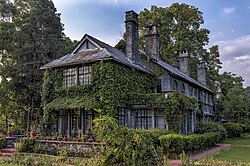


Kamal Guha (talk | contribs) Another picture in gallery |
m corrected intro for consistency and updated info for clarity |
||
| (One intermediate revision by one other user not shown) | |||
| Line 1: | Line 1: | ||
{{Use Indian English|date= | {{Use Indian English|date=February 2024}} | ||
{{Use dmy dates|date=February | {{Use dmy dates|date=February 2024}} | ||
{{Infobox settlement | {{Infobox settlement | ||
| name = Kalimpong | | name = Kalimpong | ||
| native_name = | | native_name = | ||
| native_name_lang = | | native_name_lang = bn and ne | ||
| other_name = | | other_name = | ||
| settlement_type = Town | | settlement_type = Town | ||
| Line 22: | Line 22: | ||
| subdivision_type1 = [[States and territories of India|State]] | | subdivision_type1 = [[States and territories of India|State]] | ||
| subdivision_type2 = [[List of districts of India|District]] | | subdivision_type2 = [[List of districts of India|District]] | ||
| subdivision_name1 = [[West Bengal]] | | subdivision_name1 = {{flagicon image|}} [[West Bengal]] | ||
| subdivision_name2 = [[Kalimpong District|Kalimpong]] | | subdivision_name2 = [[Kalimpong District|Kalimpong]] | ||
| established_title = <!-- Established --> | | established_title = <!-- Established --> | ||
| Line 46: | Line 46: | ||
| demographics_type1 = Languages | | demographics_type1 = Languages | ||
| demographics1_title1 = Official | | demographics1_title1 = Official | ||
| demographics1_info1 = | | demographics1_info1 = [[Nepali language|Nepali]] and [[Bengali language|Bengali]]<ref name="wblangoff"/><ref name="langreport" /> | ||
| demographics1_title2 = Additional official | | demographics1_title2 = Additional official | ||
| demographics1_info2 = [[English language|English]]<ref name="wblangoff"/> | | demographics1_info2 = [[English language|English]]<ref name="wblangoff"/> | ||
| Line 52: | Line 52: | ||
| utc_offset1 = +5:30 | | utc_offset1 = +5:30 | ||
| postal_code_type = [[Postal Index Number|PIN]] | | postal_code_type = [[Postal Index Number|PIN]] | ||
| postal_code = 734 301 | | postal_code = 734 301/734 316 | ||
| area_code = 03552 | | area_code = 03552 | ||
| area_code_type = Telephone code | | area_code_type = Telephone code | ||
| Line 58: | Line 59: | ||
| blank1_name_sec1 = [[Lok Sabha]] constituency | | blank1_name_sec1 = [[Lok Sabha]] constituency | ||
| blank1_info_sec1 = [[Darjeeling (Lok Sabha constituency)|Darjeeling]] | | blank1_info_sec1 = [[Darjeeling (Lok Sabha constituency)|Darjeeling]] | ||
| website = {{URL|https://kalimpong.gov.in/}} | | website = {{URL|https://kalimpong.gov.in/}}<br/>{{URL|https://kalimpongmunicipality.org/}} | ||
| footnotes = | | footnotes = | ||
| blank2_name_sec1 = [[Vidhan Sabha]] constituency | | blank2_name_sec1 = [[Vidhan Sabha]] constituency | ||
| Line 65: | Line 66: | ||
}} | }} | ||
'''Kalimpong''' is a town and the headquarters of an [[Kalimpong district|eponymous district]] in the [[India]]n [[states and territories of India|state]] of [[West Bengal]]. It is located at an average elevation of {{convert|1250|m|ft|0}}.<ref name="General Information">{{cite web |url=http://darjeeling.gov.in/kalimpong.html |title=General Information |publisher=[[Darjeeling Gorkha Hill Council]] |work=Tourism Department |access-date=8 December 2008 |url-status=dead |archive-url=https://web.archive.org/web/20081120211256/http://darjeeling.gov.in/kalimpong.html |archive-date=20 November 2008 | '''Kalimpong''' is a town and the headquarters of an [[Kalimpong district|eponymous district]] in the [[India]]n [[states and territories of India|state]] of [[West Bengal]]. It is located at an average elevation of {{convert|1250|m|ft|0}}.<ref name="General Information">{{cite web |url=http://darjeeling.gov.in/kalimpong.html |title=General Information |publisher=[[Darjeeling Gorkha Hill Council]] |work=Tourism Department |access-date=8 December 2008 |url-status=dead |archive-url=https://web.archive.org/web/20081120211256/http://darjeeling.gov.in/kalimpong.html |archive-date=20 November 2008 }}</ref> The town is the headquarters of the [[Kalimpong district]].<ref>{{cite news|title=Carved out of Darjeeling, Kalimpong a district today|url=http://timesofindia.indiatimes.com/city/kolkata/carved-out-of-darjeeling-kalimpong-a-district-today/articleshow/57137909.cms|newspaper=Times of India|date=14 February 2017 |access-date=14 February 2017}}</ref> The region comes under the [[Gorkhaland Territorial Administration]] which is a semi-autonomous governing body within the state of [[West Bengal]]. The [[Indian Army]]'s 27 Mountain Division is located on the outskirts of the city.<ref name="India moves over 6,000 troops to border with China">{{cite news |url=http://www.hindu.com/thehindu/holnus/002200712132006.htm |title=India moves over 6,000 troops to border with China |date=13 December 2007 |work=The Hindu |access-date=8 December 2008 |location=Chennai, India |url-status=dead |archive-url=https://web.archive.org/web/20081003054331/http://www.hindu.com/thehindu/holnus/002200712132006.htm |archive-date=3 October 2008 }}</ref> | ||
Kalimpong is known for its educational institutions, many of which were established during the [[British Raj|British colonial period]].<ref name="Education and prospects for employment">{{cite web |url=http://planningcommission.nic.in/plans/stateplan/sdr_pdf/shdr_sikkim01.pdf |title=Education and prospects for employment |publisher=Government of Sikkim |page=33 |access-date=21 December 2008 |archive-url=https://web.archive.org/web/20090327015607/http://planningcommission.nic.in/plans/stateplan/sdr_pdf/shdr_sikkim01.pdf |archive-date=27 March 2009 |url-status=dead }}</ref> It used to be a gateway in the trade between [[Tibet]] and India before [[Annexation of Tibet by the People's Republic of China|China's annexation of Tibet]] and the [[Sino-Indian War]]. Kalimpong and neighbouring [[Darjeeling]] were major centres calling for a separate [[Gorkhaland]] state in the 1980s, and more recently in 2010. | Kalimpong is known for its educational institutions, many of which were established during the [[British Raj|British colonial period]].<ref name="Education and prospects for employment">{{cite web |url=http://planningcommission.nic.in/plans/stateplan/sdr_pdf/shdr_sikkim01.pdf |title=Education and prospects for employment |publisher=Government of Sikkim |page=33 |access-date=21 December 2008 |archive-url=https://web.archive.org/web/20090327015607/http://planningcommission.nic.in/plans/stateplan/sdr_pdf/shdr_sikkim01.pdf |archive-date=27 March 2009 |url-status=dead }}</ref> It used to be a gateway in the trade between [[Tibet]] and India before [[Annexation of Tibet by the People's Republic of China|China's annexation of Tibet]] and the [[Sino-Indian War]]. Kalimpong and neighbouring [[Darjeeling]] were major centres calling for a separate [[Gorkhaland]] state in the 1980s, and more recently in 2010. | ||
The municipality sits on a ridge overlooking the [[Teesta River]] and is a tourist destination owing to its temperate climate, natural environment and proximity to popular tourist locations in the region. [[Horticulture]] is important to Kalimpong: It has a flower market notable for its wide array of [[Orchidaceae|orchids]]; nurseries, which export Himalayan grown flower bulbs, tubers and rhizomes, contribute to the economy of Kalimpong.<ref name="General Information" /> The [[Tibetan Buddhism|Tibetan Buddhist]] monastery [[Zang Dhok Palri Phodang]] holds a number of rare Tibetan Buddhist scriptures.<ref name="Special: Kalimpong, West Bengal in Rediff">{{cite web |url= | The municipality sits on a ridge overlooking the [[Teesta River]] and is a tourist destination owing to its temperate climate, natural environment and proximity to popular tourist locations in the region. [[Horticulture]] is important to Kalimpong: It has a flower market notable for its wide array of [[Orchidaceae|orchids]]; nurseries, which export Himalayan grown flower bulbs, tubers and rhizomes, contribute to the economy of Kalimpong.<ref name="General Information" /> The [[Tibetan Buddhism|Tibetan Buddhist]] monastery [[Zang Dhok Palri Phodang]] holds a number of rare Tibetan Buddhist scriptures.<ref name="Special: Kalimpong, West Bengal in Rediff">{{cite web |url=https://www.blueorchidhomestay.com/blog/is-kalimpong-worth-visiting |title=Is it Worth Visiting Kalimpong |publisher=[[Blue Orchid HomeStay]] |access-date=17 Feb 2026|website=Blue Orchid HomeStay}}</ref> | ||
The Kalimpong Science Centre, established under the [[Darjeeling Gorkha Hill Council]] in 2008 is a recent addition to its many tourist attractions. The Science Centre, which provides for scientific awareness among the students of the town and the locals sits atop the [[Deolo Hill]]. | The Kalimpong Science Centre, established under the [[Darjeeling Gorkha Hill Council]] in 2008 is a recent addition to its many tourist attractions. The Science Centre, which provides for scientific awareness among the students of the town and the locals sits atop the [[Deolo Hill]]. | ||
| Line 76: | Line 77: | ||
The precise [[etymology|origin]] of the name ''Kalimpong'' remains unclear. There are many theories on the origin of the name. One widely accepted theory claims that the name "Kalimpong" means "Assembly (or Stockade) of the King's Ministers" in [[Classical Tibetan|Tibetan]], derived from ''kalon'' ("King's ministers") and ''pong'' ("[[stockade]]").<ref name="Kalimpong Etymology">{{cite web |url=http://www.wb.nic.in/westbg/kalimpong2.html |title=Kalimpong Etymology |publisher=Government of West Bengal |access-date=22 December 2008 |archive-url=https://web.archive.org/web/20081205152844/http://www.wb.nic.in/westbg/kalimpong2.html |archive-date=5 December 2008 }}</ref> The name may be derived from the translation "ridge where we play" from [[Lepcha language|Lepcha]], as it was known to be the place for traditional tribal gatherings for summer sporting events. People from the hills call the area ''Kalempung'' ("the black spurs").{{citation needed|date=December 2021}} | The precise [[etymology|origin]] of the name ''Kalimpong'' remains unclear. There are many theories on the origin of the name. One widely accepted theory claims that the name "Kalimpong" means "Assembly (or Stockade) of the King's Ministers" in [[Classical Tibetan|Tibetan]], derived from ''kalon'' ("King's ministers") and ''pong'' ("[[stockade]]").<ref name="Kalimpong Etymology">{{cite web |url=http://www.wb.nic.in/westbg/kalimpong2.html |title=Kalimpong Etymology |publisher=Government of West Bengal |access-date=22 December 2008 |archive-url=https://web.archive.org/web/20081205152844/http://www.wb.nic.in/westbg/kalimpong2.html |archive-date=5 December 2008 }}</ref> The name may be derived from the translation "ridge where we play" from [[Lepcha language|Lepcha]], as it was known to be the place for traditional tribal gatherings for summer sporting events. People from the hills call the area ''Kalempung'' ("the black spurs").{{citation needed|date=December 2021}} | ||
According to K.P. Tamsang, author of ''The Untold and Unknown Reality about the Lepchas'', the term Kalimpong is deduced from the name ''Kalenpung'', which in Lepcha means "Hillock of Assemblage";<ref name="kalidarjhist">{{cite web|url=http://www.darjeelingnews.net/kalimpong_history.html |title=History of Kalimpong |access-date=17 February 2007 |work=Darjeelingnews.net |publisher=Darjeeling News Service |url-status=dead |archive-url=https://web.archive.org/web/20070205043810/http://darjeelingnews.net/kalimpong_history.html |archive-date=5 February 2007 }}</ref> in time, the name was distorted to ''Kalebung'', and later further contorted to Kalimpong. Another possible derivation points to Kaulim | According to K.P. Tamsang, author of ''The Untold and Unknown Reality about the Lepchas'', the term Kalimpong is deduced from the name ''Kalenpung'', which in Lepcha means "Hillock of Assemblage";<ref name="kalidarjhist">{{cite web|url=http://www.darjeelingnews.net/kalimpong_history.html |title=History of Kalimpong |access-date=17 February 2007 |work=Darjeelingnews.net |publisher=Darjeeling News Service |url-status=dead |archive-url=https://web.archive.org/web/20070205043810/http://darjeelingnews.net/kalimpong_history.html |archive-date=5 February 2007 }}</ref> in time, the name was distorted to ''Kalebung'', and later further contorted to Kalimpong. Another possible derivation points to Kaulim, locally known as odal Scientific name ''Sterculia Villosa,'' a fibrous plant found in abundance in the region.<ref name="wbnicpagearch">{{cite web|title=Kalimpong |publisher=NITPU Kolkata, West Bengal |access-date=11 December 2012 |archive-url=https://web.archive.org/web/20081006025217/http://www.wb.nic.in/westbg/kalimpong.html |archive-date=6 October 2008 |url=http://www.wb.nic.in/westbg/kalimpong.html }}</ref> | ||
== History == | == History == | ||
Until the mid-19th century, the area around Kalimpong was ruled in succession by the [[Sikkim]]ese and [[Bhutan]]ese kingdoms.<ref name="kalidarjhist" /><ref name="sikkimkalimpong"> | [[File:Katherine_Graham_Memorial_Chapel%2C_Dr._Graham%27s_Homes%2C_Kalimpong%2C_West_Bengal_Side.jpg|thumb|upright|Katherine Graham Memorial Chapel, Dr. Graham's Homes]] | ||
[[File:Kalimpong Clock Tower.jpg|thumb|upright|The Clock Tower of Kalimpong.]] | |||
Until the mid-19th century, the area around Kalimpong was ruled in succession by the [[Kingdom of Sikkim|Sikkim]]ese and [[Bhutan]]ese kingdoms.<ref name="kalidarjhist" /><ref name="sikkimkalimpong"> | |||
{{cite book |last=Gurung |first=Chanda |author2=Gurung, Nawraj |title=Social and Gender Analysis in Natural Resource Management|editor=Ronnie Vernooy |publisher=International Development Research Centre (Canada), NetLibrary, Inc |year=2006|pages=39–43|chapter=The Social and Gendered Nature of Ginger Production and Commercialization |isbn=1-55250-218-X}} | {{cite book |last=Gurung |first=Chanda |author2=Gurung, Nawraj |title=Social and Gender Analysis in Natural Resource Management|editor=Ronnie Vernooy |publisher=International Development Research Centre (Canada), NetLibrary, Inc |year=2006|pages=39–43|chapter=The Social and Gendered Nature of Ginger Production and Commercialization |isbn=1-55250-218-X}} | ||
</ref> | </ref> | ||
Kalimpong is said to have come under the control of Bhutan in the year 1706.{{sfn|O'Malley, Darjeeling Gazetteer|1907|p=55}} However, according to historians, the Bhutanese encroachments had been in effect for about two decades by then, following the defeat of [[Gyalpo Ajok]] and other Lepcha | Kalimpong is said to have come under the control of Bhutan in the year 1706.{{sfn|O'Malley, Darjeeling Gazetteer|1907|p=55}} However, according to historians, the Bhutanese encroachments had been in effect for about two decades by then, following the defeat of [[Gyalpo Ajok]] and other Lepcha chieftains.<ref>{{citation |first=John |last=Ardussi |title=Lepcha Chieftains of the 17th-18th centuries, based on Tibetan and Bhutanese Sources |journal=Journal of Bhutan Studies |volume=43 |date=Winter 2020 |issn=1608-411X |url=https://www.bhutanstudies.org.bt/publicationFiles/JBS/JBS%2043/01.%20Lepcha%20Chieftains%20of%20the%2017th%E2%80%9318th%20Centuries%2C%20based%20on%20Tibetan%20and%20Bhutanese%20Sources%20by%20John%20Ardusi.pdf |pages=9–10}}</ref> | ||
The area was sparsely populated by the indigenous [[Lepcha people|Lepcha]] | The area was sparsely populated by the indigenous [[Lepcha people|Lepcha]] and [[Limbu people|Limbu]] community and migrant [[Bhutia]] and [[Kirati]] tribes.{{citation needed|date=December 2021}} | ||
[[File:Southern border of Bhutan1985.jpg|thumb|280px|Kalimpong under the Kingdom of Bhutan in '''blue''' before the [[Duar War]] of 1865]] | |||
After the [[Anglo-Bhutan War]] in 1864, the Treaty of Sinchula (1865) was signed, in which Bhutanese-held territory east of the [[Teesta River]] was ceded to the [[British East India Company]].<ref name="kalidarjhist" />{{clarification needed|date=December 2021|reason=What does "east of Teesta" mean? The whole of Bhutan is east of Teesta!}} It was administered as the 'Western Duars' district for a few years, and divided into three tehsils. Kalimpong fell into the [[Dalingkot|Dalingkot tehsil]], which consisted of all the mountainous part of the annexed territory. In 1867, the Dalingkot tehsil was merged with the Darjeeling district, and eventually renamed the Kalimpong Subdivision.{{sfnp|Roy, Survey and Settlement of the Western Duars|2013|p=41}} | After the [[Anglo-Bhutan War]] in 1864, the Treaty of Sinchula (1865) was signed, in which Bhutanese-held territory east of the [[Teesta River]] was ceded to the [[British East India Company]].<ref name="kalidarjhist" />{{clarification needed|date=December 2021|reason=What does "east of Teesta" mean? The whole of Bhutan is east of Teesta!}} It was administered as the 'Western Duars' district for a few years, and divided into three tehsils. Kalimpong fell into the [[Dalingkot|Dalingkot tehsil]], which consisted of all the mountainous part of the annexed territory. In 1867, the Dalingkot tehsil was merged with the Darjeeling district, and eventually renamed the Kalimpong Subdivision.{{sfnp|Roy, Survey and Settlement of the Western Duars|2013|p=41}} | ||
| Line 110: | Line 114: | ||
The arrival of Scottish missionaries saw the construction of schools and welfare centres for the British.<ref name="tribunekalim" /> Rev. W. Macfarlane in the early 1870s established the first schools in the area.<ref name="tribunekalim" /> The Scottish University Mission Institution was opened in 1886, followed by the Kalimpong Girls High School. In 1900, Reverend [[John Anderson Graham|J.A. Graham]] founded the [[Dr. Graham's Homes]] for destitute [[Anglo-Indian]] students.<ref name="tribunekalim" /> The young missionary (and aspiring writer and poet) [[Aeneas Francon Williams]], aged 24, arrived in Kalimpong in 1910 to take up the post of assistant schoolmaster at [[Dr. Graham's Homes]],<ref>Correspondence from [[Aeneas Francon Williams]] addressed from Wolseley House, Kalimpong, is stored in the Dr. Graham Kalimpong Archive held at the National Library of Scotland, Edinburgh</ref> where he later became Bursar and remained working at the school for the next fourteen years.<ref>Marriage Certificate for [[Aeneas Francon Williams]] and Clara Anne Rendall, 2 December 1914: Findmypast.co.uk – Williams rank of profession is registered as ‘Assistant School Master.’</ref> From 1907 onwards, most schools in Kalimpong had started offering education to Indian students. By 1911, the population comprised many ethnic groups, including Nepalis, Lepchas, Tibetans, Muslims, the Anglo-Indian communities. Hence by 1911, the population had swollen to 7,880.<ref name="tribunekalim" /> | The arrival of Scottish missionaries saw the construction of schools and welfare centres for the British.<ref name="tribunekalim" /> Rev. W. Macfarlane in the early 1870s established the first schools in the area.<ref name="tribunekalim" /> The Scottish University Mission Institution was opened in 1886, followed by the Kalimpong Girls High School. In 1900, Reverend [[John Anderson Graham|J.A. Graham]] founded the [[Dr. Graham's Homes]] for destitute [[Anglo-Indian]] students.<ref name="tribunekalim" /> The young missionary (and aspiring writer and poet) [[Aeneas Francon Williams]], aged 24, arrived in Kalimpong in 1910 to take up the post of assistant schoolmaster at [[Dr. Graham's Homes]],<ref>Correspondence from [[Aeneas Francon Williams]] addressed from Wolseley House, Kalimpong, is stored in the Dr. Graham Kalimpong Archive held at the National Library of Scotland, Edinburgh</ref> where he later became Bursar and remained working at the school for the next fourteen years.<ref>Marriage Certificate for [[Aeneas Francon Williams]] and Clara Anne Rendall, 2 December 1914: Findmypast.co.uk – Williams rank of profession is registered as ‘Assistant School Master.’</ref> From 1907 onwards, most schools in Kalimpong had started offering education to Indian students. By 1911, the population comprised many ethnic groups, including Nepalis, Lepchas, Tibetans, Muslims, the Anglo-Indian communities. Hence by 1911, the population had swollen to 7,880.<ref name="tribunekalim" /> | ||
Following [[Indian independence movement|Indian independence]] in 1947, Kalimpong became part of the state of West Bengal, after Bengal was partitioned between India and [[East Pakistan]]. With [[ | Following [[Indian independence movement|Indian independence]] in 1947, Kalimpong became part of the state of West Bengal, after Bengal was partitioned between India and [[East Pakistan]]. With [[China]]'s annexation of [[Tibet]] in 1959, many Buddhist monks fled Tibet and established monasteries in Kalimpong. These monks brought many rare Buddhist scriptures with them. In 1962, the permanent closure of the [[Jelep Pass]] after the [[Sino-Indian War]] disrupted trade between Tibet and India, and led to a slowdown in Kalimpong's economy. In 1976, the visiting [[Dalai Lama]] consecrated the [[Zang Dhok Palri Phodang]] monastery, which houses many of the scriptures.<ref name="tribunekalim" /> | ||
[[File:Kalimpongkanchenjanga.jpg|thumb|Most large houses in Kalimpong were built during the British era. In the background is [[Kangchenjunga]].]] | |||
[[File:Morgan House Kalimpong 2.jpg|thumb|[[Morgan House, Kalimpong|Morgan House]] is a classic example of colonial architecture in Kalimpong.]] | |||
Between 1986 and 1988, the demand for a separate state of [[Gorkhaland]] and [[Kamtapur]] based on ethnic lines grew strong. Riots between the [[Gorkha National Liberation Front]] (GNLF) and the West Bengal government reached a stand-off after a forty-day strike. The town was virtually under siege, and the state government called in the Indian army to maintain law and order. This led to the formation of the [[Darjeeling Gorkha Hill Council]], a body that was given semi-autonomous powers to govern the Darjeeling district, except the area under the [[Siliguri subdivision]]. Since 2007, the demand for a separate Gorkhaland state has been revived by the [[Gorkha Janmukti Morcha]] and its supporters in the Darjeeling hills.<ref>{{cite web |url=http://www.darjeelingtimes.com/news/Top-Story/Call-for-Gorkhaland-renewed.html |title=Call for Gorkhaland renewed |date=7 October 2007 |publisher=Darjeeling Times |access-date=13 January 2009 |archive-url=https://web.archive.org/web/20081222214506/http://www.darjeelingtimes.com/news/Top-Story/Call-for-Gorkhaland-renewed.html |archive-date=22 December 2008 |url-status=dead }}</ref> The [[Kamtapur People's Party]] and its supporters' movement for a separate Kamtapur state covering [[North Bengal]] have gained momentum.<ref>{{cite web | Between 1986 and 1988, the demand for a separate state of [[Gorkhaland]] and [[Kamtapur]] based on ethnic lines grew strong. Riots between the [[Gorkha National Liberation Front]] (GNLF) and the West Bengal government reached a stand-off after a forty-day strike. The town was virtually under siege, and the state government called in the Indian army to maintain law and order. This led to the formation of the [[Darjeeling Gorkha Hill Council]], a body that was given semi-autonomous powers to govern the Darjeeling district, except the area under the [[Siliguri subdivision]]. Since 2007, the demand for a separate Gorkhaland state has been revived by the [[Gorkha Janmukti Morcha]] and its supporters in the Darjeeling hills.<ref>{{cite web |url=http://www.darjeelingtimes.com/news/Top-Story/Call-for-Gorkhaland-renewed.html |title=Call for Gorkhaland renewed |date=7 October 2007 |publisher=Darjeeling Times |access-date=13 January 2009 |archive-url=https://web.archive.org/web/20081222214506/http://www.darjeelingtimes.com/news/Top-Story/Call-for-Gorkhaland-renewed.html |archive-date=22 December 2008 |url-status=dead }}</ref> The [[Kamtapur People's Party]] and its supporters' movement for a separate Kamtapur state covering [[North Bengal]] have gained momentum.<ref>{{cite web | ||
|url=http://articles.timesofindia.indiatimes.com/2009-12-29/india/28100583_1_kamtapur-state-north-bengal-demand |archive-url=https://web.archive.org/web/20130617172345/http://articles.timesofindia.indiatimes.com/2009-12-29/india/28100583_1_kamtapur-state-north-bengal-demand |url-status=dead |archive-date=17 June 2013 |title=Now, demand for a separate Kamtapur state in WBengal |author=[[Press Trust of India]] (PTI) |date=29 December 2009 |work=[[The Times of India]] |access-date=11 December 2012}}</ref> | |url=http://articles.timesofindia.indiatimes.com/2009-12-29/india/28100583_1_kamtapur-state-north-bengal-demand |archive-url=https://web.archive.org/web/20130617172345/http://articles.timesofindia.indiatimes.com/2009-12-29/india/28100583_1_kamtapur-state-north-bengal-demand |url-status=dead |archive-date=17 June 2013 |title=Now, demand for a separate Kamtapur state in WBengal |author=[[Press Trust of India]] (PTI) |date=29 December 2009 |work=[[The Times of India]] |access-date=11 December 2012}}</ref> | ||
== Geography == | == Geography == | ||
[[File: | [[File:Deolo.jpg|thumb|A view from the Deolo Cliff Eco Resort, atop Deolo Hill, Kalimpong's highest point]] | ||
The town centre is on a [[ridge]] connecting two hills, [[Deolo Hill]] and [[Durpin Hill]],<ref name="tribunekalim" /> at an elevation of {{convert|1247|m|ft|abbr=on}}. Deolo, the highest point in Kalimpong, has an altitude of {{convert|1704|m|ft|abbr=on}} and Durpin Hill is at an elevation of {{convert|1372|m|ft|abbr=on}}. The [[River Teesta]] flows in the valley below and separates Kalimpong from the state of Sikkim. The soil in the Kalimpong area is typically reddish in | [[File:Valley of the Teesta River viewed from West Bengal's Munsong, Kalimpong.jpg|thumb|The Teesta River is carving its way through the rugged Himalayan landscape.]] | ||
The town centre is on a [[ridge]] connecting two hills, [[Deolo Hill]] and [[Durpin Hill]],<ref name="tribunekalim" /> at an elevation of {{convert|1247|m|ft|abbr=on}}. Deolo, the highest point in Kalimpong, has an altitude of {{convert|1704|m|ft|abbr=on}} and Durpin Hill is at an elevation of {{convert|1372|m|ft|abbr=on}}. The [[River Teesta]] flows in the valley below and separates Kalimpong from the state of Sikkim. The soil in the Kalimpong area is typically reddish in colour. Occasional dark soils are found due to extensive existence of [[phyllite]] and [[schists]].<ref name="Identification and Mapping of Hazard Prone areas regarding landslide in the Darjeeling Hill areas">{{cite web |url=http://darjeeling.gov.in/geography.html |title=Identification and Mapping of Hazard Prone areas regarding landslide in the Darjeeling Hill areas |website=Department of Ecology & Environment |publisher=Government of Darjeeling |access-date=20 December 2008}}</ref> The [[Siwalik Hills|Shiwalik Hills]], like most of the Himalayan foothills, have steep slopes and soft, loose topsoil, leading to frequent [[landslide]]s in the [[monsoon]] season.<ref name="Identification and Mapping of Hazard Prone areas regarding landslide in the Darjeeling Hill areas" /> The hills are nestled within higher peaks and the snow-clad Himalayan ranges tower over the town in the distance. [[Kanchenjunga]], at {{convert|8586|m|ft|abbr=on}} the world's third tallest peak,<ref>{{cite web|url=http://news.bbc.co.uk/2/hi/south_asia/4578767.stm |title=Kanchenjunga golden jubilee held |publisher=BBC News: South Asia |date=25 May 2005 |access-date=11 December 2012}}</ref> is clearly visible from Kalimpong.<ref name="General Information" /> | |||
[[File:Kalimpong 02.jpg|thumb|View of [[Kanchenjunga]]]] | |||
===Climate=== | ===Climate=== | ||
Kalimpong has five distinct seasons: spring, summer, autumn, winter and the monsoons. The annual temperature is {{convert|18|C|F}}. Summers are mild, with an average maximum temperature of {{convert|25.5|C|F}} in August.<ref>{{cite web |author=West Bengal State Marketing Board |url=http://wbagrimarketingboard.gov.in/Area/Maxmintemp.html |title=West Bengal marketing Board |publisher=wbagrimarketingboard.gov.in |access-date=16 June 2011 |archive-url=https://web.archive.org/web/20110721162040/http://wbagrimarketingboard.gov.in/Area/Maxmintemp.html |archive-date=21 July 2011 |url-status=dead }}</ref> Summers are followed by the monsoon rains which lash the town between June and September. The monsoons are severe, often causing landslides which sequester the town from the rest of India. Winter lasts from December to February, with the minimum temperature being around {{convert|8|C|F}}. During the monsoon and winter seasons, Kalimpong is often enveloped by fog.<ref name="nchanda">{{cite news |url=http://www.telegraphindia.com/1080912/jsp/guwahati/story_9797333.jsp |archive-url=https://web.archive.org/web/20100226133834/http://www.telegraphindia.com/1080912/jsp/guwahati/story_9797333.jsp |url-status=dead |archive-date=26 February 2010 |title=Next weekend you can be at ...Kalimpong |first=Nabotpal |last=Chanda |publisher=The Telegraph, Calcutta |date=12 September 2008 }}</ref> | Kalimpong has a temperate, monsoon-influenced [[Oceanic climate#Subtropical highland variety (Cfb, Cwb)|subtropical highland climate]] ([[Köppen climate classification|Köppen]]: ''Cwb''). It has five distinct seasons: spring, summer, autumn, winter and the monsoons. The annual temperature is {{convert|18|C|F}}. Summers are mild, with an average maximum temperature of {{convert|25.5|C|F}} in August.<ref>{{cite web |author=West Bengal State Marketing Board |url=http://wbagrimarketingboard.gov.in/Area/Maxmintemp.html |title=West Bengal marketing Board |publisher=wbagrimarketingboard.gov.in |access-date=16 June 2011 |archive-url=https://web.archive.org/web/20110721162040/http://wbagrimarketingboard.gov.in/Area/Maxmintemp.html |archive-date=21 July 2011 |url-status=dead }}</ref> Summers are followed by the monsoon rains which lash the town between June and September. The monsoons are severe, often causing landslides which sequester the town from the rest of India. Winter lasts from December to February, with the minimum temperature being around {{convert|8|C|F}}. During the monsoon and winter seasons, Kalimpong is often enveloped by fog.<ref name="nchanda">{{cite news |url=http://www.telegraphindia.com/1080912/jsp/guwahati/story_9797333.jsp |archive-url=https://web.archive.org/web/20100226133834/http://www.telegraphindia.com/1080912/jsp/guwahati/story_9797333.jsp |url-status=dead |archive-date=26 February 2010 |title=Next weekend you can be at ...Kalimpong |first=Nabotpal |last=Chanda |publisher=The Telegraph, Calcutta |date=12 September 2008 }}</ref> | ||
{{Weather box | {{Weather box | ||
| location = Kalimpong ( | | location = Kalimpong (1991–2020, extremes 1920–2020) | ||
| metric first = yes | | metric first = yes | ||
| single line = yes | | single line = yes | ||
| Line 135: | Line 143: | ||
| Jul record high C = 34.1 | | Jul record high C = 34.1 | ||
| Aug record high C = 31.4 | | Aug record high C = 31.4 | ||
| Sep record high C = | | Sep record high C = 32.0 | ||
| Oct record high C = 31.1 | | Oct record high C = 31.1 | ||
| Nov record high C = 30.1 | | Nov record high C = 30.1 | ||
| Dec record high C = 29.9 | | Dec record high C = 29.9 | ||
| year record high C = 35.0 | | year record high C = 35.0 | ||
| Jan | | Jan high C = 16.3 | ||
| Feb | | Feb high C = 16.8 | ||
| Mar | | Mar high C = 20.5 | ||
| Apr | | Apr high C = 24.2 | ||
| May high C = 25.3 | |||
| Jun high C = 25.5 | |||
| Jul high C = 25.1 | |||
| Aug high C = 25.6 | |||
| Sep high C = 24.7 | |||
| Oct high C = 23.5 | |||
| Nov high C = 20.9 | |||
| Dec high C = 17.6 | |||
| year high C = 22.2 | |||
| Jan low C = 6.8 | |||
| Feb low C = 8.4 | |||
| Mar low C = 11.3 | |||
| Apr low C = 14.0 | |||
| May high C = 25. | | May low C = 15.2 | ||
| Jun high C = 25. | | Jun low C = 16.3 | ||
| Jul high C = 25. | | Jul low C = 16.6 | ||
| Aug high C = 25. | | Aug low C = 17.7 | ||
| Sep high C = | | Sep low C = 16.3 | ||
| Oct high C = | | Oct low C = 14.0 | ||
| Nov high C = | | Nov low C = 11.2 | ||
| Dec high C = | | Dec low C = 8.7 | ||
| year high C = 22. | | year low C = 13.0 | ||
| Jan low C = 8 | |||
| Feb low C = | |||
| Mar low C = 11. | |||
| Apr | |||
| | |||
| | |||
| | |||
| Aug | |||
| Sep | |||
| Oct | |||
| Nov | |||
| Dec | |||
| year | |||
| Jan record low C = 0.4 | | Jan record low C = 0.4 | ||
| Feb record low C = | | Feb record low C = 0.5 | ||
| Mar record low C = 3.8 | | Mar record low C = 3.8 | ||
| Apr record low C = 6.4 | | Apr record low C = 6.4 | ||
| Line 206: | Line 188: | ||
| year record low C = -0.6 | | year record low C = -0.6 | ||
| rain colour = green | | rain colour = green | ||
| Jan rain mm = | | Jan rain mm = 16.1 | ||
| Feb rain mm = | | Feb rain mm = 20.2 | ||
| Mar rain mm = | | Mar rain mm = 27.3 | ||
| Apr rain mm = | | Apr rain mm = 85.9 | ||
| May rain mm = | | May rain mm = 153.0 | ||
| Jun rain mm = | | Jun rain mm = 349.9 | ||
| Jul rain mm = | | Jul rain mm = 628.1 | ||
| Aug rain mm = | | Aug rain mm = 457.9 | ||
| Sep rain mm = | | Sep rain mm = 329.8 | ||
| Oct rain mm = | | Oct rain mm = 62.6 | ||
| Nov rain mm = 5 | | Nov rain mm = 4.5 | ||
| Dec rain mm = | | Dec rain mm = 6.1 | ||
| year rain mm = | | year rain mm = 2141.3 | ||
| Jan rain days = 1.2 | | Jan rain days = 1.2 | ||
| Feb rain days = 1. | | Feb rain days = 1.8 | ||
| Mar rain days = 2. | | Mar rain days = 2.5 | ||
| Apr rain days = | | Apr rain days = 6.1 | ||
| May rain days = | | May rain days = 10.0 | ||
| Jun rain days = 14. | | Jun rain days = 14.7 | ||
| Jul rain days = 21. | | Jul rain days = 21.4 | ||
| Aug rain days = | | Aug rain days = 17.1 | ||
| Sep rain days = | | Sep rain days = 13.1 | ||
| Oct rain days = 3. | | Oct rain days = 3.1 | ||
| Nov rain days = 0. | | Nov rain days = 0.6 | ||
| Dec rain days = 0. | | Dec rain days = 0.5 | ||
| year rain days = | | year rain days = 92.0 | ||
|time day = 17:30 [[Indian Standard Time|IST]] | |time day = 17:30 [[Indian Standard Time|IST]] | ||
| Jan humidity = | | Jan humidity = 88 | ||
| Feb humidity = | | Feb humidity = 87 | ||
| Mar humidity = | | Mar humidity = 85 | ||
| Apr humidity = | | Apr humidity = 85 | ||
| May humidity = 89 | | May humidity = 89 | ||
| Jun humidity = | | Jun humidity = 93 | ||
| Jul humidity = | | Jul humidity = 94 | ||
| Aug humidity = | | Aug humidity = 93 | ||
| Sep humidity = | | Sep humidity = 93 | ||
| Oct humidity = | | Oct humidity = 90 | ||
| Nov humidity = | | Nov humidity = 88 | ||
| Dec humidity = | | Dec humidity = 88 | ||
|year humidity = 89 | |year humidity = 89 | ||
|source 1 = [[India Meteorological Department]]<ref name=IMDnormals> | |source 1 = [[India Meteorological Department]]<ref>{{cite web | ||
| url = https://imdpune.gov.in/library/public/Climatological%20Tables%201991-2020.pdf | |||
| title = Climatological Tables of Observatories in India 1991-2020 | |||
| publisher = [[India Meteorological Department]] | |||
| access-date = April 8, 2024 | |||
}}</ref><ref name=IMDnormals> | |||
{{cite web | {{cite web | ||
| archive-url = https://web.archive.org/web/20200205040301/http://imdpune.gov.in/library/public/1981-2010%20CLIM%20NORMALS%20%28STATWISE%29.pdf | | archive-url = https://web.archive.org/web/20200205040301/http://imdpune.gov.in/library/public/1981-2010%20CLIM%20NORMALS%20%28STATWISE%29.pdf | ||
| Line 269: | Line 256: | ||
== Economy == | == Economy == | ||
[[File:Kalimpong 52.jpg|thumb|Oranges grown in the hillsides are transported to many parts of India.]] | |||
Tourism is the most significant contributor to Kalimpong's economy.<ref name="kuenseledu">{{cite news |url=http://www.kuenselonline.com/modules.php?name=News&file=article&sid=11317 |title=Kalimpong — As popular an educational destination as ever |last=Norbu |first=Passang |date=17 October 2008 |work=Kuensel Online |publisher=Kuensel Corporation |access-date=9 December 2008 }}</ref> The [[summer]] and [[Spring (season)|spring]] seasons are the most popular with tourists, keeping many of town's residents employed directly and indirectly. The town—earlier an important trade post between India and Tibet—hoped to boost its economy after the reopening of the [[Nathu La]] pass in April 2006.<ref>[http://www.flonnet.com/fl2014/stories/20030718005201800.htm Routes of promise] {{webarchive|url=https://web.archive.org/web/20120716230615/http://www.flonnet.com/fl2014/stories/20030718005201800.htm |date=16 July 2012 }}, [http://www.flonnet.com/ Frontline magazine] {{Webarchive|url=https://web.archive.org/web/20050404074358/http://www.flonnet.com/ |date=4 April 2005 }}, Volume 20, Issue 14; 5–18 July July 2004</ref> Though this resumed Indo–China border trades, local leaders requested that the [[Jelep La]] pass also be reopened to allow trade.<ref name="telegraphPranab">{{cite news |url=http://www.telegraphindia.com/1080519/jsp/siliguri/story_9289288.jsp |title=Pranab blots out Jelep-la from memory |publisher=The Telegraph, Calcutta |date=19 March 2008 |access-date=14 February 2009 |archive-url=https://web.archive.org/web/20110605115620/http://www.telegraphindia.com/1080519/jsp/siliguri/story_9289288.jsp |archive-date=5 June 2011}}</ref> | Tourism is the most significant contributor to Kalimpong's economy.<ref name="kuenseledu">{{cite news |url=http://www.kuenselonline.com/modules.php?name=News&file=article&sid=11317 |title=Kalimpong — As popular an educational destination as ever |last=Norbu |first=Passang |date=17 October 2008 |work=Kuensel Online |publisher=Kuensel Corporation |access-date=9 December 2008 }}</ref> The [[summer]] and [[Spring (season)|spring]] seasons are the most popular with tourists, keeping many of town's residents employed directly and indirectly. The town—earlier an important trade post between India and Tibet—hoped to boost its economy after the reopening of the [[Nathu La]] pass in April 2006.<ref>[http://www.flonnet.com/fl2014/stories/20030718005201800.htm Routes of promise] {{webarchive|url=https://web.archive.org/web/20120716230615/http://www.flonnet.com/fl2014/stories/20030718005201800.htm |date=16 July 2012 }}, [http://www.flonnet.com/ Frontline magazine] {{Webarchive|url=https://web.archive.org/web/20050404074358/http://www.flonnet.com/ |date=4 April 2005 }}, Volume 20, Issue 14; 5–18 July July 2004</ref> Though this resumed Indo–China border trades, local leaders requested that the [[Jelep La]] pass also be reopened to allow trade.<ref name="telegraphPranab">{{cite news |url=http://www.telegraphindia.com/1080519/jsp/siliguri/story_9289288.jsp |title=Pranab blots out Jelep-la from memory |publisher=The Telegraph, Calcutta |date=19 March 2008 |access-date=14 February 2009 |archive-url=https://web.archive.org/web/20110605115620/http://www.telegraphindia.com/1080519/jsp/siliguri/story_9289288.jsp |archive-date=5 June 2011}}</ref> | ||
Kalimpong is a major [[ginger]] growing area of India. Kalimpong and the state of [[Sikkim]] together contribute 15 | Kalimpong is a major [[ginger]] growing area of India. Kalimpong and the state of [[Sikkim]] together contribute 15 per cent of the ginger produced in India.<ref name="Social and Gender Analysis in Natural Resource Management: Learning Studies and Lessons from Asia">{{cite book |author=Ronnie Vernooy |title=Social and Gender Analysis in Natural Resource Management: Learning Studies and Lessons from Asia |publisher=IDRC |year=2006 |page=64 |isbn=1-55250-218-X |url=https://books.google.com/books?id=5wFC3LnOfSUC }}</ref> The [[Darjeeling Himalayan hill region]] is internationally famous for its [[Darjeeling tea|tea industry]].<ref name="teabest">{{cite news |url=http://www.deccanherald.com/deccanherald/jun172005/living1150492005616.asp |archive-url=https://web.archive.org/web/20070221074118/http://www.deccanherald.com/deccanherald/jun172005/living1150492005616.asp |archive-date=21 February 2007 |title=Champagne among teas |work=Deccan Herald |publisher=The Printers (Mysore) Private Ltd |date=17 June 2005 |access-date=18 July 2006 }}</ref> However, most of the [[Tea garden (cultivation)|tea garden]]s are on the western side of [[Teesta river]] (towards the town of Darjeeling) and so tea gardens near Kalimpong contribute only 4 percent of total tea production of the region. In Kalimpong division, 90 percent of land is cultivable but only 10 percent is used for tea production.<ref name="The Himalayas: An Anthropological Perspective">{{cite book |first=Makhan |last=Jha |title=The Himalayas: An Anthropological Perspective |publisher=M.D. Publications Pvt. Ltd |year=1996 |page=144 |isbn=978-81-7533-020-7 |url=https://books.google.com/books?id=zeg-uNBcgncC }}</ref> Kalimpong is well known for its flower export industry—especially for its wide array of indigenous [[Orchidaceae|orchids]] and [[gladioli]].<ref name=easthim>{{cite web |url=http://www.east-himalaya.com/darjeeling/kalimpong.htm |title=Kalimpong |publisher=East-Himalaya.com |access-date=13 December 2012 |archive-date=16 October 2012 |archive-url=https://web.archive.org/web/20121016021136/http://east-himalaya.com/darjeeling/kalimpong.htm |url-status=dead }}</ref> | ||
A significant contributor to the town's economy is education sector.<ref name="kuenseledu" /> The schools of Kalimpong, besides imparting education to the locals, attract a significant number of students from the plains, the neighbouring state of Sikkim and countries such as [[Bhutan]], [[Bangladesh]], [[Nepal]] and Thailand.<ref name="kuenseledu" /> | A significant contributor to the town's economy is education sector.<ref name="kuenseledu" /> The schools of Kalimpong, besides imparting education to the locals, attract a significant number of students from the plains, the neighbouring state of Sikkim and countries such as [[Bhutan]], [[Bangladesh]], [[Nepal]] and Thailand.<ref name="kuenseledu" /> | ||
| Line 277: | Line 265: | ||
Many establishments cater to the Indian army bases near the town, providing it with essential supplies. Small contributions to the economy come by the way of the sale of traditional arts and crafts of Sikkim and Tibet. Government efforts related to [[sericulture]], seismology, and fisheries provide a steady source of employment to many of its residents. | Many establishments cater to the Indian army bases near the town, providing it with essential supplies. Small contributions to the economy come by the way of the sale of traditional arts and crafts of Sikkim and Tibet. Government efforts related to [[sericulture]], seismology, and fisheries provide a steady source of employment to many of its residents. | ||
Kalimpong is well renowned for its cheese, noodles and lollipops. Kalimpong exports a wide range of traditional handicrafts, wood-carvings, embroidered items, bags and purses with tapestry work, copper ware, scrolls, Tibetan jewellery and | Kalimpong is well renowned for its cheese, noodles and lollipops. Kalimpong exports a wide range of traditional handicrafts, wood-carvings, embroidered items, bags and purses with tapestry work, copper ware, scrolls, Tibetan jewellery and artefacts.<ref name=easthim/><ref name="east-himalaya-cheese">{{cite news |url=http://www.east-himalaya.com/news/2004/apr/15040402n.htm |title=Kalimpong cheese : a vanishing recipe |publisher=East-Himalaya.com |access-date=13 December 2012 |archive-date=10 July 2011 |archive-url=https://web.archive.org/web/20110710163646/http://www.east-himalaya.com/news/2004/apr/15040402n.htm |url-status=dead }}</ref> | ||
== Transport == | == Transport == | ||
[[File:Teestavalley.jpg|thumb| | |||
[[National Highway 10 (India)|NH10]] winds along the banks of the river [[Teesta river|Teesta]] near Kalimpong.]] | [[National Highway 10 (India)|NH10]] winds along the banks of the river [[Teesta river|Teesta]] near Kalimpong.]] | ||
===Roadways=== | ===Roadways=== | ||
Kalimpong is located off the [[National Highway 10 (India)|NH10]], which links [[Sevoke]] to Gangtok. [[National Highway 717A (India)|NH-717A]] connecting [[Bagrakote]] with [[Gangtok]] is located at [[Algarah]], 16 kilometres away from Kalimpong.<ref name="nhai">{{cite web|url=http://www.nhai.org/Doc/project-offer/Highways.pdf |title=NH wise Details of NH in respect of Stretches entrusted to NHAI |publisher=National Highway Authority of India |access-date=22 December 2008 |url-status=dead |archive-url=https://web.archive.org/web/20090225142615/http://www.nhai.org/Doc/project-offer/Highways.pdf |archive-date=25 February 2009 }}</ref> These two National Highways together, via Sevoke and [[Lava, West Bengal| | Kalimpong is located off the [[National Highway 10 (India)|NH10]], which links [[Sevoke]] to Gangtok. [[National Highway 717A (India)|NH-717A]] connecting [[Bagrakote]] with [[Gangtok]] is located at [[Algarah]], 16 kilometres away from Kalimpong.<ref name="nhai">{{cite web|url=http://www.nhai.org/Doc/project-offer/Highways.pdf |title=NH wise Details of NH in respect of Stretches entrusted to NHAI |publisher=National Highway Authority of India |access-date=22 December 2008 |url-status=dead |archive-url=https://web.archive.org/web/20090225142615/http://www.nhai.org/Doc/project-offer/Highways.pdf |archive-date=25 February 2009 }}</ref> These two National Highways together, via Sevoke and [[Lava, West Bengal|Lava]], links Kalimpong to the plains.<ref>{{cite news |url=http://www.telegraphindia.com/1060916/asp/siliguri/story_6752322.asp |archive-url=https://web.archive.org/web/20110526021922/http://www.telegraphindia.com/1060916/asp/siliguri/story_6752322.asp |url-status=dead |archive-date=26 May 2011 |title=Hill traffic slides to standstill |publisher=The Telegraph, Calcutta |date=16 September 2006 |access-date=22 December 2008 }}</ref> Regular bus services, Jeep Services and hired vehicles connect Kalimpong with [[Siliguri]] and the neighbouring towns and cities like [[Gangtok]], [[Kurseong]], [[Darjeeling]], [[Namchi]], [[Ravangla]], [[Pakyong]], [[Malbazar]], [[Rhenock]], [[Rongli]], [[Algarah]], [[Pedong]], [[Lava, West Bengal|Lava]], [[Gorubathan]], [[Rangpo]], [[Jaldhaka]], [[Singtam]], [[Pelling]], [[Rorathang]], [[Melli]], [[Jorethang]], [[Sevoke]], [[Todey Tangta]], [[Gyalshing]] and [[Mirik]]. | ||
===Airways=== | ===Airways=== | ||
| Line 296: | Line 285: | ||
#[[Sivok Junction]] - 45 kilometres. | #[[Sivok Junction]] - 45 kilometres. | ||
#[[Siliguri Junction]] - 66 kilometres | #[[Siliguri Junction]] - 66 kilometres | ||
#[[New Mal Junction|Malbazar Junction]]- 74 kilometres | #[[New Mal Junction|Malbazar Junction]] - 74 kilometres | ||
#[[New Jalpaiguri|New Jalpaiguri Junction]]- 75 kilometres | #[[New Jalpaiguri|New Jalpaiguri Junction]] - 75 kilometres | ||
== Demographics == | == Demographics == | ||
| Line 309: | Line 298: | ||
At the 2001 census,<ref>{{cite web|url=http://www.censusindia.net/results/town.php?stad=A&state5=999|archive-url=https://web.archive.org/web/20040616075334/http://www.censusindia.net/results/town.php?stad=A&state5=999|archive-date=16 June 2004|title= Census of India 2001: Data from the 2001 Census, including cities, villages and towns (Provisional)|access-date=1 November 2008|publisher= Census Commission of India}}</ref> Kalimpong had an average literacy rate of 79%, higher than the national average of 59.5%: male literacy was 84%, and female literacy was 73%. In Kalimpong, 8% of the population was under 6 years of age. The [[Scheduled castes and scheduled tribes]] population for Kalimpong was 5,100 and 5,121 respectively.<ref name="Kalimpong Municipality">{{cite web |url=http://www.wbdma.gov.in/HTM/DIS/MUNI_ULB_Kalimpong.htm |title=Kalimpong Municipality |work=Department of Municipal Affairs. |publisher=Government of West Bengal |access-date=10 December 2012 |archive-url=https://web.archive.org/web/20151018204426/http://www.wbdma.gov.in/HTM/DIS/MUNI_ULB_Kalimpong.htm |archive-date=18 October 2015 |url-status=dead }}</ref> | At the 2001 census,<ref>{{cite web|url=http://www.censusindia.net/results/town.php?stad=A&state5=999|archive-url=https://web.archive.org/web/20040616075334/http://www.censusindia.net/results/town.php?stad=A&state5=999|archive-date=16 June 2004|title= Census of India 2001: Data from the 2001 Census, including cities, villages and towns (Provisional)|access-date=1 November 2008|publisher= Census Commission of India}}</ref> Kalimpong had an average literacy rate of 79%, higher than the national average of 59.5%: male literacy was 84%, and female literacy was 73%. In Kalimpong, 8% of the population was under 6 years of age. The [[Scheduled castes and scheduled tribes]] population for Kalimpong was 5,100 and 5,121 respectively.<ref name="Kalimpong Municipality">{{cite web |url=http://www.wbdma.gov.in/HTM/DIS/MUNI_ULB_Kalimpong.htm |title=Kalimpong Municipality |work=Department of Municipal Affairs. |publisher=Government of West Bengal |access-date=10 December 2012 |archive-url=https://web.archive.org/web/20151018204426/http://www.wbdma.gov.in/HTM/DIS/MUNI_ULB_Kalimpong.htm |archive-date=18 October 2015 |url-status=dead }}</ref> | ||
===Religion=== | |||
{{Pie chart | |||
|thumb = right | |||
|caption = Religious Demographic in Kalimpong City (2011)<ref>[https://www.census2011.co.in/data/town/801635-kalimpong-west-bengal.html] censusindia.gov.in</ref> | |||
|label1= [[Hinduism]] | |||
|value1= 65.69 | |||
|color1 = orange | |||
|label2= [[Buddhism]] | |||
|value2 = 16.41 | |||
|color2 = yellow | |||
|label3 = [[Christianity]] | |||
|value3 = 12.46 | |||
|color3 = blue | |||
|label4 = [[Islam]] | |||
|value4 = 4.27 | |||
|color4 = green | |||
|label5 = Others | |||
|value5 = 1.03 | |||
|color5 = black | |||
}} | |||
== Civic administration == | == Civic administration == | ||
| Line 339: | Line 349: | ||
== People, culture, and cuisine == | == People, culture, and cuisine == | ||
[[File: Mangal Dham.jpg|thumb|Mangal Dham Mandir]] | |||
The majority of Indians in Kalimpong adhere to [[Hinduism]]. The original settlers of Kalimpong are the [[Lepcha people|Lepchas]],<ref name="Jest">{{cite journal |last1=Jest |first1=M. Corneille |title=Religious Beliefs of the Lepchas in the Kalimpong District (West Bengal) |journal=Journal of the Royal Asiatic Society of Great Britain and Ireland |date=1960 |volume=92 |issue=3/4 |publisher=Cambridge University Press |pages=124–134 |doi=10.1017/S0035869X00163105 |jstor=25202366 |url=https://www.jstor.org/stable/25202366}}</ref> who also form one of main ethnic groups of [[Sikkim]] and [[Bhutan]].<ref name="Jest"/><ref name="Bhutan: Society and Polity">{{cite book |author=Ramakant |author2=Ramesh Chandra Misra |title=Bhutan: Society and Polity |publisher=Indus Publishing |year=1996 |page=80 |isbn=978-81-7387-044-6 |url=https://books.google.com/books?id=m8U94l6xHlYC&q=kalimpong+%22ethnic+communities%22&pg=PA80 }}</ref> The majority of the populace are ethnic [[Indian Gorkha]]s.{{citation needed|date=October 2023}} | |||
Local Hindu festivals include [[ | Indigenous ethnic groups include the [[Bhutia]], [[Limbu people|Limbu]]s, [[Rai people|Rais]], [[Sherpa (people)|Sherpa]]s, [[Magar people|Magar]]s,<ref name="People and culture">{{cite web |url=http://darjeeling.gov.in/people.html |title=People and culture |publisher=Government of Darjeeling |access-date=3 January 2009 }}</ref> [[Chhetri|Chettris]], [[Bahun]]s, [[Thakuri]]s, [[Gurung people|Gurungs]], [[Tamang people|Tamangs]], [[Hyolmo people|Yolmo]]s, [[Bhujel]]s, [[Yakkha people|Yakkha]]s, [[Sunuwar]]s, [[Sirki|Sarkis]], [[Damai]]s and the [[Kami]]s.<ref name="Rebuilding Buddhism ">{{cite book |first=Sarah |last=LeVine |author2=David N. Gellner |title=Rebuilding Buddhism |publisher=Harvard University Press |year=2005 |page=25 |isbn=978-0-674-01908-9 |url=https://books.google.com/books?id=e9C1iF3MAYgC&q=kalimpong+Limbus&pg=PA25 }}</ref> The other non-native communities as old as the [[Indian Gorkha]]s are the [[Bengalis]], [[Muslim]]s, [[Anglo-Indian]]s, [[Chinese race|Chinese]], [[Bihar]]is and [[Tibetan people|Tibetans]] who escaped to Kalimpong after fleeing the [[Communist Party of China|Communist Chinese]] invasion of Tibet. Kalimpong is home to [[Trinley Thaye Dorje]]—one of the [[17th Karmapa]] incarnations.<ref>{{cite web|url=http://www.vienna-dharma-projects.org/English/images/LETTER1a.pdf |title=Karmapa Charitable Trust: Announcement from the Council of His Holiness Gyalwa Karmapa |date=17 May 2006 |access-date=16 January 2009 |url-status=usurped |archive-url=https://web.archive.org/web/20090220024519/http://www.vienna-dharma-projects.org/English/images/LETTER1a.pdf |archive-date=20 February 2009 }}</ref> Kalimpong is the closest Indian town to Bhutan's western border, and has a small number of [[Demographics of Bhutan|Bhutan]]ese nationals residing here. [[Hinduism]] is the largest religion followed by [[Pranami Sampraday|Nijananda Sampradaya]], [[Buddhism]] and [[Christianity]].<ref name="People and culture" /> [[Islam]] has a minuscule presence in this region, The Oldest settlers include people residing since the mid of 19th Century and also mostly [[Tibetan Muslims]] who fled in 1959 after [[Invasion of Tibet (1950–1951)|Chinese invasion of Tibet]].<ref name="Muslims of Tibet">{{cite news |url=http://timesofindia.indiatimes.com/Sunday_Specials/Muslims_of_Tibet/articleshow/3008446.cms |title=Muslims of Tibet |date=4 May 2008 |publisher=Times of India |access-date=29 December 2008|first1=Atul|last1=Sethi }}</ref> The Buddhist monastery [[Zang Dhok Palri Phodang]] holds a number of rare [[Tibetan Buddhism|Tibetan Buddhist]] scriptures.<ref name="Special: Kalimpong, West Bengal in Rediff" /> There is a [[Mosque]], Kalimpong Anjuman Islamia Established in 1887 in the bazaar area of Kalimpong.<ref name="Prayers for tsunami dead — Tragedy unites Kalimpong faithful ">{{cite news |url=http://www.telegraphindia.com/1050107/asp/siliguri/story_4221319.asp |archive-url=https://web.archive.org/web/20110526022623/http://www.telegraphindia.com/1050107/asp/siliguri/story_4221319.asp |url-status=dead |archive-date=26 May 2011 |title=Prayers for tsunami dead — Tragedy unites Kalimpong faithful |date=7 January 2005 |publisher=Telegraph India |access-date=29 December 2008 |first=Reza |last=Pradhan}}</ref> | ||
Local Hindu festivals include [[Diwali]], [[Holi]], [[Dussehra]], [[Tihar (festival)|Tihar]], [[Sakela]] Cultural Programme and the Tibetan festival of [[Losar]]. The official languages are [[Hindi]], [[Bengali language|Bengali]] and [[Nepali language|Nepali]], with [[Indian English|English]] acting as the additional official language.<ref name="langreport"> | |||
{{cite web |title=52nd REPORT OF THE COMMISSIONER FOR LINGUISTIC MINORITIES IN INDIA |url=http://nclm.nic.in/shared/linkimages/NCLM52ndReport.pdf |website=nclm.nic.in |publisher=[[Ministry of Minority Affairs]] |access-date=10 March 2019 |page=85 |url-status=dead |archive-url=https://web.archive.org/web/20170525141614/http://nclm.nic.in/shared/linkimages/NCLM52ndReport.pdf |archive-date=25 May 2017}} | {{cite web |title=52nd REPORT OF THE COMMISSIONER FOR LINGUISTIC MINORITIES IN INDIA |url=http://nclm.nic.in/shared/linkimages/NCLM52ndReport.pdf |website=nclm.nic.in |publisher=[[Ministry of Minority Affairs]] |access-date=10 March 2019 |page=85 |url-status=dead |archive-url=https://web.archive.org/web/20170525141614/http://nclm.nic.in/shared/linkimages/NCLM52ndReport.pdf |archive-date=25 May 2017}} | ||
</ref><ref name="wblangoff"> | </ref><ref name="wblangoff"> | ||
{{cite web |title=Fact and Figures |url=https://wb.gov.in/portal/web/guest/facts-and-figures;jsessionid=JzdD9RHb7aMY5esZPtcsIVLy |website=www.wb.gov.in |access-date=10 March 2019}} | {{cite web |title=Fact and Figures |url=https://wb.gov.in/portal/web/guest/facts-and-figures;jsessionid=JzdD9RHb7aMY5esZPtcsIVLy |website=www.wb.gov.in |access-date=10 March 2019}} | ||
</ref> | </ref> | ||
Languages spoken in Kalimpong include [[Nepali language|Nepali]] and [[Hindi]], which are the predominant languages; [[Lepcha language|Lepcha]], [[Limbu language|Limbu]], [[Rai languages|Rai]], [[Tamang language|Tamang]], and [[Indian English|English]].<ref name="General Information" /> Though there is a growing interest in [[cricket]] as a winter sport in Darjeeling Hills, [[association football|football]] still remains the most popular sport in Kalimpong.<ref>{{cite news |url=http://www.telegraphindia.com/1070212/asp/siliguri/story_7379834.asp |archive-url=https://web.archive.org/web/20110526024527/http://www.telegraphindia.com/1070212/asp/siliguri/story_7379834.asp |url-status=dead |archive-date=26 May 2011 |title=Cricket feast for hill sports freaks — Tourney draws the best of talent |first=Rajeev |last=Ravidas |publisher=The Telegraph |location=Calcutta |date=7 February 2007 |access-date=16 January 2009 }}</ref> Every year since 1947, the Independence Shield Football Tournament is | Languages spoken in Kalimpong include [[Nepali language|Nepali]] and [[Hindi]], which are the predominant languages; [[Lepcha language|Lepcha]], [[Limbu language|Limbu]], [[Rai languages|Rai]], [[Tamang language|Tamang]], and [[Indian English|English]].<ref name="General Information" /> Though there is a growing interest in [[cricket]] as a winter sport in Darjeeling Hills, [[association football|football]] still remains the most popular sport in Kalimpong.<ref>{{cite news |url=http://www.telegraphindia.com/1070212/asp/siliguri/story_7379834.asp |archive-url=https://web.archive.org/web/20110526024527/http://www.telegraphindia.com/1070212/asp/siliguri/story_7379834.asp |url-status=dead |archive-date=26 May 2011 |title=Cricket feast for hill sports freaks — Tourney draws the best of talent |first=Rajeev |last=Ravidas |publisher=The Telegraph |location=Calcutta |date=7 February 2007 |access-date=16 January 2009 }}</ref> Every year since 1947, the Independence Shield Football Tournament is organised here as part of the two-day-long Independence Day celebrations.<ref>{{cite news |url=http://www.telegraphindia.com/1050803/asp/siliguri/story_5060715.asp |archive-url=https://web.archive.org/web/20051125053521/http://www.telegraphindia.com/1050803/asp/siliguri/story_5060715.asp |url-status=dead |archive-date=25 November 2005 |title=Soccer for I-Day celebrations |publisher=The Telegraph, Calcutta |date=3 August 2005 |access-date=16 January 2009 }}</ref> Former captain of [[India men's national football team|India national football team]], [[Pem Dorji|Pem Dorjee Sherpa]] hails from Kalimpong.<ref name="Kalimpong boys dream big after Subroto Cup debut">{{cite news |url=http://ibnlive.in.com/news/kalimpong-boys-dream-big-after-subroto-cup-debut/73922-5.html |archive-url=https://web.archive.org/web/20081229084341/http://ibnlive.in.com/news/kalimpong-boys-dream-big-after-subroto-cup-debut/73922-5.html |url-status=dead |archive-date=29 December 2008 |title=Kalimpong boys dream big after Subroto Cup debut |first=Mendra |last=Dorjey |date=19 September 2008 |publisher=CNN-IBN |access-date=3 January 2009 }}</ref> | ||
A popular snack in Kalimpong is the [[momo (food)|momo]], steamed dumplings made of chicken, pork, beef or vegetable cooked in a wrapping of flour and served with watery soup. [[Wai-Wai (food)|Wai-Wai]] is a packaged Thai snack made of noodles which are eaten either dry or in soup form. [[Churpee]], a kind of hard cheese made from [[yak]]'s or chauri's (a hybrid of yak and cattle) milk, is sometimes chewed.<ref>{{cite book |url=https://books.google.com/books?id=akYLOTMdCSEC&q=churpi+yak&pg=PA142 |title=IFIS Dictionary of Food Science and Technology |publisher=[[John Wiley & Sons]] |access-date=13 December 2012 |date=26 May 2009 |page=142 |isbn=978-0-86014-186-0}}</ref> A form of [[noodle]] called [[Thukpa]], served in soup form is popular in Kalimpong.<ref name="Thukpa">{{cite web |url=http://traveller.outlookindia.com/destinationlink.aspx?id=409&destinationid=34 |title=Food |year=2008 |work=Outlook Traveller|publisher=Outlook |access-date=30 December 2008 |url-status=dead |archive-url=https://archive.today/20130104224514/http://traveller.outlookindia.com/destinationlink.aspx?id=409&destinationid=34 |archive-date=4 January 2013 | A popular snack in Kalimpong is the [[momo (food)|momo]], steamed dumplings made of chicken, pork, beef or vegetable cooked in a wrapping of flour and served with watery soup. [[Wai-Wai (food)|Wai-Wai]] is a packaged Thai snack made of noodles which are eaten either dry or in soup form. [[Churpee]], a kind of hard cheese made from [[yak]]'s or chauri's (a hybrid of yak and cattle) milk, is sometimes chewed.<ref>{{cite book |url=https://books.google.com/books?id=akYLOTMdCSEC&q=churpi+yak&pg=PA142 |title=IFIS Dictionary of Food Science and Technology |publisher=[[John Wiley & Sons]] |access-date=13 December 2012 |date=26 May 2009 |page=142 |isbn=978-0-86014-186-0}}</ref> A form of [[noodle]] called [[Thukpa]], served in soup form is popular in Kalimpong.<ref name="Thukpa">{{cite web |url=http://traveller.outlookindia.com/destinationlink.aspx?id=409&destinationid=34 |title=Food |year=2008 |work=Outlook Traveller|publisher=Outlook |access-date=30 December 2008 |url-status=dead |archive-url=https://archive.today/20130104224514/http://traveller.outlookindia.com/destinationlink.aspx?id=409&destinationid=34 |archive-date=4 January 2013 }}</ref> There are a large number of restaurants which offer a wide variety of cuisines, ranging from Indian to continental, to cater to the tourists. Tea is the most popular beverage in Kalimpong, procured from the famed [[Darjeeling tea]] gardens. Kalimpong has a [[golf course]] besides Kalimpong Circuit House.<ref name="General Information" /><ref name="Kalimpong charms Tollywood tribe">{{cite news |url=http://www.telegraphindia.com/1041227/asp/siliguri/story_4177312.asp |archive-url=https://web.archive.org/web/20110526014955/http://www.telegraphindia.com/1041227/asp/siliguri/story_4177312.asp |url-status=dead |archive-date=26 May 2011 |title=Kalimpong charms Tollywood tribe |date=27 December 2004 |publisher=The Telegraph |access-date=8 December 2008 }}</ref> | ||
The cultural centres in Kalimpong include, the Lepcha Museum and the Zang Dhok Palri Phodang monastery. The Lepcha Museum, a kilometre away from the town centre, showcases the culture of the Lepcha community, the indigenous peoples of Sikkim. The Zang Dhok Palri Phodong monastery has 108 volumes of the [[Kangyur]], and belongs to the [[Gelug]] of Buddhism. | The cultural centres in Kalimpong include, the Lepcha Museum and the Zang Dhok Palri Phodang monastery. The Lepcha Museum, a kilometre away from the town centre, showcases the culture of the Lepcha community, the indigenous peoples of Sikkim. The Zang Dhok Palri Phodong monastery has 108 volumes of the [[Kangyur]], and belongs to the [[Gelug]] of Buddhism. | ||
== Media == | == Media == | ||
Kalimpong has access to most of the television channels aired in the rest of India. Cable Television still provides service to many homes in the town and its outskirts, while [[DTH in India|DTH]] connections are now practically mandatory throughout the country. Besides mainstream Indian channels, many Nepali-language channels such as | Kalimpong has access to most of the television channels aired in the rest of India. Cable Television still provides service to many homes in the town and its outskirts, while [[DTH in India|DTH]] connections are now practically mandatory throughout the country. Besides mainstream Indian channels, many Nepali-language channels such as Dainandini DD, Kalimpong Television KTv, Haal Khabar (an association of the Hill Channel Network), Jan Sarokar, Himalayan People's Channel (HPC), and Kalimpong Times are broadcast in Kalimpong. These channels, which mainly broadcast locally relevant news, are produced by regional media houses and news networks, and are broadcast through the local cable network, which is now slowly becoming defunct due to the Indian government's ruling on mandatory digitisation of TV channels. The movie production houses like JBU films produces the movies on the nepali and other languages.<ref>{{Cite web |url=http://www.ndtv.com/topic/cable-tv-digitisation |title=Cable Tv Digitisation: Latest News, Photos, Videos on Cable Tv Digitisation}}</ref> | ||
Newspapers in Kalimpong include English language dailies ''[[The Statesman (India)|The Statesman]]'' and ''[[The Telegraph (Kolkata)|The Telegraph]]'', which are printed in [[Siliguri]],<ref>{{cite web |url=http://www.thestatesman.net/page.aboutus.php?usrsess=1 |title=About Us |publisher=The Statesman |access-date=24 February 2009 |archive-url=https://web.archive.org/web/20080618081810/http://www.thestatesman.net/page.aboutus.php?usrsess=1 |archive-date=18 June 2008 }}</ref><ref>{{cite news |url=http://www.telegraphindia.com/section/others/aboutus.jsp |title=About Us |publisher=The Telegraph, Calcutta |access-date=24 February 2009 |archive-url=https://web.archive.org/web/20170904123840/https://www.telegraphindia.com/section/others/aboutus.jsp |archive-date=4 September 2017 |url-status=dead }}</ref> and ''[[The Economic Times]]'' and the ''[[Hindustan Times]]'', which are printed in [[Kolkata]]. | Newspapers in Kalimpong include English language dailies ''[[The Statesman (India)|The Statesman]]'' and ''[[The Telegraph (Kolkata)|The Telegraph]]'', which are printed in [[Siliguri]],<ref>{{cite web |url=http://www.thestatesman.net/page.aboutus.php?usrsess=1 |title=About Us |publisher=The Statesman |access-date=24 February 2009 |archive-url=https://web.archive.org/web/20080618081810/http://www.thestatesman.net/page.aboutus.php?usrsess=1 |archive-date=18 June 2008 }}</ref><ref>{{cite news |url=http://www.telegraphindia.com/section/others/aboutus.jsp |title=About Us |publisher=The Telegraph, Calcutta |access-date=24 February 2009 |archive-url=https://web.archive.org/web/20170904123840/https://www.telegraphindia.com/section/others/aboutus.jsp |archive-date=4 September 2017 |url-status=dead }}</ref> and ''[[The Economic Times]]'' and the ''[[Hindustan Times]]'', which are printed in [[Kolkata]]. | ||
Among other languages, Nepali, Hindi and Bengali are prominent vernacular languages used in this region.<ref name="nchanda" /> Newspapers in all these four languages are available in the Darjeeling Hills region. Of the largely circulated Nepali newspapers | Among other languages, Nepali, Hindi and Bengali are prominent vernacular languages used in this region.<ref name="nchanda" /> Newspapers in all these four languages are available in the Darjeeling Hills region. Of the largely circulated Nepali newspapers Himalay Darpan, Swarnabhumi and some Sikkim-based Nepali newspapers like Hamro Prajashakti and Samay Dainik are read most.<ref name="newspapers">{{cite web |url=http://www.goldentipstea.com/Darjeeling-Travel-Guide/Darjeeling-Travel-Guide-Oct-Dec-06.pdf |archive-url=https://wayback.archive-it.org/all/20090327015609/http://www.goldentipstea.com/Darjeeling-Travel-Guide/Darjeeling-Travel-Guide-Oct-Dec-06.pdf |url-status=dead |archive-date=27 March 2009 |title=Darjeeling, your travel guide |publisher=Golden Tips Tea, a company from Darjeeling |page=73 |year=2006 |access-date=30 January 2009 }}</ref> The ''[[Tibet Mirror]]'' was the first Tibetan-language newspaper published in Kalimpong in 1925.<ref name="Exile as Challenge: The Tibetan Diaspora">{{cite book |author=Dagmar Bernstorff |author2=Hubertus von Welck |title=Exile as Challenge: The Tibetan Diaspora |publisher=Orient Blackswan |year=2003 |page=172 |isbn=978-81-250-2555-9 |url=https://books.google.com/books?id=_lLiIvbf9S4C&q=newspaper+circulation+in+kalimpong&pg=PA172 }}</ref> while Himalayan Times was the first English to have come out from Kalimpong in the year 1947, it was closed down in the year 1962 after the Chinese aggression but was started once again and is now in regular print. | ||
[[All India Radio]] and several other National and Private Channels including [[FM broadcasting|FM]] Radio are received in Kalimpong. | [[All India Radio]] and several other National and Private Channels including [[FM broadcasting|FM]] Radio are received in Kalimpong. | ||
The area is serviced by [[ | The area is serviced by [[List of telecom companies in India|major telecommunication companies of India]] with most types of cellular services in most areas.<ref>{{cite news |url=http://www.telegraphindia.com/1041103/asp/siliguri/story_3953058.asp |archive-url=https://web.archive.org/web/20110526025232/http://www.telegraphindia.com/1041103/asp/siliguri/story_3953058.asp |url-status=dead |archive-date=26 May 2011 |title=BSNL trips on tourist rush |publisher=The Telegraph, Calcutta |date=3 November 2004 |access-date=30 January 2009 }}</ref> | ||
== Flora and fauna == | == Flora and fauna == | ||
| Line 373: | Line 383: | ||
The [[Red panda]], [[Clouded leopard]], [[Siberian weasel]], [[Asiatic black bear]],<ref name="Bears">{{cite book |others=IUCN/SSC Polar Bear Specialist Group, Kana Moll, Joseph Moll |title=Bears: Status Survey and Conservation Action Plan |publisher=Species Survival Commission of the International Union for Conservation of Nature and Natural Resources |year=1999 |page=205 |isbn=978-2-8317-0462-3 |url=https://books.google.com/books?id=XXQ03uVmCAIC&q=kalimpong+forest+animals+panda&pg=PA205 |author1=Christopher Servheen |author2=Stephen Herrero |author3=Bernard Peyton |author4=Kristy Pelletier |author-link2=Stephen Herrero }}</ref> [[Muntjac|barking deer]],<ref name="Ungulates of West Bengal and its adjoining areas including Sikkim, Bhutan and Bangladesh">{{cite web|url=http://www.wii.gov.in/envis/ungulatesofindia/ungulates.htm |title=Ungulates of West Bengal and its adjoining areas including Sikkim, Bhutan and Bangladesh |author1=N.C. Bahuguna |author2=J. K. Mallick |publisher=Government of West Bengal |access-date=30 December 2008 }}{{dead link|date=June 2016|bot=medic}}{{cbignore|bot=medic}}</ref> [[Himalayan tahr]], [[Nemorhaedus|goral]], [[gaur]]<ref name="Ungulates of West Bengal and its adjoining areas including Sikkim, Bhutan and Bangladesh" /> and [[pangolin]] are some of the fauna found near Kalimpong. [[Bird|Avifauna]] of the region include the [[pheasant]]s, [[cuckoo]]s, [[minivet]]s, [[Old World flycatcher|flycatcher]]s, [[bulbul]]s, orioles, [[owl]]s, [[partridge]]s, [[sunbird]]s, [[warbler]]s, [[swallow]]s, [[Swift (bird)|swift]]s and [[woodpecker]]s.<ref name="avibase">{{cite web |url=http://avibase.bsc-eoc.org/checklist.jsp?region=INggwb09&list=howardmoore |title=Avibase - Bird Checklists of the World: Lava (and Upper Neora Valley) |publisher=Avibase |access-date=10 December 2012}}</ref> | The [[Red panda]], [[Clouded leopard]], [[Siberian weasel]], [[Asiatic black bear]],<ref name="Bears">{{cite book |others=IUCN/SSC Polar Bear Specialist Group, Kana Moll, Joseph Moll |title=Bears: Status Survey and Conservation Action Plan |publisher=Species Survival Commission of the International Union for Conservation of Nature and Natural Resources |year=1999 |page=205 |isbn=978-2-8317-0462-3 |url=https://books.google.com/books?id=XXQ03uVmCAIC&q=kalimpong+forest+animals+panda&pg=PA205 |author1=Christopher Servheen |author2=Stephen Herrero |author3=Bernard Peyton |author4=Kristy Pelletier |author-link2=Stephen Herrero }}</ref> [[Muntjac|barking deer]],<ref name="Ungulates of West Bengal and its adjoining areas including Sikkim, Bhutan and Bangladesh">{{cite web|url=http://www.wii.gov.in/envis/ungulatesofindia/ungulates.htm |title=Ungulates of West Bengal and its adjoining areas including Sikkim, Bhutan and Bangladesh |author1=N.C. Bahuguna |author2=J. K. Mallick |publisher=Government of West Bengal |access-date=30 December 2008 }}{{dead link|date=June 2016|bot=medic}}{{cbignore|bot=medic}}</ref> [[Himalayan tahr]], [[Nemorhaedus|goral]], [[gaur]]<ref name="Ungulates of West Bengal and its adjoining areas including Sikkim, Bhutan and Bangladesh" /> and [[pangolin]] are some of the fauna found near Kalimpong. [[Bird|Avifauna]] of the region include the [[pheasant]]s, [[cuckoo]]s, [[minivet]]s, [[Old World flycatcher|flycatcher]]s, [[bulbul]]s, orioles, [[owl]]s, [[partridge]]s, [[sunbird]]s, [[warbler]]s, [[swallow]]s, [[Swift (bird)|swift]]s and [[woodpecker]]s.<ref name="avibase">{{cite web |url=http://avibase.bsc-eoc.org/checklist.jsp?region=INggwb09&list=howardmoore |title=Avibase - Bird Checklists of the World: Lava (and Upper Neora Valley) |publisher=Avibase |access-date=10 December 2012}}</ref> | ||
Kalimpong is a major production centre of [[gladiolus|gladioli]] in India,<ref name="gladioli">{{cite journal |url=http://www.arccjournals.com/pdf/Reviews/ar-28-4/ar-28-4-012.pdf |title=Dormancy in Gladiolus: The cause and remedy – a review |last1=Naveenkumar |first1=P |last2=Raju |first2=D V S |journal=Agricultural Reviews |volume=28 |series=4 |year=2007 |access-date=11 December 2012 |url-status=dead |archive-url=https://web.archive.org/web/20130619081513/http://www.arccjournals.com/pdf/Reviews/ar-28-4/ar-28-4-012.pdf |archive-date=19 June 2013 | Kalimpong is a major production centre of [[gladiolus|gladioli]] in India,<ref name="gladioli">{{cite journal |url=http://www.arccjournals.com/pdf/Reviews/ar-28-4/ar-28-4-012.pdf |title=Dormancy in Gladiolus: The cause and remedy – a review |last1=Naveenkumar |first1=P |last2=Raju |first2=D V S |journal=Agricultural Reviews |volume=28 |series=4 |year=2007 |access-date=11 December 2012 |url-status=dead |archive-url=https://web.archive.org/web/20130619081513/http://www.arccjournals.com/pdf/Reviews/ar-28-4/ar-28-4-012.pdf |archive-date=19 June 2013 }}</ref> and [[Orchidaceae|orchids]], which are exported to many parts of the world. The Rishi Bankim Chandra Park is an ecological museums within Kalimpong.<ref>{{cite book |author1=Sarina Singh |author2=Joe Bindloss |author3=Paul Clammer |author4=Janine Eberle |title=India |publisher=Lonely Planet |year=2005 |page=[https://archive.org/details/lonelyplanetindi00sari_1/page/494 494] |isbn=9781740596947 |url-access=registration |url=https://archive.org/details/lonelyplanetindi00sari_1/page/494 }}</ref> Citrus Dieback Research Station at Kalimpong works towards control of diseases, plant protection and production of disease free orange seedlings.<ref name="Report of the task group on problems of hilly areas">{{cite web |url=http://planningcommission.nic.in/aboutus/committee/wrkgrp11/tg11_hillarea.doc |title=Report of the task group on problems of hilly areas |date=April 2008 |work=Government of India |publisher=planningcommission.nic.in |access-date=9 December 2008 |archive-url=https://web.archive.org/web/20090327015627/http://planningcommission.nic.in/aboutus/committee/wrkgrp11/tg11_hillarea.doc |archive-date=27 March 2009 |url-status=dead }}</ref> | ||
Kalimpong is also known for their | Kalimpong is also known for their practice of [[cactus]] cultivation. Its nurseries attract people from far and wide for the collection of cacti they cultivate. The strains of cacti, though not indigenous to the locale, have been carefully cultivated over the years, and now the town boasts one of the most exhaustive collections of the family [[Cactus|Cactaceae]]. The plants have adapted well to the altitude and environment, and now prove to be one of the chief draws of tourism to the township.<ref>{{cite web |url=http://www.tripadvisor.in/Attraction_Review-g503707-d1205655-Reviews-Kalimpong_Cactus_Nursery-Kalimpong_West_Bengal.html |title=TripAdvisor Review of Cactus nursery in Kalimpong |work=TripAdvisor |access-date=4 December 2015 }}</ref><ref name="When You Dare to Dream - Daily Star">{{cite web |url=http://www.thedailystar.net/star-weekend/campus/when-you-dare-dream-99154 |title=When You Dare to Dream |date=June 2015 |work=Md Sohel Rana |publisher=DailyStar |access-date=4 December 2015 }}</ref> | ||
== | ==Notable people== | ||
* [[Suman Kumar Dhar]], professor | |||
* [[Gyalo Thondup]], brother of the [[14th Dalai Lama]] | |||
== References == | == References == | ||
| Line 406: | Line 408: | ||
* [http://wbnorthbengaldev.gov.in/HtmlPage/Kalimpong.aspx Official government site] | * [http://wbnorthbengaldev.gov.in/HtmlPage/Kalimpong.aspx Official government site] | ||
* [http://www.kalimpong.info/ Daily Kalimpong News and Information] | * [http://www.kalimpong.info/ Daily Kalimpong News and Information] | ||
* | * {{Wikivoyage inline}} | ||
* [http://www.kalimpong.org/ Informative site on Kalimpong maintained by Hotel and Restaurant Owners Association (HORAK)] | * [http://www.kalimpong.org/ Informative site on Kalimpong maintained by Hotel and Restaurant Owners Association (HORAK)] | ||
* [https://web.archive.org/web/20080516194547/http://www.kalimpong.info/list-of-schools-in-kalimpong/ Comprehensive list of schools in Kalimpong] | * [https://web.archive.org/web/20080516194547/http://www.kalimpong.info/list-of-schools-in-kalimpong/ Comprehensive list of schools in Kalimpong] | ||
Latest revision as of 12:41, 2 April 2026
Kalimpong | |
|---|---|
Town | |
| Kalimpong Municipality | |
 View of Kalimpong town | |
Kalimpong is located in West Bengal  Kalimpong  Kalimpong | |
| Coordinates: 27°04′N 88°28′E / 27.06°N 88.47°E | |
| Country |  India India |
| State |  West Bengal West Bengal |
| District | Kalimpong |
| Named for | Kaley Bung |
| Government | |
| • Type | Municipality |
| • Body | Kalimpong Municipality |
| • Chairman | Rabi Pradhan |
| Area | |
| • Total | 9.168 km2 (3.540 sq mi) |
| Elevation | 1,247 m (4,091 ft) |
| Population (2011)[1] | |
| • Total | 49,403 |
| • Density | 5,400/km2 (14,000/sq mi) |
| Languages | |
| • Official | Nepali and Bengali[2][3] |
| • Additional official | English[2] |
| Time zone | UTC+5:30 (IST) |
| PIN | 734 301/734 316 |
| Telephone code | 03552 |
| Vehicle registration | WB-78, 79 |
| Lok Sabha constituency | Darjeeling |
| Vidhan Sabha constituency | Kalimpong |
| Website | kalimpong kalimpongmunicipality |
Kalimpong is a town and the headquarters of an eponymous district in the Indian state of West Bengal. It is located at an average elevation of 1,250 metres (4,101 ft).[4] The town is the headquarters of the Kalimpong district.[5] The region comes under the Gorkhaland Territorial Administration which is a semi-autonomous governing body within the state of West Bengal. The Indian Army's 27 Mountain Division is located on the outskirts of the city.[6]
Kalimpong is known for its educational institutions, many of which were established during the British colonial period.[7] It used to be a gateway in the trade between Tibet and India before China's annexation of Tibet and the Sino-Indian War. Kalimpong and neighbouring Darjeeling were major centres calling for a separate Gorkhaland state in the 1980s, and more recently in 2010.
The municipality sits on a ridge overlooking the Teesta River and is a tourist destination owing to its temperate climate, natural environment and proximity to popular tourist locations in the region. Horticulture is important to Kalimpong: It has a flower market notable for its wide array of orchids; nurseries, which export Himalayan grown flower bulbs, tubers and rhizomes, contribute to the economy of Kalimpong.[4] The Tibetan Buddhist monastery Zang Dhok Palri Phodang holds a number of rare Tibetan Buddhist scriptures.[8]
The Kalimpong Science Centre, established under the Darjeeling Gorkha Hill Council in 2008 is a recent addition to its many tourist attractions. The Science Centre, which provides for scientific awareness among the students of the town and the locals sits atop the Deolo Hill.
Etymology[edit | edit source]
The precise origin of the name Kalimpong remains unclear. There are many theories on the origin of the name. One widely accepted theory claims that the name "Kalimpong" means "Assembly (or Stockade) of the King's Ministers" in Tibetan, derived from kalon ("King's ministers") and pong ("stockade").[9] The name may be derived from the translation "ridge where we play" from Lepcha, as it was known to be the place for traditional tribal gatherings for summer sporting events. People from the hills call the area Kalempung ("the black spurs").[citation needed]
According to K.P. Tamsang, author of The Untold and Unknown Reality about the Lepchas, the term Kalimpong is deduced from the name Kalenpung, which in Lepcha means "Hillock of Assemblage";[10] in time, the name was distorted to Kalebung, and later further contorted to Kalimpong. Another possible derivation points to Kaulim, locally known as odal Scientific name Sterculia Villosa, a fibrous plant found in abundance in the region.[11]
History[edit | edit source]


Until the mid-19th century, the area around Kalimpong was ruled in succession by the Sikkimese and Bhutanese kingdoms.[10][12] Kalimpong is said to have come under the control of Bhutan in the year 1706.[13] However, according to historians, the Bhutanese encroachments had been in effect for about two decades by then, following the defeat of Gyalpo Ajok and other Lepcha chieftains.[14]
The area was sparsely populated by the indigenous Lepcha and Limbu community and migrant Bhutia and Kirati tribes.[citation needed]

After the Anglo-Bhutan War in 1864, the Treaty of Sinchula (1865) was signed, in which Bhutanese-held territory east of the Teesta River was ceded to the British East India Company.[10][clarification needed] It was administered as the 'Western Duars' district for a few years, and divided into three tehsils. Kalimpong fell into the Dalingkot tehsil, which consisted of all the mountainous part of the annexed territory. In 1867, the Dalingkot tehsil was merged with the Darjeeling district, and eventually renamed the Kalimpong Subdivision.[15]
At the time of annexation, Kalimpong was a hamlet, with only two or three families known to reside there.[16] The first recorded mention of the town was a fleeting reference made that year by Ashley Eden, a government official with the Bengal Civil Service. Kalimpong was added to district of Darjeeling in 1866. In 1866–1867 an Anglo-Bhutanese commission demarcated the common boundaries between the two, thereby giving shape to the Kalimpong subdivision and the Darjeeling district.[17]
After the war, the region became a subdivision of the Western Duars district, and the following year it was merged with the district of Darjeeling.[10] The temperate climate prompted the British to develop the town as an alternative hill station to Darjeeling, to escape the scorching summer heat in the plains. Kalimpong's proximity to the Nathu La and Jelep La passes (La means "pass") for trading with Tibet was an added advantage. It soon became an important trading outpost in the trade of furs, wools and food grains between India and Tibet.[18] The increase in commerce attracted large numbers of Nepali's from the neighbouring Nepal and the lower regions of Sikkim, the areas where, Nepali's were residing since the Gorkha invasion of Sikkim in 1790. The movement of people into the area, transformed Kalimpong from a small hamlet with a few houses, to a thriving town with increased economic prosperity. Britain assigned a plot within Kalimpong to the influential Bhutanese Dorji family, through which trade and relations with Bhutan flowed. This later became Bhutan House, a Bhutanese administrative and cultural centre.[19][20][21]
The arrival of Scottish missionaries saw the construction of schools and welfare centres for the British.[16] Rev. W. Macfarlane in the early 1870s established the first schools in the area.[16] The Scottish University Mission Institution was opened in 1886, followed by the Kalimpong Girls High School. In 1900, Reverend J.A. Graham founded the Dr. Graham's Homes for destitute Anglo-Indian students.[16] The young missionary (and aspiring writer and poet) Aeneas Francon Williams, aged 24, arrived in Kalimpong in 1910 to take up the post of assistant schoolmaster at Dr. Graham's Homes,[22] where he later became Bursar and remained working at the school for the next fourteen years.[23] From 1907 onwards, most schools in Kalimpong had started offering education to Indian students. By 1911, the population comprised many ethnic groups, including Nepalis, Lepchas, Tibetans, Muslims, the Anglo-Indian communities. Hence by 1911, the population had swollen to 7,880.[16]
Following Indian independence in 1947, Kalimpong became part of the state of West Bengal, after Bengal was partitioned between India and East Pakistan. With China's annexation of Tibet in 1959, many Buddhist monks fled Tibet and established monasteries in Kalimpong. These monks brought many rare Buddhist scriptures with them. In 1962, the permanent closure of the Jelep Pass after the Sino-Indian War disrupted trade between Tibet and India, and led to a slowdown in Kalimpong's economy. In 1976, the visiting Dalai Lama consecrated the Zang Dhok Palri Phodang monastery, which houses many of the scriptures.[16]


Between 1986 and 1988, the demand for a separate state of Gorkhaland and Kamtapur based on ethnic lines grew strong. Riots between the Gorkha National Liberation Front (GNLF) and the West Bengal government reached a stand-off after a forty-day strike. The town was virtually under siege, and the state government called in the Indian army to maintain law and order. This led to the formation of the Darjeeling Gorkha Hill Council, a body that was given semi-autonomous powers to govern the Darjeeling district, except the area under the Siliguri subdivision. Since 2007, the demand for a separate Gorkhaland state has been revived by the Gorkha Janmukti Morcha and its supporters in the Darjeeling hills.[24] The Kamtapur People's Party and its supporters' movement for a separate Kamtapur state covering North Bengal have gained momentum.[25]
Geography[edit | edit source]


The town centre is on a ridge connecting two hills, Deolo Hill and Durpin Hill,[16] at an elevation of 1,247 m (4,091 ft). Deolo, the highest point in Kalimpong, has an altitude of 1,704 m (5,591 ft) and Durpin Hill is at an elevation of 1,372 m (4,501 ft). The River Teesta flows in the valley below and separates Kalimpong from the state of Sikkim. The soil in the Kalimpong area is typically reddish in colour. Occasional dark soils are found due to extensive existence of phyllite and schists.[26] The Shiwalik Hills, like most of the Himalayan foothills, have steep slopes and soft, loose topsoil, leading to frequent landslides in the monsoon season.[26] The hills are nestled within higher peaks and the snow-clad Himalayan ranges tower over the town in the distance. Kanchenjunga, at 8,586 m (28,169 ft) the world's third tallest peak,[27] is clearly visible from Kalimpong.[4]

Climate[edit | edit source]
Kalimpong has a temperate, monsoon-influenced subtropical highland climate (Köppen: Cwb). It has five distinct seasons: spring, summer, autumn, winter and the monsoons. The annual temperature is 18 °C (64 °F). Summers are mild, with an average maximum temperature of 25.5 °C (77.9 °F) in August.[28] Summers are followed by the monsoon rains which lash the town between June and September. The monsoons are severe, often causing landslides which sequester the town from the rest of India. Winter lasts from December to February, with the minimum temperature being around 8 °C (46 °F). During the monsoon and winter seasons, Kalimpong is often enveloped by fog.[29]
| Climate data for Kalimpong (1991–2020, extremes 1920–2020) | |||||||||||||
|---|---|---|---|---|---|---|---|---|---|---|---|---|---|
| Month | Jan | Feb | Mar | Apr | May | Jun | Jul | Aug | Sep | Oct | Nov | Dec | Year |
| Record high °C (°F) | 29.9 (85.8) |
29.9 (85.8) |
31.9 (89.4) |
32.4 (90.3) |
35.0 (95.0) |
33.6 (92.5) |
34.1 (93.4) |
31.4 (88.5) |
32.0 (89.6) |
31.1 (88.0) |
30.1 (86.2) |
29.9 (85.8) |
35.0 (95.0) |
| Average high °C (°F) | 16.3 (61.3) |
16.8 (62.2) |
20.5 (68.9) |
24.2 (75.6) |
25.3 (77.5) |
25.5 (77.9) |
25.1 (77.2) |
25.6 (78.1) |
24.7 (76.5) |
23.5 (74.3) |
20.9 (69.6) |
17.6 (63.7) |
22.2 (72.0) |
| Average low °C (°F) | 6.8 (44.2) |
8.4 (47.1) |
11.3 (52.3) |
14.0 (57.2) |
15.2 (59.4) |
16.3 (61.3) |
16.6 (61.9) |
17.7 (63.9) |
16.3 (61.3) |
14.0 (57.2) |
11.2 (52.2) |
8.7 (47.7) |
13.0 (55.4) |
| Record low °C (°F) | 0.4 (32.7) |
0.5 (32.9) |
3.8 (38.8) |
6.4 (43.5) |
4.4 (39.9) |
4.6 (40.3) |
6.4 (43.5) |
7.4 (45.3) |
5.9 (42.6) |
6.0 (42.8) |
3.9 (39.0) |
−0.6 (30.9) |
−0.6 (30.9) |
| Average rainfall mm (inches) | 16.1 (0.63) |
20.2 (0.80) |
27.3 (1.07) |
85.9 (3.38) |
153.0 (6.02) |
349.9 (13.78) |
628.1 (24.73) |
457.9 (18.03) |
329.8 (12.98) |
62.6 (2.46) |
4.5 (0.18) |
6.1 (0.24) |
2,141.3 (84.30) |
| Average rainy days | 1.2 | 1.8 | 2.5 | 6.1 | 10.0 | 14.7 | 21.4 | 17.1 | 13.1 | 3.1 | 0.6 | 0.5 | 92.0 |
| Average relative humidity (%) (at 17:30 IST) | 88 | 87 | 85 | 85 | 89 | 93 | 94 | 93 | 93 | 90 | 88 | 88 | 89 |
| Source: India Meteorological Department[30][31][32] | |||||||||||||
Economy[edit | edit source]

Tourism is the most significant contributor to Kalimpong's economy.[33] The summer and spring seasons are the most popular with tourists, keeping many of town's residents employed directly and indirectly. The town—earlier an important trade post between India and Tibet—hoped to boost its economy after the reopening of the Nathu La pass in April 2006.[34] Though this resumed Indo–China border trades, local leaders requested that the Jelep La pass also be reopened to allow trade.[35]
Kalimpong is a major ginger growing area of India. Kalimpong and the state of Sikkim together contribute 15 per cent of the ginger produced in India.[36] The Darjeeling Himalayan hill region is internationally famous for its tea industry.[37] However, most of the tea gardens are on the western side of Teesta river (towards the town of Darjeeling) and so tea gardens near Kalimpong contribute only 4 percent of total tea production of the region. In Kalimpong division, 90 percent of land is cultivable but only 10 percent is used for tea production.[38] Kalimpong is well known for its flower export industry—especially for its wide array of indigenous orchids and gladioli.[39]
A significant contributor to the town's economy is education sector.[33] The schools of Kalimpong, besides imparting education to the locals, attract a significant number of students from the plains, the neighbouring state of Sikkim and countries such as Bhutan, Bangladesh, Nepal and Thailand.[33]
Many establishments cater to the Indian army bases near the town, providing it with essential supplies. Small contributions to the economy come by the way of the sale of traditional arts and crafts of Sikkim and Tibet. Government efforts related to sericulture, seismology, and fisheries provide a steady source of employment to many of its residents.
Kalimpong is well renowned for its cheese, noodles and lollipops. Kalimpong exports a wide range of traditional handicrafts, wood-carvings, embroidered items, bags and purses with tapestry work, copper ware, scrolls, Tibetan jewellery and artefacts.[39][40]
Transport[edit | edit source]

Roadways[edit | edit source]
Kalimpong is located off the NH10, which links Sevoke to Gangtok. NH-717A connecting Bagrakote with Gangtok is located at Algarah, 16 kilometres away from Kalimpong.[41] These two National Highways together, via Sevoke and Lava, links Kalimpong to the plains.[42] Regular bus services, Jeep Services and hired vehicles connect Kalimpong with Siliguri and the neighbouring towns and cities like Gangtok, Kurseong, Darjeeling, Namchi, Ravangla, Pakyong, Malbazar, Rhenock, Rongli, Algarah, Pedong, Lava, Gorubathan, Rangpo, Jaldhaka, Singtam, Pelling, Rorathang, Melli, Jorethang, Sevoke, Todey Tangta, Gyalshing and Mirik.
Airways[edit | edit source]
The nearest airport is Pakyong Airport 56 kilometres (35 mi) kilometres away and Bagdogra International Airport about 80 kilometres (50 mi) from Kalimpong. Vistara, IndiGo, Go First, Akasa Air, AIX Connect, Air India, SpiceJet and Druk Air (Bhutan) are the major carriers that connect Bagdogra airport to Chennai, Bangalore, Ahmedabad, Hyderabad, Mumbai, Delhi, Paro(Bhutan), Guwahati, Kolkata, Dibrugarh and Bangkok (Thailand) whereas SpiceJet is the only carrier operating from Pakyong Airport which connects Delhi, Kolkata and Guwahati.
Railway[edit | edit source]
Under construction
- Tista Bazaar railway station 18 kilometres and
- Melli railway station 20 kilometres away are the two railway stations which lies on the under construction Sivok - Rangpo Railway Line which will serve Kalimpong in the future.
The closest currently operating major railway stations from Kalimpong are as follows:
- Sivok Junction - 45 kilometres.
- Siliguri Junction - 66 kilometres
- Malbazar Junction - 74 kilometres
- New Jalpaiguri Junction - 75 kilometres
Demographics[edit | edit source]
| Year | Pop. | ±% |
|---|---|---|
| 1991 | 38,832 | — |
| 2001 | 40,143 | +3.4% |
| 2011 | 42,988 | +7.1% |
| Source: Census of India[43] | ||
At the 2011 India census,[44] Kalimpong town area had a population of 42,988, of which 52% were male and 48% female.[44]
At the 2001 census,[45] Kalimpong had an average literacy rate of 79%, higher than the national average of 59.5%: male literacy was 84%, and female literacy was 73%. In Kalimpong, 8% of the population was under 6 years of age. The Scheduled castes and scheduled tribes population for Kalimpong was 5,100 and 5,121 respectively.[46]
Religion[edit | edit source]
- Hinduism (65.7%)
- Buddhism (16.4%)
- Christianity (12.5%)
- Islam (4.27%)
- Others (1.03%)
Civic administration[edit | edit source]
Kalimpong is the headquarters of the Kalimpong district. The semi-autonomous Darjeeling Gorkha Hill Council, set up by the West Bengal government in 1988, administers this district as well as the Darjeeling Sadar and Kurseong subdivisions.[48] Kalimpong elects eight councillors, who manage the departments of Public Health, Education, Public Works, Transport, Tourism, Market, Small scale industries, Agriculture, Agricultural waterways, Forest (except reserved forests), Water, Livestock, Vocational Training and Sports and Youth services.[49] The district administration of Darjeeling, which is the authoritative body for the departments of election, panchayat, law and order, revenue, etc., also acts as an interface of communication between the Council and the State Government.[49] The rural area in the district covers three community development blocks Kalimpong I, Kalimpong II and Gorubathan consisting of forty-two gram panchayats.[50] A Sub-Divisional Officer (SDO) presides over the Kalimpong subdivision. Kalimpong has a police station that serves the municipality and 18 gram panchayats of Kalimpong–I CD block.[51]
The Kalimpong municipality, which was established in 1945,[46] is in charge of the infrastructure of the town such as potable water and roads. The municipal area is divided into twenty-three wards.[52] Kalimpong municipality is constructing additional water storage tanks to meet the requirement of potable water, and it needs an increase of water supply from the 'Neora Khola Water Supply Scheme' for this purpose.[53] Often, landslides occurring in monsoon season cause havoc to the roads in and around Kalimpong.[54] The West Bengal State Electricity Distribution Corporation Limited (WBSEDCL) provides electricity here.[55] Renewable Energy Development Agency of the state has plans to promote usage of solar street lights in Kalimpong and proposed an energy park here to sell renewable energy gadgets.[56] The Public Works Department is responsible for the road connecting the town to the National Highway–NH-31A.[57] The Kalimpong municipality has a total of 10 health care units, with a total of 433 bed capacity.[58]
The Kalimpong assembly constituency, which is an assembly segment of the Darjeeling parliamentary constituency, elects one member of the Vidhan Sabha of West Bengal.[59]
People, culture, and cuisine[edit | edit source]

The majority of Indians in Kalimpong adhere to Hinduism. The original settlers of Kalimpong are the Lepchas,[60] who also form one of main ethnic groups of Sikkim and Bhutan.[60][61] The majority of the populace are ethnic Indian Gorkhas.[citation needed]
Indigenous ethnic groups include the Bhutia, Limbus, Rais, Sherpas, Magars,[62] Chettris, Bahuns, Thakuris, Gurungs, Tamangs, Yolmos, Bhujels, Yakkhas, Sunuwars, Sarkis, Damais and the Kamis.[63] The other non-native communities as old as the Indian Gorkhas are the Bengalis, Muslims, Anglo-Indians, Chinese, Biharis and Tibetans who escaped to Kalimpong after fleeing the Communist Chinese invasion of Tibet. Kalimpong is home to Trinley Thaye Dorje—one of the 17th Karmapa incarnations.[64] Kalimpong is the closest Indian town to Bhutan's western border, and has a small number of Bhutanese nationals residing here. Hinduism is the largest religion followed by Nijananda Sampradaya, Buddhism and Christianity.[62] Islam has a minuscule presence in this region, The Oldest settlers include people residing since the mid of 19th Century and also mostly Tibetan Muslims who fled in 1959 after Chinese invasion of Tibet.[65] The Buddhist monastery Zang Dhok Palri Phodang holds a number of rare Tibetan Buddhist scriptures.[8] There is a Mosque, Kalimpong Anjuman Islamia Established in 1887 in the bazaar area of Kalimpong.[66]
Local Hindu festivals include Diwali, Holi, Dussehra, Tihar, Sakela Cultural Programme and the Tibetan festival of Losar. The official languages are Hindi, Bengali and Nepali, with English acting as the additional official language.[3][2] Languages spoken in Kalimpong include Nepali and Hindi, which are the predominant languages; Lepcha, Limbu, Rai, Tamang, and English.[4] Though there is a growing interest in cricket as a winter sport in Darjeeling Hills, football still remains the most popular sport in Kalimpong.[67] Every year since 1947, the Independence Shield Football Tournament is organised here as part of the two-day-long Independence Day celebrations.[68] Former captain of India national football team, Pem Dorjee Sherpa hails from Kalimpong.[69]
A popular snack in Kalimpong is the momo, steamed dumplings made of chicken, pork, beef or vegetable cooked in a wrapping of flour and served with watery soup. Wai-Wai is a packaged Thai snack made of noodles which are eaten either dry or in soup form. Churpee, a kind of hard cheese made from yak's or chauri's (a hybrid of yak and cattle) milk, is sometimes chewed.[70] A form of noodle called Thukpa, served in soup form is popular in Kalimpong.[71] There are a large number of restaurants which offer a wide variety of cuisines, ranging from Indian to continental, to cater to the tourists. Tea is the most popular beverage in Kalimpong, procured from the famed Darjeeling tea gardens. Kalimpong has a golf course besides Kalimpong Circuit House.[4][72]
The cultural centres in Kalimpong include, the Lepcha Museum and the Zang Dhok Palri Phodang monastery. The Lepcha Museum, a kilometre away from the town centre, showcases the culture of the Lepcha community, the indigenous peoples of Sikkim. The Zang Dhok Palri Phodong monastery has 108 volumes of the Kangyur, and belongs to the Gelug of Buddhism.
Media[edit | edit source]
Kalimpong has access to most of the television channels aired in the rest of India. Cable Television still provides service to many homes in the town and its outskirts, while DTH connections are now practically mandatory throughout the country. Besides mainstream Indian channels, many Nepali-language channels such as Dainandini DD, Kalimpong Television KTv, Haal Khabar (an association of the Hill Channel Network), Jan Sarokar, Himalayan People's Channel (HPC), and Kalimpong Times are broadcast in Kalimpong. These channels, which mainly broadcast locally relevant news, are produced by regional media houses and news networks, and are broadcast through the local cable network, which is now slowly becoming defunct due to the Indian government's ruling on mandatory digitisation of TV channels. The movie production houses like JBU films produces the movies on the nepali and other languages.[73]
Newspapers in Kalimpong include English language dailies The Statesman and The Telegraph, which are printed in Siliguri,[74][75] and The Economic Times and the Hindustan Times, which are printed in Kolkata.
Among other languages, Nepali, Hindi and Bengali are prominent vernacular languages used in this region.[29] Newspapers in all these four languages are available in the Darjeeling Hills region. Of the largely circulated Nepali newspapers Himalay Darpan, Swarnabhumi and some Sikkim-based Nepali newspapers like Hamro Prajashakti and Samay Dainik are read most.[76] The Tibet Mirror was the first Tibetan-language newspaper published in Kalimpong in 1925.[77] while Himalayan Times was the first English to have come out from Kalimpong in the year 1947, it was closed down in the year 1962 after the Chinese aggression but was started once again and is now in regular print.
All India Radio and several other National and Private Channels including FM Radio are received in Kalimpong.
The area is serviced by major telecommunication companies of India with most types of cellular services in most areas.[78]
Flora and fauna[edit | edit source]

The area around Kalimpong lies in the Eastern Himalayas, which is classified as an ecological hotspot, one of only three among the ecoregions of India. Neora Valley National Park lies within the Kalimpong subdivision and is home to tigers.[79] Acacia is the most commonly found species at lower altitudes, while cinnamon, ficus, bamboo and cardamom, are found in the hillsides around Kalimpong. The forests found at higher altitudes are made up of pine trees and other evergreen alpine vegetation. Seven species of rhododendrons are found in the region east of Kalimpong. The temperate deciduous forests include oak, birch, maple and alder.[80] Three hundred species of orchid are found around Kalimpong.[81]
The Red panda, Clouded leopard, Siberian weasel, Asiatic black bear,[82] barking deer,[83] Himalayan tahr, goral, gaur[83] and pangolin are some of the fauna found near Kalimpong. Avifauna of the region include the pheasants, cuckoos, minivets, flycatchers, bulbuls, orioles, owls, partridges, sunbirds, warblers, swallows, swifts and woodpeckers.[84]
Kalimpong is a major production centre of gladioli in India,[85] and orchids, which are exported to many parts of the world. The Rishi Bankim Chandra Park is an ecological museums within Kalimpong.[86] Citrus Dieback Research Station at Kalimpong works towards control of diseases, plant protection and production of disease free orange seedlings.[87]
Kalimpong is also known for their practice of cactus cultivation. Its nurseries attract people from far and wide for the collection of cacti they cultivate. The strains of cacti, though not indigenous to the locale, have been carefully cultivated over the years, and now the town boasts one of the most exhaustive collections of the family Cactaceae. The plants have adapted well to the altitude and environment, and now prove to be one of the chief draws of tourism to the township.[88][89]
Notable people[edit | edit source]
- Suman Kumar Dhar, professor
- Gyalo Thondup, brother of the 14th Dalai Lama
References[edit | edit source]
- ↑ 1.0 1.1 "Kalimpong Municipality". kalimpongdistrict.in. Retrieved 26 November 2020.
- ↑ 2.0 2.1 2.2 "Fact and Figures". www.wb.gov.in. Retrieved 10 March 2019.
- ↑ 3.0 3.1 "52nd REPORT OF THE COMMISSIONER FOR LINGUISTIC MINORITIES IN INDIA" (PDF). nclm.nic.in. Ministry of Minority Affairs. p. 85. Archived from the original (PDF) on 25 May 2017. Retrieved 10 March 2019.
- ↑ 4.0 4.1 4.2 4.3 4.4 "General Information". Tourism Department. Darjeeling Gorkha Hill Council. Archived from the original on 20 November 2008. Retrieved 8 December 2008.
- ↑ "Carved out of Darjeeling, Kalimpong a district today". Times of India. 14 February 2017. Retrieved 14 February 2017.
- ↑ "India moves over 6,000 troops to border with China". The Hindu. Chennai, India. 13 December 2007. Archived from the original on 3 October 2008. Retrieved 8 December 2008.
- ↑ "Education and prospects for employment" (PDF). Government of Sikkim. p. 33. Archived from the original (PDF) on 27 March 2009. Retrieved 21 December 2008.
- ↑ 8.0 8.1 "Is it Worth Visiting Kalimpong". Blue Orchid HomeStay. Blue Orchid HomeStay. Retrieved 17 February 2026.
- ↑ "Kalimpong Etymology". Government of West Bengal. Archived from the original on 5 December 2008. Retrieved 22 December 2008.
- ↑ 10.0 10.1 10.2 10.3 "History of Kalimpong". Darjeelingnews.net. Darjeeling News Service. Archived from the original on 5 February 2007. Retrieved 17 February 2007.
- ↑ "Kalimpong". NITPU Kolkata, West Bengal. Archived from the original on 6 October 2008. Retrieved 11 December 2012.
- ↑ Gurung, Chanda; Gurung, Nawraj (2006). "The Social and Gendered Nature of Ginger Production and Commercialization". In Ronnie Vernooy (ed.). Social and Gender Analysis in Natural Resource Management. International Development Research Centre (Canada), NetLibrary, Inc. pp. 39–43. ISBN 1-55250-218-X.
- ↑ O'Malley, Darjeeling Gazetteer 1907, p. 55.
- ↑ Ardussi, John (Winter 2020), "Lepcha Chieftains of the 17th-18th centuries, based on Tibetan and Bhutanese Sources" (PDF), Journal of Bhutan Studies, 43: 9–10, ISSN 1608-411X
- ↑ Roy, Survey and Settlement of the Western Duars (2013), p. 41.
- ↑ 16.0 16.1 16.2 16.3 16.4 16.5 16.6 Banerjee, Partha S (19 May 2002). "A quiet hill retreat, far from the tourist crowd". Spectrum, The Tribune. The Tribune Trust. Retrieved 17 February 2007.
- ↑ Samanta, Amiya K. (2000). Gorkhaland Movement: A Study in Ethnic Separatism. APH Publishing. p. 43. ISBN 978-81-7648-166-3.
- ↑ Khawas, Vimal (31 December 2004). "The Forgotten Way: Recalling the road to Lhasa from Kalimpong". The Statesman. The Statesman Ltd.
- ↑ Hilker, Deb Shova Kansakar (2005). Syamukapu: The Lhasa Newars of Kalimpong and Kathmandu. Vajra Publications. ISBN 99946-644-6-8. Retrieved 12 August 2011.
- ↑ Arts of Asia. Vol. 17. Arts of Asia Publications. 1987. p. 107. Retrieved 12 August 2011.
- ↑ Tsarong, Dundul Namgyal; Chödron, Ani K. Trinlay (2000). Ani K. Trinlay Chödron (ed.). In the service of his country: the biography of Dasang Damdul Tsarong, commander general of Tibet. Snow Lion Publications. p. 35. ISBN 1-55939-151-0. Retrieved 12 August 2011.
- ↑ Correspondence from Aeneas Francon Williams addressed from Wolseley House, Kalimpong, is stored in the Dr. Graham Kalimpong Archive held at the National Library of Scotland, Edinburgh
- ↑ Marriage Certificate for Aeneas Francon Williams and Clara Anne Rendall, 2 December 1914: Findmypast.co.uk – Williams rank of profession is registered as ‘Assistant School Master.’
- ↑ "Call for Gorkhaland renewed". Darjeeling Times. 7 October 2007. Archived from the original on 22 December 2008. Retrieved 13 January 2009.
- ↑ Press Trust of India (PTI) (29 December 2009). "Now, demand for a separate Kamtapur state in WBengal". The Times of India. Archived from the original on 17 June 2013. Retrieved 11 December 2012.
- ↑ 26.0 26.1 "Identification and Mapping of Hazard Prone areas regarding landslide in the Darjeeling Hill areas". Department of Ecology & Environment. Government of Darjeeling. Retrieved 20 December 2008.
- ↑ "Kanchenjunga golden jubilee held". BBC News: South Asia. 25 May 2005. Retrieved 11 December 2012.
- ↑ West Bengal State Marketing Board. "West Bengal marketing Board". wbagrimarketingboard.gov.in. Archived from the original on 21 July 2011. Retrieved 16 June 2011.
- ↑ 29.0 29.1 Chanda, Nabotpal (12 September 2008). "Next weekend you can be at ...Kalimpong". The Telegraph, Calcutta. Archived from the original on 26 February 2010.
- ↑ "Climatological Tables of Observatories in India 1991-2020" (PDF). India Meteorological Department. Retrieved 8 April 2024.
- ↑ "Station: Kalimpong Climatological Table 1981–2010" (PDF). Climatological Normals 1981–2010. India Meteorological Department. January 2015. pp. 377–378. Archived from the original (PDF) on 5 February 2020. Retrieved 21 November 2020.
- ↑ "Extremes of Temperature & Rainfall for Indian Stations (Up to 2012)" (PDF). India Meteorological Department. December 2016. p. M236. Archived from the original (PDF) on 5 February 2020. Retrieved 15 March 2020.
- ↑ 33.0 33.1 33.2 Norbu, Passang (17 October 2008). "Kalimpong — As popular an educational destination as ever". Kuensel Online. Kuensel Corporation. Retrieved 9 December 2008.
- ↑ Routes of promise Archived 16 July 2012 at the Wayback Machine, Frontline magazine Archived 4 April 2005 at the Wayback Machine, Volume 20, Issue 14; 5–18 July July 2004
- ↑ "Pranab blots out Jelep-la from memory". The Telegraph, Calcutta. 19 March 2008. Archived from the original on 5 June 2011. Retrieved 14 February 2009.
- ↑ Ronnie Vernooy (2006). Social and Gender Analysis in Natural Resource Management: Learning Studies and Lessons from Asia. IDRC. p. 64. ISBN 1-55250-218-X.
- ↑ "Champagne among teas". Deccan Herald. The Printers (Mysore) Private Ltd. 17 June 2005. Archived from the original on 21 February 2007. Retrieved 18 July 2006.
- ↑ Jha, Makhan (1996). The Himalayas: An Anthropological Perspective. M.D. Publications Pvt. Ltd. p. 144. ISBN 978-81-7533-020-7.
- ↑ 39.0 39.1 "Kalimpong". East-Himalaya.com. Archived from the original on 16 October 2012. Retrieved 13 December 2012.
- ↑ "Kalimpong cheese : a vanishing recipe". East-Himalaya.com. Archived from the original on 10 July 2011. Retrieved 13 December 2012.
- ↑ "NH wise Details of NH in respect of Stretches entrusted to NHAI" (PDF). National Highway Authority of India. Archived from the original (PDF) on 25 February 2009. Retrieved 22 December 2008.
- ↑ "Hill traffic slides to standstill". The Telegraph, Calcutta. 16 September 2006. Archived from the original on 26 May 2011. Retrieved 22 December 2008.
- ↑ "Final report on Waste Inventory (MSW & BMW) in West Bengal" (PDF). Census of India. Government of West Bengal. Archived from the original (PDF) on 27 March 2009. Retrieved 22 December 2008.
- ↑ 44.0 44.1 "Census of India: View population details". 2011 census of India. Retrieved 19 January 2013.
- ↑ "Census of India 2001: Data from the 2001 Census, including cities, villages and towns (Provisional)". Census Commission of India. Archived from the original on 16 June 2004. Retrieved 1 November 2008.
- ↑ 46.0 46.1 "Kalimpong Municipality". Department of Municipal Affairs. Government of West Bengal. Archived from the original on 18 October 2015. Retrieved 10 December 2012.
- ↑ [1] censusindia.gov.in
- ↑ "Memoranda of Settlement — DGHC". Darjeeling Times. Archived from the original on 29 March 2009. Retrieved 22 December 2008.
- ↑ 49.0 49.1 "History of Darjeeling: Darjeeling-Today". Official website of Darjeeling District. Retrieved 22 December 2008.
- ↑ "Directory of District, Sub division, Panchayat Samiti/ Block and Gram Panchayats in West Bengal, March 2008". West Bengal. National Informatics Centre, India. 19 March 2008. Archived from the original on 25 February 2009. Retrieved 8 December 2008.
- ↑ "District Profile". Official website of Darjeeling district. Retrieved 13 December 2012.
- ↑ "GNLF protests poll security". The Telegraph. 5 July 2004. Archived from the original on 26 May 2011. Retrieved 8 December 2008.
- ↑ "Four water tanks for hill residents". The Telegraph, Calcutta. 23 October 2008. Archived from the original on 26 May 2011. Retrieved 24 February 2009.
- ↑ Rajeev Ravidas (13 September 2007). "Nature's fury continues unabated—Slides & cave-ins ravage hills". The Telegraph, Calcutta. Archived from the original on 26 May 2011. Retrieved 24 February 2009.
- ↑ "Power shock jolts Kalimpong". The Telegraph, Calcutta. 6 December 2003. Archived from the original on 4 March 2016. Retrieved 24 February 2009.
- ↑ "Tax slash plan for solar users". The Telegraph, Calcutta. 9 January 2008. Archived from the original on 26 May 2011. Retrieved 24 February 2009.
- ↑ Rajeev Ravidas (31 October 2007). "PWD report on road repair". The Telegraph, Calcutta. Archived from the original on 2 November 2007. Retrieved 30 January 2009.
- ↑ "Health care units and bed capacity" (PDF). Government of West Bengal. p. 43. Archived from the original (PDF) on 27 March 2009. Retrieved 22 December 2008.
- ↑ "General election to the Legislative Assembly, 2001 — List of Parliamentary and Assembly Constituencies" (PDF). West Bengal. Election Commission of India. Archived from the original (PDF) on 11 April 2008. Retrieved 8 October 2007.
- ↑ 60.0 60.1 Jest, M. Corneille (1960). "Religious Beliefs of the Lepchas in the Kalimpong District (West Bengal)". Journal of the Royal Asiatic Society of Great Britain and Ireland. 92 (3/4). Cambridge University Press: 124–134. doi:10.1017/S0035869X00163105. JSTOR 25202366.
- ↑ Ramakant; Ramesh Chandra Misra (1996). Bhutan: Society and Polity. Indus Publishing. p. 80. ISBN 978-81-7387-044-6.
- ↑ 62.0 62.1 "People and culture". Government of Darjeeling. Retrieved 3 January 2009.
- ↑ LeVine, Sarah; David N. Gellner (2005). Rebuilding Buddhism. Harvard University Press. p. 25. ISBN 978-0-674-01908-9.
- ↑ "Karmapa Charitable Trust: Announcement from the Council of His Holiness Gyalwa Karmapa" (PDF). 17 May 2006. Archived from the original on 20 February 2009. Retrieved 16 January 2009.
- ↑ Sethi, Atul (4 May 2008). "Muslims of Tibet". Times of India. Retrieved 29 December 2008.
- ↑ Pradhan, Reza (7 January 2005). "Prayers for tsunami dead — Tragedy unites Kalimpong faithful". Telegraph India. Archived from the original on 26 May 2011. Retrieved 29 December 2008.
- ↑ Ravidas, Rajeev (7 February 2007). "Cricket feast for hill sports freaks — Tourney draws the best of talent". Calcutta: The Telegraph. Archived from the original on 26 May 2011. Retrieved 16 January 2009.
- ↑ "Soccer for I-Day celebrations". The Telegraph, Calcutta. 3 August 2005. Archived from the original on 25 November 2005. Retrieved 16 January 2009.
- ↑ Dorjey, Mendra (19 September 2008). "Kalimpong boys dream big after Subroto Cup debut". CNN-IBN. Archived from the original on 29 December 2008. Retrieved 3 January 2009.
- ↑ IFIS Dictionary of Food Science and Technology. John Wiley & Sons. 26 May 2009. p. 142. ISBN 978-0-86014-186-0. Retrieved 13 December 2012.
- ↑ "Food". Outlook Traveller. Outlook. 2008. Retrieved 30 December 2008.
{{cite web}}: CS1 maint: deprecated archival service (link) - ↑ "Kalimpong charms Tollywood tribe". The Telegraph. 27 December 2004. Archived from the original on 26 May 2011. Retrieved 8 December 2008.
- ↑ "Cable Tv Digitisation: Latest News, Photos, Videos on Cable Tv Digitisation".
- ↑ "About Us". The Statesman. Archived from the original on 18 June 2008. Retrieved 24 February 2009.
- ↑ "About Us". The Telegraph, Calcutta. Archived from the original on 4 September 2017. Retrieved 24 February 2009.
- ↑ "Darjeeling, your travel guide" (PDF). Golden Tips Tea, a company from Darjeeling. 2006. p. 73. Archived from the original (PDF) on 27 March 2009. Retrieved 30 January 2009.
- ↑ Dagmar Bernstorff; Hubertus von Welck (2003). Exile as Challenge: The Tibetan Diaspora. Orient Blackswan. p. 172. ISBN 978-81-250-2555-9.
- ↑ "BSNL trips on tourist rush". The Telegraph, Calcutta. 3 November 2004. Archived from the original on 26 May 2011. Retrieved 30 January 2009.
- ↑ "Tiger census in North Bengal this year". Times of India. 17 November 2008. Retrieved 8 December 2008.
- ↑ "Geography of the land". Department of Tourism. Government of West Bengal. Archived from the original on 9 November 2009. Retrieved 30 December 2008.
- ↑ "The road to Kalimpong". Business Line. 28 October 2002. Retrieved 30 December 2008.
- ↑ Christopher Servheen; Stephen Herrero; Bernard Peyton; Kristy Pelletier (1999). Bears: Status Survey and Conservation Action Plan. IUCN/SSC Polar Bear Specialist Group, Kana Moll, Joseph Moll. Species Survival Commission of the International Union for Conservation of Nature and Natural Resources. p. 205. ISBN 978-2-8317-0462-3.
- ↑ 83.0 83.1 N.C. Bahuguna; J. K. Mallick. "Ungulates of West Bengal and its adjoining areas including Sikkim, Bhutan and Bangladesh". Government of West Bengal. Retrieved 30 December 2008.[dead link]
- ↑ "Avibase - Bird Checklists of the World: Lava (and Upper Neora Valley)". Avibase. Retrieved 10 December 2012.
- ↑ Naveenkumar, P; Raju, D V S (2007). "Dormancy in Gladiolus: The cause and remedy – a review" (PDF). Agricultural Reviews. 4. 28. Archived from the original (PDF) on 19 June 2013. Retrieved 11 December 2012.
- ↑ Sarina Singh; Joe Bindloss; Paul Clammer; Janine Eberle (2005). India. Lonely Planet. p. 494. ISBN 9781740596947.
- ↑ "Report of the task group on problems of hilly areas". Government of India. planningcommission.nic.in. April 2008. Archived from the original on 27 March 2009. Retrieved 9 December 2008.
- ↑ "TripAdvisor Review of Cactus nursery in Kalimpong". TripAdvisor. Retrieved 4 December 2015.
- ↑ "When You Dare to Dream". Md Sohel Rana. DailyStar. June 2015. Retrieved 4 December 2015.
Bibliography[edit | edit source]
- Foning, A. R.; Christoph von Fürer-Haimendorf (forward) (1987). Lepcha, My Vanishing Tribe. New Delhi: Sterling Publishers. ISBN 978-81-207-0685-9.
- O'Malley, L. S. S., ed. (1907), Bengal District Gazetteers: Darjeeling, Government of Bengal – via archive.org
- Roy, D. C., ed. (2013), Survey and Settlement of the Western Duarsl in the District of Jalpaiguri 1889–1895, D. H. E. Sunder, Siliguri: N. L. Publishers – via archive.org
Further reading[edit | edit source]
- Jain, Sandeep C. (2002). Guide to Kalimpong (3rd ed.). Himalayan Sales.
- Sangharakshita (1991). Facing Mount Kanchenjunga: An English Buddhist in the Eastern Himalayas. Glasgow: Windhorse Publications. ISBN 978-0-904766-52-3.
- Tamsang, K. P. The Unknown and Untold Reality about the Lepchas.
External links[edit | edit source]
- Official government site
- Daily Kalimpong News and Information
- Template:Wikivoyage inline
- Informative site on Kalimpong maintained by Hotel and Restaurant Owners Association (HORAK)
- Comprehensive list of schools in Kalimpong
- Birds of Kalimpong area
- Sengupta, Somen (3 September 2006). "Next weekend you can be at ... Kalimpong". The Telegraph. Archived from the original on 5 June 2011.
Cities, towns and locations in Kalimpong District | |
|---|---|
| Cities, municipal and census towns | |
| Locations other than cities and towns |
|
| See also | |


.png)