Alipore
This article has multiple issues. Please help improve it or discuss these issues on the talk page. (Learn how and when to remove these template messages)
|
Alipore (Pron:ˌɑ:lɪˈpɔ:) is a neighbourhood in South Kolkata in Kolkata district in the Indian state of West Bengal. It is one of the costliest pin-codes in India with homes costing in excess of £2 million.
Alipore | |
|---|---|
Neighbourhood in Kolkata (Calcutta) | |
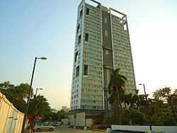
 BelAir, a luxury Condo in Alipore | |
| Coordinates: 22°32′21″N 88°19′38″E / 22.5391712°N 88.3272782°ECoordinates: 22°32′21″N 88°19′38″E / 22.5391712°N 88.3272782°E | |
| Country | |
| State | West Bengal |
| District | Kolkata |
| City | Kolkata |
| Metro Station | Jatin Das Park, Kalighat and Majerhat(under construction) |
| Municipal Corporation | Kolkata Municipal Corporation |
| KMC ward | 74 |
| Elevation | 14 m (46 ft) |
| Population | |
| • Total | For population see linked KMC ward page |
| Languages | |
| • Official | Bengali, English |
| Time zone | UTC+5:30 (IST) |
| PIN | 700027 |
| Lok Sabha constituency | Kolkata Dakshin |
| Vidhan Sabha constituency | Bhabanipur |
It is flanked by the Tolly Nullah to the north, Bhowanipore to the east, the Diamond Harbour Road to the west and New Alipore to the south, bordered by the Budge Budge section of the Sealdah South section railway line.
GeographyEdit
LocationEdit
Alipore is located at 22°32′21″N 88°19′38″E / 22.5391712°N 88.3272782°E.[1] It has an average elevation of 14 metres (46 feet). Alipore area is bordered by the following roads - AJC Bose Road to the north, D L Khan Road to the East, Diamond Harbour Road to the West and Alipore Avenue to the south.
Police districtEdit
Alipore police station is part of the South division of Kolkata Police. It is located at 8, Belvadere Road, Kolkata-700027.[2]
Tollygunge Women's police station has jurisdiction over all the police districts in the South Division, i.e. Park Street, Shakespeare Sarani, Alipore, Hastings, Maidan, Bhowanipore, Kalighat, Tollygunge, Charu Market, New Alipur and Chetla.[2]
TransportEdit
Alipore is connected to all parts of the city by extensive bus services. Alipore is served by the Majherhat and New Alipore railway stations on the Budge Budge section of Kolkata Suburban Railway.
The Kalighat metro station of the Kolkata Metro as well as the Jatin Das Park station is close to Alipore.
See alsoEdit
ReferencesEdit
- ↑ Falling Rain Genomics, Inc - Alipore[permanent dead link]
- ↑ 2.0 2.1 "Kolkata Police". South Division – Hastings police station. KP. Retrieved 26 March 2018.

