


Kalimpong district | |
|---|---|
.jpg)  .jpg)  .jpg) Clockwise from top-left: View of Kalimpong , Morgan House in Kalimpong, Gouripur house , view from Rishyap, Neora Valley National Park | |
| Coordinates: 27°04′N 88°28′E / 27.06°N 88.47°E | |
| Country | |
| State | West Bengal |
| Division | Jalpaiguri |
| Headquarters | Kalimpong |
| Government | |
| • Subdivisions | Kalimpong Sadar |
| • CD Blocks | Kalimpong I, Kalimpong II, Gorubathan |
| • Lok Sabha constituencies | Darjeeling |
| • Vidhan Sabha constituencies | Kalimpong |
| Area | |
| • Total | 1,044.60 km2 (403.32 sq mi) |
| Population (2011)[1] | |
| • Total | 251,642 |
| • Density | 240/km2 (620/sq mi) |
| Demographics | |
| • Literacy | 78.57 per cent |
| • Sex ratio | 949 ♂/♀ |
| Languages | |
| • Official | Bengali,[2][3] Nepali[3] |
| • Additional official | English[2] |
| Time zone | UTC+05:30 (IST) |
| Website | kalimpong |

Kalimpong district is a district in the state of West Bengal, India. In 2017, it was carved out as a separate district to become the 21st district of West Bengal.[4][5] The district is headquartered at Kalimpong, which grew to prominence as a market town for Indo-Tibetan trade during the British period. It is bounded by Pakyong district of Sikkim in the north, Bhutan in the east, Darjeeling district in the west, and Jalpaiguri district in the south.
The district consists of the Kalimpong municipality and four community development blocks: Kalimpong I, Kalimpong II, Gorubathan and Pedong. The towns and villages in Kalimpong District are: Kalimpong, Gorubathan, Melli Bazar, Teesta Bazar, Algarah, Labha, Samsing and Rambi.
Area[edit | edit source]
Apart from the Kalimpong municipality that consists of 23 wards, the district contains rural areas of 42 gram panchayats under four community development blocks: Kalimpong I, Kalimpong II, Gorubathan and Pedong.[6]
Kalimpong district has an area of 1,053.60 km2 (406.80 sq mi), with Kalimpong I block having an area of 360.46 km2 (139.17 sq mi); Kalimpong II block an area of 241.26 km2 (93.15 sq mi); Gorubathan block an area of 442.72 km2 (170.94 sq mi); and Kalimpong Municipality an area of 9.16 km2 (3.54 sq mi).[1]
History[edit | edit source]


What is now Kalimpong district was originally Sikkimese territory.[7][8] It was controlled through two hill forts in the region, at Damsang[lower-alpha 1] and Daling[lower-alpha 2] (or Dalingkot, meaning "Daling fort"). The region itself seems to have been referred to as Dalingkot.[9] In 1718, the Kingdom of Bhutan annexed this territory, and ruled it for the following 150 years.[10][11] The area was sparsely populated by Lepchas, and migrant Bhutia, Limbu and Kirati tribes.
After the Anglo-Bhutan War in 1864, the Treaty of Sinchula (1865) was signed, in which certain "hill territory to east of the Teesta River" was ceded to British India.[7] The precise territory was unspecified but included the fort of Dalingkot. In 1866–1867, British surveyors demarcated the area, and set the Di Chu and Ni Chu rivers as the eastern and northeastern boundaries.[12][13]

The ceded territory was added to the Western Duars district at first, and later transferred to the Darjeeling district of the Bengal province in 1866.[10] It was referred to as the "tract of Dalingkot" or "tract of Damsang", after the hill forts through which it had been administered in the past.[13][14] At that time, Kalimpong was a small hamlet, with only two or three families known to reside there.[15] However the neighbourhood of Kalimpong was well-populated with several villages, as recorded by Ashley Eden during a mission to Bhutan in 1864. Eden mentioned that the people there were well-disposed to the British administration and had frequently traded with the Darjeeling area to the west of Teesta in defiance of the Bhutanese authorities.[16]
The temperate climate prompted the British to develop the town as an alternative hill station to Darjeeling, to escape the scorching summer heat in the Indo-Gangetic Plain. Kalimpong's proximity to the Nathu La and Jelep La passes for trading with Tibet was an added advantage. It soon became an important trading outpost in the trade of furs, wools and food grains between India and Tibet.[17] The increase in commerce attracted large numbers of Nepalis from neighbouring Nepal and also the lower regions of Sikkim where Nepalis had been residing since the Gorkha invasion of Sikkim in 1790. The movement of people into the area transformed Kalimpong from a small hamlet with a few houses, to a thriving town with economic prosperity. Britain assigned a plot within Kalimpong to the influential Bhutanese Dorji family, through which trade and relations with Bhutan flowed. This later became the Bhutan House, a Bhutanese administrative and cultural centre.[18][19][20]
The arrival of Scottish missionaries saw the construction of schools and welfare centres for the British.[15] Rev. W. Macfarlane in the early 1870s established the first schools in the area.[15] The Scottish University Mission Institution was opened in 1886, followed by the Kalimpong Girls High School. In 1900, Reverend J.A. Graham founded the Dr. Graham's Homes for destitute Anglo-Indian students.[15] The young missionary (and aspiring writer and poet) Aeneas Francon Williams, aged 24, arrived in Kalimpong in 1910 to take up the post of assistant schoolmaster at Dr. Graham's Homes,[21] where he later became Bursar and remained working at the school for the next fourteen years.[22] From 1907 onwards, most schools in Kalimpong had started offering education to Indian students. By 1911, the population comprised many ethnic groups, including Nepalis, Lepchas, Tibetans, Muslims, the Anglo-Indian communities. Hence by 1911, the population had swollen to 7,880.[15]
Following Indian independence in 1947, Kalimpong remained in West Bengal, the part of Bengal allocated to India during the Paritiion. With China's annexation of Tibet in 1950, many Buddhist monks fled Tibet and established monasteries in Kalimpong. These monks brought rare Buddhist scriptures with them. In 1962, the permanent closure of Jelep La after the Sino-Indian War disrupted trade between Tibet and India, and led to a slowdown in Kalimpong's economy. In 1976, the visiting Dalai Lama consecrated the Zang Dhok Palri Phodang monastery, which houses many of the Tibetan Buddhist scriptures.[15]

Between 1986 and 1988, the demand for a separate state of Gorkhaland and Kamtapur based on ethnic lines grew strong. Riots between the Gorkha National Liberation Front (GNLF) and the West Bengal government reached a stand-off after a forty-day strike. The town was virtually under siege, and the state government called in the Indian army to maintain law and order. This led to the formation of the Darjeeling Gorkha Hill Council, a body that was given semi-autonomous powers to govern the Darjeeling district, except the area under the Siliguri subdivision. Since 2007, the demand for a separate Gorkhaland state has been revived by the Gorkha Janmukti Morcha and its supporters in the Darjeeling hills.[23] The Kamtapur People's Party and its supporters' movement for a separate Kamtapur state covering North Bengal have gained momentum.[24]
Blocks[edit | edit source]
Kalimpong I block[edit | edit source]
The Kalimpong I block consists of 18 gram panchayats; Bong, Kalimpong, Samalbong, Tista, Dr. Graham's Homes, Lower Echhay, Samthar, Neembong, Dungra, Upper Echhay, Seokbir, Bhalukhop, Yangmakum, Pabringtar, Sindebong, Kafer Kanke Bong, Pudung and Tashiding.[6] This block has one police station at Kalimpong.[25] The block is headquartered in Kalimpong.[26]
Kalimpong II block[edit | edit source]
The Kalimpong II block consists of 7 gram panchayats, namely Dalapchand, Gitdabling, Lava-Gitabeong, Lolay, Payong, Shangse, and Shantuk.[6] This block is served by Kalimpong police station.[25] The block is headquartered in Algarah.[26]
Gorubathan block[edit | edit source]
The Gorubathan block consists of 11 gram panchayats, namely Dalim, Gorubathan–I, Gorubathan–II, Patengodak, Todey Tangta, Kumai, Pokhreybong, Samsing, Aahaley, Nim and Rongo.[6] This block has two police stations: Gorubathan and Jaldhaka.[25] The block is headquartered in Fagu.[26]
Pedong block[edit | edit source]
The Pedong block consists of 6 gram panchayats, namely Kage, Kashyong, Lingsey, Lingseykha, Pedong and Syakiyong. This block is served by Kalimpong police station. The block is headquartered in Pedong.
Legislative segments[edit | edit source]
As per order of the Delimitation Commission in respect of the delimitation of constituencies in West Bengal, the whole area under the district of Kalimpong (formerly Kalimpong subdivision), namely the Kalimpong municipality and the three blocks of Kalimpong–I, Kalimpong–II and Gorubathan together constitutes the Kalimpong Assembly constituency of West Bengal. This constituency is part of Darjeeling Lok Sabha constituency. Darjeeling is represented by Neeraj Zimba of the Bharatiya Janata Party, while Kalimpong Assembly constituency is represented by Ruden Sada Lepcha of the Gorkha Janmukti Morcha (Tamang faction).[27]
| No. | Name | Lok Sabha | MLA | 2021 Winner | 2024 Lead | ||
|---|---|---|---|---|---|---|---|
| 22 | Kalimpong | Darjeeling | Ruden Sada Lepcha | Bharatiya Gorkha Prajatantrik Morcha | Bharatiya Janata Party | ||
Demographics[edit | edit source]
According to the 2011 census, Kalimpong district (enumerated as Kalimpong subdivision then) has a population of 251,642. Kalimpong I block had a population of 74,746; Kalimpong II block had a population of 66,830; Gorubathan block had a population of 60,663; and Kalimpong Municipality had a population of 49,403. Kalimpong district has a sex ratio of 959 females per 1000 males. 56,192 (22.33%) live in urban areas. Scheduled Castes and Scheduled Tribes made up 16,433 (6.53%) and 74,976 (29.79%) of the population respectively.[1]
Religion[edit | edit source]
| Religion | 1941 | 2011 | ||
|---|---|---|---|---|
| Pop.[29]:90–91 | % | Pop.[28] | % | |
| Hinduism |
35,928 | 45.45% | 153,355 | 60.94% |
| Tribal religion |
31,674 | 40.07% | 3,243 | 1.29% |
| Christianity |
714 | 0.9% | 37,453 | 14.88% |
| Islam |
324 | 0.41% | 3,998 | 1.59% |
| Buddhism |
--- | --- | 52,688 | 20.94% |
| Others[lower-alpha 3] | 10,402 | 13.16% | 905 | 0.36% |
| Total Population | 79,042 | 100% | 251,642 | 100% |
According to the 2011 census, Hindus numbered 153,355 (60.94%), Buddhists numbered 52,688 (20.94%), Christians numbered 37,453 (14.88%). Muslims numbered 3,998 (1.59%) of the population, while traditional faiths (such as Kirat Mundhum) were 3,243 (1.29%).[28]
Languages[edit | edit source]
At the time of the 1951 census, only 24% of those now living in Kalimpong district spoke Nepali as their mother tongue. Most of the population spoke a variety of other languages such as Rai, Limbu, Lepcha and Tamang, although nearly all could speak Nepali as a second language.[32] By 1961, the proportion of people in Kalimpong returning Nepali as their mother tongue had jumped to 75%. This was accompanied by a dramatic fall in the numbers of other languages spoken by the variety of ethnic groups in the hills.[33]
However at the time of the 2011 census, 87.61% of the population spoke Nepali, 3.18% Hindi, 2.67% Lepcha, 1.16% Bhojpuri and 5.38% Others languages as their first language.[30][31]
Flora and fauna[edit | edit source]

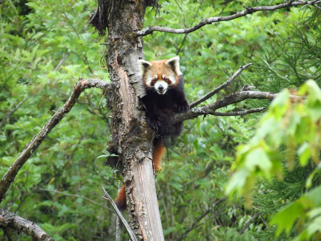
Kalimpong district is home to the Neora Valley National Park, which has an area of 159.89 km2 (61.73 sq mi).[34] Mammals reported from this area are Indian leopard, five viverrid species, Asiatic black bear, sloth bear, Asian golden cat, wild boar, leopard cat, goral, serow, barking deer, sambar deer, flying squirrel, tahr, red panda and clouded leopard.[35]
Transport[edit | edit source]
Roadways[edit | edit source]
National Highways
- National Highway 10 connecting Siliguri to Gangtok, lies in Kalimpong District from Kalijhora to Atal Setu Bridge, Rangpo via Teesta Bazaar, Rambi Bazar and Melli.
- National Highway-717A Connecting Bagrakote to Gangtok lies in Kalimpong district from Bagrakote to Resi Sikkim border, via Chuikhim, Nimbong, Loleygaon, Lava, Algarah, Pedong, and Kataray Bazar.[36]
- National Highway 17 connecting Sevoke to Guwahati lies in Kalimpong district at Coronation Bridge - Mongpong area.
Railway[edit | edit source]
The currently functioning nearest railway station from Kalimpong district is Sivok railway station of Darjeeling district and Bagrakote Railway Station of Jalpaiguri district. The nearest major railway stations are Malbazar Junction, Siliguri Junction and New Jalpaiguri railway station.
The under construction Sevoke - Rangpo railway line, and Matelli - Naxal railway line lies in Kalimpong district, the following are the under construction railway stations under Kalimpong district:
Airways[edit | edit source]
Bagdogra Airport is the nearest airport from southern parts of Kalimpong district, and Pakyong Airport is the nearest airport from northern areas of Kalimpong district.
Rivers[edit | edit source]
The major rivers flowing through Kalimpong district are River Teesta, River Jaldhaka and River Rangpo. Other rivers are Relli Khola, Riyang Khola,Murti Khola, Reshi Khola, Chel Khola, River Ghish, Bindu Khola, Les Khola, Neora Khola etc.
Geographical indication[edit | edit source]
Kalonunia rice was awarded the Geographical Indication (GI) status tag from the Geographical Indications Registry under the Union Government of India on 2 January 2024 (valid until 11 March 2034). It is a common and widely cultivated crop in districts of Cooch Behar, Jalpaiguri and Alipurduar along with some parts of Darjeeling & Kalimpong districts of West Bengal.[37][38][39][40]
State Agricultural Management & Extension Training Institute (SAMETI) from Narendrapur, proposed the GI registration of Kalonunia rice. After filing the application in March 2021, the rice was granted the GI tag in 2024 by the Geographical Indication Registry in Chennai, making the name "Kalonunia rice" exclusive to the rice grown in the region.[41] It thus became the third rice variety from West Bengal after Tulaipanji rice and the 26th type of goods from West Bengal to earn the GI tag.
The GI tag protects the rice from illegal selling and marketing, and gives it legal protection and a unique identity.
Notes[edit | edit source]
- ↑ Alternative spellings include "Damsung", "Damsong", "Dumsong", "Dhumsong" etc.
- ↑ Also called "Dalim". Variant spellings include "Dhalim" and "Dhaling".
- ↑ Including Jainism, Buddhism, Zoroastrianism, Judaism, Ad-Dharmis, or not stated
References[edit | edit source]
- ↑ 1.0 1.1 1.2 "District Census Handbook: Darjeeling" (PDF). censusindia.gov.in. Registrar General and Census Commissioner of India. 2011.
- ↑ 2.0 2.1 "Fact and Figures". Wb.gov.in. Retrieved 5 July 2019.
- ↑ 3.0 3.1 "52nd Report of the Commissioner for Linguistic Minorities in India" (PDF). Nclm.nic.in. Ministry of Minority Affairs. p. 85. Archived from the original (PDF) on 25 May 2017. Retrieved 5 July 2019.
- ↑ "Carved out of Darjeeling, Kalimpong a district today". Times of India. Retrieved 14 February 2017.
- ↑ "Kalimpong district may stoke Gorkhaland fire". Hindustan Times. 13 February 2017.
- ↑ 6.0 6.1 6.2 6.3 "Directory of District, Sub division, Panchayat Samiti/ Block and Gram Panchayats in West Bengal, March 2008". Government of West Bengal. 19 March 2008. Archived from the original on 25 February 2009.
- ↑ 7.0 7.1 "History of Kalimpong". Darjeeling News Service. Archived from the original on 5 February 2007. Retrieved 17 February 2007.
- ↑ Gurung, Chanda; Gurung, Nawraj (2006). "The Social and Gendered Nature of Ginger Production and Commercialization". In Ronnie Vernooy (ed.). Social and Gender Analysis in Natural Resource Management. International Development Research Centre (Canada), NetLibrary, Inc. pp. 39–43. ISBN 1-55250-218-X.
- ↑ Sengupta, Somen (3 September 2006). "Next weekend you can be at ... Kalimpong". The Telegraph. Archived from the original on 5 June 2011.
- ↑ 10.0 10.1 Roy, Survey and Settlement of the Western Duars (2013), pp. 6, 41.
- ↑ Subba, J. R. (2008), History, Culture and Customs of Sikkim, Gyan Publishing House, p. 50, ISBN 9788121209649
- ↑ Samanta (2000), p. 43
- ↑ 13.0 13.1 Hunter, W. W. (1876), A Statistical Account Of Bengal, Vol. X: Districts of Darjiling and Jalpaiguri, State of Kuch Behar, London: Trubner & Co, p. 19 – via archive.org: "In August 1866, by a Government Resolution, the hilly tract situated east of the Tista, west of the Ne-chu and De-chu rivers, and south of Independent Sikkim, being part of the territory acquired as the result of the Bhutan campaign of 1864, was added to the jurisdiction of Darjiling, and now forms the tract known as Damsang or Dalingkot."
- ↑ Roy, Survey and Settlement of the Western Duars (2013), p. 6: "... the Dalingkot tahsil, which includes the mountainous part of the annexed territory."
- ↑ 15.0 15.1 15.2 15.3 15.4 15.5 Banerjee, Partha S (19 May 2002). "A quiet hill retreat, far from the tourist crowd". Spectrum, The Tribune.
- ↑ Rennie, Bhotan and the Dooar War (1866), pp. 64–66.
- ↑ Khawas, Vimal (31 December 2004). "The Forgotten Way: Recalling the road to Lhasa from Kalimpong". The Statesman. The Statesman Ltd.
- ↑ Hilker, Deb Shova Kansakar (2005). Syamukapu: The Lhasa Newars of Kalimpong and Kathmandu. Vajra Publications. ISBN 99946-644-6-8. Retrieved 12 August 2011.
- ↑ Arts of Asia. Vol. 17. Arts of Asia Publications. 1987. p. 107. Retrieved 12 August 2011.
- ↑ Tsarong, Dundul Namgyal; Chödron, Ani K. Trinlay (2000). Ani K. Trinlay Chödron (ed.). In the service of his country: the biography of Dasang Damdul Tsarong, commander general of Tibet. Snow Lion Publications. p. 35. ISBN 1-55939-151-0. Retrieved 12 August 2011.
- ↑ Correspondence from Aeneas Francon Williams addressed from Wolseley House, Kalimpong, is stored in the Dr. Graham Kalimpong Archive held at the National Library of Scotland, Edinburgh
- ↑ Marriage Certificate for Aeneas Francon Williams and Clara Anne Rendall, 2 December 1914: Findmypast.co.uk – Williams rank of profession is registered as ‘Assistant School Master.’
- ↑ "Call for Gorkhaland renewed". Darjeeling Times. 7 October 2007. Archived from the original on 22 December 2008. Retrieved 13 January 2009.
- ↑ Press Trust of India (PTI) (29 December 2009). "Now, demand for a separate Kamtapur state in WBengal". The Times of India. Archived from the original on 17 June 2013. Retrieved 11 December 2012.
- ↑ 25.0 25.1 25.2 "District Profile". Official website of Darjeeling district. Retrieved 9 December 2008.
- ↑ 26.0 26.1 26.2 "Contact details of Block Development Officers". Darjeeling district. Panchayats and Rural Development Department, Government of West Bengal. Retrieved 26 December 2008.[permanent dead link]
- ↑ "Press Note, Delimitation Commission" (PDF). Assembly Constituencies in West Bengal. Delimitation Commission. pp. 5, 23. Retrieved 10 January 2009.
- ↑ 28.0 28.1 28.2 "Table C-01 Population by Religion: West Bengal". censusindia.gov.in. Registrar General and Census Commissioner of India.
- ↑ "CENSUS OF INDIA, 1941 VOLUME VI BENGAL PROVINCE" (PDF). Retrieved 13 August 2022.
- ↑ 30.0 30.1 "Table C-16 Population by Mother Tongue: West Bengal". Census of India. Registrar General and Census Commissioner of India. see Kalimpong-I, Kalimpong-II, Gorubuthan blocks
- ↑ 31.0 31.1 "Table C-16 Population by Mother Tongue: West Bengal (Urban)". Census of India. Registrar General and Census Commissioner of India. see Kalimpong (M).
- ↑ "Table 1.19 Languages: Darjeeling district" (PDF). Census of India. Registrar General and Census Commissioner of India. 1951.
- ↑ "Table C.V Languages: Darjeeling district" (PDF). Census of India. Registrar General and Census Commissioner of India. 1961.
- ↑ "National Parks". ENVIS Centre on Wildlife & Protected Areas. Retrieved 17 February 2017.
- ↑ [1] Archived 3 February 2016 at the Wayback Machine, IBAs in West Bengal – Page 20.
- ↑ Aishik Chanda, Doklam effect: Sikkim to get new all-weather highway, The New Indian Express, 28 May 2018.
- ↑ "Bengal's own Gobindabhog and Tulaipanji soon to get a distinct stand on world map". The Indian Express. 2 January 2024. Retrieved 23 November 2024.
- ↑ Khush, Gurdev S.; Hettel, Gene; Rola, Tess (1996). Rice Genetics III: Proceedings of the Third International Rice Genetics Symposium, Manila, Philippines, 16-20 October 1995. Int. Rice Res. Inst. ISBN 978-971-22-0087-8. Retrieved 23 November 2024.
- ↑ Roychoudhury, Aryadeep (29 July 2020). Rice Research for Quality Improvement: Genomics and Genetic Engineering: Volume 2: Nutrient Biofortification and Herbicide and Biotic Stress Resistance in Rice. Springer Nature. ISBN 978-981-15-5337-0. Retrieved 23 November 2024.
- ↑ Sarker, Dilip De; Saha, Manas Ranjan; Saha, Subrata (1 January 2015). Perspective of dietetic and antioxidant medicinal plants. Notion Press. ISBN 978-93-84878-95-5.
- ↑ "Kalonunia Rice". Intellectual Property India. Retrieved 23 November 2024.
Bibliography[edit | edit source]
- Rennie, Surgeon (1866), Bhotan and the Dooar War, John Murray – via archive.org
- Roy, D. C., ed. (1895), Survey and Settlement of the Western Duarsl in the District of Jalpaiguri 1889-1895, D. H. E. Sunder, Siliguri: N. L. Publishers – via archive.org
- Samanta, Amiya K. (2000). Gorkhaland Movement: A Study in Ethnic Separatism. APH Publishing. ISBN 978-81-7648-166-3.
External links[edit | edit source]
- kalimpong
.gov .in - Kalimpong district, OpenStreetMap, retrieved 2 December 2021.
Places adjacent to Kalimpong district | |
|---|---|
Cities, towns and locations in Kalimpong District | |
|---|---|
| Cities, municipal and census towns | |
| Locations other than cities and towns |
|
| See also | |
.png)