


robot: Update article (please report if you notice any mistake or error in this edit) |
No edit summary |
||
| Line 1: | Line 1: | ||
{{Short description|District in West Bengal, India}} | |||
{{About|the district|its eponymous headquarters|Cooch Behar}} | {{About|the district|its eponymous headquarters|Cooch Behar}} | ||
{{ | {{Use dmy dates|date=May 2025}} | ||
{{Use Indian English|date= | {{Use Indian English|date=May 2025}} | ||
{{Infobox settlement | {{Infobox settlement | ||
| name | | name = Cooch Behar district | ||
| settlement_type | | native_name = | ||
| | | other_name = | ||
| | | settlement_type = [[List of districts of West Bengal|District]] of [[West Bengal]] | ||
| | | image_skyline = {{multiple image | ||
| | | border = infobox | ||
| | | total_width = 300 | ||
| | | image_style = | ||
| | | perrow = 1/3/2/1 | ||
| | | caption_align = center | ||
| | | image1 = The Cooch Behar Palace or the Cooch Behar Rajbari, Cooch Behar District, West Bengal, India 01.jpg | ||
| caption1 = [[Cooch Behar Palace]] | |||
| | | image2 = Parijat Villa at Cooch Behar Town located under Cooch Behar district in West Bengal 01.jpg | ||
| | | caption2 = Parijat Villa | ||
| | | image3 = | ||
| | | caption3 = [[Acharya Brojendra Nath Seal College|ABN Seal College]] | ||
| | | image4 = Rasikbeel tower.jpg | ||
| | | caption4 = [[Rasikbil]] | ||
| | | image5 = | ||
| | | caption5 = [[Torsa River|Banks of the river Torsa]] | ||
| | | image6 = Sagar Dighi, Coochbehar.jpg | ||
}} | | caption6 = Sagar Dighi Lake | ||
| image7 = | |||
| caption7 = Victor Palace | |||
| image8 = Madan Mohan Bari Cooch Behar.jpg | |||
| subdivision_type | | caption8 = [[Madan Mohan Temple]]}} | ||
| subdivision_name | | mapframe = yes | ||
| subdivision_type1 | | mapframe-point = none | ||
| subdivision_name1 | | mapsize = 300 | ||
| subdivision_type2 | | map_caption1 = Location of Cooch Behar district in West Bengal | ||
| subdivision_name2 | | coordinates = {{coord|26|17|N|89|21|E|type:adm3rd_region:IN-WB_dim:50000|display=inline,title}} | ||
| | | subdivision_type = Country | ||
| | | subdivision_name = [[India]] | ||
| | | subdivision_type1 = [[States and union territories of India|State]] | ||
| | | subdivision_name1 = [[West Bengal]] | ||
| | | subdivision_type2 = [[Administrative divisions of West Bengal|Division]] | ||
| | | subdivision_name2 = [[Jalpaiguri division|Jalpaiguri]] | ||
| | | seat_type = Headquarters | ||
| area_total_km2 | | seat = [[Cooch Behar]] | ||
| area_footnotes | | leader_title = [[List of subdivisions of West Bengal|Subdivisions]] | ||
| population_as_of | | leader_name = [[Cooch Behar Sadar subdivision|Cooch Behar Sadar]], [[Dinhata subdivision|Dinhata]], [[Mathabhanga subdivision|Mathabhanga]], [[Tufanganj subdivision|Tufanganj]], [[Mekhliganj subdivision|Mekhliganj]] | ||
| population_total | | leader_title1 = [[Community Development Block|CD Blocks]] | ||
| population_footnotes | | leader_name1 = [[Cooch Behar I]], [[Cooch Behar II]], [[Dinhata I]], [[Dinhata II]], [[Sitai]], [[Mathabhanga I]], [[Mathabhanga II]], [[Sitalkuchi]], [[Tufanganj I]], [[Tufanganj II]], [[Mekhliganj (community development block)|Mekhliganj]], [[Haldibari (community development block)|Haldibari]] | ||
| population_urban | | leader_title2 = [[List of constituencies of the Lok Sabha|Lok Sabha constituencies]] | ||
| leader_name2 = [[Cooch Behar (Lok Sabha constituency)|Cooch Behar]] | |||
| leader_title3 = [[List of constituencies of the West Bengal Legislative Assembly|Vidhan Sabha constituencies]] | |||
| leader_name3 = [[Mathabhanga (Vidhan Sabha constituency)|Mathabhanga]], [[Cooch Behar Uttar (Vidhan Sabha constituency)|Cooch Behar Uttar]], [[Cooch Behar Dakshin (Vidhan Sabha constituency)|Cooch Behar Dakshin]], [[Sitalkuchi (Vidhan Sabha constituency)|Sitalkuchi]], [[Sitai (Vidhan Sabha constituency)|Sitai]], [[Dinhata (Vidhan Sabha constituency)|Dinhata]], [[Natabari (Vidhan Sabha constituency)|Natabari]], [[Tufanganj (Vidhan Sabha constituency)|Tufanganj]] | |||
| total_type = Total | |||
| area_total_km2 = 3387 | |||
| area_footnotes = | |||
| population_as_of = 2011 | |||
| population_total = 2819086 | |||
| population_footnotes = | |||
| population_urban = | |||
| population_density_km2 = auto | | population_density_km2 = auto | ||
| demographics_type1 | | demographics_type1 = Demographics | ||
| demographics1_title1 | | demographics1_title1 = [[Literacy in India|Literacy]] | ||
| demographics1_info1 | | demographics1_info1 = 74.78 per cent | ||
| demographics1_title2 | | demographics1_title2 = [[Human sex ratio|Sex ratio]] | ||
| demographics1_info2 | | demographics1_info2 = 942 [[male|♂]]/[[female|♀]] | ||
| demographics_type2 = Languages | |||
| demographics2_title1 = Official | |||
| demographics2_info1 = [[Bengali language|Bengali]]<ref name="wblangoff">{{cite web|title=Fact and Figures|url=https://wb.gov.in/portal/web/guest/facts-and-figures;jsessionid=JzdD9RHb7aMY5esZPtcsIVLy|website=Wb.gov.in|access-date=5 July 2019}}</ref><ref>{{cite web|title=52nd Report of the Commissioner for Linguistic Minorities in India|url=http://nclm.nic.in/shared/linkimages/NCLM52ndReport.pdf|website=Nclm.nic.in|publisher=[[Ministry of Minority Affairs]]|access-date=5 July 2019|page=85|url-status=dead|archive-url=https://web.archive.org/web/20170525141614/http://nclm.nic.in/shared/linkimages/NCLM52ndReport.pdf|archive-date=25 May 2017}}</ref> | |||
| demographics2_title2 = Additional official | |||
| | | demographics2_info2 = [[English language|English]]<ref name="wblangoff"/> | ||
| | | timezone1 = [[Indian Standard Time|IST]] | ||
| | | utc_offset1 = +05:30 | ||
| | | website = {{URL|http://coochbehar.nic.in}} | ||
| | |||
| | |||
| | |||
| | |||
| website | |||
}} | }} | ||
'''Cooch Behar district''' ({{IPA | '''Cooch Behar district''' ({{IPA|bn|kot͡ʃ biɦar d͡ʒela}}), also known as '''Koch Bihar district''', is one of the [[List of districts of West Bengal|23 districts]] of the state of [[West Bengal]] in [[India]]. The district is the part of [[Jalpaiguri division|Jalpaiguri Division]].<ref>{{Cite web |title=Cooch Behar District {{!}} Cooch Behar – City of Beauty {{!}} India |url=https://coochbehar.gov.in/ |access-date=2 May 2025 |language=en-US}}</ref> [[Cooch Behar]] city is the headquarters of the district. This district was a [[Cooch Behar State|Princely state]] until 1949 CE. The district consists of the flat plains of [[North Bengal]] and has several rivers: the most notable being the [[Teesta River|Teesta]], [[Jaldhaka River|Jaldhaka]] and [[Torsa River|Torsa]]. The district has the highest proportion of [[Scheduled Castes and Scheduled Tribes|Scheduled Castes]] in the country.<ref>{{Cite web |title=Districts having more than 40% SC population in India {{!}} Department of Social Justice and Empowerment - Government of India |url=https://socialjustice.gov.in/common/76668 |access-date=2 May 2025 |website=socialjustice.gov.in}}</ref> | ||
==Etymology== | |||
{{main|Etymology of Cooch Behar}} | |||
The name ''Cooch Behar'' is derived from two words—''Cooch'', a corrupted form of the word ''Koch'', the name of the [[Koch people|Koch]] tribes, and the word ''behar'' is derived from ''[[vihara]]'' meaning ''land'', Koch Behar means ''land of the Koches''.<ref>{{cite book |last= Pal |first= Dr. Nripendra Nath |title= Itikathai Cooch Behar (A brief history of Cooch Behar) |year=2000 |publisher=Anima Prakashani |location=Kolkata | pages = 11–12}}</ref><ref>The name Cooch Behar is a compound of two words: Cooch and Behar. Cooch is a corrupted form of Coch or Koch, the name of an ethnic group of people inhabiting largely in vast tract of land to the north-east of Bengal. Behar or more properly Vihara denotes abode or sport. Cooch Behar means, therefore, the abode or land of the Koches. Ray, B.. [http://lsi.gov.in:8081/jspui/bitstream/123456789/5164/1/22881_1961_COO.pdf ''CENSUS 1961 WEST BENGAL'']. GOVERNMENT PRINTING, WEST BENGAL, 1961, p.20</ref> | |||
The name ''Cooch Behar'' is derived from | |||
==History== | ==History== | ||
| Line 85: | Line 86: | ||
===Early period=== | ===Early period=== | ||
{{See also|Kamarupa Kingdom|Kamata kingdom|Koch dynasty}} | {{See also|Kamarupa Kingdom|Kamata kingdom|Koch dynasty}} | ||
[[File:Gosanimari Rajpat at Gosanimari village in Coochbihar district 31.jpg|thumb|[[Gosanimari]] archaeological site former capital of Kamata kingdom]] | [[File:Gosanimari Rajpat at Gosanimari village in Coochbihar district 31.jpg|thumb|[[Gosanimari]] archaeological site former capital of Kamata kingdom]] | ||
Cooch Behar formed part of the [[Kamarupa|Kamarupa Kingdom]] of Assam from the 4th to the 12th centuries. In the 12th century, the area became a part of the [[Kamata Kingdom]], first ruled by the [[Khen dynasty]] from their capital at Kamatapur. The Khens were an indigenous tribe, and they ruled till about 1498 [[Common Era|CE]], when they fell to [[Alauddin Hussain Shah]], the independent Pathan Sultan of [[Gauḍa (city)|Gour]]. The new invaders fought with the local [[Baro-Bhuyan|Bhuyan chieftains]] and the [[Ahom kingdom|Ahom]] king [[Suhungmung]] and lost control of the region. During this time, the Koch tribe became very powerful and proclaimed itself ''Kamateshwar'' (Lord of Kamata) and established the Koch dynasty. | Cooch Behar formed part of the [[Kamarupa|Kamarupa Kingdom]] of Assam from the 4th to the 12th centuries. In the 12th century, the area became a part of the [[Kamata Kingdom]], first ruled by the [[Khen dynasty]] from their capital at Kamatapur. The Khens were an indigenous tribe, and they ruled till about 1498 [[Common Era|CE]], when they fell to [[Alauddin Hussain Shah]], the independent Pathan Sultan of [[Gauḍa (city)|Gour]]. The new invaders fought with the local [[Baro-Bhuyan|Bhuyan chieftains]] and the [[Ahom kingdom|Ahom]] king [[Suhungmung]] and lost control of the region. During this time, the Koch tribe became very powerful and proclaimed itself ''Kamateshwar'' (Lord of Kamata) and established the Koch dynasty. | ||
| Line 91: | Line 92: | ||
The first important Koch ruler was [[Biswa Singha]], who came to power in 1515.<ref>{{Citation|url=https://books.google.com/books?id=ECxUOSudNGYC|last=Nath |first=D. |title=History of the Koch Kingdom, C. 1515-1615 |pages=5–6|publisher=Mittal Publications|year= 1989|isbn=8170991099}}</ref> Under his son, [[Nara Narayan]], the Kamata Kingdom reached its zenith.<ref>{{cite web |url=http://coochbehar.gov.in/HTMfiles/royal_history.html |title=Royal History of Cooch Behar |access-date=22 October 2006}}</ref> Nara Narayan's younger brother, Shukladhwaj ([[Chilarai]]), was a noted military general who undertook expeditions to expand the kingdom. He became governor of its eastern portion. | The first important Koch ruler was [[Biswa Singha]], who came to power in 1515.<ref>{{Citation|url=https://books.google.com/books?id=ECxUOSudNGYC|last=Nath |first=D. |title=History of the Koch Kingdom, C. 1515-1615 |pages=5–6|publisher=Mittal Publications|year= 1989|isbn=8170991099}}</ref> Under his son, [[Nara Narayan]], the Kamata Kingdom reached its zenith.<ref>{{cite web |url=http://coochbehar.gov.in/HTMfiles/royal_history.html |title=Royal History of Cooch Behar |access-date=22 October 2006}}</ref> Nara Narayan's younger brother, Shukladhwaj ([[Chilarai]]), was a noted military general who undertook expeditions to expand the kingdom. He became governor of its eastern portion. | ||
After Chilarai's death, his son Raghudev became governor of this portion. Since Nara Narayan did not have a son, Raghudev was seen as the heir apparent. However, a late child of Nara Narayan removed Raghudev's claim to the throne. To placate him, Nara Narayan had to anoint Raghudev as a vassal chief of the portion of the kingdom east of the [[Sankosh | After Chilarai's death, his son Raghudev became governor of this portion. Since Nara Narayan did not have a son, Raghudev was seen as the heir apparent. However, a late child of Nara Narayan removed Raghudev's claim to the throne. To placate him, Nara Narayan had to anoint Raghudev as a vassal chief of the portion of the kingdom east of the [[Sankosh River]]. This area came to be known as [[Koch Hajo]]. After the death of Nara Narayan in 1584, Raghudev declared independence. The kingdom ruled by the son of Nara Narayan, [[Lakshmi Narayan]], came to be known as Cooch Behar. The division of the Kamata Kingdom into Koch Behar and Koch Hajo was permanent. Koch Behar aligned itself with the [[Mughal Empire]] and finally joined the India as a part of the West Bengal, whereas remnants of the Koch Hajo rulers aligned themselves with the Ahom kingdom and the region became a part of [[Assam]]. | ||
As the early capital of the Koch Kingdom, Cooch Behar's location was not static and became stable only when shifted to Cooch Behar town. Maharaja Rup Narayan, on the advice of an unknown saint, transferred the capital from Attharokotha to [[Guriahati]] (now called Cooch Behar town) on the banks of the [[Torsa | As the early capital of the Koch Kingdom, Cooch Behar's location was not static and became stable only when shifted to Cooch Behar town. Maharaja Rup Narayan, on the advice of an unknown saint, transferred the capital from Attharokotha to [[Guriahati]] (now called Cooch Behar town) on the banks of the [[Torsa River]] between 1693 and 1714. The capital has always been in or near its present location since then. | ||
In 1661 CE, Maharaja Pran Narayan planned to expand his kingdom. However, [[Mir Jumla II|Mir Jumla]], the [[subedar]] of [[Bengal]] under the Mughal emperor [[Aurangazeb]], attacked Cooch Behar and conquered the territory, meeting almost no resistance.<ref>{{cite book |last= Pal |first=Dr. Nripendra Nath |title= Itikathai Cooch Behar (A brief history of Cooch Behar) |year=2000 |publisher=Anima Prakashani |location=Kolkata | page = 68}}</ref> The town of Cooch Behar was subsequently named Alamgirnagar.<ref name="bnpedia1">{{cite book |last=Bhattacharyya |first=PK |year=2012 |chapter=Kamata-Koch Behar |chapter-url=http://en.banglapedia.org/index.php?title=Kamata-Koch_Behar |editor1-last=Islam |editor1-first=Sirajul |editor1-link=Sirajul Islam |editor2-last=Jamal |editor2-first=Ahmed A. |title=Banglapedia: National Encyclopedia of Bangladesh |edition=Second |publisher=[[Asiatic Society of Bangladesh]]}}</ref> Maharaja Pran Narayan regained his kingdom within a few days. | In 1661 CE, Maharaja Pran Narayan planned to expand his kingdom. However, [[Mir Jumla II|Mir Jumla]], the [[subedar]] of [[Bengal]] under the Mughal emperor [[Aurangazeb]], attacked Cooch Behar and conquered the territory, meeting almost no resistance.<ref>{{cite book |last= Pal |first=Dr. Nripendra Nath |title= Itikathai Cooch Behar (A brief history of Cooch Behar) |year=2000 |publisher=Anima Prakashani |location=Kolkata | page = 68}}</ref> The town of Cooch Behar was subsequently named Alamgirnagar.<ref name="bnpedia1">{{cite book |last=Bhattacharyya |first=PK |year=2012 |chapter=Kamata-Koch Behar |chapter-url=http://en.banglapedia.org/index.php?title=Kamata-Koch_Behar |editor1-last=Islam |editor1-first=Sirajul |editor1-link=Sirajul Islam |editor2-last=Jamal |editor2-first=Ahmed A. |title=Banglapedia: National Encyclopedia of Bangladesh |edition=Second |publisher=[[Asiatic Society of Bangladesh]]}}</ref> Maharaja Pran Narayan regained his kingdom within a few days. | ||
| Line 100: | Line 101: | ||
[[Image:1907-bengal-sikkim3.jpg|left|thumb|1907 Map of Bengal with Sikkim]] | [[Image:1907-bengal-sikkim3.jpg|left|thumb|1907 Map of Bengal with Sikkim]] | ||
{{main|Cooch Behar State}} | {{main|Cooch Behar State}} | ||
In 1772–1773, the king of [[Bhutan]] attacked and captured Cooch Behar. To expel the Bhutanese, the kingdom of Cooch Behar signed a defence treaty with the [[British East India Company]] on 5 April 1773. After expelling the Bhutanese, Cooch Behar became a princely kingdom under the protection of British East India company.<ref>{{cite book |last= Pal |first=Dr. Nripendra Nath |title= Itikathai Cooch Behar (A brief history of Cooch Behar) |year=2000 |publisher=Anima Prakashani |location=Kolkata | page = 73}}</ref> | In 1772–1773, the king of [[Bhutan]] attacked and captured Cooch Behar. To expel the Bhutanese, the kingdom of Cooch Behar signed a defence treaty with the [[British East India Company]] on 5 April 1773. After expelling the Bhutanese, Cooch Behar became a princely kingdom under the protection of British East India company.<ref>{{cite book |last= Pal |first=Dr. Nripendra Nath |title= Itikathai Cooch Behar (A brief history of Cooch Behar) |year=2000 |publisher=Anima Prakashani |location=Kolkata | page = 73}}</ref> | ||
| Line 106: | Line 108: | ||
===Post Independence=== | ===Post Independence=== | ||
Under an agreement between the kings of Cooch Behar and the Indian Government at the end of British rule, Maharaja [[Jagaddipendra Narayan]] transferred full authority, jurisdiction and power of the state to the Dominion [[Government of India]], effective 12 September 1949.<ref name="web1">{{cite web|url=http://coochbehar.gov.in/HTMfiles/brief_history.html|title=Brief Royal History of Cooch Behar 5|access-date=22 October 2006|archive-url=https://web.archive.org/web/20110724080258/http://www.coochbehar.gov.in/Htmfiles/brief_history.html|archive-date=24 July 2011|url-status=dead}}</ref> Eventually, Cooch Bihar became part of the state of West Bengal on 19 January 1950, with Cooch Behar town as its headquarters.<ref name="web1" /> | Under an agreement between the kings of Cooch Behar and the Indian Government at the end of British rule, Maharaja [[Jagaddipendra Narayan]] transferred full authority, jurisdiction and power of the state to the Dominion [[Government of India]], effective 12 September 1949.<ref name="web1">{{cite web|url=http://coochbehar.gov.in/HTMfiles/brief_history.html|title=Brief Royal History of Cooch Behar 5|access-date=22 October 2006|archive-url=https://web.archive.org/web/20110724080258/http://www.coochbehar.gov.in/Htmfiles/brief_history.html|archive-date=24 July 2011|url-status=dead}}</ref> Eventually, Cooch Bihar became part of the state of West Bengal on 19 January 1950, with Cooch Behar town as its headquarters.<ref name="web1" /> | ||
==Geography== | ==Geography== | ||
| Line 115: | Line 113: | ||
Cooch Behar is a district under the [[Jalpaiguri Division]] of the state of [[West Bengal]]. Cooch Behar is located in the northeastern part of the state and bounded by the district of [[Jalpaiguri District|Jalpaiguri]] and [[Alipurduar district|Alipurduar]] in the north, [[Dhubri]] and [[Kokrajhar]] district of [[Assam]] in the east and by [[Bangladesh]] in the west as well as in the south. The district forms part of the Himalayan [[Terai]] of West Bengal. | Cooch Behar is a district under the [[Jalpaiguri Division]] of the state of [[West Bengal]]. Cooch Behar is located in the northeastern part of the state and bounded by the district of [[Jalpaiguri District|Jalpaiguri]] and [[Alipurduar district|Alipurduar]] in the north, [[Dhubri]] and [[Kokrajhar]] district of [[Assam]] in the east and by [[Bangladesh]] in the west as well as in the south. The district forms part of the Himalayan [[Terai]] of West Bengal. | ||
A geopolitical curiosity was that there were 92 Bangladeshi [[exclave]]s, with a total area of 47.7 km<sup>2</sup> in Cooch-Behar. Similarly, there were 106 Indian exclaves inside Bangladesh, with a total area of 69.5 km<sup>2</sup>. These were part of the high stake card or chess games centuries ago between two regional kings, the Raja of Cooch Behar and the Maharaja of Rangpur.<ref name="A Great Divide"/> | A geopolitical curiosity was that there were 92 Bangladeshi [[exclave]]s, with a total area of 47.7 km<sup>2</sup> in Cooch-Behar. Similarly, there were 106 Indian exclaves inside Bangladesh, with a total area of 69.5 km<sup>2</sup>. These were part of the high stake card or chess games centuries ago between two regional kings, the Raja of Cooch Behar and the Maharaja of Rangpur.<ref name="A Great Divide">{{cite news |url=http://www.time.com/time/magazine/article/0,9171,1877200-4,00.html |archive-url=https://web.archive.org/web/20110419030927/http://www.time.com/time/magazine/article/0,9171,1877200-4,00.html |url-status=dead |archive-date=19 April 2011 |magazine=Time |title=A Great Divide |date=5 February 2009}}</ref> | ||
Twenty-one of the Bangladeshi exclaves were within Indian exclaves, and three of the Indian exclaves were within Bangladeshi exclaves. The largest Indian exclave was Balapara Khagrabari which surrounded a Bangladeshi exclave, Upanchowki Bhajni, which itself surrounded an Indian exclave called [[Dahala Khagrabari]], of less than one hectare (link to external map here [http://geosite.jankrogh.com/enklaver/CoochBehar_Annotated.jpg]). But all this has ended in the historic India-Bangladesh land agreement. See [[Indo-Bangladesh enclaves]]. | Twenty-one of the Bangladeshi exclaves were within Indian exclaves, and three of the Indian exclaves were within Bangladeshi exclaves. The largest Indian exclave was Balapara Khagrabari which surrounded a Bangladeshi exclave, Upanchowki Bhajni, which itself surrounded an Indian exclave called [[Dahala Khagrabari]], of less than one hectare (link to external map here [http://geosite.jankrogh.com/enklaver/CoochBehar_Annotated.jpg]). But all this has ended in the historic India-Bangladesh land agreement. See [[Indo-Bangladesh enclaves]]. | ||
| Line 122: | Line 120: | ||
Cooch Behar is a flat region with a slight southeastern slope along which the main rivers of the district flow. Most of the highland areas are in the Sitalkuchi region and most of the low-lying lands lie in Dinhata region. | Cooch Behar is a flat region with a slight southeastern slope along which the main rivers of the district flow. Most of the highland areas are in the Sitalkuchi region and most of the low-lying lands lie in Dinhata region. | ||
The rivers in the district of Cooch Behar generally flow from northwest to southeast. | The rivers in the district of Cooch Behar generally flow from northwest to southeast. Seven rivers that cut through the district are the [[Teesta River|Teesta]], [[Jaldhaka]], [[Torsha]], [[Kaljani River|Kaljani]], [[Raidak]], [[Sankosh River|Sankosh]] (Gadadhar) and [[Ghargharia]]. | ||
== | ===Flora and fauna=== | ||
In 1976 Cooch Behar district became home to the Jaldapara Wildlife Sanctuary (now [[Jaldapara National Park]]), which has an area of {{convert|217|km2|mi2|abbr=on|1}}.<ref name=parks>{{cite web|author=Indian Ministry of Forests and Environment |title=Protected areas: Sikkim |url=http://oldwww.wii.gov.in/envis/envis_pa_network/index.htm |access-date=25 September 2011 |url-status=dead |archive-url=https://web.archive.org/web/20110823163836/http://oldwww.wii.gov.in/envis/envis_pa_network/index.htm |archive-date=23 August 2011}}</ref> It shares the park with [[Alipurduar]] district.<ref name=parks/> | |||
=== | ==Demographics== | ||
{{historical populations|11=1901|12=5,65,116|13=1911|14=5,91,012|15=1921|16=5,90,599|17=1931|18=5,89,053|19=1941|20=6,38,703|21=1951|22=6,68,949|23=1961|24=10,19,806|25=1971|26=14,14,183|27=1981|28=17,71,643|29=1991|30=21,71,145|31=2001|32=24,79,155|33=2011|34=28,19,086|percentages=pagr|footnote=source:<ref>[http://www.censusindia.gov.in/2011census/PCA/A2_Data_Table.html Decadal Variation In Population Since 1901]</ref>|align=center}} | |||
According to the [[2011 census of India|2011 census]] Cooch Behar district has a [[Demographics of India|population]] of 2,819,086,<ref name="districtcensus">{{Cite web |date=2011 |title=District Census Handbook: Cooch Behar |url=https://censusindia.gov.in/nada/index.php/catalog/1332/download/4342/DH_2011_1903_PART_A_DCHB_KOCH_BIHAR.pdf |website=censusindia.gov.in |publisher=[[Registrar General and Census Commissioner of India]]}}</ref> roughly equal to the nation of [[Jamaica]].<ref name="cia">{{cite web |author=US Directorate of Intelligence |title=Country Comparison:Population |url=https://www.cia.gov/library/publications/the-world-factbook/rankorder/2119rank.html |archive-url=https://web.archive.org/web/20070613004507/https://www.cia.gov/library/publications/the-world-factbook/rankorder/2119rank.html |url-status=dead |archive-date=13 June 2007 |access-date=1 October 2011 |quote=Jamaica 2,868,380 July 2011 est}}</ref> This gives it a ranking of 136th in India (out of a total of [[Districts of India|739]]).<ref name=districtcensus/> The district has a population density of {{convert| 833 |PD/sqkm|PD/sqmi}}.<ref name=districtcensus/> Its [[Family planning in India|population growth rate]] over the decade 2001–2011 was 13.86%.<ref name=districtcensus/> Koch Bihar has a [[sex ratio]] of 942 [[Women in India|females]] for every 1000 males,<ref name=districtcensus/> and a [[Literacy in India|literacy rate]] of 75.49%.<ref name=districtcensus/> 10.27% of the population lives in urban areas. Scheduled Castes and Scheduled Tribes make up 1,414,336 (50.17%) and 18,125 (0.64%) of the population respectively. Cooch Behar is the only district in India where Scheduled Castes make up a majority of the population.<ref name="SC">{{cite web |title=Census of India : Scheduled Castes & Scheduled Tribes Population |url=https://www.censusindia.gov.in/Census_Data_2001/India_at_Glance/scst.aspx |website=www.censusindia.gov.in |access-date=5 February 2021}}</ref> | |||
===Religion=== | |||
==== | |||
{{bar box | {{bar box | ||
|title=Religions in Cooch Behar district (2011)<ref name=" | |title=Religions in Cooch Behar district (2011)<ref name="religion" /> | ||
|titlebar=#Fcd116 | |titlebar=#Fcd116 | ||
|left1=Religion | |left1=Religion | ||
| Line 170: | Line 138: | ||
|float=right | |float=right | ||
|bars= | |bars= | ||
{{bar percent|[[ | {{bar percent|[[Hinduism in West Bengal|Hinduism]]|darkorange|74.05}} | ||
{{bar percent|[[ | {{bar percent|[[Islam in West Bengal|Islam]]|green|25.54}} | ||
{{bar percent|Other or not stated| | {{bar percent|Other or not stated|black|0.41}} | ||
}} | }} | ||
{| class="wikitable sortable" | |||
|+Religion in present-day Cooch Behar district | |||
!Religion | |||
!Population (1941)<ref name="1941religion">{{cite web |title=CENSUS OF INDIA, 1941 VOLUME VI BENGAL PROVINCE |url=https://dspace.gipe.ac.in/xmlui/bitstream/handle/10973/37365/GIPE-020591.pdf?sequence=3&isAllowed=y |access-date=13 August 2022}}</ref>{{rp|104–105}} | |||
!Percentage (1941) | |||
!Population (2011)<ref name="religion">{{Cite web |date=2011 |title=Table C-01 Population by Religion: West Bengal |url=https://censusindia.gov.in/nada/index.php/catalog/11396/download/14509/DDW19C-01%20MDDS.XLS |website=censusindia.gov.in |publisher=[[Registrar General and Census Commissioner of India]]}}</ref> | |||
!Percentage (2011) | |||
|- | |||
|[[Hinduism in West Bengal|Hinduism]] [[File:Om.svg|16x16px]] | |||
|394,948 | |||
|61.63% | |||
|2,087,766 | |||
|74.05% | |||
|- | |||
|[[Islam in West Bengal|Islam]] [[File:Star_and_Crescent.svg|15x15px]] | |||
|242,684 | |||
|37.87% | |||
|720,033 | |||
|25.54% | |||
|- | |||
|Others{{efn|Including [[Jainism]], [[Buddhism]], [[Christianity]], [[Zoroastrianism]], [[Judaism]], [[Ad-Dharmi]]s, or not stated}} | |||
|3,210 | |||
|0.5% | |||
|11,287 | |||
|0.41% | |||
|- | |||
|'''Total Population''' | |||
|'''640,842''' | |||
|'''100%''' | |||
|'''2,819,086''' | |||
|'''100%''' | |||
|} | |||
Hinduism is the majority religion. Islam is the minority religion, and is mainly rural. Muslims are a significant minority in Dinhata I (36.98%), Dinhata II (36.68%) and Sitalkuchi (35.31%) blocks.<ref name="religion"/> | |||
===Language=== | |||
{{Pie chart | {{Pie chart | ||
|thumb = right | |thumb = right | ||
|caption = Languages of Cooch Behar district (2011)<ref name= | |caption = Languages of Cooch Behar district (2011)<ref name="languages"/> | ||
|label1 = [[Bengali language|Bengali]] |value1 = 94.79|color1 = orchid | |label1 = [[Bengali language|Bengali]] |value1 = 94.79 |color1 = orchid | ||
|label2 = [[Rangpuri language|Rajbongshi]] | | |label2 = 'Other' Bengali |value2 = 2.01 |color2 = mediumpurple | ||
| | |label3 = [[Rangpuri language|Rajbongshi]] |value3 = 1.31 |color3 = plum | ||
| | |label4 = [[Hindi]] |value4 = 1.17 |color4 = orange | ||
|label5 = Others |value5 = 0.72 |color5 = grey | |||
}} | }} | ||
At the time of the 2011 census, 94.79% of the population spoke [[Bengali language|Bengali]], 1.31% [[Rangpuri language|Rajbongshi]] and 1.17% [[Hindi]] as their first language.<ref name= | At the time of the 2011 census, 94.79% of the population spoke [[Bengali language|Bengali]], 1.31% [[Rangpuri language|Rajbongshi]] and 1.17% [[Hindi]] as their first language. 2.01% of the population recorded their language as 'Others' under Bengali.<ref name="languages">{{Cite web |title=Table C-16 Population by Mother Tongue: West Bengal |url=https://censusindia.gov.in/nada/index.php/catalog/10226/download/13338/DDW-C16-STMT-MDDS-1900.XLSX |website=www.censusindia.gov.in |publisher=[[Registrar General and Census Commissioner of India]]}}</ref> | ||
==Government and politics== | |||
===Divisions=== | |||
====Sub-divisions==== | |||
The district of Cooch Behar comprises five sub-divisions: | |||
* [[Cooch Behar Sadar subdivision]] | |||
* [[Dinhata subdivision]] | |||
* [[Mathabhanga subdivision]] | |||
* [[Tufanganj subdivision]] | |||
* [[Mekhliganj subdivision]] | |||
====Assembly constituencies==== | |||
As per order of the 2008 [[Delimitation Commission]] in respect of the [[delimitation of constituencies]] in the West Bengal, the district is divided into 9 assembly constituencies:<ref>{{cite web | |||
| url = http://www.wbgov.com/e-gov/English/DELIMITATION.pdf | title = Press Note, Delimitation Commission| access-date = 16 November 2008 | work = Assembly Constituencies in West Bengal| publisher =Delimitation Commission}}</ref> | |||
==Politics== | |||
{| class="wikitable sortable" | |||
!No. | |||
!Constituency | |||
!Name | |||
! colspan="2" |Party | |||
!Remarks | |||
|- | |||
|1 | |||
|[[Mekliganj Assembly constituency|Mekliganj]] | |||
|[[Paresh Chandra Adhikary]] | |||
|{{Full party name with colour|All India Trinamool Congress}} | |||
| | |||
|- | |||
|2 | |||
|[[Mathabhanga Assembly constituency|Mathabhanga]] | |||
|[[Sushil Barman]] | |||
|{{Full party name with colour|Bharatiya Janata Party}} | |||
| | |||
|- | |||
|3 | |||
|[[Cooch Behar Uttar]] | |||
|[[Sukumar Roy (politician)|Sukumar Roy]] | |||
|{{Full party name with colour|Bharatiya Janata Party}} | |||
| | |||
|- | |||
|4 | |||
|[[Cooch Behar Dakshin]] | |||
|[[Nikhil Ranjan Dey]] | |||
|{{Full party name with colour|Bharatiya Janata Party}} | |||
| | |||
|- | |||
|5 | |||
|[[Sitalkuchi Assembly constituency|Sitalkuchi]] | |||
|[[Baren Chandra Barman]] | |||
|{{Full party name with colour|Bharatiya Janata Party}} | |||
| | |||
|- | |||
|6 | |||
|[[Sitai Assembly constituency|Sitai]] | |||
|[[Jagadish Chandra Barma Basunia]] | |||
|{{Full party name with colour|All India Trinamool Congress}} | |||
| | |||
|- | |||
| rowspan="2" |7 | |||
| rowspan="2" |[[Dinhata Assembly constituency|Dinhata]] | |||
|[[Nisith Pramanik]] | |||
|{{Full party name with colour|Bharatiya Janta Party}} | |||
|Resigned<ref>{{Cite web |title=Two West Bengal BJP MPs resign as MLAs after directive from party leadership |url=https://www.newindianexpress.com/nation/2021/may/12/two-west-bengal-bjp-mps-resign-as-mlas-after-directivefrom-party-leadership-2301747.html |access-date=8 April 2022 |website=The New Indian Express |date=12 May 2021}}</ref> | |||
|- | |||
|[[Udayan Guha]]{{ref label|BYE|BYE|BYE}} | |||
|{{Full party name with colour|All India Trinamool Congress}} | |||
|Won in 2021 bypoll | |||
|- | |||
|8 | |||
|[[Natabari Assembly constituency|Natabari]] | |||
|[[Mihir Goswami]] | |||
|{{Full party name with colour|Bharatiya Janata Party}} | |||
|'''Deputy Leader of Opposition''' | |||
|- | |||
|9 | |||
|[[Tufanganj Assembly constituency|Tufanganj]] | |||
|[[Malati Rava Roy]] | |||
|{{Full party name with colour|Bharatiya Janata Party}} | |||
| | |||
|} | |||
Mekliganj, Mathabhanga, Cooch Behar Uttar, Sitalkuchi and Sitai constituencies are reserved for [[Scheduled castes and scheduled tribes|Scheduled Castes (SC)]] candidates. Mekhliganj constituency is part of [[Jalpaiguri (Lok Sabha constituency)]], which also contains six assembly segments from [[Jalpaiguri district]]. Mathabhanga, Cooch Behar Uttar, Cooch Behar Dakshin, Sitalkuchi, Sitai, Dinhata and Natabari constituencies form the [[Cooch Behar (Lok Sabha constituency)]], which is reserved for [[Scheduled castes and scheduled tribes|Scheduled Castes (SC)]]. Tufanganj constituency is part of [[Alipurduars (Lok Sabha constituency)]], which also contains six assembly segments from [[Alipurduar district|Alipurduar]] and Jalpaiguri districts. | |||
==Education== | ==Education== | ||
<!--- begin this section ---> | <!--- begin this section ---> | ||
*[[Baramaricha Delwar Hossain (X+2) High School]] | *[[Baramaricha Delwar Hossain (X+2) High School]] | ||
*[[Suniti Academy]] | |||
==Towns and villages== | |||
<!---♦♦♦ Only add a location to this list if they already have their own article on the English Bharatpedia ♦♦♦---> | |||
<!---♦♦♦ Please keep the list in alphabetical order ♦♦♦---> | |||
*[[Bhetaguri]] | |||
*Dhalpal | |||
*[[Maheshwar, Cooch Behar|Maheshwar]] | |||
*[[Sajerpar Ghoramara]] | |||
==Geographical indication== | |||
[[Kalonunia rice]] was awarded the [[List of geographical indications in India|Geographical Indication]] (GI) status tag from the [[Geographical Indication Registry (India)|Geographical Indications Registry]] under the [[Government of India|Union Government of India]] on 2 January 2024 (valid until 11 March 2034). It is a common and widely cultivated crop in districts of Cooch Behar, [[Jalpaiguri district|Jalpaiguri]] and [[Alipurduar district|Alipurduar]] along with some parts of [[Darjeeling district|Darjeeling]] & [[Kalimpong district|Kalimpong]] districts of West Bengal.<ref>{{cite news |title=Bengal's own Gobindabhog and Tulaipanji soon to get a distinct stand on world map |url=https://indianexpress.com/article/cities/kolkata/how-new-grading-rules-for-non-basmati-rice-varieties-can-put-gobindabhog-on-world-map-9091192/ |access-date=23 November 2024 |work=The Indian Express |date=2 January 2024 |language=en}}</ref><ref>{{cite book |last1=Khush |first1=Gurdev S. |last2=Hettel |first2=Gene |last3=Rola |first3=Tess |title=Rice Genetics III: Proceedings of the Third International Rice Genetics Symposium, Manila, Philippines, 16-20 October 1995 |date=1996 |publisher=Int. Rice Res. Inst. |isbn=978-971-22-0087-8 |url=https://books.google.com/books?id=M_hKLjbOuBEC&dq=Kalonunia+rice&pg=PA823 |access-date=23 November 2024 |language=en}}</ref><ref>{{cite book |last1=Roychoudhury |first1=Aryadeep |title=Rice Research for Quality Improvement: Genomics and Genetic Engineering: Volume 2: Nutrient Biofortification and Herbicide and Biotic Stress Resistance in Rice |date=29 July 2020 |publisher=Springer Nature |isbn=978-981-15-5337-0 |url=https://books.google.com/books?id=6RL0DwAAQBAJ&dq=Kalonunia+rice&pg=PA393 |access-date=23 November 2024 |language=en}}</ref><ref>{{cite book |last1=Sarker |first1=Dilip De |last2=Saha |first2=Manas Ranjan |last3=Saha |first3=Subrata |title=Perspective of dietetic and antioxidant medicinal plants |date=1 January 2015 |publisher=Notion Press |isbn=978-93-84878-95-5 |url=https://books.google.com/books?id=YTrECQAAQBAJ&dq=Kalonunia+rice&pg=PT20 |language=en}}</ref> | |||
State Agricultural Management & Extension Training Institute (SAMETI) from [[Narendrapur]], proposed the GI registration of Kalonunia rice. After filing the application in March 2021, the rice was granted the GI tag in 2024 by the Geographical Indication Registry in [[Chennai]], making the name "Kalonunia rice" exclusive to the rice grown in the region.<ref>{{cite web |title=Kalonunia Rice |url=https://search.ipindia.gov.in/GIRPublic/Application/Details/743 |website=Intellectual Property India |access-date=23 November 2024}}</ref> It thus became the third rice variety from West Bengal after [[Tulaipanji rice]] and the 26th type of goods from West Bengal to earn the GI tag. | |||
The GI tag protects the rice from illegal selling and marketing, and gives it legal protection and a unique identity. | |||
== | ==Notable people== | ||
<!---♦♦♦ Only add a person to this list if they already have their OWN article on the English Bharatpedia ♦♦♦---> | |||
<!---♦♦♦ Please keep the list in alphabetical order by the LAST NAME ♦♦♦---> | |||
*Abbasi family of Tufanganj | |||
**[[Abbasuddin Ahmed]] (1901–1959), musician | |||
**[[Mustafa Kamal (judge)|Mustafa Kamal Abbasi]] (1933–2015), 9th Chief Justice of Bangladesh | |||
**[[Ferdausi Rahman]] (born 1941), singer | |||
**[[Mustafa Zaman Abbasi]] (1936–2025), musicologist | |||
**[[Nashid Kamal]] (born 1958), singer | |||
*[[Maziruddin Ahmed]] (born 1898), Cooch Behar politician<ref>{{cite book|title=Who's Who in India|page=71|publisher=West Bengal Legislative Assembly Secretariat|year=1957}}</ref> | |||
*[[Tamser Ali]] (born 1953), MLA for Natabari | |||
*Guha family of Dinhata | |||
**[[Kamal Guha]] (1928–2007), Agriculture Minister of West Bengal | |||
**[[Udayan Guha]] (born 1955), West Bengal cabinet minister | |||
*[[Fazle Haque]] (born 1933), former state minister | |||
*[[Fazal Karim Miah]] (born 1951), MLA for Tufanganj | |||
*Wakil family of Dinhata (relocated to Bangladesh after partition) | |||
**[[Hossain Mohammad Ershad]] (1930–2019), President of [[Bangladesh]] | |||
**[[Saad Ershad]] (born 1983), businessman | |||
**[[Mozammel Hossain Lalu]] (1942–2014), member of the Bangladesh parliament | |||
**[[GM Quader|Ghulam Mohammad Quader]] (born 1948), Commerce Minister of Bangladesh | |||
**[[Merina Rahman]] (born 1943), member of the Bangladesh parliament | |||
**[[Hossain Mokbul Shahriar]] (born 1974), member of the Bangladesh parliament | |||
==See also== | ==See also== | ||
* [[Indo-Bangladesh enclaves]] | * [[India–Bangladesh enclaves|Indo-Bangladesh enclaves]] | ||
* [[List of enclaves and exclaves]] | * [[List of enclaves and exclaves]] | ||
* [[List of West Bengal districts ranked by literacy rate]] | * [[List of West Bengal districts ranked by literacy rate]] | ||
==References== | ==References== | ||
{{Reflist}} | {{Reflist}}{{Reflist|group=lower-alpha}} | ||
==Further reading== | ==Further reading== | ||
| Line 230: | Line 356: | ||
{{Proposed states and territories of India}} | {{Proposed states and territories of India}} | ||
{{Authority control}} | {{Authority control}} | ||
{{DEFAULTSORT:Cooch Behar District}} | {{DEFAULTSORT:Cooch Behar District}} | ||
[[Category:Cooch Behar district| ]] | [[Category:Cooch Behar district| ]] | ||
[[Category:Districts of West Bengal]] | [[Category:Districts of West Bengal]] | ||
[[Category:Minority | [[Category:Minority concentrated districts in India]] | ||
[[Category:Proposed states and union territories of India]] | [[Category:Proposed states and union territories of India]] | ||
[[sv:Kutch Behar]] | [[sv:Kutch Behar]] | ||
Revision as of 09:01, 8 March 2026
Cooch Behar district | |
|---|---|
| Coordinates: 26°17′N 89°21′E / 26.283°N 89.350°E | |
| Country | India |
| State | West Bengal |
| Division | Jalpaiguri |
| Headquarters | Cooch Behar |
| Government | |
| • Subdivisions | Cooch Behar Sadar, Dinhata, Mathabhanga, Tufanganj, Mekhliganj |
| • CD Blocks | Cooch Behar I, Cooch Behar II, Dinhata I, Dinhata II, Sitai, Mathabhanga I, Mathabhanga II, Sitalkuchi, Tufanganj I, Tufanganj II, Mekhliganj, Haldibari |
| • Lok Sabha constituencies | Cooch Behar |
| • Vidhan Sabha constituencies | Mathabhanga, Cooch Behar Uttar, Cooch Behar Dakshin, Sitalkuchi, Sitai, Dinhata, Natabari, Tufanganj |
| Area | |
| • Total | 3,387 km2 (1,308 sq mi) |
| Population (2011) | |
| • Total | 2,819,086 |
| • Density | 830/km2 (2,200/sq mi) |
| Demographics | |
| • Literacy | 74.78 per cent |
| • Sex ratio | 942 ♂/♀ |
| Languages | |
| • Official | Bengali[1][2] |
| • Additional official | English[1] |
| Time zone | UTC+05:30 (IST) |
| Website | coochbehar |


Cooch Behar district (Bengali pronunciation: [kot͡ʃ biɦar d͡ʒela]), also known as Koch Bihar district, is one of the 23 districts of the state of West Bengal in India. The district is the part of Jalpaiguri Division.[3] Cooch Behar city is the headquarters of the district. This district was a Princely state until 1949 CE. The district consists of the flat plains of North Bengal and has several rivers: the most notable being the Teesta, Jaldhaka and Torsa. The district has the highest proportion of Scheduled Castes in the country.[4]
Etymology
The name Cooch Behar is derived from two words—Cooch, a corrupted form of the word Koch, the name of the Koch tribes, and the word behar is derived from vihara meaning land, Koch Behar means land of the Koches.[5][6]
History

Early period

Cooch Behar formed part of the Kamarupa Kingdom of Assam from the 4th to the 12th centuries. In the 12th century, the area became a part of the Kamata Kingdom, first ruled by the Khen dynasty from their capital at Kamatapur. The Khens were an indigenous tribe, and they ruled till about 1498 CE, when they fell to Alauddin Hussain Shah, the independent Pathan Sultan of Gour. The new invaders fought with the local Bhuyan chieftains and the Ahom king Suhungmung and lost control of the region. During this time, the Koch tribe became very powerful and proclaimed itself Kamateshwar (Lord of Kamata) and established the Koch dynasty.
The first important Koch ruler was Biswa Singha, who came to power in 1515.[7] Under his son, Nara Narayan, the Kamata Kingdom reached its zenith.[8] Nara Narayan's younger brother, Shukladhwaj (Chilarai), was a noted military general who undertook expeditions to expand the kingdom. He became governor of its eastern portion.
After Chilarai's death, his son Raghudev became governor of this portion. Since Nara Narayan did not have a son, Raghudev was seen as the heir apparent. However, a late child of Nara Narayan removed Raghudev's claim to the throne. To placate him, Nara Narayan had to anoint Raghudev as a vassal chief of the portion of the kingdom east of the Sankosh River. This area came to be known as Koch Hajo. After the death of Nara Narayan in 1584, Raghudev declared independence. The kingdom ruled by the son of Nara Narayan, Lakshmi Narayan, came to be known as Cooch Behar. The division of the Kamata Kingdom into Koch Behar and Koch Hajo was permanent. Koch Behar aligned itself with the Mughal Empire and finally joined the India as a part of the West Bengal, whereas remnants of the Koch Hajo rulers aligned themselves with the Ahom kingdom and the region became a part of Assam.
As the early capital of the Koch Kingdom, Cooch Behar's location was not static and became stable only when shifted to Cooch Behar town. Maharaja Rup Narayan, on the advice of an unknown saint, transferred the capital from Attharokotha to Guriahati (now called Cooch Behar town) on the banks of the Torsa River between 1693 and 1714. The capital has always been in or near its present location since then.
In 1661 CE, Maharaja Pran Narayan planned to expand his kingdom. However, Mir Jumla, the subedar of Bengal under the Mughal emperor Aurangazeb, attacked Cooch Behar and conquered the territory, meeting almost no resistance.[9] The town of Cooch Behar was subsequently named Alamgirnagar.[10] Maharaja Pran Narayan regained his kingdom within a few days.
British Raj

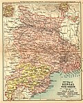
In 1772–1773, the king of Bhutan attacked and captured Cooch Behar. To expel the Bhutanese, the kingdom of Cooch Behar signed a defence treaty with the British East India Company on 5 April 1773. After expelling the Bhutanese, Cooch Behar became a princely kingdom under the protection of British East India company.[11]
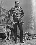
The Victor Jubilee Palace was based on Buckingham Palace and built in 1887, during the reign of Maharaja Nripendra Narayan.[10] In 1878, the maharaja married the daughter of Brahmo preacher Keshab Chandra Sen. This union led to a renaissance in Cooch Behar state.[12] Maharaja Nripendra Narayan is known as the architect of modern Cooch Behar town.[13]
Post Independence
Under an agreement between the kings of Cooch Behar and the Indian Government at the end of British rule, Maharaja Jagaddipendra Narayan transferred full authority, jurisdiction and power of the state to the Dominion Government of India, effective 12 September 1949.[14] Eventually, Cooch Bihar became part of the state of West Bengal on 19 January 1950, with Cooch Behar town as its headquarters.[14]
Geography

Cooch Behar is a district under the Jalpaiguri Division of the state of West Bengal. Cooch Behar is located in the northeastern part of the state and bounded by the district of Jalpaiguri and Alipurduar in the north, Dhubri and Kokrajhar district of Assam in the east and by Bangladesh in the west as well as in the south. The district forms part of the Himalayan Terai of West Bengal.
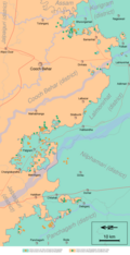
A geopolitical curiosity was that there were 92 Bangladeshi exclaves, with a total area of 47.7 km2 in Cooch-Behar. Similarly, there were 106 Indian exclaves inside Bangladesh, with a total area of 69.5 km2. These were part of the high stake card or chess games centuries ago between two regional kings, the Raja of Cooch Behar and the Maharaja of Rangpur.[15]
Twenty-one of the Bangladeshi exclaves were within Indian exclaves, and three of the Indian exclaves were within Bangladeshi exclaves. The largest Indian exclave was Balapara Khagrabari which surrounded a Bangladeshi exclave, Upanchowki Bhajni, which itself surrounded an Indian exclave called Dahala Khagrabari, of less than one hectare (link to external map here [1]). But all this has ended in the historic India-Bangladesh land agreement. See Indo-Bangladesh enclaves.
Rivers and topography
Cooch Behar is a flat region with a slight southeastern slope along which the main rivers of the district flow. Most of the highland areas are in the Sitalkuchi region and most of the low-lying lands lie in Dinhata region.
The rivers in the district of Cooch Behar generally flow from northwest to southeast. Seven rivers that cut through the district are the Teesta, Jaldhaka, Torsha, Kaljani, Raidak, Sankosh (Gadadhar) and Ghargharia.
Flora and fauna
In 1976 Cooch Behar district became home to the Jaldapara Wildlife Sanctuary (now Jaldapara National Park), which has an area of 217 km2 (83.8 sq mi).[16] It shares the park with Alipurduar district.[16]
Demographics
| Year | Pop. | ±% p.a. |
|---|---|---|
| 1901 | 565,116 | — |
| 1911 | 591,012 | +0.45% |
| 1921 | 590,599 | −0.01% |
| 1931 | 589,053 | −0.03% |
| 1941 | 638,703 | +0.81% |
| 1951 | 668,949 | +0.46% |
| 1961 | 1,019,806 | +4.31% |
| 1971 | 1,414,183 | +3.32% |
| 1981 | 1,771,643 | +2.28% |
| 1991 | 2,171,145 | +2.05% |
| 2001 | 2,479,155 | +1.34% |
| 2011 | 2,819,086 | +1.29% |
| source:[17] | ||
According to the 2011 census Cooch Behar district has a population of 2,819,086,[18] roughly equal to the nation of Jamaica.[19] This gives it a ranking of 136th in India (out of a total of 739).[18] The district has a population density of 833 inhabitants per square kilometre (2,160/sq mi).[18] Its population growth rate over the decade 2001–2011 was 13.86%.[18] Koch Bihar has a sex ratio of 942 females for every 1000 males,[18] and a literacy rate of 75.49%.[18] 10.27% of the population lives in urban areas. Scheduled Castes and Scheduled Tribes make up 1,414,336 (50.17%) and 18,125 (0.64%) of the population respectively. Cooch Behar is the only district in India where Scheduled Castes make up a majority of the population.[20]
Religion
| Religion | Population (1941)[22]:104–105 | Percentage (1941) | Population (2011)[21] | Percentage (2011) |
|---|---|---|---|---|
Hinduism 
|
394,948 | 61.63% | 2,087,766 | 74.05% |
Islam 
|
242,684 | 37.87% | 720,033 | 25.54% |
| Others[lower-alpha 1] | 3,210 | 0.5% | 11,287 | 0.41% |
| Total Population | 640,842 | 100% | 2,819,086 | 100% |
Hinduism is the majority religion. Islam is the minority religion, and is mainly rural. Muslims are a significant minority in Dinhata I (36.98%), Dinhata II (36.68%) and Sitalkuchi (35.31%) blocks.[21]
Language
- Bengali (94.8%)
- 'Other' Bengali (2.01%)
- Rajbongshi (1.31%)
- Hindi (1.17%)
- Others (0.72%)
At the time of the 2011 census, 94.79% of the population spoke Bengali, 1.31% Rajbongshi and 1.17% Hindi as their first language. 2.01% of the population recorded their language as 'Others' under Bengali.[23]
Government and politics
Divisions
Sub-divisions
The district of Cooch Behar comprises five sub-divisions:
- Cooch Behar Sadar subdivision
- Dinhata subdivision
- Mathabhanga subdivision
- Tufanganj subdivision
- Mekhliganj subdivision
Assembly constituencies
As per order of the 2008 Delimitation Commission in respect of the delimitation of constituencies in the West Bengal, the district is divided into 9 assembly constituencies:[24]
Politics
Mekliganj, Mathabhanga, Cooch Behar Uttar, Sitalkuchi and Sitai constituencies are reserved for Scheduled Castes (SC) candidates. Mekhliganj constituency is part of Jalpaiguri (Lok Sabha constituency), which also contains six assembly segments from Jalpaiguri district. Mathabhanga, Cooch Behar Uttar, Cooch Behar Dakshin, Sitalkuchi, Sitai, Dinhata and Natabari constituencies form the Cooch Behar (Lok Sabha constituency), which is reserved for Scheduled Castes (SC). Tufanganj constituency is part of Alipurduars (Lok Sabha constituency), which also contains six assembly segments from Alipurduar and Jalpaiguri districts.
Education
Towns and villages
- Bhetaguri
- Dhalpal
- Maheshwar
- Sajerpar Ghoramara
Geographical indication
Kalonunia rice was awarded the Geographical Indication (GI) status tag from the Geographical Indications Registry under the Union Government of India on 2 January 2024 (valid until 11 March 2034). It is a common and widely cultivated crop in districts of Cooch Behar, Jalpaiguri and Alipurduar along with some parts of Darjeeling & Kalimpong districts of West Bengal.[26][27][28][29]
State Agricultural Management & Extension Training Institute (SAMETI) from Narendrapur, proposed the GI registration of Kalonunia rice. After filing the application in March 2021, the rice was granted the GI tag in 2024 by the Geographical Indication Registry in Chennai, making the name "Kalonunia rice" exclusive to the rice grown in the region.[30] It thus became the third rice variety from West Bengal after Tulaipanji rice and the 26th type of goods from West Bengal to earn the GI tag.
The GI tag protects the rice from illegal selling and marketing, and gives it legal protection and a unique identity.
Notable people
- Abbasi family of Tufanganj
- Abbasuddin Ahmed (1901–1959), musician
- Mustafa Kamal Abbasi (1933–2015), 9th Chief Justice of Bangladesh
- Ferdausi Rahman (born 1941), singer
- Mustafa Zaman Abbasi (1936–2025), musicologist
- Nashid Kamal (born 1958), singer
- Maziruddin Ahmed (born 1898), Cooch Behar politician[31]
- Tamser Ali (born 1953), MLA for Natabari
- Guha family of Dinhata
- Kamal Guha (1928–2007), Agriculture Minister of West Bengal
- Udayan Guha (born 1955), West Bengal cabinet minister
- Fazle Haque (born 1933), former state minister
- Fazal Karim Miah (born 1951), MLA for Tufanganj
- Wakil family of Dinhata (relocated to Bangladesh after partition)
- Hossain Mohammad Ershad (1930–2019), President of Bangladesh
- Saad Ershad (born 1983), businessman
- Mozammel Hossain Lalu (1942–2014), member of the Bangladesh parliament
- Ghulam Mohammad Quader (born 1948), Commerce Minister of Bangladesh
- Merina Rahman (born 1943), member of the Bangladesh parliament
- Hossain Mokbul Shahriar (born 1974), member of the Bangladesh parliament
See also
- Indo-Bangladesh enclaves
- List of enclaves and exclaves
- List of West Bengal districts ranked by literacy rate
References
- ↑ 1.0 1.1 "Fact and Figures". Wb.gov.in. Retrieved 5 July 2019.
- ↑ "52nd Report of the Commissioner for Linguistic Minorities in India" (PDF). Nclm.nic.in. Ministry of Minority Affairs. p. 85. Archived from the original (PDF) on 25 May 2017. Retrieved 5 July 2019.
- ↑ "Cooch Behar District | Cooch Behar – City of Beauty | India". Retrieved 2 May 2025.
- ↑ "Districts having more than 40% SC population in India | Department of Social Justice and Empowerment - Government of India". socialjustice.gov.in. Retrieved 2 May 2025.
- ↑ Pal, Dr. Nripendra Nath (2000). Itikathai Cooch Behar (A brief history of Cooch Behar). Kolkata: Anima Prakashani. pp. 11–12.
- ↑ The name Cooch Behar is a compound of two words: Cooch and Behar. Cooch is a corrupted form of Coch or Koch, the name of an ethnic group of people inhabiting largely in vast tract of land to the north-east of Bengal. Behar or more properly Vihara denotes abode or sport. Cooch Behar means, therefore, the abode or land of the Koches. Ray, B.. CENSUS 1961 WEST BENGAL. GOVERNMENT PRINTING, WEST BENGAL, 1961, p.20
- ↑ Nath, D. (1989), History of the Koch Kingdom, C. 1515-1615, Mittal Publications, pp. 5–6, ISBN 8170991099
- ↑ "Royal History of Cooch Behar". Retrieved 22 October 2006.
- ↑ Pal, Dr. Nripendra Nath (2000). Itikathai Cooch Behar (A brief history of Cooch Behar). Kolkata: Anima Prakashani. p. 68.
- ↑ 10.0 10.1 Bhattacharyya, PK (2012). "Kamata-Koch Behar". In Islam, Sirajul; Jamal, Ahmed A. (eds.). Banglapedia: National Encyclopedia of Bangladesh (Second ed.). Asiatic Society of Bangladesh.
- ↑ Pal, Dr. Nripendra Nath (2000). Itikathai Cooch Behar (A brief history of Cooch Behar). Kolkata: Anima Prakashani. p. 73.
- ↑ Pal, Dr. Nripendra Nath (2000). Itikathai Cooch Behar (A brief history of Cooch Behar). Kolkata: Anima Prakashani. p. 75.
- ↑ "Royal History of Cooch Behar 5". Retrieved 22 October 2006.
- ↑ 14.0 14.1 "Brief Royal History of Cooch Behar 5". Archived from the original on 24 July 2011. Retrieved 22 October 2006.
- ↑ "A Great Divide". Time. 5 February 2009. Archived from the original on 19 April 2011.
- ↑ 16.0 16.1 Indian Ministry of Forests and Environment. "Protected areas: Sikkim". Archived from the original on 23 August 2011. Retrieved 25 September 2011.
- ↑ Decadal Variation In Population Since 1901
- ↑ 18.0 18.1 18.2 18.3 18.4 18.5 "District Census Handbook: Cooch Behar" (PDF). censusindia.gov.in. Registrar General and Census Commissioner of India. 2011.
- ↑ US Directorate of Intelligence. "Country Comparison:Population". Archived from the original on 13 June 2007. Retrieved 1 October 2011.
Jamaica 2,868,380 July 2011 est
- ↑ "Census of India : Scheduled Castes & Scheduled Tribes Population". www.censusindia.gov.in. Retrieved 5 February 2021.
- ↑ 21.0 21.1 21.2 "Table C-01 Population by Religion: West Bengal". censusindia.gov.in. Registrar General and Census Commissioner of India. 2011.
- ↑ "CENSUS OF INDIA, 1941 VOLUME VI BENGAL PROVINCE" (PDF). Retrieved 13 August 2022.
- ↑ 23.0 23.1 "Table C-16 Population by Mother Tongue: West Bengal". www.censusindia.gov.in. Registrar General and Census Commissioner of India.
- ↑ "Press Note, Delimitation Commission" (PDF). Assembly Constituencies in West Bengal. Delimitation Commission. Retrieved 16 November 2008.
- ↑ "Two West Bengal BJP MPs resign as MLAs after directive from party leadership". The New Indian Express. 12 May 2021. Retrieved 8 April 2022.
- ↑ "Bengal's own Gobindabhog and Tulaipanji soon to get a distinct stand on world map". The Indian Express. 2 January 2024. Retrieved 23 November 2024.
- ↑ Khush, Gurdev S.; Hettel, Gene; Rola, Tess (1996). Rice Genetics III: Proceedings of the Third International Rice Genetics Symposium, Manila, Philippines, 16-20 October 1995. Int. Rice Res. Inst. ISBN 978-971-22-0087-8. Retrieved 23 November 2024.
- ↑ Roychoudhury, Aryadeep (29 July 2020). Rice Research for Quality Improvement: Genomics and Genetic Engineering: Volume 2: Nutrient Biofortification and Herbicide and Biotic Stress Resistance in Rice. Springer Nature. ISBN 978-981-15-5337-0. Retrieved 23 November 2024.
- ↑ Sarker, Dilip De; Saha, Manas Ranjan; Saha, Subrata (1 January 2015). Perspective of dietetic and antioxidant medicinal plants. Notion Press. ISBN 978-93-84878-95-5.
- ↑ "Kalonunia Rice". Intellectual Property India. Retrieved 23 November 2024.
- ↑ Who's Who in India. West Bengal Legislative Assembly Secretariat. 1957. p. 71.
- ↑ Including Jainism, Buddhism, Christianity, Zoroastrianism, Judaism, Ad-Dharmis, or not stated
Further reading
- Moore, Lucy (2004) Maharanis: The Extraordinary Tale Of Four Indian Queens And Their Journey From Purdah To Parliament, Penguin, ISBN 0-670-03368-5
External links
Places adjacent to Cooch Behar district | ||||||||||
|---|---|---|---|---|---|---|---|---|---|---|
| ||||||||||


Cities and towns in Cooch Behar district | |||||||||||
|---|---|---|---|---|---|---|---|---|---|---|---|
| Cities, municipal and census towns |
| ||||||||||
| Locations other than cities and towns |
| ||||||||||
| Related topics | |||||||||||


| Central India | (Madhya Pradesh/Uttar Pradesh) (Madhya Pradesh/Uttar Pradesh) (Chhattisgarh/Madhya Pradesh/Maharashtra/Odisha/Telangana) (Madhya Pradesh) (Madhya Pradesh) (Madhya Pradesh) |  |
|---|---|---|
| East India | ||
| North India | (Uttar Pradesh) (Uttar Pradesh) (Uttar Pradesh) (Jammu and Kashmir) (Jammu and Kashmir) (Jammu and Kashmir) (Uttar Pradesh) | |
| Northeast India | (Assam/Manipur) (Assam) (Mizoram) (Assam/Nagaland) (Meghalaya) (Assam) (Tripura) | |
| South India | (Karnataka) (Karnataka) (Karnataka) (Tamil Nadu) (Puducherry) (Kerala) (Andhra Pradesh) (Karnataka/Kerala) | |
| West India | (Maharashtra) (Goa/Karnataka/Maharashtra) (Gujarat) (Maharashtra) (Rajasthan) (Gujarat) (Maharashtra) | |

![[1]](http://geosite.jankrogh.com/enklaver/CoochBehar_Annotated.jpg)
.png)