Leh district | |
|---|---|
 View of Leh Town | |
![A map showing Indian-administered Ladakh (shaded in tan in the disputed Kashmir region[1]](/wiki/File:Kashmir_region._LOC_2003626427_-_showing_sub-regions_administered_by_different_countries.jpg) | |
| Coordinates (Leh): 33°38′N 77°46′E / 33.633°N 77.767°E | |
| Administering country | India |
| Union Territory | Ladakh |
| Headquarters | Leh |
| Established | 1 July 1979 |
| Headquarters | Leh |
| Tehsils | Leh, Khaltsi, Nyoma, Kharu, Diskit Nubra, Saspol, Durbuk and Sumoor |
| Government | |
| • Deputy Commissioner | Sh. Romil Singh Donk IAS |
| • Chief Executive Councillor | post vacant since {1st november} |
| • Lok Sabha Constituency | Ladakh |
| • MP | Mohmad Haneefa[2] |
| Area | |
| • Total | 45,110 km2 (17,420 sq mi) |
| Population (2011) | |
| • Total | 133,487 |
| • Density | 3.0/km2 (7.7/sq mi) |
| • Urban | 45,671 |
| Demographics | |
| • Literacy | 77.2% |
| • Sex ratio | 690 ♀/ 1000 ♂ |
| Languages | |
| • Official | Hindi, English |
| • Spoken | Ladakhi, Balti, Brokskat, Tibetan, Hindi/Urdu |
| Time zone | UTC+05:30 (IST) |
| Vehicle registration | JK 10 (till 2019) LA-02 |
| Website | leh |
Leh district is a district in Indian-administered Ladakh in the disputed Kashmir-region.[1] Ladakh is an Indian-administered union territory. With an area of 45,110 km2, it is the second largest district in the country, second only to Kutch. It is bounded on the north by Gilgit-Baltistan's Kharmang and Ghanche districts and Xinjiang's Kashgar Prefecture and Hotan Prefecture, to which it connects via the historic Karakoram Pass. Aksai Chin and Tibet are to the east, Kargil district to the west, and Lahul and Spiti to the south. The district headquarters is in Leh. It lies between 32 and 36 degree north latitude and 75 to 80 degree east longitude.
All of Ladakh was under the administration of Leh until 1 July 1979, when the Kargil and Leh administrative districts were created. Religion has been a source of grievance between Buddhists and Muslims since the late 20th century and contributed to this division.[3]
In 2017, the district was declared a tobacco-free zone. The Directorate of Health Services Kashmir, under the National Tobacco Control Programme, began working towards the designation early in 2017 and the status was declared in August. Rehana Kousar (in-charge, NTCP, Kashmir) said that work was done with civil society, religious and women's groups and that a "major success was achieved by the involvement of women in the anti-tobacco campaign."[4]
In August 2019, the Parliament of India passed the act that contained provisions to make Leh a district of the new union territory of Ladakh, which was formed 31 October 2019.[5]
Administration[edit | edit source]
Leh district has seven sub-divisions and eight tehsils. The sub-divisions are: Nubra, Durbuk (Durbok), Khalatse (Khaltsi/Khalsi), Leh, Kharoo, Likir, Nyoma.[6] The tehsils are: Sumoor, Diskit, Durbuk, Khalatse, Saspol, Leh, Kharoo, and Nyoma.[7]
As a result of The Jammu and Kashmir Reorganisation (Removal of Difficulties) Second Order, 2019, Leh district claimed de jure jurisdiction over the following areas of Pakistani-administered Kashmir: Gilgit, Gilgit Wazarat, Chilas, and Tribal territory.[8]
The Ladakh Autonomous Hill Development Council, Leh (LAHDC Leh) is the Autonomous District Council that administers the Leh district.[9]
Demographics[edit | edit source]
According to the 2011 census Leh district had a population of 133,487,[12] roughly equal to the nation of Saint Lucia.[13] This gives it a ranking of 609th in India (out of a total of 640).[citation needed] The district has a population density of 3 inhabitants per square kilometre (7.8/sq mi). Its population growth rate over the decade 2001-2011 was 13.87%, (it was 30.15% for 1991–2001).[citation needed] Leh has a sex ratio of 690 females for every 1000 males (this varies with religion), and a literacy rate of 77.2%.[citation needed]
Religion[edit | edit source]
| Leh district: religion, gender ratio, and % urban of population, according to the 2011 Census.[11] | |||||||||
|---|---|---|---|---|---|---|---|---|---|
| Hindu | Muslim | Christian | Sikh | Buddhist | Jain | Other | Not stated | Total | |
| Total | 22,882 | 19,057 | 658 | 1,092 | 88,635 | 103 | 54 | 1,006 | 133,487 |
| 17.14% | 14.28% | 0.49% | 0.82% | 66.40% | 0.08% | 0.04% | 0.75% | 100.00% | |
| Male | 21,958 | 10,493 | 469 | 1,018 | 44,019 | 49 | 29 | 936 | 78,971 |
| Female | 924 | 8,564 | 189 | 74 | 44,616 | 54 | 25 | 70 | 54,516 |
| Gender ratio (% female) | 4.0% | 44.9% | 28.7% | 6.8% | 50.3% | 52.4% | 46.3% | 7.0% | 40.8% |
| Sex ratio (no. females per 1,000 males) |
42 | 816 | 403 | 73 | 1,014 | – | – | 75 | 690 |
| Urban | 14,542 | 5,169 | 358 | 927 | 24,023 | 24 | 53 | 575 | 45,671 |
| Rural | 8,340 | 13,888 | 300 | 165 | 64,612 | 79 | 1 | 431 | 87,816 |
| % Urban | 63.6% | 27.1% | 54.4% | 84.9% | 27.1% | 23.3% | 98.1% | 57.2% | 34.2% |
Languages[edit | edit source]
Ladakhi is the most spoken language, and Hindi/Urdu is the second-largest language, mainly spoken in Leh. Balti is found in Nubra near the boundary with Gilgit-Baltistan. Tibetan, Punjabi, Marathi and Nepali are all mainly spoken in Leh. Urdu and English are widely understood in Leh.[3]
Politics[edit | edit source]
Parliamentary Constituency[edit | edit source]
The district falls under Ladakh (Lok Sabha constituency). The present Member of Parliament (MP) of Ladakh is Mohmad Haneefa (independent candidate).
Autonomous Hill Council[edit | edit source]
Leh District is administered by an elected body known as the Ladakh Autonomous Hill Development Council, Leh. The LAHDC was established in 1995.[15]
The latest elections were held in October 2020. The BJP secured 15 seats while the INC won 9 and the Independents won 2.
Transportation[edit | edit source]
Road[edit | edit source]
Leh is connected to the rest of India by two high-altitude roads both of which are subject to landslides and neither of which are passable in winter when covered by deep snows. The National Highway 1D from Srinagar via Kargil is generally open longer. The Leh-Manali Highway can be troublesome due to very high passes and plateaus, and the lower but landslide-prone Rohtang Pass near Manali. The third road axis is under construction.
The overland approach to Ladakh from the Kashmir valley via the 434-km. National Highway 1 typically remains open for traffic from June to October/November. The most dramatic part of this road journey is the ascent up the 3,505 m (11,500 ft.) high Zoji-la, a tortuous pass in the Great Himalayan Wall. The Jammu and Kashmir State Road Transport Corporation (JKSRTC) operates regular Deluxe and Ordinary bus services between Srinagar and Leh on this route with an overnight halt at Kargil. Taxis (cars and jeeps) are also available at Srinagar for the journey.
Since 1989, the 473-km Leh-Manali Highway has been serving as the second land approach to Ladakh. Open for traffic from June to late October, this high road traverses the upland desert plateaux of Rupsho whose altitude ranges from 3,660 m to 4,570 m. There are a number of high passes en route among which the highest one, known as Tanglang La, is sometimes (but incorrectly) claimed to be the world's second-highest motorable pass at an altitude of 5,325 m. (17,469 feet).[16]
This is the third road axis to Leh. It is currently under construction.
Air[edit | edit source]

Leh's Leh Kushok Bakula Rimpochee Airport has flights to Delhi at least daily on Air India which also provides twice-weekly services to Jammu and a weekly flight to Srinagar. Passengers connect in Delhi for other destinations. Go First operates Delhi to Leh daily flights during peak time.
Rail[edit | edit source]
There is no railway service currently in Ladakh, however, 2 railway routes are proposed- the Bhanupli–Leh line and Srinagar–Kargil–Leh line.[17]
Gallery[edit | edit source]
-
 Indus River Valley in Thiksey
 -
 Indus Valley in Leh
 -
 Khardung La pass in Ladakh Range
 -
 Rock formations along Leh-Manali Highway
 -
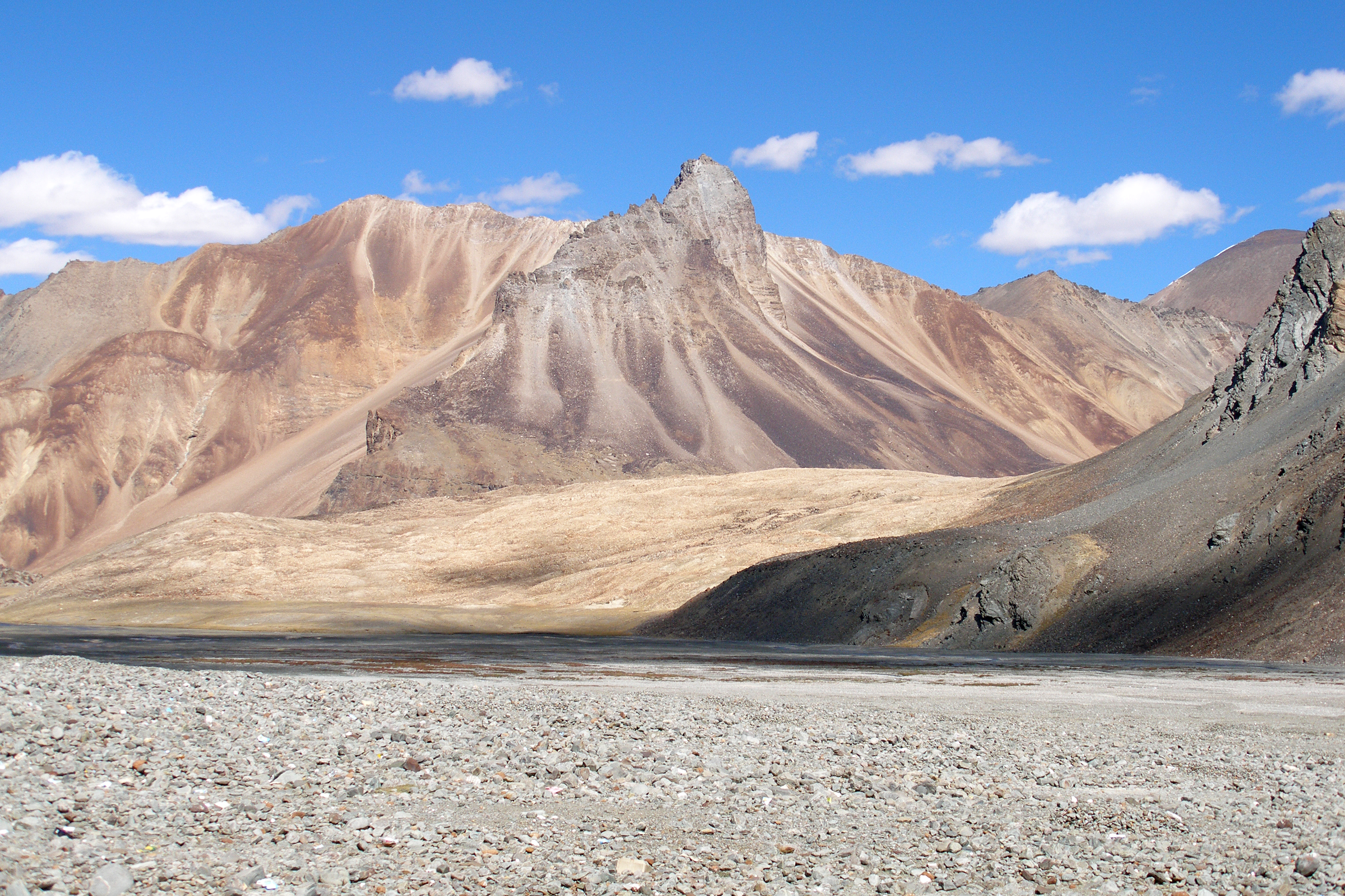
 Mountain peaks around Leh
 -
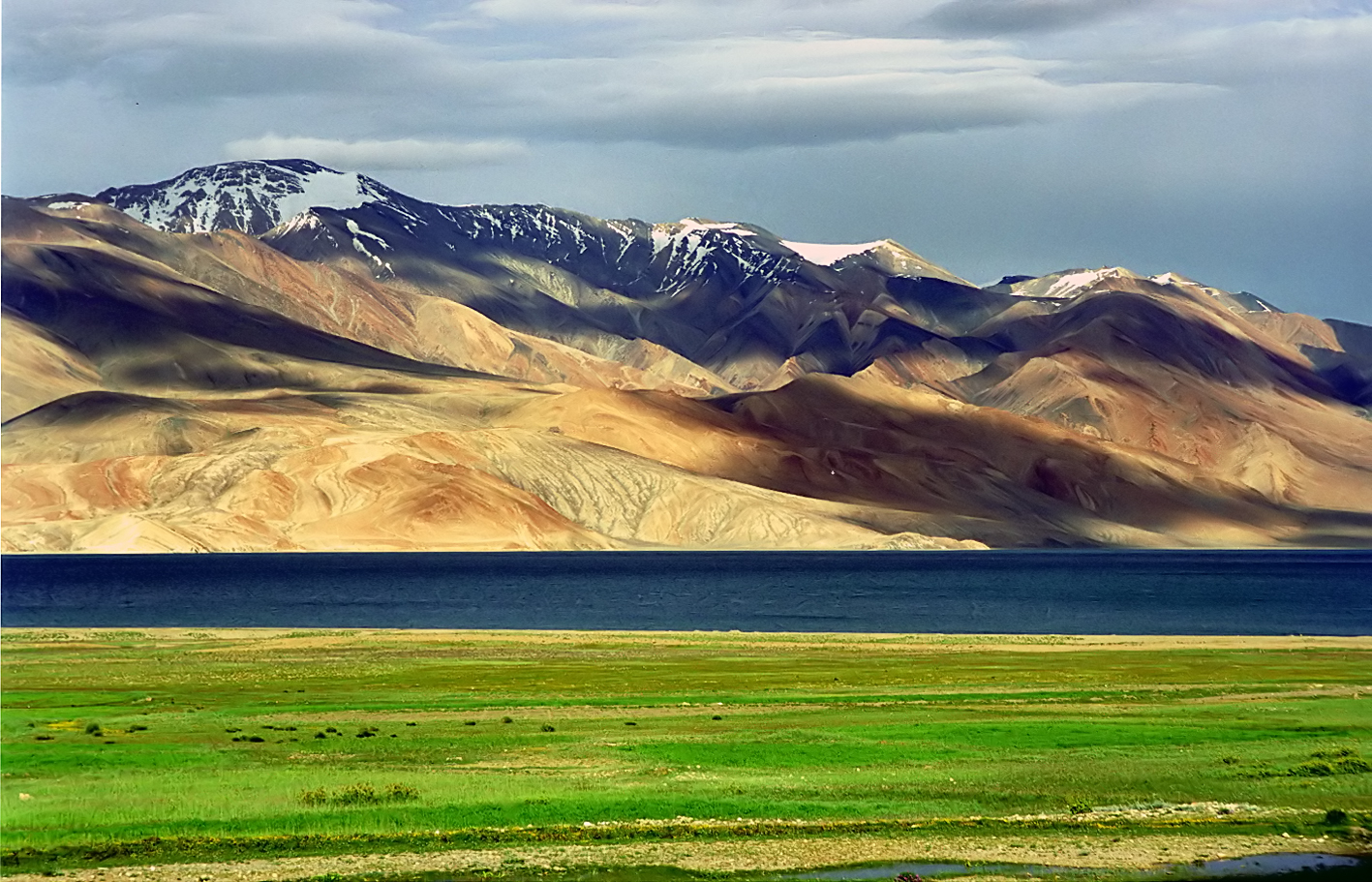 Tsomoriri lake
 -
 Pangong lake
 -
 Leh district flower fields and mountains


,_Mountains,_Indus_River_Valley,_Ladakh,_North_India,_Himalayas.jpg)


.jpg)
See also[edit | edit source]
References[edit | edit source]
- ↑ 1.0 1.1 1.2 The application of the term "administered" to the various regions of Kashmir and a mention of the Kashmir dispute is supported by the tertiary sources (a) through (e), reflecting due weight in the coverage. Although "controlled" and "held" are also applied neutrally to the names of the disputants or to the regions administered by them, as evidenced in sources (h) through (i) below, "held" is also considered politicized usage, as is the term "occupied," (see (j) below).
(a) Kashmir, region Indian subcontinent, Encyclopaedia Britannica, retrieved 15 August 2019 (subscription required) Quote: "Kashmir, region of the northwestern Indian subcontinent ... has been the subject of dispute between India and Pakistan since the partition of the Indian subcontinent in 1947. The northern and western portions are administered by Pakistan and comprise three areas: Azad Kashmir, Gilgit, and Baltistan, the last two being part of a territory called the Northern Areas. Administered by India are the southern and southeastern portions, which constitute the state of Jammu and Kashmir but are slated to be split into two union territories.";
(b) Pletcher, Kenneth, Aksai Chin, Plateau Region, Asia, Encyclopaedia Britannica, retrieved 16 August 2019 (subscription required) Quote: "Aksai Chin, Chinese (Pinyin) Aksayqin, portion of the Kashmir region, at the northernmost extent of the Indian subcontinent in south-central Asia. It constitutes nearly all the territory of the Chinese-administered sector of Kashmir that is claimed by India to be part of the Ladakh area of Jammu and Kashmir state.";
(c) "Kashmir", Encyclopedia Americana, Scholastic Library Publishing, 2006, p. 328, ISBN 978-0-7172-0139-6 C. E Bosworth, University of Manchester Quote: "KASHMIR, kash'mer, the northernmost region of the Indian subcontinent, administered partlv by India, partly by Pakistan, and partly by China. The region has been the subject of a bitter dispute between India and Pakistan since they became independent in 1947";
(d) Osmańczyk, Edmund Jan (2003), Encyclopedia of the United Nations and International Agreements: G to M, Taylor & Francis, pp. 1191–, ISBN 978-0-415-93922-5 Quote: "Jammu and Kashmir: Territory in northwestern India, subject to a dispute between India and Pakistan. It has borders with Pakistan and China."
(e) Talbot, Ian (2016), A History of Modern South Asia: Politics, States, Diasporas, Yale University Press, pp. 28–29, ISBN 978-0-300-19694-8 Quote: "We move from a disputed international border to a dotted line on the map that represents a military border not recognized in international law. The line of control separates the Indian and Pakistani administered areas of the former Princely State of Jammu and Kashmir.";
(f) Skutsch, Carl (2015) [2007], "China: Border War with India, 1962", in Ciment, James (ed.), Encyclopedia of Conflicts Since World War II (2nd ed.), London and New York: Routledge, p. 573, ISBN 978-0-7656-8005-1,The situation between the two nations was complicated by the 1957–1959 uprising by Tibetans against Chinese rule. Refugees poured across the Indian border, and the Indian public was outraged. Any compromise with China on the border issue became impossible. Similarly, China was offended that India had given political asylum to the Dalai Lama when he fled across the border in March 1959. In late 1959, there were shots fired between border patrols operating along both the ill-defined McMahon Line and in the Aksai Chin.
(g) Clary, Christopher, The Difficult Politics of Peace: Rivalry in Modern South Asia, Oxford and New York: Oxford University Press, p. 109, ISBN 9780197638408,Territorial Dispute: The situation along the Sino-Indian frontier continued to worsen. In late July (1959), an Indian reconnaissance patrol was blocked, "apprehended," and eventually expelled after three weeks in custody at the hands of a larger Chinese force near Khurnak Fort in Aksai Chin. ... Circumstances worsened further in October 1959, when a major class at Kongka Pass in eastern Ladakh led to nine dead and ten captured Indian border personnel, making it by far the most serious Sino-Indian class since India's independence.
(h) Bose, Sumantra (2009), Kashmir: Roots of Conflict, Paths to Peace, Harvard University Press, pp. 294, 291, 293, ISBN 978-0-674-02855-5 Quote: "J&K: Jammu and Kashmir. The former princely state that is the subject of the Kashmir dispute. Besides IJK (Indian-controlled Jammu and Kashmir. The larger and more populous part of the former princely state. It has a population of slightly over 10 million, and comprises three regions: Kashmir Valley, Jammu, and Ladakh.) and AJK ('Azad" (Free) Jammu and Kashmir. The more populous part of Pakistani-controlled J&K, with a population of approximately 2.5 million.), it includes the sparsely populated "Northern Areas" of Gilgit and Baltistan, remote mountainous regions which are directly administered, unlike AJK, by the Pakistani central authorities, and some high-altitude uninhabitable tracts under Chinese control."
(i) Fisher, Michael H. (2018), An Environmental History of India: From Earliest Times to the Twenty-First Century, Cambridge University Press, p. 166, ISBN 978-1-107-11162-2 Quote: "Kashmir’s identity remains hotly disputed with a UN-supervised “Line of Control” still separating Pakistani-held Azad (“Free”) Kashmir from Indian-held Kashmir.";
(j) Snedden, Christopher (2015), Understanding Kashmir and Kashmiris, Oxford University Press, p. 10, ISBN 978-1-84904-621-3 Quote:"Some politicised terms also are used to describe parts of J&K. These terms include the words 'occupied' and 'held'." - ↑ "Lok Sabha Members". Lok Sabha. Retrieved 12 July 2021.
- ↑ 3.0 3.1 "Muslim Precedence Politics - How it operates in Ladakh". Kashmir Sentinel. August 2002. Archived from the original on 6 October 2008.
- ↑ "Leh Declared Tobacco-Free". The Tribune India. Retrieved 24 August 2017.
- ↑ "Article 370 revoked Updates: Jammu & Kashmir is now a Union Territory, Lok Sabha passes bifurcation bill". Business Today. 6 August 2019.
- ↑ "Subdivisions & Blocks". District Leh - Ladakh.
- ↑ Leh tehsils.
- ↑ "J&K Reorganisation (Removal of Difficulties) Second Order, 2019 -- [Territory of Leh district shall constitute, Gilgit, Gilgit Wazarat, Chilas, Tribal territory & 'Leh & Ladakh' except present territory of Kargil]". 2 November 2019.
- ↑ "Ladakh Autonomous Hill development Council act 1997" (PDF). Retrieved 26 January 2021.
- ↑ "Villages | District Leh, Union Territory of Ladakh | India". District Leh - Ladakh – Government of India. Retrieved 24 December 2020.
{{cite web}}: CS1 maint: deprecated archival service (link) - ↑ 11.0 11.1 11.2 C-1 Population By Religious Community – Jammu & Kashmir (Report). Office of the Registrar General & Census Commissioner, India. Retrieved 28 July 2020.
- ↑ "Leh district census data 2011" (PDF). Retrieved 20 February 2019.
- ↑ US Directorate of Intelligence. "Country Comparison:Population". Archived from the original on 13 June 2007. Retrieved 1 October 2011.
Saint Lucia 161,557 July 2011 est.
- ↑ C-16 Population By Mother Tongue – Jammu & Kashmir (Report). Office of the Registrar General & Census Commissioner, India. Retrieved 18 July 2020.
- ↑ "Ladakh Autonomous Hill Development Council, Leh". Leh. Archived from the original on 30 October 2007. Retrieved 6 December 2007.
- ↑ See the article on Khardung La for a discussion of the world's highest motorable passes.
- ↑ "Himachal CM meets Union railway minister, seeks 100% Centre funding for Bhanupali-Bilaspur-Leh rail line". Hindustan Times. Retrieved 9 November 2020.
External links[edit | edit source]
- Official Website of Ladakh Autonomous Hill Development Council, Leh
- Leh tehsil map, Maps of India
- Ladakh Tourism Guide - Photo Gallery of Leh, Monasteries in Leh, NGO's in Leh, Important Phone #.
- Shaam Region in Leh (not to be confused with the Middle Eastern region)
Places adjacent to Leh district | |
|---|---|
| History |
| ||||||||||||||||||
|---|---|---|---|---|---|---|---|---|---|---|---|---|---|---|---|---|---|---|---|
| Administration | |||||||||||||||||||
| Geography |
| ||||||||||||||||||
| Human settlements | |||||||||||||||||||
| Culture |
| ||||||||||||||||||
| Tourism and wildlife |
| ||||||||||||||||||
| Transport |
| ||||||||||||||||||
| Infrastructure |
| ||||||||||||||||||
| See also |
| ||||||||||||||||||