








WikiDwarfBOT (talk | contribs) Cleanup: Source modification. Information added. |
m Refined content and updated sections |
||
| Line 1: | Line 1: | ||
{{About|the municipality in West Bengal, India|the district|Cooch Behar district|the princely state|Cooch Behar State}} | {{About|the municipality in West Bengal, India|the district|Cooch Behar district|the princely state|Cooch Behar State}} | ||
{{ | {{Use Indian English|date=February 2026}} | ||
{{Use dmy dates|date= | {{Use dmy dates|date=February 2026}} | ||
{{Infobox settlement | {{Infobox settlement | ||
| name | | name = Cooch Behar | ||
| official_name | | official_name = | ||
| other_name | | other_name = Koch Bihar | ||
| settlement_type | | settlement_type = [[City]] | ||
| image_skyline | | image_skyline = {{multiple image | ||
| | | border = infobox | ||
| | | total_width = 300 | ||
| | | image_style = | ||
| perrow = 1/2/3/2 | |||
| | | caption_align = center | ||
| | | image1 = | ||
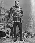
| nickname | | caption1 = [[Cooch Behar Palace]] | ||
| pushpin_map | | image2 = | ||
| pushpin_relief | | caption2 = [[Madan Mohan Temple, Cooch Behar|Madanmohan Temple]] | ||
| pushpin_map_alt | | image3 = | ||
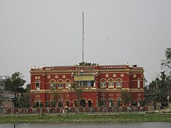
| pushpin_map_caption | | caption3 = [[Acharya Brojendra Nath Seal College|ABN Seal College]] | ||
| pushpin_label_position | | image4 = | ||
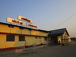
| coordinates | | caption4 = [[Cooch Behar railway station| Cooch Behar Railway Museum]] | ||
| subdivision_type | | image5 = | ||
| subdivision_name | | caption5 = [[Torsa River|Banks of the river Torsa]] | ||
| subdivision_type1 | | image6 = | ||
| subdivision_type2 | | caption6 = [[Suniti Academy|Sunity Academy]] | ||
| subdivision_name1 | | image7 = Sagar Dighi, Coochbehar.jpg | ||
| subdivision_name2 | | caption7 = Sagar Dighi Lake | ||
| established_title | | image8 = Parijat Villa at Cooch Behar Town located under Cooch Behar district in West Bengal 01.jpg | ||
| established_date | | caption8 = Parijat Villa}} | ||
| founder | | image_alt = | ||
| named_for | | image_caption = | ||
| government_type | | image_blank_emblem = | ||
| governing_body | | blank_emblem_type = | ||
| leader_title | | blank_emblem_size = 150px | ||
| leader_name | | nickname = | ||
| unit_pref | | mapframe = yes | ||
| area_footnotes | | mapframe-zoom = 8 | ||
| area_total_km2 | | mapframe-point = none | ||
| area_rank | | map_caption = Location of Cooch Behar city in Coochbehar district | ||
| elevation_footnotes | | pushpin_map = India West Bengal#India | ||
| elevation_m | | pushpin_relief = | ||
| population_total | | pushpin_map_alt = | ||
| population_as_of | | pushpin_map_caption = Location in West Bengal, India | ||
| population_footnotes | | pushpin_label_position = left | ||
| population_density_km2 | | coordinates = {{coord|26|19|27.084|N|89|27|3.6|E|display=inline,title}} | ||
| population_metro | | subdivision_type = Country | ||
| population_rank | | subdivision_name = {{flag|India}} | ||
| population_demonym | | subdivision_type1 = State | ||
| demographics_type1 | | subdivision_type2 = [[List of districts of India|District]] | ||
| demographics1_title1 | | subdivision_name1 = {{flagicon image|}} [[West Bengal]] | ||
| demographics1_info1 | | subdivision_name2 = [[Cooch Behar district|Cooch Behar]] | ||
| demographics1_title2 | | established_title = <!-- Established --> | ||
| demographics1_info2 | | established_date = 12 September 1949 | ||
| demographics1_title3 | | founder = | ||
| demographics1_info3 | | named_for = | ||
| timezone1 | | government_type = [[Municipal Corporations in India|Municipality]] | ||
| utc_offset1 | | governing_body = Cooch Behar Municipality | ||
| postal_code_type | | leader_title = Chairman | ||
| postal_code | | leader_name = [[Rabindra Nath Ghosh]] ([[All India Trinamool Congress]]) | ||
| area_code | | unit_pref = Metric | ||
| area_code_type | | area_footnotes = <ref>{{cite web|title=Cooch Behar City|url=http://coochbeharmunicipality.com/content.php?id=5|website=coochbeharmunicipality.com|access-date=26 November 2020|archive-date=15 February 2020|archive-url=https://web.archive.org/web/20200215214246/http://coochbeharmunicipality.com/content.php?id=5|url-status=live}}</ref> | ||
| registration_plate | | area_total_km2 = 8.29 | ||
| blank1_name_sec1 | | area_rank = | ||
| blank1_info_sec1 | | elevation_footnotes = | ||
| website | | elevation_m = | ||
| footnotes | | population_total = 77,935 | ||
| blank2_name_sec1 | | population_as_of = 2011 | ||
| blank2_info_sec1 | | population_footnotes = <ref>{{Cite web |title=Demography {{!}} Cooch Behar District {{!}} India |url=https://coochbehar.gov.in/demography/ |access-date=1 May 2023 |language=en-US}}</ref> | ||
| population_density_km2 = 832 | |||
| population_metro = | |||
| population_rank = | |||
| population_demonym = | |||
| demographics_type1 = Languages | |||
| demographics1_title1 = Official | |||
| demographics1_info1 = [[Bengali language|Bengali]]<ref name="wblangoff">{{cite web|title=Fact and Figures|url=https://wb.gov.in/portal/web/guest/facts-and-figures;jsessionid=JzdD9RHb7aMY5esZPtcsIVLy|website=wb.gov.in|access-date=15 January 2019|archive-date=14 June 2020|archive-url=https://web.archive.org/web/20200614062657/https://wb.gov.in/404-page.aspx?aspxerrorpath=%2Fportal%2Fweb%2Fguest%2F404-page.aspx|url-status=live}}</ref><ref>{{cite web|title=52nd Report of the Commissioner for Linguistic Minorities in India|url=http://nclm.nic.in/shared/linkimages/NCLM52ndReport.pdf|website=nclm.nic.in|publisher=[[Ministry of Minority Affairs]]|access-date=2 March 2019|page=85|url-status=dead|archive-url=https://web.archive.org/web/20170525141614/http://nclm.nic.in/shared/linkimages/NCLM52ndReport.pdf|archive-date=25 May 2017}}</ref> | |||
| demographics1_title2 = Additional official | |||
| demographics1_info2 = English,<ref name="wblangoff"/> [[Rajbongshi (language)|Rajbongshi]]<ref>{{cite magazine |last=PTI |date=28 February 2018 |title=Kamtapuri, Rajbanshi make it to list of official languages in |url=https://www.indiatoday.in/pti-feed/story/kamtapuri-rajbanshi-make-it-to-list-of-official-languages-in-1179890-2018-02-28 |magazine=India Today |access-date=11 October 2023}}</ref> | |||
| demographics1_title3 = Regional | |||
| demographics1_info3 = Bengali, Rajbongshi | |||
| timezone1 = [[Indian Standard Time|IST]] | |||
| utc_offset1 = +5:30 | |||
| postal_code_type = [[Postal Index Number|PIN]] | |||
| postal_code = 736101<ref>{{cite web |title=Head Post Office Coochbehar |url=https://coochbehar.gov.in/public-utility-category/postal/ |website=Cooch Behar District - India |access-date=10 February 2026}}</ref> | |||
| area_code = 03582 | |||
| area_code_type = Telephone code | |||
| registration_plate = WB-64/63 | |||
| blank1_name_sec1 = [[Lok Sabha]] constituency | |||
| blank1_info_sec1 = [[Cooch Behar (Lok Sabha constituency)|Cooch Behar (SC)]] | |||
| website = {{URL|coochbehar.gov.in}} {{URL|coochbeharmunicipality.com}} | |||
| footnotes = | |||
| blank2_name_sec1 = [[Vidhan Sabha]] constituency | |||
| blank2_info_sec1 = [[Cooch Behar Uttar (Vidhan Sabha constituency)|Cooch Behar Uttar (SC)]], [[Cooch Behar Dakshin (Vidhan Sabha constituency)|Cooch Behar Dakshin]], [[Natabari (Vidhan Sabha constituency)|Natabari]] | |||
}} | }} | ||
[[File:ADMINISTRATIVE MAP.jpg|thumb|Administrative map of Cooch Behar]] | [[File:ADMINISTRATIVE MAP.jpg|thumb|Administrative map of Cooch Behar]] | ||
'''Cooch Behar''' ({{ | '''Cooch Behar''' ({{IPA|bn|kot͡ʃ biɦar}}), also known as '''Koch Bihar''', is a city in the [[India]]n state of [[West Bengal]] and it stands on bank of the [[Torsa River|Torsa river]].<ref>[https://www.anandabazar.com/west-bengal/north-bengal/flood-prone-at-uttarbanga-after-continious-rain-1.60068 Torsa river bank in Cooch Behar]</ref> The city is the headquarters of the [[Cooch Behar district]].<ref>{{Cite web |title=Cooch Behar District {{!}} Cooch Behar – City of Beauty {{!}} India |url=https://coochbehar.gov.in/ |access-date=22 April 2025 |language=en-US}}</ref> During the [[British Raj]], Cooch Behar was the seat of the [[princely state]] of [[Cooch Behar State|Cooch Behar]].<ref>{{Cite web |last=Rathore |first=Abhinay |date=5 January 1954 |title=Cooch Behar (Princely State) |url=https://www.indianrajputs.com/view/cooch_behar |access-date=22 April 2025 |website=Rajput Provinces of India |language=en}}</ref> In the [[North Bengal]] region, the only planned city with royal heritage is Cooch Behar. The city is a popular tourist destination and cultural hub in [[Bengal]].<ref>{{Cite web |title=History {{!}} District Court, Cooch Behar {{!}} India |url=https://coochbehar.dcourts.gov.in/about-department/history/#:~:text=Cooch%20Behar%20is%20the%20only,been%20declared%20a%20heritage%20town. |access-date=22 April 2025 |language=en-US}}</ref> | ||
During the [[British Raj]], Cooch Behar was the seat of the [[princely state]] of [[Cooch Behar State| | |||
==Etymology== | ==Etymology== | ||
{{main| Etymology of Cooch Behar}} | {{main| Etymology of Cooch Behar}} | ||
The name ''Cooch Behar'' is derived from two words—''Cooch'', a corrupted form of the word ''Koch'', the name of the [[Koch people|Koch]] tribes, and the word '' | The name ''Cooch Behar'' is derived from two words—'' Cooch'', a corrupted form of the word ''Koch'', the name of the [[Koch people|Koch]] tribes, and the word ''Behar'' is derived from ''[[vihara]]'' meaning ''land or settlement.'' Koch Behar means ''land of the [[Koch people|Koches]]''.<ref>{{cite book |last= Pal |first= Dr. Nripendra Nath |title= Itikathai Cooch Behar (A brief history of Cooch Behar) |year=2000 |publisher=Anima Prakashani |location=Kolkata | pages = 11–12}}</ref><ref>The name Cooch Behar is a compound of two words: Cooch and Behar. Cooch is a corrupted form of Coch or Koch, the name of an ethnic group inhabiting a vast tract of land to the northeast of Bengal. Behar or, more properly, Vihara denotes abode or sport. Cooch Behar means, therefore, the abode or land of the Koches. Ray, B.. [http://lsi.gov.in:8081/jspui/bitstream/123456789/5164/1/22881_1961_COO.pdf ''CENSUS 1961 WEST BENGAL''] {{Webarchive|url=https://web.archive.org/web/20221012025513/http://lsi.gov.in:8081/jspui/bitstream/123456789/5164/1/22881_1961_COO.pdf |date=12 October 2022 }}. GOVERNMENT PRINTING, WEST BENGAL, 1961, p.20</ref> | ||
==History== | ==History== | ||
| Line 82: | Line 104: | ||
===Early period=== | ===Early period=== | ||
{{more citations needed section|date=June 2024}} | |||
{{main|Koch dynasty|Kamarupa Kingdom}} | {{main|Koch dynasty|Kamarupa Kingdom}} | ||
Cooch Behar formed part of the [[Kamarupa Kingdom]] of Assam from the 4th to the 12th. In the 13th century, the area became a part of the [[Kamata Kingdom]]. The [[Khen dynasty|Khen]]s ruled until about 1498 [[Common Era|CE]], when they fell to [[Alauddin Hussain Shah]], the independent | Cooch Behar formed part of the [[Kamarupa Kingdom]] of Assam from the 4th to the 12th. In the 13th century, the area became a part of the [[Kamata Kingdom]]. The [[Khen dynasty|Khen]]s ruled until about 1498 [[Common Era|CE]], when they fell to [[Alauddin Hussain Shah]], the independent Sultan of [[Gaur, West Bengal|Gour]]. The new invaders fought with the local [[Bhuyan chieftains]] and the [[Ahom kingdom|Ahom]] king [[Suhungmung]] and lost control of the region. During this time, the Koch tribe became very powerful, proclaimed itself ''Kamateshwar'' (Lord of Kamata), and established the Koch dynasty.{{citation needed|date=June 2024}} | ||
The first important Koch ruler was Bisu, later called [[Biswa Singha]], who came to power in 1515 CE.<ref>{{Citation|url=https://books.google.com/books?id=ECxUOSudNGYC|last=Nath|first=D.|title=History of the Koch Kingdom, C. 1515-1615|pages=5–6|publisher=Mittal Publications|year=1989|isbn=8170991099|access-date=3 May 2023|archive-date=3 May 2023|archive-url=https://web.archive.org/web/20230503105404/https://books.google.com/books?id=ECxUOSudNGYC|url-status=live}}</ref> Under his son, [[Nara Narayan]], the Kamata Kingdom reached its zenith.<ref>{{cite web |url=http://coochbehar.gov.in/HTMfiles/royal_history.html |title=Royal History of Cooch Behar |access-date=22 October 2006 |archive-date=21 July 2011 |archive-url=https://web.archive.org/web/20110721161510/http://coochbehar.gov.in/HTMfiles/royal_history.html |url-status=live }}</ref> Nara Narayan's younger brother, Shukladhwaj ([[Chilarai]]), was a noted military general who undertook expeditions to expand the kingdom. He became governor of its eastern portion. | The first important Koch ruler was Bisu, later called [[Biswa Singha]], who came to power in 1515 CE.<ref>{{Citation|url=https://books.google.com/books?id=ECxUOSudNGYC|last=Nath|first=D.|title=History of the Koch Kingdom, C. 1515-1615|pages=5–6|publisher=Mittal Publications|year=1989|isbn=8170991099|access-date=3 May 2023|archive-date=3 May 2023|archive-url=https://web.archive.org/web/20230503105404/https://books.google.com/books?id=ECxUOSudNGYC|url-status=live}}</ref> Under his son, [[Nara Narayan]], the Kamata Kingdom reached its zenith.<ref>{{cite web |url=http://coochbehar.gov.in/HTMfiles/royal_history.html |title=Royal History of Cooch Behar |access-date=22 October 2006 |archive-date=21 July 2011 |archive-url=https://web.archive.org/web/20110721161510/http://coochbehar.gov.in/HTMfiles/royal_history.html |url-status=live }}</ref> Nara Narayan's younger brother, Shukladhwaj ([[Chilarai]]), was a noted military general who undertook expeditions to expand the kingdom. He became governor of its eastern portion. | ||
As the early capital of the Koch Kingdom, Koch Behar's location was not static and became stable only when shifted to Cooch Behar town. Rup Narayan, on the advice of an unknown saint, transferred the capital from Attharokotha to [[Guriahati]] (now called Cooch Behar town) on the banks of the [[Torsa river]] between 1693 and 1714. After this, the capital was always in or near its present location. | As the early capital of the Koch Kingdom, Koch Behar's location was not static and became stable only when it shifted to Cooch Behar town. Rup Narayan, on the advice of an unknown saint, transferred the capital from Attharokotha to [[Guriahati]] (now called Cooch Behar town) on the banks of the [[Torsa river]] between 1693 and 1714. After this, the capital was always in or near its present location. | ||
In 1661 CE, Pran Narayan planned to expand his kingdom. However, [[Mir Jumla II|Mir Jumla]], the [[subedar]] of [[Bengal]] under the Mughal emperor [[Aurangazeb]], attacked Cooch Behar and conquered the territory, meeting almost no resistance.<ref>{{cite book |last= Pal |first=Dr. Nripendra Nath |title= Itikathai Cooch Behar (A brief history of Cooch Behar) |year=2000 |publisher=Anima Prakashani |location=Kolkata | page = 68}}</ref> | In 1661 CE, Pran Narayan planned to expand his kingdom. However, [[Mir Jumla II|Mir Jumla]], the [[subedar]] of [[Bengal]] under the Mughal emperor [[Aurangazeb]], attacked Cooch Behar and conquered the territory, meeting almost no resistance.<ref>{{cite book |last= Pal |first=Dr. Nripendra Nath |title= Itikathai Cooch Behar (A brief history of Cooch Behar) |year=2000 |publisher=Anima Prakashani |location=Kolkata | page = 68}}</ref> | ||
| Line 95: | Line 118: | ||
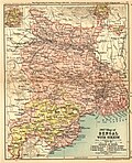
[[Image:1907-bengal-sikkim3.jpg|left|thumb|1907 map of Bengal with Sikkim]] | [[Image:1907-bengal-sikkim3.jpg|left|thumb|1907 map of Bengal with Sikkim]] | ||
{{main|Cooch Behar State}} | {{main|Cooch Behar State}} | ||
[[Cooch Behar | Between 1772 and 1773, the [[Bhutan|Bhutanese Desi]] attacked and seized control of Cooch Behar. In response, Cooch Behar entered into a defence treaty with the [[East India Company|English East India Company]] on 5 April 1773, to drive out the Bhutanese invaders. During this period, Bhutanese coins were minted in Cooch Behar.<ref>{{cite web|url=https://www.mintageworld.com/coin/16-bhutan/#:~:text=The%20coins%20of%20Cooch%20Behar,were%20used%20for%20local%20purchase.|title=Old Coins of Bhutan|website=Mintage World|access-date=10 October 2021|archive-date=10 October 2021|archive-url=https://web.archive.org/web/20211010095010/https://www.mintageworld.com/coin/16-bhutan/#:~:text=The%20coins%20of%20Cooch%20Behar,were%20used%20for%20local%20purchase.|url-status=live}}</ref> Once the Bhutanese were expelled, Cooch Behar was reinstated as a princely state under the aegis of the British East India Company.<ref>{{cite book |last= Pal |first=Dr. Nripendra Nath |title= Itikathai Cooch Behar (A brief history of Cooch Behar) |year=2000 |publisher=Anima Prakashani |location=Kolkata | page = 73}}</ref><ref>{{Cite book|url=https://archive.org/details/columbiachronolo00john|url-access=registration|title=Columbia Chronologies of Asian History and Culture|publisher=Columbia University Press|year=2000|isbn=0-231-11004-9|editor-last=Bowman|editor-first=John S.|location=New York|pages=[https://archive.org/details/columbiachronolo00john/page/385 385]}}</ref> | ||
Cooch Behar Palace is built after classical Italian architecture. The dome of the Palace is in Italian style, resembling the dome of [[St. Peter's Basilica]], Vatican City, Rome. It had been built-in 1887, during the reign of Maharaja [[Nripendra Narayan]].<ref name="bnpedia1" /> In 1878, the maharaja married the daughter of [[Brahmo]] preacher [[Keshab Chandra Sen]]. This union led to a renaissance in Cooch Behar state.<ref>{{cite book |last= Pal |first=Dr. Nripendra Nath |title= Itikathai Cooch Behar (A brief history of Cooch Behar) |year=2000 |publisher=Anima Prakashani |location=Kolkata | page = 75}}</ref> Maharaja Nripendra Narayan is known as the architect of modern Cooch Behar town.<ref>{{cite web|url=http://coochbehar.gov.in/Htmfiles/history_book5.html|title=Royal History of Cooch Behar 5|access-date=22 October 2006|archive-date=21 July 2011|archive-url=https://web.archive.org/web/20110721161722/http://coochbehar.gov.in/Htmfiles/history_book5.html|url-status=live}}</ref> | |||
===Post-Independence=== | ===Post-Independence=== | ||
Under an agreement between the king of [[Cooch Behar State|Cooch Behar]] and the Indian Government at the end of British rule, Maharaja [[Jagaddipendra Narayan]] transferred full authority, jurisdiction, and power of the state to the Dominion [[Government of India]], effective 12 September 1949.<ref name="web1" /> Eventually, Cooch Bihar became part of the state of West Bengal on 19 January 1950, with Cooch Behar town as its headquarters.<ref name="web1" /> | Under an agreement between the king of [[Cooch Behar State|Cooch Behar]] and the Indian Government at the end of British rule, Maharaja [[Jagaddipendra Narayan]] transferred full authority, jurisdiction, and power of the state to the Dominion [[Government of India]], effective 12 September 1949.<ref name="web1">{{cite web |title=Brief Royal History of Cooch Behar 5 |url=http://coochbehar.gov.in/HTMfiles/brief_history.html |url-status=dead |archive-url=https://web.archive.org/web/20110724080258/http://www.coochbehar.gov.in/Htmfiles/brief_history.html |archive-date=24 July 2011 |access-date=22 October 2006}}</ref> Eventually, Cooch Bihar became part of the state of West Bengal on 19 January 1950, with Cooch Behar town as its headquarters.<ref name="web1" /> | ||
==Geography== | ==Geography== | ||
[[File:Torsa in coochbehar.JPG|Torsa River near Cooch Behar|thumb|right]] | [[File:Torsa in coochbehar.JPG|Torsa River near Cooch Behar|thumb|right]] | ||
The [[Torsa | The [[Torsa River]] flows by the western side of town. Heavy rains often cause strong river currents and flooding. The turbulent water carries huge amounts of sand, silt, and pebbles, which hurt crop production as well as the hydrology of the region.<ref name="book1">{{cite book |title= Annual Plan on Agriculture 2003–04 |publisher=Cooch Behar District Agriculture Office |location=Cooch Behar | page =2}}</ref> Alluvial deposits from the soil, which is acidic.<ref name="book1" /> The soil depth varies from {{cvt|15|to|50|cm}}, superimposed on a bed of sand. The foundation materials are igneous and metamorphic rocks at a depth of {{cvt|1000|to|1500|m}}. The soil has low levels of [[nitrogen]] with moderate levels of [[potassium]] and [[phosphorus]]. Deficiencies of [[boron]], [[zinc]], [[calcium]], [[magnesium]], and [[sulphur]] are high.<ref name="book1" /> | ||
Cooch Behar is a flat region with a slight southeastern slope along which the main rivers of the district flow. Most | Cooch Behar is a flat region with a slight southeastern slope along which the main rivers of the district flow. Most highland areas are in the Sitalkuchi region, and most low-lying lands lie in the Dinhata region. The elevation of the town is 48 meters above mean sea level. The [[Torsa river]] flows by the western side of town. The rivers in the district of Cooch Behar generally flow from northwest to southeast. Six rivers that cut through the district are the [[Teesta]], [[Jaldhaka]], [[Torsha]], [[Kaljani River|Kaljani]], [[Raidāk River|Raidak]], Gadadhar, and Ghargharia. | ||
The town of Cooch Behar and its surrounding regions face [[deforestation]] due to increasing demand for fuel and timber, | The town of Cooch Behar and its surrounding regions face [[deforestation]] due to increasing demand for fuel and timber, along with air pollution from increasing vehicular traffic. The local flora includes palms, bamboo, creepers, ferns, orchids, aquatic plants, fungi, timber, grass, vegetables, and fruit trees. Migratory birds and many local species are found in the city, especially around the [[Sagardighi, Cooch Behar|Sagardighi]] and other water bodies.<ref>{{cite web|url=http://www.wbtourism.com/heritage/coochbehar.htm |archive-url=https://web.archive.org/web/20090715093902/http://www.wbtourism.com/heritage/coochbehar.htm |archive-date=15 July 2009 |title=West Bengal Tourism: Cooch Behar |url-status=dead }}</ref> | ||
In 1976, the Cooch Behar district became home to the Jaldapara Wildlife Sanctuary (now [[Jaldapara National Park]]), which has an area of {{convert|217|km2|mi2|abbr=on|1}}.<ref name=parks>{{cite web|author=Indian Ministry of Forests and Environment|title=Protected areas: Sikkim|url=http://oldwww.wii.gov.in/envis/envis_pa_network/index.htm |access-date=25 September 2011 |url-status=dead |archive-url=https://web.archive.org/web/20110823163836/http://oldwww.wii.gov.in/envis/envis_pa_network/index.htm |archive-date=23 August 2011}}</ref> It shares the park with the | In 1976, the Cooch Behar district became home to the Jaldapara Wildlife Sanctuary (now [[Jaldapara National Park]]), which has an area of {{convert|217|km2|mi2|abbr=on|1}}.<ref name=parks>{{cite web|author=Indian Ministry of Forests and Environment|title=Protected areas: Sikkim|url=http://oldwww.wii.gov.in/envis/envis_pa_network/index.htm |access-date=25 September 2011 |url-status=dead |archive-url=https://web.archive.org/web/20110823163836/http://oldwww.wii.gov.in/envis/envis_pa_network/index.htm |archive-date=23 August 2011}}</ref> It shares the park with the Alipurduar district.<ref name=parks/> | ||
===Climate=== | ===Climate=== | ||
Cooch Behar has a moderate climate characterised by heavy rainfall during the monsoons and slight rainfall from October to March. The city does not experience very high temperatures at any time of the year. The daily maximum temperature is {{cvt|32.7|°C}} in August, the hottest month, and the daily minimum temperature is {{cvt|9.2|°C}} in January, the coldest month.<ref name=IMDnormals/> The highest temperature in Cooch Behar was 41.0 °C, recorded on 11 September 1977; the lowest temperature recorded was 3.3 °C, reported on 28 January 1982.<ref name=IMDnormals/> The atmosphere is highly humid. The rainy season lasts from June to September. The average annual rainfall in the city is {{cvt|3,562|mm}}.<ref name=IMDnormals/> | |||
Cooch Behar has a moderate climate | |||
{{Weather box | {{Weather box | ||
|location = Cooch Behar ( | |location = Cooch Behar (1991–2020, extremes 1901–2020) | ||
|metric first = Yes | |metric first = Yes | ||
|single line = Yes | |single line = Yes | ||
|Jan record high C = | |Jan record high C = 30.0 | ||
|Feb record high C = | |Feb record high C = 32.6 | ||
|Mar record high C = 37.6 | |Mar record high C = 37.6 | ||
|Apr record high C = 39.4 | |Apr record high C = 39.4 | ||
| Line 132: | Line 154: | ||
|Sep record high C = 41.0 | |Sep record high C = 41.0 | ||
|Oct record high C = 36.1 | |Oct record high C = 36.1 | ||
|Nov record high C = | |Nov record high C = 34.5 | ||
|Dec record high C = 33.4 | |Dec record high C = 33.4 | ||
|year record high C = 41.0 | |year record high C = 41.0 | ||
| Jan avg record high C = 27. | | Jan avg record high C = 27.5 | ||
| Feb avg record high C = 29. | | Feb avg record high C = 29.6 | ||
| Mar avg record high C = 34. | | Mar avg record high C = 34.2 | ||
| Apr avg record high C = 35.5 | | Apr avg record high C = 35.5 | ||
| May avg record high C = 35. | | May avg record high C = 35.2 | ||
| Jun avg record high C = | | Jun avg record high C = 36.0 | ||
| Jul avg record high C = | | Jul avg record high C = 35.6 | ||
| Aug avg record high C = | | Aug avg record high C = 36.1 | ||
| Sep avg record high C = | | Sep avg record high C = 35.5 | ||
| Oct avg record high C = | | Oct avg record high C = 34.2 | ||
| Nov avg record high C = | | Nov avg record high C = 32.0 | ||
| Dec avg record high C = 28. | | Dec avg record high C = 28.9 | ||
| year avg record high C = | | year avg record high C = 37.3 | ||
|Jan high C = 23. | |Jan high C = 23.5 | ||
|Feb high C = | |Feb high C = 26.3 | ||
|Mar high C = 29. | |Mar high C = 29.9 | ||
|Apr high C = | |Apr high C = 31.1 | ||
|May high C = 31. | |May high C = 31.4 | ||
|Jun high C = 31. | |Jun high C = 31.8 | ||
|Jul high C = 31. | |Jul high C = 31.8 | ||
|Aug high C = 32. | |Aug high C = 32.7 | ||
|Sep high C = 31. | |Sep high C = 31.8 | ||
|Oct high C = | |Oct high C = 31.2 | ||
|Nov high C = | |Nov high C = 29.2 | ||
|Dec high C = 25. | |Dec high C = 25.9 | ||
|year high C = 29. | |year high C = 29.7 | ||
|Jan low C = 9. | |Jan low C = 9.2 | ||
|Feb low C = | |Feb low C = 12.1 | ||
|Mar low C = 16. | |Mar low C = 16.3 | ||
|Apr low C = | |Apr low C = 20.2 | ||
|May low C = 22. | |May low C = 22.5 | ||
|Jun low C = 24. | |Jun low C = 24.5 | ||
|Jul low C = | |Jul low C = 25.2 | ||
|Aug low C = 25. | |Aug low C = 25.4 | ||
|Sep low C = | |Sep low C = 24.5 | ||
|Oct low C = | |Oct low C = 21.0 | ||
|Nov low C = 15.3 | |Nov low C = 15.3 | ||
|Dec low C = | |Dec low C = 10.9 | ||
|year low C = 18. | |year low C = 18.8 | ||
| Jan avg record low C = 6. | | Jan avg record low C = 6.3 | ||
| Feb avg record low C = 8. | | Feb avg record low C = 8.3 | ||
| Mar avg record low C = 11. | | Mar avg record low C = 11.7 | ||
| Apr avg record low C = | | Apr avg record low C = 16.4 | ||
| May avg record low C = | | May avg record low C = 19.4 | ||
| Jun avg record low C = 21. | | Jun avg record low C = 21.8 | ||
| Jul avg record low C = | | Jul avg record low C = 23.1 | ||
| Aug avg record low C = | | Aug avg record low C = 23.2 | ||
| Sep avg record low C = 21. | | Sep avg record low C = 21.8 | ||
| Oct avg record low C = 16. | | Oct avg record low C = 16.7 | ||
| Nov avg record low C = 11.8 | | Nov avg record low C = 11.8 | ||
| Dec avg record low C = | | Dec avg record low C = 7.7 | ||
| year avg record low C = 6. | | year avg record low C = 6.0 | ||
|Jan record low C = 3.3 | |Jan record low C = 3.3 | ||
|Feb record low C = 3.6 | |Feb record low C = 3.6 | ||
|Mar record low C = 7.1 | |Mar record low C = 7.1 | ||
|Apr record low C = | |Apr record low C = 8.1 | ||
|May record low C = 16.1 | |May record low C = 16.1 | ||
|Jun record low C = 18.2 | |Jun record low C = 18.2 | ||
| Line 201: | Line 223: | ||
|year record low C = 3.3 | |year record low C = 3.3 | ||
| rain colour = green | | rain colour = green | ||
| Jan rain mm = | | Jan rain mm = 10.8 | ||
| Feb rain mm = | | Feb rain mm = 14.9 | ||
| Mar rain mm = | | Mar rain mm = 46.8 | ||
| Apr rain mm = | | Apr rain mm = 173.7 | ||
| May rain mm = | | May rain mm = 363.8 | ||
| Jun rain mm = 683. | | Jun rain mm = 683.4 | ||
| Jul rain mm = | | Jul rain mm = 776.1 | ||
| Aug rain mm = | | Aug rain mm = 597.9 | ||
| Sep rain mm = | | Sep rain mm = 487.3 | ||
| Oct rain mm = | | Oct rain mm = 160.8 | ||
| Nov rain mm = | | Nov rain mm = 8.7 | ||
| Dec rain mm = | | Dec rain mm = 3.0 | ||
| year rain mm = | | year rain mm = 3327.4 | ||
|Jan rain days = 0.8 | |Jan rain days = 0.8 | ||
|Feb rain days = 1. | |Feb rain days = 1.3 | ||
|Mar rain days = 2. | |Mar rain days = 2.6 | ||
|Apr rain days = 8. | |Apr rain days = 8.4 | ||
|May rain days = 14. | |May rain days = 14.4 | ||
|Jun rain days = | |Jun rain days = 17.9 | ||
|Jul rain days = | |Jul rain days = 19.4 | ||
|Aug rain days = 16. | |Aug rain days = 16.5 | ||
|Sep rain days = | |Sep rain days = 13.5 | ||
|Oct rain days = 5. | |Oct rain days = 5.5 | ||
|Nov rain days = 0. | |Nov rain days = 0.6 | ||
|Dec rain days = 0. | |Dec rain days = 0.3 | ||
|year rain days = | |year rain days = 101.1 | ||
| time day = 17:30 [[Indian Standard Time|IST]] | | time day = 17:30 [[Indian Standard Time|IST]] | ||
|Jan humidity = | |Jan humidity = 74 | ||
|Feb humidity = | |Feb humidity = 64 | ||
|Mar humidity = | |Mar humidity = 56 | ||
|Apr humidity = | |Apr humidity = 64 | ||
|May humidity = | |May humidity = 73 | ||
|Jun humidity = | |Jun humidity = 79 | ||
|Jul humidity = | |Jul humidity = 80 | ||
|Aug humidity = | |Aug humidity = 81 | ||
|Sep humidity = 83 | |Sep humidity = 83 | ||
|Oct humidity = | |Oct humidity = 81 | ||
|Nov humidity = | |Nov humidity = 78 | ||
|Dec humidity = | |Dec humidity = 76 | ||
|year humidity = | |year humidity = 74 | ||
|source 1 = [[India Meteorological Department]]<ref name=IMDnormals> | |source 1 = [[India Meteorological Department]]<ref>{{cite web | ||
| url = https://imdpune.gov.in/library/public/Climatological%20Tables%201991-2020.pdf | |||
| title = Climatological Tables of Observatories in India 1991-2020 | |||
| publisher = [[India Meteorological Department]] | |||
| access-date = 8 April 2024 | |||
}}</ref><ref name=IMDnormals> | |||
{{cite web | {{cite web | ||
| archive-url = https://web.archive.org/web/20200205040301/http://imdpune.gov.in/library/public/1981-2010%20CLIM%20NORMALS%20%28STATWISE%29.pdf | | archive-url = https://web.archive.org/web/20200205040301/http://imdpune.gov.in/library/public/1981-2010%20CLIM%20NORMALS%20%28STATWISE%29.pdf | ||
| Line 265: | Line 292: | ||
==Demographics== | ==Demographics== | ||
{{Historical population | {{Historical population | ||
| source = <ref>{{Cite web |year=2011 |title=A-02: Decadal variation in population 1901-2011 |url=https://censusindia.gov.in/nada/index.php/catalog/43352/download/47040/19%20A-2%20West%20Bengal.pdf |url-status=live |archive-url=https://web.archive.org/web/20230430172318/https://censusindia.gov.in/nada/index.php/catalog/43352/download/47040/19%20A-2%20West%20Bengal.pdf |archive-date=30 April 2023 |archive-format=PDF |access-date=30 April 2023 |website=Office of the Registrar General & Census Commissioner, India}}</ref> | | source = <ref>{{Cite web |year=2011 |title=A-02: Decadal variation in population 1901-2011 |url=https://censusindia.gov.in/nada/index.php/catalog/43352/download/47040/19%20A-2%20West%20Bengal.pdf |url-status=live |archive-url=https://web.archive.org/web/20230430172318/https://censusindia.gov.in/nada/index.php/catalog/43352/download/47040/19%20A-2%20West%20Bengal.pdf |archive-date=30 April 2023 |archive-format=PDF |access-date=30 April 2023 |website=Office of the Registrar General & Census Commissioner, India}}</ref>{{check|date=December 2024}} | ||
| 1951 | 26299980 | | 1951 | 26299980 | ||
| 1961 | 34926279 | | 1961 | 34926279 | ||
| Line 276: | Line 303: | ||
{{bar box|width = 300px | {{bar box|width = 300px | ||
|barwidth = 250px |cellpadding="0" | |barwidth = 250px |cellpadding="0" | ||
|title=Religion in Cooch Behar<ref>{{Cite web |year=2011 |title=C-01: Population by religious community |url=https://censusindia.gov.in/nada/index.php/catalog/11396/download/14509/DDW19C-01%20MDDS.XLS |url-status=live |archive-url=https://web.archive.org/web/20230405063030/https://censusindia.gov.in/nada/index.php/catalog/11396/download/14509/DDW19C-01%20MDDS.XLS |archive-date= | |title=Religion in Cooch Behar<ref name="censusindia.gov.in">{{Cite web |year=2011 |title=C-01: Population by religious community |url=https://censusindia.gov.in/nada/index.php/catalog/11396/download/14509/DDW19C-01%20MDDS.XLS |url-status=live |archive-url=https://web.archive.org/web/20230405063030/https://censusindia.gov.in/nada/index.php/catalog/11396/download/14509/DDW19C-01%20MDDS.XLS |archive-date=5 April 2023 |archive-format=XLS |access-date=30 April 2023 |website=Office of the Registrar General & Census Commissioner, India}}</ref> | ||
|titlebar=#Fcd116 | |titlebar=#Fcd116 | ||
|left1=Religion | |left1=Religion | ||
| Line 290: | Line 317: | ||
{{Pie chart | {{Pie chart | ||
|thumb = right | |thumb = right | ||
|caption = Languages of Cooch Behar (2011)<ref | |caption = Languages of Cooch Behar (2011)<ref name="C-16 City 1900"/> | ||
|label1 = [[Bengali language|Bengali]] |value1 = | |label1= [[Bengali language|Bengali]] | ||
|label2 = [[Hindi language|Hindi]] |value2 = | |value1= 83.58 | ||
|label3 = [[Nepali language|Nepali]] |value3 = | |color1 = pink | ||
|label4 = Others |value4 = | |label2 = [[Hindi language|Hindi]] | ||
|value2 = 13.89 | |||
|color2 = orange | |||
|label3 = [[Nepali language|Nepali]] | |||
|value3 = 1.09 | |||
|color3 = red | |||
|label4 = Others | |||
|value4 = 1.44 | |||
|color4 = grey | |||
}} | }} | ||
In the 2011 census, the Cooch Behar [[urban agglomeration]] had a population of 2,89,434, of which 1,46,626 were male and 1,42,808 were female. The 0–6 years population was 7,910. The effective literacy rate for the urban population was 80.59%.<ref>{{Cite web |title=Demography {{!}} Cooch Behar District {{!}} India |url=https://coochbehar.gov.in/demography/ |access-date=1 May 2023 |language=en-US |archive-date=9 February 2023 |archive-url=https://web.archive.org/web/20230209102053/https://coochbehar.gov.in/demography/ |url-status=live }}</ref><ref>{{Cite web |year=2011 |title=C-08: Educational level by age and sex for population age seven and above (total) |url=https://censusindia.gov.in/nada/index.php/catalog/44825/download/48498/DDW-1900C-08.xlsx |url-status=live |archive-url=https://web.archive.org/web/20230501124929/https://censusindia.gov.in/nada/index.php/catalog/44825/download/48498/DDW-1900C-08.xlsx |archive-date=1 May 2023 |access-date=1 May 2023 |website=[[Registrar General and Census Commissioner of India]]}}</ref> | |||
The major religions | According to the 2011 census, the Cooch Behar Municipal area has a population of 77,935.<ref>{{Cite web |title=Coochbehar Municipality: Population |url=https://coochbeharmunicipality.com/content.php?id=14 |access-date=1 May 2023 |website=coochbeharmunicipality.com |archive-date=16 April 2023 |archive-url=https://web.archive.org/web/20230416110551/http://coochbeharmunicipality.com/content.php?id=14 |url-status=live }}</ref> The decadal growth rate for the population is 1.38%. The sex ratio is 972 females per 1,000 males.<ref>{{Cite web |title=Koch Bihar (Cooch Behar) District Population Census 2011 - 2021 - 2023, West Bengal literacy sex ratio and density |url=https://www.census2011.co.in/census/district/3-koch-bihar.html |access-date=1 May 2023 |website=www.census2011.co.in |archive-date=6 April 2023 |archive-url=https://web.archive.org/web/20230406100723/https://www.census2011.co.in/census/district/3-koch-bihar.html |url-status=live }}</ref> Males constitute 50.6% of the population, and females constitute 49.4%. Cooch Behar has an average literacy rate of 74.78%, higher than the national average of 74.04%. The male literacy rate is 80.71%, while the female literacy rate is 68.49%.<ref>{{Cite web |title=What is the literacy rate of Koch Bihar (Cooch Behar) district of West Bengal in 2011 census? |url=https://www.census2011.co.in/questions/3/district-literacy/literacy-rate-of-koch-bihar-district-2011.html |access-date=1 May 2023 |website=www.census2011.co.in |archive-date=12 November 2017 |archive-url=https://web.archive.org/web/20171112060539/http://www.census2011.co.in/questions/3/district-literacy/literacy-rate-of-koch-bihar-district-2011.html |url-status=live }}</ref><ref>{{Cite web |title=Profile - Literacy - Know India: National Portal of India |url=https://knowindia.india.gov.in/profile/literacy.php |access-date=1 May 2023 |website=knowindia.india.gov.in |archive-date=15 April 2023 |archive-url=https://web.archive.org/web/20230415175155/https://knowindia.india.gov.in/profile/literacy.php |url-status=live }}</ref> | ||
The major religions practised in Cooch Behar are [[Hinduism]] (76.44%) followed by [[Islam]] (25.54%).<ref name="censusindia.gov.in">{{Cite web |year=2011 |title=C-01: Population by religious community |url=https://censusindia.gov.in/nada/index.php/catalog/11396/download/14509/DDW19C-01%20MDDS.XLS |url-status=live |archive-url=https://web.archive.org/web/20230405063030/https://censusindia.gov.in/nada/index.php/catalog/11396/download/14509/DDW19C-01%20MDDS.XLS |archive-date=5 April 2023 |archive-format=XLS |access-date=30 April 2023 |website=Office of the Registrar General & Census Commissioner, India}}</ref> Commonly spoken languages are [[Bengali language|Bengali]] and [[Hindi Language|Hindi]].<ref name="C-16 City 1900">{{Cite web |year=2011 |title=C-16 City: Population by mother tongue (town level) |url=https://censusindia.gov.in/nada/index.php/catalog/10245/download/13357/DDW-C16-TOWN-STMT-MDDS-1900.XLSX |archive-url=https://web.archive.org/web/20230501040127/https://censusindia.gov.in/nada/index.php/catalog/10245/download/13357/DDW-C16-TOWN-STMT-MDDS-1900.XLSX |archive-date=1 May 2023 |archive-format=XLS |access-date=1 May 2023 |website=[[Registrar General and Census Commissioner of India]]}}</ref> | |||
==Government and politics== | ==Government and politics== | ||
===Civic administration=== | ===Civic administration=== | ||
[[File:Cooch behar dm office.JPG|right|thumb|Office of the District Magistrate]] | [[File:Cooch behar dm office.JPG|right|thumb|Office of the District Magistrate]] | ||
Cooch Behar Municipality is responsible for the civic administration of the town. The municipality consists of a board of | Cooch Behar Municipality is responsible for the civic administration of the town.The Cooch Behar Municipal Act of 1944 was the main law for the local government when Cooch Behar was an independent state. When Cooch Behar joined West Bengal in 1950, this old law was kept in place for a short time but slowly changed. The state government eventually created one main set of rules for all cities. The West Bengal Municipal Act, 1993, became the new, single law that replaced the 1944 Act.<ref>{{Cite web |title=Cooch Behar Municipal (Amendment) Act, 1962 |url=https://www.latestlaws.com/bare-acts/state-acts-rules/west-bengal-state-laws/cooch-behar-municipal-amendment-act-1962/ |access-date=19 December 2025 |website=latestlaws.com |language=en}}</ref><ref>{{Cite web |title=Wayback Machine |url=https://www.indiacode.nic.in/bitstream/123456789/14517/1/1993-22.pdf |archive-url=http://web.archive.org/web/20230611094016/https://www.indiacode.nic.in/bitstream/123456789/14517/1/1993-22.pdf |archive-date=11 June 2023 |access-date=19 December 2025 |website=www.indiacode.nic.in}}</ref> The area of the Cooch Behar Municipality (the town/headquarters) is approximately 8.29 sq km. The municipality consists of a board of councillors, elected from each of the 20 wards<ref>[http://coochbehar.nic.in/Htmfiles/District_Administration.html District Administration] {{Webarchive|url=https://web.archive.org/web/20110803134152/http://www.coochbehar.nic.in/Htmfiles/District_Administration.html |date=3 August 2011 }} Accessed on 1 October 2006</ref> and a few members nominated by the state government. The board of councillors elects a chairman from among its elected members; the chairman is the executive head of the municipality. The [[All India Trinamool Congress]] controls the municipality. The state government looks after education, health, and tourism. | ||
The town is in the [[Cooch Behar (Lok Sabha constituency)|Cooch Behar constituency]] and elects one member to the [[Lok Sabha]] (the [[Lower House]] of the [[Indian Parliament]]). The town area is covered by one assembly constituency, Cooch Behar Dakshin, that elects one member to the [[Vidhan Sabha]], which is the [[West Bengal Legislative Assembly|West Bengal state legislative assembly]].<ref name="delimit">{{cite web| url = http://www.wbgov.com/e-gov/English/DELIMITATION.pdf| title = Press Note, Delimitation Commission| access-date = 18 April 2009| work = Assembly Constituencies in West Bengal| publisher = Delimitation Commission| pages = 4, 23| archive-date = 8 January 2011| archive-url = https://web.archive.org/web/20110108095020/http://www.wbgov.com/e-gov/English/DELIMITATION.pdf| url-status = live}}</ref> Cooch Behar town comes under the jurisdiction of the district police (which is a part of the [[West Bengal Police|state police]]); the [[Superintendent of Police]] oversees security and matters | The town is in the [[Cooch Behar (Lok Sabha constituency)|Cooch Behar constituency]] and elects one member to the [[Lok Sabha]] (the [[Lower House]] of the [[Indian Parliament]]). The town area is covered by one assembly constituency, Cooch Behar Dakshin, that elects one member to the [[Vidhan Sabha]], which is the [[West Bengal Legislative Assembly|West Bengal state legislative assembly]].<ref name="delimit">{{cite web| url = http://www.wbgov.com/e-gov/English/DELIMITATION.pdf| title = Press Note, Delimitation Commission| access-date = 18 April 2009| work = Assembly Constituencies in West Bengal| publisher = Delimitation Commission| pages = 4, 23| archive-date = 8 January 2011| archive-url = https://web.archive.org/web/20110108095020/http://www.wbgov.com/e-gov/English/DELIMITATION.pdf| url-status = live}}</ref> Cooch Behar town comes under the jurisdiction of the district police (which is a part of the [[West Bengal Police|state police]]); the [[Superintendent of Police]] oversees security and matters about law and order. Cooch Behar is home to the District Court. | ||
===Utility services=== | ===Utility services=== | ||
[[File:Head Post Office Cooch Behar.jpg|thumb|Cooch Behar Head Post Office]] | [[File:Head Post Office Cooch Behar.jpg|thumb|Cooch Behar Head Post Office]] | ||
Cooch Behar is a well-planned town,<ref>{{cite web|url= http://www.north-bengal.com/places/coochbehar/|title= North Bengal: Cooch Behar|access-date= 7 November 2006|archive-url= https://web.archive.org/web/20061108151129/http://www.north-bengal.com/places/coochbehar/|archive-date= 8 November 2006|url-status= dead}}</ref> and the municipality is responsible for providing | Cooch Behar is a well-planned town,<ref>{{cite web|url= http://www.north-bengal.com/places/coochbehar/|title= North Bengal: Cooch Behar|access-date= 7 November 2006|archive-url= https://web.archive.org/web/20061108151129/http://www.north-bengal.com/places/coochbehar/|archive-date= 8 November 2006|url-status= dead}}</ref> and the municipality is responsible for providing essential services such as [[potable water]] and [[sanitation]]. The city supplies water from groundwater sources, and almost all the houses in the municipal area are connected. Solid waste is collected every day by the municipality van from individual homes. The surface drains, mostly cemented, drain into the Torsa River. Electricity is supplied by the [[West Bengal State Electricity Board]], and the [[West Bengal Fire Service]] provides emergency services like fire tenders. Most roads are metalled (macadam), and street lighting is available throughout the town. The Public Works Department is responsible for road maintenance and the streets connecting Cooch Behar with other regional cities. Health services in Cooch Behar include a government-owned District Hospital, a Regional Cancer Centre, and private nursing homes. Utility services provided in Cooch Behar are considered one of the best government utility services in West Bengal. However, the city floods during heavy rain due to problems with the drainage system. | ||
[[File:Cooch Behar city Top View.png|thumb|right|Cooch Behar from above]] | [[File:Cooch Behar city Top View.png|thumb|right|Cooch Behar from above]] | ||
==== Health facilities ==== | ==== Health facilities ==== | ||
The city has one district hospital MJN Hospital which has 400 beds. The hospital has now been converted to [[ | The city has one district hospital, formerly MJN Hospital, which has 400 beds. The hospital has now been converted to [[Maharaja Jitendra Narayan Medical College and Hospital]].<ref>{{cite web|url= https://www.telegraphindia.com/?ref=brand-logo_story-page|title= Rush to start Cooch Behar medical college|access-date= 9 September 2019|archive-url= https://web.archive.org/web/20190608065829/https://www.telegraphindia.com/?ref=brand-logo_story-page|archive-date= 8 June 2019|url-status= bot: unknown}}</ref> The city also offers numerous multi-speciality hospitals such as Shubham Hospital, Cooch Behar Mission Hospital and Dr. P K Saha Hospital Pvt. Ltd.<ref>{{Cite web|title=Subham Hospital & Diagnostic Centre (P) Ltd. {{!}} National Health Portal of India|url=https://www.nhp.gov.in/hospital/subham-hospital-and-diagnostic-centre-(p)-ltd-koch_bihar-west_bengal|access-date=22 October 2021|website=nhp.gov.in|archive-date=22 October 2021|archive-url=https://web.archive.org/web/20211022183957/https://www.nhp.gov.in/hospital/subham-hospital-and-diagnostic-centre-(p)-ltd-koch_bihar-west_bengal|url-status=live}}</ref> | ||
==== Market facilities ==== | ==== Market facilities ==== | ||
The municipality has four daily markets, two wholesale markets, and eight commercial complexes.<ref>{{cite web|url= http://coochbeharmunicipality.com/history.php|title= Social Infrastructure|access-date= 9 September 2019|archive-date= 26 August 2019|archive-url= https://web.archive.org/web/20190826084553/http://coochbeharmunicipality.com/history.php|url-status= live}}</ref> Apart from these, two new malls have also opened recently.<ref>{{Cite web|last=prmgroup.co.in|title=Retail Projects PRM Group|url=https://www.prmgroup.co.in/retail.php|access-date=22 October 2021|website=prmgroup.co.in|language=english|archive-date=22 October 2021|archive-url=https://web.archive.org/web/20211022165434/https://www.prmgroup.co.in/retail.php|url-status=live}}</ref> | |||
==Economy== | ==Economy== | ||
{{ | {{more citations needed section|date=April 2023}} | ||
The central and state governments are the | The central and state governments are among the major employers in Cooch Behar town.<ref>{{cite web |title=Employment in Cooch Behar |url=http://coochbehar.nic.in/htmfiles/cob_employment.html#employment2 |website=coochbehar.nic.in |access-date=29 April 2022 |archive-date=1 May 2022 |archive-url=https://web.archive.org/web/20220501003222/http://coochbehar.nic.in/HTMfiles/cob_employment.html#employment2 |url-status=live }}</ref> Cooch Behar is home to several district-level and divisional-level offices and has a large government-employee workforce. Business is mainly centered on retail goods; the main centers lie on B.S. Road, Rupnarayan Road, Keshab Road, and Bhawaniganj Bazar. | ||
[[File:Cooch Behar Sagar Dighi area.jpg|thumb|right]] | [[File:Cooch Behar Sagar Dighi area.jpg|thumb|right]] | ||
An [[industrial park]] has been built at [[Chakchaka]], {{cvt|4|km}} from town, on the route to [[Tufanganj]]. A number of companies have set up industries there.<ref>[http://coochbehar.gov.in/HTMfiles/scope_industry.html#chakchaka Industries in Cooch Behar] {{Webarchive|url=https://web.archive.org/web/20070327091813/http://www.coochbehar.gov.in/Htmfiles/scope_industry.html#chakchaka |date=27 March 2007 }}, [http://www.coochbehar.gov.in/ Cooch Behar Government Website] {{Webarchive|url=https://web.archive.org/web/20100715150955/http://www.coochbehar.gov.in/ |date=15 July 2010 }} Accessed on 1 October 2006</ref> | An [[industrial park]] has been built at [[Chakchaka]], {{cvt|4|km}} from town, on the route to [[Tufanganj]]. A number of companies have set up industries there.<ref>[http://coochbehar.gov.in/HTMfiles/scope_industry.html#chakchaka Industries in Cooch Behar] {{Webarchive|url=https://web.archive.org/web/20070327091813/http://www.coochbehar.gov.in/Htmfiles/scope_industry.html#chakchaka |date=27 March 2007 }}, [http://www.coochbehar.gov.in/ Cooch Behar Government Website] {{Webarchive|url=https://web.archive.org/web/20100715150955/http://www.coochbehar.gov.in/ |date=15 July 2010 }} Accessed on 1 October 2006</ref> | ||
Farming is a | Farming is a significant source of livelihood for the nearby rural populace, and it supplies the town with fruits and vegetables. Poorer sections of this semi-rural society are involved in transport, primary agriculture, small shops, and manual labour in construction. | ||
Cooch Behar has | Cooch Behar has witnessed radical changes and rapid development in segments like industry, real estate, information technology firms, and education since the advent of the twenty-first century. The changes concern infrastructure and industrial growth for steel (direct reduced iron), metal, cement, and knowledge-based industries. Many engineering, technology, management, and professional study colleges have opened at Cooch Behar. Housing co-operatives, flats, shopping malls, hotels, and stadiums have also emerged. | ||
As the town is near the international border, the [[Border Security Force]] (BSF) maintains a | As the town is near the international border, the [[Border Security Force]] (BSF) maintains a significant presence in the vicinity. This gives rise to a large population of semi-permanent residents, who bring revenue to the economy. The state government is trying to promote Cooch Behar as a tourist destination. Though income from tourism is low,<ref>[http://www.coochbehar.gov.in/Htmfiles/tourist_development.html Tourism Development in Cooch Behar] {{Webarchive|url=https://web.archive.org/web/20070327091916/http://www.coochbehar.gov.in/HTMfiles/tourist_development.html |date=27 March 2007 }}, [http://www.coochbehar.gov.in/ Cooch Behar Government Website] {{Webarchive|url=https://web.archive.org/web/20100715150955/http://www.coochbehar.gov.in/ |date=15 July 2010 }} Accessed on 1 October 2006</ref> Cooch Behar is one of the major tourist attractions in West Bengal. | ||
==Culture== | ==Culture== | ||
[[File:Coochbehar Raschakra.jpg|thumb|The Ras Chakra during Ras Mela in Madan Mohan Bari]] | [[File:Coochbehar Raschakra.jpg|thumb|The Ras Chakra during Ras Mela in Madan Mohan Bari]] | ||
Every year during the Ras Purnima, the city hosts Ras Mela, one of the largest and oldest fairs | Every year during the Ras Purnima, the city hosts [[Cooch Behar Rash Mela|Ras Mela]], one of the largest and oldest fairs in West Bengal. The fair is older than 200 years. Cooch Behar Municipality organises the fair in Ras Mela ground near ABN Seal College. During the fair, it becomes a central economic hub of the North Bengal region. Merchants and sellers from all over India and also from Bangladesh join this fair. Earlier, the Maharajas of Cooch Behar used to inaugurate the fair by moving the Ras Chakra, and now the work is executed by the [[District Magistrate]] of Cooch Behar District. The [[Rashchakra|Ras Chakra]] is considered a symbol of communal harmony because an artisanal Muslim family builds it from scratch. A huge crowd gathers in Cooch Behar from neighbouring [[Assam]], [[Jalpaiguri]], [[Alipurduar]], and the whole [[North Bengal]] during the fair. | ||
Novelist [[Amiya Bhushan Majumdar]] was born, | Novelist [[Amiya Bhushan Majumdar]] was born, raised, and worked in Cooch Behar. Cooch Behar, with its people, culture, and the river Torsha has been a recurrent theme in his novels. | ||
Apart from this Cooch Behar has a rich history of Debate, Extempore, Quizzing. | Apart from this, Cooch Behar has a rich history of Debate, Extempore, and Quizzing. | ||
=== Tourism === | === Tourism === | ||
Cooch Behar is | Cooch Behar is a significant tourist destination in [[West Bengal]]. The main attractions are: | ||
==== Cooch Behar Palace ==== | ==== Cooch Behar Palace ==== | ||
[[File:Cooch Behar Palace - Cooch Behar - West Bengal - 005.jpg|thumb| | [[File:Cooch Behar Palace - Cooch Behar - West Bengal - 005.jpg|thumb|Cooch Behar Palace]] | ||
It is the main attraction of the city | It is the main attraction of the city, having been modelled after [[Buckingham Palace]] in [[London]] and built in 1887 during the reign of [[Nripendra Narayan|Maharaja Nripendra Narayan]]. It is a brick-built double-story structure in the classical Western style covering {{convert|51309|ft2|m2|abbr=off}}. The whole structure stands {{convert|395|ft|m}} long, {{convert|296|ft|m}} wide and rests {{convert|4|ft|9|in|m}} above ground. The Palace is fronted on the ground and first floors by a series of arcaded verandahs with their piers arranged alternately in single and double rows. | ||
The Palace projects slightly at the southern and northern ends, and in the center is a projected porch providing an entrance to the [[Durbar Hall]]. The Hall has an elegantly shaped metal dome topped by a cylindrical louvre-type ventilator. This is {{convert|124|ft|m}} high from the ground and is in the style of [[Renaissance]] architecture. The intros of the dome are carved in stepped patterns, and [[Corinthian columns]] support the base of the [[cupola]]. This adds variegated colours and designs to the entire surface. | |||
There are various halls in the palace and rooms, including the Dressing Room, Bed Room, Drawing Room, Dining Hall, Billiard hall, Library, Toshakhana, Lady's Gallery, and Vestibules. The articles and precious objects that these rooms and halls used to contain are now lost. The original palace was three storied but was destroyed by a 19th-century earthquake measuring 8.7 on the Richter scale. The palace shows the acceptance of the European idealism of the Koch kings and the fact that they had embraced European culture without denouncing their Indian heritage.<ref>{{Cite web| url=http://coochbehar.nic.in/Htmfiles/rajbari_exclusive.html#rajbari| title=Rajbari in Cooch Behar town| access-date=3 May 2023| archive-date=14 August 2022| archive-url=https://web.archive.org/web/20220814072309/http://coochbehar.nic.in/htmfiles/rajbari_exclusive.html#rajbari| url-status=live}}</ref> | |||
==== Sagar Dighi ==== | ==== Sagar Dighi ==== | ||
[[File:Sagar Dighi, Coochbehar.jpg|thumb|A view of Sagar Dighi]] | [[File:Sagar Dighi, Coochbehar.jpg|thumb|A view of Sagar Dighi]] | ||
[[Sagardighi, Cooch Behar|Sagardighi]] is one of the "Great Ponds" in the heart of Cooch Behar, West Bengal. The name means an ocean-like pond, exaggerated | [[Sagardighi, Cooch Behar|Sagardighi]] is one of the "Great Ponds" in the heart of Cooch Behar, West Bengal. The name means an ocean-like pond, exaggerated given its great significance. As well as being popular with people, it attracts [[migratory birds]] each winter. It is surrounded by many important administrative buildings, like the District Magistrates Office, the Administrative Building of [[North Bengal State Transport Corporation]], BSNL's DTO Office in the West; the Office of the Superintendent of Police, the District Library, the Municipality Building in the South, the Office of BLRO, the State Bank of India's Cooch Behar Main Branch and many others in the East, the RTO office, the Foreigner's registration office, the District Court in the North and others. Most of these buildings are remnants of royal heritage.<ref>{{Cite web | url=http://coochbehar.nic.in/Htmfiles/tour_all.html | title=Tourist places of Cooch Behar | access-date=3 May 2023 | archive-date=10 August 2022 | archive-url=https://web.archive.org/web/20220810174630/http://coochbehar.nic.in/htmfiles/tour_all.html | url-status=live }}</ref> | ||
==Transport== | ==Transport== | ||
===Road=== | ===Road=== | ||
Cooch Behar is very well connected by road | Cooch Behar is very well connected by road to neighbouring areas, other cities of West Bengal and the rest of the country. Cooch Behar is a major roadway junction after Siliguri towards [[Northeast India]] and [[Bangladesh]]. [[National Highway 17 (India)|NH-17]] crosses through the heart of the city, connecting Assam and [[North Bengal]]. Apart from this, state highways including SH-16 and SH-12A, pass through Cooch Behar, connecting different places in West Bengal.<ref>{{Cite web |title=State Highways in West Bengal |url=https://www.wbtrafficpolice.com/state-highways.php |access-date=29 April 2023 |website=www.wbtrafficpolice.com |archive-date=29 April 2023 |archive-url=https://web.archive.org/web/20230429091041/https://www.wbtrafficpolice.com/state-highways.php |url-status=live }}</ref><ref>{{Cite web |title=Road-State Highway |url=http://wbpwd.gov.in/road/state_highway |access-date=29 April 2023 |website=wbpwd.gov.in |archive-date=29 April 2023 |archive-url=https://web.archive.org/web/20230429091041/http://wbpwd.gov.in/road/state_highway |url-status=live }}</ref> | ||
===Bus service=== | ===Bus service=== | ||
[[File:New Coochbehar Railway Station Complex.jpg|thumb|New Cooch Behar railway station in 2019.]] | [[File:New Coochbehar Railway Station Complex.jpg|thumb|New Cooch Behar railway station in 2019.]] | ||
[[North Bengal State Transport Corporation|North Bengal State Transport Corporation (NBSTC)]], a state government run transport corporation | [[North Bengal State Transport Corporation|North Bengal State Transport Corporation (NBSTC)]], a state government-run transport corporation headquartered in Cooch Behar, runs regular bus service to most places in West Bengal. Private buses are also available, which operate from bus stops or designated pick-up spots to various tows in [[Assam]], [[Bihar]], and [[West Bengal]]. City services from NBSTC are also available for riders to commute from different parts of a city.<ref>{{Cite web|title=NBSTC Bus routes|url=https://nbstc.in/uploads/routes_pdf/Bus295594192Routes.pdf|access-date=29 April 2023|website=nbstc.in/|archive-date=1 February 2023|archive-url=https://web.archive.org/web/20230201092559/https://nbstc.in/uploads/routes_pdf/Bus295594192Routes.pdf|url-status=live}}</ref><ref>{{Cite web |title=About - North Bengal State Transport Corporation |url=https://nbstc.in/about-us.php |access-date=1 May 2023 |website=nbstc.in |archive-date=1 February 2023 |archive-url=https://web.archive.org/web/20230201102540/https://nbstc.in/about-us.php |url-status=live }}</ref> | ||
* ''' | * '''Mini-Bus Stand & NBSTC Bus Terminus''': Located near [[Cooch Behar Palace]], it serves as a bus depot for both government and private buses. Government buses are operated by NBSTC. | ||
* '''NBSTC New Bus Stand''': Located within the city, it is the hub for NBSTC buses and a boarding point for long-haul buses.<ref>{{Cite web |title=Depots & Divisions - North Bengal State Transport Corporation |url=https://nbstc.in/depots-division.php |website=nbstc.in |access-date=5 April 2024}}</ref> | |||
* '''NBSTC Bus Stand''': Located within the city, it | |||
===Rail=== | ===Rail=== | ||
[[File:Coochbehar Railway Station.JPG|thumb|Cooch Behar railway station in 2015.]] | [[File:Coochbehar Railway Station.JPG|thumb|Cooch Behar railway station in 2015.]] | ||
Being a popular tourism hub,<ref>{{Cite web |title=COOCHBEHAR - West Bengal Tourism, Experience Bengal, Dept. of Tourism, Govt. of W. B. |url=https://wbtourism.gov.in/destination/district/coochbehar |access-date=29 April 2023 |website=wbtourism.gov.in |archive-date=26 November 2022 |archive-url=https://web.archive.org/web/20221126000351/https://wbtourism.gov.in/destination/district/coochbehar |url-status=live }}</ref> Cooch Behar is well connected through railway with almost all parts of the country. | Being a popular tourism hub,<ref>{{Cite web |title=COOCHBEHAR - West Bengal Tourism, Experience Bengal, Dept. of Tourism, Govt. of W. B. |url=https://wbtourism.gov.in/destination/district/coochbehar |access-date=29 April 2023 |website=wbtourism.gov.in |archive-date=26 November 2022 |archive-url=https://web.archive.org/web/20221126000351/https://wbtourism.gov.in/destination/district/coochbehar |url-status=live }}</ref> Cooch Behar is well connected through railway with almost all parts of the country. Two stations serve the city. | ||
* '''[[New Cooch Behar Junction railway station|New Cooch Behar railway station]]''' (NCB): Located around 5 km from city, it is well connected to almost all major Indian cities including [[Kolkata]], [[Delhi]], [[Mumbai]], [[Bangalore]], [[Chennai]], [[Guwahati]]. All [[Rajdhani Express|Rajdhani]], [[Express trains in India|superfast and express]] trains going towards [[northeast India]] have a stoppage here. New Cooch Behar station came up when the broad gauge [[New Jalpaiguri–New Bongaigaon section]] of [[Barauni–Guwahati line]] was laid in 1966.<ref>{{cite web|url=http://www.nfr.railnet.gov.in/pro/CPRO1.HTM |title=Some Milestones of NF Railway |access-date=28 January 2012|archiveurl=https://web.archive.org/web/20111124125914/http://www.nfr.railnet.gov.in/pro/CPRO1.HTM |archive-date=24 November 2011}}</ref> As of 2018, it is the largest [[List of railway junction stations in India|railway junction]] of [[Northeast Frontier Railway zone|Northeast Frontier Railway]] with six routes towards [[Changrabandha railway station|New Changrabandha]], [[New Jalpaiguri Junction railway station|New Jalpaiguri]], [[New Bongaigaon Junction railway station|New Bongaigaon]], [[Alipurduar Junction railway station|Alipurduar Junction]], [[Dhubri railway station|Dhubri]], and [[Bamanhat railway station|Bamanhat]]. New Cooch Behar railway station | * '''[[New Cooch Behar Junction railway station|New Cooch Behar railway station]]''' (NCB): Located around 5 km from the city, it is well connected to almost all major Indian cities including [[Kolkata]], [[Delhi]], [[Mumbai]], [[Bangalore]], [[Chennai]], [[Guwahati]]. All [[Rajdhani Express|Rajdhani]], [[Express trains in India|superfast and express]] trains going towards [[northeast India]] have a stoppage here. New Cooch Behar station came up when the broad gauge [[New Jalpaiguri–New Bongaigaon section]] of [[Barauni–Guwahati line]] was laid in 1966.<ref>{{cite web|url=http://www.nfr.railnet.gov.in/pro/CPRO1.HTM |title=Some Milestones of NF Railway |access-date=28 January 2012|archiveurl=https://web.archive.org/web/20111124125914/http://www.nfr.railnet.gov.in/pro/CPRO1.HTM |archive-date=24 November 2011}}</ref> As of 2018, it is the largest [[List of railway junction stations in India|railway junction]] of [[Northeast Frontier Railway zone|Northeast Frontier Railway]] with six routes towards [[Changrabandha railway station|New Changrabandha]], [[New Jalpaiguri Junction railway station|New Jalpaiguri]], [[New Bongaigaon Junction railway station|New Bongaigaon]], [[Alipurduar Junction railway station|Alipurduar Junction]], [[Dhubri railway station|Dhubri]], and [[Bamanhat railway station|Bamanhat]]. New Cooch Behar railway station boasts a beautiful look similar to Cooch Behar Palace.<ref>{{Cite web |title=New Cooch Behar railway station gets facade of local palace |url=https://www.telegraphindia.com/west-bengal/new-cooch-behar-railway-station-gets-facade-of-local-palace/cid/1681978 |access-date=29 April 2023 |website=www.telegraphindia.com |archive-date=3 May 2023 |archive-url=https://web.archive.org/web/20230503105404/https://www.telegraphindia.com/west-bengal/new-cooch-behar-railway-station-gets-facade-of-local-palace/cid/1681978 |url-status=live }}</ref> This station is equipped with Wi-Fi facilities, restrooms, food cafes, dormitories, waiting lounge elevators and escalators.<ref>{{Cite news |date=10 July 2015 |title=Renovation of 'Pay and Use' toilet at New Cooch Behar station complete |work=The Economic Times |url=https://economictimes.indiatimes.com/news/politics-and-nation/renovation-of-pay-and-use-toilet-at-new-cooch-behar-station-complete/articleshow/48020332.cms?from=mdr |access-date=29 April 2023 |issn=0013-0389 |archive-date=3 May 2023 |archive-url=https://web.archive.org/web/20230503105353/https://economictimes.indiatimes.com/news/politics-and-nation/renovation-of-pay-and-use-toilet-at-new-cooch-behar-station-complete/articleshow/48020332.cms?from=mdr |url-status=live }}</ref> | ||
* '''[[Cooch Behar railway station]]''' (COB): Situated inside the town, this station lies on the [[Alipurduar–Bamanhat branch line]]. Trains connecting [[Bamanhat]] with Alipurduar and [[Siliguri]] halt here. It was built in 1901 when [[Cooch Behar State Railway]] constructed the Geetaldaha-Jainti line.<ref>{{Cite web |title=[IRFCA] The State Railways of Cooch Behar (1903) |url=https://www.irfca.org/docs/history/cooch-behar-railway.html |access-date=29 April 2023 |website=www.irfca.org |archive-date=28 November 2022 |archive-url=https://web.archive.org/web/20221128123754/https://irfca.org/docs/history/cooch-behar-railway.html |url-status=live }}</ref> The station offers Wi-Fi, seating and other basic facilities. A Railway Heritage Museum, a smaller version of the [[National Rail Museum, New Delhi|National Rail Museum]], is constructed in the station area and looks like Cooch Behar Madan Mohan Temple.<ref>{{Cite web |date=10 March 2011 |title=Construction of Railway Heritage Museum starts |url=https://coochbeharcalling.blogspot.com/2011/03/construction-of-railway-heritage-museum.html |access-date=29 April 2023 |website=COOCHBEHAR CALLING |archive-date=23 March 2017 |archive-url=https://web.archive.org/web/20170323143340/http://coochbeharcalling.blogspot.com/2011/03/construction-of-railway-heritage-museum.html |url-status=live }}</ref><ref>{{Cite web |title=Rail Museum at Cooch Behar |url=https://nfr.indianrailways.gov.in/uploads/files/1631531900173-Heritage.pdf |access-date=29 April 2023 |website=nfr.indianrailways.gov.in |archive-date=29 April 2023 |archive-url=https://web.archive.org/web/20230429102221/https://nfr.indianrailways.gov.in/uploads/files/1631531900173-Heritage.pdf |url-status=live }}</ref> | |||
* '''[[Cooch Behar railway station]]''' (COB): Situated inside the town, this station lies on the [[Alipurduar–Bamanhat branch line]]. Trains connecting [[Bamanhat]] with | |||
===Air=== | ===Air=== | ||
[[File:Coochbehar airport.jpg|thumb|Terminal of Cooch Behar Airport.]] | [[File:Coochbehar airport.jpg|thumb|Terminal of Cooch Behar Airport.]] | ||
[[Cooch Behar Airport]] is a [[domestic airport]] located near the city. It handles daily flights from [[Netaji Subhas Chandra Bose International Airport|Netaji Subash Chandra Bose International Airport]] in [[Kolkata]].<ref>{{Cite news |date=22 February 2023 |title=Cooch Behar back on West Bengal's aviation map |work=The Times of India |url=https://timesofindia.indiatimes.com/city/kolkata/cooch-behar-back-on-west-bengals-aviation-map/articleshow/98134654.cms |access-date=29 April 2023 |issn=0971-8257 |archive-date=31 March 2023 |archive-url=https://web.archive.org/web/20230331064207/https://timesofindia.indiatimes.com/city/kolkata/cooch-behar-back-on-west-bengals-aviation-map/articleshow/98134654.cms |url-status=live }}</ref> | [[Cooch Behar Airport]] is a [[domestic airport]] located near the city. It handles daily flights from [[Netaji Subhas Chandra Bose International Airport|Netaji Subash Chandra Bose International Airport]] in [[Kolkata]].<ref>{{Cite news |date=22 February 2023 |title=Cooch Behar back on West Bengal's aviation map |work=The Times of India |url=https://timesofindia.indiatimes.com/city/kolkata/cooch-behar-back-on-west-bengals-aviation-map/articleshow/98134654.cms |access-date=29 April 2023 |issn=0971-8257 |archive-date=31 March 2023 |archive-url=https://web.archive.org/web/20230331064207/https://timesofindia.indiatimes.com/city/kolkata/cooch-behar-back-on-west-bengals-aviation-map/articleshow/98134654.cms |url-status=live }}</ref> | ||
The nearest [[international airport]] is [[Bagdogra Airport]] near [[Siliguri]], about 142 km (88 mi) from Cooch Behar. [[IndiGo]], [[Vistara]] and [[ | The nearest [[international airport]] is [[Bagdogra Airport]] near [[Siliguri]], about 142 km (88 mi) from Cooch Behar. [[IndiGo]], [[Vistara]] and [[SpiceJet]] are the major carriers that connect the area to [[Delhi]], [[Kolkata]], [[Guwahati]], [[Mumbai]], Chennai, Bangkok, [[Paro, Bhutan|Paro]], [[Bangkok]] and [[Chandigarh]]. | ||
== Education == | == Education == | ||
[[File:Abnsealcollege.jpg|thumb|A.B.N. Seal College]] | [[File:Abnsealcollege.jpg|thumb|A.B.N. Seal College]] | ||
Cooch Behar's schools usually use English and Bengali as their [[medium of instruction]], although the use of the [[Hindi Language|Hindi]] language is also stressed. The schools are affiliated with the [[Indian Certificate of Secondary Education]] (ICSE) or the [[Central Board of Secondary Education]] (CBSE), or the [[West Bengal Board of Secondary Education]]. Some of the reputed schools include [[Jenkins School, Coochbehar|Jenkins School]], [[Suniti Academy|Sunity Academy]], and [[Cooch Behar Rambhola High School]]. | Cooch Behar's schools usually use English and Bengali as their [[medium of instruction]], although the use of the [[Hindi Language|Hindi]] language is also stressed. The schools are affiliated with the [[Indian Certificate of Secondary Education]] (ICSE) or the [[Central Board of Secondary Education]] (CBSE), or the [[West Bengal Board of Secondary Education]]. Some of the reputed schools include [[Jenkins School, Coochbehar|Jenkins School]], [[Suniti Academy|Sunity Academy]], and [[Cooch Behar Rambhola High School]]. | ||
[[File:School bldg1.jpg|thumb|Jenkins School, Cooch Behar]] | [[File:School bldg1.jpg|thumb|Jenkins School, Cooch Behar]] | ||
[[Cooch Behar Panchanan Barma University]] is the only single university in Cooch Behar. It is a U.G.C. | [[Cooch Behar Panchanan Barma University]] is the only single university in Cooch Behar. It is a U.G.C. recognised [[public university]] in Cooch Behar, West Bengal, India. The university was named after the 19th-century [[Rajbongshi people|Rajbongshi]] leader and social reformist, [[Panchanan Barma]]. A total of 15 colleges from the Cooch Behar district are affiliated with the university.<ref>{{Cite web | url=https://www.cbpbu.ac.in/ | title=Coochbehar Panchanan Barma University :: Home | access-date=3 May 2023 | archive-date=22 April 2023 | archive-url=https://web.archive.org/web/20230422054201/https://www.cbpbu.ac.in/ | url-status=live }}</ref><ref>{{cite web|url= https://collegedunia.com/college/58092-coochbehar-government-engineering-college-cooch-behar|title= COOCHBEHAR GOVERNMENT ENGINEERING COLLEGE, COOCH BEHAR|access-date= 9 September 2019|archive-date= 29 December 2019|archive-url= https://web.archive.org/web/20191229215038/https://collegedunia.com/college/58092-coochbehar-government-engineering-college-cooch-behar|url-status= live}}</ref> | ||
There are five colleges and a polytechnic in town,<ref>[http://coochbehar.gov.in/HTMfiles/Education_inCoB.html Education in Cooch Behar] {{Webarchive|url=https://web.archive.org/web/20110721155910/http://coochbehar.gov.in/HTMfiles/Education_inCoB.html |date=21 July 2011 }}, [http://www.coochbehar.gov.in/ Cooch Behar Government Website] {{Webarchive|url=https://web.archive.org/web/20100715150955/http://www.coochbehar.gov.in/ |date=15 July 2010 }} Accessed on 1 October 2006</ref> including [[A.B.N. Seal College]], [[Cooch Behar College]], [[University B.T. & Evening College]], [[Thakur Panchanan Mahila Mahavidyalaya]], all of which are affiliated with the [[Cooch Behar Panchanan Barma University]], which was established in 2013.<ref>{{cite news|url=http://thestatesman.net/index.php?option=com_content&view=article&id=415836&catid=42|title=Private education Bill passed amidst Opposition walkout|date=6 July 2012|newspaper=The Statesman|access-date=7 July 2012|url-status=dead|archive-url=https://archive.today/20121220042108/http://thestatesman.net/index.php?option=com_content&view=article&id=415836&catid=42|archive-date=20 December 2012}}</ref><ref>{{cite news|url=http://www.asianage.com/kolkata/bill-passed-set-private-varsity-653|title=Bill passed to set up private varsity|date=7 July 2012|newspaper=Asian Age|access-date=7 July 2012|archive-url=https://web.archive.org/web/20171211054143/http://www.asianage.com/kolkata/bill-passed-set-private-varsity-653|archive-date=11 December 2017|url-status=dead}}</ref> | There are five colleges and a polytechnic in town,<ref>[http://coochbehar.gov.in/HTMfiles/Education_inCoB.html Education in Cooch Behar] {{Webarchive|url=https://web.archive.org/web/20110721155910/http://coochbehar.gov.in/HTMfiles/Education_inCoB.html |date=21 July 2011 }}, [http://www.coochbehar.gov.in/ Cooch Behar Government Website] {{Webarchive|url=https://web.archive.org/web/20100715150955/http://www.coochbehar.gov.in/ |date=15 July 2010 }} Accessed on 1 October 2006</ref> including [[A.B.N. Seal College]], [[Cooch Behar College]], [[University B.T. & Evening College]], [[Thakur Panchanan Mahila Mahavidyalaya]], all of which are affiliated with the [[Cooch Behar Panchanan Barma University]], which was established in 2013.<ref>{{cite news|url=http://thestatesman.net/index.php?option=com_content&view=article&id=415836&catid=42|title=Private education Bill passed amidst Opposition walkout|date=6 July 2012|newspaper=The Statesman|access-date=7 July 2012|url-status=dead|archive-url=https://archive.today/20121220042108/http://thestatesman.net/index.php?option=com_content&view=article&id=415836&catid=42|archive-date=20 December 2012}}</ref><ref>{{cite news|url=http://www.asianage.com/kolkata/bill-passed-set-private-varsity-653|title=Bill passed to set up private varsity|date=7 July 2012|newspaper=Asian Age|access-date=7 July 2012|archive-url=https://web.archive.org/web/20171211054143/http://www.asianage.com/kolkata/bill-passed-set-private-varsity-653|archive-date=11 December 2017|url-status=dead}}</ref>[[Cooch Behar Polytechnic]] established in 1964, one of oldest Polytechnic Institute in Coochbehar district. | ||
[[Acharya Brojendra Nath Seal College]] was established in 1888 as Victoria College by [[Nripendra Narayan|Maharaja Nripendra Narayan]] of [[Cooch Behar State|Koch Bihar]] to enhance student capability in the Kingdom. The first principal was John Cornwallis Godley, who in 1895 became the second principal of [[Aitchison College]] in [[Lahore]]. Later, Maharaja Nripendra Naryayan offered the post of principal to [[Acharya Brojendra Nath Seal]], a Brahmo and philosopher, who remained in the post for eighteen years from 1896 to 1913. In 1950, when the state of Cooch Behar was merged into the Union of India, | [[Acharya Brojendra Nath Seal College]] was established in 1888 as Victoria College by [[Nripendra Narayan|Maharaja Nripendra Narayan]] of [[Cooch Behar State|Koch Bihar]] to enhance student capability in the Kingdom. The first principal was John Cornwallis Godley, who in 1895 became the second principal of [[Aitchison College]] in [[Lahore]]. Later, Maharaja Nripendra Naryayan offered the post of principal to [[Acharya Brojendra Nath Seal]], a Brahmo and philosopher, who remained in the post for eighteen years from 1896 to 1913. In 1950, when the state of Cooch Behar was merged into the Union of India, governance was passed to the Government of West Bengal. It was earlier affiliated with the [[University of Calcutta]] and [[University of North Bengal]] and is now affiliated with [[Cooch Behar Panchanan Barma University]] after the creation of the same. In 1970, it was renamed Acharya Brojendra Nath Seal College. It is one of the few colleges under the Cooch Behar Panchanan Barma University to offer postgraduate education. The college is in the heart of the town with a campus of 13.27 acres (53,700 m2) and a built-up area of 9032.96 sq. meters.<ref>{{cite web|url= http://abnscollege.org/|title= Acharya Brojendra Nath Seal College|access-date= 9 September 2019|archive-url= https://web.archive.org/web/20141216184605/http://abnscollege.org/|archive-date= 16 December 2014|url-status= bot: unknown}}</ref> | ||
1981 the [[Maya Chitram Art Institute]] was founded in Cooch Behar.<ref>[http://indiaforyou.in/ngos/ngodisplay.php?ngo=MAYA%20CHITRAM%20ART%20INSTITUTE ''Maya Chitram Art Institute.'']{{Dead link|date=December 2023 |bot=InternetArchiveBot |fix-attempted=yes }} India for You. Retrieved 19 August 2012.</ref> There is an agricultural university, [[Uttar Banga Krishi Vishwavidyalaya]], 16 km from the town at [[Pundibari]]. A medical college named [[Maharaja Jitendra Narayan Medical College and Hospital]] began instruction in 2019 with 100 students.<ref>{{cite news |title=CM inaugurates Maharaja Jitendra Narayan Medical College & Hospital in Cooch Behar |url=https://www.millenniumpost.in/kolkata/cm-inaugurates-maharaja-jitendra-narayan-medical-college-hospital-in-cooch-behar-426668 |access-date=13 September 2023 |work=Millennium Post |date=16 December 2020 }}</ref> | |||
[[Cooch Behar Government Engineering College]] started its first academic session in 2016.<ref>{{cite news|url=http://echoofindia.com/cooch-behar-nbdd-minister-inaugurates-multiple-projects-cooch-behar-48723|title=NBDD minister inaugurates multiple projects in Cooch Behar|last=EOI|first=Correspondence|url-status=dead|archive-url=https://web.archive.org/web/20150114100759/http://echoofindia.com/cooch-behar-nbdd-minister-inaugurates-multiple-projects-cooch-behar-48723|archive-date=14 January 2015}}</ref> | [[Cooch Behar Government Engineering College]] started its first academic session in 2016.<ref>{{cite news|url=http://echoofindia.com/cooch-behar-nbdd-minister-inaugurates-multiple-projects-cooch-behar-48723|title=NBDD minister inaugurates multiple projects in Cooch Behar|last=EOI|first=Correspondence|url-status=dead|archive-url=https://web.archive.org/web/20150114100759/http://echoofindia.com/cooch-behar-nbdd-minister-inaugurates-multiple-projects-cooch-behar-48723|archive-date=14 January 2015}}</ref> | ||
| Line 418: | Line 453: | ||
File:View of Moti Mahal - now Kalyan Bhavan (3116564839).jpg|Moti Mahal | File:View of Moti Mahal - now Kalyan Bhavan (3116564839).jpg|Moti Mahal | ||
File:Madanmohan Temple at night.jpg|Madanmohan Temple at night | File:Madanmohan Temple at night.jpg|Madanmohan Temple at night | ||
File:Cooch Behar Stadium (3117391408).jpg|Palace view from stadium | File:Cooch Behar Stadium (3117391408).jpg|Palace view from the stadium | ||
</gallery> | </gallery> | ||
==See also== | ==See also== | ||
* [[Madan Mohan Temple, Cooch Behar|Madan Mohan Temple]], a temple dedicated to Madan Mohan | |||
* [[Narendra Narayan Park]], a botanical garden in town, founded in 1892 | * [[Narendra Narayan Park]], a botanical garden in town, founded in 1892 | ||
* [[Cooch Behar Stadium]], a multi-purpose stadium | * [[Cooch Behar Stadium]], a multi-purpose stadium | ||
| Line 431: | Line 466: | ||
==External links== | ==External links== | ||
{{Wikiquote}} | |||
* [https://web.archive.org/web/20100715150955/http://www.coochbehar.gov.in/ Cooch Behar District's official website] | * [https://web.archive.org/web/20100715150955/http://www.coochbehar.gov.in/ Cooch Behar District's official website] | ||
{{Contains special characters|Indic}} | {{Contains special characters|Indic}} | ||
{{Commons category|Cooch Behar}} | |||
{{Wikivoyage inline|Cooch Behar}} | |||
{{Towns and Cities of Cooch Behar District}} | {{Towns and Cities of Cooch Behar District}} | ||
{{Municipalities of West Bengal}} | {{Municipalities of West Bengal}} | ||
| Line 444: | Line 480: | ||
[[Category:Cities and towns in Cooch Behar district]] | [[Category:Cities and towns in Cooch Behar district]] | ||
[[Category:Former | [[Category:Former capitals in India]] | ||
[[Category:Cooch Behar]] | [[Category:Cooch Behar| ]] | ||
[[Category:Cities in West Bengal]] | [[Category:Cities in West Bengal]] | ||
[[Category:Planned cities in West Bengal]] | [[Category:Planned cities in West Bengal]] | ||
[[Category:Planned communities in India]] | [[Category:Planned communities in India]] | ||
Revision as of 04:24, 14 March 2026
Cooch Behar
Koch Bihar | |
|---|---|
Sagar Dighi Lake Parijat Villa | |
Cooch Behar is located in West Bengal  Cooch Behar Location in West Bengal, India  Cooch Behar Cooch Behar (India) | |
| Coordinates: 26°19′27.084″N 89°27′3.6″E / 26.32419000°N 89.451000°E | |
| Country |  India India |
| State |  West Bengal West Bengal |
| District | Cooch Behar |
| Government | |
| • Type | Municipality |
| • Body | Cooch Behar Municipality |
| • Chairman | Rabindra Nath Ghosh (All India Trinamool Congress) |
| Area | |
| • Total | 8.29 km2 (3.20 sq mi) |
| Population (2011)[2] | |
| • Total | 77,935 |
| • Density | 832/km2 (2,150/sq mi) |
| Languages | |
| • Official | Bengali[3][4] |
| • Additional official | English,[3] Rajbongshi[5] |
| • Regional | Bengali, Rajbongshi |
| Time zone | UTC+5:30 (IST) |
| PIN | 736101[6] |
| Telephone code | 03582 |
| Vehicle registration | WB-64/63 |
| Lok Sabha constituency | Cooch Behar (SC) |
| Vidhan Sabha constituency | Cooch Behar Uttar (SC), Cooch Behar Dakshin, Natabari |
| Website | coochbehar |


Cooch Behar (Bengali pronunciation: [kot͡ʃ biɦar]), also known as Koch Bihar, is a city in the Indian state of West Bengal and it stands on bank of the Torsa river.[7] The city is the headquarters of the Cooch Behar district.[8] During the British Raj, Cooch Behar was the seat of the princely state of Cooch Behar.[9] In the North Bengal region, the only planned city with royal heritage is Cooch Behar. The city is a popular tourist destination and cultural hub in Bengal.[10]
Etymology
The name Cooch Behar is derived from two words— Cooch, a corrupted form of the word Koch, the name of the Koch tribes, and the word Behar is derived from vihara meaning land or settlement. Koch Behar means land of the Koches.[11][12]
History

Early period
 | This section needs more citations. (June 2024) |
Cooch Behar formed part of the Kamarupa Kingdom of Assam from the 4th to the 12th. In the 13th century, the area became a part of the Kamata Kingdom. The Khens ruled until about 1498 CE, when they fell to Alauddin Hussain Shah, the independent Sultan of Gour. The new invaders fought with the local Bhuyan chieftains and the Ahom king Suhungmung and lost control of the region. During this time, the Koch tribe became very powerful, proclaimed itself Kamateshwar (Lord of Kamata), and established the Koch dynasty.[citation needed]
The first important Koch ruler was Bisu, later called Biswa Singha, who came to power in 1515 CE.[13] Under his son, Nara Narayan, the Kamata Kingdom reached its zenith.[14] Nara Narayan's younger brother, Shukladhwaj (Chilarai), was a noted military general who undertook expeditions to expand the kingdom. He became governor of its eastern portion.
As the early capital of the Koch Kingdom, Koch Behar's location was not static and became stable only when it shifted to Cooch Behar town. Rup Narayan, on the advice of an unknown saint, transferred the capital from Attharokotha to Guriahati (now called Cooch Behar town) on the banks of the Torsa river between 1693 and 1714. After this, the capital was always in or near its present location.
In 1661 CE, Pran Narayan planned to expand his kingdom. However, Mir Jumla, the subedar of Bengal under the Mughal emperor Aurangazeb, attacked Cooch Behar and conquered the territory, meeting almost no resistance.[15] The town of Cooch Behar was subsequently named Alamgirnagar.[16] Pran Narayan regained his kingdom within a few days.
British Raj

Between 1772 and 1773, the Bhutanese Desi attacked and seized control of Cooch Behar. In response, Cooch Behar entered into a defence treaty with the English East India Company on 5 April 1773, to drive out the Bhutanese invaders. During this period, Bhutanese coins were minted in Cooch Behar.[17] Once the Bhutanese were expelled, Cooch Behar was reinstated as a princely state under the aegis of the British East India Company.[18][19]
Cooch Behar Palace is built after classical Italian architecture. The dome of the Palace is in Italian style, resembling the dome of St. Peter's Basilica, Vatican City, Rome. It had been built-in 1887, during the reign of Maharaja Nripendra Narayan.[16] In 1878, the maharaja married the daughter of Brahmo preacher Keshab Chandra Sen. This union led to a renaissance in Cooch Behar state.[20] Maharaja Nripendra Narayan is known as the architect of modern Cooch Behar town.[21]
Post-Independence
Under an agreement between the king of Cooch Behar and the Indian Government at the end of British rule, Maharaja Jagaddipendra Narayan transferred full authority, jurisdiction, and power of the state to the Dominion Government of India, effective 12 September 1949.[22] Eventually, Cooch Bihar became part of the state of West Bengal on 19 January 1950, with Cooch Behar town as its headquarters.[22]
Geography

The Torsa River flows by the western side of town. Heavy rains often cause strong river currents and flooding. The turbulent water carries huge amounts of sand, silt, and pebbles, which hurt crop production as well as the hydrology of the region.[23] Alluvial deposits from the soil, which is acidic.[23] The soil depth varies from 15 to 50 cm (5.9 to 19.7 in), superimposed on a bed of sand. The foundation materials are igneous and metamorphic rocks at a depth of 1,000 to 1,500 m (3,300 to 4,900 ft). The soil has low levels of nitrogen with moderate levels of potassium and phosphorus. Deficiencies of boron, zinc, calcium, magnesium, and sulphur are high.[23]
Cooch Behar is a flat region with a slight southeastern slope along which the main rivers of the district flow. Most highland areas are in the Sitalkuchi region, and most low-lying lands lie in the Dinhata region. The elevation of the town is 48 meters above mean sea level. The Torsa river flows by the western side of town. The rivers in the district of Cooch Behar generally flow from northwest to southeast. Six rivers that cut through the district are the Teesta, Jaldhaka, Torsha, Kaljani, Raidak, Gadadhar, and Ghargharia.
The town of Cooch Behar and its surrounding regions face deforestation due to increasing demand for fuel and timber, along with air pollution from increasing vehicular traffic. The local flora includes palms, bamboo, creepers, ferns, orchids, aquatic plants, fungi, timber, grass, vegetables, and fruit trees. Migratory birds and many local species are found in the city, especially around the Sagardighi and other water bodies.[24]
In 1976, the Cooch Behar district became home to the Jaldapara Wildlife Sanctuary (now Jaldapara National Park), which has an area of 217 km2 (83.8 sq mi).[25] It shares the park with the Alipurduar district.[25]
Climate
Cooch Behar has a moderate climate characterised by heavy rainfall during the monsoons and slight rainfall from October to March. The city does not experience very high temperatures at any time of the year. The daily maximum temperature is 32.7 °C (90.9 °F) in August, the hottest month, and the daily minimum temperature is 9.2 °C (48.6 °F) in January, the coldest month.[26] The highest temperature in Cooch Behar was 41.0 °C, recorded on 11 September 1977; the lowest temperature recorded was 3.3 °C, reported on 28 January 1982.[26] The atmosphere is highly humid. The rainy season lasts from June to September. The average annual rainfall in the city is 3,562 mm (140.2 in).[26]
| Climate data for Cooch Behar (1991–2020, extremes 1901–2020) | |||||||||||||
|---|---|---|---|---|---|---|---|---|---|---|---|---|---|
| Month | Jan | Feb | Mar | Apr | May | Jun | Jul | Aug | Sep | Oct | Nov | Dec | Year |
| Record high °C (°F) | 30.0 (86.0) |
32.6 (90.7) |
37.6 (99.7) |
39.4 (102.9) |
39.9 (103.8) |
40.3 (104.5) |
38.9 (102.0) |
38.0 (100.4) |
41.0 (105.8) |
36.1 (97.0) |
34.5 (94.1) |
33.4 (92.1) |
41.0 (105.8) |
| Mean maximum °C (°F) | 27.5 (81.5) |
29.6 (85.3) |
34.2 (93.6) |
35.5 (95.9) |
35.2 (95.4) |
36.0 (96.8) |
35.6 (96.1) |
36.1 (97.0) |
35.5 (95.9) |
34.2 (93.6) |
32.0 (89.6) |
28.9 (84.0) |
37.3 (99.1) |
| Average high °C (°F) | 23.5 (74.3) |
26.3 (79.3) |
29.9 (85.8) |
31.1 (88.0) |
31.4 (88.5) |
31.8 (89.2) |
31.8 (89.2) |
32.7 (90.9) |
31.8 (89.2) |
31.2 (88.2) |
29.2 (84.6) |
25.9 (78.6) |
29.7 (85.5) |
| Average low °C (°F) | 9.2 (48.6) |
12.1 (53.8) |
16.3 (61.3) |
20.2 (68.4) |
22.5 (72.5) |
24.5 (76.1) |
25.2 (77.4) |
25.4 (77.7) |
24.5 (76.1) |
21.0 (69.8) |
15.3 (59.5) |
10.9 (51.6) |
18.8 (65.8) |
| Mean minimum °C (°F) | 6.3 (43.3) |
8.3 (46.9) |
11.7 (53.1) |
16.4 (61.5) |
19.4 (66.9) |
21.8 (71.2) |
23.1 (73.6) |
23.2 (73.8) |
21.8 (71.2) |
16.7 (62.1) |
11.8 (53.2) |
7.7 (45.9) |
6.0 (42.8) |
| Record low °C (°F) | 3.3 (37.9) |
3.6 (38.5) |
7.1 (44.8) |
8.1 (46.6) |
16.1 (61.0) |
18.2 (64.8) |
20.3 (68.5) |
20.0 (68.0) |
19.7 (67.5) |
13.9 (57.0) |
8.2 (46.8) |
3.9 (39.0) |
3.3 (37.9) |
| Average rainfall mm (inches) | 10.8 (0.43) |
14.9 (0.59) |
46.8 (1.84) |
173.7 (6.84) |
363.8 (14.32) |
683.4 (26.91) |
776.1 (30.56) |
597.9 (23.54) |
487.3 (19.19) |
160.8 (6.33) |
8.7 (0.34) |
3.0 (0.12) |
3,327.4 (131.00) |
| Average rainy days | 0.8 | 1.3 | 2.6 | 8.4 | 14.4 | 17.9 | 19.4 | 16.5 | 13.5 | 5.5 | 0.6 | 0.3 | 101.1 |
| Average relative humidity (%) (at 17:30 IST) | 74 | 64 | 56 | 64 | 73 | 79 | 80 | 81 | 83 | 81 | 78 | 76 | 74 |
| Source: India Meteorological Department[27][26][28] | |||||||||||||
Demographics
| Year | Pop. | ±% |
|---|---|---|
| 1951 | 26,299,980 | — |
| 1961 | 34,926,279 | +32.8% |
| 1971 | 44,312,011 | +26.9% |
| 1981 | 54,580,647 | +23.2% |
| 1991 | 68,077,965 | +24.7% |
| 2001 | 80,176,197 | +17.8% |
| 2011 | 91,276,115 | +13.8% |
| Source: [29][verification needed] | ||
In the 2011 census, the Cooch Behar urban agglomeration had a population of 2,89,434, of which 1,46,626 were male and 1,42,808 were female. The 0–6 years population was 7,910. The effective literacy rate for the urban population was 80.59%.[32][33]
According to the 2011 census, the Cooch Behar Municipal area has a population of 77,935.[34] The decadal growth rate for the population is 1.38%. The sex ratio is 972 females per 1,000 males.[35] Males constitute 50.6% of the population, and females constitute 49.4%. Cooch Behar has an average literacy rate of 74.78%, higher than the national average of 74.04%. The male literacy rate is 80.71%, while the female literacy rate is 68.49%.[36][37]
The major religions practised in Cooch Behar are Hinduism (76.44%) followed by Islam (25.54%).[30] Commonly spoken languages are Bengali and Hindi.[31]
Government and politics
Civic administration

Cooch Behar Municipality is responsible for the civic administration of the town.The Cooch Behar Municipal Act of 1944 was the main law for the local government when Cooch Behar was an independent state. When Cooch Behar joined West Bengal in 1950, this old law was kept in place for a short time but slowly changed. The state government eventually created one main set of rules for all cities. The West Bengal Municipal Act, 1993, became the new, single law that replaced the 1944 Act.[38][39] The area of the Cooch Behar Municipality (the town/headquarters) is approximately 8.29 sq km. The municipality consists of a board of councillors, elected from each of the 20 wards[40] and a few members nominated by the state government. The board of councillors elects a chairman from among its elected members; the chairman is the executive head of the municipality. The All India Trinamool Congress controls the municipality. The state government looks after education, health, and tourism.
The town is in the Cooch Behar constituency and elects one member to the Lok Sabha (the Lower House of the Indian Parliament). The town area is covered by one assembly constituency, Cooch Behar Dakshin, that elects one member to the Vidhan Sabha, which is the West Bengal state legislative assembly.[41] Cooch Behar town comes under the jurisdiction of the district police (which is a part of the state police); the Superintendent of Police oversees security and matters about law and order. Cooch Behar is home to the District Court.
Utility services

Cooch Behar is a well-planned town,[42] and the municipality is responsible for providing essential services such as potable water and sanitation. The city supplies water from groundwater sources, and almost all the houses in the municipal area are connected. Solid waste is collected every day by the municipality van from individual homes. The surface drains, mostly cemented, drain into the Torsa River. Electricity is supplied by the West Bengal State Electricity Board, and the West Bengal Fire Service provides emergency services like fire tenders. Most roads are metalled (macadam), and street lighting is available throughout the town. The Public Works Department is responsible for road maintenance and the streets connecting Cooch Behar with other regional cities. Health services in Cooch Behar include a government-owned District Hospital, a Regional Cancer Centre, and private nursing homes. Utility services provided in Cooch Behar are considered one of the best government utility services in West Bengal. However, the city floods during heavy rain due to problems with the drainage system.

Health facilities
The city has one district hospital, formerly MJN Hospital, which has 400 beds. The hospital has now been converted to Maharaja Jitendra Narayan Medical College and Hospital.[43] The city also offers numerous multi-speciality hospitals such as Shubham Hospital, Cooch Behar Mission Hospital and Dr. P K Saha Hospital Pvt. Ltd.[44]
Market facilities
The municipality has four daily markets, two wholesale markets, and eight commercial complexes.[45] Apart from these, two new malls have also opened recently.[46]
Economy
| This section needs more citations. (April 2023) |
The central and state governments are among the major employers in Cooch Behar town.[47] Cooch Behar is home to several district-level and divisional-level offices and has a large government-employee workforce. Business is mainly centered on retail goods; the main centers lie on B.S. Road, Rupnarayan Road, Keshab Road, and Bhawaniganj Bazar.

An industrial park has been built at Chakchaka, 4 km (2.5 mi) from town, on the route to Tufanganj. A number of companies have set up industries there.[48]
Farming is a significant source of livelihood for the nearby rural populace, and it supplies the town with fruits and vegetables. Poorer sections of this semi-rural society are involved in transport, primary agriculture, small shops, and manual labour in construction.
Cooch Behar has witnessed radical changes and rapid development in segments like industry, real estate, information technology firms, and education since the advent of the twenty-first century. The changes concern infrastructure and industrial growth for steel (direct reduced iron), metal, cement, and knowledge-based industries. Many engineering, technology, management, and professional study colleges have opened at Cooch Behar. Housing co-operatives, flats, shopping malls, hotels, and stadiums have also emerged.
As the town is near the international border, the Border Security Force (BSF) maintains a significant presence in the vicinity. This gives rise to a large population of semi-permanent residents, who bring revenue to the economy. The state government is trying to promote Cooch Behar as a tourist destination. Though income from tourism is low,[49] Cooch Behar is one of the major tourist attractions in West Bengal.
Culture

Every year during the Ras Purnima, the city hosts Ras Mela, one of the largest and oldest fairs in West Bengal. The fair is older than 200 years. Cooch Behar Municipality organises the fair in Ras Mela ground near ABN Seal College. During the fair, it becomes a central economic hub of the North Bengal region. Merchants and sellers from all over India and also from Bangladesh join this fair. Earlier, the Maharajas of Cooch Behar used to inaugurate the fair by moving the Ras Chakra, and now the work is executed by the District Magistrate of Cooch Behar District. The Ras Chakra is considered a symbol of communal harmony because an artisanal Muslim family builds it from scratch. A huge crowd gathers in Cooch Behar from neighbouring Assam, Jalpaiguri, Alipurduar, and the whole North Bengal during the fair.
Novelist Amiya Bhushan Majumdar was born, raised, and worked in Cooch Behar. Cooch Behar, with its people, culture, and the river Torsha has been a recurrent theme in his novels. Apart from this, Cooch Behar has a rich history of Debate, Extempore, and Quizzing.
Tourism
Cooch Behar is a significant tourist destination in West Bengal. The main attractions are:
Cooch Behar Palace

It is the main attraction of the city, having been modelled after Buckingham Palace in London and built in 1887 during the reign of Maharaja Nripendra Narayan. It is a brick-built double-story structure in the classical Western style covering 51,309 square feet (4,766.8 square metres). The whole structure stands 395 feet (120 m) long, 296 feet (90 m) wide and rests 4 feet 9 inches (1.45 m) above ground. The Palace is fronted on the ground and first floors by a series of arcaded verandahs with their piers arranged alternately in single and double rows.
The Palace projects slightly at the southern and northern ends, and in the center is a projected porch providing an entrance to the Durbar Hall. The Hall has an elegantly shaped metal dome topped by a cylindrical louvre-type ventilator. This is 124 feet (38 m) high from the ground and is in the style of Renaissance architecture. The intros of the dome are carved in stepped patterns, and Corinthian columns support the base of the cupola. This adds variegated colours and designs to the entire surface.
There are various halls in the palace and rooms, including the Dressing Room, Bed Room, Drawing Room, Dining Hall, Billiard hall, Library, Toshakhana, Lady's Gallery, and Vestibules. The articles and precious objects that these rooms and halls used to contain are now lost. The original palace was three storied but was destroyed by a 19th-century earthquake measuring 8.7 on the Richter scale. The palace shows the acceptance of the European idealism of the Koch kings and the fact that they had embraced European culture without denouncing their Indian heritage.[50]
Sagar Dighi

Sagardighi is one of the "Great Ponds" in the heart of Cooch Behar, West Bengal. The name means an ocean-like pond, exaggerated given its great significance. As well as being popular with people, it attracts migratory birds each winter. It is surrounded by many important administrative buildings, like the District Magistrates Office, the Administrative Building of North Bengal State Transport Corporation, BSNL's DTO Office in the West; the Office of the Superintendent of Police, the District Library, the Municipality Building in the South, the Office of BLRO, the State Bank of India's Cooch Behar Main Branch and many others in the East, the RTO office, the Foreigner's registration office, the District Court in the North and others. Most of these buildings are remnants of royal heritage.[51]
Transport
Road
Cooch Behar is very well connected by road to neighbouring areas, other cities of West Bengal and the rest of the country. Cooch Behar is a major roadway junction after Siliguri towards Northeast India and Bangladesh. NH-17 crosses through the heart of the city, connecting Assam and North Bengal. Apart from this, state highways including SH-16 and SH-12A, pass through Cooch Behar, connecting different places in West Bengal.[52][53]
Bus service

North Bengal State Transport Corporation (NBSTC), a state government-run transport corporation headquartered in Cooch Behar, runs regular bus service to most places in West Bengal. Private buses are also available, which operate from bus stops or designated pick-up spots to various tows in Assam, Bihar, and West Bengal. City services from NBSTC are also available for riders to commute from different parts of a city.[54][55]
- Mini-Bus Stand & NBSTC Bus Terminus: Located near Cooch Behar Palace, it serves as a bus depot for both government and private buses. Government buses are operated by NBSTC.
- NBSTC New Bus Stand: Located within the city, it is the hub for NBSTC buses and a boarding point for long-haul buses.[56]
Rail

Being a popular tourism hub,[57] Cooch Behar is well connected through railway with almost all parts of the country. Two stations serve the city.
- New Cooch Behar railway station (NCB): Located around 5 km from the city, it is well connected to almost all major Indian cities including Kolkata, Delhi, Mumbai, Bangalore, Chennai, Guwahati. All Rajdhani, superfast and express trains going towards northeast India have a stoppage here. New Cooch Behar station came up when the broad gauge New Jalpaiguri–New Bongaigaon section of Barauni–Guwahati line was laid in 1966.[58] As of 2018, it is the largest railway junction of Northeast Frontier Railway with six routes towards New Changrabandha, New Jalpaiguri, New Bongaigaon, Alipurduar Junction, Dhubri, and Bamanhat. New Cooch Behar railway station boasts a beautiful look similar to Cooch Behar Palace.[59] This station is equipped with Wi-Fi facilities, restrooms, food cafes, dormitories, waiting lounge elevators and escalators.[60]
- Cooch Behar railway station (COB): Situated inside the town, this station lies on the Alipurduar–Bamanhat branch line. Trains connecting Bamanhat with Alipurduar and Siliguri halt here. It was built in 1901 when Cooch Behar State Railway constructed the Geetaldaha-Jainti line.[61] The station offers Wi-Fi, seating and other basic facilities. A Railway Heritage Museum, a smaller version of the National Rail Museum, is constructed in the station area and looks like Cooch Behar Madan Mohan Temple.[62][63]
Air

Cooch Behar Airport is a domestic airport located near the city. It handles daily flights from Netaji Subash Chandra Bose International Airport in Kolkata.[64]
The nearest international airport is Bagdogra Airport near Siliguri, about 142 km (88 mi) from Cooch Behar. IndiGo, Vistara and SpiceJet are the major carriers that connect the area to Delhi, Kolkata, Guwahati, Mumbai, Chennai, Bangkok, Paro, Bangkok and Chandigarh.
Education

Cooch Behar's schools usually use English and Bengali as their medium of instruction, although the use of the Hindi language is also stressed. The schools are affiliated with the Indian Certificate of Secondary Education (ICSE) or the Central Board of Secondary Education (CBSE), or the West Bengal Board of Secondary Education. Some of the reputed schools include Jenkins School, Sunity Academy, and Cooch Behar Rambhola High School.

Cooch Behar Panchanan Barma University is the only single university in Cooch Behar. It is a U.G.C. recognised public university in Cooch Behar, West Bengal, India. The university was named after the 19th-century Rajbongshi leader and social reformist, Panchanan Barma. A total of 15 colleges from the Cooch Behar district are affiliated with the university.[65][66]
There are five colleges and a polytechnic in town,[67] including A.B.N. Seal College, Cooch Behar College, University B.T. & Evening College, Thakur Panchanan Mahila Mahavidyalaya, all of which are affiliated with the Cooch Behar Panchanan Barma University, which was established in 2013.[68][69]Cooch Behar Polytechnic established in 1964, one of oldest Polytechnic Institute in Coochbehar district.
Acharya Brojendra Nath Seal College was established in 1888 as Victoria College by Maharaja Nripendra Narayan of Koch Bihar to enhance student capability in the Kingdom. The first principal was John Cornwallis Godley, who in 1895 became the second principal of Aitchison College in Lahore. Later, Maharaja Nripendra Naryayan offered the post of principal to Acharya Brojendra Nath Seal, a Brahmo and philosopher, who remained in the post for eighteen years from 1896 to 1913. In 1950, when the state of Cooch Behar was merged into the Union of India, governance was passed to the Government of West Bengal. It was earlier affiliated with the University of Calcutta and University of North Bengal and is now affiliated with Cooch Behar Panchanan Barma University after the creation of the same. In 1970, it was renamed Acharya Brojendra Nath Seal College. It is one of the few colleges under the Cooch Behar Panchanan Barma University to offer postgraduate education. The college is in the heart of the town with a campus of 13.27 acres (53,700 m2) and a built-up area of 9032.96 sq. meters.[70]
1981 the Maya Chitram Art Institute was founded in Cooch Behar.[71] There is an agricultural university, Uttar Banga Krishi Vishwavidyalaya, 16 km from the town at Pundibari. A medical college named Maharaja Jitendra Narayan Medical College and Hospital began instruction in 2019 with 100 students.[72]
Cooch Behar Government Engineering College started its first academic session in 2016.[73]
Gallery
-
 Indoor Stadium, cooch Behar
 -
 District Court
 -
 ABN Seal College
 -
 Cooch Behar Airport
 -
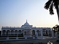 Railway Museum near Cooch Behar Station
 -
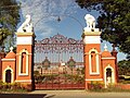 Palace Gate
 -
 Sahid Bag, Cooch Behar
 -
 Bhola Ashram, Cooch Behar. (Residence of Executive Engineer WBPWD)
 -
 Madan Mohan Bari Entrance
 -
 Circuit House
 -
 New Cooch Behar at night
 -
 New Cooch Behar Junction
 -
 Debi Bari Cooch Behar
 -
 Moti Mahal
 -
 Madanmohan Temple at night
 -
 Palace view from the stadium


.jpg)
.jpg)
.jpg)
.jpg)


.jpg)
.jpg)

.jpg)
See also
- Madan Mohan Temple, a temple dedicated to Madan Mohan
- Narendra Narayan Park, a botanical garden in town, founded in 1892
- Cooch Behar Stadium, a multi-purpose stadium
References
 |
- ↑ "Cooch Behar City". coochbeharmunicipality.com. Archived from the original on 15 February 2020. Retrieved 26 November 2020.
- ↑ "Demography | Cooch Behar District | India". Retrieved 1 May 2023.
- ↑ 3.0 3.1 "Fact and Figures". wb.gov.in. Archived from the original on 14 June 2020. Retrieved 15 January 2019.
- ↑ "52nd Report of the Commissioner for Linguistic Minorities in India" (PDF). nclm.nic.in. Ministry of Minority Affairs. p. 85. Archived from the original (PDF) on 25 May 2017. Retrieved 2 March 2019.
- ↑ PTI (28 February 2018). "Kamtapuri, Rajbanshi make it to list of official languages in". India Today. Retrieved 11 October 2023.
- ↑ "Head Post Office Coochbehar". Cooch Behar District - India. Retrieved 10 February 2026.
- ↑ Torsa river bank in Cooch Behar
- ↑ "Cooch Behar District | Cooch Behar – City of Beauty | India". Retrieved 22 April 2025.
- ↑ Rathore, Abhinay (5 January 1954). "Cooch Behar (Princely State)". Rajput Provinces of India. Retrieved 22 April 2025.
- ↑ "History | District Court, Cooch Behar | India". Retrieved 22 April 2025.
- ↑ Pal, Dr. Nripendra Nath (2000). Itikathai Cooch Behar (A brief history of Cooch Behar). Kolkata: Anima Prakashani. pp. 11–12.
- ↑ The name Cooch Behar is a compound of two words: Cooch and Behar. Cooch is a corrupted form of Coch or Koch, the name of an ethnic group inhabiting a vast tract of land to the northeast of Bengal. Behar or, more properly, Vihara denotes abode or sport. Cooch Behar means, therefore, the abode or land of the Koches. Ray, B.. CENSUS 1961 WEST BENGAL Archived 12 October 2022 at the Wayback Machine. GOVERNMENT PRINTING, WEST BENGAL, 1961, p.20
- ↑ Nath, D. (1989), History of the Koch Kingdom, C. 1515-1615, Mittal Publications, pp. 5–6, ISBN 8170991099, archived from the original on 3 May 2023, retrieved 3 May 2023
- ↑ "Royal History of Cooch Behar". Archived from the original on 21 July 2011. Retrieved 22 October 2006.
- ↑ Pal, Dr. Nripendra Nath (2000). Itikathai Cooch Behar (A brief history of Cooch Behar). Kolkata: Anima Prakashani. p. 68.
- ↑ 16.0 16.1 Bhattacharyya, PK (2012). "Kamata-Koch Behar". In Islam, Sirajul; Jamal, Ahmed A. (eds.). Banglapedia: National Encyclopedia of Bangladesh (Second ed.). Asiatic Society of Bangladesh. Archived from the original on 16 April 2023. Retrieved 3 May 2023.
- ↑ "Old Coins of Bhutan". Mintage World. Archived from the original on 10 October 2021. Retrieved 10 October 2021.
- ↑ Pal, Dr. Nripendra Nath (2000). Itikathai Cooch Behar (A brief history of Cooch Behar). Kolkata: Anima Prakashani. p. 73.
- ↑ Bowman, John S., ed. (2000). Columbia Chronologies of Asian History and Culture. New York: Columbia University Press. pp. 385. ISBN 0-231-11004-9.
- ↑ Pal, Dr. Nripendra Nath (2000). Itikathai Cooch Behar (A brief history of Cooch Behar). Kolkata: Anima Prakashani. p. 75.
- ↑ "Royal History of Cooch Behar 5". Archived from the original on 21 July 2011. Retrieved 22 October 2006.
- ↑ 22.0 22.1 "Brief Royal History of Cooch Behar 5". Archived from the original on 24 July 2011. Retrieved 22 October 2006.
- ↑ 23.0 23.1 23.2 Annual Plan on Agriculture 2003–04. Cooch Behar: Cooch Behar District Agriculture Office. p. 2.
- ↑ "West Bengal Tourism: Cooch Behar". Archived from the original on 15 July 2009.
- ↑ 25.0 25.1 Indian Ministry of Forests and Environment. "Protected areas: Sikkim". Archived from the original on 23 August 2011. Retrieved 25 September 2011.
- ↑ 26.0 26.1 26.2 26.3 "Station: Cooch Behar (A) Climatological Table 1981–2010" (PDF). Climatological Normals 1981–2010. India Meteorological Department. January 2015. pp. 207–208. Archived from the original (PDF) on 5 February 2020. Retrieved 10 January 2021.
- ↑ "Climatological Tables of Observatories in India 1991-2020" (PDF). India Meteorological Department. Retrieved 8 April 2024.
- ↑ "Extremes of Temperature & Rainfall for Indian Stations (Up to 2012)" (PDF). India Meteorological Department. December 2016. p. M233. Archived from the original (PDF) on 5 February 2020. Retrieved 10 January 2021.
- ↑ "A-02: Decadal variation in population 1901-2011" (PDF). Office of the Registrar General & Census Commissioner, India. 2011. Archived (PDF) from the original on 30 April 2023. Retrieved 30 April 2023.
- ↑ 30.0 30.1 "C-01: Population by religious community". Office of the Registrar General & Census Commissioner, India. 2011. Archived (XLS) from the original on 5 April 2023. Retrieved 30 April 2023.
- ↑ 31.0 31.1 "C-16 City: Population by mother tongue (town level)" (XLS). Registrar General and Census Commissioner of India. 2011. Archived from the original on 1 May 2023. Retrieved 1 May 2023.
- ↑ "Demography | Cooch Behar District | India". Archived from the original on 9 February 2023. Retrieved 1 May 2023.
- ↑ "C-08: Educational level by age and sex for population age seven and above (total)". Registrar General and Census Commissioner of India. 2011. Archived from the original on 1 May 2023. Retrieved 1 May 2023.
- ↑ "Coochbehar Municipality: Population". coochbeharmunicipality.com. Archived from the original on 16 April 2023. Retrieved 1 May 2023.
- ↑ "Koch Bihar (Cooch Behar) District Population Census 2011 - 2021 - 2023, West Bengal literacy sex ratio and density". www.census2011.co.in. Archived from the original on 6 April 2023. Retrieved 1 May 2023.
- ↑ "What is the literacy rate of Koch Bihar (Cooch Behar) district of West Bengal in 2011 census?". www.census2011.co.in. Archived from the original on 12 November 2017. Retrieved 1 May 2023.
- ↑ "Profile - Literacy - Know India: National Portal of India". knowindia.india.gov.in. Archived from the original on 15 April 2023. Retrieved 1 May 2023.
- ↑ "Cooch Behar Municipal (Amendment) Act, 1962". latestlaws.com. Retrieved 19 December 2025.
- ↑ "Wayback Machine" (PDF). www.indiacode.nic.in. Archived from the original (PDF) on 11 June 2023. Retrieved 19 December 2025.
{{cite web}}: Cite uses generic title (help) - ↑ District Administration Archived 3 August 2011 at the Wayback Machine Accessed on 1 October 2006
- ↑ "Press Note, Delimitation Commission" (PDF). Assembly Constituencies in West Bengal. Delimitation Commission. pp. 4, 23. Archived (PDF) from the original on 8 January 2011. Retrieved 18 April 2009.
- ↑ "North Bengal: Cooch Behar". Archived from the original on 8 November 2006. Retrieved 7 November 2006.
- ↑ "Rush to start Cooch Behar medical college". Archived from the original on 8 June 2019. Retrieved 9 September 2019.
{{cite web}}: CS1 maint: bot: original URL status unknown (link) - ↑ "Subham Hospital & Diagnostic Centre (P) Ltd. | National Health Portal of India". nhp.gov.in. Archived from the original on 22 October 2021. Retrieved 22 October 2021.
- ↑ "Social Infrastructure". Archived from the original on 26 August 2019. Retrieved 9 September 2019.
- ↑ prmgroup.co.in. "Retail Projects PRM Group". prmgroup.co.in. Archived from the original on 22 October 2021. Retrieved 22 October 2021.
- ↑ "Employment in Cooch Behar". coochbehar.nic.in. Archived from the original on 1 May 2022. Retrieved 29 April 2022.
- ↑ Industries in Cooch Behar Archived 27 March 2007 at the Wayback Machine, Cooch Behar Government Website Archived 15 July 2010 at the Wayback Machine Accessed on 1 October 2006
- ↑ Tourism Development in Cooch Behar Archived 27 March 2007 at the Wayback Machine, Cooch Behar Government Website Archived 15 July 2010 at the Wayback Machine Accessed on 1 October 2006
- ↑ "Rajbari in Cooch Behar town". Archived from the original on 14 August 2022. Retrieved 3 May 2023.
- ↑ "Tourist places of Cooch Behar". Archived from the original on 10 August 2022. Retrieved 3 May 2023.
- ↑ "State Highways in West Bengal". www.wbtrafficpolice.com. Archived from the original on 29 April 2023. Retrieved 29 April 2023.
- ↑ "Road-State Highway". wbpwd.gov.in. Archived from the original on 29 April 2023. Retrieved 29 April 2023.
- ↑ "NBSTC Bus routes" (PDF). nbstc.in/. Archived (PDF) from the original on 1 February 2023. Retrieved 29 April 2023.
- ↑ "About - North Bengal State Transport Corporation". nbstc.in. Archived from the original on 1 February 2023. Retrieved 1 May 2023.
- ↑ "Depots & Divisions - North Bengal State Transport Corporation". nbstc.in. Retrieved 5 April 2024.
- ↑ "COOCHBEHAR - West Bengal Tourism, Experience Bengal, Dept. of Tourism, Govt. of W. B." wbtourism.gov.in. Archived from the original on 26 November 2022. Retrieved 29 April 2023.
- ↑ "Some Milestones of NF Railway". Archived from the original on 24 November 2011. Retrieved 28 January 2012.
- ↑ "New Cooch Behar railway station gets facade of local palace". www.telegraphindia.com. Archived from the original on 3 May 2023. Retrieved 29 April 2023.
- ↑ "Renovation of 'Pay and Use' toilet at New Cooch Behar station complete". The Economic Times. 10 July 2015. ISSN 0013-0389. Archived from the original on 3 May 2023. Retrieved 29 April 2023.
- ↑ "[IRFCA] The State Railways of Cooch Behar (1903)". www.irfca.org. Archived from the original on 28 November 2022. Retrieved 29 April 2023.
- ↑ "Construction of Railway Heritage Museum starts". COOCHBEHAR CALLING. 10 March 2011. Archived from the original on 23 March 2017. Retrieved 29 April 2023.
- ↑ "Rail Museum at Cooch Behar" (PDF). nfr.indianrailways.gov.in. Archived (PDF) from the original on 29 April 2023. Retrieved 29 April 2023.
- ↑ "Cooch Behar back on West Bengal's aviation map". The Times of India. 22 February 2023. ISSN 0971-8257. Archived from the original on 31 March 2023. Retrieved 29 April 2023.
- ↑ "Coochbehar Panchanan Barma University :: Home". Archived from the original on 22 April 2023. Retrieved 3 May 2023.
- ↑ "COOCHBEHAR GOVERNMENT ENGINEERING COLLEGE, COOCH BEHAR". Archived from the original on 29 December 2019. Retrieved 9 September 2019.
- ↑ Education in Cooch Behar Archived 21 July 2011 at the Wayback Machine, Cooch Behar Government Website Archived 15 July 2010 at the Wayback Machine Accessed on 1 October 2006
- ↑ "Private education Bill passed amidst Opposition walkout". The Statesman. 6 July 2012. Retrieved 7 July 2012.
{{cite news}}: CS1 maint: deprecated archival service (link) - ↑ "Bill passed to set up private varsity". Asian Age. 7 July 2012. Archived from the original on 11 December 2017. Retrieved 7 July 2012.
- ↑ "Acharya Brojendra Nath Seal College". Archived from the original on 16 December 2014. Retrieved 9 September 2019.
{{cite web}}: CS1 maint: bot: original URL status unknown (link) - ↑ Maya Chitram Art Institute.[permanent dead link] India for You. Retrieved 19 August 2012.
- ↑ "CM inaugurates Maharaja Jitendra Narayan Medical College & Hospital in Cooch Behar". Millennium Post. 16 December 2020. Retrieved 13 September 2023.
- ↑ EOI, Correspondence. "NBDD minister inaugurates multiple projects in Cooch Behar". Archived from the original on 14 January 2015.
External links

Cities and towns in Cooch Behar district | |||||||||||
|---|---|---|---|---|---|---|---|---|---|---|---|
| Cities, municipal and census towns |
| ||||||||||
| Locations other than cities and towns |
| ||||||||||
| Related topics | |||||||||||


| Part A States |  | |
|---|---|---|
| Part B States | ||
| Part C States | ||
| Part D States | ||
.png)
- Pages using the JsonConfig extension
- Pages with Bengali IPA
- Articles needing additional references from June 2024
- Articles needing additional references from April 2023
- Articles with broken or outdated citations from April 2023
- All articles with broken or outdated citations
- Cities and towns in Cooch Behar district
- Former capitals in India
- Cooch Behar
- Cities in West Bengal
- Planned cities in West Bengal
- Planned communities in India