



imported>Narky Blert Link to DAB page -> redlink |
Priyupranav (talk | contribs) refined details for clarity and added references |
||
| Line 1: | Line 1: | ||
{{about|the | {{Short description|District in West Bengal, India}} | ||
{{about|the district of West Bengal|the Malda type of mango|List of mango cultivars}} | |||
{{Use Indian English|date=June 2025}} | |||
{{Use dmy dates|date=June 2025}} | |||
}} | |||
{{Use Indian English|date= | |||
{{Use dmy dates|date= | |||
{{Infobox settlement | {{Infobox settlement | ||
| name | | name = Malda district | ||
| settlement_type | | native_name = {{native_name|bn|Māldôho Jelā}} | ||
| | | other_name = | ||
| | | settlement_type = [[List of districts of West Bengal|District]] of [[West Bengal]] | ||
| | | image_skyline = {{multiple image | ||
| | | border = infobox | ||
| | | total_width = 280 | ||
| | | caption_align = center | ||
| | | perrow = 1/2/2/1 | ||
| | |image1 = Baraduari Mosque alias Barasona Mosque at Gaur 05.jpg | ||
| | |image2 = Firoze Minar at Gaur in Malda district 10.jpg | ||
|image3 = Lukachuri Gateway at Gaur in Malda District 02.jpg | |||
|image4 = The Tomb of Fateh Khan, Gaur, WB.jpg | |||
|image5 = Adina Mosque exterior view.jpg | |||
|image6 = Malda Town Railway Station.jpg | |||
}} | }} | ||
| | | caption = Clockwise from top-left: [[Baro Shona Masjid|Baro Sona mosque]], [[Lukochuri Darwaza|Lukachuri gateway]] in [[Gauḍa (city)|Gaur]], [[Adina Mosque]], Malda Town Railway Station, Tomb of Fateh Khan and [[Firoz Minar]] | ||
| image_map | | image_map = {{maplink|frame=yes|frame-width=300|frame-height=300|frame-align=center|type=shape|id=Q2049820 |stroke-colour=#C60C30|stroke-width=2|text=Interactive Map Outlining Malda District}} | ||
| | | image_map1 = Malda in West Bengal (India).svg | ||
| coordinates | | mapsize = 300 | ||
| | | map_caption1 = Location of Malda district in West Bengal | ||
| coordinates = {{coord|25|06|N|88|06|E|region:IN-WB_type:adm3rd_dim:100000|display=inline,title}} | |||
| subdivision_name | | subdivision_type = [[List of sovereign states|Country]] | ||
| subdivision_type1 | | subdivision_name = [[India]] | ||
| subdivision_name1 | | subdivision_type1 = [[States and union territories of India|State]] | ||
| subdivision_type2 | | subdivision_name1 = [[West Bengal]] | ||
| subdivision_name2 | | subdivision_type2 = [[Administrative divisions of West Bengal|Division]] | ||
| subdivision_name2 = [[Malda division|Malda]] | |||
| seat_type = Headquarters | |||
| seat_type | | seat = [[Malda, West Bengal|Malda]] | ||
| seat | | leader_title = [[List of subdivisions of West Bengal|Subdivisions]] | ||
| | | leader_name = [[Malda Sadar subdivision|Malda Sadar]], [[Chanchal subdivision|Chanchal]] | ||
| | | leader_title1 = [[Community Development Block|CD Blocks]] | ||
| | | leader_name1 = [[English Bazar (community development block)|English Bazar]], [[Old Malda (community development block)|Old Malda]], [[Gazole (community development block)|Gazole]], [[Habibpur (community development block)|Habibpur]], [[Kaliachak I]], [[Kaliachak II]], [[Kaliachak III]], [[Manikchak (community development block)|Manikchak]], [[Bamangola (community development block)|Bamangola]], [[Chanchal I]], [[Chanchal II]], [[Ratua I]], [[Ratua II]], [[Harishchandrapur I]], [[Harishchandrapur II]] | ||
| | | leader_title2 = [[List of constituencies of the Lok Sabha|Lok Sabha constituencies]] | ||
| | | leader_name2 = [[Maldah Dakshin (Lok Sabha constituency)|Maldah Dakshin]], [[Maldaha Uttar (Lok Sabha constituency)|Maldah Uttar]] | ||
| | | leader_title3 = [[List of constituencies of the West Bengal Legislative Assembly|Vidhan Sabha constituencies]] | ||
| | | leader_name3 = [[Habibpur (Vidhan Sabha constituency)|Habibpur]], [[Gazole (Vidhan Sabha constituency)|Gazole]], [[Chanchal (Vidhan Sabha constituency)|Chanchal]], [[Harishchandrapur (Vidhan Sabha constituency)|Harishchandrapur]], [[Malatipur (Vidhan Sabha constituency)|Malatipur]], [[Ratua (Vidhan Sabha constituency)|Ratua]], [[Manikchak (Vidhan Sabha constituency)|Manikchak]], [[Maldaha (Vidhan Sabha constituency)|Maldah]], [[English Bazar (Vidhan Sabha constituency)|English Bazar]], [[Mothabari (Vidhan Sabha constituency)|Mothabari]], [[Sujapur (Vidhan Sabha constituency)|Sujapur]], [[Baisnabnagar (Vidhan Sabha constituency)|Baisnabnagar]] | ||
| | | total_type = Total | ||
| | | area_total_km2 = 3733 | ||
| | | area_footnotes = | ||
| | | population_as_of = 2011 | ||
| population_total = 3,988,845 | |||
| population_footnotes = | |||
| population_urban = 541,660 | |||
| population_density_km2 = auto | |||
| demographics_type1 = Demographics | |||
| demographics1_title1 = [[Literacy in India|Literacy]] | |||
| | | demographics1_info1 = 62.71 per cent | ||
| | | demographics1_title2 = [[Human sex ratio|Sex ratio]] | ||
| | | demographics1_info2 = 939 [[male|♂]]/[[female|♀]] | ||
| | | demographics_type2 = Languages | ||
| | | demographics2_title1 = Official | ||
| | | demographics2_info1 = [[Bengali language|Bengali]]<ref name="wblangoff">{{cite web|title=Fact and Figures|url=https://wb.gov.in/portal/web/guest/facts-and-figures;jsessionid=JzdD9RHb7aMY5esZPtcsIVLy|website=Wb.gov.in|access-date=5 July 2019}}</ref><ref>{{cite web|title=52nd Report of the Commissioner for Linguistic Minorities in India|url=http://nclm.nic.in/shared/linkimages/NCLM52ndReport.pdf|website=Nclm.nic.in|publisher=[[Ministry of Minority Affairs]]|access-date=5 July 2019|page=85|url-status=dead|archive-url=https://web.archive.org/web/20170525141614/http://nclm.nic.in/shared/linkimages/NCLM52ndReport.pdf|archive-date=25 May 2017}}</ref> | ||
| | | demographics2_title2 = Additional official | ||
| | | demographics2_info2 = [[English language|English]]<ref name="wblangoff"/> | ||
| | | timezone1 = [[Indian Standard Time|IST]] | ||
[[ | | utc_offset1 = +05:30 | ||
| | | website = {{URL|http://malda.gov.in/}} | ||
| | |||
| website | |||
}} | }} | ||
The headquarters of Malda district is in [[English Bazar]], also known as ''Malda'', which was once the capital of Bengal. The district maintains the traditions of the past in culture and education. [[Old Malda]], the town which lies just east of the confluence of the [[Mahananda River|Mahananda]] and [[Kalindi River]] | '''Malda district''', also spelt '''Maldah''' or '''Maldaha''' ({{IPA|bn|malda|lang}}, {{IPA|bn|maldɔɦ|}}, often {{IPA|bn|maldɔɦo|}}), is a district in [[West Bengal]], India.<ref>{{Cite web |title=Malda District {{!}} Government of West Bengal {{!}} India |url=https://malda.gov.in/ |access-date=4 April 2025 |language=en-US}}</ref> The capital of the [[Bengal Sultanate]], [[Gauḍa (city)|Gauda]] and [[Pandua, Malda|Pandua]], was situated in this district.<ref>{{Cite web |title=The Rise of Islam and the Bengal Frontier, 1204–1760 |url=https://publishing.cdlib.org/ucpressebooks/view?docId=ft067n99v9&chunk.id=s1.2.3&toc.depth=1&brand=ucpress |access-date=4 April 2025 |website=publishing.cdlib.org}}</ref> [[Mango]], [[jute]] and [[silk]] are the most notable products of this district. The special variety of mango, [[Fazli (mango)|Fazli]], produced in this region is popularly known by the name of the district and is exported across the world and is internationally acclaimed. The folk culture of [[gombhira]] is a feature of the district, being a unique way of representation of joy and sorrow in daily life of the common people, as well as the unique medium of presentation on national and international matters. | ||
According to the [[National Investigation Agency]] Malda is believed to be a hub of a [[counterfeit money|fake currency]] racket.<ref>[http://timesofindia.indiatimes.com/city/kolkata/Malda-gateway-of-fake-currencies/articleshow/48950199.cms Malda, gateway of fake currencies]. (14 September 2015). [[Times of India]]. Retrieved 12 March 2021.</ref><ref>{{cite web|url=http://scroll.in/article/821401/malda-indias-fake-currency-capital-is-feeling-the-demonetisation-pinch|title=Malda, India's fake currency capital, is feeling the demonetisation pinch|date=14 November 2016 }}</ref><ref>{{Cite web|url=http://www.oneindia.com/india/why-does-fake-currency-come-from-west-bengal-1788096.html|title=Why does all fake currency come from West Bengal?|date=25 June 2015}}</ref> It has been reported that 90 per cent of the fake currency that enters India (through Bangladesh) originates in Malda.<ref>{{Cite web|url=http://www.ndtv.com/india-news/malda-violence-was-bsf-vs-people-claims-mamata-banerjee-1263898|title = Malda Violence Was 'BSF Vs People', Claims Mamata Banerjee}}</ref><ref>{{Cite web|url=https://www.indiatoday.in/pti-feed/story/fake-currency-seized-from-malda-494216-2015-10-13|title=Fake currency seized from Malda|date=13 October 2015 }}</ref>{{better|date=February 2025}} The headquarters of Malda district is in [[Malda, West Bengal|English Bazar]], also known as ''Malda'', which was once the [[Capital city|capital]] of [[Bengal]]. The district maintains the traditions of the past in culture and education. [[Old Malda]], the town which lies just east of the confluence of the [[Mahananda River|Mahananda]] and [[Kalindi River|Kalindi]] rivers, is part of the English Bazar metropolitan city. The town rose to prominence as the river port of the old capital of [[Pandua, Malda|Pandua]]. During the 18th century, it was the seat of prosperous cotton and silk industries. It remains an important distribution centre for rice, jute, and wheat. The area between the historical monument of Jame Masjid (1566) and the landmark of Nimasarai Tower across the river Mahananda, constituted a municipality in 1867. Rice, jute, [[legumes]], and [[oilseed]] are the chief crops in the surrounding area. Malda is the largest producer of excellent quality jute in India. [[Mulberry]] plantations and mango orchards also occupy large areas; mango trade and silk manufacture are the main economic activities. | |||
==History== | ==History== | ||
| Line 76: | Line 75: | ||
It had been within the limits of ancient ''Gour'' and ''Pandua'' ([[Pundravardhana|''Pundrabardhana'']]). These two cities had been the capital of Bengal in ancient and medieval ages and are equidistant, north and south, from [[Malda, West Bengal|English Bazar]] town (once known as Engelzavad established by the British rulers). | It had been within the limits of ancient ''Gour'' and ''Pandua'' ([[Pundravardhana|''Pundrabardhana'']]). These two cities had been the capital of Bengal in ancient and medieval ages and are equidistant, north and south, from [[Malda, West Bengal|English Bazar]] town (once known as Engelzavad established by the British rulers). | ||
The boundary of Gour was changed in different ages since the fifth century BC, and its name can be found in [[Purana|Puranic]] texts. [[Mahasthangarh|Pundranagara]] was the provincial capital of the [[Maurya Empire]]. Gour and [[Pundravardhana]] formed parts of the Mourya empire as is evinced from the [[inscription]]s, [[Brāhmī script|Brahmi]] script on a seal discovered from the ruins of [[Mahasthangarh]] in the [[Bogra District]] of [[Bangladesh]]. [[Xuanzang]] saw many [[Ashoka]]n [[stupa]]s at Pundravardhana. | |||
The inscriptions discovered in the district of undivided [[Dinajpur District, Bangladesh|Dinajpur]] and other parts of North Bengal, along with the [[Allahabad]] pillar inscriptions of [[Samudragupta]], clearly indicate that the whole of [[North Bengal]] as far east as [[Kamrup region|Kamrup]] formed a part of the [[Gupta Empire]]. After the Guptas at the beginning of seventh century AD [[Sasanka]], the king of Karnasubarna, as well as the king of [[Gauḍa region|Gauda]], ruled independently for more than three decades. From the middle of the eighth century to the end of the 11th century the Pala dynasty ruled Bengal, and the kings were devoted to [[Buddhism]]. It was during their reign that the Jagadalla Vihara (monastery) in Barindri flourished paralleling with [[Nalanda]], Vikramshila and Devikot.<ref name="HANDBOOK"/> | |||
The inscriptions discovered in the district of undivided [[Dinajpur District, Bangladesh|Dinajpur]] and other parts of North Bengal, along with the [[Allahabad]] pillar inscriptions of [[Samudragupta]], clearly indicate that the whole of [[North Bengal]] as far east as [[Kamrup region|Kamrup]] formed a part of the [[Gupta Empire]]. | |||
After the Guptas at the beginning of | |||
===Gour Era=== | ===Gour Era=== | ||
The [[Pala | The [[Pala Empire]] yielded to the emergence of the [[Sen Dynasty]]. The Sen rulers were [[Orthodox Hinduism|orthodox Hindus]], and in the habit of moving from place to place within their kingdom. During this time, Buddhism went on the defensive. It eventually disappeared from the demographic map of Bengal. At the time of Gaudeshwara [[Lakshman Sen]], Goud was known as Lakshmanabati. During his reign Bengal was attacked by the Turkic force of [[Muhammad bin Bakhtiyar Khalji|Bakhtiyar Khilji]]. After Lakshman Sen, Keshava Sen, Biswarup Sen, Madhava Sen etc. many Sena dynasty rulers ruled Gauda and hold the title Gaudeshwara Then Deva dynasty kings of Chandradwip ruled Bengal. Deva dynasty king [[Danujmardandeva]] and [[Mahendra Deva]] both hold the title Gaudeshwara.{{citation needed|date=August 2021}} | ||
The name Mal Daha was coined (from ''Mal'' meaning riches and ''Daha'' meaning lake). Sultans [[Ilyas Shah]], [[Ilyas Shahi dynasty|Firuz Shah]], [[Sikandar Shah]], [[Raja Ganesha]], [[Alauddin Hussain Shah]] and [[Nasiruddin Nasrat Shah]] were the notable rulers of the medieval age. Afghan warrior [[Sher Shah Suri]] | The name Mal Daha was coined (from ''Mal'' meaning riches and ''Daha'' meaning lake). [[Sultan|Sultans]] [[Ilyas Shah]], [[Ilyas Shahi dynasty|Firuz Shah]], [[Sikandar Shah]], [[Raja Ganesha]], [[Alauddin Hussain Shah]] and [[Nasiruddin Nasrat Shah]] were the notable rulers of the medieval age. [[Afghanistan|Afghan]] warrior [[Sher Shah Suri]] conquered [[Gauḍa (city)|Gour]]<ref>{{cite web |title=Malda: A spectacle of desolation in West Bengal |url=https://www.sundayguardianlive.com/culture/malda-spectacle-desolation-west-bengal |website=The Sunday Guardian Live |date=30 May 2020}}</ref> and was repelled by [[Mughal emperor]] [[Humayun]]. [[Humayun]], loving the [[mango]] of Gour, named the place ''Jannatabad'' (garden of heaven). [[Firuz Shah Tughlaq]], [[Ghiyasuddin Mahmud Shah|Ghiyasuddin]] and the [[Mughal Empire|Mughal]] army invaded [[Gaur|Gour]] to suppress rebellion several times. | ||
Relics of | Relics of [[Islamic architecture]] structures are present in Malda district, such as [[Gaur|Firuz minar]], [[Adina Mosque]] (the largest [[mosque]] of [[South Asia]] at the time), and [[Qutwali Gate]]. During the Mughal rule, the capital was removed to [[Dhaka]] due to a course change of the river [[Ganges]]. Muslim rule ended in 1757. [[Koch dynasty|Koch]] army invasion increased during the downfall of Gour.<ref name="HANDBOOK"/><ref>{{Cite web|title=Malda: A spectacle of desolation in West Bengal|url=https://www.sundayguardianlive.com/culture/malda-spectacle-desolation-west-bengal|date=30 May 2020|website=The Sunday Guardian Live|language=en-US|access-date=2 June 2020}}</ref> | ||
===Post-Gour Era=== | ===Post-Gour Era=== | ||
| Line 94: | Line 90: | ||
After the [[Battle of Plassey|war of Palassy]], the [[East India Company|British]] rule started in 1757. The English traders settled in the southern bank of the river [[Mahananda River|Mahananda]]. Some indigo plant chambers, trade centre, and offices were established. [[William Carey (missionary)|William Carey]] worked here. But the glory days were gone.{{opinion|date=March 2021}} | After the [[Battle of Plassey|war of Palassy]], the [[East India Company|British]] rule started in 1757. The English traders settled in the southern bank of the river [[Mahananda River|Mahananda]]. Some indigo plant chambers, trade centre, and offices were established. [[William Carey (missionary)|William Carey]] worked here. But the glory days were gone.{{opinion|date=March 2021}} | ||
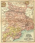
[[Image:1907-bengal-sikkim3.jpg|right|thumb|1907 Map of Bengal with Sikkim]] | [[Image:1907-bengal-sikkim3.jpg|right|thumb|1907 Map of Bengal with Sikkim]] | ||
This district was formed out of some portions of outlying areas of [[Purnia]], [[Dinajpur District, Bangladesh|Dinajpur]] and [[Rajshahi District|Rajshahi]] districts in 1813. At the time of Dr. B. Hamilton (1808–09), the present thanas of [[Gazole Town|Gazole]], Malda, Bamongola, and part of [[Habibpur]] were included in the district of Dinajpur and the thanas of Harischandrapur, Kharba, Ratua, Manikchak, and Kaliachak were included in the district of Purnia. In 1813, in consequence of the prevalence of serious crimes in the Kaliachak and Sahebganj thanas and also on the rivers, a Joint Magistrate and Deputy Collector were appointed at English Bazar, with jurisdiction over a number of police stations centering that place and taken from the two districts. Thus the district of Malda was born. The year 1832 saw the establishment of a separate treasury and the year 1859 the posting of a full-fledged magistrate and collector. | This district was formed out of some portions of outlying areas of [[Purnia]], [[Dinajpur District, Bangladesh|Dinajpur]] and [[Rajshahi District|Rajshahi]] districts in 1813. At the time of Dr. B. Hamilton (1808–09), the present thanas of [[Gazole Town|Gazole]], Malda, Bamongola, and part of [[Habibpur]] were included in the district of Dinajpur and the thanas of Harischandrapur, Kharba, Ratua, Manikchak, and Kaliachak were included in the district of Purnia. In 1813, in consequence of the prevalence of serious crimes in the Kaliachak and Sahebganj thanas and also on the rivers, a Joint Magistrate and Deputy Collector were appointed at English Bazar, with jurisdiction over a number of police stations centering that place and taken from the two districts. Thus the district of Malda was born. The year 1832 saw the establishment of a separate treasury and the year 1859 the posting of a full-fledged magistrate and collector.{{cn|date=October 2024}} | ||
Up to 1876, this district formed part of [[Rajshahi Division]] and between 1876 and 1905, it formed part of [[Bhagalpur Division]]. In 1905, it was again transferred to Rajshahi Division and until 1947, Malda remained in this division. During the first [[Partition of Bengal (1905)|Partition of Bengal of 1905]], this district was attached to the newly created province of [[Eastern Bengal and Assam]]. Malda has a history of the Indigo movement led by Rafique Mondal. The Santhals got insurgent and captured historic [[Adina Mosque]] in support of Jeetu. Again in August 1947, this district was affected by partition. Between 12–15 August 1947, the fate of the district as to which side it should go, to Pakistan or to India, was undecided because the announcement of the partition award of | Up to 1876, this district formed part of [[Rajshahi Division]] and between 1876 and 1905, it formed part of [[Bhagalpur Division]]. In 1905, it was again transferred to Rajshahi Division and until 1947, Malda remained in this division. During the first [[Partition of Bengal (1905)|Partition of Bengal of 1905]], this district was attached to the newly created province of [[Eastern Bengal and Assam]]. Malda has a history of the Indigo movement led by [[Rafique Mondal]]. The Santhals got insurgent and captured historic [[Adina Mosque]] in support of Jeetu. Again in August 1947, this district was affected by partition. Between 12–15 August 1947, the fate of the district as to which side it should go, to Pakistan or to India, was undecided because the announcement of the partition award of [[Cyril Radcliffe, 1st Viscount Radcliffe|Cyril Radcliffe]] did not make this point clear. During these few days, the district was under a Magistrate of [[East Pakistan]] due to Muslim majority (1941 British India census). When the details of the [[Radcliffe Award]] were published, the district came over to [[West Bengal]] on 17 August 1947. However, the sub-division of [[Chapai Nawabganj District|Nawabganj]] was severed from Malda and was given to East Pakistan as a sub-division of the [[Rajshahi]] district.<ref name="HANDBOOK">{{cite book|title=HISTORY AND SCOPE OF THE DISTRICT CENSUS HANDBOOK|page=7|url=http://www.censusindia.gov.in/2011census/dchb/DCHB_A/19/1906_PART_A_DCHB_MALDAH.pdf|access-date=23 December 2016}}</ref> | ||
==Geography== | ==Geography== | ||
The [[latitude]] range is 24°40’20" N to 25°32’08" N, and the [[longitude]] range is 87°45’50" E to 88°28’10" E. The district covers an area of {{convert|3733.66|km2|sqmi|1}}. The total population (as of 2001 Census) was recorded as 3,290,160. | The [[latitude]] range is 24°40’20" N to 25°32’08" N, and the [[longitude]] range is 87°45’50" E to 88°28’10" E. The district covers an area of {{convert|3733.66|km2|sqmi|1}}. The total population (as of 2001 Census) was recorded as 3,290,160. | ||
Malda is called the gateway of North [[Bengal]]. It was once the capital of Gour-Banga with its {{convert|3733|km2|sqmi|0}} lay of the land classified into Tal, Diara, and Barind. | Malda is called the gateway of North [[Bengal]]. It was once the capital of [[Gour-Banga]] with its {{convert|3733|km2|sqmi|0}} lay of the land classified into Tal, Diara, and Barind. | ||
To the south is [[Murshidabad district]], to the north are [[North Dinajpur| North Dinajpur district]] and [[South Dinajpur|South Dinajpur district]]. To the east is the international border with Bangladesh. To the west is [[Santhal Parganas]] of [[Jharkhand]] and [[Purnea]] of [[Bihar]]. | To the south is [[Murshidabad district]], to the north are [[North Dinajpur| North Dinajpur district]] and [[South Dinajpur|South Dinajpur district]]. To the east is the international border with Bangladesh. To the west is [[Santhal Parganas]] of [[Jharkhand]] and [[Purnea]] of [[Bihar]]. | ||
| Line 108: | Line 104: | ||
{{Main|Malda City}} | {{Main|Malda City}} | ||
'''Malda''', the district headquarters which lends its name to the district, during its early days grew up only near the side of the river Mahananda, and now the place is known as Phulbari. Some of the oldest houses can be found here. The city started to grow from | '''Malda''', the district headquarters which lends its name to the district, during its early days grew up only near the side of the river Mahananda, and now the place is known as Phulbari. Some of the oldest houses can be found here. The city started to grow from 1925 to 1930. Now nearly a half-million people live in this city, and it is one of the biggest cities of West Bengal. It was a part of the historic city of [[Gauḍa (city)|Gour]]. Malda is recognised as the [[Old Malda Municipality, Malda|Old Malda municipality]] and the [[English Bazar Municipality|English Bazar municipality]]. Its notable railway station is named as [[Malda Town railway station|Malda Town]]. | ||
===Mahadipur international border crossing=== | ===Mahadipur international border crossing=== | ||
The | The Mahadipur international border crossing is on the Malda-[[Rajshahi]] route at Mahadipur town in Malda district. | ||
==Local newspapers== | ==Local newspapers== | ||
The first monthly periodicals published from Malda was ''Kusum'', edited by Radhesh Chandra Seth, a noted personality of the then Malda. Though the exact date of its first publications is not known, it has been assumed by the informed sources that Kusum was first published in the 1890s. In 1896, Radhesh Chandra published two weekly newspapers ''Gourdoot'' and ''Gourbarta''.<ref>{{cite book|last1=Sarkar|first1=Ashim|title=Changing Profile of Bengal District:Malda 1932-1950|date=2008|publisher=Classique Books|location=9, Radhanath Mallik Lane, Kolkata|isbn=978-81-87616-34-4|pages=10–12|edition=First}}</ref> In 1897 Maldaha Samachar edited by Kaliprasanna Chakrabarty began to be published. Maulavi Abdul Ganikhan published 'Malda Akhbar' in 1914. In the same year, another periodical Gambhira' edited by Krishna Charan Sarkar was published. Damru, Adina and Minar—three weekly newspapers were published in 1941. The editors were Nanda Gopal Chowdhury, Akbar Munshi and Abdur Rahaman respectively. | The first monthly periodicals published from Malda was ''Kusum'', edited by Radhesh Chandra Seth, a noted personality of the then Malda. Though the exact date of its first publications is not known, it has been assumed by the informed sources that Kusum was first published in the 1890s. In 1896, Radhesh Chandra published two weekly newspapers ''Gourdoot'' and ''Gourbarta''.<ref>{{cite book|last1=Sarkar|first1=Ashim|title=Changing Profile of Bengal District:Malda 1932-1950|date=2008|publisher=Classique Books|location=9, Radhanath Mallik Lane, Kolkata|isbn=978-81-87616-34-4|pages=10–12|edition=First}}</ref> In 1897 Maldaha Samachar edited by Kaliprasanna Chakrabarty began to be published. Maulavi Abdul Ganikhan published 'Malda Akhbar' in 1914. In the same year, another periodical Gambhira' edited by Krishna Charan Sarkar was published. Damru, Adina and Minar—three weekly newspapers were published in 1941. The editors were Nanda Gopal Chowdhury, Akbar Munshi and Abdur Rahaman respectively. | ||
The most important among them was ''Gourdoot'' which was first published on 1896 by Radhesh Chandra Seth. But within a short period, the publication of the newspaper came to an end as the editor faced a serious financial loss. The 'Gourdoot' again began to be published from 1912 under the editorship of Lalbihari Majumdar. Majumdar was a great scholar and his literary sense was appreciated by Benoy Kumar Sarkar and Radhesh Chandra Seth. In this | The most important among them was ''Gourdoot'' which was first published on 1896 by Radhesh Chandra Seth. But within a short period, the publication of the newspaper came to an end as the editor faced a serious financial loss. The 'Gourdoot' again began to be published from 1912 under the editorship of Lalbihari Majumdar. Majumdar was a great scholar and his literary sense was appreciated by Benoy Kumar Sarkar and Radhesh Chandra Seth. In this endeavour, the editor was greatly supported by them and financed by Sarat Chandra Roy Chowdhury, Maharaja of Chancal. The Gourdoot was used to be published on Thursday of each week. The paper contained 6 pages and the price is one anna in 1944. The political outlook of the newspaper is pro-Congress. Moreover, Lalbihari Majumdar, its editor, took a pioneering role in organising the congress movement in Malda.{{cn|date=October 2024}} | ||
==Popular movements in Malda== | ==Popular movements in Malda== | ||
The most important among the popular movement is the one led by Jitu Santhal in 1932. Historians like Tanika Sarkar observes Jitu's movement was rooted in the rich tradition of tribal struggle in Malda. The early form of Santhal resistance was migration, which Professor Ashim Sarkar thinks amounted to a kind of passive resistance. Active struggle between the Santhals and their landlords began about 1910. | The most important among the popular movement is the one led by Jitu Santhal in 1932. Historians like Tanika Sarkar observes Jitu's movement was rooted in the rich tradition of tribal struggle in Malda. The early form of Santhal resistance was migration, which Professor Ashim Sarkar thinks amounted to a kind of passive resistance. Active struggle between the Santhals and their landlords began about 1910. | ||
As the barind (barindra) area began to be transformed into a developed agricultural zone, the zamindars of barind began to enhance the rent and curb the rights so far enjoyed by the Santhal from 1910 onwards. M.O Carter mentions cases were commonly found in which the lands cultivated by the adhiars, which were previously their occupancy holdings but had been sold up in rent or mortgage sales. This caused friction among zamindars and Santhals. The friction took an alarming proportion as early as 1910 when a zamindar of Bulbulchandi tried to enhance the rent. The Santhal tenants rose into protest. The gravity of the situation compelled Mr. Vas, the District Magistrate, to interfere and fix the rent. It was in this backdrop of oppression, exploitation and injustice. Jitu Santhal of Kochakandahar village of Habibpur began to mobilise the Santhals for a widespread movement. In 1926 Jitu became the leader of the Santhals by converting them | As the barind (barindra) area began to be transformed into a developed agricultural zone, the zamindars of barind began to enhance the rent and curb the rights so far enjoyed by the Santhal from 1910 onwards. M.O Carter mentions cases were commonly found in which the lands cultivated by the adhiars, which were previously their occupancy holdings but had been sold up in rent or mortgage sales. This caused friction among zamindars and Santhals. The friction took an alarming proportion as early as 1910 when a zamindar of Bulbulchandi tried to enhance the rent. The Santhal tenants rose into protest. The gravity of the situation compelled Mr. Vas, the District Magistrate, to interfere and fix the rent. It was in this backdrop of oppression, exploitation and injustice. Jitu Santhal of Kochakandahar village of Habibpur began to mobilise the Santhals for a widespread movement. In 1926 Jitu became the leader of the Santhals by [[Religious conversion|converting]] them to [[Vaivasvata Manu|Manuvadi]] Hinduism. In the same year 'Jitu's Sanyasi Dal' defied police order to perform a Kali puja to assert its new Hindu status. In September 1928 Santhals under Jitu's leadership [[looted]] the autumn crop of [[Sikarpur, Cooch Behar|Sikharpur]] which had recently been taken away from them in [[Barind Tract|barind]] region. The District Magistrate and the Superintendent of the Police rushed to the spot with armed police. After much skirmishes, Jitu along with his sixty followers arrested at the hand of the police.<ref>{{cite book|last1=Sarkar|first1=Ashim Kumar|title=Changing Profile of a Bengal District Malda:19|date=2008|publisher=Classique Books|location=9, Radhanath Mallik Lane, Kolkata-12|isbn=978-81-87616-34-4|page=35|edition=First}}</ref> | ||
==Economy== | ==Economy== | ||
| Line 136: | Line 130: | ||
|url=http://wbdemo5.nic.in/writereaddata/Directoryof_District_Block_GPs(RevisedMarch-2008).doc | |url=http://wbdemo5.nic.in/writereaddata/Directoryof_District_Block_GPs(RevisedMarch-2008).doc | ||
|title=Directory of District, Sub division, Panchayat Samiti/ Block and Gram Panchayats in West Bengal, March 2008 | |title=Directory of District, Sub division, Panchayat Samiti/ Block and Gram Panchayats in West Bengal, March 2008 | ||
|date=19 March 2008 | |date=19 March 2008 |access-date=10 November 2008 |work=West Bengal | ||
|publisher=National Informatics Centre, India | |publisher=National Informatics Centre, India | ||
|url-status=dead | |url-status=dead | ||
|archive-url=https://web.archive.org/web/20090225032419/http://wbdemo5.nic.in/writereaddata/Directoryof_District_Block_GPs%28RevisedMarch-2008%29.doc | |archive-url=https://web.archive.org/web/20090225032419/http://wbdemo5.nic.in/writereaddata/Directoryof_District_Block_GPs%28RevisedMarch-2008%29.doc | ||
|archive-date=25 February 2009 | |archive-date=25 February 2009 }}</ref> [[English Bazar]] is the district headquarters. There are 15 police stations(including malda woman police station),and one cybersecurity police station<ref>{{cite web | ||
}}</ref> [[English Bazar]] is the district headquarters. There are | |||
|url=http://web.cmc.net.in/wbcensus/DataTables/01/Table2_2.htm | |url=http://web.cmc.net.in/wbcensus/DataTables/01/Table2_2.htm | ||
|title=Census of India 2001, Final Population Totals, West Bengal, Rural Frame | |title=Census of India 2001, Final Population Totals, West Bengal, Rural Frame | ||
|work=West Bengal | |work=West Bengal | ||
|publisher=Directorate of census operations | |publisher=Directorate of census operations | ||
|access-date=10 November 2008 | |access-date=10 November 2008 |url-status=dead | ||
|archive-url=https://web.archive.org/web/20110719040820/http://web.cmc.net.in/wbcensus/DataTables/01/Table2_2.htm | |archive-url=https://web.archive.org/web/20110719040820/http://web.cmc.net.in/wbcensus/DataTables/01/Table2_2.htm | ||
|archive-date=19 July 2011 | |archive-date=19 July 2011 }}</ref> 15 development blocks, 2 municipalities, 146 [[gram panchayat]]s and 3,701 villages in this district.<ref name=blocdir/><ref name=adminsetup>{{cite web | ||
}}</ref> 15 development blocks, 2 municipalities, 146 [[gram panchayat]]s and 3,701 villages in this district.<ref name=blocdir/><ref name=adminsetup>{{cite web | |||
| url = http://malda.nic.in/Disprof.htm | | url = http://malda.nic.in/Disprof.htm | ||
| title = District Profile | | title = District Profile | ||
| Line 168: | Line 157: | ||
| work = West Bengal | | work = West Bengal | ||
| publisher = Directorate of census operations | | publisher = Directorate of census operations | ||
}}</ref> In total there are 10 urban units, 2 municipalities and 3 census towns. [[English Bazar]] and [[Old Malda]] form an [[urban agglomeration]]. | }}</ref> In total there are 10 urban units, 2 municipalities and 3 census towns. [[Malda, West Bengal|English Bazar]] and [[Old Malda]] form an [[urban agglomeration]]. | ||
====Chanchal subdivision==== | ====Chanchal subdivision==== | ||
| Line 180: | Line 169: | ||
====Malda Sadar subdivision==== | ====Malda Sadar subdivision==== | ||
* [[English Bazar]]: municipality | * [[English Bazar]]: municipality | ||
* [[Old Malda]]: municipality | * [[Old Malda Municipality, Malda|Old Malda]]: municipality | ||
* [[English Bazar (community development block)]] consists of rural areas only (11 gram panchayats). | * [[English Bazar (community development block)]] consists of rural areas only (11 gram panchayats). | ||
* [[Gazole (community development block)]] consists of rural areas only (15 gram panchayats). | * [[Gazole (community development block)]] consists of rural areas only (15 gram panchayats). | ||
| Line 190: | Line 179: | ||
* [[Old Malda (community development block)]] consists of rural areas only (6 gram panchayats). | * [[Old Malda (community development block)]] consists of rural areas only (6 gram panchayats). | ||
* [[Bamangola (community development block)]] consists of rural areas only (6 gram panchayats). | * [[Bamangola (community development block)]] consists of rural areas only (6 gram panchayats). | ||
=== Assembly Constituencies === | |||
{| class="wikitable" | |||
!No. | |||
!Name | |||
!Lok Sabha | |||
!MLA | |||
! colspan="2" |2021 Winner | |||
! colspan="2" |2024 Lead | |||
|- | |||
| 43 | |||
| [[Habibpur Assembly constituency|Habibpur (ST)]] | |||
| rowspan="6" |[[Maldaha Uttar Lok Sabha constituency|Maldaha Uttar]] | |||
|[[Joyel Murmu]] | |||
|{{Full party name with color|Bharatiya Janata Party|rowspan=2}} | |||
|{{Full party name with color|Bharatiya Janata Party|rowspan=2}} | |||
|- | |||
| 44 | |||
| [[Gazole Assembly constituency|Gazole (SC)]] | |||
|[[Chinmoy Deb Barman]] | |||
|- | |||
| 45 | |||
| [[Chanchal Assembly constituency|Chanchal]] | |||
|[[Nihar Ranjan Ghosh]] | |||
|{{Full party name with color|Trinamool Congress|rowspan=5}} | |||
|{{Full party name with color|Indian National Congress|rowspan=4}} | |||
|- | |||
| 46 | |||
| [[Harishchandrapur Assembly constituency|Harishchandrapur]] | |||
|[[Tajmul Hossain]] | |||
|- | |||
| 47 | |||
| [[Malatipur Assembly constituency|Malatipur]] | |||
|[[Abdur Rahim Boxi]] | |||
|- | |||
|48 | |||
| [[Ratua Assembly constituency|Ratua]] | |||
|[[Samar Mukherjee (Malda politician)|Samar Mukherjee]] | |||
|- | |||
| 49 | |||
| [[Manikchak Assembly constituency|Manikchak]] | |||
|[[Maldaha Dakshin Lok Sabha constituency|Maldaha Dakshin]] | |||
|[[Sabitri Mitra]] | |||
|{{Full party name with color|Bharatiya Janata Party|rowspan=3}} | |||
|- | |||
| 50 | |||
| [[Maldaha Assembly constituency|Maldaha (SC)]] | |||
|[[Maldaha Uttar Lok Sabha constituency|Maldaha Uttar]] | |||
|[[Gopal Chandra Saha]] | |||
|{{Full party name with color|Bharatiya Janata Party|rowspan=2}} | |||
|- | |||
| 51 | |||
| [[English Bazar Assembly constituency|English Bazar]] | |||
| rowspan="4" |[[Maldaha Dakshin Lok Sabha constituency|Maldaha Dakshin]] | |||
|[[Sreerupa Mitra Chaudhury]] | |||
|- | |||
| 52 | |||
| [[Mothabari Assembly constituency|Mothabari]] | |||
| [[Sabina Yeasmin]] | |||
|{{Full party name with color|Trinamool Congress|rowspan=3}} | |||
|{{Full party name with color|Indian National Congress|rowspan=2}} | |||
|- | |||
| 53 | |||
| [[Sujapur Assembly constituency|Sujapur]] | |||
|[[Abdul Ghani (Indian politician)|Muhammad Abdul Ghani]] | |||
|- | |||
| 54 | |||
| [[Baisnabnagar Assembly constituency|Baisnabnagar]] | |||
|[[Chandana Sarkar]] | |||
|{{Full party name with color|Bharatiya Janata Party}} | |||
|} | |||
=== Villages === | |||
<!---♦♦♦ Only add a location to this list if they already have their own article on the English Wikipedia ♦♦♦---> | |||
<!---♦♦♦ Please keep the list in alphabetical order ♦♦♦---> | |||
*[[Chitholia]] | |||
==Demographics== | ==Demographics== | ||
{{See also| List of West Bengal districts ranked by literacy rate}}{{historical populations|11=1901|12=6,03,649|13=1911|14=6,98,547|15=1921|16=6,86,174|17=1931|18=7,20,440|19=1941|20=8,44,315|21=1951|22=9,37,580|23=1961|24=12,21,923|25=1971|26=16,12,657|27=1981|28=20,31,871|29=1991|30=26,37,032|31=2001|32=32,90,468|33=2011|34=39,88,845|percentages=pagr|footnote=source:<ref>[http://www.censusindia.gov.in/2011census/PCA/A2_Data_Table.html Decadal Variation In Population Since 1901]</ref>|align=right}}{{bar box | {{See also| List of West Bengal districts ranked by literacy rate}}{{historical populations|11=1901|12=6,03,649|13=1911|14=6,98,547|15=1921|16=6,86,174|17=1931|18=7,20,440|19=1941|20=8,44,315|21=1951|22=9,37,580|23=1961|24=12,21,923|25=1971|26=16,12,657|27=1981|28=20,31,871|29=1991|30=26,37,032|31=2001|32=32,90,468|33=2011|34=39,88,845|percentages=pagr|footnote=source:<ref>[http://www.censusindia.gov.in/2011census/PCA/A2_Data_Table.html Decadal Variation In Population Since 1901]</ref>|align=right}} | ||
[[Bengalis]] about 91% including [[Bengali Muslims]] and [[Bengali Hindus]] form the majority of the district population. Bengali Muslims about 51.27% form the [[Ethnic majority|majority]] of Malda district population whereas Bengali Hindus are the second largest community forming about 48% of District population. According to the [[2011 census of India|2011 census]] Malda district has a [[Demographics of India|population]] of 3,988,845,<ref name="districtcensus">{{cite web|year=2011|title=District Census 2011 - Malda|url=https://censusindia.gov.in/2011census/dchb/DCHB_A/19/1906_PART_A_DCHB_MALDAH.pdf|access-date=|website=censusindia.gov.in|publisher=Office of the Registrar General & Census Commissioner, India}}</ref> roughly equal to the nation of [[Liberia]]<ref name="cia">{{cite web | author = US Directorate of Intelligence | title = Country Comparison:Population | url = https://www.cia.gov/library/publications/the-world-factbook/rankorder/2119rank.html | archive-url = https://web.archive.org/web/20070613004507/https://www.cia.gov/library/publications/the-world-factbook/rankorder/2119rank.html | url-status = dead | archive-date = 13 June 2007 | access-date = 1 October 2011 | quote = Liberia 3,786,764 July 2011 est. | |||
}}</ref> or the US state of [[Oregon]].<ref>{{cite web | |||
|url=http://2010.census.gov/2010census/data/apportionment-pop-text.php | |||
|title=2010 Resident Population Data | |||
|publisher=U. S. Census Bureau | |||
|access-date=30 September 2011 |quote=Oregon 3,831,074 | |||
|url-status=dead | |||
|archive-url=https://web.archive.org/web/20111028064539/http://2010.census.gov/2010census/data/apportionment-pop-text.php | |||
|archive-date=28 October 2011 }}</ref> This gives it a ranking of 58th in India (out of a total of [[Districts of India|640]]).<ref name=districtcensus/> The district has a population density of {{convert| 1071 |PD/sqkm|PD/sqmi}} .<ref name=districtcensus/> Its [[Family planning in India|population growth rate]] over the decade 2001-2011 was 21.5%.<ref name=districtcensus/> Malda has a [[sex ratio]] of 939 [[Women in India|females]] for every 1000 males,<ref name=districtcensus/> and a [[Literacy in India|literacy rate]] of 62.71%. 13.58% of the population live in urban areas. Scheduled Castes and Scheduled Tribes make up 20.94% and 7.87% of the population respectively.<ref name=districtcensus/> | |||
;Community | |||
Malda has a largely diverse range of population groups. People from adjoining regions like Bihar and Murshidabad district came here since centuries. People of various classes and tribes like Polia, [[Shershabadia]], [[Khotta people|Khotta]], [[Fisherman|Panjhra]], [[Chain Mondal]], [[Rajbanshi people|Rajbanshi]], and [[Santal people|Santhal]] inhabit the district.<ref>{{Cite book |last=Mitra |first=A. |title=West Bengal District Handbook: Malda |publisher=The Government of India Press |year=1954 |location=Calcutta |pages=13–24}}</ref> | |||
=== Religion === | |||
{{bar box | |||
|title=Religion in Malda district | |title=Religion in Malda district | ||
<ref name=" | <ref name="religion"/> | ||
|titlebar=#Fcd116 | |titlebar=#Fcd116 | ||
|left1=Malda | |left1=Malda | ||
| Line 201: | Line 282: | ||
|width= | |width= | ||
|bars= | |bars= | ||
{{bar percent|[[Islam| | {{bar percent|[[Islam in West Bengal|Islam]]|green|51.27}} | ||
{{bar percent|[[Hinduism| | {{bar percent|[[Hinduism in West Bengal|Hinduism]]|darkorange|47.99}} | ||
{{bar percent| | {{bar percent|Other or not stated|black|0.74}} | ||
}} | }} | ||
{ | {| class="wikitable sortable" | ||
| | |+Religion in present-day Malda district | ||
| | !Religion | ||
| | !Population (1941)<ref name="1941religion">{{cite web |title=CENSUS OF INDIA, 1941 VOLUME VI BENGAL PROVINCE |url=https://dspace.gipe.ac.in/xmlui/bitstream/handle/10973/37365/GIPE-020591.pdf?sequence=3&isAllowed=y |access-date=13 August 2022}}</ref>{{rp|75}} | ||
!Percentage (1941) | |||
| | !Population (1951)<ref>{{Cite web |last=Mitra |first=A. |date=1954 |title=India - District Handbook Malda - Census 1951 |url=https://censusindia.gov.in/nada/index.php/catalog/30078 |access-date=20 April 2025 |website=censusindia.gov.in |publisher=Manager of Publications, Delhi |page=25 |id=Dspace_123456789_5118}}</ref> | ||
| | !Percentage (1951) | ||
| | !Population (2011)<ref name="religion">{{Cite web |date=2011 |title=Table C-01 Population by Religion: West Bengal |url=https://censusindia.gov.in/nada/index.php/catalog/11396/download/14509/DDW19C-01%20MDDS.XLS |website=censusindia.gov.in |publisher=[[Registrar General and Census Commissioner of India]]}}</ref> | ||
!Percentage (2011) | |||
|- | |||
|[[Islam]] [[File:Star_and_Crescent.svg|15x15px]] | |||
|414,031 | |||
|49.04% | |||
|346,649 | |||
|36,97% | |||
|2,045,151 | |||
|51.27% | |||
|- | |||
|[[Hinduism]] [[File:Om.svg|16x16px]] | |||
|378,341 | |||
|44.81% | |||
|589,896 | |||
|62.92% | |||
|1,914,352 | |||
|47.99% | |||
|- | |||
|Tribal religion | |||
|51,462 | |||
|6.10% | |||
|87 | |||
|0.01% | |||
|7,929 | |||
|0.20% | |||
|- | |||
|Others{{efn|Including [[Jainism]], [[Christianity]], [[Buddhism]], [[Zoroastrianism]], [[Judaism]], [[Ad-Dharmi]]s, or not stated}} | |||
|481 | |||
|0.06% | |||
| | |||
| | |||
|21,413 | |||
|0.54% | |||
|- | |||
|'''Total Population''' | |||
|'''844,315''' | |||
|'''100%''' | |||
|'''937,580''' | |||
|'''100%''' | |||
|'''3,988,845''' | |||
|'''100%''' | |||
|} | |||
Muslims are the majority in the district, and are most dominant in the northwest and south along the Padma River. Hindus are in majority to the east of the Padma along the Bangladesh border, as well as in urban areas.<ref name="religion" /> | |||
Before independence the district had a Muslim plurality, but due to partition migration, even though uneven in nature in Bengal, decadal Hindu population grew by 56% against the decrease of Muslim population by only 16%, resulting overall Hindu majority at 63%. Since then the percentage of Hindu population has fallen to being minority at 48% in 2011, with a decrease of 15% which more than double of overall West Bengal. Due to lack of sufficient and proper border fencing and security across Bangladesh border, large number of illegal Bangladeshi Muslim immigrants have arrived according to government estimate, political suspects and various research studies. | |||
{| class="wikitable" | {| class="wikitable" | ||
|+Population by religion in CD blocks | |||
|- | |||
! CD Block | |||
! Muslim | |||
! Hindu | |||
! Other | |||
|- | |||
| [[Harishchandrapur I]] | |||
| style="background:green;color:white" |59.41% | |||
|40.31% | |||
|0.28% | |||
|- | |||
| [[Harishchandrapur II]] | |||
| style="background:green;color:white" |73.65% | |||
|26.18% | |||
|0.17% | |||
|- | |||
| [[Chanchal I]] | |||
| style="background:green;color:white" |71.22% | |||
|28.61% | |||
|0.17% | |||
|- | |- | ||
| [[Chanchal II]] | |||
| style="background:green;color:white" |71.25% | |||
|27.82% | |||
|0.93% | |||
|- | |- | ||
| | | [[Ratua I]] | ||
| | | style="background:green;color:white" |66.88% | ||
| | |32.97% | ||
|0.15% | |||
| | |||
| | |||
|- | |- | ||
| | | [[Ratua II]] | ||
| | | style="background:green;color:white" |78.71% | ||
| | |21.18% | ||
|0.11% | |||
| | |||
| | |||
|- | |- | ||
| | | [[Gazole (community development block)|Gazole]] | ||
| | |23.60% | ||
| | | style="background:darkorange" |74.51% | ||
| | |1.89% | ||
| | |||
| | |||
|- | |- | ||
| | | [[Bamangola (community development block)|Bamangola]] | ||
| | |8.87% | ||
| | | style="background:darkorange" |89.96% | ||
| | |1.17% | ||
| | |||
| | |||
|- | |- | ||
| | | [[Habibpur (community development block)|Habibpur]] | ||
| | |1.28% | ||
| | | style="background:darkorange" |94.96% | ||
| | |3.76% | ||
| | |||
| | |||
|- | |- | ||
| | | [[Old Malda (community development block)|Old Malda]] | ||
| | |28.60% | ||
| | | style="background:darkorange" |70.00% | ||
| | |1.40% | ||
| | |||
| | |||
|- | |- | ||
| | | [[English Bazar (community development block)|English Bazar]] | ||
| | | style="background:green;color:white" |51.49% | ||
| | |48.34% | ||
| | |0.17% | ||
| | |||
| | |||
|- | |- | ||
| | |[[Manikchak]] | ||
| | |43.88% | ||
| | | style="background:darkorange" |55.96% | ||
|0.16% | |||
| | |||
| | |||
|- | |- | ||
| | |[[Kaliachak I]] | ||
| | | style="background:green;color:white" |89.29% | ||
| | |10.56% | ||
|0.15% | |||
| | |||
| | |||
|- | |- | ||
| | |[[Kaliachak II]] | ||
| | | style="background:green;color:white" |65.98% | ||
| | |33.88% | ||
|0.14% | |||
| | |||
| | |||
|- | |- | ||
| | |[[Kaliachak III]] | ||
| | | style="background:green;color:white" |50.72% | ||
| | |49.01% | ||
|0.27% | |||
| | |||
| | |||
|- | |- | ||
| | |Area not under any Sub-district | ||
| | |11.66% | ||
| | | style="background:darkorange" |86.80% | ||
|1.54% | |||
| | |||
| | |||
|} | |} | ||
=== Language === | |||
{{Pie chart | |||
|thumb = left | |||
|caption = Languages of Malda District (2011).<ref name="languages"/> | |||
|label1 = [[Bengali language|Bengali]] |value1 = 91.04 |color1 = orchid | |||
|label2 = [[Santali language|Santali]] |value2 = 4.18 |color2 = darkturquoise | |||
|label3 = [[Khortha language|Khortha]] |value3 = 2.27 |color3 = tomato | |||
|label4 = [[Hindi]] |value4 = 1.06 |color4 = Orange | |||
|label5 = Other |value5 = 1.45 |color5 = Grey | |||
}} | |||
The language spoken by the populace of Malda district is predominantly [[Bengali language|Bengali]].<ref name="languages">{{Cite web |title=Table C-16 Population by Mother Tongue: West Bengal |url=https://censusindia.gov.in/nada/index.php/catalog/10226/download/13338/DDW-C16-STMT-MDDS-1900.XLSX |website=www.censusindia.gov.in |publisher=[[Registrar General and Census Commissioner of India]]}}</ref> [[Khotta Bhasha|Khotta]], [[Santali language|Santali]], [[Maithili language|Maithili]] and [[Hindi]] languages are also spoken by some minority population throughout the district.<ref>{{Cite book |last=Mitra |first=A. |title=West Bengal District Handbook: Malda |publisher=The Government of India Press |year=1954 |location=Calcutta |pages=17}}</ref> | |||
==Culture== | ==Culture== | ||
| Line 356: | Line 462: | ||
===Fairs=== | ===Fairs=== | ||
Some of the most reputed cultural fairs of the district are | Some of the most reputed cultural fairs of the district are | ||
* Ramkeli Fair, [[Gaur, West Bengal|Gour]] | * [[Ramkeli Mela|Ramkeli Fair]], [[Gaur, West Bengal|Gour]] | ||
* [[Aiho]] and Bulbulchandi ' Kali Puja Fair | * [[Aiho]] and Bulbulchandi ' Kali Puja Fair | ||
* | * Debipur Haribasar 32 Prahar Mela. | ||
* Gobarjanna Kalipujo | * Gobarjanna Kalipujo MelM | ||
* Charak Fair | * Charak Fair | ||
* Chobbish (24) Prahor at Shingabad and Rishipur | * Chobbish (24) Prahor at Shingabad and Rishipur | ||
| Line 374: | Line 478: | ||
* [[Muharram|Muharram Fair]], at [[Sattari, Malda|Sattari]] | * [[Muharram|Muharram Fair]], at [[Sattari, Malda|Sattari]] | ||
* [[Maha Shivratri|Maha Shivratri Fair]] or [[Kanwar Yatra|Bhole Bam]] at Amrity | * [[Maha Shivratri|Maha Shivratri Fair]] or [[Kanwar Yatra|Bhole Bam]] at Amrity | ||
* Christmas Carnival, | * Christmas Carnival, Englishbazar, Malda | ||
*32 | *32 praxhar harinam sankirtan at Debipur (Ratua 1,Malda) | ||
== | ==Tourist attractions == | ||
[[File:Gourruins.jpg|right|thumb|250px|Early 19th century [[lithograph]] of the Muslim ruins of | [[File:Gourruins.jpg|right|thumb|250px|Early 19th century [[lithograph]] of the Muslim ruins of [[Dakhil Darwaza]] at [[Gaur, West Bengal|Gour]]]] | ||
* Adina Relics | * Adina Relics | ||
# [[Adina Mosque]] | # [[Adina Mosque]] | ||
# Gol ghar | # Gol ghar | ||
# Eklakhi | # [[Eklakhi Mausoleum]] | ||
# Adina deer park | # Adina deer park | ||
* Relics of [[ | * Relics of [[Gauḍa (city)|Gour]] | ||
# Firoz minar | # [[Firoz Minar|Firoz minar]] | ||
# Chika Masjid | # Chika Masjid | ||
# | # [[Kotwali Gate]] | ||
# 12-gated [[mosque]] | # 12-gated [[mosque]] | ||
# | # [[Qadam Rasul Mosque]], [[dargah]] shrine believed to contain the footprint of [[Muhammad|the Prophet]] | ||
[[ | |||
* [[Congregational mosque|Jami Masjid]] | |||
* Aquatic Bengal | * Aquatic Bengal | ||
* Nimai Sarai [[Light house|Tower]] | * Nimai Sarai [[Light house|Tower]] | ||
* [[Pandua, Malda|Pandua Sharif]] | * [[Pandua, Malda|Pandua Sharif]] | ||
* Pirana Pir Dargah. | * Pirana Pir [[Dargah]]. | ||
* Sattari [[Congregational mosque|Jame Mosque]] | |||
* Lost [[monastery]] of Jagjivanpur | * Lost [[monastery]] of Jagjivanpur | ||
* Temple of [[Ramakrishna Mission]] | * Temple of [[Ramakrishna Mission]] | ||
* Temple of Jahura Kali (Local avatar of Goddess Chandi) | * Temple of Jahura Kali (Local avatar of Goddess Chandi) | ||
* [[Chanchal]] Rajbari | * [[Chanchal]] Rajbari | ||
* Debipur Haribasar Radhagobinda Temple (Debipur,Ratua 1,Malda) | * Debipur Haribasar Radhagobinda Temple (Debipur,Ratua 1,Malda) | ||
* Amrity Shiv Mandir | * Amrity Shiv Mandir | ||
* | *Gobarjanna Kali Mandir | ||
[[File:Temple of Johara Kali, Malda.jpg|thumb|Temple of Jahura Kali Bari, Malda]] | |||
[[File:Debipur Haribasar Radhakrishna Mandir .jpg|thumb| Debipur Haribasar Radhakrishna Mandir (Debipur, Ratua1, Malda)]] | [[File:Debipur Haribasar Radhakrishna Mandir .jpg|thumb|Debipur Haribasar Radhakrishna Mandir (Debipur, Ratua1, Malda)]] | ||
==Education== | ==Education== | ||
Notable educational institutions of the district include: | |||
===Schools=== | ===Schools=== | ||
<!---♦♦♦ Only add a school to this list if it already has its own article on the English Wikipedia ♦♦♦---> | <!---♦♦♦ Only add a school to this list if it already has its own article on the English Wikipedia ♦♦♦---> | ||
* [[Akrumoni Coronation Institution|A. C. Institution]] | * [[Akrumoni Coronation Institution|A. C. Institution]] | ||
*[[Barlow Girls' High School]] | * [[Barlow Girls' High School]] | ||
* [[Lalit Mohan Shyam Mohini High School]] | * [[Lalit Mohan Shyam Mohini High School]] | ||
* [[Malda Railway High School]] | * [[Malda Railway High School]] | ||
* [[Malda Town High School]] | * [[Malda Town High School]] | ||
* [[Malda Zilla School]] | * [[Malda Zilla School]] | ||
* [[Moyna High School]] | |||
* [[Ramakrishna Mission Vivekananda Vidyamandir]] | * [[Ramakrishna Mission Vivekananda Vidyamandir]] | ||
* [[Usha Martin School, Malda]] | * [[Usha Martin School, Malda]] | ||
===Engineering Colleges=== | ===Engineering Colleges=== | ||
<!---♦♦♦ Only add a college to this list if it already has its own article on the English Wikipedia ♦♦♦---> | |||
* [[Ghani Khan Choudhury Institute of Engineering & Technology]] | * [[Ghani Khan Choudhury Institute of Engineering & Technology]] | ||
* [[IMPS College of Engineering and Technology]], established - 2003 | * [[IMPS College of Engineering and Technology]], established - 2003 | ||
===General degree Colleges=== | ===General degree Colleges=== | ||
<!---♦♦♦ Only add a college to this list if it already has its own article on the English Wikipedia ♦♦♦---> | |||
* [[Chanchal College]] | * [[Chanchal College]] | ||
* [[Gazole Mahavidyalaya]] | * [[Gazole Mahavidyalaya]] | ||
* [[Gour Mahavidyalaya]] | |||
* [[Harishchandrapur College]] | * [[Harishchandrapur College]] | ||
* [[Kaliachak College]] | * [[Kaliachak College]] | ||
* [[Malda College]] | |||
* [[Malda Women's College]] | |||
* [[Manikchak College]] | * [[Manikchak College]] | ||
* [[Pakuahat Degree College]] | * [[Pakuahat Degree College]] | ||
| Line 445: | Line 546: | ||
===Medical schools=== | ===Medical schools=== | ||
<!---♦♦♦ Only add a college to this list if it already has its own article on the English Wikipedia ♦♦♦---> | |||
* [[Malda Medical College and Hospital]] | * [[Malda Medical College and Hospital]] | ||
===Polytechnic Colleges=== | ===Polytechnic Colleges=== | ||
<!---♦♦♦ Only add a college to this list if it already has its own article on the English Wikipedia ♦♦♦---> | |||
* [[Malda Polytechnic]] | * [[Malda Polytechnic]] | ||
* [[Ratua Satyendra Nath Bose Government Polytechnic]] | * [[Ratua Satyendra Nath Bose Government Polytechnic]] | ||
===University=== | ===University=== | ||
<!---♦♦♦ Only add a university to this list if it already has its own article on the English Wikipedia ♦♦♦---> | |||
* [[University of Gour Banga]] | * [[University of Gour Banga]] | ||
| Line 459: | Line 561: | ||
<!---♦♦♦ Only add a person to this list if they already have their own article on the English Wikipedia ♦♦♦---> | <!---♦♦♦ Only add a person to this list if they already have their own article on the English Wikipedia ♦♦♦---> | ||
<!---♦♦♦ Please keep the list in alphabetical order by LAST NAME ♦♦♦---> | <!---♦♦♦ Please keep the list in alphabetical order by LAST NAME ♦♦♦---> | ||
* [[ | * [[Momtazuddin Ahmed (dramatist)|Momtazuddin Ahmed]] | ||
* [[ | * [[Subhamita Banerjee]] | ||
* [[ | * [[Abdur Rahim Boxi]] | ||
* [[ | * [[Sandip Chakrabarti]] | ||
* [[Shibram Chakraborty]] | * [[Shibram Chakraborty]] | ||
* [[A. B. A. Ghani Khan Choudhury]] | * [[A. B. A. Ghani Khan Choudhury]] | ||
* [[Abu Hasem Khan Choudhury]] | * [[Abu Hasem Khan Choudhury]] | ||
* [[Krishnendu Narayan Choudhury]] | * [[Krishnendu Narayan Choudhury]] | ||
* [[Raja Ganesha]] | |||
* [[Jiva Goswami]] | |||
* [[Tajmul Hossain]] | |||
* [[Tafazzal Hossain]], politician | |||
* [[Sabitri Mitra]] | * [[Sabitri Mitra]] | ||
* [[Mausam Noor]] | * [[Mausam Noor]] | ||
* [[Rubi Noor]] | * [[Rubi Noor]] | ||
* [[Uma Roy]] | * [[Uma Roy]] | ||
* [[Krishna Jiban Sanyal]] | |||
* [[Benoy Kumar Sarkar]], Indian social scientist, professor, nationalist | |||
* [[Santi Gopal Sen]] | |||
* [[Shamsuddin Ilyas Shah]] | |||
* [[Jalaluddin Muhammad Shah]] | |||
* [[Sikandar Shah]] | |||
* [[Bidhushekhar Shastri]] | |||
* [[Tapan Sikdar]] | |||
* [[Sabina Yeasmin]] | * [[Sabina Yeasmin]] | ||
<!---♦♦♦ Only add a person to this list if they already have their own article on the English Wikipedia ♦♦♦---> | <!---♦♦♦ Only add a person to this list if they already have their own article on the English Wikipedia ♦♦♦---> | ||
| Line 480: | Line 593: | ||
* [[History of Bengal]] | * [[History of Bengal]] | ||
* [[Gauḍa (city)|Gour]] | * [[Gauḍa (city)|Gour]] | ||
==Notes== | |||
{{Notelist}} | |||
==References== | ==References== | ||
{{reflist | {{reflist}} | ||
==External links== | ==External links== | ||
{{commons category|Malda district}} | {{commons category|Malda district}} | ||
* | * {{official website|http://www.malda.gov.in}} | ||
{{Geographic location | {{Geographic location | ||
| Line 505: | Line 621: | ||
{{Minority Concentrated Districts in India}} | {{Minority Concentrated Districts in India}} | ||
{{Authority control}} | {{Authority control}} | ||
{{DEFAULTSORT:Malda District}} | {{DEFAULTSORT:Malda District}} | ||
[[Category:Malda district| ]] | [[Category:Malda district| ]] | ||
[[Category:Districts of West Bengal]] | [[Category:Districts of West Bengal]] | ||
[[Category:Minority | [[Category:Minority concentrated districts in India]] | ||
[[Category:1813 establishments in British India]] | [[Category:1813 establishments in British India]] | ||
Revision as of 01:11, 19 February 2026


.svg)
Malda district, also spelt Maldah or Maldaha (Bengali: [malda], [maldɔɦ], often [maldɔɦo]), is a district in West Bengal, India.[3] The capital of the Bengal Sultanate, Gauda and Pandua, was situated in this district.[4] Mango, jute and silk are the most notable products of this district. The special variety of mango, Fazli, produced in this region is popularly known by the name of the district and is exported across the world and is internationally acclaimed. The folk culture of gombhira is a feature of the district, being a unique way of representation of joy and sorrow in daily life of the common people, as well as the unique medium of presentation on national and international matters.
According to the National Investigation Agency Malda is believed to be a hub of a fake currency racket.[5][6][7] It has been reported that 90 per cent of the fake currency that enters India (through Bangladesh) originates in Malda.[8][9][better source needed] The headquarters of Malda district is in English Bazar, also known as Malda, which was once the capital of Bengal. The district maintains the traditions of the past in culture and education. Old Malda, the town which lies just east of the confluence of the Mahananda and Kalindi rivers, is part of the English Bazar metropolitan city. The town rose to prominence as the river port of the old capital of Pandua. During the 18th century, it was the seat of prosperous cotton and silk industries. It remains an important distribution centre for rice, jute, and wheat. The area between the historical monument of Jame Masjid (1566) and the landmark of Nimasarai Tower across the river Mahananda, constituted a municipality in 1867. Rice, jute, legumes, and oilseed are the chief crops in the surrounding area. Malda is the largest producer of excellent quality jute in India. Mulberry plantations and mango orchards also occupy large areas; mango trade and silk manufacture are the main economic activities.
History
Pre-Gour Era
Pāṇini mentioned a city named Gourpura, which by strong reason may be identified as the city of Gouda, ruins of which are situated in this district. Examples are legion of the relics of a predecessor kingdom being used in the monuments of the successor kingdoms.
It had been within the limits of ancient Gour and Pandua (Pundrabardhana). These two cities had been the capital of Bengal in ancient and medieval ages and are equidistant, north and south, from English Bazar town (once known as Engelzavad established by the British rulers). The boundary of Gour was changed in different ages since the fifth century BC, and its name can be found in Puranic texts. Pundranagara was the provincial capital of the Maurya Empire. Gour and Pundravardhana formed parts of the Mourya empire as is evinced from the inscriptions, Brahmi script on a seal discovered from the ruins of Mahasthangarh in the Bogra District of Bangladesh. Xuanzang saw many Ashokan stupas at Pundravardhana.
The inscriptions discovered in the district of undivided Dinajpur and other parts of North Bengal, along with the Allahabad pillar inscriptions of Samudragupta, clearly indicate that the whole of North Bengal as far east as Kamrup formed a part of the Gupta Empire. After the Guptas at the beginning of seventh century AD Sasanka, the king of Karnasubarna, as well as the king of Gauda, ruled independently for more than three decades. From the middle of the eighth century to the end of the 11th century the Pala dynasty ruled Bengal, and the kings were devoted to Buddhism. It was during their reign that the Jagadalla Vihara (monastery) in Barindri flourished paralleling with Nalanda, Vikramshila and Devikot.[10]
Gour Era
The Pala Empire yielded to the emergence of the Sen Dynasty. The Sen rulers were orthodox Hindus, and in the habit of moving from place to place within their kingdom. During this time, Buddhism went on the defensive. It eventually disappeared from the demographic map of Bengal. At the time of Gaudeshwara Lakshman Sen, Goud was known as Lakshmanabati. During his reign Bengal was attacked by the Turkic force of Bakhtiyar Khilji. After Lakshman Sen, Keshava Sen, Biswarup Sen, Madhava Sen etc. many Sena dynasty rulers ruled Gauda and hold the title Gaudeshwara Then Deva dynasty kings of Chandradwip ruled Bengal. Deva dynasty king Danujmardandeva and Mahendra Deva both hold the title Gaudeshwara.[citation needed]
The name Mal Daha was coined (from Mal meaning riches and Daha meaning lake). Sultans Ilyas Shah, Firuz Shah, Sikandar Shah, Raja Ganesha, Alauddin Hussain Shah and Nasiruddin Nasrat Shah were the notable rulers of the medieval age. Afghan warrior Sher Shah Suri conquered Gour[11] and was repelled by Mughal emperor Humayun. Humayun, loving the mango of Gour, named the place Jannatabad (garden of heaven). Firuz Shah Tughlaq, Ghiyasuddin and the Mughal army invaded Gour to suppress rebellion several times.
Relics of Islamic architecture structures are present in Malda district, such as Firuz minar, Adina Mosque (the largest mosque of South Asia at the time), and Qutwali Gate. During the Mughal rule, the capital was removed to Dhaka due to a course change of the river Ganges. Muslim rule ended in 1757. Koch army invasion increased during the downfall of Gour.[10][12]
Post-Gour Era

After the war of Palassy, the British rule started in 1757. The English traders settled in the southern bank of the river Mahananda. Some indigo plant chambers, trade centre, and offices were established. William Carey worked here. But the glory days were gone.[opinion]

This district was formed out of some portions of outlying areas of Purnia, Dinajpur and Rajshahi districts in 1813. At the time of Dr. B. Hamilton (1808–09), the present thanas of Gazole, Malda, Bamongola, and part of Habibpur were included in the district of Dinajpur and the thanas of Harischandrapur, Kharba, Ratua, Manikchak, and Kaliachak were included in the district of Purnia. In 1813, in consequence of the prevalence of serious crimes in the Kaliachak and Sahebganj thanas and also on the rivers, a Joint Magistrate and Deputy Collector were appointed at English Bazar, with jurisdiction over a number of police stations centering that place and taken from the two districts. Thus the district of Malda was born. The year 1832 saw the establishment of a separate treasury and the year 1859 the posting of a full-fledged magistrate and collector.[citation needed]
Up to 1876, this district formed part of Rajshahi Division and between 1876 and 1905, it formed part of Bhagalpur Division. In 1905, it was again transferred to Rajshahi Division and until 1947, Malda remained in this division. During the first Partition of Bengal of 1905, this district was attached to the newly created province of Eastern Bengal and Assam. Malda has a history of the Indigo movement led by Rafique Mondal. The Santhals got insurgent and captured historic Adina Mosque in support of Jeetu. Again in August 1947, this district was affected by partition. Between 12–15 August 1947, the fate of the district as to which side it should go, to Pakistan or to India, was undecided because the announcement of the partition award of Cyril Radcliffe did not make this point clear. During these few days, the district was under a Magistrate of East Pakistan due to Muslim majority (1941 British India census). When the details of the Radcliffe Award were published, the district came over to West Bengal on 17 August 1947. However, the sub-division of Nawabganj was severed from Malda and was given to East Pakistan as a sub-division of the Rajshahi district.[10]
Geography
The latitude range is 24°40’20" N to 25°32’08" N, and the longitude range is 87°45’50" E to 88°28’10" E. The district covers an area of 3,733.66 square kilometres (1,441.6 sq mi). The total population (as of 2001 Census) was recorded as 3,290,160.
Malda is called the gateway of North Bengal. It was once the capital of Gour-Banga with its 3,733 square kilometres (1,441 sq mi) lay of the land classified into Tal, Diara, and Barind.
To the south is Murshidabad district, to the north are North Dinajpur district and South Dinajpur district. To the east is the international border with Bangladesh. To the west is Santhal Parganas of Jharkhand and Purnea of Bihar.
Malda City
Malda, the district headquarters which lends its name to the district, during its early days grew up only near the side of the river Mahananda, and now the place is known as Phulbari. Some of the oldest houses can be found here. The city started to grow from 1925 to 1930. Now nearly a half-million people live in this city, and it is one of the biggest cities of West Bengal. It was a part of the historic city of Gour. Malda is recognised as the Old Malda municipality and the English Bazar municipality. Its notable railway station is named as Malda Town.
Mahadipur international border crossing
The Mahadipur international border crossing is on the Malda-Rajshahi route at Mahadipur town in Malda district.
Local newspapers
The first monthly periodicals published from Malda was Kusum, edited by Radhesh Chandra Seth, a noted personality of the then Malda. Though the exact date of its first publications is not known, it has been assumed by the informed sources that Kusum was first published in the 1890s. In 1896, Radhesh Chandra published two weekly newspapers Gourdoot and Gourbarta.[13] In 1897 Maldaha Samachar edited by Kaliprasanna Chakrabarty began to be published. Maulavi Abdul Ganikhan published 'Malda Akhbar' in 1914. In the same year, another periodical Gambhira' edited by Krishna Charan Sarkar was published. Damru, Adina and Minar—three weekly newspapers were published in 1941. The editors were Nanda Gopal Chowdhury, Akbar Munshi and Abdur Rahaman respectively.
The most important among them was Gourdoot which was first published on 1896 by Radhesh Chandra Seth. But within a short period, the publication of the newspaper came to an end as the editor faced a serious financial loss. The 'Gourdoot' again began to be published from 1912 under the editorship of Lalbihari Majumdar. Majumdar was a great scholar and his literary sense was appreciated by Benoy Kumar Sarkar and Radhesh Chandra Seth. In this endeavour, the editor was greatly supported by them and financed by Sarat Chandra Roy Chowdhury, Maharaja of Chancal. The Gourdoot was used to be published on Thursday of each week. The paper contained 6 pages and the price is one anna in 1944. The political outlook of the newspaper is pro-Congress. Moreover, Lalbihari Majumdar, its editor, took a pioneering role in organising the congress movement in Malda.[citation needed]
Popular movements in Malda
The most important among the popular movement is the one led by Jitu Santhal in 1932. Historians like Tanika Sarkar observes Jitu's movement was rooted in the rich tradition of tribal struggle in Malda. The early form of Santhal resistance was migration, which Professor Ashim Sarkar thinks amounted to a kind of passive resistance. Active struggle between the Santhals and their landlords began about 1910.
As the barind (barindra) area began to be transformed into a developed agricultural zone, the zamindars of barind began to enhance the rent and curb the rights so far enjoyed by the Santhal from 1910 onwards. M.O Carter mentions cases were commonly found in which the lands cultivated by the adhiars, which were previously their occupancy holdings but had been sold up in rent or mortgage sales. This caused friction among zamindars and Santhals. The friction took an alarming proportion as early as 1910 when a zamindar of Bulbulchandi tried to enhance the rent. The Santhal tenants rose into protest. The gravity of the situation compelled Mr. Vas, the District Magistrate, to interfere and fix the rent. It was in this backdrop of oppression, exploitation and injustice. Jitu Santhal of Kochakandahar village of Habibpur began to mobilise the Santhals for a widespread movement. In 1926 Jitu became the leader of the Santhals by converting them to Manuvadi Hinduism. In the same year 'Jitu's Sanyasi Dal' defied police order to perform a Kali puja to assert its new Hindu status. In September 1928 Santhals under Jitu's leadership looted the autumn crop of Sikharpur which had recently been taken away from them in barind region. The District Magistrate and the Superintendent of the Police rushed to the spot with armed police. After much skirmishes, Jitu along with his sixty followers arrested at the hand of the police.[14]
Economy
In 2006 the Ministry of Panchayati Raj named Malda one of the country's 283 most backward districts (out of a total of 640).[15] It is one of the eleven districts in West Bengal currently receiving funds from the Backward Regions Grant Fund Programme (BRGF). No notable industry is made here. Most of the people of the district are agricultural labourer and unskilled labourer. [15][16]
Divisions
Administrative subdivisions
The district comprises two subdivisions: Chanchal and Malda Sadar. Chanchal consists of six community development blocks: Chanchal–I, Chanchal–II, Ratua–I, Ratua–II, Harishchandrapur–I and Harishchandrapur–II. Malda Sadar subdivision consists of Old Malda municipality, English Bazar municipality and nine community development blocks: English Bazar, Gazole, Habibpur, Kaliachak–I, Kaliachak–II, Kaliachak–III, Manickchak, Old Malda and Bamangola.[17] English Bazar is the district headquarters. There are 15 police stations(including malda woman police station),and one cybersecurity police station[18] 15 development blocks, 2 municipalities, 146 gram panchayats and 3,701 villages in this district.[17][19]
Other than municipality areas, each subdivision contains community development blocs, which in turn, are divided into rural areas and census towns.[20] In total there are 10 urban units, 2 municipalities and 3 census towns. English Bazar and Old Malda form an urban agglomeration.
Chanchal subdivision
- Chanchal I (community development block) consists of rural areas (8 gram panchayats) and town Chanchal,(second largest town in Malda).
- Chanchal II (community development block) consists of rural areas only (7 gram panchayats).
- Ratua I (community development block) consists of rural areas only (10 gram panchayats).
- Ratua II (community development block) consists of rural areas only (8 gram panchayats).
- Harishchandrapur I (community development block) consists of rural areas only (7 gram panchayats).
- Harishchandrapur II (community development block) consists of rural areas only (9 gram panchayats).
Malda Sadar subdivision
- English Bazar: municipality
- Old Malda: municipality
- English Bazar (community development block) consists of rural areas only (11 gram panchayats).
- Gazole (community development block) consists of rural areas only (15 gram panchayats).
- Habibpur (community development block) consists of rural areas (11 gram panchayats) and three census towns: Kachu Pukur, Kendua and Aiho.
- Kaliachak I (community development block) consists of rural areas only (14 gram panchayats).
- Kaliachak II (community development block) consists of rural areas only (9 gram panchayats).
- Kaliachak III (community development block) consists of rural areas only (14 gram panchayats).
- Manikchak (community development block) consists of rural areas only (11 gram panchayats).
- Old Malda (community development block) consists of rural areas only (6 gram panchayats).
- Bamangola (community development block) consists of rural areas only (6 gram panchayats).
Assembly Constituencies
Villages
Demographics
| Year | Pop. | ±% p.a. |
|---|---|---|
| 1901 | 603,649 | — |
| 1911 | 698,547 | +1.47% |
| 1921 | 686,174 | −0.18% |
| 1931 | 720,440 | +0.49% |
| 1941 | 844,315 | +1.60% |
| 1951 | 937,580 | +1.05% |
| 1961 | 1,221,923 | +2.68% |
| 1971 | 1,612,657 | +2.81% |
| 1981 | 2,031,871 | +2.34% |
| 1991 | 2,637,032 | +2.64% |
| 2001 | 3,290,468 | +2.24% |
| 2011 | 3,988,845 | +1.94% |
| source:[21] | ||
Bengalis about 91% including Bengali Muslims and Bengali Hindus form the majority of the district population. Bengali Muslims about 51.27% form the majority of Malda district population whereas Bengali Hindus are the second largest community forming about 48% of District population. According to the 2011 census Malda district has a population of 3,988,845,[22] roughly equal to the nation of Liberia[23] or the US state of Oregon.[24] This gives it a ranking of 58th in India (out of a total of 640).[22] The district has a population density of 1,071 inhabitants per square kilometre (2,770/sq mi) .[22] Its population growth rate over the decade 2001-2011 was 21.5%.[22] Malda has a sex ratio of 939 females for every 1000 males,[22] and a literacy rate of 62.71%. 13.58% of the population live in urban areas. Scheduled Castes and Scheduled Tribes make up 20.94% and 7.87% of the population respectively.[22]
- Community
Malda has a largely diverse range of population groups. People from adjoining regions like Bihar and Murshidabad district came here since centuries. People of various classes and tribes like Polia, Shershabadia, Khotta, Panjhra, Chain Mondal, Rajbanshi, and Santhal inhabit the district.[25]
Religion
| Religion | Population (1941)[27]:75 | Percentage (1941) | Population (1951)[28] | Percentage (1951) | Population (2011)[26] | Percentage (2011) |
|---|---|---|---|---|---|---|
Islam 
|
414,031 | 49.04% | 346,649 | 36,97% | 2,045,151 | 51.27% |
Hinduism 
|
378,341 | 44.81% | 589,896 | 62.92% | 1,914,352 | 47.99% |
| Tribal religion | 51,462 | 6.10% | 87 | 0.01% | 7,929 | 0.20% |
| Others[lower-alpha 1] | 481 | 0.06% | 21,413 | 0.54% | ||
| Total Population | 844,315 | 100% | 937,580 | 100% | 3,988,845 | 100% |
Muslims are the majority in the district, and are most dominant in the northwest and south along the Padma River. Hindus are in majority to the east of the Padma along the Bangladesh border, as well as in urban areas.[26]
Before independence the district had a Muslim plurality, but due to partition migration, even though uneven in nature in Bengal, decadal Hindu population grew by 56% against the decrease of Muslim population by only 16%, resulting overall Hindu majority at 63%. Since then the percentage of Hindu population has fallen to being minority at 48% in 2011, with a decrease of 15% which more than double of overall West Bengal. Due to lack of sufficient and proper border fencing and security across Bangladesh border, large number of illegal Bangladeshi Muslim immigrants have arrived according to government estimate, political suspects and various research studies.
| CD Block | Muslim | Hindu | Other |
|---|---|---|---|
| Harishchandrapur I | 59.41% | 40.31% | 0.28% |
| Harishchandrapur II | 73.65% | 26.18% | 0.17% |
| Chanchal I | 71.22% | 28.61% | 0.17% |
| Chanchal II | 71.25% | 27.82% | 0.93% |
| Ratua I | 66.88% | 32.97% | 0.15% |
| Ratua II | 78.71% | 21.18% | 0.11% |
| Gazole | 23.60% | 74.51% | 1.89% |
| Bamangola | 8.87% | 89.96% | 1.17% |
| Habibpur | 1.28% | 94.96% | 3.76% |
| Old Malda | 28.60% | 70.00% | 1.40% |
| English Bazar | 51.49% | 48.34% | 0.17% |
| Manikchak | 43.88% | 55.96% | 0.16% |
| Kaliachak I | 89.29% | 10.56% | 0.15% |
| Kaliachak II | 65.98% | 33.88% | 0.14% |
| Kaliachak III | 50.72% | 49.01% | 0.27% |
| Area not under any Sub-district | 11.66% | 86.80% | 1.54% |
Language
The language spoken by the populace of Malda district is predominantly Bengali.[29] Khotta, Santali, Maithili and Hindi languages are also spoken by some minority population throughout the district.[30]
Culture
Malda has special cultural sorts like Gombhira, Alkap, Kavigan etc.
Festivals
Almost all of the major religious festivals are celebrated, like
- Durga puja
- Kali Puja
- Diwali
- Dussehra
- Eid al-Fitr
- Eid al-Adha
- Muharram
- Milad un-Nabi
- Shab-e-Barat
- Shab-e-Kadar
- Guru Nanak Jayanti
- Christmas
- Ratha-Yatra
- Maha Shivratri
Fairs
Some of the most reputed cultural fairs of the district are
- Ramkeli Fair, Gour
- Aiho and Bulbulchandi ' Kali Puja Fair
- Debipur Haribasar 32 Prahar Mela.
- Gobarjanna Kalipujo MelM
- Charak Fair
- Chobbish (24) Prahor at Shingabad and Rishipur
- Dariapur Urush at Dariapur, Kaliachak
- Gazole Utsab
- Kahala Urush at Mothabari
- Kahala Durga Puja Fair .
- Kartik puja Fair
- Moyna Bishohari Mela.
- Eid Fair, Pirana Pir Dargah
- Muharram Fair, at Sattari
- Maha Shivratri Fair or Bhole Bam at Amrity
- Christmas Carnival, Englishbazar, Malda
- 32 praxhar harinam sankirtan at Debipur (Ratua 1,Malda)
Tourist attractions

- Adina Relics
- Adina Mosque
- Gol ghar
- Eklakhi Mausoleum
- Adina deer park
- Relics of Gour
- Firoz minar
- Chika Masjid
- Kotwali Gate
- 12-gated mosque
- Qadam Rasul Mosque, dargah shrine believed to contain the footprint of the Prophet
- Jami Masjid
- Aquatic Bengal
- Nimai Sarai Tower
- Pandua Sharif
- Pirana Pir Dargah.
- Sattari Jame Mosque
- Lost monastery of Jagjivanpur
- Temple of Ramakrishna Mission
- Temple of Jahura Kali (Local avatar of Goddess Chandi)
- Chanchal Rajbari
- Debipur Haribasar Radhagobinda Temple (Debipur,Ratua 1,Malda)
- Amrity Shiv Mandir
- Gobarjanna Kali Mandir


Education
Notable educational institutions of the district include:
Schools
- A. C. Institution
- Barlow Girls' High School
- Lalit Mohan Shyam Mohini High School
- Malda Railway High School
- Malda Town High School
- Malda Zilla School
- Moyna High School
- Ramakrishna Mission Vivekananda Vidyamandir
- Usha Martin School, Malda
Engineering Colleges
- Ghani Khan Choudhury Institute of Engineering & Technology
- IMPS College of Engineering and Technology, established - 2003
General degree Colleges
- Chanchal College
- Gazole Mahavidyalaya
- Gour Mahavidyalaya
- Harishchandrapur College
- Kaliachak College
- Malda College
- Malda Women's College
- Manikchak College
- Pakuahat Degree College
- Samsi College
- South Malda College
Medical schools
Polytechnic Colleges
University
Notable people
- Momtazuddin Ahmed
- Subhamita Banerjee
- Abdur Rahim Boxi
- Sandip Chakrabarti
- Shibram Chakraborty
- A. B. A. Ghani Khan Choudhury
- Abu Hasem Khan Choudhury
- Krishnendu Narayan Choudhury
- Raja Ganesha
- Jiva Goswami
- Tajmul Hossain
- Tafazzal Hossain, politician
- Sabitri Mitra
- Mausam Noor
- Rubi Noor
- Uma Roy
- Krishna Jiban Sanyal
- Benoy Kumar Sarkar, Indian social scientist, professor, nationalist
- Santi Gopal Sen
- Shamsuddin Ilyas Shah
- Jalaluddin Muhammad Shah
- Sikandar Shah
- Bidhushekhar Shastri
- Tapan Sikdar
- Sabina Yeasmin
See also
Notes
- ↑ Including Jainism, Christianity, Buddhism, Zoroastrianism, Judaism, Ad-Dharmis, or not stated
References
- ↑ 1.0 1.1 "Fact and Figures". Wb.gov.in. Retrieved 5 July 2019.
- ↑ "52nd Report of the Commissioner for Linguistic Minorities in India" (PDF). Nclm.nic.in. Ministry of Minority Affairs. p. 85. Archived from the original (PDF) on 25 May 2017. Retrieved 5 July 2019.
- ↑ "Malda District | Government of West Bengal | India". Retrieved 4 April 2025.
- ↑ "The Rise of Islam and the Bengal Frontier, 1204–1760". publishing.cdlib.org. Retrieved 4 April 2025.
- ↑ Malda, gateway of fake currencies. (14 September 2015). Times of India. Retrieved 12 March 2021.
- ↑ "Malda, India's fake currency capital, is feeling the demonetisation pinch". 14 November 2016.
- ↑ "Why does all fake currency come from West Bengal?". 25 June 2015.
- ↑ "Malda Violence Was 'BSF Vs People', Claims Mamata Banerjee".
- ↑ "Fake currency seized from Malda". 13 October 2015.
- ↑ 10.0 10.1 10.2 HISTORY AND SCOPE OF THE DISTRICT CENSUS HANDBOOK (PDF). p. 7. Retrieved 23 December 2016.
- ↑ "Malda: A spectacle of desolation in West Bengal". The Sunday Guardian Live. 30 May 2020.
- ↑ "Malda: A spectacle of desolation in West Bengal". The Sunday Guardian Live. 30 May 2020. Retrieved 2 June 2020.
- ↑ Sarkar, Ashim (2008). Changing Profile of Bengal District:Malda 1932-1950 (First ed.). 9, Radhanath Mallik Lane, Kolkata: Classique Books. pp. 10–12. ISBN 978-81-87616-34-4.
{{cite book}}: CS1 maint: location (link) - ↑ Sarkar, Ashim Kumar (2008). Changing Profile of a Bengal District Malda:19 (First ed.). 9, Radhanath Mallik Lane, Kolkata-12: Classique Books. p. 35. ISBN 978-81-87616-34-4.
{{cite book}}: CS1 maint: location (link) - ↑ 15.0 15.1 Ministry of Panchayati Raj (8 September 2009). "A Note on the Backward Regions Grant Fund Programme" (PDF). National Institute of Rural Development. Archived from the original (PDF) on 5 April 2012. Retrieved 27 September 2011.
- ↑ "District Portal of Malda".
- ↑ 17.0 17.1 "Directory of District, Sub division, Panchayat Samiti/ Block and Gram Panchayats in West Bengal, March 2008". West Bengal. National Informatics Centre, India. 19 March 2008. Archived from the original on 25 February 2009. Retrieved 10 November 2008.
- ↑ "Census of India 2001, Final Population Totals, West Bengal, Rural Frame". West Bengal. Directorate of census operations. Archived from the original on 19 July 2011. Retrieved 10 November 2008.
- ↑ "District Profile". Official website of the Malda district. Archived from the original on 19 July 2011. Retrieved 10 November 2008.
- ↑ "Population, Decadal Growth Rate, Density and General Sex Ratio by Residence and Sex, West Bengal/ District/ Sub District, 1991 and 2001". West Bengal. Directorate of census operations. Retrieved 10 November 2008.
- ↑ Decadal Variation In Population Since 1901
- ↑ 22.0 22.1 22.2 22.3 22.4 22.5 "District Census 2011 - Malda" (PDF). censusindia.gov.in. Office of the Registrar General & Census Commissioner, India. 2011.
- ↑ US Directorate of Intelligence. "Country Comparison:Population". Archived from the original on 13 June 2007. Retrieved 1 October 2011.
Liberia 3,786,764 July 2011 est.
- ↑ "2010 Resident Population Data". U. S. Census Bureau. Archived from the original on 28 October 2011. Retrieved 30 September 2011.
Oregon 3,831,074
- ↑ Mitra, A. (1954). West Bengal District Handbook: Malda. Calcutta: The Government of India Press. pp. 13–24.
- ↑ 26.0 26.1 26.2 "Table C-01 Population by Religion: West Bengal". censusindia.gov.in. Registrar General and Census Commissioner of India. 2011.
- ↑ "CENSUS OF INDIA, 1941 VOLUME VI BENGAL PROVINCE" (PDF). Retrieved 13 August 2022.
- ↑ Mitra, A. (1954). "India - District Handbook Malda - Census 1951". censusindia.gov.in. Manager of Publications, Delhi. p. 25. Dspace_123456789_5118. Retrieved 20 April 2025.
- ↑ 29.0 29.1 "Table C-16 Population by Mother Tongue: West Bengal". www.censusindia.gov.in. Registrar General and Census Commissioner of India.
- ↑ Mitra, A. (1954). West Bengal District Handbook: Malda. Calcutta: The Government of India Press. p. 17.
External links
Places adjacent to Malda district | |
|---|---|


Cities, towns and locations in Mada District | |||||
|---|---|---|---|---|---|
| Cities, municipal and census towns |
| ||||
| Locations other than cities and towns |
| ||||
| Related topics | |||||


.png)