




CleanupBot (talk | contribs) m →Schools: clean up |
m content fix |
||
| Line 1: | Line 1: | ||
{{Short description|Planned Urban Agglomeration and Major Industrial Hub of West Bengal, India}} | |||
{{About|the city in [[West Bengal]]|the administrative subdivision|Durgapur subdivision|other uses}} | {{About|the city in [[West Bengal]]|the administrative subdivision|Durgapur subdivision|other uses}} | ||
{{Use Indian English|date=November 2019}} | {{Use Indian English|date=November 2019}} | ||
| Line 4: | Line 5: | ||
{{Infobox settlement | {{Infobox settlement | ||
| name = Durgapur | | name = Durgapur | ||
| other_name = | | other_name = | ||
| image_skyline = {{ | | settlement_type = [[Urban Agglomeration]] | ||
| | | image_skyline = {{multiple image | ||
| | | border = infobox | ||
| | | space = 1 | ||
| | | total_width = 275 | ||
| | | perrow = 1/2/2 | ||
| | | image1 = | ||
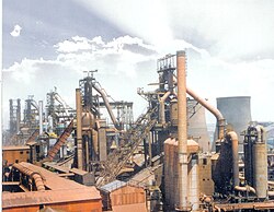
| | | caption1 = Durgapur aerial view along [[Asian Highway 1|AH1]] | ||
| image2 = NIT Durgapur front .jpg | |||
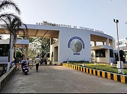
| caption2 = Statue of [[Bidhan Chandra Roy]] in [[National Institute of Technology Durgapur|NIT Durgapur]] | |||
| image3 = | |||
| caption3 = [[Durgapur Barrage]] | |||
| image4 = Kazi Nazrul Islam Airport on November 2020.jpg | |||
| caption4 = [[Kazi Nazrul Islam Airport]] | |||
| image5 = Shram Vir Statue, Durgapur Steel Plant - panoramio (1).jpg | |||
| caption5 = [[Durgapur Steel Plant]] | |||
}} | |||
| nickname = Ruhr of India | | nickname = Ruhr of India | ||
| pushpin_map = India West Bengal#India3 | | pushpin_map = India West Bengal#India3#Asia | ||
| coordinates = {{coord|23|33|N|87|19|E|display=inline,title}} | |||
| coordinates = {{coord|23 | |||
| subdivision_type = Country | | subdivision_type = Country | ||
| subdivision_name = {{flag|India}} | | subdivision_name = {{flag|India}} | ||
| subdivision_type1 = [[States and | | subdivision_type1 = [[States and territories of India|State]] | ||
| subdivision_name1 = [[West Bengal]] | |||
| subdivision_type2 = [[List of districts of India|District]] | | subdivision_type2 = [[List of districts of India|District]] | ||
| subdivision_name2 = [[Paschim Bardhaman district|Paschim Bardhaman]] | | subdivision_name2 = [[Paschim Bardhaman district|Paschim Bardhaman]] | ||
| | | established_title = Established | ||
| | | established_date = Late 1950s | ||
| founder = [[Bidhan Chandra Roy]] (former | | founder = [[Bidhan Chandra Roy]] (former Chief Minister of West Bengal) | ||
| named_for = | | named_for = Durgacharan Chattopadhyay | ||
| government_type = [[Municipal Corporations in India|Municipal Corporation]] | | government_type = [[Municipal Corporations in India|Municipal Corporation]] | ||
| governing_body = {{bulleted list|[[Durgapur Municipal Corporation]]|Asansol Durgapur Development Authority}} | | governing_body = {{bulleted list|[[Durgapur Municipal Corporation]]|[[Asansol Durgapur Development Authority]]}} | ||
| leader_title1 = [[ | | leader_title = [[Mayor]] | ||
| leader_name1 = | | leader_name = Anindita Mukherjee | ||
| leader_title1 = [[Legislature]] | |||
| leader_name1 = {{Collapsible list|bullets=yes | |||
| title = Members | |||
| 1 = [[Member of Parliament, Lok Sabha|MP]] [[Kirti Azad]] ([[Bardhaman–Durgapur (Lok Sabha constituency)|Bardhaman–Durgapur]]; [[Trinamool Congress|TMC]]) | |||
| 2 = [[Member of the Legislative Assembly (India)|MLA]] [[Pradip Mazumdar]] ([[Durgapur Purba (Vidhan Sabha constituency)|Durgapur Purba]]; [[Trinamool Congress|TMC]]) | |||
| 3 = [[Member of the Legislative Assembly (India)|MLA]] [[Lakshman Chandra Ghorui]] ([[Durgapur Paschim (Vidhan Sabha constituency)|Durgapur Paschim]]; [[Bharatiya Janata Party|BJP]]) | |||
}} | |||
| leader_title2 = [[Executive (government)|Executive]] | |||
| leader_name2 = {{Collapsible list|bullets=yes | |||
| title = Officers | |||
| 1 = [[Indian Administrative Service|IAS]] Sh. Ponnambalam S., [[District magistrate|DM]], [[Paschim Bardhaman district|Paschim Bardhaman]] | |||
| 2 = [[Indian Administrative Service|IAS]] Smt. Aditi Chaudhary, [[Commissioner]] of [[Asansol Municipal Corporation]] & CEO, [[Asansol Durgapur Development Authority|ADDA]] | |||
| 3 = [[Indian Police Service|IPS]] Sunil Kumar Choudhary, [[Commissioner of Police (India)|CP]], [[Asansol–Durgapur Police Commissionerate]] (in the rank of IG) | |||
| 4 = [[Indian Administrative Service|IAS]] Ms. Nitu, [[Additional district magistrate|ADM]], Paschim Bardhaman | |||
| 5 = [[Indian Administrative Service|IAS]] Ms. Subashini E., [[Additional district magistrate|ADM]], Paschim Bardhaman | |||
| 6 = [[West Bengal Civil Service|WBCS]] Sanjoy Paul, [[Additional district magistrate|ADM]] | |||
| 7 = [[West Bengal Civil Service|WBCS]] Aranya Banerjee, [[Additional district magistrate|ADM]] | |||
| 8 = [[West Bengal Police Service|WBPS]] Mir Sahidul Ali, [[Additional deputy commissioner of police|ADC]] | |||
| 9 = [[West Bengal Police Service|WBPS]] Subrata Deb, [[Additional deputy commissioner of police|ADC]] | |||
| 10 = [[West Bengal Police Service|WBPS]] Pradip Mondal, [[Additional deputy commissioner of police|ADC]] | |||
}} | |||
| leader_title3 = [[Judiciary]] | |||
| leader_name3 = {{Collapsible list|bullets=yes | |||
| title = Judges | |||
| 1 = [[All India Judicial Service|AIJS]] Shri Debaprasad Nath, [[District courts of India|District & Sessions Judge]] | |||
| 2 = [[West Bengal Judicial Service|WBJS]] Mohd. Aqil Saifi, [[District courts of India|ADSJ]] | |||
| 3 = [[All India Judicial Service|AIJS]] Lokesh Pathak, [[District courts of India|ADSJ]] | |||
| 4 = [[West Bengal Judicial Service|WBJS]] Shri Prashant Chowdhary, [[District courts of India|ADSJ]] | |||
| 5 = [[West Bengal Judicial Service|WBJS]] Md. Rafique Alam, [[District courts of India|ADSJ]] | |||
}} | |||
| unit_pref = Metric | | unit_pref = Metric | ||
| area_footnotes = <ref>{{cite web|title=Durgapur City|url=http://bardhaman.nic.in/blocks/durgapur_mc.html}}</ref> | | area_footnotes = <ref>{{cite web|title=Durgapur City|url=http://bardhaman.nic.in/blocks/durgapur_mc.html}}</ref><ref name='ADDA'>{{cite web|title=Asansol Durgapur Development Authority|url=https://www.sudawb.org/wbdma_oldversion/HTM/MUNI_ADDA.htm|website=sudawb.org|access-date=24 November 2020}}</ref> | ||
| area_urban_km2 = 154.20 | |||
| area_metro_km2 = 771.28 | |||
| | | area_rank = [[List of metropolitan area in West Bengal|4th in West Bengal]] | ||
| | |||
| area_rank = | |||
| | |||
| elevation_m = 65 | | elevation_m = 65 | ||
| | | population_urban = 726,000 | ||
| population_as_of = | | population_as_of = 2024 | ||
| | | population_metro = 1,209,372 | ||
| population_demonym = Durgapurbashi, Durgapurians | |||
| population_density_km2 = auto | | population_density_km2 = auto | ||
| | | population_rank = [[List of metropolitan area in West Bengal|4th in West Bengal]] | ||
| | |||
| demographics_type1 = Languages | | demographics_type1 = Languages | ||
| demographics1_title1 = Official | | demographics1_title1 = Official | ||
| Line 61: | Line 90: | ||
| utc_offset1 = +5:30 | | utc_offset1 = +5:30 | ||
| postal_code_type = [[Postal Index Number|PIN]] | | postal_code_type = [[Postal Index Number|PIN]] | ||
| postal_code = | | postal_code = 713201–713217 | ||
| area_code_type = Telephone code | |||
| area_code = +91 0343 | | area_code = +91 0343 | ||
| registration_plate = [[List of RTO districts in India#WB—West Bengal|WB-39]] / [[List of RTO districts in India#WB—West Bengal|WB-40]] | |||
| registration_plate = [[List of RTO districts in India# | |||
| blank1_name_sec1 = [[Lok Sabha]] constituency | | blank1_name_sec1 = [[Lok Sabha]] constituency | ||
| blank1_info_sec1 = [[ | | blank1_info_sec1 = [[Bardhaman–Durgapur (Lok Sabha constituency)|Bardhaman–Durgapur]] | ||
| blank2_name_sec1 = [[Vidhan Sabha]] constituency | | blank2_name_sec1 = [[Vidhan Sabha]] constituency | ||
| blank2_info_sec1 = [[Durgapur Purba (Vidhan Sabha constituency)|Durgapur Purba]] | | blank2_info_sec1 = [[Durgapur Purba (Vidhan Sabha constituency)|Durgapur Purba]]<br>[[Durgapur Paschim (Vidhan Sabha constituency)|Durgapur Paschim]] | ||
[[Durgapur Paschim (Vidhan Sabha constituency)|Durgapur Paschim]] | | blank3_name_sec1 = [[Köppen climate classification|Climate]] | ||
| | | blank3_info_sec1 = [[Tropical savanna climate|Aw]] | ||
| | | blank4_name_sec1 = [[Transit system|Transit]] | ||
| | | blank4_info_sec1 = '''[[National highways of India|Highway]]''': [[National Highway 19 (India)|NH-19]]<br>[[Grand Trunk Road]]<br>[[Asian Highway 1|AH1]]<br>'''[[Railway]]''': [[Durgapur railway station|DGR]]<br>'''[[Airport]]''': [[Kazi Nazrul Islam Airport]] | ||
| | | blank5_name_sec1 = City Development Authority | ||
| | | blank5_info_sec1 = [[Asansol Durgapur Development Authority]] ('''ADDA''') | ||
| website = {{URL|https://durgapurmunicipalcorporation.org/}} | |||
}} | }} | ||
'''Durgapur''' ({{ | '''Durgapur''' ({{IPA|bn|durgapur}}), is a major industrial hub and a [[Planned community|planned]] urban agglomeration in the [[India|Indian]] [[States and union territories of India|state]] of [[West Bengal]].<ref>{{Cite web |title=Places to visit in Durgapur |url=https://www.incredibleindia.gov.in/en/west-bengal/durgapur |access-date=2025-04-21 |website=Incredible India |language=en}}</ref> It stands on the northern bank of the [[Damodar River|Damodar]] river and is located in [[Paschim Bardhaman district]].<ref>{{Cite web |last=মাঝি |first=দেবাশিস দাশগুপ্ত,সুমন |date=2024-09-20 |title=দামোদরের ড্রেজিংয়ের ভাবনায় সরকার, চিন্তা নাব্যতা নিয়ে |url=https://eisamay.com/west-bengal-news/durgapur-news/state-government-is-thinking-of-dredging-damodar-river/articleshow/113523498.cms |access-date=2025-04-21 |website=Eisamay Online |language=bn}}</ref><ref>{{cite web| url = http://censusindia.gov.in/2011-prov-results/paper2/data_files/India2/Table_3_PR_UA_Citiees_1Lakh_and_Above.pdf | title = Urban Agglomerations/Cities having population 1 lakh and above |work= Provisional Population Totals, Census of India 2011 |access-date = 21 March 2020 }}</ref> Durgapur is a major centre for producing [[steel]] and manufacturing [[Train wheel|train wheels]] in India.<ref>[https://pib.gov.in/PressReleasePage.aspx?PRID=1798772 Durgapur Railway Wheel Manufacturing]</ref><ref>{{Cite web |title=Durgapur {{!}} Industrial City, Steel Hub {{!}} Britannica |url=https://www.britannica.com/place/Durgapur |access-date=2025-04-21 |website=www.britannica.com |language=en}}</ref> Over the past few years{{which|date=July 2025}}, this city has also been developed as a hub for the [[Information technology|IT industry]] in India.<ref>https://stpi.in/en/about-kolkata-durgapur {{Bare URL inline|date=August 2025}}</ref> The city was planned by Bidhan Chandra Roy, [[Joseph Allen Stein]] and [[Benjamin Polk]] in 1955.<ref>{{Cite web |last=Raza |first=Raqeeb |date=2024-10-06 |title=23 Years Later: How an American Architect Shaped Modern Delhi's Steinabad |url=https://www.thequint.com/videos/23-years-later-an-ode-to-stein-man-behind-delhis-modern-architecture |access-date=2025-04-22 |website=TheQuint |language=en}}</ref> Durgapur is the only city in eastern India to have an operational [[dry dock]]. Durgapur has been nicknamed the 'Steel Backbone of Industrial Bengal'. | ||
== History == | |||
=== Ancient settlements === | |||
Stone hunting equipment used by hunters from the prehistoric period has been excavated from Durgapur which shows that the human settlement of thr Durgapur area dates back to around 5000 BC.<ref>{{Cite web |title=History of Durgapur, Historical Places in Durgapur, Durgapur Past |url=https://www.durgapuronline.in/guide/history-of-durgapur |archive-url=https://web.archive.org/web/20240907212229/https://www.durgapuronline.in/guide/history-of-durgapur |archive-date=7 September 2024 |access-date=2025-01-03 |website=DurgapurOnline.in |language=en |url-status=live }}</ref> The Damodar-Ajay River Valley witnessed the growth of settled life simultaneously during the [[Indus Valley Civilisation|Harappa-Mohenjo Daro]] civilization.<ref name=":0">{{Cite web |last=Team |first=Editorial |date=2024-01-16 |title=Historical Origins of Durgapur - Durgapur Hub |url=https://durgapurhub.com/historical-origins-of-durgapur/ |access-date=2025-01-03 |language=en-US}}</ref> | |||
=== Etymology === | |||
Around 1765, Gopinath Chattopadhyay secured a lease for a portion of Jangalmahal (now part of Durgapur) from the Maharaja of Bardhaman.<ref name=":0" /> This area later became known as Gopinathpur Mouja. Gopinath worked to transform this dense forest into a habitable area. His descendant, Durgacharan Chattopadhyay, continued the effort and established a new colony in the present Sagarbhanga region of Durgapur. In 1793, he erected a Kali temple, followed by a Shiva temple in 1803. The Zamindar house in Sagarbhanga stands as a testament to Durgacharan’s substantial contributions. | |||
In 1855, when the East India Company laid the railway line between Bardhaman and Andal, the station was named Durgapur, a tribute to Durgacharan’s efforts by the local community. This marked the formalization of the name ‘Durgapur,’ gaining significance as a railway hub in the country.<ref name=":0" /> | |||
=== Grand Trunk Road === | |||
As the colonial era unfolded, Durgapur became a strategic outpost along the [[Grand Trunk Road]]. British administrative records narrate the city’s transformation from a hamlet to a bustling settlement. | |||
=== Post-Independence === | |||
Following India’s independence in 1947, Durgapur underwent a remarkable metamorphosis under the visionary leadership of [[Bidhan Chandra Roy]], the then Chief Minister of West Bengal. The city was chosen as the site for the second integrated steel plant in India, setting the stage for rapid industrialization and urbanization. | |||
==Geography== | ==Geography== | ||
[[File:Map of Paschim Bardhaman district.jpg|400px|thumb|Map of Paschim Bardhaman district|left]] | |||
===Location=== | ===Location=== | ||
Durgapur is located at {{Coord|23.55|N|87.32|E|}}. It has an average elevation of {{convert|65|m|ft}}. | Durgapur is located at {{Coord|23.55|N|87.32|E|}}. It has an average elevation of {{convert|65|m|ft}}. | ||
Durgapur is in the [[Paschim Bardhaman district]] of West Bengal, on the bank of the [[Damodar River]], just before it enters the alluvial plains of Bengal. The topography is undulating. The coal-bearing area of the [[Raniganj]] coalfields lies just beyond Durgapur; some parts intrude into the area. The area was deeply forested until | Durgapur is in the [[Paschim Bardhaman district]] of West Bengal, on the bank of the [[Damodar River]], just before it enters the alluvial plains of Bengal. The [[topography]] is undulating. The coal-bearing area of the [[Raniganj]] coalfields lies just beyond Durgapur; some parts intrude into the area. The area was deeply forested until the end of 20th century and some streaks of the indigenous [[Shorea robusta|sal]] and [[Madhuca longifolia|Mahua]] forests can still be seen scantily. | ||
{{OSM Location map | {{OSM Location map | ||
| Line 133: | Line 176: | ||
|mark-coord40= {{coord|23|33|50|N|87|14|0|E}} | label-pos40=right|label40= Durgapur Cement/ |labela40= Birla Cement| numbered40=W| mark-title40= [[M.P Birla Group]]}} | |mark-coord40= {{coord|23|33|50|N|87|14|0|E}} | label-pos40=right|label40= Durgapur Cement/ |labela40= Birla Cement| numbered40=W| mark-title40= [[M.P Birla Group]]}} | ||
== | === Environment === | ||
Durgapur has been ranked 35th best “National Clean Air City” under (Category 2 3-10L Population cities) in India.<ref>{{Cite web |date=7 September 2024 |title=Swachh Vayu Sarvekshan 2024 |url=https://prana.cpcb.gov.in/ncapServices/robust/fetchFilesFromDrive/Swachh_Vayu_Survekshan_2024_Result.pdf |website=Swachh Vayu Sarvekshan 2024}}</ref> | |||
===Police stations=== | ===Climate=== | ||
{{unreferencedsect|date=July 2025}} | |||
{{climate chart | |||
|Durgapur | |||
|9|22|14 | |||
|15|29|19 | |||
|19|36|25 | |||
|24|45|31 | |||
|26|41|87 | |||
|26|42|275 | |||
|26|37|334 | |||
|25|35|338 | |||
|25|34|239 | |||
|22|32|78 | |||
|17|28|15 | |||
|10|25|24 | |||
|float=left | |||
|clear=none | |||
}} | |||
Durgapur experiences a somewhat transitional climate between the tropical wet and dry climate of Kolkata and the more humid subtropical climate further north. Summers are extremely hot and dry, lasting from March to the middle of June, with average daily temperatures exceeding 45 °C. They are followed by the monsoon season with heavy precipitation and somewhat lower temperatures. Durgapur receives most of its annual rainfall of around 1,320 mm during this season. The monsoon is followed by a cold, dry winter from November to January. Temperatures are cold, with average daily temperatures dropping near 9 °C. There is a short autumn at the end of October and a short spring in February, both of which have relatively moderate temperatures of around 20 °C. Due to the heavy rainfall it has received in recent years, for almost five months of heavy rainfall every year, locals often refer to the city as "Chhota Cherapunji" (named after the main city of [[Cherrapunji|Cherapunji]]). | |||
==Law administration== | |||
=== Police stations === | |||
Aurobindo Police Station, located in Durgapur Steel Township, opposite to Office of Commissioner of Police (Asansol-Durgapur) has jurisdiction over parts of [[Andal (community development block)|Andal]] CD Block. The area covered is 87 km<sup>2</sup> and the population covered is 292,841. It has following investigation centres under it.<ref name=ps1>{{cite web | url = http://wbpspm.gov.in/publications/District%20Statistical%20Handbook | title = District Statistical Handbook 2014 Bardhaman | work = Tables 2.1, 2.2 | publisher = Department of Statistics and Programme Implementation, Government of West Bengal | access-date = 23 September 2018 | archive-date = 21 January 2019 | archive-url = https://web.archive.org/web/20190121045803/http://www.wbpspm.gov.in/publications/District%20Statistical%20Handbook | url-status = dead}}</ref><ref name=ps2>{{cite web| url = http://asansoldurgapurpolice.in/# |title = Asansol Durgapur Police Commissionerate |work = Find your police station | publisher= Asansol Durgapur Police | access-date = 18 February 2017}}</ref> | |||
{| class="wikitable sortable" | |||
|- | |||
! Investigation Centre ||Address | |||
|- | |||
| B-Zone Investigation Centre|| Marconi Avenue, B-Zone | |||
|- | |||
| City Centre Investigation Centre|| Bengal Ambuja, City Centre | |||
|- | |||
| Faridpur Investigation Centre|| Near Gandhi More | |||
|- | |||
| Waria Investigation Centre|| Near DSP Main Gate, Waria | |||
|- | |||
| DTPS Investigation Centre|| Old Colony, DVC-DTPS | |||
|- | |||
|} | |||
Coke Oven police station, located near Durgapur | Coke Oven police station, located near the Durgapur Railway Station, has jurisdiction over parts of the Durgapur municipal corporation. The area covered is 49 km<sup>2</sup> and the population covered is 136,181. | ||
Durgapur Women PS has jurisdiction over the Durgapur Subdivision | |||
[[ | New Township police station, located in MAMC township, has jurisdiction over parts of the Durgapur municipal corporation and the [[Faridpur Durgapur]] CD Block. The area covered is 23 km<sup>2</sup>, and the population covered is 160,411. It has a police Outpost located in Bidhannagar under its jurisdiction.<ref name=ps1 /><ref name=ps2/> | ||
==Demographics== | ==Demographics== | ||
In the 2011 census, Durgapur Urban Agglomeration had a population of | |||
In the 2011 census, Durgapur Urban Agglomeration had a population of 566,937 out of which 294,349 were male and 272,588 were female. The 0–6 year population was 50,512. Effective literacy rate of the population was 87.70.<ref name="CensusUA">{{cite web| url = http://www.censusindia.gov.in/2011-prov-results/paper2/data_files/India2/Table_3_PR_UA_Citiees_1Lakh_and_Above.pdf | title = Urban Agglomerations/Cities having population 1 lakh and above |work= Provisional Population Totals, Census of India 2011 | publisher = Government of India|access-date = 10 October 2011 }}</ref> Durgapur Municipal Corporation included and 3 [[census town]]s: [[Bamunara, Paschim Bardhaman|Bamunara]], [[Arra, Paschim Bardhaman|Arra]], and partly [[Andal, Paschim Bardhaman|Andal]].<ref>{{cite web| url = http://censusindia.gov.in/2011-prov-results/paper2/data_files/India2/Table_4_PR_UAs_1Lakh_and_Above_Appendix.pdf | title = Constituents of urban Agglomerations Having Population 1 Lakh & above |work= Provisional Population Totals, Census of India 2011| publisher = Government of India|access-date = 27 March 2012 }}</ref> | |||
{{See also|List of cities in West Bengal}} | {{See also|List of cities in West Bengal}} | ||
In the 2011 census, Durgapur Municipal Corporation had a population of | In the 2011 census, Durgapur Municipal Corporation had a population of 581,409 out of which 301,700 were male and 279,709 were female. The 0–6 year population was 51,930. Effective literacy rate of the population was 87.84.<ref name=Census2011>{{cite web| url = http://www.censusindia.gov.in/2011-prov-results/paper2/data_files/India2/Table_2_PR_Cities_1Lakh_and_Above.pdf | title = Urban Agglomerations/Cities having population 1 lakh and above |work= Provisional Population Totals, Census of India 2011 |access-date = 10 October 2011 }}</ref> | ||
=== Religion === | |||
{{Pie chart | |||
|caption = Religions of Durgapur (2011)<ref name="religion"/> | |||
|label1 = [[Hinduism in West Bengal|Hinduism]] |value1 = 91.63 |color1 = orange | |||
|label2 = [[Islam]] |value2 = 6.34 |color2 = green | |||
|label3 = [[Sikhism]] |value3 = 0.41 |color3 = darkturquoise | |||
|label4 = Others |value4 = 1.62|color4 = yellow | |||
|thumb = left | |||
}} | |||
{{ | According to Census of India 2011, Hinduism is the predominant religion in this city, followed by Islam, Christianity, Sikhism, Buddhism, Jainism, and others. Out of the 5,66,517 people living in Durgapur (Municipal Corporation); 5,19,122 are Hindus (91.63%), 35,923 are Muslims (6.34%), 1889 are Christians (0.36%), 2346 are Sikhs (0.44%), 513 are Buddhists, 382 are Jains, 906 are other religions, and 5436 (1.04%) did not state their religion.<ref name="religion">{{Cite web |date=2011 |title=Table C-01 Population by Religion: West Bengal |url=https://censusindia.gov.in/nada/index.php/catalog/11396/download/14509/DDW19C-01%20MDDS.XLS |website=censusindia.gov.in |publisher=[[Registrar General and Census Commissioner of India]]}}</ref> | ||
| | |||
| | ===Languages=== | ||
| | {{Pie chart | ||
| | |caption = Languages of Durgapur (2011)<ref name="languages"/> | ||
| | |label1 = [[Bengali language|Bengali]] |value1 = 82.99 |color1 = orchid | ||
|label2 = [[Hindi]] |value2 = 11.15 |color2 = orange | |||
{{ | |label3 = [[Santali language|Santali]] |value3 = 1.84 |color3 = darkturquoise | ||
|label4 = [[Urdu]] |value4 = 1.03 |color4 = green | |||
|label5 = Others |value5 = 2.99 |color5 = grey | |||
| | |thumb = left | ||
}} | }} | ||
At the time of the 2011 census, 82.99% of the population spoke [[Bengali language|Bengali]], 11.15% [[Hindi]], 1.84% [[Santali language|Santali]], and 1.03% [[Urdu]] as their first language.<ref name="languages">{{Cite web |title=Table C-16 Population by Mother Tongue: West Bengal |url=https://censusindia.gov.in/nada/index.php/catalog/10226/download/13338/DDW-C16-STMT-MDDS-1900.XLSX |website=www.censusindia.gov.in |publisher=[[Registrar General and Census Commissioner of India]]}}</ref> | |||
==Economy== | ==Economy== | ||
Durgapur is the biggest industrial hub of West Bengal and was planned as an integrated industrial city. It is the most developed city in West Bengal in terms of technology, infrastructure, and economy next to Kolkata and contributes a substantial amount to the economy of the state of West Bengal. It lies on the banks of [[Damodar River]] and near to the coalfields of Raniganj. Durgapur was a dream of former prime minister of India, [[Jawaharlal Nehru]] and chief minister of West Bengal, [[Bidhan Chandra Roy]].<ref>{{Cite web|url=https://www.indiatoday.in/magazine/economy/story/19881231-public-private-industries-in-dire-straits-in-durgapur-798050-1988-12-31|title=Public and private industries in dire straits in Durgapur|first=Kamaljeet |last=Rattan|website=India Today|language=en|access-date=12 November 2019|date=31 December 1988}}</ref> The 1948-founded [[Damodar Valley Corporation]] (DVC) is essential to the growth of the area.<ref name="durgapurhub.com">{{Cite web |date=2024-08-15 |title=All You Need to Know About Asansol, Durgapur & Raniganj |url=https://durgapurhub.com/all-you-need-to-know-about-asansol-durgapur-raniganj/ |access-date=2024-08-15 |language=en-US}}</ref> The first project in Durgapur was Damodar Valley Corporation's [[Durgapur Barrage]] which attracted many public sector units. [[Durgapur Steel Plant]] was the first PSU established in the region in 1955 with the help of U.K which was later undertaken by [[Steel Authority of India|SAIL]]. Later, an alloy plant was established by Hindustan Steel Ltd. in 1965 which was also acquired by SAIL. From 1951 to 2019, industrial units in the region grew from 46 to 430, with engineering units rising from 18 to 66 and basic metal units booming from 2 to 122.<ref name="durgapurhub.com"/> The area's economic strength is driven by its rich coal deposits, excellent transportation, and skilled labor force, making it a key economic hub in West Bengal and Eastern India. | |||
[[File:Durgapur Steel Plant.jpg|thumb|Inside Durgapur Steel Plant]] | |||
Durgapur is the biggest industrial hub of West Bengal | Mining and Allied Machinery Corporation (MAMC) was established in 1964 with the help and support from [[USSR]] (now closed but reviving with J.V of Bharat Earth Movers, [[Coal India]] & DVC).<ref>{{Cite web|url=https://www.telegraphindia.com/west-bengal/joint-venture-to-revive-mamc/cid/515676|title=Joint venture to revive MAMC|website=www.telegraphindia.com|language=en|access-date=12 November 2019}}</ref> Hindustan Fertilisers Corporation (HFC) was a major PSU which produced fertilizer but got closed down (now RCF showed interest to reopen it).<ref>{{Cite web|url=https://www.telegraphindia.com/business/rcf-eyes-durgapur-fertiliser-unit/cid/723078|title=RCF eyes Durgapur fertiliser unit|website=www.telegraphindia.com|language=en|access-date=12 November 2019}}</ref> Bharat Opthlamic Glass Limited (BOGL) was established in 1972 used to manufacture electronic valves and other electronic components. Its closure was approved in 2006. | ||
Durgapur is also an emerging IT and real estate hub. The Government of West Bengal's Webel IT Park houses some of well | Durgapur Chemicals Limited (DCL) was set up by the Government of West Bengal in 1963 to boost the chemical needs of the state. DCL started its journey in 1968 and was involved in commercial production of [[Phenol]], [[phthalic anhydride]], [[Monochlorobenzene|monochloro benzene]], [[Pentachlorophenol|pentachloro Phenol]], [[caustic soda]], [[chlorine]] and [[hydrochloric acid]].{{cn|date=July 2025}} Although not closed, but the Government of West Bengal decided to disinvest in DCL in 2016 as it had increasingly become a sick industry.{{cn|date=July 2025}} | ||
[[DPL Thermal Power Station|Durgapur Projects Limited]] (DPL) was the first [[thermal power station]] in the city. It was commissioned by the [[Government of West Bengal]] in 1960. It has eight production units of which only two are currently operational. The whole city of Durgapur and the surrounding areas get electricity supply from DPL. It is currently owned by [[West Bengal Power Development Corporation]].{{cn|date=July 2025}} | |||
Major Indian and international MNCs have their production facilities in Durgapur which includes [[GE Power|GE Power India Limited]] (formerly ACC Babcock Limited which was later taken over by [[Alstom]]), [[Scania AB|Scania]] and [[Komatsu Limited|Komatsu]] (in partnership with [[Larsen & Toubro]]), [[RPG Group|Philips Carbon Black]], Sankey Wheels (a unit of GKW), [[Birla Corporation|Birla Cement]] (earlier Durgapur Cement Ltd.), Graphite India Limited, etc. | |||
Durgapur is also an emerging IT and real estate hub. The Government of West Bengal's Webel IT Park houses some of well known as well as startup software companies generating employment opportunities for the youth of the region. It is set to develop many proposed residential areas like DLF's Durgapur Township.<ref>{{Cite news|url=https://economictimes.indiatimes.com/industry/services/property-/-cstruction/dlf-bags-durgapur-project/articleshow/2300108.cms?from=mdr|title=DLF bags Durgapur project|date=22 August 2007|work=The Economic Times|access-date=12 November 2019}}</ref> Companies like [[Tata Consultancy Services]] (a major Indian multinational IT company) etc. have their branch office and back office respectively in the city.{{cn|date=July 2025}} | |||
==Transport== | ==Transport== | ||
===Road=== | ===Road network=== | ||
Durgapur | Durgapur has a well-defined hierarchical road system comprising approximately 1,780 km of roads, categorized as arterial, sub-arterial, and collector roads.<ref name="IIEST20202" /> | ||
* '''Arterial and Sub-Arterial Roads''': ~ 480 km | |||
** Some of the Major corridors include: | |||
*** [[National Highway 19 (India)|NH-19]] | |||
*** Jawaharlal Nehru Avenue | |||
*** Mahatma Gandhi Road | |||
*** Sarat Chandra Avenue | |||
*** Bidhan Chandra Roy Avenue | |||
*** Hahnemann Avenue | |||
*** Bankura Road | |||
*** Bidhan Sarani | |||
*** SSB Sarani | |||
*** Shahid Khudiram bose Sarani | |||
*** Shastri Avenue | |||
*** Zakir Hussain Avenue | |||
* '''Collector Roads''': ~1,300 km | |||
These are generally 7-meter-wide roads serving local traffic within neighborhoods. | |||
Various private buses ranging from sleepers to premium Volvos are available from City Center | Planned areas such as the DSP Township, SEPCO, MAMC, and Bidhan Nagar follow grid or modular patterns with wide roads and proper junctions. In contrast, unplanned areas like Benachity, Bhiringi, Fuljhore, and Palashdiha exhibit organically developed and often narrower road layouts with limited connectivity and lower right-of-way.<ref name="IIEST20202" /> | ||
The study reports that arterial roads in the planned areas have wider right-of-way (up to 50 m) compared to unplanned areas (as narrow as 15 m). Roads in industrial areas are generally 2-lane undivided roads with inadequate width for the volume of heavy vehicles.<ref name="IIEST20202" /> | |||
Durgapur is a gateway to the districts of [[Bankura district|Bankura]], [[Birbhum district|Birbhum]] ([[Bolpur]], [[Rampurhat]], [[Suri, Birbhum|Suri]]), and [[Purulia district|Purulia]]. [[National Highway 19 (India)|NH 19]] (old numbering: NH 2) passes through the city jurisdiction and [[State Highway 9 (West Bengal)|SH 9]] originates from Muchipara in the city. [[National Highway 14 (India)|NH 14]] (old numbering NH 60) passes through the north-western suburb of [[Pandabeswar]] and finally passes through [[Raniganj]] and heads away towards [[Odisha, India|Odisha]]. It is one of the few cities that has an [[Asian Highway Network|Asian Highway (AH)]] passing directly through the city jurisdiction. The [[AH1]] links [[Japan]] with [[Turkey]], through [[Korea]], [[China]], [[Vietnam]], [[Cambodia]], [[Thailand]], [[Myanmar]], [[India]], [[Bangladesh]], [[Pakistan]], [[Afghanistan]], and [[Iran]]. | |||
Durgapur has three bus termini at Durgapur Railway Station, Prantika (Prantika-I and II), and City Center. Within the city, private mini-buses operate from Durgapur Rly. Station to Prantika, via City Centre, Muchipara and various other routes within the city. Muchipara is an important bus stop in Durgapur, from which all buses are available. | |||
Intra City Routes within the city are as follows: | |||
{| class="wikitable" | |||
!Route Name | |||
!Origin & Destination | |||
!Areas Covered | |||
|- | |||
|8B | |||
|Durgapur Railway Station - Prantika | |||
|<ref name="IIEST20203" />Sagarbhanga, Muchipara, Bidhannagar, Fuljhore, Sepco (''Only bus stop'') | |||
|- | |||
|8A | |||
|Durgapur Railway Station - Prantika | |||
|<ref name="IIEST20203" />Birbhanpur, Angadpur, DTPS, Faridpur, Benachity. | |||
|- | |||
|A - Zone | |||
|Durgapur Railway Station - Prantika | |||
|<ref name="IIEST20203" />Gamon Bus stop, Garrage, DPL bus stop, 1st AB bus stop, City Centre, DSP Township. | |||
|- | |||
|B - Zone | |||
|Durgapur Railway Station - Prantika | |||
|<ref name="IIEST20203" />Gamon Bus stop, Garrage, DPL bus stop, 1st AB bus stop, City Centre, Kabiguru, SEPCO Township, IQ - City, DSP Township. | |||
|- | |||
|54 - Feet | |||
|Durgapur Railway Station - Prantika | |||
|<ref name="IIEST20203" />Gamon Bus stop, Garrage, DPL bus stop, 1st AB bus stop, City Centre, Gandhi More, 54 Feet Area. | |||
|- | |||
|MAMC | |||
|Durgapur Railway Station - Prantika | |||
|<ref name="IIEST20203" />Gamon Bus stop, Garrage, DPL bus stop, MAMC Township, Mamra, Sepco (''Only bus stop''). | |||
|- | |||
|Ichhapur, Ukhra | |||
|Prantika - Ichhapur. | |||
Prantika - Ukhra. | |||
|<ref name="IIEST20203" />Dhandabag, Ichhapur, Ukhra. | |||
|- | |||
|Bijra | |||
|Prantika - Bijra | |||
|<ref name="IIEST20203" />Bijra. | |||
|} | |||
Auto-rickshaws ply between City Center, Benachity, William Kery, Chandidas, Mamra, Bidhannagar, Railway Station, and other parts of the city in a number of routes. They also act as Feeder Routes to ensure last Mile connectivity. Pre-paid taxis are available in the city from railway stations. Additionally, online cab services like [[Ola Cabs|Ola]], [[Uber]], etc., and bike taxi services like [[Rapido (company)|Rapido]] are available within the city. | |||
[[File:Ram Mandir in Bidhannagar, Durgapur.jpg|thumb|Ram Mandir in Bidhannagar, Durgapur, West Bengal, India]] | |||
Only one bus is available for the Kalyani-Bansberia route and it departs from Prantika-II Bus Terminus at 4:40 am and from [[Kalyani, West Bengal|Kalyani]] at 10 am every day. | |||
Various private and government buses ranging from sleepers to premium Volvos are available from City Center Bus Terminus and Station Bus Terminus for [[Kolkata]], [[Asansol]], [[Barddhaman]], [[Barakar]], [[Bhubaneswar]], [[Digha]], and other nearby cities. Durgapur is the headquarters of [[South Bengal State Transport Corporation|SBSTC]] which provides government bus services to Kolkata, Haldia, Digha, and Bankura, from Durgapur and Asansol. Private buses are available for Asansol, Barakar, Bardhaman, Bolpur, Bishnupur, Chittaranjan, Deoghar, Digha, Illambazar, Jhargram, Kalna, Katwa, Kharagpur, Krishnanagar, Medinipur, Nabadwip, Nalhati, Purulia, Rampurhat, Siuri, Tatanagar, and Tarakeswar, among others. | |||
===Air=== | ===Air=== | ||
[[File:The front facade of Kazi Nazrul Islam Airport, Andal, Durgapur.jpg|270x270px|thumb|Kazi Nazrul Islam Airport]] | |||
The city is home to a domestic airport, the [[Kazi Nazrul Islam Airport]]. It is India's first private-sector Greenfield airport. It is located at a place called Andal which is roughly 15 kilometres from Durgapur's City Center Bus Terminus.<ref>{{Cite web|url=http://www.kniairport.com/#|title=KNIAIRPORT- Kazi Nazrul Islam Airport|website=www.kniairport.com|access-date=23 September 2018}}</ref> And an old DSP Airport at Bijra near IQ city. | |||
An air force station at [[Panagarh]] (Military Airfield), belonging to the Indian Air Force, is used as a base for a [[C-130J Hercules]] squadron.<ref>{{Cite news|url=https://economictimes.indiatimes.com/news/defence/panagarh-to-be-iafs-second-hub-for-c-130j-super-hercules-planes/articleshow/48344173.cms|title=Panagarh to be IAF's second hub for C-130J Super Hercules planes|date=11 July 2018|work=The Economic Times|access-date=23 September 2018}}</ref> | |||
== Administrative changes == | == Administrative changes == | ||
The administrative setup came in stages. In 1837, when Bankura district was formed, Durgapur area was part of it. In 1847, Raniganj subdivision was formed with three police stations – Raniganj, Kanksa, and Neamatpur | {{unreferencedsect|date=July 2025}} | ||
In 2011, the Asansol Durgapur Police Commissionerate (ADPC) was formed by the | The administrative setup came in stages. In 1837, when Bankura district was formed, the Durgapur area was part of it. In 1847, the Raniganj subdivision was formed with three police stations – Raniganj, Kanksa, and Neamatpur – and it was made a part of the Bardhaman district. In 1906, the subdivisional headquarters was shifted to Burdwan, and the subdivision renamed accordingly. In 1910, the police stations in Asansol subdivision were Asansol, Ranigunj, Kanksa, Faridpur, and Barakar. On 14 April 1968, the [[Durgapur subdivision]] was carved out of Asansol subdivision. In 2011, the [[Asansol–Durgapur Police Commissionerate|Asansol Durgapur Police Commissionerate]] (ADPC) was formed by the state government. | ||
==Education== | ==Education== | ||
=== Colleges === | === Colleges === | ||
[[File: | [[File:Nitdgpfront.jpg|thumb|National Institute of Technology, Durgapur, West Bengal, India]] | ||
Durgapur is home to [[National Institute of Technology, Durgapur]],<ref>{{cite web|url=http://www.nitdgp.ac.in|title=NIT DURGAPUR|work=nitdgp.ac.in}}</ref> an autonomous institution in eastern India of [[List of Institutes of National Importance|national importance]]. It is one of the 31 [[National Institutes of Technology|N.I.T.]]s in the country. [[National Institute of Technology, Durgapur|N.I.T. Durgapur]] is one of the | Durgapur is home to [[National Institute of Technology, Durgapur]],<ref>{{cite web|url=http://www.nitdgp.ac.in|title=NIT DURGAPUR|work=nitdgp.ac.in}}</ref> an autonomous institution in eastern India of [[List of Institutes of National Importance|national importance]]. It is one of the 31 [[National Institutes of Technology|N.I.T.]]s in the country. [[National Institute of Technology, Durgapur|N.I.T. Durgapur]] is one of the eight old Regional Engineering Colleges established in 1956. | ||
[[Durgapur Government College]] is | [[Durgapur Government College]] is a premier government degree college not only in the home district of Paschim Barddhaman but also in the neighbouring districts of Bankura, Purulia, and Birbhum. It was established on 15 September 1970, and was affiliated to the [[University of Burdwan]], which later got affiliated to [[Kazi Nazrul University]]. | ||
The [[Central Mechanical Engineering Research Institute]] (also known as CSIR-CMERI Durgapur or CMERI Durgapur) is a public [[engineering]] [[research and development]] institution in Durgapur, [[West Bengal]], India. It is a constituent laboratory of the Indian [[Council of Scientific and Industrial Research]] (CSIR).<ref>{{Cite web | url=http://www.csir.res.in |title = Council of Scientific & Industrial Research | CSIR | GoI}}</ref> The institute is dedicated to work in the [[Mechanical engineering|mechanical]] and allied engineering disciplines.<ref>{{cite web|url=http://www.cmeri.res.in/abt/profile.html |title=Welcome to CMERI |publisher=cmeri.res.in |access-date=25 August 2013}}</ref> | The [[Central Mechanical Engineering Research Institute]] (also known as CSIR-CMERI Durgapur or CMERI Durgapur) is a public [[engineering]] [[research and development]] institution in Durgapur, [[West Bengal]], India. It is a constituent laboratory of the Indian [[Council of Scientific and Industrial Research]] (CSIR).<ref>{{Cite web | url=http://www.csir.res.in |title = Council of Scientific & Industrial Research | CSIR | GoI}}</ref> The institute is dedicated to work in the [[Mechanical engineering|mechanical]] and allied engineering disciplines.<ref>{{cite web|url=http://www.cmeri.res.in/abt/profile.html |title=Welcome to CMERI |publisher=cmeri.res.in |access-date=25 August 2013}}</ref> | ||
The [[National Power Training Institute]] (Also known as NPTI(ER) and formerly known as PETS, Durgapur) is an institute under Ministry of Power, Government of India which offers postgraduate education in the field of power plants. This institute is also associated with several industrial bodies for imparting training to plant personnel.<ref>{{cite web|url=http://www.nptidurgapur.com|title=Welcome To NPTI Durgapur|website=www.nptidurgapur.com|access-date=25 March 2018}}</ref> | The [[National Power Training Institute]] (Also known as NPTI(ER) and formerly known as PETS, Durgapur) is an institute under Ministry of Power, Government of India which offers postgraduate education in the field of power plants. This institute is also associated with several industrial bodies for imparting training to plant personnel.<ref>{{cite web|url=http://www.nptidurgapur.com/|title=Welcome To NPTI Durgapur|website=www.nptidurgapur.com|access-date=25 March 2018|archive-date=10 January 2017|archive-url=https://web.archive.org/web/20170110055202/http://www.nptidurgapur.com/|url-status=dead}}</ref> | ||
[[Dr. B.C. Roy Engineering College, Durgapur|Dr. B.C. Roy Engineering College]], [[Bengal College of Engineering and Technology]], [[Sanaka Education Trusts Group of Institutions]], [[NSHM Knowledge Campus]], [[Durgapur Institute of Advanced Technology and Management]] and The Aryabhatta Institute of Engineering & Management are private engineering colleges which offer ([[B.Tech]]) in engineering and other degrees, including [[Bachelor of Business Administration|BBA]], [[Bachelor of Computer Application|BCA]], [[B.Pharm]], and others. They are affiliated to [[Maulana Abul Kalam Azad University of Technology]] (MAKAUT). [[Durgapur Women's College]] and [[Michael Madhusudan Memorial College]] are general degree colleges affiliated to [[Kazi Nazrul University]]. | |||
[[Netaji Subhas Open University]] is a state open university for imparting distance education. It is modelled on the [[Open University]], [[UK]] and the [[IGNOU]], and offers courses in different disciplines of graduate and post-graduate courses. | |||
[[ | [[IQ City Medical College]] and [[Gouri Devi Institute of Medical Sciences and Hospital]] are two colleges which offer ([[MBBS]]) medical degree and paramedical courses. They are affiliated to [[West Bengal University of Health Sciences]]. Durgapur Paramedical College is another college which offers both a diploma and degree in paramedical courses. | ||
=== | === Public schools === | ||
[[File:Jawaharlal Nehru with school children at Durgapur copy.jpg|thumb|[[Jawaharlal Nehru]] with [[schoolchildren]] at Durgapur]] | [[File:Jawaharlal Nehru with school children at Durgapur copy.jpg|thumb|[[Jawaharlal Nehru]] with [[schoolchildren]] at Durgapur]] | ||
Durgapur houses a large number of government aided and public schools in addition to two [[Kendriya Vidyalaya]] and [[Jawahar Navodaya Vidyalaya, Durgapur|Jawahar Navodaya Vidyalaya]] (under the Government of India). Notable private schools include: [[ | Durgapur houses a large number of government aided and public schools in addition to two [[Kendriya Vidyalaya]] and [[Jawahar Navodaya Vidyalaya, Durgapur|Jawahar Navodaya Vidyalaya]] (under the Government of India). Notable private schools include: the [[St. Xavier's School, Durgapur|St. Xavier's School]] and [[Guru Tegh Bahadur]] Public School.<!---♦♦♦ Only add a school to this list if it already has its own article on the English Bharatpedia ♦♦♦---> | ||
==Sports facilities== | ==Sports facilities== | ||
*[[Nehru Stadium, Durgapur|Nehru Stadium]] | *[[Nehru Stadium, Durgapur|Nehru Stadium]] is the largest sports stadium in the city. It has a football ground, basketball and volleyball courts, athletic tracks, modern fully equipped gymnasium, etc.. It is managed by Durgapur Steel Plant Authority. | ||
*[[Sidhu Kanu Indoor Stadium]] houses sporting organisations and sporting associations of Burdwan district, including Durgapur Sub-divisional Women's Sports Association, School Sports Association-Durgapur Sub-division, Burdwan District Badminton Association, Burdwan District Table Tennis Association, and Burdwan District Physical Culture Association. | |||
*[[Sidhu Kanu Indoor Stadium]] houses | |||
==Media== | ==Media== | ||
Durgapur has several electronic media houses | Durgapur has several electronic media houses: Express News, DSTV (owned by DSP), India Hood Durgapur, Durgapur Darpan, ''[[Anandabazar Patrika]]'' is published from Ghutgoria, near Durgapur, in Bankura District. Samay Sanket is another newspaper published from Durgapur. Durgapur does not have any F.M. stations, however, [[All India Radio]] 100.3 FM, 92.7 Big FM, 93.5 Red FM, and Radio Mirchi 95 FM have stations at [[Asansol]],<ref>{{cite web |last=Shibpur |first=Department of Architecture and Town & Regional Planning, IIEST |date=2020 |title=Preparation of Integrated Development Plan for Durgapur Town |url=https://www.scribd.com/document/716596150/Group-2-Transportation-and-Land-Use |website=scribd.com}}</ref> and serve both Asansol and Durgapur. | ||
== Notable people == | == Notable people == | ||
| Line 290: | Line 400: | ||
* [[Bikramjit Basu]], recipient of the [[Shanti Swarup Bhatnagar Prize for Science and Technology]], Alumni of [[National Institute of Technology, Durgapur]]. | * [[Bikramjit Basu]], recipient of the [[Shanti Swarup Bhatnagar Prize for Science and Technology]], Alumni of [[National Institute of Technology, Durgapur]]. | ||
* [[Bimal Mitra]], Indian Bengali Author and author of [[Saheb Bibi Golam]]. | * [[Bimal Mitra]], Indian Bengali Author and author of [[Saheb Bibi Golam]]. | ||
* [[Dipali Saha]], Politician, [[All India Trinamool Congress]], won from Sonamukhi (Vidhan Sabha constituency), formerly within [[Durgapur (Lok Sabha constituency) | * [[Dipali Saha]], Politician, [[All India Trinamool Congress]], won from Sonamukhi (Vidhan Sabha constituency), formerly within [[Durgapur (Lok Sabha constituency)|Durgapur]]. | ||
* [[Kalipada Bauri]], Former Politician who won from Gangajalghati, formerly within [[Durgapur (Lok Sabha constituency) | * [[Kalipada Bauri]], Former Politician who won from Gangajalghati, formerly within [[Durgapur (Lok Sabha constituency)|Durgapur]] from [[Communist Party of India (Marxist)]]. | ||
* [[Kamanio Chattopadhyay]], recipient of the [[Shanti Swarup Bhatnagar Prize for Science and Technology]], Alumni of [[National Institute of Technology, Durgapur]]. | * [[Kamanio Chattopadhyay]], recipient of the [[Shanti Swarup Bhatnagar Prize for Science and Technology]], Alumni of [[National Institute of Technology, Durgapur]]. | ||
* [[Lalbihari Bhattacharya]], Former Politician who won from [[Barjora (Vidhan Sabha constituency)]], formerly within [[Durgapur (Lok Sabha constituency) | * [[Lalbihari Bhattacharya]], Former Politician who won from [[Barjora (Vidhan Sabha constituency)]], formerly within [[Durgapur (Lok Sabha constituency)|Durgapur]] from [[Communist Party of India (Marxist)]]. | ||
* [[Mamtaz Sanghamita]], Former Member of Parliament, [[Bardhaman–Durgapur (Lok Sabha constituency)]] belonging to [[All India Trinamool Congress]] | * [[Mamtaz Sanghamita]], Former Member of Parliament, [[Bardhaman–Durgapur (Lok Sabha constituency)]] belonging to [[All India Trinamool Congress]] | ||
* [[Mika Singh]], Indian Playback Singer and live performer. | * [[Mika Singh]], Indian Playback Singer and live performer. | ||
| Line 307: | Line 417: | ||
* [[Sunil Kumar Mandal]], Indian Politician and [[Member of Parliament]], Purba Bardhaman, who previously won from Galsi, within [[Bardhaman–Durgapur (Lok Sabha constituency)]], from [[Forward Bloc]]. | * [[Sunil Kumar Mandal]], Indian Politician and [[Member of Parliament]], Purba Bardhaman, who previously won from Galsi, within [[Bardhaman–Durgapur (Lok Sabha constituency)]], from [[Forward Bloc]]. | ||
* [[S. S. Ahluwalia]], Member of Parliament, [[Bardhaman–Durgapur (Lok Sabha constituency)]] belonging to [[Bhartiya Janata Party]]. | * [[S. S. Ahluwalia]], Member of Parliament, [[Bardhaman–Durgapur (Lok Sabha constituency)]] belonging to [[Bhartiya Janata Party]]. | ||
* [[Tushar Dutta]], Classical Music Vocalist. | * [[Tushar Dutta]], Classical Music Vocalist. | ||
| Line 314: | Line 423: | ||
== External links == | == External links == | ||
{{Commons category}} | |||
* [http://www.bardhaman.nic.in/ Bardhaman district official site] | * [http://www.bardhaman.nic.in/ Bardhaman district official site] | ||
* | * {{Wikivoyage inline|Durgapur}} | ||
{{Geographic location | {{Geographic location | ||
Revision as of 19:23, 7 February 2026
Durgapur | |
|---|---|
| Nickname: Ruhr of India | |
| Coordinates: 23°33′N 87°19′E / 23.550°N 87.317°E | |
| Country |  India India |
| State | West Bengal |
| District | Paschim Bardhaman |
| Established | Late 1950s |
| Founded by | Bidhan Chandra Roy (former Chief Minister of West Bengal) |
| Named for | Durgacharan Chattopadhyay |
| Government | |
| • Type | Municipal Corporation |
| • Body | |
| • Mayor | Anindita Mukherjee |
| • Legislature | |
| • Executive | Officers
|
| • Judiciary | |
| Area | |
| • Urban | 154.20 km2 (59.54 sq mi) |
| • Metro | 771.28 km2 (297.79 sq mi) |
| • Rank | 4th in West Bengal |
| Elevation | 65 m (213 ft) |
| Population (2024) | |
| • Rank | 4th in West Bengal |
| • Urban | 726,000 |
| • Metro | 1,209,372 |
| Demonym(s) | Durgapurbashi, Durgapurians |
| Languages | |
| • Official | Bengali[3][4] |
| • Additional official | English[3] |
| Time zone | UTC+5:30 (IST) |
| PIN | 713201–713217 |
| Telephone code | +91 0343 |
| Vehicle registration | WB-39 / WB-40 |
| Lok Sabha constituency | Bardhaman–Durgapur |
| Vidhan Sabha constituency | Durgapur Purba Durgapur Paschim |
| Climate | Aw |
| Transit | Highway: NH-19 Grand Trunk Road AH1 Railway: DGR Airport: Kazi Nazrul Islam Airport |
| City Development Authority | Asansol Durgapur Development Authority (ADDA) |
| Website | durgapurmunicipalcorporation |


.jpg)


Durgapur (Bengali pronunciation: [durgapur]), is a major industrial hub and a planned urban agglomeration in the Indian state of West Bengal.[5] It stands on the northern bank of the Damodar river and is located in Paschim Bardhaman district.[6][7] Durgapur is a major centre for producing steel and manufacturing train wheels in India.[8][9] Over the past few years[which?], this city has also been developed as a hub for the IT industry in India.[10] The city was planned by Bidhan Chandra Roy, Joseph Allen Stein and Benjamin Polk in 1955.[11] Durgapur is the only city in eastern India to have an operational dry dock. Durgapur has been nicknamed the 'Steel Backbone of Industrial Bengal'.
History
Ancient settlements
Stone hunting equipment used by hunters from the prehistoric period has been excavated from Durgapur which shows that the human settlement of thr Durgapur area dates back to around 5000 BC.[12] The Damodar-Ajay River Valley witnessed the growth of settled life simultaneously during the Harappa-Mohenjo Daro civilization.[13]
Etymology
Around 1765, Gopinath Chattopadhyay secured a lease for a portion of Jangalmahal (now part of Durgapur) from the Maharaja of Bardhaman.[13] This area later became known as Gopinathpur Mouja. Gopinath worked to transform this dense forest into a habitable area. His descendant, Durgacharan Chattopadhyay, continued the effort and established a new colony in the present Sagarbhanga region of Durgapur. In 1793, he erected a Kali temple, followed by a Shiva temple in 1803. The Zamindar house in Sagarbhanga stands as a testament to Durgacharan’s substantial contributions.
In 1855, when the East India Company laid the railway line between Bardhaman and Andal, the station was named Durgapur, a tribute to Durgacharan’s efforts by the local community. This marked the formalization of the name ‘Durgapur,’ gaining significance as a railway hub in the country.[13]
Grand Trunk Road
As the colonial era unfolded, Durgapur became a strategic outpost along the Grand Trunk Road. British administrative records narrate the city’s transformation from a hamlet to a bustling settlement.
Post-Independence
Following India’s independence in 1947, Durgapur underwent a remarkable metamorphosis under the visionary leadership of Bidhan Chandra Roy, the then Chief Minister of West Bengal. The city was chosen as the site for the second integrated steel plant in India, setting the stage for rapid industrialization and urbanization.
Geography

Location
Durgapur is located at 23°33′N 87°19′E / 23.55°N 87.32°E. It has an average elevation of 65 metres (213 ft).
Durgapur is in the Paschim Bardhaman district of West Bengal, on the bank of the Damodar River, just before it enters the alluvial plains of Bengal. The topography is undulating. The coal-bearing area of the Raniganj coalfields lies just beyond Durgapur; some parts intrude into the area. The area was deeply forested until the end of 20th century and some streaks of the indigenous sal and Mahua forests can still be seen scantily.
Lua error in Module:OSM_Location_map at line 1984: attempt to index field 'wikibase' (a nil value).
Environment
Durgapur has been ranked 35th best “National Clean Air City” under (Category 2 3-10L Population cities) in India.[14]
Climate
 |
| Durgapur | ||||||||||||||||||||||||||||||||||||||||||||||||||||||||||||
|---|---|---|---|---|---|---|---|---|---|---|---|---|---|---|---|---|---|---|---|---|---|---|---|---|---|---|---|---|---|---|---|---|---|---|---|---|---|---|---|---|---|---|---|---|---|---|---|---|---|---|---|---|---|---|---|---|---|---|---|---|
| Climate chart (explanation) | ||||||||||||||||||||||||||||||||||||||||||||||||||||||||||||
| ||||||||||||||||||||||||||||||||||||||||||||||||||||||||||||
| ||||||||||||||||||||||||||||||||||||||||||||||||||||||||||||
Durgapur experiences a somewhat transitional climate between the tropical wet and dry climate of Kolkata and the more humid subtropical climate further north. Summers are extremely hot and dry, lasting from March to the middle of June, with average daily temperatures exceeding 45 °C. They are followed by the monsoon season with heavy precipitation and somewhat lower temperatures. Durgapur receives most of its annual rainfall of around 1,320 mm during this season. The monsoon is followed by a cold, dry winter from November to January. Temperatures are cold, with average daily temperatures dropping near 9 °C. There is a short autumn at the end of October and a short spring in February, both of which have relatively moderate temperatures of around 20 °C. Due to the heavy rainfall it has received in recent years, for almost five months of heavy rainfall every year, locals often refer to the city as "Chhota Cherapunji" (named after the main city of Cherapunji).
Law administration
Police stations
Aurobindo Police Station, located in Durgapur Steel Township, opposite to Office of Commissioner of Police (Asansol-Durgapur) has jurisdiction over parts of Andal CD Block. The area covered is 87 km2 and the population covered is 292,841. It has following investigation centres under it.[15][16]
| Investigation Centre | Address |
|---|---|
| B-Zone Investigation Centre | Marconi Avenue, B-Zone |
| City Centre Investigation Centre | Bengal Ambuja, City Centre |
| Faridpur Investigation Centre | Near Gandhi More |
| Waria Investigation Centre | Near DSP Main Gate, Waria |
| DTPS Investigation Centre | Old Colony, DVC-DTPS |
Coke Oven police station, located near the Durgapur Railway Station, has jurisdiction over parts of the Durgapur municipal corporation. The area covered is 49 km2 and the population covered is 136,181.
Durgapur Women PS has jurisdiction over the Durgapur Subdivision
New Township police station, located in MAMC township, has jurisdiction over parts of the Durgapur municipal corporation and the Faridpur Durgapur CD Block. The area covered is 23 km2, and the population covered is 160,411. It has a police Outpost located in Bidhannagar under its jurisdiction.[15][16]
Demographics
In the 2011 census, Durgapur Urban Agglomeration had a population of 566,937 out of which 294,349 were male and 272,588 were female. The 0–6 year population was 50,512. Effective literacy rate of the population was 87.70.[17] Durgapur Municipal Corporation included and 3 census towns: Bamunara, Arra, and partly Andal.[18]
In the 2011 census, Durgapur Municipal Corporation had a population of 581,409 out of which 301,700 were male and 279,709 were female. The 0–6 year population was 51,930. Effective literacy rate of the population was 87.84.[19]
Religion
According to Census of India 2011, Hinduism is the predominant religion in this city, followed by Islam, Christianity, Sikhism, Buddhism, Jainism, and others. Out of the 5,66,517 people living in Durgapur (Municipal Corporation); 5,19,122 are Hindus (91.63%), 35,923 are Muslims (6.34%), 1889 are Christians (0.36%), 2346 are Sikhs (0.44%), 513 are Buddhists, 382 are Jains, 906 are other religions, and 5436 (1.04%) did not state their religion.[20]
Languages
At the time of the 2011 census, 82.99% of the population spoke Bengali, 11.15% Hindi, 1.84% Santali, and 1.03% Urdu as their first language.[21]
Economy
Durgapur is the biggest industrial hub of West Bengal and was planned as an integrated industrial city. It is the most developed city in West Bengal in terms of technology, infrastructure, and economy next to Kolkata and contributes a substantial amount to the economy of the state of West Bengal. It lies on the banks of Damodar River and near to the coalfields of Raniganj. Durgapur was a dream of former prime minister of India, Jawaharlal Nehru and chief minister of West Bengal, Bidhan Chandra Roy.[22] The 1948-founded Damodar Valley Corporation (DVC) is essential to the growth of the area.[23] The first project in Durgapur was Damodar Valley Corporation's Durgapur Barrage which attracted many public sector units. Durgapur Steel Plant was the first PSU established in the region in 1955 with the help of U.K which was later undertaken by SAIL. Later, an alloy plant was established by Hindustan Steel Ltd. in 1965 which was also acquired by SAIL. From 1951 to 2019, industrial units in the region grew from 46 to 430, with engineering units rising from 18 to 66 and basic metal units booming from 2 to 122.[23] The area's economic strength is driven by its rich coal deposits, excellent transportation, and skilled labor force, making it a key economic hub in West Bengal and Eastern India.

Mining and Allied Machinery Corporation (MAMC) was established in 1964 with the help and support from USSR (now closed but reviving with J.V of Bharat Earth Movers, Coal India & DVC).[24] Hindustan Fertilisers Corporation (HFC) was a major PSU which produced fertilizer but got closed down (now RCF showed interest to reopen it).[25] Bharat Opthlamic Glass Limited (BOGL) was established in 1972 used to manufacture electronic valves and other electronic components. Its closure was approved in 2006.
Durgapur Chemicals Limited (DCL) was set up by the Government of West Bengal in 1963 to boost the chemical needs of the state. DCL started its journey in 1968 and was involved in commercial production of Phenol, phthalic anhydride, monochloro benzene, pentachloro Phenol, caustic soda, chlorine and hydrochloric acid.[citation needed] Although not closed, but the Government of West Bengal decided to disinvest in DCL in 2016 as it had increasingly become a sick industry.[citation needed]
Durgapur Projects Limited (DPL) was the first thermal power station in the city. It was commissioned by the Government of West Bengal in 1960. It has eight production units of which only two are currently operational. The whole city of Durgapur and the surrounding areas get electricity supply from DPL. It is currently owned by West Bengal Power Development Corporation.[citation needed]
Major Indian and international MNCs have their production facilities in Durgapur which includes GE Power India Limited (formerly ACC Babcock Limited which was later taken over by Alstom), Scania and Komatsu (in partnership with Larsen & Toubro), Philips Carbon Black, Sankey Wheels (a unit of GKW), Birla Cement (earlier Durgapur Cement Ltd.), Graphite India Limited, etc.
Durgapur is also an emerging IT and real estate hub. The Government of West Bengal's Webel IT Park houses some of well known as well as startup software companies generating employment opportunities for the youth of the region. It is set to develop many proposed residential areas like DLF's Durgapur Township.[26] Companies like Tata Consultancy Services (a major Indian multinational IT company) etc. have their branch office and back office respectively in the city.[citation needed]
Transport
Road network
Durgapur has a well-defined hierarchical road system comprising approximately 1,780 km of roads, categorized as arterial, sub-arterial, and collector roads.[27]
- Arterial and Sub-Arterial Roads: ~ 480 km
- Some of the Major corridors include:
- NH-19
- Jawaharlal Nehru Avenue
- Mahatma Gandhi Road
- Sarat Chandra Avenue
- Bidhan Chandra Roy Avenue
- Hahnemann Avenue
- Bankura Road
- Bidhan Sarani
- SSB Sarani
- Shahid Khudiram bose Sarani
- Shastri Avenue
- Zakir Hussain Avenue
- Some of the Major corridors include:
- Collector Roads: ~1,300 km
These are generally 7-meter-wide roads serving local traffic within neighborhoods.
Planned areas such as the DSP Township, SEPCO, MAMC, and Bidhan Nagar follow grid or modular patterns with wide roads and proper junctions. In contrast, unplanned areas like Benachity, Bhiringi, Fuljhore, and Palashdiha exhibit organically developed and often narrower road layouts with limited connectivity and lower right-of-way.[27]
The study reports that arterial roads in the planned areas have wider right-of-way (up to 50 m) compared to unplanned areas (as narrow as 15 m). Roads in industrial areas are generally 2-lane undivided roads with inadequate width for the volume of heavy vehicles.[27]
Durgapur is a gateway to the districts of Bankura, Birbhum (Bolpur, Rampurhat, Suri), and Purulia. NH 19 (old numbering: NH 2) passes through the city jurisdiction and SH 9 originates from Muchipara in the city. NH 14 (old numbering NH 60) passes through the north-western suburb of Pandabeswar and finally passes through Raniganj and heads away towards Odisha. It is one of the few cities that has an Asian Highway (AH) passing directly through the city jurisdiction. The AH1 links Japan with Turkey, through Korea, China, Vietnam, Cambodia, Thailand, Myanmar, India, Bangladesh, Pakistan, Afghanistan, and Iran.
Durgapur has three bus termini at Durgapur Railway Station, Prantika (Prantika-I and II), and City Center. Within the city, private mini-buses operate from Durgapur Rly. Station to Prantika, via City Centre, Muchipara and various other routes within the city. Muchipara is an important bus stop in Durgapur, from which all buses are available.
Intra City Routes within the city are as follows:
| Route Name | Origin & Destination | Areas Covered |
|---|---|---|
| 8B | Durgapur Railway Station - Prantika | [28]Sagarbhanga, Muchipara, Bidhannagar, Fuljhore, Sepco (Only bus stop) |
| 8A | Durgapur Railway Station - Prantika | [28]Birbhanpur, Angadpur, DTPS, Faridpur, Benachity. |
| A - Zone | Durgapur Railway Station - Prantika | [28]Gamon Bus stop, Garrage, DPL bus stop, 1st AB bus stop, City Centre, DSP Township. |
| B - Zone | Durgapur Railway Station - Prantika | [28]Gamon Bus stop, Garrage, DPL bus stop, 1st AB bus stop, City Centre, Kabiguru, SEPCO Township, IQ - City, DSP Township. |
| 54 - Feet | Durgapur Railway Station - Prantika | [28]Gamon Bus stop, Garrage, DPL bus stop, 1st AB bus stop, City Centre, Gandhi More, 54 Feet Area. |
| MAMC | Durgapur Railway Station - Prantika | [28]Gamon Bus stop, Garrage, DPL bus stop, MAMC Township, Mamra, Sepco (Only bus stop). |
| Ichhapur, Ukhra | Prantika - Ichhapur.
Prantika - Ukhra. |
[28]Dhandabag, Ichhapur, Ukhra. |
| Bijra | Prantika - Bijra | [28]Bijra. |
Auto-rickshaws ply between City Center, Benachity, William Kery, Chandidas, Mamra, Bidhannagar, Railway Station, and other parts of the city in a number of routes. They also act as Feeder Routes to ensure last Mile connectivity. Pre-paid taxis are available in the city from railway stations. Additionally, online cab services like Ola, Uber, etc., and bike taxi services like Rapido are available within the city.

Only one bus is available for the Kalyani-Bansberia route and it departs from Prantika-II Bus Terminus at 4:40 am and from Kalyani at 10 am every day.
Various private and government buses ranging from sleepers to premium Volvos are available from City Center Bus Terminus and Station Bus Terminus for Kolkata, Asansol, Barddhaman, Barakar, Bhubaneswar, Digha, and other nearby cities. Durgapur is the headquarters of SBSTC which provides government bus services to Kolkata, Haldia, Digha, and Bankura, from Durgapur and Asansol. Private buses are available for Asansol, Barakar, Bardhaman, Bolpur, Bishnupur, Chittaranjan, Deoghar, Digha, Illambazar, Jhargram, Kalna, Katwa, Kharagpur, Krishnanagar, Medinipur, Nabadwip, Nalhati, Purulia, Rampurhat, Siuri, Tatanagar, and Tarakeswar, among others.
Air

The city is home to a domestic airport, the Kazi Nazrul Islam Airport. It is India's first private-sector Greenfield airport. It is located at a place called Andal which is roughly 15 kilometres from Durgapur's City Center Bus Terminus.[29] And an old DSP Airport at Bijra near IQ city.
An air force station at Panagarh (Military Airfield), belonging to the Indian Air Force, is used as a base for a C-130J Hercules squadron.[30]
Administrative changes
|
The administrative setup came in stages. In 1837, when Bankura district was formed, the Durgapur area was part of it. In 1847, the Raniganj subdivision was formed with three police stations – Raniganj, Kanksa, and Neamatpur – and it was made a part of the Bardhaman district. In 1906, the subdivisional headquarters was shifted to Burdwan, and the subdivision renamed accordingly. In 1910, the police stations in Asansol subdivision were Asansol, Ranigunj, Kanksa, Faridpur, and Barakar. On 14 April 1968, the Durgapur subdivision was carved out of Asansol subdivision. In 2011, the Asansol Durgapur Police Commissionerate (ADPC) was formed by the state government.
Education
Colleges

Durgapur is home to National Institute of Technology, Durgapur,[31] an autonomous institution in eastern India of national importance. It is one of the 31 N.I.T.s in the country. N.I.T. Durgapur is one of the eight old Regional Engineering Colleges established in 1956.
Durgapur Government College is a premier government degree college not only in the home district of Paschim Barddhaman but also in the neighbouring districts of Bankura, Purulia, and Birbhum. It was established on 15 September 1970, and was affiliated to the University of Burdwan, which later got affiliated to Kazi Nazrul University.
The Central Mechanical Engineering Research Institute (also known as CSIR-CMERI Durgapur or CMERI Durgapur) is a public engineering research and development institution in Durgapur, West Bengal, India. It is a constituent laboratory of the Indian Council of Scientific and Industrial Research (CSIR).[32] The institute is dedicated to work in the mechanical and allied engineering disciplines.[33]
The National Power Training Institute (Also known as NPTI(ER) and formerly known as PETS, Durgapur) is an institute under Ministry of Power, Government of India which offers postgraduate education in the field of power plants. This institute is also associated with several industrial bodies for imparting training to plant personnel.[34]
Dr. B.C. Roy Engineering College, Bengal College of Engineering and Technology, Sanaka Education Trusts Group of Institutions, NSHM Knowledge Campus, Durgapur Institute of Advanced Technology and Management and The Aryabhatta Institute of Engineering & Management are private engineering colleges which offer (B.Tech) in engineering and other degrees, including BBA, BCA, B.Pharm, and others. They are affiliated to Maulana Abul Kalam Azad University of Technology (MAKAUT). Durgapur Women's College and Michael Madhusudan Memorial College are general degree colleges affiliated to Kazi Nazrul University.
Netaji Subhas Open University is a state open university for imparting distance education. It is modelled on the Open University, UK and the IGNOU, and offers courses in different disciplines of graduate and post-graduate courses.
IQ City Medical College and Gouri Devi Institute of Medical Sciences and Hospital are two colleges which offer (MBBS) medical degree and paramedical courses. They are affiliated to West Bengal University of Health Sciences. Durgapur Paramedical College is another college which offers both a diploma and degree in paramedical courses.
Public schools

Durgapur houses a large number of government aided and public schools in addition to two Kendriya Vidyalaya and Jawahar Navodaya Vidyalaya (under the Government of India). Notable private schools include: the St. Xavier's School and Guru Tegh Bahadur Public School.
Sports facilities
- Nehru Stadium is the largest sports stadium in the city. It has a football ground, basketball and volleyball courts, athletic tracks, modern fully equipped gymnasium, etc.. It is managed by Durgapur Steel Plant Authority.
- Sidhu Kanu Indoor Stadium houses sporting organisations and sporting associations of Burdwan district, including Durgapur Sub-divisional Women's Sports Association, School Sports Association-Durgapur Sub-division, Burdwan District Badminton Association, Burdwan District Table Tennis Association, and Burdwan District Physical Culture Association.
Media
Durgapur has several electronic media houses: Express News, DSTV (owned by DSP), India Hood Durgapur, Durgapur Darpan, Anandabazar Patrika is published from Ghutgoria, near Durgapur, in Bankura District. Samay Sanket is another newspaper published from Durgapur. Durgapur does not have any F.M. stations, however, All India Radio 100.3 FM, 92.7 Big FM, 93.5 Red FM, and Radio Mirchi 95 FM have stations at Asansol,[35] and serve both Asansol and Durgapur.
Notable people
- Abhisek Banerjee, Former Indian domestic cricketer.
- Aishe Ghosh, Indian research scholar and student leader of SFI.
- Aloke Paul, recipient of the Shanti Swarup Bhatnagar Prize for Science and Technology, Alumni of National Institute of Technology, Durgapur, Born in Durgapur.
- Ananda Gopal Mukhopadhyay, Former Politician and Leader, Indian National Congress.
- Bikash Sinha, chairman of the Board of Governors of the National Institute of Technology, Durgapur.
- Bikramjit Basu, recipient of the Shanti Swarup Bhatnagar Prize for Science and Technology, Alumni of National Institute of Technology, Durgapur.
- Bimal Mitra, Indian Bengali Author and author of Saheb Bibi Golam.
- Dipali Saha, Politician, All India Trinamool Congress, won from Sonamukhi (Vidhan Sabha constituency), formerly within Durgapur.
- Kalipada Bauri, Former Politician who won from Gangajalghati, formerly within Durgapur from Communist Party of India (Marxist).
- Kamanio Chattopadhyay, recipient of the Shanti Swarup Bhatnagar Prize for Science and Technology, Alumni of National Institute of Technology, Durgapur.
- Lalbihari Bhattacharya, Former Politician who won from Barjora (Vidhan Sabha constituency), formerly within Durgapur from Communist Party of India (Marxist).
- Mamtaz Sanghamita, Former Member of Parliament, Bardhaman–Durgapur (Lok Sabha constituency) belonging to All India Trinamool Congress
- Mika Singh, Indian Playback Singer and live performer.
- Mrinal Banerjee, Former Minister of Power, State of West Bengal and former leader of Communist Party of India (Marxist).
- Munmun Dutta, Indian Film Actress.
- Nikhil Kumar Banerjee, Indian physician and Politician belonging to All India Trinamool Congress.
- Prayas Ray Barman, Indian Cricketer, Youngest debutant in Indian Premier League.
- Saidul Haque, Former Member of Parliament, Bardhaman–Durgapur (Lok Sabha constituency) belonging to Communist Party of India (Marxist)
- Sandip Burman, Tabla Player and Musician.
- Sri Zaheer, 12th and current dean of the Carlson School of Management, University of Minnesota.
- Subir Chowdhury, CEO and MD of JCB India.
- Sudip Chattopadhyay, Indian developmental biologist, biotechnologist and the dean of research and consultancy at the National Institute of Technology, Durgapur.
- Sunil Kumar Mandal, Indian Politician and Member of Parliament, Purba Bardhaman, who previously won from Galsi, within Bardhaman–Durgapur (Lok Sabha constituency), from Forward Bloc.
- S. S. Ahluwalia, Member of Parliament, Bardhaman–Durgapur (Lok Sabha constituency) belonging to Bhartiya Janata Party.
- Tushar Dutta, Classical Music Vocalist.
References
- ↑ "Durgapur City".
- ↑ "Asansol Durgapur Development Authority". sudawb.org. Retrieved 24 November 2020.
- ↑ 3.0 3.1 "Fact and Figures". Wb.gov.in. Retrieved 13 November 2019.
- ↑ "52nd Report of the Commissioner for Linguistic Minorities in India" (PDF). Nclm.nic.in. Ministry of Minority Affairs. p. 85. Archived from the original (PDF) on 25 May 2017. Retrieved 13 November 2019.
- ↑ "Places to visit in Durgapur". Incredible India. Retrieved 21 April 2025.
- ↑ মাঝি, দেবাশিস দাশগুপ্ত,সুমন (20 September 2024). "দামোদরের ড্রেজিংয়ের ভাবনায় সরকার, চিন্তা নাব্যতা নিয়ে". Eisamay Online (in Bengali). Retrieved 21 April 2025.
{{cite web}}: CS1 maint: multiple names: authors list (link) - ↑ "Urban Agglomerations/Cities having population 1 lakh and above" (PDF). Provisional Population Totals, Census of India 2011. Retrieved 21 March 2020.
- ↑ Durgapur Railway Wheel Manufacturing
- ↑ "Durgapur | Industrial City, Steel Hub | Britannica". www.britannica.com. Retrieved 21 April 2025.
- ↑ https://stpi.in/en/about-kolkata-durgapur [bare URL]
- ↑ Raza, Raqeeb (6 October 2024). "23 Years Later: How an American Architect Shaped Modern Delhi's Steinabad". TheQuint. Retrieved 22 April 2025.
- ↑ "History of Durgapur, Historical Places in Durgapur, Durgapur Past". DurgapurOnline.in. Archived from the original on 7 September 2024. Retrieved 3 January 2025.
- ↑ 13.0 13.1 13.2 Team, Editorial (16 January 2024). "Historical Origins of Durgapur - Durgapur Hub". Retrieved 3 January 2025.
- ↑ "Swachh Vayu Sarvekshan 2024" (PDF). Swachh Vayu Sarvekshan 2024. 7 September 2024.
- ↑ 15.0 15.1 "District Statistical Handbook 2014 Bardhaman". Tables 2.1, 2.2. Department of Statistics and Programme Implementation, Government of West Bengal. Archived from the original on 21 January 2019. Retrieved 23 September 2018.
- ↑ 16.0 16.1 "Asansol Durgapur Police Commissionerate". Find your police station. Asansol Durgapur Police. Retrieved 18 February 2017.
- ↑ "Urban Agglomerations/Cities having population 1 lakh and above" (PDF). Provisional Population Totals, Census of India 2011. Government of India. Retrieved 10 October 2011.
- ↑ "Constituents of urban Agglomerations Having Population 1 Lakh & above" (PDF). Provisional Population Totals, Census of India 2011. Government of India. Retrieved 27 March 2012.
- ↑ "Urban Agglomerations/Cities having population 1 lakh and above" (PDF). Provisional Population Totals, Census of India 2011. Retrieved 10 October 2011.
- ↑ 20.0 20.1 "Table C-01 Population by Religion: West Bengal". censusindia.gov.in. Registrar General and Census Commissioner of India. 2011.
- ↑ 21.0 21.1 "Table C-16 Population by Mother Tongue: West Bengal". www.censusindia.gov.in. Registrar General and Census Commissioner of India.
- ↑ Rattan, Kamaljeet (31 December 1988). "Public and private industries in dire straits in Durgapur". India Today. Retrieved 12 November 2019.
- ↑ 23.0 23.1 "All You Need to Know About Asansol, Durgapur & Raniganj". 15 August 2024. Retrieved 15 August 2024.
- ↑ "Joint venture to revive MAMC". www.telegraphindia.com. Retrieved 12 November 2019.
- ↑ "RCF eyes Durgapur fertiliser unit". www.telegraphindia.com. Retrieved 12 November 2019.
- ↑ "DLF bags Durgapur project". The Economic Times. 22 August 2007. Retrieved 12 November 2019.
- ↑ 27.0 27.1 27.2 Cite error: Invalid
<ref>tag; no text was provided for refs namedIIEST20202 - ↑ 28.0 28.1 28.2 28.3 28.4 28.5 28.6 28.7 Cite error: Invalid
<ref>tag; no text was provided for refs namedIIEST20203 - ↑ "KNIAIRPORT- Kazi Nazrul Islam Airport". www.kniairport.com. Retrieved 23 September 2018.
- ↑ "Panagarh to be IAF's second hub for C-130J Super Hercules planes". The Economic Times. 11 July 2018. Retrieved 23 September 2018.
- ↑ "NIT DURGAPUR". nitdgp.ac.in.
- ↑ "Council of Scientific & Industrial Research | CSIR | GoI".
- ↑ "Welcome to CMERI". cmeri.res.in. Retrieved 25 August 2013.
- ↑ "Welcome To NPTI Durgapur". www.nptidurgapur.com. Archived from the original on 10 January 2017. Retrieved 25 March 2018.
- ↑ Shibpur, Department of Architecture and Town & Regional Planning, IIEST (2020). "Preparation of Integrated Development Plan for Durgapur Town". scribd.com.
{{cite web}}: CS1 maint: multiple names: authors list (link)
External links
Places adjacent to Durgapur | |
|---|---|


Cities, towns and locations in Paschim Bardhaman district, West Bengal | |||||
|---|---|---|---|---|---|
| Cities, municipal and census towns | |||||
| Locations other than cities and towns |
| ||||
| Neighbourhoods in Asansol |
| ||||
| Related topics | |||||


.png)
- Pages using the JsonConfig extension
- Pages using multiple image with unknown parameters
- Pages with Bengali IPA
- Articles needing additional references from July 2025
- Durgapur, West Bengal
- Cities and towns in Paschim Bardhaman district
- Cities in West Bengal
- Planned communities in India
- Planned cities in West Bengal