


m Removed empty portal template using script |
m minor edit |
||
| Line 1: | Line 1: | ||
{{Short description|Southwestern coast of India}} | |||
{{For|other uses of Malabar|Malabar (disambiguation)}} | {{For|other uses of Malabar|Malabar (disambiguation)}} | ||
{{Use Indian English|date=December 2016}} | {{Use Indian English|date=December 2016}} | ||
{{Use dmy dates|date=May 2020}} | {{Use dmy dates|date=May 2020}} | ||
{{Infobox settlement | {{Infobox settlement | ||
| other_name | | other_name = | ||
| settlement_type | | settlement_type = Region | ||
| | | nicknames = Maritime Gateway of [[India]],<ref name="Etymology of Malabar"/><ref>{{cite book|author=K. V. Krishna Iyer|title=Zamorins of Calicut: From the earliest times to AD 1806|publisher=Norman Printing Bureau, Kozhikode|url=https://archive.org/details/in.gov.ignca.3379|year=1938}}</ref> Spice Garden of India | ||
| image_skyline = Braun Calicut Kozhikode UBHD.jpg | |||
| image_caption = Calicut coast 1572, painting by [[Georg Braun]] | |||
| image_map = India Malabar Coast locator map.svg | |||
| map_alt = | |||
| map_caption = Map showing the Malabar Coast | |||
| image_skyline | | coordinates = {{Coord|12.0167|N|75.2833|E|source:wikidata-and-enwiki-cat-tree_region:IN|display=title,inline}} | ||
| image_caption | | subdivision_type = Country | ||
| image_map | | subdivision_name = India | ||
| map_alt | | subdivision_type1 = State | ||
| map_caption | | subdivision_type2 = Metro | ||
| | | subdivision_name1 = [[Kerala]], [[Karnataka]], [[Goa]], [[Puducherry (union territory)]] and [[Tamil Nadu]] | ||
| subdivision_type | | subdivision_name2 = <!-- for neighbourhoods/suburbs only --> | ||
| subdivision_name | | established_title = <!-- Established --> | ||
| subdivision_type1 | | established_date = | ||
| subdivision_type2 | | seat_type = | ||
| subdivision_name1 | | area_total_km2 = | ||
| subdivision_name2 | | elevation_footnotes = | ||
| established_title | | elevation_m = | ||
| established_date | | population_total = | ||
| seat_type | | population_as_of = | ||
| area_total_km2 | | population_density_km2 = 816 | ||
| elevation_footnotes | | demographics_type1 = Languages | ||
| elevation_m | | demographics1_title1 = Official | ||
| population_total | | timezone1 = [[Indian Standard Time|IST]] | ||
| population_as_of | | utc_offset1 = +5:30 | ||
| population_density_km2 | | postal_code_type = <!-- [[Postal Index Number|PIN]] --> | ||
| demographics_type1 | | postal_code = | ||
| demographics1_title1 | | iso_code = [[ISO 3166-2:IN|IN-KL]], IN-TN, IN-PY and IN-KA | ||
| timezone1 | | blank1_name_sec1 = No. of districts | ||
| utc_offset1 | | blank1_info_sec1 = 14 (9 in [[Kerala]], 3 in [[Karnataka]], 1 in [[Mahe district|Puducherry (union territory)]] and 1 in [[Kanyakumari District|Tamil Nadu]]) | ||
| postal_code_type | | blank1_name_sec2 = [[Climate of India|Climate]] | ||
| postal_code | | blank1_info_sec2 = [[Climatic regions of India|Tropical]] {{small|([[Köppen climate classification|Köppen]])}} | ||
| iso_code | | website = | ||
| demographics1_info1 = [[Konkani language|Konkani]], [[Malayalam]], [[Tulu language|Tulu]], [[Kannada language|Kannada]], [[English language|English]], [[Tamil language|Tamil]] | |||
| blank1_name_sec1 | | blank2_name_sec1 = Largest cities | ||
| blank1_info_sec1 | | blank2_info_sec1 = | ||
| blank1_name_sec2 | | blank4_name_sec1 = [[IUCN protected area categories|IUCN category]] | ||
| blank1_info_sec2 | | official_name = | ||
| website | |||
| demographics1_info1 | |||
| blank2_name_sec1 | |||
| blank2_info_sec1 | |||
| blank4_name_sec1 | |||
| official_name | |||
}} | }} | ||
The '''Malabar Coast''' is the southwestern | The '''Malabar Coast''' ({{ipa|ml|mɐlɐbaːr|lang}}) is the southwestern region of the [[Indian subcontinent]]. It generally refers to the [[West Coast of India|western coastline of India]] stretching from [[Konkan]] to [[Kanyakumari]]. Geographically, it comprises one of the wettest regions of the subcontinent, which includes the southern tip of [[Goa]], [[Kanara]] region of [[Karnataka]], all of [[Kerala]] and Kanyakumari region of [[Tamil Nadu]].<ref name="Erwin Fahlbusch">{{cite book|last1=Fahlbusch|first1=Erwin|author-link1=Erwin Fahlbusch|last2=Bromiley|first2=Geoffrey William|author-link2=Geoffrey W. Bromiley|last3=Lochman|first3=Jan Milic|author-link3=Jan Milic Lochman|title=The Encyclodedia of Christianity|url=https://books.google.com/books?id=lZUBZlth2qgC&q=Muziris|year=2008|publisher=Wm. B. Eerdmans Publishing|isbn=978-0-8028-2417-2|page=285}}</ref> | ||
The region parallel to the Malabar Coast gently slopes from the eastern highland of [[Western Ghats]] ranges to the western coastal lowland. The moisture-laden winds of the Southwest monsoon, on reaching the southernmost point of the [[Indian | [[Kuttanad]], which is the point of the [[List of extreme points of India#Altitudes|lowest elevation in India]], lies on the Malabar Coast. Kuttanad, also known as ''The Rice Bowl of Kerala'', is among the few places in the world where cultivation takes place below sea level.<ref name="ndtv_2238752">{{Cite news|title=Kerala Boat Ferries Lone Passenger To Help Her Take Exam|url=https://www.ndtv.com/kerala-news/coronavirus-lockdown4-kerala-government-boat-ferries-lone-passenger-sandra-babu-to-help-her-take-exam-2238752|last=Press Trust of India|date=1 June 2020|access-date=17 November 2020|work=NDTV}}</ref><ref>{{Cite web|url=http://www.hindu.com/mag/2003/07/13/stories/2003071300600200.htm|title=Thirst below sea level|last=Suchitra|first=M|date=13 August 2003|work=[[The Hindu]]|access-date=17 November 2020|archive-url=https://web.archive.org/web/20190922101804/https://www.thehindu.com/todays-paper/tp-features/tp-sundaymagazine/thirst-below-sea-level/article28523147.ece |archive-date=22 September 2019}}</ref> The peak of [[Anamudi]], which is also the point of highest elevation in India outside the [[Himalayas]], lies parallel to the Malabar Coast on the [[Western Ghats]]. | ||
The region parallel to the Malabar Coast gently slopes from the eastern highland of [[Western Ghats]] ranges to the western coastal lowland. The moisture-laden winds of the Southwest monsoon, on reaching the southernmost point of the [[Indian subcontinent]], because of its topography, divide into two branches; the "[[Arabian Sea]] Branch" and the "[[Bay of Bengal]] Branch".<ref name="Jain">{{cite book|author=RK Jain|title=Geography 10|url=https://books.google.com/books?id=7hOybWJeZN0C&pg=PA110 |access-date=18 November 2012|publisher=Ratna Sagar|isbn=978-8183320818|page=110}}</ref> The "Arabian Sea Branch" of the Southwest monsoon first hits the Western Ghats,<ref name="Together with Social Science Term II">{{cite book|title=Together with Social Science Term II|url=https://books.google.com/books?id=oOA1nsSU8JYC&pg=PA112 |access-date=18 November 2012|publisher=Rachna Sagar|isbn=978-8181373991|page=112}}</ref> making Kerala the first state in India to receive rain from the Southwest monsoon.<ref name="google6">{{cite book|author1=Edgar Thorpe, Showick Thorpe|author2=Thorpe Edgar|title=The Pearson CSAT Manual 2011|url=https://books.google.com/books?id=WuBFs6yFRwcC&pg=SL7-PA168 |access-date=18 November 2012|publisher=Pearson Education India|isbn=978-8131758304|page=7}}</ref><ref name="Aggarwal">{{cite book|author1=N.N. Kher|author2=Jaideep Aggarwal|title=A Text Book of Social Sciences|url=https://books.google.com/books?id=jV6k0FvIC4sC&pg=RA5-PA16 |access-date=18 November 2012|publisher=Pitambar Publishing|isbn=978-8120914667|page=5}}</ref> The Malabar Coast is a source of [[Wildlife of Kerala|biodiversity]] in India. | |||
==Etymology== | ==Etymology== | ||
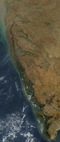
[[File:Satellite Picture of the Western Ghats & Indian West Coast.png|left|thumbnail|The [[Western Ghats]] lie roughly parallel to the southwestern Malabar coast of India.]] | [[File:Satellite Picture of the Western Ghats & Indian West Coast.png|left|thumbnail|The [[Western Ghats]] lie roughly parallel to the southwestern Malabar coast of India.]] | ||
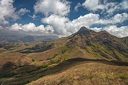
[[File:AnaimudiPeak DSC 4834.jpg|left|thumbnail|[[Anamudi]], the highest peak in India outside the [[Himalaya]]s, lies parallel to the Malabar Coast, in [[Western Ghats]].]] | [[File:AnaimudiPeak DSC 4834.jpg|left|thumbnail|[[Anamudi]], the highest peak in India outside the [[Himalaya]]s, lies parallel to the Malabar Coast, in [[Western Ghats]].]] | ||
Until the arrival of [[British people|British]], the term ''Malabar'' was used in foreign trade circles as a general name for [[Kerala]].<ref name="Etymology of Malabar">{{cite book|last1=Sreedhara Menon|first1=A.|url=https://books.google.com/books?id=FAlXPgAACAAJ&q=%E0%B4%95%E0%B5%87%E0%B4%B0%E0%B4%B3+%E0%B4%9A%E0%B4%B0%E0%B4%BF%E0%B4%A4%E0%B5%8D%E0%B4%B0%E0%B4%82|title=''Kerala Charitram''|date=January 2007|publisher=DC Books|isbn=9788126415885|edition=2007|location=Kottayam|access-date=19 July 2020}}</ref> Earlier, the term ''Malabar'' had also been used to denote [[Tulu Nadu]] and [[Kanyakumari district|Kanyakumari]] which lie contiguous to Kerala in the southwestern coast of India, in addition to the modern state of Kerala.<ref>{{cite web | ''Malabar'' is reminiscent of the word ''Malanad'' or ''Malavaram'' in [[Malayalam]], which means ''the land of mountains''. The earliest recorded use of 'Malabar' is by [[Al-Biruni]] (AD 973–1048), though the name had already been in use much earlier.<ref name="Etymology of Malabar" /> Authors such as [[Ibn Khordadbeh]] and [[Al-Baladhuri]] mention Malabar ports in their works.<ref name="KMMohammad">Mohammad, K.M. "Arab relations with Malabar Coast from 9th to 16th centuries" Proceedings of the Indian History Congress. Vol. 60 (1999), pp. 226–234.</ref>{{Citation needed|date=October 2024}} According to [[William Logan (author)|William Logan]], the word ''Malabar'' comes from a combination of the Dravidian word ''Mala'' (mountain) and the [[Persian language|Persian]]/[[Arabic]] word ''Barr'' (country/continent).<ref name="Etymology of Malabar" /><ref>{{Cite book |last=Logan |first=William |url=https://archive.org/details/malabarmanual0000loga/page/1/mode/1up |title=Malabar Manual, Vol. 1 |date=1887 |publisher=Superintendent, Government Press (Madras) |others=Servants of Knowledge |isbn=978-81-206-0446-9 |pages=1}}</ref> The first element of the name is first attested in the ''Topography'' written by [[Cosmas Indicopleustes]] (6th century CE), which indicates that [[Arabs|Arab]] sailors already call Kerala ''Male'' at that time. The ''Topography'' mentions a pepper emporium called ''Male'', which clearly gave its name to Malabar ('the country of Male').<ref>C. A. Innes and F. B. Evans, ''Malabar and Anjengo, volume 1'', Madras District Gazetteers (Madras: Government Press, 1915), p. 2.</ref><ref>M. T. Narayanan, ''[https://books.google.com/books?id=kHtbkuXruzwC Agrarian Relations in Late Medieval Malabar]'' (New Delhi: Northern Book Centre, 2003), xvi–xvii.</ref> The second part of the name is thought by scholars to be the Arabic word {{Lang|ar-Latn|barr}} ('continent') or its Persian relative {{Lang|fa-Latn|bar}} ('country'). | ||
Until the arrival of the [[British people|British]], the term ''Malabar'' was used in foreign trade circles as a general name for [[Kerala]].<ref name="Etymology of Malabar">{{cite book|last1=Sreedhara Menon|first1=A.|url=https://books.google.com/books?id=FAlXPgAACAAJ&q=%E0%B4%95%E0%B5%87%E0%B4%B0%E0%B4%B3+%E0%B4%9A%E0%B4%B0%E0%B4%BF%E0%B4%A4%E0%B5%8D%E0%B4%B0%E0%B4%82|title=''Kerala Charitram''|date=January 2007|publisher=DC Books|isbn=9788126415885|edition=2007|location=Kottayam|access-date=19 July 2020}}</ref> Earlier, the term ''Malabar'' had also been used to denote [[Tulu Nadu]] and [[Kanyakumari district|Kanyakumari]], which lie contiguous to Kerala in the southwestern coast of India, in addition to the modern state of Kerala.<ref>{{cite web|author=J. Sturrock|year=1894|title=Madras District Manuals - South Canara (Volume-I)|publisher=Madras Government Press|url=https://archive.org/details/dli.csl.3200/page/n1/mode/2up}}</ref><ref>{{cite book|author=V. Nagam Aiya|year=1906|title=The Travancore State Manual|publisher=Travancore Government Press|url=https://archive.org/details/travancorestate00aiyagoog/page/n10/mode/2up}}</ref> The people of Malabar were known as ''[[Malabars]]''. The term ''Malabar'' is often used to denote the entire southwestern coast of India. | |||
}}</ref><ref>{{cite book | Additionally, European traders and scholars referred to [[Tamils]] of [[Eelam|Sri Lanka]] as ''Malabars''. In the 18th century, [[Johann Phillip Fabricius|J. P. Fabricius]] described his Tamil-English Dictionary as the "Dictionary of Malabar and English".<ref>{{Cite book |last=Fabricius |first=Johann Philipp |url=http://archive.org/details/malabarenglishdi00fabr |title=A Malabar and English dictionary |date=1809 |publisher=Vepery |others=The Library of Congress}}</ref> | ||
}}</ref> The people of Malabar were known as ''[[Malabars]]''. The term Malabar is often used to denote the entire southwestern coast of India. | |||
==Definitions== | ==Definitions== | ||
{{More citations needed section|date=February 2023}} | |||
[[File:Bekalfortbeach.JPG|thumb|[[Bekal Fort]] Beach in Kerala]] | [[File:Bekalfortbeach.JPG|thumb|[[Bekal Fort]] Beach in Kerala]] | ||
The term ''Malabar Coast'', in historical contexts, refers to India's southwestern coast, which lies on the narrow coastal plain of [[Karnataka]] and [[Kerala]] between the [[Western Ghats]] range and the [[Arabian Sea]].<ref name="britannica">[https://www.britannica.com/EBchecked/topic/359386/Malabar-Coast Malabar Coast], Britannica.com. Accessed 7 March 2023.</ref> The coast runs from south of [[Goa]] to [[Kanyakumari]] on India's southern tip. India's southeastern coast is called the [[Coromandel Coast]].<ref>[http://xenophongroup.com/mcjoynt/suffren3.gif Map of Coromandel Coast] {{Webarchive|url=https://web.archive.org/web/20120210015347/http://xenophongroup.com/mcjoynt/suffren3.gif |date=10 February 2012 }} on a website dedicated to the East Indian Campaign (1782–1783).</ref> | |||
In ancient times the term ''Malabar'' was used to denote the entire south-western coast of the Indian peninsula. The region formed part of the ancient kingdom of [[Chera dynasty|Chera]] until the early 12th century. Following the breakup of the Chera Kingdom, the chieftains of the region proclaimed their independence. Notable among these were the [[Zamorin]]s of [[Kozhikode district|Kozhikode]], [[Kolathunadu]], [[Kingdom of Cochin|''Perumbadappu Swaroopam'']], [[Venad (kingdom)|Venad]], [[Kingdom of Valluvanad]] of [[Kingdom of Valluvanad]].{{citation needed|date=February 2023}} | |||
In ancient times the term ''Malabar'' was used to denote the entire south-western coast of the Indian peninsula. The region formed part of the ancient kingdom of [[Chera dynasty|Chera]] until the early 12th century. Following the breakup of the Chera Kingdom, the chieftains of the region proclaimed their independence. Notable among these were the [[ | |||
The name ''Malabar Coast'' is sometimes used as an all-encompassing term for the entire Indian coast from [[Konkan]] to the tip of the subcontinent at Kanyakumari.<ref name="britannica" /> | The name ''Malabar Coast'' is sometimes used as an all-encompassing term for the entire Indian coast from [[Konkan]] to the tip of the subcontinent at Kanyakumari.<ref name="britannica" /> It stretches approximately 845 kilometers (525 miles) along the southwestern coast of India. It extends from the southern tip of Goa to [[Kanyakumari]], encompassing the coastal regions of Karnataka and Kerala. It is flanked by the Arabian Sea on the west and the Western Ghats on the east. The southern part of this narrow coast is referred to as the [[South Western Ghats moist deciduous forests]].{{citation needed|date=February 2021}} | ||
''[[Malabar Coast moist forests|Malabar]]'' is also used by ecologists to refer to the [[ | ''[[Malabar Coast moist forests|Malabar]]'' is also used by ecologists to refer to the [[Tropical and subtropical moist broadleaf forests]] of southwestern India (present-day Kerala).{{citation needed|date=February 2021}} | ||
==Geography== | ==Geography== | ||
{{see also|Geography of Kerala|List of rivers of Kerala|Wildlife of Kerala|Kerala Backwaters}} | {{see also|Geography of Kerala|List of rivers of Kerala|Wildlife of Kerala|Kerala Backwaters}} | ||
Geographically, the Malabar Coast can be divided into three climatically distinct regions: the eastern highlands; rugged and cool mountainous terrain, the central mid-lands; rolling hills, and the western lowlands; coastal plains.<ref name="ChattopadhyayFranke2006"/> | Geographically, the Malabar Coast can be divided into three climatically distinct regions: the eastern highlands; rugged and cool mountainous terrain, the central mid-lands; rolling hills, and the western lowlands; coastal plains.<ref name="ChattopadhyayFranke2006"/> | ||
The [[Western Ghats]] mountain | The [[Western Ghats]] mountain range lie parallel to the coast on the eastern highland and separate the plains from the [[Deccan Plateau]]. These mountains are recognised as one of the world's eight "hottest hotspots" of biological diversity and are listed among [[UNESCO]] [[World Heritage Site]]s.<ref name="UNESCO">{{cite news|url=https://timesofindia.indiatimes.com/home/environment/flora-fauna/UN-designates-Western-Ghats-as-world-heritage-site/articleshow/14595602.cms |archive-url=https://web.archive.org/web/20130131192257/http://articles.timesofindia.indiatimes.com/2012-07-02/flora-fauna/32507340_1_world-heritage-list-western-ghats-border-town |url-status=live |archive-date=31 January 2013|title=UN designates Western Ghats as world heritage site|date=2 July 2012|newspaper=[[The Times of India]] |access-date=27 November 2018}}</ref> The peak of [[Anamudi]] in [[Kerala]], at an elevation of {{convert|2,695|m|abbr=on}}, is the highest peak in India outside the [[Himalayas]].<ref>{{cite book|last=Hunter|first=William Wilson|author2=James Sutherland Cotton|author3=Richard Burn|author4=William Stevenson Meyer|author5=Great Britain India Office|url=https://dsal.uchicago.edu/reference/gazetteer/|title=The Imperial Gazetteer of India|volume=11|publisher=Clarendon Press|year=1909 |access-date=16 May 2015|ref=imp |archive-url=https://web.archive.org/web/20081216124143/http://dsal.uchicago.edu/reference/gazetteer/ |archive-date=16 December 2008 |url-status=live}}</ref> The chain's forests are considered to be older than the Himalaya mountains.<ref name="UNESCO"/> | ||
Malabar's western coastal belt is relatively flat compared to the eastern region,<ref name="ChattopadhyayFranke2006"/>{{rp|33}} and is criss-crossed by a network of interconnected [[brackish]] canals, lakes, [[estuaries]],<ref name="Moss2010">{{cite book|author=Danny Moss|title=Public Relations Cases: International Perspectives|url=https://books.google.com/books?id=s0-CJ3djEdEC&pg=PA41 |access-date=18 November 2012|year=2010|publisher=Taylor & Francis|isbn=978-0415773362|page=41}}</ref> and rivers known as the [[Kerala Backwaters]].<ref name="Thorpe2012">{{cite book|author=Edgar Thorpe|title=The Pearson CSAT Manual 2012|url=https://books.google.com/books?id=1cruroSVFoUC&pg=RA3-PA38 |access-date=18 November 2012|year=2012|publisher=Pearson Education India|isbn=978-8131767344|page=3}}</ref> The [[Kuttanad]] region, also known as ''The Rice Bowl of Kerala'', has the [[List of extreme points of India#Altitudes|lowest altitude in India]].<ref name="ndtv_2238752"/><ref>{{Cite web|url=http://www.hindu.com/mag/2003/07/13/stories/2003071300600200.htm|title=Thirst below sea level|last=Suchitra|first=M|date=2003-08-13|work=[[The Hindu]]|access-date=2020-11-17|archive-url=https://web.archive.org/web/20190922101804/https://www.thehindu.com/todays-paper/tp-features/tp-sundaymagazine/thirst-below-sea-level/article28523147.ece |archive-date=2019-09-22}}</ref> The country's longest lake [[Vembanad Lake|Vembanad]], dominates the backwaters; it lies between [[Alappuzha]] and [[Kochi]] and is about {{convert|200|km2|sqmi|abbr=on}} in area.<ref name="Husain">{{cite book|author=Majid Husain|title=Understanding: Geographical: Map Entries: for Civil Services Examinations: Second Edition|url=https://books.google.com/books?id=_9VGKfQ-sQsC&pg=RA9-PT18 |access-date=18 November 2012|publisher=Tata McGraw-Hill Education|isbn=978-0070702882|page=9|year=2011}}</ref> Around eight percent of India's waterways are found in Kerala.<ref name="IWAI_2005">{{Cite journal|author=Inland Waterways Authority of India (IWAI—Ministry of Shipping)|year=2005|title=Introduction to Inland Water Transport|journal=IWAI (Ministry of Shipping)|url=http://iwai.nic.in/Introduction.html |archive-url=https://archive.today/20050204175110/http://iwai.nic.in/Introduction.html |url-status=dead |archive-date=4 February 2005 |access-date=19 January 2006}}</ref> | |||
<gallery widths="200px" heights="135px"> | |||
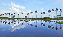
File:Vembanad Lake at Kumarakom.jpg|[[Vembanad]], the largest lake in India, is a portion of the [[Kerala Backwaters]]. | |||
File:Chalakudy River bank on a summer sunrise.jpg|The [[Athirappilly Falls]] is located on [[Chalakudy River]]. | |||
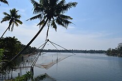
File:Fish net over Periyar River 0.jpg|[[Periyar (river)|Periyar]], the longest [[List of rivers of Kerala|river of Kerala]] | |||
File:Kappad beach kerala.jpg|[[Kappad]] beach near [[Koyilandy]] | |||
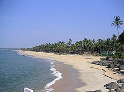
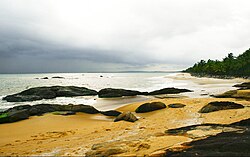
File:Ezhimala beach.JPG|Sandy beaches dotted with swaying coconut palms are a ubiquitous sight along the Malabar coast. | |||
</gallery> | |||
===Physical geography=== | ===Physical geography=== | ||
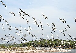
[[File:Kadalundi Bird Sanctuary.jpg|thumbnail|A view of the [[Kadalundi Bird Sanctuary]]. The coastal area of Malabar is home to several migratory birds.]] | [[File:Kadalundi Bird Sanctuary.jpg|thumbnail|A view of the [[Kadalundi Bird Sanctuary]]. The coastal area of Malabar is home to several migratory birds.]] | ||
The term ''Malabar Coast'' is sometimes used as an all-encompassing term for the entire Indian coast from the western coast of [[Konkan]] to the tip of the subcontinent at [[Cape Comorin]]. It is over 525 miles or 845 kilometers long. It spans from the south-western coast of [[Maharashtra]] and goes along the coastal region of [[Goa]], through the entire western coast of [[Karnataka]] and [[Kerala]] and reaches till [[Kanyakumari district|Kanyakumari]]. It is flanked by the [[Arabian Sea]] on the west and the [[Western Ghats]] on the east. The Southern part of this narrow coast is the [[South Western Ghats moist deciduous forests]]. Climate-wise, the Malabar Coast, especially on its westward-facing mountain slopes, comprises the wettest region of southern India, as the Western Ghats intercept the moisture-laden Southwest [[monsoon]] rains. | The term ''Malabar Coast'' is sometimes used as an all-encompassing term for the entire Indian coast from the western coast of [[Konkan]] to the tip of the subcontinent at [[Cape Comorin]]. It is over 525 miles or 845 kilometers long. It spans from the south-western coast of [[Maharashtra]] and goes along the coastal region of [[Goa]], through the entire western coast of [[Karnataka]] and [[Kerala]] and reaches till [[Kanyakumari district|Kanyakumari]]. It is flanked by the [[Arabian Sea]] on the west and the [[Western Ghats]] on the east. The Southern part of this narrow coast is the [[South Western Ghats moist deciduous forests]]. Climate-wise, the Malabar Coast, especially on its westward-facing mountain slopes, comprises the wettest region of southern India, as the Western Ghats intercept the moisture-laden Southwest [[monsoon]] rains. | ||
| Line 99: | Line 99: | ||
{{See also|Wildlife of Kerala}} | {{See also|Wildlife of Kerala}} | ||
The [[Malabar rainforests]] include these [[ecoregion]]s recognized by [[biogeography|biogeographers]]: | The [[Malabar rainforests]] include these [[ecoregion]]s recognized by [[biogeography|biogeographers]]: | ||
# the [[Malabar Coast moist forests]] formerly occupied the coastal zone, up to the 250 meters in elevation (but 95% of these forests no longer exist) | # the [[Malabar Coast moist forests]] formerly occupied the coastal zone, up to the 250 meters in elevation (but 95% of these forests no longer exist) | ||
# the [[South Western Ghats moist deciduous forests]] grow at intermediate elevations | # the [[South Western Ghats moist deciduous forests]] grow at intermediate elevations | ||
| Line 109: | Line 110: | ||
The Malabar Coast featured (and in some instances still does) several historic port cities. Notable among these were/are [[Kannur|Naura]], [[Vizhinjam]], [[Muziris]], [[Nelcynda]], [[Beypore]] and [[Thundi]] (near [[Ponnani]] or [[Kadalundi]]) during ancient times, and [[Kozhikode]] (Calicut), [[Kollam]], [[Ponnani]], [[Kannur]] (Cannanore), and [[Kochi, India|Cochin]] in the medieval period, and have served as centers of the [[Indian Ocean]] trade for millennia. | The Malabar Coast featured (and in some instances still does) several historic port cities. Notable among these were/are [[Kannur|Naura]], [[Vizhinjam]], [[Muziris]], [[Nelcynda]], [[Beypore]] and [[Thundi]] (near [[Ponnani]] or [[Kadalundi]]) during ancient times, and [[Kozhikode]] (Calicut), [[Kollam]], [[Ponnani]], [[Kannur]] (Cannanore), and [[Kochi, India|Cochin]] in the medieval period, and have served as centers of the [[Indian Ocean]] trade for millennia. | ||
Because of their orientation to the sea and to maritime commerce, the Malabar coast cities feel very [[Multicultural|cosmopolitan]], and have been home to some of the first groups of [[Jews]] (known today as [[Cochin Jews]]), Syrian Christians (known as [[Saint Thomas Christians]]), [[Muslims]] (presently known as [[Mappilas]]), and [[Anglo-Indians]] in India.<ref>[https://books.google.com/books?id=qhKGPprbQaYC | Because of their orientation to the sea and to maritime commerce, the Malabar coast cities feel very [[Multicultural|cosmopolitan]], and have been home to some of the first groups of [[Jews]] (known today as [[Cochin Jews]]), Syrian Christians (known as [[Saint Thomas Christians]]), [[Muslims]] (presently known as [[Malabar Muslims|Mappilas]]), and [[Anglo-Indians]] in India.<ref>[https://books.google.com/books?id=qhKGPprbQaYC&q=two+millennia ''The Jews of India: A Story of Three Communities''] by Orpa Slapak. The Israel Museum, Jerusalem. 2003. p. 27. {{ISBN|965-278-179-7}}.</ref><ref>[https://www.zum.de/whkmla/sp/1213/jeannedarc/mdh3.html ''The Clash of Cultures in Malabar : Encounters, Conflict and Interaction with European Culture, 1498-1947''] Korean Minjok Leadership Academy, Myeong, Do Hyeong, Term Paper, AP World History Class, July 2012</ref> | ||
==History== | ==History== | ||
{{See also|History of Kerala}} | {{See also|History of Kerala}} | ||
===Prehistory=== | ===Prehistory=== | ||
A substantial portion of the Malabar Coast including the western coastal lowlands and the plains of the midland may have been under the sea in ancient times. Marine fossils have been found in an area near [[Changanassery]], thus supporting the hypothesis.<ref name="Menon2007">{{cite book |author=A Sreedhara Menon |title=A Survey Of Kerala History |url=https://books.google.com/books?id=FVsw35oEBv4C&pg=PA20 |access-date=27 July 2012 |year= 2007 |publisher=DC Books |isbn=978-8126415786 |pages=20–21}}</ref> Pre-historical archaeological findings include [[dolmen]]s of the [[Neolithic]] era in the [[Marayur]] area of the [[Idukki district]], which lie on the eastern highland made by [[Western Ghats]]. Rock engravings in the [[Edakkal Caves]], in [[Wayanad]] date back to the Neolithic era around 6000 BCE.<ref name="Kapoor2002">{{cite book |author=Subodh Kapoor |title=The Indian Encyclopaedia |url=https://books.google.com/books?id=gxIpYtnyzu4C&pg=PA2184 |access-date=1 August 2012 |year= 2002 |publisher=Cosmo Publications |isbn=978-8177552577 |page=2184}}</ref><ref>{{cite web |title=Wayanad |url=https://www.kerala.gov.in/web/guest/wayanad |website=kerala.gov.in |publisher=Government of Kerala |access-date=12 November 2015}}</ref> | A substantial portion of the Malabar Coast including the western coastal lowlands and the plains of the midland may have been under the sea in ancient times. Marine fossils have been found in an area near [[Changanassery]], thus supporting the hypothesis.<ref name="Menon2007">{{cite book|author=A Sreedhara Menon|title=A Survey Of Kerala History|url=https://books.google.com/books?id=FVsw35oEBv4C&pg=PA20 |access-date=27 July 2012|year=2007|publisher=DC Books|isbn=978-8126415786|pages=20–21}}</ref> Pre-historical archaeological findings include [[dolmen]]s of the [[Neolithic]] era in the [[Marayur]] area of the [[Idukki district]], which lie on the eastern highland made by [[Western Ghats]]. Rock engravings in the [[Edakkal Caves]], in [[Wayanad]] date back to the Neolithic era around 6000 BCE.<ref name="Kapoor2002">{{cite book|author=Subodh Kapoor|title=The Indian Encyclopaedia|url=https://books.google.com/books?id=gxIpYtnyzu4C&pg=PA2184 |access-date=1 August 2012|year=2002|publisher=Cosmo Publications|isbn=978-8177552577|page=2184}}</ref><ref>{{cite web|title=Wayanad|url=https://www.kerala.gov.in/web/guest/wayanad|website=kerala.gov.in|publisher=Government of Kerala|access-date=12 November 2015|archive-date=28 May 2021|archive-url=https://web.archive.org/web/20210528022259/https://kerala.gov.in/web/guest/wayanad|url-status=dead}}</ref> | ||
===Ancient and medieval history=== | ===Ancient and medieval history=== | ||
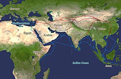
[[File:Periplous of the Erythraean Sea.svg | [[File:Silk route.jpg|thumb|[[Silk Road]] and [[Spice trade]], ancient trade routes that linked India within the [[Old World]], carried goods and ideas between the ancient civilisations of the Old World and India. The land routes are red; the water routes are blue.]] | ||
[[File:Periplous of the Erythraean Sea.svg|thumbnail|Names, routes and locations of the ''[[Periplus of the Erythraean Sea]]'' (1st century CE)]] | |||
[[File:Caminho maritimo para a India.png|thumb|The path [[Vasco da Gama]] took to reach [[Kozhikode]] (black line) in 1498, which was also the [[Age of Discovery|discovery of a sea route]] from [[Europe]] to India, and eventually paved way for the [[Colonial India|European colonisation]] of [[Indian subcontinent]]]] | |||
The Malabar Coast has been a major spice exporter since 3000 BCE, according to [[Sumer|Sumerian records]] and it is still referred to as the "Garden of Spices" or as the "Spice Garden of India".<ref>{{cite news|url=https://www.thehindu.com/todays-paper/tp-national/tp-kerala/of-kerala-egypt-and-the-spice-link/article5625620.ece|first=Kaavya|last=Pradeep Kumar|work=The Hindu|title=Of Kerala, Egypt, and the Spice link|date=28 January 2014 |access-date=12 November 2015}}</ref><ref name="ChattopadhyayFranke2006">{{Cite book|title=Striving for Sustainability: Environmental Stress and Democratic Initiatives in Kerala|last1=Chattopadhyay|first1=Srikumar|publisher=Concept Publishing Company|year=2006|isbn=978-81-8069-294-9|url=https://books.google.com/books?id=gOrvghLklKoC|last2=Franke|first2=Richard W.}}</ref>{{rp|79}} [[Kerala]]'s spices attracted ancient [[Arab]]s, [[Babylonians]], [[Assyria]]ns and [[Egyptians]] to the Malabar Coast in the 3rd and 2nd millennia BCE. [[Phoenicians]] established trade with Malabar during this period.<ref name="Menon57">{{cite book|author=A Sreedhara Menon|title=A Survey Of Kerala History|url=https://books.google.com/books?id=FVsw35oEBv4C&pg=PA57 |access-date=10 October 2012|date=1 January 2007|publisher=DC Books|isbn=978-81-264-1578-6|pages=57–58}}</ref> [[Arab]]s and [[Phoenicians]] were the first to enter the Malabar Coast to trade [[Spice]]s.<ref name="Menon57"/> The Arabs on the coasts of [[Yemen]], [[Oman]], and the [[Persian Gulf]], must have made the first long voyage to Malabar and other [[Eastern world|eastern countries]].<ref name="Menon57"/> They must have brought the [[Cinnamon]] of Malabar to the [[Middle East]].<ref name="Menon57"/> The Greek historian [[Herodotus]] (5th century BCE) records that in his time the cinnamon spice industry was monopolized by the Egyptians and the Phoenicians.<ref name="Menon57"/> | |||
According to the ''[[Periplus of the Erythraean Sea]]'', a region known as ''[[Limyrike]]'' began at ''[[Kannur|Naura]]'' and ''[[Tyndis]]''. However, the [[Ptolemy]] mentions only ''Tyndis'' as the ''Limyrike'''s starting point. The region probably ended at [[Kanyakumari]]; it thus roughly corresponds to the present-day Malabar Coast. The value of Rome's annual trade with the region was estimated at 50,000,000 [[sesterces]].<ref>According to [[Pliny the Elder]], goods from India were sold in the Empire at 100 times their original purchase price. See [https://web.archive.org/web/20131106031753/http://www.cartage.org.lb/en/themes/BookLibrary/books/bibliographie/P/Plinyelder/elder/pliny-india.html]</ref> [[Pliny the Elder]] mentioned that ''Limyrike'' was prone by pirates.<ref>Bostock, John (1855). "26 (Voyages to India)". Pliny the Elder, The Natural History. London: Taylor and Francis.</ref> The [[Cosmas Indicopleustes]] mentioned that the ''[[Limyrike]]'' was a source of [[Malabar pepper]]s.<ref>Indicopleustes, Cosmas (1897). Christian Topography. 11. United Kingdom: The Tertullian Project. pp. 358–373.</ref><ref>Das, Santosh Kumar (2006). The Economic History of Ancient India. Genesis Publishing Pvt Ltd. p. 301.</ref> In the last centuries BCE the coast became important to the Greeks and Romans for its spices, especially Malabar pepper. The Cheras had trading links with [[Ancient China|China]], [[Western Asia|West Asia]], [[Egypt]], [[Greece]], and the [[Roman Empire]].<ref>[https://books.google.com/books?id=eONSAAAAcAAJ&q=Muziris Cyclopaedia of India and of Eastern and Southern Asia.]{{webarchive|url=https://web.archive.org/web/20161227045308/https://books.google.com/books?id=eONSAAAAcAAJ&q=Muziris |date=27 December 2016 }} Ed. by Edward Balfour (1871), Second Edition. Volume 2. p. 584.</ref> In foreign-trade circles the region was known as ''Male'' or ''Malabar''.<ref>{{cite web|url=http://www.siamese-heritage.org/jsspdf/1961/JSS_054_1c_Minattur_MalayaWhatsInAName.pdf|title=Malaya: What's in the name|publisher=siamese-heritage.org |access-date=7 August 2012|author=Joseph Minattur|page=1}}</ref> [[Muziris]], Tyndis, Naura (near [[Kannur]]), and Nelcynda were among the principal ports at that time.<ref name="Kusuman">{{cite book|author=K. K. Kusuman|title=A History of Trade & Commerce in Travancore|publisher=Mittal Publications|year=1987|isbn=978-8170990260|url=https://books.google.com/books?id=qbNuyHswr1cC|pages=1–2 |access-date=30 May 2015}}</ref> Contemporary [[Sangam literature]] describes Roman ships coming to Muziris in Kerala, laden with gold to exchange for [[Malabar pepper]]. One of the earliest western traders to use the monsoon winds to reach Kerala was [[Eudoxus of Cyzicus]], around 118 or 166 BCE, under the patronage of [[Ptolemy VIII Physcon|Ptolemy VIII]], king of the [[Hellenistic civilisation|Hellenistic]] [[Ptolemaic dynasty]] in Egypt. Roman establishments in the port cities of the region, such as a temple of ''[[Augustus]]'' and barracks for garrisoned Roman soldiers, are marked in the [[Tabula Peutingeriana]], the only surviving map of the Roman ''[[cursus publicus]]''.<ref>{{cite book|author=Abraham Eraly|title=The First Spring: The Golden Age of India|url=https://books.google.com/books?id=te1sqTzTxD8C&pg=PA246 |access-date=7 August 2012|year=2011|publisher=Penguin Books India|isbn=978-0670084784|pages=246–}}</ref><ref name="Iyengar_2001">{{cite book|author=Iyengar PTS|year=2001|title=History Of The Tamils: From the Earliest Times to 600 A.D.|publisher=Asian Educational Services|isbn=978-8120601451|url=https://books.google.com/books?id=ERq-OCn2cloC |access-date=29 December 2008}}</ref> | |||
During the early [[Middle Ages]], [[Nambudiri|Namboodiri]] Brahmin immigrants arrived in Kerala and shaped the society on the lines of the [[Caste system in India|caste system]]. In the 8th century, [[Adi Shankara]] was born at [[Kalady]] in central Kerala. He travelled extensively across the [[Indian subcontinent]] founding institutions of the widely influential philosophy of [[Advaita Vedanta]]. The Cheras regained control over Kerala in the 9th century until the kingdom was dissolved in the 12th century, after which small autonomous chiefdoms, most notably [[Zamorin of Calicut|the Kingdom of Kozhikode]], arose. The 13th century Venetian explorer, [[Marco Polo]], would visit | The term ''[[Kerala]]'' was first epigraphically recorded as ''Ketalaputo'' ([[Chera dynasty|Cheras]]) in a 3rd-century BCE rock inscription by emperor [[Ashoka]] of [[Magadha (Mahajanapada)|Magadha]].<ref name="Kerala 2011">"Kerala." Encyclopædia Britannica. Encyclopædia Britannica Online. Encyclopædia Britannica Inc., 2011. Web. 26 December 2011.</ref> It was mentioned as one of four independent kingdoms in southern India during Ashoka's time, the others being the [[Chola Empire|Cholas]], [[Pandya Empire|Pandyas]] and [[Athiyamān|Satyaputras]].<ref name="SmithJackson2008">{{cite book|author1=Vincent A. Smith|url=https://books.google.com/books?id=bP7DzXQBoM4C&pg=PA166|title=History of India, in Nine Volumes: Vol. II – From the Sixth Century BCE to the Mohammedan Conquest, Including the Invasion of Alexander the Great|author2=A. V. Williams Jackson|date=30 November 2008|publisher=Cosimo, Inc.|isbn=978-1-60520-492-5|pages=166–|access-date=1 August 2012}}</ref> The Cheras transformed Kerala into an international trade centre by establishing trade relations across the [[Arabian Sea]] with all major [[Mediterranean]] and [[Red Sea]] ports as well those of the [[Far East]]. The dominion of Cheras was located in one of the key routes of the ancient [[Indian Ocean trade]]. The early Cheras collapsed after repeated attacks from the neighboring [[Chola Empire|Cholas]] and [[Rashtrakuta Empire|Rashtrakutas]]. | ||
In 1498, [[Vasco Da Gama]] established a sea route to | During the early [[Middle Ages]], [[Nambudiri|Namboodiri]] Brahmin immigrants arrived in Kerala and shaped the society on the lines of the [[Caste system in India|caste system]]. In the 8th century, [[Adi Shankara]] was born at [[Kalady]] in central Kerala. He travelled extensively across the [[Indian subcontinent]] founding institutions of the widely influential philosophy of [[Advaita Vedanta]]. The Cheras regained control over Kerala in the 9th century until the kingdom was dissolved in the 12th century, after which small autonomous chiefdoms, most notably [[Zamorin of Calicut|the Kingdom of Kozhikode]], arose. The 13th century Venetian explorer, [[Marco Polo]], would visit and write of his stay in the province.<ref>{{Cite web|title=The Travels of Marco Polo/Book 3/Chapter 17 - Wikisource, the free online library|url=https://en.wikisource.org/wiki/The_Travels_of_Marco_Polo/Book_3/Chapter_17|access-date=2022-01-12|website=en.wikisource.org|language=en}}</ref> The port at [[Kozhikode]] acted as the gateway to medieval [[South India]]n coast for the [[Chinese people|Chinese]], the [[Arab]]s, the [[Portugal|Portuguese]], the [[Dutch East India Company|Dutch]], and finally the [[East India Company|British]].<ref name="Etymology of Malabar"/> | ||
In 1498, [[Vasco Da Gama]] established a sea route to Kozhikode during the [[Age of Discovery]], which was also the first modern sea route from [[Europe]] to [[South Asia]], and raised Portuguese settlements, which marked the beginning of the [[Early modern period|colonial era]] of India. European trading interests of the [[Dutch East India Company|Dutch]], [[Louis XIV's East India Company|French]] and the [[East India Company|British]] East India companies took centre stage during the [[colonial war]]s in India. [[Travancore]] became the most dominant state in Kerala by defeating the powerful [[Zamorin]] of [[History of Kozhikode|Kozhikode]] in the battle of [[Purakkad]] in 1755.<ref name="AHoT 162">{{cite book|last1=Shungoony Menon|first1=P.|title=A History of Travancore from the Earliest Times|date=1878|publisher=Higgin Botham & Co.|location=Madras|pages=[https://archive.org/details/ahistorytravanc00menogoog/page/n212 162]–164|url=https://archive.org/details/ahistorytravanc00menogoog|access-date=5 May 2016|language=en|format=pdf}}</ref> Paliath Achan of Cochin and Travancore united to expel the [[Zamorin|Zamorin of Calicut]] from [[Kochi]] territories. Under Martanda Pillai's leadership, [[Nair Brigade|Travancore's Nair forces]], with General de Lannoy's guidance, successfully captured [[Thrissur district|Thrissur]] in the [[Battle of Thrissur]] in 1763. Despite fierce resistance, the Zamorin's troops retreated, leading to their eventual evacuation from Cochin Territory. In pursuit of peace, the Zamorin agreed to indemnify Travancore for war expenses and vowed perpetual friendship, marking a triumph of strategy and valor led by Pillai.<ref>{{Cite journal |last1=B. |first1=W. R. |last2=Panikkar |first2=K. M. |date=July 1932 |title=Malabar and the Dutch: Being the History of the Fall of the Nayar Power in Malabar |url=http://dx.doi.org/10.2307/1785406 |journal=The Geographical Journal |volume=80 |issue=1 |pages=71 |doi=10.2307/1785406 |jstor=1785406 |bibcode=1932GeogJ..80...71B |issn=0016-7398|url-access=subscription }}</ref><ref>{{Cite book |last=P. Shungoonny Menon |url=https://archive.org/details/historyoftravanc0000shun |title=History of Travancore from the Earliest Times |date=1878 |publisher=Higginbotham and Co. (Madras) |others=Servants of Knowledge |isbn=978-81-206-0169-7}}</ref> After the Dutch were [[Travancore–Dutch War|defeated]] by Travancore king [[Marthanda Varma]], the British crown gained control over Kerala through the creation of the [[Malabar District]] in northern Kerala and by allying with the newly created princely state of Travancore in the southern part of the state until India was declared [[Indian independence movement|independent]] in 1947. The state of Kerala was created in 1956 from the former state of [[Travancore–Cochin]], the [[Malabar district]] and the [[Kasaragod taluk]] of [[South Canara]] District of [[Madras state]].<ref>{{cite news|url=http://www.hindu.com/yw/2003/11/01/stories/2003110101270300.htm |archive-url=https://web.archive.org/web/20040117071454/http://www.hindu.com/yw/2003/11/01/stories/2003110101270300.htm |url-status=dead |archive-date=17 January 2004|title=The land that arose from the sea|date=1 November 2003|work=[[The Hindu]] |access-date=2009-07-30}}</ref> | |||
===British colonialism: Malabar District=== | ===British colonialism: Malabar District=== | ||
{{main | {{main|Malabar District}} | ||
{{See also|Dutch Malabar|North Malabar|South Malabar}} | {{See also|Dutch Malabar|North Malabar|South Malabar}} | ||
After the Anglo-Mysore wars, the parts of the Malabar Coast, those became British colonies, were organized into a district of [[British Raj|British India]]. The British district included the present-day districts of [[Kannur]], [[Kozhikode]], [[Wayanad]], [[Malappuram]], much of [[Palakkad]] (Excluding [[Chittur]] taluk), some parts of [[Thrissur]] ([[Chavakkad]] Taluk), and the [[Fort Kochi]] region of [[Ernakulam district]], besides the isolated islands of [[Lakshadweep]]. The administrative headquarters was at | After the Anglo-Mysore wars, the parts of the Malabar Coast, those became British colonies, were organized into a district of [[British Raj|British India]]. The British district included the present-day districts of [[Kannur]], [[Kozhikode]], [[Wayanad]], [[Malappuram]], much of [[Palakkad]] (Excluding [[Chittur]] taluk), some parts of [[Thrissur]] ([[Chavakkad]] Taluk), and the [[Fort Kochi]] region of [[Ernakulam district]], besides the isolated islands of [[Lakshadweep]]. The administrative headquarters was at Kozhikode. | ||
[[File:Malabar District (1951 Census).svg|thumb|A map of the erstwhile [[Malabar District]] in 1951]] | [[File:Malabar District (1951 Census).svg|thumb|upright|A map of the erstwhile [[Malabar District]] in 1951]] | ||
[[Malabar District]], a part of the ancient Malabar (or Malabar Coast) was a part of the [[East India Company|British East India Company]] | [[Malabar District]], a part of the ancient Malabar (or Malabar Coast) was a part of the [[East India Company|British East India Company]]–controlled state. It included the northern half of the state of [[Kerala]] and the islands of [[Lakshadweep]].<ref>{{cite web|title=Kerala. Encyclopædia Britannica|url=https://www.britannica.com/place/Kerala|website=Encyclopædia Britannica Online|date=8 June 2008}}</ref> Kozhikode is considered as the capital of Malabar. The area was divided into two categories as North and South. [[North Malabar]] comprises present [[Kasaragod district|Kasaragod]] and [[Kannur]] Districts, Mananthavady Taluk of Wayanad District and [[Vatakara]] and [[Koyilandy]] Taluks of Kozhikode District. The left-over area is [[South Malabar]] aka [[kozhikode Taluk|Kozhikode]] it's included present Kozhikode and [[Political divisions of Kozhikode District#Villages in Thamarassery Taluk|Thamarassery taluk]], [[south wayanad]] it's included present kalpetta and sulthan battery places, [[Eranad Taluk|Eranad]] Taluk which comes under present [[Malappuram district|Malappuram]] District, [[Palakkad district|Palakkad]] District and [[Chavakkad]] taluk of [[Thrissur district|Thrissur]] district. | ||
During the [[British rule]], the Malabar's chief importance laid in producing [[Malabar pepper|pepper]], [[ | During the [[British rule]], the Malabar's chief importance laid in producing [[Malabar pepper|pepper]], [[tiles]], and [[coconut]]s.<ref>Pamela Nightingale, '[[Jonathan Duncan (Governor of Bombay)|Jonathan Duncan]] (bap. 1756, d. 1811)', Oxford Dictionary of National Biography, Oxford University Press, 2004; online edn, May 2009</ref> In the old administrative records of the [[Madras Presidency]], it is recorded that the most remarkable plantation owned by Government in the erstwhile Madras Presidency was the Teak plantation at [[Nilambur]] planted in 1844.<ref name="Mbsp">{{cite book|url=https://www.tamildigitallibrary.in/admin/assets/book/TVA_BOK_0023302_The_Madras_Presidency_1881_1931.pdf|title=The Madras Presidency (1881–1931)|last=Boag|first=GT|publisher=Government of Madras|location=Madras|year=1933|page=63}}</ref> The District of Malabar and the ports at [[Beypore]] and [[Fort Kochi]] had some sort of importance in the erstwhile Madras Presidency as it was one of the two districts of the Presidency that lies on the Western Malabar Coast, thus accessing the marine route through [[Arabian Sea]]. The first railway line of Kerala from [[Tirur]] to [[Beypore]] in 1861 was laid for it. | ||
===After Indian independence=== | ===After Indian independence=== | ||
With India's independence, Madras presidency became [[Madras State]], which was divided along linguistic lines on 1 November 1956, whereupon [[Kasaragod district|Kasaragod]] region was merged with the Malabar immediately to the north and the state of [[ | With India's independence, Madras presidency became [[Madras State]], which was divided along linguistic lines on 1 November 1956, whereupon [[Kasaragod district|Kasaragod]] region was merged with the Malabar immediately to the north and the state of [[Travancore–Cochin]] to the south to form the state of Kerala. Before that, Kasaragod was a part of [[South Canara]] district of [[Madras Presidency]]. [[Lakshadweep]] Islands were separated to form a new union territory. | ||
==See also== | ==See also== | ||
{{Portal||India}} | |||
{{ | * [[Coromandel Coast]] | ||
*[[ | * [[Coastal South West India]] | ||
*[[ | * [[Battle of Thrissur]] | ||
*[[ | * [[Dutch Malabar]] | ||
*[[ | * [[Kerala Backwaters]] | ||
*[[ | * [[List of rivers of Kerala]] | ||
*[[ | * [[Travancore]] | ||
*[[ | * [[Venad (kingdom)]] | ||
*[[ | * [[Zamorin]] | ||
*[[Malabar (disambiguation)]] | * [[Thiru-Kochi]] | ||
*[[Malabar District]] | * [[Malabar (disambiguation)]] | ||
*[[ | * [[Malabar District]] | ||
*[[Portuguese Empire]] | * [[Malabars]] | ||
*[[Portuguese India]] | * [[Portuguese Empire]] | ||
* [[Portuguese India]] | |||
* [[Thalassery cuisine]] | |||
==References== | ==References== | ||
{{Reflist}} | {{Reflist}} | ||
{{refbegin}} | {{refbegin}} | ||
* {{Cite book|title=Mathrubhumi Yearbook Plus | * {{Cite book|title=Mathrubhumi Yearbook Plus – 2019|publisher=P. V. Chandran, Managing Editor, Mathrubhumi Printing & Publishing Company Limited, Kozhikode|year=2018|location=Kozhikode|last=Chandran|first=VP|edition=Malayalam}} | ||
{{refend}} | {{refend}} | ||
==Further reading== | ==Further reading== | ||
*{{cite book|author= | * {{cite book|author=K. V. Krishna Iyer|title=Zamorins of Calicut: From the earliest times to AD 1806|publisher=Norman Printing Bureau, Kozhikode|url=https://archive.org/details/in.gov.ignca.3379|year=1938}} | ||
*{{cite book|author= | * {{cite book|author=William Logan|year=1887|title=Malabar Manual (Volume-I)|publisher=Madras Government Press|url=https://archive.org/details/malabarmanual0000loga/mode/2up}} | ||
*{{cite book|author= | * {{cite book|author=William Logan|year=1887|title=Malabar Manual (Volume-II)|publisher=Madras Government Press|url=https://archive.org/details/malabar_manual_volume2/mode/2up}} | ||
* {{cite book|author=Menon, A. Sreedhara |title=A Survey of Kerala History|url=https://books.google.com/books?id=FVsw35oEBv4C|year=2007|publisher=DC Books|isbn=9788126415786}} | * {{cite book|author=Menon, A. Sreedhara|title=A Survey of Kerala History|url=https://books.google.com/books?id=FVsw35oEBv4C|year=2007|publisher=DC Books|isbn=9788126415786}} | ||
* {{cite book | * {{cite book|author=S. Muhammad Hussain Nainar|year=1942|title=Tuhfat-al-Mujahidin: An Historical Work in The Arabic Language|publisher=University of Madras|url=https://archive.org/details/Tuhfat-al-MujahidinAnHistoricalWorkInTheArabicLanguage}} | ||
* {{cite book|author=Panikkar, K. M.|author-link=K. M. Panikkar|date=1929|title=Malabar and the Portuguese: being a history of the relations of the Portuguese with Malabar from 1500 to 1663|url=https://archive.org/details/in.ernet.dli.2015.280840}} | |||
* {{cite book|author=Panikkar, K. M.|author-link=K. M. Panikkar|date=1931|title=Malabar and the Dutch|url=https://archive.org/details/in.ernet.dli.2015.530045}} | |||
* {{cite book|author=Panikkar, K. M.|author-link=K. M. Panikkar|date=1953|title=Asia and Western dominance, 1498–1945|location=London|publisher=G. Allen and Unwin}} | |||
}} | |||
* {{cite book | == External links == | ||
* {{Commons category-inline}} | |||
* {{Wikivoyage inline|Malabar}} | |||
* {{cite book | |||
}} | |||
* {{cite book | |||
}} | |||
{{Malabar}} | {{Malabar}} | ||
| Line 205: | Line 196: | ||
{{South India topics}} | {{South India topics}} | ||
}} | }} | ||
{{Authority control}} | {{Authority control}} | ||
[[Category:Malabar Coast| ]] | [[Category:Malabar Coast| ]] | ||
[[Category: | [[Category:Coasts of India]] | ||
[[Category:Landforms of Karnataka]] | [[Category:Landforms of Karnataka]] | ||
[[Category:Landforms of Kerala]] | [[Category:Landforms of Kerala]] | ||
[[Category: | [[Category:Regions of India]] | ||
[[Category:Regions of Kerala]] | [[Category:Regions of Kerala]] | ||
[[Category:Natural regions of India]] | |||
Latest revision as of 09:33, 15 March 2026
Malabar Coast | |
|---|---|
Region | |
 Calicut coast 1572, painting by Georg Braun | |
| Nicknames: | |
 Map showing the Malabar Coast | |
| Coordinates: 12°01′00″N 75°17′00″E / 12.0167°N 75.2833°E | |
| Country | India |
| State | Kerala, Karnataka, Goa, Puducherry (union territory) and Tamil Nadu |
| • Density | 816/km2 (2,110/sq mi) |
| Languages | |
| • Official | Konkani, Malayalam, Tulu, Kannada, English, Tamil |
| Time zone | UTC+5:30 (IST) |
| ISO 3166 code | IN-KL, IN-TN, IN-PY and IN-KA |
| No. of districts | 14 (9 in Kerala, 3 in Karnataka, 1 in Puducherry (union territory) and 1 in Tamil Nadu) |
| Climate | Tropical (Köppen) |
The Malabar Coast (Malayalam: [mɐlɐbaːr]) is the southwestern region of the Indian subcontinent. It generally refers to the western coastline of India stretching from Konkan to Kanyakumari. Geographically, it comprises one of the wettest regions of the subcontinent, which includes the southern tip of Goa, Kanara region of Karnataka, all of Kerala and Kanyakumari region of Tamil Nadu.[3]
Kuttanad, which is the point of the lowest elevation in India, lies on the Malabar Coast. Kuttanad, also known as The Rice Bowl of Kerala, is among the few places in the world where cultivation takes place below sea level.[4][5] The peak of Anamudi, which is also the point of highest elevation in India outside the Himalayas, lies parallel to the Malabar Coast on the Western Ghats.
The region parallel to the Malabar Coast gently slopes from the eastern highland of Western Ghats ranges to the western coastal lowland. The moisture-laden winds of the Southwest monsoon, on reaching the southernmost point of the Indian subcontinent, because of its topography, divide into two branches; the "Arabian Sea Branch" and the "Bay of Bengal Branch".[6] The "Arabian Sea Branch" of the Southwest monsoon first hits the Western Ghats,[7] making Kerala the first state in India to receive rain from the Southwest monsoon.[8][9] The Malabar Coast is a source of biodiversity in India.
Etymology[edit | edit source]


Malabar is reminiscent of the word Malanad or Malavaram in Malayalam, which means the land of mountains. The earliest recorded use of 'Malabar' is by Al-Biruni (AD 973–1048), though the name had already been in use much earlier.[1] Authors such as Ibn Khordadbeh and Al-Baladhuri mention Malabar ports in their works.[10][citation needed] According to William Logan, the word Malabar comes from a combination of the Dravidian word Mala (mountain) and the Persian/Arabic word Barr (country/continent).[1][11] The first element of the name is first attested in the Topography written by Cosmas Indicopleustes (6th century CE), which indicates that Arab sailors already call Kerala Male at that time. The Topography mentions a pepper emporium called Male, which clearly gave its name to Malabar ('the country of Male').[12][13] The second part of the name is thought by scholars to be the Arabic word barr ('continent') or its Persian relative bar ('country').
Until the arrival of the British, the term Malabar was used in foreign trade circles as a general name for Kerala.[1] Earlier, the term Malabar had also been used to denote Tulu Nadu and Kanyakumari, which lie contiguous to Kerala in the southwestern coast of India, in addition to the modern state of Kerala.[14][15] The people of Malabar were known as Malabars. The term Malabar is often used to denote the entire southwestern coast of India.
Additionally, European traders and scholars referred to Tamils of Sri Lanka as Malabars. In the 18th century, J. P. Fabricius described his Tamil-English Dictionary as the "Dictionary of Malabar and English".[16]
Definitions[edit | edit source]
 | This section needs more citations. (February 2023) |

The term Malabar Coast, in historical contexts, refers to India's southwestern coast, which lies on the narrow coastal plain of Karnataka and Kerala between the Western Ghats range and the Arabian Sea.[17] The coast runs from south of Goa to Kanyakumari on India's southern tip. India's southeastern coast is called the Coromandel Coast.[18]
In ancient times the term Malabar was used to denote the entire south-western coast of the Indian peninsula. The region formed part of the ancient kingdom of Chera until the early 12th century. Following the breakup of the Chera Kingdom, the chieftains of the region proclaimed their independence. Notable among these were the Zamorins of Kozhikode, Kolathunadu, Perumbadappu Swaroopam, Venad, Kingdom of Valluvanad of Kingdom of Valluvanad.[citation needed]
The name Malabar Coast is sometimes used as an all-encompassing term for the entire Indian coast from Konkan to the tip of the subcontinent at Kanyakumari.[17] It stretches approximately 845 kilometers (525 miles) along the southwestern coast of India. It extends from the southern tip of Goa to Kanyakumari, encompassing the coastal regions of Karnataka and Kerala. It is flanked by the Arabian Sea on the west and the Western Ghats on the east. The southern part of this narrow coast is referred to as the South Western Ghats moist deciduous forests.[citation needed]
Malabar is also used by ecologists to refer to the Tropical and subtropical moist broadleaf forests of southwestern India (present-day Kerala).[citation needed]
Geography[edit | edit source]
Geographically, the Malabar Coast can be divided into three climatically distinct regions: the eastern highlands; rugged and cool mountainous terrain, the central mid-lands; rolling hills, and the western lowlands; coastal plains.[19]
The Western Ghats mountain range lie parallel to the coast on the eastern highland and separate the plains from the Deccan Plateau. These mountains are recognised as one of the world's eight "hottest hotspots" of biological diversity and are listed among UNESCO World Heritage Sites.[20] The peak of Anamudi in Kerala, at an elevation of 2,695 m (8,842 ft), is the highest peak in India outside the Himalayas.[21] The chain's forests are considered to be older than the Himalaya mountains.[20]
Malabar's western coastal belt is relatively flat compared to the eastern region,[19]:33 and is criss-crossed by a network of interconnected brackish canals, lakes, estuaries,[22] and rivers known as the Kerala Backwaters.[23] The Kuttanad region, also known as The Rice Bowl of Kerala, has the lowest altitude in India.[4][24] The country's longest lake Vembanad, dominates the backwaters; it lies between Alappuzha and Kochi and is about 200 km2 (77 sq mi) in area.[25] Around eight percent of India's waterways are found in Kerala.[26]
-
 Vembanad, the largest lake in India, is a portion of the Kerala Backwaters.
 -
 The Athirappilly Falls is located on Chalakudy River.
 -
 Periyar, the longest river of Kerala
 -
-
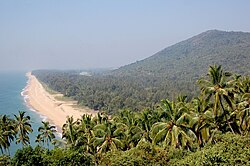 Sandy beaches dotted with swaying coconut palms are a ubiquitous sight along the Malabar coast.


Physical geography[edit | edit source]

The term Malabar Coast is sometimes used as an all-encompassing term for the entire Indian coast from the western coast of Konkan to the tip of the subcontinent at Cape Comorin. It is over 525 miles or 845 kilometers long. It spans from the south-western coast of Maharashtra and goes along the coastal region of Goa, through the entire western coast of Karnataka and Kerala and reaches till Kanyakumari. It is flanked by the Arabian Sea on the west and the Western Ghats on the east. The Southern part of this narrow coast is the South Western Ghats moist deciduous forests. Climate-wise, the Malabar Coast, especially on its westward-facing mountain slopes, comprises the wettest region of southern India, as the Western Ghats intercept the moisture-laden Southwest monsoon rains.
Malabar rainforests[edit | edit source]
The Malabar rainforests include these ecoregions recognized by biogeographers:
- the Malabar Coast moist forests formerly occupied the coastal zone, up to the 250 meters in elevation (but 95% of these forests no longer exist)
- the South Western Ghats moist deciduous forests grow at intermediate elevations
- the South Western Ghats montane rain forests cover the areas above 1000 meters
The Monsooned Malabar coffee bean comes from this area.
Port cities[edit | edit source]
The Malabar Coast featured (and in some instances still does) several historic port cities. Notable among these were/are Naura, Vizhinjam, Muziris, Nelcynda, Beypore and Thundi (near Ponnani or Kadalundi) during ancient times, and Kozhikode (Calicut), Kollam, Ponnani, Kannur (Cannanore), and Cochin in the medieval period, and have served as centers of the Indian Ocean trade for millennia.
Because of their orientation to the sea and to maritime commerce, the Malabar coast cities feel very cosmopolitan, and have been home to some of the first groups of Jews (known today as Cochin Jews), Syrian Christians (known as Saint Thomas Christians), Muslims (presently known as Mappilas), and Anglo-Indians in India.[27][28]
History[edit | edit source]
Prehistory[edit | edit source]
A substantial portion of the Malabar Coast including the western coastal lowlands and the plains of the midland may have been under the sea in ancient times. Marine fossils have been found in an area near Changanassery, thus supporting the hypothesis.[29] Pre-historical archaeological findings include dolmens of the Neolithic era in the Marayur area of the Idukki district, which lie on the eastern highland made by Western Ghats. Rock engravings in the Edakkal Caves, in Wayanad date back to the Neolithic era around 6000 BCE.[30][31]
Ancient and medieval history[edit | edit source]


The Malabar Coast has been a major spice exporter since 3000 BCE, according to Sumerian records and it is still referred to as the "Garden of Spices" or as the "Spice Garden of India".[32][19]:79 Kerala's spices attracted ancient Arabs, Babylonians, Assyrians and Egyptians to the Malabar Coast in the 3rd and 2nd millennia BCE. Phoenicians established trade with Malabar during this period.[33] Arabs and Phoenicians were the first to enter the Malabar Coast to trade Spices.[33] The Arabs on the coasts of Yemen, Oman, and the Persian Gulf, must have made the first long voyage to Malabar and other eastern countries.[33] They must have brought the Cinnamon of Malabar to the Middle East.[33] The Greek historian Herodotus (5th century BCE) records that in his time the cinnamon spice industry was monopolized by the Egyptians and the Phoenicians.[33]
According to the Periplus of the Erythraean Sea, a region known as Limyrike began at Naura and Tyndis. However, the Ptolemy mentions only Tyndis as the Limyrike's starting point. The region probably ended at Kanyakumari; it thus roughly corresponds to the present-day Malabar Coast. The value of Rome's annual trade with the region was estimated at 50,000,000 sesterces.[34] Pliny the Elder mentioned that Limyrike was prone by pirates.[35] The Cosmas Indicopleustes mentioned that the Limyrike was a source of Malabar peppers.[36][37] In the last centuries BCE the coast became important to the Greeks and Romans for its spices, especially Malabar pepper. The Cheras had trading links with China, West Asia, Egypt, Greece, and the Roman Empire.[38] In foreign-trade circles the region was known as Male or Malabar.[39] Muziris, Tyndis, Naura (near Kannur), and Nelcynda were among the principal ports at that time.[40] Contemporary Sangam literature describes Roman ships coming to Muziris in Kerala, laden with gold to exchange for Malabar pepper. One of the earliest western traders to use the monsoon winds to reach Kerala was Eudoxus of Cyzicus, around 118 or 166 BCE, under the patronage of Ptolemy VIII, king of the Hellenistic Ptolemaic dynasty in Egypt. Roman establishments in the port cities of the region, such as a temple of Augustus and barracks for garrisoned Roman soldiers, are marked in the Tabula Peutingeriana, the only surviving map of the Roman cursus publicus.[41][42]
The term Kerala was first epigraphically recorded as Ketalaputo (Cheras) in a 3rd-century BCE rock inscription by emperor Ashoka of Magadha.[43] It was mentioned as one of four independent kingdoms in southern India during Ashoka's time, the others being the Cholas, Pandyas and Satyaputras.[44] The Cheras transformed Kerala into an international trade centre by establishing trade relations across the Arabian Sea with all major Mediterranean and Red Sea ports as well those of the Far East. The dominion of Cheras was located in one of the key routes of the ancient Indian Ocean trade. The early Cheras collapsed after repeated attacks from the neighboring Cholas and Rashtrakutas.
During the early Middle Ages, Namboodiri Brahmin immigrants arrived in Kerala and shaped the society on the lines of the caste system. In the 8th century, Adi Shankara was born at Kalady in central Kerala. He travelled extensively across the Indian subcontinent founding institutions of the widely influential philosophy of Advaita Vedanta. The Cheras regained control over Kerala in the 9th century until the kingdom was dissolved in the 12th century, after which small autonomous chiefdoms, most notably the Kingdom of Kozhikode, arose. The 13th century Venetian explorer, Marco Polo, would visit and write of his stay in the province.[45] The port at Kozhikode acted as the gateway to medieval South Indian coast for the Chinese, the Arabs, the Portuguese, the Dutch, and finally the British.[1]
In 1498, Vasco Da Gama established a sea route to Kozhikode during the Age of Discovery, which was also the first modern sea route from Europe to South Asia, and raised Portuguese settlements, which marked the beginning of the colonial era of India. European trading interests of the Dutch, French and the British East India companies took centre stage during the colonial wars in India. Travancore became the most dominant state in Kerala by defeating the powerful Zamorin of Kozhikode in the battle of Purakkad in 1755.[46] Paliath Achan of Cochin and Travancore united to expel the Zamorin of Calicut from Kochi territories. Under Martanda Pillai's leadership, Travancore's Nair forces, with General de Lannoy's guidance, successfully captured Thrissur in the Battle of Thrissur in 1763. Despite fierce resistance, the Zamorin's troops retreated, leading to their eventual evacuation from Cochin Territory. In pursuit of peace, the Zamorin agreed to indemnify Travancore for war expenses and vowed perpetual friendship, marking a triumph of strategy and valor led by Pillai.[47][48] After the Dutch were defeated by Travancore king Marthanda Varma, the British crown gained control over Kerala through the creation of the Malabar District in northern Kerala and by allying with the newly created princely state of Travancore in the southern part of the state until India was declared independent in 1947. The state of Kerala was created in 1956 from the former state of Travancore–Cochin, the Malabar district and the Kasaragod taluk of South Canara District of Madras state.[49]
British colonialism: Malabar District[edit | edit source]
After the Anglo-Mysore wars, the parts of the Malabar Coast, those became British colonies, were organized into a district of British India. The British district included the present-day districts of Kannur, Kozhikode, Wayanad, Malappuram, much of Palakkad (Excluding Chittur taluk), some parts of Thrissur (Chavakkad Taluk), and the Fort Kochi region of Ernakulam district, besides the isolated islands of Lakshadweep. The administrative headquarters was at Kozhikode.
.svg)
Malabar District, a part of the ancient Malabar (or Malabar Coast) was a part of the British East India Company–controlled state. It included the northern half of the state of Kerala and the islands of Lakshadweep.[50] Kozhikode is considered as the capital of Malabar. The area was divided into two categories as North and South. North Malabar comprises present Kasaragod and Kannur Districts, Mananthavady Taluk of Wayanad District and Vatakara and Koyilandy Taluks of Kozhikode District. The left-over area is South Malabar aka Kozhikode it's included present Kozhikode and Thamarassery taluk, south wayanad it's included present kalpetta and sulthan battery places, Eranad Taluk which comes under present Malappuram District, Palakkad District and Chavakkad taluk of Thrissur district.
During the British rule, the Malabar's chief importance laid in producing pepper, tiles, and coconuts.[51] In the old administrative records of the Madras Presidency, it is recorded that the most remarkable plantation owned by Government in the erstwhile Madras Presidency was the Teak plantation at Nilambur planted in 1844.[52] The District of Malabar and the ports at Beypore and Fort Kochi had some sort of importance in the erstwhile Madras Presidency as it was one of the two districts of the Presidency that lies on the Western Malabar Coast, thus accessing the marine route through Arabian Sea. The first railway line of Kerala from Tirur to Beypore in 1861 was laid for it.
After Indian independence[edit | edit source]
With India's independence, Madras presidency became Madras State, which was divided along linguistic lines on 1 November 1956, whereupon Kasaragod region was merged with the Malabar immediately to the north and the state of Travancore–Cochin to the south to form the state of Kerala. Before that, Kasaragod was a part of South Canara district of Madras Presidency. Lakshadweep Islands were separated to form a new union territory.
See also[edit | edit source]

- Coromandel Coast
- Coastal South West India
- Battle of Thrissur
- Dutch Malabar
- Kerala Backwaters
- List of rivers of Kerala
- Travancore
- Venad (kingdom)
- Zamorin
- Thiru-Kochi
- Malabar (disambiguation)
- Malabar District
- Malabars
- Portuguese Empire
- Portuguese India
- Thalassery cuisine
References[edit | edit source]
- ↑ 1.0 1.1 1.2 1.3 1.4 Sreedhara Menon, A. (January 2007). Kerala Charitram (2007 ed.). Kottayam: DC Books. ISBN 9788126415885. Retrieved 19 July 2020.
- ↑ K. V. Krishna Iyer (1938). Zamorins of Calicut: From the earliest times to AD 1806. Norman Printing Bureau, Kozhikode.
- ↑ Fahlbusch, Erwin; Bromiley, Geoffrey William; Lochman, Jan Milic (2008). The Encyclodedia of Christianity. Wm. B. Eerdmans Publishing. p. 285. ISBN 978-0-8028-2417-2.
- ↑ 4.0 4.1 Press Trust of India (1 June 2020). "Kerala Boat Ferries Lone Passenger To Help Her Take Exam". NDTV. Retrieved 17 November 2020.
- ↑ Suchitra, M (13 August 2003). "Thirst below sea level". The Hindu. Archived from the original on 22 September 2019. Retrieved 17 November 2020.
- ↑ RK Jain. Geography 10. Ratna Sagar. p. 110. ISBN 978-8183320818. Retrieved 18 November 2012.
- ↑ Together with Social Science Term II. Rachna Sagar. p. 112. ISBN 978-8181373991. Retrieved 18 November 2012.
- ↑ Edgar Thorpe, Showick Thorpe; Thorpe Edgar. The Pearson CSAT Manual 2011. Pearson Education India. p. 7. ISBN 978-8131758304. Retrieved 18 November 2012.
- ↑ N.N. Kher; Jaideep Aggarwal. A Text Book of Social Sciences. Pitambar Publishing. p. 5. ISBN 978-8120914667. Retrieved 18 November 2012.
- ↑ Mohammad, K.M. "Arab relations with Malabar Coast from 9th to 16th centuries" Proceedings of the Indian History Congress. Vol. 60 (1999), pp. 226–234.
- ↑ Logan, William (1887). Malabar Manual, Vol. 1. Servants of Knowledge. Superintendent, Government Press (Madras). p. 1. ISBN 978-81-206-0446-9.
- ↑ C. A. Innes and F. B. Evans, Malabar and Anjengo, volume 1, Madras District Gazetteers (Madras: Government Press, 1915), p. 2.
- ↑ M. T. Narayanan, Agrarian Relations in Late Medieval Malabar (New Delhi: Northern Book Centre, 2003), xvi–xvii.
- ↑ J. Sturrock (1894). "Madras District Manuals - South Canara (Volume-I)". Madras Government Press.
- ↑ V. Nagam Aiya (1906). The Travancore State Manual. Travancore Government Press.
- ↑ Fabricius, Johann Philipp (1809). A Malabar and English dictionary. The Library of Congress. Vepery.
- ↑ 17.0 17.1 Malabar Coast, Britannica.com. Accessed 7 March 2023.
- ↑ Map of Coromandel Coast Archived 10 February 2012 at the Wayback Machine on a website dedicated to the East Indian Campaign (1782–1783).
- ↑ 19.0 19.1 19.2 Chattopadhyay, Srikumar; Franke, Richard W. (2006). Striving for Sustainability: Environmental Stress and Democratic Initiatives in Kerala. Concept Publishing Company. ISBN 978-81-8069-294-9.
- ↑ 20.0 20.1 "UN designates Western Ghats as world heritage site". The Times of India. 2 July 2012. Archived from the original on 31 January 2013. Retrieved 27 November 2018.
- ↑ Hunter, William Wilson; James Sutherland Cotton; Richard Burn; William Stevenson Meyer; Great Britain India Office (1909). The Imperial Gazetteer of India. Vol. 11. Clarendon Press. Archived from the original on 16 December 2008. Retrieved 16 May 2015.
- ↑ Danny Moss (2010). Public Relations Cases: International Perspectives. Taylor & Francis. p. 41. ISBN 978-0415773362. Retrieved 18 November 2012.
- ↑ Edgar Thorpe (2012). The Pearson CSAT Manual 2012. Pearson Education India. p. 3. ISBN 978-8131767344. Retrieved 18 November 2012.
- ↑ Suchitra, M (13 August 2003). "Thirst below sea level". The Hindu. Archived from the original on 22 September 2019. Retrieved 17 November 2020.
- ↑ Majid Husain (2011). Understanding: Geographical: Map Entries: for Civil Services Examinations: Second Edition. Tata McGraw-Hill Education. p. 9. ISBN 978-0070702882. Retrieved 18 November 2012.
- ↑ Inland Waterways Authority of India (IWAI—Ministry of Shipping) (2005). "Introduction to Inland Water Transport". IWAI (Ministry of Shipping). Retrieved 19 January 2006.
{{cite journal}}: CS1 maint: deprecated archival service (link) - ↑ The Jews of India: A Story of Three Communities by Orpa Slapak. The Israel Museum, Jerusalem. 2003. p. 27. ISBN 965-278-179-7.
- ↑ The Clash of Cultures in Malabar : Encounters, Conflict and Interaction with European Culture, 1498-1947 Korean Minjok Leadership Academy, Myeong, Do Hyeong, Term Paper, AP World History Class, July 2012
- ↑ A Sreedhara Menon (2007). A Survey Of Kerala History. DC Books. pp. 20–21. ISBN 978-8126415786. Retrieved 27 July 2012.
- ↑ Subodh Kapoor (2002). The Indian Encyclopaedia. Cosmo Publications. p. 2184. ISBN 978-8177552577. Retrieved 1 August 2012.
- ↑ "Wayanad". kerala.gov.in. Government of Kerala. Archived from the original on 28 May 2021. Retrieved 12 November 2015.
- ↑ Pradeep Kumar, Kaavya (28 January 2014). "Of Kerala, Egypt, and the Spice link". The Hindu. Retrieved 12 November 2015.
- ↑ 33.0 33.1 33.2 33.3 33.4 A Sreedhara Menon (1 January 2007). A Survey Of Kerala History. DC Books. pp. 57–58. ISBN 978-81-264-1578-6. Retrieved 10 October 2012.
- ↑ According to Pliny the Elder, goods from India were sold in the Empire at 100 times their original purchase price. See [1]
- ↑ Bostock, John (1855). "26 (Voyages to India)". Pliny the Elder, The Natural History. London: Taylor and Francis.
- ↑ Indicopleustes, Cosmas (1897). Christian Topography. 11. United Kingdom: The Tertullian Project. pp. 358–373.
- ↑ Das, Santosh Kumar (2006). The Economic History of Ancient India. Genesis Publishing Pvt Ltd. p. 301.
- ↑ Cyclopaedia of India and of Eastern and Southern Asia.Archived 27 December 2016 at the Wayback Machine Ed. by Edward Balfour (1871), Second Edition. Volume 2. p. 584.
- ↑ Joseph Minattur. "Malaya: What's in the name" (PDF). siamese-heritage.org. p. 1. Retrieved 7 August 2012.
- ↑ K. K. Kusuman (1987). A History of Trade & Commerce in Travancore. Mittal Publications. pp. 1–2. ISBN 978-8170990260. Retrieved 30 May 2015.
- ↑ Abraham Eraly (2011). The First Spring: The Golden Age of India. Penguin Books India. pp. 246–. ISBN 978-0670084784. Retrieved 7 August 2012.
- ↑ Iyengar PTS (2001). History Of The Tamils: From the Earliest Times to 600 A.D. Asian Educational Services. ISBN 978-8120601451. Retrieved 29 December 2008.
- ↑ "Kerala." Encyclopædia Britannica. Encyclopædia Britannica Online. Encyclopædia Britannica Inc., 2011. Web. 26 December 2011.
- ↑ Vincent A. Smith; A. V. Williams Jackson (30 November 2008). History of India, in Nine Volumes: Vol. II – From the Sixth Century BCE to the Mohammedan Conquest, Including the Invasion of Alexander the Great. Cosimo, Inc. pp. 166–. ISBN 978-1-60520-492-5. Retrieved 1 August 2012.
- ↑ "The Travels of Marco Polo/Book 3/Chapter 17 - Wikisource, the free online library". en.wikisource.org. Retrieved 12 January 2022.
- ↑ Shungoony Menon, P. (1878). A History of Travancore from the Earliest Times (pdf). Madras: Higgin Botham & Co. pp. 162–164. Retrieved 5 May 2016.
- ↑ B., W. R.; Panikkar, K. M. (July 1932). "Malabar and the Dutch: Being the History of the Fall of the Nayar Power in Malabar". The Geographical Journal. 80 (1): 71. Bibcode:1932GeogJ..80...71B. doi:10.2307/1785406. ISSN 0016-7398. JSTOR 1785406.
- ↑ P. Shungoonny Menon (1878). History of Travancore from the Earliest Times. Servants of Knowledge. Higginbotham and Co. (Madras). ISBN 978-81-206-0169-7.
- ↑ "The land that arose from the sea". The Hindu. 1 November 2003. Archived from the original on 17 January 2004. Retrieved 30 July 2009.
- ↑ "Kerala. Encyclopædia Britannica". Encyclopædia Britannica Online. 8 June 2008.
- ↑ Pamela Nightingale, 'Jonathan Duncan (bap. 1756, d. 1811)', Oxford Dictionary of National Biography, Oxford University Press, 2004; online edn, May 2009
- ↑ Boag, GT (1933). The Madras Presidency (1881–1931) (PDF). Madras: Government of Madras. p. 63.
- Chandran, VP (2018). Mathrubhumi Yearbook Plus – 2019 (Malayalam ed.). Kozhikode: P. V. Chandran, Managing Editor, Mathrubhumi Printing & Publishing Company Limited, Kozhikode.
Further reading[edit | edit source]
- K. V. Krishna Iyer (1938). Zamorins of Calicut: From the earliest times to AD 1806. Norman Printing Bureau, Kozhikode.
- William Logan (1887). Malabar Manual (Volume-I). Madras Government Press.
- William Logan (1887). Malabar Manual (Volume-II). Madras Government Press.
- Menon, A. Sreedhara (2007). A Survey of Kerala History. DC Books. ISBN 9788126415786.
- S. Muhammad Hussain Nainar (1942). Tuhfat-al-Mujahidin: An Historical Work in The Arabic Language. University of Madras.
- Panikkar, K. M. (1929). Malabar and the Portuguese: being a history of the relations of the Portuguese with Malabar from 1500 to 1663.
- Panikkar, K. M. (1931). Malabar and the Dutch.
- Panikkar, K. M. (1953). Asia and Western dominance, 1498–1945. London: G. Allen and Unwin.


.png)