.svg)
Pushpagiri (mountain)
This article needs additional citations for verification. (December 2013) |
| Pushpagiri | |
|---|---|
 A moment to rejoice far upon the mountains of Pushpagiri | |
| Highest point | |
| Elevation | 1,712 m (5,617 ft) |
| Coordinates | 12°40′00″N 75°41′00″E / 12.66667°N 75.68333°ECoordinates: 12°40′00″N 75°41′00″E / 12.66667°N 75.68333°E |
| Geography | |
 Pushpagiri Location of Pushpagiri, Karnataka  Pushpagiri Pushpagiri (India) | |
| Location | Border of Sullia Taluk, Dakshina Kannada district, Sakaleshpur Taluk Hassan District Somvarpet Taluk , Kodagu district Karnataka, India |
| Parent range | Western Ghats |
| Climbing | |
| Easiest route | Hike[citation needed] |
Pushpagiri (Kumara Parvatha), at 1,712 metres (5,617 ft),[citation needed] is the highest peak in Pushpagiri Wildlife Sanctuary in the Western Ghats of Karnataka. It is located in the Somwarpet Taluk, 20 kilometres (12 mi) from Somwarpet in the northern part of Kodagu district on the border between Dakshina Kannada and Kodagu district and hassan districts. It is 4th highest peak of Karnataka. The Sanskrit name of the mountain is Puṣpagiri while its Prakrit form is Puphagiri, which is mentioned in the Nagarjunakond Second Apsidal Temple inscription,[1] although this may refer to a different mountain to the north of Cuddapah, in Andhra Pradesh.
Pushpagiri Mountains[edit]
The Pushpagiri or Subramanya Hills (also referred as Kumaraparvatha) is the second-highest peak of Kodagu, and fourth highest peak in Karnataka
About 36 kilometres (22 mi) from Somwarpet and 1.5 kilometres (0.93 mi) from Kumaralli, it is located amid the jungle.
The Eastern entrance can be reached from Beedehalli via Heggademane temple and the Western entrance from Kukke Subramanya via Giri gadde. However, the entrance through Beedehalli is less strenuous.
The entrance from Kukke Subramanya is located 165 m above sea level. The nearest airport is in Mangalore at a distance of 106 kilometres (70 mi).Trekkers have to obtain permission from the Forest department which is located near Batra Mane, which is also a spot for overnight camping. This place is at a distance of 6 km from Kukke Subramanya.
Demography[edit]
- Somwarpet
- As of the 2001[update] India census,[2] Somwarpet had a population of 7218. Males constitute 50% of the population and females 50%. Somwarpet has an average literacy rate of 75%, higher than the national average of 59.5%: male literacy is 80%, and female literacy is 70%. In Somwarpet, 12% of the population is under 6 years of age.
- Somwarpet is located at 10°25′N 74°44′E / 10.42°N 74.73°E It has an elevation of 1130 metres (5003 feet).
- Madikeri
- As of 2001[update] India census,[2] Madikeri had a population of 32,286. Males constitute 51% of the population and females 49%. Madikeri had an average literacy rate of 81%, higher than the national average of 59.5%: male literacy was 83%, and female literacy 79%. 11% of the population was under 6 years of age. This town is situated at an elevation of over 3000 ft above sea level.
- Madikeri is located at 12°25′N 75°44′E / 12.42°N 75.73°E It has an elevation of 1170 metres (5003 feet).
- Kushalanagara
- As of 2001[update] India census,[2] Kushalnagar had a population of 13,262. Males constitute 53% of the population and females 47%. Kushalnagar has an average literacy rate of 78%, higher than the national average of 59.5%: male literacy is 82%, and female literacy is 73%. In Kushalnagar, 12% of the population is under 6 years of age.
- Kushalnagar is located at 12°28′N 75°58′E / 12.47°N 75.97°E It has an average elevation of 831 metres (2726 feet).
Historical Value: It is believed that Lord Subramanya's footmark is presented in the hilltop temple. You can see the stone mark still. Top of the hill there are two temples, one is for Lord Shiva and other one for Lord Shubramanya. It is believed that if any person has Sharpadosha it can be eliminated by visiting this temple.
Climatic conditions[edit]
The climate is generally cool and wet. The climate is that of a highland, with no extreme variations. It receives heavy rainfall between June to September. From October to December the area is covered in mist almost all the time.
- Rainfall: The rainfall in Coorg varies extensively, ranging from 3,500 mm (140 in) per year in the western Highlands and to under 1,000 mm (40 in) per year near the eastern plateau.
- Temperature: November to January are generally the coldest months, with the daytime maximum temperatures that ranges of an average of around 7° to 20 °C. April and May are normally the warmest months here, with temperatures of an average 29 °C. The temperatures in Mercara and Virajpet are generally a few degrees cooler than in Kushalnagar because of the hilly terrace.
- Visibility: This place often enjoys good visibility, although hill fog sometimes restricts the visibility.
Trekking at Pushpagiri[edit]
| Difficulty level | Strenuous |
| Approx Temperature | Max 30 degrees C |
| Accommodation type | Tented accommodation or stay in Bhattramane ( depending on availability ) |
| Washrooms | Only at base camp |
| Food | Basic Veg food ( Rice, Sambar, Buttermilk, Pickle ) available at Bhattramane |
| Distance from Bangalore | 230 km (one way) |
| Total trekking distance | 14 km approx (one way) |
| Attraction | Pushpagiri Wildlife Sanctuary, Kukke Subramanya Temple |
See also[edit]
- Kukke Subramanya
- Madikeri
- Mandalapatti
- Mangalore
- Sakleshpur
- Mullayana Giri
- Baba Budan giri
- Brahmagiri
- Kodachadri
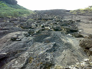
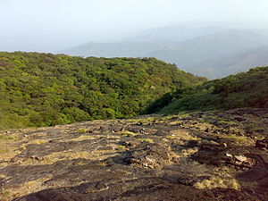
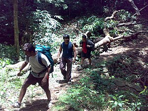
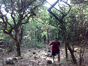
Gallery[edit]
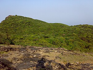
- Cliffs on the Trekking route to Pushpagiri Top


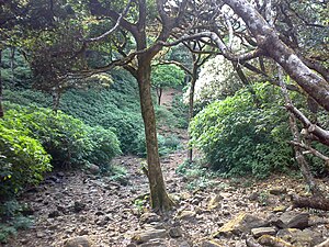
- Trekking route through the woods


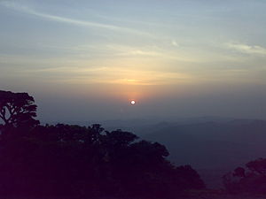
- Sunrise and Sunset

Top
Sunrise

Sunset

Kumara Parvata

The woods


References[edit]
- ↑ "Pushpagiri history".
- ↑ 2.0 2.1 2.2 "Census of India 2001: Data from the 2001 Census, including cities, villages and towns (Provisional)". Census Commission of India. Archived from the original on 16 June 2004. Retrieved 1 November 2008.