


Kottayam District | |
|---|---|
|
Clockwise from top: Kumarakom, Malarikkal, Nair Service Society, Indian Institute of Information Technology, Kottayam, CMS College Kottayam, and Vaikom Boat Jetty. | |
| Coordinates: 9°35′42″N 76°31′52″E / 9.595°N 76.531°E | |
| Country | India |
| State | Kerala |
| Established | 1 July 1949 |
| Region | Central Travancore |
| Headquarters | Kottayam |
| Government | |
| • Collector | M. Anjana I.A.S[1] |
| Area | |
| • Total | 2,208 km2 (853 sq mi) |
| Population | |
| • Total | 1,974,551 |
| • Density | 890/km2 (2,300/sq mi) |
| Languages | |
| • Official | Malayalam, English |
| Time zone | UTC+5:30 (IST) |
| ISO 3166 code | IN-KL |
| Vehicle registration | KL-05,KL-33,KL-34,KL-35,KL-36,KL-67 |
| HDI (2005) | |
| Website | www |

.jpg)


Kottayam is one of fourteen districts in the state of Kerala, India. Kottayam district comprises six municipal towns: Kottayam, Changanassery, Pala, Erattupetta, Ettumanoor, and Vaikom. It is the only district in Kerala that neither border the Arabian Sea nor any other states.
The district is bordered by hills in the east, and the Vembanad Lake and paddy fields of Kuttanad on the west. The area's geographic features include paddy fields, highlands, and hills. As of the 2011 census, 28.6% of the district's residents live in urban areas, and it reports a 97.2% literacy rate.[3] In 2008, the district became the first tobacco-free district in India.[4] Kottayam registered the lowest Multidimensional Poverty Index (MPI) of zero among all districts of India, indicating no deprivation as per the report published by Oxford Poverty and Human Development Initiative and UNDP for districts across India.[5]
The district's headquarters are based in the city of Kottayam. The towns of Pala and Kidangoor are located in the center of the district.
Alapra is the only village in Kottayam district where the traditional art of Padayani is performed. Hindustan Newsprint Limited and Rubber Board are two central government organizations located in the district. The headquarters of two religious communities in Kerala are also in the Kottayam District: Nair Service Society and the Indian Orthodox Church.
History[edit | edit source]
The name Kottayam is a combination of the words "kotta" and "akam" in the local language of Malayalam, meaning "interior of a fort".
The current Kottayam district was previously part of the state of Travancore. Earlier, the Travancore state consisted of two revenue divisions: the southern and northern divisions, both under the administrative control of a "Diwan Peshkar" for each. Later in 1868, two more divisions—Kollam and Kottayam—were constituted. A fifth division Devikulam was added, but it only lasted for a short period, and was then joined with Kottayam. At the time of the integration of the state of Travancore and Kochi in 1949, these revenue divisions were renamed as districts and the Diwan Peshkars gave way to district collectors, paving the way for the birth of the Kottayam district in July 1949. The cities included were Kottayam, Muvattupuzha (including present-day Kothamangalam), Thodupuzha, Changanasserry, Vaikkom, Meenachil, Devikulam and Peermade taluks.[6]
Kottayam has been involved in a number of political movements, including the 'Malayali Memorial' movement. The movements goal was more representation for Travancoreans in civil service.[7]
Vaikom Satyagraha, a protest against caste discrimination, took place in Kottayam district. The district also participated in the protests for responsible government in Travancore, which ended with the overthrow of Sir C. P. Ramaswami Iyer, the Diwan of Travancore.[citation needed]
Communities[edit | edit source]
The three major religious communities in the Kottayam district are Hinduism, Christianity, and Islam. The Nair Service Society's headquarters are located in the district's town of Perunna, Changanaserry. The Mannam memorial, created in memory of social reformer Mannathu Padmanabha Pillai, is also located there.
The headquarters of the Malankara Orthodox Syrian Church (Malankara Church/Indian Orthodox Church), is located in Devalokam, Kottayam. It is the official headquarters of the Malankara Metropolitan and the Catholicos of the East.
The Madhya Kerala Diocese of the Church of South India has its headquarters in Kottayam.
The Knanaya Christian community (both the Catholic and Jacobite factions) also has its headquarters in Kottayam district.
The Thazhathangady Juma Mosque, which is one of the oldest Masjids in the country, is also located at Kottayam.
Climate[edit | edit source]
There are no distinct seasons in Kottayam, as it has a tropical climate like that of the rest of Kerala. Humidity is high and rises to about 90% during the rainy season. Kottayam gets rain from two monsoon seasons, the south-west monsoon and the north-east monsoon, and accumulates an average rainfall of around 3600 mm per year. The south-west monsoon starts in June and ends in September, and the north-east monsoon season is from October to November. Pre-monsoon rains from March to May are accompanied by thunder and lightning; the highest rainfall during this period in Kerala is received in Kottayam. December, January, and February are cooler, while March, April, and May are warmer. The highest temperature recorded in Kottayam was 38.5 °C on 6 April 1998, and the lowest was 15 °C on 13 December 2000.[8]
The Kottayam district experienced intense red rainfall in 2001, during which the rain was colored red, yellow, green, and black.[9]
Tourism and wildlife[edit | edit source]
Kottayam has a network of rivers, backwaters, ancient religious places, and hill stations. Local tourist places include:

- Kumarakom, a tourist destination located near the city of Kottayam. It contains the Kumarakom Bird Sanctuary, which is known for migratory birds.[10]
- Vembanad Lake is home to traditional cargo boats called Kettuvallams, which are modified into cruise boats and houseboats.[11] Pathiramanal is a small island located in the Vembanad Lake, and is only accessible by boat.[11]

- Ilaveezha Poonchira is a hill station in Kottayam.[12]
- Vagamon is a hill station in Kerala. It is located primarily in the Idukki district, but includes the Meenachil taluk and Kanjirappally taluk as well.[13]
- During the Onam festival in August and September, water boat races are conducted in Kollam. The major one is the Nehru Trophy Boat Race. The Thazhathangadi boat race in Kummanam is over a century old.
- Vaikom, a historical town.
- Illickal Kallu, the highest point in the Kottayam district.
Accessibility[edit | edit source]
This section does not cite any sources. (August 2019) |
Kottayam is linked by major roads and rail to other prominent cities in Kerala, and also by waterways allowing for waterborne travel. The Kottayam Kumali, Ettumanoor-Ernakulam, Kottayam-Pathanamthitta, Thiruvalla-Kidangoor Central Kerala Bypass, and MC road are the major roads in the district. The nearest airport is the Cochin International Airport. SWTD operates ferry services from different parts of the Kottayam district. The ferry service from Vaikom to Thavanakkadavu in the Alappuzha district is the longest. India's first solar ferry service boat, 'Adhithya', operates from Vaikom.[citation needed]
Agriculture[edit | edit source]
Kottayam has a mountainous terrain as well as low-lying areas very close to sea level. Depending on the location, different varieties of food and cash crops are cultivated. Rice is the principal crop extensively cultivated in low-lying regions like Vaikom and Upper Kuttanad. The district occupies third place in the production of rice in Kerala behind Palakkad and Alappuzha. Though it is the staple food of the people, the area under cultivation is dwindling due to more lucrative cash crops like rubber plantations for which Kottayam significantly contributes to the overall rubber production in India. Kottayam is India's largest rubber producer. Rubber trees provide a stable income for farmers and the climate is ideal for rubber plantations. Though the highlands are more suitable, cultivation has spread to almost all regions. Other crops cultivated include tapiocas, coconuts, peppers, and vegetables. To enhance rubber productivity, the government of India has set up a Rubber Board as well as a rubber research institute in Kottayam.[14][15]
Industry[edit | edit source]
This section does not cite any sources. (August 2019) |
The district lacks refineries, ports, and an airport, which are needed for major industries.[citation needed]Aside from two public sector companies, Hindustan Newsprint at Velloor and Travancore Cements at Nattakom, industries in the district consist mostly of small and medium-size operations. These mainly include the publishing and processing of rubber or latex, and manufacturing of rubber-based products.
Confined mostly to the Vaikom area of the district is an industry of coir processing and making coir products.[citation needed] Consisting of more than twenty cooperatives, it employs around 20,000 people.[citation needed] In the hand-loom sector, eight cooperative societies employ 2,100 persons. The district's forests include varieties of softwood and other varieties of timber providing the raw material for several small enterprises in the production of plywood, packing cases, splints, veneers, and furniture.[citation needed]
The first printing press in Kerala, C.M.S. Press, was established in 1821 by Rev. Benjamin Bailey, a British missionary. Malayalam-English and English-Malayalam dictionaries were published in Kottayam in 1846 and 1847. The only cooperative society of writers, authors and publishers (SPCS) for publishing books and periodicals was established in 1945. Kottayam is home to a number of books and periodicals, and is the center of publishing business in the state.[citation needed] Publishing houses like Malayala Manorama, Mathrubhumi publications, Labour India Publications Ltd, Mangalam Publications, Deepika, D. C. Books, V Publishers, Vidhyamitram, Kerala Kaumudi daily and Kerala Kaumudi Flash are also publishers in the district. The city of Kottayam hosts several book exhibitions every year.
Demographics[edit | edit source]
| Year | Pop. | ±% p.a. |
|---|---|---|
| 1901 | 450,615 | — |
| 1911 | 488,040 | +0.80% |
| 1921 | 585,478 | +1.84% |
| 1931 | 775,069 | +2.84% |
| 1941 | 942,899 | +1.98% |
| 1951 | 1,132,478 | +1.85% |
| 1961 | 1,313,983 | +1.50% |
| 1971 | 1,539,030 | +1.59% |
| 1981 | 1,697,442 | +0.98% |
| 1991 | 1,828,271 | +0.75% |
| 2001 | 1,953,646 | +0.67% |
| 2011 | 1,974,551 | +0.11% |
| source:[16] | ||
According to the 2011 census Kottayam district has a population of 1,974,551,[17] roughly equal to the nation of Slovenia[18] or the US state of New Mexico.[19] This gives it a ranking of 234th in India (out of a total of 640).[17] The district has a population density of 896 inhabitants per square kilometre (2,320/sq mi).[17] Its population growth rate over the decade 2001–11 was 1.32%.[17] Kottayam has a sex ratio of 1040 females for every 1000 males,[17] and a literacy rate of 97.21, the highest in the state and 4th highest in India.
Religion[edit | edit source]
According to the 2011 Indian Census, Hinduism (49.81%) is the majority religion in Kottayam, with a significant Christian (43.48%) Syro-Malabar, Orthodox and Jacobites are the majority population. The Muslim population constitutes 6.41% of the district.[citation needed]
Kottayam, Thiruvalla, and Chengannur are the railway stations for pilgrims heading to the Hindu holy site of Sabarimala.
The pilgrim centers in Kottayam include a number of Hindu temples, Christian churches and Muslim mosques, including:[20]
Hindu temples[edit | edit source]

- Erumely Sree Dharmasastha Temple—Pilgrims arrive here during Mandalakalam on their way to Sabarimala. Erumeli Pettathullal is a notable ritual.
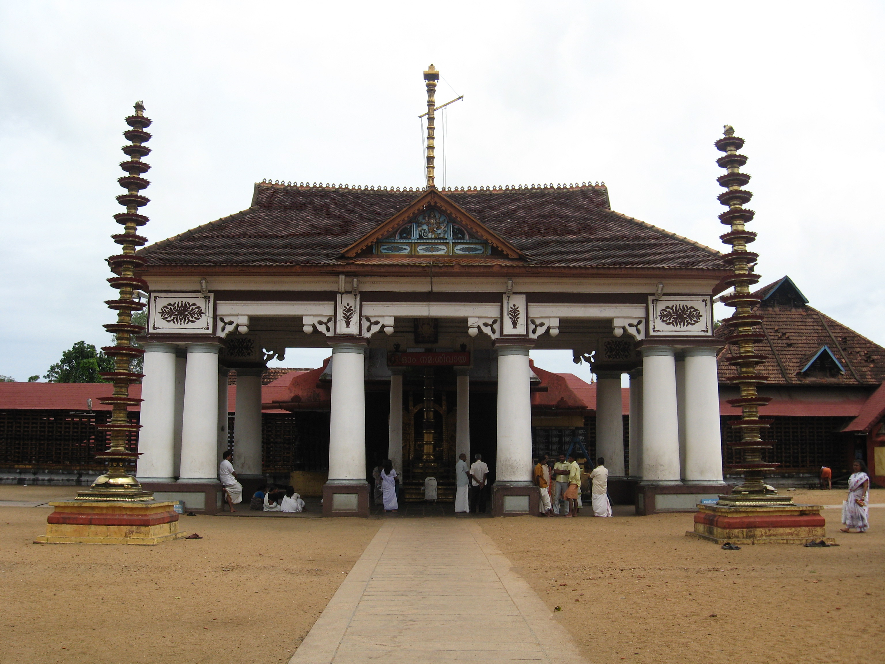
- Vaikom Mahadeva Temple—It is known as the Kasi of the south. The Vaikath Ashtami is held in November and December. Vadakkumpurathupattu is held every 12 years to attract devotees.
- Kodungoor Devi Temple
- Ettumanoor Mahadevar Temple—Annual festival and Ezhunallath are held in this Shiva temple in Kumbham (February to March).
- Panachikkadu Dakshina Mookambilka Saraswathy Devi Temple
- Kumaranalloor Devi Temple — Known for Thrikarthika Deshavilakku. Navarathri and Meena Pooram are the other festivals celebrated at this temple.[citation needed]
- Adithyapuram Sun Temple — It is the only 'Adithya' (Hindu solar deity) shrine in the state.[citation needed]
- Thirunakkara Sree Mahadevar Temple — The temple is situated in the heart of Kottayam city and is built in the traditional architectural styles of Kerala. The temple is about 500 years old and was built by the Thekkumkoor Raja, and occupies about 4 acres of land.
Churches[edit | edit source]
- St. George Orthodox Church, Puthuppally (Orthodox) - Georgian Pilgrim Centre (Founded AD 1557). Relics of St. George is kept here
- Pazhaya Seminary (Orthodox) - The remains of Saint Vattasseril Dionysius VI (15th Malankara Metropolitan) are kept here
- Bharananganam (Syro-Malabar Catholic) — The remains of Saint Alphonsa are kept here.
- St. Joseph's Church, Mannanam (Syro-Malabar Catholic) —It was built by Kuriakose Elias Chavara. His remains are preserved here.
- St. Mary's Jacobite Syrian Cathedral, Manarcad (Jacobite Orthodox) —Its Ettunompu festivals/perunnals are notable.[21]
- St Thomas Cathedral of Pala - cathedral of the Syro-Malabar Diocese of Pala
- St. Mary's Church, Kottayam—(Kottayam Cheriapalli) (Orthodox) - It was built in 1579 AD with a Kerala and Portuguese style.
- Vimalagiri Cathedral (Latin Catholic) —It was built in the Gothic Architectural style. Cathedral of the Latin Diocese of Vijayapuram
- Marth Mariam Archdeacon Pilgrim Church, Kuravilangad (Syro-Malabar Catholic) - 13 km north of Ettumanoor.
- Mar Sleeva Forane Church, Cherpunkal, (Syro-Malabar Catholic) near Pala.
- Marth Mariyam Metropolitan Cathedral (Valiyapally) - cathedral of the Syro-Malabar Archdiocese of Changanassery
- St. Dominic's Cathedral Kanjirappally - cathedral of the Syro-Malabar Diocese of Kanjirappally
Mosques[edit | edit source]

- Thazhathangady Juma Mosque—One of the ancient mosques in India.
- Thangalppara in Kottayam—The mausoleum of Sheikh Fariduddin, and a Muslim pilgrim centre.[22]
Notable persons[edit | edit source]
This section does not cite any sources. (December 2019) |
- KM Mani, who was the chairman and leader of Kerala Congress (M) which is one of the oldest regional political parties in India.
- K R Narayanan, the former President of India
- E. C. George Sudarshan, Scientist, 9 times Nobel Prize nominee.
- Parvathy Omanakuttan, the Miss World 2008 runner-up
- Kalabhavan Shajohn, an actor
- P. K. Vasudevan Nair, Former Chief Minister, Kerala
- Oommen Chandy, the former Chief minister of Kerala
- Mannathu Padmanabhan, a social reformer and the founder of Nair Service Society (N.S.S.)
- Jose Prakash, Actor
- Jayaraj , Director
- Saint Alphonsa, a canonised saint
- Abhilash Tomy, sailor
- Vijayaraghavan, an actor
- Karoor Neelakanta Pillai, writer
- N N Pillai, an Indian playwright, actor, theatre director, and orator.
- Mammootty, an actor in Mollywood
- Dulquer Salmaan, actor in Mollywood
- Ponkunnam Varkey, Malayalam writer
- Vaikom Muhammad Basheer, Malayalam writer
- A. R. Raja Raja Varma, a poet
- Kerala Varma Valiya Koil Thampuran, a Malayalam-language poet and translator
- Janardhanan, actor in India
- Santhosh George Kulangara, managing director of Safari TV
- KPAC Lalitha, South Indian actress
- Guinness Pakru, a South Indian actor who is the shortest actor in the world
- Rimi Tomy, playback singer in Kerala
- Manoj K. Jayan, a Malayalam actor
- Arundhati Roy, an Indian author
- Ulloor S. Parameswara Iyer, a Malayalam writer
- K. G. Balakrishnan, the first judge from the state of Kerala to become the Chief Justice of the Supreme Court
- Janaki Ramachandran, a Tamil actress and politician
- Kottarathil Sankunni, Legendory writer of Malayalam
- Baby Meenakshi, a child artist
Politics[edit | edit source]
K. R. Narayanan, the former President of India is from Kottayam district. Currently, Kottayam is represented in the Lok Sabha by Thomas Chazhikadan of Kerala Congress (Mani).
MLA's by constituency[edit | edit source]
| Sl. No | Constituency | Member | Party | Alliance |
|---|---|---|---|---|
| 1 | Pala | Mani C. Kappan | NCP | UDF |
| 2 | Kaduthuruthy | Monce Joseph | KC | UDF |
| 3 | Vaikom | C. K. Asha | CPI | LDF |
| 4 | Ettumanoor | V. N. Vasavan | CPI(M) | LDF |
| 5 | Kottayam | Thiruvanchoor Radhakrishnan | INC | UDF |
| 6 | Puthuppally | Oommen Chandy | INC | UDF |
| 7 | Changanassery | Job Michael | KC(M) | LDF |
| 8 | Kanjirappally | N. Jayaraj | KC(M) | LDF |
| 9 | Poonjar | Sebastian Kulathunkal | KC(M) | LDF |
Towns and villages in the district[edit | edit source]
Major Tier-I towns[edit | edit source]
Major Tier-II towns[edit | edit source]
Other villages[edit | edit source]
- Angel Valley,
- Akalalkunnam,
- Ambikamarket,
- Amayannoor,
- Arumanoor,
- Amparanirappel,
- Anchery,
- Anthinadu,
- Arpookara,
- Athirampuzha, Ayamkudy,
- Aymanam, Ayarkunnam,
- Chemmalamattam,
- Chenappady,
- Chengalam,
- Cheruvally,
- Chungam,
- Changanassery,
- Chempu,
- Cheeranchira,
- Cherpunkal,
- Chingavanam,
- Choondacherry,
- Ettumanoor,
- Edakkunnam,
- Elikkulam,
- Elivali,
- Erumely,
- Kadaplamattom,
- Kaduthuruthy
- Kanjirappally
- Kangazha
- Kalikave
- Karikkattoor
- Kallara
- Karukachal
- Kanakkary
- Kezhuvamkulam
- Kidangoor
- Kanjiramattom
- Kaipuzha
- Erattupetta
- Kadappoor
- Kizhaparayar,
- Kodungoor,
- Koottickal,
- Koodalloor,
- Koovappally,
- Kothala,
- Kothanalloor,
- Kudamaloor,
- Kumarakom,
- Kumaranalloor,
- Kummannoor,
- Kuravilangad,
- Kurichithanam,
- Kurumannu,
- Kurupanthara,
- Malloossery,
- Manarkadu,
- Manimala,
- Marangattupilly,
- Meenadam,
- Melukavu,
- Mudiyoorkara,
- Mukkoottuthara,
- Mundakayam,
- Mutholy,
- Muttuchira,
- Naduvile,
- Neendoor,
- Neericadu,
- Padinjattinkara,
- Palackattumala,
- Palai,
- Pallickathode,
- Pampady,
- Panachikkad,
- Panamattom,
- Parampuzha,
- Parathodu,
- Pathamuttom,
- Payappar,
- Peroor,
- Perunilam,
- Ponkunnam,
- Poonjar,
- Poovarany,
- Puthuppally,
- Puthuvely,
- Ramapuram,
- Vaikom,
- Kidangoor,
- Thalayolaparambu,
- Thekkumthala,
- Thiruvanchoor,
- Thiruvarppu
- Uzhavoor,
- Vadakkemuri,
- Vadavathoor,
- Vaikom,
- Vakathanam,
- Vazhappally Padinjaru,
- Vechoor,
- Vellilappally,
- Venkotta,
- Villoonni
Education[edit | edit source]

The first college in Kerala state and the second established under British rule in India was the C.M.S. College (Grammar School) (1840) in Kottayam.[23]
- Mahatma Gandhi University, Kerala.
- Government Medical College, Kottayam
- Rajiv Gandhi Institute of Technology, Kottayam (Government Engineering College)
- K. R. Narayanan National Institute of Visual Science and Arts
- Indian Institute of Information Technology, Kottayam(IIIT-K)
- Indian Institute of Mass Communication, Kottayam (IIMC-K)
- Kottayam Institute of Technology & Science
- Government College, Kottayam[24]
- Kendriya Vidyalaya, Puthuppally[25]
- IHRD and MG university, Puthuppally
- St joseph college of engineering and technology, Palai
- Saintgits College of Engineering, Pathamuttom
See also[edit | edit source]
References[edit | edit source]
- ↑ "About District Collector - Kottayam District, Government of Kerala - India". Retrieved 6 June 2019.
- ↑ "Kerala | UNDP in India". UNDP.
- ↑ "2011 Kottayam Census" (PDF). p. 15,16. Archived from the original (PDF) on 4 November 2019.
- ↑ "Kottayam district to be declared tobacco-free - KERALA - The Hindu". The Hindu. 16 February 2020. Archived from the original on 16 February 2020. Retrieved 16 February 2020.
- ↑ "States of poverty: an exploration of the Multidimensional Poverty Index - The Hindu". The Hindu. 29 October 2018.
- ↑ K. M. Mathew, ed. (2006). Manorama Year Book. Malayala Manorama. p. 116.
- ↑ "History | Kottayam District, Government of Kerala". Retrieved 8 January 2019.
- ↑ http://www.kerala.gov.instatistical/panchayat_statistics2001/ktm_shis.htm[permanent dead link] Climate of Kottayam
- ↑ Ramakrishnan, Venkatraman (30 July 2001). "Coloured Rain: A Report on the Phenomenon" (PDF). BBC. Archived from the original (PDF) on 15 May 2006. Retrieved 23 September 2019.
{{cite news}}:|archive-date=/|archive-url=timestamp mismatch; 13 June 2006 suggested (help) - ↑ http://www.forest.kerala.gov.in/index.php/kottayam
- ↑ 11.0 11.1 "VEMBANAD LAKE | Kottayam District, Government of Kerala | India".
- ↑ "ILAVEEZHAPOONCHIRA | Kottayam District, Government of Kerala | India".
- ↑ "Vagamon,Wagamon, Vagamon hill station, Vagamon Heights, Vagamon Hideout".
- ↑ "Agriculture". Government of Kerala. Archived from the original on 19 July 2011. Retrieved 3 January 2011.
- ↑ "naturemagics.com - Diese Website steht zum Verkauf! - Informationen zum Thema naturemagics". ww1.naturemagics.com. Retrieved 6 June 2019.
- ↑ Decadal Variation In Population Since 1901
- ↑ 17.0 17.1 17.2 17.3 17.4 "District Census 2011". Census2011.co.in. 2011. Retrieved 30 September 2011.
- ↑ US Directorate of Intelligence. "Country Comparison:Population". Retrieved 1 October 2011.
Slovenia 2,000,092 July 2011 est.
- ↑ "2010 Resident Population Data". U. S. Census Bureau. Archived from the original on 19 October 2013. Retrieved 30 September 2011.
New Mexico - 2,059,179
- ↑ "District Profile". Archived from the original on 8 September 2019. Retrieved 1 September 2019.
- ↑ "St.Mary's Jacobite Syrian Cathedral, Manarcad".
- ↑ "Thangalppara, Muslim pilgrim centre, Kottayam".
- ↑ CMS College CMS website.
- ↑ "Government College Kottayam". Archived from the original on 20 March 2015. Retrieved 11 June 2021.
- ↑ "Kendriya Vidyalaya, Rubber Board, Puthuppally". Archived from the original on 13 March 2008. Retrieved 1 June 2008.
Further reading[edit | edit source]
- U. Sivaraman Nair (1952), 1951 Census Handbook- Kottayam District (PDF), Trivandrum: Travancore-Cochin Government Press
- M. K. Devassy (1965), 1961 Census Handbook- Kottayam District (PDF), Directorate of Census Operations, Kerala and The Union Territory of Laccadive, Minicoy, and Amindivi Islands
- Government of India (2014–15), District Census Handbook - Kottayam (Part-A) 2011 (PDF), Directorate of Census Operations, Kerala
- Government of India (2014–15), District Census Handbook - Kottayam (Part-B) 2011 (PDF), Directorate of Census Operations, Kerala
External links[edit | edit source]
Places adjacent to Kottayam district | ||||||||||
|---|---|---|---|---|---|---|---|---|---|---|
| ||||||||||
.png)
| Districts |
|  |
|---|---|---|
| Towns and cities |
| |