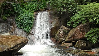
Nelliampathi
Nelliyampathy
Nelliampathi | |
|---|---|
Village | |
| Nelliampathi | |
 Western Ghats at Nelliampathi | |
| Nickname: Nelliampathi | |
| Coordinates: 10°31′47″N 76°41′02″E / 10.529627°N 76.684012°ECoordinates: 10°31′47″N 76°41′02″E / 10.529627°N 76.684012°E | |
| Country | |
| State | Kerala |
| District | Palakkad |
| Named for | Nelliampathi |
| Government | |
| • Body | Gram panchayat |
| Languages | |
| • Official | Malayalam, English |
| Time zone | UTC+5:30 (IST) |
| ISO 3166 code | IN-KL |
| Vehicle registration | KL-70 |
| Nearest city | Nenmara and Kollengode |
Nelliyampathy (also spelled Nelliampathi) is a hill station 60 kilometres (37 mi) from Palakkad, state of Kerala, India.
Geography[edit | edit source]
- Nelliampathy is surrounded by tea and coffee plantations.
- The village has its own gram panchayat and forms a part of the Chittur taluk. Pothundi Dam, which was constructed in the 19th century, is the entrance to Nelliyampathy.
Seetharkundu[edit | edit source]
A viewpoint called Seethargund is situated 8 km away from Nelliyampathy. Seethargund, according to beliefs is the place where Lord Rama, Laxmana and Seetha rested during their exile.
Kesavan Rock[edit | edit source]
Another attraction of Nelliyampathy is Kesavanpara viewpoint. The film Mrigaya starring Mammootty was shot here.[1][2]
Demographics[edit | edit source]
As of 2001[update] India census, Nelliyampathy had a population of 8,718 with 4,358 males and 4360 females.[3]
Gallery[edit | edit source]
See also[edit | edit source]
References[edit | edit source]
- ↑ Maradei, Irene (2007). "Nelliyampathy". Things to Do and See Around Palakkad. Palakkad. Archived from the original on 7 October 2010. Retrieved 25 January 2010.
- ↑ "Reports of National Panchayat Directory". Ministry of Panchayati Raj. Archived from the original on 30 December 2013. Retrieved 29 December 2013.
- ↑ "Census of India : Villages with population 5000 & above". Registrar General & Census Commissioner, India. Retrieved 29 December 2013.


