


imported>Arjayay m Reverted edits by Mainakchatterjee.tech (talk) to last version by 103.215.227.240 |
basic expand structure also and cleaned formatting |
||
| Line 1: | Line 1: | ||
{{Short description|Town in West Bengal, India}} | |||
{{Use Indian English|date=October 2016}} | {{Use Indian English|date=October 2016}} | ||
{{Use dmy dates|date=September 2019}} | {{Use dmy dates|date=September 2019}} | ||
<!-- See [[Wikipedia:WikiProject Indian cities]] for details --> | <!-- See [[Wikipedia:WikiProject Indian cities]] for details --> | ||
{{Infobox settlement | {{Infobox settlement | ||
| name | | name = Tamluk | ||
| other_name = Tamralipta, Tamralipti, Tamolika | |||
| settlement_type = City | |||
| other_name | | image_skyline = Bargabhima Temple Arnab Dutta.jpg | ||
| settlement_type | | image_alt = | ||
| image_skyline | | image_caption = [[Bargabhima temple]] at Tamluk | ||
| image_alt | | nickname = | ||
| image_caption | | image_map = | ||
| nickname | | map_alt = | ||
| image_map | | map_caption = | ||
| map_alt | | pushpin_map = India West Bengal#India3#Asia | ||
| map_caption | | pushpin_label_position = right | ||
| pushpin_map | | pushpin_map_alt = | ||
| pushpin_label_position | | pushpin_map_caption = Location in West Bengal, India | ||
| pushpin_map_alt | | coordinates = {{coord|22.3|N|87.92|E|display=inline,title}} | ||
| pushpin_map_caption | | subdivision_type = Country | ||
| coordinates | | subdivision_name = [[India]] | ||
| subdivision_type | | subdivision_type1 = [[States and territories of India|State]] | ||
| subdivision_name | | subdivision_name1 = [[West Bengal]] | ||
| subdivision_type1 | | subdivision_type2 = [[List of districts of India|District]] | ||
| subdivision_name1 | | subdivision_name2 = [[East Medinipur district|East Medinipur]] | ||
| subdivision_type2 | | established_title = <!-- Established --> | ||
| subdivision_name2 | | established_date = | ||
| established_title | | founder = | ||
| established_date | | named_for = | ||
| founder | | government_type = [[Municipal Corporations in India|Municipality]] | ||
| named_for | | governing_body = {{bulleted list|Tamluk Municipality|Haldia Development Authority}} | ||
| government_type | | unit_pref = Metric | ||
| governing_body | | area_footnotes = <ref>{{cite web|title=Tamluk Info|url=https://www.sudawb.org/wbdma_oldversion/HTM/DIS/MUNI_ULB_Tamluk.htm|website=sudawb.org|access-date=25 November 2020}}</ref> | ||
| unit_pref | | area_rank = | ||
| area_footnotes | | area_total_km2 = 17.86 | ||
| area_rank | | elevation_footnotes = | ||
| area_total_km2 | | elevation_m = 7 | ||
| elevation_footnotes | | population_total = 65,306 | ||
| elevation_m | | population_as_of = 2011 | ||
| population_total | | population_rank = | ||
| population_as_of | | population_density_km2 = auto | ||
| population_rank | | population_demonym = | ||
| population_density_km2 | | population_footnotes = <ref name="Census2011Gov"/> | ||
| population_demonym | | demographics_type1 = Languages | ||
| population_footnotes | | demographics1_title1 = Official | ||
| demographics_type1 | | demographics1_info1 = [[Bengali language|Bengali]]<ref name="wblangoff">{{cite web|title=Fact and Figures|url=https://wb.gov.in/portal/web/guest/facts-and-figures;jsessionid=JzdD9RHb7aMY5esZPtcsIVLy|website=www.wb.gov.in|access-date=15 January 2019}}</ref><ref>{{cite web|title=52nd Report of the Commissioner for Linguistic Minorities in India|url=http://nclm.nic.in/shared/linkimages/NCLM52ndReport.pdf|website=nclm.nic.in|publisher=[[Ministry of Minority Affairs]]|access-date=2 March 2019|page=85|url-status=dead|archive-url=https://web.archive.org/web/20170525141614/http://nclm.nic.in/shared/linkimages/NCLM52ndReport.pdf|archive-date=25 May 2017}}</ref> | ||
| demographics1_title1 | | demographics1_title2 = Additional official | ||
| demographics1_info1 | | demographics1_info2 = [[English language|English]]<ref name="wblangoff"/> | ||
| demographics1_title2 | | timezone1 = [[Indian Standard Time|IST]] | ||
| demographics1_info2 | | utc_offset1 = +5:30 | ||
| timezone1 | | postal_code_type = [[Postal Index Number|PIN]] | ||
| utc_offset1 | | postal_code = 721636 721627 721648 721649 | ||
| postal_code_type | | area_code_type = Telephone code | ||
| postal_code | | area_code = 91-3228 | ||
| area_code_type | | registration_plate = WB 29-xxxx, WB 30-xxxx | ||
| area_code | | blank1_name_sec1 = [[Lok Sabha]] constituency | ||
| registration_plate | | blank1_info_sec1 = [[Tamluk (Lok Sabha constituency)|Tamluk]] | ||
| blank1_name_sec1 | | blank2_name_sec1 = [[Vidhan Sabha]] constituency | ||
| blank1_info_sec1 | | blank2_info_sec1 = [[Tamluk (Vidhan Sabha constituency)|Tamluk]] | ||
| blank2_name_sec1 | | website = {{URL|purbamedinipur.gov.in/}} | ||
| blank2_info_sec1 | | footnotes = | ||
| website | |||
| footnotes | |||
}} | }} | ||
[[File:Tamluk Rajbari ruins at Tamluk town located under Purba Medinipur district in West Bengal 09.jpg|thumb|Tamluk Rajbari | [[File:Tamluk Rajbari ruins at Tamluk town located under Purba Medinipur district in West Bengal 09.jpg|thumb|Ruins of Tamluk Rajbari]] | ||
[[File:Radhamadhab and Radharaman Deul temple at Tamluk town under Purba Medinipur district in West Bengal 04.jpg|thumb|Radhamadhab and Radharaman Deul temple | [[File:Radhamadhab and Radharaman Deul temple at Tamluk town under Purba Medinipur district in West Bengal 04.jpg|thumb|Radhamadhab and Radharaman Deul temple in Tamluk]] | ||
'''Tamluk''' ({{ | '''Tamluk''' ({{IPA|bn|tɔmluk}}), is a city and a municipality in the [[India]]n [[States and territories of India|state]] of [[West Bengal]]. It is one of the [[List of oldest continuously inhabited cities|oldest continuously inhabited cities of the world]]<ref name="bengalchronicle">{{Cite web |last=Paul |first=Santanu |date=2022-05-26 |title=Tamralipta, the ancient port city of India |url=https://www.bengalchronicle.com/2022/05/26/tamralipta-the-ancient-port-city-of-india/ |access-date=2025-04-13 |website=Bengal Chronicle |language=en-GB}}</ref> and the headquarters of the [[Purba Medinipur district]].<ref>{{Cite web |title=Purba Medinipur {{!}} District Administration {{!}} India |url=https://purbamedinipur.gov.in/ |access-date=2025-05-31 |language=en-US}}</ref> Though there is some controversy, scholars have generally agreed that present-day Tamluk is the site of the ancient city variously known as [[Tamralipta]] or Tamralipti, where [[Xuanzang|Hiuen Tsang]], a Chinese traveller and Chinese Buddhist monk [[Fa-Hien]] also visited the town, is now located on the banks of [[Rupnarayan River]], close to the [[Bay of Bengal]]. | ||
==Name== | |||
According to [[T. N. Ramachandran]], the name "Tamluk" is related to the older form ''Tamālikā'', which is a variant spelling (found in the ''[[Trikāṇḍaśesha]]'') of the ancient name ''[[Tamralipta|Tāmraliptī]]'' (or ''Tāmralipta'').<!-- Ramachandran 1951, p. 229 --> Other names listed in the ''Trikāṇḍaśesha'' and the ''[[Abhidanachintamani (Hemachandra)|Abhidānachintāmaṇi]]'' as referring to Tāmraliptī include ''Staṁbhapura'', ''Velākūla'', and ''Vishṇugṛiha''.<ref name="Ramachandran 1951"/>{{rp|229}} | |||
==History== | ==History== | ||
{{Main|Tamralipta}} | {{Main|Tamralipta}} | ||
This ancient kingdom and port city was bounded by the [[Bay of Bengal]] in the south, [[Rupnarayan River]] in the east and [[Subarnarekha River]] in the west. The Rupnarayana is the joint flow of the rivers [[Dwarakeswar River|Dwarakeswar]] and [[Shilabati River|Silai]]. The Bay of Bengal and these great rivers with their numerous branches created a prosperous and easy water navigational system fostering commerce, culture and early contacts with the people outside the region. At the same time, these rivers helped to develop the agriculture in this region. | This ancient kingdom and port city was bounded by the [[Bay of Bengal]] in the south, [[Rupnarayan River]] in the east and [[Subarnarekha River]] in the west. The Rupnarayana is the joint flow of the rivers [[Dwarakeswar River|Dwarakeswar]] and [[Shilabati River|Silai]]. The Bay of Bengal and these great rivers with their numerous branches created a prosperous and easy water navigational system fostering commerce, culture and early contacts with the people outside the region. At the same time, these rivers helped to develop the agriculture in this region.<ref name=":2">{{cite book |author=Dilip K. Chakrabarti |title=Archaeological Geography of the Ganga Plain: The Lower and the Middle Ganga |url=https://books.google.com/books?id=OEZe-wAIiKIC&pg=PA125 |year=2001 |publisher=Orient Blackswan |isbn=978-81-7824-016-9 |page=125 }}</ref> | ||
Archaeological remains show continuous settlement from about the 3rd century BC. It was known as Tramralipta (in the [[Puranas]] and the ''[[Mahabharata]]''), Tamralipta (in the ''Mahabharata''), Tamalika (in historical documents), Tamalitti (in foreigners' descriptions), or Tamoluk (in the [[British Raj]]). It was a seaport, now buried under river [[silt]]. For this reason, Tamluk has many ponds and lakes remaining today.<ref>{{Cite book|last=Schendel|first=Willem van|url=https://books.google.com/books?id=7Y2bBQAAQBAJ|title=A History of Bangladesh|date=2009-02-12|publisher=Cambridge University Press|isbn=978-1-316-26497-3|pages=16|language=en}}</ref><ref name=":3">{{Cite journal|last1=Tripati|first1=S.|last2=Rao|first2=S.|date=1994-01-01|title=Tamralipti: The Ancient Port of India|url=|journal=Studies in History and Culture|volume=2|pages=33–39}}</ref><ref>{{Cite web |title=History {{!}} Purba Medinipur {{!}} India |url=https://purbamedinipur.gov.in/history/ |access-date=2022-03-18 |language=en-US}}</ref> | |||
In the ''Mahabharata'' (Bhishma Parba/Nabam Adhyay), while describing the names of the holiest rivers and kingdoms of India, Sanjay took the name of "Tramralipta" to Dhritarashtra.<ref name=":1">{{Cite book|last=Puri|first=Baij Nath|url=https://books.google.com/books?id=cz8uAAAAMAAJ|title=Cities of Ancient India|date=1966|publisher=Meenakshi Prakashan|pages=110|language=en}}</ref><ref>{{Cite book|last=Choudhury|first=Pratap Chandra|url=https://books.google.com/books?id=EE1uAAAAMAAJ|title=Assam-Bengal Relations from the Earliest Times to the Twelfth Century A.D.|date=1988|publisher=Spectrum Publications|pages=67|language=en}}</ref><ref name=":2" /> | |||
Tamluk was also known as Bhivas, in religious texts, and Madhya Desh, as the Middle State of Utkal/Kalinga and Banga.{{cn|date=March 2022}} | |||
According to [[Jain]] sources, Tamralipti was the capital of the tamralipti janapada and was long known as a port.<ref>{{cite journal |last1=Schmiedchen |first1=Annette |title=Medieval Endowment Cultures in Western India: Buddhist and Muslim Encounters – Some Preliminary Observations |journal=Mondes de l'Asie du Sud et de l'Asie Centrale |date=2019 |page=7 |url=https://hal.archives-ouvertes.fr/hal-03012318/document}}</ref><ref>{{Cite book |last=Paine |first=Lincoln |url=https://books.google.com/books?id=6vglAwAAQBAJ&pg=PT265 |title=The Sea and Civilization: A Maritime History of the World |date=2014-02-06 |publisher=Atlantic Books |isbn=978-1-78239-357-3 |pages=265 |language=en}}</ref><ref name="Ramachandran 1951">{{Cite journal |last=Ramachandran |first=T. N. |date=1951 |title=Tāmraliptī (Taṁluk) |url=https://www.jstor.org/stable/3248590 |journal=Artibus Asiae |volume=14 |issue=3 |pages=226–239 |doi=10.2307/3248590 |jstor=3248590 |issn=0004-3648|url-access=subscription }}</ref><ref>{{Cite book |last=Bhaumick |first=Manoranjan |url=https://books.google.com/books?id=TCFuAAAAMAAJ |title=History, Culture, and Antiquities of Tāmralipta |date=2001 |publisher=Punthi Pustak |isbn=978-81-86791-27-1 |language=en |pages=7-8}}</ref> | |||
==Archaeology== | |||
Several archaeological find sites have been found in Tamluk, including a number of high mounds in the town as well as in and around various tanks.<!-- Ramachandran 1951, p. 230 --> The [[Bargabhima Temple|Bargabhīmā Temple]], in the middle of town, is built on one such mound.<ref name=":0">{{Citation |last=Pinakpani |title=English: Bargabhima, the ancient temple of Tamluk in Purba Medinipur district |date=2023-08-20 |url=https://commons.wikimedia.org/wiki/File:Bargabhima,_the_ancient_temple_of_Tamluk_in_Purba_Medinipur_district_02.jpg |access-date=2024-04-12}}</ref><!-- Ramachandran 1951, p. 230 --> Another mound is now occupied by the local Mission house. Here, people digging a well found wood fragments at a depth of 50 feet, which T. N. Ramachandran compared to the remains of the Maurya-era wooden palisade found at [[Pataliputra]].<!-- Ramachandran 1951, p. 230 --> At another high mound, this one by the Rupnarayan riverbank, a hoard of about 350 coins dated to the 1st-2nd centuries BCE was found by K. N. Dikshit in the early 1920s.<!-- Ramachandran 1951, p. 230-2 --><ref name="Ramachandran 1951"/>{{rp|230-2}} | |||
Tamluk | Just east of the Rajbari in central Tamluk is a large square tank called Khātpukūr, which probably dates from the 15th century.<!-- Ramachandran 1951, p. 230, 7 --> Digging here, Ramachandran's group found terracotta remains with similarities to Shunga-period artifacts, but because of where they were found, Ramachandran did not assign them a date.<!-- Ramachandran 1951, p. 235-6 --> Among the artifacts found at Khātpukūr were a couple of Egyptian-style vases, which also could not be dated.<!-- Ramachandran 1951, p. 235 --> They may have been either imports from Egypt or local imitations of Egyptian style.<!-- Ramachandran 1951, p. 235 --> Either way, their presence indicates long-distance cultural contact due to maritime trade, as would be expected at a major port like Tāmraliptī.<!-- Ramachandran 1951, p. 235 --> At another site, "an oblong tank next to the local school", old brick walls and terracotta fragments were found under Gurusday Dutt.<!-- Ramachandran 1951, p. 230 --> Various items were found in and around a couple of tanks on Adhikaripara Road, Padambasan Road, and School Road.<!-- Ramachandran 1951, p. 237 --><ref name="Ramachandran 1951"/>{{rp|230, 235-7}} | ||
A group led by T. N. Ramachandran undertook a survey of various sites in Tamluk in the 1940s.<!-- Ramachandran 1951, p. 229-30 --><ref name="Ramachandran 1951"/>{{rp|229-30}} | |||
==Geography== | ==Geography== | ||
| Line 108: | Line 117: | ||
|mark-coord24={{coord|22|27|5|N|87|44|10|E}} | label-pos24=left|label24= Dakshin Maynadal| numbered24=H| mark-title24= [[Dakshin Maynadal]] (H)| shape-color24=#AA6666 | |mark-coord24={{coord|22|27|5|N|87|44|10|E}} | label-pos24=left|label24= Dakshin Maynadal| numbered24=H| mark-title24= [[Dakshin Maynadal]] (H)| shape-color24=#AA6666 | ||
|mark-coord25={{coord|22|26|15|N|87|44|49|E}} | label-pos25=left|label25= Purbba Gopalpur| numbered25=H| mark-title25= [[Purbba Gopalpur]] (H)| shape-color25=#AA6666}} | |mark-coord25={{coord|22|26|15|N|87|44|49|E}} | label-pos25=left|label25= Purbba Gopalpur| numbered25=H| mark-title25= [[Purbba Gopalpur]] (H)| shape-color25=#AA6666}} | ||
Tamluk is located on the right bank of the Rupnarayan river, about 19 km upstream from where it joins the [[Hooghly River]].<ref name="Ramachandran 1951"/>{{rp|226}} | |||
===Police station=== | ===Police station=== | ||
[[Image:Purba medinipur.png|thumb|Map of Purba Medinipur showing Tamluk]] | [[Image:Purba medinipur.png|thumb|Map of Purba Medinipur showing Tamluk]] | ||
Tamluk police station has jurisdiction over Tamluk (municipality) and [[Tamluk (community development block)|Tamluk]] CD Block. Tamluk police station covers an area of 214.14 km<sup>2</sup> with a population of 352,748.<ref>{{cite web |url = http://www.dospiwb.org.in/site.php |title = District Statistical Handbook 2014 Purba Medinipur |work = Tables 2.1, 2.2 |publisher = Department of Statistics and Programme Implementation, Government of West Bengal |access-date = 10 November 2016 |url-status = | Tamluk police station has jurisdiction over Tamluk (municipality) and [[Tamluk (community development block)|Tamluk]] CD Block. Tamluk police station covers an area of 214.14 km<sup>2</sup> with a population of 352,748.<ref>{{cite web |url = http://www.dospiwb.org.in/site.php |title = District Statistical Handbook 2014 Purba Medinipur |work = Tables 2.1, 2.2 |publisher = Department of Statistics and Programme Implementation, Government of West Bengal |access-date = 10 November 2016 |url-status = usurped |archive-url = https://web.archive.org/web/20170729135056/http://www.dospiwb.org.in/site.php |archive-date = 29 July 2017 |df = dmy-all }}</ref><ref>{{cite web| url = http://emdp.co.in/detailstation/TAMLUK |title = Tamluk PS | publisher= Purba Medinipur District Police | access-date = 10 November 2016}}</ref> | ||
==Demographics== | ==Demographics== | ||
{{Historical populations | |||
|1972 |5,849 | |||
|1881 |6,044 | |||
|1891 |6,612 | |||
|1901 |8,085 | |||
|1911 |8,048 | |||
|1921 |8,348 | |||
|1931 |9,095 | |||
|1941 |12,079 | |||
|1951 |13,599 | |||
|1961 |17,986 | |||
|1971 |22,478 | |||
|1981 |29,367 | |||
|1991 | | |||
|2001 | | |||
|2011 |65,306 | |||
|footnote= | |||
|source=[[Census of India]]<ref>{{cite journal|first=Pranab |last= Ganguly |first2=Suvas |last2=Bose |date=|title=Population Trends in Midnapore District, West Bengal, 1872–1981 |journal=Vidyasagar University: Journal of Social Sciences |others=Inaugural Number 1991–1992 |url=https://www.academia.edu/7661574/Population_Trends_in_Midnapore_District_West_Bengal_1872_1981 |publisher=Vidyasagar University |location=Midnapore |pages=1–13 }}</ref>}} | |||
According to [[2011 Indian Census]], Tamluk had a total population of 65,306, of which 33,260 were males and 32,046 were females. Population within the age group of 0 to 6 years was 6,180. The total number of literates in Tamluk was 53,318, which constituted 81.6% of the population with male literacy of 85.0% and female literacy of 78.1%. The effective literacy rate of population (7 years and above) of Tamluk was 90.2%, of which male literacy rate was 94.0% and female literacy rate was 86.2%. The [[Scheduled Castes and Scheduled Tribes]] population was 4,441 and 201 respectively. Tamluk had 14489 households in 2011.<ref name="Census2011Gov">{{cite web |title=Census of India: Tamluk |url=http://censusindia.gov.in/pca/SearchDetails.aspx?Id=390725 |website=www.censusindia.gov.in |access-date=9 October 2019}}</ref> | According to [[2011 Indian Census]], Tamluk had a total population of 65,306, of which 33,260 were males and 32,046 were females. Population within the age group of 0 to 6 years was 6,180. The total number of literates in Tamluk was 53,318, which constituted 81.6% of the population with male literacy of 85.0% and female literacy of 78.1%. The effective literacy rate of population (7 years and above) of Tamluk was 90.2%, of which male literacy rate was 94.0% and female literacy rate was 86.2%. The [[Scheduled Castes and Scheduled Tribes]] population was 4,441 and 201 respectively. Tamluk had 14489 households in 2011.<ref name="Census2011Gov">{{cite web |title=Census of India: Tamluk |url=http://censusindia.gov.in/pca/SearchDetails.aspx?Id=390725 |website=www.censusindia.gov.in |access-date=9 October 2019}}</ref> | ||
==Transport== | ==Transport== | ||
Tamluk | Tamluk has two railway stations - [[Tamluk Junction railway station|Tamluk Junction]] and [[Sahid Matangini railway station|Sahid Matangini]]. | ||
Tamluk | |||
==Education== | ==Education== | ||
===Schools=== | ===Schools=== | ||
* [[ | * [[Sudhir Memorial Institute Tamluk]] :- It is an CBSE English - Medium School | ||
* | * Tamralipta Public School, an ICSE and ISC affiliated school | ||
* [[Tamluk Hamilton High School]] :- A school under West Bengal board | * Matangini Mission School, Tamluk :- It is a Bengali & English - Medium School | ||
* [[Rajkumari Santanamoyee Girls' High School]] :- A school under West Bengal board | * [[Tamluk Hamilton High School]] :- A school under West Bengal board, established on 1852. | ||
* [[Tamluk High School]] :- A school under West Bengal board | * [[Rajkumari Santanamoyee Girls' High School]] :- A school under West Bengal board | ||
* [[Tamluk High School]] :- A school under West Bengal board | |||
* Demari High School :- A school under West Bengal board | |||
* Tamralipta Vidyapith School : A school under West Bengal board | |||
*Ratnali Adarsha Valika Vidyalaya : A school under West Bengal board | |||
*Radhaballavpur Bhima Charan Basu Vidyapith : A school under West Bengal board | |||
*Kulberia Bhimdeb Adarsha Vidyapith :A school under West Bengal board | |||
*Bhander Beria Debendra High School : A school under West Bengal board | |||
*Kakgechia Satyanarayan High School : A school under West Bengal board | |||
*Jogikhop Girl High School : A school under West Bengal board | |||
*Banhichar High School : A school under West Bengal board | |||
*Kelomal Santoshini High School : A school under West Bengal board | |||
*Nakibasan High School : A school under West Bengal board | |||
* Daharpur Tapashili High School | |||
* Salgechia High School | |||
* Zilla Public School | |||
===Colleges=== | ===Colleges=== | ||
[[File:Tamralipta Mahavidyalaya.jpg|thumb|[[Tamralipta Mahavidyalaya]]]] | [[File:Tamralipta Mahavidyalaya.jpg|thumb|[[Tamralipta Mahavidyalaya]]]] | ||
* [[Tamralipta Mahavidyalaya]] was established | * [[Tamralipta Mahavidyalaya]] was established in 1948. It is affiliated to [[Vidyasagar University]]. It offers courses in arts, science, commerce and education.<ref>{{cite web | url = http://tamraliptamahavidyalaya.org/main/ | title = Tamralipta Mahaviyalaya | publisher = TM | access-date = 1 April 2017 | archive-date = 7 May 2017 | archive-url = https://web.archive.org/web/20170507081134/http://tamraliptamahavidyalaya.org/main/ | url-status = dead }}</ref> | ||
* [[Shahid Matangini Hazra Government College for Women]] was established at Nimtouri, Tamluk in 2015. It is affiliated to [[Vidyasagar University]]. | |||
* [[Tamralipto Government Medical College and Hospital]], established in 2022. It is affiliated to [[West Bengal University of Health Sciences|WBUHS]]. | |||
==Landmarks and tourist places== | ==Landmarks and tourist places== | ||
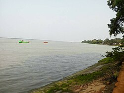
[[File:Riverside tamluk.jpg|thumb|Rupnarayan Riverside Tamluk]] | [[File:Riverside tamluk.jpg|thumb|Rupnarayan Riverside Tamluk]] | ||
* Rupnarayan river bank: The bank of river Rupnarayan is famous for picnic.{{citation needed|date=July 2020}} | * Rupnarayan river bank: The bank of river Rupnarayan is famous for picnic.{{citation needed|date=July 2020}} | ||
* [[Bargabhima temple|Devi Barghobhima]]: Nearly 1150-year-old Temple of Kali named as Devi Bargobhima. This temple is a part of 51 [[ | * [[Bargabhima temple|Devi Barghobhima]]: Nearly 1150-year-old Temple of Kali named as Devi Bargobhima. This temple is a part of 51 [[Shakta pithas]].<ref name=":0" /> [[Puranas]] say that the small finger of left feet of [[Dakshayani|Sati]]/[[Parvati]] fell here when Lord [[Vishnu]] cut the sacred Body of Goddess Sati into several pieces to pacify Lord [[Shiva]]. | ||
* Tamluk Rajbari: Located on the outskirts of town, the royal abode of the | * [[Tamluk Royal Family|Tamluk Rajbari]]: Located on the outskirts of town, the old ruined royal abode of the [[Bhanj dynasty]] (Mayur/Peacock),<ref>{{citation |title=Bargabhima temple: seeking an unknown mystery |publisher=IIJCRT |url=https://www.ijcrt.org/papers/IJCRT2102193.pdf |author=Shashwati Pandit |date=2 February 2021 }}</ref> is a tourist destination. | ||
* Rakhit Bati: It is another place to visit in Tamluk. In the beginning of 19th century it was a secret centre of the then revolutionary party [[Anushilan Samiti|Anusilan Samiti & Gupta samiti]]. The historian late Shri Tailakyanath Rakhit rebuilt this building. | * Rakhit Bati: It is another place to visit in Tamluk. In the beginning of 19th century it was a secret centre of the then revolutionary party [[Anushilan Samiti|Anusilan Samiti & Gupta samiti]]. The historian late Shri Tailakyanath Rakhit rebuilt this building. | ||
* [[Geonkhali]]: At geonkhali river Rupnarayan joins Hooghly river. | * [[Geonkhali]]: At geonkhali river Rupnarayan joins Hooghly river. | ||
== Notable people== | == Notable people== | ||
* [[Matangini Hazra]], [[Indian independence movement]] revolutionary and martyr | |||
* [[Matangini Hazra]], [[Indian independence movement]] revolutionary | * [[Satish Chandra Samanta]], [[Indian independence movement]] activist and leader of [[Tamralipta Jatiya Sarkar]] | ||
* [[Satish Chandra Samanta]], [[Indian independence movement]] activist | * [[Ajoy Mukherjee]], former [[Chief Minister of West Bengal]]. | ||
* [[Ajoy Mukherjee]], former | * [[Sushil Kumar Dhara]], co-founder of [[Tamralipta Jatiya Sarkar]] in British India & after independence he also served as Industry and Commerce Minister of West Bengal. | ||
* [[Sushil Kumar Dhara]], | |||
* [[Paresh Maity]], artist. | * [[Paresh Maity]], artist. | ||
* [[Mani Lal Bhaumik]],<ref>{{Cite web|title=.:: Dr. Mani Lal Bhaumik ::.|url=https://www.midnapore.in/people/mani_lal_bhaumik.html|access-date=2021-07-16|website=www.midnapore.in}}</ref> Indian American physicist and best-selling author | |||
*[[Mani Lal Bhaumik]],<ref>{{Cite web|title=.:: Dr. Mani Lal Bhaumik ::.|url=https://www.midnapore.in/people/mani_lal_bhaumik.html|access-date=2021-07-16|website=www.midnapore.in}}</ref> | * [[Ashok Dinda]], former cricketer of [[India national cricket team|Indian National Cricket Team]] and politician. | ||
==Gallery== | ==Gallery== | ||
| Line 205: | Line 199: | ||
Image: Tamluk Junction railway station.jpg|Tamluk Junction railway station | Image: Tamluk Junction railway station.jpg|Tamluk Junction railway station | ||
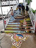
Image: Tamluk Junction Foot-over Bridge.jpg |Tamluk Junction Foot-over Bridge | Image: Tamluk Junction Foot-over Bridge.jpg |Tamluk Junction Foot-over Bridge | ||
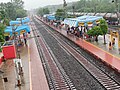
Image:A view from foot over bridge.jpg |A view of station from foot overbridge | |||
Image:A view from foot over bridge.jpg | A view from foot | |||
Image:Tamluk, rupnarayan river.jpg|Rupnarayan river bank, Tamluk | Image:Tamluk, rupnarayan river.jpg|Rupnarayan river bank, Tamluk | ||
Image:Ruined royal palace of Tamluk, a heritage building in East Medinipur 19.jpg|Ruined royal palace of Tamluk | |||
Image:Bargabhima, the ancient temple of Tamluk in Purba Medinipur district 07.jpg|Bargabhima, the ancient temple of Tamluk | |||
Image:East Medinipur District and Session Court at Tamluk, Old and New building 02.jpg|East Medinipur District and Session Court at Tamluk | |||
</gallery> | </gallery> | ||
| Line 213: | Line 209: | ||
* [[Tamluk (Lok Sabha constituency)]] | * [[Tamluk (Lok Sabha constituency)]] | ||
* [[Tamralipta]] | * [[Tamralipta]] | ||
* [[Tamluk Royal Family]] | |||
==References== | ==References== | ||
| Line 218: | Line 215: | ||
==External links== | ==External links== | ||
{{EB1911 poster|Tamluk}} | {{EB1911 poster|Tamluk}} | ||
* {{Commons category-inline|Tamluk}} | |||
* {{Wikivoyage-inline|Tamluk}} | * {{Wikivoyage-inline|Tamluk}} | ||
* [http://www.tamlukmunicipality.org/ Tamluk Municipality] | * [http://www.tamlukmunicipality.org/ Tamluk Municipality] | ||
| Line 234: | Line 232: | ||
[[Category:Cities and towns in Purba Medinipur district]] | [[Category:Cities and towns in Purba Medinipur district]] | ||
[[Category:Cities in West Bengal]] | |||
Latest revision as of 02:50, 27 February 2026
Tamluk
Tamralipta, Tamralipti, Tamolika | |
|---|---|
City | |
 Bargabhima temple at Tamluk | |
Location in West Bengal, India   Tamluk Tamluk (India)  Tamluk Tamluk (Asia) | |
| Coordinates: 22°18′N 87°55′E / 22.3°N 87.92°E | |
| Country | India |
| State | West Bengal |
| District | East Medinipur |
| Government | |
| • Type | Municipality |
| • Body |
|
| Area | |
| • Total | 17.86 km2 (6.90 sq mi) |
| Elevation | 7 m (23 ft) |
| Population (2011)[2] | |
| • Total | 65,306 |
| • Density | 3,700/km2 (9,500/sq mi) |
| Languages | |
| • Official | Bengali[3][4] |
| • Additional official | English[3] |
| Time zone | UTC+5:30 (IST) |
| PIN | 721636 721627 721648 721649 |
| Telephone code | 91-3228 |
| Vehicle registration | WB 29-xxxx, WB 30-xxxx |
| Lok Sabha constituency | Tamluk |
| Vidhan Sabha constituency | Tamluk |
| Website | purbamedinipur |


Tamluk (Bengali pronunciation: [tɔmluk]), is a city and a municipality in the Indian state of West Bengal. It is one of the oldest continuously inhabited cities of the world[5] and the headquarters of the Purba Medinipur district.[6] Though there is some controversy, scholars have generally agreed that present-day Tamluk is the site of the ancient city variously known as Tamralipta or Tamralipti, where Hiuen Tsang, a Chinese traveller and Chinese Buddhist monk Fa-Hien also visited the town, is now located on the banks of Rupnarayan River, close to the Bay of Bengal.
Name[edit | edit source]
According to T. N. Ramachandran, the name "Tamluk" is related to the older form Tamālikā, which is a variant spelling (found in the Trikāṇḍaśesha) of the ancient name Tāmraliptī (or Tāmralipta). Other names listed in the Trikāṇḍaśesha and the Abhidānachintāmaṇi as referring to Tāmraliptī include Staṁbhapura, Velākūla, and Vishṇugṛiha.[7]:229
History[edit | edit source]
This ancient kingdom and port city was bounded by the Bay of Bengal in the south, Rupnarayan River in the east and Subarnarekha River in the west. The Rupnarayana is the joint flow of the rivers Dwarakeswar and Silai. The Bay of Bengal and these great rivers with their numerous branches created a prosperous and easy water navigational system fostering commerce, culture and early contacts with the people outside the region. At the same time, these rivers helped to develop the agriculture in this region.[8]
Archaeological remains show continuous settlement from about the 3rd century BC. It was known as Tramralipta (in the Puranas and the Mahabharata), Tamralipta (in the Mahabharata), Tamalika (in historical documents), Tamalitti (in foreigners' descriptions), or Tamoluk (in the British Raj). It was a seaport, now buried under river silt. For this reason, Tamluk has many ponds and lakes remaining today.[9][10][11]
In the Mahabharata (Bhishma Parba/Nabam Adhyay), while describing the names of the holiest rivers and kingdoms of India, Sanjay took the name of "Tramralipta" to Dhritarashtra.[12][13][8]
Tamluk was also known as Bhivas, in religious texts, and Madhya Desh, as the Middle State of Utkal/Kalinga and Banga.[citation needed]
According to Jain sources, Tamralipti was the capital of the tamralipti janapada and was long known as a port.[14][15][7][16]
Archaeology[edit | edit source]
Several archaeological find sites have been found in Tamluk, including a number of high mounds in the town as well as in and around various tanks. The Bargabhīmā Temple, in the middle of town, is built on one such mound.[17] Another mound is now occupied by the local Mission house. Here, people digging a well found wood fragments at a depth of 50 feet, which T. N. Ramachandran compared to the remains of the Maurya-era wooden palisade found at Pataliputra. At another high mound, this one by the Rupnarayan riverbank, a hoard of about 350 coins dated to the 1st-2nd centuries BCE was found by K. N. Dikshit in the early 1920s.[7]:230–2
Just east of the Rajbari in central Tamluk is a large square tank called Khātpukūr, which probably dates from the 15th century. Digging here, Ramachandran's group found terracotta remains with similarities to Shunga-period artifacts, but because of where they were found, Ramachandran did not assign them a date. Among the artifacts found at Khātpukūr were a couple of Egyptian-style vases, which also could not be dated. They may have been either imports from Egypt or local imitations of Egyptian style. Either way, their presence indicates long-distance cultural contact due to maritime trade, as would be expected at a major port like Tāmraliptī. At another site, "an oblong tank next to the local school", old brick walls and terracotta fragments were found under Gurusday Dutt. Various items were found in and around a couple of tanks on Adhikaripara Road, Padambasan Road, and School Road.[7]:230, 235–7
A group led by T. N. Ramachandran undertook a survey of various sites in Tamluk in the 1940s.[7]:229–30
Geography[edit | edit source]
Lua error in Module:OSM_Location_map at line 1984: attempt to index field 'wikibase' (a nil value).
Tamluk is located on the right bank of the Rupnarayan river, about 19 km upstream from where it joins the Hooghly River.[7]:226
Police station[edit | edit source]

Tamluk police station has jurisdiction over Tamluk (municipality) and Tamluk CD Block. Tamluk police station covers an area of 214.14 km2 with a population of 352,748.[18][19]
Demographics[edit | edit source]
| Year | Pop. | ±% |
|---|---|---|
| 1972 | 5,849 | — |
| 1881 | 6,044 | +3.3% |
| 1891 | 6,612 | +9.4% |
| 1901 | 8,085 | +22.3% |
| 1911 | 8,048 | −0.5% |
| 1921 | 8,348 | +3.7% |
| 1931 | 9,095 | +8.9% |
| 1941 | 12,079 | +32.8% |
| 1951 | 13,599 | +12.6% |
| 1961 | 17,986 | +32.3% |
| 1971 | 22,478 | +25.0% |
| 1981 | 29,367 | +30.6% |
| 1991 | — | |
| 2001 | — | |
| 2011 | 65,306 | — |
| Source: Census of India[20] | ||
According to 2011 Indian Census, Tamluk had a total population of 65,306, of which 33,260 were males and 32,046 were females. Population within the age group of 0 to 6 years was 6,180. The total number of literates in Tamluk was 53,318, which constituted 81.6% of the population with male literacy of 85.0% and female literacy of 78.1%. The effective literacy rate of population (7 years and above) of Tamluk was 90.2%, of which male literacy rate was 94.0% and female literacy rate was 86.2%. The Scheduled Castes and Scheduled Tribes population was 4,441 and 201 respectively. Tamluk had 14489 households in 2011.[2]
Transport[edit | edit source]
Tamluk has two railway stations - Tamluk Junction and Sahid Matangini.
Education[edit | edit source]
Schools[edit | edit source]
- Sudhir Memorial Institute Tamluk :- It is an CBSE English - Medium School
- Tamralipta Public School, an ICSE and ISC affiliated school
- Matangini Mission School, Tamluk :- It is a Bengali & English - Medium School
- Tamluk Hamilton High School :- A school under West Bengal board, established on 1852.
- Rajkumari Santanamoyee Girls' High School :- A school under West Bengal board
- Tamluk High School :- A school under West Bengal board
- Demari High School :- A school under West Bengal board
- Tamralipta Vidyapith School : A school under West Bengal board
- Ratnali Adarsha Valika Vidyalaya : A school under West Bengal board
- Radhaballavpur Bhima Charan Basu Vidyapith : A school under West Bengal board
- Kulberia Bhimdeb Adarsha Vidyapith :A school under West Bengal board
- Bhander Beria Debendra High School : A school under West Bengal board
- Kakgechia Satyanarayan High School : A school under West Bengal board
- Jogikhop Girl High School : A school under West Bengal board
- Banhichar High School : A school under West Bengal board
- Kelomal Santoshini High School : A school under West Bengal board
- Nakibasan High School : A school under West Bengal board
- Daharpur Tapashili High School
- Salgechia High School
- Zilla Public School
Colleges[edit | edit source]

- Tamralipta Mahavidyalaya was established in 1948. It is affiliated to Vidyasagar University. It offers courses in arts, science, commerce and education.[21]
- Shahid Matangini Hazra Government College for Women was established at Nimtouri, Tamluk in 2015. It is affiliated to Vidyasagar University.
- Tamralipto Government Medical College and Hospital, established in 2022. It is affiliated to WBUHS.
Landmarks and tourist places[edit | edit source]

- Rupnarayan river bank: The bank of river Rupnarayan is famous for picnic.[citation needed]
- Devi Barghobhima: Nearly 1150-year-old Temple of Kali named as Devi Bargobhima. This temple is a part of 51 Shakta pithas.[17] Puranas say that the small finger of left feet of Sati/Parvati fell here when Lord Vishnu cut the sacred Body of Goddess Sati into several pieces to pacify Lord Shiva.
- Tamluk Rajbari: Located on the outskirts of town, the old ruined royal abode of the Bhanj dynasty (Mayur/Peacock),[22] is a tourist destination.
- Rakhit Bati: It is another place to visit in Tamluk. In the beginning of 19th century it was a secret centre of the then revolutionary party Anusilan Samiti & Gupta samiti. The historian late Shri Tailakyanath Rakhit rebuilt this building.
- Geonkhali: At geonkhali river Rupnarayan joins Hooghly river.
Notable people[edit | edit source]
- Matangini Hazra, Indian independence movement revolutionary and martyr
- Satish Chandra Samanta, Indian independence movement activist and leader of Tamralipta Jatiya Sarkar
- Ajoy Mukherjee, former Chief Minister of West Bengal.
- Sushil Kumar Dhara, co-founder of Tamralipta Jatiya Sarkar in British India & after independence he also served as Industry and Commerce Minister of West Bengal.
- Paresh Maity, artist.
- Mani Lal Bhaumik,[23] Indian American physicist and best-selling author
- Ashok Dinda, former cricketer of Indian National Cricket Team and politician.
Gallery[edit | edit source]
-
 Khudiram Bose
 -
 Tamluk Junction railway station
 -
 Tamluk Junction Foot-over Bridge
 -
 A view of station from foot overbridge
 -
 Rupnarayan river bank, Tamluk
 -
 Ruined royal palace of Tamluk
 -
 Bargabhima, the ancient temple of Tamluk
 -
 East Medinipur District and Session Court at Tamluk


See also[edit | edit source]
References[edit | edit source]
- ↑ "Tamluk Info". sudawb.org. Retrieved 25 November 2020.
- ↑ 2.0 2.1 "Census of India: Tamluk". www.censusindia.gov.in. Retrieved 9 October 2019.
- ↑ 3.0 3.1 "Fact and Figures". www.wb.gov.in. Retrieved 15 January 2019.
- ↑ "52nd Report of the Commissioner for Linguistic Minorities in India" (PDF). nclm.nic.in. Ministry of Minority Affairs. p. 85. Archived from the original (PDF) on 25 May 2017. Retrieved 2 March 2019.
- ↑ Paul, Santanu (26 May 2022). "Tamralipta, the ancient port city of India". Bengal Chronicle. Retrieved 13 April 2025.
- ↑ "Purba Medinipur | District Administration | India". Retrieved 31 May 2025.
- ↑ 7.0 7.1 7.2 7.3 7.4 7.5 Ramachandran, T. N. (1951). "Tāmraliptī (Taṁluk)". Artibus Asiae. 14 (3): 226–239. doi:10.2307/3248590. ISSN 0004-3648. JSTOR 3248590.
- ↑ 8.0 8.1 Dilip K. Chakrabarti (2001). Archaeological Geography of the Ganga Plain: The Lower and the Middle Ganga. Orient Blackswan. p. 125. ISBN 978-81-7824-016-9.
- ↑ Schendel, Willem van (12 February 2009). A History of Bangladesh. Cambridge University Press. p. 16. ISBN 978-1-316-26497-3.
- ↑ Tripati, S.; Rao, S. (1 January 1994). "Tamralipti: The Ancient Port of India". Studies in History and Culture. 2: 33–39.
- ↑ "History | Purba Medinipur | India". Retrieved 18 March 2022.
- ↑ Puri, Baij Nath (1966). Cities of Ancient India. Meenakshi Prakashan. p. 110.
- ↑ Choudhury, Pratap Chandra (1988). Assam-Bengal Relations from the Earliest Times to the Twelfth Century A.D. Spectrum Publications. p. 67.
- ↑ Schmiedchen, Annette (2019). "Medieval Endowment Cultures in Western India: Buddhist and Muslim Encounters – Some Preliminary Observations". Mondes de l'Asie du Sud et de l'Asie Centrale: 7.
- ↑ Paine, Lincoln (6 February 2014). The Sea and Civilization: A Maritime History of the World. Atlantic Books. p. 265. ISBN 978-1-78239-357-3.
- ↑ Bhaumick, Manoranjan (2001). History, Culture, and Antiquities of Tāmralipta. Punthi Pustak. pp. 7–8. ISBN 978-81-86791-27-1.
- ↑ 17.0 17.1 Pinakpani (20 August 2023), English: Bargabhima, the ancient temple of Tamluk in Purba Medinipur district, retrieved 12 April 2024
- ↑ "District Statistical Handbook 2014 Purba Medinipur". Tables 2.1, 2.2. Department of Statistics and Programme Implementation, Government of West Bengal. Archived from the original on 29 July 2017. Retrieved 10 November 2016.
- ↑ "Tamluk PS". Purba Medinipur District Police. Retrieved 10 November 2016.
- ↑ Ganguly, Pranab; Bose, Suvas. "Population Trends in Midnapore District, West Bengal, 1872–1981". Vidyasagar University: Journal of Social Sciences. Inaugural Number 1991–1992. Midnapore: Vidyasagar University: 1–13.
- ↑ "Tamralipta Mahaviyalaya". TM. Archived from the original on 7 May 2017. Retrieved 1 April 2017.
- ↑ Shashwati Pandit (2 February 2021), Bargabhima temple: seeking an unknown mystery (PDF), IIJCRT
- ↑ ".:: Dr. Mani Lal Bhaumik ::". www.midnapore.in. Retrieved 16 July 2021.
External links[edit | edit source]
- Tamluk Municipality
- Purba Medinipur District Official Website
- Paschim Medinipur District Official Website
- Tamralipta Mahavidyalaya
- On temples of Midnapur
Cities, towns, locations and neighbourhoods in Purba Medinipur District | |||||||||
|---|---|---|---|---|---|---|---|---|---|
| Cities, municipal and census towns |
| ||||||||
| Locations other than cities and towns |
| ||||||||
| Neighbourhoods |
| ||||||||
| Related topics | |||||||||


.png)