

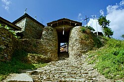


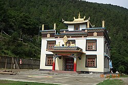


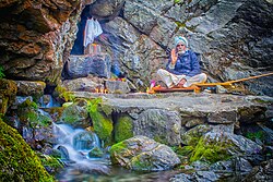
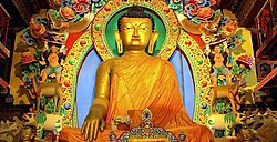



No edit summary |
correct intro based on references per sources |
||
| Line 1: | Line 1: | ||
{{Short description|State in | {{Short description|State in northeast India}} | ||
{{Redirect|Arunachal|the hill at Thiruvannamalai|Arunachala}} | {{Redirect|Arunachal|the hill at Thiruvannamalai|Arunachala|other uses|Arunachalam (disambiguation)}} | ||
{{Use Indian English|date= | {{pp-sock|small=yes}} | ||
{{Use dmy dates|date= | {{Use Indian English|date=May 2025}} | ||
{{Use dmy dates|date=May 2025}} | |||
{{Infobox Indian state or territory | {{Infobox Indian state or territory | ||
| name = Arunachal Pradesh | | name = Arunachal Pradesh | ||
| type = State | | type = State | ||
| image_skyline = {{ | | image_skyline = {{Multiple image | ||
| | | border = infobox | ||
| | | total_width = 280 | ||
| | | image_style = border:1; | ||
| | | perrow = 2/2/2/2 | ||
| | | image1 = The Tawang Monastery.jpg | ||
| | | caption1 = [[Tawang Monastery]] | ||
| | | image2 = Tawang Gate.jpg | ||
| | | caption2 = Tawang Gate, [[Tawang]] | ||
| | | image3 = A wintry morning in Vijaynagar.jpg | ||
| | | caption3 = [[Vijaynagar, Arunachal Pradesh|Vijaynagar]] | ||
| | | image4 = Golden Pagoda Namsai Arunachal Pradesh.jpg | ||
| caption4 = [[Golden Pagoda, Namsai|Golden Pagoda]], [[Namsai, Arunachal Pradesh|Namsai]] | |||
| image5 = Natural beauty of Mechuka, Arunachal Pradesh 8.jpg | |||
| caption5 = [[Mechuka]] | |||
| image6 = Ziro valley of Aruncahl in summer season.jpg | |||
| caption6 =[[Ziro|Ziro valley]] | |||
| image7 = Madhuri Lake.jpg | |||
| caption7 = Madhuri Lake | |||
| image8 = Sela Pass .jpg | |||
| caption8 = [[Sela Pass]] | |||
| image9 = | |||
| caption9 = [[Golden Jubilee Stadium]] | |||
}} | }} | ||
| image_caption | | image_caption = | ||
| image_seal = Arunachal Pradesh Seal.svg | | image_seal = Arunachal Pradesh Seal.svg | ||
| etymology = Arunachal ('dawn-lit mountains') and Pradesh ('province or territory') | | etymology = Arunachal ('dawn-lit mountains') and Pradesh ('province or territory') | ||
| | | nickname = "Land of Rising Sun" | ||
( | | motto = [[Satyameva Jayate]] (Truth Alone Triumphs) | ||
| image_map = IN-AR.svg | | image_map = IN-AR.svg | ||
| coordinates = {{coord|27.06|93.37|region:IN-AR_type:adm1st|display=inline,title}} | | coordinates = {{coord|27.06|93.37|region:IN-AR_type:adm1st|display=inline,title}} | ||
| Line 33: | Line 45: | ||
| capital = Itanagar | | capital = Itanagar | ||
| largestcity = capital | | largestcity = capital | ||
| districts = [[List of districts of Arunachal Pradesh| | | districts = [[List of districts of Arunachal Pradesh|28]] | ||
| government_footnotes = | | government_footnotes = | ||
| Governor = [[Kaiwalya Trivikram Parnaik]] | | Governor = [[Kaiwalya Trivikram Parnaik]] | ||
| Chief_Minister = [[Pema Khandu]] | | Chief_Minister = [[Pema Khandu]] ([[Bharatiya Janata Party|BJP]]) | ||
| | | Deputy_CM = [[Chowna Mein]] ([[Bharatiya Janata Party|BJP]]) | ||
| judiciary = [[ | | judiciary = [[Gauhati High Court|Gauhati High Court-Itanagar Bench]] | ||
| legislature_type = Unicameral | | legislature_type = Unicameral | ||
| assembly = [[Arunachal Pradesh Legislative Assembly]] | | assembly = [[Arunachal Pradesh Legislative Assembly]] | ||
| Line 44: | Line 56: | ||
| rajya_sabha_seats = 1 seat | | rajya_sabha_seats = 1 seat | ||
| lok_sabha_seats = 2 seats | | lok_sabha_seats = 2 seats | ||
| area_footnotes = <ref name=":0">{{Cite web|others=Hosted by: G.B. Pant National Institute of Himalayan Environment and Sustainable Development. Sponsored by: Ministry of Environment, Forest & Climate Change, Govt of India|title=Arunachal Pradesh: Physiography, At a glance|url=http://gbpihedenvis.nic.in/Arunachal_glance.html | | area_footnotes = <ref name=":0">{{Cite web|others=Hosted by: G.B. Pant National Institute of Himalayan Environment and Sustainable Development. Sponsored by: Ministry of Environment, Forest & Climate Change, Govt of India|title=Arunachal Pradesh: Physiography, At a glance|url=http://gbpihedenvis.nic.in/Arunachal_glance.html|access-date=23 June 2021|website=gbpihedenvis.nic.in|publisher=ENVIS Centre on Himalayan Ecology|archive-date=24 June 2021|archive-url=https://web.archive.org/web/20210624211513/http://gbpihedenvis.nic.in/Arunachal_glance.html|url-status=live}}</ref> | ||
| area_total_km2 = 83743 | | area_total_km2 = 83743 | ||
| area_rank = 14th | | area_rank = 14th | ||
| elevation_footnotes = <ref>{{Cite web|date=26 June 2018|title=4 Reasons Why Arunachal Pradesh is a Natural Wonderland|url=https://www.outlookindia.com/outlooktraveller/explore/story/68025/4-reasons-arunachal-pradesh-natural-wonderland | | elevation_footnotes = <ref>{{Cite web|date=26 June 2018|title=4 Reasons Why Arunachal Pradesh is a Natural Wonderland|url=https://www.outlookindia.com/outlooktraveller/explore/story/68025/4-reasons-arunachal-pradesh-natural-wonderland|access-date=23 June 2021|website=Outlook India Traveller|quote=We may as well call Arunachal a flowery paradise. Arunachal is also called Orchid State of India|archive-date=24 June 2021|archive-url=https://web.archive.org/web/20210624205857/https://www.outlookindia.com/outlooktraveller/explore/story/68025/4-reasons-arunachal-pradesh-natural-wonderland|url-status=live}}</ref> | ||
| elevation_m = | | elevation_m = | ||
| population_total = 1, | | elevation_max_m = 7,090 | ||
| elevation_max_point = [[Kangto]] | |||
| elevation_min_m = 44 | |||
| elevation_min_point = [[Brahmaputra River]] | |||
| population_total = {{Increase}} 1,383,727 | |||
| population_as_of = 2011 | | population_as_of = 2011 | ||
| population_rank = 27th | | population_rank = 27th | ||
| Line 55: | Line 71: | ||
| population_rural = 77.06% | | population_rural = 77.06% | ||
| population_density = 17 | | population_density = 17 | ||
| 0fficial_Langs = English<ref name=langoff>{{cite web |url=http://nclm.nic.in/shared/linkimages/NCLM47thReport.pdf |title=Report of the Commissioner for linguistic minorities: 47th report (July 2008 to June 2010) |pages=122–126 |publisher=Commissioner for Linguistic Minorities, Ministry of Minority Affairs, [[Government of India]] |access-date=16 February 2012 |archive-url=https://web.archive.org/web/20120513161847/http://nclm.nic.in/shared/linkimages/NCLM47thReport.pdf |archive-date=13 May 2012 | | population_footnotes = <ref name="census2011Abstract">{{cite web |url=https://censusindia.gov.in/pca/DDW_PCA0000_2011_Indiastatedist.xlsx |title=Primary Census Abstract Data Tables (India & States/UTs – District Level) |publisher=Office of the Registrar General and Census Commissioner of India |access-date=8 April 2022 |archive-url=https://web.archive.org/web/20220408052329/https://censusindia.gov.in/pca/DDW_PCA0000_2011_Indiastatedist.xlsx |archive-date=8 April 2022 }}</ref> | ||
| GDP_total = {{INRConvert| | | population_demonym = Arunachalis | ||
| GDP_year = | | 0fficial_Langs = English<ref name=langoff>{{cite web |url=http://nclm.nic.in/shared/linkimages/NCLM47thReport.pdf |title=Report of the Commissioner for linguistic minorities: 47th report (July 2008 to June 2010) |pages=122–126 |publisher=Commissioner for Linguistic Minorities, Ministry of Minority Affairs, [[Government of India]] |access-date=16 February 2012 |archive-url=https://web.archive.org/web/20120513161847/http://nclm.nic.in/shared/linkimages/NCLM47thReport.pdf |archive-date=13 May 2012 }}</ref><ref>{{cite web |title=Ministry of Development of North Eastern Region, North East India |url=https://mdoner.gov.in/about-north-east/arunachal-pradesh |website=mdoner.gov.in |access-date=22 February 2022 |archive-date=15 October 2023 |archive-url=https://web.archive.org/web/20231015025343/https://mdoner.gov.in/about-north-east/arunachal-pradesh |url-status=live }}</ref><ref>{{cite web |title=WORKING IN HINDI LANGUAGE |url=https://rajbhasha.gov.in/sites/default/files/2863engls.pdf |website=rajbhasha.gov.in |access-date=22 February 2022 |archive-date=25 February 2023 |archive-url=https://web.archive.org/web/20230225114825/https://rajbhasha.gov.in/sites/default/files/2863engls.pdf |url-status=live}}</ref> | ||
| GDP_rank = | | official_script = [[Latin script]] | ||
| GDP_per_capita = {{INRConvert| | | GDP_total = {{Increase}}{{INRConvert|0.47823|lc|lk=r}} | ||
| GDP_per_capita_rank = | | GDP_year = 2025–26 | ||
| GDP_rank = 31st | |||
| GDP_per_capita = {{Increase}}{{INRConvert|280380|lk=r}} | |||
| HDI_year = | | GDP_per_capita_rank = 16th | ||
| HDI = 0. | | HDI_year = 2023 | ||
| HDI_rank = | | HDI = {{Increase}} 0.722 {{color|green|High}}<ref>{{cite web |title=India: Subnational HDI |url=https://globaldatalab.org/shdi/table/shdi/IND/ |website=Global Data Labs |access-date=15 November 2025}}</ref> | ||
| literacy = | | HDI_rank = 17th | ||
| literacy_year = | | literacy = 84.2%<ref>{{Cite book |url=https://www.mospi.gov.in/sites/default/files/publication_reports/AnnualReport_PLFS2023-24L2.pdf |title=Annual Report, Periodic Labour Force Survey (PLFS) (July 2023 – June 2024) |date=23 September 2024 |publisher=National Sample Survey Office, Ministry of Statistics and Programme Implementation, Government of India |pages=A-10 |chapter=Appendix-A: Detailed tables, Table (7): Literacy rate (in per cent) of persons of different age groups for each State/UT (persons, age-group (years): 7 & above, rural+urban (column 6))}}</ref> | ||
| sex_ratio = 997[[female|♀]]/ | | literacy_year = 2024 | ||
| literacy_rank = 21st | |||
| sex_ratio = 997[[female|♀]]/1,000 [[male|♂]]<ref>{{Cite web|title=Sex ratio of State and Union Territories of India as per National Health survey (2019–2021)|url=https://main.mohfw.gov.in/basicpage-14|website=Ministry of Health and Family Welfare, India|access-date=29 January 2023|archive-date=8 January 2023|archive-url=https://web.archive.org/web/20230108164803/https://main.mohfw.gov.in/basicpage-14|url-status=live}}</ref> | |||
| sexratio_year = 2021 | | sexratio_year = 2021 | ||
| sexratio_rank = 5th | |||
| iso_code = IN-AR | | iso_code = IN-AR | ||
| registration_plate = AR | | registration_plate = AR | ||
| website = arunachalpradesh.gov.in | | website = arunachalpradesh.gov.in | ||
| foundation_day = Arunachal Pradesh Day | | foundation_day = Arunachal Pradesh Day | ||
| mammal = [[Gayal|Mithun]] | | mammal = [[Gayal|Mithun]] | ||
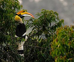
| bird = [[Hornbill]] | | bird = [[Hornbill]] | ||
| fish = Golden Mahseerref | | fish = Golden Mahseerref | ||
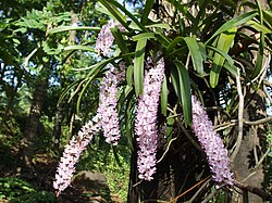
| flower = [[Foxtail orchid]] | | flower = [[Foxtail orchid]] | ||
| tree = Hollong | | tree = Hollong | ||
| image_highway = SH IN-AR.png | |||
}} | }} | ||
'''Arunachal Pradesh''' ({{IPAc-en| | '''Arunachal Pradesh''' ({{IPAc-en|ər|ʊ|ˌ|n|ɑː|tʃ|əl|_|p|r|ə|ˈ|d|eɪ|ʃ}};<ref>{{Cite encyclopedia |url=http://www.lexico.com/definition/Arunachal_Pradesh |archive-url=https://web.archive.org/web/20210516154328/https://www.lexico.com/definition/arunachal_pradesh |archive-date=16 May 2021 |title=Arunachal Pradesh |dictionary=[[Lexico]] UK English Dictionary |publisher=[[Oxford University Press]]}}</ref> {{Literal translation|Dawn-Lit Mountain Province}})<ref>{{cite news |title='We Wake Up at 4 am': Arunachal Pradesh CM Pema Khandu Wants Separate Time Zone |url=https://www.outlookindia.com/website/story/we-wake-up-at-4am-arunachal-cm-pema-khandu-wants-separate-time-zone/299308 |work=Outlook |date=12 June 2017|archive-url=https://web.archive.org/web/20180517152928/https://www.outlookindia.com/website/story/we-wake-up-at-4am-arunachal-cm-pema-khandu-wants-separate-time-zone/299308|archive-date=17 May 2018|url-status=live}}</ref> is a [[States and union territories of India|state]] in [[northeast India]]. It was known as the [[North-East Frontier Agency]] until 1972, after which it became a [[union territory]] under the name Arunachal Pradesh. It became a state on 20 February 1987. [[Itanagar]] is its capital and largest town. | ||
It shares [[Borders of India|international borders]] with [[Bhutan]] in the west, [[Myanmar]] in the east, and a disputed 1,129 km border with [[China]]'s [[Tibet Autonomous Region]] in the north at the [[McMahon Line]].<ref>{{cite news |last1=Choudhury |first1=Ratnadip |date=23 September 2020 |title=Arunachal Residents Write To PM On Road Project, Quote National Security |url=https://www.ndtv.com/india-news/arunachal-pradesh-residents-quote-national-security-as-they-write-to-pm-modi-on-stalled-road-project-2299974 |work=NDTV |access-date=27 January 2021 |archive-date=30 October 2020 |archive-url=https://web.archive.org/web/20201030144101/https://www.ndtv.com/india-news/arunachal-pradesh-residents-quote-national-security-as-they-write-to-pm-modi-on-stalled-road-project-2299974 |url-status=live }}</ref> Nearly four-fifths of Arunachal Pradesh is claimed{{efn|Except the districts of [[Longding district|Longding]], [[Tirap district|Tirap]], [[Changlang district|Changlang]] and [[Namsai district|Namsai]] and some parts of [[Lohit district|Lohit]] and [[Anjaw district|Anjaw]] districts. The area of these districts is nearly 14,000 km² as per state figures.<ref>{{cite web|title=State Profile of Arunachal Pradesh|url=http://dcmsme.gov.in/dips/state_wise_dips/STATE%20PROFILE%20OF%20ARUNACHAL%20%20PRADESH,%202015_14316.pdf|publisher=Ministry of Micro, Small and Medium Enterprises, Government of India|pages=12–15|date=2014}}</ref>}}<ref name="BBC_Apr2023"/><ref>{{Cite news |last=Saaliq |first=Sheikh |date=21 October 2024 |title=India says it reached a pact with China on military patrols along their disputed border |url=https://apnews.com/article/india-china-ladakh-border-standoff-c7c5fcf61b2378428842207b52b547c3 |agency=[[Associated Press]] |access-date=6 November 2024}}</ref><ref>{{Cite news |date=17 January 2022 |title=China returns Indian citizen at disputed border |url=https://www.reuters.com/world/china/china-says-it-questioned-then-returned-indian-citizen-disputed-border-2022-01-27/ |access-date=6 November 2024 |agency=[[Reuters]]}}</ref> by China as [[Southern Tibet]] as part of the Tibet Autonomous Region;<ref>{{Cite book |url=https://press.princeton.edu/books/paperback/9780691136097/strong-borders-secure-nation |title=Strong Borders, Secure Nation |date=14 September 2008 |isbn=978-0-691-13609-7 |pages=326–327 |quote=The territorial dispute between China and India concerns three sectors. The eastern sector includes 90,000 square kilometers south of the McMahon Line and north of what China claims as Tibet’s customary boundary, effectively the present-day Indian state of Arunachal Pradesh, previously known as the North Eastern Frontier Agency. India claims that the frontier here was delimited by the McMahon Line drawn at the 1913–14 Simla Conference. China does not recognize the McMahon Line itself or any of the documents from this conference, which it never ratified. In addition, as the line itself was drawn directly on a map, it lacks a precise delimitation. Historically, Tibet had administered the area around Tawang in the far western portion of this sector, where the sixth Dalai Lama was born, and claimed additional areas on the southern slope. After independence in 1947, India moved to assert its authority, slowly administering this region in the early 1950s and in some cases replacing local Tibetan officials. |last1=Taylor Fravel |first1=M. |publisher=Princeton University Press |access-date=2 August 2023 |archive-date=2 August 2023 |archive-url=https://web.archive.org/web/20230802045657/https://press.princeton.edu/books/paperback/9780691136097/strong-borders-secure-nation |url-status=live }}</ref><ref>{{Cite journal |last=Sarmah |first=Minakshi |date=2021 |title=Is China's Territorial Claim On Arunachal Pradesh Justifiable? |url=https://www.jstor.org/stable/48654881 |journal=World Affairs: The Journal of International Issues |volume=25 |issue=4 |pages=78–89 |jstor=48654881 |issn=0971-8052}}</ref> China [[Sino-Indian War|occupied some regions]] of Arunachal Pradesh in 1962 but later withdrew its forces.<ref name="Mayilvaganan-Bej-Khatoon">{{cite book |title=Tawang, Monpas and Tibetan Buddhism in Transition |publisher=[[Springer Nature]] |year=2020 |editor-last1=Mayilvaganan |editor-first1=M. |editor-last2=Bej |editor-first2=Sourina |editor-last3=Khatoon |editor-first3=Nasima}}</ref>{{rp|22|quote=A theatre to the 1962 war, Tawang remained captive for a brief spell of time till China voluntarily retreated the territory in November 1962.}}<ref>{{Citation |title=Open War: State-Making's Dress Rehearsal |date=2016 |url=https://www.cambridge.org/core/books/shadow-states/open-war/6069407DCF915B6A0D6A38EEB8E43ECA |work=Shadow States: India, China and the Himalayas, 1910–1962 |pages=232–264 |editor-last=Guyot-Réchard |editor-first=Bérénice |access-date=12 June 2023 |place=Cambridge |publisher=Cambridge University Press |doi=10.1017/9781316796894.012 |isbn=978-1-107-17679-9 |archive-date=14 June 2018 |archive-url=https://web.archive.org/web/20180614071134/https://www.cambridge.org/core/books/shadow-states/open-war/6069407DCF915B6A0D6A38EEB8E43ECA |url-status=live |url-access=subscription }}</ref> | |||
As | As per the [[2011 Census of India|2011 census]], Arunachal Pradesh has a population of 1,383,727. With only 17 inhabitants per square kilometre, it is the least densely populated state in India. It is an ethnically diverse state, with predominantly [[Monpa people]] in the west, [[Tani people]] in the centre, [[Mishmi people|Mishmi]] and [[Tai peoples|Tai people]] in the east, and [[Naga people]] in the southeast of the state. About 23 major tribes and 100 sub-tribes live in the state,{{cn|date=February 2022}} including [[Nocte people|Nocte]], [[Adi people|Adi]], [[Nyishi people|Nyishi]], [[Jingpo people|Singpho]], [[Galo tribe|Galo]], [[Tagin people|Tagin]], and [[Apatani people|Apatani]]. The Nyishi are the largest ethnic group in the region. The Mishmi tribe has three sub-tribes, namely Idu-Mishmi, Digaru-Mishmi, and Miju-Mishmi. | ||
==Etymology== | |||
Arunachal Pradesh means ''Land of the Dawn-Lit Mountains'', which is the [[sobriquet]] for the state in [[Sanskrit]].<ref>{{Cite book |title=Discovery of North-East India |first=Usha |last=Sharma |isbn=978-81-8324-034-5 |page=65 |publisher=Mittal Publications |year=2005}}</ref> The term was coined during the formation of the state. Prior to the year 1972, it was called [[North-East Frontier Agency]]. | |||
== | The [[China|People's Republic of China]] (PRC) does not recognize Arunachal Pradesh, and claims the land to be part of Tibet, calling it [[Southern Tibet]] ({{lang-zh|c=藏南}} [[pinyin]]: ''Zàngnán'').<ref name="Mayilvaganan-Bej-Khatoon" />{{rp|22|quote=China's Ministry of Civil Affairs announced that it was standardising the names of six places in its 'south Tibet region' (''Zangnan diqu'') that refers to a portion of the Indian state of Arunachal Pradesh.}}{{rp|155|quote=The ROC officially has never ceased to claim that it is the legitimate government of all China and continues, therefore, to claim all the territories that the People's Republic of China claims and more. This includes territories in dispute with India, too.}}<ref>{{cite news |date=10 September 2020 |title=India launches villages programme in Arunachal, ignores angry China |url=https://www.reuters.com/world/asia-pacific/china-criticises-indian-ministers-visit-arunachal-pradesh-foreign-ministry-2023-04-10/ |url-status=live |archive-url=https://web.archive.org/web/20231108131004/https://www.reuters.com/world/asia-pacific/china-criticises-indian-ministers-visit-arunachal-pradesh-foreign-ministry-2023-04-10/ |archive-date=8 November 2023 |access-date=11 November 2023 |agency=Reuters }}</ref> In ancient [[Classical Tibetan language|Tibetan]] texts, eastern Arunachal Pradesh{{Clarify|reason=Which part? Vague description.|date=January 2025}} and some parts of Tibet{{Which|date=January 2025}} were called Lhoyü while the residents were called Lhobha people,<ref>{{cite web |title=Official Web Page of Government of Arunachal Pradesh |url=http://arunachalpradesh.nic.in/tourism.htm |archive-url=https://web.archive.org/web/20120320144930/http://arunachalpradesh.nic.in/tourism.htm |archive-date=20 March 2012}}</ref>{{Failed verification|date=January 2025}} while [[Tawang district]] and [[West Kameng district]] in western Arunachal Pradesh were called Monyul.{{Efn|name=Monyul|{{harvnb|Nanda|2020|p=[https://books.google.com/books?id=8i3rDwAAQBAJ&pg=PA30 30]}}: "Tawang, Dirang and parts of Western Kameng of Arunachal Pradesh, were historically and territorially (traditionally) part of the 'Monyul'."}} | ||
== History == | == History == | ||
===Ancient | ===Ancient period=== | ||
{{Main|Monpa people|Prince Tsangma}} | |||
Very little ancient history is known about the region apart from the Northwestern corner, and the areas bordering current [[Assam]]. The Northwestern regions came under Monpa and [[Tibet]]an control. | |||
Northwestern parts of this area came under the control of the Monpa kingdom of Monyul under Tibet which flourished between 500 BCE and 600 CE. The [[Monpa people|Monpa]] and [[Sherdukpen]] keep historical records of the existence of local chiefdoms in the northwest as well.<ref>{{harvcol|Mizuno|Tenpa|2015|pp=15–16}}</ref> | |||
According to Tibetan chronicles, Monyul was ruled by Gongkar Gyal, descendent of an exiled Tibetan ruler named [[Prince Tsangma|Lhase Tsangma]], the brother of Tibetan king [[Ralpacan]] who arrived in Monyul in 837 A.D or earlier.<ref>{{harvcol|Mizuno|Tenpa|2015|p=16}}</ref> | |||
A descendant of Gongkar Gyal became the ruler of Trashiyangtse region of Bhutan and Gapde Tsan another descendant was the ruler of Khorwong valley in [[Thembang]] town (now [[West Kameng district]], Arunachal Pradesh).<ref name="ReferenceB">{{harvcol|Mizuno|Tenpa|2015|pp=16–17}}</ref> | |||
[[File:Thembang msb.jpg|thumb|250px|Thembang dzong built during the 12th century, a type of dzong commonly found in Bhutan and Tibet]] | |||
Later, the second son of Gongkar Gyal, Wongme Palde who returned to Tibet owing to the poverty in Khorwong valley came back to Monyul to become its ruler.<ref name="ReferenceB"/> | |||
The Rgyal rigs text written in 1668 or 1728 contains a record of taxes collected. Taxes were paid via coins, foodstuffs, or livestock from area around present-day [[Kameng district]] and [[Tawang district]].<ref>{{harvcol|Mizuno|Tenpa|2015|p=27}}</ref> | |||
The Monpas ({{bo|t=མོན་པ}}) ་known to the [[Chinese people|Chinese]] as '''Menba'''<ref>{{harvcol|Eilmer|2014|p=127}}</ref> were responsible for trade between Assam and Tibet and held the Koriapar Dooar at [[Sonitpur district]] of [[Assam]]. The Monpa chief were subordinate to the ruler of [[Tawang]] who in turn were subordinate to the [[Ganden Phodrang|Government of Tibet]] or Ganden Phodrang in [[Lhasa]].<ref name="harvcol|Das|1998|p=38">{{harvcol|Das|1998|p=38}}</ref> The Tibetan government at Lhasa appointed Tibetan officials called Gellongs to supervise the local Monpa chief. The Monpa chief who looked after the Duar were called Tsorgon, a position created in the 16th century.<ref name="harvcol|Das|1998|p=38"/> | |||
According to historical Tibetan text the state of Arunachal Pradesh known as Lhoyu came under the control of Tubo Kingdom or [[Tibetan Empire]] in the 7th century CE.<ref>{{cite book |title=China's Tibet |author=Xiaoming Zhang |publisher=五洲传播出版社 |year=2004 |page=23 |isbn=7-5085-0608-1|quote=According to historical records, in the 7th century and thereafter, Lhoyu fell under the jurisdiction of the Tubo Kingdom and of the local government of Tibet}}</ref> | |||
[[File:Tibetan empire greatest extent 780s-790s CE.png|thumb|250px|Arunachal Pradesh under the Tibetan Empire in 7th and 8th century CE]] | |||
===Medieval period=== | |||
{{Main|Tsangyang Gyatso|Tawang Monastery}} | |||
[[File:Tawang Monastery second largest monastery in Asia Arunachal Pradesh India.jpg|thumb|upright=1.13|[[Tawang Monastery]] built in the 17th century under the instruction of the [[5th Dalai Lama]], is the largest monastery in India and second-largest in the world after the [[Potala Palace]] in [[Lhasa]], Tibet. It is one of the few monasteries of [[Tibetan Buddhism]] that have remained protected from [[Mao Zedong|Mao]]'s [[Cultural Revolution]] without any damage.{{Sfn|Richardson|1984|p=210}}]] | |||
In the 17th century, the 5th Dalai Lama [[Ngawang Lobsang Gyatso]] (1617–1682), who achieved political supremacy over Tibet in 1642, imposed a tax called ''Khrey'' over Monyul and instructed the construction of fortresses in Monpa area called [[Dzong]] which served as centers for administration and tax collection.<ref name="harvcol|Mizuno|Tenpa|2015|p=32">{{harvcol|Mizuno|Tenpa|2015|p=32}}</ref> | |||
[[File:Dirang Monastery.jpg|thumb|250px|Dirang Dzong build under instruction of the 5th Dalai Lama [[Ngawang Lobsang Gyatso]]]] | |||
The fortressess built were Dirang Dzong, Taklung Dzong and Gyangkhar Dzong to collect tax from the [[Dirang|Dirang Monpa]], [[Kalaktang|Kalaktang Monpa]] and [[Tawang|Tawang Monpa]] respectively. The officials who collected the taxes were called [[Dzongpen|Dzongpon]].<ref name="harvcol|Mizuno|Tenpa|2015|p=32"/> | |||
The tax was carried to Tawang Monastery and then to Lhasa via [[Tsona]] city (present-day China).<ref name="harvcol|Mizuno|Tenpa|2015|p=32"/> | |||
[[File:Tsangyang Gyatso birth place.jpg|thumb|[[Urgelling Monastery]] built in 1489 A.D by Urgen Sangpo in Tawang is the birthplace of [[6th Dalai Lama]], Tsangyang Gyatso]] | |||
The 6th [[Dalai Lama]] [[6th Dalai Lama|Tsangyang Gyatso]] (1683–1706) was born in [[Tawang]] and died in [[Amdo]] (present-day China) on his way to [[Beijing]] after being kidnapped by the [[Mongols|Mongol]] forces under [[Lha-bzang Khan]], the last ruler of [[Khoshut Khanate]] on the approval of [[Kangxi Emperor]] of the [[Qing dynasty]]. | |||
Before his death the [[6th Dalai Lama]] instructed the construction of notable buildings like [[Tromzikhang]] in [[Barkhor]], [[Lhasa]]. | |||
[[File:Lhasa khrom gzigs khang 2014.09.23 11-19-07.jpg|thumb|Tromzikhang in Lhasa build under the instruction of the 6th Dalai Lama]] | |||
Arunachal Pradesh falls under [[Kham]] ({{bo|t=ཁམས་}}) and [[Ü-Tsang]] ({{bo|t=དབུས་གཙང་}}) cultural region of Tibet which also includes the [[Brahmaputra River]] watershed. | |||
The foothills and the plains, were under the control of the [[Chutia Kingdom|Chutia]] kings of [[Assam]]. Inner parts of the state remained independent and self-governed even though interactions with external parties did exist.<ref>[[Claude Arpi]], The Pure Crystal Mountain Pilgrimage of Tsari, ''1962: The McMahon Line Saga''.</ref> | |||
The main archaeological sites of the state include:<ref>{{cite book |last=Baruah |first=Swarnalata |title=Chutia Jaatir Buranji |year=2004 |publisher=Banalata Publications |location=Guwahati}}</ref> | The main archaeological sites of the state include:<ref>{{cite book |last=Baruah |first=Swarnalata |title=Chutia Jaatir Buranji |year=2004 |publisher=Banalata Publications |location=Guwahati}}</ref> | ||
| Line 104: | Line 164: | ||
! Site || Dated to || Built by | ! Site || Dated to || Built by | ||
|- | |- | ||
| [[Bhismaknagar| Bhismaknagar Fort]], Roing || 8th–15th century<ref name="roing.nic.in">{{Cite web|url=https://roing.nic.in/tourism/|title=Tourism | District Lower Dibang Valley, Government of Arunachal Pradesh. | India}}</ref>|| [[Chutia Kingdom|Chutia kings]] | | [[Bhismaknagar|Bhismaknagar Fort]], [[Roing]] || 8th–15th century<ref name="roing.nic.in">{{Cite web|url=https://roing.nic.in/tourism/|title=Tourism | District Lower Dibang Valley, Government of Arunachal Pradesh. | India|access-date=11 June 2020|archive-date=15 May 2021|archive-url=https://web.archive.org/web/20210515105256/https://roing.nic.in/tourism/|url-status=live}}</ref>|| [[Chutia Kingdom|Chutia kings]] | ||
|- | |- | ||
| Bolung Fort, Bolung || 13th century || Chutia kings | | Bolung Fort, Bolung || 13th century || Chutia kings | ||
| Line 110: | Line 170: | ||
| Dimachung-Betali, West Kameng || 13th century || Chutia kings | | Dimachung-Betali, West Kameng || 13th century || Chutia kings | ||
|- | |- | ||
| [[Gomsi]] Fort, East Siang || 13th century<ref> | | [[Gomsi]] Fort, [[East Siang district|East Siang]] || 13th century<ref>{{Cite web |url=http://nmma.nic.in/nmma/nmma_doc/Indian%20Archaeology%20Review/Indian%20Archaeology%201996_97%20A%20Review.pdf |title=Indian Archeology-1996-97 |access-date=11 June 2020 |archive-date=24 February 2021 |archive-url=https://web.archive.org/web/20210224044929/http://nmma.nic.in/nmma/nmma_doc/Indian%20Archaeology%20Review/Indian%20Archaeology%201996_97%20A%20Review.pdf |url-status=live }}</ref> | ||
|| Chutia kings | || Chutia kings | ||
|- | |- | ||
| Rukmini Fort, Roing || 14th–15th century<ref name="roing.nic.in"/> || Chutia kings | | Rukmini Fort, Roing || 14th–15th century<ref name="roing.nic.in"/> || Chutia kings | ||
|- | |- | ||
| Tezu Fort, Roing || | | Tezu Fort, Roing || 14th–15th century<ref>{{Cite web |url=https://shodhganga.inflibnet.ac.in/jspui/bitstream/10603/159414/8/08_chapter%203.pdf |title=Chattopadhyay, S., ''History and archaeology of Arunachal Pradesh'', p. 71 |access-date=11 June 2020 |archive-date=21 November 2021 |archive-url=https://web.archive.org/web/20211121180648/https://shodhganga.inflibnet.ac.in:8443/jspui/pdfToThesis.jsp?toHandle=https://shodhganga.inflibnet.ac.in/handle/10603/159414&toFile=https://shodhganga.inflibnet.ac.in/bitstream/10603/159414/8/08_chapter%203.pdf |url-status=live }}</ref>|| Chutia kings | ||
|- | |- | ||
| Naksha Parbat ruins, East Kameng || 14th–15th century<ref>Borah,D.K.''Archaeological ruins of Naksabat'', p.32</ref> | | Naksha Parbat ruins, [[East Kameng district|East Kameng]] || 14th–15th century<ref>Borah, D.K.''Archaeological ruins of Naksabat'', p.32</ref> | ||
|| Chutia kings | || Chutia kings | ||
|- | |- | ||
| [[Ita Fort]], Itanagar || 14th–15th century<ref>{{Cite web|url=https://itanagar.nic.in/tourist-place/ita-fort/|title=Ita Fort | Itanagar Capital Complex |website=itanagar.nic.in |access-date=December | | [[Ita Fort]], Itanagar || 14th–15th century<ref>{{Cite web|url=https://itanagar.nic.in/tourist-place/ita-fort/|title=Ita Fort | Itanagar Capital Complex|website=itanagar.nic.in|access-date=17 December 2022|archive-date=6 April 2019|archive-url=https://web.archive.org/web/20190406223800/https://itanagar.nic.in/tourist-place/ita-fort/|url-status=live}}</ref>|| Chutia kings | ||
|- | |- | ||
|Buroi Fort, Papum Pare|| 13th century<ref>{{Cite web|url=http://archive.org/details/in.gov.ignca.2613|title=Early history of Kamarupa|first=Rai K. L.|last=Barua|date=27 January 1933|via=Internet Archive}}</ref>||Chutia kings | |Buroi Fort, [[Papum Pare]]|| 13th century<ref>{{Cite web|url=http://archive.org/details/in.gov.ignca.2613|title=Early history of Kamarupa|first=Rai K. L.|last=Barua|date=27 January 1933|via=Internet Archive}}</ref>||Chutia kings | ||
|- | |- | ||
| [[Malinithan]] Temple, Likabali || 13th–14th century<ref>{{Cite journal | | [[Malinithan]] Temple, Likabali || 13th–14th century<ref>{{Cite journal|last=Thakur|first=A.K.|title=Pre-Historic Archaeological Remains of Arunachal Pradesh and People's Perception: An Overview|year=2004|journal=Proceedings of the Indian History Congress|volume=65|pages=1185–1196|jstor=44144827}}</ref>|| Chutia kings | ||
|- | |- | ||
| Ita Pukhuri, Ithili || 13th–14th century<ref name="auto"> | | Ita Pukhuri, Ithili || 13th–14th century<ref name="auto">{{Cite web |url=https://censusindia.gov.in/2011census/dchb/DCHB_A/12/1214_PART_A_DCHB_LOWER%20DIBANG%20VALLEY.pdf |title=District Handbook of Lower Dibang District |access-date=22 August 2020 |archive-date=11 November 2021 |archive-url=https://web.archive.org/web/20211111181928/https://censusindia.gov.in/2011census/dchb/DCHB_A/12/1214_PART_A_DCHB_LOWER%20DIBANG%20VALLEY.pdf |url-status=live }}</ref> || Chutia kings | ||
|- | |- | ||
| Padum Pukhuri, Ithili || 13th–14th century<ref name="auto"/> || Chutia kings | | Padum Pukhuri, Ithili || 13th–14th century<ref name="auto"/> || Chutia kings | ||
|- | |- | ||
| Kampona brick tank, Idili || 13th–14th century<ref name="auto"/> || Chutia kings | | Kampona brick tank, Idili || 13th–14th century<ref name="auto"/> || Chutia kings | ||
| Line 134: | Line 194: | ||
| Kanying brick tank, Idili || 13th–14th century<ref name="auto"/> || Chutia kings | | Kanying brick tank, Idili || 13th–14th century<ref name="auto"/> || Chutia kings | ||
|- | |- | ||
| Bolung brick canal, Bolung|| 13th–14th century<ref> | | Bolung brick canal, Bolung|| 13th–14th century<ref>{{Cite web |url=https://shodhganga.inflibnet.ac.in/bitstream/10603/159414/8/08_chapter%203.pdf |title=Chattopadhyay, S. "History and Archeology of Arunachal Pradesh Chapter3: Archeological remains", p.76. |access-date=22 August 2020 |archive-date=11 June 2020 |archive-url=https://web.archive.org/web/20200611010056/https://shodhganga.inflibnet.ac.in/bitstream/10603/159414/8/08_chapter%203.pdf |url-status=live }}</ref> || Chutia kings | ||
|-Dibang fortifications, Dibang-Dikrung valley|| 13th–14th century<ref> | |-Dibang fortifications, Dibang-Dikrung valley|| 13th–14th century<ref>{{Cite web |url=https://www.biodiversitylibrary.org/item/124005#page/581/mode/1up |title=Notes on ancient temples and other remains in the vicinity of Sadiya by Major S.F.Hannay |access-date=22 August 2020 |archive-date=31 March 2022 |archive-url=https://web.archive.org/web/20220331094100/https://www.biodiversitylibrary.org/item/124005#page/581/mode/1up |url-status=live }}</ref> || Chutia kings | ||
|- | |- | ||
| Dirang Dzong, West Kameng || 17th century || [[Monpa people|Monpa]] | | Dirang [[Dzong architecture|Dzong]], West Kameng || 17th century || [[Monpa people|Monpa]] | ||
|- | |- | ||
| [[Tawang Monastery]], Tawang || 17th century (1680–1681) || Merak Lama Lodre Gyatso | | [[Tawang Monastery]], Tawang || 17th century (1680–1681) || Merak Lama Lodre Gyatso | ||
| Line 143: | Line 203: | ||
===British India=== | ===British India=== | ||
[[File:British Indian Empire 1909 Imperial Gazetteer of India.jpg|thumb|262px|Map of the [[British Indian Empire]] from the [[Imperial Gazetteer of India]], 1909 showing the Outer Line as the border of Assam]] | |||
[[File:North-East Frontier in 1946 map of India by National Geographic.jpg|thumb|right|280px|The North-East Frontier Tracts in 1946]] | [[File:North-East Frontier in 1946 map of India by National Geographic.jpg|thumb|right|280px|The North-East Frontier Tracts in 1946]] | ||
In | |||
Following the annexation of Assam after the [[First Anglo-Burmese War]], the British inherited the previous [[Ahom Kingdom]]'s tributary system in appeasing the frontier tribes known as ''posa''. The system was optimised with contracts to the leading chiefs to standardise who had the right to demand tribute from the British to curb raiding. With the goals of economic growth and extraction of tea, coal, oil and minerals in Assam, the British set out on a policy to curb tribal headhunting, civil wars and slavery.{{sfn|Rose|Fisher|1967|p=19}} Prior to the [[Simla Conference]] there was no declaration of British intentions towards the frontier tracts and tribes of the region. The region was treated as [[terra nullius]] neither to the British Raj or to any other entity. The British in their official documentation did not assert any recongition or affilitation of the frontier tracts with Tibetan or Chinese polities. Their assumption rested in that tribal territories were within the British sphere of influence until clear Tibetan boundaries were evident. In the 19th century, there was uncertainty along the border and no urgency to demarcate it.{{sfn|Rose|Fisher|1967|p=20}} | |||
The first territorial policy with the frontier tracts was the introduction of the [[Inner Line Permit|Inner Line]] system. This was designed to restrict people beyond a certain territory to avoid provoking hostile relations with tribal groups on the frontier. However, the Inner Line was less of an international boundary and more of a framework for migration management. Before 1880, tribal relations with the British were handled ''ad-hoc'' by British officials. In 1880, a Frontier Tract Regulation was adopted and extended to any tract inhabited or freqeuented by barbarous or semi-civilised tribes adjoining or within the borders of any of the districts with the Territories under the administration of the Chief Commissioner of Assam. With this declaration, the Dibrugah Frontier Tract (east of the Subansiri River) was formally put under the adminsitration of Lakhimpur with a political officer at Sadiya. The western section was in charge of the Deputy Commissioner of Darrang.{{sfn|Rose|Fisher|1967|p=20}} | |||
In 1912, the sudden activity of Chinese military forces in the vicinity prompted the British to negotiate a formal delimitation of the international boundary. This was attributed to the [[Qing Empire]]'s attempts to establish Chinese authority in the Kham area of Tibet in 1910. The British recorded that various reports of dubious origin stated Chinese influence in the region. A party of Chinese were rumoured to have appeared in the Aka country, not far from the Inner Line boundary in the west. Chinese officials in Rima had also reportedly summoned the Mishmi chiefs to offer them to submit. Other rumours described a Chinese force ordered to march down the Siang river valley into the homeland of the Abors. As a response to these rumours, the British dispatched three missions into the hills. The Miri Mission explored the hills west of the Subansiri River. The Abor Mission between Subansiri and Siang was conducted along with the Mishmi Mission in the Sisseri, Dibang and Lohit river valleys. The goal of these missions was to establish the "natural and traditional frontier" between the frontier tribes and Tibet, and to inform the tribes that they were under British sovereignty and must adhere to British laws and punishments.{{sfn|Rose|Fisher|1967|p=21}} | |||
The results of these missions led the boundary commission to create the [[McMahon Line]], which was influenced by the findings of the three missions. The one major exception was the incorporation of Tawang in the westernmost area. The inhabitants held close cultural and religious ties to Tibet and Bhutan, and the British had previously characterised this as a "dependancy of Thibet" not included in the tribal area designation. However, as knowledge of the Lhasa and Sub-Himalayan Buddhist communities grew, the accuracy of the statements of Tawang being a Tibetan dependency was questioned by the British and attributed to a category analogous to Bhutan and Sikkim, who were distinct groups with ties to the religious institution of Tibet. Another region between the tribals and Bhutan was considered highly undesirable, which in 1914 was examined by the British. The report by the Balipara Political Officer stated that the Tawang Monastery, the political authority of the region, was an offshoot of Drepung Monastery near Lhasa but recommend incorporation into the British regardless. Hence with these cosniderations the current McMahon line was drawn up.{{sfn|Rose|Fisher|1967|p=21}} | |||
In 1912–13, the [[British Raj|British Indian government]] established the [[North-East Frontier Agency|North-East Frontier Tracts]] via three divisions: the Western section, the Central and Eastern section, and the Lakhimpur tract. In 1919, they eventually came to be called the Ballipara Frontier Tract, Lakhimpur Frontier Tract and Sadiya Frontier Tract.{{sfnp|State Gazetteer of Arunachal Pradesh|2010|pp=1–2}}{{sfn|Rose|Fisher|1967|p=21-22}} | |||
==== The McMahon line ==== | ==== The McMahon line ==== | ||
{{Main|McMahon Line}} | {{Main|McMahon Line}} | ||
[[File:McMahon Line on 1936 Survey of India map of Tibet.jpg|thumb|right|280px|A 1936 map of Tibet by [[Survey of India]], showing the [[McMahon Line]]]] | [[File:McMahon Line on 1936 Survey of India map of Tibet.jpg|thumb|right|280px|A 1936 map of Tibet by [[Survey of India]], showing the [[McMahon Line]]]] | ||
{{multiple image | {{multiple image | ||
| align = right | |||
| direction = vertical | |||
| width = 280 | |||
| image1 = 1947 India showing Provinces, States and Districts by Survey of India (cropped).jpg | |||
| caption1 = The first political map of India (1947) | |||
| image2 = North-East Frontier in 1947 Political Map of India.jpg | |||
| caption2 = The North-East Frontier Tracts in 1947 | |||
}} | }} | ||
The Chinese position was that Tibet was not independent from China and could not sign treaties, so the Accord was invalid, like the Anglo-Chinese (1906) and Anglo-Russian (1907) conventions.<ref name="int">{{Cite book |title=Aspects of India's International relations, 1700 to 2000: South Asia and the World |last=Ray |first=Jayanta Kumar |series=History of science, philosophy, and culture in Indian civilization: Towards independence | In 1913–1914, representatives of the [[Tibet (1912–1951)|''de facto'' independent state of Tibet]] and Britain met in India to define the borders of 'Outer Tibet' (with respect to China). British administrator [[Sir Henry McMahon]] drew the {{convert|550|mi|km}} [[McMahon Line]] as the border between [[British India]] and Tibet, placing [[Tawang]] and other areas within British India. The Tibetan and British representatives devised the [[Simla Accord (1914)|Simla Accord]] including the McMahon Line,<ref>{{cite web |url=http://tibetjustice.org/materials/treaties/treaties16.html |title=Simla Convention |publisher=Tibetjustice.org |access-date=6 October 2010 |archive-url=https://web.archive.org/web/20110215213927/http://www.tibetjustice.org/materials/treaties/treaties16.html |archive-date=15 February 2011 |url-status=live}}</ref> but the Chinese representatives did not concur.<ref name="Shakya1999">{{cite book |first=Tsering |last=Shakya |title=The Dragon in the Land of Snows: A History of Modern Tibet Since 1947 |url=https://books.google.com/books?id=dosnYnxzTD4C&pg=PA279 |year=1999 |publisher=Columbia University Press |isbn=978-0-231-11814-9 |page=279 |archive-url=https://web.archive.org/web/20170330183541/https://books.google.com/books?id=dosnYnxzTD4C&pg=PA279 |archive-date=30 March 2017 |url-status=live}}</ref> The Simla Accord denies other benefits to China unless it assents to the Accord.<ref>Lamb, Alastair, ''The McMahon line: a study in the relations between India, China and Tibet, 1904 to 1914'', London, 1966, p529</ref> | ||
The Chinese position was that Tibet was not independent from China and could not sign treaties, so the Accord was invalid, like the [[Convention Between Great Britain and China Respecting Tibet|Anglo-Chinese (1906)]] and [[Anglo-Russian Convention|Anglo-Russian (1907)]] conventions.<ref name="int">{{Cite book |title=Aspects of India's International relations, 1700 to 2000: South Asia and the World |last=Ray |first=Jayanta Kumar |series=History of science, philosophy, and culture in Indian civilization: Towards independence |year=2007 |isbn=978-81-317-0834-7 |page=202}}</ref> British records show that the condition for the Tibetan government to accept the new border was that China must accept the Simla Convention. As Britain was not able to get an acceptance from China, Tibetans considered the McMahon line invalid.<ref name="Shakya1999" /> | |||
In the time that China did not exercise power in Tibet, the line had no serious challenges. In 1935, a Deputy Secretary in the Foreign Department, [[Olaf Caroe]], "discovered" that the McMahon Line was not drawn on official maps. The [[Survey of India]] published a map showing the McMahon Line as the official boundary in 1937.<ref name="Ray2007">{{cite book |last=Ray |first=Jayanta Kumar |title=Aspects of India's International Relations, 1700 to 2000: South Asia and the World |url=https://books.google.com/books?id=Nyk6oA2nOlgC&pg=PA203 |year=2007 |publisher=Pearson Education India |isbn=978-81-317-0834-7 |page=203|archive-url=https://web.archive.org/web/20151017012124/https://books.google.com/books?id=Nyk6oA2nOlgC&pg=PA203|archive-date=17 October 2015|url-status=live}}</ref> In 1938, two decades after the Simla Conference, the British finally published the Simla Accord as a bilateral accord and the Survey of India published a detailed map showing the McMahon Line as a border of India. In 1944, Britain established administrations in the area, from Dirang Dzong in the west to [[Walong]] in the east. | In the time that China did not exercise power in Tibet, the line had no serious challenges. In 1935, a Deputy Secretary in the Foreign Department, [[Olaf Caroe]], "discovered" that the McMahon Line was not drawn on official maps. The [[Survey of India]] published a map showing the McMahon Line as the official boundary in 1937.<ref name="Ray2007">{{cite book |last=Ray |first=Jayanta Kumar |title=Aspects of India's International Relations, 1700 to 2000: South Asia and the World |url=https://books.google.com/books?id=Nyk6oA2nOlgC&pg=PA203 |year=2007 |publisher=Pearson Education India |isbn=978-81-317-0834-7 |page=203|archive-url=https://web.archive.org/web/20151017012124/https://books.google.com/books?id=Nyk6oA2nOlgC&pg=PA203|archive-date=17 October 2015|url-status=live}}</ref> In 1938, two decades after the Simla Conference, the British finally published the Simla Accord as a bilateral accord and the Survey of India published a detailed map showing the McMahon Line as a border of India. | ||
In April 1938, a small British force led by Captain G. S. Lightfoot arrived in Tawang and informed the monastery that the district was now Indian territory.{{sfnp|Goldstein|1991|p=307}} The Tibetan government at [[Lhasa]] protested and its authority was restored after Lightfoot's return. | |||
In 1944, Britain established administrations in the area, from Dirang Dzong in the west to [[Walong]] in the east. Administrative control extended over the area of the Tawang tract lying south of the [[Sela Pass]] when [[James Philip Mills|J.P. Mills]] set up an [[Assam Rifles]] post at [[Dirang]] [[Dzong]] and sent the Tibetan tax-collectors packing. Tibetan protests were brushed aside. However, no steps were taken to evict Tibet from the area north of the pass which contained Tawang town.<ref name=Maxwell>{{harvnb|Maxwell|1972|pp=50–51}}</ref> The Tawang district remained under Tibetan authority until 1951. | |||
=== Sino-Indian War === | === Sino-Indian War === | ||
{{Main|Sino-Indian War}} | {{Main|Sino-Indian War}} | ||
What is now Arunachal Pradesh was established as the [[North-East Frontier Agency]] (NEFA) in 1954 | Following the conclusion of British rule, India gained independence in 1947, while the People's Republic of China (PRC) was founded in 1949. The new Chinese administration maintained the position that the McMahon Line was not valid.<ref name="Shakya1999"/> | ||
In October 1947, independent [[Tibet (1912–1951)|Tibet]] wrote a note to the Government of India asking for a "return" of the territories that the [[British Raj|British]] had allegedly occupied from Tibet. Among these were listed [[Zayul]] and [[Walong]] and in direction of [[Mêdog County|Pemakoe]], Lonag, Lopa, Mon, [[Bhutan]], [[Kingdom of Sikkim|Sikkim]], [[Darjeeling]]. After negotiation with the Indian government, Tibet relinquished claims on these territories.{{sfnp|Woodman, ''Himalayan Frontiers''|1969|pp=213–214}}{{sfnp|Maxwell, India's China War|1970|p=69}}<ref name="Lamb2-580">{{harvp|Lamb, ''The McMahon Line'', Vol. 2|1966|p=580}}</ref> | |||
In November 1950, the PRC was poised to take over [[Annexation of Tibet by the People's Republic of China|Tibet by force]], and India supported Tibet. Journalist Sudha Ramachandran argued that China claimed Tawang on behalf of Tibetans, though Tibetans did not claim Tawang as part of Tibet.<ref>{{Cite news |url=http://www.atimes.com/atimes/South_Asia/JF27Df01.html |title=China toys with India's border |first=Sudha |last=Ramachandran |date=27 June 2008 |work=South Asia |archive-url=https://swap.stanford.edu/20091122200123/http%3A//www%2Eatimes%2Ecom/atimes/South_Asia/JF27Df01%2Ehtml |archive-date=22 November 2009 | url-status= unfit}}</ref> | |||
In February 1951, India sent [[Ralengnao Khathing]] of [[Manipur]] with a small escort and several hundred porters to Tawang and took control of the remainder of the Tawang tract from the Tibetans, removing the Tibetan administration.<ref>{{harvnb|Maxwell|1972|p=66}}</ref>{{efn|The official was [[Ralengnao Khathing]] of [[Manipur]], the Assistant Political Officer of the Sela subagency (now [[West Kameng district]]). He was accompanied by two platoons of [[Assam Rifles]].<ref>[https://timesofindia.indiatimes.com/city/guwahati/Manipur-remembers-man-who-won-Tawang/articleshow/45859646.cms Manipur remembers man who won Tawang], The Times of India, 13 January 2014.</ref>}} | |||
What is now Arunachal Pradesh was established as the [[North-East Frontier Agency]] (NEFA) in 1954. [[Sino-Indian relations]] were cordial until 1960. Resurgence of the border disagreement was a factor leading to the [[Sino-Indian War]] in 1962, during which China captured most of Arunachal Pradesh, including the Tawang tract.<ref name="Neville_Maxwell"/><ref name="Noorani2"/><ref name="Joshi"/> China soon declared victory, withdrew back to the [[McMahon Line]], and returned Indian prisoners of war in 1963.<ref name="Neville_Maxwell">{{cite book |title=India's China War |last=Maxwell |first=Neville |author-link=Neville Maxwell |year=1970 |publisher=Pantheon |location=New York |isbn=978-0-224-61887-8 |url=https://archive.org/details/indiaschinawar0000maxw |url-access=registration}}</ref><ref name="Noorani2">A.G. Noorani, "{{usurped|[https://web.archive.org/web/20050326174852/http://www.hinduonnet.com/fline/fl2017/stories/20030829001604900.htm Perseverance in peace process]}}", ''India's National Magazine'', 29 August 2003.</ref><ref name="Joshi">Manoj Joshi, "Line of Defence", ''Times of India'', 21 October 2000</ref> | |||
The war resulted in the termination of [[barter trade]] with Tibet, although since 2007 the Indian government has shown signs of wanting to resume barter trade.<ref>{{Cite web|url=http://in.news.yahoo.com/061227/48/6amqn.html|title=PM to visit Arunachal in mid-Feb}}</ref> | The war resulted in the termination of [[barter trade]] with Tibet, although since 2007 the Indian government has shown signs of wanting to resume barter trade.<ref>{{Cite web|url=http://in.news.yahoo.com/061227/48/6amqn.html|title=PM to visit Arunachal in mid-Feb|access-date=2 January 2007|archive-date=19 February 2023|archive-url=https://web.archive.org/web/20230219083155/https://in.search.yahoo.com/?fr2=inr|url-status=live}}</ref> | ||
===Renaming and statehood=== | ===Renaming and statehood=== | ||
The North-East Frontier Agency was renamed Arunachal Pradesh by Bibhabasu Das Shastri, | Under the leadership of [[Indira Gandhi]], The North-East Frontier Agency (NEFA) was renamed Arunachal Pradesh {{citation needed span|date=February 2025|by Bibhabasu Das Shastri, Daya Krishna Goswami and O. P. Upadhya}} on 20 January 1972, and it became a [[union territory]]. Later on, Arunachal Pradesh became a state on 20 February 1987 during [[Rajiv Gandhi]]'s government.<ref>{{Cite web |title=History {{!}} DISTRICT UPPER SIANG {{!}} India |url=https://uppersiang.nic.in/history/ |access-date=10 April 2024 |archive-date=24 February 2024 |archive-url=https://web.archive.org/web/20240224051233/https://uppersiang.nic.in/history/ |url-status=live }}</ref> | ||
NB: K A A Raja, as Chief Commissioner to NEFA, under [[Assam]], whose Capital used to be [[Shillong]], later on went to become the first Lieutenant Governor to the Union Territory of Arunachal Pradesh.<ref>{{Cite web |date=15 March 2017 |title=KAA Raja brought democracy: C T Mein |url=https://arunachalobserver.org/2017/03/16/kaa-raja-brought-democracy-c-t-mein/ |access-date=10 April 2024 |website=Arunachal Observer }}</ref> | |||
=== Recent claims === | |||
The [[14th Dalai Lama]] did not originally recognise India's sovereignty over Arunachal Pradesh. As late as 2003, he said that "Arunachal Pradesh was actually part of Tibet".<ref name="Tawang Dalai Lama">{{cite news |title=Tawang is part of India: Dalai Lama |url=https://timesofindia.indiatimes.com/india/tawang-is-part-of-india-dalai-lama/articleshow/3097568.cms |archive-date=25 January 2011 |archive-url=https://web.archive.org/web/20110125122218/http://timesofindia.indiatimes.com/India/Tawang_is_part_of_India_Dalai_Lama_/articleshow/3097568.cms |url-status=live |work=The Times of India |date=4 June 2008 |access-date=20 August 2012}}</ref> In January 2007, the Dalai Lama said that both Britain and Tibet had recognised the McMahon Line in 1914. In 2008, he said that Arunachal Pradesh was a part of India under the [[Simla Accord (1914)|agreement]] signed by Tibetan and British representatives.<ref name="tpt">{{cite news |title=Tawang is part of India: Dalai Lama |publisher=TNN |date=4 June 2008 |url=http://timesofindia.indiatimes.com/India/Tawang_is_part_of_India_Dalai_Lama_/articleshow/3097568.cms |access-date=20 August 2012 |archive-url=https://web.archive.org/web/20110125122218/http://timesofindia.indiatimes.com/India/Tawang_is_part_of_India_Dalai_Lama_/articleshow/3097568.cms |archive-date=25 January 2011 |url-status=live}}</ref> According to the Dalai Lama, "In 1962 during the India-China war, the [[People's Liberation Army]] (PLA) occupied all these areas (Arunachal Pradesh) but they announced a unilateral ceasefire and withdrew, accepting the current international boundary".<ref>"Dalai Lama's visit to Arunachal nostalgic: Top aide" [[Hindustan Times]] dated Dharamsala, 8 November 2009</ref> | |||
In recent years, China has occasionally asserted its claims on [[Tawang district|Tawang]]. India rebutted these claims and told the Chinese government that Tawang is an integral part of India. India reiterated this to China when the two prime ministers met in [[Thailand]] in October 2009. A report that the [[Chinese Army]] had briefly invaded Arunachal Pradesh in 2016 was denied by India's [[Minister of Home Affairs (India)#List of Ministers of State|Minister of State for Home Affairs]], [[Kiren Rijiju]].<ref>{{Cite news|url=http://timesofindia.indiatimes.com/india/News-of-Chinese-incursion-in-Arunachal-Pradesh-incorrect-MoS-Rijiju/articleshow/54560708.cms|archive-url = https://web.archive.org/web/20161003011521/http://timesofindia.indiatimes.com/india/News-of-Chinese-incursion-in-Arunachal-Pradesh-incorrect-MoS-Rijiju/articleshow/54560708.cms|archive-date = 3 October 2016|title = Kiren Rijiju: News of Chinese incursion in Arunachal Pradesh incorrect: MoS Rijiju |website = [[The Times of India]]| date=28 September 2016 }}</ref> In April 2017, China strongly objected to a visit to Tawang by the Dalai Lama, as it had to an earlier visit by the US ambassador.<ref>{{Cite web |url=http://www.tribuneindia.com/news/comment/dalai-lama-in-tawang-what-next/391957.html |title=Dalai Lama in Tawang: What next |work=Tribuneindia News Service |archive-url=https://web.archive.org/web/20170424090023/http://www.tribuneindia.com/news/comment/dalai-lama-in-tawang-what-next/391957.html |archive-date=24 April 2017 |url-status=live |date=15 April 2017 |last1=Dikshit |first1=Sandeep }}</ref> China had objected to the Dalai Lama's previous visits to the area.<ref>{{Cite web |url=http://www.chinapost.com.tw/asia/india/2009/11/10/232126/Thousands-flock.htm |archive-url=https://web.archive.org/web/20160304114542/http://www.chinapost.com.tw/asia/india/2009/11/10/232126/Thousands-flock.htm|title=Thousands flock to see Dalai Lama in Indian state. |archive-date=4 March 2016}}</ref> | |||
[[ | |||
In | |||
In | In 2024, ''[[The New York Times]]'' reported that, according to [[satellite imagery]], China had constructed villages along and inside of disputed territory within Arunachal Pradesh.<ref name=":02">{{Cite news |last1=Xiao |first1=Muyi |last2=Chang |first2=Agnes |date=10 August 2024 |title=China's Great Wall of Villages |url=https://www.nytimes.com/interactive/2024/08/10/world/asia/china-border-villages.html |work=[[The New York Times]] |issn=0362-4331 |access-date=10 August 2024 |archive-date=10 August 2024 |archive-url=https://web.archive.org/web/20240810234238/https://www.nytimes.com/interactive/2024/08/10/world/asia/china-border-villages.html |url-status=live }}</ref> Chinese individuals, called "border guardians", received annual subsidies to relocate to newly built villages and paid to conduct border patrols.<ref name=":02" /> | ||
=== Insurgency === | === Insurgency === | ||
{{Main|Insurgency in Arunachal Pradesh}} | {{Main|Insurgency in Arunachal Pradesh}} | ||
Arunachal Pradesh has faced threats from insurgent groups, notably the [[National Socialist Council of Nagaland]] (NSCN), who are believed to have base camps in the districts of [[Changlang district|Changlang]] and [[Tirap district|Tirap]].<ref>{{cite news |url=http://www.telegraphindia.com/1030812/asp/northeast/story_2255514.asp |title=Apang rules out Chakma compromise |date=12 August 2003 | |||
Arunachal Pradesh has faced threats from insurgent groups, notably the [[National Socialist Council of Nagaland]] (NSCN), who are believed to have base camps in the districts of [[Changlang district|Changlang]] and [[Tirap district|Tirap]].<ref>{{cite news |url=http://www.telegraphindia.com/1030812/asp/northeast/story_2255514.asp |title=Apang rules out Chakma compromise |date=12 August 2003|archive-url=https://web.archive.org/web/20110526000435/http://www.telegraphindia.com/1030812/asp/northeast/story_2255514.asp|archive-date=26 May 2011 |publisher=Telegraphindia.com |location=Calcutta, India}}</ref> These groups seek to decrease the influence of Indian government in the region and merge part of Arunachal Pradesh into [[Nagaland]]. | |||
The [[Indian army]] is present along the Tibetan border to thwart any Chinese incursion. Under the [[Foreigners (Protected Areas) Order 1958 (India)]], [[Inner Line Permit]]s (ILPs) are required to enter Arunachal Pradesh through any of its checkgates on the border with [[Assam]].{{citation needed|date=October 2021}} | The [[Indian army]] is present along the Tibetan border to thwart any Chinese incursion. Under the [[Foreigners (Protected Areas) Order 1958 (India)]], [[Inner Line Permit]]s (ILPs) are required to enter Arunachal Pradesh through any of its checkgates on the border with [[Assam]].{{citation needed|date=October 2021}} | ||
== Geography == | == Geography == | ||
{{Main|Geography of Arunachal Pradesh}} | {{Main|Geography of Arunachal Pradesh}} | ||
[[File:Mountains of Arunachal Pradesh.jpg|thumb|left|A [[Kettle (landform)|kettle lake]] at [[Sela Pass|Se La]] in [[Tawang district]].]] | [[File:Mountains of Arunachal Pradesh.jpg|thumb|left|A [[Kettle (landform)|kettle lake]] at [[Sela Pass|Se La]] in [[Tawang district]].]] | ||
| Line 203: | Line 287: | ||
=== Climate === | === Climate === | ||
The climate of Arunachal Pradesh varies with elevation. The low-altitude areas have a [[humid subtropical climate]]. High-altitude areas ( | The climate of Arunachal Pradesh varies with elevation. The low-altitude areas have a [[humid subtropical climate]]. High-altitude areas (3,500–5,500 m) have a [[Oceanic climate|subtropical highland climate]] and alpine climate. Arunachal Pradesh receives {{convert|2,000|to|5,000|mm}} of rainfall annually,<ref>{{Cite journal |last1=Dhar |first1=O. N. |last2=Nandargi |first2=S. |date=1 June 2004 |title=Rainfall distribution over the Arunachal Pradesh Himalayas |journal=Weather |volume=59 |issue=6 |pages=155–157 |doi=10.1256/wea.87.03 |issn=1477-8696 |bibcode=2004Wthr...59..155D|s2cid=121748669 }}</ref> 70%–80% obtained between May and October. | ||
=== Biodiversity === | === Biodiversity === | ||
Arunachal Pradesh has among the highest diversity of mammals and birds in India. There are around 750 species of birds<ref name="Choudhury2006">{{cite book |first=A. U. |last=Choudhury |title=A pocket guide to the birds of Arunachal Pradesh. Gibbon Books & The Rhino Foundation for Nature in North East India |location=Guwahati, India |isbn=81-900866-5-0 |date=2006}}</ref> and more than 200 species of mammals<ref name="Choudhury2003">{{cite book |first=A. U. |last=Choudhury |title=The mammals of Arunachal Pradesh |publisher=Regency Publications |location=New Delhi |isbn= | Arunachal Pradesh has among the highest diversity of mammals and birds in India. There are around 750 species of birds<ref name="Choudhury2006">{{cite book |first=A. U. |last=Choudhury |title=A pocket guide to the birds of Arunachal Pradesh. Gibbon Books & The Rhino Foundation for Nature in North East India |location=Guwahati, India |isbn=81-900866-5-0 |date=2006}}</ref> and more than 200 species of mammals<ref name="Choudhury2003">{{cite book |first=A. U. |last=Choudhury |title=The mammals of Arunachal Pradesh |publisher=Regency Publications |location=New Delhi |isbn=978-81-87498-80-3 |date=2003}}</ref> in the state. | ||
[[File:Clean ziro green ziro.jpeg|left|thumb|Ziro valley]] Arunachal's forests account for one-third of habitat area within the Himalayan biodiversity hot-spot.<ref>{{Cite book |title=Hotspots revisited. |last=Mittermeier |first=Russell A. |publisher=Cemex |year=2004}}</ref> In 2013, {{convert|31273|km2|abbr=on}} of Arunachal's forests were identified as part of a vast area of continuous forests ({{convert|65730|km2|disp=or|abbr=on}}, including forests in Myanmar, China and Bhutan) known as [[Intact forest landscape]]s.<ref>{{Cite journal |last1=Potapov |first1=Peter |last2=Hansen |first2=Matthew C. |last3=Laestadius |first3=Lars |last4=Turubanova |first4=Svetlana |last5=Yaroshenko |first5=Alexey |last6=Thies |first6=Christoph |last7=Smith |first7=Wynet |last8=Zhuravleva |first8=Ilona |last9=Komarova |first9=Anna |date=1 January 2017 |title=The last frontiers of wilderness: Tracking loss of intact forest landscapes from 2000 to 2013 |journal=Science Advances | [[File:Clean ziro green ziro.jpeg|left|thumb|Ziro valley]] Arunachal's forests account for one-third of habitat area within the Himalayan biodiversity hot-spot.<ref>{{Cite book |title=Hotspots revisited. |last=Mittermeier |first=Russell A. |publisher=Cemex |year=2004}}</ref> In 2013, {{convert|31273|km2|abbr=on}} of Arunachal's forests were identified as part of a vast area of continuous forests ({{convert|65730|km2|disp=or|abbr=on}}, including forests in Myanmar, China and Bhutan) known as [[Intact forest landscape]]s.<ref>{{Cite journal |last1=Potapov |first1=Peter |last2=Hansen |first2=Matthew C. |last3=Laestadius |first3=Lars |last4=Turubanova |first4=Svetlana |last5=Yaroshenko |first5=Alexey |last6=Thies |first6=Christoph |last7=Smith |first7=Wynet |last8=Zhuravleva |first8=Ilona |last9=Komarova |first9=Anna |date=1 January 2017 |title=The last frontiers of wilderness: Tracking loss of intact forest landscapes from 2000 to 2013 |journal=Science Advances |volume=3 |issue=1 |article-number=e1600821 |doi=10.1126/sciadv.1600821 |issn=2375-2548 |pmc=5235335 |pmid=28097216 |bibcode=2017SciA....3E0821P}}</ref> There are three tiger reserves in the state: a reserve in [[Namdapha National Park]], Mouling National Park and [[Pakke Tiger Reserve]].<ref name="Arunachal Forest">{{cite web |last1=PCCF Arunachal Pradesh |title=Protected Areas |url=http://arunachalforests.gov.in/protected_areas.html |website=www.arunachalforests.gov.in |publisher=Department of Forests & Environment, Govt. of Arunachal Pradesh |access-date=7 June 2021 |archive-date=7 June 2021 |archive-url=https://web.archive.org/web/20210607084038/http://arunachalforests.gov.in/protected_areas.html |url-status=live }}</ref> | ||
===Flora=== | ===Flora=== | ||
In the year 2000 Arunachal Pradesh was covered with {{convert| | In the year 2000, Arunachal Pradesh was covered with {{convert|63,093|km2|abbr=on}} of tree cover<ref>{{Cite journal |last1=Hansen |first1=M. C. |last2=Potapov |first2=P. V. |last3=Moore |first3=R. |last4=Hancher |first4=M. |last5=Turubanova |first5=S. A. |last6=Tyukavina |first6=A. |last7=Thau |first7=D. |last8=Stehman |first8=S. V. |last9=Goetz |first9=S. J. |s2cid=23541992 |date=15 November 2013 |title=High-Resolution Global Maps of 21st-Century Forest Cover Change |journal=Science |volume=342 |issue=6160 |pages=850–853 |doi=10.1126/science.1244693 |issn=0036-8075 |pmid=24233722 |bibcode=2013Sci...342..850H}}</ref> (77% of its land area). It harbours over 5,000 plants.<ref>Govt of Arunachal Pradesh. {{cite web |url=http://arunachalpradesh.gov.in/bio.htm |title=Official Web Page of Government of Arunachal Pradesh |access-date=31 March 2016 |archive-url=https://web.archive.org/web/20160415005713/http://arunachalpradesh.gov.in/bio.htm |archive-date=15 April 2016}}</ref> At the lowest elevations, essentially at Arunachal Pradesh's border with [[Assam]], are [[Brahmaputra Valley semi-evergreen forests]]. Much of the state, including the Himalayan foothills and the Patkai hills, are home to [[Eastern Himalayan broadleaf forests]]. Toward the northern border with Tibet, with increasing elevation, come a mixture of [[Eastern Himalayan subalpine conifer forests|Eastern]] and [[Northeastern Himalayan subalpine conifer forests]] followed by [[Eastern Himalayan alpine shrub and meadows]] and ultimately rock and ice on the highest peaks. It supports many medicinal plants and within Ziro valley of Lower Subansiri district 158 medicinal plants are being used by its inhabitants.<ref>{{cite journal |pmc=1315349 |pmid=16288657 |doi=10.1186/1746-4269-1-11 |volume=1 |title=Ethnomedicinal botany of the Apatani in the Eastern Himalayan region of India |year=2005 |journal=J Ethnobiol Ethnomed |article-number=11 |last1=Kala |first1=CP |doi-access=free }}</ref> The mountain slopes and hills are covered with alpine, temperate, and subtropical forests of dwarf [[rhododendron]], [[oak]], [[pine]], [[maple]] and [[fir]].<ref>{{Cite book |title=A revised survey of the forest types of India(1968). |last1=Champion |first1=HG |first2=Shiam Kishore |last2=Seth |year=1968}}</ref> The state has [[Mouling National Park|Mouling]] and [[Namdapha National Park|Namdapha]] national parks. | ||
===Fauna=== | ===Fauna=== | ||
The major animal species are [[tiger]], [[leopard]], [[snow leopard]], [[Asian elephant]], [[sambar deer]], [[chital deer]], [[barking deer]], [[sloth bear]], [[Bos frontalis|mithun]] (''Bos frontalis''), [[gaur]], [[dhole]], [[giant squirrel]], [[marbled cat]], [[leopard cat]].<ref name="Arunachal Forestb">{{cite web |title=Flora and Fauna |url=http://arunachalforests.gov.in/wildlife_special.html |website=www.arunachalforests.gov.in |publisher=Department of Forests & Environment, Govt. of Arunachal Pradesh |access-date=7 June 2021}}</ref> A new | The major animal species are [[tiger]], [[leopard]], [[snow leopard]], [[Asian elephant]], [[sambar deer]], [[chital deer]], [[barking deer]], [[sloth bear]], [[Bos frontalis|mithun]] (''Bos frontalis''), [[gaur]], [[dhole]], [[giant squirrel]], [[marbled cat]], [[leopard cat]].<ref name="Arunachal Forestb">{{cite web |title=Flora and Fauna |url=http://arunachalforests.gov.in/wildlife_special.html |website=www.arunachalforests.gov.in |publisher=Department of Forests & Environment, Govt. of Arunachal Pradesh |access-date=7 June 2021 |archive-date=8 June 2021 |archive-url=https://web.archive.org/web/20210608224915/http://arunachalforests.gov.in/wildlife_special.html |url-status=live }}</ref> A new subspecies of hoolock gibbon has been described from the state which has been named as the [[Mishmi Hills hoolock gibbon]] (''H. h. mishmiensis'').<ref name="Choudhury2013b">{{cite journal |first=A. U. |last=Choudhury |title=Description of a new subspecies of hoolock gibbon ''Hoolock hoolock'' from North East India |journal=The Newsletter & Journal of the Rhino Foundation for Nat. In NE India |volume=9 |pages=49–59 |year=2013}}</ref> Three new giant flying squirrels were also described from the state during the last one and half-decade. These were, [[Mechuka giant flying squirrel]],<ref name="Choudhury2007">{{cite journal|first=A. U. |last=Choudhury |title=A new flying squirrel of the genus Petaurista Link from Arunachal Pradesh in north-east India. |journal= The Newsletter & Journal of the Rhino Foundation NE India |volume=7 |pages=26–32 |date=2007}}</ref> [[Mishmi Hills giant flying squirrel]],<ref name="Choudhury2009">{{cite journal |first=A. U. |last=Choudhury |title=One more new species of giant flying squirrel of the genus Petaurista Link, 1795 from Arunachal Pradesh in north-east India |journal=The Newsletter & Journal of the Rhino Foundation NE India |volume=8 |pages=27–35 |date=2009}}</ref> and [[Mebo giant flying squirrel]].<ref name="Choudhury2013a">{{cite journal |first=A. U. |last=Choudhury |title=Description of a new species of giant flying squirrel of the genus Petaurista Link, 1795 from Siang basin, Arunachal Pradesh in North East India |journal=The Newsletter & Journal of the Rhino Foundation for Nat. In NE India |volume=9 |pages=30–38 |date=2013}}</ref> | ||
== Districts == | == Administration == | ||
=== Districts === | |||
{{Main|Districts of Arunachal Pradesh}} | {{Main|Districts of Arunachal Pradesh}} | ||
Arunachal Pradesh comprises | |||
{|class="wikitable | Arunachal Pradesh comprises three divisions, namely, Central, East and West, each headed by a [[Divisional commissioner (India)|divisional commissioner]] and twenty-eight districts, each administered by a [[district magistrate|deputy commissioner]]. West Siang is the largest district by area and Tawang is the smallest district. Papum is the largest district by population and Diwang Valley is the smallest.<ref>{{Cite web |title=Arunachal Pradesh Districts |url=https://www.arunachalpradesh.gov.in/ |website=arunachalpradesh.gov.in |access-date=22 December 2025 |archive-date=22 December 2025|archive-url=https://web.archive.org/web/20251222005915/https://www.arunachalpradesh.gov.in/ |url-status=live }}</ref> | ||
{{Arunachal Pradesh districts}} | |||
! | {| class="wikitable" | ||
! Division<ref>{{cite news |url=http://www.arunachalpradesh.gov.in/wp-content/uploads/extraordinary_gazette/1513159055_2017%2520EOG%2520217%2520PERSONNEL.PDF |archive-url=https://web.archive.org/web/20210224190501/https://www.arunachalpradesh.gov.in/wp-content/uploads/extraordinary_gazette/1513159055_2017%20EOG%20217%20PERSONNEL.PDF |archive-date=24 February 2021 |title=Administrative jurisdiction of divisions and districts |publisher=Government of Arunachal Pradesh|access-date=27 January 2019}}</ref> | |||
! West | |||
! Central | |||
! East | |||
|- | |- | ||
| | | Headquarters | ||
| [[Yazali, Arunachal Pradesh|Yazali]] | |||
| [[Basar, Arunachal Pradesh|Basar]] | |||
| [[Namsai, Arunachal Pradesh|Namsai]] | |||
|- | |- | ||
| | | Districts | ||
| | |||
* [[East Kameng District|East Kameng]] | |||
* [[Kamle district|Kamle]] | |||
* [[Kra Daadi District|Kra Daadi]] | |||
* [[Kurung Kumey District|Kurung Kumey]] | |||
* [[Lower Subansiri District|Lower Subansiri]] | |||
* [[Pakke-Kessang district|Pakke-Kessang]] | |||
* [[Papum Pare district|Papum Pare]] | |||
* [[Tawang District|Tawang]] | |||
* [[West Kameng District|West Kameng]] | |||
| | |||
* [[Lepa-Rada district|Lepa-Rada]] | |||
* [[Lower Siang district|Lower Siang]] | |||
* [[Shi-Yomi district|Shi-Yomi]] | |||
* [[Upper Subansiri District|Upper Subansiri]] | |||
* [[West Siang District|West Siang]] | |||
| | |||
* [[Anjaw District|Anjaw]] | |||
* [[Changlang District|Changlang]] | |||
* [[Dibang Valley District|Dibang Valley]] | |||
* [[East Siang District|East Siang]] | |||
* [[Lohit District|Lohit]] | |||
* [[Longding District|Longding]] | |||
* [[Lower Dibang Valley District|Lower Dibang Valley]] | |||
* [[Namsai District|Namsai]] | |||
* [[Siang District|Siang]] | |||
* [[Tirap District|Tirap]] | |||
* [[Upper Siang District|Upper Siang]] | |||
|} | |} | ||
== Major towns == | === Major towns === | ||
{{see also|List of cities and towns in Arunachal Pradesh}} | {{see also|List of cities and towns in Arunachal Pradesh}} | ||
Below are the major towns in Arunachal Pradesh. | Below are the major towns in Arunachal Pradesh. | ||
=== Municipal | ==== Municipal corporation ==== | ||
* [[Itanagar|Itanagar Municipal | * [[Itanagar|Itanagar Municipal Corporation]] | ||
* [[Pasighat|Pasighat Municipal | |||
==== Municipal councils ==== | |||
* [[Pasighat|Pasighat Municipal council]] | |||
=== Municipal | ==== Municipal committees ==== | ||
{{div col|colwidth=15em}} | {{div col|colwidth=15em}} | ||
* [[Deomali]] | |||
* [[Aalo]] | * [[Aalo]] | ||
* [[Seppa]] | * [[Seppa]] | ||
| Line 254: | Line 376: | ||
{{div col end}} | {{div col end}} | ||
=== Towns === | ==== Towns ==== | ||
{{div col|colwidth=15em}} | {{div col|colwidth=15em}} | ||
* [[Jairampur]] | * [[Jairampur]] | ||
| Line 281: | Line 403: | ||
* [[Hayuliang]] | * [[Hayuliang]] | ||
* [[Palin, Arunachal Pradesh|Palin]] | * [[Palin, Arunachal Pradesh|Palin]] | ||
* [[Jamin | * [[Jamin (Arunachal Pradesh)|Jamin]] | ||
* [[Bhismaknagar]] | * [[Bhismaknagar]] | ||
* [[Akshiganga]] | * [[Akshiganga]] | ||
| Line 287: | Line 409: | ||
* [[Pasighat]] | * [[Pasighat]] | ||
* [[Ziro]] | * [[Ziro]] | ||
* [[Raga, Arunachal Pradesh|Raga]] | |||
{{div col end}} | {{div col end}} | ||
== Demographics == | == Demographics == | ||
{{Main|Demographics of Arunachal Pradesh}} | {{Main|Demographics of Arunachal Pradesh}} | ||
{{more citations needed section|date=May 2020}} | {{more citations needed section|date=May 2020}} | ||
[[File:Nishi tribal from Arunachal - Diganta Talukdar.jpg|thumb|left|Nyishi man in traditional dress]] | [[File:Nishi tribal from Arunachal - Diganta Talukdar.jpg|thumb|left|Nyishi man in traditional dress]] | ||
{{Historical population | {{Historical population | ||
| source = [[Census of India]]<ref name="Census Population">{{cite web |url=http://indiabudget.nic.in/es2006-07/chapt2007/tab97.pdf |title=Census Population |work=Census of India |publisher=Ministry of Finance India |access-date=18 December 2008 |archive-url=https://web.archive.org/web/20081219073658/http://indiabudget.nic.in/es2006-07/chapt2007/tab97.pdf |archive-date=19 December 2008 | | 1961 | 336,558 | ||
| | | 1971 | 467,511 | ||
| | | 1981 | 631,839 | ||
| | | 1991 | 864,558 | ||
| | | 2001 | 1,097,968 | ||
| 2011 | 1,383,727 | |||
| source = [[Census of India]]<ref>{{cite web|title= A – 2 DECADAL VARIATION IN POPULATION SINCE 1901 |publisher=Office of the Registrar General and Census Commissioner of India |url=http://www.censusindia.gov.in/2011census/PCA/A-2_Data_Tables/12%20A-2%20Arunachal%20Pradesh.pdf |archive-url=https://web.archive.org/web/20190808132041/http://www.censusindia.gov.in/2011census/PCA/A-2_Data_Tables/12%20A-2%20Arunachal%20Pradesh.pdf |archive-date= 8 August 2019}}</ref><ref name="Census Population">{{cite web |url=http://indiabudget.nic.in/es2006-07/chapt2007/tab97.pdf |title=Census Population |work=Census of India |publisher=Ministry of Finance India |access-date=18 December 2008 |archive-url=https://web.archive.org/web/20081219073658/http://indiabudget.nic.in/es2006-07/chapt2007/tab97.pdf |archive-date=19 December 2008 }}</ref><ref>{{cite web |title=Population and decadal change by residence: 2011 (PERSONS) |url=http://www.censusindia.gov.in/2011census/PCA/PCA_Highlights/pca_highlights_file/India/Chapter-1.pdf |publisher=Office of the Registrar General & Census Commissioner, India |page=2 |access-date=15 August 2023 |archive-date=24 June 2016 |archive-url=https://web.archive.org/web/20160624015117/http://www.censusindia.gov.in/2011census/PCA/PCA_Highlights/pca_highlights_file/India/Chapter-1.pdf }}</ref> | |||
}} | }} | ||
Within each of these cultural spheres, one finds populations of related tribes speaking related languages and sharing similar traditions. In the Tibetic area, one finds large numbers of Monpa tribespeople, with several subtribes speaking closely related but mutually incomprehensible languages, and also large numbers of Tibetan refugees. Within the [[Tani people|Tani]] area, major tribes include the [[Nyishi people|Nyishi]]. [[Apatani people|Apatani]] also live among the [[Nyishi people|Nyishi]], but are distinct. In the centre, one finds predominantly [[Galo people]], with the major sub-groups of Karka, Lodu, Bogum, Lare and Pugo among others, extending to the Ramo and Pailibo areas (which are close in many ways to Galo). In the east, one finds the [[Adi people|Adi]] with many subtribes including [[Padam tribe|Padam]], Pasi, [[Minyong]] and [[Bokar language|Bokar]], among others. [[Milang tribe|Milang]], while also falling within the general Adi sphere, are in many ways quite distinct. Moving east, the [[Idu Mishmi language|Idu]], [[Miju Mishmi tribe|Miju]] and [[Digaro Mishmi language|Digaru]] make up the [[Mishmi people|Mishmi]] cultural-linguistic area. | As per the 2011 Census, Arunachal Pradesh has 12 [[List of Scheduled Tribes#Arunachal Pradesh|Scheduled Tribes]], comprising 68.79% of its population. The state can be roughly divided into a set of semi-distinct cultural spheres, on the basis of tribal identity, language, religion and material culture: the [[Tibetic languages|Tibetic]]-speaking [[Monpa people|Monpa]] area bordering [[Bhutan]] in the west, the [[Tani people|Tani]] area in the centre of the state, the [[Mishmi Hills|Mishmi]] area to the east of the Tani area, the [[Tai peoples|Tai]]/[[Singpho people|Singpho]]/[[Tangsa]] area bordering Myanmar, and the [[Naga people|Naga]] area to the south, which also borders Myanmar. In between there are transition zones, such as the [[Aka (tribe)|Aka]]/[[Hruso people|Hruso]]/[[Miji people|Miji]]/[[Sherdukpen]] area, between the Tibetan Buddhist tribes and the animist [[Tani (tribes)|Tani hill tribes]]. In addition, there are isolated peoples scattered throughout the state, such as the Sulung. | ||
[[File:A senior Adi Gaon bura in his official coat and badge, G.B.Simong, Upper Siang district.jpg|thumb|An Adi ''gaon-bura'' (village headman) in G.B.Simong village of the Upper Siang district, Arunachal Pradesh]] | |||
Within each of these cultural spheres, one finds populations of related tribes speaking related languages and sharing similar traditions. In the Tibetic area, one finds large numbers of Monpa tribespeople, with several subtribes speaking closely related but mutually incomprehensible languages, and also large numbers of Tibetan refugees. Within the [[Tani people|Tani]] area, major tribes include the [[Nyishi people|Nyishi]]. [[Apatani people|Apatani]] also live among the [[Nyishi people|Nyishi]], but are distinct. In the north one find the Tagin People. In the centre, one finds predominantly [[Galo people]], with the major sub-groups of Karka, Lodu, Bogum, Lare and Pugo among others, extending to the Ramo and Pailibo areas (which are close in many ways to Galo). In the east, one finds the [[Adi people|Adi]] with many subtribes including [[Padam tribe|Padam]], Pasi, [[Minyong]] and [[Bokar language|Bokar]], among others. [[Milang tribe|Milang]], while also falling within the general Adi sphere, are in many ways quite distinct. Moving east, the [[Idu Mishmi language|Idu]], [[Miju Mishmi tribe|Miju]] and [[Digaro Mishmi language|Digaru]] make up the [[Mishmi people|Mishmi]] cultural-linguistic area. | |||
Moving southeast, the [[Tai peoples|Tai]] [[Khamti people|Khamti]] are linguistically distinct from their neighbours and culturally distinct from the majority of other Arunachalese tribes. They follow the [[Theravada]] sect of Buddhism. They also exhibit considerable convergence with the [[Singpho people|Singpho]] and [[Tangsa]] Naga tribes of the same area, all of which are also found in Burma. They are one of the most recent people group migrated to Arunachal region from Burma. The [[Nocte language|Nocte]] Naga and [[Wancho language|Wancho]] Naga are another two major ethnic tribes. Both the tribes exhibit very much cultural similarities. Finally, the [[Deori people|Deori]] tribe is also a major community in the state, with their own distinctive identity. They are the descendants of the priestly class of [[Chutia kingdom|Chutia people]] who were allowed to continue their livelihood after the defeat of the Chutias. Deoris are one of the only Arunachal tribes in the historical records – which shows they are among the first ethnic groups to inhabit the Himalayas of the districts of Dibang Valley and Lohit, before the arrival of many other tribes in the region between 1600 and 1900. | |||
===Religion=== | |||
{{main|Religion in Arunachal Pradesh|Hinduism in Arunachal Pradesh}} | |||
[[File:BuddhaTwang.jpg|right|thumb|upright=1.13|[[Buddhism]] is practised by 12% of the population. Shown here is a statue of [[Gautama Buddha|the Buddha]] in [[Tawang]], Arunachal Pradesh.]] | [[File:BuddhaTwang.jpg|right|thumb|upright=1.13|[[Buddhism]] is practised by 12% of the population. Shown here is a statue of [[Gautama Buddha|the Buddha]] in [[Tawang]], Arunachal Pradesh.]] | ||
{{Pie chart | {{Pie chart | ||
|thumb = right | |thumb = right | ||
|caption = Religion in Arunachal Pradesh (2011)<ref name="census2011">{{cite web|title=Population by religion community – 2011 |url=https://www.censusindia.gov.in/2011census/C-01/DDW12C-01%20MDDS.XLS |website=Census of India, 2011 |publisher=The Registrar General & Census Commissioner, India |access-date=1 April 2022}}</ref> | |caption = Religion in Arunachal Pradesh (2011)<ref name="census2011">{{cite web |title=Population by religion community – 2011 |url=https://www.censusindia.gov.in/2011census/C-01/DDW12C-01%20MDDS.XLS |website=Census of India, 2011 |publisher=The Registrar General & Census Commissioner, India |access-date=1 April 2022 |archive-date=1 April 2022 |archive-url=https://web.archive.org/web/20220401141634/https://www.censusindia.gov.in/2011census/C-01/DDW12C-01%20MDDS.XLS |url-status=live }}</ref> | ||
|label1 = [[Christianity]] | |label1 = [[Christianity]] | ||
|value1 = 30.26 | |value1 = 30.26 | ||
|color1 = | |color1 = DodgerBlue | ||
|label2 = [[Hinduism]] | |label2 = [[Hinduism]] | ||
|value2 = 29.04 | |value2 = 29.04 | ||
|color2 = | |color2 = Darkorange | ||
|label3 = [[Donyi-Polo]]<ref>{{cite web |title=C-1 Appendix | |label3 = [[Donyi-Polo]]<ref>{{cite web |title=C-1 Appendix – 2011 Details Of Religious Community Shown Under 'other Religions And Persuasions' In Main Table C-1 |url=https://censusindia.gov.in/2011census/DDW00C-01%20Appendix%20MDDS.xlsx |website=censusindia.gov.in |access-date=9 March 2021 |archive-date=3 August 2016 |archive-url=https://web.archive.org/web/20160803134400/http://www.censusindia.gov.in/2011census/DDW00C-01%20Appendix%20MDDS.xlsx |url-status=live }}</ref> | ||
|value3 = 26.20 | |value3 = 26.20 | ||
|color3 = Crimson | |color3 = Crimson | ||
| Line 365: | Line 459: | ||
|color6 = Gray | |color6 = Gray | ||
}} | }} | ||
According to the 2011 Indian Census, 418,732 (30.26%) are [[Christians]], 401,876 (29.04%) are [[Hindus]], 162,815 (11.77%) [[Buddhists]], 27,045 (1.95%) [[Muslims]], 3,287 (0.24%) [[Sikhism|Sikhs]], 771 (0.06%) [[Jainism|Jains]] and 362,553 (26.20%) are adherents of various tribals belief including [[Donyi-Polo]].<ref name="ReferenceA">{{cite web |title=Census of India – Religious Composition |publisher=Government of India, Ministry of Home Affairs |url=http://www.censusindia.gov.in/2011census/C-01.html |access-date=27 August 2015 | archive-url=https://web.archive.org/web/20150913045700/http://www.censusindia.gov.in/2011census/C-01.html |archive-date=13 September 2015 |url-status=live}} | |||
</ref> However, the religious landscape of Arunachal Pradesh is diverse with no single religious group representing the majority of the population, although it is one of the few Indian states where [[Christianity]] has the most followers. A relatively large percentage of Arunachal's population are nature worshippers ([[indigenous religions]]), and follow their own distinct traditional institutions like the Nyedar Namlo by the [[Nyishi people|Nyishi]], the [[Rangfrah]] by the [[Tangsa Naga|Tangsa]] & [[Nocte people|Nocte]], Medar Nelo by the [[Apatani people|Apatani]], the Kargu Gamgi by the [[Galo tribe|Galo]] and Donyi-Polo Dere by the [[Adi people|Adi]] under the umbrella of the indigenous religion the [[Donyi-Polo]]. A small number of Arunachali people have traditionally identified as [[Hindu]]s,<ref>{{cite news |url=https://economictimes.indiatimes.com/news/politics-and-nation/how-churches-in-arunachal-pradesh-are-facing-resistance-over-conversion-of-tribals/articleshow/61703687.cms |title=How churches in Arunachal Pradesh are facing resistance over conversion of tribals|archive-url=https://web.archive.org/web/20171201122855/https://economictimes.indiatimes.com/news/politics-and-nation/how-churches-in-arunachal-pradesh-are-facing-resistance-over-conversion-of-tribals/articleshow/61703687.cms|archive-date=1 December 2017|url-status=live |newspaper=The Economic Times |date=19 November 2017 |last1=Katiyar |first1=Prerna}}</ref> although the number may grow as animist traditions are absorbed into Hinduism. [[Tibetan Buddhism]] predominates in the districts of [[Tawang]], [[West Kameng]], and isolated regions adjacent to [[Tibet]]. [[Theravada Buddhism]] is practised by groups living near the [[Myanmar]] border. Around 30% of the population are Christians.<ref>{{cite web |url=http://www.censusindia.gov.in/2011census/C-01.html |title=Census of India: C-1 Population By Religious Community|access-date=27 August 2015|archive-url=https://web.archive.org/web/20150913045700/http://www.censusindia.gov.in/2011census/C-01.html|archive-date=13 September 2015|url-status=live}}</ref> | |||
Buddhism arrived in Arunachal Pradesh in 8th century CE from Tibet.<ref>{{cite web | url=https://www.sahapedia.org/theravada-buddhist-monasteries-arunachal-pradesh-study-art-and-visual-culture#:~:text=While%20Mahayana%20Buddhism%20arrived%20in,%2Dday%20Myanmar)%2C%20settled%20in | title=Theravada Buddhist Monasteries of Arunachal Pradesh: A Study of Art and Visual Culture | access-date=24 June 2022 | archive-date=26 June 2022 | archive-url=https://web.archive.org/web/20220626051042/https://www.sahapedia.org/theravada-buddhist-monasteries-arunachal-pradesh-study-art-and-visual-culture#:~:text=While%20Mahayana%20Buddhism%20arrived%20in,%2Dday%20Myanmar)%2C%20settled%20in | url-status=live }}</ref> | |||
In 1971, the percentage of Christians in the state was 0.79%. This increased to 10.3% by 1991 and by 2011 it had crossed 25%.<ref>{{Cite news|last1=Bansal|first1=Samarth|last2=Ramachandran|first2=Smriti Kak|date=8 March 2017|title=Christian population on the rise in Arunachal Pradesh, Manipur|url=https://www.hindustantimes.com/india-news/christian-population-on-the-rise-in-arunachal-pradesh-manipur/story-8Go2uITu2BLFJ547MPwohM.html|access-date=26 January 2021|work=Hindustan Times|archive-date=1 June 2023|archive-url=https://web.archive.org/web/20230601163854/https://www.hindustantimes.com/india-news/christian-population-on-the-rise-in-arunachal-pradesh-manipur/story-8Go2uITu2BLFJ547MPwohM.html|url-status=live}}</ref> | |||
In 1971, the percentage of Christians in the state was 0.79%. This increased to 10.3% by 1991 and by 2011 it had crossed | |||
=== Languages === | === Languages === | ||
| Line 386: | Line 470: | ||
{{Pie chart | {{Pie chart | ||
| thumb = right | | thumb = right | ||
| caption = Languages of Arunachal Pradesh in 2011<ref name="Census of India">{{Cite web |url=https://censusindia.gov.in/nada/index.php/catalog/10194/download/13306/DDW-C16-STMT-MDDS-1200.XLSX |title=Census of India Website : Office of the Registrar General & Census Commissioner, India |website=www.censusindia.gov.in}}</ref> | | caption = Languages of Arunachal Pradesh in 2011<ref name="Census of India">{{Cite web |url=https://censusindia.gov.in/nada/index.php/catalog/10194/download/13306/DDW-C16-STMT-MDDS-1200.XLSX |title=Census of India Website: Office of the Registrar General & Census Commissioner, India |website=www.censusindia.gov.in |access-date=10 August 2022 |archive-date=9 August 2022 |archive-url=https://web.archive.org/web/20220809135135/https://censusindia.gov.in/nada/index.php/catalog/10194/download/13306/DDW-C16-STMT-MDDS-1200.XLSX |url-status=live }}</ref> | ||
| label1 = [[Nyishi language|Nyishi]] | | label1 = [[Nyishi language|Nyishi]] | ||
| value1 = 20.74 | | value1 = 20.74 | ||
| Line 438: | Line 522: | ||
| value17 = 13.16 | | value17 = 13.16 | ||
| color17 = Grey | | color17 = Grey | ||
| footer = Hindi is spoken by 62.8% (nearly 0.9 million) of the state population as a primary, secondary, or additional language, serving as the ''[[lingua franca]]'' for diverse ethnolinguistic social groups.<ref>{{cite web|title=C-17: Population by bilingualism and trilingualism, Arunachal Pradesh - 2011 |url=https://censusindia.gov.in/nada/index.php/catalog/10274/download/13386/DDW-C17-1200.XLSX |publisher=Office of the Registrar General & Census Commissioner, India}}</ref> | |||
}} | }} | ||
The speakers of major languages of the state according to the 2011 census are [[Nishi language|Nyishi]] (20.74%), [[Adi people#Language|Adi]] (17.35%, includes Adi and [[Gallong language|Gallong]]), [[Nepali language|Nepali]] (6.89%), [[Bangni-Tagin language|Tagin]] (4.54%), [[Bhotia language|Bhotia]] (4.51%), [[Wancho language|Wancho]] (4.23%), [[Assamese language|Assamese]] (3.9%), [[Bangla language|Bangla]] (3.65%), [[Hindi]] (3.45%), [[Chakma language|Chakma]] (3.40%), [[Apatani language|Apatani]] (3.21%), [[Mishmi people|Mishmi]] (3.04%), Tangsa (2.64%), Nocte (2.19%), [[Bhojpuri language|Bhojpuri]] (2.04%) and [[Sadri language|Sadri]] (1.03%). | The speakers of major languages of the state according to the 2011 census are [[Nishi language|Nyishi]] (20.74%), [[Adi people#Language|Adi]] (17.35%, includes Adi and [[Gallong language|Gallong]]), [[Nepali language|Nepali]] (6.89%), [[Bangni-Tagin language|Tagin]] (4.54%), [[Bhotia language|Bhotia]] (4.51%), [[Wancho language|Wancho]] (4.23%), [[Assamese language|Assamese]] (3.9%), [[Bangla language|Bangla]] (3.65%), [[Hindi]] (3.45%), [[Chakma language|Chakma]] (3.40%), [[Apatani language|Apatani]] (3.21%), [[Mishmi people|Mishmi]] (3.04%), Tangsa (2.64%), Nocte (2.19%), [[Bhojpuri language|Bhojpuri]] (2.04%) and [[Sadri language|Sadri]] (1.03%). | ||
The vast majority of Arunachal Pradesh speaks [[Tani languages]] of the [[ | The vast majority of Arunachal Pradesh speaks [[Tani languages]] of the [[Tibeto-Burman languages|Tibeto-Burman]] language family. [[Tani people]] are indigenous to central Arunachal Pradesh, including (moving from west to east) the [[Nyishi people|Nyishi]], the [[Apatani people|Apatani]], the [[Tagin people|Tagin]], the [[Galo people|Galo]], the [[Bokar language|Bokar]], the [[Adi people|Adi]], the [[Padam people|Padam]], the Pasi, and the [[Minyong people|Minyong]]. The Tani languages are noticeably characterised by an overall relative uniformity, suggesting relatively recent origin and dispersal within their present-day area of concentration. Most of the [[Tani languages]] are mutually intelligible with at least one other Tani language, meaning that the area constitutes a [[dialect chain]], as was once found in much of Europe; only [[Apatani language|Apatani]] and [[Milang language|Milang]] stand out as relatively unusual in the Tani context. Tani languages are among the better-studied languages of the region.{{citation needed|date=November 2022}} | ||
To the east of the Tani area lie three virtually undescribed and highly endangered languages of the "[[Digaro languages|Mishmi]]" group of Tibeto-Burman: [[Idu Mishmi language|Idu]], [[Digaro Mishmi language|Digaru]] and [[Mishmi people]]. A number of speakers of these languages are also found in [[Tibet]]. The relationships of these languages, both | To the east of the Tani area lie three virtually undescribed and highly endangered languages of the "[[Digaro languages|Mishmi]]" group of Tibeto-Burman: [[Idu Mishmi language|Idu]], [[Digaro Mishmi language|Digaru]] and [[Mishmi people]]. A number of speakers of these languages are also found in [[Tibet]]. The relationships of these languages, both among one another and to other area languages, are as yet uncertain. Further south, one finds the [[Jingpho language|Singpho (Kachin) language]], which is primarily spoken by large populations in [[Myanmar]]'s [[Kachin State]], and the [[Nocte language|Nocte]] and [[Wancho language]]s, which show affiliations to certain [[Naga languages]] spoken to the south in modern-day [[Nagaland]]. | ||
To the west and north of the Tani area are found at least one and possibly as many as four [[Bodic languages]], including [[Dakpa language|Dakpa]] and [[Tshangla language]]; within modern-day India, these languages go by the cognate but, in usage, distinct designations Monpa and [[Memba people|Memba]]. Most speakers of these languages or closely related Bodic languages are found in neighbouring [[Bhutan]] and [[Tibet]], and Monpa and Memba populations remain closely adjacent to these border regions.{{citation needed|date=November 2022}} | To the west and north of the Tani area are found at least one and possibly as many as four [[Bodic languages]], including [[Dakpa language|Dakpa]] and [[Tshangla language]]; within modern-day India, these languages go by the cognate but, in usage, distinct designations Monpa and [[Memba people|Memba]]. Most speakers of these languages or closely related Bodic languages are found in neighbouring [[Bhutan]] and [[Tibet]], and Monpa and Memba populations remain closely adjacent to these border regions.{{citation needed|date=November 2022}} | ||
| Line 452: | Line 537: | ||
Finally, other than the Bodic and Tani groups, there are also certain migratory languages that are largely spoken by migratory and central government employees serving in the state in different departments and institutions in modern-day Arunachal Pradesh.{{citation needed|date=November 2022}} They are classified as Non-Tribal as per the provisions of the [[Constitution of India]]. | Finally, other than the Bodic and Tani groups, there are also certain migratory languages that are largely spoken by migratory and central government employees serving in the state in different departments and institutions in modern-day Arunachal Pradesh.{{citation needed|date=November 2022}} They are classified as Non-Tribal as per the provisions of the [[Constitution of India]]. | ||
Outside of Tibeto-Burman, one finds in Arunachal Pradesh a single representative of the [[Tai languages|Tai family]], spoken by [[Khamti people|Tai Khamti]], which is closely affiliated to the [[Shan language]] of [[Myanmar]]'s [[Shan State]]. Seemingly, Khampti is a recent arrival in Arunachal Pradesh whose presence dates to 18th | Outside of Tibeto-Burman, one finds in Arunachal Pradesh a single representative of the [[Tai languages|Tai family]], spoken by [[Khamti people|Tai Khamti]], which is closely affiliated to the [[Shan language]] of [[Myanmar]]'s [[Shan State]]. Seemingly, Khampti is a recent arrival in Arunachal Pradesh whose presence dates to 18th or early 19th-century migrations from northern [[Myanmar]].{{citation needed|date=November 2022}} | ||
In addition to English, various Indo-Aryan languages [[Assamese language|Assamese]], [[Bengali language|Bengali]], [[Nepali language|Nepali]] and especially [[Hindi]] are making strong inroads into Arunachal Pradesh. Primarily as a result of the primary education system—in which classes are generally taught by Hindi-speaking migrant teachers from [[Bihar]] and other Hindi-speaking parts of northern India, a large and growing section of the population now speaks a semi-[[Creolization|creolised]] variety of Hindi as a mother tongue. Hindi acts as a lingua franca for most of the people in the state.<ref>{{Cite web |url=https://scroll.in/article/675419/how-hindi-became-the-language-of-choice-in-arunachal-pradesh |title=How Hindi became the language of choice in Arunachal Pradesh |date=22 August 2014 |access-date=18 September 2017 |archive-url=https://web.archive.org/web/20161211120138/http://scroll.in/article/675419/how-hindi-became-the-language-of-choice-in-arunachal-pradesh |archive-date=11 December 2016 |url-status=live}}</ref> Despite, or perhaps because of, the linguistic diversity of the region, English is the only official language recognised in the state. | |||
===Education=== | |||
Literacy has risen in official figures to 66.95% in 2011 from 54.74% in 2001. The literate population is said to number 789,943. The number of literate males is 454,532 (73.69%) and the number of literate females is 335,411 (59.57%).<ref>{{cite web |url=http://censusindia.gov.in/2011-prov-results/data_files/Table-2(3)_literacy.pdf |title=Census of India: Provisional Population Tables – Census 2011 |publisher=Censusindia.gov.in |access-date=11 April 2011 |archive-url=https://web.archive.org/web/20110409075627/http://www.censusindia.gov.in/2011-prov-results/data_files/Table-2%283%29_literacy.pdf |archive-date=9 April 2011}}</ref> | |||
== Economy == | |||
{{see also|List of Indian states by GDP}} | |||
The chart below displays the trend of the gross state domestic product of Arunachal Pradesh at market prices by the Ministry of Statistics and Programme Implementation with figures in billions of Indian Rupees.{{citation needed|date=February 2016}} | |||
{| class="wikitable" | |||
|- | |||
! Year || Gross Domestic Product (Billion ₹) | |||
|- | |||
| 1980 || align=right|1.070 | |||
|- | |||
| 1985 || align=right|2.690 | |||
|- | |||
| 1990 || align=right|5.080 | |||
|- | |||
| 1995 || align=right|11.840 | |||
|- | |||
| 2000 || align=right|17.830 | |||
|- | |||
| 2005 || align=right|31.880 | |||
|- | |||
| 2010 || align=right|65.210 | |||
|- | |||
| 2015|| align=right|155.880 | |||
|} | |||
Arunachal Pradesh's [[Gross domestic product|gross state domestic product]] was estimated at US$706 million at current prices in 2004 and US$1.75 billion at current prices in 2012. Agriculture primarily drives the economy. Jhum, the local term used for shifting cultivation is being widely practised among the tribal groups, though owing to the gradual growth of other sources of income in the recent years, it is not being practised as prominently as it was earlier. Arunachal Pradesh has close to 61,000 km<sup>2</sup> of forests, and forest products are the next most significant sector of the economy. Among the crops grown here are rice, maize, millet, wheat, pulses, sugarcane, ginger, and oilseeds. Arunachal is also ideal for horticulture and fruit orchards. Its major industries are rice mills, fruit preservation and processing units, and handloom handicrafts. [[Sawmill]]s and plywood trades are prohibited under law.<ref>[http://www.thisismyindia.com/arunachal-pradesh/arunachal-pradesh-economy.html Arunachal Pradesh Economy] {{webarchive |url=https://web.archive.org/web/20160508051639/http://www.thisismyindia.com/arunachal-pradesh/arunachal-pradesh-economy.html |date=8 May 2016 }}, ''This Is My India''</ref> There are many saw mills in the state.<ref>{{Cite web |url=http://www.mapsofindia.com/arunachal-pradesh/economy.html |title=Economy of Arunachal Pradesh |access-date=26 November 2016 |archive-url=https://web.archive.org/web/20161027102248/http://www.mapsofindia.com/arunachal-pradesh/economy.html |archive-date=27 October 2016 |url-status=live}}</ref> | |||
A significant portion of India's unexplored hydroelectric capacity is attributed to Arunachal Pradesh. In 2008, the Arunachal Pradesh government entered into several memoranda of understanding with multiple companies, outlining around 42 hydroelectric projects intended to generate over 27,000 MW of electricity.<ref>{{cite web |url=http://www.indiatogether.org/2008/feb/env-arunachal.htm |title=Massive dam plans for Arunachal |date=17 February 2008 |publisher=Indiatogether.org |access-date=6 October 2010 }}{{Dead link|date=May 2021 |bot=InternetArchiveBot |fix-attempted=yes }}</ref> Construction of the [[Upper Siang Hydroelectric Project]], which is expected to generate between 10,000 and 12,000 MW, began in April 2009.<ref>{{cite web |url=http://newindianexpress.com/nation/article53042.ece |title=India pre-empts Chinese design in Arunachal |work=The New Indian Express|access-date=22 May 2013|archive-url=https://web.archive.org/web/20140812234659/http://www.newindianexpress.com/nation/article53042.ece|archive-date=12 August 2014}}</ref> | |||
== Transport == | == Transport == | ||
=== Air === | === Air === | ||
[[Itanagar Airport]], a [[ | [[Itanagar Airport]], a [[greenfield project]] serving Itanagar, was constructed at Holongi at a cost of {{INR}}6.5 billion.<ref>{{cite news |title=PMO ends tussle between AAI and Arunachal |url=http://www.thehindu.com/news/states/other-states/article3696836.ece |newspaper=[[The Hindu]] |date=28 July 2012 |location=Chennai, India |archive-url=https://web.archive.org/web/20120730222350/http://www.thehindu.com/news/states/other-states/article3696836.ece |archive-date=30 July 2012}}</ref> In 2022, [[IndiGo]] began direct flights to Itanagar from [[Mumbai]] and [[Kolkata]].<ref>{{Cite web |url= https://www.goindigo.in/press-releases/indigo-commences-operations-from-donyi-polo-airport-itanagar.html |title= IndiGo commences operations from Donyi Polo Airport, Itanagar |website=IndiGo |date=28 November 2022 |access-date=22 December 2024 |archive-date=5 February 2023 |archive-url= https://web.archive.org/web/20230205105931/https://www.goindigo.in/press-releases/indigo-commences-operations-from-donyi-polo-airport-itanagar.html |url-status=live }}</ref>{{primary source inline|date=December 2024}} [[Alliance Air (India)|Alliance Air]] operates flights to the state flying from Kolkata via [[Guwahati]] to [[Pasighat Airport]]. This route commenced in May 2018 under the Government's Regional Connectivity Scheme [[UDAN]] following the completion of a passenger terminal at Pasighat Airport in 2017.<ref>{{Cite web |url=https://timesofindia.indiatimes.com/city/itanagar/arunachals-first-commercial-flight-lands-at-pasighat-airport/articleshow/64271968.cms |title=Arunachal's first commercial flight lands at Pasighat airport |website=The Times of India |date=22 May 2018 |access-date=23 November 2019 |archive-date=26 May 2021 |archive-url=https://web.archive.org/web/20210526033123/https://timesofindia.indiatimes.com/city/itanagar/arunachals-first-commercial-flight-lands-at-pasighat-airport/articleshow/64271968.cms |url-status=live }}</ref> State-owned [[Daporijo Airport]], [[Ziro Airport]], [[Along Airport]], and [[Tezu Airport]] are small and not in operation, but the government has proposed to develop them.<ref>{{cite news |title=Govt considering setting up of 3 greenfield airports in NE |url=http://www.thehindubusinessline.com/industry-and-economy/logistics/govt-considering-setting-up-of-3-greenfield-airports-in-ne/article6312413.ece |date=13 August 2014 |work=[[Business Line|The Hindu Businessline]] |access-date=21 August 2014 |archive-date=8 March 2021 |archive-url=https://web.archive.org/web/20210308035352/https://www.thehindubusinessline.com/economy/logistics/Govt-considering-setting-up-of-3-greenfield-airports-in-NE/article20842073.ece |url-status=live }}</ref> Before the state was connected by roads, these airstrips were used to distribute food. | ||
=== Roads === | === Roads === | ||
[[File:Parsuram.jpg|thumb|The road from Tinsukia to [[Parshuram Kund]]]] | [[File:Parsuram.jpg|thumb|The road from Tinsukia to [[Parshuram Kund]]]] | ||
[[File:Hunli Signboard Arunachal Pradesh.jpg|thumb|Hunli | [[File:Hunli Signboard Arunachal Pradesh.jpg|thumb|Hunli signboard]] | ||
The main highway of Arunachal Pradesh is the [[Trans-Arunachal Highway]], [[National Highway 13 (India)|National Highway 13]] ({{convert|1293|km|abbr=on|adj=on}}; formerly NH-229 and NH-52). It originates in [[Tawang Town|Tawang]] and spans most of the width of Arunachal Pradesh, then crosses south into [[Assam]] and ends at [[Wakro]]. The project was announced by then Prime Minister [[Manmohan Singh]] in 2008 for completion by 2015–16, but only became operational in 2018. | The main highway of Arunachal Pradesh is the [[Trans-Arunachal Highway]], [[National Highway 13 (India)|National Highway 13]] ({{convert|1293|km|abbr=on|adj=on}}; formerly NH-229 and NH-52). It originates in [[Tawang Town|Tawang]] and spans most of the width of Arunachal Pradesh, then crosses south into [[Assam]] and ends at [[Wakro]]. The project was announced by then Prime Minister [[Manmohan Singh]] in 2008 for completion by 2015–16, but only became operational in 2018. | ||
[[National Highway 15 (India)|NH-15]] through Assam follows the southern border of Arunachal Pradesh. Access to central Arunachal Pradesh has been facilitated by the [[Bogibeel Bridge]], an earthquake-resistant rail and road bridge over the [[Brahmaputra River]] in Assam, opened for public use on 25 December 2018 by Prime Minister [[Narendra Modi]]. A spur highway numbered [[National Highway 415 (India)|NH-415]] services Itanagar. | [[National Highway 15 (India)|NH-15]] through Assam follows the southern border of Arunachal Pradesh. Access to central Arunachal Pradesh has been facilitated by the [[Bogibeel Bridge]], an earthquake-resistant rail and road bridge over the [[Brahmaputra River]] in Assam, opened for public use on 25 December 2018 by Prime Minister [[Narendra Modi]]. A spur highway numbered [[National Highway 415 (India)|NH-415]] services Itanagar. | ||
State-owned [[Arunachal Pradesh State Transport Services]] (APSTS) runs daily bus service from [[Itanagar]] to most district headquarters including [[Tezpur]], [[Guwahati]] in Assam, [[Shillong]] in Meghalaya, and [[Dimapur]] in Nagaland.<ref>{{Cite news |url=http://timesofindia.indiatimes.com/city/guwahati/itanagar-dimapur-bus-service-flagged-off/articleshow/56168153.cms |title=Itanagar-Dimapur bus service flagged off |website=[[The Times of India]] |date=25 December 2016 |access-date=3 January 2017 |archive-url=https://web.archive.org/web/20180208223430/https://timesofindia.indiatimes.com/city/guwahati/itanagar-dimapur-bus-service-flagged-off/articleshow/56168153.cms |archive-date=8 February 2018 |url-status=live}}</ref><ref>{{Cite web |url=http://www.arunachalpradesh.gov.in/csp_ap_portal/night-bus-service-again.html |archive-url=https://web.archive.org/web/20170103170752/http://www.arunachalpradesh.gov.in/csp_ap_portal/night-bus-service-again.html | State-owned [[Arunachal Pradesh State Transport Services]] (APSTS) runs daily bus service from [[Itanagar]] to most district headquarters including [[Tezpur]], [[Guwahati]] in Assam, [[Shillong]] in Meghalaya, and [[Dimapur]] in Nagaland.<ref>{{Cite news |url=http://timesofindia.indiatimes.com/city/guwahati/itanagar-dimapur-bus-service-flagged-off/articleshow/56168153.cms |title=Itanagar-Dimapur bus service flagged off |website=[[The Times of India]] |date=25 December 2016 |access-date=3 January 2017 |archive-url=https://web.archive.org/web/20180208223430/https://timesofindia.indiatimes.com/city/guwahati/itanagar-dimapur-bus-service-flagged-off/articleshow/56168153.cms |archive-date=8 February 2018 |url-status=live}}</ref><ref>{{Cite web |url=http://www.arunachalpradesh.gov.in/csp_ap_portal/night-bus-service-again.html |archive-url=https://web.archive.org/web/20170103170752/http://www.arunachalpradesh.gov.in/csp_ap_portal/night-bus-service-again.html|title=Night coach bus services introduced |archive-date=3 January 2017}}</ref><ref>{{Cite web |url=http://www.indiamapped.com/public-transports-in-india/arunachal-pradesh/ |title=PSTS |access-date=3 January 2017 |archive-url=https://web.archive.org/web/20170103170146/http://www.indiamapped.com/public-transports-in-india/arunachal-pradesh/ |archive-date=3 January 2017 |url-status=live}}</ref><ref>{{Cite web |date= |title=Official Page of NRC Yak, Dirang.. |url=http://www.icar.org.in/nrcyak/background.html |archive-url=https://web.archive.org/web/20070928040347/http://www.icar.org.in/nrcyak/background.html |archive-date=28 September 2007 |access-date=20 May 2025 |website=www.icar.org.in}}</ref> | ||
{{as of|2007}}, every village is connected by road, thanks to funding provided by the central government. Every small town has its own bus station with daily bus service. Connections to [[Assam]] have increased commerce. | {{as of|2007}}, every village is connected by road, thanks to funding provided by the central government. Every small town has its own bus station with daily bus service. Connections to [[Assam]] have increased commerce. | ||
In 2014, two additional east–west highways were proposed: an [[East-West Industrial Corridor Highway, Arunachal Pradesh|Industrial Corridor Highway]] in the lower foothills, and a [[ | In 2014, two additional east–west highways were proposed: an [[East-West Industrial Corridor Highway, Arunachal Pradesh|Industrial Corridor Highway]] in the lower foothills, and a [[Arunachal Frontier Highway|Frontier Highway]] along the [[McMahon Line]].<ref name=BR1>{{cite news |title=Top officials to meet to expedite road building along China border |url=http://timesofindia.indiatimes.com/india/Top-officials-to-meet-to-expedite-road-building-along-China-border/articleshow/44831871.cms |work=Dipak Kumar Dash |date=16 October 2014 |publisher=[[The Times of India]] |access-date=27 October 2014|archive-url=https://web.archive.org/web/20141018192037/http://timesofindia.indiatimes.com/india/Top-officials-to-meet-to-expedite-road-building-along-China-border/articleshow/44831871.cms|archive-date=18 October 2014|url-status=live}}</ref><ref name=BR2>{{cite web |title=Narendra Modi government to provide funds for restoration of damaged highways |url=http://www.dnaindia.com/india/report-narendra-modi-government-to-provide-funds-for-restoration-of-damaged-highways-2020106 |publisher=dnaindia |access-date=27 October 2014|archive-url=https://web.archive.org/web/20141027082007/http://www.dnaindia.com/india/report-narendra-modi-government-to-provide-funds-for-restoration-of-damaged-highways-2020106|archive-date=27 October 2014|url-status=live |date=20 September 2014}}</ref><ref name=BR3>{{cite web |title=Indian Government Plans Highway Along Disputed China Border |url=https://thediplomat.com/2014/10/indian-government-plans-highway-along-disputed-china-border/ |work=Ankit Panda |publisher=thediplomat.com |access-date=27 October 2014|archive-url=https://web.archive.org/web/20141018054055/https://thediplomat.com/2014/10/indian-government-plans-highway-along-disputed-china-border/|archive-date=18 October 2014|url-status=live}}</ref><ref name=BR4>{{cite news |url=http://www.livemint.com/Politics/nqEwdXxkIgrSHPpTSzsFRN/Govt-planning-road-along-McMohan-line-in-Arunachal-Pradesh.html |title=Govt planning road along McMohan line in Arunachal Pradesh: Kiren Rijiju |newspaper=Live Mint |access-date=26 October 2014 |archive-url=https://web.archive.org/web/20141202035956/http://www.livemint.com/Politics/nqEwdXxkIgrSHPpTSzsFRN/Govt-planning-road-along-McMohan-line-in-Arunachal-Pradesh.html |archive-date= 2 December 2014 |url-status= live}}</ref> The proposed alignment of the Frontier Highway has been published.<ref>{{cite web |url=http://www.tribuneindia.com/2014/20141016/nat7.jpg |title=Archived copy |access-date=27 October 2014 |url-status=live |archive-url=https://web.archive.org/web/20160303225424/http://www.tribuneindia.com/2014/20141016/nat7.jpg |archive-date=3 March 2016}}</ref> | ||
=== Railway === | === Railway === | ||
Arunachal Pradesh got its first railway line in late 2013 with the opening of the new link line from Harmuti on the main [[Rangiya–Murkongselek section|Rangpara North–Murkongselak railway line]] to Naharlagun in Arunachal Pradesh. The construction of the 33-kilometre {{track gauge|5ft6in|lk=on}} [[broad-gauge railway]] line was completed in 2012, and the link became operational after the gauge conversion of the main line from Assam. The state capital Itanagar was added to the Indian railway map on 12 April 2014 via the newly built 20-kilometre Harmuti-Naharlagun railway line, when a train from Dekargaon in [[Assam]] reached [[Naharlagun railway station]], 10 kilometres from the centre of Itanagar, a total distance of 181 kilometres.<ref>{{cite web |url=http://www.indiatimes.com/lifestyle/travel/arunachal-pradesh-capital-itanagar-put-on-indias-railway-map-139950.html |title=Arunachal Pradesh Capital Itanagar Put on India's Railway Map |work=indiatimes.com|access-date=29 April 2014|archive-url=https://web.archive.org/web/20140429092408/http://www.indiatimes.com/lifestyle/travel/arunachal-pradesh-capital-itanagar-put-on-indias-railway-map-139950.html|archive-date=29 April 2014|url-status=live |date=8 April 2014}}</ref><ref>{{cite web |url=http://articles.economictimes.indiatimes.com/2014-04-12/news/49080232_1_harmuti-railway-map-arunachal-pradesh |title=Arunachal Pradesh now on railway map, train reaches Naharlagun, a town near capital Itanagar |work=timesofindia-economictimes|access-date=18 August 2014|archive-url=https://web.archive.org/web/20140819090627/http://articles.economictimes.indiatimes.com/2014-04-12/news/49080232_1_harmuti-railway-map-arunachal-pradesh|archive-date=19 August 2014 | Arunachal Pradesh got its first railway line in late 2013 with the opening of the new link line from Harmuti on the main [[Rangiya–Murkongselek section|Rangpara North–Murkongselak railway line]] to Naharlagun in Arunachal Pradesh. The construction of the 33-kilometre {{track gauge|5ft6in|lk=on}} [[broad-gauge railway]] line was completed in 2012, and the link became operational after the gauge conversion of the main line from Assam. The state capital Itanagar was added to the Indian railway map on 12 April 2014 via the newly built 20-kilometre Harmuti-Naharlagun railway line, when a train from Dekargaon in [[Assam]] reached [[Naharlagun railway station]], 10 kilometres from the centre of Itanagar, a total distance of 181 kilometres.<ref>{{cite web |url=http://www.indiatimes.com/lifestyle/travel/arunachal-pradesh-capital-itanagar-put-on-indias-railway-map-139950.html |title=Arunachal Pradesh Capital Itanagar Put on India's Railway Map |work=indiatimes.com|access-date=29 April 2014|archive-url=https://web.archive.org/web/20140429092408/http://www.indiatimes.com/lifestyle/travel/arunachal-pradesh-capital-itanagar-put-on-indias-railway-map-139950.html|archive-date=29 April 2014|url-status=live |date=8 April 2014}}</ref><ref>{{cite web |url=http://articles.economictimes.indiatimes.com/2014-04-12/news/49080232_1_harmuti-railway-map-arunachal-pradesh |title=Arunachal Pradesh now on railway map, train reaches Naharlagun, a town near capital Itanagar |work=timesofindia-economictimes|access-date=18 August 2014|archive-url=https://web.archive.org/web/20140819090627/http://articles.economictimes.indiatimes.com/2014-04-12/news/49080232_1_harmuti-railway-map-arunachal-pradesh|archive-date=19 August 2014}}</ref> | ||
On 20 February 2015 the first through train was run from New Delhi to Naharlagun, flagged off from the capital by the Indian prime minister, [[Narendra Modi]]. India plans to eventually extend the railway to [[Tawang]], near the border with China.<ref>{{cite news |last1=Kalita |first1=Prabin |title=Modi to flag off first train from Arunachal to Delhi |url=http://timesofindia.indiatimes.com/india/Modi-to-flag-off-first-train-from-Arunachal-to-Delhi/articleshow/46307403.cms |access-date=23 February 2015 |work=The Times of India |date=20 February 2015|archive-url=https://web.archive.org/web/20150223113655/http://timesofindia.indiatimes.com/india/Modi-to-flag-off-first-train-from-Arunachal-to-Delhi/articleshow/46307403.cms|archive-date=23 February 2015|url-status=live}}</ref> | On 20 February 2015, the first through train was run from New Delhi to Naharlagun, flagged off from the capital by the Indian prime minister, [[Narendra Modi]]. India plans to eventually extend the railway to [[Tawang]], near the border with China.<ref>{{cite news |last1=Kalita |first1=Prabin |title=Modi to flag off first train from Arunachal to Delhi |url=http://timesofindia.indiatimes.com/india/Modi-to-flag-off-first-train-from-Arunachal-to-Delhi/articleshow/46307403.cms |access-date=23 February 2015 |work=The Times of India |date=20 February 2015|archive-url=https://web.archive.org/web/20150223113655/http://timesofindia.indiatimes.com/india/Modi-to-flag-off-first-train-from-Arunachal-to-Delhi/articleshow/46307403.cms|archive-date=23 February 2015|url-status=live}}</ref> | ||
== Education == | == Education == | ||
{{Main|Education in Arunachal Pradesh}} | {{Main|Education in Arunachal Pradesh}} | ||
{{See also|List of institutions of higher education in Arunachal Pradesh}} | {{See also|List of institutions of higher education in Arunachal Pradesh}} | ||
[[File:NERIST academic block.jpg|thumb|left|[[NERIST]] academic block]] | [[File:NERIST academic block.jpg|thumb|left|[[NERIST]] academic block]] | ||
[[File:NIT Arunachal Pradesh.jpg|thumb|[[NIT Arunachal Pradesh]] temporary campus in [[Yupia]]]] | [[File:NIT Arunachal Pradesh.jpg|thumb|[[NIT Arunachal Pradesh]] temporary campus in [[Yupia]]]] | ||
The state government is expanding the relatively underdeveloped education system with the assistance of NGOs like [[Vivekananda Kendra]], leading to a sharp improvement in the state's literacy rate. The main universities are the [[Rajiv Gandhi University]] (formerly known as Arunachal University), under which come 36 institutions offering regular undergraduate courses as well as teacher education and health sciences and nursing degrees, both under governmental and private managements, [[Indira Gandhi Technological and Medical Sciences University]] and [[Himalayan University]]<ref>{{cite web |url=http://articles.economictimes.indiatimes.com/2012-09-29/news/34163931_1_apex-professional-university-education-bills-education-minister-bosiram-siram |title=Quality higher education |publisher= | The state government is expanding the relatively underdeveloped education system with the assistance of NGOs like [[Vivekananda Kendra]], leading to a sharp improvement in the state's literacy rate. The main universities are the [[Rajiv Gandhi University]] (formerly known as Arunachal University), under which come 36 institutions offering regular undergraduate courses as well as teacher education and health sciences and nursing degrees, both under governmental and private managements, [[Indira Gandhi Technological and Medical Sciences University]] and [[Himalayan University]]<ref>{{cite web |url=http://articles.economictimes.indiatimes.com/2012-09-29/news/34163931_1_apex-professional-university-education-bills-education-minister-bosiram-siram |title=Quality higher education |work=The Economic Times |publisher=[[The Economic Times]] |access-date=29 September 2012 |archive-url=https://web.archive.org/web/20121214064057/http://articles.economictimes.indiatimes.com/2012-09-29/news/34163931_1_apex-professional-university-education-bills-education-minister-bosiram-siram |archive-date=14 December 2012 }}</ref> as well. The first college, Jawaharlal Nehru College, Pasighat, was established in 1964. The First Technical University is Established in 2014 namely [[North East Frontier Technical University (NEFTU)]]. In Aalo, West Siang District by The Automobile Society India, New Delhi. There is also a [[deemed university]], the [[North Eastern Regional Institute of Science and Technology]] as well as the [[National Institute of Technology, Arunachal Pradesh]], established on 18 August 2010, is located in [[Yupia]] (headquarter of Itanagar).<ref>{{cite web |url=http://www.nitap.in |title=NIT Arunachal Pradesh, Govt. of India|access-date=30 April 2019|archive-url=https://web.archive.org/web/20190224042511/http://nitap.in/|archive-date=24 February 2019|url-status=live}}</ref> NERIST plays an important role in technical and management higher education. The directorate of technical education conducts examinations yearly so that students who qualify can continue on to higher studies in other states. | ||
[[File:St Claret College Ziro.JPG|thumb|St Claret College Ziro]] | [[File:St Claret College Ziro.JPG|thumb|St Claret College Ziro]] | ||
Of the above institutions, only the following institutions are accredited by NAAC ([[National Assessment and Accreditation Council]]), in the order of their grade: [[Jawaharlal Nehru College]], Pasighat (Grade A), [[St Claret College, Ziro]] (Grade A), [[Indira Gandhi Government College, Tezu|Indira Gandhi Govt. College]], Tezu (Grade B++), [[Rajiv Gandhi University]] (Grade B), [[National Institute of Technology, Arunachal Pradesh]] (Grade B), Dera Natung Government College, Itanagar (Grade B), Govt. College, Bomdila (Grade B), [[Donyi Polo Government College, Kamki|Donyi Polo Govt. College]], Kamki (Grade B), and [[Rang Frah Government College, Changlang|Rang Frah Govt. College]], Changeling (Grade C). | Of the above institutions, only the following institutions are accredited by NAAC ([[National Assessment and Accreditation Council]]), in the order of their grade: [[Jawaharlal Nehru College]], Pasighat (Grade A), [[St Claret College, Ziro]] (Grade A), [[Indira Gandhi Government College, Tezu|Indira Gandhi Govt. College]], Tezu (Grade B++), [[Rajiv Gandhi University]] (Grade B), [[National Institute of Technology, Arunachal Pradesh]] (Grade B), Dera Natung Government College, Itanagar (Grade B), Govt. College, Bomdila (Grade B), [[Donyi Polo Government College, Kamki|Donyi Polo Govt. College]], Kamki (Grade B), and [[Rang Frah Government College, Changlang|Rang Frah Govt. College]], Changeling (Grade C). | ||
Wangcha Rajkumar Government College, [[Deomali]]<ref>{{Cite web |title=WANGCHA RAJKUMAR GOVT.COLLEGE |url=https://www.wrgcollege.edu.in/ |access-date=13 September 2023 |website=www.wrgcollege.edu.in |archive-date=9 October 2023 |archive-url=https://web.archive.org/web/20231009152333/https://www.wrgcollege.edu.in/ |url-status=live }}</ref> is the only college in the southeastern part of Arunachal Pradesh. It caters to the students from [[Tirap district|Tirap]], [[Changlang]] and [[Longding district|Longding]] districts. | |||
There are also trust institutes, like Pali Vidyapith, run by Buddhists. They teach Pali and [[Khamti language|Khamti]] scripts in addition to typical education subjects. [[Khamti people|Khamti]] is the only tribe in Arunachal Pradesh that has its own script. Libraries of scriptures are in a number of places in [[Lohit district]], the largest one being in [[Chowkham]]. | There are also trust institutes, like Pali Vidyapith, run by Buddhists. They teach Pali and [[Khamti language|Khamti]] scripts in addition to typical education subjects. [[Khamti people|Khamti]] is the only tribe in Arunachal Pradesh that has its own script. Libraries of scriptures are in a number of places in [[Lohit district]], the largest one being in [[Chowkham]]. | ||
The state has two polytechnic institutes: [[Rajiv Gandhi Government Polytechnic]] in Itanagar established in 2002 and Tomi Polytechnic College in Basar established in 2006. There are two law colleges, namely, the private-owned Arunachal Law Academy at Itanagar and the government-owned Jarbom Gamlin Government Law College at Jote, Itanagar. The College of Horticulture and Forestry is affiliated to the [[Central Agricultural University]], [[Imphal]]. | The state has two polytechnic institutes: [[Rajiv Gandhi Government Polytechnic]] in Itanagar established in 2002 and Tomi Polytechnic College in Basar established in 2006. There are two law colleges, namely, the private-owned Arunachal Law Academy at Itanagar and the government-owned Jarbom Gamlin Government Law College at Jote, Itanagar. The College of Horticulture and Forestry is affiliated to the [[Central Agricultural University]], [[Imphal]]. | ||
==Politics== | |||
{{see also|Politics of Arunachal Pradesh}} | |||
Arunachal Pradesh suffered [[2015–16 Arunachal Pradesh political crisis|political crisis]] between April 2016 and December 2016. The [[Indian National Congress]] Chief Minister [[Nabam Tuki]] replaced [[Jarbom Gamlin]] as the [[Chief Minister of Arunachal Pradesh]] on 1 November 2011 and continued until January 2016. After a political crisis in 2016, [[President's rule]] was imposed ending his tenure as the chief minister. In February 2016, [[Kalikho Pul]] became the Chief Minister when 14 disqualified MLAs were reinstated by the [[Supreme Court of India|Supreme Court]]. On 13 July 2016, the Supreme Court quashed the Arunachal Pradesh Governor [[Jyoti Prasad Rajkhowa|J.P. Rajkhowa]]'s order to advance the Assembly session from 14 January 2016 to 16 December 2015, which resulted in President's rule in Arunachal Pradesh. As a result, Nabam Tuki was reinstated as the Chief Minister of Arunachal Pradesh on 13 July 2016. But hours before floor test, he resigned as the chief minister on 16 July 2016. He was succeeded by [[Pema Khandu]] as the INC Chief Minister who later joined PPA in September 2016 along with majority of MLAs. Pema Khandu further joined BJP in December 2016 along with majority of MLAs. Arunachal Pradesh becomes second northeast Indian state to achieve [[Open defecation#Open defecation free|ODF]] status.<ref>{{cite news |url=https://timesofindia.indiatimes.com/city/guwahati/arunachal-becomes-2nd-ne-state-to-achieve-odf-status/articleshow/62348405.cms |title=Arunachal becomes 2nd NE state to achieve ODF status |work=[[The Times of India]] |date=3 January 2018 |access-date=24 January 2018 |archive-url=https://web.archive.org/web/20180125030743/https://timesofindia.indiatimes.com/city/guwahati/arunachal-becomes-2nd-ne-state-to-achieve-odf-status/articleshow/62348405.cms |archive-date=25 January 2018 |url-status=live}}</ref> | |||
During 2017, 2021, and 2023, China compiled a list of name alterations for multiple locations in Arunachal Pradesh, in both Chinese and Tibetan languages. China asserts these areas as belonging to "Southern Tibet" and being integral parts of China. The proposed changes encompassed 11 alterations, covering geographical landmarks like mountain summits and rivers, as well as residential zones.<ref name=HT/> The Indian government has continued to reject Chinese claims of geographical ownership of parts of Arunachal Pradesh. National military forces on both sides have increased over the Indian-Chinese border.<ref name="BBC_Apr2023">{{cite news |title=Arunachal Pradesh: India rejects China's attempt to rename disputed places |url=https://www.bbc.com/news/world-asia-india-65134534 |work=BBC News |date=4 April 2023 |archive-date=4 April 2023 |access-date=4 April 2023 |archive-url=https://web.archive.org/web/20230404074648/https://www.bbc.com/news/world-asia-india-65134534 |url-status=live }}</ref> | |||
On 28 August 2023, China further provoked India when the PRC's Ministry of Natural Resources released its new 'standard map' in which Arunachal Pradesh was depicted as a part of PRC. Other internationally disputed lands and waters were also depicted as PRC territory on their new map.<ref name=HT>''Himalayan Times'', "China Provokes India, includes Arunachal Pradesh, Aksai Chin in new 'standard map' ", p.3, 30 August 2023. ''Asian News International'', Beijing, 29 August 2023.</ref> | |||
== State symbols == | == State symbols == | ||
| Line 501: | Line 627: | ||
|- | |- | ||
|- | |- | ||
| '''Emblem''' | | '''Emblem''' | ||
| [[Emblem of Arunachal Pradesh]] || | | [[Emblem of Arunachal Pradesh]] || [[File:Arunachal Pradesh Seal.svg|50px]] | ||
|- | |- | ||
| '''Animal''' | | '''Animal''' | ||
| Line 514: | Line 640: | ||
|- | |- | ||
| '''Tree''' | | '''Tree''' | ||
| [[Hollong]] (''Dipterocarpus | | [[Hollong]] (''Dipterocarpus retusus'')<ref name="State Symbols of Arunachal Pradesh">{{Cite web |url=http://knowindia.gov.in/national-identity-elements/states-ut-symbol.php |title=Arunachal Pradesh Symbols |website=knowindia.gov.in |access-date=19 November 2017 |archive-url=https://web.archive.org/web/20171127114512/http://knowindia.gov.in/national-identity-elements/states-ut-symbol.php |archive-date=27 November 2017 }}</ref> || [[File:Dipterocarpus macrocarpus Hollong young leafIMG 1920 05.jpg|50px]] | ||
|- | |- | ||
|} | |} | ||
{{clear}} | {{clear}} | ||
==Geographical indication== | |||
[[Arunachal Pradesh Khaw Tai (Khamti Rice)]] was awarded the [[List of geographical indications in India|Geographical Indication]] (GI) status tag from the [[Geographical Indication Registry (India)|Geographical Indications Registry]], under the [[Government of India|Union Government of India]], on 3 October 2023 and is valid until 12 December 2031.<ref>{{cite news |title=18 lesser-known GI-certified products of Arunachal Pradesh |url=https://timesofindia.indiatimes.com/etimes/trending/18-lesser-known-gi-certified-products-of-arunachal-pradesh/photostory/108183979.cms |access-date=22 December 2024 |work=The Times of India |date=3 March 2024}}</ref> | |||
Namsai Organic Spices and Agricultural Producer Company Limited from Lohit, proposed the GI registration of Arunachal Pradesh Khaw Tai (Khamti Rice). After filing the application in December 2021, the rice was granted the GI tag in 2023 by the Geographical Indication Registry in [[Chennai]], making the name "Arunachal Pradesh Khaw Tai (Khamti Rice)" exclusive to the rice grown in the region. It thus became the first rice variety from Arunachal Pradesh and the 3rd type of goods from Arunachal Pradesh to earn the GI tag. The GI tag protects the rice from illegal selling and marketing, and gives it legal protection and a unique identity. | |||
== See also == | == See also == | ||
{{Portal|India}} | |||
{{div col|colwidth=15em}} | {{div col|colwidth=15em}} | ||
* [[ | * [[Aksai Chin]] | ||
* [[Arunachal Scouts]] | * [[Arunachal Scouts]] | ||
* [[Arunachal Pradesh Police]] | * [[Arunachal Pradesh Police]] | ||
* [[ | * [[Cuisine of Arunachal Pradesh]] | ||
* [[List of people from Arunachal Pradesh]] | * [[List of people from Arunachal Pradesh]] | ||
* [[Sino-Indian border dispute]] | * [[Sino-Indian border dispute]] | ||
{{div col end}} | {{div col end}} | ||
{{clear}} | |||
{{ | ==Notes== | ||
{{notelist}} | |||
== References == | == References == | ||
| Line 543: | Line 669: | ||
== Bibliography == | == Bibliography == | ||
* {{citation |last=Lamb |first=Alastair |title=The McMahon Line: a Study in the Relations Between, India, China and Tibet, 1904 to 1914, Vol. 2: Hardinge, McMahon and the Simla Conference |year=1966 |publisher=Routledge & K. Paul |url=https://archive.org/details/mcmahonlinestudy0002lamb_h1e5 |via=archive.org |url-access=registration |ref={{sfnref|Lamb, The McMahon Line, Vol. 2|1966}}}} | |||
* {{citation |last=Maxwell |first=Neville |author-link=Neville Maxwell |title=India's China War |publisher=Pantheon Books |year=1970 |isbn=978-0-394-47051-1 |url=https://archive.org/details/indiaschinawar0000maxw |via=archive.org |ref={{sfnref|Maxwell, India's China War|1970}}}} | |||
* {{citation |last=Woodman |first=Dorothy |title=Himalayan Frontiers: A Political Review of British, Chinese, Indian, and Russian Rivalries |publisher=Praeger |year=1969 |url=https://archive.org/details/himalayanfrontie00wood |via=archive.org |ref={{sfnref|Woodman, Himalayan Frontiers|1969}}}} | |||
* {{citation |last=Goldstein |first=Melvyn C. |title=A History of Modern Tibet, 1913–1951: The Demise of the Lamaist State |url=https://books.google.com/books?id=Upwq0I-wm7YC |year=1991 |publisher=University of California Press |isbn=978-0-520-91176-5}} | |||
*{{cite book |first=Neville |last=Maxwell |title=India's China War |publisher=Anchor Books |year=1972}} | |||
* {{cite book|last1=Mizuno|first1=Kazuharu|last2=Tenpa|first2=Lobsang|title=Himalayan Nature and Tibetan Buddhist Culture in Arunachal Pradesh, India: A Study of Monpa|year=2015|publisher=Springer | |||
}} | |||
* {{cite book|last=Eilmer|first=David|title=The Emperor Far Away:Travels at the Edge of China|year=2014|publisher=Bloomsbury}} | |||
* {{Cite thesis|last=Das|first=Smriti|date=1998|title=Assam Bhutan relations with special reference to duars from 1681 to 1949|type=PhD|publisher=Guwahati University|url=https://ir.nbu.ac.in/handle/123456789/195|hdl=10603/67909|access-date=25 April 2023|archive-date=16 March 2023|archive-url=https://web.archive.org/web/20230316100526/https://ir.nbu.ac.in/handle/123456789/195}} | |||
* {{citation |editor-last=Kri |editor-first=Sokhep |title=State Gazetteer of Arunachal Pradesh, Volume 1 |publisher=Government of Arunachal Pradesh |year=2010 |isbn=978-81906587-3-7 |url=https://www.arunachalpradesh.gov.in/wp-content/uploads/2017/08/state-gazetteer.pdf |ref={{sfnref|State Gazetteer of Arunachal Pradesh|2010}}}} | * {{citation |editor-last=Kri |editor-first=Sokhep |title=State Gazetteer of Arunachal Pradesh, Volume 1 |publisher=Government of Arunachal Pradesh |year=2010 |isbn=978-81906587-3-7 |url=https://www.arunachalpradesh.gov.in/wp-content/uploads/2017/08/state-gazetteer.pdf |ref={{sfnref|State Gazetteer of Arunachal Pradesh|2010}}}} | ||
* {{citation |last=Richardson |first=Hugh E. |title=Tibet and its History |edition=Second |publisher=Shambala |location=Boulder/London |date=1984 |isbn= | * {{citation |last=Richardson |first=Hugh E. |title=Tibet and its History |edition=Second |publisher=Shambala |location=Boulder/London |date=1984 |isbn=978-0-87773-789-6 |url=https://books.google.com/books?id=45QizQEACAAJ}} | ||
* {{cite book |last=Nanda |first=Neeru |chapter=Tawang and the Mon in their Borderlands: A Historical Overview |editor1-first=M. |editor1-last=Mayilvaganan |editor2-first=Nasima |editor2-last=Khatoon |editor3-first=Sourina |editor3-last=Bej |title=Tawang, Monpas and Tibetan Buddhism in Transition: Life and Society along the India-China Borderland |year=2020 |pages=29–44 |publisher=Springer Singapore |isbn=978-981-15-4346-3 |doi=10.1007/978-981-15-4346-3_3 |s2cid=226473864}} | |||
*{{cite book |last1=Rose |first1=Leo E.|last2=Fisher|first2=Margaret Welpley |title=The North-East Frontier Agency of India |date=1967 |publisher=Institute of International Studies |location=California |url=https://www.google.co.nz/books/edition/The_North_East_Frontier_Agency_of_India/AIG1AAAAIAAJ?hl=en&gbpv=0 |access-date=14 February 2026}} | |||
== External links == | == External links == | ||
{{Sister project links|voy=Arunachal Pradesh}} | {{Sister project links|voy=Arunachal Pradesh}} | ||
;Government | |||
* [http://arunachalpradesh.gov.in/ Official Site of the government of Arunachal Pradesh] | * [http://arunachalpradesh.gov.in/ Official Site of the government of Arunachal Pradesh] | ||
* [http://arunachaltourism.com/#0 Official Tourism Site of Arunachal Pradesh, India] | * [http://arunachaltourism.com/#0 Official Tourism Site of Arunachal Pradesh, India] | ||
;General information | |||
* {{ | * {{Britannica|37367}} | ||
* {{osmrelation-inline|2027346}} | * {{osmrelation-inline|2027346}} | ||
{{Geographic location | {{Geographic location | ||
|Centre = Arunachal Pradesh | |Centre = Arunachal Pradesh | ||
|North = [[Tibet Autonomous Region]], China | |North = [[Tibet Autonomous Region]], China | ||
|Northeast = | |Northeast = | ||
|East = {{flag|Kachin State}}, Myanmar | |East = {{flag|Kachin State}}, Myanmar | ||
|Southeast = {{flag|Sagaing Region}}, Myanmar | |Southeast = {{flag|Sagaing Region}}, Myanmar | ||
|South = [[Nagaland]] | |South = [[Nagaland]] | ||
|Southwest = [[Assam]] | |Southwest = [[Assam]] | ||
| Line 568: | Line 704: | ||
|Northwest = | |Northwest = | ||
}} | }} | ||
{{Navboxes|list= | |||
{{Arunachal Pradesh}} | {{Arunachal Pradesh}} | ||
{{States and territories of India}} | {{States and territories of India}} | ||
{{North East India|state=collapsed}} | {{North East India|state=collapsed}} | ||
}} | |||
{{Authority control}} | {{Authority control}} | ||
| Line 577: | Line 714: | ||
[[Category:Northeast India]] | [[Category:Northeast India]] | ||
[[Category:States and union territories of India]] | [[Category:States and union territories of India]] | ||
[[Category: | [[Category:Countries and territories where English is an official language]] | ||
[[Category: | [[Category:Sino-Indian border dispute]] | ||
[[Category:Tibet]] | [[Category:Tibet]] | ||
[[Category:States and territories established in 1987]] | [[Category:States and territories established in 1987]] | ||
[[Category:1987 establishments in India]] | [[Category:1987 establishments in India]] | ||
Revision as of 15:07, 23 February 2026
Arunachal Pradesh | |
|---|---|
Tawang Gate, Tawang Madhuri Lake | |
| Etymology: Arunachal ('dawn-lit mountains') and Pradesh ('province or territory') | |
| Nickname: "Land of Rising Sun" | |
| Motto: Satyameva Jayate (Truth Alone Triumphs) | |
 Location of Arunachal Pradesh in India | |
| Coordinates: 27°04′N 93°22′E / 27.06°N 93.37°E | |
| Country |  India India |
| Region | Northeast India |
| Before was | North-East Frontier Agency |
| As union territory | 21 January 1972 |
| Formation (as a state) | 20 February 1987[1] |
| Capital and largest city | Itanagar |
| Districts | 28 |
| Government | |
| • Body | Government of Arunachal Pradesh |
| • Governor | Kaiwalya Trivikram Parnaik |
| • Chief minister | Pema Khandu (BJP) |
| • Deputy chief minister | Chowna Mein (BJP) |
| State Legislature | Unicameral |
| • Assembly | Arunachal Pradesh Legislative Assembly (60 seats) |
| National Parliament | Parliament of India |
| • Rajya Sabha | 1 seat |
| • Lok Sabha | 2 seats |
| High Court | Gauhati High Court-Itanagar Bench |
| Area | |
| • Total | 83,743 km2 (32,333 sq mi) |
| • Rank | 14th |
| Highest elevation (Kangto) | 7,090 m (23,260 ft) |
| Lowest elevation | 44 m (144 ft) |
| Population (2011)[3] | |
| • Total |  1,383,727 1,383,727 |
| • Rank | 27th |
| • Density | 17/km2 (40/sq mi) |
| • Urban | 22.94% |
| • Rural | 77.06% |
| Demonym | Arunachalis |
| Language | |
| • Official | English[4][5][6] |
| • Official script | Latin script |
| GDP | |
| • Total (2025–26) | ₹0.47823 lakh crore (US$6.7 billion) |
| • Rank | 31st |
| • Per capita | ₹280,380 (US$3,900) (16th) |
| Time zone | UTC+05:30 (IST) |
| ISO 3166 code | IN-AR |
| Vehicle registration | AR |
| HDI (2023) | 0.722 High[7] (17th) |
| Literacy (2024) | 84.2%[8] (21st) |
| Sex ratio (2021) | 997♀/1,000 ♂[9] (5th) |
| Website | arunachalpradesh |
| Symbols of Arunachal Pradesh | |
| Foundation day | Arunachal Pradesh Day |
| Mammal | Mithun |
| Bird | Hornbill |
| Fish | Golden Mahseerref |
| Flower | Foxtail orchid |
| Tree | Hollong |
| State highway mark | |
 | |
| State highway of Arunachal Pradesh | |
| List of Indian state symbols | |


Arunachal Pradesh (/ərʊˌnɑːtʃəl prəˈdeɪʃ/;[11] lit. 'Dawn-Lit Mountain Province')[12] is a state in northeast India. It was known as the North-East Frontier Agency until 1972, after which it became a union territory under the name Arunachal Pradesh. It became a state on 20 February 1987. Itanagar is its capital and largest town.
It shares international borders with Bhutan in the west, Myanmar in the east, and a disputed 1,129 km border with China's Tibet Autonomous Region in the north at the McMahon Line.[13] Nearly four-fifths of Arunachal Pradesh is claimed[lower-alpha 1][15][16][17] by China as Southern Tibet as part of the Tibet Autonomous Region;[18][19] China occupied some regions of Arunachal Pradesh in 1962 but later withdrew its forces.[20]:22[21]
As per the 2011 census, Arunachal Pradesh has a population of 1,383,727. With only 17 inhabitants per square kilometre, it is the least densely populated state in India. It is an ethnically diverse state, with predominantly Monpa people in the west, Tani people in the centre, Mishmi and Tai people in the east, and Naga people in the southeast of the state. About 23 major tribes and 100 sub-tribes live in the state,[citation needed] including Nocte, Adi, Nyishi, Singpho, Galo, Tagin, and Apatani. The Nyishi are the largest ethnic group in the region. The Mishmi tribe has three sub-tribes, namely Idu-Mishmi, Digaru-Mishmi, and Miju-Mishmi.
Etymology
Arunachal Pradesh means Land of the Dawn-Lit Mountains, which is the sobriquet for the state in Sanskrit.[22] The term was coined during the formation of the state. Prior to the year 1972, it was called North-East Frontier Agency.
The People's Republic of China (PRC) does not recognize Arunachal Pradesh, and claims the land to be part of Tibet, calling it Southern Tibet (Chinese: 藏南 pinyin: Zàngnán).[20]:22:155[23] In ancient Tibetan texts, eastern Arunachal Pradesh[clarification needed] and some parts of Tibet[which?] were called Lhoyü while the residents were called Lhobha people,[24][failed verification] while Tawang district and West Kameng district in western Arunachal Pradesh were called Monyul.[lower-alpha 2]
History
Ancient period
Very little ancient history is known about the region apart from the Northwestern corner, and the areas bordering current Assam. The Northwestern regions came under Monpa and Tibetan control.
Northwestern parts of this area came under the control of the Monpa kingdom of Monyul under Tibet which flourished between 500 BCE and 600 CE. The Monpa and Sherdukpen keep historical records of the existence of local chiefdoms in the northwest as well.[25]
According to Tibetan chronicles, Monyul was ruled by Gongkar Gyal, descendent of an exiled Tibetan ruler named Lhase Tsangma, the brother of Tibetan king Ralpacan who arrived in Monyul in 837 A.D or earlier.[26]
A descendant of Gongkar Gyal became the ruler of Trashiyangtse region of Bhutan and Gapde Tsan another descendant was the ruler of Khorwong valley in Thembang town (now West Kameng district, Arunachal Pradesh).[27]

Later, the second son of Gongkar Gyal, Wongme Palde who returned to Tibet owing to the poverty in Khorwong valley came back to Monyul to become its ruler.[27]
The Rgyal rigs text written in 1668 or 1728 contains a record of taxes collected. Taxes were paid via coins, foodstuffs, or livestock from area around present-day Kameng district and Tawang district.[28]
The Monpas (Tibetan: མོན་པ) ་known to the Chinese as Menba[29] were responsible for trade between Assam and Tibet and held the Koriapar Dooar at Sonitpur district of Assam. The Monpa chief were subordinate to the ruler of Tawang who in turn were subordinate to the Government of Tibet or Ganden Phodrang in Lhasa.[30] The Tibetan government at Lhasa appointed Tibetan officials called Gellongs to supervise the local Monpa chief. The Monpa chief who looked after the Duar were called Tsorgon, a position created in the 16th century.[30]
According to historical Tibetan text the state of Arunachal Pradesh known as Lhoyu came under the control of Tubo Kingdom or Tibetan Empire in the 7th century CE.[31]

Medieval period

In the 17th century, the 5th Dalai Lama Ngawang Lobsang Gyatso (1617–1682), who achieved political supremacy over Tibet in 1642, imposed a tax called Khrey over Monyul and instructed the construction of fortresses in Monpa area called Dzong which served as centers for administration and tax collection.[33]

The fortressess built were Dirang Dzong, Taklung Dzong and Gyangkhar Dzong to collect tax from the Dirang Monpa, Kalaktang Monpa and Tawang Monpa respectively. The officials who collected the taxes were called Dzongpon.[33]
The tax was carried to Tawang Monastery and then to Lhasa via Tsona city (present-day China).[33]

The 6th Dalai Lama Tsangyang Gyatso (1683–1706) was born in Tawang and died in Amdo (present-day China) on his way to Beijing after being kidnapped by the Mongol forces under Lha-bzang Khan, the last ruler of Khoshut Khanate on the approval of Kangxi Emperor of the Qing dynasty.
Before his death the 6th Dalai Lama instructed the construction of notable buildings like Tromzikhang in Barkhor, Lhasa.

Arunachal Pradesh falls under Kham (Tibetan: ཁམས་) and Ü-Tsang (Tibetan: དབུས་གཙང་) cultural region of Tibet which also includes the Brahmaputra River watershed.
The foothills and the plains, were under the control of the Chutia kings of Assam. Inner parts of the state remained independent and self-governed even though interactions with external parties did exist.[34]
The main archaeological sites of the state include:[35]
| Site | Dated to | Built by |
|---|---|---|
| Bhismaknagar Fort, Roing | 8th–15th century[36] | Chutia kings |
| Bolung Fort, Bolung | 13th century | Chutia kings |
| Dimachung-Betali, West Kameng | 13th century | Chutia kings |
| Gomsi Fort, East Siang | 13th century[37] | Chutia kings |
| Rukmini Fort, Roing | 14th–15th century[36] | Chutia kings |
| Tezu Fort, Roing | 14th–15th century[38] | Chutia kings |
| Naksha Parbat ruins, East Kameng | 14th–15th century[39] | Chutia kings |
| Ita Fort, Itanagar | 14th–15th century[40] | Chutia kings |
| Buroi Fort, Papum Pare | 13th century[41] | Chutia kings |
| Malinithan Temple, Likabali | 13th–14th century[42] | Chutia kings |
| Ita Pukhuri, Ithili | 13th–14th century[43] | Chutia kings |
| Padum Pukhuri, Ithili | 13th–14th century[43] | Chutia kings |
| Kampona brick tank, Idili | 13th–14th century[43] | Chutia kings |
| Kanying brick tank, Idili | 13th–14th century[43] | Chutia kings |
| Bolung brick canal, Bolung | 13th–14th century[44] | Chutia kings |
| Dirang Dzong, West Kameng | 17th century | Monpa |
| Tawang Monastery, Tawang | 17th century (1680–1681) | Merak Lama Lodre Gyatso |
British India


Following the annexation of Assam after the First Anglo-Burmese War, the British inherited the previous Ahom Kingdom's tributary system in appeasing the frontier tribes known as posa. The system was optimised with contracts to the leading chiefs to standardise who had the right to demand tribute from the British to curb raiding. With the goals of economic growth and extraction of tea, coal, oil and minerals in Assam, the British set out on a policy to curb tribal headhunting, civil wars and slavery.[46] Prior to the Simla Conference there was no declaration of British intentions towards the frontier tracts and tribes of the region. The region was treated as terra nullius neither to the British Raj or to any other entity. The British in their official documentation did not assert any recongition or affilitation of the frontier tracts with Tibetan or Chinese polities. Their assumption rested in that tribal territories were within the British sphere of influence until clear Tibetan boundaries were evident. In the 19th century, there was uncertainty along the border and no urgency to demarcate it.[47]
The first territorial policy with the frontier tracts was the introduction of the Inner Line system. This was designed to restrict people beyond a certain territory to avoid provoking hostile relations with tribal groups on the frontier. However, the Inner Line was less of an international boundary and more of a framework for migration management. Before 1880, tribal relations with the British were handled ad-hoc by British officials. In 1880, a Frontier Tract Regulation was adopted and extended to any tract inhabited or freqeuented by barbarous or semi-civilised tribes adjoining or within the borders of any of the districts with the Territories under the administration of the Chief Commissioner of Assam. With this declaration, the Dibrugah Frontier Tract (east of the Subansiri River) was formally put under the adminsitration of Lakhimpur with a political officer at Sadiya. The western section was in charge of the Deputy Commissioner of Darrang.[47]
In 1912, the sudden activity of Chinese military forces in the vicinity prompted the British to negotiate a formal delimitation of the international boundary. This was attributed to the Qing Empire's attempts to establish Chinese authority in the Kham area of Tibet in 1910. The British recorded that various reports of dubious origin stated Chinese influence in the region. A party of Chinese were rumoured to have appeared in the Aka country, not far from the Inner Line boundary in the west. Chinese officials in Rima had also reportedly summoned the Mishmi chiefs to offer them to submit. Other rumours described a Chinese force ordered to march down the Siang river valley into the homeland of the Abors. As a response to these rumours, the British dispatched three missions into the hills. The Miri Mission explored the hills west of the Subansiri River. The Abor Mission between Subansiri and Siang was conducted along with the Mishmi Mission in the Sisseri, Dibang and Lohit river valleys. The goal of these missions was to establish the "natural and traditional frontier" between the frontier tribes and Tibet, and to inform the tribes that they were under British sovereignty and must adhere to British laws and punishments.[48]
The results of these missions led the boundary commission to create the McMahon Line, which was influenced by the findings of the three missions. The one major exception was the incorporation of Tawang in the westernmost area. The inhabitants held close cultural and religious ties to Tibet and Bhutan, and the British had previously characterised this as a "dependancy of Thibet" not included in the tribal area designation. However, as knowledge of the Lhasa and Sub-Himalayan Buddhist communities grew, the accuracy of the statements of Tawang being a Tibetan dependency was questioned by the British and attributed to a category analogous to Bhutan and Sikkim, who were distinct groups with ties to the religious institution of Tibet. Another region between the tribals and Bhutan was considered highly undesirable, which in 1914 was examined by the British. The report by the Balipara Political Officer stated that the Tawang Monastery, the political authority of the region, was an offshoot of Drepung Monastery near Lhasa but recommend incorporation into the British regardless. Hence with these cosniderations the current McMahon line was drawn up.[48]
In 1912–13, the British Indian government established the North-East Frontier Tracts via three divisions: the Western section, the Central and Eastern section, and the Lakhimpur tract. In 1919, they eventually came to be called the Ballipara Frontier Tract, Lakhimpur Frontier Tract and Sadiya Frontier Tract.[49][50]
The McMahon line

.jpg)

In 1913–1914, representatives of the de facto independent state of Tibet and Britain met in India to define the borders of 'Outer Tibet' (with respect to China). British administrator Sir Henry McMahon drew the 550 miles (890 km) McMahon Line as the border between British India and Tibet, placing Tawang and other areas within British India. The Tibetan and British representatives devised the Simla Accord including the McMahon Line,[51] but the Chinese representatives did not concur.[52] The Simla Accord denies other benefits to China unless it assents to the Accord.[53]
The Chinese position was that Tibet was not independent from China and could not sign treaties, so the Accord was invalid, like the Anglo-Chinese (1906) and Anglo-Russian (1907) conventions.[54] British records show that the condition for the Tibetan government to accept the new border was that China must accept the Simla Convention. As Britain was not able to get an acceptance from China, Tibetans considered the McMahon line invalid.[52]
In the time that China did not exercise power in Tibet, the line had no serious challenges. In 1935, a Deputy Secretary in the Foreign Department, Olaf Caroe, "discovered" that the McMahon Line was not drawn on official maps. The Survey of India published a map showing the McMahon Line as the official boundary in 1937.[55] In 1938, two decades after the Simla Conference, the British finally published the Simla Accord as a bilateral accord and the Survey of India published a detailed map showing the McMahon Line as a border of India.
In April 1938, a small British force led by Captain G. S. Lightfoot arrived in Tawang and informed the monastery that the district was now Indian territory.[56] The Tibetan government at Lhasa protested and its authority was restored after Lightfoot's return.
In 1944, Britain established administrations in the area, from Dirang Dzong in the west to Walong in the east. Administrative control extended over the area of the Tawang tract lying south of the Sela Pass when J.P. Mills set up an Assam Rifles post at Dirang Dzong and sent the Tibetan tax-collectors packing. Tibetan protests were brushed aside. However, no steps were taken to evict Tibet from the area north of the pass which contained Tawang town.[57] The Tawang district remained under Tibetan authority until 1951.
Sino-Indian War
Following the conclusion of British rule, India gained independence in 1947, while the People's Republic of China (PRC) was founded in 1949. The new Chinese administration maintained the position that the McMahon Line was not valid.[52]
In October 1947, independent Tibet wrote a note to the Government of India asking for a "return" of the territories that the British had allegedly occupied from Tibet. Among these were listed Zayul and Walong and in direction of Pemakoe, Lonag, Lopa, Mon, Bhutan, Sikkim, Darjeeling. After negotiation with the Indian government, Tibet relinquished claims on these territories.[58][59][60]
In November 1950, the PRC was poised to take over Tibet by force, and India supported Tibet. Journalist Sudha Ramachandran argued that China claimed Tawang on behalf of Tibetans, though Tibetans did not claim Tawang as part of Tibet.[61]
In February 1951, India sent Ralengnao Khathing of Manipur with a small escort and several hundred porters to Tawang and took control of the remainder of the Tawang tract from the Tibetans, removing the Tibetan administration.[62][lower-alpha 3]
What is now Arunachal Pradesh was established as the North-East Frontier Agency (NEFA) in 1954. Sino-Indian relations were cordial until 1960. Resurgence of the border disagreement was a factor leading to the Sino-Indian War in 1962, during which China captured most of Arunachal Pradesh, including the Tawang tract.[64][65][66] China soon declared victory, withdrew back to the McMahon Line, and returned Indian prisoners of war in 1963.[64][65][66]
The war resulted in the termination of barter trade with Tibet, although since 2007 the Indian government has shown signs of wanting to resume barter trade.[67]
Renaming and statehood
Under the leadership of Indira Gandhi, The North-East Frontier Agency (NEFA) was renamed Arunachal Pradesh by Bibhabasu Das Shastri, Daya Krishna Goswami and O. P. Upadhya[citation needed] on 20 January 1972, and it became a union territory. Later on, Arunachal Pradesh became a state on 20 February 1987 during Rajiv Gandhi's government.[68]
NB: K A A Raja, as Chief Commissioner to NEFA, under Assam, whose Capital used to be Shillong, later on went to become the first Lieutenant Governor to the Union Territory of Arunachal Pradesh.[69]
Recent claims
The 14th Dalai Lama did not originally recognise India's sovereignty over Arunachal Pradesh. As late as 2003, he said that "Arunachal Pradesh was actually part of Tibet".[70] In January 2007, the Dalai Lama said that both Britain and Tibet had recognised the McMahon Line in 1914. In 2008, he said that Arunachal Pradesh was a part of India under the agreement signed by Tibetan and British representatives.[71] According to the Dalai Lama, "In 1962 during the India-China war, the People's Liberation Army (PLA) occupied all these areas (Arunachal Pradesh) but they announced a unilateral ceasefire and withdrew, accepting the current international boundary".[72]
In recent years, China has occasionally asserted its claims on Tawang. India rebutted these claims and told the Chinese government that Tawang is an integral part of India. India reiterated this to China when the two prime ministers met in Thailand in October 2009. A report that the Chinese Army had briefly invaded Arunachal Pradesh in 2016 was denied by India's Minister of State for Home Affairs, Kiren Rijiju.[73] In April 2017, China strongly objected to a visit to Tawang by the Dalai Lama, as it had to an earlier visit by the US ambassador.[74] China had objected to the Dalai Lama's previous visits to the area.[75]
In 2024, The New York Times reported that, according to satellite imagery, China had constructed villages along and inside of disputed territory within Arunachal Pradesh.[76] Chinese individuals, called "border guardians", received annual subsidies to relocate to newly built villages and paid to conduct border patrols.[76]
Insurgency
Arunachal Pradesh has faced threats from insurgent groups, notably the National Socialist Council of Nagaland (NSCN), who are believed to have base camps in the districts of Changlang and Tirap.[77] These groups seek to decrease the influence of Indian government in the region and merge part of Arunachal Pradesh into Nagaland.
The Indian army is present along the Tibetan border to thwart any Chinese incursion. Under the Foreigners (Protected Areas) Order 1958 (India), Inner Line Permits (ILPs) are required to enter Arunachal Pradesh through any of its checkgates on the border with Assam.[citation needed]
Geography

Arunachal Pradesh is located between 26.28° N and 29.30° N latitude and 91.20° E and 97.30° E longitude and has an area of 83,743 km2 (32,333 sq mi).
The highest peak in the state is Kangto, at 7,060 metres (23,160 ft). Nyegi Kangsang, the main Gorichen peak, and the Eastern Gorichen peak are other tall Himalaya peaks. The state's mountain ranges, in the extreme East of India, are described as "the place where the sun rises" in historical Indian texts and named the Aruna Mountains, which inspired the name of the state. The villages of Dong (more accessible by car, and with a lookout favoured by tourists) and Vijaynagar (on the edge of Myanmar) receive the first sunlight in all of India.

Major rivers of Arunachal Pradesh include the Kameng, Subansiri, Siang (Brahmaputra), Dibang, Lohit and Noa Dihing rivers. Subsurface flows and summer snow melt contribute to the volume of water. Mountains until the Siang river are classified as the Eastern Himalayas. Those between the Siang and Noa Dihing are classified as the Mishmi Hills that may be part of the Hengduan Mountains. Mountains south of the Noa Dihing in Tirap and Longding districts are part of the Patkai Range.
Climate
The climate of Arunachal Pradesh varies with elevation. The low-altitude areas have a humid subtropical climate. High-altitude areas (3,500–5,500 m) have a subtropical highland climate and alpine climate. Arunachal Pradesh receives 2,000 to 5,000 millimetres (79 to 197 in) of rainfall annually,[78] 70%–80% obtained between May and October.
Biodiversity
Arunachal Pradesh has among the highest diversity of mammals and birds in India. There are around 750 species of birds[79] and more than 200 species of mammals[80] in the state.

Arunachal's forests account for one-third of habitat area within the Himalayan biodiversity hot-spot.[81] In 2013, 31,273 km2 (12,075 sq mi) of Arunachal's forests were identified as part of a vast area of continuous forests (65,730 km2 or 25,380 sq mi, including forests in Myanmar, China and Bhutan) known as Intact forest landscapes.[82] There are three tiger reserves in the state: a reserve in Namdapha National Park, Mouling National Park and Pakke Tiger Reserve.[83]
Flora
In the year 2000, Arunachal Pradesh was covered with 63,093 km2 (24,360 sq mi) of tree cover[84] (77% of its land area). It harbours over 5,000 plants.[85] At the lowest elevations, essentially at Arunachal Pradesh's border with Assam, are Brahmaputra Valley semi-evergreen forests. Much of the state, including the Himalayan foothills and the Patkai hills, are home to Eastern Himalayan broadleaf forests. Toward the northern border with Tibet, with increasing elevation, come a mixture of Eastern and Northeastern Himalayan subalpine conifer forests followed by Eastern Himalayan alpine shrub and meadows and ultimately rock and ice on the highest peaks. It supports many medicinal plants and within Ziro valley of Lower Subansiri district 158 medicinal plants are being used by its inhabitants.[86] The mountain slopes and hills are covered with alpine, temperate, and subtropical forests of dwarf rhododendron, oak, pine, maple and fir.[87] The state has Mouling and Namdapha national parks.
Fauna
The major animal species are tiger, leopard, snow leopard, Asian elephant, sambar deer, chital deer, barking deer, sloth bear, mithun (Bos frontalis), gaur, dhole, giant squirrel, marbled cat, leopard cat.[88] A new subspecies of hoolock gibbon has been described from the state which has been named as the Mishmi Hills hoolock gibbon (H. h. mishmiensis).[89] Three new giant flying squirrels were also described from the state during the last one and half-decade. These were, Mechuka giant flying squirrel,[90] Mishmi Hills giant flying squirrel,[91] and Mebo giant flying squirrel.[92]
Administration
Districts
Arunachal Pradesh comprises three divisions, namely, Central, East and West, each headed by a divisional commissioner and twenty-eight districts, each administered by a deputy commissioner. West Siang is the largest district by area and Tawang is the smallest district. Papum is the largest district by population and Diwang Valley is the smallest.[93] Template:Arunachal Pradesh districts
| Division[94] | West | Central | East |
|---|---|---|---|
| Headquarters | Yazali | Basar | Namsai |
| Districts |
Major towns
Below are the major towns in Arunachal Pradesh.
Municipal corporation
Municipal councils
Municipal committees
Towns
Demographics
 | This section needs more citations. (May 2020) |

| Year | Pop. | ±% |
|---|---|---|
| 1961 | 336,558 | — |
| 1971 | 467,511 | +38.9% |
| 1981 | 631,839 | +35.1% |
| 1991 | 864,558 | +36.8% |
| 2001 | 1,097,968 | +27.0% |
| 2011 | 1,383,727 | +26.0% |
| Source: Census of India[95][96][97] | ||
As per the 2011 Census, Arunachal Pradesh has 12 Scheduled Tribes, comprising 68.79% of its population. The state can be roughly divided into a set of semi-distinct cultural spheres, on the basis of tribal identity, language, religion and material culture: the Tibetic-speaking Monpa area bordering Bhutan in the west, the Tani area in the centre of the state, the Mishmi area to the east of the Tani area, the Tai/Singpho/Tangsa area bordering Myanmar, and the Naga area to the south, which also borders Myanmar. In between there are transition zones, such as the Aka/Hruso/Miji/Sherdukpen area, between the Tibetan Buddhist tribes and the animist Tani hill tribes. In addition, there are isolated peoples scattered throughout the state, such as the Sulung.

Within each of these cultural spheres, one finds populations of related tribes speaking related languages and sharing similar traditions. In the Tibetic area, one finds large numbers of Monpa tribespeople, with several subtribes speaking closely related but mutually incomprehensible languages, and also large numbers of Tibetan refugees. Within the Tani area, major tribes include the Nyishi. Apatani also live among the Nyishi, but are distinct. In the north one find the Tagin People. In the centre, one finds predominantly Galo people, with the major sub-groups of Karka, Lodu, Bogum, Lare and Pugo among others, extending to the Ramo and Pailibo areas (which are close in many ways to Galo). In the east, one finds the Adi with many subtribes including Padam, Pasi, Minyong and Bokar, among others. Milang, while also falling within the general Adi sphere, are in many ways quite distinct. Moving east, the Idu, Miju and Digaru make up the Mishmi cultural-linguistic area.
Moving southeast, the Tai Khamti are linguistically distinct from their neighbours and culturally distinct from the majority of other Arunachalese tribes. They follow the Theravada sect of Buddhism. They also exhibit considerable convergence with the Singpho and Tangsa Naga tribes of the same area, all of which are also found in Burma. They are one of the most recent people group migrated to Arunachal region from Burma. The Nocte Naga and Wancho Naga are another two major ethnic tribes. Both the tribes exhibit very much cultural similarities. Finally, the Deori tribe is also a major community in the state, with their own distinctive identity. They are the descendants of the priestly class of Chutia people who were allowed to continue their livelihood after the defeat of the Chutias. Deoris are one of the only Arunachal tribes in the historical records – which shows they are among the first ethnic groups to inhabit the Himalayas of the districts of Dibang Valley and Lohit, before the arrival of many other tribes in the region between 1600 and 1900.
Religion

- Christianity (30.3%)
- Hinduism (29.0%)
- Donyi-Polo[98] (26.2%)
- Buddhism (11.8%)
- Islam (1.95%)
- Others (0.78%)
According to the 2011 Indian Census, 418,732 (30.26%) are Christians, 401,876 (29.04%) are Hindus, 162,815 (11.77%) Buddhists, 27,045 (1.95%) Muslims, 3,287 (0.24%) Sikhs, 771 (0.06%) Jains and 362,553 (26.20%) are adherents of various tribals belief including Donyi-Polo.[100] However, the religious landscape of Arunachal Pradesh is diverse with no single religious group representing the majority of the population, although it is one of the few Indian states where Christianity has the most followers. A relatively large percentage of Arunachal's population are nature worshippers (indigenous religions), and follow their own distinct traditional institutions like the Nyedar Namlo by the Nyishi, the Rangfrah by the Tangsa & Nocte, Medar Nelo by the Apatani, the Kargu Gamgi by the Galo and Donyi-Polo Dere by the Adi under the umbrella of the indigenous religion the Donyi-Polo. A small number of Arunachali people have traditionally identified as Hindus,[101] although the number may grow as animist traditions are absorbed into Hinduism. Tibetan Buddhism predominates in the districts of Tawang, West Kameng, and isolated regions adjacent to Tibet. Theravada Buddhism is practised by groups living near the Myanmar border. Around 30% of the population are Christians.[102]
Buddhism arrived in Arunachal Pradesh in 8th century CE from Tibet.[103]
In 1971, the percentage of Christians in the state was 0.79%. This increased to 10.3% by 1991 and by 2011 it had crossed 25%.[104]
Languages
The speakers of major languages of the state according to the 2011 census are Nyishi (20.74%), Adi (17.35%, includes Adi and Gallong), Nepali (6.89%), Tagin (4.54%), Bhotia (4.51%), Wancho (4.23%), Assamese (3.9%), Bangla (3.65%), Hindi (3.45%), Chakma (3.40%), Apatani (3.21%), Mishmi (3.04%), Tangsa (2.64%), Nocte (2.19%), Bhojpuri (2.04%) and Sadri (1.03%).
The vast majority of Arunachal Pradesh speaks Tani languages of the Tibeto-Burman language family. Tani people are indigenous to central Arunachal Pradesh, including (moving from west to east) the Nyishi, the Apatani, the Tagin, the Galo, the Bokar, the Adi, the Padam, the Pasi, and the Minyong. The Tani languages are noticeably characterised by an overall relative uniformity, suggesting relatively recent origin and dispersal within their present-day area of concentration. Most of the Tani languages are mutually intelligible with at least one other Tani language, meaning that the area constitutes a dialect chain, as was once found in much of Europe; only Apatani and Milang stand out as relatively unusual in the Tani context. Tani languages are among the better-studied languages of the region.[citation needed]
To the east of the Tani area lie three virtually undescribed and highly endangered languages of the "Mishmi" group of Tibeto-Burman: Idu, Digaru and Mishmi people. A number of speakers of these languages are also found in Tibet. The relationships of these languages, both among one another and to other area languages, are as yet uncertain. Further south, one finds the Singpho (Kachin) language, which is primarily spoken by large populations in Myanmar's Kachin State, and the Nocte and Wancho languages, which show affiliations to certain Naga languages spoken to the south in modern-day Nagaland.
To the west and north of the Tani area are found at least one and possibly as many as four Bodic languages, including Dakpa and Tshangla language; within modern-day India, these languages go by the cognate but, in usage, distinct designations Monpa and Memba. Most speakers of these languages or closely related Bodic languages are found in neighbouring Bhutan and Tibet, and Monpa and Memba populations remain closely adjacent to these border regions.[citation needed]
Between the Bodic and Tani areas lie many almost completely undescribed and unclassified languages, which, speculatively considered Tibeto-Burman, exhibit many unique structural and lexical properties that probably reflect both a long history in the region and a complex history of language contact with neighbouring populations. Among them are Sherdukpen, Bugun, Hruso, Koro, Miji, Bangru and Puroik/Sulung. The high linguistic significance these languages is belied by the extreme paucity of documentation and description of them, even in view of their highly endangered status. Puroik, in particular, is perhaps one of the most culturally and linguistically unique and significant populations in all of Asia from proto-historical and anthropological-linguistic perspectives, and yet virtually no information of any real reliability regarding their culture or language can be found in print.[citation needed]
Finally, other than the Bodic and Tani groups, there are also certain migratory languages that are largely spoken by migratory and central government employees serving in the state in different departments and institutions in modern-day Arunachal Pradesh.[citation needed] They are classified as Non-Tribal as per the provisions of the Constitution of India.
Outside of Tibeto-Burman, one finds in Arunachal Pradesh a single representative of the Tai family, spoken by Tai Khamti, which is closely affiliated to the Shan language of Myanmar's Shan State. Seemingly, Khampti is a recent arrival in Arunachal Pradesh whose presence dates to 18th or early 19th-century migrations from northern Myanmar.[citation needed]
In addition to English, various Indo-Aryan languages Assamese, Bengali, Nepali and especially Hindi are making strong inroads into Arunachal Pradesh. Primarily as a result of the primary education system—in which classes are generally taught by Hindi-speaking migrant teachers from Bihar and other Hindi-speaking parts of northern India, a large and growing section of the population now speaks a semi-creolised variety of Hindi as a mother tongue. Hindi acts as a lingua franca for most of the people in the state.[107] Despite, or perhaps because of, the linguistic diversity of the region, English is the only official language recognised in the state.
Education
Literacy has risen in official figures to 66.95% in 2011 from 54.74% in 2001. The literate population is said to number 789,943. The number of literate males is 454,532 (73.69%) and the number of literate females is 335,411 (59.57%).[108]
Economy
The chart below displays the trend of the gross state domestic product of Arunachal Pradesh at market prices by the Ministry of Statistics and Programme Implementation with figures in billions of Indian Rupees.[citation needed]
| Year | Gross Domestic Product (Billion ₹) |
|---|---|
| 1980 | 1.070 |
| 1985 | 2.690 |
| 1990 | 5.080 |
| 1995 | 11.840 |
| 2000 | 17.830 |
| 2005 | 31.880 |
| 2010 | 65.210 |
| 2015 | 155.880 |
Arunachal Pradesh's gross state domestic product was estimated at US$706 million at current prices in 2004 and US$1.75 billion at current prices in 2012. Agriculture primarily drives the economy. Jhum, the local term used for shifting cultivation is being widely practised among the tribal groups, though owing to the gradual growth of other sources of income in the recent years, it is not being practised as prominently as it was earlier. Arunachal Pradesh has close to 61,000 km2 of forests, and forest products are the next most significant sector of the economy. Among the crops grown here are rice, maize, millet, wheat, pulses, sugarcane, ginger, and oilseeds. Arunachal is also ideal for horticulture and fruit orchards. Its major industries are rice mills, fruit preservation and processing units, and handloom handicrafts. Sawmills and plywood trades are prohibited under law.[109] There are many saw mills in the state.[110] A significant portion of India's unexplored hydroelectric capacity is attributed to Arunachal Pradesh. In 2008, the Arunachal Pradesh government entered into several memoranda of understanding with multiple companies, outlining around 42 hydroelectric projects intended to generate over 27,000 MW of electricity.[111] Construction of the Upper Siang Hydroelectric Project, which is expected to generate between 10,000 and 12,000 MW, began in April 2009.[112]
Transport
Air
Itanagar Airport, a greenfield project serving Itanagar, was constructed at Holongi at a cost of ₹6.5 billion.[113] In 2022, IndiGo began direct flights to Itanagar from Mumbai and Kolkata.[114][non-primary source needed] Alliance Air operates flights to the state flying from Kolkata via Guwahati to Pasighat Airport. This route commenced in May 2018 under the Government's Regional Connectivity Scheme UDAN following the completion of a passenger terminal at Pasighat Airport in 2017.[115] State-owned Daporijo Airport, Ziro Airport, Along Airport, and Tezu Airport are small and not in operation, but the government has proposed to develop them.[116] Before the state was connected by roads, these airstrips were used to distribute food.
Roads


The main highway of Arunachal Pradesh is the Trans-Arunachal Highway, National Highway 13 (1,293 km (803 mi); formerly NH-229 and NH-52). It originates in Tawang and spans most of the width of Arunachal Pradesh, then crosses south into Assam and ends at Wakro. The project was announced by then Prime Minister Manmohan Singh in 2008 for completion by 2015–16, but only became operational in 2018.
NH-15 through Assam follows the southern border of Arunachal Pradesh. Access to central Arunachal Pradesh has been facilitated by the Bogibeel Bridge, an earthquake-resistant rail and road bridge over the Brahmaputra River in Assam, opened for public use on 25 December 2018 by Prime Minister Narendra Modi. A spur highway numbered NH-415 services Itanagar.
State-owned Arunachal Pradesh State Transport Services (APSTS) runs daily bus service from Itanagar to most district headquarters including Tezpur, Guwahati in Assam, Shillong in Meghalaya, and Dimapur in Nagaland.[117][118][119][120]
As of 2007[update], every village is connected by road, thanks to funding provided by the central government. Every small town has its own bus station with daily bus service. Connections to Assam have increased commerce.
In 2014, two additional east–west highways were proposed: an Industrial Corridor Highway in the lower foothills, and a Frontier Highway along the McMahon Line.[121][122][123][124] The proposed alignment of the Frontier Highway has been published.[125]
Railway
Arunachal Pradesh got its first railway line in late 2013 with the opening of the new link line from Harmuti on the main Rangpara North–Murkongselak railway line to Naharlagun in Arunachal Pradesh. The construction of the 33-kilometre 5 ft 6 in (1,676 mm) broad-gauge railway line was completed in 2012, and the link became operational after the gauge conversion of the main line from Assam. The state capital Itanagar was added to the Indian railway map on 12 April 2014 via the newly built 20-kilometre Harmuti-Naharlagun railway line, when a train from Dekargaon in Assam reached Naharlagun railway station, 10 kilometres from the centre of Itanagar, a total distance of 181 kilometres.[126][127]
On 20 February 2015, the first through train was run from New Delhi to Naharlagun, flagged off from the capital by the Indian prime minister, Narendra Modi. India plans to eventually extend the railway to Tawang, near the border with China.[128]
Education


The state government is expanding the relatively underdeveloped education system with the assistance of NGOs like Vivekananda Kendra, leading to a sharp improvement in the state's literacy rate. The main universities are the Rajiv Gandhi University (formerly known as Arunachal University), under which come 36 institutions offering regular undergraduate courses as well as teacher education and health sciences and nursing degrees, both under governmental and private managements, Indira Gandhi Technological and Medical Sciences University and Himalayan University[129] as well. The first college, Jawaharlal Nehru College, Pasighat, was established in 1964. The First Technical University is Established in 2014 namely North East Frontier Technical University (NEFTU). In Aalo, West Siang District by The Automobile Society India, New Delhi. There is also a deemed university, the North Eastern Regional Institute of Science and Technology as well as the National Institute of Technology, Arunachal Pradesh, established on 18 August 2010, is located in Yupia (headquarter of Itanagar).[130] NERIST plays an important role in technical and management higher education. The directorate of technical education conducts examinations yearly so that students who qualify can continue on to higher studies in other states.

Of the above institutions, only the following institutions are accredited by NAAC (National Assessment and Accreditation Council), in the order of their grade: Jawaharlal Nehru College, Pasighat (Grade A), St Claret College, Ziro (Grade A), Indira Gandhi Govt. College, Tezu (Grade B++), Rajiv Gandhi University (Grade B), National Institute of Technology, Arunachal Pradesh (Grade B), Dera Natung Government College, Itanagar (Grade B), Govt. College, Bomdila (Grade B), Donyi Polo Govt. College, Kamki (Grade B), and Rang Frah Govt. College, Changeling (Grade C).
Wangcha Rajkumar Government College, Deomali[131] is the only college in the southeastern part of Arunachal Pradesh. It caters to the students from Tirap, Changlang and Longding districts.
There are also trust institutes, like Pali Vidyapith, run by Buddhists. They teach Pali and Khamti scripts in addition to typical education subjects. Khamti is the only tribe in Arunachal Pradesh that has its own script. Libraries of scriptures are in a number of places in Lohit district, the largest one being in Chowkham.
The state has two polytechnic institutes: Rajiv Gandhi Government Polytechnic in Itanagar established in 2002 and Tomi Polytechnic College in Basar established in 2006. There are two law colleges, namely, the private-owned Arunachal Law Academy at Itanagar and the government-owned Jarbom Gamlin Government Law College at Jote, Itanagar. The College of Horticulture and Forestry is affiliated to the Central Agricultural University, Imphal.
Politics
Arunachal Pradesh suffered political crisis between April 2016 and December 2016. The Indian National Congress Chief Minister Nabam Tuki replaced Jarbom Gamlin as the Chief Minister of Arunachal Pradesh on 1 November 2011 and continued until January 2016. After a political crisis in 2016, President's rule was imposed ending his tenure as the chief minister. In February 2016, Kalikho Pul became the Chief Minister when 14 disqualified MLAs were reinstated by the Supreme Court. On 13 July 2016, the Supreme Court quashed the Arunachal Pradesh Governor J.P. Rajkhowa's order to advance the Assembly session from 14 January 2016 to 16 December 2015, which resulted in President's rule in Arunachal Pradesh. As a result, Nabam Tuki was reinstated as the Chief Minister of Arunachal Pradesh on 13 July 2016. But hours before floor test, he resigned as the chief minister on 16 July 2016. He was succeeded by Pema Khandu as the INC Chief Minister who later joined PPA in September 2016 along with majority of MLAs. Pema Khandu further joined BJP in December 2016 along with majority of MLAs. Arunachal Pradesh becomes second northeast Indian state to achieve ODF status.[132] During 2017, 2021, and 2023, China compiled a list of name alterations for multiple locations in Arunachal Pradesh, in both Chinese and Tibetan languages. China asserts these areas as belonging to "Southern Tibet" and being integral parts of China. The proposed changes encompassed 11 alterations, covering geographical landmarks like mountain summits and rivers, as well as residential zones.[133] The Indian government has continued to reject Chinese claims of geographical ownership of parts of Arunachal Pradesh. National military forces on both sides have increased over the Indian-Chinese border.[15]
On 28 August 2023, China further provoked India when the PRC's Ministry of Natural Resources released its new 'standard map' in which Arunachal Pradesh was depicted as a part of PRC. Other internationally disputed lands and waters were also depicted as PRC territory on their new map.[133]
State symbols
| Emblem | Emblem of Arunachal Pradesh | 
|
| Animal | Mithun (Bos frontalis) | 
|
| Bird | Hornbill (Buceros bicornis) | 
|
| Flower | Foxtail orchid (Rhynchostylis retusa) | 
|
| Tree | Hollong (Dipterocarpus retusus)[134] | 
|
Geographical indication
Arunachal Pradesh Khaw Tai (Khamti Rice) was awarded the Geographical Indication (GI) status tag from the Geographical Indications Registry, under the Union Government of India, on 3 October 2023 and is valid until 12 December 2031.[135]
Namsai Organic Spices and Agricultural Producer Company Limited from Lohit, proposed the GI registration of Arunachal Pradesh Khaw Tai (Khamti Rice). After filing the application in December 2021, the rice was granted the GI tag in 2023 by the Geographical Indication Registry in Chennai, making the name "Arunachal Pradesh Khaw Tai (Khamti Rice)" exclusive to the rice grown in the region. It thus became the first rice variety from Arunachal Pradesh and the 3rd type of goods from Arunachal Pradesh to earn the GI tag. The GI tag protects the rice from illegal selling and marketing, and gives it legal protection and a unique identity.
See also

Notes
- ↑ Except the districts of Longding, Tirap, Changlang and Namsai and some parts of Lohit and Anjaw districts. The area of these districts is nearly 14,000 km² as per state figures.[14]
- ↑ Nanda 2020, p. 30: "Tawang, Dirang and parts of Western Kameng of Arunachal Pradesh, were historically and territorially (traditionally) part of the 'Monyul'."
- ↑ The official was Ralengnao Khathing of Manipur, the Assistant Political Officer of the Sela subagency (now West Kameng district). He was accompanied by two platoons of Assam Rifles.[63]
References
- ↑ Government Archived 7 October 2016 at the Wayback Machine
- ↑ "Arunachal Pradesh: Physiography, At a glance". gbpihedenvis.nic.in. Hosted by: G.B. Pant National Institute of Himalayan Environment and Sustainable Development. Sponsored by: Ministry of Environment, Forest & Climate Change, Govt of India. ENVIS Centre on Himalayan Ecology. Archived from the original on 24 June 2021. Retrieved 23 June 2021.
{{cite web}}: CS1 maint: others (link) - ↑ "Primary Census Abstract Data Tables (India & States/UTs – District Level)". Office of the Registrar General and Census Commissioner of India. Archived from the original on 8 April 2022. Retrieved 8 April 2022.
- ↑ "Report of the Commissioner for linguistic minorities: 47th report (July 2008 to June 2010)" (PDF). Commissioner for Linguistic Minorities, Ministry of Minority Affairs, Government of India. pp. 122–126. Archived from the original (PDF) on 13 May 2012. Retrieved 16 February 2012.
- ↑ "Ministry of Development of North Eastern Region, North East India". mdoner.gov.in. Archived from the original on 15 October 2023. Retrieved 22 February 2022.
- ↑ "WORKING IN HINDI LANGUAGE" (PDF). rajbhasha.gov.in. Archived (PDF) from the original on 25 February 2023. Retrieved 22 February 2022.
- ↑ "India: Subnational HDI". Global Data Labs. Retrieved 15 November 2025.
- ↑ "Appendix-A: Detailed tables, Table (7): Literacy rate (in per cent) of persons of different age groups for each State/UT (persons, age-group (years): 7 & above, rural+urban (column 6))". Annual Report, Periodic Labour Force Survey (PLFS) (July 2023 – June 2024) (PDF). National Sample Survey Office, Ministry of Statistics and Programme Implementation, Government of India. 23 September 2024. pp. A-10.
- ↑ "Sex ratio of State and Union Territories of India as per National Health survey (2019–2021)". Ministry of Health and Family Welfare, India. Archived from the original on 8 January 2023. Retrieved 29 January 2023.
- ↑ "4 Reasons Why Arunachal Pradesh is a Natural Wonderland". Outlook India Traveller. 26 June 2018. Archived from the original on 24 June 2021. Retrieved 23 June 2021.
We may as well call Arunachal a flowery paradise. Arunachal is also called Orchid State of India
- ↑ "Arunachal Pradesh". Lexico UK English Dictionary. Oxford University Press. Archived from the original on 16 May 2021.
- ↑ "'We Wake Up at 4 am': Arunachal Pradesh CM Pema Khandu Wants Separate Time Zone". Outlook. 12 June 2017. Archived from the original on 17 May 2018.
- ↑ Choudhury, Ratnadip (23 September 2020). "Arunachal Residents Write To PM On Road Project, Quote National Security". NDTV. Archived from the original on 30 October 2020. Retrieved 27 January 2021.
- ↑ "State Profile of Arunachal Pradesh" (PDF). Ministry of Micro, Small and Medium Enterprises, Government of India. 2014. pp. 12–15.
- ↑ 15.0 15.1 "Arunachal Pradesh: India rejects China's attempt to rename disputed places". BBC News. 4 April 2023. Archived from the original on 4 April 2023. Retrieved 4 April 2023.
- ↑ Saaliq, Sheikh (21 October 2024). "India says it reached a pact with China on military patrols along their disputed border". Associated Press. Retrieved 6 November 2024.
- ↑ "China returns Indian citizen at disputed border". Reuters. 17 January 2022. Retrieved 6 November 2024.
- ↑ Taylor Fravel, M. (14 September 2008). Strong Borders, Secure Nation. Princeton University Press. pp. 326–327. ISBN 978-0-691-13609-7. Archived from the original on 2 August 2023. Retrieved 2 August 2023.
The territorial dispute between China and India concerns three sectors. The eastern sector includes 90,000 square kilometers south of the McMahon Line and north of what China claims as Tibet's customary boundary, effectively the present-day Indian state of Arunachal Pradesh, previously known as the North Eastern Frontier Agency. India claims that the frontier here was delimited by the McMahon Line drawn at the 1913–14 Simla Conference. China does not recognize the McMahon Line itself or any of the documents from this conference, which it never ratified. In addition, as the line itself was drawn directly on a map, it lacks a precise delimitation. Historically, Tibet had administered the area around Tawang in the far western portion of this sector, where the sixth Dalai Lama was born, and claimed additional areas on the southern slope. After independence in 1947, India moved to assert its authority, slowly administering this region in the early 1950s and in some cases replacing local Tibetan officials.
- ↑ Sarmah, Minakshi (2021). "Is China's Territorial Claim On Arunachal Pradesh Justifiable?". World Affairs: The Journal of International Issues. 25 (4): 78–89. ISSN 0971-8052. JSTOR 48654881.
- ↑ 20.0 20.1 Mayilvaganan, M.; Bej, Sourina; Khatoon, Nasima, eds. (2020). Tawang, Monpas and Tibetan Buddhism in Transition. Springer Nature.
- ↑ Guyot-Réchard, Bérénice, ed. (2016), "Open War: State-Making's Dress Rehearsal", Shadow States: India, China and the Himalayas, 1910–1962, Cambridge: Cambridge University Press, pp. 232–264, doi:10.1017/9781316796894.012, ISBN 978-1-107-17679-9, archived from the original on 14 June 2018, retrieved 12 June 2023
{{citation}}: CS1 maint: work parameter with ISBN (link) - ↑ Sharma, Usha (2005). Discovery of North-East India. Mittal Publications. p. 65. ISBN 978-81-8324-034-5.
- ↑ "India launches villages programme in Arunachal, ignores angry China". Reuters. 10 September 2020. Archived from the original on 8 November 2023. Retrieved 11 November 2023.
- ↑ "Official Web Page of Government of Arunachal Pradesh". Archived from the original on 20 March 2012.
- ↑ (Mizuno & Tenpa 2015:15–16)
- ↑ (Mizuno & Tenpa 2015:16)
- ↑ 27.0 27.1 (Mizuno & Tenpa 2015:16–17)
- ↑ (Mizuno & Tenpa 2015:27)
- ↑ (Eilmer 2014:127)
- ↑ 30.0 30.1 (Das 1998:38)
- ↑ Xiaoming Zhang (2004). China's Tibet. 五洲传播出版社. p. 23. ISBN 7-5085-0608-1.
According to historical records, in the 7th century and thereafter, Lhoyu fell under the jurisdiction of the Tubo Kingdom and of the local government of Tibet
- ↑ Richardson 1984, p. 210.
- ↑ 33.0 33.1 33.2 (Mizuno & Tenpa 2015:32)
- ↑ Claude Arpi, The Pure Crystal Mountain Pilgrimage of Tsari, 1962: The McMahon Line Saga.
- ↑ Baruah, Swarnalata (2004). Chutia Jaatir Buranji. Guwahati: Banalata Publications.
- ↑ 36.0 36.1 "Tourism | District Lower Dibang Valley, Government of Arunachal Pradesh. | India". Archived from the original on 15 May 2021. Retrieved 11 June 2020.
- ↑ "Indian Archeology-1996-97" (PDF). Archived (PDF) from the original on 24 February 2021. Retrieved 11 June 2020.
- ↑ "Chattopadhyay, S., History and archaeology of Arunachal Pradesh, p. 71" (PDF). Archived (PDF) from the original on 21 November 2021. Retrieved 11 June 2020.
- ↑ Borah, D.K.Archaeological ruins of Naksabat, p.32
- ↑ "Ita Fort | Itanagar Capital Complex". itanagar.nic.in. Archived from the original on 6 April 2019. Retrieved 17 December 2022.
- ↑ Barua, Rai K. L. (27 January 1933). "Early history of Kamarupa" – via Internet Archive.
- ↑ Thakur, A.K. (2004). "Pre-Historic Archaeological Remains of Arunachal Pradesh and People's Perception: An Overview". Proceedings of the Indian History Congress. 65: 1185–1196. JSTOR 44144827.
- ↑ 43.0 43.1 43.2 43.3 "District Handbook of Lower Dibang District" (PDF). Archived (PDF) from the original on 11 November 2021. Retrieved 22 August 2020.
- ↑ "Chattopadhyay, S. "History and Archeology of Arunachal Pradesh Chapter3: Archeological remains", p.76" (PDF). Archived (PDF) from the original on 11 June 2020. Retrieved 22 August 2020.
- ↑ "Notes on ancient temples and other remains in the vicinity of Sadiya by Major S.F.Hannay". Archived from the original on 31 March 2022. Retrieved 22 August 2020.
- ↑ Rose & Fisher 1967, p. 19.
- ↑ 47.0 47.1 Rose & Fisher 1967, p. 20.
- ↑ 48.0 48.1 Rose & Fisher 1967, p. 21.
- ↑ State Gazetteer of Arunachal Pradesh (2010), pp. 1–2.
- ↑ Rose & Fisher 1967, p. 21-22.
- ↑ "Simla Convention". Tibetjustice.org. Archived from the original on 15 February 2011. Retrieved 6 October 2010.
- ↑ 52.0 52.1 52.2 Shakya, Tsering (1999). The Dragon in the Land of Snows: A History of Modern Tibet Since 1947. Columbia University Press. p. 279. ISBN 978-0-231-11814-9. Archived from the original on 30 March 2017.
- ↑ Lamb, Alastair, The McMahon line: a study in the relations between India, China and Tibet, 1904 to 1914, London, 1966, p529
- ↑ Ray, Jayanta Kumar (2007). Aspects of India's International relations, 1700 to 2000: South Asia and the World. History of science, philosophy, and culture in Indian civilization: Towards independence. p. 202. ISBN 978-81-317-0834-7.
- ↑ Ray, Jayanta Kumar (2007). Aspects of India's International Relations, 1700 to 2000: South Asia and the World. Pearson Education India. p. 203. ISBN 978-81-317-0834-7. Archived from the original on 17 October 2015.
- ↑ Goldstein (1991), p. 307.
- ↑ Maxwell 1972, pp. 50–51
- ↑ Woodman, Himalayan Frontiers (1969), pp. 213–214.
- ↑ Maxwell, India's China War (1970), p. 69.
- ↑ Lamb, The McMahon Line, Vol. 2 (1966), p. 580
- ↑ Ramachandran, Sudha (27 June 2008). "China toys with India's border". South Asia. Archived from the original on 22 November 2009.
- ↑ Maxwell 1972, p. 66
- ↑ Manipur remembers man who won Tawang, The Times of India, 13 January 2014.
- ↑ 64.0 64.1 Maxwell, Neville (1970). India's China War. New York: Pantheon. ISBN 978-0-224-61887-8.
- ↑ 65.0 65.1 A.G. Noorani, "Perseverance in peace process[usurped]", India's National Magazine, 29 August 2003.
- ↑ 66.0 66.1 Manoj Joshi, "Line of Defence", Times of India, 21 October 2000
- ↑ "PM to visit Arunachal in mid-Feb". Archived from the original on 19 February 2023. Retrieved 2 January 2007.
- ↑ "History | DISTRICT UPPER SIANG | India". Archived from the original on 24 February 2024. Retrieved 10 April 2024.
- ↑ "KAA Raja brought democracy: C T Mein". Arunachal Observer. 15 March 2017. Retrieved 10 April 2024.
- ↑ "Tawang is part of India: Dalai Lama". The Times of India. 4 June 2008. Archived from the original on 25 January 2011. Retrieved 20 August 2012.
- ↑ "Tawang is part of India: Dalai Lama". TNN. 4 June 2008. Archived from the original on 25 January 2011. Retrieved 20 August 2012.
- ↑ "Dalai Lama's visit to Arunachal nostalgic: Top aide" Hindustan Times dated Dharamsala, 8 November 2009
- ↑ "Kiren Rijiju: News of Chinese incursion in Arunachal Pradesh incorrect: MoS Rijiju". The Times of India. 28 September 2016. Archived from the original on 3 October 2016.
- ↑ Dikshit, Sandeep (15 April 2017). "Dalai Lama in Tawang: What next". Tribuneindia News Service. Archived from the original on 24 April 2017.
- ↑ "Thousands flock to see Dalai Lama in Indian state". Archived from the original on 4 March 2016.
- ↑ 76.0 76.1 Xiao, Muyi; Chang, Agnes (10 August 2024). "China's Great Wall of Villages". The New York Times. ISSN 0362-4331. Archived from the original on 10 August 2024. Retrieved 10 August 2024.
- ↑ "Apang rules out Chakma compromise". Calcutta, India: Telegraphindia.com. 12 August 2003. Archived from the original on 26 May 2011.
- ↑ Dhar, O. N.; Nandargi, S. (1 June 2004). "Rainfall distribution over the Arunachal Pradesh Himalayas". Weather. 59 (6): 155–157. Bibcode:2004Wthr...59..155D. doi:10.1256/wea.87.03. ISSN 1477-8696. S2CID 121748669.
- ↑ Choudhury, A. U. (2006). A pocket guide to the birds of Arunachal Pradesh. Gibbon Books & The Rhino Foundation for Nature in North East India. Guwahati, India. ISBN 81-900866-5-0.
{{cite book}}: CS1 maint: location missing publisher (link) - ↑ Choudhury, A. U. (2003). The mammals of Arunachal Pradesh. New Delhi: Regency Publications. ISBN 978-81-87498-80-3.
- ↑ Mittermeier, Russell A. (2004). Hotspots revisited. Cemex.
- ↑ Potapov, Peter; Hansen, Matthew C.; Laestadius, Lars; Turubanova, Svetlana; Yaroshenko, Alexey; Thies, Christoph; Smith, Wynet; Zhuravleva, Ilona; Komarova, Anna (1 January 2017). "The last frontiers of wilderness: Tracking loss of intact forest landscapes from 2000 to 2013". Science Advances. 3 (1) e1600821. Bibcode:2017SciA....3E0821P. doi:10.1126/sciadv.1600821. ISSN 2375-2548. PMC 5235335. PMID 28097216.
- ↑ PCCF Arunachal Pradesh. "Protected Areas". www.arunachalforests.gov.in. Department of Forests & Environment, Govt. of Arunachal Pradesh. Archived from the original on 7 June 2021. Retrieved 7 June 2021.
- ↑ Hansen, M. C.; Potapov, P. V.; Moore, R.; Hancher, M.; Turubanova, S. A.; Tyukavina, A.; Thau, D.; Stehman, S. V.; Goetz, S. J. (15 November 2013). "High-Resolution Global Maps of 21st-Century Forest Cover Change". Science. 342 (6160): 850–853. Bibcode:2013Sci...342..850H. doi:10.1126/science.1244693. ISSN 0036-8075. PMID 24233722. S2CID 23541992.
- ↑ Govt of Arunachal Pradesh. "Official Web Page of Government of Arunachal Pradesh". Archived from the original on 15 April 2016. Retrieved 31 March 2016.
- ↑ Kala, CP (2005). "Ethnomedicinal botany of the Apatani in the Eastern Himalayan region of India". J Ethnobiol Ethnomed. 1 11. doi:10.1186/1746-4269-1-11. PMC 1315349. PMID 16288657.
- ↑ Champion, HG; Seth, Shiam Kishore (1968). A revised survey of the forest types of India(1968).
- ↑ "Flora and Fauna". www.arunachalforests.gov.in. Department of Forests & Environment, Govt. of Arunachal Pradesh. Archived from the original on 8 June 2021. Retrieved 7 June 2021.
- ↑ Choudhury, A. U. (2013). "Description of a new subspecies of hoolock gibbon Hoolock hoolock from North East India". The Newsletter & Journal of the Rhino Foundation for Nat. In NE India. 9: 49–59.
- ↑ Choudhury, A. U. (2007). "A new flying squirrel of the genus Petaurista Link from Arunachal Pradesh in north-east India". The Newsletter & Journal of the Rhino Foundation NE India. 7: 26–32.
- ↑ Choudhury, A. U. (2009). "One more new species of giant flying squirrel of the genus Petaurista Link, 1795 from Arunachal Pradesh in north-east India". The Newsletter & Journal of the Rhino Foundation NE India. 8: 27–35.
- ↑ Choudhury, A. U. (2013). "Description of a new species of giant flying squirrel of the genus Petaurista Link, 1795 from Siang basin, Arunachal Pradesh in North East India". The Newsletter & Journal of the Rhino Foundation for Nat. In NE India. 9: 30–38.
- ↑ "Arunachal Pradesh Districts". arunachalpradesh.gov.in. Archived from the original on 22 December 2025. Retrieved 22 December 2025.
- ↑ "Administrative jurisdiction of divisions and districts" (PDF). Government of Arunachal Pradesh. Archived from the original (PDF) on 24 February 2021. Retrieved 27 January 2019.
- ↑ "A – 2 DECADAL VARIATION IN POPULATION SINCE 1901" (PDF). Office of the Registrar General and Census Commissioner of India. Archived from the original (PDF) on 8 August 2019.
- ↑ "Census Population" (PDF). Census of India. Ministry of Finance India. Archived from the original (PDF) on 19 December 2008. Retrieved 18 December 2008.
- ↑ "Population and decadal change by residence: 2011 (PERSONS)" (PDF). Office of the Registrar General & Census Commissioner, India. p. 2. Archived from the original (PDF) on 24 June 2016. Retrieved 15 August 2023.
- ↑ "C-1 Appendix – 2011 Details Of Religious Community Shown Under 'other Religions And Persuasions' In Main Table C-1". censusindia.gov.in. Archived from the original on 3 August 2016. Retrieved 9 March 2021.
- ↑ "Population by religion community – 2011". Census of India, 2011. The Registrar General & Census Commissioner, India. Archived from the original on 1 April 2022. Retrieved 1 April 2022.
- ↑ "Census of India – Religious Composition". Government of India, Ministry of Home Affairs. Archived from the original on 13 September 2015. Retrieved 27 August 2015.
- ↑ Katiyar, Prerna (19 November 2017). "How churches in Arunachal Pradesh are facing resistance over conversion of tribals". The Economic Times. Archived from the original on 1 December 2017.
- ↑ "Census of India: C-1 Population By Religious Community". Archived from the original on 13 September 2015. Retrieved 27 August 2015.
- ↑ "Theravada Buddhist Monasteries of Arunachal Pradesh: A Study of Art and Visual Culture". Archived from the original on 26 June 2022. Retrieved 24 June 2022.
- ↑ Bansal, Samarth; Ramachandran, Smriti Kak (8 March 2017). "Christian population on the rise in Arunachal Pradesh, Manipur". Hindustan Times. Archived from the original on 1 June 2023. Retrieved 26 January 2021.
- ↑ "Census of India Website: Office of the Registrar General & Census Commissioner, India". www.censusindia.gov.in. Archived from the original on 9 August 2022. Retrieved 10 August 2022.
- ↑ "C-17: Population by bilingualism and trilingualism, Arunachal Pradesh - 2011". Office of the Registrar General & Census Commissioner, India.
- ↑ "How Hindi became the language of choice in Arunachal Pradesh". 22 August 2014. Archived from the original on 11 December 2016. Retrieved 18 September 2017.
- ↑ "Census of India: Provisional Population Tables – Census 2011" (PDF). Censusindia.gov.in. Archived from the original (PDF) on 9 April 2011. Retrieved 11 April 2011.
- ↑ Arunachal Pradesh Economy Archived 8 May 2016 at the Wayback Machine, This Is My India
- ↑ "Economy of Arunachal Pradesh". Archived from the original on 27 October 2016. Retrieved 26 November 2016.
- ↑ "Massive dam plans for Arunachal". Indiatogether.org. 17 February 2008. Retrieved 6 October 2010.[permanent dead link]
- ↑ "India pre-empts Chinese design in Arunachal". The New Indian Express. Archived from the original on 12 August 2014. Retrieved 22 May 2013.
- ↑ "PMO ends tussle between AAI and Arunachal". The Hindu. Chennai, India. 28 July 2012. Archived from the original on 30 July 2012.
- ↑ "IndiGo commences operations from Donyi Polo Airport, Itanagar". IndiGo. 28 November 2022. Archived from the original on 5 February 2023. Retrieved 22 December 2024.
- ↑ "Arunachal's first commercial flight lands at Pasighat airport". The Times of India. 22 May 2018. Archived from the original on 26 May 2021. Retrieved 23 November 2019.
- ↑ "Govt considering setting up of 3 greenfield airports in NE". The Hindu Businessline. 13 August 2014. Archived from the original on 8 March 2021. Retrieved 21 August 2014.
- ↑ "Itanagar-Dimapur bus service flagged off". The Times of India. 25 December 2016. Archived from the original on 8 February 2018. Retrieved 3 January 2017.
- ↑ "Night coach bus services introduced". Archived from the original on 3 January 2017.
- ↑ "PSTS". Archived from the original on 3 January 2017. Retrieved 3 January 2017.
- ↑ "Official Page of NRC Yak, Dirang." www.icar.org.in. Archived from the original on 28 September 2007. Retrieved 20 May 2025.
- ↑ "Top officials to meet to expedite road building along China border". Dipak Kumar Dash. The Times of India. 16 October 2014. Archived from the original on 18 October 2014. Retrieved 27 October 2014.
- ↑ "Narendra Modi government to provide funds for restoration of damaged highways". dnaindia. 20 September 2014. Archived from the original on 27 October 2014. Retrieved 27 October 2014.
- ↑ "Indian Government Plans Highway Along Disputed China Border". Ankit Panda. thediplomat.com. Archived from the original on 18 October 2014. Retrieved 27 October 2014.
- ↑ "Govt planning road along McMohan line in Arunachal Pradesh: Kiren Rijiju". Live Mint. Archived from the original on 2 December 2014. Retrieved 26 October 2014.
- ↑ "Archived copy". Archived from the original on 3 March 2016. Retrieved 27 October 2014.
{{cite web}}: CS1 maint: archived copy as title (link) - ↑ "Arunachal Pradesh Capital Itanagar Put on India's Railway Map". indiatimes.com. 8 April 2014. Archived from the original on 29 April 2014. Retrieved 29 April 2014.
- ↑ "Arunachal Pradesh now on railway map, train reaches Naharlagun, a town near capital Itanagar". timesofindia-economictimes. Archived from the original on 19 August 2014. Retrieved 18 August 2014.
- ↑ Kalita, Prabin (20 February 2015). "Modi to flag off first train from Arunachal to Delhi". The Times of India. Archived from the original on 23 February 2015. Retrieved 23 February 2015.
- ↑ "Quality higher education". The Economic Times. The Economic Times. Archived from the original on 14 December 2012. Retrieved 29 September 2012.
- ↑ "NIT Arunachal Pradesh, Govt. of India". Archived from the original on 24 February 2019. Retrieved 30 April 2019.
- ↑ "WANGCHA RAJKUMAR GOVT.COLLEGE". www.wrgcollege.edu.in. Archived from the original on 9 October 2023. Retrieved 13 September 2023.
- ↑ "Arunachal becomes 2nd NE state to achieve ODF status". The Times of India. 3 January 2018. Archived from the original on 25 January 2018. Retrieved 24 January 2018.
- ↑ 133.0 133.1 Himalayan Times, "China Provokes India, includes Arunachal Pradesh, Aksai Chin in new 'standard map' ", p.3, 30 August 2023. Asian News International, Beijing, 29 August 2023.
- ↑ "Arunachal Pradesh Symbols". knowindia.gov.in. Archived from the original on 27 November 2017. Retrieved 19 November 2017.
- ↑ "18 lesser-known GI-certified products of Arunachal Pradesh". The Times of India. 3 March 2024. Retrieved 22 December 2024.
Bibliography
- Lamb, Alastair (1966), The McMahon Line: a Study in the Relations Between, India, China and Tibet, 1904 to 1914, Vol. 2: Hardinge, McMahon and the Simla Conference, Routledge & K. Paul – via archive.org
- Maxwell, Neville (1970), India's China War, Pantheon Books, ISBN 978-0-394-47051-1 – via archive.org
- Woodman, Dorothy (1969), Himalayan Frontiers: A Political Review of British, Chinese, Indian, and Russian Rivalries, Praeger – via archive.org
- Goldstein, Melvyn C. (1991), A History of Modern Tibet, 1913–1951: The Demise of the Lamaist State, University of California Press, ISBN 978-0-520-91176-5
- Maxwell, Neville (1972). India's China War. Anchor Books.
- Mizuno, Kazuharu; Tenpa, Lobsang (2015). Himalayan Nature and Tibetan Buddhist Culture in Arunachal Pradesh, India: A Study of Monpa. Springer.
- Eilmer, David (2014). The Emperor Far Away:Travels at the Edge of China. Bloomsbury.
- Das, Smriti (1998). Assam Bhutan relations with special reference to duars from 1681 to 1949 (PhD). Guwahati University. hdl:10603/67909. Archived from the original on 16 March 2023. Retrieved 25 April 2023.
- Kri, Sokhep, ed. (2010), State Gazetteer of Arunachal Pradesh, Volume 1 (PDF), Government of Arunachal Pradesh, ISBN 978-81906587-3-7
- Richardson, Hugh E. (1984), Tibet and its History (Second ed.), Boulder/London: Shambala, ISBN 978-0-87773-789-6
- Nanda, Neeru (2020). "Tawang and the Mon in their Borderlands: A Historical Overview". In Mayilvaganan, M.; Khatoon, Nasima; Bej, Sourina (eds.). Tawang, Monpas and Tibetan Buddhism in Transition: Life and Society along the India-China Borderland. Springer Singapore. pp. 29–44. doi:10.1007/978-981-15-4346-3_3. ISBN 978-981-15-4346-3. S2CID 226473864.
- Rose, Leo E.; Fisher, Margaret Welpley (1967). The North-East Frontier Agency of India. California: Institute of International Studies. Retrieved 14 February 2026.
External links
- Government
- Official Site of the government of Arunachal Pradesh
- Official Tourism Site of Arunachal Pradesh, India
- General information
- Arunachal Pradesh at the Encyclopædia Britannica
 Geographic data related to Arunachal Pradesh at OpenStreetMap
Places adjacent to Arunachal Pradesh | ||||||||||
|---|---|---|---|---|---|---|---|---|---|---|
| ||||||||||


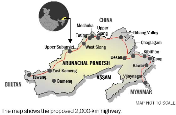

.png)
- Pages using the JsonConfig extension
- Articles needing additional references from May 2020
- Arunachal Pradesh
- Northeast India
- States and union territories of India
- Countries and territories where English is an official language
- Sino-Indian border dispute
- Tibet
- States and territories established in 1987
- 1987 establishments in India