Pasighat Airport
Pasighat Airport | |||||||||||
|---|---|---|---|---|---|---|---|---|---|---|---|
| Summary | |||||||||||
| Airport type | Public | ||||||||||
| Operator | Airports Authority of India | ||||||||||
| Location | Pasighat | ||||||||||
| Elevation AMSL | 157 m / 514 ft | ||||||||||
| Coordinates | 28°04′06.5″N 095°20′04.3″E / 28.068472°N 95.334528°ECoordinates: 28°04′06.5″N 095°20′04.3″E / 28.068472°N 95.334528°E | ||||||||||
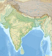
| Map | |||||||||||
| Runways | |||||||||||
| |||||||||||
Pasighat Airport (IATA: IXT, ICAO: VEPG) is located at Pasighat in the state of Arunachal Pradesh, India.
History[edit]
The airstrip was laid down during the Sino-Indian War of 1962 and saw little use after the war until the Indian Air Force signed a Memorandum of Understanding (MoU) with the Government of Arunachal Pradesh to develop the airstrip in 2009. The IAF took over the airstrip in February 2010. An Air Traffic Control Tower, apron for parking aircraft, a perimeter road and security wall was constructed. The upgraded airstrip was inaugurated by Kiren Rijiju in August 2016 and a Sukhoi Su-30 fighter of the Indian Air Force landed on the airstrip as part of the inaugural function.[1]
Current status[edit]
- The Airports Authority of India (AAI) operates a civil enclave at Pasighat. A new passenger terminal was built in 2017.[2] A helicopter service on behalf of the Arunachal Pradesh government is operated by Pawan Hans between Pasighat and various regional stations.[3]
- In April 2018, an Air India Regional ATR-42 aircraft carried out a test landing at the Pasighat ALG, in preparation for scheduled commercial services.[4] The commercial flights commenced on May 21, 2018 when Alliance Air (India)'s 42-seater ATR aircraft from Guwahati landed at the airport with Chief Minister Pema Khandu and Deputy Chief Minister Chowna Mein.[5] The connectivity comes under the Government's Regional Connectivity Scheme called UDAN.[6]
Airlines and destinations[edit]
| Airlines | Destinations |
|---|---|
| Alliance Air | Tezpur[7] |
See also[edit]
References[edit]
- ↑ "Sukhoi fighter aircraft makes touch down at Pasighat ALG in Arunachal Pradesh". The Economic Times. Retrieved 9 September 2016.
- ↑ "Pasighat ALG operational soon - Officials inspect site". The Telegraph. 24 August 2017. Retrieved 25 April 2018.
- ↑ "Arunachal Pradesh helicopter non-schedule flight service". Government of Arunachal Pradesh. Archived from the original on 4 March 2016. Retrieved 10 January 2016.
- ↑ "Alliance Air carries out test flight to Pasighat in Arunachal". Business Standard India. Press Trust of India. 23 April 2018. Retrieved 25 April 2018.
- ↑ May 22, TNN | Updated; 2018; Ist, 15:30. "Arunachal's first commercial flight lands at Pasighat airport | Itanagar News - Times of India". The Times of India. Retrieved 1 August 2019.
{{cite web}}: CS1 maint: numeric names: authors list (link) - ↑ "Arunachal Pradesh finally gets connected with Guwahati by a commercial flight". The Economic Times. 21 May 2018. Retrieved 29 July 2019.
- ↑ "Air India and Alliance Air schedule list". airindia.in. Retrieved 8 November 2018.
External links[edit]

