










No edit summary |
added info |
||
| Line 1: | Line 1: | ||
{{Short description|State in northeastern India}} | {{Short description|State in northeastern India}} | ||
{{about|the modern day state of India|the eponymous kingdom mentioned in the epic Mahabharata| | {{about|the modern day state of India|the eponymous kingdom mentioned in the epic Mahabharata|Manipura (Mahabharata)|other uses|Manipur (disambiguation)}} | ||
{{Redirect|Jewel of India|the highest civilian award of the Republic of India|Bharat Ratna}} | |||
{{pp-vandalism|small=yes}} | |||
{{Use Indian English|date=June 2016}} | {{Use Indian English|date=June 2016}} | ||
{{Use dmy dates|date=January | {{Use dmy dates|date=January 2025}} | ||
{{Infobox Indian state or territory | {{Infobox Indian state or territory | ||
| name = Manipur | | name = Manipur | ||
| official_name = | | official_name = | ||
| type = State | | type = State | ||
| image_seal = | | image_seal = Kanglasa.svg | ||
| image_skyline = {{Multiple image | | image_skyline = {{Multiple image | ||
| border = infobox | |||
| perrow = 2 | | perrow = 2 | ||
| total_width = 300 | | total_width = 300 | ||
| image1 = ꯅꯣꯡꯃꯥꯏꯆꯤꯡ ꯆꯤꯡꯒꯤ ꯂꯥꯏꯅꯤꯡꯊꯧ ꯁꯅꯥꯃꯍꯤ ꯂꯥꯏꯁꯪ (ꯁꯅꯥꯃꯍꯤ ꯀꯤꯌꯣꯡ)ꯒꯤ ꯑꯋꯥꯡ ꯅꯣꯡꯆꯨꯞ ꯊꯪꯕ ꯃꯥꯏꯀꯩꯗꯒꯤ ꯀꯥꯞꯄ ꯃꯃꯤ.jpg | | image1 = ꯅꯣꯡꯃꯥꯏꯆꯤꯡ ꯆꯤꯡꯒꯤ ꯂꯥꯏꯅꯤꯡꯊꯧ ꯁꯅꯥꯃꯍꯤ ꯂꯥꯏꯁꯪ (ꯁꯅꯥꯃꯍꯤ ꯀꯤꯌꯣꯡ)ꯒꯤ ꯑꯋꯥꯡ ꯅꯣꯡꯆꯨꯞ ꯊꯪꯕ ꯃꯥꯏꯀꯩꯗꯒꯤ ꯀꯥꯞꯄ ꯃꯃꯤ.jpg | ||
| image2 = | | image2 = Breathtaking beauty of Dzukou Valley in Manipur-Nagaland border (edit).jpg | ||
| image3 = | | image3 = Marjing Polo Statue — World's tallest statue of a polo player — Classical monumental Meitei equestrian sculpture — G20 summit — Cultural heritage of Meitei civilization — Cradle of "modern polo".jpg | ||
| image4 = Uttra Sanglen.JPG | | image4 = Uttra Sanglen.JPG | ||
| image5 = Rasa Lila in Manipuri dance style.jpg | | image5 = Rasa Lila in Manipuri dance style.jpg | ||
| image6 = Loktak Lake Boat people Moirang Manipur India.jpg | | image6 = Loktak Lake Boat people Moirang Manipur India.jpg | ||
| image7 = Temple of God Pakhangba of Sanamahi religion inside the Kangla Fort, Imphal West, Manipur.jpg | | image7 = Temple of God Pakhangba of Sanamahi religion inside the Kangla Fort, Imphal West, Manipur.jpg | ||
}} | }} | ||
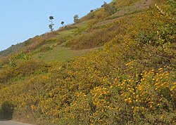
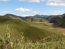
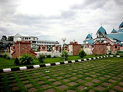
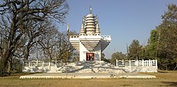
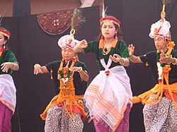
| image_caption = Clockwise from top: the [[Sanamahi Kiyong]] in the [[Nongmaiching Ching]] mountain, | | image_caption = Clockwise from top: the [[Sanamahi Kiyong]] in the [[Nongmaiching Ching]] mountain, [[Dzüko Valley]], the dual statues of the [[Kanglā shā]] dragons, the [[Loktak lake]], the [[Pakhangba Temple, Kangla|Temple of Pakhangba]] inside the [[Kangla Fort]], the [[Manipuri classical dance]], the [[Marjing Polo Statue]] | ||
| anthem ={{Langnf|mni|[[Sana Leibak Manipur]]|Manipur, Land of Gold|break=yes}}<ref>{{Cite web |url=https://thenortheastaffairs.com/sana-leibak-manipur-adopted-as-state-song-by-cabinet/ |title='Sana Leibak Manipur' adopted as State Song by Cabinet |date=12 August 2021 | | anthem = {{Langnf|mni|[[Sana Leibak Manipur|Sanā leibāk Manipur]]|Manipur, Land of Gold|break=yes}}<ref>{{Cite web |url=https://thenortheastaffairs.com/sana-leibak-manipur-adopted-as-state-song-by-cabinet/ |title='Sana Leibak Manipur' adopted as State Song by Cabinet |date=12 August 2021}}</ref> | ||
| image_map = IN-MN.svg | | image_map = IN-MN.svg | ||
| coordinates = {{Coord|24.81|N|93.94|E|display=inline.title}} | | coordinates = {{Coord|24.81|N|93.94|E|display=inline.title}} | ||
| region = Northeast India | | region = Northeast India | ||
| before_was = [[Manipur | | before_was = [[Manipur (kingdom)|Manipur State]] | ||
| formation_date = 15 October 1949<ref>{{Cite journal |last= | | formation_date = 15 October 1949<ref>{{Cite journal |last=Sinha |first=L. P. |title=The Politics and Government of Manipur |date=1987 |journal=The Indian Journal of Political Science |volume=48 |issue=4 |pages=487–493 |jstor=41855332 }}</ref> | ||
| formation_date1 = 1956 | | formation_date1 = 1 November 1956 | ||
| formation_date2 = 1972 | | formation_date2 = 21 January 1972 | ||
| capital = Imphal | | capital = Imphal | ||
| largestcity = capital | | largestcity = capital | ||
| districts = [[List of districts of Manipur|16]] | | districts = [[List of districts of Manipur|16]] | ||
| Governor = [[ | | Governor = [[Ajay Kumar Bhalla]] | ||
| Chief_Minister = [[ | | Chief_Minister = [[Yumnam Khemchand Singh|Y. Khemchand Singh]] | ||
| party = [[Bharatiya Janata Party|BJP]] | | party = [[Bharatiya Janata Party|BJP]] | ||
| Deputy_CM = [[Nemcha Kipgen]] ([[Bharatiya Janata Party|BJP]])<br>[[Losii Dikho]] ([[Naga People's Front|NPF]])<ref>{{cite web|url=https://www.ndtv.com/india-news/yumnam-khemchand-singh-sworn-in-as-manipur-chief-minister-after-presidents-rule-ends-10945800|title=Yumnam Khemchand Singh Sworn In As Manipur Chief Minister, Gets 2 Deputies|work=NDTV|accessdate=4 February 2026}}</ref> | |||
| judiciary = [[Manipur High Court]] | | judiciary = [[Manipur High Court]] | ||
| legislature_type = Unicameral | | legislature_type = Unicameral | ||
| assembly = [[Manipur Legislative Assembly]] | | assembly = [[Manipur Legislative Assembly]] | ||
| assembly_seats = 60 seats | | assembly_seats = 60 seats | ||
| rajya_sabha_seats = 1 seat | | rajya_sabha_seats = 1 seat | ||
| lok_sabha_seats = 2 seats | | lok_sabha_seats = 2 seats | ||
| area_total_km2 = 22327 | | area_total_km2 = 22327 | ||
| area_rank = 23rd | | area_rank = 23rd | ||
| population_footnotes = <ref name=" | | elevation_m = | ||
| elevation_max_m = 2,994 | |||
| elevation_max_point = [[Mount Tempü]] | |||
| elevation_min_m = 140 | |||
| elevation_min_point = [[Barak River]] | |||
| population_footnotes = <ref name="census2011Abstract">{{cite web |url=https://censusindia.gov.in/pca/DDW_PCA0000_2011_Indiastatedist.xlsx |title=Primary Census Abstract Data Tables (India & States/UTs - District Level) |publisher=Office of the Registrar General and Census Commissioner of India |access-date=8 April 2022 |archive-url=https://web.archive.org/web/20220408052329/https://censusindia.gov.in/pca/DDW_PCA0000_2011_Indiastatedist.xlsx |archive-date=8 April 2022 }}</ref><ref name="census2011.co.in">{{cite web |url=https://www.census2011.co.in/census/state/manipur.html |title=Manipur Population Sex Ratio in Manipur Literacy rate data |work=census2011.co.in |access-date=1 September 2015}}</ref> | |||
| population_total = 2,855,794 | | population_total = 2,855,794 | ||
| population_as_of = 2011 | | population_as_of = 2011 | ||
| Line 50: | Line 58: | ||
| population_rural = 69.79% | | population_rural = 69.79% | ||
| population_density = 130 | | population_density = 130 | ||
| 0fficial_Langs = [[Meitei language]] | | 0fficial_Langs = [[Meitei language|Meitei (Manipuri)]] | ||
| official_script = [[Meitei script]] | | official_script = [[Meitei script]] | ||
| GDP_total = {{INRConvert|0. | | GDP_total = {{INRConvert|0.527|lc|lk=r}} | ||
| GDP_year = | | GDP_year = 2024–25 | ||
| GDP_rank = 28th | | GDP_rank = 28th | ||
| GDP_per_capita = {{INRConvert| | | GDP_per_capita = {{INRConvert|125937|lk=r}} | ||
| GDP_per_capita_rank = 27th | | GDP_per_capita_rank = 27th | ||
| HDI = {{increase}} 0.683<ref>{{cite web |title=India: Subnational HDI |url=https://globaldatalab.org/shdi/table/shdi/IND/ |website=Global Data Labs |access-date=8 June 2025}}</ref> {{colour|orange|medium}} | |||
| HDI_year = 2022 | |||
| HDI = 0. | | HDI_rank = 17th | ||
| literacy = 92.0%<ref>{{Cite book |url=https://www.mospi.gov.in/sites/default/files/publication_reports/AnnualReport_PLFS2023-24L2.pdf |title=Annual Report, Periodic Labour Force Survey (PLFS) (July 2023 – June 2024) |date=23 September 2024 |publisher=National Sample Survey Office, Ministry of Statistics and Programme Implementation, Government of India |pages=A-10 |chapter=Appendix-A: Detailed tables, Table (7): Literacy rate (in per cent) of persons of different age groups for each State/UT (persons, age-group (years): 7 & above, rural+urban (column 6))}}</ref> | |||
| literacy_year = 2024 | |||
| literacy_rank = 10th | |||
| literacy_year = | |||
| literacy_rank = | |||
| sex_ratio = 985[[female|♀]]/1000 [[male|♂]] | | sex_ratio = 985[[female|♀]]/1000 [[male|♂]] | ||
| sexratio_year = 2011 | | sexratio_year = 2011 | ||
| Line 74: | Line 80: | ||
| tree = [[File:Phoebe hainesiana north Bengal AJTJ.JPG|50px|left]] {{langnf|mni|Uningthou|italic=no|''[[Phoebe hainesiana]]''|break=yes}} | | tree = [[File:Phoebe hainesiana north Bengal AJTJ.JPG|50px|left]] {{langnf|mni|Uningthou|italic=no|''[[Phoebe hainesiana]]''|break=yes}} | ||
| flower = [[File:Lilium mackliniae.jpg|50px|left]] [[Shirui lily]] (''Lilium mackliniae'') | | flower = [[File:Lilium mackliniae.jpg|50px|left]] [[Shirui lily]] (''Lilium mackliniae'') | ||
| fish = [[File:Rohtee belangeri Achilles 147.jpg|50px|left]] {{langnf|mni|Pengba|italic=no|''[[Osteobrama belangeri]]''|break=yes}}<ref>{{cite web |title=State Fishes of India |url=http://nfdb.gov.in/PDF/Fish%20&%20Fisheries%20of%20India/2.State%20Fishes%20of%20India.pdf |publisher=National Fisheries Development Board, Government of India |access-date=25 December 2020 | | fish = [[File:Rohtee belangeri Achilles 147.jpg|50px|left]] {{langnf|mni|Pengba|italic=no|''[[Osteobrama belangeri]]''|break=yes}}<ref>{{cite web |title=State Fishes of India |url=http://nfdb.gov.in/PDF/Fish%20&%20Fisheries%20of%20India/2.State%20Fishes%20of%20India.pdf |publisher=National Fisheries Development Board, Government of India |access-date=25 December 2020}}</ref> | ||
}} | }} | ||
{{Contains special characters|Meitei}} | {{Contains special characters|Meitei}} | ||
'''Manipur''' ({{IPAc-en|ˌ|m|æ|n|ɪ|ˈ|p|ʊər}}, {{ipa|hi|məɳiˈpʊɾ|ipa}})<ref>{{Cite dictionary |url=http://www.lexico.com/definition/Manipur |archive-url=https://web.archive.org/web/20210516231153/https://www.lexico.com/definition/Manipur |archive-date=16 May 2021 |title=Manipur |dictionary=[[Lexico]] UK English Dictionary |publisher=[[Oxford University Press]]}}</ref> is a [[States and union territories of India|state]] in [[northeast India|northeastern India]], with [[Imphal]] as its capital city. It borders the Indian states of [[Assam]] to the west, [[Mizoram]] to the south, and [[Nagaland]] to the north and shares the [[India–Myanmar border|international border]] with [[Myanmar]], specifically the [[Sagaing Region]] to the east and [[Chin State]] to the southeast. Covering an area of 22,330 square kilometers (8,621 mi²), the state consists mostly of hilly terrain with the 1813-square-kilometre (700 mi²) [[Imphal Valley]] inhabited by the [[Meitei people|Meitei (Manipuri) community]], historically a [[Manipur (princely state)|kingdom]]. Surrounding hills are home to [[Naga people|Naga]] and [[Kuki people|Kuki-Zo]] communities, who speak [[Tibeto-Burman languages]].<ref> | |||
{{citation |first=Ramachandra |last=Guha |author-link=Ramachandra Guha |title=India after Gandhi: The History of the World's Largest Democracy |publisher=Pan Macmillian |year=2017 |isbn=978-1-5098-8328-8 |url=https://books.google.com/books?id=AW4sDwAAQBAJ&pg=PR10 |page=x}} | |||
</ref><ref> | |||
{{citation |last=Choudhury |first=Sanghamitra |title=Women and Conflict in India |url=https://books.google.com/books?id=72yFCwAAQBAJ&pg=PA35 |year=2016 |publisher=Routledge |isbn=978-1-317-55362-5 |page=35}} | |||
</ref> The official language and [[lingua franca]], [[Meitei language|Meitei]] (Manipuri), also belongs to the Tibeto-Burman family.<ref>{{Cite encyclopedia |entry=Manipuri language |encyclopedia=Britannica |entry-url=https://www.britannica.com/topic/Manipuri-language |access-date=2022-07-09 }}</ref> | |||
During the days of the [[British Raj]], Manipur was one of the [[princely state]]s.<ref>Naorem Sanajaoba (Editor), ''Manipur, Past and Present: The Heritage and Ordeals of a Civilization'', Volume 4, Chapter 2: NT Singh, {{ISBN|978-8170998532}}</ref> Prior to the British departure in 1947, Manipur acceded to the [[Dominion of India]], along with roughly 550 other princely states.<ref name="Furber"/> In September 1949, the ruler of Manipur signed a merger agreement with India, giving up his kingdom and obtaining a [[Privy purse in India|privy purse]] in return.{{sfnp|Choudhury, Northeast India: A Political History|2023|pp=136–137}} Many Meitei people feel that their self-determination was violated by the agreement since the legislature elected under the [[Manipur State Constitution Act 1947|constitution]] was not consulted.<ref name="HRW"/> Ethnic and separatist concerns have resulted in a long-running [[Insurgency in Manipur|insurgency against Indian rule]].<ref name="HRW"/> From 2009 through 2018, the conflict was responsible for the violent deaths of over 1000 people.<ref name=satp9413/> | |||
Manipur | The Meitei people represent around 53% of the population of Manipur state, followed by various Naga tribes at 20% and Kuki-Zo tribes at 16%.<ref name="censusindia.gov.in"> | ||
{{Cite web |title=Census of India Website: Office of the Registrar General & Census Commissioner, India |url=http://www.censusindia.gov.in/2011census/PCA/ST.html }} | |||
</ref> Manipur's ethnic groups practice a variety of religions.<ref name="census2011"> | |||
{{cite web |title=Population by religion community - 2011 |url=http://www.censusindia.gov.in/2011census/C-01/DDW00C-01%20MDDS.XLS |website=Census of India, 2011 |publisher=The Registrar General & Census Commissioner, India |archive-url=https://web.archive.org/web/20150825155850/http://www.censusindia.gov.in/2011census/C-01/DDW00C-01%20MDDS.XLS |archive-date=25 August 2015}} | |||
</ref> According to 2011 census, [[Hinduism]] and [[Christianity]] are the major religions of the state.<ref name="census2011"/> | |||
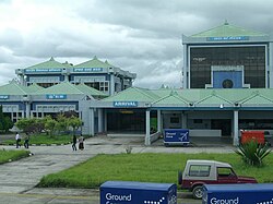
Manipur has primarily an agrarian economy, with significant hydroelectric power generation potential. It is connected to other areas by daily flights through [[Imphal Airport]], the second largest in northeastern India.<ref name=manipuraai/> Manipur is home to many sports and the origin of [[Manipuri dance]],{{sfn|Reginald Massey|2004|pp=177–184}} and is credited with introducing [[polo]] to Europeans.<ref name="nam.ac.uk"/> | |||
==Name== | |||
The name Manipur ({{langx|sa|मणिपुर|maṇipura|'city of jewels'}}) was chosen by [[Gharib Nawaz (Manipur)|Gharib Nawaz]] in the eighteenth century. It is named after [[Manipura (Mahabharata)|a kingdom of the same name]] mentioned in the {{transliteration|sa|[[Mahabharata]]}} Hindu epic. Previously, it had been known as Kangleipak {{Meitei|ꯀꯪꯂꯩꯄꯛ|la=Kangleipak}}<ref name="Sanajaoba_pa89"> | |||
{{Cite book |last=Sanajaoba |first=Naorem |url=https://books.google.com/books?id=-CzSQKVmveUC&dq=kangleipak&pg=PA89 |title=Manipur, Past and Present: The Heritage and Ordeals of a Civilization |date=1988 |publisher=Mittal Publications |isbn=978-81-7099-853-2 |page=89}} | |||
</ref><ref> | |||
{{Cite book |last1=Noni |first1=Arambam |last2=Sanatomba |first2=Kangujam |url=https://books.google.com/books?id=OzjbCgAAQBAJ |title=Colonialism and Resistance: Society and State in Manipur |date=2015-10-16 |publisher=Routledge |isbn=978-1-317-27066-9 |page=234 }} | |||
</ref> or Meiteileipak ({{Meitei|ꯃꯩꯇꯩꯂꯩꯕꯥꯛ|la=Meiteileipak|t=land of the Meiteis|labels=none|p=no}}).<ref name="Sanajaoba1988"> | |||
{{cite book |author=Naorem Sanajaoba |title=Manipur, Past and Present: The Heritage and Ordeals of a Civilization |url=https://books.google.com/books?id=-CzSQKVmveUC |year=1988 |publisher=Mittal Publications |isbn=978-81-7099-853-2 |pages=31–32}} | |||
</ref> Later, the work ''Dharani Samhita'' (1825–34) popularised the [[Sanskritisation|Sanskrit legends]] of the origin of Manipur's name.<ref> | |||
Gangmumei Kabui, ''History of Manipur'', National Publishing House, Delhi, 1991.</ref> | |||
Other names include Sanaleibak {{Meitei|ꯁꯅꯥꯂꯩꯕꯥꯛ|t=the land of gold|t2=golden land}}, not given because Manipur has a lot of the gold mines, but because of its happiness and prosperity.<ref> | |||
{| | {{Cite web |title=Sana Leibak Manipur By Free Thinker |url=https://www.e-pao.net/epSubPageExtractor.asp?src=leisure.EI.Sana_Leibak_Manipur_By_Free_Thinker#:~:text=Nehru%20called%20us%20the%20Jewel,land%20of%20gold. |access-date=2023-10-09 |website=}} | ||
|- | </ref> This name was mentioned in the 11th-12th century constitution, the [[Loiyumba Shinyen]].{{ref|Sanajaoba1988"|10}} and is still heard in the official song of Manipur, "[[Sana Leibak Manipur]]". | ||
|- | |||
| | |||
| | |||
==History== | ==History== | ||
{{main|History of Manipur|Manipur | {{main|History of Manipur|Manipur (princely state)}} | ||
=== Antiquity === | |||
{{Main| | ===Antiquity=== | ||
{{Main|Kangleipak}} | |||
[[File:Stamp of India - 2014 - Colnect 510569 - Sagol Kangjei.jpeg|thumb|300px|A match of {{langnf|mni|[[Sagol Kangjei]]|[[Polo]]}} depicted in a stamp of the [[Republic of India]]]] | [[File:Stamp of India - 2014 - Colnect 510569 - Sagol Kangjei.jpeg|thumb|300px|A match of {{langnf|mni|[[Sagol Kangjei]]|[[Polo]]}} depicted in a stamp of the [[Republic of India]]]] | ||
The history of Manipur | The history of Manipur Meiteis is chronicled in [[Puya (Meitei texts)|Puyas]] or Puwaris (stories about the forefathers), namely, the Ninghthou Kangbalon, Cheitharol Kumbaba, Ningthourol Lambuba, Poireiton Khunthokpa, Panthoibi Khongkul, and so forth in the [[Meitei script]], which is comparable to the [[Thai script]]. The historical accounts presented here were recordings from the eyes and the judgment of Meitei kings and {{Interlanguage link|Maichou|simple}} (Meitei scholars). | ||
====The Kingdoms of Möng Kawng and Möng Mao==== | |||
According to the Tai chronicles, Manipur (Kahse) is one of the territories conquered by Sam Lông Hpa (1150–1201), the first [[Chao Pha]] of [[Möng Kawng State|Möng Kawng]].<ref>{{harvcol|Gogoi|1956|p=133}}</ref> A 14th-century inscription from [[Bagan|Pagan]], [[Myanmar]], mentions Kasan (Manipur) as one of the 21 states under the [[Möng Mao|Mong Mao]] ruler Thonganbwa (1413–1445/6); he later was captured by the Governor of [[Taungdwingyi]].<ref>{{harvcol|Luce|Htway|1976|p=214}}</ref> | |||
===Medieval=== | ===Medieval=== | ||
====Vassal State of the Toungoo empire==== | |||
[[Bayinnaung]], the ruler of [[First Toungoo Empire|Toungoo dynasty]] ordered the invasion of Manipur in 1559. He had recalled [[Binnya Dala (minister-general)|Binnya Dala]] from [[Chiang Mai]] to lead the invasion. The three armies mostly made up of army from [[Kalay|Kale]], [[Möng Yang State|Mohnyin]], [[Möng Kawng State|Mogaung]], [[Möng Mit State|Momeik]] and [[Sanda (state)|Sanda]] led the invasion, the King of Manipur surrendered without any resistance and Manipur became a [[vassal state]] of the | |||
[[First Toungoo Empire|Toungoo empire]].<ref name=vbl-154-155>Lieberman 2003: 154–155</ref> | |||
=== | [[File:Map of Taungoo Empire (1580).png|thumb|right|Toungoo empire in 1580]] | ||
====Vassal state of Konbaung dynasty==== | |||
In the 18th century, [[Bodawpaya]], the king of Burma acquired the Manipur (1814) along with the western kingdoms of [[Kingdom of Mrauk U|Arakan]] (1784), [[Upper Assam|Assam]] (1817). | |||
By the medieval period, marriage alliances between the royal families of Manipur, [[Ahom kingdom]] and [[Myanmar|Burma]] had become common.<ref name="Sanajaoba1988p3">{{cite book |url=http://themanipurpage.tripod.com/history/puwarimeitei.html |title=A Brief History (Puwari) of the Meiteis of Manipur |access-date=15 November 2009 }}</ref> Medieval era manuscripts discovered in the 20th century, particularly the ''Puya'', provide evidence that Hindus from the Indian subcontinent had married Manipur royalty by at least the 14th century. In centuries thereafter, royal spouses came also from what is now Assam, [[Bengal]], and [[Uttar Pradesh]] and from other [[South Indian]] kingdoms as well.<ref name="Sanajaoba1988p13"> | |||
{{cite book |author=Naorem Sanajaoba |title=Manipur, Past and Present: The Heritage and Ordeals of a Civilization |url=https://books.google.com/books?id=-CzSQKVmveUC |year=1988 |publisher=Mittal Publications |isbn=978-81-7099-853-2 |pages=12–14}} | |||
</ref> Another manuscript suggests that Muslims arrived in Manipur in the 17th century, from what is now [[Bangladesh]], during the reign of Meidingu [[Khagemba]].<ref name="Sanajaoba1988p13"/> The socio-political turmoil and wars, particularly the persistent and devastating [[Anglo-Burmese wars]], affected the cultural and religious demography of Manipur.<ref name="Sanajaoba1988p15"> | |||
{{cite book |author=Naorem Sanajaoba |title=Manipur, Past and Present: The Heritage and Ordeals of a Civilization |url=https://books.google.com/books?id=-CzSQKVmveUC |year=1988 |publisher=Mittal Publications |isbn=978-81-7099-853-2 |pages=15–18}} | |||
</ref> | |||
===British colonial period=== | |||
{{Main|Manipur (princely state)}} | {{Main|Manipur (princely state)}} | ||
=== | In 1824, the ruler of Manipur entered into a [[subsidiary alliance]] with the British Empire in the Indian subcontinent, which became responsible for Manipur's external defence. The British recognised that the state remained internally self-governing, as a [[princely state]].<ref> | ||
{{ | {{cite book |author=N. Lokendra |title=The Unquiet Valley: Society, Economy, and Politics of Manipur (1891-1950) |year=1998 |publisher=Mittal Publications |isbn=978-81-7099-696-5 |pages=36–38 |url=https://books.google.com/books?id=6FXEEd2muZoC}} | ||
After the war, [[British | </ref> During [[World War II]], Manipur was the scene of many fierce battles between Japanese invaders and British Indian forces. The [[Empire of Japan|Japanese]] were beaten back before they could enter [[Battle of Imphal|Imphal]], which was one of the turning points of the overall war in South Asia.<ref> | ||
{{Cite book |last=Katoch |first=Hemant Singh |title=The Battlefields of Imphal: The Second World War and North East India |date=2016-03-02 |publisher=Routledge |isbn=978-1-317-27402-5 |url=https://books.google.com/books?id=91OpCwAAQBAJ&dq=battle+of+Imphal&pg=PP1}} | |||
</ref> The [[Battle of Imphal]], known to the Manipuris as ''Japan Laan'', are among the lesser-known battles of the Second World War. Yet the Allied Victory in this battle was a turning point against the Japanese in East Asia.<ref> | |||
{{Cite web |title=10 Photos of the Battles of Imphal and Kohima |url=https://www.iwm.org.uk/history/10-photos-of-the-battles-of-imphal-and-kohima |access-date=2023-08-11 |website=Imperial War Museums }} | |||
</ref><ref> | |||
{{cite book |last1=Strahorn |first1=Eric A. |title=The Routledge History of the Second World War |chapter=South Asia in World War II |date=2021 |pages=428–444 |doi=10.4324/9780429455353-34 |isbn=978-0-429-45535-3 }} | |||
</ref><ref> | |||
{{Cite book |last=Thompson |first=Bruce G. |url=http://hdl.handle.net/1880/21888 |title=The Role of intelligence at the Battle of Imphal-Kohima, March - July 1944 |date=1989 |publisher=Thesis (M.A.)--University of Calgary |hdl=1880/21888 |isbn=978-0-315-61764-3 }} | |||
</ref> | |||
===Post-colonial history=== | |||
After the war, the Maharaja took the advice of the [[1946 Cabinet Mission to India|British Cabinet Mission]] and the [[Chamber of Princes]] to introduce democratic reforms in the state.{{refn|{{sfnp|Sudhirkumar Singh, Socio-religious and Political Movements |2011|pp=116, 118}}<ref name="Ibochou Singh"> | |||
{{Cite thesis |last=Ibochou Singh |first=Khwairakpam |title=British administration in Manipur 1891–1947 |date=1985 |publisher=Guwahati University/Shodhganga |hdl-access=free |pages=224–225 |hdl=10603/66697}} | |||
</ref><ref> | |||
{{Cite thesis |last=Thoiba Singh |first=Wakambam |title=Meetei Polity – A study of the socio-economic and political changes among the Meeteis from 1750 to 1950 |date=1984 |publisher=Guwahati University/Shodhganga |hdl=10603/69732 |hdl-access=free |at=p. 233 (Chapter 5) |quote=The Governor of Assam having conveyed the message of the Cabinet Mission to the Maharaja of Manipur, the latter announced the appointment of a constitution making committee to draft the future constitution of Manipur.}} | |||
</ref><ref> | |||
{{citation |last=Manimohan Singh |first=Karam |chapter=Constitutional Reforms in Manipur and Its Impact on the Christians |title=History of Christian Missions in Manipur |publisher=Mittal PUblications |year=1991 |pages=415–416 |chapter-url=https://archive.org/details/historyofchristi0000sing/page/415/mode/2up |via=archive.org}} | |||
</ref><ref> | |||
{{citation |last=Indrakumar |first=Konthoujam |chapter=Colonialism and Movement for Democracy in Manipur |editor1=Arambam Noni |editor2=Kangujam Sanatomba |title=Colonialism and Resistance: Society and State in Manipur |year=2015 |publisher=Routledge |location=Abingdon |isbn=978-1-003-04589-2 |pages=61–69 |doi=10.4324/9781315638317 |chapter-url=https://books.google.com/books?id=OzjbCgAAQBAJ&pg=PA61 |ref={{sfnref|Indrakumar, Colonialism and Movement for Democracy|2015}} }} | |||
</ref>}} | |||
The [[Manipur State Constitution Act 1947|Manipur State Constitution Act of 1947]] was promulgated in July 1947 to give the state an elected legislative assembly and an appointed prime minister.{{sfnp|Sudhirkumar Singh, Socio-religious and Political Movements |2011|pp=130–131}}{{sfnp|Tarapot, Bleeding Manipur|2003|p=172}} | |||
Elections to the assembly were held only in the following year.<ref> | |||
{{citation |last=Choudhury |first=Sanghamitra |title=Women and Conflict in India |url=https://books.google.com/books?id=72yFCwAAQBAJ&pg=PA35 |year=2016 |publisher=Routledge |isbn=978-1-317-55362-5 |pages=35–36 |quote=The elections were held and the new government was formed in Manipur, but it was not responsible to the legislature; Instead, it was only responsive to the legislature, which was a technicality devised by the constitutional experts of Maharaja.}} | |||
</ref> | |||
Following the decision to [[Partition of India|partition]] [[British India]], all the princely states were advised to "accede" to one of the new dominions. The Maharaja [[Instrument of Accession|acceded]] to India on 11 August 1947 and signed a [[standstill agreement (India)|standstill agreement]] to continue all the pre-existing arrangements it had with British India.<ref name="Furber"> | |||
{{harvp|Furber, The Unification of India|1951|loc=p. 357: "... in July and August 1947 all of the princely states within the geographical orbit of India as distinct from that of Pakistan (except Hyderabad, Kashmir and Junagadh) "acceded" to India in accordance with the procedure laid down in the [Government of] India Act of 1935 as adapted and amended by the Government of the new Dominion of India. The important states "acceded" only with respect to defence, external affairs and communications as defined in List I of Schedule VII of the [Government of] India Act of 1935."}} | |||
</ref><ref> | |||
{{citation |title=Why Pre-Merger Political Status for Manipur: Under the Framework of the Instrument of Accession, 1947 |url=https://books.google.com/books?id=oKZoDwAAQBAJ&pg=PA26 |year=2018 |publisher=Research and Media Cell, CIRCA |id=GGKEY:8XLWSW77KUZ |page=26 |ref={{sfnref|CIRCA, Why Pre-Merger Political Status for Manipur|2018}} |quote=Before the controversial merger, both Manipur and India were bound by the Instrument of Accession (IOA) which the King of Manipur signed on 11 August 1947. The IOA was accepted by the Governor General of India Lord Mountbatten on 16 August 1947 vide Home Department, Government of India file no A-1/1/1947. Subsequently, the Manipur State Council approved the IOA in its meeting held on 22 August 1947 Vide Memo No. 383 PTI Reference Council Minutes Part I of 11-8-1947. The execution of the Instrument of Accession was published in the Manipur State Gazette on 27 August 1947.}} | |||
</ref><ref> | |||
{{harvp|Sudhirkumar Singh, Socio-religious and Political Movements|2011|loc=chapter 6, p. 139: "The Dominion of India once again successfully convinced the Maharaja of Manipur to sign the Instrument of Accession along with the Governor General of India on 11 August 1947 on the promise of protecting the internal authority, autonomy and welfare of the state."}} | |||
</ref>{{sfnp|Sanatomba, Interrogation into the political status of Manipur |2015|p=169}} | |||
Some Meitei people argue that the king was in no legal position to sign the instrument of accession at the time.<ref> | |||
{{harvp|Sanatomba, Interrogation into the political status of Manipur|2015|loc=pp. 172–193: "Furthermore, Section 9(b) of the Manipur State Constitution Act, 1947, would certainly dispel any doubt about the titular status of the Maharaja, which was expressedly stated thus: 'The Maharaja means His Highness, the Maharaja of Manipur, the constitutional head of the state.' The Maharaja in his capacity as the constitutional ruler could not execute the Instrument without proper authorisation and constitutional endorsement. This was simply on account of the fact that he was not a sovereign ruler and that Manipur was not a sovereign state then. Therefore, the act of signing the Instrument of Accession on 11 August 1947 by the Maharaja could not be considered an Act of the State. Hence, the Instrument was deemed null and void right from the moment it was executed... For example, the Indian Dominion had never existed on or before 11 August 1947. Being so, it can be aptly said that the Maharaja acceded to a political non-entity. Therefore, it can be claimed that the Instrument was never executed in actuality. It was simply pre-judicial to execute the Instrument between two political entities which were yet to be born."}} | |||
</ref><ref> | |||
{{Cite news |last=Khomdom |first=Lisam |date=5 July 2018 |title=Manipur State Constitution Act-1947 A Cure for all myriads of ailments in Manipur ?|url=https://e-pao.net/epSubPageExtractor.asp?src=education.Human_Rights_Legal.Manipur_State_Constitution_Act_1947_Part_3_By_Khomdon_Lisam |work=E- Pao}} | |||
</ref> | |||
Over the next two years, the multitude of princely states of India were extensively reorganised as India moved towards becoming a [[Constitution of India|constitutional republic]]. Proposals for reorganisation were also made for Manipur but discarded as being unsuitable.{{sfnp|Tarapot, Bleeding Manipur|2003|p=173}}{{sfnp|Parratt, Wounded Land|2005|pp=103–104}} Eventually Manipur was turned into a centrally administered province (called a 'Part C' state, later renamed [[union territory (India)|union territory]]) by asking the Maharaja to sign a merger agreement.<ref> | |||
{{harvp|Furber, The Unification of India|1951|loc=pp. 366–367: 'Finally we must note the process whereby certain other princely states have become "centrally administered areas" with a constitutional status analogous to that of the former "Chief Commissioners' Provinces". This was done by having the rulers execute merger agreements in almost precisely the same terms as those executed by rulers whose states were merged in provinces... The princely states which have thus become "centrally administered areas" at the dates below specified are: ... (6) Manipur, September 1949;... Himachal Pradesh, Kutch, Tripura, and Manipur are all on the international borders of India. For Tripura and Manipur, direct administration from New Delhi was desirable for strategic reasons;...'}} | |||
</ref><ref> | |||
{{citation |last=Rustomji |first=Nari |title=Enchanted Frontiers |publisher=Oxford University Press |year=1971 |url=https://archive.org/details/enchantedfrontie0000rust |via=archive.org |page=109}} | {{citation |last=Rustomji |first=Nari |title=Enchanted Frontiers |publisher=Oxford University Press |year=1971 |url=https://archive.org/details/enchantedfrontie0000rust |via=archive.org |page=109}} | ||
</ref> He is believed to have signed | </ref> He is believed to have signed it under duress.<ref>{{Cite web |author=Pradip Phanjoubam |title=Why it matters how Manipur became a state |url=https://www.telegraphindia.com/opinion/why-it-matters-how-manipur-became-a-state-of-india/cid/1684958 |website=www.telegraphindia.com}}</ref> | ||
{{cite | Later, on 21 September 1949, he signed a Merger Agreement, disputed as having been done without consultation of the popular ministry under [[Manipur State Constitution Act 1947]] and denial of the king's request to return to Manipur to discuss the same with his people.<ref> | ||
</ref> | {{harvp|Sanatomba, Interrogation into the political status of Manipur |2015|loc=p. 210: "The Maharaja refused to sign the Merger Agreement without consulting his Council of Ministers and conveyed his desire to return to Manipur to obtain the approval of the people. Rejecting such a reasonable proposal, Nari Rustomji, Advisor to the Governor of Assam, suggested that the Maharaja might as well finalise the merger issue during that current visit only.. (Singh 1988: 106)"}} | ||
{{ | </ref><ref> | ||
{{Cite journal |last=Akoijam |first=A. Bimol |date=2001 |title=How History Repeats Itself |journal=Economic and Political Weekly |volume=36 |issue=30 |pages=2807–2812 |jstor=4410908 |quote= When maharaja Bodhchandra resisted the move to merge Manipur with the Indian union saying that he was only a constitutional monarch and he needed to consult his elected members of the state assembly, the representatives of the union government informed him that the GoI did not recognise the assembly }} | |||
{{Cite web |url=http://indiacode.nic.in/acts-in-pdf/392012.pdf |title=Indiacode - Acts |access-date=26 March 2014 | </ref><ref> | ||
{{Cite book |last=Phanjoubam |first=Pradip |url=https://books.google.com/books?id=OxStCwAAQBAJ&dq=manipur+merger+agreement+controversy&pg=PA205 |title=The Northeast Question: Conflicts and frontiers |date=2015-12-14 |publisher=Routledge |pages=204–207|quote=after six days of 'per-suasion', made to sign the Merger Agreement, thereby formally merging Manipur with the Union of India. Repeated pleas by the king that it was his desire to ultimately sign the agreement, but he be first allowed to go home and consult his assembly was turned down...|isbn=978-1-317-34004-1 }} | |||
</ref><ref> | |||
{{Cite news |last=Adrija |first=Roychowdhury |date=26 August 2023 |title=How Manipur merged with India: From a constitutional monarchy to Part C state |url=https://indianexpress.com/article/research/how-manipur-merged-with-india-from-a-constitutional-monarchy-to-part-c-state-8888978/ |work=The Indian Express}} | |||
</ref> | |||
Under 'duress' and 'coercion' [[Bodhchandra Singh|Bodhachandra Singh]] signed the merger agreement merging the kingdom into India, which led to its becoming a [[Part C State]].<ref> | |||
U. B. Singh, ''India Fiscal Federalism in Indian Union'' (2003), p. 135 | |||
</ref><ref> | |||
{{cite book |author1=K.R. Dikshit |author2=Jutta K Dikshit |title=North-East India: Land, People and Economy |url=https://books.google.com/books?id=iorHBAAAQBAJ |year=2013 |publisher=Springer Science |isbn=978-94-007-7055-3 |page=56}} | |||
</ref><ref> | |||
{{cite book |author1=Kalpana Kannabiran |author2=Ranbir Singh |title=Challenging The Rules(s) of Law |url=https://books.google.com/books?id=yreGAwAAQBAJ |year=2008 |publisher=SAGE Publications |isbn=978-81-321-0027-0 |page=264}} | |||
</ref> | |||
The legislative assembly was dissolved and a centrally appointed Chief Commissioner handled the state's administration, as per the Constitution of India. An advisory council with nominated members was provided to advise the Chief Commissioner.<ref name=Sinha> | |||
{{citation |first=L. P. |last=Sinha |title=The Politics and Government of Manipur |journal=The Indian Journal of Political Science |date=1987 |volume=48 |number=4 |jstor=41855332 |page=488}} | |||
</ref> In 1956, the advisory council was replaced by a territorial council with mostly elected members.<ref name=Sinha/>{{sfnp|Kumar, Union Territories|1991|pp=44–45}} In 1963, Manipur was provided a legislative assembly, with a council of ministers headed by a chief minister.<ref name=Sinha/>{{sfnp|Kumar, Union Territories|1991|pp=49–53}} | |||
It was made a fully-fledged state in 1972 by the [[North-Eastern Areas (Reorganisation) Act, 1971]].<ref name=Sinha/><ref> | |||
{{Cite web |url=http://indiacode.nic.in/acts-in-pdf/392012.pdf |title=Indiacode - Acts |access-date=26 March 2014}}</ref> | |||
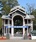
[[File:The Kangla Gate.JPG|thumb|Kangla Gate, the west entrance to the [[Kangla Palace|Kangla Fort]]]] | [[File:The Kangla Gate.JPG|thumb|Kangla Gate, the west entrance to the [[Kangla Palace|Kangla Fort]]]] | ||
Manipur has a long record of insurgency and inter-ethnic violence.<ref>[ | Manipur has a long record of insurgency and inter-ethnic violence.<ref>[https://www.economist.com/asia/2007/03/01/the-mayhem-in-manipur "The mayhem in Manipur"] ''The Economist'' (1 March 2007)</ref><ref>[https://www.economist.com/news/2007/03/09/a-safe-house-for-dangerous-men "Manipur, India - A safe house for dangerous men"] ''The Economist'' (9 March 2007)</ref> Its first armed opposition group, the [[United National Liberation Front]] (UNLF), was founded in 1964 aiming to achieve independence from India and establish Manipur as a new country. Over time, many more groups formed, each with different goals, and deriving support from diverse ethnic groups in Manipur. The [[People's Revolutionary Party of Kangleipak]] (PREPAK) was formed in 1977, and the People's Liberation Army (PLA) in 1978, suspected by [[Human Rights Watch]] of receiving arms and training from China.<ref name="FM">{{Cite web |title="These Fellows Must Be Eliminated": Relentless Violence and Impunity in Manipur: II. Background: Conflict in Manipur |url=https://www.hrw.org/reports/2008/india0908/2.htm |access-date=2024-01-06 |website=www.hrw.org}}</ref> In 1980, the [[Kangleipak Communist Party]] (KCP) was formed. These groups began a spree of bank robberies and attacks on police officers and government buildings.<ref name="FM" /> The state government appealed to the central government in [[New Delhi]] for support in combating this violence.<ref name="HRW">{{citation |chapter=Background: Conflict in Manipur |title="These Fellows Must Be Eliminated": Relentless Violence and Impunity in Manipur |publisher=Human Rights Watch |year=2008 |chapter-url=http://www.hrw.org/reports/2008/india0908/2.htm |archive-url=https://web.archive.org/web/20150924180321/http://www.hrw.org/reports/2008/india0908/2.htm |archive-date=24 September 2015}}</ref> | ||
===="Disturbed area" designation==== | ===="Disturbed area" designation==== | ||
From 1980 to 2004, the Indian government referred to Manipur as a ''disturbed area.'' This term (designated by the [[Ministry of Home Affairs (India)|Ministry of Home Affairs]] or a [[Governors of states of India|state governor]]) refers to a territory where extraordinary laws under the [[Armed Forces (Special Powers) Act]] can be used. The laws allow the military to treat private and public spaces in the same manner, detain individuals for up to 24 hours with unlimited renewals, perform warrantless searches, and to shoot and kill individuals who break laws, carry weapons, or gather in groups larger than four. Legal immunity applies to the military.<ref>McDuie-Ra, Duncan. 2016. ''Borderland city in new India: Frontier to gateway'' (pp. 15, 17–19). Amsterdam University Press.</ref> Since 1980, the application of AFSPA has been at the heart of concerns about [[human rights]] violations in the region, such as arbitrary killings, torture, cruel, [[inhuman or degrading treatment|inhuman and degrading treatment]], and [[forced disappearance]]s. Its continued application has led to numerous protests, notably the longstanding hunger strike by [[Irom Sharmila Chanu]].<ref>{{Cite news |url=https://www.bbc.com/news/world-asia-india-37007494 |title=Irom Sharmila: World's longest hunger strike ends |work=BBC News |date=9 August 2016 | From 1980 to 2004, the Indian government referred to Manipur as a ''disturbed area.'' This term (designated by the [[Ministry of Home Affairs (India)|Ministry of Home Affairs]] or a [[Governors of states of India|state governor]]) refers to a territory where extraordinary laws under the [[Armed Forces (Special Powers) Act]] can be used. The laws allow the military to treat private and public spaces in the same manner, detain individuals for up to 24 hours with unlimited renewals, perform warrantless searches, and to shoot and kill individuals who break laws, carry weapons, or gather in groups larger than four. Legal immunity applies to the military.<ref>McDuie-Ra, Duncan. 2016. ''Borderland city in new India: Frontier to gateway'' (pp. 15, 17–19). Amsterdam University Press.</ref> Since 1980, the application of the AFSPA has been at the heart of concerns about [[human rights]] violations in the region, such as arbitrary killings, torture, cruel, [[inhuman or degrading treatment|inhuman and degrading treatment]], and [[forced disappearance]]s. Its continued application has led to numerous protests, notably the longstanding hunger strike by [[Irom Sharmila Chanu]].<ref>{{Cite news |url=https://www.bbc.com/news/world-asia-india-37007494 |title=Irom Sharmila: World's longest hunger strike ends |work=BBC News |date=9 August 2016 }}</ref><ref>{{Cite web |url=https://www.theguardian.com/world/2016/aug/09/indian-campaigner-irom-chanu-sharmila-end-16-year-hunger-strike |title=Indian hunger striker Irom Chanu Sharmila to end 16-year fast |website=[[TheGuardian.com]] |date=9 August 2016 }}</ref> | ||
In 2004, the government lifted the ''disturbed'' status after a violent attack on a local woman. The rape of a Manipuri woman, [[Thangjam Manorama Devi]], by members of the [[Assam Rifles]] paramilitary had led to wide protests including a nude protest by the [[Meira Paibi]] women's association.<ref>McDuie-Ra, Duncan. 2016. ''Borderland City in New India: Frontier to Gateway'', Amsterdam University Press, p. 18</ref> | In 2004, the government lifted the ''disturbed'' status after a violent attack on a local woman. The rape of a Manipuri woman, [[Thangjam Manorama Devi]], by members of the [[Assam Rifles]] paramilitary had led to wide protests including a nude protest by the [[Meira Paibi]] women's association.<ref>McDuie-Ra, Duncan. 2016. ''Borderland City in New India: Frontier to Gateway'', Amsterdam University Press, p. 18</ref> | ||
====2023 | |||
====18 June Uprising==== | |||
{{Main|2001 Manipur Uprising}} | |||
On 18 June 2001, a massive protest broke out in Imphal Valley. The protest was triggered by the Government of India's decision to extend the [[ceasefire]] agreement with the [[NSCN-IM]] "without territorial limits", which was widely perceived as a threat to Manipur's territorial integrity. Demonstrators set fire to the Manipur Legislative Assembly and other government buildings in Imphal. Security forces opened fire to stop the crowds, killing 18 people.<ref>{{cite web|last=Chaudhuri|first=Kalyan|url=https://frontline.thehindu.com/the-nation/article30251130.ece|title=Truce and violence|date=7 July 2001|publisher=[[Frontline (magazine)|Frontline]]|access-date=6 April 2026}}</ref> | |||
====2023 Manipur violence==== | |||
{{Main|2023 Manipur violence}} | {{Main|2023 Manipur violence}} | ||
On 3 May 2023, [[2023–2025 Manipur violence|ethnic violence]] broke out between [[Meitei people]] and [[Kuki people]] led to extensive violence and arson, resulting in the displacement of 60,000 people from their homes and hundreds more dead and hospitalised.<ref> | |||
{{cite news |date=22 July 2023 |first=Patricia |last=Mukhim |title=Can Manipur ever trust India again? |url=https://www.aljazeera.com/opinions/2023/7/22/can-manipur-ever-trust-india-again |work=Al Jazeera}} | |||
</ref> According to data released by [[Manipur Police]], as on September 15, 2023; 175 people were killed; 1,118 people were injured, and 33 people were missing. 96 bodies remained unclaimed. 5,172 cases of arson including destruction of 4,786 houses and 386 religious places, out of which there were 254 churches and 132 temples, were reported since May. Out of 5,668 arms lost;{{Clarify|date=January 2025}} 1,329 arms, 15,050 ammunition and 400 bombs were recovered.<ref> | |||
{{Cite web |date=2023-09-15 |title=Manipur violence: 175 deaths so far, 4,786 houses burnt, say police |url=https://indianexpress.com/article/north-east-india/manipur/manipur-violence-deaths-houses-burnt-police-8941007/ |website=The Indian Express }} | |||
</ref><ref> | |||
{{Cite web |title=175 Killed, 4,786 Homes Set Ablaze: Manipur Police Data Sheds Light On Scale Of Conflict |website=TimesNow |date=2023-09-15 |url=https://www.timesnownews.com/india/175-killed-4786-homes-set-ablaze-manipur-police-data-sheds-light-on-scale-of-conflict-article-103683991}} | |||
</ref><ref> | |||
{{Cite web |title=Police Updates Statistics on Manipur Violence: 175 Officially Dead, 96 Bodies Yet Unclaimed |website=The Wire |url=https://thewire.in/government/manipur-death-toll-violence-missing-arms |access-date=2023-10-02}} | |||
</ref> [[Indian army]] troops were deployed to control the situation.<ref> | |||
{{cite news |last1=Farooqui |first1=Sania |last2=Sehgal |first2=Kunal |title=Over 50 dead, hundreds hospitalized and 23,000 displaced by ethnic violence in India's Manipur |publisher=CNN |url=https://edition.cnn.com/2023/05/07/india/manipur-ethnic-violence-over-50-dead-india-intl-hnk/index.html }} | |||
</ref> International outrage resulted on 20 July 2023, from a viral video that two Kuki women had been paraded naked and allegedly gang-raped by a mob of Meitei men.<ref>{{Cite news |first=Cherylann |last=Mollan |url=https://www.bbc.com/news/world-asia-india-66253389 |title=Manipur: India outrage after women paraded naked in violence-hit state |work=BBC News |date=20 July 2023 }}</ref><ref>{{Cite news |last1=Ellis-Petersen |first1=Hannah |last2=Hassan |first2=Aakash |date=2023-07-22 |title=Video of women attacked in Manipur breaks silence on systematic gang rapes in India |work=The Observer |url=https://www.theguardian.com/world/2023/jul/22/video-of-women-attacked-in-manipur-breaks-silence-on-systematic-gang-rapes-in-india }}</ref><ref>{{Cite web |title=Police Updates Statistics on Manipur Violence: 175 Officially Dead, 96 Bodies Yet Unclaimed |url=https://thewire.in/government/manipur-death-toll-violence-missing-arms |website=The Wire}}</ref> | |||
==Geography== | ==Geography== | ||
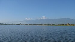
[[File:1 Loktak Lake.jpg|thumb|left|[[Loktak Lake]], the largest fresh water lake in the state.]] | [[File:1 Loktak Lake.jpg|thumb|left|[[Loktak Lake]], the largest fresh water lake in the state.]] | ||
The state lies at a latitude of 23°83'N – 25°68'N and a longitude of 93°03'E – 94°78'E. The total area covered by the state is {{cvt|22327|km2}}. The capital lies in an oval-shaped valley of approximately {{cvt|700|sqmi|km2|sigfig=1}}, surrounded by blue mountains, at an elevation of {{cvt|790|m}} above sea level.<ref name="www.e-pao.net">{{cite web |url=https://www.e-pao.net/epSubPageExtractor.asp?src=education.Scientific_Papers.fate_of_loktak_lake |title=fate of loktak lake |work=e-pao.net |access-date=1 September 2015 }}</ref> The slope of the valley is from north to south. The mountain ranges create a moderate climate, preventing the cold winds from the north from reaching the valley and barring cyclonic storms.<ref>{{Cite web |date=2002 |title=South Asia - A Climatological Study Volume II: Continental South Asia |url=https://apps.dtic.mil/sti/tr/pdf/ADA406961.pdf |access-date=January 6, 2024}}</ref> | |||
The state | The state is bordered by the Indian states of [[Nagaland]] to its north, [[Mizoram]] to its south, Assam to its west, and shares an international border with [[Myanmar]] to its east.<ref name="HG">{{Cite web |date=2024-01-06 |title=Manipur {{!}} History, Government, Map, Capital, & Facts {{!}} Britannica |url=https://www.britannica.com/place/Manipur |access-date=2024-01-06 |website=www.britannica.com }}</ref> | ||
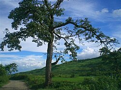
[[File:Landscape of Manipur1.jpg|thumb|right|A tree amid Manipur hills.]] | [[File:Landscape of Manipur1.jpg|thumb|right|A tree amid Manipur hills.]] | ||
The state has four major river basins: the [[Barak River|Barak River Basin]] ([[Barak Valley]]) to the west, the [[Manipur River|Manipur River Basin]] in central Manipur, the [[ | The state has four major river basins: the [[Barak River|Barak River Basin]] ([[Barak Valley]]) to the west, the [[Manipur River|Manipur River Basin]] in central Manipur, the [[Kabaw Valley|Yu River Basin]] in the east, and a portion of the Lanye River Basin in the north.<ref>[http://www.manenvis.nic.in/stateprofile1.pdf Haokip, Shri Ngamthang (2007) "Basine Delineation Map of Manipur"] {{webarchive |url=https://web.archive.org/web/20090326174634/http://www.manenvis.nic.in/stateprofile1.pdf |date=26 March 2009 }}, ''Profile on State of Environment Report of Manipur, 2006–07'', Ministry of Environment and Forests, Manipur, p. 4</ref> The water resources of Barak and Manipur river basins are about 1.8487 Mham (million hectare metres). The overall water balance of the state amounts to 0.7236 Mham in the annual water budget.<ref>{{cite news |title=Irrigation And Water Management |author=Government of Manipur |url=http://www.manipur.nic.in/planning/DraftMSDR/Draft_SDR_pdf/Chapter%207_irrigation.pdf |access-date=31 October 2010 |archive-url=https://web.archive.org/web/20110626213235/http://manipur.nic.in/planning/DraftMSDR/Draft_SDR_pdf/Chapter%207_Irrigation.pdf |archive-date=26 June 2011 }}</ref> (By comparison, India receives 400 Mham of rain annually.<ref>{{cite news |title=The Arithmetic of Water in India |author=Centre for Science and Environment (India) |url=http://www.rainwaterharvesting.org/Solution/Water-Arithmetic.htm |access-date=31 October 2010}}</ref>) | ||
The Barak River, the largest of Manipur, originates in the Manipur Hills and is joined by tributaries, such as the Irang, Maku, and [[Tuivai River|Tuivai]]. After its junction with the Tuivai, the Barak River turns north, forms the border with [[Assam State]], and then enters the [[Cachar]] Assam just above [[Lakhipur]]. The Manipur river basin has eight major rivers: the [[Manipur River|Manipur]], [[Imphal River|Imphal]], [[Iril River|Iril]], Nambul, Sekmai, Chakpi, Thoubal and Khuga. All these rivers originate from the surrounding hills.{{ | The Barak River, the largest of Manipur, originates in the Manipur Hills and is joined by tributaries, such as the Irang, Maku, and [[Tuivai River|Tuivai]]. After its junction with the Tuivai, the Barak River turns north, forms the border with [[Assam State]], and then enters the [[Cachar]] Assam just above [[Lakhipur]]. The Manipur river basin has eight major rivers: the [[Manipur River|Manipur]], [[Imphal River|Imphal]], [[Iril River|Iril]], Nambul, Sekmai, Chakpi, Thoubal and Khuga. All these rivers originate from the surrounding hills.<ref name="GW">{{cite journal |last1=Kshetrimayum |first1=K.S. |last2=Laishram |first2=Premananda |title=Assessment of surface water and groundwater interaction using hydrogeology, hydrochemical and isotopic constituents in the Imphal river basin, Northeast India |journal=Groundwater for Sustainable Development |date=October 2020 |volume=11 |article-number=100391 |doi=10.1016/j.gsd.2020.100391 |bibcode=2020GSusD..1100391K }}</ref> | ||
[[File:Landscape of Valley.jpg|thumb|left|Landscape view for dawn at Senapati, Manipur]] | [[File:Landscape of Valley.jpg|thumb|left|Landscape view for dawn at Senapati, Manipur]] | ||
Almost all the rivers in the valley area are in the mature stage and therefore deposit their sediment load in the [[Loktak Lake]].<ref name="www.e-pao.net" /> The rivers draining the Manipur Hills are comparatively young, due to the hilly terrain through which they flow. These rivers are corrosive and become turbulent in the rainy season. Important rivers draining the western area include the Maku, [[Barak River|Barak]], Jiri, Irang, and Leimatak. Rivers draining the eastern part of the state, the Yu River Basin, include the Chamu, Khunou and other short streams. | Almost all the rivers in the valley area are in the mature stage and therefore deposit their sediment load in the [[Loktak Lake]].<ref name="www.e-pao.net"/> The rivers draining the Manipur Hills are comparatively young, due to the hilly terrain through which they flow. These rivers are corrosive and become turbulent in the rainy season. Important rivers draining the western area include the Maku, [[Barak River|Barak]], Jiri, Irang, and Leimatak. Rivers draining the eastern part of the state, the Yu River Basin, include the Chamu, Khunou and other short streams.<ref name="GW" /> | ||
Manipur may be characterised as two distinct physical regions: an outlying area of rugged hills and narrow valleys, and the inner area of flat plain, with all associated landforms. These two areas are distinct in physical features and are conspicuous in flora and fauna. The valley region has hills and mounds rising above the flat surface. The Loktak Lake is an important feature of the central plain. The total area occupied by all the lakes is about 600 km<sup>2</sup>. The altitude ranges from 40 m at [[Jiribam]] to 2,994 m at [[Mount Tempü]] peak along the border with Nagaland. | Manipur may be characterised as two distinct physical regions: an outlying area of rugged hills and narrow valleys, and the inner area of flat plain, with all associated landforms. These two areas are distinct in physical features and are conspicuous in flora and fauna. The valley region has hills and mounds rising above the flat surface. The Loktak Lake is an important feature of the central plain. The total area occupied by all the lakes is about 600 km<sup>2</sup>. The altitude ranges from 40 m at [[Jiribam]] to 2,994 m at [[Mount Tempü]] peak along the border with Nagaland. | ||
The soil cover can be divided into two broad types, viz. the red [[Iron oxide|ferruginous]] soil in the hill area and the [[alluvium]] in the valley. The valley soils generally contain loam, small rock fragments, sand, and sandy clay, and are varied. On the plains, especially flood plains and deltas, the soil is quite thick. The topsoil on the steep slopes is very thin. Soil on the steep hill slopes is subject to high erosion, resulting in [[gullies]] and barren rock slopes. The normal pH value ranges from 5.4 to 6.8.<ref>{{cite news |author=Director of Commerce and Industries, Manipur |access-date=31 October 2010 |title=Soil and Climate of Manipur |url=http://investinmanipur.nic.in/gp_soil.htm |archive-url=https://web.archive.org/web/20100831113213/http://investinmanipur.nic.in/gp_soil.htm | The soil cover can be divided into two broad types, viz. the red [[Iron oxide|ferruginous]] soil in the hill area and the [[alluvium]] in the valley. The valley soils generally contain loam, small rock fragments, sand, and sandy clay, and are varied. On the plains, especially flood plains and deltas, the soil is quite thick. The topsoil on the steep slopes is very thin. Soil on the steep hill slopes is subject to high erosion, resulting in [[gullies]] and barren rock slopes. The normal pH value ranges from 5.4 to 6.8.<ref>{{cite news |author=Director of Commerce and Industries, Manipur |access-date=31 October 2010 |title=Soil and Climate of Manipur |url=http://investinmanipur.nic.in/gp_soil.htm |archive-date=31 August 2010 |archive-url=https://web.archive.org/web/20100831113213/http://investinmanipur.nic.in/gp_soil.htm }}</ref> | ||
===Flora=== | ===Flora=== | ||
[[File:Hill Slope.JPG|thumb|right|Flowers carpeting the foothills]] | [[File:Hill Slope.JPG|thumb|right|Flowers carpeting the foothills]] | ||
Natural vegetation occupies an area of about {{cvt| | Natural vegetation occupies an area of about {{cvt|17418|km2}},<ref>{{Cite web |date=2015 |title=State Profile of Manipur |url=https://dcmsme.gov.in/old/dips/state_wise_dips/state%20profile%20of%20manipur.pdf |access-date=January 6, 2024}}</ref> or 77.2% of the total geographical area of the state, and consists of short and tall grasses, reeds and [[bamboo]]s, and trees. About a third of Manipur's forests are protected: 8.42% of the forested land is categorized under Reserved Forests, and 23.95% under Protected Forests.<ref name="FD">{{Cite web |title=FOREST DEPARTMENT, GOVERNMENT OF MANIPUR |url=https://monitoring.manipurforest.gov.in/Main/AboutUs |access-date=January 6, 2024 |archive-date=6 January 2024 |archive-url=https://web.archive.org/web/20240106231255/https://monitoring.manipurforest.gov.in/Main/AboutUs }}</ref> | ||
There are forests of [[teak]], [[pine]], [[oak]], [[Phoebe hainesiana|uningthou]], leihao, bamboo, and [[Arundo|cane]]. [[Rubber tree|Rubber]], [[tea]], [[coffee]], [[Orange tree|orange]], and [[cardamom]] are grown in hill areas. [[Rice]] is a staple food for Manipuris. | There are six major types of forests in Manipur, and 10 subtypes. The six major forest types, according to the state's Forest Department, include Tropical Wet Evergreen Forest, Tropical Moist Deciduous Forests, Sub-Tropical Pine Forest, Tropical Dry Deciduous Forest, Montane Wet Temperate Forest and Sub-alpine Forest.<ref name="FD" /> | ||
There are forests of [[teak]], [[pine]], [[oak]], [[Phoebe hainesiana|uningthou]], leihao, bamboo, and [[Arundo|cane]]. [[Rubber tree|Rubber]], [[tea]], [[coffee]], [[Orange tree|orange]], and [[cardamom]] are grown in hill areas. [[Rice]] is a staple food for Manipuris.<ref name="HG"/> | |||
===Climate=== | ===Climate=== | ||
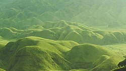
[[File:The Dzukou Valley.JPG|thumb| | [[File:The Dzukou Valley.JPG|thumb|right|The [[Dzüko Valley]] which exists between the boundaries of Manipur and Nagaland has a temperate climate.]] | ||
Manipur's climate is largely influenced by the topography of the region. Lying 790 metres above sea level, Manipur is wedged among hills on all sides. This northeastern corner of India enjoys a generally amiable climate, though the winters can be | Manipur's climate is largely influenced by the topography of the region. Lying 790 metres above sea level, Manipur is wedged among hills on all sides. This northeastern corner of India enjoys a generally amiable climate, though the winters can be cool. The maximum temperature in the summer months is {{cvt|32|C}}. The coolest conditions are in January, and the warmest month is July.{{citation needed|date=December 2023}} | ||
The state receives an average annual rainfall of {{cvt|1467.5|mm}} between April and mid-October. Precipitation ranges from light | The state receives an average annual rainfall of {{cvt|1467.5|mm}} between April and mid-October. Precipitation ranges from light rain or mizzle to heavy downpours. The capital city [[Imphal]] receives an annual average of {{cvt|933|mm}}. Rainfall in this region is caused by The South Westerly [[Monsoon]] picking up moisture from the [[Bay of Bengal]] and heading towards the [[Eastern Himalaya]] ranges. This normal rainfall pattern of Manipur enriches the soil and much of the agrarian activities are dependent on it as well. | ||
Manipur is already [[Climate change in India|experiencing climate change]], especially [[Impacts of climate change|changes in weather]], with both increased [[Extreme weather|variability in rain]] as well as increasingly severe changes in temperature.<ref>{{Cite web |last= | Manipur is already [[Climate change in India|experiencing climate change]], especially [[Impacts of climate change|changes in weather]], with both increased [[Extreme weather|variability in rain]] as well as increasingly severe changes in temperature.<ref>{{Cite web |last=Samom |first=Sobhapati |title=Manipur affected by changing climate, say scientists |url=https://nenow.in/north-east-news/manipur-affected-by-changing-climate-say-scientists.html |website=NorthEast Now |date=31 May 2019 }}</ref> | ||
==Demographics== | ==Demographics== | ||
===Population=== | |||
{{Historical populations | |||
|1=1901 |2=284465 | |||
|3=1911 |4=346222 | |||
|5=1921 |6=384016 | |||
|7=1931 |8=445606 | |||
|9=1941 |10=512069 | |||
|11=1951 |12=577635 | |||
|13=1961 |14=780037 | |||
|15=1971 |16=1072753 | |||
|17=1981 |18=1420953 | |||
|19=1991 |20=1837149 | |||
|21=2001 |22=2293896 | |||
|23=2011 |24=2855794 | |||
| source = [[Census of India]]<ref>{{cite web |title=A-02: Decadal variation in population 1901-2011, Manipur |url=https://censusindia.gov.in/nada/index.php/catalog/43347/download/47030/14%20A-2%20Manipur.pdf |website=censusindia.gov.in |access-date=22 July 2023}}</ref> | |||
|align=right}} | |||
Manipur had a population of 2,855,794 at the 2011 census.<ref>{{cite web |title=Manipur Population Census data 2011 |url=https://www.census2011.co.in/census/state/manipur.html |publisher=Census 2011 |access-date=2 September 2017 }}</ref> Of this total, 57.2% lived in the valley districts and the remaining 42.8% in the hill districts. The valley (plain) is mainly inhabited by the [[Meitei people|Meitei speaking population]] (native [[Manipuri language|Manipuri]] speakers). The hills are inhabited mainly by several ethno-linguistically diverse tribes belonging to the [[Naga people|Naga]]s, the [[Kuki people|Kuki]]s and smaller tribal groupings. Naga and Kuki settlements are also found in the valley region, though less in numbers. There are also sizable populations of Nepalis, Bengalis, Tamils and Marwaris living in Manipur.{{citation needed|date=December 2023}}{{verify source|date=December 2023}} | |||
Manipur | |||
The distribution of area, population and density, and literacy rate as per the 2001 Census provisional figures are as below:{{citation needed|date=October 2015}} | The distribution of area, population and density, and literacy rate as per the 2001 Census provisional figures are as below:{{citation needed|date=October 2015}} | ||
{| class=" | {| class="wikitable floatright collapsible" style="margin-left:3em; width:24em;" | ||
| | |+ Demographics of Manipur (2011) | ||
|- | |- | ||
| style="padding-left: 1em; padding-right: 2em;"| '''Total Population''' || 2,855,794 | | style="padding-left: 1em; padding-right: 2em;"| '''Total Population''' || 2,855,794 | ||
| Line 216: | Line 318: | ||
|} | |} | ||
=== People === | ===People=== | ||
{{Main|Manipuri people}} | {{Main|Manipuri people}} | ||
Nagas and Kuki | The [[Meitei people|Meiteis]]<ref name="Khomdan Singh Lisam pp 322">Khomdan Singh Lisam, ''Encyclopaedia Of Manipur'', {{ISBN|978-8178358642}}, pp. 322–347</ref> (synonymous to the [[Manipuris]]) constitute the majority of the state's population. They inhabit the [[Imphal Valley]]. Nagas and Kuki-Zo are the major tribe conglomerates of tribes inhabiting the surrounding hills. The Kuki-Zos consist of several tribes including [[Gangte people|Gangte]], [[Hmar people|Hmar]], [[Paite people|Paite]], [[Simte people|Simte]], [[Sukte people|Sukte]], [[Thadou people|Thadou]], [[Vaiphei people|Vaiphei]], [[Zou people|Zou]], and some smaller tribes. They speak [[Kuki-Chin languages]] and predominate the southern hill districts of Manipur. The prominent Naga tribes are [[Mao people (India)|Mao]], [[Maram people|Maram]], [[Maring people (India)|Maring]], [[Liangmai people|Liangmai]], [[Poumai people|Poumai]], [[Rongmei people|Rongmei]] and [[Tangkhul people|Tangkhul]], each speaking its own language. They predominate the northern hill districts of Manipur. In addition, several smaller tribes that were classified as "Old Kuki" by the British administrators populate [[Chandel district|Chandel]] and neighbouring districts. Some of them now classify themselves as Nagas while others retain the Kuki classification.{{Efn|The Old Kuki tribes retaining the Kuki classification include: Aimol, Chiru, Kom, Koireng, Kharam, and Ralte. The tribes under the Naga umbrella include: Anal, Chothe, Koirao, Lamkang, Moyon, Monsang, Purum and Tarao.<ref>{{Cite journal |last=Kom |first=Ch. Sekholal |date=June 2015 |title=Ethno-nationalism: Competing Micro-nationalist Dissents in Manipur |journal=Social Change |volume=45 |issue=2 |pages=289–307 |doi=10.1177/0049085715574192 }}</ref>}}<ref>{{Cite journal |doi=10.1080/13537113.2014.879768 |title=Ethnicity, Colonial Legacies, and Postindependence Issues of Identity Politics in North-East India |journal=Nationalism and Ethnic Politics |volume=20 |pages=99–115 |year=2014 |last1=Meetei |first1=Nameirakpam Bijen }}</ref><ref>{{cite thesis |last=Laishram |first=Ratankumar singh |publisher=[[Manipur University]] |date=2009 |title=A Historical study of the role and politics of civil society in Manipur |chapter=United Naga Council (UNC) |hdl=10603/103655 |hdl-access=free }}</ref><ref>{{cite book |last1=Tohring |first1=S. R. |title=Violence and Identity in North-east India: Naga-Kuki Conflict |date=2010 |publisher=Mittal Publications |isbn=978-81-8324-344-5 |pages=xv–xvii }}</ref> | ||
{| class="wikitable" | |||
|+ | |||
!|All Scheduled Tribes | |||
!Population<ref>{{citation |title=A-11 Appendix: District wise scheduled tribe population (Appendix), Manipur - 2011 |date=2011 |url=https://censusindia.gov.in/nada/index.php/catalog/43013 |publisher=Office of the Registrar General & Census Commissioner, Government of India |access-date=22 September 2023}}</ref> | |||
!Percentage | |||
of Total Pop. | |||
|- | |||
|[[Kuki people|Kuki-Zo tribes]] | |||
|448,197 | |||
|15.7% | |||
|- | |||
|[[Naga people|Naga tribes]] | |||
|623,441 | |||
|21.8% | |||
|- | |||
|Old Kuki/Naga | |||
|74,978 | |||
|2.6% | |||
|- | |||
|Total | |||
|1,167,422 | |||
|40.9% | |||
|} | |||
===Languages=== | |||
{{Main|Languages of India|Meitei language}} | |||
{{Pie chart | {{Pie chart | ||
|thumb = right | |thumb = right | ||
|caption = Languages in Manipur (2011)<ref>{{ | |caption = Languages in Manipur (2011)<ref name="language">{{Cite web |date=2011 |title=Table C-16 Population by mother tongue: Manipur |url=https://censusindia.gov.in/nada/index.php/catalog/10213/download/13325/DDW-C16-STMT-MDDS-1400.XLSX |website=[[Census of India]] |publisher=[[Registrar General and Census Commissioner of India]] |access-date=10 August 2023}}</ref><!-- Click on Manipur --> | ||
|label1 = [[Meitei language|Meitei]] |value1 = 53.30 |color1 = | |label1 = [[Meitei language|Meitei]] |value1 = 53.30 |color1 = goldenrod | ||
|label2 = [[Thadou language|Thadou]] |value2 = | |label2 = [[Thadou language|Thadou]] |value2 = 9.16 |color2 = green | ||
|label3 = [[Tangkhul language|Tangkhul]] |value3 = 6.41 |color3 = mediumblue | |label3 = [[Tangkhul language|Tangkhul]] |value3 = 6.41 |color3 = mediumblue | ||
|label4 = [[Poula language|Poula]] |value4 = 4.74 |color4 = | |label4 = [[Poula language|Poula]] |value4 = 4.74 |color4 = royalblue | ||
|label5 = [[Rongmei language| | |label5 = [[Rongmei language|Kabui]] |value5 = 3.83 |color5 = lightblue | ||
|label6 = [[ | |label6 = [[Mao language (Manipur)|Mao]] |value6 = 3.12 |color6 = steelblue | ||
|label7 = [[Nepali language|Nepali]] |value7 = 2.23 |color7 = | |label7 = [[Nepali language|Nepali]] |value7 = 2.23 |color7 = pink | ||
|label8 = [[Paite language|Paite]] |value8 = 1.92 |color8 = | |label8 = [[Paite language|Paite]] |value8 = 1.92 |color8 = lime | ||
|label9 = [[Hmar language|Hmar]] |value9 = 1.72 |color9 = | |label9 = [[Hmar language|Hmar]] |value9 = 1.72 |color9 = palegreen | ||
|label10 = [[Liangmai language|Liangmai]] |value10 = 1.59 |color10 = | |label10 = [[Liangmai language|Liangmai]] |value10 = 1.59 |color10 = lightskyblue | ||
|label11 = [[Vaiphei language|Vaiphei]] |value11 = 1.39 |color11 = | |label11 = [[Vaiphei language|Vaiphei]] |value11 = 1.39 |color11 = yellowgreen | ||
|label12 = [[Kukish languages|Kuki]] |value12 = 1.32 |color12 = | |label12 = [[Kukish languages|Kuki]] |value12 = 1.32 |color12 = mediumseagreen | ||
|label13 = [[Maram language|Maram]] |value13 = 1.12 |color13 = | |label13 = [[Maram language|Maram]] |value13 = 1.12 |color13 = powderblue | ||
|label14 = [[Bengali language|Bengali]] |value14 = 1.07 |color14 = | |label14 = [[Bengali language|Bengali]] |value14 = 1.07 |color14 = orchid | ||
|label15 = | |label15 = [[Anāl language|Anal]] |value15 = 0.93 |color15 = seagreen | ||
|label16 = [[Zou language|Zou]] |value16 = 0.91 |color16 = limegreen | |||
|label17 = [[Maringic languages|Maring]] |value17 = 0.90 |color17 = darkblue | |||
|other = yes |other-color = grey | |||
}} | }} | ||
Other than Meitei language, in Manipur, there is | The official language of the state is [[Meitei language|Meitei]] (also known as ''Manipuri''). It is a [[Scheduled languages of India|scheduled language]] in the Republic of India,<ref name=langoff>{{cite web |url=http://nclm.nic.in/shared/linkimages/NCLM47thReport.pdf |title=Report of the Commissioner for linguistic minorities: 47th report (July 2008 to June 2010) |page=78 |publisher=Commissioner for Linguistic Minorities, [[Ministry of Minority Affairs]], [[Government of India]] |access-date=16 February 2012 |archive-url=https://web.archive.org/web/20120513161847/http://nclm.nic.in/shared/linkimages/NCLM47thReport.pdf |archive-date=13 May 2012}}</ref> and serves as the [[lingua franca]] in Manipur.<ref>{{Cite encyclopedia |entry=Manipuri language |encyclopedia=Britannica |entry-url=https://www.britannica.com/topic/Manipuri-language |access-date=2023-02-22 }}</ref> | ||
Other than Meitei language, in Manipur, there is considerable linguistic diversity, as is the case in most of the Northeast India. Almost all of the languages are [[Sino-Tibetan]], with many different subgroups represented. There are multiple [[Kuki-Chin languages]], the largest being [[Thadou language|Thadou]] and is spoken in all the hill districts. Another major language family is the [[Naga languages]], like [[Tangkhulic languages|Tangkhul]], [[Poula language|Poula]], [[Rongmei language|Rongmei]] and [[Mao language (India)|Mao]]. Less than 5% speak Indo-European languages, mostly [[Nepali language|Nepali]] and [[Bengali language|Bengali]], which is the major language of [[Jiribam district]].<ref>{{Cite web |url=http://censusindia.gov.in/2011census/C-16.html |title=Census of India Website: Office of the Registrar General & Census Commissioner, India |website=censusindia.gov.in |access-date=15 March 2020 }}</ref> | |||
The [[Directorate of Language Planning and Implementation]] (AKA [[Department of Language Planning and Implementation]]) of the [[Government of Manipur]] works for the development and the promotion of Meitei language and other local vernaculars of Manipur.<ref>{{Cite news |date=2018-03-14 |title=Department of language planning and implementation trying to resolve all language issues in the state |newspaper=Pothashang News |url=https://www.pothashang.in/2018/03/14/department-language-planning-implementation-trying-resolve-language-issues-state/ | The [[Directorate of Language Planning and Implementation]] (AKA [[Department of Language Planning and Implementation]]) of the [[Government of Manipur]] works for the development and the promotion of Meitei language and other local vernaculars of Manipur.<ref>{{Cite news |date=2018-03-14 |title=Department of language planning and implementation trying to resolve all language issues in the state |newspaper=Pothashang News |url=https://www.pothashang.in/2018/03/14/department-language-planning-implementation-trying-resolve-language-issues-state/ }}</ref> | ||
==== Linguistic events ==== | ====Linguistic events==== | ||
*[[Meitei language day]] ([[Manipuri language day]]) | * [[Meitei language day]] ([[Manipuri language day]]) | ||
*[[Meitei poetry day]] ([[Manipuri poetry day]]) | * [[Meitei poetry day]] ([[Manipuri poetry day]]) | ||
*[[Meitei language movement]]s | * [[Meitei language movement]]s | ||
**[[Meitei classical language movement]] (ongoing) | ** [[Meitei classical language movement]] (ongoing) | ||
**[[Meitei linguistic purism movement]] (ongoing) | ** [[Meitei linguistic purism movement]] (ongoing) | ||
**[[Meitei scheduled language movement]] (successful) | ** [[Meitei scheduled language movement]] (successful) | ||
== | ==Administrative divisions== | ||
=== Districts === | |||
{| class="wikitable sortable mw-collapsible" width="98%" | |||
! width="30%" | District | |||
! width="30%" | Population (2011)<ref>{{cite web | |||
|url = http://censusindia.gov.in/2011-prov-results/data_files/Manipur/statement1.xls | |||
|format=XLS | |||
|title = Ranking of Districts by Population Size, 2001 and 2011 | |||
|publisher = The Registrar General & Census Commissioner, India, New Delhi-110011 | |||
|date = 2010–2011 | |||
|access-date = 2011-09-18 | |||
}}</ref> | |||
! width="20%" | Area (km<sup>2</sup>) | |||
! width="15%" | Density (/km<sup>2</sup>) | |||
|- | |||
|[[Bishnupur district|Bishnupur]] || 240,363 || 496 || 415 | |||
|- | |||
| [[Thoubal district|Thoubal]] || 420,517 || 324 || 713 | |||
|- | |||
| [[Imphal East]] || 452,661 || 497 || 555 | |||
|- | |||
| [[Imphal West]] || 514,683 || 519 || 847 | |||
|- | |||
| [[Senapati district|Senapati]] || 354,772 || 1,573 || 116 | |||
|- | |||
| [[Ukhrul district|Ukhrul]] || 183,115 || 2,206 || 31 | |||
|- | |||
| [[Chandel district|Chandel]] || 144,028 || 2,100 || 37 | |||
|- | |||
| [[Churachandpur district|Churachandpur]] || 271,274 || 2,392 || 50 | |||
|- | |||
| [[Tamenglong district|Tamenglong]] || 140,143 || 3,315 || 25 | |||
|- | |||
| [[Jiribam district|Jiribam]] || 43,818 || 182 || 190 | |||
|- | |||
| [[Kangpokpi district|Kangpokpi]] || || 1,698|| | |||
|- | |||
| [[Kakching district|Kakching]] || 135,481 || 190|| | |||
|- | |||
| [[Tengnoupal district|Tengnoupal]] || || 1,213|| | |||
|- | |||
| [[Kamjong district|Kamjong]] || 45,616 || 2,338 || 23 | |||
|- | |||
| [[Noney district|Noney]] || || 1,076|| | |||
|- | |||
| [[Pherzawl district|Pherzawl]] || 47,250 || 2,128 || 21 | |||
|} | |||
=== Subdivisions === | |||
{| class="wikitable sortable mw-collapsible" width="98%" | |||
! width="30%" | Districts | |||
! width="65%" | Subdivisions | |||
|- | |||
|[[Bishnupur district|Bishnupur]] | |||
|Nambol, Moirang, Bishnupur | |||
|- | |||
| [[Thoubal district|Thoubal]] | |||
|Thoubal, Lilong | |||
|- | |||
| [[Imphal East]] | |||
|Porompat, Keirao Bitra, Sawombung | |||
|- | |||
| [[Imphal West]] | |||
|Lamshang, Patsoi, Lamphelpat, Wangoi | |||
|- | |||
| [[Senapati district|Senapati]] | |||
|Tadubi, Paomata, Purul, Willong, Chilivai Phaibung, Songsong, Lairouching | |||
|- | |||
| [[Ukhrul district|Ukhrul]] | |||
|Ukhrul, Lungchong Maiphai, Chingai, Jessami | |||
|- | |||
| [[Chandel district|Chandel]] | |||
|Chandel, Chakpikarong, Khengjoy | |||
|- | |||
| [[Churachandpur district|Churachandpur]] | |||
|churchandpur, Tuiboung, Sangaikot, Mualnuam, Singngat, Henglep, Suangdoh, Kangvai, Samulamlan, Saikot | |||
|- | |||
| [[Tamenglong district|Tamenglong]] | |||
|Tamenglong, Tamei, Tousem | |||
|- | |||
|[[Jiribam district|Jiribam]] | |||
|Jiribam, Borobekra | |||
|- | |||
| [[Kangpokpi district|Kangpokpi]] ([[Sadar Hills]]) | |||
|Kangpokpi, Champhai, Saitu Gamphazol, Kangchup Geljang, Tuijang Waichong, Saikul, Lhungtin Island, Bungte Chiru | |||
|- | |||
|[[Kakching district|Kakching]] | |||
|Kakching, Waikhong | |||
|- | |||
| [[Tengnoupal district|Tengnoupal]] | |||
|Machi, Moreh, Tengnoupal | |||
|- | |||
| [[Kamjong district|Kamjong]] | |||
|Kamjong, Kasom Khullen, Sahamphung, Phungyar | |||
|- | |||
| [[Noney district|Noney]] | |||
|Nungba, Khoupum, Longmai, Haochong | |||
|- | |||
| [[Pherzawl district|Pherzawl]] | |||
|Pherzawl, Parbung Tipaimukh, Vangai Range, Thanlon | |||
|} | |||
==Religion== | |||
{{Pie chart | {{Pie chart | ||
|thumb = | | thumb = right | ||
|caption = Religion in Manipur (2011)<ref name=" | | caption = Religion in Manipur (2011)<ref name="religion"/> | ||
|label1 = [[Hinduism in Manipur|Hinduism]] |color1 = | | label1 = [[Hinduism in Manipur|Hinduism]] | ||
|label2 = [[Christianity in Manipur|Christianity]] |color2 = | | color1 = darkorange | ||
|label3 = [[ | | value1 = 41.39 | ||
|label4 = [[ | | label2 = [[Christianity in Manipur|Christianity]] | ||
|label5 = [[ | | color2 = dodgerblue | ||
|label6 = [[ | | value2 = 41.29 | ||
|label7 = | | label3 = [[Meitei Pangals|Islam]] | ||
|label8 = [[ | | color3 = green | ||
| value3 = 8.40 | |||
| label4 = [[Buddhism in India|Buddhism]] | |||
| color4 = Gold | |||
| value4 = 0.25 | |||
| label5 = [[Jainism in India|Jainism]] | |||
| color5 = brown | |||
| value5 = 0.06 | |||
| label6 = [[Sikhism in India|Sikhism]] | |||
| color6 = darkkhaki | |||
| value6 = 0.05 | |||
| label7 = Other religion | |||
| color7 = gray | |||
| value7 = 8.19 | |||
| label8 = [[Irreligion in India|No religion]] | |||
| color8 = white | |||
| value8 = 0.38 | |||
}} | }} | ||
=== Hinduism === | [[File:Largest religion by district in Manipur (2011).jpg|thumb|Largest religion by district in Manipur, 2011 census]] | ||
{{ | |||
[[Hinduism]] and [[Christianity]] are the major religions practised in Manipur. Between the 1961 and 2011 censuses of India, the share of [[Hindus]] in the state declined from 62% to 41%, while the share of [[Christians]] rose from 19% to 41%.<ref>{{Cite web |date=2017-03-08 |title=Christian population on the rise in Arunachal Pradesh, Manipur|url=https://www.hindustantimes.com/india-news/christian-population-on-the-rise-in-arunachal-pradesh-manipur/story-8Go2uITu2BLFJ547MPwohM.html |website=Hindustan Times}}</ref> The religious groups of the Meitei-speaking people include [[Hindu]]s, [[Sanamahism|Sanamahist]]s, [[Meitei Christians]] and [[Meitei Pangals]]. Besides these, tribal communities other than the Meitei-speaking population are mostly Christians. | |||
===Hinduism=== | |||
{{further|Hinduism in Manipur|Meitei Hindus}} | |||
[[File:Gopinath Temple - Ningthoukhong, Manipur (India).jpg|left|thumb|[[Ningthoukhong Gopinath Mandir|Ningthoukhong Gopinath Temple]]]] | [[File:Gopinath Temple - Ningthoukhong, Manipur (India).jpg|left|thumb|[[Ningthoukhong Gopinath Mandir|Ningthoukhong Gopinath Temple]]]] | ||
The [[Meitei people|Meitei ethnicity]] (aka [[Manipuri people]]) is the majority group following Hinduism in Manipur, beside other minor immigrants following the same faith | The [[Meitei people|Meitei ethnicity]] (aka [[Manipuri people]]) is the majority group following Hinduism in Manipur, beside other minor immigrants from other parts of India following the same faith. Among the indigenous communities of Manipur, [[Meiteis]] are the only Hindus as no other indigenous ethnic groups follow this faith. | ||
According to the [[2011 Census of India]], about 41.39% of the Manipuri people | According to the [[2011 Census of India]], about 41.39% of the Manipuri people practise [[Hinduism]]. The Hindu population is heavily concentrated in the Meitei dominant areas of the Manipur Valley ([[Imphal Valley]]), among the Meitei people. The districts of Bishnupur, Thoubal, Imphal East, and Imphal West all have Hindu majorities, averaging 67.62% (range 62.27–74.81%) according to the 2011 census data.<ref name="religion">{{Cite web |date=2011 |title=Table C-01 Population by religious community: Manipur |url=https://censusindia.gov.in/nada/index.php/catalog/11383/download/14496/DDW14C-01%20MDDS.XLS |website=[[Census of India]] |publisher=[[Registrar General and Census Commissioner of India]] |access-date=10 August 2023}}</ref> | ||
Vaishnavite Hinduism was the state religion of the [[Manipur Kingdom|Kingdom of Manipur]]. In 1704, Meitei King [[Charairongba]] accepted Vaishnavism and changed his traditional Meitei name into Hindu name, Pitambar Singh.<ref>{{cite thesis |chapter-url=https://shodhganga.inflibnet.ac.in/bitstream/10603/93320/11/11_chapter%204.pdf |title=Advent of a caste - the emergence and role of Brahmans in Manipuri society |author=S. Bebita Devi |year=2013 |chapter=4 | Vaishnavite Hinduism was the state religion of the [[Manipur Kingdom|Kingdom of Manipur]]. In 1704, Meitei King [[Charairongba]] accepted Vaishnavism and changed his traditional Meitei name into Hindu name, Pitambar Singh.<ref>{{cite thesis |chapter-url=https://shodhganga.inflibnet.ac.in/bitstream/10603/93320/11/11_chapter%204.pdf |title=Advent of a caste - the emergence and role of Brahmans in Manipuri society |author=S. Bebita Devi |year=2013 |chapter=4}}</ref> During the 13th century, Meitei King Khumomba constructed a Lord Hanuman temple.<ref>{{Cite book |url=https://books.google.com/books?id=-CzSQKVmveUC&pg=PA14 |title=Manipur, Past and Present: The Heritage and Ordeals of a Civilization |isbn=978-81-7099-853-2 |last1=Sanajaoba |first1=Naorem |year=1988 |publisher=Mittal Publications }}</ref> The Vishnu temple at Lamangdong was constructed during 1474 CE (during the reign of Meitei King [[Senbi Kiyamba|Kiyamba]]), by Brahmins immigrating from the neighborhood [[Shan State]]. As per the legends, the temple was constructed to house the Vishnu emblem given to King Kiyamba by King Khekhomba of Shan. Phurailatpam Shubhi Narayan was the first Brahmin priest of this temple.<ref>{{Cite web |url=https://www.sahapedia.org/the-vaishnava-temples-of-manipur-historical-study |title=The Vaishnava Temples of Manipur: An Historical Study |access-date=2 February 2020 }}</ref> | ||
===Christianity=== | |||
{{main|Christianity in Manipur|}} | |||
[[File:St. Joseph's Cathedral.jpg|thumb|St. Joseph's Cathedral at Imphal]] | [[File:St. Joseph's Cathedral.jpg|thumb|St. Joseph's Cathedral at Imphal]] | ||
Christianity is the religion of 41% of the people in the state, but is the majority in rural areas with 53%, and is predominant in the hills. It was brought by Protestant missionaries to Manipur in the 19th century. In the 20th century, a few Christian schools were established, which introduced Western-type education. Christianity is the predominant religion among tribals of Manipur and tribal Christians make up the vast majority | Christianity is the religion of 41% of the people in the state, but is the majority in rural areas with 53%, and is predominant in the hills. It was brought by Protestant missionaries to Manipur in the 19th century. In the 20th century, a few Christian schools were established, which introduced Western-type education. Christianity is the predominant religion among tribals of Manipur and tribal Christians make up the vast majority of the Christian population in Manipur. | ||
=== Islam === | ===Islam=== | ||
{{Main|Meitei Pangals}} | {{Main|Meitei Pangals}} | ||
=== Sanamahism === | The [[Meitei Pangals]] ({{langx|mni|{{Script|Mtei|[[ꯃꯩꯇꯩ ꯄꯥꯡꯒꯜ]]}}}}), also known as Meitei Muslims or Manipuri Muslims, are the third largest religious majority group in the state, comprising less than 8.3%{{Efn|The majority of Muslims are in Manipur are Pangals/Pangan, but some other minor Muslim groups are also there.<ref name="Hazra 2014" />}}<!-- According to "Office of the Registrar General & Census Commissioner, India. Population Census 2011. Table ST-14: Scheduled tribe population by religious community (State/UT level), Manipur - 2011"; some schedule tribes have Muslim population, thus claiming that the 8.3% of Manipur are pangals is wrong statement. --> of the state population. Majority belongs to the [[Sunni]] group of the [[Hanafi]] school of Islamic thought.<ref>{{cite web |url=https://www.e-pao.net/epSubPageExtractor.asp?src=manipur.Ethnic_Races_Manipur.Evolution_of_clan_system_Manipuri_Muslim_1 |title=Evolution of clan system Manipuri Muslim 1|work=e-pao.net |access-date=1 September 2015 }}</ref><ref>{{Cite web |last=Saikia |first=Arunabh |date=2019-02-24 |title=After six decades, Manipur's Burmese Tamils get a glimpse of their ancestral places in Myanmar |url=https://scroll.in/article/913335/after-six-decades-manipurs-burmese-tamils-get-a-glimpse-of-their-ancestral-places-in-myanmar |access-date=2026-02-05 |website=Scroll.in |language=en-US |quote=By local estimates, there are around 3,000 Tamils, Hindu and Muslim, in Moreh, a town of less than 20,000 people belonging to at least a dozen distinct communities, including the Kukis and the Manipuri Meiteis.}}</ref><ref name="Hazra 2014" >{{Cite book |last=Hazra |first=Anupam |url=https://books.google.com/books?id=0BZrEQAAQBAJ&dq=Meghalaya+pangals&pg=PA198 |title=Sustaining Development in North-East India: Emerging Issues, Challenges and Policy Measures |date=2014-01-01 |publisher=Concept Publishing Company |isbn=978-93-5125-024-1 |pages=198 |language=en |quote=All the Muslims of Manipur are not Meitei Pangals because Meitei Pangals are those who are born and brought up in Manipur.}}</ref><ref> | ||
{| class="wikitable sortable" | |||
|+Muslim population among Scheduled Tribes in Manipur | |||
! rowspan="2" |Tribe | |||
! colspan="3" |2001 | |||
! colspan="3" |2011 | |||
|- | |||
!Total Muslims | |||
!🚹 | |||
!🚺 | |||
!Total Muslims | |||
!🚹 | |||
!🚺 | |||
|- | |||
|Aimol | |||
|4 | |||
|1 | |||
|3 | |||
|15 | |||
|6 | |||
|9 | |||
|- | |||
|Anal | |||
|110 | |||
|57 | |||
|53 | |||
|74 | |||
|31 | |||
|43 | |||
|- | |||
|Angami | |||
|1 | |||
|1 | |||
|0 | |||
|0 | |||
|0 | |||
|0 | |||
|- | |||
|Chiru | |||
|24 | |||
|14 | |||
|10 | |||
|62 | |||
|25 | |||
|37 | |||
|- | |||
|Chothe | |||
|6 | |||
|2 | |||
|4 | |||
|5 | |||
|1 | |||
|4 | |||
|- | |||
|Gangte | |||
|35 | |||
|21 | |||
|14 | |||
|101 | |||
|52 | |||
|49 | |||
|- | |||
|Hmar | |||
|300 | |||
|153 | |||
|147 | |||
|226 | |||
|109 | |||
|117 | |||
|- | |||
|Kabui | |||
|602 | |||
|310 | |||
|292 | |||
|376 | |||
|183 | |||
|193 | |||
|- | |||
|Kacha Naga | |||
|280 | |||
|148 | |||
|132 | |||
|208 | |||
|103 | |||
|105 | |||
|- | |||
|Koirao | |||
|7 | |||
|4 | |||
|3 | |||
|34 | |||
|15 | |||
|19 | |||
|- | |||
|Koireng | |||
|6 | |||
|2 | |||
|4 | |||
|6 | |||
|1 | |||
|5 | |||
|- | |||
|Kom | |||
|94 | |||
|55 | |||
|39 | |||
|47 | |||
|22 | |||
|25 | |||
|- | |||
|Lamgang | |||
|29 | |||
|15 | |||
|14 | |||
|19 | |||
|9 | |||
|10 | |||
|- | |||
|Mao | |||
|23 | |||
|15 | |||
|8 | |||
|243 | |||
|121 | |||
|122 | |||
|- | |||
|Maram | |||
|0 | |||
|0 | |||
|0 | |||
|78 | |||
|39 | |||
|39 | |||
|- | |||
|Maring | |||
|82 | |||
|39 | |||
|43 | |||
|77 | |||
|43 | |||
|34 | |||
|- | |||
|Any Mizo (Lushai) tribes etc. | |||
|56 | |||
|32 | |||
|24 | |||
|19 | |||
|10 | |||
|9 | |||
|- | |||
|Monsang | |||
|24 | |||
|16 | |||
|8 | |||
|9 | |||
|6 | |||
|3 | |||
|- | |||
|Moyon | |||
|11 | |||
|7 | |||
|4 | |||
|2 | |||
|0 | |||
|2 | |||
|- | |||
|Paite | |||
|177 | |||
|92 | |||
|85 | |||
|268 | |||
|127 | |||
|141 | |||
|} | |||
Source: | |||
* {{Cite web |title=Census of India 2001 – ST-14 Scheduled Tribe Population by Religious Community |url=https://censusindia.gov.in/nada/index.php/catalog/44856/download/48570/PC01_ST14_14_00.xlsx |access-date=30 October 2025 |publisher=Office of the Registrar General & Census Commissioner, India}} | |||
* {{Cite web |title=Census of India Website : Office of the Registrar General & Census Commissioner, India |url=https://censusindia.gov.in/2011census/SCST-Series/ST14.html |archive-url=https://web.archive.org/web/20191114034625/https://censusindia.gov.in/2011census/SCST-Series/ST14.html |archive-date=2019-11-14 |access-date=2025-12-05 |website=censusindia.gov.in}} | |||
</ref> In 1991 first time Quran Translated into Meitei language.<ref>{{Cite book |last=Khan |first=Mofakhkhar Hussain |url=https://books.google.com/books?id=ne3XAAAAMAAJ |title=The Holy Qur'ãn in South Asia: A Bio-bibliographic Study of Translations of the Holy Qurʼãn in 23 South Asian Languages |date=2001 |publisher=Bibi Akhtar Prakãs̆ani |pages=430 |language=en}}</ref> (See [[Meitei Pangals#History|History of Manipuri Muslims]]) | |||
===Sanamahism=== | |||
{{Main|Sanamahism}} | {{Main|Sanamahism}} | ||
[[File:The Symbol of Sanamahi.svg|thumb | |||
[[File:The Symbol of Sanamahi.svg|thumb|The symbol of Sanamahism religion, the indigenous [[ethnic religion]] of the [[Meitei people]].]] | |||
[[File:Temple at Kangla.jpg|thumb|300px|left|A reconstructed ancient temple dedicated to Meitei God [[Pakhangba]] of [[Sanamahism]] inside the [[Kangla Fort]], [[Imphal]]]] | [[File:Temple at Kangla.jpg|thumb|300px|left|A reconstructed ancient temple dedicated to Meitei God [[Pakhangba]] of [[Sanamahism]] inside the [[Kangla Fort]], [[Imphal]]]] | ||
[[Sanamahism]] | [[Sanamahism]] is the indigenous, polytheistic and animistic [[ethnic religion]] of the Meitei people.<ref name="lintner2015p113">{{cite book |author=Bertil Lintner |url=https://books.google.com/books?id=0fLOBwAAQBAJ |title=Great Game East: India, China, and the Struggle for Asia's Most Volatile Frontier |publisher=Yale University Press |year=2015 |isbn=978-0-300-19567-5 |page=113}}</ref> Sanamahist worship concentrates on the household deity [[Lainingthou Sanamahi]]. The ancient Meiteis worshiped a Supreme deity, Salailen, and followed their ancestors. Their ancestor worship and animism was based on [[Umang Lai]] – ethnic governing deities worshiped in the [[sacred groves]]. Some of the traditional [[Meitei deities]], or Lais are Atiya Sidaba, [[Pakhangba]], [[Lainingthou Sanamahi|Sanamahi]], and [[Panthoibi]]. Out of the 233,767 people who opted for the "Other religion" option, 222,315 were Sanamahists.{{Citation needed|date=November 2023}} | ||
=== Other religions === | ===Other religions=== | ||
The various other religions were mostly followers of tribal folk religions, 6,444 were Heraka, 2,032 were Jewish and 1,180 were from other tribal religions such as Tingkao Ragwang Chapriak.{{ | The various other religions were mostly followers of tribal folk religions, 6,444 were [[Haipou Jadonang#Heraka movement|Heraka]], 2,032 were Jewish and 1,180 were from other tribal religions such as Tingkao Ragwang Chapriak.{{citation needed |date=March 2023}} | ||
==Government== | ==Government== | ||
{{expand section |date=January 2015}} | {{expand section|date=January 2015}} | ||
{{main|Government of Manipur|Manipur Legislative Assembly}} | {{main|Government of Manipur|Manipur Legislative Assembly}} | ||
[[File:Kanglasa.svg|thumb|300px|The [[Emblem of Manipur|emblem]] of the [[Government of Manipur]] depicts [[Kangla Sha]] ([[Kangla Sa]]), an [[ancient Meitei deity]], and a [[Meitei language]] text written in [[Meitei script]]]] | [[File:Kanglasa.svg|thumb|300px|The [[Emblem of Manipur|emblem]] of the [[Government of Manipur]] depicts [[Kangla Sha]] ([[Kangla Sa]]), an [[ancient Meitei deity]], and a [[Meitei language]] text written in [[Meitei script]]]] | ||
The government of Manipur is a collective assembly of 60 elected members, of which 19 are reserved for Scheduled Tribes and 1 for Scheduled Castes.<ref>{{cite web |title=State/UT wise Seats in the Assembly and their Reservation Status |url=http://eci.nic.in/eci_main1/seat_in_legislativeassembilies.aspx |publisher=[[Election Commission of India]] |access-date=23 May 2018 | The government of Manipur is a collective assembly of 60 elected members, of which 19 are reserved for [[Scheduled Castes and Scheduled Tribes|Scheduled Tribes]] and 1 for [[Scheduled Castes and Scheduled Tribes|Scheduled Castes]].<ref>{{cite web |title=State/UT wise Seats in the Assembly and their Reservation Status |url=http://eci.nic.in/eci_main1/seat_in_legislativeassembilies.aspx |publisher=[[Election Commission of India]] |access-date=23 May 2018 }}</ref> The state sends two representatives to the [[Lok Sabha]] of the [[Parliament of India]]. The state sends one representative to the [[Rajya Sabha]]. The legislature of the state is Unicameral.<ref>[http://manipur.gov.in Manipur Government] {{Webarchive |url=https://web.archive.org/web/20161022063244/http://manipur.gov.in/ |date=22 October 2016 }}, Govt of India</ref> Representatives are elected for a five-year term to the state assembly and the Indian parliament through voting, a process overseen by the offices of the [[Election Commission of India]].<ref>[http://www.ceomanipur.nic.in/index.html ECI Manipur] {{Webarchive |url=https://web.archive.org/web/20170519143058/http://www.ceomanipur.nic.in/index.html |date=19 May 2017 }}, Govt of India</ref> | ||
The state has [[Sadar Hills Autonomous District Council|one autonomous council]]. | The state has [[Sadar Hills Autonomous District Council|one autonomous council]]. | ||
=== Civil unrest === | For administrative purposes, the state of Manipur is divided into 16 districts, each headed by a [[District magistrate|Deputy Commissioner]] (DC), who is an officer of the [[Indian Administrative Service]] (IAS). The Deputy Commissioner also serves as the Collector and the District Magistrate. Each district is further divided into subdivisions, which are headed by [[Sub-divisional magistrate|Sub-Divisional Officers]] (SDOs). For development administration, each district is divided into [[Community development block|Community Development]] (CD) Blocks, which are headed by Block Development Officers (BDOs).<ref name=":0">{{cite report | ||
==== Social movements ==== | |title=Manipur Local Bodies Report 2015 – Annual Technical Inspection Report on Panchayati Raj Institutions and Urban Local Bodies for the year ended 31 March 2014|publisher=Comptroller and Auditor General of India|url=https://cag.gov.in/webroot/uploads/download_audit_report/2015/Manipur_Local_Bodies_Report_2015.pdf|location=Imphal|date=2015|access-date= }}</ref> | ||
Other key district officials include the [[Superintendent of police (India)|Superintendent of Police]] (SP), an [[Indian Police Service]] officer who oversees the police administration in the district. | |||
For local governance, the state has a three-tier [[Panchayati raj|Panchayati Raj system]] for rural areas and [[Municipal governance in India|municipal bodies]] for urban areas. There are nine Municipal Councils (MCs), 18 Nagar Panchayats (NPs), and one Small Town Committee, making a total of 28 urban local bodies.<ref>{{cite report | |||
| title = Manipur Local Bodies Report 2015 – Annual Technical Inspection Report on Panchayati Raj Institutions and Urban Local Bodies for the year ended 31 March 2014 | |||
| publisher = Comptroller and Auditor General of India | |||
| url = https://cag.gov.in/webroot/uploads/download_audit_report/2015/Manipur_Local_Bodies_Report_2015.pdf | |||
| location = Imphal | |||
| date = 2015 | |||
| access-date = | |||
}}</ref> | |||
===Civil unrest=== | |||
====Social movements==== | |||
There were many public movements in Manipur against the government: | There were many public movements in Manipur against the government: | ||
*[[Meitei classical language movement]] | * [[Meitei classical language movement]] | ||
*[[Meitei language movement#Scheduled language movement|Meitei scheduled language movement]] | * [[Meitei language movement#Scheduled language movement|Meitei scheduled language movement]] | ||
*[[Meitei language movement#Linguistic purism movement|Meitei linguistic purism movement]] | * [[Meitei language movement#Linguistic purism movement|Meitei linguistic purism movement]] | ||
====Security and insurgency==== | ====Security and insurgency==== | ||
{{ | {{Further|2023-2026 Manipur conflict|Insurgency in Manipur|Human rights abuses in Manipur|Thangjam Manorama#Protests against the AFSPA}} | ||
[[File:Irom sharmila at calicut.jpg|thumb|300px|[[Irom Chanu Sharmila]], the world's longest hunger striker, who [[hunger strike]]d for more than 500 weeks, demanding the repealing of the [[Armed Forces (Special Powers) Act, 1958]] in Manipur<ref>{{Cite web |date=2010-11-04 |title=A decade of starvation for Irom Sharmila |url=https://www.independent.co.uk/news/world/asia/a-decade-of-starvation-for-irom-sharmila-2124608.html | [[File:Irom sharmila at calicut.jpg|thumb|300px|[[Irom Chanu Sharmila]], the world's longest hunger striker, who [[hunger strike]]d for more than 500 weeks, demanding the repealing of the [[Armed Forces (Special Powers) Act, 1958]] in Manipur<ref>{{Cite web |date=2010-11-04 |title=A decade of starvation for Irom Sharmila |url=https://www.independent.co.uk/news/world/asia/a-decade-of-starvation-for-irom-sharmila-2124608.html |website=The Independent }}</ref>]] | ||
The violence in Manipur extends beyond the conflict between Indian security forces and insurgent armed groups. There is violence between the [[Meitei ethnicity]], various [[Naga tribes]], various [[Kuki tribes]], and other tribal groups.<ref name= | The violence in Manipur extends beyond the conflict between Indian security forces and insurgent armed groups. There is violence between the [[Meitei ethnicity]], various [[Naga tribes]], various [[Kuki tribes]], and other tribal groups.<ref name="HRW"/> | ||
Splinter groups have arisen within some of the armed groups, and disagreement between them is rife. Other than the UNLF, PLA, and PREPAK, Manipuri insurgent groups include the Revolutionary Peoples Front (RPF), Manipur Liberation Front Army (MLFA), Kanglei Yawol Kanba Lup (KYKL), Revolutionary Joint Committee (RJC), Kangleipak Communist Party (KCP), Peoples United Liberation Front (PULF), Manipur Naga People Front (MNPF), National Socialist Council of Nagaland (NSCN-K), National Socialist Council of Nagaland (NSCN-I/M), United Kuki Liberation Front (UKLF), Kuki National Front (KNF), Kuki National Army (KNA), Kuki Defence Force (KDF), Kuki Democratic Movement (KDM), Kuki National Organisation (KNO), Kuki Security Force (KSF), Chin Kuki Revolutionary Front (CKRF), Kom Rem Peoples Convention (KRPC), Zomi Revolutionary Volunteers (ZRV), Zomi Revolutionary Army (ZRA), Zomi Reunification Organisation (ZRO), and Hmar Peoples Convention (HPC).<ref>{{Cite news |url= | Splinter groups have arisen within some of the armed groups, and disagreement between them is rife. Other than the UNLF, PLA, and PREPAK, Manipuri insurgent groups include the Revolutionary Peoples Front (RPF), Manipur Liberation Front Army (MLFA), Kanglei Yawol Kanba Lup (KYKL), Revolutionary Joint Committee (RJC), Kangleipak Communist Party (KCP), Peoples United Liberation Front (PULF), Manipur Naga People Front (MNPF), National Socialist Council of Nagaland (NSCN-K), National Socialist Council of Nagaland (NSCN-I/M), United Kuki Liberation Front (UKLF), Kuki National Front (KNF), Kuki National Army (KNA), Kuki Defence Force (KDF), Kuki Democratic Movement (KDM), Kuki National Organisation (KNO), Kuki Security Force (KSF), Chin Kuki Revolutionary Front (CKRF), Kom Rem Peoples Convention (KRPC), Zomi Revolutionary Volunteers (ZRV), Zomi Revolutionary Army (ZRA), Zomi Reunification Organisation (ZRO), and Hmar Peoples Convention (HPC).<ref>{{Cite news |url=https://www.thehindu.com/news/national/Centre-inks-peace-accord-with-Naga-insurgent-outfit/article10293606.ece |title=Centre inks peace accord with Naga insurgent outfit |last=Singh |first=Vijaita |work=The Hindu }}</ref><ref name="HRW"/> | ||
The Meitei insurgent groups seek independence from India. The Kuki insurgent groups want a separate state for the Kukis to be carved out from the present state of Manipur. The Kuki insurgent groups are under two umbrella organisations: the Kuki National Organisation (KNO) and United Peoples Forum.<ref>{{cite web |url=http://www.kukination.net |title=仏壇修理・洗浄なら石川県羽咋市の宮本仏檀店 |work=kukination.net |access-date=1 September 2015 |archive-url=https://web.archive.org/web/20150424145258/http://www.kukination.net/ |archive-date=24 April 2015}}</ref> The Nagas wish to annex part of Manipur and merge with a greater Nagaland or Nagalim, which is in conflict with Meitei insurgent demands for the integrity of their vision of an independent state. There have been many tensions between the tribes and numerous clashes between Naga and Kukis, Meiteis and Muslims.<ref name= | The Meitei insurgent groups seek independence from India. The Kuki insurgent groups want a separate state for the Kukis to be carved out from the present state of Manipur. The Kuki insurgent groups are under two umbrella organisations: the Kuki National Organisation (KNO) and United Peoples Forum.<ref>{{cite web |url=http://www.kukination.net |title=仏壇修理・洗浄なら石川県羽咋市の宮本仏檀店 |work=kukination.net |access-date=1 September 2015 |archive-url=https://web.archive.org/web/20150424145258/http://www.kukination.net/ |archive-date=24 April 2015}}</ref> The Nagas wish to annex part of Manipur and merge with a greater Nagaland or Nagalim, which is in conflict with Meitei insurgent demands for the integrity of their vision of an independent state. There have been many tensions between the tribes and numerous clashes between Naga and Kukis, Meiteis and Muslims.<ref name="HRW"/> | ||
According to SATP in 2014, there had been a dramatic decline in fatalities in Manipur since 2009. In 2009, 77 civilians died (about 3 per 100,000 people).<ref name=satp9413>[http://www.satp.org/satporgtp/countries/india/database/indiafatalities.htm State wise Indian fatalities, 1994-2013] {{Webarchive |url=https://web.archive.org/web/20140715000520/http://www.satp.org/satporgtp/countries/india/database/indiafatalities.htm |date=15 July 2014 }} Militancy and Terrorism Database, SATP, New Delhi</ref> From 2010 onward, about 25 civilians have died in militant-related violence (about 1 per 100,000 people), dropping further to 21 civilian deaths in 2013 (or 0.8 per 100,000 people). However, there were 76 explosions in 2013 compared to 107 in 2012. Different groups have claimed responsibility for the explosions, some claiming they were targeting competing militant groups, others claiming their targets were state and central government officials.<ref name=satp>[ | According to SATP in 2014, there had been a dramatic decline in fatalities in Manipur since 2009. In 2009, 77 civilians died (about 3 per 100,000 people).<ref name=satp9413>[http://www.satp.org/satporgtp/countries/india/database/indiafatalities.htm State wise Indian fatalities, 1994-2013] {{Webarchive |url=https://web.archive.org/web/20140715000520/http://www.satp.org/satporgtp/countries/india/database/indiafatalities.htm |date=15 July 2014 }} Militancy and Terrorism Database, SATP, New Delhi</ref> From 2010 onward, about 25 civilians have died in militant-related violence (about 1 per 100,000 people), dropping further to 21 civilian deaths in 2013 (or 0.8 per 100,000 people). However, there were 76 explosions in 2013 compared to 107 in 2012. Different groups have claimed responsibility for the explosions, some claiming they were targeting competing militant groups, others claiming their targets were state and central government officials.<ref name=satp>[https://www.satp.org/satporgtp/countries/india/states/manipur/index.html Manipur Assessment - Year 2014] {{Webarchive |url=https://web.archive.org/web/20140704061223/http://satp.org/satporgtp/countries/india/states/manipur/index.html |date=4 July 2014 }} SATP, New Delhi</ref> | ||
As a point of comparison, the average annual global rate of violent death between 2004 and 2009 was 7.9 per 100,000 people.<ref name=gede>[http://www.genevadeclaration.org/fileadmin/docs/GBAV2/GBAV2011-Ch2-Summary.pdf Global Burden of Armed Violence] {{Webarchive |url=https://web.archive.org/web/20150924021451/http://www.genevadeclaration.org/fileadmin/docs/GBAV2/GBAV2011-Ch2-Summary.pdf |date=24 September 2015 }} Chapter 2, Geneva Declaration, Switzerland (2011)</ref> | As a point of comparison, the average annual global rate of violent death between 2004 and 2009 was 7.9 per 100,000 people.<ref name=gede>[http://www.genevadeclaration.org/fileadmin/docs/GBAV2/GBAV2011-Ch2-Summary.pdf Global Burden of Armed Violence] {{Webarchive |url=https://web.archive.org/web/20150924021451/http://www.genevadeclaration.org/fileadmin/docs/GBAV2/GBAV2011-Ch2-Summary.pdf |date=24 September 2015 }} Chapter 2, Geneva Declaration, Switzerland (2011)</ref> | ||
==Economy== | ==Economy== | ||
[[File:Soibum yendem eromba.jpg|thumb|Bamboo is common in Manipur, and an important contributor to its economy as well as cuisine. Above is ''soibum yendem eromba'', a bamboo shoot dish of Manipur.]] | [[File:Soibum yendem eromba.jpg|thumb|Bamboo is common in Manipur, and an important contributor to its economy as well as cuisine. Above is ''soibum yendem eromba'', a bamboo shoot dish of Manipur.]] | ||
The 2012–2013 gross state domestic product of Manipur at market prices was about {{INRConvert|10188|c}}.<ref>[http://pbplanning.gov.in/pdf/Statewise%20GSDP%20PCI%20and%20G.R.pdf State wise : Population, GSDP, Per Capita Income and Growth Rate] {{Webarchive |url=https://web.archive.org/web/20131111062118/http://pbplanning.gov.in/pdf/Statewise%20GSDP%20PCI%20and%20G.R.pdf |date=11 November 2013}} Planning Commission, Govt of India; See third table 2011-2012 fiscal year, 16th row</ref> Its economy is primarily agriculture, forestry, cottage and trade driven.<ref name=ghg>G. Hiamguanglung Gonmei | The 2012–2013 gross state domestic product of Manipur at market prices was about {{INRConvert|10188|c}}.<ref>[http://pbplanning.gov.in/pdf/Statewise%20GSDP%20PCI%20and%20G.R.pdf State wise : Population, GSDP, Per Capita Income and Growth Rate] {{Webarchive |url=https://web.archive.org/web/20131111062118/http://pbplanning.gov.in/pdf/Statewise%20GSDP%20PCI%20and%20G.R.pdf |date=11 November 2013}} Planning Commission, Govt of India; See third table 2011-2012 fiscal year, 16th row</ref> Its economy is primarily agriculture, forestry, cottage and trade driven.<ref name=ghg>{{cite journal |first1=G. Hiamguanglung |last1=Gonmei |title=Hills Economy of Manipur: A Structural Change |journal=Journal of North East India Studies |volume=3 |issue=1 |date=2013 |pages=61–73 |url=https://www.jneis.com/wp-content/uploads/2020/12/3.1.5.pdf }}</ref> Manipur acts as India's "Gateway to the East" through [[Moreh, India|Moreh]] and [[Tamu, Burma|Tamu]] towns, the land route for trade between India and Burma and other countries in Southeast Asia, East Asia, Siberia, the Arctic, Micronesia and Polynesia. Manipur has the highest number of handicraft units and the highest number of craftspersons in the northeastern region of India.<ref name="Manipur Economy - Snapshot">[http://www.ibef.org/states/Manipur.aspx "Manipur Economy - Snapshot"] {{Webarchive |url=https://web.archive.org/web/20140702210507/http://www.ibef.org/states/Manipur.aspx |date=2 July 2014 }} IBEF</ref> | ||
===Electricity=== | ===Electricity=== | ||
| Line 336: | Line 778: | ||
===Agriculture=== | ===Agriculture=== | ||
Manipur's climate and soil conditions make it ideally suited for horticultural crops. Growing there are rare and exotic [[Medicinal plants|medicinal]] and [[aromatic plants]].<ref name="Manipur Economy - Snapshot"/> Some cash crops suited for Manipur include [[Lychee]], [[Cashew]], [[Walnut]], [[Orange (fruit)| | Manipur's climate and soil conditions make it ideally suited for horticultural crops. Growing there are rare and exotic [[Medicinal plants|medicinal]] and [[aromatic plants]].<ref name="Manipur Economy - Snapshot"/> Some cash crops suited for Manipur include [[Lychee|lychees]], [[Cashew|cashews]], [[Walnut|walnuts]], [[Orange (fruit)|oranges]], [[Lemon|lemons]], [[Pineapple|pineapples]], [[Papaya|papayas]], [[Passiflora edulis|passion fruit]], [[Peach|peaches]], [[Pear|pears]], and [[Plum|plums]].<ref name=ghg/> The state is covered with over {{cvt|3000|km2}} of bamboo forests, making it a major contributor to India's bamboo industry.<ref name="Manipur Economy - Snapshot"/> | ||
Agriculture in Manipur includes a number of [[smallholding]] farms, many of whom are owned by women.<ref name=" | Agriculture in Manipur includes a number of [[smallholding]] farms, many of whom are owned by women.<ref name="RM">{{Cite web |date=2018-03-14 |title=In rural Manipur, women feel the heat of climate change |url=https://www.thethirdpole.net/en/climate/in-rural-manipur-women-feel-the-heat-of-climate-change/ |access-date=2021-10-07 |website=The Third Pole}}</ref> Climate change, especially changes in temperature and weather are hurting small farmers in the state.<ref>{{cite news |last1=Shirin |first1=Babie |title=Climate Change: Farmers in Manipur hit hard by unusual weather temperature |url=https://www.ifp.co.in/2042/climate-change-farmers-in-manipur-hit-hard-by-unusual-weather-temperature |work=Imphal Free Press |date=27 January 2021 }}</ref> Like [[Women in climate change|rural women in other parts of the world]], women in agriculture in Manipur are harmed more by the changes in weather, because of less access to support from local governments.<ref name="RM" /> | ||
===Transportation infrastructure=== | ===Transportation infrastructure=== | ||
[[File:Imphal airport.jpg|thumb|Imphal airport is the second largest airport in India's northeast.]] | [[File:Imphal airport.jpg|thumb|Imphal airport is the second largest airport in India's northeast.]] | ||
[[Tulihal Airport]], Changangei, Imphal, the only airport of Manipur, connects directly with [[Delhi]], [[Kolkata]], [[Guwahati]], and [[Agartala]]. It has been upgraded to an [[international airport]]. As India's second largest airport in the northeast, it serves as a key logistical centre for northeastern states. The Tulihal Airport has been renamed Bir Tikendrajit Airport.<ref name=manipuraai>{{cite web |url=http://investinmanipur.nic.in/gp_transportation.htm |title=Transportation of Manipur |work=investinmanipur.nic.in |access-date=1 September 2015 |archive-url=https://web.archive.org/web/20150730011522/http://investinmanipur.nic.in/gp_transportation.htm | [[Tulihal Airport]], Changangei, Imphal, the only airport of Manipur, connects directly with [[Delhi]], [[Kolkata]], [[Guwahati]], and [[Agartala]]. It has been upgraded to an [[international airport]]. As India's second largest airport in the northeast, it serves as a key logistical centre for northeastern states. The Tulihal Airport has been renamed Bir Tikendrajit Airport.<ref name=manipuraai>{{cite web |url=http://investinmanipur.nic.in/gp_transportation.htm |title=Transportation of Manipur |work=investinmanipur.nic.in |access-date=1 September 2015 |archive-date=30 July 2015 |archive-url=https://web.archive.org/web/20150730011522/http://investinmanipur.nic.in/gp_transportation.htm }}</ref> [[National Highway 39 (India)|National Highway NH-39]] links Manipur with the rest of the country through the railway stations at [[Dimapur]] in Nagaland at a distance of {{cvt|215|km|mi}} from Imphal.{{citation needed|date=December 2023}}{{verify source|date=December 2023}} | ||
[[National Highway 53 (India)]] connects Manipur with another railway station at [[Silchar]] in Assam, which is {{cvt|269|km|mi}} away from Imphal. The road network of Manipur, with a length of {{cvt|7170|km|mi}} connects all the important towns and distant villages. However, the road condition throughout the state is often deplorable.<ref>{{cite news |url=http://indianexpress.com/article/india/india-news-india/manipur-maram-purul-phaibung-road-villager-fix-roads-3021938 |work=The Indian Express |title=Manipur's villagers take charge, fix 19km stretch of roads: ANI – The Indian Express | [[National Highway 53 (India)]] connects Manipur with another railway station at [[Silchar]] in Assam, which is {{cvt|269|km|mi}} away from Imphal. The road network of Manipur, with a length of {{cvt|7170|km|mi}} connects all the important towns and distant villages. However, the road condition throughout the state is often deplorable.<ref>{{cite news |url=http://indianexpress.com/article/india/india-news-india/manipur-maram-purul-phaibung-road-villager-fix-roads-3021938 |work=The Indian Express |title=Manipur's villagers take charge, fix 19km stretch of roads: ANI – The Indian Express }}</ref><ref>{{cite book |url=https://books.google.com/books?id=b3TwS0WRn5kC&q=manipur+govt+accused+of+bad+roads&pg=PA521 |page=521 |title=The Ninth Assembly Elections in Manipur: A. Prafullokumar Singh – Election Politics in Manipur |isbn=978-81-8324-279-0 |last1=Prafullokumar Singh |first1=A. |year=2009 |publisher=Mittal Publications }}</ref> In 2010, Indian government announced that it is considering an Asian infrastructure network from Manipur to [[Vietnam]].<ref>{{cite news |url=https://timesofindia.indiatimes.com/india/Rail-link-from-Manipur-to-Vietnam-on-cards-Tharoor/articleshow/5778641.cms |title=Rail link from Manipur to Vietnam on cards: Tharoor |archive-url=https://web.archive.org/web/20130517081158/http://articles.timesofindia.indiatimes.com/2010-04-09/india/28123011_1_rail-link-trilateral-highway-project-link-roads |archive-date=17 May 2013 |work=[[The Times of India]] |url-status=live }}</ref> The proposed [[Trans-Asian Railway]] (TAR), if constructed, will pass through Manipur, connecting India to [[Burma]], [[Thailand]], [[Malaysia]] and [[Singapore]]. | ||
===Tourism=== | ===Tourism=== | ||
{{main|Tourism in North East India}} | {{main|Tourism in North East India}} | ||
The tourist season is from October to February when it is often sunny without being hot and humid.{{citation needed|date=October 2015}} The culture features martial arts, dance, theatre and sculpture. Greenery accompanies a moderate climate. The seasonal [[Shirui Lily]] plant at [[Ukhrul]] (district), [[Dzüko Valley]] at Senapati, [[Sangai]] ([[Brow antlered deer]]) and the [[floating islands]] at [[Loktak Lake]] are among the rarities of the area. [[Polo]], which can be called a royal game, originated in Manipur. | The tourist season is from October to February when it is often sunny without being hot and humid.{{citation needed|date=October 2015}} The culture features martial arts, dance, theatre and sculpture. Greenery accompanies a moderate climate. The seasonal [[Shirui Lily]] plant at [[Ukhrul]] (district), [[Dzüko Valley]] at Senapati, [[Sangai]] ([[Brow antlered deer]]) and the [[floating islands]] at [[Loktak Lake]] are among the rarities of the area. [[Polo]], which can be called a royal game, originated in Manipur. | ||
==== UNESCO list ==== | ====UNESCO list==== | ||
The [[Keibul Lamjao National Park]] (KLNP), which is the world's only floating national park, located in the [[Loktak lake]],<ref>{{Cite web |date=2018-05-07 |title=The Floating Islands of India |url=https://earthobservatory.nasa.gov/images/92090/the-floating-islands-of-india |access-date=2023-03-13 |website=earthobservatory.nasa.gov |quote=The largest island is home to the Keibul Lamjao, the world's only floating national park. It serves as a habitat for the endangered brow-antlered sangai, or "dancing deer," whose hooves have adapted to the island's spongy ground. The park, covering 15 square miles (40 km2), was specifically created to preserve the deer, which were once thought to be extinct.}}</ref><ref>{{Cite web |last=McKechnie |first=Ben |title=The world's only floating national park |url=https://www.bbc.com/travel/article/20180411-the-worlds-only-floating-national-park |website=www.bbc.com |date=12 April 2018 }}</ref> is under the tentative lists of the [[UNESCO World Heritage Site]]s, under the title ''"[[Keibul Lamjao Conservation Area (KLCA)]]"'', additionally covering the buffer of [[Loktak Lake]] (140 sq km) and [[Pumlenpat|Pumlen Pat]] (43 sq. km), besides the 40 sq km of the KLNP.<ref>{{Cite web |last=Centre |first=UNESCO World Heritage |title=Keibul Lamjao Conservation Area |url=https://whc.unesco.org/en/tentativelists/6086/ |access-date=2023-03-13 |website=UNESCO World Heritage Centre }}</ref><ref>{{Cite web |title=Keibul Lamjao Conservation Area {{!}} For UNESCO World Heritage Travellers |url=https://www.worldheritagesite.org/tentative/id/6086 |access-date=2023-03-13 |website=www.worldheritagesite.org}}</ref> | |||
The [[Kangla]] (officially called the [[Kangla Fort]]), which was the historic seat of administration of the [[List of Meitei kings|Meitei rulers]] of [[Manipur Kingdom]], is also moved in the [[Indian Parliament]], to be included in the [[UNESCO World Heritage Site]] list.<ref>{{Cite news |date=2021-02-05 |title=Manipur titular king moves Parliament to declare Kangla Fort as World Heritage Site |work=[[The Times of India]] |url=https://timesofindia.indiatimes.com/city/imphal/manipur-titular-king-moves-parliament-to-declare-kangla-fort-as-world-heritage-site/articleshow/80704014.cms }}</ref><ref>{{Cite web |title=Kangla as a World Heritage Site |url=https://www.ifp.co.in/6177/kangla-as-a-world-heritage-site |website=[[Imphal Free Press]] |access-date=13 March 2023 |archive-date=8 February 2023 |archive-url=https://web.archive.org/web/20230208152141/https://www.ifp.co.in/6177/kangla-as-a-world-heritage-site }}</ref> | |||
The [[Kangla]] (officially called the [[Kangla Fort]]), which was the historic seat of administration of the [[List of Meitei kings|Meitei rulers]] of [[Manipur Kingdom]], is also moved in the [[Indian Parliament]], to be included in the [[UNESCO World Heritage Site]] list.<ref>{{Cite news |date=2021-02-05 |title=Manipur titular king moves Parliament to declare Kangla Fort as World Heritage Site |work=[[The Times of India]] |url=https://timesofindia.indiatimes.com/city/imphal/manipur-titular-king-moves-parliament-to-declare-kangla-fort-as-world-heritage-site/articleshow/80704014.cms | |||
====Imphal (capital)==== | ====Imphal (capital)==== | ||
| Line 362: | Line 804: | ||
====Lakes and islands==== | ====Lakes and islands==== | ||
{{multiple image | {{multiple image | ||
| direction = vertical | | direction = vertical | ||
| align = right | | align = right | ||
| width = | | width = | ||
| footer = Rare birds and flowers include: [[Mrs. Hume's pheasant|Nongin]]<ref>[http://environmentmanipur.com/State%20Bird%20Nongin.html State bird Nongin] {{webarchive |url=https://web.archive.org/web/20140827022801/http://environmentmanipur.com/State%20Bird%20Nongin.html |date=27 August 2014 }} Government of Manipur</ref> is the state bird (top) and Siroi Lily<ref>[http://environmentmanipur.com/State%20Flower%20Shirui%20Lily.html State flower SHIRUI LILY] {{webarchive |url=https://web.archive.org/web/20140203194214/http://environmentmanipur.com/State%20Flower%20Shirui%20Lily.html |date=3 February 2014 }} Government of Manipur</ref> is its state flower (middle). | | footer = Rare birds and flowers include: [[Mrs. Hume's pheasant|Nongin]]<ref>[http://environmentmanipur.com/State%20Bird%20Nongin.html State bird Nongin] {{webarchive |url=https://web.archive.org/web/20140827022801/http://environmentmanipur.com/State%20Bird%20Nongin.html |date=27 August 2014}} Government of Manipur</ref> is the state bird (top) and Siroi Lily<ref>[http://environmentmanipur.com/State%20Flower%20Shirui%20Lily.html State flower SHIRUI LILY] {{webarchive |url=https://web.archive.org/web/20140203194214/http://environmentmanipur.com/State%20Flower%20Shirui%20Lily.html |date=3 February 2014}} Government of Manipur</ref> is its state flower (middle). Sadu Chiru waterfalls, bottom, is a local attraction. | ||
| image3 = Leimaram waterfall.jpg | | image3 = Leimaram waterfall.jpg | ||
| image2 = Siroi Lily.jpg | | image2 = Siroi Lily.jpg | ||
| image1 = Syrmaticus_humiae.jpg | | image1 = Syrmaticus_humiae.jpg | ||
}} | |||
{{cvt|48|km|mi}} from [[Imphal]], lies the largest fresh water lake in northeast India, the [[Loktak Lake]], a miniature inland sea. There is a tourist bungalow atop Sendra Island. Life on the lake includes small islands that are floating weed on which live the lake people, the blue waters of the lake, and colourful water plants. There is a [[Sendra]] tourist home with an attached cafeteria in the middle of the lake. [[Floating islands]] are made out of the tangle of watery weeds and other plants. The wetland is swampy and is favourable for a number of species. It is in the district of [[Bishnupur district|Bishnupur]]. The etymology of Loktak is "lok = stream / tak = the end" (End of the Streams).<ref name="www.e-pao.net" /> Sendra park and resort is opening on the top of Sendra hills and attracting the tourist. | {{cvt|48|km|mi}} from [[Imphal]], lies the largest fresh water lake in northeast India, the [[Loktak Lake]], a miniature inland sea. There is a tourist bungalow atop Sendra Island. Life on the lake includes small islands that are floating weed on which live the lake people, the blue waters of the lake, and colourful water plants. There is a [[Sendra]] tourist home with an attached cafeteria in the middle of the lake. [[Floating islands]] are made out of the tangle of watery weeds and other plants. The wetland is swampy and is favourable for a number of species. It is in the district of [[Bishnupur district|Bishnupur]]. The etymology of Loktak is "lok = stream / tak = the end" (End of the Streams).<ref name="www.e-pao.net" /> Sendra park and resort is opening on the top of Sendra hills and attracting the tourist. | ||
| Line 377: | Line 820: | ||
====Eco tourism==== | ====Eco tourism==== | ||
[[File:Sangai.jpg|thumb|200px|left|Sangai, the state animal, at Keibul Lamjao National Park. In the wild, it has a habit of waiting and looking back at viewers.<ref>[http://environmentmanipur.com/State%20Animal%20Sangai.html State animal Sangai] {{webarchive |url=https://web.archive.org/web/20140201232639/http://environmentmanipur.com/State%20Animal%20Sangai.html |date=1 February 2014 }} Government of Manipur</ref>]] | [[File:Sangai.jpg|thumb|200px|left|Sangai, the state animal, at Keibul Lamjao National Park. In the wild, it has a habit of waiting and looking back at viewers.<ref>[http://environmentmanipur.com/State%20Animal%20Sangai.html State animal Sangai] {{webarchive |url=https://web.archive.org/web/20140201232639/http://environmentmanipur.com/State%20Animal%20Sangai.html |date=1 February 2014 }} Government of Manipur</ref>]] | ||
[[Keibul Lamjao National Park]], {{cvt|48|km|mi}} away from Imphal is an abode of the rare and endangered species of [[Eld's deer|brow antlered deer]]. This ecosystem contains 17 rare species of mammals.<ref name="www.e-pao.net" /> It is the only floating national park of the world.<ref>{{Cite web |url=http://www.bbc.com/travel/story/20180411-the-worlds-only-floating-national-park |title=The world's only floating national park | | [[Keibul Lamjao National Park]], {{cvt|48|km|mi}} away from Imphal is an abode of the rare and endangered species of [[Eld's deer|brow antlered deer]]. This ecosystem contains 17 rare species of mammals.<ref name="www.e-pao.net" /> It is the only floating national park of the world.<ref>{{Cite web |url=http://www.bbc.com/travel/story/20180411-the-worlds-only-floating-national-park |title=The world's only floating national park |date=12 April 2018 }}</ref>{{citation needed|date=August 2015}} | ||
{{cvt|6|km|mi|spell=In}} to the west of [[Imphal]], at the foot of the pine growing hillocks at Iroisemba on the Imphal-Kangchup Road are the [[Zoological Gardens]]. Some [[brow antlered deer]] (Sangai) are housed there. | {{cvt|6|km|mi|spell=In}} to the west of [[Imphal]], at the foot of the pine growing hillocks at Iroisemba on the Imphal-Kangchup Road are the [[Zoological Gardens]]. Some [[brow antlered deer]] (Sangai) are housed there. | ||
====Waterfalls==== | ====Waterfalls==== | ||
Sadu Chiru waterfall is near Ichum Keirap village<ref>{{cite web |url=http://ichumkeirap.yolasite.com |title=Ichum Keirap |work=yolasite.com |access-date=1 September 2015 | Sadu Chiru waterfall is near Ichum Keirap village<ref>{{cite web |url=http://ichumkeirap.yolasite.com |title=Ichum Keirap |work=yolasite.com |access-date=1 September 2015 }}</ref> {{cvt|27|km|mi}} from Imphal, in the Sadar hill area, Senapati district. This consists of three falls with the first fall about {{cvt|30|m}} high. Agape Park is in the vicinity. | ||
====Natural caves==== | ====Natural caves==== | ||
Thalon Cave (around {{cvt|910|m}} above sea level) is one of the historical sites of Manipur under [[Tamenglong district]]. It is around {{cvt|185|km}} from the state capital and around {{cvt|30|km}} from Tamenglong district headquarters in north side. From Thalon village, this cave is {{cvt|4|-|5|km}}.<ref>{{cite web |url=http://www.e-pao.net/epGallery.asp?id=1&src=Landscape/Thalon200912_2 |title=Thalon Cave, Tamenglong: December 2009 ~ Pictures from Manipur |work=e-pao.net |access-date=1 September 2015 | Thalon Cave (around {{cvt|910|m}} above sea level) is one of the historical sites of Manipur under [[Tamenglong district]]. It is around {{cvt|185|km}} from the state capital and around {{cvt|30|km}} from Tamenglong district headquarters in north side. From Thalon village, this cave is {{cvt|4|-|5|km}}.<ref>{{cite web |url=http://www.e-pao.net/epGallery.asp?id=1&src=Landscape/Thalon200912_2 |title=Thalon Cave, Tamenglong: December 2009 ~ Pictures from Manipur |work=e-pao.net |access-date=1 September 2015 }}</ref> Khangkhui Cave is a natural limestone cave in [[Ukhrul district]]. The big hall in the cave is the darbar hall of the Devil King living deep inside while the northern hall is the royal bedroom, according to local folklore. During World War II, villagers sought shelter here. This cave is an hour's trek from Khangkui village.<ref>{{cite web |url=http://ukhrul.nic.in/places-to-visit.html |title=Ukhrul District |work=ukhrul.nic.in |access-date=1 September 2015}}</ref> | ||
==Education== | ==Education== | ||
| Line 394: | Line 837: | ||
==Transportation== | ==Transportation== | ||
{{ | {{Further|India–Myanmar–Thailand Trilateral Highway}} | ||
[[File:India–Myanmar–Thailand Trilateral Highway.svg|thumb|300px|Manipur serves as the passing point of the [[India–Myanmar–Thailand Trilateral Highway]], having [[Imphal]]-[[Mandalay]]-[[Bangkok]] route with a distance of 1,813 km (1,127 miles) to improve the [[ASEAN–India Free Trade Area]].]] | [[File:India–Myanmar–Thailand Trilateral Highway.svg|thumb|300px|Manipur serves as the passing point of the [[India–Myanmar–Thailand Trilateral Highway]], having [[Imphal]]-[[Mandalay]]-[[Bangkok]] route with a distance of 1,813 km (1,127 miles) to improve the [[ASEAN–India Free Trade Area]].]] | ||
[[File:Imphal, Manipur (55).jpeg|thumb|National Highway 150 in Imphal]] | [[File:Imphal, Manipur (55).jpeg|thumb|National Highway 150 in Imphal]] | ||
===Air=== | ===Air=== | ||
[[ | [[Bir Tikendrajit International Airport]] is situated in the capital [[Imphal]] which connects direct flights from [[Imphal]] to [[Kolkata]], [[Guwahati]], [[New Delhi]], [[Bangalore]] and [[Agartala]]. | ||
===Roadways=== | ===Roadways=== | ||
| Line 407: | Line 850: | ||
Manipur has one operational railway station, [[Jiribam railway station|Jiribam]]. [[Imphal railway station]], is an under-construction railway station in [[Imphal]], the capital of Manipur. | Manipur has one operational railway station, [[Jiribam railway station|Jiribam]]. [[Imphal railway station]], is an under-construction railway station in [[Imphal]], the capital of Manipur. | ||
==Art and | ==Art and culture {{anchor|Art|Arts|Culture|Art and Culture|Tradition|Traditions}}== | ||
{{ | {{Further|Meitei architecture|Meitei culture|Meitei dances|Meitei mythology|Meitei festivals|Meitei folklore|Meitei folktales|Meitei religion|Meitei literature}} | ||
{{ | |||
Secular theatre is mostly confined to themes that are not religious; it is performed in the secular or profane spheres. In these are ''Shumang lila'' and ''Phampak lila'' (stage drama). ''Shumang lila'' is very popular. Etymologically Shumang lila is the combination of "Shumang" (courtyard) and "[[Lila (given name)|Lila]]" (play or performance). It is performed in an area of 13×13 ft in the centre of any open space, in a very simple style without a raised stage, set design, or heavy props such as curtains, background scenery, and visual effects. It uses one table and two chairs, kept on one side of the performance space. Its claim as the "theatre of the masses" is underlined by the way it is performed in the middle of an audience that surrounds it, leaving one passage as entrance and exit.{{citation needed|date=October 2015}} | Secular theatre is mostly confined to themes that are not religious; it is performed in the secular or profane spheres. In these are ''Shumang lila'' and ''Phampak lila'' (stage drama). ''Shumang lila'' is very popular. Etymologically Shumang lila is the combination of "Shumang" (courtyard) and "[[Lila (given name)|Lila]]" (play or performance). It is performed in an area of 13×13 ft in the centre of any open space, in a very simple style without a raised stage, set design, or heavy props such as curtains, background scenery, and visual effects. It uses one table and two chairs, kept on one side of the performance space. Its claim as the "theatre of the masses" is underlined by the way it is performed in the middle of an audience that surrounds it, leaving one passage as entrance and exit.{{citation needed|date=October 2015}} | ||
| Line 425: | Line 867: | ||
===Manipur dance (Ras Lila)=== | ===Manipur dance (Ras Lila)=== | ||
{{main|Manipuri dance}} | {{main|Manipuri dance}} | ||
[[File:The Shrine at Chorus.jpg|thumb|The Shrine – the main theatre]] | [[File:The Shrine at Chorus.jpg|thumb|The Shrine – the main theatre]] | ||
[[Manipur dance]] also known as Jagoi,{{Sfn|Reginald Massey|2004|p=177}} is one of the major [[Classical Indian dance|Indian classical dance forms]],{{Sfn|Williams|2004|pp=83-84, the other major classical Indian dances are: Bharatanatyam, Kathak, Odissi, Kathakali, Kuchipudi, Cchau, Satriya, Yaksagana and Bhagavata Mela}} named after the state of Manipur.<ref name=lochtefeld420>{{cite book |author=James G. Lochtefeld |title=The Illustrated Encyclopedia of Hinduism: A-M |url=https://books.google.com/books?id=5kl0DYIjUPgC&pg=PA376 |year=2002 |publisher=The Rosen Publishing Group |isbn=978-0-8239-3179-8 |pages=420–421 | [[Manipur dance|Manipuri dance]] also known as Jagoi,{{Sfn|Reginald Massey|2004|p=177}} is one of the major [[Classical Indian dance|Indian classical dance forms]],{{Sfn|Williams|2004|pp=83-84, the other major classical Indian dances are: Bharatanatyam, Kathak, Odissi, Kathakali, Kuchipudi, Cchau, Satriya, Yaksagana and Bhagavata Mela}} named after the state of Manipur.<ref name=lochtefeld420>{{cite book |author=James G. Lochtefeld |title=The Illustrated Encyclopedia of Hinduism: A-M |url=https://books.google.com/books?id=5kl0DYIjUPgC&pg=PA376 |year=2002 |publisher=The Rosen Publishing Group |isbn=978-0-8239-3179-8 |pages=420–421 }}</ref>{{Sfn|Reginald Massey|2004|pp=177-187}} It is particularly known for its Hindu [[Vaishnavism]] themes, and exquisite performances of love-inspired dance drama of Radha-Krishna called [[Raslila]].<ref name=lochtefeld420/>{{Sfn|Reginald Massey|2004|p=177}}{{Sfn|Ragini Devi|1990|pp=175-180}} However, the dance is also performed to themes related to [[Shaivism]], [[Shaktism]] and regional deities such as Umang Lai during [[Lai Haraoba]].{{Sfn|Reginald Massey|2004|pp=177-180}}<ref>{{cite book |author=Saroj Nalini Parratt |title=The pleasing of the gods: Meitei Lai Haraoba |url=https://books.google.com/books?id=COCBAAAAMAAJ |year=1997 |publisher=Vikas Publishers |pages=14–20, 42–46 |isbn=978-81-259-0416-8 }}</ref> The roots of Manipur dance, as with all classical Indian dances, is the ancient [[Hindu]] Sanskrit text ''[[Natya Shastra]]'', but with influences from the culture fusion between India and Southeast Asia, East Asia, Siberia, Micronesia and Polynesia.{{Sfn|Saryu Doshi|1989|pp=xv-xviii}} | ||
===Chorus Repertory Theatre=== | ===Chorus Repertory Theatre=== | ||
| Line 433: | Line 876: | ||
==Sports== | ==Sports== | ||
{{Main|Sports in Manipur|Khong kangjei|Mukna|Polo|}} | {{Main|Sports in Manipur|Khong kangjei|Mukna|Polo|}} | ||
[[File:ꯍꯩꯉꯥꯡ ꯃꯥꯔꯖꯤꯡ ꯁꯥꯒꯣꯜ ꯃꯤꯇꯝ.jpg|thumb|300px|[[Marjing Polo Statue]], the world's tallest polo player statue, standing inside the [[Marjing Polo Complex]], dedicated to God [[Marjing]], the [[Meitei deity]] of [[polo]], in the [[Heingang Ching]]]] | [[File:ꯍꯩꯉꯥꯡ ꯃꯥꯔꯖꯤꯡ ꯁꯥꯒꯣꯜ ꯃꯤꯇꯝ.jpg|thumb|300px|[[Marjing Polo Statue]], the world's tallest polo player statue, standing inside the [[Marjing Polo Complex]], dedicated to God [[Marjing]], the [[Meitei deity]] of [[polo]], in the [[Heingang Ching]]]] | ||
Mukna is a popular form of wrestling.<ref>Ved Prakash, Encyclopaedia of North-East India, Volume 4, {{ISBN|978-8126907069}}, pp 1558-1561</ref> Mukna Kangjei, or ''Khong Kangjei'', is a game which combines the arts of [[mukna]] (wrestling hockey) and [[Khong kangjei|Kangjei]] (Cane Stick) to play the ball made of seasoned [[bamboo]] roots.<ref>Gurmeet Kanwal, Defenders of the Dawn, {{ISBN|978-8170622796}}, pp 48</ref><ref name=ksl826>Khomdan Singh Lisam, Encyclopaedia Of Manipur, {{ISBN|978-8178358642}}, pp 824-830</ref> | [[Mukna]] is a popular form of wrestling.<ref>Ved Prakash, Encyclopaedia of North-East India, Volume 4, {{ISBN|978-8126907069}}, pp 1558-1561</ref> Mukna Kangjei, or ''Khong Kangjei'', is a game which combines the arts of [[mukna]] (wrestling hockey) and [[Khong kangjei|Kangjei]] (Cane Stick) to play the ball made of seasoned [[bamboo]] roots.<ref>Gurmeet Kanwal, Defenders of the Dawn, {{ISBN|978-8170622796}}, pp 48</ref><ref name=ksl826>Khomdan Singh Lisam, Encyclopaedia Of Manipur, {{ISBN|978-8178358642}}, pp 824-830</ref> | ||
[[Yubi lakpi]] is a traditional full contact game played in Manipur, India, using a coconut, which has some notable similarities to [[rugby football|rugby]].<ref name=ksl826/> ''Yubi lakpi'' literally means "coconut snatching". The coconut is greased to make it slippery. There are rules of the game, as with all Manipur sports.<ref>[http://manipur.gov.in/?p=23 Indigenous games of Manipur] {{Webarchive |url=https://web.archive.org/web/20150512142602/http://manipur.gov.in/?p=23 |date=12 May 2015 }} Govt of Manipur</ref> The coconut serves the purpose of a ball and is offered to the king, the chief guest or the judges before the game begins. The aim is to run while carrying the greased coconut and physically cross over the goal line, while the other team tackles and blocks any such attempt as well as tries to grab the coconut and score on its own. In Manipur's long history, Yubi lakpi was the annual official game, attended by the king, over the Hindu festival of Shree Govindajee.<ref>Khomdan Singh Lisam, Encyclopaedia Of Manipur, {{ISBN|978-8178358642}}, pp 825</ref> It is like the game of [[Rugby sevens|rugby]],<ref>Mills | [[Yubi lakpi]] is a traditional full contact game played in Manipur, India, using a coconut, which has some notable similarities to [[rugby football|rugby]].<ref name=ksl826/> ''Yubi lakpi'' literally means "coconut snatching". The coconut is greased to make it slippery. There are rules of the game, as with all Manipur sports.<ref>[http://manipur.gov.in/?p=23 Indigenous games of Manipur] {{Webarchive |url=https://web.archive.org/web/20150512142602/http://manipur.gov.in/?p=23 |date=12 May 2015 }} Govt of Manipur</ref> The coconut serves the purpose of a ball and is offered to the king, the chief guest or the judges before the game begins. The aim is to run while carrying the greased coconut and physically cross over the goal line, while the other team tackles and blocks any such attempt as well as tries to grab the coconut and score on its own. In Manipur's long history, Yubi lakpi was the annual official game, attended by the king, over the Hindu festival of Shree Govindajee.<ref>Khomdan Singh Lisam, Encyclopaedia Of Manipur, {{ISBN|978-8178358642}}, pp 825</ref> It is like the game of [[Rugby sevens|rugby]],<ref>{{cite journal |last1=Mills |first1=James H. |title='Manipur Rules Here': Gender, Politics, and Sport in an Asian Border Zone |journal=Journal of Sport and Social Issues |date=February 2006 |volume=30 |issue=1 |pages=62–78 |doi=10.1177/0193723505282470 }}</ref> or American football.<ref name=ksl825830>Khomdan Singh Lisam, Encyclopaedia Of Manipur, {{ISBN|978-8178358642}}, pp 825-830</ref> | ||
Oolaobi (Woo-Laobi) is an outdoor game mainly played by females. Meitei mythology believes that UmangLai Heloi-Taret (seven deities–seven fairies) played this game on the Courtyard of the temple of Umang Lai Lairembi. The number of participants is not fixed but are divided into two groups (size as per agreement). Players are divided as into Raiders (Attackers) or Defenders (Avoiders).<ref name="ksl826"/> ''[[Hiyang Tannaba]]'', also called ''Hi Yangba Tanaba'', is a traditional boat rowing race and festivity of the Panas.<ref name=ksl826/> | Oolaobi (Woo-Laobi) is an outdoor game mainly played by females. Meitei mythology believes that UmangLai Heloi-Taret (seven deities–seven fairies) played this game on the Courtyard of the temple of Umang Lai Lairembi. The number of participants is not fixed but are divided into two groups (size as per agreement). Players are divided as into Raiders (Attackers) or Defenders (Avoiders).<ref name="ksl826"/> ''[[Hiyang Tannaba]]'', also called ''Hi Yangba Tanaba'', is a traditional boat rowing race and festivity of the Panas.<ref name=ksl826/> | ||
| Line 442: | Line 886: | ||
===Polo=== | ===Polo=== | ||
{{multiple image | {{multiple image | ||
| direction = vertical | | direction = vertical | ||
| align = right | | align = right | ||
| width = | | width = | ||
| footer = The rules-based Polo game in 19th century Manipur (above), and modern Polo in the 21st century. | | footer = The rules-based Polo game in 19th century Manipur (above), and modern Polo in the 21st century. | ||
| image1 = Manipur Polo Players 1875.jpg | | image1 = Manipur Polo Players 1875.jpg | ||
| image2 = Full gallop polo.jpg | | image2 = Full gallop polo.jpg | ||
}} | |||
The origin of modern polo can be traced to Manipur where the world's oldest polo ground lies, [[Imphal Polo Ground]].<ref>{{Cite web |title=History of Polo {{!}} Polo Museum |url=https://www.polomuseum.org/sport-polo/history-polo |access-date=2023-08-13 |website=www.polomuseum.org}}</ref><ref>{{Cite web |date=2017-08-14 |title=Polo Origins |url=https://www.andalucia.com/sotogrande/polo/the-origins |access-date=2023-08-13 |website=Andalucia.com }}</ref> Captain Robert Stewart and Lieutenant Joseph Sherer<ref>Joseph Ford Sherer is called the Father of English Polo; see Horace A. Laffaye (2009), ''The Evolution of Polo'', {{ISBN|978-0786438143}}, Chapter 2; National Army Museum [http://www.nam.ac.uk/online-collection/detail.php?acc=1998-03-8-1 Silver salver presented to Captain Joseph Ford Sherer] {{Webarchive |url=https://web.archive.org/web/20141128210216/http://www.nam.ac.uk/online-collection/detail.php?acc=1998-03-8-1 |date=28 November 2014 }} United Kingdom</ref> of the British colonial era first watched locals play a rules-based ''pulu'' or ''sagolkangjei'' (literally, horse and stick) game in 1859. They adopted its rules, calling the game polo, and playing it on their horses. The game spread among the British in Calcutta and then to England.<ref name="nam.ac.uk">[http://www.nam.ac.uk/online-collection/detail.php?acc=1999-12-145-1 Lieutenant (later Major General) Joseph Ford Sherer, Assistant to the Superintendent of Cachar, with his bearers, Manipur, 1861] {{Webarchive |url=https://web.archive.org/web/20141003051550/http://www.nam.ac.uk/online-collection/detail.php?acc=1999-12-145-1 |date=3 October 2014 }} National Army Museum, United Kingdom; ''Journal of the Society for Army Historical Research'', Volume 82, Issues 337–340, page 238</ref><ref name="Manipur, Cradle of the Modern Game">Chris Aston [http://www.poloconsult.com/index.php/en/le-polo/tribune-de-chris-ashton/535-manipur-cradle-polo "Manipur, Cradle of the Modern Game"] {{webarchive |url=https://web.archive.org/web/20141127144046/http://www.poloconsult.com/index.php/en/le-polo/tribune-de-chris-ashton/535-manipur-cradle-polo |date=27 November 2014 }}, Polo Consult</ref> | |||
First of its kind in India, National Sports University will be constructed in Manipur.<ref>{{Cite news |url=https://www.thehindu.com/news/national/lok-sabha-passes-bill-to-set-up-sports-varsity-in-manipur/article24594002.ece |title=Lok Sabha passes Bill to set-up sports varsity in Manipur |newspaper=The Hindu |date=3 August 2018 |via=www.thehindu.com | Apart from these games, some outdoor children's games are fading in popularity. Some games such as Khutlokpi, Phibul Thomba, and Chaphu Thugaibi remain very popular elsewhere, such as in [[Cambodia]]. They are played especially during the Khmer New Year.<ref>{{Cite web |url=https://e-pao.net/epSubPageExtractor.asp?src=manipur.Sports_and_Manipur.Indigenous_Games_between_Cambodia_and_Manipur |title=Singh, Atom Sunil; ''indigenous Games between Cambodia and Manipur: A Borderless Connectivity'', The Sangai Express, 4 June 2008. |access-date=30 April 2017 }}</ref> | ||
First of its kind in India, National Sports University will be constructed in Manipur.<ref>{{Cite news |url=https://www.thehindu.com/news/national/lok-sabha-passes-bill-to-set-up-sports-varsity-in-manipur/article24594002.ece |title=Lok Sabha passes Bill to set-up sports varsity in Manipur |newspaper=The Hindu |date=3 August 2018 |via=www.thehindu.com }}</ref> | |||
==Festivals== | ==Festivals== | ||
| Line 460: | Line 905: | ||
On 21 November 2017, the Sangai Festival 2017 was inaugurated by President [[Ram Nath Kovind]] in Manipur. Held for 10 days, the festival is named after Manipur's state animal, the brow-antlered Sangai deer. The Sangai Festival showcases the tourism potential of Manipur in the field of arts and culture, handloom, handicrafts, indigenous sports, cuisine, music and adventure sports. | On 21 November 2017, the Sangai Festival 2017 was inaugurated by President [[Ram Nath Kovind]] in Manipur. Held for 10 days, the festival is named after Manipur's state animal, the brow-antlered Sangai deer. The Sangai Festival showcases the tourism potential of Manipur in the field of arts and culture, handloom, handicrafts, indigenous sports, cuisine, music and adventure sports. | ||
===Sangai festival=== | |||
{{Excerpt|Sangai festival|}} | |||
===Ningol Chakouba=== | ===Ningol Chakouba=== | ||
| Line 469: | Line 917: | ||
===Yaosang=== | ===Yaosang=== | ||
{{main|Yaosang}} | {{main|Yaosang}} | ||
Held in February or March,<ref>Khomdan Singh Lisam, ''Encyclopaedia Of Manipur'', {{ISBN|978-8178358642}}, pp. 629–632</ref> Yaosang is considered to be one of the biggest festivals of Manipur. It is the Holi festival (festival of colour) but Yaosang is the regional name given by the people of Manipur. | Held in February or March,<ref>Khomdan Singh Lisam, ''Encyclopaedia Of Manipur'', {{ISBN|978-8178358642}}, pp. 629–632</ref> Yaosang is considered to be one of the biggest festivals of Manipur. It is the Holi festival (festival of colour) but Yaosang is the regional name given by the people of Manipur. | ||
===Khuado Pawi=== | ===Khuado Pawi=== | ||
Khuado Pawi is the harvest festival of the [[Tedim people]] who were recognised as [[Sukte people|Sukte]] and [[Zomi]] in India and [[Myanmar]] respectively. The word Pawi means [[festival]] in Tedim Zomi language. It is celebrated every year in the month of September–October after harvesting.<ref name="archive.tongsan.org">{{Cite web |url=http://archive.tongsan.org/articles/zokam/69-zomi-ngeina-khuado-pawi.html |title=Zomi Ngeina Khuado Pawi |access-date=9 February 2016 |archive-url=https://web.archive.org/web/ | Khuado Pawi is the harvest festival of the [[Tedim people]] who were recognised as [[Sukte people|Sukte]] and [[Zomi]] in India and [[Myanmar]] respectively. The word Pawi means [[festival]] in Tedim Zomi language. It is celebrated every year in the month of September–October after harvesting.<ref name="archive.tongsan.org">{{Cite web |url=http://archive.tongsan.org/articles/zokam/69-zomi-ngeina-khuado-pawi.html |title=Zomi Ngeina Khuado Pawi |work=ARCHIVE | TONGSAN || International Media Group |access-date=9 February 2016 |archive-date=27 April 2019 |archive-url=https://web.archive.org/web/20190427234744/http://archive.tongsan.org/articles/zokam/69-zomi-ngeina-khuado-pawi.html }}</ref> | ||
[[File: | [[File:Cheirao Ching Kaba, a traditional Meitei annual mountain climbing cultural event, performed as a part of the celebration of Cheiraoba (traditional Meitei new year), in the Cheirao Ching summit in Kangleipak (Manipur).jpg|thumb|Cheiraoba is a celebration of the new year during the spring season. People feast (top), then climb up a hill together later in the day to signify overcoming hurdles and reaching new heights in the new year.<ref name=ksl825830/>]] | ||
===Cheiraoba=== | ===Cheiraoba=== | ||
{{main|Sajibu Nongma Panba}} | {{main|Sajibu Nongma Panba}} | ||
Also known as Sajibugi Nongma Panba and held in March or April, ''Cheiraoba'' is the new year of Manipur.<ref name=ksl825830/> It is observed on the first lunar day of the lunar month ''Sajibu'' (March/April) and so it is also popularly known as ''Sajibu Cheiraoba''. People of Manipur immaculate and decorate their houses and make a sumptuous variety of dishes to feast upon after offering food to the deity on this day. After the feast, as a part of the ritual, people climb hilltops; in the belief that it would excel them to greater heights in their worldly life.<ref name="ksl825830"/> | Also known as Sajibugi Nongma Panba and held in March or April, ''Cheiraoba'' is the new year of Manipur.<ref name=ksl825830/> It is observed on the first lunar day of the lunar month ''Sajibu'' (March/April) and so it is also popularly known as ''Sajibu Cheiraoba''. People of Manipur immaculate and decorate their houses and make a sumptuous variety of dishes to feast upon after offering food to the deity on this day. After the feast, as a part of the ritual, people climb hilltops; in the belief that it would excel them to greater heights in their worldly life.<ref name="ksl825830"/> | ||
==Notable people== | ==Notable people== | ||
{{See also|List of Meitei people|List of Naga people|}} | |||
<!---♦♦♦ Only add a person to this list if they already have their own article on the English Wikipedia ♦♦♦---> | <!---♦♦♦ Only add a person to this list if they already have their own article on the English Wikipedia ♦♦♦---> | ||
<!---♦♦♦ Please keep the list in alphabetical order by LAST NAME ♦♦♦---> | <!---♦♦♦ Please keep the list in alphabetical order by LAST NAME ♦♦♦---> | ||
=== | * [[Mary Kom]] | ||
{{ | |||
{{ | ==Geographical indication== | ||
===Chak-Hao (Black rice)=== | |||
[[Chak-Hao (Black rice)|Chak-Hao]] was awarded the [[List of geographical indications in India|Geographical Indication]] (GI) status tag from the [[Geographical Indication Registry (India)|Geographical Indications Registry]], under the [[Government of India|Union Government of India]], on 20 April 2020 and is valid until 25 December 2027.<ref>{{cite web |title=Chak-Hao |url=https://search.ipindia.gov.in/GIRPublic/Application/Details/364 |website=Intellectual Property India |access-date=12 December 2024}}</ref><ref>{{cite news |title=Organic Manipur black rice exported to Europe for the first time |url=https://www.hindustantimes.com/india-news/organic-manipur-black-rice-exported-to-europe-for-the-first-time-101628771374566.html |access-date=12 December 2024 |work=Hindustan Times |date=12 August 2021 |language=en-us}}</ref> | |||
Consortium of Producers of Chak-Hao (Black Rice) from Imphal, proposed the GI registration of Chak-Hao. After filing the application in December 2017, the rice was granted the GI tag in 2020 by the Geographical Indication Registry in [[Chennai]], making the name "Chak-Hao" exclusive to the rice grown in the region. It thus became the first rice variety from Manipur and Nagaland. It also is the 5th type of goods from Manipur and 4th from Nagaland to earn the GI tag respectively.<ref>{{cite book |title=Business and Economy Current Affairs Yearly Review 2021 E-book: Check this Business and Economy Current Affairs Yearly Review 2021 E-book. Know all annual news here |date=24 January 2022 |publisher=Testbook.com |url=https://books.google.com/books?id=s55aEAAAQBAJ&dq=Chak+Hao+gi&pg=PA61 |access-date=12 December 2024 |language=en}}</ref> | |||
The GI tag protects the rice from illegal selling and marketing, and gives it legal protection and a unique identity. | |||
== See also == | ==See also== | ||
{{Portal|India}} | {{Portal|India}} | ||
*[[Human rights abuses in Manipur]] | * [[Insurgency in Manipur]] | ||
*[[Outline of Manipur]] | * [[Human rights abuses in Manipur]] | ||
*[[Tourist Attractions in Manipur]] | * [[Outline of Manipur]] | ||
* [[Tourist Attractions in Manipur]] | |||
== Footnotes == | ==Footnotes== | ||
{{notelist}} | {{notelist}} | ||
== References == | ==References== | ||
{{Reflist}} | {{Reflist}} | ||
=== Bibliography === | ===Bibliography=== | ||
*{{cite book |last=Gogoi |first=Padmeswar |title=The political expansion of the Mao Shans |year=1956}} | * {{citation |first=Samrat |last=Choudhury |title=Northeast India: A Political History |publisher=Hurst |year=2023 |isbn=978-1-78738-952-6 |ref={{sfnref|Choudhury, Northeast India: A Political History|2023}}}} | ||
*{{citation |last1=Luce |first1=G.H |last2=Htway |first2=Tin |contribution=A 15th Century Inscription and Library at Pagán, Burma |year=1976 |title=Malalasekera Commemoration Volume. Colombo: The Malalasekera Commemoration Volume Editorial Committee |pages=203–256 |publisher=Dept of Pali and Buddhist Studies, University of Ceylon}} | * {{Citation |last=Furber |first=Holden |author-link=Holden Furber |title=The Unification of India, 1947–1951 |journal=Pacific Affairs |volume=24 |issue=4 |year=1951 |pages=352–371 |doi=10.2307/2753451 |publisher=Pacific Affairs, University of British Columbia |jstor=2753451 |ref={{sfnref |Furber, The Unification of India |1951}}}} | ||
*{{cite book |author=Ragini Devi |title=Dance Dialects of India |url=https://books.google.com/books?id=KRz5ykKRVAEC |year=1990 |publisher=Motilal Banarsidass |isbn=978-81-208-0674-0}} | * {{cite book |last=Harvey |first = G. E. |author-link=G.E. Harvey |title = History of Burma: From the Earliest Times to 10 March 1824 |publisher=Frank Cass & Co. Ltd |year = 1925 |location = London }} | ||
*{{cite book |author=Saryu Doshi |title=Dances of Manipur: The Classical Tradition |url=https://books.google.com/books?id=xRbkAAAAMAAJ |year=1989 |publisher=Marg Publications |isbn=978-81-85026-09-1}} | * {{cite book |last=Kala |author-link=U Kala |first=U |title=[[Maha Yazawin]] |publisher=Ya-Pyei Publishing |location=Yangon |orig-date=1724 |year=2006 |edition=4th printing |language=my |volume=1–3}} | ||
*{{cite book |author=Reginald Massey |title=India's Dances: Their History, Technique, and Repertoire |url=https://books.google.com/books?id=t6MJ8jbHqIwC |year=2004 |publisher=Abhinav Publications |isbn=978-81-7017-434-9}} | * {{cite book |last=Myint-U |first=Thant |title=The River of Lost Footsteps—Histories of Burma |year=2006 |publisher=Farrar, Straus and Giroux |isbn=978-0-374-16342-6}} | ||
*{{citation |last=Singh |first=Haorongbam | * {{citation |first=John |last=Parratt |title=Wounded Land: Politics and Identity in Modern Manipur |publisher=Mittal Publications |year=2005 |isbn=978-81-8324-053-6 |ref={{sfnref|Parratt, Wounded Land|2005}}}} | ||
*{{cite journal | | * {{citation |first=Sudhir |last=Kumar |title=Political and Administrative Setup of Union Territories in India |publisher=Mittal Publications |year=1991 |isbn=978-81-7099-304-9 |url=https://books.google.com/books?id=vokxiAXSgKQC |ref={{sfnref|Kumar, Union Territories|1991}}}} | ||
* {{cite book |last=Gogoi |first=Padmeswar |title=The political expansion of the Mao Shans |year=1956}} | |||
* {{citation |last1=Luce |first1=G.H |last2=Htway |first2=Tin |contribution=A 15th Century Inscription and Library at Pagán, Burma |year=1976 |title=Malalasekera Commemoration Volume. Colombo: The Malalasekera Commemoration Volume Editorial Committee |pages=203–256 |publisher=Dept of Pali and Buddhist Studies, University of Ceylon}} | |||
* {{cite book |author=Ragini Devi |title=Dance Dialects of India |url=https://books.google.com/books?id=KRz5ykKRVAEC |year=1990 |publisher=Motilal Banarsidass |isbn=978-81-208-0674-0}} | |||
* {{citation |first=Kangujam |last=Sanatomba |chapter=Interrogation into the political status of Manipur |editor1=Arambam Noni |editor2=Kangujam Sanatomba |title=Colonialism and Resistance: Society and State in Manipur |url=https://books.google.com/books?id=OzjbCgAAQBAJ&pg=PA159 |year=2015 |publisher=Routledge |isbn=978-1-317-27066-9 |pages=159–180 |ref={{sfnref|Sanatomba, Interrogation into the political status of Manipur|2015}}}} | |||
* {{cite book |author=Saryu Doshi |title=Dances of Manipur: The Classical Tradition |url=https://books.google.com/books?id=xRbkAAAAMAAJ |year=1989 |publisher=Marg Publications |isbn=978-81-85026-09-1}} | |||
* {{cite book |author=Reginald Massey |title=India's Dances: Their History, Technique, and Repertoire |url=https://books.google.com/books?id=t6MJ8jbHqIwC |year=2004 |publisher=Abhinav Publications |isbn=978-81-7017-434-9}} | |||
* {{citation |last=Sudhirkumar Singh |first=Haorongbam |title=Socio-religious and Political Movements in Modern Manipur 1934–51 |journal=INFLIBNET |year=2011 |hdl=10603/121665 |hdl-access=free |ref={{sfnref|Sudhirkumar Singh, Socio-religious and Political Movements|2011}}}} | |||
* {{citation |last=Tarapot |first=Phanjoubam |title=Bleeding Manipur |url=https://books.google.com/books?id=FsUJ0E3BXkMC |year=2003 |publisher=Har-Anand Publications |isbn=978-81-241-0902-1 |ref={{sfnref|Tarapot, Bleeding Manipur|2003}}}} | |||
* {{cite journal |last1=Williams |first1=Drid |title=In the Shadow of Hollywood Orientalism: Authentic East Indian Dancing |journal=Visual Anthropology |date=January 2004 |volume=17 |issue=1 |pages=69–98 |doi=10.1080/08949460490274013 }} | |||
* {{cite book |last=Lieberman |first=Victor B. |author-link=Victor Lieberman |title=Strange Parallels: Southeast Asia in Global Context, c. 800–1830, volume 1, Integration on the Mainland |year=2003 |publisher=Cambridge University Press |isbn=978-0-521-80496-7}} | |||
==External links== | ==External links== | ||
{{Wikiquote}} | |||
{{commons category}} | |||
{{Wikivoyage}} | |||
{{Wiktionary|Manipur}} | |||
'''Government''' | '''Government''' | ||
*{{official website}} | * {{official website}} | ||
*[https://web.archive.org/web/20140608105853/http://tourismmanipur.nic.in/ Official Tourism Site of Manipur] | * [https://web.archive.org/web/20140608105853/http://tourismmanipur.nic.in/ Official Tourism Site of Manipur] | ||
'''General information''' | '''General information''' | ||
* {{osmrelation-inline|2027869}} | |||
*{{osmrelation-inline|2027869}} | |||
{{Districts of Manipur}} | {{Districts of Manipur}} | ||
Latest revision as of 09:24, 5 May 2026
%EA%AF%92%EA%AF%A4_%EA%AF%91%EA%AF%8B%EA%AF%A5%EA%AF%A1_%EA%AF%85%EA%AF%A3%EA%AF%A1%EA%AF%86%EA%AF%A8%EA%AF%9E_%EA%AF%8A%EA%AF%AA%EA%AF%95_%EA%AF%83%EA%AF%A5%EA%AF%8F%EA%AF%80%EA%AF%A9%EA%AF%97%EA%AF%92%EA%AF%A4_%EA%AF%80%EA%AF%A5%EA%AF%9E%EA%AF%84_%EA%AF%83%EA%AF%83%EA%AF%A4.jpg)
.jpg)


Manipur (/ˌmænɪˈpʊər/, IPA: [məɳiˈpʊɾ])[9] is a state in northeastern India, with Imphal as its capital city. It borders the Indian states of Assam to the west, Mizoram to the south, and Nagaland to the north and shares the international border with Myanmar, specifically the Sagaing Region to the east and Chin State to the southeast. Covering an area of 22,330 square kilometers (8,621 mi²), the state consists mostly of hilly terrain with the 1813-square-kilometre (700 mi²) Imphal Valley inhabited by the Meitei (Manipuri) community, historically a kingdom. Surrounding hills are home to Naga and Kuki-Zo communities, who speak Tibeto-Burman languages.[10][11] The official language and lingua franca, Meitei (Manipuri), also belongs to the Tibeto-Burman family.[12]
During the days of the British Raj, Manipur was one of the princely states.[13] Prior to the British departure in 1947, Manipur acceded to the Dominion of India, along with roughly 550 other princely states.[14] In September 1949, the ruler of Manipur signed a merger agreement with India, giving up his kingdom and obtaining a privy purse in return.[15] Many Meitei people feel that their self-determination was violated by the agreement since the legislature elected under the constitution was not consulted.[16] Ethnic and separatist concerns have resulted in a long-running insurgency against Indian rule.[16] From 2009 through 2018, the conflict was responsible for the violent deaths of over 1000 people.[17]
The Meitei people represent around 53% of the population of Manipur state, followed by various Naga tribes at 20% and Kuki-Zo tribes at 16%.[18] Manipur's ethnic groups practice a variety of religions.[19] According to 2011 census, Hinduism and Christianity are the major religions of the state.[19]
Manipur has primarily an agrarian economy, with significant hydroelectric power generation potential. It is connected to other areas by daily flights through Imphal Airport, the second largest in northeastern India.[20] Manipur is home to many sports and the origin of Manipuri dance,[21] and is credited with introducing polo to Europeans.[22]
Name[edit | edit source]
The name Manipur (Sanskrit: मणिपुर, romanized: maṇipura, lit. ''city of jewels'') was chosen by Gharib Nawaz in the eighteenth century. It is named after a kingdom of the same name mentioned in the Mahabharata Hindu epic. Previously, it had been known as Kangleipak Template:Meitei[23][24] or Meiteileipak (Template:Meitei).[25] Later, the work Dharani Samhita (1825–34) popularised the Sanskrit legends of the origin of Manipur's name.[26]
Other names include Sanaleibak Template:Meitei, not given because Manipur has a lot of the gold mines, but because of its happiness and prosperity.[27] This name was mentioned in the 11th-12th century constitution, the Loiyumba Shinyen.10 and is still heard in the official song of Manipur, "Sana Leibak Manipur".
History[edit | edit source]
Antiquity[edit | edit source]

The history of Manipur Meiteis is chronicled in Puyas or Puwaris (stories about the forefathers), namely, the Ninghthou Kangbalon, Cheitharol Kumbaba, Ningthourol Lambuba, Poireiton Khunthokpa, Panthoibi Khongkul, and so forth in the Meitei script, which is comparable to the Thai script. The historical accounts presented here were recordings from the eyes and the judgment of Meitei kings and Maichou (Meitei scholars).
The Kingdoms of Möng Kawng and Möng Mao[edit | edit source]
According to the Tai chronicles, Manipur (Kahse) is one of the territories conquered by Sam Lông Hpa (1150–1201), the first Chao Pha of Möng Kawng.[28] A 14th-century inscription from Pagan, Myanmar, mentions Kasan (Manipur) as one of the 21 states under the Mong Mao ruler Thonganbwa (1413–1445/6); he later was captured by the Governor of Taungdwingyi.[29]
Medieval[edit | edit source]
Vassal State of the Toungoo empire[edit | edit source]
Bayinnaung, the ruler of Toungoo dynasty ordered the invasion of Manipur in 1559. He had recalled Binnya Dala from Chiang Mai to lead the invasion. The three armies mostly made up of army from Kale, Mohnyin, Mogaung, Momeik and Sanda led the invasion, the King of Manipur surrendered without any resistance and Manipur became a vassal state of the Toungoo empire.[30]
.png)
Vassal state of Konbaung dynasty[edit | edit source]
In the 18th century, Bodawpaya, the king of Burma acquired the Manipur (1814) along with the western kingdoms of Arakan (1784), Assam (1817).
By the medieval period, marriage alliances between the royal families of Manipur, Ahom kingdom and Burma had become common.[31] Medieval era manuscripts discovered in the 20th century, particularly the Puya, provide evidence that Hindus from the Indian subcontinent had married Manipur royalty by at least the 14th century. In centuries thereafter, royal spouses came also from what is now Assam, Bengal, and Uttar Pradesh and from other South Indian kingdoms as well.[32] Another manuscript suggests that Muslims arrived in Manipur in the 17th century, from what is now Bangladesh, during the reign of Meidingu Khagemba.[32] The socio-political turmoil and wars, particularly the persistent and devastating Anglo-Burmese wars, affected the cultural and religious demography of Manipur.[33]
British colonial period[edit | edit source]
In 1824, the ruler of Manipur entered into a subsidiary alliance with the British Empire in the Indian subcontinent, which became responsible for Manipur's external defence. The British recognised that the state remained internally self-governing, as a princely state.[34] During World War II, Manipur was the scene of many fierce battles between Japanese invaders and British Indian forces. The Japanese were beaten back before they could enter Imphal, which was one of the turning points of the overall war in South Asia.[35] The Battle of Imphal, known to the Manipuris as Japan Laan, are among the lesser-known battles of the Second World War. Yet the Allied Victory in this battle was a turning point against the Japanese in East Asia.[36][37][38]
Post-colonial history[edit | edit source]
After the war, the Maharaja took the advice of the British Cabinet Mission and the Chamber of Princes to introduce democratic reforms in the state.[44] The Manipur State Constitution Act of 1947 was promulgated in July 1947 to give the state an elected legislative assembly and an appointed prime minister.[45][46] Elections to the assembly were held only in the following year.[47]
Following the decision to partition British India, all the princely states were advised to "accede" to one of the new dominions. The Maharaja acceded to India on 11 August 1947 and signed a standstill agreement to continue all the pre-existing arrangements it had with British India.[14][48][49][50] Some Meitei people argue that the king was in no legal position to sign the instrument of accession at the time.[51][52]
Over the next two years, the multitude of princely states of India were extensively reorganised as India moved towards becoming a constitutional republic. Proposals for reorganisation were also made for Manipur but discarded as being unsuitable.[53][54] Eventually Manipur was turned into a centrally administered province (called a 'Part C' state, later renamed union territory) by asking the Maharaja to sign a merger agreement.[55][56] He is believed to have signed it under duress.[57] Later, on 21 September 1949, he signed a Merger Agreement, disputed as having been done without consultation of the popular ministry under Manipur State Constitution Act 1947 and denial of the king's request to return to Manipur to discuss the same with his people.[58][59][60][61] Under 'duress' and 'coercion' Bodhachandra Singh signed the merger agreement merging the kingdom into India, which led to its becoming a Part C State.[62][63][64]
The legislative assembly was dissolved and a centrally appointed Chief Commissioner handled the state's administration, as per the Constitution of India. An advisory council with nominated members was provided to advise the Chief Commissioner.[65] In 1956, the advisory council was replaced by a territorial council with mostly elected members.[65][66] In 1963, Manipur was provided a legislative assembly, with a council of ministers headed by a chief minister.[65][67] It was made a fully-fledged state in 1972 by the North-Eastern Areas (Reorganisation) Act, 1971.[65][68]

Manipur has a long record of insurgency and inter-ethnic violence.[69][70] Its first armed opposition group, the United National Liberation Front (UNLF), was founded in 1964 aiming to achieve independence from India and establish Manipur as a new country. Over time, many more groups formed, each with different goals, and deriving support from diverse ethnic groups in Manipur. The People's Revolutionary Party of Kangleipak (PREPAK) was formed in 1977, and the People's Liberation Army (PLA) in 1978, suspected by Human Rights Watch of receiving arms and training from China.[71] In 1980, the Kangleipak Communist Party (KCP) was formed. These groups began a spree of bank robberies and attacks on police officers and government buildings.[71] The state government appealed to the central government in New Delhi for support in combating this violence.[16]
"Disturbed area" designation[edit | edit source]
From 1980 to 2004, the Indian government referred to Manipur as a disturbed area. This term (designated by the Ministry of Home Affairs or a state governor) refers to a territory where extraordinary laws under the Armed Forces (Special Powers) Act can be used. The laws allow the military to treat private and public spaces in the same manner, detain individuals for up to 24 hours with unlimited renewals, perform warrantless searches, and to shoot and kill individuals who break laws, carry weapons, or gather in groups larger than four. Legal immunity applies to the military.[72] Since 1980, the application of the AFSPA has been at the heart of concerns about human rights violations in the region, such as arbitrary killings, torture, cruel, inhuman and degrading treatment, and forced disappearances. Its continued application has led to numerous protests, notably the longstanding hunger strike by Irom Sharmila Chanu.[73][74]
In 2004, the government lifted the disturbed status after a violent attack on a local woman. The rape of a Manipuri woman, Thangjam Manorama Devi, by members of the Assam Rifles paramilitary had led to wide protests including a nude protest by the Meira Paibi women's association.[75]
18 June Uprising[edit | edit source]
On 18 June 2001, a massive protest broke out in Imphal Valley. The protest was triggered by the Government of India's decision to extend the ceasefire agreement with the NSCN-IM "without territorial limits", which was widely perceived as a threat to Manipur's territorial integrity. Demonstrators set fire to the Manipur Legislative Assembly and other government buildings in Imphal. Security forces opened fire to stop the crowds, killing 18 people.[76]
2023 Manipur violence[edit | edit source]
On 3 May 2023, ethnic violence broke out between Meitei people and Kuki people led to extensive violence and arson, resulting in the displacement of 60,000 people from their homes and hundreds more dead and hospitalised.[77] According to data released by Manipur Police, as on September 15, 2023; 175 people were killed; 1,118 people were injured, and 33 people were missing. 96 bodies remained unclaimed. 5,172 cases of arson including destruction of 4,786 houses and 386 religious places, out of which there were 254 churches and 132 temples, were reported since May. Out of 5,668 arms lost;[clarification needed] 1,329 arms, 15,050 ammunition and 400 bombs were recovered.[78][79][80] Indian army troops were deployed to control the situation.[81] International outrage resulted on 20 July 2023, from a viral video that two Kuki women had been paraded naked and allegedly gang-raped by a mob of Meitei men.[82][83][84]
Geography[edit | edit source]

The state lies at a latitude of 23°83'N – 25°68'N and a longitude of 93°03'E – 94°78'E. The total area covered by the state is 22,327 km2 (8,621 sq mi). The capital lies in an oval-shaped valley of approximately 700 sq mi (2,000 km2), surrounded by blue mountains, at an elevation of 790 m (2,590 ft) above sea level.[85] The slope of the valley is from north to south. The mountain ranges create a moderate climate, preventing the cold winds from the north from reaching the valley and barring cyclonic storms.[86]
The state is bordered by the Indian states of Nagaland to its north, Mizoram to its south, Assam to its west, and shares an international border with Myanmar to its east.[87]

The state has four major river basins: the Barak River Basin (Barak Valley) to the west, the Manipur River Basin in central Manipur, the Yu River Basin in the east, and a portion of the Lanye River Basin in the north.[88] The water resources of Barak and Manipur river basins are about 1.8487 Mham (million hectare metres). The overall water balance of the state amounts to 0.7236 Mham in the annual water budget.[89] (By comparison, India receives 400 Mham of rain annually.[90])
The Barak River, the largest of Manipur, originates in the Manipur Hills and is joined by tributaries, such as the Irang, Maku, and Tuivai. After its junction with the Tuivai, the Barak River turns north, forms the border with Assam State, and then enters the Cachar Assam just above Lakhipur. The Manipur river basin has eight major rivers: the Manipur, Imphal, Iril, Nambul, Sekmai, Chakpi, Thoubal and Khuga. All these rivers originate from the surrounding hills.[91]

Almost all the rivers in the valley area are in the mature stage and therefore deposit their sediment load in the Loktak Lake.[85] The rivers draining the Manipur Hills are comparatively young, due to the hilly terrain through which they flow. These rivers are corrosive and become turbulent in the rainy season. Important rivers draining the western area include the Maku, Barak, Jiri, Irang, and Leimatak. Rivers draining the eastern part of the state, the Yu River Basin, include the Chamu, Khunou and other short streams.[91]
Manipur may be characterised as two distinct physical regions: an outlying area of rugged hills and narrow valleys, and the inner area of flat plain, with all associated landforms. These two areas are distinct in physical features and are conspicuous in flora and fauna. The valley region has hills and mounds rising above the flat surface. The Loktak Lake is an important feature of the central plain. The total area occupied by all the lakes is about 600 km2. The altitude ranges from 40 m at Jiribam to 2,994 m at Mount Tempü peak along the border with Nagaland.
The soil cover can be divided into two broad types, viz. the red ferruginous soil in the hill area and the alluvium in the valley. The valley soils generally contain loam, small rock fragments, sand, and sandy clay, and are varied. On the plains, especially flood plains and deltas, the soil is quite thick. The topsoil on the steep slopes is very thin. Soil on the steep hill slopes is subject to high erosion, resulting in gullies and barren rock slopes. The normal pH value ranges from 5.4 to 6.8.[92]
Flora[edit | edit source]

Natural vegetation occupies an area of about 17,418 km2 (6,725 sq mi),[93] or 77.2% of the total geographical area of the state, and consists of short and tall grasses, reeds and bamboos, and trees. About a third of Manipur's forests are protected: 8.42% of the forested land is categorized under Reserved Forests, and 23.95% under Protected Forests.[94]
There are six major types of forests in Manipur, and 10 subtypes. The six major forest types, according to the state's Forest Department, include Tropical Wet Evergreen Forest, Tropical Moist Deciduous Forests, Sub-Tropical Pine Forest, Tropical Dry Deciduous Forest, Montane Wet Temperate Forest and Sub-alpine Forest.[94]
There are forests of teak, pine, oak, uningthou, leihao, bamboo, and cane. Rubber, tea, coffee, orange, and cardamom are grown in hill areas. Rice is a staple food for Manipuris.[87]
Climate[edit | edit source]

Manipur's climate is largely influenced by the topography of the region. Lying 790 metres above sea level, Manipur is wedged among hills on all sides. This northeastern corner of India enjoys a generally amiable climate, though the winters can be cool. The maximum temperature in the summer months is 32 °C (90 °F). The coolest conditions are in January, and the warmest month is July.[citation needed]
The state receives an average annual rainfall of 1,467.5 mm (57.78 in) between April and mid-October. Precipitation ranges from light rain or mizzle to heavy downpours. The capital city Imphal receives an annual average of 933 mm (36.7 in). Rainfall in this region is caused by The South Westerly Monsoon picking up moisture from the Bay of Bengal and heading towards the Eastern Himalaya ranges. This normal rainfall pattern of Manipur enriches the soil and much of the agrarian activities are dependent on it as well.
Manipur is already experiencing climate change, especially changes in weather, with both increased variability in rain as well as increasingly severe changes in temperature.[95]
Demographics[edit | edit source]
Population[edit | edit source]
| Year | Pop. | ±% |
|---|---|---|
| 1901 | 284,465 | — |
| 1911 | 346,222 | +21.7% |
| 1921 | 384,016 | +10.9% |
| 1931 | 445,606 | +16.0% |
| 1941 | 512,069 | +14.9% |
| 1951 | 577,635 | +12.8% |
| 1961 | 780,037 | +35.0% |
| 1971 | 1,072,753 | +37.5% |
| 1981 | 1,420,953 | +32.5% |
| 1991 | 1,837,149 | +29.3% |
| 2001 | 2,293,896 | +24.9% |
| 2011 | 2,855,794 | +24.5% |
| Source: Census of India[96] | ||
Manipur had a population of 2,855,794 at the 2011 census.[97] Of this total, 57.2% lived in the valley districts and the remaining 42.8% in the hill districts. The valley (plain) is mainly inhabited by the Meitei speaking population (native Manipuri speakers). The hills are inhabited mainly by several ethno-linguistically diverse tribes belonging to the Nagas, the Kukis and smaller tribal groupings. Naga and Kuki settlements are also found in the valley region, though less in numbers. There are also sizable populations of Nepalis, Bengalis, Tamils and Marwaris living in Manipur.[citation needed][verification needed]
The distribution of area, population and density, and literacy rate as per the 2001 Census provisional figures are as below:[citation needed]
| Total Population | 2,855,794 |
| Male Population | 1,438,586 |
| Female Population | 1,417,208 |
| Rural Population | 1,736,236 |
| Urban Population | 834,154 |
| Child Sex Ratio | 936 female to 1000 male |
| Density (per km2) | 115 |
| Literacy | 1,768,181 (85.4%) |
| Towns | 33 |
People[edit | edit source]
The Meiteis[98] (synonymous to the Manipuris) constitute the majority of the state's population. They inhabit the Imphal Valley. Nagas and Kuki-Zo are the major tribe conglomerates of tribes inhabiting the surrounding hills. The Kuki-Zos consist of several tribes including Gangte, Hmar, Paite, Simte, Sukte, Thadou, Vaiphei, Zou, and some smaller tribes. They speak Kuki-Chin languages and predominate the southern hill districts of Manipur. The prominent Naga tribes are Mao, Maram, Maring, Liangmai, Poumai, Rongmei and Tangkhul, each speaking its own language. They predominate the northern hill districts of Manipur. In addition, several smaller tribes that were classified as "Old Kuki" by the British administrators populate Chandel and neighbouring districts. Some of them now classify themselves as Nagas while others retain the Kuki classification.[lower-alpha 1][100][101][102]
| All Scheduled Tribes | Population[103] | Percentage
of Total Pop. |
|---|---|---|
| Kuki-Zo tribes | 448,197 | 15.7% |
| Naga tribes | 623,441 | 21.8% |
| Old Kuki/Naga | 74,978 | 2.6% |
| Total | 1,167,422 | 40.9% |
Languages[edit | edit source]
The official language of the state is Meitei (also known as Manipuri). It is a scheduled language in the Republic of India,[105] and serves as the lingua franca in Manipur.[106]
Other than Meitei language, in Manipur, there is considerable linguistic diversity, as is the case in most of the Northeast India. Almost all of the languages are Sino-Tibetan, with many different subgroups represented. There are multiple Kuki-Chin languages, the largest being Thadou and is spoken in all the hill districts. Another major language family is the Naga languages, like Tangkhul, Poula, Rongmei and Mao. Less than 5% speak Indo-European languages, mostly Nepali and Bengali, which is the major language of Jiribam district.[107]
The Directorate of Language Planning and Implementation (AKA Department of Language Planning and Implementation) of the Government of Manipur works for the development and the promotion of Meitei language and other local vernaculars of Manipur.[108]
Linguistic events[edit | edit source]
- Meitei language day (Manipuri language day)
- Meitei poetry day (Manipuri poetry day)
- Meitei language movements
- Meitei classical language movement (ongoing)
- Meitei linguistic purism movement (ongoing)
- Meitei scheduled language movement (successful)
Administrative divisions[edit | edit source]
Districts[edit | edit source]
| District | Population (2011)[109] | Area (km2) | Density (/km2) |
|---|---|---|---|
| Bishnupur | 240,363 | 496 | 415 |
| Thoubal | 420,517 | 324 | 713 |
| Imphal East | 452,661 | 497 | 555 |
| Imphal West | 514,683 | 519 | 847 |
| Senapati | 354,772 | 1,573 | 116 |
| Ukhrul | 183,115 | 2,206 | 31 |
| Chandel | 144,028 | 2,100 | 37 |
| Churachandpur | 271,274 | 2,392 | 50 |
| Tamenglong | 140,143 | 3,315 | 25 |
| Jiribam | 43,818 | 182 | 190 |
| Kangpokpi | 1,698 | ||
| Kakching | 135,481 | 190 | |
| Tengnoupal | 1,213 | ||
| Kamjong | 45,616 | 2,338 | 23 |
| Noney | 1,076 | ||
| Pherzawl | 47,250 | 2,128 | 21 |
Subdivisions[edit | edit source]
| Districts | Subdivisions |
|---|---|
| Bishnupur | Nambol, Moirang, Bishnupur |
| Thoubal | Thoubal, Lilong |
| Imphal East | Porompat, Keirao Bitra, Sawombung |
| Imphal West | Lamshang, Patsoi, Lamphelpat, Wangoi |
| Senapati | Tadubi, Paomata, Purul, Willong, Chilivai Phaibung, Songsong, Lairouching |
| Ukhrul | Ukhrul, Lungchong Maiphai, Chingai, Jessami |
| Chandel | Chandel, Chakpikarong, Khengjoy |
| Churachandpur | churchandpur, Tuiboung, Sangaikot, Mualnuam, Singngat, Henglep, Suangdoh, Kangvai, Samulamlan, Saikot |
| Tamenglong | Tamenglong, Tamei, Tousem |
| Jiribam | Jiribam, Borobekra |
| Kangpokpi (Sadar Hills) | Kangpokpi, Champhai, Saitu Gamphazol, Kangchup Geljang, Tuijang Waichong, Saikul, Lhungtin Island, Bungte Chiru |
| Kakching | Kakching, Waikhong |
| Tengnoupal | Machi, Moreh, Tengnoupal |
| Kamjong | Kamjong, Kasom Khullen, Sahamphung, Phungyar |
| Noney | Nungba, Khoupum, Longmai, Haochong |
| Pherzawl | Pherzawl, Parbung Tipaimukh, Vangai Range, Thanlon |
Religion[edit | edit source]
- Hinduism (41.4%)
- Christianity (41.3%)
- Islam (8.40%)
- Buddhism (0.25%)
- Jainism (0.06%)
- Sikhism (0.05%)
- Other religion (8.19%)
- No religion (0.38%)
.jpg)
Hinduism and Christianity are the major religions practised in Manipur. Between the 1961 and 2011 censuses of India, the share of Hindus in the state declined from 62% to 41%, while the share of Christians rose from 19% to 41%.[111] The religious groups of the Meitei-speaking people include Hindus, Sanamahists, Meitei Christians and Meitei Pangals. Besides these, tribal communities other than the Meitei-speaking population are mostly Christians.
Hinduism[edit | edit source]
.jpg)
The Meitei ethnicity (aka Manipuri people) is the majority group following Hinduism in Manipur, beside other minor immigrants from other parts of India following the same faith. Among the indigenous communities of Manipur, Meiteis are the only Hindus as no other indigenous ethnic groups follow this faith. According to the 2011 Census of India, about 41.39% of the Manipuri people practise Hinduism. The Hindu population is heavily concentrated in the Meitei dominant areas of the Manipur Valley (Imphal Valley), among the Meitei people. The districts of Bishnupur, Thoubal, Imphal East, and Imphal West all have Hindu majorities, averaging 67.62% (range 62.27–74.81%) according to the 2011 census data.[110]
Vaishnavite Hinduism was the state religion of the Kingdom of Manipur. In 1704, Meitei King Charairongba accepted Vaishnavism and changed his traditional Meitei name into Hindu name, Pitambar Singh.[112] During the 13th century, Meitei King Khumomba constructed a Lord Hanuman temple.[113] The Vishnu temple at Lamangdong was constructed during 1474 CE (during the reign of Meitei King Kiyamba), by Brahmins immigrating from the neighborhood Shan State. As per the legends, the temple was constructed to house the Vishnu emblem given to King Kiyamba by King Khekhomba of Shan. Phurailatpam Shubhi Narayan was the first Brahmin priest of this temple.[114]
Christianity[edit | edit source]

Christianity is the religion of 41% of the people in the state, but is the majority in rural areas with 53%, and is predominant in the hills. It was brought by Protestant missionaries to Manipur in the 19th century. In the 20th century, a few Christian schools were established, which introduced Western-type education. Christianity is the predominant religion among tribals of Manipur and tribal Christians make up the vast majority of the Christian population in Manipur.
Islam[edit | edit source]
The Meitei Pangals (Meitei: ꯃꯩꯇꯩ ꯄꯥꯡꯒꯜ), also known as Meitei Muslims or Manipuri Muslims, are the third largest religious majority group in the state, comprising less than 8.3%[lower-alpha 2] of the state population. Majority belongs to the Sunni group of the Hanafi school of Islamic thought.[116][117][115][118] In 1991 first time Quran Translated into Meitei language.[119] (See History of Manipuri Muslims)
Sanamahism[edit | edit source]


Sanamahism is the indigenous, polytheistic and animistic ethnic religion of the Meitei people.[120] Sanamahist worship concentrates on the household deity Lainingthou Sanamahi. The ancient Meiteis worshiped a Supreme deity, Salailen, and followed their ancestors. Their ancestor worship and animism was based on Umang Lai – ethnic governing deities worshiped in the sacred groves. Some of the traditional Meitei deities, or Lais are Atiya Sidaba, Pakhangba, Sanamahi, and Panthoibi. Out of the 233,767 people who opted for the "Other religion" option, 222,315 were Sanamahists.[citation needed]
Other religions[edit | edit source]
The various other religions were mostly followers of tribal folk religions, 6,444 were Heraka, 2,032 were Jewish and 1,180 were from other tribal religions such as Tingkao Ragwang Chapriak.[citation needed]
Government[edit | edit source]
![[icon]](/wiki/File:Wiki_letter_w_cropped.svg) | This section needs expansion. You can help by adding to it. (January 2015) |

The government of Manipur is a collective assembly of 60 elected members, of which 19 are reserved for Scheduled Tribes and 1 for Scheduled Castes.[121] The state sends two representatives to the Lok Sabha of the Parliament of India. The state sends one representative to the Rajya Sabha. The legislature of the state is Unicameral.[122] Representatives are elected for a five-year term to the state assembly and the Indian parliament through voting, a process overseen by the offices of the Election Commission of India.[123]
The state has one autonomous council.
For administrative purposes, the state of Manipur is divided into 16 districts, each headed by a Deputy Commissioner (DC), who is an officer of the Indian Administrative Service (IAS). The Deputy Commissioner also serves as the Collector and the District Magistrate. Each district is further divided into subdivisions, which are headed by Sub-Divisional Officers (SDOs). For development administration, each district is divided into Community Development (CD) Blocks, which are headed by Block Development Officers (BDOs).[124]
Other key district officials include the Superintendent of Police (SP), an Indian Police Service officer who oversees the police administration in the district.
For local governance, the state has a three-tier Panchayati Raj system for rural areas and municipal bodies for urban areas. There are nine Municipal Councils (MCs), 18 Nagar Panchayats (NPs), and one Small Town Committee, making a total of 28 urban local bodies.[125]
Civil unrest[edit | edit source]
Social movements[edit | edit source]
There were many public movements in Manipur against the government:
- Meitei classical language movement
- Meitei scheduled language movement
- Meitei linguistic purism movement
Security and insurgency[edit | edit source]

The violence in Manipur extends beyond the conflict between Indian security forces and insurgent armed groups. There is violence between the Meitei ethnicity, various Naga tribes, various Kuki tribes, and other tribal groups.[16]
Splinter groups have arisen within some of the armed groups, and disagreement between them is rife. Other than the UNLF, PLA, and PREPAK, Manipuri insurgent groups include the Revolutionary Peoples Front (RPF), Manipur Liberation Front Army (MLFA), Kanglei Yawol Kanba Lup (KYKL), Revolutionary Joint Committee (RJC), Kangleipak Communist Party (KCP), Peoples United Liberation Front (PULF), Manipur Naga People Front (MNPF), National Socialist Council of Nagaland (NSCN-K), National Socialist Council of Nagaland (NSCN-I/M), United Kuki Liberation Front (UKLF), Kuki National Front (KNF), Kuki National Army (KNA), Kuki Defence Force (KDF), Kuki Democratic Movement (KDM), Kuki National Organisation (KNO), Kuki Security Force (KSF), Chin Kuki Revolutionary Front (CKRF), Kom Rem Peoples Convention (KRPC), Zomi Revolutionary Volunteers (ZRV), Zomi Revolutionary Army (ZRA), Zomi Reunification Organisation (ZRO), and Hmar Peoples Convention (HPC).[127][16]
The Meitei insurgent groups seek independence from India. The Kuki insurgent groups want a separate state for the Kukis to be carved out from the present state of Manipur. The Kuki insurgent groups are under two umbrella organisations: the Kuki National Organisation (KNO) and United Peoples Forum.[128] The Nagas wish to annex part of Manipur and merge with a greater Nagaland or Nagalim, which is in conflict with Meitei insurgent demands for the integrity of their vision of an independent state. There have been many tensions between the tribes and numerous clashes between Naga and Kukis, Meiteis and Muslims.[16]
According to SATP in 2014, there had been a dramatic decline in fatalities in Manipur since 2009. In 2009, 77 civilians died (about 3 per 100,000 people).[17] From 2010 onward, about 25 civilians have died in militant-related violence (about 1 per 100,000 people), dropping further to 21 civilian deaths in 2013 (or 0.8 per 100,000 people). However, there were 76 explosions in 2013 compared to 107 in 2012. Different groups have claimed responsibility for the explosions, some claiming they were targeting competing militant groups, others claiming their targets were state and central government officials.[129] As a point of comparison, the average annual global rate of violent death between 2004 and 2009 was 7.9 per 100,000 people.[130]
Economy[edit | edit source]

The 2012–2013 gross state domestic product of Manipur at market prices was about ₹10,188 crore (US$1.4 billion).[131] Its economy is primarily agriculture, forestry, cottage and trade driven.[132] Manipur acts as India's "Gateway to the East" through Moreh and Tamu towns, the land route for trade between India and Burma and other countries in Southeast Asia, East Asia, Siberia, the Arctic, Micronesia and Polynesia. Manipur has the highest number of handicraft units and the highest number of craftspersons in the northeastern region of India.[133]
Electricity[edit | edit source]
Manipur produced about 0.1 GWh (0.36 TJ) of electricity in 2010 with its infrastructure.[134] The state has hydroelectric power generation potential, estimated to be over 2 GWh (7.2 TJ). As of 2010, if half of this potential is realised, it is estimated that this would supply 24/7 electricity to all residents, with a surplus for sale, as well as supplying the Burma power grid.[135]
Agriculture[edit | edit source]
Manipur's climate and soil conditions make it ideally suited for horticultural crops. Growing there are rare and exotic medicinal and aromatic plants.[133] Some cash crops suited for Manipur include lychees, cashews, walnuts, oranges, lemons, pineapples, papayas, passion fruit, peaches, pears, and plums.[132] The state is covered with over 3,000 km2 (1,200 sq mi) of bamboo forests, making it a major contributor to India's bamboo industry.[133]
Agriculture in Manipur includes a number of smallholding farms, many of whom are owned by women.[136] Climate change, especially changes in temperature and weather are hurting small farmers in the state.[137] Like rural women in other parts of the world, women in agriculture in Manipur are harmed more by the changes in weather, because of less access to support from local governments.[136]
Transportation infrastructure[edit | edit source]

Tulihal Airport, Changangei, Imphal, the only airport of Manipur, connects directly with Delhi, Kolkata, Guwahati, and Agartala. It has been upgraded to an international airport. As India's second largest airport in the northeast, it serves as a key logistical centre for northeastern states. The Tulihal Airport has been renamed Bir Tikendrajit Airport.[20] National Highway NH-39 links Manipur with the rest of the country through the railway stations at Dimapur in Nagaland at a distance of 215 km (134 mi) from Imphal.[citation needed][verification needed]
National Highway 53 (India) connects Manipur with another railway station at Silchar in Assam, which is 269 km (167 mi) away from Imphal. The road network of Manipur, with a length of 7,170 km (4,460 mi) connects all the important towns and distant villages. However, the road condition throughout the state is often deplorable.[138][139] In 2010, Indian government announced that it is considering an Asian infrastructure network from Manipur to Vietnam.[140] The proposed Trans-Asian Railway (TAR), if constructed, will pass through Manipur, connecting India to Burma, Thailand, Malaysia and Singapore.
Tourism[edit | edit source]
The tourist season is from October to February when it is often sunny without being hot and humid.[citation needed] The culture features martial arts, dance, theatre and sculpture. Greenery accompanies a moderate climate. The seasonal Shirui Lily plant at Ukhrul (district), Dzüko Valley at Senapati, Sangai (Brow antlered deer) and the floating islands at Loktak Lake are among the rarities of the area. Polo, which can be called a royal game, originated in Manipur.
UNESCO list[edit | edit source]
The Keibul Lamjao National Park (KLNP), which is the world's only floating national park, located in the Loktak lake,[141][142] is under the tentative lists of the UNESCO World Heritage Sites, under the title "Keibul Lamjao Conservation Area (KLCA)", additionally covering the buffer of Loktak Lake (140 sq km) and Pumlen Pat (43 sq. km), besides the 40 sq km of the KLNP.[143][144]
The Kangla (officially called the Kangla Fort), which was the historic seat of administration of the Meitei rulers of Manipur Kingdom, is also moved in the Indian Parliament, to be included in the UNESCO World Heritage Site list.[145][146]
Imphal (capital)[edit | edit source]

The city is inhabited by the Meitei people and other communities. The city contains the Tulihal Airport. The district is divided into East and West. The Khuman Lampak Sports Complex was built for the 1997 National Games. The stadium is used for a sports venue. It also contains a cyclists' velodrome. Most of the imported goods are sold at Paona Bazaar, Gambhir Singh Shopping Complex and Leima Plaza. Kangla Fort, Marjing Polo Statue, Sanamahi Kiyong, Ima Market, Samban-Lei Sekpil, Shree Govindajee Temple, Andro village, and Manipur State Museum are in the city.
Lakes and islands[edit | edit source]


48 km (30 mi) from Imphal, lies the largest fresh water lake in northeast India, the Loktak Lake, a miniature inland sea. There is a tourist bungalow atop Sendra Island. Life on the lake includes small islands that are floating weed on which live the lake people, the blue waters of the lake, and colourful water plants. There is a Sendra tourist home with an attached cafeteria in the middle of the lake. Floating islands are made out of the tangle of watery weeds and other plants. The wetland is swampy and is favourable for a number of species. It is in the district of Bishnupur. The etymology of Loktak is "lok = stream / tak = the end" (End of the Streams).[85] Sendra park and resort is opening on the top of Sendra hills and attracting the tourist.
Hills and valleys[edit | edit source]
Kaina is a hillock about 921 m (3,022 ft) above sea level. It is a sacred place for Manipuri Hindus. The legend is that, Shri Govindajee appeared in the dream of his devotee, Shri Jai Singh Maharaja, and asked the saintly king to install in a temple, an image of Shri Govindajee. It was to be carved out of a jack fruit tree, which was then growing at Kaina. It is 29 km (18 mi) from Imphal. The Dzüko Valley is in Senapati district bordering with Kohima. There are seasonal flowers and number of flora and fauna. It is at an altitude of 2,438 m (7,999 ft) above sea level, behind Mount Japfü in Nagaland. The rare Dzüko lily is found only in this valley.[citation needed]
Eco tourism[edit | edit source]

Keibul Lamjao National Park, 48 km (30 mi) away from Imphal is an abode of the rare and endangered species of brow antlered deer. This ecosystem contains 17 rare species of mammals.[85] It is the only floating national park of the world.[150][citation needed] 6 km (3.7 mi)[convert: bug, ask for help] to the west of Imphal, at the foot of the pine growing hillocks at Iroisemba on the Imphal-Kangchup Road are the Zoological Gardens. Some brow antlered deer (Sangai) are housed there.
Waterfalls[edit | edit source]
Sadu Chiru waterfall is near Ichum Keirap village[151] 27 km (17 mi) from Imphal, in the Sadar hill area, Senapati district. This consists of three falls with the first fall about 30 m (98 ft) high. Agape Park is in the vicinity.
Natural caves[edit | edit source]
Thalon Cave (around 910 m (2,990 ft) above sea level) is one of the historical sites of Manipur under Tamenglong district. It is around 185 km (115 mi) from the state capital and around 30 km (19 mi) from Tamenglong district headquarters in north side. From Thalon village, this cave is 4–5 km (2.5–3.1 mi).[152] Khangkhui Cave is a natural limestone cave in Ukhrul district. The big hall in the cave is the darbar hall of the Devil King living deep inside while the northern hall is the royal bedroom, according to local folklore. During World War II, villagers sought shelter here. This cave is an hour's trek from Khangkui village.[153]
Education[edit | edit source]
%EA%AF%92%EA%AF%A4_%EA%AF%85%EA%AF%A3%EA%AF%A1%EA%AF%86%EA%AF%A8%EA%AF%9E_%EA%AF%8A%EA%AF%AA%EA%AF%95_%EA%AF%83%EA%AF%A5%EA%AF%8F%EA%AF%80%EA%AF%A9%EA%AF%97%EA%AF%92%EA%AF%A4_%EA%AF%80%EA%AF%A5%EA%AF%9E%EA%AF%84_%EA%AF%83%EA%AF%83%EA%AF%A4_%EA%AF%91%EA%AF%83.jpg)
Manipur schools are run by the state and central government or by private organisation. Instruction is mainly in English. Under the 10+2+3 plan, students may enroll in general or professional degree programs after passing the Higher Secondary Examination (the grade 12 examination). The main universities are Manipur University, Central Agricultural University, National Institute of Technology, Manipur, Indian Institute of Information Technology, Manipur, Jawaharlal Nehru Institute of Medical Sciences, Regional Institute of Medical Sciences and Indira Gandhi National Tribal University.
Manipur is home to India's first floating elementary school: Loktak Elementary Floating School in Loktak Lake.
Transportation[edit | edit source]

.jpeg)
Air[edit | edit source]
Bir Tikendrajit International Airport is situated in the capital Imphal which connects direct flights from Imphal to Kolkata, Guwahati, New Delhi, Bangalore and Agartala.
Roadways[edit | edit source]
Manipur is connected to all its neighbouring states with National Highways.
Rail[edit | edit source]
Manipur has one operational railway station, Jiribam. Imphal railway station, is an under-construction railway station in Imphal, the capital of Manipur.
Art and culture [edit | edit source]
Secular theatre is mostly confined to themes that are not religious; it is performed in the secular or profane spheres. In these are Shumang lila and Phampak lila (stage drama). Shumang lila is very popular. Etymologically Shumang lila is the combination of "Shumang" (courtyard) and "Lila" (play or performance). It is performed in an area of 13×13 ft in the centre of any open space, in a very simple style without a raised stage, set design, or heavy props such as curtains, background scenery, and visual effects. It uses one table and two chairs, kept on one side of the performance space. Its claim as the "theatre of the masses" is underlined by the way it is performed in the middle of an audience that surrounds it, leaving one passage as entrance and exit.[citation needed]
The world of Phampak lila (stage drama) performed in the proscenium theatre is similar, in form, to the Western theatrical model and Indian Natyasastra model though its contents are indigenous. The so-called modern theatre descended on Manipur theatre culture with the performance of Pravas Milan (1902) under the enthusiastic patronage of Sir Churchand Maharaj (1891–1941). The pace of theatrical movement was geared up with the institution of groups such as Manipur Dramatic Union (MDU) (1930), Arian Theatre (1935), Chitrangada Natya Mandir (1936), Society Theatre (1937), Rupmahal (1942), Cosmopolitan Dramatic Union (1968), and the Chorus Repertory Theatre of Ratan Thiyam (1976).[citation needed] These groups started experimenting with types of plays apart from historical and Puranic ones. Today Manipur theatre is well respected because of excellent productions shown in India and abroad. Manipur plays, both Shumang lila and stage lila, have been a regular feature in the annual festival of the National School of Drama, New Delhi.[citation needed]
Iskcon led by Bhaktisvarupa Damodara Swami started a network of schools in Northeastern India, where more than 4,000 students receive education centred on Vaishnava spiritual values. In 1989 he founded "Ranganiketan Manipuri Cultural Arts Troupe", which has approximately 600 performances at over 300 venues in over 15 countries. Ranganiketan (literally "House of Colorful Arts") is a group of more than 20 dancers, musicians, singers, martial artists, choreographers, and craft artisans.[citation needed] Some of them have received international acclaim.
-
 Manipuri dance, one of eight the classical dances of India
 -
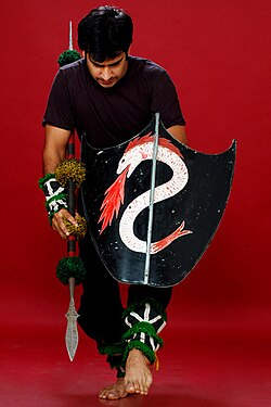 Thang Ta, the martial art form of Manipur
 -
 Pena is an ancient Manipur musical instrument, particularly popular among the Meitei people.
 -
 The Chorus Repertory Theatre, Imphal, founded by Ratan Thiyam


Manipur dance (Ras Lila)[edit | edit source]

Manipuri dance also known as Jagoi,[154] is one of the major Indian classical dance forms,[155] named after the state of Manipur.[156][157] It is particularly known for its Hindu Vaishnavism themes, and exquisite performances of love-inspired dance drama of Radha-Krishna called Raslila.[156][154][158] However, the dance is also performed to themes related to Shaivism, Shaktism and regional deities such as Umang Lai during Lai Haraoba.[159][160] The roots of Manipur dance, as with all classical Indian dances, is the ancient Hindu Sanskrit text Natya Shastra, but with influences from the culture fusion between India and Southeast Asia, East Asia, Siberia, Micronesia and Polynesia.[161]
Chorus Repertory Theatre[edit | edit source]
The auditorium of the theatre is on the outskirts of Imphal and the campus stretches for about 2 acres (8,100 m2). It has housing and working quarters to accommodate self-sufficiency of life. The theatre association has churned out internationally acclaimed plays like Chakravyuha and Uttarpriyadashi. Its 25 years of existence in theatre had disciplined its performers to a world of excellence. Chakravyuha taken from the Mahabharat epic had won Fringe Firsts Award, 1987 at the Edinburgh International Theater Festival. Chakravyuha deals with the story of Abhimanyu (son of Arjun) of his last battle and approaching death, whereas Uttarpriyadashi is an 80-minute exposition of Emperor Ashoka's redemption.[citation needed]
Sports[edit | edit source]

Mukna is a popular form of wrestling.[162] Mukna Kangjei, or Khong Kangjei, is a game which combines the arts of mukna (wrestling hockey) and Kangjei (Cane Stick) to play the ball made of seasoned bamboo roots.[163][164]
Yubi lakpi is a traditional full contact game played in Manipur, India, using a coconut, which has some notable similarities to rugby.[164] Yubi lakpi literally means "coconut snatching". The coconut is greased to make it slippery. There are rules of the game, as with all Manipur sports.[165] The coconut serves the purpose of a ball and is offered to the king, the chief guest or the judges before the game begins. The aim is to run while carrying the greased coconut and physically cross over the goal line, while the other team tackles and blocks any such attempt as well as tries to grab the coconut and score on its own. In Manipur's long history, Yubi lakpi was the annual official game, attended by the king, over the Hindu festival of Shree Govindajee.[166] It is like the game of rugby,[167] or American football.[168]
Oolaobi (Woo-Laobi) is an outdoor game mainly played by females. Meitei mythology believes that UmangLai Heloi-Taret (seven deities–seven fairies) played this game on the Courtyard of the temple of Umang Lai Lairembi. The number of participants is not fixed but are divided into two groups (size as per agreement). Players are divided as into Raiders (Attackers) or Defenders (Avoiders).[164] Hiyang Tannaba, also called Hi Yangba Tanaba, is a traditional boat rowing race and festivity of the Panas.[164]
Polo[edit | edit source]


The origin of modern polo can be traced to Manipur where the world's oldest polo ground lies, Imphal Polo Ground.[169][170] Captain Robert Stewart and Lieutenant Joseph Sherer[171] of the British colonial era first watched locals play a rules-based pulu or sagolkangjei (literally, horse and stick) game in 1859. They adopted its rules, calling the game polo, and playing it on their horses. The game spread among the British in Calcutta and then to England.[22][172]
Apart from these games, some outdoor children's games are fading in popularity. Some games such as Khutlokpi, Phibul Thomba, and Chaphu Thugaibi remain very popular elsewhere, such as in Cambodia. They are played especially during the Khmer New Year.[173]
First of its kind in India, National Sports University will be constructed in Manipur.[174]
Festivals[edit | edit source]

The festivals of Manipur are Lui-ngai-ni Ningol Chakouba, Shirui Lily festival, Yaoshang, Gan-ngai, Chumpha, Cheiraoba, Kang and Heikru Hidongba, as well as the broader religious festivals Eid-Ul-Fitr, Eid-Ul-Adha and Christmas. Most of these festivals are celebrated on the basis of the lunar calendar. Almost every festival celebrated in other states of India is observed.
On 21 November 2017, the Sangai Festival 2017 was inaugurated by President Ram Nath Kovind in Manipur. Held for 10 days, the festival is named after Manipur's state animal, the brow-antlered Sangai deer. The Sangai Festival showcases the tourism potential of Manipur in the field of arts and culture, handloom, handicrafts, indigenous sports, cuisine, music and adventure sports.
Sangai festival[edit | edit source]


Ningol Chakouba[edit | edit source]
Held on 9 November,[177] this is a social festival of the Meitei people of Manipur where married women (Ningol) are invited (Chakouba, literally calling to a meal; for dinner or lunch) to a feast at their parental house accompanied by their children. Besides the feast, gifts are given to the women/invitees and to their children. It is the festival that binds and revives the family relations between the women married away and the parental family. Nowadays, other communities have started celebrating this kind of a family-bonding festival.
Kut[edit | edit source]
Held after the Harvest festival in November,[178][179] this festival predominantly celebrated by Kuki-Chin-Mizo tribes in Manipur has become one of the leading festivals of the state. Kut is not restricted to a community or tribe — the whole state populace participates in merriment. On 1 November of every year, the state declared holiday for Kut celebration.
Yaosang[edit | edit source]
Held in February or March,[180] Yaosang is considered to be one of the biggest festivals of Manipur. It is the Holi festival (festival of colour) but Yaosang is the regional name given by the people of Manipur.
Khuado Pawi[edit | edit source]
Khuado Pawi is the harvest festival of the Tedim people who were recognised as Sukte and Zomi in India and Myanmar respectively. The word Pawi means festival in Tedim Zomi language. It is celebrated every year in the month of September–October after harvesting.[181]
,_in_the_Cheirao_Ching_summit_in_Kangleipak_(Manipur).jpg)
Cheiraoba[edit | edit source]
Also known as Sajibugi Nongma Panba and held in March or April, Cheiraoba is the new year of Manipur.[168] It is observed on the first lunar day of the lunar month Sajibu (March/April) and so it is also popularly known as Sajibu Cheiraoba. People of Manipur immaculate and decorate their houses and make a sumptuous variety of dishes to feast upon after offering food to the deity on this day. After the feast, as a part of the ritual, people climb hilltops; in the belief that it would excel them to greater heights in their worldly life.[168]
Notable people[edit | edit source]
Geographical indication[edit | edit source]
Chak-Hao (Black rice)[edit | edit source]
Chak-Hao was awarded the Geographical Indication (GI) status tag from the Geographical Indications Registry, under the Union Government of India, on 20 April 2020 and is valid until 25 December 2027.[182][183]
Consortium of Producers of Chak-Hao (Black Rice) from Imphal, proposed the GI registration of Chak-Hao. After filing the application in December 2017, the rice was granted the GI tag in 2020 by the Geographical Indication Registry in Chennai, making the name "Chak-Hao" exclusive to the rice grown in the region. It thus became the first rice variety from Manipur and Nagaland. It also is the 5th type of goods from Manipur and 4th from Nagaland to earn the GI tag respectively.[184]
The GI tag protects the rice from illegal selling and marketing, and gives it legal protection and a unique identity.
See also[edit | edit source]

- Insurgency in Manipur
- Human rights abuses in Manipur
- Outline of Manipur
- Tourist Attractions in Manipur
Footnotes[edit | edit source]
- ↑ The Old Kuki tribes retaining the Kuki classification include: Aimol, Chiru, Kom, Koireng, Kharam, and Ralte. The tribes under the Naga umbrella include: Anal, Chothe, Koirao, Lamkang, Moyon, Monsang, Purum and Tarao.[99]
- ↑ The majority of Muslims are in Manipur are Pangals/Pangan, but some other minor Muslim groups are also there.[115]
References[edit | edit source]
- ↑ "'Sana Leibak Manipur' adopted as State Song by Cabinet". 12 August 2021.
- ↑ Sinha, L. P. (1987). "The Politics and Government of Manipur". The Indian Journal of Political Science. 48 (4): 487–493. JSTOR 41855332.
- ↑ "Yumnam Khemchand Singh Sworn In As Manipur Chief Minister, Gets 2 Deputies". NDTV. Retrieved 4 February 2026.
- ↑ "Primary Census Abstract Data Tables (India & States/UTs - District Level)". Office of the Registrar General and Census Commissioner of India. Archived from the original on 8 April 2022. Retrieved 8 April 2022.
- ↑ "Manipur Population Sex Ratio in Manipur Literacy rate data". census2011.co.in. Retrieved 1 September 2015.
- ↑ "India: Subnational HDI". Global Data Labs. Retrieved 8 June 2025.
- ↑ "Appendix-A: Detailed tables, Table (7): Literacy rate (in per cent) of persons of different age groups for each State/UT (persons, age-group (years): 7 & above, rural+urban (column 6))". Annual Report, Periodic Labour Force Survey (PLFS) (July 2023 – June 2024) (PDF). National Sample Survey Office, Ministry of Statistics and Programme Implementation, Government of India. 23 September 2024. pp. A-10.
- ↑ "State Fishes of India" (PDF). National Fisheries Development Board, Government of India. Retrieved 25 December 2020.
- ↑ "Manipur". Lexico UK English Dictionary. Oxford University Press. Archived from the original on 16 May 2021.
- ↑ Guha, Ramachandra (2017), India after Gandhi: The History of the World's Largest Democracy, Pan Macmillian, p. x, ISBN 978-1-5098-8328-8
- ↑ Choudhury, Sanghamitra (2016), Women and Conflict in India, Routledge, p. 35, ISBN 978-1-317-55362-5
- ↑ "Manipuri language". Britannica. Retrieved 9 July 2022.
- ↑ Naorem Sanajaoba (Editor), Manipur, Past and Present: The Heritage and Ordeals of a Civilization, Volume 4, Chapter 2: NT Singh, ISBN 978-8170998532
- ↑ 14.0 14.1 Furber, The Unification of India (1951), p. 357: "... in July and August 1947 all of the princely states within the geographical orbit of India as distinct from that of Pakistan (except Hyderabad, Kashmir and Junagadh) "acceded" to India in accordance with the procedure laid down in the [Government of] India Act of 1935 as adapted and amended by the Government of the new Dominion of India. The important states "acceded" only with respect to defence, external affairs and communications as defined in List I of Schedule VII of the [Government of] India Act of 1935."
- ↑ Choudhury, Northeast India: A Political History (2023), pp. 136–137.
- ↑ 16.0 16.1 16.2 16.3 16.4 16.5 "Background: Conflict in Manipur", "These Fellows Must Be Eliminated": Relentless Violence and Impunity in Manipur, Human Rights Watch, 2008, archived from the original on 24 September 2015
- ↑ 17.0 17.1 State wise Indian fatalities, 1994-2013 Archived 15 July 2014 at the Wayback Machine Militancy and Terrorism Database, SATP, New Delhi
- ↑ "Census of India Website: Office of the Registrar General & Census Commissioner, India".
- ↑ 19.0 19.1 "Population by religion community - 2011". Census of India, 2011. The Registrar General & Census Commissioner, India. Archived from the original on 25 August 2015.
- ↑ 20.0 20.1 "Transportation of Manipur". investinmanipur.nic.in. Archived from the original on 30 July 2015. Retrieved 1 September 2015.
- ↑ Reginald Massey 2004, pp. 177–184.
- ↑ 22.0 22.1 Lieutenant (later Major General) Joseph Ford Sherer, Assistant to the Superintendent of Cachar, with his bearers, Manipur, 1861 Archived 3 October 2014 at the Wayback Machine National Army Museum, United Kingdom; Journal of the Society for Army Historical Research, Volume 82, Issues 337–340, page 238
- ↑ Sanajaoba, Naorem (1988). Manipur, Past and Present: The Heritage and Ordeals of a Civilization. Mittal Publications. p. 89. ISBN 978-81-7099-853-2.
- ↑ Noni, Arambam; Sanatomba, Kangujam (16 October 2015). Colonialism and Resistance: Society and State in Manipur. Routledge. p. 234. ISBN 978-1-317-27066-9.
- ↑ Naorem Sanajaoba (1988). Manipur, Past and Present: The Heritage and Ordeals of a Civilization. Mittal Publications. pp. 31–32. ISBN 978-81-7099-853-2.
- ↑ Gangmumei Kabui, History of Manipur, National Publishing House, Delhi, 1991.
- ↑ "Sana Leibak Manipur By Free Thinker". Retrieved 9 October 2023.
- ↑ (Gogoi 1956:133)
- ↑ (Luce & Htway 1976:214)
- ↑ Lieberman 2003: 154–155
- ↑ A Brief History (Puwari) of the Meiteis of Manipur. Retrieved 15 November 2009.
- ↑ 32.0 32.1 Naorem Sanajaoba (1988). Manipur, Past and Present: The Heritage and Ordeals of a Civilization. Mittal Publications. pp. 12–14. ISBN 978-81-7099-853-2.
- ↑ Naorem Sanajaoba (1988). Manipur, Past and Present: The Heritage and Ordeals of a Civilization. Mittal Publications. pp. 15–18. ISBN 978-81-7099-853-2.
- ↑ N. Lokendra (1998). The Unquiet Valley: Society, Economy, and Politics of Manipur (1891-1950). Mittal Publications. pp. 36–38. ISBN 978-81-7099-696-5.
- ↑ Katoch, Hemant Singh (2 March 2016). The Battlefields of Imphal: The Second World War and North East India. Routledge. ISBN 978-1-317-27402-5.
- ↑ "10 Photos of the Battles of Imphal and Kohima". Imperial War Museums. Retrieved 11 August 2023.
- ↑ Strahorn, Eric A. (2021). "South Asia in World War II". The Routledge History of the Second World War. pp. 428–444. doi:10.4324/9780429455353-34. ISBN 978-0-429-45535-3.
- ↑ Thompson, Bruce G. (1989). The Role of intelligence at the Battle of Imphal-Kohima, March - July 1944. Thesis (M.A.)--University of Calgary. hdl:1880/21888. ISBN 978-0-315-61764-3.
- ↑ Sudhirkumar Singh, Socio-religious and Political Movements (2011), pp. 116, 118.
- ↑ Ibochou Singh, Khwairakpam (1985). British administration in Manipur 1891–1947 (Thesis). Guwahati University/Shodhganga. pp. 224–225. hdl:10603/66697.
- ↑
Thoiba Singh, Wakambam (1984). Meetei Polity – A study of the socio-economic and political changes among the Meeteis from 1750 to 1950 (Thesis). Guwahati University/Shodhganga. p. 233 (Chapter 5). hdl:10603/69732.
The Governor of Assam having conveyed the message of the Cabinet Mission to the Maharaja of Manipur, the latter announced the appointment of a constitution making committee to draft the future constitution of Manipur.
- ↑ Manimohan Singh, Karam (1991), "Constitutional Reforms in Manipur and Its Impact on the Christians", History of Christian Missions in Manipur, Mittal PUblications, pp. 415–416 – via archive.org
- ↑ Indrakumar, Konthoujam (2015), "Colonialism and Movement for Democracy in Manipur", in Arambam Noni; Kangujam Sanatomba (eds.), Colonialism and Resistance: Society and State in Manipur, Abingdon: Routledge, pp. 61–69, doi:10.4324/9781315638317, ISBN 978-1-003-04589-2
- ↑ [39][40][41][42][43]
- ↑ Sudhirkumar Singh, Socio-religious and Political Movements (2011), pp. 130–131.
- ↑ Tarapot, Bleeding Manipur (2003), p. 172.
- ↑
Choudhury, Sanghamitra (2016), Women and Conflict in India, Routledge, pp. 35–36, ISBN 978-1-317-55362-5,
The elections were held and the new government was formed in Manipur, but it was not responsible to the legislature; Instead, it was only responsive to the legislature, which was a technicality devised by the constitutional experts of Maharaja.
- ↑
Why Pre-Merger Political Status for Manipur: Under the Framework of the Instrument of Accession, 1947, Research and Media Cell, CIRCA, 2018, p. 26, GGKEY:8XLWSW77KUZ,
Before the controversial merger, both Manipur and India were bound by the Instrument of Accession (IOA) which the King of Manipur signed on 11 August 1947. The IOA was accepted by the Governor General of India Lord Mountbatten on 16 August 1947 vide Home Department, Government of India file no A-1/1/1947. Subsequently, the Manipur State Council approved the IOA in its meeting held on 22 August 1947 Vide Memo No. 383 PTI Reference Council Minutes Part I of 11-8-1947. The execution of the Instrument of Accession was published in the Manipur State Gazette on 27 August 1947.
- ↑ Sudhirkumar Singh, Socio-religious and Political Movements (2011), chapter 6, p. 139: "The Dominion of India once again successfully convinced the Maharaja of Manipur to sign the Instrument of Accession along with the Governor General of India on 11 August 1947 on the promise of protecting the internal authority, autonomy and welfare of the state."
- ↑ Sanatomba, Interrogation into the political status of Manipur (2015), p. 169.
- ↑ Sanatomba, Interrogation into the political status of Manipur (2015), pp. 172–193: "Furthermore, Section 9(b) of the Manipur State Constitution Act, 1947, would certainly dispel any doubt about the titular status of the Maharaja, which was expressedly stated thus: 'The Maharaja means His Highness, the Maharaja of Manipur, the constitutional head of the state.' The Maharaja in his capacity as the constitutional ruler could not execute the Instrument without proper authorisation and constitutional endorsement. This was simply on account of the fact that he was not a sovereign ruler and that Manipur was not a sovereign state then. Therefore, the act of signing the Instrument of Accession on 11 August 1947 by the Maharaja could not be considered an Act of the State. Hence, the Instrument was deemed null and void right from the moment it was executed... For example, the Indian Dominion had never existed on or before 11 August 1947. Being so, it can be aptly said that the Maharaja acceded to a political non-entity. Therefore, it can be claimed that the Instrument was never executed in actuality. It was simply pre-judicial to execute the Instrument between two political entities which were yet to be born."
- ↑ Khomdom, Lisam (5 July 2018). "Manipur State Constitution Act-1947 A Cure for all myriads of ailments in Manipur ?". E- Pao.
- ↑ Tarapot, Bleeding Manipur (2003), p. 173.
- ↑ Parratt, Wounded Land (2005), pp. 103–104.
- ↑ Furber, The Unification of India (1951), pp. 366–367: 'Finally we must note the process whereby certain other princely states have become "centrally administered areas" with a constitutional status analogous to that of the former "Chief Commissioners' Provinces". This was done by having the rulers execute merger agreements in almost precisely the same terms as those executed by rulers whose states were merged in provinces... The princely states which have thus become "centrally administered areas" at the dates below specified are: ... (6) Manipur, September 1949;... Himachal Pradesh, Kutch, Tripura, and Manipur are all on the international borders of India. For Tripura and Manipur, direct administration from New Delhi was desirable for strategic reasons;...'
- ↑ Rustomji, Nari (1971), Enchanted Frontiers, Oxford University Press, p. 109 – via archive.org
- ↑ Pradip Phanjoubam. "Why it matters how Manipur became a state". www.telegraphindia.com.
- ↑ Sanatomba, Interrogation into the political status of Manipur (2015), p. 210: "The Maharaja refused to sign the Merger Agreement without consulting his Council of Ministers and conveyed his desire to return to Manipur to obtain the approval of the people. Rejecting such a reasonable proposal, Nari Rustomji, Advisor to the Governor of Assam, suggested that the Maharaja might as well finalise the merger issue during that current visit only.. (Singh 1988: 106)"
- ↑
Akoijam, A. Bimol (2001). "How History Repeats Itself". Economic and Political Weekly. 36 (30): 2807–2812. JSTOR 4410908.
When maharaja Bodhchandra resisted the move to merge Manipur with the Indian union saying that he was only a constitutional monarch and he needed to consult his elected members of the state assembly, the representatives of the union government informed him that the GoI did not recognise the assembly
- ↑
Phanjoubam, Pradip (14 December 2015). The Northeast Question: Conflicts and frontiers. Routledge. pp. 204–207. ISBN 978-1-317-34004-1.
after six days of 'per-suasion', made to sign the Merger Agreement, thereby formally merging Manipur with the Union of India. Repeated pleas by the king that it was his desire to ultimately sign the agreement, but he be first allowed to go home and consult his assembly was turned down...
- ↑ Adrija, Roychowdhury (26 August 2023). "How Manipur merged with India: From a constitutional monarchy to Part C state". The Indian Express.
- ↑ U. B. Singh, India Fiscal Federalism in Indian Union (2003), p. 135
- ↑ K.R. Dikshit; Jutta K Dikshit (2013). North-East India: Land, People and Economy. Springer Science. p. 56. ISBN 978-94-007-7055-3.
- ↑ Kalpana Kannabiran; Ranbir Singh (2008). Challenging The Rules(s) of Law. SAGE Publications. p. 264. ISBN 978-81-321-0027-0.
- ↑ 65.0 65.1 65.2 65.3 Sinha, L. P. (1987), "The Politics and Government of Manipur", The Indian Journal of Political Science, 48 (4): 488, JSTOR 41855332
- ↑ Kumar, Union Territories (1991), pp. 44–45.
- ↑ Kumar, Union Territories (1991), pp. 49–53.
- ↑ "Indiacode - Acts" (PDF). Retrieved 26 March 2014.
- ↑ "The mayhem in Manipur" The Economist (1 March 2007)
- ↑ "Manipur, India - A safe house for dangerous men" The Economist (9 March 2007)
- ↑ 71.0 71.1 ""These Fellows Must Be Eliminated": Relentless Violence and Impunity in Manipur: II. Background: Conflict in Manipur". www.hrw.org. Retrieved 6 January 2024.
- ↑ McDuie-Ra, Duncan. 2016. Borderland city in new India: Frontier to gateway (pp. 15, 17–19). Amsterdam University Press.
- ↑ "Irom Sharmila: World's longest hunger strike ends". BBC News. 9 August 2016.
- ↑ "Indian hunger striker Irom Chanu Sharmila to end 16-year fast". TheGuardian.com. 9 August 2016.
- ↑ McDuie-Ra, Duncan. 2016. Borderland City in New India: Frontier to Gateway, Amsterdam University Press, p. 18
- ↑ Chaudhuri, Kalyan (7 July 2001). "Truce and violence". Frontline. Retrieved 6 April 2026.
- ↑ Mukhim, Patricia (22 July 2023). "Can Manipur ever trust India again?". Al Jazeera.
- ↑ "Manipur violence: 175 deaths so far, 4,786 houses burnt, say police". The Indian Express. 15 September 2023.
- ↑ "175 Killed, 4,786 Homes Set Ablaze: Manipur Police Data Sheds Light On Scale Of Conflict". TimesNow. 15 September 2023.
- ↑ "Police Updates Statistics on Manipur Violence: 175 Officially Dead, 96 Bodies Yet Unclaimed". The Wire. Retrieved 2 October 2023.
- ↑ Farooqui, Sania; Sehgal, Kunal. "Over 50 dead, hundreds hospitalized and 23,000 displaced by ethnic violence in India's Manipur". CNN.
- ↑ Mollan, Cherylann (20 July 2023). "Manipur: India outrage after women paraded naked in violence-hit state". BBC News.
- ↑ Ellis-Petersen, Hannah; Hassan, Aakash (22 July 2023). "Video of women attacked in Manipur breaks silence on systematic gang rapes in India". The Observer.
- ↑ "Police Updates Statistics on Manipur Violence: 175 Officially Dead, 96 Bodies Yet Unclaimed". The Wire.
- ↑ 85.0 85.1 85.2 85.3 "fate of loktak lake". e-pao.net. Retrieved 1 September 2015.
- ↑ "South Asia - A Climatological Study Volume II: Continental South Asia" (PDF). 2002. Retrieved 6 January 2024.
- ↑ 87.0 87.1 "Manipur | History, Government, Map, Capital, & Facts | Britannica". www.britannica.com. 6 January 2024. Retrieved 6 January 2024.
- ↑ Haokip, Shri Ngamthang (2007) "Basine Delineation Map of Manipur" Archived 26 March 2009 at the Wayback Machine, Profile on State of Environment Report of Manipur, 2006–07, Ministry of Environment and Forests, Manipur, p. 4
- ↑ Government of Manipur. "Irrigation And Water Management" (PDF). Archived from the original (PDF) on 26 June 2011. Retrieved 31 October 2010.
- ↑ Centre for Science and Environment (India). "The Arithmetic of Water in India". Retrieved 31 October 2010.
- ↑ 91.0 91.1 Kshetrimayum, K.S.; Laishram, Premananda (October 2020). "Assessment of surface water and groundwater interaction using hydrogeology, hydrochemical and isotopic constituents in the Imphal river basin, Northeast India". Groundwater for Sustainable Development. 11 100391. Bibcode:2020GSusD..1100391K. doi:10.1016/j.gsd.2020.100391.
- ↑ Director of Commerce and Industries, Manipur. "Soil and Climate of Manipur". Archived from the original on 31 August 2010. Retrieved 31 October 2010.
- ↑ "State Profile of Manipur" (PDF). 2015. Retrieved 6 January 2024.
- ↑ 94.0 94.1 "FOREST DEPARTMENT, GOVERNMENT OF MANIPUR". Archived from the original on 6 January 2024. Retrieved 6 January 2024.
- ↑ Samom, Sobhapati (31 May 2019). "Manipur affected by changing climate, say scientists". NorthEast Now.
- ↑ "A-02: Decadal variation in population 1901-2011, Manipur" (PDF). censusindia.gov.in. Retrieved 22 July 2023.
- ↑ "Manipur Population Census data 2011". Census 2011. Retrieved 2 September 2017.
- ↑ Khomdan Singh Lisam, Encyclopaedia Of Manipur, ISBN 978-8178358642, pp. 322–347
- ↑ Kom, Ch. Sekholal (June 2015). "Ethno-nationalism: Competing Micro-nationalist Dissents in Manipur". Social Change. 45 (2): 289–307. doi:10.1177/0049085715574192.
- ↑ Meetei, Nameirakpam Bijen (2014). "Ethnicity, Colonial Legacies, and Postindependence Issues of Identity Politics in North-East India". Nationalism and Ethnic Politics. 20: 99–115. doi:10.1080/13537113.2014.879768.
- ↑ Laishram, Ratankumar singh (2009). "United Naga Council (UNC)". A Historical study of the role and politics of civil society in Manipur (Thesis). Manipur University. hdl:10603/103655.
- ↑ Tohring, S. R. (2010). Violence and Identity in North-east India: Naga-Kuki Conflict. Mittal Publications. pp. xv–xvii. ISBN 978-81-8324-344-5.
- ↑ A-11 Appendix: District wise scheduled tribe population (Appendix), Manipur - 2011, Office of the Registrar General & Census Commissioner, Government of India, 2011, retrieved 22 September 2023
- ↑ "Table C-16 Population by mother tongue: Manipur". Census of India. Registrar General and Census Commissioner of India. 2011. Retrieved 10 August 2023.
- ↑ "Report of the Commissioner for linguistic minorities: 47th report (July 2008 to June 2010)" (PDF). Commissioner for Linguistic Minorities, Ministry of Minority Affairs, Government of India. p. 78. Archived from the original (PDF) on 13 May 2012. Retrieved 16 February 2012.
- ↑ "Manipuri language". Britannica. Retrieved 22 February 2023.
- ↑ "Census of India Website: Office of the Registrar General & Census Commissioner, India". censusindia.gov.in. Retrieved 15 March 2020.
- ↑ "Department of language planning and implementation trying to resolve all language issues in the state". Pothashang News. 14 March 2018.
- ↑ "Ranking of Districts by Population Size, 2001 and 2011" (XLS). The Registrar General & Census Commissioner, India, New Delhi-110011. 2010–2011. Retrieved 18 September 2011.
- ↑ 110.0 110.1 "Table C-01 Population by religious community: Manipur". Census of India. Registrar General and Census Commissioner of India. 2011. Retrieved 10 August 2023.
- ↑ "Christian population on the rise in Arunachal Pradesh, Manipur". Hindustan Times. 8 March 2017.
- ↑ S. Bebita Devi (2013). "4" (PDF). Advent of a caste - the emergence and role of Brahmans in Manipuri society (Thesis).
- ↑ Sanajaoba, Naorem (1988). Manipur, Past and Present: The Heritage and Ordeals of a Civilization. Mittal Publications. ISBN 978-81-7099-853-2.
- ↑ "The Vaishnava Temples of Manipur: An Historical Study". Retrieved 2 February 2020.
- ↑ 115.0 115.1 Hazra, Anupam (1 January 2014). Sustaining Development in North-East India: Emerging Issues, Challenges and Policy Measures. Concept Publishing Company. p. 198. ISBN 978-93-5125-024-1.
All the Muslims of Manipur are not Meitei Pangals because Meitei Pangals are those who are born and brought up in Manipur.
- ↑ "Evolution of clan system Manipuri Muslim 1". e-pao.net. Retrieved 1 September 2015.
- ↑ Saikia, Arunabh (24 February 2019). "After six decades, Manipur's Burmese Tamils get a glimpse of their ancestral places in Myanmar". Scroll.in. Retrieved 5 February 2026.
By local estimates, there are around 3,000 Tamils, Hindu and Muslim, in Moreh, a town of less than 20,000 people belonging to at least a dozen distinct communities, including the Kukis and the Manipuri Meiteis.
- ↑
Muslim population among Scheduled Tribes in Manipur Tribe 2001 2011 Total Muslims 🚹 🚺 Total Muslims 🚹 🚺 Aimol 4 1 3 15 6 9 Anal 110 57 53 74 31 43 Angami 1 1 0 0 0 0 Chiru 24 14 10 62 25 37 Chothe 6 2 4 5 1 4 Gangte 35 21 14 101 52 49 Hmar 300 153 147 226 109 117 Kabui 602 310 292 376 183 193 Kacha Naga 280 148 132 208 103 105 Koirao 7 4 3 34 15 19 Koireng 6 2 4 6 1 5 Kom 94 55 39 47 22 25 Lamgang 29 15 14 19 9 10 Mao 23 15 8 243 121 122 Maram 0 0 0 78 39 39 Maring 82 39 43 77 43 34 Any Mizo (Lushai) tribes etc. 56 32 24 19 10 9 Monsang 24 16 8 9 6 3 Moyon 11 7 4 2 0 2 Paite 177 92 85 268 127 141 Source:
- "Census of India 2001 – ST-14 Scheduled Tribe Population by Religious Community". Office of the Registrar General & Census Commissioner, India. Retrieved 30 October 2025.
- "Census of India Website : Office of the Registrar General & Census Commissioner, India". censusindia.gov.in. Archived from the original on 14 November 2019. Retrieved 5 December 2025.
- ↑ Khan, Mofakhkhar Hussain (2001). The Holy Qur'ãn in South Asia: A Bio-bibliographic Study of Translations of the Holy Qurʼãn in 23 South Asian Languages. Bibi Akhtar Prakãs̆ani. p. 430.
- ↑ Bertil Lintner (2015). Great Game East: India, China, and the Struggle for Asia's Most Volatile Frontier. Yale University Press. p. 113. ISBN 978-0-300-19567-5.
- ↑ "State/UT wise Seats in the Assembly and their Reservation Status". Election Commission of India. Retrieved 23 May 2018.
- ↑ Manipur Government Archived 22 October 2016 at the Wayback Machine, Govt of India
- ↑ ECI Manipur Archived 19 May 2017 at the Wayback Machine, Govt of India
- ↑ Manipur Local Bodies Report 2015 – Annual Technical Inspection Report on Panchayati Raj Institutions and Urban Local Bodies for the year ended 31 March 2014 (PDF) (Report). Imphal: Comptroller and Auditor General of India. 2015.
- ↑ Manipur Local Bodies Report 2015 – Annual Technical Inspection Report on Panchayati Raj Institutions and Urban Local Bodies for the year ended 31 March 2014 (PDF) (Report). Imphal: Comptroller and Auditor General of India. 2015.
- ↑ "A decade of starvation for Irom Sharmila". The Independent. 4 November 2010.
- ↑ Singh, Vijaita. "Centre inks peace accord with Naga insurgent outfit". The Hindu.
- ↑ "仏壇修理・洗浄なら石川県羽咋市の宮本仏檀店". kukination.net. Archived from the original on 24 April 2015. Retrieved 1 September 2015.
- ↑ Manipur Assessment - Year 2014 Archived 4 July 2014 at the Wayback Machine SATP, New Delhi
- ↑ Global Burden of Armed Violence Archived 24 September 2015 at the Wayback Machine Chapter 2, Geneva Declaration, Switzerland (2011)
- ↑ State wise : Population, GSDP, Per Capita Income and Growth Rate Archived 11 November 2013 at the Wayback Machine Planning Commission, Govt of India; See third table 2011-2012 fiscal year, 16th row
- ↑ 132.0 132.1 Gonmei, G. Hiamguanglung (2013). "Hills Economy of Manipur: A Structural Change" (PDF). Journal of North East India Studies. 3 (1): 61–73.
- ↑ 133.0 133.1 133.2 "Manipur Economy - Snapshot" Archived 2 July 2014 at the Wayback Machine IBEF
- ↑ Manipur Energy Archived 23 March 2015 at the Wayback Machine Govt of Manipur
- ↑ Manipur power Archived 19 March 2014 at the Wayback Machine Government of India
- ↑ 136.0 136.1 "In rural Manipur, women feel the heat of climate change". The Third Pole. 14 March 2018. Retrieved 7 October 2021.
- ↑ Shirin, Babie (27 January 2021). "Climate Change: Farmers in Manipur hit hard by unusual weather temperature". Imphal Free Press.
- ↑ "Manipur's villagers take charge, fix 19km stretch of roads: ANI – The Indian Express". The Indian Express.
- ↑ Prafullokumar Singh, A. (2009). The Ninth Assembly Elections in Manipur: A. Prafullokumar Singh – Election Politics in Manipur. Mittal Publications. p. 521. ISBN 978-81-8324-279-0.
- ↑ "Rail link from Manipur to Vietnam on cards: Tharoor". The Times of India. Archived from the original on 17 May 2013.
- ↑ "The Floating Islands of India". earthobservatory.nasa.gov. 7 May 2018. Retrieved 13 March 2023.
The largest island is home to the Keibul Lamjao, the world's only floating national park. It serves as a habitat for the endangered brow-antlered sangai, or "dancing deer," whose hooves have adapted to the island's spongy ground. The park, covering 15 square miles (40 km2), was specifically created to preserve the deer, which were once thought to be extinct.
- ↑ McKechnie, Ben (12 April 2018). "The world's only floating national park". www.bbc.com.
- ↑ Centre, UNESCO World Heritage. "Keibul Lamjao Conservation Area". UNESCO World Heritage Centre. Retrieved 13 March 2023.
- ↑ "Keibul Lamjao Conservation Area | For UNESCO World Heritage Travellers". www.worldheritagesite.org. Retrieved 13 March 2023.
- ↑ "Manipur titular king moves Parliament to declare Kangla Fort as World Heritage Site". The Times of India. 5 February 2021.
- ↑ "Kangla as a World Heritage Site". Imphal Free Press. Archived from the original on 8 February 2023. Retrieved 13 March 2023.
- ↑ State bird Nongin Archived 27 August 2014 at the Wayback Machine Government of Manipur
- ↑ State flower SHIRUI LILY Archived 3 February 2014 at the Wayback Machine Government of Manipur
- ↑ State animal Sangai Archived 1 February 2014 at the Wayback Machine Government of Manipur
- ↑ "The world's only floating national park". 12 April 2018.
- ↑ "Ichum Keirap". yolasite.com. Retrieved 1 September 2015.
- ↑ "Thalon Cave, Tamenglong: December 2009 ~ Pictures from Manipur". e-pao.net. Retrieved 1 September 2015.
- ↑ "Ukhrul District". ukhrul.nic.in. Retrieved 1 September 2015.
- ↑ 154.0 154.1 Reginald Massey 2004, p. 177.
- ↑ Williams 2004, pp. 83-84, the other major classical Indian dances are: Bharatanatyam, Kathak, Odissi, Kathakali, Kuchipudi, Cchau, Satriya, Yaksagana and Bhagavata Mela.
- ↑ 156.0 156.1 James G. Lochtefeld (2002). The Illustrated Encyclopedia of Hinduism: A-M. The Rosen Publishing Group. pp. 420–421. ISBN 978-0-8239-3179-8.
- ↑ Reginald Massey 2004, pp. 177-187.
- ↑ Ragini Devi 1990, pp. 175-180.
- ↑ Reginald Massey 2004, pp. 177-180.
- ↑ Saroj Nalini Parratt (1997). The pleasing of the gods: Meitei Lai Haraoba. Vikas Publishers. pp. 14–20, 42–46. ISBN 978-81-259-0416-8.
- ↑ Saryu Doshi 1989, pp. xv-xviii.
- ↑ Ved Prakash, Encyclopaedia of North-East India, Volume 4, ISBN 978-8126907069, pp 1558-1561
- ↑ Gurmeet Kanwal, Defenders of the Dawn, ISBN 978-8170622796, pp 48
- ↑ 164.0 164.1 164.2 164.3 Khomdan Singh Lisam, Encyclopaedia Of Manipur, ISBN 978-8178358642, pp 824-830
- ↑ Indigenous games of Manipur Archived 12 May 2015 at the Wayback Machine Govt of Manipur
- ↑ Khomdan Singh Lisam, Encyclopaedia Of Manipur, ISBN 978-8178358642, pp 825
- ↑ Mills, James H. (February 2006). "'Manipur Rules Here': Gender, Politics, and Sport in an Asian Border Zone". Journal of Sport and Social Issues. 30 (1): 62–78. doi:10.1177/0193723505282470.
- ↑ 168.0 168.1 168.2 168.3 Khomdan Singh Lisam, Encyclopaedia Of Manipur, ISBN 978-8178358642, pp 825-830
- ↑ "History of Polo | Polo Museum". www.polomuseum.org. Retrieved 13 August 2023.
- ↑ "Polo Origins". Andalucia.com. 14 August 2017. Retrieved 13 August 2023.
- ↑ Joseph Ford Sherer is called the Father of English Polo; see Horace A. Laffaye (2009), The Evolution of Polo, ISBN 978-0786438143, Chapter 2; National Army Museum Silver salver presented to Captain Joseph Ford Sherer Archived 28 November 2014 at the Wayback Machine United Kingdom
- ↑ Chris Aston "Manipur, Cradle of the Modern Game" Archived 27 November 2014 at the Wayback Machine, Polo Consult
- ↑ "Singh, Atom Sunil; indigenous Games between Cambodia and Manipur: A Borderless Connectivity, The Sangai Express, 4 June 2008". Retrieved 30 April 2017.
- ↑ "Lok Sabha passes Bill to set-up sports varsity in Manipur". The Hindu. 3 August 2018 – via www.thehindu.com.
- ↑ "Manipur Sangai Festival Concludes". Northeast Today. Retrieved 25 December 2012.
{{cite news}}: CS1 maint: deprecated archival service (link) - ↑ "Why Manipur Sangai Festival". Sangai festival - Department of Tourism. Retrieved 25 December 2012.
- ↑ Khomdan Singh Lisam, Encyclopaedia Of Manipur, ISBN 978-8178358642, pp. 607–617
- ↑ Khomdan Singh Lisam, Encyclopaedia Of Manipur, ISBN 978-8178358642, pp. 950–961
- ↑ G. K. Ghosh, Shukla Ghosh, Women of Manipur, ISBN 978-8170248972
- ↑ Khomdan Singh Lisam, Encyclopaedia Of Manipur, ISBN 978-8178358642, pp. 629–632
- ↑ "Zomi Ngeina Khuado Pawi". ARCHIVE | TONGSAN || International Media Group. Archived from the original on 27 April 2019. Retrieved 9 February 2016.
- ↑ "Chak-Hao". Intellectual Property India. Retrieved 12 December 2024.
- ↑ "Organic Manipur black rice exported to Europe for the first time". Hindustan Times. 12 August 2021. Retrieved 12 December 2024.
- ↑ Business and Economy Current Affairs Yearly Review 2021 E-book: Check this Business and Economy Current Affairs Yearly Review 2021 E-book. Know all annual news here. Testbook.com. 24 January 2022. Retrieved 12 December 2024.
Bibliography[edit | edit source]
- Choudhury, Samrat (2023), Northeast India: A Political History, Hurst, ISBN 978-1-78738-952-6
- Furber, Holden (1951), "The Unification of India, 1947–1951", Pacific Affairs, 24 (4), Pacific Affairs, University of British Columbia: 352–371, doi:10.2307/2753451, JSTOR 2753451
- Harvey, G. E. (1925). History of Burma: From the Earliest Times to 10 March 1824. London: Frank Cass & Co. Ltd.
- Kala, U (2006) [1724]. Maha Yazawin (in မြန်မာဘာသာ). Vol. 1–3 (4th printing ed.). Yangon: Ya-Pyei Publishing.
- Myint-U, Thant (2006). The River of Lost Footsteps—Histories of Burma. Farrar, Straus and Giroux. ISBN 978-0-374-16342-6.
- Parratt, John (2005), Wounded Land: Politics and Identity in Modern Manipur, Mittal Publications, ISBN 978-81-8324-053-6
- Kumar, Sudhir (1991), Political and Administrative Setup of Union Territories in India, Mittal Publications, ISBN 978-81-7099-304-9
- Gogoi, Padmeswar (1956). The political expansion of the Mao Shans.
- Luce, G.H; Htway, Tin (1976), "A 15th Century Inscription and Library at Pagán, Burma", Malalasekera Commemoration Volume. Colombo: The Malalasekera Commemoration Volume Editorial Committee, Dept of Pali and Buddhist Studies, University of Ceylon, pp. 203–256
- Ragini Devi (1990). Dance Dialects of India. Motilal Banarsidass. ISBN 978-81-208-0674-0.
- Sanatomba, Kangujam (2015), "Interrogation into the political status of Manipur", in Arambam Noni; Kangujam Sanatomba (eds.), Colonialism and Resistance: Society and State in Manipur, Routledge, pp. 159–180, ISBN 978-1-317-27066-9
- Saryu Doshi (1989). Dances of Manipur: The Classical Tradition. Marg Publications. ISBN 978-81-85026-09-1.
- Reginald Massey (2004). India's Dances: Their History, Technique, and Repertoire. Abhinav Publications. ISBN 978-81-7017-434-9.
- Sudhirkumar Singh, Haorongbam (2011), "Socio-religious and Political Movements in Modern Manipur 1934–51", INFLIBNET, hdl:10603/121665
- Tarapot, Phanjoubam (2003), Bleeding Manipur, Har-Anand Publications, ISBN 978-81-241-0902-1
- Williams, Drid (January 2004). "In the Shadow of Hollywood Orientalism: Authentic East Indian Dancing". Visual Anthropology. 17 (1): 69–98. doi:10.1080/08949460490274013.
- Lieberman, Victor B. (2003). Strange Parallels: Southeast Asia in Global Context, c. 800–1830, volume 1, Integration on the Mainland. Cambridge University Press. ISBN 978-0-521-80496-7.
External links[edit | edit source]
Government
{{URL|example.com|optional display text}}- Official Tourism Site of Manipur
General information
 Geographic data related to Manipur at OpenStreetMap
.png)