









ImportMaster (talk | contribs) mNo edit summary |
robot: Creating/updating articles |
||
| Line 1: | Line 1: | ||
[[ | {{Short description|Group of Northeastern Indian states}} | ||
'''Northeast India''' (officially '''North Eastern Region''' | {{About|the North Eastern Region (NER) of India||Northeast (disambiguation)}} | ||
{{Use Indian English|date=December 2016}} | |||
{{Use dmy dates|date=March 2022}} | |||
{{Infobox settlement | |||
<!-- See Template:Infobox settlement for additional fields and descriptions -->| name = Northeast India | |||
| native_name = | |||
| native_name_lang = mni <!-- ISO 639-3 {{lang|ori}} instead --> <!-- ISO 639-2 {{lang|bn}} instead --> | |||
| settlement_type = | |||
| image_skyline = | |||
| image_alt = | |||
| image_caption = | |||
| motto = | |||
| image_map = Northeast india.png | |||
| map_alt = Northeast india map.png | |||
| coordinates = {{coords|26|91|dim:500km_region:IN|display=title,inline}} | |||
| coordinates_footnotes = | |||
| subdivision_type = [[Country]] | |||
| subdivision_name = {{flag|India}} | |||
| subdivision_type1 = States | |||
| subdivision_name1 = {{plainlist| | |||
* '''[[Arunachal Pradesh]]''' | |||
* '''[[Assam]]''' | |||
* '''[[Manipur]]''' | |||
* '''[[Meghalaya]]''' | |||
* '''[[Mizoram]]''' | |||
* '''[[Nagaland]]''' | |||
* '''[[Tripura]]''' | |||
* '''[[Sikkim]]''' | |||
}} | |||
| subdivision_type2 = Largest city | |||
| subdivision_name2 = [[Guwahati]] | |||
| subdivision_type3 = Major cities ([[2011 Census of India]])<ref name="Indian cities by population">{{cite web |url=http://censusindia.gov.in/2011-prov-results/paper2/data_files/India2/Table_2_PR_Cities_1Lakh_and_Above.pdf |title=Indian cities by population |access-date=30 May 2018 |archive-date=23 July 2013 |archive-url=https://web.archive.org/web/20130723151530/http://www.censusindia.gov.in/2011-prov-results/paper2/data_files/India2/Table_2_PR_Cities_1Lakh_and_Above.pdf |url-status=live }}</ref> | |||
| subdivision_name3 = {{plainlist| | |||
* [[Agartala]] | |||
* [[Aizawl]] | |||
* [[Imphal]] | |||
* [[Itanagar]] | |||
* [[Silchar]] | |||
* [[Shillong]] | |||
* [[Dibrugarh]] | |||
* [[Dimapur]] | |||
* [[Kohima]] | |||
}} | |||
<!-- ALL fields with measurements have automatic unit conversion --> | |||
<!-- for references: use <ref> tags -->| unit_pref = Metric | |||
| area_footnotes = | |||
| area_total_km2 = 262,179 | |||
| area_land_km2 = | |||
| area_water_km2 = | |||
| area_water_percent = | |||
| area_rank = | |||
| area_note = | |||
| population_total = 45,772,188 | |||
| population_as_of = [[2011 Census of India|2011]] | |||
| population_density_km2 = 173 | |||
| population_demonym = | |||
| timezone1 = [[Indian Standard Time]] | |||
| utc_offset1 = +5:30 | |||
| timezone1_DST = | |||
| utc_offset1_DST = | |||
| blank_name_sec1 = [[Scheduled languages of India|Scheduled languages]] | |||
| blank_info_sec1 = * [[Assamese language|Assamese]]<ref name="scheduledlanguages">{{Cite web |title=Languages Included in the Eighth Schedule of the Indian Constitution {{!}} Department of Official Language {{!}} Ministry of Home Affairs {{!}} GoI |url=https://rajbhasha.gov.in/en/languages-included-eighth-schedule-indian-constitution |access-date=2022-07-31 |website=rajbhasha.gov.in}}</ref> | |||
* [[Bengali language|Bengali]]<ref name=scheduledlanguages/> | |||
* [[Bodo language|Bodo]]<ref name=scheduledlanguages/> | |||
* [[Meitei language|Meitei]] ([[Manipuri language|Manipuri]])<ref name=scheduledlanguages/><ref>{{Cite web |title=Manipuri language {{!}} Britannica |url=https://www.britannica.com/topic/Manipuri-language |website=www.britannica.com |language=en}}</ref> | |||
* [[Nepali language|Nepali]]<ref name=scheduledlanguages/> | |||
| blank_name_sec2 = State/Regional official languages | |||
| blank_info_sec2 = <!-- Please do not add any other languages other than the following 7 languages, until and unless included in the legitimate official sources released by the Government of India --> | |||
* [[Assamese language|Assamese]] (of [[Assam]])<ref name=langoff>{{cite web |url=http://nclm.nic.in/shared/linkimages/NCLM47thReport.pdf |title=Report of the Commissioner for linguistic minorities: 47th report (July 2008 to June 2010) |pages=84–89 |publisher=Commissioner for Linguistic Minorities, Ministry of Minority Affairs, Government of India |access-date=16 February 2012 |url-status=dead |archive-url=https://web.archive.org/web/20120513161847/http://nclm.nic.in/shared/linkimages/NCLM47thReport.pdf |archive-date=13 May 2012 }}</ref><ref>{{Cite book |last=Nath |first=Monoj Kumar |url=https://books.google.com/books?id=sDAXEAAAQBAJ&q=Assam+Official+Language+Act%2C+1960%2C+which+made+Assamese+the+state+language+of+Assam&pg=PA57 |title=The Muslim Question in Assam and Northeast India |date=2021-03-29 |publisher=Taylor & Francis |isbn=978-1-000-37027-0 |pages=57 |language=en}}</ref> | |||
* [[Bengali language|Bengali]] (of [[Tripura]]<ref name=langoff/><ref name="Chakravarti 421">{{Cite book |last=Chakravarti |first=Sudeep |url=https://books.google.com/books?id=e11PEAAAQBAJ&q=The+official+languages+of+Tripura+are+Bangla+and+Kok+Borok&pg=PT421 |title=The Eastern Gate: War and Peace in Nagaland, Manipur and India's Far East |date=2022-01-06 |publisher=Simon and Schuster |isbn=978-93-92099-26-7 |pages=421 |language=en}}</ref><ref name="Kumāra 2007 88">{{Cite book |last=Kumāra |first=Braja Bihārī |url=https://books.google.com/books?id=QTCJTIBHJHEC&q=Kakbarak+recognized+official+Tripura+Bengalee&pg=PA88 |title=Problems of Ethnicity in the North-East India |date=2007 |publisher=Concept Publishing Company |isbn=978-81-8069-464-6 |pages=88 |language=en}}</ref> and [[Barak Valley]]<ref name=langoff/><ref>{{Cite book |last=Wadley |first=Susan S. |url=https://books.google.com/books?id=xDzfBQAAQBAJ&q=Bengali+was+declared+the+official+language+of+Assam&pg=PA76 |title=South Asia in the World: An Introduction: An Introduction |date=2014-12-18 |publisher=Routledge |isbn=978-1-317-45959-0 |pages=76 |language=en}}</ref>) | |||
* [[Bodo language|Bodo]] (of [[Bodoland]])<ref name=langoff/><ref>{{Cite book |last1=Oinam |first1=Bhagat |url=https://books.google.com/books?id=X31aDwAAQBAJ&q=Bodo+recognised+as+an+associated+state+official+language+of+Assam&pg=PT164 |title=Northeast India: A Reader |last2=Sadokpam |first2=Dhiren A. |date=2018-05-11 |publisher=Taylor & Francis |isbn=978-0-429-95320-0 |pages=164 |language=en}}</ref><ref>{{Cite book |last=Deb |first=Bimal J. |url=https://books.google.com/books?id=_YYnwp8e5VYC&q=Government+of+Assam+have+declared+Bodo+as+an+associate+official+language&pg=PA21 |title=Ethnic Issues, Secularism, and Conflict Resolution in North East Asia |date=2006 |publisher=Concept Publishing Company |isbn=978-81-8069-134-8 |pages=21 |language=en}}</ref> | |||
* [[Kokborok]] ([[Tripuri language|Tripuri]]) (of [[Tripura]])<ref name=langoff/><ref name="Chakravarti 421"/><ref name="Kumāra 2007 88"/> | |||
* [[Mizo language|Mizo]] (of [[Mizoram]])<ref name=langoff/><ref name="Britannica 174">{{Cite book |last=Britannica |url=https://books.google.com/books?id=-xzljvnQ1vAC&q=Manipuri+%28+or+Meitei+%29+official+Manipur+Mizo+Mizoram&pg=PA174 |title=Student Britannica India 7 Vols |publisher=Popular Prakashan |isbn=978-0-85229-762-9 |pages=174 |language=en}}</ref> | |||
* [[Meitei language|Meitei]] ([[Manipuri language|Manipuri]]) (of [[Manipur]])<ref name=langoff/><ref name="Britannica 174"/><ref>{{Cite book |last=Brenzinger |first=Matthias |url=https://books.google.com/books?id=i3xdDwAAQBAJ&q=Meithei+official+language+of+Manipur&pg=PA322 |title=Language Diversity Endangered |date=2015-07-31 |publisher=Walter de Gruyter GmbH & Co KG |isbn=978-3-11-090569-4 |pages=322 |language=en}}</ref><ref>{{Cite book |last=Experts |first=Arihant |url=https://books.google.com/books?id=TBrzDwAAQBAJ&q=Manipuri+official+language+of+Manipur&pg=PA531 |title=General Knowledge 2020 |date=2019-06-04 |publisher=Arihant Publications India limited |isbn=978-93-131-9167-4 |pages=531 |language=en}}</ref> | |||
* [[Nepali language|Nepali]] (of [[Sikkim]])<ref name="auto">[https://sikkim.gov.in/department/departmentmenudetails?url=Menu%3Dsikkim-legislative-assembly%2Flanguage-used-in-assembly#:~:text=The%20business%20of%20the%20Assembly,Sikkim%2C%20namely%20Nepali%2C%20Bhutia Legislative assembly]</ref> | |||
* [[English language|English]] (of [[Arunachal Pradesh]], [[Meghalaya]] and [[Nagaland]])<ref name=langoff/> | |||
* [[Sikkimese language|Sikkimese]] (of [[Sikkim]])<ref name="auto"/> | |||
| coordinates_region = | |||
| official_name = North Eastern Region (NER) | |||
| population_density_sq_mi = auto | |||
| population_est = 51670000 | |||
| pop_est_as_of = 2022 | |||
| pop_est_footnotes = <ref>[https://uidai.gov.in/images/StateWiseAge_AadhaarSat_Rep_31082022_Projected-2022-Final.pdf State/UT wise Aadhaar Saturation]</ref> | |||
}} | |||
'''Northeast India''' (officially the '''North Eastern Region''' '''(NER)''') is the easternmost region of [[India]] representing both a geographic and political [[Administrative divisions of India|administrative division]] of the country.<ref>https://mdoner.gov.in/</ref> It comprises eight [[States and union territories of India|states]]—[[Arunachal Pradesh]], [[Assam]], [[Manipur]], [[Meghalaya]], [[Mizoram]], [[Nagaland]] and [[Tripura]] (commonly known as the "Seven Sisters"), and the "brother" state [[Sikkim]].<ref name="North Eastern Council"/> | |||
== | The region shares an international border of {{convert|5182|km}} (about 99 percent of its total geographical boundary) with several neighbouring countries – {{convert|1395|km}} with [[Tibet Autonomous Region|Tibet]] in the north, {{convert|1640|km}} with [[Myanmar]] in the east, {{convert|1596|km}} with [[Bangladesh]] in the south-west, {{convert|97|km}} with [[Nepal]] in the west, and {{convert|455|km}} with [[Bhutan]] in the north-west.<ref name="Borders of Northeast India">{{cite web |url=http://fincomindia.nic.in/writereaddata/html_en_files/oldcommission_html/fincom13/discussion/report14.pdf |title=Problems of border areas in Northeast India |access-date=30 April 2018 |archive-date=23 January 2022 |archive-url=https://web.archive.org/web/20220123012040/https://fincomindia.nic.in/writereaddata/html_en_files/oldcommission_html/fincom13/discussion/report14.pdf |url-status=live }}</ref> It comprises an area of {{convert|262230|km2}}, almost 8 percent of that of India. The [[Siliguri Corridor]] connects the region to the rest of mainland India. | ||
The states of North Eastern Region are officially recognised under the [[North Eastern Council]] (NEC),<ref name="North Eastern Council">{{cite web |url=http://necouncil.nic.in/ |title=North Eastern Council |access-date=25 March 2012 |url-status=dead |archive-url=https://web.archive.org/web/20120415001111/http://necouncil.nic.in/ |archive-date=15 April 2012 }}</ref> constituted in 1971 as the acting agency for the development of the north eastern states. Long after induction of NEC, Sikkim formed part of the North Eastern Region as the eighth state in 2002.<ref name="Integration of Sikkim in North Eastern Council" /><ref name="Inclusion of Sikkim by NEC">{{cite web |url=http://www.necouncil.gov.in/writereaddata/mainlinkFile/Namchi,%20Sikkim.pdf |title=Evaluation of NEC funded projects in Sikkim |publisher=NEC |access-date=4 June 2017 |archive-url=https://web.archive.org/web/20170908201708/http://www.necouncil.gov.in/writereaddata/mainlinkFile/Namchi,%20Sikkim.pdf |archive-date=8 September 2017 |url-status=dead }}</ref> [[India–Myanmar barrier#Look-East connectivity|India's Look-East connectivity projects]] connect Northeast India to East Asia and [[ASEAN]]. [[Guwahati]] city in Assam is called the Gateway to the North East and is the largest metropolis in North East India. | |||
==History== | |||
{{further|History of Assam|History of Manipur|History of Tripura|People of Assam}} | |||
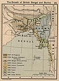
[[File:Joppen1907BritishBengalBritishBurmaA.jpg|left|220px|thumb|{{center|Assam annexation to [[British India]] in 1838.}}]] | |||
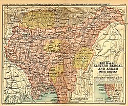
[[File:1907-east-bengal-assam3.jpg|thumb|220px|{{center|Eastern Bengal and Assam in 1907}}]] | |||
The earliest settlers may have been [[Austroasiatic languages|Austroasiatic]] speakers from [[Southeast Asia]], followed by [[Tibeto-Burman languages|Tibeto-Burman]] speakers from China, and by 500 BCE [[Indo-Aryan languages|Indo-Aryan]] speakers from the [[Gangetic Plain]]s as well as [[Kra–Dai languages|Kra–Dai]] speakers from southern [[Yunnan]] and [[Shan State]].<ref>{{Cite book |url=https://www.worldcat.org/oclc/47208764 |title=Geography of Assam |date=2001 |publisher=Rajesh Publications |isbn=81-85891-41-9 |location=New Delhi |page=12 |oclc=47208764 |quote=The first group of migrants to settle in this part of the country is perhaps the Austro-Asiatic language speaking people who came here from South-East Asia a few millennia before Christ. The second group of migrants came to Assam from the north, north-east and east. They are mostly the Tibeto-Burman language speaking people. From about the fifth century before Christ, there started a trickle of migration of the people speaking Indo-Aryan language from the Gangetic plain. |access-date=22 December 2020 |archive-date=2 March 2022 |archive-url=https://web.archive.org/web/20220302150418/https://www.worldcat.org/title/geography-of-assam/oclc/47208764 |url-status=live }}</ref> Due to the biodiversity and crop diversity of the region, [[archaeology|archaeological]] researchers believe that early settlers of Northeast India had domesticated several important plants.<ref>Hazarika, M. 2006 "Neolithic Culture of Northeast India: A Recent Perspective on the Origins of Pottery and Agriculture." ''Ancient Asia'', 1, {{doi|10.5334/aa.06104}}</ref> Writers believe that the 100 BCE writings of Chinese explorer [[Zhang Qian]] indicate an early trade route via Northeast India.<ref>"Chang K'ien had clearly realized the existence of a trade route between Sichuan and India via Yunnan and Burma or Assam" {{harv|Lahiri|1991|pp=11–12}}</ref> The ''[[Periplus of the Erythraean Sea]]'' mentions a people called Sêsatai in the region,<ref>''Besatae'' in the Schoff translation and also sometimes used by Ptolemy, they are a people similar to Kirradai and they lived in the region between "Assam and Sichuan" {{harv|Casson|1989|pp=214–242}}</ref> who produced [[malabathron]], so prized in the old world.<ref>{{harv|Casson|1989|pp=51–53}}</ref> [[Ptolemy]]'s [[Geographia (Ptolemy)|Geographia]] (2nd century CE) calls the region ''Kirrhadia'', apparently after the [[Kirata]] population.<ref>"The ''Periplus of the Erythraen Sea'' (last quarter of the first century A.D) and Ptolemy's ''Geography'' (middle of the second century A.D) appear to call the land including Assam Kirrhadia after its Kirata population." {{harvcol|Sircar|1990|pp=60–61}}</ref> | |||
In the early historical period (most of the first millennium CE), [[Kamarupa]] straddled most of present-day Northeast India, besides Bhutan and Sylhet in Bangladesh. [[Xuanzang]], a travelling Chinese Buddhist monk, visited [[Kamarupa]] in the 7th century CE. He described the people as "short in stature and black-looking", whose speech differed a little from central India and who were of simple but violent disposition. He wrote that the people in Kamarupa knew of [[Sichuan]], which lay to the kingdom's east beyond a treacherous mountain.<ref>{{harv|Watters|1905|p=186}}</ref> | |||
The northeastern states were established during the [[British Raj]] of the 19th and early 20th centuries, when they became relatively isolated from traditional trading partners such as [[Bhutan]] and [[Myanmar]].<ref>Baruah, Sanjib (2004), ''Between South and Southeast Asia Northeast India and Look East Policy'', Ceniseas Paper 4, Guwahati</ref> Many of the peoples in present-day Mizoram, Meghalaya and Nagaland converted to Christianity under the influence of British (Welsh) missionaries.<ref>{{Cite book |last=May |first=Andrew |title=Welsh Missionaries and British Imperialism: The Empire of Clouds in North-east India |publisher=Manchester University Press |year=2015 |isbn=9780719099977}}</ref> | |||
===Formation of North Eastern states=== | |||
{{further|First Anglo-Burmese War|Bhutan War|Anglo-Khasi War|Anglo-Manipur War}} | |||
In the early 19th century, both the [[Ahom kingdom|Ahom]] and the [[Manipur kingdom|Manipur]] kingdoms fell to a [[Burmese invasion of Assam|Burmese invasion]]. The ensuing [[First Anglo-Burmese War]] resulted in the entire region coming under British control. In the colonial period (1826–1947), North East India was made a part of [[Bengal Presidency|Bengal Province]] from 1839 to 1873, after which [[Colonial Assam]] became its own [[Assam Province|province]],<ref>{{cite web | url=http://indiaheritage.org/history/history_assam.htm | title=Formation of Assam during British rule in India | access-date=25 March 2012 | archive-date=11 June 2012 | archive-url=https://web.archive.org/web/20120611074251/http://www.indiaheritage.org/history/history_assam.htm | url-status=live }}</ref> but which included [[Sylhet]]. | |||
After [[Dominion of India|Indian Independence]] from [[British Raj|British Rule]] in 1947, the Northeastern region of [[British India]] consisted of [[Assam]] and the [[princely state]]s of [[Tripura Kingdom]] and [[Manipur Kingdom]]. Subsequently, [[Nagaland]] in 1963, [[Meghalaya]] in 1972, [[Arunachal Pradesh]] in 1975 (capital changed to Itanagar) (formed on 20 February 1987) and [[Mizoram]] in 1987 were formed out of the large territory of Assam.<ref>{{cite web | url=http://www.north-east-india.com/information/history.html | title=Formation of North Eastern states from Assam | access-date=25 March 2012 | archive-date=27 June 2018 | archive-url=https://web.archive.org/web/20180627133346/http://north-east-india.com/information/history.html | url-status=live }}</ref> Manipur and Tripura remained [[Union Territory|Union Territories of India]] from 1956 until 1972, when they attained fully-fledged statehood. [[Sikkim]] was integrated as the eighth [[North Eastern Council]] state in 2002.<ref name="Integration of Sikkim in North Eastern Council">{{cite web |url=http://articles.timesofindia.indiatimes.com/2002-12-10/india/27327277_1_nec-doner-north-east-council |archive-url=https://web.archive.org/web/20130430130617/http://articles.timesofindia.indiatimes.com/2002-12-10/india/27327277_1_nec-doner-north-east-council |url-status=dead |archive-date=30 April 2013 | title=Integration of Sikkim in North Eastern Council | date=10 December 2002 |work=[[The Times of India]] | access-date=25 March 2012}}</ref> | |||
The city of [[Shillong]] served as the capital of the Assam province created during British Rule. It remained the capital of undivided Assam until the formation of the state of Meghalaya in 1972.<ref>{{cite web | url=http://cexstshillong.gov.in/abshillong.htm | title=Shillong becomes the capital of Meghalaya | access-date=25 March 2012 | archive-date=16 April 2012 | archive-url=https://web.archive.org/web/20120416010727/http://cexstshillong.gov.in/abshillong.htm | url-status=live }}</ref> The capital of Assam was shifted to [[Dispur]], a part of [[Guwahati]], and Shillong was designated as the capital of Meghalaya.{{citation needed|date= September 2022}} | |||
{| class="wikitable" style="font-size:0.9em; min-width:70%; background:#fff;" | |||
|- | |||
! State | |||
! Historic Name | |||
! Capital(s) | |||
! Statehood | |||
|- | |||
| style="background:#f7f7fe;"|[[Arunachal Pradesh]] || [[North-East Frontier Agency]] || [[Itanagar]] || 1987 (earlier a Union Territory of India, constituted in 1971)<ref name="NER-ReorganisationAct1971"/> | |||
|- | |||
| style="background:#f7f7fe;"|[[Assam]] || ''[[Kamarupa]]'' ||[[History of Shillong|Shillong (till 1969)]], [[Dispur]] || 1947 | |||
|- | |||
| style="background:#f7f7fe;"|[[Manipur]] || ''[[Kangleipak]]''<ref name="Ancient name of Manipur">{{cite web |url=http://kanglaonline.com/2012/04/ancient-name-of-manipur/ |title=Ancient name of Manipur |access-date=5 June 2017 |archive-date=18 November 2017 |archive-url=https://web.archive.org/web/20171118223036/http://kanglaonline.com/2012/04/ancient-name-of-manipur/ |url-status=live }}</ref> || [[Imphal]] ||1971 (earlier a Union Territory of India, constituted in 1956)<ref name="NER-ReorganisationAct1971">{{cite web |url=http://meglaw.gov.in/acts/The_North_Eastern_Areas_(Reorganisation_Act)_1971.pdf |title=The North Eastern Areas (Re-organisation Act) 1971 |website=meglaw.gov.in |access-date=5 December 2017 |archive-date=6 December 2017 |archive-url=https://web.archive.org/web/20171206005945/http://meglaw.gov.in/acts/The_North_Eastern_Areas_(Reorganisation_Act)_1971.pdf |url-status=live }}</ref> | |||
|- | |||
| style="background:#f7f7fe;"|[[Meghalaya]] || Khasi hills, Jaintia hills and Garo hills || [[Shillong]] || 1971<ref name="NER-ReorganisationAct1971"/> | |||
|- | |||
| style="background:#f7f7fe;"|[[Tripura]] | |||
|''[[Tripura (princely state)|Tipperah]]''<ref name="Historic name of Tripura">{{cite web |url=https://landrevenue.mizoram.gov.in/uploads/files/historical-evolution-of-mizoram.pdf |title=Historical evolution of Mizoram |access-date=5 June 2017 |archive-date=7 July 2017 |archive-url=https://web.archive.org/web/20170707024815/https://landrevenue.mizoram.gov.in/uploads/files/historical-evolution-of-mizoram.pdf |url-status=live }}</ref> | |||
|[[Agartala]] | |||
|1971 (earlier a Union Territory of India, constituted in 1956)<ref name="NER-ReorganisationAct1971" /> | |||
|- | |||
| style="background:#f7f7fe;"|[[Mizoram]] || [[Lushai hills]] || [[Aizawl]] || 1987 (earlier a Union Territory of India, constituted in 1971)<ref name="NER-ReorganisationAct1971"/><ref name="Statehood of Mizoram">{{cite web |url=https://rajbhavan.mizoram.gov.in/page/history-of-mizoram |title=History of Mizoram |access-date=5 June 2017 |archive-date=29 August 2017 |archive-url=https://web.archive.org/web/20170829162210/https://rajbhavan.mizoram.gov.in/page/history-of-mizoram |url-status=live }}</ref> | |||
|- | |||
| style="background:#f7f7fe;"|[[Nagaland]] || Naga Hills District ||[[Kohima]]|| 1963 | |||
|- | |||
| style="background:#f7f7fe;"|[[Sikkim]] | |||
|Sukhim | |||
|[[Gangtok]] | |||
|[[Sikkim|1975]] | |||
|} | |||
===World War II=== | |||
{{main|Battle of Kohima|Battle of Imphal}} | |||
In 1944, the Japanese planned a daring attack on British India. Traveling through [[Myanmar|Burma]], its forces were stopped at [[Kohima]] and [[Imphal]] by British and Indian troops. This marked the furthest western expansion of the Japanese Empire; its defeat in this area presaged Allied victory.<ref>{{Cite web |author=Ranjan Pal |title=Revisiting India's forgotten battle of WWII: Kohima-Imphal, the Stalingrad of the East |url=https://www.cnn.com/travel/article/wwii-kohima-imphal-india-battle-intl-hnk/index.html |access-date=2022-12-27 |website=CNN |date=4 October 2020 |language=en}}</ref> | |||
===Sino-Indian War (1962)=== | |||
{{main|Sino-Indian War}} | |||
[[File:SevenSisterStates.svg|right|220px|thumb|{{center|[[Seven Sister States]]}}]] | |||
Arunachal Pradesh, a state in the Northeastern tip of India, is claimed by China as [[South Tibet]].<ref>{{Cite news |title=China says Arunachal Pradesh part of it "since ancient times" |work=The Economic Times |url=https://economictimes.indiatimes.com/news/india/china-says-arunachal-pradesh-part-of-it-since-ancient-times/articleshow/88618947.cms?from=mdr |access-date=2022-12-27}}</ref> [[Sino-Indian relations]] degraded, resulting in the [[Sino-Indian War]] of 1962. The cause of the escalation into war is still disputed by both Chinese and Indian sources. During the war in 1962, the [[People's Republic of China|PRC]] (China) captured much of the NEFA ([[North-East Frontier Agency]]) created by India in 1954. But on 21 November 1962, China declared a unilateral ceasefire, and withdrew its troops {{convert|20|km}} behind the [[McMahon Line]]. It returned Indian [[prisoners of war]] in 1963.<ref>[[Larry M. Wortzel]], Robin D.S Higham (1999), Dictionary of Contemporary Chinese Military History</ref> | |||
===Seven Sister States=== | |||
The ''Seven Sister States'' is a popular term for the contiguous [[States of India|states]] of [[Arunachal Pradesh]], [[Assam]], [[Meghalaya]], [[Manipur]], [[Mizoram]], [[Nagaland]] and [[Tripura]] prior to inclusion of the state of [[Sikkim]] into the North Eastern Region of India. The [[sobriquet]] 'Land of the Seven Sisters' was coined to coincide with the inauguration of the new states in January 1972 by Jyoti Prasad Saikia,<ref name="The Land of Seven Sisters">{{Cite book |title=The Land of seven sisters |last=Saikia |first=J. P |publisher=Directorate of Information and Public Relations, Assam |year=1976 |location=Place of publication not identified |language=en|oclc = 4136888}}</ref> a journalist in Tripura, in the course of a radio talk show. He later compiled a book on the interdependence and commonness of the Seven Sister States. It has been primarily because of this publication that the nickname has caught on.<ref>{{Cite web |title=Who are the Seven Sisters of India? |url=https://htschool.hindustantimes.com/editorsdesk/knowledge-vine/who-are-the-seven-sisters-of-india |access-date=2022-12-27 |website=HT School |language=en-US}}</ref> | |||
==Geography== | |||
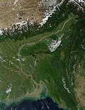
[[File:Ganges.A2001296.0425.1km.jpg|thumb|220px|[[Brahmaputra Valley]] and [[Eastern Himalaya]] in Northeast India]] | |||
The Northeast region can be [[physical geography|physiographically]] categorised into the [[Eastern Himalaya]], the [[Patkai]] and the [[Brahmaputra valley|Brahmaputra]] and the [[Barak valley|Barak]] valley plains. Northeast India (at the confluence of Indo-Malayan, Indo-Chinese, and Indian biogeographical realms) has a predominantly humid sub-tropical climate with hot, humid summers, severe monsoons, and mild winters. Along with the west coast of India, this region has some of the Indian subcontinent's last remaining rainforests, which support diverse flora and fauna and several crop species. Reserves of petroleum and natural gas in the region are estimated to constitute a fifth of India's total potential.{{citation needed|date= September 2022}} | |||
The region is covered by the mighty Brahmaputra-Barak river systems and their tributaries. Geographically, apart from the [[Brahmaputra River|Brahmaputra]], [[Barak Valley|Barak]] and [[Imphal]] valleys and some flatlands in between the hills of [[Meghalaya]] and [[Tripura]], the remaining two-thirds of the area is hilly terrain interspersed with valleys and plains; the altitude varies from almost sea-level to over {{convert|7000|m}} above [[Sea level|MSL]]. The region's high rainfall, averaging around {{convert|10000|mm|in}} and above creates problems of the ecosystem, high seismic activity, and floods. The states of [[Arunachal Pradesh]] and [[Sikkim]] have a [[Montane ecology|montane]] climate with cold, snowy winters and mild summers.{{citation needed|date= September 2022}} | |||
<gallery mode="packed" heights="134"> | |||
File:Gangtok ropeway.jpg|{{center|Ropeway, [[Gangtok]]}} | |||
File:View of the ridgetop city of Aizawl, state capital of Mizoram.jpg|{{center|[[Aizawl]], [[Mizoram]]}} | |||
File:Aerial view of Shillong Meghalaya India.jpg|{{center|Aerial view of [[Shillong]]}} | |||
File:Neer Mahal.jpg|{{center|Neer Mahal of [[Tripura]]}} | |||
File:The Dzukou Valley.JPG|{{center|[[Dzüko Valley]] (Borders of [[Nagaland]] and [[Manipur]])}} | |||
File:2007-sela-pass-1.jpg|{{center|[[Sela Pass]], [[Tawang district|Tawang]] ([[Arunachal Pradesh]])}} | |||
File:Salna Bari, Bhalukpong.jpg|{{center|[[Bhalukpong]], [[Arunachal Pradesh]]}} | |||
File:2 Loktak lake Manipur India.jpg|{{center|[[Loktak lake]], [[Manipur]]}} | |||
File:Majuli Island.jpg|{{center|[[Majuli|Majuli Island]], [[Assam]]}} | |||
File:Nohkalikai Falls.JPG|{{center|Nohkalikai Falls, [[Cherrapunji]], [[Meghalaya]] }} | |||
</gallery> | |||
===Topography=== | |||
====Highest peaks==== | |||
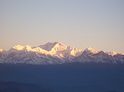
[[File:Kanchenjunga.JPG|thumb|220px|{{center|Mt. Kanchenjunga, [[Sikkim]]}}]] | |||
{{Main|List of Indian states and territories by highest point}} | |||
[[Kangchenjunga]], the third highest mountain peak in the world rising to an altitude of {{convert|8586|m|abbr=on}}, lies in-between the state [[Sikkim]] and adjacent country [[Nepal]]. | |||
{| class="wikitable sortable" style="text-align:left; font-size:0.9em; background:#fff; min-width:70%;" | |||
|+style="text-align:left;"|Mountains and hills by state | |||
! Peak | |||
! State | |||
! Range/Region | |||
! data-sort-type="numeric" | Height ([[metre|m]]) | |||
! data-sort-type="numeric" | Height ([[foot (unit of length)|ft]]) | |||
! Coordinates | |||
|- | |||
| style="background:#f7f7fe;"|[[Kangchenjunga]] (shared with [[Nepal]]) | |||
| [[Sikkim]] | |||
| [[Eastern Himalaya]] | |||
| style="text-align:right;" | 8,586 | |||
| style="text-align:right;" | 28,169 | |||
| {{Coord|27.703|88.148|display=inline}} | |||
|- | |||
| style="background:#f7f7fe;"|[[Kangto]] (shared with [[China]]) | |||
| [[Arunachal Pradesh]] | |||
| [[Eastern Himalaya]] | |||
| style="text-align:right;" | 7,090 | |||
| style="text-align:right;" | 23,261 | |||
| {{Coord|27.865|92.533|display=inline}} | |||
|- | |||
| style="background:#f7f7fe;"|[[Mount Saramati]] (shared with [[Myanmar]]) | |||
| [[Nagaland]] | |||
| [[Naga Hills]] section of the [[Purvanchal Range]] | |||
| style="text-align:right;" | 3,841 | |||
| style="text-align:right;" | 12,602 | |||
| {{Coord|25.742|95.033|display=inline}} | |||
|- | |||
| style="background:#f7f7fe;"|[[Mount Tempü]] (also known as Mount Iso) | |||
| [[Manipur]] | |||
| [[Naga Hills]] section of the [[Purvanchal Range]] | |||
| style="text-align:right;" | 2,994 | |||
| style="text-align:right;" | 9,823 | |||
| {{Coord|25.531|94.085|display=inline}} | |||
|- | |||
| style="background:#f7f7fe;"|[[Phawngpui]] | |||
| [[Mizoram]] | |||
| [[Lushai Hills]] section of the [[Purvanchal Range]] | |||
| style="text-align:right;" | 2,165 | |||
| style="text-align:right;" | 7,103 | |||
| {{Coord|22.632|93.039|display=inline}} | |||
|- | |||
| style="background:#f7f7fe;"|[[Shillong Peak]] | |||
| [[Meghalaya]] | |||
| [[Khasi Hills]] section of the [[Shillong Plateau]] | |||
| style="text-align:right;" | 1,965 | |||
| style="text-align:right;" | 6,447 | |||
| {{Coord|25.532|91.851|display=inline}} | |||
|- | |||
| style="background:#f7f7fe;"|''Unnamed peak'' | |||
| [[Assam]] | |||
| [[Cachar Hills]] section of the [[Karbi Anglong Plateau]] | |||
| style="text-align:right;" | 1,960 | |||
| style="text-align:right;" | 6,430 | |||
| {{Coord|25.321|93.453|display=inline}} | |||
|- | |||
| style="background:#f7f7fe;"|[[Betlingchhip]] (also known as [[Betlingchhip|Sibrai-khung]]) | |||
| [[Tripura]] | |||
| [[Jampui Hills]] section of the [[Purvanchal Range]] | |||
| style="text-align:right;" | 930 | |||
| style="text-align:right;" | 3,051 | |||
|{{Coord|23.810|N|92.261|E|display=inline}} | |||
|} | |||
====Brahmaputra River Basin==== | |||
[[File:Brahmaputra-river-basin.png|thumb|220px|{{center|Brahmaputra [[Drainage basin|river basin]]}} ]] | |||
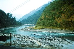
[[File:Riverteesta.jpg|thumb|220px|{{center|Teesta River, [[Sikkim]]}}]] | |||
{{see also|Brahmaputra River|List of rivers by length|List of rivers of Assam}} | |||
Tributaries of the [[Brahmaputra River]] in Northeast India: | |||
{{colbegin|colwidth=15em}} | |||
{{plainlist| | |||
* [[Beki River]] | |||
* [[Bhogdoi River]] | |||
* [[Dhansiri River]] | |||
* [[Dibang River]] | |||
* [[Dihing River]] | |||
* [[Kameng River]] | |||
* [[Kolong River|Kolong]] | |||
* [[Kopili River]] | |||
* [[Lohit River]] | |||
* [[Manas River]] | |||
* [[Sankosh River]] | |||
* [[Subansiri River]] | |||
* [[Teesta River]] | |||
}} | |||
{{colend}} | |||
===Climate=== | |||
[[File:India map of Köppen climate classification.svg|thumb|220px|{{center|Indian map of [[Köppen climate classification]]}} ]] | |||
Northeast India has a [[subtropical climate]] that is influenced by its relief and influences from the southwest and northeast [[monsoon]]s.{{sfn|Dikshit|2014|p=150}}{{sfn|Dikshit|2014|p=151}} The Himalayas to the north, the Meghalaya plateau to the south and the hills of Nagaland, Mizoram and Manipur to the east influences the climate.{{sfn|Dikshit|2014|p=152}} Since monsoon winds originating from the [[Bay of Bengal]] move northeast, these mountains force the moist winds upwards, causing them to cool [[Lapse rate|adiabatically]] and condense into clouds, releasing heavy precipitation on these slopes.{{sfn|Dikshit|2014|p=152}} It is the rainiest region in the country, with many places receiving an average annual precipitation of {{convert|2000|mm|in|0|abbr=on}}, which is mostly concentrated in summer during the [[Wet season|monsoon season]].{{sfn|Dikshit|2014|p=152}} [[Cherrapunji]], located on the Meghalaya plateau is one of the rainiest place in the world with an annual precipitation of {{convert|11777|mm|in|1|abbr=on}}.{{sfn|Dikshit|2014|p=152}} Temperatures are moderate in the [[Brahmaputra]] and [[Barak River|Barak valley river]] plains which decreases with altitude in the hilly areas.{{sfn|Dikshit|2014|p=152}} At the highest altitudes, there is permanent snow cover.{{sfn|Dikshit|2014|p=152}} In general, the region has 3 seasons: Winter, Summer, and rainy season in which the rainy season coincides with the summer months much like the rest of India.{{sfn|Dikshit|2014|p=149}} Winter is from early November until mid March while summer is from mid-April to mid-October.{{sfn|Dikshit|2014|p=152}} | |||
Under the [[Köppen climate classification]], the region is divided into 3 broad types: A (tropical climates), C (warm temperate mesothermal climates), and D (snow microthermal climates).{{sfn|Dikshit|2014|p=171}}{{sfn|Dikshit|2014|p=172}} The tropical climates are located in parts of Manipur, Tripura, Mizoram, and the Cachar plains south of 25<small>o</small>N and are classified as [[Tropical savanna climate|tropical wet and dry]] (''Aw'').{{sfn|Dikshit|2014|p=171}} Much of Assam, Nagaland, northern parts of Meghalaya and Manipur and parts of Arunachal Pradesh fall within the warm temperature mesothermal climates (type C) where the mean temperatures in coldest months range from {{convert|-3|to|18|C|F|0}}.{{sfn|Dikshit|2014|p=172}}<ref name=Peel>{{cite journal |author1= Peel, M. C. |author2= Finlayson B. L. |author3= McMahon, T. A. |year= 2007 |title= Updated world map of the Köppen−Geiger climate classification |journal= Hydrol. Earth Syst. Sci. |volume= 11 |issue= 5 |pages= 1633–1644 |doi= 10.5194/hess-11-1633-2007 |url= http://www.hydrol-earth-syst-sci.net/11/1633/2007/hess-11-1633-2007.pdf |issn= 1027-5606 |access-date= 22 February 2013 |archive-url= https://web.archive.org/web/20120203170339/http://www.hydrol-earth-syst-sci.net/11/1633/2007/hess-11-1633-2007.pdf |archive-date= 3 February 2012 |url-status= live |bibcode= 2007HESS...11.1633P |doi-access= free }}</ref> The entire Brahmaputra valley has a [[humid subtropical climate]] (''Cfa/Cwa'') with hot summers.{{sfn|Dikshit|2014|p=172}}<ref name=Peel/> At altitudes between {{convert|500|to|1500|m|ft|abbr=on}} located in the eastern hills of Nagaland, Manipur and Arunachal Pradesh, a (''Cfb/CWb'') climate prevails with warm summers.{{sfn|Dikshit|2014|p=172}}<ref name=Peel/> Locations above {{convert|1500|m|ft|abbr=on}} in Meghalaya, parts of Nagaland, and northern Arunachal Pradesh have a (''Cfc/Cwc'') climate with short and cool summers.<ref name=Peel/> Finally, the extreme northern parts of Arunachal Pradesh are classified as [[humid continental climate]]s with mean winter temperatures below {{convert|-3|C|F|0}}.{{sfn|Dikshit|2014|p=172}}<ref name=nwskoppen>{{cite web |archive-url=https://web.archive.org/web/20181224025419/https://www.weather.gov/jetstream/climate_max |archive-date=24 December 2018 |url=https://www.weather.gov/jetstream/climate_max |title=JetStream Max: Addition Köppen-Geiger Climate Subdivisions |publisher=National Weather Service |access-date=24 December 2018}}</ref> | |||
;Temperature | |||
Temperatures vary by altitude with the warmest places being in the [[Brahmaputra]] and [[Barak River]] plains and the coldest at the highest altitudes.{{sfn|Dikshit|2014|p=153}} It is also influenced by proximity to the sea with the valleys and western areas being close to the sea, which moderates temperatures.{{sfn|Dikshit|2014|p=153}} Generally, temperatures in the hilly and mountainous areas are lower than the plains which lie at a lower altitude.{{sfn|Dikshit|2014|p=156}} Summer temperatures tend to be more uniform than winter temperatures due to high cloud cover and humidity.{{sfn|Dikshit|2014|p=158}} | |||
In the Brahmaputra and Barak valley river plains, mean winter temperatures vary between {{convert|16|and|17|C|F|0}} while mean summer temperatures are around {{convert|28|C|F|0}}.{{sfn|Dikshit|2014|p=153}} The highest summer temperatures occur in the West Tripura plain with [[Agartala]], the capital of [[Tripura]] having mean maximum summer temperatures ranging between {{convert|33|and|35|C|F|0}} in April.{{sfn|Dikshit|2014|p=155}} The highest temperatures in summer occur before the arrival of monsoons and thus eastern areas have the highest temperatures in June and July where the monsoon arrives later than western areas.{{sfn|Dikshit|2014|p=155}} In the Cachar Plain, located south of the Brahmaputra plain, temperatures are higher than the Brahmaputra plain although the temperature range is smaller owing to higher cloud cover and the monsoons that moderate night temperatures year round.{{sfn|Dikshit|2014|p=156}}{{sfn|Dikshit|2014|p=155}} | |||
In the mountainous areas of Arunachal Pradesh, the Himalayan ranges in the northern border with [[India]] and [[China]] experience the lowest temperatures with heavy snow during winter and temperatures that drop below freezing.{{sfn|Dikshit|2014|p=156}} Areas with altitudes exceeding {{convert|2000|m|ft|0}} receive snowfall during winters and have cool summers.{{sfn|Dikshit|2014|p=156}} Below {{convert|2000|m|ft|0}} above sea level, winter temperatures reach up to {{convert|15|C|F|0}} during the day with nights dropping to zero while summers are cool, with a mean maximum of {{convert|25|C|F|0}} and a mean minimum of {{convert|15|C|F|0}}.{{sfn|Dikshit|2014|p=156}} In the hilly areas of Meghalaya, Nagaland, Manipur and Mizoram, winters are cold while summers are cool.{{sfn|Dikshit|2014|p=158}} | |||
The plains in Manipur has colder winter minimums than what is warranted by its elevation owing to being surrounded by hills on all sides.{{sfn|Dikshit|2014|p=157}} This is due to temperature inversions during winter nights when cold air descends from the hills | |||
into the valleys below and its geographic location which prevents winds that bring hot temperatures and humidity from coming into the Manipur plain.{{sfn|Dikshit|2014|p=157}} For example in Imphal, winter daytime temperatures hover around {{convert|21|C|F|0}} but nighttime temperatures drop to {{convert|3|C|F|0}}.{{sfn|Dikshit|2014|p=157}} | |||
;Rainfall | |||
No part of Northeast India receives less than {{convert|1000|mm|in|0|abbr=on}} of rainfall a year.{{sfn|Dikshit|2014|p=149}} Areas in the Brahmputra valley receive {{convert|2000|mm|in|0|abbr=on}} of rainfall a year while mountainous areas receive {{convert|2000|to|3000|mm|in|0|abbr=on}} a year.{{sfn|Dikshit|2014|p=149}} The southwest monsoon is responsible for bringing 90% of the annual rainfall to the region.{{sfn|Dikshit|2014|p=160}} April to late October are the months where most of the rainfall in Northeast India occurs with June and July being the rainiest months.{{sfn|Dikshit|2014|p=160}} In most parts of the region, the average date of onset of the monsoons is 1 June.{{sfn|Dikshit|2014|p=59}} Southern areas are the first to receive the monsoon (May or June) with the Brahmaputra valley and the mountainous north receiving later (later May or June).{{sfn|Dikshit|2014|p=160}} In the hilly parts of Mizoram, the closer proximity to the [[Bay of Bengal]] causes it to experience early monsoons with June being the wettest season.{{sfn|Dikshit|2014|p=160}} | |||
===High-risk seismic zone=== | |||
{{See also|List of earthquakes in India}} | |||
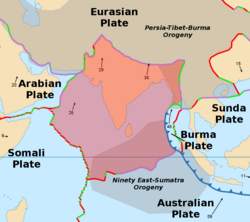
[[File:IndianPlate.png|thumb|220px|{{center|[[India Plate]] and other tectonic plates}}]] | |||
The North Eastern Region of India is a mega-earthquake prone zone caused by active [[Fault (geology)|fault planes]] beneath formed by the convergence of three [[List of tectonic plates|tectonic plates]] viz. [[India Plate]], [[Eurasian Plate]] and [[Burma Plate]]. Historically the region has suffered from two great earthquakes (M > 8.0) – [[1897 Assam earthquake]] and [[1950 Assam-Tibet earthquake]] – and about 20 large earthquakes (8.0 > M > 7.0) since 1897.<ref name="Frequent seismic activity">{{cite web |url=https://www.theguardian.com/world/2016/jan/04/india-earthquake-north-east-manipur-state-tremor |title=At least eight dead as north-east India hit by 6.7 magnitude earthquake |newspaper=The Guardian |date=4 January 2016 |access-date=4 June 2017 |archive-date=9 September 2017 |archive-url=https://web.archive.org/web/20170909233150/https://www.theguardian.com/world/2016/jan/04/india-earthquake-north-east-manipur-state-tremor |url-status=live }}</ref><ref name="Shillong Plateau Earthquakes">{{cite web |url=https://www.researchgate.net/publication/251244722 |title=Shillong Plateau Earthquakes |author1=J. R. Kayal |author2=S. S. Arefiev |author3=S. Barua |author4=Devajit Hazarika |author5=N. Gogoi |author6=A. Kumar |author7=S. N. Chowdhury |author8=Sarbeswar Kalita |date=July 2006 |access-date=11 February 2019 |archive-date=2 March 2022 |archive-url=https://web.archive.org/web/20220302150317/https://www.researchgate.net/publication/251244722_Shillong_plateau_earthquakes_in_northeast_India_region_Complex_tectonic_model |url-status=live }}</ref> The [[1950 Assam-Tibet earthquake]] is still the [[List of earthquakes|largest earthquake in India]].{{citation needed|date= September 2022}} | |||
==Wildlife== | |||
===Flora=== | |||
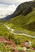
[[File:A scene from Kanchenjunga National Park, Sikkim (1).jpg|thumb|220px|{{center|[[Khangchendzonga National Park]]}}]] | |||
[[World Wide Fund for Nature|WWF]] has identified the entire Eastern [[Himalayas]] as a priority [[Global 200]] [[ecoregion]]. [[Conservation International]] has upscaled the [[Eastern Himalaya]] hotspot<!---had "Myers 2000" here which seemed like a possible link in wrong format. No such book here yet---> to include all the eight states of Northeast India, along with the neighbouring countries of [[Bhutan]], southern [[China]] and [[Myanmar]]. | |||
The region has been identified by the [[Indian Council of Agricultural Research]] as a center of rice germplasm. The National Bureau of Plant Genetic Resources (NBPGR), India, has highlighted the region as being rich in wild relatives of crop plants. It is the center of origin of citrus fruits. Two primitive variety of maize, Sikkim Primitive 1 and 2, have been reported from Sikkim (Dhawan, 1964). Although [[Slash-and-burn|jhum cultivation]], a traditional system of agriculture, is often cited as a reason for the loss of [[forest cover]] of the region, this primary agricultural economic activity practiced by local tribes supported the cultivation of 35 varieties of crops. The region is rich in medicinal plants and many other rare and endangered [[Taxon|taxa]]. Its high [[endemism]] in both [[Vascular plant|higher plants]], [[vertebrate]]s, and [[bird|avian]] diversity has qualified it as a [[biodiversity hotspot]]. | |||
The following figures highlight the biodiversity significance of the region:<ref>Hedge 2000, FSI 2003.</ref> | |||
* 51 [[Broadleaf forest|forest types]] are found in the region, broadly classified into six major types – tropical moist deciduous forests, tropical semi-evergreen forests, tropical wet evergreen forests, subtropical forests, temperate forests, and alpine forests. | |||
* Out of the nine important vegetation types of India, six are found in the North Eastern Region. | |||
* These forests harbor 8,000 out of 15,000 species of [[flowering plant]]s. In floral species richness, the highest diversity is reported from the states of [[Arunachal Pradesh]] (5000 species) and [[Sikkim]] (4500 species) amongst the North Eastern states. | |||
* According to the ''Indian Red Data Book,'' published by the [[Botanical Survey of India]], 10 percent of the flowering plants in the country are endangered. Of the 1500 endangered floral species, 800 are reported from Northeast India. | |||
* Most of the North Eastern states have more than 60% of their area under forest cover, a minimum suggested coverage for the hill states in the country in order to protect from erosion. | |||
* Northeast India is a part of [[Indo-Burma]] hotspot. This hotspot is the second largest in the world, next only to the [[Mediterranean Basin]], with an area {{convert|2206000|km2}} among the 25 identified.{{citation needed|date=July 2014}} | |||
===Fauna=== | |||
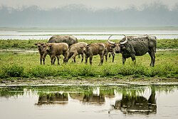
[[File:Asiatic buffalo.jpg|thumb|220px|{{center|[[Wild water buffalo|Asiatic Buffalo]] at [[Kaziranga National Park]]}}]] | |||
[[File:One-Horned Rhino at the Kaziranga National Park, Assam.jpg|thumb|220px|{{center|[[Indian rhinoceros|One-horned rhinoceros]] at [[Kaziranga National Park]]}}]] | |||
{{see also|List of amphibians of Northeast India}} | |||
The [[International Council for Bird Preservation]], UK identified the Assam plains and the Eastern Himalaya as an [[Endemic Bird Area]] (EBA). The EBA has an area of 220,000 km<sup>2</sup> following the [[Himalayas|Himalayan range]] in the countries of Bangladesh, Bhutan, China, Nepal, Myanmar and the Indian states of [[Sikkim]], [[North Bengal]], Assam, [[Nagaland]], [[Manipur]], [[Meghalaya]] and [[Mizoram]]. Because of a southward occurrence of this mountain range in comparison to other Himalayan ranges, this region has a distinctly different climate, with warmer mean temperatures and fewer days with frost, and much higher rainfall. This has resulted in the occurrence of a rich array of restricted-range bird species. More than two critically endangered species, three endangered species, and 14 vulnerable species of birds are in this EBA. Stattersfield et al. (1998) identified 22 restricted range species, out of which 19 are confined to this region and the remaining three are present in other endemic and secondary areas. Eleven of the 22 restricted-range species found in this region are considered as threatened ([[Birdlife International]] 2001), a number greater than in any other [[Endemic Bird Area|EBA]] of India.{{citation needed|date=December 2016}} | |||
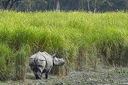
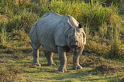
Northeast India is very rich in [https://northeastindiaindetails.blogspot.com/2020/05/biodiversity-of-northeast-india.html faunal diversity]. There are as many as 15 species of non-human primates and most important of them are [[hoolock gibbon]], [[stumptied macaque]], pigtailed macaque, golden langur, [[hanuman langur]] and rhesus monkey. The most important and endangered species is one-horned rhinoceros. The forests of the region are also the habitats of elephant, royal Bengal tiger, leopard, golden cat, fishing cat, marbled cat, Bengal fox etc. the Gangetic dolphin in the Brahmaputra is also an endangered species. The other endangered species are otter, mugger crocodile, tortoise and some fishes.<ref>{{cite web |last=Saikia |first=Parth |date=15 May 2020 |title=Biodiversity of Northeast India {{!}} Flora, Fauna and Hotspots |url=https://northeastindiaindetails.blogspot.com/2020/05/biodiversity-of-northeast-india.html |access-date=20 May 2020 |website=North East India Info}}</ref> | |||
[[World Wide Fund for Nature|WWF]] has identified the following priority ecoregions in North-East India: | |||
: [[Brahmaputra Valley semi-evergreen forests]] | |||
: [[Eastern Himalayan broadleaf forests]] | |||
: [[Eastern Himalayan subalpine conifer forests]] | |||
: [[Northeast India–Myanmar pine forests]] | |||
===National Parks=== | |||
{{see also|Wildlife sanctuaries of India|List of national parks of India}} | |||
{| class="sortable wikitable" style="font-size:0.9em; background:#fff;" | |||
|- | |||
! [[National park]] !! Location !! State !! Area (km<sup>2</sup>) !! Importance !! Vegetation | |||
|- | |||
| style="background:#f7f7fe;width:20%;"|[[Namdapha National Park]] || [[Changlang district]] ||Arunachal Pradesh || style="text-align:right;"|1,985 || Largest protected area in [[Eastern Himalaya]] ||[[Tropical and subtropical moist broadleaf forests]], [[Montane ecosystems|montane forests]] | |||
|- | |||
| style="background:#f7f7fe;"|[[Manas National Park]]||[[Baksa district]]||Assam||align="right"|950||[[UNESCO]] [[World Heritage Site]]||[[Tropical and subtropical moist broadleaf forests]] | |||
|- | |||
| style="background:#f7f7fe;"|[[Kaziranga National Park]]||[[Golaghat district|Golaghat]] and [[Nagaon district|Nagaon]] districts||Assam ||align="right"|<ref name="Kaziranga National Park">{{cite web |url=http://www.assamforest.in/knp-osc/pdfreport/brief-note-knp-n7w.pdf |title=Kaziranga National Park – a world heritage site, Govt. of Assam |access-date=10 September 2017 |archive-date=8 September 2017 |archive-url=https://web.archive.org/web/20170908053529/http://assamforest.in/knp-osc/pdfreport/brief-note-knp-n7w.pdf |url-status=live }}</ref> 882||[[UNESCO]] [[World Heritage Site]]||[[Brahmaputra Valley semi-evergreen forests]], [[Terai–Duar savanna and grasslands]] | |||
|- | |||
| style="background:#f7f7fe;"|[[Khangchendzonga National Park]]||[[North Sikkim district]]||Sikkim||align="right"|850||[[UNESCO]] Mixed [[World Heritage Site]] and highest altitude wildlife protected area in India||[[Subtropics|Sub-tropical]] to [[Alpine plant|Alpine]], [[Krummholz]] (stunted forest)<ref name="Khangchendzonga National Park">{{cite web |url=https://whc.unesco.org/en/list/1513 |title=Khangchendzonga National Park |access-date=26 December 2019 |archive-date=11 July 2018 |archive-url=https://web.archive.org/web/20180711185515/https://whc.unesco.org/en/list/1513 |url-status=live }}</ref> | |||
|- | |||
| style="background:#f7f7fe;"|[[Mouling National Park]]||[[Upper Siang district|Upper Siang]], [[West Siang district|West Siang]] and [[East Siang district|East Siang]] districts||Arunachal Pradesh||align="right"|483|| ||[[Tropical forest|Tropical]] to [[Temperate forest|Temperate]] forests | |||
|- | |||
| style="background:#f7f7fe;"|[[Dibru-Saikhowa National Park]]||[[Dibrugarh district|Dibrugarh]] and [[Tinsukia district|Tinsukia]] districts||Assam||align="right"|350|| ||[[Brahmaputra Valley semi-evergreen forests]] | |||
|- | |||
| style="background:#f7f7fe;"|[[Balphakram National Park]]||[[South Garo Hills district]]||Meghalaya||align="right"|220|| ||Sub-tropical evergreen deciduous forests | |||
|- | |||
| style="background:#f7f7fe;"|[[Ntangki National Park|Intangki National Park]]||[[Peren district]]||Nagaland||align="right"|202|| || Temperate evergreen forests | |||
|- | |||
| style="background:#f7f7fe;"|[[Nameri National Park]]||[[Sonitpur district]]||Assam||align="right"|200|| ||[[Brahmaputra Valley semi-evergreen forests]] | |||
|- | |||
| style="background:#f7f7fe;"|[[Murlen National Park]]||[[Champhai district]]||Mizoram||align="right"|100|| ||Montane sub-tropical semi-evergreen forest<ref name="Murlen National Park">{{Cite journal |title=A note on non-human primates of Murlen National Park, Mizoram, India |url=http://faunaofindia.nic.in/PDFVolumes/records/106/01/0111-0114.pdf |journal=Zoological Survey of India |volume=106 (Part-1) |pages=111–114 |access-date=10 September 2017 |archive-date=21 July 2017 |archive-url=https://web.archive.org/web/20170721194453/http://faunaofindia.nic.in/PDFVolumes/records/106/01/0111-0114.pdf |url-status=live }}</ref> | |||
|- | |||
| style="background:#f7f7fe;"|[[Orang National Park]]||[[Darrang district|Darrang]] and [[Sonitpur district|Sonitpur]]||Assam||align="right"|79|| ||Eastern seasonal swamp forests, Eastern Himalayan moist mixed deciduous forests, eastern wet alluvial grasslands<ref name="Orang Tiger Reserve - forest types">{{cite web |url=http://orangtigerreserve.gov.in/forestTypes.php |title=Orang Tiger Reserve |access-date=10 September 2017 |archive-date=10 September 2017 |archive-url=https://web.archive.org/web/20170910173941/http://orangtigerreserve.gov.in/forestTypes.php |url-status=live }}</ref> | |||
|- | |||
| style="background:#f7f7fe;"|[[Phawngpui National Park]]||[[Lawngtlai district]]||Mizoram||align="right"|50|| || Temperate forests<ref name="Forest types of Mizoram">{{cite web |url=https://forest.mizoram.gov.in/page/forest-types |title=Forest types of Mizoram |access-date=10 September 2017 |archive-date=10 September 2017 |archive-url=https://web.archive.org/web/20170910220611/https://forest.mizoram.gov.in/page/forest-types |url-status=live }}</ref> | |||
|- | |||
| style="background:#f7f7fe;"|[[Nokrek National Park]]||[[West Garo Hills district]]||Meghalaya||align="right"|48|| ||[[Tropical and subtropical moist broadleaf forests]] | |||
|- | |||
| style="background:#f7f7fe;"|[[Sirohi National Park]]||[[Ukhrul district]]||Manipur||align="right"|41|| ||[[Mizoram–Manipur–Kachin rain forests]] | |||
|- | |||
|style="background:#f7f7fe;"|[[Keibul Lamjao National Park]]||[[Bishnupur district]]||Manipur||align="right"|40||World's only floating [[National park]]||''[[Phumdi]]'' (floating marshes) | |||
|- | |||
| style="background:#f7f7fe;"|[[Rajbari National Park|Bison (Rajbari) National Park]]||[[South Tripura district]]||Tripura||align="right"|32|| ||Tropical semi-evergreen and moist deciduous forests | |||
|- | |||
| style="background:#f7f7fe;"|[[Clouded Leopard National Park]]||[[Sepahijala district]]||Tripura||align="right"|5|| ||[[Tropical and subtropical moist broadleaf forests]] | |||
|} | |||
===State Symbols=== | |||
{{Main|List of symbols of Indian states and territories}} | |||
{| class="wikitable" style="background:#fff;font-size:0.9em;" | |||
|- | |||
! || colspan="2"|'''[[Arunachal Pradesh]]''' || colspan="2"|'''[[Assam]]''' || colspan="2"|'''[[Manipur]]'''||colspan="2"|'''[[Meghalaya]]''' | |||
|- | |||
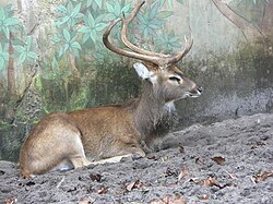
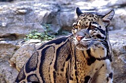
| style="background:#f7f7fe;"|'''Animal'''|| Mithun (''[[Bos frontalis]]'') || [[File:Wild Bos gaurus Upparabeeranahalli.jpg|50px]] || [[Indian rhinoceros]] (''Rhinoceros unicornis'') || [[File:Rhinoceros unicornis, Kaziranga (2006).jpg|50px]] ||[[Sangai]] (''Rucervus eldii eldii'')||[[File:Cervus eldii4.jpg|50px]]||[[Clouded leopard]] ''(Neofelis nebulosa)''||[[File:Clouded leopard.jpg|50px]] | |||
|- | |||
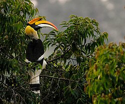
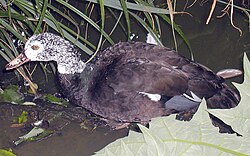
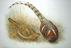
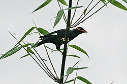
| style="background:#f7f7fe;"|'''Bird'''|| Hornbill (''[[Buceros bicornis]]'') || [[File:Great-Hornbill.jpg|50px]] || [[White-winged duck]] (''Asarcornis scutulata'') || [[File:White-winged.wood.duck.arp.jpg|50px]]||[[Mrs. Hume's pheasant]] (''Syrmaticus humiae'')||[[File:Syrmaticus humiae.jpg|50px]]|| [[Common hill myna|Hill myna]] ''(Gracula religiosa)''||[[File:Gracula religiosa Deothang Bhutan 1.jpg|50px]] | |||
|- | |||
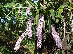
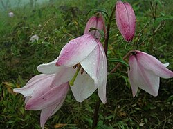
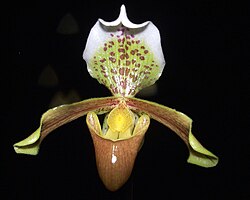
| style="background:#f7f7fe;"|'''Flower'''|| Foxtail orchid (''[[Rhynchostylis retusa]]'') || [[File:Rhynchostylis retusa.JPG|50px]]|| Foxtail orchid (''[[Rhynchostylis retusa]]'') || [[File:Rhynchostylis retusa.JPG|50px]]||[[Siroi lily]] (''Lilium mackliniae'')||[[File:Siroi Lily.jpg|50px]]|| Lady's Slipper Orchid (''[[Paphiopedilum insigne]]'')||[[File:Paphiopedilum insigne Orchi 01.jpg|50px]] | |||
|- | |||
| style="background:#f7f7fe;"|'''Tree'''|| [[Hollong]] (''Dipterocarpus macrocarpus'') || [[File:Dipterocarpus macrocarpus Hollong young leafIMG 1920 05.jpg|50px]]|| [[Hollong]] (''Dipterocarpus macrocarpus'') || [[File:Dipterocarpus macrocarpus Hollong young leafIMG 1920 05.jpg|50px]]||Uningthou (''[[Phoebe hainesiana]]'')||[[File:Phoebe hainesiana north Bengal AJTJ.JPG|50px]]|| Gamhar (''[[Gmelina arborea]]'')||[[File:Kamari (Nepalese- कामरी) (3394494165).jpg|50px]] | |||
|- | |||
! || colspan="2"|'''[[Mizoram]]''' || colspan="2"|'''[[Nagaland]]''' || colspan="2"|'''[[Sikkim]]'''||colspan="2"|'''[[Tripura]]''' | |||
|- | |||
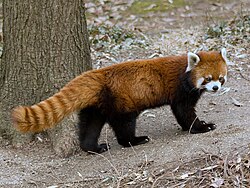
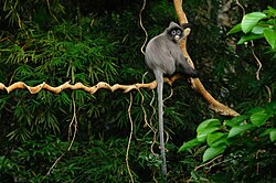
| style="background:#f7f7fe;"|'''Animal''' ||[[Himalayan serow]] (''Capricornis thar'')||[[File:Himalayan Serow Pangolakha Wildlife Sanctuary East Sikkim Sikkim India 13.02.2016.jpg|50px]]||Mithun (''[[Bos frontalis]]'') || [[File:Wild Bos gaurus Upparabeeranahalli.jpg|50px]] ||[[Red panda]] (''Ailurus fulgens'')||[[File:RedPandaFullBody.JPG|50px]]||[[Phayre's leaf monkey]] (''Trachypithecus phayrei'')||[[File:Phayre's Langur, Trachypithecus phayrei in Phu Khieo Wildlife Sanctuary (21134240148).jpg|50px]] | |||
|- | |||
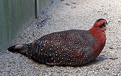
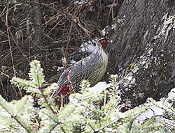
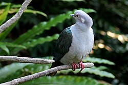
| style="background:#f7f7fe;"|'''Bird''' ||[[Mrs. Hume's pheasant]] (''Syrmaticus humiae'')||[[File:Syrmaticus humiae.jpg|50px]]||[[Blyth's tragopan]] (''Tragopan blythii'')||[[File:Tragopan blythii01.jpg|50px]]||[[Blood pheasant]] (''Ithaginis cruentus'')||[[File:Blood Pheasant.jpg|50px]]||[[Green imperial pigeon]] (''Ducula aenea'')||[[File:DuculaAenea.JPG|50px]] | |||
|- | |||
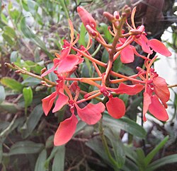
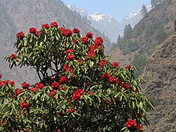
| style="background:#f7f7fe;"|'''Flower''' ||Red Vanda (''[[Renanthera imschootiana]]'')||[[File:Renanthera imschootiana 01.jpg|50px]]||Tree rhododendron (''[[Rhododendron arboreum]]'')||[[File:Manaslu-Circuit Rhododendron.jpg|50px]]||Noble dendrobium (''[[Dendrobium nobile]]'')||[[File:Dendrobium nobile - flower view 01.jpg|50px]]||Indian rose chestnut (''[[Mesua ferrea]]'')||[[File:Flowers of Mesua ferrea Kaziranga TR AJTJ P1010329.JPG|50px]] | |||
|- | |||
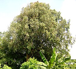
| style="background:#f7f7fe;"|'''Tree''' ||Indian rose chestnut (''[[Mesua ferrea]]'')||[[File:MesuaFerrea IronWood.jpg|50px]]||Alder ''([[Alnus nepalensis]])''||[[File:Alnus nepalensis.JPG|50px]]||Rhododendron (''[[Rhododendron niveum]]'')||[[File:Rhododendron niveum AJT Johnsingh P1020212.JPG|50px]]||[[Agarwood]] (''Aquilaria agallocha'')|| | |||
|} | |||
==Demographics== | |||
{{main|2011 Census of India}} | |||
<!-- These links are for the articles on those ethnicities whose population comprises roughly half or more than half of their respective state's population, forming significant majority groups in their states. --> | |||
{{Further|Assamese people|Bengali people|Meitei people|Mizo people}} | |||
The total population of Northeast India is 46 million with 68 percent of that living in Assam alone. Assam also has a higher population density of 397 persons per km<sup>2</sup> than the national average of 382 persons per km<sup>2</sup>. The literacy rates in the states of the Northeastern region, except those in Arunachal Pradesh and Assam, are higher than the national average of 74 percent. As per 2011 census, Meghalaya recorded the highest population growth of 27.8 percent among all the states of the region, higher than the national average at 17.64 percent; while Nagaland recorded the lowest in the entire country with a negative 0.5 percent.<ref name="Nagaland records negative decadal growth">{{Cite news|url=http://www.thehindu.com/news/national/other-states/Nagaland-records-negative-growth-in-decadal-population/article14666718.ece|title=Nagaland records negative decadal growth|website=[[The Hindu]]|date=April 2011|access-date=1 May 2018|archive-date=28 February 2020|archive-url=https://web.archive.org/web/20200228220031/http://www.thehindu.com/news/national/other-states/Nagaland-records-negative-growth-in-decadal-population/article14666718.ece|url-status=live}}</ref> | |||
{| class="wikitable sortable" style="font-size:0.9em; background:#fff; width:100%; text-align:right;" | |||
|- | |||
! State | |||
! Population | |||
! Males !! Females | |||
! Sex Ratio | |||
! Literacy % | |||
! Rural Population | |||
! Urban Population | |||
! Area (km<sup>2</sup>) | |||
! Density (/km<sup>2</sup>) | |||
|- | |||
| style="background:#f7f7fe;text-align:left;"|Arunachal Pradesh || 1,383,727 || 713,912 || 669,815 || 938 || 65.38 || 870,087 | |||
| 227,881 || 83,743 || 17 | |||
|- | |||
| style="background:#f7f7fe;text-align:left;"|Assam || 31,205,576 || 15,939,443 || 15,266,133 || 958 || 72.19 || 23,216,288 | |||
| 3,439,240 || 78,438 || 397 | |||
|- | |||
| style="background:#f7f7fe;text-align:left;"|Manipur || 2,570,390 || 1,290,171 || 1,280,219 || 992 || 79.21 || 1,590,820 || 575,968 | |||
| 22,327 || 122 | |||
|- | |||
| style="background:#f7f7fe;text-align:left;"|Meghalaya || 2,966,889 || 1,491,832 || 1,475,057 || 989 || 74.43 || 1,864,711 || 454,111 | |||
| 22,429 || 132 | |||
|- | |||
| style="background:#f7f7fe;text-align:left;"|Mizoram || 1,097,206 || 555,339 || 541,867 || 976 || 91.33 || 447,567 || 441,006 | |||
| 21,081 || 52 | |||
|- | |||
| style="background:#f7f7fe;text-align:left;"|Nagaland || 1,978,502 || 1,024,649 || 953,853 || 931 || 79.55 || 1,647,249 || 342,787 | |||
| 16,579 || 119 | |||
|- | |||
| style="background:#f7f7fe;text-align:left;"|Sikkim || 610,577 || 323,070 || 287,507 || 890 || 81.42 || 480,981 || 59,870 || 7,096 | |||
| 86 | |||
|- | |||
| style="background:#f7f7fe;text-align:left;"|Tripura || 3,673,917 || 2,087,059 || 2,086,858 || 960 || 91.58 || 2,639,134 || 1,534,783 | |||
| 10,486 || 350 | |||
|} | |||
===Largest cities by population=== | |||
{{main|List of cities in India by population|List of cities in Assam by population}} | |||
According to [[2011 Census of India]], the largest cities in Northeast India are | |||
{| class="wikitable" style="font-size:0.9em; background:#fff; text-align:center; min-width:70%;" | |||
|- | |||
! Rank !! City !! Type !!State !!Population !!Rank !! City !! Type !!State !!Population | |||
|- | |||
| style="background:#f7f7fe;"|1 || [[Guwahati]] || style="text-align:center;"|City||Assam || style="text-align:right;"| 968,549||style="background:#f7f7fe;"|9 || [[Jorhat]] ||UA ||Assam|| style="text-align:right;"| 153,889 | |||
|- | |||
| style="background:#f7f7fe;"|2 || [[Agartala]] ||style="background:#fEE0F2;"|City||Tripura || style="text-align:right;"| 622,613|| style="background:#f7f7fe;"|10 || [[Nagaon]] ||UA ||Assam|| style="text-align:right;"| 147,496 | |||
|- | |||
| style="background:#f7f7fe;"|3 || [[Imphal]] || style="text-align:center;"|UA ||Manipur|| style="text-align:right;"| 414,288||style="background:#f7f7fe;"|11 || [[Bongaigaon]] ||UA ||Assam|| style="text-align:right;"| 139,650 | |||
|- | |||
| style="background:#f7f7fe;"|4 || [[Dimapur]] ||style="background:#fEE0F2;"|City||Nagaland|| style="text-align:right;"| 379,769|| style="background:#f7f7fe;"|12 || [[Tinsukia]] ||UA ||Assam|| style="text-align:right;"| 126,389 | |||
|- | |||
| style="background:#f7f7fe;"|5 || [[Shillong]] ||UA ||Meghalaya|| style="text-align:right;"| 354,325|| style="background:#f7f7fe;"|13 || [[Tezpur]] ||UA ||Assam|| style="text-align:right;"| 102,505 | |||
|- | |||
| style="background:#f7f7fe;"|6 || [[Aizawl]] ||style="background:#fEE0F2;"|City ||Mizoram|| style="text-align:right;"| 291,822|| style="background:#f7f7fe;"|14 || [[Kohima]] ||UA ||Nagaland|| style="text-align:right;"| 100,000 | |||
|- | |||
| style="background:#f7f7fe;"|7 || [[Silchar]] ||UA ||Assam|| style="text-align:right;"| 229,136|| style="background:#f7f7fe;"|15 || [[Gangtok]] ||style="background:#fEE0F2;"|City ||Sikkim || style="text-align:right;"| 98,658 | |||
|- | |||
| style="background:#f7f7fe;"|8 || [[Dibrugarh]] ||UA ||Assam|| style="text-align:right;"| 154,296|| style="background:#f7f7fe;"|16 || [[Itanagar]] ||style="background:#fEE0F2;"|City ||Arunachal Pradesh|| style="text-align:right;"| 95,650 | |||
|- | |||
| colspan="10" style="text-align:left;"| | |||
''UA'': Urban Agglomeration<ref>{{Cite web |url=http://www.censusindia.gov.in/2011-prov-results/paper2/data_files/India2/Table_3_PR_UA_Citiees_1Lakh_and_Above.pdf |title=Archived copy |access-date=30 May 2017 |archive-date=26 December 2018 |archive-url=https://web.archive.org/web/20181226064111/http://www.censusindia.gov.in/2011-prov-results/paper2/data_files/India2/Table_3_PR_UA_Citiees_1Lakh_and_Above.pdf%20 |url-status=live }}</ref> | |||
|} | |||
===Languages=== | |||
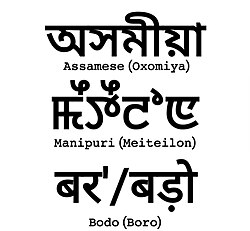
[[File:The official languages of the Indian Republic recognised by the Constitution of India which are indigenous to Northeast India written in their respective official scripts.jpg|thumb|300px|The [[official languages of India|official languages of the Indian Republic]] recognised by the [[Constitution of India]] which are [[Indigenous language|indigenous]] to Northeast India written in their respective [[official script]]s]] | |||
Northeast India constitutes a single linguistic region within the Indian national context, with about 220 languages in multiple language families ([[Indo-European]], [[Sino-Tibetan]], [[Kra–Dai]], [[Austroasiatic]], as well as some creole languages) that share a number of features that set them apart from most other areas of the Indian subcontinent (such as alveolar consonants rather than the more typical dental/retroflex distinction).<ref name="moral97_42">{{harv|Moral|1997|p=42}}</ref><ref name="IITG-languages_of_ne">{{cite web |url=http://www.iitg.ernet.in/rcilts/phaseI/heirarchy.htm |title=IITG – Hierarchy of North Eastern Languages |access-date=5 December 2017 |archive-date=17 March 2018 |archive-url=https://web.archive.org/web/20180317062900/http://www.iitg.ernet.in/rcilts/phaseI/heirarchy.htm |url-status=live }}</ref> [[Assamese language|Assamese]], an [[Indo-Aryan language]] spoken mostly in the [[Brahmaputra Valley]], developed as a ''lingua franca'' for many speech communities. Assamese-based pidgin/creoles have developed in Nagaland ([[Nagamese]]) and Arunachal ([[Nefamese]]),<ref>{{harv|Moral|1997|pp=43–44}}</ref> though Nefamese has been replaced by [[Hindi]] in recent times. The Austro-Asiatic family is represented by the [[Khasi language|Khasi]], [[Jaintia language|Jaintia]] and [[War language|War]] languages of Meghalaya. A small number of Tai–Kadai languages ([[Ahom language|Ahom]], [[Phake language|Tai Phake]], [[Khamti language|Khamti]], etc.) are also spoken. Sino-Tibetan is represented by a number of languages that differ significantly from each other,<ref name=BlenchPost13>Blench, R. & Post, M. W. (2013). [https://www.academia.edu/627686/Rethinking_Sino-Tibetan_phylogeny_from_the_perspective_of_North_East_Indian_languages Rethinking Sino-Tibetan phylogeny from the perspective of Northeast Indian languages] {{Webarchive|url=https://web.archive.org/web/20200426233833/https://www.academia.edu/627686/Rethinking_Sino-Tibetan_phylogeny_from_the_perspective_of_North_East_Indian_languages |date=26 April 2020 }}</ref> some of which are: [[Boro language (India)|Boro]], [[Rabha language|Rabha]], [[Karbi language|Karbi]], [[Mising language|Mising]], [[Tiwa language (India)|Tiwa]], [[Deori language|Deori]], Biate etc. (Assam); [[Garo language|Garo]], [[Hajong language|Hajong]], Biate (Meghalaya) [[Ao language|Ao]], [[Angami language|Angami]], Sema, Lotha, Konyak etc. (Nagaland); Mizo, [[Hmar language|Hmar]], [[Paite language|Paite]], etc. (Mizoram); Hrusso, Tanee, Nisi, Adi, Abor, Nocte, Apatani, Misimi etc. (Arunachal). [[Meitei language|Meitei]] is the official language in Manipur, the dominant language of the Imphal Valley; while "Naga" languages such as [[Poula language|Poumai]], [[Sopvoma language|Mao]], Maram, Rongmei (Kabui) and Tangkul, and Kuki-Chin languages such as Thadou-Kuki, Mizo, [[Paite language|Paite]], Simte and Hmar predominate in individual hill areas of the state.<ref name=PostBurling17>Post, M. W. and R. Burling (2017). [https://www.academia.edu/17070971/The_Tibeto-Burman_languages_of_Northeast_India The Tibeto-Burman languages of Northeast India] {{Webarchive|url=https://web.archive.org/web/20180407085618/http://www.academia.edu/17070971/The_Tibeto-Burman_languages_of_Northeast_India |date=7 April 2018 }}</ref> | |||
{{Pie chart| thumb = right | |||
|caption=Main languages of North East India<ref name="census2011-langreport">{{cite web |title=Language – India, States and Union Territories |url=http://censusindia.gov.in/2011Census/C-16_25062018_NEW.pdf |work=Census of India 2011 |publisher=Office of the Registrar General |pages=13–14 |access-date=30 April 2019 |archive-url=https://web.archive.org/web/20181114073412/http://www.censusindia.gov.in/2011Census/C-16_25062018_NEW.pdf |archive-date=14 November 2018 |url-status=live }}</ref><ref>{{cite web |title=C-16 Population By Mother Tongue |url=http://censusindia.gov.in/2011census/C-16/DDW-C16-STMT-MDDS-2000.XLSX |website=census.gov.in |access-date=6 March 2020 |archive-date=12 January 2020 |archive-url=https://web.archive.org/web/20200112015730/http://censusindia.gov.in/2011census/C-16/DDW-C16-STMT-MDDS-2000.XLSX |url-status=live }}</ref> | |||
|label1=[[Assamese language|Assamese]]|value1=33.24|color1=#FF0800 | |||
|label2=[[Bengali language|Bengali]]|value2=26.20|color2=#DA70D6 | |||
|label3=[[Hindi]]|value3=5.45|color3=#FF8C00 | |||
|label5=[[Bodo language|Bodo]]|value5=3.14|color5=#FBEC5D | |||
|label4=[[Manipuri language|Manipuri]]|value4=3.79|color4=#81613C | |||
|label6=[[Khasi language|Khasi]]|value6=3.12|color6=#FFF8E7 | |||
|label7=[[Nepali language|Nepali]]|value7=2.73|color7=#2E2D88 | |||
|label8=[[Garo language|Garo]]|value8=2.49|color8=#A7D8DE | |||
|label9=[[Kokborok]]|value9=2.21|color9=#1B1B1B | |||
|label10=[[Mizo language|Mizo]]|value10=1.80|color10=#0000FF | |||
|label11=[[Mishing language|Mishing]]|value11=1.38|color11=#CCFF00 | |||
|label12=[[Karbi language|Karbi]]|value12=1.15|color12=#7BB661 | |||
|value13=13.30|color13=Grey|label13=Others}} | |||
Among other Indo-Aryan languages, [[Bengali language]] is spoken in South Assam in the Barak Valley, where [[Bengali language|Bengali]] is an official language. [[Chakma language|Chakma]] is also an Indo-Aryan language spoken in Mizoram. Besides the Sino-Tibetan [[Tripuri language]], [[Bengali language|Bengali]] is a majority language in Tripura. [[Nepali language|Nepali]], an Indo-Aryan language, is dominant in [[Sikkim]], besides the Sino-Tibetan languages [[Limbu language|Limbu]], [[Bhutia language|Bhutia]], [[Lepcha language|Lepcha]], [[Bantawa language|Rai]], [[Tamang language|Tamang]], [[Sherpa language|Sherpa]], etc. [[Bengali language|Bengali]] was made the official language of [[Colonial Assam]] from 1836 to 1873.<ref>{{Cite book |last=Banerjee |first=Paula |title=Women in Peace Politics |publisher=Sage |year=2008 |isbn=978-0-7619-3570-4 |pages=71}}</ref> | |||
====Official languages==== | |||
{{See also|Languages with official status in India}} | |||
{| class="wikitable" style="font-size:0.9em; min-width:70%; background:#fff;" | |||
|- | |||
! State | |||
! Official Languages<ref name="NER official languages">{{cite web |url=http://www.mcrg.ac.in/Core/Northeast_Report.pdf |title=Report on North East India |access-date=29 May 2017 |archive-date=24 February 2020 |archive-url=https://web.archive.org/web/20200224230343/http://www.mcrg.ac.in/Core/Northeast_Report.pdf |url-status=live }}</ref> | |||
|- | |||
| style="background:#f7f7fe;"|[[Arunachal Pradesh]]|| [[English language|English]] | |||
|- | |||
| style="background:#f7f7fe;"|[[Assam]]|| [[Assamese language|Assamese]] (in the [[Brahmaputra Valley]]), [[Bengali language|Bengali]] (in the [[Barak Valley]]), [[Bodo language|Bodo]] (in [[Bodoland]]) | |||
|- | |||
| style="background:#f7f7fe;"|[[Manipur]]|| [[Meitei language|Meitei]] | |||
|- | |||
| style="background:#f7f7fe;"|[[Meghalaya]]|| [[Khasi language|Khasi]], [[Garo language|Garo]], [[English language|English]] | |||
|- | |||
| style="background:#f7f7fe;"|[[Mizoram]]|| [[Mizo language|Mizo]], [[English language|English]] | |||
|- | |||
| style="background:#f7f7fe;"|[[Nagaland]]|| [[Nagamese language|Nagamese]], [[English language|English]]<ref name="Nagaland State Profile">{{cite web |url=http://www.nagaland.gov.in/portal/portal/StatePortal/AboutNagaland/StateProfile |title=Nagaland State Profile |access-date=24 July 2017 |archive-date=13 September 2017 |archive-url=https://web.archive.org/web/20170913091539/https://www.nagaland.gov.in/portal/portal/StatePortal/AboutNagaland/StateProfile |url-status=live }}</ref> | |||
|- | |||
| style="background:#f7f7fe;"|[[Sikkim]]|| [[Sikkimese language|Sikkimese]], [[Nepali language|Nepali]], [[English language|English]]<ref name="auto"/> | |||
|- | |||
| style="background:#f7f7fe;"|[[Tripura]]||[[Kokborok|Tripuri]], [[Bengali language|Bengali]], English<ref>{{cite web|title=Know Tripura {{!}} Tripura State Portal|url=https://tripura.gov.in/know-tripura|access-date=29 June 2020|website=tripura.gov.in|archive-date=3 January 2021|archive-url=https://web.archive.org/web/20210103073240/https://tripura.gov.in/know-tripura|url-status=live}}</ref> | |||
|} | |||
====Etymology of state names==== | |||
{{See also|Nomenclature of States in North East India|List of Indian state and union territory name etymologies}} | |||
{| class="wikitable" style="font-size:0.9em; min-width:70%; background:#fff;" | |||
|- | |||
! Name of state | |||
! Origin | |||
! Literal meaning | |||
|- | |||
| style="background:#f7f7fe;"|Arunachal Pradesh || [[Sanskrit]] || ''Land of the rising sun'' | |||
|- | |||
| style="background:#f7f7fe;"|[[Etymology of Assam|Assam]] || Native word || Name derived from the ''[[Ahom people]]''<ref>"Ahoms also gave Assam and its language their name (' | |||
|''Ahom'' and the modern ''ɒχɒm'' 'Assam' come from an attested earlier form ''asam'', ''acam'', probably from a Burmese corruption of the word ''Shan/Shyam'', cf. ''Siam'': Kakati 1962; 1–4)." {{harv|Masica|1993|p=50}}</ref> | |||
|- | |||
| style="background:#f7f7fe;"|[[wiktionary:Manipur|Manipur]] || [[Sanskrit]] || ''Land abundant with jewels'', adopted in the 18th century | |||
|- | |||
| style="background:#f7f7fe;"|Meghalaya || [[Sanskrit]] || ''Abode of the clouds'', coined by [[Shiba P. Chatterjee]] | |||
|- | |||
| style="background:#f7f7fe;"|Mizoram || [[Mizo language]] || ''Land of the Mizo people''; ''Ram'' – means land | |||
|- | |||
| style="background:#f7f7fe;"|Nagaland || [[English language|English]] || ''Land of the Naga people'' | |||
|- | |||
| style="background:#f7f7fe;"|Sikkim || [[Limbu language]] || ''New House'' – Derived from the word ''"Sukhim"'', "Su" meaning new and "Khim" meaning house | |||
|- | |||
| style="background:#f7f7fe;"|[[Tripura#Etymology|Tripura]] || [[Kokborok]] || [[Sanskrit]] version of native names: Tipra, Tuipura, [[Twipra]] etc. It literally means ''Land near the Water'' – Derived from the word ''"TWIPRA"'', "Twi" meaning water and "Bupra" meaning near. As [[Tripura]] is slightly near the [[Bay of Bengal]] | |||
|} | |||
===Religions=== | |||
{{Pie chart |thumb = right | |||
|caption = Religion in Northeast India (2011) | |||
|label1 = [[Hinduism]]|color1 = Orange | |||
|value1 = 54.02 | |||
|label2 = [[Islam]]|color2 = Green | |||
|value2 = 25.05 | |||
|label3 = [[Christianity]]|color3 = Blue | |||
|value3 = 17.24 | |||
|label4 = [[Buddhism]]|color4 = Yellow | |||
|value4 = 1.37 | |||
|label5 = [[Jainism]]|color5 = Pink | |||
|value5 = 0.07 | |||
|label6 = [[Sikhism]]|color6 = Red | |||
|value6 = 0.07 | |||
|label7 = Other|color7 = Grey | |||
|value7 = 1.97 | |||
|label8 = [[Irreligion|No religion]]|color8 = Black | |||
|value8 = 0.21 | |||
}} | |||
{| class="sortable wikitable" style="font-size:0.9em; text-align:right; background:#fff; min-width:70%;" | |||
|+ style="text-align:left;"|Religious population in North Eastern Region, according to [[2011 Census of India]]<ref name="2011 Census of India - Population By Religious Community">{{cite web|url=http://www.censusindia.gov.in/2011census/C-01.html|title=Population By Religious Community|access-date=5 June 2017|archive-date=13 September 2015|archive-url=https://web.archive.org/web/20150913045700/http://www.censusindia.gov.in/2011census/C-01.html|url-status=live}}</ref> | |||
! State !! Hinduism !! Islam !! Christianity !! Buddhism !! Jainism !! Sikhism !! Other Religions !! Religion Not Stated | |||
|- | |||
| style="background:#f7f7fe;text-align:left;"|Arunachal Pradesh || 401,876 || 27,045 || 418,732 || 162,815 || 771 || 3,287 || 362,553 || 6,648 | |||
|- | |||
| style="background:#f7f7fe;text-align:left;"|Assam || 19,180,759 || 10,679,345 || 1,165,867 || 54,993 || 25,949 || 20,672 || 27,118 || 50,873 | |||
|- | |||
| style="background:#f7f7fe;text-align:left;"|Manipur || 1,181,876 || 239,836 || 1,179,043 || 7,084 || 1,692 || 1,527 || 233,767 || 10,969 | |||
|- | |||
| style="background:#f7f7fe;text-align:left;"|Meghalaya || 342,078 || 130,399 || 2,213,027 || 9,864 || 627 || 3,045 || 258,271 || 9,578 | |||
|- | |||
| style="background:#f7f7fe;text-align:left;"|Mizoram || 30,136 || 14,832 || 956,331 || 93,411 || 376 || 286 || 808 || 1,026 | |||
|- | |||
| style="background:#f7f7fe;text-align:left;"|Nagaland || 173,054 || 48,963 || 1,739,651 || 6,759 || 2,655 || 1,890 || 3,214 || 2,316 | |||
|- | |||
| style="background:#f7f7fe;text-align:left;"|Sikkim || 352,662 || 9,867 || 60,522 || 167,216 || 314 || 1,868 || 16,300 || 1,828 | |||
|- | |||
| style="background:#f7f7fe;text-align:left;"|Tripura || 3,063,903 || 316,042 || 159,882 || 125,385 || 860 || 1,070 || 1,514 || 5,261 | |||
|- | |||
| style="background:#f7f7fe;text-align:left;"|'''Total''' || '''24,726,344''' || '''11,466,329''' || '''7,893,055''' || '''627,527''' || '''33,244''' || '''33,645''' || '''903,545''' || '''88,499''' | |||
|} | |||
===Ethnic groups=== | |||
Northeast India has over 220 ethnic groups and an equal number of dialects in which [[Bodo people|Bodo]] form the largest indigenous ethnic group.<ref name="Tribal groups in Assam and Northeast India">{{cite web |url=http://factsanddetails.com/india/Minorities_Castes_and_Regions_in_India/sub7_4f/entry-4210.html |title=Tribal groups in Assam and Northeast India |access-date=28 August 2019 |archive-date=28 August 2019 |archive-url=https://web.archive.org/web/20190828085442/http://factsanddetails.com/india/Minorities_Castes_and_Regions_in_India/sub7_4f/entry-4210.html |url-status=live }}</ref> The hills states in the region like [[Arunachal Pradesh]], [[Meghalaya]], [[Mizoram]], and [[Nagaland]] are predominantly inhabited by tribal people with a degree of diversity even within the tribal groups. The region's population results from ancient and continuous flows of migrations from Tibet, Indo-Gangetic India, the Himalayas, present Bangladesh, and Myanmar.<ref>van Driem, G. (2012)</ref> | |||
====Majority communities==== | |||
These ethnic groups form significant majorities in the states/regions of Northeast India: | |||
* [[Assamese people]] - (48.38%), largest ethnicity in [[Assam]] | |||
* [[Nishi people]] - (20.74%), largest ethnicity in [[Arunachal Pradesh]] | |||
* [[Bodo people]] - (30.47%), largest ethnicity in [[Bodoland]] region of Assam | |||
* [[Bengali people]] - (63.48% and 80.84%), largest ethnicity in [[Tripura]] state and [[Barak Valley]] region of Assam | |||
* [[Meitei people]] (AKA [[Manipuri people]]) - (53.3%), largest ethnicity in [[Manipur]] | |||
* [[Mizo people]] (AKA [[Lusei people]]) - (73.14%), largest ethnicity in [[Mizoram]] | |||
* [[Khasi people]] - (46.24%), largest ethnicity in [[Meghalaya]] | |||
* [[Naga people]] - (88.24%), largest ethnicity in [[Nagaland]] | |||
* [[Nepali people]] - (62.6%), largest ethnicity in [[Sikkim]] | |||
====Minority communities==== | |||
These ethnic groups form minorities in the states of Northeast India: | |||
{{colbegin|colwidth=10em}} | |||
{{plainlist| | |||
* [[Adi people|Adi]] | |||
* [[Angami Naga]] | |||
* [[Ao Naga]] | |||
* [[Adivasi]] | |||
* [[Apatani people|Apatani]] | |||
* [[Bhojpuri people|Bhojpuri]] | |||
* [[Bhutia]] | |||
* [[Bisnupriya Manipuri people|Bishnupriya]] | |||
* [[Biate people|Biate]] | |||
* [[Bodo people|Bodo]] | |||
* [[Chakhesang Naga]] | |||
* [[Chakma people|Chakma]] | |||
* [[Deori people|Deori]] | |||
* [[Dimasa people|Dimasa]] | |||
* [[Garo people|Garo]] | |||
* [[Hajong people|Hajong]] | |||
* [[Hmar people|Hmar]] | |||
* [[Karbi people|Karbi]] | |||
* [[Kami (caste)]] | |||
* [[Khampti]] | |||
* [[Koch Rajbongshi people|Koch Rajbongshi]] | |||
* [[Kom people (India)|Kom]] | |||
* [[Kuki people|Kuki]] | |||
* [[Lepcha people|Lepcha]] | |||
* [[Limbu people|Limbu]] | |||
* [[Lotha Naga]] | |||
* [[Miji people|Miji]] | |||
* [[Mishing People|Mishing]] | |||
* [[Miya people|Miyas]] | |||
* [[Mara people|Mara]] | |||
* [[Mishmi people|Mishmi]] | |||
* [[Naga people|Nagas]] | |||
* [[Nyishi people|Nyishi]] | |||
* [[Nepalis|Nepali]] | |||
* [[Paite people|Paite]] | |||
* [[Pnar people|Pnar]] | |||
* [[Purvottar maithili]] | |||
* [[Rabha]] | |||
* [[Ranglong language|Ranglong]] (''Langrong'') | |||
* [[Rai people|Rai]] | |||
* [[Singpho people|Singpho]] | |||
* [[Sümi Naga]] | |||
* [[Sylheti language|Sylheti]] | |||
* [[Tamang people|Tamang]] | |||
* [[Tiwa (Lalung)|Tiwa]] | |||
* [[Tripuri people|Tripuri]] | |||
* [[Yimkhiung Naga]] | |||
* [[Zomi people]] (Paite, Vaiphei, Zou, Teddim, Simte, Gangte) | |||
}} | |||
{{colend}} | |||
<br /> | |||
<gallery> | |||
File:British India map of Northeast India and Myanmar, Bengal Assam Meghalaya Arunachal Pradesh Nagaland Manipur Mizoram Tripura regions 1891.jpg|{{center|British India map of Northeast India by ethnicity, 1891}} | |||
File:Танцор племени нага.JPG|{{center|A [[Naga people|Naga]] warrior in 1960}} | |||
File:Naga Girl.jpg|thumb|left|An [[Ao Naga]] girl in her traditional attire in [[Nagaland]] | |||
File:SHAD SUK MYNSIEM.jpg|{{center|Shad suk Mynsiem, a [[Khasi people|Khasi]] festival}} | |||
File:Traditional Hajong Clothing, Pathin and Argon.jpg|{{center|Traditional [[Hajong people|Hajong]] Clothing}} | |||
File:Aka Tribe.jpg|{{center|Aka tribe, [[Arunachal Pradesh]]}} | |||
File:Mizo school girls.jpg|{{center|[[Mizo people|Mizo]] school girls}} | |||
File:Fruit sellers in Senapati, Manipur, India..JPG|{{center|Women selling fruits in [[Senapati district|Senapati]], [[Manipur]]}} | |||
File:Sister of the King of Sikkim in traditional royal dress, 30214u.tif|{{center|Princess of [[Sikkim]] in traditional royal dress}} | |||
File:Tripuri woman in traditional attire.jpg|{{center|[[Tripuri people|Tripuri]] woman in traditional attire}} | |||
File:Assamese Bihu.jpg|[[Assamese people|Asamiya]] youth in Bihu attire. | |||
</gallery> | |||
[[File:Mizo girls in Mizo traditional dress.jpg|thumb|Mizo girls in Mizo traditional dress]] | |||
[[File:Lahoo Dance of Meghalaya.jpg|thumb|Lahoo Dance of Meghalaya]] | |||
==Culture== | |||
===Cuisines=== | |||
{{Main|Indian cuisine}} | |||
{| class="wikitable" style="font-size:0.9em; min-width:70%; background:#fff;" | |||
|- | |||
! State | |||
! Staple diet | |||
! Popular dishes | |||
! Related article | |||
|- | |||
| style="background:#f7f7fe;"|Arunachal Pradesh||Rice, fish, meat, [[leaf vegetables]]||[[Thukpa]], [[Momo (food)|momo]], ''[[apong]]'' ([[rice beer]])||[[Cuisine of Arunachal Pradesh]] | |||
|- | |||
| style="background:#f7f7fe;"|Assam||Rice, fish, meat, [[leaf vegetable]]||[[Assam tea]], [[Pitha]] (rice cakes), ''Khar'' (alkali), ''Khar-Matidail'', ''Ou-tenga-Maasor-Jul'', ''Pura-Maas'', ''Alu-Pitika'', ''Pani-Tenga'', ''Kharoli'', ''Khorisa'' (bamboo shoot), ''Xukan Maasor Xukoti'', ''Pointa-Bhaat'', ''Tupula-Bhaat'', ''Sunga-Sawul'' (rice cooked in bamboo), ''Kharikat Diya Maas'', ''Kharikat Dia-Mangxo'', ''Pati-Hanhor-Mangxo-Jul'' (duck stew), ''Lai-Xak-Gahori-Mangxo'' (pork with mustard greens), ''Kumol Sawul-Doi Jolpaan'', Tamul ([[betel nut]]) – [[paan]], [[rice beer]] ([[Judima]], Rohi, Xaj Pani, [[Apong]] etc.) ||[[Assamese cuisine]] | |||
|- | |||
| style="background:#f7f7fe;"|Manipur||Rice, fish, local vegetables||''[[Eromba]]'', ''[[u-morok]]'', ''[[singju]]'', ''ngari'' (fermented fish), ''kangshoi''||[[Cuisine of Manipur]] | |||
|- | |||
| style="background:#f7f7fe;"|Meghalaya||Rice, spiced meat, fish||'''''Khasi''' dishes – Thungtap, Dohjem, Thungrumbai, Jadoh'', ''ki kpu'', '''Garo''' dishes – ''kappa, brenga, so•tepa, wa•tepa, pura, minil'', ''na•kam'' (dried fish), [[bamboo shoot]]||[[Cuisine of Meghalaya]] | |||
|- | |||
| style="background:#f7f7fe;"|Mizoram||Rice, fish, meat||''Bai'', ''bekang'' (fermented soya beans), ''sa-um'' (fermented pork), ''sawhchiar''|| | |||
|- | |||
| style="background:#f7f7fe;"|Nagaland||Rice, meat, stewed or steamed vegetables||fermented bamboo shoot, smoked pork and beef, ''[[akhuni|axone]]'', ''[[galho]]'', ''[[bhut jolokia]]''||[[Naga cuisine]] | |||
|- | |||
| style="background:#f7f7fe;"|Sikkim||Rice, meat, dairy products||[[Thukpa]], [[Momo (food)|momo]], [[sha Phaley]], [[gundruk]], [[Sinki (food)|sinki]], [[sel roti]]||[[Sikkimese cuisine]] | |||
|- | |||
| style="background:#f7f7fe;"|Tripura||Mai (rice), Aa (fish), Muihan/Kakai (meat), Sikamuk/Kakamuk (edible snails), Sindai (oysters), local vegetables | |||
|Maidul (rice ball), Awang bangwi, Awang sokrang, Chakhūi, Gudok, Mosodeng, Awandru, Mūkhūi, Hangjak, Yikjak, Wahan mosodeng, Muiya (bamboo shoot), Berma Bwtwi (fermented fish)||[[Tripuri cuisine]] | |||
|} | |||
<gallery> | |||
File:Naga thali.JPG|{{center|[[Naga cuisine|Naga meal]]}} | |||
File:Bhangui.PNG|{{center|''Bangwi'' - Tripuri food of [[Tripura]]}} | |||
File:Paknam.JPG|{{center|''Paknam'' ([[Cuisine of Manipur|Manipur]])}} | |||
File:Tripuri cusine.jpg|{{center|Basic [[Tripuri cuisine|Tripuri]] lunch thali}} | |||
File:Smoked freshwater fish.JPG|{{center|Smoked freshwater fish ([[Cuisine of Manipur|Manipur]])}} | |||
File:Food in Lachung, North Sikkim.JPG|{{center|[[North Sikkim district|North Sikkim]] meal}} | |||
File:Assamese dish.JPG|{{center|[[Assamese cuisine|Assamese]] ''thali''}} | |||
File:Red Rice With Pork pieces.jpg|{{center|Red rice with pork ([[Arunachal Pradesh]])}} | |||
</gallery> | |||
=== Arts === | |||
The [[Manipuri Raas Leela]] dance (from [[Manipur]]) and the [[Sattriya]] (from [[Assam]]) have been included in the elite category of the "[[Indian classical dance|Classical Dances of India]]", as officially recognised by both the [[Sangeet Natak Akademi]] and the [[Ministry of Culture (India)]]. Besides these, all tribes in Northeast India have their own folk dances associated with their religion and festivals. The tribal heritage in the region is rich with the practice of hunting, land cultivation and indigenous crafts. The rich culture is vibrant and visible with the traditional attires of each community.{{citation needed|date=June 2017}} | |||
All states in Northeast India share the handicrafts of [[bamboo]] and [[cane (grass)|cane]], [[wood carving]], making traditional weapons and musical instruments, pottery and handloom weaving. Traditional tribal attires are made of thick fabrics primarily with cotton.<ref name="Northeast India craft forms" /> [[Assam silk]] is a famous industry in the region. | |||
{| class="wikitable" style="font-size:0.9em; min-width:70%; text-align:left; background:#fff;" | |||
|- | |||
! State | |||
! Traditional [[Performing Arts]] | |||
! Traditional [[Visual Arts]] | |||
! Traditional [[Crafts]] | |||
|- | |||
| style="background:#f7f7fe;"|Arunachal Pradesh||Wancho dances, Idu Mishmi dance, Digaru Mishmi Buiya dance, Khampti dance, Ponung dance, Sadinuktso<ref name="Culture of Arunachal Pradesh">{{cite web |url=http://www.webindia123.com/arunachal/arts/dance.htm |title=Arunachal Pradesh |access-date=6 June 2017 |archive-date=3 June 2017 |archive-url=https://web.archive.org/web/20170603113355/http://www.webindia123.com/arunachal/arts/dance.htm |url-status=live }}</ref>|| ||[[Arundo|Cane]] and [[bamboo]], cotton and wool weaving, wood carving, blacksmithy (hand tools, weapons, ornaments, dishes, sacred bells and smoking pipes)<ref name="Culture of Arunachal Pradesh" /><ref name="Arts and crafts of North-east India">{{cite web |url=http://www.ignca.nic.in/craft001.htm |title=Arts and crafts of North-east India |access-date=6 June 2017 |archive-date=2 June 2017 |archive-url=https://web.archive.org/web/20170602033821/http://www.ignca.nic.in/craft001.htm |url-status=live }}</ref> | |||
|- | |||
| style="background:#f7f7fe;"|Assam||[[Sattriya]], ''[[Bagurumba]]'', [[Bihu dance]], [[Bhaona]] (For more see [[Music of Assam]])||[[Hastividyarnava]] (For more see [[Fine Arts of Assam]])||[[Arundo|Cane]] and [[bamboo]], [[Kamrupi crafts|bell metal and brass]], [[Assam silk|silk]], toy and mask making, [[pottery]] and [[terracotta]], jewellery, musical instruments making, boat making, paints | |||
|- | |||
| style="background:#f7f7fe;"|Manipur||[[Manipuri dance]] (Ras Lila), ''Kartal Cholom'', ''Manjira Cholom'', ''Khubak Eshei'', ''Pung Cholom'', ''Lai-Haraoba''|| ||[[Cotton]] textile, [[bamboo]] crafts (hats, baskets), [[pottery]]<ref name="Arts and crafts of North-east India" /><ref name="Northeast India craft forms">{{cite web |url=http://www.nelive.in/north-east/art-culture/top-5-craft-forms-land-north-east |title=Northeast India craft forms – nelive.in |access-date=7 June 2017 |archive-date=28 April 2017 |archive-url=https://web.archive.org/web/20170428100905/http://www.nelive.in/north-east/art-culture/top-5-craft-forms-land-north-east |url-status=live }}</ref> | |||
|- | |||
| style="background:#f7f7fe;"|Meghalaya||''Nongkrem'', ''Shad suk'', ''Behdienkhlam'', ''Wangala'', ''Lahoo'' dance<ref name="Popular dances of Meghalaya">{{cite web |url=http://www.north-east-india.com/meghalaya/music-dance-meghalaya.html |title=Popular dances of Meghalaya |access-date=7 June 2017 |archive-date=27 May 2017 |archive-url=https://web.archive.org/web/20170527105606/http://www.north-east-india.com/meghalaya/music-dance-meghalaya.html |url-status=live }}</ref><ref name="Arts and crafts of North-east India" /> (For more see [[Music of Meghalaya]])|| ||Making hand tools and weapons, musical instruments (drums), [[Arundo|cane]] and [[bamboo]] work, weaving traditional attires, jewellery making (gold, coral, glass), wall engravings, wood carving<ref name="Arts and crafts of North-east India" /><ref name="Meghalaya handicrafts">{{cite web |url=http://camelcraft.com/meghalaya-handicrafts.html |title=Meghalaya handicrafts |access-date=7 June 2017 |archive-date=19 May 2017 |archive-url=https://web.archive.org/web/20170519051011/http://www.camelcraft.com/meghalaya-handicrafts.html |url-status=live }}</ref> | |||
|- | |||
| style="background:#f7f7fe;"|Mizoram||''Cheraw'', ''Khuallam'', ''Chheih-Lam'', ''Chai'', ''Rallu-Lam'', ''Sawlakia'', ''Sarlamkai'', ''Par-lam'', ''Sakei Lu Lam''<ref name="Mizoram dances">{{cite web |url=http://ignca.nic.in/craft205.htm#Dances |title=Dances in Mizoram |access-date=7 June 2017 |archive-date=4 June 2017 |archive-url=https://web.archive.org/web/20170604212935/http://www.ignca.nic.in/craft205.htm#Dances |url-status=live }}</ref> (For more see [[Music of Mizoram]]),Bizhu Dance|| ||Traditional hand tools, weapons and textile work, [[bamboo]] and [[Arundo|cane]] handicrafts<ref name="Mizoram handicrafts">{{cite web |url=http://www.camelcraft.com/mizoram-handicrafts.html |title=Mizoram handicrafts |access-date=7 June 2017 |archive-date=24 May 2017 |archive-url=https://web.archive.org/web/20170524170504/http://www.camelcraft.com/mizoram-handicrafts.html |url-status=live }}</ref><ref name="Arts and crafts of North-east India" /> | |||
|- | |||
| style="background:#f7f7fe;"|Nagaland||[[Zeliangrong|Zeliang]] dance, war dance, ''Nruirolians'' (cock dance) (For more see [[Music of Nagaland]])|| ||[[Arundo|Cane]] and [[bamboo]] crafts, traditional hand tools, weapons and textile work, [[wood carving]], [[pottery]], ornaments for traditional attire, musical instruments ([[drum]] and [[trumpet]])<ref name="Arts and crafts of North-east India" /> | |||
|- | |||
| style="background:#f7f7fe;"|Sikkim||''Chu Faat'' dance, ''Lu Khangthamo'', ''Gha To Kito'', ''Rechungma'', ''Maruni'', ''[[Tamang Selo]]'', ''Singhi Chaam'', Yak Chaam, [[Khukuri]] dance, Rumtek Chaam (mask dance)<ref name="Sikkim dances">{{cite web |url=http://www.bharatonline.com/sikkim/culture/folk-dance.html |title=Sikkim dances |access-date=7 June 2017 |archive-date=16 June 2017 |archive-url=https://web.archive.org/web/20170616203742/http://www.bharatonline.com/sikkim/culture/folk-dance.html |url-status=live }}</ref><ref name="Culture of Sikkim">{{cite web |url=http://www.sikkimonline.in/about/Profile/Culture/index.html |title=Culture of Sikkim – sikkimonline.in |access-date=7 June 2017 |archive-date=2 May 2017 |archive-url=https://web.archive.org/web/20170502180217/http://www.sikkimonline.in/About/profile/Culture/index.html |url-status=live }}</ref><ref name="Folk dances of Sikkim">{{cite web |url=http://www.nelive.in/sikkim/art-culture/folk-dances-sikkim |title=Folk dances of Sikkim |access-date=7 June 2017 |archive-date=10 June 2017 |archive-url=https://web.archive.org/web/20170610084311/http://www.nelive.in/sikkim/art-culture/folk-dances-sikkim |url-status=live }}</ref> (See also [[Music of Sikkim]])||''[[Thangka]]'' (showcasing [[Buddhism|Buddhist teachings]] on cotton canvas using vegetable dyes)<ref name="Culture of Sikkim" /> ||[[Handmade paper]], carpet making, woollen textile, [[wood carving]]<ref name="Culture of Sikkim" /> | |||
|- | |||
| style="background:#f7f7fe;"|Tripura||[[Tripuri dances]], [[Goria dance]], [[Jhum dance]], [[Lebang dance]], [[Mamita dance]], [[Mosak sulmani dance]], [[Hojagiri dance]], [[Bizhu dance]], [[Wangala]], [[Hai-hak dance]], [[Sangrai dance]], [[Owa dance]]|| Rock curbings of different gods and goddesses||[[Arundo|Cane]] and [[bamboo]], Traditional cotton textiles, weaving and handloom, ''moluwa /sitalpati''(mat making), [[wood carving]],<ref name="Arts and crafts of North-east India" /> [[String instrument|string]] and [[Wind instrument|wind musical instruments]] | |||
|} | |||
<gallery> | <gallery> | ||
File: | File:Satriya dance at Rabindra Bhawan.JPG|{{center|[[Sattriya|Sattriya dance]] ([[Assam]])}} | ||
File: | File:Bihu dance of Assam.jpg|[[Assamese people|Assamese]] youths performing [[Bihu dance]]. | ||
File: | File:Nyokum festival Nyishi.JPG|{{center|Nyokum festival of [[Nyishi (Tribe)|Nyishi tribe]] ([[Arunachal Pradesh]])}} | ||
File: | File:Jagoi Manipuri dance 2.jpg|{{center|[[Manipuri dance]]}} | ||
File:Bodo dance.jpg|{{center|[[Bagurumba]] dance of [[Bodo people|Bodo tribe]] ([[Assam]])}} | |||
File:Wangala Dance.1.JPG|{{center|[[Wangala]] dance of [[Garo people|Garo tribe]] ([[Assam]], [[Meghalaya]])}} | |||
File:Angami 1863b.jpg|{{center|Dance of [[Angami Naga|Angami tribe]] ([[Nagaland]])}} | |||
File:Traditional dance.jpg|{{center|Students performing traditional dance at [[Jorethang]] ([[Sikkim]])}} | |||
</gallery> | </gallery> | ||
[[Category:Northeast India| ]] | ===Music=== | ||
{{Further|Moirang Sai|Shakuhachi meets Pena|Nura Pakhang (Eu e Tu)}} | |||
Northeast is a hub of different genres of music. Each community has its own rich heritage of folk music. Talented musicians and singers are plentifully found in this part of the country. The Assamese singer-composer [[Bhupen Hazarika]] achieved national and international fame with his remarkable creations. Another famous singer from Assam, [[Pratima Barua Pandey]] is a well-known folk singer. [[Zubeen Garg]], [[Papon (Assamese singer)|Papon]], [[Anurag Saikia]] are some other notable singers, musicians from the state of [[Assam]]. [[Tangkhul Naga people|Tangkhul Naga]] folk blue singer like [[Rewben Mashangva]], who comes from Ukhrul, is an acclaimed Folk singer whose music is inspired by the like of Bob Dylan and Bob Marley. Another famous folk singing band from Nagaland popularly known as [[Tetseo Sisters]] is one to be noted for their original music genre. However, younger generation has started pursuing western music more and more nowadays. The northeast region has seen a significant increase in musical innovation in the 21st century.<ref>{{Cite web |last=Sundaresan |first=Eshwar |date=2022-10-20 |title=Music a language in itself in north-east India |url=https://frontline.thehindu.com/the-nation/ziro-festival-highlights-how-music-a-language-in-itself-in-north-east-india/article66004509.ece |access-date=2022-12-27 |website=frontline.thehindu.com |language=en}}</ref> | |||
===Literature=== | |||
{{Further|Meitei Mahabharata|Epic cycles of incarnations|Khamba Thoibi Sheireng}} | |||
Many of the Northeast Indian indigenous communities have an ancient heritage of [[Folklore genre|folktales]] which tell the tale of their origin, rituals, beliefs and so on. These tales are transmitted from one generation to another in oral form. They are remarkable instances of tribal wisdom and imagination. However, Assam, Tripura and Manipur have some ancient written texts. These states were mentioned in the great Hindu epic [[Mahabharata]]. The [[Saptakanda Ramayana]] in [[Assamese language|Assamese]] by [[Madhava Kandali]] is considered the first translation of the Sanskrit [[Ramayana]] into a modern [[Indo-Aryan languages|Indo-Aryan Language]]. ''Karbi Ramayana'' bears witness to the old heritage of written literature in Assam. Two writers from the Northeast, viz., [[Birendra Kumar Bhattacharya]] and [[Mamoni Raisom Goswami]], have been awarded [[Jnanpith Award|Jnanpith]], the highest literary award in India.<ref name="Jnanpith {{!}} Laureates">{{cite web|url=http://jnanpith.net/laureates.html?id=3#list-3|title=Jnanpith {{!}} Laureates|website=jnanpith.net|access-date=23 July 2019|archive-date=3 October 2019|archive-url=https://web.archive.org/web/20191003072538/http://www.jnanpith.net/laureates.html?id=3#list-3|url-status=live}}</ref> Hence, [[Birendra Kumar Bhattacharya]] was the first [[Assamese language|Assamese]] writer and from the Northeast India to receive [[Jnanpith Award]] for his [[Assamese language|Assamese]] novel ''Mrityunjay(1979).''<ref>{{cite web|url=https://indianexpress.com/article/india/india-others/assamese-manipuri-naga-authors-have-kept-alive-world-war-ii-fought-70-years-ago/|title=Assamese, Manipuri, Naga authors have kept alive World War II fought 70 years ago|date=8 May 2015|website=The Indian Express|language=en-IN|access-date=23 July 2019|archive-date=23 July 2019|archive-url=https://web.archive.org/web/20190723072123/https://indianexpress.com/article/india/india-others/assamese-manipuri-naga-authors-have-kept-alive-world-war-ii-fought-70-years-ago/|url-status=live}}</ref> [[Mamoni Raisom Goswami]] was awarded the [[Jnanpith Award]] in the year 2000.<ref name="Jnanpith {{!}} Laureates"/> [[Nagen Saikia]] is the first writer from [[Assam]] and the Northeast India, to have been conferred the [[Sahitya Akademi Fellowship]] by the [[Sahitya Akademi]].<ref>{{cite web|url=http://sahitya-akademi.gov.in/fellows/sahitya_akademi_fellowship.jsp#Sahitya%20Akademi%20Fellows|title=..:: SAHITYA : Fellows and Honorary Fellows ::..|website=sahitya-akademi.gov.in|access-date=23 July 2019|archive-date=18 July 2019|archive-url=https://web.archive.org/web/20190718232829/http://www.sahitya-akademi.gov.in/fellows/sahitya_akademi_fellowship.jsp#Sahitya%20Akademi%20Fellows|url-status=live}}</ref><ref>{{cite web|url=http://sahitya-akademi.gov.in/pdf/fellows_29-1-2019.pdf|title=Press release, election of fellows of Sahitya Akademy.|date=29 January 2019|website=Sahitya Akademi|archive-url=https://web.archive.org/web/20190129181401/http://sahitya-akademi.gov.in/pdf/fellows_29-1-2019.pdf|archive-date=29 January 2019|access-date=23 July 2019|url-status=live}}</ref> The last quarter of the 20th century saw the rise of modern literature in the Northeast. Most of the writers, especially the tribal writers, are bilingual, that is, they write both in their mother-tongue and English. Some of the general features of this literature are—retrieval of folklore, celebration of folk culture, identity politics, reaction to the insurgency and counter-insurgency operations, depiction of natural beauty, changes meted out by time, etc. The major writers of Northeast Literature are--(from Assam) [[Lakshminath Bezbaroa]], [[Homen Borgohain]], [[Birendra Kumar Bhattacharya]], [[Harekrishna Deka]], [[Rongbong Terang]], [[Nilmani Phukan]], [[Indira Goswami]], [[Hiren Bhattacharyya]], [[Mitra Phukan]], [[Jahnavi Barua]], [[Dhruba Hazarika]], [[Rita Chowdhury]], D N Bezbarua, Nilim Kumar, Anupama Basumatary, Uddipana Goswami, Aruni Kashyap; (from Arunachal Pradesh) [[Mamang Dai]]; (from Manipur) [[Robin S Ngangom]], [[Ratan Thiyam]], Thangjam Ibopishak, Gambhini Devi, T Bijoykumar Singh; (from Meghalaya) Kynpham Sing Nongkynrih, Esther Syiem, Desmond Kharmawphlang, Paul Lyngdoh, Anjum Hassan; (from Mizoram) Mona Zote; (from Nagaland) [[Temsula Ao]], Cherrie Chhangte, [[Easterine Kire]]; (from Sikkim) Sudha M Rai, Rajendra Bhandari (from Tripura) Chandrakanta Murasingh. Temsula Ao is the first writer from Northeast India to be awarded the [[Sahitya Akademi Award]] (2013) in the Indian English Literature category for her collection of short stories, ''Laburnum for My Head'', and [[Padma Shri|Padmashree]] (2007). Easterine Kire is the first English novelist hailed from Nagaland. She received [[The Hindu Literary Prize]] (2015) for her novel ''When the River Sleeps''. Indira Goswami, alias Mamoni Roisom Goswami, is an acclaimed Assamese writer whose novels include ''Moth-Eaten Howda of the Tusker'', ''Pages Stained with Blood'', ''The Shadow of Kamakhya'' and ''The Blue-Necked God''. Mamang Dai won the [[Sahitya Akademi Award]] (2017) for her novel ''The Black Hill''.<ref>{{cite web|url=http://sahitya-akademi.gov.in/awards/akademi%20samman_suchi.jsp|title=..:: SAHITYA : Akademi Awards ::..|website=sahitya-akademi.gov.in|access-date=23 July 2019|archive-date=10 September 2019|archive-url=https://web.archive.org/web/20190910083525/http://www.sahitya-akademi.gov.in/awards/akademi%20samman_suchi.jsp|url-status=live}}</ref> | |||
=== Festivals === | |||
{{See also|Sangai festival|Emoinu Fish Fest}} | |||
Indigenous festivals in the northeast include the Ojiale festival of the [[Wancho Naga|Wancho people]], Chhekar festival of the [[Sherdukpen people]], Longte Yullo festival of [[Nyishi people|Nishis]], Solung festival of [[Adi people|Adis]], Losar festival of [[Monpa people|Monpas]], Reh festival of [[Mishmi people|Idu Mishmis]] and Dree festival of [[Apatani people|Apatani]]. [[Mamita Festival|Mamita]] [[Tripurabda]](Tring festival), [[Buisu]], Hangrai, [[Hojagiri]], [[Kharchi puja|Kharchi]] and Garia festivals of Tripura, {{Sfn|Sadangi|2008|p=48–55}} In Manipur popular festivals include [[Ningol Chakouba]] and the Manipur boat racing festival or the [[Heikru Hidongba]]. | |||
==Administration and political disputes== | |||
===International borders management=== | |||
* [[McMahon Line]] and [[:Category:China–India border crossings|China–India border crossings]] patrolled by [[Indo-Tibetan Border Police]] and [[Special Frontier Force]] with China along Sikkim and Arunachal Pradesh | |||
* [[Bangladesh–India border|India-Bangladesh border]] and [[Transport between India and Bangladesh|crossings]] patrolled by [[Border Security Force]] along Assam, Meghalaya, Tripura and Mizoram | |||
* [[India–Myanmar border]], [[India–Myanmar barrier#International border crossings|crossings]] patrolled by [[Assam Rifles]] and [[Indian Army]] along Arunachal Pradesh, Nagaland, Manipur and Mizoram | |||
* [[Bhutan–India border|India-Bhutan borders]] patrolled by [[Sashastra Seema Bal]] along Sikkim, Assam and Arunachal Pradesh | |||
* [[India–Nepal relations|India-Nepal border]] patrolled by Sashastra Seema Bal along Sikkim | |||
===Pan-states development authorities=== | |||
* [[Ministry for Development of North Eastern Region]] (DoNER) | |||
* [[North Eastern Council]] | |||
===States and sub-divisions=== | |||
{{main|Administrative divisions of India|List of districts in India}} | |||
{| class="wikitable" style="background:#fff;font-size:0.9em;" | |||
|- | |||
! State!! [[ISO 3166-2:IN|Code]] !! Capital !![[List of districts in India|Districts]]!! Sub-division Type !! Number of Subdivisions | |||
|- | |||
| style="background:#f7f7fe;"|Arunachal Pradesh || style="text-align:center;"| IN-AR || [[Itanagar]] || style="text-align:center;"| 20 || Circle || style="text-align:center;"| 149 | |||
|- | |||
| style="background:#f7f7fe;"|Assam || style="text-align:center;"| IN-AS || [[Dispur]] || style="text-align:center;"| 35 || Sub-division || style="text-align:center;"| 78 | |||
|- | |||
| style="background:#f7f7fe;"|Manipur || style="text-align:center;"| IN-MN || [[Imphal]] || style="text-align:center;"| 16 || Sub-division || style="text-align:center;"| 38 | |||
|- | |||
| style="background:#f7f7fe;"|Meghalaya || style="text-align:center;"| IN-ML || [[Shillong]] || style="text-align:center;"| 12 || [[Community development block in India|Community Development Block]] || style="text-align:center;"| 39 | |||
|- | |||
| style="background:#f7f7fe;"|Mizoram || style="text-align:center;"| IN-MZ || [[Aizawl]] || style="text-align:center;"| 11 || Community Development Block || style="text-align:center;"| 22 | |||
|- | |||
| style="background:#f7f7fe;"|Nagaland || style="text-align:center;"| IN-NL || [[Kohima]] || style="text-align:center;"| 16 || Circle || style="text-align:center;"| 33 | |||
|- | |||
| style="background:#f7f7fe;"|Sikkim || style="text-align:center;"| IN-SK || [[Gangtok]] || style="text-align:center;"| 6 || Sub-division || style="text-align:center;"| 9 | |||
|- | |||
| style="background:#f7f7fe;"|Tripura || style="text-align:center;"| IN-TR || [[Agartala]] || style="text-align:center;"| 8 || Sub-division || style="text-align:center;"| 23 | |||
|} | |||
[[File:NE Autonomous divisions of India.svg|thumb|220px|{{center|[[Autonomous administrative divisions of India|Autonomous administrative divisions of NE India]]}}]] | |||
{| class="wikitable" style="font-size:0.9em; background:#fff;" | |||
|+ style="text-align:left;"|Autonomous Administrative Divisions in North Eastern States | |||
|- | |||
! State | |||
! Autonomous Division | |||
! Establishment | |||
|- | |||
| rowspan="5" style="background:#f7f7fe;"|Assam || [[Bodoland|Bodoland Territorial Area Districts]] || style="text-align:right;"|February 2003 | |||
|- | |||
| [[Dima Hasao district]] || style="text-align:right;"|February 1970 | |||
|- | |||
| [[Karbi Anglong district]] || style="text-align:right;"|February 1970 | |||
|- | |||
| [[Mising Autonomous Council]] || style="text-align:right;"|1995 | |||
|- | |||
| [[Rabha Hasong Autonomous Council]] || style="text-align:right;"|1995 | |||
|- | |||
| rowspan="6" style="background:#f7f7fe;"|Manipur<ref name="Autonomous District Councils of Manipur">{{cite web |url=http://manipur.gov.in/?page_id=926 |title=Autonomous District Councils of Manipur |access-date=17 April 2018 |archive-date=18 April 2018 |archive-url=https://web.archive.org/web/20180418031629/http://manipur.gov.in/?page_id=926 |url-status=live }}</ref><ref name="Manipur District Council Act 1971">{{cite web |url=https://lawyerslaw.org/the-manipur-hill-areas-district-councils-act-1971/ |title=Manipur District Council Act 1971 |access-date=17 April 2018 |archive-date=17 April 2018 |archive-url=https://web.archive.org/web/20180417192603/https://lawyerslaw.org/the-manipur-hill-areas-district-councils-act-1971/ |url-status=live }}</ref> || Churachandpur Autonomous District Council|| style="text-align:right;"|1971 | |||
|- | |||
| Chandel Autonomous District Council || style="text-align:right;"|1971 | |||
|- | |||
| Senapati Autonomous District Council || style="text-align:right;"|1971 | |||
|- | |||
| [[Sadar Hills Autonomous District Council]] || style="text-align:right;"|1971 | |||
|- | |||
| Tamenglong Autonomous District Council || style="text-align:right;"|1971 | |||
|- | |||
| Ukhrul Autonomous District Council || style="text-align:right;"|1971 | |||
|- | |||
| rowspan="3" style="background:#f7f7fe;"|Meghalaya || [[Garo Hills Autonomous District Council]] || | |||
|- | |||
| [[West Jaintia Hills district|Jaintia Hills Autonomous District Council]] || style="text-align:right;"|July 2012 | |||
|- | |||
| [[Khasi Hills Autonomous District Council]] || | |||
|- | |||
| rowspan="3" style="background:#f7f7fe;"|Mizoram || [[Chakma Autonomous District Council]] || style="text-align:right;"|April 1972 | |||
|- | |||
| [[Lai Autonomous District Council]] || style="text-align:right;"|April 1972 | |||
|- | |||
| [[Mara Autonomous District Council]] || style="text-align:right;"|May 1971 | |||
|- | |||
| style="background:#f7f7fe;"|Tripura || [[Tripura Tribal Areas Autonomous District Council]] || style="text-align:right;"|January 1982 | |||
|- | |||
| colspan="3" style="text-align:left;"|{{main | Autonomous administrative divisions of India}} | |||
|} | |||
===Government=== | |||
The northeastern states, having 3.8% of India's total population, are allotted 25 out of a total of 543 seats in the [[Lok Sabha]]. This is 4.6% of the total number of seats.{{citation needed|date=October 2013}} | |||
{| class="wikitable" style="font-size:0.9em; min-width:70%; background:#fff;" | |||
|- | |||
! State | |||
! [[Chief Minister (India)|Chief Minister]]<ref>http://india.gov.in/my-governmentra/whos-who/chief-ministers {{Dead link|date=March 2022}}</ref> | |||
! [[Governors of states of India|Governor]]<ref>{{Cite web |url=http://india.gov.in/my-government/whos-who/governors |title=Governors | National Portal of India |access-date=16 October 2015 |archive-date=9 October 2015 |archive-url=https://web.archive.org/web/20151009021419/http://india.gov.in/my-government/whos-who/governors |url-status=dead }}</ref> | |||
! [[List of High Courts of India|High Court]] | |||
! Chief Justice | |||
|- | |||
| style="background:#f7f7fe;"|Arunachal Pradesh||[[Pema Khandu]]||[[B. D. Mishra]] || [[Guwahati High Court]] (Itanagar Bench)|| Ajai Lamba, Chief Justice | |||
|- | |||
| style="background:#f7f7fe;"|Assam||[[Himanta Biswa Sarma]]||[[Jagdish Mukhi]] || [[Guwahati High Court]] || Ajai Lamba, Chief Justice | |||
|- | |||
| style="background:#f7f7fe;"|Manipur||[[Nongthombam Biren Singh]]||[[La. Ganesan]] || [[Manipur High Court]] || Justice N. Kotiswar Singh | |||
|- | |||
| style="background:#f7f7fe;"|Meghalaya||[[Conrad Sangma]]||[[B. D. Mishra]] ||[[Meghalaya High Court]] || Justice [[Dinesh Maheshwari]] | |||
|- | |||
| style="background:#f7f7fe;"|Mizoram||[[Zoramthanga]]||[[Kambhampati Hari Babu]] | |||
|[[Guwahati High Court]] (Aizawl Bench) ||Shri Ajai Lamba, Chief Justice | |||
|- | |||
| style="background:#f7f7fe;"|Nagaland||[[Neiphiu Rio]]||[[Jagdish Mukhi]] ||[[Guwahati High Court]] (Kohima Bench) || Ajai Lamba, Chief Justice | |||
|- | |||
| style="background:#f7f7fe;"|Sikkim||[[Prem Singh Tamang]]||[[Ganga Prasad]] || [[Sikkim High Court]] || Justice [[Satish K. Agnihotri]] | |||
|- | |||
| style="background:#f7f7fe;"|Tripura||[[Manik Saha]]||[[Satyadev Narayan Arya]]||[[Tripura High Court]] || Justice Tinlianthang Vaiphei | |||
|} | |||
===20th century separatist unrest=== | |||
{{main|Insurgency in Northeast India}} | |||
In 1947 Indian independence and [[Partition of India|partition]] resulted in the North East becoming a landlocked region. This exacerbated the isolation that has been recognized, but not studied. [[East Pakistan]] controlled access to the Indian Ocean.<ref>{{cite web |url=http://www.freeindiamedia.com/economy/19_june_economy.htm |title=Seventh Kamal Kumari Memorial Lecture. |access-date=6 June 2006 |archive-url=https://web.archive.org/web/20060525001240/http://www.freeindiamedia.com/economy/19_june_economy.htm |archive-date=25 May 2006 |url-status=dead }}</ref> The mountainous terrain has hampered the construction of road and railways connections in the region.{{citation needed|date=August 2014}} | |||
Several militant groups have formed an alliance to fight against the governments of India, Bhutan, and Myanmar, and now use the term "Western Southeast Asia" (WESEA) to refer to the region.<ref>{{cite news|title=11 rebel groups call for Republic Day boycott|url=http://timesofindia.indiatimes.com/city/guwahati/11-rebel-groups-call-for-Republic-Day-boycott/articleshow/29194133.cms|work=The Times of India|date=22 January 2014 |access-date=9 September 2014|archive-date=26 January 2014|archive-url=https://web.archive.org/web/20140126012141/http://timesofindia.indiatimes.com/city/guwahati/11-rebel-groups-call-for-Republic-Day-boycott/articleshow/29194133.cms|url-status=live}}</ref> The separatist groups include the [[Kangleipak Communist Party]] (KCP), [[Kanglei Yawol Kanna Lup]] (KYKL), [[People's Revolutionary Party of Kangleipak]] (PREPAK), People's Revolutionary Party of Kangleipak-Pro (PREPAK-Pro), Revolutionary People's Front (RPF) and [[United National Liberation Front]] (UNLF) of [[Manipur]], [[Hynniewtrep National Liberation Council]] (HNLC) of [[Meghalaya]], Kamatapur Liberation Organization (KLO), which operates in [[Assam]] and [[North Bengal]], [[National Democratic Front of Bodoland]] and [[ULFA]] of [[Assam]], and the [[National Liberation Front of Tripura]] (NLFT).<ref>{{cite web|title=NE rebels call general strike on I-Day|url=http://www.thesangaiexpress.com/page/items/41765/ne-rebels-call-general-strike-on-i-day|publisher=The Sangai Express|access-date=9 September 2014|url-status=dead|archive-url=https://web.archive.org/web/20140909031515/http://www.thesangaiexpress.com/page/items/41765/ne-rebels-call-general-strike-on-i-day|archive-date=9 September 2014}}</ref> | |||
==Economy== | |||
The [[Ministry for Development of North Eastern Region|Ministry of Development of North Eastern Region]] (MDoNER) is the deciding body under [[Government of India]] for socio-economic development in the region. The [[North Eastern Council]] under MDoNER serves as the regional governing body for Northeast India. The North Eastern Development Finance Corporation Ltd. (NEDFi) is a [[Public Limited Company]] providing assistance to micro, small, medium and large enterprises within the northeastern region (NER). Other organizations under MDoNER include North Eastern Regional Agricultural Marketing Corporation Limited (NERAMAC), Sikkim Mining Corporation Limited (SMC) and North Eastern Handlooms and Handicrafts Development Corporation (NEHHDC). | |||
===Industries=== | |||
====Agriculture==== | |||
{{See also|Central Agricultural University}} | |||
The economy is agrarian. Little land is available for settled agriculture. Along with settled agriculture, ''jhum'' ([[slash-and-burn]]) cultivation is still practised by a few indigenous groups of people. | |||
The inaccessible terrain and internal disturbances has made rapid industrialisation difficult in the region.{{citation needed|reason=should say more about "poor transportation" of goods|date=September 2013}} | |||
<gallery> | |||
File:Jhum cultivation in Nokrek Biosphere Reserve Meghalaya India Northeast India 2004.jpg|{{center|[[Jhum cultivation]]}} | |||
File:Tea Garden at Indo-Bhutan Border at Darranga, Assam.jpg|{{center|[[Assam tea|Tea]] garden in [[Darrang district|Darrang]], [[Assam]]}} | |||
File:Paddy fields manipur.jpg|{{center|Paddy fields in [[Manipur]]}} | |||
File:Oilpalm Mizoram DSC6906.jpg|{{center|[[Elaeis|Oil palm]] plantation in [[Mizoram]]}} | |||
File:Terrace cultivation, Pfutsero, Nagaland (6328134243).jpg|{{center|[[Terrace (agriculture)|Terrace farming]] in [[Nagaland]]}} | |||
File:Assamveggie.jpg|{{center|Local vegetables in [[Assam]]}} | |||
</gallery> | |||
====Tourism==== | |||
{{see also|Tourism in North East India|Tourism in India by state}} | |||
'''Living Root Bridges''' | |||
[[File:1 Rangthylliang 1.JPG|thumb|220px|{{center|[[Living root bridges|Living root bridge]], [[Meghalaya]]}}]] | |||
Northeast India is also the home of many [[living root bridges]]. In Meghalaya, these can be found in the southern [[Khasi and Jaintia Hills]].<ref>{{Cite news|url=http://www.cherrapunjee.com/living-root-bridges/|title=Living Root Bridges|work=Cherrapunjee|access-date=11 September 2017|language=en-US|archive-date=9 June 2014|archive-url=https://web.archive.org/web/20140609231150/http://cherrapunjee.com/living-root-bridges/|url-status=dead}}</ref><ref>{{cite web|url=https://livingrootbridges.com/|title=The Living Root Bridge Project|website=The Living Root Bridge Project|language=en-US|access-date=11 September 2017|archive-date=5 September 2017|archive-url=https://web.archive.org/web/20170905001717/https://livingrootbridges.com/|url-status=live}}</ref><ref>{{Cite news|url=https://www.riluk.com/living-root-bridge-symbol-benevolence/|title=The Living-Root Bridge: The Symbol of Benevolence|date=10 October 2016|work=Riluk|access-date=11 September 2017|language=en-US|archive-url=https://web.archive.org/web/20170908021245/https://www.riluk.com/living-root-bridge-symbol-benevolence/|archive-date=8 September 2017|url-status=dead}}</ref> They are still widespread in the region, though as a practice they are fading out, with many examples having been destroyed in floods or replaced by more standard structures in recent years.<ref>{{Cite news|url=https://livingrootbridges.com/threats-to-meghalayas-botanical-architecture/|title=Why is Meghalaya's Botanical Architecture Disappearing?|date=6 April 2017|work=The Living Root Bridge Project|access-date=11 September 2017|language=en-US|archive-date=11 September 2017|archive-url=https://web.archive.org/web/20170911204634/https://livingrootbridges.com/threats-to-meghalayas-botanical-architecture/|url-status=dead}}</ref> Living root bridges have also been observed in the state of Nagaland, near the Indo-Myanmar border.<ref>{{cite web|url=http://guyshachar.com/en/2016/living-root-bridges-nagaland-india-mon-myahnyu/|title=Living Root Bridges of Nagaland India – Nyahnyu Village Mon District {{!}} Guy Shachar|website=guyshachar.com|language=en|access-date=11 September 2017|archive-date=12 June 2018|archive-url=https://web.archive.org/web/20180612141456/http://guyshachar.com/en/2016/living-root-bridges-nagaland-india-mon-myahnyu/|url-status=dead}}</ref> | |||
====Newspapers and Magazines==== | |||
{{See also|Meitei language newspapers}} | |||
Northeast India has several newspapers in both English and regional languages. The largest circulated English daily in Assam is ''[[The Assam Tribune]]''. In Meghalaya, ''[[The Shillong Times]]'' is the highest circulated newspaper. In Nagaland, ''[[Nagaland Post]]'' has the highest number of readers. ''G Plus'' is the only print and digital English weekly tabloid published from Guwahati. In Manipur, ''[[Imphal Free Press]]'' is a highly respected newspaper. In Arunachal Pradesh, ''The Arunachal Times'' is the highest circulated newspaper in Arunachal Pradesh.{{citation needed|date=September 2018}} | |||
===Transportation=== | |||
====Air==== | |||
[[File:Guwahati Airport.jpg|thumb|220px|{{center|Inside [[Lokpriya Gopinath Bordoloi International Airport]] airport ([[Guwahati]], [[Assam]])}}]] | |||
[[File:Agartala airport from the apron.jpg|thumb|220px|{{center|Maharaja Bir Bikram Manikya [[Agartala]] airport ([[Tripura]])}}]] | |||
{{Main|List of airports in India}} | |||
States in the North Eastern Region are well connected by air-transport conducting regular flights to all major cities in the country. The states also own several small airstrips for military and private purposes which may be accessed using [[Pawan Hans]] helicopter services. The region currently has two international airports viz. [[Lokapriya Gopinath Bordoloi International Airport]], [[Imphal International Airport|Bir Tikendrajit International Airport]] [[Maharaja Bir Bikram Airport]] conducting flights to [[Thailand]], [[Myanmar]], [[Nepal]] and [[Bhutan]]. While the airport in [[Sikkim]] is under-construction, [[Bagdogra Airport]] {{airport codes|IXB|VEBD}} remains the closest domestic airport to the state. | |||
{| class="wikitable" style="font-size:0.9em; min-width:70%; background:#fff;" | |||
|- | |||
|+ style="text-align:left;"|Public airports operational in Northeast India | |||
|- | |||
! State | |||
! Airport | |||
! City | |||
! IATA Code | |||
|- | |||
| style="background:#f7f7fe;"|[[Arunachal Pradesh]] || [[Itanagar Airport]]|| [[Itanagar]] || style="text-align:center;"|HGI | |||
|- | |||
|rowspan="7" style="background:#f7f7fe;"|[[Assam]] || [[Dibrugarh Airport]] || [[Dibrugarh]] || style="text-align:center;"|DIB | |||
|- | |||
|[[Jorhat Airport]] || [[Jorhat]] || style="text-align:center;"|JRH | |||
|- | |||
|[[Lokpriya Gopinath Bordoloi International Airport]] || [[Guwahati]] || style="text-align:center;"|GAU | |||
|- | |||
|[[Lilabari Airport]] || [[Lakhimpur district|Lakhimpur]] || style="text-align:center;"|IXI | |||
|- | |||
|[[Rupsi Airport]] || [[Dhubri]] || style="text-align:center;"|RUP | |||
|- | |||
|[[Silchar Airport]] || [[Silchar]] || style="text-align:center;"|IXS | |||
|- | |||
|[[Tezpur Airport]] || [[Tezpur]] || style="text-align:center;"|TEZ | |||
|- | |||
| style="background:#f7f7fe;"|[[Manipur]] ||[[Imphal International Airport|Bir Tikendrajit International Airport]] || [[Imphal]] || style="text-align:center;"|IMF | |||
|- | |||
| rowspan="2" style="background:#f7f7fe;"|[[Meghalaya]] || [[Baljek Airport]] || [[Tura, Meghalaya|Tura]] || style="text-align:center;"|VETU ([[International Civil Aviation Organization airport code|ICAO]]) | |||
|- | |||
|[[Shillong Airport]] || [[Shillong]] || style="text-align:center;"|SHL | |||
|- | |||
| style="background:#f7f7fe;"|[[Mizoram]] || [[Lengpui Airport]] || [[Aizawl]] || style="text-align:center;"|AJL | |||
|- | |||
| style="background:#f7f7fe;"|[[Nagaland]] || [[Dimapur Airport]] || [[Dimapur]] || style="text-align:center;"|DMU | |||
|- | |||
| style="background:#f7f7fe;"|[[Sikkim]] || [[Pakyong Airport]] || [[Gangtok]] || style="text-align:center;"|PYG | |||
|- | |||
| style="background:#f7f7fe;"|[[Tripura]] || [[Agartala Airport|Maharaja Bir Bikram Airport]] || [[Agartala]] || style="text-align:center;"|IXA | |||
|} | |||
====Railway==== | |||
[[File:Northeast India railway.png|thumb|220px|{{center|[[Northeast Frontier Railway zone|Northeast India railway]]}}]] | |||
{{Main|Northeast Frontier Railway zone}} | |||
Railway in Northeast India is delineated as [[Northeast Frontier Railway zone]] of [[Indian Railways]]. The regional network is underdeveloped. States of [[Manipur]], [[Meghalaya]], [[Mizoram]] and [[Sikkim]] will remain almost disconnected till March 2023 when the capital cities of Manipur Mizoram and-Nagaland are expected to get the rail links once the under construction rail projects are completed.<ref name=nerc1>[https://www.business-standard.com/article/indian-railways/by-march-2023-manipur-mizoram-and-nagaland-to-have-rail-connectivity-120082900843_1.html By March 2023, Manipur, Mizoram and Nagaland to have rail connectivity] {{Webarchive|url=https://web.archive.org/web/20210915074159/https://www.business-standard.com/article/indian-railways/by-march-2023-manipur-mizoram-and-nagaland-to-have-rail-connectivity-120082900843_1.html |date=15 September 2021 }}, Business Standard, 29 August 2020.</ref> | |||
===Look East Policy=== | |||
[[File:India–Myanmar–Thailand Trilateral Highway.svg|thumb|The [[India–Myanmar–Thailand Trilateral Highway|India–Myanmar–Thailand road connectivity]] will make [[Moreh]] and [[Imphal]] of Northeast India the important commercial centres in the international trilateral connectivity.]] | |||
[[File:Kaladan_Multi-Modal_Transit_Transport_Project.svg|thumb|The [[Kaladan Multi-Modal Transit Transport Project]] will provide sea access to Northeastern states of India through Myanmar]] | |||
In the 21st century, there has been recognition among policymakers and economists of the region that the main stumbling block for economic development of the Northeastern region is the disadvantageous geographical location.<ref>Sachdeva, Gulshan. Economy of the North-East: Policy, Present Conditions and Future Possibilities. New Delhi: Konark Publishers, 2000, p. 145.</ref> It was argued that globalisation propagates deterritorialisation and a borderless world which is often associated with economic integration. With 98 percent of its borders with China, Myanmar, Bhutan, Bangladesh and Nepal, Northeast India appears to have a better scope for development in the era of globalisation.<ref>Thongkholal Haokip, ''[http://www.freewebs.com/roberthaokip/articles/India's_Northeast_Policy_Continuity_and_Change.pdf India’s Northeast Policy: Continuity and Change] {{webarchive|url=https://web.archive.org/web/20170428190348/http://www.freewebs.com/roberthaokip/articles/India's_Northeast_Policy_Continuity_and_Change.pdf |date=28 April 2017 }}'', Man and Society – A Journal of North-East Studies, Vol. VII, Winter 2010, pp. 86–99.</ref> As a result, a new policy developed among intellectuals and politicians that one direction the Northeastern region must be looking to as a new way of development lies with political integration with the rest of India and economic integration with the rest of Asia and Oceania, with North, East and Southeast Asia, Micronesia and Polynesia in particular, as the policy of economic integration with the rest of India did not yield much dividends. With the development of this new policy, the Government of India directed its Look East policy towards developing the Northeastern region. This policy is reflected in the Year End Review 2004 of the [[Ministry of External Affairs (India)|Ministry of External Affairs]], which stated that: "[[Look East policy (India)|India’s Look East Policy]] has now been given a new dimension by the UPA Government. India is now looking towards a partnership with the Association of Southeast Asian Nations [[ASEAN]] countries, both within [[BIMSTEC]] and the India-ASEAN Summit dialogue as integrally linked to economic and security interests, particularly for India’s East and North East region."<ref>Year End Review 2004, Ministry of External Affairs, Government of India. New Delhi.</ref> | |||
===Development and connectivity projects=== | |||
The north-east (NE) region of India lags behind the rest of the country in several development indicators. Although infrastructure has developed over the years, the region has to go a long way to level up the national standard. The total road network of about 377 thousand km of NE contributes about 9.94 per cent of the total roads in the country. Road density in terms of road length per thousand square kilometers. area is very poor in hilly state of Arunachal Pradesh, Mizoram, Meghalaya and Sikkim, while it is significantly high in Tripura and Assam. The road length per 100 km<sup>2</sup> area in NE districts varies from as less as below 10 km (in Arunachal Pradesh) to more than 200 km (in Tripura). Other means of transport such as rail, air and water is insignificant in NE (except Assam); however, a few cities of these states having direct air connectivity in the region. The total railway network in the NE is 2,602 km (as on 2011), which is only about 4 per cent of the total rail network of the country. Constructions of roads build the road map for development and road is the only means of mass transport for the entire NE of India. Due to hilly terrain and varied altitudes, rail transport is mainly confined to Assam and water transport is almost non-existent. | |||
India's road network has benefited greatly from the articulation of the National Highways Development Project (NHDP). The Ministry has formulated the Special Accelerated Road Development Programme for North East (SARDP-NE) for the development/improvement of more than 10,000 km roads in the NE states. The Ministry of Road Transport and Highways (MoRTH) has been paying special attention to the development of national highways in the region and has assigned 10 per cent of the total allocation of fund for the NE region. | |||
Another major constraint of surface infrastructure projects in the NE states has to be linked up with parallel developments in the neighboring countries, particularly with Bangladesh. The restoration and extension of pre-partition land and river transit routes through Bangladesh is vital for transport infrastructure in NE states. Other international cooperation, such as, revival of Ledo road (Stilwell road) connecting Ledo in Assam to northern Myanmar and extended up to Kunming in south-eastern China, Kaladan Multimodal Transit Project and Trans-Asian Railways, could open up an eastern window for the land-locked NE states of India. Various regional initiatives, such as, the Bangladesh–China–India–Myanmar (BCIM) and Bay of Bengal Initiative for Multi-Sectoral Technical and Economic Cooperation (BIMSTEC), India–Myanmar–Thailand Trilateral Highway (IMTTH) project to link the markets of South and Southeast Asia, are in very initial stages.<ref>{{Cite journal |doi = 10.1177/0974930614564648|title = Road Infrastructure in Economically Underdeveloped North-east India|journal = Journal of Infrastructure Development|volume = 6|issue = 2|pages = 131–144|year = 2014|last1 = Nandy|first1 = S.N.|s2cid = 155649407}}</ref> | |||
* [[Ministry for Development of North Eastern Region#Projects|NE road, rail, air services, water, power, and tourism projects]] | |||
* [[India–Myanmar barrier#Look-East connectivity|Look-East connectivity projects]] with [[ASEAN]] and [[South Asian Association for Regional Cooperation|SAARC]] | |||
==See also== | |||
{{Portal|India}} | |||
*[[Battle of the Tennis Court]] | |||
*[[Laskar Committee Report]] | |||
*[[Ledo Road|Ledo Road (Stillwell Road)]] | |||
*[[List of Christian denominations in Northeast India]] | |||
*[[Literature from North East India]] | |||
*[[Political integration of India]] | |||
*[[History of Ladakh]] | |||
*[[List of indigenous peoples#South Asia|List of indigenous peoples of South Asia]] | |||
* [[East India]] | |||
* [[North India]] | |||
* [[South India]] | |||
* [[Central India]] | |||
* [[Western India]] | |||
* [[Administrative divisions of India]] | |||
== References == | |||
=== Citations === | |||
{{reflist}} | |||
=== Sources cited === | |||
<!--- not looking to expand this list! These were used to construct the original article which should now be footnoted ---> | |||
{{refbegin}} | |||
* {{cite book |last=Casson |first=Lionel |author-link=Lionel Casson |title=The Periplus Maris Erythraei: Text With Introduction, Translation, and Commentary |year=1989 |publisher=Princeton University Press |isbn = 978-0-691-04060-8 }} | |||
* {{Citation| last = Sircar| first = D C| contribution = Pragjyotisha-Kamarupa| year = 1990| title = The Comprehensive History of Assam| editor-last = Barpujari| editor-first = H K| volume = I| pages = 59–78| place = Guwahati| publisher = Publication Board, Assam}} | |||
* {{cite book |last1=Dikshit |first1=K. |last2=Dikshit |first2=Jutta |title=North–East India: Land, People and Economy |publisher=Springer Netherlands |year=2014 |pages=149–173 |chapter=Weather and Climate of North–East India |isbn=978-94-007-7054-6 |ref={{sfnRef|Dikshit|2014}} |doi=10.1007/978-94-007-7055-3_6 }} | |||
* {{Linguistic Survey of India|5| chapter = Assamese| year = 1967| orig-year = 1903| pages = 393–398| place = New Delhi| publisher = Motilal Banarasidass| chapter-url = https://archive.org/stream/rosettaproject_asm_detail-2#page/n0/mode/2up}} | |||
* {{cite book |last = Lahiri |first = Nayanjot |title = Pre-Ahom Assam: Studies in the Inscriptions of Assam between the Fifth and the Thirteenth Centuries AD | |||
|publisher = Munshiram Manoharlal Publishers Pvt Ltd |year = 1991}} | |||
* {{Citation|last=Masica|first=Colin P.|author-link=Colin Masica|year=1993|title=Indo-Aryan Languages|url=https://books.google.com/books?id=J3RSHWePhXwC|publisher=Cambridge University Press|isbn=9780521299442|access-date=26 September 2017|archive-date=26 July 2020|archive-url=https://web.archive.org/web/20200726100249/https://books.google.com/books?id=J3RSHWePhXwC|url-status=live}} | |||
* {{Citation |last=Moral |first=Dipankar |year=1997 |title=North-East India as a Linguistic Area |journal=Mon-Khmer Studies |volume=27 |pages=43–53 |url=http://sealang.net/sala/archives/pdf8/moral1997north.pdf |access-date=19 December 2020 |archive-date=24 February 2021 |archive-url=https://web.archive.org/web/20210224135520/http://sealang.net/sala/archives/pdf8/moral1997north.pdf |url-status=live }} | |||
* {{Citation| editor-last=Sharma | editor-first=Benudhar | title=An Account of Assam | publisher=Assam Jyoti | place=Gauhati | year=1972}} | |||
* {{Citation |last=Taher |first=M |chapter = Assam: An Introduction |year=2001 |title=Geography of Assam |editor-last = Bhagawati |editor-first = A K |pages=1–17 |place=New Delhi |publisher=Rajesh Publications }} | |||
* {{cite book |last=Watters |first=Thomas |title=On Yuan Chwang's Travels in India |url=https://books.google.com/books?id=0VIoAAAAYAAJ |access-date=29 January 2013 |year=1905 |publisher=Royal Asiatic Society |location=London |volume=2 |isbn=9780524026779 |editor1-last=Davids |editor1-first=T. W. Rhys |editor2-last=Bushell |editor2-first=S. W. |archive-date=4 July 2014 |archive-url=https://web.archive.org/web/20140704190401/http://books.google.com/books?id=0VIoAAAAYAAJ |url-status=live }} | |||
* {{citation |last=Nandy |first= S N |title=Agro-Economic Indicators—A Comparative Study of North-Eastern States of India |journal=Journal of Land and Rural Studies |volume= 2 |pages= 75–88 |year=2014 |doi= 10.1177/2321024913515127 |s2cid= 128485864 }} | |||
* {{citation |last=van Driem |first=George |chapter="Glimpses of the Ethnolinguistic Prehistory of Northeastern India".|year=2012|title= Origins and Migrations in the Extended Eastern Himalayas |editor-last= Huber |editor-first= Toni |place= Leiden |publisher= Brill }} | |||
* {{Cite book|last=Sadangi|first=H. C.|title=Emergent North-East: A Way Forward|publisher=Gyan Publishing House|year=2008|isbn=9788182054370|location=|pages=}} | |||
{{refend}} | |||
==External links== | |||
{{Commons category|Northeast India}} | |||
{{Sister project links|Northeast India|voy=Northeast India}} | |||
* [http://mdoner.gov.in Ministry of Development of North Eastern Region] | |||
* [https://web.archive.org/web/20170818054533/http://knowindia.gov.in/states-uts/ Know India/States] | |||
* [http://www.northeasttourism.gov.in Northeast India Tourism] | |||
* {{Wikivoyage-inline}} | |||
{{-}} | |||
{{Geographic location | |||
| Centre = {{flagicon|India}} Northeast India | |||
| North = {{flagicon|China}} [[Tibet Autonomous Region]], China | |||
| Northwest = {{flagicon|Bhutan}} Bhutan | |||
| East = {{flagicon|Myanmar}} Myanmar | |||
| Southeast = {{flagicon|Myanmar}} Myanmar | |||
| Southwest = {{flagicon|Bangladesh}} Bangladesh | |||
| West = [[West Bengal|West Bengal (India)]], {{flagicon|Nepal}} Nepal | |||
}} | |||
{{North East India|state=collapsed}} | |||
{{Autonomous Areas of Northeast India}} | |||
{{Geography of India}} | |||
{{Authority control}} | |||
[[Category:Northeast India| ]] | |||
[[Category:Regions of India]] | |||
[[Category:Tourism in Northeast India]] | |||
Revision as of 14:31, 15 March 2023
Northeast India | |
|---|---|
| North Eastern Region (NER) | |
 | |
| Coordinates: 26°N 91°E / 26°N 91°E | |
| Country |  India India |
| States | |
| Largest city | Guwahati |
| Major cities (2011 Census of India)[1] | |
| Area | |
| • Total | 262,179 km2 (101,228 sq mi) |
| Population (2011) | |
| • Total | 45,772,188 |
| • Estimate (2022)[2] | 51,670,000 |
| • Density | 173/km2 (450/sq mi) |
| Time zone | UTC+5:30 (Indian Standard Time) |
| Scheduled languages | |
| State/Regional official languages |
|
Northeast India (officially the North Eastern Region (NER)) is the easternmost region of India representing both a geographic and political administrative division of the country.[16] It comprises eight states—Arunachal Pradesh, Assam, Manipur, Meghalaya, Mizoram, Nagaland and Tripura (commonly known as the "Seven Sisters"), and the "brother" state Sikkim.[17]
The region shares an international border of 5,182 kilometres (3,220 mi) (about 99 percent of its total geographical boundary) with several neighbouring countries – 1,395 kilometres (867 mi) with Tibet in the north, 1,640 kilometres (1,020 mi) with Myanmar in the east, 1,596 kilometres (992 mi) with Bangladesh in the south-west, 97 kilometres (60 mi) with Nepal in the west, and 455 kilometres (283 mi) with Bhutan in the north-west.[18] It comprises an area of 262,230 square kilometres (101,250 sq mi), almost 8 percent of that of India. The Siliguri Corridor connects the region to the rest of mainland India.
The states of North Eastern Region are officially recognised under the North Eastern Council (NEC),[17] constituted in 1971 as the acting agency for the development of the north eastern states. Long after induction of NEC, Sikkim formed part of the North Eastern Region as the eighth state in 2002.[19][20] India's Look-East connectivity projects connect Northeast India to East Asia and ASEAN. Guwahati city in Assam is called the Gateway to the North East and is the largest metropolis in North East India.
History


The earliest settlers may have been Austroasiatic speakers from Southeast Asia, followed by Tibeto-Burman speakers from China, and by 500 BCE Indo-Aryan speakers from the Gangetic Plains as well as Kra–Dai speakers from southern Yunnan and Shan State.[21] Due to the biodiversity and crop diversity of the region, archaeological researchers believe that early settlers of Northeast India had domesticated several important plants.[22] Writers believe that the 100 BCE writings of Chinese explorer Zhang Qian indicate an early trade route via Northeast India.[23] The Periplus of the Erythraean Sea mentions a people called Sêsatai in the region,[24] who produced malabathron, so prized in the old world.[25] Ptolemy's Geographia (2nd century CE) calls the region Kirrhadia, apparently after the Kirata population.[26]
In the early historical period (most of the first millennium CE), Kamarupa straddled most of present-day Northeast India, besides Bhutan and Sylhet in Bangladesh. Xuanzang, a travelling Chinese Buddhist monk, visited Kamarupa in the 7th century CE. He described the people as "short in stature and black-looking", whose speech differed a little from central India and who were of simple but violent disposition. He wrote that the people in Kamarupa knew of Sichuan, which lay to the kingdom's east beyond a treacherous mountain.[27]
The northeastern states were established during the British Raj of the 19th and early 20th centuries, when they became relatively isolated from traditional trading partners such as Bhutan and Myanmar.[28] Many of the peoples in present-day Mizoram, Meghalaya and Nagaland converted to Christianity under the influence of British (Welsh) missionaries.[29]
Formation of North Eastern states
In the early 19th century, both the Ahom and the Manipur kingdoms fell to a Burmese invasion. The ensuing First Anglo-Burmese War resulted in the entire region coming under British control. In the colonial period (1826–1947), North East India was made a part of Bengal Province from 1839 to 1873, after which Colonial Assam became its own province,[30] but which included Sylhet.
After Indian Independence from British Rule in 1947, the Northeastern region of British India consisted of Assam and the princely states of Tripura Kingdom and Manipur Kingdom. Subsequently, Nagaland in 1963, Meghalaya in 1972, Arunachal Pradesh in 1975 (capital changed to Itanagar) (formed on 20 February 1987) and Mizoram in 1987 were formed out of the large territory of Assam.[31] Manipur and Tripura remained Union Territories of India from 1956 until 1972, when they attained fully-fledged statehood. Sikkim was integrated as the eighth North Eastern Council state in 2002.[19]
The city of Shillong served as the capital of the Assam province created during British Rule. It remained the capital of undivided Assam until the formation of the state of Meghalaya in 1972.[32] The capital of Assam was shifted to Dispur, a part of Guwahati, and Shillong was designated as the capital of Meghalaya.[citation needed]
| State | Historic Name | Capital(s) | Statehood |
|---|---|---|---|
| Arunachal Pradesh | North-East Frontier Agency | Itanagar | 1987 (earlier a Union Territory of India, constituted in 1971)[33] |
| Assam | Kamarupa | Shillong (till 1969), Dispur | 1947 |
| Manipur | Kangleipak[34] | Imphal | 1971 (earlier a Union Territory of India, constituted in 1956)[33] |
| Meghalaya | Khasi hills, Jaintia hills and Garo hills | Shillong | 1971[33] |
| Tripura | Tipperah[35] | Agartala | 1971 (earlier a Union Territory of India, constituted in 1956)[33] |
| Mizoram | Lushai hills | Aizawl | 1987 (earlier a Union Territory of India, constituted in 1971)[33][36] |
| Nagaland | Naga Hills District | Kohima | 1963 |
| Sikkim | Sukhim | Gangtok | 1975 |
World War II
In 1944, the Japanese planned a daring attack on British India. Traveling through Burma, its forces were stopped at Kohima and Imphal by British and Indian troops. This marked the furthest western expansion of the Japanese Empire; its defeat in this area presaged Allied victory.[37]
Sino-Indian War (1962)

Arunachal Pradesh, a state in the Northeastern tip of India, is claimed by China as South Tibet.[38] Sino-Indian relations degraded, resulting in the Sino-Indian War of 1962. The cause of the escalation into war is still disputed by both Chinese and Indian sources. During the war in 1962, the PRC (China) captured much of the NEFA (North-East Frontier Agency) created by India in 1954. But on 21 November 1962, China declared a unilateral ceasefire, and withdrew its troops 20 kilometres (12 mi) behind the McMahon Line. It returned Indian prisoners of war in 1963.[39]
Seven Sister States
The Seven Sister States is a popular term for the contiguous states of Arunachal Pradesh, Assam, Meghalaya, Manipur, Mizoram, Nagaland and Tripura prior to inclusion of the state of Sikkim into the North Eastern Region of India. The sobriquet 'Land of the Seven Sisters' was coined to coincide with the inauguration of the new states in January 1972 by Jyoti Prasad Saikia,[40] a journalist in Tripura, in the course of a radio talk show. He later compiled a book on the interdependence and commonness of the Seven Sister States. It has been primarily because of this publication that the nickname has caught on.[41]
Geography

The Northeast region can be physiographically categorised into the Eastern Himalaya, the Patkai and the Brahmaputra and the Barak valley plains. Northeast India (at the confluence of Indo-Malayan, Indo-Chinese, and Indian biogeographical realms) has a predominantly humid sub-tropical climate with hot, humid summers, severe monsoons, and mild winters. Along with the west coast of India, this region has some of the Indian subcontinent's last remaining rainforests, which support diverse flora and fauna and several crop species. Reserves of petroleum and natural gas in the region are estimated to constitute a fifth of India's total potential.[citation needed]
The region is covered by the mighty Brahmaputra-Barak river systems and their tributaries. Geographically, apart from the Brahmaputra, Barak and Imphal valleys and some flatlands in between the hills of Meghalaya and Tripura, the remaining two-thirds of the area is hilly terrain interspersed with valleys and plains; the altitude varies from almost sea-level to over 7,000 metres (23,000 ft) above MSL. The region's high rainfall, averaging around 10,000 millimetres (390 in) and above creates problems of the ecosystem, high seismic activity, and floods. The states of Arunachal Pradesh and Sikkim have a montane climate with cold, snowy winters and mild summers.[citation needed]
-
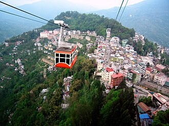 Ropeway, Gangtok
 -
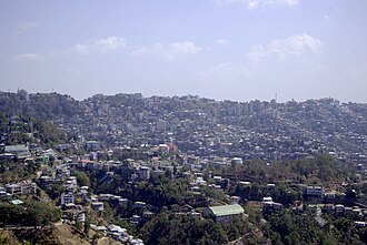
-
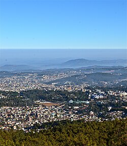 Aerial view of Shillong
 -
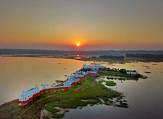 Neer Mahal of Tripura
 -
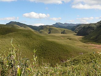
-
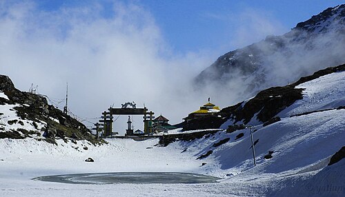
-
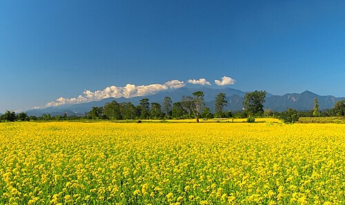
-
-
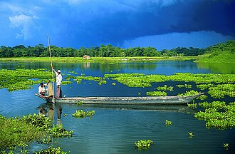
-
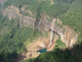 Nohkalikai Falls, Cherrapunji, Meghalaya


Topography
Highest peaks

Kangchenjunga, the third highest mountain peak in the world rising to an altitude of 8,586 m (28,169 ft), lies in-between the state Sikkim and adjacent country Nepal.
Brahmaputra River Basin


Tributaries of the Brahmaputra River in Northeast India:
Climate

Northeast India has a subtropical climate that is influenced by its relief and influences from the southwest and northeast monsoons.[42][43] The Himalayas to the north, the Meghalaya plateau to the south and the hills of Nagaland, Mizoram and Manipur to the east influences the climate.[44] Since monsoon winds originating from the Bay of Bengal move northeast, these mountains force the moist winds upwards, causing them to cool adiabatically and condense into clouds, releasing heavy precipitation on these slopes.[44] It is the rainiest region in the country, with many places receiving an average annual precipitation of 2,000 mm (79 in), which is mostly concentrated in summer during the monsoon season.[44] Cherrapunji, located on the Meghalaya plateau is one of the rainiest place in the world with an annual precipitation of 11,777 mm (463.7 in).[44] Temperatures are moderate in the Brahmaputra and Barak valley river plains which decreases with altitude in the hilly areas.[44] At the highest altitudes, there is permanent snow cover.[44] In general, the region has 3 seasons: Winter, Summer, and rainy season in which the rainy season coincides with the summer months much like the rest of India.[45] Winter is from early November until mid March while summer is from mid-April to mid-October.[44]
Under the Köppen climate classification, the region is divided into 3 broad types: A (tropical climates), C (warm temperate mesothermal climates), and D (snow microthermal climates).[46][47] The tropical climates are located in parts of Manipur, Tripura, Mizoram, and the Cachar plains south of 25oN and are classified as tropical wet and dry (Aw).[46] Much of Assam, Nagaland, northern parts of Meghalaya and Manipur and parts of Arunachal Pradesh fall within the warm temperature mesothermal climates (type C) where the mean temperatures in coldest months range from −3 to 18 °C (27 to 64 °F).[47][48] The entire Brahmaputra valley has a humid subtropical climate (Cfa/Cwa) with hot summers.[47][48] At altitudes between 500 to 1,500 m (1,600 to 4,900 ft) located in the eastern hills of Nagaland, Manipur and Arunachal Pradesh, a (Cfb/CWb) climate prevails with warm summers.[47][48] Locations above 1,500 m (4,900 ft) in Meghalaya, parts of Nagaland, and northern Arunachal Pradesh have a (Cfc/Cwc) climate with short and cool summers.[48] Finally, the extreme northern parts of Arunachal Pradesh are classified as humid continental climates with mean winter temperatures below −3 °C (27 °F).[47][49]
- Temperature
Temperatures vary by altitude with the warmest places being in the Brahmaputra and Barak River plains and the coldest at the highest altitudes.[50] It is also influenced by proximity to the sea with the valleys and western areas being close to the sea, which moderates temperatures.[50] Generally, temperatures in the hilly and mountainous areas are lower than the plains which lie at a lower altitude.[51] Summer temperatures tend to be more uniform than winter temperatures due to high cloud cover and humidity.[52]
In the Brahmaputra and Barak valley river plains, mean winter temperatures vary between 16 and 17 °C (61 and 63 °F) while mean summer temperatures are around 28 °C (82 °F).[50] The highest summer temperatures occur in the West Tripura plain with Agartala, the capital of Tripura having mean maximum summer temperatures ranging between 33 and 35 °C (91 and 95 °F) in April.[53] The highest temperatures in summer occur before the arrival of monsoons and thus eastern areas have the highest temperatures in June and July where the monsoon arrives later than western areas.[53] In the Cachar Plain, located south of the Brahmaputra plain, temperatures are higher than the Brahmaputra plain although the temperature range is smaller owing to higher cloud cover and the monsoons that moderate night temperatures year round.[51][53]
In the mountainous areas of Arunachal Pradesh, the Himalayan ranges in the northern border with India and China experience the lowest temperatures with heavy snow during winter and temperatures that drop below freezing.[51] Areas with altitudes exceeding 2,000 metres (6,562 ft) receive snowfall during winters and have cool summers.[51] Below 2,000 metres (6,562 ft) above sea level, winter temperatures reach up to 15 °C (59 °F) during the day with nights dropping to zero while summers are cool, with a mean maximum of 25 °C (77 °F) and a mean minimum of 15 °C (59 °F).[51] In the hilly areas of Meghalaya, Nagaland, Manipur and Mizoram, winters are cold while summers are cool.[52]
The plains in Manipur has colder winter minimums than what is warranted by its elevation owing to being surrounded by hills on all sides.[54] This is due to temperature inversions during winter nights when cold air descends from the hills into the valleys below and its geographic location which prevents winds that bring hot temperatures and humidity from coming into the Manipur plain.[54] For example in Imphal, winter daytime temperatures hover around 21 °C (70 °F) but nighttime temperatures drop to 3 °C (37 °F).[54]
- Rainfall
No part of Northeast India receives less than 1,000 mm (39 in) of rainfall a year.[45] Areas in the Brahmputra valley receive 2,000 mm (79 in) of rainfall a year while mountainous areas receive 2,000 to 3,000 mm (79 to 118 in) a year.[45] The southwest monsoon is responsible for bringing 90% of the annual rainfall to the region.[55] April to late October are the months where most of the rainfall in Northeast India occurs with June and July being the rainiest months.[55] In most parts of the region, the average date of onset of the monsoons is 1 June.[56] Southern areas are the first to receive the monsoon (May or June) with the Brahmaputra valley and the mountainous north receiving later (later May or June).[55] In the hilly parts of Mizoram, the closer proximity to the Bay of Bengal causes it to experience early monsoons with June being the wettest season.[55]
High-risk seismic zone

The North Eastern Region of India is a mega-earthquake prone zone caused by active fault planes beneath formed by the convergence of three tectonic plates viz. India Plate, Eurasian Plate and Burma Plate. Historically the region has suffered from two great earthquakes (M > 8.0) – 1897 Assam earthquake and 1950 Assam-Tibet earthquake – and about 20 large earthquakes (8.0 > M > 7.0) since 1897.[57][58] The 1950 Assam-Tibet earthquake is still the largest earthquake in India.[citation needed]
Wildlife
Flora
.jpg)
WWF has identified the entire Eastern Himalayas as a priority Global 200 ecoregion. Conservation International has upscaled the Eastern Himalaya hotspot to include all the eight states of Northeast India, along with the neighbouring countries of Bhutan, southern China and Myanmar.
The region has been identified by the Indian Council of Agricultural Research as a center of rice germplasm. The National Bureau of Plant Genetic Resources (NBPGR), India, has highlighted the region as being rich in wild relatives of crop plants. It is the center of origin of citrus fruits. Two primitive variety of maize, Sikkim Primitive 1 and 2, have been reported from Sikkim (Dhawan, 1964). Although jhum cultivation, a traditional system of agriculture, is often cited as a reason for the loss of forest cover of the region, this primary agricultural economic activity practiced by local tribes supported the cultivation of 35 varieties of crops. The region is rich in medicinal plants and many other rare and endangered taxa. Its high endemism in both higher plants, vertebrates, and avian diversity has qualified it as a biodiversity hotspot.
The following figures highlight the biodiversity significance of the region:[59]
- 51 forest types are found in the region, broadly classified into six major types – tropical moist deciduous forests, tropical semi-evergreen forests, tropical wet evergreen forests, subtropical forests, temperate forests, and alpine forests.
- Out of the nine important vegetation types of India, six are found in the North Eastern Region.
- These forests harbor 8,000 out of 15,000 species of flowering plants. In floral species richness, the highest diversity is reported from the states of Arunachal Pradesh (5000 species) and Sikkim (4500 species) amongst the North Eastern states.
- According to the Indian Red Data Book, published by the Botanical Survey of India, 10 percent of the flowering plants in the country are endangered. Of the 1500 endangered floral species, 800 are reported from Northeast India.
- Most of the North Eastern states have more than 60% of their area under forest cover, a minimum suggested coverage for the hill states in the country in order to protect from erosion.
- Northeast India is a part of Indo-Burma hotspot. This hotspot is the second largest in the world, next only to the Mediterranean Basin, with an area 2,206,000 square kilometres (852,000 sq mi) among the 25 identified.[citation needed]
Fauna


The International Council for Bird Preservation, UK identified the Assam plains and the Eastern Himalaya as an Endemic Bird Area (EBA). The EBA has an area of 220,000 km2 following the Himalayan range in the countries of Bangladesh, Bhutan, China, Nepal, Myanmar and the Indian states of Sikkim, North Bengal, Assam, Nagaland, Manipur, Meghalaya and Mizoram. Because of a southward occurrence of this mountain range in comparison to other Himalayan ranges, this region has a distinctly different climate, with warmer mean temperatures and fewer days with frost, and much higher rainfall. This has resulted in the occurrence of a rich array of restricted-range bird species. More than two critically endangered species, three endangered species, and 14 vulnerable species of birds are in this EBA. Stattersfield et al. (1998) identified 22 restricted range species, out of which 19 are confined to this region and the remaining three are present in other endemic and secondary areas. Eleven of the 22 restricted-range species found in this region are considered as threatened (Birdlife International 2001), a number greater than in any other EBA of India.[citation needed]
Northeast India is very rich in faunal diversity. There are as many as 15 species of non-human primates and most important of them are hoolock gibbon, stumptied macaque, pigtailed macaque, golden langur, hanuman langur and rhesus monkey. The most important and endangered species is one-horned rhinoceros. The forests of the region are also the habitats of elephant, royal Bengal tiger, leopard, golden cat, fishing cat, marbled cat, Bengal fox etc. the Gangetic dolphin in the Brahmaputra is also an endangered species. The other endangered species are otter, mugger crocodile, tortoise and some fishes.[60]
WWF has identified the following priority ecoregions in North-East India:
- Brahmaputra Valley semi-evergreen forests
- Eastern Himalayan broadleaf forests
- Eastern Himalayan subalpine conifer forests
- Northeast India–Myanmar pine forests
National Parks
State Symbols
| Arunachal Pradesh | Assam | Manipur | Meghalaya | |||||
|---|---|---|---|---|---|---|---|---|
| Animal | Mithun (Bos frontalis) |  |
Indian rhinoceros (Rhinoceros unicornis) | .jpg) |
Sangai (Rucervus eldii eldii) |  |
Clouded leopard (Neofelis nebulosa) | 
|
| Bird | Hornbill (Buceros bicornis) |  |
White-winged duck (Asarcornis scutulata) |  |
Mrs. Hume's pheasant (Syrmaticus humiae) |  |
Hill myna (Gracula religiosa) | 
|
| Flower | Foxtail orchid (Rhynchostylis retusa) |  |
Foxtail orchid (Rhynchostylis retusa) | |
Siroi lily (Lilium mackliniae) |  |
Lady's Slipper Orchid (Paphiopedilum insigne) | 
|
| Tree | Hollong (Dipterocarpus macrocarpus) |  |
Hollong (Dipterocarpus macrocarpus) | |
Uningthou (Phoebe hainesiana) |  |
Gamhar (Gmelina arborea) | _(3394494165).jpg)
|
| Mizoram | Nagaland | Sikkim | Tripura | |||||
| Animal | Himalayan serow (Capricornis thar) |  |
Mithun (Bos frontalis) | |
Red panda (Ailurus fulgens) |  |
Phayre's leaf monkey (Trachypithecus phayrei) | .jpg)
|
| Bird | Mrs. Hume's pheasant (Syrmaticus humiae) | |
Blyth's tragopan (Tragopan blythii) |  |
Blood pheasant (Ithaginis cruentus) |  |
Green imperial pigeon (Ducula aenea) | 
|
| Flower | Red Vanda (Renanthera imschootiana) |  |
Tree rhododendron (Rhododendron arboreum) |  |
Noble dendrobium (Dendrobium nobile) |  |
Indian rose chestnut (Mesua ferrea) | 
|
| Tree | Indian rose chestnut (Mesua ferrea) |  |
Alder (Alnus nepalensis) |  |
Rhododendron (Rhododendron niveum) |  |
Agarwood (Aquilaria agallocha) | |
Demographics
The total population of Northeast India is 46 million with 68 percent of that living in Assam alone. Assam also has a higher population density of 397 persons per km2 than the national average of 382 persons per km2. The literacy rates in the states of the Northeastern region, except those in Arunachal Pradesh and Assam, are higher than the national average of 74 percent. As per 2011 census, Meghalaya recorded the highest population growth of 27.8 percent among all the states of the region, higher than the national average at 17.64 percent; while Nagaland recorded the lowest in the entire country with a negative 0.5 percent.[66]
| State | Population | Males | Females | Sex Ratio | Literacy % | Rural Population | Urban Population | Area (km2) | Density (/km2) |
|---|---|---|---|---|---|---|---|---|---|
| Arunachal Pradesh | 1,383,727 | 713,912 | 669,815 | 938 | 65.38 | 870,087 | 227,881 | 83,743 | 17 |
| Assam | 31,205,576 | 15,939,443 | 15,266,133 | 958 | 72.19 | 23,216,288 | 3,439,240 | 78,438 | 397 |
| Manipur | 2,570,390 | 1,290,171 | 1,280,219 | 992 | 79.21 | 1,590,820 | 575,968 | 22,327 | 122 |
| Meghalaya | 2,966,889 | 1,491,832 | 1,475,057 | 989 | 74.43 | 1,864,711 | 454,111 | 22,429 | 132 |
| Mizoram | 1,097,206 | 555,339 | 541,867 | 976 | 91.33 | 447,567 | 441,006 | 21,081 | 52 |
| Nagaland | 1,978,502 | 1,024,649 | 953,853 | 931 | 79.55 | 1,647,249 | 342,787 | 16,579 | 119 |
| Sikkim | 610,577 | 323,070 | 287,507 | 890 | 81.42 | 480,981 | 59,870 | 7,096 | 86 |
| Tripura | 3,673,917 | 2,087,059 | 2,086,858 | 960 | 91.58 | 2,639,134 | 1,534,783 | 10,486 | 350 |
Largest cities by population
According to 2011 Census of India, the largest cities in Northeast India are
| Rank | City | Type | State | Population | Rank | City | Type | State | Population |
|---|---|---|---|---|---|---|---|---|---|
| 1 | Guwahati | City | Assam | 968,549 | 9 | Jorhat | UA | Assam | 153,889 |
| 2 | Agartala | City | Tripura | 622,613 | 10 | Nagaon | UA | Assam | 147,496 |
| 3 | Imphal | UA | Manipur | 414,288 | 11 | Bongaigaon | UA | Assam | 139,650 |
| 4 | Dimapur | City | Nagaland | 379,769 | 12 | Tinsukia | UA | Assam | 126,389 |
| 5 | Shillong | UA | Meghalaya | 354,325 | 13 | Tezpur | UA | Assam | 102,505 |
| 6 | Aizawl | City | Mizoram | 291,822 | 14 | Kohima | UA | Nagaland | 100,000 |
| 7 | Silchar | UA | Assam | 229,136 | 15 | Gangtok | City | Sikkim | 98,658 |
| 8 | Dibrugarh | UA | Assam | 154,296 | 16 | Itanagar | City | Arunachal Pradesh | 95,650 |
|
UA: Urban Agglomeration[67] | |||||||||
Languages

Northeast India constitutes a single linguistic region within the Indian national context, with about 220 languages in multiple language families (Indo-European, Sino-Tibetan, Kra–Dai, Austroasiatic, as well as some creole languages) that share a number of features that set them apart from most other areas of the Indian subcontinent (such as alveolar consonants rather than the more typical dental/retroflex distinction).[68][69] Assamese, an Indo-Aryan language spoken mostly in the Brahmaputra Valley, developed as a lingua franca for many speech communities. Assamese-based pidgin/creoles have developed in Nagaland (Nagamese) and Arunachal (Nefamese),[70] though Nefamese has been replaced by Hindi in recent times. The Austro-Asiatic family is represented by the Khasi, Jaintia and War languages of Meghalaya. A small number of Tai–Kadai languages (Ahom, Tai Phake, Khamti, etc.) are also spoken. Sino-Tibetan is represented by a number of languages that differ significantly from each other,[71] some of which are: Boro, Rabha, Karbi, Mising, Tiwa, Deori, Biate etc. (Assam); Garo, Hajong, Biate (Meghalaya) Ao, Angami, Sema, Lotha, Konyak etc. (Nagaland); Mizo, Hmar, Paite, etc. (Mizoram); Hrusso, Tanee, Nisi, Adi, Abor, Nocte, Apatani, Misimi etc. (Arunachal). Meitei is the official language in Manipur, the dominant language of the Imphal Valley; while "Naga" languages such as Poumai, Mao, Maram, Rongmei (Kabui) and Tangkul, and Kuki-Chin languages such as Thadou-Kuki, Mizo, Paite, Simte and Hmar predominate in individual hill areas of the state.[72]
Among other Indo-Aryan languages, Bengali language is spoken in South Assam in the Barak Valley, where Bengali is an official language. Chakma is also an Indo-Aryan language spoken in Mizoram. Besides the Sino-Tibetan Tripuri language, Bengali is a majority language in Tripura. Nepali, an Indo-Aryan language, is dominant in Sikkim, besides the Sino-Tibetan languages Limbu, Bhutia, Lepcha, Rai, Tamang, Sherpa, etc. Bengali was made the official language of Colonial Assam from 1836 to 1873.[75]
Official languages
| State | Official Languages[76] |
|---|---|
| Arunachal Pradesh | English |
| Assam | Assamese (in the Brahmaputra Valley), Bengali (in the Barak Valley), Bodo (in Bodoland) |
| Manipur | Meitei |
| Meghalaya | Khasi, Garo, English |
| Mizoram | Mizo, English |
| Nagaland | Nagamese, English[77] |
| Sikkim | Sikkimese, Nepali, English[15] |
| Tripura | Tripuri, Bengali, English[78] |
Etymology of state names
| Name of state | Origin | Literal meaning |
|---|---|---|
| Arunachal Pradesh | Sanskrit | Land of the rising sun |
| Assam | Native word | Name derived from the Ahom people[79] |
| Manipur | Sanskrit | Land abundant with jewels, adopted in the 18th century |
| Meghalaya | Sanskrit | Abode of the clouds, coined by Shiba P. Chatterjee |
| Mizoram | Mizo language | Land of the Mizo people; Ram – means land |
| Nagaland | English | Land of the Naga people |
| Sikkim | Limbu language | New House – Derived from the word "Sukhim", "Su" meaning new and "Khim" meaning house |
| Tripura | Kokborok | Sanskrit version of native names: Tipra, Tuipura, Twipra etc. It literally means Land near the Water – Derived from the word "TWIPRA", "Twi" meaning water and "Bupra" meaning near. As Tripura is slightly near the Bay of Bengal |
Religions
- Hinduism (54.0%)
- Islam (25.1%)
- Christianity (17.2%)
- Buddhism (1.37%)
- Jainism (0.07%)
- Sikhism (0.07%)
- Other (1.97%)
- No religion (0.21%)
| State | Hinduism | Islam | Christianity | Buddhism | Jainism | Sikhism | Other Religions | Religion Not Stated |
|---|---|---|---|---|---|---|---|---|
| Arunachal Pradesh | 401,876 | 27,045 | 418,732 | 162,815 | 771 | 3,287 | 362,553 | 6,648 |
| Assam | 19,180,759 | 10,679,345 | 1,165,867 | 54,993 | 25,949 | 20,672 | 27,118 | 50,873 |
| Manipur | 1,181,876 | 239,836 | 1,179,043 | 7,084 | 1,692 | 1,527 | 233,767 | 10,969 |
| Meghalaya | 342,078 | 130,399 | 2,213,027 | 9,864 | 627 | 3,045 | 258,271 | 9,578 |
| Mizoram | 30,136 | 14,832 | 956,331 | 93,411 | 376 | 286 | 808 | 1,026 |
| Nagaland | 173,054 | 48,963 | 1,739,651 | 6,759 | 2,655 | 1,890 | 3,214 | 2,316 |
| Sikkim | 352,662 | 9,867 | 60,522 | 167,216 | 314 | 1,868 | 16,300 | 1,828 |
| Tripura | 3,063,903 | 316,042 | 159,882 | 125,385 | 860 | 1,070 | 1,514 | 5,261 |
| Total | 24,726,344 | 11,466,329 | 7,893,055 | 627,527 | 33,244 | 33,645 | 903,545 | 88,499 |
Ethnic groups
Northeast India has over 220 ethnic groups and an equal number of dialects in which Bodo form the largest indigenous ethnic group.[81] The hills states in the region like Arunachal Pradesh, Meghalaya, Mizoram, and Nagaland are predominantly inhabited by tribal people with a degree of diversity even within the tribal groups. The region's population results from ancient and continuous flows of migrations from Tibet, Indo-Gangetic India, the Himalayas, present Bangladesh, and Myanmar.[82]
Majority communities
These ethnic groups form significant majorities in the states/regions of Northeast India:
- Assamese people - (48.38%), largest ethnicity in Assam
- Nishi people - (20.74%), largest ethnicity in Arunachal Pradesh
- Bodo people - (30.47%), largest ethnicity in Bodoland region of Assam
- Bengali people - (63.48% and 80.84%), largest ethnicity in Tripura state and Barak Valley region of Assam
- Meitei people (AKA Manipuri people) - (53.3%), largest ethnicity in Manipur
- Mizo people (AKA Lusei people) - (73.14%), largest ethnicity in Mizoram
- Khasi people - (46.24%), largest ethnicity in Meghalaya
- Naga people - (88.24%), largest ethnicity in Nagaland
- Nepali people - (62.6%), largest ethnicity in Sikkim
Minority communities
These ethnic groups form minorities in the states of Northeast India:
- Adi
- Angami Naga
- Ao Naga
- Adivasi
- Apatani
- Bhojpuri
- Bhutia
- Bishnupriya
- Biate
- Bodo
- Chakhesang Naga
- Chakma
- Deori
- Dimasa
- Garo
- Hajong
- Hmar
- Karbi
- Kami (caste)
- Khampti
- Koch Rajbongshi
- Kom
- Kuki
- Lepcha
- Limbu
- Lotha Naga
- Miji
- Mishing
- Miyas
- Mara
- Mishmi
- Nagas
- Nyishi
- Nepali
- Paite
- Pnar
- Purvottar maithili
- Rabha
- Ranglong (Langrong)
- Rai
- Singpho
- Sümi Naga
- Sylheti
- Tamang
- Tiwa
- Tripuri
- Yimkhiung Naga
- Zomi people (Paite, Vaiphei, Zou, Teddim, Simte, Gangte)
-
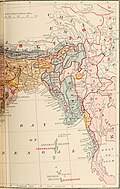 British India map of Northeast India by ethnicity, 1891
 -
 A Naga warrior in 1960
 -

-
 Shad suk Mynsiem, a Khasi festival
 -
Traditional Hajong Clothing
-
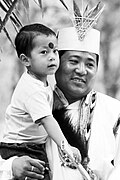 Aka tribe, Arunachal Pradesh
 -
 Mizo school girls
 -
-
Princess of Sikkim in traditional royal dress
-
 Tripuri woman in traditional attire
 -
 Asamiya youth in Bihu attire.


Culture
Cuisines
| State | Staple diet | Popular dishes | Related article |
|---|---|---|---|
| Arunachal Pradesh | Rice, fish, meat, leaf vegetables | Thukpa, momo, apong (rice beer) | Cuisine of Arunachal Pradesh |
| Assam | Rice, fish, meat, leaf vegetable | Assam tea, Pitha (rice cakes), Khar (alkali), Khar-Matidail, Ou-tenga-Maasor-Jul, Pura-Maas, Alu-Pitika, Pani-Tenga, Kharoli, Khorisa (bamboo shoot), Xukan Maasor Xukoti, Pointa-Bhaat, Tupula-Bhaat, Sunga-Sawul (rice cooked in bamboo), Kharikat Diya Maas, Kharikat Dia-Mangxo, Pati-Hanhor-Mangxo-Jul (duck stew), Lai-Xak-Gahori-Mangxo (pork with mustard greens), Kumol Sawul-Doi Jolpaan, Tamul (betel nut) – paan, rice beer (Judima, Rohi, Xaj Pani, Apong etc.) | Assamese cuisine |
| Manipur | Rice, fish, local vegetables | Eromba, u-morok, singju, ngari (fermented fish), kangshoi | Cuisine of Manipur |
| Meghalaya | Rice, spiced meat, fish | Khasi dishes – Thungtap, Dohjem, Thungrumbai, Jadoh, ki kpu, Garo dishes – kappa, brenga, so•tepa, wa•tepa, pura, minil, na•kam (dried fish), bamboo shoot | Cuisine of Meghalaya |
| Mizoram | Rice, fish, meat | Bai, bekang (fermented soya beans), sa-um (fermented pork), sawhchiar | |
| Nagaland | Rice, meat, stewed or steamed vegetables | fermented bamboo shoot, smoked pork and beef, axone, galho, bhut jolokia | Naga cuisine |
| Sikkim | Rice, meat, dairy products | Thukpa, momo, sha Phaley, gundruk, sinki, sel roti | Sikkimese cuisine |
| Tripura | Mai (rice), Aa (fish), Muihan/Kakai (meat), Sikamuk/Kakamuk (edible snails), Sindai (oysters), local vegetables | Maidul (rice ball), Awang bangwi, Awang sokrang, Chakhūi, Gudok, Mosodeng, Awandru, Mūkhūi, Hangjak, Yikjak, Wahan mosodeng, Muiya (bamboo shoot), Berma Bwtwi (fermented fish) | Tripuri cuisine |
-
-
 Bangwi - Tripuri food of Tripura
 -
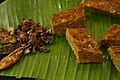 Paknam (Manipur)
 -
 Basic Tripuri lunch thali
 -
 Smoked freshwater fish (Manipur)
 -
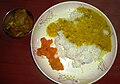 North Sikkim meal
 -
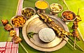 Assamese thali
 -
 Red rice with pork (Arunachal Pradesh)


Arts
The Manipuri Raas Leela dance (from Manipur) and the Sattriya (from Assam) have been included in the elite category of the "Classical Dances of India", as officially recognised by both the Sangeet Natak Akademi and the Ministry of Culture (India). Besides these, all tribes in Northeast India have their own folk dances associated with their religion and festivals. The tribal heritage in the region is rich with the practice of hunting, land cultivation and indigenous crafts. The rich culture is vibrant and visible with the traditional attires of each community.[citation needed]
All states in Northeast India share the handicrafts of bamboo and cane, wood carving, making traditional weapons and musical instruments, pottery and handloom weaving. Traditional tribal attires are made of thick fabrics primarily with cotton.[83] Assam silk is a famous industry in the region.
| State | Traditional Performing Arts | Traditional Visual Arts | Traditional Crafts |
|---|---|---|---|
| Arunachal Pradesh | Wancho dances, Idu Mishmi dance, Digaru Mishmi Buiya dance, Khampti dance, Ponung dance, Sadinuktso[84] | Cane and bamboo, cotton and wool weaving, wood carving, blacksmithy (hand tools, weapons, ornaments, dishes, sacred bells and smoking pipes)[84][85] | |
| Assam | Sattriya, Bagurumba, Bihu dance, Bhaona (For more see Music of Assam) | Hastividyarnava (For more see Fine Arts of Assam) | Cane and bamboo, bell metal and brass, silk, toy and mask making, pottery and terracotta, jewellery, musical instruments making, boat making, paints |
| Manipur | Manipuri dance (Ras Lila), Kartal Cholom, Manjira Cholom, Khubak Eshei, Pung Cholom, Lai-Haraoba | Cotton textile, bamboo crafts (hats, baskets), pottery[85][83] | |
| Meghalaya | Nongkrem, Shad suk, Behdienkhlam, Wangala, Lahoo dance[86][85] (For more see Music of Meghalaya) | Making hand tools and weapons, musical instruments (drums), cane and bamboo work, weaving traditional attires, jewellery making (gold, coral, glass), wall engravings, wood carving[85][87] | |
| Mizoram | Cheraw, Khuallam, Chheih-Lam, Chai, Rallu-Lam, Sawlakia, Sarlamkai, Par-lam, Sakei Lu Lam[88] (For more see Music of Mizoram),Bizhu Dance | Traditional hand tools, weapons and textile work, bamboo and cane handicrafts[89][85] | |
| Nagaland | Zeliang dance, war dance, Nruirolians (cock dance) (For more see Music of Nagaland) | Cane and bamboo crafts, traditional hand tools, weapons and textile work, wood carving, pottery, ornaments for traditional attire, musical instruments (drum and trumpet)[85] | |
| Sikkim | Chu Faat dance, Lu Khangthamo, Gha To Kito, Rechungma, Maruni, Tamang Selo, Singhi Chaam, Yak Chaam, Khukuri dance, Rumtek Chaam (mask dance)[90][91][92] (See also Music of Sikkim) | Thangka (showcasing Buddhist teachings on cotton canvas using vegetable dyes)[91] | Handmade paper, carpet making, woollen textile, wood carving[91] |
| Tripura | Tripuri dances, Goria dance, Jhum dance, Lebang dance, Mamita dance, Mosak sulmani dance, Hojagiri dance, Bizhu dance, Wangala, Hai-hak dance, Sangrai dance, Owa dance | Rock curbings of different gods and goddesses | Cane and bamboo, Traditional cotton textiles, weaving and handloom, moluwa /sitalpati(mat making), wood carving,[85] string and wind musical instruments |
-
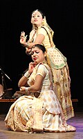
-
 Assamese youths performing Bihu dance.
 -
 Nyokum festival of Nyishi tribe (Arunachal Pradesh)
 -
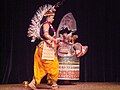
-
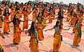
-
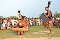
-
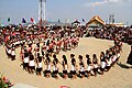 Dance of Angami tribe (Nagaland)
 -



Music
Northeast is a hub of different genres of music. Each community has its own rich heritage of folk music. Talented musicians and singers are plentifully found in this part of the country. The Assamese singer-composer Bhupen Hazarika achieved national and international fame with his remarkable creations. Another famous singer from Assam, Pratima Barua Pandey is a well-known folk singer. Zubeen Garg, Papon, Anurag Saikia are some other notable singers, musicians from the state of Assam. Tangkhul Naga folk blue singer like Rewben Mashangva, who comes from Ukhrul, is an acclaimed Folk singer whose music is inspired by the like of Bob Dylan and Bob Marley. Another famous folk singing band from Nagaland popularly known as Tetseo Sisters is one to be noted for their original music genre. However, younger generation has started pursuing western music more and more nowadays. The northeast region has seen a significant increase in musical innovation in the 21st century.[93]
Literature
Many of the Northeast Indian indigenous communities have an ancient heritage of folktales which tell the tale of their origin, rituals, beliefs and so on. These tales are transmitted from one generation to another in oral form. They are remarkable instances of tribal wisdom and imagination. However, Assam, Tripura and Manipur have some ancient written texts. These states were mentioned in the great Hindu epic Mahabharata. The Saptakanda Ramayana in Assamese by Madhava Kandali is considered the first translation of the Sanskrit Ramayana into a modern Indo-Aryan Language. Karbi Ramayana bears witness to the old heritage of written literature in Assam. Two writers from the Northeast, viz., Birendra Kumar Bhattacharya and Mamoni Raisom Goswami, have been awarded Jnanpith, the highest literary award in India.[94] Hence, Birendra Kumar Bhattacharya was the first Assamese writer and from the Northeast India to receive Jnanpith Award for his Assamese novel Mrityunjay(1979).[95] Mamoni Raisom Goswami was awarded the Jnanpith Award in the year 2000.[94] Nagen Saikia is the first writer from Assam and the Northeast India, to have been conferred the Sahitya Akademi Fellowship by the Sahitya Akademi.[96][97] The last quarter of the 20th century saw the rise of modern literature in the Northeast. Most of the writers, especially the tribal writers, are bilingual, that is, they write both in their mother-tongue and English. Some of the general features of this literature are—retrieval of folklore, celebration of folk culture, identity politics, reaction to the insurgency and counter-insurgency operations, depiction of natural beauty, changes meted out by time, etc. The major writers of Northeast Literature are--(from Assam) Lakshminath Bezbaroa, Homen Borgohain, Birendra Kumar Bhattacharya, Harekrishna Deka, Rongbong Terang, Nilmani Phukan, Indira Goswami, Hiren Bhattacharyya, Mitra Phukan, Jahnavi Barua, Dhruba Hazarika, Rita Chowdhury, D N Bezbarua, Nilim Kumar, Anupama Basumatary, Uddipana Goswami, Aruni Kashyap; (from Arunachal Pradesh) Mamang Dai; (from Manipur) Robin S Ngangom, Ratan Thiyam, Thangjam Ibopishak, Gambhini Devi, T Bijoykumar Singh; (from Meghalaya) Kynpham Sing Nongkynrih, Esther Syiem, Desmond Kharmawphlang, Paul Lyngdoh, Anjum Hassan; (from Mizoram) Mona Zote; (from Nagaland) Temsula Ao, Cherrie Chhangte, Easterine Kire; (from Sikkim) Sudha M Rai, Rajendra Bhandari (from Tripura) Chandrakanta Murasingh. Temsula Ao is the first writer from Northeast India to be awarded the Sahitya Akademi Award (2013) in the Indian English Literature category for her collection of short stories, Laburnum for My Head, and Padmashree (2007). Easterine Kire is the first English novelist hailed from Nagaland. She received The Hindu Literary Prize (2015) for her novel When the River Sleeps. Indira Goswami, alias Mamoni Roisom Goswami, is an acclaimed Assamese writer whose novels include Moth-Eaten Howda of the Tusker, Pages Stained with Blood, The Shadow of Kamakhya and The Blue-Necked God. Mamang Dai won the Sahitya Akademi Award (2017) for her novel The Black Hill.[98]
Festivals
Indigenous festivals in the northeast include the Ojiale festival of the Wancho people, Chhekar festival of the Sherdukpen people, Longte Yullo festival of Nishis, Solung festival of Adis, Losar festival of Monpas, Reh festival of Idu Mishmis and Dree festival of Apatani. Mamita Tripurabda(Tring festival), Buisu, Hangrai, Hojagiri, Kharchi and Garia festivals of Tripura, [99] In Manipur popular festivals include Ningol Chakouba and the Manipur boat racing festival or the Heikru Hidongba.
Administration and political disputes
International borders management
- McMahon Line and China–India border crossings patrolled by Indo-Tibetan Border Police and Special Frontier Force with China along Sikkim and Arunachal Pradesh
- India-Bangladesh border and crossings patrolled by Border Security Force along Assam, Meghalaya, Tripura and Mizoram
- India–Myanmar border, crossings patrolled by Assam Rifles and Indian Army along Arunachal Pradesh, Nagaland, Manipur and Mizoram
- India-Bhutan borders patrolled by Sashastra Seema Bal along Sikkim, Assam and Arunachal Pradesh
- India-Nepal border patrolled by Sashastra Seema Bal along Sikkim
Pan-states development authorities
States and sub-divisions
| State | Code | Capital | Districts | Sub-division Type | Number of Subdivisions |
|---|---|---|---|---|---|
| Arunachal Pradesh | IN-AR | Itanagar | 20 | Circle | 149 |
| Assam | IN-AS | Dispur | 35 | Sub-division | 78 |
| Manipur | IN-MN | Imphal | 16 | Sub-division | 38 |
| Meghalaya | IN-ML | Shillong | 12 | Community Development Block | 39 |
| Mizoram | IN-MZ | Aizawl | 11 | Community Development Block | 22 |
| Nagaland | IN-NL | Kohima | 16 | Circle | 33 |
| Sikkim | IN-SK | Gangtok | 6 | Sub-division | 9 |
| Tripura | IN-TR | Agartala | 8 | Sub-division | 23 |

| State | Autonomous Division | Establishment |
|---|---|---|
| Assam | Bodoland Territorial Area Districts | February 2003 |
| Dima Hasao district | February 1970 | |
| Karbi Anglong district | February 1970 | |
| Mising Autonomous Council | 1995 | |
| Rabha Hasong Autonomous Council | 1995 | |
| Manipur[100][101] | Churachandpur Autonomous District Council | 1971 |
| Chandel Autonomous District Council | 1971 | |
| Senapati Autonomous District Council | 1971 | |
| Sadar Hills Autonomous District Council | 1971 | |
| Tamenglong Autonomous District Council | 1971 | |
| Ukhrul Autonomous District Council | 1971 | |
| Meghalaya | Garo Hills Autonomous District Council | |
| Jaintia Hills Autonomous District Council | July 2012 | |
| Khasi Hills Autonomous District Council | ||
| Mizoram | Chakma Autonomous District Council | April 1972 |
| Lai Autonomous District Council | April 1972 | |
| Mara Autonomous District Council | May 1971 | |
| Tripura | Tripura Tribal Areas Autonomous District Council | January 1982 |
Government
The northeastern states, having 3.8% of India's total population, are allotted 25 out of a total of 543 seats in the Lok Sabha. This is 4.6% of the total number of seats.[citation needed]
| State | Chief Minister[102] | Governor[103] | High Court | Chief Justice |
|---|---|---|---|---|
| Arunachal Pradesh | Pema Khandu | B. D. Mishra | Guwahati High Court (Itanagar Bench) | Ajai Lamba, Chief Justice |
| Assam | Himanta Biswa Sarma | Jagdish Mukhi | Guwahati High Court | Ajai Lamba, Chief Justice |
| Manipur | Nongthombam Biren Singh | La. Ganesan | Manipur High Court | Justice N. Kotiswar Singh |
| Meghalaya | Conrad Sangma | B. D. Mishra | Meghalaya High Court | Justice Dinesh Maheshwari |
| Mizoram | Zoramthanga | Kambhampati Hari Babu | Guwahati High Court (Aizawl Bench) | Shri Ajai Lamba, Chief Justice |
| Nagaland | Neiphiu Rio | Jagdish Mukhi | Guwahati High Court (Kohima Bench) | Ajai Lamba, Chief Justice |
| Sikkim | Prem Singh Tamang | Ganga Prasad | Sikkim High Court | Justice Satish K. Agnihotri |
| Tripura | Manik Saha | Satyadev Narayan Arya | Tripura High Court | Justice Tinlianthang Vaiphei |
20th century separatist unrest
In 1947 Indian independence and partition resulted in the North East becoming a landlocked region. This exacerbated the isolation that has been recognized, but not studied. East Pakistan controlled access to the Indian Ocean.[104] The mountainous terrain has hampered the construction of road and railways connections in the region.[citation needed]
Several militant groups have formed an alliance to fight against the governments of India, Bhutan, and Myanmar, and now use the term "Western Southeast Asia" (WESEA) to refer to the region.[105] The separatist groups include the Kangleipak Communist Party (KCP), Kanglei Yawol Kanna Lup (KYKL), People's Revolutionary Party of Kangleipak (PREPAK), People's Revolutionary Party of Kangleipak-Pro (PREPAK-Pro), Revolutionary People's Front (RPF) and United National Liberation Front (UNLF) of Manipur, Hynniewtrep National Liberation Council (HNLC) of Meghalaya, Kamatapur Liberation Organization (KLO), which operates in Assam and North Bengal, National Democratic Front of Bodoland and ULFA of Assam, and the National Liberation Front of Tripura (NLFT).[106]
Economy
The Ministry of Development of North Eastern Region (MDoNER) is the deciding body under Government of India for socio-economic development in the region. The North Eastern Council under MDoNER serves as the regional governing body for Northeast India. The North Eastern Development Finance Corporation Ltd. (NEDFi) is a Public Limited Company providing assistance to micro, small, medium and large enterprises within the northeastern region (NER). Other organizations under MDoNER include North Eastern Regional Agricultural Marketing Corporation Limited (NERAMAC), Sikkim Mining Corporation Limited (SMC) and North Eastern Handlooms and Handicrafts Development Corporation (NEHHDC).
Industries
Agriculture
The economy is agrarian. Little land is available for settled agriculture. Along with settled agriculture, jhum (slash-and-burn) cultivation is still practised by a few indigenous groups of people. The inaccessible terrain and internal disturbances has made rapid industrialisation difficult in the region.[citation needed]


.jpg)

Tourism
Living Root Bridges

Northeast India is also the home of many living root bridges. In Meghalaya, these can be found in the southern Khasi and Jaintia Hills.[107][108][109] They are still widespread in the region, though as a practice they are fading out, with many examples having been destroyed in floods or replaced by more standard structures in recent years.[110] Living root bridges have also been observed in the state of Nagaland, near the Indo-Myanmar border.[111]
Newspapers and Magazines
Northeast India has several newspapers in both English and regional languages. The largest circulated English daily in Assam is The Assam Tribune. In Meghalaya, The Shillong Times is the highest circulated newspaper. In Nagaland, Nagaland Post has the highest number of readers. G Plus is the only print and digital English weekly tabloid published from Guwahati. In Manipur, Imphal Free Press is a highly respected newspaper. In Arunachal Pradesh, The Arunachal Times is the highest circulated newspaper in Arunachal Pradesh.[citation needed]
Transportation
Air


States in the North Eastern Region are well connected by air-transport conducting regular flights to all major cities in the country. The states also own several small airstrips for military and private purposes which may be accessed using Pawan Hans helicopter services. The region currently has two international airports viz. Lokapriya Gopinath Bordoloi International Airport, Bir Tikendrajit International Airport Maharaja Bir Bikram Airport conducting flights to Thailand, Myanmar, Nepal and Bhutan. While the airport in Sikkim is under-construction, Bagdogra Airport (IATA: IXB, ICAO: VEBD) remains the closest domestic airport to the state.
| State | Airport | City | IATA Code |
|---|---|---|---|
| Arunachal Pradesh | Itanagar Airport | Itanagar | HGI |
| Assam | Dibrugarh Airport | Dibrugarh | DIB |
| Jorhat Airport | Jorhat | JRH | |
| Lokpriya Gopinath Bordoloi International Airport | Guwahati | GAU | |
| Lilabari Airport | Lakhimpur | IXI | |
| Rupsi Airport | Dhubri | RUP | |
| Silchar Airport | Silchar | IXS | |
| Tezpur Airport | Tezpur | TEZ | |
| Manipur | Bir Tikendrajit International Airport | Imphal | IMF |
| Meghalaya | Baljek Airport | Tura | VETU (ICAO) |
| Shillong Airport | Shillong | SHL | |
| Mizoram | Lengpui Airport | Aizawl | AJL |
| Nagaland | Dimapur Airport | Dimapur | DMU |
| Sikkim | Pakyong Airport | Gangtok | PYG |
| Tripura | Maharaja Bir Bikram Airport | Agartala | IXA |
Railway

Railway in Northeast India is delineated as Northeast Frontier Railway zone of Indian Railways. The regional network is underdeveloped. States of Manipur, Meghalaya, Mizoram and Sikkim will remain almost disconnected till March 2023 when the capital cities of Manipur Mizoram and-Nagaland are expected to get the rail links once the under construction rail projects are completed.[112]
Look East Policy


In the 21st century, there has been recognition among policymakers and economists of the region that the main stumbling block for economic development of the Northeastern region is the disadvantageous geographical location.[113] It was argued that globalisation propagates deterritorialisation and a borderless world which is often associated with economic integration. With 98 percent of its borders with China, Myanmar, Bhutan, Bangladesh and Nepal, Northeast India appears to have a better scope for development in the era of globalisation.[114] As a result, a new policy developed among intellectuals and politicians that one direction the Northeastern region must be looking to as a new way of development lies with political integration with the rest of India and economic integration with the rest of Asia and Oceania, with North, East and Southeast Asia, Micronesia and Polynesia in particular, as the policy of economic integration with the rest of India did not yield much dividends. With the development of this new policy, the Government of India directed its Look East policy towards developing the Northeastern region. This policy is reflected in the Year End Review 2004 of the Ministry of External Affairs, which stated that: "India’s Look East Policy has now been given a new dimension by the UPA Government. India is now looking towards a partnership with the Association of Southeast Asian Nations ASEAN countries, both within BIMSTEC and the India-ASEAN Summit dialogue as integrally linked to economic and security interests, particularly for India’s East and North East region."[115]
Development and connectivity projects
The north-east (NE) region of India lags behind the rest of the country in several development indicators. Although infrastructure has developed over the years, the region has to go a long way to level up the national standard. The total road network of about 377 thousand km of NE contributes about 9.94 per cent of the total roads in the country. Road density in terms of road length per thousand square kilometers. area is very poor in hilly state of Arunachal Pradesh, Mizoram, Meghalaya and Sikkim, while it is significantly high in Tripura and Assam. The road length per 100 km2 area in NE districts varies from as less as below 10 km (in Arunachal Pradesh) to more than 200 km (in Tripura). Other means of transport such as rail, air and water is insignificant in NE (except Assam); however, a few cities of these states having direct air connectivity in the region. The total railway network in the NE is 2,602 km (as on 2011), which is only about 4 per cent of the total rail network of the country. Constructions of roads build the road map for development and road is the only means of mass transport for the entire NE of India. Due to hilly terrain and varied altitudes, rail transport is mainly confined to Assam and water transport is almost non-existent.
India's road network has benefited greatly from the articulation of the National Highways Development Project (NHDP). The Ministry has formulated the Special Accelerated Road Development Programme for North East (SARDP-NE) for the development/improvement of more than 10,000 km roads in the NE states. The Ministry of Road Transport and Highways (MoRTH) has been paying special attention to the development of national highways in the region and has assigned 10 per cent of the total allocation of fund for the NE region.
Another major constraint of surface infrastructure projects in the NE states has to be linked up with parallel developments in the neighboring countries, particularly with Bangladesh. The restoration and extension of pre-partition land and river transit routes through Bangladesh is vital for transport infrastructure in NE states. Other international cooperation, such as, revival of Ledo road (Stilwell road) connecting Ledo in Assam to northern Myanmar and extended up to Kunming in south-eastern China, Kaladan Multimodal Transit Project and Trans-Asian Railways, could open up an eastern window for the land-locked NE states of India. Various regional initiatives, such as, the Bangladesh–China–India–Myanmar (BCIM) and Bay of Bengal Initiative for Multi-Sectoral Technical and Economic Cooperation (BIMSTEC), India–Myanmar–Thailand Trilateral Highway (IMTTH) project to link the markets of South and Southeast Asia, are in very initial stages.[116]
- NE road, rail, air services, water, power, and tourism projects
- Look-East connectivity projects with ASEAN and SAARC
See also

- Battle of the Tennis Court
- Laskar Committee Report
- Ledo Road (Stillwell Road)
- List of Christian denominations in Northeast India
- Literature from North East India
- Political integration of India
- History of Ladakh
- List of indigenous peoples of South Asia
- East India
- North India
- South India
- Central India
- Western India
- Administrative divisions of India
References
Citations
- ↑ "Indian cities by population" (PDF). Archived (PDF) from the original on 23 July 2013. Retrieved 30 May 2018.
- ↑ State/UT wise Aadhaar Saturation
- ↑ 3.0 3.1 3.2 3.3 3.4 "Languages Included in the Eighth Schedule of the Indian Constitution | Department of Official Language | Ministry of Home Affairs | GoI". rajbhasha.gov.in. Retrieved 31 July 2022.
- ↑ "Manipuri language | Britannica". www.britannica.com.
- ↑ 5.0 5.1 5.2 5.3 5.4 5.5 5.6 5.7 "Report of the Commissioner for linguistic minorities: 47th report (July 2008 to June 2010)" (PDF). Commissioner for Linguistic Minorities, Ministry of Minority Affairs, Government of India. pp. 84–89. Archived from the original (PDF) on 13 May 2012. Retrieved 16 February 2012.
- ↑ Nath, Monoj Kumar (29 March 2021). The Muslim Question in Assam and Northeast India. Taylor & Francis. p. 57. ISBN 978-1-000-37027-0.
- ↑ 7.0 7.1 Chakravarti, Sudeep (6 January 2022). The Eastern Gate: War and Peace in Nagaland, Manipur and India's Far East. Simon and Schuster. p. 421. ISBN 978-93-92099-26-7.
- ↑ 8.0 8.1 Kumāra, Braja Bihārī (2007). Problems of Ethnicity in the North-East India. Concept Publishing Company. p. 88. ISBN 978-81-8069-464-6.
- ↑ Wadley, Susan S. (18 December 2014). South Asia in the World: An Introduction: An Introduction. Routledge. p. 76. ISBN 978-1-317-45959-0.
- ↑ Oinam, Bhagat; Sadokpam, Dhiren A. (11 May 2018). Northeast India: A Reader. Taylor & Francis. p. 164. ISBN 978-0-429-95320-0.
- ↑ Deb, Bimal J. (2006). Ethnic Issues, Secularism, and Conflict Resolution in North East Asia. Concept Publishing Company. p. 21. ISBN 978-81-8069-134-8.
- ↑ 12.0 12.1 Britannica. Student Britannica India 7 Vols. Popular Prakashan. p. 174. ISBN 978-0-85229-762-9.
- ↑ Brenzinger, Matthias (31 July 2015). Language Diversity Endangered. Walter de Gruyter GmbH & Co KG. p. 322. ISBN 978-3-11-090569-4.
- ↑ Experts, Arihant (4 June 2019). General Knowledge 2020. Arihant Publications India limited. p. 531. ISBN 978-93-131-9167-4.
- ↑ 15.0 15.1 15.2 Legislative assembly
- ↑ https://mdoner.gov.in/
- ↑ 17.0 17.1 "North Eastern Council". Archived from the original on 15 April 2012. Retrieved 25 March 2012.
- ↑ "Problems of border areas in Northeast India" (PDF). Archived (PDF) from the original on 23 January 2022. Retrieved 30 April 2018.
- ↑ 19.0 19.1 "Integration of Sikkim in North Eastern Council". The Times of India. 10 December 2002. Archived from the original on 30 April 2013. Retrieved 25 March 2012.
- ↑ "Evaluation of NEC funded projects in Sikkim" (PDF). NEC. Archived from the original (PDF) on 8 September 2017. Retrieved 4 June 2017.
- ↑ Geography of Assam. New Delhi: Rajesh Publications. 2001. p. 12. ISBN 81-85891-41-9. OCLC 47208764. Archived from the original on 2 March 2022. Retrieved 22 December 2020.
The first group of migrants to settle in this part of the country is perhaps the Austro-Asiatic language speaking people who came here from South-East Asia a few millennia before Christ. The second group of migrants came to Assam from the north, north-east and east. They are mostly the Tibeto-Burman language speaking people. From about the fifth century before Christ, there started a trickle of migration of the people speaking Indo-Aryan language from the Gangetic plain.
- ↑ Hazarika, M. 2006 "Neolithic Culture of Northeast India: A Recent Perspective on the Origins of Pottery and Agriculture." Ancient Asia, 1, doi:10.5334/aa.06104
- ↑ "Chang K'ien had clearly realized the existence of a trade route between Sichuan and India via Yunnan and Burma or Assam" (Lahiri 1991, pp. 11–12)
- ↑ Besatae in the Schoff translation and also sometimes used by Ptolemy, they are a people similar to Kirradai and they lived in the region between "Assam and Sichuan" (Casson 1989, pp. 214–242)
- ↑ (Casson 1989, pp. 51–53)
- ↑ "The Periplus of the Erythraen Sea (last quarter of the first century A.D) and Ptolemy's Geography (middle of the second century A.D) appear to call the land including Assam Kirrhadia after its Kirata population." (Sircar 1990:60–61)
- ↑ (Watters 1905, p. 186)
- ↑ Baruah, Sanjib (2004), Between South and Southeast Asia Northeast India and Look East Policy, Ceniseas Paper 4, Guwahati
- ↑ May, Andrew (2015). Welsh Missionaries and British Imperialism: The Empire of Clouds in North-east India. Manchester University Press. ISBN 9780719099977.
- ↑ "Formation of Assam during British rule in India". Archived from the original on 11 June 2012. Retrieved 25 March 2012.
- ↑ "Formation of North Eastern states from Assam". Archived from the original on 27 June 2018. Retrieved 25 March 2012.
- ↑ "Shillong becomes the capital of Meghalaya". Archived from the original on 16 April 2012. Retrieved 25 March 2012.
- ↑ 33.0 33.1 33.2 33.3 33.4 "The North Eastern Areas (Re-organisation Act) 1971" (PDF). meglaw.gov.in. Archived (PDF) from the original on 6 December 2017. Retrieved 5 December 2017.
- ↑ "Ancient name of Manipur". Archived from the original on 18 November 2017. Retrieved 5 June 2017.
- ↑ "Historical evolution of Mizoram" (PDF). Archived (PDF) from the original on 7 July 2017. Retrieved 5 June 2017.
- ↑ "History of Mizoram". Archived from the original on 29 August 2017. Retrieved 5 June 2017.
- ↑ Ranjan Pal (4 October 2020). "Revisiting India's forgotten battle of WWII: Kohima-Imphal, the Stalingrad of the East". CNN. Retrieved 27 December 2022.
- ↑ "China says Arunachal Pradesh part of it "since ancient times"". The Economic Times. Retrieved 27 December 2022.
- ↑ Larry M. Wortzel, Robin D.S Higham (1999), Dictionary of Contemporary Chinese Military History
- ↑ Saikia, J. P (1976). The Land of seven sisters. Place of publication not identified: Directorate of Information and Public Relations, Assam. OCLC 4136888.
- ↑ "Who are the Seven Sisters of India?". HT School. Retrieved 27 December 2022.
- ↑ Dikshit 2014, p. 150.
- ↑ Dikshit 2014, p. 151.
- ↑ 44.0 44.1 44.2 44.3 44.4 44.5 44.6 Dikshit 2014, p. 152.
- ↑ 45.0 45.1 45.2 Dikshit 2014, p. 149.
- ↑ 46.0 46.1 Dikshit 2014, p. 171.
- ↑ 47.0 47.1 47.2 47.3 47.4 Dikshit 2014, p. 172.
- ↑ 48.0 48.1 48.2 48.3 Peel, M. C.; Finlayson B. L.; McMahon, T. A. (2007). "Updated world map of the Köppen−Geiger climate classification" (PDF). Hydrol. Earth Syst. Sci. 11 (5): 1633–1644. Bibcode:2007HESS...11.1633P. doi:10.5194/hess-11-1633-2007. ISSN 1027-5606. Archived (PDF) from the original on 3 February 2012. Retrieved 22 February 2013.
- ↑ "JetStream Max: Addition Köppen-Geiger Climate Subdivisions". National Weather Service. Archived from the original on 24 December 2018. Retrieved 24 December 2018.
- ↑ 50.0 50.1 50.2 Dikshit 2014, p. 153.
- ↑ 51.0 51.1 51.2 51.3 51.4 Dikshit 2014, p. 156.
- ↑ 52.0 52.1 Dikshit 2014, p. 158.
- ↑ 53.0 53.1 53.2 Dikshit 2014, p. 155.
- ↑ 54.0 54.1 54.2 Dikshit 2014, p. 157.
- ↑ 55.0 55.1 55.2 55.3 Dikshit 2014, p. 160.
- ↑ Dikshit 2014, p. 59.
- ↑ "At least eight dead as north-east India hit by 6.7 magnitude earthquake". The Guardian. 4 January 2016. Archived from the original on 9 September 2017. Retrieved 4 June 2017.
- ↑ J. R. Kayal; S. S. Arefiev; S. Barua; Devajit Hazarika; N. Gogoi; A. Kumar; S. N. Chowdhury; Sarbeswar Kalita (July 2006). "Shillong Plateau Earthquakes". Archived from the original on 2 March 2022. Retrieved 11 February 2019.
- ↑ Hedge 2000, FSI 2003.
- ↑ Saikia, Parth (15 May 2020). "Biodiversity of Northeast India | Flora, Fauna and Hotspots". North East India Info. Retrieved 20 May 2020.
- ↑ "Kaziranga National Park – a world heritage site, Govt. of Assam" (PDF). Archived (PDF) from the original on 8 September 2017. Retrieved 10 September 2017.
- ↑ "Khangchendzonga National Park". Archived from the original on 11 July 2018. Retrieved 26 December 2019.
- ↑ "A note on non-human primates of Murlen National Park, Mizoram, India" (PDF). Zoological Survey of India. 106 (Part-1): 111–114. Archived (PDF) from the original on 21 July 2017. Retrieved 10 September 2017.
- ↑ "Orang Tiger Reserve". Archived from the original on 10 September 2017. Retrieved 10 September 2017.
- ↑ "Forest types of Mizoram". Archived from the original on 10 September 2017. Retrieved 10 September 2017.
- ↑ "Nagaland records negative decadal growth". The Hindu. April 2011. Archived from the original on 28 February 2020. Retrieved 1 May 2018.
- ↑ "Archived copy" (PDF). Archived from the original on 26 December 2018. Retrieved 30 May 2017.
{{cite web}}: CS1 maint: archived copy as title (link) - ↑ (Moral 1997, p. 42)
- ↑ "IITG – Hierarchy of North Eastern Languages". Archived from the original on 17 March 2018. Retrieved 5 December 2017.
- ↑ (Moral 1997, pp. 43–44)
- ↑ Blench, R. & Post, M. W. (2013). Rethinking Sino-Tibetan phylogeny from the perspective of Northeast Indian languages Archived 26 April 2020 at the Wayback Machine
- ↑ Post, M. W. and R. Burling (2017). The Tibeto-Burman languages of Northeast India Archived 7 April 2018 at the Wayback Machine
- ↑ "Language – India, States and Union Territories" (PDF). Census of India 2011. Office of the Registrar General. pp. 13–14. Archived (PDF) from the original on 14 November 2018. Retrieved 30 April 2019.
- ↑ "C-16 Population By Mother Tongue". census.gov.in. Archived from the original on 12 January 2020. Retrieved 6 March 2020.
- ↑ Banerjee, Paula (2008). Women in Peace Politics. Sage. p. 71. ISBN 978-0-7619-3570-4.
- ↑ "Report on North East India" (PDF). Archived (PDF) from the original on 24 February 2020. Retrieved 29 May 2017.
- ↑ "Nagaland State Profile". Archived from the original on 13 September 2017. Retrieved 24 July 2017.
- ↑ "Know Tripura | Tripura State Portal". tripura.gov.in. Archived from the original on 3 January 2021. Retrieved 29 June 2020.
- ↑ "Ahoms also gave Assam and its language their name (' |Ahom and the modern ɒχɒm 'Assam' come from an attested earlier form asam, acam, probably from a Burmese corruption of the word Shan/Shyam, cf. Siam: Kakati 1962; 1–4)." (Masica 1993, p. 50)
- ↑ "Population By Religious Community". Archived from the original on 13 September 2015. Retrieved 5 June 2017.
- ↑ "Tribal groups in Assam and Northeast India". Archived from the original on 28 August 2019. Retrieved 28 August 2019.
- ↑ van Driem, G. (2012)
- ↑ 83.0 83.1 "Northeast India craft forms – nelive.in". Archived from the original on 28 April 2017. Retrieved 7 June 2017.
- ↑ 84.0 84.1 "Arunachal Pradesh". Archived from the original on 3 June 2017. Retrieved 6 June 2017.
- ↑ 85.0 85.1 85.2 85.3 85.4 85.5 85.6 "Arts and crafts of North-east India". Archived from the original on 2 June 2017. Retrieved 6 June 2017.
- ↑ "Popular dances of Meghalaya". Archived from the original on 27 May 2017. Retrieved 7 June 2017.
- ↑ "Meghalaya handicrafts". Archived from the original on 19 May 2017. Retrieved 7 June 2017.
- ↑ "Dances in Mizoram". Archived from the original on 4 June 2017. Retrieved 7 June 2017.
- ↑ "Mizoram handicrafts". Archived from the original on 24 May 2017. Retrieved 7 June 2017.
- ↑ "Sikkim dances". Archived from the original on 16 June 2017. Retrieved 7 June 2017.
- ↑ 91.0 91.1 91.2 "Culture of Sikkim – sikkimonline.in". Archived from the original on 2 May 2017. Retrieved 7 June 2017.
- ↑ "Folk dances of Sikkim". Archived from the original on 10 June 2017. Retrieved 7 June 2017.
- ↑ Sundaresan, Eshwar (20 October 2022). "Music a language in itself in north-east India". frontline.thehindu.com. Retrieved 27 December 2022.
- ↑ 94.0 94.1 "Jnanpith | Laureates". jnanpith.net. Archived from the original on 3 October 2019. Retrieved 23 July 2019.
- ↑ "Assamese, Manipuri, Naga authors have kept alive World War II fought 70 years ago". The Indian Express. 8 May 2015. Archived from the original on 23 July 2019. Retrieved 23 July 2019.
- ↑ "..:: SAHITYA : Fellows and Honorary Fellows ::." sahitya-akademi.gov.in. Archived from the original on 18 July 2019. Retrieved 23 July 2019.
- ↑ "Press release, election of fellows of Sahitya Akademy" (PDF). Sahitya Akademi. 29 January 2019. Archived (PDF) from the original on 29 January 2019. Retrieved 23 July 2019.
- ↑ "..:: SAHITYA : Akademi Awards ::." sahitya-akademi.gov.in. Archived from the original on 10 September 2019. Retrieved 23 July 2019.
- ↑ Sadangi 2008, p. 48–55.
- ↑ "Autonomous District Councils of Manipur". Archived from the original on 18 April 2018. Retrieved 17 April 2018.
- ↑ "Manipur District Council Act 1971". Archived from the original on 17 April 2018. Retrieved 17 April 2018.
- ↑ http://india.gov.in/my-governmentra/whos-who/chief-ministers [dead link]
- ↑ "Governors | National Portal of India". Archived from the original on 9 October 2015. Retrieved 16 October 2015.
- ↑ "Seventh Kamal Kumari Memorial Lecture". Archived from the original on 25 May 2006. Retrieved 6 June 2006.
- ↑ "11 rebel groups call for Republic Day boycott". The Times of India. 22 January 2014. Archived from the original on 26 January 2014. Retrieved 9 September 2014.
- ↑ "NE rebels call general strike on I-Day". The Sangai Express. Archived from the original on 9 September 2014. Retrieved 9 September 2014.
- ↑ "Living Root Bridges". Cherrapunjee. Archived from the original on 9 June 2014. Retrieved 11 September 2017.
- ↑ "The Living Root Bridge Project". The Living Root Bridge Project. Archived from the original on 5 September 2017. Retrieved 11 September 2017.
- ↑ "The Living-Root Bridge: The Symbol of Benevolence". Riluk. 10 October 2016. Archived from the original on 8 September 2017. Retrieved 11 September 2017.
- ↑ "Why is Meghalaya's Botanical Architecture Disappearing?". The Living Root Bridge Project. 6 April 2017. Archived from the original on 11 September 2017. Retrieved 11 September 2017.
- ↑ "Living Root Bridges of Nagaland India – Nyahnyu Village Mon District | Guy Shachar". guyshachar.com. Archived from the original on 12 June 2018. Retrieved 11 September 2017.
- ↑ By March 2023, Manipur, Mizoram and Nagaland to have rail connectivity Archived 15 September 2021 at the Wayback Machine, Business Standard, 29 August 2020.
- ↑ Sachdeva, Gulshan. Economy of the North-East: Policy, Present Conditions and Future Possibilities. New Delhi: Konark Publishers, 2000, p. 145.
- ↑ Thongkholal Haokip, India’s Northeast Policy: Continuity and Change Archived 28 April 2017 at the Wayback Machine, Man and Society – A Journal of North-East Studies, Vol. VII, Winter 2010, pp. 86–99.
- ↑ Year End Review 2004, Ministry of External Affairs, Government of India. New Delhi.
- ↑ Nandy, S.N. (2014). "Road Infrastructure in Economically Underdeveloped North-east India". Journal of Infrastructure Development. 6 (2): 131–144. doi:10.1177/0974930614564648. S2CID 155649407.
Sources cited
- Casson, Lionel (1989). The Periplus Maris Erythraei: Text With Introduction, Translation, and Commentary. Princeton University Press. ISBN 978-0-691-04060-8.
- Sircar, D C (1990), "Pragjyotisha-Kamarupa", in Barpujari, H K (ed.), The Comprehensive History of Assam, vol. I, Guwahati: Publication Board, Assam, pp. 59–78
- Dikshit, K.; Dikshit, Jutta (2014). "Weather and Climate of North–East India". North–East India: Land, People and Economy. Springer Netherlands. pp. 149–173. doi:10.1007/978-94-007-7055-3_6. ISBN 978-94-007-7054-6.
- Grierson, George A. (1967) [1903]. "Assamese". Linguistic Survey of India. Vol. Volume V, Indo-Aryan family. Eastern group. New Delhi: Motilal Banarasidass. pp. 393–398.
{{cite book}}:|volume=has extra text (help); External link in|volume= - Lahiri, Nayanjot (1991). Pre-Ahom Assam: Studies in the Inscriptions of Assam between the Fifth and the Thirteenth Centuries AD. Munshiram Manoharlal Publishers Pvt Ltd.
- Masica, Colin P. (1993), Indo-Aryan Languages, Cambridge University Press, ISBN 9780521299442, archived from the original on 26 July 2020, retrieved 26 September 2017
- Moral, Dipankar (1997), "North-East India as a Linguistic Area" (PDF), Mon-Khmer Studies, 27: 43–53, archived (PDF) from the original on 24 February 2021, retrieved 19 December 2020
- Sharma, Benudhar, ed. (1972), An Account of Assam, Gauhati: Assam Jyoti
- Taher, M (2001), "Assam: An Introduction", in Bhagawati, A K (ed.), Geography of Assam, New Delhi: Rajesh Publications, pp. 1–17
- Watters, Thomas (1905). Davids, T. W. Rhys; Bushell, S. W. (eds.). On Yuan Chwang's Travels in India. Vol. 2. London: Royal Asiatic Society. ISBN 9780524026779. Archived from the original on 4 July 2014. Retrieved 29 January 2013.
- Nandy, S N (2014), "Agro-Economic Indicators—A Comparative Study of North-Eastern States of India", Journal of Land and Rural Studies, 2: 75–88, doi:10.1177/2321024913515127, S2CID 128485864
- van Driem, George (2012), ""Glimpses of the Ethnolinguistic Prehistory of Northeastern India".", in Huber, Toni (ed.), Origins and Migrations in the Extended Eastern Himalayas, Leiden: Brill
- Sadangi, H. C. (2008). Emergent North-East: A Way Forward. Gyan Publishing House. ISBN 9788182054370.
External links
Places adjacent to Northeast India | ||||||||||
|---|---|---|---|---|---|---|---|---|---|---|
| ||||||||||


