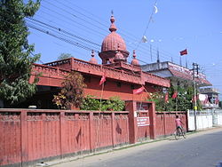
South Tripura district
South Tripura
দক্ষিণ ত্রিপুরা জেলা | |
|---|---|
District | |
 | |
 Tripura's four districts | |
| Coordinates: 23°32′N 91°29′E / 23.533°N 91.483°ECoordinates: 23°32′N 91°29′E / 23.533°N 91.483°E | |
| State | Tripura |
| Country | India |
| Headquarter | Belonia |
| Area | |
| • Total | 1,514.3 km2 (584.7 sq mi) |
| Elevation | 26 m (85 ft) |
| Population (2011) | |
| • Total | 453,079 |
| • Density | 300/km2 (770/sq mi) |
| Time zone | UTC+05:30 (IST) |
| ISO 3166 code | IN-TR |
| Website | http://southtripura.nic.in/ |

South Tripura (Bengali: দক্ষিণ ত্রিপুরা জেলা) is an administrative district in the state of Tripura in northeastern India.
History[edit]
The district came into existence on 1 September 1970, when the entire state was divided into three districts.[citation needed]
Geography[edit]
The district occupies an area of 2,152 km2 (831 sq mi).[citation needed] The district headquarters are located at Belonia.[citation needed]
Divisions[edit]
District has three sub divisions (Belonia, Sabroom and Santirbazar).
The district resides in two Lok Sabha constituencies: Tripura West (shared with West Tripura district) and Tripura East (shared with Dhalai and North Tripura districts. It is also split between seven Legislative assembly constituencies : Belonia, Hrishyamukh, Jolaibari, Manu, Rajnagar, Sabroom and Santirbazar.[1]
Demographics[edit]
According to the 2011 census South Tripura district has a population of 876,001,[2] roughly equal to the nation of Fiji[3] or the US state of Delaware.[4] This gives it a ranking of 471st in India (out of a total of 640).[2] The district has a population density of 286 inhabitants per square kilometre (740/sq mi) .[2] Its population growth rate over the decade 2001–2011 was 14.03%.[2] South Tripura has a sex ratio of 957 females for every 1000 males,[2] and a literacy rate of 85.41%.[2]
| Parameters | Particulars |
|---|---|
| Total population | 4,53,079 |
| Male | 2,34,118 |
| Female | 2,18,961 |
| SC Population (No. and % of total population) | 74,020 (16.33%) |
| ST Population (No. and % of total population) | 1,62,463 (35.85%) |
| Rural Population (in lakh) | 4,14,426 |
| Urban Population (in lakh) | 38,653 |
| Population Density (Ratio) | 299 per Sq. Km. |
| Sex Ratio | 935 Female per 1000 Male |
| Literacy Male (in percentage) | 93.39% |
| Literacy Female (in percentage) | 79.54% |
| Literacy Total (in percentage) | 85.09% |
| Total geographical area (in Sq. Km.) | 1514.3 Sq. Km. |
Flora and fauna[edit]
In 1987, South Tripura district became home to the Trishna Wildlife Sanctuary, which has an area of 195 square kilometres (75 sq mi).[5] It is also home to the Gumti Wildlife Sanctuary, which was established in 1988 and has an area of 390 square kilometres (150 sq mi).[5]
References[edit]
- ↑ "District/AC Map - Chief Electoral Officer, Tripura". ceotripura.nic.in. Archived from the original on 5 April 2014. Retrieved 23 January 2021.
- ↑ 2.0 2.1 2.2 2.3 2.4 2.5 "District Census 2011". Census2011.co.in. 2011. Retrieved 30 September 2011.
- ↑ US Directorate of Intelligence. "Country Comparison:Population". Retrieved 1 October 2011.
Fiji 883,125 July 2011 est.
- ↑ "2010 Resident Population Data". U. S. Census Bureau. Retrieved 30 September 2011.
Delaware 897,934
- ↑ 5.0 5.1 Indian Ministry of Forests and Environment. "Protected areas: Tripura". Retrieved 25 September 2011.
External links[edit]