


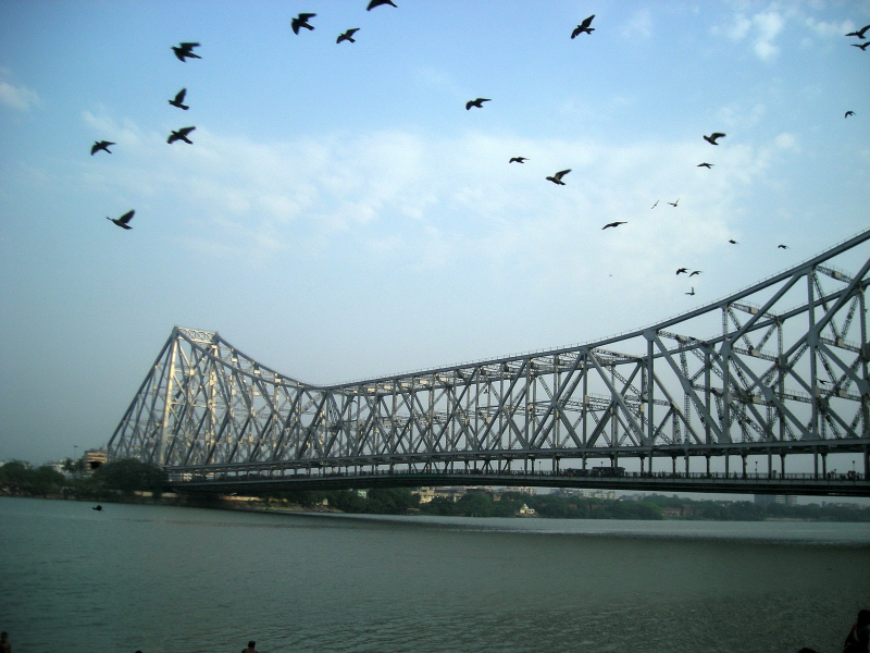

WikiDwarfBOT (talk | contribs) Cleanup: Source modification. |
cleanup content per sources |
||
| Line 1: | Line 1: | ||
{{About|the city in West Bengal, India|its namesake district|Howrah district|other uses}} | {{About|the city in West Bengal, India|its namesake district|Howrah district|other uses}} | ||
{{Use Indian English|date= | {{Use Indian English|date=February 2025}} | ||
{{Use dmy dates|date=February | {{Use dmy dates|date=February 2025}} | ||
<!-- See [[ | <!-- See [[Bharatpedia:WikiProject Indian cities]] for details --> | ||
{{Infobox settlement | {{Infobox settlement | ||
| name | | name = Howrah | ||
| native_name | | native_name = {{nativename|bn|Haōṛa}} | ||
| native_name_lang | | native_name_lang = bn | ||
| other_name | | other_name = | ||
| settlement_type | | settlement_type = [[Metropolis]] | ||
| image_skyline | | image_skyline = {{multiple image | ||
| border = infobox | | border = infobox | ||
| total_width = 275 | | total_width = 275 | ||
| Line 16: | Line 16: | ||
| image1= Howrah bridge at night.jpg | | image1= Howrah bridge at night.jpg | ||
| caption1 = The [[Howrah Bridge]] | | caption1 = The [[Howrah Bridge]] | ||
|image2 = | |image2 = | ||
|caption2= | Howrah Railway Station 02.jpg | ||
| | |caption2= [[Howrah Junction railway station]] | ||
| | |caption4= [[Acharya Jagadish Chandra Bose Indian Botanic Garden|AJCB Indian Botanical Garden]] at [[Shibpur]] | ||
|image4=Campus Road - Bengal Engineering and Science University - Sibpur - Howrah 2013-06-08 9317.JPG | |image4=AJC Bose Indian Botanic Garden - Howrah 2018-04-01 2353.JPG | ||
| | |image3=Campus Road - Bengal Engineering and Science University - Sibpur - Howrah 2013-06-08 9317.JPG | ||
|image5 = Sabuj Sathi Krirangan - Howrah Indoor Stadium - Dumurjala - Howrah 2023-05-27 7780.jpg | |caption3 = Inside [[IIEST Shibpur]] campus | ||
| | |image5 =BelurMath kolkata.jpg | ||
| | |caption5 =[[Belur Math]] | ||
| | |image6 = Sabuj Sathi Krirangan - Howrah Indoor Stadium - Dumurjala - Howrah 2023-05-27 7780.jpg | ||
|caption6 = [[Howrah Indoor Stadium]] at [[Dumurjala Sports City]] | |||
|image7= Unitech - Gateway Cluster 1 - Residential Complex - Santragachi - Howrah 2014-04-06 0611.JPG | |||
|caption7= Apartments in [[Santragachi]] | |||
}} | }} | ||
| pushpin_map | | pushpin_map = India Kolkata#India West Bengal#India | ||
| pushpin_label_position =right | | pushpin_label_position = right | ||
| pushpin_map_alt | | pushpin_map_alt = | ||
| pushpin_map_caption | | pushpin_map_caption = Location in Kolkata##Location in West Bengal##Location in India | ||
| pushpin_mapsize | | pushpin_mapsize = 300 | ||
| coordinates | | coordinates = {{Coord|22|34|48|N|88|19|46|E|region:IN-WB|display=inline,title}} | ||
| nickname | | nickname = [[Sheffield]] of India<ref>{{cite book |last1=Bengal (India) |first1=West |title=West Bengal District Gazetteers: Calcutta and Howrah |year=1972 |publisher=State editor, West Bengal District Gazetteers |page=202 |url=https://books.google.com/books?id=z8FFAQAAIAAJ&q=howrah+sheffield+w+of+india |language=en |access-date=19 February 2021 |archive-date=10 October 2022 |archive-url=https://web.archive.org/web/20221010040559/https://www.google.co.in/books/edition/West_Bengal_District_Gazetteers_Calcutta/z8FFAQAAIAAJ?hl=en&gbpv=1&bsq=howrah+sheffield+w+of+india&dq=howrah+sheffield+w+of+india&printsec=frontcover |url-status=live }}</ref><ref>{{cite news |last1=Shaw |first1=Shri Ram |title=Sheffield of India dying an untimely death |url=https://timesofindia.indiatimes.com/city/kolkata/sheffield-of-india-dying-an-untimely-death/articleshow/336158732.cms |access-date=19 February 2021 |work=The Times of India |date=20 September 2001 |language=en |archive-date=11 October 2018 |archive-url=https://web.archive.org/web/20181011172707/https://timesofindia.indiatimes.com/city/kolkata/Sheffield-of-India-dying-an-untimely-death/articleshow/336158732.cms |url-status=live }}</ref><ref name="2024-05-22-city-WBHC" /> | ||
| subdivision_type = [[List of sovereign states|Country]] | |||
| subdivision_type1 | | subdivision_type1 = [[States and union territories of India|State]] | ||
| subdivision_type2 | | subdivision_type2 = [[Administrative divisions of West Bengal|Division]] | ||
| subdivision_type3 | | subdivision_type3 = [[List of districts of West Bengal|District]] | ||
| | | subdivision_name = {{flag|India}} | ||
| subdivision_name1 | | subdivision_name1 = {{flagicon image|}} [[West Bengal]] | ||
| subdivision_name2 | | subdivision_name2 = [[Presidency division|Presidency]] | ||
| subdivision_name3 | | subdivision_name3 = [[Howrah district|Howrah]] | ||
| | | established_title = <!-- Established --> | ||
| established_date = | |||
| founder = | |||
| named_for = | |||
| established_date | | government_type = [[Municipal Corporations in India|Municipal Corporation]] | ||
| founder | | governing_body = [[Howrah Municipal Corporation]] | ||
| named_for | | leader_party = [[All India Trinamool Congress|TMC]] | ||
| government_type | | leader_title1 = Police commissioner | ||
| governing_body | | leader_name1 = C Sudhakar, [[Indian Police Service|IPS]]<ref>{{cite news |title=Kolkata, Howrah, Salt Lake get new police commissioners ahead of assembly polls |url=https://www.hindustantimes.com/india-news/kolkata-howrah-salt-lake-get-new-police-commissioners-ahead-of-assembly-polls-101612628287021.html |access-date=1 March 2021 |work=Hindustan Times |date=6 February 2021 |language=en |archive-date=8 February 2021 |archive-url=https://web.archive.org/web/20210208084443/https://www.hindustantimes.com/india-news/kolkata-howrah-salt-lake-get-new-police-commissioners-ahead-of-assembly-polls-101612628287021.html |url-status=live }}</ref> | ||
| leader_party | | unit_pref = Metric | ||
| leader_title1 | | area_footnotes = <ref name='HC'/><ref>{{cite news |title=HMC |url=https://www.hmcgov.in/hmcweb/pdf/Mission%20and%20Vision.pdf}}</ref><ref>{{cite news |title=Bally Municipality |url=http://www.ballymunicipality.org/1.php?page_id=2 |archive-url=https://web.archive.org/web/20150402114655/http://www.ballymunicipality.org/1.php?page_id=2 |archive-date=2 April 2015}}</ref> | ||
| leader_name1 | | area_total_km2 = 63.55 | ||
| unit_pref | | area_rank = | ||
| area_footnotes | | area_metro_km2 = 450.65 | ||
| | | elevation_footnotes = | ||
| | | elevation_m = 12 | ||
| | | population_total = 1077075 | ||
| | | population_metro = 2811344 | ||
| | | population_as_of = 2011 | ||
| | | population_footnotes = <ref name="census2011" /><ref>{{cite web |title=Bally 2011 census |url=https://www.britannica.com/place/Bally |access-date=14 August 2020 |archive-date=26 February 2021 |archive-url=https://web.archive.org/web/20210226125913/https://www.britannica.com/place/Bally |url-status=live }}</ref> | ||
| | | population_density_km2 = auto | ||
| | | population_rank = | ||
| | | population_demonym = | ||
| demographics_type1 = Languages | |||
| demographics1_title1 = Official | |||
| demographics1_info1 = [[Bengali language|Bengali]]<ref>{{cite web |title=52nd Report of the Commissioner for Linguistic Minorities in India |url=http://nclm.nic.in/shared/linkimages/NCLM52ndReport.pdf |website=Nclm.nic.in |publisher=[[Ministry of Minority Affairs]] |access-date=28 August 2019 |page=85 |url-status=dead |archive-url=https://web.archive.org/web/20170525141614/http://nclm.nic.in/shared/linkimages/NCLM52ndReport.pdf |archive-date=25 May 2017}}</ref><ref name="wblangoff">{{cite web |title=Fact and Figures |url=https://wb.gov.in/portal/web/guest/facts-and-figures;jsessionid=JzdD9RHb7aMY5esZPtcsIVLy |website=Wb.gov.in |access-date=28 August 2019 |archive-date=14 June 2020 |archive-url=https://web.archive.org/web/20200614062657/https://wb.gov.in/404-page.aspx?aspxerrorpath=%2Fportal%2Fweb%2Fguest%2F404-page.aspx |url-status=live }}</ref> | |||
| | | demographics1_title2 = Additional official | ||
| | | demographics1_info2 = [[English language|English]]<ref name="wblangoff"/> | ||
| timezone1 = [[Indian Standard Time|IST]] | |||
| | | utc_offset1 = +5:30 | ||
| postal_code_type = [[Postal Index Number|PIN]] | |||
| postal_code = 711101 to 711114, 711201 to 711204, 711302 and 711409 | |||
| | | area_code = +91 33 | ||
| | | area_code_type = [[Telephone numbers in India|Telephone code]] | ||
| iso_code = | |||
| registration_plate = [[List of Regional Transport Office districts in India#WB.E2.80.94West Bengal|WB-11]] to [[List of Regional Transport Office districts in India#WB.E2.80.94West Bengal|WB-14]] | |||
| blank1_name_sec1 = [[List of constituencies of the Lok Sabha|Lok Sabha constituency]] | |||
| blank1_info_sec1 = [[Howrah (Lok Sabha constituency)|Howrah]] | |||
| blank2_name_sec1 = [[List of constituencies of the West Bengal Legislative Assembly|Vidhan Sabha constituency]] | |||
| blank2_info_sec1 = [[Howrah Uttar (Vidhan Sabha constituency)|Howrah Uttar]], [[Bally (Vidhan Sabha constituency)|Bally]], [[Howrah Madhya (Vidhan Sabha constituency)|Howrah Madhya]], [[Howrah Dakshin (Vidhan Sabha constituency)|Howrah Dakshin]], [[Shibpur (Vidhan Sabha constituency)|Shibpur]] | |||
| website = {{URL|www.myhmc.in}} | |||
| website | |||
}} | }} | ||
'''Howrah''' ({{IPAc-en|ˈ|h|aʊ|r|ə}} | '''Howrah''' ({{IPAc-en|ˈ|h|aʊ|r|ə}}; {{IPA|bn|ˈɦao̯ɽa|lang}})<ref name="britannica" /> is a city and a municipal corporation in the [[States and union territories of India|Indian state]] of [[West Bengal]]. Howrah is located on the western bank of the [[Hooghly River]], opposite to its twin city of [[Kolkata]].<ref name="2024-05-22-city-WBHC" /> Administratively Howrah lies within [[Howrah district]] and is the headquarters of the [[Howrah Sadar subdivision]]. It is also a part of the area covered by [[Kolkata Metropolitan Development Authority]] (KMDA). Howrah is an important industrial and transportation hub, and is also a gateway to Kolkata via [[Howrah railway station]] and [[Howrah Bridge]]. | ||
==Etymology== | ==Etymology== | ||
The name came from the word ''[[Haor]]''—[[Bengali language|Bengali]] word for a fluvial swampy lake, which is sedimentologically a depression where water, mud and organic debris accumulate.{{citation needed|date=February 2018}} The word itself was rather used in eastern part of [[Bengal]] (now Bangladesh), as compared to the western part (now West Bengal).<ref name="OMC169" /> | The name came from the word ''[[Haor]]''—[[Bengali language|Bengali]] word for a fluvial swampy lake, which is sedimentologically a depression where water, mud and organic debris accumulate.{{citation needed|date=February 2018}} The word itself was rather used in eastern part of [[Bengal]] (now Bangladesh), as compared to the western part (now West Bengal).<ref name="OMC169" /> | ||
==History== | == History == | ||
The history of the city of Howrah dates back over 500 years, but the district is situated in an area historically occupied by the ancient Bengali kingdom of [[Bhurshut]]. [[Venice|Venetian]] explorer [[Cesare Federici]], who travelled in India during 1565–79, mentioned a place called ''Buttor'' in his journal circa 1578.<ref name=betor /> As per his description, this was a location into which large ships could travel (presumably the [[Hooghly River|Hoogli river]]) and perhaps a commercial port.<ref name=betor/> This place is identifiable with the modern day neighbourhood of [[Betor|Bator]].<ref name=betor/> Bator was also mentioned in the Bengali poetry ''Manasamangal'' written by [[Bipradas Pipilai]] in 1495.<ref name="OMC19" /> | The history of the city of Howrah dates back over 500 years, but the district is situated in an area historically occupied by the ancient Bengali kingdom of [[Bhurshut]]. [[Venice|Venetian]] explorer [[Cesare Federici]], who travelled in India during 1565–79, mentioned a place called ''Buttor'' in his journal circa 1578.<ref name=betor /> As per his description, this was a location into which large ships could travel (presumably the [[Hooghly River|Hoogli river]]) and perhaps a commercial port.<ref name=betor/> This place is identifiable with the modern day neighbourhood of [[Betor|Bator]].<ref name=betor/> Bator was also mentioned in the Bengali poetry ''Manasamangal'' written by [[Bipradas Pipilai]] in 1495.<ref name="OMC19" /> | ||
| Line 99: | Line 102: | ||
==Demographics== | ==Demographics== | ||
{{bar box | |||
|title=Religion in Howrah (2011)<ref name="religion">{{Cite web |date=2011 |title=Table C-01 Population by Religion: West Bengal |url=https://censusindia.gov.in/nada/index.php/catalog/11396/download/14509/DDW19C-01%20MDDS.XLS |website=censusindia.gov.in |publisher=[[Registrar General and Census Commissioner of India]]}}</ref> | |||
|titlebar=#Fcd116 | |||
|left1=Religion | |||
|right1=Percent | |||
|float=left | |||
|width= | |||
|bars= | |||
{{bar percent|[[Hinduism in West Bengal|Hinduism]]|darkorange|82.72}} | |||
{{bar percent|[[Islam in West Bengal|Islam]]|green|15.25}} | |||
{{bar percent|[[Jainism in Bengal|Jainism]]|pink|0.75}} | |||
{{bar percent|Others|black|1.28}} | |||
}} | |||
Howrah is 2nd most populated city in West Bengal (behind Kolkata).<ref>{{cite web |title=Haora City Population 2024 {{!}} Literacy and Hindu Muslim Population |url=https://www.census2011.co.in/census/city/246-haora.html |website=www.census2011.co.in |access-date=12 June 2024}}</ref><ref>{{cite web |title=Asansol City Population 2024 {{!}} Literacy and Hindu Muslim Population |url=https://www.census2011.co.in/census/city/200-asansol.html |website=www.census2011.co.in |access-date=12 June 2024}}</ref> {{As of|2011}} Indian census, Howrah had a population of {{#statements:population}} with {{#statements:number of households}} households.<ref name="census2011" /><ref group=note>Census data of Howrah can be difficult to compare as the city is sometimes grouped together with the [[Kolkata]] and other settlements as the [[Kolkata metropolitan area]]. Further care needs to be taken to distinguish Howrah town from Howrah district. It is also worth noting that Bally Municipality was re-incorporated into Howrah in 2015</ref><ref>{{cite web|url=https://www.britannica.com/place/Bally |archive-url=https://web.archive.org/web/20190814065726/https://www.britannica.com/place/Bally |archive-date=14 August 2019 |url-status=live |title=Bally | India City, Shopping Hub, Tourist Spot | Britannica }}</ref> | |||
In the 1896 census of [[British India]], Howrah had a population of {{formatnum:84069}}, which grew to {{formatnum:157594}} in the 1901 census.<ref name=OMC31 /><ref name="census2001" /> This rapid growth was due to abundance of job opportunities, which resulted in a 100% increase in male population during this period, whereas the female population grew only by 60%.<ref name=OMC31/> | In the 1896 census of [[British India]], Howrah had a population of {{formatnum:84069}}, which grew to {{formatnum:157594}} in the 1901 census.<ref name=OMC31 /><ref name="census2001" /> This rapid growth was due to abundance of job opportunities, which resulted in a 100% increase in male population during this period, whereas the female population grew only by 60%.<ref name=OMC31/> | ||
| Line 133: | Line 151: | ||
| 2011<ref name="census2011" /> || {{formatnum:1077075}} || 6.90 || {{formatnum:561220}} || {{formatnum:515855}} | | 2011<ref name="census2011" /> || {{formatnum:1077075}} || 6.90 || {{formatnum:561220}} || {{formatnum:515855}} | ||
|} | |} | ||
==Geography== | ==Geography== | ||
===Climate=== | ===Climate=== | ||
Howrah has a [[Tropical savanna climate|Tropical wet-and-dry climate]] ([[Köppen climate classification]] ''Aw''). The summers here have a good deal of rainfall, while the winters have very little. The temperature averages 26.3 °C. Precipitation averages 1744 mm.<ref>{{Cite web |url=https://en.climate-data.org/location/969448/ |title=Howrah climate: Average Temperature, weather by month, Howrah weather averages - Climate-Data.org |access-date=15 October 2018 |archive-url=https://web.archive.org/web/20181015114554/https://en.climate-data.org/location/969448/ |archive-date=15 October 2018 |url-status=live}}</ref> | Howrah has a [[Tropical savanna climate|Tropical wet-and-dry climate]] ([[Köppen climate classification]] ''Aw''). The summers here have a good deal of rainfall, while the winters have very little. The temperature averages 26.3 °C. Precipitation averages 1744 mm.<ref>{{Cite web |url=https://en.climate-data.org/location/969448/ |title=Howrah climate: Average Temperature, weather by month, Howrah weather averages - Climate-Data.org |access-date=15 October 2018 |archive-url=https://web.archive.org/web/20181015114554/https://en.climate-data.org/location/969448/ |archive-date=15 October 2018 |url-status=live}}</ref> | ||
Howrah has been ranked 40th best "National Clean Air City" (under Category 1 >10L Population cities) in India.<ref>{{Cite web |date=7 September 2024 |title=Swachh Vayu Sarvekshan 2024 |url=https://prana.cpcb.gov.in/ncapServices/robust/fetchFilesFromDrive/Swachh_Vayu_Survekshan_2024_Result.pdf |website=Swachh Vayu Sarvekshan 2024 |access-date=20 September 2024 |archive-date=14 September 2024 |archive-url=https://web.archive.org/web/20240914164336/https://prana.cpcb.gov.in/ncapServices/robust/fetchFilesFromDrive/Swachh_Vayu_Survekshan_2024_Result.pdf |url-status=dead }}</ref> | |||
{{Weather box | {{Weather box | ||
|location=Howrah, 1981–2010 | |location=Howrah, 1981–2010 | ||
| Line 207: | Line 218: | ||
==Civic administration== | ==Civic administration== | ||
[[Howrah Municipal Corporation]] is responsible for the administration of Howrah. The tenure of the last board of HMC had ended back on 10 December 2018. From then onwards the corporation has been run by unelected board of administrators selected by the West Bengal government.<ref>{{cite news |title=Calcutta High Court orders Bengal government to immediately hold Howrah Municipal polls |url=https://www.thestatesman.com/india/calcutta-high-court-orders-bengal-government-to-immediately-hold-howrah-municipal-polls-1502949334.html |access-date=6 September 2021 |work=The Statesman |date=29 January 2021 |language=en |archive-date=5 September 2021 |archive-url=https://web.archive.org/web/20210905215825/https://www.thestatesman.com/india/calcutta-high-court-orders-bengal-government-to-immediately-hold-howrah-municipal-polls-1502949334.html |url-status=live }}</ref> The [[Howrah City Police]] is responsible for law enforcement in the city. | [[Howrah Municipal Corporation]] is responsible for the administration of Howrah. The tenure of the last board of HMC had ended back on 10 December 2018. From then onwards the corporation has been run by unelected board of administrators selected by the West Bengal government.<ref>{{cite news |title=Calcutta High Court orders Bengal government to immediately hold Howrah Municipal polls |url=https://www.thestatesman.com/india/calcutta-high-court-orders-bengal-government-to-immediately-hold-howrah-municipal-polls-1502949334.html |access-date=6 September 2021 |work=The Statesman |date=29 January 2021 |language=en |archive-date=5 September 2021 |archive-url=https://web.archive.org/web/20210905215825/https://www.thestatesman.com/india/calcutta-high-court-orders-bengal-government-to-immediately-hold-howrah-municipal-polls-1502949334.html |url-status=live }}</ref> The [[Howrah City Police]] is responsible for law enforcement in the city. | ||
=== Municipal finance === | |||
According to financial data published on the CityFinance Portal of the Ministry of Housing and Urban Affairs,<ref>{{cite web |title=Howrah Municipal Corporation Finance |url=https://www.cityfinance.in/municipal-data/city/howrah |publisher=CityFinance Portal, Ministry of Housing and Urban Affairs |access-date=12 March 2026}}</ref> the Howrah Municipal Corporation reported total revenue receipts of ₹288 crore (US$34 million) and total expenditure of ₹311 crore (US$37 million) in 2022–23. Tax revenue accounted for about 17.4% of the total revenue, while the corporation received ₹177 crore in grants during the financial year. | |||
===History=== | ===History=== | ||
[[Howrah Municipal Corporation|Howrah Municipality]] was established in 1862.<ref>{{cite web |url=http://wbdma.gov.in/htm/DIS%5CMUNI_COR_Howrah.htm |title=Howrah Municipal Corporation |publisher=Official website of Department of Municipal Affairs, Government of West Bengal |access-date=29 December 2008 |url-status=dead |archive-url=https://web.archive.org/web/20120317203441/http://www.wbdma.gov.in/HTM/DIS/MUNI_COR_Howrah.htm |archive-date=17 March 2012}}</ref> From 1896, it started supplying filter water across the city.<ref>{{Harvnb|O'Malley|Chakravarti|1909|p=28}}</ref> During 1882–83, [[Bally Municipality]] was formed separating it out from Howrah.<ref name=OMC31/> As per the ''Howrah Municipal Corporation Act of 1980'', Howrah became a municipal corporation in 1984.<ref>{{cite web |url=http://www.wbdma.gov.in/htm/MUNI_Legislation_OtherMunicipalCorporationActs.htm |title=Other Municipal Corporation Acts |publisher=Official website of Department of Municipal Affairs, Government of West Bengal |access-date=29 December 2008 |url-status=dead |archive-url=https://web.archive.org/web/20090810200753/http://wbdma.gov.in/htm/MUNI_Legislation_OtherMunicipalCorporationActs.htm |archive-date=10 August 2009}}</ref> The corporation area was divided into fifty wards, each of which elects a councillor.<ref name=hmc /> The Mayor-in-council, which is led by Mayor and supported by Commissioner and officers, is responsible for administration of the corporation area.<ref name=hmc/> In 2015, the Bally Municipality was re-amalgamated into Howrah Municipal Corporation, through Corporation vide notification no. 428/MA/O/C-4/IM-36/2014 dated 26 June 2015, which increased the total number of wards to 66.<ref name='HC'/><ref>{{cite news |title=HMC sets up 'Mayor's Cop' to monitor civic amenities |journal=Millennium Post |url=http://www.millenniumpost.in/hmc-sets-up-mayors-cop-to-monitor-civic-amenities-118977 |first=Pritesh |last=Basu |date=4 January 2016 |access-date=26 June 2019 |archive-date=15 January 2021 |archive-url=https://web.archive.org/web/20210115092225/http://www.millenniumpost.in/hmc-sets-up-mayors-cop-to-monitor-civic-amenities-118977 |url-status=live }}</ref> | [[File:Great Banyan Tree at the Botanical Gardens, Howrah by Francis Frith (1).jpg|thumb|Great Banyan Tree at the Botanical Gardens, Howrah by [[Francis Frith]] (1850s-1870s)]] | ||
[[Howrah Municipal Corporation|Howrah Municipality]] was established in 1862.<ref>{{cite web |url=http://wbdma.gov.in/htm/DIS%5CMUNI_COR_Howrah.htm |title=Howrah Municipal Corporation |publisher=Official website of Department of Municipal Affairs, Government of West Bengal |access-date=29 December 2008 |url-status=dead |archive-url=https://web.archive.org/web/20120317203441/http://www.wbdma.gov.in/HTM/DIS/MUNI_COR_Howrah.htm |archive-date=17 March 2012}}</ref> From 1896, it started supplying filter water across the city.<ref>{{Harvnb|O'Malley|Chakravarti|1909|p=28}}</ref> During 1882–83, [[Bally Municipality]] was formed separating it out from Howrah.<ref name=OMC31/> [[Mahendranath Roy|Babu Mahendranath Roy]] was the first Indian elected chairperson of the [[Howrah Municipal Corporation|Howrah Municipal corporation]], many subsequent projects were undertaken by him for the development of the city.<ref>{{Cite news |title=The dirtiest since 1889 |url=https://www.telegraphindia.com/west-bengal/the-dirtiest-since-1889/cid/247307 |archive-url=https://web.archive.org/web/20241218063516/https://www.telegraphindia.com/west-bengal/the-dirtiest-since-1889/cid/247307 |archive-date=18 December 2024 |access-date=2025-06-29 |language=en |url-status=live }}</ref> As per the ''Howrah Municipal Corporation Act of 1980'', Howrah became a municipal corporation in 1984.<ref>{{cite web |url=http://www.wbdma.gov.in/htm/MUNI_Legislation_OtherMunicipalCorporationActs.htm |title=Other Municipal Corporation Acts |publisher=Official website of Department of Municipal Affairs, Government of West Bengal |access-date=29 December 2008 |url-status=dead |archive-url=https://web.archive.org/web/20090810200753/http://wbdma.gov.in/htm/MUNI_Legislation_OtherMunicipalCorporationActs.htm |archive-date=10 August 2009}}</ref> The corporation area was divided into fifty wards, each of which elects a councillor.<ref name=hmc /> The Mayor-in-council, which is led by Mayor and supported by Commissioner and officers, is responsible for administration of the corporation area.<ref name=hmc/> In 2015, the Bally Municipality was re-amalgamated into Howrah Municipal Corporation, through Corporation vide notification no. 428/MA/O/C-4/IM-36/2014 dated 26 June 2015, which increased the total number of wards to 66.<ref name='HC'>{{cite web |title=Howrah Corporation |url=https://www.myhmc.in/about-hmc/ |access-date=3 June 2020 |archive-date=10 January 2021 |archive-url=https://web.archive.org/web/20210110150339/https://www.myhmc.in/about-hmc/ |url-status=live }}</ref><ref>{{cite news |title=HMC sets up 'Mayor's Cop' to monitor civic amenities |journal=Millennium Post |url=http://www.millenniumpost.in/hmc-sets-up-mayors-cop-to-monitor-civic-amenities-118977 |first=Pritesh |last=Basu |date=4 January 2016 |access-date=26 June 2019 |archive-date=15 January 2021 |archive-url=https://web.archive.org/web/20210115092225/http://www.millenniumpost.in/hmc-sets-up-mayors-cop-to-monitor-civic-amenities-118977 |url-status=live }}</ref> | |||
===Other administrative offices=== | ===Other administrative offices=== | ||
| Line 215: | Line 230: | ||
==Development and growth== | ==Development and growth== | ||
Although it is one of the largest cities in the state, Howrah witnessed urbanisation in an unplanned manner.{{citation needed|date=April 2019}} As a result, Howrah is continuing to face its perennial problems like traffic congestion, heavy population growth, and pollution.<ref>{{Cite book |url=https://books.google.com/books?id=cGZPAAAAMAAJ |title=Howrah, a Study in Urbanization |last=Mukherjee |first=Alok Kumar |year=1992 |publisher=Chatterjee Publishers |isbn=9788185089089 |language=en |access-date=2 June 2020 |archive-date=10 October 2022 |archive-url=https://web.archive.org/web/20221010040539/https://books.google.com/books?id=cGZPAAAAMAAJ |url-status=live }}</ref> | |||
The city contains a few unlicensed and unregulated residential areas or slums. The name of the novel [[City of Joy]], which has been often the name the [[Kolkata]] metropolis been called, is actually based on one such slum | The city contains a few unlicensed and unregulated residential areas or slums. The name of the novel ''[[City of Joy]]'', which has been often the name the [[Kolkata]] metropolis been called, is actually based on one such Howrah slum.<ref name="cityofjoy">{{cite web |url=https://www.independent.co.uk/news/a-city-of-joy-an-ocean-of-human-misery-1189306.html |access-date=22 September 2019 |title=Review of the book 'City of Joy', authored by Dominique Lapierre |website=[[Independent.co.uk]] |date=5 December 1998 |archive-date=22 September 2019 |archive-url=https://web.archive.org/web/20190922110513/https://www.independent.co.uk/news/a-city-of-joy-an-ocean-of-human-misery-1189306.html |url-status=live }}</ref> However, recently, work has been done on broadening the National Highways and several local roads.{{citation needed|date=April 2019}} These activities are expected to help in improvement of traffic conditions. Of late, Howrah has seen a lot of new industrial proposals like the Kona Truck Terminus,<ref>{{Cite web |url=https://www.telegraphindia.com/business/kona-truck-terminal-in-limbo/cid/938760 |title=KONA TRUCK TERMINAL IN LIMBO |website=www.telegraphindia.com |language=en |access-date=8 November 2019 |archive-date=8 November 2019 |archive-url=https://web.archive.org/web/20191108164748/https://www.telegraphindia.com/business/kona-truck-terminal-in-limbo/cid/938760 |url-status=live }}</ref> [[Kolkata West International City]] and relocation of the old smoky foundry plants.{{citation needed|date=April 2019}}. The West Bengal Government has also planned a major renovation of the city to match the city's urban facilities with its neighbouring city Kolkata.<ref>{{Cite news |url=https://timesofindia.indiatimes.com/city/kolkata/howrah-to-become-a-mega-city/articleshow/38260786.cms |title=Howrah to become a mega city |newspaper=The Times of India |date=12 July 2014 |language=en |access-date=8 November 2020 |archive-date=7 September 2021 |archive-url=https://web.archive.org/web/20210907073316/https://timesofindia.indiatimes.com/city/kolkata/howrah-to-become-a-mega-city/articleshow/38260786.cms |url-status=live }}</ref> The Kolkata Metropolitan Development Authority (KMDA) is the statutory planning and development authority for Howrah, as the city lies within the Kolkata Metropolitan Area (KMA). | ||
However, recently, work has been done on broadening the National Highways and several local roads.{{citation needed|date=April 2019}} These activities are expected to help in improvement of traffic conditions. Of late, Howrah has seen a lot of new industrial proposals like the Kona Truck Terminus,<ref>{{Cite web |url=https://www.telegraphindia.com/business/kona-truck-terminal-in-limbo/cid/938760 |title=KONA TRUCK TERMINAL IN LIMBO |website=www.telegraphindia.com |language=en |access-date=8 November 2019 |archive-date=8 November 2019 |archive-url=https://web.archive.org/web/20191108164748/https://www.telegraphindia.com/business/kona-truck-terminal-in-limbo/cid/938760 |url-status=live }}</ref> [[Kolkata West International City]] and relocation of the old smoky foundry plants.{{citation needed|date=April 2019}}. The West Bengal Government has also planned a major renovation of the city to match the city's urban facilities with its | |||
Kolkata Metropolitan Development Authority (KMDA) is the statutory planning and development authority for Howrah, as the city lies within the Kolkata Metropolitan Area (KMA). | |||
==Economy== | ==Economy== | ||
Often termed as ''Sheffield of the East'',<ref name="2001-09-20-toi-sheffield" /> Howrah is known as an engineering hub, mainly in the area of light engineering industry.<ref name="2001-09-20-toi-sheffield" /> In 1823, Bishop [[Reginald Heber]] described Howrah as the place "chiefly inhabited by shipbuilders".<ref>{{Harvnb|O'Malley|Chakravarti|1909|p=165}}</ref> There are small engineering firms all over Howrah, particularly around Belilios Road area near Howrah station<ref>Mark Holmström, p.137</ref> However these businesses are declining in the 21st century.<ref name="2001-09-20-toi-sheffield" /> There are many foundries in [[Liluah]] area.{{citation needed|date=May 2019}} | Often termed as ''Sheffield of the East'',<ref name="2001-09-20-toi-sheffield" /> Howrah is known as an engineering hub, mainly in the area of light engineering industry.<ref name="2001-09-20-toi-sheffield" /> In 1823, Bishop [[Reginald Heber]] described Howrah as the place "chiefly inhabited by shipbuilders".<ref>{{Harvnb|O'Malley|Chakravarti|1909|p=165}}</ref> There are small engineering firms all over Howrah, particularly around Belilios Road area near Howrah station<ref>Mark Holmström, p.137</ref> However these businesses are declining in the 21st century.<ref name="2001-09-20-toi-sheffield" /> There are many foundries in [[Liluah]] area.{{citation needed|date=May 2019}} | ||
[[Burn Standard Company]], a major company in heavy engineering industry, has its oldest manufacturing unit located in Howrah.<ref>{{cite web |url=http://www.bbunl.com/co_burn.html |title=Group Companies: Burn Standard Co. Ltd. |publisher=Bharat Bhari Udyog Nigam Limited |access-date=29 December 2008 |url-status=dead |archive-url=https://web.archive.org/web/20081225160816/http://www.bbunl.com/co_burn.html |archive-date=25 December 2008 | [[Burn Standard Company]], a major company in heavy engineering industry, has its oldest manufacturing unit located in Howrah.<ref>{{cite web |url=http://www.bbunl.com/co_burn.html |title=Group Companies: Burn Standard Co. Ltd. |publisher=Bharat Bhari Udyog Nigam Limited |access-date=29 December 2008 |url-status=dead |archive-url=https://web.archive.org/web/20081225160816/http://www.bbunl.com/co_burn.html |archive-date=25 December 2008 }}</ref> [[Ramkrishna Forgings]] one of the largest forging company in India has one of its plant located at [[Liluah]] in Howrah. The Howrah plant of [[Shalimar Paints]] (established in 1902) was the first large-scale paint manufacturing plant to be set up not only in India but in entire South East Asia.<ref>{{cite web |url=http://www.shalimarpaints.com/about_fac.html |title=Shalimar Paints:About us – Manufacturing Facilities |access-date=29 December 2008 |url-status=dead |archive-url=https://web.archive.org/web/20090115152538/http://www.shalimarpaints.com/about_fac.html |archive-date=15 January 2009 }}</ref> The city houses one of the major manufacturing units of [[Tarsons Products]].<ref>{{Cite web |title=Tarsons Products: Diversified portfolio & strong distribution network to facilitate its growth across geographies |url=https://mintgenie.livemint.com/news/markets/tarsons-products-diversified-portfolio-strong-distribution-network-to-facilitate-its-growth-across-geographies-151673427995452 |access-date=20 June 2023 |website=Mintgenie |language=en}}</ref> | ||
==Transport== | ==Transport== | ||
| Line 233: | Line 244: | ||
===Rail=== | ===Rail=== | ||
[[File:Howrah Station.jpg|right|thumb|200px|[[Howrah Station]]]] | [[File:Howrah Station.jpg|right|thumb|200px|[[Howrah Station]]]] | ||
[[Howrah | [[Howrah railway station]] (more commonly referred to as Howrah Station) is the major railway station serving Howrah, Kolkata and the neighbouring districts. It is the busiest rail station in India, along with being the largest railway station in terms of number of platform (24). It was established in 1854 when a railway line was constructed connecting the city to the coalfields of [[Bardhaman district|Bardhaman]]. Howrah Station serves as a terminal for two railway zones of India: the [[Eastern Railway (India)|Eastern Railway]] and the [[South Eastern Railway (India)|South Eastern Railway]], and it is connected to most of the major cities of India. From Howrah both Eastern Railway and South Eastern Railway operates connecting various stations of the districts of Howrah, [[Hooghly district|Hooghly]], Bardhaman, [[Purba Medinipur district|East Midnapore]] and [[Paschim Medinipur district|West Midnapore]]. Within Howrah city itself, there are twelve more stations, the most prominents being [[Santragachi Junction railway station|Santragachi]] and [[Shalimar railway station|Shalimar]]. | ||
===Metro rail=== | ===Metro rail=== | ||
{{see also|Green Line (Kolkata Metro)}} | |||
{{see also|Kolkata Metro | Howrah is served by the [[Green Line (Kolkata Metro)|Green Line]] with Salt Lake in Kolkata via a tunnel under River Hooghly. The Metro line connects Howrah to Esplanade as well which will act as interchange where commuters can change sides to travel on the North-South line. | ||
Howrah is | On the Howrah side, the 2 Stations will be at [[Howrah metro station|Howrah Station]] and [[Howrah Maidan metro station|Howrah Maidan]]. These stations are open for public. The Metro currently connects Howrah Maidan Station on one side to Saltlake sector V Station on the other; Howrah, Esplanade & Sealdah stations lying in between. People can also interchange at Esplanade station to reach Airport or other blue line metro station's. | ||
===Roads=== | ===Roads=== | ||
The total road length in Howrah is approximately {{cvt|300|km|mile}}.<ref>{{cite web |url=http://www.hmc.org.in/home/engineering.php |title=Engineering Department |publisher=Official website of the Howrah Municipality |access-date=31 December 2008 |url-status=dead |archive-url=https://web.archive.org/web/20081006123707/http://www.hmc.org.in/home/engineering.php |archive-date=6 October 2008 | The total road length in Howrah is approximately {{cvt|300|km|mile}}.<ref>{{cite web |url=http://www.hmc.org.in/home/engineering.php |title=Engineering Department |publisher=Official website of the Howrah Municipality |access-date=31 December 2008 |url-status=dead |archive-url=https://web.archive.org/web/20081006123707/http://www.hmc.org.in/home/engineering.php |archive-date=6 October 2008 }}</ref> Howrah hosts a branch of the [[Grand Trunk Road]] – this was built, starting 1804, by the Public Works Department of the British administration.<ref name=OMC119 /> The road starts at the [[Indian Botanical Gardens|Acharya Jagadish Chandra Bose Indian Botanic Garden]]<ref>{{Cite web |url=http://www.bsienvis.nic.in/PDF/Newsletter%2015(1).pdf |title=ENVIS Newsletter |access-date=20 January 2011 |archive-url=https://web.archive.org/web/20120319212040/http://www.bsienvis.nic.in/PDF/Newsletter%2015(1).pdf |archive-date=19 March 2012 |url-status=dead}}</ref> and connects to the main road near [[Chandannagar]].<ref name=OMC119/> Howrah also connects the metropolitan region to the national highways – [[National Highway 16 (India)|NH 16]] and [[National Highway 19 (India)|NH 19]], which are connected to Vidyasagar Setu via the [[Kona Expressway]]. | ||
===Bridges=== | ===Bridges=== | ||
| Line 256: | Line 266: | ||
===Other transport=== | ===Other transport=== | ||
There are ferry services available, between various jetties in Howrah and Kolkata, which | There are ferry services available, between various jetties in Howrah and Kolkata, which were introduced in the 1970s.<ref name=eiasia>{{cite web |url=http://www.wbgov.com/e-gov/admin/newgovtpublications/upload/Chap-Chapt2.pdf |title=East-West Kolkata Metro Corridor: EIA and SIA (Chapter 2) |publisher=Government of West Bengal |access-date=21 March 2009 |archive-url=https://web.archive.org/web/20110606041100/http://www.wbgov.com/e-gov/admin/newgovtpublications/upload/Chap-Chapt2.pdf |archive-date=6 June 2011 |url-status=live }}</ref> | ||
==Neighbourhoods== | ==Neighbourhoods== | ||
| Line 273: | Line 283: | ||
| label-pos1=right <!-- Various settings in mark1 are inherited by the other marks --> | | label-pos1=right <!-- Various settings in mark1 are inherited by the other marks --> | ||
| label-size1=11 <!-- unless they are over-ridden individually --> | | label-size1=11 <!-- unless they are over-ridden individually --> | ||
| label-color1=hard grey <!-- some standard | | label-color1=hard grey <!-- some standard colours can be used that blend with the map --> | ||
| mark-title1=[[Shibpur]] | | mark-title1=[[Shibpur]] | ||
| mark-image1= | | mark-image1= | ||
| Line 283: | Line 293: | ||
| label-pos2=right <!-- Various settings in mark1 are inherited by the other marks --> | | label-pos2=right <!-- Various settings in mark1 are inherited by the other marks --> | ||
| label-size2=11 <!-- unless they are over-ridden individually --> | | label-size2=11 <!-- unless they are over-ridden individually --> | ||
| label-color2=hard grey <!-- some standard | | label-color2=hard grey <!-- some standard colours can be used that blend with the map --> | ||
| mark-title2=[[Santragachi]] | | mark-title2=[[Santragachi]] | ||
| mark-image2= | | mark-image2= | ||
| Line 293: | Line 303: | ||
| label-pos3=right <!-- Various settings in mark1 are inherited by the other marks --> | | label-pos3=right <!-- Various settings in mark1 are inherited by the other marks --> | ||
| label-size3=11 <!-- unless they are over-ridden individually --> | | label-size3=11 <!-- unless they are over-ridden individually --> | ||
| label-color3=hard grey <!-- some standard | | label-color3=hard grey <!-- some standard colours can be used that blend with the map --> | ||
| mark-title3=[[Belur, West Bengal|Belur]] | | mark-title3=[[Belur, West Bengal|Belur]] | ||
| mark-image3= | | mark-image3= | ||
| Line 303: | Line 313: | ||
| label-pos4=right <!-- Various settings in mark1 are inherited by the other marks --> | | label-pos4=right <!-- Various settings in mark1 are inherited by the other marks --> | ||
| label-size4=11 <!-- unless they are over-ridden individually --> | | label-size4=11 <!-- unless they are over-ridden individually --> | ||
| label-color4=hard grey <!-- some standard | | label-color4=hard grey <!-- some standard colours can be used that blend with the map --> | ||
| mark-title4=[[Ramrajatala]] | | mark-title4=[[Ramrajatala]] | ||
| mark-image4= | | mark-image4= | ||
| Line 313: | Line 323: | ||
| label-pos5=right <!-- Various settings in mark1 are inherited by the other marks --> | | label-pos5=right <!-- Various settings in mark1 are inherited by the other marks --> | ||
| label-size5=11 <!-- unless they are over-ridden individually --> | | label-size5=11 <!-- unless they are over-ridden individually --> | ||
| label-color5=hard grey <!-- some standard | | label-color5=hard grey <!-- some standard colours can be used that blend with the map --> | ||
| mark-title5=[[Bally, Howrah|Bally]] | | mark-title5=[[Bally, Howrah|Bally]] | ||
| mark-image5= | | mark-image5= | ||
| Line 323: | Line 333: | ||
| label-pos6=right <!-- Various settings in mark1 are inherited by the other marks --> | | label-pos6=right <!-- Various settings in mark1 are inherited by the other marks --> | ||
| label-size6=11 <!-- unless they are over-ridden individually --> | | label-size6=11 <!-- unless they are over-ridden individually --> | ||
| label-color6=hard grey <!-- some standard | | label-color6=hard grey <!-- some standard colours can be used that blend with the map --> | ||
| mark-title6=[[Salkia]] | | mark-title6=[[Salkia]] | ||
| mark-image6= | | mark-image6= | ||
| Line 333: | Line 343: | ||
| label-pos7=right <!-- Various settings in mark1 are inherited by the other marks --> | | label-pos7=right <!-- Various settings in mark1 are inherited by the other marks --> | ||
| label-size7=11 <!-- unless they are over-ridden individually --> | | label-size7=11 <!-- unless they are over-ridden individually --> | ||
| label-color7=hard grey <!-- some standard | | label-color7=hard grey <!-- some standard colours can be used that blend with the map --> | ||
| mark-title7=[[Liluah]] | | mark-title7=[[Liluah]] | ||
| mark-image7= | | mark-image7= | ||
| Line 339: | Line 349: | ||
}} | }} | ||
Howrah has many various neighbourhoods, the most notable being [[Shibpur]], [[Santragachi]], [[Belur, West Bengal|Belur]], [[Ramrajatala]], [[Liluah]] and [[Bally, Howrah|Bally]].{{citation needed|date=September 2019}} [[Shibpur]] hosts the [[Acharya Jagadish Chandra Bose Indian Botanic Garden]], containing [[the Great Banyan]] tree, and the [[Indian Institute of Engineering Science and Technology, Shibpur]].<ref>{{cite web |url=https://www.iiests.ac.in/index.php/institute/iiest-institute/about |access-date=21 September 2019 |title=IIEST official website}}</ref> | Howrah has many various neighbourhoods, the most notable being [[Shibpur]], [[Santragachi]], [[Belur, West Bengal|Belur]], [[Salkia]], [[Ramrajatala]], [[Liluah]], Howrah Maidan and [[Bally, Howrah|Bally]].{{citation needed|date=September 2019}} [[Shibpur]] hosts the [[Acharya Jagadish Chandra Bose Indian Botanic Garden]], containing [[the Great Banyan]] tree, Avani Riverside Mall is also located here and the [[Indian Institute of Engineering Science and Technology, Shibpur]].<ref>{{cite web |url=https://www.iiests.ac.in/index.php/institute/iiest-institute/about |access-date=21 September 2019 |title=IIEST official website}}</ref> Near Howrah Station is the slum of [[Pilkhana, West Bengal|Pilkhana]] which was the basis of the famous book and film ''[[City of Joy]]''.<ref name="cityofjoy" /> | ||
==Education== | ==Education== | ||
| Line 345: | Line 355: | ||
{{see also|List of high schools in Howrah|:Category:Education in Howrah}} | {{see also|List of high schools in Howrah|:Category:Education in Howrah}} | ||
The [[Indian Institute of Engineering Science and Technology, Shibpur]] is a public engineering and research institution. It is the | The [[Indian Institute of Engineering Science and Technology, Shibpur]] is a public engineering and research institution. It is the fourth oldest engineering institution in India, and is an [[institute of national importance]].<ref>{{cite web |title=E-Gazette published by the Ministry of Law and Justice of the Government of India regarding the National Institutes of Technology, science education and research amendment of 2014 |url=http://www.egazette.nic.in/WriteReadData/2014/158429.pdf |access-date=22 September 2019 |archive-date=2 January 2021 |archive-url=https://web.archive.org/web/20210102230458/http://www.egazette.nic.in/WriteReadData/2014/158429.pdf |url-status=live }}</ref> | ||
Howrah's schools are either run by the state government or by private institutions. The medium of instruction is [[Bengali language|Bengali]], [[English language|English]] or [[Hindi]]. Schools are affiliated to the [[West Bengal Board of Secondary Education|West Bengal Board of Secondary Education (WBBSE)]], [[West Bengal Council of Higher Secondary Education|West Bengal Council of Higher Secondary Education (WBCHSE)]], the [[Indian Certificate of Secondary Education|Indian Certificate of Secondary Education (ICSE)]], [[National Institute of Open Schooling|National Institute of Open Schooling (NIOS)]] and [[Central Board of Secondary Education|Central Board of Secondary Education (CBSE)]].{{citation needed|date=April 2018}} | Howrah's schools are either run by the state government or by private institutions. The medium of instruction is [[Bengali language|Bengali]], [[English language|English]] or [[Hindi]]. Schools are affiliated to the [[West Bengal Board of Secondary Education|West Bengal Board of Secondary Education (WBBSE)]], [[West Bengal Council of Higher Secondary Education|West Bengal Council of Higher Secondary Education (WBCHSE)]], the [[Indian Certificate of Secondary Education|Indian Certificate of Secondary Education (ICSE)]], [[National Institute of Open Schooling|National Institute of Open Schooling (NIOS)]] and [[Central Board of Secondary Education|Central Board of Secondary Education (CBSE)]].{{citation needed|date=April 2018}} | ||
[[Howrah Zilla School]], established in 1845, is the only Governmental school in Howrah. | [[Howrah Zilla School]], established in 1845, is the only Governmental school in Howrah. | ||
Howrah's first vernacular Bengali medium school, established in 1857, was ''Santragachi Minor School'' | |||
Howrah's first vernacular Bengali medium school, established in 1857, was ''Santragachi Minor School'': currently the school is running as [[Santragachi Kedarnath Institution, Howrah]].<ref>{{cite book |last=Alok Kumar Mukherjee |title=Howrah, a Study in Urbanization |url=https://books.google.com/books?id=cGZPAAAAMAAJ |year=1991 |page=99 |publisher=Chatterjee Publishers |isbn=9788185089089 |access-date=2 June 2020 |archive-date=10 October 2022 |archive-url=https://web.archive.org/web/20221010040539/https://books.google.com/books?id=cGZPAAAAMAAJ |url-status=live }}</ref> | |||
==Sports== | ==Sports== | ||
The [[Sailen Manna Stadium]], also known as the Howrah Municipal Corporation Stadium, is a multi-use stadium that hosts sporting events for [[association football]]. [[Dumurjala Sports City]] is a multi-purpose sports complex at Dumurjala. | The [[Sailen Manna Stadium]], also known as the Howrah Municipal Corporation Stadium, is a multi-use stadium that hosts sporting events for [[association football]]. [[Dumurjala Sports City]] is a multi-purpose sports complex at Dumurjala. Howrah Rifle Club is a sports shooting stadium located at Kadamtala. | ||
==Notable people== | ==Notable people== | ||
{{Main|List of people from Howrah}} | {{Main|List of people from Howrah}} | ||
{{See also|:Category:People from Howrah}} | {{See also|:Category:People from Howrah}} | ||
[[File: | [[File:Aerial View of Howrah Bridge.jpg|thumb|Howrah Station]] | ||
==Gallery== | ==Gallery== | ||
{{Commons category|Howrah}} | |||
<gallery mode="packed" style="font-size:88%; line-height:130%; border-bottom:1px #aaa solid;" heights="150"> | <gallery mode="packed" style="font-size:88%; line-height:130%; border-bottom:1px #aaa solid;" heights="150"> | ||
File:Ramakrishna Belur Math, Howrah.jpg|[[Belur Math]], headquarters of the [[Ramakrishna Math and Mission]] | File:Ramakrishna Belur Math, Howrah.jpg|[[Belur Math]], headquarters of the [[Ramakrishna Math and Mission]] | ||
File:Rampuja.jpg|Rampuja at [[Ramrajatala]] | File:Rampuja.jpg|Rampuja at [[Ramrajatala]] | ||
File:Vidyasagar Setu Kolkata West Bengal.jpg|[[Second Hooghly Bridge]] (Vidyasagar Setu) | File:Vidyasagar Setu Kolkata West Bengal.jpg|[[Second Hooghly Bridge]] (Vidyasagar Setu) | ||
| Line 373: | Line 383: | ||
File:Howrah Municipal Corporation Stadium - Howrah Maidan Area - Howrah 2013-04-28 6587.jpg|[[Sailen Manna Stadium]] (Howrah Municipal Corporation Stadium) | File:Howrah Municipal Corporation Stadium - Howrah Maidan Area - Howrah 2013-04-28 6587.jpg|[[Sailen Manna Stadium]] (Howrah Municipal Corporation Stadium) | ||
File:Nivedita Setu as seen from Bally Bridge.jpg|[[Nivedita Setu]] as seen from [[Bally Bridge]] | File:Nivedita Setu as seen from Bally Bridge.jpg|[[Nivedita Setu]] as seen from [[Bally Bridge]] | ||
File:Indian Railways Museum in Howrah 06.jpg|Howrah Rail Museum | File:Indian Railways Museum in Howrah 06.jpg|Howrah Rail Museum | ||
File:Demonical powers of the past, may be fairy-tale demons - Flickr - Dr. Santulan Mahanta.jpg|Howrah Rail Museum | File:Demonical powers of the past, may be fairy-tale demons - Flickr - Dr. Santulan Mahanta.jpg|Howrah Rail Museum | ||
File:Avani Riverside Mall Howrah1.jpg|[[Avani Riverside Mall]], [[Shibpur]] | File:Avani Riverside Mall Howrah1.jpg|[[Avani Riverside Mall]], [[Shibpur]] | ||
File:Durga Dalan of Dutta Chowdhury family of Andul, Howrah.jpg|Durga Dalan of Dutta Chowdhury family of Andul, Howrah | |||
File:Andul Raj Nawabi Period.png|Andul Rajbari of the KarRays' & Mitras. | |||
</gallery> | </gallery> | ||
| Line 388: | Line 399: | ||
<ref name="2001-09-20-toi-sheffield">{{cite news |title=Sheffield of India dying an untimely death - Times of India |url=https://timesofindia.indiatimes.com/city/kolkata/Sheffield-of-India-dying-an-untimely-death/articleshow/336158732.cms |access-date=11 October 2018 |work=The Times of India |date=20 September 2001 |archive-url=https://web.archive.org/web/20181011172707/https://timesofindia.indiatimes.com/city/kolkata/Sheffield-of-India-dying-an-untimely-death/articleshow/336158732.cms |archive-date=11 October 2018 |url-status=live}}</ref> | <ref name="2001-09-20-toi-sheffield">{{cite news |title=Sheffield of India dying an untimely death - Times of India |url=https://timesofindia.indiatimes.com/city/kolkata/Sheffield-of-India-dying-an-untimely-death/articleshow/336158732.cms |access-date=11 October 2018 |work=The Times of India |date=20 September 2001 |archive-url=https://web.archive.org/web/20181011172707/https://timesofindia.indiatimes.com/city/kolkata/Sheffield-of-India-dying-an-untimely-death/articleshow/336158732.cms |archive-date=11 October 2018 |url-status=live}}</ref> | ||
<ref name="census2011">{{cite web |title=Primary Census Abstract Data Tables – West Bengal – DDW_PCA1915_2011_MDDS with UI |url=http://censusindia.gov.in/pca/pcadata/DDW_PCA1915_2011_MDDS%20with%20UI.xlsx |website=Census of India |publisher=Office of the Registrar General & Census Commissioner, India |access-date=3 April 2018 |archive-url=https://web.archive.org/web/20171212234045/http://censusindia.gov.in/pca/pcadata/DDW_PCA1915_2011_MDDS%20with%20UI.xlsx |archive-date=12 December 2017 |url-status=live}}</ref> | <ref name="census2011">{{cite web |title=Primary Census Abstract Data Tables – West Bengal – DDW_PCA1915_2011_MDDS with UI |url=http://censusindia.gov.in/pca/pcadata/DDW_PCA1915_2011_MDDS%20with%20UI.xlsx |website=Census of India |publisher=Office of the Registrar General & Census Commissioner, India |access-date=3 April 2018 |archive-url=https://web.archive.org/web/20171212234045/http://censusindia.gov.in/pca/pcadata/DDW_PCA1915_2011_MDDS%20with%20UI.xlsx |archive-date=12 December 2017 |url-status=live}}</ref> | ||
<ref name="britannica">{{cite web |title=Haora - India |url=https://www.britannica.com/place/Haora |website=Encyclopedia Britannica |access-date=12 January 2021 |language=en |archive-date=19 November 2020 |archive-url=https://web.archive.org/web/20201119220545/https://www.britannica.com/place/Haora |url-status=live }}</ref> | |||
<ref name="OMC169">{{Harvnb|O'Malley|Chakravarti|1909|p=169}}</ref> | <ref name="OMC169">{{Harvnb|O'Malley|Chakravarti|1909|p=169}}</ref> | ||
<ref name=betor>Donald Frederick Lach, p.473</ref> | <ref name=betor>Donald Frederick Lach, p.473</ref> | ||
| Line 394: | Line 406: | ||
<ref name=OMC31>{{Harvnb|O'Malley|Chakravarti|1909|p=31}}</ref> | <ref name=OMC31>{{Harvnb|O'Malley|Chakravarti|1909|p=31}}</ref> | ||
<ref name="census2001">{{cite web |title=A −4 : Towns and Urban Agglomerations Classified by Population Size Class in 2001 With Variation Since 1901 |url=http://www.censusindia.gov.in/DigitalLibrary/MFTableSeries.aspx |website=The Registrar General & Census Commissioner, India |access-date=3 April 2018 |archive-url=https://web.archive.org/web/20160315050316/http://www.censusindia.gov.in/DigitalLibrary/MFTableSeries.aspx |archive-date=15 March 2016 |url-status=live}}</ref> | <ref name="census2001">{{cite web |title=A −4 : Towns and Urban Agglomerations Classified by Population Size Class in 2001 With Variation Since 1901 |url=http://www.censusindia.gov.in/DigitalLibrary/MFTableSeries.aspx |website=The Registrar General & Census Commissioner, India |access-date=3 April 2018 |archive-url=https://web.archive.org/web/20160315050316/http://www.censusindia.gov.in/DigitalLibrary/MFTableSeries.aspx |archive-date=15 March 2016 |url-status=live}}</ref> | ||
<ref name=hmc>{{cite web |url=http://www.hmc.org.in/home/aboutus.php |title=About us page |publisher=Howrah Municipal Corporation |access-date=29 December 2008 |url-status=dead |archive-url=https://web.archive.org/web/20081208193802/http://www.hmc.org.in/home/aboutus.php |archive-date=8 December 2008 | <ref name=hmc>{{cite web |url=http://www.hmc.org.in/home/aboutus.php |title=About us page |publisher=Howrah Municipal Corporation |access-date=29 December 2008 |url-status=dead |archive-url=https://web.archive.org/web/20081208193802/http://www.hmc.org.in/home/aboutus.php |archive-date=8 December 2008 }}</ref> | ||
<ref name=OMC119>{{Harvnb|O'Malley|Chakravarti|1909|p=119}}</ref> | <ref name=OMC119>{{Harvnb|O'Malley|Chakravarti|1909|p=119}}</ref> | ||
<ref name="2024-05-22-city-WBHC">{{cite web |title=West Bengal Heritage Commission |url=https://wbhc.in/home/place_list/ZWU3YjY0Nzg4ZTZiNGJiNWQ5ZmUzZTgyNmZlYWUwNGMwODQ0YzVjOTc0M2EzZGMzYzRlMzc0NzRiOWY0NzFmZGI4OTg5NGQ0ODAwN2ZiNjJmMzgwOTBhYzBjNmNhZjI3MTU0MjA3NTg2YjI1MmRjYjE4NzIxNjIyNjM1YTYxNzB3dzJneWEySFRjN05wR0hqZFhSVTFmOXZCemNWdmRmbXM1ZEtaa045bzljPQ== |website=wbhc.in |access-date=22 May 2024 |archive-url=https://web.archive.org/web/20240522113527/https://wbhc.in/home/place_list/ZWU3YjY0Nzg4ZTZiNGJiNWQ5ZmUzZTgyNmZlYWUwNGMwODQ0YzVjOTc0M2EzZGMzYzRlMzc0NzRiOWY0NzFmZGI4OTg5NGQ0ODAwN2ZiNjJmMzgwOTBhYzBjNmNhZjI3MTU0MjA3NTg2YjI1MmRjYjE4NzIxNjIyNjM1YTYxNzB3dzJneWEySFRjN05wR0hqZFhSVTFmOXZCemNWdmRmbXM1ZEtaa045bzljPQ== |archive-date=22 May 2024}}</ref> | |||
}} | }} | ||
==Bibliography== | ==Bibliography== | ||
*{{cite book |last=Bhattacherje |first=S. B. |title=Encyclopaedia of Indian Events & Dates |url=https://books.google.com/books?id=oGVSvXuCsyUC&pg=SL1-PA273 |year=2009 |publisher=Sterling Publishers Pvt. |isbn=978-81-207-4074-7}} | *{{cite book |last=Bhattacherje |first=S. B. |title=Encyclopaedia of Indian Events & Dates |url=https://books.google.com/books?id=oGVSvXuCsyUC&pg=SL1-PA273 |year=2009 |publisher=Sterling Publishers Pvt. |isbn=978-81-207-4074-7}} | ||
*{{cite book |last1=Gunguly |first1=C. K. |last2=Battarcharya |first2=S. K. |title=The Design Methodology and Construction Technique of 457 m Span Cable Stayed Bridge (Dead Load Composite) at Vidyasagar Setu |editor1-last=Dayaratnam |editor1-first=P | *{{cite book |last1=Gunguly |first1=C. K. |last2=Battarcharya |first2=S. K. |title=The Design Methodology and Construction Technique of 457 m Span Cable Stayed Bridge (Dead Load Composite) at Vidyasagar Setu |editor1-last=Dayaratnam |editor1-first=P |url=https://books.google.com/books?id=pb67nkDk4FMC&pg=PA113 |year=2000 |publisher=Universities Press (India) |pages=113–114 |isbn=978-81-7371-271-5}} | ||
*{{cite book |last=Holmström |first=Mark |url=https://books.google.com/books?id=w_Y8AAAAIAAJ&q=howrah+industry&pg=PA137 |title=Industry and Inequality: The Social Anthropology of Indian Labour |publisher=Cambridge University Press |year=1984 |isbn=0-521-26745-5 |access-date=29 December 2008}} | *{{cite book |last=Holmström |first=Mark |url=https://books.google.com/books?id=w_Y8AAAAIAAJ&q=howrah+industry&pg=PA137 |title=Industry and Inequality: The Social Anthropology of Indian Labour |publisher=Cambridge University Press |year=1984 |isbn=0-521-26745-5 |access-date=29 December 2008}} | ||
*{{cite book |last=Lach |first=Donald Frederick |url=https://books.google.com/books?id=wz23Oeg4ZdIC&q=betor+howrah&pg=PA473 |title=Asia in the Making of Europe |publisher=University of Chicago Press |year=1977 |isbn=0-226-46731-7 |access-date=28 December 2008}} | *{{cite book |last=Lach |first=Donald Frederick |url=https://books.google.com/books?id=wz23Oeg4ZdIC&q=betor+howrah&pg=PA473 |title=Asia in the Making of Europe |publisher=University of Chicago Press |year=1977 |isbn=0-226-46731-7 |access-date=28 December 2008}} | ||
*{{Cite book |last1=O'Malley |first1=L. S | *{{Cite book |last1=O'Malley |first1=L.S S.|last2=Chakravarti |first2=Monmohan |year=1909 |title=Bengal District Gazetteers: Howrah |url=https://archive.org/details/in.ernet.dli.2015.55774 |publisher=Bengal Secretariat Book Depot}} | ||
*{{cite book |last=Sen |first=Samita |url=https://books.google.com/books?id=-0KxZ0mji3QC&q=howrah+industry&pg=PA23 |title=Women and Labour in Late Colonial India: The Bengal Jute Industry |publisher=Cambridge University Press |year=1999 |isbn=0-521-45363-1 |access-date=29 December 2008}} | *{{cite book |last=Sen |first=Samita |url=https://books.google.com/books?id=-0KxZ0mji3QC&q=howrah+industry&pg=PA23 |title=Women and Labour in Late Colonial India: The Bengal Jute Industry |publisher=Cambridge University Press |year=1999 |isbn=0-521-45363-1 |access-date=29 December 2008}} | ||
Revision as of 15:09, 12 March 2026
Howrah
| |
|---|---|
| Nickname: | |
Location in Kolkata Location in West Bengal   Howrah Location in India | |
| Coordinates: 22°34′48″N 88°19′46″E / 22.58000°N 88.32944°E | |
| Country |  India India |
| State |  West Bengal West Bengal |
| Division | Presidency |
| District | Howrah |
| Government | |
| • Type | Municipal Corporation |
| • Body | Howrah Municipal Corporation |
| • Police commissioner | C Sudhakar, IPS[4] |
| Area | |
| • Metropolis | 63.55 km2 (24.54 sq mi) |
| • Metro | 450.65 km2 (174.00 sq mi) |
| Elevation | 12 m (39 ft) |
| Population | |
| • Metropolis | 1,077,075 |
| • Density | 17,000/km2 (44,000/sq mi) |
| • Metro | 2,811,344 |
| Languages | |
| • Official | Bengali[10][11] |
| • Additional official | English[11] |
| Time zone | UTC+5:30 (IST) |
| PIN | 711101 to 711114, 711201 to 711204, 711302 and 711409 |
| Telephone code | +91 33 |
| Vehicle registration | WB-11 to WB-14 |
| Lok Sabha constituency | Howrah |
| Vidhan Sabha constituency | Howrah Uttar, Bally, Howrah Madhya, Howrah Dakshin, Shibpur |
| Website | www |


Howrah (/ˈhaʊrə/; bn)[12] is a city and a municipal corporation in the Indian state of West Bengal. Howrah is located on the western bank of the Hooghly River, opposite to its twin city of Kolkata.[3] Administratively Howrah lies within Howrah district and is the headquarters of the Howrah Sadar subdivision. It is also a part of the area covered by Kolkata Metropolitan Development Authority (KMDA). Howrah is an important industrial and transportation hub, and is also a gateway to Kolkata via Howrah railway station and Howrah Bridge.
Etymology
The name came from the word Haor—Bengali word for a fluvial swampy lake, which is sedimentologically a depression where water, mud and organic debris accumulate.[citation needed] The word itself was rather used in eastern part of Bengal (now Bangladesh), as compared to the western part (now West Bengal).[13]
History
The history of the city of Howrah dates back over 500 years, but the district is situated in an area historically occupied by the ancient Bengali kingdom of Bhurshut. Venetian explorer Cesare Federici, who travelled in India during 1565–79, mentioned a place called Buttor in his journal circa 1578.[14] As per his description, this was a location into which large ships could travel (presumably the Hoogli river) and perhaps a commercial port.[14] This place is identifiable with the modern day neighbourhood of Bator.[14] Bator was also mentioned in the Bengali poetry Manasamangal written by Bipradas Pipilai in 1495.[15]
In 1713, the Bengal Council of the British East India Company, on the accession of the Emperor Farrukhsiyar, grandson of Aurangzeb, to the throne of Delhi, sent a deputation to him with a petition for a settlement of five villages on west bank of Hooghly river along with thirty-three villages on the east bank.[16] The list of villages appeared in the Consultation Book of the Council dated 4 May 1714. The five villages on the west bank on Hooghly river were: 'Salica' (Salkia), 'Harirah' (Howrah), 'Cassundeah' (Kasundia), 'Ramkrishnopoor' (Ramkrishnapur) and 'Battar' (Bator): all identifiable with localities of modern-day Howrah city.[17] The deputation was successful except for these five villages.[17] By 1728, most of the present-day Howrah district was part of either of the two zamindaris: Burdwan or Muhammand Aminpur.[17]
On 11 October 1760, as a result of the Battle of Plassey, the East India Company signed a treaty with Mir Qasim, the Nawab of Bengal, to take over the control of Howrah district.[18] In 1787 the Hooghly district was formed and in 1819 the whole of the present day Howrah district was added to it.[19] The Howrah district was separated from the Hooghly district in 1843.[20]
Demographics
Howrah is 2nd most populated city in West Bengal (behind Kolkata).[22][23] As of 2011[update] Indian census, Howrah had a population of {{#statements:population}} with {{#statements:number of households}} households.[8][note 1][24]
In the 1896 census of British India, Howrah had a population of 84,069, which grew to 157,594 in the 1901 census.[25][26] This rapid growth was due to abundance of job opportunities, which resulted in a 100% increase in male population during this period, whereas the female population grew only by 60%.[25]
| Year | Population | % increase | Males | Females |
|---|---|---|---|---|
| 1896 | 84,069 | |||
| 1901 | 157,594 | 99,904 | 57,690 | |
| 1911 | 179,006 | 13.59 | 114,566 | 64,440 |
| 1921 | 195,301 | 9.10 | 128,472 | 66,829 |
| 1931 | 224,873 | 15.14 | 145,120 | 79,753 |
| 1941 | 379,292 | 68.67 | 246,959 | 132,333 |
| 1951 | 433,630 | 14.33 | 268,412 | 165,218 |
| 1961 | 532,692 | 22.84 | 325,493 | 207,199 |
| 1971 | 737,877 | 38.52 | 439,457 | 298,420 |
| 1981 | 744,429 | 0.89 | 421,636 | 322,793 |
| 1991 | 950,435 | 27.67 | 528,396 | 422,039 |
| 2001 | 1,007,532 | 6.01 | 547,068 | 460,464 |
| 2011[8] | 1,077,075 | 6.90 | 561,220 | 515,855 |
Geography
Climate
Howrah has a Tropical wet-and-dry climate (Köppen climate classification Aw). The summers here have a good deal of rainfall, while the winters have very little. The temperature averages 26.3 °C. Precipitation averages 1744 mm.[27]
Howrah has been ranked 40th best "National Clean Air City" (under Category 1 >10L Population cities) in India.[28]
| Climate data for Howrah, 1981–2010 | |||||||||||||
|---|---|---|---|---|---|---|---|---|---|---|---|---|---|
| Month | Jan | Feb | Mar | Apr | May | Jun | Jul | Aug | Sep | Oct | Nov | Dec | Year |
| Average high °C (°F) | 25.8 (78.4) |
29.2 (84.6) |
33.5 (92.3) |
35.3 (95.5) |
35.3 (95.5) |
33.8 (92.8) |
32.4 (90.3) |
32.2 (90.0) |
32.4 (90.3) |
32.2 (90.0) |
30.1 (86.2) |
27.0 (80.6) |
31.6 (88.9) |
| Average low °C (°F) | 14.1 (57.4) |
17.8 (64.0) |
22.4 (72.3) |
25.3 (77.5) |
26.4 (79.5) |
26.8 (80.2) |
26.5 (79.7) |
26.4 (79.5) |
26.0 (78.8) |
24.1 (75.4) |
19.7 (67.5) |
15.2 (59.4) |
22.6 (72.7) |
| Average precipitation mm (inches) | 10.4 (0.41) |
20.9 (0.82) |
35.2 (1.39) |
58.9 (2.32) |
133.1 (5.24) |
300.6 (11.83) |
396.0 (15.59) |
344.5 (13.56) |
318.0 (12.52) |
180.5 (7.11) |
35.1 (1.38) |
3.2 (0.13) |
1,836.4 (72.3) |
| Average rainy days | 1.1 | 1.7 | 2.2 | 3.4 | 7.0 | 12.8 | 17.7 | 16.9 | 13.9 | 7.4 | 1.3 | 0.5 | 85.9 |
| Source: India Meteorological Department[29] | |||||||||||||
Civic administration
Howrah Municipal Corporation is responsible for the administration of Howrah. The tenure of the last board of HMC had ended back on 10 December 2018. From then onwards the corporation has been run by unelected board of administrators selected by the West Bengal government.[30] The Howrah City Police is responsible for law enforcement in the city.
Municipal finance
According to financial data published on the CityFinance Portal of the Ministry of Housing and Urban Affairs,[31] the Howrah Municipal Corporation reported total revenue receipts of ₹288 crore (US$34 million) and total expenditure of ₹311 crore (US$37 million) in 2022–23. Tax revenue accounted for about 17.4% of the total revenue, while the corporation received ₹177 crore in grants during the financial year.
History
.jpg)
Howrah Municipality was established in 1862.[32] From 1896, it started supplying filter water across the city.[33] During 1882–83, Bally Municipality was formed separating it out from Howrah.[25] Babu Mahendranath Roy was the first Indian elected chairperson of the Howrah Municipal corporation, many subsequent projects were undertaken by him for the development of the city.[34] As per the Howrah Municipal Corporation Act of 1980, Howrah became a municipal corporation in 1984.[35] The corporation area was divided into fifty wards, each of which elects a councillor.[36] The Mayor-in-council, which is led by Mayor and supported by Commissioner and officers, is responsible for administration of the corporation area.[36] In 2015, the Bally Municipality was re-amalgamated into Howrah Municipal Corporation, through Corporation vide notification no. 428/MA/O/C-4/IM-36/2014 dated 26 June 2015, which increased the total number of wards to 66.[5][37]
Other administrative offices
Howrah also hosts the temporary administrative office of the state of West Bengal. The office of the Chief Minister of state had been traditionally posted at the Writers' Building, however owing to renovation of the building, the administration has been occupying the Nabanna building.[38]
Development and growth
Although it is one of the largest cities in the state, Howrah witnessed urbanisation in an unplanned manner.[citation needed] As a result, Howrah is continuing to face its perennial problems like traffic congestion, heavy population growth, and pollution.[39]
The city contains a few unlicensed and unregulated residential areas or slums. The name of the novel City of Joy, which has been often the name the Kolkata metropolis been called, is actually based on one such Howrah slum.[40] However, recently, work has been done on broadening the National Highways and several local roads.[citation needed] These activities are expected to help in improvement of traffic conditions. Of late, Howrah has seen a lot of new industrial proposals like the Kona Truck Terminus,[41] Kolkata West International City and relocation of the old smoky foundry plants.[citation needed]. The West Bengal Government has also planned a major renovation of the city to match the city's urban facilities with its neighbouring city Kolkata.[42] The Kolkata Metropolitan Development Authority (KMDA) is the statutory planning and development authority for Howrah, as the city lies within the Kolkata Metropolitan Area (KMA).
Economy
Often termed as Sheffield of the East,[43] Howrah is known as an engineering hub, mainly in the area of light engineering industry.[43] In 1823, Bishop Reginald Heber described Howrah as the place "chiefly inhabited by shipbuilders".[44] There are small engineering firms all over Howrah, particularly around Belilios Road area near Howrah station[45] However these businesses are declining in the 21st century.[43] There are many foundries in Liluah area.[citation needed]
Burn Standard Company, a major company in heavy engineering industry, has its oldest manufacturing unit located in Howrah.[46] Ramkrishna Forgings one of the largest forging company in India has one of its plant located at Liluah in Howrah. The Howrah plant of Shalimar Paints (established in 1902) was the first large-scale paint manufacturing plant to be set up not only in India but in entire South East Asia.[47] The city houses one of the major manufacturing units of Tarsons Products.[48]
Transport
Howrah can be accessed from its many rail links, road links to National Highways, as well as its transport connections to Kolkata. Apart from the bridges connecting the cities, there are also ferry services between various jetties.
Rail

Howrah railway station (more commonly referred to as Howrah Station) is the major railway station serving Howrah, Kolkata and the neighbouring districts. It is the busiest rail station in India, along with being the largest railway station in terms of number of platform (24). It was established in 1854 when a railway line was constructed connecting the city to the coalfields of Bardhaman. Howrah Station serves as a terminal for two railway zones of India: the Eastern Railway and the South Eastern Railway, and it is connected to most of the major cities of India. From Howrah both Eastern Railway and South Eastern Railway operates connecting various stations of the districts of Howrah, Hooghly, Bardhaman, East Midnapore and West Midnapore. Within Howrah city itself, there are twelve more stations, the most prominents being Santragachi and Shalimar.
Metro rail
Howrah is served by the Green Line with Salt Lake in Kolkata via a tunnel under River Hooghly. The Metro line connects Howrah to Esplanade as well which will act as interchange where commuters can change sides to travel on the North-South line. On the Howrah side, the 2 Stations will be at Howrah Station and Howrah Maidan. These stations are open for public. The Metro currently connects Howrah Maidan Station on one side to Saltlake sector V Station on the other; Howrah, Esplanade & Sealdah stations lying in between. People can also interchange at Esplanade station to reach Airport or other blue line metro station's.
Roads
The total road length in Howrah is approximately 300 km (190 mi).[49] Howrah hosts a branch of the Grand Trunk Road – this was built, starting 1804, by the Public Works Department of the British administration.[50] The road starts at the Acharya Jagadish Chandra Bose Indian Botanic Garden[51] and connects to the main road near Chandannagar.[50] Howrah also connects the metropolitan region to the national highways – NH 16 and NH 19, which are connected to Vidyasagar Setu via the Kona Expressway.
Bridges

Howrah and Kolkata are separated by the Hooghly River/Ganges and connected by four bridges across the river. These are the:
- Howrah Bridge, also known as Rabindra Setu
- Vidyasagar Setu, also known as the second Hooghly Bridge
- Vivekananda Setu, also known as Bally Bridge
- Nivedita Setu, also known as Second Bally Bridge
The cantilever style Howrah Bridge and the cable-stayed Vidyasagar Setu are counted among the longest bridges in the world within their types.[52]
Other transport
There are ferry services available, between various jetties in Howrah and Kolkata, which were introduced in the 1970s.[53]
Neighbourhoods
Lua error in Module:OSM_Location_map at line 1984: attempt to index field 'wikibase' (a nil value).
Howrah has many various neighbourhoods, the most notable being Shibpur, Santragachi, Belur, Salkia, Ramrajatala, Liluah, Howrah Maidan and Bally.[citation needed] Shibpur hosts the Acharya Jagadish Chandra Bose Indian Botanic Garden, containing the Great Banyan tree, Avani Riverside Mall is also located here and the Indian Institute of Engineering Science and Technology, Shibpur.[54] Near Howrah Station is the slum of Pilkhana which was the basis of the famous book and film City of Joy.[40]
Education
The Indian Institute of Engineering Science and Technology, Shibpur is a public engineering and research institution. It is the fourth oldest engineering institution in India, and is an institute of national importance.[55]
Howrah's schools are either run by the state government or by private institutions. The medium of instruction is Bengali, English or Hindi. Schools are affiliated to the West Bengal Board of Secondary Education (WBBSE), West Bengal Council of Higher Secondary Education (WBCHSE), the Indian Certificate of Secondary Education (ICSE), National Institute of Open Schooling (NIOS) and Central Board of Secondary Education (CBSE).[citation needed]
Howrah Zilla School, established in 1845, is the only Governmental school in Howrah.
Howrah's first vernacular Bengali medium school, established in 1857, was Santragachi Minor School: currently the school is running as Santragachi Kedarnath Institution, Howrah.[56]
Sports
The Sailen Manna Stadium, also known as the Howrah Municipal Corporation Stadium, is a multi-use stadium that hosts sporting events for association football. Dumurjala Sports City is a multi-purpose sports complex at Dumurjala. Howrah Rifle Club is a sports shooting stadium located at Kadamtala.
Notable people

Gallery
-
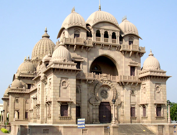 Belur Math, headquarters of the Ramakrishna Math and Mission
 -
 Rampuja at Ramrajatala
 -
 Second Hooghly Bridge (Vidyasagar Setu)
 -
Howrah Bridge (Rabindra Setu)
-
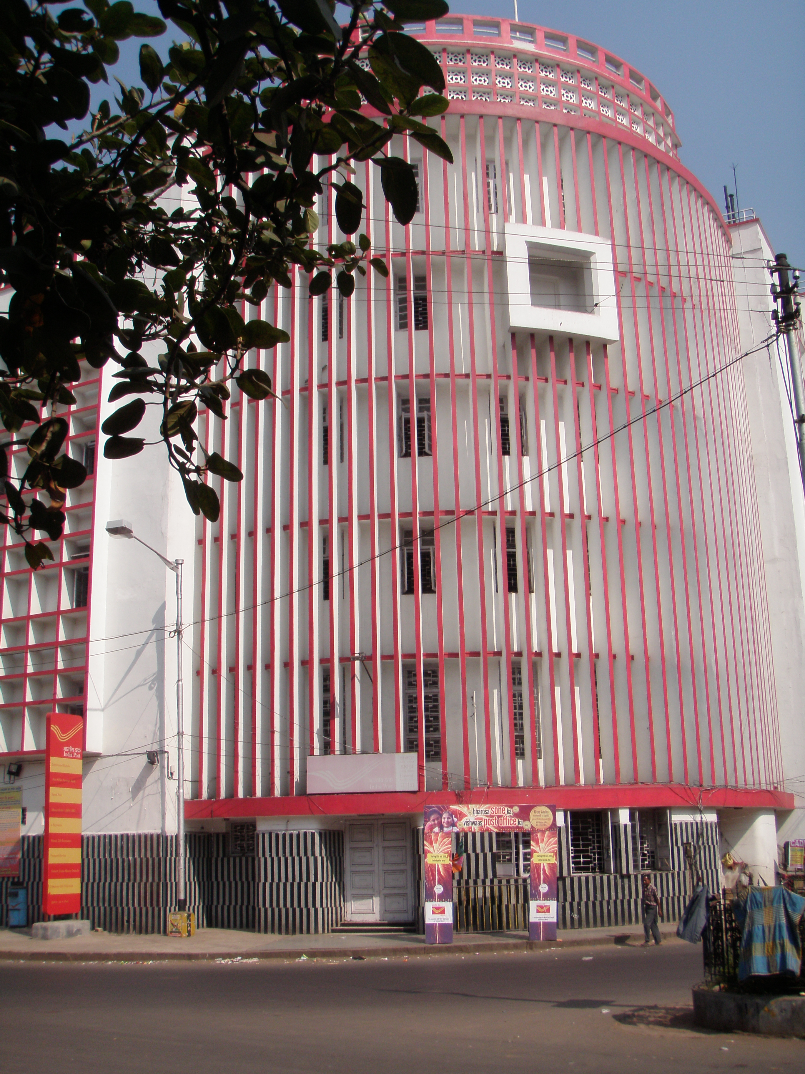 Howrah Head Post Office- 711101
 -

-
 Howrah Municipal Corporation Head Office
 -
 Sailen Manna Stadium (Howrah Municipal Corporation Stadium)
 -
 Nivedita Setu as seen from Bally Bridge
 -
 Howrah Rail Museum
 -
 Howrah Rail Museum
 -
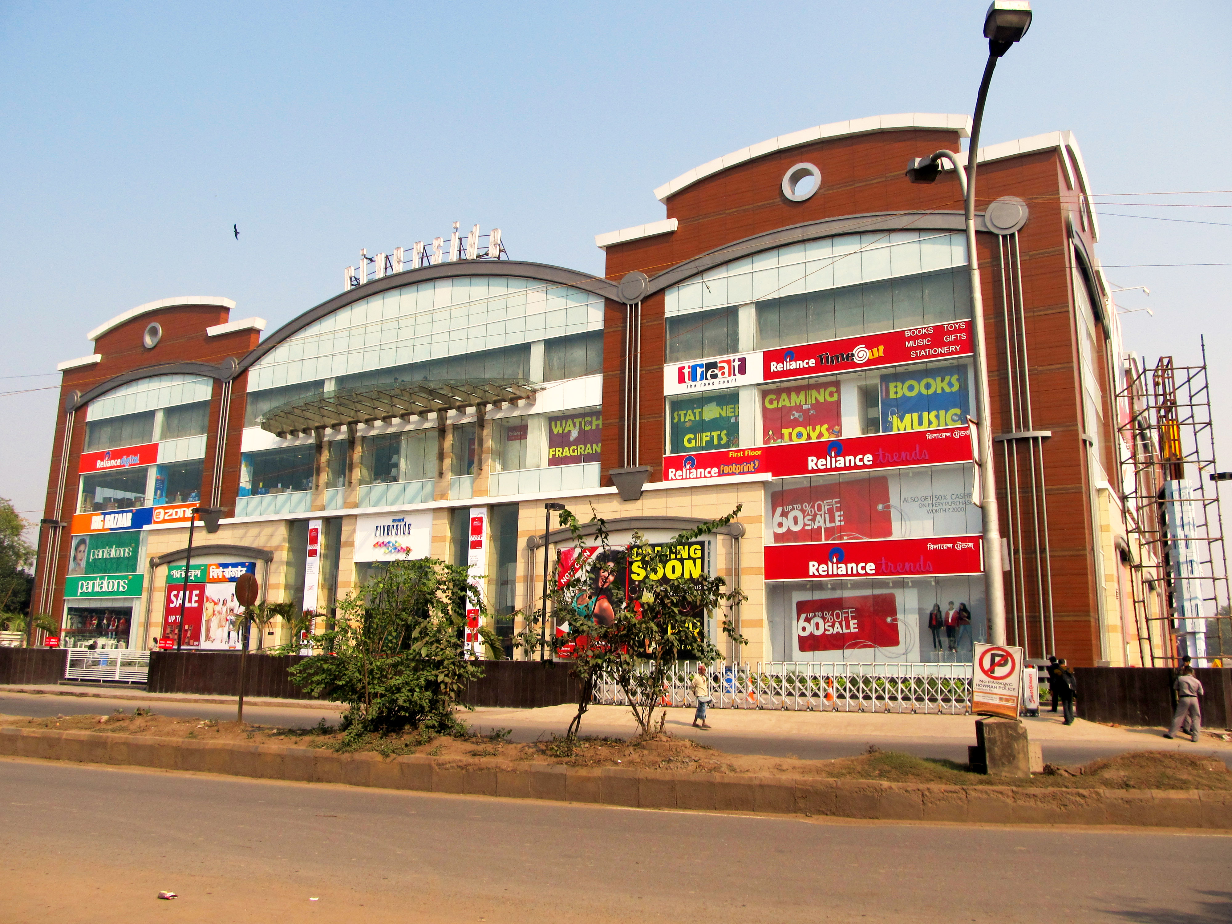
-
 Durga Dalan of Dutta Chowdhury family of Andul, Howrah
 -
 Andul Rajbari of the KarRays' & Mitras.


Footnotes
- ↑ Census data of Howrah can be difficult to compare as the city is sometimes grouped together with the Kolkata and other settlements as the Kolkata metropolitan area. Further care needs to be taken to distinguish Howrah town from Howrah district. It is also worth noting that Bally Municipality was re-incorporated into Howrah in 2015
- ↑ Note that Howrah town census area was not stable until 1981
References
- ↑ Bengal (India), West (1972). West Bengal District Gazetteers: Calcutta and Howrah. State editor, West Bengal District Gazetteers. p. 202. Archived from the original on 10 October 2022. Retrieved 19 February 2021.
- ↑ Shaw, Shri Ram (20 September 2001). "Sheffield of India dying an untimely death". The Times of India. Archived from the original on 11 October 2018. Retrieved 19 February 2021.
- ↑ 3.0 3.1 "West Bengal Heritage Commission". wbhc.in. Archived from the original on 22 May 2024. Retrieved 22 May 2024.
- ↑ "Kolkata, Howrah, Salt Lake get new police commissioners ahead of assembly polls". Hindustan Times. 6 February 2021. Archived from the original on 8 February 2021. Retrieved 1 March 2021.
- ↑ 5.0 5.1 "Howrah Corporation". Archived from the original on 10 January 2021. Retrieved 3 June 2020.
- ↑ "HMC" (PDF).
- ↑ "Bally Municipality". Archived from the original on 2 April 2015.
- ↑ 8.0 8.1 8.2 "Primary Census Abstract Data Tables – West Bengal – DDW_PCA1915_2011_MDDS with UI". Census of India. Office of the Registrar General & Census Commissioner, India. Archived from the original on 12 December 2017. Retrieved 3 April 2018.
- ↑ "Bally 2011 census". Archived from the original on 26 February 2021. Retrieved 14 August 2020.
- ↑ "52nd Report of the Commissioner for Linguistic Minorities in India" (PDF). Nclm.nic.in. Ministry of Minority Affairs. p. 85. Archived from the original (PDF) on 25 May 2017. Retrieved 28 August 2019.
- ↑ 11.0 11.1 "Fact and Figures". Wb.gov.in. Archived from the original on 14 June 2020. Retrieved 28 August 2019.
- ↑ "Haora - India". Encyclopedia Britannica. Archived from the original on 19 November 2020. Retrieved 12 January 2021.
- ↑ O'Malley & Chakravarti 1909, p. 169
- ↑ 14.0 14.1 14.2 Donald Frederick Lach, p.473
- ↑ O'Malley & Chakravarti 1909, p. 19
- ↑ O'Malley & Chakravarti 1909, p. 22
- ↑ 17.0 17.1 17.2 O'Malley & Chakravarti 1909, p. 23
- ↑ O'Malley & Chakravarti 1909, p. 25
- ↑ O'Malley & Chakravarti 1909, p. 26
- ↑ O'Malley & Chakravarti 1909, p. 27
- ↑ "Table C-01 Population by Religion: West Bengal". censusindia.gov.in. Registrar General and Census Commissioner of India. 2011.
- ↑ "Haora City Population 2024 | Literacy and Hindu Muslim Population". www.census2011.co.in. Retrieved 12 June 2024.
- ↑ "Asansol City Population 2024 | Literacy and Hindu Muslim Population". www.census2011.co.in. Retrieved 12 June 2024.
- ↑ "Bally | India City, Shopping Hub, Tourist Spot | Britannica". Archived from the original on 14 August 2019.
- ↑ 25.0 25.1 25.2 O'Malley & Chakravarti 1909, p. 31
- ↑ 26.0 26.1 "A −4 : Towns and Urban Agglomerations Classified by Population Size Class in 2001 With Variation Since 1901". The Registrar General & Census Commissioner, India. Archived from the original on 15 March 2016. Retrieved 3 April 2018.
- ↑ "Howrah climate: Average Temperature, weather by month, Howrah weather averages - Climate-Data.org". Archived from the original on 15 October 2018. Retrieved 15 October 2018.
- ↑ "Swachh Vayu Sarvekshan 2024" (PDF). Swachh Vayu Sarvekshan 2024. 7 September 2024. Archived from the original (PDF) on 14 September 2024. Retrieved 20 September 2024.
- ↑ "Howrah climate 1981-2010". Retrieved 17 October 2020.
- ↑ "Calcutta High Court orders Bengal government to immediately hold Howrah Municipal polls". The Statesman. 29 January 2021. Archived from the original on 5 September 2021. Retrieved 6 September 2021.
- ↑ "Howrah Municipal Corporation Finance". CityFinance Portal, Ministry of Housing and Urban Affairs. Retrieved 12 March 2026.
- ↑ "Howrah Municipal Corporation". Official website of Department of Municipal Affairs, Government of West Bengal. Archived from the original on 17 March 2012. Retrieved 29 December 2008.
- ↑ O'Malley & Chakravarti 1909, p. 28
- ↑ "The dirtiest since 1889". Archived from the original on 18 December 2024. Retrieved 29 June 2025.
- ↑ "Other Municipal Corporation Acts". Official website of Department of Municipal Affairs, Government of West Bengal. Archived from the original on 10 August 2009. Retrieved 29 December 2008.
- ↑ 36.0 36.1 "About us page". Howrah Municipal Corporation. Archived from the original on 8 December 2008. Retrieved 29 December 2008.
- ↑ Basu, Pritesh (4 January 2016). "HMC sets up 'Mayor's Cop' to monitor civic amenities". Millennium Post. Archived from the original on 15 January 2021. Retrieved 26 June 2019.
- ↑ "Kolkata's iconic Writer's Building gets ready for a facelift". The Weekend Leader. 4 October 2014. Archived from the original on 19 August 2019. Retrieved 19 August 2019.
- ↑ Mukherjee, Alok Kumar (1992). Howrah, a Study in Urbanization. Chatterjee Publishers. ISBN 9788185089089. Archived from the original on 10 October 2022. Retrieved 2 June 2020.
- ↑ 40.0 40.1 "Review of the book 'City of Joy', authored by Dominique Lapierre". Independent.co.uk. 5 December 1998. Archived from the original on 22 September 2019. Retrieved 22 September 2019.
- ↑ "KONA TRUCK TERMINAL IN LIMBO". www.telegraphindia.com. Archived from the original on 8 November 2019. Retrieved 8 November 2019.
- ↑ "Howrah to become a mega city". The Times of India. 12 July 2014. Archived from the original on 7 September 2021. Retrieved 8 November 2020.
- ↑ 43.0 43.1 43.2 "Sheffield of India dying an untimely death - Times of India". The Times of India. 20 September 2001. Archived from the original on 11 October 2018. Retrieved 11 October 2018.
- ↑ O'Malley & Chakravarti 1909, p. 165
- ↑ Mark Holmström, p.137
- ↑ "Group Companies: Burn Standard Co. Ltd". Bharat Bhari Udyog Nigam Limited. Archived from the original on 25 December 2008. Retrieved 29 December 2008.
- ↑ "Shalimar Paints:About us – Manufacturing Facilities". Archived from the original on 15 January 2009. Retrieved 29 December 2008.
- ↑ "Tarsons Products: Diversified portfolio & strong distribution network to facilitate its growth across geographies". Mintgenie. Retrieved 20 June 2023.
- ↑ "Engineering Department". Official website of the Howrah Municipality. Archived from the original on 6 October 2008. Retrieved 31 December 2008.
- ↑ 50.0 50.1 O'Malley & Chakravarti 1909, p. 119
- ↑ "ENVIS Newsletter" (PDF). Archived from the original (PDF) on 19 March 2012. Retrieved 20 January 2011.
- ↑ Durkee, Jackson (24 May 1999). "National Steel Bridge Alliance: World's Longest Bridge Spans" (PDF). American Institute of Steel Construction, Inc. Archived from the original (PDF) on 1 June 2002. Retrieved 4 January 2009.
- ↑ "East-West Kolkata Metro Corridor: EIA and SIA (Chapter 2)" (PDF). Government of West Bengal. Archived (PDF) from the original on 6 June 2011. Retrieved 21 March 2009.
- ↑ "IIEST official website". Retrieved 21 September 2019.
- ↑ "E-Gazette published by the Ministry of Law and Justice of the Government of India regarding the National Institutes of Technology, science education and research amendment of 2014" (PDF). Archived (PDF) from the original on 2 January 2021. Retrieved 22 September 2019.
- ↑ Alok Kumar Mukherjee (1991). Howrah, a Study in Urbanization. Chatterjee Publishers. p. 99. ISBN 9788185089089. Archived from the original on 10 October 2022. Retrieved 2 June 2020.
Bibliography
- Bhattacherje, S. B. (2009). Encyclopaedia of Indian Events & Dates. Sterling Publishers Pvt. ISBN 978-81-207-4074-7.
- Gunguly, C. K.; Battarcharya, S. K. (2000). Dayaratnam, P (ed.). The Design Methodology and Construction Technique of 457 m Span Cable Stayed Bridge (Dead Load Composite) at Vidyasagar Setu. Universities Press (India). pp. 113–114. ISBN 978-81-7371-271-5.
- Holmström, Mark (1984). Industry and Inequality: The Social Anthropology of Indian Labour. Cambridge University Press. ISBN 0-521-26745-5. Retrieved 29 December 2008.
- Lach, Donald Frederick (1977). Asia in the Making of Europe. University of Chicago Press. ISBN 0-226-46731-7. Retrieved 28 December 2008.
- O'Malley, L.S S.; Chakravarti, Monmohan (1909). Bengal District Gazetteers: Howrah. Bengal Secretariat Book Depot.
- Sen, Samita (1999). Women and Labour in Late Colonial India: The Bengal Jute Industry. Cambridge University Press. ISBN 0-521-45363-1. Retrieved 29 December 2008.
External links
- History of Howrah from India Government Site
- Howrah Municipal Corporation Site
- Satellite View of Howrah
- Howrah Train Time Table
Places adjacent to Howrah | ||||||||||
|---|---|---|---|---|---|---|---|---|---|---|
| ||||||||||


| Kolkata Municipal Corporation |
|
|---|---|
| Kolkata Urban Agglomeration Outside KMC |
|
.png)