




>Rachhenhang Rai |
m small adjust citations after review and improved wording per standard format |
||
| Line 1: | Line 1: | ||
{{Short description|District | {{Short description|District in West Bengal, India}} | ||
{{Use Indian English|date=March 2026}} | |||
{{Use dmy dates|date=March 2026}} | |||
{{Use Indian English|date= | |||
{{Use dmy dates|date= | |||
{{Infobox settlement | {{Infobox settlement | ||
| name | | name = Darjeeling district | ||
| settlement_type | | native_name = | ||
| other_name = | |||
| settlement_type = [[List of districts of West Bengal|District]] of [[West Bengal]] | |||
| image_skyline | | image_skyline = {{Photomontage | ||
|photo1a = Tea Estate, Darjeeling.jpg | |photo1a = Tea Estate, Darjeeling.jpg | ||
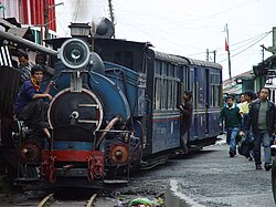
|photo1b = Darjeeling Toy Train at Batasia Loop.jpg | |photo1b = Darjeeling Toy Train at Batasia Loop.jpg | ||
|photo2a = Siliguri view 2.jpg | |photo2a = Siliguri view 2.jpg | ||
|photo2b = | |photo2b = | ||
|photo3a = Darjeeling & Mt Kangjenjunga (8131820332).jpg | |photo3a = Darjeeling & Mt Kangjenjunga (8131820332).jpg | ||
|size= | |size = 300 | ||
|foot_montage = Clockwise from top-left: Tea estate in Darjeeling, [[Darjeeling Himalayan Railway]], View of [[Kangchenjunga]] from [[Tiger Hill, Darjeeling|Tiger Hill]], View of [[Siliguri]] | |||
}} | }} | ||
| | | image_map = | ||
| | | image_map1 = Darjeeling in West Bengal (India).svg | ||
| | | mapsize = 300 | ||
| coordinates | | map_caption1 = Location of Darjeeling district in West Bengal | ||
| | | coordinates = {{coord|26|52|N|88|18|E|type:adm3rd_region:IN-WB_dim:100000|display=inline,title}} | ||
| subdivision_type | | subdivision_type = [[List of sovereign states|Country]] | ||
| subdivision_name | | subdivision_name = {{flag|India}} | ||
| subdivision_type1 | | subdivision_type1 = [[States and union territories of India|State]] | ||
| subdivision_name1 | | subdivision_name1 = [[West Bengal]] | ||
| subdivision_type2 | | subdivision_type2 = [[Administrative divisions of West Bengal|Division]] | ||
| subdivision_name2 | | subdivision_name2 = [[Jalpaiguri division|Jalpaiguri]] | ||
| | | seat_type = Headquarters | ||
| | | seat = [[Darjeeling]] | ||
| | | government_type = | ||
| | | leader_title = [[List of subdivisions of West Bengal|Subdivisions]] | ||
| | | leader_name = [[Darjeeling Sadar subdivision|Darjeeling Sadar]], [[Mirik subdivision|Mirik]], [[Siliguri subdivision|Siliguri]], [[Kurseong]] | ||
| | | leader_title1 = [[Community Development Block|CD Blocks]] | ||
| | | leader_name1 = [[Darjeeling Pulbazar (community development block)|Darjeeling Pulbazar]], [[Jorebunglow Sukhiapokhri (community development block)|Jorebunglow Sukhiapokhri]], [[Rangli Rangliot (community development block)|Rangli Rangliot]], [[Mirik (community development block)|Mirik]], [[Naxalbari (community development block)|Naxalbari]], [[Kharibari (community development block)|Kharibari]], [[Phansidewa]], [[Matigara (community development block)|Matigara]], [[Kurseong (community development block)|Kurseong]] | ||
| area_total_km2 | | leader_title2 = [[List of constituencies of the Lok Sabha|Lok Sabha constituencies]] | ||
| area_footnotes | | leader_name2 = [[Darjeeling (Lok Sabha constituency)|Darjeeling]] | ||
| population_as_of | | leader_title3 = [[List of constituencies of the West Bengal Legislative Assembly|Vidhan Sabha constituencies]] | ||
| population_total | | leader_name3 = [[Darjeeling (Vidhan Sabha constituency)|Darjeeling]], [[Kurseong (Vidhan Sabha constituency)|Kurseong]], [[Matigara-Naxalbari (Vidhan Sabha constituency)|Matigara-Naxalbari]], [[Siliguri (Vidhan Sabha constituency)|Siliguri]], [[Phansidewa (Vidhan Sabha constituency)|Phansidewa]] | ||
| population_footnotes | | total_type = Total | ||
| population_urban | | area_total_km2 = 3149 | ||
| area_footnotes = <ref>{{cite web |title=About District - Darjeeling |url=https://darjeeling.gov.in/ |website=Darjeeling District, Government of West Bengal |access-date=25 May 2024}}</ref> | |||
| population_as_of = 2011 | |||
| population_total = 1,595,181 | |||
| population_footnotes = | |||
| population_urban = 727963 | |||
| population_density_km2 = auto | | population_density_km2 = auto | ||
| demographics_type1 | | demographics_type1 = Demographics | ||
| demographics1_title1 | | demographics1_title1 = [[Literacy in India|Literacy]] | ||
| demographics1_info1 | | demographics1_info1 = 79.56 per cent | ||
| demographics1_title2 | | demographics1_title2 = [[Human sex ratio|Sex ratio]] | ||
| demographics1_info2 | | demographics1_info2 = 970 [[male|♂]]/[[female|♀]] | ||
| demographics_type2 = Languages | |||
| demographics2_title1 = Official | |||
| demographics2_info1 = [[Bengali language|Bengali]],<ref name="wblangoff">{{cite web|title=Fact and Figures|url=https://wb.gov.in/portal/web/guest/facts-and-figures;jsessionid=JzdD9RHb7aMY5esZPtcsIVLy|website=Wb.gov.in|access-date=5 July 2019}}</ref><ref name="minority report"/> [[Nepali language|Nepali]]<ref name="minority report">{{cite web|title=52nd Report of the Commissioner for Linguistic Minorities in India|url=http://nclm.nic.in/shared/linkimages/NCLM52ndReport.pdf|website=Nclm.nic.in|publisher=[[Ministry of Minority Affairs]]|access-date=5 July 2019|page=85|url-status=dead|archive-url=https://web.archive.org/web/20170525141614/http://nclm.nic.in/shared/linkimages/NCLM52ndReport.pdf|archive-date=25 May 2017}}</ref> | |||
| demographics2_title2 = Additional official | |||
| | | demographics2_info2 = [[English language|English]]<ref name="wblangoff"/> | ||
| | | timezone1 = [[Indian Standard Time|IST]] | ||
| | | utc_offset1 = +05:30 | ||
| | | website = {{URL|https://darjeeling.gov.in/}} | ||
| | |||
| | |||
| | |||
| | |||
| | |||
| | |||
}} | }} | ||
'''Darjeeling | '''Darjeeling district''' is the northernmost district of the state of [[West Bengal]] in eastern [[India]] in the foothills of the [[Himalayas]], in the eastern [[Sivalik Hills]].The district is famous for its [[hill station]] and [[Darjeeling tea]]. [[Darjeeling]] is the district headquarters. [[Kurseong]], [[Siliguri]] and [[Mirik]], three major towns in the district, are the subdivisional headquarters of the district. [[Kalimpong district|Kalimpong]] was one of the subdivisions but on 14 February 2017, it officially became a separate [[Kalimpong district]].<ref>{{cite news |last=Konar |first=Debashis |date=14 February 2017 |url=https://timesofindia.indiatimes.com/city/kolkata/west-bengal-cm-congratulates-people-of-kalimpong-district/articleshow/57151807.cms |title=West Bengal CM congratulates people of Kalimpong district |work=The Times of Indial |access-date=18 February 2017}}</ref> | ||
[[ | Geographically, the district can be divided into two broad divisions: the hills and the plains. The entire hilly region of the district comes under the [[Gorkhaland Territorial Administration]], a semi-autonomous administrative body under the state government of West Bengal. This body covers the three hill subdivisions of Darjeeling, Kurseong and Mirik and the district of Kalimpong. The foothills of Darjeeling Himalayas, which comes under the Siliguri subdivision, is known as the [[Terai]]. The district is bounded on the north by [[Sikkim]], on the south by [[Uttar Dinajpur district]] of West Bengal, southwest by [[Kishanganj district]] of [[Bihar]] state, on the southeast by [[Panchagarh District|Panchagarh district]] of [[Bangladesh]], on the east by [[Kalimpong district|Kalimpong]] and [[Jalpaiguri district|Jalpaiguri]] districts, and on the west by easternmost [[Koshi Province]] of [[Nepal]]. Darjeeling district has a length from north to south of {{convert|18|mi|km}} and a breadth from east to west of {{convert|16|mi|km}}. As of 2011, it was the second least populous district of West Bengal (out of [[Districts of West Bengal|19]]), after [[Dakshin Dinajpur district|Dakshin Dinajpur]].<ref name="districtcensus">{{Cite web |date=2011 |title=District Census Handbook: Darjeeling |url=https://censusindia.gov.in/nada/index.php/catalog/1329/download/4330/DH_2011_1901_PART_B_DCHB_DARJILING.pdf |website=censusindia.gov.in |publisher=[[Registrar General and Census Commissioner of India]] |access-date=18 April 2023 |archive-date=18 April 2023 |archive-url=https://web.archive.org/web/20230418052557/https://censusindia.gov.in/nada/index.php/catalog/1329/download/4330/DH_2011_1901_PART_B_DCHB_DARJILING.pdf |url-status=live }}</ref> | ||
==Name== | |||
The etymological term of Darjeeling is denoted "Tajenglung", a [[Limbu language]] terminology that means the stones that "talk to each other", according to the historian Sankarhang Subba of Darjeeling.<ref>Subba U.,( 'Sabdatitma Tajenglung' (Title) by Sankarhang Subba,) (Editor) Yuma Manghim Udghatan Samaroha Smarika 2017, Nalichour, Sonada, published by Limbu/ Subba Tribal Society, Darjeeling.</ref> The name Darjeeling acclaimed from the [[Standard Tibetan|Tibetan]] words ''Dorje'', which is the [[Vajra|thunderbolt sceptre]] of the Hindu deity [[Indra]], and ''ling'', which means "a place" or "land".<ref>{{cite web |title=Pre-Independence [Darjeeling] |url=http://darjeeling.gov.in/darj-hist.html |publisher=Government of Darjeeling |access-date=17 August 2015 |url-status=live |archive-url=https://web.archive.org/web/20151031114710/http://darjeeling.gov.in/darj-hist.html |archive-date=31 October 2015}}</ref> | |||
==History== | ==History== | ||
The | The ancient inhabitants of Darjeeling are the [[Lepcha people|Lepcha]] and [[Limbu people|Limbu]]. | ||
Most of Darjeeling formed a part of dominions of the [[Chogyal]] of Sikkim, who had been engaged in an unsuccessful warfare against the [[Gurkha|Gorkha]]s of Nepal. From 1780, the Gorkhas made several attempts to capture the entire region of Darjeeling. By the beginning of the 19th century, they had overrun Sikkim as far eastward as the [[Teesta River]] and had conquered and annexed the entire [[Terai]]. | Most of Darjeeling formed a part of dominions of the [[Chogyal]] of Sikkim, who had been engaged in an unsuccessful warfare against the [[Gurkha|Gorkha]]s of Nepal. From 1780, the Gorkhas made several attempts to capture the entire region of Darjeeling. By the beginning of the 19th century, they had overrun Sikkim as far eastward as the [[Teesta River]] and had conquered and annexed the entire [[Terai]]. | ||
| Line 76: | Line 75: | ||
In the meantime, the British were engaged in preventing the Gorkhas from over-running the whole of the northern frontier. The [[Anglo-Nepalese War|Anglo-Gorkha]] war broke out in 1814, which resulted in the defeat of the Gorkhas and subsequently led to the signing of the [[Sugauli Treaty]] in 1815. According to the treaty, [[Nepal]] had to cede all those territories which the Gorkhas had annexed from the Chogyal of Sikkim to the British East India Company (i.e., the area between [[Mechi River]] and Teesta River). In 1817, through the [[Treaty of Titalia]], the [[British East India Company]] reinstated the Chogyal of Sikkim, restored all the tracts of land between the Mechi and the Teesta rivers to the Chogyal of Sikkim and guaranteed his sovereignty. In 1835, the hill of Darjeeling, including an enclave of {{convert|138|sqmi|km2}}, was given to the British East India Company by Sikkim. | In the meantime, the British were engaged in preventing the Gorkhas from over-running the whole of the northern frontier. The [[Anglo-Nepalese War|Anglo-Gorkha]] war broke out in 1814, which resulted in the defeat of the Gorkhas and subsequently led to the signing of the [[Sugauli Treaty]] in 1815. According to the treaty, [[Nepal]] had to cede all those territories which the Gorkhas had annexed from the Chogyal of Sikkim to the British East India Company (i.e., the area between [[Mechi River]] and Teesta River). In 1817, through the [[Treaty of Titalia]], the [[British East India Company]] reinstated the Chogyal of Sikkim, restored all the tracts of land between the Mechi and the Teesta rivers to the Chogyal of Sikkim and guaranteed his sovereignty. In 1835, the hill of Darjeeling, including an enclave of {{convert|138|sqmi|km2}}, was given to the British East India Company by Sikkim. | ||
In November 1864, the [[Treaty of Sinchula]] was executed in which the [[Dooars|Bhutan Dooars]] with the passes leading into the hills and [[Kalimpong district|Kalimpong]] were ceded to the British by [[Bhutan]]. The Darjeeling district can be said to have assumed its present shape and size in 1866 with an area of 1234 sq. miles. | In November 1864, the [[Treaty of Sinchula]] was executed in which the [[Dooars|Bhutan Dooars]] with the passes leading into the hills and [[Kalimpong district|Kalimpong]] were ceded to the British by [[Bhutan]]. The Darjeeling district can be said to have assumed its present shape and size in 1866 with an area of 1234 sq. miles.{{fact|date=April 2025}} | ||
Before 1861 and from 1870 to 1874, Darjeeling District was a "Non-Regulated Area" (where acts and regulations of the [[British Raj]] did not automatically apply in the district in line with rest of the country, unless specifically extended). From 1862 to 1870, it was considered a "Regulated Area". The phrase "Non-Regulated Area" was changed to "Scheduled District" in 1874 and again to "Backward Tracts" in 1919. The status was known as "Partially Excluded Area" from 1935 until the [[independence of India]]. | Before 1861 and from 1870 to 1874, Darjeeling District was a "Non-Regulated Area" (where acts and regulations of the [[British Raj]] did not automatically apply in the district in line with rest of the country, unless specifically extended). From 1862 to 1870, it was considered a "Regulated Area". The phrase "Non-Regulated Area" was changed to "Scheduled District" in 1874 and again to "Backward Tracts" in 1919. The status was known as "Partially Excluded Area" from 1935 until the [[independence of India]]. | ||
| Line 83: | Line 82: | ||
===Gorkhaland Movement=== | ===Gorkhaland Movement=== | ||
{{Main|Gorkhaland movement}} | {{Main|Gorkhaland movement}} | ||
[[File:Flag of Gurkhaland.svg|thumb|right|150px|The GNLF flag.]] | [[File:Flag of Gurkhaland.svg|thumb|right|150px|The GNLF flag.]] | ||
| Line 89: | Line 87: | ||
During the 1980s, the [[Gorkha National Liberation Front]] led an intensive and often violent campaign for the creation of a separate [[Gorkhaland]] state within India, across the [[Nepali language|Nepali]]-speaking areas in northern West Bengal. The movement reached its peak around 1986–1988 but ended with the establishment of the [[Darjeeling Gorkha Hill Council]] in 1988. | During the 1980s, the [[Gorkha National Liberation Front]] led an intensive and often violent campaign for the creation of a separate [[Gorkhaland]] state within India, across the [[Nepali language|Nepali]]-speaking areas in northern West Bengal. The movement reached its peak around 1986–1988 but ended with the establishment of the [[Darjeeling Gorkha Hill Council]] in 1988. | ||
The hill areas of Darjeeling enjoyed some measure of autonomy under the [[Darjeeling Gorkha Hill Council]]. However, the demand for full statehood within India has emerged once again, with the [[Gorkha Janmukti Morcha]] as its chief proponent.<ref>{{cite news| url=http://www.hindu.com/2004/05/15/stories/2004051502021400.htm | archive-url=https://web.archive.org/web/20040706233634/http://www.hindu.com/2004/05/15/stories/2004051502021400.htm | url-status=dead | archive-date=6 July 2004 | location=Chennai, India | work=[[The Hindu]] | title=Gorkhaland State a distinct possibility | date=15 May 2004}}</ref> The [[Gorkhaland Territorial Administration]] replaced the DGHC in August 2012 after the GJM signed an agreement with the government.<ref>{{cite web|url=http://timesofindia.indiatimes.com/india/Gorkha-Territorial-Administration-members-sworn-in-Shinde-Mamata-assure-support/articleshow/15352094.cms|title=Gorkha Territorial Administration members sworn in; Shinde, Mamata assure support|work=The Times of India |date=5 August 2012 |access-date=5 August 2012}}</ref> | The hill areas of Darjeeling enjoyed some measure of autonomy under the [[Darjeeling Gorkha Hill Council]]. However, the demand for full statehood within India has emerged once again, with the [[Gorkha Janmukti Morcha]] as its chief proponent.<ref>{{cite news| url=http://www.hindu.com/2004/05/15/stories/2004051502021400.htm | archive-url=https://web.archive.org/web/20040706233634/http://www.hindu.com/2004/05/15/stories/2004051502021400.htm | url-status=dead | archive-date=6 July 2004 | location=Chennai, India | work=[[The Hindu]] | title=Gorkhaland State a distinct possibility | date=15 May 2004}}</ref> The [[Gorkhaland Territorial Administration]] replaced the DGHC in August 2012 after the GJM signed an agreement with the government.<ref>{{cite web|url=http://timesofindia.indiatimes.com/india/Gorkha-Territorial-Administration-members-sworn-in-Shinde-Mamata-assure-support/articleshow/15352094.cms|title=Gorkha Territorial Administration members sworn in; Shinde, Mamata assure support|work=The Times of India|date=5 August 2012|access-date=5 August 2012|archive-date=4 August 2012|archive-url=https://web.archive.org/web/20120804212156/http://timesofindia.indiatimes.com/india/Gorkha-Territorial-Administration-members-sworn-in-Shinde-Mamata-assure-support/articleshow/15352094.cms|url-status=live}}</ref> | ||
==Geography== | ==Geography== | ||
[[File:Batasia Loop of Darjeeling Himalayan Railway.jpg|thumb|Batasia Loop, Darjeeling]] | |||
[[File:Darjeeling Tea Garden.JPG|right|thumb|200px|A tea garden in Darjeeling.]] | [[File:Darjeeling Tea Garden.JPG|right|thumb|200px|A tea garden in Darjeeling.]] | ||
The Darjeeling hill area is formed of comparatively recent rock structure that has a direct bearing on landslides. Heavy monsoon precipitation contributes to the landslides. Soils of Darjeeling hill areas are extremely varied, depending on elevation, degree of slope, vegetative cover and geolithology. | The Darjeeling hill area is formed of comparatively recent rock structure that has a direct bearing on landslides. Heavy monsoon precipitation contributes to the landslides. Soils of Darjeeling hill areas are extremely varied, depending on elevation, degree of slope, vegetative cover and geolithology. | ||
The Himalayas serve as the source of natural resources for the population residing in the hills as well as in the plains. As human population expands in the hills, forests are being depleted for the extension of agricultural lands, introduction of new settlements, roadways, etc. The growing changes coming in the wake of urbanisation and industrialisation leave deep impressions on the hill ecosystem.[[File:Bridge at Teesta.jpg|thumb|right|200px|[[Coronation Bridge]] over [[Teesta | The Himalayas serve as the source of natural resources for the population residing in the hills as well as in the plains. As human population expands in the hills, forests are being depleted for the extension of agricultural lands, introduction of new settlements, roadways, etc. The growing changes coming in the wake of urbanisation and industrialisation leave deep impressions on the hill ecosystem.[[File:Bridge at Teesta.jpg|thumb|right|200px|[[Coronation Bridge]] over [[Teesta River]].]] | ||
The economy of Darjeeling hill area depends on tea production, horticulture, agriculture, forestry and tourism. The major portions of the forests are today found at elevations of {{convert|2000|m}} and above. The area in between {{convert|1000 and 2000|m}} is cleared either for tea plantation or cultivation. About 30 | The economy of Darjeeling hill area depends on tea production, horticulture, agriculture, forestry and tourism. The major portions of the forests are today found at elevations of {{convert|2000|m}} and above. The area in between {{convert|1000 and 2000|m}} is cleared either for tea plantation or cultivation. About 30 per cent of the forest covers found in the lower hills are deciduous. Evergreen forest constitutes only about 6 per cent of the total forest coverage. ''[[Shorea robusta]]'' remains the most prominent species of tropical moist deciduous forest along with heavy undergrowth. | ||
[[Teesta River|Teesta]], [[Rangeet River|Rangeet]], [[Mechi River|Mechi]], [[Balason River|Balason]], [[Mahananda River|Mahananda]] and [[Rammam | [[Teesta River|Teesta]], [[Rangeet River|Rangeet]], [[Mechi River|Mechi]], [[Balason River|Balason]], [[Mahananda River|Mahananda]] and [[Rammam River|Rammam]] are the important rivers of the district. | ||
===Climate=== | ===Climate=== | ||
| Line 189: | Line 188: | ||
[[File:Kurseong Station, Darjeeling Himalayan Railway 1031.jpg|thumb|Kurseong Station, [[Darjeeling Himalayan Railway]]]] | [[File:Kurseong Station, Darjeeling Himalayan Railway 1031.jpg|thumb|Kurseong Station, [[Darjeeling Himalayan Railway]]]] | ||
The district was previously divided into six [[assembly constituency|assembly constituencies]].<ref>{{cite web|url=http://archive.eci.gov.in/se2001/background/S25/WB_ACPC.pdf |title=General election to the Legislative Assembly, 2001 – List of Parliamentary and Assembly Constituencies |access-date=16 November 2008 |work=West Bengal |publisher=Election Commission of India |url-status=dead |archive-url=https://web.archive.org/web/20060504185949/http://archive.eci.gov.in/se2001/background/S25/WB_ACPC.pdf |archive-date=4 May 2006 | The district was previously divided into six [[assembly constituency|assembly constituencies]].<ref>{{cite web|url=http://archive.eci.gov.in/se2001/background/S25/WB_ACPC.pdf |title=General election to the Legislative Assembly, 2001 – List of Parliamentary and Assembly Constituencies |access-date=16 November 2008 |work=West Bengal |publisher=Election Commission of India |url-status=dead |archive-url=https://web.archive.org/web/20060504185949/http://archive.eci.gov.in/se2001/background/S25/WB_ACPC.pdf |archive-date=4 May 2006 }}</ref> As per the order of the [[Delimitation Commission]] in respect of the [[delimitation of constituencies]] in West Bengal, the district had been divided into six assembly constituencies.<ref>{{cite web | url = http://www.wbgov.com/e-gov/English/DELIMITATION.pdf | title = Press Note, Delimitation Commission | access-date = 16 November 2008 | work = Assembly Constituencies in West Bengal | publisher = Delimitation Commission | archive-date = 8 January 2011 | archive-url = https://web.archive.org/web/20110108095020/http://www.wbgov.com/e-gov/English/DELIMITATION.pdf | url-status = live }}</ref> Kalimpong has become a separate district from 14 February 2017, so the number of assembly constituencies in Darjeeling district is now five. | ||
{| class="wikitable" | |||
!No. | |||
!Name | |||
!Lok Sabha | |||
!MLA | |||
! colspan="2" |2021 Winner | |||
! colspan="2" |2024 Lead | |||
|- | |||
| 23 | |||
|[[Darjeeling Assembly constituency|Darjeeling]] | |||
|rowspan="5" |[[Darjeeling Lok Sabha constituency|Darjeeling]] | |||
|[[Neeraj Zimba]] | |||
|{{Full party name with color|Bharatiya Janata Party|rowspan=5}} | |||
|{{Full party name with color|Bharatiya Janata Party|rowspan=5}} | |||
|- | |||
| 24 | |||
|[[Kurseong Assembly constituency|Kurseong]] | |||
|[[Bishnu Prasad Sharma]] | |||
|- | |||
| 25 | |||
|[[Matigara-Naxalbari Assembly constituency|Matigara-Naxalbari (SC)]] | |||
|[[Anandamoy Barman]] | |||
|- | |||
| 26 | |||
|[[Siliguri Assembly constituency|Siliguri]] | |||
|[[Shankar Ghosh (politician)|Shankar Ghosh]] | |||
|- | |||
| 27 | |||
|[[Phansidewa Assembly constituency|Phansidewa (ST)]] | |||
|[[Durga Murmu]] | |||
|- | |||
|} | |||
Phansidewa constituency is reserved for Scheduled Tribes (ST) candidates. Matigara-Naxalbari constituency is reserved for Scheduled Castes (SC) candidates. Along with one assembly constituency from [[Kalimpong district]] and one assembly constituency from [[Uttar Dinajpur district]], the five assembly constituencies of this district form the [[ | Phansidewa constituency is reserved for Scheduled Tribes (ST) candidates. Matigara-Naxalbari constituency is reserved for Scheduled Castes (SC) candidates. Along with one assembly constituency from [[Kalimpong district]] and one assembly constituency from [[Uttar Dinajpur district]], the five assembly constituencies of this district form the [[Darjeeling Lok Sabha constituency]]. | ||
==Demographics== | ==Demographics== | ||
According to the [[2011 census of India|2011 census]] Darjeeling district has a [[Demographics of India|population]] of 1,846,823,<ref name="districtcensus"/> roughly equal to the population of [[Kosovo]].<ref name="cia">{{cite web | author = US Directorate of Intelligence | title = Country Comparison:Population | url = https://www.cia.gov/library/publications/the-world-factbook/rankorder/2119rank.html | access-date = 1 October 2011 | quote = Kosovo 1,825,632 July 2011 est. }}</ref> This gives it a ranking of 257th in India (out of a total of [[Districts of India|640]]).<ref name=districtcensus/> The district has a population density of {{convert| 586 |PD/sqkm|PD/sqmi}}.<ref name=districtcensus/> Its [[Family planning in India|population growth rate]] over the decade 2001-2011 was 14.77%.<ref name=districtcensus/> Darjeeling has a [[sex ratio]] of 970 [[Women in India|females]] for every 1000 males,<ref name=districtcensus/> and a [[Literacy in India|literacy rate]] of 79.56%. | {{historical populations|11=1901|12=2,65,780|13=1911|14=2,79,899|15=1921|16=2,94,237|17=1931|18=3,32,061|19=1941|20=3,90,899|21=1951|22=4,59,617|23=1961|24=6,24,640|25=1971|26=7,81,777|27=1981|28=10,24,269|29=1991|30=12,99,919|31=2001|32=16,09,172|33=2011|34=18,46,823|percentages=pagr|footnote=source:<ref>{{Cite web |url=http://www.censusindia.gov.in/2011census/PCA/A2_Data_Table.html |title=Decadal Variation In Population Since 1901 |access-date=8 August 2019 |archive-date=8 August 2019 |archive-url=https://web.archive.org/web/20190808131957/http://www.censusindia.gov.in/2011census/PCA/A2_Data_Table.html |url-status=live }}</ref>|align=center}} | ||
[[File:Darjeeling Himalayan Railway.jpg|right|thumb|200px|[[Darjeeling Himalayan Railway|Darjeeling Toy Train]]]] | |||
[[File:Darjeeling railway station.jpg|thumb|200px|[[Darjeeling railway station]] an outside view]] | |||
[[File:Kurseong Toy train.jpg|thumb|200px|[[Darjeeling Himalayan Railway]] toy train at [[Kurseong]] station]] | |||
According to the [[2011 census of India|2011 census]] Darjeeling district has a [[Demographics of India|population]] of 1,846,823,<ref name="districtcensus"/> roughly equal to the population of [[Kosovo]].<ref name="cia">{{cite web | author = US Directorate of Intelligence | title = Country Comparison:Population | url = https://www.cia.gov/library/publications/the-world-factbook/rankorder/2119rank.html | archive-url = https://web.archive.org/web/20070613004507/https://www.cia.gov/library/publications/the-world-factbook/rankorder/2119rank.html | url-status = dead | archive-date = 13 June 2007 | access-date = 1 October 2011 | quote = Kosovo 1,825,632 July 2011 est. }}</ref> This gives it a ranking of 257th in India (out of a total of [[Districts of India|640]]).<ref name=districtcensus/> The district has a population density of {{convert|586|PD/sqkm|PD/sqmi}}.<ref name=districtcensus/> Its [[Family planning in India|population growth rate]] over the decade 2001-2011 was 14.77%.<ref name=districtcensus/> Darjeeling has a [[sex ratio]] of 970 [[Women in India|females]] for every 1000 males,<ref name=districtcensus/> and a [[Literacy in India|literacy rate]] of 79.56%.<ref>{{cite web |url=http://censusindia.gov.in/2011-prov-results/prov_data_products_wb.html |title=Census of India : Provisional Population Totals Paper 1 of 2011 : West Bengal |publisher=Censusindia.gov.in |access-date=13 June 2012 |archive-date=25 December 2018 |archive-url=https://web.archive.org/web/20181225195547/http://censusindia.gov.in/2011-prov-results/prov_data_products_wb.html |url-status=live }}</ref> After Kalimpong district was separated its population was 1,595,181, of which 671,1771 (42.11%) live in urban areas. The residual district has a sex ratio of 972 females per 1000 males. Scheduled Castes and Scheduled Tribes make up 18.86% and 20.21% of the population respectively.<ref name=districtcensus/> | |||
{{See also| List of West Bengal districts ranked by literacy rate}} | {{See also| List of West Bengal districts ranked by literacy rate}} | ||
In 2001, the population of the district was 1,609,172. The rural population was 1,088,740 and urban population was 520,432. Total males were 830,644 and females were 778,528. The density of population was 511 per km<sup>2</sup>. The decennial population growth rate (1991–2001) was 23.79%.<ref> | In 2001, the population of the district was 1,609,172. The rural population was 1,088,740 and urban population was 520,432. Total males were 830,644 and females were 778,528. The density of population was 511 per km<sup>2</sup>. The decennial population growth rate (1991–2001) was 23.79%.<ref>{{cite web|url=http://www.darjeeling.gov.in/CENSUS-2001/index.htm |title=Census 2001 |archive-url=https://web.archive.org/web/20100305104009/http://www.darjeeling.gov.in/CENSUS-2001/index.htm |archive-date=5 March 2010 |access-date=22 November 2021 |website=darjeeling.gov.in}}</ref> | ||
The hills have a population of 624,061 which is nearly 40% of the population. The original inhabitants of the Darjeeling Hills were the [[Lepcha people|Lepcha]] and [[Limbu people|Limbu]] (the ravine people, as they prefer themselves to be known as). Other communities with a long history in the district include the [[Tamang people|Tamang]], [[Yakkha people|Yakkha]], [[Rai people|Rai]], [[Gurung]], [[Magar people|Magar]], [[Newar]], [[Thami]], [[Chettri]], [[Bahun]], [[Kami people|Kami]], and [[Damai]]. There is also a sizeable population of [[Tibetans]] who arrived from [[Tibet]] since the 1950s. Over time, the ethnic distinctions between the hill people have blurred and today most identify as Gorkha and speak [[Nepali language|Nepali]] only as mother tongue.<ref name="darjgov">{{cite web|title=People and Culture - Language|url=http://darjeeling.gov.in/people.html|access-date=26 April 2018|url-status=dead|archive-url=https://web.archive.org/web/20081225153402/http://darjeeling.gov.in/people.html|archive-date=25 December 2008}}</ref> | |||
In the plains, the [[Bengalis]] and [[Rajbanshi people|Rajbongshis]] are in majority while there are large numbers of Gorkhas and [[Adivasi]]s, the latter of which migrated from [[Chota Nagpur Plateau|Chotanagpur]] and [[Santhal Parganas]] during British rule as tea garden workers. Both in the hills and plains are various migrants from other regions including [[Biharis]], [[Marwaris]] and [[Punjabis]].<ref name="darjgov"/> | |||
===Religion=== | |||
{{bar box | |||
|title = Religion in Darjeeling district (2011)<ref name="religion"/> | |||
|titlebar=#Fcd116 | |||
|float=left | |||
|bars= | |||
{{bar percent|[[Hinduism in West Bengal|Hinduism]]|darkorange|76.06}} | |||
{{bar percent|[[Buddhism]]|yellow|9.81}} | |||
{{bar percent|[[Christianity in West Bengal|Christianity]]|dodgerblue|6.54}} | |||
{{bar percent|[[Islam in West Bengal|Islam]]|green|6.34}} | |||
{{bar percent|Others*|red|0.78}} | |||
{{bar percent|Other or not stated|black|0.47}} | |||
|caption = <small>Others includes faiths like [[Kirat Mundhum]], [[Bon]], [[Mun (religion)|Mun]]</small> | |||
}} | |||
{| class="wikitable sortable" | |||
|+Religion in present-day Darjeeling district | |||
!Religion | |||
!Population (1941)<ref name="1941religion">{{cite web |title=Census of India, 1941 Volume VI Bengal Province |url=https://dspace.gipe.ac.in/xmlui/bitstream/handle/10973/37365/GIPE-020591.pdf?sequence=3&isAllowed=y |access-date=13 August 2022 |archive-date=9 December 2017 |archive-url=https://web.archive.org/web/20171209142042/http://dspace.gipe.ac.in/xmlui/bitstream/handle/10973/37365/GIPE-020591.pdf?sequence=3&isAllowed=y |url-status=live }}</ref>{{rp|90–91}} | |||
!Percentage (1941) | |||
!Population (2011)<ref name="religion">{{Cite web |date=2011 |title=Table C-01 Population by Religion: West Bengal |url=https://censusindia.gov.in/nada/index.php/catalog/11396/download/14509/DDW19C-01%20MDDS.XLS |website=censusindia.gov.in |publisher=[[Registrar General and Census Commissioner of India]] |access-date=17 August 2022 |archive-date=5 April 2023 |archive-url=https://web.archive.org/web/20230405063030/https://censusindia.gov.in/nada/index.php/catalog/11396/download/14509/DDW19C-01%20MDDS.XLS |url-status=live }}</ref> | |||
!Percentage (2011) | |||
|- | |||
|[[Hinduism in West Bengal|Hinduism]] [[File:Om.svg|16x16px]] | |||
|142,568 | |||
|47.95% | |||
|1,213,326 | |||
|76.06% | |||
|- | |||
|Tribal religion [[File:Kirat flag-02.jpg|15x15px]] | |||
|109,627 | |||
|36.87% | |||
|12,460 | |||
|0.78% | |||
|- | |||
|[[Islam in West Bengal|Islam]] [[File:Star_and_Crescent.svg|15x15px]]<ref>{{Cite thesis |last=Chatterjee |first=Rajib |title=Muslims of Darjeeling Himalaya: Aspects of Their Economy, Society, Culture and Identity |date=25 January 2012 |publisher=[[University of North Bengal]] |url=https://ir.nbu.ac.in/handle/123456789/1336}}</ref> | |||
|8,801 | |||
|2.96% | |||
|101,088 | |||
|6.34% | |||
|- | |||
|[[Christianity in West Bengal|Christianity]] [[File:Christian_cross.svg|21x21px]] | |||
|1,885 | |||
|0.63% | |||
|104,395 | |||
|6.54% | |||
|- | |||
|[[Buddhism]] [[File:Dharma Wheel (2).svg|15x15px]] | |||
|<nowiki>---</nowiki> | |||
| --- | |||
|156,552 | |||
|9.81% | |||
|- | |||
|Others{{efn|Including [[Jainism]], [[Buddhism]], [[Zoroastrianism]], [[Judaism]], [[Ad-Dharmi]]s, or not stated}} | |||
|34,446 | |||
|11.59% | |||
|7,360 | |||
|0.47% | |||
|- | |||
|'''Total Population''' | |||
|'''297,327''' | |||
|'''100%''' | |||
|'''1,595,181''' | |||
|'''100%''' | |||
|} | |||
Hinduism is the majority religion in both the hills and plains. Buddhism and Kirat Mudhum are almost entirely present in the hills. Christianity is primarily in the hills, although there are significant numbers among the tea tribes in the plains. Islam is almost entirely found in the plains.<ref name="religion" /> | |||
===Languages=== | ===Languages=== | ||
{{Pie chart | {{Pie chart | ||
|thumb = right | |thumb = right | ||
|caption = Languages spoken in Darjeeling district (2011)<ref name=" | |caption = Languages spoken in Darjeeling district (2011)<ref name="languages"/> | ||
|label1 = [[Nepali language|Nepali]] | |label1 = [[Nepali language|Nepali]] |value1 = 39.88 |color1 = lightcoral | ||
|value1 = 39.88 | |label2 = [[Bengali language|Bengali]] |value2 = 26.51 |color2 = orchid | ||
|color1 = | |label3 = [[Hindi]] |value3 = 10.95 |color3 = orange | ||
|label2 = [[Bengali language|Bengali]] | |label4 = [[Rangpuri language|Rajbongshi]] |value4 = 6.17 |color4 = plum | ||
|value2 = 26.51 | |label5 = [[Sadri language|Sadri]] |value5 = 5.38 |color5 = burlywood | ||
|color2 = | |label6 = [[Kurukh language|Kurukh]] |value6 = 2.52 |color6 = mediumseagreen | ||
|label3 = [[Hindi]] | |label7 = [[Bhojpuri language|Bhojpuri]] |value7 = 1.50 |color7 = gold | ||
|value3 = 10.95 | |label8 = [[Santali language|Santali]] |value8 = 1.15 |color8 = darkturquoise | ||
|color3 = orange | |label9 = 'Other' Bengali |value9 = 1.04 |color9 = mediumpurple | ||
|label4 = Rajbongshi | |label10 = Others |value10 = 4.90 |color10 = grey | ||
|value4 = 6. | }} | ||
| | |||
At the time of the 2011 census, 39.88% of the population spoke [[Nepali language|Nepali]], 26.51% [[Bengali language|Bengali]], 10.95% [[Hindi]], 6. | At the time of the 2011 census, 39.88% of the population spoke [[Nepali language|Nepali]], 26.51% [[Bengali language|Bengali]], 10.95% [[Hindi]], 6.17% [[Rangpuri language|Rajbongshi]], 5.38% [[Sadri language|Sadri]], 2.52% [[Kurukh language|Kurukh]], 1.50% [[Bhojpuri language|Bhojpuri]] and 1.15% [[Santali language|Santali]] as their first language. 1.04% of the population recorded their language as 'Others' under Bengali.<ref name="languages">{{Cite web |title=Table C-16 Population by Mother Tongue: West Bengal |url=https://censusindia.gov.in/nada/index.php/catalog/10226/download/13338/DDW-C16-STMT-MDDS-1900.XLSX |website=www.censusindia.gov.in |publisher=[[Registrar General and Census Commissioner of India]] |access-date=17 August 2022 |archive-date=9 August 2022 |archive-url=https://web.archive.org/web/20220809134437/https://censusindia.gov.in/nada/index.php/catalog/10226/download/13338/DDW-C16-STMT-MDDS-1900.XLSX |url-status=live }}</ref> According to 1951 Census, about 26% of the population in the three hill sub-divisions of Darjeeling district (including Kalimpong) spoke Nepali as mother language.<ref>{{cite web |title=Lok Sabha Debates - Nepali-speaking People in Darjeeling |url=https://eparlib.nic.in/bitstream/123456789/1815/1/lsd_02_08_27-08-1959.pdf |website=eparlib.nic.in |access-date=16 April 2022 |archive-date=16 April 2022 |archive-url=https://web.archive.org/web/20220416092132/https://eparlib.nic.in/bitstream/123456789/1815/1/lsd_02_08_27-08-1959.pdf |url-status=live }}</ref> Other languages formerly spoken in the hills included [[Limbu language|Limbu]], [[Tamang language|Tamang]], [[Magar language|Magar]], [[Gurung language|Gurung]], [[Rai people|Rai]], [[Sunwar language|Sunuwar]], [[Yakkha language|Yakkha]] and [[Newar language|Newar]]. | ||
Bengali is the official language of the district | Bengali is the official language of the district, with [[Nepali language|Nepali]] declared as co-official only in [[Darjeeling Sadar subdivision|Darjeeling]] and [[Kurseong]] subdivisions.<ref name="nclm50">{{cite web |url=http://nclm.nic.in/shared/linkimages/NCLM50thReport.pdf |title=Report of the Commissioner for Linguistic Minorities in India: 50th report (delivered to the Lokh Sabha in 2014) |page=95 |publisher=National Commissioner for Linguistic Minorities, Ministry of Minority Affairs, Government of India |access-date=13 July 2015 |archive-url=https://web.archive.org/web/20160708012438/http://nclm.nic.in/shared/linkimages/NCLM50thReport.pdf |archive-date=8 July 2016 |url-status=dead }}</ref><ref name="darjgov"/> | ||
Nepali is the dominant language in the hill divisions, spoken by more than 90% of the people in Darjeeling, Kurseong and Mirik subdivisions, although most hill inhabitants are not from [[Khas people|Khas]] communities. Several hundred of the original hill inhabitants still speak their original languages although the vast majority now speak only Nepali.<ref name="languages" /> | |||
The main language of the [[Siliguri subdivision]] is Bengali. It is followed by a sizeable number of [[Rangpuri language|Kamatpuri]] or Rajbongshi speakers. Among the Adivasis, Sadri is the main language although some still speak their original languages like Kurukh, [[Mundari language|Mundari]] and Santali.<ref name="languages" /> | |||
==Flora and fauna== | ==Flora and fauna== | ||
Darjeeling district is home to [[Singalila National Park]], which was set up in 1986 as a wildlife sanctuary and converted to a [[national parks|national park]] in 1992. It has an area of {{convert|78.60|km2|mi2|abbr=on|1}}.<ref>{{cite web|title=National Parks|url=http://wiienvis.nic.in/Database/npa_8231.aspx|publisher=ENVIS Centre on Wildlife & Protected Areas|access-date=17 February 2017}}</ref> | Darjeeling district is home to [[Singalila National Park]], which was set up in 1986 as a wildlife sanctuary and converted to a [[national parks|national park]] in 1992. It has an area of {{convert|78.60|km2|mi2|abbr=on|1}}.<ref>{{cite web|title=National Parks|url=http://wiienvis.nic.in/Database/npa_8231.aspx|publisher=ENVIS Centre on Wildlife & Protected Areas|access-date=17 February 2017|archive-date=4 November 2016|archive-url=https://web.archive.org/web/20161104102249/http://wiienvis.nic.in/Database/npa_8231.aspx|url-status=live}}</ref> | ||
Darjeeling district has three [[Wildlife Sanctuaries in India|wildlife sanctuaries]]: [[Jore Pokhri Wildlife Sanctuary|Jorepokhri]], [[Mahananda Wildlife Sanctuary|Mahananda]], and [[Senchal Wildlife Sanctuary|Senchal]].<ref>{{cite web|title=Wildlife Sanctuaries|url=http://wiienvis.nic.in/Database/wls_8230.aspx|publisher=ENVIS Centre on Wildlife & Protected Areas|access-date=17 February 2017|archive-date=23 February 2017|archive-url=https://web.archive.org/web/20170223175631/http://wiienvis.nic.in/Database/wls_8230.aspx|url-status=live}}</ref> | |||
==Geographical indication== | |||
[[Kalonunia rice]] was awarded the [[List of geographical indications in India|Geographical Indication]] (GI) status tag from the [[Geographical Indication Registry (India)|Geographical Indications Registry]] under the [[Government of India|Union Government of India]] on 2 January 2024 (valid until 11 March 2034). It is a common and widely cultivated crop in districts of [[Cooch Behar district|Cooch Behar]], [[Jalpaiguri district|Jalpaiguri]] and [[Alipurduar district|Alipurduar]] along with some parts of Darjeeling and [[Kalimpong district|Kalimpong]] districts of West Bengal.<ref>{{cite news |title=Bengal's own Gobindabhog and Tulaipanji soon to get a distinct stand on world map |url=https://indianexpress.com/article/cities/kolkata/how-new-grading-rules-for-non-basmati-rice-varieties-can-put-gobindabhog-on-world-map-9091192/ |access-date=23 November 2024 |work=The Indian Express |date=2 January 2024 |language=en}}</ref><ref>{{cite book |last1=Khush |first1=Gurdev S. |last2=Hettel |first2=Gene |last3=Rola |first3=Tess |title=Rice Genetics III: Proceedings of the Third International Rice Genetics Symposium, Manila, Philippines, 16-20 October 1995 |date=1996 |publisher=Int. Rice Res. Inst. |isbn=978-971-22-0087-8 |url=https://books.google.com/books?id=M_hKLjbOuBEC&dq=Kalonunia+rice&pg=PA823 |access-date=23 November 2024 |language=en}}</ref><ref>{{cite book |last1=Roychoudhury |first1=Aryadeep |title=Rice Research for Quality Improvement: Genomics and Genetic Engineering: Volume 2: Nutrient Biofortification and Herbicide and Biotic Stress Resistance in Rice |date=29 July 2020 |publisher=Springer Nature |isbn=978-981-15-5337-0 |url=https://books.google.com/books?id=6RL0DwAAQBAJ&dq=Kalonunia+rice&pg=PA393 |access-date=23 November 2024 |language=en}}</ref><ref>{{cite book |last1=Sarker |first1=Dilip De |last2=Saha |first2=Manas Ranjan |last3=Saha |first3=Subrata |title=Perspective of dietetic and antioxidant medicinal plants |date=1 January 2015 |publisher=Notion Press |isbn=978-93-84878-95-5 |url=https://books.google.com/books?id=YTrECQAAQBAJ&dq=Kalonunia+rice&pg=PT20 |language=en}}</ref> | |||
State Agricultural Management & Extension Training Institute (SAMETI) from [[Narendrapur]], proposed the GI registration of Kalonunia rice. After filing the application in March 2021, the rice was granted the GI tag in 2024 by the Geographical Indication Registry in [[Chennai]], making the name "Kalonunia rice" exclusive to the rice grown in the region.<ref name=":0">{{cite web |title=Kalonunia Rice |url=https://search.ipindia.gov.in/GIRPublic/Application/Details/743 |website=Intellectual Property India |access-date=23 November 2024}}</ref> It thus became the third rice variety from West Bengal after [[Tulaipanji rice]] and the 26th type of goods from West Bengal to earn the GI tag. | |||
The GI tag protects the rice from illegal selling and marketing, and gives it legal protection and a unique identity. | |||
== | ==Notable people== | ||
<!---♦♦♦ Only add a person to this list if they already have their OWN article on the English Wikipedia ♦♦♦---> | |||
* [[ | <!---♦♦♦ Please keep the list in alphabetical order by the LAST NAME ♦♦♦---> | ||
* [[ | *[[Taslimuddin Ahmad]] (1852-1927), lawyer, author and philanthropist | ||
*[[Sonia Jabbar]], wildlife conservationist | |||
==References== | ==References== | ||
{{Reflist}} | {{Reflist}}{{reflist|group=lower-alpha}} | ||
==External links== | ==External links== | ||
| Line 266: | Line 360: | ||
{{Geographic location | {{Geographic location | ||
|Centre = Darjeeling district | |Centre = Darjeeling district | ||
|North = [[ | |North = [[Namchi district]], [[Sikkim]] | ||
|Northeast = [[Kalimpong district]], [[ | |Northeast = [[Kalimpong district]], [[Gangtok district]], [[Sikkim]] | ||
|East = [[Kalimpong district]], [[Jalpaiguri district]] | |East = [[Kalimpong district]], [[Jalpaiguri district]] | ||
|Southeast = {{BGD|Bangladesh}} | |Southeast = {{BGD|Bangladesh}} | ||
| Line 273: | Line 367: | ||
|Southwest = [[Kishanganj district]], [[Bihar]] | |Southwest = [[Kishanganj district]], [[Bihar]] | ||
|West = {{NEP|Nepal}} | |West = {{NEP|Nepal}} | ||
|Northwest = [[ | |Northwest = [[Gyalshing district]], [[Sikkim]] | ||
}} | }} | ||
{{Darjeeling}} | |||
{{Darjeeling District}} | {{Darjeeling District}} | ||
{{Districts of West Bengal}} | {{Districts of West Bengal}} | ||
{{Authority control}} | {{Authority control}} | ||
{{DEFAULTSORT:Darjeeling District}} | {{DEFAULTSORT:Darjeeling District}} | ||
Latest revision as of 19:55, 15 March 2026
Darjeeling district | |
|---|---|
   .jpg) Clockwise from top-left: Tea estate in Darjeeling, Darjeeling Himalayan Railway, View of Kangchenjunga from Tiger Hill, View of Siliguri | |
.svg) Location of Darjeeling district in West Bengal | |
| Coordinates: 26°52′N 88°18′E / 26.867°N 88.300°E | |
| Country |  India India |
| State | West Bengal |
| Division | Jalpaiguri |
| Headquarters | Darjeeling |
| Government | |
| • Subdivisions | Darjeeling Sadar, Mirik, Siliguri, Kurseong |
| • CD Blocks | Darjeeling Pulbazar, Jorebunglow Sukhiapokhri, Rangli Rangliot, Mirik, Naxalbari, Kharibari, Phansidewa, Matigara, Kurseong |
| • Lok Sabha constituencies | Darjeeling |
| • Vidhan Sabha constituencies | Darjeeling, Kurseong, Matigara-Naxalbari, Siliguri, Phansidewa |
| Area | |
| • Total | 3,149 km2 (1,216 sq mi) |
| Population (2011) | |
| • Total | 1,595,181 |
| • Density | 510/km2 (1,300/sq mi) |
| • Urban | 727,963 |
| Demographics | |
| • Literacy | 79.56 per cent |
| • Sex ratio | 970 ♂/♀ |
| Languages | |
| • Official | Bengali,[2][3] Nepali[3] |
| • Additional official | English[2] |
| Time zone | UTC+05:30 (IST) |
| Website | darjeeling |
Darjeeling district is the northernmost district of the state of West Bengal in eastern India in the foothills of the Himalayas, in the eastern Sivalik Hills.The district is famous for its hill station and Darjeeling tea. Darjeeling is the district headquarters. Kurseong, Siliguri and Mirik, three major towns in the district, are the subdivisional headquarters of the district. Kalimpong was one of the subdivisions but on 14 February 2017, it officially became a separate Kalimpong district.[4]
Geographically, the district can be divided into two broad divisions: the hills and the plains. The entire hilly region of the district comes under the Gorkhaland Territorial Administration, a semi-autonomous administrative body under the state government of West Bengal. This body covers the three hill subdivisions of Darjeeling, Kurseong and Mirik and the district of Kalimpong. The foothills of Darjeeling Himalayas, which comes under the Siliguri subdivision, is known as the Terai. The district is bounded on the north by Sikkim, on the south by Uttar Dinajpur district of West Bengal, southwest by Kishanganj district of Bihar state, on the southeast by Panchagarh district of Bangladesh, on the east by Kalimpong and Jalpaiguri districts, and on the west by easternmost Koshi Province of Nepal. Darjeeling district has a length from north to south of 18 miles (29 km) and a breadth from east to west of 16 miles (26 km). As of 2011, it was the second least populous district of West Bengal (out of 19), after Dakshin Dinajpur.[5]
Name[edit | edit source]
The etymological term of Darjeeling is denoted "Tajenglung", a Limbu language terminology that means the stones that "talk to each other", according to the historian Sankarhang Subba of Darjeeling.[6] The name Darjeeling acclaimed from the Tibetan words Dorje, which is the thunderbolt sceptre of the Hindu deity Indra, and ling, which means "a place" or "land".[7]
History[edit | edit source]
The ancient inhabitants of Darjeeling are the Lepcha and Limbu.
Most of Darjeeling formed a part of dominions of the Chogyal of Sikkim, who had been engaged in an unsuccessful warfare against the Gorkhas of Nepal. From 1780, the Gorkhas made several attempts to capture the entire region of Darjeeling. By the beginning of the 19th century, they had overrun Sikkim as far eastward as the Teesta River and had conquered and annexed the entire Terai.
In the meantime, the British were engaged in preventing the Gorkhas from over-running the whole of the northern frontier. The Anglo-Gorkha war broke out in 1814, which resulted in the defeat of the Gorkhas and subsequently led to the signing of the Sugauli Treaty in 1815. According to the treaty, Nepal had to cede all those territories which the Gorkhas had annexed from the Chogyal of Sikkim to the British East India Company (i.e., the area between Mechi River and Teesta River). In 1817, through the Treaty of Titalia, the British East India Company reinstated the Chogyal of Sikkim, restored all the tracts of land between the Mechi and the Teesta rivers to the Chogyal of Sikkim and guaranteed his sovereignty. In 1835, the hill of Darjeeling, including an enclave of 138 square miles (360 km2), was given to the British East India Company by Sikkim.
In November 1864, the Treaty of Sinchula was executed in which the Bhutan Dooars with the passes leading into the hills and Kalimpong were ceded to the British by Bhutan. The Darjeeling district can be said to have assumed its present shape and size in 1866 with an area of 1234 sq. miles.[citation needed]
Before 1861 and from 1870 to 1874, Darjeeling District was a "Non-Regulated Area" (where acts and regulations of the British Raj did not automatically apply in the district in line with rest of the country, unless specifically extended). From 1862 to 1870, it was considered a "Regulated Area". The phrase "Non-Regulated Area" was changed to "Scheduled District" in 1874 and again to "Backward Tracts" in 1919. The status was known as "Partially Excluded Area" from 1935 until the independence of India.
On 14 February 2017, Kalimpong district was carved out of Darjeeling district.
Gorkhaland Movement[edit | edit source]

During the 1980s, the Gorkha National Liberation Front led an intensive and often violent campaign for the creation of a separate Gorkhaland state within India, across the Nepali-speaking areas in northern West Bengal. The movement reached its peak around 1986–1988 but ended with the establishment of the Darjeeling Gorkha Hill Council in 1988.
The hill areas of Darjeeling enjoyed some measure of autonomy under the Darjeeling Gorkha Hill Council. However, the demand for full statehood within India has emerged once again, with the Gorkha Janmukti Morcha as its chief proponent.[8] The Gorkhaland Territorial Administration replaced the DGHC in August 2012 after the GJM signed an agreement with the government.[9]
Geography[edit | edit source]


The Darjeeling hill area is formed of comparatively recent rock structure that has a direct bearing on landslides. Heavy monsoon precipitation contributes to the landslides. Soils of Darjeeling hill areas are extremely varied, depending on elevation, degree of slope, vegetative cover and geolithology.
The Himalayas serve as the source of natural resources for the population residing in the hills as well as in the plains. As human population expands in the hills, forests are being depleted for the extension of agricultural lands, introduction of new settlements, roadways, etc. The growing changes coming in the wake of urbanisation and industrialisation leave deep impressions on the hill ecosystem.

The economy of Darjeeling hill area depends on tea production, horticulture, agriculture, forestry and tourism. The major portions of the forests are today found at elevations of 2,000 metres (6,600 ft) and above. The area in between 1,000 and 2,000 metres (3,300 and 6,600 ft) is cleared either for tea plantation or cultivation. About 30 per cent of the forest covers found in the lower hills are deciduous. Evergreen forest constitutes only about 6 per cent of the total forest coverage. Shorea robusta remains the most prominent species of tropical moist deciduous forest along with heavy undergrowth.
Teesta, Rangeet, Mechi, Balason, Mahananda and Rammam are the important rivers of the district.
Climate[edit | edit source]
| Climate data for Darjeeling | |||||||||||||
|---|---|---|---|---|---|---|---|---|---|---|---|---|---|
| Month | Jan | Feb | Mar | Apr | May | Jun | Jul | Aug | Sep | Oct | Nov | Dec | Year |
| Record high °C (°F) | 16 (61) |
17 (63) |
23 (73) |
24 (75) |
25 (77) |
24 (75) |
25 (77) |
25 (77) |
25 (77) |
23 (73) |
19 (66) |
17 (63) |
25 (77) |
| Average high °C (°F) | 8 (46) |
9 (48) |
14 (57) |
17 (63) |
18 (64) |
18 (64) |
19 (66) |
18 (64) |
18 (64) |
16 (61) |
12 (54) |
9 (48) |
15 (58) |
| Average low °C (°F) | 2 (36) |
2 (36) |
6 (43) |
9 (48) |
12 (54) |
13 (55) |
14 (57) |
14 (57) |
13 (55) |
10 (50) |
6 (43) |
3 (37) |
9 (48) |
| Record low °C (°F) | −3 (27) |
−2 (28) |
−1 (30) |
1 (34) |
6 (43) |
8 (46) |
9 (48) |
11 (52) |
10 (50) |
4 (39) |
2 (36) |
−1 (30) |
−3 (27) |
| Average precipitation mm (inches) | 13 (0.5) |
28 (1.1) |
43 (1.7) |
104 (4.1) |
216 (8.5) |
589 (23.2) |
798 (31.4) |
638 (25.1) |
447 (17.6) |
130 (5.1) |
23 (0.9) |
8 (0.3) |
3,037 (119.6) |
| Source: http://www.bbc.co.uk/weather/world/city_guides/results.shtml?tt=TT004930 | |||||||||||||
Area[edit | edit source]

Subdivisions[edit | edit source]
Darjeeling District comprises four subdivisions:
Assembly constituencies[edit | edit source]

The district was previously divided into six assembly constituencies.[10] As per the order of the Delimitation Commission in respect of the delimitation of constituencies in West Bengal, the district had been divided into six assembly constituencies.[11] Kalimpong has become a separate district from 14 February 2017, so the number of assembly constituencies in Darjeeling district is now five.
| No. | Name | Lok Sabha | MLA | 2021 Winner | 2024 Lead | ||
|---|---|---|---|---|---|---|---|
| 23 | Darjeeling | Darjeeling | Neeraj Zimba | Bharatiya Janata Party | Bharatiya Janata Party | ||
| 24 | Kurseong | Bishnu Prasad Sharma | |||||
| 25 | Matigara-Naxalbari (SC) | Anandamoy Barman | |||||
| 26 | Siliguri | Shankar Ghosh | |||||
| 27 | Phansidewa (ST) | Durga Murmu | |||||
Phansidewa constituency is reserved for Scheduled Tribes (ST) candidates. Matigara-Naxalbari constituency is reserved for Scheduled Castes (SC) candidates. Along with one assembly constituency from Kalimpong district and one assembly constituency from Uttar Dinajpur district, the five assembly constituencies of this district form the Darjeeling Lok Sabha constituency.
Demographics[edit | edit source]
| Year | Pop. | ±% p.a. |
|---|---|---|
| 1901 | 265,780 | — |
| 1911 | 279,899 | +0.52% |
| 1921 | 294,237 | +0.50% |
| 1931 | 332,061 | +1.22% |
| 1941 | 390,899 | +1.64% |
| 1951 | 459,617 | +1.63% |
| 1961 | 624,640 | +3.12% |
| 1971 | 781,777 | +2.27% |
| 1981 | 1,024,269 | +2.74% |
| 1991 | 1,299,919 | +2.41% |
| 2001 | 1,609,172 | +2.16% |
| 2011 | 1,846,823 | +1.39% |
| source:[12] | ||


According to the 2011 census Darjeeling district has a population of 1,846,823,[5] roughly equal to the population of Kosovo.[13] This gives it a ranking of 257th in India (out of a total of 640).[5] The district has a population density of 586 inhabitants per square kilometre (1,520/sq mi).[5] Its population growth rate over the decade 2001-2011 was 14.77%.[5] Darjeeling has a sex ratio of 970 females for every 1000 males,[5] and a literacy rate of 79.56%.[14] After Kalimpong district was separated its population was 1,595,181, of which 671,1771 (42.11%) live in urban areas. The residual district has a sex ratio of 972 females per 1000 males. Scheduled Castes and Scheduled Tribes make up 18.86% and 20.21% of the population respectively.[5]
In 2001, the population of the district was 1,609,172. The rural population was 1,088,740 and urban population was 520,432. Total males were 830,644 and females were 778,528. The density of population was 511 per km2. The decennial population growth rate (1991–2001) was 23.79%.[15]
The hills have a population of 624,061 which is nearly 40% of the population. The original inhabitants of the Darjeeling Hills were the Lepcha and Limbu (the ravine people, as they prefer themselves to be known as). Other communities with a long history in the district include the Tamang, Yakkha, Rai, Gurung, Magar, Newar, Thami, Chettri, Bahun, Kami, and Damai. There is also a sizeable population of Tibetans who arrived from Tibet since the 1950s. Over time, the ethnic distinctions between the hill people have blurred and today most identify as Gorkha and speak Nepali only as mother tongue.[16]
In the plains, the Bengalis and Rajbongshis are in majority while there are large numbers of Gorkhas and Adivasis, the latter of which migrated from Chotanagpur and Santhal Parganas during British rule as tea garden workers. Both in the hills and plains are various migrants from other regions including Biharis, Marwaris and Punjabis.[16]
Religion[edit | edit source]
| Religion | Population (1941)[18]:90–91 | Percentage (1941) | Population (2011)[17] | Percentage (2011) |
|---|---|---|---|---|
Hinduism 
|
142,568 | 47.95% | 1,213,326 | 76.06% |
Tribal religion 
|
109,627 | 36.87% | 12,460 | 0.78% |
Islam  [19] [19]
|
8,801 | 2.96% | 101,088 | 6.34% |
Christianity 
|
1,885 | 0.63% | 104,395 | 6.54% |
Buddhism .svg)
|
--- | --- | 156,552 | 9.81% |
| Others[lower-alpha 1] | 34,446 | 11.59% | 7,360 | 0.47% |
| Total Population | 297,327 | 100% | 1,595,181 | 100% |
Hinduism is the majority religion in both the hills and plains. Buddhism and Kirat Mudhum are almost entirely present in the hills. Christianity is primarily in the hills, although there are significant numbers among the tea tribes in the plains. Islam is almost entirely found in the plains.[17]
Languages[edit | edit source]
At the time of the 2011 census, 39.88% of the population spoke Nepali, 26.51% Bengali, 10.95% Hindi, 6.17% Rajbongshi, 5.38% Sadri, 2.52% Kurukh, 1.50% Bhojpuri and 1.15% Santali as their first language. 1.04% of the population recorded their language as 'Others' under Bengali.[20] According to 1951 Census, about 26% of the population in the three hill sub-divisions of Darjeeling district (including Kalimpong) spoke Nepali as mother language.[21] Other languages formerly spoken in the hills included Limbu, Tamang, Magar, Gurung, Rai, Sunuwar, Yakkha and Newar.
Bengali is the official language of the district, with Nepali declared as co-official only in Darjeeling and Kurseong subdivisions.[22][16]
Nepali is the dominant language in the hill divisions, spoken by more than 90% of the people in Darjeeling, Kurseong and Mirik subdivisions, although most hill inhabitants are not from Khas communities. Several hundred of the original hill inhabitants still speak their original languages although the vast majority now speak only Nepali.[20]
The main language of the Siliguri subdivision is Bengali. It is followed by a sizeable number of Kamatpuri or Rajbongshi speakers. Among the Adivasis, Sadri is the main language although some still speak their original languages like Kurukh, Mundari and Santali.[20]
Flora and fauna[edit | edit source]
Darjeeling district is home to Singalila National Park, which was set up in 1986 as a wildlife sanctuary and converted to a national park in 1992. It has an area of 78.60 km2 (30.3 sq mi).[23]
Darjeeling district has three wildlife sanctuaries: Jorepokhri, Mahananda, and Senchal.[24]
Geographical indication[edit | edit source]
Kalonunia rice was awarded the Geographical Indication (GI) status tag from the Geographical Indications Registry under the Union Government of India on 2 January 2024 (valid until 11 March 2034). It is a common and widely cultivated crop in districts of Cooch Behar, Jalpaiguri and Alipurduar along with some parts of Darjeeling and Kalimpong districts of West Bengal.[25][26][27][28]
State Agricultural Management & Extension Training Institute (SAMETI) from Narendrapur, proposed the GI registration of Kalonunia rice. After filing the application in March 2021, the rice was granted the GI tag in 2024 by the Geographical Indication Registry in Chennai, making the name "Kalonunia rice" exclusive to the rice grown in the region.[29] It thus became the third rice variety from West Bengal after Tulaipanji rice and the 26th type of goods from West Bengal to earn the GI tag.
The GI tag protects the rice from illegal selling and marketing, and gives it legal protection and a unique identity.
Notable people[edit | edit source]
- Taslimuddin Ahmad (1852-1927), lawyer, author and philanthropist
- Sonia Jabbar, wildlife conservationist
References[edit | edit source]
- ↑ "About District - Darjeeling". Darjeeling District, Government of West Bengal. Retrieved 25 May 2024.
- ↑ 2.0 2.1 "Fact and Figures". Wb.gov.in. Retrieved 5 July 2019.
- ↑ 3.0 3.1 "52nd Report of the Commissioner for Linguistic Minorities in India" (PDF). Nclm.nic.in. Ministry of Minority Affairs. p. 85. Archived from the original (PDF) on 25 May 2017. Retrieved 5 July 2019.
- ↑ Konar, Debashis (14 February 2017). "West Bengal CM congratulates people of Kalimpong district". The Times of Indial. Retrieved 18 February 2017.
- ↑ 5.0 5.1 5.2 5.3 5.4 5.5 5.6 "District Census Handbook: Darjeeling" (PDF). censusindia.gov.in. Registrar General and Census Commissioner of India. 2011. Archived (PDF) from the original on 18 April 2023. Retrieved 18 April 2023.
- ↑ Subba U.,( 'Sabdatitma Tajenglung' (Title) by Sankarhang Subba,) (Editor) Yuma Manghim Udghatan Samaroha Smarika 2017, Nalichour, Sonada, published by Limbu/ Subba Tribal Society, Darjeeling.
- ↑ "Pre-Independence [Darjeeling]". Government of Darjeeling. Archived from the original on 31 October 2015. Retrieved 17 August 2015.
- ↑ "Gorkhaland State a distinct possibility". The Hindu. Chennai, India. 15 May 2004. Archived from the original on 6 July 2004.
- ↑ "Gorkha Territorial Administration members sworn in; Shinde, Mamata assure support". The Times of India. 5 August 2012. Archived from the original on 4 August 2012. Retrieved 5 August 2012.
- ↑ "General election to the Legislative Assembly, 2001 – List of Parliamentary and Assembly Constituencies" (PDF). West Bengal. Election Commission of India. Archived from the original (PDF) on 4 May 2006. Retrieved 16 November 2008.
- ↑ "Press Note, Delimitation Commission" (PDF). Assembly Constituencies in West Bengal. Delimitation Commission. Archived (PDF) from the original on 8 January 2011. Retrieved 16 November 2008.
- ↑ "Decadal Variation In Population Since 1901". Archived from the original on 8 August 2019. Retrieved 8 August 2019.
- ↑ US Directorate of Intelligence. "Country Comparison:Population". Archived from the original on 13 June 2007. Retrieved 1 October 2011.
Kosovo 1,825,632 July 2011 est.
- ↑ "Census of India : Provisional Population Totals Paper 1 of 2011 : West Bengal". Censusindia.gov.in. Archived from the original on 25 December 2018. Retrieved 13 June 2012.
- ↑ "Census 2001". darjeeling.gov.in. Archived from the original on 5 March 2010. Retrieved 22 November 2021.
- ↑ 16.0 16.1 16.2 "People and Culture - Language". Archived from the original on 25 December 2008. Retrieved 26 April 2018.
- ↑ 17.0 17.1 17.2 "Table C-01 Population by Religion: West Bengal". censusindia.gov.in. Registrar General and Census Commissioner of India. 2011. Archived from the original on 5 April 2023. Retrieved 17 August 2022.
- ↑ "Census of India, 1941 Volume VI Bengal Province" (PDF). Archived (PDF) from the original on 9 December 2017. Retrieved 13 August 2022.
- ↑ Chatterjee, Rajib (25 January 2012). Muslims of Darjeeling Himalaya: Aspects of Their Economy, Society, Culture and Identity (Thesis). University of North Bengal.
- ↑ 20.0 20.1 20.2 20.3 "Table C-16 Population by Mother Tongue: West Bengal". www.censusindia.gov.in. Registrar General and Census Commissioner of India. Archived from the original on 9 August 2022. Retrieved 17 August 2022.
- ↑ "Lok Sabha Debates - Nepali-speaking People in Darjeeling" (PDF). eparlib.nic.in. Archived (PDF) from the original on 16 April 2022. Retrieved 16 April 2022.
- ↑ "Report of the Commissioner for Linguistic Minorities in India: 50th report (delivered to the Lokh Sabha in 2014)" (PDF). National Commissioner for Linguistic Minorities, Ministry of Minority Affairs, Government of India. p. 95. Archived from the original (PDF) on 8 July 2016. Retrieved 13 July 2015.
- ↑ "National Parks". ENVIS Centre on Wildlife & Protected Areas. Archived from the original on 4 November 2016. Retrieved 17 February 2017.
- ↑ "Wildlife Sanctuaries". ENVIS Centre on Wildlife & Protected Areas. Archived from the original on 23 February 2017. Retrieved 17 February 2017.
- ↑ "Bengal's own Gobindabhog and Tulaipanji soon to get a distinct stand on world map". The Indian Express. 2 January 2024. Retrieved 23 November 2024.
- ↑ Khush, Gurdev S.; Hettel, Gene; Rola, Tess (1996). Rice Genetics III: Proceedings of the Third International Rice Genetics Symposium, Manila, Philippines, 16-20 October 1995. Int. Rice Res. Inst. ISBN 978-971-22-0087-8. Retrieved 23 November 2024.
- ↑ Roychoudhury, Aryadeep (29 July 2020). Rice Research for Quality Improvement: Genomics and Genetic Engineering: Volume 2: Nutrient Biofortification and Herbicide and Biotic Stress Resistance in Rice. Springer Nature. ISBN 978-981-15-5337-0. Retrieved 23 November 2024.
- ↑ Sarker, Dilip De; Saha, Manas Ranjan; Saha, Subrata (1 January 2015). Perspective of dietetic and antioxidant medicinal plants. Notion Press. ISBN 978-93-84878-95-5.
- ↑ "Kalonunia Rice". Intellectual Property India. Retrieved 23 November 2024.
- ↑ Including Jainism, Buddhism, Zoroastrianism, Judaism, Ad-Dharmis, or not stated
External links[edit | edit source]
Places adjacent to Darjeeling district | |
|---|---|


.png)