


No edit summary |
CleanupBot (talk | contribs) m Robot: Replacing encoded entity with character |
||
| Line 7: | Line 7: | ||
{{Infobox settlement | {{Infobox settlement | ||
| name = Punjab | | name = Punjab | ||
| native_name = {{lang|pa-Latn|Panjāb}} ([[Punjabi language|Punjabi]]) | | native_name = {{lang|pa-Latn|Panjāb}} ([[Punjabi language|Punjabi]])<!-- Use romanized Punjabi instead of both Gurmukhi and Shahmukhi here. --> | ||
| native_name_lang = pa | | native_name_lang = pa | ||
| settlement_type = [[Historical region]] | | settlement_type = [[Historical region]] | ||
| Line 15: | Line 15: | ||
| image_shield = | | image_shield = | ||
| shield_alt = | | shield_alt = | ||
| nickname = Land of the Five Rivers | | nickname = Land of the Five Rivers<br>Cradle of [[Sikhism]]<br>[[Breadbasket]] of the [[Indian subcontinent]] | ||
| motto = | | motto = | ||
| image_map = Punjab map (topographic) with cities.png | | image_map = Punjab map (topographic) with cities.png | ||
| Line 28: | Line 28: | ||
| coordinates_footnotes = | | coordinates_footnotes = | ||
| subdivision_type = Countries | | subdivision_type = Countries | ||
| subdivision_name = {{flag|Pakistan}} | | subdivision_name = {{flag|Pakistan}}<br />{{flag|India}} | ||
| subdivision_type2 = [[List of cities in the Punjab region by population|Largest city]] | | subdivision_type2 = [[List of cities in the Punjab region by population|Largest city]] | ||
| subdivision_name2 = [[Lahore]] | | subdivision_name2 = [[Lahore]] | ||
| Line 42: | Line 42: | ||
| named_for = Five tributaries of the [[Indus River]] | | named_for = Five tributaries of the [[Indus River]] | ||
| demographics_type1 = Demographics | | demographics_type1 = Demographics | ||
| demographics1_footnotes = | | demographics1_footnotes = <!-- for references: use <ref> tags --> | ||
| demographics1_title1 = [[Ethnic groups]] | | demographics1_title1 = [[Ethnic groups]] | ||
| demographics1_info1 = [[Punjabis]] | | demographics1_info1 = [[Punjabis]] <br />''Minor: [[Baloch people|Balochs]], [[Biharis]], [[Dogras]], [[Haryanvi people|Haryanvis]], [[Himachal Pradesh|Himachalis]], [[Hindkowans]], [[Kashmiris]], [[Muhajir (Urdu-speaking people)|Muhajirs]], [[Pashtuns]], [[Saraiki people|Saraikis]], [[Sindhi people|Sindhis]]<ref>{{cite web|title=Elections in Bihar, Campaigning in Punjab to Woo Bihari Migrants|url=https://www.newindianexpress.com/nation/2015/oct/04/elections-in-bihar-campaigning-in-punjab-to-woo-bihari-migrants-824629.html|date=4 October 2015|quote=Punjab, as per official estimates, is home to some two million migrants from Bihar. They are engaged in various jobs and occupations in Punjab. Of this, over 1.3 million are living in and around the industrial hub of Ludhiana.|access-date=17 February 2024|archive-date=29 March 2023|archive-url=https://web.archive.org/web/20230329091742/https://www.newindianexpress.com/nation/2015/oct/04/Elections-in-Bihar-Campaigning-in-Punjab-to-Woo-Bihari-Migrants-824629.html|url-status=live}}</ref>'' | ||
| demographics_type2 = | | demographics_type2 = | ||
| demographics2_footnotes = | | demographics2_footnotes = <!-- for references: use <ref> tags --> | ||
| demographics1_title2 = Languages | | demographics1_title2 = Languages | ||
| demographics1_info2 = [[Punjabi language|Punjabi]], [[Punjabi dialects and languages|its dialects and varieties]] and [[#Languages|others]] | | demographics1_info2 = [[Punjabi language|Punjabi]], [[Punjabi dialects and languages|its dialects and varieties]] and [[#Languages|others]] | ||
| demographics_type3 = | | demographics_type3 = | ||
| demographics3_footnotes = | | demographics3_footnotes = <!-- for references: use <ref> tags --> | ||
| demographics1_title3 = Religions | | demographics1_title3 = Religions | ||
| demographics1_info3 = | | demographics1_info3 = <!-- Note: See religion subsection for references - estimates from combining 2011 Indian census and 2017 Pakistani census in Punjab region (including Punjab (India), Punjab (Pakistan), Haryana, Delhi, Himachal Pradesh, Islamabad, Chandigarh) -->[[Punjabi Muslims|Islam]] (64.72%)<br />[[Punjabi Hindus|Hinduism]] (23.38%)<br />[[Sikhism]] (10.1%)<br />[[Punjabi Christians|Christianity]] (1.49%)<br /> Others (0.31%) | ||
| blank_name_sec1 = | | blank_name_sec1 = | ||
| blank_info_sec1 = | | blank_info_sec1 = | ||
| Line 58: | Line 58: | ||
| blank_info_sec2 = | | blank_info_sec2 = | ||
| unit_pref = Metric | | unit_pref = Metric | ||
<!-- ALL fields with measurements have automatic unit conversion --> | |||
<!-- for references: use <ref> tags -->| area_footnotes = | |||
| area_urban_footnotes = | | area_urban_footnotes = <!--<ref></ref> --> | ||
| area_rural_footnotes = | | area_rural_footnotes = <!--<ref></ref> --> | ||
| area_metro_footnotes = | | area_metro_footnotes = <!--<ref></ref> --> | ||
| area_magnitude = | | area_magnitude = <!--<ref></ref> --> | ||
| area_note = | | area_note = | ||
| area_water_percent = | | area_water_percent = | ||
| area_rank = | | area_rank = | ||
| area_blank1_title = | | area_blank1_title = | ||
| area_blank2_title = | | area_blank2_title = <!-- km<sup>2</sup> --> | ||
| area_total_km2 = 458,354.5 | | area_total_km2 = 458,354.5 | ||
| area_land_km2 = | | area_land_km2 = | ||
| Line 76: | Line 76: | ||
| area_metro_km2 = | | area_metro_km2 = | ||
| area_blank1_km2 = | | area_blank1_km2 = | ||
| area_blank2_km2 = | | area_blank2_km2 = <!-- hectares --> | ||
| area_total_ha = | | area_total_ha = | ||
| area_land_ha = | | area_land_ha = | ||
| Line 91: | Line 91: | ||
| elevation_m = | | elevation_m = | ||
| population_as_of = [[2011 Indian census|2011]] {{small|India}} & [[2017 Census of Pakistan|2017]] {{small|Pakistan}} | | population_as_of = [[2011 Indian census|2011]] {{small|India}} & [[2017 Census of Pakistan|2017]] {{small|Pakistan}} | ||
| population_total = {{circa|190|lk=yes}}&nbsp;million{{efn|name=2011&2017Census}} | | population_total = {{circa|190|lk=yes}}&nbsp;million{{efn|name=2011&2017Census}} <br/> {{flag|Pakistan}} 115 million <br/> {{flag|India}} 75 million | ||
| population_density_km2 = | | population_density_km2 = | ||
| population_note = | | population_note = | ||
| Line 106: | Line 106: | ||
| area_code = | | area_code = | ||
| iso_code = | | iso_code = | ||
| website = | | website = <!-- {{URL|example.com}} --> | ||
| footnotes = Demographics based on [[Punjab Province (British India)|British Punjab]]'s colonial borders | | footnotes = Demographics based on [[Punjab Province (British India)|British Punjab]]'s colonial borders | ||
}} | }} | ||
{{Punjabis}} | {{Punjabis}} | ||
'''Punjab''' ({{IPAc-en|p|ʌ|n|ˈ|dʒ|ɑː|b}} {{respell|pun|JAHB}}; | '''Punjab''' ({{IPAc-en|p|ʌ|n|ˈ|dʒ|ɑː|b}} {{respell|pun|JAHB}};<ref>{{Cite Dictionary.com|Punjab}}</ref> {{langx|pa-Latn|Panjāb}}, {{IPA|pa|pəɲˈd͡ʒaːb|pron|Punjab.ogg}}){{efn|From [[Persian language|Persian]] {{lang|fa|پنج}} ''{{lang|fa-Latn|panj}}''—meaning literally 'five'—and {{lang|fa|آب}} ''{{lang|fa-Latn|âb}}''—meaning literally 'water' or 'river', thus translating as 'five waters'.<ref name=EoS>{{cite encyclopedia |url=http://www.learnpunjabi.org/eos/PUNJAB.html |title=The Punjab |author=H K Manmohan Siṅgh |encyclopedia=The Encyclopedia of Sikhism |publisher=[[Punjabi University]], Patiala|access-date=18 August 2015 |url-status=live |archive-url=https://web.archive.org/web/20160305062705/http://www.learnpunjabi.org/eos/PUNJAB.html |archive-date=5 March 2016}}</ref>}} is a [[geography|geographical]], [[ethnolinguistics|ethnolinguistic]], and [[historical region]] in [[South Asia]], located in its [[Northwestern South Asia|northwestern part]], comprising areas of modern-day [[Pakistan]] and [[Northwest India|northwestern]] [[India]]. It is primarily inhabited by the [[Punjabis|Punjabi people]]. [[Lahore]] is its largest city and historic capital, with other major cities including [[Faisalabad]], [[Rawalpindi]], [[Gujranwala]], [[Multan]], [[Sialkot]], [[Sargodha]], and [[Bahawalpur]] in Pakistan; alongside [[Ludhiana]], [[Amritsar]], [[Chandigarh]], [[Jalandhar]], [[Patiala]], [[Mohali]], [[Bathinda]], [[Firozpur]], and [[Fazilka]] in India. | ||
Punjab grew out of the settlements along the five rivers, which served as an important route to the [[Near East]] as early as the ancient [[Indus Valley Civilisation|Indus Valley civilization]], dating back to {{BCE|3000|link=y}}, | Punjab grew out of the settlements along the five rivers, which served as an important route to the [[Near East]] as early as the ancient [[Indus Valley Civilisation|Indus Valley civilization]], dating back to {{BCE|3000|link=y}},<ref name="Nayar1">{{Cite book |last=Nayar |first=Kamala Elizabeth |url=https://books.google.com/books?id=q7pO-IZY218C&pg=PA7 |title=The Punjabis in British Columbia: Location, Labour, First Nations, and Multiculturalism |date=2012 |page=7|publisher=McGill-Queen's Press – MQUP |isbn=978-0-7735-4070-5 |language=en}}</ref> followed by [[Indo-Aryan migration|migrations]] of the [[Indo-Aryan peoples]]. Agriculture has been the chief economic feature of the Punjab and formed the foundation of [[Punjabi culture]].<ref name="Nayar1"/> The Punjab emerged as an important agricultural region, especially following the [[Green Revolution]] during the mid-1960s to the mid-1970s, and has been described as the "[[breadbasket]] of both India and Pakistan."<ref name="Nayar1"/> | ||
Following [[Alexander the Great]]'s invasion in the 4th century BCE, [[Chandragupta Maurya]] allied with Punjabi republics to establish the [[Maurya Empire]]. | Following [[Alexander the Great]]'s invasion in the 4th century BCE, [[Chandragupta Maurya]] allied with Punjabi republics to establish the [[Maurya Empire]].<ref name="auto72">{{Cite book |last=Mookerji |first=Radhakumud |url=https://books.google.com/books?id=t5g2EAAAQBAJ&dq=yaudheyas+chandragupta&pg=PA22 |title=Chandragupta Maurya and His Times |date=1 January 2016 |publisher=[[Motilal Banarsidass]] |isbn=978-81-208-0433-3 |page=22 |language=en |quote=Rhys Davids [Buddhist India p. 267] points out that 'it was from the Panjab that Chandragupta recruited the nucleus of the force with which he besieged and conquered Dhana Nanda' |access-date=30 January 2023 |archive-date=14 March 2023 |archive-url=https://web.archive.org/web/20230314141224/https://books.google.com/books?id=t5g2EAAAQBAJ&dq=yaudheyas+chandragupta&pg=PA22 |url-status=live }}</ref> Successive reigns of the [[Indo-Greek Kingdom]], [[Kushan Empire]], and [[Indo-Scythians]] followed, but were ultimately defeated by Eastern Punjab [[Janapada]]s such as the [[Yaudheya]], [[Trigarta Kingdom]], [[Audumbaras]], [[Arjunayanas]], and [[Kuninda Kingdom]].<ref name="auto">{{Cite book |last=Tarn |first=William Woodthorpe |url=https://books.google.com/books?id=-HeJS3nE9cAC&pg=PA324 |title=The Greeks in Bactria and India |date=24 June 2010 |publisher=[[Cambridge University Press]] |isbn=978-1-108-00941-6 |page=324 |language=en |quote=Audumbaras, Trigartas, Kunindas, Yaudheyas, Arjunayanas — began to coin in the first century BC, which means that they had become independent kingdoms or republics; but the coins do not all tell the same story. Those of the two sounthernmost peoples begin somewhere about 100 BC and bear the legends 'Victory of the Arjunayanas' and (on their copper issue) 'Victory of the Yaudheyas', which point to their having won independence by the sword.}}</ref><ref>{{Cite book |last1=Majumdar |first1=Ramesh Chandra |url=https://books.google.com/books?id=OswUZtL1_CUC&q=madra+republic |title=Vakataka gupta age: circa 200–550 |last2=Altekar |first2=Anant Sadashiv |date=1986 |publisher=[[Motilal Banarsidass]] |isbn=978-81-208-0026-7 |page=31 |language=en |access-date=9 July 2023 |archive-date=4 October 2023 |archive-url=https://web.archive.org/web/20231004104524/https://books.google.com/books?id=OswUZtL1_CUC&q=madra+republic |url-status=live }}</ref> In the 5th and 6th centuries CE, Punjab faced devastating Hunnic invasions, yet the [[Vardhana dynasty]] emerged triumphant, ruling over [[Northern India]].<ref>{{Cite book |last=Cunningham |first=Alexander |url=https://books.google.com/books?id=FN2vEAAAQBAJ&dq=alexander+cunningham+vardhana+empire&pg=PA280 |title=Archaeological Survey of India: Vol. 1 |date=23 February 2023 |publisher=BoD – Books on Demand |isbn=978-3-382-11929-4 |page=280 |language=en |access-date=9 July 2023 |archive-date=4 October 2023 |archive-url=https://web.archive.org/web/20231004104524/https://books.google.com/books?id=FN2vEAAAQBAJ&dq=alexander+cunningham+vardhana+empire&pg=PA280 |url-status=live }}</ref> The 8th century CE witnessed the [[Hindu Shahis]] rise, known for defeating the [[Persianate]] [[Saffarid dynasty]] and the [[Samanid Empire]]. Concurrently, the [[Tomara dynasty]] and [[Katoch Dynasty]] controlled eastern Punjab, resisting [[Ghaznavids|Ghaznavid]] invasions.<ref>{{Cite book |last1=Hutchison |first1=John |url=https://books.google.com/books?id=3btDw4S2FmYC&q=diwan+i+salman+jalandhar |title=History of the Panjab Hill States |last2=Vogel |first2=Jean Philippe |date=1994 |publisher=[[Asian Educational Services]] |isbn=978-81-206-0942-6 |page=123 |language=en |access-date=30 January 2023 |archive-date=25 March 2023 |archive-url=https://web.archive.org/web/20230325135205/https://books.google.com/books?id=3btDw4S2FmYC&q=diwan+i+salman+jalandhar |url-status=live }}</ref> [[Islam]] took hold in Western Punjab under Ghaznavid rule. The Delhi Sultanate then succeeded the Ghaznavids in which the [[Tughlaq dynasty]] and [[Sayyid dynasty]] [[Sultan]]s are described as Punjabi origin.<ref name="Easton2019">{{cite book |author-link=Richard M. Eaton |last=Easton |first=Richard M. |title=India in the Persianate Age: 1000–1765 |year=2019 |isbn=978-0520325128 |page=117 |publisher=University of California Press |language=en |quote=The career of Khizr Khan, a Punjabi chieftain belonging to the Khokar clan...}}</ref><ref name="auto11">{{cite book |author=Fauja Singh |url=https://books.google.com/books?id=fLW1AAAAIAAJ |title=History of the Punjab: A.D. 1000-1526. |date=1972 |page=152 |publisher=Department of Punjab Historical Studies, Punjabi University |quote="The Tughlaqs had close links with the Punjab. According to Firishta and Sujan Rai Bhandari, Tughlaq, the founder of the dynasty, was born in the Punjab to a Jat mother" |access-date=9 July 2023 |archive-date=1 May 2023 |archive-url=https://web.archive.org/web/20230501193142/https://books.google.com/books?id=fLW1AAAAIAAJ |url-status=live }}</ref> The 15th century saw the emergence of the [[Langah Sultanate]] in south Punjab, acclaimed for its victory over the [[Lodi dynasty]].<ref name=":4" /> After the [[Mughal Empire]]'s decline in the 18th century, Punjab experienced a period of anarchy. 12 [[Sikh Confederacy|Sikh Misls]] along with Muslim Chattha, [[Sial dynasty|Sial]], [[Tarar (clan)|Tarar]], Chisti and [[Gakhars|Gakhar]] States fought for political ascendancy. In 1799 CE, the [[Sikh Empire]] established its rule, undertaking conquests into the [[Kashmir]]- and [[Durrani Empire]]-held territories. | ||
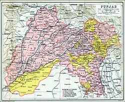
The boundaries of the region are ill-defined and focus on historical accounts and thus the geographical definition of the term "Punjab" has changed over time. In the 16th century [[Mughal Empire]] the Punjab region was divided into three, with the [[Lahore Subah]] in the west, the Delhi [[Subah]] in the east and the [[Multan Subah]] in the south. Under the [[British Raj]] until the [[Partition of India]] in 1947, the [[Punjab Province (British India)|Punjab Province]] encompassed the present Indian [[States and union territories of India|states and union territories]] of [[Punjab, India|Punjab]], [[Haryana]], [[Himachal Pradesh]], [[Chandigarh]], and [[Delhi]], and the [[Administrative units of Pakistan|Pakistani regions]] of [[Punjab, Pakistan|Punjab]], and [[Islamabad Capital Territory]]. | The boundaries of the region are ill-defined and focus on historical accounts and thus the geographical definition of the term "Punjab" has changed over time. In the 16th century [[Mughal Empire]] the Punjab region was divided into three, with the [[Lahore Subah]] in the west, the Delhi [[Subah]] in the east and the [[Multan Subah]] in the south. Under the [[British Raj]] until the [[Partition of India]] in 1947, the [[Punjab Province (British India)|Punjab Province]] encompassed the present Indian [[States and union territories of India|states and union territories]] of [[Punjab, India|Punjab]], [[Haryana]], [[Himachal Pradesh]], [[Chandigarh]], and [[Delhi]], and the [[Administrative units of Pakistan|Pakistani regions]] of [[Punjab, Pakistan|Punjab]], and [[Islamabad Capital Territory]]. | ||
| Line 121: | Line 121: | ||
==Etymology== | ==Etymology== | ||
The name Punjab is of [[Persian language|Persian]] origin, with its two parts ({{Langx|fa|پنج|translit=panj|label=none|lit=five}} and {{Langx|fa|آب|translit=āb|label=none|lit=water}}) being cognates of the [[Sanskrit]] words {{Langx|sa|पञ्च|translit=pañca|label=none|lit=five}} and {{Langx|sa|अप्|translit=áp|label=none|lit=water}}, of the same meaning. | The name Punjab is of [[Persian language|Persian]] origin, with its two parts ({{Langx|fa|پنج|translit=panj|label=none|lit=five}} and {{Langx|fa|آب|translit=āb|label=none|lit=water}}) being cognates of the [[Sanskrit]] words {{Langx|sa|पञ्च|translit=pañca|label=none|lit=five}} and {{Langx|sa|अप्|translit=áp|label=none|lit=water}}, of the same meaning.<ref name="EoS" /><ref>{{cite book|last=Gandhi|first=Rajmohan|title=Punjab: A History from Aurangzeb to Mountbatten|publisher=Aleph Book Company|year=2013|isbn=978-93-83064-41-0|location=New Delhi, India, Urbana, [[Illinois]]|page=1 ("Introduction")}}</ref> The word ''pañjāb'' is thus calque of Indo-Aryan "pañca-áp" and means "The Land of Five Waters", referring to the rivers [[Jhelum River|Jhelum]], [[Chenab River|Chenab]], [[Ravi River|Ravi]], [[Sutlej]], and [[Beas River|Beas]].<ref>"Punjab." Pp. 107 in [[Encyclopædia Britannica, Ninth Edition|''Encyclopædia Britannica'' (9th ed.)]], vol. 20.</ref> All are [[Tributary|tributaries]] of the [[Indus River]], the Sutlej being the largest. References to a land of five rivers may be found in the ''[[Mahabharata]]'', in which one of the regions is named as ''Panchanada'' ({{Langx|sa|पञ्चनद|translit=pañca-nada|lit=five rivers}}).<ref>{{cite book|url=https://books.google.com/books?id=GdKcAAAAQBAJ&pg=PA199|title=The Geography of India: Sacred and Historic Places|publisher=Britannica Educational Publishing|year=2010|isbn=978-1-61530-202-4|editor=Kenneth Pletcher|page=199|quote=The word's origin can perhaps be traced to panca nada, Sanskrit for "five rivers" and the name of a region mentioned in the ancient epic the Mahabharata.}}</ref><ref>{{cite book|author=Rajesh Bala|url=https://books.google.com/books?id=PzduAAAAMAAJ|title=Punjab History Conference, Thirty-seventh Session, March 18–20, 2005: Proceedings|publisher=Punjabi University|year=2005|isbn=978-81-7380-990-3|editor=Sukhdial Singh|page=80|chapter=Foreign Invasions and their Effect on Punjab|quote="The word Punjab is a compound of two words-Panj (Five) and aab (Water), thus signifying the land of five waters or rivers. This origin can perhaps be traced to panch nada, Sanskrit for "Five rivers" the word used before the advent of Muslims with a knowledge of Persian to describe the meeting point of the Jhelum, Chenab, Ravi, Beas, and Sutlej rivers, before they joined the Indus."}}</ref> Earlier, the Punjab was known as [[Sapta Sindhu]] in the [[Rigveda]] or ''Hapta Hendu'' in [[Avestan geography|Avesta]], translating into "The Land of Seven Rivers", with the other two being Indus and [[Kabul river|Kabul]].<ref>{{cite book|last=Grenet|first=Frantz |editor-last1=Curtis|editor-first1=Vesta Sarkhosh|editor-last2=Stewart|editor-first2=Sarah |title=Birth of the Persian Empire Volume I|chapter=An Archaeologist's Approach to Avestan Geography |publisher=I.B.Tauris |year=2005|isbn=978-0-7556-2459-1|page=34}}</ref> The ancient [[Greek people|Greeks]] referred to the region as ''Pentapotamía'' ({{langx|el|Πενταποταμία}}), which has the same meaning as that of Punjab.<ref>[[Christian Lassen|Lassen, Christian]]. 1827. ''[https://books.google.com/books?id=XbBCAAAAcAAJ&pg=PA3 Commentatio Geographica atque Historica de Pentapotamia Indica] {{Webarchive|url=https://web.archive.org/web/20221118182901/https://books.google.ca/books?id=XbBCAAAAcAAJ&pg=PA3&redir_esc=y |date=18 November 2022 }}'' [''A Geographical and Historical Commentary on Indian Pentapotamia'']. Weber. p. 4: | ||
"That part of India which today we call by the Persian name | "That part of India which today we call by the Persian name <nowiki>''Penjab''</nowiki> is named ''Panchanada'' in the sacred language of the Indians; either of which names may be rendered in Greek by Πενταποταμια. The Persian origin of the former name is not at all in doubt, although the words of which it is composed are both Indian and Persian.... But, in truth, that final word is never, to my knowledge, used by the Indians in proper names compounded in this way; on the other hand, there exist multiple Persian names which end with that word, e.g., ''Doab'' and ''Nilab''. Therefore, it is probable that the name Penjab, which is today found in all geographical books, is of more recent origin and is to be attributed to the Muslim kings of India, among whom the Persian language was mostly in use. That the Indian name Panchanada is ancient and genuine is evident from the fact that it is already seen in the ''Ramayana'' and ''Mahabharata'', the most ancient Indian poems, and that no other exists in addition to it among the Indians; for ''Panchála'', which English translations of the ''Ramayana'' render with Penjab...is the name of another region, entirely distinct from Pentapotamia...."{{whose translation|reason=has several mistakes – looks like Google translation|date=August 2022}}</ref><ref>{{cite book|author1-last=Latif|author-link=Syad Muhammad Latif |author1-first=Syad Muhammad|title=History of the Panjáb from the Remotest Antiquity to the Present Time|year=1891|publisher=Calcultta Central Press Company|page=1|quote=The Panjáb, the Pentapotamia of the Greek historians, the north-western region of the empire of Hindostán, derives its name from two Persian words, ''panj'' (five), an ''áb'' (water), having reference to the five rivers which confer on the country its distinguishing features." |url=https://books.google.com/books?id=RzBAAQAAMAAJ&pg=PR1}}</ref><ref name="Khalid">{{cite journal|author1-last=Khalid|author1-first=Kanwal|title=Lahore of Pre Historic Era|journal=Journal of the Research Society of Pakistan|volume=52|issue=2|page=73|year=2015|quote=The earliest mention of five rivers in the collective sense was found in Yajurveda and a word Panchananda was used, which is a Sanskrit word to describe a land where five rivers meet. [...] In the later period, the word ''Pentapotamia'' was used by the Greeks to identify this land. (''Penta'' means 5 and potamia, water ___ the land of five rivers) Muslim Historians implied the word "Punjab" for this region. Again, it was not a new word because in Persian-speaking areas, there are references of this name given to any particular place where five rivers or lakes meet.|url=http://pu.edu.pk/images/journal/history/PDF-FILES/7.%20Kanwal%20Khalid_v52_2_15.pdf|access-date=20 January 2019|archive-date=11 August 2022|archive-url=https://web.archive.org/web/20220811210654/http://pu.edu.pk/images/journal/history/PDF-FILES/7.%20Kanwal%20Khalid_v52_2_15.pdf|url-status=live}}</ref> | ||
== History == | == History == | ||
| Line 130: | Line 130: | ||
=== Ancient period === | === Ancient period === | ||
The Punjab region is noted as the site of one of the earliest urban societies, the [[Indus Valley civilisation|Indus Valley Civilization]] which flourished from about {{BCE|3000|link=y}} and declined rapidly 1,000 years later, following the [[Indo-Aryan migrations]] that overran the region in waves between {{BCE|1500}} and {{BCE|500}}. | The Punjab region is noted as the site of one of the earliest urban societies, the [[Indus Valley civilisation|Indus Valley Civilization]] which flourished from about {{BCE|3000|link=y}} and declined rapidly 1,000 years later, following the [[Indo-Aryan migrations]] that overran the region in waves between {{BCE|1500}} and {{BCE|500}}.<ref name=":9">{{Cite book |last=Minahan |first=James |url=https://books.google.com/books?id=abNDLZQ6quYC&pg=PA257 |title=Ethnic Groups of South Asia and the Pacific: An Encyclopedia |date=2012 |publisher=ABC-CLIO |isbn=978-1-59884-659-1 |pages=257–259 |language=en |access-date=21 August 2022 |archive-date=27 September 2023 |archive-url=https://web.archive.org/web/20230927082336/https://books.google.com/books?id=abNDLZQ6quYC&pg=PA257 |url-status=live }}</ref> Frequent intertribal wars stimulated the growth of larger groupings ruled by chieftains and kings, who ruled local kingdoms known as [[Mahajanapadas]].<ref name=":9" /> The rise of kingdoms and dynasties in the Punjab is chronicled in the ancient Hindu epics, particularly the [[Mahabharata]].<ref name=":9" /> The epic battles described in the ''[[Mahabharata]]'' are chronicled as being fought in what is now the state of Haryana and historic Punjab. The [[Gandhara]]s, [[Kambojas]], [[Trigartas]], [[Andhra in Indian epic literature|Andhra]], [[Pauravas]], [[Bahlikas]] ([[Bactrian people|Bactrian]] settlers of the Punjab), [[Yaudheya]]s, and others sided with the [[Kauravas]] in the great battle fought at [[Kurukshetra]].<ref>Buddha Parkash, ''Evolution of Heroic Tradition in Ancient Panjab'', p 36.</ref> According to Fauja Singh and L.{{nbsp}}M. Joshi: "There is no doubt that the Kambojas, Daradas, Kaikayas, Andhra, Pauravas, Yaudheyas, Malavas, Saindhavas, and Kurus had jointly contributed to the heroic tradition and composite culture of ancient Punjab."<ref>Joshi, L. M., and Fauja Singh. ''History of Panjab'', Vol I. p. 4.</ref> | ||
==== Invasions of Alexander the Great (c.&nbsp;4th century BCE) ==== | ==== Invasions of Alexander the Great (c.&nbsp;4th century BCE) ==== | ||
[[File:Surrender of Porus to the Emperor Alexander.jpg|right|thumb|upright=0.9|One of the first known kings of ancient Punjab, [[King Porus]], fought against Alexander the Great. His surrender is depicted in this 1865 engraving by [[Alonzo Chappel]].]] | [[File:Surrender of Porus to the Emperor Alexander.jpg|right|thumb|upright=0.9|One of the first known kings of ancient Punjab, [[King Porus]], fought against Alexander the Great. His surrender is depicted in this 1865 engraving by [[Alonzo Chappel]].]] | ||
The earliest known notable local king of this region was known as [[King Porus]], who fought the famous [[Battle of the Hydaspes]] against [[Alexander the Great]]. His kingdom spanned between rivers ''Hydaspes'' ([[Jhelum River|Jhelum]]) and ''Acesines'' ([[Chenab River|Chenab]]); [[Strabo]] had held the territory to contain almost 300 cities. | The earliest known notable local king of this region was known as [[King Porus]], who fought the famous [[Battle of the Hydaspes]] against [[Alexander the Great]]. His kingdom spanned between rivers ''Hydaspes'' ([[Jhelum River|Jhelum]]) and ''Acesines'' ([[Chenab River|Chenab]]); [[Strabo]] had held the territory to contain almost 300 cities.<ref name=":6">{{Cite book |last=Bosworth |first=Albert Brian |title=Conquest and Empire: The Reign of Alexander the Great |publisher=Cambridge University Press |year=1993 |pages=125–130 |chapter=The campaign of the Hydaspes}}</ref> He (alongside [[Abisares]]) had a hostile relationship with the Kingdom of [[Taxila]] which was ruled by his extended family.<ref name=":6" /> When the armies of Alexander crossed the Indus in its eastward migration, probably in [[Udabhandapura]], he was greeted by the ruler of Taxila, [[Taxiles|Omphis]].<ref name=":6" /> Omphis had hoped to force both Porus and Abisares into submission leveraging the might of Alexander's forces and diplomatic missions were mounted, but while Abisares accepted the submission, Porus refused.<ref name=":6" /> This led Alexander to seek for a face-off with Porus.<ref name=":6" /> Thus began the Battle of the Hydaspes in 326 BCE; the exact site remains unknown.<ref name=":6" /> The battle is thought to be resulted in a decisive [[Greeks|Greek]] victory; however, A. B. Bosworth warns against an uncritical reading of Greek sources that were exaggerated.<ref name=":6" /> | ||
Alexander later founded two cities—''[[Nicaea, Punjab|Nicaea]]'' at the site of victory and [[Alexandria Bucephalous|''Bucephalous'']] at the battle-ground, in memory of [[Bucephalus|his horse]], who died soon after the battle. | Alexander later founded two cities—''[[Nicaea, Punjab|Nicaea]]'' at the site of victory and [[Alexandria Bucephalous|''Bucephalous'']] at the battle-ground, in memory of [[Bucephalus|his horse]], who died soon after the battle.<ref name=":6" />{{Efn|Craterus supervised the construction. These cities are yet to be identified.}} Later, [[tetradrachm]]s would be minted depicting Alexander on horseback, armed with a ''sarissa'' and attacking a pair of Indians on an elephant.<ref name=":6" /><ref>{{Cite book |last=Holt |first=Frank Lee |title=Alexander the Great and the mystery of the elephant medallions |publisher=University of California Press |year=2003}}</ref> Porus refused to surrender and wandered about atop an elephant, until he was wounded and his force routed.<ref name=":6" /> When asked by Alexander how he wished to be treated, Porus replied "Treat me as a king would treat another king".<ref>Rogers, p.200</ref> Despite the apparently one-sided results, Alexander was impressed by Porus and chose to not depose him.<ref name=":7">{{Cite book |last=Bosworth |first=Albert Brian |title=Conquest and Empire: The Reign of Alexander the Great |publisher=Cambridge University Press |year=1993 |chapter=From the Hydaspes to the Southern Ocean}}</ref><ref>{{Cite book |last=Anson |first=Edward M. |title=Alexander the Great: Themes and Issues |publisher=Bloomsbury |year=2013 |isbn=9781441193797 |page=151}}</ref>{{sfn|Roy|2004|pp=23–28}} Not only was his territory reinstated but also expanded with Alexander's forces annexing the territories of Glausaes, who ruled to the northeast of Porus' kingdom.<ref name=":7" /> | ||
After Alexander's death in {{BCE|323}}, [[Perdiccas]] became the regent of his empire, and after Perdiccas's murder in {{BCE|321}}, [[Antipater]] became the new regent. | After Alexander's death in {{BCE|323}}, [[Perdiccas]] became the regent of his empire, and after Perdiccas's murder in {{BCE|321}}, [[Antipater]] became the new regent.<ref>{{Cite book |last=Heckel |first=Waldemar |title=Who's Who in the Age of Alexander the Great: Prosopography of Alexander's Empire |publisher=Wiley |year=2006 |isbn=9781405112109}}</ref> According to [[Diodorus Siculus|Diodorus]], Antipater recognized Porus's authority over the territories along the [[Indus River]]. However, [[Eudemus (general)|Eudemus]], who had served as Alexander's [[satrap]] in the Punjab region, treacherously killed Porus.<ref>{{cite book |author1=Irfan Habib |url=https://books.google.com/books?id=nUvGQgAACAAJ |title=Mauryan India |author2=Vivekanand Jha |publisher=Aligarh Historians Society / [[Tulika Books]] |year=2004 |isbn=978-81-85229-92-8 |series=A People's History of India |page=16 |author1-link=Irfan Habib}}</ref> | ||
==== Mauryan Empire (c. 320–180 BCE) ==== | ==== Mauryan Empire (c. 320–180 BCE) ==== | ||
[[Chandragupta Maurya]], with the aid of [[Kautilya]], had established his empire around {{BCE|320}}. The early life of Chandragupta Maurya is not clear. Kautilya enrolled the young Chandragupta in the [[University of Ancient Taxila|university at Taxila]] to educate him in the arts, sciences, logic, mathematics, warfare, and administration. [[Megasthenes]]' account, as it has survived in Greek texts that quote him, states that Alexander the Great and Chandragupta met, which if true would mean his rule started earlier than {{BCE|321}}. As Alexander never crossed the [[Beas river|Beas River]], so his territory probably lay in the [[Punjab region]].{{Citation needed|date=May 2023}} With the help of the small Janapadas of Punjab, he had gone on to conquer much of the North West Indian subcontinent. | [[Chandragupta Maurya]], with the aid of [[Kautilya]], had established his empire around {{BCE|320}}. The early life of Chandragupta Maurya is not clear. Kautilya enrolled the young Chandragupta in the [[University of Ancient Taxila|university at Taxila]] to educate him in the arts, sciences, logic, mathematics, warfare, and administration. [[Megasthenes]]' account, as it has survived in Greek texts that quote him, states that Alexander the Great and Chandragupta met, which if true would mean his rule started earlier than {{BCE|321}}. As Alexander never crossed the [[Beas river|Beas River]], so his territory probably lay in the [[Punjab region]].{{Citation needed|date=May 2023}} With the help of the small Janapadas of Punjab, he had gone on to conquer much of the North West Indian subcontinent.<ref name="auto7">{{Cite book |last=Mookerji |first=Radhakumud |url=https://books.google.com/books?id=t5g2EAAAQBAJ&dq=yaudheyas+chandragupta&pg=PA22 |title=Chandragupta Maurya and His Times |date=2016-01-01 |publisher=Motilal Banarsidass |isbn=978-81-208-0433-3 |page=22 |language=en |access-date=30 January 2023 |archive-date=14 March 2023 |archive-url=https://web.archive.org/web/20230314141224/https://books.google.com/books?id=t5g2EAAAQBAJ&dq=yaudheyas+chandragupta&pg=PA22 |url-status=live }}</ref> He then defeated the Nanda rulers in [[Pataliputra]] to capture the throne. Chandragupta Maurya fought Alexander's successor in the east, [[Seleucus I Nicator|Seleucus]] when the latter invaded. In a peace treaty, Seleucus ceded all territories west of the Indus and offered a marriage, including a portion of [[Bactria]], while Chandragupta granted Seleucus 500 elephants.{{Citation needed|date=May 2023}} The chief of the Mauryan military was also always a [[Yaudheya]]n warrior according to the Bijaygadh Pillar inscription, which states that the Yaudheyas elected their own chief who also served as the general for the Mauryans.<ref name="auto4">{{Cite book |last=Gupta |first=Gyan Swarup |url=https://books.google.com/books?id=jbjT9GG__nEC&dq=chief+of+the+mauryan+military+yaudheyas&pg=PA194 |title=India: From Indus Valley Civilisation to Mauryas |date=1999 |publisher=Concept Publishing Company |isbn=978-81-7022-763-2 |language=en |page=194 |access-date=30 January 2023 |archive-date=8 July 2023 |archive-url=https://web.archive.org/web/20230708165611/https://books.google.com/books?id=jbjT9GG__nEC&dq=chief+of+the+mauryan+military+yaudheyas&pg=PA194 |url-status=live }}</ref><ref name="auto10">{{Cite book |last=Majumdar |first=Ramesh Chandra |url=https://books.google.com/books?id=VJQ6AAAAIAAJ&q=bijaygadh+pillar+inscription+yaudheyas |title=Corporate Life in Ancient India |date=1969 |publisher=Firma K. L. Mukhopadhyay |page=222 |language=en |access-date=21 March 2023 |archive-date=14 March 2023 |archive-url=https://web.archive.org/web/20230314141256/https://books.google.com/books?id=VJQ6AAAAIAAJ&q=bijaygadh+pillar+inscription+yaudheyas |url-status=live }}</ref> The Mauryan military was also made up vastly of men from the Punjab Janapadas.<ref name=":0">{{Cite book |last=Mookerji |first=Radhakumud |url=https://books.google.com/books?id=t5g2EAAAQBAJ&dq=mauryan+military+mostly+Punjabi&pg=PA27 |title=Chandragupta Maurya and His Times |date=2016-01-01 |publisher=Motilal Banarsidass |isbn=978-81-208-0433-3 |language=en |page=27 |access-date=30 January 2023 |archive-date=8 July 2023 |archive-url=https://web.archive.org/web/20230708165613/https://books.google.com/books?id=t5g2EAAAQBAJ&dq=mauryan+military+mostly+Punjabi&pg=PA27 |url-status=live }}</ref> | ||
Chandragupta's rule was very well organised. The Mauryans had an autocratic and centralised administration system, aided by a council of ministers, and also a well-established espionage system. Much of Chandragupta's success is attributed to [[Chanakya]], the author of the ''[[Arthashastra]].'' Much of the Mauryan rule had a strong bureaucracy that had regulated tax collection, trade and commerce, industrial activities, mining, statistics and data, maintenance of public places, and upkeep of temples.{{Citation needed|date=May 2023}} | Chandragupta's rule was very well organised. The Mauryans had an autocratic and centralised administration system, aided by a council of ministers, and also a well-established espionage system. Much of Chandragupta's success is attributed to [[Chanakya]], the author of the ''[[Arthashastra]].'' Much of the Mauryan rule had a strong bureaucracy that had regulated tax collection, trade and commerce, industrial activities, mining, statistics and data, maintenance of public places, and upkeep of temples.{{Citation needed|date=May 2023}} | ||
| Line 149: | Line 149: | ||
==== Hindu Shahis (c. 820–1022 CE) ==== | ==== Hindu Shahis (c. 820–1022 CE) ==== | ||
In the 9th century, the [[Hindu Shahis|Hindu Shahi]] dynasty originating from the region of [[Oddiyana]], | In the 9th century, the [[Hindu Shahis|Hindu Shahi]] dynasty originating from the region of [[Oddiyana]],<ref>{{Cite journal |last=Rahman |first=Abdul |date=2002 |title=New Light on the Khingal, Turk and the Hindu Sahis |url=http://journals.uop.edu.pk/papers/AP_v15_37to42.pdf |journal=Ancient Pakistan |volume=XV |pages=37–42 |quote=The Hindu Śāhis were therefore neither Bhattis, or Janjuas, nor Brahmans. They were simply Uḍis/Oḍis. It can now be seen that the term Hindu Śāhi is a misnomer and, based as it is merely upon religious discrimination, should be discarded and forgotten. The correct name is Uḍi or Oḍi Śāhi dynasty. |access-date=11 January 2023 |archive-date=26 April 2021 |archive-url=https://web.archive.org/web/20210426060455/http://journals.uop.edu.pk/papers/AP_v15_37to42.pdf |url-status=live }}</ref><ref>{{Cite journal |last=Meister |first=Michael W. |date=2005 |title=The Problem of Platform Extensions at Kafirkot North |url=http://journals.uop.edu.pk/papers/AP_v16_41to48.pdf |journal=Ancient Pakistan |volume=XVI |pages=41–48 |quote=Rehman (2002: 41) makes a good case for calling the Hindu Śāhis by a more accurate name, "Uḍi Śāhis". |access-date=11 January 2023 |archive-date=1 February 2023 |archive-url=https://web.archive.org/web/20230201184532/http://journals.uop.edu.pk/papers/AP_v16_41to48.pdf |url-status=live }}</ref>{{sfn|Rehman|1976}} replaced the Taank kingdom, ruling Western Punjab along with eastern Afghanistan.<ref name=":9" /> The tribe of the [[Gakhars]]/[[Khokhars]], formed a large part of the Hindu Shahi army according to the Persian historian [[Firishta]].{{sfn|Rehman|1976|pp=48–50}} The most notable rulers of the empire were Lalliya, Bhimadeva and Jayapala who were accredited for military victories. | ||
Lalliya had reclaimed the territory at and around Kabul between 879 and 901 CE after it had been lost under his predecessor to the [[Saffarid dynasty]].{{sfn|Rehman|1976}}{{page needed|date=January 2023}} He was described as a fearsome Shahi. Two of his ministers reconstructed by Rahman as Toramana and Asata are said to of have taken advantage of [[Amr ibn al-Layth|Amr al-Layth]]'s preoccupation with rebellions in Khorasan, by successfully raiding [[Ghazna]] around 900 CE.{{sfn|Rehman|1976}}{{page needed|date=January 2023}} | Lalliya had reclaimed the territory at and around Kabul between 879 and 901 CE after it had been lost under his predecessor to the [[Saffarid dynasty]].{{sfn|Rehman|1976}}{{page needed|date=January 2023}} He was described as a fearsome Shahi. Two of his ministers reconstructed by Rahman as Toramana and Asata are said to of have taken advantage of [[Amr ibn al-Layth|Amr al-Layth]]'s preoccupation with rebellions in Khorasan, by successfully raiding [[Ghazna]] around 900 CE.{{sfn|Rehman|1976}}{{page needed|date=January 2023}} | ||
| Line 156: | Line 156: | ||
==== Turkic rule (c. 1030–1320 CE) ==== | ==== Turkic rule (c. 1030–1320 CE) ==== | ||
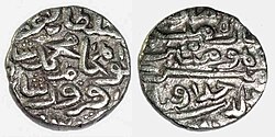
[[File:Khizr Khan (4).jpg|thumb|Silver copper coin of [[Khizr Khan]], founder of the [[Sayyid dynasty]] | [[File:Khizr Khan (4).jpg|thumb|Silver copper coin of [[Khizr Khan]], founder of the [[Sayyid dynasty]]<ref>{{cite book |author=Richard M. Eaton |title=India in the Persianate Age: 1000–1765 |year=2019 |isbn=978-0520325128 |page=117 |publisher=University of California Press |language=en |quote=The career of Khizr Khan, a Punjabi chieftain belonging to the Khokar clan...}}</ref>]] | ||
The [[Turkic peoples|Turkic]] [[Ghaznavids]] in the tenth century overthrew the Hindu Shahis and consequently ruled for 157 years in Western Punjab, gradually declining as a power until the [[Ghurid]] [[Siege of Lahore (1186)|conquest of Lahore]] by [[Muhammad of Ghor]] in 1186, deposing the last Ghaznavid ruler [[Khusrau Malik]]. | The [[Turkic peoples|Turkic]] [[Ghaznavids]] in the tenth century overthrew the Hindu Shahis and consequently ruled for 157 years in Western Punjab, gradually declining as a power until the [[Ghurid]] [[Siege of Lahore (1186)|conquest of Lahore]] by [[Muhammad of Ghor]] in 1186, deposing the last Ghaznavid ruler [[Khusrau Malik]].<ref>{{Cite book |last=Mehta |first=Jaswant Lal |url=https://books.google.com/books?id=iUk5k5AN54sC&pg=PA76 |title=Advanced Study in the History of Medieval India |date=1979 |publisher=Sterling Publishers Pvt. Ltd |isbn=978-81-207-0617-0 |page=76 |language=en |access-date=9 September 2022 |archive-date=27 September 2023 |archive-url=https://web.archive.org/web/20230927082342/https://books.google.com/books?id=iUk5k5AN54sC&pg=PA76#v=onepage&q&f=false |url-status=live }}</ref> Following the death of [[Muhammad of Ghor]] in 1206 by Punjabi assassins near the Jhelum river, the Ghurid state fragmented and was replaced in northern India by the [[Delhi Sultanate]]. | ||
==== Tughlaq dynasty (c. 1320–1410 CE) ==== | ==== Tughlaq dynasty (c. 1320–1410 CE) ==== | ||
The Tughlaq dynasty's reign formally started in 1320 in [[Delhi]] when Ghazi Malik assumed the throne under the title of [[Ghiyath al-Din Tughluq]] after defeating [[Khusrau Khan]] at the [[Battle of Lahrawat]]. | The Tughlaq dynasty's reign formally started in 1320 in [[Delhi]] when Ghazi Malik assumed the throne under the title of [[Ghiyath al-Din Tughluq]] after defeating [[Khusrau Khan]] at the [[Battle of Lahrawat]]. | ||
During Ghazi Malik's reign, in 1321 he sent his eldest son Jauna Khan, later known as [[Muhammad bin Tughlaq]], to [[Deogir]] to plunder the Hindu kingdoms of Arangal and Tilang (now part of [[Telangana]]). His first attempt was a failure. | During Ghazi Malik's reign, in 1321 he sent his eldest son Jauna Khan, later known as [[Muhammad bin Tughlaq]], to [[Deogir]] to plunder the Hindu kingdoms of Arangal and Tilang (now part of [[Telangana]]). His first attempt was a failure.<ref name="lowe296">William Lowe (Translator), {{Google books|RFNOAAAAYAAJ|Muntakhabu-t-tawārīkh|page=296}}, Volume 1, pages 296-301</ref> Four months later, Ghiyasuddin Tughlaq sent large army reinforcements for his son asking him to attempt plundering Arangal and Tilang again.<ref>[https://archive.org/stream/historyindiaast06elligoog#page/n240/mode/2up Tarikh-I Firoz Shahi] Ziauddin Barni, The History of India by its own Historians - The Muhammadan Period, Volume 3, Trubner London, pages 233-234</ref> This time Jauna Khan succeeded and Arangal fell, it was renamed to Sultanpur, and all plundered wealth, state treasury and captives were transferred from the captured kingdom to the Delhi Sultanate.The Muslim aristocracy in Lukhnauti (Bengal) invited Ghiyasuddin Tughlaq to extend his coup and expand eastwards into Bengal by attacking [[Shamsuddin Firoz Shah]], which he did over 1324–1325 CE,<ref name="lowe296" /> after placing Delhi under control of his son Ulugh Khan, and then leading his army to Lukhnauti. Ghiyasuddin Tughlaq succeeded in this campaign. | ||
After his father's death in 1325 CE, Muhammad bin Tughlaq assumed power and his rule saw the empire expand to most of the Indian subcontinent, its peak in terms of geographical reach. | After his father's death in 1325 CE, Muhammad bin Tughlaq assumed power and his rule saw the empire expand to most of the Indian subcontinent, its peak in terms of geographical reach.<ref name="ebmit">[http://www.britannica.com/EBchecked/topic/396460/Muhammad-ibn-Tughluq Muḥammad ibn Tughluq] {{Webarchive|url=https://web.archive.org/web/20150427052630/http://www.britannica.com/EBchecked/topic/396460/Muhammad-ibn-Tughluq |date=27 April 2015 }} Encyclopædia Britannica</ref> He attacked and plundered [[Malwa]], [[Gujarat]], [[Lakhnauti]], [[Chittagong]], [[Mithila (region)|Mithila]] and many other regions in India.<ref>[https://archive.org/stream/historyindiaast06elligoog#page/n242/mode/2up Tarikh-I Firoz Shahi] Ziauddin Barni, The History of India by its own Historians - The Muhammadan Period, Volume 3, Trubner London, pp. 236–237</ref> His distant campaigns were expensive, although each raid and attack on non-Muslim kingdoms brought new looted wealth and ransom payments from captured people. The extended empire was difficult to retain, and rebellions became commonplace all over the Indian subcontinent.<ref name="zbarni">[https://archive.org/stream/historyindiaast06elligoog#page/n242/mode/2up Tarikh-I Firoz Shahi] Ziauddin Barni, The History of India by its own Historians - The Muhammadan Period, Volume 3, Trubner London, pp. 235–240</ref> Muhammad bin Tughlaq died in March 1351{{sfn|Jackson|2003|p=162}} while trying to chase and punish people for rebellion and their refusal to pay taxes in [[Sindh]] and [[Gujarat]].<ref name="vsoxford3">Vincent A Smith, {{Google books|p2gxAQAAMAAJ|The Oxford History of India: From the Earliest Times to the End of 1911|page=217}}, Chapter 2, pp. 242–248, Oxford University Press</ref> | ||
After Muhammad bin Tughlaq's death, the Tughlaq empire was in a state of disarray with many regions assuming independence; it was at this point that [[Firuz Shah Tughlaq]], Ghazi Malik's nephew, took reign. His father's name was Rajab (the younger brother of Ghazi Malik) who had the title ''[[Sipahsalar]]''. His mother Naila was a Punjabi Bhatti princess (daughter of Rana Mal) from [[Dipalpur]] and [[Abohar]] according to the historian [[William Crooke]]. | After Muhammad bin Tughlaq's death, the Tughlaq empire was in a state of disarray with many regions assuming independence; it was at this point that [[Firuz Shah Tughlaq]], Ghazi Malik's nephew, took reign. His father's name was Rajab (the younger brother of Ghazi Malik) who had the title ''[[Sipahsalar]]''. His mother Naila was a Punjabi Bhatti princess (daughter of Rana Mal) from [[Dipalpur]] and [[Abohar]] according to the historian [[William Crooke]].<ref>{{Cite book |last=Crooke |first=William |url=https://books.google.com/books?id=tCc-AAAAYAAJ&dq=firoz+shah+tughlaq+mother&pg=PA144 |title=An Ethnographical Hand-book for the N.-W. Provinces and Oudh |date=1890 |publisher=North-Western provinces and Oudh government Press |page=144 |language=en |access-date=14 March 2023 |archive-date=8 July 2023 |archive-url=https://web.archive.org/web/20230708165612/https://books.google.com/books?id=tCc-AAAAYAAJ&dq=firoz+shah+tughlaq+mother&pg=PA144 |url-status=live }}</ref><ref>{{Cite book |url=https://books.google.com/books?id=WhFDAAAAYAAJ&q=bibi+naila+punjabi |title=Proceedings - Punjab History Conference |date=1966 |publisher=Publication Bureau, Punjab University |page=82 |language=en |access-date=14 March 2023 |archive-date=8 July 2023 |archive-url=https://web.archive.org/web/20230708165612/https://books.google.com/books?id=WhFDAAAAYAAJ&q=bibi+naila+punjabi |url-status=live }}</ref> The southern states had drifted away from the Sultanate and there were rebellions in Gujarat and Sindh, while "Bengal asserted its independence." He led expeditions against Bengal in 1353 and 1358. He captured [[Cuttack]], desecrated the [[Jagannath Temple, Puri]], and forced Raja Gajpati of Jajnagar in [[Orissa, India|Orissa]] to pay tribute.<ref>{{Cite book |last1=Kulke |first1=Hermann |url=https://books.google.com/books?id=TPVq3ykHyH4C&dq=firoz+shah+orissa&pg=PA184 |title=A History of India |last2=Rothermund |first2=Dietmar |date=2004 |publisher=Psychology Press |isbn=978-0-415-32919-4 |page=184 |language=en |access-date=14 March 2023 |archive-date=8 July 2023 |archive-url=https://web.archive.org/web/20230708165612/https://books.google.com/books?id=TPVq3ykHyH4C&dq=firoz+shah+orissa&pg=PA184 |url-status=live }}</ref><ref>{{Cite book |last=Haque |first=Mohammed Anwarul |url=https://books.google.com/books?id=Co8eAAAAMAAJ&q=firoz+shah+cuttack |title=Muslim Administration in Orissa, 1568-1751 A.D. |date=1980 |publisher=Punthi Pustak |page=20 |language=en |access-date=14 March 2023 |archive-date=8 July 2023 |archive-url=https://web.archive.org/web/20230708165610/https://books.google.com/books?id=Co8eAAAAMAAJ&q=firoz+shah+cuttack |url-status=live }}</ref> He also laid siege to the [[Kangra Fort]] and forced Nagarkot to pay tribute.<ref>{{Cite book |last=Jauhri |first=R. C. |url=https://books.google.com/books?id=ToRHAAAAMAAJ&q=firoz+shah+tughluq+kangra |title=Firoz Tughluq, 1351-1388 A.D. |date=1990 |publisher=ABS Publications |isbn=978-81-7072-029-4 |page=74 |language=en |access-date=14 March 2023 |archive-date=8 July 2023 |archive-url=https://web.archive.org/web/20230708165613/https://books.google.com/books?id=ToRHAAAAMAAJ&q=firoz+shah+tughluq+kangra |url-status=live }}</ref> During this time, Tatar Khan of [[Greater Khorasan]] attacked Punjab, but he was defeated and his face slashed by the sword given by [[Feroz Shah Tughlaq]] to Raja [[Kailas Pal]] who ruled the Nagarkot region in Punjab.<ref>{{Cite book |last1=Hutchison |first1=John |url=https://books.google.com/books?id=3btDw4S2FmYC&dq=kailas+pal&pg=PA221 |title=History of the Panjab Hill States |last2=Vogel |first2=Jean Philippe |date=1994 |publisher=Asian Educational Services |isbn=978-81-206-0942-6 |page=221 |language=en |access-date=14 March 2023 |archive-date=8 July 2023 |archive-url=https://web.archive.org/web/20230708165611/https://books.google.com/books?id=3btDw4S2FmYC&dq=kailas+pal&pg=PA221 |url-status=live }}</ref> | ||
==== Sayyid dynasty (c. 1410–1450 CE) ==== | ==== Sayyid dynasty (c. 1410–1450 CE) ==== | ||
{{See also|Sayyid dynasty}} | {{See also|Sayyid dynasty}} | ||
[[Khizr Khan]] established the [[Sayyid dynasty]], the fourth dynasty of the [[Delhi Sultanate]] after the fall of the [[Tughlaq dynasty|Tughlaqs]]. | [[Khizr Khan]] established the [[Sayyid dynasty]], the fourth dynasty of the [[Delhi Sultanate]] after the fall of the [[Tughlaq dynasty|Tughlaqs]].<ref name=":02">{{cite book |author=Richard M. Eaton |title=India in the Persianate Age: 1000–1765 |year=2019 |isbn=978-0520325128 |page=117|publisher=University of California Press }}</ref> | ||
Following [[Timur]]'s 1398 sack of [[Delhi]],{{sfn|Jackson|2003|p=103}} he appointed [[Khizr Khan]] as deputy of [[Multan]] ([[Punjab region|Punjab]]).{{sfn|Kumar|2020|p=583}} He held Lahore, Dipalpur, Multan and Upper Sindh. | Following [[Timur]]'s 1398 sack of [[Delhi]],{{sfn|Jackson|2003|p=103}} he appointed [[Khizr Khan]] as deputy of [[Multan]] ([[Punjab region|Punjab]]).{{sfn|Kumar|2020|p=583}} He held Lahore, Dipalpur, Multan and Upper Sindh.<ref>{{cite book |author=Kenneth Pletcher |url=https://books.google.com/books?id=VsujRFvaHI8C&dq=khizr+khan+sind&pg=PA132 |title=The History of India |date=2010 |page=132 |publisher=The Rosen Publishing Group |isbn=9781615301225 |access-date=19 March 2023 |archive-date=4 April 2023 |archive-url=https://web.archive.org/web/20230404112659/https://books.google.com/books?id=VsujRFvaHI8C&dq=khizr+khan+sind&pg=PA132 |url-status=live }}</ref><ref>{{cite book |author=V. D. Mahajan |url=https://books.google.com/books?id=nMWSQuf4oSIC&dq=khizr+khan+sind&pg=RA1-PA229 |title=History of Medieval India |date=2007 |page=229 |publisher=S. Chand |isbn=9788121903646 |access-date=19 March 2023 |archive-date=4 April 2023 |archive-url=https://web.archive.org/web/20230404112707/https://books.google.com/books?id=nMWSQuf4oSIC&dq=khizr+khan+sind&pg=RA1-PA229 |url-status=live }}</ref> Khizr Khan captured Delhi on 28 May 1414 thereby establishing the Sayyid dynasty.{{sfn|Kumar|2020|p=583}} Khizr Khan did not take up the title of [[sultan]], but continued the fiction of his allegiance to Timur as ''Rayat-i-Ala''(vassal) of the [[Timurids]] - initially that of Timur, and later his son [[Shahrukh Mirza|Shah Rukh]].<ref>{{cite book |url=https://books.google.com/books?id=OghDAAAAYAAJ&q=It+is+generally+acknowledged+that+Khizr+Khan+continued+to+recognise+Timur+and+his+successors+,+Shah+Rukh+,+as+his+nominal+overlords+.+But+later+on+under+his+succesor+,+Mubarak+Khan+,+this+%27+fiction+%27+of+allegiance+to+the+Timurid+rulers |title=Proceedings:Volume 55 |year=1995 |publisher=Indian History Congress |page=216 |access-date=19 March 2023 |archive-date=4 April 2023 |archive-url=https://web.archive.org/web/20230404004957/https://books.google.com/books?id=OghDAAAAYAAJ&q=It+is+generally+acknowledged+that+Khizr+Khan+continued+to+recognise+Timur+and+his+successors+%2C+Shah+Rukh+%2C+as+his+nominal+overlords+.+But+later+on+under+his+succesor+%2C+Mubarak+Khan+%2C+this+%27+fiction+%27+of+allegiance+to+the+Timurid+rulers |url-status=live }}</ref>{{sfn|Mahajan|2007|page=237}} After the accession of Khizr Khan, the Punjab, [[Uttar Pradesh]] and Sindh were reunited under the Delhi Sultanate, where he spent his time subduing rebellions.<ref>{{cite book |url=https://books.google.com/books?id=F3QbAAAAIAAJ&q=khizr+khan+sindh |title=Rajasthan [district Gazetteers] Bharatpur |date=1971 |publisher=Printed at Government Central Press |page=52 |access-date=19 March 2023 |archive-date=4 April 2023 |archive-url=https://web.archive.org/web/20230404112704/https://books.google.com/books?id=F3QbAAAAIAAJ&q=khizr+khan+sindh |url-status=live }}</ref> Punjab was the powerbase of Khizr Khan and his successors as the bulk of the Delhi army during their reigns came from [[Multan]] and [[Dipalpur]].<ref>{{Cite book |last=Lal |first=Kishori Saran |url=https://books.google.com/books?id=C-E_SwAACAAJ&q=twilight+of+the+sultanate |title=Twilight of the Sultanate: A Political, Social and Cultural History of the Sultanate of Delhi from the Invasion of Timur to the Conquest of Babur 1398-1526 |date=1980 |publisher=Munshiram Manoharlal |isbn=978-81-215-0227-6 |language=en |quote=This considerably depleted Iqbal's strength and encouraged Khizr Khan to collect his forces of Multan, Deopalpur and the Punjab |access-date=9 March 2023 |archive-date=9 March 2023 |archive-url=https://web.archive.org/web/20230309205559/https://books.google.com/books?id=C-E_SwAACAAJ&q=twilight+of+the+sultanate |url-status=live }}</ref> | ||
Khizr Khan was succeeded by his son [[Mubarak Shah (Sayyid dynasty)|Mubarak Shah]] after his death on 20 May 1421. Mubarak Shah referred to himself as ''Muizz-ud-Din Mubarak Shah'' on his coins, removing the Timurid name with the name of the Caliph, and declared himself a Shah. | Khizr Khan was succeeded by his son [[Mubarak Shah (Sayyid dynasty)|Mubarak Shah]] after his death on 20 May 1421. Mubarak Shah referred to himself as ''Muizz-ud-Din Mubarak Shah'' on his coins, removing the Timurid name with the name of the Caliph, and declared himself a Shah.<ref>{{cite book |author=V. D. Mahajan |url=https://books.google.com/books?id=nMWSQuf4oSIC&dq=sultan+mubarak+shah+timur++caliph&pg=RA1-PA240 |title=History of Medieval India |date=2007 |page=240 |publisher=S. Chand | isbn=978-81-219-0364-6 |access-date=19 March 2023 |archive-date=4 April 2023 |archive-url=https://web.archive.org/web/20230404112700/https://books.google.com/books?id=nMWSQuf4oSIC&dq=sultan+mubarak+shah+timur++caliph&pg=RA1-PA240 |url-status=live }}</ref><ref>{{cite book |author=Iqtidar Alam Khan |url=https://books.google.com/books?id=pzZFUcDpDzsC&dq=sultan+mubarak+shah&pg=PA103 |title=Historical Dictionary of Medieval India |date=2008 |page=103 | publisher=Scarecrow Press | isbn=978-0-8108-5503-8 |access-date=19 March 2023 |archive-date=4 April 2023 |archive-url=https://web.archive.org/web/20230404005001/https://books.google.com/books?id=pzZFUcDpDzsC&dq=sultan+mubarak+shah&pg=PA103 |url-status=live }}</ref> He defeated the advancing [[Hoshang Shah|Hoshang Shah Ghori]], ruler of [[Malwa Sultanate]] and forced him to pay heavy tribute early in his reign.<ref>{{Cite book |last=Lal |first=Kishori Saran |url=https://books.google.com/books?id=C-E_SwAACAAJ&q=twilight+of+the+sultanate |title=Twilight of the Sultanate: A Political, Social and Cultural History of the Sultanate of Delhi from the Invasion of Timur to the Conquest of Babur 1398-1526 |date=1980 |publisher=Munshiram Manoharlal |isbn=978-81-215-0227-6 |language=en |quote=Hoshang tried his luck against Sultan of Delhi but he was beaten back by Mubarak Shah Saiyyad to whom he had to pay a handsome tribute |access-date=9 March 2023 |archive-date=9 March 2023 |archive-url=https://web.archive.org/web/20230309205559/https://books.google.com/books?id=C-E_SwAACAAJ&q=twilight+of+the+sultanate |url-status=live }}</ref> Mubarak Shah also put down the rebellion of [[Jasrat Khokhar|Jasrath Khokhar]] and managed to fend off multiple invasions by the Timurids of Kabul.<ref>{{Cite book |last=Lal |first=Kishori Saran |url=https://books.google.com/books?id=C-E_SwAACAAJ&q=twilight+of+the+sultanate |title=Twilight of the Sultanate: A Political, Social and Cultural History of the Sultanate of Delhi from the Invasion of Timur to the Conquest of Babur 1398-1526 |date=1980 |publisher=Munshiram Manoharlal |isbn=978-81-215-0227-6 |page=109 |language=en |access-date=9 March 2023 |archive-date=9 March 2023 |archive-url=https://web.archive.org/web/20230309205559/https://books.google.com/books?id=C-E_SwAACAAJ&q=twilight+of+the+sultanate |url-status=live }}</ref> | ||
The last ruler of the Sayyids, [[Alam Shah|Ala-ud-Din]], voluntarily abdicated the throne of the Delhi Sultanate in favour of [[Bahlul Khan Lodi]] on 19 April 1451, and left for Badaun, where he died in 1478.{{sfn|Mahajan|2007|page=244}} | The last ruler of the Sayyids, [[Alam Shah|Ala-ud-Din]], voluntarily abdicated the throne of the Delhi Sultanate in favour of [[Bahlul Khan Lodi]] on 19 April 1451, and left for Badaun, where he died in 1478.{{sfn|Mahajan|2007|page=244}} | ||
==== Langah Sultanate (c. 1450–1530 CE) ==== | ==== Langah Sultanate (c. 1450–1530 CE) ==== | ||
In 1445, Sultan Qutbudin, chief of ''Langah'' (a [[Jat]] [[Zamindar]] tribe), | In 1445, Sultan Qutbudin, chief of ''Langah'' (a [[Jat]] [[Zamindar]] tribe),<ref name="Ahmed 1984 pp. 428–434">{{cite journal |last=Ahmed |first=Iftikhar |year=1984 |title=Territorial Distribution of Jatt Castes in Punjab c. 1595 – c. 1881 |url=http://www.jstor.org/stable/44140224 |journal=Proceedings of the Indian History Congress |publisher=Indian History Congress |volume=45 |pages=429, 432 |issn=2249-1937 |jstor=44140224 |access-date=28 July 2022 |archive-date=28 July 2022 |archive-url=https://web.archive.org/web/20220728212635/https://www.jstor.org/stable/44140224 |url-status=live }}</ref><ref name="Mubārak Blochmann 1891 p.321">{{cite book |last1=Mubārak |first1=A.F. |url=https://books.google.com/books?id=L8IXAAAAYAAJ |title=The Ain I Akbari |last2=Blochmann |first2=H. |publisher=Asiatic Society of Bengal |year=1891 |series=Bibliotheca Indica |page=321 |access-date=28 July 2022 |issue=v. 2}}</ref><ref name="Lambrick p.212">{{cite book |last=Lambrick |first=H. T. |title=Sind : a general introduction |date=1975 |publisher=Sindhi Adabi Board |isbn=0-19-577220-2 |publication-place=Hyderabad |page=212 |oclc=2404471}}</ref><ref name="Roseberry 1987 p.177">{{cite book |last=Roseberry |first=J.R. |url=https://books.google.com/books?id=iAMNAAAAIAAJ |title=Imperial Rule in Punjab: The Conquest and Administration of Multan, 1818–1881 |publisher=Manohar |year=1987 |isbn=978-81-85054-28-5 |page=177 |access-date=28 July 2022}}</ref> established the [[Langah Sultanate]] in [[Multan]] after the fall of the [[Sayyid dynasty]]. Husseyn Langah I (reigned 1456–1502) was the second ruler of Langah Sultanate. He undertook military campaigns in Punjab and captured [[Chiniot]] and [[Shorkot]] from the Lodis. Shah Husayn successfully repulsed attempted invasion by the Lodis led by [[Tatar Khan]] and [[Rukunuddin Barbak Shah|Barbak Shah]], as well as his daughter Zeerak Rumman.<ref name=":4">{{Cite book |title=History of Civilizations of Central Asia: Age of Achievement, 750 AD to the End of the 15th Century |editor1=M. S. Asimov |editor2=C. E. Bosworth |editor2-link=Clifford Edmund Bosworth |contribution=Chapter 15. The Regions Of Sind, Baluchistan, Multan And Kashmir: The Historical, Social And Economic Setting |contribution-url=https://en.unesco.org/silkroad/sites/default/files/knowledge-bank-article/vol_IVa%20silk%20road_the%20regions%20of%20sind%2C%20baluchistan%2C%20multan%20and%20kashmir.pdf |page=305 |author1=N. A. Baloch |author2=A. Q. Rafiqi |publisher=[[UNESCO]] |year=1998 |isbn=978-92-3-103467-1 |access-date=22 January 2023 |archive-date=6 March 2022 |archive-url=https://web.archive.org/web/20220306193338/https://en.unesco.org/silkroad/sites/default/files/knowledge-bank-article/vol_IVa%20silk%20road_the%20regions%20of%20sind%2C%20baluchistan%2C%20multan%20and%20kashmir.pdf |url-status=live }}</ref> | ||
=== Early modern period === | === Early modern period === | ||
==== Mughal Empire (c. 1530–1700 CE) ==== | ==== Mughal Empire (c. 1530–1700 CE) ==== | ||
The [[Mughal Empire|Mughals]] came to power in the early 16th century and gradually expanded to control all of the Punjab from their capital at [[Lahore]]. During the Mughal era, [[Saadullah Khan (Mughal Empire)|Saadullah Khan]], born into a family of Punjabi agriculturalists | The [[Mughal Empire|Mughals]] came to power in the early 16th century and gradually expanded to control all of the Punjab from their capital at [[Lahore]]. During the Mughal era, [[Saadullah Khan (Mughal Empire)|Saadullah Khan]], born into a family of Punjabi agriculturalists<ref name="Journal of Central Asia 1992 p.842">{{cite book |url=https://books.google.com/books?id=ml5xAAAAMAAJ |title=Journal of Central Asia |publisher=Centre for the Study of the Civilizations of Central Asia, Quaid-i-Azam University |year=1992 |page=84 |quote=Sadullah Khan was the son of Amir Bakhsh a cultivator of Chiniot . He belongs to Jat family. He was born on Thursday, the 10th Safar 1000 A.H./1591 A.C. |access-date=2022-07-30 |issue=v. 15}}</ref> belonging to the [[Thaheem (tribe)|Thaheem tribe]]<ref name="Quddus 1992 p.402">{{cite book |last=Quddus |first=S.A. |url=https://books.google.com/books?id=4y9zAAAAMAAJ |title=Punjab, the Land of Beauty, Love, and Mysticism |publisher=Royal Book Company |year=1992 |isbn=978-969-407-130-5 |page=402 |access-date=2022-07-29}}</ref> from [[Chiniot]]<ref name=":13">{{Cite journal |last=Siddiqui |first=Shabbir A. |title=Relations Between Dara Shukoh and Sa'adullah Khan |date=1986 |url=https://www.jstor.org/stable/44141552 |journal=Proceedings of the Indian History Congress |volume=47 |pages=273–276 |jstor=44141552 |issn=2249-1937 |access-date=11 August 2022 |archive-date=22 April 2022 |archive-url=https://web.archive.org/web/20220422052225/https://www.jstor.org/stable/44141552 |url-status=live }}</ref> remained [[grand vizier]] (or Prime Minister) of the Mughal Empire in the period 1645–1656.<ref name=":13" /> Other prominent Muslims from Punjab who rose to nobility during the Mughal Era include [[Wazir Khan (Lahore)|Wazir Khan]],<ref name="Koch">{{Cite book |last=Koch |first=Ebba |title=The complete Taj Mahal : and the riverfront gardens of Agra |date=2006 |publisher=Thames & Hudson |others=Richard André. Barraud |isbn=978-0-500-34209-1 |location=London |page=45 |oclc=69022179 }}</ref> [[Adina Beg|Adina Beg Arain]],<ref>{{Cite book |first=G.S. |last=Chhabra |url=https://books.google.com/books?id=UkDi6rVbckoC&dq=adina+beg+punjab&pg=PA38 |title=Advance Study in the History of Modern India (Volume-1: 1707–1803) |date=2005 |publisher=Lotus Press |isbn=978-81-89093-06-8 |page=38 |language=en}}</ref> and [[Shahbaz Khan Kamboh]].<ref>{{cite Banglapedia|article=Shahbaz Khan|author=Chisti, AA Sheikh Md Asrarul Hoque}}</ref> The Mughal Empire ruled the region until it was severely weakened in the eighteenth century.<ref name=":9" /> As Mughal power weakened, Afghan rulers took control of the region.<ref name=":9" /> Contested by the [[Maratha Empire|Marathas]] and Afghans, the region was the center of the growing influence of the [[misl]]s, who expanded and established the Sikh Confederacy as the Mughals and Afghans weakened, ultimately ruling the Punjab, [[Khyber Pakhtunkhwa]], and territories north into the [[Himalayas]].<ref name=":9" /> | ||
==== Pakpattan state (c. 1700–1730 CE) ==== | ==== Pakpattan state (c. 1700–1730 CE) ==== | ||
Following the disintegration of the Mughal Empire, the shrine's ''Dīwān'' was able to forge a political independent state centered on Pakpattan. | Following the disintegration of the Mughal Empire, the shrine's ''Dīwān'' was able to forge a political independent state centered on Pakpattan.<ref name=":3">{{Cite book |last=Metcalf |first=Barbara Daly |url=https://books.google.com/books?id=Y5-vzVq8hdkC&q=pakpattan&pg=PA349 |title=Moral Conduct and Authority: The Place of Adab in South Asian Islam |date=1984-01-01 |publisher=University of California Press |isbn=978-0-520-04660-3 |language=en}}</ref> In 1757, ''Dīwān'' 'Abd as-Subḥān gathered an army of his [[Jats|Jat]] [[Murid|murīds]], attacked the Raja of [[Bikaner]], and thereby expanded the shrine's territorial holdings for the first time east of the Sutlej.<ref name=":3" /> Around 1776, the ''Dīwān'', supported mainly by his [[Wattoo (surname)|Wattu]] [[Murid|murīds]], successfully repelled an attack by the Sikh [[Nakai Misl]], resulting in the death of the Nakai leader, [[Heera Singh Sandhu]].<ref name=":3" /> | ||
==== Sial dynasty (c. 1730–1799 CE) ==== | ==== Sial dynasty (c. 1730–1799 CE) ==== | ||
{{See also|Sial dynasty}} | {{See also|Sial dynasty}} | ||
The [[Sial dynasty]] was established by the 13 Sial Chief Nawab Walidad Khan Sial in 1723. | The [[Sial dynasty]] was established by the 13 Sial Chief Nawab Walidad Khan Sial in 1723.<ref>{{Cite book |last=Gilmartin |first=David |url=https://books.google.com/books?id=GfXLDwAAQBAJ&pg=PA93 |title=Blood and Water: The Indus River Basin in Modern History |date=2020-04-14 |publisher=Univ of California Press |isbn=978-0-520-35553-8 |language=en}}</ref> He gradually gained control of the lower [[Rachna Doab|Rachna doab]], including the cities of [[Chiniot]], [[Pindi Bhattian]], [[Jhang]] and [[Mankera]].<ref name="Punjab Government 1883">{{Cite book |last=Punjab Government |url=http://archive.org/details/in.ernet.dli.2015.105607 |title=Gazetteer Of The Jhang District |date=1883}}</ref> | ||
Next chief, [[Inayatullah Khan Sial|Inayatullah Khan]] (r. 1747– 1787) was a successful general who won 22 battles against [[Bhangi Misl]] and the Multan chiefs. | Next chief, [[Inayatullah Khan Sial|Inayatullah Khan]] (r. 1747– 1787) was a successful general who won 22 battles against [[Bhangi Misl]] and the Multan chiefs.<ref name="Punjab Government 1883"/> | ||
The Sikh Empire invaded Jhang multiple times from 1801 to 1816 | The Sikh Empire invaded Jhang multiple times from 1801 to 1816<ref name="Punjab Government 1883"/> and annexed by the dynasty; Ahmad Khan Sial was awarded a Jagir by [[Ranjit Singh]].<ref>{{Cite book |last=Yasmin |first=Robina |url=https://books.google.com/books?id=IRsCzwEACAAJ |title=Muslims Under Sikh Rule in the Nineteenth Century: Maharaja Ranjit Singh and Religious Tolerance |date=2022 |publisher=I.B. Tauris |isbn=978-0-7556-4035-5 |language=en}}</ref> | ||
=== Modern period === | === Modern period === | ||
| Line 201: | Line 201: | ||
{{See also|Sikh Empire}} | {{See also|Sikh Empire}} | ||
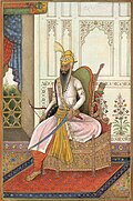
[[File:Maharaj Ranjit Singh.jpg|thumb|upright=0.8|Illustration of [[Ranjit Singh]], founder of the [[Sikh Empire]]]] | [[File:Maharaj Ranjit Singh.jpg|thumb|upright=0.8|Illustration of [[Ranjit Singh]], founder of the [[Sikh Empire]]]] | ||
In the 19th century, Maharajah [[Ranjit Singh]] established the [[Sikh Empire]] based in the Punjab. | In the 19th century, Maharajah [[Ranjit Singh]] established the [[Sikh Empire]] based in the Punjab.<ref>{{cite web |date=3 September 2015 |title=Ranjit Singh: A Secular Sikh Sovereign by K.S. Duggal. (''Date:1989. ISBN 8170172446'') |url=http://www.exoticindiaart.com/book/details/IDE822/ |access-date=2009-08-09 |publisher=Exoticindiaart.com |archive-date=17 June 2008 |archive-url=https://web.archive.org/web/20080617232755/http://www.exoticindiaart.com/book/details/IDE822/ |url-status=live }}</ref> The empire existed from 1799, when Ranjit Singh captured [[Lahore]], to 1849, when it was defeated and conquered in the [[Second Anglo-Sikh War]]. It was forged on the foundations of the [[Khalsa]] from a collection of autonomous [[Sikhism|Sikh]] ''[[misl]]s''.<ref name="Encyclopædia Britannica Eleventh Edition 1911 Page 892">{{cite EB1911 |wstitle=Ranjit Singh |volume=22 |page=892}}</ref><ref name="Grewal">{{cite book |last=Grewal |first=J. S. |url=https://books.google.com/books?id=2_nryFANsoYC |title=The Sikhs of the Punjab, Chapter 6: The Sikh empire (1799–1849) |publisher=Cambridge University Press |year=1990 |isbn=0-521-63764-3 |series=The New Cambridge History of India |access-date=29 October 2019 |archive-date=27 September 2023 |archive-url=https://web.archive.org/web/20230927082839/https://books.google.com/books?id=2_nryFANsoYC |url-status=live }}</ref> At its peak in the 19th century, the Empire extended from the [[Khyber Pass]] in the west to western [[Tibet]] in the east, and from [[Mithankot]] in the south to [[Kashmir]] in the north. It was divided into four provinces: [[Lahore]], in Punjab, which became the Sikh capital; [[Multan]], also in Punjab; [[Peshawar]]; and Kashmir from 1799 to 1849. Religiously diverse, with an estimated population of 3.5&nbsp;million in 1831 (making it the [[List of countries by population in 1800|19th most populous country at the time]]),<ref name="ReferenceA">[[Amarinder Singh]]'s The Last Sunset: The Rise and Fall of the Lahore Durbar</ref> it was the last major region of the Indian subcontinent to [[Colonial India|be annexed]] by the [[British Empire]]. | ||
==== British Punjab (c. 1849–1947 CE)==== | ==== British Punjab (c. 1849–1947 CE)==== | ||
{{see also|Punjab Province (British India)}} | {{see also|Punjab Province (British India)}} | ||
The Sikh Empire ruled the Punjab until the British annexed it in 1849 following the [[First Anglo-Sikh War|First]] and [[Second Anglo-Sikh War]]s. | The Sikh Empire ruled the Punjab until the British annexed it in 1849 following the [[First Anglo-Sikh War|First]] and [[Second Anglo-Sikh War]]s.<ref>{{cite book |last1=Grewal |first1=J. S. |series=The New Cambridge History of India |title=The Sikhs of the Punjab |date=1998 |publisher=Cambridge University Press |location=Cambridge |isbn=0-521-63764-3 |pages=126–128 |edition=Revised |chapter=The Sikh empire (1799–1849) - Chapter 6}}</ref> Most of the Punjabi homeland formed a province of British India, though a number of small [[princely state]]s retained local rulers who recognized British authority.<ref name=":9" /> The Punjab with its rich farmlands became one of the most important colonial assets.<ref name=":9" /> Lahore was a noted center of learning and culture, and [[Rawalpindi]] became an important military installation.<ref name=":9" /> Most Punjabis supported the British during [[World War I]], providing men and resources to the war effort even though the Punjab remained a source of anti colonial activities.<ref name="hibb 1980" />{{rp|163}} Disturbances in the region increased as the war continued.<ref name=":9" /> At the end of the war, high casualty rates, heavy taxation, inflation, and a widespread influenza epidemic disrupted Punjabi society.<ref name=":9" /> In 1919, Colonel [[Reginald Dyer]] ordered troops under command to fire on a crowd of demonstrators, mostly Sikhs in [[Amritsar]]. The [[Jallianwala Bagh massacre|Jallianwala massacre]] fueled the [[Indian independence movement]].<ref name=":9" /> Nationalists declared the independence of India from Lahore in 1930 but were quickly suppressed.<ref name=":9" /> When the Second World War broke out, nationalism in British India had already divided into religious movements.<ref name=":9" /> Many Sikhs and other minorities supported the Hindus, who promised a secular multicultural and multireligious society, and Muslim leaders in Lahore passed a resolution to work for a Muslim Pakistan, making the Punjab region a center of growing conflict between Indian and Pakistani nationalists.<ref name=":9" /> At the end of the war, the British granted separate independence to India and Pakistan, setting off massive communal violence as Muslims fled to Pakistan and Hindu and Sikh Punjabis fled east to India.<ref name=":9" /> | ||
The [[British Raj]] had major political, cultural, philosophical, and literary consequences in the Punjab, including the establishment of a new system of education. During the [[Indian independence movement|independence movement]], many Punjabis played a significant role, including [[Madan Lal Dhingra]], [[Sukhdev Thapar]], [[Sardar Ajit Singh|Ajit Singh Sandhu]], [[Bhagat Singh]], [[Udham Singh]], [[Kartar Singh Sarabha]], [[Bhai Parmanand]], [[Choudhry Rahmat Ali]], and [[Lala Lajpat Rai]]. At the time of partition in 1947, the province was split into East and West Punjab. [[East Punjab]] (48%) became part of India, while [[West Punjab]] (52%) became part of Pakistan. | The [[British Raj]] had major political, cultural, philosophical, and literary consequences in the Punjab, including the establishment of a new system of education. During the [[Indian independence movement|independence movement]], many Punjabis played a significant role, including [[Madan Lal Dhingra]], [[Sukhdev Thapar]], [[Sardar Ajit Singh|Ajit Singh Sandhu]], [[Bhagat Singh]], [[Udham Singh]], [[Kartar Singh Sarabha]], [[Bhai Parmanand]], [[Choudhry Rahmat Ali]], and [[Lala Lajpat Rai]]. At the time of partition in 1947, the province was split into East and West Punjab. [[East Punjab]] (48%) became part of India, while [[West Punjab]] (52%) became part of Pakistan.<ref>{{cite web |url=http://www.pakgeotagging.blogspot.co.uk/2014/10/partition-of-punjab-in-1947.html |title=Pakistan Geotagging: Partition of Punjab in 1947 |access-date=11 February 2016 |url-status=live |archive-url=https://web.archive.org/web/20160208221714/http://pakgeotagging.blogspot.co.uk/2014/10/partition-of-punjab-in-1947.html |archive-date=8 February 2016|date=3 October 2014 }}. Daily Times (10 May 2012). Retrieved 12 July 2013.</ref> The Punjab bore the brunt of the [[Civil disorder|civil unrest]] following [[Partition of India|partition]], with casualties estimated to be in the millions.<ref>{{cite journal|last1=Talbot|first1=Ian|title=Partition of India: The Human Dimension|journal=Cultural and Social History|year=2009|volume=6|issue=4|pages=403–410|quote=The number of casualties remains a matter of dispute, with figures being claimed that range from 200,000 to 2 million victims.|doi=10.2752/147800409X466254|s2cid=147110854 | issn=1478-0038 }}</ref><ref name="dcosta2011">{{Cite book|title=Nationbuilding, Gender and War Crimes in South Asia|last=D'Costa|first=Bina|publisher=Routledge|year=2011|isbn=978-0415565660|page=53}}</ref><ref name="Silence2000">{{Cite book|url=https://www.nytimes.com/books/first/b/butalia-silence.html|title=The Other Side of Silence: Voices From the Partition of India|last=Butalia|first=Urvashi|publisher=Duke University Press|year=2000|access-date=1 September 2021|archive-date=25 March 2016|archive-url=https://web.archive.org/web/20160325043612/https://www.nytimes.com/books/first/b/butalia-silence.html|url-status=live}}</ref><ref>{{Cite book|title=Muslims in India Since 1947: Islamic Perspectives on Inter-Faith Relations|last=Sikand|first=Yoginder|publisher=Routledge|year=2004|isbn=978-1134378258|page=5}}</ref> | ||
The struggle for Indian independence witnessed competing and conflicting interests in the Punjab. The landed elites of the Muslim, Hindu and Sikh communities had loyally collaborated with the British since annexation, supported the Unionist Party and were hostile to the Congress party–led independence movement. | The struggle for Indian independence witnessed competing and conflicting interests in the Punjab. The landed elites of the Muslim, Hindu and Sikh communities had loyally collaborated with the British since annexation, supported the Unionist Party and were hostile to the Congress party–led independence movement.<ref name="autogenerated542">Pritam Singh, Federalism, Nationalism and Development: India and the Punjab Economy, Routledge, 19 February 2008, p.54</ref> Amongst the peasantry and urban middle classes, the Hindus were the most active [[Indian National Congress|National Congress]] supporters, the Sikhs flocked to the [[Akali movement]] whilst the Muslims eventually supported the [[All-India Muslim League|Muslim League]].<ref name="autogenerated542" /> Since the partition of the sub-continent had been decided, special meetings of the Western and Eastern Section of the Legislative Assembly were held on 23 June 1947 to decide whether or not the Province of the Punjab be partitioned. After voting on both sides, partition was decided and the existing Punjab Legislative Assembly was also divided into [[West Punjab]] Legislative Assembly and the East Punjab Legislative Assembly. This last Assembly before independence, held its last sitting on 4 July 1947.<ref>{{Cite web |url=http://www.pap.gov.pk/uploads/previous_members/S-1946-1947.htm |title=Provincial Assembly of the Punjab |access-date=5 August 2022 |archive-date=7 February 2017 |archive-url=https://web.archive.org/web/20170207162416/http://www.pap.gov.pk/uploads/previous_members/S-1946-1947.htm |url-status=live }}</ref> | ||
Another major consequence of partition was the sudden shift towards religious homogeneity occurred in all districts across Punjab owing to the new international border that cut through the province. This rapid demographic shift was primarily due to wide scale migration but also caused by large-scale [[Religious persecution#Religious cleansing|religious cleansing]] riots which were witnessed across the region at the time. According to historical demographer [[Tim Dyson]], in the eastern regions of Punjab that ultimately became [[Punjab, India|Indian Punjab]] following independence, districts that were 66% Hindu in 1941 became 80% Hindu in 1951; those that were 20% Sikh became 50% Sikh in 1951. Conversely, in the western regions of Punjab that ultimately became [[Punjab, Pakistan|Pakistani Punjab]], all districts became almost exclusively Muslim by 1951.{{sfn|Dyson|2018|pp=188–189}} | Another major consequence of partition was the sudden shift towards religious homogeneity occurred in all districts across Punjab owing to the new international border that cut through the province. This rapid demographic shift was primarily due to wide scale migration but also caused by large-scale [[Religious persecution#Religious cleansing|religious cleansing]] riots which were witnessed across the region at the time. According to historical demographer [[Tim Dyson]], in the eastern regions of Punjab that ultimately became [[Punjab, India|Indian Punjab]] following independence, districts that were 66% Hindu in 1941 became 80% Hindu in 1951; those that were 20% Sikh became 50% Sikh in 1951. Conversely, in the western regions of Punjab that ultimately became [[Punjab, Pakistan|Pakistani Punjab]], all districts became almost exclusively Muslim by 1951.{{sfn|Dyson|2018|pp=188–189}} | ||
== Geography == | == Geography == | ||
The geographical definition of the term "Punjab" has changed over time. In the 16th century [[Mughal Empire]] it referred to a relatively smaller area between the [[Indus River|Indus]] and the [[Sutlej River|Sutlej]] rivers. | The geographical definition of the term "Punjab" has changed over time. In the 16th century [[Mughal Empire]] it referred to a relatively smaller area between the [[Indus River|Indus]] and the [[Sutlej River|Sutlej]] rivers.<ref name="JS_Grewal_1998">{{cite book |author=J. S. Grewal |url=https://books.google.com/books?id=2_nryFANsoYC |title=The Sikhs of the Punjab |publisher=Cambridge University Press |year=1998 |isbn=978-0-521-63764-0 |edition=Revised |series=The New Cambridge History of India |page=1 |access-date=29 October 2019 |archive-date=27 September 2023 |archive-url=https://web.archive.org/web/20230927082839/https://books.google.com/books?id=2_nryFANsoYC |url-status=live }}</ref><ref name="Pearson2009">{{Cite book |url=https://books.google.com/books?id=9x5FX2RROZgC&pg=PA202 |title=Different Types of History |date=2009 |publisher=Pearson Education India |isbn=978-81-317-1818-6 |language=en |page=202}}</ref> | ||
=== Sikh Empire === | === Sikh Empire === | ||
[[File:Map of India 1823.jpg|thumb|upright=1.1|Sikh Empire (green) in northwest India in 1823]] | [[File:Map of India 1823.jpg|thumb|upright=1.1|Sikh Empire (green) in northwest India in 1823]] | ||
At its height in the first half of the 19th century, the Sikh Empire spanned a total of over {{cvt|200,000|sqmi}}. | At its height in the first half of the 19th century, the Sikh Empire spanned a total of over {{cvt|200,000|sqmi}}.<ref>{{cite book |last=Manning |first=Stephen |url=https://books.google.com/books?id=sNveDwAAQBAJ&pg=PA9 |title=Bayonet to Barrage Weaponry on the Victorian Battlefield |date=30 September 2020 |publisher=Pen & Sword Books Limited |page=9 |isbn=9781526777249 |quote="The Sikh kingdom expanded from Tibet in the east to Kashmir in the west and from Sind in the south to the Khyber Pass in the north, an area of 200,000 square miles" |access-date=19 March 2023 |archive-date=26 March 2023 |archive-url=https://web.archive.org/web/20230326164802/https://books.google.com/books?id=sNveDwAAQBAJ&pg=PA9 |url-status=live }}</ref><ref>{{cite book |last=Barczewski |first=Stephanie |url=https://books.google.com/books?id=ixd8CwAAQBAJ&pg=PA89 |title=Heroic Failure and the British |date=22 March 2016 |publisher=Yale University Press |isbn=9780300186819 |page=89 |quote="..the Sikh state encompassed over 200,000 square miles (518,000 sq km)" |access-date=19 March 2023 |archive-date=26 March 2023 |archive-url=https://web.archive.org/web/20230326164802/https://books.google.com/books?id=ixd8CwAAQBAJ&pg=PA89 |url-status=live }}</ref><ref>{{cite book |last=Khilani |first=N. M. |url=https://books.google.com/books?id=fGEDAAAAMAAJ&q=punjab+of+over+200,000+square+miles+khilnani |title=British power in the Punjab, 1839–1858 |date=1972 |publisher=Asia Publishing House |isbn=9780210271872 |page=251 |quote="..into existence a kingdom of the Punjab of over 200,000 square miles" |access-date=19 March 2023 |archive-date=5 April 2023 |archive-url=https://web.archive.org/web/20230405041653/https://books.google.com/books?id=fGEDAAAAMAAJ&q=punjab+of+over+200,000+square+miles+khilnani |url-status=live }}</ref> | ||
The Punjab was a region straddling India and the Afghan [[Durrani Empire]]. The following modern-day political divisions made up the historical Punjab region during the Sikh Empire: | The Punjab was a region straddling India and the Afghan [[Durrani Empire]]. The following modern-day political divisions made up the historical Punjab region during the Sikh Empire: | ||
| Line 226: | Line 226: | ||
** [[Himachal Pradesh]], India, south to areas just across the [[Sutlej]] river | ** [[Himachal Pradesh]], India, south to areas just across the [[Sutlej]] river | ||
** [[Jammu Division]], [[Jammu and Kashmir (union territory)|Jammu and Kashmir]], India and Pakistan (1808–1846) | ** [[Jammu Division]], [[Jammu and Kashmir (union territory)|Jammu and Kashmir]], India and Pakistan (1808–1846) | ||
* [[Kashmir]] region, Pakistan/China | * [[Kashmir]] region, Pakistan/China<ref>{{cite book|title=The Masters Revealed: Madam Blavatsky and the Myth of the Great White Lodge |last=Johnson |first=K. Paul |author-link=K. Paul Johnson |year=1994 |publisher=State University of New York Press |isbn=978-0-7914-2063-8 |edition=1st |page=128}}</ref><ref>{{cite book|title=Britain and Tibet 1765–1947 |last=Marshall |first=Julie G. |year=2012 |publisher=Routledge |isbn=978-0-415-59997-9 |edition=1st |page=116}}</ref> | ||
** [[Kashmir Valley]], India (1819–1846) | ** [[Kashmir Valley]], India (1819–1846) | ||
** [[Gilgit]], [[Gilgit–Baltistan]], Pakistan (1842–1846){{citation needed|date=August 2020}} | ** [[Gilgit]], [[Gilgit–Baltistan]], Pakistan (1842–1846){{citation needed|date=August 2020}} | ||
** [[Ladakh]], India (1834–1846) | ** [[Ladakh]], India (1834–1846)<ref>{{cite book |author1=Pandey, Dr. Hemant Kumar |url=https://books.google.com/books?id=nn5IDwAAQBAJ&q=ladakh+1834+sikh&pg=PA57 |title=India's Major Military and Rescue Operations |author2=Singh, Manish Raj |publisher=Horizon Books |year=2017 |isbn=9789386369390 |page=57}}</ref><ref>{{cite web |last1=Deng |first1=Jonathan M. |date=2010 |title=Frontier: The Making of the Northern and Eastern Border in Ladakh From 1834 to the Present |url=https://digitalcollections.sit.edu/cgi/viewcontent.cgi?referer=https://www.google.com/&httpsredir=1&article=1923&context=isp_collection |publisher=SIT Digital Collections Independent Study Project (ISP) Collection. 920. |access-date=5 August 2022 |archive-date=18 December 2022 |archive-url=https://web.archive.org/web/20221218164514/https://digitalcollections.sit.edu/cgi/viewcontent.cgi?referer=https://www.google.com/&httpsredir=1&article=1923&context=isp_collection |url-status=live }}</ref> | ||
* [[Khyber Pass]], Pakistan/Afghanistan | * [[Khyber Pass]], Pakistan/Afghanistan<ref>The Khyber Pass: A History of Empire and Invasion, (Docherty, p. 187)</ref> | ||
** [[Peshawar]], Pakistan | ** [[Peshawar]], Pakistan<ref>The Khyber Pass: A History of Empire and Invasion, (Docherty, pp. 185–187)</ref> (taken in 1818, retaken in 1834) | ||
** [[Khyber Pakhtunkhwa]] and the [[Federally Administered Tribal Areas]], Pakistan (documented from [[Hazara region|Hazara]], taken in 1818, again in 1836 to [[Bannu]]) | ** [[Khyber Pakhtunkhwa]] and the [[Federally Administered Tribal Areas]], Pakistan (documented from [[Hazara region|Hazara]], taken in 1818, again in 1836 to [[Bannu]])<ref>{{cite book|title=Pakistan & the Karakoram Highway|author=Sarina Singh|display-authors=etal|publisher=Lonely Planet|year=2008|edition=7th|isbn=978-1-74104542-0|page=199}}</ref> | ||
* Parts of [[Tibet|Western Tibet]], | * Parts of [[Tibet|Western Tibet]],<ref>{{cite book|title=The Real Ranjit Singh|author=Fakir Syed Waheeduddin|year=1981|publisher=[[Punjabi University]]|oclc=221246072|page=vii}}</ref> China ([[Sino-Sikh war|briefly]] in 1841, to [[Burang Town|Taklakot]])<ref>{{cite book |author1=Kartar Singh Duggal |url=https://books.google.com/books?id=4udb8LsF3-oC&q=tibet |title=Maharaja Ranjit Singh, the Last to Lay Arms |publisher=Abhinav Publications |year=2001 |isbn=9788170174103 |page=131}}</ref> | ||
After Ranjit Singh's death in 1839, the empire was severely weakened by internal divisions and political mismanagement. This opportunity was used by the [[East India Company]] to launch the [[First Anglo-Sikh War|First]] and [[Second Anglo-Sikh War]]s. The country was finally annexed and dissolved at the end of the Second Anglo-Sikh War in 1849 into separate [[princely states]] and the [[Punjab (British India)|province of Punjab]]. Eventually, a Lieutenant Governorship was formed in Lahore as a direct representative of [[the Crown]]. | After Ranjit Singh's death in 1839, the empire was severely weakened by internal divisions and political mismanagement. This opportunity was used by the [[East India Company]] to launch the [[First Anglo-Sikh War|First]] and [[Second Anglo-Sikh War]]s. The country was finally annexed and dissolved at the end of the Second Anglo-Sikh War in 1849 into separate [[princely states]] and the [[Punjab (British India)|province of Punjab]]. Eventually, a Lieutenant Governorship was formed in Lahore as a direct representative of [[the Crown]].<ref name="hibb 1980">{{cite book |last1=Hibbert |first1=Christopher |title=The great mutiny: India 1857 |date=1980 |publisher=Penguin Books |isbn=978-0-14-004752-3 |location=Harmondsworth}}</ref>{{rp|221}} | ||
=== Punjab (British India) === | === Punjab (British India) === | ||
{{See also|Punjab Province (British India)}} | {{See also|Punjab Province (British India)}} | ||
In British India, until the [[Partition of India]] in 1947, the [[Punjab Province (British India)|Punjab Province]] was geographically a triangular tract of country of which the [[Indus River]] and its tributary the [[Sutlej]] formed the two sides up to their confluence, the base of the triangle in the north being the [[Lower Himalayan Range]] between those two rivers. Moreover, the province as constituted under British rule also included a large tract outside these boundaries. Along the northern border, Himalayan ranges divided it from [[Kashmir]] and [[Tibet]]. On the west it was separated from the [[North-West Frontier Province (1901–1955)|North-West Frontier Province]] by the Indus, until it reached the border of [[Dera Ghazi Khan District]], which was divided from [[Balochistan (Pakistan)|Baluchistan]] by the [[Sulaiman Range]]. To the south lay [[Sindh]] and [[Rajputana]], while on the east the rivers [[Jumna River|Jumna]] and [[Tons River|Tons]] separated it from the [[United Provinces of Agra and Oudh|United Provinces]]. | In British India, until the [[Partition of India]] in 1947, the [[Punjab Province (British India)|Punjab Province]] was geographically a triangular tract of country of which the [[Indus River]] and its tributary the [[Sutlej]] formed the two sides up to their confluence, the base of the triangle in the north being the [[Lower Himalayan Range]] between those two rivers. Moreover, the province as constituted under British rule also included a large tract outside these boundaries. Along the northern border, Himalayan ranges divided it from [[Kashmir]] and [[Tibet]]. On the west it was separated from the [[North-West Frontier Province (1901–1955)|North-West Frontier Province]] by the Indus, until it reached the border of [[Dera Ghazi Khan District]], which was divided from [[Balochistan (Pakistan)|Baluchistan]] by the [[Sulaiman Range]]. To the south lay [[Sindh]] and [[Rajputana]], while on the east the rivers [[Jumna River|Jumna]] and [[Tons River|Tons]] separated it from the [[United Provinces of Agra and Oudh|United Provinces]].<ref name="Chisholm 1911, p. 653">{{cite EB1911|Volume 22|wstitle=Punjab|page=653}}</ref> In total Punjab had an area of approximately 357 000&nbsp;km square about the same size as modern day Germany, being one of the largest provinces of the British Raj. | ||
[[File:Punjab 1909.jpg|thumb|upright=1.2|Map of the Punjab Province (British India)]] | [[File:Punjab 1909.jpg|thumb|upright=1.2|Map of the Punjab Province (British India)]] | ||
It encompassed the present day [[States and union territories of India|Indian states]] of [[Punjab, India|Punjab]], Haryana, [[Chandigarh]], Delhi, and some parts of [[Himachal Pradesh]] which were merged with Punjab by the British for administrative purposes (but excluding the former [[princely state]]s which were later combined into the [[Patiala and East Punjab States Union]]) and the Pakistani regions of the [[Punjab, Pakistan|Punjab]], [[Islamabad Capital Territory]] and [[Khyber Pakhtunkhwa]]. | It encompassed the present day [[States and union territories of India|Indian states]] of [[Punjab, India|Punjab]], Haryana, [[Chandigarh]], Delhi, and some parts of [[Himachal Pradesh]] which were merged with Punjab by the British for administrative purposes (but excluding the former [[princely state]]s which were later combined into the [[Patiala and East Punjab States Union]]) and the Pakistani regions of the [[Punjab, Pakistan|Punjab]], [[Islamabad Capital Territory]] and [[Khyber Pakhtunkhwa]]. | ||
In 1901 the frontier districts beyond the Indus were separated from Punjab and made into a new province: the [[North-West Frontier Province (1901–1955)|North-West Frontier Province]]. Subsequently, Punjab was divided into four natural geographical divisions by colonial officials on the decadal census data: | In 1901 the frontier districts beyond the Indus were separated from Punjab and made into a new province: the [[North-West Frontier Province (1901–1955)|North-West Frontier Province]]. Subsequently, Punjab was divided into four natural geographical divisions by colonial officials on the decadal census data:<ref name="punjab1911">{{cite web |title=Census of India 1911. Vol. 14, Punjab. Pt. 1, Report. |url=https://www.jstor.org/site/SAOA/SouthAsiaOpenArchivesSAOA/CensusReports-1911-26575903/ |access-date=21 July 2022 |archive-date=7 October 2022 |archive-url=https://web.archive.org/web/20221007223437/https://www.jstor.org/site/SAOA/SouthAsiaOpenArchivesSAOA/CensusReports-1911-26575903/ |url-status=live }}</ref>{{rp|2}}<ref name="punjab1941">{{cite web|url=https://www.jstor.org/site/south-asia-open-archives/saoa/censusofindia1941-28216851/|title=CENSUS OF INDIA, 1941 VOLUME VI PUNJAB|access-date=19 August 2022|archive-date=11 October 2022|archive-url=https://web.archive.org/web/20221011130147/https://www.jstor.org/site/south-asia-open-archives/saoa/censusofindia1941-28216851/|url-status=live}}</ref>{{rp|4}} | ||
# '''''Indo-Gangetic Plain West geographical division''''' (including [[Hisar district]], [[Loharu State]], [[Rohtak district]], [[Dujana|Dujana State]], [[Gurgaon district]], [[Pataudi State]], Delhi, [[Karnal district]], [[Jalandhar district]], [[Kapurthala State]], [[Ludhiana district]], [[Malerkotla State]], [[Firozpur district]], [[Faridkot State]], [[Patiala State]], [[Jind State]], [[Nabha State]], [[Lahore District]], [[Amritsar district]], [[Gujranwala District]], and [[Sheikhupura district]]); | # '''''Indo-Gangetic Plain West geographical division''''' (including [[Hisar district]], [[Loharu State]], [[Rohtak district]], [[Dujana|Dujana State]], [[Gurgaon district]], [[Pataudi State]], Delhi, [[Karnal district]], [[Jalandhar district]], [[Kapurthala State]], [[Ludhiana district]], [[Malerkotla State]], [[Firozpur district]], [[Faridkot State]], [[Patiala State]], [[Jind State]], [[Nabha State]], [[Lahore District]], [[Amritsar district]], [[Gujranwala District]], and [[Sheikhupura district]]); | ||
| Line 256: | Line 256: | ||
== Climate == | == Climate == | ||
[[File:Himalayas, Punjab region.png|thumb|The snow-covered Himalayas]]The climate has significant impact on the economy of Punjab, particularly for agriculture in the region. Climate is not uniform over the whole region, as the areas adjacent to the Himalayas generally receive heavier rainfall than those at a distance. | [[File:Himalayas, Punjab region.png|thumb|The snow-covered Himalayas]]The climate has significant impact on the economy of Punjab, particularly for agriculture in the region. Climate is not uniform over the whole region, as the areas adjacent to the Himalayas generally receive heavier rainfall than those at a distance.<ref>{{cite web|website=MapsofIndia.com |url=https://www.mapsofindia.com/punjab/geography-and-history/climate.html |title=Climate of Punjab |date=7 March 2013 |archive-url=https://web.archive.org/web/20121030101212/http://www.mapsofindia.com/punjab/geography-and-history/climate.html |archive-date=30 October 2012 |url-status=live}}</ref> The [[Köppen climate classification]] generally classifies Punjab as having either a [[Humid subtropical climate|monsoon-influenced humid subtropical climate]] ([[Köppen climate classification|Köppen]]: Cwa) or a [[hot semi-arid climate]] ([[Köppen climate classification|Köppen]]: BSh). | ||
There are three main seasons and two transitional periods. During summer, from mid-April to the end of June, the temperature may reach {{convert|48|C}}. The [[monsoon season]], from July to September, is a period of heavy rainfall, providing water for crops in addition to the supply from canals and [[irrigation]] systems. The transitional period after the monsoon season is cool and mild, leading to the winter season, when the temperature in January falls to {{convert|5|C}} at night and {{convert|12|C}} by day. During the transitional period from winter to summer, sudden [[hailstorm]]s and heavy showers may occur, causing damage to crops. | There are three main seasons and two transitional periods. During summer, from mid-April to the end of June, the temperature may reach {{convert|48|C}}. The [[monsoon season]], from July to September, is a period of heavy rainfall, providing water for crops in addition to the supply from canals and [[irrigation]] systems. The transitional period after the monsoon season is cool and mild, leading to the winter season, when the temperature in January falls to {{convert|5|C}} at night and {{convert|12|C}} by day. During the transitional period from winter to summer, sudden [[hailstorm]]s and heavy showers may occur, causing damage to crops.<ref name=rgs>{{cite web|work=Royal Geographical Society |url=http://www.rgs.org/NR/rdonlyres/5F44251D-8FD1-4102-BCDB-240A4E9EA1B8/0/F3ClimateandLandscapeFactsheet.pdf |title=The Climate & Landscape of the Punjab – Fact Sheet|archive-url=https://web.archive.org/web/20140430034607/http://www.rgs.org/NR/rdonlyres/5F44251D-8FD1-4102-BCDB-240A4E9EA1B8/0/F3ClimateandLandscapeFactsheet.pdf |archive-date=30 April 2014 |url-status=dead}}</ref> | ||
=== Western Punjab === | === Western Punjab === | ||
| Line 377: | Line 377: | ||
| Dec humidity = 69 | | Dec humidity = 69 | ||
| year humidity = 58 | | year humidity = 58 | ||
|source 1 = [[India Meteorological Department]] | |source 1 = [[India Meteorological Department]]<ref name=IMDnormals> | ||
{{cite web | {{cite web | ||
| archive-url = https://web.archive.org/web/20200205040301/http://imdpune.gov.in/library/public/1981-2010%20CLIM%20NORMALS%20%28STATWISE%29.pdf | | archive-url = https://web.archive.org/web/20200205040301/http://imdpune.gov.in/library/public/1981-2010%20CLIM%20NORMALS%20%28STATWISE%29.pdf | ||
| Line 387: | Line 387: | ||
| date = January 2015 | | date = January 2015 | ||
| pages = 597–598 | | pages = 597–598 | ||
| access-date = 20 January 2021}} | | access-date = 20 January 2021}}</ref><ref name=IMDextremes> | ||
{{cite web | {{cite web | ||
| archive-url = https://web.archive.org/web/20200205042509/http://imdpune.gov.in/library/public/EXTREMES%20OF%20TEMPERATURE%20and%20RAINFALL%20upto%202012.pdf | | archive-url = https://web.archive.org/web/20200205042509/http://imdpune.gov.in/library/public/EXTREMES%20OF%20TEMPERATURE%20and%20RAINFALL%20upto%202012.pdf | ||
| Line 396: | Line 396: | ||
| date = December 2016 | | date = December 2016 | ||
| page = M172 | | page = M172 | ||
| access-date = 20 January 2021}} | | access-date = 20 January 2021}}</ref> | ||
|source 2 = Tokyo Climate Center (mean temperatures 1991–2020) | |source 2 = Tokyo Climate Center (mean temperatures 1991–2020)<ref name=TCC1> | ||
{{cite web | {{cite web | ||
| url = https://ds.data.jma.go.jp/gmd/tcc/tcc/products/climate/normal/parts/NrmMonth_e.php?stn=42101 | | url = https://ds.data.jma.go.jp/gmd/tcc/tcc/products/climate/normal/parts/NrmMonth_e.php?stn=42101 | ||
| title = Normals Data: Patiala – India Latitude: 30.33°N Longitude: 76.47°E Height: 251 (m) | | title = Normals Data: Patiala – India Latitude: 30.33°N Longitude: 76.47°E Height: 251 (m) | ||
| publisher = Japan Meteorological Agency | | publisher = Japan Meteorological Agency | ||
| access-date = 1 December 2022}} | | access-date = 1 December 2022}}</ref> | ||
}} | }} | ||
| Line 411: | Line 411: | ||
{{See also|Punjab_Province_(British_India)#1931_census|Punjabi dialects and languages|Punjab, Pakistan#language}} | {{See also|Punjab_Province_(British_India)#1931_census|Punjabi dialects and languages|Punjab, Pakistan#language}} | ||
[[File:Mother Tongue by Pakistani District - 2017 Census.svg|thumb|right|upright=1.6| | [[File:Mother Tongue by Pakistani District - 2017 Census.svg|thumb|right|upright=1.6| | ||
<div style="text-align: center">The dominant [[mother tongue]] in each [[District of Pakistan]], according to the [[2017 Pakistan Census]]</div>]] | |||
The major language is [[Punjabi language|Punjabi]], which is written in India with the [[Gurmukhi]] script, and in Pakistan using the [[Shahmukhi]] script. | The major language is [[Punjabi language|Punjabi]], which is written in India with the [[Gurmukhi]] script, and in Pakistan using the [[Shahmukhi]] script.<ref>{{Cite web|url=https://www.omniglot.com/writing/punjabi.htm|title=Punjabi language, alphabets and pronunciation|access-date=13 April 2020|archive-date=1 November 2018|archive-url=https://web.archive.org/web/20181101213732/http://www.omniglot.com/writing/punjabi.htm|url-status=live}}</ref> The [[Punjabi language|Punjabi]] language has official status and is widely used in education and administration in Indian Punjab, whereas in Pakistani Punjab these roles are instead fulfilled by the [[Urdu]] language and [[Punjabi language|Punjabi]] is seen as a vernacular language | ||
Several languages closely related to Punjabi are spoken in the various parts of the region. [[Dogri language|Dogri]], | Several languages closely related to Punjabi are spoken in the various parts of the region. [[Dogri language|Dogri]],<ref>{{Cite web |title=Dogri |url=http://lisindia.ciil.org/Dogri/Dogri.html |access-date=2022-08-17 |website=lisindia.ciil.org |archive-date=26 March 2023 |archive-url=https://web.archive.org/web/20230326023902/http://lisindia.ciil.org/Dogri/Dogri.html |url-status=live }}</ref> [[Kangri language|Kangri]],<ref>{{Cite web |title=Language {{!}} District Kangra, Government of Himachal Pradesh {{!}} India |url=https://hpkangra.nic.in/language/ |access-date=2022-08-17 |language=en-US |archive-date=16 August 2022 |archive-url=https://web.archive.org/web/20220816202002/https://hpkangra.nic.in/language/ |url-status=live }}</ref> and other [[western Pahari]] dialects are spoken in the north-central and northeastern parts of the region, while [[Bagri language|Bagri]]<ref>{{Cite web |date=28 January 2013 |title=Bagri of Rajasthan, Punjab, and Haryana: A Sociolinguistic Survey |url=https://www.sil.org/resources/archives/43105 |access-date=2022-08-17 |website=SIL International |language=en |archive-date=6 June 2023 |archive-url=https://web.archive.org/web/20230606040411/https://www.sil.org/resources/archives/43105 |url-status=live }}</ref> is spoken in south-central and southeastern sections. Meanwhile, [[Saraiki language|Saraiki]] is generally spoken across a wide belt covering the southwest, while in the northwest there are large pockets containing speakers of [[Hindko]] and [[Pahari-Pothwari]].{{sfn|Shackle|1979|p=198}} | ||
{| class="wikitable sortable" | {| class="wikitable sortable" | ||
| Line 421: | Line 421: | ||
! colspan="1" |Percentage | ! colspan="1" |Percentage | ||
|- | |- | ||
!1911 | !1911<ref name="punjab1911" />{{rp|370}} | ||
|- | |- | ||
! [[Punjabi dialects and languages|Punjabi]]{{efn|[[Standard Punjabi]]: 58.34% | ! [[Punjabi dialects and languages|Punjabi]]{{efn|[[Standard Punjabi]]: 58.34%<br />[[Lahnda]]:{{efn|name=lahnda|Western Punjabi languages and dialects including [[Saraiki language|Saraiki]], [[Hindko]] and [[Pahari-Pothwari]], and other related languages or dialects}} 17.59%}} | ||
| 75.93% | | 75.93% | ||
|- | |- | ||
| Line 453: | Line 453: | ||
==== Background ==== | ==== Background ==== | ||
[[File:1500-1200 BCE Rigveda, manuscript page sample i, Mandala 1, Hymn 1 (Sukta 1), Adhyaya 1, lines 1.1.1 to 1.1.9, Sanskrit, Devanagari.jpg|thumb|[[Rig Veda]], the oldest known Hindu text, originated in the Punjab region.]] | [[File:1500-1200 BCE Rigveda, manuscript page sample i, Mandala 1, Hymn 1 (Sukta 1), Adhyaya 1, lines 1.1.1 to 1.1.9, Sanskrit, Devanagari.jpg|thumb|[[Rig Veda]], the oldest known Hindu text, originated in the Punjab region.]] | ||
The Punjab is predominantly [[Muslim]] though Hinduism is the oldest of the religions practised by Punjabi people, however, the term ''Hindu'' was also applied over a vast territory with much regional diversity. | The Punjab is predominantly [[Muslim]] though Hinduism is the oldest of the religions practised by Punjabi people, however, the term ''Hindu'' was also applied over a vast territory with much regional diversity.<ref name="Nayar12">{{Cite book |last=Nayar |first=Kamala Elizabeth |url=https://books.google.com/books?id=q7pO-IZY218C&pg=PA7 |title=The Punjabis in British Columbia: Location, Labour, First Nations, and Multiculturalism |date=2012 |page=7 |publisher=McGill-Queen's Press - MQUP |isbn=978-0-7735-4070-5 |language=en}}</ref> The [[historical Vedic religion]] constituted the religious ideas and practices in the Punjab during the [[Vedic period]] ({{BCE|1500–500}}), centered primarily in the worship of [[Indra]].<ref>{{Cite book |last=Wheeler |first=James Talboys |url=https://books.google.com/books?id=xSFGIqjWG14C&q=punjab |title=The History of India from the Earliest Ages: Hindu Buddhist Brahmanical revival |date=1874 |publisher=N. Trübner |page=330 |language=en |quote=The Punjab, to say the least, was less Brahmanical. It was an ancient centre of the worship of Indra, who was always regarded as an enemy by the Bráhmans; and it was also a stronghold of Buddhism. |access-date=9 September 2022 |archive-date=3 October 2022 |archive-url=https://web.archive.org/web/20221003135341/https://books.google.com/books?id=xSFGIqjWG14C&q=punjab |url-status=live }}</ref><ref>{{Cite book |last=Hunter |first=W. W. |url=https://books.google.com/books?id=Vdv7AQAAQBAJ&pg=PA80 |title=The Indian Empire: Its People, History and Products |date=2013-11-05 |publisher=Routledge |isbn=978-1-136-38301-4 |page=80 |language=en |quote=In the settlements of the Punjab, Indra thus advanced to the first place among the Vedic divinities. |access-date=9 September 2022 |archive-date=28 November 2022 |archive-url=https://web.archive.org/web/20221128002436/https://books.google.com/books?id=Vdv7AQAAQBAJ&pg=PA80 |url-status=live }}</ref><ref>{{Cite book |last=Virdee |first=Pippa |url=https://books.google.com/books?id=WYJIDwAAQBAJ&pg=PA24 |title=From the Ashes of 1947 |date=February 2018 |publisher=Cambridge University Press |isbn=978-1-108-42811-8 |page=24 |language=en |quote=The Rig Veda and the Upanishads, which belonged to the Vedic religion, were a precursor of Hinduism, both of which were composed in Punjab. |access-date=30 January 2023 |archive-date=26 March 2023 |archive-url=https://web.archive.org/web/20230326164803/https://books.google.com/books?id=WYJIDwAAQBAJ&pg=PA24 |url-status=live }}</ref><ref>{{harvtxt|Michaels|2004|p=38}}: "The legacy of the Vedic religion in Hinduism is generally overestimated. The influence of the mythology is indeed great, but the religious terminology changed considerably: all the key terms of Hinduism either do not exist in Vedic or have a completely different meaning. The religion of the Veda does not know the ethicised migration of the soul with retribution for acts (''karma''), the cyclical destruction of the world, or the idea of salvation during one's lifetime (''jivanmukti; moksa; nirvana''); the idea of the world as illusion (''maya'') must have gone against the grain of ancient India, and an omnipotent creator god emerges only in the late hymns of the rgveda. Nor did the Vedic religion know a caste system, the burning of widows, the ban on remarriage, images of gods and temples, Puja worship, Yoga, pilgrimages, vegetarianism, the holiness of cows, the doctrine of stages of life (''asrama''), or knew them only at their inception. Thus, it is justified to see a turning point between the Vedic religion and Hindu religions."<br />{{cite web |first1=Stephanie |last1=Jamison |first2=Michael |last2=Witzel |year=1992 |title=Vedic Hinduism |url=http://www.people.fas.harvard.edu/~witzel/vedica.pdf |publisher=Harvard University |page=3 |access-date=5 August 2022 |archive-date=13 April 2018 |archive-url=https://web.archive.org/web/20180413055150/http://www.people.fas.harvard.edu/~witzel/vedica.pdf |url-status=live }}: "... to call this period Vedic Hinduism is a contradictio in terminis since Vedic religion is very different from what we generally call Hindu religion – at least as much as Old Hebrew religion is from medieval and modern Christian religion. However, Vedic religion is treatable as a predecessor of Hinduism."<br />See also {{harvnb|Halbfass|1991|pp=1–2}}</ref> The bulk of the [[Rigveda]] was composed in the Punjab region between circa 1500 and 1200 BCE,<ref>{{Cite book |last=Flood |first=Gavin |url=https://archive.org/details/anintroductiontohinduismgavinfloodd.oupseeotherbooks_355_z/page/37/mode/2up |title=An Introduction to Hinduism |date=13 July 1996 |publisher=Cambridge University Press |isbn=978-0-521-43878-0}}</ref> while later Vedic scriptures were composed more eastwards, between the [[Yamuna]] and [[Ganges]] rivers. An ancient Indian law book called the [[Manusmriti]], developed by Brahmin Hindu priests, shaped Punjabi religious life from 200 BCE onward.<ref name="Nayar">{{Cite book |last=Nayar |first=Kamala Elizabeth |url=https://books.google.com/books?id=q7pO-IZY218C&pg=PA7 |title=The Punjabis in British Columbia: Location, Labour, First Nations, and Multiculturalism |date=2012 |publisher=McGill-Queen's Press - MQUP |isbn=978-0-7735-4070-5 |pages=7–8 |language=en}}</ref> | ||
Later, the [[History of Buddhism in India|spread of Buddhisim]] and Jainism in the Indian subcontinent saw the growth of [[Buddhism]] and [[Jainism]] in the Punjab. | Later, the [[History of Buddhism in India|spread of Buddhisim]] and Jainism in the Indian subcontinent saw the growth of [[Buddhism]] and [[Jainism]] in the Punjab.<ref>{{Cite web |date=2019-05-03 |title=In ancient Punjab, religion was fluid, not watertight, says Romila Thapar |url=https://indianexpress.com/article/cities/in-ancient-punjab-religion-was-fluid-not-watertight-says-romila-thapar-5709145/ |access-date= |website=The Indian Express |language=en |quote=Thapar said Buddhism was very popular in Punjab during the Mauryan and post-Mauryan period. Bookended between Gandhara in Taxila on the one side where Buddhism was practised on a large scale and Mathura on another side where Buddhism, Jainism and Puranic religions were practised, this religion flourished in the state. But after the Gupta period, Buddhism began to decline. |archive-date=3 May 2019 |archive-url=https://web.archive.org/web/20190503143856/https://indianexpress.com/article/cities/in-ancient-punjab-religion-was-fluid-not-watertight-says-romila-thapar-5709145/ |url-status=live }}</ref> [[Islam]] was introduced via southern Punjab in the 8th century, becoming the majority by the 16th century, via local conversion.<ref name="oxford22">{{Cite book |last1=Rambo |first1=Lewis R. |url=https://books.google.com/books?id=U03gAgAAQBAJ&pg=PA490 |title=The Oxford Handbook of Religious Conversion |last2=Farhadian |first2=Charles E. |date=2014-03-06 |publisher=Oxford University Press |isbn=978-0-19-971354-7 |pages=489–491 |language=en |quote=First, Islam was introduced into the southern Punjab in the opening decades of the eighth century. By the sixteenth century, Muslims were the majority in the region and an elaborate network of mosques and mausoleums marked the landscape. Local converts constituted the majority of this Muslim community, and as far for the mechanisms of conversion, the sources of the period emphasize the recitation of the Islamic confession of faith (shahada), the performance of the circumsicion (indri vaddani), and the ingestion of cow-meat (bhas khana). |access-date=23 November 2021 |archive-date=27 September 2023 |archive-url=https://web.archive.org/web/20230927082337/https://books.google.com/books?id=U03gAgAAQBAJ&pg=PA490#v=onepage&q&f=false |url-status=live }}</ref><ref>{{Cite book |last=Chhabra |first=G. S. |url=https://books.google.com/books?id=vF9DAAAAYAAJ |title=Advanced History of the Punjab: Guru and post-Guru period upto Ranjit Singh |date=1968 |publisher=New Academic Publishing Company |page=37 |language=en |access-date=26 November 2021 |archive-date=27 September 2023 |archive-url=https://web.archive.org/web/20230927082337/https://books.google.com/books?id=vF9DAAAAYAAJ |url-status=live }}</ref> There was a small Jain community left in Punjab by the 16th century, while the Buddhist community had largely disappeared by the turn of the 10th century.<ref>{{Cite book |last1=Rambo |first1=Lewis R. |url=https://books.google.com/books?id=U03gAgAAQBAJ&pg=PA490 |title=The Oxford Handbook of Religious Conversion |last2=Farhadian |first2=Charles E. |date=2014-03-06 |publisher=Oxford University Press |isbn=978-0-19-971354-7 |page=490 |language=en |quote=While Punjabi Hindu society was relatively well established, there was also a small but vibrant Jain community in the Punjab. Buddhist communities, however, had largely disappeared by the turn of the tenth century. |access-date=23 November 2021 |archive-date=27 September 2023 |archive-url=https://web.archive.org/web/20230927082337/https://books.google.com/books?id=U03gAgAAQBAJ&pg=PA490#v=onepage&q&f=false |url-status=live }}</ref> The region became predominantly [[Muslim]] due to missionary [[Sufi]] saints whose [[dargah]]s dot the landscape of the Punjab region.<ref>{{Cite book |last1=Nicholls |first1=Ruth J. |url=https://books.google.com/books?id=gdz0DwAAQBAJ&q=islam+punjab+sufi |title=Insights into Sufism: Voices from the Heart |last2=Riddell |first2=Peter G. |date=2020-07-31 |publisher=Cambridge Scholars Publishing |isbn=978-1-5275-5748-2 |language=en |quote=With the Muslim conquest of Punjab there was a flow of Sufis and other preachers who came to spread Islam. Much of the advance of Islam was due to these preachers.}}</ref> | ||
The rise of [[Sikhism]] in the 1700s saw some Punjabis, both Hindu and Muslim, accepting the new Sikh faith. | The rise of [[Sikhism]] in the 1700s saw some Punjabis, both Hindu and Muslim, accepting the new Sikh faith.<ref name="Nayar" /><ref>{{Cite book |last=Singh |first=Pritam |url=https://books.google.com/books?id=lQpswqcdDLIC&pg=PA25 |title=Federalism, Nationalism and Development: India and the Punjab Economy |date=2008-02-19 |page=25 |publisher=Routledge |isbn=978-1-134-04946-2 |language=en}}</ref> A number of Punjabis during the [[Colonial India|colonial period of India]] became Christians, with all of these religions characterizing the religious diversity now found in the Punjab region.<ref name="Nayar" /> | ||
==== Colonial era ==== | ==== Colonial era ==== | ||
{{Main|Religion in the Punjab#Subregions}} | {{Main|Religion in the Punjab#Subregions}} | ||
A number of Punjabis during the [[Colonial India|colonial period of India]] became Christians, with all of these religions characterizing the religious diversity now found in the Punjab region. | A number of Punjabis during the [[Colonial India|colonial period of India]] became Christians, with all of these religions characterizing the religious diversity now found in the Punjab region.<ref name="Nayar2">{{Cite book |last=Nayar |first=Kamala Elizabeth |url=https://books.google.com/books?id=q7pO-IZY218C&pg=PA7 |title=The Punjabis in British Columbia: Location, Labour, First Nations, and Multiculturalism |date=2012 |publisher=McGill-Queen's Press – MQUP |isbn=978-0-7735-4070-5 |pages=7–8 |language=en}}</ref> Additionally during the colonial era, the practice of [[religious syncretism]] among [[Punjabi Muslims]] and [[Punjabi Hindus]] was noted and documented by officials in census reports: | ||
{{blockquote|{{smaller|''"In other parts of the Province, too, traces of Hindu festivals are noticeable among the Muhammadans. In the western Punjab, [[Vaisakhi|Baisakhi]], the new year's day of the Hindus, is celebrated as an agricultural festival, by all Muhammadans, by racing bullocks yoked to the well gear, with the beat of tom-toms, and large crowds gather to witness the show, The race is called Baisakhi and is a favourite pastime in the well-irrigated tracts. Then the processions of [[tazia]]s, in [[Muharram]], with the accompaniment of tom-toms, fencing parties and bands playing on flutes and other musical instruments (which is disapproved by the orthodox Muhammadans) and the establishment of [[Sebil (fountain)|Sabils]] (shelters where water and [[Sharbat (beverage)|sharbat]] are served out) are clearly influenced by similar practices at Hindu festivals, while the illuminations on occasions like the [[Mela Chiraghan|Chiraghan fair]] of [[Shalimar Gardens, Lahore|Shalamar (Lahore)]] are no doubt practices answering to the holiday-making instinct of the converted Hindus."'' | {{blockquote|{{smaller|''"In other parts of the Province, too, traces of Hindu festivals are noticeable among the Muhammadans. In the western Punjab, [[Vaisakhi|Baisakhi]], the new year's day of the Hindus, is celebrated as an agricultural festival, by all Muhammadans, by racing bullocks yoked to the well gear, with the beat of tom-toms, and large crowds gather to witness the show, The race is called Baisakhi and is a favourite pastime in the well-irrigated tracts. Then the processions of [[tazia]]s, in [[Muharram]], with the accompaniment of tom-toms, fencing parties and bands playing on flutes and other musical instruments (which is disapproved by the orthodox Muhammadans) and the establishment of [[Sebil (fountain)|Sabils]] (shelters where water and [[Sharbat (beverage)|sharbat]] are served out) are clearly influenced by similar practices at Hindu festivals, while the illuminations on occasions like the [[Mela Chiraghan|Chiraghan fair]] of [[Shalimar Gardens, Lahore|Shalamar (Lahore)]] are no doubt practices answering to the holiday-making instinct of the converted Hindus."''<ref name="punjab1911"/>{{rp|174}}<br>''"Besides actual conversion, Islam has had a considerable influence on the Hindu religion. The sects of reformers based on a revolt from the orthodoxy of [[Varnashrama Dharma]] were obviously the outcome of the knowledge that a different religion could produce equally pious and right thinking men. Laxity in social restrictions also appeared simultaneously in various degrees and certain customs were assimilated to those of the Muhammadans. On the other hand the miraculous powers of Muhammadan saints were enough to attract the saint worshiping Hindus, to allegiance, if not to a total change of faith... The [[Punjabi Saudagaran-e-Delhi|Shamsis]] are believers in [[Shamsuddin Sabzwari|Shah Shamas Tabrez]] of [[Multan]], and follow the [[Imam]], for the time being, of the [[Isma'ilism|Ismailia]] sect of [[Shias]]... they belong mostly to the [[Sunar|Sunar caste]] and their connection with the sect is kept a secret, like Freemasonry. They pass as ordinary Hindus, but their devotion to the Imam is very strong."''<ref name="punjab1911"/>{{rp|130}}}} | ||
|Excerpts from the [[Census of India]] ([[Punjab Province (British India)|Punjab Province]])|1911}} | |Excerpts from the [[Census of India]] ([[Punjab Province (British India)|Punjab Province]])|1911}} | ||
{| class="wikitable sortable" | {| class="wikitable sortable" | ||
|+Population trends for major religious groups in the [[Punjab Province (British India)|Punjab Province]] of the [[British Raj|British India]](1881–1941) | |+Population trends for major religious groups in the [[Punjab Province (British India)|Punjab Province]] of the [[British Raj|British India]](1881–1941)<ref name="krishan2004">{{cite journal |url=http://www.global.ucsb.edu/punjab/sites/secure.lsit.ucsb.edu.gisp.d7_sp/files/sitefiles/journals/volume11/no1/6_krishan.pdf |title=Demography of the Punjab (1849–1947) |first=Gopal |last=Krishan |journal=Journal of Punjab Studies |volume=11 |issue=1 |year=2004 |pages=77–89 |access-date=16 August 2022 |archive-date=9 February 2018 |archive-url=https://web.archive.org/web/20180209003014/http://www.global.ucsb.edu/punjab/sites/secure.lsit.ucsb.edu.gisp.d7_sp/files/sitefiles/journals/volume11/no1/6_krishan.pdf |url-status=live }}</ref><ref name="punjab1941"/>{{rp|46}} | ||
|- style="text-align: left;" | |- style="text-align: left;" | ||
! Religious | ! Religious<br/>group | ||
! Population | ! Population <br/>% 1881{{efn|name=Delhi}} | ||
! Population | ! Population <br/>% 1891 | ||
! Population | ! Population <br/>% 1901{{efn|name=Delhi}} | ||
! Population | ! Population <br/>% 1911{{efn|name=Delhi|Including Delhi district, which was later made into a separate province in 1912, following [[Delhi#Colonial period|the transfer from Calcutta to Delhi as capital of India in 1911]].}} | ||
! Population | ! Population <br/>% 1921 | ||
! Population | ! Population <br/>% 1931 | ||
! Population | ! Population <br/>% 1941 | ||
|- | |- | ||
! style="background: green; color: white;"| Islam | ! style="background: green; color: white;"| Islam | ||
| Line 497: | Line 497: | ||
{| class="wikitable collapsible sortable" | {| class="wikitable collapsible sortable" | ||
|+ Religious groups in [[Punjab Province (British India)|Punjab Province]] (1881–1941) | |+ Religious groups in [[Punjab Province (British India)|Punjab Province]] (1881–1941) | ||
! rowspan="2" |[[Religion in India|Religious]] | ! rowspan="2" |[[Religion in India|Religious]]<br>group | ||
! colspan="2" |1881 | ! colspan="2" |1881<ref name="Census1881">{{cite web|url=https://www.jstor.org/stable/saoa.crl.25057656 |jstor=saoa.crl.25057656 |access-date=7 April 2024 |title=Census of India, 1881 Report on the Census of the Panjáb Taken on the 17th of February 1881, vol. I. |year=1881 }}</ref><ref name="Census1881B">{{cite web|url=https://www.jstor.org/stable/saoa.crl.25057657 |jstor=saoa.crl.25057657 |access-date=7 April 2024 |title=Census of India, 1881 Report on the Census of the Panjáb Taken on the 17th of February 1881, vol. II. |year=1881 |pages=14 }}</ref><ref name="Census1881C">{{cite web|url=https://www.jstor.org/stable/saoa.crl.25057658 |jstor=saoa.crl.25057658 |access-date=7 April 2024 |title=Census of India, 1881 Report on the Census of the Panjáb Taken on the 17th of February 1881, vol. III. |year=1881 |pages=14 }}</ref>{{efn|name=Delhi}} | ||
! colspan="2" |1901 | ! colspan="2" |1901<ref name="Census1901">{{cite web |url=https://www.jstor.org/stable/saoa.crl.25363739 |jstor=saoa.crl.25363739 |access-date=10 March 2024 |title=Census of India 1901. [Vol. 17A]. Imperial tables, I-VIII, X-XV, XVII and XVIII for the Punjab, with the native states under the political control of the Punjab Government, and for the North-west Frontier Province. |year=1901 |archive-date=28 January 2024 |archive-url=https://web.archive.org/web/20240128154853/https://www.jstor.org/stable/saoa.crl.25363739 |url-status=live }}</ref>{{rp|34}}{{efn|name=Delhi}} | ||
! colspan="2" |1911 | ! colspan="2" |1911<ref name="Census1911">{{cite web |url=https://www.jstor.org/stable/saoa.crl.25393788 |jstor=saoa.crl.25393788 |access-date=3 March 2024 |title=Census of India 1911. Vol. 14, Punjab. Pt. 2, Tables. |year=1911 |archive-date=9 January 2024 |archive-url=https://web.archive.org/web/20240109220619/https://www.jstor.org/stable/saoa.crl.25393788 |url-status=live }}</ref>{{rp|27}}<ref name="Census1911B">{{cite web|url=https://archive.org/details/in.ernet.dli.2015.62718 |access-date=3 March 2024 |title=Census Of India 1911 Punjab Vol XIV Part II |year=1911 |author=Kaul, Harikishan}}</ref>{{rp|27}}{{efn|name=Delhi}} | ||
! colspan="2" |1921 | ! colspan="2" |1921<ref name="Census1921">{{cite web |url=https://www.jstor.org/stable/saoa.crl.25430165 |jstor=saoa.crl.25430165 |access-date=17 February 2024 |title=Census of India 1921. Vol. 15, Punjab and Delhi. Pt. 2, Tables. |year=1921 |archive-date=26 March 2023 |archive-url=https://web.archive.org/web/20230326083309/https://www.jstor.org/stable/saoa.crl.25430165 |url-status=live }}</ref>{{rp|29}} | ||
! colspan="2" |1931 | ! colspan="2" |1931<ref name="Census1931">{{cite web |url=https://www.jstor.org/stable/saoa.crl.25793242 |jstor=saoa.crl.25793242 |access-date=4 February 2024 |title=Census of India 1931. Vol. 17, Punjab. Pt. 2, Tables. |year=1931 |archive-date=31 October 2023 |archive-url=https://web.archive.org/web/20231031110212/https://www.jstor.org/stable/saoa.crl.25793242 |url-status=live }}</ref>{{rp|277}} | ||
! colspan="2" |1941 | ! colspan="2" |1941<ref name="Census1941">{{cite web |url=https://www.jstor.org/stable/saoa.crl.28215541 |jstor=saoa.crl.28215541 |access-date=22 July 2022 |title=Census of India, 1941. Vol. 6, Punjab |year=1941 |archive-date=2 October 2022 |archive-url=https://web.archive.org/web/20221002225000/https://www.jstor.org/stable/saoa.crl.28215541 |url-status=live |author1=India Census Commissioner |volume=6 }}</ref>{{rp|42}} | ||
|- | |- | ||
![[Population|{{abbr|Pop.|Population}}]] | ![[Population|{{abbr|Pop.|Population}}]] | ||
| Line 661: | Line 661: | ||
{| class="wikitable sortable" | {| class="wikitable sortable" | ||
|+ Religion in West Punjab (1881–1941) | |+ Religion in West Punjab (1881–1941) | ||
! rowspan="2" |[[Religion in India|Religious]] | ! rowspan="2" |[[Religion in India|Religious]]<br>group | ||
! colspan="2" |1881 | ! colspan="2" |1881<ref name="Census1881"/><ref name="Census1881B"/><ref name="Census1881C"/><ref name="Shakargarh1881">{{cite web|url=https://archive.org/details/in.ernet.dli.2015.35264 |access-date=7 April 2024 |title=Gazetteers Of Gurdaspur District, 1883-84 |year=1884}}</ref>{{efn|name=WestPunjab1881|1881 figure taken from [[Census in British India|census data]] by combining the total population of all [[Districts of British India|districts]] ([[Lahore District|Lahore]], [[Sialkot District|Sialkot]], [[Gujranwala District|Gujranwala]], [[Gujrat District|Gujrat]], [[Shahpur District|Shahpur]], [[Jhelum District|Jhelum]], [[Rawalpindi District|Rawalpindi]], [[Montgomery District|Montgomery]], [[Jhang District|Jhang]], [[Multan District|Multan]], [[Muzaffargarh District|Muzaffargargh]], [[Dera Ghazi Khan District|Dera Ghazi Khan]]), one [[tehsil]] ([[Shakargarh Tehsil|Shakargarh]] – then part of [[Gurdaspur district|Gurdaspur District]]), and one [[princely state]] ([[Bahawalpur (princely state)|Bahawalpur]]) in Punjab Province, British India that ultimately fell on the western side of the [[Radcliffe Line]]. See 1881 census data here:<ref name="Census1881"/><ref name="Census1881B"/><ref name="Census1881C"/><br>Immediately following the partition of India in 1947, these districts and tract would ultimately make up the subdivision of West Punjab, which also later included [[Bahawalpur (princely state)|Bahawalpur]]. The state that makes up this region in the contemporary era is [[Punjab, Pakistan]].}} | ||
! colspan="2" |1901 | ! colspan="2" |1901<ref name="Census1901"/>{{rp|34}}<ref name="Shakargarh1901">{{cite web|url=https://archive.org/details/in.ernet.dli.2015.105602 |access-date=10 March 2024 |title=Punjab District Gazetteers Gurdaspur District Vol.21 Statistical Tables |year=1913}}</ref>{{rp|62}}{{efn|name=WestPunjab1901|1901 figure taken from [[Census in British India|census data]] by combining the total population of all [[Districts of British India|districts]] ([[Lahore District|Lahore]], [[Sialkot District|Sialkot]], [[Gujranwala District|Gujranwala]], [[Gujrat District|Gujrat]], [[Shahpur District|Shahpur]], [[Jhelum District|Jhelum]], [[Rawalpindi District|Rawalpindi]], [[Mianwali District|Mianwali]], [[Montgomery District|Montgomery]], [[Lyallpur District|Lyallpur]] (inscribed as the ''[[Punjab Canal Colonies#Chenab Colony|Chenab Colony]]'' on the 1901 census), [[Jhang District|Jhang]], [[Multan District|Multan]], [[Muzaffargarh District|Muzaffargargh]], [[Dera Ghazi Khan District|Dera Ghazi Khan]]), one [[tehsil]] ([[Shakargarh Tehsil|Shakargarh]] – then part of [[Gurdaspur district|Gurdaspur District]]), one [[princely state]] ([[Bahawalpur (princely state)|Bahawalpur]]), and one tract (Biloch Trans–Frontier) in Punjab Province, British India that ultimately fell on the western side of the [[Radcliffe Line]]. See 1901 census data here:<ref name="Census1901"/>{{rp|34}}<br>Immediately following the partition of India in 1947, these districts and tract would ultimately make up the subdivision of West Punjab, which also later included [[Bahawalpur (princely state)|Bahawalpur]]. The state that makes up this region in the contemporary era is [[Punjab, Pakistan]].}} | ||
! colspan="2" |1911 | ! colspan="2" |1911<ref name="Census1911"/>{{rp|27}}<ref name="Census1911B"/>{{rp|27}}{{efn|name=WestPunjab1911|1911 figure taken from [[Census in British India|census data]] by combining the total population of all [[Districts of British India|districts]] ([[Lahore District|Lahore]], [[Sialkot District|Sialkot]], [[Gujranwala District|Gujranwala]], [[Gujrat District|Gujrat]], [[Shahpur District|Shahpur]], [[Jhelum District|Jhelum]], [[Rawalpindi District|Rawalpindi]], [[Attock District|Attock]], [[Mianwali District|Mianwali]], [[Montgomery District|Montgomery]], [[Lyallpur District|Lyallpur]], [[Jhang District|Jhang]], [[Multan District|Multan]], [[Muzaffargarh District|Muzaffargargh]], [[Dera Ghazi Khan District|Dera Ghazi Khan]]), one [[tehsil]] ([[Shakargarh Tehsil|Shakargarh]] – then part of [[Gurdaspur district|Gurdaspur District]]), one [[princely state]] ([[Bahawalpur (princely state)|Bahawalpur]]), and one tract (Biloch Trans–Frontier) in Punjab Province, British India that ultimately fell on the western side of the [[Radcliffe Line]]. See 1911 census data here:<ref name="Census1911"/>{{rp|27}}<ref name="Census1911B"/>{{rp|27}}<br>Immediately following the partition of India in 1947, these districts and tract would ultimately make up the subdivision of West Punjab, which also later included [[Bahawalpur (princely state)|Bahawalpur]]. The state that makes up this region in the contemporary era is [[Punjab, Pakistan]].}} | ||
! colspan="2" |1921 | ! colspan="2" |1921<ref name="Census1921"/>{{rp|29}}{{efn|name=WestPunjab1921|1921 figure taken from [[Census in British India|census data]] by combining the total population of all [[Districts of British India|districts]] ([[Lahore District|Lahore]], [[Sialkot District|Sialkot]], [[Gujranwala District|Gujranwala]], [[Sheikhupura District|Sheikhupura]], [[Gujrat District|Gujrat]], [[Shahpur District|Shahpur]], [[Jhelum District|Jhelum]], [[Rawalpindi District|Rawalpindi]], [[Attock District|Attock]], [[Mianwali District|Mianwali]], [[Montgomery District|Montgomery]], [[Lyallpur District|Lyallpur]], [[Jhang District|Jhang]], [[Multan District|Multan]], [[Muzaffargarh District|Muzaffargargh]], [[Dera Ghazi Khan District|Dera Ghazi Khan]]), one [[tehsil]] ([[Shakargarh Tehsil|Shakargarh]] – then part of [[Gurdaspur district|Gurdaspur District]]), one [[princely state]] ([[Bahawalpur (princely state)|Bahawalpur]]), and one tract (Biloch Trans–Frontier) in Punjab Province, British India that ultimately fell on the western side of the [[Radcliffe Line]]. See 1921 census data here:<ref name="Census1921"/>{{rp|29}}<br>Immediately following the partition of India in 1947, these districts and tract would ultimately make up the subdivision of West Punjab, which also later included [[Bahawalpur (princely state)|Bahawalpur]]. The state that makes up this region in the contemporary era is [[Punjab, Pakistan]].}} | ||
! colspan="2" |1931 | ! colspan="2" |1931<ref name="Census1931"/>{{rp|277}}{{efn|name=WestPunjab1931|1931 figure taken from [[Census in British India|census data]] by combining the total population of all [[Districts of British India|districts]] ([[Lahore District|Lahore]], [[Sialkot District|Sialkot]], [[Gujranwala District|Gujranwala]], [[Sheikhupura District|Sheikhupura]], [[Gujrat District|Gujrat]], [[Shahpur District|Shahpur]], [[Jhelum District|Jhelum]], [[Rawalpindi District|Rawalpindi]], [[Attock District|Attock]], [[Mianwali District|Mianwali]], [[Montgomery District|Montgomery]], [[Lyallpur District|Lyallpur]], [[Jhang District|Jhang]], [[Multan District|Multan]], [[Muzaffargarh District|Muzaffargargh]], [[Dera Ghazi Khan District|Dera Ghazi Khan]]), one [[tehsil]] ([[Shakargarh Tehsil|Shakargarh]] – then part of [[Gurdaspur district|Gurdaspur District]]), one [[princely state]] ([[Bahawalpur (princely state)|Bahawalpur]]), and one tract (Biloch Trans–Frontier) in Punjab Province, British India that ultimately fell on the western side of the [[Radcliffe Line]]. See 1931 census data here:<ref name="Census1931"/>{{rp|277}}<br>Immediately following the partition of India in 1947, these districts and tract would ultimately make up the subdivision of West Punjab, which also later included [[Bahawalpur (princely state)|Bahawalpur]]. The state that makes up this region in the contemporary era is [[Punjab, Pakistan]].}} | ||
! colspan="2" |1941 | ! colspan="2" |1941<ref name="Census1941"/>{{rp|42}}{{efn|name=WestPunjab1941|1941 figure taken from [[Census in British India|census data]] by combining the total population of all [[Districts of British India|districts]] ([[Lahore District|Lahore]], [[Sialkot District|Sialkot]], [[Gujranwala District|Gujranwala]], [[Sheikhupura District|Sheikhupura]], [[Gujrat District|Gujrat]], [[Shahpur District|Shahpur]], [[Jhelum District|Jhelum]], [[Rawalpindi District|Rawalpindi]], [[Attock District|Attock]], [[Mianwali District|Mianwali]], [[Montgomery District|Montgomery]], [[Lyallpur District|Lyallpur]], [[Jhang District|Jhang]], [[Multan District|Multan]], [[Muzaffargarh District|Muzaffargargh]], [[Dera Ghazi Khan District|Dera Ghazi Khan]]), one [[tehsil]] ([[Shakargarh Tehsil|Shakargarh]] – then part of [[Gurdaspur district|Gurdaspur District]]), one [[princely state]] ([[Bahawalpur (princely state)|Bahawalpur]]), and one tract (Biloch Trans–Frontier) in Punjab Province, British India that ultimately fell on the western side of the [[Radcliffe Line]]. See 1941 census data here:<ref name="Census1941"/>{{rp|42}}<br>Immediately following the partition of India in 1947, these districts and tract would ultimately make up the subdivision of West Punjab, which also later included [[Bahawalpur (princely state)|Bahawalpur]]. The state that makes up this region in the contemporary era is [[Punjab, Pakistan]].}} | ||
|- | |- | ||
![[Population|{{abbr|Pop.|Population}}]] | ![[Population|{{abbr|Pop.|Population}}]] | ||
| Line 826: | Line 826: | ||
{| class="wikitable sortable" | {| class="wikitable sortable" | ||
|+ Religion in East Punjab (1881–1941) | |+ Religion in East Punjab (1881–1941) | ||
! rowspan="2" |[[Religion in India|Religious]] | ! rowspan="2" |[[Religion in India|Religious]]<br>group | ||
! colspan="2" |1881 | ! colspan="2" |1881<ref name="Census1881"/><ref name="Census1881B"/><ref name="Census1881C"/><ref name="Shakargarh1881"/>{{efn|name=EastPunjab1881|1881 figure taken from [[Census in British India|census data]] by combining the total population of all [[Districts of British India|districts]] ([[Hisar district|Hisar]], [[Rohtak district|Rohtak]], [[Gurgaon district|Gurgaon]], [[Delhi]], [[Karnal district|Karnal]], [[Sirsa district|Sirsa]], [[Jalandhar district|Jalandhar]], [[Ludhiana district|Ludhiana]], [[Firozpur district|Firozpur]], [[Amritsar district|Amritsar]], [[Simla District|Simla]], [[Kangra district|Kangra]], [[Ambala district|Ambala]], [[Hoshiarpur district|Hoshiarpur]], and [[Gurdaspur district|Gurdaspur]] (minus [[Shakargarh Tehsil]])), and [[princely state]]s ([[Loharu State|Loharu]], [[Dujana]], [[Pataudi State|Pataudi]], [[Kalsia State|Kalsia]], [[Kapurthala State|Kapurthala]], [[Malerkotla State|Malerkotla]], [[Faridkot State|Faridkot]], [[Patiala State|Patiala]], [[Jind State|Jind]], [[Nabha State|Nabha]], and [[Simla Hill States|Simla Hill]]) in Punjab Province, British India that ultimately fell on the eastern side of the [[Radcliffe Line]]. See 1881 census data here:<ref name="Census1881"/><ref name="Census1881B"/><ref name="Census1881C"/><br>Immediately following the partition of India in 1947, these districts and princely states would ultimately make up the subdivision of East Punjab, which also included [[Patiala and East Punjab States Union]], [[Chief Commissioner's Province of Himachal Pradesh]], and [[Bilaspur State (1950–1954)|Bilaspur State]]. The states that make up this region in the contemporary era are [[Punjab, India]], [[Chandigarh]], [[Haryana]], and [[Himachal Pradesh]].}}{{efn|name=Delhi}} | ||
! colspan="2" |1901 | ! colspan="2" |1901<ref name="Census1901"/>{{rp|34}}<ref name="Shakargarh1901"/>{{rp|62}}{{efn|name=EastPunjab1901|1901 figure taken from [[Census in British India|census data]] by combining the total population of all [[Districts of British India|districts]] ([[Hisar district|Hisar]], [[Rohtak district|Rohtak]], [[Gurgaon district|Gurgaon]], [[Delhi]], [[Karnal district|Karnal]], [[Jalandhar district|Jalandhar]], [[Ludhiana district|Ludhiana]], [[Firozpur district|Firozpur]], [[Amritsar district|Amritsar]], [[Simla District|Simla]], [[Kangra district|Kangra]], [[Ambala district|Ambala]], [[Hoshiarpur district|Hoshiarpur]], and [[Gurdaspur district|Gurdaspur]] (minus [[Shakargarh Tehsil]])), and [[princely state]]s ([[Loharu State|Loharu]], [[Dujana]], [[Pataudi State|Pataudi]], [[Kalsia State|Kalsia]], [[Kapurthala State|Kapurthala]], [[Malerkotla State|Malerkotla]], [[Faridkot State|Faridkot]], [[Patiala State|Patiala]], [[Jind State|Jind]], [[Nabha State|Nabha]], [[Sirmur State|Nahan]], [[Simla Hill States|Simla Hill]], [[Mandi State|Mandi]], [[Suket State|Suket]], and [[Chamba State|Chamba]]) in Punjab Province, British India that ultimately fell on the eastern side of the [[Radcliffe Line]]. See 1901 census data here:<ref name="Census1901"/>{{rp|34}}<br>Immediately following the partition of India in 1947, these districts and princely states would ultimately make up the subdivision of East Punjab, which also included [[Patiala and East Punjab States Union]], [[Chief Commissioner's Province of Himachal Pradesh]], and [[Bilaspur State (1950–1954)|Bilaspur State]]. The states that make up this region in the contemporary era are [[Punjab, India]], [[Chandigarh]], [[Haryana]], and [[Himachal Pradesh]].}}{{efn|name=Delhi}} | ||
! colspan="2" |1911 | ! colspan="2" |1911<ref name="Census1911"/>{{rp|27}}<ref name="Census1911B"/>{{rp|27}}{{efn|name=EastPunjab1911|1911 figure taken from [[Census in British India|census data]] by combining the total population of all [[Districts of British India|districts]] ([[Hisar district|Hisar]], [[Rohtak district|Rohtak]], [[Gurgaon district|Gurgaon]], [[Delhi]], [[Karnal district|Karnal]], [[Jalandhar district|Jalandhar]], [[Ludhiana district|Ludhiana]], [[Firozpur district|Firozpur]], [[Amritsar district|Amritsar]], [[Simla District|Simla]], [[Kangra district|Kangra]], [[Ambala district|Ambala]], [[Hoshiarpur district|Hoshiarpur]], and [[Gurdaspur district|Gurdaspur]] (minus [[Shakargarh Tehsil]])), and [[princely state]]s ([[Loharu State|Loharu]], [[Dujana]], [[Pataudi State|Pataudi]], [[Kalsia State|Kalsia]], [[Kapurthala State|Kapurthala]], [[Malerkotla State|Malerkotla]], [[Faridkot State|Faridkot]], [[Patiala State|Patiala]], [[Jind State|Jind]], [[Nabha State|Nabha]], [[Sirmur State|Nahan]], [[Simla Hill States|Simla Hill]], [[Mandi State|Mandi]], [[Suket State|Suket]], and [[Chamba State|Chamba]]) in Punjab Province, British India that ultimately fell on the eastern side of the [[Radcliffe Line]]. See 1911 census data here:<ref name="Census1911"/>{{rp|27}}<ref name="Census1911B"/>{{rp|27}}<br>Immediately following the partition of India in 1947, these districts and princely states would ultimately make up the subdivision of East Punjab, which also included [[Patiala and East Punjab States Union]], [[Chief Commissioner's Province of Himachal Pradesh]], and [[Bilaspur State (1950–1954)|Bilaspur State]]. The states that make up this region in the contemporary era are [[Punjab, India]], [[Chandigarh]], [[Haryana]], and [[Himachal Pradesh]].}}{{efn|name=Delhi}} | ||
! colspan="2" |1921 | ! colspan="2" |1921<ref name="Census1921"/>{{rp|29}}{{efn|name=EastPunjab1921|1921 figure taken from [[Census in British India|census data]] by combining the total population of all [[Districts of British India|districts]] ([[Hisar district|Hisar]], [[Rohtak district|Rohtak]], [[Gurgaon district|Gurgaon]], [[Karnal district|Karnal]], [[Jalandhar district|Jalandhar]], [[Ludhiana district|Ludhiana]], [[Firozpur district|Firozpur]], [[Amritsar district|Amritsar]], [[Simla District|Simla]], [[Kangra district|Kangra]], [[Ambala district|Ambala]], [[Hoshiarpur district|Hoshiarpur]], and [[Gurdaspur district|Gurdaspur]] (minus [[Shakargarh Tehsil]])), and [[princely state]]s ([[Loharu State|Loharu]], [[Dujana]], [[Pataudi State|Pataudi]], [[Kalsia State|Kalsia]], [[Kapurthala State|Kapurthala]], [[Malerkotla State|Malerkotla]], [[Faridkot State|Faridkot]], [[Patiala State|Patiala]], [[Jind State|Jind]], [[Nabha State|Nabha]], [[Sirmur State|Nahan]], [[Simla Hill States|Simla Hill]], [[Bilaspur State (princely state)|Bilaspur]], [[Mandi State|Mandi]], [[Suket State|Suket]], and [[Chamba State|Chamba]]) in Punjab Province, British India that ultimately fell on the eastern side of the [[Radcliffe Line]]. See 1921 census data here:<ref name="Census1921"/>{{rp|29}}<br>Immediately following the partition of India in 1947, these districts and princely states would ultimately make up the subdivision of East Punjab, which also included [[Patiala and East Punjab States Union]], [[Chief Commissioner's Province of Himachal Pradesh]], and [[Bilaspur State (1950–1954)|Bilaspur State]]. The states that make up this region in the contemporary era are [[Punjab, India]], [[Chandigarh]], [[Haryana]], and [[Himachal Pradesh]].}} | ||
! colspan="2" |1931 | ! colspan="2" |1931<ref name="Census1931"/>{{rp|277}}{{efn|name=EastPunjab1931|1931 figure taken from [[Census in British India|census data]] by combining the total population of all [[Districts of British India|districts]] ([[Hisar district|Hisar]], [[Rohtak district|Rohtak]], [[Gurgaon district|Gurgaon]], [[Karnal district|Karnal]], [[Jalandhar district|Jalandhar]], [[Ludhiana district|Ludhiana]], [[Firozpur district|Firozpur]], [[Amritsar district|Amritsar]], [[Simla District|Simla]], [[Kangra district|Kangra]], [[Ambala district|Ambala]], [[Hoshiarpur district|Hoshiarpur]], and [[Gurdaspur district|Gurdaspur]] (minus [[Shakargarh Tehsil]])), and [[princely state]]s ([[Loharu State|Loharu]], [[Dujana]], [[Pataudi State|Pataudi]], [[Kalsia State|Kalsia]], [[Kapurthala State|Kapurthala]], [[Malerkotla State|Malerkotla]], [[Faridkot State|Faridkot]], [[Patiala State|Patiala]], [[Jind State|Jind]], [[Nabha State|Nabha]], [[Sirmur State|Sirmoor]], [[Simla Hill States|Simla Hill]], [[Bilaspur State (princely state)|Bilaspur]], [[Mandi State|Mandi]], [[Suket State|Suket]], and [[Chamba State|Chamba]]) in Punjab Province, British India that ultimately fell on the eastern side of the [[Radcliffe Line]]. See 1931 census data here:<ref name="Census1931"/>{{rp|277}}<br>Immediately following the partition of India in 1947, these districts and princely states would ultimately make up the subdivision of East Punjab, which also included [[Patiala and East Punjab States Union]], [[Chief Commissioner's Province of Himachal Pradesh]], and [[Bilaspur State (1950–1954)|Bilaspur State]]. The states that make up this region in the contemporary era are [[Punjab, India]], [[Chandigarh]], [[Haryana]], and [[Himachal Pradesh]].}} | ||
! colspan="2" |1941 | ! colspan="2" |1941<ref name="Census1941"/>{{rp|42}}{{efn|name=EastPunjab1941|1941 figure taken from [[Census in British India|census data]] by combining the total population of all [[Districts of British India|districts]] ([[Hisar district|Hisar]], [[Rohtak district|Rohtak]], [[Gurgaon district|Gurgaon]], [[Karnal district|Karnal]], [[Jalandhar district|Jalandhar]], [[Ludhiana district|Ludhiana]], [[Firozpur district|Firozpur]], [[Amritsar district|Amritsar]], [[Simla District|Simla]], [[Kangra district|Kangra]], [[Ambala district|Ambala]], [[Hoshiarpur district|Hoshiarpur]], and [[Gurdaspur district|Gurdaspur]] (minus [[Shakargarh Tehsil]])), and [[princely state]]s ([[Loharu State|Loharu]], [[Dujana]], [[Pataudi State|Pataudi]], [[Kalsia State|Kalsia]], [[Kapurthala State|Kapurthala]], [[Malerkotla State|Malerkotla]], [[Faridkot State|Faridkot]], [[Patiala State|Patiala]], [[Jind State|Jind]], [[Nabha State|Nabha]], [[Sirmur State|Sirmoor]], [[Simla Hill States|Simla Hill]], [[Bilaspur State (princely state)|Bilaspur]], [[Mandi State|Mandi]], [[Suket State|Suket]], and [[Chamba State|Chamba]]) in Punjab Province, British India that ultimately fell on the eastern side of the [[Radcliffe Line]]. See 1941 census data here:<ref name="Census1941"/>{{rp|42}}<br>Immediately following the partition of India in 1947, these districts and princely states would ultimately make up the subdivision of East Punjab, which also included [[Patiala and East Punjab States Union]], [[Chief Commissioner's Province of Himachal Pradesh]], and [[Bilaspur State (1950–1954)|Bilaspur State]]. The states that make up this region in the contemporary era are [[Punjab, India]], [[Chandigarh]], [[Haryana]], and [[Himachal Pradesh]].}} | ||
|- | |- | ||
![[Population|{{abbr|Pop.|Population}}]] | ![[Population|{{abbr|Pop.|Population}}]] | ||
| Line 993: | Line 993: | ||
{| class="wikitable sortable" | {| class="wikitable sortable" | ||
|+ Religious groups in the Indo—Gangetic Plain West geographical division of [[Punjab Province (British India)|Punjab Province]] (1881–1941) | |+ Religious groups in the Indo—Gangetic Plain West geographical division of [[Punjab Province (British India)|Punjab Province]] (1881–1941) | ||
! rowspan="2" |[[Religion in India|Religious]] | ! rowspan="2" |[[Religion in India|Religious]]<br>group | ||
! colspan="2" |1881 | ! colspan="2" |1881<ref name="Census1881"/><ref name="Census1881B"/><ref name="Census1881C"/> | ||
! colspan="2" |1901 | ! colspan="2" |1901<ref name="Census1901"/>{{rp|34}} | ||
! colspan="2" |1911 | ! colspan="2" |1911<ref name="Census1911"/>{{rp|27}}<ref name="Census1911B"/>{{rp|27}} | ||
! colspan="2" |1921 | ! colspan="2" |1921<ref name="Census1921"/>{{rp|29}} | ||
! colspan="2" |1931 | ! colspan="2" |1931<ref name="Census1931"/>{{rp|277}} | ||
! colspan="2" |1941 | ! colspan="2" |1941<ref name="Census1941"/>{{rp|42}} | ||
|- | |- | ||
![[Population|{{abbr|Pop.|Population}}]] | ![[Population|{{abbr|Pop.|Population}}]] | ||
| Line 1,154: | Line 1,154: | ||
! {{Percentage | 15435980 | 15435980 | 2 }} | ! {{Percentage | 15435980 | 15435980 | 2 }} | ||
|} | |} | ||
The ''Indo−Gangetic Plain West geographical division'' included [[Hisar district]], [[Loharu State]], [[Rohtak district]], [[Dujana|Dujana State]], [[Gurgaon district]], [[Pataudi State]], [[Delhi]], [[Karnal district]], [[Jalandhar district]], [[Kapurthala State]], [[Ludhiana district]], [[Malerkotla State]], [[Firozpur district]], [[Faridkot State]], [[Patiala State]], [[Jind State]], [[Nabha State]], [[Lahore District]], [[Amritsar district]], [[Gujranwala District]], and [[Sheikhupura District]]. | The ''Indo−Gangetic Plain West geographical division'' included [[Hisar district]], [[Loharu State]], [[Rohtak district]], [[Dujana|Dujana State]], [[Gurgaon district]], [[Pataudi State]], [[Delhi]], [[Karnal district]], [[Jalandhar district]], [[Kapurthala State]], [[Ludhiana district]], [[Malerkotla State]], [[Firozpur district]], [[Faridkot State]], [[Patiala State]], [[Jind State]], [[Nabha State]], [[Lahore District]], [[Amritsar district]], [[Gujranwala District]], and [[Sheikhupura District]].<ref name="punjab1911"/>{{rp|2}}<ref name="punjab1941"/>{{rp|4}} | ||
{{clear}} | {{clear}} | ||
{| class="wikitable collapsible sortable" | {| class="wikitable collapsible sortable" | ||
|+ Religious groups in the Himalayan geographical division of [[Punjab Province (British India)|Punjab Province]] (1881–1941) | |+ Religious groups in the Himalayan geographical division of [[Punjab Province (British India)|Punjab Province]] (1881–1941) | ||
! rowspan="2" |[[Religion in India|Religious]] | ! rowspan="2" |[[Religion in India|Religious]]<br>group | ||
! colspan="2" |1881 | ! colspan="2" |1881<ref name="Census1881"/><ref name="Census1881B"/><ref name="Census1881C"/> | ||
! colspan="2" |1901 | ! colspan="2" |1901<ref name="Census1901"/>{{rp|34}} | ||
! colspan="2" |1911 | ! colspan="2" |1911<ref name="Census1911"/>{{rp|27}}<ref name="Census1911B"/>{{rp|27}} | ||
! colspan="2" |1921 | ! colspan="2" |1921<ref name="Census1921"/>{{rp|29}} | ||
! colspan="2" |1931 | ! colspan="2" |1931<ref name="Census1931"/>{{rp|277}} | ||
! colspan="2" |1941 | ! colspan="2" |1941<ref name="Census1941"/>{{rp|42}} | ||
|- | |- | ||
![[Population|{{abbr|Pop.|Population}}]] | ![[Population|{{abbr|Pop.|Population}}]] | ||
| Line 1,320: | Line 1,320: | ||
! {{Percentage | 2036428 | 2036428 | 2 }} | ! {{Percentage | 2036428 | 2036428 | 2 }} | ||
|} | |} | ||
The ''Himalayan geographical division'' included [[Sirmur State|Sirmoor State]], [[Simla District]], [[Simla Hill States]], [[Bilaspur State (princely state)|Bilaspur State]], [[Kangra district]], [[Mandi State]], [[Suket State]], and [[Chamba State]]. | The ''Himalayan geographical division'' included [[Sirmur State|Sirmoor State]], [[Simla District]], [[Simla Hill States]], [[Bilaspur State (princely state)|Bilaspur State]], [[Kangra district]], [[Mandi State]], [[Suket State]], and [[Chamba State]].<ref name="punjab1911"/>{{rp|2}}<ref name="punjab1941"/>{{rp|4}} | ||
{{clear}} | {{clear}} | ||
{| class="wikitable collapsible sortable" | {| class="wikitable collapsible sortable" | ||
|+ Religious groups in the Sub—Himalayan geographical division of [[Punjab Province (British India)|Punjab Province]] (1881–1941) | |+ Religious groups in the Sub—Himalayan geographical division of [[Punjab Province (British India)|Punjab Province]] (1881–1941) | ||
! rowspan="2" |[[Religion in India|Religious]] | ! rowspan="2" |[[Religion in India|Religious]]<br>group | ||
! colspan="2" |1881 | ! colspan="2" |1881<ref name="Census1881"/><ref name="Census1881B"/><ref name="Census1881C"/> | ||
! colspan="2" |1901 | ! colspan="2" |1901<ref name="Census1901"/>{{rp|34}} | ||
! colspan="2" |1911 | ! colspan="2" |1911<ref name="Census1911"/>{{rp|27}}<ref name="Census1911B"/>{{rp|27}} | ||
! colspan="2" |1921 | ! colspan="2" |1921<ref name="Census1921"/>{{rp|29}} | ||
! colspan="2" |1931 | ! colspan="2" |1931<ref name="Census1931"/>{{rp|277}} | ||
! colspan="2" |1941 | ! colspan="2" |1941<ref name="Census1941"/>{{rp|42}} | ||
|- | |- | ||
![[Population|{{abbr|Pop.|Population}}]] | ![[Population|{{abbr|Pop.|Population}}]] | ||
| Line 1,486: | Line 1,486: | ||
! {{Percentage | 7625185 | 7625185 | 2 }} | ! {{Percentage | 7625185 | 7625185 | 2 }} | ||
|} | |} | ||
The ''Sub−Himalayan geographical division'' included [[Ambala district]], [[Kalsia State]], [[Hoshiarpur district]], [[Gurdaspur district]], [[Sialkot District]], [[Gujrat District]], [[Jhelum District]], [[Rawalpindi District]], and [[Attock District]]. | The ''Sub−Himalayan geographical division'' included [[Ambala district]], [[Kalsia State]], [[Hoshiarpur district]], [[Gurdaspur district]], [[Sialkot District]], [[Gujrat District]], [[Jhelum District]], [[Rawalpindi District]], and [[Attock District]].<ref name="punjab1911"/>{{rp|2}}<ref name="punjab1941"/>{{rp|4}} | ||
{{clear}} | {{clear}} | ||
{| class="wikitable collapsible sortable" | {| class="wikitable collapsible sortable" | ||
|+ Religious groups in the North—West Dry Area geographical division of [[Punjab Province (British India)|Punjab Province]] (1881–1941) | |+ Religious groups in the North—West Dry Area geographical division of [[Punjab Province (British India)|Punjab Province]] (1881–1941) | ||
! rowspan="2" |[[Religion in India|Religious]] | ! rowspan="2" |[[Religion in India|Religious]]<br>group | ||
! colspan="2" |1881 | ! colspan="2" |1881<ref name="Census1881"/><ref name="Census1881B"/><ref name="Census1881C"/> | ||
! colspan="2" |1901 | ! colspan="2" |1901<ref name="Census1901"/>{{rp|34}} | ||
! colspan="2" |1911 | ! colspan="2" |1911<ref name="Census1911"/>{{rp|27}}<ref name="Census1911B"/>{{rp|27}} | ||
! colspan="2" |1921 | ! colspan="2" |1921<ref name="Census1921"/>{{rp|29}} | ||
! colspan="2" |1931 | ! colspan="2" |1931<ref name="Census1931"/>{{rp|277}} | ||
! colspan="2" |1941 | ! colspan="2" |1941<ref name="Census1941"/>{{rp|42}} | ||
|- | |- | ||
![[Population|{{abbr|Pop.|Population}}]] | ![[Population|{{abbr|Pop.|Population}}]] | ||
| Line 1,652: | Line 1,652: | ||
! {{Percentage | 9212268 | 9212268 | 2 }} | ! {{Percentage | 9212268 | 9212268 | 2 }} | ||
|} | |} | ||
The ''North−West Dry Area geographical division'' included [[Montgomery District]], [[Shahpur District]], [[Mianwali District]], [[Lyallpur District]], [[Jhang District]], [[Multan District]], [[Bahawalpur State]], [[Muzaffargarh District]], [[Dera Ghazi Khan District]], and the Biloch Trans–Frontier Tract. | The ''North−West Dry Area geographical division'' included [[Montgomery District]], [[Shahpur District]], [[Mianwali District]], [[Lyallpur District]], [[Jhang District]], [[Multan District]], [[Bahawalpur State]], [[Muzaffargarh District]], [[Dera Ghazi Khan District]], and the Biloch Trans–Frontier Tract.<ref name="punjab1911"/>{{rp|2}}<ref name="punjab1941"/>{{rp|4}} | ||
==== Post-partition ==== | ==== Post-partition ==== | ||
In the present-day, the vast majority of Pakistani Punjabis are Sunni Muslim by faith, but also include significant minority faiths, such as Shia Muslims, Ahmadi Muslims, [[Hindus]], [[Sikhs]] and Christians. | In the present-day, the vast majority of Pakistani Punjabis are Sunni Muslim by faith, but also include significant minority faiths, such as Shia Muslims, Ahmadi Muslims, [[Hindus]], [[Sikhs]] and Christians. | ||
Sikhism, founded by [[Guru Nanak]] is the main religion practised in the post-1966 Indian Punjab state. About 57.7% of the population of Punjab state is [[Sikh]], 38.5% is [[Hindu]], with the remaining population including [[Islam in Punjab, India|Muslims]], [[Christianity in Punjab, India|Christians]], and [[Jainism|Jains]]. | Sikhism, founded by [[Guru Nanak]] is the main religion practised in the post-1966 Indian Punjab state. About 57.7% of the population of Punjab state is [[Sikh]], 38.5% is [[Hindu]], with the remaining population including [[Islam in Punjab, India|Muslims]], [[Christianity in Punjab, India|Christians]], and [[Jainism|Jains]].<ref>{{cite web| url=http://censusindia.gov.in/Census_Data_2001/Census_data_finder/C_Series/Population_by_religious_communities.htm| title=Census Reference Tables, C-Series Population by religious communities| publisher=Census of India| year=2001| access-date=25 July 2010| url-status=live| archive-url=https://web.archive.org/web/20100701214405/http://www.censusindia.gov.in/Census_Data_2001/Census_data_finder/C_Series/Population_by_religious_communities.htm| archive-date=1 July 2010}}</ref> Punjab state contains the holy Sikh cities of [[Amritsar]], [[Anandpur Sahib]], [[Tarn Taran Sahib]], [[Fatehgarh Sahib]] and [[Chamkaur Sahib]]. | ||
The Punjab was home to several [[List of Sufi saints|Sufi saints]], and Sufism is [[Sufism in Punjab|well established in the region]]. | The Punjab was home to several [[List of Sufi saints|Sufi saints]], and Sufism is [[Sufism in Punjab|well established in the region]].<ref>{{cite web |url=http://www.punjabics.com/SufiSaintsOfPunjab/ |title=Sufi Saints of the Punjab |website=Punjabics.com |access-date=1 July 2018 |url-status=live |archive-url=https://web.archive.org/web/20131230010342/http://punjabics.com/SufiSaintsOfPunjab/ |archive-date=30 December 2013}}</ref> Also, [[Kirpal Singh]] revered the Sikh Gurus as saints.<ref>{{cite web |url=http://www.ruhanisatsangusa.org/indian/sant_kirpal_singh_history/punjab_home_of_master_saints.htm |title=The Punjab – Home of Master Saints |last1=Kirpal Singh |first1=Sant |access-date=1 July 2018 |url-status=live |archive-url=https://web.archive.org/web/20150924092640/http://www.ruhanisatsangusa.org/indian/sant_kirpal_singh_history/punjab_home_of_master_saints.htm |archive-date=24 September 2015|author1-link=Kirpal Singh }}</ref> | ||
{| class="wikitable sortable" | {| class="wikitable sortable" | ||
|+ Religious groups in the Punjab Region ([[2011 Census of India]] & | |+ Religious groups in the Punjab Region ([[2011 Census of India]] & [[2017 Census of Pakistan]])<ref name="WestPunjab&IslamabadReligions">{{cite web|url=https://www.pbs.gov.pk/sites/default/files/population/2017/tables/pakistan/Table09n.pdf|title=TABLE 9 - POPULATION BY SEX, RELIGION AND RURAL/URBAN|access-date=13 February 2023|archive-date=9 August 2022|archive-url=https://web.archive.org/web/20220809195627/https://www.pbs.gov.pk/sites/default/files/population/2017/tables/pakistan/Table09n.pdf|url-status=live}}</ref><ref name="EastPunjabReligions">{{cite web |title=Population by religion community – 2011 |url=http://www.censusindia.gov.in/2011census/C-01/DDW03C-01%20MDDS.XLS |publisher=The Registrar General & Census Commissioner, India |access-date=13 February 2023 |archive-url=https://web.archive.org/web/20150923230423/http://www.censusindia.gov.in/2011census/C-01/DDW03C-01%20MDDS.XLS |archive-date=23 September 2015}}</ref><ref name="Haryana&Himachal&Delhi&ChandigarhReligions">{{cite web|title=Population by religion community – 2011|url=http://www.censusindia.gov.in/2011census/C-01/DDW00C-01%20MDDS.XLS |website=Census of India, 2011 |publisher=The Registrar General & Census Commissioner, India |access-date=13 February 2023 |archive-url=https://web.archive.org/web/20150825155850/http://www.censusindia.gov.in/2011census/C-01/DDW00C-01%20MDDS.XLS |archive-date=25 August 2015}}</ref>{{efn|name=2011&2017Census|Estimates from combining [[2011 Indian census]] and [[2017 Pakistani Census|2017 Pakistani census]] with religious data amalgamated from [[Punjab, India]], [[Punjab, Pakistan]], [[Haryana]], [[Delhi]], [[Himachal Pradesh]], [[Islamabad]], and [[Chandigarh]].<ref name="WestPunjab&IslamabadReligions"/><ref name="EastPunjabReligions"/><ref name="Haryana&Himachal&Delhi&ChandigarhReligions"/>}} | ||
! rowspan="2" |Religious | ! rowspan="2" |Religious<br>group | ||
! colspan="2" |Punjab | ! colspan="2" |Punjab<br>Region | ||
! colspan="2" |[[Punjab, Pakistan|Punjab | ! colspan="2" |[[Punjab, Pakistan|Punjab<br>(Pakistan)]]<ref name="WestPunjab&IslamabadReligions"/> | ||
! colspan="2" |[[Punjab, India|Punjab | ! colspan="2" |[[Punjab, India|Punjab<br>(India)]]<ref name="EastPunjabReligions"/> | ||
! colspan="2" |[[Haryana]] | ! colspan="2" |[[Haryana]]<ref name="Haryana&Himachal&Delhi&ChandigarhReligions"/> | ||
! colspan="2" |[[Delhi]] | ! colspan="2" |[[Delhi]]<ref name="Haryana&Himachal&Delhi&ChandigarhReligions"/> | ||
! colspan="2" |[[Himachal Pradesh|Himachal | ! colspan="2" |[[Himachal Pradesh|Himachal<br>Pradesh]]<ref name="Haryana&Himachal&Delhi&ChandigarhReligions"/> | ||
! colspan="2" |[[Islamabad Capital Territory|Islamabad]] | ! colspan="2" |[[Islamabad Capital Territory|Islamabad]]<ref name="WestPunjab&IslamabadReligions"/> | ||
! colspan="2" |[[Chandigarh]] | ! colspan="2" |[[Chandigarh]]<ref name="Haryana&Himachal&Delhi&ChandigarhReligions"/> | ||
|- | |- | ||
!Total | !Total<br>population | ||
!Percentage | !Percentage | ||
![[Population|{{abbr|Pop.|Population}}]] | ![[Population|{{abbr|Pop.|Population}}]] | ||
| Line 1,855: | Line 1,855: | ||
=== Tribes === | === Tribes === | ||
{{See also|List of Punjabi tribes}} | {{See also|List of Punjabi tribes}} | ||
<gallery widths="180" heights="240" caption="Ethnographic photographs from Punjab region (mid-19th century)."> | |||
File:JatsAroundDelhi1868.jpg|Jats in Delhi (1868) | File:JatsAroundDelhi1868.jpg|Jats in Delhi (1868) | ||
File:Charles Shepherd and Arthur Robertson01.jpg|Rajputs in Delhi (1868) | File:Charles Shepherd and Arthur Robertson01.jpg|Rajputs in Delhi (1868) | ||
| Line 1,862: | Line 1,862: | ||
File:Arain men in Lahore.jpg|Arains in Lahore (1868) | File:Arain men in Lahore.jpg|Arains in Lahore (1868) | ||
File:Portrait of three unidentified Lahore carpenters (likely Tarkhan) with tools, ca.1862–72.png|Tarkhans in Lahore (c. 1862–1872) | File:Portrait of three unidentified Lahore carpenters (likely Tarkhan) with tools, ca.1862–72.png|Tarkhans in Lahore (c. 1862–1872) | ||
File:Two Gurjar (also transliterated as Gujjar, Gujar, Gurjara, & | File:Two Gurjar (also transliterated as Gujjar, Gujar, Gurjara, & Gujjer) Men on a Pavement and a Woman in a Doorway in Delhi, Shepherd & Robertson (possibly), ca.1859–69.png|Gujjars in Delhi (c. 1859–1869) | ||
File:Portrait of an unidentified Arora Storekeeper from Lahore with coins in hand and in front of him, ca.1862–72.png|Arora in Lahore (c. 1862–1872) | File:Portrait of an unidentified Arora Storekeeper from Lahore with coins in hand and in front of him, ca.1862–72.png|Arora in Lahore (c. 1862–1872) | ||
File:Portrait of two unknown Kumhar potters from Lahore, ca.1859–69.png|Kumhars in Lahore (c. 1859–1869) | File:Portrait of two unknown Kumhar potters from Lahore, ca.1859–69.png|Kumhars in Lahore (c. 1859–1869) | ||
</gallery> | |||
The Punjab region is diverse. Historic census reports taken in the [[British Raj|colonial era]] details the main [[Caste system in India|castes]] are represented, alongside numerous subcastes and [[List of Scheduled Tribes in India|tribes]] (also known as ''[[Jāti]]'' or ''[[Baradari (brotherhood)|Barādarī]]''), formed parts of the various ethnic groups in the region, contemporarily known as [[Punjabi people|Punjabis]], [[Haryanvi people|Haryanvis]], [[Hindkowans]], [[Saraiki people|Saraikis]], [[Dogras]], [[Mahasu (region)|Paharis]], and more. | The Punjab region is diverse. Historic census reports taken in the [[British Raj|colonial era]] details the main [[Caste system in India|castes]] are represented, alongside numerous subcastes and [[List of Scheduled Tribes in India|tribes]] (also known as ''[[Jāti]]'' or ''[[Baradari (brotherhood)|Barādarī]]''), formed parts of the various ethnic groups in the region, contemporarily known as [[Punjabi people|Punjabis]], [[Haryanvi people|Haryanvis]], [[Hindkowans]], [[Saraiki people|Saraikis]], [[Dogras]], [[Mahasu (region)|Paharis]], and more. | ||
{| class="wikitable sortable" | {| class="wikitable sortable" | ||
|+Tribes of [[Punjab Province (British India)|Punjab Province]] (1881–1931) | |+Tribes of [[Punjab Province (British India)|Punjab Province]] (1881–1931)<ref name="punjab1911"/>{{rp|478}}<ref name="punjab1921A">{{cite web |url=https://www.jstor.org/stable/saoa.crl.25430164 |jstor=saoa.crl.25430164 |access-date=26 March 2023 |title=Census of India 1921. Vol. 15, Punjab and Delhi. Pt. 1, Report. |year=1921 |volume=15 |archive-date=26 March 2023 |archive-url=https://web.archive.org/web/20230326083309/https://www.jstor.org/stable/saoa.crl.25430164 |url-status=live }}</ref>{{rp|348}}<ref name="punjab1921B">{{cite web |url=https://www.jstor.org/stable/saoa.crl.25430165 |jstor=saoa.crl.25430165 |access-date=26 March 2023 |title=Census of India 1921. Vol. 15, Punjab and Delhi. Pt. 2, Tables. |year=1921 |volume=15 |archive-date=26 March 2023 |archive-url=https://web.archive.org/web/20230326083306/https://www.jstor.org/stable/saoa.crl.25430165 |url-status=live }}</ref>{{rp|193–254}}<ref name="punjab1931A">{{cite web |url=https://www.jstor.org/stable/saoa.crl.25793222 |jstor=saoa.crl.25793222 |access-date=21 March 2023 |title=Census of India 1931. Vol. 17, Punjab. Pt. 1, Report. |year=1931 |volume=17 |archive-date=22 March 2023 |archive-url=https://web.archive.org/web/20230322030701/https://www.jstor.org/stable/saoa.crl.25793222 |url-status=live }}</ref>{{rp|367}}<ref name="punjab1931B">{{cite web |url=https://www.jstor.org/stable/saoa.crl.25793242 |jstor=saoa.crl.25793242 |access-date=21 March 2023 |title=Census of India 1931. Vol. 17, Punjab. Pt. 2, Tables. |year=1931 |volume=17 |archive-date=26 March 2023 |archive-url=https://web.archive.org/web/20230326084838/https://www.jstor.org/stable/saoa.crl.25793242 |url-status=live }}</ref>{{rp|281–309}} | ||
! rowspan="2" |Tribe | ! rowspan="2" |Tribe | ||
! colspan="2" |1881 | ! colspan="2" |1881 | ||
| Line 2,423: | Line 2,423: | ||
| {{Percentage | 134096 | 25569792 | 2 }} | | {{Percentage | 134096 | 25569792 | 2 }} | ||
|- | |- | ||
! Dagi & | ! Dagi & [[Koli people|Koli]] | ||
| 78,559 | | 78,559 | ||
| {{Percentage | 78559 | 20800995 | 2 }} | | {{Percentage | 78559 | 20800995 | 2 }} | ||
| Line 2,917: | Line 2,917: | ||
{{main|Economy of Punjab, Pakistan|Economy of Punjab, India}} | {{main|Economy of Punjab, Pakistan|Economy of Punjab, India}} | ||
The historical region of Punjab produces a relatively high proportion of the food output from India and Pakistan.{{citation needed|date=June 2022}} The region has been used for extensive wheat farming. In addition, rice, cotton, [[sugarcane]], fruit, and vegetables are also grown. | The historical region of Punjab produces a relatively high proportion of the food output from India and Pakistan.{{citation needed|date=June 2022}} The region has been used for extensive wheat farming. In addition, rice, cotton, [[sugarcane]], fruit, and vegetables are also grown.<ref name="Agropedia 2013" /> | ||
The agricultural output of the Punjab region in Pakistan contributes significantly to Pakistan's GDP. Both Indian and Pakistani Punjab is considered to have the best infrastructure of their respective countries. The Indian state of Punjab is currently the [[List of Indian states and union territories by GDP per capita|16th richest state]] or the eighth richest large state of India. Pakistani Punjab produces 68% of Pakistan's foodgrain production. | The agricultural output of the Punjab region in Pakistan contributes significantly to Pakistan's GDP. Both Indian and Pakistani Punjab is considered to have the best infrastructure of their respective countries. The Indian state of Punjab is currently the [[List of Indian states and union territories by GDP per capita|16th richest state]] or the eighth richest large state of India. Pakistani Punjab produces 68% of Pakistan's foodgrain production.<ref>{{cite web|url=http://www.infopak.gov.pk/punjab.aspx |title=Pakistani government statistics |archive-url=https://web.archive.org/web/20070308122328/http://www.infopak.gov.pk/punjab.aspx |archive-date=8 March 2007 |url-status=dead |access-date=14 April 2007 |website=infopak.gov.pk}}</ref> Its share of Pakistan's GDP has historically ranged from 51.8% to 54.7%.<ref>{{Cite web |url=http://www.spdc.org.pk/Data/Publication/PDF/WP5.pdf |title=Provincial Accounts of Pakistan: Methodology and Estimates 1973–2000 |access-date=26 December 2017 |archive-date=26 December 2017 |archive-url=https://web.archive.org/web/20171226234709/http://www.spdc.org.pk/Data/Publication/PDF/WP5.pdf |url-status=dead }}</ref> and has the highest per capita of any province. | ||
Called "The Granary of India" or "The Bread Basket of India", Indian Punjab produces 1% of the [[Rice production|world's rice]], 2% of its wheat, and 2% of its cotton. | Called "The Granary of India" or "The Bread Basket of India", Indian Punjab produces 1% of the [[Rice production|world's rice]], 2% of its wheat, and 2% of its cotton.<ref name="Agropedia 2013">{{cite web |url=http://agropedia.iitk.ac.in/content/punjab-leader-agricultural-sector |title=Punjab – The Leader in Agricultural Sector, Agriculture Today, 2013 |last=Yadav |first=Kiran |date=11 February 2013 |website=Agropedia |access-date=15 March 2013 |url-status=live |archive-url=https://web.archive.org/web/20140306042334/http://agropedia.iitk.ac.in/content/punjab-leader-agricultural-sector |archive-date=6 March 2014}}</ref> In 2001, it was recorded that farmers made up 39% of Indian Punjab's workforce.<ref>{{Cite journal|last=Ghuman|first=Ranjit Singh|date=2005|title=Rural Non-Farm Employment Scenario: Reflections from Recent Data in Punjab|url=https://www.jstor.org/stable/4417268|journal=Economic and Political Weekly|volume=40|issue=41|pages=4473–4480|jstor=4417268|issn=0012-9976|access-date=25 March 2021|archive-date=29 September 2021|archive-url=https://web.archive.org/web/20210929123841/https://www.jstor.org/stable/4417268|url-status=live}}</ref> In the Punjab region of Pakistan, 42.3% of the labour force is engaged in the agriculture sector.<ref>{{cite web | url=http://www.agripunjab.gov.pk/overview | title=Agriculture Department, Overview | date=20 March 2014 | website=agripunjab.gov.pk |url-status=live |archive-date=23 June 2023 |archive-url=https://web.archive.org/web/20230623161017/http://www.agripunjab.gov.pk/overview}}</ref> | ||
Alternatively, Punjab is also adding to the economy with the increase in employment of Punjab youth in the [[private sector]]. Government schemes such as 'Ghar Ghar Rozgar and Karobar Mission' have brought enhanced employability in the private sector. {{as of|2019|10}}, more than 32,000 youths have been placed in different jobs and 12,000 have been skill-trained. | Alternatively, Punjab is also adding to the economy with the increase in employment of Punjab youth in the [[private sector]]. Government schemes such as 'Ghar Ghar Rozgar and Karobar Mission' have brought enhanced employability in the private sector. {{as of|2019|10}}, more than 32,000 youths have been placed in different jobs and 12,000 have been skill-trained.<ref>{{Cite news|url=https://www.indiatoday.in/education-today/news/story/punjab-govt-to-identify-poorest-among-unemployed-in-villages-amarinder-singh-1606817-2019-10-07|title=Punjab govt to identify poorest among unemployed in villages: Amarinder Singh|website=India Today|language=en|access-date=7 October 2019|date=7 October 2019|url-status=live|archive-date=10 August 2022 |archive-url=https://web.archive.org/web/20220810105500/https://www.indiatoday.in/education-today/news/story/punjab-govt-to-identify-poorest-among-unemployed-in-villages-amarinder-singh-1606817-2019-10-07}}</ref> | ||
==See also== | ==See also== | ||
Revision as of 10:26, 22 March 2026
Lua error in Module:Effective_protection_level at line 16: attempt to index field 'FlaggedRevs' (a nil value).
Punjab
Panjāb (Punjabi) | |
|---|---|
| Nickname(s): | |
_with_cities.png) Location of Punjab in South Asia | |
| Coordinates: 31°N 74°E / 31°N 74°E | |
| Countries |  Pakistan Pakistan India India |
| Largest city | Lahore |
| Second largest city | Faisalabad |
| Named for | Five tributaries of the Indus River |
| Area | |
| • Total | 458,354.5 km2 (176,971.7 sq mi) |
| Population | |
| • Total | c. 190 million[lower-alpha 1] Pakistan 115 million India 75 million |
| Demonym | Punjabi |
| Demographics | |
| • Ethnic groups | Punjabis Minor: Balochs, Biharis, Dogras, Haryanvis, Himachalis, Hindkowans, Kashmiris, Muhajirs, Pashtuns, Saraikis, Sindhis[1] |
| • Languages | Punjabi, its dialects and varieties and others |
| • Religions | Islam (64.72%) Hinduism (23.38%) Sikhism (10.1%) Christianity (1.49%) Others (0.31%) |
| Time zones | UTC+05:30 (IST in India) |
| UTC+05:00 (PKT in Pakistan) | |
| Demographics based on British Punjab's colonial borders | |
| Part of a series on |
| Punjabis |
|---|
 |
 Punjab portal |
Punjab (/pʌnˈdʒɑːb/ pun-JAHB;[2] Punjabi: Panjāb, pronounced [pəɲˈd͡ʒaːb]  [[:Media:Punjab.ogg|]] (help·info))[lower-alpha 2] is a geographical, ethnolinguistic, and historical region in South Asia, located in its northwestern part, comprising areas of modern-day Pakistan and northwestern India. It is primarily inhabited by the Punjabi people. Lahore is its largest city and historic capital, with other major cities including Faisalabad, Rawalpindi, Gujranwala, Multan, Sialkot, Sargodha, and Bahawalpur in Pakistan; alongside Ludhiana, Amritsar, Chandigarh, Jalandhar, Patiala, Mohali, Bathinda, Firozpur, and Fazilka in India.
Punjab grew out of the settlements along the five rivers, which served as an important route to the Near East as early as the ancient Indus Valley civilization, dating back to 3000 BCE,[4] followed by migrations of the Indo-Aryan peoples. Agriculture has been the chief economic feature of the Punjab and formed the foundation of Punjabi culture.[4] The Punjab emerged as an important agricultural region, especially following the Green Revolution during the mid-1960s to the mid-1970s, and has been described as the "breadbasket of both India and Pakistan."[4]
Following Alexander the Great's invasion in the 4th century BCE, Chandragupta Maurya allied with Punjabi republics to establish the Maurya Empire.[5] Successive reigns of the Indo-Greek Kingdom, Kushan Empire, and Indo-Scythians followed, but were ultimately defeated by Eastern Punjab Janapadas such as the Yaudheya, Trigarta Kingdom, Audumbaras, Arjunayanas, and Kuninda Kingdom.[6][7] In the 5th and 6th centuries CE, Punjab faced devastating Hunnic invasions, yet the Vardhana dynasty emerged triumphant, ruling over Northern India.[8] The 8th century CE witnessed the Hindu Shahis rise, known for defeating the Persianate Saffarid dynasty and the Samanid Empire. Concurrently, the Tomara dynasty and Katoch Dynasty controlled eastern Punjab, resisting Ghaznavid invasions.[9] Islam took hold in Western Punjab under Ghaznavid rule. The Delhi Sultanate then succeeded the Ghaznavids in which the Tughlaq dynasty and Sayyid dynasty Sultans are described as Punjabi origin.[10][11] The 15th century saw the emergence of the Langah Sultanate in south Punjab, acclaimed for its victory over the Lodi dynasty.[12] After the Mughal Empire's decline in the 18th century, Punjab experienced a period of anarchy. 12 Sikh Misls along with Muslim Chattha, Sial, Tarar, Chisti and Gakhar States fought for political ascendancy. In 1799 CE, the Sikh Empire established its rule, undertaking conquests into the Kashmir- and Durrani Empire-held territories.
The boundaries of the region are ill-defined and focus on historical accounts and thus the geographical definition of the term "Punjab" has changed over time. In the 16th century Mughal Empire the Punjab region was divided into three, with the Lahore Subah in the west, the Delhi Subah in the east and the Multan Subah in the south. Under the British Raj until the Partition of India in 1947, the Punjab Province encompassed the present Indian states and union territories of Punjab, Haryana, Himachal Pradesh, Chandigarh, and Delhi, and the Pakistani regions of Punjab, and Islamabad Capital Territory.
The predominant ethnolinguistic group of the Punjab region are the Punjabi people, who speak the Indo-Aryan Punjabi language. Punjabi Muslims are the majority in West Punjab (Pakistan), while Punjabi Sikhs are the majority in East Punjab (India). Other religious groups include Hinduism, Christianity, Jainism, Zoroastrianism, Buddhism, and Ravidassia.
Etymology
The name Punjab is of Persian origin, with its two parts (پنج, panj, 'five' and آب, āb, 'water') being cognates of the Sanskrit words पञ्च, pañca, 'five' and अप्, áp, 'water', of the same meaning.[3][13] The word pañjāb is thus calque of Indo-Aryan "pañca-áp" and means "The Land of Five Waters", referring to the rivers Jhelum, Chenab, Ravi, Sutlej, and Beas.[14] All are tributaries of the Indus River, the Sutlej being the largest. References to a land of five rivers may be found in the Mahabharata, in which one of the regions is named as Panchanada (Sanskrit: पञ्चनद, romanized: pañca-nada, lit. 'five rivers').[15][16] Earlier, the Punjab was known as Sapta Sindhu in the Rigveda or Hapta Hendu in Avesta, translating into "The Land of Seven Rivers", with the other two being Indus and Kabul.[17] The ancient Greeks referred to the region as Pentapotamía (Greek: Πενταποταμία), which has the same meaning as that of Punjab.[18][19][20]
History

Ancient period
The Punjab region is noted as the site of one of the earliest urban societies, the Indus Valley Civilization which flourished from about 3000 BCE and declined rapidly 1,000 years later, following the Indo-Aryan migrations that overran the region in waves between 1500 BCE and 500 BCE.[21] Frequent intertribal wars stimulated the growth of larger groupings ruled by chieftains and kings, who ruled local kingdoms known as Mahajanapadas.[21] The rise of kingdoms and dynasties in the Punjab is chronicled in the ancient Hindu epics, particularly the Mahabharata.[21] The epic battles described in the Mahabharata are chronicled as being fought in what is now the state of Haryana and historic Punjab. The Gandharas, Kambojas, Trigartas, Andhra, Pauravas, Bahlikas (Bactrian settlers of the Punjab), Yaudheyas, and others sided with the Kauravas in the great battle fought at Kurukshetra.[22] According to Fauja Singh and L. M. Joshi: "There is no doubt that the Kambojas, Daradas, Kaikayas, Andhra, Pauravas, Yaudheyas, Malavas, Saindhavas, and Kurus had jointly contributed to the heroic tradition and composite culture of ancient Punjab."[23]
Invasions of Alexander the Great (c. 4th century BCE)

The earliest known notable local king of this region was known as King Porus, who fought the famous Battle of the Hydaspes against Alexander the Great. His kingdom spanned between rivers Hydaspes (Jhelum) and Acesines (Chenab); Strabo had held the territory to contain almost 300 cities.[24] He (alongside Abisares) had a hostile relationship with the Kingdom of Taxila which was ruled by his extended family.[24] When the armies of Alexander crossed the Indus in its eastward migration, probably in Udabhandapura, he was greeted by the ruler of Taxila, Omphis.[24] Omphis had hoped to force both Porus and Abisares into submission leveraging the might of Alexander's forces and diplomatic missions were mounted, but while Abisares accepted the submission, Porus refused.[24] This led Alexander to seek for a face-off with Porus.[24] Thus began the Battle of the Hydaspes in 326 BCE; the exact site remains unknown.[24] The battle is thought to be resulted in a decisive Greek victory; however, A. B. Bosworth warns against an uncritical reading of Greek sources that were exaggerated.[24]
Alexander later founded two cities—Nicaea at the site of victory and Bucephalous at the battle-ground, in memory of his horse, who died soon after the battle.[24][lower-alpha 3] Later, tetradrachms would be minted depicting Alexander on horseback, armed with a sarissa and attacking a pair of Indians on an elephant.[24][25] Porus refused to surrender and wandered about atop an elephant, until he was wounded and his force routed.[24] When asked by Alexander how he wished to be treated, Porus replied "Treat me as a king would treat another king".[26] Despite the apparently one-sided results, Alexander was impressed by Porus and chose to not depose him.[27][28][29] Not only was his territory reinstated but also expanded with Alexander's forces annexing the territories of Glausaes, who ruled to the northeast of Porus' kingdom.[27]
After Alexander's death in 323 BCE, Perdiccas became the regent of his empire, and after Perdiccas's murder in 321 BCE, Antipater became the new regent.[30] According to Diodorus, Antipater recognized Porus's authority over the territories along the Indus River. However, Eudemus, who had served as Alexander's satrap in the Punjab region, treacherously killed Porus.[31]
Mauryan Empire (c. 320–180 BCE)
Chandragupta Maurya, with the aid of Kautilya, had established his empire around 320 BCE. The early life of Chandragupta Maurya is not clear. Kautilya enrolled the young Chandragupta in the university at Taxila to educate him in the arts, sciences, logic, mathematics, warfare, and administration. Megasthenes' account, as it has survived in Greek texts that quote him, states that Alexander the Great and Chandragupta met, which if true would mean his rule started earlier than 321 BCE. As Alexander never crossed the Beas River, so his territory probably lay in the Punjab region.[citation needed] With the help of the small Janapadas of Punjab, he had gone on to conquer much of the North West Indian subcontinent.[32] He then defeated the Nanda rulers in Pataliputra to capture the throne. Chandragupta Maurya fought Alexander's successor in the east, Seleucus when the latter invaded. In a peace treaty, Seleucus ceded all territories west of the Indus and offered a marriage, including a portion of Bactria, while Chandragupta granted Seleucus 500 elephants.[citation needed] The chief of the Mauryan military was also always a Yaudheyan warrior according to the Bijaygadh Pillar inscription, which states that the Yaudheyas elected their own chief who also served as the general for the Mauryans.[33][34] The Mauryan military was also made up vastly of men from the Punjab Janapadas.[35]
Chandragupta's rule was very well organised. The Mauryans had an autocratic and centralised administration system, aided by a council of ministers, and also a well-established espionage system. Much of Chandragupta's success is attributed to Chanakya, the author of the Arthashastra. Much of the Mauryan rule had a strong bureaucracy that had regulated tax collection, trade and commerce, industrial activities, mining, statistics and data, maintenance of public places, and upkeep of temples.[citation needed]
Medieval period
Hindu Shahis (c. 820–1022 CE)
In the 9th century, the Hindu Shahi dynasty originating from the region of Oddiyana,[36][37][38] replaced the Taank kingdom, ruling Western Punjab along with eastern Afghanistan.[21] The tribe of the Gakhars/Khokhars, formed a large part of the Hindu Shahi army according to the Persian historian Firishta.[39] The most notable rulers of the empire were Lalliya, Bhimadeva and Jayapala who were accredited for military victories.
Lalliya had reclaimed the territory at and around Kabul between 879 and 901 CE after it had been lost under his predecessor to the Saffarid dynasty.[38][page needed] He was described as a fearsome Shahi. Two of his ministers reconstructed by Rahman as Toramana and Asata are said to of have taken advantage of Amr al-Layth's preoccupation with rebellions in Khorasan, by successfully raiding Ghazna around 900 CE.[38][page needed]
After a defeat in Eastern Afghanistan suffered on the Shahi ally Lawik, Bhimadeva mounted a combined attack around 963 CE.[38][page needed] Abu Ishaq Ibrahim was expelled from Ghazna and Shahi-Lawik strongholds were restored in Kabul and adjacent areas.[38][page needed] This victory appears to have been commemorated in the Hund Slab Inscription (HSI).[38][page needed]
Turkic rule (c. 1030–1320 CE)
.jpg)
The Turkic Ghaznavids in the tenth century overthrew the Hindu Shahis and consequently ruled for 157 years in Western Punjab, gradually declining as a power until the Ghurid conquest of Lahore by Muhammad of Ghor in 1186, deposing the last Ghaznavid ruler Khusrau Malik.[41] Following the death of Muhammad of Ghor in 1206 by Punjabi assassins near the Jhelum river, the Ghurid state fragmented and was replaced in northern India by the Delhi Sultanate.
Tughlaq dynasty (c. 1320–1410 CE)
The Tughlaq dynasty's reign formally started in 1320 in Delhi when Ghazi Malik assumed the throne under the title of Ghiyath al-Din Tughluq after defeating Khusrau Khan at the Battle of Lahrawat.
During Ghazi Malik's reign, in 1321 he sent his eldest son Jauna Khan, later known as Muhammad bin Tughlaq, to Deogir to plunder the Hindu kingdoms of Arangal and Tilang (now part of Telangana). His first attempt was a failure.[42] Four months later, Ghiyasuddin Tughlaq sent large army reinforcements for his son asking him to attempt plundering Arangal and Tilang again.[43] This time Jauna Khan succeeded and Arangal fell, it was renamed to Sultanpur, and all plundered wealth, state treasury and captives were transferred from the captured kingdom to the Delhi Sultanate.The Muslim aristocracy in Lukhnauti (Bengal) invited Ghiyasuddin Tughlaq to extend his coup and expand eastwards into Bengal by attacking Shamsuddin Firoz Shah, which he did over 1324–1325 CE,[42] after placing Delhi under control of his son Ulugh Khan, and then leading his army to Lukhnauti. Ghiyasuddin Tughlaq succeeded in this campaign.
After his father's death in 1325 CE, Muhammad bin Tughlaq assumed power and his rule saw the empire expand to most of the Indian subcontinent, its peak in terms of geographical reach.[44] He attacked and plundered Malwa, Gujarat, Lakhnauti, Chittagong, Mithila and many other regions in India.[45] His distant campaigns were expensive, although each raid and attack on non-Muslim kingdoms brought new looted wealth and ransom payments from captured people. The extended empire was difficult to retain, and rebellions became commonplace all over the Indian subcontinent.[46] Muhammad bin Tughlaq died in March 1351[47] while trying to chase and punish people for rebellion and their refusal to pay taxes in Sindh and Gujarat.[48]
After Muhammad bin Tughlaq's death, the Tughlaq empire was in a state of disarray with many regions assuming independence; it was at this point that Firuz Shah Tughlaq, Ghazi Malik's nephew, took reign. His father's name was Rajab (the younger brother of Ghazi Malik) who had the title Sipahsalar. His mother Naila was a Punjabi Bhatti princess (daughter of Rana Mal) from Dipalpur and Abohar according to the historian William Crooke.[49][50] The southern states had drifted away from the Sultanate and there were rebellions in Gujarat and Sindh, while "Bengal asserted its independence." He led expeditions against Bengal in 1353 and 1358. He captured Cuttack, desecrated the Jagannath Temple, Puri, and forced Raja Gajpati of Jajnagar in Orissa to pay tribute.[51][52] He also laid siege to the Kangra Fort and forced Nagarkot to pay tribute.[53] During this time, Tatar Khan of Greater Khorasan attacked Punjab, but he was defeated and his face slashed by the sword given by Feroz Shah Tughlaq to Raja Kailas Pal who ruled the Nagarkot region in Punjab.[54]
Sayyid dynasty (c. 1410–1450 CE)
Khizr Khan established the Sayyid dynasty, the fourth dynasty of the Delhi Sultanate after the fall of the Tughlaqs.[55]
Following Timur's 1398 sack of Delhi,[56] he appointed Khizr Khan as deputy of Multan (Punjab).[57] He held Lahore, Dipalpur, Multan and Upper Sindh.[58][59] Khizr Khan captured Delhi on 28 May 1414 thereby establishing the Sayyid dynasty.[57] Khizr Khan did not take up the title of sultan, but continued the fiction of his allegiance to Timur as Rayat-i-Ala(vassal) of the Timurids - initially that of Timur, and later his son Shah Rukh.[60][61] After the accession of Khizr Khan, the Punjab, Uttar Pradesh and Sindh were reunited under the Delhi Sultanate, where he spent his time subduing rebellions.[62] Punjab was the powerbase of Khizr Khan and his successors as the bulk of the Delhi army during their reigns came from Multan and Dipalpur.[63]
Khizr Khan was succeeded by his son Mubarak Shah after his death on 20 May 1421. Mubarak Shah referred to himself as Muizz-ud-Din Mubarak Shah on his coins, removing the Timurid name with the name of the Caliph, and declared himself a Shah.[64][65] He defeated the advancing Hoshang Shah Ghori, ruler of Malwa Sultanate and forced him to pay heavy tribute early in his reign.[66] Mubarak Shah also put down the rebellion of Jasrath Khokhar and managed to fend off multiple invasions by the Timurids of Kabul.[67]
The last ruler of the Sayyids, Ala-ud-Din, voluntarily abdicated the throne of the Delhi Sultanate in favour of Bahlul Khan Lodi on 19 April 1451, and left for Badaun, where he died in 1478.[68]
Langah Sultanate (c. 1450–1530 CE)
In 1445, Sultan Qutbudin, chief of Langah (a Jat Zamindar tribe),[69][70][71][72] established the Langah Sultanate in Multan after the fall of the Sayyid dynasty. Husseyn Langah I (reigned 1456–1502) was the second ruler of Langah Sultanate. He undertook military campaigns in Punjab and captured Chiniot and Shorkot from the Lodis. Shah Husayn successfully repulsed attempted invasion by the Lodis led by Tatar Khan and Barbak Shah, as well as his daughter Zeerak Rumman.[12]
Early modern period
Mughal Empire (c. 1530–1700 CE)
The Mughals came to power in the early 16th century and gradually expanded to control all of the Punjab from their capital at Lahore. During the Mughal era, Saadullah Khan, born into a family of Punjabi agriculturalists[73] belonging to the Thaheem tribe[74] from Chiniot[75] remained grand vizier (or Prime Minister) of the Mughal Empire in the period 1645–1656.[75] Other prominent Muslims from Punjab who rose to nobility during the Mughal Era include Wazir Khan,[76] Adina Beg Arain,[77] and Shahbaz Khan Kamboh.[78] The Mughal Empire ruled the region until it was severely weakened in the eighteenth century.[21] As Mughal power weakened, Afghan rulers took control of the region.[21] Contested by the Marathas and Afghans, the region was the center of the growing influence of the misls, who expanded and established the Sikh Confederacy as the Mughals and Afghans weakened, ultimately ruling the Punjab, Khyber Pakhtunkhwa, and territories north into the Himalayas.[21]
Pakpattan state (c. 1700–1730 CE)
Following the disintegration of the Mughal Empire, the shrine's Dīwān was able to forge a political independent state centered on Pakpattan.[79] In 1757, Dīwān 'Abd as-Subḥān gathered an army of his Jat murīds, attacked the Raja of Bikaner, and thereby expanded the shrine's territorial holdings for the first time east of the Sutlej.[79] Around 1776, the Dīwān, supported mainly by his Wattu murīds, successfully repelled an attack by the Sikh Nakai Misl, resulting in the death of the Nakai leader, Heera Singh Sandhu.[79]
Sial dynasty (c. 1730–1799 CE)
The Sial dynasty was established by the 13 Sial Chief Nawab Walidad Khan Sial in 1723.[80] He gradually gained control of the lower Rachna doab, including the cities of Chiniot, Pindi Bhattian, Jhang and Mankera.[81]
Next chief, Inayatullah Khan (r. 1747– 1787) was a successful general who won 22 battles against Bhangi Misl and the Multan chiefs.[81]
The Sikh Empire invaded Jhang multiple times from 1801 to 1816[81] and annexed by the dynasty; Ahmad Khan Sial was awarded a Jagir by Ranjit Singh.[82]
Modern period
Sikh Empire (c. 1799–1849 CE)

In the 19th century, Maharajah Ranjit Singh established the Sikh Empire based in the Punjab.[83] The empire existed from 1799, when Ranjit Singh captured Lahore, to 1849, when it was defeated and conquered in the Second Anglo-Sikh War. It was forged on the foundations of the Khalsa from a collection of autonomous Sikh misls.[84][85] At its peak in the 19th century, the Empire extended from the Khyber Pass in the west to western Tibet in the east, and from Mithankot in the south to Kashmir in the north. It was divided into four provinces: Lahore, in Punjab, which became the Sikh capital; Multan, also in Punjab; Peshawar; and Kashmir from 1799 to 1849. Religiously diverse, with an estimated population of 3.5 million in 1831 (making it the 19th most populous country at the time),[86] it was the last major region of the Indian subcontinent to be annexed by the British Empire.
British Punjab (c. 1849–1947 CE)
The Sikh Empire ruled the Punjab until the British annexed it in 1849 following the First and Second Anglo-Sikh Wars.[87] Most of the Punjabi homeland formed a province of British India, though a number of small princely states retained local rulers who recognized British authority.[21] The Punjab with its rich farmlands became one of the most important colonial assets.[21] Lahore was a noted center of learning and culture, and Rawalpindi became an important military installation.[21] Most Punjabis supported the British during World War I, providing men and resources to the war effort even though the Punjab remained a source of anti colonial activities.[88]:163 Disturbances in the region increased as the war continued.[21] At the end of the war, high casualty rates, heavy taxation, inflation, and a widespread influenza epidemic disrupted Punjabi society.[21] In 1919, Colonel Reginald Dyer ordered troops under command to fire on a crowd of demonstrators, mostly Sikhs in Amritsar. The Jallianwala massacre fueled the Indian independence movement.[21] Nationalists declared the independence of India from Lahore in 1930 but were quickly suppressed.[21] When the Second World War broke out, nationalism in British India had already divided into religious movements.[21] Many Sikhs and other minorities supported the Hindus, who promised a secular multicultural and multireligious society, and Muslim leaders in Lahore passed a resolution to work for a Muslim Pakistan, making the Punjab region a center of growing conflict between Indian and Pakistani nationalists.[21] At the end of the war, the British granted separate independence to India and Pakistan, setting off massive communal violence as Muslims fled to Pakistan and Hindu and Sikh Punjabis fled east to India.[21]
The British Raj had major political, cultural, philosophical, and literary consequences in the Punjab, including the establishment of a new system of education. During the independence movement, many Punjabis played a significant role, including Madan Lal Dhingra, Sukhdev Thapar, Ajit Singh Sandhu, Bhagat Singh, Udham Singh, Kartar Singh Sarabha, Bhai Parmanand, Choudhry Rahmat Ali, and Lala Lajpat Rai. At the time of partition in 1947, the province was split into East and West Punjab. East Punjab (48%) became part of India, while West Punjab (52%) became part of Pakistan.[89] The Punjab bore the brunt of the civil unrest following partition, with casualties estimated to be in the millions.[90][91][92][93]
The struggle for Indian independence witnessed competing and conflicting interests in the Punjab. The landed elites of the Muslim, Hindu and Sikh communities had loyally collaborated with the British since annexation, supported the Unionist Party and were hostile to the Congress party–led independence movement.[94] Amongst the peasantry and urban middle classes, the Hindus were the most active National Congress supporters, the Sikhs flocked to the Akali movement whilst the Muslims eventually supported the Muslim League.[94] Since the partition of the sub-continent had been decided, special meetings of the Western and Eastern Section of the Legislative Assembly were held on 23 June 1947 to decide whether or not the Province of the Punjab be partitioned. After voting on both sides, partition was decided and the existing Punjab Legislative Assembly was also divided into West Punjab Legislative Assembly and the East Punjab Legislative Assembly. This last Assembly before independence, held its last sitting on 4 July 1947.[95]
Another major consequence of partition was the sudden shift towards religious homogeneity occurred in all districts across Punjab owing to the new international border that cut through the province. This rapid demographic shift was primarily due to wide scale migration but also caused by large-scale religious cleansing riots which were witnessed across the region at the time. According to historical demographer Tim Dyson, in the eastern regions of Punjab that ultimately became Indian Punjab following independence, districts that were 66% Hindu in 1941 became 80% Hindu in 1951; those that were 20% Sikh became 50% Sikh in 1951. Conversely, in the western regions of Punjab that ultimately became Pakistani Punjab, all districts became almost exclusively Muslim by 1951.[96]
Geography
The geographical definition of the term "Punjab" has changed over time. In the 16th century Mughal Empire it referred to a relatively smaller area between the Indus and the Sutlej rivers.[97][98]
Sikh Empire

At its height in the first half of the 19th century, the Sikh Empire spanned a total of over 200,000 sq mi (520,000 km2).[99][100][101]
The Punjab was a region straddling India and the Afghan Durrani Empire. The following modern-day political divisions made up the historical Punjab region during the Sikh Empire:
- Punjab region, to Mithankot in the south
- Punjab, Pakistan, excluding Bahawalpur State
- Punjab, India, south to areas just across the Sutlej river
- Himachal Pradesh, India, south to areas just across the Sutlej river
- Jammu Division, Jammu and Kashmir, India and Pakistan (1808–1846)
- Kashmir region, Pakistan/China[102][103]
- Kashmir Valley, India (1819–1846)
- Gilgit, Gilgit–Baltistan, Pakistan (1842–1846)[citation needed]
- Ladakh, India (1834–1846)[104][105]
- Khyber Pass, Pakistan/Afghanistan[106]
- Peshawar, Pakistan[107] (taken in 1818, retaken in 1834)
- Khyber Pakhtunkhwa and the Federally Administered Tribal Areas, Pakistan (documented from Hazara, taken in 1818, again in 1836 to Bannu)[108]
- Parts of Western Tibet,[109] China (briefly in 1841, to Taklakot)[110]
After Ranjit Singh's death in 1839, the empire was severely weakened by internal divisions and political mismanagement. This opportunity was used by the East India Company to launch the First and Second Anglo-Sikh Wars. The country was finally annexed and dissolved at the end of the Second Anglo-Sikh War in 1849 into separate princely states and the province of Punjab. Eventually, a Lieutenant Governorship was formed in Lahore as a direct representative of the Crown.[88]:221
Punjab (British India)
In British India, until the Partition of India in 1947, the Punjab Province was geographically a triangular tract of country of which the Indus River and its tributary the Sutlej formed the two sides up to their confluence, the base of the triangle in the north being the Lower Himalayan Range between those two rivers. Moreover, the province as constituted under British rule also included a large tract outside these boundaries. Along the northern border, Himalayan ranges divided it from Kashmir and Tibet. On the west it was separated from the North-West Frontier Province by the Indus, until it reached the border of Dera Ghazi Khan District, which was divided from Baluchistan by the Sulaiman Range. To the south lay Sindh and Rajputana, while on the east the rivers Jumna and Tons separated it from the United Provinces.[111] In total Punjab had an area of approximately 357 000 km square about the same size as modern day Germany, being one of the largest provinces of the British Raj.

It encompassed the present day Indian states of Punjab, Haryana, Chandigarh, Delhi, and some parts of Himachal Pradesh which were merged with Punjab by the British for administrative purposes (but excluding the former princely states which were later combined into the Patiala and East Punjab States Union) and the Pakistani regions of the Punjab, Islamabad Capital Territory and Khyber Pakhtunkhwa.
In 1901 the frontier districts beyond the Indus were separated from Punjab and made into a new province: the North-West Frontier Province. Subsequently, Punjab was divided into four natural geographical divisions by colonial officials on the decadal census data:[112]:2[113]:4
- Indo-Gangetic Plain West geographical division (including Hisar district, Loharu State, Rohtak district, Dujana State, Gurgaon district, Pataudi State, Delhi, Karnal district, Jalandhar district, Kapurthala State, Ludhiana district, Malerkotla State, Firozpur district, Faridkot State, Patiala State, Jind State, Nabha State, Lahore District, Amritsar district, Gujranwala District, and Sheikhupura district);
- Himalayan geographical division (including Nahan State, Simla District, Simla Hill States, Kangra district, Mandi State, Suket State, and Chamba State);
- Sub-Himalayan geographical division (including Ambala district, Kalsia State, Hoshiarpur district, Gurdaspur District, Sialkot District, Gujrat District, Jhelum District, Rawalpindi District, and Attock District;
- North-West Dry Area geographical division (including Montgomery District, Shahpur District, Mianwali District, Lyallpur District, Jhang District, Multan District, Bahawalpur State, Muzaffargarh District, and Dera Ghazi Khan District).
Major cities
Historically, Lahore has been the capital of the Punjab region and continues to be the most populous city in the region, with a population of 11 million for the city proper. Faisalabad is the 2nd most populous city and largest industrial hub in this region. Other major cities are Rawalpindi, Gujranwala, Multan, Ludhiana, Amritsar, Jalandhar, and Chandigarh are the other cities in Punjab with a city-proper population of over a million.
Climate

The climate has significant impact on the economy of Punjab, particularly for agriculture in the region. Climate is not uniform over the whole region, as the areas adjacent to the Himalayas generally receive heavier rainfall than those at a distance.[114] The Köppen climate classification generally classifies Punjab as having either a monsoon-influenced humid subtropical climate (Köppen: Cwa) or a hot semi-arid climate (Köppen: BSh).
There are three main seasons and two transitional periods. During summer, from mid-April to the end of June, the temperature may reach 48 °C (118 °F). The monsoon season, from July to September, is a period of heavy rainfall, providing water for crops in addition to the supply from canals and irrigation systems. The transitional period after the monsoon season is cool and mild, leading to the winter season, when the temperature in January falls to 5 °C (41 °F) at night and 12 °C (54 °F) by day. During the transitional period from winter to summer, sudden hailstorms and heavy showers may occur, causing damage to crops.[115]
Western Punjab
Central Punjab
Eastern Punjab
| Climate data for Patiala (1991–2020, extremes 1901–2020) | |||||||||||||
|---|---|---|---|---|---|---|---|---|---|---|---|---|---|
| Month | Jan | Feb | Mar | Apr | May | Jun | Jul | Aug | Sep | Oct | Nov | Dec | Year |
| Record high °C (°F) | 28.4 (83.1) |
33.3 (91.9) |
37.8 (100.0) |
44.6 (112.3) |
47.0 (116.6) |
46.4 (115.5) |
45.0 (113.0) |
42.7 (108.9) |
40.6 (105.1) |
38.9 (102.0) |
35.4 (95.7) |
29.4 (84.9) |
47.0 (116.6) |
| Average high °C (°F) | 18.7 (65.7) |
22.5 (72.5) |
28.0 (82.4) |
35.2 (95.4) |
39.3 (102.7) |
38.3 (100.9) |
34.4 (93.9) |
33.4 (92.1) |
33.1 (91.6) |
32.6 (90.7) |
27.7 (81.9) |
21.2 (70.2) |
30.3 (86.5) |
| Daily mean °C (°F) | 12.1 (53.8) |
15.9 (60.6) |
21.0 (69.8) |
27.0 (80.6) |
31.7 (89.1) |
31.9 (89.4) |
30.3 (86.5) |
29.2 (84.6) |
28.1 (82.6) |
24.7 (76.5) |
19.4 (66.9) |
14.0 (57.2) |
23.8 (74.8) |
| Average low °C (°F) | 6.7 (44.1) |
9.5 (49.1) |
14.1 (57.4) |
19.3 (66.7) |
24.2 (75.6) |
26.5 (79.7) |
27.0 (80.6) |
26.3 (79.3) |
24.3 (75.7) |
18.2 (64.8) |
11.9 (53.4) |
7.8 (46.0) |
18.0 (64.4) |
| Record low °C (°F) | −0.9 (30.4) |
0.1 (32.2) |
3.5 (38.3) |
7.7 (45.9) |
15.0 (59.0) |
18.2 (64.8) |
20.4 (68.7) |
20.1 (68.2) |
15.0 (59.0) |
10.0 (50.0) |
3.7 (38.7) |
0.4 (32.7) |
−0.9 (30.4) |
| Average rainfall mm (inches) | 26.3 (1.04) |
31.9 (1.26) |
35.7 (1.41) |
20.6 (0.81) |
28.5 (1.12) |
111.6 (4.39) |
225.8 (8.89) |
204.5 (8.05) |
158.9 (6.26) |
13.1 (0.52) |
5.7 (0.22) |
12.9 (0.51) |
875.6 (34.47) |
| Average precipitation days (≥ 0.3 mm) | 3.5 | 4.8 | 4.7 | 4.0 | 4.2 | 7.2 | 11.1 | 11.2 | 6.3 | 1.5 | 1.0 | 1.5 | 61.0 |
| Average relative humidity (%) (at 17:30 IST) | 70 | 62 | 53 | 33 | 32 | 46 | 69 | 75 | 71 | 59 | 59 | 69 | 58 |
| Source 1: India Meteorological Department[116][117] | |||||||||||||
| Source 2: Tokyo Climate Center (mean temperatures 1991–2020)[118] | |||||||||||||
Demographics
Languages

The major language is Punjabi, which is written in India with the Gurmukhi script, and in Pakistan using the Shahmukhi script.[119] The Punjabi language has official status and is widely used in education and administration in Indian Punjab, whereas in Pakistani Punjab these roles are instead fulfilled by the Urdu language and Punjabi is seen as a vernacular language
Several languages closely related to Punjabi are spoken in the various parts of the region. Dogri,[120] Kangri,[121] and other western Pahari dialects are spoken in the north-central and northeastern parts of the region, while Bagri[122] is spoken in south-central and southeastern sections. Meanwhile, Saraiki is generally spoken across a wide belt covering the southwest, while in the northwest there are large pockets containing speakers of Hindko and Pahari-Pothwari.[123]
| Language | Percentage |
|---|---|
| 1911[112]:370 | |
| Punjabi[lower-alpha 5] | 75.93% |
| Western Hindi[lower-alpha 6] | 15.82% |
| Western Pahari | 4.11% |
| Rajasthani | 3.0% |
| Balochi | 0.29% |
| Pashto | 0.28% |
| English | 0.15% |
| Other | 0.42% |
Religions
Background
,_Adhyaya_1,_lines_1.1.1_to_1.1.9,_Sanskrit,_Devanagari.jpg)
The Punjab is predominantly Muslim though Hinduism is the oldest of the religions practised by Punjabi people, however, the term Hindu was also applied over a vast territory with much regional diversity.[124] The historical Vedic religion constituted the religious ideas and practices in the Punjab during the Vedic period (1500–500 BCE), centered primarily in the worship of Indra.[125][126][127][128] The bulk of the Rigveda was composed in the Punjab region between circa 1500 and 1200 BCE,[129] while later Vedic scriptures were composed more eastwards, between the Yamuna and Ganges rivers. An ancient Indian law book called the Manusmriti, developed by Brahmin Hindu priests, shaped Punjabi religious life from 200 BCE onward.[130]
Later, the spread of Buddhisim and Jainism in the Indian subcontinent saw the growth of Buddhism and Jainism in the Punjab.[131] Islam was introduced via southern Punjab in the 8th century, becoming the majority by the 16th century, via local conversion.[132][133] There was a small Jain community left in Punjab by the 16th century, while the Buddhist community had largely disappeared by the turn of the 10th century.[134] The region became predominantly Muslim due to missionary Sufi saints whose dargahs dot the landscape of the Punjab region.[135]
The rise of Sikhism in the 1700s saw some Punjabis, both Hindu and Muslim, accepting the new Sikh faith.[130][136] A number of Punjabis during the colonial period of India became Christians, with all of these religions characterizing the religious diversity now found in the Punjab region.[130]
Colonial era
A number of Punjabis during the colonial period of India became Christians, with all of these religions characterizing the religious diversity now found in the Punjab region.[137] Additionally during the colonial era, the practice of religious syncretism among Punjabi Muslims and Punjabi Hindus was noted and documented by officials in census reports:
"In other parts of the Province, too, traces of Hindu festivals are noticeable among the Muhammadans. In the western Punjab, Baisakhi, the new year's day of the Hindus, is celebrated as an agricultural festival, by all Muhammadans, by racing bullocks yoked to the well gear, with the beat of tom-toms, and large crowds gather to witness the show, The race is called Baisakhi and is a favourite pastime in the well-irrigated tracts. Then the processions of tazias, in Muharram, with the accompaniment of tom-toms, fencing parties and bands playing on flutes and other musical instruments (which is disapproved by the orthodox Muhammadans) and the establishment of Sabils (shelters where water and sharbat are served out) are clearly influenced by similar practices at Hindu festivals, while the illuminations on occasions like the Chiraghan fair of Shalamar (Lahore) are no doubt practices answering to the holiday-making instinct of the converted Hindus."[112]:174
"Besides actual conversion, Islam has had a considerable influence on the Hindu religion. The sects of reformers based on a revolt from the orthodoxy of Varnashrama Dharma were obviously the outcome of the knowledge that a different religion could produce equally pious and right thinking men. Laxity in social restrictions also appeared simultaneously in various degrees and certain customs were assimilated to those of the Muhammadans. On the other hand the miraculous powers of Muhammadan saints were enough to attract the saint worshiping Hindus, to allegiance, if not to a total change of faith... The Shamsis are believers in Shah Shamas Tabrez of Multan, and follow the Imam, for the time being, of the Ismailia sect of Shias... they belong mostly to the Sunar caste and their connection with the sect is kept a secret, like Freemasonry. They pass as ordinary Hindus, but their devotion to the Imam is very strong."[112]:130— Excerpts from the Census of India (Punjab Province), 1911
| Religious group |
Population % 1881[lower-alpha 7] |
Population % 1891 |
Population % 1901[lower-alpha 7] |
Population % 1911[lower-alpha 7] |
Population % 1921 |
Population % 1931 |
Population % 1941 |
|---|---|---|---|---|---|---|---|
| Islam | 47.6% | 47.8% | 49.2% | 50.8% | 51.1% | 52.4% | 53.2% |
| Hinduism[lower-alpha 8] | 43.8% | 43.6% | 41.8% | 36.3% | 35.1% | 31.7% | 30.1% |
| Sikhism | 8.2% | 8.2% | 8.5% | 11.9% | 12.4% | 14.3% | 14.9% |
| Christianity | 0.1% | 0.2% | 0.3% | 0.8% | 1.3% | 1.5% | 1.5% |
| Other religions / No religion | 0.2% | 0.2% | 0.2% | 0.2% | 0.2% | 0.2% | 0.2% |
| Religious group |
1881[139][140][141][lower-alpha 7] | 1901[142]:34[lower-alpha 7] | 1911[143]:27[144]:27[lower-alpha 7] | 1921[145]:29 | 1931[146]:277 | 1941[147]:42 | ||||||
|---|---|---|---|---|---|---|---|---|---|---|---|---|
| Pop. | % | Pop. | % | Pop. | % | Pop. | % | Pop. | % | Pop. | % | |
Islam 
|
9,872,745 | 47.58% | 12,183,345 | 49.22% | 12,275,477 | 50.75% | 12,813,383 | 51.05% | 14,929,896 | 52.4% | 18,259,744 | 53.22% |
Hinduism  [lower-alpha 8] [lower-alpha 8]
|
9,095,175 | 43.84% | 10,344,469 | 41.79% | 8,773,621 | 36.27% | 8,799,651 | 35.06% | 9,018,509 | 31.65% | 10,336,549 | 30.13% |
Sikhism 
|
1,706,165 | 8.22% | 2,102,896 | 8.49% | 2,883,729 | 11.92% | 3,107,296 | 12.38% | 4,071,624 | 14.29% | 5,116,185 | 14.91% |
Jainism 
|
42,572 | 0.21% | 49,983 | 0.2% | 46,775 | 0.19% | 41,321 | 0.16% | 43,140 | 0.15% | 45,475 | 0.13% |
Christianity 
|
28,054 | 0.14% | 66,591 | 0.27% | 199,751 | 0.83% | 332,939 | 1.33% | 419,353 | 1.47% | 512,466 | 1.49% |
Buddhism .svg)
|
3,251 | 0.02% | 6,940 | 0.03% | 7,690 | 0.03% | 5,912 | 0.02% | 7,753 | 0.03% | 854 | 0.002% |
Zoroastrianism 
|
413 | 0.002% | 477 | 0.002% | 653 | 0.003% | 526 | 0.002% | 569 | 0.002% | 4,359 | 0.01% |
Judaism 
|
N/A | N/A | 24 | 0.0001% | 54 | 0.0002% | 19 | 0.0001% | 13 | 0% | 39 | 0.0001% |
| Others | 57 | 0.0003% | 12 | 0% | 0 | 0% | 13 | 0.0001% | 0 | 0% | 34,190 | 0.1% |
| Total population | 20,748,432 | 100% | 24,754,737 | 100% | 24,187,750 | 100% | 25,101,060 | 100% | 28,490,857 | 100% | 34,309,861 | 100% |
| Religious group |
1881[139][140][141][148][lower-alpha 9] | 1901[142]:34[149]:62[lower-alpha 10] | 1911[143]:27[144]:27[lower-alpha 11] | 1921[145]:29[lower-alpha 12] | 1931[146]:277[lower-alpha 13] | 1941[147]:42[lower-alpha 14] | |||||||
|---|---|---|---|---|---|---|---|---|---|---|---|---|---|
| Pop. | % | Pop. | % | Pop. | % | Pop. | % | Pop. | % | Pop. | % | ||
| Islam
|
6,201,859 | 78.09% | 7,951,155 | 76.25% | 8,494,314 | 76.49% | 8,975,288 | 75.49% | 10,570,029 | 75.28% | 13,022,160 | 75.1% | |
| Hinduism [lower-alpha 8]
|
1,449,913 | 18.26% | 1,944,363 | 18.65% | 1,645,758 | 14.82% | 1,797,141 | 15.12% | 1,957,878 | 13.94% | 2,373,466 | 13.69% | |
| Sikhism
|
272,908 | 3.44% | 483,999 | 4.64% | 813,441 | 7.33% | 863,091 | 7.26% | 1,180,789 | 8.41% | 1,520,112 | 8.77% | |
| Christianity
|
12,992 | 0.16% | 42,371 | 0.41% | 144,514 | 1.3% | 247,030 | 2.08% | 324,730 | 2.31% | 395,311 | 2.28% | |
| Jainism
|
4,352 | 0.05% | 5,562 | 0.05% | 5,977 | 0.05% | 5,930 | 0.05% | 6,921 | 0.05% | 9,520 | 0.05% | |
| Zoroastrianism
|
354 | 0.004% | 300 | 0.003% | 377 | 0.003% | 309 | 0.003% | 413 | 0.003% | 312 | 0.002% | |
| Buddhism
|
0 | 0% | 6 | 0.0001% | 168 | 0.002% | 172 | 0.001% | 32 | 0.0002% | 87 | 0.001% | |
| Judaism
|
N/A | N/A | 9 | 0.0001% | 36 | 0.0003% | 16 | 0.0001% | 6 | 0% | 7 | 0% | |
| Others | 21 | 0.0003% | 0 | 0% | 0 | 0% | 8 | 0.0001% | 0 | 0% | 19,128 | 0.11% | |
| Total Population | 7,942,399 | 100% | 10,427,765 | 100% | 11,104,585 | 100% | 11,888,985 | 100% | 14,040,798 | 100% | 17,340,103 | 100% | |
|
Territory comprises the contemporary subdivisions of Punjab, Pakistan and Islamabad Capital Territory. | |||||||||||||
| Religious group |
1881[139][140][141][148][lower-alpha 15][lower-alpha 7] | 1901[142]:34[149]:62[lower-alpha 16][lower-alpha 7] | 1911[143]:27[144]:27[lower-alpha 17][lower-alpha 7] | 1921[145]:29[lower-alpha 18] | 1931[146]:277[lower-alpha 19] | 1941[147]:42[lower-alpha 20] | |||||||
|---|---|---|---|---|---|---|---|---|---|---|---|---|---|
| Pop. | % | Pop. | % | Pop. | % | Pop. | % | Pop. | % | Pop. | % | ||
| Hinduism [lower-alpha 8]
|
7,645,262 | 59.7% | 8,400,106 | 58.63% | 7,127,863 | 54.48% | 7,002,510 | 53% | 7,060,631 | 48.86% | 7,963,083 | 46.93% | |
| Islam
|
3,670,886 | 28.67% | 4,232,190 | 29.54% | 3,781,163 | 28.9% | 3,838,095 | 29.05% | 4,359,867 | 30.17% | 5,237,584 | 30.86% | |
| Sikhism
|
1,433,257 | 11.19% | 1,618,897 | 11.3% | 2,070,288 | 15.82% | 2,244,205 | 16.99% | 2,890,835 | 20.01% | 3,596,073 | 21.19% | |
| Jainism
|
38,220 | 0.3% | 44,421 | 0.31% | 40,798 | 0.31% | 35,391 | 0.27% | 36,219 | 0.25% | 35,955 | 0.21% | |
| Christianity
|
15,062 | 0.12% | 24,220 | 0.17% | 55,237 | 0.42% | 85,909 | 0.65% | 94,623 | 0.65% | 117,155 | 0.69% | |
| Buddhism
|
3,251 | 0.03% | 6,934 | 0.05% | 7,522 | 0.06% | 5,740 | 0.04% | 7,721 | 0.05% | 767 | 0.005% | |
| Zoroastrianism
|
59 | 0.0005% | 177 | 0.001% | 276 | 0.002% | 217 | 0.002% | 156 | 0.001% | 4,047 | 0.02% | |
| Judaism
|
N/A | N/A | 15 | 0.0001% | 18 | 0.0001% | 3 | 0% | 7 | 0% | 32 | 0.0002% | |
| Others | 36 | 0.0003% | 12 | 0.0001% | 0 | 0% | 5 | 0% | 0 | 0% | 15,062 | 0.09% | |
| Total Population | 12,806,033 | 100% | 14,326,972 | 100% | 13,083,165 | 100% | 13,212,075 | 100% | 14,450,059 | 100% | 16,969,758 | 100% | |
|
Territory comprises the contemporary subdivisions of Punjab, India, Chandigarh, Haryana, and Himachal Pradesh. | |||||||||||||
| Religious group |
1881[139][140][141] | 1901[142]:34 | 1911[143]:27[144]:27 | 1921[145]:29 | 1931[146]:277 | 1941[147]:42 | ||||||
|---|---|---|---|---|---|---|---|---|---|---|---|---|
| Pop. | % | Pop. | % | Pop. | % | Pop. | % | Pop. | % | Pop. | % | |
| Hinduism [lower-alpha 8]
|
4,975,901 | 48.94% | 5,825,964 | 48.64% | 4,790,624 | 43.44% | 4,735,960 | 41.37% | 4,709,545 | 36.59% | 5,314,610 | 34.43% |
| Islam
|
3,751,891 | 36.9% | 4,481,366 | 37.42% | 4,144,971 | 37.59% | 4,350,186 | 38% | 5,112,215 | 39.72% | 6,247,791 | 40.48% |
| Sikhism
|
1,390,873 | 13.68% | 1,605,457 | 13.4% | 1,993,750 | 18.08% | 2,186,429 | 19.1% | 2,816,785 | 21.88% | 3,576,659 | 23.17% |
| Jainism
|
36,479 | 0.36% | 41,877 | 0.35% | 39,111 | 0.35% | 33,515 | 0.29% | 34,806 | 0.27% | 34,744 | 0.23% |
| Christianity
|
11,729 | 0.12% | 22,103 | 0.18% | 58,462 | 0.53% | 140,104 | 1.22% | 198,081 | 1.54% | 247,028 | 1.6% |
| Zoroastrianism
|
139 | 0% | 299 | 0% | 412 | 0% | 318 | 0% | 314 | 0% | 235 | 0% |
| Buddhism
|
1 | 0% | 3 | 0% | 132 | 0% | 184 | 0% | 23 | 0% | 39 | 0% |
| Judaism
|
N/A | N/A | 19 | 0% | 28 | 0% | 14 | 0% | 5 | 0% | 30 | 0% |
| Others | 49 | 0% | 12 | 0% | 0 | 0% | 6 | 0% | 0 | 0% | 14,844 | 0.1% |
| Total population[lower-alpha 21] | 10,167,062 | 100% | 11,977,100 | 100% | 11,027,490 | 100% | 11,446,716 | 100% | 12,871,774 | 100% | 15,435,980 | 100% |
The Indo−Gangetic Plain West geographical division included Hisar district, Loharu State, Rohtak district, Dujana State, Gurgaon district, Pataudi State, Delhi, Karnal district, Jalandhar district, Kapurthala State, Ludhiana district, Malerkotla State, Firozpur district, Faridkot State, Patiala State, Jind State, Nabha State, Lahore District, Amritsar district, Gujranwala District, and Sheikhupura District.[112]:2[113]:4
| Religious group |
1881[139][140][141] | 1901[142]:34 | 1911[143]:27[144]:27 | 1921[145]:29 | 1931[146]:277 | 1941[147]:42 | ||||||
|---|---|---|---|---|---|---|---|---|---|---|---|---|
| Pop. | % | Pop. | % | Pop. | % | Pop. | % | Pop. | % | Pop. | % | |
| Hinduism [lower-alpha 8]
|
1,458,481 | 94.74% | 1,598,853 | 94.6% | 1,630,084 | 94.53% | 1,642,176 | 94.5% | 1,729,008 | 94.42% | 1,929,634 | 94.76% |
| Islam
|
70,642 | 4.59% | 76,480 | 4.53% | 74,205 | 4.3% | 77,425 | 4.46% | 82,711 | 4.52% | 87,485 | 4.3% |
| Christianity
|
3,840 | 0.25% | 3,415 | 0.2% | 4,400 | 0.26% | 4,471 | 0.26% | 2,586 | 0.14% | 2,129 | 0.1% |
| Buddhism
|
3,250 | 0.21% | 6,931 | 0.41% | 7,518 | 0.44% | 5,718 | 0.33% | 7,705 | 0.42% | 614 | 0.03% |
| Sikhism
|
2,680 | 0.17% | 3,897 | 0.23% | 7,894 | 0.46% | 7,610 | 0.44% | 8,948 | 0.49% | 12,245 | 0.6% |
| Jainism
|
536 | 0.03% | 483 | 0.03% | 358 | 0.02% | 356 | 0.02% | 291 | 0.02% | 425 | 0.02% |
| Zoroastrianism
|
4 | 0% | 7 | 0% | 18 | 0% | 40 | 0% | 3 | 0% | 3,895 | 0.19% |
| Judaism
|
N/A | N/A | 0 | 0% | 3 | 0% | 1 | 0% | 1 | 0% | 0 | 0% |
| Others | 0 | 0% | 0 | 0% | 0 | 0% | 4 | 0% | 0 | 0% | 1 | 0% |
| Total population[lower-alpha 21] | 1,539,433 | 100% | 1,690,066 | 100% | 1,724,480 | 100% | 1,737,801 | 100% | 1,831,253 | 100% | 2,036,428 | 100% |
The Himalayan geographical division included Sirmoor State, Simla District, Simla Hill States, Bilaspur State, Kangra district, Mandi State, Suket State, and Chamba State.[112]:2[113]:4
| Religious group |
1881[139][140][141] | 1901[142]:34 | 1911[143]:27[144]:27 | 1921[145]:29 | 1931[146]:277 | 1941[147]:42 | ||||||
|---|---|---|---|---|---|---|---|---|---|---|---|---|
| Pop. | % | Pop. | % | Pop. | % | Pop. | % | Pop. | % | Pop. | % | |
| Islam
|
3,511,174 | 58.8% | 3,741,759 | 60.62% | 3,551,989 | 61.19% | 3,587,246 | 61.44% | 4,009,166 | 61.99% | 4,751,911 | 62.32% |
| Hinduism [lower-alpha 8]
|
2,159,634 | 36.17% | 2,042,505 | 33.09% | 1,588,097 | 27.36% | 1,556,703 | 26.66% | 1,565,034 | 24.2% | 1,799,915 | 23.6% |
| Sikhism
|
284,592 | 4.77% | 350,587 | 5.68% | 565,596 | 9.74% | 570,759 | 9.78% | 753,168 | 11.65% | 906,802 | 11.89% |
| Christianity
|
10,363 | 0.17% | 29,930 | 0.48% | 92,524 | 1.59% | 117,172 | 2.01% | 132,500 | 2.05% | 155,386 | 2.04% |
| Jainism
|
5,231 | 0.09% | 7,278 | 0.12% | 6,695 | 0.12% | 6,866 | 0.12% | 7,299 | 0.11% | 9,172 | 0.12% |
| Zoroastrianism
|
200 | 0% | 117 | 0% | 152 | 0% | 111 | 0% | 76 | 0% | 141 | 0% |
| Buddhism
|
0 | 0% | 6 | 0% | 11 | 0% | 8 | 0% | 22 | 0% | 171 | 0% |
| Judaism
|
N/A | N/A | 5 | 0% | 17 | 0% | 1 | 0% | 7 | 0% | 6 | 0% |
| Others | 1 | 0% | 0 | 0% | 0 | 0% | 3 | 0% | 0 | 0% | 1,681 | 0.02% |
| Total population[lower-alpha 21] | 5,971,195 | 100% | 6,172,187 | 100% | 5,805,081 | 100% | 5,838,869 | 100% | 6,467,272 | 100% | 7,625,185 | 100% |
The Sub−Himalayan geographical division included Ambala district, Kalsia State, Hoshiarpur district, Gurdaspur district, Sialkot District, Gujrat District, Jhelum District, Rawalpindi District, and Attock District.[112]:2[113]:4
| Religious group |
1881[139][140][141] | 1901[142]:34 | 1911[143]:27[144]:27 | 1921[145]:29 | 1931[146]:277 | 1941[147]:42 | ||||||
|---|---|---|---|---|---|---|---|---|---|---|---|---|
| Pop. | % | Pop. | % | Pop. | % | Pop. | % | Pop. | % | Pop. | % | |
| Islam
|
2,539,038 | 82.68% | 3,883,740 | 79.01% | 4,504,312 | 80% | 4,798,526 | 78.95% | 5,725,804 | 78.22% | 7,172,557 | 77.86% |
| Hinduism [lower-alpha 8]
|
501,159 | 16.32% | 877,147 | 17.84% | 764,816 | 13.58% | 864,812 | 14.23% | 1,014,922 | 13.86% | 1,292,390 | 14.03% |
| Sikhism
|
28,020 | 0.91% | 142,955 | 2.91% | 316,489 | 5.62% | 342,498 | 5.64% | 492,723 | 6.73% | 620,479 | 6.74% |
| Christianity
|
2,122 | 0.07% | 11,143 | 0.23% | 44,365 | 0.79% | 71,192 | 1.17% | 86,186 | 1.18% | 107,923 | 1.17% |
| Jainism
|
326 | 0.01% | 345 | 0.01% | 611 | 0.01% | 584 | 0.01% | 744 | 0.01% | 1,134 | 0.01% |
| Zoroastrianism
|
70 | 0% | 54 | 0% | 71 | 0% | 57 | 0% | 176 | 0% | 88 | 0% |
| Buddhism
|
0 | 0% | 0 | 0% | 29 | 0% | 2 | 0% | 3 | 0% | 30 | 0% |
| Judaism
|
N/A | N/A | 0 | 0% | 6 | 0% | 3 | 0% | 0 | 0% | 3 | 0% |
| Others | 7 | 0% | 0 | 0% | 0 | 0% | 0 | 0% | 0 | 0% | 17,664 | 0.19% |
| Total population[lower-alpha 21] | 3,070,742 | 100% | 4,915,384 | 100% | 5,630,699 | 100% | 6,077,674 | 100% | 7,320,558 | 100% | 9,212,268 | 100% |
The North−West Dry Area geographical division included Montgomery District, Shahpur District, Mianwali District, Lyallpur District, Jhang District, Multan District, Bahawalpur State, Muzaffargarh District, Dera Ghazi Khan District, and the Biloch Trans–Frontier Tract.[112]:2[113]:4
Post-partition
In the present-day, the vast majority of Pakistani Punjabis are Sunni Muslim by faith, but also include significant minority faiths, such as Shia Muslims, Ahmadi Muslims, Hindus, Sikhs and Christians.
Sikhism, founded by Guru Nanak is the main religion practised in the post-1966 Indian Punjab state. About 57.7% of the population of Punjab state is Sikh, 38.5% is Hindu, with the remaining population including Muslims, Christians, and Jains.[150] Punjab state contains the holy Sikh cities of Amritsar, Anandpur Sahib, Tarn Taran Sahib, Fatehgarh Sahib and Chamkaur Sahib.
The Punjab was home to several Sufi saints, and Sufism is well established in the region.[151] Also, Kirpal Singh revered the Sikh Gurus as saints.[152]
| Religious group |
Punjab Region |
Punjab (Pakistan)[153] |
Punjab (India)[154] |
Haryana[155] | Delhi[155] | Himachal Pradesh[155] |
Islamabad[153] | Chandigarh[155] | ||||||||
|---|---|---|---|---|---|---|---|---|---|---|---|---|---|---|---|---|
| Total population |
Percentage | Pop. | % | Pop. | % | Pop. | % | Pop. | % | Pop. | % | Pop. | % | Pop. | % | |
| Islam
|
114,130,322 | 60.13% | 107,541,602 | 97.77% | 535,489 | 1.93% | 1,781,342 | 7.03% | 2,158,684 | 12.86% | 149,881 | 2.18% | 1,911,877 | 95.43% | 51,447 | 4.87% |
| Hinduism
|
54,159,083 | 28.54% | 211,641 | 0.19% | 10,678,138 | 38.49% | 22,171,128 | 87.46% | 13,712,100 | 81.68% | 6,532,765 | 95.17% | 737 | 0.04% | 852,574 | 80.78% |
| Sikhism
|
18,037,312 | 9.5% | N/A | N/A | 16,004,754 | 57.69% | 1,243,752 | 4.91% | 570,581 | 3.4% | 79,896 | 1.16% | N/A | N/A | 138,329 | 13.11% |
| Christianity
|
2,715,952 | 1.43% | 2,063,063 | 1.88% | 348,230 | 1.26% | 50,353 | 0.2% | 146,093 | 0.87% | 12,646 | 0.18% | 86,847 | 4.34% | 8,720 | 0.83% |
| Jainism
|
267,649 | 0.14% | N/A | N/A | 45,040 | 0.16% | 52,613 | 0.21% | 166,231 | 0.99% | 1,805 | 0.03% | N/A | N/A | 1,960 | 0.19% |
Ahmadiyya 
|
160,759 | 0.08% | 158,021 | 0.14% | N/A | N/A | N/A | N/A | N/A | N/A | N/A | N/A | 2,738 | 0.14% | N/A | N/A |
| Buddhism
|
139,019 | 0.07% | N/A | N/A | 33,237 | 0.12% | 7,514 | 0.03% | 18,449 | 0.11% | 78,659 | 1.15% | N/A | N/A | 1,160 | 0.11% |
| Others | 185,720 | 0.1% | 15,328 | 0.01% | 98,450 | 0.35% | 44,760 | 0.18% | 15,803 | 0.09% | 8,950 | 0.13% | 1,169 | 0.06% | 1,260 | 0.12% |
| Total population | 189,795,816 | 100% | 109,989,655 | 100% | 27,743,338 | 100% | 25,351,462 | 100% | 16,787,941 | 100% | 6,864,602 | 100% | 2,003,368 | 100% | 1,055,450 | 100% |
Tribes
- Ethnographic photographs from Punjab region (mid-19th century).
-
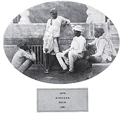 Jats in Delhi (1868)
 -
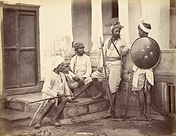 Rajputs in Delhi (1868)
 -
 Brahmin in Lahore (c. 1799–1849)
 -
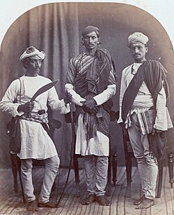 Left to right: Gurkha, Brahmin, and Shudra (Chuhra-Chamar) in Shimla (1868)
 -
 Arains in Lahore (1868)
 -
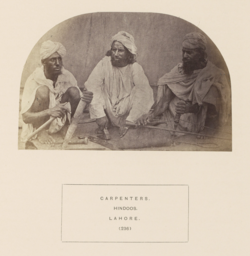 Tarkhans in Lahore (c. 1862–1872)
 -
Gujjars in Delhi (c. 1859–1869)
-
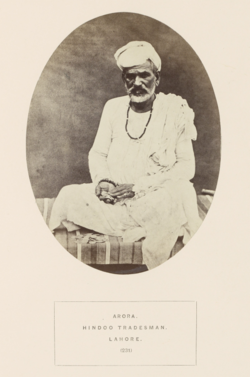 Arora in Lahore (c. 1862–1872)
 -
Kumhars in Lahore (c. 1859–1869)


_of_the_court_of_the_Sikh_Empire.jpg)


_with_tools,_ca.1862%E2%80%9372.png)

_Men_on_a_Pavement_and_a_Woman_in_a_Doorway_in_Delhi,_Shepherd_%26_Robertson_(possibly),_ca.1859%E2%80%9369.png)

The Punjab region is diverse. Historic census reports taken in the colonial era details the main castes are represented, alongside numerous subcastes and tribes (also known as Jāti or Barādarī), formed parts of the various ethnic groups in the region, contemporarily known as Punjabis, Haryanvis, Hindkowans, Saraikis, Dogras, Paharis, and more.
| Tribe | 1881 | 1891 | 1901 | 1911 | 1921 | 1931 | ||||||
|---|---|---|---|---|---|---|---|---|---|---|---|---|
| Pop. | % | Pop. | % | Pop. | % | Pop. | % | Pop. | % | Pop. | % | |
| Jat | 4,223,885 | 20.31% | 4,500,340 | 19.64% | 4,884,285 | 20.04% | 4,891,060 | 20.56% | 5,453,747 | 21.73% | 6,070,032 | 23.74% |
| Rajput | 1,648,426 | 7.92% | 1,747,989 | 7.63% | 1,784,402 | 7.32% | 1,586,274 | 6.67% | 1,853,025 | 7.38% | 2,792,060 | 10.92% |
| Brahman | 1,040,771 | 5% | 1,069,132 | 4.67% | 1,077,252 | 4.42% | 985,901 | 4.14% | 994,529 | 3.96% | 1,058,598 | 4.14% |
| Chuhra | 1,039,039 | 5% | 1,175,504 | 5.13% | 1,175,003 | 4.82% | 912,998 | 3.84% | 750,596 | 2.99% | 681,359 | 2.66% |
| Chamar | 1,033,727 | 4.97% | 1,147,913 | 5.01% | 1,172,118 | 4.81% | 1,075,941 | 4.52% | 1,134,700 | 4.52% | 1,102,465 | 4.31% |
| Arain | 795,471 | 3.82% | 890,264 | 3.88% | 1,003,698 | 4.12% | 973,888 | 4.09% | 1,086,455 | 4.33% | 1,331,295 | 5.21% |
| Julaha | 593,199 | 2.85% | 620,401 | 2.71% | 651,800 | 2.67% | 626,960 | 2.64% | 643,403 | 2.56% | 672,243 | 2.63% |
| Tarkhan | 564,385 | 2.71% | 621,718 | 2.71% | 675,361 | 2.77% | 637,971 | 2.68% | 614,912 | 2.45% | 654,053 | 2.56% |
| Gujjar | 539,251 | 2.59% | 600,198 | 2.62% | 611,904 | 2.51% | 595,598 | 2.5% | 627,451 | 2.5% | 696,442 | 2.72% |
| Arora | 538,465 | 2.59% | 603,131 | 2.63% | 647,945 | 2.66% | 667,943 | 2.81% | 707,495 | 2.82% | 775,734 | 3.03% |
| Kumhar | 465,676 | 2.24% | 515,331 | 2.25% | 561,298 | 2.3% | 542,906 | 2.28% | 570,158 | 2.27% | 620,402 | 2.43% |
| Bania | 437,000 | 2.1% | 442,000 | 1.93% | 452,000 | 1.85% | 404,000 | 1.7% | 374,169 | 1.49% | N/A | N/A |
| Jhinwar | 418,499 | 2.01% | 458,702 | 2% | 450,362 | 1.85% | 331,951 | 1.4% | 371,418 | 1.48% | 281,512 | 1.1% |
| Khatri | 392,413 | 1.89% | 418,517 | 1.83% | 433,579 | 1.78% | 423,704 | 1.78% | 452,902 | 1.8% | 516,207 | 2.02% |
| Awan | 350,848 | 1.69% | 389,402 | 1.7% | 420,504 | 1.73% | 425,450 | 1.79% | 439,975 | 1.75% | 539,242 | 2.11% |
| Kanet | 346,000 | 1.66% | 370,000 | 1.61% | 390,000 | 1.6% | 404,000 | 1.7% | 288,159 | 1.15% | 305,814 | 1.2% |
| Mochi | 334,034 | 1.61% | 384,179 | 1.68% | 408,314 | 1.68% | 410,977 | 1.73% | 429,242 | 1.71% | 472,616 | 1.85% |
| Baloch | 331,851 | 1.6% | 383,138 | 1.67% | 466,645 | 1.92% | 530,976 | 2.23% | 531,084 | 2.12% | 624,695 | 2.44% |
| Nai | 323,703 | 1.56% | 371,144 | 1.62% | 370,019 | 1.52% | 344,845 | 1.45% | 360,653 | 1.44% | 380,657 | 1.49% |
| Sheikh | 293,606 | 1.41% | 287,778 | 1.26% | 264,656 | 1.09% | 276,687 | 1.16% | 244,800 | 0.98% | 414,623 | 1.62% |
| Lohar | 291,506 | 1.4% | 323,420 | 1.41% | 347,099 | 1.42% | 319,847 | 1.34% | 322,195 | 1.28% | 333,910 | 1.31% |
| Teli | 250,544 | 1.2% | 291,513 | 1.27% | 309,433 | 1.27% | 284,505 | 1.2% | 305,122 | 1.22% | 346,342 | 1.35% |
| Pathan | 210,613 | 1.01% | 221,262 | 0.97% | 246,790 | 1.01% | 272,547 | 1.15% | 261,729 | 1.04% | 350,008 | 1.37% |
| Sayyid | 200,728 | 0.96% | 217,034 | 0.95% | 230,802 | 0.95% | 239,160 | 1.01% | 247,087 | 0.98% | 294,223 | 1.15% |
| Mirasi | 192,107 | 0.92% | 230,700 | 1.01% | 244,506 | 1% | 223,093 | 0.94% | 232,280 | 0.93% | 244,726 | 0.96% |
| Machhi | 167,882 | 0.81% | 196,574 | 0.86% | 236,122 | 0.97% | 239,702 | 1.01% | 280,956 | 1.12% | 314,862 | 1.23% |
| Ahir | 165,878 | 0.8% | 188,838 | 0.82% | 197,805 | 0.81% | 201,299 | 0.85% | 201,539 | 0.8% | 221,933 | 0.87% |
| Kashmiri | 149,733 | 0.72% | 141,280 | 0.62% | 189,878 | 0.78% | 175,334 | 0.74% | 166,449 | 0.66% | 202,920 | 0.79% |
| Saini | 147,183 | 0.71% | 120,507 | 0.53% | 121,722 | 0.5% | 107,759 | 0.45% | 120,376 | 0.48% | 165,190 | 0.65% |
| Sunar | 145,903 | 0.7% | 164,087 | 0.72% | 174,628 | 0.72% | 155,993 | 0.66% | 127,090 | 0.51% | 159,655 | 0.62% |
| Kamboh | 129,468 | 0.62% | 150,646 | 0.66% | 173,780 | 0.71% | 171,536 | 0.72% | 180,870 | 0.72% | 239,582 | 0.94% |
| Dhobi | 123,767 | 0.6% | 139,421 | 0.61% | 142,342 | 0.58% | 151,566 | 0.64% | 163,908 | 0.65% | 175,557 | 0.69% |
| Meo | 112,566 | 0.54% | 115,916 | 0.51% | 133,300 | 0.55% | 120,752 | 0.51% | 111,564 | 0.44% | 133,089 | 0.52% |
| Faqir | 111,995 | 0.54% | 300,214 | 1.31% | 362,266 | 1.49% | 262,511 | 1.1% | 270,070 | 1.08% | 287,445 | 1.12% |
| Ghirath | 110,507 | 0.53% | 118,631 | 0.52% | 121,718 | 0.5% | 121,107 | 0.51% | 117,949 | 0.47% | 124,340 | 0.49% |
| Chhimba | 100,448 | 0.48% | 141,819 | 0.62% | 147,152 | 0.6% | 124,090 | 0.52% | 120,695 | 0.48% | 96,269 | 0.38% |
| Qassab | 92,571 | 0.45% | 109,435 | 0.48% | 114,158 | 0.47% | 117,363 | 0.49% | 120,820 | 0.48% | 127,198 | 0.5% |
| Rathi | 82,957 | 0.4% | 100,656 | 0.44% | 37,793 | 0.16% | 97,763 | 0.41% | 118,015 | 0.47% | 134,096 | 0.52% |
| Dagi & Koli | 78,559 | 0.38% | 167,772 | 0.73% | 153,990 | 0.63% | 172,269 | 0.72% | 165,159 | 0.66% | 182,235 | 0.71% |
| Mughal | 92,000 | 0.44% | 118,000 | 0.51% | 98,000 | 0.4% | 99,000 | 0.42% | 88,951 | 0.35% | N/A | N/A |
| Jogi-Rawal | 90,000 | 0.43% | 91,000 | 0.4% | 76,000 | 0.31% | 83,000 | 0.35% | 80,577 | 0.32% | N/A | N/A |
| Dumna | 66,169 | 0.32% | 64,046 | 0.28% | 53,394 | 0.22% | 72,250 | 0.3% | 36,669 | 0.15% | 37,541 | 0.15% |
| Dhanuk | 66,000 | 0.32% | 74,000 | 0.32% | 77,000 | 0.32% | 83,000 | 0.35% | 87,278 | 0.35% | N/A | N/A |
| Dogar | 63,000 | 0.01% | 70,000 | 0.01% | 75,000 | 0.01% | 68,000 | 0.29% | 74,369 | 0.3% | N/A | N/A |
| Khoja | 62,000 | 0.3% | 90,000 | 0.39% | 99,000 | 0.41% | 63,000 | 0.26% | 87,461 | 0.35% | N/A | N/A |
| Mallah | 62,000 | 0.3% | 77,000 | 0.34% | 73,000 | 0.3% | 78,000 | 0.33% | 74,233 | 0.3% | N/A | N/A |
| Mali | 58,672 | 0.28% | 95,989 | 0.42% | 105,956 | 0.43% | 96,883 | 0.41% | 92,933 | 0.37% | 85,758 | 0.34% |
| Bharai | 56,000 | 0.27% | 67,000 | 0.29% | 66,000 | 0.27% | 58,000 | 0.24% | 61,721 | 0.25% | N/A | N/A |
| Barwala | 55,000 | 0.26% | 64,000 | 0.28% | 69,000 | 0.28% | 64,000 | 0.27% | 65,907 | 0.26% | N/A | N/A |
| Mahtam | 50,313 | 0.24% | 56,982 | 0.25% | 82,719 | 0.34% | 81,805 | 0.34% | 94,325 | 0.38% | 65,262 | 0.26% |
| Labana | 47,000 | 0.23% | 55,000 | 0.24% | 56,000 | 0.23% | 58,000 | 0.24% | 56,316 | 0.22% | N/A | N/A |
| Megh | 37,373 | 0.18% | 41,068 | 0.18% | 44,315 | 0.18% | 39,549 | 0.17% | 30,465 | 0.12% | 23,207 | 0.09% |
| Khokhar | 36,000 | 0.17% | 130,000 | 0.57% | 108,000 | 0.44% | 60,000 | 0.25% | 69,169 | 0.28% | N/A | N/A |
| Darzi | 30,190 | 0.15% | 36,919 | 0.16% | 39,164 | 0.16% | 35,508 | 0.15% | 38,256 | 0.15% | 45,688 | 0.18% |
| Bawaria | 22,013 | 0.11% | 26,420 | 0.12% | 29,112 | 0.12% | 32,849 | 0.14% | 34,807 | 0.14% | 32,527 | 0.13% |
| Sansi | 19,920 | 0.1% | 22,218 | 0.1% | 26,000 | 0.11% | 24,439 | 0.1% | 17,402 | 0.07% | 165,190 | 0.65% |
| Od | 15,652 | 0.08% | 22,450 | 0.1% | 26,160 | 0.11% | 31,690 | 0.13% | 28,502 | 0.11% | 32,719 | 0.13% |
| Sarera | 10,792 | 0.05% | 11,366 | 0.05% | 9,587 | 0.04% | 10,743 | 0.05% | 9,873 | 0.04% | 11,230 | 0.04% |
| Pakhiwara | 3,741 | 0.02% | 3,674 | 0.02% | 3,595 | 0.01% | 3,711 | 0.02% | 2,801 | 0.01% | 4,540 | 0.02% |
| Ghosi | 2,221 | 0.01% | 2,652 | 0.01% | 3,012 | 0.01% | 2,419 | 0.01% | 502 | 0% | 3,853 | 0.02% |
| Harni | 1,318 | 0.01% | 4,157 | 0.02% | 3,462 | 0.01% | 3,360 | 0.01% | 2,988 | 0.01% | 3,928 | 0.02% |
| Maliar | N/A | N/A | N/A | N/A | 81,000 | 0.33% | 90,000 | 0.38% | 88,755 | 0.35% | N/A | N/A |
| Mussalli | N/A | N/A | N/A | N/A | 57,367 | 0.24% | 309,543 | 1.3% | 323,549 | 1.29% | 412,300 | 1.61% |
| Qureshi | N/A | N/A | N/A | N/A | 53,000 | 0.22% | 71,000 | 0.3% | 97,625 | 0.39% | N/A | N/A |
| Aggarwal | N/A | N/A | N/A | N/A | N/A | N/A | 339,494 | 1.43% | 349,322 | 1.39% | 379,068 | 1.48% |
| Bagaria | N/A | N/A | N/A | N/A | N/A | N/A | 1,262 | 0.01% | 1,619 | 0.01% | 2,446 | 0.01% |
| Ramdasia | N/A | N/A | N/A | N/A | N/A | N/A | N/A | N/A | N/A | N/A | 126,487 | 0.49% |
| Kahar | N/A | N/A | N/A | N/A | N/A | N/A | N/A | N/A | N/A | N/A | 88,656 | 0.35% |
| Tank Kshatrya | N/A | N/A | N/A | N/A | N/A | N/A | N/A | N/A | N/A | N/A | 37,376 | 0.15% |
| Dhiman Brahman | N/A | N/A | N/A | N/A | N/A | N/A | N/A | N/A | N/A | N/A | 13,533 | 0.05% |
| No tribe | N/A | N/A | N/A | N/A | N/A | N/A | N/A | N/A | N/A | N/A | 6,816 | 0.03% |
| Total responses | N/A | N/A | N/A | N/A | N/A | N/A | N/A | N/A | N/A | N/A | 25,569,792 | 89.75% |
| Total population | 20,800,995 | 100% | 22,915,894 | 100% | 24,367,113 | 100% | 23,791,841 | 100% | 25,101,514 | 100% | 28,490,869 | 100% |
Economy
The historical region of Punjab produces a relatively high proportion of the food output from India and Pakistan.[citation needed] The region has been used for extensive wheat farming. In addition, rice, cotton, sugarcane, fruit, and vegetables are also grown.[160]
The agricultural output of the Punjab region in Pakistan contributes significantly to Pakistan's GDP. Both Indian and Pakistani Punjab is considered to have the best infrastructure of their respective countries. The Indian state of Punjab is currently the 16th richest state or the eighth richest large state of India. Pakistani Punjab produces 68% of Pakistan's foodgrain production.[161] Its share of Pakistan's GDP has historically ranged from 51.8% to 54.7%.[162] and has the highest per capita of any province.
Called "The Granary of India" or "The Bread Basket of India", Indian Punjab produces 1% of the world's rice, 2% of its wheat, and 2% of its cotton.[160] In 2001, it was recorded that farmers made up 39% of Indian Punjab's workforce.[163] In the Punjab region of Pakistan, 42.3% of the labour force is engaged in the agriculture sector.[164]
Alternatively, Punjab is also adding to the economy with the increase in employment of Punjab youth in the private sector. Government schemes such as 'Ghar Ghar Rozgar and Karobar Mission' have brought enhanced employability in the private sector. As of October 2019[update], more than 32,000 youths have been placed in different jobs and 12,000 have been skill-trained.[165]
See also
Notes
- ↑ 1.0 1.1 Estimates from combining 2011 Indian census and 2017 Pakistani census with religious data amalgamated from Punjab, India, Punjab, Pakistan, Haryana, Delhi, Himachal Pradesh, Islamabad, and Chandigarh.[153][154][155]
- ↑ From Persian پنج panj—meaning literally 'five'—and آب âb—meaning literally 'water' or 'river', thus translating as 'five waters'.[3]
- ↑ Craterus supervised the construction. These cities are yet to be identified.
- ↑ Western Punjabi languages and dialects including Saraiki, Hindko and Pahari-Pothwari, and other related languages or dialects
- ↑ Standard Punjabi: 58.34%
Lahnda:[lower-alpha 4] 17.59% - ↑ Including Hindustani (Hindi and Urdu), Braj Bhasha, Haryanvi, and other related languages or dialects
- ↑ 7.0 7.1 7.2 7.3 7.4 7.5 7.6 7.7 7.8 Including Delhi district, which was later made into a separate province in 1912, following the transfer from Calcutta to Delhi as capital of India in 1911.
- ↑ 8.0 8.1 8.2 8.3 8.4 8.5 8.6 8.7 1931 & 1941 censuses: Including Ad-Dharmis
- ↑ 1881 figure taken from census data by combining the total population of all districts (Lahore, Sialkot, Gujranwala, Gujrat, Shahpur, Jhelum, Rawalpindi, Montgomery, Jhang, Multan, Muzaffargargh, Dera Ghazi Khan), one tehsil (Shakargarh – then part of Gurdaspur District), and one princely state (Bahawalpur) in Punjab Province, British India that ultimately fell on the western side of the Radcliffe Line. See 1881 census data here:[139][140][141]
Immediately following the partition of India in 1947, these districts and tract would ultimately make up the subdivision of West Punjab, which also later included Bahawalpur. The state that makes up this region in the contemporary era is Punjab, Pakistan. - ↑ 1901 figure taken from census data by combining the total population of all districts (Lahore, Sialkot, Gujranwala, Gujrat, Shahpur, Jhelum, Rawalpindi, Mianwali, Montgomery, Lyallpur (inscribed as the Chenab Colony on the 1901 census), Jhang, Multan, Muzaffargargh, Dera Ghazi Khan), one tehsil (Shakargarh – then part of Gurdaspur District), one princely state (Bahawalpur), and one tract (Biloch Trans–Frontier) in Punjab Province, British India that ultimately fell on the western side of the Radcliffe Line. See 1901 census data here:[142]:34
Immediately following the partition of India in 1947, these districts and tract would ultimately make up the subdivision of West Punjab, which also later included Bahawalpur. The state that makes up this region in the contemporary era is Punjab, Pakistan. - ↑ 1911 figure taken from census data by combining the total population of all districts (Lahore, Sialkot, Gujranwala, Gujrat, Shahpur, Jhelum, Rawalpindi, Attock, Mianwali, Montgomery, Lyallpur, Jhang, Multan, Muzaffargargh, Dera Ghazi Khan), one tehsil (Shakargarh – then part of Gurdaspur District), one princely state (Bahawalpur), and one tract (Biloch Trans–Frontier) in Punjab Province, British India that ultimately fell on the western side of the Radcliffe Line. See 1911 census data here:[143]:27[144]:27
Immediately following the partition of India in 1947, these districts and tract would ultimately make up the subdivision of West Punjab, which also later included Bahawalpur. The state that makes up this region in the contemporary era is Punjab, Pakistan. - ↑ 1921 figure taken from census data by combining the total population of all districts (Lahore, Sialkot, Gujranwala, Sheikhupura, Gujrat, Shahpur, Jhelum, Rawalpindi, Attock, Mianwali, Montgomery, Lyallpur, Jhang, Multan, Muzaffargargh, Dera Ghazi Khan), one tehsil (Shakargarh – then part of Gurdaspur District), one princely state (Bahawalpur), and one tract (Biloch Trans–Frontier) in Punjab Province, British India that ultimately fell on the western side of the Radcliffe Line. See 1921 census data here:[145]:29
Immediately following the partition of India in 1947, these districts and tract would ultimately make up the subdivision of West Punjab, which also later included Bahawalpur. The state that makes up this region in the contemporary era is Punjab, Pakistan. - ↑ 1931 figure taken from census data by combining the total population of all districts (Lahore, Sialkot, Gujranwala, Sheikhupura, Gujrat, Shahpur, Jhelum, Rawalpindi, Attock, Mianwali, Montgomery, Lyallpur, Jhang, Multan, Muzaffargargh, Dera Ghazi Khan), one tehsil (Shakargarh – then part of Gurdaspur District), one princely state (Bahawalpur), and one tract (Biloch Trans–Frontier) in Punjab Province, British India that ultimately fell on the western side of the Radcliffe Line. See 1931 census data here:[146]:277
Immediately following the partition of India in 1947, these districts and tract would ultimately make up the subdivision of West Punjab, which also later included Bahawalpur. The state that makes up this region in the contemporary era is Punjab, Pakistan. - ↑ 1941 figure taken from census data by combining the total population of all districts (Lahore, Sialkot, Gujranwala, Sheikhupura, Gujrat, Shahpur, Jhelum, Rawalpindi, Attock, Mianwali, Montgomery, Lyallpur, Jhang, Multan, Muzaffargargh, Dera Ghazi Khan), one tehsil (Shakargarh – then part of Gurdaspur District), one princely state (Bahawalpur), and one tract (Biloch Trans–Frontier) in Punjab Province, British India that ultimately fell on the western side of the Radcliffe Line. See 1941 census data here:[147]:42
Immediately following the partition of India in 1947, these districts and tract would ultimately make up the subdivision of West Punjab, which also later included Bahawalpur. The state that makes up this region in the contemporary era is Punjab, Pakistan. - ↑ 1881 figure taken from census data by combining the total population of all districts (Hisar, Rohtak, Gurgaon, Delhi, Karnal, Sirsa, Jalandhar, Ludhiana, Firozpur, Amritsar, Simla, Kangra, Ambala, Hoshiarpur, and Gurdaspur (minus Shakargarh Tehsil)), and princely states (Loharu, Dujana, Pataudi, Kalsia, Kapurthala, Malerkotla, Faridkot, Patiala, Jind, Nabha, and Simla Hill) in Punjab Province, British India that ultimately fell on the eastern side of the Radcliffe Line. See 1881 census data here:[139][140][141]
Immediately following the partition of India in 1947, these districts and princely states would ultimately make up the subdivision of East Punjab, which also included Patiala and East Punjab States Union, Chief Commissioner's Province of Himachal Pradesh, and Bilaspur State. The states that make up this region in the contemporary era are Punjab, India, Chandigarh, Haryana, and Himachal Pradesh. - ↑ 1901 figure taken from census data by combining the total population of all districts (Hisar, Rohtak, Gurgaon, Delhi, Karnal, Jalandhar, Ludhiana, Firozpur, Amritsar, Simla, Kangra, Ambala, Hoshiarpur, and Gurdaspur (minus Shakargarh Tehsil)), and princely states (Loharu, Dujana, Pataudi, Kalsia, Kapurthala, Malerkotla, Faridkot, Patiala, Jind, Nabha, Nahan, Simla Hill, Mandi, Suket, and Chamba) in Punjab Province, British India that ultimately fell on the eastern side of the Radcliffe Line. See 1901 census data here:[142]:34
Immediately following the partition of India in 1947, these districts and princely states would ultimately make up the subdivision of East Punjab, which also included Patiala and East Punjab States Union, Chief Commissioner's Province of Himachal Pradesh, and Bilaspur State. The states that make up this region in the contemporary era are Punjab, India, Chandigarh, Haryana, and Himachal Pradesh. - ↑ 1911 figure taken from census data by combining the total population of all districts (Hisar, Rohtak, Gurgaon, Delhi, Karnal, Jalandhar, Ludhiana, Firozpur, Amritsar, Simla, Kangra, Ambala, Hoshiarpur, and Gurdaspur (minus Shakargarh Tehsil)), and princely states (Loharu, Dujana, Pataudi, Kalsia, Kapurthala, Malerkotla, Faridkot, Patiala, Jind, Nabha, Nahan, Simla Hill, Mandi, Suket, and Chamba) in Punjab Province, British India that ultimately fell on the eastern side of the Radcliffe Line. See 1911 census data here:[143]:27[144]:27
Immediately following the partition of India in 1947, these districts and princely states would ultimately make up the subdivision of East Punjab, which also included Patiala and East Punjab States Union, Chief Commissioner's Province of Himachal Pradesh, and Bilaspur State. The states that make up this region in the contemporary era are Punjab, India, Chandigarh, Haryana, and Himachal Pradesh. - ↑ 1921 figure taken from census data by combining the total population of all districts (Hisar, Rohtak, Gurgaon, Karnal, Jalandhar, Ludhiana, Firozpur, Amritsar, Simla, Kangra, Ambala, Hoshiarpur, and Gurdaspur (minus Shakargarh Tehsil)), and princely states (Loharu, Dujana, Pataudi, Kalsia, Kapurthala, Malerkotla, Faridkot, Patiala, Jind, Nabha, Nahan, Simla Hill, Bilaspur, Mandi, Suket, and Chamba) in Punjab Province, British India that ultimately fell on the eastern side of the Radcliffe Line. See 1921 census data here:[145]:29
Immediately following the partition of India in 1947, these districts and princely states would ultimately make up the subdivision of East Punjab, which also included Patiala and East Punjab States Union, Chief Commissioner's Province of Himachal Pradesh, and Bilaspur State. The states that make up this region in the contemporary era are Punjab, India, Chandigarh, Haryana, and Himachal Pradesh. - ↑ 1931 figure taken from census data by combining the total population of all districts (Hisar, Rohtak, Gurgaon, Karnal, Jalandhar, Ludhiana, Firozpur, Amritsar, Simla, Kangra, Ambala, Hoshiarpur, and Gurdaspur (minus Shakargarh Tehsil)), and princely states (Loharu, Dujana, Pataudi, Kalsia, Kapurthala, Malerkotla, Faridkot, Patiala, Jind, Nabha, Sirmoor, Simla Hill, Bilaspur, Mandi, Suket, and Chamba) in Punjab Province, British India that ultimately fell on the eastern side of the Radcliffe Line. See 1931 census data here:[146]:277
Immediately following the partition of India in 1947, these districts and princely states would ultimately make up the subdivision of East Punjab, which also included Patiala and East Punjab States Union, Chief Commissioner's Province of Himachal Pradesh, and Bilaspur State. The states that make up this region in the contemporary era are Punjab, India, Chandigarh, Haryana, and Himachal Pradesh. - ↑ 1941 figure taken from census data by combining the total population of all districts (Hisar, Rohtak, Gurgaon, Karnal, Jalandhar, Ludhiana, Firozpur, Amritsar, Simla, Kangra, Ambala, Hoshiarpur, and Gurdaspur (minus Shakargarh Tehsil)), and princely states (Loharu, Dujana, Pataudi, Kalsia, Kapurthala, Malerkotla, Faridkot, Patiala, Jind, Nabha, Sirmoor, Simla Hill, Bilaspur, Mandi, Suket, and Chamba) in Punjab Province, British India that ultimately fell on the eastern side of the Radcliffe Line. See 1941 census data here:[147]:42
Immediately following the partition of India in 1947, these districts and princely states would ultimately make up the subdivision of East Punjab, which also included Patiala and East Punjab States Union, Chief Commissioner's Province of Himachal Pradesh, and Bilaspur State. The states that make up this region in the contemporary era are Punjab, India, Chandigarh, Haryana, and Himachal Pradesh. - ↑ 21.0 21.1 21.2 21.3 See total breakdowns in tables on Religion in the Punjab page.
References
- ↑ "Elections in Bihar, Campaigning in Punjab to Woo Bihari Migrants". 4 October 2015. Archived from the original on 29 March 2023. Retrieved 17 February 2024.
Punjab, as per official estimates, is home to some two million migrants from Bihar. They are engaged in various jobs and occupations in Punjab. Of this, over 1.3 million are living in and around the industrial hub of Ludhiana.
- ↑ "Punjab". Dictionary.com Unabridged (Online). n.d.
- ↑ 3.0 3.1 H K Manmohan Siṅgh. "The Punjab". The Encyclopedia of Sikhism. Punjabi University, Patiala. Archived from the original on 5 March 2016. Retrieved 18 August 2015.
- ↑ 4.0 4.1 4.2 Nayar, Kamala Elizabeth (2012). The Punjabis in British Columbia: Location, Labour, First Nations, and Multiculturalism. McGill-Queen's Press – MQUP. p. 7. ISBN 978-0-7735-4070-5.
- ↑ Mookerji, Radhakumud (1 January 2016). Chandragupta Maurya and His Times. Motilal Banarsidass. p. 22. ISBN 978-81-208-0433-3. Archived from the original on 14 March 2023. Retrieved 30 January 2023.
Rhys Davids [Buddhist India p. 267] points out that 'it was from the Panjab that Chandragupta recruited the nucleus of the force with which he besieged and conquered Dhana Nanda'
- ↑ Tarn, William Woodthorpe (24 June 2010). The Greeks in Bactria and India. Cambridge University Press. p. 324. ISBN 978-1-108-00941-6.
Audumbaras, Trigartas, Kunindas, Yaudheyas, Arjunayanas — began to coin in the first century BC, which means that they had become independent kingdoms or republics; but the coins do not all tell the same story. Those of the two sounthernmost peoples begin somewhere about 100 BC and bear the legends 'Victory of the Arjunayanas' and (on their copper issue) 'Victory of the Yaudheyas', which point to their having won independence by the sword.
- ↑ Majumdar, Ramesh Chandra; Altekar, Anant Sadashiv (1986). Vakataka gupta age: circa 200–550. Motilal Banarsidass. p. 31. ISBN 978-81-208-0026-7. Archived from the original on 4 October 2023. Retrieved 9 July 2023.
- ↑ Cunningham, Alexander (23 February 2023). Archaeological Survey of India: Vol. 1. BoD – Books on Demand. p. 280. ISBN 978-3-382-11929-4. Archived from the original on 4 October 2023. Retrieved 9 July 2023.
- ↑ Hutchison, John; Vogel, Jean Philippe (1994). History of the Panjab Hill States. Asian Educational Services. p. 123. ISBN 978-81-206-0942-6. Archived from the original on 25 March 2023. Retrieved 30 January 2023.
- ↑ Easton, Richard M. (2019). India in the Persianate Age: 1000–1765. University of California Press. p. 117. ISBN 978-0520325128.
The career of Khizr Khan, a Punjabi chieftain belonging to the Khokar clan...
- ↑ Fauja Singh (1972). History of the Punjab: A.D. 1000-1526. Department of Punjab Historical Studies, Punjabi University. p. 152. Archived from the original on 1 May 2023. Retrieved 9 July 2023.
The Tughlaqs had close links with the Punjab. According to Firishta and Sujan Rai Bhandari, Tughlaq, the founder of the dynasty, was born in the Punjab to a Jat mother
- ↑ 12.0 12.1 N. A. Baloch; A. Q. Rafiqi (1998). "Chapter 15. The Regions Of Sind, Baluchistan, Multan And Kashmir: The Historical, Social And Economic Setting" (PDF). In M. S. Asimov; C. E. Bosworth (eds.). History of Civilizations of Central Asia: Age of Achievement, 750 AD to the End of the 15th Century. UNESCO. p. 305. ISBN 978-92-3-103467-1. Archived (PDF) from the original on 6 March 2022. Retrieved 22 January 2023.
- ↑ Gandhi, Rajmohan (2013). Punjab: A History from Aurangzeb to Mountbatten. New Delhi, India, Urbana, Illinois: Aleph Book Company. p. 1 ("Introduction"). ISBN 978-93-83064-41-0.
- ↑ "Punjab." Pp. 107 in Encyclopædia Britannica (9th ed.), vol. 20.
- ↑ Kenneth Pletcher, ed. (2010). The Geography of India: Sacred and Historic Places. Britannica Educational Publishing. p. 199. ISBN 978-1-61530-202-4.
The word's origin can perhaps be traced to panca nada, Sanskrit for "five rivers" and the name of a region mentioned in the ancient epic the Mahabharata.
- ↑ Rajesh Bala (2005). "Foreign Invasions and their Effect on Punjab". In Sukhdial Singh (ed.). Punjab History Conference, Thirty-seventh Session, March 18–20, 2005: Proceedings. Punjabi University. p. 80. ISBN 978-81-7380-990-3.
The word Punjab is a compound of two words-Panj (Five) and aab (Water), thus signifying the land of five waters or rivers. This origin can perhaps be traced to panch nada, Sanskrit for "Five rivers" the word used before the advent of Muslims with a knowledge of Persian to describe the meeting point of the Jhelum, Chenab, Ravi, Beas, and Sutlej rivers, before they joined the Indus.
- ↑ Grenet, Frantz (2005). "An Archaeologist's Approach to Avestan Geography". In Curtis, Vesta Sarkhosh; Stewart, Sarah (eds.). Birth of the Persian Empire Volume I. I.B.Tauris. p. 34. ISBN 978-0-7556-2459-1.
- ↑ Lassen, Christian. 1827. Commentatio Geographica atque Historica de Pentapotamia Indica Archived 18 November 2022 at the Wayback Machine [A Geographical and Historical Commentary on Indian Pentapotamia]. Weber. p. 4: "That part of India which today we call by the Persian name ''Penjab'' is named Panchanada in the sacred language of the Indians; either of which names may be rendered in Greek by Πενταποταμια. The Persian origin of the former name is not at all in doubt, although the words of which it is composed are both Indian and Persian.... But, in truth, that final word is never, to my knowledge, used by the Indians in proper names compounded in this way; on the other hand, there exist multiple Persian names which end with that word, e.g., Doab and Nilab. Therefore, it is probable that the name Penjab, which is today found in all geographical books, is of more recent origin and is to be attributed to the Muslim kings of India, among whom the Persian language was mostly in use. That the Indian name Panchanada is ancient and genuine is evident from the fact that it is already seen in the Ramayana and Mahabharata, the most ancient Indian poems, and that no other exists in addition to it among the Indians; for Panchála, which English translations of the Ramayana render with Penjab...is the name of another region, entirely distinct from Pentapotamia...."[whose translation?]
- ↑ Latif, Syad Muhammad (1891). History of the Panjáb from the Remotest Antiquity to the Present Time. Calcultta Central Press Company. p. 1.
The Panjáb, the Pentapotamia of the Greek historians, the north-western region of the empire of Hindostán, derives its name from two Persian words, panj (five), an áb (water), having reference to the five rivers which confer on the country its distinguishing features."
- ↑ Khalid, Kanwal (2015). "Lahore of Pre Historic Era" (PDF). Journal of the Research Society of Pakistan. 52 (2): 73. Archived (PDF) from the original on 11 August 2022. Retrieved 20 January 2019.
The earliest mention of five rivers in the collective sense was found in Yajurveda and a word Panchananda was used, which is a Sanskrit word to describe a land where five rivers meet. [...] In the later period, the word Pentapotamia was used by the Greeks to identify this land. (Penta means 5 and potamia, water ___ the land of five rivers) Muslim Historians implied the word "Punjab" for this region. Again, it was not a new word because in Persian-speaking areas, there are references of this name given to any particular place where five rivers or lakes meet.
- ↑ 21.00 21.01 21.02 21.03 21.04 21.05 21.06 21.07 21.08 21.09 21.10 21.11 21.12 21.13 21.14 21.15 21.16 Minahan, James (2012). Ethnic Groups of South Asia and the Pacific: An Encyclopedia. ABC-CLIO. pp. 257–259. ISBN 978-1-59884-659-1. Archived from the original on 27 September 2023. Retrieved 21 August 2022.
- ↑ Buddha Parkash, Evolution of Heroic Tradition in Ancient Panjab, p 36.
- ↑ Joshi, L. M., and Fauja Singh. History of Panjab, Vol I. p. 4.
- ↑ 24.00 24.01 24.02 24.03 24.04 24.05 24.06 24.07 24.08 24.09 Bosworth, Albert Brian (1993). "The campaign of the Hydaspes". Conquest and Empire: The Reign of Alexander the Great. Cambridge University Press. pp. 125–130.
- ↑ Holt, Frank Lee (2003). Alexander the Great and the mystery of the elephant medallions. University of California Press.
- ↑ Rogers, p.200
- ↑ 27.0 27.1 Bosworth, Albert Brian (1993). "From the Hydaspes to the Southern Ocean". Conquest and Empire: The Reign of Alexander the Great. Cambridge University Press.
- ↑ Anson, Edward M. (2013). Alexander the Great: Themes and Issues. Bloomsbury. p. 151. ISBN 9781441193797.
- ↑ Roy 2004, pp. 23–28.
- ↑ Heckel, Waldemar (2006). Who's Who in the Age of Alexander the Great: Prosopography of Alexander's Empire. Wiley. ISBN 9781405112109.
- ↑ Irfan Habib; Vivekanand Jha (2004). Mauryan India. A People's History of India. Aligarh Historians Society / Tulika Books. p. 16. ISBN 978-81-85229-92-8.
- ↑ Mookerji, Radhakumud (1 January 2016). Chandragupta Maurya and His Times. Motilal Banarsidass. p. 22. ISBN 978-81-208-0433-3. Archived from the original on 14 March 2023. Retrieved 30 January 2023.
- ↑ Gupta, Gyan Swarup (1999). India: From Indus Valley Civilisation to Mauryas. Concept Publishing Company. p. 194. ISBN 978-81-7022-763-2. Archived from the original on 8 July 2023. Retrieved 30 January 2023.
- ↑ Majumdar, Ramesh Chandra (1969). Corporate Life in Ancient India. Firma K. L. Mukhopadhyay. p. 222. Archived from the original on 14 March 2023. Retrieved 21 March 2023.
- ↑ Mookerji, Radhakumud (1 January 2016). Chandragupta Maurya and His Times. Motilal Banarsidass. p. 27. ISBN 978-81-208-0433-3. Archived from the original on 8 July 2023. Retrieved 30 January 2023.
- ↑ Rahman, Abdul (2002). "New Light on the Khingal, Turk and the Hindu Sahis" (PDF). Ancient Pakistan. XV: 37–42. Archived (PDF) from the original on 26 April 2021. Retrieved 11 January 2023.
The Hindu Śāhis were therefore neither Bhattis, or Janjuas, nor Brahmans. They were simply Uḍis/Oḍis. It can now be seen that the term Hindu Śāhi is a misnomer and, based as it is merely upon religious discrimination, should be discarded and forgotten. The correct name is Uḍi or Oḍi Śāhi dynasty.
- ↑ Meister, Michael W. (2005). "The Problem of Platform Extensions at Kafirkot North" (PDF). Ancient Pakistan. XVI: 41–48. Archived (PDF) from the original on 1 February 2023. Retrieved 11 January 2023.
Rehman (2002: 41) makes a good case for calling the Hindu Śāhis by a more accurate name, "Uḍi Śāhis".
- ↑ 38.0 38.1 38.2 38.3 38.4 38.5 Rehman 1976.
- ↑ Rehman 1976, pp. 48–50.
- ↑ Richard M. Eaton (2019). India in the Persianate Age: 1000–1765. University of California Press. p. 117. ISBN 978-0520325128.
The career of Khizr Khan, a Punjabi chieftain belonging to the Khokar clan...
- ↑ Mehta, Jaswant Lal (1979). Advanced Study in the History of Medieval India. Sterling Publishers Pvt. Ltd. p. 76. ISBN 978-81-207-0617-0. Archived from the original on 27 September 2023. Retrieved 9 September 2022.
- ↑ 42.0 42.1 William Lowe (Translator), Muntakhabu-t-tawārīkh, p. 296, at Google Books, Volume 1, pages 296-301
- ↑ Tarikh-I Firoz Shahi Ziauddin Barni, The History of India by its own Historians - The Muhammadan Period, Volume 3, Trubner London, pages 233-234
- ↑ Muḥammad ibn Tughluq Archived 27 April 2015 at the Wayback Machine Encyclopædia Britannica
- ↑ Tarikh-I Firoz Shahi Ziauddin Barni, The History of India by its own Historians - The Muhammadan Period, Volume 3, Trubner London, pp. 236–237
- ↑ Tarikh-I Firoz Shahi Ziauddin Barni, The History of India by its own Historians - The Muhammadan Period, Volume 3, Trubner London, pp. 235–240
- ↑ Jackson 2003, p. 162.
- ↑ Vincent A Smith, The Oxford History of India: From the Earliest Times to the End of 1911, p. 217, at Google Books, Chapter 2, pp. 242–248, Oxford University Press
- ↑ Crooke, William (1890). An Ethnographical Hand-book for the N.-W. Provinces and Oudh. North-Western provinces and Oudh government Press. p. 144. Archived from the original on 8 July 2023. Retrieved 14 March 2023.
- ↑ Proceedings - Punjab History Conference. Publication Bureau, Punjab University. 1966. p. 82. Archived from the original on 8 July 2023. Retrieved 14 March 2023.
- ↑ Kulke, Hermann; Rothermund, Dietmar (2004). A History of India. Psychology Press. p. 184. ISBN 978-0-415-32919-4. Archived from the original on 8 July 2023. Retrieved 14 March 2023.
- ↑ Haque, Mohammed Anwarul (1980). Muslim Administration in Orissa, 1568-1751 A.D. Punthi Pustak. p. 20. Archived from the original on 8 July 2023. Retrieved 14 March 2023.
- ↑ Jauhri, R. C. (1990). Firoz Tughluq, 1351-1388 A.D. ABS Publications. p. 74. ISBN 978-81-7072-029-4. Archived from the original on 8 July 2023. Retrieved 14 March 2023.
- ↑ Hutchison, John; Vogel, Jean Philippe (1994). History of the Panjab Hill States. Asian Educational Services. p. 221. ISBN 978-81-206-0942-6. Archived from the original on 8 July 2023. Retrieved 14 March 2023.
- ↑ Richard M. Eaton (2019). India in the Persianate Age: 1000–1765. University of California Press. p. 117. ISBN 978-0520325128.
- ↑ Jackson 2003, p. 103.
- ↑ 57.0 57.1 Kumar 2020, p. 583.
- ↑ Kenneth Pletcher (2010). The History of India. The Rosen Publishing Group. p. 132. ISBN 9781615301225. Archived from the original on 4 April 2023. Retrieved 19 March 2023.
- ↑ V. D. Mahajan (2007). History of Medieval India. S. Chand. p. 229. ISBN 9788121903646. Archived from the original on 4 April 2023. Retrieved 19 March 2023.
- ↑ Proceedings:Volume 55. Indian History Congress. 1995. p. 216. Archived from the original on 4 April 2023. Retrieved 19 March 2023.
- ↑ Mahajan 2007, p. 237.
- ↑ Rajasthan [district Gazetteers] Bharatpur. Printed at Government Central Press. 1971. p. 52. Archived from the original on 4 April 2023. Retrieved 19 March 2023.
- ↑ Lal, Kishori Saran (1980). Twilight of the Sultanate: A Political, Social and Cultural History of the Sultanate of Delhi from the Invasion of Timur to the Conquest of Babur 1398-1526. Munshiram Manoharlal. ISBN 978-81-215-0227-6. Archived from the original on 9 March 2023. Retrieved 9 March 2023.
This considerably depleted Iqbal's strength and encouraged Khizr Khan to collect his forces of Multan, Deopalpur and the Punjab
- ↑ V. D. Mahajan (2007). History of Medieval India. S. Chand. p. 240. ISBN 978-81-219-0364-6. Archived from the original on 4 April 2023. Retrieved 19 March 2023.
- ↑ Iqtidar Alam Khan (2008). Historical Dictionary of Medieval India. Scarecrow Press. p. 103. ISBN 978-0-8108-5503-8. Archived from the original on 4 April 2023. Retrieved 19 March 2023.
- ↑ Lal, Kishori Saran (1980). Twilight of the Sultanate: A Political, Social and Cultural History of the Sultanate of Delhi from the Invasion of Timur to the Conquest of Babur 1398-1526. Munshiram Manoharlal. ISBN 978-81-215-0227-6. Archived from the original on 9 March 2023. Retrieved 9 March 2023.
Hoshang tried his luck against Sultan of Delhi but he was beaten back by Mubarak Shah Saiyyad to whom he had to pay a handsome tribute
- ↑ Lal, Kishori Saran (1980). Twilight of the Sultanate: A Political, Social and Cultural History of the Sultanate of Delhi from the Invasion of Timur to the Conquest of Babur 1398-1526. Munshiram Manoharlal. p. 109. ISBN 978-81-215-0227-6. Archived from the original on 9 March 2023. Retrieved 9 March 2023.
- ↑ Mahajan 2007, p. 244.
- ↑ Ahmed, Iftikhar (1984). "Territorial Distribution of Jatt Castes in Punjab c. 1595 – c. 1881". Proceedings of the Indian History Congress. 45. Indian History Congress: 429, 432. ISSN 2249-1937. JSTOR 44140224. Archived from the original on 28 July 2022. Retrieved 28 July 2022.
- ↑ Mubārak, A.F.; Blochmann, H. (1891). The Ain I Akbari. Bibliotheca Indica. Asiatic Society of Bengal. p. 321. Retrieved 28 July 2022.
- ↑ Lambrick, H. T. (1975). Sind : a general introduction. Hyderabad: Sindhi Adabi Board. p. 212. ISBN 0-19-577220-2. OCLC 2404471.
- ↑ Roseberry, J.R. (1987). Imperial Rule in Punjab: The Conquest and Administration of Multan, 1818–1881. Manohar. p. 177. ISBN 978-81-85054-28-5. Retrieved 28 July 2022.
- ↑ Journal of Central Asia. Centre for the Study of the Civilizations of Central Asia, Quaid-i-Azam University. 1992. p. 84. Retrieved 30 July 2022.
Sadullah Khan was the son of Amir Bakhsh a cultivator of Chiniot . He belongs to Jat family. He was born on Thursday, the 10th Safar 1000 A.H./1591 A.C.
- ↑ Quddus, S.A. (1992). Punjab, the Land of Beauty, Love, and Mysticism. Royal Book Company. p. 402. ISBN 978-969-407-130-5. Retrieved 29 July 2022.
- ↑ 75.0 75.1 Siddiqui, Shabbir A. (1986). "Relations Between Dara Shukoh and Sa'adullah Khan". Proceedings of the Indian History Congress. 47: 273–276. ISSN 2249-1937. JSTOR 44141552. Archived from the original on 22 April 2022. Retrieved 11 August 2022.
- ↑ Koch, Ebba (2006). The complete Taj Mahal : and the riverfront gardens of Agra. Richard André. Barraud. London: Thames & Hudson. p. 45. ISBN 978-0-500-34209-1. OCLC 69022179.
- ↑ Chhabra, G.S. (2005). Advance Study in the History of Modern India (Volume-1: 1707–1803). Lotus Press. p. 38. ISBN 978-81-89093-06-8.
- ↑ Chisti, AA Sheikh Md Asrarul Hoque (2012). "Shahbaz Khan". In Islam, Sirajul; Miah, Sajahan; Khanam, Mahfuza; Ahmed, Sabbir (eds.). Banglapedia: the National Encyclopedia of Bangladesh (Online ed.). Dhaka, Bangladesh: Banglapedia Trust, Asiatic Society of Bangladesh. ISBN 984-32-0576-6. OCLC 52727562. Retrieved 19 October 2026.
- ↑ 79.0 79.1 79.2 Metcalf, Barbara Daly (1 January 1984). Moral Conduct and Authority: The Place of Adab in South Asian Islam. University of California Press. ISBN 978-0-520-04660-3.
- ↑ Gilmartin, David (14 April 2020). Blood and Water: The Indus River Basin in Modern History. Univ of California Press. ISBN 978-0-520-35553-8.
- ↑ 81.0 81.1 81.2 Punjab Government (1883). Gazetteer Of The Jhang District.
- ↑ Yasmin, Robina (2022). Muslims Under Sikh Rule in the Nineteenth Century: Maharaja Ranjit Singh and Religious Tolerance. I.B. Tauris. ISBN 978-0-7556-4035-5.
- ↑ "Ranjit Singh: A Secular Sikh Sovereign by K.S. Duggal. (Date:1989. ISBN 8170172446)". Exoticindiaart.com. 3 September 2015. Archived from the original on 17 June 2008. Retrieved 9 August 2009.
- ↑ Chisholm, Hugh, ed. (1911). . Encyclopædia Britannica. Vol. 22 (11th ed.). Cambridge University Press. p. 892.
- ↑ Grewal, J. S. (1990). The Sikhs of the Punjab, Chapter 6: The Sikh empire (1799–1849). The New Cambridge History of India. Cambridge University Press. ISBN 0-521-63764-3. Archived from the original on 27 September 2023. Retrieved 29 October 2019.
- ↑ Amarinder Singh's The Last Sunset: The Rise and Fall of the Lahore Durbar
- ↑ Grewal, J. S. (1998). "The Sikh empire (1799–1849) - Chapter 6". The Sikhs of the Punjab. The New Cambridge History of India (Revised ed.). Cambridge: Cambridge University Press. pp. 126–128. ISBN 0-521-63764-3.
- ↑ 88.0 88.1 Hibbert, Christopher (1980). The great mutiny: India 1857. Harmondsworth: Penguin Books. ISBN 978-0-14-004752-3.
- ↑ "Pakistan Geotagging: Partition of Punjab in 1947". 3 October 2014. Archived from the original on 8 February 2016. Retrieved 11 February 2016.. Daily Times (10 May 2012). Retrieved 12 July 2013.
- ↑ Talbot, Ian (2009). "Partition of India: The Human Dimension". Cultural and Social History. 6 (4): 403–410. doi:10.2752/147800409X466254. ISSN 1478-0038. S2CID 147110854.
The number of casualties remains a matter of dispute, with figures being claimed that range from 200,000 to 2 million victims.
- ↑ D'Costa, Bina (2011). Nationbuilding, Gender and War Crimes in South Asia. Routledge. p. 53. ISBN 978-0415565660.
- ↑ Butalia, Urvashi (2000). The Other Side of Silence: Voices From the Partition of India. Duke University Press. Archived from the original on 25 March 2016. Retrieved 1 September 2021.
- ↑ Sikand, Yoginder (2004). Muslims in India Since 1947: Islamic Perspectives on Inter-Faith Relations. Routledge. p. 5. ISBN 978-1134378258.
- ↑ 94.0 94.1 Pritam Singh, Federalism, Nationalism and Development: India and the Punjab Economy, Routledge, 19 February 2008, p.54
- ↑ "Provincial Assembly of the Punjab". Archived from the original on 7 February 2017. Retrieved 5 August 2022.
- ↑ Dyson 2018, pp. 188–189.
- ↑ J. S. Grewal (1998). The Sikhs of the Punjab. The New Cambridge History of India (Revised ed.). Cambridge University Press. p. 1. ISBN 978-0-521-63764-0. Archived from the original on 27 September 2023. Retrieved 29 October 2019.
- ↑ Different Types of History. Pearson Education India. 2009. p. 202. ISBN 978-81-317-1818-6.
- ↑ Manning, Stephen (30 September 2020). Bayonet to Barrage Weaponry on the Victorian Battlefield. Pen & Sword Books Limited. p. 9. ISBN 9781526777249. Archived from the original on 26 March 2023. Retrieved 19 March 2023.
The Sikh kingdom expanded from Tibet in the east to Kashmir in the west and from Sind in the south to the Khyber Pass in the north, an area of 200,000 square miles
- ↑ Barczewski, Stephanie (22 March 2016). Heroic Failure and the British. Yale University Press. p. 89. ISBN 9780300186819. Archived from the original on 26 March 2023. Retrieved 19 March 2023.
..the Sikh state encompassed over 200,000 square miles (518,000 sq km)
- ↑ Khilani, N. M. (1972). British power in the Punjab, 1839–1858. Asia Publishing House. p. 251. ISBN 9780210271872. Archived from the original on 5 April 2023. Retrieved 19 March 2023.
..into existence a kingdom of the Punjab of over 200,000 square miles
- ↑ Johnson, K. Paul (1994). The Masters Revealed: Madam Blavatsky and the Myth of the Great White Lodge (1st ed.). State University of New York Press. p. 128. ISBN 978-0-7914-2063-8.
- ↑ Marshall, Julie G. (2012). Britain and Tibet 1765–1947 (1st ed.). Routledge. p. 116. ISBN 978-0-415-59997-9.
- ↑ Pandey, Dr. Hemant Kumar; Singh, Manish Raj (2017). India's Major Military and Rescue Operations. Horizon Books. p. 57. ISBN 9789386369390.
- ↑ Deng, Jonathan M. (2010). "Frontier: The Making of the Northern and Eastern Border in Ladakh From 1834 to the Present". SIT Digital Collections Independent Study Project (ISP) Collection. 920. Archived from the original on 18 December 2022. Retrieved 5 August 2022.
- ↑ The Khyber Pass: A History of Empire and Invasion, (Docherty, p. 187)
- ↑ The Khyber Pass: A History of Empire and Invasion, (Docherty, pp. 185–187)
- ↑ Sarina Singh; et al. (2008). Pakistan & the Karakoram Highway (7th ed.). Lonely Planet. p. 199. ISBN 978-1-74104542-0.
- ↑ Fakir Syed Waheeduddin (1981). The Real Ranjit Singh. Punjabi University. p. vii. OCLC 221246072.
- ↑ Kartar Singh Duggal (2001). Maharaja Ranjit Singh, the Last to Lay Arms. Abhinav Publications. p. 131. ISBN 9788170174103.
- ↑ Chisholm, Hugh, ed. (1911). . Encyclopædia Britannica (11th ed.). Cambridge University Press. p. 653.
- ↑ 112.0 112.1 112.2 112.3 112.4 112.5 112.6 112.7 112.8 "Census of India 1911. Vol. 14, Punjab. Pt. 1, Report". Archived from the original on 7 October 2022. Retrieved 21 July 2022.
- ↑ 113.0 113.1 113.2 113.3 113.4 113.5 "CENSUS OF INDIA, 1941 VOLUME VI PUNJAB". Archived from the original on 11 October 2022. Retrieved 19 August 2022.
- ↑ "Climate of Punjab". MapsofIndia.com. 7 March 2013. Archived from the original on 30 October 2012.
- ↑ "The Climate & Landscape of the Punjab – Fact Sheet" (PDF). Royal Geographical Society. Archived from the original (PDF) on 30 April 2014.
- ↑ "Station: Patiala Climatological Table 1981–2010" (PDF). Climatological Normals 1981–2010. India Meteorological Department. January 2015. pp. 597–598. Archived from the original (PDF) on 5 February 2020. Retrieved 20 January 2021.
- ↑ "Extremes of Temperature & Rainfall for Indian Stations (Up to 2012)" (PDF). India Meteorological Department. December 2016. p. M172. Archived from the original (PDF) on 5 February 2020. Retrieved 20 January 2021.
- ↑ "Normals Data: Patiala – India Latitude: 30.33°N Longitude: 76.47°E Height: 251 (m)". Japan Meteorological Agency. Retrieved 1 December 2022.
- ↑ "Punjabi language, alphabets and pronunciation". Archived from the original on 1 November 2018. Retrieved 13 April 2020.
- ↑ "Dogri". lisindia.ciil.org. Archived from the original on 26 March 2023. Retrieved 17 August 2022.
- ↑ "Language | District Kangra, Government of Himachal Pradesh | India". Archived from the original on 16 August 2022. Retrieved 17 August 2022.
- ↑ "Bagri of Rajasthan, Punjab, and Haryana: A Sociolinguistic Survey". SIL International. 28 January 2013. Archived from the original on 6 June 2023. Retrieved 17 August 2022.
- ↑ Shackle 1979, p. 198.
- ↑ Nayar, Kamala Elizabeth (2012). The Punjabis in British Columbia: Location, Labour, First Nations, and Multiculturalism. McGill-Queen's Press - MQUP. p. 7. ISBN 978-0-7735-4070-5.
- ↑ Wheeler, James Talboys (1874). The History of India from the Earliest Ages: Hindu Buddhist Brahmanical revival. N. Trübner. p. 330. Archived from the original on 3 October 2022. Retrieved 9 September 2022.
The Punjab, to say the least, was less Brahmanical. It was an ancient centre of the worship of Indra, who was always regarded as an enemy by the Bráhmans; and it was also a stronghold of Buddhism.
- ↑ Hunter, W. W. (5 November 2013). The Indian Empire: Its People, History and Products. Routledge. p. 80. ISBN 978-1-136-38301-4. Archived from the original on 28 November 2022. Retrieved 9 September 2022.
In the settlements of the Punjab, Indra thus advanced to the first place among the Vedic divinities.
- ↑ Virdee, Pippa (February 2018). From the Ashes of 1947. Cambridge University Press. p. 24. ISBN 978-1-108-42811-8. Archived from the original on 26 March 2023. Retrieved 30 January 2023.
The Rig Veda and the Upanishads, which belonged to the Vedic religion, were a precursor of Hinduism, both of which were composed in Punjab.
- ↑ Michaels (2004, p. 38): "The legacy of the Vedic religion in Hinduism is generally overestimated. The influence of the mythology is indeed great, but the religious terminology changed considerably: all the key terms of Hinduism either do not exist in Vedic or have a completely different meaning. The religion of the Veda does not know the ethicised migration of the soul with retribution for acts (karma), the cyclical destruction of the world, or the idea of salvation during one's lifetime (jivanmukti; moksa; nirvana); the idea of the world as illusion (maya) must have gone against the grain of ancient India, and an omnipotent creator god emerges only in the late hymns of the rgveda. Nor did the Vedic religion know a caste system, the burning of widows, the ban on remarriage, images of gods and temples, Puja worship, Yoga, pilgrimages, vegetarianism, the holiness of cows, the doctrine of stages of life (asrama), or knew them only at their inception. Thus, it is justified to see a turning point between the Vedic religion and Hindu religions."
Jamison, Stephanie; Witzel, Michael (1992). "Vedic Hinduism" (PDF). Harvard University. p. 3. Archived (PDF) from the original on 13 April 2018. Retrieved 5 August 2022.: "... to call this period Vedic Hinduism is a contradictio in terminis since Vedic religion is very different from what we generally call Hindu religion – at least as much as Old Hebrew religion is from medieval and modern Christian religion. However, Vedic religion is treatable as a predecessor of Hinduism."
See also Halbfass 1991, pp. 1–2 - ↑ Flood, Gavin (13 July 1996). An Introduction to Hinduism. Cambridge University Press. ISBN 978-0-521-43878-0.
- ↑ 130.0 130.1 130.2 Nayar, Kamala Elizabeth (2012). The Punjabis in British Columbia: Location, Labour, First Nations, and Multiculturalism. McGill-Queen's Press - MQUP. pp. 7–8. ISBN 978-0-7735-4070-5.
- ↑ "In ancient Punjab, religion was fluid, not watertight, says Romila Thapar". The Indian Express. 3 May 2019. Archived from the original on 3 May 2019.
Thapar said Buddhism was very popular in Punjab during the Mauryan and post-Mauryan period. Bookended between Gandhara in Taxila on the one side where Buddhism was practised on a large scale and Mathura on another side where Buddhism, Jainism and Puranic religions were practised, this religion flourished in the state. But after the Gupta period, Buddhism began to decline.
- ↑ Rambo, Lewis R.; Farhadian, Charles E. (6 March 2014). The Oxford Handbook of Religious Conversion. Oxford University Press. pp. 489–491. ISBN 978-0-19-971354-7. Archived from the original on 27 September 2023. Retrieved 23 November 2021.
First, Islam was introduced into the southern Punjab in the opening decades of the eighth century. By the sixteenth century, Muslims were the majority in the region and an elaborate network of mosques and mausoleums marked the landscape. Local converts constituted the majority of this Muslim community, and as far for the mechanisms of conversion, the sources of the period emphasize the recitation of the Islamic confession of faith (shahada), the performance of the circumsicion (indri vaddani), and the ingestion of cow-meat (bhas khana).
- ↑ Chhabra, G. S. (1968). Advanced History of the Punjab: Guru and post-Guru period upto Ranjit Singh. New Academic Publishing Company. p. 37. Archived from the original on 27 September 2023. Retrieved 26 November 2021.
- ↑ Rambo, Lewis R.; Farhadian, Charles E. (6 March 2014). The Oxford Handbook of Religious Conversion. Oxford University Press. p. 490. ISBN 978-0-19-971354-7. Archived from the original on 27 September 2023. Retrieved 23 November 2021.
While Punjabi Hindu society was relatively well established, there was also a small but vibrant Jain community in the Punjab. Buddhist communities, however, had largely disappeared by the turn of the tenth century.
- ↑ Nicholls, Ruth J.; Riddell, Peter G. (31 July 2020). Insights into Sufism: Voices from the Heart. Cambridge Scholars Publishing. ISBN 978-1-5275-5748-2.
With the Muslim conquest of Punjab there was a flow of Sufis and other preachers who came to spread Islam. Much of the advance of Islam was due to these preachers.
- ↑ Singh, Pritam (19 February 2008). Federalism, Nationalism and Development: India and the Punjab Economy. Routledge. p. 25. ISBN 978-1-134-04946-2.
- ↑ Nayar, Kamala Elizabeth (2012). The Punjabis in British Columbia: Location, Labour, First Nations, and Multiculturalism. McGill-Queen's Press – MQUP. pp. 7–8. ISBN 978-0-7735-4070-5.
- ↑ Krishan, Gopal (2004). "Demography of the Punjab (1849–1947)" (PDF). Journal of Punjab Studies. 11 (1): 77–89. Archived (PDF) from the original on 9 February 2018. Retrieved 16 August 2022.
- ↑ 139.0 139.1 139.2 139.3 139.4 139.5 139.6 139.7 139.8 "Census of India, 1881 Report on the Census of the Panjáb Taken on the 17th of February 1881, vol. I." 1881. JSTOR saoa.crl.25057656. Retrieved 7 April 2024.
- ↑ 140.0 140.1 140.2 140.3 140.4 140.5 140.6 140.7 140.8 "Census of India, 1881 Report on the Census of the Panjáb Taken on the 17th of February 1881, vol. II". 1881. p. 14. JSTOR saoa.crl.25057657. Retrieved 7 April 2024.
- ↑ 141.0 141.1 141.2 141.3 141.4 141.5 141.6 141.7 141.8 "Census of India, 1881 Report on the Census of the Panjáb Taken on the 17th of February 1881, vol. III". 1881. p. 14. JSTOR saoa.crl.25057658. Retrieved 7 April 2024.
- ↑ 142.0 142.1 142.2 142.3 142.4 142.5 142.6 142.7 142.8 "Census of India 1901. [Vol. 17A]. Imperial tables, I-VIII, X-XV, XVII and XVIII for the Punjab, with the native states under the political control of the Punjab Government, and for the North-west Frontier Province". 1901. JSTOR saoa.crl.25363739. Archived from the original on 28 January 2024. Retrieved 10 March 2024.
- ↑ 143.0 143.1 143.2 143.3 143.4 143.5 143.6 143.7 143.8 "Census of India 1911. Vol. 14, Punjab. Pt. 2, Tables". 1911. JSTOR saoa.crl.25393788. Archived from the original on 9 January 2024. Retrieved 3 March 2024.
- ↑ 144.0 144.1 144.2 144.3 144.4 144.5 144.6 144.7 144.8 Kaul, Harikishan (1911). "Census Of India 1911 Punjab Vol XIV Part II". Retrieved 3 March 2024.
- ↑ 145.0 145.1 145.2 145.3 145.4 145.5 145.6 145.7 145.8 "Census of India 1921. Vol. 15, Punjab and Delhi. Pt. 2, Tables". 1921. JSTOR saoa.crl.25430165. Archived from the original on 26 March 2023. Retrieved 17 February 2024.
- ↑ 146.0 146.1 146.2 146.3 146.4 146.5 146.6 146.7 146.8 "Census of India 1931. Vol. 17, Punjab. Pt. 2, Tables". 1931. JSTOR saoa.crl.25793242. Archived from the original on 31 October 2023. Retrieved 4 February 2024.
- ↑ 147.0 147.1 147.2 147.3 147.4 147.5 147.6 147.7 147.8 India Census Commissioner (1941). "Census of India, 1941. Vol. 6, Punjab". JSTOR saoa.crl.28215541. Archived from the original on 2 October 2022. Retrieved 22 July 2022.
- ↑ 148.0 148.1 "Gazetteers Of Gurdaspur District, 1883-84". 1884. Retrieved 7 April 2024.
- ↑ 149.0 149.1 "Punjab District Gazetteers Gurdaspur District Vol.21 Statistical Tables". 1913. Retrieved 10 March 2024.
- ↑ "Census Reference Tables, C-Series Population by religious communities". Census of India. 2001. Archived from the original on 1 July 2010. Retrieved 25 July 2010.
- ↑ "Sufi Saints of the Punjab". Punjabics.com. Archived from the original on 30 December 2013. Retrieved 1 July 2018.
- ↑ Kirpal Singh, Sant. "The Punjab – Home of Master Saints". Archived from the original on 24 September 2015. Retrieved 1 July 2018.
- ↑ 153.0 153.1 153.2 153.3 "TABLE 9 - POPULATION BY SEX, RELIGION AND RURAL/URBAN" (PDF). Archived (PDF) from the original on 9 August 2022. Retrieved 13 February 2023.
- ↑ 154.0 154.1 154.2 "Population by religion community – 2011". The Registrar General & Census Commissioner, India. Archived from the original on 23 September 2015. Retrieved 13 February 2023.
- ↑ 155.0 155.1 155.2 155.3 155.4 155.5 "Population by religion community – 2011". Census of India, 2011. The Registrar General & Census Commissioner, India. Archived from the original on 25 August 2015. Retrieved 13 February 2023.
- ↑ "Census of India 1921. Vol. 15, Punjab and Delhi. Pt. 1, Report". 1921. JSTOR saoa.crl.25430164. Archived from the original on 26 March 2023. Retrieved 26 March 2023.
- ↑ "Census of India 1921. Vol. 15, Punjab and Delhi. Pt. 2, Tables". 1921. JSTOR saoa.crl.25430165. Archived from the original on 26 March 2023. Retrieved 26 March 2023.
- ↑ "Census of India 1931. Vol. 17, Punjab. Pt. 1, Report". 1931. JSTOR saoa.crl.25793222. Archived from the original on 22 March 2023. Retrieved 21 March 2023.
- ↑ "Census of India 1931. Vol. 17, Punjab. Pt. 2, Tables". 1931. JSTOR saoa.crl.25793242. Archived from the original on 26 March 2023. Retrieved 21 March 2023.
- ↑ 160.0 160.1 Yadav, Kiran (11 February 2013). "Punjab – The Leader in Agricultural Sector, Agriculture Today, 2013". Agropedia. Archived from the original on 6 March 2014. Retrieved 15 March 2013.
- ↑ "Pakistani government statistics". infopak.gov.pk. Archived from the original on 8 March 2007. Retrieved 14 April 2007.
- ↑ "Provincial Accounts of Pakistan: Methodology and Estimates 1973–2000" (PDF). Archived from the original (PDF) on 26 December 2017. Retrieved 26 December 2017.
- ↑ Ghuman, Ranjit Singh (2005). "Rural Non-Farm Employment Scenario: Reflections from Recent Data in Punjab". Economic and Political Weekly. 40 (41): 4473–4480. ISSN 0012-9976. JSTOR 4417268. Archived from the original on 29 September 2021. Retrieved 25 March 2021.
- ↑ "Agriculture Department, Overview". agripunjab.gov.pk. 20 March 2014. Archived from the original on 23 June 2023.
- ↑ "Punjab govt to identify poorest among unemployed in villages: Amarinder Singh". India Today. 7 October 2019. Archived from the original on 10 August 2022. Retrieved 7 October 2019.
Bibliography
- Dyson, Tim (2018). A Population History of India: From the First Modern People to the Present Day. Oxford University Press. ISBN 978-0-19-882905-8.
- Kumar, Sunil (2020). "The Delhi Sultanate as Empire". In Bang, Peter Fibiger; Bayly, C. A.; Scheidel, Walter (eds.). The Oxford World History of Empire. Vol. 2. Oxford University Press. ISBN 978-0-19-753276-8.
- Halbfass, Wilhelm (1991), Tradition and Reflection: Explorations in Indian Thought, State University of New York Press, ISBN 0-7914-0362-9
- Jackson, Peter (2003). The Delhi Sultanate: A Political and Military History. Cambridge University Press. ISBN 978-0-521-40477-8.
- Mahajan, Vidya Dhar (2007) [1991]. History of Medieval India, Sultanate Period And Mughal Period. New Delhi: S. Chand. ISBN 978-8-1-219-0364-6.
- Michaels, Alex (2004) [1998], Hinduism: Past and Present, translated by Barbara Harshaw, Princeton University Press, ISBN 0691089523
- Rehman, Abdur (January 1976). The Last Two Dynasties of the Sahis: An analysis of their history, archaeology, coinage and palaeography (Thesis). Australian National University.
- Roy, Kaushik (2004). India's Historic Battles: From Alexander the Great to Kargil. Permanent Black, India. pp. 80–1. ISBN 978-81-7824-109-8.
- Shackle, Christopher (1979). "Problems of classification in Pakistan Panjab". Transactions of the Philological Society. 77 (1): 191–210. doi:10.1111/j.1467-968X.1979.tb00857.x. ISSN 0079-1636.
Further reading
- Condos, Mark. The Insecurity State: Punjab and the Making of Colonial Power in British India (2020) excerpt Archived 18 November 2022 at the Wayback Machine
- Narang, K.S.; Gupta, Dr H.R. (1969). History of the Punjab 1500–1858 (PDF). U. C. Kapur & Sons, Delhi. Archived (PDF) from the original on 25 May 2012. Retrieved 22 January 2014.
- [Quraishee 73] Punjabi Adab De Kahani, Abdul Hafeez Quaraihee, Azeez Book Depot, Lahore, 1973.
- [Chopra 77] Punjab as a Sovereign State, Gulshan Lal Chopra, Al-Biruni, Lahore, 1977.
- Patwant Singh. 1999. The Sikhs. New York: Doubleday. ISBN 0-385-50206-0.
- The Evolution of Heroic Tradition in Ancient Panjab, 1971, Buddha Parkash.
- Social and Political Movements in ancient Panjab, Delhi, 1962, Buddha Parkash.
- History of Porus, Patiala, Buddha Parkash.
- History of the Panjab, Patiala, 1976, Fauja Singh, L. M. Joshi (Ed).
- The Legacy of the Punjab, 1997, R. M. Chopra.
- The Rise Growth and Decline of Indo-Persian Literature, R. M. Chopra, 2012, Iran Culture House, New Delhi. 2nd revised edition, published in 2013.
- Sims, Holly. "The State and Agricultural Productivity: Continuity versus Change in the Indian and Pakistani Punjabs." Asian Survey, 1 April 1986, Vol. 26(4), pp. 483–500.
External links
| Topics |  | |
|---|---|---|
| Administration | ||
| Culture |
| |
| Divisions |
| |
| Districts | ||
| Major Cities | ||