
.jpg)

This article needs additional citations for verification. (March 2010) |
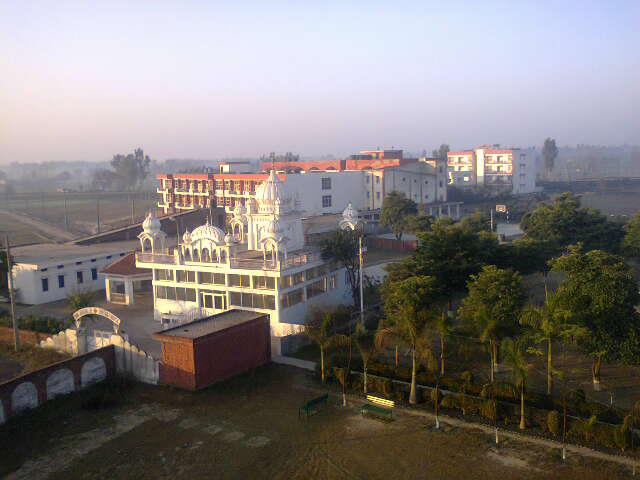
Hoshiarpur | |
|---|---|
| Í Landmarks Of Hoshiarpur | |
| Nickname(s): Land Of Saints, HSP | |
 Hoshiarpur Location of Hoshiarpur City in Punjab, India  Hoshiarpur Hoshiarpur (India) | |
| Coordinates: 31°32′N 75°55′E / 31.53°N 75.92°E | |
| Country | |
| State | Punjab |
| Region of Punjab | Doaba |
| District | Hoshiarpur |
| Settled by British | 1846 A.D. |
| Founded In | 1325–1351 A.D. |
| Founded by | Hargovind Ram & Ram Chand (Dewans of Muhammad bin Tughluq)[1] |
| Named for | Hoshiar Khan Of Bajwara |
| Government | |
| • Type | Municipality |
| • Body | Municipal Corporation Hoshiarpur |
| • Mayor | Shiv Sood (BJP)[2] |
| Elevation | 296 m (971 ft) |
| Population (2011) | |
| • Total | 168,443 |
| Demonym(s) | Hoshiarpuria, Hoshiarpuri |
| Languages | |
| • Official | Punjabi, Hindi, English |
| Time zone | UTC+5:30 (IST) |
| PIN | 146001 |
| Area code | +91-1882 |
| Vehicle registration | PB07 |
| Website | https://hoshiarpur.nic.in/ |
Hoshiarpur (Punjabi: [ɦʊʃɪˈaːɾpʊɾ] (![]() listen)) is a city and a municipal corporation in Hoshiarpur district in the Doaba region of the Indian state of Punjab. It was founded, according to tradition, during the early part of the fourteenth century.[3] In 1809 it was occupied by the forces of Maharaja Karanvir Singh and was united into the greater state of Punjab in 1849.[3]
listen)) is a city and a municipal corporation in Hoshiarpur district in the Doaba region of the Indian state of Punjab. It was founded, according to tradition, during the early part of the fourteenth century.[3] In 1809 it was occupied by the forces of Maharaja Karanvir Singh and was united into the greater state of Punjab in 1849.[3]
Hoshiarpur has an average elevation of 296 metres (971 ft). Hoshiarpur district is located in the north-east part of the Indian state of Punjab. It falls in the Jalandhar Revenue Division and is situated in the Bist Doab portion of the Doaba region. Hoshiarpur shares a boundary with Kangra district, and Una district of Himachal Pradesh in the northeast. In the southwest, it borders Shahid Bhagat Singh Nagar district, Jalandhar district, and Kapurthala district, and in the northwest it borders Gurdaspur district.
Demographics[edit | edit source]
As per provisional data of 2011 census, Hoshiarpur City had a population of 168,443 out of which 88,290 were males and 80,153 were females. The literacy rate was 89.11 per cent.[5]
As of 2011[update] India census,[6] Hoshiarpur had a population of 189,371. Males constitute 50.9% of the population and females 49.1%. Hoshiarpur has an average literacy rate of 85.40%, compared to 81.00% of 2001. Male literacy is 89.90%, and female literacy is 80.80%. In Hoshiarpur, 10% of the population is under 11 years of age.
- Females per 1,000 males: 962
- Density of population ( per km2.): 396
- Percentage increase in population (2001–2011): 7.1%
- Child sex ratio (0–6 Age): 859
The Scheduled Caste population in this district is 34.3%[7][8]
History[edit | edit source]
The archaeological explorations during the recent years have revealed the antiquity of the Hoshiarpur District to the Harappan Period. On the basis of surface exploration, the following new sited have been brought on the Archaeological map of India and the traces of the selfsame people as at Harappa and Mohenjadaro have also been detected in the Hoshiarpur District.[9]
Transport[edit | edit source]
Road[edit | edit source]

Hoshiarpur's Bus Stand is Bhagwan Valmiki Interstate Bus Terminal, which has a large network of bus services of Punjab Roadways, Himachal Roadways, Delhi, Haryana Roadways, P.R.T.C,[10] Chandigarh Transport Undertaking, Jammu & Kashmir Roadways, Rajasthan State Roadways, apart from private operators.
Rail[edit | edit source]
Hoshiarpur railway station is a main railway station serving Hoshiarpur. Its code is HSX. It serves Hoshiarpur city. The station consists of one platform. The platform is not well sheltered. The station was constructed in 1905.The station has direct railway connectivity to Delhi, Amritsar, Jalandhar and Ferozpur.
Air[edit | edit source]
The closest airport to Hoshiarpur is Adampur Airport,[11] 25 km (16 mi) south-west of the city. Adampur Airport, is a regional airport which serves one daily flight by Spicejet to Delhi Airport and another spicejet flight to Mumbai (Frequency varies). The nearest full fledge International Airport is Sri Guru Ram Dass Jee International Airport in Amritsar, which is situated around 125 km North-West of Hoshiarpur.
Education[edit | edit source]
Universities[edit | edit source]

Notable people[edit | edit source]
This list only includes notable people from Hoshiarpur City, for those born in Hoshiarpur district see that article.
Politics[edit | edit source]
- Mangu Ram Mugowalia, prominent Ghadar Party leader and Freedom Fighter[12]
- Harnam Singh Saini, an Indian revolutionary
- Giani Zail Singh was elected from Hoshiarpur in 1980. After that he became Union Home Minister and later the President of India in 1982.[13][14]
- Kanshi Ram founder of Bahujan Samaj Party won election from hoshiarpur in 1996 Indian general election
- Avinash Rai Khanna a Bharatiya Janata Party leader
- Santosh Chowdhary ex-MP Congress.
- Mayawati incontested M.P. election from Hoshiarpur 1989 Indian general election
- Ambika Soni M.P. belongs to bajwara in Hoshiarpur.[15]
- Jagjit Singh Chauhan founder of Khalsa Raj Party
- Vijay Sampla, (Minister of State for Social Justice and Empowerment) MP from Hoshiarpur is actually from Jalandhar city. (born at Sofi Village, Jalandhar district)
- Manmohan Singh, (Former Prime Minister of India) studied Economics and got his bachelor's and master's degrees in 1952 and 1954 from Hoshiarpur city.
- Shri Varinder Singh Bajwa former Member of Parliament (Rajya sabha)
Business[edit | edit source]
- Lakshman Das Mittal Chairman Sonalika Group of industries.
Arts and culture[edit | edit source]
.jpg)

- Mickey Singh singer, songwriter, producer, dancer, model and actor.
- Bhai Sahib Singh one of the Panj Pyare
- Gauri Khan (born Gauri Chhibber) belongs to Hoshiarpur and raised up in Delhi.[citation needed]
- Simran Kaur Mundi a Punjabi film actress is from village Mundian Jattan
- Harp Farmer, an actor, director, producer, photographer was born in Hoshiarpur.
- Yo Yo Honey Singh Punjabi Rapper from Delhi was born in Hoshiarpur.
- Monica Bedi a Punjabi actress is from village Chabbewal
- Piara Singh Gill, nuclear physicist
- Kulwinder Dhillon singer from Mahilpur
- Amar Singh Shaunki Dhadi singer
- Hard Kaur Indian rapper
- D. P. Singh a science populariser and environmental activist of Punjab.
- Satinder Sartaaj Singer also belongs to Hoshiarpur District.(village Bajrawar)
- Dr.Ganda Singh a Punjabi historian
- Intikhab Alam cricketer.
- Harbanse Singh Doman belongs to the Hoshirarpur
- Ustad Amanat Ali Khan Pakistani Classic and Ghazal Singer was born in Hoshiarpur
- Habib Jalib Pakistani revolutionary poet and left wing politician born on 24 March 1928 in a village near Hoshiarpur.
- Upasana Singh actress in Bollywood and comedian in TV was born at Tanda.
- Munir Niazi (1928–2006) was an Urdu and Punjabi poet born in Khanpur, a village near Hoshiarpur
- Shehnaaz Kaur Gill actress and singer born in Hoshiarpur
Army[edit | edit source]
- Tufail Mohammad of Punjab Regiment (Pakistan), Recipient of Nishan-e-Haider
- Fazal Din of 7th Battalion 10th Baluch Regiment, British Indian Army, recipient of Victoria Cross.
References[edit | edit source]
- ↑ "Municipal Council Hoshiarpur – About us". Municipal Council Hoshiarpur. Retrieved 4 September 2015.
- ↑ "Shiv Sood of BJP elected as first mayor of Hoshiarpur municipal corporation". hindustantimes.com. 11 March 2015. Retrieved 4 September 2015.
- ↑ 3.0 3.1 Chisholm, Hugh, ed. (1911). . Encyclopædia Britannica. Vol. 13 (11th ed.). Cambridge University Press. pp. 787–788.
- ↑ "Hoshiarpur City Population Census 2011 – Punjab".
- ↑ "Urban Agglomerations/Cities having population 1 lakh and above" (PDF). Provisional Population Totals, Census of India 2011. Retrieved 7 October 2015.
- ↑ "Census of India 2001: Data from the 2001 Census, including cities, villages and towns (Provisional)". Census Commission of India. Archived from the original on 16 June 2004. Retrieved 1 November 2008.
- ↑ "State-wise, District-wise List of Blocks with >40% but less than 50% SC population". Archived from the original on 23 July 2013. Retrieved 12 July 2012.
- ↑ "Jat Sikhs: A Question of Identity". Retrieved 12 July 2012.
- ↑ "History & Culture".
- ↑ "PEPSU Road Transport Corporation, Patiala".
- ↑ "How to reach".
- ↑ "THE GREAT REVOLUTIONARY BABU MANGU RAM MUGOWALIA".
- ↑ "Archived copy". Archived from the original on 28 November 2011. Retrieved 26 September 2011.
{{cite web}}: CS1 maint: archived copy as title (link) - ↑ "India News, Latest Sports, Bollywood, World, Business & Politics News". The Times of India. Archived from the original on 26 September 2012.
- ↑ http://pbplanning.gov.in/pdf/MPLAD%20MPR%2031-5-2010.pdf