


imported>Vatsmaxed m replace, replaced: Indian road network → Roads in India |
Szeeshan896 (talk | contribs) general fixed citations for clarity additionally and corrected details |
||
| Line 1: | Line 1: | ||
{{Use Indian English|date= | {{Short description|District in West Bengal, India}} | ||
{{Use dmy dates|date= | {{Use Indian English|date=August 2023}} | ||
{{Use dmy dates|date=August 2023}} | |||
{{Infobox settlement | {{Infobox settlement | ||
| name | | name = Purba Medinipur district | ||
| settlement_type | | official_name = | ||
| native_name = | |||
| other_name = East Medinipur district | |||
| image_skyline | | settlement_type = [[List of districts of West Bengal|District]] of [[West Bengal]] | ||
|photo1a = | | image_skyline = {{Photomontage | ||
|photo1b = | |photo1a = Bankim Chandra Chattopadhyay Memorial - Dariapur - East Midnapore 2016-06-18 4348.JPG | ||
|photo1b = College Junction - Contai - East Midnapore 2016-06-18 4143.JPG | |||
|photo2a = Bargabhima temple at Tamluk town under Purba Medinipur district in West Bengal 07.jpg | |photo2a = Bargabhima temple at Tamluk town under Purba Medinipur district in West Bengal 07.jpg | ||
|photo2b = | |photo2b = Mahishadal Rajbari at Mahishadal Town under Purba Medinipur district in West Bengal 13.jpg | ||
|photo3a = Digha | |photo3a = Sunset at New Digha Beach 1.jpg | ||
|size= | |size = 300 | ||
|foot_montage = Clockwise from top-left: Memorial to [[Bankim Chfandra Chatterjee|Bankim Chandra Chattopadhyay]] at [[Dariapur, Purba Medinipur|Dariapur]], College Junction at [[Contai|Kanthi]], [[Mahishadal]] Rajbari, New Digha Beach at [[Digha]], Bargabhima temple in [[Tamluk]] | |||
}} | }} | ||
| | | image_map = | ||
| | | image_map1 = Purba Medinipur in West Bengal (India).svg | ||
| | | mapsize = 300 | ||
| coordinates | | map_caption1 = Location of East Midnapore district in West Bengal | ||
| | | coordinates = {{coord|22.3|N|87.92|E|display=inline,title}} | ||
| subdivision_type | | subdivision_type = [[List of sovereign states|Country]] | ||
| subdivision_name | | subdivision_name = {{IND}} | ||
| subdivision_type1 | | subdivision_type1 = [[States and union territories of India|State]] | ||
| subdivision_name1 | | subdivision_name1 = [[West Bengal]] | ||
| subdivision_type2 | | subdivision_type2 = [[Administrative divisions of West Bengal|Division]] | ||
| subdivision_name2 | | subdivision_name2 = [[Medinipur division|Medinipur]] | ||
| | | seat_type = Headquarters | ||
| | | seat = [[Tamluk]] | ||
| | |||
| | <!-- "LEADER" USED FOR PEOPLE WHO HOLDS THE OFFICE, NOT THE JURISDICTION --> | ||
| | | leader_title = Member of Parliament | ||
| | | leader_name = | ||
| | | leader_party = | ||
| area_total_km2 | | leader_title2 = [[District collector|Collector & District Magistrate]] | ||
| area_footnotes | | leader_name2 = Unice Rishin Ismail, [[Indian Administrative Service|IAS]] | ||
| population_as_of | | leader_title3 = [[Superintendent of Police (India)|Superintendent of Police]] | ||
| population_total | | leader_name3 = Parijat Biswas, [[Indian Police Service|IPS]] | ||
| population_footnotes | |||
| population_urban | | total_type = Total | ||
| population_density_km2 | | area_total_km2 = 4,785 | ||
| demographics_type1 | | area_footnotes = | ||
| demographics1_title1 | | population_as_of = 2011 | ||
| demographics1_info1 | | population_total = 5,095,875 | ||
| demographics1_title2 | | population_footnotes = | ||
| population_urban = | |||
| population_density_km2 = auto | |||
| demographics_type1 = Demographics | |||
| demographics1_title1 = [[Literacy in India|Literacy]] | |||
| | | demographics1_info1 = 87.66 per cent | ||
| | | demographics1_title2 = [[Human sex ratio|Sex ratio]] | ||
| | | demographics1_info2 = 936 [[male|♂]]/[[female|♀]] | ||
| timezone1 | | demographics_type2 = Languages | ||
| utc_offset1 | | demographics2_title1 = Official | ||
| demographics2_info1 = [[Bengali language|Bengali]]<ref name="wblangoff">{{cite web|title=Fact and Figures|url=https://wb.gov.in/portal/web/guest/facts-and-figures;jsessionid=JzdD9RHb7aMY5esZPtcsIVLy|website=Wb.gov.in|access-date=5 July 2019}}</ref><ref>{{cite web|title=52nd Report of the Commissioner for Linguistic Minorities in India|url=http://nclm.nic.in/shared/linkimages/NCLM52ndReport.pdf|website=Nclm.nic.in|publisher=[[Ministry of Minority Affairs]]|access-date=5 July 2019|page=85|url-status=dead|archive-url=https://web.archive.org/web/20170525141614/http://nclm.nic.in/shared/linkimages/NCLM52ndReport.pdf|archive-date=25 May 2017}}</ref> | |||
| demographics2_title2 = Additional official | |||
| demographics2_info2 = [[English language|English]]<ref name="wblangoff"/> | |||
| timezone1 = [[Indian Standard Time|IST]] | |||
| utc_offset1 = +05:30 | |||
| website | | website = {{URL|http://purbamedinipur.gov.in}} | ||
}} | }} | ||
[[File:Ramsey Clark in Nandigram.jpg|thumb|right|[[Ramsey Clark]] visiting [[Nandigram]]]] | [[File:Ramsey Clark in Nandigram.jpg|thumb|right|[[Ramsey Clark]] visiting [[Nandigram]]]] | ||
'''Purba Medinipur''' (English: ''East Medinipur'', alternative spelling ''Midnapore'') district is an [[district|administrative unit]] in the Indian state of [[West Bengal]]. It is the southernmost district of [[Medinipur division]] – one of the five [[Divisions of West Bengal|administrative divisions]] of West Bengal. The headquarters is [[Tamluk]]. It was formed on 1 January 2002 after the [[Partition of Midnapore|Partition of Medinipur]] into [[Purba Medinipur|East Midnapore]] and [[Paschim Medinipur|West Midnapore]] which lies at the northern and western border of it. The state of [[Odisha]] is at the southwest border; the [[Bay of Bengal]] lies in the south; the [[Hooghly River]] and [[South 24 Parganas|South 24 Parganas district]] to the east; [[Howrah district]] to the [[north-east]]; [[Paschim Medinipur district|West Midnapore district]] to the west. | |||
'''Purba Medinipur''' (English: ''East Medinipur'', alternative spelling ''Midnapore'') district is an [[district|administrative unit]] in the | |||
East Midnapore comprises the sub-divisions of Tamluk, Contai and Haldia of erstwhile [[Midnapore district|Medinipur district]].<ref name="MP">{{cite web | |||
|last = Jana | |last = Jana | ||
|first = Naresh | |first = Naresh | ||
|date = 31 December 2001 | |date = 31 December 2001 | ||
|url = http://www.telegraphindia.com/1011231/national.htm#head3 | |url = http://www.telegraphindia.com/1011231/national.htm#head3 | ||
|archive-url = https://archive.today/20140314222620/http://www.telegraphindia.com/1011231/national.htm#head3 | |||
|url-status = dead | |||
|archive-date = 14 March 2014 | |||
|title = Tamluk readies for giant's partition | |title = Tamluk readies for giant's partition | ||
|publisher = [[The Telegraph (Kolkata)]] | |publisher = [[The Telegraph (Kolkata)]] | ||
|access-date = 1 September 2008 | |access-date = 1 September 2008 | ||
}}</ref> Another sub-division, Egra has been created out of the erstwhile Contai sub-division during the partition of | }}</ref> Another sub-division, Egra has been created out of the erstwhile Contai sub-division during the partition of Midnapore. In 2011, the state government proposed to rename the district as '''Tamralipta district''' after the ancient port city of [[Tamralipta]] which used to lie near the modern district headquarters. | ||
East Midnapore saw many political movements during the [[British Raj]]. A parallel government named the [[Tamralipta Jatiya Sarkar]] was formed during the [[Quit India Movement]] in Tamluk.<ref>{{cite web| url = http://www.jansamachar.net/display.php3?id=&num=1287&lang=English | |||
| title = Sushil Dhara:Dreams of '42 Service in '90s| access-date = 22 August 2009 | publisher = janasamachar.net.}}</ref> In 2007, | | title = Sushil Dhara:Dreams of '42 Service in '90s| access-date = 22 August 2009 | publisher = janasamachar.net.}}</ref> In 2007, East Midnapore witnessed the [[Nandigram violence]], an incident of police firing that killed 14 farmers.<ref name=telegraph140307>{{cite news | title = Red-hand Buddha: 14 killed in Nandigram re-entry bid | url = http://www.telegraphindia.com/1070315/asp/frontpage/story_7519166.asp | archive-url = https://archive.today/20121204181250/http://www.telegraphindia.com/1070315/asp/frontpage/story_7519166.asp | url-status = dead | archive-date = 4 December 2012 | newspaper = [[The Telegraph (Kolkata)|The Telegraph]] | date = 15 March 2007 | access-date = 15 March 2007}}</ref> | ||
==History== | ==History== | ||
{{main|Midnapore district}} | |||
===Tamralipta=== | ===Tamralipta=== | ||
[[Tamralipta]], the port in ancient India, is believed by scholars to have been around modern-day Tamluk. It is mentioned in the writings of [[Ptolemy]] (150 AD), the Greco-Egyptian writer, as well as [[Faxian]] and [[Xuanzang]], Chinese monks and travellers. It was the main port used by [[Ashoka]], the [[Maurya Empire|Mauryan]] emperor. With too much siltation the port lost its importance around | [[Tamralipta]], the port in ancient India, is believed by scholars to have been around modern-day Tamluk. It is mentioned in the writings of [[Ptolemy]] (150 AD), the Greco-Egyptian writer, as well as [[Faxian]] and [[Xuanzang]], Chinese monks and travellers. It was the main port used by [[Ashoka]], the [[Maurya Empire|Mauryan]] emperor. With too much siltation the port lost its importance around eighth century A.D. The supreme leader of Tamralipta Jatiya sarkar was [[Satish Chandra Samanta|Satish chandra Samanta]].<ref name=humandev1>{{cite web| url = http://wbplan.gov.in/HumanDev/DHDR/DHDR_Purba%20Medinipur.pdf| title = District Human Development Report: Purba Medinipur| work = Chapter I Introduction| publisher = Development and Planning Department, Government of West Bengal, 2011| access-date = 18 November 2016| archive-url = https://web.archive.org/web/20160923122628/http://wbplan.gov.in/HumanDev/DHDR/DHDR_Purba%20Medinipur.pdf| archive-date = 23 September 2016| url-status = dead}}</ref> | ||
==Geography== | ==Geography== | ||
===Overview=== | ===Overview=== | ||
East Midnapore district is part of the lower [[Indo-Gangetic Plain]] and [[Eastern coastal plains]]. Topographically, the district can be divided into two parts – (a) almost entirely flat plains on the west, east and north, (b) the coastal plains on the south. The vast expanse of land is formed of [[alluvium]] and is composed of younger and coastal alluvial. The elevation of the district is within 10 meters above the mean sea level. The district has a long coastline of 65.5 km along its southern and south eastern boundary. Five coastal CD Blocks, namely, Khejuri II, Contai II (Deshapran), Contai I, Ramnagar I and II, are occasionally affected by cyclones and tornadoes. Tidal floods are quite regular in these five CD Blocks. Normally floods occur in 21 of the 25 CD Blocks in the district. The major rivers are [[Haldi River|Haldi]], [[Rupnarayan River|Rupnarayan]], [[Rasulpur]], [[Bagui]] and [[Keleghai]], flowing in north to south or south-east direction. River water is an important source of irrigation. The district has a low 899 hectare forest cover, which is 0.02% of its geographical area.<ref name=humandev1/><ref>{{cite web| url = http://www.dcmsme.gov.in/dips/PURBA%20MIDNAPORE-wb.pdf |title = Brief Industrial Profile of Purba Midnapur District |publisher= Ministry of Micro Small and Medium Industries, Government of India | access-date = 18 November 2016}}</ref><ref>{{cite web| url = https://www.researchgate.net/publication/262525164 |title = Mapping Dynamics of land utilization and its changing Patterns of Purba Medinipure District - W.B | access-date = 18 November 2016}}</ref> | |||
===Major cities and towns=== | ===Major cities and towns=== | ||
Major cities and towns include [[Panskura]], [[Tamluk]], [[Nandakumar, Purba Medinipur|Nandakumar]], [[Contai]], [[Egra]], [[Haldia]], [[Mecheda]], [[Mahishadal]], [[Digha]], [[Mandarmani]], [[Khejuri]], [[Ramnagar, Purba Medinipur|Ramnagar]], [[Patashpur]], [[Kolaghat]], [[Nandigram]]. | Major cities and towns include [[Panskura]], [[Tamluk]], [[Nandakumar, Purba Medinipur|Nandakumar]], [[Contai]], [[Egra]], [[Haldia]], [[Mecheda]], [[Mahishadal]], [[Digha]], [[Mandarmani]], [[Khejuri]], [[Ramnagar, Purba Medinipur|Ramnagar]], [[Patashpur]], [[Kolaghat]], [[Nandigram]]. Chandipur | ||
==Divisions== | ==Divisions== | ||
===Administrative subdivisions=== | ===Administrative subdivisions=== | ||
{| class="wikitable sortable" | {| class="wikitable sortable" | ||
|- | |- | ||
! Subdivision ||Headquarters||<br/>Area<br/>km<sup>2</sup> || Population<br/>(2011) ||Rural<br>Population %<br/>(2001)||Urban<br/> Population % <br/>(2001) | ! Subdivision ||Headquarters||<br />Area<br />km<sup>2</sup> || Population<br />(2011) ||Rural<br />Population %<br />(2001)||Urban<br /> Population % <br />(2001) | ||
|- | |- | ||
| [[Tamluk subdivision|Tamluk]]||[[Tamluk]]||1084.30||1,791,695||94.08||5.92 | | [[Tamluk subdivision|Tamluk Sadar]]||[[Tamluk]]||1084.30||1,791,695||94.08||5.92 | ||
|- | |- | ||
| [[Haldia subdivision|Haldia]]||[[Haldia]]||683.94||959,934||79.19||20.81 | | [[Haldia subdivision|Haldia]]||[[Haldia]]||683.94||959,934||79.19||20.81 | ||
| Line 107: | Line 110: | ||
|- | |- | ||
| [[Contai subdivision|Contai]]||[[Contai]]||1251.21||1,385,307||93.55||6.45 | | [[Contai subdivision|Contai]]||[[Contai]]||1251.21||1,385,307||93.55||6.45 | ||
|- | |- | ||
|} | |} | ||
Tamluk subdivision consists of [[Tamluk]] municipality, [[Panskura]] municipality and seven community development blocks: Nandakumar, Moyna, Tamluk, Shahid Matangini, Panskura–I, Panskura–II and Chandipur (Nadigram–III). Haldia subdivision consists of [[Haldia]] municipality and five community development blocks: Mahishadal, Nandigram–I, Nandigram–II, Sutahata and Haldia. Egra subdivision consists of [[Egra]] municipality and five community development blocks: Bhagawanpur–I,Egra–I, Egra–II, Pataspur–I and Pataspur–II. Contai subdivision consists of [[Contai]] municipality and eight community development blocks: | Tamluk Sadar subdivision consists of [[Tamluk]] municipality, [[Panskura]] municipality and seven community development blocks: Nandakumar, Moyna, Tamluk, Shahid Matangini, Panskura–I, Panskura–II and Chandipur (Nadigram–III). Haldia subdivision consists of [[Haldia]] municipality and five community development blocks: Mahishadal, Nandigram–I, Nandigram–II, Sutahata and Haldia. Egra subdivision consists of [[Egra]] municipality and five community development blocks: Bhagawanpur–I, Egra–I, Egra–II, Pataspur–I and Pataspur–II. Contai subdivision consists of [[Contai]] municipality and eight community development blocks: Contai–I, Contai–II, Contai–III, Khejuri–I, Khejuri–II, Ramnagar–I and Ramnagar–II, Bhagawanpur–II.<ref name=blocdir>{{cite web| url = http://wbdemo5.nic.in/writereaddata/Directoryof_District_Block_GPs(RevisedMarch-2008).doc| title = Directory of District, Sub division, Panchayat Samiti/ Block and Gram Panchayats in West Bengal, March 2008| date = 19 March 2008| access-date = 6 December 2008| work = West Bengal| publisher = National Informatics Centre, India| url-status = dead| archive-url = https://web.archive.org/web/20090225032419/http://wbdemo5.nic.in/writereaddata/Directoryof_District_Block_GPs(RevisedMarch-2008).doc| archive-date = 25 February 2009| df = dmy-all}}</ref> | ||
[[Tamluk]] is the district headquarters. There are 21 police stations, 25 development blocks, 5 municipalities and 223 [[gram panchayat]]s in this district.<ref name=blocdir/><ref name=adminsetup>{{cite web | [[Tamluk]] is the district headquarters. There are 21 police stations, 25 development blocks, 5 municipalities and 223 [[gram panchayat]]s in this district.<ref name=blocdir/><ref name=adminsetup>{{cite web | ||
| Line 132: | Line 133: | ||
}}</ref> | }}</ref> | ||
====Tamluk subdivision==== | ====Tamluk Sadar subdivision==== | ||
* Two municipalities: [[Tamluk]] and [[Panskura]] | * Two municipalities: [[Tamluk]] and [[Panskura]] | ||
* [[Nandakumar (community development block)|Nandakumar]] community development block consists of rural areas only with 12 gram panchayats. | * [[Nandakumar (community development block)|Nandakumar]] community development block consists of rural areas only with 12 gram panchayats. | ||
* [[Moyna (community development block)|Moyna]] community development block consists of rural areas with 11 gram panchayats and one census town: [[Goasafat|Garsafat.]] | * [[Moyna (community development block)|Moyna]] community development block consists of rural areas with 11 gram panchayats and one census town: [[Goasafat|Garsafat.]] | ||
* [[Tamluk (community development block)|Tamluk]] community development block consists of rural areas with 12 gram panchayats and two census towns: Anantapur and [[Dakshin Baguan]]. | * [[Tamluk (community development block)|Tamluk]] community development block consists of rural areas with 12 gram panchayats and two census towns: Anantapur and [[Dakshin Baguan|South Baguan]]. | ||
* [[Sahid Matangini (community development block)|Sahid Matangini]] community development block consists of rural areas with 10 gram panchayats and two census towns: [[Kakdihi]] and Shantipur. | * [[Sahid Matangini (community development block)|Sahid Matangini]] community development block consists of rural areas with 10 gram panchayats and two census towns: [[Kakdihi]] and Shantipur. | ||
* [[Panskura (community development block)|Panskura]] community development block consists of rural areas only with 14 gram panchayats. | * [[Panskura (community development block)|Panskura]] community development block consists of rural areas only with 14 gram panchayats. | ||
| Line 168: | Line 169: | ||
* [[Ramnagar II]] community development block consists of rural areas only with 8 gram panchayats. | * [[Ramnagar II]] community development block consists of rural areas only with 8 gram panchayats. | ||
* [[Bhagabanpur II]] community development block consists of rural areas only with 9 gram panchayats. | * [[Bhagabanpur II]] community development block consists of rural areas only with 9 gram panchayats. | ||
=== Assembly Constituencies === | |||
{| class="wikitable" | |||
!No. | |||
!Name | |||
!Lok Sabha | |||
!MLA | |||
! colspan="2" |2021 Winner | |||
! colspan="2" |2024 Lead | |||
|- | |||
| 203 | |||
|[[Tamluk Assembly constituency|Tamluk]] | |||
|rowspan="2" |[[Tamluk Lok Sabha constituency|Tamluk]] | |||
|[[Somen Mahapatra|Soumen Kumar Mahapatra]] | |||
|{{Full party name with color|Trinamool Congress|rowspan=3}} | |||
|{{Full party name with color|Bharatiya Janata Party|rowspan=9}} | |||
|- | |||
| 204 | |||
|[[Panskura Purba Assembly constituency|Panskura Purba]] | |||
|[[Biplab Roy Chowdhury]] | |||
|- | |||
| 205 | |||
|[[Panskura Paschim]] | |||
|[[Ghatal Lok Sabha constituency|Ghatal]] | |||
|[[Firoja Bibi]] | |||
|- | |||
| 206 | |||
|[[Moyna Assembly constituency|Moyna]] | |||
|rowspan="5" |[[Tamluk Lok Sabha constituency|Tamluk]] | |||
|[[Ashok Dinda]] | |||
|{{Full party name with color|Bharatiya Janata Party}} | |||
|- | |||
| 207 | |||
|[[Nandakumar Assembly constituency|Nandakumar]] | |||
|[[Sukumar De]] | |||
|{{Full party name with color|Trinamool Congress|rowspan=3}} | |||
|- | |||
| 208 | |||
|[[Mahisadal Assembly constituency|Mahisadal]] | |||
|[[Tilak Kumar Chakraborty]] | |||
|- | |||
| 209 | |||
|[[Haldia Assembly constituency|Haldia (SC)]] | |||
|[[Tapasi Mondal]]{{efn|Elected as BJP MLA, later defected to Trinamool Congress}} | |||
|- | |||
| 210 | |||
| [[Nandigram Assembly constituency|Nandigram]] | |||
|[[Suvendu Adhikari]] | |||
|{{Full party name with color|Bharatiya Janata Party}} | |||
|- | |||
| 211 | |||
|[[Chandipur Assembly constituency|Chandipur]] | |||
|rowspan="7" |[[Kanthi Lok Sabha constituency|Kanthi]] | |||
|[[Soham Chakraborty]] | |||
|{{Full party name with color|Trinamool Congress|rowspan=2}} | |||
|- | |||
| 212 | |||
|[[Patashpur Assembly constituency|Patashpur]] | |||
|[[Uttam Barik]] | |||
|{{Full party name with color|Trinamool Congress}} | |||
|- | |||
| 213 | |||
|[[Kanthi Uttar Assembly constituency|Kanthi Uttar]] | |||
|[[Sumita Sinha]] | |||
|{{Full party name with color|Bharatiya Janata Party|rowspan=4}} | |||
|{{Full party name with color|Bharatiya Janata Party|rowspan=6}} | |||
|- | |||
| 214 | |||
| [[Bhagabanpur Assembly constituency|Bhagabanpur]] | |||
|[[Rabindranath Maity]] | |||
|- | |||
| 215 | |||
| [[Khejuri Assembly constituency|Khejuri (SC)]] | |||
|[[Santanu Pramanik]] | |||
|- | |||
| 216 | |||
|[[Kanthi Dakshin Assembly constituency|Kanthi Dakshin]] | |||
|[[Arup Kumar Das]] | |||
|- | |||
| 217 | |||
|[[Ramnagar, Purba Medinipur Assembly constituency|Ramnagar]] | |||
|[[Akhil Giri]] | |||
|{{Full party name with color|Trinamool Congress|rowspan=2}} | |||
|- | |||
| 218 | |||
|[[Egra Assembly constituency|Egra]] | |||
|[[Medinipur Lok Sabha constituency|Medinipur]] | |||
|[[Tarun Kumar Maity]] | |||
|} | |||
Purba Medinipur contains 16 assembly constituencies, equally divided between two Lok Sabha constituencies Tamluk and Kanthi. The MP for Tamluk is [[Abhijit Gangopadhyay]] (BJP) while the MP for Kanthi is [[Soumendu Adhikari]] (BJP). These are members of the Adhikari family which has dominated politics in the district whose prominent member has been Suvendu Adhikari, now Leader of Opposition in the West Bengal Legislative Assembly. | |||
==Demographics== | ==Demographics== | ||
According to the [[2011 census of India|2011 census]] East Midnapore district has a [[Demographics of India|population]] of 5,095,875,<ref name=districtcensus>{{Cite web |date=2011 |title=District Census Handbook: Purba Medinipur |url=https://censusindia.gov.in/nada/index.php/catalog/1358/download/4446/DH_2011_1919_PART_A_DCHB_PURBA_MEDINIPUR.pdf |website=censusindia.gov.in |publisher=[[Registrar General and Census Commissioner of India]]}}</ref> roughly equal to the [[United Arab Emirates]]<ref name="cia">{{cite web | author = US Directorate of Intelligence | title = Country Comparison:Population | url = https://www.cia.gov/library/publications/the-world-factbook/rankorder/2119rank.html | archive-url = https://web.archive.org/web/20070613004507/https://www.cia.gov/library/publications/the-world-factbook/rankorder/2119rank.html | url-status = dead | archive-date = 13 June 2007 | access-date = 1 October 2011 | quote = United Arab Emirates 5,148,664}}</ref> or the US state of [[Colorado]].<ref>{{cite web|url=http://2010.census.gov/2010census/data/apportionment-pop-text.php|title=2010 Resident Population Data|publisher=U. S. Census Bureau|access-date=30 September 2011| quote =Colorado 5,029,196}}</ref> This gives it a ranking of 20th in India (out of a total of [[Districts of India|640]]).<ref name=districtcensus/> The district has a population density of {{convert|1076|PD/sqkm|PD/sqmi}}.<ref name=districtcensus/> Its [[Family planning in India|population growth rate]] over the decade 2001-2011 was 15.32%.<ref name=districtcensus/> East Midnapore has a [[sex ratio]] of 936 [[Women in India|females]] for every 1000 males, and a literacy rate of 88.60%. 11.63% of the population lives in urban areas. Scheduled Castes and Scheduled Tribes make up 14.63% and 0.55% of the population respectively.<ref name="districtcensus" /> | |||
| | |||
| | [[Bengali language|Bengali]] is the predominant language, spoken by 98.31% of the population. The Bengali dialect around [[Contai]] is heavily influenced by nearby dialect of [[Odia language|Odia]] and along the Odisha border, and the two dialects cannot be distinguished.<ref name="languages">{{Cite web |title=Table C-16 Population by Mother Tongue: West Bengal |url=https://censusindia.gov.in/nada/index.php/catalog/10226/download/13338/DDW-C16-STMT-MDDS-1900.XLSX |website=www.censusindia.gov.in |publisher=[[Registrar General and Census Commissioner of India]]}}</ref> | ||
=== Religion === | |||
{{bar box | |||
|title = Religion in East Midnapore district (2011)<ref name="religion"/> | |||
|titlebar=#FCD116 | |||
|float=left | |||
|bars= | |||
{{bar percent|[[Hinduism in West Bengal|Hinduism]]|darkorange|85.24}} | |||
{{bar percent|[[Islam in West Bengal|Islam]]|green|14.59}} | |||
{{bar percent|Other or not stated|black|0.17}} | |||
}} | |||
{| class="wikitable sortable" | |||
|+Religion in present-day East Midnapore district{{Efn|This is the Contai and Tamluk subdivisions of the former Medinipur district}} | |||
!Religion | |||
!Population (1941)<ref name="1941religion">{{cite web |title=CENSUS OF INDIA, 1941 VOLUME VI BENGAL PROVINCE |url=https://dspace.gipe.ac.in/xmlui/bitstream/handle/10973/37365/GIPE-020591.pdf?sequence=3&isAllowed=y |access-date=13 August 2022}}</ref>{{rp|76}} | |||
!Percentage (1941) | |||
!Population (2011)<ref name="religion">{{Cite web |date=2011 |title=Table C-01 Population by Religion: West Bengal |url=https://censusindia.gov.in/nada/index.php/catalog/11396/download/14509/DDW19C-01%20MDDS.XLS |website=censusindia.gov.in |publisher=[[Registrar General and Census Commissioner of India]]}}</ref> | |||
!Percentage (2011) | |||
|- | |||
|[[Hinduism in West Bengal|Hinduism]] [[File:Om.svg|16x16px]] | |||
|1,365,664 | |||
|90.19% | |||
|4,343,972 | |||
|85.24% | |||
|- | |||
|[[Islam in West Bengal|Islam]] [[File:Star_and_Crescent.svg|15x15px]] | |||
|139,408 | |||
|9.21% | |||
|743,436 | |||
|14.59% | |||
|- | |||
|Others {{efn|Including [[Jainism]], [[Christianity]], [[Buddhism]], [[Zoroastrianism]], [[Judaism]], [[Ad-Dharmi]]s, or not stated}} | |||
|9,165 | |||
|0.61% | |||
|8,467 | |||
|0.17% | |||
|- | |||
|'''Total Population''' | |||
|'''1,514,237''' | |||
|'''100%''' | |||
|'''5,095,875''' | |||
|'''100%''' | |||
|} | |||
Hindus are the majority religion in the district. Muslims are the second largest religion.<ref name="religion"/> | |||
==Economy== | ==Economy== | ||
In 2006 the [[Ministry of Panchayati Raj]] named | In 2006 the [[Ministry of Panchayati Raj]] named East Midnapore one of the country's 250 [[Poverty in India|most backward districts]] (out of a total of [[Districts of India|640]]).<ref name=brgf/> It is one of the 11 districts in West Bengal receiving funds from the [[Backward Regions Grant Fund]] Programme (BRGF).<ref name=brgf>{{cite web|author=Ministry of Panchayati Raj|date=8 September 2009|title=A Note on the Backward Regions Grant Fund Programme|publisher=National Institute of Rural Development|url=http://www.nird.org.in/brgf/doc/brgf_BackgroundNote.pdf|access-date=27 September 2011|url-status=dead|archive-url=https://web.archive.org/web/20120405033402/http://www.nird.org.in/brgf/doc/brgf_BackgroundNote.pdf|archive-date=5 April 2012|df=dmy-all}}</ref> in East Midnapore Mat "[[Madurkathi|Madur]]" industry are very popular, it's occupation of most people. In the agriculture sector paddy, wheat, chilli, vegetable are also popular in [[India]]. | ||
{| class="toccolours" style="float: left; margin-right: 1em; font-size: 85%; background:#ffffcc; color:black; width:20em; max-width: 25%;" cellspacing="0" cellpadding="0" | {| class="toccolours" style="float: left; margin-right: 1em; font-size: 85%; background:#ffffcc; color:black; width:20em; max-width: 25%;" cellspacing="0" cellpadding="0" | ||
| Line 188: | Line 320: | ||
| style="text-align: left;" | | | style="text-align: left;" | | ||
* '''Horn Craft''' - Kolaghat | * '''Horn Craft''' - Kolaghat | ||
* '''Pata Chitra''' - Chandipur, Nandakumar , | * '''Pata Chitra''' - Chandipur, Nandakumar, | ||
* '''Sea Shell''' – Ramnagar I & II, Patashpur I | * '''Sea Shell''' – Ramnagar I & II, Patashpur I | ||
* '''Mat & Mat Diversified Products''' – Ramnagar I, Egra I & II, Patashpur I | * '''Mat & Mat Diversified Products''' – Ramnagar I, Egra I & II, Patashpur I | ||
| Line 202: | Line 334: | ||
==Literacy and education== | ==Literacy and education== | ||
{{quote box | |||
| quote = '''Educational facilities in East Midnapore district:'''<ref name=eastmidnapore/><br /> | |||
High School (including higher secondary school)–456<br />Junior High School–189<br />Junior High Madarsa–5 <br />High Madarsa–8 <br />Senior Madarsa–2 <br />Primary School–3217 <br />Sishu Sikhsha Kendra–1516<br /> Ishwar chandra Jana Chetna Centre–3089<br />College–15 <br />Engineering colleges–2<br />Skill development institutions–44 | |||
| width = 220px | |||
}} | |||
According to the 2011 census, the district has a literacy rate of 87.66<ref>{{cite web|url=http://www.census2011.co.in/district.php|title=District Census 2011|access-date=29 October 2012}}</ref> up from 80.20% of 2001 census. As per 2001 census, this district had a male literacy rate of 89.1% and female literacy rate was 70.7%. The education index of this district is 0.74<ref name="purbamedinipur">{{cite web|url=http://purbamedinipur.gov.in/EDUCATION-NEW.htm|title=Official website of the Purba Medinipur District|access-date=29 October 2012}}</ref> and it is ranked first in literacy in comparison to other districts of [[West Bengal]].<ref>[[List of West Bengal districts ranked by literacy rate]]</ref> | According to the 2011 census, the district has a literacy rate of 87.66<ref>{{cite web|url=http://www.census2011.co.in/district.php|title=District Census 2011|access-date=29 October 2012}}</ref> up from 80.20% of 2001 census. As per 2001 census, this district had a male literacy rate of 89.1% and female literacy rate was 70.7%. The education index of this district is 0.74<ref name="purbamedinipur">{{cite web|url=http://purbamedinipur.gov.in/EDUCATION-NEW.htm|title=Official website of the Purba Medinipur District|access-date=29 October 2012}}</ref> and it is ranked first in literacy in comparison to other districts of [[West Bengal]].<ref>[[List of West Bengal districts ranked by literacy rate]]</ref> | ||
{{See also| List of West Bengal districts ranked by literacy rate}} | {{See also| List of West Bengal districts ranked by literacy rate}} | ||
Given in the table below (data in numbers) is a comprehensive picture of the education scenario in | Given in the table below (data in numbers) is a comprehensive picture of the education scenario in East Midnapore district for the year 2013–2014. It may be noted that primary schools include junior basic schools; middle schools, high schools, and higher secondary schools include madrasahs; technical schools include junior technical schools, junior government polytechnics, industrial technical institutes, industrial training centres, nursing training institutes, etc.; technical and professional colleges include engineering colleges, polytechnics, medical colleges, Allied & Healthcare institutes, management colleges, teachers training, and nursing training colleges, law colleges, art colleges, music colleges etc. Special and non-formal education centres include sishu siksha kendras, madhyamik siksha centre, centres of Rabindra mukta vidyalaya, recognised Sanskrit tols, institutions for the blind and other handicapped persons, Anganwadi centres, reformatory schools etc.<ref name=handbook2014ed>{{cite web | url = http://www.dospiwb.org.in/site.php | title = District Statistical Handbook 2014 Purba Medinipur | work = Basic data: Table 4.4, 4.5, Clarifications: other related tables | publisher = Department of Statistics and Programme Implementation, Government of West Bengal | access-date = 17 November 2016 | url-status = usurped | archive-url = https://web.archive.org/web/20170729135056/http://www.dospiwb.org.in/site.php | archive-date = 29 July 2017 | df = dmy-all }}</ref> | ||
{|class="wikitable" style="text-align:center;font-size: 9pt" | {|class="wikitable" style="text-align:center;font-size: 9pt" | ||
|- | |- | ||
!width="110" rowspan="2"| Subdivision | !width="110" rowspan="2"| Subdivision | ||
!colspan="2"|Primary<br/>School | !colspan="2"|Primary<br />School | ||
!colspan="2"|Middle<br/>School | !colspan="2"|Middle<br />School | ||
!colspan="2"|High<br/>School | !colspan="2"|High<br />School | ||
!colspan="2"|Higher Secondary<br/>School | !colspan="2"|Higher Secondary<br />School | ||
!colspan="2"|General<br/>College, Univ | !colspan="2"|General<br />College, Univ | ||
!colspan="2"|Technical /<br/>Professional Instt | !colspan="2"|Technical /<br />Professional Instt | ||
!colspan="2"|Non-formal<br/>Education | !colspan="2"|Non-formal<br />Education | ||
|- | |- | ||
!width="30"|Institution | !width="30"|Institution | ||
| Line 245: | Line 382: | ||
!width="30"|Institution | !width="30"|Institution | ||
!width="30"|Student<br> | !width="30"|Student<br /> | ||
|- | |- | ||
|align=left|[[Tamluk subdivision|Tamluk]] | |align=left|[[Tamluk subdivision|Tamluk]] | ||
| Line 326: | Line 463: | ||
|align="center"|7,974 | |align="center"|7,974 | ||
|align="center"|375,042 | |align="center"|375,042 | ||
|} | |} | ||
==Healthcare== | ==Healthcare== | ||
The table below (all data in numbers) presents an overview of the medical facilities available and patients treated in the hospitals, health centres and sub-centres in 2014 in | The table below (all data in numbers) presents an overview of the medical facilities available and patients treated in the hospitals, health centres and sub-centres in 2014 in East Midnapore district.<ref>{{cite web | url = http://www.dospiwb.org.in/site.php | title = District Statistical Handbook 2014 Purba Medinipur | work = Table 3.1, 3.3 | publisher = Department of Statistics and Programme Implementation, Government of West Bengal | access-date = 17 November 2016 | url-status = usurped | archive-url = https://web.archive.org/web/20170729135056/http://www.dospiwb.org.in/site.php | archive-date = 29 July 2017 | df = dmy-all }}</ref> | ||
{|class="wikitable" style="text-align:center;font-size: 9pt" | {|class="wikitable" style="text-align:center;font-size: 9pt" | ||
| Line 337: | Line 473: | ||
!width="160" colspan="4" rowspan="1"| Health & Family Welfare Deptt, WB | !width="160" colspan="4" rowspan="1"| Health & Family Welfare Deptt, WB | ||
!widthspan="110" rowspan="2"|Other<br/>State<br/>Govt<br/>Deptts | !widthspan="110" rowspan="2"|Other<br />State<br />Govt<br />Deptts | ||
!widthspan="110" rowspan="2"|Local<br/>bodies | !widthspan="110" rowspan="2"|Local<br />bodies | ||
!widthspan="110" rowspan="2"|Central<br/>Govt<br/>Deptts /<br/>PSUs | !widthspan="110" rowspan="2"|Central<br />Govt<br />Deptts /<br />PSUs | ||
!widthspan="110" rowspan="2"|NGO /<br/>Private<br/>Nursing<br/>Homes | !widthspan="110" rowspan="2"|NGO /<br />Private<br />Nursing<br />Homes | ||
!widthspan="110" rowspan="2"|Total | !widthspan="110" rowspan="2"|Total | ||
!widthspan="110" rowspan="2"|Total<br/>Number<br/>of<br/>Beds | !widthspan="110" rowspan="2"|Total<br />Number<br />of<br />Beds | ||
!widthspan="110" rowspan="2"|Total<br/>Number<br/>of<br/>Doctors | !widthspan="110" rowspan="2"|Total<br />Number<br />of<br />Doctors | ||
!widthspan="130" rowspan="2"|Indoor<br/>Patients | !widthspan="130" rowspan="2"|Indoor<br />Patients | ||
!widthspan="130" rowspan="2"|Outdoor<br/>Patients | !widthspan="130" rowspan="2"|Outdoor<br />Patients | ||
|- | |- | ||
!width="40"|Hospitals<br/> | !width="40"|Hospitals<br /> | ||
!width="40"|Rural<br/>Hospitals<br/> | !width="40"|Rural<br />Hospitals<br /> | ||
!width="40"|Block<br/>Primary<br/>Health<br/>Centres<br/> | !width="40"|Block<br />Primary<br />Health<br />Centres<br /> | ||
!width="40"|Primary<br/>Health<br/>Centres<br/> | !width="40"|Primary<br />Health<br />Centres<br /> | ||
|- | |- | ||
|align=left|[[Tamluk subdivision|Tamluk]] | |align=left|[[Tamluk subdivision|Tamluk]] | ||
| Line 426: | Line 562: | ||
|align="center"|172,251 | |align="center"|172,251 | ||
|align="center"|3,319,411 | |align="center"|3,319,411 | ||
|} | |} | ||
== Tourism == | == Tourism == | ||
The coastal region of | The coastal region of East Midnapore district is in the face of river Hoogly. With good coastal, landform, seasonal, rural and heritage diversity, it offers the potential for tourism in its typical coastlines and rural areas. The famous tourist spots are<ref name="purbamedinipur" /> | ||
=== Tamluk (Tamralipta) === | === Tamluk (Tamralipta) === | ||
[[File:Bargabhima Temple Arnab Dutta.jpg|thumb|Bargabhima Temple, Tamluk]] | [[File:Bargabhima Temple Arnab Dutta.jpg|thumb|Bargabhima Temple, Tamluk]] | ||
Tamluk, district headquarters of | Tamluk, district headquarters of East Midnapore district is situated on the bank of river Rupnarayan which is a very popular picnic spot. The other places are: | ||
* '''Temple | *'''[[Bargabhima Temple]]''' is an 1150 years old Kali temple and is considered one of the 51 Shakti Peethas. According to Puran, the left ankle of Sati/Parvati fell here when Lord Vishnu cut the sacred body of Goddess Sati into several pieces to make Lord Shiva quiet. | ||
*'''Archeological Museum''' of Tamluk is a must-see place. It contains artifacts of tamra (copper) and has preserved a tamralipta with Greek inscriptions. It preserves the historical heritage of Bengal. | *'''Archeological Museum''' of Tamluk is a must-see place. It contains artifacts of tamra (copper) and has preserved a tamralipta with Greek inscriptions. It preserves the historical heritage of Bengal. | ||
*'''Rakhit Bati''' is another important place to visit in Tamluk. At the beginning of the 19th century, it was famous as a secret centre of the then revolutionary parties ''Anusilan Samiti'' and ''Gupta Samiti''. | *'''Rakhit Bati''' is another important place to visit in Tamluk. At the beginning of the 19th century, it was famous as a secret centre of the then revolutionary parties ''Anusilan Samiti'' and ''Gupta Samiti''. | ||
| Line 442: | Line 577: | ||
=== Panskura === | === Panskura === | ||
[[File:Flower valley of Panskura.jpg|thumb|left |Panskura]][[File:Valley of Flowers in Panskura.jpg|thumb|right|Panskura]] | [[File:Flower valley of Panskura.jpg|thumb|left |Panskura]][[File:Valley of Flowers in Panskura.jpg|thumb|right|Panskura]] | ||
It is a municipality upgraded in 2002. It is one of the busiest towns in East Midnapore district. Panskura is known as "Valley of Flowers" with large supplies of flowers to other places. Panskura is also known for its green vegetables wholesale market near the [[Panskura Junction railway station]]. It is open every day after 10 pm | It is a municipality upgraded in 2002. It is one of the busiest towns in East Midnapore district. Panskura is known as "Valley of Flowers" with large supplies of flowers to other places. Panskura is also known for its green vegetables wholesale market near the [[Panskura Junction railway station]]. It is open every day after 10 pm until 7 am the next morning with a regular gathering of lakhs of people. Panskura is one of the busiest railway stations which extends up to Digha or Haldia directly through this station or by bus. The river Kansabati is a good picnic spot and Mahakali (Bhavatarini) temple nearby old Panskura bazar is a pilgrimage spot. Panskura is also well known for its cultural side. Many cultural schools and institutes are there. Panskura is famous for the recitation institute Chandabani [ছন্দবাণী]. | ||
=== Mahishadal === | === Mahishadal === | ||
Mahishadal is only 16 km from Tamluk town where tourists can visit the Mahishadal Rajbari, the museum there and Gopal Jiu temple. Geonkhali is a place 8 km from Mahishadal, a perfect picnic spot at the junction (mohona) of three rivers. | Mahishadal is only 16 km from Tamluk town where tourists can visit the Mahishadal Rajbari, the museum there and Gopal Jiu temple. Geonkhali is a place 8 km from Mahishadal, a perfect picnic spot at the junction (mohona) of three rivers. | ||
=== Digha === | === Digha === | ||
[[Digha]] is a seaside resort town of | [[Digha]] is a seaside resort town of East Midnapore district and, at the northern end of the Bay of Bengal, is the most popular seaside resort of [[West Bengal]]. Renowned for its beaches, Digha is visited by thousands of tourists every year. | ||
[[File:New Digha Beach 0221.JPG|thumb|New Digha Beach]] | |||
=== Mandarmani === | === Mandarmani === | ||
Mandarmani is a small virgin beach on the Bay of Bengal under Kalindi Gram Panchayat, only 14 km from Digha-Contai Road from Chaulkhola Bus Stop. It is a small fishing harbour and a fast developing tourist spot. | Mandarmani is a small virgin beach on the Bay of Bengal under Kalindi Gram Panchayat, only 14 km from Digha-Contai Road from Chaulkhola Bus Stop. It is a small fishing harbour and a fast developing tourist spot. | ||
=== Haldia === | |||
[[File:Haldia [email protected]|thumb|200px|[[Haldia Port]]]] | [[File:Haldia [email protected]|thumb|200px|[[Haldia Port]]]] | ||
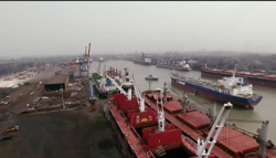
Haldia, a city and a municipality in East Midnapore, is a major seaport approximately {{cvt|100|km}} southwest of Kolkata near the mouth of the Hooghly River, one of the distributaries of the Ganges. It is being developed as a major trade port for Kolkata, intended mainly for bulk cargoes. | |||
== | ==Notable people== | ||
<!---♦♦♦ Please keep the list in chronological order ♦♦♦---> | |||
*[[Birendranath Sasmal]], independence activist, [[barrister]], freedom fighter and politician | |||
*[[Satish Chandra Samanta]], freedom fighter, politician and principal leader of [[Tamralipta Jatiya Sarkar]] | |||
*[[Sushil Kumar Dhara]], freedom fighter, politician & another leader of [[Tamralipta Jatiya Sarkar]] | |||
*[[Ajoy Mukherjee]], freedom fighter, politician & former Chief Minister of West Bengal | |||
*[[Matangini Hazra]], freedom fighter, martyr in [[Quit India Movement]] | |||
* [[Madhusudan Jana]], [[Doctor of Medicine|doctor]], [[journalist]], teacher and social worker. Founder of ''Nihar Press'' | |||
*[[Basanta Kumar Das (Indian politician)|Basanta Kumar Das]], freedom fighter, politician, member of the [[Constituent Assembly of India|Constituent Assembly]] which helped to create the [[Constitution of India]] | |||
*[[Nikunja Behari Maiti]], Independence activist, politician, first Education Minister of [[West Bengal]] | |||
*[[Anil Ghorai]], poet, novelist and short story writer | |||
*[[Mani Lal Bhaumik]], [[Indian Americans|Indian American]] physicist and an internationally bestselling author, entrepreneur and philanthropist | |||
*[[Anil Kumar Gain]], Indian statistician and Mathematician, founder of [[Vidyasagar University]] | |||
*[[Samit Bhanja]], famous Indian actor | |||
*[[Abha Maiti]], Indian politician and lawyer, minister of state for Industry in the [[Morarji Desai]] government | |||
*[[Ashok Dinda]], Indian cricketer turned politician | |||
*[[Suryakant Tripathi]], Indian poet, novelist, essayist and writer. One of the most significant poets of [[Hindi literature]] | |||
* [[Rai Sahib]] [[Bipin Bihari Sasmal]], [[Zamindar]], educationist and politician | |||
*[[Phulrenu Guha]], educationist and politician | |||
*[[Biswanath Mukherjee (politician)|Biswanath Mukherjee]], Indian politician and leader of [[Communist Party of India]], one of the founder members of [[All India Secular Front|AISF]] | |||
*[[Paresh Maity]], painter and [[Padma Shri]] and awardee 2014 | |||
*[[Jadugopal Mukherjee]], Indian politician and [[revolutionary]], one of the leaders of [[Jugantar]] group | |||
*[[Somenath Maity]], Indian artist famous for [[urban landscape]] paintings | |||
*[[Bhupal Chandra Panda]], Indian revolutionary and politician | |||
* [[Biplab Roy Chowdhury]], politician | |||
*[[Ashutosh Kuila]], Indian revolution, freedom fighter, famously martyred during the [[Quit India Movement]] | |||
*[[Suvendu Adhikari]], Politician, Leader of Opposition, West Bengal | |||
==Notes== | |||
{{reflist|group=lower-alpha}} | |||
== References == | == References == | ||
{{ | {{reflist}} | ||
== External links == | == External links == | ||
| Line 467: | Line 632: | ||
* {{Official website|http://purbamedinipur.gov.in/}} | * {{Official website|http://purbamedinipur.gov.in/}} | ||
* [http://www.midnapore.in Legacy of Midnapore (Medinipur, Midnapur, Purba Medinipur, Paschim Medinipur, East Midnapore, West Midnapore)] | * [http://www.midnapore.in Legacy of Midnapore (Medinipur, Midnapur, Purba Medinipur, Paschim Medinipur, East Midnapore, West Midnapore)] | ||
* [https://web.archive.org/web/20110514053213/http://www.hinduonnet.com/thehindu/2002/01/02/stories/2002010201551300.htm News of district bifurcation] | * {{usurped|[https://web.archive.org/web/20110514053213/http://www.hinduonnet.com/thehindu/2002/01/02/stories/2002010201551300.htm News of district bifurcation]}} | ||
* [https://web.archive.org/web/20050319130531/http://www.calcuttaweb.com/maps/medinipur.htm Map of old Medinipur district (district has now been split)] | * [https://web.archive.org/web/20050319130531/http://www.calcuttaweb.com/maps/medinipur.htm Map of old Medinipur district (district has now been split)] | ||
Revision as of 02:07, 16 March 2026
Purba Medinipur district
East Medinipur district | |
|---|---|
     Clockwise from top-left: Memorial to Bankim Chandra Chattopadhyay at Dariapur, College Junction at Kanthi, Mahishadal Rajbari, New Digha Beach at Digha, Bargabhima temple in Tamluk | |
.svg) Location of East Midnapore district in West Bengal | |
| Coordinates: 22°18′N 87°55′E / 22.3°N 87.92°E | |
| Country |  India India |
| State | West Bengal |
| Division | Medinipur |
| Headquarters | Tamluk |
| Government | |
| • Collector & District Magistrate | Unice Rishin Ismail, IAS |
| • Superintendent of Police | Parijat Biswas, IPS |
| Area | |
| • Total | 4,785 km2 (1,847 sq mi) |
| Population (2011) | |
| • Total | 5,095,875 |
| • Density | 1,100/km2 (2,800/sq mi) |
| Demographics | |
| • Literacy | 87.66 per cent |
| • Sex ratio | 936 ♂/♀ |
| Languages | |
| • Official | Bengali[1][2] |
| • Additional official | English[1] |
| Time zone | UTC+05:30 (IST) |
| Website | purbamedinipur |

Purba Medinipur (English: East Medinipur, alternative spelling Midnapore) district is an administrative unit in the Indian state of West Bengal. It is the southernmost district of Medinipur division – one of the five administrative divisions of West Bengal. The headquarters is Tamluk. It was formed on 1 January 2002 after the Partition of Medinipur into East Midnapore and West Midnapore which lies at the northern and western border of it. The state of Odisha is at the southwest border; the Bay of Bengal lies in the south; the Hooghly River and South 24 Parganas district to the east; Howrah district to the north-east; West Midnapore district to the west.
East Midnapore comprises the sub-divisions of Tamluk, Contai and Haldia of erstwhile Medinipur district.[3] Another sub-division, Egra has been created out of the erstwhile Contai sub-division during the partition of Midnapore. In 2011, the state government proposed to rename the district as Tamralipta district after the ancient port city of Tamralipta which used to lie near the modern district headquarters.
East Midnapore saw many political movements during the British Raj. A parallel government named the Tamralipta Jatiya Sarkar was formed during the Quit India Movement in Tamluk.[4] In 2007, East Midnapore witnessed the Nandigram violence, an incident of police firing that killed 14 farmers.[5]
History
Tamralipta
Tamralipta, the port in ancient India, is believed by scholars to have been around modern-day Tamluk. It is mentioned in the writings of Ptolemy (150 AD), the Greco-Egyptian writer, as well as Faxian and Xuanzang, Chinese monks and travellers. It was the main port used by Ashoka, the Mauryan emperor. With too much siltation the port lost its importance around eighth century A.D. The supreme leader of Tamralipta Jatiya sarkar was Satish chandra Samanta.[6]
Geography
Overview
East Midnapore district is part of the lower Indo-Gangetic Plain and Eastern coastal plains. Topographically, the district can be divided into two parts – (a) almost entirely flat plains on the west, east and north, (b) the coastal plains on the south. The vast expanse of land is formed of alluvium and is composed of younger and coastal alluvial. The elevation of the district is within 10 meters above the mean sea level. The district has a long coastline of 65.5 km along its southern and south eastern boundary. Five coastal CD Blocks, namely, Khejuri II, Contai II (Deshapran), Contai I, Ramnagar I and II, are occasionally affected by cyclones and tornadoes. Tidal floods are quite regular in these five CD Blocks. Normally floods occur in 21 of the 25 CD Blocks in the district. The major rivers are Haldi, Rupnarayan, Rasulpur, Bagui and Keleghai, flowing in north to south or south-east direction. River water is an important source of irrigation. The district has a low 899 hectare forest cover, which is 0.02% of its geographical area.[6][7][8]
Major cities and towns
Major cities and towns include Panskura, Tamluk, Nandakumar, Contai, Egra, Haldia, Mecheda, Mahishadal, Digha, Mandarmani, Khejuri, Ramnagar, Patashpur, Kolaghat, Nandigram. Chandipur
Divisions
Administrative subdivisions
| Subdivision | Headquarters | Area km2 |
Population (2011) |
Rural Population % (2001) |
Urban Population % (2001) |
|---|---|---|---|---|---|
| Tamluk Sadar | Tamluk | 1084.30 | 1,791,695 | 94.08 | 5.92 |
| Haldia | Haldia | 683.94 | 959,934 | 79.19 | 20.81 |
| Egra | Egra | 940.96 | 958,939 | 96.96 | 3.04 |
| Contai | Contai | 1251.21 | 1,385,307 | 93.55 | 6.45 |
Tamluk Sadar subdivision consists of Tamluk municipality, Panskura municipality and seven community development blocks: Nandakumar, Moyna, Tamluk, Shahid Matangini, Panskura–I, Panskura–II and Chandipur (Nadigram–III). Haldia subdivision consists of Haldia municipality and five community development blocks: Mahishadal, Nandigram–I, Nandigram–II, Sutahata and Haldia. Egra subdivision consists of Egra municipality and five community development blocks: Bhagawanpur–I, Egra–I, Egra–II, Pataspur–I and Pataspur–II. Contai subdivision consists of Contai municipality and eight community development blocks: Contai–I, Contai–II, Contai–III, Khejuri–I, Khejuri–II, Ramnagar–I and Ramnagar–II, Bhagawanpur–II.[9]
Tamluk is the district headquarters. There are 21 police stations, 25 development blocks, 5 municipalities and 223 gram panchayats in this district.[9][10]
Other than in the municipality area, each subdivision contains community development blocks which in turn are divided into rural areas and census towns. In total there are 10 urban units: five municipalities and five census towns.[10] Panskura municipality was established in 2001.[11]
Tamluk Sadar subdivision
- Two municipalities: Tamluk and Panskura
- Nandakumar community development block consists of rural areas only with 12 gram panchayats.
- Moyna community development block consists of rural areas with 11 gram panchayats and one census town: Garsafat.
- Tamluk community development block consists of rural areas with 12 gram panchayats and two census towns: Anantapur and South Baguan.
- Sahid Matangini community development block consists of rural areas with 10 gram panchayats and two census towns: Kakdihi and Shantipur.
- Panskura community development block consists of rural areas only with 14 gram panchayats.
- Kolaghat community development block consists of rural areas with 13 gram panchayats and four census towns: Kolaghat, Amalhara, Mihitikri and Kharisha.
- Chandipur community development block consists of rural areas with 10 gram panchayats and two census towns: Kotbar and Ershal.
Haldia subdivision
- One municipality: Haldia.
- Mahishadal community development block consists of rural areas with 11 gram panchayats and one census town: Garh Kamalpur.
- Nandigram I community development block consists of rural areas with 10 gram panchayats and one census town: Nandigram.
- Nandigram II community development block consists of rural areas with 7 gram panchayats and one census town: Ashadtalya.
- Sutahata community development block consists of rural areas with 6 gram panchayats and one census town: Barda
- Haldia community development block consists of rural areas only with 4 gram panchayats.
Egra subdivision
- One municipality: Egra.
- Bhagabanpur I community development block consists of rural areas with 10 gram panchayats and two census towns: Benudiya and Hincha Gerya.
- Egra I community development block consists of rural areas only with 8 gram panchayats.
- Egra II community development block consists of rural areas only with 8 gram panchayats.
- Patashpur I community development block consists of rural areas only with 9 gram panchayats.
- Patashpur II community development block consists of rural areas only with 7 gram panchayats.
Contai subdivision
- One municipality: Contai.
- Contai I community development block consists of rural areas only with 8 gram panchayats.
- Deshapran community development block consists of rural areas with 8 gram panchayats and one census town: Basantia.
- Contai III community development block consists of rural areas only with 8 gram panchayats.
- Khejuri I community development block consists of rural areas only with 6 gram panchayats.
- Khejuri II community development block consists of rural areas only with 5 gram panchayats.
- Ramnagar I community development block consists of rural areas with 9 gram panchayats and one census town: Khadalgobra.
- Ramnagar II community development block consists of rural areas only with 8 gram panchayats.
- Bhagabanpur II community development block consists of rural areas only with 9 gram panchayats.
Assembly Constituencies
Purba Medinipur contains 16 assembly constituencies, equally divided between two Lok Sabha constituencies Tamluk and Kanthi. The MP for Tamluk is Abhijit Gangopadhyay (BJP) while the MP for Kanthi is Soumendu Adhikari (BJP). These are members of the Adhikari family which has dominated politics in the district whose prominent member has been Suvendu Adhikari, now Leader of Opposition in the West Bengal Legislative Assembly.
Demographics
According to the 2011 census East Midnapore district has a population of 5,095,875,[12] roughly equal to the United Arab Emirates[13] or the US state of Colorado.[14] This gives it a ranking of 20th in India (out of a total of 640).[12] The district has a population density of 1,076 inhabitants per square kilometre (2,790/sq mi).[12] Its population growth rate over the decade 2001-2011 was 15.32%.[12] East Midnapore has a sex ratio of 936 females for every 1000 males, and a literacy rate of 88.60%. 11.63% of the population lives in urban areas. Scheduled Castes and Scheduled Tribes make up 14.63% and 0.55% of the population respectively.[12]
Bengali is the predominant language, spoken by 98.31% of the population. The Bengali dialect around Contai is heavily influenced by nearby dialect of Odia and along the Odisha border, and the two dialects cannot be distinguished.[15]
Religion
| Religion | Population (1941)[17]:76 | Percentage (1941) | Population (2011)[16] | Percentage (2011) |
|---|---|---|---|---|
Hinduism 
|
1,365,664 | 90.19% | 4,343,972 | 85.24% |
Islam 
|
139,408 | 9.21% | 743,436 | 14.59% |
| Others [lower-alpha 3] | 9,165 | 0.61% | 8,467 | 0.17% |
| Total Population | 1,514,237 | 100% | 5,095,875 | 100% |
Hindus are the majority religion in the district. Muslims are the second largest religion.[16]
Economy
In 2006 the Ministry of Panchayati Raj named East Midnapore one of the country's 250 most backward districts (out of a total of 640).[18] It is one of the 11 districts in West Bengal receiving funds from the Backward Regions Grant Fund Programme (BRGF).[18] in East Midnapore Mat "Madur" industry are very popular, it's occupation of most people. In the agriculture sector paddy, wheat, chilli, vegetable are also popular in India.
| Concentration of Handicraft Activities in Purba Medinipur |
|---|
|
Literacy and education
High School (including higher secondary school)–456
Junior High School–189
Junior High Madarsa–5
High Madarsa–8
Senior Madarsa–2
Primary School–3217
Sishu Sikhsha Kendra–1516
Ishwar chandra Jana Chetna Centre–3089
College–15
Engineering colleges–2
Skill development institutions–44
According to the 2011 census, the district has a literacy rate of 87.66[20] up from 80.20% of 2001 census. As per 2001 census, this district had a male literacy rate of 89.1% and female literacy rate was 70.7%. The education index of this district is 0.74[21] and it is ranked first in literacy in comparison to other districts of West Bengal.[22]
Given in the table below (data in numbers) is a comprehensive picture of the education scenario in East Midnapore district for the year 2013–2014. It may be noted that primary schools include junior basic schools; middle schools, high schools, and higher secondary schools include madrasahs; technical schools include junior technical schools, junior government polytechnics, industrial technical institutes, industrial training centres, nursing training institutes, etc.; technical and professional colleges include engineering colleges, polytechnics, medical colleges, Allied & Healthcare institutes, management colleges, teachers training, and nursing training colleges, law colleges, art colleges, music colleges etc. Special and non-formal education centres include sishu siksha kendras, madhyamik siksha centre, centres of Rabindra mukta vidyalaya, recognised Sanskrit tols, institutions for the blind and other handicapped persons, Anganwadi centres, reformatory schools etc.[23]
| Subdivision | Primary School |
Middle School |
High School |
Higher Secondary School |
General College, Univ |
Technical / Professional Instt |
Non-formal Education | |||||||
|---|---|---|---|---|---|---|---|---|---|---|---|---|---|---|
| Institution | Student | Institution | Student | Institution | Student | Institution | Student | Institution | Student | Institution | Student | Institution | Student | |
| Tamluk | 1,084 | 84,258 | 78 | 5,789 | 77 | 43,408 | 144 | 171,516 | 6 | 12,728 | 17 | 2,747 | 2,704 | 112,411 |
| Haldia | 557 | 43,173 | 40 | 5,082 | 54 | 36,767 | 77 | 83,659 | 5 | 9,792 | 16 | 6,256 | 1,359 | 59,879 |
| Egra | 629 | 41,418 | 76 | 11,537 | 49 | 32,167 | 74 | 90,730 | 3 | 9,498 | 2 | 154 | 1,595 | 62,200 |
| Contai | 983 | 50,945 | 99 | 10,557 | 81 | 46,690 | 102 | 120,128 | 5 | 12,223 | 10 | 1,602 | 2,316 | 90,552 |
| Purba Medinipur district | 3,253 | 219,794 | 293 | 32,965 | 261 | 159,032 | 397 | 466,093 | 19 | 44,241 | 45 | 10,759 | 7,974 | 375,042 |
Healthcare
The table below (all data in numbers) presents an overview of the medical facilities available and patients treated in the hospitals, health centres and sub-centres in 2014 in East Midnapore district.[24]
| Subdivision | Health & Family Welfare Deptt, WB | Other State Govt Deptts |
Local bodies |
Central Govt Deptts / PSUs |
NGO / Private Nursing Homes |
Total | Total Number of Beds |
Total Number of Doctors |
Indoor Patients |
Outdoor Patients | |||
|---|---|---|---|---|---|---|---|---|---|---|---|---|---|
| Hospitals |
Rural Hospitals |
Block Primary Health Centres |
Primary Health Centres | ||||||||||
| Tamluk | 1 | - | 7 | 14 | - | - | - | 70 | 92 | 1,506 | 96 | 61,84 | 1,251,099 |
| Haldia | 1 | 2 | 3 | 10 | - | - | - | 19 | 35 | 803 | 67 | 27,586 | 757,876 |
| Egra | 1 | 1 | 4 | 11 | - | - | - | 21 | 38 | 489 | 42 | 23,699 | 419,829 |
| Contai | 2 | - | 8 | 16 | - | - | - | 22 | 48 | 688 | 88 | 59,882 | 890,607 |
| Purba Medinipur district | 5 | 3 | 22 | 51 | - | - | - | 132 | 213 | 3,486 | 293 | 172,251 | 3,319,411 |
Tourism
The coastal region of East Midnapore district is in the face of river Hoogly. With good coastal, landform, seasonal, rural and heritage diversity, it offers the potential for tourism in its typical coastlines and rural areas. The famous tourist spots are[21]
Tamluk (Tamralipta)

Tamluk, district headquarters of East Midnapore district is situated on the bank of river Rupnarayan which is a very popular picnic spot. The other places are:
- Bargabhima Temple is an 1150 years old Kali temple and is considered one of the 51 Shakti Peethas. According to Puran, the left ankle of Sati/Parvati fell here when Lord Vishnu cut the sacred body of Goddess Sati into several pieces to make Lord Shiva quiet.
- Archeological Museum of Tamluk is a must-see place. It contains artifacts of tamra (copper) and has preserved a tamralipta with Greek inscriptions. It preserves the historical heritage of Bengal.
- Rakhit Bati is another important place to visit in Tamluk. At the beginning of the 19th century, it was famous as a secret centre of the then revolutionary parties Anusilan Samiti and Gupta Samiti.
- There are many other ancient temples in Tamluk town to visit, i.e., Jagannath Temple, Hari Temple, Mahaprabhu Temple, Ram Jiu Temple, Rajbari Temple, etc.
Panskura


It is a municipality upgraded in 2002. It is one of the busiest towns in East Midnapore district. Panskura is known as "Valley of Flowers" with large supplies of flowers to other places. Panskura is also known for its green vegetables wholesale market near the Panskura Junction railway station. It is open every day after 10 pm until 7 am the next morning with a regular gathering of lakhs of people. Panskura is one of the busiest railway stations which extends up to Digha or Haldia directly through this station or by bus. The river Kansabati is a good picnic spot and Mahakali (Bhavatarini) temple nearby old Panskura bazar is a pilgrimage spot. Panskura is also well known for its cultural side. Many cultural schools and institutes are there. Panskura is famous for the recitation institute Chandabani [ছন্দবাণী].
Mahishadal
Mahishadal is only 16 km from Tamluk town where tourists can visit the Mahishadal Rajbari, the museum there and Gopal Jiu temple. Geonkhali is a place 8 km from Mahishadal, a perfect picnic spot at the junction (mohona) of three rivers.
Digha
Digha is a seaside resort town of East Midnapore district and, at the northern end of the Bay of Bengal, is the most popular seaside resort of West Bengal. Renowned for its beaches, Digha is visited by thousands of tourists every year.

Mandarmani
Mandarmani is a small virgin beach on the Bay of Bengal under Kalindi Gram Panchayat, only 14 km from Digha-Contai Road from Chaulkhola Bus Stop. It is a small fishing harbour and a fast developing tourist spot.
Haldia

Haldia, a city and a municipality in East Midnapore, is a major seaport approximately 100 km (62 mi) southwest of Kolkata near the mouth of the Hooghly River, one of the distributaries of the Ganges. It is being developed as a major trade port for Kolkata, intended mainly for bulk cargoes.
Notable people
- Birendranath Sasmal, independence activist, barrister, freedom fighter and politician
- Satish Chandra Samanta, freedom fighter, politician and principal leader of Tamralipta Jatiya Sarkar
- Sushil Kumar Dhara, freedom fighter, politician & another leader of Tamralipta Jatiya Sarkar
- Ajoy Mukherjee, freedom fighter, politician & former Chief Minister of West Bengal
- Matangini Hazra, freedom fighter, martyr in Quit India Movement
- Madhusudan Jana, doctor, journalist, teacher and social worker. Founder of Nihar Press
- Basanta Kumar Das, freedom fighter, politician, member of the Constituent Assembly which helped to create the Constitution of India
- Nikunja Behari Maiti, Independence activist, politician, first Education Minister of West Bengal
- Anil Ghorai, poet, novelist and short story writer
- Mani Lal Bhaumik, Indian American physicist and an internationally bestselling author, entrepreneur and philanthropist
- Anil Kumar Gain, Indian statistician and Mathematician, founder of Vidyasagar University
- Samit Bhanja, famous Indian actor
- Abha Maiti, Indian politician and lawyer, minister of state for Industry in the Morarji Desai government
- Ashok Dinda, Indian cricketer turned politician
- Suryakant Tripathi, Indian poet, novelist, essayist and writer. One of the most significant poets of Hindi literature
- Rai Sahib Bipin Bihari Sasmal, Zamindar, educationist and politician
- Phulrenu Guha, educationist and politician
- Biswanath Mukherjee, Indian politician and leader of Communist Party of India, one of the founder members of AISF
- Paresh Maity, painter and Padma Shri and awardee 2014
- Jadugopal Mukherjee, Indian politician and revolutionary, one of the leaders of Jugantar group
- Somenath Maity, Indian artist famous for urban landscape paintings
- Bhupal Chandra Panda, Indian revolutionary and politician
- Biplab Roy Chowdhury, politician
- Ashutosh Kuila, Indian revolution, freedom fighter, famously martyred during the Quit India Movement
- Suvendu Adhikari, Politician, Leader of Opposition, West Bengal
Notes
- ↑ Elected as BJP MLA, later defected to Trinamool Congress
- ↑ This is the Contai and Tamluk subdivisions of the former Medinipur district
- ↑ Including Jainism, Christianity, Buddhism, Zoroastrianism, Judaism, Ad-Dharmis, or not stated
References
- ↑ 1.0 1.1 "Fact and Figures". Wb.gov.in. Retrieved 5 July 2019.
- ↑ "52nd Report of the Commissioner for Linguistic Minorities in India" (PDF). Nclm.nic.in. Ministry of Minority Affairs. p. 85. Archived from the original (PDF) on 25 May 2017. Retrieved 5 July 2019.
- ↑ Jana, Naresh (31 December 2001). "Tamluk readies for giant's partition". The Telegraph (Kolkata). Retrieved 1 September 2008.
{{cite web}}: CS1 maint: deprecated archival service (link) - ↑ "Sushil Dhara:Dreams of '42 Service in '90s". janasamachar.net. Retrieved 22 August 2009.
- ↑ "Red-hand Buddha: 14 killed in Nandigram re-entry bid". The Telegraph. 15 March 2007. Retrieved 15 March 2007.
{{cite news}}: CS1 maint: deprecated archival service (link) - ↑ 6.0 6.1 "District Human Development Report: Purba Medinipur" (PDF). Chapter I Introduction. Development and Planning Department, Government of West Bengal, 2011. Archived from the original (PDF) on 23 September 2016. Retrieved 18 November 2016.
- ↑ "Brief Industrial Profile of Purba Midnapur District" (PDF). Ministry of Micro Small and Medium Industries, Government of India. Retrieved 18 November 2016.
- ↑ "Mapping Dynamics of land utilization and its changing Patterns of Purba Medinipure District - W.B". Retrieved 18 November 2016.
- ↑ 9.0 9.1 "Directory of District, Sub division, Panchayat Samiti/ Block and Gram Panchayats in West Bengal, March 2008". West Bengal. National Informatics Centre, India. 19 March 2008. Archived from the original on 25 February 2009. Retrieved 6 December 2008.
- ↑ 10.0 10.1 "Administration Setup". Official website of Purba Medinipur district. Archived from the original on 25 April 2008. Retrieved 6 December 2008.
- ↑ "Municipalities: Panskura Municipality". Department of Urban Development, West Bengal. Retrieved 6 December 2008.
- ↑ 12.0 12.1 12.2 12.3 12.4 "District Census Handbook: Purba Medinipur" (PDF). censusindia.gov.in. Registrar General and Census Commissioner of India. 2011.
- ↑ US Directorate of Intelligence. "Country Comparison:Population". Archived from the original on 13 June 2007. Retrieved 1 October 2011.
United Arab Emirates 5,148,664
- ↑ "2010 Resident Population Data". U. S. Census Bureau. Retrieved 30 September 2011.
Colorado 5,029,196
- ↑ "Table C-16 Population by Mother Tongue: West Bengal". www.censusindia.gov.in. Registrar General and Census Commissioner of India.
- ↑ 16.0 16.1 16.2 "Table C-01 Population by Religion: West Bengal". censusindia.gov.in. Registrar General and Census Commissioner of India. 2011.
- ↑ "CENSUS OF INDIA, 1941 VOLUME VI BENGAL PROVINCE" (PDF). Retrieved 13 August 2022.
- ↑ 18.0 18.1 Ministry of Panchayati Raj (8 September 2009). "A Note on the Backward Regions Grant Fund Programme" (PDF). National Institute of Rural Development. Archived from the original (PDF) on 5 April 2012. Retrieved 27 September 2011.
- ↑ Cite error: Invalid
<ref>tag; no text was provided for refs namedeastmidnapore - ↑ "District Census 2011". Retrieved 29 October 2012.
- ↑ 21.0 21.1 "Official website of the Purba Medinipur District". Retrieved 29 October 2012.
- ↑ List of West Bengal districts ranked by literacy rate
- ↑ "District Statistical Handbook 2014 Purba Medinipur". Basic data: Table 4.4, 4.5, Clarifications: other related tables. Department of Statistics and Programme Implementation, Government of West Bengal. Archived from the original on 29 July 2017. Retrieved 17 November 2016.
- ↑ "District Statistical Handbook 2014 Purba Medinipur". Table 3.1, 3.3. Department of Statistics and Programme Implementation, Government of West Bengal. Archived from the original on 29 July 2017. Retrieved 17 November 2016.
External links
- purbamedinipur
.gov .in - Legacy of Midnapore (Medinipur, Midnapur, Purba Medinipur, Paschim Medinipur, East Midnapore, West Midnapore)
- News of district bifurcation[usurped]
- Map of old Medinipur district (district has now been split)
Places adjacent to Purba Medinipur district | ||||||||||
|---|---|---|---|---|---|---|---|---|---|---|
| ||||||||||


Cities, towns, locations and neighbourhoods in Purba Medinipur District | |||||||||
|---|---|---|---|---|---|---|---|---|---|
| Cities, municipal and census towns |
| ||||||||
| Locations other than cities and towns |
| ||||||||
| Neighbourhoods |
| ||||||||
| Related topics | |||||||||


.png)