Anandapuram
This article needs additional citations for verification. |
Anandapuram | |
|---|---|
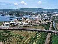
 NH16 at Anandapuram in Visakhapatnam district | |
| Coordinates: 17°54′12″N 83°21′45″E / 17.903343°N 83.362456°ECoordinates: 17°54′12″N 83°21′45″E / 17.903343°N 83.362456°E | |
| Country | |
| State | Andhra Pradesh |
| District | Visakhapatnam |
| Government | |
| • Body | Gram Panchayat |
| Population (2011) | |
| • Total | 7,707 |
| Language | |
| • Official | Telugu |
| Time zone | UTC+5:30 (IST) |
| PIN | 530052 |
| Vehicle Registration | AP31 (Former) AP39 (from 30 January 2019)[1] |
Anandapuram is a suburb and a mandal headquarters in the Visakhapatnam district in the state of Andhra Pradesh, India.[2]
History[edit]
In 1802, Visakhapatnam was formed when the Northern Circars were split into five districts. [3]Srikakulam district was carved out of Vishakhapatnam district in 1950[4][3] Vizianagaram district was formed in 1979 by transferring some portions of Srikakulam and Viskhapatnam districts. [3]
In 2022, as a part of the raising the number of districts in Andhra Pradesh from 13 to 26, Visakhapatnam district was split into three districts – Alluri Sitharama Raju district, Anakapalli district and Visakhapatnam district.[5]
Transport[edit]
It is a road junction on the National Highway 16 between Visakhapatnam and Srikakulam. There is a connecting road to Simhachalam and Pendurthi.
- APSRTC routes
| Route Number | Start | End | Via |
|---|---|---|---|
| 222 | Tagarapuvalasa | Railway Station/RTC Complex | Anandapuram, Madhurawada, Yendada, Hanumanthuwaka, Maddilapalem |
| 222V | Vizianagaram | RTC Complex | Tagarapuvalasa, Anandapuram, Madhurawada, Yendada, Hanumanthuwaka, Maddilapalem |
| 111 | Tagarapuvalasa | Kurmannapalem | Anandapuram, Madhurawada, Yendada, Hanumanthuwaka, Maddilapalem, Akkayapalem, Kancharapalem, NAD Junction, Gajuwaka |
| 111V | Vizianagaram | Kurmannapalem | Tagarapuvalasa, Anandapuram, Madhurawada, Yendada, Hanumanthuwaka, Maddilapalem, Akkayapalem, Kancharapalem, NAD Junction, Gajuwaka |
| 211 | Vizianagaram | Visakhapatnam Railway Station | Tagarapuvalasa, Anandapuram, Madhurawada, Yendada, Hanumanthuwaka, Maddilapalem, RTC Complex |
| 999 | Bheemunipatnam | RTC Complex | Dorathota, Anandapuram, Madhurawada, Yendada, Hanumanthuwaka, Maddilapalem |
| 888 | Tagarapuvalasa | Anakapalli | Anandapuram, Gudilova, Sontyam, Pendurthi, Sabbavaram, Sankaram |
| 55T | Tagarapuvalasa | Scindia | Anandapuram, Gudilova, Sontyam, Pendurthi, Vepagunta, Gopalapatnam, NAD Junction, Airport, BHPV, Gajuwaka, Malkapuram |
See also[edit]
References[edit]
- ↑ "New 'AP 39' code to register vehicles in Andhra Pradesh launched". The New Indian Express. Vijayawada. 31 January 2019. Retrieved 9 June 2019.
- ↑ "Mandal wise list of villages in Visakhapatnam district" (PDF). Chief Commissioner of Land Administration. National Informatics Centre. Archived from the original (PDF) on 19 March 2015. Retrieved 6 March 2016.
- ↑ 3.0 3.1 3.2 "AP new districts: First formed under the empire, Andhra Pradesh's map shaped and reshaped over two centuries". Umamaheswara Rao. The Times of India, 30 March 2022. Retrieved 27 January 2024.
- ↑ "District level information of Srikakulam district (Andhra Pradesh)". IndiaStatDistricts. Retrieved 27 January 2024.
- ↑ "Visakhapatnam divided into 3 new districts by the AP State Government". Yo!Vizag. Retrieved 27 January 2024.


