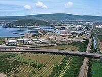
Visakhapatnam Rural mandal
Visakhapatnam Rural | |
|---|---|
| Coordinates: 17°45′44″N 83°20′18″E / 17.762251°N 83.338352°ECoordinates: 17°45′44″N 83°20′18″E / 17.762251°N 83.338352°E | |
| Country | India |
| State | Andhra Pradesh |
| District | Visakhapatnam |
| Headquarters | Visakhapatnam |
| Area | |
| • Total | 126.69 km2 (48.92 sq mi) |
| Language | |
| • Official | Telugu |
| Time zone | UTC+5:30 (IST) |
Visakhapatnam Rural Mandal is one of the 11 mandals in Visakhapatnam district of Andhra Pradesh, India. The mandal lies on the coast of Bay of Bengal and is bounded by Bheemunipatnam, Anandapuram mandals to the north and Visakhapatnam Urban-1 to the south.[2]
History[edit]
In 1802, Visakhapatnam was formed when the Northern Circars were split into five districts. [3]Srikakulam district was carved out of Vishakhapatnam district in 1950[4][3] Vizianagaram district was formed in 1979 by transferring some portions of Srikakulam and Viskhapatnam districts. [3]
In 2022, as a part of the raising the number of districts in Andhra Pradesh from 13 to 26, Visakhapatnam district was split into three districts – Alluri Sitharama Raju district, Anakapalli district and Visakhapatnam district.[5]
Demographics[edit]
As of 2011[update] census, the mandal had a population of 260,192. The total population constitute, 131,477 males and 128,715 females —a sex ratio of 979 females per 1000 males. 26,608 children are in the age group of 0–6 years, of which 13,486 are boys and 13,122 are girls —a ratio of 973 per 1000. The average literacy rate stands at 79.07% with 184,699 literates.[1] Gopalapatnam (rural) is the most populated village and Bakkannapalem is the least populated village in the mandal.[6]
Villages[edit]
Visakhapatnam Rural mandal consists of the following areas
- Adivivaram
- Bakkannapalem
- Kommadi
- Madhurawada
- Simhachalam
- Paradesipalem
- Pothinamallayyapalem
- Rushikonda
- Yendada
See also[edit]
References[edit]
- ↑ 1.0 1.1 "Census 2011". The Registrar General & Census Commissioner, India. Retrieved 13 September 2014.
- ↑ "Mandals in Visakhapatnam district". aponline.gov.in. Archived from the original on 19 April 2014. Retrieved 13 September 2014.
- ↑ 3.0 3.1 3.2 "AP new districts: First formed under the empire, Andhra Pradesh's map shaped and reshaped over two centuries". Umamaheswara Rao. The Times of India, 30 March 2022. Retrieved 27 January 2024.
- ↑ "District level information of Srikakulam district (Andhra Pradesh)". IndiaStatDistricts. Retrieved 27 January 2024.
- ↑ "Visakhapatnam divided into 3 new districts by the AP State Government". Yo!Vizag. Retrieved 27 January 2024.
- ↑ "Sub-District Details of Visakhapatnam District". The Registrar General & Census Commissioner, India. Retrieved 13 September 2014.


