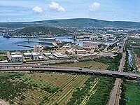
Pendurthi
This article needs additional citations for verification. |
Pendurthi | |
|---|---|
Neighbourhood | |
 Pendurthi Railway station name board | |
| Coordinates: 17°50′00″N 83°12′00″E / 17.8333°N 83.2000°E | |
| Country | India |
| State | Andhra Pradesh |
| District | Visakhapatnam district |
| Founded by | Government of Andhra Pradesh |
| Government | |
| • Type | Mayor-council |
| • Body | Greater Visakhapatnam Municipal Corporation |
| Area | |
| • Total | 118.85 km2 (45.89 sq mi) |
| Elevation | 22 m (72 ft) |
| Language | |
| • Official | Telugu |
| Time zone | UTC+5:30 (IST) |
| PIN | 531173 |
| Vehicle Registration | AP31 (Former) AP39 (from 30 January 2019)[1] |
Pendurthi is a neighborhood in the city of Visakhapatnam, India. The neighborhood is considered as the major residential and commercial area in the city. It is located within the jurisdiction of the Greater Visakhapatnam Municipal Corporation, which is responsible for the civic amenities in Pendurthi. It is located on the west fringe of Visakhapatnam city.[2]
History[edit | edit source]
In 1802, Visakhapatnam was formed when the Northern Circars were split into five districts. [3]Srikakulam district was carved out of Vishakhapatnam district in 1950[4][3] Vizianagaram district was formed in 1979 by transferring some portions of Srikakulam and Viskhapatnam districts. [3]
In 2022, as a part of the raising the number of districts in Andhra Pradesh from 13 to 26, Visakhapatnam district was split into three districts – Alluri Sitharama Raju district, Anakapalli district and Visakhapatnam district.[5]
Geography[edit | edit source]
Pendurthi is located at 17°50′00″N 83°12′00″E / 17.8333°N 83.2000°E.[6] It has an average elevation of 22 meters (75 feet).
Demographic[edit | edit source]
The total population of Pendurthi Mandal is 106,513 living in 24,543 Houses, 15 panchayats. Males are 53,800 and females are 52,713. There is a city in Pendurthi Mandal. Total 26,998 persons lives in town and 79,515 live in villages.[when?]
Transport[edit | edit source]
- Pendurti railway station is located on Howrah-Chennai mainline. Some passenger trains stop at this station.
- It has a BRTS (Bus Rapid Transport System) corridor from Vizag city. The roads have an extension of up to 200 feet.
APSRTC to run buses every place to here.
- APSRTC routes
| Route Number | Start | End | Via |
|---|---|---|---|
| 28A/28K | Pendurthi/Kothavalasa | RK Beach | Vepagunta, Gopalapatnam, NAD Kotharoad, Kancharapalem, RTC Complex, Jagadamba Centre |
| 6K | Kothavalasa | Old Head Post Office | Pendurthi, Vepagunta, Gopalapatnam, NAD Kotharoad, Kancharapalem, Convent, Town Kotharoad |
| 68K | Kothavalasa | RK Beach | Pendurthi, Vepagunta, Simhachalam, Adavivaram, Arilova, Hanumanthuwaka, Maddilapalem, RTC Complex, Jagadamba Centre |
| 541 | Kothavalasa | Maddilapalem | Pendurthi, Vepagunta, Gopalapatnam, NAD Kotharoad, Birla Junction, Gurudwar, Satyam Junction |
| 12D | Devarapalle | RTC Complex | Kothavalasa, Pendurthi, Vepagunta, Gopalapatnam, NAD Kotharoad, Birla Junction, Gurudwar |
| 201 | Srungavarapukota | RTC Complex | Kothavalasa, Pendurthi, Vepagunta, Gopalapatnam, NAD Kotharoad, Birla Junction, Gurudwar |
| 888 | Anakapalle | Tagarapuvalasa | Sankaram, Sabbavaram, Pendurthi, Shontyam, Gudilova, Anandapuram |
| 55K | Kothavalasa | Scindia | Pendurthi, Vepagunta, Gopalapatnam, NAD Kotharoad, Airport, BHPV, Old Gajuwaka, New Gajuwaka, Malkapuram |
See also[edit | edit source]
References[edit | edit source]
- ↑ "New 'AP 39' code to register vehicles in Andhra Pradesh launched". The New Indian Express. Vijayawada. 31 January 2019. Retrieved 9 June 2019.
- ↑ "Mandal wise list of villages in Visakhapatnam district" (PDF). Chief Commissioner of Land Administration. National Informatics Centre. Archived from the original (PDF) on 19 March 2015. Retrieved 6 March 2016.
- ↑ 3.0 3.1 3.2 "AP new districts: First formed under the empire, Andhra Pradesh's map shaped and reshaped over two centuries". Umamaheswara Rao. The Times of India, 30 March 2022. Retrieved 27 January 2024.
- ↑ "District level information of Srikakulam district (Andhra Pradesh)". IndiaStatDistricts. Retrieved 27 January 2024.
- ↑ "Visakhapatnam divided into 3 new districts by the AP State Government". Yo!Vizag. Retrieved 27 January 2024.
- ↑ Falling Rain Genomics.Pendurti


