


robot: Update article |
m reworked article and fixed typos |
||
| Line 1: | Line 1: | ||
{{Short description|District in West Bengal, India}} | |||
{{About|the district|its eponymous headquarters|Hugli-Chuchura}} | {{About|the district|its eponymous headquarters|Hugli-Chuchura}} | ||
{{Use dmy dates|date=October 2016}} | {{Use dmy dates|date=October 2016}} | ||
{{Use Indian English|date=October 2016}} | {{Use Indian English|date=October 2016}} | ||
{{Infobox settlement | {{Infobox settlement | ||
| name | | name = Hooghly district | ||
| settlement_type | | other_name = | ||
| settlement_type = [[List of districts of West Bengal|District]] of [[West Bengal]] | |||
| image_skyline = {{Photomontage | |||
| image_skyline | |||
|photo1a = Shiva Durga temple or simply, Durga temple of Bally Diwanganj of Goghat PS in Hooghly district of West Bengal (06).jpg | |photo1a = Shiva Durga temple or simply, Durga temple of Bally Diwanganj of Goghat PS in Hooghly district of West Bengal (06).jpg | ||
|photo1b = | |photo1b = Reflection of Hooghly Imambara.jpg | ||
|photo2a = | |photo2a = Bandel Church.jpg | ||
|photo2b = Danish Cemetery. All ancient structure & Tombs.jpg | |photo2b = Danish Cemetery. All ancient structure & Tombs.jpg | ||
|photo3a = Hooghly River, Serampore.jpg | |photo3a = Hooghly River, Serampore.jpg | ||
|size= | |size = 300 | ||
|foot_montage = Clockwise from top-left: Durga temple of [[Bali Dewanganj]], [[Hooghly Imambara]], Danish cemetery at [[Serampore]], [[Hooghly River]], [[Bandel]] Church at [[Bandel]] | |||
}} | }} | ||
| | | mapframe = yes | ||
| | | mapframe-point = none | ||
| | | mapsize = 300 | ||
| | | map_caption1 = Location of Hooghly district in West Bengal | ||
| | | coordinates = {{coord|22.90|N|88.39|E|display=inline,title}} | ||
| | | subdivision_type = [[List of sovereign states|Country]] | ||
| | | subdivision_name = [[India]] | ||
|title= | | subdivision_type1 = [[States and union territories of India|State]] | ||
| | | subdivision_name1 = [[West Bengal]] | ||
| subdivision_type2 = [[Administrative divisions of West Bengal|Division]] | |||
| subdivision_name2 = [[Burdwan division|Burdwan]] | |||
| seat_type = Headquarters | |||
| seat = [[Hooghly-Chinsurah|Chuchura]] | |||
| leader_title = [[List of subdivisions of West Bengal|Subdivisions]] | |||
| leader_name = [[Chinsurah subdivision|Chinsurah Sadar]], [[Chandannagar subdivision|Chandannagar]], [[Serampore subdivision|Serampore]], [[Arambag subdivision|Arambag]] | |||
| leader_title1 = [[Community Development Block|CD Blocks]] | |||
| leader_name1 = [[Balagarh (community development block)|Balagarh]], [[Chinsurah Mogra]], [[Dhaniakhali (community development block)|Dhaniakhali]], [[Pandua (community development block)|Pandua]], [[Polba Dadpur]], [[Haripal (community development block)|Haripal]], [[Singur (community development block)|Singur]], [[Tarakeswar (community development block)|Tarakeswar]], [[Chanditala I]], [[Chanditala II]], [[Jangipara (community development block)|Jangipara]], [[Serampore Uttarpara]], [[Khanakul I]], [[Khanakul II]], [[Goghat I]], [[Goghat II]], [[Pursurah (community development block)|Pursurah]] | |||
| leader_title2 = [[List of constituencies of the Lok Sabha|Lok Sabha constituencies]] | |||
| leader_name2 = [[Arambagh (Lok Sabha constituency)|Arambagh]], [[Hooghly (Lok Sabha constituency)|Hooghly]], [[Serampore (Lok Sabha constituency)|Serampore]] | |||
| leader_title3 = [[List of constituencies of the West Bengal Legislative Assembly|Vidhan Sabha constituencies]] | |||
| leader_name3 = [[Uttarpara (Vidhan Sabha constituency)|Uttarpara]], [[Sreerampur (Vidhan Sabha constituency)|Sreerampur]], [[Champdani (Vidhan Sabha constituency)|Champdani]], [[Singur (Vidhan Sabha constituency)|Singur]], [[Chandannagar (Vidhan Sabha constituency)|Chandannagar]], [[Chunchura (Vidhan Sabha constituency)|Chunchura]], [[Balagarh (Vidhan Sabha constituency)|Balagarh]], [[Pandua (Vidhan Sabha constituency)|Pandua]], [[Saptagram (Vidhan Sabha constituency)|Saptagram]], [[Chanditala (Vidhan Sabha constituency)|Chanditala]], [[Jangipara (Vidhan Sabha constituency)|Jangipara]], [[Haripal (Vidhan Sabha constituency)|Haripal]], [[Dhanekhali (Vidhan Sabha constituency)|Dhanekhali]], [[Tarakeswar (Vidhan Sabha constituency)|Tarakeswar]], [[Pursurah (Vidhan Sabha constituency)|Pursurah]], [[Arambag (Vidhan Sabha constituency)|Arambag]], [[Goghat (Vidhan Sabha constituency)|Goghat]], [[Khanakul (Vidhan Sabha constituency)|Khanakul]] | |||
| total_type = Total | |||
| area_total_km2 = 3149 | |||
| area_footnotes = | |||
| population_as_of = 2011 | |||
| population_total = 5,519,145 | |||
| population_footnotes = | |||
| population_urban = | |||
| population_density_km2 = auto | |||
| demographics_type1 = Demographics | |||
| demographics1_title1 = [[Literacy in India|Literacy]] | |||
| demographics1_info1 = 82.55 per cent | |||
| demographics1_title2 = [[Human sex ratio|Sex ratio]] | |||
| demographics1_info2 = 961 [[male|♂]]/[[female|♀]] | |||
| demographics_type2 = Languages | |||
| demographics2_title1 = Official | |||
| demographics2_info1 = [[Bengali language|Bengali]]<ref name="wblangoff">{{cite web|title=Fact and Figures|url=https://wb.gov.in/portal/web/guest/facts-and-figures;jsessionid=JzdD9RHb7aMY5esZPtcsIVLy|website=Wb.gov.in|access-date=5 July 2019}}</ref><ref>{{cite web|title=52nd Report of the Commissioner for Linguistic Minorities in India|url=http://nclm.nic.in/shared/linkimages/NCLM52ndReport.pdf|website=Nclm.nic.in|publisher=[[Ministry of Minority Affairs]]|access-date=5 July 2019|page=85|url-status=dead|archive-url=https://web.archive.org/web/20170525141614/http://nclm.nic.in/shared/linkimages/NCLM52ndReport.pdf|archive-date=25 May 2017}}</ref> | |||
| demographics2_title2 = Additional official | |||
| demographics2_info2 = [[English language|English]]<ref name="wblangoff"/> | |||
| timezone1 = [[Indian Standard Time|IST]] | |||
| utc_offset1 = +05:30 | |||
| website = {{url|https://hooghly.nic.in}} | |||
}} | }} | ||
The headquarters of the district | '''Hooghly district''' is one of the 23 [[Districts of West Bengal|districts]] in the [[Indian state]] of [[West Bengal]]. It can alternatively be spelt ''Hoogli''. The headquarters of the district is [[Hugli-Chuchura|Chuchura]]. The district is named after the [[Hooghly River]] and is located in the [[Burdwan division]]. There are four subdivisions of the district: [[Chinsurah subdivision|Chinsurah Sadar]], [[Serampore subdivision|Serampore]], [[Chandannagore subdivision|Chandannagore]], and [[Arambag subdivision|Arambagh]]. | ||
== History == | == History == | ||
The district of Hooghly derived its name from the town of Hooghly on the west bank of the [[ | {{Unreferenced section|date=November 2025}} | ||
The district of Hooghly derived its name from the town of Hooghly on the west bank of the [[Hooghly River]] about 40 km north of [[Kolkata]]. This town was a major river port for trade in India before colonization. | |||
The district has thousands of years of rich heritage as part of the Bengali kingdom of [[Bhurshut | The district has thousands of years of rich heritage as part of the Bengali kingdom of [[Bhurshut]]. In 1536 Portuguese traders obtained a permit from Sultan [[Mahmud Shah (Sultan of Bengal)|Mahmud Shah]] to trade in this area. In those days the Hooghly River was the main route for transportation and Hooghly served as an excellent trading port. | ||
Within a few decades, the town of Hooghly turned into a major commercial centre and the largest port in Bengal. | Within a few decades, the town of Hooghly turned into a major commercial centre and the largest port in Bengal. In 1579–80, [[Mughal Empire|Mughal]] Emperor [[Akbar]] gave permission to a Portuguese captain Pedro Tavares to establish a city anywhere in the Bengal province. They chose Hooghly, and it became the first European settlement in Bengal. In 1599, the Portuguese traders built a [[convent]] and a [[Church (building)|church]] in [[Bandel]]. This was the first Christian church in Bengal and is known as ‘Bandel Church’ today. | ||
The Portuguese traders started [[ | The Portuguese traders started [[History of slavery|slave trading]], [[robbery]] and [[Religious conversion|converting natives into Christians]] by pressure. At one point they stopped paying taxes to the [[Mughal Empire]]. As a result, Emperor [[Shah Jahan]] ordered the then-ruler of Bengal province, [[Qasim Khan Juvayni]], to blockade the city of Hooghly. This led to a war in 1632 in which the [[Portugal|Portuguese]] were defeated. | ||
Among other European powers that came to Hooghly were the [[Netherlands|Dutch]], the [[Denmark|Danish]], the [[United Kingdom|British]], the [[France|French]], the [[Belgium|Belgians]] and the [[Germany|Germans]]. Dutch traders centred their activities in the town [[Hugli-Chuchura|Chuchura]] which is south of Hooghly. [[Chandannagar]] became the base of the French and the city remained under their control from 1816 to 1950. Similarly, the Danish establishment in settlement in [[Serampore]] (1755). All these towns are on the west bank of the [[Hooghly River]] and served as ports. Among these European countries, the British ultimately became most powerful. | Among other European powers that came to Hooghly were the [[Netherlands|Dutch]], the [[Denmark|Danish]], the [[United Kingdom|British]], the [[France|French]], the [[Belgium|Belgians]] and the [[Germany|Germans]]. Dutch traders centred their activities in the town [[Hugli-Chuchura|Chuchura]] which is south of Hooghly. [[Chandannagar]] became the base of the French and the city remained under their control from 1816 to 1950. Similarly, the Danish establishment in settlement in [[Serampore]] (1755). All these towns are on the west bank of the [[Hooghly River]] and served as ports. Among these European countries, the British ultimately became most powerful. | ||
| Line 97: | Line 86: | ||
Pilgrims visit the temple throughout the year, especially on Mondays. Thousands of pilgrims visit Tarakeswar on the occasions of [[Shivaratri]] and ‘[[Gajan (festival)|Gajan]]’, the former taking place in [[Phalguna|Phalgun]] (Feb-March) while the latter lasts for five days ending on the last day of Chaitra (mid-April). The month of [[Shraavana|Sravana]] (mid-July to mid-August) is seen to be auspicious for Shiva when celebrations are held on each Monday. | Pilgrims visit the temple throughout the year, especially on Mondays. Thousands of pilgrims visit Tarakeswar on the occasions of [[Shivaratri]] and ‘[[Gajan (festival)|Gajan]]’, the former taking place in [[Phalguna|Phalgun]] (Feb-March) while the latter lasts for five days ending on the last day of Chaitra (mid-April). The month of [[Shraavana|Sravana]] (mid-July to mid-August) is seen to be auspicious for Shiva when celebrations are held on each Monday. | ||
== Geography == | == Geography == | ||
The district is flat, with no place having an elevation of more than 200 meters. The River Hooghly borders it to the east. Another major river is the [[Damodar River|Damodar]]. | [[File:Map of hooghly district .jpg|thumb|Map of Hooghly District showing CD blocks and municipal areas]] | ||
{{Unreferenced section|date=January 2024}} | |||
The district is bordered by [[Howrah district | The district is flat, with no place having an elevation of more than 200 meters.{{Citation needed|date=January 2024}} The River Hooghly borders it to the east. Another major river is the [[Damodar River|Damodar]]. The district is bordered by [[Howrah district]] to the south, [[Purba Bardhaman]] District to the north, and to the east by the [[River Hooghly]]. [[Bankura]] District lies to the north-west, with [[Paschim Medinipur]] District to the south-west. | ||
== Economy == | == Economy == | ||
| Line 121: | Line 97: | ||
There are a number of industrial complexes including one of the largest car manufacturing plants in India, the Hindustan Motors plant in Uttarpara. | There are a number of industrial complexes including one of the largest car manufacturing plants in India, the Hindustan Motors plant in Uttarpara. | ||
It was also home to the Singur Tata Nano controversy. Hindustan Motors plant was closed in 2014. | It was also home to the [[Tata Nano Singur controversy|Singur Tata Nano controversy.]] Hindustan Motors plant was closed in 2014. | ||
Bandel Thermal power plant and Tribeni tissue plant (ITC) are running smoothly. | Bandel Thermal power plant and Tribeni tissue plant (ITC) are running smoothly. | ||
| Line 133: | Line 109: | ||
* [[Arambag subdivision|Arambagh subdivision]] consists of [[Arambag]] municipality and six community development blocks: Arambag, Khanakul–I, Khanakul–II, Goghat–I, Goghat–II and Pursurah.<ref name=blocdir>{{cite web |url=http://wbdemo5.nic.in/writereaddata/Directoryof_District_Block_GPs(RevisedMarch-2008).doc |title=Directory of District, Sub division, Panchayat Samiti/ Block and Gram Panchayats in West Bengal, March 2008 |date=19 March 2008 |access-date=4 December 2008 |work=West Bengal |publisher=National Informatics Centre, India |url-status=dead |archive-url=https://web.archive.org/web/20090225032419/http://wbdemo5.nic.in/writereaddata/Directoryof_District_Block_GPs%28RevisedMarch-2008%29.doc |archive-date=25 February 2009 |df=dmy-all}}</ref> | * [[Arambag subdivision|Arambagh subdivision]] consists of [[Arambag]] municipality and six community development blocks: Arambag, Khanakul–I, Khanakul–II, Goghat–I, Goghat–II and Pursurah.<ref name=blocdir>{{cite web |url=http://wbdemo5.nic.in/writereaddata/Directoryof_District_Block_GPs(RevisedMarch-2008).doc |title=Directory of District, Sub division, Panchayat Samiti/ Block and Gram Panchayats in West Bengal, March 2008 |date=19 March 2008 |access-date=4 December 2008 |work=West Bengal |publisher=National Informatics Centre, India |url-status=dead |archive-url=https://web.archive.org/web/20090225032419/http://wbdemo5.nic.in/writereaddata/Directoryof_District_Block_GPs%28RevisedMarch-2008%29.doc |archive-date=25 February 2009 |df=dmy-all}}</ref> | ||
[[Hugli-Chuchura]] is the district headquarters. There are 23 police stations, 18 development blocks, 12 municipalities and | [[Hugli-Chuchura]] is the district headquarters. There are 23 police stations, 18 development blocks, 12 municipalities and 207 [[gram panchayat]]s in this district.<ref name=blocdir /><ref name=adminsetup>{{cite web |url=http://hooghly.nic.in/Municpal_elec/General_information.htm |title=Municipal General Election 2005: Hooghly District |publisher=Official website of Hooghly district |access-date=13 December 2008}}</ref> | ||
Other than municipality area, each subdivision contains community development blocks that are divided into rural areas and census towns. There are 41 urban units: 12 municipalities and 64 [[census town]]s.<ref name=adminsetup /><ref>{{cite web |url=http://web.cmc.net.in/wbcensus/DataTables/02/FrameTable4_12.htm |title=Population, Decadal Growth Rate, Density and General Sex Ratio by Residence and Sex, West Bengal/ District/ Sub District, 1991 and 2001 |access-date=4 December 2008 |work=West Bengal |publisher=Directorate of census operations |url-status=dead |archive-url=https://web.archive.org/web/20110719035701/http://web.cmc.net.in/wbcensus/DataTables/02/FrameTable4_12.htm |archive-date=19 July 2011 |df=dmy-all}}</ref> | Other than municipality area, each subdivision contains community development blocks that are divided into rural areas and census towns. There are 41 urban units: 12 municipalities and 64 [[census town]]s.<ref name=adminsetup /><ref>{{cite web |url=http://web.cmc.net.in/wbcensus/DataTables/02/FrameTable4_12.htm |title=Population, Decadal Growth Rate, Density and General Sex Ratio by Residence and Sex, West Bengal/ District/ Sub District, 1991 and 2001 |access-date=4 December 2008 |work=West Bengal |publisher=Directorate of census operations |url-status=dead |archive-url=https://web.archive.org/web/20110719035701/http://web.cmc.net.in/wbcensus/DataTables/02/FrameTable4_12.htm |archive-date=19 July 2011 |df=dmy-all}}</ref> | ||
==== Chinsurah subdivision ==== | ==== Chinsurah subdivision ==== | ||
* Two municipalities: [[Hugli- | * Two municipalities: [[Hugli-Chinsurah]] and [[Bansberia]] | ||
* [[Balagarh (community development block)|Balagarh]] community development block consists of rural areas with 13 gram panchayats and four census towns: [[Jirat]], [[Sripur, Hooghly|Sripur]], [[Badhagachhi]], [[Mirdhanga]]. | * [[Balagarh (community development block)|Balagarh]] community development block consists of rural areas with 13 gram panchayats and four census towns: [[Jirat]], [[Sripur, Hooghly|Sripur]], [[Badhagachhi]], [[Mirdhanga]]. | ||
* [[ | * [[Chinsurah Mogra]] community development block consists of rural areas with 10 gram panchayats and eight census towns: [[Kodalia]], [[Raghunathpur (PS-Magra)|Raghunathpur]], [[Madhusudanpur]], [[Amodghata]], [[Shankhanagar]], [[Chak Bansberia]], [[Kulihanda]], [[Simla, West Bengal|Simla]]. | ||
* [[Dhaniakhali (community development block)|Dhaniakhali]] community development block consists of rural areas only with 18 gram panchayats. | * [[Dhaniakhali (community development block)|Dhaniakhali]] community development block consists of rural areas only with 18 gram panchayats. | ||
* [[Pandua (community development block)|Pandua]] community development block consists of rural areas with 15 gram panchayats and three census towns: [[Boinchi]], [[Pandua, Hooghly|Pandua]] and [[Batika]]. | * [[Pandua (community development block)|Pandua]] community development block consists of rural areas with 15 gram panchayats and three census towns: [[Boinchi]], [[Pandua, Hooghly|Pandua]] and [[Batika]]. | ||
* [[ | * [[Polba Dadpur]] community development block consists of rural areas only with 12 gram panchayats. | ||
==== Chandannagore subdivision ==== | ==== Chandannagore subdivision ==== | ||
* [[Chandannagar]] municipal corporation | * [[Chandannagar]] municipal corporation | ||
* Three municipalities: [[Bhadreswar, Hooghly|Bhadreswar]], [[Champdani]], and [[Tarakeswar]] | * Three municipalities: [[Bhadreswar, Hooghly|Bhadreswar]], [[Champdani]], and [[Tarakeswar]] | ||
* [[Haripal]] community development block consists of rural areas only with 15 gram panchayats one census town: [[Bargachhia]]. | * [[Haripal (community development block)|Haripal]] community development block consists of rural areas only with 15 gram panchayats one census town: [[Bargachhia]]. | ||
* [[Singur]] community development block consists of rural areas with 16 gram panchayats and one census town: [[Singur]]. | * [[Singur (community development block)|Singur]] community development block consists of rural areas with 16 gram panchayats and one census town: [[Singur]]. | ||
* [[Tarakeswar]] community development block consists of rural areas only with 10 gram panchayats. | * [[Tarakeswar (community development block)|Tarakeswar]] community development block consists of rural areas only with 10 gram panchayats. | ||
==== Srirampore subdivision ==== | ==== Srirampore subdivision ==== | ||
* Six municipalities: [[Serampore]], [[Uttarpara Kotrung]], [[Konnagar]], [[Rishra]], [[Dankuni]] and [[ | * Six municipalities: [[Serampore]], [[Uttarpara Kotrung]], [[Konnagar]], [[Rishra]], [[Dankuni]] and [[Baidyabati]] | ||
* [[Chanditala I | * [[Chanditala I]] community development block consists of rural areas only with 9 gram panchayats and 2 census towns: [[Masat, Hooghly|Masat]], [[Gangadharpur]], Aniya, Bhagabatipur, Haripur, Krishnarampur, Kumirmorah, Nawabpur, Sheakhala. | ||
* [[Chanditala]] | * [[Chanditala II]] community development block consists of rural areas with 11 gram panchayats and 10 census towns: [[Purba Tajpur]], [[Kharsarai]], [[Begampur, India|Begampur]], [[Chikrand]], [[Pairagachha]], [[Monoharpur]], [[Barijhati]], [[Garalgachha]], [[Krishnapur, Chanditala|Krishnapur]] and [[Mrigala]]. | ||
* [[Jangipara]] community development block consists of rural areas only with 10 gram panchayats. | * [[Jangipara (community development block)|Jangipara]] community development block consists of rural areas only with 10 gram panchayats. | ||
* [[ | * [[Sreerampur Uttarpara]] community development block consists of rural areas with six gram panchayats and six census towns: [[Raghunathpur (PS-Dankuni)|Raghunathpur]], [[Dakshin Rajyadharpur]], [[Bamunari]], Rishra, [[Nabagram Colony|Nabagram]] and [[Kanaipur]]. | ||
==== Arambagh subdivision ==== | ==== Arambagh subdivision ==== | ||
* One municipality: [[Arambag]]. | * One municipality: [[Arambag]]. | ||
* Arambag community development block consists of rural areas only with 15 gram panchayats. | * Arambag community development block consists of rural areas only with 15 gram panchayats. | ||
* [[Khanakul]] | * [[Khanakul I]] community development block consists of rural areas only with 13 gram panchayats. | ||
* [[Khanakul]] | * [[Khanakul II]] community development block consists of rural areas only with 11 gram panchayats. | ||
* [[Goghat]] | * [[Goghat I]] community development block consists of rural areas only with 8 gram panchayats. | ||
* [[Goghat]] | * [[Goghat II]] community development block consists of rural areas only with 9 gram panchayats. | ||
* [[Pursurah]] community development block consists of rural areas only with 8 gram panchayats. | * [[Pursurah (community development block)|Pursurah]] community development block consists of rural areas only with 8 gram panchayats. | ||
=== Blocks map === | === Blocks map === | ||
| Line 192: | Line 168: | ||
=== Assembly constituencies === | === Assembly constituencies === | ||
The district is divided into 18 [[assembly constituency|assembly constituencies]]:<ref>{{cite web |url=http://archive.eci.gov.in/se2001/background/S25/WB_ACPC.pdf |title=General election to the Legislative Assembly, 2001–List of Parliamentary and Assembly Constituencies |access-date=19 November 2008 |work=West Bengal |publisher=Election Commission of India |url-status=dead |archive-url=https://web.archive.org/web/20060504185949/http://archive.eci.gov.in/se2001/background/S25/WB_ACPC.pdf |archive-date=4 May 2006 |df=dmy-all}}</ref> | The district is divided into 18 [[assembly constituency|assembly constituencies]]:<ref>{{cite web |url=http://archive.eci.gov.in/se2001/background/S25/WB_ACPC.pdf |title=General election to the Legislative Assembly, 2001–List of Parliamentary and Assembly Constituencies |access-date=19 November 2008 |work=West Bengal |publisher=Election Commission of India |url-status=dead |archive-url=https://web.archive.org/web/20060504185949/http://archive.eci.gov.in/se2001/background/S25/WB_ACPC.pdf |archive-date=4 May 2006 |df=dmy-all}}</ref> | ||
Tarakeswar | {| class="wikitable sortable" | ||
!No. | |||
!Constituency | |||
!Lok Sabha | |||
!MLA | |||
!colspan="2"|[[2026 West Bengal Legislative Assembly election|2026 Winner]] | |||
!colspan="2"|2024 Lead | |||
|- | |||
|185 | |||
|[[Uttarpara Assembly constituency|Uttarpara]] | |||
|rowspan="3" |[[Sreerampur Lok Sabha constituency|Sreerampur]] | |||
|Dipanjan Chakraborty | |||
|{{Full party name with color|Bharatiya Janata Party|rowspan=9}} | |||
|{{Full party name with color|Trinamool Congress|rowspan=5}} | |||
|- | |||
|186 | |||
|[[Sreerampur Assembly constituency|Sreerampur]] | |||
|Bhaskar Bhattacharya | |||
|- | |||
|187 | |||
|[[Champdani Assembly constituency|Champdani]] | |||
|Dilip Singh | |||
|- | |||
|188 | |||
|[[Singur Assembly constituency|Singur]] | |||
|rowspan="6" |[[Hooghly Lok Sabha constituency|Hooghly]] | |||
|Arup Kumar Das | |||
|- | |||
|189 | |||
|[[Chandannagar Assembly constituency|Chandannagar]] | |||
|Dipanjan Guha | |||
|- | |||
|190 | |||
|[[Chunchura Assembly constituency|Chunchura]] | |||
|Subir Nag | |||
|{{Full party name with color|Bharatiya Janata Party|rowspan=2}} | |||
|- | |||
|191 | |||
|[[Balagarh Assembly constituency|Balagarh (SC)]] | |||
|Sumana Sarkar | |||
|- | |||
|192 | |||
|[[Pandua Assembly constituency|Pandua]] | |||
|Tushar Kumar Majumdar | |||
|{{Full party name with color|Trinamool Congress}} | |||
|- | |||
|193 | |||
|[[Saptagram Assembly constituency|Saptagram]] | |||
|Swaraj Ghosh | |||
|{{Full party name with color|Bharatiya Janata Party}} | |||
|- | |||
|194 | |||
|[[Chanditala Assembly constituency|Chanditala]] | |||
|rowspan="2" |[[Sreerampur Lok Sabha constituency|Sreerampur]] | |||
|[[Swati Khandoker]] | |||
|{{Full party name with color|Trinamool Congress}} | |||
|{{Full party name with color|Trinamool Congress|rowspan=5}} | |||
|- | |||
|195 | |||
|[[Jangipara Assembly constituency|Jangipara]] | |||
|Prosenjit Bag | |||
|{{Full party name with color|Bharatiya Janata Party|rowspan=2}} | |||
|- | |||
|196 | |||
|[[Haripal Assembly constituency|Haripal]] | |||
|[[Arambagh Lok Sabha constituency|Arambagh]] | |||
|Madhumita Ghosh | |||
|- | |||
|197 | |||
|[[Dhanekhali Assembly constituency|Dhanekhali (SC)]] | |||
|[[Hooghly Lok Sabha constituency|Hooghly]] | |||
|[[Ashima Patra]] | |||
|{{Full party name with color|Trinamool Congress}} | |||
|- | |||
|198 | |||
|[[Tarakeswar Assembly constituency|Tarakeswar]] | |||
|rowspan="5" |[[Arambagh Lok Sabha constituency|Arambagh]] | |||
|Santu Pan | |||
|{{Full party name with color|Bharatiya Janata Party|rowspan=5}} | |||
|- | |||
|199 | |||
|[[Pursurah Assembly constituency|Pursurah]] | |||
|[[Bimal Ghosh (politician)|Biman Ghosh]] | |||
|{{Full party name with color|Bharatiya Janata Party}} | |||
|- | |||
|200 | |||
|[[Arambag Assembly constituency|Arambagh (SC)]] | |||
|Hemanta Bag | |||
|{{Full party name with color|Trinamool Congress}} | |||
|- | |||
|201 | |||
|[[Goghat Assembly constituency|Goghat (SC)]] | |||
|Prashanta Digar | |||
|{{Full party name with color|Bharatiya Janata Party|rowspan=2}} | |||
|- | |||
|202 | |||
|[[Khanakul Assembly constituency|Khanakul]] | |||
|[[Susanta Ghosh (politician)|Susanta Ghosh]] | |||
|} | |||
12 constituencies Balagarh, Dhaniakhali, Khanakul and Goghat constituencies are reserved for [[Scheduled castes and scheduled tribes|Scheduled Castes (SC)]] candidates. Along with two assembly constituencies from [[Howrah district]], Jangipara, Chanditala, Uttarpara, Sreerampur and Champdani constituencies form the [[Sreerampur Lok Sabha constituency]]. Chandannagar, Singur, Chunchura, Balagarh, Saptagram, Pandua and Dhanekhali constituencies form the [[Hooghly Lok Sabha constituency]]. Tarakeswar, Pursurah, Khanakul, Arambagh, Haripal and Goghat constituencies are part of the [[Arambagh Lok Sabha constituency]], which contains two assembly segments in [[Paschim Medinipur district]]. | |||
As per order of the [[Delimitation Commission]] in respect of the [[delimitation of constituencies]] in the West Bengal, the district will be divided into 18 assembly constituencies:<ref>{{cite web |url=http://www.wbgov.com/e-gov/English/DELIMITATION.pdf |title=Press Note, Delimitation Commission |access-date=19 November 2008 |work=Assembly Constituencies in West Bengal |publisher=Delimitation Commission}}</ref> Balagarh, Dhanekhali, Arambag and Goghat constituencies will be reserved for [[Scheduled castes and scheduled tribes|Scheduled Castes (SC)]] candidates. Along with two assembly constituencies from [[Howrah district]], Uttarpara, Sreerampur, Champdani, Chanditala and Jangipara constituencies will form the [[Sreerampur (Lok Sabha constituency)]]. Singur, Chandannagar, Chunchura, Balagarh, Pandua, Saptagram and Dhanekhali constituencies will form the [[Hooghly (Lok Sabha constituency)]]. Haripal, Tarakeswar, Pursurah, Arambag, Goghat and Khankul constituencies will be part of the [[Arambag (Lok Sabha constituency)]], which will contain one assembly segment in [[Paschim Medinipur district]]. | |||
As per order of the [[Delimitation Commission]] in respect of the [[delimitation of constituencies]] in the West Bengal, the district will be divided into 18 assembly constituencies:<ref>{{cite web |url=http://www.wbgov.com/e-gov/English/DELIMITATION.pdf |title=Press Note, Delimitation Commission |access-date=19 November 2008 |work=Assembly Constituencies in West Bengal |publisher=Delimitation Commission}}</ref> | |||
Balagarh, Dhanekhali, Arambag and Goghat constituencies will be reserved for [[Scheduled castes and scheduled tribes|Scheduled Castes (SC)]] candidates. Along with two assembly constituencies from [[Howrah district]], Uttarpara, Sreerampur, Champdani, Chanditala and Jangipara constituencies will form the [[Sreerampur (Lok Sabha constituency)]]. Singur, Chandannagar, Chunchura, Balagarh, Pandua, Saptagram and Dhanekhali constituencies will form the [[Hooghly (Lok Sabha constituency)]]. Haripal, Tarakeswar, Pursurah, Arambag, Goghat and Khankul constituencies will be part of the [[Arambag (Lok Sabha constituency)]], which will contain one assembly | |||
=== Police administration === | === Police administration === | ||
| Line 248: | Line 284: | ||
== Transport == | == Transport == | ||
=== Rail === | === Rail === | ||
The railway communication of the district, especially at the suburban area, | The railway communication of the district, especially at the suburban area, are available throughout the district. | ||
There are four junction stations in Hooghly: | There are four junction stations in Hooghly: | ||
| Line 255: | Line 291: | ||
* [[Sheoraphuli railway station]] | * [[Sheoraphuli railway station]] | ||
* [[Kamarkundu]] | * [[Kamarkundu]] | ||
The railway is under Howrah Division. The Howrah – New Delhi Rajdhani Route passes through the district | The railway is under Howrah Division. The Howrah – New Delhi Rajdhani Route passes through the district | ||
=== Bus === | |||
There are several bus stands in Hooghly district. [[Grand Trunk Road]] passes through the district and Private and Govt. buses are available. | |||
== Demographics == | |||
{{historical populations|11=1901|12=10,76,416|13=1911|14=11,15,927|15=1921|16=11,05,907|17=1931|18=11,41,558|19=1941|20=14,15,934|21=1951|22=16,05,004|23=1961|24=22,31,288|25=1971|26=28,72,116|27=1981|28=35,57,306|29=1991|30=43,55,230|31=2001|32=50,41,976|33=2011|34=55,19,145|percentages=pagr|footnote=source:<ref>[http://www.censusindia.gov.in/2011census/PCA/A2_Data_Table.html Decadal Variation In Population Since 1901]</ref>|align=center}} | |||
According to the [[2011 census of India|2011 census]] Hooghly district has a [[Demographics of India|population]] of 5,519,145,<ref name=districtcensus>{{Cite web |date=2011 |title=District Census Handbook: Hooghly |url=https://censusindia.gov.in/nada/index.php/catalog/1350/download/4414/DH_2011_1912_PART_A_DCHB_HUGLI.pdf |website=censusindia.gov.in |publisher=[[Registrar General and Census Commissioner of India]]}}</ref> roughly equal to the nation of [[Denmark]]<ref name="cia">{{cite web |author=US Directorate of Intelligence |title=Country Comparison:Population |url=https://www.cia.gov/library/publications/the-world-factbook/rankorder/2119rank.html |archive-url=https://web.archive.org/web/20070613004507/https://www.cia.gov/library/publications/the-world-factbook/rankorder/2119rank.html |url-status=dead |archive-date=13 June 2007 |access-date=1 October 2011 |quote=Denmark 5,529,888, July 2011 est.}}</ref> or the US state of [[Wisconsin]].<ref>{{cite web |url=http://2010.census.gov/2010census/data/apportionment-pop-text.php |title=2010 Resident Population Data |publisher=U. S. Census Bureau |access-date=30 September 2011 |quote=Wisconsin 5,686,986 |url-status=dead |archive-url=https://web.archive.org/web/20131019160532/http://2010.census.gov/2010census/data/apportionment-pop-text.php |archive-date=19 October 2013 |df=dmy-all}}</ref> This gives it a ranking of 16th in India (out of a total of [[Districts of India|640]]).<ref name=districtcensus /> The district has a population density of {{convert|1753|PD/sqkm|PD/sqmi}}.<ref name=districtcensus /> Its [[Family planning in India|population growth rate]] over the decade 2001–2011 was 9.49%.<ref name=districtcensus /> Hugli has a [[sex ratio]] of 958 [[Women in India|females]] for every 1000 males,<ref name=districtcensus /> and a [[Literacy in India|literacy rate]] of 82.55%. 38.57% of the population lives in urban areas. Scheduled Castes and Scheduled Tribes make up 24.35% and 4.15% of the population respectively.<ref name=districtcensus /> | |||
{{See also|List of West Bengal districts ranked by literacy rate}} | |||
== | === Religion === | ||
{{bar box | {{bar box | ||
|title = Religion in Hooghly district (2011)<ref name= | |title = Religion in Hooghly district (2011)<ref name="religion"/> | ||
|titlebar=#Fcd116 | |titlebar=#Fcd116 | ||
|float=right | |float=right | ||
|bars= | |bars= | ||
{{bar percent|[[Hinduism]]|darkorange|82.89}} | {{bar percent|[[Hinduism in West Bengal|Hinduism]]|darkorange|82.89}} | ||
{{bar percent|[[Islam]]|green|15.77}} | {{bar percent|[[Islam in West Bengal|Islam]]|green|15.77}} | ||
{{bar percent|Other or not stated|black| | {{bar percent|[[Sarnaism|Sarna]]|maroon|0.89}} | ||
{{bar percent|Other or not stated|black|0.45}} | |||
}} | }} | ||
{| class="wikitable sortable" | |||
|+Religion in Hooghly district | |||
!Religion | |||
!Population (1941)<ref name="1941religion">{{cite web |title=CENSUS OF INDIA, 1941 VOLUME VI BENGAL PROVINCE |url=https://dspace.gipe.ac.in/xmlui/bitstream/handle/10973/37365/GIPE-020591.pdf?sequence=3&isAllowed=y |access-date=13 August 2022}}</ref>{{rp|75}} | |||
!Percentage (1941) | |||
!Population (2011)<ref name="religion">{{Cite web |date=2011 |title=Table C-01 Population by Religion: West Bengal |url=https://censusindia.gov.in/nada/index.php/catalog/11396/download/14509/DDW19C-01%20MDDS.XLS |website=censusindia.gov.in |publisher=[[Registrar General and Census Commissioner of India]]}}</ref> | |||
!Percentage (2011) | |||
|- | |||
|[[Hinduism]] [[File:Om.svg|16x16px]] | |||
|799,688 | |||
|74.2% | |||
|4,574,569 | |||
|82.89% | |||
|- | |||
|[[Islam]] [[File:Star_and_Crescent.svg|15x15px]] | |||
|207,077 | |||
|19.2% | |||
|870,204 | |||
|15.77% | |||
|- | |||
|Tribal religion{{Efn|All tribals were counted under 'Tribal' in the 1941 census irrespective of actual religion practiced.}} | |||
|69,500 | |||
|6.45% | |||
|49,050 | |||
|0.89% | |||
|- | |||
|Others{{efn|Including [[Jainism]], [[Christianity]], [[Buddhism]], [[Zoroastrianism]], [[Judaism]], [[Ad-Dharmi]]s, or not stated}} | |||
|1,464 | |||
|0.15% | |||
|25,322 | |||
|0.45% | |||
|- | |||
|'''Total Population''' | |||
|'''1,077,729''' | |||
|'''100%''' | |||
|'''5,519,145''' | |||
|'''100%''' | |||
|} | |||
Hindus are the majority community in the district. Muslims are the largest minority, concentrated more in rural areas. | |||
===Language=== | |||
{{ Pie chart | {{ Pie chart | ||
|thumb = right | |thumb = right | ||
|caption = Languages of Hooghly | |caption = Languages of Hooghly district (2011)<ref name="languages"/> | ||
|label1 = [[Bengali language|Bengali]] |value1 = 87.49 |color1 = orchid | |label1 = [[Bengali language|Bengali]] |value1 = 87.49 |color1 = orchid | ||
|label2 = [[Hindi]] |value2 = 7.59 |color2 = orange | |label2 = [[Hindi]] |value2 = 7.59 |color2 = orange | ||
| Line 288: | Line 367: | ||
|label5 = Others |value5 = 0.83 |color5 = Grey | |label5 = Others |value5 = 0.83 |color5 = Grey | ||
}} | }} | ||
At the time of the 2011 census, 87.49% of the population spoke [[Bengali language|Bengali]], 7.59% [[Hindi]], 2.37% [[Santali language|Santali]] and 1.72% [[Urdu]] as their first language. Hindi and Urdu speakers are predominantly found in urban areas.<ref name="languages">{{Cite web |title=Table C-16 Population by Mother Tongue: West Bengal|url=https://censusindia.gov.in/nada/index.php/catalog/10226/download/13338/DDW-C16-STMT-MDDS-1900.XLSX|website=www.censusindia.gov.in|publisher=[[Registrar General and Census Commissioner of India]]}}</ref> | |||
== Education == | == Education == | ||
[[File:Chandernagore Govt. College.jpg|thumb|Chandernagore Govt. College]] | [[File:Chandernagore Govt. College.jpg|thumb|Chandernagore Govt. College]] | ||
There are 2992 primary schools, 408 high schools, 127 higher secondary schools, 22 colleges, and 6 technical institutes in Hooghly district. | There are 2992 primary schools, 408 high schools, 127 higher secondary schools, 22 colleges, and 6 technical institutes in Hooghly district. | ||
Notable institutions include: | |||
<!---♦♦♦ Only add a school to this list if it already has its own article on the English Wikipedia ♦♦♦---> | |||
<!---♦♦♦ Please keep the list in alphabetical order ♦♦♦---> | |||
* [[Balagarh Bijoy Krishna Mahavidyalaya]] | |||
* Chatra Nandalal Institution | |||
* [[ | * [[Furfura Fatehia Senior Madrasah]] established in 1902 | ||
* [[ | * [[Government College of Engineering & Textile Technology, Serampore]] | ||
* [[Hooghly | * [[Hooghly Branch Government School]] | ||
* [[ | * [[Hooghly Collegiate School]] established in 1812 | ||
* [[ | * [[Hooghly Madrasah]] established in 1817<ref>{{Cite web|url=http://twocircles.net/2010apr12/two_hundred_year_old_hooghly_madrasa_facing_closure.html|title=Two-hundred-year-old Hooghly Madrasa facing closure – TwoCircles.net|last=TwoCircles.net|date=12 April 2010|language=en-US|access-date=2020-02-01}}</ref> | ||
* [[Hooghly Mohsin College]] established in 1836 | |||
* [[Mahesh High School]] | |||
* [[Mahesh Sri Ramkrishna Ashram Vidyalaya (Higher Secondary)]] | * [[Mahesh Sri Ramkrishna Ashram Vidyalaya (Higher Secondary)]] | ||
*[[Saroj Mohan Institute of Technology | * [[Rani Rashmoni Green University]] established in 2018 | ||
* [[Sarat Centenary College]] | |||
* [[Saroj Mohan Institute of Technology]] | |||
* [[Serampore College]] | * [[Serampore College]] | ||
* [[Serampore Girls' College]] | * [[Serampore Girls' College]] | ||
* [[Serampore Girl's High School]] | |||
* [[Serampore Union Institution]] | * [[Serampore Union Institution]] | ||
* [[St Joseph's Convent, Chandannagar]] | * [[St Joseph's Convent, Chandannagar]] | ||
* [[ | * [[Vivekananda Mahavidyalaya, Haripal]] | ||
== Historical places == | == Historical places == | ||
[[File:Babataraknathtemple.jpg|thumb|[[Taraknath Temple|Taraknath Temple, Tarakeswar]]]] | [[File:Babataraknathtemple.jpg|thumb|[[Taraknath Temple|Taraknath Temple, Tarakeswar]]]] | ||
* | {{unsourced section|date=August 2023}} | ||
* | *[[Tarakeswar]], home of [[Taraknath Temple]].{{when|date=August 2023}} | ||
* [[Serampore]], where the [[Senate of Serampore College (University)]] was established | |||
* | * [[Bandel]], home of [[Bandel Church]], West Bengal's oldest church | ||
* [[Furfura Sharif]], [[Shrine]] of Pir [[Mohammad Abu Bakr Siddique]] | |||
* | |||
== Notable people == | == Notable people == | ||
This is a list of notable people from Hooghly District: | |||
This is a list of notable people from [[ | *[[Sridhara]] was an Indian mathematician, Sanskrit pandit and philosopher. Sridharacharya's formula is also known as the [[Quadratic formula]] or Sridharacharya's method. | ||
*[[Panchanan Karmakar]], inventor of wooden [[Bengali language|Bengali]] alphabet typeface | |||
*[[Anil Chatterjee]] is an actor. | |||
*[[Anil Chatterjee]] | *[[Brajendra Nath Seal]] was a humanist philosopher. | ||
* | *[[Diwan Mohanlal]], born in [[Guptipara]], was a [[Hindus|Hindu]] King, and the Chief commander of [[Nawab Siraj au Daulla]]. | ||
*[[Raja Ram Mohan Roy]], born in [[Radhanagore]]. He is considered as the "Father of the Indian Renaissance". He was one of the founders of the Brahmo Sabha, the precursor of the Brahmo Samaj, a socio-religious (Hindu) reform movement in Undivided India. | |||
*[[Raja Ram Mohan Roy]] | *[[Nibaran Chandra Mukherjee]] was a Brahmo reformer. | ||
*[[ | *[[Haji Muhammad Mohsin]] was a famous philanthropist. | ||
*Bhaduri Mahasaya, revered as Maharishi Nagendranath Bhaduri, once guided young minds as headmaster of Janai Training High School.<ref>{{Cite book |last=Chatterjee |first=Jaba |title=LIFE AND TEACHINGS OF MAHARSHI NAGENDRANATH |publisher=Sabitadeb Banerjee |year=2023 |edition=3rd |location=Sanatan Dharma Pracharini Sabha (1891), Shree Shree Nagendra Math (1916), Nagendra Mission (2005), 2B Rammohan Roy Road, Kolkata- 700 009 |pages=12 |language=English}}</ref> Bhaduri Mahasaya was also known as "The Levitating Saint" due to accounts of his levitation during intense [[pranayama]] practices, as described by [[Paramahansa Yogananda]] in his [[Autobiography of a Yogi]].<ref>{{Cite book |last=Yogananda |first=Paramhansa |title=The Levitating Saint, AUTOBIOGRAPHY OF A YOGI |publisher=YOGODA SATSANG SOCIETY OF INDIA |year=2023 |isbn=978-81-93939-71-0 |location=Yogoda Satsang Math, 21, U.N Mukherjee Road, Dakshineswar, Kolkata 7000076 |pages=59 |language=English}}</ref> His maternal uncle’s home in Chatra, [[Serampore]] was a cherished haven, where he often stayed and immersed himself in quiet contemplation. | |||
*[[Satish Chandra Mukherjee]], born in Banipur, was a pioneer in establishing a system of national education in India. | |||
*[[Ramdas Adak]], Bengali and Sanskrit poet, one of the composers of [[Dharmamangal]] | |||
*[[Subroto Mukherjee]] | *[[Subroto Mukherjee]] was the first Indian Commander-in-Chief of the Indian Air Force. | ||
*[[ | *[[Ganga Prasad Mukherjee]] was a physician. | ||
*[[ | *[[Jagannath Tarka Panchanan]] was a legendary Sanskrit scholar and pundit of ancient Hindu Laws. | ||
*[[ | *[[Ramakrishna]] was a Hindu mystic, saint, and religious leader in 19th century Bengal. | ||
*[[Nagendranath Basu]] was an archaeologist, encyclopaedist and a nationalist social historian of Bengal. | |||
*[[ | *[[Amiya Chakravarty]] was a literary critic, academic, and Bengali poet. He was a close associate of [[Rabindranath Tagore]], and edited several books of his poetry. | ||
*[[ | *[[Ganapati Chakraborty]] was a magician known for his mesmerizing tricks and is considered to be the pioneer of modern magic in Bengal. | ||
*[[ | *[[Rangalal Bandyopadhyay]] was a Bengali poet, journalist and author. | ||
*[[Kali Mirza]] was an 18th-century composer of tappā music in Bengal. A contemporary of [[Nidhu Babu]], he composed over 400 tappās. | |||
*[[ | *[[Swami Sri Yukteswar Giri]] was an Indian monk and yogi, and the guru of [[Paramahansa Yogananda]] and [[Swami Satyananda Giri]]. | ||
*[[ | *[[Nagendranath Chattopadhyay]] was a noted Sanskrit scholar and grammarian. | ||
*[[Murari Mohan Mukherjee]] was a plastic surgeon. | |||
*[[ | *[[Krishna Chandra Bhattacharya]] was a philosopher at the [[University of Calcutta]] known for his method of "constructive interpretation" through which relations and problematics of ancient Indian philosophical systems are drawn out and developed so that they can be studied like problems of modern philosophy. | ||
*[[ | *[[Sisir Kumar Mitra]] was a physicist. | ||
*[[ | *[[Madhusudan Gupta]] was a translator and Ayurvedic practitioner who was also trained in Western medicine and is credited with having performed India's first human dissection at Calcutta Medical College (CMC) in 1836, almost 3,000 years after Susruta. | ||
*[[Prabhat Kumar Mukhopadhyay]] was a Bengali author. | |||
*[[ | *[[Sarat Chandra Chattopadhyay]] was a Bengali novelist and short story writer of the early 20th century. | ||
*[[ | *[[Akshay Chandra Sarkar]] was a poet, an editor and a literary critic of Bengali literature. | ||
*[[Raja Digambar Mitra]] was one of the leading Derozians and first Bengali Sheriff of Kolkata. | |||
*[[ | *[[Kanailal Dutta]] was a revolutionary in India's freedom struggle belonging to the Jugantar group. | ||
*[[Ashapurna Devi]] was a prominent Indian novelist and poet in Bengali language. | |||
*[[Brahmabandhav Upadhyay ]] was a theologian, journalist and Indian freedom fighter. He was closely attached with [[Keshub Chandra Sen]], classmate of [[Swami Vivekananda]] and close acquaintance of [[Rabindranath Tagore]]. | |||
*[[Ramnidhi Gupta]] was commonly known as Nidhu Babu . He was one of the great reformers of Bengali tappā music. | |||
*[[ | *[[Kirity Roy]], a civil rights activist working in West Bengal | ||
*[[Motilal Roy]] was a Bengali revolutionary, journalist, social reformer. He founded the "Prabartak Sangha", a nationalist organisation for social works. | |||
*[[Dwarka Nath Mitra]] was a famous lawyer and judge of the [[Calcutta High Court]]. | |||
*[[Nabagopal Mitra]] was an Indian playwright, poet, essayist, patriot and one of the founding fathers of Hindu nationalism. He founded the Hindu Mela, the pioneer institution behind the genesis of Hindu nationalism. Mitra also founded National Press, National Paper, National Society, National School, National Theatre, National Store, National Gymnasium and National Circus, earning him the sobriquet 'National Mitra'. | |||
*[[Barindra Kumar Ghosh]] was an Indian revolutionary and journalist. He was one of the founding members of "Jugantar" , a Bengali weekly, a revolutionary outfit in Bengal. Barindra Kumar Ghosh was the younger brother of [[Shri Aurobindo]]. | |||
*[[Manmohan Ghose]] was an Indian poet and one of the first from India to write poetry in English. He was a brother of [[Sri Aurobindo]]. | |||
*[[Ashim Kumar Majhi]] is a politician. | |||
*[[ | *[[Nirmal Jibon Ghosh]], an Indian revolutionary and member of the Bengal volunteers. | ||
*[[Premendra Mitra]] belonged to the renowned Mitra family of Konnagar. | |||
*[[Surajit Dhara]], recipient of the [[Shanti Swarup Bhatnagar]] Prize for Science and Technology for his contributions to physical sciences in 2020<ref name="LIST">{{cite web |title=List of recipients |year=2020 |website=Shanti Swarup Bhatnagar Prize for Science & Technology |publisher=Government of India |access-date=16 August 2021|url=https://ssbprize.gov.in/WriteReadData/LatestUpdates/202009260117197601874ShantiSwarupBhatnagarPrize2020Website.pdf}}</ref> | |||
*[[Chandranath Basu]] was an Indian [[litterateur]] who coined the term "[[Hindutva]]" and has been regarded as a doyen of economic and [[Indian nationalism]] in Bengal. | |||
*[[Abbas Siddiqui]], religious scholar. | |||
*[[Kasem Bin Abu Bakar]], Bengali novelist | |||
== See also == | == See also == | ||
* [[Rathayatra of Mahesh]], Serampore | * [[Rathayatra of Mahesh]], Serampore | ||
==Notes== | |||
{{Notelist}} | |||
== References == | == References == | ||
| Line 394: | Line 466: | ||
{{Commons category|Hooghly district}} | {{Commons category|Hooghly district}} | ||
{{Commons category|Map of CD Block Hooghly District|Map of CD Blocks in Hooghly District }} | {{Commons category|Map of CD Block Hooghly District|Map of CD Blocks in Hooghly District }} | ||
* [http://www.hooghly.gov.in/ Hooghly District official homepage] | * [http://www.hooghly.gov.in/ Hooghly District official homepage] {{Webarchive|url=https://web.archive.org/web/20201001213047/http://hooghly.gov.in/ |date=1 October 2020 }} | ||
* [https://archive.today/20140729051259/http://www.wowbengal.com/hooghly Hooghly specific information on West Bengal Portal] | * [https://archive.today/20140729051259/http://www.wowbengal.com/hooghly Hooghly specific information on West Bengal Portal] | ||
* [https://web.archive.org/web/20090125225855/http://www.calcuttaweb.com/maps/hoogli.shtml Hooghly District map] | * [https://web.archive.org/web/20090125225855/http://www.calcuttaweb.com/maps/hoogli.shtml Hooghly District map] | ||
Latest revision as of 12:57, 5 May 2026
.jpg)


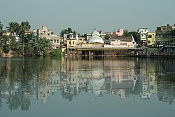
Hooghly district is one of the 23 districts in the Indian state of West Bengal. It can alternatively be spelt Hoogli. The headquarters of the district is Chuchura. The district is named after the Hooghly River and is located in the Burdwan division. There are four subdivisions of the district: Chinsurah Sadar, Serampore, Chandannagore, and Arambagh.
History[edit | edit source]
 |
The district of Hooghly derived its name from the town of Hooghly on the west bank of the Hooghly River about 40 km north of Kolkata. This town was a major river port for trade in India before colonization.
The district has thousands of years of rich heritage as part of the Bengali kingdom of Bhurshut. In 1536 Portuguese traders obtained a permit from Sultan Mahmud Shah to trade in this area. In those days the Hooghly River was the main route for transportation and Hooghly served as an excellent trading port.
Within a few decades, the town of Hooghly turned into a major commercial centre and the largest port in Bengal. In 1579–80, Mughal Emperor Akbar gave permission to a Portuguese captain Pedro Tavares to establish a city anywhere in the Bengal province. They chose Hooghly, and it became the first European settlement in Bengal. In 1599, the Portuguese traders built a convent and a church in Bandel. This was the first Christian church in Bengal and is known as ‘Bandel Church’ today.
The Portuguese traders started slave trading, robbery and converting natives into Christians by pressure. At one point they stopped paying taxes to the Mughal Empire. As a result, Emperor Shah Jahan ordered the then-ruler of Bengal province, Qasim Khan Juvayni, to blockade the city of Hooghly. This led to a war in 1632 in which the Portuguese were defeated.
Among other European powers that came to Hooghly were the Dutch, the Danish, the British, the French, the Belgians and the Germans. Dutch traders centred their activities in the town Chuchura which is south of Hooghly. Chandannagar became the base of the French and the city remained under their control from 1816 to 1950. Similarly, the Danish establishment in settlement in Serampore (1755). All these towns are on the west bank of the Hooghly River and served as ports. Among these European countries, the British ultimately became most powerful.

Initially the British were based in and around the city of Hooghly like traders from other countries. In 1690 Job Charnock decided to shift the British trading centre from Hooghly-Chinsura to Calcutta. The reason behind this decision was the strategically safe location of Calcutta and its proximity to the Bay of Bengal. As a result, trade and commerce in the Bengal province shifted from the town of Hooghly to Calcutta. Hooghly lost its importance as Calcutta prospered.
After the Battle of Buxar this region was brought under direct British rule until India's independence in 1947. After independence, this district merged into the state of West Bengal.
Though the city of Hooghly is more than 500 years old, the district of Hooghly was formed in 1795 with the city of Hooghly as its headquarters. Later the headquarters shifted to the town of Chuchura. In 1843 the Howrah district was created from the southern portion of this district. And in 1872, the south-west portion of this district was merged into the Medinipur district. The last change in area occurred in 1966.

Tarakeswar Temple[edit | edit source]
The Taraknath Temple, dedicated to the Hindu god Shiva worshiped as Taraknath, is a major pilgrimage spot in the town of Tarakeswar. Built in 1729, the temple is an ‘atchala’ structure of Bengal temple architecture with a ‘natmandir’ in front. Close by are the shrines of Kali and Lakshmi Narayan. Dudhpukur, a tank to the north of the Shiva temple is believed to fulfil the prayers of those taking a dip in it.
Pilgrims visit the temple throughout the year, especially on Mondays. Thousands of pilgrims visit Tarakeswar on the occasions of Shivaratri and ‘Gajan’, the former taking place in Phalgun (Feb-March) while the latter lasts for five days ending on the last day of Chaitra (mid-April). The month of Sravana (mid-July to mid-August) is seen to be auspicious for Shiva when celebrations are held on each Monday.
Geography[edit | edit source]

|
The district is flat, with no place having an elevation of more than 200 meters.[citation needed] The River Hooghly borders it to the east. Another major river is the Damodar. The district is bordered by Howrah district to the south, Purba Bardhaman District to the north, and to the east by the River Hooghly. Bankura District lies to the north-west, with Paschim Medinipur District to the south-west.
Economy[edit | edit source]
Hooghly is one of the most economically developed districts in West Bengal. It is the main jute cultivation, jute industry, and jute trade hub in the state. The jute mills are along the banks of the river Hooghly in Tribeni, Bhadreswar, Champdani and Sreerampur.
There are a number of industrial complexes including one of the largest car manufacturing plants in India, the Hindustan Motors plant in Uttarpara.
It was also home to the Singur Tata Nano controversy. Hindustan Motors plant was closed in 2014. Bandel Thermal power plant and Tribeni tissue plant (ITC) are running smoothly.
Divisions[edit | edit source]
Administrative subdivisions[edit | edit source]

The district comprises four subdivisions: Chinsurah, Chandannagore, Srirampore and Arambagh.
- Chinsurah subdivision consists of two municipalities (Hugli-Chuchura and Bansberia) and five community development blocs: Balagarh, Chinsurah–Mogra, Dhaniakhali, Pandua and Polba–Dadpur.
- Chandannagore subdivision consists of Chandannagar municipal corporation and three municipalities (Bhadreswar, Champdani and Tarakeswar) and three community development blocs: Haripal, Singur and Tarakeswar.
- Srirampore subdivision consists of six municipalities (Serampore, Uttarpara Kotrung, Dankuni, Konnagar, Rishra and Baidyabati) and four community development blocks: Chanditala–I, Chanditala–II, Jangipara and Sreerampur Uttarpara.
- Arambagh subdivision consists of Arambag municipality and six community development blocks: Arambag, Khanakul–I, Khanakul–II, Goghat–I, Goghat–II and Pursurah.[3]
Hugli-Chuchura is the district headquarters. There are 23 police stations, 18 development blocks, 12 municipalities and 207 gram panchayats in this district.[3][4]
Other than municipality area, each subdivision contains community development blocks that are divided into rural areas and census towns. There are 41 urban units: 12 municipalities and 64 census towns.[4][5]
Chinsurah subdivision[edit | edit source]
- Two municipalities: Hugli-Chinsurah and Bansberia
- Balagarh community development block consists of rural areas with 13 gram panchayats and four census towns: Jirat, Sripur, Badhagachhi, Mirdhanga.
- Chinsurah Mogra community development block consists of rural areas with 10 gram panchayats and eight census towns: Kodalia, Raghunathpur, Madhusudanpur, Amodghata, Shankhanagar, Chak Bansberia, Kulihanda, Simla.
- Dhaniakhali community development block consists of rural areas only with 18 gram panchayats.
- Pandua community development block consists of rural areas with 15 gram panchayats and three census towns: Boinchi, Pandua and Batika.
- Polba Dadpur community development block consists of rural areas only with 12 gram panchayats.
Chandannagore subdivision[edit | edit source]
- Chandannagar municipal corporation
- Three municipalities: Bhadreswar, Champdani, and Tarakeswar
- Haripal community development block consists of rural areas only with 15 gram panchayats one census town: Bargachhia.
- Singur community development block consists of rural areas with 16 gram panchayats and one census town: Singur.
- Tarakeswar community development block consists of rural areas only with 10 gram panchayats.
Srirampore subdivision[edit | edit source]
- Six municipalities: Serampore, Uttarpara Kotrung, Konnagar, Rishra, Dankuni and Baidyabati
- Chanditala I community development block consists of rural areas only with 9 gram panchayats and 2 census towns: Masat, Gangadharpur, Aniya, Bhagabatipur, Haripur, Krishnarampur, Kumirmorah, Nawabpur, Sheakhala.
- Chanditala II community development block consists of rural areas with 11 gram panchayats and 10 census towns: Purba Tajpur, Kharsarai, Begampur, Chikrand, Pairagachha, Monoharpur, Barijhati, Garalgachha, Krishnapur and Mrigala.
- Jangipara community development block consists of rural areas only with 10 gram panchayats.
- Sreerampur Uttarpara community development block consists of rural areas with six gram panchayats and six census towns: Raghunathpur, Dakshin Rajyadharpur, Bamunari, Rishra, Nabagram and Kanaipur.
Arambagh subdivision[edit | edit source]
- One municipality: Arambag.
- Arambag community development block consists of rural areas only with 15 gram panchayats.
- Khanakul I community development block consists of rural areas only with 13 gram panchayats.
- Khanakul II community development block consists of rural areas only with 11 gram panchayats.
- Goghat I community development block consists of rural areas only with 8 gram panchayats.
- Goghat II community development block consists of rural areas only with 9 gram panchayats.
- Pursurah community development block consists of rural areas only with 8 gram panchayats.
Blocks map[edit | edit source]
-
 Arambag CD block map showing GP and urban areas
 -
 Balagarh CD block showing GP areas
 -
 Chanditala-I CD block map showing GP areas
 -
 Chanditala-II CD block map showing GP and urban areas
 -
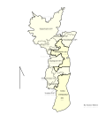 Chinsurah-Mogra CD block map showing GP and urban areas
 -
 Dhaniakhali CD block showing GP areas
 -
 Goghat-I CD block map showing GP areas
 -
 Goghat-II CD block showing GP areas
 -
 Haripal CD block map showing GP areas
 -
 Jangipara CD block map showing GP areas
 -
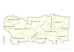 Khanakul-I CD block map showings GP areas
 -
 Khanakul-II CD block Map showing GP areas
 -
 Pursurah CD block map showing GP areas
 -
 Pandua CD block map showing GP areas
 -
 Polba-Dadpur CD block map showing GP areas
 -
 Singur CD block map showing GP and urban areas
 -
 Seerampur-Uttarpara CD block map showing GP and urban areas
 -
 Tarokeswr CD block map showing GP and urban areas


Assembly constituencies[edit | edit source]
The district is divided into 18 assembly constituencies:[6]
| No. | Constituency | Lok Sabha | MLA | 2026 Winner | 2024 Lead | ||
|---|---|---|---|---|---|---|---|
| 185 | Uttarpara | Sreerampur | Dipanjan Chakraborty | Bharatiya Janata Party | Trinamool Congress | ||
| 186 | Sreerampur | Bhaskar Bhattacharya | |||||
| 187 | Champdani | Dilip Singh | |||||
| 188 | Singur | Hooghly | Arup Kumar Das | ||||
| 189 | Chandannagar | Dipanjan Guha | |||||
| 190 | Chunchura | Subir Nag | Bharatiya Janata Party | ||||
| 191 | Balagarh (SC) | Sumana Sarkar | |||||
| 192 | Pandua | Tushar Kumar Majumdar | Trinamool Congress | ||||
| 193 | Saptagram | Swaraj Ghosh | Bharatiya Janata Party | ||||
| 194 | Chanditala | Sreerampur | Swati Khandoker | Trinamool Congress | Trinamool Congress | ||
| 195 | Jangipara | Prosenjit Bag | Bharatiya Janata Party | ||||
| 196 | Haripal | Arambagh | Madhumita Ghosh | ||||
| 197 | Dhanekhali (SC) | Hooghly | Ashima Patra | Trinamool Congress | |||
| 198 | Tarakeswar | Arambagh | Santu Pan | Bharatiya Janata Party | |||
| 199 | Pursurah | Biman Ghosh | Bharatiya Janata Party | ||||
| 200 | Arambagh (SC) | Hemanta Bag | Trinamool Congress | ||||
| 201 | Goghat (SC) | Prashanta Digar | Bharatiya Janata Party | ||||
| 202 | Khanakul | Susanta Ghosh | |||||
12 constituencies Balagarh, Dhaniakhali, Khanakul and Goghat constituencies are reserved for Scheduled Castes (SC) candidates. Along with two assembly constituencies from Howrah district, Jangipara, Chanditala, Uttarpara, Sreerampur and Champdani constituencies form the Sreerampur Lok Sabha constituency. Chandannagar, Singur, Chunchura, Balagarh, Saptagram, Pandua and Dhanekhali constituencies form the Hooghly Lok Sabha constituency. Tarakeswar, Pursurah, Khanakul, Arambagh, Haripal and Goghat constituencies are part of the Arambagh Lok Sabha constituency, which contains two assembly segments in Paschim Medinipur district.
As per order of the Delimitation Commission in respect of the delimitation of constituencies in the West Bengal, the district will be divided into 18 assembly constituencies:[7] Balagarh, Dhanekhali, Arambag and Goghat constituencies will be reserved for Scheduled Castes (SC) candidates. Along with two assembly constituencies from Howrah district, Uttarpara, Sreerampur, Champdani, Chanditala and Jangipara constituencies will form the Sreerampur (Lok Sabha constituency). Singur, Chandannagar, Chunchura, Balagarh, Pandua, Saptagram and Dhanekhali constituencies will form the Hooghly (Lok Sabha constituency). Haripal, Tarakeswar, Pursurah, Arambag, Goghat and Khankul constituencies will be part of the Arambag (Lok Sabha constituency), which will contain one assembly segment in Paschim Medinipur district.
Police administration[edit | edit source]
Hooghly District comes under Burdwan Police Range. Hooghly Rural Police District was created on 30 June 2017, curbing out of erstwhile Hooghly district. Presently it consists of sixteen police station with jurisdiction, one women police station and one Cyber Police Station. The head quarter of Hooghly Rural Police District was shifted to Kamarkundu under Singur PS from Chinsura. Chandannagar Police Commissionerate was formed after bifurcation of the Hooghly Police District, and has nine police stations under its jurisdiction established on 30 June 2017, is a police force with primary responsibilities in law enforcement and investigation within certain urban parts of Hooghly district. The Commissionerate is part of the West Bengal Police, and comes under the Department of Home & Hill Affairs, Government of West Bengal.
For the functioning of 23 police stations of the district, District Intelligence Branch, District Enforcement Branch and District Reserve Police Force SP, Hooghly is assisted by three additional superintendents:
- HQ: Having his office at Chinsurah, he looks after the Sadar Sub-Division and District Police Force, being assisted by Dy.S.P. (HQ) and Dy.S.P. (D&T).
- Industrial: He is in Serampore. He is the supervising officer for Serampore and Chandernagore Sub Divisions, assisted by SDPO: Serampore and SDPO: Chandernagore.
- Rural: He is in Arambagh and is the supervising officer for Arambagh Sub Division; being assisted by SDPO: Arambagh.
Transport[edit | edit source]
Rail[edit | edit source]
The railway communication of the district, especially at the suburban area, are available throughout the district.
There are four junction stations in Hooghly:
- Bandel Junction railway station
- Dankuni Junction railway station
- Sheoraphuli railway station
- Kamarkundu
The railway is under Howrah Division. The Howrah – New Delhi Rajdhani Route passes through the district
Bus[edit | edit source]
There are several bus stands in Hooghly district. Grand Trunk Road passes through the district and Private and Govt. buses are available.
Demographics[edit | edit source]
| Year | Pop. | ±% p.a. |
|---|---|---|
| 1901 | 1,076,416 | — |
| 1911 | 1,115,927 | +0.36% |
| 1921 | 1,105,907 | −0.09% |
| 1931 | 1,141,558 | +0.32% |
| 1941 | 1,415,934 | +2.18% |
| 1951 | 1,605,004 | +1.26% |
| 1961 | 2,231,288 | +3.35% |
| 1971 | 2,872,116 | +2.56% |
| 1981 | 3,557,306 | +2.16% |
| 1991 | 4,355,230 | +2.04% |
| 2001 | 5,041,976 | +1.47% |
| 2011 | 5,519,145 | +0.91% |
| source:[8] | ||
According to the 2011 census Hooghly district has a population of 5,519,145,[9] roughly equal to the nation of Denmark[10] or the US state of Wisconsin.[11] This gives it a ranking of 16th in India (out of a total of 640).[9] The district has a population density of 1,753 inhabitants per square kilometre (4,540/sq mi).[9] Its population growth rate over the decade 2001–2011 was 9.49%.[9] Hugli has a sex ratio of 958 females for every 1000 males,[9] and a literacy rate of 82.55%. 38.57% of the population lives in urban areas. Scheduled Castes and Scheduled Tribes make up 24.35% and 4.15% of the population respectively.[9]
Religion[edit | edit source]
| Religion | Population (1941)[13]:75 | Percentage (1941) | Population (2011)[12] | Percentage (2011) |
|---|---|---|---|---|
Hinduism 
|
799,688 | 74.2% | 4,574,569 | 82.89% |
Islam 
|
207,077 | 19.2% | 870,204 | 15.77% |
| Tribal religion[lower-alpha 1] | 69,500 | 6.45% | 49,050 | 0.89% |
| Others[lower-alpha 2] | 1,464 | 0.15% | 25,322 | 0.45% |
| Total Population | 1,077,729 | 100% | 5,519,145 | 100% |
Hindus are the majority community in the district. Muslims are the largest minority, concentrated more in rural areas.
Language[edit | edit source]
At the time of the 2011 census, 87.49% of the population spoke Bengali, 7.59% Hindi, 2.37% Santali and 1.72% Urdu as their first language. Hindi and Urdu speakers are predominantly found in urban areas.[14]
Education[edit | edit source]

There are 2992 primary schools, 408 high schools, 127 higher secondary schools, 22 colleges, and 6 technical institutes in Hooghly district. Notable institutions include:
- Balagarh Bijoy Krishna Mahavidyalaya
- Chatra Nandalal Institution
- Furfura Fatehia Senior Madrasah established in 1902
- Government College of Engineering & Textile Technology, Serampore
- Hooghly Branch Government School
- Hooghly Collegiate School established in 1812
- Hooghly Madrasah established in 1817[15]
- Hooghly Mohsin College established in 1836
- Mahesh High School
- Mahesh Sri Ramkrishna Ashram Vidyalaya (Higher Secondary)
- Rani Rashmoni Green University established in 2018
- Sarat Centenary College
- Saroj Mohan Institute of Technology
- Serampore College
- Serampore Girls' College
- Serampore Girl's High School
- Serampore Union Institution
- St Joseph's Convent, Chandannagar
- Vivekananda Mahavidyalaya, Haripal
Historical places[edit | edit source]

|
- Tarakeswar, home of Taraknath Temple.[when?]
- Serampore, where the Senate of Serampore College (University) was established
- Bandel, home of Bandel Church, West Bengal's oldest church
- Furfura Sharif, Shrine of Pir Mohammad Abu Bakr Siddique
Notable people[edit | edit source]
This is a list of notable people from Hooghly District:
- Sridhara was an Indian mathematician, Sanskrit pandit and philosopher. Sridharacharya's formula is also known as the Quadratic formula or Sridharacharya's method.
- Panchanan Karmakar, inventor of wooden Bengali alphabet typeface
- Anil Chatterjee is an actor.
- Brajendra Nath Seal was a humanist philosopher.
- Diwan Mohanlal, born in Guptipara, was a Hindu King, and the Chief commander of Nawab Siraj au Daulla.
- Raja Ram Mohan Roy, born in Radhanagore. He is considered as the "Father of the Indian Renaissance". He was one of the founders of the Brahmo Sabha, the precursor of the Brahmo Samaj, a socio-religious (Hindu) reform movement in Undivided India.
- Nibaran Chandra Mukherjee was a Brahmo reformer.
- Haji Muhammad Mohsin was a famous philanthropist.
- Bhaduri Mahasaya, revered as Maharishi Nagendranath Bhaduri, once guided young minds as headmaster of Janai Training High School.[16] Bhaduri Mahasaya was also known as "The Levitating Saint" due to accounts of his levitation during intense pranayama practices, as described by Paramahansa Yogananda in his Autobiography of a Yogi.[17] His maternal uncle’s home in Chatra, Serampore was a cherished haven, where he often stayed and immersed himself in quiet contemplation.
- Satish Chandra Mukherjee, born in Banipur, was a pioneer in establishing a system of national education in India.
- Ramdas Adak, Bengali and Sanskrit poet, one of the composers of Dharmamangal
- Subroto Mukherjee was the first Indian Commander-in-Chief of the Indian Air Force.
- Ganga Prasad Mukherjee was a physician.
- Jagannath Tarka Panchanan was a legendary Sanskrit scholar and pundit of ancient Hindu Laws.
- Ramakrishna was a Hindu mystic, saint, and religious leader in 19th century Bengal.
- Nagendranath Basu was an archaeologist, encyclopaedist and a nationalist social historian of Bengal.
- Amiya Chakravarty was a literary critic, academic, and Bengali poet. He was a close associate of Rabindranath Tagore, and edited several books of his poetry.
- Ganapati Chakraborty was a magician known for his mesmerizing tricks and is considered to be the pioneer of modern magic in Bengal.
- Rangalal Bandyopadhyay was a Bengali poet, journalist and author.
- Kali Mirza was an 18th-century composer of tappā music in Bengal. A contemporary of Nidhu Babu, he composed over 400 tappās.
- Swami Sri Yukteswar Giri was an Indian monk and yogi, and the guru of Paramahansa Yogananda and Swami Satyananda Giri.
- Nagendranath Chattopadhyay was a noted Sanskrit scholar and grammarian.
- Murari Mohan Mukherjee was a plastic surgeon.
- Krishna Chandra Bhattacharya was a philosopher at the University of Calcutta known for his method of "constructive interpretation" through which relations and problematics of ancient Indian philosophical systems are drawn out and developed so that they can be studied like problems of modern philosophy.
- Sisir Kumar Mitra was a physicist.
- Madhusudan Gupta was a translator and Ayurvedic practitioner who was also trained in Western medicine and is credited with having performed India's first human dissection at Calcutta Medical College (CMC) in 1836, almost 3,000 years after Susruta.
- Prabhat Kumar Mukhopadhyay was a Bengali author.
- Sarat Chandra Chattopadhyay was a Bengali novelist and short story writer of the early 20th century.
- Akshay Chandra Sarkar was a poet, an editor and a literary critic of Bengali literature.
- Raja Digambar Mitra was one of the leading Derozians and first Bengali Sheriff of Kolkata.
- Kanailal Dutta was a revolutionary in India's freedom struggle belonging to the Jugantar group.
- Ashapurna Devi was a prominent Indian novelist and poet in Bengali language.
- Brahmabandhav Upadhyay was a theologian, journalist and Indian freedom fighter. He was closely attached with Keshub Chandra Sen, classmate of Swami Vivekananda and close acquaintance of Rabindranath Tagore.
- Ramnidhi Gupta was commonly known as Nidhu Babu . He was one of the great reformers of Bengali tappā music.
- Kirity Roy, a civil rights activist working in West Bengal
- Motilal Roy was a Bengali revolutionary, journalist, social reformer. He founded the "Prabartak Sangha", a nationalist organisation for social works.
- Dwarka Nath Mitra was a famous lawyer and judge of the Calcutta High Court.
- Nabagopal Mitra was an Indian playwright, poet, essayist, patriot and one of the founding fathers of Hindu nationalism. He founded the Hindu Mela, the pioneer institution behind the genesis of Hindu nationalism. Mitra also founded National Press, National Paper, National Society, National School, National Theatre, National Store, National Gymnasium and National Circus, earning him the sobriquet 'National Mitra'.
- Barindra Kumar Ghosh was an Indian revolutionary and journalist. He was one of the founding members of "Jugantar" , a Bengali weekly, a revolutionary outfit in Bengal. Barindra Kumar Ghosh was the younger brother of Shri Aurobindo.
- Manmohan Ghose was an Indian poet and one of the first from India to write poetry in English. He was a brother of Sri Aurobindo.
- Ashim Kumar Majhi is a politician.
- Nirmal Jibon Ghosh, an Indian revolutionary and member of the Bengal volunteers.
- Premendra Mitra belonged to the renowned Mitra family of Konnagar.
- Surajit Dhara, recipient of the Shanti Swarup Bhatnagar Prize for Science and Technology for his contributions to physical sciences in 2020[18]
- Chandranath Basu was an Indian litterateur who coined the term "Hindutva" and has been regarded as a doyen of economic and Indian nationalism in Bengal.
- Abbas Siddiqui, religious scholar.
- Kasem Bin Abu Bakar, Bengali novelist
See also[edit | edit source]
- Rathayatra of Mahesh, Serampore
Notes[edit | edit source]
- ↑ All tribals were counted under 'Tribal' in the 1941 census irrespective of actual religion practiced.
- ↑ Including Jainism, Christianity, Buddhism, Zoroastrianism, Judaism, Ad-Dharmis, or not stated
References[edit | edit source]
- ↑ 1.0 1.1 "Fact and Figures". Wb.gov.in. Retrieved 5 July 2019.
- ↑ "52nd Report of the Commissioner for Linguistic Minorities in India" (PDF). Nclm.nic.in. Ministry of Minority Affairs. p. 85. Archived from the original (PDF) on 25 May 2017. Retrieved 5 July 2019.
- ↑ 3.0 3.1 "Directory of District, Sub division, Panchayat Samiti/ Block and Gram Panchayats in West Bengal, March 2008". West Bengal. National Informatics Centre, India. 19 March 2008. Archived from the original on 25 February 2009. Retrieved 4 December 2008.
- ↑ 4.0 4.1 "Municipal General Election 2005: Hooghly District". Official website of Hooghly district. Retrieved 13 December 2008.
- ↑ "Population, Decadal Growth Rate, Density and General Sex Ratio by Residence and Sex, West Bengal/ District/ Sub District, 1991 and 2001". West Bengal. Directorate of census operations. Archived from the original on 19 July 2011. Retrieved 4 December 2008.
- ↑ "General election to the Legislative Assembly, 2001–List of Parliamentary and Assembly Constituencies" (PDF). West Bengal. Election Commission of India. Archived from the original (PDF) on 4 May 2006. Retrieved 19 November 2008.
- ↑ "Press Note, Delimitation Commission" (PDF). Assembly Constituencies in West Bengal. Delimitation Commission. Retrieved 19 November 2008.
- ↑ Decadal Variation In Population Since 1901
- ↑ 9.0 9.1 9.2 9.3 9.4 9.5 "District Census Handbook: Hooghly" (PDF). censusindia.gov.in. Registrar General and Census Commissioner of India. 2011.
- ↑ US Directorate of Intelligence. "Country Comparison:Population". Archived from the original on 13 June 2007. Retrieved 1 October 2011.
Denmark 5,529,888, July 2011 est.
- ↑ "2010 Resident Population Data". U. S. Census Bureau. Archived from the original on 19 October 2013. Retrieved 30 September 2011.
Wisconsin 5,686,986
- ↑ 12.0 12.1 "Table C-01 Population by Religion: West Bengal". censusindia.gov.in. Registrar General and Census Commissioner of India. 2011.
- ↑ "CENSUS OF INDIA, 1941 VOLUME VI BENGAL PROVINCE" (PDF). Retrieved 13 August 2022.
- ↑ 14.0 14.1 "Table C-16 Population by Mother Tongue: West Bengal". www.censusindia.gov.in. Registrar General and Census Commissioner of India.
- ↑ TwoCircles.net (12 April 2010). "Two-hundred-year-old Hooghly Madrasa facing closure – TwoCircles.net". Retrieved 1 February 2020.
- ↑ Chatterjee, Jaba (2023). LIFE AND TEACHINGS OF MAHARSHI NAGENDRANATH (3rd ed.). Sanatan Dharma Pracharini Sabha (1891), Shree Shree Nagendra Math (1916), Nagendra Mission (2005), 2B Rammohan Roy Road, Kolkata- 700 009: Sabitadeb Banerjee. p. 12.
{{cite book}}: CS1 maint: location (link) - ↑ Yogananda, Paramhansa (2023). The Levitating Saint, AUTOBIOGRAPHY OF A YOGI. Yogoda Satsang Math, 21, U.N Mukherjee Road, Dakshineswar, Kolkata 7000076: YOGODA SATSANG SOCIETY OF INDIA. p. 59. ISBN 978-81-93939-71-0.
{{cite book}}: CS1 maint: location (link) - ↑ "List of recipients" (PDF). Shanti Swarup Bhatnagar Prize for Science & Technology. Government of India. 2020. Retrieved 16 August 2021.
External links[edit | edit source]
- Hooghly District official homepage Archived 1 October 2020 at the Wayback Machine
- Hooghly specific information on West Bengal Portal
- Hooghly District map
- Hooghly District information
Places adjacent to Hooghly district | ||||||||||
|---|---|---|---|---|---|---|---|---|---|---|
| ||||||||||


.png)