This article needs additional citations for verification. (August 2016) |
Gourhati | |
|---|---|
Village | |
Location in West Bengal, India  Gourhati Gourhati (India) | |
| Coordinates: 22°46′32″N 87°48′30″E / 22.7756000°N 87.8083570°E | |
| Country | |
| State | West Bengal |
| District | Hooghly |
| Elevation | 5 m (16 ft) |
| Population (2011) | |
| • Total | 13,084 |
| Languages | |
| • Official | Bengali, English |
| Time zone | UTC+5:30 (IST) |
| ISO 3166 code | IN-WB |
| Sex ratio | 921 ♂/♀ |
Gourhati is a village in the Arambagh CD block in the Arambagh subdivision of the Hooghly district in the Indian state of West Bengal.
Geography[edit | edit source]
Lua error in Module:OSM_Location_map at line 1984: attempt to index field 'wikibase' (a nil value).
Location[edit | edit source]
Gourhati is located at 22°46′32″N 87°48′30″E / 22.7756000°N 87.8083570°E.
Area overview[edit | edit source]
The Arambagh subdivision, presented in the map alongside, is divided into two physiographic parts – the Dwarakeswar River being the dividing line. The western part is upland and rocky – it is extension of the terrain of neighbouring Bankura district. The eastern part is flat alluvial plain area. The railways, the roads and flood-control measures have had an impact on the area.[1] The area is overwhelmingly rural with 94.77% of the population living in rural areas and 5.23% of the population living in urban areas.[2]
Note: The map alongside presents some of the notable locations in the subdivision. All places marked in the map are linked in the larger full screen map.
Demographics[edit | edit source]
As per the 2011 Census of India, Gaurhati had a total population of 13,084 of which 6,716 (51%) were males and 6,368 (49%) were females. Population in the age range 0–6 years was 1,380. The total number of literate persons in Gaurhati was 9,442 (80.67% of the population over 6 years).[3]
Education[edit | edit source]
There (Gourhati-II) are two no's of High School one for Girls (Up to 10 th Class, Name - Gourhati Durgadas Balika Vidyalaya) and another for Boys (Up to 12 Class, Class 5 th to 10 th for Boys, after 10 th class Co-ed, Name - Gourhati Haradas Institution)
Culture[edit | edit source]
David J. McCutchion mentions:[4]
- Gangadhara Siva temple as a small at chala having a single entrance, with terracotta decoration, built in 1752.
- Dolmancha as a pancha ratna with crude terracotta figures.
Gourhati picture gallery[edit | edit source]
-
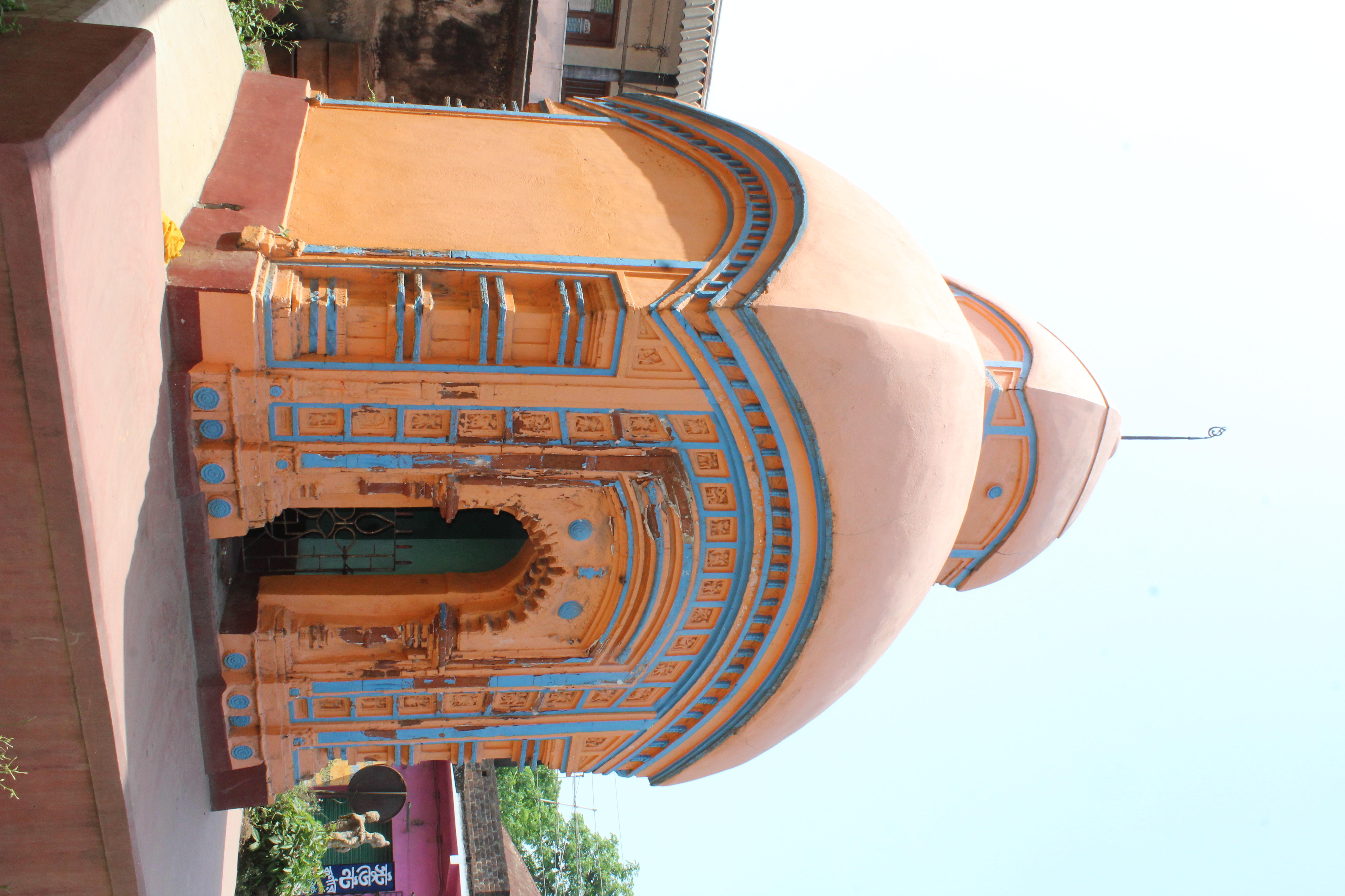 Gangadhara Siva temple, at chala built in 1752
 -
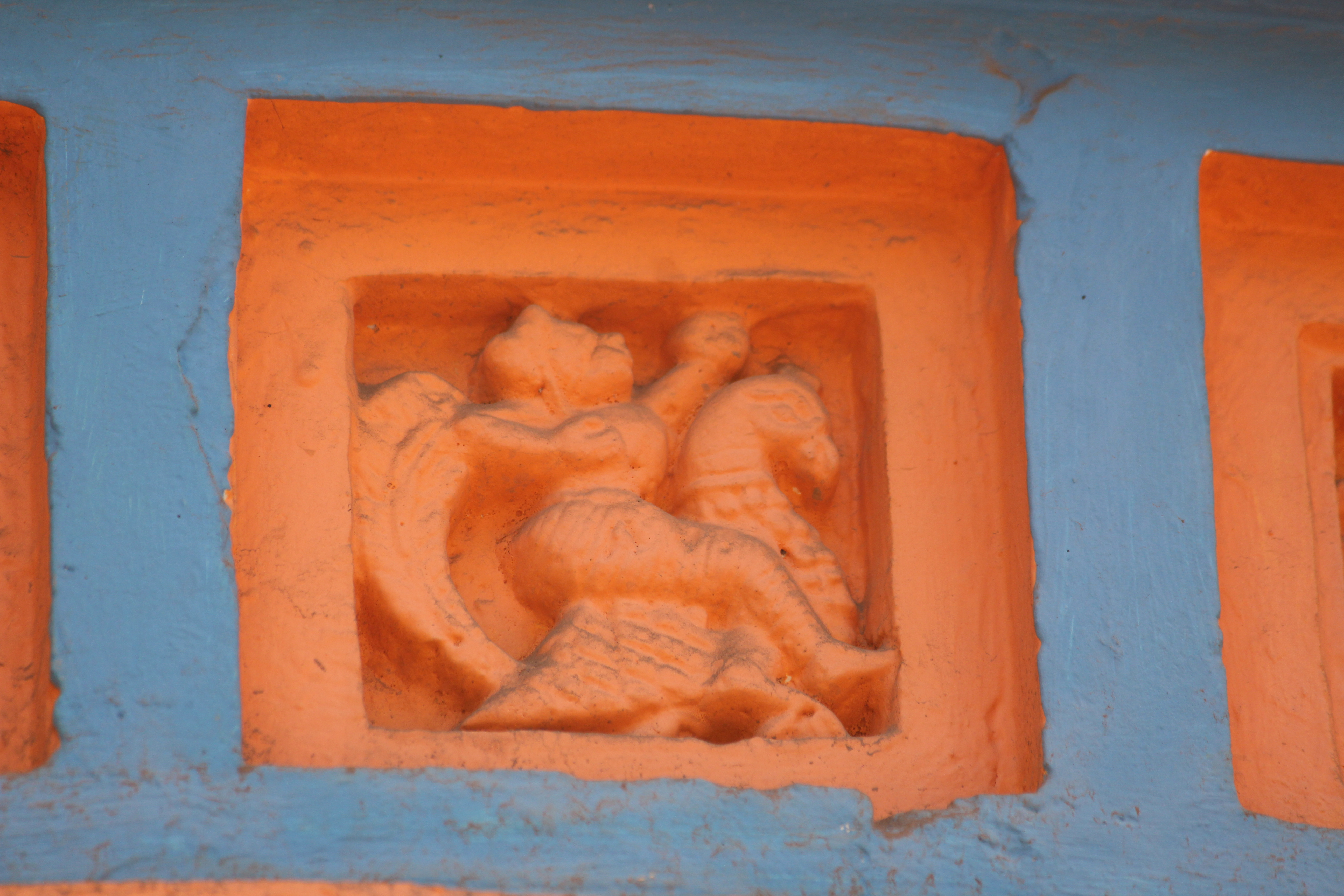 Terracota decoration in Gangadhar Siva temple
 -
 Damodarjiu temple, pancha ratna
 -
 Ram Gopal temple, pancha ratna


Note: Some pictures are wrongly marked as belonging to Basudebpur. This should be ignored. It has been taken care of at the time of categorisation.
References[edit | edit source]
- ↑ "District Census Handbook: Hugli, Series-20, Part XIIA" (PDF). Physiography, Page 17-19. Directorate of Census Operations, West Bengal, 2011. Retrieved 25 September 2020.
- ↑ "District Statistical Handbook 2014 Hooghly". Table 2.2, 2.4(a). Department of Planning and Statistics, Government of West Bengal. Retrieved 25 September 2020.
- ↑ "2011 Census – Primary Census Abstract Data Tables". West Bengal – District-wise. Registrar General and Census Commissioner, India. Retrieved 24 September 2020.
- ↑ McCutchion, David J., Late Mediaeval Temples of Bengal, first published 1972, reprinted 2017, pages 38, 75. The Asiatic Society, Kolkata, ISBN 978-93-81574-65-2