


robot: Update article (please report if you notice any mistake or error in this edit) |
Tudu Hommie (talk | contribs) refined section for consistency and updated info |
||
| Line 1: | Line 1: | ||
{{Short description|District in West Bengal, India}} | |||
{{Use Indian English|date=October 2016}} | {{Use Indian English|date=October 2016}} | ||
{{Use dmy dates|date=October 2020}} | {{Use dmy dates|date=October 2020}} | ||
{{Infobox settlement | {{Infobox settlement | ||
| name | | name = Alipurduar district | ||
| settlement_type | | native_name = | ||
| other_name = | |||
| settlement_type = [[List of districts of West Bengal|District]] of [[West Bengal]] | |||
| image_skyline | | image_skyline = {{Photomontage | ||
|photo1a = EveningAtJaldapara.JPG | |photo1a = EveningAtJaldapara.JPG | ||
|photo1b = Buxa fort,Jalpaiguri.JPG | |photo1b = Buxa fort,Jalpaiguri.JPG | ||
| Line 13: | Line 13: | ||
|photo2b = Hut used for living by the TOTO aboriginals.jpg | |photo2b = Hut used for living by the TOTO aboriginals.jpg | ||
|photo3a = Buxa Tiger Reserve forest 2014.jpg | |photo3a = Buxa Tiger Reserve forest 2014.jpg | ||
|size= | |size = 300 | ||
|foot_montage = Clockwise from top-left: Evening at [[Jaldapara National Park]], ruins of [[Buxa Fort]], Hut used by Toto aboriginals, Jayanti Hills in [[Buxa Tiger Reserve]], Bhutan gate near [[Jaigaon]] | |||
}} | }} | ||
| | | mapframe = yes | ||
| | | coordinates = {{coord|26.489|N|89.527|E|display=inline,title}} | ||
| | | subdivision_type = [[List of sovereign states|Country]] | ||
| | | subdivision_name = {{flag country|IND}} | ||
| subdivision_type1 = [[States and union territories of India|State]] | |||
| subdivision_name1 = [[West Bengal]] | |||
| subdivision_type2 = [[Administrative divisions of West Bengal|Division]] | |||
| subdivision_name2 = [[Jalpaiguri division|Jalpaiguri]] | |||
| seat_type = Headquarters | |||
}} | | seat = [[Alipurduar]] | ||
| | | leader_title = [[List of subdivisions of West Bengal|Subdivisions]] | ||
| | | leader_name = [[Alipurduar subdivision|Alipurduar Sadar]] | ||
| leader_title1 = [[Community Development Block|CD Blocks]] | |||
| leader_name1 = [[Madarihat-Birpara (community development block)|Madarihat-Birpara]], [[Alipurduar I]], [[Alipurduar II]], [[Kalchini]], [[Falakata (community development block)|Falakata]], [[Kumargram]] | |||
| subdivision_name | | leader_title2 = [[List of constituencies of the Lok Sabha|Lok Sabha constituencies]] | ||
| subdivision_type1 | | leader_name2 = [[Alipurduar (Lok Sabha constituency)|Alipurduars]] | ||
| subdivision_name1 | | leader_title3 = [[List of constituencies of the West Bengal Legislative Assembly|Vidhan Sabha constituencies]] | ||
| subdivision_type2 | | leader_name3 = [[Alipurduars (Vidhan Sabha constituency)|Alipurduars]], [[Kumargram (Vidhan Sabha constituency)|Kumargram]], [[Falakata (Vidhan Sabha constituency)|Falakata]], [[Madarihat (Vidhan Sabha constituency)|Madarihat]], [[Kalchini (Vidhan Sabha constituency)|Kalchini]] | ||
| subdivision_name2 | | leader_title4 = [[District magistrate|District Magistrate]] | ||
| | | leader_name4 = R. Vimala, [[Indian Administrative Service|IAS]]<ref>{{cite web |title=District Magistrate |url=https://alipurduar.gov.in/about-district/whos-who/ |website=Alipurduar District, Government of West Bengal |access-date=1 November 2024}}</ref> | ||
| | | total_type = Total | ||
| | | area_total_km2 = 3383 | ||
| | | area_footnotes = | ||
| | | population_as_of = 2011 | ||
| | | population_total = 1,491,250 | ||
| | | population_footnotes = <ref name=census2011>{{cite web|url=https://censusindia.gov.in/2011census/dchb/DCHB_A/19/1902_PART_A_DCHB_JALPAIGURI.pdf|title= District Census Handbook-Jalpaiguri|publisher=Directorate of Census Operations, West Bengal|access-date=10 July 2021}}</ref> | ||
| area_total_km2 | | population_urban = 307,456 | ||
| area_footnotes | | population_density_km2 = auto | ||
| population_as_of | | demographics_type1 = Demographics | ||
| population_total | | demographics1_title1 = [[Literacy in India|Literacy]] | ||
| population_footnotes | | demographics1_info1 = 78.57 per cent | ||
| population_urban | | demographics1_title2 = [[Human sex ratio|Sex ratio]] | ||
| population_density_km2 | | demographics1_info2 = 949 [[male|♂]]/[[female|♀]] | ||
| demographics_type1 | | demographics_type2 = Languages | ||
| demographics1_title1 | | demographics2_title1 = Official | ||
| demographics1_info1 | | demographics2_info1 = [[Bengali language|Bengali]]<ref name="wblangoff">{{cite web|title=Fact and Figures|url=https://wb.gov.in/portal/web/guest/facts-and-figures;jsessionid=JzdD9RHb7aMY5esZPtcsIVLy|website=Wb.gov.in|access-date=5 July 2019}}</ref><ref>{{cite web|title=52nd Report of the Commissioner for Linguistic Minorities in India|url=http://nclm.nic.in/shared/linkimages/NCLM52ndReport.pdf|website=Nclm.nic.in|publisher=[[Ministry of Minority Affairs]]|access-date=5 July 2019|page=85|url-status=dead|archive-url=https://web.archive.org/web/20170525141614/http://nclm.nic.in/shared/linkimages/NCLM52ndReport.pdf|archive-date=25 May 2017}}</ref> | ||
| demographics1_title2 | | demographics2_title2 = Additional official | ||
| demographics1_info2 | | demographics2_info2 = [[English language|English]]<ref name="wblangoff"/> | ||
| | | timezone1 = [[Indian Standard Time|IST]] | ||
| | | utc_offset1 = +05:30 | ||
| | | website = {{URL|http://alipurduar.gov.in}} | ||
| | |||
| | |||
| | |||
| timezone1 | |||
| utc_offset1 | |||
| website | |||
}} | }} | ||
'''Alipurduar | '''Alipurduar district''' ({{IPA|bn|alipurduar d͡ʒela}}),<ref>{{Cite web |title=About District {{!}} Alipurduar District {{!}} India |url=https://alipurduar.gov.in/about-district/ |access-date=2025-05-02 |language=en-US}}</ref> is one of the [[List of districts of West Bengal|23 districts]] of the state of [[West Bengal]] in [[India]]. The district is the part of [[Jalpaiguri division|Jalpaiguri Division]].<ref>{{cite web|author=TNN|url=http://timesofindia.indiatimes.com/city/kolkata/Alipurduar-a-new-district-on-June-25/articleshow/36916065.cms |title=Roy Alipurduar: Alipurduar a new district on June 25 |publisher=Timesofindia.indiatimes.com |date=2014-06-21 |access-date=2020-04-06}}</ref> [[Alipurduar]] city is the headquarters of the district. It was made a district by bifurcating [[Jalpaiguri district]] on June 25, 2014.<ref name="business-standard.com">{{cite news|author=IANS |url=http://www.business-standard.com/article/news-ians/alipurduar-becomes-bengal-s-20th-district-114062500725_1.html |title=Alipurduar becomes Bengal's 20th district | Business Standard News |work=Business Standard|date=25 June 2014 |access-date=2020-04-06}}</ref> This is the easternmost district of West Bengal. It is situated in the Western [[Dooars]] natural region, in the foothills of the Bengal Himalayas.<ref>{{Cite web |title=Alipurduar in Dooars - Tourist Places to See & Things to Do |url=https://northbengaltourism.com/alipurduar/ |access-date=2025-05-02 |website=northbengaltourism.com}}</ref> | ||
==Etymology== | |||
Alipurduar's name originates from Colonel Hedayat Ali Khan, a British officer who fought in the 1865 [[Duar War|Bhutan War]] and was stationed there, combined with "Duar" (or Door), representing its role as a gateway to the Dooars region of the Himalayas.<ref><https://www.east-himalaya.com/alipurduar.php#:~:text=The%20name%20Alipurduar%20reflects%20both,the%20name%20remains%20perfectly%20accurate.</ref> | |||
==History== | |||
===Under the Kingdom of Bhutan=== | |||
[[File:Southern border of Bhutan1985.jpg|thumb|280px|Southern Boundary of Bhutan contained the present Alipurduar district before 1865 [[Duar War]]]] | |||
The Dooars in Alipurduar district were under the control of [[Kingdom of Bhutan]] from early 17th-century till 1865 when [[British East India]] company captured the area in the [[Duar War]] under the [[Duar War#Treaty of Sinchula|Treaty of Sinchula]] and were added to the district of Jalpaiguri in 1869 and later finally to the [[India|Indian Union]] in 1949. | |||
Like all the Duars under [[Druk Gyalpo]] of [[Bhutan]], it was under the jurisdiction of [[Ponlop|Tongso Penlop]], below the Tongso Penlop were Subah who in turn appointed [[Mandal (surname)|Mondal]], Laskar or Uzir to look after the Duars.<ref>{{harvcol|Das|1998|p=32}}</ref> | |||
== Administration == | == Administration == | ||
| Line 85: | Line 83: | ||
|archive-url=https://web.archive.org/web/20090225032419/http://wbdemo5.nic.in/writereaddata/Directoryof_District_Block_GPs%28RevisedMarch-2008%29.doc | |archive-url=https://web.archive.org/web/20090225032419/http://wbdemo5.nic.in/writereaddata/Directoryof_District_Block_GPs%28RevisedMarch-2008%29.doc | ||
|archive-date=25 February 2009 | |archive-date=25 February 2009 | ||
}}</ref> | }}</ref> Geographically the district lies between 26.4°N to 26.83°N and 89°E to 89.9°E. | ||
Geographically the district lies | |||
The nine census towns are [[Paschim Jitpur]], [[Chechakhata]], [[Alipurduar Railway Junction]], [[Bholar Dabri]], [[Sobhaganj]], [[Jaygaon]] and [[Uttar Latabari]] and [[Uttar Kamakhyaguri]].<ref name=ctlist>{{cite web|url=http://web.cmc.net.in/wbcensus/DataTables/01/Table-3.htm |title=District Wise List of Statutory Towns (Municipal Corporation, Municipality,Notified Area and Cantonment Board), Census Towns and Outgrowths, West Bengal, 2001 |publisher=Census of India, Directorate of Census Operations, West Bengal |access-date=21 December 2008 |url-status=dead |archive-url=https://web.archive.org/web/20110721163402/http://web.cmc.net.in/wbcensus/DataTables/01/Table-3.htm |archive-date=21 July 2011 }}</ref> | The nine census towns are [[Paschim Jitpur]], [[Chechakhata]], [[Alipurduar Railway Junction]], [[Bholar Dabri]], [[Sobhaganj]], [[Jaygaon]] and [[Uttar Latabari]] and [[Uttar Kamakhyaguri]].<ref name=ctlist>{{cite web|url=http://web.cmc.net.in/wbcensus/DataTables/01/Table-3.htm |title=District Wise List of Statutory Towns (Municipal Corporation, Municipality,Notified Area and Cantonment Board), Census Towns and Outgrowths, West Bengal, 2001 |publisher=Census of India, Directorate of Census Operations, West Bengal |access-date=21 December 2008 |url-status=dead |archive-url=https://web.archive.org/web/20110721163402/http://web.cmc.net.in/wbcensus/DataTables/01/Table-3.htm |archive-date=21 July 2011 }}</ref> | ||
==Railway network== | ==Railway network== | ||
[[Alipurduar railway division]] has at least 710 km of railway track. It is the largest division of the [[Northeast Frontier Railway zone| | [[Alipurduar railway division]] has at least 710 km of railway track. It is the largest division of the [[Northeast Frontier Railway zone|Northeast Frontier Railway]] zone. In Alipurduar district, there are two major stations, [[Alipurduar Junction railway station|Alipurduar Junction]] (APDJ) and [[New Alipurduar railway station|New Alipurduar]] (NOQ). There are other stations in the district viz. [[Falakata Railway Station]], [[Kamakhyaguri Railway Station]], [[Dalgaon Railway Station]], [[Hasimara railway station]], [[Kalchini railway station]], [[Rajabhatkhawa]], [[Mujnai railway station]], [[Madarihat railway station]], [[Hamiltonganj railway station]], [[Samuktala Road Junction railway station]], [[Salbari railway station]] etc.{{fact|date=May 2025}} | ||
==Legislative segments== | ==Legislative segments== | ||
There are 5 assembly constituency in Alipurduar district : | There are 5 assembly constituency in Alipurduar district : | ||
{| class="wikitable" | |||
!No. | |||
!Name | |||
!Lok Sabha | |||
As per order of the [[Delimitation Commission]] in respect of the [[delimitation of constituencies]] in the West Bengal, the area under Kumargram block and seven [[gram panchayat]]s under Alipurduar–II block, viz. Bhatibari, Kohinoor, Parokata, Mahakalguri, Shamuktala, Turturi and Tatpara–I | !MLA | ||
! colspan="2" |2021 Winner | |||
! colspan="2" |2024 Lead | |||
|- | |||
| 10 | |||
|[[Kumargram Assembly constituency|Kumargram (ST)]] | |||
|rowspan="5" |[[Alipurduars Lok Sabha constituency|Alipurduars]] | |||
|[[Manoj Kumar Oraon]] | |||
|{{Full party name with color|Bharatiya Janata Party|rowspan=2}} | |||
|{{Full party name with color|Bharatiya Janata Party|rowspan=5}} | |||
|- | |||
|11 | |||
|[[Kalchini Assembly constituency|Kalchini (ST)]] | |||
|[[Bishal Lama]] | |||
|- | |||
| 12 | |||
|[[Alipurduars Assembly constituency|Alipurduars]] | |||
|[[Suman Kanjilal]]{{efn|Suman Kanjilal was elected as a BJP MLA. However, on 5 February 2023, he defected to the Trinamool Congress}} | |||
|{{Full party name with color|Trinamool Congress}} | |||
|- | |||
| 13 | |||
|[[Falakata Assembly constituency|Falakata (SC)]] | |||
|[[Dipak Barman]] | |||
|{{Full party name with color|Bharatiya Janata Party}} | |||
|- | |||
| 14 | |||
|[[Madarihat Assembly constituency|Madarihat (ST)]] | |||
|[[Jay Prakash Toppo]] | |||
|{{Full party name with color|Trinamool Congress}} | |||
|} | |||
As per order of the [[Delimitation Commission]] in respect of the [[delimitation of constituencies]] in the West Bengal, the area under Kumargram block and seven [[gram panchayat]]s under Alipurduar–II block, viz. Bhatibari, Kohinoor, Parokata, Mahakalguri, Shamuktala, Turturi and Tatpara–I constitutes the Kumargram assembly constituency of West Bengal. The Majherdabri gram panchayat under Alipurduar–II block and the area under Kalchini block constitutes the Kalchini assembly constituency. The Alipurduar municipality, the Alipurduar Railway Junction census town, and the gram panchayats of Chaporer Par–I, Chaporer Par–II and Tatpara–II under Alipurduar–II block and ten gram panchayats of Alipurduar–I block, viz. Banchukamari, Parorpar, Shalkumar–I, Vivekananda–I, Chakowakheti, Patlakhawa, Shalkumar–II, Vivekananda–II, Mathura and Tapsikhata form the Alipurduars assembly constituency. The other gram panchayat of Alipurduar–I block, viz. Purba Kanthalbari forms the Falakata assembly constituency along with the area under Falakata block. Madarihat block is part of Madarihat assembly constituency. Kumargram, Kalchini and Madarihat constituencies is reserved for [[Scheduled castes and scheduled tribes|Scheduled tribes (ST)]] candidates. Falakata constituency is reserved for [[Scheduled castes and scheduled tribes|Scheduled castes (SC)]] candidates. All these five assembly constituencies are part of [[Alipurduars (Lok Sabha constituency)]], which is reserved for ST candidates.<ref>{{cite web | |||
| url = http://www.wbgov.com/e-gov/English/DELIMITATION.pdf| title = Press Note, Delimitation Commission| access-date = 10 January 2009 | work = Assembly Constituencies in West Bengal| publisher = Delimitation Commission | pages = 4–5, 23}}</ref> | | url = http://www.wbgov.com/e-gov/English/DELIMITATION.pdf| title = Press Note, Delimitation Commission| access-date = 10 January 2009 | work = Assembly Constituencies in West Bengal| publisher = Delimitation Commission | pages = 4–5, 23}}</ref> | ||
== Demographics == | == Demographics == | ||
As of the 2011 census, Alipurduar district | As of the 2011 census, Alipurduar district had a population of 1,491,250, of which 1,183,704 were rural and 307,456 were urban. Scheduled Castes and Scheduled Tribes made up 456,706 (30.62%) and 382,112 (25.62%) of the population respectively.<ref name=census2011/> | ||
===Religion=== | |||
{{bar box | {{bar box | ||
|title = Religion in Alipurduar district (2011)<ref name=" | |title = Religion in Alipurduar district (2011)<ref name="religion"/> | ||
|titlebar=#Fcd116 | |titlebar=#Fcd116 | ||
|float=right | |float=right | ||
|bars= | |bars= | ||
{{bar percent|[[Hinduism]]|darkorange|80.07}} | {{bar percent|[[Hinduism in West Bengal|Hinduism]]|darkorange|80.07}} | ||
{{bar percent|[[Islam]]|green|8.74}} | {{bar percent|[[Islam]]|green|8.74}} | ||
{{bar percent|[[Christianity]]| | {{bar percent|[[Christianity]]|blue|7.52}} | ||
{{bar percent|[[Buddhism]]|yellow|2.37}} | {{bar percent|[[Buddhism]]|yellow|2.37}} | ||
{{bar percent|Other or not stated|black| | {{bar percent|Tribal religion|red|1.00}} | ||
{{bar percent|Other or not stated|black|0.31}} | |||
}} | }} | ||
[[ | |||
{| class="wikitable sortable" | |||
|+Religion in present-day Alipurduar district | |||
!Religion | |||
!Population (1941)<ref name="1941religion">{{cite web |title=Census of India, 1941 Volume VI Bengal Province |url=https://dspace.gipe.ac.in/xmlui/bitstream/handle/10973/37365/GIPE-020591.pdf?sequence=3&isAllowed=y |access-date=13 August 2022}}</ref>{{rp|90–91}} | |||
!Percentage (1941) | |||
!Population (2011)<ref name="religion">{{Cite web |date=2011 |title=Table C-01 Population by Religion: West Bengal |url=https://censusindia.gov.in/nada/index.php/catalog/11396/download/14509/DDW19C-01%20MDDS.XLS |website=censusindia.gov.in |publisher=[[Registrar General and Census Commissioner of India]]}}</ref> | |||
!Percentage (2011) | |||
|- | |||
|[[Hinduism in West Bengal|Hinduism]] [[File:Om.svg|16x16px]] | |||
|144,898 | |||
|45.17% | |||
|1,194,102 | |||
|80.07% | |||
|- | |||
|Tribal religion [[File:Kirat flag-02.jpg|15x15px]] | |||
|141,716 | |||
|44.17% | |||
|14,866 | |||
|1.00% | |||
|- | |||
|[[Islam in West Bengal|Islam]] [[File:Star_and_Crescent.svg|15x15px]] | |||
|29,856 | |||
|9.31% | |||
|130,339 | |||
|8.74% | |||
|- | |||
|[[Christianity in West Bengal|Christianity]] [[File:Christian_cross.svg|21x21px]] | |||
|1,385 | |||
|0.43% | |||
|112,091 | |||
|7.52% | |||
|- | |||
|[[Buddhism]] [[File:Dharma Wheel (2).svg|15x15px]] | |||
| --- | |||
| --- | |||
|35,318 | |||
|2.37% | |||
|- | |||
|Others{{efn|Including [[Jainism]], [[Buddhism]], [[Zoroastrianism]], [[Judaism]], [[Ad-Dharmi]]s, or not stated.}} | |||
|2,963 | |||
|0.93 | |||
|4,534 | |||
|0.31% | |||
|- | |||
|'''Total Population''' | |||
|'''320,818''' | |||
|'''100%''' | |||
|'''1,491,250''' | |||
|'''100%''' | |||
|} | |||
Hindus are the majority in all blocks. Muslims are spread evenly throughout the district, but Christians, traditional religions and Buddhists are concentrated in the tea garden areas. | |||
===Language=== | |||
{{Pie chart | {{Pie chart | ||
|caption = Languages of Alipurduar district (2011) | |caption = Languages of Alipurduar district (2011)<ref name="languages"/> | ||
|label1 = [[Bengali language|Bengali]] |value1 = | |label1 = [[Bengali language|Bengali]] |value1 = 53.93 |color1 = orchid | ||
|label2 = [[Sadri language|Sadri]] |value2 = 16.80 |color2 = | |label2 = [[Sadri language|Sadri]] |value2 = 16.80 |color2 = burlywood | ||
|label3 = [[Nepali language|Nepali]] |value3 = 9.70 |color3 = | |label3 = [[Nepali language|Nepali]] |value3 = 9.70 |color3 = lightcoral | ||
|label4 = [[Hindi]] |value4 = 3.67 |color4 = orange | |label4 = [[Hindi]] |value4 = 3.67 |color4 = orange | ||
|label5 = [[Rangpuri language|Rajbongshi]] |value5 = 3.17 |color5 = plum | |label5 = [[Rangpuri language|Rajbongshi]] |value5 = 3.17 |color5 = plum | ||
| Line 128: | Line 213: | ||
|label8 = [[Bhojpuri language|Bhojpuri]] |value8 = 1.39 |color8 = gold | |label8 = [[Bhojpuri language|Bhojpuri]] |value8 = 1.39 |color8 = gold | ||
|label9 = [[Santali language|Santali]] |value9 = 1.32 |color9 = darkturquoise | |label9 = [[Santali language|Santali]] |value9 = 1.32 |color9 = darkturquoise | ||
|label10 = | |label10 = [[Rabha language|Rabha]] |value10 = 1.23 |color10 = lightgreen | ||
|label11 = Others |value11 = 3.28 |color11 = grey | |||
}} | }} | ||
At the time of the 2011 census, | At the time of the 2011 census, 53.93% spoke [[Bengali language|Bengali]], 16.80% [[Sadri language|Sadri]], 9.70% [[Nepali language|Nepali]], 3.67% [[Hindi]], 3.17% [[Rangpuri language|Rajbongshi]], 3.13% [[Kurukh language|Kurukh]], 2.38% [[Boro language (India)|Boro]], 1.39% [[Bhojpuri language|Bhojpuri]], 1.32% [[Santali language|Santali]] and 1.23% [[Rabha language|Rabha]] as their first language. The remaining 3.28% spoke other languages.<ref name="languages">{{Cite web |title=Table C-16 Population by Mother Tongue: West Bengal |url=https://censusindia.gov.in/nada/index.php/catalog/10226/download/13338/DDW-C16-STMT-MDDS-1900.XLSX |website=www.censusindia.gov.in |publisher=[[Registrar General and Census Commissioner of India]]}}</ref> | ||
==Visitor attractions== | ==Visitor attractions== | ||
| Line 154: | Line 240: | ||
*[[Buxa Tiger Reserve]] | *[[Buxa Tiger Reserve]] | ||
*Dima Bridge | *Dima Bridge | ||
*[[New | *[[New Jalpaiguri–Alipurduar Tourist Special|Vistadome Ride]] | ||
*Tons of Tea Estates | *Tons of Tea Estates | ||
<!---♦♦♦ Only add a location to this list if they already have their own article on the English Wikipedia ♦♦♦---> | |||
<!---♦♦♦ Please keep the list in alphabetical order ♦♦♦---> | |||
*[[Kodalbasti]]<ref>{{cite web |last1=Basu |first1=Moushumi |title=A rhino poaching racket has created fear, suspicion towards outsiders in a West Bengal village |url=https://scroll.in/article/880750/a-rhino-poaching-racket-has-created-fear-suspicion-towards-outsiders-in-a-west-bengal-village |website=scroll.in |access-date=29 July 2023 |date=31 May 2018}}</ref> | |||
*[[Shilbarihat]] | |||
*[[Nilpara]] | |||
*[[Nimati]]<ref>{{cite web |title=Buxa Tiger Reserve Forests |url=https://www.indyatour.com/india/west_bengal/wb_buxa_tiger_reserve.php |website=indyatour.com |publisher=Indyatour |access-date=29 July 2023}}</ref> | |||
==Geographical indication== | |||
[[Kalonunia rice]] was awarded the [[List of geographical indications in India|Geographical Indication]] (GI) status tag from the [[Geographical Indication Registry (India)|Geographical Indications Registry]] under the [[Government of India|Union Government of India]] on 02/01/2024 (valid until 11/03/2034). It is a common and widely cultivated crop in [[district]]s of [[Cooch Behar district|Cooch Behar]], [[Jalpaiguri district|Jalpaiguri]] and Alipurduar along with some parts of [[Darjeeling district|Darjeeling]] & [[Kalimpong district|Kalimpong]] districts of West Bengal.<ref>{{cite news |title=Bengal's own Gobindabhog and Tulaipanji soon to get a distinct stand on world map |url=https://indianexpress.com/article/cities/kolkata/how-new-grading-rules-for-non-basmati-rice-varieties-can-put-gobindabhog-on-world-map-9091192/ |access-date=23 November 2024 |work=The Indian Express |date=2 January 2024 |language=en}}</ref><ref>{{cite book |last1=Khush |first1=Gurdev S. |last2=Hettel |first2=Gene |last3=Rola |first3=Tess |title=Rice Genetics III: Proceedings of the Third International Rice Genetics Symposium, Manila, Philippines, 16-20 October 1995 |date=1996 |publisher=Int. Rice Res. Inst. |isbn=978-971-22-0087-8 |url=https://books.google.com/books?id=M_hKLjbOuBEC&dq=Kalonunia+rice&pg=PA823 |access-date=23 November 2024 |language=en}}</ref><ref>{{cite book |last1=Roychoudhury |first1=Aryadeep |title=Rice Research for Quality Improvement: Genomics and Genetic Engineering: Volume 2: Nutrient Biofortification and Herbicide and Biotic Stress Resistance in Rice |date=29 July 2020 |publisher=Springer Nature |isbn=978-981-15-5337-0 |url=https://books.google.com/books?id=6RL0DwAAQBAJ&dq=Kalonunia+rice&pg=PA393 |access-date=23 November 2024 |language=en}}</ref><ref>{{cite book |last1=Sarker |first1=Dilip De |last2=Saha |first2=Manas Ranjan |last3=Saha |first3=Subrata |title=Perspective of dietetic and antioxidant medicinal plants |date=1 January 2015 |publisher=Notion Press |isbn=978-93-84878-95-5 |url=https://books.google.com/books?id=YTrECQAAQBAJ&dq=Kalonunia+rice&pg=PT20 |language=en}}</ref> | |||
State Agricultural Management & Extension Training Institute (SAMETI) from [[Narendrapur]], proposed the GI registration of Kalonunia rice. After filing the application in March 2021, the rice was granted the GI tag in 2024 by the Geographical Indication Registry in [[Chennai]], making the name "Kalonunia rice" exclusive to the rice grown in the region.<ref name=":0">{{cite web |title=Kalonunia Rice |url=https://search.ipindia.gov.in/GIRPublic/Application/Details/743 |website=Intellectual Property India |access-date=23 November 2024}}</ref> It thus became the third rice variety from West Bengal after [[Tulaipanji rice]] and the 26th type of goods from West Bengal to earn the GI tag.{{fact|date=May 2025}} | |||
The GI tag protects the rice from illegal selling and marketing, and gives it legal protection and a unique identity.{{fact|date=May 2025}} | |||
==Notes== | |||
{{notelist}} | |||
==References== | ==References== | ||
{{reflist}} | {{reflist}} | ||
==Bibliography== | |||
* {{Cite thesis|last=Das|first=Smriti|date=1998|title=Assam Bhutan relations with special reference to duars from 1681 to 1949|type=PhD|publisher=Guwahati University|url=https://ir.nbu.ac.in/handle/123456789/195|hdl=10603/67909|access-date=14 April 2023|archive-date=16 March 2023|archive-url=https://web.archive.org/web/20230316100526/https://ir.nbu.ac.in/handle/123456789/195|url-status=dead}} | |||
==External links== | ==External links== | ||
Latest revision as of 09:12, 21 March 2026
Alipurduar district | |
|---|---|
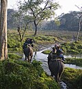
  .jpg)   Clockwise from top-left: Evening at Jaldapara National Park, ruins of Buxa Fort, Hut used by Toto aboriginals, Jayanti Hills in Buxa Tiger Reserve, Bhutan gate near Jaigaon | |
| Coordinates: 26°29′20″N 89°31′37″E / 26.489°N 89.527°E | |
| Country | Template:Flag country/core |
| State | West Bengal |
| Division | Jalpaiguri |
| Headquarters | Alipurduar |
| Government | |
| • Subdivisions | Alipurduar Sadar |
| • CD Blocks | Madarihat-Birpara, Alipurduar I, Alipurduar II, Kalchini, Falakata, Kumargram |
| • Lok Sabha constituencies | Alipurduars |
| • Vidhan Sabha constituencies | Alipurduars, Kumargram, Falakata, Madarihat, Kalchini |
| • District Magistrate | R. Vimala, IAS[1] |
| Area | |
| • Total | 3,383 km2 (1,306 sq mi) |
| Population (2011)[2] | |
| • Total | 1,491,250 |
| • Density | 440/km2 (1,100/sq mi) |
| • Urban | 307,456 |
| Demographics | |
| • Literacy | 78.57 per cent |
| • Sex ratio | 949 ♂/♀ |
| Languages | |
| • Official | Bengali[3][4] |
| • Additional official | English[3] |
| Time zone | UTC+05:30 (IST) |
| Website | alipurduar |
Alipurduar district (Bengali pronunciation: [alipurduar d͡ʒela]),[5] is one of the 23 districts of the state of West Bengal in India. The district is the part of Jalpaiguri Division.[6] Alipurduar city is the headquarters of the district. It was made a district by bifurcating Jalpaiguri district on June 25, 2014.[7] This is the easternmost district of West Bengal. It is situated in the Western Dooars natural region, in the foothills of the Bengal Himalayas.[8]
Etymology[edit | edit source]
Alipurduar's name originates from Colonel Hedayat Ali Khan, a British officer who fought in the 1865 Bhutan War and was stationed there, combined with "Duar" (or Door), representing its role as a gateway to the Dooars region of the Himalayas.[9]
History[edit | edit source]
Under the Kingdom of Bhutan[edit | edit source]

The Dooars in Alipurduar district were under the control of Kingdom of Bhutan from early 17th-century till 1865 when British East India company captured the area in the Duar War under the Treaty of Sinchula and were added to the district of Jalpaiguri in 1869 and later finally to the Indian Union in 1949.
Like all the Duars under Druk Gyalpo of Bhutan, it was under the jurisdiction of Tongso Penlop, below the Tongso Penlop were Subah who in turn appointed Mondal, Laskar or Uzir to look after the Duars.[10]
Administration[edit | edit source]
Apart from the Alipurduar municipality and Falakata municipality, the district contains eight census towns and rural areas of 66 gram panchayats under six community development blocks: Madarihat-Birpara, Alipurduar-I, Alipurduar–II, Kalchini, Falakata and Kumargram.[11] Geographically the district lies between 26.4°N to 26.83°N and 89°E to 89.9°E.
The nine census towns are Paschim Jitpur, Chechakhata, Alipurduar Railway Junction, Bholar Dabri, Sobhaganj, Jaygaon and Uttar Latabari and Uttar Kamakhyaguri.[12]
Railway network[edit | edit source]
Alipurduar railway division has at least 710 km of railway track. It is the largest division of the Northeast Frontier Railway zone. In Alipurduar district, there are two major stations, Alipurduar Junction (APDJ) and New Alipurduar (NOQ). There are other stations in the district viz. Falakata Railway Station, Kamakhyaguri Railway Station, Dalgaon Railway Station, Hasimara railway station, Kalchini railway station, Rajabhatkhawa, Mujnai railway station, Madarihat railway station, Hamiltonganj railway station, Samuktala Road Junction railway station, Salbari railway station etc.[citation needed]
Legislative segments[edit | edit source]
There are 5 assembly constituency in Alipurduar district :
| No. | Name | Lok Sabha | MLA | 2021 Winner | 2024 Lead | ||
|---|---|---|---|---|---|---|---|
| 10 | Kumargram (ST) | Alipurduars | Manoj Kumar Oraon | Bharatiya Janata Party | Bharatiya Janata Party | ||
| 11 | Kalchini (ST) | Bishal Lama | |||||
| 12 | Alipurduars | Suman Kanjilal[lower-alpha 1] | Trinamool Congress | ||||
| 13 | Falakata (SC) | Dipak Barman | Bharatiya Janata Party | ||||
| 14 | Madarihat (ST) | Jay Prakash Toppo | Trinamool Congress | ||||
As per order of the Delimitation Commission in respect of the delimitation of constituencies in the West Bengal, the area under Kumargram block and seven gram panchayats under Alipurduar–II block, viz. Bhatibari, Kohinoor, Parokata, Mahakalguri, Shamuktala, Turturi and Tatpara–I constitutes the Kumargram assembly constituency of West Bengal. The Majherdabri gram panchayat under Alipurduar–II block and the area under Kalchini block constitutes the Kalchini assembly constituency. The Alipurduar municipality, the Alipurduar Railway Junction census town, and the gram panchayats of Chaporer Par–I, Chaporer Par–II and Tatpara–II under Alipurduar–II block and ten gram panchayats of Alipurduar–I block, viz. Banchukamari, Parorpar, Shalkumar–I, Vivekananda–I, Chakowakheti, Patlakhawa, Shalkumar–II, Vivekananda–II, Mathura and Tapsikhata form the Alipurduars assembly constituency. The other gram panchayat of Alipurduar–I block, viz. Purba Kanthalbari forms the Falakata assembly constituency along with the area under Falakata block. Madarihat block is part of Madarihat assembly constituency. Kumargram, Kalchini and Madarihat constituencies is reserved for Scheduled tribes (ST) candidates. Falakata constituency is reserved for Scheduled castes (SC) candidates. All these five assembly constituencies are part of Alipurduars (Lok Sabha constituency), which is reserved for ST candidates.[13]
Demographics[edit | edit source]
As of the 2011 census, Alipurduar district had a population of 1,491,250, of which 1,183,704 were rural and 307,456 were urban. Scheduled Castes and Scheduled Tribes made up 456,706 (30.62%) and 382,112 (25.62%) of the population respectively.[2]
Religion[edit | edit source]
| Religion | Population (1941)[15]:90–91 | Percentage (1941) | Population (2011)[14] | Percentage (2011) |
|---|---|---|---|---|
Hinduism 
|
144,898 | 45.17% | 1,194,102 | 80.07% |
Tribal religion 
|
141,716 | 44.17% | 14,866 | 1.00% |
Islam 
|
29,856 | 9.31% | 130,339 | 8.74% |
Christianity 
|
1,385 | 0.43% | 112,091 | 7.52% |
Buddhism .svg)
|
--- | --- | 35,318 | 2.37% |
| Others[lower-alpha 2] | 2,963 | 0.93 | 4,534 | 0.31% |
| Total Population | 320,818 | 100% | 1,491,250 | 100% |
Hindus are the majority in all blocks. Muslims are spread evenly throughout the district, but Christians, traditional religions and Buddhists are concentrated in the tea garden areas.
Language[edit | edit source]
At the time of the 2011 census, 53.93% spoke Bengali, 16.80% Sadri, 9.70% Nepali, 3.67% Hindi, 3.17% Rajbongshi, 3.13% Kurukh, 2.38% Boro, 1.39% Bhojpuri, 1.32% Santali and 1.23% Rabha as their first language. The remaining 3.28% spoke other languages.[16]
Visitor attractions[edit | edit source]


- Buxa Tiger Reserve, IUCN category II national park
- Jayanti Hills
- Buxa Fort, built by British Raj
- Jaldapara National Park
- Chilapata Forests
- Jaigaon, a small town of Alipurduar district and near the Bhutan border
- Rajabhatkhawa Museum at Rajabhatkhawa
- Rajabhatkhawa Forest
- Raimatang
- Jayanti
- Santalabari
- Rovers point
- Roopang valley
- Lepchakha
- Chunabhati
- Chipra Forest
- Chilapata Forest
- Buxa Tiger Reserve
- Dima Bridge
- Vistadome Ride
- Tons of Tea Estates
Geographical indication[edit | edit source]
Kalonunia rice was awarded the Geographical Indication (GI) status tag from the Geographical Indications Registry under the Union Government of India on 02/01/2024 (valid until 11/03/2034). It is a common and widely cultivated crop in districts of Cooch Behar, Jalpaiguri and Alipurduar along with some parts of Darjeeling & Kalimpong districts of West Bengal.[19][20][21][22]
State Agricultural Management & Extension Training Institute (SAMETI) from Narendrapur, proposed the GI registration of Kalonunia rice. After filing the application in March 2021, the rice was granted the GI tag in 2024 by the Geographical Indication Registry in Chennai, making the name "Kalonunia rice" exclusive to the rice grown in the region.[23] It thus became the third rice variety from West Bengal after Tulaipanji rice and the 26th type of goods from West Bengal to earn the GI tag.[citation needed]
The GI tag protects the rice from illegal selling and marketing, and gives it legal protection and a unique identity.[citation needed]
Notes[edit | edit source]
- ↑ Suman Kanjilal was elected as a BJP MLA. However, on 5 February 2023, he defected to the Trinamool Congress
- ↑ Including Jainism, Buddhism, Zoroastrianism, Judaism, Ad-Dharmis, or not stated.
References[edit | edit source]
- ↑ "District Magistrate". Alipurduar District, Government of West Bengal. Retrieved 1 November 2024.
- ↑ 2.0 2.1 "District Census Handbook-Jalpaiguri" (PDF). Directorate of Census Operations, West Bengal. Retrieved 10 July 2021.
- ↑ 3.0 3.1 "Fact and Figures". Wb.gov.in. Retrieved 5 July 2019.
- ↑ "52nd Report of the Commissioner for Linguistic Minorities in India" (PDF). Nclm.nic.in. Ministry of Minority Affairs. p. 85. Archived from the original (PDF) on 25 May 2017. Retrieved 5 July 2019.
- ↑ "About District | Alipurduar District | India". Retrieved 2 May 2025.
- ↑ TNN (21 June 2014). "Roy Alipurduar: Alipurduar a new district on June 25". Timesofindia.indiatimes.com. Retrieved 6 April 2020.
- ↑ IANS (25 June 2014). "Alipurduar becomes Bengal's 20th district | Business Standard News". Business Standard. Retrieved 6 April 2020.
- ↑ "Alipurduar in Dooars - Tourist Places to See & Things to Do". northbengaltourism.com. Retrieved 2 May 2025.
- ↑ <https://www.east-himalaya.com/alipurduar.php#:~:text=The%20name%20Alipurduar%20reflects%20both,the%20name%20remains%20perfectly%20accurate.
- ↑ (Das 1998:32)
- ↑ "Directory of District, Sub division, Panchayat Samiti/ Block and Gram Panchayats in West Bengal, March 2008". West Bengal. National Informatics Centre, India. 19 March 2008. Archived from the original on 25 February 2009. Retrieved 21 December 2008.
- ↑ "District Wise List of Statutory Towns (Municipal Corporation, Municipality,Notified Area and Cantonment Board), Census Towns and Outgrowths, West Bengal, 2001". Census of India, Directorate of Census Operations, West Bengal. Archived from the original on 21 July 2011. Retrieved 21 December 2008.
- ↑ "Press Note, Delimitation Commission" (PDF). Assembly Constituencies in West Bengal. Delimitation Commission. pp. 4–5, 23. Retrieved 10 January 2009.
- ↑ 14.0 14.1 "Table C-01 Population by Religion: West Bengal". censusindia.gov.in. Registrar General and Census Commissioner of India. 2011.
- ↑ "Census of India, 1941 Volume VI Bengal Province" (PDF). Retrieved 13 August 2022.
- ↑ 16.0 16.1 "Table C-16 Population by Mother Tongue: West Bengal". www.censusindia.gov.in. Registrar General and Census Commissioner of India.
- ↑ Basu, Moushumi (31 May 2018). "A rhino poaching racket has created fear, suspicion towards outsiders in a West Bengal village". scroll.in. Retrieved 29 July 2023.
- ↑ "Buxa Tiger Reserve Forests". indyatour.com. Indyatour. Retrieved 29 July 2023.
- ↑ "Bengal's own Gobindabhog and Tulaipanji soon to get a distinct stand on world map". The Indian Express. 2 January 2024. Retrieved 23 November 2024.
- ↑ Khush, Gurdev S.; Hettel, Gene; Rola, Tess (1996). Rice Genetics III: Proceedings of the Third International Rice Genetics Symposium, Manila, Philippines, 16-20 October 1995. Int. Rice Res. Inst. ISBN 978-971-22-0087-8. Retrieved 23 November 2024.
- ↑ Roychoudhury, Aryadeep (29 July 2020). Rice Research for Quality Improvement: Genomics and Genetic Engineering: Volume 2: Nutrient Biofortification and Herbicide and Biotic Stress Resistance in Rice. Springer Nature. ISBN 978-981-15-5337-0. Retrieved 23 November 2024.
- ↑ Sarker, Dilip De; Saha, Manas Ranjan; Saha, Subrata (1 January 2015). Perspective of dietetic and antioxidant medicinal plants. Notion Press. ISBN 978-93-84878-95-5.
- ↑ "Kalonunia Rice". Intellectual Property India. Retrieved 23 November 2024.
Bibliography[edit | edit source]
- Das, Smriti (1998). Assam Bhutan relations with special reference to duars from 1681 to 1949 (PhD). Guwahati University. hdl:10603/67909. Archived from the original on 16 March 2023. Retrieved 14 April 2023.
External links[edit | edit source]
Cities, towns and locations in Alipurduar district | |||
|---|---|---|---|
| Cities, municipal and census towns | |||
| Locations other than cities and towns | |||
| Specitic Tea Estates | |||
| Related Topics | |||


Places adjacent to Alipurduar district | ||||||||||
|---|---|---|---|---|---|---|---|---|---|---|
| ||||||||||


.png)