




m Removed empty portal template using script |
general enhanced article based on references further and updated info for accuracy |
||
| Line 1: | Line 1: | ||
{{Short description|State in northern India}} | {{Short description|State in northern India}} | ||
{{Use Indian English|date=May | {{distinguish|Uttarkhan}} | ||
{{Use dmy dates|date=May | {{pp|small=yes}} | ||
{{Infobox | {{Use Indian English|date=May 2024}} | ||
{{Use dmy dates|date=May 2024}} | |||
| official_name | {{Infobox Indian state or territory | ||
| name = Uttarakhand | |||
| official_name = State of Uttarakhand | |||
| image_skyline = {{multiple image | |||
| border = infobox | |||
| total_width = 300 | |||
| image_style = | |||
| perrow = 1/2/2/1 | |||
| caption_align = center | |||
| image1 = Auli, India.jpg | |||
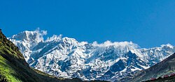
| caption1 = The [[Garhwal Himalaya]]s from [[Auli, India|Auli]] | |||
| image2 = Ganga aarti of haridwar.jpg | |||
| caption2 = [[Aarti]] at [[Har Ki Pauri]] | |||
| image3 = Badrinath temple DSCN9998.jpg | |||
| caption3 = [[Badrinath Temple]] | |||
| image6 = Kedarnath Temple in Rainy season.jpg | |||
| caption6 = [[Kedarnath Temple]] | |||
| image5 = Jim Corbett National Park (India).jpg | |||
| caption5 = [[Jim Corbett National Park]] | |||
| image4 = Governor’s House, Nainital, Uttarakhand, India.jpg | |||
| image_skyline | | caption4 = [[Raj Bhavan, Nainital|Raj Bhavan]] in [[Nainital]] | ||
| | | Image5। = Triveni Ghat Ganga Aarti, Rishikesh.jpg | ||
| | | Caption5। = [[Triveni Ghat Ganga Aarti, Rishikesh]] | ||
| | |||
| | |||
| | |||
| | |||
| | |||
| | |||
| | |||
| | |||
| | |||
| | |||
| | |||
| | |||
| | |||
| | |||
| | |||
}} | }} | ||
| type = State | |||
| image_seal = Seal of Uttarakhand.svg | |||
| etymology = Northern Land | |||
| nicknames = Devabhumi; Land of the Gods | |||
| motto = [[Satyameva Jayate]] ([[Sanskrit]])<br />"Truth alone triumphs"{{force singular}} | |||
| anthem = [[Uttarakhand Devabhumi Matribhumi]] ([[Hindi]], [[Garhwali language|Garhwali]], and [[Kumaoni language|Kumaoni]])<ref>{{cite web|title=Now Uttarakhand Will Sing Its Own Official Song|url=https://timesofindia.indiatimes.com/city/dehradun/Now-Ukhand-will-sing-its-official-song/articleshow/50882569.cms|work=[[The Times of India]]|date=6 February 2016|access-date=12 November 2018|archive-url=https://web.archive.org/web/20201026130144/https://timesofindia.indiatimes.com/city/dehradun/Now-Ukhand-will-sing-its-official-song/articleshow/50882569.cms|archive-date=26 October 2020|url-status=live}}</ref><br />"Uttarakhand, Land of the Gods, O Motherland!" | |||
| image_map = IN-UT.svg | |||
| coordinates = {{coord|30.33|78.06|region:IN_type:city|name=Dehradun|display=inline,title}} | |||
| region = North India | |||
| before_was = Part of [[Uttar Pradesh]] | |||
| formation_date2 = [[Uttar Pradesh Reorganisation Act, 2000|9 November 2000]] | |||
| formation_date3 = formation | |||
| formation_date4 = 9 November 2000 | |||
| capital = Bhararisain | |||
| winter_capital = Dehradun | |||
| largestcity = Dehradun | |||
| districts = [[List of districts of Uttarakhand|13]] | |||
| Governor = [[Gurmit Singh (general)|Gurmit Singh]] | |||
| Chief_Minister = [[Pushkar Singh Dhami]]<ref>{{cite news |title=Pushkar Singh Dhami: BJP's Pushkar Singh Dhami to be next Uttarakhand chief minister |url=https://timesofindia.indiatimes.com/india/pushkar-singh-dhami-to-be-next-uttarakhand-chief-minister/articleshow/84091689.cms |access-date=4 July 2021 |date=4 July 2021 |language=en |archive-date=2 October 2022 |archive-url=https://web.archive.org/web/20221002052249/https://timesofindia.indiatimes.com/india/pushkar-singh-dhami-to-be-next-uttarakhand-chief-minister/articleshow/84091689.cms |url-status=live }}</ref> | |||
| party = [[Bharatiya Janata Party|BJP]] | |||
| legislature_type = Unicameral | |||
| assembly = [[Uttarakhand Legislative Assembly]] | |||
| assembly_seats = 70 seats | |||
| rajya_sabha_seats = 3 seats | |||
| lok_sabha_seats = 5 seats | |||
| judiciary = [[Uttarakhand High Court]] | |||
| area_total_km2 = 53483 | |||
| area_rank = 19th | |||
| length_km = 320 | |||
| width_km = 385 | |||
| elevation_footnotes = <ref>{{cite news |last1=Asian News International |title=Nanda Devi: Operation to retrieve bodies of missing mountaineers hampered by bad weather |url=https://www.indiatoday.in/india/story/nanda-devi-operation-to-retrieve-bodies-of-missing-mountaineers-hampered-by-bad-weather-1550180-2019-06-16 |work=India Today |date=16 June 2019 |access-date=12 August 2019 |archive-date=2 October 2022 |archive-url=https://web.archive.org/web/20221002162407/https://www.indiatoday.in/india/story/nanda-devi-operation-to-retrieve-bodies-of-missing-mountaineers-hampered-by-bad-weather-1550180-2019-06-16 |url-status=live }}</ref> | |||
| elevation_m = | |||
| elevation_max_m = 7,817 | |||
| elevation_max_point = [[Nanda Devi]] | |||
| elevation_min_m = 187 | |||
| elevation_min_point = [[Sharda River|Sharda Sagar Reservoir]] | |||
| population_total = {{Increase}} 11,913,000<ref>{{Cite web | title=Population of Indian states 2025 - StatisticsTimes.com | url=https://statisticstimes.com/demographics/india/indian-states-population.php | access-date=2025-05-23 | website=statisticstimes.com}}</ref> | |||
| population_as_of = 2025 | |||
| population_rank = 21th | |||
| population_density = 213<ref name="Niti Ayog">{{cite web |title=Macro and Fiscal Landscape of the State of Uttarakhand |url=https://niti.gov.in/sites/default/files/2025-03/Macro-and-Fiscal-Landscape-of-the-State-of-Uttarakhand.pdf |website=[[Niti Ayog]] |access-date=May 20, 2025}}</ref> | |||
| population_urban = 35.90%<ref name="Niti Ayog"/> | |||
| population_rural = 64.10%<ref name="Niti Ayog"/> | |||
| population_demonym = [[List of people from Uttarakhand|Uttarakhandi]] | |||
| 0fficial_Langs = [[Hindi]]<ref name="2011lang" /> | |||
| additional_official = [[Sanskrit]]<ref name="sanskrit">{{cite news|last=Trivedi |first=Anupam |title=Sanskrit is second official language in Uttarakhand |url=http://www.hindustantimes.com/india/sanskrit-is-second-official-language-in-uttarakhand/story-wxk51l8Re4vNxofrr7FAJK.html |newspaper=Hindustan Times |date=19 January 2010 |access-date=30 August 2017 |url-status=live |archive-url=https://web.archive.org/web/20120201065836/http://www.hindustantimes.com/India-news/NorthIndia/Sanskrit-is-second-official-language-in-Uttarakhand/Article1-499467.aspx |archive-date=1 February 2012 }}</ref><ref name="sanskrit2">{{cite news|title=Sanskrit second official language of Uttarakhand|url=http://www.thehindu.com/todays-paper/tp-national/tp-otherstates/Sanskrit-second-official-language-of-Uttarakhand/article15965492.ece |work=The Hindu |date=21 January 2010 |access-date=30 August 2017 |url-status=live|archive-url=https://web.archive.org/web/20180303145846/http://www.thehindu.com/todays-paper/tp-national/tp-otherstates/Sanskrit-second-official-language-of-Uttarakhand/article15965492.ece|archive-date=3 March 2018}}</ref> | |||
| official_script = [[Devanagari]] | |||
| GDP_footnotes = <ref name="MOSPI">{{cite web|url=http://mospi.nic.in/sites/default/files/press_releases_statements/State_wise_SDP_01_08_2019_for_uploading.xls|title=MOSPI Gross State Domestic Product|date=1 August 2019|website=[[Ministry of Statistics and Program Implementation]], [[Government of India]]|access-date=16 September 2019|archive-date=26 April 2015|archive-url=https://web.archive.org/web/20150426104343/http://indiatoday.intoday.in/story/uttarakhand-macro-economy-economics-and-statistics-department/1/398361.html|url-status=live}}</ref><ref>{{cite web |title=GDP per capita of Indian states - StatisticsTimes.com |url=https://statisticstimes.com/economy/india/indian-states-gdp-per-capita.php |website=statisticstimes.com |access-date=17 April 2021 |archive-date=3 June 2021 |archive-url=https://web.archive.org/web/20210603211542/https://statisticstimes.com/economy/india/indian-states-gdp-per-capita.php |url-status=live }}</ref> | |||
| GDP_total = {{IncreaseNeutral}}{{INRConvert|3.78|lc|lk=r}}<ref>{{Cite web| title=Uttarakhand Budget Analysis 2025-26 | url=https://prsindia.org/files/budget/budget_state/uttarakhand/2025/Uttarakhand_Budget_Analysis_2025-26.pdf | archive-url=https://web.archive.org/web/20250514013435/https://prsindia.org/files/budget/budget_state/uttarakhand/2025/Uttarakhand_Budget_Analysis_2025-26.pdf | archive-date=2025-05-14}}</ref> | |||
| GDP_year = 2024–2025 | |||
| GDP_rank = 20th | |||
| GDP_per_capita = {{Increase}}{{INRConvert|315000|lk=r}} | |||
| GDP_per_capita_rank = 10th | |||
| HDI = {{Increase}} 0.722 {{color|green|high}} <ref>{{cite web |title=India: Subnational HDI |url=https://globaldatalab.org/shdi/table/shdi/IND/ |website=Global Data Labs |access-date=8 June 2025}}</ref> | |||
| HDI_year = 2023 | |||
| HDI_rank = 20th | |||
| literacy = 87.6%<ref>{{Cite web | title=Literacy and education | url=https://mospi.gov.in/sites/default/files/reports_and_publication/statistical_publication/social_statistics/WM16Chapter3.pdf | archive-url=https://web.archive.org/web/20190819082513/http://www.mospi.gov.in/sites/default/files/reports_and_publication/statistical_publication/social_statistics/WM16Chapter3.pdf | archive-date=19 August 2019 | access-date=31 July 2025 | url-status=live }}</ref><ref>{{cite web | title=TNPSC Current Affairs | TNPSC Monthly Current Affairs | url=https://www.tnpscthervupettagam.com/currentaffairs-detail/nso-survey-for-2017-2018 }}</ref> | |||
| literacy_year = 2017 | |||
| literacy_rank = 13th | |||
| sex_ratio = 963[[female|♀]] / 1000[[male|♂]]<ref name="pc-census2020">{{cite web |title=Census 2011 (Final Data) – Demographic details, Literate Population (Total, Rural & Urban) |url=http://planningcommission.gov.in/data/datatable/data_2312/DatabookDec2014%20307.pdf |website=planningcommission.gov.in |publisher=Planning Commission, Government of India |access-date=3 October 2018 |archive-url=https://web.archive.org/web/20180127163347/http://planningcommission.gov.in/data/datatable/data_2312/DatabookDec2014%20307.pdf |archive-date=27 January 2018 |url-status=dead |page=4}}</ref> | |||
| sexratio_year = 2011 | |||
| sexratio_rank = 4th | |||
| iso_code = IN-UK <ref>{{cite web|url=https://www.iso.org/obp/ui/#iso:code:3166:IN|title=Standard: ISO 3166 — Codes for the representation of names of countries and their subdivisions|access-date=24 November 2023|archive-date=17 June 2016|archive-url=https://web.archive.org/web/20160617031837/https://www.iso.org/obp/ui/#iso:code:3166:IN|url-status=live}}</ref> | |||
| registration_plate = UK | |||
| website = uk.gov.in | |||
| foundation_day = Uttarakhand Day | |||
| mammal = [[Alpine musk deer]]<ref>{{cite web|url=http://www.gmvnl.com/newgmvn/facts/|title=State Symbols of Uttarakhand |publisher=Garhwal Mandal Vikas Nigam Limited |access-date=1 April 2012 |url-status=dead |archive-url=https://web.archive.org/web/20130715112114/http://www.gmvnl.com/newgmvn/facts/ |archive-date=15 July 2013}}</ref> | |||
| bird = [[Himalayan monal]] | |||
| fish = [[Tor putitora|Golden mahseer]]<ref>{{cite web|title=State Fishes of India|url=http://nfdb.gov.in/PDF/Fish%20%26%20Fisheries%20of%20India/2.State%20Fishes%20of%20India.pdf|publisher=National Fisheries Development Board, Government of India|access-date=26 August 2020|archive-date=10 October 2020|archive-url=https://web.archive.org/web/20201010035036/http://nfdb.gov.in/PDF/Fish%20%26%20Fisheries%20of%20India/2.State%20Fishes%20of%20India.pdf|url-status=live}}</ref><ref>{{cite news|title=To protect the endangered 'mahaseer' fish, Uttarakhand set to rope in fishermen|url=https://www.hindustantimes.com/dehradun/to-protect-the-endangered-mahaseer-fish-uttarakhand-set-to-rope-in-fishermen/story-BI4UQ3JBbjypkVytn6xjpI.html|author=Sharma, Nihi|work=Hindustan Times|date=1 December 2017|access-date=26 August 2020|archive-date=10 October 2020|archive-url=https://web.archive.org/web/20201010134641/https://www.hindustantimes.com/dehradun/to-protect-the-endangered-mahaseer-fish-uttarakhand-set-to-rope-in-fishermen/story-BI4UQ3JBbjypkVytn6xjpI.html|url-status=live}}</ref> | |||
| butterfly = [[Papilio bianor|West Himalayan common peacock]]<ref>{{cite web |url=http://www.devalsari.org/images/Photo-Gallery/Common-Peacock-Male-Papilio-Bianor-Polyctor.jpg |title= Common Peacock Male Papilio Bianor Polyctor |access-date=7 January 2017 |url-status=live |archive-url=https://web.archive.org/web/20170108094143/http://www.devalsari.org/images/Photo-Gallery/Common-Peacock-Male-Papilio-Bianor-Polyctor.jpg |archive-date=8 January 2017 }}</ref><ref>{{cite web |url=http://www.hindustantimes.com/dehradun/uttarakhand-to-declare-common-peacock-as-state-butterfly/story-FxHJdVUk9fcVsmPqTvXq1M.html |title=Uttarakhand To Declare Common Peacock As State Butterfly |work=Hindustan Times |access-date=9 January 2017 |url-status=live |archive-url=https://web.archive.org/web/20170102220838/http://www.hindustantimes.com/dehradun/uttarakhand-to-declare-common-peacock-as-state-butterfly/story-FxHJdVUk9fcVsmPqTvXq1M.html |archive-date=2 January 2017 |date=18 November 2016 }}</ref> | |||
| flower = [[Saussurea obvallata|Brahma Kamal]]<ref>{{cite web |url=http://uttaraguide.com/statesigns.php |title=Uttarakhand State Signs | Uttarakhand State Tree |publisher=uttaraguide.com |year=2012 |quote=State Flower : Brahma Kamal |access-date=8 October 2012 |url-status=usurped |archive-url=https://web.archive.org/web/20121107042757/http://uttaraguide.com/statesigns.php |archive-date=7 November 2012 }}</ref> | |||
| tree = [[Rhododendron arboreum|Burans]] | |||
| image_highway = SH IN-UT.png | |||
| year_start = 9 November 2000 | |||
}} | }} | ||
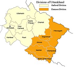
'''Uttarakhand''' ({{ | '''Uttarakhand''' ({{Indic Transl|hi|Uttarākhaṇḍ|ˈʊt̪ːəɾaːkʰəɳɖ}}, {{literally|Northern Land}}), also known as '''Uttaranchal''' ({{IPAc-en|lang|ˌ|ʊ|t|ə|ˈ|r|æ|n|tʃ|ə|l}}; [[List of renamed places in India|the official name until 2007]]),<ref>{{cite web|title=Definition of 'Uttaranchal'|publisher=Collins English Dictionary|url=https://www.collinsdictionary.com/dictionary/english/uttaranchal|access-date=16 May 2021|archive-date=30 July 2016|archive-url=https://web.archive.org/web/20160730042201/http://www.collinsdictionary.com/dictionary/english/uttaranchal|url-status=live}}</ref> is a [[States and union territories of India|state]] in [[North India|northern India]]. The state is bordered by [[Himachal Pradesh]] to the northwest, [[Tibet]] to the north, [[Nepal]] to the east and [[Uttar Pradesh]] to the south. Uttarakhand has a total area of {{cvt|53,483|km2}}, equal to 1.6% of the total area of India. [[Dehradun]] serves as the state capital, with [[Nainital]] being the judicial capital. The state is divided into two divisions, [[Garhwal division|Garhwal]] and [[Kumaon division|Kumaon]], with a total of [[List of districts of Uttarakhand|13 districts]]. The forest cover in the state is 45.4% of the state's geographical area. The cultivable area is 16% of the total geographical area. The two major rivers of the state, the [[Ganges]] and its tributary [[Yamuna]], originate from the [[Gangotri]] and [[Yamunotri]] glaciers respectively. Ranked 6th among the Top 10 Greenest States in India with Best AQI.<ref>{{Cite web |title=MSN |url=https://www.msn.com/en-in/travel/news/top-10-greenest-states-in-india-with-best-aqi-nature-forest-cover-and-eco-friendly-living/ar-AA1CPLio?ocid=winp2fptaskbar&cvid=6852dbe0e5bd4b9aa58090778a8001ad&ei=24 |access-date=2025-04-21 |website=www.msn.com}}</ref> | ||
Uttarakhand's history dates back to [[prehistoric times]], with archaeological evidence showcasing human habitation. It was part of the ancient [[Kuru Kingdom|Kuru]] and the [[Panchala|Panchal]] kingdoms during the [[Vedic period|Vedic age]], and later saw the rise of dynasties like the [[Kuninda]]s and influence of [[Buddhism]] as evidenced by [[Ashokan edicts]]. Though primarily driven by agriculture and [[hydropower]], the state's economy is now dominated by the service industry. The service sector comprises primarily travel, tourism, and hotel industry. The Gross State Domestic Product (GSDP) of Uttarakhand is {{INRConvert|3.78|lc|lk=on|year=2025}}. The state contributes [[List of Lok Sabha members from Uttarakhand|five]] seats to the lower house Lok Sabha <ref>{{Cite web |last=Bisht |first=Brijmohan |date=2013-03-07 |title=Lok Sabha Elections 2024 Uttarakhand - Lok Sabha Seats in Uttarakhand |url=https://www.euttaranchal.com/uttarakhand/lok-sabha-seats-in-uttarakhand.php |access-date=2025-03-31 |website=www.euttaranchal.com |language=en}}</ref> and [[List of Rajya Sabha members from Uttarakhand|three]] seats to the upper house Rajya Sabha. | |||
Inhabitants of the state are called either [[Garhwali people|Garhwali]] or [[Kumaoni people|Kumaoni]] depending on their region of origin. [[Hinduism]] is practiced by more than three-fourths of the population, with [[Islam]] being the next-largest religious group. [[Hindi]] is the most widely spoken language and is also the official language of the state, along with native regional languages include [[Garhwali language|Garhwali]], [[Jaunsari language|Jaunsari]], [[Rongpo language|Rongpo]], [[Jad language|Bhotia]], [[Gujari language|Gurjari]] and [[Kumaoni language|Kumaoni]]. The state is often referred to as the "Devabhumi" ({{lit|Land of the Gods}}), due to its religious significance and numerous [[Hindu temple]]s and [[Hindu pilgrimage sites in India|pilgrimage centres]] found throughout the state.<ref>{{Cite web |date=2023-12-26 |title=About Uttarakhand - Uttarakhand Tourism |url=https://uttarakhandtourism.net/about-uttarakhand/ |access-date=2025-03-31 |website=uttarakhandtourism.net |language=en-US}}</ref> Along with several historical, natural and religious tourist destinations, including [[Char Dham]], [[Haridwar]], [[Rishikesh]], [[Panch Kedar]], [[Himalayas]], and [[Sapta Badri]]. Uttarakhand is also home to two [[World Heritage sites]]. | |||
== Etymology == | ==Etymology== | ||
{{See also|List of Indian state and union territory name etymologies}} | {{See also|List of Indian state and union territory name etymologies}} | ||
Uttarakhand's name is derived from the [[Sanskrit]] words ''uttara'' ({{lang|sa|उत्तर}}) meaning 'north', and ''khaṇḍa'' ({{lang|sa|खण्ड}}) meaning ' | Uttarakhand's name is derived from the [[Sanskrit]] words ''uttara'' ({{lang|sa|[[wikt:उत्तर|उत्तर]]}}) meaning 'north', and ''khaṇḍa'' ({{lang|sa|[[wikt:खण्ड|खण्ड]]}}) meaning 'section' or 'part', altogether simply meaning 'Northern Part'.<ref>{{Cite web |title=Escape to Uttarakhand: Your Himalayan Getaway |url=https://www.traveldreams.in/uttarakhand/ |access-date=2025-03-31 |website=Traveldreams |language=en-US}}</ref> | ||
In August 2006, [[Union Council of Ministers]] assented to the demands of the [[Uttarakhand Legislative Assembly|Uttaranchal Legislative Assembly]] and leading members of the [[Uttarakhand movement|Uttarakhand statehood movement]] to rename Uttaranchal state as Uttarakhand. Legislation to that effect was passed by the Uttaranchal Legislative Assembly in October 2006,<ref>{{cite news | url = https://www.tribuneindia.com/2006/20061013/nation.htm#5 | agency = United News of India | title = Uttaranchal becomes Uttarakhand | work = The Tribune (India) | date = 13 October 2006 | access-date = 22 January 2013 | url-status=live | archive-url = https://web.archive.org/web/20130511030304/http://www.tribuneindia.com/2006/20061013/nation.htm#5 | archive-date = 11 May 2013 | df = dmy-all }}</ref> and the Union Council of Ministers brought in the bill in the winter session of Parliament. The bill was passed by the Parliament and signed into law by then President [[A. P. J. Abdul Kalam]] in December 2006, and since 1 January 2007 the state has been known as Uttarakhand.<ref>{{cite web | url = | The name finds mention in early [[Hindu scriptures]] as the combined region of "Kedarkhand" (present day [[Garhwal division|Garhwal]]) and "Manaskhand" (present day [[Kumaon division|Kumaon]]). Uttarakhand was also the ancient [[Puranic]] term for the central stretch of the Indian [[Himalayas]].<ref name="autogenerated2001">Kandari, O. P., & Gusain, O. P. (Eds.). (2001). Garhwal Himalaya: Nature, Culture & Society. Srinagar, Garhwal: Transmedia.</ref> | ||
<!-- However, the region was given the name ''Uttaranchal'' by the [[Bharatiya Janata Party]]-led [[Government of India|union government]] and [[Government of Uttarakhand|Uttarakhand state government]] when they started a new round of state reorganisation in 1998. Chosen as per BJP claims for its allegedly less-separatist connotations, since the proposed state name Uttarakhand had been used exclusively in all major statehood protests. The name change generated widespread controversy among many activists and citizens who saw it as a political act meant to hijack credit from the activist party [[Uttarakhand Kranti Dal]].<ref>Negi, B. (2001). "Round One to the Lobbyists, Politicians and Bureaucrats." ''The Indian Express'', 2 January.</ref> The name Uttarakhand remained popular in the region, while Uttaranchal was promulgated only through official usage.<ref name="Name1_UK">{{cite web | title=Parliament okays bill to rename Uttaranchal | website=The Times of India | date=7 December 2006 | url=https://timesofindia.indiatimes.com/india/parliament-okays-bill-to-rename-uttaranchal/articleshow/737781.cms | access-date=24 June 2024}}</ref> | |||
In August 2006, [[Union Council of Ministers]] assented to the demands of the [[Uttarakhand Legislative Assembly|Uttaranchal Legislative Assembly]] and leading members of the [[Uttarakhand movement|Uttarakhand statehood movement]] to rename Uttaranchal state as Uttarakhand. Legislation to that effect was passed by the Uttaranchal Legislative Assembly in October 2006,<ref>{{cite news | url = https://www.tribuneindia.com/2006/20061013/nation.htm#5 | agency = United News of India | title = Uttaranchal becomes Uttarakhand | work = The Tribune (India) | date = 13 October 2006 | access-date = 22 January 2013 | url-status=live | archive-url = https://web.archive.org/web/20130511030304/http://www.tribuneindia.com/2006/20061013/nation.htm#5 | archive-date = 11 May 2013 | df = dmy-all }}</ref> and the Union Council of Ministers brought in the bill in the winter session of Parliament. The bill was passed by the Parliament and signed into law by then [[President of India|President]] [[A. P. J. Abdul Kalam]] in December 2006, and since 1 January 2007 the state has been known as Uttarakhand.<ref>{{cite web | url = https://timesofindia.indiatimes.com/india/Uttaranchal-is-Uttarakhand-BJP-cries-foul/articleshow/1014926.cms | title = Uttaranchal is Uttarakhand, BJP cries foul | last = Chopra | first = Jasi Kiran | date = 2 January 2007 | access-date = 22 January 2013 | archive-url = https://web.archive.org/web/20130510141050/http://articles.timesofindia.indiatimes.com/2007-01-02/india/27880083_1_bjp-cries-uttaranchal-assembly-polls | archive-date = 10 May 2013 | url-status=live | work = [[The Times of India]] | df = dmy-all }}</ref>--> | |||
== History == | == History == | ||
{{Main|History of Uttarakhand}} | {{Main|History of Uttarakhand}} | ||
Among the first major dynasties of Garhwal and Kumaon were the Kunindas in the second century BCE who practised an early form of [[Shaivism]] and traded salt with Western [[Tibet]]. It is evident from the [[Ashoka]]n edict at Kalsi in Western Garhwal that [[Buddhism]] made inroads in this region. [[Folk Hinduism|Shamanic Hindu]] practices deviating from Hindu orthodoxy also persisted here. However, Garhwal and Kumaon were restored to nominal [[Historical Vedic religion|Vedic Hindu]] rule due to the travels of [[Shankaracharya]] and the arrival of migrants from the plains.{{Citation needed|date=December 2022}} | {{See also|Garhwal Kingdom|Kumaon Kingdom|Landhaura|Timli state|Uttarakhand movement}} | ||
Archaeological evidence supports the existence of humans in the region since [[prehistoric times]].<ref>{{Cite journal |last1=Bahuguna |first1=Vijay |last2=Joshi |first2=Maheshwar |title=Prehistoric rock engravings and painting: New discoveries in Uttarakhand Himalaya |url=https://www.academia.edu/31515391 |access-date=14 February 2024 |archive-date=14 February 2024 |archive-url=https://web.archive.org/web/20240214163652/https://www.academia.edu/31515391/Prehistoric_rock_engravings_and_painting_New_discoveries_in_Uttarakhand_Himalaya |url-status=live }}</ref> Though initially, it was believed that due to harsh climate and mountainous terrain, this was a barren and uninhabited land. But after various excavations and the study of ancient literature, it is now established that the history of Uttarakhand goes back to Stone Age.<ref>{{Cite journal |last=Danish |first=Mohd |date=1 January 2022 |title=The Prehistoric Rock Shelter Paintings Of Lakhudiyar, Kumaon Uttarakhand, India-A Study |url=https://www.academia.edu/112534908 |journal=Zeichen JOURNAL |access-date=14 February 2024 |archive-date=14 February 2024 |archive-url=https://web.archive.org/web/20240214163652/https://www.academia.edu/112534908/The_Prehistoric_Rock_Shelter_Paintings_Of_Lakhudiyar_Kumaon_Uttarakhand_India_A_Study |url-status=live }}</ref> Evidences of [[Stone Age]] settlements have been found in various parts of Kumaon and Garhwal, particularly notable are the rock shelters at [[Lakhudiyar Caves|Lakhudyar]], [[Almora district|Almora]].<ref>{{Cite web |title=Uttarakhand: ASI ने किया बड़ा खुलासा, लखुडियार की गुफाएं खोलेंगी आदि मानव कालीन रहस्य, यहां जानें सबकुछ |url=https://www.amarujala.com/uttarakhand/nainital/lakhudiyar-caves-will-reveal-the-secrets-of-ancient-human-era-in-almora-2023-12-27 |access-date=14 February 2024 |website=Amar Ujala |language=hi |archive-date=14 February 2024 |archive-url=https://web.archive.org/web/20240214163652/https://www.amarujala.com/uttarakhand/nainital/lakhudiyar-caves-will-reveal-the-secrets-of-ancient-human-era-in-almora-2023-12-27 |url-status=live }}</ref> | |||
[[File:Rectangle designs, Painted Rock Shelter, Prehistoric art, Lakhudiyar caves, Hindu, Almora, Uttarakhand, India, One Lakh caves, India.jpg|thumb|left|Stone age paintings at Lakhudiyar Caves, Almora]] | |||
The region formed a part of the [[Uttarakuru]] Kingdom during the [[Vedic period|Vedic age]] of [[Ancient India]]. Among the first major dynasties of Kumaon were the [[Kuninda]]s in the second century BCE who practised an early form of [[Shaivism]]. [[Ashokan edicts]] at Kalsi show the early presence of [[Buddhism]] in this region. | |||
Ancient rock paintings, rock shelters, [[paleolithic age]] stone tools (hundreds of thousands of years old), and [[megaliths]] provide evidence that the mountains of the region have been inhabited since prehistoric times. There are also archaeological remains that show the existence of early [[Vedic period|Vedic]] ({{circa|1500 BCE}}) practices in the area.<ref name="Britannica">{{cite web|title=Uttarakhand|url=http://britannica.com/EBchecked/topic/736432/Uttarakhand|publisher=Encyclopædia Britannica, Inc.|access-date=17 July 2012|url-status=live|archive-url=https://web.archive.org/web/20120702082101/http://www.britannica.com/EBchecked/topic/736432/Uttarakhand|archive-date=2 July 2012}}</ref> The [[Pauravas]], [[Khasas]], [[Kirata]]s, [[Nanda Empire|Nandas]], [[Maurya Empire|Mauryas]], [[Kushan Empire|Kushanas]], [[Kuninda Kingdom|Kunindas]], [[Gupta Empire|Guptas]], [[Karkota Empire|Karkotas]], [[Pala Empire|Palas]], [[Gurjara-Pratihara dynasty|Gurjara-Pratiharas]], [[Katyuri kings|Katyuris]], [[Doti|Raikas]], [[Chand kings|Chands]], [[Parmar (clan)|Parmar]]s or [[Panwar]]s, [[Khas Kingdom|Mallas]], [[Shah dynasty|Shahs]] and the [[British Raj|British]] have ruled Uttarakhand in turns.<ref name="autogenerated2001" /> | |||
Among the first major dynasties of Garhwal and Kumaon were the [[Kuninda kingdom|Kunindas]] in the second century BCE who practised an early form of [[Shaivism]] and traded salt with Western [[Tibet]]. It is evident from the [[Ashoka]]n edict at Kalsi in Western Garhwal that [[Buddhism]] made inroads in this region. [[Folk Hinduism|Shamanic Hindu]] practices deviating from Hindu orthodoxy also persisted here. However, Garhwal and Kumaon were restored to nominal [[Historical Vedic religion|Vedic Hindu]] rule due to the travels of [[Shankaracharya]] and the arrival of migrants from the plains.{{Citation needed|date=December 2022}} | |||
{{multiple image | {{multiple image | ||
| Line 200: | Line 142: | ||
| caption2 = [[Jageshwar]] Temples Complex are a group of over 100 Hindu temples dated between 7th and 12th century. | | caption2 = [[Jageshwar]] Temples Complex are a group of over 100 Hindu temples dated between 7th and 12th century. | ||
}} | }} | ||
[[ | Between the 4th and 14th centuries, the Katyuri dynasty dominated lands of varying extents from the Katyur valley (modern-day [[Baijnath, Uttarakhand|Baijnath]]) in Kumaon. The historically significant temples at [[Jageshwar]] are believed to have been built by the Katyuris and later remodelled by the Chands. Other peoples of the [[Tibeto-Burman]] group known as [[Kirata]] are thought to have settled in the northern highlands as well as in pockets throughout the region, and are believed to be ancestors of the modern day [[Uttarakhand Bhotiya|Bhotiya]], [[Raji people|Raji]], [[Jad people|Jad]], and [[Ban Rawats|Banrawat]] people.<ref>Saklani, D. P. (1998). Ancient communities of the Himalaya. New Delhi: Indus Pub. Co.</ref> During the medieval period, the region was consolidated under the [[Katyuri kings|Katyuri rulers]] of Kumaon also known as 'Kurmanchal Kingdom'.<ref>{{Cite book |last=Pāṇḍe |first=Badarīdatta |title=History of Kumaun : English version of "Kumaon ka itihas" |date=1993 |publisher=Shree Almora Book Depot |isbn=81-900209-5-1 |oclc=645861049}}</ref> After the fall of Katyuris, the region was divided into the [[Kumaon Kingdom]] and the [[Garhwal Kingdom]]. | ||
{{multiple image | |||
| perrow = 2 | |||
| direction = vertical | |||
| total_width = 220 | |||
| caption_align = center | |||
| align = left | |||
| image1 = Srinagar, Garhwal, 19th century.jpg | |||
| caption1 = Rope bridge across [[Alaknanda River]] at [[Srinagar, Uttarakhand|Srinagar]], 1784–94 – the capital of the [[Garhwal Kingdom]] | |||
| image2 = Fort and the capital city of Kali Kumaon, Champawat, 1815.jpg | |||
| caption2 = Fort of [[Champawat]], 1815 – the first capital of the [[Chand kings]] of [[Kumaon Kingdom]] | |||
}} | |||
By the medieval period, the region was consolidated under the [[Garhwal Kingdom]] in the west and the [[Kumaon Kingdom]] in the east. During this period, learning and new forms of painting (the [[Pahari painting|Pahari]] school of art) developed.<ref>Pande, B. D. (1993). History of Kumaun: English version of "Kumaun Ka Itihas". Almora, U.P., India: Shyam Prakashan: Shree Almora Book Depot.</ref> Modern-day Garhwal was likewise unified under the rule of [[Parmar (clan)|Parmars]] who, along with many other [[Rajputs]] and [[Brahmins]], also arrived from the plains.<ref>Rawat, A. S. (1989). History of Garhwal, 1358–1947: an erstwhile kingdom in the Himalayas. New Delhi: Indus Pub. Co.</ref> In 1791, the expanding [[Gorkha Kingdom|Gorkha Empire]] of [[Nepal]] overran [[Almora]], the seat of the Kumaon Kingdom. It was annexed to the [[Kingdom of Nepal]] by [[Amar Singh Thapa]]. In 1803, the Garhwal Kingdom also fell to the Gurkhas. After the [[Anglo-Nepalese War]], this region was ceded to the [[Company rule in India|British]] as part of the [[Treaty of Sugauli]] and the erstwhile Kumaon Kingdom along with the [[Garhwal District|eastern region of Garhwal Kingdom]] was merged with the [[Ceded and Conquered Provinces]]. In 1816, the Garhwal Kingdom was re-established from a smaller region in [[Tehri Garhwal district|Tehri]] as a [[princely state]]. | |||
[[File:Rang Mahal Landhaura.jpg|thumb|Rang Mahal of [[Landhaura]]]] | |||
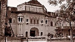
In the southern part of Uttarakhand in [[Haridwar district]] (earlier part of [[Saharanpur district|Saharanpur]] till 1988) the dominance and kingship (rajya) was exercises by some local Hindu rulers, the area was under control of Parmar (Panwar) chief in eastern [[Saharanpur district|Saharanpur]] including [[Haridwar district|Haridwar]] in kingship of Raja Sabha Chandra of [[Jhabrera (Uttarakhand Assembly constituency)|Jabarhera]] (Jhabrera). The Panwar clan held more than 500 villages there in upper Doab, and that situation was confirmed in 1759 in a grant by a Rohilla governor of 505 villages and 31 hamlets to one Manohar Singh (written in some records as Raja Nahar Singh son of Sabha Chandra). In 1792 [[Ram Dayal Singh|Ram Dayal]] and his son Sawai Singh were ruling the area but due to some family reasons Ramdayal left Jhabrera and went to Landhaura village, now some villages were under the control of Raja Ramdayal Singh at [[Landhaura]], and some under his son Sawai Singh at Jhabrera. Hence, there were two branches of Jhabrera State (riyasat) main branch at [[Jhabrera]] and the second one at [[Landhaura]], both father and son were ruling simultaneously without any conflicts till the death of Raja Sawai Singh of [[Jhabrera|Jabarhera]] in 1803. After the death of Sawai Singh total control of powers transferred to Ram Dayal Singh at Landhaura, but some villages were given to descendants of Sawai Singh and her widow to collect revenue.<ref>{{Cite web |title=Tareekh Gurjar Vol 5-تاریخ گرجر جلد پنجم.pdf |url=https://drive.google.com/file/d/0B2AJAVIyLgQwa1BfSm8xb0V3SDA/view |access-date=2025-02-27 |website=Google Docs}}</ref><ref name="Chauhan 1998">{{Cite book |last=Chauhan |first=Rana Ali Hasan |url=https://books.google.com/books?id=3ZmvnQEACAAJ |title=A Short History of the Gurjars: Past and Present |date=1998 |publisher=Chauhan Publications |isbn=978-969-8419-00-4 |language=en}}</ref> | |||
By 1803 the Landhaura villages numbered 794 under [[Raja Ram Dayal Singh]]. Raja Ram Dayal Singh died on 29 March 1813.<ref>{{Cite book|last=Atkinson|first=Edwin Thomas|url=https://books.google.com/books?id=w2xZmwEACAAJ&q=Landhaura%7Ctitle%3DStatistical|title=Statistical, Descriptive and Historical Account of the North-Western Provinces of India: 2.:Meerut division part 1|date=1875|publisher=North-Western Provinces Government|language=en}}</ref> These holdings, at least those in the original grant made by the Rohilla governor, were initially recognised by the British in land settlements concluded with Ram Dayal and his heirs. As the years passed, more and more settlements appear to have been made with the village communities, however, and by 1850 little remained of the once vast estate of the Landhaura Khübars.<ref>{{Cite book|last=Raheja|first=Gloria Goodwin|url=https://books.google.com/books?id=V6oYqw1BWAQC&pg=PA1|title=The Poison in the Gift: Ritual, Prestation, and the Dominant Caste in a North Indian Village|date=June 1988|publisher=University of Chicago Press|isbn=978-0-226-70728-0|language=en|access-date=16 June 2021|archive-date=17 June 2021|archive-url=https://web.archive.org/web/20210617111159/https://books.google.com/books?id=V6oYqw1BWAQC&pg=PA1|url-status=live}}</ref> There are many temples and Ghats on Ganga built by Rajas of Landhaura estate, therefore they also famous as ' Haridwari Rajas' in folk history and literature. Famous [[Daksheswar Mahadev Temple|Dakshamahadev Temple]] at Kankhal was built by Queen DhanKaur of Landhaura in 1810 A.D.<ref>{{Cite web |title=Nirvana India Enterprise |url=https://www.haridwartemple.com/article/id/1023/daksha-mahadev-temple |access-date=2025-02-28 |website=www.haridwartemple.com}}</ref> | |||
[[File:Ram Mahal.jpg|thumb|Ram Mahal of [[Timli state|Timli estate]]]] | |||
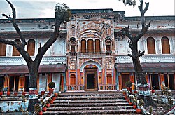
Next the Timli estate Founded in Dehradun mid-15th century by Chaudhari Ram Singh, a member of the [[Chokar]] Hindu family, the estate remained under the rule of this dynasty until its eventual annexation.<ref name="Chauhan 1998"/><ref>{{Cite journal |last1=Murtaza |first1=Mahnoor |last2=Shad |first2=Dr Elizabeth |date=2024-03-05 |title=An overview of Ada Jafri's Autobiography "Jo Rahi So Bekhabri Rahi" |url=https://ojs.lgu.edu.pk/index.php/nooretahqeeq/article/view/2136 |journal=Noor e Tahqeeq |language=en |volume=8 |issue=1 |pages=6–17 |doi=10.54692/nooretahqeeq.2024.08012136 |issn=2521-0157|doi-access=free }}</ref> In 1548, two chieftains, Pohda Singh and Lal Karan, from the Titron region in Saharanpur district, crossed the [[Sivalik Hills|Sivalik hills]], conquered the entire Dehradun area, and established the [[Timli state|Timli estate]]. They also founded a town named Timli Chaudhari Bhagwan Singh have power of magistrate.<ref>{{Cite book |last=Handa |first=O. C. |url=https://books.google.com/books?id=XTfmGNfaoC4C&dq=Bhagwan+Singhji+Choudhari&pg=PA222 |title=Art & Architecture of Uttarakhand |date=July 2009 |publisher=Pentagon Press |isbn=978-81-8274-417-2 |language=en}}</ref><ref>{{Cite book |last=Williams |first=George Robert Carlisle |url=https://books.google.com/books?id=6wQ3AQAAMAAJ&dq=Timlee+Goojur&pg=RA1-PA101 |title=Historical and Statistical Memoir of Dehra Doon |date=1874 |publisher=Printed at the Thomason Civil Engineering College Press |language=en}}</ref><ref>{{Cite book |last=Walton |first=h G. Ed |url=https://archive.org/details/in.ernet.dli.2015.94182 |title=Dehra Dun, a Gazetteer, vol.1 |date=1911}}</ref> | |||
Raja Ranjit Singh of [[Samthar State|Samthar state]], born in 1943, was married at a young age to a princess from the Chokar family, which ruled in Timli estate in [[Dehradun]].<ref>{{Cite web |title=Tareekh Gurjar Vol 5-تاریخ گرجر جلد پنجم.pdf |url=https://drive.google.com/file/d/0B2AJAVIyLgQwa1BfSm8xb0V3SDA/view |access-date=2025-02-27 |website=Google Docs}}</ref><ref>{{Cite book |last=Handa |first=O. C. |url=https://books.google.com/books?id=XTfmGNfaoC4C&dq=Timli+State&pg=PA251 |title=Art & Architecture of Uttarakhand |date=July 2009 |publisher=Pentagon Press |isbn=978-81-8274-417-2 |language=en}}</ref> | |||
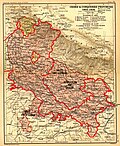
[[File:Ceded Conquered Provinces details.jpg|thumb| | [[File:Ceded Conquered Provinces details.jpg|thumb|left|alt=Map of Uttarakhand as part of United Province |Uttarakhand as a part of the [[Ceded and Conquered Provinces]]]] | ||
After India attained independence from the [[British Raj|British]], the Garhwal Kingdom was merged into the state of [[Uttar Pradesh]], where Uttarakhand composed the Garhwal and Kumaon Divisions.<ref>Saklani, A. (1987). The history of a Himalayan princely state: change, conflicts and awakening: an interpretative history of princely state of Tehri Garhwal, U.P., A.D. 1815 to 1949 A.D. (1st ed.). Delhi: Durga Publications.</ref> Until 1998, Uttarakhand was the name most commonly used to refer to the region, as various political groups, including the [[Uttarakhand Kranti Dal]] (Uttarakhand Revolutionary Party), began agitating for separate statehood under its banner. Although the erstwhile hill kingdoms of Garhwal and Kumaon were traditional rivals the inseparable and complementary nature of their geography, economy, culture, language, and traditions created strong bonds between the two regions.<ref>Aggarwal, J. C., Agrawal, S. P., & Gupta, S. S. (Eds.). (1995). Uttarakhand: past, present, and future. New Delhi: Concept Pub. Co.</ref> These bonds formed the basis of the new political identity of Uttarakhand, which gained significant momentum in 1994, when demand for separate statehood achieved almost unanimous acceptance among both the local populace and national political parties.<ref>Kumar, P. (2000). The Uttarakhand Movement: Construction of a Regional Identity. New Delhi: Kanishka Publishers.</ref> | After India attained independence from the [[British Raj|British]], the Garhwal Kingdom was merged into the state of [[Uttar Pradesh]], where Uttarakhand composed the Garhwal and Kumaon Divisions.<ref>Saklani, A. (1987). The history of a Himalayan princely state: change, conflicts and awakening: an interpretative history of princely state of Tehri Garhwal, U.P., A.D. 1815 to 1949 A.D. (1st ed.). Delhi: Durga Publications.</ref> Until 1998, Uttarakhand was the name most commonly used to refer to the region, as various political groups, including the [[Uttarakhand Kranti Dal]] (Uttarakhand Revolutionary Party), began agitating for separate statehood under its banner. Although the erstwhile hill kingdoms of Garhwal and Kumaon were traditional rivals the inseparable and complementary nature of their geography, economy, culture, language, and traditions created strong bonds between the two regions.<ref>Aggarwal, J. C., Agrawal, S. P., & Gupta, S. S. (Eds.). (1995). Uttarakhand: past, present, and future. New Delhi: Concept Pub. Co.</ref> These bonds formed the basis of the new political identity of Uttarakhand, which gained significant momentum in 1994, when demand for separate statehood achieved almost unanimous acceptance among both the local populace and national political parties.<ref>Kumar, P. (2000). The Uttarakhand Movement: Construction of a Regional Identity. New Delhi: Kanishka Publishers.</ref> | ||
The most notable incident during this period was the [[Rampur Tiraha firing case]] on the night of 1 October 1994, which led to a public uproar.<ref>{{cite news|title=HC quashes CBI report on Rampur Tiraha firing|url= | The most notable incident during this period was the [[Rampur Tiraha firing case]] on the night of 1 October 1994, which led to a public uproar.<ref>{{cite news|title=HC quashes CBI report on Rampur Tiraha firing|url=https://timesofindia.indiatimes.com/india/HC-quashes-CBI-report-on-Rampur-Tiraha-firing/articleshow/104312.cms |date=31 July 2003 |access-date=28 July 2012 |archive-url=https://web.archive.org/web/20121020023855/http://articles.timesofindia.indiatimes.com/2003-07-31/india/27185864_1_quashes-rampur-tiraha-open-fire|archive-date=20 October 2012|newspaper=[[The Times of India]]|url-status=live}}</ref> On 24 September 1998, the [[Uttar Pradesh Legislative Assembly]] and [[Uttar Pradesh Legislative Council]] passed the Uttar Pradesh Reorganisation Bill, which began the process of forming a new state.<ref>[http://www.indianexpress.com/res/web/pIe/ie/daily/19980924/26750834.html Reorganisation Bill passed by UP Govt] {{webarchive|url=https://web.archive.org/web/20090907185215/http://www.indianexpress.com/res/web/pIe/ie/daily/19980924/26750834.html |date=7 September 2009 }} ''[[The Indian Express]]'', 24 September 1998.</ref> Two years later the [[Parliament of India]] passed the [[Uttar Pradesh Reorganisation Act, 2000]] and thus, on 9 November 2000, Uttarakhand became the 27th state of the [[Republic of India]].<ref>{{Cite web |last=Bhaskar |first=Arushi |date=9 November 2022 |title=Uttarakhand Foundation Day: The long struggle for the hill state |url=https://indianexpress.com/article/explained/uttarakhand-foundation-day-the-long-struggle-for-the-hill-state-8258545/ |access-date=31 December 2022 |website=[[The Indian Express]] |language=en |archive-date=31 December 2022 |archive-url=https://web.archive.org/web/20221231120258/https://indianexpress.com/article/explained/uttarakhand-foundation-day-the-long-struggle-for-the-hill-state-8258545/ |url-status=live }}</ref> | ||
Uttarakhand is also well known for the mass agitation of the 1970s that led to the formation of the [[Chipko movement|Chipko environmental movement]]<ref>Guha, R. (2000). The unquiet woods: ecological change and peasant resistance in the Himalaya (Expanded ed.). Berkeley, Calif.: University of California Press.</ref> and other social movements. Though primarily a [[livelihood]] movement rather than a forest conservation movement, it went on to become a rallying point for many future [[environmentalists]], environmental protests, and movements the world over and created a precedent for non-violent protest.<ref>{{Cite book|last=Robbins|first=Paul|url=https://books.google.com/books?id=BLFoFf3fbi0C&dq=Chipko+movement&pg=PA194| | Uttarakhand is also well known for the mass agitation of the 1970s that led to the formation of the [[Chipko movement|Chipko environmental movement]]<ref>Guha, R. (2000). The unquiet woods: ecological change and peasant resistance in the Himalaya (Expanded ed.). Berkeley, Calif.: University of California Press.</ref> and other social movements. Though primarily a [[livelihood]] movement rather than a forest conservation movement, it went on to become a rallying point for many future [[environmentalists]], environmental protests, and movements the world over and created a precedent for non-violent protest.<ref>{{Cite book|last=Robbins|first=Paul|title=Political Ecology: A Critical Introduction|publisher=[[Wiley (publisher)|Wiley]]|page=194 |url=https://books.google.com/books?id=BLFoFf3fbi0C&dq=Chipko+movement&pg=PA194 |archive-url=https://web.archive.org/web/20160110042140/https://books.google.com/books?id=BLFoFf3fbi0C&pg=PA194&dq=Chipko+movement|archive-date=10 January 2016|url-status=live|date=9 August 2004|isbn=978-1-4051-0266-7}}</ref> It stirred up the existing civil society in India, which began to address the issues of tribal and marginalised people. So much so that, a quarter of a century later, ''[[India Today]]'' mentioned the people behind the "forest satyagraha" of the Chipko movement as among "100 people who shaped India".<ref name=ITD>{{cite web|last=Agarwal|first=Anil|title=The Chipko Movement |url=http://www.india-today.com/itoday/millennium/100people/chipko.html|work=India Today |access-date=29 July 2012|url-status=dead|archive-url=https://web.archive.org/web/20140823085113/http://www.india-today.com/itoday/millennium/100people/chipko.html|archive-date=23 August 2014}}</ref> One of Chipko's most salient features was the mass participation of female villagers.<ref>Mishra, A., & Tripathi, (1978). '''Chipko''' movement: Uttaranchal women's bid to save forest wealth. New Delhi: People's Action/Gandhi Book House.</ref> It was largely female activists that played pivotal role in the movement. [[Gaura Devi]] was the leading activist who started this movement, other participants were [[Chandi Prasad Bhatt]], [[Sunderlal Bahuguna]], and Ghanshyam Raturi, the popular Chipko poet.<ref>{{cite web|title=Chipko Movement, India |url=http://iisd.org/50comm/commdb/desc/d07.htm |publisher=International Institute for Sustainable Development|access-date=29 July 2012|url-status=dead |archive-url=https://web.archive.org/web/20120321223139/http://www.iisd.org/50comm/commdb/desc/d07.htm|archive-date=21 March 2012}}</ref> | ||
== Geography == | == Geography == | ||
{{Main|Geography of Uttarakhand|List of mountain peaks of Uttarakhand}} | {{Main|Geography of Uttarakhand|List of mountain peaks of Uttarakhand}} | ||
{{See also|Ecology of the Himalayas|Geology of the Himalayas}} | {{See also|Ecology of the Himalayas|Geology of the Himalayas}} | ||
[[File: | [[File:India Uttarakhand relief map.svg|thumb|left|alt=Uttarakhand Relief Map|Topography map of Uttarakhand, showing elevations shaded from green to brown (higher)]] | ||
Uttarakhand has a total area of {{cvt|53, | Uttarakhand has a total area of {{cvt|53,483|km2}},<ref name="Uttarakhand" /> of which 86% is mountainous and 65% is covered by forest.<ref name=Uttarakhand /> Most of the northern part of the state is covered by high [[Himalaya]]n peaks and glaciers. In the first half of the nineteenth century, the expanding development of Indian roads, railways, and other physical infrastructure was giving rise to concerns over indiscriminate logging, particularly in the [[Himalaya]]. Two of the most important rivers in Hinduism originate in the glaciers of Uttarakhand, the [[Ganges]] at [[Gangotri]] and the [[Yamuna]] at [[Yamunotri]]. They are fed by myriad lakes, glacial melts, and streams.<ref>Negi, S. S. (1991). Himalayan rivers, lakes, and glaciers. New Delhi: Indus Pub. Co.</ref> These two along with [[Badrinath]] and [[Kedarnath]] form the [[Chota Char Dham]], a holy pilgrimage for the Hindus.<ref name=char1>{{Cite web |url=http://www.india.com/business/chardham-to-get-rail-connectivity-indian-railways-pilgrimage-linking-project-to-cost-rs-43-29-crore-2124237/ |title=Chardham to get rail connectivity; Indian Railways pilgrimage linking project to cost Rs 43.29k crore, India.com, 12-May-2017 |access-date=28 February 2023 |archive-date=6 November 2022 |archive-url=https://web.archive.org/web/20221106041458/https://www.india.com/business/chardham-to-get-rail-connectivity-indian-railways-pilgrimage-linking-project-to-cost-rs-43-29-crore-2124237/ |url-status=live }}</ref><ref>[http://gov.ua.nic.in/transport/chardham.htm Chard Dham Yatra] {{Webarchive|url=https://web.archive.org/web/20090512200341/http://gov.ua.nic.in/transport/chardham.htm |date=12 May 2009 }} – Govt. of Uttarakhand, Official website.</ref><ref>[https://web.archive.org/web/20140502222038/http://www.hindustantimes.com/india-news/dehradun/char-dham-yatra-kicks-off-as-portals-open/article1-1214974.aspx Char Dham yatra kicks off as portals open – Hindustan Times<!-- Bot generated title -->]</ref><ref>{{Cite web |url=http://www.indiapilgrimtours.com/articles/destination-profiles-of-the-holy-char-dhams-uttarakhand |title=Destination Profiles of the Holy Char Dhams, Uttarakhand<!-- Bot generated title --> |date=18 April 2013 |access-date=28 February 2023 |archive-date=9 March 2023 |archive-url=https://web.archive.org/web/20230309154546/https://www.indiapilgrimtours.com/articles/destination-profiles-of-the-holy-char-dhams-uttarakhand/ |url-status=live }}</ref> | ||
Uttarakhand lies on the southern slope of the Himalaya range, and the climate and vegetation vary greatly with elevation, from glaciers at the highest elevations to [[subtropical]] forests at the lower elevations. The highest elevations are covered by ice and bare rock. Below them, between {{convert|3000|and|5000|m|ft}} are the [[western Himalayan alpine shrub and meadows]]. The temperate [[western Himalayan subalpine conifer forests]] grow just below the tree line. At {{convert|3000|to|2600|m|ft}} elevation they transition to the temperate [[western Himalayan broadleaf forests]], which lie in a belt from {{convert|2600|to|1500|m|ft}} elevation. Below {{convert|1500|m|ft}} elevation lie the [[Himalayan subtropical pine forests]]. The [[Upper Gangetic Plains moist deciduous forests]] and the drier [[Terai-Duar savanna and grasslands]] cover the lowlands along the Uttar Pradesh border in a belt locally known as [[Bhabar]]. These lowland forests have mostly been cleared for agriculture, but a few pockets remain.<ref>Negi, S. S. (1995). Uttarakhand: land and people. New Delhi: MD Pub.</ref> | |||
===Climate=== | |||
Uttarakhand has a [[temperate climate|temperate]] but varies greatly from north to south.<ref name="Climate">{{cite web |title=Climate of Uttarakhand |url=https://imdpune.gov.in/library/public/Climate%20of%20Uttarakhand.pdf |publisher=IMD Pune |access-date=28 June 2024}}</ref> The climatic conditions experienced in the state vary [[Subtropics|subtropical]] in the southern part to [[Alpine climate|alpine]] in the upper reaches of the Himalayan mountain in the northern parts. The winter season from December to February, is extreme with temperatures fluctuating anywhere between {{convert|comma=5|5|°C}} to {{convert|comma=5|20|°C}}. In higher altitudes and mountainous regions, temperatures often drop below freezing point.<ref name="Climate"/> Cold winds blow across Uttarakhand, especially in the higher altitudes and mountainous regions. These winds bring cold temperatures and often carry moisture, contributing to the heavy snowfall in places like the Himalayan ranges and hill stations.<ref name="Climate"/> | |||
[[File:India Uttarakhand | During Pre-monsoon or hot weather season from March to May, temperature starts to rise and steadily rises till it reaches its peak in May to the middle of June, when the mean maximum temperature in southern parts and valleys of the state is at about {{convert|comma=5|34|°C}} C to {{convert|comma=5|38|°C}}, But in recent days the maximum temperature has increased up to 40 °C (104 °F). and mean minimum temperature is at about {{convert|comma=5|20|°C}} to {{convert|comma=5|24|°C}} C.<ref name="Daily Weather">{{cite web |title=Daily Weather Report For Uttarakhand |url=https://mausam.imd.gov.in/dehradun/mcdata/DWR.pdf |publisher=Meteorological Centre, Dehradun |access-date=28 June 2024}}</ref> June to September constitutes the [[southwest monsoon]] season and the period of October and November is of post monsoon season. The state receives rainfall mainly due monsoon depressions originating in the [[Bay of Bengal]] during the [[southwest monsoon]] season. The total annual rainfall for the state as a whole is 133 cm and total annual number of rainy days are about 63 cm. Although, rainfall in the state varies from place to place due to its rugged topography. Precipitation is not heavy and occurs in the form of rain and snow. Winds are generally light of the order of 1 to 4 kmph in the valleys and 5 to 10 kmph at elevations of 2 km increasing further with higher altitudes. | ||
=== Flora and fauna === | |||
{{See also|Indomalayan realm}} | |||
{| class="toccolours" style="margin:1em; float:right; width:25%" | |||
|+ '''State symbols of Uttarakhand''' | |||
|- | |||
| '''State animal''' | |||
| [[Alpine musk deer]] (''Moschus chrysogaster'')|| [[File:Moschus chrysogaster.jpg|50px]] | |||
|- | |||
| '''State bird''' | |||
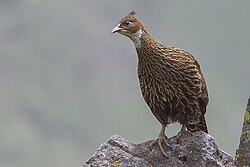
| [[Himalayan monal]] (''Lophophorus impejanus'')|| [[File:Himalayan Monal Adult Female Tungnath Rudraprayag Uttarakhand India 14.06.2013.jpg|50px]] | |||
|- | |||
| '''State tree''' | |||
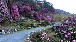
| [[Burans]] (''Rhododendron arboreum'') || [[File:Natural flowers, Chopta, Uttarakhand.jpg|50px]] | |||
|- | |||
| '''State flower''' | |||
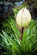
| [[Brahma Kamal]] (''Saussurea obvallata)''|| [[File:Brahma Kamal.jpg|50px]] | |||
|- | |||
| '''State fruit''' | |||
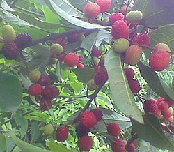
| [[Kafal]] (''Myrica esculenta)''|| [[File:Kafal(blackberry) 2014-06-04 08-48.jpg|50px]] | |||
|- | |||
| '''State sport''' | |||
| [[Association football|Football]] || [[File:Football in Bloomington, Indiana, 1995.jpg|50px]] | |||
|} | |||
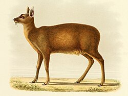
Uttarakhand | Uttarakhand has a diversity of flora and fauna. It has a recorded forest area of {{cvt|34,666|km2}}, which constitutes 65% of the total area of the state.<ref>{{cite web|title=Uttarakhand Annual Plan 2011–12 Finalisation Meeting Between Hon'ble Dputy Chairman, Planning Commission & Hon'ble Chief Minister, Uttarakhand|url=http://planningcommission.nic.in/plans/stateplan/present/Uttarakhand.pdf|publisher=planningcommission.nic.in|access-date=3 July 2012|url-status=live|archive-url=https://web.archive.org/web/20120515134301/http://planningcommission.nic.in/plans/stateplan/present/Uttarakhand.pdf|archive-date=15 May 2012}}</ref> The vegetation of the state majorly comprises alpine trees and tropical rainforests. The state is home to rare species of plants and animals, many of which are protected by sanctuaries and reserves. [[National parks of India|National parks]] in Uttarakhand include the [[Jim Corbett National Park]] (the oldest national park of India) in [[Nainital district|Nainital]] and [[Pauri Garhwal District]], and [[Valley of Flowers National Park]] & [[Nanda Devi National Park]] in [[Chamoli District]], which together are a [[UNESCO World Heritage Site]]. A number of plant species in the valley are internationally threatened, including several that have not been recorded from elsewhere in Uttarakhand.<ref name="unesco335">{{cite web|title=Nanda Devi and Valley of Flowers National Parks|url=https://whc.unesco.org/en/list/335/|publisher=UNESCO|access-date=3 July 2012|url-status=live|archive-url=https://web.archive.org/web/20120625213230/https://whc.unesco.org/en/list/335|archive-date=25 June 2012}}</ref> [[Rajaji National Park]] in [[Haridwar District|Haridwar]], [[Dehradun District|Dehradun]] and [[Pauri Garhwal District]] and [[Govind Pashu Vihar National Park]] & [[Gangotri National Park]] in [[Uttarkashi District]] are some other protected areas in the state.<ref name=wildlife>{{cite web|title=Wildlife Eco-Tourism in Uttarakhand |url=http://www.uttarakhandforest.org/Data/SC_WildlifeEco-tourism.pdf |archive-url=https://web.archive.org/web/20091123040254/http://www.uttarakhandforest.org/Data/SC_WildlifeEco-tourism.pdf |url-status=dead |archive-date=23 November 2009 |publisher=uttarakhandforest.org |access-date=14 July 2012 }}</ref> | ||
In | [[Bengal tigers]] and [[leopards]] are found in areas that are abundant in hills but may also venture into the lowland jungles. Smaller felines include the [[jungle cat]], [[fishing cat]], and [[leopard cat]]. Other mammals include four kinds of deer ([[Muntjac|barking]], [[sambar deer|sambar]], [[hog deer|hog]] and [[chital]]), [[Sloth bear|sloth]], [[Brown bear|Brown]] and [[Asian black bear|Himalayan black bears]], [[Indian grey mongoose]]s, [[otter]]s, [[Martes flavigula|yellow-throated martens]], [[bharal]], [[Indian pangolin]]s, and [[langur]] and [[rhesus macaque|rhesus]] monkeys. In the summer, [[Asian elephant|elephants]] can be seen in [[herd]]s of several hundred. [[Marsh crocodile]]s (''Crocodylus palustris''), [[gharial]]s (''Gavialis gangeticus'') and other reptiles are also found in the region. Local crocodiles were saved from extinction by captive breeding programs and subsequently re-released into the [[Ramganga]] river.<ref>Riley, Laura; William Riley (2005):208. Nature's Strongholds: The World's Great Wildlife Reserves. Princeton University Press. {{ISBN|0-691-12219-9}}.</ref> Several freshwater terrapins and turtles like the [[Indian sawback turtle]] (''Kachuga tecta''), [[brahminy river turtle]] (''Hardella thurjii''), and [[Ganges softshell turtle]] (''Trionyx gangeticus'') are found in the rivers. Butterflies and birds of the region include [[Papilio helenus|red helen]] (''Papilio helenus''), the [[Hypolimnas bolina|great eggfly]] (''Hypolimnos bolina''), [[Danaus genutia|common tiger]] (''Danaus genutia''), [[Pareronia avatar|pale wanderer]] (''Pareronia avatar''), [[jungle babbler]], [[tawny-bellied babbler]], [[great slaty woodpecker]], [[red-breasted parakeet]], [[orange-breasted green pigeon]] and [[chestnut-winged cuckoo]].<ref name="Sharma1998">{{cite book|author=K. P. Sharma|title=Garhwal & Kumaon: A Guide for Trekkers and Tourists|url=https://books.google.com/books?id=jSelsX-adscC&pg=PA56 |year=1998 |publisher=Cicerone Press Limited |isbn=978-1-85284-264-2 |pages=56– |access-date=9 July 2012 |url-status=live|archive-url=https://web.archive.org/web/20130603060215/http://books.google.com/books?id=jSelsX-adscC&pg=PA56|archive-date=3 June 2013}}</ref> In 2011, a rare migratory bird, the [[bean goose]], was also seen in the [[Jim Corbett National Park]]. A critically endangered bird, last seen in 1876 is the Himalayan quail endemic to the western Himalayas of the state.<ref name=corbett>{{cite web|title=A Rare Visit of Ben Goose at Corbett|url=http://www.corbett-national-park.com/blog/a-rare-visit-of-ben-goose-at-corbett.html|publisher=corbett-national-park.com|access-date=15 April 2015|url-status=live|archive-url=https://web.archive.org/web/20150415132138/http://www.corbett-national-park.com/blog/a-rare-visit-of-ben-goose-at-corbett.html|archive-date=15 April 2015|date=11 May 2012}}</ref> | ||
[[Evergreen oaks]], [[rhododendrons]], and [[conifers]] predominate in the hills. [[Prunus cerasoides]] (pahiyya), ''[[Sal (tree)|sal]]'' (''Shorea robusta''), [[silk cotton tree]] (''Bombax ciliata''), ''[[Dalbergia sissoo]]'', ''[[Mallotus philippensis]]'', ''[[Acacia catechu]]'', ''[[Bauhinia racemosa]]'', and ''[[Bauhinia variegata]]'' (camel's foot tree) are some other trees of the region. ''[[Albizia chinensis]]'', the sweet sticky flowers of which are favoured by sloth bears, are also part of the region's flora.<ref name="Sharma1998" /> | |||
A decade long study by Prof. [[Chandra Prakash Kala]] concluded that the Valley of Flowers is endowed with 520 species of higher plants (''[[angiosperm]]s'', ''[[gymnosperm]]s'' and ''[[pteridophyte]]s''), of these 498 are [[flowering plant]]s. The park has many species of medicinal plants including ''[[Dactylorhiza hatagirea]]'', ''[[Picrorhiza kurroa]]'', ''[[Aconitum violaceum]]'', ''[[Polygonatum multiflorum]]'', ''[[Fritillaria roylei]]'', and ''[[Podophyllum hexandrum]]''.<ref>Kala, C.P. 2005. The Valley of Flowers; A newly declared World Heritage Site. Current Science, 89 (6): 919–920.</ref><ref>Kala, C.P. 2004. The Valley of Flowers; Myth and Reality. International Book Distributors, Dehradun, India</ref> | |||
In the summer season of 2016, a large portion of forests in Uttarakhand caught fires and rubbled to ashes during [[2016 Uttarakhand forest fires|Uttarakhand forest fires]] incident, which resulted in the damage of forest resources worth billions of rupees and death of 7 people with hundreds of wild animals died during fires. During the [[2021 Uttarakhand forest fires]], there was widespread damage to the forested areas in Tehri district.<ref>{{Cite news|last=PTI|date=6 April 2021|title=Indian Air Force Battles Uttarakhand Forest Blaze, 75 New Fires Reported|url=https://www.ndtv.com/india-news/indian-air-force-battles-uttarakhand-forest-blaze-75-new-fires-reported-2407790|access-date=7 April 2021|work=NDTV|archive-date=6 April 2021|archive-url=https://web.archive.org/web/20210406195312/https://www.ndtv.com/india-news/indian-air-force-battles-uttarakhand-forest-blaze-75-new-fires-reported-2407790|url-status=live}}</ref> | |||
A number of native plants are deemed to be of medicinal value.{{citation needed|date=April 2025}} The government-run [[Herbal Research and Development Institute]] carries out research and helps conserve medicinal herbs that are found in abundance in the region. Local traditional healers still use herbs, in accordance with classical [[Ayurvedic]] texts, for diseases that are usually cured by modern medicine.<ref>{{Cite journal|title=Ethnomedicinal Investigation of Medicinal Plants of Chakrata Region (Uttarakhand) Used in the Traditional Medicine for Diabetes by Jaunsari Tribe|first1=Ankit|last1=Kumar|first2=Sonali|last2=Aswal|first3=Ashutosh|last3=Chauhan|first4=Ruchi Badoni|last4=Semwal|first5=Abhimanyu|last5=Kumar|first6=Deepak Kumar|last6=Semwal|date=1 June 2019|journal=Natural Products and Bioprospecting|volume=9|issue=3|pages=175–200|doi=10.1007/s13659-019-0202-5|pmid=30968350|pmc=6538708}}</ref> | |||
<gallery mode="packed" heights="134"> | <gallery mode="packed" heights="134"> | ||
Golden mahseer (Tor putitora) Babai River.jpg| [[Golden Mahseer]] (''Tor putitora'') | |||
File:Brännässla (Urtica Dioica).jpg|[[Urtica dioica|Kandali]] (''Urtica dioica'') | |||
Davidraju Common peacock-shillong.jpg|[[West Himalayan Common Peacock]] (''Papilio bianor polyctor'') | |||
File:Wild Himalaya Cherry's blooming at Doi suthep-pui national park.jpg|[[Prunus cerasoides|Paiyya]] (Prunus cerasoides) | |||
Himalayan Monal, Male (28466143101).jpg| [[Himalayan Monal]] (''Lophophorus impejanus'') | |||
</gallery> | </gallery> | ||
| Line 262: | Line 236: | ||
{{See also|List of cities in Uttarakhand by population|List of people from Uttarakhand|Garhwali people|Kumaoni people}} | {{See also|List of cities in Uttarakhand by population|List of people from Uttarakhand|Garhwali people|Kumaoni people}} | ||
{{Historical population | {{Historical population | ||
| source = [[Census of India]]<ref name="Census Population">{{Citation|url=http://indiabudget.nic.in/es2006-07/chapt2007/tab97.pdf|title=Census Population|work=Census of India|publisher=Ministry of Finance India|access-date=18 December 2008|archive-url=https://web.archive.org/web/20081219073658/http://indiabudget.nic.in/es2006-07/chapt2007/tab97.pdf|archive-date=19 December 2008|url-status=dead}}</ref> | | source = [[Census of India]]<ref>{{cite web|title= A - 2 DECADAL VARIATION IN POPULATION SINCE 1901|publisher=Office of the Census Commissioner |url=https://censusindia.gov.in/2011census/PCA/A-2_Data_Tables/05%20A-2%20Uttarakhand.pdf |archive-url=https://web.archive.org/web/20220226074646/https://censusindia.gov.in/2011census/PCA/A-2_Data_Tables/05%20A-2%20Uttarakhand.pdf |archive-date=26 February 2022|url-status=dead}}</ref><ref name="Census Population">{{Citation|url=http://indiabudget.nic.in/es2006-07/chapt2007/tab97.pdf|title=Census Population|work=Census of India|publisher=Ministry of Finance India|access-date=18 December 2008|archive-url=https://web.archive.org/web/20081219073658/http://indiabudget.nic.in/es2006-07/chapt2007/tab97.pdf|archive-date=19 December 2008|url-status=dead}}</ref> | ||
| 1951 | | | 1901 |1979866 | ||
| 1961 | | | 1911 |2142258 | ||
| 1971 | | | 1921 |2115984 | ||
| 1981 | | | 1931 |2301019 | ||
| 1991 | | | 1941 |2614540 | ||
| 2001 | | | 1951 | 2945929 | ||
| 1961 | 3610938 | |||
| 1971 | 4492724 | |||
| 1981 | 5725972 | |||
| 1991 | 7050634 | |||
| 2001 | 8489349 | |||
| 2011 | 10086292 | |||
}} | }} | ||
The native people of Uttarakhand are generally called | The native people of Uttarakhand are generally called Uttarakhandi and sometimes specifically either [[Garhwali people|Garhwali]] or [[Kumaoni people|Kumaoni]] depending on their place of origin in either the [[Garhwal division|Garhwal]] or [[Kumaon division|Kumaon]] region. According to the [[2011 Census of India]], Uttarakhand has a population of 10,086,292 comprising 5,137,773 males and 4,948,519 females, with 69.77% of the population living in rural areas. The state is the 20th most populous state of the country having 0.83% of the population on 1.63% of the land. The population density of the state is 189 people per square kilometre having a 2001–2011 decadal growth rate of 18.81%. The gender ratio is 963 females per 1000 males.<ref name="Census2011">{{cite web |title=Uttarakhand Profile |url=http://censusindia.gov.in/2011census/censusinfodashboard/stock/profiles/en/IND005_Uttarakhand.pdf |website=censusindia.gov.in |access-date=18 March 2020 |archive-date=19 September 2020 |archive-url=https://web.archive.org/web/20200919150703/https://censusindia.gov.in/2011census/censusinfodashboard/stock/profiles/en/IND005_Uttarakhand.pdf |url-status=live }}</ref><ref name="census">{{cite web|title=Census of India-2011 (Uttarakhand)|language=hi|url=http://censusindia.gov.in/2011-prov-results/data_files/uttarakhand/ppt_figures_press_rel.pdf|publisher=Office of the Registrar General and Census Commissioner, India (ORGI)|access-date=17 July 2012|url-status=live|archive-url=https://web.archive.org/web/20111125075341/http://censusindia.gov.in/2011-prov-results/data_files/uttarakhand/ppt_figures_press_rel.pdf|archive-date=25 November 2011}}</ref><ref name="Demography">{{cite web|title=Demography|url=http://uk.gov.in/pages/view/428-demography|publisher=Government of Uttarakhand|access-date=17 July 2012|url-status=live|archive-url=https://web.archive.org/web/20120103061346/http://uk.gov.in/pages/view/428-demography|archive-date=3 January 2012}}</ref> The crude birth rate in the state is 18.6 with the [[total fertility rate]] being 2.3. The state has an [[infant mortality rate]] of 43, a [[maternal mortality rate]] of 188 and a [[crude death rate]] of 6.6.<ref>{{cite web|title=Annual Health Survey 2010–2011 Fact Sheet|url=http://censusindia.gov.in/vital_statistics/AHSBulletins/AHS_Baseline_Factsheets/Uttarakhand.pdf|publisher=Government of India|access-date=17 July 2012|url-status=live|archive-url=https://web.archive.org/web/20121018163102/http://www.censusindia.gov.in/vital_statistics/AHSBulletins/AHS_Baseline_Factsheets/Uttarakhand.pdf|archive-date=18 October 2012}}</ref> | ||
=== | === Social groups === | ||
Uttarakhand has a multiethnic population spread across two geocultural regions: | Uttarakhand has a multiethnic population spread across two geocultural regions: Garhwal, and Kumaon, including members of the native [[Garhwali people|Garhwali]] and [[Kumaoni people|Kumaoni]] communities as well as migrant groups, dominated by the [[Rajput]]-[[Brahmin]] hegemony.<ref name="IE_2017"/> Rajputs (of various clans) constitute around 35% of the state's population, followed by Brahmins at 20% to 25%,<ref name="IE_2017">{{cite news |last1=Bhardwaj |first1=Ashutosh |title=Uttarakhand elections: Across the border; next door to UP, new caste calculus |url=https://indianexpress.com/elections/uttarakhand-assembly-elections-2017/uttarakhand-elections-across-the-border-next-door-to-up-new-caste-calculus-4525289/ |access-date=16 June 2023 |work=The Indian Express |date=15 February 2017 |language=en |archive-date=16 June 2023 |archive-url=https://web.archive.org/web/20230616105022/https://indianexpress.com/elections/uttarakhand-assembly-elections-2017/uttarakhand-elections-across-the-border-next-door-to-up-new-caste-calculus-4525289/ |url-status=live }}</ref><ref name="AajTak_Feb2022">{{cite news |last1=माहेश्वरी |first1=सुधांशु |title=उत्तराखंड: जहां सिर्फ ब्राह्मण-ठाकुर जाति वाले CM बने, कांग्रेस क्यों खेल रही दलित कार्ड? |url=https://www.aajtak.in/elections/uttarakhand-assembly-elections/story/uttarakhand-election-brahmin-thakur-cm-dalit-congress-harish-rawat-ntc-1408958-2022-02-10 |access-date=16 June 2023 |work=Aaj Tak |date=10 February 2022 |language=hi |archive-date=16 June 2023 |archive-url=https://web.archive.org/web/20230616103521/https://www.aajtak.in/elections/uttarakhand-assembly-elections/story/uttarakhand-election-brahmin-thakur-cm-dalit-congress-harish-rawat-ntc-1408958-2022-02-10 |url-status=live }}</ref> According to a 2007 study by [[Centre for the Study of Developing Societies]], Uttarakhand has the highest percentage of [[Brahmin]]s of any state in India, with approximately 20% of the population.<ref name=":0">{{cite magazine |title=Brahmins in India |url=http://outlookindia.com/article/Brahmins-In-India/234783 |magazine=[[Outlook (Indian magazine)|Outlook]] |date=4 June 2007 |access-date=17 July 2012 |url-status=live |archive-url=https://web.archive.org/web/20140531222946/http://www.outlookindia.com/article/Brahmins-In-India/234783 |archive-date=31 May 2014}}</ref> Uttarakhand is among the few Indian states where the historic [[Forward caste|Upper Caste]] forms a major share of the population.<ref name=":0" /> | ||
Of the rest 18.3% of the population is classified as [[Other Backward Class]]es (OBCs) [[Gurjar]]s majorly.<ref>{{Cite book |last=Cātaka |first=Govinda |url=https://books.google.com/books?id=5vyAAAAAMAAJ&q=gurjar+garhwal+kumoun |title=Bhāratīya loka saṃskr̥ti kā sandarbha: Madhya Himālaya |date=1990 |publisher=Takshaśilā Prakāśana |language=hi}}</ref><ref>{{Cite book |last=Nauṭiyāla |first=Śivānanda |url=https://books.google.com/books?id=Xbu1AAAAIAAJ&q=gurjar+garhwal+kumoun |title=Gaṛhvāla-darśana |date=1988 |publisher=Sulabha Prakāśana |language=hi}}</ref><ref>{{Cite book|title=Handbook of Social Welfare Statistics|year=2018|url=https://socialjustice.nic.in/writereaddata/UploadFile/HANDBOOKSocialWelfareStatistice2018.pdf|pages=238|access-date=17 January 2022|archive-date=18 January 2022|archive-url=https://web.archive.org/web/20220118182657/https://socialjustice.nic.in/writereaddata/UploadFile/HANDBOOKSocialWelfareStatistice2018.pdf|url-status=live}}</ref><ref>{{Cite web |title=उत्तराखंड:21 विधानसभा क्षेत्रों में चलती है OBC की सियासत, भाजपा,कांग्रेस सहित सभी राजनीतिक दल आरक्षण की पैरवी पर उतरे |url=https://www.livehindustan.com/uttarakhand/story-uttarakhand-politics-of-obc-runs-in-21-assembly-constituencies-bjp-congress-all-political-parties-support-reservation-4333928.amp.html |archive-url=https://web.archive.org/web/20220228034254/https://www.livehindustan.com/uttarakhand/story-uttarakhand-politics-of-obc-runs-in-21-assembly-constituencies-bjp-congress-all-political-parties-support-reservation-4333928.amp.html |archive-date=28 February 2022 |access-date=2025-02-27 |website=Hindustan |date=11 August 2021 |language=hi-IN |url-status=live }}</ref><ref>{{Cite web |title=The Pastoral Gujjar - A Study in Uttarakhand {{!}} Exotic India Art |url=https://www.exoticindiaart.com/book/details/pastoral-gujjar-study-in-uttarakhand-ubf236/ |access-date=2025-02-27 |website=www.exoticindiaart.com |language=en}}</ref> 18.76% of the population belongs to the [[Scheduled Castes]] (an official term for the lower castes in the traditional [[caste system in India]]).<ref name="Demography" /> [[Scheduled Tribes]] such as the [[Jaunsari people|Jaunsaris]], [[Bhotiyas of Uttarakhand|Bhotiyas]], [[Tharu people|Tharus]], [[Bhoksa people|Buksas]], [[Raji people|Rajis]], [[Jad people|Jads]], and [[Banrawats]] constitute 2.89% of the population.<ref name="Demography" /> Several non-scheduled tribal groups such as [[Shaukas]] and [[Gurjar]]s are also found here.<ref name="exoticindiaart.com">{{Cite web |title=The Pastoral Gujjar - A Study in Uttarakhand {{!}} Exotic India Art |url=https://www.exoticindiaart.com/book/details/pastoral-gujjar-study-in-uttarakhand-ubf236/ |access-date=2025-02-28 |website=www.exoticindiaart.com |language=en}}</ref> [[Van Gujjar people|Van Gurjars]] (found in [[Sivalik Hills|Shivalik hills]]) and [[Bhotiya]] are nomadic tribes while [[Jaunsari people|Jaunsaris]] are completely settled tribe.<ref name="exoticindiaart.com"/><ref>{{Cite web |last=Pal |first=Sanchari |date=2016-09-03 |title=Nomads of the Himalayas : A Fascinating Glimpse into the Rarely-Seen Forest World of the Van Gujjars |url=https://thebetterindia.com/67099/van-gujjars-himalayas-tribe-buffaloes/ |access-date=2025-02-28 |website=The Better India |language=en-US}}</ref><ref>{{Cite web |title=Shepherds Of Uttarakhand |url=https://himalayashelter.com/blogs/shepherds-of-uttarakhand/ |access-date=2025-02-28 |website=himalayashelter.com}}</ref> | |||
=== Languages === | === Languages === | ||
The official language of Uttarakhand is [[Hindi]],<ref name="2011lang" /> which according to the 2011 census is spoken natively by {{sigfig|43.365|2}}% of the population,<ref name="census2011-C16">{{Cite web|title=Table C-16 Population by Mother Tongue: Uttarakhand|url=https://censusindia.gov.in/nada/index.php/catalog/10225/download/13337/DDW-C16-STMT-MDDS-0500.XLSX|website=www.censusindia.gov.in|publisher=[[Registrar General and Census Commissioner of India]]|access-date=23 July 2022|archive-date=9 August 2022|archive-url=https://web.archive.org/web/20220809134456/https://censusindia.gov.in/nada/index.php/catalog/10225/download/13337/DDW-C16-STMT-MDDS-0500.XLSX|url-status=live}} Figures for Jaunsari also include speakers of Jaunpuri.</ref> and is also used throughout the state as a lingua franca. | |||
The major regional languages of Uttarakhand are [[Garhwali language|Garhwali]], which according to the 2011 census is spoken by {{sigfig|23.025|2}}% of the population, mostly in the western half of the state, [[Kumaoni language|Kumaoni]], spoken in the eastern half and native to {{sigfig|19.941|2}}%, and [[Jaunsari language|Jaunsari]], whose speakers are concentrated in Dehradun district in the southwest and make up {{sigfig|1.345|2}}% of the state's population. These three languages are closely related, with Garhwali and Kumaoni in particular making up the [[Central Pahari]] language subgroup. The languages have been part of various scattered conservation efforts due to their active decline beginning in the later quarter of the 20th century. The decline is hypothesized to be the result of heavy state-sponsored promotion of Hindi as the official language.<ref>{{Cite web |last=Chatterjee |first=Garga |date=21 February 2016 |title=Why imposing Hindi on all is as bad an idea as insisting that India is a Hindu country |url=http://scroll.in/article/803869/why-imposing-hindi-on-all-is-as-bad-an-idea-as-insisting-that-india-is-a-hindu-country |access-date=14 February 2024 |website=Scroll.in |language=en-US |archive-date=3 October 2022 |archive-url=https://web.archive.org/web/20221003212604/https://scroll.in/article/803869/why-imposing-hindi-on-all-is-as-bad-an-idea-as-insisting-that-india-is-a-hindu-country |url-status=live }}</ref> | |||
All the languages enumerated so far belong to the [[Indo-Aryan languages|Indo-Aryan]] family. Apart from a few other minority Indo-Aryan languages, like [[Buksa language|Buksa Tharu]] and [[Rana Tharu language|Rana Tharu]] (of Udham Singh Nagar district in the south-east), [[Mahasu Pahari]] (found in Uttarkashi in the north-west), and [[Doteli language|Doteli]],<ref name="ethnologue20192">{{cite news |year=2019 |editor-last1=Eberhard |editor-first1=David M. |title=India – Languages |url=https://www.ethnologue.com/country/IN/languages |archive-url=https://web.archive.org/web/20190401120331/https://www.ethnologue.com/country/IN/languages |archive-date=1 April 2019 |website=Ethnologue |publisher=SIL International |edition=22nd |editor-last2=Simons |editor-first2=Gary F. |editor-last3=Fennig |editor-first3=Charles D.}}</ref> Uttarakhand is also home to a number of indigenous [[Sino-Tibetan languages]], most of which are spoken in the north of the state. These include [[Jad language|Jad]] (spoken in Uttarkashi district in the north-west), [[Rongpo language|Rongpo]] (of Chamoli district), and several languages of Pithoragarh district in the north-east: [[Byangsi language|Byangsi]], [[Chaudangsi language|Chaudangsi]], [[Darmiya language|Darmiya]], [[Raji language|Raji]] and [[Rawat language|Rawat]].<ref>{{Cite journal |last=Sharma |first=S.R. |year=1993 |title=Tibeto-Burman Languages of Uttar Pradesh-- an Introduction |journal=Bulletin of the Deccan College Research Institute |volume=53 |pages=343–348 |jstor=42936456}}</ref> Another indigenous Sino-Tibetan language, [[Rangas language|Rangas]], became extinct by the middle of the 20th century. Additionally, two non-indigenous Sino-Tibetan languages are also represented: [[Kulung language (Nepal)|Kulung]] (otherwise native to Nepal) and [[Standard Tibetan|Tibetan]].<ref name="ethnologue20192"/> | |||
The official language of Uttarakhand is [[Hindi]],<ref name="2011lang" /> which according to the 2011 census is spoken natively by {{sigfig|43.365|2}}% of the population | |||
The | The Indian classical language [[Sanskrit]] has been declared a second official language,<ref name="sanskrit3">{{cite news |last=Trivedi |first=Anupam |date=19 January 2010 |title=Sanskrit is second official language in Uttarakhand |url=http://www.hindustantimes.com/india/sanskrit-is-second-official-language-in-uttarakhand/story-wxk51l8Re4vNxofrr7FAJK.html |url-status=live |archive-url=https://web.archive.org/web/20120201065836/http://www.hindustantimes.com/India-news/NorthIndia/Sanskrit-is-second-official-language-in-Uttarakhand/Article1-499467.aspx |archive-date=1 February 2012 |access-date=30 August 2017 |newspaper=Hindustan Times}}</ref><ref name="sanskrit22">{{cite news |date=21 January 2010 |title=Sanskrit second official language of Uttarakhand |url=http://www.thehindu.com/todays-paper/tp-national/tp-otherstates/Sanskrit-second-official-language-of-Uttarakhand/article15965492.ece |url-status=live |archive-url=https://web.archive.org/web/20180303145846/http://www.thehindu.com/todays-paper/tp-national/tp-otherstates/Sanskrit-second-official-language-of-Uttarakhand/article15965492.ece |archive-date=3 March 2018 |access-date=30 August 2017 |work=The Hindu}}</ref> by the BJP government for its allegedly historic association with the region. | ||
There are also sizeable populations of speakers of some of India's other major languages: [[Urdu]] ({{sigfig|4.218|2}}%) and [[Punjabi language|Punjabi]] ({{sigfig|2.610|2}}%), both mostly found in the southern districts, [[Bengali language|Bengali]] ({{sigfig|1.496|2}}%) and [[Bhojpuri language|Bhojpuri]] ({{sigfig|0.945|2}}%), both mainly present in Udham Singh Nagar district in the south-east, and [[Nepali language|Nepali]] ({{sigfig|1.055|2}}%, found throughout the state, but most notably in Dehradun and Uttarkashi).<ref name="census2011-C16" /> | |||
{|class="wikitable sortable mw-collapsible mw-collapsed" | {|class="wikitable sortable mw-collapsible mw-collapsed" | ||
|- style="vertical-align:top;" | |- style="vertical-align:top;" | ||
! colspan=4| Uttarakhand: mother-tongue of population, according to the 2011 Census.<ref name="census2011-C16"/> | ! colspan=4| Uttarakhand: mother-tongue of population, according to the 2011 Census.<ref name="census2011-C16"/> | ||
| Line 307: | Line 279: | ||
|- style="vertical-align:top;" | |- style="vertical-align:top;" | ||
|| 002007 || [[Bengali language|Bengali]] | || 002007 || [[Bengali language|Bengali]] | ||
| style="text-align: right;" | 150,893 | | style="text-align: right;" | 150,893 | ||
| style="text-align: right;" | 1.5% | | style="text-align: right;" | 1.5% | ||
|- style="vertical-align:top;" | |- style="vertical-align:top;" | ||
|| 006102 || [[Bhojpuri language|Bhojpuri]] | || 006102 || [[Bhojpuri language|Bhojpuri]] | ||
| style="text-align: right;" | 95,330 | | style="text-align: right;" | 95,330 | ||
| style="text-align: right;" | 0.9% | | style="text-align: right;" | 0.9% | ||
|- style="vertical-align:top;" | |- style="vertical-align:top;" | ||
|| 006195 || [[Garhwali language|Garhwali]] | || 006195 || [[Garhwali language|Garhwali]] | ||
| style="text-align: right;" | 2,322,406 | | style="text-align: right;" | 2,322,406 | ||
| style="text-align: right;" | 23.0% | | style="text-align: right;" | 23.0% | ||
|- style="vertical-align:top;" | |- style="vertical-align:top;" | ||
|| 006240 || [[Hindi]] | || 006240 || [[Hindi]] | ||
| style="text-align: right;" | 4,373,951 | | style="text-align: right;" | 4,373,951 | ||
| style="text-align: right;" | 43.4% | | style="text-align: right;" | 43.4% | ||
|- style="vertical-align:top;" | |- style="vertical-align:top;" | ||
|| 006265 || [[Jaunsari language|Jaunsari]] | || 006265 || [[Jaunsari language|Jaunsari]] | ||
| style="text-align: right;" | 135,698 | | style="text-align: right;" | 135,698 | ||
| style="text-align: right;" | 1.3% | | style="text-align: right;" | 1.3% | ||
|- style="vertical-align:top;" | |- style="vertical-align:top;" | ||
|| 006340 || [[Kumaoni language|Kumaoni]] | || 006340 || [[Kumaoni language|Kumaoni]] | ||
| style="text-align: right;" | 2,011,286 | | style="text-align: right;" | 2,011,286 | ||
| style="text-align: right;" | 19.9% | | style="text-align: right;" | 19.9% | ||
|- style="vertical-align:top;" | |- style="vertical-align:top;" | ||
|| 006439 || [[Mahasu Pahari|Pahari]] | || 006439 || [[Mahasu Pahari|Pahari]] | ||
| style="text-align: right;" | 16,984 | | style="text-align: right;" | 16,984 | ||
| style="text-align: right;" | 0.2% | | style="text-align: right;" | 0.2% | ||
|- style="vertical-align:top;" | |- style="vertical-align:top;" | ||
|| 010014 || [[Tharu languages|Tharu]] | || 010014 || [[Tharu languages|Tharu]] | ||
| style="text-align: right;" | 48,286 | | style="text-align: right;" | 48,286 | ||
| style="text-align: right;" | 0.5% | | style="text-align: right;" | 0.5% | ||
|- style="vertical-align:top;" | |- style="vertical-align:top;" | ||
|| 013071 || [[Marathi language|Marathi]] | || 013071 || [[Marathi language|Marathi]] | ||
| style="text-align: right;" | 5,989 | | style="text-align: right;" | 5,989 | ||
| style="text-align: right;" | 0.1% | | style="text-align: right;" | 0.1% | ||
|- style="vertical-align:top;" | |- style="vertical-align:top;" | ||
|| 014011 || [[Nepali language|Nepali]] | || 014011 || [[Nepali language|Nepali]] | ||
| style="text-align: right;" | 106,394 | | style="text-align: right;" | 106,394 | ||
| style="text-align: right;" | 1.1% | | style="text-align: right;" | 1.1% | ||
|- style="vertical-align:top;" | |- style="vertical-align:top;" | ||
|| 016038 || [[Punjabi language|Punjabi]] | || 016038 || [[Punjabi language|Punjabi]] | ||
| style="text-align: right;" | 263,258 | | style="text-align: right;" | 263,258 | ||
| style="text-align: right;" | 2.6% | | style="text-align: right;" | 2.6% | ||
|- style="vertical-align:top;" | |- style="vertical-align:top;" | ||
|| 022015 || [[Urdu]] | || 022015 || [[Urdu]] | ||
| style="text-align: right;" | 425,461 | | style="text-align: right;" | 425,461 | ||
| style="text-align: right;" | 4.2% | | style="text-align: right;" | 4.2% | ||
|- style="vertical-align:top;" | |- style="vertical-align:top;" | ||
|| 031001 || [[Bhotiyas of Uttarakhand|Bhoti]] | || 031001 || [[Bhotiyas of Uttarakhand|Bhoti]] | ||
| style="text-align: right;" | 9,207 | | style="text-align: right;" | 9,207 | ||
| style="text-align: right;" | 0.1% | | style="text-align: right;" | 0.1% | ||
|- style="vertical-align:top;" | |- style="vertical-align:top;" | ||
|| 046003 || [[Halam tribe|Halam]] | || 046003 || [[Halam tribe|Halam]] | ||
| style="text-align: right;" | 5,995 | | style="text-align: right;" | 5,995 | ||
| style="text-align: right;" | 0.1% | | style="text-align: right;" | 0.1% | ||
|- style="vertical-align:top;" | |- style="vertical-align:top;" | ||
|| 053005 || [[Gujari language|Gujari]] | || 053005 || [[Gujari language|Gujari]] | ||
| style="text-align: right;" | 9,470 | | style="text-align: right;" | 9,470 | ||
| style="text-align: right;" | 0.1% | | style="text-align: right;" | 0.1% | ||
|- style="vertical-align:top;" | |- style="vertical-align:top;" | ||
|| 115008 || [[Standard Tibetan|Tibetan]] | || 115008 || [[Standard Tibetan|Tibetan]] | ||
| style="text-align: right;" | 10,125 | | style="text-align: right;" | 10,125 | ||
| style="text-align: right;" | 0.1% | | style="text-align: right;" | 0.1% | ||
|- style="vertical-align:top;" | |- style="vertical-align:top;" | ||
|style="text-align: center;" | – | |style="text-align: center;" | – | ||
|| [[Languages of India|Others]] | || [[Languages of India|Others]] | ||
| style="text-align: right;" | 95,559 | | style="text-align: right;" | 95,559 | ||
| style="text-align: right;" | 0.9% | | style="text-align: right;" | 0.9% | ||
|- style="vertical-align:top;" class="sortbottom" | |- style="vertical-align:top;" class="sortbottom" | ||
| colspan=2 | Total | | colspan=2 | Total | ||
| style="text-align: right;" | 10,086,292 | | style="text-align: right;" | 10,086,292 | ||
| style="text-align: right;" | 100.0% | | style="text-align: right;" | 100.0% | ||
|} | |} | ||
| Line 384: | Line 356: | ||
| thumb = right | | thumb = right | ||
| caption = Religion in Uttarakhand (2011)<ref name="census2011">{{cite web|title=Population by religion community – 2011|url=http://www.censusindia.gov.in/2011census/C-01/DDW00C-01%20MDDS.XLS|website=Census of India, 2011|publisher=The Registrar General & Census Commissioner, India|archive-url=https://web.archive.org/web/20150825155850/http://www.censusindia.gov.in/2011census/C-01/DDW00C-01%20MDDS.XLS|archive-date=25 August 2015}}</ref> | | caption = Religion in Uttarakhand (2011)<ref name="census2011">{{cite web|title=Population by religion community – 2011|url=http://www.censusindia.gov.in/2011census/C-01/DDW00C-01%20MDDS.XLS|website=Census of India, 2011|publisher=The Registrar General & Census Commissioner, India|archive-url=https://web.archive.org/web/20150825155850/http://www.censusindia.gov.in/2011census/C-01/DDW00C-01%20MDDS.XLS|archive-date=25 August 2015}}</ref> | ||
|label1 = [[Hinduism]] |value1 = 82.97 |color1 = | |label1 = [[Hinduism]] |value1 = 82.97 |color1 = DarkOrange | ||
|label2 = [[Islam]] |value2 = 13.95 |color2 = Green | |label2 = [[Islam]] |value2 = 13.95 |color2 = Green | ||
|label3 = [[Sikhism]] |value3 = 2.34 |color3 = | |label3 = [[Sikhism]] |value3 = 2.34 |color3 = navy | ||
|label4 = [[Christianity]] |value4 = 0.37 |color4 = | |label4 = [[Christianity]] |value4 = 0.37 |color4 = Red | ||
|label5 = [[Buddhism]] |value5 = 0.15 |color5 = | |label5 = [[Buddhism]] |value5 = 0.15 |color5 = gold | ||
|label6 = [[Jainism]] |value6 = 0.09 |color6 = | |label6 = [[Jainism]] |value6 = 0.09 |color6 = pink | ||
|label7 = | |label7 = Other or not stated |value7 = 0.13 |color7 = black | ||
}} | }} | ||
More than four-fifths of Uttarakhand's residents are [[Hindus]].<ref name="Britannica" /> [[Muslims]], [[Sikhs]], [[Christians]], [[Buddhist]]s, and [[Jain]]s make up the remaining population, with the Muslims being the largest minority.<ref name="Britannica" /> Hill regions are almost entirely Hindu, while the plains regions have a significant minority of Muslims and Sikhs.<ref name="Demography" /> | More than four-fifths of Uttarakhand's residents are [[Hindus]].<ref name="Britannica" /> [[Muslims]], [[Sikhs]], [[Christians]], [[Buddhist]]s, and [[Jain]]s make up the remaining population, with the Muslims being the largest minority.<ref name="Britannica" /> Hill regions are almost entirely Hindu, while the plains regions have a significant minority of Muslims and Sikhs.<ref name="Demography" /> | ||
== | == Administrative divisions == | ||
{{Main| | {{Main|Administrative divisions of Uttarakhand}} | ||
{{See also| | |||
{{See also|List of districts of Uttarakhand|List of tehsils of Uttarakhand|List of parganas of Uttarakhand|List of community development blocks of Uttarakhand|List of urban local bodies in Uttarakhand|List of municipal corporations in Uttarakhand}} | |||
[[File:Kumaon Garhwal.jpg|thumb|Kumaon and Garhwal in Uttarakhand]] | |||
Uttarakhand is divided into 13 [[Districts of Uttarakhand|districts]] under two divisions viz. [[Kumaon division|Kumaon]] and [[Garhwal division|Garhwal]]. Each division is administered by a [[divisional commissioner]]. Four new districts named Didihat, Kotdwar, Ranikhet, and Yamunotri were declared by then Chief Minister of Uttarakhand, [[Ramesh Pokhriyal]], on 15 August 2011 but yet to be officially formed.<ref>{{cite web|title=Uttarakhand CM announces four new districts|url=http://zeenews.india.com/news/uttarakhand/uttarakhand-cm-announces-four-new-districts_726353.html|publisher=Zee News |access-date=1 July 2012 |url-status=live|archive-url=https://web.archive.org/web/20120814065854/http://zeenews.india.com/news/uttarakhand/uttarakhand-cm-announces-four-new-districts_726353.html|archive-date=14 August 2012|date=15 August 2011}}</ref> | |||
{{static row numbers}}{{sort under}}{{Table alignment}}{{row hover highlight}} | |||
{|class="wikitable sortable static-row-numbers static-row-header-text hover-highlight" "style="font-size: 100%" | |||
|+Population by divisions & districts | |||
! class=unsortable | Division | |||
! class=unsortable | Districts | |||
! class=unsortable | Population<br /> <small>(as of 2011)</small><ref name="census2011-C16" /> | |||
|- valign=top | |||
! rowspan=7 {{vert header|stp=1|va=middle|[[Garhwal division]]}} | |||
| [[Chamoli district|Chamoli]] | |||
| 391,605 | |||
|- valign=top | |||
| [[Dehradun district|Dehradun]] | |||
| 1,696,694 | |||
|- valign=top | |||
| [[Pauri Garhwal district|Pauri Garhwal]] | |||
| 687,271 | |||
|- valign=top | |||
| [[Rudraprayag district|Rudraprayag]] | |||
| 242,285 | |||
|- valign=top | |||
| [[Tehri Garhwal district|Tehri Garhwal]] | |||
| 618,931 | |||
|- valign=top | |||
| [[Uttarkashi district|Uttarkashi]] | |||
| 330,086 | |||
|- valign=top | |||
| [[Haridwar district|Haridwar]] | |||
| 1,890,422 | |||
|-class="sorttop static-row-header" | |||
! Colspan=2 | '''Garhwal division total''' | |||
! 5,857,294 | |||
|- valign=top | |||
! rowspan=6 {{vert header|stp=1|va=middle|[[Kumaon division]]}} | |||
| [[Almora district|Almora]] | |||
| 622,506 | |||
|- valign=top | |||
| [[Bageshwar district|Bageshwar]] | |||
| 259,898 | |||
|- valign=top | |||
| [[Champawat district|Champawat]] | |||
| 259,648 | |||
|- valign=top | |||
| [[Nainital district|Nainital]] | |||
| 954,605 | |||
|- valign=top | |||
| [[Pithoragarh district|Pithoragarh]] | |||
| 483,439 | |||
|- valign=top | |||
| [[Udham Singh Nagar district|Udham Singh Nagar]] | |||
| 1,648,902 | |||
|-class="sorttop static-row-header" | |||
! Colspan=2 |'''Kumaon division total''' | |||
! 4,229,998 | |||
|-class="sorttop static-row-header" | |||
! Colspan=2 |'''Uttarakhand state total''' | |||
! 10,087,292 | |||
|} | |||
Each district is administered by a [[district magistrate]]. The districts are further divided into sub-divisions, which are administered by [[sub-divisional magistrate]]s; sub-divisions comprise [[tehsil]]s which are administered by a [[tehsildar]] and [[community development block]]s, each administered by a [[block development officer]].{{Citation needed|date=December 2022}} | |||
[[Municipal governance in India|Urban areas]] are categorised into three types of municipalities based on their population; [[Municipal Corporation (India)|municipal corporations]], each administered by a [[Municipal Commissioner (India)|municipal commissioner]], [[Municipal Council (India)|municipal councils]] and, [[nagar panchayat]]s (town councils), each of them administered by a [[chief executive officer]]. [[Panchayati raj in India|Rural areas]] comprise the three tier administration; [[District Councils of India|district councils]], [[Panchayat samiti|block panchayats]] (block councils) and [[gram panchayat]]s (village councils).{{Citation needed|date=December 2022}} All state and local government offices have a five-year term. | |||
According to the 2011 census, [[Dehradun district|Dehradun]], and [[Udham Singh Nagar district|Udham Singh Nagar]] are the most populous districts, each of them having a population of over one million.<ref name="census" /> | |||
== | == Government and administration == | ||
{{Main| | {{Main|Government of Uttarakhand}} | ||
{{See also|Elections in Uttarakhand|Local elections in Uttarakhand}} | |||
Following the [[Constitution of India]], Uttarakhand, like all Indian states, has a [[parliamentary system]] of [[representative democracy]]. The [[Uttarakhand Legislative Assembly|Legislative Assembly]] is [[Unicameralism|unicameral]] consists of 70 members who are elected for five-year terms.<ref name="Uttarakhand Legislative Assembly">{{cite web|title=Uttarakhand Legislative Assembly|url=http://legislativebodiesinindia.nic.in/uttranchal.htm|publisher=legislativebodiesinindia.nic.in|access-date=3 July 2012|url-status=dead|archive-url=https://web.archive.org/web/20120409004806/http://legislativebodiesinindia.nic.in/uttranchal.htm|archive-date=9 April 2012}}</ref> Assembly meetings are presided over by the [[Speaker of the Uttarakhand Legislative Assembly|Speaker]], or the Deputy Speaker in the Speaker's absence. The [[Uttarakhand Council of Ministers]] is appointed by the Governor of Uttarakhand on the advice of the Chief Minister of Uttarakhand and reports to the Legislative Assembly. [[Leader of the Opposition in the Uttarakhand Legislative Assembly|Leader of the Opposition]] leads the Official Opposition in the Legislative Assembly. The state contributes five seats to [[Lok Sabha]], the lower house of the [[Indian Parliament]], and three seats to [[Rajya Sabha]], the upper house.<ref>{{cite web|title=Our Parliament|url=http://www.parliamentofindia.nic.in/ls/intro/p1.htm|publisher=Parliamentofindia.nic.in|access-date=3 July 2012|url-status=live|archive-url=https://web.archive.org/web/20120709235221/http://parliamentofindia.nic.in/ls/intro/p1.htm|archive-date=9 July 2012}}</ref> | |||
The [[Government of Uttarakhand]] is a [[Democracy|democratically]] elected body in India with the [[List of governors of Uttarakhand|governor]] as its constitutional head and is appointed by the [[president of India]] for a five-year term. The leader of the party or coalition with a majority in the Legislative Assembly is appointed as the [[List of chief ministers of Uttarakhand|chief minister]] by the governor, and the council of ministers is appointed by the governor on the advice of the chief minister. The governor remains a ceremonial head of the state, while the chief minister and his council are responsible for day-to-day government functions. The Council of Ministers consists of [[Cabinet (government)|Cabinet Ministers]] and [[Minister of State|Ministers of State]] (MoS). The Secretariat headed by the [[Chief Secretary (India)|Chief Secretary]] assists the council of ministers. The Chief Secretary is also the administrative head of the government. Each government department is headed by a minister, who is assisted by an [[Additional Chief Secretary (India)|Additional Chief Secretary]] or a [[Principal Secretary (India)|Principal Secretary]], who is usually an officer of [[Indian Administrative Service]] (IAS), the Additional Chief Secretary/Principal Secretary serves as the administrative head of the department they are assigned to. Each department also has officers of the rank of Secretary, Special Secretary, Joint Secretary etc. assisting the Minister and the [[Additional Chief Secretary (India)|Additional Chief Secretary]]/[[Principal Secretary (India)|Principal Secretary]]. | |||
For administration, the state is divided into two divisions and 13 districts. [[Divisional Commissioner]], an IAS officer is the head of administration on the divisional level. The administration in each district is headed by a [[District collector|District Magistrate]], who is also an IAS officer, and is assisted by several officers belonging to state services. District Magistrate being the head of the district administration, is responsible for maintaining law and order and providing public services in the district. At the block level, the Block Development Officer (BDO) is responsible for the overall development of the [[Block (district subdivision)|block]]. The [[Uttarakhand Police]] is headed by an IPS officer of the rank of [[Director general of police]]. A [[Superintendent of Police]], an IPS officer assisted by the officers of the Uttarakhand Police Service, is entrusted with the responsibility of maintaining law and order and related issues in each district. The Divisional Forest Officer, an officer belonging to the [[Indian Forest Service]] manages the forests, environment, and wildlife of the district, assisted by the officers of Uttarakhand Forest Service and Uttarakhand Forest Subordinate Service. | |||
The judiciary in the state consists of the [[Uttarakhand High Court]] in [[Nainital]], district courts and session courts in each district or Sessions Division, and lower courts at the [[tehsil]] level. The president of India appoints the chief justice of the High Court of the Uttarakhand judiciary on the advice of the [[Chief Justice of India|Chief Justice]] of the [[Supreme Court of India]] as well as the governor of Uttarakhand . Subordinate Judicial Service, categorised into two divisions viz. Uttarakhand civil judicial services and Uttarakhand higher judicial service are another vital part of the judiciary of Uttarakhand . While the Uttarakhand civil judicial services comprise the Civil Judges (Junior Division)/Judicial Magistrates and civil judges (Senior Division)/Chief Judicial Magistrate, the Uttarakhand higher judicial service comprises civil and sessions judges.<ref>{{cite news|title=Justice Malimath to be acting CJ of U'khand HC|url=https://timesofindia.indiatimes.com/city/dehradun/justice-malimath-to-be-acting-cj-of-ukhand-hc/articleshow/77024888.cms|work=[[The Times of India]]|date=18 July 2020|access-date=28 July 2020|archive-date=28 July 2020|archive-url=https://web.archive.org/web/20200728233652/https://timesofindia.indiatimes.com/city/dehradun/justice-malimath-to-be-acting-cj-of-ukhand-hc/articleshow/77024888.cms|url-status=live}}</ref> | |||
The State Politics is heavily dominated by the [[Bharatiya Janata Party|Bharatiya Janata Party (BJP)]] since 2017 with the [[Indian National Congress]] as the chief Opposition. | |||
== Culture == | == Culture == | ||
| Line 472: | Line 461: | ||
{{See also|List of Monuments of National Importance in Uttarakhand|List of State Protected Monuments in Uttarakhand}} | {{See also|List of Monuments of National Importance in Uttarakhand|List of State Protected Monuments in Uttarakhand}} | ||
<gallery mode="packed" heights="134"> | <gallery mode="packed" heights="134"> | ||
File:Hanol Mahasu04.jpg|[[Mahasu Devta Temple]] at Hanol | File:Hanol Mahasu04.jpg|[[Mahasu Devta Temple]] at Hanol, notable for its [[Hindu temple architecture|traditional wooden architecture]] | ||
File:Architectural details of a Dharamshala, estb. 1822, Haridwar.jpg|Architectural details of a [[Dharamshala (type of building)|Dharamshala]], established 1822, Haridwar | File:Architectural details of a Dharamshala, estb. 1822, Haridwar.jpg|Architectural details of a [[Dharamshala (type of building)|Dharamshala]], established 1822, Haridwar [[File:Rang_Mahal_Landhaura.jpg|thumb|Rang Mahal [[Landhaura]] ]] | ||
File: | File:Solani Aquaduct Of Ganges Canal.jpg|[[Solani aqueduct]] on [[Ganges Canal]] at [[Roorkee]], built during the [[British Raj]] | ||
File:The Deputy Chairman, Planning Commission, Shri K.C. Pant speaking at the releasing of the Uttaranchal crafts map at the exhibition of "Artistic Crafts Maps of Jharkhand.jpg|The releasing of the Uttaranchal crafts map | File:The Deputy Chairman, Planning Commission, Shri K.C. Pant speaking at the releasing of the Uttaranchal crafts map at the exhibition of "Artistic Crafts Maps of Jharkhand.jpg|The releasing of the Uttaranchal crafts map | ||
</gallery> | </gallery> | ||
Among the prominent local crafts is [[wood carving]] known as ''[[Likhai]]'', which appears most frequently in the [[Hindu temple architecture|ornately decorated temples]] of Uttarakhand. Intricately carved designs of floral patterns, deities, and geometrical motifs also decorate the doors, windows, ceilings, and walls of village houses. Paintings and murals are used to decorate both houses and temples. [[Pahari painting]] is a form of painting that flourished in the region between the 17th and 19th century. [[Mola Ram]] | |||
Among the prominent local crafts is [[wood carving]] known as ''[[Likhai]]'', which appears most frequently in the [[Hindu temple architecture|ornately decorated temples]] of the Kumaon region in Uttarakhand. Intricately carved designs of floral patterns, deities, and geometrical motifs also decorate the doors, windows, ceilings, and walls of village houses. Paintings and murals are used to decorate both houses and temples. | |||
[[File:Abhisarika-nayika-mola-ram.jpg|thumb|right|''Abhisarika Nayika'', a painting by [[Mola Ram]]]] | |||
[[Pahari painting|Garwhali Miniature painting]] is a form of miniature painting that flourished in the region between the 17th and 19th century. [[Mola Ram]] is credited as the true father of the Garhwali Branch of the wider Pahari School. Kumaoni art often is geometrical in nature, while Garhwali art is known for its closeness to nature. | |||
[[Aipan art|'''Aipan''']] is a GI certified Kumaoni ritual folk art<ref>{{Cite news |title=GI tag for 7 indigenous products of Uttarakhand |url=https://timesofindia.indiatimes.com/city/dehradun/gi-tag-for-7-indigenous-products-of-ukhand/articleshow/86623486.cms |access-date=14 February 2024 |work=The Times of India |issn=0971-8257 |archive-date=14 February 2024 |archive-url=https://web.archive.org/web/20240214165154/https://timesofindia.indiatimes.com/city/dehradun/gi-tag-for-7-indigenous-products-of-ukhand/amp_articleshow/86623486.cms |url-status=live }}</ref> done mainly during special ceremonies, the festival of Diwali, marriages and other religious rituals. Its predominantly female practitioners believe that it invokes a divine power which brings about good fortune and deters evil. The art is special as it is done on empty walls, which are brick-red in colour, called ''geru''. The actual art is done with a white paste made of [[rice flour]].<ref>{{Cite web |last=pratibha |date=15 July 2015 |title=D'source Design Gallery on Aipan Uttarakhand Part 1 |url=https://www.dsource.in/gallery/aipan-uttarakhand-part-1 |access-date=14 February 2024 |website=www.dsource.in |language=en |archive-date=14 February 2024 |archive-url=https://web.archive.org/web/20240214163654/https://www.dsource.in/gallery/aipan-uttarakhand-part-1 |url-status=live }}</ref> | |||
'''Jyuti patta''' is a class of water color paintings done on rituals, called Jyuti. Some scholars also consider Jyuti to be synonymous with the word mother of the world. To give concrete form to the deity, two-dimensional geometry is given expression in the form of frescoes. This is a geometric or decorative semi-graphic structure in which different colours and symbols are used. This structure called Jyuti also gets a new dimension by the use of ochre or biswar of Tepan. Jyunti is prepared on the surface of wall or paper and the composition is given with cotton and a brush of limiter. In this artform, various qualities of a specific deity are shown.<ref>{{Cite web |title=Uttranchal - Juthi Mathruka pattu |url=https://ignca.gov.in/coilnet/utrn0042.htm |access-date=14 February 2024 |website=ignca.gov.in |archive-date=29 September 2022 |archive-url=https://web.archive.org/web/20220929223804/https://ignca.gov.in/coilnet/utrn0042.htm |url-status=live }}</ref> | |||
Other crafts of Uttarakhand include handcrafted [[gold jewellery]], [[basketry]] from Garhwal, [[shawl|woollen shawls]], [[scarf|scarves]], and [[carpet|rugs]]. The latter are mainly produced by the Bhotiyas of northern Uttarakhand.{{Citation needed|date=December 2022}} | |||
=== Arts and literature === | === Arts and literature === | ||
{{See also|Dehradun Literature Festival}} | {{See also|Dehradun Literature Festival}} | ||
[[File:Sumitra nandan pant museum, kausani.jpg|thumb|alt=Sumitranandan Pant museum, Kausani|Sumitranandan Pant Museum, [[Kausani]]|left]] | [[File:Sumitra nandan pant museum, kausani.jpg|thumb|alt=Sumitranandan Pant museum, Kausani|Sumitranandan Pant Museum, [[Kausani]]|left]] | ||
Uttarakhand's diverse ethnicities have created a rich literary tradition in languages including Hindi, Garhwali, Kumaoni, Jaunsari, and Tharu. Many of its traditional tales originated in the form of lyrical [[ballad]]s and chanted by itinerant singers and are now considered classics of [[Hindi literature]]. [[Abodh Bandhu Bahuguna]], [[Badri Datt Pandey]], [[Ganga Prasad Vimal]]; [[Mohan Upreti]], [[Naima Khan Upreti]], [[Prasoon Joshi]], [[Shailesh Matiyani]], [[Shekhar Joshi]], [[Shivani]], [[Taradutt Gairola]], [[Tom Alter]]; [[Lalit Kala Akademi Fellowship|Lalit Kala Akademi fellow]] – [[Ranbir Singh Bisht]]; [[Sangeet Natak Akademi Award]]ees – [[B. M. Shah]], [[Narendra Singh Negi]]; [[Sahitya Akademi Award]]ees – [[Leeladhar Jagudi]], [[Shivprasad Dabral Charan]], [[Manglesh Dabral]], [[Manohar Shyam Joshi]], [[Ramesh Chandra Shah]], [[Ruskin Bond]] and [[Viren Dangwal]]; [[Jnanpith Award]]ee and [[Sahitya Akademi Fellowship|Sahitya Akademi fellow]] [[Sumitranandan Pant]] are some major literary, artistic and theatre personalities from the state. prominent philosophers, Indian independence activists and social-environmental activists; [[Anil Prakash Joshi]], [[Basanti Devi (environmentalist)|Basanti Devi]], [[Gaura Devi]], [[Govind Ballabh Pant]], [[Chandi Prasad Bhatt]], [[Deep Joshi]], [[Hargovind Pant]], [[Kalu Singh Mahara]], [[Kunwar Singh Negi]], [[Mukandi Lal]], [[Nagendra Saklani]], [[Sri Dev Suman]], [[Ram Prasad Nautiyal]], [[Sunderlal Bahuguna]] and [[Vandana Shiva]] are also from Uttarakhand.{{Citation needed|date=December 2022}} | Uttarakhand's diverse ethnicities have created a rich literary tradition in languages including Hindi, Garhwali, Kumaoni, Jaunsari, and Tharu. Many of its traditional tales originated in the form of lyrical [[ballad]]s and chanted by itinerant singers and are now considered classics of [[Hindi literature]]. [[Abodh Bandhu Bahuguna]], [[Badri Datt Pandey]], [[Ganga Prasad Vimal]]; [[Mohan Upreti]], [[Naima Khan Upreti]], [[Prasoon Joshi]], [[Shailesh Matiyani]], [[Shekhar Joshi]], [[Shivani]], [[Taradutt Gairola]], [[Tom Alter]]; [[Lalit Kala Akademi Fellowship|Lalit Kala Akademi fellow]] – [[Ranbir Singh Bisht]]; [[Sangeet Natak Akademi Award]]ees – [[B. M. Shah]], [[Narendra Singh Negi]]; [[Sahitya Akademi Award]]ees – [[Leeladhar Jagudi]], [[Shivprasad Dabral Charan]], [[Manglesh Dabral]], [[Manohar Shyam Joshi]], [[Ramesh Chandra Shah]], [[Ruskin Bond]] and [[Viren Dangwal]]; [[Jnanpith Award]]ee and [[Sahitya Akademi Fellowship|Sahitya Akademi fellow]] [[Sumitranandan Pant]] are some major literary, artistic and theatre personalities from the state. prominent philosophers, Indian independence activists and social-environmental activists; [[Anil Prakash Joshi]], [[Basanti Devi (environmentalist)|Basanti Devi]], [[Gaura Devi]], [[Govind Ballabh Pant]], [[Chandi Prasad Bhatt]], [[Deep Joshi]], [[Hargovind Pant]], [[Kalu Singh Mahara]], [[Kunwar Singh Negi]], [[Mukandi Lal]], [[Nagendra Saklani]], [[Sri Dev Suman]], [[Ram Prasad Nautiyal]], [[Sunderlal Bahuguna]] and [[Vandana Shiva]] are also from Uttarakhand.{{Citation needed|date=December 2022}} | ||
| Line 488: | Line 489: | ||
=== Cuisine === | === Cuisine === | ||
{{Main|Cuisine of Uttarakhand}} | {{Main|Cuisine of Uttarakhand}} | ||
{{See also|Kumaoni cuisine}} | {{See also|Kumaoni cuisine}} | ||
[[File:Bal mithai.jpg|thumb|[[Bal Mithai]], a popular sweet from Kumaon]] | [[File:Bal mithai.jpg|thumb|[[Bal Mithai]], a popular sweet from Kumaon]] | ||
The primary food of Uttarakhand is vegetables with wheat being a staple, although non-vegetarian food is also served. A distinctive characteristic of Uttarakhand cuisine is the sparing use of tomatoes, milk, and milk-based products. Coarse grain with high fibre content is very common in Uttarakhand due to the harsh terrain. Crops most commonly associated with Uttarakhand are [[Buckwheat]] (locally called ''Kotu'' or ''Kuttu'') and the regional crops, ''Maduwa'' and ''Jhangora'', particularly in the interior regions of Kumaon and Garhwal. Generally, either [[Ghee|Desi Ghee]] or [[Mustard oil]] is used for the purpose of cooking food. Simple recipes are made interesting with the use of hash seeds ''[[Jakhya]]'' as spice, [[chutney]] made of [[Bhang]] is also a regional cuisine. [[Bal Mithai]] is a popular fudge-like sweet. Other popular dishes include Dubuk, Chains, Kap, Bhatiya, Jaula, Phana, Paliyo, Chutkani and Sei. In sweets; Swal, Ghughut/Khajur, Arsa, [[Rock candy|Mishri]], Gatta and [[Gulgula (doughnut)|Gulgulas]] are popular. | The primary food of Uttarakhand is vegetables with wheat being a staple, although non-vegetarian food is also served. A distinctive characteristic of Uttarakhand cuisine is the sparing use of tomatoes, milk, and milk-based products. | ||
Coarse grain with high fibre content is very common in Uttarakhand due to the harsh terrain. Crops most commonly associated with Uttarakhand are [[Buckwheat]] (locally called ''Kotu'' or ''Kuttu'') and the regional crops, ''Maduwa'' and ''Jhangora'', particularly in the interior regions of Kumaon and Garhwal. Generally, either [[Ghee|Desi Ghee]] or [[Mustard oil]] is used for the purpose of cooking food. Simple recipes are made interesting with the use of hash seeds ''[[Jakhya]]'' as spice, [[chutney]] made of [[Bhang]] is also a regional cuisine. | |||
[[Bal Mithai]] is a popular fudge-like sweet. Other popular dishes include Dubuk, Chains, Kap, Bhatiya, Jaula, Phana, Paliyo, Chutkani and Sei. In sweets; Swal, Ghughut/Khajur, Arsa, [[Rock candy|Mishri]], Gatta and [[Gulgula (doughnut)|Gulgulas]] are popular. | |||
Many regional variations of [[Kadhi]] called ''Jhoi'' or ''Jholi'' is also popular.<ref>Subodh Upadhyay, ''An Essence of Himalaya'', a book about Uttarakhand cuisine</ref> Another staple of the Kumaon region is a black soybean dal referred to as ''Bhatt'' or ''chudkani''. A grinded dal ''chaisu'' is also popular in the Garhwal region. | |||
The state has a predominant non-vegetarian population, with some estimates suggesting 75% of the population being non-vegetarian. Various boar, chicken, mutton and hare recipes are popular in the region. A popular mutton dish ''bhutwa'', is made from goat intestine and other offcuts. | |||
=== Dances and music === | === Dances and music === | ||
[[File:Chanchari dance.jpg|thumb|left|Women performing | [[File:Chanchari dance.jpg|thumb|left|Women performing chanchari, a popular folk dance from [[Bageshwar district|Danpur region]] in [[Kumaon division|Kumaon]]]] | ||
The dances of the region are connected to life and human existence and exhibit myriad human emotions. Langvir Nritya is a dance form for males that resembles gymnastic movements. Barada Nati folk dance is another dance of [[Jaunsar-Bawar]], which is practised during some religious festivals. Other well-known dances include Hurka Baul, Jhora-Chanchri, Chhapeli, Thadya, Jhumaila, [[Pandav Lila|Pandav]], Chauphula, and [[Chholiya]].<ref>{{Cite web|title=उत्तराखंड में छोलिया है सबसे पुराना लोकनृत्य, जानिए इसकी खास बातें|url=https://www.jagran.com/uttarakhand/dehradun-city-choliya-is-the-oldest-folk-dance-of-uttarakhand-19707465.html|access-date=21 July 2020|website=Dainik Jagran|language=hi}}</ref><ref>{{cite web|title=Folk Dances Of North India|url=http://www.culturalindia.net/indian-dance/folk-dances/north-india.html|publisher=culturalindia.net|access-date=29 July 2012|url-status=live|archive-url=https://web.archive.org/web/20120718052314/http://www.culturalindia.net/indian-dance/folk-dances/north-india.html|archive-date=18 July 2012}}</ref> Music is an integral part of the Uttarakhandi culture. Popular types of folk songs include Mangal, Basanti, Khuder and Chhopati.<ref>{{cite web|title=Folk Songs of Uttarakhand|url=http://www.aboututtarakhand.com/Know-Abouts/Folk-Song/Folk-Songs.html|website=aboututtarakhand.com|access-date=29 July 2012|url-status=live|archive-url=https://web.archive.org/web/20120717183928/http://www.aboututtarakhand.com/Know-Abouts/Folk-Song/Folk-Songs.html|archive-date=17 July 2012}}</ref> These folk songs are played on instruments including [[Dhol]], [[Damau]], Turri, [[Ransingha]], [[Dholak|Dholki]], Daur, [[Thali (percussion)|Thali]], [[Bhankora]], Mandan and [[Bagpipe|Mashakbaja]]. "[[Bedu Pako Baro Masa]]" is a popular folk song of Uttarakhand with international fame and legendary status within the state. It serves as the cultural anthem of Uttarakhandi people worldwide.<ref>{{cite web|title=Bedu Pako|url=http://www.bedupako.com|url-status=live|archive-url=https://web.archive.org/web/20150215050139/http://bedupako.com/|archive-date=15 February 2015}}</ref><ref>{{Cite news|url=https://www.euttarakhand.com/bedu-pako-song|title=Bedu Pako Song – From Uttarakhand to Globe|date=16 November 2016|work=Uttarakhand Stories – Connect to Uttarakhand with eUttarakhand and Share Stories|access-date=9 September 2018|archive-url=https://web.archive.org/web/20180909222126/https://www.euttarakhand.com/bedu-pako-song|archive-date=9 September 2018|url-status=live}}</ref> Music is also used as a medium through which the gods are invoked. ''[[Jagar (ritual)|Jagar]]'' is a form of spirit worship in which the singer, or ''Jagariya'', sings a ballad of the gods, with allusions to great epics, like [[Mahabharat]] and [[Ramayana]], that describe the adventures and exploits of the god being invoked. [[B. K. Samant]], [[Basanti Bisht]], [[Chander Singh Rahi]], [[Girish Tiwari|Girish Tiwari 'Girda']], Gopal Babu Goswami, Heera Singh Rana, [[Jeet Singh Negi]], [[Meena Rana]], [[Mohan Upreti]], [[Narendra Singh Negi]] and [[Pritam Bhartwan]] are popular [[Indian folk music|folk singers]] and musicians from the state, so are [[Music of Bollywood|Bollywood]] singer [[Jubin Nautiyal]] and [[country music|country]] singer [[Bobby Cash (singer)|Bobby Cash]].<ref>{{cite news|title=Dylan of hills singes CM|url=http://www.telegraphindia.com/1070130/asp/nation/story_7324156.asp |newspaper=The Telegraph |date=30 January 2007 |access-date=29 July 2012 |url-status=dead|archive-url=https://web.archive.org/web/20121021153616/http://www.telegraphindia.com/1070130/asp/nation/story_7324156.asp|archive-date=21 October 2012}}</ref> | |||
The dances of the region are connected to life and human existence and exhibit myriad human emotions. Langvir Nritya is a dance form for males that resembles gymnastic movements. Barada Nati folk dance is another dance of [[Jaunsar-Bawar]], which is practised during some religious festivals. Other well-known dances include Hurka Baul, Jhora-Chanchri, Chhapeli, Thadya, Jhumaila, [[Pandav Lila|Pandav]], Chauphula, and [[Chholiya]].<ref>{{Cite web|title=उत्तराखंड में छोलिया है सबसे पुराना लोकनृत्य, जानिए इसकी खास बातें|url=https://www.jagran.com/uttarakhand/dehradun-city-choliya-is-the-oldest-folk-dance-of-uttarakhand-19707465.html|access-date=21 July 2020|website=Dainik Jagran|language=hi|archive-date=21 July 2020|archive-url=https://web.archive.org/web/20200721045319/https://www.jagran.com/uttarakhand/dehradun-city-choliya-is-the-oldest-folk-dance-of-uttarakhand-19707465.html|url-status=live}}</ref><ref>{{cite web|title=Folk Dances Of North India|url=http://www.culturalindia.net/indian-dance/folk-dances/north-india.html |publisher=culturalindia.net|access-date=29 July 2012|url-status=live|archive-url=https://web.archive.org/web/20120718052314/http://www.culturalindia.net/indian-dance/folk-dances/north-india.html|archive-date=18 July 2012}}</ref> | |||
Music is an integral part of the Uttarakhandi culture. Popular types of folk songs include Mangal, Basanti, Khuder and Chhopati.<ref>{{cite web |title=Folk Songs of Uttarakhand|url=http://www.aboututtarakhand.com/Know-Abouts/Folk-Song/Folk-Songs.html |website=aboututtarakhand.com|access-date=29 July 2012|url-status=live|archive-url=https://web.archive.org/web/20120717183928/http://www.aboututtarakhand.com/Know-Abouts/Folk-Song/Folk-Songs.html|archive-date=17 July 2012}}</ref> These folk songs are played on instruments including [[Dhol]], [[Damau]], Turri, [[Ransingha]], [[Dholak|Dholki]], Daur, [[Thali (percussion)|Thali]], [[Bhankora]], Mandan and [[Bagpipe|Mashakbaja]]. "[[Bedu Pako Baro Masa]]" is a popular folk song of Uttarakhand with international fame and legendary status within the state. It serves as the cultural anthem of Uttarakhandi people worldwide.<ref>{{cite web|title=Bedu Pako |url=http://www.bedupako.com|url-status=live |archive-url=https://web.archive.org/web/20150215050139/http://bedupako.com/|archive-date=15 February 2015}}</ref><ref>{{Cite news|url=https://www.euttarakhand.com/bedu-pako-song|title=Bedu Pako Song – From Uttarakhand to Globe|date=16 November 2016|work=Uttarakhand Stories – Connect to Uttarakhand with eUttarakhand and Share Stories|access-date=9 September 2018|archive-url=https://web.archive.org/web/20180909222126/https://www.euttarakhand.com/bedu-pako-song|archive-date=9 September 2018|url-status=live}}</ref> | |||
Music is also used as a medium through which the gods are invoked. ''[[Jagar (ritual)|Jagar]]'' is a form of spirit worship in which the singer, or ''Jagariya'', sings a ballad of the gods, the ballads evoke local deities with allusions to great epics, like [[Mahabharat]] and [[Ramayana]], that describe the adventures and exploits of the god being invoked. | |||
[[B. K. Samant]], [[Basanti Bisht]], [[Chander Singh Rahi]], [[Girish Tiwari|Girish Tiwari 'Girda']], Gopal Babu Goswami, Heera Singh Rana, [[Jeet Singh Negi]], [[Meena Rana]], [[Mohan Upreti]], [[Narendra Singh Negi]] and [[Pritam Bhartwan]] are popular [[Indian folk music|folk singers]] and musicians from the state, so are [[Music of Bollywood|Bollywood]] singer [[Jubin Nautiyal]] and [[country music|country]] singer [[Bobby Cash (singer)|Bobby Cash]].<ref>{{cite news|title=Dylan of hills singes CM |url=http://www.telegraphindia.com/1070130/asp/nation/story_7324156.asp |newspaper=The Telegraph |date=30 January 2007 |access-date=29 July 2012 |url-status=dead|archive-url=https://web.archive.org/web/20121021153616/http://www.telegraphindia.com/1070130/asp/nation/story_7324156.asp|archive-date=21 October 2012}}</ref> | |||
{{Clear}} | {{Clear}} | ||
=== Fairs and festivals === | === Fairs and festivals === | ||
[[ | The festivals of [[Kumbh Mela]] at [[Haridwar]], [[Ramlila]], [[Ramman (festival)|Ramman]] of [[Garhwal division|Garhwal]], the traditions of [[Vedic chant]]ings and [[Yoga]] are [[UNESCO Intangible Cultural Heritage Lists|included in the list]] of [[Intangible cultural heritage]] of the [[UNESCO]].<ref name="Kumbh Mela">{{cite web | title= Kumbh Mela | url= https://ich.unesco.org/en/RL/kumbh-mela-01258 | publisher= UNESCO Culture Sector | access-date= 7 December 2017 | archive-date= 7 December 2020 | archive-url= https://web.archive.org/web/20201207210911/https://ich.unesco.org/en/RL/kumbh-mela-01258 | url-status= live }}</ref><ref name="ramlila">{{cite web|title=Ramlila – the Traditional Performance of the Ramayana |url=http://www.unesco.org/culture/ich/index.php?RL=38 |publisher=UNESCO Culture Sector |access-date=7 September 2009 |url-status=dead |archive-url=https://web.archive.org/web/20121006063939/http://www.unesco.org/culture/ich/index.php?RL=38 |archive-date=6 October 2012 }}</ref><ref name="ramman">{{cite web | title= Ramman, religious festival and ritual theatre of the Garhwal Himalayas, India | url= http://www.unesco.org/culture/ich/index.php?lg=en&pg=00011&RL=00281 | publisher= UNESCO Culture Sector | access-date= 14 January 2013 | archive-date= 5 November 2015 | archive-url= https://web.archive.org/web/20151105115039/http://www.unesco.org/culture/ich/index.php?lg=en&pg=00011&RL=00281 | url-status= live }}</ref><ref name="vedic">{{cite web|title=The Tradition of Vedic Chanting |url=http://www.unesco.org/culture/ich/index.php?RL=37 |publisher=UNESCO Culture Sector |access-date=7 September 2009 |url-status=dead |archive-url=https://web.archive.org/web/20090628222637/http://www.unesco.org/culture/ich/index.php?RL=37 |archive-date=28 June 2009 }}</ref><ref name="Yoga">{{cite web | title= Yoga | url= http://www.unesco.org/culture/ich/en/RL/yoga-01163 | publisher= UNESCO Culture Sector | access-date= 2 December 2016 | archive-date= 7 December 2016 | archive-url= https://web.archive.org/web/20161207184240/http://www.unesco.org/culture/ich/en/RL/yoga-01163 | url-status= live }}</ref> | ||
*''[[Kumauni Holi]]'', in forms including Baithki Holi, Khari Holi, and Mahila Holi, all of which start from [[Vasant Panchami]], are festivals and musical affairs that can last almost a month.{{Citation needed|date=December 2022}} | |||
*''Almora Dussehra'' is a regional variant of Dussehra, dating back to 1936. It is distinct for burning fifteen distinct effigies, each representing the members of the Hindu mythological villain Ravana's entire bloodline. The effigies are all ornate and exquisitely designed. They are paraded through the city of Almora before finally being set on fire to symbolise the triumph of good over evil.<ref>{{Cite web |title=अल्मोड़ा का दशहरा: यहां होता है पूरे रावण कुल का दहन, एक दो नहीं फूंके जाते हैं 15 पुतले, विदेशी भी हैं मुरीद |url=https://www.amarujala.com/uttarakhand/almora/almora-dussehra-mahotsav-2023-2023-10-20 |access-date=3 May 2024 |website=Amar Ujala |language=hi}}</ref> | |||
*''[[Ramman (festival)|Ramman]]'' is an agro-religious festival and ritual masked theatre endemic to the Garhwali People in the Saloor Dungra village of the Painkhanda Valley in the Chamoli district. The festival serves as an offering to the village deity, Bhumichetrapal or Bhumiyal Devta, in the courtyard of the village temple. Every day of the festival, the Devta takes a round of the village. The festival lasts for ten days during which time the local epic of Rama is sung and masked dances depicting different aspects of life take place in the courtyard of the Bhumiyal Devta's temple. | |||
[[ | [[File:Third Shahi Snan in Hari Ki Pauri.jpg|thumb|right|Pilgrims gather for the third ''Shahi Snan'' ("royal bath") at [[Har Ki Pauri]] in [[Haridwar, Uttarakhand]] on 14 April 2010 during [[Haridwar Kumbh Mela]].]] | ||
*''[[Haridwar Kumbh Mela]]'', one of the major [[Hindu pilgrimage sites|Hindu pilgrimages]], takes place in Uttarakhand. [[Haridwar]] is one of the four places in India where this mela is organised. Haridwar most recently hosted the Purna [[Kumbh Mela]] from [[Makar Sankranti]] (14 January 2010) to Vaishakh Purnima Snan (28 April 2010). Hundreds of foreigners joined Indian pilgrims in the festival, which is considered the largest religious gathering in the world.<ref name=AFP>{{cite news |url=https://www.independent.co.uk/incoming/millions-dip-in-ganges-at-worlds-biggest-religious-festival-1944892.html |title=Millions dip in Ganges at world's biggest religious festival |access-date=3 November 2017 |url-status=live |archive-url=https://web.archive.org/web/20180206131616/https://www.independent.co.uk/incoming/millions-dip-in-ganges-at-worlds-biggest-religious-festival-1944892.html |archive-date=6 February 2018 |date=13 April 2010 }}, [[The Independent]], 14 April 2010</ref> | |||
*''Phool-Dei'' is a folk festival which welcomes the spring season in the state. The festival is celebrated on the first day of the Hindu month, Chaitra. In some places, the festival is celebrated as carnival and the celebration goes on for a month. The term 'Dei' refers to a ceremonial pudding which is the key food in this festival that is made from jaggery. White flour and curd are also offered. Young children gather together and go to every house in their village/towns with plates full of rice, jaggery, coconut, green leaves, and flowers. In return, they are presented with blessings and gifts like sweets, jaggery, and money. The wishing and blessing part also include placing flowers and rice on the doorsteps of the houses by the children. People of village sing and dance on their folk songs to celebrate the festival of spring along with exchanging wishes for well-being and prosperity of their family and relatives. | |||
*''Harela'' is a kumaoni festival hypothesized to date back to the indigenous population. 10–11 days before the Sankranti of Shravan, a bed is made by adding soil in bamboo pots etc. Grains grown during the rainy season like paddy, maize, urad etc. are sown, this is called Hariyala. Harakali Mahotsav, Idols of Gauri Maheshwar, Ganesha and Karkitkeya are made from clay, coloured in them and worshiped with various fruits, flowers, dishes and sweets in a bed of greenery on the night of the month of Sanat. On the second day, the Harela of Uttarang Puja is placed on the head. Sisters and daughters-in-law apply tilak and tilak and put Harela on their heads. They are given gifts.<ref>{{Cite web |title=Uttranchal - Kumaon Ke Parvoutsav v Tyohar (Festival) |url=http://ignca.nic.in/coilnet/utrn0005.htm |access-date=14 February 2024 |website=ignca.nic.in |archive-date=23 October 2017 |archive-url=https://web.archive.org/web/20171023015314/http://www.ignca.nic.in/coilnet/utrn0005.htm |url-status=live }}</ref> | |||
*''[[Ganga Dussehra]]'', Vasant Panchami, Makar Sankranti, Ghee Sankranti, Khatarua, [[Vat Savitri]], and Phul Dei (The festival of spring) are other major festivals. In addition, various fairs like [[Kanwar Yatra]], [[Kandali Festival]], [[Ramman (festival)|Ramman]], [[Kartik Purnima|Kauthig]], [[Nauchandi Mela]], Giddi Mela, Uttarayani Mela and [[Nanda Devi Raj Jat]] take place. | |||
== Economy == | == Economy == | ||
{{Main|Economy of Uttarakhand}} | {{Main|Economy of Uttarakhand}} | ||
Like most of India, agriculture is one of the most significant sectors of the economy of Uttarakhand. [[Basmati]] rice, wheat, soybeans, groundnuts, coarse cereals, pulses, and [[oil seeds]] are the most widely grown crops. Fruits like apples, oranges, pears, peaches, lychees, and plums are widely grown and important to the large food processing industry. Agricultural export zones have been set up in the state for lychees, horticulture, herbs, medicinal plants, and basmati rice. During 2010, wheat production was 831 thousand tonnes and rice production was 610 thousand tonnes, while the main cash crop of the state, sugarcane, had a production of 5058 thousand tonnes. As 86% of the state consists of hills, the yield per hectare is not very high. 86% of all croplands are in the plains while the remaining is from the hills.<ref name="phd">{{cite web|title=Uttarakhand: The State Profile |url=http://www.phdcci.in/admin/userfiles/file/Research-Bureau/Uttarakhand.pdf |publisher=PHD Chamber of Commerce and Industry |access-date=17 July 2012 |url-status=dead |archive-url=https://web.archive.org/web/20121021054815/http://www.phdcci.in/admin/userfiles/file/Research-Bureau/Uttarakhand.pdf |archive-date=21 October 2012 }}</ref> The state also holds the GI tag for Tejpatta ([[Cinnamomum tamala]]) or Indian bay leaf, which is known to add flavour to dishes and also possesses several medicinal properties.<ref>{{cite news |title=Tejpatta gets GI tag |url=https://www.tribuneindia.com/news/archive/features/tejpatta-gets-gi-tag-247787 |access-date=22 May 2022 | | [[File:Vannage du riz, Uttarakhand, India.jpg|left|thumb|upright|alt=Rice winnowing|A woman winnowing rice, an important food crop in Uttarakhand]] | ||
The Uttarakhand state is the second fastest growing state in India.<ref>{{cite web|url=http://indianexpress.com/article/business/business-others/madhya-pradesh-now-fastest-growing-state-uttarakhand-pips-bihar-to-reach-second/|title=Madhya Pradesh now fastest growing state, Uttarakhand pips Bihar to reach second|date=8 September 2014|work=The Indian Express|access-date=6 May 2015|url-status=live|archive-url=https://web.archive.org/web/20150503223718/http://indianexpress.com/article/business/business-others/madhya-pradesh-now-fastest-growing-state-uttarakhand-pips-bihar-to-reach-second/|archive-date=3 May 2015}}</ref> Its gross state domestic product (GSDP) (at constant prices) more than doubled from {{INR}}24,786 crore in FY2005 to {{INR}}60,898 crore in FY2012. The real GSDP grew at 13.7% (CAGR) during the FY2005–FY2012 period. The contribution of the service sector to the GSDP of Uttarakhand was just over 50% during FY 2012. Per capita income in Uttarakhand is {{INR}} 198738 (FY 2018–19), which is higher than the national average of {{INR}} 126406 (FY 2018–19).<ref>{{cite magazine |last=Gusain |first=Raju |date=31 October 2014 |url=https://www.indiatoday.in/magazine/state-of-the-states/story/20141110-uttarakhand-macro-economy-economics-and-statistics-department-805710-2014-10-30 |title=Uttarakhand's per capita income up |url-status=live |archive-url=https://web.archive.org/web/20150426104343/http://indiatoday.intoday.in/story/uttarakhand-macro-economy-economics-and-statistics-department/1/398361.html |archive-date=26 April 2015 |magazine=India Today |access-date=31 October 2023}}</ref><ref>{{cite news|url=http://business-standard.com/article/economy-policy/uttarakhand-per-capita-income-rises-to-rs-1-03-lakh-114071101356_1.html|title=Uttarakhand per capita income rises to Rs 1.03 lakh |author=Shishir Prashant|date=11 July 2014|newspaper=Business Standard India|access-date=6 May 2015 |archive-url=https://web.archive.org/web/20150502134236/http://www.business-standard.com/article/economy-policy/uttarakhand-per-capita-income-rises-to-rs-1-03-lakh-114071101356_1.html|archive-date=2 May 2015 |url-status=live}}</ref> According to the [[Reserve Bank of India]], the total foreign direct investment in the state from April 2000 to October 2009 amounted to US$46.7 million.<ref>{{cite web |title=Uttarakhand |url=http://www.ibef.org/download/Uttarakhand_060710.pdf|publisher=India Brand Equity Foundation |access-date=17 July 2012|url-status=live|archive-url=https://web.archive.org/web/20120710231926/http://www.ibef.org/download/Uttarakhand_060710.pdf |archive-date=10 July 2012}}</ref> | |||
Like most of India, agriculture is one of the most significant sectors of the economy of Uttarakhand. [[Basmati]] rice, wheat, soybeans, groundnuts, coarse cereals, pulses, and [[oil seeds]] are the most widely grown crops. Fruits like apples, oranges, pears, peaches, lychees, and plums are widely grown and important to the large food processing industry. Agricultural export zones have been set up in the state for lychees, horticulture, herbs, medicinal plants, and basmati rice. During 2010, wheat production was 831 thousand tonnes and rice production was 610 thousand tonnes, while the main cash crop of the state, sugarcane, had a production of 5058 thousand tonnes. As 86% of the state consists of hills, the yield per hectare is not very high. 86% of all croplands are in the plains while the remaining is from the hills.<ref name="phd">{{cite web|title=Uttarakhand: The State Profile |url=http://www.phdcci.in/admin/userfiles/file/Research-Bureau/Uttarakhand.pdf |publisher=PHD Chamber of Commerce and Industry |access-date=17 July 2012 |url-status=dead |archive-url=https://web.archive.org/web/20121021054815/http://www.phdcci.in/admin/userfiles/file/Research-Bureau/Uttarakhand.pdf |archive-date=21 October 2012 }}</ref> The state also holds the GI tag for Tejpatta ([[Cinnamomum tamala]]) or Indian bay leaf, which is known to add flavour to dishes and also possesses several medicinal properties.<ref>{{cite news |title=Tejpatta gets GI tag |work=Tribune |date=7 June 2016 |url=https://www.tribuneindia.com/news/archive/features/tejpatta-gets-gi-tag-247787 |access-date=22 May 2022 |language=en |archive-date=22 May 2022 |archive-url=https://web.archive.org/web/20220522110959/https://www.tribuneindia.com/news/archive/features/tejpatta-gets-gi-tag-247787 |url-status=live }}</ref> | |||
{| class="wikitable" style="float:right; width:260px; margin:0 0 1em 1em; background:#f4f5f6; border:#c6c7c8 solid; font-size:90%;" | {| class="wikitable" style="float:right; width:260px; margin:0 0 1em 1em; background:#f4f5f6; border:#c6c7c8 solid; font-size:90%;" | ||
| colspan=2 style="background:#c2d6e5; text-align:center;"| Economy of Uttarakhand at a | | colspan=2 style="background:#c2d6e5; text-align:center;"| Economy of Uttarakhand at a Ggance<ref name="mospi.nic.in">{{cite web | url = http://mospi.nic.in | title = Uttarakhand Economy at a Glance | date = 1 August 2012 | work = State Domestic Product and other aggregates (2004–05 series) | publisher = [[Ministry of Statistics and Programme Implementation]] | access-date = 1 August 2012 | url-status=live | archive-url = https://web.archive.org/web/20121009194142/http://www.mospi.nic.in/ | archive-date = 9 October 2012 | df = dmy-all }}</ref> | ||
figures in [[crore]]s of [[Indian rupee]]s | (figures in [[crore]]s of [[Indian rupee]]s) | ||
|- | |- | ||
! Economy at a | ! Economy at a glance (FY-2012) || In Indian rupees | ||
|- | |- | ||
| GSDP (current) || {{INR}}95,201 | | GSDP (current) || {{INR}}95,201 | ||
| Line 529: | Line 553: | ||
During 2005–2006, the state successfully developed three Integrated Industrial Estates (IIEs) at [[Haridwar]], [[Pantnagar]], and [[Sitarganj]]; Pharma City at Selakui; Information Technology Park at Sahastradhara ([[Dehradun]]); and a growth centre at Sigaddi ([[Kotdwar]]). Also in 2006, 20 industrial sectors in public private partnership mode were developed in the state.<ref name=ppp>{{cite web|title=Uttaranchal (Uttarakhand)|url=http://www.pppinindia.com/infrastructure-uttaranchal.php |publisher=Government of India |access-date=29 July 2012 |url-status=dead |archive-url=https://web.archive.org/web/20111103053153/http://pppinindia.com/infrastructure-uttaranchal.php |archive-date=3 November 2011 }}</ref> | During 2005–2006, the state successfully developed three Integrated Industrial Estates (IIEs) at [[Haridwar]], [[Pantnagar]], and [[Sitarganj]]; Pharma City at Selakui; Information Technology Park at Sahastradhara ([[Dehradun]]); and a growth centre at Sigaddi ([[Kotdwar]]). Also in 2006, 20 industrial sectors in public private partnership mode were developed in the state.<ref name=ppp>{{cite web|title=Uttaranchal (Uttarakhand)|url=http://www.pppinindia.com/infrastructure-uttaranchal.php |publisher=Government of India |access-date=29 July 2012 |url-status=dead |archive-url=https://web.archive.org/web/20111103053153/http://pppinindia.com/infrastructure-uttaranchal.php |archive-date=3 November 2011 }}</ref> | ||
== | == Transportation == | ||
{{See also|Char Dham Highway|Char Dham Railway}} | {{See also|Char Dham Highway|Char Dham Railway}} | ||
Uttarakhand has {{cvt|2,683|km}} of roads, of which {{cvt|1,328|km}} are national highways and {{cvt|1,543|km}} are state highways.<ref name="ppp" /> The | Uttarakhand has {{cvt|2,683|km}} of roads, of which {{cvt|1,328|km}} are national highways and {{cvt|1,543|km}} are [[state highways]].<ref name="ppp" /> The state has 14 national highways, comprising 2.2% of the total national highways length in India.<ref name="NH Share">{{cite web |title=List of National Highways in Uttarakhand |url=https://pwd.uk.gov.in/files/PWD/Length_of_NH.pdf |publisher=PWD Uttarakhand |access-date=28 June 2024}}</ref> The [[Uttarakhand Transport Corporation]] (UTC), established on 31 October 2003 after reorganizing the State Road Transport Corporation (SRTC). The corporation provides transportation in the state with connecting services to adjoining states. The UTC buses are the most common and affordable mode of transportation in Uttarakhand. As of 2012, approximately 1000 buses are being plied by the UTC on 35 nationalised routes along with many other non-nationalised routes. There are also private transport operators operating approximately 3000 buses on non-nationalised routes along with a few interstate routes in Uttarakhand and the neighbouring state of [[Uttar Pradesh]].<ref>{{cite web|title=Historical Information|url=http://transport.uk.gov.in/pages/display/54-history|publisher=Government of Uttarakhand|access-date=29 July 2012|url-status=live|archive-url=https://web.archive.org/web/20120523044129/http://transport.uk.gov.in/pages/display/54-history|archive-date=23 May 2012}}</ref> For travelling locally, the state, like most of the country, has [[auto rickshaw]]s and [[cycle rickshaw]]s. In addition, remote towns and villages in the hills are connected to important road junctions and bus routes by share mode of transportation.{{Citation needed|date=December 2022}} | ||
As over 86% of state's terrain consists of hills, railway services are very limited in the state and are largely confined to the plains. In 2011, the total length of railway tracks was about {{cvt|345|km}}.<ref name=ppp /> The most important railway station in [[Kumaon division|Kumaun Division]] of Uttarakhand is at [[Kathgodam]]. Kathgodam is the last terminus of the [[Broad-gauge railway|broad-gauge]] line of North East Railways that connects Nainital with Delhi, Dehradun, and [[Howrah]]. Other notable railway stations are at [[Pantnagar railway station|Pantnagar]], [[Lalkuan Junction railway station|Lalkuan]] and [[Haldwani railway station|Haldwani]]. [[Dehradun railway station]] is a railhead of the Northern Railways.<ref>{{cite web|title=Dehradun Railway Station|url=http://www.euttaranchal.com/uttaranchal/dehradun-railway-station.php|publisher=euttaranchal.com|access-date=29 July 2012|url-status=live|archive-url=https://web.archive.org/web/20120814042602/http://www.euttaranchal.com/uttaranchal/dehradun-railway-station.php|archive-date=14 August 2012}}</ref> Haridwar station is situated on the Delhi–Dehradun and Howrah–Dehradun railway lines. One of the main railheads of the Northern Railways, Haridwar Junction Railway Station is connected by broad gauge line. Roorkee comes under Northern Railway region of Indian Railways on the main [[Punjab, India|Punjab]] – [[Mughal Sarai]] trunk route and is connected to major Indian cities. Other railheads are [[Rishikesh]], [[Kotdwar]] and [[Ramnagar, Nainital|Ramnagar]] linked to Delhi by daily trains.{{Citation needed|date=December 2022}} | |||
[[Jolly Grant Airport]] in Dehradun and [[Pantnagar Airport]] in [[Pantnagar]] are the major airports and the main gateway to the state. Jolly Grant Airport is the busiest airport in the state with six daily flights to [[Indira Gandhi International Airport|Delhi Airport]]. Pantnagar Airport of the Kumaon region have 1 daily air service to Delhi and return too. The state has also proposed creating the [[Naini Saini Airport]] in [[Pithoragarh]],<ref>{{cite news|title=Govt seeks Rs 25 cr from Centre for Naini-Saini airport|url=http://www.business-standard.com/article/economy-policy/govt-seeks-rs-25-cr-from-centre-for-naini-saini-airport-112121202003_1.html |newspaper=[[Business Standard]] |date=12 December 2012 |access-date=7 August 2014 |url-status=live|archive-url=https://web.archive.org/web/20140808060502/http://www.business-standard.com/article/economy-policy/govt-seeks-rs-25-cr-from-centre-for-naini-saini-airport-112121202003_1.html|archive-date=8 August 2014}}</ref> [[Bharkot Airport]] in [[Chinyalisaur]] in Uttarkashi district and [[Gauchar Airport]] in [[Gauchar]], Chamoli district. | |||
== Tourism == | == Tourism == | ||
{{Main|Tourism in Uttarakhand}} | {{Main|Tourism in Uttarakhand}} | ||
<gallery mode="packed" heights="134"> | <gallery mode="packed" heights="134"> | ||
Valley of flowers uttaranchal full view.JPG|[[Valley of Flowers National Park]] | Valley of flowers uttaranchal full view.JPG|[[Valley of Flowers National Park]] | ||
| Line 549: | Line 572: | ||
</gallery> | </gallery> | ||
[[File:Schematic Tourist Map of Uttarakhand.jpg|thumb|Schematic tourist map of Uttarakhand]] | [[File:Schematic Tourist Map of Uttarakhand.jpg|thumb|Schematic tourist map of Uttarakhand]] | ||
Uttarakhand has long been called "Land of the Gods"<ref name=Uttarakhand>{{cite web|url=http://www.nainitaltourism.com/Uttarakhand_Uttaranchal.html|title=Info about Uttarakhand|publisher=Nainital Tours & Package|access-date=20 December 2012|url-status=live|archive-url=https://web.archive.org/web/20121125105932/http://www.nainitaltourism.com/Uttarakhand_Uttaranchal.html|archive-date=25 November 2012}}</ref> as the state has some of the holiest [[Hindu]] shrines, and for more than a thousand years, pilgrims have been visiting the region in the hopes of salvation and purification from sin. [[Gangotri]] and [[Yamunotri]], the sources of the Ganges and Yamuna, dedicated to [[Ganga in Hinduism|Ganga]] and [[Yamuna in Hinduism|Yamuna]] respectively, fall in the upper reaches of the state and together with [[Badrinath]] (dedicated to [[Vishnu]]) and [[Kedarnath]] (dedicated to [[Shiva]]) form the [[Chota Char Dham]], one of Hinduism's most spiritual and auspicious pilgrimage circuits. Haridwar, meaning "Gateway to the God", is a prime Hindu destination. [[Haridwar]] hosts the [[Haridwar Kumbh Mela]] every twelve years, in which millions of pilgrims take part from all parts of India and the world. [[Rishikesh]] near Haridwar is known as the preeminent [[yoga]] centre of India. The state has an abundance of temples and shrines, many dedicated to local deities or manifestations of Shiva and [[Durga]], references to many of which can be found in Hindu scriptures and legends.<ref>Dilwali, A., & Pant, P. (1987). The [[Garhwal division|Garhwal]] Himalayas, ramparts of heaven. New Delhi: Lustre Press.</ref> Uttarakhand is, however, a place of pilgrimage for the adherents of other religions too. [[Piran Kaliyar]] Sharif near [[Roorkee]] is a pilgrimage site to [[Muslim]]s, [[Guru Ram Rai Darbar Sahib|Gurudwara Darbar Sahib]], in [[Dehradun]], [[Gurudwara Shri Hemkund Sahib|Gurudwara Hemkund Sahib]] in [[Chamoli district]], [[Gurudwara Nanakmatta Sahib]] in [[Nanakmatta]] and [[Gurudwara Reetha Sahib]] in [[Champawat district]] are pilgrimage centres for [[Sikh]]s. [[Tibetan Buddhism]] has also made its presence with the reconstruction of [[Mindrolling Monastery#Mindrolling in India|Mindrolling Monastery]] and its [[Buddha]] [[Stupa]], described as the world's highest at [[Clement Town]], [[Dehradun]].<ref>{{cite web|title=Dalai Lama Consecrates Stupa at Mindroling Monastery|url=http://www.voatibetanenglish.com/content/a-28-a-2002-10-29-4-1-90251907/1267487.html|publisher=Voice of America Tibetan|access-date=29 July 2012|url-status=live|archive-url=https://web.archive.org/web/20130921142137/http://www.voatibetanenglish.com/content/a-28-a-2002-10-29-4-1-90251907/1267487.html|archive-date=21 September 2013}}</ref><ref>{{Cite web |title=Incredible India {{!}} Uttarakhand |url=https://www.incredibleindia.org/content/incredible-india-v2/en/destinations/states/uttarakhand.html |access-date=2022- | Uttarakhand has many tourist spots due to its location in the Himalayas. There are many ancient temples, forest reserves, national parks, hill stations, and mountain peaks that draw large number of tourists. There are 44 nationally protected monuments in the state.<ref>{{cite web|title=Alphabetical List of Monuments – Uttarakhand|url=http://www.asi.nic.in/asi_monu_alphalist_uttranchal.asp|publisher=Archaeological Survey of India|access-date=29 July 2012|url-status=dead|archive-url=https://web.archive.org/web/20120507125806/http://asi.nic.in/asi_monu_alphalist_uttranchal.asp|archive-date=7 May 2012}}</ref> [[Oak Grove School (Jharipani, Mussoorie)|Oak Grove School]] in the state is on the tentative list for World Heritage Sites.<ref>{{cite web|title=Tentative Lists|url=https://whc.unesco.org/en/tentativelists/state|publisher=UNESCO|access-date=29 July 2012|url-status=live|archive-url=https://web.archive.org/web/20130922025437/https://whc.unesco.org/en/tentativelists/state|archive-date=22 September 2013}}</ref> Two of the most holy rivers in [[Hinduism]] the [[Ganges]] and [[Yamuna]], originate in Uttarakhand. [[Binsar Devta]] is a popular Hindu temple in the area.<ref>{{cite web |title=Bineshwar Mahadev Temple |url=https://www.euttaranchal.com/tourism/bineshwar-mahadev-temple.php |website=eUttaranchal |access-date=16 February 2025}} | ||
</ref><ref>{{cite web |title=Binsar Mahadev Temple, Pauri Garhwal |url=https://uttarakhandguide.com/packages/binsar-mahadev-temple-pauri-garhwal/ |website=Uttarakhand Guide |access-date=16 February 2025}} | |||
</ref> | |||
Uttarakhand has long been called "Land of the Gods"<ref name=Uttarakhand>{{cite web|url=http://www.nainitaltourism.com/Uttarakhand_Uttaranchal.html|title=Info about Uttarakhand|publisher=Nainital Tours & Package|access-date=20 December 2012|url-status=live|archive-url=https://web.archive.org/web/20121125105932/http://www.nainitaltourism.com/Uttarakhand_Uttaranchal.html|archive-date=25 November 2012}}</ref> as the state has some of the holiest [[Hindu]] shrines, and for more than a thousand years, pilgrims have been visiting the region in the hopes of salvation and purification from sin. [[Gangotri]] and [[Yamunotri]], the sources of the Ganges and Yamuna, dedicated to [[Ganga in Hinduism|Ganga]] and [[Yamuna in Hinduism|Yamuna]] respectively, fall in the upper reaches of the state and together with [[Badrinath]] (dedicated to [[Vishnu]]) and [[Kedarnath]] (dedicated to [[Shiva]]) form the [[Chota Char Dham]], one of Hinduism's most spiritual and auspicious pilgrimage circuits. Haridwar, meaning "Gateway to the God", is a prime Hindu destination. [[Haridwar]] hosts the [[Haridwar Kumbh Mela]] every twelve years, in which millions of pilgrims take part from all parts of India and the world. [[Rishikesh]] near Haridwar is known as the preeminent [[yoga]] centre of India. The state has an abundance of temples and shrines, many dedicated to local deities or manifestations of Shiva and [[Durga]], references to many of which can be found in Hindu scriptures and legends.<ref>Dilwali, A., & Pant, P. (1987). The [[Garhwal division|Garhwal]] Himalayas, ramparts of heaven. New Delhi: Lustre Press.</ref> Uttarakhand is, however, a place of pilgrimage for the adherents of other religions too. [[Piran Kaliyar]] Sharif near [[Roorkee]] is a pilgrimage site to [[Muslim]]s, [[Guru Ram Rai Darbar Sahib|Gurudwara Darbar Sahib]], in [[Dehradun]], [[Gurudwara Shri Hemkund Sahib|Gurudwara Hemkund Sahib]] in [[Chamoli district]], [[Gurudwara Nanakmatta Sahib]] in [[Nanakmatta]] and [[Gurudwara Reetha Sahib]] in [[Champawat district]] are pilgrimage centres for [[Sikh]]s. [[Tibetan Buddhism]] has also made its presence with the reconstruction of [[Mindrolling Monastery#Mindrolling in India|Mindrolling Monastery]] and its [[Buddha]] [[Stupa]], described as the world's highest at [[Clement Town]], [[Dehradun]].<ref>{{cite web|title=Dalai Lama Consecrates Stupa at Mindroling Monastery|work=VOA |date=29 October 2002 |url=http://www.voatibetanenglish.com/content/a-28-a-2002-10-29-4-1-90251907/1267487.html|publisher=Voice of America Tibetan|access-date=29 July 2012|url-status=live|archive-url=https://web.archive.org/web/20130921142137/http://www.voatibetanenglish.com/content/a-28-a-2002-10-29-4-1-90251907/1267487.html|archive-date=21 September 2013}}</ref><ref>{{Cite web |title=Incredible India {{!}} Uttarakhand |url=https://www.incredibleindia.org/content/incredible-india-v2/en/destinations/states/uttarakhand.html |access-date=22 July 2022 |website=www.incredibleindia.org |archive-date=22 July 2022 |archive-url=https://web.archive.org/web/20220722105345/https://www.incredibleindia.org/content/incredible-india-v2/en/destinations/states/uttarakhand.html |url-status=live }}</ref> | |||
[[Auli, India|Auli]] and [[Munsiari]] are well-known skiing resorts in the state.<ref>{{cite web |title=Skiing in Uttarakhand |url=https://www.visituttrakhand.com/skiing}} | |||
</ref> | |||
The state has 12 national parks and wildlife sanctuaries, which cover 13.8% of the total area of the state.<ref>{{cite news|title=Celebrating Uttarakhand Sthapna Diwas! Ten best cities of Uttarakhand one must visit|url=https://humaribaat.com/celebrating-uttarakhand-sthapna-diwas-ten-best-cities-of-uttarakhand-one-must-visit/ |agency=Humari Baat |issue=Travel |publisher=Humari Baat |date=11 November 2017 |access-date=29 December 2017 |url-status=live|archive-url=https://web.archive.org/web/20171229172351/https://humaribaat.com/celebrating-uttarakhand-sthapna-diwas-ten-best-cities-of-uttarakhand-one-must-visit/|archive-date=29 December 2017}}</ref> They are located at different altitudes varying from 800 to 5400 metres. The oldest national park on the Indian sub-continent, [[Jim Corbett National Park]], is a major tourist attraction.<ref name=wildlife /> | |||
[[File:Mt.Kedarnath.jpg|thumb|[[Garhwal Himalaya]] mountain range in [[Kedarnath]], Uttarakhand|left]] | |||
[[Vasudhara Falls]], near [[Badrinath]] is a waterfall with a height of {{convert|122|m|ft}} set in a backdrop of snow-clad mountains.<ref name="harsh">{{cite book|last=Bisht|first=Harshwanti|title=Tourism in Garhwal Himalaya : with special reference to mountaineering and trekking in Uttarkashi and Chamoli Districts|year=1994|publisher=Indus Pub. Co.|location=New Delhi|isbn=9788173870064|pages=41, 43|url=https://books.google.com/books?id=6C6DGU73WzsC|url-status=live|archive-url=https://web.archive.org/web/20160110042140/https://books.google.com/books?id=6C6DGU73WzsC|archive-date=10 January 2016}}</ref> The state has always been a destination for [[mountaineering]], [[hiking]], and [[rock climbing]] in India. A recent development in [[adventure tourism]] in the region has been whitewater [[rafting]] in Rishikesh. Due to its proximity to the Himalaya ranges, the place is full of hills and mountains and is suitable for trekking, climbing, skiing, camping, rock climbing, and paragliding.<ref>{{cite web|title=Destination for Adventure Sports|url=http://mapsofindia.com/maps/uttaranchal/uttaranchaltourist.htm|publisher=mapsofindia.com|access-date=29 July 2012|url-status=dead|archive-url=https://web.archive.org/web/20120814113714/http://www.mapsofindia.com/maps/uttaranchal/uttaranchaltourist.htm|archive-date=14 August 2012}}</ref> [[Roopkund]] is a trekking site, known for the mysterious skeletons found in a lake, which was featured by [[National Geographic Channel]] in a documentary.<ref>{{cite web|title=UTET|url=http://www.whatismyresults.com/2013/09/UTET-answer-Key-UTET-Result.html|work=Uttarakhand|access-date=29 July 2012|url-status=dead|archive-url=https://web.archive.org/web/20130912011106/http://www.whatismyresults.com/2013/09/UTET-answer-Key-UTET-Result.html|archive-date=12 September 2013}}</ref> The trek to Roopkund passes through the meadows of [[Bugyal]].{{Citation needed|date=December 2022}} | [[Vasudhara Falls]], near [[Badrinath]], is a waterfall with a height of {{convert|122|m|ft}} set in a backdrop of snow-clad mountains.<ref name="harsh">{{cite book|last=Bisht|first=Harshwanti|title=Tourism in Garhwal Himalaya : with special reference to mountaineering and trekking in Uttarkashi and Chamoli Districts|year=1994|publisher=Indus Pub. Co.|location=New Delhi|isbn=9788173870064|pages=41, 43|url=https://books.google.com/books?id=6C6DGU73WzsC|url-status=live|archive-url=https://web.archive.org/web/20160110042140/https://books.google.com/books?id=6C6DGU73WzsC|archive-date=10 January 2016}}</ref> The state has always been a destination for [[mountaineering]], [[hiking]], and [[rock climbing]] in India. A recent development in [[adventure tourism]] in the region has been whitewater [[rafting]] in Rishikesh. Due to its proximity to the Himalaya ranges, the place is full of hills and mountains and is suitable for trekking, climbing, skiing, camping, rock climbing, and paragliding.<ref>{{cite web|title=Destination for Adventure Sports|url=http://mapsofindia.com/maps/uttaranchal/uttaranchaltourist.htm|publisher=mapsofindia.com|access-date=29 July 2012|url-status=dead|archive-url=https://web.archive.org/web/20120814113714/http://www.mapsofindia.com/maps/uttaranchal/uttaranchaltourist.htm|archive-date=14 August 2012}}</ref> [[Roopkund]] is a trekking site, known for the mysterious skeletons found in a lake, which was featured by [[National Geographic Channel]] in a documentary.<ref>{{cite web|title=UTET|url=http://www.whatismyresults.com/2013/09/UTET-answer-Key-UTET-Result.html|work=Uttarakhand|access-date=29 July 2012|url-status=dead|archive-url=https://web.archive.org/web/20130912011106/http://www.whatismyresults.com/2013/09/UTET-answer-Key-UTET-Result.html|archive-date=12 September 2013}}</ref> The trek to Roopkund passes through the meadows of [[Bugyal]].{{Citation needed|date=December 2022}} | ||
[[New Tehri]] city has [[Tehri Dam]] | [[New Tehri]] city has [[Tehri Dam]], with a height of {{Convert|260.5|m|ft}} is the tallest dam in India. It is currently ranked No 10 on the [[List of tallest dams|List of Tallest Dams]] in the world. Tehri Lake with a surface area of {{Convert|52|km2|sqmi|abbr=on}}, is the [[List of lakes of India|biggest lake]] in the state of Uttarakhand. It has good options for Adventure Sports and various water sports like Boating, Banana Boat, Bandwagon Boat, Jet Ski, Water Skiing, Para-sailing, Kayaking.{{Citation needed|date=December 2022}} | ||
== Education == | == Education == | ||
{{Main|Education in Uttarakhand}} | {{Main|Education in Uttarakhand}} | ||
{{See also|List of institutions of higher education in Uttarakhand}} | {{See also|List of institutions of higher education in Uttarakhand}} | ||
The educational system prevailing in the state's schools specifies an initial 10-year course of study, which is divided into three stages: lower primary, upper primary, and secondary school—known as 4+3+3, which signifies the number of years for each stage. After the first 10 years of schooling, students typically enroll in Higher Secondary Schooling in one of the three major streams—[[liberal arts]], [[commerce]], or [[science]]. Upon completing the required coursework, students can enroll in general or professional undergraduate (UG) degree-college programmes. Schools in the state are either managed by the government or by private trusts. The majority of public schools are affiliated with the [[Uttarakhand Board of School Education]] (UBSE) use Hindi as a medium of instruction. Private schools in Uttarakhand—which use English as the language of instruction—are affiliated to one of three administering bodies, [[Central Board of Secondary Education|CBSE]], [[Council for the Indian School Certificate Examinations|CISCE]], or [[Indian Certificate of Secondary Education|ICSE]]. | |||
Uttarakhand has more than 20 universities, including one [[Hemwati Nandan Bahuguna Garhwal University|central university]], twelve [[state universities]], three [[deemed universities]], one [[Indian Institutes of Technology|IIT]] in [[Indian Institute Of Technology Roorkee|Roorkee]], one [[IIM]] in [[IIM Kashipur|Kashipur]] and an [[AIIMS]] in [[All India Institute of Medical Sciences, Rishikesh|Rishikesh]]. Inaugurated by [[Jawahar Lal Nehru]] in 1960, [[G.B. Pant University of Agriculture and Technology]], provides research and training in agriculture and engineering. Located in Bharsar and Ranichauri, [[Veer Chandra Singh Garhwali Uttarakhand University of Horticulture and Forestry]], is a state agricultural university and has two campuses, one is in Bharsar town of [[Pauri Garhwal district]] and other is in Ranichauri town of [[Tehri Garhwal district]]. [[Kumaun University]]; located in Nainital, is one of the oldest universities in the region. | |||
Uttarakhand is home to some of premier institutes of India that hold the status of national importance due to their significant contributions to education, research, and national development. Founded in 1906, [[Forest Research Institute (India)|Forest Research Institute]] (FRI) is the oldest institutions of its kind. Its campus hosts the [[Indira Gandhi National Forest Academy]] (IGNFA), the staff college that trains officers selected for the [[Indian Forest Service]] (IFS). Located in [[Dehradun]], [[The Doon School]] has been consistently ranked as the best all-boys residential school in [[India]]. Established in 1959, [[Lal Bahadur Shastri National Academy of Administration]] (LBSNA), [[Mussoorie]], trains civil servants for the [[Indian Administrative Service]] (IAS). The [[Indian Military Academy]] (IMA), is officer training academy for the [[Indian Army]]. The academy trains officer cadets for the Permanent Commission into the Army. | |||
== Sports == | == Sports == | ||
{{See also|Maharana Pratap Sports College}} | {{See also|Maharana Pratap Sports College}} | ||
[[File:Dehradun cricket stadium.jpg|thumb|[[Rajiv Gandhi International Cricket Stadium, Dehradun|Rajiv Gandhi International Cricket Stadium]] in [[Dehradun]]]] | [[File:Dehradun cricket stadium.jpg|thumb|[[Rajiv Gandhi International Cricket Stadium, Dehradun|Rajiv Gandhi International Cricket Stadium]] in [[Dehradun]]]] | ||
More recently, [[golf]] has also become popular with [[Ranikhet]] being a | Due to its mountainous terrain and rivers, Uttarakhand attract tourists and adventure seekers for [[extreme sport|adventure sports]], such as [[paragliding]], [[sky diving]], [[rafting]] and [[bungee jumping]].<ref>{{cite web|url=http://tribuneindia.com/2010/20101218/dplus.htm |title=The Tribune, Chandigarh, India : Latest news, India, Punjab, Chandigarh, Haryana, Himachal, Uttarakhand, J&K, sports, cricket |access-date=6 May 2015 |url-status=dead |archive-url=https://web.archive.org/web/20130524034007/http://www.tribuneindia.com/2010/20101218/dplus.htm |archive-date=24 May 2013 }}</ref> Uttarakhand is home to some of the highest peaks in India, including [[Nanda Devi]] and [[Tirsuli]], popular for mountaineering expeditions and climbing activities. Traditional sports [[Mallakhamb]] (pole gymnastics), [[Gatka]] (a form of [[martial arts]]) and [[Gulli Danda]] (similar to cricket) are preserved, are preserved but have limited exposure. More recently, [[golf]] has also become popular with [[Ranikhet]] being a favorite destination.{{Citation needed|date=December 2022}} | ||
The [[Cricket Association of Uttarakhand]] is the governing body for [[Cricket in India|cricket]] activities. The [[Uttarakhand cricket team]] represents Uttarakhand in [[Ranji Trophy]], [[Vijay Hazare Trophy]] and [[Syed Mushtaq Ali Trophy]]. [[Rajiv Gandhi International Cricket Stadium, Dehradun|Rajiv Gandhi International Cricket Stadium]] in [[Dehradun]] is the home ground of Uttarakhand cricket team.{{Citation needed|date=December 2022}} | The [[Cricket Association of Uttarakhand]] is the governing body for [[Cricket in India|cricket]] activities. The [[Uttarakhand cricket team]] represents Uttarakhand in [[Ranji Trophy]], [[Vijay Hazare Trophy]] and [[Syed Mushtaq Ali Trophy]]. [[Rajiv Gandhi International Cricket Stadium, Dehradun|Rajiv Gandhi International Cricket Stadium]] in [[Dehradun]] is the home ground of Uttarakhand cricket team.{{Citation needed|date=December 2022}} Uttarakhand has state-level associations for various sports that organize tournaments and promote talent development. | ||
The [[Uttarakhand State Football Association]] is the governing body for [[Football in India|association football]]. The [[Uttarakhand football team]] represents Uttarakhand in the [[Santosh Trophy]] and other leagues. The [[Indira Gandhi International Sports Stadium]] in [[Haldwani]] is the home ground of Uttarakhand football team.{{Citation needed|date=December 2022}} | The [[Uttarakhand State Football Association]] is the governing body for [[Football in India|association football]]. The [[Uttarakhand football team]] represents Uttarakhand in the [[Santosh Trophy]] and other leagues. The [[Indira Gandhi International Sports Stadium]] in [[Haldwani]] is the home ground of Uttarakhand football team.{{Citation needed|date=December 2022}} | ||
| Line 579: | Line 612: | ||
== Notable people == | == Notable people == | ||
{{See also|List of people from Uttarakhand}} | {{See also|List of people from Uttarakhand}} | ||
== See also == | == See also == | ||
{{Portal|India|Asia|Geography}} | |||
* [[Outline of Uttarakhand]] | * [[Outline of Uttarakhand]] | ||
* [[Himalayan states]] | * [[Himalayan states]] | ||
* [[Indian Himalayan Region]] | * [[Indian Himalayan Region]] | ||
* | * [[Mountain Temples and Temple Mountains]] | ||
== References == | == References == | ||
<references> | |||
<ref name="2011lang">{{cite web |url=http://nclm.nic.in/shared/linkimages/NCLM50thReport.pdf |title=Report of the Commissioner for linguistic minorities: 50th report (July 2012 to June 2013) |publisher=Commissioner for Linguistic Minorities, Ministry of Minority Affairs, Government of India |access-date=4 December 2016 |url-status=dead |archive-url=https://web.archive.org/web/20160708012438/http://nclm.nic.in/shared/linkimages/NCLM50thReport.pdf |archive-date=8 July 2016 }}</ref> | <ref name="2011lang">{{cite web |url=http://nclm.nic.in/shared/linkimages/NCLM50thReport.pdf |title=Report of the Commissioner for linguistic minorities: 50th report (July 2012 to June 2013) |publisher=Commissioner for Linguistic Minorities, Ministry of Minority Affairs, Government of India |access-date=4 December 2016 |url-status=dead |archive-url=https://web.archive.org/web/20160708012438/http://nclm.nic.in/shared/linkimages/NCLM50thReport.pdf |archive-date=8 July 2016 }}</ref> | ||
</references> | |||
== Further reading == | == Further reading == | ||
{{Refbegin|30em}} | {{Refbegin|30em}} | ||
* {{cite book|last=Rivett-Carnac|first=J. H.|title=Archaeological Notes On Ancient Sculpturings On Rocks in Kumaon, India|url=https://archive.org/stream/archaeologicalno00rive#page/n7/mode/2up|year=1879|location=Calcutta |publisher=G.H. Rouse}} | * {{cite book|last=Rivett-Carnac|first=J. H.|title=Archaeological Notes On Ancient Sculpturings On Rocks in Kumaon, India|url=https://archive.org/stream/archaeologicalno00rive#page/n7/mode/2up|year=1879|location=Calcutta|publisher=G.H. Rouse}} | ||
* {{cite book|last=Upreti|first=Ganga Dutt|title=Proverbs & folklore of Kumaon and Garhwal|url=https://archive.org/stream/cu31924089930774#page/n7/mode/2up|year=1894|publisher=Lodiana Mission Press}} | * {{cite book|last=Upreti|first=Ganga Dutt|title=Proverbs & folklore of Kumaon and Garhwal|url=https://archive.org/stream/cu31924089930774#page/n7/mode/2up|year=1894|publisher=Lodiana Mission Press}} | ||
* {{cite book|last=Oakley|first= E. Sherman|title=Holy Himalaya: The Religion, Traditions and Scenery of Himalayan Province (Kumaon and Garwhal)|url=https://archive.org/stream/holyhimalayareli00oaklrich#page/n7/mode/2up|year=1905|publisher=Oliphant Anderson & Ferrier |location=London}} | * {{cite book|last=Oakley|first=E. Sherman|title=Holy Himalaya: The Religion, Traditions and Scenery of Himalayan Province (Kumaon and Garwhal)|url=https://archive.org/stream/holyhimalayareli00oaklrich#page/n7/mode/2up|year=1905|publisher=Oliphant Anderson & Ferrier|location=London}} | ||
* {{cite book |author1=Raja Rudradeva |editor=Haraprasada Shastri |title=Syanika Shastra: A Book on Hawking |url=https://archive.org/stream/syanikasatraorbo00rudruoft#page/n3/mode/2up |year=1910|publisher=Asiatic Society |location=Calcutta}} | * {{cite book |author1=Raja Rudradeva |editor=Haraprasada Shastri |title=Syanika Shastra: A Book on Hawking |url=https://archive.org/stream/syanikasatraorbo00rudruoft#page/n3/mode/2up |year=1910 |publisher=Asiatic Society |location=Calcutta }} | ||
* Handa, Umachand (2002). ''[https://books.google.com/books?id=7_Ct9gzvkDQC History of Uttaranchal]''. Indus Publishing. {{ISBN|81-7387-134-5}}. | * Handa, Umachand (2002). ''[https://books.google.com/books?id=7_Ct9gzvkDQC History of Uttaranchal] {{Webarchive|url=https://web.archive.org/web/20231207090054/https://books.google.com/books?id=7_Ct9gzvkDQC |date=7 December 2023 }}''. Indus Publishing. {{ISBN|81-7387-134-5}}. | ||
* Husain, Z. (1995). ''Uttarakhand Movement: The Politics of Identity and Frustration, A Psycho-Analytical Study of the Separate State Movement, 1815–1995''. Bareilly: Prakash Book Depot. {{ISBN|81-85897-17-4}} | * Husain, Z. (1995). ''Uttarakhand Movement: The Politics of Identity and Frustration, A Psycho-Analytical Study of the Separate State Movement, 1815–1995''. Bareilly: Prakash Book Depot. {{ISBN|81-85897-17-4}} | ||
* Sharma, D. (1989). ''Tibeto-Himalayan languages of Uttarakhand''. Studies in Tibeto-Himalayan languages, 3. New Delhi, India: Mittal Publications. {{ISBN|81-7099-171-4}} | * Sharma, D. (1989). ''Tibeto-Himalayan languages of Uttarakhand''. Studies in Tibeto-Himalayan languages, 3. New Delhi, India: Mittal Publications. {{ISBN|81-7099-171-4}} | ||
| Line 615: | Line 642: | ||
== External links == | == External links == | ||
{{Sister project links |species=no|n= Uttarakhand|wikt=Uttarakhand|voy=Uttarakhand|q=no |s=no |b=no |v=no}} | {{Sister project links |species=no|n= Uttarakhand|wikt=Uttarakhand|voy=Uttarakhand|q=no |s=no |b=no |v=no}} | ||
'''Government''' | |||
* [http://uk.gov.in/ Uttarakhand Government Portal] | * [http://uk.gov.in/ Uttarakhand Government Portal] | ||
* [http://uttarakhandtourism.gov.in/ Uttarakhand Tourism] | * [http://uttarakhandtourism.gov.in/ Uttarakhand Tourism] | ||
'''General information''' | |||
* {{Britannica|736432}} | |||
* [http://mountainshepherds.com/wp-content/uploads/2010/08/map-uttarakhand.pdf Map of Uttarakhand] with places of interest and historical attractions, mountainshepherds.com. | * [http://mountainshepherds.com/wp-content/uploads/2010/08/map-uttarakhand.pdf Map of Uttarakhand] with places of interest and historical attractions, mountainshepherds.com. | ||
* {{ | * {{OSM relation|374810}} | ||
{{Geographic Location | {{Geographic Location | ||
| Centre = Uttarakhand | | Centre = Uttarakhand | ||
| North = [[Tibet Autonomous Region]], {{flag|China}} | | North = [[Tibet Autonomous Region]], {{flag|China}} | ||
| Northeast = | | Northeast = | ||
| East = [[Sudurpashchim Province]], {{flag|Nepal}} | | East = [[Sudurpashchim Province]], {{flag|Nepal}} | ||
| Southeast = | | Southeast = | ||
| South = [[Uttar Pradesh]] | | South = [[Uttar Pradesh]] | ||
| Southwest = [[Haryana]] | | Southwest = [[Haryana]] | ||
| West = | | West = | ||
| Northwest = [[Himachal Pradesh]] | | Northwest = [[Himachal Pradesh]] | ||
}} | }} | ||
Revision as of 04:05, 10 March 2026


.jpg)


Uttarakhand (Template:Indic Transl, lit. 'Northern Land'), also known as Uttaranchal (English: /ˌʊtəˈræntʃəl/; the official name until 2007),[23] is a state in northern India. The state is bordered by Himachal Pradesh to the northwest, Tibet to the north, Nepal to the east and Uttar Pradesh to the south. Uttarakhand has a total area of 53,483 km2 (20,650 sq mi), equal to 1.6% of the total area of India. Dehradun serves as the state capital, with Nainital being the judicial capital. The state is divided into two divisions, Garhwal and Kumaon, with a total of 13 districts. The forest cover in the state is 45.4% of the state's geographical area. The cultivable area is 16% of the total geographical area. The two major rivers of the state, the Ganges and its tributary Yamuna, originate from the Gangotri and Yamunotri glaciers respectively. Ranked 6th among the Top 10 Greenest States in India with Best AQI.[24]
Uttarakhand's history dates back to prehistoric times, with archaeological evidence showcasing human habitation. It was part of the ancient Kuru and the Panchal kingdoms during the Vedic age, and later saw the rise of dynasties like the Kunindas and influence of Buddhism as evidenced by Ashokan edicts. Though primarily driven by agriculture and hydropower, the state's economy is now dominated by the service industry. The service sector comprises primarily travel, tourism, and hotel industry. The Gross State Domestic Product (GSDP) of Uttarakhand is ₹3.78 lakh crore (US$53 billion). The state contributes five seats to the lower house Lok Sabha [25] and three seats to the upper house Rajya Sabha.
Inhabitants of the state are called either Garhwali or Kumaoni depending on their region of origin. Hinduism is practiced by more than three-fourths of the population, with Islam being the next-largest religious group. Hindi is the most widely spoken language and is also the official language of the state, along with native regional languages include Garhwali, Jaunsari, Rongpo, Bhotia, Gurjari and Kumaoni. The state is often referred to as the "Devabhumi" (lit. 'Land of the Gods'), due to its religious significance and numerous Hindu temples and pilgrimage centres found throughout the state.[26] Along with several historical, natural and religious tourist destinations, including Char Dham, Haridwar, Rishikesh, Panch Kedar, Himalayas, and Sapta Badri. Uttarakhand is also home to two World Heritage sites.
Etymology
Uttarakhand's name is derived from the Sanskrit words uttara (उत्तर) meaning 'north', and khaṇḍa (खण्ड) meaning 'section' or 'part', altogether simply meaning 'Northern Part'.[27]
The name finds mention in early Hindu scriptures as the combined region of "Kedarkhand" (present day Garhwal) and "Manaskhand" (present day Kumaon). Uttarakhand was also the ancient Puranic term for the central stretch of the Indian Himalayas.[28]
History
Archaeological evidence supports the existence of humans in the region since prehistoric times.[29] Though initially, it was believed that due to harsh climate and mountainous terrain, this was a barren and uninhabited land. But after various excavations and the study of ancient literature, it is now established that the history of Uttarakhand goes back to Stone Age.[30] Evidences of Stone Age settlements have been found in various parts of Kumaon and Garhwal, particularly notable are the rock shelters at Lakhudyar, Almora.[31]

The region formed a part of the Uttarakuru Kingdom during the Vedic age of Ancient India. Among the first major dynasties of Kumaon were the Kunindas in the second century BCE who practised an early form of Shaivism. Ashokan edicts at Kalsi show the early presence of Buddhism in this region.
Ancient rock paintings, rock shelters, paleolithic age stone tools (hundreds of thousands of years old), and megaliths provide evidence that the mountains of the region have been inhabited since prehistoric times. There are also archaeological remains that show the existence of early Vedic (c. 1500 BCE) practices in the area.[32] The Pauravas, Khasas, Kiratas, Nandas, Mauryas, Kushanas, Kunindas, Guptas, Karkotas, Palas, Gurjara-Pratiharas, Katyuris, Raikas, Chands, Parmars or Panwars, Mallas, Shahs and the British have ruled Uttarakhand in turns.[28]
Among the first major dynasties of Garhwal and Kumaon were the Kunindas in the second century BCE who practised an early form of Shaivism and traded salt with Western Tibet. It is evident from the Ashokan edict at Kalsi in Western Garhwal that Buddhism made inroads in this region. Shamanic Hindu practices deviating from Hindu orthodoxy also persisted here. However, Garhwal and Kumaon were restored to nominal Vedic Hindu rule due to the travels of Shankaracharya and the arrival of migrants from the plains.[citation needed]

.jpg)
Between the 4th and 14th centuries, the Katyuri dynasty dominated lands of varying extents from the Katyur valley (modern-day Baijnath) in Kumaon. The historically significant temples at Jageshwar are believed to have been built by the Katyuris and later remodelled by the Chands. Other peoples of the Tibeto-Burman group known as Kirata are thought to have settled in the northern highlands as well as in pockets throughout the region, and are believed to be ancestors of the modern day Bhotiya, Raji, Jad, and Banrawat people.[33] During the medieval period, the region was consolidated under the Katyuri rulers of Kumaon also known as 'Kurmanchal Kingdom'.[34] After the fall of Katyuris, the region was divided into the Kumaon Kingdom and the Garhwal Kingdom.


By the medieval period, the region was consolidated under the Garhwal Kingdom in the west and the Kumaon Kingdom in the east. During this period, learning and new forms of painting (the Pahari school of art) developed.[35] Modern-day Garhwal was likewise unified under the rule of Parmars who, along with many other Rajputs and Brahmins, also arrived from the plains.[36] In 1791, the expanding Gorkha Empire of Nepal overran Almora, the seat of the Kumaon Kingdom. It was annexed to the Kingdom of Nepal by Amar Singh Thapa. In 1803, the Garhwal Kingdom also fell to the Gurkhas. After the Anglo-Nepalese War, this region was ceded to the British as part of the Treaty of Sugauli and the erstwhile Kumaon Kingdom along with the eastern region of Garhwal Kingdom was merged with the Ceded and Conquered Provinces. In 1816, the Garhwal Kingdom was re-established from a smaller region in Tehri as a princely state.

In the southern part of Uttarakhand in Haridwar district (earlier part of Saharanpur till 1988) the dominance and kingship (rajya) was exercises by some local Hindu rulers, the area was under control of Parmar (Panwar) chief in eastern Saharanpur including Haridwar in kingship of Raja Sabha Chandra of Jabarhera (Jhabrera). The Panwar clan held more than 500 villages there in upper Doab, and that situation was confirmed in 1759 in a grant by a Rohilla governor of 505 villages and 31 hamlets to one Manohar Singh (written in some records as Raja Nahar Singh son of Sabha Chandra). In 1792 Ram Dayal and his son Sawai Singh were ruling the area but due to some family reasons Ramdayal left Jhabrera and went to Landhaura village, now some villages were under the control of Raja Ramdayal Singh at Landhaura, and some under his son Sawai Singh at Jhabrera. Hence, there were two branches of Jhabrera State (riyasat) main branch at Jhabrera and the second one at Landhaura, both father and son were ruling simultaneously without any conflicts till the death of Raja Sawai Singh of Jabarhera in 1803. After the death of Sawai Singh total control of powers transferred to Ram Dayal Singh at Landhaura, but some villages were given to descendants of Sawai Singh and her widow to collect revenue.[37][38]
By 1803 the Landhaura villages numbered 794 under Raja Ram Dayal Singh. Raja Ram Dayal Singh died on 29 March 1813.[39] These holdings, at least those in the original grant made by the Rohilla governor, were initially recognised by the British in land settlements concluded with Ram Dayal and his heirs. As the years passed, more and more settlements appear to have been made with the village communities, however, and by 1850 little remained of the once vast estate of the Landhaura Khübars.[40] There are many temples and Ghats on Ganga built by Rajas of Landhaura estate, therefore they also famous as ' Haridwari Rajas' in folk history and literature. Famous Dakshamahadev Temple at Kankhal was built by Queen DhanKaur of Landhaura in 1810 A.D.[41]

Next the Timli estate Founded in Dehradun mid-15th century by Chaudhari Ram Singh, a member of the Chokar Hindu family, the estate remained under the rule of this dynasty until its eventual annexation.[38][42] In 1548, two chieftains, Pohda Singh and Lal Karan, from the Titron region in Saharanpur district, crossed the Sivalik hills, conquered the entire Dehradun area, and established the Timli estate. They also founded a town named Timli Chaudhari Bhagwan Singh have power of magistrate.[43][44][45]
Raja Ranjit Singh of Samthar state, born in 1943, was married at a young age to a princess from the Chokar family, which ruled in Timli estate in Dehradun.[46][47]

After India attained independence from the British, the Garhwal Kingdom was merged into the state of Uttar Pradesh, where Uttarakhand composed the Garhwal and Kumaon Divisions.[48] Until 1998, Uttarakhand was the name most commonly used to refer to the region, as various political groups, including the Uttarakhand Kranti Dal (Uttarakhand Revolutionary Party), began agitating for separate statehood under its banner. Although the erstwhile hill kingdoms of Garhwal and Kumaon were traditional rivals the inseparable and complementary nature of their geography, economy, culture, language, and traditions created strong bonds between the two regions.[49] These bonds formed the basis of the new political identity of Uttarakhand, which gained significant momentum in 1994, when demand for separate statehood achieved almost unanimous acceptance among both the local populace and national political parties.[50]
The most notable incident during this period was the Rampur Tiraha firing case on the night of 1 October 1994, which led to a public uproar.[51] On 24 September 1998, the Uttar Pradesh Legislative Assembly and Uttar Pradesh Legislative Council passed the Uttar Pradesh Reorganisation Bill, which began the process of forming a new state.[52] Two years later the Parliament of India passed the Uttar Pradesh Reorganisation Act, 2000 and thus, on 9 November 2000, Uttarakhand became the 27th state of the Republic of India.[53]
Uttarakhand is also well known for the mass agitation of the 1970s that led to the formation of the Chipko environmental movement[54] and other social movements. Though primarily a livelihood movement rather than a forest conservation movement, it went on to become a rallying point for many future environmentalists, environmental protests, and movements the world over and created a precedent for non-violent protest.[55] It stirred up the existing civil society in India, which began to address the issues of tribal and marginalised people. So much so that, a quarter of a century later, India Today mentioned the people behind the "forest satyagraha" of the Chipko movement as among "100 people who shaped India".[56] One of Chipko's most salient features was the mass participation of female villagers.[57] It was largely female activists that played pivotal role in the movement. Gaura Devi was the leading activist who started this movement, other participants were Chandi Prasad Bhatt, Sunderlal Bahuguna, and Ghanshyam Raturi, the popular Chipko poet.[58]
Geography

Uttarakhand has a total area of 53,483 km2 (20,650 sq mi),[59] of which 86% is mountainous and 65% is covered by forest.[59] Most of the northern part of the state is covered by high Himalayan peaks and glaciers. In the first half of the nineteenth century, the expanding development of Indian roads, railways, and other physical infrastructure was giving rise to concerns over indiscriminate logging, particularly in the Himalaya. Two of the most important rivers in Hinduism originate in the glaciers of Uttarakhand, the Ganges at Gangotri and the Yamuna at Yamunotri. They are fed by myriad lakes, glacial melts, and streams.[60] These two along with Badrinath and Kedarnath form the Chota Char Dham, a holy pilgrimage for the Hindus.[61][62][63][64]
Uttarakhand lies on the southern slope of the Himalaya range, and the climate and vegetation vary greatly with elevation, from glaciers at the highest elevations to subtropical forests at the lower elevations. The highest elevations are covered by ice and bare rock. Below them, between 3,000 and 5,000 metres (9,800 and 16,400 ft) are the western Himalayan alpine shrub and meadows. The temperate western Himalayan subalpine conifer forests grow just below the tree line. At 3,000 to 2,600 metres (9,800 to 8,500 ft) elevation they transition to the temperate western Himalayan broadleaf forests, which lie in a belt from 2,600 to 1,500 metres (8,500 to 4,900 ft) elevation. Below 1,500 metres (4,900 ft) elevation lie the Himalayan subtropical pine forests. The Upper Gangetic Plains moist deciduous forests and the drier Terai-Duar savanna and grasslands cover the lowlands along the Uttar Pradesh border in a belt locally known as Bhabar. These lowland forests have mostly been cleared for agriculture, but a few pockets remain.[65]
Climate
Uttarakhand has a temperate but varies greatly from north to south.[66] The climatic conditions experienced in the state vary subtropical in the southern part to alpine in the upper reaches of the Himalayan mountain in the northern parts. The winter season from December to February, is extreme with temperatures fluctuating anywhere between 5 °C (41 °F) to 20 °C (68 °F). In higher altitudes and mountainous regions, temperatures often drop below freezing point.[66] Cold winds blow across Uttarakhand, especially in the higher altitudes and mountainous regions. These winds bring cold temperatures and often carry moisture, contributing to the heavy snowfall in places like the Himalayan ranges and hill stations.[66]
During Pre-monsoon or hot weather season from March to May, temperature starts to rise and steadily rises till it reaches its peak in May to the middle of June, when the mean maximum temperature in southern parts and valleys of the state is at about 34 °C (93 °F) C to 38 °C (100 °F), But in recent days the maximum temperature has increased up to 40 °C (104 °F). and mean minimum temperature is at about 20 °C (68 °F) to 24 °C (75 °F) C.[67] June to September constitutes the southwest monsoon season and the period of October and November is of post monsoon season. The state receives rainfall mainly due monsoon depressions originating in the Bay of Bengal during the southwest monsoon season. The total annual rainfall for the state as a whole is 133 cm and total annual number of rainy days are about 63 cm. Although, rainfall in the state varies from place to place due to its rugged topography. Precipitation is not heavy and occurs in the form of rain and snow. Winds are generally light of the order of 1 to 4 kmph in the valleys and 5 to 10 kmph at elevations of 2 km increasing further with higher altitudes.
Flora and fauna
| State animal | Alpine musk deer (Moschus chrysogaster) | 
|
| State bird | Himalayan monal (Lophophorus impejanus) | 
|
| State tree | Burans (Rhododendron arboreum) | 
|
| State flower | Brahma Kamal (Saussurea obvallata) | 
|
| State fruit | Kafal (Myrica esculenta) | _2014-06-04_08-48.jpg)
|
| State sport | Football | 
|
Uttarakhand has a diversity of flora and fauna. It has a recorded forest area of 34,666 km2 (13,385 sq mi), which constitutes 65% of the total area of the state.[68] The vegetation of the state majorly comprises alpine trees and tropical rainforests. The state is home to rare species of plants and animals, many of which are protected by sanctuaries and reserves. National parks in Uttarakhand include the Jim Corbett National Park (the oldest national park of India) in Nainital and Pauri Garhwal District, and Valley of Flowers National Park & Nanda Devi National Park in Chamoli District, which together are a UNESCO World Heritage Site. A number of plant species in the valley are internationally threatened, including several that have not been recorded from elsewhere in Uttarakhand.[69] Rajaji National Park in Haridwar, Dehradun and Pauri Garhwal District and Govind Pashu Vihar National Park & Gangotri National Park in Uttarkashi District are some other protected areas in the state.[70]
Bengal tigers and leopards are found in areas that are abundant in hills but may also venture into the lowland jungles. Smaller felines include the jungle cat, fishing cat, and leopard cat. Other mammals include four kinds of deer (barking, sambar, hog and chital), sloth, Brown and Himalayan black bears, Indian grey mongooses, otters, yellow-throated martens, bharal, Indian pangolins, and langur and rhesus monkeys. In the summer, elephants can be seen in herds of several hundred. Marsh crocodiles (Crocodylus palustris), gharials (Gavialis gangeticus) and other reptiles are also found in the region. Local crocodiles were saved from extinction by captive breeding programs and subsequently re-released into the Ramganga river.[71] Several freshwater terrapins and turtles like the Indian sawback turtle (Kachuga tecta), brahminy river turtle (Hardella thurjii), and Ganges softshell turtle (Trionyx gangeticus) are found in the rivers. Butterflies and birds of the region include red helen (Papilio helenus), the great eggfly (Hypolimnos bolina), common tiger (Danaus genutia), pale wanderer (Pareronia avatar), jungle babbler, tawny-bellied babbler, great slaty woodpecker, red-breasted parakeet, orange-breasted green pigeon and chestnut-winged cuckoo.[72] In 2011, a rare migratory bird, the bean goose, was also seen in the Jim Corbett National Park. A critically endangered bird, last seen in 1876 is the Himalayan quail endemic to the western Himalayas of the state.[73]
Evergreen oaks, rhododendrons, and conifers predominate in the hills. Prunus cerasoides (pahiyya), sal (Shorea robusta), silk cotton tree (Bombax ciliata), Dalbergia sissoo, Mallotus philippensis, Acacia catechu, Bauhinia racemosa, and Bauhinia variegata (camel's foot tree) are some other trees of the region. Albizia chinensis, the sweet sticky flowers of which are favoured by sloth bears, are also part of the region's flora.[72]
A decade long study by Prof. Chandra Prakash Kala concluded that the Valley of Flowers is endowed with 520 species of higher plants (angiosperms, gymnosperms and pteridophytes), of these 498 are flowering plants. The park has many species of medicinal plants including Dactylorhiza hatagirea, Picrorhiza kurroa, Aconitum violaceum, Polygonatum multiflorum, Fritillaria roylei, and Podophyllum hexandrum.[74][75]
In the summer season of 2016, a large portion of forests in Uttarakhand caught fires and rubbled to ashes during Uttarakhand forest fires incident, which resulted in the damage of forest resources worth billions of rupees and death of 7 people with hundreds of wild animals died during fires. During the 2021 Uttarakhand forest fires, there was widespread damage to the forested areas in Tehri district.[76]
A number of native plants are deemed to be of medicinal value.[citation needed] The government-run Herbal Research and Development Institute carries out research and helps conserve medicinal herbs that are found in abundance in the region. Local traditional healers still use herbs, in accordance with classical Ayurvedic texts, for diseases that are usually cured by modern medicine.[77]
-
 Golden Mahseer (Tor putitora)
 -
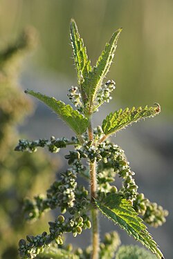 Kandali (Urtica dioica)
 -
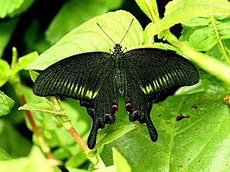 West Himalayan Common Peacock (Papilio bianor polyctor)
 -
 Paiyya (Prunus cerasoides)
 -
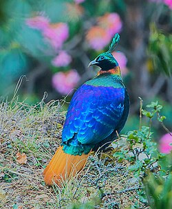 Himalayan Monal (Lophophorus impejanus)
_Babai_River.jpg)
.jpg)


.jpg)
Demographics
| Year | Pop. | ±% |
|---|---|---|
| 1901 | 1,979,866 | — |
| 1911 | 2,142,258 | +8.2% |
| 1921 | 2,115,984 | −1.2% |
| 1931 | 2,301,019 | +8.7% |
| 1941 | 2,614,540 | +13.6% |
| 1951 | 2,945,929 | +12.7% |
| 1961 | 3,610,938 | +22.6% |
| 1971 | 4,492,724 | +24.4% |
| 1981 | 5,725,972 | +27.4% |
| 1991 | 7,050,634 | +23.1% |
| 2001 | 8,489,349 | +20.4% |
| 2011 | 10,086,292 | +18.8% |
| Source: Census of India[78][79] | ||
The native people of Uttarakhand are generally called Uttarakhandi and sometimes specifically either Garhwali or Kumaoni depending on their place of origin in either the Garhwal or Kumaon region. According to the 2011 Census of India, Uttarakhand has a population of 10,086,292 comprising 5,137,773 males and 4,948,519 females, with 69.77% of the population living in rural areas. The state is the 20th most populous state of the country having 0.83% of the population on 1.63% of the land. The population density of the state is 189 people per square kilometre having a 2001–2011 decadal growth rate of 18.81%. The gender ratio is 963 females per 1000 males.[80][81][82] The crude birth rate in the state is 18.6 with the total fertility rate being 2.3. The state has an infant mortality rate of 43, a maternal mortality rate of 188 and a crude death rate of 6.6.[83]
Social groups
Uttarakhand has a multiethnic population spread across two geocultural regions: Garhwal, and Kumaon, including members of the native Garhwali and Kumaoni communities as well as migrant groups, dominated by the Rajput-Brahmin hegemony.[84] Rajputs (of various clans) constitute around 35% of the state's population, followed by Brahmins at 20% to 25%,[84][85] According to a 2007 study by Centre for the Study of Developing Societies, Uttarakhand has the highest percentage of Brahmins of any state in India, with approximately 20% of the population.[86] Uttarakhand is among the few Indian states where the historic Upper Caste forms a major share of the population.[86]
Of the rest 18.3% of the population is classified as Other Backward Classes (OBCs) Gurjars majorly.[87][88][89][90][91] 18.76% of the population belongs to the Scheduled Castes (an official term for the lower castes in the traditional caste system in India).[82] Scheduled Tribes such as the Jaunsaris, Bhotiyas, Tharus, Buksas, Rajis, Jads, and Banrawats constitute 2.89% of the population.[82] Several non-scheduled tribal groups such as Shaukas and Gurjars are also found here.[92] Van Gurjars (found in Shivalik hills) and Bhotiya are nomadic tribes while Jaunsaris are completely settled tribe.[92][93][94]
Languages
The official language of Uttarakhand is Hindi,[5] which according to the 2011 census is spoken natively by 43% of the population,[95] and is also used throughout the state as a lingua franca.
The major regional languages of Uttarakhand are Garhwali, which according to the 2011 census is spoken by 23% of the population, mostly in the western half of the state, Kumaoni, spoken in the eastern half and native to 20%, and Jaunsari, whose speakers are concentrated in Dehradun district in the southwest and make up 1.3% of the state's population. These three languages are closely related, with Garhwali and Kumaoni in particular making up the Central Pahari language subgroup. The languages have been part of various scattered conservation efforts due to their active decline beginning in the later quarter of the 20th century. The decline is hypothesized to be the result of heavy state-sponsored promotion of Hindi as the official language.[96]
All the languages enumerated so far belong to the Indo-Aryan family. Apart from a few other minority Indo-Aryan languages, like Buksa Tharu and Rana Tharu (of Udham Singh Nagar district in the south-east), Mahasu Pahari (found in Uttarkashi in the north-west), and Doteli,[97] Uttarakhand is also home to a number of indigenous Sino-Tibetan languages, most of which are spoken in the north of the state. These include Jad (spoken in Uttarkashi district in the north-west), Rongpo (of Chamoli district), and several languages of Pithoragarh district in the north-east: Byangsi, Chaudangsi, Darmiya, Raji and Rawat.[98] Another indigenous Sino-Tibetan language, Rangas, became extinct by the middle of the 20th century. Additionally, two non-indigenous Sino-Tibetan languages are also represented: Kulung (otherwise native to Nepal) and Tibetan.[97]
The Indian classical language Sanskrit has been declared a second official language,[99][100] by the BJP government for its allegedly historic association with the region.
There are also sizeable populations of speakers of some of India's other major languages: Urdu (4.2%) and Punjabi (2.6%), both mostly found in the southern districts, Bengali (1.5%) and Bhojpuri (0.95%), both mainly present in Udham Singh Nagar district in the south-east, and Nepali (1.1%, found throughout the state, but most notably in Dehradun and Uttarkashi).[95]
| Uttarakhand: mother-tongue of population, according to the 2011 Census.[95] | |||
|---|---|---|---|
| Mother tongue code | Mother tongue | People | Percentage |
| 002007 | Bengali | 150,893 | 1.5% |
| 006102 | Bhojpuri | 95,330 | 0.9% |
| 006195 | Garhwali | 2,322,406 | 23.0% |
| 006240 | Hindi | 4,373,951 | 43.4% |
| 006265 | Jaunsari | 135,698 | 1.3% |
| 006340 | Kumaoni | 2,011,286 | 19.9% |
| 006439 | Pahari | 16,984 | 0.2% |
| 010014 | Tharu | 48,286 | 0.5% |
| 013071 | Marathi | 5,989 | 0.1% |
| 014011 | Nepali | 106,394 | 1.1% |
| 016038 | Punjabi | 263,258 | 2.6% |
| 022015 | Urdu | 425,461 | 4.2% |
| 031001 | Bhoti | 9,207 | 0.1% |
| 046003 | Halam | 5,995 | 0.1% |
| 053005 | Gujari | 9,470 | 0.1% |
| 115008 | Tibetan | 10,125 | 0.1% |
| – | Others | 95,559 | 0.9% |
| Total | 10,086,292 | 100.0% | |
Religion
More than four-fifths of Uttarakhand's residents are Hindus.[32] Muslims, Sikhs, Christians, Buddhists, and Jains make up the remaining population, with the Muslims being the largest minority.[32] Hill regions are almost entirely Hindu, while the plains regions have a significant minority of Muslims and Sikhs.[82]
Administrative divisions

Uttarakhand is divided into 13 districts under two divisions viz. Kumaon and Garhwal. Each division is administered by a divisional commissioner. Four new districts named Didihat, Kotdwar, Ranikhet, and Yamunotri were declared by then Chief Minister of Uttarakhand, Ramesh Pokhriyal, on 15 August 2011 but yet to be officially formed.[102]
Template:Sort underTemplate:Row hover highlight
| Division | Districts | Population (as of 2011)[95] |
|---|---|---|
| rowspan=7 Template:Vert header | Chamoli | 391,605 |
| Dehradun | 1,696,694 | |
| Pauri Garhwal | 687,271 | |
| Rudraprayag | 242,285 | |
| Tehri Garhwal | 618,931 | |
| Uttarkashi | 330,086 | |
| Haridwar | 1,890,422 | |
| Garhwal division total | 5,857,294 | |
| rowspan=6 Template:Vert header | Almora | 622,506 |
| Bageshwar | 259,898 | |
| Champawat | 259,648 | |
| Nainital | 954,605 | |
| Pithoragarh | 483,439 | |
| Udham Singh Nagar | 1,648,902 | |
| Kumaon division total | 4,229,998 | |
| Uttarakhand state total | 10,087,292 | |
Each district is administered by a district magistrate. The districts are further divided into sub-divisions, which are administered by sub-divisional magistrates; sub-divisions comprise tehsils which are administered by a tehsildar and community development blocks, each administered by a block development officer.[citation needed]
Urban areas are categorised into three types of municipalities based on their population; municipal corporations, each administered by a municipal commissioner, municipal councils and, nagar panchayats (town councils), each of them administered by a chief executive officer. Rural areas comprise the three tier administration; district councils, block panchayats (block councils) and gram panchayats (village councils).[citation needed] All state and local government offices have a five-year term.
According to the 2011 census, Dehradun, and Udham Singh Nagar are the most populous districts, each of them having a population of over one million.[81]
Government and administration
Following the Constitution of India, Uttarakhand, like all Indian states, has a parliamentary system of representative democracy. The Legislative Assembly is unicameral consists of 70 members who are elected for five-year terms.[103] Assembly meetings are presided over by the Speaker, or the Deputy Speaker in the Speaker's absence. The Uttarakhand Council of Ministers is appointed by the Governor of Uttarakhand on the advice of the Chief Minister of Uttarakhand and reports to the Legislative Assembly. Leader of the Opposition leads the Official Opposition in the Legislative Assembly. The state contributes five seats to Lok Sabha, the lower house of the Indian Parliament, and three seats to Rajya Sabha, the upper house.[104]
The Government of Uttarakhand is a democratically elected body in India with the governor as its constitutional head and is appointed by the president of India for a five-year term. The leader of the party or coalition with a majority in the Legislative Assembly is appointed as the chief minister by the governor, and the council of ministers is appointed by the governor on the advice of the chief minister. The governor remains a ceremonial head of the state, while the chief minister and his council are responsible for day-to-day government functions. The Council of Ministers consists of Cabinet Ministers and Ministers of State (MoS). The Secretariat headed by the Chief Secretary assists the council of ministers. The Chief Secretary is also the administrative head of the government. Each government department is headed by a minister, who is assisted by an Additional Chief Secretary or a Principal Secretary, who is usually an officer of Indian Administrative Service (IAS), the Additional Chief Secretary/Principal Secretary serves as the administrative head of the department they are assigned to. Each department also has officers of the rank of Secretary, Special Secretary, Joint Secretary etc. assisting the Minister and the Additional Chief Secretary/Principal Secretary.
For administration, the state is divided into two divisions and 13 districts. Divisional Commissioner, an IAS officer is the head of administration on the divisional level. The administration in each district is headed by a District Magistrate, who is also an IAS officer, and is assisted by several officers belonging to state services. District Magistrate being the head of the district administration, is responsible for maintaining law and order and providing public services in the district. At the block level, the Block Development Officer (BDO) is responsible for the overall development of the block. The Uttarakhand Police is headed by an IPS officer of the rank of Director general of police. A Superintendent of Police, an IPS officer assisted by the officers of the Uttarakhand Police Service, is entrusted with the responsibility of maintaining law and order and related issues in each district. The Divisional Forest Officer, an officer belonging to the Indian Forest Service manages the forests, environment, and wildlife of the district, assisted by the officers of Uttarakhand Forest Service and Uttarakhand Forest Subordinate Service.
The judiciary in the state consists of the Uttarakhand High Court in Nainital, district courts and session courts in each district or Sessions Division, and lower courts at the tehsil level. The president of India appoints the chief justice of the High Court of the Uttarakhand judiciary on the advice of the Chief Justice of the Supreme Court of India as well as the governor of Uttarakhand . Subordinate Judicial Service, categorised into two divisions viz. Uttarakhand civil judicial services and Uttarakhand higher judicial service are another vital part of the judiciary of Uttarakhand . While the Uttarakhand civil judicial services comprise the Civil Judges (Junior Division)/Judicial Magistrates and civil judges (Senior Division)/Chief Judicial Magistrate, the Uttarakhand higher judicial service comprises civil and sessions judges.[105]
The State Politics is heavily dominated by the Bharatiya Janata Party (BJP) since 2017 with the Indian National Congress as the chief Opposition.
Culture
Architecture and crafts
-
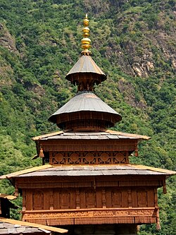 Mahasu Devta Temple at Hanol, notable for its traditional wooden architecture
 -
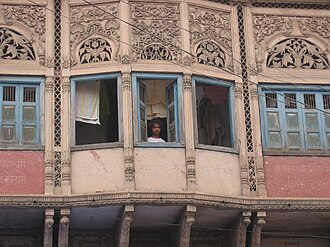 Architectural details of a Dharamshala, established 1822, Haridwar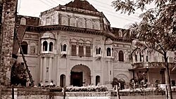
Rang Mahal Landhaura -
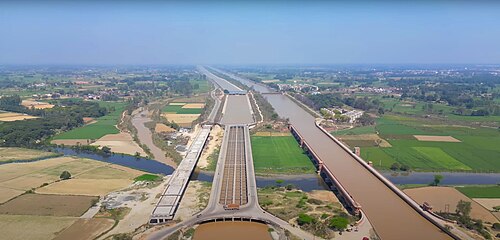
-
 The releasing of the Uttaranchal crafts map


Among the prominent local crafts is wood carving known as Likhai, which appears most frequently in the ornately decorated temples of the Kumaon region in Uttarakhand. Intricately carved designs of floral patterns, deities, and geometrical motifs also decorate the doors, windows, ceilings, and walls of village houses. Paintings and murals are used to decorate both houses and temples.

Garwhali Miniature painting is a form of miniature painting that flourished in the region between the 17th and 19th century. Mola Ram is credited as the true father of the Garhwali Branch of the wider Pahari School. Kumaoni art often is geometrical in nature, while Garhwali art is known for its closeness to nature.
Aipan is a GI certified Kumaoni ritual folk art[106] done mainly during special ceremonies, the festival of Diwali, marriages and other religious rituals. Its predominantly female practitioners believe that it invokes a divine power which brings about good fortune and deters evil. The art is special as it is done on empty walls, which are brick-red in colour, called geru. The actual art is done with a white paste made of rice flour.[107]
Jyuti patta is a class of water color paintings done on rituals, called Jyuti. Some scholars also consider Jyuti to be synonymous with the word mother of the world. To give concrete form to the deity, two-dimensional geometry is given expression in the form of frescoes. This is a geometric or decorative semi-graphic structure in which different colours and symbols are used. This structure called Jyuti also gets a new dimension by the use of ochre or biswar of Tepan. Jyunti is prepared on the surface of wall or paper and the composition is given with cotton and a brush of limiter. In this artform, various qualities of a specific deity are shown.[108]
Other crafts of Uttarakhand include handcrafted gold jewellery, basketry from Garhwal, woollen shawls, scarves, and rugs. The latter are mainly produced by the Bhotiyas of northern Uttarakhand.[citation needed]
Arts and literature

Uttarakhand's diverse ethnicities have created a rich literary tradition in languages including Hindi, Garhwali, Kumaoni, Jaunsari, and Tharu. Many of its traditional tales originated in the form of lyrical ballads and chanted by itinerant singers and are now considered classics of Hindi literature. Abodh Bandhu Bahuguna, Badri Datt Pandey, Ganga Prasad Vimal; Mohan Upreti, Naima Khan Upreti, Prasoon Joshi, Shailesh Matiyani, Shekhar Joshi, Shivani, Taradutt Gairola, Tom Alter; Lalit Kala Akademi fellow – Ranbir Singh Bisht; Sangeet Natak Akademi Awardees – B. M. Shah, Narendra Singh Negi; Sahitya Akademi Awardees – Leeladhar Jagudi, Shivprasad Dabral Charan, Manglesh Dabral, Manohar Shyam Joshi, Ramesh Chandra Shah, Ruskin Bond and Viren Dangwal; Jnanpith Awardee and Sahitya Akademi fellow Sumitranandan Pant are some major literary, artistic and theatre personalities from the state. prominent philosophers, Indian independence activists and social-environmental activists; Anil Prakash Joshi, Basanti Devi, Gaura Devi, Govind Ballabh Pant, Chandi Prasad Bhatt, Deep Joshi, Hargovind Pant, Kalu Singh Mahara, Kunwar Singh Negi, Mukandi Lal, Nagendra Saklani, Sri Dev Suman, Ram Prasad Nautiyal, Sunderlal Bahuguna and Vandana Shiva are also from Uttarakhand.[citation needed]
Cuisine

The primary food of Uttarakhand is vegetables with wheat being a staple, although non-vegetarian food is also served. A distinctive characteristic of Uttarakhand cuisine is the sparing use of tomatoes, milk, and milk-based products.
Coarse grain with high fibre content is very common in Uttarakhand due to the harsh terrain. Crops most commonly associated with Uttarakhand are Buckwheat (locally called Kotu or Kuttu) and the regional crops, Maduwa and Jhangora, particularly in the interior regions of Kumaon and Garhwal. Generally, either Desi Ghee or Mustard oil is used for the purpose of cooking food. Simple recipes are made interesting with the use of hash seeds Jakhya as spice, chutney made of Bhang is also a regional cuisine.
Bal Mithai is a popular fudge-like sweet. Other popular dishes include Dubuk, Chains, Kap, Bhatiya, Jaula, Phana, Paliyo, Chutkani and Sei. In sweets; Swal, Ghughut/Khajur, Arsa, Mishri, Gatta and Gulgulas are popular.
Many regional variations of Kadhi called Jhoi or Jholi is also popular.[109] Another staple of the Kumaon region is a black soybean dal referred to as Bhatt or chudkani. A grinded dal chaisu is also popular in the Garhwal region.
The state has a predominant non-vegetarian population, with some estimates suggesting 75% of the population being non-vegetarian. Various boar, chicken, mutton and hare recipes are popular in the region. A popular mutton dish bhutwa, is made from goat intestine and other offcuts.
Dances and music

The dances of the region are connected to life and human existence and exhibit myriad human emotions. Langvir Nritya is a dance form for males that resembles gymnastic movements. Barada Nati folk dance is another dance of Jaunsar-Bawar, which is practised during some religious festivals. Other well-known dances include Hurka Baul, Jhora-Chanchri, Chhapeli, Thadya, Jhumaila, Pandav, Chauphula, and Chholiya.[110][111]
Music is an integral part of the Uttarakhandi culture. Popular types of folk songs include Mangal, Basanti, Khuder and Chhopati.[112] These folk songs are played on instruments including Dhol, Damau, Turri, Ransingha, Dholki, Daur, Thali, Bhankora, Mandan and Mashakbaja. "Bedu Pako Baro Masa" is a popular folk song of Uttarakhand with international fame and legendary status within the state. It serves as the cultural anthem of Uttarakhandi people worldwide.[113][114]
Music is also used as a medium through which the gods are invoked. Jagar is a form of spirit worship in which the singer, or Jagariya, sings a ballad of the gods, the ballads evoke local deities with allusions to great epics, like Mahabharat and Ramayana, that describe the adventures and exploits of the god being invoked.
B. K. Samant, Basanti Bisht, Chander Singh Rahi, Girish Tiwari 'Girda', Gopal Babu Goswami, Heera Singh Rana, Jeet Singh Negi, Meena Rana, Mohan Upreti, Narendra Singh Negi and Pritam Bhartwan are popular folk singers and musicians from the state, so are Bollywood singer Jubin Nautiyal and country singer Bobby Cash.[115]
Fairs and festivals
The festivals of Kumbh Mela at Haridwar, Ramlila, Ramman of Garhwal, the traditions of Vedic chantings and Yoga are included in the list of Intangible cultural heritage of the UNESCO.[116][117][118][119][120]
- Kumauni Holi, in forms including Baithki Holi, Khari Holi, and Mahila Holi, all of which start from Vasant Panchami, are festivals and musical affairs that can last almost a month.[citation needed]
- Almora Dussehra is a regional variant of Dussehra, dating back to 1936. It is distinct for burning fifteen distinct effigies, each representing the members of the Hindu mythological villain Ravana's entire bloodline. The effigies are all ornate and exquisitely designed. They are paraded through the city of Almora before finally being set on fire to symbolise the triumph of good over evil.[121]
- Ramman is an agro-religious festival and ritual masked theatre endemic to the Garhwali People in the Saloor Dungra village of the Painkhanda Valley in the Chamoli district. The festival serves as an offering to the village deity, Bhumichetrapal or Bhumiyal Devta, in the courtyard of the village temple. Every day of the festival, the Devta takes a round of the village. The festival lasts for ten days during which time the local epic of Rama is sung and masked dances depicting different aspects of life take place in the courtyard of the Bhumiyal Devta's temple.

- Haridwar Kumbh Mela, one of the major Hindu pilgrimages, takes place in Uttarakhand. Haridwar is one of the four places in India where this mela is organised. Haridwar most recently hosted the Purna Kumbh Mela from Makar Sankranti (14 January 2010) to Vaishakh Purnima Snan (28 April 2010). Hundreds of foreigners joined Indian pilgrims in the festival, which is considered the largest religious gathering in the world.[122]
- Phool-Dei is a folk festival which welcomes the spring season in the state. The festival is celebrated on the first day of the Hindu month, Chaitra. In some places, the festival is celebrated as carnival and the celebration goes on for a month. The term 'Dei' refers to a ceremonial pudding which is the key food in this festival that is made from jaggery. White flour and curd are also offered. Young children gather together and go to every house in their village/towns with plates full of rice, jaggery, coconut, green leaves, and flowers. In return, they are presented with blessings and gifts like sweets, jaggery, and money. The wishing and blessing part also include placing flowers and rice on the doorsteps of the houses by the children. People of village sing and dance on their folk songs to celebrate the festival of spring along with exchanging wishes for well-being and prosperity of their family and relatives.
- Harela is a kumaoni festival hypothesized to date back to the indigenous population. 10–11 days before the Sankranti of Shravan, a bed is made by adding soil in bamboo pots etc. Grains grown during the rainy season like paddy, maize, urad etc. are sown, this is called Hariyala. Harakali Mahotsav, Idols of Gauri Maheshwar, Ganesha and Karkitkeya are made from clay, coloured in them and worshiped with various fruits, flowers, dishes and sweets in a bed of greenery on the night of the month of Sanat. On the second day, the Harela of Uttarang Puja is placed on the head. Sisters and daughters-in-law apply tilak and tilak and put Harela on their heads. They are given gifts.[123]
- Ganga Dussehra, Vasant Panchami, Makar Sankranti, Ghee Sankranti, Khatarua, Vat Savitri, and Phul Dei (The festival of spring) are other major festivals. In addition, various fairs like Kanwar Yatra, Kandali Festival, Ramman, Kauthig, Nauchandi Mela, Giddi Mela, Uttarayani Mela and Nanda Devi Raj Jat take place.
Economy

The Uttarakhand state is the second fastest growing state in India.[124] Its gross state domestic product (GSDP) (at constant prices) more than doubled from ₹24,786 crore in FY2005 to ₹60,898 crore in FY2012. The real GSDP grew at 13.7% (CAGR) during the FY2005–FY2012 period. The contribution of the service sector to the GSDP of Uttarakhand was just over 50% during FY 2012. Per capita income in Uttarakhand is ₹ 198738 (FY 2018–19), which is higher than the national average of ₹ 126406 (FY 2018–19).[125][126] According to the Reserve Bank of India, the total foreign direct investment in the state from April 2000 to October 2009 amounted to US$46.7 million.[127]
Like most of India, agriculture is one of the most significant sectors of the economy of Uttarakhand. Basmati rice, wheat, soybeans, groundnuts, coarse cereals, pulses, and oil seeds are the most widely grown crops. Fruits like apples, oranges, pears, peaches, lychees, and plums are widely grown and important to the large food processing industry. Agricultural export zones have been set up in the state for lychees, horticulture, herbs, medicinal plants, and basmati rice. During 2010, wheat production was 831 thousand tonnes and rice production was 610 thousand tonnes, while the main cash crop of the state, sugarcane, had a production of 5058 thousand tonnes. As 86% of the state consists of hills, the yield per hectare is not very high. 86% of all croplands are in the plains while the remaining is from the hills.[128] The state also holds the GI tag for Tejpatta (Cinnamomum tamala) or Indian bay leaf, which is known to add flavour to dishes and also possesses several medicinal properties.[129]
| Economy of Uttarakhand at a Ggance[130]
(figures in crores of Indian rupees) | |
| Economy at a glance (FY-2012) | In Indian rupees |
|---|---|
| GSDP (current) | ₹95,201 |
| Per capita income | ₹103,000 |
Other key industries include tourism and hydropower, and there is prospective development in IT, ITES, biotechnology, pharmaceuticals and automobile industries. The service sector of Uttarakhand mainly includes tourism, information technology, higher education, and banking.[128]
During 2005–2006, the state successfully developed three Integrated Industrial Estates (IIEs) at Haridwar, Pantnagar, and Sitarganj; Pharma City at Selakui; Information Technology Park at Sahastradhara (Dehradun); and a growth centre at Sigaddi (Kotdwar). Also in 2006, 20 industrial sectors in public private partnership mode were developed in the state.[131]
Transportation
Uttarakhand has 2,683 km (1,667 mi) of roads, of which 1,328 km (825 mi) are national highways and 1,543 km (959 mi) are state highways.[131] The state has 14 national highways, comprising 2.2% of the total national highways length in India.[132] The Uttarakhand Transport Corporation (UTC), established on 31 October 2003 after reorganizing the State Road Transport Corporation (SRTC). The corporation provides transportation in the state with connecting services to adjoining states. The UTC buses are the most common and affordable mode of transportation in Uttarakhand. As of 2012, approximately 1000 buses are being plied by the UTC on 35 nationalised routes along with many other non-nationalised routes. There are also private transport operators operating approximately 3000 buses on non-nationalised routes along with a few interstate routes in Uttarakhand and the neighbouring state of Uttar Pradesh.[133] For travelling locally, the state, like most of the country, has auto rickshaws and cycle rickshaws. In addition, remote towns and villages in the hills are connected to important road junctions and bus routes by share mode of transportation.[citation needed]
As over 86% of state's terrain consists of hills, railway services are very limited in the state and are largely confined to the plains. In 2011, the total length of railway tracks was about 345 km (214 mi).[131] The most important railway station in Kumaun Division of Uttarakhand is at Kathgodam. Kathgodam is the last terminus of the broad-gauge line of North East Railways that connects Nainital with Delhi, Dehradun, and Howrah. Other notable railway stations are at Pantnagar, Lalkuan and Haldwani. Dehradun railway station is a railhead of the Northern Railways.[134] Haridwar station is situated on the Delhi–Dehradun and Howrah–Dehradun railway lines. One of the main railheads of the Northern Railways, Haridwar Junction Railway Station is connected by broad gauge line. Roorkee comes under Northern Railway region of Indian Railways on the main Punjab – Mughal Sarai trunk route and is connected to major Indian cities. Other railheads are Rishikesh, Kotdwar and Ramnagar linked to Delhi by daily trains.[citation needed]
Jolly Grant Airport in Dehradun and Pantnagar Airport in Pantnagar are the major airports and the main gateway to the state. Jolly Grant Airport is the busiest airport in the state with six daily flights to Delhi Airport. Pantnagar Airport of the Kumaon region have 1 daily air service to Delhi and return too. The state has also proposed creating the Naini Saini Airport in Pithoragarh,[135] Bharkot Airport in Chinyalisaur in Uttarkashi district and Gauchar Airport in Gauchar, Chamoli district.
Tourism
-

-
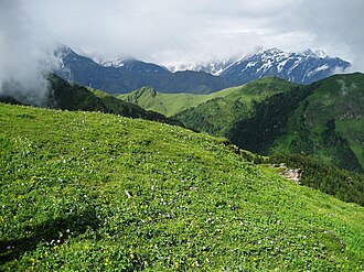 View of a Bugyal (meadow) in Uttarakhand
 -
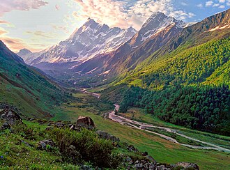 Har Ki Doon, a high-altitude hanging valley
 -
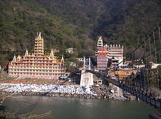
-
 Kedarnath Temple is one of the 12 Jyotirlingas


Uttarakhand has many tourist spots due to its location in the Himalayas. There are many ancient temples, forest reserves, national parks, hill stations, and mountain peaks that draw large number of tourists. There are 44 nationally protected monuments in the state.[136] Oak Grove School in the state is on the tentative list for World Heritage Sites.[137] Two of the most holy rivers in Hinduism the Ganges and Yamuna, originate in Uttarakhand. Binsar Devta is a popular Hindu temple in the area.[138][139]
Uttarakhand has long been called "Land of the Gods"[59] as the state has some of the holiest Hindu shrines, and for more than a thousand years, pilgrims have been visiting the region in the hopes of salvation and purification from sin. Gangotri and Yamunotri, the sources of the Ganges and Yamuna, dedicated to Ganga and Yamuna respectively, fall in the upper reaches of the state and together with Badrinath (dedicated to Vishnu) and Kedarnath (dedicated to Shiva) form the Chota Char Dham, one of Hinduism's most spiritual and auspicious pilgrimage circuits. Haridwar, meaning "Gateway to the God", is a prime Hindu destination. Haridwar hosts the Haridwar Kumbh Mela every twelve years, in which millions of pilgrims take part from all parts of India and the world. Rishikesh near Haridwar is known as the preeminent yoga centre of India. The state has an abundance of temples and shrines, many dedicated to local deities or manifestations of Shiva and Durga, references to many of which can be found in Hindu scriptures and legends.[140] Uttarakhand is, however, a place of pilgrimage for the adherents of other religions too. Piran Kaliyar Sharif near Roorkee is a pilgrimage site to Muslims, Gurudwara Darbar Sahib, in Dehradun, Gurudwara Hemkund Sahib in Chamoli district, Gurudwara Nanakmatta Sahib in Nanakmatta and Gurudwara Reetha Sahib in Champawat district are pilgrimage centres for Sikhs. Tibetan Buddhism has also made its presence with the reconstruction of Mindrolling Monastery and its Buddha Stupa, described as the world's highest at Clement Town, Dehradun.[141][142]
Auli and Munsiari are well-known skiing resorts in the state.[143]
The state has 12 national parks and wildlife sanctuaries, which cover 13.8% of the total area of the state.[144] They are located at different altitudes varying from 800 to 5400 metres. The oldest national park on the Indian sub-continent, Jim Corbett National Park, is a major tourist attraction.[70]

Vasudhara Falls, near Badrinath, is a waterfall with a height of 122 metres (400 ft) set in a backdrop of snow-clad mountains.[145] The state has always been a destination for mountaineering, hiking, and rock climbing in India. A recent development in adventure tourism in the region has been whitewater rafting in Rishikesh. Due to its proximity to the Himalaya ranges, the place is full of hills and mountains and is suitable for trekking, climbing, skiing, camping, rock climbing, and paragliding.[146] Roopkund is a trekking site, known for the mysterious skeletons found in a lake, which was featured by National Geographic Channel in a documentary.[147] The trek to Roopkund passes through the meadows of Bugyal.[citation needed]
New Tehri city has Tehri Dam, with a height of 260.5 metres (855 ft) is the tallest dam in India. It is currently ranked No 10 on the List of Tallest Dams in the world. Tehri Lake with a surface area of 52 km2 (20 sq mi), is the biggest lake in the state of Uttarakhand. It has good options for Adventure Sports and various water sports like Boating, Banana Boat, Bandwagon Boat, Jet Ski, Water Skiing, Para-sailing, Kayaking.[citation needed]
Education
The educational system prevailing in the state's schools specifies an initial 10-year course of study, which is divided into three stages: lower primary, upper primary, and secondary school—known as 4+3+3, which signifies the number of years for each stage. After the first 10 years of schooling, students typically enroll in Higher Secondary Schooling in one of the three major streams—liberal arts, commerce, or science. Upon completing the required coursework, students can enroll in general or professional undergraduate (UG) degree-college programmes. Schools in the state are either managed by the government or by private trusts. The majority of public schools are affiliated with the Uttarakhand Board of School Education (UBSE) use Hindi as a medium of instruction. Private schools in Uttarakhand—which use English as the language of instruction—are affiliated to one of three administering bodies, CBSE, CISCE, or ICSE.
Uttarakhand has more than 20 universities, including one central university, twelve state universities, three deemed universities, one IIT in Roorkee, one IIM in Kashipur and an AIIMS in Rishikesh. Inaugurated by Jawahar Lal Nehru in 1960, G.B. Pant University of Agriculture and Technology, provides research and training in agriculture and engineering. Located in Bharsar and Ranichauri, Veer Chandra Singh Garhwali Uttarakhand University of Horticulture and Forestry, is a state agricultural university and has two campuses, one is in Bharsar town of Pauri Garhwal district and other is in Ranichauri town of Tehri Garhwal district. Kumaun University; located in Nainital, is one of the oldest universities in the region.
Uttarakhand is home to some of premier institutes of India that hold the status of national importance due to their significant contributions to education, research, and national development. Founded in 1906, Forest Research Institute (FRI) is the oldest institutions of its kind. Its campus hosts the Indira Gandhi National Forest Academy (IGNFA), the staff college that trains officers selected for the Indian Forest Service (IFS). Located in Dehradun, The Doon School has been consistently ranked as the best all-boys residential school in India. Established in 1959, Lal Bahadur Shastri National Academy of Administration (LBSNA), Mussoorie, trains civil servants for the Indian Administrative Service (IAS). The Indian Military Academy (IMA), is officer training academy for the Indian Army. The academy trains officer cadets for the Permanent Commission into the Army.
Sports

Due to its mountainous terrain and rivers, Uttarakhand attract tourists and adventure seekers for adventure sports, such as paragliding, sky diving, rafting and bungee jumping.[148] Uttarakhand is home to some of the highest peaks in India, including Nanda Devi and Tirsuli, popular for mountaineering expeditions and climbing activities. Traditional sports Mallakhamb (pole gymnastics), Gatka (a form of martial arts) and Gulli Danda (similar to cricket) are preserved, are preserved but have limited exposure. More recently, golf has also become popular with Ranikhet being a favorite destination.[citation needed]
The Cricket Association of Uttarakhand is the governing body for cricket activities. The Uttarakhand cricket team represents Uttarakhand in Ranji Trophy, Vijay Hazare Trophy and Syed Mushtaq Ali Trophy. Rajiv Gandhi International Cricket Stadium in Dehradun is the home ground of Uttarakhand cricket team.[citation needed] Uttarakhand has state-level associations for various sports that organize tournaments and promote talent development.
The Uttarakhand State Football Association is the governing body for association football. The Uttarakhand football team represents Uttarakhand in the Santosh Trophy and other leagues. The Indira Gandhi International Sports Stadium in Haldwani is the home ground of Uttarakhand football team.[citation needed]
Notable people
See also

- Outline of Uttarakhand
- Himalayan states
- Indian Himalayan Region
- Mountain Temples and Temple Mountains
References
- ↑ "Now Uttarakhand Will Sing Its Own Official Song". The Times of India. 6 February 2016. Archived from the original on 26 October 2020. Retrieved 12 November 2018.
- ↑ "Population of Indian states 2025 - StatisticsTimes.com". statisticstimes.com. Retrieved 23 May 2025.
- ↑ "Pushkar Singh Dhami: BJP's Pushkar Singh Dhami to be next Uttarakhand chief minister". 4 July 2021. Archived from the original on 2 October 2022. Retrieved 4 July 2021.
- ↑ 4.0 4.1 4.2 "Macro and Fiscal Landscape of the State of Uttarakhand" (PDF). Niti Ayog. Retrieved 20 May 2025.
- ↑ 5.0 5.1 "Report of the Commissioner for linguistic minorities: 50th report (July 2012 to June 2013)" (PDF). Commissioner for Linguistic Minorities, Ministry of Minority Affairs, Government of India. Archived from the original (PDF) on 8 July 2016. Retrieved 4 December 2016.
- ↑ Trivedi, Anupam (19 January 2010). "Sanskrit is second official language in Uttarakhand". Hindustan Times. Archived from the original on 1 February 2012. Retrieved 30 August 2017.
- ↑ "Sanskrit second official language of Uttarakhand". The Hindu. 21 January 2010. Archived from the original on 3 March 2018. Retrieved 30 August 2017.
- ↑ "Uttarakhand Budget Analysis 2025-26" (PDF). Archived from the original (PDF) on 14 May 2025.
- ↑ "MOSPI Gross State Domestic Product". Ministry of Statistics and Program Implementation, Government of India. 1 August 2019. Archived from the original on 26 April 2015. Retrieved 16 September 2019.
- ↑ "GDP per capita of Indian states - StatisticsTimes.com". statisticstimes.com. Archived from the original on 3 June 2021. Retrieved 17 April 2021.
- ↑ "Standard: ISO 3166 — Codes for the representation of names of countries and their subdivisions". Archived from the original on 17 June 2016. Retrieved 24 November 2023.
- ↑ "India: Subnational HDI". Global Data Labs. Retrieved 8 June 2025.
- ↑ "Literacy and education" (PDF). Archived (PDF) from the original on 19 August 2019. Retrieved 31 July 2025.
- ↑ "TNPSC Current Affairs | TNPSC Monthly Current Affairs".
- ↑ "Census 2011 (Final Data) – Demographic details, Literate Population (Total, Rural & Urban)" (PDF). planningcommission.gov.in. Planning Commission, Government of India. p. 4. Archived from the original (PDF) on 27 January 2018. Retrieved 3 October 2018.
- ↑ "State Symbols of Uttarakhand". Garhwal Mandal Vikas Nigam Limited. Archived from the original on 15 July 2013. Retrieved 1 April 2012.
- ↑ "State Fishes of India" (PDF). National Fisheries Development Board, Government of India. Archived (PDF) from the original on 10 October 2020. Retrieved 26 August 2020.
- ↑ Sharma, Nihi (1 December 2017). "To protect the endangered 'mahaseer' fish, Uttarakhand set to rope in fishermen". Hindustan Times. Archived from the original on 10 October 2020. Retrieved 26 August 2020.
- ↑ "Common Peacock Male Papilio Bianor Polyctor". Archived from the original on 8 January 2017. Retrieved 7 January 2017.
- ↑ "Uttarakhand To Declare Common Peacock As State Butterfly". Hindustan Times. 18 November 2016. Archived from the original on 2 January 2017. Retrieved 9 January 2017.
- ↑ "Uttarakhand State Signs | Uttarakhand State Tree". uttaraguide.com. 2012. Archived from the original on 7 November 2012. Retrieved 8 October 2012.
State Flower : Brahma Kamal
- ↑ Asian News International (16 June 2019). "Nanda Devi: Operation to retrieve bodies of missing mountaineers hampered by bad weather". India Today. Archived from the original on 2 October 2022. Retrieved 12 August 2019.
- ↑ "Definition of 'Uttaranchal'". Collins English Dictionary. Archived from the original on 30 July 2016. Retrieved 16 May 2021.
- ↑ "MSN". www.msn.com. Retrieved 21 April 2025.
- ↑ Bisht, Brijmohan (7 March 2013). "Lok Sabha Elections 2024 Uttarakhand - Lok Sabha Seats in Uttarakhand". www.euttaranchal.com. Retrieved 31 March 2025.
- ↑ "About Uttarakhand - Uttarakhand Tourism". uttarakhandtourism.net. 26 December 2023. Retrieved 31 March 2025.
- ↑ "Escape to Uttarakhand: Your Himalayan Getaway". Traveldreams. Retrieved 31 March 2025.
- ↑ 28.0 28.1 Kandari, O. P., & Gusain, O. P. (Eds.). (2001). Garhwal Himalaya: Nature, Culture & Society. Srinagar, Garhwal: Transmedia.
- ↑ Bahuguna, Vijay; Joshi, Maheshwar. "Prehistoric rock engravings and painting: New discoveries in Uttarakhand Himalaya". Archived from the original on 14 February 2024. Retrieved 14 February 2024.
{{cite journal}}: Cite journal requires|journal=(help) - ↑ Danish, Mohd (1 January 2022). "The Prehistoric Rock Shelter Paintings Of Lakhudiyar, Kumaon Uttarakhand, India-A Study". Zeichen JOURNAL. Archived from the original on 14 February 2024. Retrieved 14 February 2024.
- ↑ "Uttarakhand: ASI ने किया बड़ा खुलासा, लखुडियार की गुफाएं खोलेंगी आदि मानव कालीन रहस्य, यहां जानें सबकुछ". Amar Ujala (in हिन्दी). Archived from the original on 14 February 2024. Retrieved 14 February 2024.
- ↑ 32.0 32.1 32.2 "Uttarakhand". Encyclopædia Britannica, Inc. Archived from the original on 2 July 2012. Retrieved 17 July 2012.
- ↑ Saklani, D. P. (1998). Ancient communities of the Himalaya. New Delhi: Indus Pub. Co.
- ↑ Pāṇḍe, Badarīdatta (1993). History of Kumaun : English version of "Kumaon ka itihas". Shree Almora Book Depot. ISBN 81-900209-5-1. OCLC 645861049.
- ↑ Pande, B. D. (1993). History of Kumaun: English version of "Kumaun Ka Itihas". Almora, U.P., India: Shyam Prakashan: Shree Almora Book Depot.
- ↑ Rawat, A. S. (1989). History of Garhwal, 1358–1947: an erstwhile kingdom in the Himalayas. New Delhi: Indus Pub. Co.
- ↑ "Tareekh Gurjar Vol 5-تاریخ گرجر جلد پنجم.pdf". Google Docs. Retrieved 27 February 2025.
- ↑ 38.0 38.1 Chauhan, Rana Ali Hasan (1998). A Short History of the Gurjars: Past and Present. Chauhan Publications. ISBN 978-969-8419-00-4.
- ↑ Atkinson, Edwin Thomas (1875). Statistical, Descriptive and Historical Account of the North-Western Provinces of India: 2.:Meerut division part 1. North-Western Provinces Government.
- ↑ Raheja, Gloria Goodwin (June 1988). The Poison in the Gift: Ritual, Prestation, and the Dominant Caste in a North Indian Village. University of Chicago Press. ISBN 978-0-226-70728-0. Archived from the original on 17 June 2021. Retrieved 16 June 2021.
- ↑ "Nirvana India Enterprise". www.haridwartemple.com. Retrieved 28 February 2025.
- ↑ Murtaza, Mahnoor; Shad, Dr Elizabeth (5 March 2024). "An overview of Ada Jafri's Autobiography "Jo Rahi So Bekhabri Rahi"". Noor e Tahqeeq. 8 (1): 6–17. doi:10.54692/nooretahqeeq.2024.08012136. ISSN 2521-0157.
- ↑ Handa, O. C. (July 2009). Art & Architecture of Uttarakhand. Pentagon Press. ISBN 978-81-8274-417-2.
- ↑ Williams, George Robert Carlisle (1874). Historical and Statistical Memoir of Dehra Doon. Printed at the Thomason Civil Engineering College Press.
- ↑ Walton, h G. Ed (1911). Dehra Dun, a Gazetteer, vol.1.
- ↑ "Tareekh Gurjar Vol 5-تاریخ گرجر جلد پنجم.pdf". Google Docs. Retrieved 27 February 2025.
- ↑ Handa, O. C. (July 2009). Art & Architecture of Uttarakhand. Pentagon Press. ISBN 978-81-8274-417-2.
- ↑ Saklani, A. (1987). The history of a Himalayan princely state: change, conflicts and awakening: an interpretative history of princely state of Tehri Garhwal, U.P., A.D. 1815 to 1949 A.D. (1st ed.). Delhi: Durga Publications.
- ↑ Aggarwal, J. C., Agrawal, S. P., & Gupta, S. S. (Eds.). (1995). Uttarakhand: past, present, and future. New Delhi: Concept Pub. Co.
- ↑ Kumar, P. (2000). The Uttarakhand Movement: Construction of a Regional Identity. New Delhi: Kanishka Publishers.
- ↑ "HC quashes CBI report on Rampur Tiraha firing". The Times of India. 31 July 2003. Archived from the original on 20 October 2012. Retrieved 28 July 2012.
- ↑ Reorganisation Bill passed by UP Govt Archived 7 September 2009 at the Wayback Machine The Indian Express, 24 September 1998.
- ↑ Bhaskar, Arushi (9 November 2022). "Uttarakhand Foundation Day: The long struggle for the hill state". The Indian Express. Archived from the original on 31 December 2022. Retrieved 31 December 2022.
- ↑ Guha, R. (2000). The unquiet woods: ecological change and peasant resistance in the Himalaya (Expanded ed.). Berkeley, Calif.: University of California Press.
- ↑ Robbins, Paul (9 August 2004). Political Ecology: A Critical Introduction. Wiley. p. 194. ISBN 978-1-4051-0266-7. Archived from the original on 10 January 2016.
- ↑ Agarwal, Anil. "The Chipko Movement". India Today. Archived from the original on 23 August 2014. Retrieved 29 July 2012.
- ↑ Mishra, A., & Tripathi, (1978). Chipko movement: Uttaranchal women's bid to save forest wealth. New Delhi: People's Action/Gandhi Book House.
- ↑ "Chipko Movement, India". International Institute for Sustainable Development. Archived from the original on 21 March 2012. Retrieved 29 July 2012.
- ↑ 59.0 59.1 59.2 "Info about Uttarakhand". Nainital Tours & Package. Archived from the original on 25 November 2012. Retrieved 20 December 2012.
- ↑ Negi, S. S. (1991). Himalayan rivers, lakes, and glaciers. New Delhi: Indus Pub. Co.
- ↑ "Chardham to get rail connectivity; Indian Railways pilgrimage linking project to cost Rs 43.29k crore, India.com, 12-May-2017". Archived from the original on 6 November 2022. Retrieved 28 February 2023.
- ↑ Chard Dham Yatra Archived 12 May 2009 at the Wayback Machine – Govt. of Uttarakhand, Official website.
- ↑ Char Dham yatra kicks off as portals open – Hindustan Times
- ↑ "Destination Profiles of the Holy Char Dhams, Uttarakhand". 18 April 2013. Archived from the original on 9 March 2023. Retrieved 28 February 2023.
- ↑ Negi, S. S. (1995). Uttarakhand: land and people. New Delhi: MD Pub.
- ↑ 66.0 66.1 66.2 "Climate of Uttarakhand" (PDF). IMD Pune. Retrieved 28 June 2024.
- ↑ "Daily Weather Report For Uttarakhand" (PDF). Meteorological Centre, Dehradun. Retrieved 28 June 2024.
- ↑ "Uttarakhand Annual Plan 2011–12 Finalisation Meeting Between Hon'ble Dputy Chairman, Planning Commission & Hon'ble Chief Minister, Uttarakhand" (PDF). planningcommission.nic.in. Archived (PDF) from the original on 15 May 2012. Retrieved 3 July 2012.
- ↑ "Nanda Devi and Valley of Flowers National Parks". UNESCO. Archived from the original on 25 June 2012. Retrieved 3 July 2012.
- ↑ 70.0 70.1 "Wildlife Eco-Tourism in Uttarakhand" (PDF). uttarakhandforest.org. Archived from the original (PDF) on 23 November 2009. Retrieved 14 July 2012.
- ↑ Riley, Laura; William Riley (2005):208. Nature's Strongholds: The World's Great Wildlife Reserves. Princeton University Press. ISBN 0-691-12219-9.
- ↑ 72.0 72.1 K. P. Sharma (1998). Garhwal & Kumaon: A Guide for Trekkers and Tourists. Cicerone Press Limited. pp. 56–. ISBN 978-1-85284-264-2. Archived from the original on 3 June 2013. Retrieved 9 July 2012.
- ↑ "A Rare Visit of Ben Goose at Corbett". corbett-national-park.com. 11 May 2012. Archived from the original on 15 April 2015. Retrieved 15 April 2015.
- ↑ Kala, C.P. 2005. The Valley of Flowers; A newly declared World Heritage Site. Current Science, 89 (6): 919–920.
- ↑ Kala, C.P. 2004. The Valley of Flowers; Myth and Reality. International Book Distributors, Dehradun, India
- ↑ PTI (6 April 2021). "Indian Air Force Battles Uttarakhand Forest Blaze, 75 New Fires Reported". NDTV. Archived from the original on 6 April 2021. Retrieved 7 April 2021.
- ↑ Kumar, Ankit; Aswal, Sonali; Chauhan, Ashutosh; Semwal, Ruchi Badoni; Kumar, Abhimanyu; Semwal, Deepak Kumar (1 June 2019). "Ethnomedicinal Investigation of Medicinal Plants of Chakrata Region (Uttarakhand) Used in the Traditional Medicine for Diabetes by Jaunsari Tribe". Natural Products and Bioprospecting. 9 (3): 175–200. doi:10.1007/s13659-019-0202-5. PMC 6538708. PMID 30968350.
- ↑ "A - 2 DECADAL VARIATION IN POPULATION SINCE 1901" (PDF). Office of the Census Commissioner. Archived from the original (PDF) on 26 February 2022.
- ↑ "Census Population" (PDF), Census of India, Ministry of Finance India, archived from the original (PDF) on 19 December 2008, retrieved 18 December 2008
- ↑ "Uttarakhand Profile" (PDF). censusindia.gov.in. Archived (PDF) from the original on 19 September 2020. Retrieved 18 March 2020.
- ↑ 81.0 81.1 "Census of India-2011 (Uttarakhand)" (PDF) (in हिन्दी). Office of the Registrar General and Census Commissioner, India (ORGI). Archived (PDF) from the original on 25 November 2011. Retrieved 17 July 2012.
- ↑ 82.0 82.1 82.2 82.3 "Demography". Government of Uttarakhand. Archived from the original on 3 January 2012. Retrieved 17 July 2012.
- ↑ "Annual Health Survey 2010–2011 Fact Sheet" (PDF). Government of India. Archived (PDF) from the original on 18 October 2012. Retrieved 17 July 2012.
- ↑ 84.0 84.1 Bhardwaj, Ashutosh (15 February 2017). "Uttarakhand elections: Across the border; next door to UP, new caste calculus". The Indian Express. Archived from the original on 16 June 2023. Retrieved 16 June 2023.
- ↑ माहेश्वरी, सुधांशु (10 February 2022). "उत्तराखंड: जहां सिर्फ ब्राह्मण-ठाकुर जाति वाले CM बने, कांग्रेस क्यों खेल रही दलित कार्ड?". Aaj Tak (in हिन्दी). Archived from the original on 16 June 2023. Retrieved 16 June 2023.
- ↑ 86.0 86.1 "Brahmins in India". Outlook. 4 June 2007. Archived from the original on 31 May 2014. Retrieved 17 July 2012.
- ↑ Cātaka, Govinda (1990). Bhāratīya loka saṃskr̥ti kā sandarbha: Madhya Himālaya (in हिन्दी). Takshaśilā Prakāśana.
- ↑ Nauṭiyāla, Śivānanda (1988). Gaṛhvāla-darśana (in हिन्दी). Sulabha Prakāśana.
- ↑ Handbook of Social Welfare Statistics (PDF). 2018. p. 238. Archived (PDF) from the original on 18 January 2022. Retrieved 17 January 2022.
- ↑ "उत्तराखंड:21 विधानसभा क्षेत्रों में चलती है OBC की सियासत, भाजपा,कांग्रेस सहित सभी राजनीतिक दल आरक्षण की पैरवी पर उतरे". Hindustan (in हिन्दी). 11 August 2021. Archived from the original on 28 February 2022. Retrieved 27 February 2025.
- ↑ "The Pastoral Gujjar - A Study in Uttarakhand | Exotic India Art". www.exoticindiaart.com. Retrieved 27 February 2025.
- ↑ 92.0 92.1 "The Pastoral Gujjar - A Study in Uttarakhand | Exotic India Art". www.exoticindiaart.com. Retrieved 28 February 2025.
- ↑ Pal, Sanchari (3 September 2016). "Nomads of the Himalayas : A Fascinating Glimpse into the Rarely-Seen Forest World of the Van Gujjars". The Better India. Retrieved 28 February 2025.
- ↑ "Shepherds Of Uttarakhand". himalayashelter.com. Retrieved 28 February 2025.
- ↑ 95.0 95.1 95.2 95.3 "Table C-16 Population by Mother Tongue: Uttarakhand". www.censusindia.gov.in. Registrar General and Census Commissioner of India. Archived from the original on 9 August 2022. Retrieved 23 July 2022. Figures for Jaunsari also include speakers of Jaunpuri.
- ↑ Chatterjee, Garga (21 February 2016). "Why imposing Hindi on all is as bad an idea as insisting that India is a Hindu country". Scroll.in. Archived from the original on 3 October 2022. Retrieved 14 February 2024.
- ↑ 97.0 97.1 Eberhard, David M.; Simons, Gary F.; Fennig, Charles D., eds. (2019). "India – Languages". Ethnologue (22nd ed.). SIL International. Archived from the original on 1 April 2019.
- ↑ Sharma, S.R. (1993). "Tibeto-Burman Languages of Uttar Pradesh-- an Introduction". Bulletin of the Deccan College Research Institute. 53: 343–348. JSTOR 42936456.
- ↑ Trivedi, Anupam (19 January 2010). "Sanskrit is second official language in Uttarakhand". Hindustan Times. Archived from the original on 1 February 2012. Retrieved 30 August 2017.
- ↑ "Sanskrit second official language of Uttarakhand". The Hindu. 21 January 2010. Archived from the original on 3 March 2018. Retrieved 30 August 2017.
- ↑ "Population by religion community – 2011". Census of India, 2011. The Registrar General & Census Commissioner, India. Archived from the original on 25 August 2015.
- ↑ "Uttarakhand CM announces four new districts". Zee News. 15 August 2011. Archived from the original on 14 August 2012. Retrieved 1 July 2012.
- ↑ "Uttarakhand Legislative Assembly". legislativebodiesinindia.nic.in. Archived from the original on 9 April 2012. Retrieved 3 July 2012.
- ↑ "Our Parliament". Parliamentofindia.nic.in. Archived from the original on 9 July 2012. Retrieved 3 July 2012.
- ↑ "Justice Malimath to be acting CJ of U'khand HC". The Times of India. 18 July 2020. Archived from the original on 28 July 2020. Retrieved 28 July 2020.
- ↑ "GI tag for 7 indigenous products of Uttarakhand". The Times of India. ISSN 0971-8257. Archived from the original on 14 February 2024. Retrieved 14 February 2024.
- ↑ pratibha (15 July 2015). "D'source Design Gallery on Aipan Uttarakhand Part 1". www.dsource.in. Archived from the original on 14 February 2024. Retrieved 14 February 2024.
- ↑ "Uttranchal - Juthi Mathruka pattu". ignca.gov.in. Archived from the original on 29 September 2022. Retrieved 14 February 2024.
- ↑ Subodh Upadhyay, An Essence of Himalaya, a book about Uttarakhand cuisine
- ↑ "उत्तराखंड में छोलिया है सबसे पुराना लोकनृत्य, जानिए इसकी खास बातें". Dainik Jagran (in हिन्दी). Archived from the original on 21 July 2020. Retrieved 21 July 2020.
- ↑ "Folk Dances Of North India". culturalindia.net. Archived from the original on 18 July 2012. Retrieved 29 July 2012.
- ↑ "Folk Songs of Uttarakhand". aboututtarakhand.com. Archived from the original on 17 July 2012. Retrieved 29 July 2012.
- ↑ "Bedu Pako". Archived from the original on 15 February 2015.
- ↑ "Bedu Pako Song – From Uttarakhand to Globe". Uttarakhand Stories – Connect to Uttarakhand with eUttarakhand and Share Stories. 16 November 2016. Archived from the original on 9 September 2018. Retrieved 9 September 2018.
- ↑ "Dylan of hills singes CM". The Telegraph. 30 January 2007. Archived from the original on 21 October 2012. Retrieved 29 July 2012.
- ↑ "Kumbh Mela". UNESCO Culture Sector. Archived from the original on 7 December 2020. Retrieved 7 December 2017.
- ↑ "Ramlila – the Traditional Performance of the Ramayana". UNESCO Culture Sector. Archived from the original on 6 October 2012. Retrieved 7 September 2009.
- ↑ "Ramman, religious festival and ritual theatre of the Garhwal Himalayas, India". UNESCO Culture Sector. Archived from the original on 5 November 2015. Retrieved 14 January 2013.
- ↑ "The Tradition of Vedic Chanting". UNESCO Culture Sector. Archived from the original on 28 June 2009. Retrieved 7 September 2009.
- ↑ "Yoga". UNESCO Culture Sector. Archived from the original on 7 December 2016. Retrieved 2 December 2016.
- ↑ "अल्मोड़ा का दशहरा: यहां होता है पूरे रावण कुल का दहन, एक दो नहीं फूंके जाते हैं 15 पुतले, विदेशी भी हैं मुरीद". Amar Ujala (in हिन्दी). Retrieved 3 May 2024.
- ↑ "Millions dip in Ganges at world's biggest religious festival". 13 April 2010. Archived from the original on 6 February 2018. Retrieved 3 November 2017., The Independent, 14 April 2010
- ↑ "Uttranchal - Kumaon Ke Parvoutsav v Tyohar (Festival)". ignca.nic.in. Archived from the original on 23 October 2017. Retrieved 14 February 2024.
- ↑ "Madhya Pradesh now fastest growing state, Uttarakhand pips Bihar to reach second". The Indian Express. 8 September 2014. Archived from the original on 3 May 2015. Retrieved 6 May 2015.
- ↑ Gusain, Raju (31 October 2014). "Uttarakhand's per capita income up". India Today. Archived from the original on 26 April 2015. Retrieved 31 October 2023.
- ↑ Shishir Prashant (11 July 2014). "Uttarakhand per capita income rises to Rs 1.03 lakh". Business Standard India. Archived from the original on 2 May 2015. Retrieved 6 May 2015.
- ↑ "Uttarakhand" (PDF). India Brand Equity Foundation. Archived (PDF) from the original on 10 July 2012. Retrieved 17 July 2012.
- ↑ 128.0 128.1 "Uttarakhand: The State Profile" (PDF). PHD Chamber of Commerce and Industry. Archived from the original (PDF) on 21 October 2012. Retrieved 17 July 2012.
- ↑ "Tejpatta gets GI tag". Tribune. 7 June 2016. Archived from the original on 22 May 2022. Retrieved 22 May 2022.
- ↑ "Uttarakhand Economy at a Glance". State Domestic Product and other aggregates (2004–05 series). Ministry of Statistics and Programme Implementation. 1 August 2012. Archived from the original on 9 October 2012. Retrieved 1 August 2012.
- ↑ 131.0 131.1 131.2 "Uttaranchal (Uttarakhand)". Government of India. Archived from the original on 3 November 2011. Retrieved 29 July 2012.
- ↑ "Historical Information". Government of Uttarakhand. Archived from the original on 23 May 2012. Retrieved 29 July 2012.
- ↑ "Dehradun Railway Station". euttaranchal.com. Archived from the original on 14 August 2012. Retrieved 29 July 2012.
- ↑ "Govt seeks Rs 25 cr from Centre for Naini-Saini airport". Business Standard. 12 December 2012. Archived from the original on 8 August 2014. Retrieved 7 August 2014.
- ↑ "Alphabetical List of Monuments – Uttarakhand". Archaeological Survey of India. Archived from the original on 7 May 2012. Retrieved 29 July 2012.
- ↑ "Tentative Lists". UNESCO. Archived from the original on 22 September 2013. Retrieved 29 July 2012.
- ↑ "Bineshwar Mahadev Temple". eUttaranchal. Retrieved 16 February 2025.
- ↑ "Binsar Mahadev Temple, Pauri Garhwal". Uttarakhand Guide. Retrieved 16 February 2025.
- ↑ Dilwali, A., & Pant, P. (1987). The Garhwal Himalayas, ramparts of heaven. New Delhi: Lustre Press.
- ↑ "Dalai Lama Consecrates Stupa at Mindroling Monastery". VOA. Voice of America Tibetan. 29 October 2002. Archived from the original on 21 September 2013. Retrieved 29 July 2012.
- ↑ "Incredible India | Uttarakhand". www.incredibleindia.org. Archived from the original on 22 July 2022. Retrieved 22 July 2022.
- ↑ "Skiing in Uttarakhand".
- ↑ "Celebrating Uttarakhand Sthapna Diwas! Ten best cities of Uttarakhand one must visit". No. Travel. Humari Baat. Humari Baat. 11 November 2017. Archived from the original on 29 December 2017. Retrieved 29 December 2017.
- ↑ Bisht, Harshwanti (1994). Tourism in Garhwal Himalaya : with special reference to mountaineering and trekking in Uttarkashi and Chamoli Districts. New Delhi: Indus Pub. Co. pp. 41, 43. ISBN 9788173870064. Archived from the original on 10 January 2016.
- ↑ "Destination for Adventure Sports". mapsofindia.com. Archived from the original on 14 August 2012. Retrieved 29 July 2012.
- ↑ "UTET". Uttarakhand. Archived from the original on 12 September 2013. Retrieved 29 July 2012.
- ↑ "The Tribune, Chandigarh, India : Latest news, India, Punjab, Chandigarh, Haryana, Himachal, Uttarakhand, J&K, sports, cricket". Archived from the original on 24 May 2013. Retrieved 6 May 2015.
Further reading
- Rivett-Carnac, J. H. (1879). Archaeological Notes On Ancient Sculpturings On Rocks in Kumaon, India. Calcutta: G.H. Rouse.
- Upreti, Ganga Dutt (1894). Proverbs & folklore of Kumaon and Garhwal. Lodiana Mission Press.
- Oakley, E. Sherman (1905). Holy Himalaya: The Religion, Traditions and Scenery of Himalayan Province (Kumaon and Garwhal). London: Oliphant Anderson & Ferrier.
- Raja Rudradeva (1910). Haraprasada Shastri (ed.). Syanika Shastra: A Book on Hawking. Calcutta: Asiatic Society.
- Handa, Umachand (2002). History of Uttaranchal Archived 7 December 2023 at the Wayback Machine. Indus Publishing. ISBN 81-7387-134-5.
- Husain, Z. (1995). Uttarakhand Movement: The Politics of Identity and Frustration, A Psycho-Analytical Study of the Separate State Movement, 1815–1995. Bareilly: Prakash Book Depot. ISBN 81-85897-17-4
- Sharma, D. (1989). Tibeto-Himalayan languages of Uttarakhand. Studies in Tibeto-Himalayan languages, 3. New Delhi, India: Mittal Publications. ISBN 81-7099-171-4
- Phonia, Kedar Singh (1987). Uttarakhand: The Land of Jungles, Temples and Snows. New Delhi, India: Lancer Books.
- Mukhopadhyaya, R. (1987). Uttarakhand Movement: A Sociological Analysis. Centre for Himalayan Studies special lecture, 8. Raja Rammohunpur, Distt. Darjeeling: University of North Bengal.
- Thapliyal, Uma Prasad (2005). Uttaranchal: Historical and Cultural Perspectives. B. R. Pub. Corp., ISBN 81-7646-463-5.
- Negi, Vijaypal Singh, Jawaharnagar, P.O. Agastyamuni, Distt. Rudraprayag, The Great Himalayas 1998,
External links
Government
General information
- Uttarakhand at the Encyclopædia Britannica
- Map of Uttarakhand with places of interest and historical attractions, mountainshepherds.com.
 Geographic data related to Uttarakhand at OpenStreetMap
Places adjacent to Uttarakhand | |
|---|---|


| ||||||||||||||||||||||||||||||||||||||||||||||||||||||||||||||||||||||||||||||||||||||


