Berinag
बीणाग | |
|---|---|
hill station | |
 Berinag taxi stand | |
 Berinag Location in Uttarakhand, India  Berinag Berinag (India) | |
| Coordinates: 29°48′N 80°04′E / 29.80°N 80.07°E | |
| Country | |
| State | Uttarakhand |
| District | Pithoragarh |
| Elevation | 1,860 m (6,100 ft) |
| Languages | |
| • Official | Kumaoni |
| Time zone | UTC+5:30 (IST) |
| Vehicle registration | UK |
| Website | uk |
Berinag, is a hill station, located 160 km from Nainital in the Pithoragarh district, which is the easternmost Himalayan district in the state of Uttarakhand, India. It is one of the six Administrative Subdivisions (tehsil) of Pithoragarh.[1] National Highway 309A passes through Berinag. Closest prominent villages include Garawon, Dhanoli, Bana, Bhattigaon, Banoli, Quarali, Tripuradevi and Sangarh.
Berinag gets its name from the Berinag Temple[2] (called as ‘Bedinag’ locally), which is a Nāg Devta Temple situated at the top of Berinag Hill. Berinag is among the many temples devoted to Nāgas namely Dhaulinag (Dhavalnag), Kalinag (Kaliyanag), Feninag (Faninag), Bashukinag (Vasukinag), Pinglenag and Harinag. Berinag offers a panoramic view of the Greater Himalayas, from Garhwal Himalayas to the Nepal ranges, especially lofty peaks like Panchachuli and Nanda Devi. The region is famous for tea estates developed during the British rule. The Berinag tea grown here was a highly sought-after tea in London tea.
Geography[edit | edit source]
Berinag is located at 29°48′N 80°04′E / 29.80°N 80.07°E.[3] It has an average elevation of 1,860 metres (6,100 feet) above mean Sea Level.It is situated 460 km North-East of the National Capital New Delhi and 443 km South-East of the State Capital Dehradun. It lies in the Kumaon division and is situated 160 km North-East of Nainital, The Headquarters of Kumaon division. Berinag is situated in a valley of the Kumaon Hills of the Central Himalaya range. The chief trees are the Chir Pine, Himalayan Cypress, Pindrow Fir, alder, Cedrus deodara, sal or iron-wood, and saindan. Limestone, sandstone, slate, gneiss and granite constitute the principal geological formations.
Culture[edit | edit source]
Berinag is Culturally Rich region where various folk songs and dances are performed during auspicious occasions like marriage and festivals. Chacheri, Jagar and Chholiya are famous among them. These folk songs are played on instruments including dhol, damau, turri, ransingha, dholki, daur, thali, bhankora, mandan and mashakbaja. Music is also used as a medium through which the gods are invoked. Jagar is a form of spirit worship in which the singer, or Jagariya, sings a ballad of the gods, with allusions to great epics, like Mahabharat and Ramayana, that describe the adventures and exploits of the god being invoked. Ramleela, Berinag Mahotsav, Berinag Kautik has been staged annually.
Transport[edit | edit source]
- Nearest airport is Naini Saini Airport, Pithoragarh : 112 km. Distance from Pantnagar Airport (PGH): 210 km.
- Nearest railway station is Kathgodam : 178 km.
- Berinag is well connected by road with Almora-96 km, Nainital-160 km, Haldwani-200 km, Bageshwar-62 km, Pithoragarh-85 km
See also[edit | edit source]
References[edit | edit source]
- ↑ "Tehsils in Pithoragarh District, Uttarakhand". www.census2011.co.in. Retrieved 3 October 2016.
- ↑ "Pithoragarh District Gazetteer" (PDF). Archived from the original (PDF) on 1 August 2014. Retrieved 10 March 2018.
- ↑ Falling Rain Genomics, Inc - Berinag
Image Gallery[edit | edit source]
-
 The Panchchuli as seen from Berinag, 2015
 -
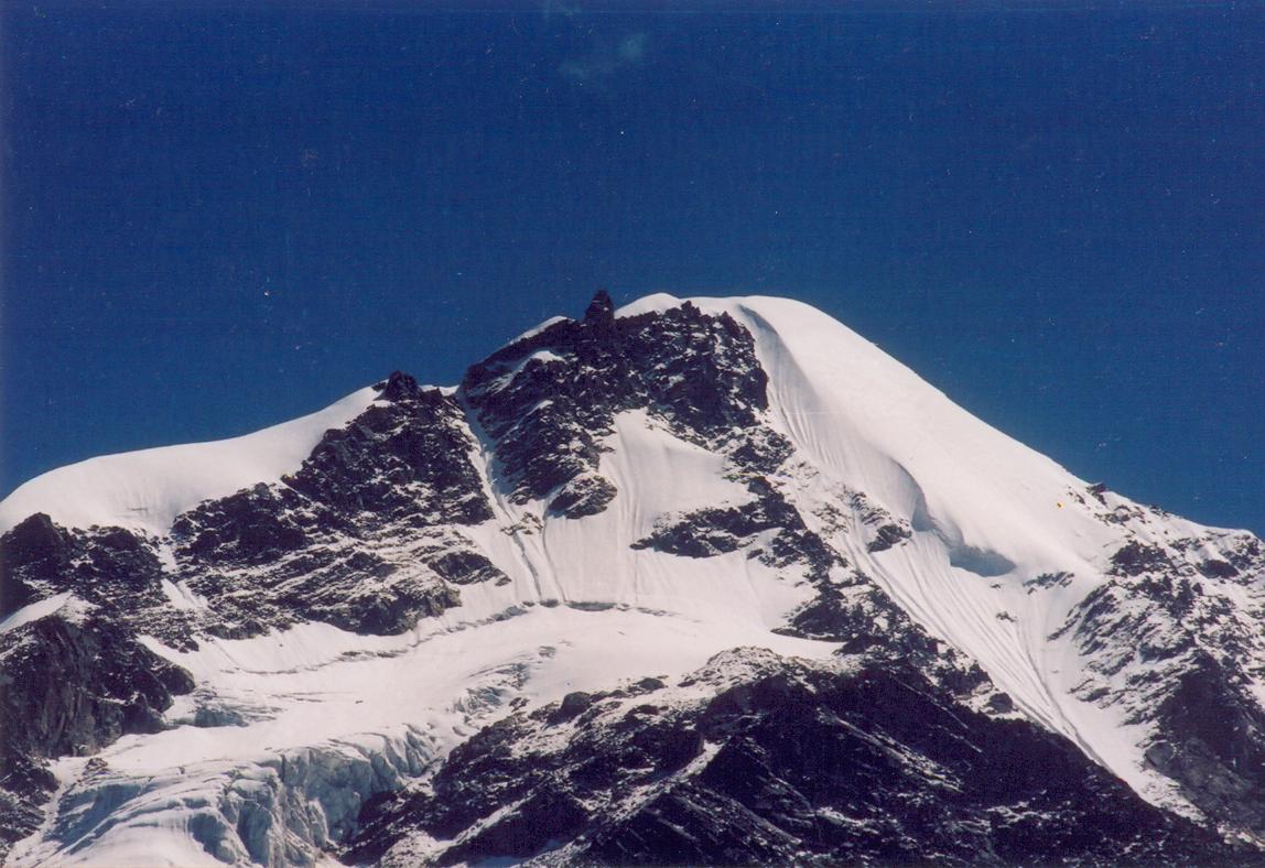 a Himalayan peak
 -
 The Panchchuli as seen from Berinag, 2016

