


No edit summary |
robot: Update article (please report if you notice any mistake or error in this edit) |
||
| Line 3: | Line 3: | ||
{{refimprove|date=January 2021}} | {{refimprove|date=January 2021}} | ||
{{Infobox settlement | {{Infobox settlement | ||
| name = Alipurduar | | name = Alipurduar District | ||
| settlement_type = [[List of districts of West Bengal|District | | settlement_type = [[List of districts of West Bengal|District of West Bengal]] | ||
| total_type = Total | | total_type = Total | ||
| native_name = | | native_name = | ||
| Line 12: | Line 12: | ||
|photo2a = Bhutan gate Phuentsholing during LGFC - Bhutan 2019 (11).jpg | |photo2a = Bhutan gate Phuentsholing during LGFC - Bhutan 2019 (11).jpg | ||
|photo2b = Hut used for living by the TOTO aboriginals.jpg | |photo2b = Hut used for living by the TOTO aboriginals.jpg | ||
|photo3a = | |photo3a = Buxa Tiger Reserve forest 2014.jpg | ||
|size=250 | |size=250 | ||
}} | }} | ||
| image_caption = Clockwise from top-left: Evening at [[Jaldapara National Park]], ruins of [[Buxa Fort]], Hut used by Toto aboriginals, Jayanti Hills in [[Buxa Tiger Reserve]], Bhutan gate near [[Jaigaon]] | | image_caption = Clockwise from top-left: Evening at [[Jaldapara National Park]], ruins of [[Buxa Fort]], Hut used by Toto aboriginals, Jayanti Hills in [[Buxa Tiger Reserve]], Bhutan gate near [[Jaigaon]] | ||
| image_map = Alipurduar district | | image_map = {{maplink |frame=yes | ||
| map_caption = Location | |frame-width=225 |frame-height=225 |frame-align=center | ||
|text= '''Alipurduar district''' | |||
|type=shape |id=Q4726845 | |||
|stroke-colour=#C60C30 | |||
|stroke-width=2 | |||
|title= Alipurduar district of West Bengal | |||
|type2=line|id2=Q1356|stroke-width2=1|stroke-colour2=#0000ff|title2=West Bengal | |||
}} | |||
| map_alt = | |||
| map_caption = Location in West Bengal | |||
| coordinates = | | coordinates = | ||
| subdivision_type = Country | | subdivision_type = Country | ||
| subdivision_name = {{flag|India}} | | subdivision_name = {{flag|India}} | ||
| Line 36: | Line 44: | ||
| area_footnotes = | | area_footnotes = | ||
| population_as_of = | | population_as_of = | ||
| population_total = | | population_total = 1,491,250 | ||
| population_footnotes = | | population_footnotes = <ref name=census2011>{{cite web|url=https://censusindia.gov.in/2011census/dchb/DCHB_A/19/1902_PART_A_DCHB_JALPAIGURI.pdf|title= District Census Handbook-Jalpaiguri|publisher=Directorate of Census Operations, West Bengal|access-date=10 July 2021}}</ref> | ||
| population_urban = | | population_urban = | ||
| population_density_km2 = auto | | population_density_km2 = auto | ||
| Line 62: | Line 70: | ||
}} | }} | ||
'''Alipurduar District''' is the 20th district in the state of [[West Bengal]], [[India]].<ref>{{cite web|author=TNN|url=http://timesofindia.indiatimes.com/city/kolkata/Alipurduar-a-new-district-on-June-25/articleshow/36916065.cms |title=Roy Alipurduar: Alipurduar a new district on June 25 |publisher=Timesofindia.indiatimes.com |date=2014-06-21 |access-date=2020-04-06}}</ref>The district has its headquarters at Alipurduar. It was made a district by bifurcating [[Jalpaiguri district]] on 25 June 2014.<ref name="business-standard.com">{{cite | '''Alipurduar District''' is the 20th district in the state of [[West Bengal]], [[India]].<ref>{{cite web|author=TNN|url=http://timesofindia.indiatimes.com/city/kolkata/Alipurduar-a-new-district-on-June-25/articleshow/36916065.cms |title=Roy Alipurduar: Alipurduar a new district on June 25 |publisher=Timesofindia.indiatimes.com |date=2014-06-21 |access-date=2020-04-06}}</ref>The district has its headquarters at Alipurduar. It was made a district by bifurcating [[Jalpaiguri district]] on 25 June 2014.<ref name="business-standard.com">{{cite news|author=IANS |url=http://www.business-standard.com/article/news-ians/alipurduar-becomes-bengal-s-20th-district-114062500725_1.html |title=Alipurduar becomes Bengal's 20th district | Business Standard News |work=Business Standard|date=25 June 2014 |access-date=2020-04-06}}</ref> | ||
It consists of [[Alipurduar]] municipality, Falakata municipality and six community development blocks: Madarihat–Birpara, Alipurduar–I, Alipurduar–II, Falakata, Kalchini and Kumargram. The six blocks contain 66 [[gram panchayat]]s and nine [[census town]]s. | It consists of [[Alipurduar]] municipality, [[Falakata]] municipality and six community development blocks: Madarihat–Birpara, Alipurduar–I, Alipurduar–II, Falakata, Kalchini and Kumargram. The six blocks contain 66 [[gram panchayat]]s and nine [[census town]]s. | ||
== | == Administration == | ||
Apart from the [[Alipurduar]] municipality, the district contains | Apart from the [[Alipurduar]] municipality and [[Falakata]] municipality, the district contains eight [[census town]]s and rural areas of 66 [[gram panchayat]]s under six [[Community Development Block in India|community development blocks]]: [[Madarihat-Birpara (community development block)|Madarihat-Birpara]], [[Alipurduar I|Alipurduar-I]], [[Alipurduar II|Alipurduar–II]], [[Kalchini]], [[Falakata (community development block)|Falakata]] and [[Kumargram]].<ref name=blocdir>{{cite web | ||
|url=http://wbdemo5.nic.in/writereaddata/Directoryof_District_Block_GPs(RevisedMarch-2008).doc | |url=http://wbdemo5.nic.in/writereaddata/Directoryof_District_Block_GPs(RevisedMarch-2008).doc | ||
|title=Directory of District, Sub division, Panchayat Samiti/ Block and Gram Panchayats in West Bengal, March 2008 | |title=Directory of District, Sub division, Panchayat Samiti/ Block and Gram Panchayats in West Bengal, March 2008 | ||
| Line 80: | Line 88: | ||
Geographically the district lies in between 26.4°N to 26.83°N and 89°E to 89.9°E. | Geographically the district lies in between 26.4°N to 26.83°N and 89°E to 89.9°E. | ||
The nine census towns are [[Paschim Jitpur]], [[Chechakhata]], [[Alipurduar Railway Junction]], [[Bholar Dabri]], [[Sobhaganj | The nine census towns are [[Paschim Jitpur]], [[Chechakhata]], [[Alipurduar Railway Junction]], [[Bholar Dabri]], [[Sobhaganj]], [[Jaygaon]] and [[Uttar Latabari]] and [[Uttar Kamakhyaguri]].<ref name=ctlist>{{cite web|url=http://web.cmc.net.in/wbcensus/DataTables/01/Table-3.htm |title=District Wise List of Statutory Towns (Municipal Corporation, Municipality,Notified Area and Cantonment Board), Census Towns and Outgrowths, West Bengal, 2001 |publisher=Census of India, Directorate of Census Operations, West Bengal |access-date=21 December 2008 |url-status=dead |archive-url=https://web.archive.org/web/20110721163402/http://web.cmc.net.in/wbcensus/DataTables/01/Table-3.htm |archive-date=21 July 2011 }}</ref> | ||
==Railway network== | ==Railway network== | ||
[[Alipurduar railway division]] has at least 710 km of railway track. It is the largest division of the [[Northeast Frontier Railway zone|NFR]] zone. In Alipurduar district there are two major stations, [[Alipurduar Junction railway station|Alipurduar junction]](APDJ) and [[New Alipurduar railway station|New Alipurduar]] (NOQ). There are other stations in the district viz. Falakata Railway Station, Dalgaon Railway Station,Hasimara Railway Station, [[Rajabhatkhawa]], Hamiltongunj etc. | [[Alipurduar railway division]] has at least 710 km of railway track. It is the largest division of the [[Northeast Frontier Railway zone|NFR]] zone. In Alipurduar district there are two major stations, [[Alipurduar Junction railway station|Alipurduar junction]](APDJ) and [[New Alipurduar railway station|New Alipurduar]] (NOQ). There are other stations in the district viz. Falakata Railway Station, Kamakhyaguri Railway Station, Dalgaon Railway Station,Hasimara Railway Station, [[Rajabhatkhawa]], Hamiltongunj etc. | ||
==Legislative segments== | ==Legislative segments== | ||
| Line 94: | Line 102: | ||
As per order of the [[Delimitation Commission]] in respect of the [[delimitation of constituencies]] in the West Bengal, the area under Kumargram block and seven [[gram panchayat]]s under Alipurduar–II block, viz. Bhatibari, Kohinoor, Parokata, Mahakalguri, Shamuktala, Turturi and Tatpara–I will constitute the Kumargram assembly constituency of West Bengal. The Majherdabri gram panchayat under Alipurduar–II block and the area under Kalchini block will constitute the Kalchini assembly constituency. The Alipurduar municipality, the Alipurduar Railway Junction census town, and the gram panchayats of Chaporer Par–I, Chaporer Par–II and Tatpara–II under Alipurduar–II block and ten gram panchayats of Alipurduar–I block, viz. Banchukamari, Parorpar, Shalkumar–I, Vivekananda–I, Chakowakheti, Patlakhawa, Shalkumar–II, Vivekananda–II, Mathura and Tapsikhata will form the Alipurduars assembly constituency. The other gram panchayat of Alipurduar–I block, viz. Purba Kanthalbari will form the Falakata assembly constituency along with the area under Falakata block. Madarihat block will be part of Madarihat assembly constituency. Kumargram, Kalchini and Madarihat constituencies will be reserved for [[Scheduled castes and scheduled tribes|Scheduled tribes (ST)]] candidates. Falakata constituency will be reserved for [[Scheduled castes and scheduled tribes|Scheduled castes (SC)]] candidates. All these five assembly constituencies will be part of [[Alipurduars (Lok Sabha constituency)]], which will be reserved for ST candidates.<ref>{{cite web | As per order of the [[Delimitation Commission]] in respect of the [[delimitation of constituencies]] in the West Bengal, the area under Kumargram block and seven [[gram panchayat]]s under Alipurduar–II block, viz. Bhatibari, Kohinoor, Parokata, Mahakalguri, Shamuktala, Turturi and Tatpara–I will constitute the Kumargram assembly constituency of West Bengal. The Majherdabri gram panchayat under Alipurduar–II block and the area under Kalchini block will constitute the Kalchini assembly constituency. The Alipurduar municipality, the Alipurduar Railway Junction census town, and the gram panchayats of Chaporer Par–I, Chaporer Par–II and Tatpara–II under Alipurduar–II block and ten gram panchayats of Alipurduar–I block, viz. Banchukamari, Parorpar, Shalkumar–I, Vivekananda–I, Chakowakheti, Patlakhawa, Shalkumar–II, Vivekananda–II, Mathura and Tapsikhata will form the Alipurduars assembly constituency. The other gram panchayat of Alipurduar–I block, viz. Purba Kanthalbari will form the Falakata assembly constituency along with the area under Falakata block. Madarihat block will be part of Madarihat assembly constituency. Kumargram, Kalchini and Madarihat constituencies will be reserved for [[Scheduled castes and scheduled tribes|Scheduled tribes (ST)]] candidates. Falakata constituency will be reserved for [[Scheduled castes and scheduled tribes|Scheduled castes (SC)]] candidates. All these five assembly constituencies will be part of [[Alipurduars (Lok Sabha constituency)]], which will be reserved for ST candidates.<ref>{{cite web | ||
| url = http://www.wbgov.com/e-gov/English/DELIMITATION.pdf| title = Press Note, Delimitation Commission| access-date = 10 January 2009 | work = Assembly Constituencies in West Bengal| publisher = Delimitation Commission | pages = 4–5, 23}}</ref> | | url = http://www.wbgov.com/e-gov/English/DELIMITATION.pdf| title = Press Note, Delimitation Commission| access-date = 10 January 2009 | work = Assembly Constituencies in West Bengal| publisher = Delimitation Commission | pages = 4–5, 23}}</ref> | ||
== Demographics == | |||
As of the 2011 census, Alipurduar district has a population of 1,491,250, of which 1,183,704 are rural and 307,456 are urban. Scheduled Castes and Scheduled Tribes make up 456,706 and 382,112 which is 30.62% and 25.62% of the population respectively.<ref name=census2011/> | |||
{{bar box | |||
|title = Religion in Alipurduar district (2011)<ref name="Religion">{{cite web |title=C-1 Population By Religious Community |url=http://www.censusindia.gov.in/2011census/C-01/DDW19C-01%20MDDS.XLS|publisher=Census |access-date=11 July 2021}}</ref> | |||
|titlebar=#Fcd116 | |||
|float=right | |||
|bars= | |||
{{bar percent|[[Hinduism]]|darkorange|80.07}} | |||
{{bar percent|[[Islam]]|green|8.74}} | |||
{{bar percent|[[Christianity]]|dodgerblue|7.52}} | |||
{{bar percent|[[Buddhism]]|yellow|2.37}} | |||
{{bar percent|Other or not stated|black|1.31}} | |||
}} | |||
[[Hindus]] have a population of 1,194,102, [[Muslims]] 130,339, [[Christians]] 112,091 and [[Buddhism|Buddhists]] 35,318. Other religions make up 19,400.<ref name="census2011" /> | |||
{{Pie chart | |||
|caption = Languages of Alipurduar district (2011) | |||
|label1 = [[Bengali language|Bengali]] |value1 = 50.28 |color1 = orchid | |||
|label2 = [[Sadri language|Sadri]] |value2 = 16.80 |color2 = salmon | |||
|label3 = [[Nepali language|Nepali]] |value3 = 9.70 |color3 = red | |||
|label4 = [[Hindi]] |value4 = 3.67 |color4 = orange | |||
|label5 = [[Rangpuri language|Rajbongshi]] |value5 = 3.17 |color5 = plum | |||
|label6 = [[Kurukh language|Kurukh]] |value6 = 3.13 |color6 = mediumseagreen | |||
|label7 = [[Boro language (India)|Boro]] |value7 = 2.38 |color7 = steelblue | |||
|label8 = [[Bhojpuri language|Bhojpuri]] |value8 = 1.39 |color8 = gold | |||
|label9 = [[Santali language|Santali]] |value9 = 1.32 |color9 = darkturquoise | |||
|label10 = Others |value10 = 8.16 |color10 = grey | |||
}} | |||
At the time of the 2011 census, 50.28% spoke [[Bengali language|Bengali]], 16.80% [[Sadri language|Sadri]], 9.70% [[Nepali language|Nepali]], 3.67% [[Hindi]], 3.17% [[Rangpuri language|Rajbongshi]], 3.13% [[Kurukh language|Kurukh]], 2.38% [[Boro language (India)|Boro]], 1.39% [[Bhojpuri language|Bhojpuri]] and 1.32% [[Santali language|Santali]] as their first language.<ref name="census2011" /> | |||
==Visitor attractions== | ==Visitor attractions== | ||
| Line 103: | Line 140: | ||
* [[Jaldapara National Park]] | * [[Jaldapara National Park]] | ||
* [[Chilapata Forests]] | * [[Chilapata Forests]] | ||
* [[Jaigaon]], a small town of Alipurduar and near the [[Bhutan]] border | * [[Jaigaon]], a small town of [[Alipurduar]] district and near the [[Bhutan]] border | ||
* Rajabhatkhawa Museum at [[Rajabhatkhawa]] | * Rajabhatkhawa Museum at [[Rajabhatkhawa]] | ||
* | *[[Rajabhatkhawa|Rajabhatkhawa Forest]] | ||
* [[Raimatang]] | |||
*[[Jayanti, Alipurduar|Jayanti]] | |||
* Santalabari | * Santalabari | ||
* Rovers point | * Rovers point | ||
* Roopang valley | * Roopang valley | ||
* | * Lepchakha | ||
* Chunabhati | * Chunabhati | ||
* Tea | * Chipra Forest | ||
*[[Chilapata Forests|Chilapata Forest]] | |||
*[[Buxa Tiger Reserve]] | |||
*Dima Bridge | |||
*[[New Jalpaiguri Alipurduar Tourist Vistadome Special|Vistadome Ride]] | |||
*Tons of Tea Estates | |||
==References== | ==References== | ||
Revision as of 14:24, 11 April 2022
 | This article needs more citations. (January 2021) |
Alipurduar District | |
|---|---|
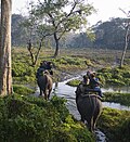
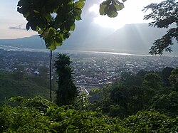
  .jpg)   Clockwise from top-left: Evening at Jaldapara National Park, ruins of Buxa Fort, Hut used by Toto aboriginals, Jayanti Hills in Buxa Tiger Reserve, Bhutan gate near Jaigaon | |
| Country |  India India |
| State | File:..West Bengal Flag(INDIA).png West Bengal |
| Division | Jalpaiguri |
| Headquarters | Alipurduar |
| Government | |
| • Lok Sabha constituencies | Alipurduar |
| • Vidhan Sabha constituencies | Alipurduars, Kumargram, Falakata, Madarihat, Kalchini |
| Area | |
| • Total | 3,136 km2 (1,211 sq mi) |
| Population | |
| • Total | 1,491,250 |
| • Density | 480/km2 (1,200/sq mi) |
| Time zone | UTC+05:30 (IST) |
| Website | alipurduar |
Alipurduar District is the 20th district in the state of West Bengal, India.[2]The district has its headquarters at Alipurduar. It was made a district by bifurcating Jalpaiguri district on 25 June 2014.[3]
It consists of Alipurduar municipality, Falakata municipality and six community development blocks: Madarihat–Birpara, Alipurduar–I, Alipurduar–II, Falakata, Kalchini and Kumargram. The six blocks contain 66 gram panchayats and nine census towns.
Administration
Apart from the Alipurduar municipality and Falakata municipality, the district contains eight census towns and rural areas of 66 gram panchayats under six community development blocks: Madarihat-Birpara, Alipurduar-I, Alipurduar–II, Kalchini, Falakata and Kumargram.[4] Geographically the district lies in between 26.4°N to 26.83°N and 89°E to 89.9°E.
The nine census towns are Paschim Jitpur, Chechakhata, Alipurduar Railway Junction, Bholar Dabri, Sobhaganj, Jaygaon and Uttar Latabari and Uttar Kamakhyaguri.[5]
Railway network
Alipurduar railway division has at least 710 km of railway track. It is the largest division of the NFR zone. In Alipurduar district there are two major stations, Alipurduar junction(APDJ) and New Alipurduar (NOQ). There are other stations in the district viz. Falakata Railway Station, Kamakhyaguri Railway Station, Dalgaon Railway Station,Hasimara Railway Station, Rajabhatkhawa, Hamiltongunj etc.
Legislative segments
There are 5 assembly constituency in Alipurduar district :
- Alipurduars (Vidhan Sabha constituency)
- Kumargram (Vidhan Sabha constituency)
- Falakata (Vidhan Sabha constituency)
- Madarihat (Vidhan Sabha constituency)
- Kalchini (Vidhan Sabha constituency)
As per order of the Delimitation Commission in respect of the delimitation of constituencies in the West Bengal, the area under Kumargram block and seven gram panchayats under Alipurduar–II block, viz. Bhatibari, Kohinoor, Parokata, Mahakalguri, Shamuktala, Turturi and Tatpara–I will constitute the Kumargram assembly constituency of West Bengal. The Majherdabri gram panchayat under Alipurduar–II block and the area under Kalchini block will constitute the Kalchini assembly constituency. The Alipurduar municipality, the Alipurduar Railway Junction census town, and the gram panchayats of Chaporer Par–I, Chaporer Par–II and Tatpara–II under Alipurduar–II block and ten gram panchayats of Alipurduar–I block, viz. Banchukamari, Parorpar, Shalkumar–I, Vivekananda–I, Chakowakheti, Patlakhawa, Shalkumar–II, Vivekananda–II, Mathura and Tapsikhata will form the Alipurduars assembly constituency. The other gram panchayat of Alipurduar–I block, viz. Purba Kanthalbari will form the Falakata assembly constituency along with the area under Falakata block. Madarihat block will be part of Madarihat assembly constituency. Kumargram, Kalchini and Madarihat constituencies will be reserved for Scheduled tribes (ST) candidates. Falakata constituency will be reserved for Scheduled castes (SC) candidates. All these five assembly constituencies will be part of Alipurduars (Lok Sabha constituency), which will be reserved for ST candidates.[6]
Demographics
As of the 2011 census, Alipurduar district has a population of 1,491,250, of which 1,183,704 are rural and 307,456 are urban. Scheduled Castes and Scheduled Tribes make up 456,706 and 382,112 which is 30.62% and 25.62% of the population respectively.[1]
Hindus have a population of 1,194,102, Muslims 130,339, Christians 112,091 and Buddhists 35,318. Other religions make up 19,400.[1]
At the time of the 2011 census, 50.28% spoke Bengali, 16.80% Sadri, 9.70% Nepali, 3.67% Hindi, 3.17% Rajbongshi, 3.13% Kurukh, 2.38% Boro, 1.39% Bhojpuri and 1.32% Santali as their first language.[1]
Visitor attractions


- Buxa Tiger Reserve, IUCN category II national park
- Jayanti Hills
- Buxa Fort, built by British Raj
- Jaldapara National Park
- Chilapata Forests
- Jaigaon, a small town of Alipurduar district and near the Bhutan border
- Rajabhatkhawa Museum at Rajabhatkhawa
- Rajabhatkhawa Forest
- Raimatang
- Jayanti
- Santalabari
- Rovers point
- Roopang valley
- Lepchakha
- Chunabhati
- Chipra Forest
- Chilapata Forest
- Buxa Tiger Reserve
- Dima Bridge
- Vistadome Ride
- Tons of Tea Estates
References
- ↑ 1.0 1.1 1.2 1.3 "District Census Handbook-Jalpaiguri" (PDF). Directorate of Census Operations, West Bengal. Retrieved 10 July 2021.
- ↑ TNN (21 June 2014). "Roy Alipurduar: Alipurduar a new district on June 25". Timesofindia.indiatimes.com. Retrieved 6 April 2020.
- ↑ IANS (25 June 2014). "Alipurduar becomes Bengal's 20th district | Business Standard News". Business Standard. Retrieved 6 April 2020.
- ↑ "Directory of District, Sub division, Panchayat Samiti/ Block and Gram Panchayats in West Bengal, March 2008". West Bengal. National Informatics Centre, India. 19 March 2008. Archived from the original on 25 February 2009. Retrieved 21 December 2008.
- ↑ "District Wise List of Statutory Towns (Municipal Corporation, Municipality,Notified Area and Cantonment Board), Census Towns and Outgrowths, West Bengal, 2001". Census of India, Directorate of Census Operations, West Bengal. Archived from the original on 21 July 2011. Retrieved 21 December 2008.
- ↑ "Press Note, Delimitation Commission" (PDF). Assembly Constituencies in West Bengal. Delimitation Commission. pp. 4–5, 23. Retrieved 10 January 2009.
- ↑ "C-1 Population By Religious Community". Census. Retrieved 11 July 2021.
External links
Cities, towns and locations in Alipurduar district | |||
|---|---|---|---|
| Cities, municipal and census towns | |||
| Locations other than cities and towns | |||
| Specitic Tea Estates | |||
| Related Topics | |||


Places adjacent to Alipurduar district | ||||||||||
|---|---|---|---|---|---|---|---|---|---|---|
| ||||||||||


.png)