

imported>Rohit klar →Tourism: red link removed |
m formatting fix |
||
| Line 1: | Line 1: | ||
{{Use dmy dates|date= | {{Short description|Eastern region of the Indian state of Maharashtra}} | ||
{{Other uses}} | |||
{{Use dmy dates|date=August 2022}} | |||
{{Use Indian English|date=August 2017}} | {{Use Indian English|date=August 2017}} | ||
{{Infobox settlement | {{Infobox settlement | ||
| name | | name = Vidarbha | ||
| | | image_skyline = {{Photomontage | ||
| | |photo1a = Amravati_Court.jpg | ||
| | |photo1b = VCA Nagpur,India.jpg | ||
| | |photo2a = Lonar_Meteorite_Crater_edit_1.JPG | ||
| | |photo2b = Tiger_chasing_a_wild_Pig.jpg | ||
| | |photo3a = Temple_of_Daitya_Sudana-Lonar-Maharashtra.jpg | ||
| | |photo3b = Anand_sagar_view.JPG | ||
| | |spacing = 1 | ||
| | |size = 250 | ||
| | |position = center | ||
| | |border = 0 | ||
| | |color = #000000 | ||
| | |foot_montage = '''Clockwise from top left''': Court in [[Amravati]], [[Vidarbha Cricket Association Stadium]], [[Tadoba Andhari Tiger Reserve]], [[Shegaon#Anand Sagar|Anand Sagar]], [[Daitya Sudan Temple]], and [[Lonar Lake]] | ||
| | }} | ||
| subdivision_type | | image_map = File:India_Vidarbha_locator_map.svg | ||
| subdivision_name | | map_caption = | ||
| subdivision_type1 | | subdivision_type = Country | ||
| subdivision_name1 | | subdivision_name = [[India]] | ||
| | | subdivision_type1 = State | ||
| | | subdivision_name1 = [[Maharastra]] | ||
| | |subdivision_type2 = [[Districts of India|District(s)]] | ||
| | |subdivision_name2 = [[Akola district|Akola]], [[Amravati District|Amravati]], [[Bhandara District|Bhandara]], [[Buldhana district|Buldhana]], [[Chandrapur District|Chandrapur]], [[Gadchiroli District|Gadchiroli]], [[Gondia District|Gondia]], [[Nagpur District|Nagpur]], [[Wardha District|Wardha]], [[Washim District|Washim]], [[Yavatmal District|Yavatmal]] | ||
| | |subdivision_type3 = Largest city | ||
| | |subdivision_name3 = [[Nagpur]] | ||
| | |area_total_km2 = | ||
| | |population_total = 23,003,179 | ||
| | |population_as_of = 2011 | ||
| | |demographics1_title1 = Major language | ||
| | |demographics1_info1 = [[Marathi language|Marathi]] | ||
|timezone1 = [[Indian Standard Time]] | |||
| population_total | |||
| population_as_of | |||
| demographics1_title1 | |||
| demographics1_info1 | |||
| timezone1 | |||
}} | }} | ||
'''Vidarbha''' (Pronunciation: [[Help:IPA/Marathi|[ʋid̪əɾbʱə]]]) is a geographical region in the [[west India]]n [[States and union territories of India|state]] of [[Maharashtra]]. Forming the eastern part of the state, it comprises [[Amravati Division|Amravati]] and [[Nagpur Division|Nagpur]] divisions. As per the [[2011 Census of India|2011 Census]], the region had a population of 23,003,179. The region occupies 31.6% of the total area and is home to 21.3% of the total population of Maharashtra. Situated in central India, it borders the state of [[Madhya Pradesh]] to the north, [[Chhattisgarh]] to the east, [[Telangana]] to the south and [[Marathwada]] and [[North Maharashtra|Uttar Maharashtra]] regions of Maharashtra to the west. | |||
According to the [[Hindu epic]] ''[[Mahabharata]]'', [[Rukmini]], the wife of lord [[Krishna]], was born to [[Bhishmaka]], the king of the Vidarbha kingdom. Vidarbha was part of the [[Satavahana Empire]] during 1st to 2nd century CE). The coins and inscriptions from the period of [[Paramaras|Paramara]] king [[Jagadeva]], the son of the [[Udayaditya]] (reigned c. 1060–1086) have been found in the northern parts the region. According to the ''[[Ain-i-Akbari]]'', the region was part of [[Berar Subah]], in the [[Middle Ages|Medieval period]]. In 1680, the region was captured by [[Sambhaji]], the son of [[Shivaji]], who was the founder of [[Maratha Empire]]. In 1724, [[Asaf Jah]], who later became the [[Nizam of Hyderabad]], declared independence and brought most of the region under his nominal rule. The administration and right of collecting taxes were held by the Marathas. In 1803, following the defeat of the Marathas, the region came under the rule of [[British East India Company]]. Later, the [[British Empire]] took control of the region from the British East India Company in 1857, and the region was part of [[Berar Province|Berar]] and [[Central Provinces]]. After [[Indian Independence Act 1947|Indian Independence]] in 1947, the region remained a part of the [[Central Provinces and Berar]]. After the Re-organization of Indian states, majority of the region became part of [[Bombay State]] in 1957. After the bifurcation of [[Bombay State]], into [[Gujarat]] and [[Maharashtra]], the region became part of [[Maharashtra]]. | |||
The [[GDP]] of the region is estimated to be {{INRconvert|6130.3|b}} 2023-24. The economy of the region is largely dependent on [[agriculture]] with [[Orange (fruit)|oranges]] and [[cotton]] being the major crops. The region also holds considerable mineral resources and forest cover. The region is economically under developed compared to the rest of Maharashtra with considerable [[poverty]] and [[malnutrition]]. Agriculture is largely dependent on seasonal [[monsoons]] and the region receives very less rainfall due to its location in the [[rain shadow]] region of the [[Western Ghats]]. [[Drought]]s and [[famines]] are common with more than 1.4 lakh farmer [[suicide]]s in the period 1997 to 2006. | |||
The largest and major city in the region is [[Nagpur]] and other major towns include [[Amravati]], [[Akola]], [[Chandrapur]], [[Yavatmal]] and [[Gondia]]. [[Varhadi]] and Zadi dialects of [[Marathi language|Marathi]] is widely spoken. There have been demands for a [[Proposed states and union territories of India#Maharashtra|separate state]] of Vidarbha, due to perceived neglect from the [[Government of Maharashtra]]. While the demand is supported by major political parties [[BJP]] and [[Indian National Congress|Congress]], it is opposed by [[Shiv Sena (1966–2022)|Shiv Sena]], one of the major regional political parties in the state. | |||
== History == | == History == | ||
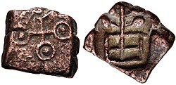
[[File:Vidarbhas of the Deccan.jpg|thumb|Coin of the Vidarbhas of the Deccan (1st century BCE)]] | |||
[[File:Vidarbhas of the Deccan.jpg|thumb|Coin of the Vidarbhas of the Deccan | |||
Vidarbha was part of the [[Satavahana Empire]] | According to the [[Hindu epic]] ''[[Mahabharata]]'' and other ''[[Puranic]]'' scriptures, princess [[Rukmini]] considered to be an incarnation of the goddess [[Lakshmi]] and the wife of lord [[Krishna]], was born to Bhishmaka, the king of the Vidarbha kingdom.<ref>{{Cite book |last=Ayyar |first=P. V. Jagadisa |url=https://books.google.com/books?id=NLSGFW1uZboC&dq=rukmini+purana&pg=PA29 |title=South Indian Shrines: Illustrated |date=1982 |publisher=Asian Educational Services |isbn=978-81-206-0151-2 |pages=29}}</ref> Vidarbha was part of the [[Satavahana Empire]] during 1st to 2nd century CE), ascertained by the Satavahana coins found in [[Pauni]].<ref>{{cite book|last1=Sarma|first1=Inguva Karthikeya|url=https://books.google.com/books?id=ilBmAAAAMAAJ&pg=PA38|title=Coinage of the Satavahana Empire|date=1980|publisher=Agam|page=38|quote=The latest site which contributed valuable numismatic evidence confirming, once and for all, ancient Vidarbha's early Satavahana affiliation is Pauni, in district Bhandara}}</ref> | ||
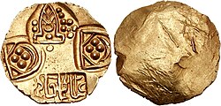
[[File:Paramaras of Vidarbha King Jagaddeva 12th-13th centuries.jpg|thumb|Coin of King [[Jagadeva]] of the [[Paramara dynasty|Paramaras]] of Vidarbha, 12th–13th centuries CE]] | |||
=== | The coins and inscriptions from the period of [[Paramaras|Paramara]] king [[Jagadeva]] have been found in the northern parts the region. An inscription discovered at [[Jainad]] names Jagadeva as the son of the Paramara king [[Udayaditya]] (reigned c. 1060–1086).<ref>{{cite book |author=Gulab Chandra Choudhary |title=Political History of Northern India, from Jain Sources: (c. 650 A. D. to 1300 A. D.) |url=https://books.google.com/books?id=CpMBAAAAMAAJ |year=1964 |publisher=Sohanlal Jaindharma Pracharak Samiti |page=108 }}</ref><ref>{{cite book |author=P. C. Roy |title=The Coinage of Northern India |url=https://books.google.com/books?id=f2Et2zZGJPUC&pg=PA66 |year=1980 |publisher=Abhinav Publications |isbn=978-81-7017-122-5 |pages=66–68 }}</ref> Scholar M. H. Krishna argued that the [[Chalukya]] king [[Someshvara I|Someshvara]] was known by the title "Jagadeva" ("Lord of the world") in the northern part of his kingdom, and it was he who issued these coins. However, all the known Chalukya coins featured [[Kannada script]], while the coins of Jagadeva featured the [[Nagari script]] used by the Paramaras.<ref>{{cite book |author=A. V. Narasimha Murthy |title=The Coins of Karnataka |url=https://books.google.com/books?id=fPoXAAAAMAAJ |year=1975 |publisher=Geetha Book House |page=86 }}</ref> | ||
[[ | According to the ''[[Ain-i-Akbari]]'', the region was part of [[Berar Subah]], known as the Gulshan-e-Berar in the [[Medieval India|Medieval period]].<ref>{{cite book|author=Abul Fazl-i-Allami|year=1949|title=Ain-i-Akbari|volume=2|publisher=The Asiatic Society|page=236}}</ref> In 1680, the region was captured by [[Sambhaji]], the son of [[Shivaji]] who was the founder of [[Maratha Empire]].<ref>{{cite web|url=https://dsal.uchicago.edu/reference/gazetteer/pager.html?objectid=DS405.1.I34_V07_375.gif|title=Imperial Gazetteer of India|volume=7|page=369|access-date=20 February 2021|archive-date=18 May 2021|archive-url=https://web.archive.org/web/20210518202651/https://dsal.uchicago.edu/reference/gazetteer/pager.html?objectid=DS405.1.I34_V07_375.gif|url-status=live}}</ref> In 1724, following a battle at [[Buldana]], [[Asaf Jah]] defeated the [[Mughal Empire|Mughal]] governor and declared independence. Most of the region came under the nominal rule of Jah, who later became the [[Nizam of Hyderabad]], though the administration and right of collecting [[chauth]] were held by the Marathas. In 1803, following the defeat of the Marathas, the region came under the rule of [[British East India Company]].<ref>{{cite web|url=https://dsal.uchicago.edu/reference/gazetteer/pager.html?objectid=DS405.1.I34_V07_376.gif|title=Imperial Gazetteer of India|volume=7|page=370|access-date=27 June 2024|archive-date=14 December 2024|archive-url=https://web.archive.org/web/20241214133846/https://dsal.uchicago.edu/reference/gazetteer/pager.html?objectid=DS405.1.I34_V07_376.gif|url-status=live}}</ref> | ||
Later, the [[British Empire]] took control of the region from the British East India Company in 1857.<ref>{{cite book|title=Great Mutiny: India 1857|first=Christopher|last=Hibbert|date=1 March 2000|publisher=Penguin|page=221|isbn=978-0-1400-4752-3}}</ref> After [[Indian Independence Act 1947|Indian Independence]] in 1947, the region was part of the [[Bombay State]].<ref>{{cite book|title=Constitution of India|chapter=Article 1|url=http://lawmin.nic.in/olwing/coi/coi-english/coi-indexenglish.htm|publisher=[[Government of India]]|access-date=31 December 2015|archive-date=2 April 2012|archive-url=https://web.archive.org/web/20120402064301/http://lawmin.nic.in/olwing/coi/coi-english/coi-indexenglish.htm|url-status=dead}}</ref> After the [[States Reorganisation Act]], which re-organized state boundaries, majority of the region became part of [[Maharashtra]].<ref>{{cite book|last=Thapar|first=Romesh|author-link=Romesh Thapar|title=Change and Conflict in India|publisher=Macmillan|year=1978|isbn=978-0-8364-0222-3|page=75}}</ref><ref>{{cite report|url=https://thc.nic.in/Central%20Governmental%20Acts/States%20Re-Organisation%20Act,%201956.pdf|title=States Reorganisation Act, 1956|publisher=High Court of Tripura|access-date=16 September 2023|archive-date=29 September 2023|archive-url=https://web.archive.org/web/20230929014519/https://thc.nic.in/Central%20Governmental%20Acts/States%20Re-Organisation%20Act,%201956.pdf|url-status=live}}</ref> | |||
== Geography == | == Geography == | ||
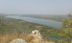
[[File:Vainganga river21.jpeg|thumb|[[Wainganga]] river]] | |||
[[File:Vainganga river21.jpeg | Vidarbha lies in [[Central India]] on the northern part of the [[Deccan Plateau]]. It borders the state of [[Madhya Pradesh]] to the north, [[Chhattisgarh]] to the east, [[Telangana]] to the south and [[Marathwada]] and [[North Maharashtra|Uttar Maharashtra]] regions of Maharashtra to the west. It lies in the [[rain shadow]] region of the [[Western Ghats]] and the terrain is largely flat. The [[Satpura Range]] lies to the north of Vidarbha region with [[Melghat]] in [[Amravati district]] forming part of the southern offshoot of the Satpura Range.<ref>{{cite web |url=http://amravati.gov.in/htmldocs/melghat.htm |title= New Page 2|website=amravati.gov.in |archive-url=https://web.archive.org/web/20080830010013/http://amravati.gov.in/htmldocs/melghat.htm |archive-date=30 August 2008}}</ref> Large [[basalt]]ic rock formations exists throughout the region, part of the 66-million-year-old volcanic [[Deccan Traps]]. [[Bhandara district|Bhandara]] and Gondia district are entirely occupied by metamorphic rock and alluvium, making their geology unique in Maharashtra.<ref>{{cite web |url=http://gondia.gov.in/htmldocs/phygon.html |title=Gondia geology |publisher=Gondia |access-date=22 September 2010 |archive-date=21 July 2011 |archive-url=https://web.archive.org/web/20110721155823/http://gondia.gov.in/htmldocs/phygon.html |url-status=live }}</ref> The Poorna river basin lies in Western Vidarbha and comprises [[Akola district|Akola]], Amaravati and [[Buldhana district]]s. The region has extremely high innate soil and water salinity.<ref>{{cite web| last = Kher| first = Vivek| title = Social and Economic Issues in the Salinity Affected Areas in Poorna Basin: An overview| website = | date = | url = https://publications.iwmi.org/pdf/H032404.pdf| access-date = 8 September 2022| archive-date = 4 August 2023| archive-url = https://web.archive.org/web/20230804165827/https://publications.iwmi.org/pdf/H032404.pdf| url-status = dead}}</ref> | ||
Vidarbha lies on the northern part of the [[Deccan Plateau]]. | |||
== Administration == | == Administration == | ||
Vidarbha | Vidarbha has 11 districts divided into two divisions: [[Amravati Division|Amravati]] (earlier [[Berar Province|Berar]]) and [[Nagpur Division|Nagpur]] divisions.<ref>{{cite book|url=https://books.google.com/books?id=EFDVAAAAMAAJ&pg=RA1-PA131|title=Asian Review |year=1898 }}</ref><ref>{{cite book|title=Journal of the Royal Asiatic Society of Great Britain & Ireland|publisher=Royal Asiatic Society of Great Britain and Ireland|page=323}}</ref> | ||
{| class=wikitable style="text-align: | |||
{| class=wikitable style="text-align:center" | |||
|- | |- | ||
! | ! Division | ||
! Headquarters | |||
! Districts | |||
! Tehsils | |||
|- | |- | ||
![[Amravati Division|Amravati]]<ref>{{cite web|url=http://amravatidivision.gov.in/|title=Amaravati Division|publisher=[[Government of Maharashtra]]|access-date=1 June 2024|archive-date=15 September 2008|archive-url=https://web.archive.org/web/20080915084143/http://amravatidivision.gov.in/|url-status=dead}}</ref> | |||
|| {{ | |[[Amravati]] | ||
|{{bulletlist | [[Akola district|Akola]] | [[Amravati District|Amravati]] | [[Buldhana district|Buldhana]] | [[Washim District|Washim]] | [[Yavatmal District|Yavatmal]] }} | |||
|56 | |||
|- | |||
![[Nagpur Division|Nagpur]]<ref>{{cite web|url=http://nagpur.nic.in/divisionalcommissioner/htmlscripts/index.asp|title=Nagpur Division|publisher=[[Government of Maharashtra]]|access-date=1 June 2024|archive-date=9 October 2017|archive-url=https://web.archive.org/web/20171009204959/http://nagpur.nic.in/divisionalcommissioner/htmlscripts/index.asp|url-status=live}}</ref> | |||
|[[Nagpur]] | |||
}} | |{{bulletlist | [[Bhandara District|Bhandara]] | [[Chandrapur District|Chandrapur]] | [[Gadchiroli District|Gadchiroli]] | [[Gondia District|Gondia]] | [[Nagpur District|Nagpur]] | [[Wardha District|Wardha]] }} | ||
| | |64 | ||
|- | |||
| | |||
| | |||
{{ | |||
}} | |||
| | |||
|} | |} | ||
Each district has a collector's office which is responsible for day-to-day administration.The [[District Collector]] is a Central Indian Government IAS appointee who is in charge of the governance of a district in a state.<ref>[http://www.maharashtra.gov.in/english/Districts%20List.php Districts Of Maharashtra] {{webarchive |url=https://web.archive.org/web/20080112033302/http://www.maharashtra.gov.in/english/Districts%20List.php |date=12 January 2008 }}</ref> | Each district has a collector's office which is responsible for day-to-day administration. The [[District Collector]] is a Central Indian Government IAS appointee who is in charge of the governance of a district in a state.<ref>[http://www.maharashtra.gov.in/english/Districts%20List.php Districts Of Maharashtra] {{webarchive |url=https://web.archive.org/web/20080112033302/http://www.maharashtra.gov.in/english/Districts%20List.php |date=12 January 2008 }}</ref> | ||
== Demographics == | == Demographics == | ||
Vidarbha has a total population of {{formatnum:23003179}} according to the 2011 India census.<ref>{{cite web|title=Vidarbha population 2011|url=http://censusindia.gov.in/2011-prov-results/paper2/prov_results_paper2_mah.html}}</ref> | Vidarbha has a total population of {{formatnum:23003179}} according to the 2011 India census.<ref>{{cite web|title=Vidarbha population 2011|url=http://censusindia.gov.in/2011-prov-results/paper2/prov_results_paper2_mah.html|publisher=[[Government of India]]|access-date=1 June 2024|archive-date=9 May 2013|archive-url=https://web.archive.org/web/20130509092131/http://www.censusindia.gov.in/2011-prov-results/paper2/prov_results_paper2_mah.html|url-status=live}}</ref> The region occupies 31.6% of the total area and is home to 21.3% of the total population of Maharashtra.<ref>{{cite web |url=http://www.mh-31.com/nagpur/about-nagpur/nagpur-general/496-population-census-nagpur |title=Population of Nagpur |date=31 March 2011 |access-date=6 April 2011 |archive-date=26 December 2018 |archive-url=https://web.archive.org/web/20181226121326/http://www.mh-31.com/nagpur/about-nagpur/nagpur-general/496-population-census-nagpur |url-status=usurped }}</ref> According to the 2011 census, [[Hinduism]] was the principal religion in the state at 76.91% of the total population, while [[Buddhists]] constituted 13.08 of the total population. Vidarbha accounts for 45.91% of total Buddhists in [[Maharashtra]].<ref name="census_2011_religion"/> | ||
{{Bar chart | |||
|float = right | |||
|title = Religion in Vidarbha (2011 census)<ref name="census_2011_religion">{{cite web |url=http://www.censusindia.gov.in/2011census/C-01/DDW00C-01%20MDDS.XLS |title=Population by religious community - 2011 |publisher=Office of the Registrar General & Census Commissioner |access-date=25 August 2015 |archive-url=https://web.archive.org/web/20150825155850/http://www.censusindia.gov.in/2011census/C-01/DDW00C-01%20MDDS.XLS |archive-date=25 August 2015}}</ref> | |||
|label1 = [[Hinduism in Maharashtra|Hinduism]] | |||
|data1 = 76.91 | |||
|color1 = orange | |||
|label2 = [[Buddhism]] | |||
|data2 = 13.08 | |||
|color2 = yellow | |||
|label3 = [[Islam]] | |||
|data3 = 8.34 | |||
|color3 = Green | |||
|label4 = [[Jainism in Maharashtra|Jainism]] | |||
|data4 = 0.44 | |||
|color4 = pink | |||
|label5 = [[Christianity in Maharashtra|Christianity]] | |||
|data5 = 0.34 | |||
|color5 = blue | |||
|label6 = [[Sikhism]] | |||
|data6 = 0.18 | |||
|color6 = darkkhaki | |||
|label7 = Others/Non religious | |||
|data7 = 0.72 | |||
|color7 = Grey | |||
}} | |||
{| class="wikitable sortable" style="font-size: | {{Bar chart | ||
|float = right | |||
|title = Languages of Vidarbha (2011)<ref name="lang"/> | |||
|label1 = [[Marathi language|Marathi]] |data1 = 73.72 |color1 = orange | |||
|label2 = [[Hindi]] |data2 = 8.30 |color2 = red | |||
|label3 = [[Urdu]] |data3 = 6.23 |color3 = green | |||
|label4 = [[Lambadi]] |data4 = 2.58 |color4 = brown | |||
|label5 = [[Gondi language|Gondi]] |data5 = 1.83 |color5 = darkturquoise | |||
|label6 = [[Korku language|Korku]] |data6 = 1.10 |color6 = darkviolet | |||
|label7 = [[Telugu language|Telugu]] |data7 = 1.02 |color7 = blue | |||
|label8 = others |data8 = 5.22 |color8 = grey | |||
}} | |||
{{Table alignment}} | |||
{| class="wikitable sortable defaultcenter col1left" style="font-size: 100%" | |||
|- style="background:#f0f0ff;" | |- style="background:#f0f0ff;" | ||
! | ! District | ||
! | ! Male | ||
! | ! Female | ||
! | ! Total | ||
|- | |- | ||
| [[Akola district|Akola]] | |||
| | | 936,226 | ||
| | | 882,391 | ||
| | | 1,818,617 | ||
|- | |- | ||
| [[Amravati district|Amravati]] | |||
| 1,482,845 | | 1,482,845 | ||
| 1,404,981 | | 1,404,981 | ||
| 2,887,826 | | 2,887,826 | ||
|- | |- | ||
| [[Bhandara district|Bhandara]] | |||
| 604,371 | | 604,371 | ||
| 594,439 | | 594,439 | ||
| 1,198,810 | | 1,198,810 | ||
|- | |- | ||
| [[Buldhana district|Buldhana]] | |||
| 1,342,152 | | 1,342,152 | ||
| 1,245,887 | | 1,245,887 | ||
| 2,588,039 | | 2,588,039 | ||
|- | |- | ||
| [[Chandrapur district|Chandrapur]] | |||
| 1,120,316 | |||
| 1,073,946 | |||
| 2,194,262 | |||
|- | |||
| [[Gadchiroli district|Gadchiroli]] | |||
| 542,813 | | 542,813 | ||
| 528,982 | | 528,982 | ||
| 1,071,795 | | 1,071,795 | ||
|- | |- | ||
| [[Gondia district|Gondia]] | |||
| 662,524 | | 662,524 | ||
| 659,807 | | 659,807 | ||
| 1,322,331 | | 1,322,331 | ||
|- | |- | ||
| [[Nagpur district|Nagpur]] | |||
| 2,388,558 | |||
| 2,264,613 | |||
| 4,653,171 | |||
|- | |- | ||
| [[ | | [[Wardha district|Wardha]] | ||
| | | 665,925 | ||
| | | 630,232 | ||
| 1,296,157 | |||
|- | |- | ||
| [[ | | [[Washim district|Washim]] | ||
| | | 621,228 | ||
| | | 575,486 | ||
| 1,196,714 | |||
|- | |- | ||
| [[ | | [[Yavatmal district|Yavatmal]] | ||
| 1, | | 1,425,593 | ||
| | | 1,349,864 | ||
| 2,775,457 | |||
| | |||
|} | |} | ||
The largest city in the region is [[Nagpur]] and other major cities include [[Amravati]], [[Akola]], [[Chandrapur]], [[Yavatmal]] and [[Gondia]].<ref>{{cite web |title=Population Ranking Maharashtra |date=22 November 2012 |url=https://www.worldlistmania.com/list-largest-cities-maharashtra/ |publisher=World List |access-date=1 June 2024 |archive-date=6 April 2023 |archive-url=https://web.archive.org/web/20230406004920/https://www.worldlistmania.com/list-largest-cities-maharashtra/ |url-status=live }}</ref> | |||
== Language and culture == | == Language and culture == | ||
As per the 2011 census, 73.72% of the population speaks [[Marathi language|Marathi]], 8.30% [[Hindi]], 6.23% [[Urdu]], 2.58% [[Lambadi]], 1.83% [[Gondi language|Gondi]], 1.10% [[Korku language|Korku]], 1.02% [[Telugu language|Telugu]] and around 1% [[Powari language|Powari]] their first language.<ref name="lang">{{cite report|title=Languages – 2011|url=http://www.censusindia.gov.in/2011census/C-16.html|publisher=The Registrar General & Census Commissioner, India|archive-url=https://web.archive.org/web/20150825155850/http://www.censusindia.gov.in/2011census/C-01/DDW00C-01%20MDDS.XLS|archive-date=25 August 2015}}</ref> [[Varhadi]] and Zadi dialects of [[Marathi language|Marathi]] are widely spoken.<ref>{{cite web |url=http://www.buzzalive.com/lifestyle/travel/dialects-in-maharashtra/ |title=Dialects in Maharashtra|publisher=Buzzalive |access-date=13 April 2017 |archive-date=23 June 2018 |archive-url=https://web.archive.org/web/20180623013041/http://www.buzzalive.com/lifestyle/travel/dialects-in-maharashtra/ |url-status=dead }}</ref> | |||
[[ | |||
| | |||
| | |||
| | |||
| | |||
| | |||
| | |||
| | |||
}} | |||
[[Hindu]] festivals like [[Holi]], [[Diwali]] and [[Vijayadashami|Dasara]] are celebrated throughout the region.<ref>{{cite web |url=http://gadchiroli.gov.in/people10.htm |title=People And Their Culture |publisher=Gadchiroli |access-date=22 September 2010 |archive-date=21 July 2011 |archive-url=https://web.archive.org/web/20110721155714/http://gadchiroli.gov.in/people10.htm |url-status=dead }}</ref> | |||
The [[Nagpur Central Museum]] ({{abbr|est.|established}} 1863) maintains collections | The [[Nagpur Central Museum]] ({{abbr|est.|established}} 1863) maintains collections from the region.<ref>[http://www.maharashtra.gov.in/english/gazetteer/FINAL_GAZETTEE/edu1.html Nagpur District Gazetteer] {{webarchive |url=https://web.archive.org/web/20080422001048/http://www.maharashtra.gov.in/english/gazetteer/FINAL_GAZETTEE/edu1.html |date=22 April 2008 }}</ref> | ||
== Economy == | == Economy == | ||
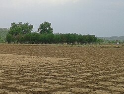
[[File: | [[File:Agriculture farm in Vidarbha.jpeg|thumb|Farmland in Vidarbha region]] | ||
The [[GDP]] of the region is estimated to be {{INRconvert|5445.4|b}} 2022-23. The region also holds considerable mineral resources and forest cover.<ref>{{cite web | url=http://www.sindhindia.com/p/maharastra/nagpur/nagpur-urban/nagpur-urban | title=Nagpur Urban | publisher=Sindhi India | access-date=1 June 2024 | archive-date=2 February 2017 | archive-url=https://web.archive.org/web/20170202234857/http://www.sindhindia.com/p/maharastra/nagpur/nagpur-urban/nagpur-urban | url-status=dead }}</ref> The region is economically under developed compared to the rest of Maharashtra with considerable [[poverty]] and [[malnutrition]].<ref>{{cite web |url= http://www.iwmi.cgiar.org/iwmi-tata_html/PM2003/Schedule/IrrPov.htm |title= PM 2003 Schedule Irr Pov |access-date=6 September 2007 |url-status=dead |archive-url= https://web.archive.org/web/20071218124256/http://www.iwmi.cgiar.org/iwmi-tata_html/PM2003/Schedule/IrrPov.htm |archive-date= 18 December 2007 |author= Sanjiv Phansalkar |work= IWMI-TATA Water Policy Research Program}}</ref><ref>{{cite web |url=http://in.rediff.com/election/2004/oct/12vidarbha.htm |title=Vidarbha profile on rediff |publisher=[[Rediff]] |date=12 October 2004 |access-date=22 September 2010 |archive-date=4 June 2011 |archive-url=https://web.archive.org/web/20110604015601/http://in.rediff.com/election/2004/oct/12vidarbha.htm |url-status=live }}</ref><ref>{{cite web|url=http://www.shramdeepindia.org.in/melghat.htm |title=WHO declares Melghat as India's most malnutrition-hit area|archive-url=https://web.archive.org/web/20070830070118/http://www.shramdeepindia.org.in/melghat.htm |publisher=Shramdeep| archive-date=30 August 2007 }}</ref> | |||
The economy of the region is largely dependent on [[agriculture]] with [[Orange (fruit)|oranges]] and [[cotton]] being the major crops. Agriculture is largely dependent on seasonal [[monsoons]] and the region receives very less rainfall. [[Drought]]s and [[famines]] are common with more than 1.4 lakh [[Farmers' suicides in India|farmer suicides]] in the period 1997 to 2006.<ref>{{cite news |url= http://www.hindu.com/2007/11/14/stories/2007111453091100.htm |archive-url= https://web.archive.org/web/20071116052924/http://www.hindu.com/2007/11/14/stories/2007111453091100.htm |url-status= dead |archive-date= 16 November 2007 |title= Maharashtra: 'graveyard of farmers' |date= 14 November 2007|newspaper= [[The Hindu]] }}</ref> Though the [[Government of India|federal government]] has provided relief packages aimed at the region, with corruption rampant in the region.<ref>[https://web.archive.org/web/20071218211400/http://pmindia.nic.in/prelease/pcontent.asp?id=466 relief package for Vidarbha]</ref> Columnist and journalist [[P Sainath]] opined that the relief packages were destined to fail as corruption in the government meant that little impact happened on the ground.<ref>{{cite web |first=P |last=Sainath |url=http://www.indiatogether.org/2006/jul/psa-package.htm |title=Politics of packages, packaging of politics |publisher=Indiatogether.org |date=16 July 2006 |access-date=22 September 2010 |archive-date=26 August 2022 |archive-url=https://web.archive.org/web/20220826000937/https://indiatogether.org/package-op-ed |url-status=live }}</ref> | |||
[[ | |||
=== | Nagpur is a major hub for business and healthcare.<ref>{{cite web|url=http://articles.economictimes.indiatimes.com/2008-12-24/news/27722689_1_nagpur-growth-nucleus-second-greenest-city |archive-url=https://web.archive.org/web/20150219113813/http://articles.economictimes.indiatimes.com/2008-12-24/news/27722689_1_nagpur-growth-nucleus-second-greenest-city |url-status=dead |archive-date=19 February 2015 |title=Nagpur – Growth Nucleus of India|newspaper=[[The Economic Times]]|date=24 December 2008|access-date=1 June 2024}}</ref> [[Multi-modal International Cargo Hub and Airport at Nagpur|MIHAN]] is the major cargo hub in the region, operational out of [[Nagpur Airport]].<ref name="aboutmadc">{{cite web|url=http://www.madcindia.org/aboutmadc.htm |title=Maharashtra Airport Development Company Limited |access-date=14 May 2008 |work=madcindia.org |archive-url=https://web.archive.org/web/20080510173353/http://www.madcindia.org/aboutmadc.htm |archive-date=10 May 2008 |url-status=dead }}</ref><ref name="factsheet">{{cite web|url=http://pibarchive.nic.in/archieve/factsheet/2005/fscivil2005.pdf|title=Maharashtra Airport Development Company Limited|access-date=29 January 2008|publisher=Press Information Bureau and Ministry of Civil Aviation|archive-date=9 September 2018|archive-url=https://web.archive.org/web/20180909000315/http://pibarchive.nic.in/archieve/factsheet/2005/fscivil2005.pdf|url-status=live}}</ref> | ||
[[Nagpur]], [[ | Nagpur also hosts [[Information Technology]] [[Special Economic Zone]] (IT SEZ)<ref>{{cite news|url=http://www.indianexpress.com/story/3713.html|title=Nagpur stakes claim to lead boomtown pack|newspaper=[[The Indian Express]]|access-date=1 June 2006|url-status=dead|archive-url=https://web.archive.org/web/20070929125003/http://www.indianexpress.com/story/3713.html|archive-date=29 September 2007}}</ref> for information-technology companies.<ref>{{cite news|url=https://timesofindia.indiatimes.com/city/nagpur/Mihan-is-biggest-development-project/articleshow/2065727.cms|archive-url=https://web.archive.org/web/20120314133754/http://articles.timesofindia.indiatimes.com/2007-05-22/nagpur/27875804_1_mihan-health-city-r-c-sinha|url-status=live|archive-date=14 March 2012|title=Mihan is biggest development|access-date=22 May 2007|newspaper=[[The Times of India]]|date=22 May 2007}}</ref> Amravati and [[Yavatmal]] are known for cotton production. [[Chandrapur]] has a [[Chandrapur Super Thermal Power Station|thermal power station]], which is one of the biggest in India.<ref>{{cite web|url=http://chanda.nic.in/htmldocs/ctps.html|title=Chandrapur Thermal Power Station, A Giant In Power Generation|access-date=20 April 2015|archive-url=https://web.archive.org/web/20150525231932/http://chanda.nic.in/htmldocs/ctps.html|archive-date=25 May 2015|url-status=dead}}</ref><ref>{{cite book|url=https://books.google.com/books?id=IleHyBDWbzEC&q=Chandrapur+Super+Thermal+Power+Station&pg=PA671|title=Land and People of Indian States and Union Territories|year=2006|isbn=978-8-178-35372-2|access-date=20 April 2015|last1=Bhatt|first1=S. C.|publisher=Gyan Publishing House }}</ref> There are other heavy industries and mines in the region.<ref>{{cite web |url=http://chanda.nic.in/htmldocs/bilt.html |title=Ballarpur Industries Limited- Bilt |publisher=Chanda.nic.in |access-date=22 September 2010 |archive-url=https://web.archive.org/web/20111003060548/http://chanda.nic.in/htmldocs/bilt.html |archive-date=3 October 2011 |url-status=dead }}</ref> | ||
The region has mineral resources with coal and [[manganese]], the major minerals. Iron ore and [[limestone]] have also been identified as potential mining resources.<ref>[http://www.maharashtra.gov.in/english/community/community_geo_profileShow.php#resource "Maharashtra Resources"] {{webarchive |url=https://web.archive.org/web/20070930030242/http://www.maharashtra.gov.in/english/community/community_geo_profileShow.php#resource |date=30 September 2007 }}</ref> [[Chandrapur district]] contributes 29% of all mineral output of Maharashtra.<ref>{{cite web |url=http://chanda.nic.in/htmldocs/geology.html |title=Demography |publisher=Chanda.nic.in |access-date=22 September 2010 |archive-url=https://web.archive.org/web/20111003060401/http://chanda.nic.in/htmldocs/geology.html |archive-date=3 October 2011 |url-status=dead }}</ref> | |||
[[ | |||
==Education== | == Education == | ||
{{See also|List of higher education institutions in | {{See also|List of higher education institutions in Maharashtra}} | ||
== Sports == | == Sports and recreation == | ||
[[ | [[Cricket]] is the most popular sport in the region. Nagpur's [[Vidarbha Cricket Association Ground]] (VCA) hosted international cricket matches.<ref>{{cite web |url=http://content-www.cricinfo.com/ci/content/grounded/58344.html |title=Vidarbha Cricket Association Ground profile |publisher=[[Cricinfo]] |access-date=12 November 2012 }}{{Dead link|date=August 2024 |bot=InternetArchiveBot |fix-attempted=yes }}</ref> In 2008, the new [[Vidarbha Cricket Association Stadium]] was built in Jamtha.<ref>{{cite web |url=http://www.espncricinfo.com/indian-domestic-2011/content/ground/375326.html |title=Vidarbha Cricket Association Stadiumprofile |publisher=[[Cricinfo]] |access-date=12 November 2012 |archive-date=17 December 2011 |archive-url=https://web.archive.org/web/20111217122547/http://www.espncricinfo.com/indian-domestic-2011/content/ground/375326.html |url-status=live }}</ref> | ||
The eastern part of Vidarbha consists of Maharashtra's oldest [[Protected areas of India|National Park]], the [[Tadoba Andhari Tiger Reserve]], one of the [[Tiger reserves of India|Project Tiger Reserves]].<ref>{{cite web |title=National Tiger Conservation Authority |url=https://ntca.gov.in/tiger-reserves/#tiger-reserves-2 |publisher=[[National Tiger Conservation Authority]] |access-date=1 June 2024 |archive-date=25 March 2023 |archive-url=https://web.archive.org/web/20230325183112/https://ntca.gov.in/tiger-reserves/#tiger-reserves-2 |url-status=live }}</ref><ref>{{cite web |url=http://projecttiger.nic.in/tadoba.htm |title=Tadoba Tiger Reserve |publisher=[[Project Tiger]]|access-date=22 September 2010 |url-status=dead |archive-url=https://web.archive.org/web/20120224040201/http://projecttiger.nic.in/tadoba.htm |archive-date=24 February 2012 }}</ref> [[Shegaon]] is a place of pilgrimage with temples attributed to the Hindu saint [[Gajanan Maharaj]] who lived there.<ref>{{cite web|title=Temples of Gajanan Maharaj|url=http://www.gajanan-shegaon.com/int_page.asp?page=temples|publisher=Gajanan Shegaon|access-date=10 October 2017|archive-date=18 November 2017|archive-url=https://web.archive.org/web/20171118150159/http://www.gajanan-shegaon.com/int_page.asp?page=temples|url-status=live}}</ref> [[Chikhaldara]] in Amravati district is a [[hill station]] and popular tourist destination.<ref>{{cite news|url=https://timesofindia.indiatimes.com/city/nagpur/chikhaldaras-water-crisis-continues-delays-in-long-term-water-supply-project/articleshow/110064853.cms|title=Chikhaldara's water woes may continue for a yr more|date=13 May 2024|access-date=1 June 2024|newspaper=[[The Times of India]]}}</ref> | |||
[[ | |||
[[ | |||
== Politics == | == Politics == | ||
Vidarbha has ten [[Lok Sabha]] constituencies. [[Nagpur district]] has two seats [[Nagpur Lok Sabha constituency|Nagpur]] and [[Ramtek Lok Sabha constituency|Ramtek]], while [[Gadchiroli-Chimur Lok Sabha constituency]] is spread across districts of [[Chandrapur district|Chandrapur]], [[Gadchiroli district|Gadchiroli]] and [[Gondia district|Gondia]]. [[Yavatmal district|Yavatmal]] and [[Washim district]]s form part of [[Yavatmal–Washim Lok Sabha constituency]]. Other seats include [[Akola Lok Sabha constituency|Akola]], [[Amravati Lok Sabha constituency|Amravati]], [[Bhandara Lok Sabha constituency|Bhandara]], [[Buldhana Lok Sabha constituency|Buldhana]], [[Gondia Lok Sabha constituency|Gondia]], and [[Wardha Lok Sabha constituency|Wardha]]. Amravati and Ramtek seats are reserved for [[Scheduled Caste]] candidates, while Gadchiroli-Chimur is reserved for [[Scheduled Tribes]].<ref>{{cite web|url=http://www.eci.gov.in/election_maps/Results/PC/S13/S13_PC.jpg |title=Archived copy |access-date=21 January 2008 |url-status=dead |archive-url=https://web.archive.org/web/20070711221400/http://www.eci.gov.in/election_maps/Results/PC/S13/S13_PC.jpg |archive-date=11 July 2007 }}</ref> In the [[Maharashtra Legislative Assembly]], the region is represented by 62 [[Vidhan Sabha]] seats.<ref>{{cite web|url=http://www.eci.gov.in/election_maps/Results/AC/S13/S13_AC.jpg |title=Archived copy |access-date=21 January 2008 |url-status=dead |archive-url=https://web.archive.org/web/20090304114803/http://www.eci.gov.in/election_maps/Results/AC/S13/S13_AC.jpg |archive-date=4 March 2009 }}</ref> | |||
== | == Demand for statehood == | ||
[[File:MaharashtraVidarbha.png|thumb|Vidarbha region in Maharashtra (dark green)]] | |||
{{main|Vidarbha movement}} | |||
=== | The [[Vidarbha movement]] started in the 1930s demanding a [[Proposed states and union territories of India#Maharashtra|separate state]] of Vidarbha. The demand has been raised at times due to perceived neglect of the region by the [[Government of Maharashtra]].<ref>{{cite news|url=https://www.mid-day.com/mumbai/mumbai-news/article/lok-sabha-elections-2024-separate-vidarbha-anyone-23344849|title=Lok Sabha elections 2024: Separate Vidarbha, anyone?|date=18 April 2024|access-date=1 June 2024|work=Times now|archive-date=23 May 2024|archive-url=https://web.archive.org/web/20240523062945/https://www.mid-day.com/mumbai/mumbai-news/article/lok-sabha-elections-2024-separate-vidarbha-anyone-23344849|url-status=live}}</ref><ref>{{cite news|url=https://www.deccanherald.com/elections/india/vidarbha-statehood-demand-missing-from-poll-narratives-in-maharashtra-2974033|title=Vidarbha statehood demand missing from poll narratives in Maharashtra|date=11 April 2024|access-date=1 June 2024|work=[[Deccan Herald]]}}</ref> While the demand is supported by major political parties [[BJP]] and [[Indian National Congress|Congress]], it is opposed by [[Shiv Sena (1966–2022)|Shiv Sena]], one of the major regional political parties in the state.<ref>{{cite news |url= http://www.rediff.com/news/2004/aug/18inter.htm |title= Interview of Maharashtra Pradesh Congress Committee President Ranjeet Deshmukh |work= [[Rediff]] |date= 18 August 2004 |access-date= 22 September 2010 |archive-date= 22 October 2012 |archive-url= https://web.archive.org/web/20121022142237/http://www.rediff.com/news/2004/aug/18inter.htm |url-status= live }}</ref><ref>{{cite news |last=Phadke |first=Manasi |date=16 November 2017 |title=I am for a separate Vidarbha state: Maharashtra CM Fadnavis |url=https://theprint.in/theprint-otc/separate-vidarbha-maharashtra-fadnavis/16582/ |access-date=20 March 2024 |work=The Print |archive-date=20 March 2024 |archive-url=https://web.archive.org/web/20240320144221/https://theprint.in/theprint-otc/separate-vidarbha-maharashtra-fadnavis/16582/ |url-status=live }}</ref><ref>{{cite news |url= http://www.hindu.com/2004/03/23/stories/2004032301361300.htm |archive-url= https://web.archive.org/web/20040623093743/http://www.hindu.com/2004/03/23/stories/2004032301361300.htm |url-status= dead |archive-date= 23 June 2004 |title= Very few takers for a separate State |date=23 March 2004 |access-date= 22 September 2010 |newspaper= [[The Hindu]] }}</ref> Political economist [[Shrikant Jichkar]] opposed the separation of the region from Maharashtra, stating that it was not sustainable. He noted that income from available natural resources would not be able to balance the subsidies given by the government, whose cooperation would be vital to any development and that the division introduces societal risks due to dividing of the Marathi-speaking state.<ref>{{cite news|url=http://www.thehindu.com/2000/09/09/stories/0209000g.htm |archive-url=https://web.archive.org/web/20160107121747/http://www.thehindu.com/2000/09/09/stories/0209000g.htm |url-status=dead |archive-date=7 January 2016 |newspaper=[[The Hindu]] |title=Vidarbha not viable economically |date=9 September 2000}}</ref> | ||
{{ | |||
==See also== | ==See also== | ||
| Line 339: | Line 240: | ||
==External links== | ==External links== | ||
{{Commons category}} | {{Commons category}} | ||
{{Coord missing|Maharashtra}} | {{Coord missing|Maharashtra}} | ||
Latest revision as of 02:40, 22 February 2026
Vidarbha | |
|---|---|
      Clockwise from top left: Court in Amravati, Vidarbha Cricket Association Stadium, Tadoba Andhari Tiger Reserve, Anand Sagar, Daitya Sudan Temple, and Lonar Lake | |
 | |
| Country | India |
| State | Maharastra |
| District(s) | Akola, Amravati, Bhandara, Buldhana, Chandrapur, Gadchiroli, Gondia, Nagpur, Wardha, Washim, Yavatmal |
| Largest city | Nagpur |
| Population (2011) | |
| • Total | 23,003,179 |
| Time zone | Indian Standard Time |
Vidarbha (Pronunciation: [ʋid̪əɾbʱə]) is a geographical region in the west Indian state of Maharashtra. Forming the eastern part of the state, it comprises Amravati and Nagpur divisions. As per the 2011 Census, the region had a population of 23,003,179. The region occupies 31.6% of the total area and is home to 21.3% of the total population of Maharashtra. Situated in central India, it borders the state of Madhya Pradesh to the north, Chhattisgarh to the east, Telangana to the south and Marathwada and Uttar Maharashtra regions of Maharashtra to the west.
According to the Hindu epic Mahabharata, Rukmini, the wife of lord Krishna, was born to Bhishmaka, the king of the Vidarbha kingdom. Vidarbha was part of the Satavahana Empire during 1st to 2nd century CE). The coins and inscriptions from the period of Paramara king Jagadeva, the son of the Udayaditya (reigned c. 1060–1086) have been found in the northern parts the region. According to the Ain-i-Akbari, the region was part of Berar Subah, in the Medieval period. In 1680, the region was captured by Sambhaji, the son of Shivaji, who was the founder of Maratha Empire. In 1724, Asaf Jah, who later became the Nizam of Hyderabad, declared independence and brought most of the region under his nominal rule. The administration and right of collecting taxes were held by the Marathas. In 1803, following the defeat of the Marathas, the region came under the rule of British East India Company. Later, the British Empire took control of the region from the British East India Company in 1857, and the region was part of Berar and Central Provinces. After Indian Independence in 1947, the region remained a part of the Central Provinces and Berar. After the Re-organization of Indian states, majority of the region became part of Bombay State in 1957. After the bifurcation of Bombay State, into Gujarat and Maharashtra, the region became part of Maharashtra.
The GDP of the region is estimated to be ₹6,130.3 billion (US$86 billion) 2023-24. The economy of the region is largely dependent on agriculture with oranges and cotton being the major crops. The region also holds considerable mineral resources and forest cover. The region is economically under developed compared to the rest of Maharashtra with considerable poverty and malnutrition. Agriculture is largely dependent on seasonal monsoons and the region receives very less rainfall due to its location in the rain shadow region of the Western Ghats. Droughts and famines are common with more than 1.4 lakh farmer suicides in the period 1997 to 2006.
The largest and major city in the region is Nagpur and other major towns include Amravati, Akola, Chandrapur, Yavatmal and Gondia. Varhadi and Zadi dialects of Marathi is widely spoken. There have been demands for a separate state of Vidarbha, due to perceived neglect from the Government of Maharashtra. While the demand is supported by major political parties BJP and Congress, it is opposed by Shiv Sena, one of the major regional political parties in the state.
History[edit | edit source]

According to the Hindu epic Mahabharata and other Puranic scriptures, princess Rukmini considered to be an incarnation of the goddess Lakshmi and the wife of lord Krishna, was born to Bhishmaka, the king of the Vidarbha kingdom.[1] Vidarbha was part of the Satavahana Empire during 1st to 2nd century CE), ascertained by the Satavahana coins found in Pauni.[2]

The coins and inscriptions from the period of Paramara king Jagadeva have been found in the northern parts the region. An inscription discovered at Jainad names Jagadeva as the son of the Paramara king Udayaditya (reigned c. 1060–1086).[3][4] Scholar M. H. Krishna argued that the Chalukya king Someshvara was known by the title "Jagadeva" ("Lord of the world") in the northern part of his kingdom, and it was he who issued these coins. However, all the known Chalukya coins featured Kannada script, while the coins of Jagadeva featured the Nagari script used by the Paramaras.[5]
According to the Ain-i-Akbari, the region was part of Berar Subah, known as the Gulshan-e-Berar in the Medieval period.[6] In 1680, the region was captured by Sambhaji, the son of Shivaji who was the founder of Maratha Empire.[7] In 1724, following a battle at Buldana, Asaf Jah defeated the Mughal governor and declared independence. Most of the region came under the nominal rule of Jah, who later became the Nizam of Hyderabad, though the administration and right of collecting chauth were held by the Marathas. In 1803, following the defeat of the Marathas, the region came under the rule of British East India Company.[8]
Later, the British Empire took control of the region from the British East India Company in 1857.[9] After Indian Independence in 1947, the region was part of the Bombay State.[10] After the States Reorganisation Act, which re-organized state boundaries, majority of the region became part of Maharashtra.[11][12]
Geography[edit | edit source]

Vidarbha lies in Central India on the northern part of the Deccan Plateau. It borders the state of Madhya Pradesh to the north, Chhattisgarh to the east, Telangana to the south and Marathwada and Uttar Maharashtra regions of Maharashtra to the west. It lies in the rain shadow region of the Western Ghats and the terrain is largely flat. The Satpura Range lies to the north of Vidarbha region with Melghat in Amravati district forming part of the southern offshoot of the Satpura Range.[13] Large basaltic rock formations exists throughout the region, part of the 66-million-year-old volcanic Deccan Traps. Bhandara and Gondia district are entirely occupied by metamorphic rock and alluvium, making their geology unique in Maharashtra.[14] The Poorna river basin lies in Western Vidarbha and comprises Akola, Amaravati and Buldhana districts. The region has extremely high innate soil and water salinity.[15]
Administration[edit | edit source]
Vidarbha has 11 districts divided into two divisions: Amravati (earlier Berar) and Nagpur divisions.[16][17]
| Division | Headquarters | Districts | Tehsils |
|---|---|---|---|
| Amravati[18] | Amravati | Template:Bulletlist | 56 |
| Nagpur[19] | Nagpur | Template:Bulletlist | 64 |
Each district has a collector's office which is responsible for day-to-day administration. The District Collector is a Central Indian Government IAS appointee who is in charge of the governance of a district in a state.[20]
Demographics[edit | edit source]
Vidarbha has a total population of 23,003,179 according to the 2011 India census.[21] The region occupies 31.6% of the total area and is home to 21.3% of the total population of Maharashtra.[22] According to the 2011 census, Hinduism was the principal religion in the state at 76.91% of the total population, while Buddhists constituted 13.08 of the total population. Vidarbha accounts for 45.91% of total Buddhists in Maharashtra.[23]
| City | Population |
|---|---|
| Hinduism | 76.91
|
| Buddhism | 13.08
|
| Islam | 8.34
|
| Jainism | 0.44
|
| Christianity | 0.34
|
| Sikhism | 0.18
|
| Others/Non religious | 0.72
|
| City | Population |
|---|---|
| Marathi | 73.72
|
| Hindi | 8.30
|
| Urdu | 6.23
|
| Lambadi | 2.58
|
| Gondi | 1.83
|
| Korku | 1.10
|
| Telugu | 1.02
|
| others | 5.22
|
| District | Male | Female | Total |
|---|---|---|---|
| Akola | 936,226 | 882,391 | 1,818,617 |
| Amravati | 1,482,845 | 1,404,981 | 2,887,826 |
| Bhandara | 604,371 | 594,439 | 1,198,810 |
| Buldhana | 1,342,152 | 1,245,887 | 2,588,039 |
| Chandrapur | 1,120,316 | 1,073,946 | 2,194,262 |
| Gadchiroli | 542,813 | 528,982 | 1,071,795 |
| Gondia | 662,524 | 659,807 | 1,322,331 |
| Nagpur | 2,388,558 | 2,264,613 | 4,653,171 |
| Wardha | 665,925 | 630,232 | 1,296,157 |
| Washim | 621,228 | 575,486 | 1,196,714 |
| Yavatmal | 1,425,593 | 1,349,864 | 2,775,457 |
The largest city in the region is Nagpur and other major cities include Amravati, Akola, Chandrapur, Yavatmal and Gondia.[25]
Language and culture[edit | edit source]
As per the 2011 census, 73.72% of the population speaks Marathi, 8.30% Hindi, 6.23% Urdu, 2.58% Lambadi, 1.83% Gondi, 1.10% Korku, 1.02% Telugu and around 1% Powari their first language.[24] Varhadi and Zadi dialects of Marathi are widely spoken.[26]
Hindu festivals like Holi, Diwali and Dasara are celebrated throughout the region.[27]
The Nagpur Central Museum (est. 1863) maintains collections from the region.[28]
Economy[edit | edit source]

The GDP of the region is estimated to be ₹5,445.4 billion (US$76 billion) 2022-23. The region also holds considerable mineral resources and forest cover.[29] The region is economically under developed compared to the rest of Maharashtra with considerable poverty and malnutrition.[30][31][32]
The economy of the region is largely dependent on agriculture with oranges and cotton being the major crops. Agriculture is largely dependent on seasonal monsoons and the region receives very less rainfall. Droughts and famines are common with more than 1.4 lakh farmer suicides in the period 1997 to 2006.[33] Though the federal government has provided relief packages aimed at the region, with corruption rampant in the region.[34] Columnist and journalist P Sainath opined that the relief packages were destined to fail as corruption in the government meant that little impact happened on the ground.[35]
Nagpur is a major hub for business and healthcare.[36] MIHAN is the major cargo hub in the region, operational out of Nagpur Airport.[37][38] Nagpur also hosts Information Technology Special Economic Zone (IT SEZ)[39] for information-technology companies.[40] Amravati and Yavatmal are known for cotton production. Chandrapur has a thermal power station, which is one of the biggest in India.[41][42] There are other heavy industries and mines in the region.[43]
The region has mineral resources with coal and manganese, the major minerals. Iron ore and limestone have also been identified as potential mining resources.[44] Chandrapur district contributes 29% of all mineral output of Maharashtra.[45]
Education[edit | edit source]
Sports and recreation[edit | edit source]
Cricket is the most popular sport in the region. Nagpur's Vidarbha Cricket Association Ground (VCA) hosted international cricket matches.[46] In 2008, the new Vidarbha Cricket Association Stadium was built in Jamtha.[47]
The eastern part of Vidarbha consists of Maharashtra's oldest National Park, the Tadoba Andhari Tiger Reserve, one of the Project Tiger Reserves.[48][49] Shegaon is a place of pilgrimage with temples attributed to the Hindu saint Gajanan Maharaj who lived there.[50] Chikhaldara in Amravati district is a hill station and popular tourist destination.[51]
Politics[edit | edit source]
Vidarbha has ten Lok Sabha constituencies. Nagpur district has two seats Nagpur and Ramtek, while Gadchiroli-Chimur Lok Sabha constituency is spread across districts of Chandrapur, Gadchiroli and Gondia. Yavatmal and Washim districts form part of Yavatmal–Washim Lok Sabha constituency. Other seats include Akola, Amravati, Bhandara, Buldhana, Gondia, and Wardha. Amravati and Ramtek seats are reserved for Scheduled Caste candidates, while Gadchiroli-Chimur is reserved for Scheduled Tribes.[52] In the Maharashtra Legislative Assembly, the region is represented by 62 Vidhan Sabha seats.[53]
Demand for statehood[edit | edit source]

The Vidarbha movement started in the 1930s demanding a separate state of Vidarbha. The demand has been raised at times due to perceived neglect of the region by the Government of Maharashtra.[54][55] While the demand is supported by major political parties BJP and Congress, it is opposed by Shiv Sena, one of the major regional political parties in the state.[56][57][58] Political economist Shrikant Jichkar opposed the separation of the region from Maharashtra, stating that it was not sustainable. He noted that income from available natural resources would not be able to balance the subsidies given by the government, whose cooperation would be vital to any development and that the division introduces societal risks due to dividing of the Marathi-speaking state.[59]
See also[edit | edit source]
- Dehani lift irrigation scheme
- List of cities in Vidarbha
- List of Maratha dynasties and states
- Manav Vikas Mission
- Proposed states and territories of India
References[edit | edit source]
- ↑ Ayyar, P. V. Jagadisa (1982). South Indian Shrines: Illustrated. Asian Educational Services. p. 29. ISBN 978-81-206-0151-2.
- ↑ Sarma, Inguva Karthikeya (1980). Coinage of the Satavahana Empire. Agam. p. 38.
The latest site which contributed valuable numismatic evidence confirming, once and for all, ancient Vidarbha's early Satavahana affiliation is Pauni, in district Bhandara
- ↑ Gulab Chandra Choudhary (1964). Political History of Northern India, from Jain Sources: (c. 650 A. D. to 1300 A. D.). Sohanlal Jaindharma Pracharak Samiti. p. 108.
- ↑ P. C. Roy (1980). The Coinage of Northern India. Abhinav Publications. pp. 66–68. ISBN 978-81-7017-122-5.
- ↑ A. V. Narasimha Murthy (1975). The Coins of Karnataka. Geetha Book House. p. 86.
- ↑ Abul Fazl-i-Allami (1949). Ain-i-Akbari. Vol. 2. The Asiatic Society. p. 236.
- ↑ "Imperial Gazetteer of India". p. 369. Archived from the original on 18 May 2021. Retrieved 20 February 2021.
- ↑ "Imperial Gazetteer of India". p. 370. Archived from the original on 14 December 2024. Retrieved 27 June 2024.
- ↑ Hibbert, Christopher (1 March 2000). Great Mutiny: India 1857. Penguin. p. 221. ISBN 978-0-1400-4752-3.
- ↑ "Article 1". Constitution of India. Government of India. Archived from the original on 2 April 2012. Retrieved 31 December 2015.
- ↑ Thapar, Romesh (1978). Change and Conflict in India. Macmillan. p. 75. ISBN 978-0-8364-0222-3.
- ↑ States Reorganisation Act, 1956 (PDF) (Report). High Court of Tripura. Archived (PDF) from the original on 29 September 2023. Retrieved 16 September 2023.
- ↑ "New Page 2". amravati.gov.in. Archived from the original on 30 August 2008.
- ↑ "Gondia geology". Gondia. Archived from the original on 21 July 2011. Retrieved 22 September 2010.
- ↑ Kher, Vivek. "Social and Economic Issues in the Salinity Affected Areas in Poorna Basin: An overview" (PDF). Archived from the original (PDF) on 4 August 2023. Retrieved 8 September 2022.
- ↑ Asian Review. 1898.
- ↑ Journal of the Royal Asiatic Society of Great Britain & Ireland. Royal Asiatic Society of Great Britain and Ireland. p. 323.
- ↑ "Amaravati Division". Government of Maharashtra. Archived from the original on 15 September 2008. Retrieved 1 June 2024.
- ↑ "Nagpur Division". Government of Maharashtra. Archived from the original on 9 October 2017. Retrieved 1 June 2024.
- ↑ Districts Of Maharashtra Archived 12 January 2008 at the Wayback Machine
- ↑ "Vidarbha population 2011". Government of India. Archived from the original on 9 May 2013. Retrieved 1 June 2024.
- ↑ "Population of Nagpur". 31 March 2011. Archived from the original on 26 December 2018. Retrieved 6 April 2011.
- ↑ 23.0 23.1 "Population by religious community - 2011". Office of the Registrar General & Census Commissioner. Archived from the original on 25 August 2015. Retrieved 25 August 2015.
- ↑ 24.0 24.1 Languages – 2011 (Report). The Registrar General & Census Commissioner, India. Archived from the original on 25 August 2015.
- ↑ "Population Ranking Maharashtra". World List. 22 November 2012. Archived from the original on 6 April 2023. Retrieved 1 June 2024.
- ↑ "Dialects in Maharashtra". Buzzalive. Archived from the original on 23 June 2018. Retrieved 13 April 2017.
- ↑ "People And Their Culture". Gadchiroli. Archived from the original on 21 July 2011. Retrieved 22 September 2010.
- ↑ Nagpur District Gazetteer Archived 22 April 2008 at the Wayback Machine
- ↑ "Nagpur Urban". Sindhi India. Archived from the original on 2 February 2017. Retrieved 1 June 2024.
- ↑ Sanjiv Phansalkar. "PM 2003 Schedule Irr Pov". IWMI-TATA Water Policy Research Program. Archived from the original on 18 December 2007. Retrieved 6 September 2007.
- ↑ "Vidarbha profile on rediff". Rediff. 12 October 2004. Archived from the original on 4 June 2011. Retrieved 22 September 2010.
- ↑ "WHO declares Melghat as India's most malnutrition-hit area". Shramdeep. Archived from the original on 30 August 2007.
- ↑ "Maharashtra: 'graveyard of farmers'". The Hindu. 14 November 2007. Archived from the original on 16 November 2007.
- ↑ relief package for Vidarbha
- ↑ Sainath, P (16 July 2006). "Politics of packages, packaging of politics". Indiatogether.org. Archived from the original on 26 August 2022. Retrieved 22 September 2010.
- ↑ "Nagpur – Growth Nucleus of India". The Economic Times. 24 December 2008. Archived from the original on 19 February 2015. Retrieved 1 June 2024.
- ↑ "Maharashtra Airport Development Company Limited". madcindia.org. Archived from the original on 10 May 2008. Retrieved 14 May 2008.
- ↑ "Maharashtra Airport Development Company Limited" (PDF). Press Information Bureau and Ministry of Civil Aviation. Archived (PDF) from the original on 9 September 2018. Retrieved 29 January 2008.
- ↑ "Nagpur stakes claim to lead boomtown pack". The Indian Express. Archived from the original on 29 September 2007. Retrieved 1 June 2006.
- ↑ "Mihan is biggest development". The Times of India. 22 May 2007. Archived from the original on 14 March 2012. Retrieved 22 May 2007.
- ↑ "Chandrapur Thermal Power Station, A Giant In Power Generation". Archived from the original on 25 May 2015. Retrieved 20 April 2015.
- ↑ Bhatt, S. C. (2006). Land and People of Indian States and Union Territories. Gyan Publishing House. ISBN 978-8-178-35372-2. Retrieved 20 April 2015.
- ↑ "Ballarpur Industries Limited- Bilt". Chanda.nic.in. Archived from the original on 3 October 2011. Retrieved 22 September 2010.
- ↑ "Maharashtra Resources" Archived 30 September 2007 at the Wayback Machine
- ↑ "Demography". Chanda.nic.in. Archived from the original on 3 October 2011. Retrieved 22 September 2010.
- ↑ "Vidarbha Cricket Association Ground profile". Cricinfo. Retrieved 12 November 2012.[permanent dead link]
- ↑ "Vidarbha Cricket Association Stadiumprofile". Cricinfo. Archived from the original on 17 December 2011. Retrieved 12 November 2012.
- ↑ "National Tiger Conservation Authority". National Tiger Conservation Authority. Archived from the original on 25 March 2023. Retrieved 1 June 2024.
- ↑ "Tadoba Tiger Reserve". Project Tiger. Archived from the original on 24 February 2012. Retrieved 22 September 2010.
- ↑ "Temples of Gajanan Maharaj". Gajanan Shegaon. Archived from the original on 18 November 2017. Retrieved 10 October 2017.
- ↑ "Chikhaldara's water woes may continue for a yr more". The Times of India. 13 May 2024. Retrieved 1 June 2024.
- ↑ "Archived copy". Archived from the original on 11 July 2007. Retrieved 21 January 2008.
{{cite web}}: CS1 maint: archived copy as title (link) - ↑ "Archived copy". Archived from the original on 4 March 2009. Retrieved 21 January 2008.
{{cite web}}: CS1 maint: archived copy as title (link) - ↑ "Lok Sabha elections 2024: Separate Vidarbha, anyone?". Times now. 18 April 2024. Archived from the original on 23 May 2024. Retrieved 1 June 2024.
- ↑ "Vidarbha statehood demand missing from poll narratives in Maharashtra". Deccan Herald. 11 April 2024. Retrieved 1 June 2024.
- ↑ "Interview of Maharashtra Pradesh Congress Committee President Ranjeet Deshmukh". Rediff. 18 August 2004. Archived from the original on 22 October 2012. Retrieved 22 September 2010.
- ↑ Phadke, Manasi (16 November 2017). "I am for a separate Vidarbha state: Maharashtra CM Fadnavis". The Print. Archived from the original on 20 March 2024. Retrieved 20 March 2024.
- ↑ "Very few takers for a separate State". The Hindu. 23 March 2004. Archived from the original on 23 June 2004. Retrieved 22 September 2010.
- ↑ "Vidarbha not viable economically". The Hindu. 9 September 2000. Archived from the original on 7 January 2016.
External links[edit | edit source]
| Topics | |||||||||||||
|---|---|---|---|---|---|---|---|---|---|---|---|---|---|
| Regions | |||||||||||||
| Divisions and Districts |
| ||||||||||||
| Million-plus cities in Maharashtra | |||||||||||||
| Other cities with municipal corporations | |||||||||||||

| Districts of Vidarbha | |
|---|---|
| Cities with municipal corporations | |


| Central India | (Madhya Pradesh/Uttar Pradesh) (Madhya Pradesh/Uttar Pradesh) (Chhattisgarh/Madhya Pradesh/Maharashtra/Odisha/Telangana) (Madhya Pradesh) (Madhya Pradesh) (Madhya Pradesh) |  |
|---|---|---|
| East India | ||
| North India | (Uttar Pradesh) (Uttar Pradesh) (Uttar Pradesh) (Jammu and Kashmir) (Jammu and Kashmir) (Jammu and Kashmir) (Uttar Pradesh) | |
| Northeast India | (Assam/Manipur) (Assam) (Mizoram) (Assam/Nagaland) (Meghalaya) (Assam) (Tripura) | |
| South India | (Karnataka) (Karnataka) (Karnataka) (Tamil Nadu) (Puducherry) (Kerala) (Andhra Pradesh) (Karnataka/Kerala) | |
| West India | (Maharashtra) (Goa/Karnataka/Maharashtra) (Gujarat) (Maharashtra) (Rajasthan) (Gujarat) (Maharashtra) | |