
CleanupBot (talk | contribs) m clean up |
m expanded content |
||
| Line 1: | Line 1: | ||
{{Short description|District in West Bengal, India}} | |||
{{Use Indian English|date=April 2025}} | |||
{{Use dmy dates|date=April 2025}} | |||
{{Infobox settlement | {{Infobox settlement | ||
| name | | name = Paschim Bardhaman district | ||
| native_name = {{native_name|bn|Pōshchim Bôrdhōmān Jelā}} | |||
| other_name = | |||
| native_name | | settlement_type = [[List of districts of West Bengal|District]] of [[West Bengal]] | ||
| image_skyline = {{Photomontage | |||
|photo1a = Asansol rail station in Asansol 04.jpg | |||
|photo1b = Radhamadhab temple at Khandra in Paschim Bardhaman district 09.jpg | |||
|photo2a = Shram Vir Statue, Durgapur Steel Plant - panoramio (1).jpg | |||
|photo2b = Sita-Rama temple inside Thakurbari premises of Handa family at Ukhra in Paschim Bardhaman district, West Bengal 03.jpg | |||
|photo3a = ISP Burnpur.JPG | |||
| | |size = 300 | ||
| | |foot_montage = Clockwise from top-left: Asansol railway station, Radhamadhab Temple in [[Khandra]], Sita-Rama Temple in [[Ukhra]], [[IISCO Steel Plant]], Shram Vir statue in Durgapur steel plant | ||
| | |||
| | |||
| | |||
| | |||
| | |||
| | |||
| | |||
| | |||
}} | }} | ||
'''Paschim Bardhaman district''' is | | image_flag = | ||
| image_shield = | |||
| image_map = {{maplink|frame=yes|frame-width=300|frame-height=300|frame-align=center|type=shape|id=Q29215602 |stroke-colour=#C60C30|stroke-width=2|text=Interactive Map Outlining Paschim Bardhaman District}} | |||
| image_map1 = Paschim Bardhaman in West Bengal (India).svg | |||
| mapsize = 300 | |||
| map_caption1 = Location of Paschim Bardhaman district in West Bengal | |||
| coordinates = {{coord|23.68|N|86.99|E|display=inline,title}} | |||
| subdivision_type = [[List of sovereign states|Country]] | |||
| subdivision_name = [[India]] | |||
| subdivision_type1 = [[States and union territories of India|State]] | |||
| subdivision_name1 = [[West Bengal]] | |||
| subdivision_type2 = [[Administrative divisions of West Bengal|Division]] | |||
| subdivision_name2 = [[Burdwan division|Burdwan]] | |||
| seat_type = Headquarters | |||
| seat = [[Asansol]] | |||
| leader_title = [[List of subdivisions of West Bengal|Subdivisions]] | |||
| leader_name = [[Asansol Sadar subdivision|Asansol Sadar]], [[Durgapur subdivision|Durgapur]] | |||
| leader_title1 = [[Community Development Block|CD Blocks]] | |||
| leader_name1 = [[Salanpur (community development block)|Salanpur]], [[Barabani (community development block)|Barabani]], [[Jamuria (community development block)|Jamuria]], [[Raniganj (community development block)|Raniganj]], [[Andal (community development block)|Andal]], [[Pandabeswar (community development block)|Pandabeswar]], [[Faridpur-Durgapur (community development block)|Faridpur-Durgapur]], [[Kanksa (community development block)|Kanksa]] | |||
| leader_title2 = [[List of constituencies of the Lok Sabha|Lok Sabha constituencies]] | |||
| leader_name2 = [[Asansol (Lok Sabha constituency)|Asansol]], [[Bardhaman-Durgapur (Lok Sabha constituency)|Bardhaman-Durgapur]] | |||
| leader_title3 = [[List of constituencies of the West Bengal Legislative Assembly|Vidhan Sabha constituencies]] | |||
| leader_name3 = [[Asansol Uttar (Vidhan Sabha constituency)|Asansol Uttar]], [[Asansol Dakshin (Vidhan Sabha constituency)|Asansol Dakshin]], [[Barabani (Vidhan Sabha constituency)|Barabani]], [[Durgapur Purba (Vidhan Sabha constituency)|Durgapur Purba]], [[Durgapur Paschim (Vidhan Sabha constituency)|Durgapur Paschim]], [[Jamuria (Vidhan Sabha constituency)|Jamuria]], | |||
[[Kulti (Vidhan Sabha constituency)|Kulti]], [[Pandaveswar (Vidhan Sabha constituency)|Pandabeswar]], [[Raniganj (West Bengal Vidhan Sabha constituency)|Raniganj]] | |||
| total_type = Total | |||
| area_total_km2 = 1,603.17 | |||
| area_footnotes = | |||
| population_as_of = 2011 | |||
| population_total = 2,882,031 | |||
| population_footnotes = | |||
| population_urban = | |||
| population_density_km2 = auto | |||
| demographics_type1 = Demographics | |||
| demographics1_title1 = [[Literacy in India|Literacy]] | |||
| demographics1_info1 = 78.75 per cent | |||
| demographics1_title2 = [[Human sex ratio|Sex ratio]] | |||
| demographics1_info2 = 922 [[male|♂]]/[[female|♀]] | |||
| demographics_type2 = Languages | |||
| demographics2_title1 = Official | |||
| demographics2_info1 = [[Bengali language|Bengali]]<ref name="wblangoff">{{cite web |title=Fact and Figures |url=https://wb.gov.in/portal/web/guest/facts-and-figures;jsessionid=JzdD9RHb7aMY5esZPtcsIVLy |website=Wb.gov.in |access-date=5 July 2019}}</ref><ref>{{cite web |title=52nd Report of the Commissioner for Linguistic Minorities in India |url=http://nclm.nic.in/shared/linkimages/NCLM52ndReport.pdf |website=Nclm.nic.in |publisher=[[Ministry of Minority Affairs]] |access-date=5 July 2019 |page=85 |url-status=dead |archive-url=https://web.archive.org/web/20170525141614/http://nclm.nic.in/shared/linkimages/NCLM52ndReport.pdf |archive-date=25 May 2017}}</ref> | |||
| demographics2_title2 = Additional official | |||
| demographics2_info2 = [[English language|English]]<ref name="wblangoff" /> | |||
| timezone1 = [[Indian Standard Time|IST]] | |||
| utc_offset1 = +05:30 | |||
| website = {{URL|https://paschimbardhaman.gov.in/}} | |||
}} | |||
'''Paschim Bardhaman district''' is a predominantly urban mining-industrial district in [[West Bengal]]. The headquarter of the district is [[Asansol]]. It was formed on 7 April 2017 after bifurcation of the erstwhile [[Bardhaman district]] as the 23rd district of West Bengal. | |||
==Etymology== | |||
Some historians link the name of the district to the 24th and last [[Jainism|Jain]] ''[[tirthankara]]'', [[Mahavira|Mahavira Vardhamana]], who came to preach in the area. Alternatively, ''Bardhamana'' means a prosperous and growing area. It was a forward frontier zone in the progress of [[Indo-Aryanisation|Aryanisation]] by the people in the Upper Gangetic valley.<ref name="2011 census handbook">{{cite web |url=http://www.censusindia.gov.in/2011census/dchb/1909_PART_B_DCHB_BARDDHAMAN.pdf |title=Census of India 2011: District Census Handbook, Bardhaman, Part XII B |work=Brief History of the district |pages=9–11 |publisher=Directorate of Census Operations, West Bengal |access-date=12 April 2017}}</ref> ''Paschim'' means west. | |||
==History== | ==History== | ||
[[Microlith]]s found at Birbhanpur, near Durgapur, indicate settlements in the [[Damodar River|Ajay]] valley in the [[Paleolithic]]/ [[Mesolithic]] age, around 5,000 BC.<ref>{{cite web |url=http://www.importantindia.com/10072/list-of-paleolithic-sites-in-india/ |title=List of Paleolithic sites in India |publisher=Important India |access-date=18 April 2017 |archive-url=https://web.archive.org/web/20170418164354/http://www.importantindia.com/10072/list-of-paleolithic-sites-in-india/ |archive-date=18 April 2017 |url-status=usurped}}</ref><ref>{{cite web |url=http://bardhaman.gov.in/histandback.html |title=Bardhaman district |work=History and Background |publisher=Bardhaman district authorities |access-date=18 April 2017}}</ref> | |||
In early historical times [[Bardhamanbhukti]], a part of the [[Rarh region]], was ruled successively by the [[Magadha (Mahajanapada)|Magadha]]s, [[Maurya Empire|Mauryas]], [[Kushan Empire|Kushanas]] and [[Gupta Empire|Guptas]]. In the 7th century AD, when [[Shashanka]] was king, the area was part of the [[Gauda Kingdom]]. It was ruled by the [[Pala Empire|Palas]] and [[Sena Dynasty|Senas]], till [[Muhammad bin Bakhtiyar Khilji|Bakhtiyar Khilji]] captured it in 1199 AD.<ref name="2011 census handbook" /> | |||
The | The early Muslim rulers ruled over major parts of Bengal from [[Gauḍa (city)|Gauda]] or Lakhnauti. In ''[[Ain-i-Akbari]]'', Bardhaman is mentioned as a ''mahal'' or ''pargana'' of ''Sarcar Sharifabad''. The area between the [[Damodar River|Damodar]] and the [[Ajay River|Ajay]] river was referred to Gopbhum, where the [[Yadav]] kings ruled. There are remains of the period at Shymarupar Garh and Ichhai Ghosher deul in Kanksa CD Block.<ref name="2011 census handbook" /> | ||
In 1689, Raja Krishnaram Roy, of the [[Bardhaman Raj|Bardhaman Raj family]], obtained a ''farman'' (royal decree) from [[Aurangzeb]] by which he was made the ''[[zamindar]]'' (landlord) of Bardhaman, and since then the Raj family's history became identical with that of the district.<ref name="2011 census handbook" /> There are references to the Raja of Panchkot being zamindar of certain sections (mostly the western part) of what later became Asansol subdivision. There also are references to the Raja of Searsole being zamindar of the Raniganj area.<ref name="RailIndia">{{cite web |url=http://irfca.org/~mrinal/asansol.html |title=Asansol |work=History |publisher=Railindia |access-date=18 April 2017 |archive-url=https://web.archive.org/web/20170507171611/http://www.irfca.org/~mrinal/asansol.html |archive-date=7 May 2017 |url-status=dead}}</ref> | |||
After the death of Aurangzeb, the [[Mughal Empire]] became weak and [[Murshid Quli Khan]] became the [[Nawabs of Bengal and Murshidabad|Nawab of Bengal]], owning only nominal allegiance to the Mughal emperor. At that time Bardhaman was referred to as ''chakla'', a change from the earlier ''pargana''. Subsequently, during the reign of [[Alivardi Khan]], the [[Bargi]]s attacked and plundered Bardhaman.<ref name="2011 census handbook" /> | |||
After the victory of the British in the [[Battle of Plassey]] in 1757, the fertile district of Bardhaman, along with Medinipur and Chittagong, was ceded to the [[East India Company]]. In 1857, the British Crown took over the administration of the country from the East India Company.<ref name="2011 census handbook" /> | |||
In 1765, when East India Company acquired the ''diwani'' of Bardhaman, it was composed of Bardhaman, Bankura, Hooghly and a third of Birbhum. In 1805, the western ''parganas'' of Shergarh and Senpahari (which later formed Asansol subdivision) and parts of Bankura were formed into a new district called [[Jungle Mahals]]. Shergarh and Senpahari was restored to Bardhaman, when Bankura was made into a separate district. Hooghly was separated in 1820, Bankura and Birbhum in 1837. At the time of the [[Permanent Settlement]] of [[Charles Cornwallis, 1st Marquess Cornwallis|Lord Cornwallis]] in 1793, the ''chaklas'' were reduced in size, in order to make them more manageable, and districts were created. Six subdivisions were created in Bardhaman district – Bud Bud in 1846, Katwa, Raniganj, Jahanabad (later named Arambagh), Bardhaman Sadar in 1847 and Kalna in 1850. In 1906, Raniganj subdivision was converted to Asansol subdivision. The ''parganas'' were converted to ''thanas'' (police stations). At that time there were 22 ''thanas'' in Bardhaman district. Later, Jahanabad was transferred out of Bardhaman. Some minor changes went on taking place.<ref>Chattopadhyay, Akkori, ''Bardhaman Jelar Itihas O Lok Sanskriti'' (History and Folk lore of Bardhaman District.), {{in lang|bn}}, Vol I, pp 367-370, Radical Impression. {{ISBN|81-85459-36-3}}</ref><ref>{{cite web |url=http://bardhaman.gov.in/distgazet/ch2.pdf |title=Bengal District Gazetteers, Burdwan by JCK Peterson |work=History |page=51 |publisher=First published in 1910, reprinted in 1997 by the Government of West Bengal |access-date=13 April 2017}}</ref> Durgapur subdivision was carved out of Asansol subdivision in 1968.<ref name="ADDA">{{cite web |url=http://durgapuradda.com/about-durgapur-history-formation |title=About Durgapur |publisher=ADDA |access-date=13 April 2017 |archive-url=https://web.archive.org/web/20170418162908/http://durgapuradda.com/about-durgapur-history-formation |archive-date=18 April 2017 |url-status=dead}}</ref> | |||
The Permanent Settlement ultimately led to the dismemberment of the Bardhaman estate. As the rajas often failed to pay the rent demands, some parts of the estate were auctioned off. However, there were bright spots even in the later period of the rule of Bardhaman zamindary till the abolition of zamindary system in 1954, after independence of the country.<ref>Chattopadhyay, Akkori, Vol I, pp 345-365</ref><ref name="District Admin">{{cite web |url=http://bardhaman.gov.in/histandback.html |title=Bardhaman District |work=History and Background |publisher=Bardhaman district administration |access-date=13 April 2017}}</ref> | |||
Bardhaman district was bifurcated into two districts, [[Purba Bardhaman district|Purba Bardhaman]] and Paschim Bardhaman, on 7 April 2017.<ref name="abp">{{cite web |url=http://abpananda.abplive.in/state/burdwan-district-bifurcation-today-324944 |title=পূর্ব ও পশ্চিম, আজ বর্ধমান জেলা ভাগের আনুষ্ঠানিক ঘোষনা মুখ্যমন্ত্রীর |language=bn |website=ABP Ananda |date=7 April 2017 |access-date=9 April 2017}}</ref> | |||
==Geography== | ==Geography== | ||
[[ | The rocky undulating topography with [[laterite]] soil found in Paschim Bardhaman district is a sort of extension of the [[Chota Nagpur Plateau]]. For ages the area was heavily forested and infested with plunderers and marauders. The discovery of coal in the 18th century led to industrialisation. Most of the forests in the coal-bearing areas have been cleared but some areas in the eastern part of the district remained thickly forested till more recent times and some are still there. The eastern part of the district gradually slopes down to the rice plains of the agriculturally rich [[Purba Bardhaman district]].<ref>{{cite web |url=http://www.censusindia.gov.in/2011census/DCHB/DCHB_A/19/1909_PART_A_DCHB_BARDDHAMAN.pdf |title=Census of India 2011, West Bengal: District Census Handbook, Barddhaman |work=Physiography |pages=13–14 |publisher=Directorate of Census Operations, West Bengal |access-date=20 April 2017}}</ref><ref>Chattopadhyay, Akkori, ''Bardhaman Jelar Itihas O Lok Sanskriti'', Vol I, pp 14-15.</ref> | ||
[[File:Paschim Bardhaman.jpg|alt=|center|thumb|300x300px|Map of Paschim Bardhaman district]] | |||
==Administrative divisions== | |||
The district comprises two subdivisions: [[Asansol Sadar subdivision]] and [[Durgapur subdivision]]. In Paschim Bardhaman district, there are 8 CD block under two subdivision. In Asansol Sadar subdivision, there are 4 CD block - [[Salanpur (community development block)|Salanpur]], [[Barabani (community development block)|Barabani]], [[Jamuria (community development block)|Jamuria]] and [[Raniganj (community development block)|Raniganj]]. In Durgapur subdivision, there are 4 CD block - [[Andal (community development block)|Andal]], [[Pandabeswar (community development block)|Pandabeswar]], [[Faridpur-Durgapur (community development block)|Faridpur-Durgapur]] and [[Kanksa (community development block)|Kanksa]].<ref>{{cite web |url=https://wb.gov.in/portal/web/guest/news-corner/-/asset_publisher/DRJNTTCAyFo0/content/-west-burdwan-the-23rd-district-of-west-bengal-;jsessionid=vnN0KI0PJmHoD4QJWcXlM4kj?redirect=https%3A%2F%2Fwb.gov.in%2Fportal%2Fweb%2Fguest%2Fnews-corner%3Bjsessionid%3DvnN0KI0PJmHoD4QJWcXlM4kj%3Fp_p_id%3D101_INSTANCE_DRJNTTCAyFo0%26p_p_lifecycle%3D0%26p_p_state%3Dnormal%26p_p_mode%3Dview%26p_p_col_id%3Dcolumn-2%26p_p_col_count%3D1 |title=West Burdwan the 23rd District of West Bengal |website=Egiye Bangla, official portal of the Government of West Bengal |access-date=21 April 2017}}</ref><ref name="blocdir">{{cite web | |||
|url=http://wbdemo5.nic.in/writereaddata/Directoryof_District_Block_GPs(RevisedMarch-2008).doc |title=Directory of District, Sub division, Panchayat Samiti/ Block and Gram Panchayats in West Bengal, March 2008 |date=19 March 2008 |access-date=6 December 2008 |work=West Bengal |publisher=National Informatics Centre, India |url-status=dead |archive-url=https://web.archive.org/web/20090225032419/http://wbdemo5.nic.in/writereaddata/Directoryof_District_Block_GPs(RevisedMarch-2008).doc |archive-date=25 February 2009}}</ref> | |||
[[Asansol]] is the district headquarters. There are 16 police stations, 8 development blocks, 2 municipal corporations, 62 [[gram panchayat]]s in this district.<ref name="blocdir" /><ref name="Admin setup">{{cite web | |||
|url=http://bardhaman.gov.in/adminunit.html | |||
|title=Administrative Units | |||
|publisher=Bardhaman district | |||
|access-date=6 December 2008 | |||
}}</ref> | |||
Other than municipality areas, each subdivision contains community development blocks which, in turn, are divided into rural areas and census towns. In total there are 66 urban units: 2 municipal corporations, 3 municipalities (which have subsequently been absorbed in Asansol Municipal Corporation) and 65 [[census town]]s.<ref name="Admin setup" /><ref>{{cite web | |||
| url=http://www.wbcensus.gov.in/DataTables/02/Table4_9.htm | |||
| title=Population, Decadal Growth Rate, Density and General Sex Ratio by Residence and Sex, West Bengal/ District/ Sub District, 1991 and 2001 | |||
| access-date=6 December 2008 | |||
| work=West Bengal | |||
| publisher=Directorate of census operations | |||
}} {{Dead link|date=October 2010|bot=H3llBot}}</ref> | |||
[[ | There are two [[urban agglomeration]]s (UA). | ||
* [[Asansol]], Kulti, Bhanowara, Jamuria, Jemari, Raniganj, Amkula, Murgathaul, Raghunathchak and Ballavpur together form the Asansol UA. | |||
* Durgapur UA consists of [[Durgapur]], Arrah, Bamunara, Amlajora, Kanksa, Panagarh, Mankar, Shibpur, Andal, Ukhra, Kajora, Pandabeswar, Ichhapur and Madhaiganj. | |||
'''Asansol Sadar subdivision''' | |||
[[Asansol Sadar subdivision]] has 10 police stations, 4 community development blocks, 4 panchayat samitis, 35 gram panchayats, 181 [[mouza]]s, 165 inhabited villages, 1 municipal corporation, 3 municipalities and 26 [[census town]]s+1 (partly). The single municipal corporation is at [[Asansol]]. The municipalities are at: [[Raniganj]], [[Jamuria]] and [[Kulti]]. The census towns are: [[Chittaranjan]], [[Rupnarayanpur|Hindustan Cables Town]], [[Domohani]], [[Bhanowara]], [[Majiara]], [[Pangachhiya]], [[Charanpur]], [[Kunustara]], [[Topsi]], [[Nimsa]], [[Chinchuria]], [[Kenda]], [[Parasia]], [[Ratibati]], [[Chapui]], [[Jemari (J.K. Nagar Township)]], [[Banshra]], [[Belebathan]], [[Chelad]], [[Murgathaul]], [[Amkula]], [[Baktarnagar]], [[Egara, Paschim Bardhaman|Egara]], [[Sahebganj, Paschim Bardhaman|Sahebganj]], [[Raghunathchak]], [[Ballavpur]] and [[Kendra Khottamdi]] (partly). The subdivision has its headquarters at Asansol.<ref>{{cite web |url=http://wbpspm.gov.in/publications/District%20Statistical%20Handbook |title=District Statistical Handbook 2014 Bardhaman |work=Table 2.1 |publisher=Department of Statistics and Programme Implementation, Government of West Bengal |access-date=12 March 2019 |archive-url=https://web.archive.org/web/20190121045803/http://www.wbpspm.gov.in/publications/District%20Statistical%20Handbook |archive-date=21 January 2019 |url-status=dead}}</ref><ref>{{cite web |url=http://wbprd.gov.in/HtmlPage/PANCHAYATS.aspx |title=Directory of District, Subdivision, Panchayat Samiti/ Block and Gram Panchayats in West Bengal |work=Bardhaman |date=March 2008 |publisher=Panchayats and Rural Development Department, Government of West Bengal |access-date=17 February 2017}}</ref> | |||
According to the Kolkata Gazette notification of 3 June 2015, the municipal areas of [[Kulti]], [[Raniganj]] and [[Jamuria]] were included within the jurisdiction of [[Asansol Municipal Corporation]].<ref name="2015 notification">{{cite web |url=https://www.wbdma.gov.in/circulars/249-135-ma_2015-2016.pdf |title=The Kolkata Gazette |work=Notification No. 335/MA/O/C-4/1M-36/2014 dated 3 June 2015 |publisher=Department of Municipal Affairs, Government of West Bengal |access-date=9 March 2017 |archive-url=https://web.archive.org/web/20170312033552/https://www.wbdma.gov.in/circulars/249-135-ma_2015-2016.pdf |archive-date=12 March 2017 |url-status=dead}}</ref> | |||
'''Durgapur subdivision''' | |||
[[Durgapur subdivision]] has 6 police stations, 4 community development blocks, 4 panchayat samitis, 27 gram panchayats, 171 [[mouza]]s, 151 inhabited villages, 1 municipal corporation and 39 [[census town]]s+1 (partly). The single municipal corporation is at [[Durgapur]]. The census towns are: [[Siduli]], [[Khandra]], [[Chak Bankola]], [[Ukhra]], [[Mahira]], [[Dakshin Khanda]], [[Parashkol]], [[Kajora]], [[Harishpur]], [[Palashban]], [[Dignala]], Andal (gram), [[Andal, Bardhaman|Ondal]], [[Baska, Andal|Baska]], [[Bilpahari]], [[Ramnagar, Pandaveswar|Ramnagar]], [[Dalurband]], [[Baidyanathpur, Paschim Bardhaman|Baidyanathpur]], [[Mahal, Paschim Bardhaman|Mahal]], [[Konardihi]], [[Nabgram]], [[Sankarpur, Bardhaman|Sankarpur]], [[Haripur, Bardhaman|Haripur]], [[Chhora]], [[Bahula]], [[Mandarbani]], [[Banagram, Paschim Bardhaman|Banagram]], [[Sirsha, India|Sirsha]], [[Nabaghanapur]], [[Sarpi, Bardhaman|Sarpi]], [[Ichhapur, Paschim Bardhaman|Ichhapur]], [[Arra, Paschim Bardhaman|Arra]], [[Gopalpur, Paschim Bardhaman|Gopalpur]], [[Bamunara, Paschim Bardhaman|Bamunara]], [[Amlajora]], [[Kanksa]], [[Debipur, India|Debipur]], [[Prayagpur]] and [[Kendra Khottamdi]] (part). The subdivision has its headquarters at Durgapur.<ref>{{cite web |url=http://wbpspm.gov.in/publications/District%20Statistical%20Handbook |title=District Statistical Handbook 2014 Bardhaman |work=Table 2.1 |publisher=Department of Statistics and Programme Implementation, Government of West Bengal |access-date=12 March 2019 |archive-url=https://web.archive.org/web/20190121045803/http://www.wbpspm.gov.in/publications/District%20Statistical%20Handbook |archive-date=21 January 2019 |url-status=dead}}</ref><ref name="Bardhaman - Revised in March 2008">{{cite web |url=http://wbprd.gov.in/HtmlPage/PANCHAYATS.aspx |title=Directory of District, Subdivision, Panchayat Samiti/ Block and Gram Panchayats in West Bengal |work=Bardhaman |date=March 2008 |publisher=Panchayats and Rural Development Department, Government of West Bengal |access-date=17 February 2017}}</ref> | |||
'''Urban-rural divide''' | |||
The urban-rural divide of the two administrative subdivisions are as follows:<ref>{{cite web |url=http://wbpspm.gov.in/publications/District%20Statistical%20Handbook |title=District Statistical Handbook 2014 Burdwan |work=Table 2.2, 2.4(a) |publisher=Department of Statistics and Programme Implementation, Government of West Bengal |access-date=12 March 2019 |archive-url=https://web.archive.org/web/20190121045803/http://www.wbpspm.gov.in/publications/District%20Statistical%20Handbook |archive-date=21 January 2019 |url-status=dead}}</ref><ref name="abp" /> | |||
{| class="wikitable sortable" | |||
|- | |||
! Subdivision ||Headquarters||<br/>Area<br/>km<sup>2</sup> || Population<br/>(2011) ||Rural<br/>population %<br/>(2011)||Urban<br/> population % <br/>(2011) | |||
|- | |||
| [[Asansol Sadar subdivision|Asansol Sadar]]||[[Asansol]]||831.89||1,672,659||16.67||83.33 | |||
|- | |||
|[[Durgapur subdivision|Durgapur]]||[[Durgapur]]||771.28||1,209,372||20.78||79.22 | |||
|- | |||
|'''Paschim Bardhaman district'''||[[Asansol]]||1,603.17||2,882,031||18.39||81.61 | |||
|} | |||
===Assembly constituencies=== | |||
{| class="wikitable" | |||
!No. | |||
!Name | |||
!Lok Sabha | |||
!MLA | |||
! colspan="2" |[[2026 West Bengal Legislative Assembly election|2026 Winner]] | |||
! colspan="2" |2024 Lead | |||
|- | |||
| 275 | |||
|[[Pandabeswar Assembly constituency|Pandabeswar]] | |||
|[[Asansol Lok Sabha constituency|Asansol]] | |||
|[[Jitendra Tiwari]] | |||
|{{Full party name with color|Bharatiya Janata Party|rowspan=9}} | |||
|{{Full party name with color|Trinamool Congress|rowspan=2}} | |||
|- | |||
| 276 | |||
|[[Durgapur Purba Assembly constituency|Durgapur Purba]] | |||
|rowspan=2|[[Bardhaman–Durgapur Lok Sabha constituency|Bardhaman–Durgapur]] | |||
|Chandra Shekhar Banerjee | |||
|- | |||
| 277 | |||
|[[Durgapur Paschim Assembly constituency|Durgapur Paschim]] | |||
|[[Lakshman Chandra Ghorui]] | |||
|{{Full party name with color|Bharatiya Janata Party}} | |||
|- | |||
| 278 | |||
|[[Raniganj, West Bengal Assembly constituency|Raniganj]] | |||
|rowspan="6" |[[Asansol Lok Sabha constituency|Asansol]] | |||
|Partho Ghosh | |||
|{{Full party name with color|Trinamool Congress|rowspan=2}} | |||
|- | |||
| 279 | |||
|[[Jamuria Assembly constituency|Jamuria]] | |||
|Bijan Mukherjee | |||
|- | |||
| 280 | |||
|[[Asansol Dakshin Assembly constituency|Asansol Dakshin]] | |||
|[[Agnimitra Paul]] | |||
|{{Full party name with color|Bharatiya Janata Party}} | |||
|- | |||
| 281 | |||
|[[Asansol Uttar Assembly constituency|Asansol Uttar]] | |||
|Krishnendu Mukherjee | |||
|{{Full party name with color|Trinamool Congress}} | |||
|- | |||
| 282 | |||
|[[Kulti Assembly constituency|Kulti]] | |||
|[[Ajay Kumar Poddar]] | |||
|{{Full party name with color|Bharatiya Janata Party}} | |||
|- | |||
| 283 | |||
|[[Barabani Assembly constituency|Barabani]] | |||
|Arijit Roy | |||
|{{Full party name with color|Trinamool Congress}} | |||
|- | |||
|} | |||
==Demographics== | ==Demographics== | ||
Paschim Bardhaman district | As per the [[2011 Census of India]] data, Paschim Bardhaman district (after bifurcation of Bardhaman district in 2016), had a total population of 2,882,031. There were 1,497,479 (52%) males and 1,384,452 (48%) females. Population below 6 years was 322,268. 2,351,954 (81.61%) lived in urban areas.<ref name="census 2011">{{Cite web |date=2011 |title=District Census Handbook: Barddhaman |url=https://censusindia.gov.in/nada/index.php/catalog/1344/download/4390/DH_2011_1909_PART_A_DCHB_BARDDHAMAN.pdf |publisher=[[Registrar General and Census Commissioner of India]]}}</ref> | ||
As per the 2011 census data the total number of literates in Paschim Bardhaman district, after bifurcation of Bardhaman district in 2017, was 2,015,056 (78.75% of the population over 6 years) out of which males numbered 1,136,990 (85.44% of the male population over 6 years) and females numbered 806,010 (65.55% of the female population over 6 years). Scheduled Castes and Scheduled Tribes made up 628,568 (21.81%) and 161,946 (5.62%) of the population respectively.<ref name="census 2011" /> | |||
{{bar box | |||
|title=Religion in Paschim Bardhaman district (2011)<ref name="religion" /> | |||
|titlebar=#Fcd116 | |||
|left1= | |||
|float=right | |||
|bars= | |||
{{bar percent|[[Hinduism in West Bengal|Hinduism]]|darkorange|84.75}} | |||
{{bar percent|[[Islam in West Bengal|Islam]]|green|13.32}} | |||
{{bar percent|[[Sikhism]]|darkkhaki|0.51}} | |||
{{bar percent|[[Christianity in West Bengal|Christianity]]|dodgerblue|0.44}} | |||
{{bar percent|Other <small>(tribal religion)</small>|maroon|0.44}} | |||
{{bar percent|Other or not stated|black|0.54}} | |||
}} | |||
{| class="wikitable sortable" | |||
|+ ''Religion in present-day Paschim Bardhaman District (1941)''{{efn|Asansol subdivision of Burdwan district|group=lower-alpha}} | |||
|- | |||
! Religion | |||
! Population (1941)<ref name="1941 religion">{{cite web|url=https://dspace.gipe.ac.in/xmlui/bitstream/handle/10973/37365/GIPE-020591.pdf?sequence=3&isAllowed=y|title=CENSUS OF INDIA, 1941 VOLUME VI BENGAL PROVINCE|access-date=13 August 2022}}</ref>{{rp|74}} | |||
! Percentage (1941) | |||
!Population (2011) | |||
!Percentage (2011)<ref name="religion">{{Cite web |date=2011 |title=Table C-01 Population by Religion: West Bengal |url=https://censusindia.gov.in/nada/index.php/catalog/11396/download/14509/DDW19C-01%20MDDS.XLS |publisher=[[Registrar General and Census Commissioner of India]]}}</ref> | |||
|- | |||
| [[Hinduism]] [[File:Om.svg|15px]] | |||
| 471,334 | |||
|77.82% | |||
|2,442,414 | |||
|84.75% | |||
|- | |||
| Tribal religion{{Efn|In the 1941 census all tribals were counted under 'Tribal' religion, irrespective of their actual religion.|group=lower-alpha}} | |||
| 66,857 | |||
|11.04% | |||
|12,572 | |||
|0.44% | |||
|- | |||
| [[Islam]] [[File:Star and Crescent.svg|15px]] | |||
| 59,089 | |||
|9.76% | |||
|384,027 | |||
|13.32% | |||
|- | |||
|[[Christianity in West Bengal|Christianity]] [[File:Christian cross.svg|15px]] | |||
|3,027 | |||
|0.50% | |||
|12,636 | |||
|0.44% | |||
|- | |||
| Others{{efn|Including [[Jainism]], [[Christianity]], [[Buddhism]], [[Zoroastrianism]], [[Judaism]], [[Ad-Dharmi]]s, or not stated}} | |||
| 5,382 | |||
|0.88% | |||
|30,382 | |||
|1.05% | |||
|- | |||
| '''Total Population''' | |||
| '''605,689''' | |||
| '''{{Percentage | 214404 | 214404 | 2 }}''' | |||
|'''2,882,031''' | |||
|'''100%''' | |||
|} | |||
In the 2011 census Hindus were the majority with 2,442,414 (84.75%) in Paschim Bardhaman district. Muslims numbered 384,027 (13.32%), Sikhs were 14,754 (0.51%), almost entirely in urban areas such as Asansol and Durgapur. Christians numbered 12,636 (0.44%) of the population. Other religions (including indigenous religions such as Sarna) numbered 42,954 (1.49%) of the population.<ref name="religion" /> | |||
{{Pie chart | |||
|caption = Languages of Paschim Bardhaman district (2011)<ref name="Lang" /> | |||
|label1 = [[Bengali language|Bengali]] |value1 = 58.18 |color1 = orchid | |||
|label2 = [[Hindi]] |value2 = 26.78 |color2 = orange | |||
|label3 = [[Urdu]] |value3 = 7.64 |color3 = green | |||
|label4 = [[Santali language|Santali]] |value4 = 4.47 |color4 = darkturquoise | |||
|label5 = Others |value5 = 2.93 |color5 = grey | |||
}} | |||
==Economy== | According to the 2011 census, 58.18% of the population in what is now Paschim Bardhaman district spoke [[Bengali language|Bengali]], 26.78% [[Hindi]], 7.64% [[Urdu]] and 4.47% [[Santali language|Santali]] as their first language.<ref name="Lang">{{cite web |title=C-16 Population By Mother Tongue|url=http://censusindia.gov.in/2011census/C-16/DDW-C16-STMT-MDDS-1900.XLSX |website=censusindia.gov.in |access-date=25 March 2021}}</ref> | ||
=== | |||
== Economy == | |||
===Coal mining=== | |||
Coal mining in India first started in the [[Raniganj Coalfield]]. In 1774, John Sumner and [[Suetonius Grant Heatly]] of the [[East India Company|British East India Company]] found coal near [[Ethora]], presently in [[Salanpur (community development block)|Salanpur]] CD Block.<ref name="Chattopadhyay">Akkori Chattopadhyay, ''Bardhaman Jelar Itihas O Lok Sanskriti'', Vol I, pp. 46-51, (Bengali), Radical, 2001, {{ISBN|81-85459-36-3}}</ref> | |||
In 1973, the Government of India took over the management of all non-coking coal mines in the country and in 1975 [[Coal India]] was formed to manage the coking and non-coking coal mines.<ref>{{cite web |url=https://www.coalindia.in/en-us/company/history.aspx |title=Coal India Limited |work=History |publisher=CIL |access-date=4 March 2017 |archive-date=4 February 2018 |archive-url=https://web.archive.org/web/20180204000436/https://www.coalindia.in/en-us/company/history.aspx |url-status=dead}}</ref> | |||
Eastern Coalfields has been producing around 30 million tonnes per annum from its open cast mines, it has been modernising its underground mines to produce around 10 million tonnes per annum from its underground mines.<ref>{{cite web |url=http://www.thehindubusinessline.com/companies/eastern-coalfields-aims-higher-output-from-underground-mining/article6493531.ece |title=Eastern Coalfields aim higher output from underground mining |website=The Hindu Business Line |date=12 October 2014 |access-date=4 March 2017}}</ref><ref>{{cite web |url=http://www.easterncoal.gov.in/planning.html |title=Eastern Coalfields |work=Planning |publisher=ECL |access-date=4 March 2017}}</ref> | |||
===Railways=== | |||
Narayankuri ghat, on the [[Damodar River|Damodar]], was used by Carr Tagore & Company for transporting coal to Kolkata by boat in the middle of the nineteenth century.<ref name="transport">{{cite web |url=http://www.irfca.org/~mrinal/asansol.html |title=Asansol |access-date=9 February 2017 |publisher=Railindia |archive-url=https://web.archive.org/web/20170507171611/http://www.irfca.org/~mrinal/asansol.html |archive-date=7 May 2017 |url-status=dead}}</ref> Varying levels of water in the Damodar posed problems for transportation. In order to capture the lucrative coal transport business, [[East Indian Railway Company|East Indian Railway]] laid lines up to Raniganj in 1855.<ref name="transport" /> It captured the entire coal transport business. The line was extended to Asansol in 1863.<ref name="transport" /> | |||
The Howrah-Delhi main line via Asansol and Patna of [[East Indian Railway Company|East Indian Railway]] was made operable in 1871 and the [[Grand Chord]] from Sitarampur to Mughalsarai was completed in 1901, shortening the travel distance between Howrah and Delhi. [[Bengal Nagpur Railway]] linked its operations in the Nagpur-Chandil sector to Asansol in 1887. With all these links Asansol emerged as a major railway junction.<ref>{{cite web |url=http://www.irfca.org/~mrinal/chronology.html |title=The Chronology of Railway development in Eastern Indian |publisher=Railindia |access-date=19 April 2017 |archive-url=https://web.archive.org/web/20080316015721/http://www.irfca.org/~mrinal/chronology.html |archive-date=16 March 2008 |url-status=dead}}</ref> | |||
Asansol has an electric loco shed and an EMU shed. There is a diesel loco shed at Andal and Andal also has a large goods yard, apart from those at Sitrampur and Barakar. Asansol Division of Eastern Railway handles around 1,300 wagons of coal every day.<ref name="transport" /> | |||
===Industry=== | ===Industry=== | ||
[[IISCO Steel Plant]] of [[Steel Authority of India Limited]] at [[Burnpur]] has a crude steel production capacity of 2.5 million tonnes per year.<ref name="iisco">{{cite web |url=https://www.sail.co.in/iisco-steel-plant/about-iisco-steel-plant |title=Steel Authority of India Limited |work=IISCO Steel Plant |publisher=SAIL |access-date=4 March 2017 |archive-date=3 August 2017 |archive-url=https://web.archive.org/web/20170803023533/http://sail.co.in/iisco-steel-plant/about-iisco-steel-plant |url-status=dead}}</ref> The modernisation and expansion programme of IISCO Steel Plant was implemented with an investment of over Rs 16,000 crore<ref>{{cite press release |url=https://www.sail.co.in/sail-press-release/pm-dedicates-nation-sail%E2%80%99s-modernised-expanded-iisco-steel-plant-burnpur |title=PM Dedicates to the Nation SAIL's Modernised & Expanded IISCO Steel Plant at Burnpur |publisher=SAIL |access-date=4 March 2017 |archive-date=22 March 2016 |archive-url=https://web.archive.org/web/20160322122002/http://www.sail.co.in/sail-press-release/pm-dedicates-nation-sail%E2%80%99s-modernised-expanded-iisco-steel-plant-burnpur |url-status=dead}}</ref> As of 2015, the investment for modernisation was the single largest investment in West Bengal till then.<ref>{{cite press release |url=https://www.sail.co.in/sail-press-release/chairman-sail-reviews-performance-isp-burnpur |title=Chairman, SAIL reviews performance of ISP, Burnpur |date=7 March 2015 |publisher=SAIL |access-date=30 March 2017 |archive-date=13 October 2018 |archive-url=https://web.archive.org/web/20181013093334/https://www.sail.co.in/sail-press-release/chairman-sail-reviews-performance-isp-burnpur |url-status=dead}}</ref> Established in 1918, the Indian Iron and Steel Company (IISCO) was amalgamated with SAIL in 2006 and renamed IISCO Steel Plant.<ref name="iisco" /> | |||
[[Chittaranjan Locomotive Works]] is one of the largest electric locomotive manufacturers in the world. Established in 1950, it produced steam locomotives up to 1972.<ref>{{cite web |url=http://www.clw.indianrailways.gov.in/ |title=Chittaranjan Locomotive Works |publisher=Indian Railways |access-date=4 March 2017 |archive-url=https://web.archive.org/web/20140319005303/http://www.clw.indianrailways.gov.in/ |archive-date=19 March 2014 |url-status=dead}}</ref> Ballavpur Paper Mnfg. Ltd. (earlier Bengal Paper Mill) at [[Ballavpur]] started production in 2009 after revamp.<ref>{{cite web |url=http://www.ballavpurpaper.com/index.html |title=Ballavpur Paper Mnfg. Ltd. |publisher=BPML |access-date=7 July 2018}}</ref> | |||
Among the other industries at Asansol are: [[Burn Standard Company|Burn Standard]] (earlier Indian Standard Wagon), Sen Raleigh cycle factory (not a productive unit any more), Hindustan Pilkington glass factory (not a productive unit any more), Dhakeswari Cotton Mills (not a productive unit any more), Kulti Works of SAIL Growth Division and Hindustan Cables at [[Rupnarayanpur]] (not a productive unit any more).<ref name="msme">{{cite web |url=http://www.dcmsme.gov.in/dips/BURDWAN.pdf |title=Brief Industrial Profile of Burdwan district |publisher=Micro Small and Medium Industries |access-date=13 April 2017}}</ref><ref name="dist industries">{{cite web |url=http://www.bardhaman.gov.in/indus/industry.htm |title=Bardhaman district |work=Industries |publisher=Bardhaman district administration |access-date=20 April 2017}}</ref> | |||
[[Durgapur Steel Plant]] of [[Steel Authority of India]], set up in the fifties, has a rated capacity of 2.2 million tonnes of crude steel, after expansion and modernisation. The plant is consistently performing at beyond its rated capacity.<ref>{{cite web |url=https://www.sail.co.in/durgapur-steel-plant/about-durgapur-steel-plant |title=Steel Authority of India |work=About Durgapur Steel Plant |publisher=SAIL |access-date=4 March 2017 |archive-date=3 August 2017 |archive-url=https://web.archive.org/web/20170803054247/http://sail.co.in/durgapur-steel-plant/about-durgapur-steel-plant |url-status=dead}}</ref> | |||
[[Durgapur Barrage]] was built by [[Damodar Valley Corporation]] in 1955 and handed over, along with the canal network, to the Government of West Bengal in 1964.<ref>{{cite web |url=http://www.dvc.gov.in/dvcwebsite_new1/water-management-overview/ |title=Damodar Valley Corporation |work=Reservoirs and Barrages |publisher=DVC |access-date=20 April 2017}}</ref> | |||
== | Among the other industrial units at Durgpur are: Alloy Steels Plant of SAIL, Durgapur Projects Limited, Mining and Allied Machinery Corporation (not a productive unit any more), Alstom Power Boilers Ltd. (earlier known as ACC-Vickers Babcock and later as ACC-Babcock), Philips Carbon Black Limited, Sankey Wheels (a unit of GKW), Birla Cement (earlier Durgapur Cement Ltd.), Graphite India Limited, Durgapur Chemicals, Bharat Ophathalmic Glass Limited (not a productive unit any more) and Hindustan Fertilizer Corporation (not a productive unit any more).<ref name="ADDA" /><ref name="dist industries" /> | ||
[[ | |||
Between 2001 and 2007 Durgapur saw the setting up of around a dozen middle to large scale industrial investment in iron and steel manufacturing sector. The prominent investors are MB Group, [[Jai Balaji group]], SPS group, Adhunik Group of Industries, Neo Metallic, Stolberg India, Super Smelters Ltd, Shyam Steel and [[UltraTech Cement]].<ref name="ADDA" /> | |||
Among the industrial areas in the district are: Durgapur Industrial Area, Industrial Complex at Rajbandh, Industrial Estate at Kalyanpur, Asansol, Raniganj Industrial Estate, Panagarh Industrial Park, Aluminium and Non-Ferrous Metal Park and Salanpur Industrial Park.<ref name="msme" /> | |||
IT industry in the area is slowly picking up with the small IT hubs scattered around Durgapur and Asansol. | |||
Along with this the area is running a parallel economy in illegal mining of coal and sand. Various groups of scrupulous individuals are digging mine shafts and extracting coals illegally which are sold to the small scale industries at less than government rates. The [[sand theft|illegal sand mining]] at Damodar river has damaged the natural flow of the river, caused due to rise in demand for construction of houses and factories recently | |||
== | ==Educational institutions== | ||
The | The district has a number of colleges imparting education in engineering, management, medicines, law, science and other technological and general courses. There is only one university in the district namely [[Kazi Nazrul University]]. Some of the well known institutes are: | ||
*[[ | * [[Asansol Girls' College]] | ||
*[[Central Mechanical Engineering Research Institute]] | * [[Asansol Engineering College]] | ||
*[[ | * [[Banwarilal Bhalotia College, Asansol]] | ||
*[[National Power Training Institute]] | * [[Bidhan Chandra College, Asansol]] | ||
* [[Deshbandhu Mahavidyalaya]] | |||
* [[Bengal College of Engineering & Technology]] [[Durgapur]] | |||
* [[Bengal Homoeopathic Medical College and Hospital]] [[Asansol]] | |||
* [[Central Mechanical Engineering Research Institute]] [[Durgapur]] | |||
* [[Dr. B.C. Roy Engineering College, Durgapur]] | |||
* Dr. B.C. Roy College of Pharmacy & Allied Health Science, Durgapur | |||
* [[Durgapur Government College]] | |||
* [[Durgapur Institute of Legal Studies]] | |||
* [[Durgapur Women's College]] | |||
* Gupta College of Technological Sciences, Asansol | |||
* [[IQ City Medical College]] [[Durgapur]] | |||
* [[Jawahar Navodaya Vidyalaya, Durgapur]] | |||
* [[Kazi Nazrul University]], [[Asansol]] | |||
* [[Kazi Nazrul Islam Mahavidyalaya]], [[Churulia]] | |||
* [[Law College Durgapur]] | |||
* [[Michael Madhusudan Memorial College]] | |||
* [[National Institute of Technology, Durgapur]] | |||
* [[National Power Training Institute]] | |||
* [[Shri Ramkrishna Institute of Medical Sciences and Sanaka Hospital]] | |||
* [[St. Xavier's College, Asansol]] | |||
* [[Triveni Devi Bhalotia College]] | |||
< | ==Notable people== | ||
<!---♦♦♦ Only add a person to this list if they already have their OWN article on the English Wikipedia ♦♦♦---> | |||
<!---♦♦♦ Please keep the list in alphabetical order by the LAST NAME ♦♦♦---> | |||
* [[S. S. Ahluwalia]], notable politician of the [[Bharatiya Janata Party (BJP)]] | |||
* [[Swami Ashokananda]], monk of the Ramakrishna Math, in charge of the Vedanta Society of Northern California, San Francisco from 1932 | |||
* [[Arjun Atwal]], Indian professional golfer, the first player born in India to become a member of, and later win a tournament on the U.S.-based [[PGA Tour]] | |||
* [[Abhisek Banerjee]], former Indian domestic cricketer | |||
* [[Meenakshi Banerjee]], Indian cyanobacteriologist and presently works as the head of the Center for Applied Algal Research at Rice University in Houston, Texas | |||
* [[Prayas Ray Barman]], cricketer and youngest player to debut in the IPL | |||
* [[Timir Biswas]], Indian playback singer of Bengali and Hindi films, lead singer of the band Fakira | |||
* [[Sandip Burman]], Tabla Player and Musician | |||
* [[Sudip Chattopadhyay]], Indian developmental biologist and biotechnologist | |||
* [[Rana Chowdhary]], Indian cricketer | |||
* [[Munmun Dutta]], Indian actress and model, best known for her portrayal of [[Babita Iyer]] in the Hindi sitcom [[Taarak Mehta Ka Ooltah Chashmah]] | |||
* [[Alok Krishna Gupta]], Indian mineralogist, petrologist | |||
* Kazi family of Churulia | |||
**[[Kazi Nazrul Islam]] (1899–1976), National Poet of Bangladesh | |||
**[[Kazi Sabyasachi]] (1928–1979), elocutionist | |||
**[[Khilkhil Kazi]], singer | |||
* [[Jahanara Khan]] (born 1967), politician | |||
* [[Aloke Paul]], Indian materials scientist | |||
* [[Malcolm Roberts (politician)|Malcolm Roberts]], Australian politician for [[Pauline Hanson's One Nation]] | |||
* [[Mika Singh]], Indian singer | |||
* [[Vivek Singh (chef)|Vivek Singh]], Indian British celebrity chef and restaurateur | |||
* [[Bikash Sinha]], Indian physicist, chairman of the Board of Governors of the National Institute of Technology, Durgapur in June 2005 | |||
* [[Sharmila Tagore]], Indian film actress | |||
* [[Dilara Zaman]], Bangladeshi film and television actress | |||
== | ==Gallery== | ||
<gallery widths="100px" heights="80px"> | |||
File:Sacred Heart Church, Asansol 01.jpg|Sacred Heart Church in Asansol | |||
File:Mother Kalyaneshwari Temple, Maithan 77.jpg|Kalyaneshwari Temple in Asansol | |||
File:Ghagar Buri Temple, Asansol.jpg|[[Ghaghar Burhi|Ghaghar Burhi Chandi Temple]] in Asansol | |||
File:Vivekananda Institute or Durand Institute, Asansol- 01.jpg|Vivekananda Institute (Durand Institute), Asansol | |||
File:Rabindra Bhawan, Asansol.jpg|Rabindra Bhawan in Asansol | |||
File:Burnpur Nehru Park 1.jpg|Burnpur Nehru Park in Riverside, Asansol | |||
File:Maithon Dam.jpg|Maithon Dam | |||
File:Statue of Kazi Nazrul Islam, Asansol.jpg|Statue of [[Kazi Nazrul Islam]] in [[Asansol]] | |||
File:Nazrul Academy Churulia.jpg|Nazrul Academy; [[Churulia]], Birth Place of [[Kazi Nazrul Islam]]. | |||
</gallery> | |||
==Notes== | |||
{{Notelist}} | |||
== References == | == References == | ||
{{ | {{reflist|2}} | ||
{{Paschim Bardhaman | == External links == | ||
{{ | {{official website|http://paschimbardhaman.co.in/}} | ||
{{Commons category|Paschim Bardhaman district}} | |||
{{Geographic location | |||
|Centre = Paschim Bardhaman district | |||
|North = [[Birbhum district]] | |||
|Northeast = [[Birbhum district]] | |||
|East = [[Purba Bardhaman district]] | |||
|Southeast = [[Bankura district]], [[Purba Bardhaman district]] | |||
|South = [[Bankura district]] | |||
|Southwest = [[Bankura district]], [[Purulia district]] | |||
|West = [[Jamtara district]], [[Jharkhand]] <br/> [[Dhanbad district]], [[Jharkhand]] | |||
|Northwest = [[Jamtara district]], [[Jharkhand]] <br/> [[Dhanbad district]], [[Jharkhand]] | |||
}} | |||
{{Paschim Bardhaman topics}} | {{Paschim Bardhaman topics}} | ||
{{West Bengal topics}} | |||
[[Category:Paschim Bardhaman district| ]] | |||
[[Category:Districts of West Bengal]] | [[Category:Districts of West Bengal]] | ||
Latest revision as of 12:35, 5 May 2026
Paschim Bardhaman district
Pōshchim Bôrdhōmān Jelā (Bengali) | |
|---|---|
  .jpg)   Clockwise from top-left: Asansol railway station, Radhamadhab Temple in Khandra, Sita-Rama Temple in Ukhra, IISCO Steel Plant, Shram Vir statue in Durgapur steel plant | |
.svg) Location of Paschim Bardhaman district in West Bengal | |
| Coordinates: 23°41′N 86°59′E / 23.68°N 86.99°E | |
| Country | India |
| State | West Bengal |
| Division | Burdwan |
| Headquarters | Asansol |
| Government | |
| • Subdivisions | Asansol Sadar, Durgapur |
| • CD Blocks | Salanpur, Barabani, Jamuria, Raniganj, Andal, Pandabeswar, Faridpur-Durgapur, Kanksa |
| • Lok Sabha constituencies | Asansol, Bardhaman-Durgapur |
| • Vidhan Sabha constituencies | Asansol Uttar, Asansol Dakshin, Barabani, Durgapur Purba, Durgapur Paschim, Jamuria, Kulti, Pandabeswar, Raniganj |
| Area | |
| • Total | 1,603.17 km2 (618.99 sq mi) |
| Population (2011) | |
| • Total | 2,882,031 |
| • Density | 1,800/km2 (4,700/sq mi) |
| Demographics | |
| • Literacy | 78.75 per cent |
| • Sex ratio | 922 ♂/♀ |
| Languages | |
| • Official | Bengali[1][2] |
| • Additional official | English[1] |
| Time zone | UTC+05:30 (IST) |
| Website | paschimbardhaman |
Paschim Bardhaman district is a predominantly urban mining-industrial district in West Bengal. The headquarter of the district is Asansol. It was formed on 7 April 2017 after bifurcation of the erstwhile Bardhaman district as the 23rd district of West Bengal.
Etymology[edit | edit source]
Some historians link the name of the district to the 24th and last Jain tirthankara, Mahavira Vardhamana, who came to preach in the area. Alternatively, Bardhamana means a prosperous and growing area. It was a forward frontier zone in the progress of Aryanisation by the people in the Upper Gangetic valley.[3] Paschim means west.
History[edit | edit source]
Microliths found at Birbhanpur, near Durgapur, indicate settlements in the Ajay valley in the Paleolithic/ Mesolithic age, around 5,000 BC.[4][5]
In early historical times Bardhamanbhukti, a part of the Rarh region, was ruled successively by the Magadhas, Mauryas, Kushanas and Guptas. In the 7th century AD, when Shashanka was king, the area was part of the Gauda Kingdom. It was ruled by the Palas and Senas, till Bakhtiyar Khilji captured it in 1199 AD.[3]
The early Muslim rulers ruled over major parts of Bengal from Gauda or Lakhnauti. In Ain-i-Akbari, Bardhaman is mentioned as a mahal or pargana of Sarcar Sharifabad. The area between the Damodar and the Ajay river was referred to Gopbhum, where the Yadav kings ruled. There are remains of the period at Shymarupar Garh and Ichhai Ghosher deul in Kanksa CD Block.[3]
In 1689, Raja Krishnaram Roy, of the Bardhaman Raj family, obtained a farman (royal decree) from Aurangzeb by which he was made the zamindar (landlord) of Bardhaman, and since then the Raj family's history became identical with that of the district.[3] There are references to the Raja of Panchkot being zamindar of certain sections (mostly the western part) of what later became Asansol subdivision. There also are references to the Raja of Searsole being zamindar of the Raniganj area.[6]
After the death of Aurangzeb, the Mughal Empire became weak and Murshid Quli Khan became the Nawab of Bengal, owning only nominal allegiance to the Mughal emperor. At that time Bardhaman was referred to as chakla, a change from the earlier pargana. Subsequently, during the reign of Alivardi Khan, the Bargis attacked and plundered Bardhaman.[3]
After the victory of the British in the Battle of Plassey in 1757, the fertile district of Bardhaman, along with Medinipur and Chittagong, was ceded to the East India Company. In 1857, the British Crown took over the administration of the country from the East India Company.[3]
In 1765, when East India Company acquired the diwani of Bardhaman, it was composed of Bardhaman, Bankura, Hooghly and a third of Birbhum. In 1805, the western parganas of Shergarh and Senpahari (which later formed Asansol subdivision) and parts of Bankura were formed into a new district called Jungle Mahals. Shergarh and Senpahari was restored to Bardhaman, when Bankura was made into a separate district. Hooghly was separated in 1820, Bankura and Birbhum in 1837. At the time of the Permanent Settlement of Lord Cornwallis in 1793, the chaklas were reduced in size, in order to make them more manageable, and districts were created. Six subdivisions were created in Bardhaman district – Bud Bud in 1846, Katwa, Raniganj, Jahanabad (later named Arambagh), Bardhaman Sadar in 1847 and Kalna in 1850. In 1906, Raniganj subdivision was converted to Asansol subdivision. The parganas were converted to thanas (police stations). At that time there were 22 thanas in Bardhaman district. Later, Jahanabad was transferred out of Bardhaman. Some minor changes went on taking place.[7][8] Durgapur subdivision was carved out of Asansol subdivision in 1968.[9]
The Permanent Settlement ultimately led to the dismemberment of the Bardhaman estate. As the rajas often failed to pay the rent demands, some parts of the estate were auctioned off. However, there were bright spots even in the later period of the rule of Bardhaman zamindary till the abolition of zamindary system in 1954, after independence of the country.[10][11]
Bardhaman district was bifurcated into two districts, Purba Bardhaman and Paschim Bardhaman, on 7 April 2017.[12]
Geography[edit | edit source]
The rocky undulating topography with laterite soil found in Paschim Bardhaman district is a sort of extension of the Chota Nagpur Plateau. For ages the area was heavily forested and infested with plunderers and marauders. The discovery of coal in the 18th century led to industrialisation. Most of the forests in the coal-bearing areas have been cleared but some areas in the eastern part of the district remained thickly forested till more recent times and some are still there. The eastern part of the district gradually slopes down to the rice plains of the agriculturally rich Purba Bardhaman district.[13][14]

Administrative divisions[edit | edit source]
The district comprises two subdivisions: Asansol Sadar subdivision and Durgapur subdivision. In Paschim Bardhaman district, there are 8 CD block under two subdivision. In Asansol Sadar subdivision, there are 4 CD block - Salanpur, Barabani, Jamuria and Raniganj. In Durgapur subdivision, there are 4 CD block - Andal, Pandabeswar, Faridpur-Durgapur and Kanksa.[15][16]
Asansol is the district headquarters. There are 16 police stations, 8 development blocks, 2 municipal corporations, 62 gram panchayats in this district.[16][17]
Other than municipality areas, each subdivision contains community development blocks which, in turn, are divided into rural areas and census towns. In total there are 66 urban units: 2 municipal corporations, 3 municipalities (which have subsequently been absorbed in Asansol Municipal Corporation) and 65 census towns.[17][18]
There are two urban agglomerations (UA).
- Asansol, Kulti, Bhanowara, Jamuria, Jemari, Raniganj, Amkula, Murgathaul, Raghunathchak and Ballavpur together form the Asansol UA.
- Durgapur UA consists of Durgapur, Arrah, Bamunara, Amlajora, Kanksa, Panagarh, Mankar, Shibpur, Andal, Ukhra, Kajora, Pandabeswar, Ichhapur and Madhaiganj.
Asansol Sadar subdivision
Asansol Sadar subdivision has 10 police stations, 4 community development blocks, 4 panchayat samitis, 35 gram panchayats, 181 mouzas, 165 inhabited villages, 1 municipal corporation, 3 municipalities and 26 census towns+1 (partly). The single municipal corporation is at Asansol. The municipalities are at: Raniganj, Jamuria and Kulti. The census towns are: Chittaranjan, Hindustan Cables Town, Domohani, Bhanowara, Majiara, Pangachhiya, Charanpur, Kunustara, Topsi, Nimsa, Chinchuria, Kenda, Parasia, Ratibati, Chapui, Jemari (J.K. Nagar Township), Banshra, Belebathan, Chelad, Murgathaul, Amkula, Baktarnagar, Egara, Sahebganj, Raghunathchak, Ballavpur and Kendra Khottamdi (partly). The subdivision has its headquarters at Asansol.[19][20]
According to the Kolkata Gazette notification of 3 June 2015, the municipal areas of Kulti, Raniganj and Jamuria were included within the jurisdiction of Asansol Municipal Corporation.[21]
Durgapur subdivision
Durgapur subdivision has 6 police stations, 4 community development blocks, 4 panchayat samitis, 27 gram panchayats, 171 mouzas, 151 inhabited villages, 1 municipal corporation and 39 census towns+1 (partly). The single municipal corporation is at Durgapur. The census towns are: Siduli, Khandra, Chak Bankola, Ukhra, Mahira, Dakshin Khanda, Parashkol, Kajora, Harishpur, Palashban, Dignala, Andal (gram), Ondal, Baska, Bilpahari, Ramnagar, Dalurband, Baidyanathpur, Mahal, Konardihi, Nabgram, Sankarpur, Haripur, Chhora, Bahula, Mandarbani, Banagram, Sirsha, Nabaghanapur, Sarpi, Ichhapur, Arra, Gopalpur, Bamunara, Amlajora, Kanksa, Debipur, Prayagpur and Kendra Khottamdi (part). The subdivision has its headquarters at Durgapur.[22][23]
Urban-rural divide
The urban-rural divide of the two administrative subdivisions are as follows:[24][12]
| Subdivision | Headquarters | Area km2 |
Population (2011) |
Rural population % (2011) |
Urban population % (2011) |
|---|---|---|---|---|---|
| Asansol Sadar | Asansol | 831.89 | 1,672,659 | 16.67 | 83.33 |
| Durgapur | Durgapur | 771.28 | 1,209,372 | 20.78 | 79.22 |
| Paschim Bardhaman district | Asansol | 1,603.17 | 2,882,031 | 18.39 | 81.61 |
Assembly constituencies[edit | edit source]
| No. | Name | Lok Sabha | MLA | 2026 Winner | 2024 Lead | ||
|---|---|---|---|---|---|---|---|
| 275 | Pandabeswar | Asansol | Jitendra Tiwari | Bharatiya Janata Party | Trinamool Congress | ||
| 276 | Durgapur Purba | Bardhaman–Durgapur | Chandra Shekhar Banerjee | ||||
| 277 | Durgapur Paschim | Lakshman Chandra Ghorui | Bharatiya Janata Party | ||||
| 278 | Raniganj | Asansol | Partho Ghosh | Trinamool Congress | |||
| 279 | Jamuria | Bijan Mukherjee | |||||
| 280 | Asansol Dakshin | Agnimitra Paul | Bharatiya Janata Party | ||||
| 281 | Asansol Uttar | Krishnendu Mukherjee | Trinamool Congress | ||||
| 282 | Kulti | Ajay Kumar Poddar | Bharatiya Janata Party | ||||
| 283 | Barabani | Arijit Roy | Trinamool Congress | ||||
Demographics[edit | edit source]
As per the 2011 Census of India data, Paschim Bardhaman district (after bifurcation of Bardhaman district in 2016), had a total population of 2,882,031. There were 1,497,479 (52%) males and 1,384,452 (48%) females. Population below 6 years was 322,268. 2,351,954 (81.61%) lived in urban areas.[25]
As per the 2011 census data the total number of literates in Paschim Bardhaman district, after bifurcation of Bardhaman district in 2017, was 2,015,056 (78.75% of the population over 6 years) out of which males numbered 1,136,990 (85.44% of the male population over 6 years) and females numbered 806,010 (65.55% of the female population over 6 years). Scheduled Castes and Scheduled Tribes made up 628,568 (21.81%) and 161,946 (5.62%) of the population respectively.[25]
| Religion | Population (1941)[27]:74 | Percentage (1941) | Population (2011) | Percentage (2011)[26] |
|---|---|---|---|---|
Hinduism 
|
471,334 | 77.82% | 2,442,414 | 84.75% |
| Tribal religion[lower-alpha 2] | 66,857 | 11.04% | 12,572 | 0.44% |
Islam 
|
59,089 | 9.76% | 384,027 | 13.32% |
Christianity 
|
3,027 | 0.50% | 12,636 | 0.44% |
| Others[lower-alpha 3] | 5,382 | 0.88% | 30,382 | 1.05% |
| Total Population | 605,689 | 100% | 2,882,031 | 100% |
In the 2011 census Hindus were the majority with 2,442,414 (84.75%) in Paschim Bardhaman district. Muslims numbered 384,027 (13.32%), Sikhs were 14,754 (0.51%), almost entirely in urban areas such as Asansol and Durgapur. Christians numbered 12,636 (0.44%) of the population. Other religions (including indigenous religions such as Sarna) numbered 42,954 (1.49%) of the population.[26]
According to the 2011 census, 58.18% of the population in what is now Paschim Bardhaman district spoke Bengali, 26.78% Hindi, 7.64% Urdu and 4.47% Santali as their first language.[28]
Economy[edit | edit source]
Coal mining[edit | edit source]
Coal mining in India first started in the Raniganj Coalfield. In 1774, John Sumner and Suetonius Grant Heatly of the British East India Company found coal near Ethora, presently in Salanpur CD Block.[29]
In 1973, the Government of India took over the management of all non-coking coal mines in the country and in 1975 Coal India was formed to manage the coking and non-coking coal mines.[30]
Eastern Coalfields has been producing around 30 million tonnes per annum from its open cast mines, it has been modernising its underground mines to produce around 10 million tonnes per annum from its underground mines.[31][32]
Railways[edit | edit source]
Narayankuri ghat, on the Damodar, was used by Carr Tagore & Company for transporting coal to Kolkata by boat in the middle of the nineteenth century.[33] Varying levels of water in the Damodar posed problems for transportation. In order to capture the lucrative coal transport business, East Indian Railway laid lines up to Raniganj in 1855.[33] It captured the entire coal transport business. The line was extended to Asansol in 1863.[33]
The Howrah-Delhi main line via Asansol and Patna of East Indian Railway was made operable in 1871 and the Grand Chord from Sitarampur to Mughalsarai was completed in 1901, shortening the travel distance between Howrah and Delhi. Bengal Nagpur Railway linked its operations in the Nagpur-Chandil sector to Asansol in 1887. With all these links Asansol emerged as a major railway junction.[34]
Asansol has an electric loco shed and an EMU shed. There is a diesel loco shed at Andal and Andal also has a large goods yard, apart from those at Sitrampur and Barakar. Asansol Division of Eastern Railway handles around 1,300 wagons of coal every day.[33]
Industry[edit | edit source]
IISCO Steel Plant of Steel Authority of India Limited at Burnpur has a crude steel production capacity of 2.5 million tonnes per year.[35] The modernisation and expansion programme of IISCO Steel Plant was implemented with an investment of over Rs 16,000 crore[36] As of 2015, the investment for modernisation was the single largest investment in West Bengal till then.[37] Established in 1918, the Indian Iron and Steel Company (IISCO) was amalgamated with SAIL in 2006 and renamed IISCO Steel Plant.[35]
Chittaranjan Locomotive Works is one of the largest electric locomotive manufacturers in the world. Established in 1950, it produced steam locomotives up to 1972.[38] Ballavpur Paper Mnfg. Ltd. (earlier Bengal Paper Mill) at Ballavpur started production in 2009 after revamp.[39]
Among the other industries at Asansol are: Burn Standard (earlier Indian Standard Wagon), Sen Raleigh cycle factory (not a productive unit any more), Hindustan Pilkington glass factory (not a productive unit any more), Dhakeswari Cotton Mills (not a productive unit any more), Kulti Works of SAIL Growth Division and Hindustan Cables at Rupnarayanpur (not a productive unit any more).[40][41]
Durgapur Steel Plant of Steel Authority of India, set up in the fifties, has a rated capacity of 2.2 million tonnes of crude steel, after expansion and modernisation. The plant is consistently performing at beyond its rated capacity.[42]
Durgapur Barrage was built by Damodar Valley Corporation in 1955 and handed over, along with the canal network, to the Government of West Bengal in 1964.[43]
Among the other industrial units at Durgpur are: Alloy Steels Plant of SAIL, Durgapur Projects Limited, Mining and Allied Machinery Corporation (not a productive unit any more), Alstom Power Boilers Ltd. (earlier known as ACC-Vickers Babcock and later as ACC-Babcock), Philips Carbon Black Limited, Sankey Wheels (a unit of GKW), Birla Cement (earlier Durgapur Cement Ltd.), Graphite India Limited, Durgapur Chemicals, Bharat Ophathalmic Glass Limited (not a productive unit any more) and Hindustan Fertilizer Corporation (not a productive unit any more).[9][41]
Between 2001 and 2007 Durgapur saw the setting up of around a dozen middle to large scale industrial investment in iron and steel manufacturing sector. The prominent investors are MB Group, Jai Balaji group, SPS group, Adhunik Group of Industries, Neo Metallic, Stolberg India, Super Smelters Ltd, Shyam Steel and UltraTech Cement.[9]
Among the industrial areas in the district are: Durgapur Industrial Area, Industrial Complex at Rajbandh, Industrial Estate at Kalyanpur, Asansol, Raniganj Industrial Estate, Panagarh Industrial Park, Aluminium and Non-Ferrous Metal Park and Salanpur Industrial Park.[40]
IT industry in the area is slowly picking up with the small IT hubs scattered around Durgapur and Asansol.
Along with this the area is running a parallel economy in illegal mining of coal and sand. Various groups of scrupulous individuals are digging mine shafts and extracting coals illegally which are sold to the small scale industries at less than government rates. The illegal sand mining at Damodar river has damaged the natural flow of the river, caused due to rise in demand for construction of houses and factories recently
Educational institutions[edit | edit source]
The district has a number of colleges imparting education in engineering, management, medicines, law, science and other technological and general courses. There is only one university in the district namely Kazi Nazrul University. Some of the well known institutes are:
- Asansol Girls' College
- Asansol Engineering College
- Banwarilal Bhalotia College, Asansol
- Bidhan Chandra College, Asansol
- Deshbandhu Mahavidyalaya
- Bengal College of Engineering & Technology Durgapur
- Bengal Homoeopathic Medical College and Hospital Asansol
- Central Mechanical Engineering Research Institute Durgapur
- Dr. B.C. Roy Engineering College, Durgapur
- Dr. B.C. Roy College of Pharmacy & Allied Health Science, Durgapur
- Durgapur Government College
- Durgapur Institute of Legal Studies
- Durgapur Women's College
- Gupta College of Technological Sciences, Asansol
- IQ City Medical College Durgapur
- Jawahar Navodaya Vidyalaya, Durgapur
- Kazi Nazrul University, Asansol
- Kazi Nazrul Islam Mahavidyalaya, Churulia
- Law College Durgapur
- Michael Madhusudan Memorial College
- National Institute of Technology, Durgapur
- National Power Training Institute
- Shri Ramkrishna Institute of Medical Sciences and Sanaka Hospital
- St. Xavier's College, Asansol
- Triveni Devi Bhalotia College
Notable people[edit | edit source]
- S. S. Ahluwalia, notable politician of the Bharatiya Janata Party (BJP)
- Swami Ashokananda, monk of the Ramakrishna Math, in charge of the Vedanta Society of Northern California, San Francisco from 1932
- Arjun Atwal, Indian professional golfer, the first player born in India to become a member of, and later win a tournament on the U.S.-based PGA Tour
- Abhisek Banerjee, former Indian domestic cricketer
- Meenakshi Banerjee, Indian cyanobacteriologist and presently works as the head of the Center for Applied Algal Research at Rice University in Houston, Texas
- Prayas Ray Barman, cricketer and youngest player to debut in the IPL
- Timir Biswas, Indian playback singer of Bengali and Hindi films, lead singer of the band Fakira
- Sandip Burman, Tabla Player and Musician
- Sudip Chattopadhyay, Indian developmental biologist and biotechnologist
- Rana Chowdhary, Indian cricketer
- Munmun Dutta, Indian actress and model, best known for her portrayal of Babita Iyer in the Hindi sitcom Taarak Mehta Ka Ooltah Chashmah
- Alok Krishna Gupta, Indian mineralogist, petrologist
- Kazi family of Churulia
- Kazi Nazrul Islam (1899–1976), National Poet of Bangladesh
- Kazi Sabyasachi (1928–1979), elocutionist
- Khilkhil Kazi, singer
- Jahanara Khan (born 1967), politician
- Aloke Paul, Indian materials scientist
- Malcolm Roberts, Australian politician for Pauline Hanson's One Nation
- Mika Singh, Indian singer
- Vivek Singh, Indian British celebrity chef and restaurateur
- Bikash Sinha, Indian physicist, chairman of the Board of Governors of the National Institute of Technology, Durgapur in June 2005
- Sharmila Tagore, Indian film actress
- Dilara Zaman, Bangladeshi film and television actress
Gallery[edit | edit source]
-
 Sacred Heart Church in Asansol
 -
 Kalyaneshwari Temple in Asansol
 -
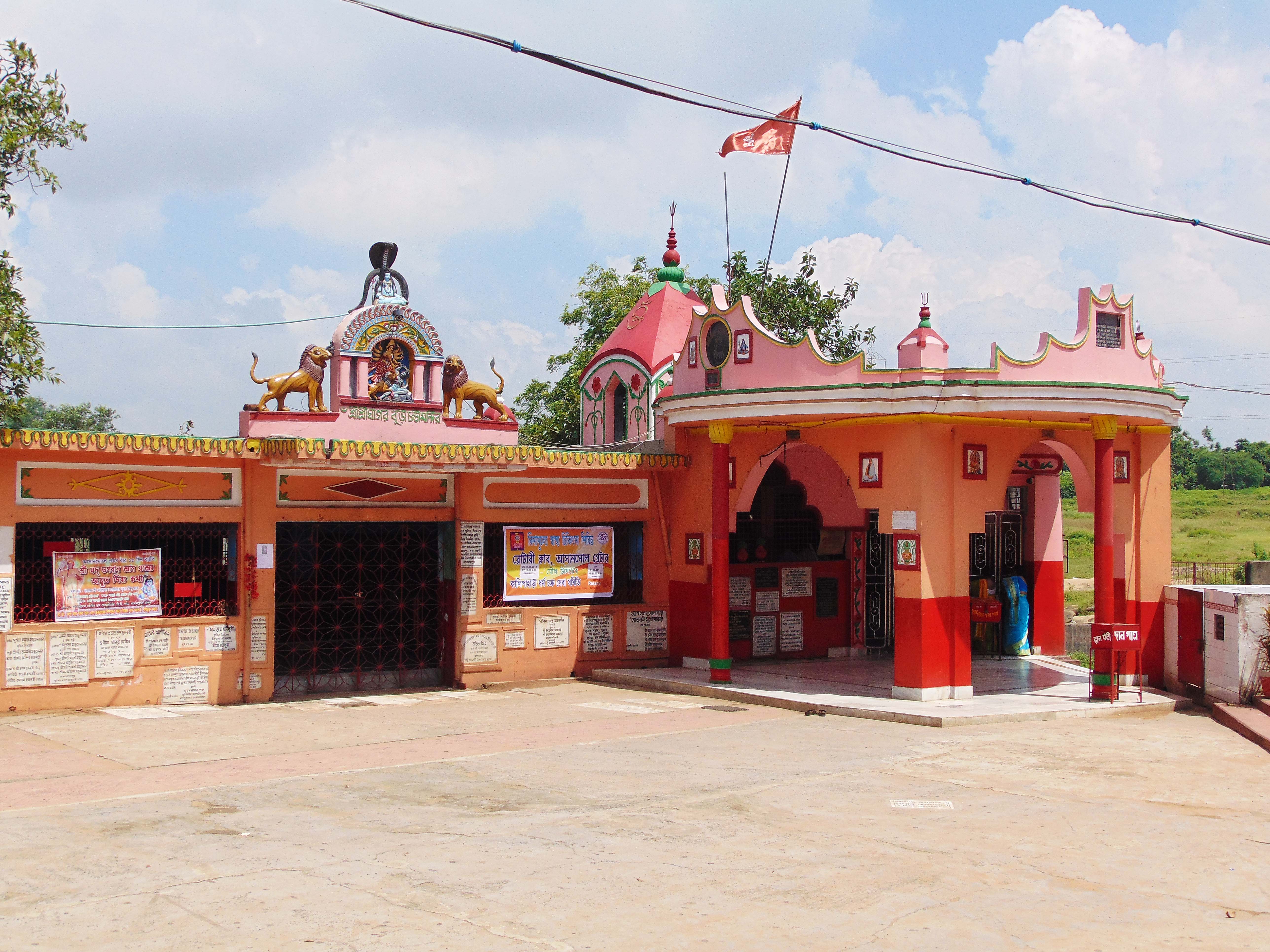 Ghaghar Burhi Chandi Temple in Asansol
 -
 Vivekananda Institute (Durand Institute), Asansol
 -
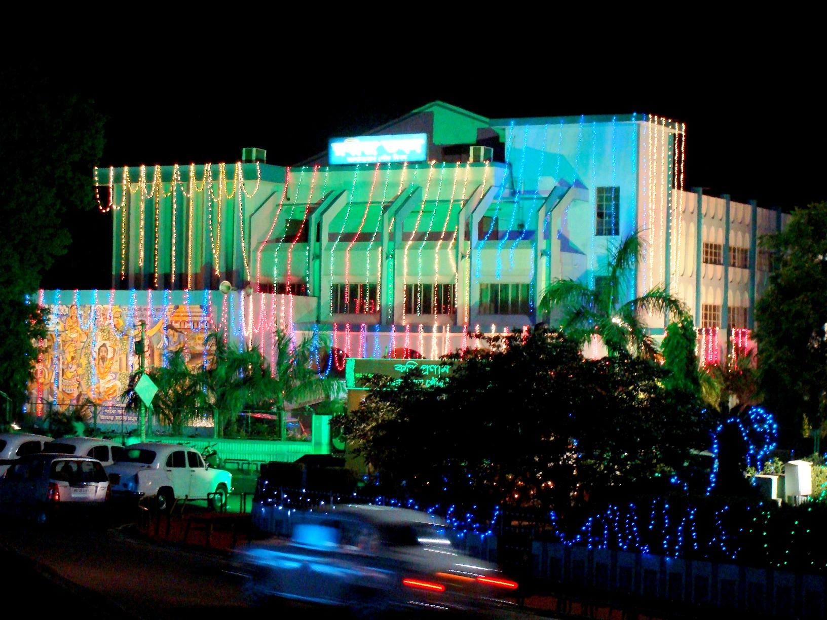 Rabindra Bhawan in Asansol
 -
 Burnpur Nehru Park in Riverside, Asansol
 -
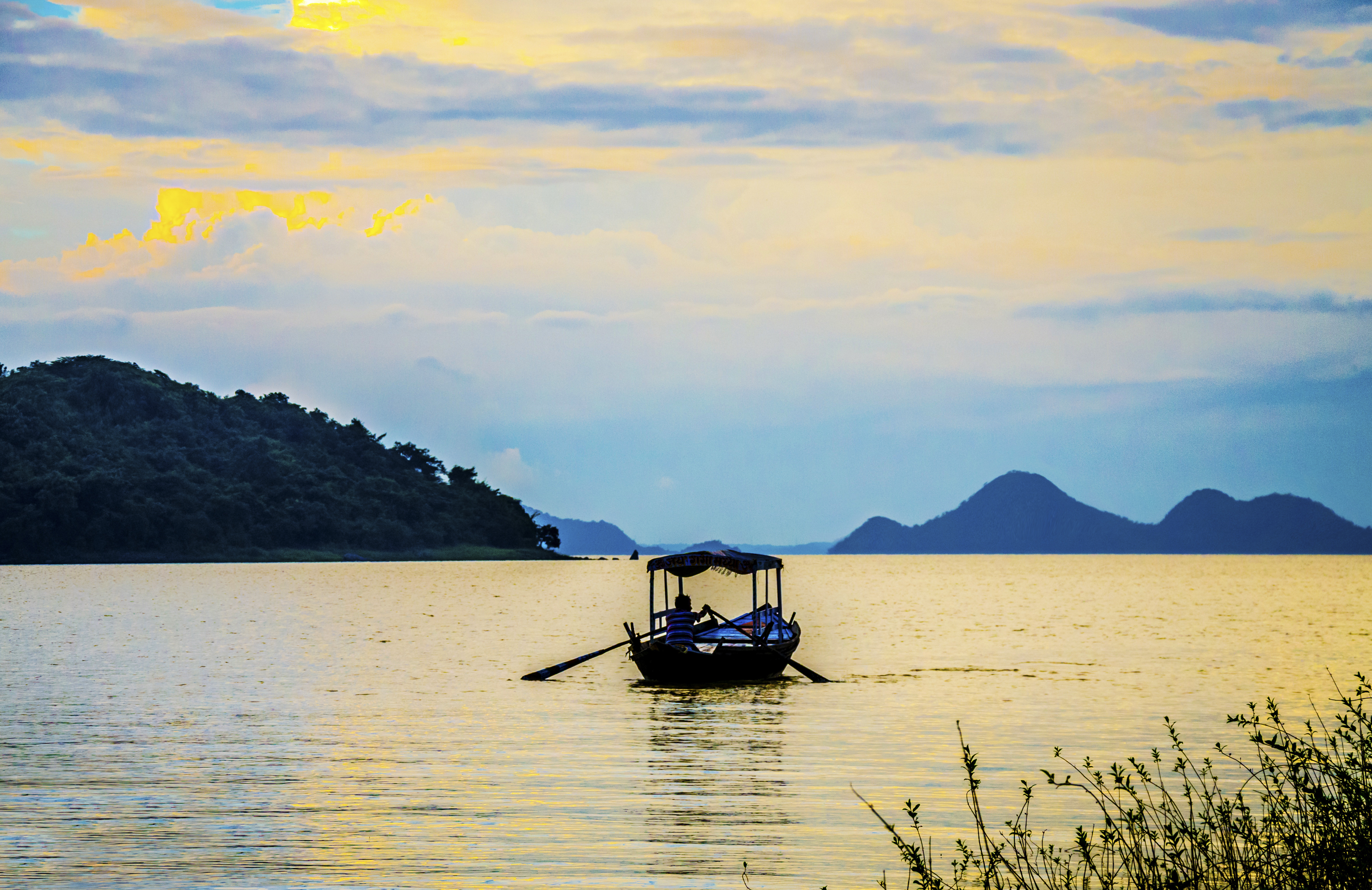 Maithon Dam
 -
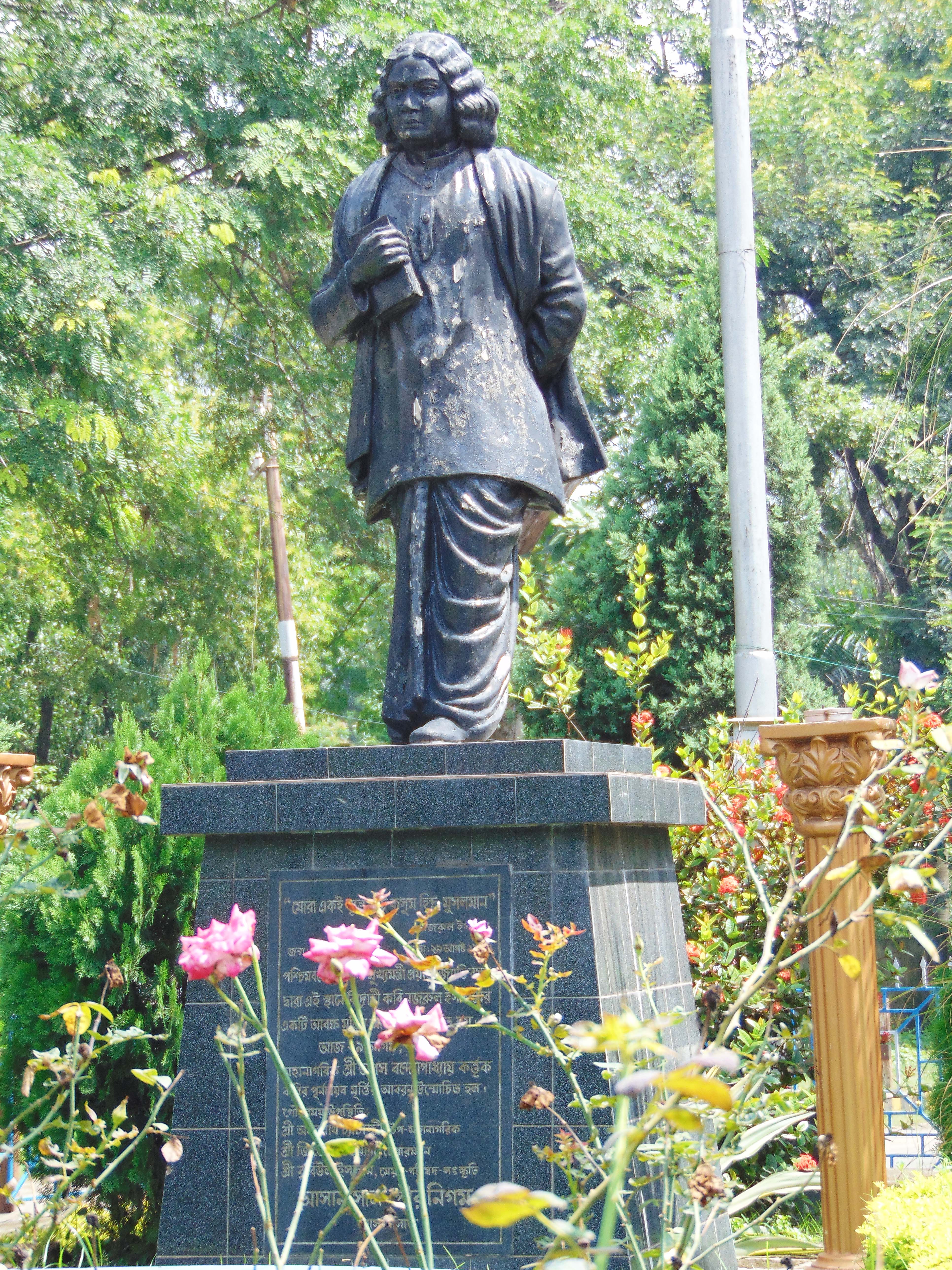 Statue of Kazi Nazrul Islam in Asansol
 -
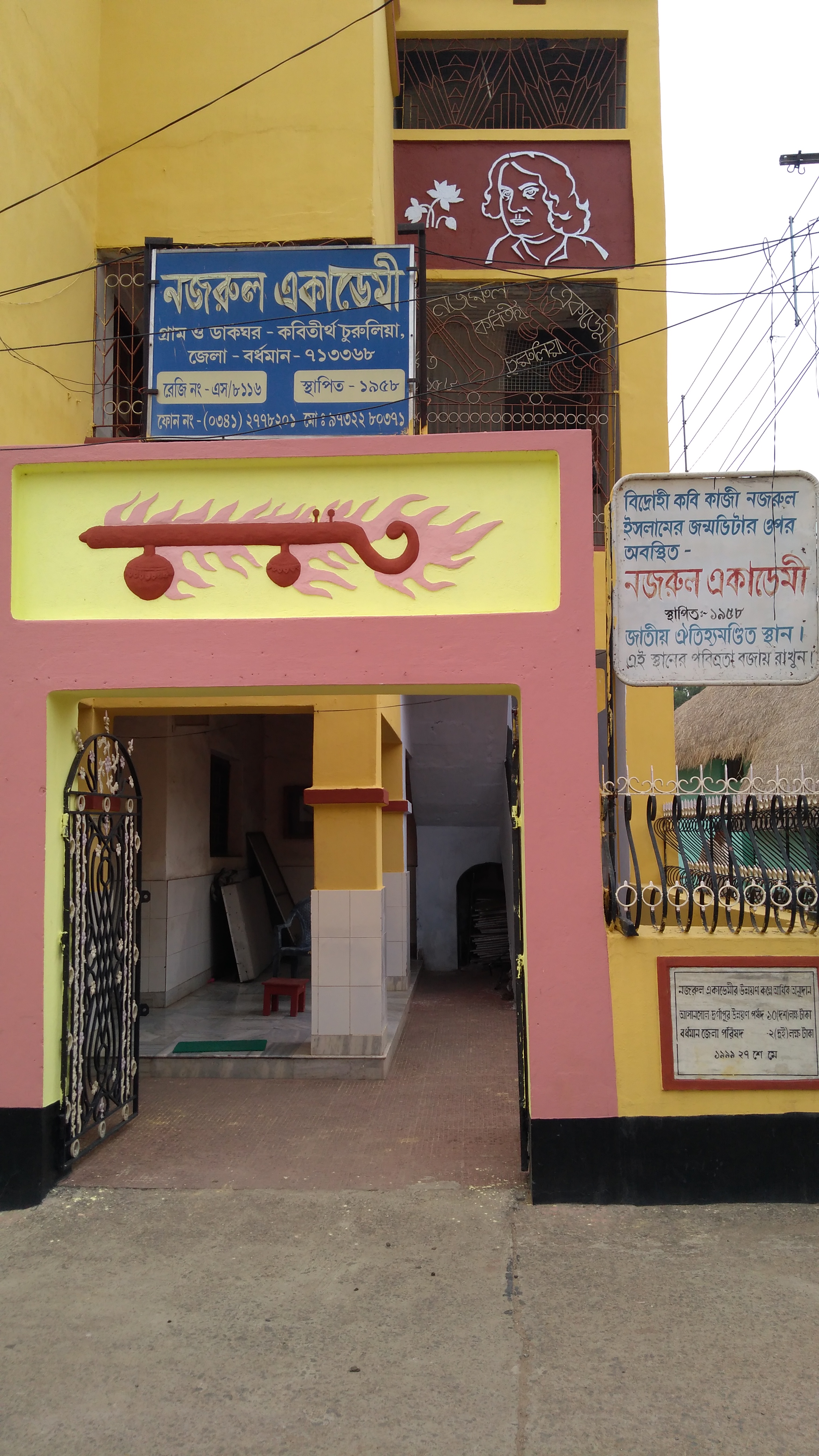 Nazrul Academy; Churulia, Birth Place of Kazi Nazrul Islam.


Notes[edit | edit source]
- ↑ Asansol subdivision of Burdwan district
- ↑ In the 1941 census all tribals were counted under 'Tribal' religion, irrespective of their actual religion.
- ↑ Including Jainism, Christianity, Buddhism, Zoroastrianism, Judaism, Ad-Dharmis, or not stated
References[edit | edit source]
- ↑ 1.0 1.1 "Fact and Figures". Wb.gov.in. Retrieved 5 July 2019.
- ↑ "52nd Report of the Commissioner for Linguistic Minorities in India" (PDF). Nclm.nic.in. Ministry of Minority Affairs. p. 85. Archived from the original (PDF) on 25 May 2017. Retrieved 5 July 2019.
- ↑ 3.0 3.1 3.2 3.3 3.4 3.5 "Census of India 2011: District Census Handbook, Bardhaman, Part XII B" (PDF). Brief History of the district. Directorate of Census Operations, West Bengal. pp. 9–11. Retrieved 12 April 2017.
- ↑ "List of Paleolithic sites in India". Important India. Archived from the original on 18 April 2017. Retrieved 18 April 2017.
- ↑ "Bardhaman district". History and Background. Bardhaman district authorities. Retrieved 18 April 2017.
- ↑ "Asansol". History. Railindia. Archived from the original on 7 May 2017. Retrieved 18 April 2017.
- ↑ Chattopadhyay, Akkori, Bardhaman Jelar Itihas O Lok Sanskriti (History and Folk lore of Bardhaman District.), (in Bengali), Vol I, pp 367-370, Radical Impression. ISBN 81-85459-36-3
- ↑ "Bengal District Gazetteers, Burdwan by JCK Peterson" (PDF). History. First published in 1910, reprinted in 1997 by the Government of West Bengal. p. 51. Retrieved 13 April 2017.
- ↑ 9.0 9.1 9.2 "About Durgapur". ADDA. Archived from the original on 18 April 2017. Retrieved 13 April 2017.
- ↑ Chattopadhyay, Akkori, Vol I, pp 345-365
- ↑ "Bardhaman District". History and Background. Bardhaman district administration. Retrieved 13 April 2017.
- ↑ 12.0 12.1 "পূর্ব ও পশ্চিম, আজ বর্ধমান জেলা ভাগের আনুষ্ঠানিক ঘোষনা মুখ্যমন্ত্রীর". ABP Ananda (in Bengali). 7 April 2017. Retrieved 9 April 2017.
- ↑ "Census of India 2011, West Bengal: District Census Handbook, Barddhaman" (PDF). Physiography. Directorate of Census Operations, West Bengal. pp. 13–14. Retrieved 20 April 2017.
- ↑ Chattopadhyay, Akkori, Bardhaman Jelar Itihas O Lok Sanskriti, Vol I, pp 14-15.
- ↑ "West Burdwan the 23rd District of West Bengal". Egiye Bangla, official portal of the Government of West Bengal. Retrieved 21 April 2017.
- ↑ 16.0 16.1 "Directory of District, Sub division, Panchayat Samiti/ Block and Gram Panchayats in West Bengal, March 2008". West Bengal. National Informatics Centre, India. 19 March 2008. Archived from the original on 25 February 2009. Retrieved 6 December 2008.
- ↑ 17.0 17.1 "Administrative Units". Bardhaman district. Retrieved 6 December 2008.
- ↑ "Population, Decadal Growth Rate, Density and General Sex Ratio by Residence and Sex, West Bengal/ District/ Sub District, 1991 and 2001". West Bengal. Directorate of census operations. Retrieved 6 December 2008. [dead link]
- ↑ "District Statistical Handbook 2014 Bardhaman". Table 2.1. Department of Statistics and Programme Implementation, Government of West Bengal. Archived from the original on 21 January 2019. Retrieved 12 March 2019.
- ↑ "Directory of District, Subdivision, Panchayat Samiti/ Block and Gram Panchayats in West Bengal". Bardhaman. Panchayats and Rural Development Department, Government of West Bengal. March 2008. Retrieved 17 February 2017.
- ↑ "The Kolkata Gazette" (PDF). Notification No. 335/MA/O/C-4/1M-36/2014 dated 3 June 2015. Department of Municipal Affairs, Government of West Bengal. Archived from the original (PDF) on 12 March 2017. Retrieved 9 March 2017.
- ↑ "District Statistical Handbook 2014 Bardhaman". Table 2.1. Department of Statistics and Programme Implementation, Government of West Bengal. Archived from the original on 21 January 2019. Retrieved 12 March 2019.
- ↑ "Directory of District, Subdivision, Panchayat Samiti/ Block and Gram Panchayats in West Bengal". Bardhaman. Panchayats and Rural Development Department, Government of West Bengal. March 2008. Retrieved 17 February 2017.
- ↑ "District Statistical Handbook 2014 Burdwan". Table 2.2, 2.4(a). Department of Statistics and Programme Implementation, Government of West Bengal. Archived from the original on 21 January 2019. Retrieved 12 March 2019.
- ↑ 25.0 25.1 "District Census Handbook: Barddhaman" (PDF). Registrar General and Census Commissioner of India. 2011.
- ↑ 26.0 26.1 26.2 "Table C-01 Population by Religion: West Bengal". Registrar General and Census Commissioner of India. 2011.
- ↑ "CENSUS OF INDIA, 1941 VOLUME VI BENGAL PROVINCE" (PDF). Retrieved 13 August 2022.
- ↑ 28.0 28.1 "C-16 Population By Mother Tongue". censusindia.gov.in. Retrieved 25 March 2021.
- ↑ Akkori Chattopadhyay, Bardhaman Jelar Itihas O Lok Sanskriti, Vol I, pp. 46-51, (Bengali), Radical, 2001, ISBN 81-85459-36-3
- ↑ "Coal India Limited". History. CIL. Archived from the original on 4 February 2018. Retrieved 4 March 2017.
- ↑ "Eastern Coalfields aim higher output from underground mining". The Hindu Business Line. 12 October 2014. Retrieved 4 March 2017.
- ↑ "Eastern Coalfields". Planning. ECL. Retrieved 4 March 2017.
- ↑ 33.0 33.1 33.2 33.3 "Asansol". Railindia. Archived from the original on 7 May 2017. Retrieved 9 February 2017.
- ↑ "The Chronology of Railway development in Eastern Indian". Railindia. Archived from the original on 16 March 2008. Retrieved 19 April 2017.
- ↑ 35.0 35.1 "Steel Authority of India Limited". IISCO Steel Plant. SAIL. Archived from the original on 3 August 2017. Retrieved 4 March 2017.
- ↑ "PM Dedicates to the Nation SAIL's Modernised & Expanded IISCO Steel Plant at Burnpur" (Press release). SAIL. Archived from the original on 22 March 2016. Retrieved 4 March 2017.
- ↑ "Chairman, SAIL reviews performance of ISP, Burnpur" (Press release). SAIL. 7 March 2015. Archived from the original on 13 October 2018. Retrieved 30 March 2017.
- ↑ "Chittaranjan Locomotive Works". Indian Railways. Archived from the original on 19 March 2014. Retrieved 4 March 2017.
- ↑ "Ballavpur Paper Mnfg. Ltd". BPML. Retrieved 7 July 2018.
- ↑ 40.0 40.1 "Brief Industrial Profile of Burdwan district" (PDF). Micro Small and Medium Industries. Retrieved 13 April 2017.
- ↑ 41.0 41.1 "Bardhaman district". Industries. Bardhaman district administration. Retrieved 20 April 2017.
- ↑ "Steel Authority of India". About Durgapur Steel Plant. SAIL. Archived from the original on 3 August 2017. Retrieved 4 March 2017.
- ↑ "Damodar Valley Corporation". Reservoirs and Barrages. DVC. Retrieved 20 April 2017.
External links[edit | edit source]
Places adjacent to Paschim Bardhaman district | |
|---|---|




.png)