




Kamal Guha (talk | contribs) No edit summary |
m update content for consistency for accuracy |
||
| (3 intermediate revisions by 2 users not shown) | |||
| Line 1: | Line 1: | ||
{{Short description|District in West Bengal, India}} | |||
{{Use dmy dates|date=January 2019}} | |||
{{Use Indian English|date=January 2019}} | |||
{{Infobox settlement | {{Infobox settlement | ||
| name | | name = Purba Bardhaman district | ||
| native_name = {{native_name|bn|Purbō Bôrdhōmān Jēlā}} | |||
| other_name = | |||
| native_name | | settlement_type = [[List of districts of West Bengal|District]] of [[West Bengal]] | ||
| image_skyline = {{Photomontage | |||
|photo1a = 108 Shiva Temple at Nababhat area of Bardhaman Town at Purba Bardhaman district in West Bengal 07.jpg | |||
|photo1b = Ajay River.jpg | |||
|photo2a = The Mosque of Pir Bahram Sakka at Bardhaman town at Purba Bardhaman district in West Bengal 01.jpg | |||
|photo2b = 108 Shiva Temple, Ambika-Kalna, Bardhaman, West Bengal.jpg | |||
|photo3a = Uddharanpur Ghat in Purba Bardhaman 16.jpg | |||
| | |size = 300 | ||
| | |foot_montage = Clockwise from top-left: 108 Shiva Temple at Nababhat, [[Ajay River]] at [[Katwa]], [[Naba Kailash Mandir]] at [[Kalna City|Kalna]], Uddharanpur Ghat, Mosque of Pir Bahram Sakka in [[Bardhaman]] | ||
| | |||
| | |||
| | |||
| | |||
| | |||
| | |||
| | |||
| | |||
}} | }} | ||
'''Purba Bardhaman district''' is | | image_map = {{maplink|frame=yes|frame-width=300|frame-height=300|frame-align=center|type=shape|id=Q29257278 |stroke-colour=#C60C30|stroke-width=2|text=Interactive Map Outlining Purba Bardhaman District}} | ||
| image_map1 = Purba Bardhaman in West Bengal (India).svg | |||
| mapsize = 300 | |||
| map_caption1 = Location of Purba Bardhaman district in West Bengal | |||
| coordinates = {{coord|23|22|N|87|58|E|type:adm3rd_region:IN-WB_dim:100000|display=inline,title}} | |||
| subdivision_type = [[List of sovereign states|Country]] | |||
| subdivision_name = [[India]] | |||
| subdivision_type1 = [[States and union territories of India|State]] | |||
| subdivision_name1 = [[West Bengal]] | |||
| subdivision_type2 = [[Administrative divisions of West Bengal|Division]] | |||
| subdivision_name2 = [[Burdwan division|Burdwan]] | |||
| seat_type = Headquarters | |||
| seat = [[Bardhaman]] | |||
| leader_title = [[List of subdivisions of West Bengal|Subdivisions]] | |||
| leader_name = [[Bardhaman Sadar North subdivision|Bardhaman Sadar North]], [[Bardhaman Sadar South subdivision|Bardhaman Sadar South]], [[Kalna subdivision|Kalna]], [[Katwa subdivision|Katwa]] | |||
| leader_title1 = [[Community Development Block|CD Blocks]] | |||
| leader_name1 = [[Ausgram I]], [[Ausgram II]], [[Bhatar (community development block)|Bhatar]], [[Burdwan I]], [[Burdwan II]], [[Galsi I]], [[Galsi II]], [[Khandaghosh (community development block)|Khandaghosh]], [[Jamalpur (community development block)|Jamalpur]], [[Memari I]], [[Memari II]], [[Raina I]], [[Raina II]], [[Kalna I]], [[Kalna II]], [[Manteswar (community development block)|Manteswar]], [[Purbasthali I]], [[Purbasthali II]], [[Katwa I]], [[Katwa II]], [[Ketugram I]], [[Ketugram II]], [[Mongalkote (community development block)|Mongakote]] | |||
| leader_title2 = [[List of constituencies of the Lok Sabha|Lok Sabha constituencies]] | |||
| leader_name2 = [[Bardhaman-Durgapur (Lok Sabha constituency)|Bardhaman-Durgapur]], [[Bardhaman Purba (Lok Sabha constituency)|Bardhaman Purba]], [[Bishnupur (Lok Sabha constituency)|Bishnupur]], [[Bolpur (Lok Sabha constituency)|Bolpur]] | |||
| leader_title3 = [[List of constituencies of the West Bengal Legislative Assembly|Vidhan Sabha constituencies]] | |||
| leader_name3 = [[Bardhaman Dakshin (Vidhan Sabha constituency)|Bardhaman Dakshin]], [[Bardhaman Uttar (Vidhan Sabha constituency)|Bardhaman Uttar]], [[Bhatar (Vidhan Sabha constituency)|Bhatar]], [[Galsi (Vidhan Sabha constituency)|Galsi]], [[Raina (Vidhan Sabha constituency)|Raina]], [[Jamalpur, West Bengal Assembly constituency|Jamalpur]], [[Memari (Vidhan Sabha constituency)|Memari]], [[Khandaghosh (Vidhan Sabha constituency)|Khandaghosh]], [[Katwa (Vidhan Sabha constituency)|Katwa]], [[Mangalkot (Vidhan Sabha constituency)|Mangalkot]], [[Ketugram (Vidhan Sabha constituency)|Ketugram]], [[Ausgram (Vidhan Sabha constituency)|Ausgram]], [[Kalna (Vidhan Sabha constituency)|Kalna]], [[Purbasthali Dakshin (Vidhan Sabha constituency)|Purbasthali Dakshin]], [[Purbasthali Uttar (Vidhan Sabha constituency)|Purbasthali Uttar]], [[Manteswar (Vidhan Sabha constituency)|Manteswar]] | |||
| total_type = Total | |||
| area_total_km2 = 5432.69 | |||
| area_footnotes = | |||
| population_as_of = 2011 | |||
| population_total = 4,835,532 | |||
| population_footnotes = | |||
| population_urban = | |||
| population_density_km2 = auto | |||
| demographics_type1 = Demographics | |||
| demographics1_title1 = [[Literacy in India|Literacy]] | |||
| demographics1_info1 = 74.73 per cent | |||
| demographics1_title2 = [[Human sex ratio|Sex ratio]] | |||
| demographics1_info2 = 945 [[male|♂]]/[[female|♀]] | |||
| demographics_type2 = Languages | |||
| demographics2_title1 = Official | |||
| demographics2_info1 = [[Bengali language|Bengali]]<ref name="wblangoff">{{cite web|title=Fact and Figures|url=https://wb.gov.in/portal/web/guest/facts-and-figures;jsessionid=JzdD9RHb7aMY5esZPtcsIVLy|website=Wb.gov.in|access-date=5 July 2019}}</ref><ref>{{cite web|title=52nd Report of the Commissioner for Linguistic Minorities in India|url=http://nclm.nic.in/shared/linkimages/NCLM52ndReport.pdf|website=Nclm.nic.in|publisher=[[Ministry of Minority Affairs]]|access-date=5 July 2019|page=85|url-status=dead|archive-url=https://web.archive.org/web/20170525141614/http://nclm.nic.in/shared/linkimages/NCLM52ndReport.pdf|archive-date=25 May 2017}}</ref> | |||
| demographics2_title2 = Additional official | |||
| demographics2_info2 = [[English language|English]]<ref name="wblangoff"/> | |||
| timezone1 = [[Indian Standard Time|IST]] | |||
| utc_offset1 = +05:30 | |||
| website = {{URL|purbabardhaman.gov.in/}} | |||
}} | |||
'''Purba Bardhaman district''' is in the Indian state of [[West Bengal]]. Its headquarters is in [[Bardhaman]]. It was formed on 7 April 2017 after the division of the previous [[Bardhaman district]]. | |||
==Etymology== | |||
Some historians link the name of the district to the 24th and last [[Jainism|Jain]] ''[[tirthankara]]'', [[Mahavira|Mahavira Vardhamana]], who came to preach in the area. Alternatively, ''Bardhamana'' means a prosperous and growing area. It was a forward frontier zone in the progress of [[Indo-Aryanisation|Aryanisation]] by the people in the Upper Gangetic valley.<ref name= 2011censushandbook>{{cite web | url = http://www.censusindia.gov.in/2011census/dchb/1909_PART_B_DCHB_BARDDHAMAN.pdf| title = Census of India 2011: District Census Handbook, Bardhaman, Part XII B | work = Brief History of the district, pages 9 - 11 | publisher = Directorate of Census Operations, West Bengal |access-date = 12 April 2017}}</ref> ''Purba'' means east. | |||
==History== | ==History== | ||
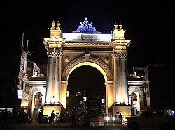
Bardhaman | [[File:Curzon Gate.jpg|thumb|250px|[[Curzon Gate, Bardhaman|Curzon Gate]] in Bardhaman|left]] | ||
The district is recorded in the early 20th century British chronicles as 'the richest tract in Bengal and the area of its oldest and most settled cultivation'. Archaeological excavations at [[Pandu Rajar Dhibi]] have indicated settlements in the [[Ajay River|Ajay]] valley in the [[Mesolithic]] age, around 5,000 BC. In early historical times [[Bardhamanbhukti]], a part of the [[Rarh region]], was ruled successively by the [[Magadha (Mahajanapada)|Magadha]]s, [[Maurya Empire|Mauryas]], [[Kushan Empire|Kushanas]] and [[Gupta Empire|Guptas]]. In the 7th century AD, when [[Shashanka]] was king, the area was part of the [[Gauda Kingdom]]. It was subsequently ruled by the [[Pala Empire|Palas]] and [[Sena Dynasty|Senas]].<ref name= 2011censushandbook/> | |||
[[Muhammad bin Bakhtiyar Khilji|Bakhtiyar Khilji]] captured it in 1199 AD. The early Muslim rulers ruled over major parts of Bengal from [[Gauḍa (city)|Gauda]] or Lakhnauti. In ''[[Ain-i-Akbari]]'', Bardhaman is mentioned as a ''mahal'' or ''pargana'' of ''Sarcar Sharifabad''. Some western parts of Bardhaman formed Gopbhum, ruled for many centuries by the [[Sadgop]] kings. There are remains of a fort at [[Amrargar]].<ref name= 2011censushandbook/> | |||
In 1689, Raja Krishnaram Roy, of the [[Bardhaman Raj|Bardhaman Raj family]], obtained from [[Aurangzeb]] a {{Transliteration|bn|farman}} (royal decree) which made him the ''[[zamindar]]'' (landlord) of Bardhaman, and since then the Raj family's history became identical with that of the district.<ref name= 2011censushandbook/> After the death of Aurangzeb, the [[Mughal Empire]] became weak and [[Murshid Quli Khan]] became the [[Nawabs of Bengal and Murshidabad|Nawab of Bengal]], owning only nominal allegiance to the Mughal emperor. At that time Bardhaman was referred to as a {{Transliteration|bn|chakla}}, a change from the earlier ''pargana''. Subsequently, during the reign of [[Alivardi Khan]], the [[Bargi]]s attacked and plundered Bardhaman.<ref name= 2011censushandbook/> | |||
After the victory of the British in the [[Battle of Plassey]] in 1757, Bardhaman, Medinipur and Chittagong were ceded to the [[East India Company]]. In 1857, the [[British Crown]] took over the administration of the country from the East India Company.<ref name= 2011censushandbook/> | |||
In 1765, when East India Company acquired the ''diwani'' of Bardhaman, it was composed of Bardhaman, Bankura, Hooghly and a third of Birbhum. Hooghly was separated in 1820, Bankura and Birbhum in 1837.<ref name="chattopadyay1">Chattopadhyay, Akkori, ''Bardhaman Jelar Itihas O Lok Sanskriti'' (History and Folk lore of Bardhaman District.), {{in lang|bn}}, Vol I, pp 367-370, Radical Impression. {{ISBN|81-85459-36-3}}</ref> | |||
In 1765, Tilakchand Ray, as the ''zamindar'' of Bardhaman, controlled 75 ''parganas'' and also looked after the law and order. At the time of the [[Permanent Settlement]] of [[Charles Cornwallis, 1st Marquess Cornwallis|Lord Cornwallis]] in 1793, the {{Transliteration|bn|chaklas}} were reduced in size, in order to make them more manageable, and districts were created. Six subdivisions were created in Bardhaman district – Bud Bud in 1846, Katwa, Raniganj, Jahanabad (later named Arambagh), Bardhaman Sadar in 1847 and Kalna in 1850. The ''parganas'' were converted to ''thanas'' (police stations). At that time Bardhaman district had 22 {{Transliteration|bn|thanas}}. Later, Jahanabad was transferred out of Bardhaman. Some minor changes continued.<ref name="chattopadyay1"/> | |||
The Permanent Settlement ultimately led to the dismemberment of the Bardhaman estate. As the rajas often failed to pay the rent demands, some parts of the estate were auctioned off. However, there were bright spots. Mahatabchand was appointed additional member of the [[Viceroy's Executive Council]] and in 1877 was allowed to use the title of ''His Highness'' before his name. [[Bijay Chand Mahtab|Bijoy Chand Mahatab]] was conferred the title of ''Maharajadhiraj'' by [[Gilbert John Elliot-Murray-Kynynmound, 4th Earl of Minto|Lord Minto]] in 1908. [[Uday Chand Mahtab]] took over in 1941 and served till abolition of the zamindary system in 1954, after independence of the country.<ref>Chattopadhyay, Akkori, Vol I, pp 345-365</ref><ref name=districtadmin>{{cite web | url = http://bardhaman.gov.in/histandback.html | title = Bardhaman District | work = History and Background | publisher = Bardhaman district administration |access-date = 13 April 2017}}</ref> | |||
Bardhaman district was bifurcated into two districts, Purba Bardhaman and [[Paschim Bardhaman district|Paschim Bardhman]], on 7 April 2017.<ref name=abp>{{cite web | url = http://abpananda.abplive.in/state/burdwan-district-bifurcation-today-324944 | title = পূর্ব ও পশ্চিম, আজ বর্ধমান জেলা ভাগের আনুষ্ঠানিক ঘোষনা মুখ্যমন্ত্রীর | date = 7 April 2017 |language = bn | publisher = ABP Ananda, 7 April 2017 |access-date = 9 April 2017}}</ref> | |||
==Geography== | ==Geography== | ||
===Overview=== | |||
Purba Bardhaman district is a flat [[alluvial]] plain area that can be divided into four prominent topographical regions. On the north, the Kanksa Ketugram Plain lies along the [[Ajay River|Ajay]], which joins the [[Hooghly River|Bhagirathi]]. The Bardhaman Plain occupies the central area of the district, with the [[Damodar River|Damodar]] on the south and the south-east. On the southern part is the Khandaghosh Plain. The Bhagirathi flows along the eastern boundary of the district, and the Bhagirathi Basin occupies the eastern part of the district. The undulating laterite topography of [[Paschim Bardhaman district]] extends up to Ausgram area of this district.<ref>Chattopadhyay, Akkori, ''Bardhaman Jelar Itihas O Lok Sanskriti'' (History and Folk lore of Bardhaman District.), {{in lang|bn}}, Vol I, p18,28, Radical Impression. {{ISBN|81-85459-36-3}}</ref><ref>{{cite web| url = http://www.censusindia.gov.in/2011census/DCHB/DCHB_A/19/1909_PART_A_DCHB_BARDDHAMAN.pdf |title = Census of India 2011, West Bengal: District Census Handbook, Barddhaman |work = Physiography, pages 13-14| publisher= Directorate of Census Operations, West Bengal | access-date = 3 March 2017}}</ref> | |||
[[File:Roypara gopal temple.jpg|thumb|Roypara Gopal Jeu Temple at [[Majigram]]|left]] | |||
[[File:Sales Counter - Adi Langcha House - AH-1 - Saktigarh 2014-06-29 5588.JPG|thumb|right|250px|A [[Lyangcha|langcha]] shop in [[Saktigarh, Bardhaman|Saktigarh]]]] | |||
Purba Bardhaman district | ===Climate=== | ||
Purba Bardhaman district has a tropical climate - hot and humid. While the hottest month is May, the coldest is January. The [[monsoon]] season is from June to September, with an annual average rainfall of 1,400 mm, 75% of it falling in the monsoon months. Localised thunderstorms, called ''[[Norwesters|kalbaisakhi]]'' in Bengali, are a special feature from March until the monsoon sets in.<ref>{{cite web | url = http://www.censusindia.gov.in/2011census/DCHB/DCHB_A/19/1909_PART_A_DCHB_BARDDHAMAN.pdf | title = 2011 District Census Handbook Bardhaman Part XII A | work = Climate on page 17 | publisher = Directorate of Census Operations, West Bengal | access-date = 6 March 2017}}</ref> | |||
Purba Bardhaman district is | ===Administrative divisions=== | ||
Purba Bardhaman district is divided into the following administrative subdivisions:<ref name=handbook2014>{{cite web |url = http://wbpspm.gov.in/publications/District%20Statistical%20Handbook |title = District Statistical Handbook 2014 Burdwan |work = Table 2.2, 2.4(a) |publisher = Department of Statistics and Programme Implementation, Government of West Bengal |access-date = 17 February 2017 |archive-url = https://web.archive.org/web/20190121045803/http://www.wbpspm.gov.in/publications/District%20Statistical%20Handbook |archive-date = 21 January 2019 |url-status = dead }}</ref><ref name=abp/> | |||
[[ | {| class="wikitable sortable" | ||
|- | |||
! Subdivision ||Headquarters||<br />Area<br />km<sup>2</sup> || Population<br />(2011) ||Rural<br />Population %<br />(2011)||Urban<br /> Population % <br />(2011) | |||
|- | |||
|[[Bardhaman Sadar North subdivision|Bardhaman Sadar North]]||[[Bardhaman]]||1,958.43||1,586,623||73.58||26.42 | |||
|- | |||
|[[Bardhaman Sadar South subdivision|Bardhaman Sadar South]]||[[Bardhaman]]||1,410.03||1,198,155||95.54||4.46 | |||
|- | |||
|[[Katwa subdivision|Katwa]]||[[Katwa]]||1,070.48||963,022||88.44||11.56 | |||
|- | |||
|[[Kalna subdivision|Kalna]]||[[Kalna, India|Kalna]]||993.75||1,097,732||87.00||13.00 | |||
|- | |||
|'''Purba Bardhaman district'''||[[Bardhaman]]||5,432.69||4,835,532||84.98||15.02 | |||
|- | |||
|} | |||
[[Community | The district comprises four subdivisions:<ref name=abp/><ref name=handbook2014/><ref name=blocdir>{{cite web | ||
|url=http://wbdemo5.nic.in/writereaddata/Directoryof_District_Block_GPs(RevisedMarch-2008).doc |title=Directory of District, Sub division, Panchayat Samiti/ Block and Gram Panchayats in West Bengal, March 2008 |date=19 March 2008 |access-date=6 December 2008 |work=West Bengal |publisher=National Informatics Centre, India |url-status=dead |archive-url=https://web.archive.org/web/20090225032419/http://wbdemo5.nic.in/writereaddata/Directoryof_District_Block_GPs(RevisedMarch-2008).doc |archive-date=25 February 2009 | |||
}}</ref> | |||
* [[Kalna subdivision]] consists of one municipality at Kalna and five [[Community development block in India|CD blocks]]: [[Kalna I]], [[Kalna II]], [[Manteswar (community development block)|Manteswar]], [[Purbasthali I]] and [[Purbasthali II]]. | |||
* [[Katwa subdivision]] consists of two municipalities at [[Katwa]] and [[Dainhat]] and five CD blocks: [[Katwa I]], [[Katwa II]], [[Ketugram I]], [[Ketugram II]] and [[Mongalkote (community development block)|Mongakote]]. | |||
* [[Bardhaman Sadar North subdivision]] consists of two municipalities at [[Bardhaman]] and [[Guskara]] and seven CD blocks: [[Ausgram I]], [[Ausgram II]], [[Bhatar (community development block)|Bhatar]], [[Burdwan I]], [[Burdwan II]], [[Galsi I]] and [[Galsi II]]. | |||
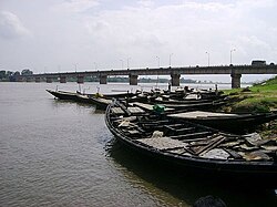
[[File:Damodar River.jpg|thumb|200px|right|''Krishak Setu'' across the [[Damodar River|Damodar]] near [[Bardhaman]]]] | |||
* [[Bardhaman Sadar South subdivision]] consists of one municipality at [[Memari]] and six CD blocks: [[Khandaghosh (community development block)|Khandaghosh]], [[Jamalpur (community development block)|Jamalpur]], [[Memari I]], [[Memari II]], [[Raina I]] and [[Raina II]]. | |||
[[File:Map of purba bardhaman district.jpg|500x500px|thumb|center|Map of purba bardhaman district]] | |||
==Demographics== | ==Demographics== | ||
Purba Bardhaman | As per the [[2011 Census of India]] data, recast after bifurcation of Bardhaman district in 2017, Purba Bardhaman district had a total population of 4,835,532. There were 2,469,310 (51%) males and 2,366,222 (49%) females. Population below 6 years was 509,855. 726,345 (15.02%) live in urban areas. Scheduled Castes and Scheduled Tribes make up 1,487,151 (30.75%) and 327,501 (6.77%) of the population respectively.<ref name=census2011>{{Cite web |date=2011 |title=District Census Handbook: Barddhaman |url=https://censusindia.gov.in/nada/index.php/catalog/1344/download/4390/DH_2011_1909_PART_A_DCHB_BARDDHAMAN.pdf |website=censusindia.gov.in |publisher=[[Registrar General and Census Commissioner of India]]}}</ref> | ||
As per the 2011 census data, recast after bifurcation of Bardhaman district in 2017, the total number of literates in Purba Bardhaman district was 3,232,452 (74.73% of the population over 6 years) out of which males numbered 1,781,090 (80.60% of the male population over 6 years) and females numbered 1,453,362 (68.66% of the female population over 6 years).<ref name=census2011/> | |||
{{See also|List of West Bengal districts ranked by literacy rate}} | |||
=== Religion === | |||
{{bar box | |||
|title=Religion in Purba Bardhaman district (2011)<ref name="religion"/> | |||
|titlebar=#Fcd116 | |||
|left1= | |||
|float=right | |||
|bars= | |||
{{bar percent|[[Hinduism in West Bengal|Hinduism]]|darkorange|73.75}} | |||
{{bar percent|[[Islam in West Bengal|Islam]]|green|25.14}} | |||
{{bar percent|Other <small>(tribal religion)</small>|maroon|0.67}} | |||
{{bar percent|Other or not stated|black|0.45}} | |||
}} | |||
{| class="wikitable sortable" | |||
|+ ''Religion in present-day Purba Bardhaman district (1941)'' | |||
|- | |||
! Religion | |||
! Population (1941)<ref name="1941religion">{{cite web|url=https://dspace.gipe.ac.in/xmlui/bitstream/handle/10973/37365/GIPE-020591.pdf?sequence=3&isAllowed=y|title=CENSUS OF INDIA, 1941 VOLUME VI BENGAL PROVINCE|access-date=13 August 2022}}</ref>{{rp|74}} | |||
! Percentage (1941) | |||
!Population (2011)<ref name="religion">{{Cite web |date=2011 |title=Table C-01 Population by Religion: West Bengal |url=https://censusindia.gov.in/nada/index.php/catalog/11396/download/14509/DDW19C-01%20MDDS.XLS |website=censusindia.gov.in |publisher=[[Registrar General and Census Commissioner of India]]}}</ref> | |||
!Percentage (2011) | |||
|- | |||
| [[Hinduism]] [[File:Om.svg|15px]] | |||
| 922,290 | |||
|71.77% | |||
|3,566,068 | |||
|73.75% | |||
|- | |||
| [[Islam]] [[File:Star and Crescent.svg|15px]] | |||
| 277,573 | |||
|21.60% | |||
|1,215,737 | |||
|25.14% | |||
|- | |||
| Tribal religion{{Efn|In the 1941 census all tribals were counted under 'Tribal' religion, irrespective of their actual religion.|group=lower-alpha}} | |||
| 84,493 | |||
|6.58% | |||
| 32,396 | |||
| 0.67% | |||
|- | |||
| Others{{efn|Including [[Jainism]], [[Christianity]], [[Buddhism]], [[Zoroastrianism]], [[Judaism]], [[Ad-Dharmi]]s, or not stated}} | |||
| 687 | |||
|0.05% | |||
|21,331 | |||
|0.44% | |||
|- | |||
| '''Total Population''' | |||
| '''1,285,043''' | |||
| '''{{Percentage | 214404 | 214404 | 2 }}''' | |||
|'''4,835,532''' | |||
|'''100%''' | |||
|} | |||
Hinduism is the majority religion, while Islam is the second-largest religion. The many zamindars of Bardhaman, largely Hindus, built many family temples which dot the landscape. Most of the tribals follow Hinduism but with the flavour of their tribal religion. | |||
Islam is more concentrated in rural areas, and makes up a significant minority in Ketugram I (46.77%) and Manteswar (41.77%) CD blocks.<ref name="religion" /> | |||
=== Languages === | |||
{{Pie chart | |||
|thumb = right | |||
|caption = Languages of Purba Bardhaman district (2011)<ref name="languages"/> | |||
|label1 = [[Bengali language|Bengali]] |value1 = 92.86 |color1 = orchid | |||
|label2 = [[Santali language|Santali]] |value2 = 5.03 |color2 = darkturquoise | |||
|label3 = [[Hindi]] |value3 = 1.66 |color3 = orange | |||
|label4 = Others |value4 = 0.45 |color4 = Grey | |||
}} | |||
According to the 2011 census, 92.86% of the population in what is now Purba Bardhaman district spoke [[Bengali language|Bengali]], 5.03% [[Santali language|Santali]] and 1.66% [[Hindi]] as their first language.<ref name="languages">{{Cite web |title=Table C-16 Population by Mother Tongue: West Bengal|url=https://censusindia.gov.in/nada/index.php/catalog/10226/download/13338/DDW-C16-STMT-MDDS-1900.XLSX|website=www.censusindia.gov.in|publisher=[[Registrar General and Census Commissioner of India]]}}</ref> | |||
==Flora== | |||
The flora of Purba Bardhaman district is composed mostly of woody plants. Amongst the flora are: Simul ([[Bombax ceiba|Salmalia malabarica]]), neem ([[Azadirachta indica]], amlaki ([[Phyllanthus emblica]]), Indian ash tree ([[Lannea coromandelica]]), [[coconut]], [[date palm]], tal (Palmyra palm / [[Borassus flabellifer]]), bat (banyan/ [[Ficus benghalensis]]), asvattha (pipal/ [[Ficus religiosa]]), palash ([[Butea monosperma]]), krishnachuda ([[Caesalpinia pulcherrima]]) and am ([[mango]]/ [[mangifera indica]]). There are some shrubby plants: ashsheoda (orangeberry/ [[Glycosmis pentaphylla]], {{Transliteration|bn|pianj}} (onion), rasun ([[garlic]]), rajanigandha (tube rose/''[[Agave amica]]''), gulancha ([[Tinospora cordifolia]]), tulsi (basil/ [[Ocimum tenuiflorum]]) etc.<ref name=districtadmin1>{{cite web | url = http://bardhaman.gov.in/geography.html | title = Bardhaman District | work = Geography - Flora, Fauna | publisher = Bardhaman district administration |access-date = 13 April 2017}}</ref> | |||
The common aquatic or marsh weeds found in jheels (lakes) and swamps of the eastern part of the district (in the Bhagirathi Basin) are: bena (andropogon squarrosos), water hyacinth ([[Eichhornia crassipes]]), padma ([[nelumbo nucifera]]), hogla ([[Typha domingensis]]) etc.<ref name=districtadmin/> | |||
==Fauna== | |||
The mammals of the district include [[Gray wolf|wolf]] and [[golden jackal]] whilst [[wild boar]] and [[monkey]]s (including [[hanuman]]) are seen frequently. Poisonous snakes such as [[Indian cobra]], [[common krait]] and [[Russell's viper]], as well as dhamnas and harmless grass snakes are very common. The common avifauna of the district include [[red-vented bulbul]], [[bluethroat]], [[Indian robin]] and [[common myna]]. Other bird species include [[fowl]]s, [[crow]]s, [[munia]], [[Old World sparrow|sparrow]], [[cuckoo]], [[Asian koel]], [[parakeet]], [[woodpecker]], [[kingfisher]], [[owl]], [[vulture]], [[eagle]], [[Kite (bird)|kite]], [[hawk]], [[stork]], [[duck]], [[Columbidae|pigeon]], [[falcon]] and [[heron]]. The low lying swampy areas are home to [[bird migration|migratory birds]] in winter.<ref name=districtadmin1/> | |||
The principal varieties fish caught are [[rohu]], [[Mrigal carp|mrigala]], [[catla]], {{Transliteration|bn|kharke bata}} (reba), {{Transliteration|bn|bhangan bata}} (bata), [[shrimp]] (smaller variety of [[prawn]]), {{Transliteration|bn|maurala, pabda, tengra, bele, chela, punti, [[Wallago attu|boal]], aid, galda}} (large variety of [[prawn]]), {{Transliteration|bn|vacha, chital, pholoi, khaira, fensa, silon}}, and {{Transliteration|bn|bhola}}.<ref name=districtadmin1/> | |||
==Rural poverty== | |||
According to the District Human Development Report, Bardhaman, "The legendary prosperity of Bardhaman in history has to be taken as that of the ruling class – the rich, the royals and their assistants." It is only in the relatively recent past that the focus has shifted to the toiling masses.<ref>{{cite web | url = http://wbplan.gov.in/HumanDev/DHDR/District%20DEV%20Report.%20Burdwan%20%202012%20total%20Book%20Curve%20Red.pdf | title = District Human Development Report, Bardhaman, 2011 | work = Chapter I Introduction, page 2 | publisher = Development and Planning Department, Government of West Bengal | access-date = 27 April 2017 | archive-url = https://web.archive.org/web/20170814062640/http://wbplan.gov.in/HumanDev/DHDR/District%20DEV%20Report.%20Burdwan%20%202012%20total%20Book%20Curve%20Red.pdf | archive-date = 14 August 2017 | url-status = dead }}</ref> | |||
As per the rural household survey conducted by the state government in 2005, the percentage of rural households living [[Below Poverty Line (India)|below poverty line]] in the old Bardhaman district was 33.49%. Using the same data the percentage of households living below poverty line in Purba Bardhaman district is 37.14%.<ref>{{cite web | url = http://wbplan.gov.in/HumanDev/DHDR/District%20DEV%20Report.%20Burdwan%20%202012%20total%20Book%20Curve%20Red.pdf | title = District Human Development Report, Bardhaman, 2011 | work = Chapter VI Poverty and Inequality in Bardhaman, pages 85-128 | publisher = Development and Planning Department, Government of West Bengal | access-date = 27 April 2017 | archive-url = https://web.archive.org/web/20170814062640/http://wbplan.gov.in/HumanDev/DHDR/District%20DEV%20Report.%20Burdwan%20%202012%20total%20Book%20Curve%20Red.pdf | archive-date = 14 August 2017 | url-status = dead }}</ref> | |||
==Economy== | ==Economy== | ||
===Agriculture=== | |||
Purba Bardhaman is an agriculturally prosperous district of West Bengal. The soil and climate of the district favour the production of food grains. The undivided Bardhaman district was the largest producer of rice in West Bengal, and bulk of it was produced in what is now Purba Bardhaman district. Rice, the major crop has three varieties – Aus (in autumn), Aman (in winter) and Boro (in summer). Other than cereals and pulses, cash crops such as mustard, til, jute and potatoes are also grown.<ref name=agriculture>{{cite web | url = http://wbplan.gov.in/HumanDev/DHDR/District%20DEV%20Report.%20Burdwan%20%202012%20total%20Book%20Curve%20Red.pdf | title = District Human Development Report Bardhaman, March 2011 | work = pages 37, 50-58 | publisher = Development and Planning Department, Government of West Bengal | access-date = 13 April 2017 | archive-url = https://web.archive.org/web/20170814062640/http://wbplan.gov.in/HumanDev/DHDR/District%20DEV%20Report.%20Burdwan%20%202012%20total%20Book%20Curve%20Red.pdf | archive-date = 14 August 2017 | url-status = dead }}</ref> | |||
The year 1953 was a major turning point for agriculture in the district. Prior to 1953, cultivation was largely monsoon-dependent. In 1953, the irrigation projects of [[Damodar Valley Corporation]] were implemented. Irrigation and intensive cropping pattern provided the real momentum to agriculture. The undivided Bardhaman district topped the state with maximum irrigated land. The district utilises both surface water and groundwater for irrigation. In 2003–2004, 27.07% of the gross cropped area was under irrigation. 65.51% of the reported area was net sown area.<ref name=agriculture/> | |||
[[Operation Barga]] provided tenurial security and increased the share of produce in favour of the tenants. In the 1980s agricultural production reflected robust growth rates against stagnation in the previous decades. Horticulture, pisciculture, dairy etc. have successfully emerged as economically rewarding viable options for diversifying.<ref name=agriculture/> | |||
===Industry and crafts=== | |||
At the time of bifurcation of Bardhaman district in 2017, the mining and industrial areas of the district were placed in Paschim Bardhaman district and the Purba Bardhaman district was composed of rural/ agricultural areas.<ref>{{cite news | url = https://economictimes.indiatimes.com/news/politics-and-nation/burdwan-district-bifurcation-before-next-durga-puja-mamata-banerjee/articleshow/49997195.cms| title = Burdwan district bifurcation before next Durga Puja: Mamata Banerjee | newspaper = The Economic Times | publisher = The Economic Times, 1 December 2015|access-date = 17 February 2019}}</ref><ref>{{cite news | url = https://www.thehindu.com/news/national/other-states/wb-govt-plans-bifurcation-of-burdwan-district/article2621592.ece | title = WB Govt plans bifurcation of Burdwan district | newspaper = The Hindu | date = 12 November 2011 | publisher = The Hindu, 12 November 2011|access-date =17 February 2019}}</ref> Purba Bardhaman district has some medium scale enterprises. Since it is an agro-based area, it has many rice mills. The other industries are: rice bran oil, cold storage, oil mill, chira mill, bakery, L.P.G. gas filling plant, transformer manufacturing/repairing, automobile spare parts etc. There is an industrial estate at [[Saktigarh, Bardhaman|Saktigarh]]. In a report by the Micro, Small and Medium Industries Development Institute, it says that the degree of excellence of products like, [[sholapith|sola]] craft of [[Bankapasi]] and [[dhokra]] of [[Dwariapur, Bardhaman|Dwariapur]] is now acceptable to European markets. There are rural wood carving artisans who are maintain the continuity of their traditional art.<ref>{{cite web | url = http://www.dcmsme.gov.in/dips/BURDWAN.pdf| title = Brief Industrial Profile of Burdwan district| work = Pages 14-15 : 3.10 Industrial Scenario | publisher = MSME Development Institute, Kolkata|access-date = 17 February 2019}}</ref> Amongst the other crafts in Purba Bardhaman district are: clay craft, including terracotta work and idol making, wooden dolls, stone carving, bamboo and cane craft and [[kantha]] designing.<ref>Chattopadhyay, Akkori, ''Bardhaman Jelar Itihas O Lok Sanskriti'' (History and Folk lore of Bardhaman District.), {{in lang|bn}}, Vol II, pages 469-492, Radical Impression. {{ISBN|81-85459-36-3}}</ref> There is a vibrant weaving network around [[Kalna, India|Kalna]], [[Dhatrigram]] and | |||
[[Samudragarh]].<ref>{{cite web | url = http://www.indiaprofile.com/art-crafts/bengal-art.htm | title = A Traditional Panorama - Bengal Art|access-date = 17 February 2019| work = Arts and Crafts in India| publisher =India Profile}}</ref> | |||
==Transport== | |||
The [[Howrah-Bardhaman main line]] and [[Howrah-Bardhaman chord]], both part of [[Kolkata Suburban Railway]] system, enter this district and converge at [[Saktigarh railway station]]. The [[Bardhaman-Asansol section]], which is part of [[Howrah-Delhi main line]], [[Howrah-Gaya-Delhi line]] and [[Howrah-Allahabad-Mumbai line]], and the Bardhaman-Kiul [[Sahibganj Loop]] leave at the other end of the district.<ref>{{cite web| url = http://indiarailinfo.com/train/timetable/howrah-barddhaman-jn-chord-local-36811/14441/1/2 |title =36811/ Howrah Barddhaman Jn Chord Local |work = Time Table | publisher= indiarailinfo | access-date = 9 February 2017}}</ref><ref>{{cite web| url = http://indiarailinfo.com/train/timetable/howrah-barddhaman-fast-memu-local-63501/14440/1/2 |title = 63501/ Mowrah-Barddhaman Fast Memu Local |work = Time Table | publisher= indiarailinfo | access-date = 9 February 2017}}</ref> | |||
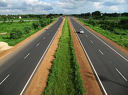
[[File:Durgapur Xpressway.jpg|thumb|200px|The Delhi-Kolkata [[National Highway 19|NH 19]]]] | |||
[[Diesel multiple unit|DEMU]] services are available on the [[Bankura-Masagram line]].<ref>{{cite web| url = http://indiarailinfo.com/train/timetable/bankura-mathnashipur-demu-78024-bqa-to-mtip/5807/955/10318 |title = Bankura-Mathnasibpur DEMU |work = Time Table | publisher= indiarailinfo | access-date = 28 February 2017}}</ref> | |||
The [[Bardhaman-Katwa line]], after conversion from narrow gauge to electrified broad gauge, was opened to the public on 12 January 2018.<ref>{{cite web| url =http://www.anandabazar.com/district/bardhaman/katwa-burdwan-broad-gauge-trains-started-at-last-1.739229 |title = Baro rail Katwae, jamlo bhidr (Big railway in Katwa, crowd gathers) | work= Bengali |publisher= Ananda Bazar Patrika, 13 January 2018 | access-date = 13 January 2018}}</ref> | |||
Kolkata-Agra [[National Highway 19 (India)|National Highway 19]] (old numbering NH 2), covering a large part of the old [[Grand Trunk Road]] passes through this district.<ref name="renumber">{{cite web|url=http://dorth.gov.in/writereaddata/sublinkimages/finaldoc6143316640.pdf|title=Rationalisation of Numbering Systems of National Highways|publisher=[[Department of Road Transport and Highways]]|access-date=10 February 2017|location=New Delhi|archive-url=https://web.archive.org/web/20160201124738/http://dorth.gov.in/writereaddata/sublinkimages/finaldoc6143316640.pdf|archive-date=1 February 2016|url-status=dead}}</ref> The other highways passing through the district are: [[National Highway 114 (India)|National Highway 114]], [[State Highway 6 (West Bengal)|State Highway 6]], [[State Highway 7 (West Bengal)|State Highway 7]], [[State Highway 13 (West Bengal)|State Highway 13]] (covering a large part of the old Grand Trunk Road), [[State Highway 14 (West Bengal)|State Highway 14]] and [[State Highway 15 (West Bengal)|State Highway 15]].<ref>{{cite web| url = http://www.wbtrafficpolice.com/state-highways.php |title =List of State Highways in West Bengal| publisher= West Bengal Traffic Police | access-date = 15 October 2016}}</ref> | |||
==Education== | ==Education== | ||
Purba Bardhaman district | {{quote box|width=230px|quote='''Educational facilities in Purba Bardhaman district in 2013-14'''<ref>{{cite web |url = http://www.dospiwb.org.in/site.php |title = District Statistical Handbook 2014 Burdwan |work = Basic data: Table 4.4, 4.5, Clarifications: other related tables |publisher = Department of Statistics and Programme Implementation, Government of West Bengal |access-date = 16 April 2016 |url-status = usurped |archive-url = https://web.archive.org/web/20170729135056/http://www.dospiwb.org.in/site.php |archive-date = 29 July 2017 }}</ref><br />Primary school–3,008<br />Middle school–127<br />High school–373<br />Higher secondary school–245 <br />General degree college–19 <br />University–1 <br />Professional/ technical institutions–60<br />Institutions for non-formal education– 7,571}} | ||
[[File:Uitbu.jpg|thumb|right|University Institute of Technology, Burdwan University|228x228px]] | |||
The first ''[[vernacular]] school'' in erstwhile Bardhaman district was set up by Captain Stuart in 1816. Prior to that there were ''chatuspathis'' and ''maktabs'' run by local pundits and maulavis. There also were Sanskrit ''tols'', Persian and Arabic schools.<ref name="humandev2">{{cite web | url = http://wbplan.gov.in/HumanDev/DHDR/District%20DEV%20Report.%20Burdwan%20%202012%20total%20Book%20Curve%20Red.pdf | title = District Human Development Report Bardhaman, 2011 | work = Education, pages 129-160 | publisher = Development and Planning Department, Government of West Bengal | access-date = 16 April 2017 | archive-url = https://web.archive.org/web/20170814062640/http://wbplan.gov.in/HumanDev/DHDR/District%20DEV%20Report.%20Burdwan%20%202012%20total%20Book%20Curve%20Red.pdf | archive-date = 14 August 2017 | url-status = dead }}</ref> | |||
The | The box alongside provides information about educational facilities in Purba Bardhaman district, subsequent to bifurcation of the district in 2017, with data for 2013–2014. There were almost 250,000 students in the primary schools and more than 50,000 students studied at the college and university levels in the district.<ref name=2handbook2014>{{cite web |url = http://www.dospiwb.org.in/site.php |title = District Statistical Handbook 2014 Burdwan |work = Basic data: Table 4.4, 4.5, Clarifications: other related tables |publisher = Department of Statistics and Programme Implementation, Government of West Bengal |access-date = 16 April 2017 |url-status = usurped |archive-url = https://web.archive.org/web/20170729135056/http://www.dospiwb.org.in/site.php |archive-date = 29 July 2017 }}</ref><ref name="humandev2"/> More than 6,000 schools (in erstwhile Bardhaman district) serve cooked [[Midday Meal Scheme|midday meal]] to more than 900,000 students.<ref>{{cite web | url = http://bardhaman.nic.in/middam/mdm.htm| title = Midday Meal – Burdwan, WB| publisher = District Authorities |access-date = 12 February 2019}}</ref> | ||
< | The infrastructure available is an important element in the education arena. The table below shows the availability and accessibility of facilities in rural areas of erstwhile Bardhaman district (percentage of villages within specified distance):<ref name="humandev2"/> | ||
{| class="wikitable sortable" | |||
|- | |||
! Indicator ||Within village||Within 1 km ||Beyond 1 km | |||
|- | |||
| Nearest primary school||92.7||4.1||3.3 | |||
|- | |||
|Nearest middle school||28.5||27.6||43.9 | |||
|- | |||
|Nearest secondary/ higher secondary school||16.3||10.0||73.7 | |||
|- | |||
|Nearest college||1.6||0.8||97.6 | |||
|- | |||
|} | |||
97% of the primary schools have pucca buildings and 99% have sanitation facilities. All primary and high schools have drinking water facility. Availability of teachers per school are 3 in primary schools, 12 in secondary schools and 20 in higher secondary schools.<ref name="humandev2"/> | |||
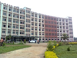
The [[University of Burdwan]] was founded in 1960, as part of [[Bidhan Chandra Roy|Dr. B.C.Roy's]] master plan to expand the scope of higher education beyond the metropolis of Kolkata. The university was privileged to inherit a large part of the estate of the erstwhile [[Bardhaman Raj]].<ref>{{cite web | url = http://www.buruniv.ac.in/about/history | title = University of Burdwan | work= History of Burdwan University | publisher = Burdwan University |access-date =25 April 2017}}</ref> [[Burdwan Raj College]] was established at Bardhaman in 1881.<ref>{{cite web| url = http://www.burdwanrajcollege.ac.in/ |title = Burdwan Raj College | publisher= BRC | access-date = 2 March 2017}}</ref> All other degree colleges in the district came up after independence. Amongst the specialized institutes are: [[Burdwan Medical College]],<ref>{{cite web| url = http://www.burdwanmedicalcollege.org/ |title = Burdwan Medical College| publisher= BMC | access-date = 2 March 2017}}</ref> [[University Institute of Technology, Burdwan University]]<ref>{{cite web| url = http://www.uit.buruniv.ac.in/ |title = University Institute of Technology | publisher =UIT | access-date = 17 February 2019}}</ref> and College of Agriculture (Extended Campus of Bidhan Chandra Krishi Viswavidalaya)<ref>{{cite web| url = http://www.bckv.edu.in/bckv.php?page=3636638817772e42b59d74cff571fbb3a9 |title = College of Agriculture (Extended Campus of BCKV) | publisher= BCKV | access-date = 12 February 2019}}</ref> Meghnad Saha Planetarium was opened at Bardhaman in 1994.<ref>{{cite web | url = http://www.buruniv.ac.in/bunew/Template.php?page=Facilities&subpage=MSP | title = Meghnad Saha Planetarium| publisher = University of Burdwan |access-date =17 February 2019}}</ref> | |||
==Literary traditions== | |||
Purba Bardhaman district has rich literary and cultural traditions. [[Kashiram Das]] well known for his Bengali adaptation of the ''[[Mahabharat]]'' was born in and lived in Purba Bardhaman district. [[Maladhar Basu]], the author of ''শ্রীকৃষ্ণবিজয়'', the Triumph of Lord Krishna, as well as poets of the ''[[Mangal-Kavya]]'' fame, such as Kavi Kankan Mukunda Ram Chakravarty, [[Ghanaram Chakrabarty]] and [[Rupram Chakrabarty]] belonged to Purba Bardhaman district. Vaisnava poets and saints such as [[Krishnadasa Kaviraja]], author of ''[[Chaitanya Charitamrita]]'', Brindabandas, Lochandas and Jnandas were born in this district. Purba Bardhaman district was home to such great scholars as Raghunandan Goswami, the famous logician, [[Ganga Kishore Bhattacharya]] of ''Bengal Gazetti'' fame and [[Lal Behari Dey]] of ''Bengal Peasant Life'' fame. Modern Bengali poets such as [[Kalidas Roy]] and [[Kumud Ranjan Mullick]] also made this district proud.<ref>{{cite web | url = http://www.censusindia.gov.in/2011census/DCHB/DCHB_A/19/1909_PART_A_DCHB_BARDDHAMAN.pdf | title = 2011 District Census Handbook Bardhaman Part XII A | work = Historical figures associated with this district, page 128 | publisher = Directorate of Census Operations, West Bengal | access-date = 14 May 2017}}</ref> | |||
==Culture== | |||
[[File:WLM@WB-Nava-Kailasha_Temple_in_Kalna_(Panoramic_View)_02.jpg|thumb|right|350px| Nava-Kailasha Temple in [[Kalna, India|Kalna]]]] | |||
===Festivals and fairs=== | |||
The Bengali proverb ''baro masey tero parban'' (thirteen festivals in twelve months) indicates the abundance of festivities in the state. [[Durga Puja]] or Saradotsav, celebrated by Bengali Hindus, is the main festival in the state and the district. It is one of the largest festivals celebrated in the world. Other festivals are: [[Kali Puja]], [[Saraswati Puja]], [[Holi]], [[Ratha-Yatra]], [[Raksha Bandhan]], [[Eid al-Fitr]], [[Muharram]], [[Christmas]], [[Good Friday]], [[Guru Nanak Gurpurab]], [[Vesak|Buddha Poornima]] and [[Mahavir Jayanti]]. In addition to these festivals organized throughout the state, there are local festivals, as for example [[Dharmathakur|Gajan of Dharmaraj]] and [[Gajan (festival)|Gajan of Shiva]].<ref name=censushandbook>{{cite web| url = http://www.censusindia.gov.in/2011census/dchb/DCHB_A/19/1909_PART_A_DCHB_BARDDHAMAN.pdf |title = District Census Handbook Barddhaman, Census of India 2011, Series 20, Part XII A |work =Pages 121-124: Major Social and Cultural Activities of the District like Festivals and Fairs | publisher= Directorate of Census Operations, West Bengal| access-date = 12 February 2019}}</ref> | |||
Numerous fairs are held in Purba Bardhaman district. Researchers have been listing the fairs over the years. Dr. Asok Mitra had listed 369 fairs in Bardhaman district and Dr. Gopikanta Konar had listed 482 fairs. Information about some of the prominent fairs follows. A month-long fair is held around [[Makar Sankranti]] at Dadhia in Mongalkote PS. There is a Nangteswar Shiva fair during [[Maha Shivaratri]] at Babladihi. A week-long fair is held during [[Rama Navami]] at Kairapur in Ausgram PS. A fair is organised at [[Karui]] to celebrate the Gajan of Shiva on the last day of the Bengali month of [[Choitro]]. At Kaigram Kusumgram, Neredighi and Suata, [[Urs]] of a [[Pir (Sufism)|Pir]] is celebrated with fairs in the Bengali month of [[Falgun]]. The [[Santal people|Santals]] organise a fair at [[Baidyapur]] during Aswin Nabami. A fair is organised during [[Bhadu (festival)|Bhadu Utsab]] in the Bengali month of [[Bhadro]] at Sitahati in Ketugram PS. There are many more fairs in the district.<ref>Chattopadhyay, Akkori, ''Bardhaman Jelar Itihas O Lok Sanskriti'' (History and Folk lore of Bardhaman District.), {{in lang|bn}}, Vol II, pages 83-88, Radical Impression. {{ISBN|81-85459-36-3}}</ref> | |||
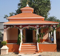
[[Image:108 shiv temple.jpg|thumb|180px|108 Shiva Temple]] | |||
===Religion related institutions=== | |||
Purba Bardhaman district had rich religious traditions. The religion related institutions draw in large number of pilgrims/ tourists. The temple of the deity of Sarbamangala, the presiding deity of the [[Bardhaman Raj]] is at [[Bardhaman]]. Kamalakanta Kalibari is a [[Kali]] temple associated with the poet-devotee [[Kamalakanta Bhattacharya (West Bengal)|Kamalakanta]]. The 108 Shiva temple complex has a picturesque setting located near Bardhaman. The idol at Babladihi is of archaeological interest as it is believed to have been built in the [[Pala Empire|Pala era]].<ref name=tourism>{{cite web| url = http://purbabardhaman.gov.in/general_info/tourism.php |title =Purba Bardhaman district| work= Tourism|publisher= District Administration | access-date = 12 February 2019}}</ref> [[Christ Church Bardhaman]], the oldest church in the district is in Bardhaman town.<ref>{{Cite web|title=Next weekend you can be at ... Burdwan|url=https://www.telegraphindia.com/west-bengal/next-weekend-you-can-be-at-burdwan/cid/1653695|access-date=2020-09-15|website=www.telegraphindia.com}}</ref> | |||
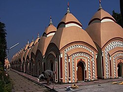
[[Katwa]] had close association with [[Chaitanya Mahaprabhu]] and so the area has notable [[Vaishnavism]] religious centres. Sree Gouranga Mandir is believed to have been visited by Chaitanya Mahaprabhu. The [[ashram]] at Madhaitala has links with Jagai and Madhai, two famous disciples of Chaitanya Mahaprabhu. [[Kalna, India|Kalna]], is another place with Vaishanavism associations. There are popular temples attracting devotees – Gouranga temple, 109 Shiva temples (also called [[Naba Kailash Mandir|Naba Kailash]]) and Kashinath Shiva temple. The temple of Sddheswari Ambika, the presiding goddess, and Baikunthanath Shiva temple, are notable for their terracotta decorations.<ref name=tourism/> | |||
Shah Alam's Dargah, built in the early 18th century by [[Murshid Quli Khan]] is a place of archaeological interest. The Jima Masjid was constructed by [[Azim-us-Shan]], subedar of Bengal, in the last part of the 17th century. The tomb of Bahman Pir and its adjoining dargah, in Ausgram II CD block, is popular with all communities.<ref name=tourism/> | |||
==Healthcare== | ==Healthcare== | ||
The | [[File:Burdwan Medical College Hospital.jpg|thumb|Bardhaman Medical College Hospital]] | ||
The health infrastructure in Purba Bardhaman district, as per 2013-14 data, can be summed up as follows: 3 hospitals, 5 rural hospitals, 19 block primary health centres, and 74 primary health centres. These facilities are provided by the Health and Family Welfare department of the Government of West Bengal. Additionally 2 medical units are provided by other departments of the state government, 1 medical unit by the Central Government/ PSUs and there are 109 private nursing homes.<ref name="medical">{{cite web |url = http://www.dospiwb.org.in/site.php |title = District Statistical Handbook 2014 Bardhaman |work = Table 3.1, 3.3 |publisher = Department of Statistics and Programme Implementation, Government of West Bengal |access-date = 2 March 2017 |url-status = usurped |archive-url = https://web.archive.org/web/20170729135056/http://www.dospiwb.org.in/site.php |archive-date = 29 July 2017 }}</ref> | |||
The district had 4,360 hospital beds.<ref name="medical"/> Out of this 1,105 beds were in the medical college at Bardhaman and 809 beds were in the four subdivisional towns and the balance in the rural areas in 2005–2006.<ref name=health>{{cite web| url = http://wbplan.gov.in/HumanDev/DHDR/District%20DEV%20Report.%20Burdwan%20%202012%20total%20Book%20Curve%20Red.pdf| title = District Human Development Report, Bardhaman, 2011| work = Chapter 6, Health| publisher = Development and Planning Department, Government of West Bengal| access-date = 23 April 2017| archive-url = https://web.archive.org/web/20170814062640/http://wbplan.gov.in/HumanDev/DHDR/District%20DEV%20Report.%20Burdwan%20%202012%20total%20Book%20Curve%20Red.pdf| archive-date = 14 August 2017| url-status = dead}}</ref> | |||
The rural areas of Purba Bardhaman district are flooded frequently and that affects health. Some blocks near the Bhagirathi have been facing the problem of arsenic contamination in ground water.<ref name=health/> | |||
== References == | In 2001, in most of the blocks, even 25% of the households did not have individual sanitation latrines but since then the situation has improved and the district had been moving towards the 100% target. The district has become a ''nirmal jilla''. The availability of safe drinking water is also moving towards the 100% target.<ref name=health/> | ||
{{ | |||
Public healthcare is no longer an illusion for the poor. The district has come a long way from the colonial era. However, the scenario of undernourished mothers and babies has not vanished even in the 21st century. ''Health for all'', the clarion call of world bodies, still remains to be achieved.<ref name=health/> | |||
==Electoral constituencies== | |||
The last delimitation of electoral constituencies in West Bengal was done in 2006,<ref name =delimitation>{{cite web| url = http://eci.nic.in/delim/Final_Publications/WestBengal/FINAL%20ORDER%20NOTIFICATION_English.pdf | title = Delimitation Commission Order No. 18 | access-date = 28 April 2017 | work = Table B – Extent of Parliamentary Constituencies | publisher =Government of West Bengal}}</ref> The last general election for [[Lok Sabha]] was held in 2019 and for [[Vidhan Sabha]] in 2016.<ref>{{cite web|url=http://indianexpress.com/article/explained/west-bengal-poll-schedule-who-benefits-and-how/|title=Six phases in Bengal|date=9 March 2016}}</ref> | |||
The [[Bardhaman Purba (Lok Sabha constituency)]] with its seven assembly segments - [[Raina (Vidhan Sabha constituency)|Raina (SC)]], [[Jamalpur, West Bengal Assembly constituency|Jamalpur (SC)]], [[Kalna (Vidhan Sabha constituency)|Kalna (SC)]], [[Memari (Vidhan Sabha constituency)|Memari]], [[Purbasthali Dakshin (Vidhan Sabha constituency)|Purbasthali Dakshin]], [[Purbasthali Uttar (Vidhan Sabha constituency)|Purbasthali Uttar]] and [[Katwa (Vidhan Sabha constituency)|Katwa]] – is located in Purba Bardhaman district.<ref name =delimitation/> | |||
The [[Bardhaman-Durgapur (Lok Sabha constituency)]], has four assembly segments in Purba Bardhaman district - [[Bardhaman Dakshin (Vidhan Sabha constituency)|Bardhaman Dakshin]], [[Bardhaman Uttar (Vidhan Sabha constituency)|Bardhaman Uttar (SC)]], [[Manteswar (Vidhan Sabha constituency)|Monteswar]] and [[Bhatar (Vidhan Sabha constituency)|Bhatar]] – and three in Paschim Bardhaman district.<ref name =delimitation/> | |||
[[Ketugram (Vidhan Sabha constituency)|Ketugram]], [[Mangalkot (Vidhan Sabha constituency)|Mangalkot]], and [[Ausgram (Vidhan Sabha constituency)|Ausgram (SC)]], all three assembly constituencies of Purba Bardhaman district, are part of [[Bolpur (Lok Sabha constituency)]] with four other assembly segments in Birbhum district.<ref name =delimitation/> | |||
[[Khandaghosh (Vidhan Sabha constituency)|Khandaghosh (SC)]], located in Purba Bardhaman district, is part of [[Bishnupur (Lok Sabha constituency)]] with six other assembly segments in Bankura district.<ref name =delimitation/> | |||
==Notable people== | |||
<!---♦♦♦ Only add a person to this list if they already have their own article on the English Wikipedia ♦♦♦---> | |||
<!---♦♦♦ Please keep the list in chronological order ♦♦♦---> | |||
* Zamindar family of Kashiara | |||
**[[Nawab Abdul Jabbar]] (1837–1918), bureaucrat and deputy magistrate | |||
**[[Abul Kasem (politician, born 1872)|Abul Kasem]] (1872–1936), politician | |||
**[[Abul Hashim]] (1905–1974), politician | |||
**[[Badruddin Umar]] (born 1931), Marxist–Leninist theorist and political activist | |||
* Konar family | |||
**[[Hare Krishna Konar]] (1915–1974), Indian Marxist revolutionary and politician | |||
**[[Benoy Krishna Konar]] (1930–2014), Indian politician | |||
**[[Maharani Konar]] (1933–2024), Indian politician | |||
* Chowdhury family | |||
**[[Chowdhury Abu Taleb]] (died 1971), politician | |||
**[[Siddiqullah Chowdhury]] (born 1949), Islamic scholar and politician | |||
* Ahmad family of Kulia (Raina) | |||
**[[Ekramuddin Ahmad]] (1872–1940), author and activist | |||
**[[Naziruddin Ahmad]] (born 1889), member of the Constituent Assembly of India | |||
* Mondal family of Galsi | |||
**[[Idrish Mondal]], politician | |||
**[[Mehbub Mondal]] (born 1966), politician | |||
* Syed family | |||
**[[Syed Abdul Mansur Habibullah|Syed Abul Mansur Habibullah]] (1917–1996), Law Minister of West Bengal | |||
**[[Mamtaz Sanghamita|Dr. Syeda Mamtaz Sanghamita]] (born 1946), gynaecologist | |||
* [[Abdullah al-Baqi]] [Tubgram] (1886–1952), Islamic scholar and member of the Central Legislative Assembly | |||
* [[Syed Abdus Samad (footballer)|Syed Abdus Samad]] [Bhuri] (1895–1964), footballer | |||
* [[Abdul Halim (communist)|Abdul Halim]] [Keuburi] (1901–1966), member of the West Bengal Legislative Council | |||
* [[M.A. Rasul|Mohammed Abdullah Rasul]] (1903–1991), politician and author | |||
* [[Kazi Kader Newaj]] (1909–1983), poet | |||
* [[Janab Abdus Sattar]] [Tola] (1911–1965), politician | |||
* [[Abu Mohammed Habibullah]] (1911–1983), historian and former President of Bangla Academy | |||
* [[Syed Shahedullah]] [Burdwan] (1913–1991), politician and author | |||
* [[Habibur Rahman (poet)|Habibur Rahman]] [Palishgram] (1923–1976), poet | |||
* [[Munshi Mohammad Fazle Kader]] [Ketugram] (1928–2019), civil servant | |||
* [[Mahboob Zahedi]] (1929–2006), politician and soldier of Indian National Army | |||
* [[Syed Hasan Imam (actor)|Syed Hasan Imam]] (born 1935), actor | |||
* [[Nur Alam Ziku]] [Haripur] (1938–2010), politician and filmmaker | |||
* [[Mokbula Manzoor]] [Kalna] (1938–2020), novelist | |||
* [[Hasan Azizul Huq]] [Jabagram] (1939–2021), short-story writer and novelist | |||
* [[Kazi Abu Zafar Siddique|Kazi Abu Zafar Mohammed Hasan Siddiqui]] (1940–2012), activist | |||
* [[Abu Ayesh Mondal]] [Akbarnagar] (born 1944), politician | |||
* [[Sayed Md Masih]] [Bhatar] (born 1944), politician | |||
* [[Saifuddin Choudhury]] [Memari] (1952–2014), politician | |||
* [[Sekh Sahonawez]] (born 1958), politician | |||
* [[Sheikh Saidul Haque]] [Jagulipara] (born 1954), academic and politician | |||
* [[Nurul Islam Mollah]] [Kalna], politician | |||
* [[Mollah Humayun Kabir]] [Purbasthali], politician | |||
* [[Nurunnesa Sattar]] [Purbasthali], politician | |||
* [[Mohammad Hossain]] [Khandaghosh], politician | |||
* [[Abul Hasem Mondal]] [Kantipur], politician | |||
* [[Nargis Begum]], politician | |||
* [[Maladhar Basu]], Bengali poet of 15th century | |||
* [[Rajshekhar Basu]], Bengali writer, chemist and lexicographer better known by his pen name '''Parashuram''' | |||
* [[Kamalakanta Bhattacharya (Bengal)|Sadhak Kamalakanta Bhattacharya]], [[Bengalis|Bengali]] Shakta poet and [[yogi]] of India | |||
* [[Rash Behari Bose]], Indian revolutionary leader known for organising [[Indian National Army]] | |||
* [[Ghanaram Chakrabarty]], Bengali poet of the early modern period | |||
* [[Batukeshwar Dutt]], Indian socialist revolutionary and independence fighter | |||
* [[Satyendranath Dutta]], Bengali poet | |||
* [[Rash Behari Ghosh]], Indian politician, lawyer, social worker and philanthropist. The street Rashbehari Avenue in Kolkata was named after him. | |||
* [[Somai Kisku]], Indian writer in Santali language | |||
* [[Partha Sarathi Mukherjee]], Indian Scientist | |||
* [[Shakti Samanta]], famous Indian film director | |||
* [[Sukumar Sen (linguist)|Sukumar Sen]], Bengali linguist and historian of the Bengali literature | |||
* [[Rabindranath Tagore]], Nobel laureate, [[Bengalis|Bengali]] poet, writer, playwright, composer, philosopher, social reformer and painter whose ancestral village was Kush in this district | |||
== See also == | |||
* [[List of villages in Purba Bardhaman district]] | |||
==Notes== | |||
{{Notelist}} | |||
==References == | |||
{{reflist|3}} | |||
== External links == | |||
{{Commons category}} | |||
* [http://purbabardhaman.gov.in/ Official website] | |||
{{Geographic location | |||
|Centre = Purba Bardhaman district | |||
|North = [[Birbhum district]] | |||
|Northeast = [[Murshidabad district]] | |||
|East = [[Nadia district]] | |||
|Southeast = [[Hooghly district]] | |||
|South = [[Hooghly district]] | |||
|Southwest = [[Bankura district]] | |||
|West = [[Bankura district]] | |||
|Northwest = [[Paschim Bardhaman district]] | |||
}} | |||
{{West Bengal topics}} | |||
{{Purba Bardhaman District}} | {{Purba Bardhaman District}} | ||
[[Category:Purba Bardhaman district| ]] | |||
[[Category:Districts of West Bengal]] | [[Category:Districts of West Bengal]] | ||
Latest revision as of 02:29, 6 May 2026


.svg)
Purba Bardhaman district is in the Indian state of West Bengal. Its headquarters is in Bardhaman. It was formed on 7 April 2017 after the division of the previous Bardhaman district.
Etymology[edit | edit source]
Some historians link the name of the district to the 24th and last Jain tirthankara, Mahavira Vardhamana, who came to preach in the area. Alternatively, Bardhamana means a prosperous and growing area. It was a forward frontier zone in the progress of Aryanisation by the people in the Upper Gangetic valley.[3] Purba means east.
History[edit | edit source]

The district is recorded in the early 20th century British chronicles as 'the richest tract in Bengal and the area of its oldest and most settled cultivation'. Archaeological excavations at Pandu Rajar Dhibi have indicated settlements in the Ajay valley in the Mesolithic age, around 5,000 BC. In early historical times Bardhamanbhukti, a part of the Rarh region, was ruled successively by the Magadhas, Mauryas, Kushanas and Guptas. In the 7th century AD, when Shashanka was king, the area was part of the Gauda Kingdom. It was subsequently ruled by the Palas and Senas.[3]
Bakhtiyar Khilji captured it in 1199 AD. The early Muslim rulers ruled over major parts of Bengal from Gauda or Lakhnauti. In Ain-i-Akbari, Bardhaman is mentioned as a mahal or pargana of Sarcar Sharifabad. Some western parts of Bardhaman formed Gopbhum, ruled for many centuries by the Sadgop kings. There are remains of a fort at Amrargar.[3]
In 1689, Raja Krishnaram Roy, of the Bardhaman Raj family, obtained from Aurangzeb a farman (royal decree) which made him the zamindar (landlord) of Bardhaman, and since then the Raj family's history became identical with that of the district.[3] After the death of Aurangzeb, the Mughal Empire became weak and Murshid Quli Khan became the Nawab of Bengal, owning only nominal allegiance to the Mughal emperor. At that time Bardhaman was referred to as a chakla, a change from the earlier pargana. Subsequently, during the reign of Alivardi Khan, the Bargis attacked and plundered Bardhaman.[3]
After the victory of the British in the Battle of Plassey in 1757, Bardhaman, Medinipur and Chittagong were ceded to the East India Company. In 1857, the British Crown took over the administration of the country from the East India Company.[3]
In 1765, when East India Company acquired the diwani of Bardhaman, it was composed of Bardhaman, Bankura, Hooghly and a third of Birbhum. Hooghly was separated in 1820, Bankura and Birbhum in 1837.[4]
In 1765, Tilakchand Ray, as the zamindar of Bardhaman, controlled 75 parganas and also looked after the law and order. At the time of the Permanent Settlement of Lord Cornwallis in 1793, the chaklas were reduced in size, in order to make them more manageable, and districts were created. Six subdivisions were created in Bardhaman district – Bud Bud in 1846, Katwa, Raniganj, Jahanabad (later named Arambagh), Bardhaman Sadar in 1847 and Kalna in 1850. The parganas were converted to thanas (police stations). At that time Bardhaman district had 22 thanas. Later, Jahanabad was transferred out of Bardhaman. Some minor changes continued.[4]
The Permanent Settlement ultimately led to the dismemberment of the Bardhaman estate. As the rajas often failed to pay the rent demands, some parts of the estate were auctioned off. However, there were bright spots. Mahatabchand was appointed additional member of the Viceroy's Executive Council and in 1877 was allowed to use the title of His Highness before his name. Bijoy Chand Mahatab was conferred the title of Maharajadhiraj by Lord Minto in 1908. Uday Chand Mahtab took over in 1941 and served till abolition of the zamindary system in 1954, after independence of the country.[5][6]
Bardhaman district was bifurcated into two districts, Purba Bardhaman and Paschim Bardhman, on 7 April 2017.[7]
Geography[edit | edit source]
Overview[edit | edit source]
Purba Bardhaman district is a flat alluvial plain area that can be divided into four prominent topographical regions. On the north, the Kanksa Ketugram Plain lies along the Ajay, which joins the Bhagirathi. The Bardhaman Plain occupies the central area of the district, with the Damodar on the south and the south-east. On the southern part is the Khandaghosh Plain. The Bhagirathi flows along the eastern boundary of the district, and the Bhagirathi Basin occupies the eastern part of the district. The undulating laterite topography of Paschim Bardhaman district extends up to Ausgram area of this district.[8][9]


Climate[edit | edit source]
Purba Bardhaman district has a tropical climate - hot and humid. While the hottest month is May, the coldest is January. The monsoon season is from June to September, with an annual average rainfall of 1,400 mm, 75% of it falling in the monsoon months. Localised thunderstorms, called kalbaisakhi in Bengali, are a special feature from March until the monsoon sets in.[10]
Administrative divisions[edit | edit source]
Purba Bardhaman district is divided into the following administrative subdivisions:[11][7]
| Subdivision | Headquarters | Area km2 |
Population (2011) |
Rural Population % (2011) |
Urban Population % (2011) |
|---|---|---|---|---|---|
| Bardhaman Sadar North | Bardhaman | 1,958.43 | 1,586,623 | 73.58 | 26.42 |
| Bardhaman Sadar South | Bardhaman | 1,410.03 | 1,198,155 | 95.54 | 4.46 |
| Katwa | Katwa | 1,070.48 | 963,022 | 88.44 | 11.56 |
| Kalna | Kalna | 993.75 | 1,097,732 | 87.00 | 13.00 |
| Purba Bardhaman district | Bardhaman | 5,432.69 | 4,835,532 | 84.98 | 15.02 |
The district comprises four subdivisions:[7][11][12]
- Kalna subdivision consists of one municipality at Kalna and five CD blocks: Kalna I, Kalna II, Manteswar, Purbasthali I and Purbasthali II.
- Katwa subdivision consists of two municipalities at Katwa and Dainhat and five CD blocks: Katwa I, Katwa II, Ketugram I, Ketugram II and Mongakote.
- Bardhaman Sadar North subdivision consists of two municipalities at Bardhaman and Guskara and seven CD blocks: Ausgram I, Ausgram II, Bhatar, Burdwan I, Burdwan II, Galsi I and Galsi II.

- Bardhaman Sadar South subdivision consists of one municipality at Memari and six CD blocks: Khandaghosh, Jamalpur, Memari I, Memari II, Raina I and Raina II.

Demographics[edit | edit source]
As per the 2011 Census of India data, recast after bifurcation of Bardhaman district in 2017, Purba Bardhaman district had a total population of 4,835,532. There were 2,469,310 (51%) males and 2,366,222 (49%) females. Population below 6 years was 509,855. 726,345 (15.02%) live in urban areas. Scheduled Castes and Scheduled Tribes make up 1,487,151 (30.75%) and 327,501 (6.77%) of the population respectively.[13]
As per the 2011 census data, recast after bifurcation of Bardhaman district in 2017, the total number of literates in Purba Bardhaman district was 3,232,452 (74.73% of the population over 6 years) out of which males numbered 1,781,090 (80.60% of the male population over 6 years) and females numbered 1,453,362 (68.66% of the female population over 6 years).[13]
Religion[edit | edit source]
| Religion | Population (1941)[15]:74 | Percentage (1941) | Population (2011)[14] | Percentage (2011) |
|---|---|---|---|---|
Hinduism 
|
922,290 | 71.77% | 3,566,068 | 73.75% |
Islam 
|
277,573 | 21.60% | 1,215,737 | 25.14% |
| Tribal religion[lower-alpha 1] | 84,493 | 6.58% | 32,396 | 0.67% |
| Others[lower-alpha 2] | 687 | 0.05% | 21,331 | 0.44% |
| Total Population | 1,285,043 | 100% | 4,835,532 | 100% |
Hinduism is the majority religion, while Islam is the second-largest religion. The many zamindars of Bardhaman, largely Hindus, built many family temples which dot the landscape. Most of the tribals follow Hinduism but with the flavour of their tribal religion.
Islam is more concentrated in rural areas, and makes up a significant minority in Ketugram I (46.77%) and Manteswar (41.77%) CD blocks.[14]
Languages[edit | edit source]
According to the 2011 census, 92.86% of the population in what is now Purba Bardhaman district spoke Bengali, 5.03% Santali and 1.66% Hindi as their first language.[16]
Flora[edit | edit source]
The flora of Purba Bardhaman district is composed mostly of woody plants. Amongst the flora are: Simul (Salmalia malabarica), neem (Azadirachta indica, amlaki (Phyllanthus emblica), Indian ash tree (Lannea coromandelica), coconut, date palm, tal (Palmyra palm / Borassus flabellifer), bat (banyan/ Ficus benghalensis), asvattha (pipal/ Ficus religiosa), palash (Butea monosperma), krishnachuda (Caesalpinia pulcherrima) and am (mango/ mangifera indica). There are some shrubby plants: ashsheoda (orangeberry/ Glycosmis pentaphylla, pianj (onion), rasun (garlic), rajanigandha (tube rose/Agave amica), gulancha (Tinospora cordifolia), tulsi (basil/ Ocimum tenuiflorum) etc.[17]
The common aquatic or marsh weeds found in jheels (lakes) and swamps of the eastern part of the district (in the Bhagirathi Basin) are: bena (andropogon squarrosos), water hyacinth (Eichhornia crassipes), padma (nelumbo nucifera), hogla (Typha domingensis) etc.[6]
Fauna[edit | edit source]
The mammals of the district include wolf and golden jackal whilst wild boar and monkeys (including hanuman) are seen frequently. Poisonous snakes such as Indian cobra, common krait and Russell's viper, as well as dhamnas and harmless grass snakes are very common. The common avifauna of the district include red-vented bulbul, bluethroat, Indian robin and common myna. Other bird species include fowls, crows, munia, sparrow, cuckoo, Asian koel, parakeet, woodpecker, kingfisher, owl, vulture, eagle, kite, hawk, stork, duck, pigeon, falcon and heron. The low lying swampy areas are home to migratory birds in winter.[17]
The principal varieties fish caught are rohu, mrigala, catla, kharke bata (reba), bhangan bata (bata), shrimp (smaller variety of prawn), maurala, pabda, tengra, bele, chela, punti, boal, aid, galda (large variety of prawn), vacha, chital, pholoi, khaira, fensa, silon, and bhola.[17]
Rural poverty[edit | edit source]
According to the District Human Development Report, Bardhaman, "The legendary prosperity of Bardhaman in history has to be taken as that of the ruling class – the rich, the royals and their assistants." It is only in the relatively recent past that the focus has shifted to the toiling masses.[18]
As per the rural household survey conducted by the state government in 2005, the percentage of rural households living below poverty line in the old Bardhaman district was 33.49%. Using the same data the percentage of households living below poverty line in Purba Bardhaman district is 37.14%.[19]
Economy[edit | edit source]
Agriculture[edit | edit source]
Purba Bardhaman is an agriculturally prosperous district of West Bengal. The soil and climate of the district favour the production of food grains. The undivided Bardhaman district was the largest producer of rice in West Bengal, and bulk of it was produced in what is now Purba Bardhaman district. Rice, the major crop has three varieties – Aus (in autumn), Aman (in winter) and Boro (in summer). Other than cereals and pulses, cash crops such as mustard, til, jute and potatoes are also grown.[20]
The year 1953 was a major turning point for agriculture in the district. Prior to 1953, cultivation was largely monsoon-dependent. In 1953, the irrigation projects of Damodar Valley Corporation were implemented. Irrigation and intensive cropping pattern provided the real momentum to agriculture. The undivided Bardhaman district topped the state with maximum irrigated land. The district utilises both surface water and groundwater for irrigation. In 2003–2004, 27.07% of the gross cropped area was under irrigation. 65.51% of the reported area was net sown area.[20]
Operation Barga provided tenurial security and increased the share of produce in favour of the tenants. In the 1980s agricultural production reflected robust growth rates against stagnation in the previous decades. Horticulture, pisciculture, dairy etc. have successfully emerged as economically rewarding viable options for diversifying.[20]
Industry and crafts[edit | edit source]
At the time of bifurcation of Bardhaman district in 2017, the mining and industrial areas of the district were placed in Paschim Bardhaman district and the Purba Bardhaman district was composed of rural/ agricultural areas.[21][22] Purba Bardhaman district has some medium scale enterprises. Since it is an agro-based area, it has many rice mills. The other industries are: rice bran oil, cold storage, oil mill, chira mill, bakery, L.P.G. gas filling plant, transformer manufacturing/repairing, automobile spare parts etc. There is an industrial estate at Saktigarh. In a report by the Micro, Small and Medium Industries Development Institute, it says that the degree of excellence of products like, sola craft of Bankapasi and dhokra of Dwariapur is now acceptable to European markets. There are rural wood carving artisans who are maintain the continuity of their traditional art.[23] Amongst the other crafts in Purba Bardhaman district are: clay craft, including terracotta work and idol making, wooden dolls, stone carving, bamboo and cane craft and kantha designing.[24] There is a vibrant weaving network around Kalna, Dhatrigram and Samudragarh.[25]
Transport[edit | edit source]
The Howrah-Bardhaman main line and Howrah-Bardhaman chord, both part of Kolkata Suburban Railway system, enter this district and converge at Saktigarh railway station. The Bardhaman-Asansol section, which is part of Howrah-Delhi main line, Howrah-Gaya-Delhi line and Howrah-Allahabad-Mumbai line, and the Bardhaman-Kiul Sahibganj Loop leave at the other end of the district.[26][27]

DEMU services are available on the Bankura-Masagram line.[28]
The Bardhaman-Katwa line, after conversion from narrow gauge to electrified broad gauge, was opened to the public on 12 January 2018.[29]
Kolkata-Agra National Highway 19 (old numbering NH 2), covering a large part of the old Grand Trunk Road passes through this district.[30] The other highways passing through the district are: National Highway 114, State Highway 6, State Highway 7, State Highway 13 (covering a large part of the old Grand Trunk Road), State Highway 14 and State Highway 15.[31]
Education[edit | edit source]
Primary school–3,008
Middle school–127
High school–373
Higher secondary school–245
General degree college–19
University–1
Professional/ technical institutions–60
Institutions for non-formal education– 7,571

The first vernacular school in erstwhile Bardhaman district was set up by Captain Stuart in 1816. Prior to that there were chatuspathis and maktabs run by local pundits and maulavis. There also were Sanskrit tols, Persian and Arabic schools.[33]
The box alongside provides information about educational facilities in Purba Bardhaman district, subsequent to bifurcation of the district in 2017, with data for 2013–2014. There were almost 250,000 students in the primary schools and more than 50,000 students studied at the college and university levels in the district.[34][33] More than 6,000 schools (in erstwhile Bardhaman district) serve cooked midday meal to more than 900,000 students.[35]
The infrastructure available is an important element in the education arena. The table below shows the availability and accessibility of facilities in rural areas of erstwhile Bardhaman district (percentage of villages within specified distance):[33]
| Indicator | Within village | Within 1 km | Beyond 1 km |
|---|---|---|---|
| Nearest primary school | 92.7 | 4.1 | 3.3 |
| Nearest middle school | 28.5 | 27.6 | 43.9 |
| Nearest secondary/ higher secondary school | 16.3 | 10.0 | 73.7 |
| Nearest college | 1.6 | 0.8 | 97.6 |
97% of the primary schools have pucca buildings and 99% have sanitation facilities. All primary and high schools have drinking water facility. Availability of teachers per school are 3 in primary schools, 12 in secondary schools and 20 in higher secondary schools.[33]
The University of Burdwan was founded in 1960, as part of Dr. B.C.Roy's master plan to expand the scope of higher education beyond the metropolis of Kolkata. The university was privileged to inherit a large part of the estate of the erstwhile Bardhaman Raj.[36] Burdwan Raj College was established at Bardhaman in 1881.[37] All other degree colleges in the district came up after independence. Amongst the specialized institutes are: Burdwan Medical College,[38] University Institute of Technology, Burdwan University[39] and College of Agriculture (Extended Campus of Bidhan Chandra Krishi Viswavidalaya)[40] Meghnad Saha Planetarium was opened at Bardhaman in 1994.[41]
Literary traditions[edit | edit source]
Purba Bardhaman district has rich literary and cultural traditions. Kashiram Das well known for his Bengali adaptation of the Mahabharat was born in and lived in Purba Bardhaman district. Maladhar Basu, the author of শ্রীকৃষ্ণবিজয়, the Triumph of Lord Krishna, as well as poets of the Mangal-Kavya fame, such as Kavi Kankan Mukunda Ram Chakravarty, Ghanaram Chakrabarty and Rupram Chakrabarty belonged to Purba Bardhaman district. Vaisnava poets and saints such as Krishnadasa Kaviraja, author of Chaitanya Charitamrita, Brindabandas, Lochandas and Jnandas were born in this district. Purba Bardhaman district was home to such great scholars as Raghunandan Goswami, the famous logician, Ganga Kishore Bhattacharya of Bengal Gazetti fame and Lal Behari Dey of Bengal Peasant Life fame. Modern Bengali poets such as Kalidas Roy and Kumud Ranjan Mullick also made this district proud.[42]
Culture[edit | edit source]
_02.jpg)
Festivals and fairs[edit | edit source]
The Bengali proverb baro masey tero parban (thirteen festivals in twelve months) indicates the abundance of festivities in the state. Durga Puja or Saradotsav, celebrated by Bengali Hindus, is the main festival in the state and the district. It is one of the largest festivals celebrated in the world. Other festivals are: Kali Puja, Saraswati Puja, Holi, Ratha-Yatra, Raksha Bandhan, Eid al-Fitr, Muharram, Christmas, Good Friday, Guru Nanak Gurpurab, Buddha Poornima and Mahavir Jayanti. In addition to these festivals organized throughout the state, there are local festivals, as for example Gajan of Dharmaraj and Gajan of Shiva.[43]
Numerous fairs are held in Purba Bardhaman district. Researchers have been listing the fairs over the years. Dr. Asok Mitra had listed 369 fairs in Bardhaman district and Dr. Gopikanta Konar had listed 482 fairs. Information about some of the prominent fairs follows. A month-long fair is held around Makar Sankranti at Dadhia in Mongalkote PS. There is a Nangteswar Shiva fair during Maha Shivaratri at Babladihi. A week-long fair is held during Rama Navami at Kairapur in Ausgram PS. A fair is organised at Karui to celebrate the Gajan of Shiva on the last day of the Bengali month of Choitro. At Kaigram Kusumgram, Neredighi and Suata, Urs of a Pir is celebrated with fairs in the Bengali month of Falgun. The Santals organise a fair at Baidyapur during Aswin Nabami. A fair is organised during Bhadu Utsab in the Bengali month of Bhadro at Sitahati in Ketugram PS. There are many more fairs in the district.[44]

[edit | edit source]
Purba Bardhaman district had rich religious traditions. The religion related institutions draw in large number of pilgrims/ tourists. The temple of the deity of Sarbamangala, the presiding deity of the Bardhaman Raj is at Bardhaman. Kamalakanta Kalibari is a Kali temple associated with the poet-devotee Kamalakanta. The 108 Shiva temple complex has a picturesque setting located near Bardhaman. The idol at Babladihi is of archaeological interest as it is believed to have been built in the Pala era.[45] Christ Church Bardhaman, the oldest church in the district is in Bardhaman town.[46]
Katwa had close association with Chaitanya Mahaprabhu and so the area has notable Vaishnavism religious centres. Sree Gouranga Mandir is believed to have been visited by Chaitanya Mahaprabhu. The ashram at Madhaitala has links with Jagai and Madhai, two famous disciples of Chaitanya Mahaprabhu. Kalna, is another place with Vaishanavism associations. There are popular temples attracting devotees – Gouranga temple, 109 Shiva temples (also called Naba Kailash) and Kashinath Shiva temple. The temple of Sddheswari Ambika, the presiding goddess, and Baikunthanath Shiva temple, are notable for their terracotta decorations.[45]
Shah Alam's Dargah, built in the early 18th century by Murshid Quli Khan is a place of archaeological interest. The Jima Masjid was constructed by Azim-us-Shan, subedar of Bengal, in the last part of the 17th century. The tomb of Bahman Pir and its adjoining dargah, in Ausgram II CD block, is popular with all communities.[45]
Healthcare[edit | edit source]

The health infrastructure in Purba Bardhaman district, as per 2013-14 data, can be summed up as follows: 3 hospitals, 5 rural hospitals, 19 block primary health centres, and 74 primary health centres. These facilities are provided by the Health and Family Welfare department of the Government of West Bengal. Additionally 2 medical units are provided by other departments of the state government, 1 medical unit by the Central Government/ PSUs and there are 109 private nursing homes.[47]
The district had 4,360 hospital beds.[47] Out of this 1,105 beds were in the medical college at Bardhaman and 809 beds were in the four subdivisional towns and the balance in the rural areas in 2005–2006.[48]
The rural areas of Purba Bardhaman district are flooded frequently and that affects health. Some blocks near the Bhagirathi have been facing the problem of arsenic contamination in ground water.[48]
In 2001, in most of the blocks, even 25% of the households did not have individual sanitation latrines but since then the situation has improved and the district had been moving towards the 100% target. The district has become a nirmal jilla. The availability of safe drinking water is also moving towards the 100% target.[48]
Public healthcare is no longer an illusion for the poor. The district has come a long way from the colonial era. However, the scenario of undernourished mothers and babies has not vanished even in the 21st century. Health for all, the clarion call of world bodies, still remains to be achieved.[48]
Electoral constituencies[edit | edit source]
The last delimitation of electoral constituencies in West Bengal was done in 2006,[49] The last general election for Lok Sabha was held in 2019 and for Vidhan Sabha in 2016.[50]
The Bardhaman Purba (Lok Sabha constituency) with its seven assembly segments - Raina (SC), Jamalpur (SC), Kalna (SC), Memari, Purbasthali Dakshin, Purbasthali Uttar and Katwa – is located in Purba Bardhaman district.[49]
The Bardhaman-Durgapur (Lok Sabha constituency), has four assembly segments in Purba Bardhaman district - Bardhaman Dakshin, Bardhaman Uttar (SC), Monteswar and Bhatar – and three in Paschim Bardhaman district.[49]
Ketugram, Mangalkot, and Ausgram (SC), all three assembly constituencies of Purba Bardhaman district, are part of Bolpur (Lok Sabha constituency) with four other assembly segments in Birbhum district.[49]
Khandaghosh (SC), located in Purba Bardhaman district, is part of Bishnupur (Lok Sabha constituency) with six other assembly segments in Bankura district.[49]
Notable people[edit | edit source]
- Zamindar family of Kashiara
- Nawab Abdul Jabbar (1837–1918), bureaucrat and deputy magistrate
- Abul Kasem (1872–1936), politician
- Abul Hashim (1905–1974), politician
- Badruddin Umar (born 1931), Marxist–Leninist theorist and political activist
- Konar family
- Hare Krishna Konar (1915–1974), Indian Marxist revolutionary and politician
- Benoy Krishna Konar (1930–2014), Indian politician
- Maharani Konar (1933–2024), Indian politician
- Chowdhury family
- Chowdhury Abu Taleb (died 1971), politician
- Siddiqullah Chowdhury (born 1949), Islamic scholar and politician
- Ahmad family of Kulia (Raina)
- Ekramuddin Ahmad (1872–1940), author and activist
- Naziruddin Ahmad (born 1889), member of the Constituent Assembly of India
- Mondal family of Galsi
- Idrish Mondal, politician
- Mehbub Mondal (born 1966), politician
- Syed family
- Syed Abul Mansur Habibullah (1917–1996), Law Minister of West Bengal
- Dr. Syeda Mamtaz Sanghamita (born 1946), gynaecologist
- Abdullah al-Baqi [Tubgram] (1886–1952), Islamic scholar and member of the Central Legislative Assembly
- Syed Abdus Samad [Bhuri] (1895–1964), footballer
- Abdul Halim [Keuburi] (1901–1966), member of the West Bengal Legislative Council
- Mohammed Abdullah Rasul (1903–1991), politician and author
- Kazi Kader Newaj (1909–1983), poet
- Janab Abdus Sattar [Tola] (1911–1965), politician
- Abu Mohammed Habibullah (1911–1983), historian and former President of Bangla Academy
- Syed Shahedullah [Burdwan] (1913–1991), politician and author
- Habibur Rahman [Palishgram] (1923–1976), poet
- Munshi Mohammad Fazle Kader [Ketugram] (1928–2019), civil servant
- Mahboob Zahedi (1929–2006), politician and soldier of Indian National Army
- Syed Hasan Imam (born 1935), actor
- Nur Alam Ziku [Haripur] (1938–2010), politician and filmmaker
- Mokbula Manzoor [Kalna] (1938–2020), novelist
- Hasan Azizul Huq [Jabagram] (1939–2021), short-story writer and novelist
- Kazi Abu Zafar Mohammed Hasan Siddiqui (1940–2012), activist
- Abu Ayesh Mondal [Akbarnagar] (born 1944), politician
- Sayed Md Masih [Bhatar] (born 1944), politician
- Saifuddin Choudhury [Memari] (1952–2014), politician
- Sekh Sahonawez (born 1958), politician
- Sheikh Saidul Haque [Jagulipara] (born 1954), academic and politician
- Nurul Islam Mollah [Kalna], politician
- Mollah Humayun Kabir [Purbasthali], politician
- Nurunnesa Sattar [Purbasthali], politician
- Mohammad Hossain [Khandaghosh], politician
- Abul Hasem Mondal [Kantipur], politician
- Nargis Begum, politician
- Maladhar Basu, Bengali poet of 15th century
- Rajshekhar Basu, Bengali writer, chemist and lexicographer better known by his pen name Parashuram
- Sadhak Kamalakanta Bhattacharya, Bengali Shakta poet and yogi of India
- Rash Behari Bose, Indian revolutionary leader known for organising Indian National Army
- Ghanaram Chakrabarty, Bengali poet of the early modern period
- Batukeshwar Dutt, Indian socialist revolutionary and independence fighter
- Satyendranath Dutta, Bengali poet
- Rash Behari Ghosh, Indian politician, lawyer, social worker and philanthropist. The street Rashbehari Avenue in Kolkata was named after him.
- Somai Kisku, Indian writer in Santali language
- Partha Sarathi Mukherjee, Indian Scientist
- Shakti Samanta, famous Indian film director
- Sukumar Sen, Bengali linguist and historian of the Bengali literature
- Rabindranath Tagore, Nobel laureate, Bengali poet, writer, playwright, composer, philosopher, social reformer and painter whose ancestral village was Kush in this district
See also[edit | edit source]
Notes[edit | edit source]
- ↑ In the 1941 census all tribals were counted under 'Tribal' religion, irrespective of their actual religion.
- ↑ Including Jainism, Christianity, Buddhism, Zoroastrianism, Judaism, Ad-Dharmis, or not stated
References[edit | edit source]
- ↑ 1.0 1.1 "Fact and Figures". Wb.gov.in. Retrieved 5 July 2019.
- ↑ "52nd Report of the Commissioner for Linguistic Minorities in India" (PDF). Nclm.nic.in. Ministry of Minority Affairs. p. 85. Archived from the original (PDF) on 25 May 2017. Retrieved 5 July 2019.
- ↑ 3.0 3.1 3.2 3.3 3.4 3.5 "Census of India 2011: District Census Handbook, Bardhaman, Part XII B" (PDF). Brief History of the district, pages 9 - 11. Directorate of Census Operations, West Bengal. Retrieved 12 April 2017.
- ↑ 4.0 4.1 Chattopadhyay, Akkori, Bardhaman Jelar Itihas O Lok Sanskriti (History and Folk lore of Bardhaman District.), (in Bengali), Vol I, pp 367-370, Radical Impression. ISBN 81-85459-36-3
- ↑ Chattopadhyay, Akkori, Vol I, pp 345-365
- ↑ 6.0 6.1 "Bardhaman District". History and Background. Bardhaman district administration. Retrieved 13 April 2017.
- ↑ 7.0 7.1 7.2 "পূর্ব ও পশ্চিম, আজ বর্ধমান জেলা ভাগের আনুষ্ঠানিক ঘোষনা মুখ্যমন্ত্রীর" (in Bengali). ABP Ananda, 7 April 2017. 7 April 2017. Retrieved 9 April 2017.
- ↑ Chattopadhyay, Akkori, Bardhaman Jelar Itihas O Lok Sanskriti (History and Folk lore of Bardhaman District.), (in Bengali), Vol I, p18,28, Radical Impression. ISBN 81-85459-36-3
- ↑ "Census of India 2011, West Bengal: District Census Handbook, Barddhaman" (PDF). Physiography, pages 13-14. Directorate of Census Operations, West Bengal. Retrieved 3 March 2017.
- ↑ "2011 District Census Handbook Bardhaman Part XII A" (PDF). Climate on page 17. Directorate of Census Operations, West Bengal. Retrieved 6 March 2017.
- ↑ 11.0 11.1 "District Statistical Handbook 2014 Burdwan". Table 2.2, 2.4(a). Department of Statistics and Programme Implementation, Government of West Bengal. Archived from the original on 21 January 2019. Retrieved 17 February 2017.
- ↑ "Directory of District, Sub division, Panchayat Samiti/ Block and Gram Panchayats in West Bengal, March 2008". West Bengal. National Informatics Centre, India. 19 March 2008. Archived from the original on 25 February 2009. Retrieved 6 December 2008.
- ↑ 13.0 13.1 "District Census Handbook: Barddhaman" (PDF). censusindia.gov.in. Registrar General and Census Commissioner of India. 2011.
- ↑ 14.0 14.1 14.2 "Table C-01 Population by Religion: West Bengal". censusindia.gov.in. Registrar General and Census Commissioner of India. 2011.
- ↑ "CENSUS OF INDIA, 1941 VOLUME VI BENGAL PROVINCE" (PDF). Retrieved 13 August 2022.
- ↑ 16.0 16.1 "Table C-16 Population by Mother Tongue: West Bengal". www.censusindia.gov.in. Registrar General and Census Commissioner of India.
- ↑ 17.0 17.1 17.2 "Bardhaman District". Geography - Flora, Fauna. Bardhaman district administration. Retrieved 13 April 2017.
- ↑ "District Human Development Report, Bardhaman, 2011" (PDF). Chapter I Introduction, page 2. Development and Planning Department, Government of West Bengal. Archived from the original (PDF) on 14 August 2017. Retrieved 27 April 2017.
- ↑ "District Human Development Report, Bardhaman, 2011" (PDF). Chapter VI Poverty and Inequality in Bardhaman, pages 85-128. Development and Planning Department, Government of West Bengal. Archived from the original (PDF) on 14 August 2017. Retrieved 27 April 2017.
- ↑ 20.0 20.1 20.2 "District Human Development Report Bardhaman, March 2011" (PDF). pages 37, 50-58. Development and Planning Department, Government of West Bengal. Archived from the original (PDF) on 14 August 2017. Retrieved 13 April 2017.
- ↑ "Burdwan district bifurcation before next Durga Puja: Mamata Banerjee". The Economic Times. The Economic Times, 1 December 2015. Retrieved 17 February 2019.
- ↑ "WB Govt plans bifurcation of Burdwan district". The Hindu. The Hindu, 12 November 2011. 12 November 2011. Retrieved 17 February 2019.
- ↑ "Brief Industrial Profile of Burdwan district" (PDF). Pages 14-15 : 3.10 Industrial Scenario. MSME Development Institute, Kolkata. Retrieved 17 February 2019.
- ↑ Chattopadhyay, Akkori, Bardhaman Jelar Itihas O Lok Sanskriti (History and Folk lore of Bardhaman District.), (in Bengali), Vol II, pages 469-492, Radical Impression. ISBN 81-85459-36-3
- ↑ "A Traditional Panorama - Bengal Art". Arts and Crafts in India. India Profile. Retrieved 17 February 2019.
- ↑ "36811/ Howrah Barddhaman Jn Chord Local". Time Table. indiarailinfo. Retrieved 9 February 2017.
- ↑ "63501/ Mowrah-Barddhaman Fast Memu Local". Time Table. indiarailinfo. Retrieved 9 February 2017.
- ↑ "Bankura-Mathnasibpur DEMU". Time Table. indiarailinfo. Retrieved 28 February 2017.
- ↑ "Baro rail Katwae, jamlo bhidr (Big railway in Katwa, crowd gathers)". Bengali. Ananda Bazar Patrika, 13 January 2018. Retrieved 13 January 2018.
- ↑ "Rationalisation of Numbering Systems of National Highways" (PDF). New Delhi: Department of Road Transport and Highways. Archived from the original (PDF) on 1 February 2016. Retrieved 10 February 2017.
- ↑ "List of State Highways in West Bengal". West Bengal Traffic Police. Retrieved 15 October 2016.
- ↑ "District Statistical Handbook 2014 Burdwan". Basic data: Table 4.4, 4.5, Clarifications: other related tables. Department of Statistics and Programme Implementation, Government of West Bengal. Archived from the original on 29 July 2017. Retrieved 16 April 2016.
- ↑ 33.0 33.1 33.2 33.3 "District Human Development Report Bardhaman, 2011" (PDF). Education, pages 129-160. Development and Planning Department, Government of West Bengal. Archived from the original (PDF) on 14 August 2017. Retrieved 16 April 2017.
- ↑ "District Statistical Handbook 2014 Burdwan". Basic data: Table 4.4, 4.5, Clarifications: other related tables. Department of Statistics and Programme Implementation, Government of West Bengal. Archived from the original on 29 July 2017. Retrieved 16 April 2017.
- ↑ "Midday Meal – Burdwan, WB". District Authorities. Retrieved 12 February 2019.
- ↑ "University of Burdwan". History of Burdwan University. Burdwan University. Retrieved 25 April 2017.
- ↑ "Burdwan Raj College". BRC. Retrieved 2 March 2017.
- ↑ "Burdwan Medical College". BMC. Retrieved 2 March 2017.
- ↑ "University Institute of Technology". UIT. Retrieved 17 February 2019.
- ↑ "College of Agriculture (Extended Campus of BCKV)". BCKV. Retrieved 12 February 2019.
- ↑ "Meghnad Saha Planetarium". University of Burdwan. Retrieved 17 February 2019.
- ↑ "2011 District Census Handbook Bardhaman Part XII A" (PDF). Historical figures associated with this district, page 128. Directorate of Census Operations, West Bengal. Retrieved 14 May 2017.
- ↑ "District Census Handbook Barddhaman, Census of India 2011, Series 20, Part XII A" (PDF). Pages 121-124: Major Social and Cultural Activities of the District like Festivals and Fairs. Directorate of Census Operations, West Bengal. Retrieved 12 February 2019.
- ↑ Chattopadhyay, Akkori, Bardhaman Jelar Itihas O Lok Sanskriti (History and Folk lore of Bardhaman District.), (in Bengali), Vol II, pages 83-88, Radical Impression. ISBN 81-85459-36-3
- ↑ 45.0 45.1 45.2 "Purba Bardhaman district". Tourism. District Administration. Retrieved 12 February 2019.
- ↑ "Next weekend you can be at ... Burdwan". www.telegraphindia.com. Retrieved 15 September 2020.
- ↑ 47.0 47.1 "District Statistical Handbook 2014 Bardhaman". Table 3.1, 3.3. Department of Statistics and Programme Implementation, Government of West Bengal. Archived from the original on 29 July 2017. Retrieved 2 March 2017.
- ↑ 48.0 48.1 48.2 48.3 "District Human Development Report, Bardhaman, 2011" (PDF). Chapter 6, Health. Development and Planning Department, Government of West Bengal. Archived from the original (PDF) on 14 August 2017. Retrieved 23 April 2017.
- ↑ 49.0 49.1 49.2 49.3 49.4 "Delimitation Commission Order No. 18" (PDF). Table B – Extent of Parliamentary Constituencies. Government of West Bengal. Retrieved 28 April 2017.
- ↑ "Six phases in Bengal". 9 March 2016.
External links[edit | edit source]
Places adjacent to Purba Bardhaman district | |
|---|---|


.png)