








robot: Update article |
|||
| Line 1: | Line 1: | ||
[[ | {{Short description|State in central India}} | ||
{{Use dmy dates|date=September 2020}} | |||
{{Use Indian English|date=November 2017}} | |||
{{Infobox settlement | |||
<!-- See Template:Infobox settlement for additional fields and descriptions -->| name = Chhattisgarh | |||
| native_name = | |||
| image_skyline = {{Photomontage | |||
| photo1a = The ravishing beauty of Chitrakote falls.jpg | |||
| photo2a = | |||
| photo2b = Laxman temple at sirpur,chhattisgarh,india.JPG | |||
| photo3a = The Mahanadi River , Chhattisgarh.png | |||
| photo3b = Rock Hills ofKanger valley National park.jpg | |||
| photo4a = Secretariat in Naya Raipur.JPG | |||
| photo4b = Bhoramdeo Temple, Kawardha.jpg | |||
| photo5a = Bastar Dusshera Unexplored Bastar.jpg | |||
| photo5b = | |||
| spacing = 1 | |||
| color_border = black | |||
| color = white | |||
| size = 275 | |||
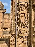
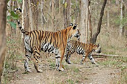
| foot_montage = ''From top, left to right:''[[Chitrakote Falls]] at [[Jagdalpur]], [[Sirpur Group of Monuments]], [[Mahanadi|Mahanadi River]], [[Kanger Ghati National Park]], [[Naya Raipur]], [[Bhoramdeo Temple]], [[Achanakmar Wildlife Sanctuary]], [[Bastar Dussehra]] and [[Korba district|Satrenga Reservoir]] | |||
}} | |||
| image_caption = | |||
| image_blank_emblem = ..Chhattisgarh Flag(INDIA).png | |||
| blank_emblem_type = Emblem | |||
| anthem = "[[Arpa Pairi Ke Dhar]]"<ref>{{Cite web|url=https://www.naidunia.com/chhattisgarh/raipur-arpa-parry-ke-dhar-become-chhattisgars-state-song-3299534|title=Chhattisgarh State Song : अरपा पैरी के धार... बना छत्तीसगढ़ का राजगीत|date=4 November 2019|website=Nai Dunia}}</ref><ref>{{Cite web|url=https://www.aninews.in/news/national/politics/chattisgarhs-official-song-to-play-after-vande-mataram-to-mark-commencement-of-assembly-session20191122084816/|title=Chattisgarh's official song to play after Vande Mataram to mark commencement of assembly session|website=ANI News}}</ref> <br />(''The Streams of Arpa and Pairi'') | |||
| image_map = | |||
| map_alt = | |||
| map_caption = | |||
| image_map1 = IN-CT.svg | |||
| map_caption1 = Location of Chhattisgarh in India | |||
| coordinates = {{coord|21.25|81.60|region:IN-CT_type:adm1st|display=inline}} | |||
| coor_pinpoint = Chhattisgarh | |||
| coordinates_footnotes = | |||
| subdivision_type = Country | |||
| subdivision_name = {{flag|India}} | |||
| established_title = Formation | |||
| established_date = 1 November 2000{{ref|cap|†}} | |||
| seat_type = Capital(s) | |||
| seat = [[Raipur]] | |||
| parts_type = [[List of Indian districts|Districts]] | |||
| parts_style = para | |||
| p1 = [[List of districts of Chhattisgarh]] | |||
| government_footnotes = | |||
| governing_body = {{nowrap|[[Government of Chhattisgarh]]}} | |||
| leader_title = [[Governors of Chhattisgarh|Governor]] | |||
| leader_name = [[Anusuiya Uikey]] | |||
| leader_title1 = [[Chief Ministers of Chhattisgarh|Chief Minister]] | |||
| leader_name1 = [[Bhupesh Baghel]] ([[Indian National Congress|INC]]) | |||
| unit_pref = Metric | |||
| area_footnotes = <ref name="censusofficial">{{cite web|title=Official site of the Ministry of Statistics and Programme Implementation, India|url=http://mospi.nic.in/mospi_new/upload/SYB2013/ch2.html|access-date=20 July 2013|url-status=dead|archive-url=https://web.archive.org/web/20131203163229/http://mospi.nic.in/mospi_new/upload/SYB2013/ch2.html|archive-date=3 December 2013}}</ref> | |||
| area_total_km2 = 135192 | |||
| area_rank = [[List of states and territories of India by area|9th]] | |||
| area_note = | |||
| elevation_footnotes = | |||
| elevation_m = | |||
| population_total = 2,94,36,231 | |||
| population_as_of = 2020 | |||
| population_footnotes = <ref name="auto">{{Cite web|title=Projected Population of Indian States|url=https://uidai.gov.in/images/state-wise-aadhaar-saturation.pdf|url-status=live|archive-url=https://web.archive.org/web/20190116035945/https://uidai.gov.in/images/state-wise-aadhaar-saturation.pdf |archive-date=16 January 2019 }}</ref> | |||
| population_density_km2 = auto | |||
| population_rank = [[List of states and union territories of India by population|17th]] | |||
| population_note = | |||
| timezone1 = [[Indian Standard Time|IST]] | |||
| utc_offset1 = +05:30 | |||
| iso_code = [[ISO 3166-2:IN|IN-CT]] | |||
| blank_name_sec1 = [[Human Development Index|HDI]] | |||
| blank_info_sec1 = {{increase}} 0.613 (<span style="color:#fc0">medium</span>) | |||
| blank1_name_sec1 = HDI rank | |||
| blank1_info_sec1 = [[List of Indian states and territories by Human Development Index|31st]] (2017) | |||
| blank_name_sec2 = [[Literacy in India|Literacy]] | |||
| blank_info_sec2 = 77.3% (2017) <ref>{{cite web|title=State of Literacy|url=http://censusindia.gov.in/2011-prov-results/data_files/india/Final%20PPT%202011_chapter6.pdf|publisher=Census of India|archive-url=https://web.archive.org/web/20120507131945/http://censusindia.gov.in/2011-prov-results/data_files/india/Final%20PPT%202011_chapter6.pdf|archive-date=7 May 2012|page=114}}</ref> | |||
| demographics_type2 = Languages | |||
| demographics2_title1 = Official | |||
| demographics2_info1 = [[Hindi]] | |||
| demographics2_title2 = Regional | |||
| demographics2_info2 = [[Chhattisgarhi language|Chhattisgarhi]] | |||
| website = {{url|cgstate.gov.in/}} | |||
| footnotes = | |||
| type = [[States and union territories of India|State]] | |||
| seat1_type = Largest cities | |||
| seat1 = [[Raipur]] | |||
| leader_title2 = [[Chhattisgarh Legislative Assembly|Legislature]] | |||
| leader_name2 = [[Unicameral]] ([[List of constituencies of Chhattisgarh Legislative Assembly|90+1 seats]]) | |||
| leader_title3 = [[Parliament of India|Parliamentary constituencies]] | |||
| leader_name3 = * [[Rajya Sabha]] ([[List of Rajya Sabha members from Chhattisgarh|5 seats]]) | |||
* [[Lok Sabha]] ([[List of members of the 17th Lok Sabha#Chhattisgarh|11 seats]]) | |||
| leader_title4 = [[High Courts of India|High Court]] | |||
| leader_name4 = [[Chhattisgarh High Court]], [[Bilaspur district, Chhattisgarh|Bilaspur]] | |||
| official_name = | |||
| module = {{Infobox place symbols | |||
| embedded = yes | |||
| region = Chhattisgarh | |||
| country = India | |||
| flag = | |||
| emblem = [[Emblem of Chhattisgarh]][[File:..Chhattisgarh Flag(INDIA).png|50px|left]] | |||
| song = [[Arpa Pairi Ke Dhar]] | |||
| language = | |||
| instrument = | |||
| mammal = [[Wild water buffalo]][[File:Indian Water Buffalo Bubalus arnee by Dr Raju Kasambe IMG 0347 (11) (cropped).jpg|50px|left]] | |||
| bird = [[Hill myna]] [[File:Beo-2.jpg|50px|left]] | |||
| fish = | |||
| butterfly = <!-- or | insect = --> | |||
| flower = [[Rhynchostylis gigantea]] [[File:Rhynchostylis gigantea.jpg|50px|left]] | |||
| fruit = | |||
| tree = [[Shorea robusta]] [[File:Shorea robusta - Simurali 2011-10-05 050368.JPG|50px|left]] | |||
| plant = | |||
| vegetable = | |||
| food = <!-- or | dish = --> | |||
| drink = | |||
| sweet = <!-- or | confectionery = --> | |||
| river = <!-- or | lake = --> | |||
| fossil = | |||
| mineral = | |||
| sport = <!-- or | game = --> | |||
| costume = <!-- or | dress = --> | |||
| colour = <!-- or | color = --> | |||
}} | |||
}} | |||
'''Chhattisgarh''' ({{IPAc-en|tʃ|æ|t|ɪ|s|ɡ|ɑː|ɹ}}, {{IPA-hi|ˈtʃʰət̪ːiːsgəɽʱ|lang}}) is a landlocked and heavily forested [[States and union territories of India|state]] located in the region of [[Central India]]. Formerly part of [[Madhya Pradesh]] it was granted statehood on [[Chhattisgarh Rajyotsava|1 November 2000]]. It is the [[List of states and union territories of India by area|9th-largest state in India]], with an area of {{convert|135192|km2|sqmi|abbr=on}}. As of 2021, it has a population of roughly 30 million (3 crores), making it the [[List of states and union territories of India by population|17th most populated state in the country]].<ref>{{Cite web|title=Chhattisgarh Population 2020/2021|url=https://www.populationu.com/in/chhattisgarh-population|access-date=2021-08-22|website=www.populationu.com}}</ref> | |||
== | The state was formed by the partition of ten [[Chhattisgarhi]] and six [[Gondi language|Gondi]]-speaking [[List of districts of Madhya Pradesh|districts]] in the southeast of Madhya Pradesh.<ref name="cgfinance.nic.in">{{cite web |url=http://cgfinance.nic.in/Rules%20%26%20Act/Reorganisation%20Act-2000/Reorganisation%20Act%2C2000%28English%29.PDF |title=Madhya Pradesh Reorganisation Act, 2000 |access-date=29 September 2013 |archive-url=https://web.archive.org/web/20130718013901/http://cgfinance.nic.in/Rules%20%26%20Act/Reorganisation%20Act-2000/Reorganisation%20Act%2C2000%28English%29.PDF |archive-date=18 July 2013 |url-status=dead }}</ref><ref name="zeenews.india.com">{{Cite web|url=http://zeenews.india.com/Elections08/Chhattisgarhstory.aspx?aid=482902|title=Chhattisgarh profile- Know all you want to know about state<!-- Bot generated title -->}}{{Dead link|date=December 2021 |bot=InternetArchiveBot |fix-attempted=yes }}</ref> Its capital city is [[Raipur]]. It borders 7 states – [[Uttar Pradesh]] to the north, [[Madhya Pradesh]] to the northwest, [[Maharashtra]] to the southwest, [[Jharkhand]] to the northeast, [[Odisha]] to the east, [[Telangana]] and [[Andhra Pradesh]] to the south.<ref>{{cite web|url=https://www.google.com/maps/place/Chhattisgarh,+India/|title=Google Maps|publisher=Google Maps|access-date=6 December 2015}}</ref> Currently, it comprises [[List of districts of Chhattisgarh|32 districts]]. | ||
< | |||
Chhattisgarh is one of the fastest-developing states in India.<ref>{{cite web|title=Chhattisgarh Steel |url=http://india.gov.in/knowindia/st_chhattisgarh.php |access-date=22 July 2011 |url-status=dead |archive-url=https://web.archive.org/web/20110707025600/http://india.gov.in/knowindia/st_chhattisgarh.php |archive-date=7 July 2011 }}</ref> Its [[Gross regional domestic product|Gross State Domestic Product (GSDP)]] is {{INRConvert|3.63|lc|lk=}}, with a [[per capita]] GSDP of {{INRConvert|102.762|k|lk=}}.<ref>{{Cite news|url=https://www.prsindia.org/parliamenttrack/budgets/chhattisgarh-budget-analysis-2019-20|title=Chhattisgarh Budget Analysis 2019–20|archive-url=https://web.archive.org/web/20190217084901/https://www.prsindia.org/parliamenttrack/budgets/chhattisgarh-budget-analysis-2019-20|archive-date=17 February 2019|url-status=dead|access-date=14 March 2019}}</ref> A resource-rich state, Chhattisgarh provides electricity, coal, and steel to the rest of the nation.<ref>{{cite web|title=Chhattisgarh State – Power Hub |url=http://cg.gov.in/power/power1.htm |access-date=22 July 2011 |url-status=dead |archive-url=https://web.archive.org/web/20101120182905/http://cg.gov.in/power/power1.htm |archive-date=20 November 2010 }}</ref> | |||
In 2020, it again won the title of cleanest state with more than 100 [[Urban Local Bodies]], as announced by [[Ministry of Housing and Urban Affairs|Minister for Housing and Urban Affairs]] [[Hardeep Singh Puri]] following the 'Swachh Survekshan 2020'.<ref>{{Cite web|date=20 August 2020|title=Swachh Survekshan 2020 Results: Indore Is India's Cleanest City And Chhattisgarh The Cleanest State, Follow The Highlights {{!}} News|url=https://swachhindia.ndtv.com/swachh-survekshan-2020-results-hardeep-singh-puri-announces-winners-follow-the-highlights-48556/|access-date=20 August 2020|website=NDTV|language=en-US}}</ref> | |||
== Etymology == | |||
There are several theories as to the origin of the name ''Chhattisgarh'', which in ancient times was known as [[Dakshina Kosala]] (South Kosala).<ref>{{cite web|url=https://www.wisdomlib.org/definition/dakshinakosala|title=Dakshinakosala, Dakshina-kosala, Dakṣiṇakosala: 1 definition|last=www.wisdomlib.org|date=21 May 2017|website=www.wisdomlib.org|access-date=29 December 2019}}</ref> The native place of [[Bhagavan|bhagwan]] [[Rama]] as his mother name was [[Kausalya]], daughter of Kaushal Naresh.{{citation needed|date=June 2020}} "Chhattisgarh" was popularised later during the time of the [[Maratha Empire]] and was first used in an official document in 1795.<ref>{{cite web|url=https://www.mapsofindia.com/chhattisgarh/history.html|title=History of Chhattisgarh|website=www.mapsofindia.com|access-date=11 January 2019|archive-url=https://web.archive.org/web/20170826100529/http://www.mapsofindia.com/chhattisgarh/history.html|archive-date=26 August 2017|url-status=live}}</ref> | |||
The most popular theory claims that Chhattisgarh takes its name from the 36 ancient forts (from ''chhattis'' meaning thirty-six and ''garh'' meaning [[fort]]) in the area.{{citation needed|date=June 2020}} The old state had 36 demesnes (feudal territories): [[Ratanpur, Chhattisgarh|Ratanpur]], Vijaypur, Kharound, Maro, Kautgarh, [[Nawagarh]], Sondhi, Aukhar, Padarbhatta, Semriya, Champa, Lafa, Chhuri, Kenda, Matin, Aparora, Pendra, Kurkuti-kandri, Raipur, Patan, Simaga, Singarpur, Lavan, Omera, Durg, Saradha, Sirasa, Menhadi, Khallari, Sirpur, Figeswar, Rajim, Singhangarh, Suvarmar, Tenganagarh and Akaltara.<ref>Dr. Bhagvan Singh Verma, ''Chhattisgarh ka Itihas'' (A History of Chhattisgarh – in Hindi), Madhya Pradesh Hindi Granth Academy, Bhopal (M.P.), 4th edition (2003), p.7</ref> However, most historians disagree with this theory as 36 forts have not been found and identified. | |||
According to the opinion of Hiralal, it is said that at one time there were 36 strongholds in this area, that is why its name was Chhattisgarh. But even after the increase in the number of strongholds, there was no change in the name, Chhattisgarh is the [[State of India]] which has been given the status of 'Mahtari' (Mother). There are two regions in India which are named for special reasons – one was '[[Magadha]]' which became "[[Bihar]]" due to the abundance of [[Buddhism]] viharas and the other was '[[Dakshina Kosala]]' which became "Chhattisgarh" due to the inclusion of thirty-six strongholds. | |||
Another view, more popular with experts and historians, is that Chhattisgarh is the corrupted form of ''Chedisgarh'' meaning ''Raj'' or "[[Chedi Kingdom|Empire of the Chedis]]".{{citation needed|date=June 2020}} In ancient times, Chhattisgarh region had been part of the Chedi dynasty of [[Kalinga (historical region)|Kalinga]], in modern [[Odisha]]. In the medieval period up to 1803, a major portion of present eastern Chhattisgarh was part of the [[Sambalpur]] Kingdom of [[Odisha]]. | |||
== History == | |||
{{See also|Sirpur Group of Monuments|Malhar, Chhattisgarh}} | |||
=== Ancient and medieval history === | |||
[[File:8th century couple embraced and mouth kissing at Tivara Deva temple, she stands on his feet, Sirpur monuments Chhattisgarh India.jpg|thumb|Carved statue in the medieval city of Sirpur]] | |||
Sitabega caves are one of the earliest examples of [[Theatre of India|theatre]] architecture in India located on [[Ramgarh, Chhattisgarh|Ramgarh hill]] of Chhattisgarh dated to Mauryan period of 3rd century BCE. [[Jogimara and Sitabenga Caves|Jogimara caves]] contain ancient Brahmi inscription and the oldest painting known in India. The inscription can be translated as either a love proclamation by a girl or a dancer-painter creating a cave theatre together.<ref>{{Cite book|last=Singh|first=Upinder|url=https://books.google.com/books?id=H3lUIIYxWkEC|title=A History of Ancient and Early Medieval India: From the Stone Age to the 12th Century|date=2008|publisher=Pearson Education India|isbn=978-81-317-1120-0|pages=50|language=en}}</ref> In ancient times, this region was known as [[Dakshina Kosala]]. This area is also mentioned in Ramayana and Mahabharata. One of the earliest statues of [[Vishnu]] has been excavated from [[Shunga Empire|Shunga]] period site at [[Malhar, Chhattisgarh|Malhar]]. Between the sixth and twelfth centuries, [[Sharabhapuriya dynasty|Sharabhpurias]], Panduvanshis (of [[Panduvamshis of Mekala|Mekala]] and [[Panduvamshis of Dakshina Kosala|Dakshina Kosala]]), [[Somavaṃśī dynasty|Somavanshi]], [[Kalachuris of Ratnapura|Kalachuri]] and [[Chindaka Naga|Nagavanshi]] rulers dominated this region. The [[Bastar state|Bastar]] region of Chhattisgarh was invaded by [[Rajendra Chola I]] and [[Kulothunga Chola I]] of the [[Chola dynasty]] in the 11th century.<ref>Dimensions of Human Cultures in Central India by Professor S.K. Tiwari p.161</ref><ref>Dimensions of Human Cultures in Central India: by Professor S.K. Tiwari p.163</ref><ref>Tribal Roots of Hinduism by Sheev Kumar Tiwari p.209</ref> | |||
=== Colonial and post-independence history === | |||
{{See also|Chhattisgarh Division}} | |||
Chhattisgarh was under [[Maratha]] rule (Bhonsales of Nagpur) from 1741 to 1845 CE. It came under British rule from 1845 to 1947 as the [[Chhattisgarh Division]] of the [[Central Provinces]]. Raipur gained prominence over the capital Ratanpur with the advent of the British in 1845. In 1905, the [[Sambalpur district]] was transferred to Odisha and the estates of Surguja were transferred from Bengal to Chhattisgarh. | |||
The area constituting the new state merged into Madhya Pradesh on 1 November 1956, under the [[States Reorganisation Act, 1956]] and remained a part of that state for 44 years. Prior to that, the region was part of the [[Central Provinces and Berar]] (CP and Berar) under British rule. Some areas constituting the Chhattisgarh state were [[princely state]]s under the British rule, but were later on merged into Madhya Pradesh.<ref>{{cite web|title=State Finance Report - Chapter 4|url=http://cgfinance.nic.in/FSFC/State%20Finance%20Report/English/Chap-4.pdf|url-status=dead|archive-url=https://web.archive.org/web/20130502133300/http://cgfinance.nic.in/FSFC/State%20Finance%20Report/English/Chap-4.pdf|archive-date=2 May 2013|access-date=1 April 2012}}</ref> | |||
=== Separation of Chhattisgarh === | |||
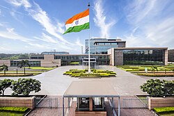
[[File:Secretariat in Naya Raipur.JPG|thumb|Mantralaya in Naya (New) Raipur]] | |||
The demand for Chhattisgarh to be a separate state first rose in the 1920s, with similar demands appearing at regular intervals; however, a well-organised movement was never initiated. Several all-party platforms were created and usually resolved around petitions, public meetings, seminars, rallies and strikes.<ref name="Prithak Chhattisgarh">{{cite web|title=Prithak Chhattisgarh|url=http://cg.gov.in/profile/corigin.htm#prathak|url-status=dead|archive-url=https://web.archive.org/web/20100704202817/http://cg.gov.in/profile/corigin.htm|archive-date=4 July 2010|access-date=22 July 2011}}</ref> The demand was raised by the Raipur Congress unit in 1924 and was also discussed in the Indian Congress at Tripuri. A discussion about forming a Regional Congress organisation for Chhattisgarh took place. In 1954, when the State Reorganisation Commission was set up, the demand was put forward but was rejected. In 1955, the demand was raised in the Nagpur assembly of Madhya Bharat.<ref name="Prithak Chhattisgarh" /> | |||
In the 1990s, the demand became more prominent, resulting in the formation of a statewide political forum known as the Chhattisgarh Rajya Nirman Manch. The forum was led by [[Chandulal Chadrakar]] and several successful region-wide strikes and rallies were organised under it, all of which were supported by major political parties, such as the [[Indian National Congress]] and the [[Bharatiya Janata Party]].<ref name="Prithak Chhattisgarh" /> | |||
The new National Democratic Alliance government sent the Separate Chhattisgarh Bill for approval by the Madhya Pradesh Assembly, where it was unanimously approved and then submitted to the [[Lok Sabha]]. The bill was passed in the Lok Sabha and the Rajya Sabha, which allowed the creation of the state of Chhattisgarh. [[K. R. Narayanan]] gave his consent to the [[Madhya Pradesh Reorganisation Act]] on 25 August 2000 and the government of India set 1 November 2000 as the day Chhattisgarh would be separated from Madhya Pradesh.<ref name="Prithak Chhattisgarh" /> As such, Chhattisgarh was formed from Madhya Pradesh.<ref name="cgfinance.nic.in" /><ref name="zeenews.india.com" /> | |||
== Geography == | |||
The northern and southern parts of the state are hilly, while the central part is a fertile [[plain]]. The highest point in the state is the Gaurlata near Samri, Balrampur-Ramanujganj district.<ref>{{cite web|url=http://naidunia.jagran.com/search/chhattisgarh-highest-peak|title=Chhattisgarh Highest Peak: Latest Chhattisgarh Highest Peak News in Hindi – Naidunia|website=naidunia.jagran.com|access-date=13 September 2017|archive-url=https://web.archive.org/web/20170518144953/http://naidunia.jagran.com/search/chhattisgarh-highest-peak|archive-date=18 May 2017|url-status=dead}}</ref> Deciduous forests of the Eastern Highlands Forests cover roughly 44% of the state.<ref>{{cite web|url=http://cgclimatechange.com/ongoing-projects/|title=Ongoing Projects|language=en-GB|access-date=29 December 2019}}</ref> | |||
[[File:The Mahanadi River , Chhattisgarh.png|thumb|The Mahanadi River, in Chhattisgarh]] | |||
The state animal is the ''van bhainsa'', or wild Asian buffalo. The state bird is the ''pahari myna'', or hill myna. The state tree is the [[Shorea robusta|Sal (Sarai)]] found in Bastar division. | |||
[[File:Shorea robusta in Chhattisgarh.jpg|thumb|Sal- The State Tree of Chhattisgarh]] | |||
In the north lies the edge of the great [[Indo-Gangetic plain]]. The [[Rihand River]], a tributary of the [[Ganges River|Ganges]], drains this area. The eastern end of the [[Satpura Range]] and the western edge of the [[Chota Nagpur Plateau]] form an east–west belt of hills that divide the [[Mahanadi River]] basin from the Indo-Gangetic plain. The outline of Chhattisgarh is like a sea horse. | |||
The central part of the state lies in the fertile upper basin of the Mahanadi River and its tributaries. This area has extensive rice cultivation. The upper Mahanadi basin is separated from the upper [[Narmada River|Narmada]] basin to the west by the [[Maikal Hill]]s (part of the Satpuras) and from the plains of Odisha to the east by ranges of hills. The southern part of the state lies on the [[Deccan Plateau|Deccan plateau]], in the watershed of the [[Godavari River]] and its tributary, the [[Indravati River]]. The Mahanadi is the chief river of the state. The other main rivers are [[Hasdeo River|Hasdeo]] (a tributary of Mahanadi), [[Rihand]], [[Indravati]], [[Jonk River|Jonk]], Arpa and Shivnath.<ref>{{cite web|url=http://www.india-wris.nrsc.gov.in/wrpinfo/index.php?title=Major_Rivers_Flowing_in_Chhattisgarh|title=Major Rivers Flowing in Chhattisgarh -|website=india-wris.nrsc.gov.in|access-date=5 October 2018|archive-url=https://web.archive.org/web/20181005120535/http://www.india-wris.nrsc.gov.in/wrpinfo/index.php?title=Major_Rivers_Flowing_in_Chhattisgarh|archive-date=5 October 2018|url-status=dead}}</ref> | |||
The natural environment of Koriya in Chhattisgarh includes forests, mountains, rivers and waterfalls.{{citation needed|date=December 2018}} Koriya was a princely state during the British rule in India. Koriya is also known for its mineral deposits.<ref>{{cite web|url=https://www.districtsofindia.com/chhattisgarh/koriya/industriesandmining/mines/index.aspx|title=Welcome To Districts of India|website=www.districtsofindia.com|access-date=27 January 2019|archive-url=https://web.archive.org/web/20190127152720/https://www.districtsofindia.com/chhattisgarh/koriya/industriesandmining/mines/index.aspx|archive-date=27 January 2019|url-status=dead}}</ref> Coal is also found in this part of the country.<ref>{{cite web|url=http://chhattisgarhmines.gov.in/en/coal|title=Chhattisgarh Mines Govt Official Website|access-date=5 October 2018|archive-url=https://web.archive.org/web/20181012044852/http://chhattisgarhmines.gov.in/en/coal|archive-date=12 October 2018|url-status=live}}</ref> The dense forests are rich in wildlife.{{citation needed|date=December 2018}} | |||
The Amrit Dhara Waterfall, Koriya's main attraction, is a natural waterfall which originates from the Hasdeo River. The fall is situated seven kilometres from Koriya on the Manendragarh-Baikunthpur road. The Amrit Dhara Waterfall falls from a height of 27 m, and it is approximately 3–4.5 m wide. [[Chirimiri]] is one of the most popular places, known for its natural environment and climate, in Chhattisgarh.<ref>{{cite web|url=http://www.maniactravellers.com/india/chhattisgarh/213|title=Chirmiri Hill Station, Chirmiri {{!}} Chhattisgarh|last=Travellers|first=Maniac|website=Maniac Travellers|access-date=18 February 2019|archive-url=https://web.archive.org/web/20190219015646/https://www.maniactravellers.com/india/chhattisgarh/213|archive-date=19 February 2019|url-status=dead}}</ref> | |||
[[File:Landuse landcover imgae of Chhattisgarh.jpg|thumb|https://daac.ornl.gov/VEGETATION/guides/Decadal_LULC_India.html]] | |||
=== Climate === | |||
Chhattisgarh has a tropical [[climate]]. It is hot and humid in the summer because of its proximity to the [[Tropic of Cancer]] and its dependence on the [[monsoon]]s for rains. Summer temperatures in Chhattisgarh can reach up to 49 °C (113 °F).<ref>{{cite web|url=http://chtenvis.nic.in/Climate.html|title=Chhattisgarh {{!}} Institute|website=chtenvis.nic.in|access-date=5 October 2018|archive-url=https://web.archive.org/web/20180813230036/http://www.chtenvis.nic.in/Climate.html|archive-date=13 August 2018|url-status=dead}}</ref> The monsoon season is from late June to October and is a welcome respite from the heat. Chhattisgarh receives an average of {{convert|1292|mm}} of rain. Winter is from November to January. Winters are pleasant with low temperatures and less humidity. Ambikapur, Mainpat, Pendra Road, Samri and Jashpur are some of the coldest places in the state.<ref>{{cite web|author=Pragati Infosoft Pvt. Ltd. |url=http://chhattisgarhonline.in/Profile/Geography/Climate.asp |title=Chhattisgarh Climate, Climate of Chhattisgarh, Chhattisgarh Temperature, Temperature of Chhattisgarh |publisher=Chhattisgarhonline.in |access-date=29 August 2011 |url-status=dead |archive-url=https://archive.today/20101106223444/http://www.chhattisgarhonline.in/Profile/Geography/climate.asp |archive-date=6 November 2010 }}</ref> | |||
== Transport == | |||
=== Roads === | |||
Chhattisgarh has four-lane or two-lane roads that provide connectivity to major cities. A total of 20 national highways pass through the state, together measuring 3,078 km. Many national highways exist only on paper and are not fully converted into four-lane, leave alone six-lane or eight-lane, highways. These include: | |||
* NH 130A New | |||
* NH 130B New | |||
* NH 130C New | |||
* NH 130D New | |||
* NH 149B New | |||
* NH 163A New | |||
* NH 343 New | |||
* NH 930 New | |||
* NH 6 | |||
* NH 16 | |||
* NH 43 | |||
* NH 12A | |||
* NH 78 | |||
* NH 111 | |||
* NH 200 | |||
* NH 202 | |||
* NH 216 | |||
* NH 217 | |||
* NH 221 | |||
* NH 30 | |||
* NH 930 New. | |||
The [[State Highway (India)|state highways]] and major district roads constitute another network of 8,031 km. | |||
=== Rail network === | |||
[[File:Raipur Railway Station Entrance.jpg|thumb|Raipur Railway Station Entrance]] | |||
Almost the entire railway network spread over the state comes under the geographical jurisdiction of the [[South East Central Railway]] Zone of Indian Railways centred around [[Bilaspur, Chhattisgarh|Bilaspur]], which is the zonal headquarters of this zone. Almost 85% of tracks are electrified, the non-electrified route is Maroda–Bhanupratappur line from Durg–Bhanupratappur branch line, which is 120 km long. The main railway junctions are [[Bilaspur Junction]], {{rws|Durg Junction}} and Raipur, which is also a starting point of many long-distance trains. These three junctions are well-connected to the major cities of India and also these station comes under the top 50 booking stations in India.<ref name="rail-secr">{{cite web|url=http://www.secr.indianrailways.gov.in/view_section.jsp?lang=0&id=0,1,652,653|title=South East Central Railways|publisher=South East Central Railway|access-date=23 May 2013|archive-url=https://web.archive.org/web/20130709223243/http://www.secr.indianrailways.gov.in/view_section.jsp?lang=0&id=0,1,652,653|archive-date=9 July 2013|url-status=dead}}</ref> | |||
The state has the highest freight loading in the country, and one-sixth of Indian Railway's revenue comes from Chhattisgarh. The length of the rail network in the state is 1,108 km, while a third track has been commissioned between Durg and Raigarh.<ref>{{cite web|title=Department of Commerce & Industry Chhattisgarh |url=http://industries.cg.gov.in/connectivity.htm |publisher=Government of Chhattisgarh |access-date=23 May 2013 |url-status=dead |archive-url=https://web.archive.org/web/20130715035303/http://industries.cg.gov.in/connectivity.htm |archive-date=15 July 2013 }}</ref> Construction of some new railway lines include Dalli–Rajhara–Jagdalpur rail line, Pendra Road–Gevra Road rail line, Raigarh–Mand Colliery to Bhupdeopur rail line and Barwadih–Chirmiri rail line.<ref>{{cite news|title=Proposed new rail line to bring Mumbai, Kolkata closer|url=http://www.business-standard.com/article/economy-policy/proposed-new-rail-line-to-bring-mumbai-kolkata-closer-110030300025_1.html|access-date=23 May 2013|newspaper=Business Standard|date=3 March 2010|archive-url=https://web.archive.org/web/20140506202213/http://www.business-standard.com/article/economy-policy/proposed-new-rail-line-to-bring-mumbai-kolkata-closer-110030300025_1.html|archive-date=6 May 2014|url-status=live}}</ref> Freight/goods trains provide services mostly to coal and iron ore industries in east–west corridor (Mumbai–Howrah route). There is a lack of passenger services to north and south of Chhattisgarh. | |||
==== Major railway stations of Chhattisgarh ==== | |||
* {{rws|Bilaspur Junction}} | |||
* {{rws|Durg Junction}} | |||
* {{rws|Raipur Junction}} | |||
* {{rws|Ambikapur}} | |||
* {{rws|Raigarh}} | |||
* {{rws|Korba}} | |||
* {{rws|Champa Junction}} | |||
*{{rws|Mahasamund}} | |||
* {{rws|Rajnandgaon}} | |||
* {{rws|Dongargarh}} | |||
* {{rws|Gevra Road}} | |||
* {{rws|Pendra Road}} | |||
===Air=== | |||
[[File:Raipur Airport night view.png|thumb|Swami Vivekananda Airport, Raipur]] | |||
The air infrastructure in Chhattisgarh is improving. [[Swami Vivekananda Airport|Swami Vivekananda International Airport]] in [[Raipur]] is well connected to all major cities of India and operation of International flights from Raipur are under consideration besides this small airports [[Bilaspur Airport]] and [[Jagdalpur Airport]] are regionally connected with scheduled commercial services. A massive reduction in sales tax on aviation turbine fuel (ATF) from 25 to 4% in Chhattisgarh in 2003 contributed to a sharp rise in passenger flow. The passenger flow increased by 58% between 2011 and November 2012.<ref>{{cite news|title=Pranab hopes Raipur airport's new terminal will support Chhattisgarh's growth|url=http://www.thehindu.com/news/national/other-states/pranab-hopes-raipur-airports-new-terminal-will-support-chhattisgarhs-growth/article4075110.ece|work=[[The Hindu]]|date=8 November 2012|access-date=22 April 2013|location=Chennai, India|first=Suvojit|last=Bagchi|archive-url=https://web.archive.org/web/20150904045832/http://www.thehindu.com/news/national/other-states/pranab-hopes-raipur-airports-new-terminal-will-support-chhattisgarhs-growth/article4075110.ece|archive-date=4 September 2015|url-status=live}}</ref> | |||
'''Other Airstrips''' | |||
* [[Ambikapur Airport]], Darima, Ambikapur | |||
== Governance == | |||
{{Main|Government of Chhattisgarh|Legislative Assembly of Chhattisgarh}} | |||
The State Legislative assembly is composed of 90 members of the Legislative Assembly. There are 11 members of the Lok Sabha from Chhattisgarh. The [[Rajya Sabha]] has five members from the state. | |||
== Administration == | |||
Chhattisgarh state consists of 5 divisions with 32 districts (one new district named "Gaurela-Pendra-Marwahi" created with effect from 10 February 2020). | |||
=== Divisions === | |||
{| class="wikitable" style="text-align: left;" | |||
|- | |||
![[Bastar Division]] | |||
!Durg Division | |||
!Raipur Division | |||
!Bilaspur Division | |||
!Surguja Division | |||
|- style="vertical-align: top;" | |||
| | |||
* [[Bastar District|Bastar]] (Jagdalpur) | |||
* [[Bijapur district, Chhattisgarh|Bijapur]] | |||
* [[Sukma district|Sukma]] | |||
* [[Dantewada District|Dakshin Bastar Dantewada]] (Dakshin Bastar) | |||
* [[Kondagaon]] | |||
* [[Narayanpur district|Narayanpur]] | |||
* [[Kanker District|Uttar Bastar Kanker]] (Uttar Bastar) | |||
| | |||
* [[Kabirdham district|Kabirdham]] (Kabirdham) | |||
* [[Rajnandgaon District|Rajnandgaon]] | |||
* [[Balod district|Balod]] | |||
* [[Durg District|Durg]] | |||
* [[Bemetara district|Bemetara]] | |||
* [[Mohla-Manpur district|Mohla-Manpur]]<ref name="economictimes.indiatimes.com">{{Cite news|url=https://economictimes.indiatimes.com/news/politics-and-nation/chhattisgarh-to-have-4-new-districts-says-cm-baghel-on-independence-day/articleshow/85345132.cms|title = Chhattisgarh to have 4 new districts, says CM Bhupesh Baghel on Independence Day|newspaper = The Economic Times}}</ref> | |||
| | |||
* [[Dhamtari District|Dhamtari]] | |||
* [[Gariaband district|Gariaband]] | |||
* [[Raipur District|Raipur]] | |||
* [[Baloda Bazar]] | |||
* [[Mahasamund District|Mahasamund]] | |||
| | |||
* [[Bilaspur District, Chhattisgarh|Bilaspur]] | |||
* [[Mungeli District|Mungeli]] | |||
* [[Korba District|Korba]] | |||
* [[Janjgir-Champa]] | |||
* [[Raigarh District|Raigarh]] | |||
* [[Gaurela-Pendra-Marwahi district|Gaurela-Pendra-Marwahi]] | |||
* [[Sarangarh-Bilaigarh District|Sarangarh-Bilaigarh]]<ref name="economictimes.indiatimes.com"/> | |||
* [[Shakti district|Shakti]]<ref name="economictimes.indiatimes.com"/> | |||
| | |||
* [[Koriya District|Koriya]] | |||
* [[Surajpur district|Surajpur]] | |||
* [[Surguja District|Surguja]] (Ambikapur) | |||
* [[Balrampur district, Chhattisgarh|Balrampur-Ramanujganj]] | |||
* [[Jashpur District|Jashpur]] | |||
* [[Manendragarh-Chirmiri-Bharatpur district|Manendragarh-Chirmiri-Bharatpur]]<ref name="economictimes.indiatimes.com"/> | |||
|} | |||
=== Districts === | |||
{{Main|List of districts of Chhattisgarh}} | |||
[[File:Chhattisgarh districts map.svg|thumb|Districts of Chhattisgarh state in 2020]] | |||
Chhattisgarh comprises 32 districts.<ref name="economictimes.indiatimes.com"/> The following are the list of the districts of Chhattisgarh State with major cities: | |||
{| class="wikitable sortable" style="text-align: left;" | |||
|- | |||
! District !! Headquarter !! Largest City !! class=unsortable| Other Major Cities | |||
|- | |||
| [[Raipur District|Raipur]] || [[Raipur]] || [[Raipur]] || Arang, Tilda-Newra | |||
|- | |||
| [[Bilaspur district, Chhattisgarh|Bilaspur]] || [[Bilaspur, Chhattisgarh|Bilaspur]] || [[Bilaspur, Chhattisgarh|Bilaspur]] || Kota (Kargi Road), Bilha | |||
|- | |||
|[[Durg District|Durg]] || [[Durg]] || [[Bhilai]]|| Charoda, Kumhari, Patan | |||
|- | |||
| [[Korba District|Korba]] || [[Korba, Chhattisgarh|Korba]]|| [[Korba, Chhattisgarh|Korba]] || Katghora, Dipka, Pali | |||
|- | |||
|[[Raigarh District|Raigarh]] || [[Raigarh]] || [[Raigarh]]|| [[Kharsia]], Gharghora, Sarangagarh, lailunga | |||
|- | |||
|[[Rajnandgaon District|Rajnandgaon]] || [[Rajnandgaon]] || [[Rajnandgaon]] || Dongargarh, Dongargaon | |||
|- | |||
|[[Koriya District|Koriya]] || [[Baikunthpur, Koriya|Baikunthpur]] || [[Chirmiri]] || [[Manendragarh]] | |||
|- | |||
|[[Surguja District|Surguja]] || [[Ambikapur, India|Ambikapur]] || [[Ambikapur, India|Ambikapur]]|| [[Sitapur, Chhattisgarh|Sitapur]] | |||
|- | |||
|[[Balrampur district, Chhattisgarh|Balrampur-Ramanujganj]] || [[Balrampur]] || [[Balrampur]] || Ramanujganj | |||
|- | |||
| [[Jashpur District|Jashpur]] || [[Jashpur Nagar]]|| [[Jashpur Nagar]]|| Kunkuri, Patthalgaon, Tapkara | |||
|- | |||
| [[Surajpur District|Surajpur]] || [[Surajpur, Chhattisgarh|Surajpur]]|| [[Surajpur, Chhattisgarh|Surajpur]] || [[Telgaon]], [[Bishrampur, Chhattisgarh|Bishrampur]] | |||
|- | |||
| [[Janjgir–Champa]] || [[Janjgir]] || [[Janjgir]]-Naila, [[Champa]] || [[Sakti, Chhattisgarh|Sakti]], [[Akaltara]], [[Shivrinarayan]] | |||
|- | |||
|[[Mungeli District|Mungeli]]||[[Mungeli]]||[[Mungeli]]||[[Lormi]], Takhatpur | |||
|- | |||
|[[Kabirdham District|Kabirdham]] || [[Kawardha]] || [[Kawardha]] || Pandariya, Pandatarai | |||
|- | |||
| [[Bemetara]] || [[Bemetara]] || [[Bemetara]] || Nawagarh, Saja | |||
|- | |||
| [[Balod district|Balod]]|| [[Balod]] || [[Balod]] || Dalli-Rajhara | |||
|- | |||
| [[Baloda Bazar District|Baloda Bazar-Bhatapara]] || [[Baloda Bazar]], [[Bhatapara]] || [[Bhatapara]] || Simga, Palari, Lawan, Kasdol, Bilaigarh | |||
|- | |||
| [[Gariaband district|Gariaband]]||[[Gariaband]] || [[Gariaband]] || Rajim, Deobhog | |||
|- | |||
| [[Mahasamund]] || [[Mahasamund]] || [[Mahasamund]] || Saraipali, Bagbahra | |||
|- | |||
| [[Dhamtari District|Dhamtari]] || [[Dhamtari]] || [[Dhamtari]] || [[Kurud]] | |||
|- | |||
|[[Bijapur district, Chhattisgarh|Bijapur]]||[[Bijapur, Chhattisgarh|Bijapur]] || [[Bijapur, Chhattisgarh|Bijapur]] || Sangampal, Kasiguda | |||
|- | |||
| [[Narayanpur district|Narayanpur]] || [[Narayanpur, Chhattisgarh|Narayanpur]] ||[[Narayanpur, Chhattisgarh|Narayanpur]] || Kodenar, Orchha | |||
|- | |||
| [[Kanker District|Kanker]] || [[Kanker, Chhattisgarh|Kanker]] ||[[Kanker, Chhattisgarh|Kanker]] || Bhanupratapur | |||
|- | |||
| [[Bastar District|Bastar]] || [[Jagdalpur]] || [[Jagdalpur]] || [[Bastar district|Bastar]] | |||
|- | |||
| [[Dantewada district|Dantewada]] || [[Dantewada]] || [[Dantewada]] || Kirandul, Geedam | |||
|- | |||
| [[Kondagaon district|Kondagaon]]|| [[Kondagaon]] || [[Kondagaon]] || [[Keshkal]] | |||
|- | |||
|[[Sukma district|Sukma]] || [[Sukma]] || [[Sukma]] || Tadmetla, Murtonda | |||
|- | |||
| [[Gaurela-Pendra-Marwahi district|Gaurela-Pendra-Marwahi]] || [[Gaurella]] || [[Pendra]] || Marwahi, Basti-Bagra, Rajmergarh, Pasan | |||
|- | |||
| [[Manendragarh-Chirmiri-Bharatpur district|Manendragarh-Chirmiri-Bharatpur]] || [[Manendragarh]] || [[Chirmiri]] || Bharatpur, Khadgawan, Amritdhara | |||
|- | |||
| [[Mohla Manpur district|Mohla Manpur]] || [[Mohla]] || [[Mohla]] || Chilamtol | |||
|- | |||
| [[Shakti district|Shakti]] || [[Sakti, Chhattisgarh|Sakti]] || [[Sakti, Chhattisgarh|Sakti]] || Sonthi | |||
|- | |||
| [[Sarangarh-Bilaigarh District|Sarangarh-Bilaigarh]] || [[Sarangarh]] || [[Sarangarh]] || Bilaigarh | |||
|} | |||
=== Major cities === | |||
{{Main|List of cities in Chhattisgarh}} | |||
{| class="wikitable" style="margin:0.2em auto" | |||
!colspan="12" style="padding:0.3em 0; line-height:1.2em; font-size:110%;"| [[List of cities in Chhattisgarh by population|Largest cities in Chhattisgarh]]<br />{{nobold|<small>(2011 Census of India estimate)<ref>{{cite web |url=http://www.censusindia.gov.in/pca/default.aspx |title=Chhattisgarh |publisher=Office of the Registrar General and Census Commissioner |date=18 March 2007 |access-date=23 July 2008 |archive-url=https://web.archive.org/web/20151009081347/http://www.censusindia.gov.in/pca/default.aspx |archive-date=9 October 2015 |url-status=live }}</ref></small>}} | |||
|- | |||
! Rank !! City !! District !! Population | |||
|- | |||
| align=center | 1 ||align=left | '''[[Raipur]]''' || [[Raipur district|Raipur]] || 4,063,872 | |||
|- | |||
| align=center | 2 ||align=left | '''[[Bhilai]]-[[Durg]]''' || [[Durg district|Durg]] || 3,343,872 | |||
|- | |||
| align=center | 3 ||align=left | '''[[Bilaspur, Chhattisgarh|Bilaspur]]''' || [[Bilaspur District, Chhattisgarh|Bilaspur]] || 2,663,629 | |||
|- | |||
| align=center | 4 ||align=left | '''[[Rajnandgaon]]'''|| [[Rajnandgaon district|Rajnandgaon]] || 1,537,133 | |||
|- | |||
| align=center | 5 ||align=left | '''[[Raigarh]]''' || [[Raigarh district|Raigarh]] || 1,493,984 | |||
|- | |||
| align=center | 6 ||align=left | '''[[Korba, Chhattisgarh|Korba]]''' || [[Korba district|Korba]] || 1,206,640 | |||
|- | |||
| align=center | 7 ||align=left |'''[[Ambikapur, India|Ambikapur]]''' || [[Surguja district|Sarguja]] || 2,359,886 | |||
|- | |||
| align=center | 8 ||align=left | '''[[Jagdalpur]]''' ||[[Bastar district|Bastar]] || 125,345 | |||
|- | |||
| align=center | 9 ||align=left | '''[[Chirmiri]] ''' ||[[Koriya district|Koriya]] || 100,656 | |||
|- | |||
| align=center | 10 ||align=left | '''[[Dhamtari]] ''' ||[[Dhamtari district|Dhamtari]] || 90,254 | |||
|- | |||
| align=center | 11 ||align=left | '''[[Mahasamund]] ''' ||[[Mahasamund district|Mahasamund]] || 85,000 | |||
|} | |||
== Economy == | |||
{{Infobox economy | |||
| country = Chhattisgarh | |||
| image = | |||
| image_size = | |||
| caption = | |||
| currency = | |||
| organs = | |||
| gdp = {{INRConvert|4.38|lc}} (2022–23 est.)<ref name="Budget Analysis"/> | |||
| gdp rank = [[List of Indian states and union territories by GDP|18th]] | |||
| growth = -1.8% (2020–21)<ref name="Budget Analysis" /> | |||
| per capita = {{INRConvert|117615}} (2020–21)<ref name="Budget Analysis" /> | |||
| per capita rank = | |||
| sectors = Agriculture 28% <br /> Industry 34% <br /> Services 38% (2020–21)<ref name="Budget Analysis" /> | |||
| components = | |||
| inflation = | |||
| bankrate = | |||
| poverty = | |||
| gini = | |||
| hdi = | |||
| labor = | |||
| occupations = | |||
| unemployment = | |||
| average gross salary = | |||
| gross median = | |||
| average net salary = | |||
| net median = | |||
| industries = | |||
| edbr = | |||
| exports = | |||
| export-goods = | |||
| export-partners = | |||
| imports = | |||
| import-goods = | |||
| import-partners = | |||
| FDI = | |||
| current account = | |||
| gross external debt = | |||
| NIIP = | |||
| debt = 26.14% of GSDP (2022–23 est.)<ref name="Budget Analysis" /> | |||
| balance = {{INRConvert|-14600|c}} (3.33% of GSDP) (2022–23 est.)<ref name="Budget Analysis" /> | |||
| revenue = {{INRConvert|89400|c}} (2022–23 est.)<ref name="Budget Analysis" /> | |||
| expenses = {{INRConvert|1.04|lc}} (2022–23 est.)<ref name="Budget Analysis">{{cite web|title=Chhattisgarh Budget Analysis 2022–23|url=https://prsindia.org/budgets/states/chhattisgarh-budget-analysis-2022-23|website=PRS Legislative Research|access-date=18 March 2022|date=March 2022}}</ref> | |||
| aid = | |||
| credit = | |||
| spelling = Oxford | |||
| presentUS$asdefault = no | |||
}} | |||
Chhattisgarh's nominal gross state domestic product (GSDP) is estimated at {{INRConvert|3.26|lc}} in 2018–19, the [[List of Indian states and union territories by GDP|17th]] largest state economy in India. The economy of Chhattisgarh recorded a growth rate of 6.7% in 2017–18.<ref name="Budget Analysis" /> Chhattisgarh's success factors in achieving high growth rate are growth in agriculture and industrial production. | |||
=== Agriculture === | |||
Agriculture is counted as the chief economic occupation of the state. According to a government estimate, net sown area of the state is 4.828 million hectares and the gross sown area is 5.788 million hectares.<ref name="Agriculture in Chhattisgarh">{{cite web|title=Agriculture in Chhattisgarh |url=http://cg.gov.in/development/cdevelopment.htm#irrigation |access-date=22 July 2011 |url-status=dead |archive-url=https://web.archive.org/web/20110721155523/http://cg.gov.in/development/cdevelopment.htm |archive-date=21 July 2011 }}</ref> Horticulture and animal husbandry also engage a major share of the total population of the state.<ref>{{cite web|title=Economy of Chhattisgarh|url=http://www.mapsofindia.com/chhattisgarh/economy/|access-date=22 July 2011|archive-url=https://web.archive.org/web/20110507072918/http://www.mapsofindia.com/chhattisgarh/economy/|archive-date=7 May 2011|url-status=live}}</ref> About 80% of the population of the state is rural and the main livelihood of the villagers is agriculture and agriculture-based small industry. | |||
The majority of the farmers are still practicing the traditional methods of cultivation, resulting in low growth rates and productivity. The farmers have to be made aware of modern technologies suitable to their holdings. Providing adequate knowledge to the farmers is essential for a better implementation of the agricultural development plans and to improve productivity.<ref name="nhm.nic.in">http://nhm.nic.in/ActionPlan/ActionPlan_Chhattisgarh.pdf{{dead link|date=December 2017 |bot=InternetArchiveBot |fix-attempted=yes }}</ref> | |||
Considering this and a very limited irrigated area, the productivity of not only rice but also other crops is low, hence the farmers are unable to obtain economic benefits from agriculture and it has remained as subsistence agriculture till now. | |||
<gallery mode="packed" heights="134"> | |||
File:Chloroxylon from India.JPG|Chloroxylon is used for pest management in organic rice cultivation in Chhattisgarh | |||
File:Medicinal Rice.jpg|Medicinal rice of Chhattisgarh used as an immune booster | |||
File:Aloe Farming.jpg|Aloe vera farming in Chhattisgarh | |||
File:Gulbakawali Farming.jpg|Herbal farming in Chhattisgarh: Gulbakawali | |||
File:Pigeonpea cultivation on Safed Musli Bed.jpg|Herbal farming in Chhattisgarh: Safed Musli with Arhar | |||
</gallery> | |||
==== Agricultural products ==== | |||
The main crops are rice, maize,<ref>Oudhia, P. (1999) Allelopathic effects of Lantana camara L. on germination of soybean. Legume Research 22(4): 273–274.</ref> ''kodo-kutki'' and other small millets and pulses (''tuar''<ref>Oudhia, P. (2000). Positive (inhibitory) allelopathic effects of some obnoxious weeds on germination and seedling vigour of pigeonpea (Cajanus cajan L.). Research on Crops. 1 (1):116–118.</ref> and ''kulthi''); oilseeds, such as groundnuts (peanuts), soybeans<ref>Oudhia, P. (2001). Stimulatory allelopathic effects of Ageratum conyzoides L. on soybean. Agric. Sci. Digest. 21 (1):55–56.</ref> and sunflowers, are also grown. In the mid-1990s, most of Chhattisgarh was still a monocrop belt. Only one-fourth to one-fifth of the sown area was double-cropped. When a very substantial portion of the population is dependent on agriculture, a situation where nearly 80% of a state's area is covered only by one crop, immediate attention to turn them into double crop areas is needed. Also, very few cash crops are grown in Chhattisgarh, so there is a need to diversify the agriculture produce towards oilseeds and other cash crops. Chhattisgarh is also called the "rice bowl of central India".<ref name="Agriculture in Chhattisgarh" /> | |||
<gallery mode="packed" heights="134"> | |||
File:Kodo Millet in Chhattisgarh.jpg|Kodo Millet is used as a life saving medicine in Chhattisgarh | |||
File:Bastar Beer.jpg|Bastar beer prepared from Sulfi | |||
</gallery> | |||
==== Irrigation ==== | |||
In Chhattisgarh, rice, the main crop, is grown on about 77% of the net sown area. Only about 20% of the area is under irrigation; the rest depends on rain. Of the three agroclimatic zones, about 73% of the Chhattisgarh plains, 97% of the Bastar plateau and 95% of the northern hills are rainfed. The irrigated area available for double cropping is only 87,000 ha in Chhattisgarh plains and 2300 ha in Bastar plateau and northern hills. Due to this, the productivity of rice and other crops is low, hence the farmers are unable to obtain economic benefits from agriculture and it has remained as subsistence agriculture till now, though agriculture is the main occupation of more than 80% of the population.<ref name="nhm.nic.in" /> | |||
In Chhattisgarh region, about 22% of net cropped area was under irrigation as compared to 36.5% in Madhya Pradesh in 1998–99, whereas the average national irrigation was about 40%. The irrigation is characterised by a high order of variability ranging from 1.6% in Bastar to 75.0% in Dhamtari. Based on an average growth trend in the irrigated area, about 0.43% additional area is brought under irrigation every year as compared to 1.89% in Madhya Pradesh and 1.0% in the country as a whole. Thus, irrigation has been growing at a very low rate in Chhattisgarh and the pace of irrigation is so slow, it would take about 122 years to reach the 75% level of net irrigated area in Chhattisgarh at the present rate of growth.<ref name="nhm.nic.in" /> | |||
Chhattisgarh has a limited [[irrigation]] system, with dams and [[canal]]s on some rivers. Average rainfall in the state is around 1400 mm and the entire state falls under the rice agroclimatic zone. The Large variation in the yearly rainfall directly affects the production of rice. Irrigation is the prime need of the state for its overall development and therefore the state government has given top priority to development of irrigation.<ref name="Agriculture in Chhattisgarh" /> | |||
A total of four major, 33 medium and 2199 minor irrigation projects have been completed and five major, nine medium and 312 minor projects are under construction, as of 31 March 2006.{{Update inline|date=August 2019|reason=These numbers are from over ten years ago. Needs updating}} | |||
=== Industrial sector === | |||
==== Power sector ==== | |||
Chhattisgarh is one of the few states of India where the power sector is effectively developed. Based on the current production of surplus electric power, the position of the State is comfortable and profitable. The Chhattisgarh State Electricity Board (CSEB) is in a strong position to meet the electricity requirement of the state and is in good financial health. According to [[Central Electricity Authority (India)|Central Electricity Authority]] (CEA), Chhattisgarh provides electricity to several other states because of surplus production.<ref>{{cite web|url=https://www.dailypioneer.com/2019/state-editions/chhattisgarh-is-power-surplus-state--confirms-cea-report.html|title=Chhattisgarh is power surplus state, confirms CEA report|last=Pioneer|first=The|website=The Pioneer|language=en|access-date=31 December 2019}}</ref> | |||
In Chhattisgarh, [[National Thermal Power Corporation Limited]] (|NTPC) has [[Sipat Thermal Power Station]] with a capacity of 2,980 MW at Sipat, Bilaspur; [[LARA Super Thermal Power Station]] with a nameplate capacity of 1600MW and [[Korba Super Thermal Power Station]] with a capacity of 2,600 MW at Korba, while CSEB's units have a thermal capacity of 1,780 MW and hydel capacity of 130 MW. Apart from NTPC and CSEB, there are a number of private generation units of large and small capacity. The state government has pursued a liberal policy with regard to captive generation which has resulted in a number of private companies coming up.<ref name="Power Sector in Chhattisgarh">{{cite web|title=Power Sector in Chhattisgarh|url=http://cserc.nic.in/power_sector.htm|access-date=22 July 2011|archive-url=https://web.archive.org/web/20041211023325/http://www.cserc.nic.in/power_sector.htm|archive-date=11 December 2004|url-status=dead}}</ref> | |||
The state has a potential of 61,000 MW of additional thermal power in terms of availability of coal for more than 100 years and more than 2,500 MW hydel capacity. To use this vast potential, substantial additions to the existing generation capacity are already underway.<ref name="Power Sector in Chhattisgarh" /> | |||
==== Steel sector ==== | |||
The steel industry is one of the biggest heavy industries of Chhattisgarh. [[Bhilai Steel Plant|Bhilai Steel Plant, Bhilai]] operated by [[Steel Authority of India Limited|SAIL]], with a capacity of 5.4 million tonnes per year, is regarded as a significant growth indicator of the state. More than 100 steel rolling mills, 90 sponge iron plants and ferro-alloy units are in Chhattisgarh. Along with Bhilai, today Raipur, Bilaspur, Korba and Raigarh have become the steel hub of Chhattisgarh. Today, Raipur has become the centre of the steel sector, the biggest market for steel in India.<ref name="Industries in Chhattisgarh">{{cite web|title=Industries in Chhattisgarh|url=http://www.mapsofindia.com/chhattisgarh/economy/chhattisgarh-industries.html|access-date=22 July 2011|archive-url=https://web.archive.org/web/20110810083204/http://www.mapsofindia.com/chhattisgarh/economy/chhattisgarh-industries.html|archive-date=10 August 2011|url-status=live}}</ref> | |||
==== Aluminium sector ==== | |||
The aluminium industry of Chhattisgarh was established by Bharat Aluminium Company Limited, which has a capacity of around 5,700,000 tonnes each year.<ref name="Industries in Chhattisgarh" /> | |||
==== Natural resources ==== | |||
===== Mineral deposits ===== | |||
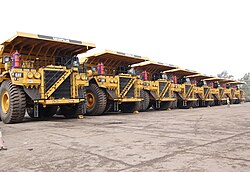
Chhattisgarh is rich in minerals. It produces 50% of the country's total cement production. It has the highest output of coal in the country with second-highest reserves. It is third in iron ore production and first in tin production. [[Limestone]], [[Dolomite (rock)|dolomite]] and [[bauxite]] are abundant. It is the only [[tin]] ore-producing state in India. Other commercially extracted minerals include [[corundum]], [[garnet]], [[quartz]], [[marble]], [[alexandrite]] and diamonds. | |||
<gallery mode="packed" heights="134"> | |||
Maikal Hills.jpg|Mineral deposits in the Maikal Hills | |||
Mineral wealth of Chhattisgarh.jpg|Mineral Wealth from Chandidongri | |||
</gallery> | </gallery> | ||
{{ | ===== Information and technologies ===== | ||
In recent years, Chhattisgarh is also receiving exposure in [[information technology]] (IT) projects and consultancy. Its government is also promoting IT and has set up a body to take care of IT solutions. The body, known as CHiPS, is providing large IT projects such as Choice, Swan, and so forth. | |||
===== Major companies ===== | |||
Major companies with a presence in the state include: | |||
* Metal: [[Bhilai Steel Plant]], [[Jindal Steel and Power]], [[Bharat Aluminium Company]] | |||
* Oil: [[Indian Oil Corporation]], [[Hindustan Petroleum Corporation Limited]] | |||
* Mining: [[National Mineral Development Corporation|NMDC]], [[South Eastern Coalfields]] | |||
* Power : [[NTPC Limited|NTPC]], [[Lanco Infratech]], [[KSK Energy Ventures]], [[Jindal Power Limited]] | |||
=== Exports === | |||
Chhattisgarh's total exports were US$353.3 million in 2009–10. Nearly 75% of exports comes from Bhilai and the remaining from Urla, Bhanpuri, and Sirgitti. The major exports products include steel, handicrafts, handlooms, blended yarn, food and agri-products, iron, aluminium, cement, minerals, and engineering products. CSIDC (Chhattisgarh State Industrial Development Corporation Limited) is the nodal agency of the government of Chhattisgarh for export promotion in the state. | |||
=== Media === | |||
Mainline print media present in Chhattisgarh are [[Hari Bhoomi]],<ref>{{Cite web|url=https://www.haribhoomi.com/local/chhattisgarh|title=Chhattisgarh News, CG News, Chhattisgarh News in Hindi, Coronavirus Update|website=www.haribhoomi.com}}</ref> [[Dainik Bhaskar]], [[Rajasthan Patrika|Patrika]], Navabharat, and Nai Duniya. | |||
== Human Development Indicators == | |||
=== HDI === | |||
As of 2018 Chhattisgarh state had a [[Human Development Index]] value of 0.613 (medium), ranks 31st in Indian states & union territories. The national average is 0.647 according to Global Data lab.<ref name="ihdr-2001">{{Cite web|title=Sub-national HDI - Subnational HDI - Global Data Lab|url=https://globaldatalab.org/shdi/shdi/IND/?levels=1+4&interpolation=0&extrapolation=0&nearest_real=0&colour_scales=global|access-date=2021-02-23|website=globaldatalab.org}}</ref> | |||
=== Standard of living === | |||
The standard of living in Chhattisgarh is extremely imbalanced. The cities such as [[Durg]], Raipur, Bhilai and Bilaspur have a medium to high standard of living, while the rural and forested areas lack even the basic resources and amenities. For example, Bhilai has a literacy rate of 86%, while [[Bastar district|Bastar]] has a literacy rate of 54%.<ref>{{cite web|url=https://www.census2011.co.in/census/city/279-bhilai-nagar.html|title=Bhilai Nagar City Population Census 2011 – Chhattisgarh|website=census2011.co.in|access-date=10 August 2018|archive-url=https://web.archive.org/web/20180808042729/http://www.census2011.co.in/census/city/279-bhilai-nagar.html|archive-date=8 August 2018|url-status=dead}}</ref> | |||
Raipur, the capital of Chhattisgarh, is one of the fastest developing cities in India.<ref>{{cite web|url=https://timesofindia.indiatimes.com/city/raipur/chhattisgarh-among-fastest-growing-states/articleshow/62005292.cms|title='Chhattisgarh among fastest growing states' – Times of India|website=[[The Times of India]]|access-date=10 August 2018|archive-url=https://web.archive.org/web/20180821074041/https://timesofindia.indiatimes.com/city/raipur/chhattisgarh-among-fastest-growing-states/articleshow/62005292.cms|archive-date=21 August 2018|url-status=live}}</ref> [[Naya Raipur|Atal Nagar]] (Formerly ''Naya Raipur''<ref>{{cite news |title=Chhattisgarh Govt Renames It New Capital Naya Raipur To 'Atal Nagar', Pays Tribute in Unique Way |url=https://headlinestoday.org/national/1802/chhattisgarh-govt-renames-it-new-capital-naya-raipur-to-atal-nagar-pays-tribute-in-unique-way/ |access-date=21 August 2018 |agency=Headlines Today |archive-url=https://web.archive.org/web/20180821191859/https://headlinestoday.org/national/1802/chhattisgarh-govt-renames-it-new-capital-naya-raipur-to-atal-nagar-pays-tribute-in-unique-way/ |archive-date=21 August 2018 |url-status=dead }}</ref>) is the new planned city that is touted to become the financial hub of the [[Central India|Central Indian region]]. New world class educational institutions and hospitals have already been established in the city.<ref>{{cite web|url=https://www.indiatoday.in/education-today/gk-current-affairs/story/naya-raipur-953494-2017-01-06|title=Naya Raipur becomes the world's first integrated city|website=India Today|access-date=10 August 2018|archive-url=https://web.archive.org/web/20180810112437/https://www.indiatoday.in/education-today/gk-current-affairs/story/naya-raipur-953494-2017-01-06|archive-date=10 August 2018|url-status=live}}</ref> | |||
=== Education Index === | |||
[[File:Girls students, Chhattisgarh, India.jpg|thumb|School children in Chhattisgarh]] | |||
Chhattisgarh has an Education Index of 0.526 according to the 2011 NHDR, which is higher than that of the states of Bihar, Jharkhand, Uttar Pradesh, Rajasthan. The Average Literacy rate in Chhattisgarh for Urban regions was 84.05 percent in which males were 90.58% literate while female literacy stood at 73.39%. Total literates in the urban region of Chhattisgarh were 4,370,966.<ref name="census2011.co.in">{{cite web|url=https://www.census2011.co.in/census/state/chhattisgarh.html|title=Chhattisgarh Population Sex Ratio in Chhattisgarh Literacy rate data|website=census2011.co.in|access-date=10 August 2018|archive-url=https://web.archive.org/web/20180808042246/http://www.census2011.co.in/census/state/chhattisgarh.html|archive-date=8 August 2018|url-status=dead}}</ref> | |||
According to NSS (2007–08), the literacy rate for [[Scheduled Castes and Scheduled Tribes|Scheduled Tribes (STs) and Scheduled Castes (SCs)]] was better than the corresponding national average. | |||
Among the marginalized groups, STs are at the bottom of the rankings, further emphasizing the lack of social development in the state. Bastar and Dantewada in south Chhattisgarh are the most illiterate districts and the dropout ratio is the highest among all the districts. The reason for this is the extreme poverty in rural areas. | |||
[[Ramakrishna Mission Ashrama Narainpur|Ramakrishna Mission Asharama Narainpur]] serves the tribals at the abhjhmad jungle region of Chhattisgarh for their upliftment and education.<ref>{{Cite book|url=https://books.google.com/books?id=CgCcEqqa-C8C&q=ramakrishna+mission+ashrama+narainpur+serves+tribals|title=Social Welfare|date=1998|publisher=Publications Division|language=en}}</ref> | |||
As per census 2011, the State has population of 25.5 million and six medical colleges ( five Government and one private) with intake capacity of 700 students and doctor patient ratio of 1:17,000.<ref>{{cite web |title=Chhattisgarh a poor State with low health indices: CAG |url=https://www.dailypioneer.com/2017/state-editions/chhattisgarh-a-poor-state-with-low-health-indices-cag.html |website=The Pioneer |access-date=29 September 2018 |date=31 March 2017 |archive-url=https://web.archive.org/web/20180929233452/https://www.dailypioneer.com/2017/state-editions/chhattisgarh-a-poor-state-with-low-health-indices-cag.html |archive-date=29 September 2018 |url-status=dead }}</ref> | |||
Under The NITI Aayog released Health Index report titled, "Healthy States, Progressive India", Chhattisgarh has an index of 52.02 Out of 100, which is better than states such as Madhya Pradesh, Haryana, Rajasthan, Odisha, Bihar, Assam and Uttar Pradesh.<ref>{{cite web |last1=Pandey |first1=Kundan |title=NITI Aayog's Health Index: Kerala on top; Rajasthan, Uttar Pradesh among worst performers |url=https://www.downtoearth.org.in/news/niti-aayog-s-health-index-kerala-on-top-rajasthan-uttar-pradesh-among-worst-performers-59663 |website=Down To Earth |access-date=29 September 2018 |date=9 February 2018 |archive-url=https://web.archive.org/web/20180810142701/https://www.downtoearth.org.in/news/niti-aayog-s-health-index-kerala-on-top-rajasthan-uttar-pradesh-among-worst-performers-59663 |archive-date=10 August 2018 |url-status=dead }}</ref> | |||
Despite different health-related schemes and programs, the health indicators such as the percentage of women with BMI<18.5, Under Five Mortality Rate and underweight children, are poor. This may be due to the difficulty in accessing the remote areas in the state. The prevalence of female malnutrition in Chhattisgarh is higher than the national average—half of the ST females are malnourished. The performance of SCs is a little better than the corresponding national and state average. The Under Five Mortality Rate among STs is significantly higher than the national average. | |||
=== Net state domestic product === | |||
Chhattisgarh is one of the emerging states with relatively high growth rates of net state domestic product (NSDP) (8.2% vs. 7.1% All India over 2002–2008) and per capita NSDP (6.2% vs. 5.4% All India over 2002–2008). The growth rates of the said parameters are above the national averages and thus it appears that Chhattisgarh is catching up with other states in this respect. However, the state still has very low levels of per capita income as compared to the other states. | |||
=== Urbanisation === | |||
Out of total population of Chhattisgarh, 23.24% people live in urban regions. The total figure of population living in urban areas is 5,937,237 of which 3,035,469 are males and while remaining 2,901,768 are females. | |||
Raipur, Durg, Bhilai Nagar, Bilaspur, Korba, Jagdalpur, Rajnandgaon, Ambikapur and Raigarh are some of the urban towns and cities in the region.<ref name="census2011.co.in" /> | |||
=== Sex ratio === | |||
There are more than 13 million males and 12.9 million females in Chhattisgarh, which constitutes 2.11% of the country's population. The [[human sex ratio|sex ratio]] in the state is one of the most balanced in India with 991 females per 1,000 males, as is the child sex-ratio with 964 females per 1,000 males (Census 2011) | |||
=== Fertility rate === | |||
Chhattisgarh has a fairly high fertility rate (2.4) as of 2017 compared to All India (2.2) and the replacement rate (2.1). It has a rural fertility rate of 2.6 and urban fertility rate of 1.9 | |||
=== SC and ST population === | |||
With the exception of the hilly states of the north-east, Chhattisgarh has one of highest shares of Scheduled Tribe (ST) populations within a state, accounting for about 10 percent of the STs in India. Scheduled Tribes make up 30.62% of the population. The tribals are an important part of the state population and mainly inhabit the dense forests of Bastar and other districts of south Chhattisgarh. The percentage increase in the population of the scheduled list of tribals during the 2001–2011 decade had been at the rate of 18.23%. The Scheduled Caste (SC) population of Chhattisgarh is 2,418,722 as per 2001 census constituting 11.6 percent of the total population (20,833,803). The proportion of Scheduled Castes has increased from 11.6 percent in 2001 to 12.8% in 2011. | |||
=== Poverty === | |||
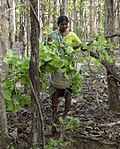
[[File:Diospyros melanoxylon Tendu.jpg|thumb|[[Tendu (tree)|Tendu]] Patta (Leaf) collection in Chhattisgarh, India.]] | |||
The incidence of poverty in Chhattisgarh is very high. The estimated poverty ratio in 2004–05 based on uniform reference period consumption was around 50 per cent, which is approximately double the all India level. The incidence of poverty in the rural and urban areas is almost the same. | |||
More than half of the rural STs and urban SCs are poor. In general, the proportion of poor SC and ST households in the state is higher than the state average and their community's respective national averages (except for rural SC households). Given that more than 50 percent of the state's population is ST and SC, the high incidence of income poverty among them is a matter of serious concern in the state. | |||
This indicates that the good economic performance in recent years has not percolated to this socially deprived group, which is reflected in their poor performance in human development indicators. | |||
=== Access to drinking water === | |||
In terms of access to improved drinking water sources, at the aggregate level, Chhattisgarh fared better than the national average and the SCs of the state performed better than the corresponding national average. Scheduled Tribes are marginally below the state average, but still better than the STs at the all India level. | |||
The proportion of households with access to improved sources of drinking water in 2008–09 was 91%. This proportion was over 90% even in states like Bihar, Chhattisgarh, Madhya Pradesh and Uttar Pradesh. This was largely because these states had over 70% of their households accessing tube wells/hand-pumps as sources of drinking water. | |||
=== Sanitation === | |||
Sanitation facilities in the state were abysmally low with only about 41 percent having toilet facilities before the [[Swachh Bharat Mission]] was Launched by the Government of India. The Urban areas of Chhattisgarh attained the title of open defecation free on 2 October 2017 and the rural areas have achieved a 90.31% sanitation coverage. What sets Chhattisgarh apart from other states of India is an approach to bring in behavioural change in order to get open defecation free status. In Chhattisgarh, people don't get toilet incentives, they have to construct the toilet with their own money, after using the toilet for 3 months they are entitled for the incentive amount.<ref>{{cite web|url=https://swachhindia.ndtv.com/commendable-progress-urban-rural-sanitation-chhattisgarh-way-open-defecation-free-12041/|title=With Commendable Progress in Both Urban And Rural Sanitation, Chhattisgarh Is on Its Way To Be Open Defecation Free – Swachh Report Card|date=19 September 2017|access-date=10 August 2018|archive-url=https://web.archive.org/web/20180810143753/https://swachhindia.ndtv.com/commendable-progress-urban-rural-sanitation-chhattisgarh-way-open-defecation-free-12041/|archive-date=10 August 2018|url-status=dead}}</ref> | |||
=== Teledensity === | |||
Across states, it has been found that [[teledensity]] (telephone density) was below 10 percent in 2010 for Chhattisgarh and Jharkhand, reflecting a lack of access to telephones in these relatively poorer states. But due to development of new technology the teledensity in 2017 is 68.08 percent which shows improvement of telecom infrastructure. On the other hand, for states like Delhi and Himachal Pradesh and metropolitan cities like Kolkata, Mumbai and Chennai, teledensity was over 100 percent in 2010 implying that individuals have more than one telephone connection. | |||
=== Road density === | |||
The total density of National Highways (NHs) in Chhattisgarh is at 23.4 km per 1,000 km<sup>2</sup> out of the total length of 3,168 km in the State, the Central Government has informed. | |||
Chhattisgarh Government had completed construction of 5,266 cement concrete (CC) roads having a total length of 1,530 km in various villages of the State as on 31 May 2016 under 'Mukhyamantri Gram Sadak Yojana'.<ref>{{cite web |title=23.4 km per 1000 sq. kms NH road density in Chhattisgarh: Centre |url=https://www.dailypioneer.com/2016/state-editions/234-kms-per-1000-sq-kms-nh-road-density-in-chhattisgarh-centre.html |website=The Pioneer |access-date=29 September 2018 |date=15 December 2016 |archive-url=https://web.archive.org/web/20180929233445/https://www.dailypioneer.com/2016/state-editions/234-kms-per-1000-sq-kms-nh-road-density-in-chhattisgarh-centre.html |archive-date=29 September 2018 |url-status=dead }}</ref> | |||
=== Witchcraft === | |||
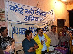
[[File:Mission Against Witchcraft.jpg|thumb|Social Mission Against Blind Faith|alt=|right]]To bring about social reforms and with a view to discourage undesirable social practices, Chhattisgarh government has enacted the Chhattisgarh Tonhi Atyachar (Niwaran) Act, 2005 against witchery.{{citation needed|date=September 2021}} Much has to be done on the issue of law enforcement by judicial authorities to protect women in this regard, bringing such persecution to an end.<ref name="womennewsnetwork.net" /> | |||
Some sections of tribal population of Chhattisgarh state believe in [[witchcraft]].<ref name="womennewsnetwork.net">{{cite web|title=India: Protective Laws Fall Short for Women Charged with Witchcraft|url=http://womennewsnetwork.net/2010/03/21/witchcraft-india-89/|access-date=22 July 2011|date=21 March 2010|archive-url=https://web.archive.org/web/20110702111614/http://womennewsnetwork.net/2010/03/21/witchcraft-india-89/|archive-date=2 July 2011|url-status=dead}}</ref> Women are believed to have access to supernatural forces and are accused of being witches (''tonhi'') often to settle personal scores. | |||
As of 2010, they are still hounded out of villages on the basis of flimsy accusations by male village sorcerers paid to do so by villagers with personal agendas, such as property and goods acquisition.<ref name="womennewsnetwork.net" /> According to [[National Geographic Society|National Geographic]] Channel's investigations, those accused are fortunate if they are only verbally bullied and shunned or exiled from their village. | |||
== Demographics == | |||
{{IndiaCensusPop | |||
| title= Population Growth | |||
| 1951= 7457000 | |||
| 1961= 9154000 | |||
| 1971= 11637000 | |||
| 1981= 14010000 | |||
| 1991= 17615000 | |||
| 2001= 20834000 | |||
| 2011= 25540198 | |||
| estimate= | |||
| estyear= | |||
| estref= | |||
| footnote=Source:Census of India<ref name="Census Population">{{cite web|url=http://indiabudget.nic.in/es2006-07/chapt2007/tab97.pdf|title=Census Population|work=Census of India|publisher=Ministry of Finance India|access-date=18 December 2008|archive-url=https://web.archive.org/web/20081219073658/http://indiabudget.nic.in/es2006-07/chapt2007/tab97.pdf|archive-date=19 December 2008|url-status=dead}}</ref><ref name="2011census">{{cite web|url=http://www.census2011.co.in/states.php|title=States Census 2011|work=Census of India|publisher=Ministry of Finance India|access-date=18 August 2015|archive-url=https://web.archive.org/web/20140214170814/http://www.census2011.co.in/states.php|archive-date=14 February 2014|url-status=dead}}</ref> | |||
| 1901=4181554|1911=5191583|1921=5264976|1931=6028778|1941=6814886}} | |||
Chhattisgarh has an urban population of 23.4% (around 5.1 million people in 2011) residing in urban areas. According to a report by the government of India,<ref>{{cite web|url=http://ncw.nic.in/pdfreports/Gender%20Profile-Chhattisgarh.pdf |title=NCW Report, page 4 |publisher=National Commission of Women, Government of India |access-date=22 August 2010 |url-status=dead |archive-url=https://web.archive.org/web/20090619081035/http://ncw.nic.in/pdfreports/Gender%20Profile-Chhattisgarh.pdf |archive-date=19 June 2009 }}</ref> at least 34% are [[Scheduled Tribes]], 12% are [[Scheduled Castes and Scheduled Tribes|Scheduled Castes]] and over 50% belong to the official list of [[Other Backward Class]]es. The plains are numerically dominated by castes such as [[Teli]], [[Ghasidas|Satnami]] and [[Kurmi]]; while forest areas are mainly occupied by tribes such as [[Gondi people|Gond]], [[Halba (tribe)|Halba]], [[Kamar language|Kamar]]/Bujia and [[Oraon]]. There is also a large [[Odia people|Odia]] population. A community of [[Bengalis]] has existed in major cities since the times of the [[British Raj]]. They are associated with education, industry and services. | |||
[[File:Danteswari Temple 0034.jpg|thumb|[[Danteshwari Temple]] is one of the [[Shakti Pitha|Shakti peethas]]|alt=|left]] | |||
=== Religion === | |||
{{Pie chart | |||
|thumb = right | |||
|caption = Religion in Chhattisgarh (2011) | |||
|label1 = [[Hinduism]] | |||
|color1 = DarkOrange | |||
|value1 = 93.25 | |||
|label2 = [[Islam]] | |||
|color2 = Green | |||
|value2 = 2.02 | |||
|label3 = Christianity | |||
|color3 = DodgerBlue | |||
|value3 = 1.92 | |||
|label4 = [[Buddhism]] | |||
|color4 = Yellow | |||
|value4 = 0.28 | |||
|label5 = [[Sikhism]] | |||
|color5 = DarkKhaki | |||
|value5 = 0.27 | |||
|label6 = [[Jainism]] | |||
|color6 = Brown | |||
|value6 = 0.24 | |||
|label7 = Other <small>(Tribal religion)</small> | |||
|color7 = Chartreuse | |||
|value7 = 1.94 | |||
|label8 = None or not stated | |||
|value8 = 0.09 | |||
|color8 = black | |||
}}According to the 2011 census, 93.25% of Chhattisgarh's population practised Hinduism, while 2.02% followed [[Islam]], 1.92% followed Christianity and smaller number followed [[Buddhism]], [[Sikhism]], [[Jainism]] or other religions.<ref name="census2011">{{cite web|date=2011|title=Details of communities shown under 'Other Religions and Persuasions'|url=https://censusindia.gov.in/2011census/DDW00C-01%20Appendix%20MDDS.xlsx|url-status=live|website=censusindia.gov.in|publisher=Office of the Registrar General & Census Commissioner, India|archive-url=https://web.archive.org/web/20160803134400/http://www.censusindia.gov.in/2011census/DDW00C-01%20Appendix%20MDDS.xlsx |archive-date=3 August 2016 }}</ref> | |||
Hindus are the majority in the state and are the dominant religion in all districts of the state. One sect particular to Chhattisgarh are the Satnamis, who follow [[Ghasidas|Guru Ghasidas]], a saint who promoted bhakti towards God and against the caste system. Chhattisgarh has many famous pilgrimage sites, such as the [[Bambleshwari Temple]] in [[Dongargarh]] and [[Danteshwari Temple|Danteshwari temple]] in the [[Dantewada]], one of the Shakti Peethas. Buddhism was once a major religion in Chhattisgarh. | |||
Islam is the second-largest religion, concentrated in the urban centres. Most Christians are tribals from the Surguja region. Many tribals stated they belonged to a tribal religion such as 'Gond' in the census, especially in the Bastar region.<ref name="census2011" /> | |||
=== Language === | |||
{{Main|Chhattisgarhi language}} | |||
{{Pie chart | |||
|caption = Language data from 2011 census<ref>{{cite web|url=http://censusindia.gov.in/2011Census/Language_MTs.html|title=Table C-16: Language by States and Union Territories - Chhattisgarh|website=censusindia.gov.in|access-date=2 January 2021}}</ref> | |||
|label1=[[Chhattisgarhi]] language including Surgujia |Chhattisgarhi]] | |||
|value1=68.7 | |||
|color1=red | |||
|label2=[[Hindi]] | |||
|value2=10.61 | |||
|color2=orange | |||
|label3= | |||
|value3=6.8 | |||
|color3=tomato | |||
|label4=[[Gondi language|Gondi]] | |||
|value4=3.95 | |||
|color4=teal | |||
|label5=[[Halbi language|Halbi]] | |||
|value5=2.76 | |||
|color5=gold | |||
|label6=[[Odia language|Odia]] | |||
|value6=2.68 | |||
|color6=saddlebrown | |||
|label7=[[Sadri language|Sadri]] | |||
|value7=2.53 | |||
|color7=peachpuff | |||
|label8=[[Kurukh language|Kurukh]] | |||
|value8=2.02 | |||
|color8=lightskyblue | |||
|label9=Others | |||
|value9=6.75 | |||
|color9=grey | |||
}} | |||
The official languages of the state are [[Chhattisgarhi language|Chhattisgarhi]] and [[Hindi]]. Chhattisgarhi, a variety of eastern Hindi, is spoken and understood by the majority of people in Chhattisgarh and is the dominant language in the Chhattisgarh plain. Chhattisgarhi is called Khaltahi by tribals and Laria in [[Odia language|Odia]]. Chhattisgarhi is itself divided into many dialects, one of the most distinct being [[Surgujia dialect|Surgujia]] from the Surguja region, which is sometimes considered its own language. Near the Uttar Pradesh border this dialect merges into [[Bhojpuri language|Bhojpuri]], while it merges with [[Bagheli language|Bagheli]] near the Madhya Pradesh border. Surgujia also merges into [[Sadri language|Sadri]] in the northeast along the border with Jharkhand. [[Hindi]] is spoken by many migrants from outside the state, and is a major language in the cities and industrial centres, while many whose dialect is actually Chhattisgarhi. [[Odia language|Odia]] is widely-spoken in eastern Chhattisgarh especially near the Odisha border. Telugu and Marathi speaking minorities can be found along the Telangana and Maharashtra borders respectively. In the eastern Bastar region, [[Halbi language|Halbi]] and [[Bhatri language|Bhatri]] are major languages. | |||
In addition, Chhattisgarh has several tribal languages. [[Kurukh language|Kurukh]] and [[Korwa language|Korwa]] are both spoken in the Surguja region. [[Gondi language|Gondi]] is a major language in southern Chhattisgarh. Gondi has many dialects, such as [[Muria language|Muria]] in north Bastar, which transitions to [[Madiya language|Madia]] further south and Dorli, transitional between Gondi and [[Koya language|Koya]], along the borders of Andhra Pradesh and Telangana. In the east of Bastar. Most Gonds in the north and east of Bastar, as well as the rest of the state, speak regional languages and have largely forgotten their original tongue.<ref>{{Cite web|url=http://kanker.gov.in/art.html|title=District - North Baster, Kanker|date=8 October 2012|archive-url=https://web.archive.org/web/20121008235722/http://kanker.gov.in/art.html|archive-date=8 October 2012}}</ref><ref>{{cite web|url=http://bastar.gov.in/people_and_culture.htm|title=District-Bastar, Chhattishgarh|publisher=bastar.gov.in|access-date=13 September 2017|archive-url=https://web.archive.org/web/20170916000959/http://bastar.gov.in/people_and_culture.htm|archive-date=16 September 2017|url-status=dead}}</ref><ref>{{cite web|url=http://www.languageinindia.com/junjulaug2001/bastar.html|title=Language in India|publisher=languageinindia.com|access-date=13 September 2017|archive-url=https://web.archive.org/web/20171202231005/http://www.languageinindia.com/junjulaug2001/bastar.html|archive-date=2 December 2017|url-status=live}}</ref><ref>{{cite web|url=http://www.cmijag.in/Bastar.html|title=BASTAR REGION|website=cmijag.in|access-date=13 September 2017|archive-url=https://web.archive.org/web/20170913230846/http://www.cmijag.in/Bastar.html|archive-date=13 September 2017|url-status=dead}}</ref> | |||
=== Gender ratio === | |||
Chhattisgarh has a high female-male [[human sex ratio|sex ratio]] (991)<ref>{{cite web|title=Chhattisgarh, At a glance|url=http://www.censusindia.gov.in/2011-prov-results/data_files/Chhattishgarh/2.%20Chhattishgarh%20Figures%20at%20a%20glance.pdf|publisher=Census 2011, Ministry of Home Affair, India|access-date=22 July 2011|archive-url=https://web.archive.org/web/20110813034404/http://censusindia.gov.in/2011-prov-results/data_files/Chhattishgarh/2.%20Chhattishgarh%20Figures%20at%20a%20glance.pdf|archive-date=13 August 2011|url-status=live}}</ref> ranking at the fifth position among other states of India. Although this ratio is small compared to other states, it is unique in India because Chhattisgarh is the 10th-largest state in India. | |||
The gender ratio (number of females per 1,000 males) has been steadily declining over 20th century in Chhattisgarh. But it is conspicuous that Chhattisgarh always had a better female-to-male ratio compared with national average. | |||
{| class="wikitable" | |||
|- | |||
! Year !! 1901 !! 1911 !! 1921 !! 1931 !! 1941 !! 1951 !! 1961 !! 1971 !! 1981 !! 1991 !! 2001 !! 2011 | |||
|- | |||
| India || 972 || 964 || 955 || 950 || 945 || 946 || 941 || 930 || 934 || 927 || 933 || 940 | |||
|- | |||
| Chhattisgarh || 1046 || 1039 ||1041 || 1043 || 1032 || 1024 || 1008 || 998 || 998 || 985 || 989 || 991 | |||
|} | |||
Rural women, although poor, are independent, better organised, and socially outspoken. According to another local custom, women can choose to terminate a marriage relationship through a custom called ''chudi pahanana'', if she desires. Most of the old temples and shrines follow [[Shaktism]] and are goddess-centric (e.g., [[Shabari]], [[Mahamaya]], [[Danteshwari Temple|Danteshwari]]) and the existence of these temples gives insight into historical and current social fabric of this state. However, a mention of these progressive local customs in no way suggests that the ideology of female subservience does not exist in Chhattisgarh. On the contrary, the male authority and dominance is seen quite clearly in the social and cultural life.<ref>{{cite web|title=Social Structure in Chhattisgarh |url=http://www.korbacity.com/index.php/know-more-about-chhattisgarh/chhattisgarh-social-structure.html |access-date=22 July 2011 |url-status=dead |archive-url=https://web.archive.org/web/20110720005404/http://www.korbacity.com/index.php/know-more-about-chhattisgarh/chhattisgarh-social-structure.html |archive-date=20 July 2011 }}</ref> | |||
== Culture == | |||
[[File:Temple Carvings in Malhar Bilaspur Chhattisgarh 2009.jpg|thumb|left|A carving in the 10th- or 11th-century Hindu temple of Malhar village. This area, 40 km from Bilaspur, was supposedly a major Buddhist centre in ancient times.]] | |||
[[File:Pandwani by Ritu Verma.jpg|thumb|Pandwani]] | |||
[[File:Raut Nacha.jpg|thumb|Raut Nacha]] | |||
[[File:Sua Nacha.jpg|thumb|Suwa Nacha at Khudmudi Village, Chhattisgarh]] | |||
[[File:Muktibodh Rashtriya Natya Samaroh.jpg|thumb|Natya Samaroh by IPTA]] | |||
[[File:Trombidium.jpg|thumb|Red Velvet Mite is used as medicine in traditional healing in Chhattisgarh|alt=]] | |||
The state hosts many religious sects such as [[Satnampanth]], [[Kabirpanth]], [[Ramnami Samaj]] and others. [[Champaran, Chhattisgarh|Champaran]] is a small town with religious significance as the birthplace of the saint [[Vallabha]]charya, increasingly important as a pilgrimage site for the Gujarati community. | |||
Chhattisgarh has a significant role in the life of the Lord [[Rama]]. Lord Rama along with his wife Sita and his younger brother [[Lakshmana]] had started his ''[[Vanvas]]'' (exile) in the Bastar, then known as Dandakarayna. They lived more than 10 of their 14 years of Vanvas in different places of Chhattisgarh. One of the remarkable places is [[Shivrinarayan]] which is nearby [[Bilaspur, Chhattisgarh|Bilaspur]] district of Chhattisgarh. Shivrinarayan was named after an old lady [[Shabari]]. When Ram visited Shabari she said "I do not have anything to offer other than my heart, but here are some berry fruits. May it please you, my Lord." Saying so, Shabari offered the fruits she had meticulously collected to Rama. When Rama was tasting them, Lakshmana raised the concern that Shabari had already tasted them and therefore unworthy of eating. To this Rama said that of the many types of food he had tasted, "nothing could equal these berry fruits, offered with such devotion. You taste them, then alone will you know. Whomsoever offers a fruit, leaf, flower or some water with love, I partake it with great joy." | |||
The [[Odia culture]] is prominent in the eastern parts of Chhattisgarh bordering Odisha. | |||
=== Literature === | |||
Chhattisgarh is a storehouse of literature, performing arts and crafts—all of which derives its substance and sustenance from the day-to-day life experiences of its people. Religion, mythology, social and political events, nature and folklore are favourite motifs. Traditional crafts include painting, woodcarving, bell metal craft, bamboo ware, and tribal jewellery. Chhattisgarh has a rich literary heritage with roots that lie deep in the sociological and historical movements of the region. Its literature reflects the regional consciousness and the evolution of an identity distinct from others in Central India. | |||
=== Crafts === | |||
Chhattisgarh is known for "Kosa silk" and "Dhokra or Bell metal art". Besides saris and salwar suits, the fabric is used to create lehengas, stoles, shawls and menswear including jackets, shirts, achkans and sherwanis. Works by the internationally renowned sculptor, Sushil Sakhuja's Dhokra Nandi, are available at the government's Shabari Chhattisgarh State Emporium, Raipur. | |||
=== Dance === | |||
Panthi, Raut Nacha, Pandwani, Chaitra, Kaksar, Saila, Khamb-swang, Bhatra Naat, Rahas, Raai, Maao-Pata and Soowa are the several indigenous dance styles of Chhattisgarh. | |||
Panthi, the folk dance of the Satnami community, has religious overtones. Panthi is performed on Maghi Purnima, the anniversary of the birth of [[Ghasidas|Guru Ghasidas]]. The dancers dance around a jaitkhamb set up for the occasion, to songs eulogising their spiritual head. The songs reflect a view of ''[[nirvana]]'', conveying the spirit of their guru's renunciation and the teachings of saint poets like [[Kabir]], Ramdas and Dadu. Dancers with bent torsos and swinging arms dance, carried away by their devotion. As the rhythm quickens, they perform acrobatics and form human pyramids.<ref>{{cite web|title=Panthi Dance|url=http://www.sangeetnatak.org/deshparva/desaj/panthi.htm|access-date=27 July 2011|url-status=dead|archive-url=https://web.archive.org/web/20111002123235/http://www.sangeetnatak.org/deshparva/desaj/panthi.htm|archive-date=2 October 2011}}</ref> | |||
==== Pandavani ==== | |||
[[Pandavani]] is a folk ballad form performed predominantly in Chhattisgarh. It depicts the story of the Pandavas, the leading characters in the epic Mahabharata. The artists in the Pandavani narration consist of a lead artist and some supporting singers and musicians. There are two styles of narration in Pandavani, Vedamati, and Kapalik. In the Vedamati style, the lead artist narrates in a simple manner by sitting on the floor throughout the performance. The Kaplik style is livelier, where the narrator actually enacts the scenes and characters. Padma Shri, Padma Bhushan, and Padma Vibhushan [[Teejan Bai]] is most popular artist of Pandavani<ref>{{cite web|title=Pandawani|url=http://durg.gov.in/DistrictProfile_ArtsAndCulture.html|access-date=27 July 2011|archive-url=https://web.archive.org/web/20110830152418/http://durg.gov.in/DistrictProfile_ArtsAndCulture.html|archive-date=30 August 2011|url-status=dead}}</ref> | |||
==== Raut Nacha ==== | |||
Raut Nacha, the folk dance of cowherds, is a traditional dance of Yaduvanshis (clan of [[Yadu]]) as symbol of worship to [[Krishna]] from the 4th day of Diwali (Goverdhan Puja) till the time of Dev Uthani Ekadashi (day of awakening of the gods after a brief rest) which is the 11th day after Diwali according to the Hindu calendar. The dance closely resembles Krishna's dance with the gopis (milkmaids).<ref>{{cite web|title=Rawat Nacha Traditions|url=http://news.oneindia.in/2008/11/09/chhattisgarh-reverberates-with-rawat-nach-1226225007.html|access-date=27 July 2011|date=9 November 2008|archive-url=https://web.archive.org/web/20121009155057/http://news.oneindia.in/2008/11/09/chhattisgarh-reverberates-with-rawat-nach-1226225007.html|archive-date=9 October 2012|url-status=dead}}</ref><ref>{{cite web|title=Raut nacha|url=http://durg.gov.in/DistrictProfile_ArtsAndCulture.html|access-date=27 July 2011|archive-url=https://web.archive.org/web/20110830152418/http://durg.gov.in/DistrictProfile_ArtsAndCulture.html|archive-date=30 August 2011|url-status=dead}}</ref> | |||
In Bilaspur, the Raut Nach Mahotsav folk dance festival is organised annually since 1978. Tens of hundreds of Rautt dancers from remote areas participate.<ref>{{cite web|title=Rawat nacha mahotsva|url=http://news.oneindia.in/2008/11/09/chhattisgarh-reverberates-with-rawat-nach-1226225007.html|access-date=27 July 2011|date=9 November 2008|archive-url=https://web.archive.org/web/20121009155057/http://news.oneindia.in/2008/11/09/chhattisgarh-reverberates-with-rawat-nach-1226225007.html|archive-date=9 October 2012|url-status=dead}}</ref> | |||
==== Suwa Nacha ==== | |||
Soowa or Suwa tribal dance in Chhattisgarh is also known as Parrot Dance. It is a symbolic form of dancing related to worship. Dancers keep a parrot in a bamboo-pot and form a circle around it. Then performers sing and dance, moving around it with clapping. This is one of the main dance form of tribal women of Chhattisgarh.<ref>{{cite web|title=Suwa Dance |url=http://www.cgculture.in/CulturalProgrammePurkhautMuktangan.html |access-date=27 July 2011 |url-status=dead |archive-url=https://web.archive.org/web/20120318142948/http://www.cgculture.in/CulturalProgrammePurkhautMuktangan.html |archive-date=18 March 2012 }}</ref> | |||
==== Karma ==== | |||
Tribal groups like Gonds, the Baigas and the Oraons in Chhattisgarh have the Karma dance as part of their culture. Both men and women arrange themselves in two rows and follow the rhythmic steps, directed by the singer group. The Karma tribal dance marks the end of the rainy season and the advent of spring season.{{clarify|date=July 2012}}<ref>{{cite web|title=Arts and Culture of Chhattisgarh |url=http://www.cgculture.in/CulturalProgrammePurkhautMuktangan.html |access-date=27 July 2011 |url-status=dead |archive-url=https://web.archive.org/web/20120318142948/http://www.cgculture.in/CulturalProgrammePurkhautMuktangan.html |archive-date=18 March 2012 }}</ref><ref>{{cite web|title=Karma Tribal Dance in India|url=http://tribes-of-india.blogspot.com/2009/04/karma-tribal-dance-in-india.html|access-date=27 July 2011|archive-url=https://web.archive.org/web/20110831114524/http://tribes-of-india.blogspot.com/2009/04/karma-tribal-dance-in-india.html|archive-date=31 August 2011|url-status=dead}}</ref> | |||
=== Theatre === | |||
Theater is known as ''Gammat'' in Chhattisgarh. Pandavani is one of the lyrical forms of this theatre. Several acclaimed plays of [[Habib Tanvir]], such as ''[[Charandas Chor]]'', are variations of Chhattisgarhi theatre. | |||
=== Cinema === | |||
[[Chhollywood]] is Chhattisgarh's film industries. Every year many Chhattisgarhi films are produced by local producers. | |||
[[Lata Mangeshkar]] sang a song for Chhattisgarhi film [[Bhakla]] of Dhriti pati sarkar. | |||
[[Mohammed Rafi]] sang a song for Chhattisgarhi film. He had also sung songs for various Chhattisgarhi films like Ghardwaar, [[Kahi Debe Sandesh]], Punni Ke Chanda, etc.<ref>{{Cite web|url=https://www.patrika.com/raipur-news/raipur-first-chhattisgarhi-film-kahi-debe-sandesh-complete-50-years-1104391/|title=हिंदी खबर, Latest News in Hindi, हिंदी समाचार, ताजा खबर|website=Patrika News}}</ref><ref>{{Cite web|url=https://kosalkatha.com/manu-nayak-kahi-debe-sandesh/|title=इन्होंने तब छत्तीसगढ़ी फ़िल्म बन दी जब छत्तीसगढ़ ही नही बना था, कथा मनु नायक की।|first=Shubham|last=Thawait|date=24 January 2018}}</ref> | |||
=== Cuisine === | |||
{{Main|Cuisine of Chhattisgarh}}The State of Chhattisgarh is known as the rice bowl of India and has a rich tradition of food culture. | |||
The typical Chhattisgarhi thali consists of roti, bhat, dal or kadhi, curry, chutney and bhaji. Few Chhattisgarhi dishes are Aamat, Bafauri, Bhajia, Chousela, Dubkikadhi, Farra, Khurmi, Moong Bara, Thethari, and Muthia.<ref>Oudhia, P. (1999) Chhattisgarh farmer's response on control of weeds in direct seeded rice. Agril. Sci. Digest. 19(4): 261–263.</ref><ref>Das, G.K. and Oudhia, P. (2001). Rice as the medicinal plant in Chhattisgarh (India): A survey. Agric. Sci. Digest. 21(3):204–205.</ref><ref>Oudhia, P. (2002). Rice-Acorus intercropping: A new system developed by innovative farmers of Chhattisgarh (India). International Rice Research Notes (IRRN).27(1):56.</ref><ref>{{cite web|url=http://www.mapsofindia.com/chhattisgarh/|title=Chhattisgarh|publisher=mapsofindia.com|url-status=live|archive-url=https://web.archive.org/web/20110802034713/http://www.mapsofindia.com/chhattisgarh/|archive-date=2 August 2011|access-date=22 July 2011}}</ref><ref>{{cite web|url=http://www.indiawaterportal.org/sites/indiawaterportal.org/files/Farmers_groups_conserve_traditional_rice_varieties_in_Bastar_region_of_Chhattisgarh.pdf|title=Rice Bowl of India|website=India Water Portal|url-status=live|archive-url=https://web.archive.org/web/20171215101855/http://www.indiawaterportal.org/sites/indiawaterportal.org/files/Farmers_groups_conserve_traditional_rice_varieties_in_Bastar_region_of_Chhattisgarh.pdf|archive-date=15 December 2017|access-date=29 September 2018}}</ref><ref>{{cite web|url=http://www.gktoday.in/quiz-questions/which-of-the-following-district-is-called-as-the-rice-bowl-of-andhra-pradesh/|title=Which of the following district is called as the 'Rice Bowl of Andhra Pradesh' ?|work=gktoday.in|url-status=live|archive-url=https://web.archive.org/web/20150714164456/http://www.gktoday.in/quiz-questions/which-of-the-following-district-is-called-as-the-rice-bowl-of-andhra-pradesh/|archive-date=14 July 2015|access-date=14 July 2015}}</ref> | |||
== Festivals of Chhattisgarh == | |||
Major festivals of Chhattisgarh include [[Bastar Dussehra]]/ [[Durga Puja]], [[Bastar Lokotsav]], [[Madai Festival]], [[Rajim Kumbh]] Mela, and [[Pakhanjore]] Mela ([[Nara Narayan Mela]]). | |||
== Tourism == | |||
{{Main|Tourism in Chhattisgarh}} | |||
Chhattisgarh, situated in the heart of India, is endowed with a rich cultural heritage and attractive natural diversity. The state is full of ancient monuments, rare wildlife, exquisitely carved temples, [[Buddhism|Buddhist]] sites, [[palace]]s, [[waterfall]]s, caves, rock paintings, and hill plateaus. | |||
Mainpat is mini Shimla of Chhattisgarh. | |||
There are many waterfalls, hot springs, caves, temples, dams and national parks, tiger reserves and wildlife sanctuaries in Chhattisgarh. | |||
India's first man-made jungle safari is also situated in Raipur. | |||
=== Sports === | |||
[[Abujhmad Peace Marathon]] is the largest sports event of Narainpur. | |||
== Education == | |||
{{Main|Education in Chhattisgarh}} | |||
{{See also|List of institutions of higher education in Chhattisgarh}} | |||
According to the census of 2011, Chhattisgarh's literacy, the most basic indicator of education, was at 71.04 per cent. Female literacy was at 60.59 percent. | |||
=== Absolute literates and literacy rate === | |||
Data from Census of India, 2011.<ref>{{cite web |url=http://www.censusindia.gov.in/2011-prov-results/data_files/Chhattishgarh/2.%20Chhattishgarh%20Figures%20at%20a%20glance.pdf |title=Archived copy |access-date=22 July 2011 |archive-url=https://web.archive.org/web/20110813034404/http://censusindia.gov.in/2011-prov-results/data_files/Chhattishgarh/2.%20Chhattishgarh%20Figures%20at%20a%20glance.pdf |archive-date=13 August 2011 |url-status=live }}</ref> | |||
{| class="wikitable" | |||
|- | |||
! Description !! 2001 census !! 2011 census | |||
|- | |||
| Total ||20,833,803 || 25,540,196 | |||
|- | |||
| Male || 10,474,218 || 12,827,915 | |||
|- | |||
| Female|| 10,359,585 || 12,712,281 | |||
|- | |||
| % Total|| 64.66 || 71.04 | |||
|- | |||
| % Male || 77.38 || 81.45 | |||
|- | |||
| % Female || 55.85 || 60.99 | |||
|} | |||
== See also == | |||
* [[Dadaria]] <!--- park this wikilink here for now; possibly move to spot about local music,folklore? ---> | |||
* [[Outline of Chhattisgarh]] | |||
* [[List of states and union territories of India by area]] | |||
== Notes == | |||
* Books on Chhattisgarh | |||
** डाॅ. सुरेश चन्द्र शुक्ला एवं डाॅ. (श्रीमती) अर्चना शुक्ला - छत्तीसगढ़ का समग्र इतिहास (मातुश्री पब्लिकेशन, रायपुर, {{ISBN|978-81-939385-0-8}}) | |||
** Dr. Suresh Chandra Shukla & Dr. (Smt.) Archana Shukla - Chhattisgarh Ka Samagra Itihas (Matushree Publication, Raipur {{ISBN|978-81-939385-0-8}}) | |||
** ड़ा.संजय अलंग-छत्तीसगढ़ की जनजातियाँ Tribes और जातियाँ Castes (मानसी पब्लीकेशन,दिल्ली 6, {{ISBN|978-81-89559-32-8}}) | |||
** ड़ा.संजय अलंग-छत्तीसगढ़ की पूर्व रियासतें और जमीन्दारियाँ (वैभव प्रकाशन,रायपुर 1, {{ISBN|81-89244-96-5}}) [https://www.scribd.com/doc/72030961/Dr-Sanjay-Alung-CG-Ki-Riyaste-Jamindariya-Hindi DR Sanjay Alung-CG Ki Riyaste & Jamindariya (Hindi)] | |||
** Deshbandhu Publication Division, "सन्दर्भ छत्तीसगढ़" | |||
** Deshbandhu Publication Division, "छत्तीसगढ़ के तीर्थ और पर्यटन स्थल" | |||
** Deshbandhu Publication Division, "Chhattisgarh: Beautiful & Bountiful (Study in Biodiversity of Chhattisgarh)" | |||
** Ramesh Dewangan & Sunil Tuteja, "Chhattisgarh Samagra" | |||
** C.K. Chandrakar, "Chhattisgarhi Shabadkosh" | |||
** C.K. Chandrakar, "Manak Chhattisgarhi Vyakaran" | |||
** C.K. Chandrakar, "Chhattisgarhi Muhawara Kosh" | |||
** Lawrence Babb, "The Divine Hierarchy: Popular Hinduism in Central India" | |||
** Saurabh Dube, "Untouchable Pasts: Religion, Identity and Power among a Central Indian Community, 1780–1950" (on the Satnamis) | |||
** Ramdas Lamb, "Rapt in the Name: Ramnamis, Ramnam and Untouchable Religion in Central India" | |||
** Chad Bauman, "Identifying the Satnam: Hindu Satnamis, Indian Christians and Dalit Religion in Colonial Chhattisgarh, India (1868–1947) (Ph.D. dissertation, Princeton Theological Seminary, 2005) | |||
** [http://www.dkagencies.com/doc/from/1023/to/21330/Author/Shukla,%20H.%20L.%20(Hira%20Lal),%201939-/Books-By-Indian-Author.html "List of books by Prof H. L. Shukla] | |||
** Raipur district gazetteer Hindi [https://36.gurturgoth.com/2019/09/raipur-rashmi-gazeteer-history-of.html रायपुर-रश्मि] {{Webarchive|url=https://web.archive.org/web/20190911032006/http://36.gurturgoth.com/2019/09/raipur-rashmi-gazeteer-history-of.html |date=11 September 2019 }} <ref>{{Cite web|url=http://36.gurturgoth.com/2019/09/raipur-rashmi-gazeteer-history-of.html|title=रायपुर-रश्मि : रायपुर जिले का इतिहास Raipur-Rashmi Gazeteer History of Raipur District|access-date=16 June 2021|archive-date=2 June 2021|archive-url=https://web.archive.org/web/20210602152405/https://36.gurturgoth.com/2019/09/raipur-rashmi-gazeteer-history-of.html|url-status=dead}}</ref> | |||
** Durg district gazetteer Hindi [https://36.gurturgoth.com/2019/08/1921-history-of-durg-district-durg.html दुर्ग-दर्पण] {{Webarchive|url=https://web.archive.org/web/20190912230840/http://36.gurturgoth.com/2019/08/1921-history-of-durg-district-durg.html |date=12 September 2019 }} <ref>{{Cite web|url=http://36.gurturgoth.com/2019/08/1921-history-of-durg-district-durg.html|title=दुर्ग दर्पण - दुर्ग जिले का इतिहास सन् 1921|access-date=16 June 2021|archive-date=8 May 2021|archive-url=https://web.archive.org/web/20210508020106/https://36.gurturgoth.com/2019/08/1921-history-of-durg-district-durg.html|url-status=dead}}</ref> | |||
** Bilaspur district gazetteer Hindi [https://36.gurturgoth.com/2019/08/1923.html बिलासपुर-वैभव]{{Dead link|date=September 2021 |bot=InternetArchiveBot |fix-attempted=yes }} <ref>{{Cite web|url=http://36.gurturgoth.com/2019/08/1923.html|title=बिलासपुर-वैभव 1923 बिलासपुर जिले का इतिहास|access-date=16 June 2021|archive-date=2 June 2021|archive-url=https://web.archive.org/web/20210602152526/http://36.gurturgoth.com/2019/08/1923.html|url-status=dead}}</ref> | |||
== References == | |||
{{reflist|colwidth=30em}} | |||
{{India}} | == External links == | ||
{{Sister project links|s=1911 Encyclopædia Britannica/Chhattisgarh|voy=Chhattisgarh|Chhattisgarh}} | |||
* [https://web.archive.org/web/20150920041757/http://www.cgstate.gov.in/en/web/guest/home The Official Site of the Government of Chhattisgarh] | |||
* [https://www.britannica.com/place/Chhattisgarh Chhattisgarh] ''Encyclopædia Britannica'' entry | |||
* {{curlie|Regional/Asia/India/Chhattisgarh}} | |||
* {{osmrelation-inline|1972004}} | |||
{{ | {{Geographic location | ||
|Centre = Chhattisgarh | |||
|North = [[Uttar Pradesh]] | |||
|Northeast = [[Jharkhand]] | |||
|East = [[Odisha]] | |||
|Southeast = [[Andhra Pradesh]] | |||
|South = [[Andhra Pradesh]] | |||
|Southwest = [[Telangana]] | |||
|West = [[Maharashtra]] | |||
|Northwest = [[Madhya Pradesh]] | |||
}} | |||
{{Geography of India by state or territory}} | |||
{{Chhattisgarh}} | |||
{{states and territories of India}} | |||
{{Authority control}} | |||
[[Category:Chhattisgarh| ]] | [[Category:Chhattisgarh| ]] | ||
[[Category:States and union territories of India]] | |||
[[Category:States and territories established in 2000]] | |||
[[Category:2000 establishments in India]] | |||
Revision as of 04:03, 2 May 2022


_(cropped).jpg)


Chhattisgarh (/tʃætɪsɡɑːr/, Hindi: [ˈtʃʰət̪ːiːsgəɽʱ]) is a landlocked and heavily forested state located in the region of Central India. Formerly part of Madhya Pradesh it was granted statehood on 1 November 2000. It is the 9th-largest state in India, with an area of 135,192 km2 (52,198 sq mi). As of 2021, it has a population of roughly 30 million (3 crores), making it the 17th most populated state in the country.[6]
The state was formed by the partition of ten Chhattisgarhi and six Gondi-speaking districts in the southeast of Madhya Pradesh.[7][8] Its capital city is Raipur. It borders 7 states – Uttar Pradesh to the north, Madhya Pradesh to the northwest, Maharashtra to the southwest, Jharkhand to the northeast, Odisha to the east, Telangana and Andhra Pradesh to the south.[9] Currently, it comprises 32 districts.
Chhattisgarh is one of the fastest-developing states in India.[10] Its Gross State Domestic Product (GSDP) is ₹3.63 lakh crore (US$51 billion), with a per capita GSDP of ₹102,762 (US$1,400).[11] A resource-rich state, Chhattisgarh provides electricity, coal, and steel to the rest of the nation.[12]
In 2020, it again won the title of cleanest state with more than 100 Urban Local Bodies, as announced by Minister for Housing and Urban Affairs Hardeep Singh Puri following the 'Swachh Survekshan 2020'.[13]
Etymology
There are several theories as to the origin of the name Chhattisgarh, which in ancient times was known as Dakshina Kosala (South Kosala).[14] The native place of bhagwan Rama as his mother name was Kausalya, daughter of Kaushal Naresh.[citation needed] "Chhattisgarh" was popularised later during the time of the Maratha Empire and was first used in an official document in 1795.[15]
The most popular theory claims that Chhattisgarh takes its name from the 36 ancient forts (from chhattis meaning thirty-six and garh meaning fort) in the area.[citation needed] The old state had 36 demesnes (feudal territories): Ratanpur, Vijaypur, Kharound, Maro, Kautgarh, Nawagarh, Sondhi, Aukhar, Padarbhatta, Semriya, Champa, Lafa, Chhuri, Kenda, Matin, Aparora, Pendra, Kurkuti-kandri, Raipur, Patan, Simaga, Singarpur, Lavan, Omera, Durg, Saradha, Sirasa, Menhadi, Khallari, Sirpur, Figeswar, Rajim, Singhangarh, Suvarmar, Tenganagarh and Akaltara.[16] However, most historians disagree with this theory as 36 forts have not been found and identified.
According to the opinion of Hiralal, it is said that at one time there were 36 strongholds in this area, that is why its name was Chhattisgarh. But even after the increase in the number of strongholds, there was no change in the name, Chhattisgarh is the State of India which has been given the status of 'Mahtari' (Mother). There are two regions in India which are named for special reasons – one was 'Magadha' which became "Bihar" due to the abundance of Buddhism viharas and the other was 'Dakshina Kosala' which became "Chhattisgarh" due to the inclusion of thirty-six strongholds.
Another view, more popular with experts and historians, is that Chhattisgarh is the corrupted form of Chedisgarh meaning Raj or "Empire of the Chedis".[citation needed] In ancient times, Chhattisgarh region had been part of the Chedi dynasty of Kalinga, in modern Odisha. In the medieval period up to 1803, a major portion of present eastern Chhattisgarh was part of the Sambalpur Kingdom of Odisha.
History
Ancient and medieval history

Sitabega caves are one of the earliest examples of theatre architecture in India located on Ramgarh hill of Chhattisgarh dated to Mauryan period of 3rd century BCE. Jogimara caves contain ancient Brahmi inscription and the oldest painting known in India. The inscription can be translated as either a love proclamation by a girl or a dancer-painter creating a cave theatre together.[17] In ancient times, this region was known as Dakshina Kosala. This area is also mentioned in Ramayana and Mahabharata. One of the earliest statues of Vishnu has been excavated from Shunga period site at Malhar. Between the sixth and twelfth centuries, Sharabhpurias, Panduvanshis (of Mekala and Dakshina Kosala), Somavanshi, Kalachuri and Nagavanshi rulers dominated this region. The Bastar region of Chhattisgarh was invaded by Rajendra Chola I and Kulothunga Chola I of the Chola dynasty in the 11th century.[18][19][20]
Colonial and post-independence history
Chhattisgarh was under Maratha rule (Bhonsales of Nagpur) from 1741 to 1845 CE. It came under British rule from 1845 to 1947 as the Chhattisgarh Division of the Central Provinces. Raipur gained prominence over the capital Ratanpur with the advent of the British in 1845. In 1905, the Sambalpur district was transferred to Odisha and the estates of Surguja were transferred from Bengal to Chhattisgarh.
The area constituting the new state merged into Madhya Pradesh on 1 November 1956, under the States Reorganisation Act, 1956 and remained a part of that state for 44 years. Prior to that, the region was part of the Central Provinces and Berar (CP and Berar) under British rule. Some areas constituting the Chhattisgarh state were princely states under the British rule, but were later on merged into Madhya Pradesh.[21]
Separation of Chhattisgarh

The demand for Chhattisgarh to be a separate state first rose in the 1920s, with similar demands appearing at regular intervals; however, a well-organised movement was never initiated. Several all-party platforms were created and usually resolved around petitions, public meetings, seminars, rallies and strikes.[22] The demand was raised by the Raipur Congress unit in 1924 and was also discussed in the Indian Congress at Tripuri. A discussion about forming a Regional Congress organisation for Chhattisgarh took place. In 1954, when the State Reorganisation Commission was set up, the demand was put forward but was rejected. In 1955, the demand was raised in the Nagpur assembly of Madhya Bharat.[22]
In the 1990s, the demand became more prominent, resulting in the formation of a statewide political forum known as the Chhattisgarh Rajya Nirman Manch. The forum was led by Chandulal Chadrakar and several successful region-wide strikes and rallies were organised under it, all of which were supported by major political parties, such as the Indian National Congress and the Bharatiya Janata Party.[22]
The new National Democratic Alliance government sent the Separate Chhattisgarh Bill for approval by the Madhya Pradesh Assembly, where it was unanimously approved and then submitted to the Lok Sabha. The bill was passed in the Lok Sabha and the Rajya Sabha, which allowed the creation of the state of Chhattisgarh. K. R. Narayanan gave his consent to the Madhya Pradesh Reorganisation Act on 25 August 2000 and the government of India set 1 November 2000 as the day Chhattisgarh would be separated from Madhya Pradesh.[22] As such, Chhattisgarh was formed from Madhya Pradesh.[7][8]
Geography
The northern and southern parts of the state are hilly, while the central part is a fertile plain. The highest point in the state is the Gaurlata near Samri, Balrampur-Ramanujganj district.[23] Deciduous forests of the Eastern Highlands Forests cover roughly 44% of the state.[24]

The state animal is the van bhainsa, or wild Asian buffalo. The state bird is the pahari myna, or hill myna. The state tree is the Sal (Sarai) found in Bastar division.

In the north lies the edge of the great Indo-Gangetic plain. The Rihand River, a tributary of the Ganges, drains this area. The eastern end of the Satpura Range and the western edge of the Chota Nagpur Plateau form an east–west belt of hills that divide the Mahanadi River basin from the Indo-Gangetic plain. The outline of Chhattisgarh is like a sea horse.
The central part of the state lies in the fertile upper basin of the Mahanadi River and its tributaries. This area has extensive rice cultivation. The upper Mahanadi basin is separated from the upper Narmada basin to the west by the Maikal Hills (part of the Satpuras) and from the plains of Odisha to the east by ranges of hills. The southern part of the state lies on the Deccan plateau, in the watershed of the Godavari River and its tributary, the Indravati River. The Mahanadi is the chief river of the state. The other main rivers are Hasdeo (a tributary of Mahanadi), Rihand, Indravati, Jonk, Arpa and Shivnath.[25]
The natural environment of Koriya in Chhattisgarh includes forests, mountains, rivers and waterfalls.[citation needed] Koriya was a princely state during the British rule in India. Koriya is also known for its mineral deposits.[26] Coal is also found in this part of the country.[27] The dense forests are rich in wildlife.[citation needed]
The Amrit Dhara Waterfall, Koriya's main attraction, is a natural waterfall which originates from the Hasdeo River. The fall is situated seven kilometres from Koriya on the Manendragarh-Baikunthpur road. The Amrit Dhara Waterfall falls from a height of 27 m, and it is approximately 3–4.5 m wide. Chirimiri is one of the most popular places, known for its natural environment and climate, in Chhattisgarh.[28]

Climate
Chhattisgarh has a tropical climate. It is hot and humid in the summer because of its proximity to the Tropic of Cancer and its dependence on the monsoons for rains. Summer temperatures in Chhattisgarh can reach up to 49 °C (113 °F).[29] The monsoon season is from late June to October and is a welcome respite from the heat. Chhattisgarh receives an average of 1,292 millimetres (50.9 in) of rain. Winter is from November to January. Winters are pleasant with low temperatures and less humidity. Ambikapur, Mainpat, Pendra Road, Samri and Jashpur are some of the coldest places in the state.[30]
Transport
Roads
Chhattisgarh has four-lane or two-lane roads that provide connectivity to major cities. A total of 20 national highways pass through the state, together measuring 3,078 km. Many national highways exist only on paper and are not fully converted into four-lane, leave alone six-lane or eight-lane, highways. These include:
- NH 130A New
- NH 130B New
- NH 130C New
- NH 130D New
- NH 149B New
- NH 163A New
- NH 343 New
- NH 930 New
- NH 6
- NH 16
- NH 43
- NH 12A
- NH 78
- NH 111
- NH 200
- NH 202
- NH 216
- NH 217
- NH 221
- NH 30
- NH 930 New.
The state highways and major district roads constitute another network of 8,031 km.
Rail network

Almost the entire railway network spread over the state comes under the geographical jurisdiction of the South East Central Railway Zone of Indian Railways centred around Bilaspur, which is the zonal headquarters of this zone. Almost 85% of tracks are electrified, the non-electrified route is Maroda–Bhanupratappur line from Durg–Bhanupratappur branch line, which is 120 km long. The main railway junctions are Bilaspur Junction, Durg Junction and Raipur, which is also a starting point of many long-distance trains. These three junctions are well-connected to the major cities of India and also these station comes under the top 50 booking stations in India.[31]
The state has the highest freight loading in the country, and one-sixth of Indian Railway's revenue comes from Chhattisgarh. The length of the rail network in the state is 1,108 km, while a third track has been commissioned between Durg and Raigarh.[32] Construction of some new railway lines include Dalli–Rajhara–Jagdalpur rail line, Pendra Road–Gevra Road rail line, Raigarh–Mand Colliery to Bhupdeopur rail line and Barwadih–Chirmiri rail line.[33] Freight/goods trains provide services mostly to coal and iron ore industries in east–west corridor (Mumbai–Howrah route). There is a lack of passenger services to north and south of Chhattisgarh.
Major railway stations of Chhattisgarh
- Bilaspur Junction
- Durg Junction
- Raipur Junction
- Ambikapur
- Raigarh
- Korba
- Champa Junction
- Mahasamund
- Rajnandgaon
- Dongargarh
- Gevra Road
- Pendra Road
Air
The air infrastructure in Chhattisgarh is improving. Swami Vivekananda International Airport in Raipur is well connected to all major cities of India and operation of International flights from Raipur are under consideration besides this small airports Bilaspur Airport and Jagdalpur Airport are regionally connected with scheduled commercial services. A massive reduction in sales tax on aviation turbine fuel (ATF) from 25 to 4% in Chhattisgarh in 2003 contributed to a sharp rise in passenger flow. The passenger flow increased by 58% between 2011 and November 2012.[34]
Other Airstrips
- Ambikapur Airport, Darima, Ambikapur
Governance
The State Legislative assembly is composed of 90 members of the Legislative Assembly. There are 11 members of the Lok Sabha from Chhattisgarh. The Rajya Sabha has five members from the state.
Administration
Chhattisgarh state consists of 5 divisions with 32 districts (one new district named "Gaurela-Pendra-Marwahi" created with effect from 10 February 2020).
Divisions
| Bastar Division | Durg Division | Raipur Division | Bilaspur Division | Surguja Division |
|---|---|---|---|---|
|
|
Districts

Chhattisgarh comprises 32 districts.[35] The following are the list of the districts of Chhattisgarh State with major cities:
Major cities
| Largest cities in Chhattisgarh (2011 Census of India estimate)[36] | |||||||||||
|---|---|---|---|---|---|---|---|---|---|---|---|
| Rank | City | District | Population | ||||||||
| 1 | Raipur | Raipur | 4,063,872 | ||||||||
| 2 | Bhilai-Durg | Durg | 3,343,872 | ||||||||
| 3 | Bilaspur | Bilaspur | 2,663,629 | ||||||||
| 4 | Rajnandgaon | Rajnandgaon | 1,537,133 | ||||||||
| 5 | Raigarh | Raigarh | 1,493,984 | ||||||||
| 6 | Korba | Korba | 1,206,640 | ||||||||
| 7 | Ambikapur | Sarguja | 2,359,886 | ||||||||
| 8 | Jagdalpur | Bastar | 125,345 | ||||||||
| 9 | Chirmiri | Koriya | 100,656 | ||||||||
| 10 | Dhamtari | Dhamtari | 90,254 | ||||||||
| 11 | Mahasamund | Mahasamund | 85,000 | ||||||||
Economy
| Statistics | |
|---|---|
| GDP | ₹4.38 lakh crore (US$61 billion) (2022–23 est.)[37] |
| GDP rank | 18th |
GDP growth | -1.8% (2020–21)[37] |
GDP per capita | ₹117,615 (US$1,600) (2020–21)[37] |
GDP by sector | Agriculture 28% Industry 34% Services 38% (2020–21)[37] |
| Public finances | |
| 26.14% of GSDP (2022–23 est.)[37] | |
| ₹−14,600 crore (US$−2.0 billion) (3.33% of GSDP) (2022–23 est.)[37] | |
| Revenues | ₹89,400 crore (US$13 billion) (2022–23 est.)[37] |
| Expenses | ₹1.04 lakh crore (US$15 billion) (2022–23 est.)[37] |
Chhattisgarh's nominal gross state domestic product (GSDP) is estimated at ₹3.26 lakh crore (US$46 billion) in 2018–19, the 17th largest state economy in India. The economy of Chhattisgarh recorded a growth rate of 6.7% in 2017–18.[37] Chhattisgarh's success factors in achieving high growth rate are growth in agriculture and industrial production.
Agriculture
Agriculture is counted as the chief economic occupation of the state. According to a government estimate, net sown area of the state is 4.828 million hectares and the gross sown area is 5.788 million hectares.[38] Horticulture and animal husbandry also engage a major share of the total population of the state.[39] About 80% of the population of the state is rural and the main livelihood of the villagers is agriculture and agriculture-based small industry.
The majority of the farmers are still practicing the traditional methods of cultivation, resulting in low growth rates and productivity. The farmers have to be made aware of modern technologies suitable to their holdings. Providing adequate knowledge to the farmers is essential for a better implementation of the agricultural development plans and to improve productivity.[40]
Considering this and a very limited irrigated area, the productivity of not only rice but also other crops is low, hence the farmers are unable to obtain economic benefits from agriculture and it has remained as subsistence agriculture till now.
-
 Chloroxylon is used for pest management in organic rice cultivation in Chhattisgarh
 -
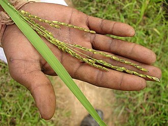 Medicinal rice of Chhattisgarh used as an immune booster
 -
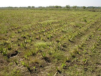 Aloe vera farming in Chhattisgarh
 -
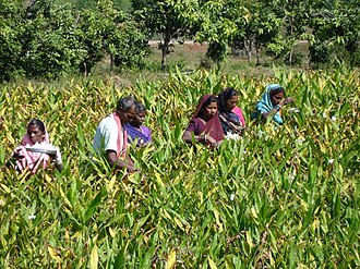 Herbal farming in Chhattisgarh: Gulbakawali
 -
 Herbal farming in Chhattisgarh: Safed Musli with Arhar


Agricultural products
The main crops are rice, maize,[41] kodo-kutki and other small millets and pulses (tuar[42] and kulthi); oilseeds, such as groundnuts (peanuts), soybeans[43] and sunflowers, are also grown. In the mid-1990s, most of Chhattisgarh was still a monocrop belt. Only one-fourth to one-fifth of the sown area was double-cropped. When a very substantial portion of the population is dependent on agriculture, a situation where nearly 80% of a state's area is covered only by one crop, immediate attention to turn them into double crop areas is needed. Also, very few cash crops are grown in Chhattisgarh, so there is a need to diversify the agriculture produce towards oilseeds and other cash crops. Chhattisgarh is also called the "rice bowl of central India".[38]
-
 Kodo Millet is used as a life saving medicine in Chhattisgarh
 -
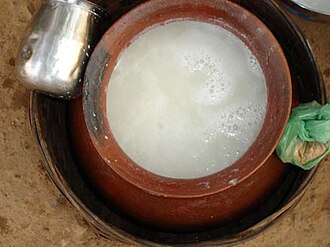 Bastar beer prepared from Sulfi


Irrigation
In Chhattisgarh, rice, the main crop, is grown on about 77% of the net sown area. Only about 20% of the area is under irrigation; the rest depends on rain. Of the three agroclimatic zones, about 73% of the Chhattisgarh plains, 97% of the Bastar plateau and 95% of the northern hills are rainfed. The irrigated area available for double cropping is only 87,000 ha in Chhattisgarh plains and 2300 ha in Bastar plateau and northern hills. Due to this, the productivity of rice and other crops is low, hence the farmers are unable to obtain economic benefits from agriculture and it has remained as subsistence agriculture till now, though agriculture is the main occupation of more than 80% of the population.[40]
In Chhattisgarh region, about 22% of net cropped area was under irrigation as compared to 36.5% in Madhya Pradesh in 1998–99, whereas the average national irrigation was about 40%. The irrigation is characterised by a high order of variability ranging from 1.6% in Bastar to 75.0% in Dhamtari. Based on an average growth trend in the irrigated area, about 0.43% additional area is brought under irrigation every year as compared to 1.89% in Madhya Pradesh and 1.0% in the country as a whole. Thus, irrigation has been growing at a very low rate in Chhattisgarh and the pace of irrigation is so slow, it would take about 122 years to reach the 75% level of net irrigated area in Chhattisgarh at the present rate of growth.[40]
Chhattisgarh has a limited irrigation system, with dams and canals on some rivers. Average rainfall in the state is around 1400 mm and the entire state falls under the rice agroclimatic zone. The Large variation in the yearly rainfall directly affects the production of rice. Irrigation is the prime need of the state for its overall development and therefore the state government has given top priority to development of irrigation.[38]
A total of four major, 33 medium and 2199 minor irrigation projects have been completed and five major, nine medium and 312 minor projects are under construction, as of 31 March 2006.[needs update]
Industrial sector
Power sector
Chhattisgarh is one of the few states of India where the power sector is effectively developed. Based on the current production of surplus electric power, the position of the State is comfortable and profitable. The Chhattisgarh State Electricity Board (CSEB) is in a strong position to meet the electricity requirement of the state and is in good financial health. According to Central Electricity Authority (CEA), Chhattisgarh provides electricity to several other states because of surplus production.[44]
In Chhattisgarh, National Thermal Power Corporation Limited (|NTPC) has Sipat Thermal Power Station with a capacity of 2,980 MW at Sipat, Bilaspur; LARA Super Thermal Power Station with a nameplate capacity of 1600MW and Korba Super Thermal Power Station with a capacity of 2,600 MW at Korba, while CSEB's units have a thermal capacity of 1,780 MW and hydel capacity of 130 MW. Apart from NTPC and CSEB, there are a number of private generation units of large and small capacity. The state government has pursued a liberal policy with regard to captive generation which has resulted in a number of private companies coming up.[45]
The state has a potential of 61,000 MW of additional thermal power in terms of availability of coal for more than 100 years and more than 2,500 MW hydel capacity. To use this vast potential, substantial additions to the existing generation capacity are already underway.[45]
Steel sector
The steel industry is one of the biggest heavy industries of Chhattisgarh. Bhilai Steel Plant, Bhilai operated by SAIL, with a capacity of 5.4 million tonnes per year, is regarded as a significant growth indicator of the state. More than 100 steel rolling mills, 90 sponge iron plants and ferro-alloy units are in Chhattisgarh. Along with Bhilai, today Raipur, Bilaspur, Korba and Raigarh have become the steel hub of Chhattisgarh. Today, Raipur has become the centre of the steel sector, the biggest market for steel in India.[46]
Aluminium sector
The aluminium industry of Chhattisgarh was established by Bharat Aluminium Company Limited, which has a capacity of around 5,700,000 tonnes each year.[46]
Natural resources
Mineral deposits
Chhattisgarh is rich in minerals. It produces 50% of the country's total cement production. It has the highest output of coal in the country with second-highest reserves. It is third in iron ore production and first in tin production. Limestone, dolomite and bauxite are abundant. It is the only tin ore-producing state in India. Other commercially extracted minerals include corundum, garnet, quartz, marble, alexandrite and diamonds.
-
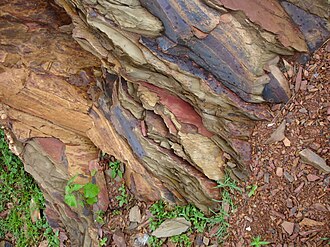 Mineral deposits in the Maikal Hills
 -
 Mineral Wealth from Chandidongri


Information and technologies
In recent years, Chhattisgarh is also receiving exposure in information technology (IT) projects and consultancy. Its government is also promoting IT and has set up a body to take care of IT solutions. The body, known as CHiPS, is providing large IT projects such as Choice, Swan, and so forth.
Major companies
Major companies with a presence in the state include:
- Metal: Bhilai Steel Plant, Jindal Steel and Power, Bharat Aluminium Company
- Oil: Indian Oil Corporation, Hindustan Petroleum Corporation Limited
- Mining: NMDC, South Eastern Coalfields
- Power : NTPC, Lanco Infratech, KSK Energy Ventures, Jindal Power Limited
Exports
Chhattisgarh's total exports were US$353.3 million in 2009–10. Nearly 75% of exports comes from Bhilai and the remaining from Urla, Bhanpuri, and Sirgitti. The major exports products include steel, handicrafts, handlooms, blended yarn, food and agri-products, iron, aluminium, cement, minerals, and engineering products. CSIDC (Chhattisgarh State Industrial Development Corporation Limited) is the nodal agency of the government of Chhattisgarh for export promotion in the state.
Media
Mainline print media present in Chhattisgarh are Hari Bhoomi,[47] Dainik Bhaskar, Patrika, Navabharat, and Nai Duniya.
Human Development Indicators
HDI
As of 2018 Chhattisgarh state had a Human Development Index value of 0.613 (medium), ranks 31st in Indian states & union territories. The national average is 0.647 according to Global Data lab.[48]
Standard of living
The standard of living in Chhattisgarh is extremely imbalanced. The cities such as Durg, Raipur, Bhilai and Bilaspur have a medium to high standard of living, while the rural and forested areas lack even the basic resources and amenities. For example, Bhilai has a literacy rate of 86%, while Bastar has a literacy rate of 54%.[49]
Raipur, the capital of Chhattisgarh, is one of the fastest developing cities in India.[50] Atal Nagar (Formerly Naya Raipur[51]) is the new planned city that is touted to become the financial hub of the Central Indian region. New world class educational institutions and hospitals have already been established in the city.[52]
Education Index

Chhattisgarh has an Education Index of 0.526 according to the 2011 NHDR, which is higher than that of the states of Bihar, Jharkhand, Uttar Pradesh, Rajasthan. The Average Literacy rate in Chhattisgarh for Urban regions was 84.05 percent in which males were 90.58% literate while female literacy stood at 73.39%. Total literates in the urban region of Chhattisgarh were 4,370,966.[53]
According to NSS (2007–08), the literacy rate for Scheduled Tribes (STs) and Scheduled Castes (SCs) was better than the corresponding national average.
Among the marginalized groups, STs are at the bottom of the rankings, further emphasizing the lack of social development in the state. Bastar and Dantewada in south Chhattisgarh are the most illiterate districts and the dropout ratio is the highest among all the districts. The reason for this is the extreme poverty in rural areas.
Ramakrishna Mission Asharama Narainpur serves the tribals at the abhjhmad jungle region of Chhattisgarh for their upliftment and education.[54]
As per census 2011, the State has population of 25.5 million and six medical colleges ( five Government and one private) with intake capacity of 700 students and doctor patient ratio of 1:17,000.[55] Under The NITI Aayog released Health Index report titled, "Healthy States, Progressive India", Chhattisgarh has an index of 52.02 Out of 100, which is better than states such as Madhya Pradesh, Haryana, Rajasthan, Odisha, Bihar, Assam and Uttar Pradesh.[56]
Despite different health-related schemes and programs, the health indicators such as the percentage of women with BMI<18.5, Under Five Mortality Rate and underweight children, are poor. This may be due to the difficulty in accessing the remote areas in the state. The prevalence of female malnutrition in Chhattisgarh is higher than the national average—half of the ST females are malnourished. The performance of SCs is a little better than the corresponding national and state average. The Under Five Mortality Rate among STs is significantly higher than the national average.
Net state domestic product
Chhattisgarh is one of the emerging states with relatively high growth rates of net state domestic product (NSDP) (8.2% vs. 7.1% All India over 2002–2008) and per capita NSDP (6.2% vs. 5.4% All India over 2002–2008). The growth rates of the said parameters are above the national averages and thus it appears that Chhattisgarh is catching up with other states in this respect. However, the state still has very low levels of per capita income as compared to the other states.
Urbanisation
Out of total population of Chhattisgarh, 23.24% people live in urban regions. The total figure of population living in urban areas is 5,937,237 of which 3,035,469 are males and while remaining 2,901,768 are females.
Raipur, Durg, Bhilai Nagar, Bilaspur, Korba, Jagdalpur, Rajnandgaon, Ambikapur and Raigarh are some of the urban towns and cities in the region.[53]
Sex ratio
There are more than 13 million males and 12.9 million females in Chhattisgarh, which constitutes 2.11% of the country's population. The sex ratio in the state is one of the most balanced in India with 991 females per 1,000 males, as is the child sex-ratio with 964 females per 1,000 males (Census 2011)
Fertility rate
Chhattisgarh has a fairly high fertility rate (2.4) as of 2017 compared to All India (2.2) and the replacement rate (2.1). It has a rural fertility rate of 2.6 and urban fertility rate of 1.9
SC and ST population
With the exception of the hilly states of the north-east, Chhattisgarh has one of highest shares of Scheduled Tribe (ST) populations within a state, accounting for about 10 percent of the STs in India. Scheduled Tribes make up 30.62% of the population. The tribals are an important part of the state population and mainly inhabit the dense forests of Bastar and other districts of south Chhattisgarh. The percentage increase in the population of the scheduled list of tribals during the 2001–2011 decade had been at the rate of 18.23%. The Scheduled Caste (SC) population of Chhattisgarh is 2,418,722 as per 2001 census constituting 11.6 percent of the total population (20,833,803). The proportion of Scheduled Castes has increased from 11.6 percent in 2001 to 12.8% in 2011.
Poverty

The incidence of poverty in Chhattisgarh is very high. The estimated poverty ratio in 2004–05 based on uniform reference period consumption was around 50 per cent, which is approximately double the all India level. The incidence of poverty in the rural and urban areas is almost the same.
More than half of the rural STs and urban SCs are poor. In general, the proportion of poor SC and ST households in the state is higher than the state average and their community's respective national averages (except for rural SC households). Given that more than 50 percent of the state's population is ST and SC, the high incidence of income poverty among them is a matter of serious concern in the state.
This indicates that the good economic performance in recent years has not percolated to this socially deprived group, which is reflected in their poor performance in human development indicators.
Access to drinking water
In terms of access to improved drinking water sources, at the aggregate level, Chhattisgarh fared better than the national average and the SCs of the state performed better than the corresponding national average. Scheduled Tribes are marginally below the state average, but still better than the STs at the all India level.
The proportion of households with access to improved sources of drinking water in 2008–09 was 91%. This proportion was over 90% even in states like Bihar, Chhattisgarh, Madhya Pradesh and Uttar Pradesh. This was largely because these states had over 70% of their households accessing tube wells/hand-pumps as sources of drinking water.
Sanitation
Sanitation facilities in the state were abysmally low with only about 41 percent having toilet facilities before the Swachh Bharat Mission was Launched by the Government of India. The Urban areas of Chhattisgarh attained the title of open defecation free on 2 October 2017 and the rural areas have achieved a 90.31% sanitation coverage. What sets Chhattisgarh apart from other states of India is an approach to bring in behavioural change in order to get open defecation free status. In Chhattisgarh, people don't get toilet incentives, they have to construct the toilet with their own money, after using the toilet for 3 months they are entitled for the incentive amount.[57]
Teledensity
Across states, it has been found that teledensity (telephone density) was below 10 percent in 2010 for Chhattisgarh and Jharkhand, reflecting a lack of access to telephones in these relatively poorer states. But due to development of new technology the teledensity in 2017 is 68.08 percent which shows improvement of telecom infrastructure. On the other hand, for states like Delhi and Himachal Pradesh and metropolitan cities like Kolkata, Mumbai and Chennai, teledensity was over 100 percent in 2010 implying that individuals have more than one telephone connection.
Road density
The total density of National Highways (NHs) in Chhattisgarh is at 23.4 km per 1,000 km2 out of the total length of 3,168 km in the State, the Central Government has informed. Chhattisgarh Government had completed construction of 5,266 cement concrete (CC) roads having a total length of 1,530 km in various villages of the State as on 31 May 2016 under 'Mukhyamantri Gram Sadak Yojana'.[58]
Witchcraft

To bring about social reforms and with a view to discourage undesirable social practices, Chhattisgarh government has enacted the Chhattisgarh Tonhi Atyachar (Niwaran) Act, 2005 against witchery.[citation needed] Much has to be done on the issue of law enforcement by judicial authorities to protect women in this regard, bringing such persecution to an end.[59]
Some sections of tribal population of Chhattisgarh state believe in witchcraft.[59] Women are believed to have access to supernatural forces and are accused of being witches (tonhi) often to settle personal scores.
As of 2010, they are still hounded out of villages on the basis of flimsy accusations by male village sorcerers paid to do so by villagers with personal agendas, such as property and goods acquisition.[59] According to National Geographic Channel's investigations, those accused are fortunate if they are only verbally bullied and shunned or exiled from their village.
Demographics
| Population Growth | |||
|---|---|---|---|
| Census | Population | %± | |
| 1901 | 4,181,554 | — | |
| 1911 | 5,191,583 | 24.2% | |
| 1921 | 5,264,976 | 1.4% | |
| 1931 | 6,028,778 | 14.5% | |
| 1941 | 6,814,886 | 13.0% | |
| 1951 | 7,457,000 | 9.4% | |
| 1961 | 9,154,000 | 22.8% | |
| 1971 | 11,637,000 | 27.1% | |
| 1981 | 14,010,000 | 20.4% | |
| 1991 | 17,615,000 | 25.7% | |
| 2001 | 20,834,000 | 18.3% | |
| 2011 | 25,540,198 | 22.6% | |
| Source:Census of India[60][61] | |||
Chhattisgarh has an urban population of 23.4% (around 5.1 million people in 2011) residing in urban areas. According to a report by the government of India,[62] at least 34% are Scheduled Tribes, 12% are Scheduled Castes and over 50% belong to the official list of Other Backward Classes. The plains are numerically dominated by castes such as Teli, Satnami and Kurmi; while forest areas are mainly occupied by tribes such as Gond, Halba, Kamar/Bujia and Oraon. There is also a large Odia population. A community of Bengalis has existed in major cities since the times of the British Raj. They are associated with education, industry and services.

Religion
According to the 2011 census, 93.25% of Chhattisgarh's population practised Hinduism, while 2.02% followed Islam, 1.92% followed Christianity and smaller number followed Buddhism, Sikhism, Jainism or other religions.[63]
Hindus are the majority in the state and are the dominant religion in all districts of the state. One sect particular to Chhattisgarh are the Satnamis, who follow Guru Ghasidas, a saint who promoted bhakti towards God and against the caste system. Chhattisgarh has many famous pilgrimage sites, such as the Bambleshwari Temple in Dongargarh and Danteshwari temple in the Dantewada, one of the Shakti Peethas. Buddhism was once a major religion in Chhattisgarh.
Islam is the second-largest religion, concentrated in the urban centres. Most Christians are tribals from the Surguja region. Many tribals stated they belonged to a tribal religion such as 'Gond' in the census, especially in the Bastar region.[63]
Language
The official languages of the state are Chhattisgarhi and Hindi. Chhattisgarhi, a variety of eastern Hindi, is spoken and understood by the majority of people in Chhattisgarh and is the dominant language in the Chhattisgarh plain. Chhattisgarhi is called Khaltahi by tribals and Laria in Odia. Chhattisgarhi is itself divided into many dialects, one of the most distinct being Surgujia from the Surguja region, which is sometimes considered its own language. Near the Uttar Pradesh border this dialect merges into Bhojpuri, while it merges with Bagheli near the Madhya Pradesh border. Surgujia also merges into Sadri in the northeast along the border with Jharkhand. Hindi is spoken by many migrants from outside the state, and is a major language in the cities and industrial centres, while many whose dialect is actually Chhattisgarhi. Odia is widely-spoken in eastern Chhattisgarh especially near the Odisha border. Telugu and Marathi speaking minorities can be found along the Telangana and Maharashtra borders respectively. In the eastern Bastar region, Halbi and Bhatri are major languages.
In addition, Chhattisgarh has several tribal languages. Kurukh and Korwa are both spoken in the Surguja region. Gondi is a major language in southern Chhattisgarh. Gondi has many dialects, such as Muria in north Bastar, which transitions to Madia further south and Dorli, transitional between Gondi and Koya, along the borders of Andhra Pradesh and Telangana. In the east of Bastar. Most Gonds in the north and east of Bastar, as well as the rest of the state, speak regional languages and have largely forgotten their original tongue.[65][66][67][68]
Gender ratio
Chhattisgarh has a high female-male sex ratio (991)[69] ranking at the fifth position among other states of India. Although this ratio is small compared to other states, it is unique in India because Chhattisgarh is the 10th-largest state in India.
The gender ratio (number of females per 1,000 males) has been steadily declining over 20th century in Chhattisgarh. But it is conspicuous that Chhattisgarh always had a better female-to-male ratio compared with national average.
| Year | 1901 | 1911 | 1921 | 1931 | 1941 | 1951 | 1961 | 1971 | 1981 | 1991 | 2001 | 2011 |
|---|---|---|---|---|---|---|---|---|---|---|---|---|
| India | 972 | 964 | 955 | 950 | 945 | 946 | 941 | 930 | 934 | 927 | 933 | 940 |
| Chhattisgarh | 1046 | 1039 | 1041 | 1043 | 1032 | 1024 | 1008 | 998 | 998 | 985 | 989 | 991 |
Rural women, although poor, are independent, better organised, and socially outspoken. According to another local custom, women can choose to terminate a marriage relationship through a custom called chudi pahanana, if she desires. Most of the old temples and shrines follow Shaktism and are goddess-centric (e.g., Shabari, Mahamaya, Danteshwari) and the existence of these temples gives insight into historical and current social fabric of this state. However, a mention of these progressive local customs in no way suggests that the ideology of female subservience does not exist in Chhattisgarh. On the contrary, the male authority and dominance is seen quite clearly in the social and cultural life.[70]
Culture


The state hosts many religious sects such as Satnampanth, Kabirpanth, Ramnami Samaj and others. Champaran is a small town with religious significance as the birthplace of the saint Vallabhacharya, increasingly important as a pilgrimage site for the Gujarati community.
Chhattisgarh has a significant role in the life of the Lord Rama. Lord Rama along with his wife Sita and his younger brother Lakshmana had started his Vanvas (exile) in the Bastar, then known as Dandakarayna. They lived more than 10 of their 14 years of Vanvas in different places of Chhattisgarh. One of the remarkable places is Shivrinarayan which is nearby Bilaspur district of Chhattisgarh. Shivrinarayan was named after an old lady Shabari. When Ram visited Shabari she said "I do not have anything to offer other than my heart, but here are some berry fruits. May it please you, my Lord." Saying so, Shabari offered the fruits she had meticulously collected to Rama. When Rama was tasting them, Lakshmana raised the concern that Shabari had already tasted them and therefore unworthy of eating. To this Rama said that of the many types of food he had tasted, "nothing could equal these berry fruits, offered with such devotion. You taste them, then alone will you know. Whomsoever offers a fruit, leaf, flower or some water with love, I partake it with great joy."
The Odia culture is prominent in the eastern parts of Chhattisgarh bordering Odisha.
Literature
Chhattisgarh is a storehouse of literature, performing arts and crafts—all of which derives its substance and sustenance from the day-to-day life experiences of its people. Religion, mythology, social and political events, nature and folklore are favourite motifs. Traditional crafts include painting, woodcarving, bell metal craft, bamboo ware, and tribal jewellery. Chhattisgarh has a rich literary heritage with roots that lie deep in the sociological and historical movements of the region. Its literature reflects the regional consciousness and the evolution of an identity distinct from others in Central India.
Crafts
Chhattisgarh is known for "Kosa silk" and "Dhokra or Bell metal art". Besides saris and salwar suits, the fabric is used to create lehengas, stoles, shawls and menswear including jackets, shirts, achkans and sherwanis. Works by the internationally renowned sculptor, Sushil Sakhuja's Dhokra Nandi, are available at the government's Shabari Chhattisgarh State Emporium, Raipur.
Dance
Panthi, Raut Nacha, Pandwani, Chaitra, Kaksar, Saila, Khamb-swang, Bhatra Naat, Rahas, Raai, Maao-Pata and Soowa are the several indigenous dance styles of Chhattisgarh.
Panthi, the folk dance of the Satnami community, has religious overtones. Panthi is performed on Maghi Purnima, the anniversary of the birth of Guru Ghasidas. The dancers dance around a jaitkhamb set up for the occasion, to songs eulogising their spiritual head. The songs reflect a view of nirvana, conveying the spirit of their guru's renunciation and the teachings of saint poets like Kabir, Ramdas and Dadu. Dancers with bent torsos and swinging arms dance, carried away by their devotion. As the rhythm quickens, they perform acrobatics and form human pyramids.[71]
Pandavani
Pandavani is a folk ballad form performed predominantly in Chhattisgarh. It depicts the story of the Pandavas, the leading characters in the epic Mahabharata. The artists in the Pandavani narration consist of a lead artist and some supporting singers and musicians. There are two styles of narration in Pandavani, Vedamati, and Kapalik. In the Vedamati style, the lead artist narrates in a simple manner by sitting on the floor throughout the performance. The Kaplik style is livelier, where the narrator actually enacts the scenes and characters. Padma Shri, Padma Bhushan, and Padma Vibhushan Teejan Bai is most popular artist of Pandavani[72]
Raut Nacha
Raut Nacha, the folk dance of cowherds, is a traditional dance of Yaduvanshis (clan of Yadu) as symbol of worship to Krishna from the 4th day of Diwali (Goverdhan Puja) till the time of Dev Uthani Ekadashi (day of awakening of the gods after a brief rest) which is the 11th day after Diwali according to the Hindu calendar. The dance closely resembles Krishna's dance with the gopis (milkmaids).[73][74]
In Bilaspur, the Raut Nach Mahotsav folk dance festival is organised annually since 1978. Tens of hundreds of Rautt dancers from remote areas participate.[75]
Suwa Nacha
Soowa or Suwa tribal dance in Chhattisgarh is also known as Parrot Dance. It is a symbolic form of dancing related to worship. Dancers keep a parrot in a bamboo-pot and form a circle around it. Then performers sing and dance, moving around it with clapping. This is one of the main dance form of tribal women of Chhattisgarh.[76]
Karma
Tribal groups like Gonds, the Baigas and the Oraons in Chhattisgarh have the Karma dance as part of their culture. Both men and women arrange themselves in two rows and follow the rhythmic steps, directed by the singer group. The Karma tribal dance marks the end of the rainy season and the advent of spring season.[clarification needed][77][78]
Theatre
Theater is known as Gammat in Chhattisgarh. Pandavani is one of the lyrical forms of this theatre. Several acclaimed plays of Habib Tanvir, such as Charandas Chor, are variations of Chhattisgarhi theatre.
Cinema
Chhollywood is Chhattisgarh's film industries. Every year many Chhattisgarhi films are produced by local producers.
Lata Mangeshkar sang a song for Chhattisgarhi film Bhakla of Dhriti pati sarkar.
Mohammed Rafi sang a song for Chhattisgarhi film. He had also sung songs for various Chhattisgarhi films like Ghardwaar, Kahi Debe Sandesh, Punni Ke Chanda, etc.[79][80]
Cuisine
The State of Chhattisgarh is known as the rice bowl of India and has a rich tradition of food culture.
The typical Chhattisgarhi thali consists of roti, bhat, dal or kadhi, curry, chutney and bhaji. Few Chhattisgarhi dishes are Aamat, Bafauri, Bhajia, Chousela, Dubkikadhi, Farra, Khurmi, Moong Bara, Thethari, and Muthia.[81][82][83][84][85][86]
Festivals of Chhattisgarh
Major festivals of Chhattisgarh include Bastar Dussehra/ Durga Puja, Bastar Lokotsav, Madai Festival, Rajim Kumbh Mela, and Pakhanjore Mela (Nara Narayan Mela).
Tourism
Chhattisgarh, situated in the heart of India, is endowed with a rich cultural heritage and attractive natural diversity. The state is full of ancient monuments, rare wildlife, exquisitely carved temples, Buddhist sites, palaces, waterfalls, caves, rock paintings, and hill plateaus.
Mainpat is mini Shimla of Chhattisgarh.
There are many waterfalls, hot springs, caves, temples, dams and national parks, tiger reserves and wildlife sanctuaries in Chhattisgarh.
India's first man-made jungle safari is also situated in Raipur.
Sports
Abujhmad Peace Marathon is the largest sports event of Narainpur.
Education
According to the census of 2011, Chhattisgarh's literacy, the most basic indicator of education, was at 71.04 per cent. Female literacy was at 60.59 percent.
Absolute literates and literacy rate
Data from Census of India, 2011.[87]
| Description | 2001 census | 2011 census |
|---|---|---|
| Total | 20,833,803 | 25,540,196 |
| Male | 10,474,218 | 12,827,915 |
| Female | 10,359,585 | 12,712,281 |
| % Total | 64.66 | 71.04 |
| % Male | 77.38 | 81.45 |
| % Female | 55.85 | 60.99 |
See also
Notes
- Books on Chhattisgarh
- डाॅ. सुरेश चन्द्र शुक्ला एवं डाॅ. (श्रीमती) अर्चना शुक्ला - छत्तीसगढ़ का समग्र इतिहास (मातुश्री पब्लिकेशन, रायपुर, ISBN 978-81-939385-0-8)
- Dr. Suresh Chandra Shukla & Dr. (Smt.) Archana Shukla - Chhattisgarh Ka Samagra Itihas (Matushree Publication, Raipur ISBN 978-81-939385-0-8)
- ड़ा.संजय अलंग-छत्तीसगढ़ की जनजातियाँ Tribes और जातियाँ Castes (मानसी पब्लीकेशन,दिल्ली 6, ISBN 978-81-89559-32-8)
- ड़ा.संजय अलंग-छत्तीसगढ़ की पूर्व रियासतें और जमीन्दारियाँ (वैभव प्रकाशन,रायपुर 1, ISBN 81-89244-96-5) DR Sanjay Alung-CG Ki Riyaste & Jamindariya (Hindi)
- Deshbandhu Publication Division, "सन्दर्भ छत्तीसगढ़"
- Deshbandhu Publication Division, "छत्तीसगढ़ के तीर्थ और पर्यटन स्थल"
- Deshbandhu Publication Division, "Chhattisgarh: Beautiful & Bountiful (Study in Biodiversity of Chhattisgarh)"
- Ramesh Dewangan & Sunil Tuteja, "Chhattisgarh Samagra"
- C.K. Chandrakar, "Chhattisgarhi Shabadkosh"
- C.K. Chandrakar, "Manak Chhattisgarhi Vyakaran"
- C.K. Chandrakar, "Chhattisgarhi Muhawara Kosh"
- Lawrence Babb, "The Divine Hierarchy: Popular Hinduism in Central India"
- Saurabh Dube, "Untouchable Pasts: Religion, Identity and Power among a Central Indian Community, 1780–1950" (on the Satnamis)
- Ramdas Lamb, "Rapt in the Name: Ramnamis, Ramnam and Untouchable Religion in Central India"
- Chad Bauman, "Identifying the Satnam: Hindu Satnamis, Indian Christians and Dalit Religion in Colonial Chhattisgarh, India (1868–1947) (Ph.D. dissertation, Princeton Theological Seminary, 2005)
- "List of books by Prof H. L. Shukla
- Raipur district gazetteer Hindi रायपुर-रश्मि Archived 11 September 2019 at the Wayback Machine [88]
- Durg district gazetteer Hindi दुर्ग-दर्पण Archived 12 September 2019 at the Wayback Machine [89]
- Bilaspur district gazetteer Hindi बिलासपुर-वैभव[permanent dead link] [90]
References
- ↑ "Chhattisgarh State Song : अरपा पैरी के धार... बना छत्तीसगढ़ का राजगीत". Nai Dunia. 4 November 2019.
- ↑ "Chattisgarh's official song to play after Vande Mataram to mark commencement of assembly session". ANI News.
- ↑ "Official site of the Ministry of Statistics and Programme Implementation, India". Archived from the original on 3 December 2013. Retrieved 20 July 2013.
- ↑ "Projected Population of Indian States" (PDF). Archived (PDF) from the original on 16 January 2019.
- ↑ "State of Literacy" (PDF). Census of India. p. 114. Archived from the original (PDF) on 7 May 2012.
- ↑ "Chhattisgarh Population 2020/2021". www.populationu.com. Retrieved 22 August 2021.
- ↑ 7.0 7.1 "Madhya Pradesh Reorganisation Act, 2000" (PDF). Archived from the original (PDF) on 18 July 2013. Retrieved 29 September 2013.
- ↑ 8.0 8.1 "Chhattisgarh profile- Know all you want to know about state".[permanent dead link]
- ↑ "Google Maps". Google Maps. Retrieved 6 December 2015.
- ↑ "Chhattisgarh Steel". Archived from the original on 7 July 2011. Retrieved 22 July 2011.
- ↑ "Chhattisgarh Budget Analysis 2019–20". Archived from the original on 17 February 2019. Retrieved 14 March 2019.
- ↑ "Chhattisgarh State – Power Hub". Archived from the original on 20 November 2010. Retrieved 22 July 2011.
- ↑ "Swachh Survekshan 2020 Results: Indore Is India's Cleanest City And Chhattisgarh The Cleanest State, Follow The Highlights | News". NDTV. 20 August 2020. Retrieved 20 August 2020.
- ↑ www.wisdomlib.org (21 May 2017). "Dakshinakosala, Dakshina-kosala, Dakṣiṇakosala: 1 definition". www.wisdomlib.org. Retrieved 29 December 2019.
- ↑ "History of Chhattisgarh". www.mapsofindia.com. Archived from the original on 26 August 2017. Retrieved 11 January 2019.
- ↑ Dr. Bhagvan Singh Verma, Chhattisgarh ka Itihas (A History of Chhattisgarh – in Hindi), Madhya Pradesh Hindi Granth Academy, Bhopal (M.P.), 4th edition (2003), p.7
- ↑ Singh, Upinder (2008). A History of Ancient and Early Medieval India: From the Stone Age to the 12th Century. Pearson Education India. p. 50. ISBN 978-81-317-1120-0.
- ↑ Dimensions of Human Cultures in Central India by Professor S.K. Tiwari p.161
- ↑ Dimensions of Human Cultures in Central India: by Professor S.K. Tiwari p.163
- ↑ Tribal Roots of Hinduism by Sheev Kumar Tiwari p.209
- ↑ "State Finance Report - Chapter 4" (PDF). Archived from the original (PDF) on 2 May 2013. Retrieved 1 April 2012.
- ↑ 22.0 22.1 22.2 22.3 "Prithak Chhattisgarh". Archived from the original on 4 July 2010. Retrieved 22 July 2011.
- ↑ "Chhattisgarh Highest Peak: Latest Chhattisgarh Highest Peak News in Hindi – Naidunia". naidunia.jagran.com. Archived from the original on 18 May 2017. Retrieved 13 September 2017.
- ↑ "Ongoing Projects". Retrieved 29 December 2019.
- ↑ "Major Rivers Flowing in Chhattisgarh -". india-wris.nrsc.gov.in. Archived from the original on 5 October 2018. Retrieved 5 October 2018.
- ↑ "Welcome To Districts of India". www.districtsofindia.com. Archived from the original on 27 January 2019. Retrieved 27 January 2019.
- ↑ "Chhattisgarh Mines Govt Official Website". Archived from the original on 12 October 2018. Retrieved 5 October 2018.
- ↑ Travellers, Maniac. "Chirmiri Hill Station, Chirmiri | Chhattisgarh". Maniac Travellers. Archived from the original on 19 February 2019. Retrieved 18 February 2019.
- ↑ "Chhattisgarh | Institute". chtenvis.nic.in. Archived from the original on 13 August 2018. Retrieved 5 October 2018.
- ↑ Pragati Infosoft Pvt. Ltd. "Chhattisgarh Climate, Climate of Chhattisgarh, Chhattisgarh Temperature, Temperature of Chhattisgarh". Chhattisgarhonline.in. Retrieved 29 August 2011.
{{cite web}}: CS1 maint: deprecated archival service (link) - ↑ "South East Central Railways". South East Central Railway. Archived from the original on 9 July 2013. Retrieved 23 May 2013.
- ↑ "Department of Commerce & Industry Chhattisgarh". Government of Chhattisgarh. Archived from the original on 15 July 2013. Retrieved 23 May 2013.
- ↑ "Proposed new rail line to bring Mumbai, Kolkata closer". Business Standard. 3 March 2010. Archived from the original on 6 May 2014. Retrieved 23 May 2013.
- ↑ Bagchi, Suvojit (8 November 2012). "Pranab hopes Raipur airport's new terminal will support Chhattisgarh's growth". The Hindu. Chennai, India. Archived from the original on 4 September 2015. Retrieved 22 April 2013.
- ↑ 35.0 35.1 35.2 35.3 35.4 "Chhattisgarh to have 4 new districts, says CM Bhupesh Baghel on Independence Day". The Economic Times.
- ↑ "Chhattisgarh". Office of the Registrar General and Census Commissioner. 18 March 2007. Archived from the original on 9 October 2015. Retrieved 23 July 2008.
- ↑ 37.0 37.1 37.2 37.3 37.4 37.5 37.6 37.7 37.8 "Chhattisgarh Budget Analysis 2022–23". PRS Legislative Research. March 2022. Retrieved 18 March 2022.
- ↑ 38.0 38.1 38.2 "Agriculture in Chhattisgarh". Archived from the original on 21 July 2011. Retrieved 22 July 2011.
- ↑ "Economy of Chhattisgarh". Archived from the original on 7 May 2011. Retrieved 22 July 2011.
- ↑ 40.0 40.1 40.2 http://nhm.nic.in/ActionPlan/ActionPlan_Chhattisgarh.pdf[permanent dead link]
- ↑ Oudhia, P. (1999) Allelopathic effects of Lantana camara L. on germination of soybean. Legume Research 22(4): 273–274.
- ↑ Oudhia, P. (2000). Positive (inhibitory) allelopathic effects of some obnoxious weeds on germination and seedling vigour of pigeonpea (Cajanus cajan L.). Research on Crops. 1 (1):116–118.
- ↑ Oudhia, P. (2001). Stimulatory allelopathic effects of Ageratum conyzoides L. on soybean. Agric. Sci. Digest. 21 (1):55–56.
- ↑ Pioneer, The. "Chhattisgarh is power surplus state, confirms CEA report". The Pioneer. Retrieved 31 December 2019.
- ↑ 45.0 45.1 "Power Sector in Chhattisgarh". Archived from the original on 11 December 2004. Retrieved 22 July 2011.
- ↑ 46.0 46.1 "Industries in Chhattisgarh". Archived from the original on 10 August 2011. Retrieved 22 July 2011.
- ↑ "Chhattisgarh News, CG News, Chhattisgarh News in Hindi, Coronavirus Update". www.haribhoomi.com.
- ↑ "Sub-national HDI - Subnational HDI - Global Data Lab". globaldatalab.org. Retrieved 23 February 2021.
- ↑ "Bhilai Nagar City Population Census 2011 – Chhattisgarh". census2011.co.in. Archived from the original on 8 August 2018. Retrieved 10 August 2018.
- ↑ "'Chhattisgarh among fastest growing states' – Times of India". The Times of India. Archived from the original on 21 August 2018. Retrieved 10 August 2018.
- ↑ "Chhattisgarh Govt Renames It New Capital Naya Raipur To 'Atal Nagar', Pays Tribute in Unique Way". Headlines Today. Archived from the original on 21 August 2018. Retrieved 21 August 2018.
- ↑ "Naya Raipur becomes the world's first integrated city". India Today. Archived from the original on 10 August 2018. Retrieved 10 August 2018.
- ↑ 53.0 53.1 "Chhattisgarh Population Sex Ratio in Chhattisgarh Literacy rate data". census2011.co.in. Archived from the original on 8 August 2018. Retrieved 10 August 2018.
- ↑ Social Welfare. Publications Division. 1998.
- ↑ "Chhattisgarh a poor State with low health indices: CAG". The Pioneer. 31 March 2017. Archived from the original on 29 September 2018. Retrieved 29 September 2018.
- ↑ Pandey, Kundan (9 February 2018). "NITI Aayog's Health Index: Kerala on top; Rajasthan, Uttar Pradesh among worst performers". Down To Earth. Archived from the original on 10 August 2018. Retrieved 29 September 2018.
- ↑ "With Commendable Progress in Both Urban And Rural Sanitation, Chhattisgarh Is on Its Way To Be Open Defecation Free – Swachh Report Card". 19 September 2017. Archived from the original on 10 August 2018. Retrieved 10 August 2018.
- ↑ "23.4 km per 1000 sq. kms NH road density in Chhattisgarh: Centre". The Pioneer. 15 December 2016. Archived from the original on 29 September 2018. Retrieved 29 September 2018.
- ↑ 59.0 59.1 59.2 "India: Protective Laws Fall Short for Women Charged with Witchcraft". 21 March 2010. Archived from the original on 2 July 2011. Retrieved 22 July 2011.
- ↑ "Census Population" (PDF). Census of India. Ministry of Finance India. Archived from the original (PDF) on 19 December 2008. Retrieved 18 December 2008.
- ↑ "States Census 2011". Census of India. Ministry of Finance India. Archived from the original on 14 February 2014. Retrieved 18 August 2015.
- ↑ "NCW Report, page 4" (PDF). National Commission of Women, Government of India. Archived from the original (PDF) on 19 June 2009. Retrieved 22 August 2010.
- ↑ 63.0 63.1 "Details of communities shown under 'Other Religions and Persuasions'". censusindia.gov.in. Office of the Registrar General & Census Commissioner, India. 2011. Archived from the original on 3 August 2016.
- ↑ "Table C-16: Language by States and Union Territories - Chhattisgarh". censusindia.gov.in. Retrieved 2 January 2021.
- ↑ "District - North Baster, Kanker". 8 October 2012. Archived from the original on 8 October 2012.
- ↑ "District-Bastar, Chhattishgarh". bastar.gov.in. Archived from the original on 16 September 2017. Retrieved 13 September 2017.
- ↑ "Language in India". languageinindia.com. Archived from the original on 2 December 2017. Retrieved 13 September 2017.
- ↑ "BASTAR REGION". cmijag.in. Archived from the original on 13 September 2017. Retrieved 13 September 2017.
- ↑ "Chhattisgarh, At a glance" (PDF). Census 2011, Ministry of Home Affair, India. Archived (PDF) from the original on 13 August 2011. Retrieved 22 July 2011.
- ↑ "Social Structure in Chhattisgarh". Archived from the original on 20 July 2011. Retrieved 22 July 2011.
- ↑ "Panthi Dance". Archived from the original on 2 October 2011. Retrieved 27 July 2011.
- ↑ "Pandawani". Archived from the original on 30 August 2011. Retrieved 27 July 2011.
- ↑ "Rawat Nacha Traditions". 9 November 2008. Archived from the original on 9 October 2012. Retrieved 27 July 2011.
- ↑ "Raut nacha". Archived from the original on 30 August 2011. Retrieved 27 July 2011.
- ↑ "Rawat nacha mahotsva". 9 November 2008. Archived from the original on 9 October 2012. Retrieved 27 July 2011.
- ↑ "Suwa Dance". Archived from the original on 18 March 2012. Retrieved 27 July 2011.
- ↑ "Arts and Culture of Chhattisgarh". Archived from the original on 18 March 2012. Retrieved 27 July 2011.
- ↑ "Karma Tribal Dance in India". Archived from the original on 31 August 2011. Retrieved 27 July 2011.
- ↑ "हिंदी खबर, Latest News in Hindi, हिंदी समाचार, ताजा खबर". Patrika News.
- ↑ Thawait, Shubham (24 January 2018). "इन्होंने तब छत्तीसगढ़ी फ़िल्म बन दी जब छत्तीसगढ़ ही नही बना था, कथा मनु नायक की।".
- ↑ Oudhia, P. (1999) Chhattisgarh farmer's response on control of weeds in direct seeded rice. Agril. Sci. Digest. 19(4): 261–263.
- ↑ Das, G.K. and Oudhia, P. (2001). Rice as the medicinal plant in Chhattisgarh (India): A survey. Agric. Sci. Digest. 21(3):204–205.
- ↑ Oudhia, P. (2002). Rice-Acorus intercropping: A new system developed by innovative farmers of Chhattisgarh (India). International Rice Research Notes (IRRN).27(1):56.
- ↑ "Chhattisgarh". mapsofindia.com. Archived from the original on 2 August 2011. Retrieved 22 July 2011.
- ↑ "Rice Bowl of India" (PDF). India Water Portal. Archived (PDF) from the original on 15 December 2017. Retrieved 29 September 2018.
- ↑ "Which of the following district is called as the 'Rice Bowl of Andhra Pradesh' ?". gktoday.in. Archived from the original on 14 July 2015. Retrieved 14 July 2015.
- ↑ "Archived copy" (PDF). Archived (PDF) from the original on 13 August 2011. Retrieved 22 July 2011.
{{cite web}}: CS1 maint: archived copy as title (link) - ↑ "रायपुर-रश्मि : रायपुर जिले का इतिहास Raipur-Rashmi Gazeteer History of Raipur District". Archived from the original on 2 June 2021. Retrieved 16 June 2021.
- ↑ "दुर्ग दर्पण - दुर्ग जिले का इतिहास सन् 1921". Archived from the original on 8 May 2021. Retrieved 16 June 2021.
- ↑ "बिलासपुर-वैभव 1923 बिलासपुर जिले का इतिहास". Archived from the original on 2 June 2021. Retrieved 16 June 2021.
External links
- The Official Site of the Government of Chhattisgarh
- Chhattisgarh Encyclopædia Britannica entry
- Chhattisgarh at Curlie
 Geographic data related to Chhattisgarh at OpenStreetMap
Places adjacent to Chhattisgarh | |
|---|---|


| Governance |  | |
|---|---|---|
| Topics | ||
| Divisions |
| |
| Districts | ||
| Cities | ||

.png)
