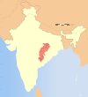
Surajpur district
This article needs additional citations for verification. (December 2009) |
Surajpur District | |
|---|---|
 Location of Surajpur district in Chhattisgarh | |
| Country | India |
| State | Chhattisgarh |
| Division | District |
| Headquarters | Surajpur |
| Tehsils | 6 |
| Government | |
| • District Magistrate | Gaurav Kumar Singh (IAS) |
| Area | |
| • Total | 2,786.76 km2 (1,075.97 sq mi) |
| Population | |
| • Total | 789,043 |
| • Density | 280/km2 (730/sq mi) |
| Time zone | UTC+05:30 (IST) |
| Vehicle registration | CG-29 |
| Major highways | NH 43 |
| Website | surajpur |
Surajpur district is a district in the state of Chhattisgarh in central India, with its administrative headquarters at Surajpur. National Highway 43 passes through Surajpur district. Surajpur was declared a district on 15 August 2011 by the state former Chief Minister Dr. Raman Singh along with eight other new districts. Surajpur is the first district to receive National Satyan Maitra Literacy Award. The district is known for its market (economical and quality product) and other major tourist places of Chhattisgarh with Tamor Pingla Wildlife Sanctuary.[1]
Administration[edit]
Blocks or Mandals[edit]
Each sub-division is divided into two or more administrative areas called tehsils. Tehsil is the basic unit for purposes of general administration, treasury, land revenue, land records and other items of work. It has the closest and widest contact with the rural population. The officer-in-charge of the tehsil is the tehsildar who belongs to the state civil services. He is the principal official in the district administration responsible for revenue collector. Nayab tehsildar are there to assist tehsildars. In the absence of the tehsildars, Nayab tehsildars take charge.
Surajpur district has 6 tehsils:[2]
Demographics[edit]
According to the Census 2011, total population of 789043 (Male – 398381, Female – 390662) dwells in 547 villages. The Population density of the District is noted as 283 persons/sq.km. as per the census. The literacy rate according to the census is 60.95%, however the sex ratio corresponds to 980 females per 1000 males. Scheduled Castes and Scheduled Tribes make up 5.43% and 45.58% of the population respectively.[1]
Languages of Surajpur district (2011)
According to the 2011 census, 81.26% of the population spoke Surgujia, 6.18% Hindi, 2.53% Chhattisgarhi, 1.88% Kurukh and 1.03% Bengali as their first language.[3]
Places of interest[edit]
There are famous temples at:
- Deogarh in the Surajpur district
- Kudargarh in Surajpur district (Bagheshwari Devi Temple)
- Bhaiyathan in Surajpur district (Patal Bhairav Mandir)
- Prem nagar in Surajpur district (mahesri mandir)
- Sarasor (Shiv Temple), Surajpur
- Khatu Shyam Baba Temple, Surajpur
- Gauri Shankar mandir, basdei, Surajpur
See also[edit]
References[edit]
- ↑ 1.0 1.1 "Surajpur District". Surajpur.gov.in. 2012. Retrieved 1 March 2017.
- ↑ "Sub Division & Tehsil | District Surajpur, Government of Chhattisgarh | India". Retrieved 18 August 2020.
- ↑ 2011 Census of India, Population By Mother Tongue
External links[edit]
