


No edit summary |
|||
| Line 1: | Line 1: | ||
{{Short description|Province of British India}} | {{Short description|Province of British India}} | ||
{{About| | {{About|the former province of [[Presidencies and provinces of British India|British India]] (1849–1947)|other uses|Punjab Province (disambiguation)}} | ||
{{ | {{Use British English|date=October 2017}} | ||
{{Use dmy dates|date=January 2022}} | {{Use dmy dates|date=January 2022}} | ||
{{Infobox former country | |||
{{Infobox | | conventional_long_name = Province of Punjab | ||
| conventional_long_name = Punjab | |||
| common_name = Punjab | | common_name = Punjab | ||
| | | status = *[[#Early administration|Board of Administration]]-led province under [[Bengal Presidency]] of [[East India Company]] (1849–1853) | ||
| | *[[Chief Commissioner's Province]] of [[East India Company]] (1853–1858) | ||
| | *[[Lieutenant governor|Lieutenant Governor]]-led [[Presidencies and provinces of British India|province of British Raj]] (1858–1921) | ||
*[[List of head of the State of Punjab (British India)|Governor]]-led province of British Raj (1921–1947) | |||
| native_name = <!-- Do not add a language --> | |||
| image_flag = Flag of the Province of Punjab of British India.svg | |||
| alt_flag = Flag of the Province of the Punjab based on the British Blue Ensign featuring a Union Jack in the upper hoist quarter; and augmented with the emblem of the province. | |||
| flag = Flag of the Province of the Punjab | |||
| image_coat = Badge of British Punjab.svg | |||
| symbol_width = 60px | |||
| alt_coat = Emblem of the Province of the Punjab featuring a sun with five rivers. | |||
| symbol_type = [[Flags of British India#Emblem|Emblem]] | |||
| national_motto = Crescat e Fluviis ([[Latin]]) | |||
| englishmotto = "Let it grow from the rivers" | |||
| national_anthem = "[[God Save the King]]"<br /><div style="display:inline-block;margin-top:0.4em;">[[File:God Save The King (Band of the Grenadier Guards, 1930s instrumental).oga|God Save the King / Queen <!-- Do not change file name due to computer error without ensuring that the file is playable. -->]]</div> | |||
| image_map = {{Switcher|[[File:Punjab 1909.jpg |upright=1.15|frameless]]|The Province of the Punjab in 1909|[[File:Pope1880Panjab3.jpg|upright=1.15|frameless]]|The Province of the Punjab in 1880|default=1}} | |||
| map_width = 250px | |||
| alt_map = Images of maps of the Province of the Punjab | |||
| capital = [[Lahore]] | |||
| admin_center = [[Murree]] (1873–1876)<br />[[Simla]] (1876–1947) | |||
| admin_center_type = Summer Capital | |||
| official_languages = {{Hlist|[[English language|English]]|[[Hindustani language|Hindustani]]|[[Persian language|Persian]] (1849{{ndash}}1854)|[[Punjabi language|Punjabi]] (1854{{ndash}}1947){{efn|English was used by the British administration; while Hindustani (both Hindi and Urdu) and Persian were used in local administration.<br />In 1849, the Board of Administration of the Punjab adopted a "two-language policy" maintaining the already-established Persian in the province, as well as establishing Hindustani for official use. However, in 1854, Persian was discontinued as an official language in the province and was replaced with Punjabi}}}} | |||
| languages_type = Native languages | |||
| languages = {{Hlist|[[Punjabi language|Punjabi]]|[[#Language|others]]}} <!-- Do not add more languages --> | |||
| ethnic_groups = 76.4% [[Punjabis|Punjabi]]<br /> 23.6% [[#Language|other]]<!-- Do not list other ethnicities --> | |||
| ethnic_groups_year = 1931 | |||
| demonym = Punjabi | |||
| title_leader = [[List of head of the State of Punjab (British India)|Head of Province]] | |||
| leader1 = [[Henry Montgomery Lawrence]] (first){{efn|as [[List of governors of Punjab (British India)#List of heads of the Punjab (1849–1947)|President of the Board of Administration]]}} | |||
| year_leader1 = 1849–1853 | |||
| leader2 = [[Evan Meredith Jenkins]] (last){{efn|as [[List of governors of Punjab (British India)|Governor]]}} | |||
| year_leader2 = 1946–1947 | |||
| title_representative = [[Premier of the Punjab|Premier]] | |||
| representative1 = [[Sikandar Hayat Khan]] (first) | |||
| year_representative1 = 1937–1942 | |||
| representative2 = [[Malik Khizar Hayat Tiwana]] (last) | |||
| year_representative2 = 1942–1947 | |||
| legislature = [[Punjab Legislative Council (British India)|Punjab Legislative Council]] (1921–1936)<br />[[Punjab Provincial Assembly (British India)|Punjab Provincial Assembly]] (1937–1947) | |||
| event_start = [[Battle of Gujrat]] | |||
| year_start = 1849 | | year_start = 1849 | ||
| date_start = | | date_start = 21 February | ||
| | | event_end = [[Partition of Punjab|Partition of Punjab during the Partition of India]] | ||
| year_end = 1947 | | year_end = 1947 | ||
| date_end = | | date_end = 17 August | ||
| | | event1 = [[#Company rule|Annexation of Punjab]] | ||
| | | date_event1 = 29 March 1849 | ||
| | | event2 = [[Delhi Territory#History|Incorporation of Delhi Division]] | ||
| | | date_event2 = 1858 | ||
| | | event3 = [[North-West Frontier Province#Formation|Separation of the North-West Frontier]] | ||
| | | date_event3 = 9 November 1901 | ||
| event4 = [[Delhi|Separation of Delhi District]] | |||
| date_event4 = 1911 | |||
| event5 = [[Partition of India|Establishment of Pakistan and India]] | |||
| date_event5 = 14–15 August 1947 | |||
| area_km2 = 458,354 | |||
| area_sq_mi = 176,971 | |||
| population_census = 34,309,861 | |||
| population_census_year = 1941 | |||
| population_link = #Population | |||
| currency = [[History of the rupee#Coinage since the British period|British Indian rupee]] | |||
| utc_offset = +05:30 | |||
| date_format = {{ubl | |||
| {{nowrap|{{abbr|dd|day}}-{{abbr|mm|month}}-{{abbr|yyyy|year}}}} | |||
}} | }} | ||
| religion_year = 1941 | |||
| religion = {{ubl | |||
| 53.2% [[Islam]] | |||
| 30.1% [[Hinduism]] | |||
| 14.9% [[Sikhism]] | |||
| 1.5% [[Christianity]] | |||
| 0.5% [[Religion in the Punjab|other]] | |||
}} | |||
| p1 = Sikh Empire{{!}}'''1849''':<br>Sikh Empire | | p1 = Sikh Empire{{!}}'''1849''':<br>Sikh Empire | ||
| p2 = | | p2 = Cis-Sutlej states{{!}}'''1849''':<br>Cis-Sutlej states | ||
| p3 = | | p3 = Delhi Territory{{!}}'''1858''':<br>Delhi Division | ||
| s1 = North-West Frontier Province{{!}}'''1901''':<br/>North-West Frontier Province | | s1 = North-West Frontier Province{{!}}'''1901''':<br/>North-West Frontier Province | ||
| s2 = West Punjab{{!}}'''1947''':<br>West Punjab | | s2 = Delhi{{!}}'''1911:'''<br />Delhi Province | ||
| | | s3 = West Punjab{{!}}'''1947''':<br>West Punjab | ||
| | | s4 = East Punjab | ||
| s5 = Patiala and East Punjab States Union | |||
| flag_p1 = Sikh Empire flag.svg | | flag_p1 = Sikh Empire flag.svg | ||
| flag_p3 = Flag of the British East India Company (1801).svg | | flag_p3 = Flag of the British East India Company (1801).svg | ||
| flag_s1 = British Raj Red Ensign.svg | | flag_s1 = British Raj Red Ensign.svg | ||
| flag_s2 = | | flag_s2 = British Raj Red Ensign.svg | ||
| flag_s3 = Flag of | | flag_s3 = Flag of Pakistan.svg | ||
| | | flag_s4 = Flag of India.svg | ||
| | | flag_s5 = EMBLEM OF PEPSU.png | ||
| today = {{hidden||{{Tree list}} | |||
| | * {{flag|Pakistan}} | ||
** [[Punjab,Pakistan|Punjab]] | |||
| | ** [[Islamabad Capital Territory]] | ||
* {{flag|India}} | |||
** [[Punjab,India|Punjab]] | |||
** [[Haryana]] | |||
** [[Himachal Pradesh]] | |||
** [[Delhi NCR]] | |||
{{tree list/end}} | |||
| | }} | ||
| era = New Imperialism | |||
}} | }} | ||
'''Punjab''' was a province of [[ | The '''Punjab Province''', officially the '''Province of the Punjab''', was a [[Presidencies and provinces of British India|province of British Raj]], with its capital in [[Lahore]] and [[summer capital]]s in [[Murree]] and [[Simla]]. At its greatest extent, it stretched from the [[Khyber Pass]] to [[Delhi]]; and from the [[Babusar Pass]] and the borders of [[Tibet]] to the borders of [[Sind Division|Sind]]. Established in 1849 following [[#History|Punjab's annexation]], the province was [[Partition of Punjab|partitioned in 1947]] into [[West Punjab|West]] and [[East Punjab]]; and incorporated into [[Pakistan]] and [[India]], respectively. | ||
Most of the [[Punjab|Punjab region]] was annexed by the [[East India Company]] on [[Second Anglo-Sikh War|29 March 1849]] following the company's victory against the [[Sikh Empire]]'s army at the [[Battle of Gujrat]] in northern Punjab, a month prior. The Punjab was the last major region of the [[Indian subcontinent]] to fall to [[British imperialism]]. | |||
Immediately following its annexation, the Punjab was annexed into the [[Bengal Presidency]] and administered separately by a [[#Early administration|board of administration]] led by the [[List of head of the State of Punjab (British India)|head of province]].<ref name=":1">{{Cite book |last=Michel |first=Aloys Arthur |title=The Indus Rivers: A Study of the Effects of Partition |publisher=Yale University Press |year=1967 |isbn=9780608140230}}</ref>{{Rp|page=54}} After 1853, the board was replaced by a [[chief commissioner]] as the Punjab was separated from the Bengal Presidency and established as a [[Chief Commissioner's Province]].<ref name=":1" />{{Rp|page=54}} In 1858, the Punjab, along with the rest of British India, came under the rule of the [[The Crown|British crown]]. Following the [[Indian Rebellion of 1857]], the Punjab became a lieutenant-governor's province under the Bengal Presidency.<ref name=":1" />{{Rp|page=54}} After the ''[[Government of India Act 1919]]'', Punjab was turned into a governor's province.<ref name=":1" />{{Rp|pages=55}} It had a land area of 358,355 square kilometers. | |||
The province comprised four natural geographic regions – ''Indo-Gangetic Plain West'', ''Himalayan'', ''Sub-Himalayan'', and the ''North-West Dry Area'' – along with five administrative divisions – [[Delhi]], [[Jalandhar|Jullundur]], [[Lahore]], [[Multan]], and [[Rawalpindi]] – and a number of [[princely state]]s.<ref name="Chisholm 1911, p. 653">{{cite EB1911 |wstitle=Punjab | Volume 22 |page=653}}</ref> In 1947, the [[Partition of India]] led to the province's division into [[East Punjab]] and [[West Punjab]], in the newly independent [[dominion]]s of the [[Dominion of India|Indian Union]] and [[Dominion of Pakistan|Pakistan]] respectively. | |||
During the colonial-period, the appellation "province" was used somewhat indiscriminately but usually referred to lieutenant-governor provinces (which Punjab was after 1859) but also to chief-commissioner provinces (which Punjab was from 1853–1859).<ref name=":1" />{{Rp|pages=54–55}} | |||
==Etymology== | ==Etymology== | ||
The region was originally called [[Sapta Sindhu]],<ref name=Anin1>D. R. Bhandarkar, 1989, [https://books.google.com/books?isbn=8120604571 Some Aspects of Ancient Indian Culture: Sir William Meyers Lectures, 1938-39], Asia Educational Services, p.{{nbsp}}2.</ref> the [[Vedic period|Vedic]] land of the seven rivers | The region was originally called the [[Sapta Sindhu|Sapta Sindhu Rivers]],<ref name=Anin1>D. R. Bhandarkar, 1989, [https://books.google.com/books?isbn=8120604571 Some Aspects of Ancient Indian Culture: Sir William Meyers Lectures, 1938-39] {{Webarchive|url=https://web.archive.org/web/20221007062647/https://www.google.com/search?tbo=p&tbm=bks&q=isbn:8120604571 |date=7 October 2022 }}, Asia Educational Services, p.{{nbsp}}2.</ref> the [[Vedic period|Vedic]] land of the seven rivers, originally: Saraswati, Indus, Sutlej, Jhelum, Chenab, Ravi, and Beas.<ref name=curr1>A.S. valdiya, [http://www.currentscience.ac.in/Volumes/104/01/0042.pdf "River Sarasvati was a Himalayan-born river"] {{Webarchive|url=https://web.archive.org/web/20180924194903/http://www.currentscience.ac.in/Volumes/104/01/0042.pdf |date=24 September 2018 }}, [http://www.currentscience.ac.in Current Science] {{Webarchive|url=https://web.archive.org/web/20180710211340/http://www.currentscience.ac.in/ |date=10 July 2018 }}, vol 104, no.01, ISSN 0011-3891.</ref> The [[Sanskrit]] name for the region, as mentioned in the [[Ramayana]] and [[Mahabharata]], for example, was ''Pañcanada'', which means literally "Five Waters", and was translated from [[Sanskrit]] to [[Farsi language|Farsi]] as ''Panj-Âb'' after the [[Muslim conquests in the Indian subcontinent|Islamic conquests]].<ref>{{cite web|url=http://dsalsrv02.uchicago.edu/cgi-bin/philologic/getobject.pl?p.1:375.hobson|title=Hobson-Jobson: A glossary of Colloquial Anglo-Indian Words and Phrases, and of Kindred Terms, Etymological, Historical, Geographical and Discursive|first=Henry|last=Yule|date=31 December 2018|website=dsalsrv02.uchicago.edu|access-date=7 May 2018|archive-date=1 December 2018|archive-url=https://web.archive.org/web/20181201141824/http://dsalsrv02.uchicago.edu/cgi-bin/philologic/getobject.pl?p.1:375.hobson|url-status=dead}}</ref><ref>{{cite web|url=http://dsalsrv02.uchicago.edu/cgi-bin/app/macdonell_query.py?qs=%E0%A4%AA%E0%A4%9E%E0%A5%8D%E0%A4%9A%E0%A4%A8%E0%A4%96&searchhws=yes|title=A Practical Sanskrit Dictionary with Transliteration, Accentuation, and Etymological Analysis Throughout|first=Arthur Anthony|last=Macdonell|date=31 December 2018|website=dsalsrv02.uchicago.edu|access-date=10 July 2018|archive-date=1 December 2018|archive-url=https://web.archive.org/web/20181201141645/http://dsalsrv02.uchicago.edu/cgi-bin/app/macdonell_query.py?qs=%E0%A4%AA%E0%A4%9E%E0%A5%8D%E0%A4%9A%E0%A4%A8%E0%A4%96&searchhws=yes|url-status=dead}}</ref> The later name ''Punjab'' is thus a compound of two [[Farsi language|Farsi]] words<ref name=EoS>{{cite encyclopedia |url=http://www.learnpunjabi.org/eos/PUNJAB.html |title=The Punjab |author=H K Manmohan Siṅgh |encyclopedia=The Encyclopedia of Sikhism, Editor-in-Chief Harbans Singh |publisher=[[Punjabi University]], Patiala |access-date=18 August 2015 |archive-date=5 March 2016 |archive-url=https://web.archive.org/web/20160305062705/http://www.learnpunjabi.org/eos/PUNJAB.html |url-status=live }}</ref><ref>{{cite book|last=Gandhi|first=Rajmohan|title=Punjab: A History from Aurangzeb to Mountbatten|year=2013|page=1 ("Introduction")|publisher=Aleph Book Company|location=New Delhi, India, Urbana, [[Illinois]]|isbn=978-93-83064-41-0}}</ref> Panj (five) and āb (water) and was introduced to the region by the [[Turko-Persian]] conquerors<ref>{{cite book|last=Canfield|first=Robert L.|title=Turko-Persia in Historical Perspective|year=1991|page=1 ("Origins")|publisher=Cambridge University Press|location=[[Cambridge]], United Kingdom|isbn=978-0-521-52291-5}}</ref> of [[History of India|India]] and more formally popularised during the [[Mughal Empire]].<ref>{{cite book|last=Gandhi|first=Rajmohan|title=Punjab: A History from Aurangzeb to Mountbatten|year=2013|publisher=Aleph Book Company|location=New Delhi, India, Urbana, [[Illinois]]|isbn=978-93-83064-41-0}}</ref><ref>{{cite book|last=Shimmel|first=Annemarie|title=The Empire of the Great Mughals: History, Art and Culture|year=2004|publisher=Reaktion Books Ltd.|location=London, United Kingdom|isbn=1-86189-1857|url-access=registration|url=https://archive.org/details/empireofgreatmug00anne}}</ref> Punjab literally means ''"(The Land of) Five Waters"'' referring to the rivers: [[Jhelum River|Jhelum]], [[Chenab River|Chenab]], [[Ravi River|Ravi]], [[Sutlej]], and [[Beas River|Beas]].<ref>Encyclopædia Britannica, 9th ed., vol.20, Punjab, p.107</ref> All are tributaries of the [[Indus River]], the Chenab being the largest. | ||
==Geography== | ==Geography== | ||
| Line 66: | Line 125: | ||
It encompassed the present day [[States and union territories of India|Indian states]] of [[Punjab (India)|Punjab]], [[Haryana]], [[Chandigarh]], [[Delhi]], and some parts of [[Himachal Pradesh]] which were merged with Punjab by the British for administrative purposes (but excluding the former [[princely state]]s which were later combined into the [[Patiala and East Punjab States Union]]) and the Pakistani regions of the [[Punjab (Pakistan)|Punjab]], [[Islamabad Capital Territory]] and [[Khyber Pakhtunkhwa]]. | It encompassed the present day [[States and union territories of India|Indian states]] of [[Punjab (India)|Punjab]], [[Haryana]], [[Chandigarh]], [[Delhi]], and some parts of [[Himachal Pradesh]] which were merged with Punjab by the British for administrative purposes (but excluding the former [[princely state]]s which were later combined into the [[Patiala and East Punjab States Union]]) and the Pakistani regions of the [[Punjab (Pakistan)|Punjab]], [[Islamabad Capital Territory]] and [[Khyber Pakhtunkhwa]]. | ||
In 1901 the frontier districts beyond the Indus were separated from Punjab and made into a new province: the [[North-West Frontier Province (1901–1955)|North-West Frontier Province]]. | In 1901 the frontier districts beyond the Indus were separated from Punjab and made into a new province: the [[North-West Frontier Province (1901–1955)|North-West Frontier Province]]. Subsequently, Punjab was divided into four natural geographical divisions by colonial officials on the decadal census data:<ref name="punjab1911">{{cite web|url=https://www.jstor.org/site/SAOA/SouthAsiaOpenArchivesSAOA/CensusReports-1911-26575903/|title=Census of India 1911. Vol. 14, Punjab. Pt. 1, Report.|access-date=21 July 2022|archive-date=21 July 2022|archive-url=https://web.archive.org/web/20220721231731/https://www.jstor.org/site/SAOA/SouthAsiaOpenArchivesSAOA/CensusReports-1911-26575903/|url-status=live}}</ref>{{rp|2}}<ref name="Census1941"/>{{rp|4}} | ||
# '''''Indo-Gangetic Plain West geographical division''''' (including [[Hisar district]], [[Loharu State]], [[Rohtak district]], [[Dujana|Dujana State]], [[Gurgaon district]], [[Pataudi State]], [[Delhi]], [[Karnal district]], [[Jalandhar district]], [[Kapurthala State]], [[Ludhiana district]], [[Malerkotla State]], [[Firozpur district]], [[Faridkot State]], [[Patiala State]], [[Jind State]], [[Nabha State]], [[Lahore District]], [[Amritsar district]], [[Gujranwala District]], and [[Sheikhupura District]]); | |||
# '''''Himalayan geographical division''''' (including [[Sirmur State|Sirmoor State]], [[Simla District]], [[Simla Hill States]], [[Bilaspur State (princely state)|Bilaspur State]], [[Kangra district]], [[Mandi State]], [[Suket State]], and [[Chamba State]]); | |||
# '''''Sub-Himalayan geographical division''''' (including [[Ambala district]], [[Kalsia State]], [[Hoshiarpur district]], [[Gurdaspur District (British Punjab)|Gurdaspur District]], [[Sialkot District]], [[Gujrat District]], [[Jhelum District]], [[Rawalpindi District]], and [[Attock District]]; | |||
# '''''North-West Dry Area geographical division''''' (including [[Montgomery District]], [[Shahpur District]], [[Mianwali District]], [[Lyallpur District]], [[Jhang District]], [[Multan District]], [[Bahawalpur State]], [[Muzaffargarh District]], [[Dera Ghazi Khan District]], and the Biloch Trans–Frontier Tract). | |||
==Administrative divisions== | |||
{| class="wikitable" | |||
|+ Punjab (British India): British Territory and Princely States in 1855<ref>See the Page no.- 9,13,14, [https://censusindia.gov.in/nada/index.php/catalog/31709 1855 Punjab Province Census on Censusgovin] & also see Page no. 4 [[iarchive:dli.pahar.0447|Administration of Punab 1851-53]]</ref> | |||
! Division !! Districts | |||
|- | |||
| Cis-Sutlej Division || [[Ambala district|Ambala]] • [[Ludhiana district|Ludhiana]] • [[Firozpur district|Firozpur]] • [[Thanesar]] • [[Shimla district|Shimla]] | |||
|- | |||
| Trans-Sutlej Division || [[Kangra district|Kangra]] • [[Hoshiarpur district|Hoshiarpur]] • [[Jalandhar district|Jalandhar]] | |||
|- | |||
| Lahore Division || [[Lahore District|Lahore]] • [[Amritsar district|Amritsar]] • [[Sialkot District|Sialkot]] • [[Gujranwala District|Gujranwala]] • [[Gurdaspur district|Gurdaspur]] | |||
|- | |||
| Jhelum Division || [[Rawalpindi District|Rawalpindi]] • [[Shahpur District|Shahpur]] • [[Jhelum District|Jhelum]] • [[Gujrat District|Gujrat]] | |||
|- | |||
| Multan Division || [[Multan District|Multan]] • [[Gogera]] • [[Jhang District|Jhang]] | |||
|- | |||
| Leia Division || [[Layyah District|Layyah]] • [[Khangarh, Punjab|Khangarh]] • [[Dera Ismail Khan District|Dera Ismail Khan]] • [[Dera Ghazi Khan District|Dera Ghazi Khan]] | |||
|- | |||
|Peshwar Division || [[Peshawar District|Peshawar]] • [[Hazara District|Hazara]] • [[Kohat District|Kohat]] | |||
|- | |||
! Total British Territory || 81,625.24 square miles & 12,717,821 persons | |||
|- | |||
|Cis-Satluj Principlites | |||
|[[Patiala State|Patiala]] • [[Nabha State|Nabha]] • [[Faridkot State|Faridkot]] • [[Jind State|Jind]] • [[Malerkotla State|Malerkotla]] • [[Kalsia]] | |||
|- | |||
|Simla-Hill states | |||
|[[Simla Hill States|Hill states]] {{smaller|(south of [[Sutlej River]])}} | |||
|- | |||
|Trans-Sutlej Principlites | |||
|[[Kapurthala State|Kapurthala]] • [[Simla Hill States|Hill states]] {{smaller|between [[Beas River|Beas]] & [[Ravi River]])}} | |||
|- | |||
|Bahawalpur | |||
|[[Bahawalpur (princely state)|Bahawalpur]] | |||
|- | |||
|Kashmir & Jammu | |||
|[[Jammu and Kashmir (princely state)|Gulab singh Territories]] | |||
|- | |||
! Total Native States || 102,884.95 square miles & 6,750,606 persons | |||
|- | |||
! Total Punjab Province || 184,510.19 square miles & 19,468,627 persons | |||
|} | |||
{| class="wikitable sortable" | |||
|+ Punjab (British India): British Territory and Princely States in 1901 | |||
! Division!!Districts in British Territory / Princely States | |||
|- | |||
| Rawalpindi Division || {{hlist|[[Attock District|Attock]]| |[[Jhelum District|Jhelum]] | [[Rawalpindi District|Rawalpindi]] | [[Shahpur District|Shahpur]]}} | |||
|- | |||
| Lahore Division || {{hlist|[[Amritsar District|Amritsar]] | [[Gujrat district|Gujrat]] | [[Gujranwala District|Gujranwala]] |4=[[Gurdaspur District|Gurdaspur]]|5=[[Lahore District|Lahore]]|9=[[Sialkot District|Sialkot]]}} | |||
|- | |||
| Multan Division || {{hlist|[[Dera Ghazi Khan District|Dera Ghazi Khan]]| [[Jhang District|Jhang]]|[[Mianwali District|Mianwali]] | [[Multan District|Multan]] | [[Muzaffargarh District|Muzaffargarh]] | }} | |||
|- | |||
| Jullundur Division || {{hlist|[[Firozpur district|Ferozepore]] | [[Hoshiarpur district|Hoshiarpur]] | [[Jalandhar district|Jullundur]] | [[Kangra district|Kangra]] | [[Ludhiana district|Ludhiana]]}} | |||
|- | |||
| Delhi Division || {{hlist| [[Ambala district|Ambala]] | [[Delhi district|Delhi]] | [[Gurgaon district|Gurgaon]] | [[Hisar district|Hissar]] | [[Karnal district|Karnal]] | [[Rohtak district|Rohtak]] | [[Simla district|Simla]]}} | |||
|- | |||
! Total British Territory || 97,209 square miles | |||
|- | |||
| Native States || {{hlist|[[Patiala State|Patiala]] | [[Jind State|Jind]] | [[Nabha State|Nabha]] | [[Bahawalpur State|Bahawalpur]] | [[Sirmur State|Sirmur]] | [[Loharu State|Loharu]] | [[Dujana]] | [[Pataudi State|Pataudi]] | [[Kalsia]] | [[Simla Hill States]] | [[Kapurthala State|Kapurthala]] | [[Mandi State|Mandi]] | [[Malerkotla State|Malerkotla]] | [[Suket State|Suket]] | [[Faridkot State|Faridkot]] | [[Siba State|Siba]] | [[Chamba State|Chamba]] | [[Kahlur]] (Bilaspur) }} | |||
|- | |||
! Total Native States || 36,532 square miles | |||
|- | |||
! Total Punjab Province || 133,741 square miles | |||
|} | |||
=== Maps of administrative divisions === | |||
<gallery> | |||
File:Province of Punjab map with Divisions, Labeled, with main district, 1947.jpg|Map of the divisions of British Punjab (with the namesake district of each division shaded darker and princely-states shaded black), 1947 | |||
File:Province and Princely States of Punjab, 1947.jpg|Map of Punjab in 1947, with princely-state territory in purple & direct British-rule in pink. | |||
File:British and native states in the Cis-Sutlej Division between 1847–51, by Abdos Sobhan, 1858 (F.4-27).jpg|1847–1851:- Punjab Province's Cis-Sutlej Division and Principlites | |||
File:Map of the Punjab and the adjoining countries, 1853 (F.4-10).jpg|1853:- Map showing Punjab provinces and adjoining area | |||
File:Punjab-religion-2.jpg|Districts of Punjab with Muslim (green) and non-Muslim (pink) majorities, as per 1941 census | |||
</gallery> | |||
==History== | ==History== | ||
| Line 79: | Line 214: | ||
| image2 = Iln1864rightmax.jpg | | image2 = Iln1864rightmax.jpg | ||
| width2 = 125 | | width2 = 125 | ||
| alt2 = }} | | alt2 = }}[[Delhi Territory|Delhi]] and the areas of Gurgaon, Hisar, and Karnal districts were [[Second Anglo-Maratha War|conquered by the British]] in 1803.<ref name=":2">{{Cite book |last1=Banerjee |first1=Abhijit |url=https://eml.berkeley.edu/~webfac/bardhan/e271_sp03/2_18.pdf |title=History, Institutions and Economic Performance: The Legacy of Colonial Land Tenure Systems in India (BREAD Working Paper No. 003) |last2=Iyer |first2=Lakshmi |date=January 2003 |publisher=Bureau for Research in Economic Analysis of Development |pages=39 |chapter=Appendix Table 1: Districts of British India, With Dates and Mode of Acquisition by the British}}</ref> On 30 December 1803, the [[Daulat Scindia]] signed the [[Treaty of Surji-Anjangaon]] with the British after the [[Battle of Assaye]] and Battle of [[Laswari]] and ceded to the British, Hisar, Panipat, Rohtak, Rewari, Gurgaon, Ganges-Jumna Doab, the Delhi-Agra region, parts of Bundelkhand, Broach, some districts of Gujarat and the fort of Ahmmadnagar.<ref name="Naravane">{{Cite book |last=Naravane |first=M.S. |title=Battles of the Honorourable East India Company |publisher=A.P.H. Publishing Corporation |year=2014 |isbn=978-81-313-0034-3 |pages=65–66}}</ref>{{rp|73}} The area of Shimla district was obtained by the British in 1815.<ref name=":2"/> | ||
After the conclusion of the First Anglo-Sikh War of 1845–46, the areas of the following districts were annexed by the British: Ambala, Firozpur, Hoshiyarpur, Jalandhar, Kangra, Ludhiana districts.<ref name=":2" />{{Better source needed|reason=The current source is insufficiently reliable ([[WP:NOTRS]]).|date=June 2025}} After the Second Anglo-Sikh War of 1848–49, the areas of the following districts were annexed by the Britishers: Amritsar, Gurdaspur, Bannu, Dera Ghazi Khan, Dera Ismail Khan, Gujranwala, Gujrat, Hazara, Jhang, Jhelum, Kohat, Lahore, Montgomerty, Multan, Muzaffargarh, Peshawar, Rawalpindi, Shahpur, and Sialkot districts.<ref name=":3">See point 81(c) or Pdf reader page no. - 44 - [https://plrs.org.in/pdfs/land%20administration%20Manual.pdf Land Administration Punjab]</ref><ref name=":2" />[[File:Map of British India, showing principal administrative divisions, London & New York, 1851.png|thumb|Map of British India, showing principal administrative divisions, London & New York, 1851. The recently conquered Punjabi territory was initially administered as part of the [[Bengal Presidency]] for a few years following annexation.]] | |||
On 21{{nbsp}}February 1849, the [[East India Company]] decisively defeated the [[Sikh Empire]] at the [[Battle of Gujrat]] bringing to an end the [[Second Anglo-Sikh War]]. Following the victory, the East India Company announced the annexation of the conquered territory through a ''[[Durbar (court)|durbar]]'' proclamation on 30 March 1849 and annexed the Punjab on 2{{nbsp}}April 1849{{Citation needed|date=December 2024}} and incorporated it within [[British India]].<ref name=":02">{{Cite book |last=Archbold |first=W. A. J. |title=The Cambridge History of India |publisher=Cambridge University Press |year=1929 |editor-last=Dodwell |editor-first=Henry Herbert |volume=V: British India, 1497–1858 |chapter=29 (XXIX): The Conquest of Sind and the Panjab}}</ref>{{Rp|page=556}} The deposed child-monarch [[Duleep Singh]] was given a pension and forced to live outside Punjab.<ref name=":02"/>{{Rp|page=556}} | |||
For the task of organization of the conquered region, Henry Lawrence was the prime candidate to take up the task, yet Dalhousie did not agree with Lawrence's views fully.<ref name=":02" />{{Rp|page=556}} Thus, the compromise was the establishment of a three-member board of government/administration to administer the new territory.<ref name=":02" />{{Rp|page=556}}<ref name=":1" />{{Rp|page=54}} The province whilst nominally under the control of the [[Bengal Presidency]] was administratively independent.{{Citation needed|date=December 2024}} [[James Broun-Ramsay, 1st Marquess of Dalhousie|Lord Dalhousie]] constituted the Board of Administration by inducting into it the most experienced and seasoned British officers.<ref name=":02" />{{Rp|page=556}} The Board was led by [[Henry Montgomery Lawrence|Sir Henry Lawrence]], who had previously worked as British Resident at the [[Lahore]] [[Durbar (court)|Durbar]] and also consisted of his younger brother [[John Lawrence, 1st Baron Lawrence|John Lawrence]] and [[Charles Grenville Mansel]].<ref>J. S. Grewal, The Sikhs of the Punjab, Volumes 2-3, Cambridge University Press, 8 October 1998, p.258</ref><ref name=":02" />{{Rp|page=556}} Below the Board, a group of acclaimed officers collectively known as [[Henry Lawrence's "Young Men"]] assisted in the administration of the newly acquired province.{{Citation needed|date=December 2024}} The Board was abolished by Lord Dalhousie in 1853;{{Citation needed|date=December 2024}} Sir Henry was assigned to the [[Rajputana Agency]], and his brother John Lawrence succeeded as the first Chief Commissioner.<ref name=":02" />{{Rp|page=557}} Thus, Punjab became administered by a chief commissioner.<ref name=":1" />{{Rp|page=54}} | |||
Recognising the cultural diversity of the Punjab, the Board maintained a strict policy of non-interference in regard to religious and cultural matters.<ref name="autogenerated77">Arvind-Pal Singh Mandair, Sikhism: A Guide for the Perplexed, A&C Black, 8 August 2013, p.77</ref> Sikh aristocrats were given patronage and pensions and groups in control of historical places of worship were allowed to remain in control.<ref name="autogenerated77"/> | Recognising the cultural diversity of the Punjab, the Board maintained a strict policy of non-interference in regard to religious and cultural matters.<ref name="autogenerated77">Arvind-Pal Singh Mandair, Sikhism: A Guide for the Perplexed, A&C Black, 8 August 2013, p.77</ref> Sikh aristocrats were given patronage and pensions and groups in control of historical places of worship were allowed to remain in control.<ref name="autogenerated77"/> | ||
During the [[Indian Rebellion of 1857]], the Punjab remained relatively peaceful.<ref name="auto1">{{cite book |last1=N. Arielli, B. Collins |title=Transnational Soldiers: Foreign Military Enlistment in the Modern Era |date=28 November 2012 |publisher=Springer |isbn= | During the [[Indian Rebellion of 1857]], the Punjab remained relatively peaceful, apart from rebellion led by [[Rai Ahmad Khan Kharal|Ahmad Khan Kharral]].<ref name="auto1">{{cite book |last1=N. Arielli, B. Collins |title=Transnational Soldiers: Foreign Military Enlistment in the Modern Era |date=28 November 2012 |publisher=Springer |isbn=978-1137296634}}</ref> In May, John Lawrence took swift action to disarm potentially mutinous sepoys and redeploy most European troops to the Delhi ridge.<ref>{{cite book |last1=Dalrymple |first1=William |title=The Last Mughal: The Fall of Delhi, 1857 |date=17 August 2009 |publisher=A&C Black |isbn=978-1408806883}}</ref> Finally he recruited new regiments of Punjabis to replace the depleted force, and was provided with manpower and support from surrounding princely states such as Jind, Patiala, Nabha and Kapurthala and tribal chiefs on the borderlands with Afghanistan. By 1858, an estimated 70,000 extra men had been recruited for the army and militarised police from within the Punjab.<ref name="auto1"/> | ||
===British Raj=== | ===British Raj=== | ||
{{See also|British Raj}} | {{See also|British Raj}} | ||
[[File:Pope1880Panjab3.jpg|thumb|250px|The Punjab in 1880]] | [[File:Pope1880Panjab3.jpg|thumb|250px|The Punjab in 1880]] | ||
Following the Indian mutiny, Punjab became a lieutenant-governor's province, still under the Bengal Presidency.<ref name=":1" />{{Rp|page=54}} The governor-general of India, the highest seat of local authority, ruled the Bengal Presidency through its lieutenant-governors and chief-commissioners.<ref name=":1" />{{Rp|page=54}} Both the lieutenant-governors and chief-commissioners presided over commissioners of divisions, with those commissioners having authority over deputy-commissioners of districts.<ref name=":1" />{{Rp|page=54}} | |||
In 1858, under the terms of the Queen's Proclamation issued by [[Queen Victoria]], the Punjab, along with the rest of British India, came under the direct rule of the British Crown.<ref name="victoriap221">[[#Hibbert|Hibbert 2000]], p. 221</ref> The East India Company was abolished, along with its court of directors, replacing that administrative set-up with the [[council of India]].<ref name=":1" />{{Rp|page=55}} [[Delhi Territory]] was transferred from the [[North-Western Provinces]] to the Punjab in 1858, partly to punish the city for the important role the last [[Mughal emperors|Mughal emperor]], [[Bahadur Shah II]], and the city as a whole, played in the 1857 Rebellion.<ref>Gupta, Narayani. 1981. ''Delhi Between Two Empires, 1803-1931''. Oxford University Press, p.26</ref> | |||
In 1885 the Punjab administration began an ambitious plan to transform over six million acres of barren waste land in central and western Punjab into irrigable agricultural land. The [[Punjab Canal Colonies|creation of canal colonies]] was designed to relieve demographic pressures in the central parts of the province, increase productivity and revenues, and create a loyal support amongst peasant landholders.<ref>Imran Ali, | In 1859, Punjab became a lieutenant-governor's province.<ref name=":1" />{{Rp|pages=54–55}} Sir John Lawrence, then Chief Commissioner, was appointed the first [[List of Governors of Punjab (British India)|Lieutenant-Governor]] on 1{{nbsp}}January 1859. In 1866, the Judicial Commissioner was replaced by a Chief Court. The direct administrative functions of the Government were carried by the Lieutenant-Governor through the Secretariat, comprising a Chief Secretary, a Secretary and two Under-Secretaries. They were usually members of the [[Indian Civil Service]].<ref name="two">{{cite web|url=https://dsal.uchicago.edu/reference/gazetteer/pager.html?objectid=DS405.1.I34_V20_337.gif|title=Imperial Gazetteer2 of India, Volume 20, page 331 -- Imperial Gazetteer of India -- Digital South Asia Library|work=uchicago.edu|access-date=20 February 2021|archive-date=18 September 2020|archive-url=https://web.archive.org/web/20200918085700/https://dsal.uchicago.edu/reference/gazetteer/pager.html?objectid=DS405.1.I34_V20_337.gif|url-status=live}}</ref> The territory under the Lieutenant consisted of 29 Districts, grouped under 5 Divisions, and 43 [[Princely State]]s. Each District was under a Deputy-Commissioner, who reported to the Commissioner of the Division. Each District was subdivided into between three and seven [[tehsils]], each under a ''tahsildar'', assisted by a ''naib'' (deputy) ''tahsildar''.<ref>{{cite web|url=https://dsal.uchicago.edu/reference/gazetteer/pager.html?objectid=DS405.1.I34_V20_339.gif|title=Imperial Gazetteer2 of India, Volume 20, page 333 -- Imperial Gazetteer of India -- Digital South Asia Library|work=uchicago.edu|access-date=20 February 2021|archive-date=18 September 2020|archive-url=https://web.archive.org/web/20200918074647/https://dsal.uchicago.edu/reference/gazetteer/pager.html?objectid=DS405.1.I34_V20_339.gif|url-status=live}}</ref> | ||
In 1885 the Punjab administration began an ambitious plan to transform over six million acres of barren waste land in central and western Punjab into irrigable agricultural land. The [[Punjab Canal Colonies|creation of canal colonies]] was designed to relieve demographic pressures in the central parts of the province, increase productivity and revenues, and create a loyal support amongst peasant landholders.<ref>Imran Ali, The Punjab Canal Colonies, 1885-1940, 1979, The Australian National University, Canberra, p34</ref> The colonisation resulted in an agricultural revolution in the province, rapid industrial growth, and the resettlement of over one million Punjabis in the new areas.<ref>Ian Talbot, Khizr Tiwana, the Punjab Unionist Party and the Partition of India, Routledge, 16 December 2013, p,55</ref> A number of towns were created or saw significant development in the colonies, such as [[Lyallpur]], [[Sargodha]] and [[Sahiwal|Montgomery]]. Colonisation led to the canal irrigated area of the Punjab increasing from three to fourteen million acres in the period from 1885 to 1947.<ref>Saiyid, the Muslim Women of the British Punjab, p.4.</ref> | |||
The beginning of the twentieth century saw increasing unrest in the Punjab. Conditions in the Chenab colony, together with land reforms such as the [[Punjab Land Alienation Act, 1900]] and the Colonisation Bill, 1906 contributed to the [[1907 Punjab unrest]]. The unrest was unlike any previous agitation in the province as the government had for the first time aggrieved a large portion of the rural population.<ref name="autogenerated353">Barrier, N. Gerald. "The Punjab Disturbances of 1907: The Response of the British Government in India to Agrarian Unrest." Modern Asian Studies, vol. 1, no. 4, 1967, pp. 353–383</ref> Mass demonstrations were organised, headed by [[Lala Lajpat Rai]], a leader of the Hindu revivalist sect [[Arya Samaj]].<ref name="autogenerated353"/> The unrest resulted in the repeal of the Colonisation Bill and the end of paternalist policies in the colonies.<ref name="autogenerated353"/> | The beginning of the twentieth century saw increasing unrest in the Punjab. Conditions in the Chenab colony, together with land reforms such as the [[Punjab Land Alienation Act, 1900]] and the Colonisation Bill, 1906 contributed to the [[1907 Punjab unrest]]. The unrest was unlike any previous agitation in the province as the government had for the first time aggrieved a large portion of the rural population.<ref name="autogenerated353">Barrier, N. Gerald. "The Punjab Disturbances of 1907: The Response of the British Government in India to Agrarian Unrest." Modern Asian Studies, vol. 1, no. 4, 1967, pp. 353–383</ref> Mass demonstrations were organised, headed by [[Lala Lajpat Rai]], a leader of the Hindu revivalist sect [[Arya Samaj]].<ref name="autogenerated353"/> The unrest resulted in the repeal of the Colonisation Bill and the end of paternalist policies in the colonies.<ref name="autogenerated353"/> | ||
During the [[World War I|First World War]], Punjabi manpower contributed heavily to the [[British Indian Army|Indian Army]]. Out of a total of 683,149 combat troops, 349,688 hailed from the province.<ref>Tan Tai Yong, "An Imperial Home Front: Punjab and the First World War", The Journal of Military History (2000), p.64</ref> In 1918, an influenza epidemic broke out in the province, resulting in the deaths of an estimated 962,937 people or 4.77 percent of the total estimated population.<ref>"Influenza in India, 1918." Public Health Reports, vol. 34, no. 42, 1919, pp. 2300–2302</ref> In March 1919 the [[Rowlatt Act]] was passed extending emergency measures of detention and incarceration in response to the perceived threat of terrorism from revolutionary nationalist organisations.<ref name=Sarkar1921>{{Harvnb|Sarkar|1921|p=137}}</ref> This led to the infamous [[Jallianwala Bagh massacre]] in April 1919, where Colonel [[Reginald Dyer|Reginald Edward Harry Dyer]] ordered detachments of the [[9th Gorkha Rifles]] and the [[59th Scinde Rifles (Frontier Force)|59th Scinde Rifles]] under his command to fire into a group of some 10,000 unarmed protesters and [[Baisakhi]] pilgrims, killing 379.<ref>{{cite | During the [[World War I|First World War]], Punjabi manpower contributed heavily to the [[British Indian Army|Indian Army]]. Out of a total of 683,149 combat troops, 349,688 hailed from the province.<ref>Tan Tai Yong, "An Imperial Home Front: Punjab and the First World War", The Journal of Military History (2000), p.64</ref> In 1918, an influenza epidemic broke out in the province, resulting in the deaths of an estimated 962,937 people or 4.77 percent of the total estimated population.<ref>"Influenza in India, 1918." Public Health Reports, vol. 34, no. 42, 1919, pp. 2300–2302</ref> In March 1919 the [[Rowlatt Act]] was passed extending emergency measures of detention and incarceration in response to the perceived threat of terrorism from revolutionary nationalist organisations.<ref name=Sarkar1921>{{Harvnb|Sarkar|1921|p=137}}</ref> This led to the infamous [[Jallianwala Bagh massacre]] in April 1919, where Colonel [[Reginald Dyer|Reginald Edward Harry Dyer]] ordered detachments of the [[9th Gorkha Rifles]] and the [[59th Scinde Rifles (Frontier Force)|59th Scinde Rifles]] under his command to fire into a group of some 10,000 unarmed protesters and [[Baisakhi]] pilgrims, killing 379.<ref>{{cite encyclopedia|url=http://www.britannica.com/EBchecked/topic/483563/Punjab/46046/History|title=Punjab|encyclopedia=Encyclopædia Britannica|access-date=4 May 2013|archive-date=14 June 2013|archive-url=https://web.archive.org/web/20130614133208/http://www.britannica.com/EBchecked/topic/483563/Punjab/46046/History|url-status=live}}</ref> | ||
===Administrative reforms=== | ===Administrative reforms=== | ||
The [[Montagu–Chelmsford Reforms]] enacted through the [[Government of India Act 1919]] expanded the Punjab Legislative Council and introduced the principle of [[dyarchy]], whereby certain responsibilities such as agriculture, health, education, and local government, were transferred to elected ministers. The first Punjab Legislative Council under the 1919 Act was constituted in 1921, comprising 93 members, seventy per cent to be elected and rest to be nominated.<ref>http://www.pap.gov.pk/uploads/previous_members/S-1921-1923.htm [[Provincial Assembly of the Punjab]]</ref> Some of the British Indian ministers under the dyarchy scheme were [[Abdul Qadir (Muslim leader)|Sir Sheikh Abdul Qadir]], Sir [[Shahab-ud-Din Virk]] and Lala Hari Kishen Lal.<ref>{{cite book|title=The Working Of Dyarchy In India 1919 1928|publisher=D.B.Taraporevala Sons And Company.|url=https://archive.org/details/workingofdyarchy029425mbp}}</ref><ref>http://www.pap.gov.pk/uploads/previous_members/S-1924-1926.htm Provincial Assembly of the Punjab</ref> | The [[Montagu–Chelmsford Reforms]] enacted through the [[Government of India Act 1919]] expanded the Punjab Legislative Council and introduced the principle of [[dyarchy]], whereby certain responsibilities such as agriculture, health, education, and local government, were transferred to elected ministers. The first Punjab Legislative Council under the 1919 Act was constituted in 1921, comprising 93 members, seventy per cent to be elected and rest to be nominated.<ref>http://www.pap.gov.pk/uploads/previous_members/S-1921-1923.htm {{Webarchive|url=https://web.archive.org/web/20160402123711/http://www.pap.gov.pk/uploads/previous_members/S-1921-1923.htm |date=2 April 2016 }} [[Provincial Assembly of the Punjab]]</ref> Some of the British Indian ministers under the dyarchy scheme were [[Abdul Qadir (Muslim leader)|Sir Sheikh Abdul Qadir]], Sir [[Shahab-ud-Din Virk]] and Lala Hari Kishen Lal.<ref>{{cite book|title=The Working Of Dyarchy In India 1919 1928|date=12 August 2023 |publisher=D.B.Taraporevala Sons And Company.|url=https://archive.org/details/workingofdyarchy029425mbp}}</ref><ref>http://www.pap.gov.pk/uploads/previous_members/S-1924-1926.htm {{Webarchive|url=https://web.archive.org/web/20170207160211/http://www.pap.gov.pk/uploads/previous_members/S-1924-1926.htm |date=7 February 2017 }} Provincial Assembly of the Punjab</ref> | ||
The [[Government of India Act 1935]] introduced provincial autonomy to Punjab replacing the system of dyarchy. It provided for the constitution of Punjab Legislative Assembly of 175 members presided by a Speaker and an executive government responsible to the Assembly. The [[Unionist Party (Punjab)|Unionist Party]] under Sir [[Sikandar Hayat Khan]] formed the government in 1937. Sir Sikandar was succeeded by [[Malik Khizar Hayat Tiwana]] in 1942 who remained the Premier till partition in 1947. Although the term of the Assembly was five years, the Assembly continued for about eight years and its last sitting was held on 19 March 1945.<ref>http://www.pap.gov.pk/uploads/previous_members/S-1937-1945.htm Provincial Assembly of the Punjab</ref> | The [[Government of India Act 1935]] introduced provincial autonomy to Punjab replacing the system of dyarchy. It provided for the constitution of Punjab Legislative Assembly of 175 members presided by a Speaker and an executive government responsible to the Assembly. The [[Unionist Party (Punjab)|Unionist Party]] under Sir [[Sikandar Hayat Khan]] formed the government in 1937. Sir Sikandar was succeeded by [[Malik Khizar Hayat Tiwana]] in 1942 who remained the Premier till partition in 1947. Although the term of the Assembly was five years, the Assembly continued for about eight years and its last sitting was held on 19 March 1945.<ref>http://www.pap.gov.pk/uploads/previous_members/S-1937-1945.htm {{Webarchive|url=https://web.archive.org/web/20160402123700/http://www.pap.gov.pk/uploads/previous_members/S-1937-1945.htm |date=2 April 2016 }} Provincial Assembly of the Punjab</ref> | ||
===Partition=== | ===Partition=== | ||
{{See also|Partition of India}} | {{See also|Partition of India|Partition of Punjab}} | ||
The struggle for Indian independence witnessed competing and conflicting interests in the Punjab. The landed elites of the Muslim, Hindu and Sikh communities had loyally collaborated with the British since annexation, supported the Unionist Party and were hostile to the Congress party led independence movement.<ref name="autogenerated54">Pritam Singh, Federalism, Nationalism and Development: India and the Punjab Economy, Routledge, 19 February 2008, p.54</ref> Amongst the peasantry and urban middle classes, the Hindus were the most active [[Indian National Congress|National Congress]] supporters, the Sikhs flocked to the [[Akali movement]] whilst the Muslims eventually supported the [[All-India | The struggle for Indian independence witnessed competing and conflicting interests in the Punjab. The landed elites of the Muslim, Hindu and Sikh communities had loyally collaborated with the British since annexation, supported the Unionist Party and were hostile to the Congress party led independence movement.<ref name="autogenerated54">Pritam Singh, Federalism, Nationalism and Development: India and the Punjab Economy, Routledge, 19 February 2008, p.54</ref> Amongst the peasantry and urban middle classes, the Hindus were the most active [[Indian National Congress|National Congress]] supporters, the Sikhs flocked to the [[Shiromani Akali Dal|Akali movement]] whilst the Muslims eventually supported the [[All-India Muslim League]].<ref name="autogenerated54"/> | ||
Since the partition of the sub-continent had been decided, special meetings of the Western and Eastern Section of the Legislative Assembly were held on 23 June 1947 to decide whether or not the Province of the Punjab be partitioned. After voting on both sides, partition was decided and the existing Punjab Legislative Assembly was also divided into [[West Punjab]] [[Legislative Assembly]] and the East Punjab Legislative Assembly. This last Assembly before independence, held its last sitting on 4 July 1947.<ref>http://www.pap.gov.pk/uploads/previous_members/S-1946-1947.htm Provincial Assembly of the Punjab</ref> | Since the partition of the sub-continent had been decided, special meetings of the Western and Eastern Section of the Legislative Assembly were held on 23 June 1947 to decide whether or not the Province of the Punjab be partitioned. After voting on both sides, partition was decided and the existing Punjab Legislative Assembly was also divided into [[West Punjab]] [[Legislative Assembly]] and the East Punjab Legislative Assembly. This last Assembly before independence, held its last sitting on 4 July 1947.<ref>http://www.pap.gov.pk/uploads/previous_members/S-1946-1947.htm {{Webarchive|url=https://web.archive.org/web/20170207162416/http://www.pap.gov.pk/uploads/previous_members/S-1946-1947.htm |date=7 February 2017 }} Provincial Assembly of the Punjab</ref> | ||
== | == Population == | ||
{{Historical populations | {{Historical populations | ||
| title = Population history | | title = Population history | ||
| direction = vertical | | direction = vertical | ||
| align = right | | align = right | ||
| footnote = ''Source: [[Census of India]]''<br /><ref name=" | | footnote = ''Source: [[Census of India]]''<br /><ref name="Census1941"/>{{rp|8}}<ref name="punjab1931">{{cite web|url=https://jstor.org/stable/saoa.crl.25793242|title=CCensus of India 1931. Vol. 17, Punjab. Pt. 2, Tables.|date=12 August 2023 |jstor=saoa.crl.25793242 |access-date=15 August 2021|archive-date=6 June 2020|archive-url=https://web.archive.org/web/20200606080643/https://www.jstor.org/stable/saoa.crl.25793242|url-status=live}}</ref>{{rp|6}}<ref name="krishan2004"/>{{rp|86}} | ||
| 1855|17600000 | | 1855|17600000 | ||
| 1868|19700000 | |||
| 1881|20800995 | |||
| 1891|22915894 | | 1891|22915894 | ||
| 1901|24367113 | | 1901|24367113 | ||
| Line 125: | Line 267: | ||
| 1941|34309861 | | 1941|34309861 | ||
}} | }} | ||
The first British census of the Punjab was carried out in 1855. This covered only British territory to the exclusion of local princely states, and placed the population at 17.6 million. The first regular census of British India carried out in 1881 recorded a population of 20.8 million people. The final British census in 1941 recorded 34.3 million people in the Punjab, which comprised 29 districts within British territory, 43 princely states, 52,047 villages and 283 towns.<ref name="krishan2004">{{cite journal |url=http://www.global.ucsb.edu/punjab/sites/secure.lsit.ucsb.edu.gisp.d7_sp/files/sitefiles/journals/volume11/no1/6_krishan.pdf |title=Demography of the Punjab (1849–1947) |first=Gopal |last=Krishan |journal=Journal of Punjab Studies |volume=11 |issue=1 |year=2004 |pages=77–89}}</ref> | The first British census of the Punjab was carried out in 1855. This covered only British territory to the exclusion of local princely states, and placed the population at 17.6 million. The first regular census of British India carried out in 1881 recorded a population of 20.8 million people. The final British census in 1941 recorded 34.3 million people in the Punjab, which comprised 29 districts within British territory, 43 princely states, 52,047 villages and 283 towns.<ref name="krishan2004">{{cite journal |url=http://www.global.ucsb.edu/punjab/sites/secure.lsit.ucsb.edu.gisp.d7_sp/files/sitefiles/journals/volume11/no1/6_krishan.pdf |title=Demography of the Punjab (1849–1947) |first=Gopal |last=Krishan |journal=Journal of Punjab Studies |volume=11 |issue=1 |year=2004 |pages=77–89 |access-date=8 February 2018 |archive-date=9 February 2018 |archive-url=https://web.archive.org/web/20180209003014/http://www.global.ucsb.edu/punjab/sites/secure.lsit.ucsb.edu.gisp.d7_sp/files/sitefiles/journals/volume11/no1/6_krishan.pdf |url-status=live }}</ref> | ||
In 1881, only Amritsar and Lahore had populations over 100,000. The commercial and industrial city of Amritsar (152,000) was slightly larger than the cultural capital of Lahore (149,000). Over the following sixty years, Lahore increased in population fourfold, whilst Amritsar grew two-fold. By 1941, the province had seven cities with populations over 100,000 with emergence and growth of Rawalpindi, Multan, Sialkot, Jullundur and Ludhiana.<ref name="krishan2004"/> | In 1881, only Amritsar and Lahore had populations over 100,000. The commercial and industrial city of Amritsar (152,000) was slightly larger than the cultural capital of Lahore (149,000). Over the following sixty years, Lahore increased in population fourfold, whilst Amritsar grew two-fold. By 1941, the province had seven cities with populations over 100,000 with emergence and growth of Rawalpindi, Multan, Sialkot, Jullundur and Ludhiana.<ref name="krishan2004"/> | ||
The colonial period saw large scale migration within the Punjab due to the creation of canal colonies in western Punjab. The majority of colonists hailed from the seven most densely populated districts of Amritsar, Gurdaspur, Jullundur, Hoshiarpur, Ludhiana, Ambala and Sialkot, and consisted primarily of [[Khatris]], [[Jats]], [[Arain]]s, [[Sainis]], [[Kamboj|Kambohs]] and [[Rajputs]]. The movement of many highly skilled farmers from eastern and central Punjab to the new colonies, led to western Punjab becoming the most progressive and advanced agricultural region of the province | The colonial period saw large scale migration within the Punjab due to the creation of [[Punjab Canal Colonies|canal colonies in western Punjab]]. The majority of colonists hailed from the seven most densely populated districts of Amritsar, Gurdaspur, Jullundur, Hoshiarpur, Ludhiana, Ambala and Sialkot, and consisted primarily of [[Khatris]], [[Brahmins]], [[Jats]], [[Arain]]s, [[Sainis]], [[Kamboj|Kambohs]] and [[Rajputs]]. The movement of many highly skilled farmers from eastern and central Punjab to the new colonies, led to western Punjab becoming the most progressive and advanced agricultural region of the province.<ref name="krishan2004"/> | ||
The period also saw significant numbers of Punjabis emigrate to other regions of the [[British Empire]]. The main destinations were East Africa - [[Kenya]], [[Uganda]] and [[Tanzania]], Southeast Asia - [[British Malaya|Malaya]] and [[Burma]], [[Hong Kong]] and [[Canada]].<ref name="krishan2004"/> | |||
The | |||
{| | == Religion == | ||
| | {{Main|Religion in the Punjab}} | ||
|- | |||
The Punjab was a religiously eclectic province, comprising three major groups: [[Islam|Muslims]], [[Hinduism|Hindus]] and [[Sikhism|Sikhs]]. By 1941, the religious Muslims constituting an absolute majority at 53.2%, whilst the Hindu population was at 30.1%.{{efn|name=ad-dharmi}} The period between 1881 and 1941 saw a significant increase in the Sikh and [[Christianity|Christian]] populations, growing from 8.2% and 0.1% to 14.9% and 1.9% respectively.<ref name="krishan2004" /> The decrease in the Hindu population has been attributed to the conversion of Hindus mainly to Sikhism and Islam, and also to Christianity.<ref name="krishan2004" /> | |||
! | |||
In 1941, the Hindus, Muslims and Sikhs made 30.1,{{efn|name=ad-dharmi}} 53.2 and 14.9 per cent of the total population of Punjab but | |||
! | made 37.9, 51.4 and 8.4 per cent of its [[urban areas|urban]] population respectively.<ref name="krishan2004"/> | ||
{{Further|Religion in the Punjab#Punjab region}} | |||
! | {| class="wikitable sortable" | ||
! | |+ Religious groups in Punjab Province (1881–1941) | ||
! rowspan="2" |[[Religion in India|Religious]]<br>group | |||
! colspan="2" |1881<ref name="Census1881">{{cite web|url=https://www.jstor.org/stable/saoa.crl.25057656 |jstor=saoa.crl.25057656 |access-date=7 April 2024 |title=Census of India, 1881 Report on the Census of the Panjáb Taken on the 17th of February 1881, vol. I. |year=1881 }}</ref><ref name="Census1881B">{{cite web|url=https://www.jstor.org/stable/saoa.crl.25057657 |jstor=saoa.crl.25057657 |access-date=7 April 2024 |title=Census of India, 1881 Report on the Census of the Panjáb Taken on the 17th of February 1881, vol. II. |year=1881 |pages=14 }}</ref><ref name="Census1881C">{{cite web|url=https://www.jstor.org/stable/saoa.crl.25057658 |jstor=saoa.crl.25057658 |access-date=7 April 2024 |title=Census of India, 1881 Report on the Census of the Panjáb Taken on the 17th of February 1881, vol. III. |year=1881 |pages=14 }}</ref>{{efn|name=Delhi}}{{efn|name=NWFP|Population figure excludes subdivisions that would ultimately form part of [[North-West Frontier Province]] following bifurcation of Punjab Province in 1901.}} | |||
! colspan="2" |1891<ref name="Census1891">{{cite web|url=https://www.jstor.org/stable/saoa.crl.25318668 |jstor=saoa.crl.25318668 |access-date=23 June 2025 |title=Census of India, 1891 The Punjab and its feudatories, part I--The report on the census |year=1891 }}</ref><ref name="Census1891B">{{cite web|url=https://www.jstor.org/stable/saoa.crl.25318669 |jstor=saoa.crl.25318669 |access-date=23 June 2025 |title=Census of India, 1891 The Punjab and its feudatories, part II--Imperial Tables and Supplementary Returns for the British Territory |year=1891 |pages=14 }}</ref><ref name="Census1891C">{{cite web|url=https://www.jstor.org/stable/saoa.crl.25318670 |jstor=saoa.crl.25318670 |access-date=23 June 2025 |title=Census of India, 1891 The Punjab and its feudatories, part III--Imperial Tables and Supplementary Returns for the Native States, Together with a Caste Index |year=1891 |pages=8 }}</ref>{{efn|name=Delhi}}{{efn|name=NWFP}} | |||
! colspan="2" |1901<ref name="Census1901">{{cite web|url=https://www.jstor.org/stable/saoa.crl.25363739 |jstor=saoa.crl.25363739 |access-date=10 March 2024 |title=Census of India 1901. [Vol. 17A]. Imperial tables, I–VIII, X–XV, XVII and XVIII for the Punjab, with the native states under the political control of the Punjab Government, and for the North-west Frontier Province. |year=1901}}</ref>{{rp|34}}{{efn|name=Delhi}} | |||
! colspan="2" |1911<ref name="Census1911">{{cite web|url=https://www.jstor.org/stable/saoa.crl.25393788 |jstor=saoa.crl.25393788 |access-date=3 March 2024 |title=Census of India 1911. Vol. 14, Punjab. Pt. 2, Tables. |year=1911}}</ref>{{rp|27}}<ref name="Census1911B">{{cite web|url=https://archive.org/details/in.ernet.dli.2015.62718 |access-date=3 March 2024 |title=Census Of India 1911 Punjab Vol XIV Part II |year=1911 |author=Kaul, Harikishan}}</ref>{{rp|27}}{{efn|name=Delhi|Including Delhi district, which was later made into a separate province in 1912, following [[Delhi#Colonial period|the transfer from Calcutta to Delhi as capital of India in 1911]].}} | |||
! colspan="2" |1921<ref name="Census1921">{{cite web|url=https://www.jstor.org/stable/saoa.crl.25430165 |jstor=saoa.crl.25430165 |access-date=17 February 2024 |title=Census of India 1921. Vol. 15, Punjab and Delhi. Pt. 2, Tables. |year=1921}}</ref>{{rp|29}} | |||
! colspan="2" |1931<ref name="Census1931">{{cite web|url=https://www.jstor.org/stable/saoa.crl.25793242 |jstor=saoa.crl.25793242 |access-date=4 February 2024 |title=Census of India 1931. Vol. 17, Punjab. Pt. 2, Tables. |year=1931}}</ref>{{rp|277}} | |||
! colspan="2" |1941<ref name="Census1941">{{cite web|url=https://www.jstor.org/stable/saoa.crl.28215541 |jstor=saoa.crl.28215541 |access-date=22 July 2022 |title=Census of India, 1941. Vol. 6, Punjab |year=1941 |author1=India Census Commissioner |volume=6 }}</ref>{{rp|42}} | |||
|- | |- | ||
! | ![[Population|{{abbr|Pop.|Population}}]] | ||
| | !{{Abbr|%|percentage}} | ||
!{{abbr|Pop.|Population}} | |||
!{{Abbr|%|percentage}} | |||
!{{abbr|Pop.|Population}} | |||
!{{Abbr|%|percentage}} | |||
!{{abbr|Pop.|Population}} | |||
!{{Abbr|%|percentage}} | |||
!{{abbr|Pop.|Population}} | |||
!{{Abbr|%|percentage}} | |||
!{{abbr|Pop.|Population}} | |||
!{{Abbr|%|percentage}} | |||
!{{abbr|Pop.|Population}} | |||
!{{Abbr|%|percentage}} | |||
|- | |- | ||
! | ! [[Islam]] [[File:Star and Crescent.svg|15px]] | ||
| | | 9,872,745 | ||
| {{Percentage | 9872745 | 20748432 | 2 }} | |||
| 10,827,628 | |||
| {{Percentage | 10827628 | 22848419 | 2 }} | |||
| 12,183,345 | |||
| {{Percentage | 12183345 | 24754737 | 2 }} | |||
| 12,275,477 | |||
| {{Percentage | 12275477 | 24187750 | 2 }} | |||
| 12,813,383 | |||
| {{Percentage | 12813383 | 25101060 | 2 }} | |||
| 14,929,896 | |||
| {{Percentage | 14929896 | 28490857 | 2 }} | |||
| 18,259,744 | |||
| {{Percentage | 18259744 | 34309861 | 2 }} | |||
|- | |- | ||
! | ! [[Hinduism]] [[File:Om.svg|15px]]{{efn|name=ad-dharmi|1931 & 1941 censuses: Including [[Ad-Dharmi]]s}} | ||
| | | 9,095,175 | ||
| {{Percentage | 9095175 | 20748432 | 2 }} | |||
| 10,070,716 | |||
| {{Percentage | 10070716 | 22848419 | 2 }} | |||
| 10,344,469 | |||
| {{Percentage | 10344469 | 24754737 | 2 }} | |||
| 8,773,621 | |||
| {{Percentage | 8773621 | 24187750 | 2 }} | |||
| 8,799,651 | |||
| {{Percentage | 8799651 | 25101060 | 2 }} | |||
| 9,018,509 | |||
| {{Percentage | 9018509 | 28490857 | 2 }} | |||
| 10,336,549 | |||
| {{Percentage | 10336549 | 34309861 | 2 }} | |||
|- | |- | ||
! | ! [[Sikhism]] [[File:Khanda.svg|15px]] | ||
| | | 1,706,165 | ||
| {{Percentage | 1706165 | 20748432 | 2 }} | |||
| 1,849,371 | |||
| {{Percentage | 1849371 | 22848419 | 2 }} | |||
| 2,102,896 | |||
| {{Percentage | 2102896 | 24754737 | 2 }} | |||
| 2,883,729 | |||
| {{Percentage | 2883729 | 24187750 | 2 }} | |||
| 3,107,296 | |||
| {{Percentage | 3107296 | 25101060 | 2 }} | |||
| 4,071,624 | |||
| {{Percentage | 4071624 | 28490857 | 2 }} | |||
| 5,116,185 | |||
| {{Percentage | 5116185 | 34309861 | 2 }} | |||
|- | |- | ||
! | ! [[Jainism]] [[File:Jain_Prateek_Chihna.svg|15px]] | ||
| | | 42,572 | ||
| {{Percentage | 42572 | 20748432 | 2 }} | |||
| 45,575 | |||
| {{Percentage | 45575 | 22848419 | 2 }} | |||
| 49,983 | |||
| {{Percentage | 49983 | 24754737 | 2 }} | |||
| 46,775 | |||
| {{Percentage | 46775 | 24187750 | 2 }} | |||
| 41,321 | |||
| {{Percentage | 41321 | 25101060 | 2 }} | |||
| 43,140 | |||
| {{Percentage | 43140 | 28490857 | 2 }} | |||
| 45,475 | |||
| {{Percentage | 45475 | 34309861 | 2 }} | |||
|- | |||
! [[Christianity]] [[File:Christian cross.svg|15px]] | |||
| 28,054 | |||
| {{Percentage | 28054 | 20748432 | 2 }} | |||
| 48,472 | |||
| {{Percentage | 48472 | 22848419 | 2 }} | |||
| 66,591 | |||
| {{Percentage | 66591 | 24754737 | 2 }} | |||
| 199,751 | |||
| {{Percentage | 199751 | 24187750 | 2 }} | |||
| 332,939 | |||
| {{Percentage | 332939 | 25101060 | 2 }} | |||
| 419,353 | |||
| {{Percentage | 419353 | 28490857 | 2 }} | |||
| 512,466 | |||
| {{Percentage | 512466 | 34309861 | 2 }} | |||
|- | |||
! [[Buddhism]] [[File:Dharma_Wheel_(2).svg|15px]] | |||
| 3,251 | |||
| {{Percentage | 3251 | 20748432 | 2 }} | |||
| 6,236 | |||
| {{Percentage | 6236 | 22848419 | 2 }} | |||
| 6,940 | |||
| {{Percentage | 6940 | 24754737 | 2 }} | |||
| 7,690 | |||
| {{Percentage | 7690 | 24187750 | 2 }} | |||
| 5,912 | |||
| {{Percentage | 5912 | 25101060 | 2 }} | |||
| 7,753 | |||
| {{Percentage | 7753 | 28490857 | 2 }} | |||
| 854 | |||
| {{Percentage | 854 | 34309861 | 3 }} | |||
|- | |||
! [[Zoroastrianism]] [[File:Faravahar.svg|15px]] | |||
| 413 | |||
| {{Percentage | 413 | 20748432 | 3 }} | |||
| 364 | |||
| {{Percentage | 364 | 22848419 | 3 }} | |||
| 477 | |||
| {{Percentage | 477 | 24754737 | 3 }} | |||
| 653 | |||
| {{Percentage | 653 | 24187750 | 3 }} | |||
| 526 | |||
| {{Percentage | 526 | 25101060 | 3 }} | |||
| 569 | |||
| {{Percentage | 569 | 28490857 | 3 }} | |||
| 4,359 | |||
| {{Percentage | 4359 | 34309861 | 2 }} | |||
|- | |||
! [[Judaism]] [[File:Star_of_David.svg|15px]] | |||
| {{N/a}} | |||
| {{N/a}} | |||
| 29 | |||
| {{Percentage | 29 | 22848419 | 4 }} | |||
| 24 | |||
| {{Percentage | 24 | 24754737 | 4 }} | |||
| 54 | |||
| {{Percentage | 54 | 24187750 | 4 }} | |||
| 19 | |||
| {{Percentage | 19 | 25101060 | 4 }} | |||
| 13 | |||
| {{Percentage | 13 | 28490857 | 4 }} | |||
| 39 | |||
| {{Percentage | 39 | 34309861 | 4 }} | |||
|- | |||
! Others | |||
| 57 | |||
| {{Percentage | 57 | 20748432 | 4 }} | |||
| 28 | |||
| {{Percentage | 28 | 22848419 | 4 }} | |||
| 12 | |||
| {{Percentage | 12 | 24754737 | 4 }} | |||
| 0 | |||
| {{Percentage | 0 | 24187750 | 4 }} | |||
| 13 | |||
| {{Percentage | 13 | 25101060 | 4 }} | |||
| 0 | |||
| {{Percentage | 0 | 28490857 | 4 }} | |||
| 34,190 | |||
| {{Percentage | 34190 | 34309861 | 2 }} | |||
|- | |||
! Total population | |||
! 20,748,432 | |||
! {{Percentage | 20748432 | 20748432 | 2 }} | |||
! 22,848,419 | |||
! {{Percentage | 22848419 | 22848419 | 2 }} | |||
! 24,754,737 | |||
! {{Percentage | 24754737 | 24754737 | 2 }} | |||
! 24,187,750 | |||
! {{Percentage | 24187750 | 24187750 | 2 }} | |||
! 25,101,060 | |||
! {{Percentage | 25101060 | 25101060 | 2 }} | |||
! 28,490,857 | |||
! {{Percentage | 28490857 | 28490857 | 2 }} | |||
! 34,309,861 | |||
! {{Percentage | 34309861 | 34309861 | 2 }} | |||
|- class="sortbottom" | |||
| colspan="15" | {{small|Territory comprises the contemporary subdivisions of [[Punjab, India]], [[Chandigarh Union Territory]], [[Haryana]], [[Himachal Pradesh]], [[National Capital Territory of Delhi]] (until 1911), [[Punjab, Pakistan]], and [[Islamabad Capital Territory]].}} | |||
|} | |} | ||
{{clear}} | {{clear}} | ||
{| class="wikitable sortable" | |||
|+ Religion in West Punjab (1881–1941) | |||
! rowspan="2" |[[Religion in India|Religious]]<br>group | |||
! colspan="2" |1881<ref name="Census1881"/><ref name="Census1881B"/><ref name="Census1881C"/><ref name="Shakargarh1881">{{cite web|url=https://archive.org/details/in.ernet.dli.2015.35264 |access-date=7 April 2024 |title=Gazetteers Of Gurdaspur District, 1883-84 |year=1884}}</ref>{{efn|name=WestPunjab1881|1881 figure taken from [[Census in British India|census data]] by combining the total population of all [[Districts of British India|districts]] ([[Lahore District|Lahore]], [[Sialkot District|Sialkot]], [[Gujranwala District|Gujranwala]], [[Gujrat District|Gujrat]], [[Shahpur District|Shahpur]], [[Jhelum District|Jhelum]], [[Rawalpindi District|Rawalpindi]], [[Montgomery District|Montgomery]], [[Jhang District|Jhang]], [[Multan District|Multan]], [[Muzaffargarh District|Muzaffargargh]], [[Dera Ghazi Khan District|Dera Ghazi Khan]]), one [[tehsil]] ([[Shakargarh Tehsil|Shakargarh]] – then part of [[Gurdaspur district|Gurdaspur District]]), and one [[princely state]] ([[Bahawalpur (princely state)|Bahawalpur]]) in Punjab Province, British India that ultimately fell on the western side of the [[Radcliffe Line]]. See 1881 census data here:<ref name="Census1881"/><ref name="Census1881B"/><ref name="Census1881C"/><br>Immediately following the partition of India in 1947, these districts and tract would ultimately make up the subdivision of West Punjab, which also later included [[Bahawalpur (princely state)|Bahawalpur]]. The state that makes up this region in the contemporary era is [[Punjab, Pakistan]].}} | |||
! colspan="2" |1891<ref name="Census1891"/><ref name="Census1891B"/><ref name="Census1891C"/><ref name="Shakargarh1891">{{cite web|url=https://archive.org/details/in.gov.ignca.30607/ |access-date=23 June 2025 |title=Gazetteer of the Gurdaspur district, 1891-92 |year=1892}}</ref>{{efn|name=WestPunjab1891|1891 figure taken from [[Census in British India|census data]] by combining the total population of all [[Districts of British India|districts]] ([[Lahore District|Lahore]], [[Sialkot District|Sialkot]], [[Gujranwala District|Gujranwala]], [[Gujrat District|Gujrat]], [[Shahpur District|Shahpur]], [[Jhelum District|Jhelum]], [[Rawalpindi District|Rawalpindi]], [[Montgomery District|Montgomery]], [[Jhang District|Jhang]], [[Multan District|Multan]], [[Muzaffargarh District|Muzaffargargh]], [[Dera Ghazi Khan District|Dera Ghazi Khan]]), one [[tehsil]] ([[Shakargarh Tehsil|Shakargarh]] – then part of [[Gurdaspur district|Gurdaspur District]]), one [[princely state]] ([[Bahawalpur (princely state)|Bahawalpur]]), and one tract (Biloch Trans–Frontier) in Punjab Province, British India that ultimately fell on the western side of the [[Radcliffe Line]]. See 1891 census data here:<ref name="Census1891"/><ref name="Census1891B"/><ref name="Census1891C"/><br>Immediately following the partition of India in 1947, these districts and tract would ultimately make up the subdivision of West Punjab, which also later included [[Bahawalpur (princely state)|Bahawalpur]]. The state that makes up this region in the contemporary era is [[Punjab, Pakistan]].}} | |||
! colspan="2" |1901<ref name="Census1901"/>{{rp|34}}<ref name="Shakargarh1901">{{cite web|url=https://archive.org/details/in.ernet.dli.2015.105602 |access-date=10 March 2024 |title=Punjab District Gazetteers Gurdaspur District Vol.21 Statistical Tables |year=1913}}</ref>{{rp|62}}{{efn|name=WestPunjab1901|1901 figure taken from [[Census in British India|census data]] by combining the total population of all [[Districts of British India|districts]] ([[Lahore District|Lahore]], [[Sialkot District|Sialkot]], [[Gujranwala District|Gujranwala]], [[Gujrat District|Gujrat]], [[Shahpur District|Shahpur]], [[Jhelum District|Jhelum]], [[Rawalpindi District|Rawalpindi]], [[Mianwali District|Mianwali]], [[Montgomery District|Montgomery]], [[Lyallpur District|Lyallpur]] (inscribed as the ''[[Punjab Canal Colonies#Chenab Colony|Chenab Colony]]'' on the 1901 census), [[Jhang District|Jhang]], [[Multan District|Multan]], [[Muzaffargarh District|Muzaffargargh]], [[Dera Ghazi Khan District|Dera Ghazi Khan]]), one [[tehsil]] ([[Shakargarh Tehsil|Shakargarh]] – then part of [[Gurdaspur district|Gurdaspur District]]), one [[princely state]] ([[Bahawalpur (princely state)|Bahawalpur]]), and one tract (Biloch Trans–Frontier) in Punjab Province, British India that ultimately fell on the western side of the [[Radcliffe Line]]. See 1901 census data here:<ref name="Census1901"/>{{rp|34}}<br>Immediately following the partition of India in 1947, these districts and tract would ultimately make up the subdivision of West Punjab, which also later included [[Bahawalpur (princely state)|Bahawalpur]]. The state that makes up this region in the contemporary era is [[Punjab, Pakistan]].}} | |||
! colspan="2" |1911<ref name="Census1911"/>{{rp|27}}<ref name="Census1911B"/>{{rp|27}}{{efn|name=WestPunjab1911|1911 figure taken from [[Census in British India|census data]] by combining the total population of all [[Districts of British India|districts]] ([[Lahore District|Lahore]], [[Sialkot District|Sialkot]], [[Gujranwala District|Gujranwala]], [[Gujrat District|Gujrat]], [[Shahpur District|Shahpur]], [[Jhelum District|Jhelum]], [[Rawalpindi District|Rawalpindi]], [[Attock District|Attock]], [[Mianwali District|Mianwali]], [[Montgomery District|Montgomery]], [[Lyallpur District|Lyallpur]], [[Jhang District|Jhang]], [[Multan District|Multan]], [[Muzaffargarh District|Muzaffargargh]], [[Dera Ghazi Khan District|Dera Ghazi Khan]]), one [[tehsil]] ([[Shakargarh Tehsil|Shakargarh]] – then part of [[Gurdaspur district|Gurdaspur District]]), one [[princely state]] ([[Bahawalpur (princely state)|Bahawalpur]]), and one tract (Biloch Trans–Frontier) in Punjab Province, British India that ultimately fell on the western side of the [[Radcliffe Line]]. See 1911 census data here:<ref name="Census1911"/>{{rp|27}}<ref name="Census1911B"/>{{rp|27}}<br>Immediately following the partition of India in 1947, these districts and tract would ultimately make up the subdivision of West Punjab, which also later included [[Bahawalpur (princely state)|Bahawalpur]]. The state that makes up this region in the contemporary era is [[Punjab, Pakistan]].}} | |||
! colspan="2" |1921<ref name="Census1921"/>{{rp|29}}{{efn|name=WestPunjab1921|1921 figure taken from [[Census in British India|census data]] by combining the total population of all [[Districts of British India|districts]] ([[Lahore District|Lahore]], [[Sialkot District|Sialkot]], [[Gujranwala District|Gujranwala]], [[Sheikhupura District|Sheikhupura]], [[Gujrat District|Gujrat]], [[Shahpur District|Shahpur]], [[Jhelum District|Jhelum]], [[Rawalpindi District|Rawalpindi]], [[Attock District|Attock]], [[Mianwali District|Mianwali]], [[Montgomery District|Montgomery]], [[Lyallpur District|Lyallpur]], [[Jhang District|Jhang]], [[Multan District|Multan]], [[Muzaffargarh District|Muzaffargargh]], [[Dera Ghazi Khan District|Dera Ghazi Khan]]), one [[tehsil]] ([[Shakargarh Tehsil|Shakargarh]] – then part of [[Gurdaspur district|Gurdaspur District]]), one [[princely state]] ([[Bahawalpur (princely state)|Bahawalpur]]), and one tract (Biloch Trans–Frontier) in Punjab Province, British India that ultimately fell on the western side of the [[Radcliffe Line]]. See 1921 census data here:<ref name="Census1921"/>{{rp|29}}<br>Immediately following the partition of India in 1947, these districts and tract would ultimately make up the subdivision of West Punjab, which also later included [[Bahawalpur (princely state)|Bahawalpur]]. The state that makes up this region in the contemporary era is [[Punjab, Pakistan]].}} | |||
! colspan="2" |1931<ref name="Census1931"/>{{rp|277}}{{efn|name=WestPunjab1931|1931 figure taken from [[Census in British India|census data]] by combining the total population of all [[Districts of British India|districts]] ([[Lahore District|Lahore]], [[Sialkot District|Sialkot]], [[Gujranwala District|Gujranwala]], [[Sheikhupura District|Sheikhupura]], [[Gujrat District|Gujrat]], [[Shahpur District|Shahpur]], [[Jhelum District|Jhelum]], [[Rawalpindi District|Rawalpindi]], [[Attock District|Attock]], [[Mianwali District|Mianwali]], [[Montgomery District|Montgomery]], [[Lyallpur District|Lyallpur]], [[Jhang District|Jhang]], [[Multan District|Multan]], [[Muzaffargarh District|Muzaffargargh]], [[Dera Ghazi Khan District|Dera Ghazi Khan]]), one [[tehsil]] ([[Shakargarh Tehsil|Shakargarh]] – then part of [[Gurdaspur district|Gurdaspur District]]), one [[princely state]] ([[Bahawalpur (princely state)|Bahawalpur]]), and one tract (Biloch Trans–Frontier) in Punjab Province, British India that ultimately fell on the western side of the [[Radcliffe Line]]. See 1931 census data here:<ref name="Census1931"/>{{rp|277}}<br>Immediately following the partition of India in 1947, these districts and tract would ultimately make up the subdivision of West Punjab, which also later included [[Bahawalpur (princely state)|Bahawalpur]]. The state that makes up this region in the contemporary era is [[Punjab, Pakistan]].}} | |||
! colspan="2" |1941<ref name="Census1941"/>{{rp|42}}{{efn|name=WestPunjab1941|1941 figure taken from [[Census in British India|census data]] by combining the total population of all [[Districts of British India|districts]] ([[Lahore District|Lahore]], [[Sialkot District|Sialkot]], [[Gujranwala District|Gujranwala]], [[Sheikhupura District|Sheikhupura]], [[Gujrat District|Gujrat]], [[Shahpur District|Shahpur]], [[Jhelum District|Jhelum]], [[Rawalpindi District|Rawalpindi]], [[Attock District|Attock]], [[Mianwali District|Mianwali]], [[Montgomery District|Montgomery]], [[Lyallpur District|Lyallpur]], [[Jhang District|Jhang]], [[Multan District|Multan]], [[Muzaffargarh District|Muzaffargargh]], [[Dera Ghazi Khan District|Dera Ghazi Khan]]), one [[tehsil]] ([[Shakargarh Tehsil|Shakargarh]] – then part of [[Gurdaspur district|Gurdaspur District]]), one [[princely state]] ([[Bahawalpur (princely state)|Bahawalpur]]), and one tract (Biloch Trans–Frontier) in Punjab Province, British India that ultimately fell on the western side of the [[Radcliffe Line]]. See 1941 census data here:<ref name="Census1941"/>{{rp|42}}<br>Immediately following the partition of India in 1947, these districts and tract would ultimately make up the subdivision of West Punjab, which also later included [[Bahawalpur (princely state)|Bahawalpur]]. The state that makes up this region in the contemporary era is [[Punjab, Pakistan]].}} | |||
|- | |||
![[Population|{{abbr|Pop.|Population}}]] | |||
!{{Abbr|%|percentage}} | |||
!{{abbr|Pop.|Population}} | |||
!{{Abbr|%|percentage}} | |||
!{{abbr|Pop.|Population}} | |||
!{{Abbr|%|percentage}} | |||
!{{abbr|Pop.|Population}} | |||
!{{Abbr|%|percentage}} | |||
!{{abbr|Pop.|Population}} | |||
!{{Abbr|%|percentage}} | |||
!{{abbr|Pop.|Population}} | |||
!{{Abbr|%|percentage}} | |||
!{{abbr|Pop.|Population}} | |||
!{{Abbr|%|percentage}} | |||
|- | |||
! [[Islam]] [[File:Star and Crescent.svg|15px]] | |||
| 6,201,859 | |||
|{{Percentage | 6201859 | 7942399 | 2 }} | |||
| 6,766,545 | |||
|{{Percentage | 6766545 | 8895342 | 2 }} | |||
| 7,951,155 | |||
|{{Percentage | 7951155 | 10427765 | 2 }} | |||
| 8,494,314 | |||
|{{Percentage | 8494314 | 11104585 | 2 }} | |||
| 8,975,288 | |||
|{{Percentage | 8975288 | 11888985 | 2 }} | |||
| 10,570,029 | |||
|{{Percentage | 10570029 | 14040798 | 2 }} | |||
| 13,022,160 | |||
|{{Percentage | 13022160 | 17350103 | 2 }} | |||
|- | |||
! [[Hinduism]] [[File:Om.svg|15px]]{{efn|name=ad-dharmi}} | |||
| 1,449,913 | |||
|{{Percentage | 1449913 | 7942399 | 2 }} | |||
| 1,727,810 | |||
|{{Percentage | 1727810 | 8895342 | 2 }} | |||
| 1,944,363 | |||
|{{Percentage | 1944363 | 10427765 | 2 }} | |||
| 1,645,758 | |||
|{{Percentage | 1645758 | 11104585 | 2 }} | |||
| 1,797,141 | |||
|{{Percentage | 1797141 | 11888985 | 2 }} | |||
| 1,957,878 | |||
|{{Percentage | 1957878 | 14040798 | 2 }} | |||
| 2,373,466 | |||
|{{Percentage | 2373466 | 17350103 | 2 }} | |||
|- | |||
! [[Sikhism]] [[File:Khanda.svg|15px]] | |||
| 272,908 | |||
|{{Percentage | 272908 | 7942399 | 2 }} | |||
| 366,162 | |||
|{{Percentage | 366162 | 8895342 | 2 }} | |||
| 483,999 | |||
|{{Percentage | 483999 | 10427765 | 2 }} | |||
| 813,441 | |||
|{{Percentage | 813441 | 11104585 | 2 }} | |||
| 863,091 | |||
|{{Percentage | 863091 | 11888985 | 2 }} | |||
| 1,180,789 | |||
|{{Percentage | 1180789 | 14040798 | 2 }} | |||
| 1,530,112 | |||
|{{Percentage | 1530112 | 17350103 | 2 }} | |||
|- | |||
! [[Christianity]] [[File:Christian cross.svg|15px]] | |||
| 12,992 | |||
|{{Percentage | 12992 | 7942399 | 2 }} | |||
| 30,168 | |||
|{{Percentage | 30168 | 8895342 | 2 }} | |||
| 42,371 | |||
|{{Percentage | 42371 | 10427765 | 2 }} | |||
| 144,514 | |||
|{{Percentage | 144514 | 11104585 | 2 }} | |||
| 247,030 | |||
|{{Percentage | 247030 | 11888985 | 2 }} | |||
| 324,730 | |||
|{{Percentage | 324730 | 14040798 | 2 }} | |||
| 395,311 | |||
|{{Percentage | 395311 | 17350103 | 2 }} | |||
|- | |||
! [[Jainism]] [[File:Jain_Prateek_Chihna.svg|15px]] | |||
| 4,352 | |||
|{{Percentage | 4352 | 7942399 | 2 }} | |||
| 4,408 | |||
|{{Percentage | 4408 | 8895342 | 2 }} | |||
| 5,562 | |||
|{{Percentage | 5562 | 10427765 | 2 }} | |||
| 5,977 | |||
|{{Percentage | 5977 | 11104585 | 2 }} | |||
| 5,930 | |||
|{{Percentage | 5930 | 11888985 | 2 }} | |||
| 6,921 | |||
|{{Percentage | 6921 | 14040798 | 2 }} | |||
| 9,520 | |||
|{{Percentage | 9520 | 17350103 | 2 }} | |||
|- | |||
! [[Zoroastrianism]] [[File:Faravahar.svg|15px]] | |||
| 354 | |||
|{{Percentage | 354 | 7942399 | 3 }} | |||
| 215 | |||
|{{Percentage | 215 | 8895342 | 3 }} | |||
| 300 | |||
|{{Percentage | 300 | 10427765 | 3 }} | |||
| 377 | |||
|{{Percentage | 377 | 11104585 | 3 }} | |||
| 309 | |||
|{{Percentage | 309 | 11888985 | 3 }} | |||
| 413 | |||
|{{Percentage | 413 | 14040798 | 3 }} | |||
| 312 | |||
|{{Percentage | 312 | 17350103 | 3 }} | |||
|- | |||
! [[Buddhism]] [[File:Dharma_Wheel_(2).svg|15px]] | |||
| 0 | |||
|{{Percentage | 0 | 7942399 | 4 }} | |||
| 0 | |||
|{{Percentage | 0 | 8895342 | 4 }} | |||
| 6 | |||
|{{Percentage | 6 | 10427765 | 4 }} | |||
| 168 | |||
|{{Percentage | 168 | 11104585 | 3 }} | |||
| 172 | |||
|{{Percentage | 172 | 11888985 | 3 }} | |||
| 32 | |||
|{{Percentage | 32 | 14040798 | 4 }} | |||
| 87 | |||
|{{Percentage | 87 | 17350103 | 3 }} | |||
|- | |||
! [[Judaism]] [[File:Star_of_David.svg|15px]] | |||
|{{N/a}} | |||
|{{N/a}} | |||
| 17 | |||
|{{Percentage | 17 | 8895342 | 4 }} | |||
| 9 | |||
|{{Percentage | 9 | 10427765 | 4 }} | |||
| 36 | |||
|{{Percentage | 36 | 11104585 | 4 }} | |||
| 16 | |||
|{{Percentage | 16 | 11888985 | 4 }} | |||
| 6 | |||
|{{Percentage | 6 | 14040798 | 4 }} | |||
| 7 | |||
|{{Percentage | 7 | 17350103 | 4 }} | |||
|- | |||
! Others | |||
| 21 | |||
|{{Percentage | 21 | 7942399 | 4 }} | |||
| 17 | |||
|{{Percentage | 17 | 8895342 | 4 }} | |||
| 0 | |||
|{{Percentage | 0 | 10427765 | 4 }} | |||
| 0 | |||
|{{Percentage | 0 | 11104585 | 4 }} | |||
| 8 | |||
|{{Percentage | 8 | 11888985 | 4 }} | |||
| 0 | |||
|{{Percentage | 0 | 14040798 | 4 }} | |||
| 19,128 | |||
|{{Percentage | 19128 | 17350103 | 2 }} | |||
|- | |||
! Total Population | |||
! 7,942,399 | |||
!{{Percentage | 7942399 | 7942399 | 2 }} | |||
! 8,895,342 | |||
!{{Percentage | 8895342 | 8895342 | 2 }} | |||
! 10,427,765 | |||
!{{Percentage | 10427765 | 10427765 | 2 }} | |||
! 11,104,585 | |||
!{{Percentage | 11104585 | 11104585 | 2 }} | |||
! 11,888,985 | |||
!{{Percentage | 11888985 | 11888985 | 2 }} | |||
! 14,040,798 | |||
!{{Percentage | 14040798 | 14040798 | 2 }} | |||
! 17,350,103 | |||
!{{Percentage | 17350103 | 17350103 | 2 }} | |||
|- class="sortbottom" | |||
| colspan="16" | {{small|Territory comprises the contemporary subdivisions of [[Punjab, Pakistan]] and [[Islamabad Capital Territory]].<BR><BR>Note: 186 villages and 2 towns — [[Khemkaran]] and [[Patti, Punjab|Patti]] — in [[Kasur Tehsil]] ([[Lahore District]]) fell on the eastern side of the [[Radcliffe Line]], but their population numbers are still included here as detailed sub-tehsil religious data did not exist at the time. According to the 1941 census, [[Kasur Tehsil]] had a total of 322 villages and 3 towns, roughly half fell on the western side of the [[Radcliffe Line]].<ref name="auto">{{Cite book |last=Vashishta, India. Superintendent of Census Operations, Punjab. |first=Lakshmi Chandra |url=https://www.jstor.org/stable/saoa.crl.25797139 |title=Census of India, 1951: Punjab, Pepsu, Himachal Pradesh, Bilaspur & Delhi Part I-A - Report |publisher=India, Superintendent of Census Operations, Punjab. |pages=X|jstor=saoa.crl.25797139 }}</ref>}} | |||
|} | |||
{| class="wikitable sortable" | |||
|+ Religion in East Punjab (1881–1941) | |||
! rowspan="2" |[[Religion in India|Religious]]<br>group | |||
! colspan="2" |1881<ref name="Census1881"/><ref name="Census1881B"/><ref name="Census1881C"/><ref name="Shakargarh1881"/>{{efn|name=EastPunjab1881|1881 figure taken from [[Census in British India|census data]] by combining the total population of all [[Districts of British India|districts]] ([[Hisar district|Hisar]], [[Rohtak district|Rohtak]], [[Gurgaon district|Gurgaon]], [[Delhi]], [[Karnal district|Karnal]], [[Sirsa district|Sirsa]], [[Jalandhar district|Jalandhar]], [[Ludhiana district|Ludhiana]], [[Firozpur district|Firozpur]], [[Amritsar district|Amritsar]], [[Simla District|Simla]], [[Kangra district|Kangra]], [[Ambala district|Ambala]], [[Hoshiarpur district|Hoshiarpur]], and [[Gurdaspur district|Gurdaspur]] (minus [[Shakargarh Tehsil]])), and [[princely state]]s ([[Loharu State|Loharu]], [[Dujana]], [[Pataudi State|Pataudi]], [[Kalsia State|Kalsia]], [[Kapurthala State|Kapurthala]], [[Malerkotla State|Malerkotla]], [[Faridkot State|Faridkot]], [[Patiala State|Patiala]], [[Jind State|Jind]], [[Nabha State|Nabha]], and [[Simla Hill States|Simla Hill]]) in Punjab Province, British India that ultimately fell on the eastern side of the [[Radcliffe Line]]. See 1881 census data here:<ref name="Census1881"/><ref name="Census1881B"/><ref name="Census1881C"/><br>Immediately following the partition of India in 1947, these districts and princely states would ultimately make up the subdivision of East Punjab, which also included [[Patiala and East Punjab States Union]], [[Chief Commissioner's Province of Himachal Pradesh]], and [[Bilaspur State (1950–1954)|Bilaspur State]]. The states that make up this region in the contemporary era are [[Punjab, India]], [[Chandigarh]], [[Haryana]], and [[Himachal Pradesh]].}}{{efn|name=Delhi}} | |||
! colspan="2" |1891<ref name="Census1891"/><ref name="Census1891B"/><ref name="Census1891C"/><ref name="Shakargarh1891"/>{{efn|name=EastPunjab1891|1891 figure taken from [[Census in British India|census data]] by combining the total population of all [[Districts of British India|districts]] ([[Hisar district|Hisar]], [[Rohtak district|Rohtak]], [[Gurgaon district|Gurgaon]], [[Delhi]], [[Karnal district|Karnal]], [[Jalandhar district|Jalandhar]], [[Ludhiana district|Ludhiana]], [[Firozpur district|Firozpur]], [[Amritsar district|Amritsar]], [[Simla District|Simla]], [[Kangra district|Kangra]], [[Ambala district|Ambala]], [[Hoshiarpur district|Hoshiarpur]], and [[Gurdaspur district|Gurdaspur]] (minus [[Shakargarh Tehsil]])), and [[princely state]]s ([[Loharu State|Loharu]], [[Dujana]], [[Pataudi State|Pataudi]], [[Kalsia State|Kalsia]], [[Kapurthala State|Kapurthala]], [[Malerkotla State|Malerkotla]], [[Faridkot State|Faridkot]], [[Patiala State|Patiala]], [[Jind State|Jind]], [[Nabha State|Nabha]], [[Sirmur State|Nahan]], [[Simla Hill States|Simla Hill]], [[Mandi State|Mandi]], and [[Chamba State|Chamba]]) in Punjab Province, British India that ultimately fell on the eastern side of the [[Radcliffe Line]]. See 1891 census data here:<ref name="Census1891"/><ref name="Census1891B"/><ref name="Census1891C"/><br>Immediately following the partition of India in 1947, these districts and princely states would ultimately make up the subdivision of East Punjab, which also included [[Patiala and East Punjab States Union]], [[Chief Commissioner's Province of Himachal Pradesh]], and [[Bilaspur State (1950–1954)|Bilaspur State]]. The states that make up this region in the contemporary era are [[Punjab, India]], [[Chandigarh]], [[Haryana]], and [[Himachal Pradesh]].}}{{efn|name=Delhi}} | |||
! colspan="2" |1901<ref name="Census1901"/>{{rp|34}}<ref name="Shakargarh1901"/>{{rp|62}}{{efn|name=EastPunjab1901|1901 figure taken from [[Census in British India|census data]] by combining the total population of all [[Districts of British India|districts]] ([[Hisar district|Hisar]], [[Rohtak district|Rohtak]], [[Gurgaon district|Gurgaon]], [[Delhi]], [[Karnal district|Karnal]], [[Jalandhar district|Jalandhar]], [[Ludhiana district|Ludhiana]], [[Firozpur district|Firozpur]], [[Amritsar district|Amritsar]], [[Simla District|Simla]], [[Kangra district|Kangra]], [[Ambala district|Ambala]], [[Hoshiarpur district|Hoshiarpur]], and [[Gurdaspur district|Gurdaspur]] (minus [[Shakargarh Tehsil]])), and [[princely state]]s ([[Loharu State|Loharu]], [[Dujana]], [[Pataudi State|Pataudi]], [[Kalsia State|Kalsia]], [[Kapurthala State|Kapurthala]], [[Malerkotla State|Malerkotla]], [[Faridkot State|Faridkot]], [[Patiala State|Patiala]], [[Jind State|Jind]], [[Nabha State|Nabha]], [[Sirmur State|Nahan]], [[Simla Hill States|Simla Hill]], [[Mandi State|Mandi]], [[Suket State|Suket]], and [[Chamba State|Chamba]]) in Punjab Province, British India that ultimately fell on the eastern side of the [[Radcliffe Line]]. See 1901 census data here:<ref name="Census1901"/>{{rp|34}}<br>Immediately following the partition of India in 1947, these districts and princely states would ultimately make up the subdivision of East Punjab, which also included [[Patiala and East Punjab States Union]], [[Chief Commissioner's Province of Himachal Pradesh]], and [[Bilaspur State (1950–1954)|Bilaspur State]]. The states that make up this region in the contemporary era are [[Punjab, India]], [[Chandigarh]], [[Haryana]], and [[Himachal Pradesh]].}}{{efn|name=Delhi}} | |||
! colspan="2" |1911<ref name="Census1911"/>{{rp|27}}<ref name="Census1911B"/>{{rp|27}}{{efn|name=EastPunjab1911|1911 figure taken from [[Census in British India|census data]] by combining the total population of all [[Districts of British India|districts]] ([[Hisar district|Hisar]], [[Rohtak district|Rohtak]], [[Gurgaon district|Gurgaon]], [[Delhi]], [[Karnal district|Karnal]], [[Jalandhar district|Jalandhar]], [[Ludhiana district|Ludhiana]], [[Firozpur district|Firozpur]], [[Amritsar district|Amritsar]], [[Simla District|Simla]], [[Kangra district|Kangra]], [[Ambala district|Ambala]], [[Hoshiarpur district|Hoshiarpur]], and [[Gurdaspur district|Gurdaspur]] (minus [[Shakargarh Tehsil]])), and [[princely state]]s ([[Loharu State|Loharu]], [[Dujana]], [[Pataudi State|Pataudi]], [[Kalsia State|Kalsia]], [[Kapurthala State|Kapurthala]], [[Malerkotla State|Malerkotla]], [[Faridkot State|Faridkot]], [[Patiala State|Patiala]], [[Jind State|Jind]], [[Nabha State|Nabha]], [[Sirmur State|Nahan]], [[Simla Hill States|Simla Hill]], [[Mandi State|Mandi]], [[Suket State|Suket]], and [[Chamba State|Chamba]]) in Punjab Province, British India that ultimately fell on the eastern side of the [[Radcliffe Line]]. See 1911 census data here:<ref name="Census1911"/>{{rp|27}}<ref name="Census1911B"/>{{rp|27}}<br>Immediately following the partition of India in 1947, these districts and princely states would ultimately make up the subdivision of East Punjab, which also included [[Patiala and East Punjab States Union]], [[Chief Commissioner's Province of Himachal Pradesh]], and [[Bilaspur State (1950–1954)|Bilaspur State]]. The states that make up this region in the contemporary era are [[Punjab, India]], [[Chandigarh]], [[Haryana]], and [[Himachal Pradesh]].}}{{efn|name=Delhi}} | |||
! colspan="2" |1921<ref name="Census1921"/>{{rp|29}}{{efn|name=EastPunjab1921|1921 figure taken from [[Census in British India|census data]] by combining the total population of all [[Districts of British India|districts]] ([[Hisar district|Hisar]], [[Rohtak district|Rohtak]], [[Gurgaon district|Gurgaon]], [[Karnal district|Karnal]], [[Jalandhar district|Jalandhar]], [[Ludhiana district|Ludhiana]], [[Firozpur district|Firozpur]], [[Amritsar district|Amritsar]], [[Simla District|Simla]], [[Kangra district|Kangra]], [[Ambala district|Ambala]], [[Hoshiarpur district|Hoshiarpur]], and [[Gurdaspur district|Gurdaspur]] (minus [[Shakargarh Tehsil]])), and [[princely state]]s ([[Loharu State|Loharu]], [[Dujana]], [[Pataudi State|Pataudi]], [[Kalsia State|Kalsia]], [[Kapurthala State|Kapurthala]], [[Malerkotla State|Malerkotla]], [[Faridkot State|Faridkot]], [[Patiala State|Patiala]], [[Jind State|Jind]], [[Nabha State|Nabha]], [[Sirmur State|Nahan]], [[Simla Hill States|Simla Hill]], [[Bilaspur State (princely state)|Bilaspur]], [[Mandi State|Mandi]], [[Suket State|Suket]], and [[Chamba State|Chamba]]) in Punjab Province, British India that ultimately fell on the eastern side of the [[Radcliffe Line]]. See 1921 census data here:<ref name="Census1921"/>{{rp|29}}<br>Immediately following the partition of India in 1947, these districts and princely states would ultimately make up the subdivision of East Punjab, which also included [[Patiala and East Punjab States Union]], [[Chief Commissioner's Province of Himachal Pradesh]], and [[Bilaspur State (1950–1954)|Bilaspur State]]. The states that make up this region in the contemporary era are [[Punjab, India]], [[Chandigarh]], [[Haryana]], and [[Himachal Pradesh]].}} | |||
! colspan="2" |1931<ref name="Census1931"/>{{rp|277}}{{efn|name=EastPunjab1931|1931 figure taken from [[Census in British India|census data]] by combining the total population of all [[Districts of British India|districts]] ([[Hisar district|Hisar]], [[Rohtak district|Rohtak]], [[Gurgaon district|Gurgaon]], [[Karnal district|Karnal]], [[Jalandhar district|Jalandhar]], [[Ludhiana district|Ludhiana]], [[Firozpur district|Firozpur]], [[Amritsar district|Amritsar]], [[Simla District|Simla]], [[Kangra district|Kangra]], [[Ambala district|Ambala]], [[Hoshiarpur district|Hoshiarpur]], and [[Gurdaspur district|Gurdaspur]] (minus [[Shakargarh Tehsil]])), and [[princely state]]s ([[Loharu State|Loharu]], [[Dujana]], [[Pataudi State|Pataudi]], [[Kalsia State|Kalsia]], [[Kapurthala State|Kapurthala]], [[Malerkotla State|Malerkotla]], [[Faridkot State|Faridkot]], [[Patiala State|Patiala]], [[Jind State|Jind]], [[Nabha State|Nabha]], [[Sirmur State|Sirmoor]], [[Simla Hill States|Simla Hill]], [[Bilaspur State (princely state)|Bilaspur]], [[Mandi State|Mandi]], [[Suket State|Suket]], and [[Chamba State|Chamba]]) in Punjab Province, British India that ultimately fell on the eastern side of the [[Radcliffe Line]]. See 1931 census data here:<ref name="Census1931"/>{{rp|277}}<br>Immediately following the partition of India in 1947, these districts and princely states would ultimately make up the subdivision of East Punjab, which also included [[Patiala and East Punjab States Union]], [[Chief Commissioner's Province of Himachal Pradesh]], and [[Bilaspur State (1950–1954)|Bilaspur State]]. The states that make up this region in the contemporary era are [[Punjab, India]], [[Chandigarh]], [[Haryana]], and [[Himachal Pradesh]].}} | |||
! colspan="2" |1941<ref name="Census1941"/>{{rp|42}}{{efn|name=EastPunjab1941|1941 figure taken from [[Census in British India|census data]] by combining the total population of all [[Districts of British India|districts]] ([[Hisar district|Hisar]], [[Rohtak district|Rohtak]], [[Gurgaon district|Gurgaon]], [[Karnal district|Karnal]], [[Jalandhar district|Jalandhar]], [[Ludhiana district|Ludhiana]], [[Firozpur district|Firozpur]], [[Amritsar district|Amritsar]], [[Simla District|Simla]], [[Kangra district|Kangra]], [[Ambala district|Ambala]], [[Hoshiarpur district|Hoshiarpur]], and [[Gurdaspur district|Gurdaspur]] (minus [[Shakargarh Tehsil]])), and [[princely state]]s ([[Loharu State|Loharu]], [[Dujana]], [[Pataudi State|Pataudi]], [[Kalsia State|Kalsia]], [[Kapurthala State|Kapurthala]], [[Malerkotla State|Malerkotla]], [[Faridkot State|Faridkot]], [[Patiala State|Patiala]], [[Jind State|Jind]], [[Nabha State|Nabha]], [[Sirmur State|Sirmoor]], [[Simla Hill States|Simla Hill]], [[Bilaspur State (princely state)|Bilaspur]], [[Mandi State|Mandi]], [[Suket State|Suket]], and [[Chamba State|Chamba]]) in Punjab Province, British India that ultimately fell on the eastern side of the [[Radcliffe Line]]. See 1941 census data here:<ref name="Census1941"/>{{rp|42}}<br>Immediately following the partition of India in 1947, these districts and princely states would ultimately make up the subdivision of East Punjab, which also included [[Patiala and East Punjab States Union]], [[Chief Commissioner's Province of Himachal Pradesh]], and [[Bilaspur State (1950–1954)|Bilaspur State]]. The states that make up this region in the contemporary era are [[Punjab, India]], [[Chandigarh]], [[Haryana]], and [[Himachal Pradesh]].}} | |||
|- | |||
![[Population|{{abbr|Pop.|Population}}]] | |||
!{{Abbr|%|percentage}} | |||
!{{abbr|Pop.|Population}} | |||
!{{Abbr|%|percentage}} | |||
!{{abbr|Pop.|Population}} | |||
!{{Abbr|%|percentage}} | |||
!{{abbr|Pop.|Population}} | |||
!{{Abbr|%|percentage}} | |||
!{{abbr|Pop.|Population}} | |||
!{{Abbr|%|percentage}} | |||
!{{abbr|Pop.|Population}} | |||
!{{Abbr|%|percentage}} | |||
!{{abbr|Pop.|Population}} | |||
!{{Abbr|%|percentage}} | |||
|- | |||
! [[Hinduism]] [[File:Om.svg|15px]]{{efn|name=ad-dharmi}} | |||
| 7,645,262 | |||
|{{Percentage | 7645262 | 12806033 | 2 }} | |||
| 8,342,906 | |||
|{{Percentage | 8342906 | 13953077 | 2 }} | |||
| 8,400,106 | |||
|{{Percentage | 8400106 | 14326972 | 2 }} | |||
| 7,127,863 | |||
|{{Percentage | 7127863 | 13083165 | 2 }} | |||
| 7,002,510 | |||
|{{Percentage | 7002510 | 13212075 | 2 }} | |||
| 7,060,631 | |||
|{{Percentage | 7060631 | 14450059 | 2 }} | |||
| 7,963,083 | |||
|{{Percentage | 7963083 | 16959758 | 2 }} | |||
|- | |||
! [[Islam]] [[File:Star and Crescent.svg|15px]] | |||
| 3,670,886 | |||
|{{Percentage | 3670886 | 12806033 | 2 }} | |||
| 4,061,083 | |||
|{{Percentage | 4061083 | 13953077 | 2 }} | |||
| 4,232,190 | |||
|{{Percentage | 4232190 | 14326972 | 2 }} | |||
| 3,781,163 | |||
|{{Percentage | 3781163 | 13083165 | 2 }} | |||
| 3,838,095 | |||
|{{Percentage | 3838095 | 13212075 | 2 }} | |||
| 4,359,867 | |||
|{{Percentage | 4359867 | 14450059 | 2 }} | |||
| 5,237,584 | |||
|{{Percentage | 5237584 | 16959758 | 2 }} | |||
|- | |||
! [[Sikhism]] [[File:Khanda.svg|15px]] | |||
| 1,433,257 | |||
|{{Percentage | 1433257 | 12806033 | 2 }} | |||
| 1,483,209 | |||
|{{Percentage | 1483209 | 13953077 | 2 }} | |||
| 1,618,897 | |||
|{{Percentage | 1618897 | 14326972 | 2 }} | |||
| 2,070,288 | |||
|{{Percentage | 2070288 | 13083165 | 2 }} | |||
| 2,244,205 | |||
|{{Percentage | 2244205 | 13212075 | 2 }} | |||
| 2,890,835 | |||
|{{Percentage | 2890835 | 14450059 | 2 }} | |||
| 3,586,073 | |||
|{{Percentage | 3586073 | 16959758 | 2 }} | |||
|- | |||
! [[Jainism]] [[File:Jain_Prateek_Chihna.svg|15px]] | |||
| 38,220 | |||
|{{Percentage | 38220 | 12806033 | 2 }} | |||
| 41,167 | |||
|{{Percentage | 41167 | 13953077 | 2 }} | |||
| 44,421 | |||
|{{Percentage | 44421 | 14326972 | 2 }} | |||
| 40,798 | |||
|{{Percentage | 40798 | 13083165 | 2 }} | |||
| 35,391 | |||
|{{Percentage | 35391 | 13212075 | 2 }} | |||
| 36,219 | |||
|{{Percentage | 36219 | 14450059 | 2 }} | |||
| 35,955 | |||
|{{Percentage | 35955 | 16959758 | 2 }} | |||
|- | |||
! [[Christianity]] [[File:Christian cross.svg|15px]] | |||
| 15,062 | |||
|{{Percentage | 15062 | 12806033 | 2 }} | |||
| 18,304 | |||
|{{Percentage | 18304 | 13953077 | 2 }} | |||
| 24,220 | |||
|{{Percentage | 24220 | 14326972 | 2 }} | |||
| 55,237 | |||
|{{Percentage | 55237 | 13083165 | 2 }} | |||
| 85,909 | |||
|{{Percentage | 85909 | 13212075 | 2 }} | |||
| 94,623 | |||
|{{Percentage | 94623 | 14450059 | 2 }} | |||
| 117,155 | |||
|{{Percentage | 117155 | 16959758 | 2 }} | |||
|- | |||
! [[Buddhism]] [[File:Dharma_Wheel_(2).svg|15px]] | |||
| 3,251 | |||
|{{Percentage | 3251 | 12806033 | 2 }} | |||
| 6,236 | |||
|{{Percentage | 6236 | 13953077 | 2 }} | |||
| 6,934 | |||
|{{Percentage | 6934 | 14326972 | 2 }} | |||
| 7,522 | |||
|{{Percentage | 7522 | 13083165 | 2 }} | |||
| 5,740 | |||
|{{Percentage | 5740 | 13212075 | 2 }} | |||
| 7,721 | |||
|{{Percentage | 7721 | 14450059 | 2 }} | |||
| 767 | |||
|{{Percentage | 767 | 16959758 | 3 }} | |||
|- | |||
! [[Zoroastrianism]] [[File:Faravahar.svg|15px]] | |||
| 59 | |||
|{{Percentage | 59 | 12806033 | 4 }} | |||
| 149 | |||
|{{Percentage | 149 | 13953077 | 3 }} | |||
| 177 | |||
|{{Percentage | 177 | 14326972 | 3 }} | |||
| 276 | |||
|{{Percentage | 276 | 13083165 | 3 }} | |||
| 217 | |||
|{{Percentage | 217 | 13212075 | 3 }} | |||
| 156 | |||
|{{Percentage | 156 | 14450059 | 3 }} | |||
| 4,047 | |||
|{{Percentage | 4047 | 16959758 | 2 }} | |||
|- | |||
! [[Judaism]] [[File:Star_of_David.svg|15px]] | |||
|{{N/a}} | |||
|{{N/a}} | |||
| 12 | |||
|{{Percentage | 12 | 13953077 | 4 }} | |||
| 15 | |||
|{{Percentage | 15 | 14326972 | 4 }} | |||
| 18 | |||
|{{Percentage | 18 | 13083165 | 4 }} | |||
| 3 | |||
|{{Percentage | 3 | 13212075 | 4 }} | |||
| 7 | |||
|{{Percentage | 7 | 14450059 | 4 }} | |||
| 32 | |||
|{{Percentage | 32 | 16959758 | 4 }} | |||
|- | |||
! Others | |||
| 36 | |||
|{{Percentage | 36 | 12806033 | 4 }} | |||
| 11 | |||
|{{Percentage | 11 | 13953077 | 4 }} | |||
| 12 | |||
|{{Percentage | 12 | 14326972 | 4 }} | |||
| 0 | |||
|{{Percentage | 0 | 13083165 | 4 }} | |||
| 5 | |||
|{{Percentage | 5 | 13212075 | 4 }} | |||
| 0 | |||
|{{Percentage | 0 | 14450059 | 4 }} | |||
| 15,062 | |||
|{{Percentage | 15062 | 16959758 | 2 }} | |||
|- | |||
! Total Population | |||
! 12,806,033 | |||
!{{Percentage | 12806033 | 12806033 | 2 }} | |||
! 13,953,077 | |||
!{{Percentage | 13953077 | 13953077 | 2 }} | |||
! 14,326,972 | |||
!{{Percentage | 14326972 | 14326972 | 2 }} | |||
! 13,083,165 | |||
!{{Percentage | 13083165 | 13083165 | 2 }} | |||
! 13,212,075 | |||
!{{Percentage | 13212075 | 13212075 | 2 }} | |||
! 14,450,059 | |||
!{{Percentage | 14450059 | 14450059 | 2 }} | |||
! 16,959,758 | |||
!{{Percentage | 16959758 | 16959758 | 2 }} | |||
|- class="sortbottom" | |||
| colspan="16" | {{small|Territory comprises the contemporary subdivisions of [[Punjab, India]], [[Chandigarh]], [[Haryana]], [[Himachal Pradesh]], and [[National Capital Territory of Delhi]] (until 1911).<BR><BR>Note: 186 villages and 2 towns — [[Khemkaran]] and [[Patti, Punjab|Patti]] — in [[Kasur Tehsil]] ([[Lahore District]]) fell on the eastern side of the [[Radcliffe Line]], but their population numbers are not included here as detailed sub-tehsil religious data did not exist at the time. According to the 1941 census, [[Kasur Tehsil]] had a total of 322 villages and 3 towns, roughly half fell on the western side of the [[Radcliffe Line]].<ref name="auto"/>}} | |||
|} | |||
=== Subdivisions === | |||
{{About||detailed decadal census data from 1901 to 1941 broken down by subdivision and classified by natural division|Religion in the Punjab#Subregions}} | |||
{| class="wikitable sortable" | |||
|+ Religion in the Districts & Princely States of Punjab Province (1941)<ref name="Census1941"/> | |||
! rowspan="2" |[[Districts of British India|District]]/<br>[[Princely state]] | |||
! colspan="2" |[[Islam]] [[File:Star and Crescent.svg|15px]] | |||
! colspan="2" |[[Hinduism]] [[File:Om.svg|15px]]{{efn|name=ad-dharmi}} | |||
! colspan="2" |[[Sikhism]] [[File:Khanda.svg|15px]] | |||
! colspan="2" |Christianity [[File:Christian cross.svg|15px]] | |||
! colspan="2" |[[Jainism]] [[File:Jain_Prateek_Chihna.svg|15px]] | |||
! colspan="2" |Others{{efn|name=others|Including [[Buddhism]], [[Zoroastrianism]], Judaism, [[Tribal religions in India|Tribals]], others, or not stated}} | |||
! colspan="2" |Total | |||
|- | |||
![[Population|{{abbr|Pop.|Population}}]] | |||
!{{Abbr|%|percentage}} | |||
!{{abbr|Pop.|Population}} | |||
!{{Abbr|%|percentage}} | |||
!{{abbr|Pop.|Population}} | |||
!{{Abbr|%|percentage}} | |||
!{{abbr|Pop.|Population}} | |||
!{{Abbr|%|percentage}} | |||
!{{abbr|Pop.|Population}} | |||
!{{Abbr|%|percentage}} | |||
!{{abbr|Pop.|Population}} | |||
!{{Abbr|%|percentage}} | |||
!{{abbr|Pop.|Population}} | |||
!{{Abbr|%|percentage}} | |||
|- | |||
| [[Patiala State]] | |||
| 436,539 | |||
| {{Percentage | 436539 | 1936259 | 2 }} | |||
| 597,488 | |||
| {{Percentage | 597488 | 1936259 | 2 }} | |||
| 896,021 | |||
| {{Percentage | 896021 | 1936259 | 2 }} | |||
| 1,592 | |||
| {{Percentage | 1592 | 1936259 | 2 }} | |||
| 3,101 | |||
| {{Percentage | 3101 | 1936259 | 2 }} | |||
| 1,518 | |||
| {{Percentage | 1518 | 1936259 | 2 }} | |||
! 1,936,259 | |||
! {{Percentage | 1936259 | 1936259 | 2 }} | |||
|- | |||
| [[Lahore District]] | |||
| 1,027,772 | |||
| {{Percentage | 1027772 | 1695375 | 2 }} | |||
| 284,689 | |||
| {{Percentage | 284689 | 1695375 | 2 }} | |||
| 310,646 | |||
| {{Percentage | 310646 | 1695375 | 2 }} | |||
| 70,147 | |||
| {{Percentage | 70147 | 1695375 | 2 }} | |||
| 1,951 | |||
| {{Percentage | 1951 | 1695375 | 2 }} | |||
| 170 | |||
| {{Percentage | 170 | 1695375 | 2 }} | |||
! 1,695,375 | |||
! {{Percentage | 1695375 | 1695375 | 2 }} | |||
|- | |||
| [[Multan District]] | |||
| 1,157,911 | |||
| {{Percentage | 1157911 | 1484333 | 2 }} | |||
| 249,872 | |||
| {{Percentage | 249872 | 1484333 | 2 }} | |||
| 61,628 | |||
| {{Percentage | 61628 | 1484333 | 2 }} | |||
| 14,290 | |||
| {{Percentage | 14290 | 1484333 | 2 }} | |||
| 552 | |||
| {{Percentage | 552 | 1484333 | 2 }} | |||
| 80 | |||
| {{Percentage | 80 | 1484333 | 2 }} | |||
! 1,484,333 | |||
! {{Percentage | 1484333 | 1484333 | 2 }} | |||
|- | |||
| [[Firozpur district]] | |||
| 641,448 | |||
| {{Percentage | 641448 | 1423076 | 2 }} | |||
| 287,733 | |||
| {{Percentage | 287733 | 1423076 | 2 }} | |||
| 479,486 | |||
| {{Percentage | 479486 | 1423076 | 2 }} | |||
| 12,607 | |||
| {{Percentage | 12607 | 1423076 | 2 }} | |||
| 1,674 | |||
| {{Percentage | 1674 | 1423076 | 2 }} | |||
| 128 | |||
| {{Percentage | 128 | 1423076 | 2 }} | |||
! 1,423,076 | |||
! {{Percentage | 1423076 | 1423076 | 2 }} | |||
|- | |||
| [[Amritsar district]] | |||
| 657,695 | |||
| {{Percentage | 657695 | 1413876 | 2 }} | |||
| 217,431 | |||
| {{Percentage | 217431 | 1413876 | 2 }} | |||
| 510,845 | |||
| {{Percentage | 510845 | 1413876 | 2 }} | |||
| 25,973 | |||
| {{Percentage | 25973 | 1413876 | 2 }} | |||
| 1,911 | |||
| {{Percentage | 1911 | 1413876 | 2 }} | |||
| 21 | |||
| {{Percentage | 21 | 1413876 | 2 }} | |||
! 1,413,876 | |||
! {{Percentage | 1413876 | 1413876 | 2 }} | |||
|- | |||
| [[Lyallpur District]] | |||
| 877,518 | |||
| {{Percentage | 877518 | 1396305 | 2 }} | |||
| 204,059 | |||
| {{Percentage | 204059 | 1396305 | 2 }} | |||
| 262,737 | |||
| {{Percentage | 262737 | 1396305 | 2 }} | |||
| 51,948 | |||
| {{Percentage | 51948 | 1396305 | 2 }} | |||
| 35 | |||
| {{Percentage | 35 | 1396305 | 2 }} | |||
| 8 | |||
| {{Percentage | 8 | 1396305 | 2 }} | |||
! 1,396,305 | |||
! {{Percentage | 1396305 | 1396305 | 2 }} | |||
|- | |||
| [[Bahawalpur State]] | |||
| 1,098,814 | |||
| {{Percentage | 1098814 | 1341209 | 2 }} | |||
| 174,408 | |||
| {{Percentage | 174408 | 1341209 | 2 }} | |||
| 46,945 | |||
| {{Percentage | 46945 | 1341209 | 2 }} | |||
| 3,048 | |||
| {{Percentage | 3048 | 1341209 | 2 }} | |||
| 351 | |||
| {{Percentage | 351 | 1341209 | 2 }} | |||
| 17,643 | |||
| {{Percentage | 17643 | 1341209 | 2 }} | |||
! 1,341,209 | |||
! {{Percentage | 1341209 | 1341209 | 2 }} | |||
|- | |||
| [[Montgomery District]] | |||
| 918,564 | |||
| {{Percentage | 918564 | 1329103 | 2 }} | |||
| 210,966 | |||
| {{Percentage | 210966 | 1329103 | 2 }} | |||
| 175,064 | |||
| {{Percentage | 175064 | 1329103 | 2 }} | |||
| 24,432 | |||
| {{Percentage | 24432 | 1329103 | 2 }} | |||
| 49 | |||
| {{Percentage | 49 | 1329103 | 2 }} | |||
| 28 | |||
| {{Percentage | 28 | 1329103 | 2 }} | |||
! 1,329,103 | |||
! {{Percentage | 1329103 | 1329103 | 2 }} | |||
|- | |||
| [[Sialkot District]] | |||
| 739,218 | |||
| {{Percentage | 739218 | 1190497 | 2 }} | |||
| 231,319 | |||
| {{Percentage | 231319 | 1190497 | 2 }} | |||
| 139,409 | |||
| {{Percentage | 139409 | 1190497 | 2 }} | |||
| 75,831 | |||
| {{Percentage | 75831 | 1190497 | 2 }} | |||
| 3,250 | |||
| {{Percentage | 3250 | 1190497 | 2 }} | |||
| 1,470 | |||
| {{Percentage | 1470 | 1190497 | 2 }} | |||
! 1,190,497 | |||
! {{Percentage | 1190497 | 1190497 | 2 }} | |||
|- | |||
| [[Hoshiarpur district]] | |||
| 380,759 | |||
| {{Percentage | 380759 | 1170323 | 2 }} | |||
| 584,080 | |||
| {{Percentage | 584080 | 1170323 | 2 }} | |||
| 198,194 | |||
| {{Percentage | 198194 | 1170323 | 2 }} | |||
| 6,165 | |||
| {{Percentage | 6165 | 1170323 | 2 }} | |||
| 1,125 | |||
| {{Percentage | 1125 | 1170323 | 2 }} | |||
| 0 | |||
| {{Percentage | 0 | 1170323 | 2 }} | |||
! 1,170,323 | |||
! {{Percentage | 1170323 | 1170323 | 2 }} | |||
|- | |||
| [[Jalandhar district]] | |||
| 509,804 | |||
| {{Percentage | 509804 | 1127190 | 2 }} | |||
| 311,010 | |||
| {{Percentage | 311010 | 1127190 | 2 }} | |||
| 298,741 | |||
| {{Percentage | 298741 | 1127190 | 2 }} | |||
| 6,233 | |||
| {{Percentage | 6233 | 1127190 | 2 }} | |||
| 1,395 | |||
| {{Percentage | 1395 | 1127190 | 2 }} | |||
| 7 | |||
| {{Percentage | 7 | 1127190 | 2 }} | |||
! 1,127,190 | |||
! {{Percentage | 1127190 | 1127190 | 2 }} | |||
|- | |||
| [[Gujrat District]] | |||
| 945,609 | |||
| {{Percentage | 945609 | 1104952 | 2 }} | |||
| 84,643 | |||
| {{Percentage | 84643 | 1104952 | 2 }} | |||
| 70,233 | |||
| {{Percentage | 70233 | 1104952 | 2 }} | |||
| 4,449 | |||
| {{Percentage | 4449 | 1104952 | 2 }} | |||
| 10 | |||
| {{Percentage | 10 | 1104952 | 2 }} | |||
| 8 | |||
| {{Percentage | 8 | 1104952 | 2 }} | |||
! 1,104,952 | |||
! {{Percentage | 1104952 | 1104952 | 2 }} | |||
|- | |||
| [[Hill States of India#Simla Hills|Hill States]]{{efn|HillStates|Including [[Mandi State]], [[Chamba State]], [[Sirmur State]], [[Bilaspur State (princely state)|Bilaspur State]], [[Suket State]], and other minor [[Hill States of India#Simla Hills in Details|Simla Hill States]].}} | |||
| 37,214 | |||
| {{Percentage | 37214 | 1098475 | 2 }} | |||
| 1,053,637 | |||
| {{Percentage | 1053637 | 1098475 | 2 }} | |||
| 6,404 | |||
| {{Percentage | 6404 | 1098475 | 2 }} | |||
| 407 | |||
| {{Percentage | 407 | 1098475 | 2 }} | |||
| 210 | |||
| {{Percentage | 210 | 1098475 | 2 }} | |||
| 603 | |||
| {{Percentage | 603 | 1098475 | 2 }} | |||
! 1,098,475 | |||
! {{Percentage | 1098475 | 1098475 | 2 }} | |||
|- | |||
| [[Hisar district]] | |||
| 285,208 | |||
| {{Percentage | 285208 | 1006709 | 2 }} | |||
| 652,842 | |||
| {{Percentage | 652842 | 1006709 | 2 }} | |||
| 60,731 | |||
| {{Percentage | 60731 | 1006709 | 2 }} | |||
| 1,292 | |||
| {{Percentage | 1292 | 1006709 | 2 }} | |||
| 6,126 | |||
| {{Percentage | 6126 | 1006709 | 2 }} | |||
| 510 | |||
| {{Percentage | 510 | 1006709 | 2 }} | |||
! 1,006,709 | |||
! {{Percentage | 1006709 | 1006709 | 2 }} | |||
|- | |||
| [[Shahpur District]] | |||
| 835,918 | |||
| {{Percentage | 835918 | 998921 | 2 }} | |||
| 102,172 | |||
| {{Percentage | 102172 | 998921 | 2 }} | |||
| 48,046 | |||
| {{Percentage | 48046 | 998921 | 2 }} | |||
| 12,770 | |||
| {{Percentage | 12770 | 998921 | 2 }} | |||
| 13 | |||
| {{Percentage | 13 | 998921 | 2 }} | |||
| 2 | |||
| {{Percentage | 2 | 998921 | 2 }} | |||
! 998,921 | |||
! {{Percentage | 998921 | 998921 | 2 }} | |||
|- | |||
| [[Karnal district]] | |||
| 304,346 | |||
| {{Percentage | 304346 | 994575 | 2 }} | |||
| 666,301 | |||
| {{Percentage | 666301 | 994575 | 2 }} | |||
| 19,887 | |||
| {{Percentage | 19887 | 994575 | 2 }} | |||
| 1,249 | |||
| {{Percentage | 1249 | 994575 | 2 }} | |||
| 2,789 | |||
| {{Percentage | 2789 | 994575 | 2 }} | |||
| 3 | |||
| {{Percentage | 3 | 994575 | 2 }} | |||
! 994,575 | |||
! {{Percentage | 994575 | 994575 | 2 }} | |||
|- | |||
| [[Rohtak district]] | |||
| 166,569 | |||
| {{Percentage | 166569 | 956399 | 2 }} | |||
| 780,474 | |||
| {{Percentage | 780474 | 956399 | 2 }} | |||
| 1,466 | |||
| {{Percentage | 1466 | 956399 | 2 }} | |||
| 1,043 | |||
| {{Percentage | 1043 | 956399 | 2 }} | |||
| 6,847 | |||
| {{Percentage | 6847 | 956399 | 2 }} | |||
| 0 | |||
| {{Percentage | 0 | 956399 | 2 }} | |||
! 956,399 | |||
! {{Percentage | 956399 | 956399 | 2 }} | |||
|- | |||
| [[Gujranwala District]] | |||
| 642,706 | |||
| {{Percentage | 642706 | 912234 | 2 }} | |||
| 108,115 | |||
| {{Percentage | 108115 | 912234 | 2 }} | |||
| 99,139 | |||
| {{Percentage | 99139 | 912234 | 2 }} | |||
| 60,829 | |||
| {{Percentage | 60829 | 912234 | 2 }} | |||
| 1,445 | |||
| {{Percentage | 1445 | 912234 | 2 }} | |||
| 0 | |||
| {{Percentage | 0 | 912234 | 2 }} | |||
! 912,234 | |||
! {{Percentage | 912234 | 912234 | 2 }} | |||
|- | |||
| [[Kangra district]] | |||
| 43,249 | |||
| {{Percentage | 43249 | 899377 | 2 }} | |||
| 846,531 | |||
| {{Percentage | 846531 | 899377 | 2 }} | |||
| 4,809 | |||
| {{Percentage | 4809 | 899377 | 2 }} | |||
| 788 | |||
| {{Percentage | 788 | 899377 | 2 }} | |||
| 101 | |||
| {{Percentage | 101 | 899377 | 2 }} | |||
| 3,899 | |||
| {{Percentage | 3899 | 899377 | 2 }} | |||
! 899,377 | |||
! {{Percentage | 899377 | 899377 | 2 }} | |||
|- | |||
| [[Gurdaspur district]]{{efn|name="Gurdaspur1947"|Does not include [[Shakargarh Tehsil]], which was awarded to Pakistan as part of the [[Radcliffe Line]].}} | |||
| 440,323 | |||
| {{Percentage | 440323 | 862006 | 2 }} | |||
| 174,221 | |||
| {{Percentage | 174221 | 862006 | 2 }} | |||
| 200,688 | |||
| {{Percentage | 200688 | 862006 | 2 }} | |||
| 46,743 | |||
| {{Percentage | 46743 | 862006 | 2 }} | |||
| 25 | |||
| {{Percentage | 25 | 862006 | 2 }} | |||
| 6 | |||
| {{Percentage | 6 | 862006 | 2 }} | |||
! 862,006 | |||
! {{Percentage | 862006 | 862006 | 2 }} | |||
|- | |||
| [[Sheikhupura District]] | |||
| 542,344 | |||
| {{Percentage | 542344 | 852508 | 2 }} | |||
| 89,182 | |||
| {{Percentage | 89182 | 852508 | 2 }} | |||
| 160,706 | |||
| {{Percentage | 160706 | 852508 | 2 }} | |||
| 60,054 | |||
| {{Percentage | 60054 | 852508 | 2 }} | |||
| 221 | |||
| {{Percentage | 221 | 852508 | 2 }} | |||
| 1 | |||
| {{Percentage | 1 | 852508 | 2 }} | |||
! 852,508 | |||
! {{Percentage | 852508 | 852508 | 2 }} | |||
|- | |||
| [[Gurgaon district]] | |||
| 285,992 | |||
| {{Percentage | 285992 | 851458 | 2 }} | |||
| 560,537 | |||
| {{Percentage | 560537 | 851458 | 2 }} | |||
| 637 | |||
| {{Percentage | 637 | 851458 | 2 }} | |||
| 1,673 | |||
| {{Percentage | 1673 | 851458 | 2 }} | |||
| 2,613 | |||
| {{Percentage | 2613 | 851458 | 2 }} | |||
| 6 | |||
| {{Percentage | 6 | 851458 | 2 }} | |||
! 851,458 | |||
! {{Percentage | 851458 | 851458 | 2 }} | |||
|- | |||
| [[Ambala district]] | |||
| 268,999 | |||
| {{Percentage | 268999 | 847745 | 2 }} | |||
| 412,658 | |||
| {{Percentage | 412658 | 847745 | 2 }} | |||
| 156,543 | |||
| {{Percentage | 156543 | 847745 | 2 }} | |||
| 6,065 | |||
| {{Percentage | 6065 | 847745 | 2 }} | |||
| 3,065 | |||
| {{Percentage | 3065 | 847745 | 2 }} | |||
| 415 | |||
| {{Percentage | 415 | 847745 | 2 }} | |||
! 847,745 | |||
! {{Percentage | 847745 | 847745 | 2 }} | |||
|- | |||
| [[Jhang District]] | |||
| 678,736 | |||
| {{Percentage | 678736 | 821631 | 2 }} | |||
| 129,889 | |||
| {{Percentage | 129889 | 821631 | 2 }} | |||
| 12,238 | |||
| {{Percentage | 12238 | 821631 | 2 }} | |||
| 763 | |||
| {{Percentage | 763 | 821631 | 2 }} | |||
| 5 | |||
| {{Percentage | 5 | 821631 | 2 }} | |||
| 0 | |||
| {{Percentage | 0 | 821631 | 2 }} | |||
! 821,631 | |||
! {{Percentage | 821631 | 821631 | 2 }} | |||
|- | |||
| [[Ludhiana district]] | |||
| 302,482 | |||
| {{Percentage | 302482 | 818615 | 2 }} | |||
| 171,715 | |||
| {{Percentage | 171715 | 818615 | 2 }} | |||
| 341,175 | |||
| {{Percentage | 341175 | 818615 | 2 }} | |||
| 1,913 | |||
| {{Percentage | 1913 | 818615 | 2 }} | |||
| 1,279 | |||
| {{Percentage | 1279 | 818615 | 2 }} | |||
| 51 | |||
| {{Percentage | 51 | 818615 | 2 }} | |||
! 818,615 | |||
! {{Percentage | 818615 | 818615 | 2 }} | |||
|- | |||
| [[Rawalpindi District]] | |||
| 628,193 | |||
| {{Percentage | 628193 | 785231 | 2 }} | |||
| 82,478 | |||
| {{Percentage | 82478 | 785231 | 2 }} | |||
| 64,127 | |||
| {{Percentage | 64127 | 785231 | 2 }} | |||
| 9,014 | |||
| {{Percentage | 9014 | 785231 | 2 }} | |||
| 1,337 | |||
| {{Percentage | 1337 | 785231 | 2 }} | |||
| 82 | |||
| {{Percentage | 82 | 785231 | 2 }} | |||
! 785,231 | |||
! {{Percentage | 785231 | 785231 | 2 }} | |||
|- | |||
| [[Muzaffargarh District]] | |||
| 616,074 | |||
| {{Percentage | 616074 | 712849 | 2 }} | |||
| 90,643 | |||
| {{Percentage | 90643 | 712849 | 2 }} | |||
| 5,882 | |||
| {{Percentage | 5882 | 712849 | 2 }} | |||
| 227 | |||
| {{Percentage | 227 | 712849 | 2 }} | |||
| 0 | |||
| {{Percentage | 0 | 712849 | 2 }} | |||
| 23 | |||
| {{Percentage | 23 | 712849 | 2 }} | |||
! 712,849 | |||
! {{Percentage | 712849 | 712849 | 2 }} | |||
|- | |||
| [[Attock District]] | |||
| 611,128 | |||
| {{Percentage | 611128 | 675875 | 2 }} | |||
| 43,209 | |||
| {{Percentage | 43209 | 675875 | 2 }} | |||
| 20,120 | |||
| {{Percentage | 20120 | 675875 | 2 }} | |||
| 1,392 | |||
| {{Percentage | 1392 | 675875 | 2 }} | |||
| 13 | |||
| {{Percentage | 13 | 675875 | 2 }} | |||
| 13 | |||
| {{Percentage | 13 | 675875 | 2 }} | |||
! 675,875 | |||
! {{Percentage | 675875 | 675875 | 2 }} | |||
|- | |||
| [[Jhelum District]] | |||
| 563,033 | |||
| {{Percentage | 563033 | 629658 | 2 }} | |||
| 40,888 | |||
| {{Percentage | 40888 | 629658 | 2 }} | |||
| 24,680 | |||
| {{Percentage | 24680 | 629658 | 2 }} | |||
| 893 | |||
| {{Percentage | 893 | 629658 | 2 }} | |||
| 159 | |||
| {{Percentage | 159 | 629658 | 2 }} | |||
| 5 | |||
| {{Percentage | 5 | 629658 | 2 }} | |||
! 629,658 | |||
! {{Percentage | 629658 | 629658 | 2 }} | |||
|- | |||
| [[Dera Ghazi Khan District]] | |||
| 512,678 | |||
| {{Percentage | 512678 | 581350 | 2 }} | |||
| 67,407 | |||
| {{Percentage | 67407 | 581350 | 2 }} | |||
| 1,072 | |||
| {{Percentage | 1072 | 581350 | 2 }} | |||
| 87 | |||
| {{Percentage | 87 | 581350 | 2 }} | |||
| 106 | |||
| {{Percentage | 106 | 581350 | 2 }} | |||
| 0 | |||
| {{Percentage | 0 | 581350 | 2 }} | |||
! 581,350 | |||
! {{Percentage | 581350 | 581350 | 2 }} | |||
|- | |||
| [[Mianwali District]] | |||
| 436,260 | |||
| {{Percentage | 436260 | 506321 | 2 }} | |||
| 62,814 | |||
| {{Percentage | 62814 | 506321 | 2 }} | |||
| 6,865 | |||
| {{Percentage | 6865 | 506321 | 2 }} | |||
| 358 | |||
| {{Percentage | 358 | 506321 | 2 }} | |||
| 23 | |||
| {{Percentage | 23 | 506321 | 2 }} | |||
| 1 | |||
| {{Percentage | 1 | 506321 | 2 }} | |||
! 506,321 | |||
! {{Percentage | 506321 | 506321 | 2 }} | |||
|- | |||
| [[Kapurthala State]] | |||
| 213,754 | |||
| {{Percentage | 213754 | 378380 | 2 }} | |||
| 61,546 | |||
| {{Percentage | 61546 | 378380 | 2 }} | |||
| 88,350 | |||
| {{Percentage | 88350 | 378380 | 2 }} | |||
| 1,667 | |||
| {{Percentage | 1667 | 378380 | 2 }} | |||
| 380 | |||
| {{Percentage | 380 | 378380 | 2 }} | |||
| 12,683 | |||
| {{Percentage | 12683 | 378380 | 2 }} | |||
! 378,380 | |||
! {{Percentage | 378380 | 378380 | 2 }} | |||
|- | |||
| [[Jind State]] | |||
| 50,972 | |||
| {{Percentage | 50972 | 361812 | 2 }} | |||
| 268,355 | |||
| {{Percentage | 268355 | 361812 | 2 }} | |||
| 40,981 | |||
| {{Percentage | 40981 | 361812 | 2 }} | |||
| 161 | |||
| {{Percentage | 161 | 361812 | 2 }} | |||
| 1,294 | |||
| {{Percentage | 1294 | 361812 | 2 }} | |||
| 49 | |||
| {{Percentage | 49 | 361812 | 2 }} | |||
! 361,812 | |||
! {{Percentage | 361812 | 361812 | 2 }} | |||
|- | |||
| [[Nabha State]] | |||
| 70,373 | |||
| {{Percentage | 70373 | 344044 | 2 }} | |||
| 146,518 | |||
| {{Percentage | 146518 | 344044 | 2 }} | |||
| 122,451 | |||
| {{Percentage | 122451 | 344044 | 2 }} | |||
| 221 | |||
| {{Percentage | 221 | 344044 | 2 }} | |||
| 480 | |||
| {{Percentage | 480 | 344044 | 2 }} | |||
| 1 | |||
| {{Percentage | 1 | 344044 | 2 }} | |||
! 344,044 | |||
! {{Percentage | 344044 | 344044 | 2 }} | |||
|- | |||
| [[Shakargarh Tehsil]]{{efn|name=Shakargarh1947|Part of [[Gurdaspur district|Gurdaspur District]] which was awarded to Pakistan as part of the [[Radcliffe Line]].}} | |||
| 149,600 | |||
| {{Percentage | 149600 | 291505 | 2 }} | |||
| 116,553 | |||
| {{Percentage | 116553 | 291505 | 2 }} | |||
| 20,573 | |||
| {{Percentage | 20573 | 291505 | 2 }} | |||
| 4,779 | |||
| {{Percentage | 4779 | 291505 | 2 }} | |||
| 0 | |||
| {{Percentage | 0 | 291505 | 2 }} | |||
| 0 | |||
| {{Percentage | 0 | 291505 | 2 }} | |||
! 291,505 | |||
! {{Percentage | 291505 | 291505 | 2 }} | |||
|- | |||
| [[Faridkot State]] | |||
| 61,352 | |||
| {{Percentage | 61352 | 199283 | 2 }} | |||
| 21,814 | |||
| {{Percentage | 21814 | 199283 | 2 }} | |||
| 115,070 | |||
| {{Percentage | 115070 | 199283 | 2 }} | |||
| 247 | |||
| {{Percentage | 247 | 199283 | 2 }} | |||
| 800 | |||
| {{Percentage | 800 | 199283 | 2 }} | |||
| 0 | |||
| {{Percentage | 0 | 199283 | 2 }} | |||
! 199,283 | |||
! {{Percentage | 199283 | 199283 | 2 }} | |||
|- | |||
| [[Malerkotla State]] | |||
| 33,881 | |||
| {{Percentage | 33881 | 88109 | 2 }} | |||
| 23,482 | |||
| {{Percentage | 23482 | 88109 | 2 }} | |||
| 30,320 | |||
| {{Percentage | 30320 | 88109 | 2 }} | |||
| 116 | |||
| {{Percentage | 116 | 88109 | 2 }} | |||
| 310 | |||
| {{Percentage | 310 | 88109 | 2 }} | |||
| 0 | |||
| {{Percentage | 0 | 88109 | 2 }} | |||
! 88,109 | |||
! {{Percentage | 88109 | 88109 | 2 }} | |||
|- | |||
| [[Kalsia State]] | |||
| 25,049 | |||
| {{Percentage | 25049 | 67393 | 2 }} | |||
| 29,866 | |||
| {{Percentage | 29866 | 67393 | 2 }} | |||
| 12,235 | |||
| {{Percentage | 12235 | 67393 | 2 }} | |||
| 55 | |||
| {{Percentage | 55 | 67393 | 2 }} | |||
| 188 | |||
| {{Percentage | 188 | 67393 | 2 }} | |||
| 0 | |||
| {{Percentage | 0 | 67393 | 2 }} | |||
! 67,393 | |||
! {{Percentage | 67393 | 67393 | 2 }} | |||
|- | |||
| Biloch Trans–Frontier Tract | |||
| 40,084 | |||
| {{Percentage | 40084 | 40246 | 2 }} | |||
| 160 | |||
| {{Percentage | 160 | 40246 | 2 }} | |||
| 2 | |||
| {{Percentage | 2 | 40246 | 2 }} | |||
| 0 | |||
| {{Percentage | 0 | 40246 | 2 }} | |||
| 0 | |||
| {{Percentage | 0 | 40246 | 2 }} | |||
| 0 | |||
| {{Percentage | 0 | 40246 | 2 }} | |||
! 40,246 | |||
! {{Percentage | 40246 | 40246 | 2 }} | |||
|- | |||
| [[Simla District]] | |||
| 7,022 | |||
| {{Percentage | 7022 | 38576 | 2 }} | |||
| 29,466 | |||
| {{Percentage | 29466 | 38576 | 2 }} | |||
| 1,032 | |||
| {{Percentage | 1032 | 38576 | 2 }} | |||
| 934 | |||
| {{Percentage | 934 | 38576 | 2 }} | |||
| 114 | |||
| {{Percentage | 114 | 38576 | 2 }} | |||
| 8 | |||
| {{Percentage | 8 | 38576 | 2 }} | |||
! 38,576 | |||
! {{Percentage | 38576 | 38576 | 2 }} | |||
|- | |||
| [[Dujana|Dujana State]] | |||
| 6,939 | |||
| {{Percentage | 6939 | 30666 | 2 }} | |||
| 23,727 | |||
| {{Percentage | 23727 | 30666 | 2 }} | |||
| 0 | |||
| {{Percentage | 0 | 30666 | 2 }} | |||
| 0 | |||
| {{Percentage | 0 | 30666 | 2 }} | |||
| 0 | |||
| {{Percentage | 0 | 30666 | 2 }} | |||
| 0 | |||
| {{Percentage | 0 | 30666 | 2 }} | |||
! 30,666 | |||
! {{Percentage | 30666 | 30666 | 2 }} | |||
|- | |||
| [[Loharu State]] | |||
| 3,960 | |||
| {{Percentage | 3960 | 27892 | 2 }} | |||
| 23,923 | |||
| {{Percentage | 23923 | 27892 | 2 }} | |||
| 7 | |||
| {{Percentage | 7 | 27892 | 2 }} | |||
| 2 | |||
| {{Percentage | 2 | 27892 | 2 }} | |||
| 0 | |||
| {{Percentage | 0 | 27892 | 2 }} | |||
| 0 | |||
| {{Percentage | 0 | 27892 | 2 }} | |||
! 27,892 | |||
! {{Percentage | 27892 | 27892 | 2 }} | |||
|- | |||
| [[Pataudi State]] | |||
| 3,655 | |||
| {{Percentage | 3655 | 21520 | 2 }} | |||
| 17,728 | |||
| {{Percentage | 17728 | 21520 | 2 }} | |||
| 0 | |||
| {{Percentage | 0 | 21520 | 2 }} | |||
| 9 | |||
| {{Percentage | 9 | 21520 | 2 }} | |||
| 128 | |||
| {{Percentage | 128 | 21520 | 2 }} | |||
| 0 | |||
| {{Percentage | 0 | 21520 | 2 }} | |||
! 21,520 | |||
! {{Percentage | 21520 | 21520 | 2 }} | |||
|- class="sortbottom" | |||
!Total | |||
!18,259,744 | |||
!{{Percentage | 18259744 | 34309861 | 2 }} | |||
!10,336,549 | |||
!{{Percentage | 10336549 | 34309861 | 2 }} | |||
!5,116,185 | |||
!{{Percentage | 5116185 | 34309861 | 2 }} | |||
!512,466 | |||
!{{Percentage | 512466 | 34309861 | 2 }} | |||
!45,475 | |||
!{{Percentage | 45475 | 34309861 | 2 }} | |||
!39,442 | |||
!{{Percentage | 39442 | 34309861 | 2 }} | |||
!34,309,861 | |||
!{{Percentage | 34309861 | 34309861 | 2 }} | |||
|- class="sortbottom" | |||
| colspan="15" | {{small|Territory comprises the contemporary subdivisions of [[Punjab, India]], [[Chandigarh Union Territory]], [[Haryana]], [[Himachal Pradesh]], [[Punjab, Pakistan]], and [[Islamabad Capital Territory]].}} | |||
|} | |||
==Language== | |||
As with religion, Punjab was a linguistically eclectically diverse province and [[Punjab|region]]. In 1837, [[Persian language|Persian]] had been abolished as the official language of Company administration and replaced by local Indian vernacular languages. In the Sikh Empire, Persian continued to be the official state language.<ref>{{cite book |last1=Goud and Mookherjee |first1=R. Sidda and Manisha |title=India and Iran in Contemporary Relations |date=20 April 2014 |publisher=Allied Publishers |isbn=978-8184249095 |page=64}}</ref> Shortly after annexing the Punjab in 1849, the Board of Administration canvassed local officials in each of the provinces's six divisions to decide which language was "best suited for the Courts and Public Business".<ref name="Mir (2010)">{{cite book |last1=Mir |first1=Farina |title=The Social Space of Language: Vernacular Culture in British Colonial Punjab |date=2010 |publisher=University of California Press |isbn=978-0520262690 |pages=35–50 |ref=Mir (2010)}}</ref> Officials in the western divisions recommended Persian whilst eastern officials suggested a shift to Urdu.<ref name="Mir (2010)"/> In September 1849 a two-language policy was instituted throughout the province. The language policy in the Punjab differed from other Indian provinces in that Urdu was not a widespread local vernacular. In 1849 John Lawrence noted "that Urdu is not the language of these districts and neither is Persian".<ref name="Mir (2010)"/> | |||
In 1854, the Board of Administration abruptly ended the two-language policy and Urdu was designated as the official language of government across the province. The decision was motivated by new civil service rules requiring all officials pass a test in the official language of their local court. In fear of potentially losing their jobs, officials in Persian districts petitioned the board to replace Persian with Urdu, believing Urdu the easier language to master.<ref name="University of California Press">{{cite book |last1=Mir |first1=Farina |title=The Social Space of Language: Vernacular Culture in British Colonial Punjab |date=2010 |publisher=University of California Press |isbn=978-0520262690 |pages=37–50}}</ref> Urdu remained the official administrative language until 1947. | |||
Officials, although aware that Punjabi was the colloquial language of the majority, instead favoured the use of Urdu for a number of reasons. Criticism of Punjabi included the belief that it was simply a form of [[patois]], lacking any form of standardisation, and that "would be inflexible and barren, and incapable of expressing nice shades of meaning and exact logical ideas with the precision so essential in local proceedings."<ref name="University of California Press"/> Similar arguments had earlier been made about [[Bengali language|Bengali]], [[Odia language|Oriya]] and [[Hindustani language|Hindustani]]; however, those languages were later adopted for local administration. Instead it is believed the advantages of Urdu served the administration greater. Urdu, and initially Persian, allowed the Company to recruit experienced administrators from elsewhere in India who did not speak Punjabi, to facilitate greater integration with other Indian territories which were administered with Urdu, and to help foster ties with local elites who spoke Persian and Urdu and could act as intermediaries with the wider populace.<ref name="University of California Press"/> | |||
{| class="wikitable sortable" | |||
|+ Language in Punjab Province (1881–1931) | |||
! rowspan="2" |[[Mother tongue]] | |||
! colspan="2" |1881<ref name="Census1881"/><ref name="Census1881B"/>{{rp|168}}<ref name="Census1881C"/>{{rp|122}}{{efn|name=Delhi}}{{efn|name=NWFP}} | |||
! colspan="2" |1931<ref name="Census1931"/>{{rp|266}} | |||
|- | |||
![[Population|{{abbr|Pop.|Population}}]] | |||
!{{Abbr|%|percentage}} | |||
!{{abbr|Pop.|Population}} | |||
!{{Abbr|%|percentage}} | |||
|- | |||
! [[Punjabi dialects and languages|Punjabi]] | |||
| 14,895,747{{efn|[[Standard Punjabi]]: 13,266,525<br>[[Lahnda]]: 1,513,778<br>Other: 115,444}} | |||
| {{Percentage | 14895747 | 20748432 | 2 }} | |||
| 21,893,702{{efn|[[Standard Punjabi]]: 14,515,090<br>[[Lahnda]]: 7,378,252<br>Other: 360}} | |||
| {{Percentage | 21893702 | 28490857 | 2 }} | |||
|- | |||
! [[Hindustani language|Hindustani]] | |||
| 4,193,440 | |||
| {{Percentage | 4193440 | 20748432 | 2 }} | |||
| 3,988,023 | |||
| {{Percentage | 3988023 | 28490857 | 2 }} | |||
|- | |||
! [[Northern Indo-Aryan languages|Pahari]] | |||
| 1,378,512 | |||
| {{Percentage | 1378512 | 20748432 | 2 }} | |||
| 1,699,152 | |||
| {{Percentage | 1699152 | 28490857 | 2 }} | |||
|- | |||
! [[Rajasthani languages|Rajasthani]] | |||
| 116,721 | |||
| {{Percentage | 116721 | 20748432 | 2 }} | |||
| 618,396 | |||
| {{Percentage | 618396 | 28490857 | 2 }} | |||
|- | |||
! [[Kashmiri language|Kashmiri]] | |||
| 45,797 | |||
| {{Percentage | 45797 | 20748432 | 2 }} | |||
| 21,822 | |||
| {{Percentage | 21822 | 28490857 | 2 }} | |||
|- | |||
! [[Pashto]] | |||
| 32,974 | |||
| {{Percentage | 32974 | 20748432 | 2 }} | |||
| 92,554 | |||
| {{Percentage | 92554 | 28490857 | 2 }} | |||
|- | |||
! [[Tibetic languages|Tibetic]] | |||
| 27,474 | |||
| {{Percentage | 27474 | 20748432 | 2 }} | |||
| 62,703 | |||
| {{Percentage | 62703 | 28490857 | 2 }} | |||
|- | |||
! [[Balochi language|Balochi]] | |||
| 23,238 | |||
| {{Percentage | 23238 | 20748432 | 2 }} | |||
| 60,985 | |||
| {{Percentage | 60985 | 28490857 | 2 }} | |||
|- | |||
! [[English language|English]] | |||
| 23,026 | |||
| {{Percentage | 23026 | 20748432 | 2 }} | |||
| 26,204 | |||
| {{Percentage | 26204 | 28490857 | 2 }} | |||
|- | |||
! [[Sindhi language|Sindhi]] | |||
| 4,924 | |||
| {{Percentage | 4924 | 20748432 | 2 }} | |||
| 11,581 | |||
| {{Percentage | 11581 | 28490857 | 2 }} | |||
|- | |||
! [[Bengali language|Bengali]] | |||
| 2,681 | |||
| {{Percentage | 2681 | 20748432 | 2 }} | |||
| 2,667 | |||
| {{Percentage | 2667 | 28490857 | 2 }} | |||
|- | |||
! [[Persian language|Persian]] | |||
| 2,117 | |||
| {{Percentage | 2117 | 20748432 | 2 }} | |||
| 4,000 | |||
| {{Percentage | 4000 | 28490857 | 2 }} | |||
|- | |||
! [[Gujarati language|Gujarati]] & [[Marathi language|Marathi]] | |||
| 621 | |||
| {{Percentage | 621 | 20748432 | 2 }} | |||
| 3,494 | |||
| {{Percentage | 3494 | 28490857 | 2 }} | |||
|- | |||
! [[Dravidian languages|Dravidian]] | |||
| 245 | |||
| {{Percentage | 245 | 20748432 | 2 }} | |||
| 976 | |||
| {{Percentage | 976 | 28490857 | 2 }} | |||
|- | |||
! [[Arabic]] & [[Turkish language|Turkish]] | |||
| 234 | |||
| {{Percentage | 234 | 20748432 | 2 }} | |||
| 675 | |||
| {{Percentage | 675 | 28490857 | 2 }} | |||
|- | |||
! Others | |||
| 681 | |||
| {{Percentage | 681 | 20748432 | 2 }} | |||
| 3,923 | |||
| {{Percentage | 3923 | 28490857 | 2 }} | |||
|- | |||
! Total population | |||
! 20,748,432 | |||
! {{Percentage | 20748432 | 20748432 | 2 }} | |||
! 28,490,857 | |||
! {{Percentage | 28490857 | 28490857 | 2 }} | |||
|- class="sortbottom" | |||
| colspan="15" | {{small|Territory comprises the contemporary subdivisions of [[Punjab, India]], [[Chandigarh Union Territory]], [[Haryana]], [[Himachal Pradesh]], [[National Capital Territory of Delhi]] (until 1911), [[Punjab, Pakistan]], and [[Islamabad Capital Territory]].}} | |||
|} | |||
=== 1931 census === | |||
According to the 1931 Census of British Punjab Province, [[Punjabi language|Punjabi]] was the most widely spoken language, with '''50.94%''' of the population reporting it, and '''50.49%''' declaring it as their mother tongue (MT). [[Lahnda]] followed with '''25.90%''' total speakers ('''25.66%''' MT), and [[Hindustani language|Hindustani]] accounted for '''14.00%''' ('''13.75%''' MT). Other languages included [[Western Pahari]] ('''5.93%'''), [[Rajasthani languages|Rajasthani]] ('''2.15%'''), [[Pashto]] ('''0.32%'''), Balochi ('''0.21%'''), and [[Kashmiri language|Kashmiri]] ('''0.08%'''). Additionally, '''0.47%''' of the population spoke languages categorized as 'Others'. The table below presents the full linguistic distribution, including both total speakers and those who reported each [[language]] as their [[mother tongue]]. | |||
{| class="wikitable sortable" style="text-align:center;" | |||
|+ Mother Tongue Language Statistics from 1931 Census of Punjab Province<ref name="census-source">Source: Page 284, [https://archive.org/details/in.ernet.dli.2015.56041 Census of India 1931, Volume XVII: Punjab, Part I & II - Report and Statistical Tables], Published by the Government of India, Census Commissioner's Office; [https://www.jstor.org/stable/saoa.crl.25793222?searchText=1931+census&searchUri=%2Faction%2FdoBasicSearch%3FQuery%3D1931%2Bcensus%26so%3Drel&ab_segments=0%2Fbasic_search_gsv2%2Fcontrol&refreqid=fastly-default%3A5c54b3a3a539b8fd6e54b368a65e7260&seq=1 Census of India 1931: Punjab - Mother Tongue Statistics], Available at JSTOR</ref> | |||
|- | |||
! District or State | |||
! colspan="2" | [[Punjabi language|Punjabi]] | |||
! colspan="2" | [[Lahnda language|Lahnda]] | |||
! colspan="2" | [[Hindustani language|Hindustani]] | |||
! colspan="2" | [[Western Pahari languages|Western Pahadi]] | |||
! colspan="2" | [[Rajasthani language|Rajasthani]] | |||
! colspan="2" | Others<ref group="lower-alpha" name="a">Includes [[Pashto language|Pashto]], [[Balochi language|Balochi]], [[Kashmiri language|Kashmiri]], and other languages.</ref> | |||
|- | |||
! | |||
! Total | |||
! MT only | |||
! Total | |||
! MT only | |||
! Total | |||
! MT only | |||
! Total | |||
! MT only | |||
! Total | |||
! MT only | |||
! Total | |||
! MT only | |||
|- | |||
| '''Punjab''' || '''50.94%'''|| '''50.49%'''|| '''25.90%'''|| '''25.66%'''|| '''14.00%'''|| '''13.75%'''|| '''5.93%'''|| '''5.90%'''|| '''2.15%'''|| '''2.10%'''|| '''1.08%'''|| '''2.10%''' | |||
|- | |||
| Indo-Gangetic Plain West || 66.97% || 66.16% || 2.00% || 2.00% || 25.91% || 25.50% || 0.31% || 0.30% || 4.43% || 4.35% || 0.38% || 1.69% | |||
|- | |||
| [[Hissar district|Hissar]] || 24.43% || 24.36% || 0.00% || 0.00% || 54.01% || 53.98% || 0.00% || 0.00% || 21.54% || 21.17% || 0.02% || 0.49% | |||
|- | |||
| [[Loharu State]] || 0.07% || 0.02% || 0.00% || 0.00% || 99.92% || 99.92% || 0.00% || 0.00% || 0.00% || 0.00% || 0.01% || 0.06% | |||
|- | |||
| [[Rohtak district|Rohtak]] || 0.07% || 0.03% || 0.00% || 0.00% || 99.91% || 99.91% || 0.00% || 0.00% || 0.00% || 0.00% || 0.02% || 0.06% | |||
|- | |||
| [[Dujana|Dujana State]] || 0.05% || 0.05% || 0.00% || 0.00% || 99.93% || 99.93% || 0.00% || 0.00% || 0.00% || 0.00% || 0.02% || 0.02% | |||
|- | |||
| [[Gurgaon district|Gurgaon]] || 0.12% || 0.03% || 0.00% || 0.00% || 78.25% || 78.25% || 0.00% || 0.00% || 21.39% || 21.58% || 0.24% || 0.14% | |||
|- | |||
| [[Pataudi State]] || 0.01% || 0.01% || 0.00% || 0.00% || 99.98% || 99.98% || 0.00% || 0.00% || 0.00% || 0.00% || 0.01% || 0.01% | |||
|- | |||
| [[Karnal district|Karnal]] || 1.95% || 1.79% || 0.00% || 0.00% || 98.03% || 98.01% || 0.00% || 0.00% || 0.00% || 0.00% || 0.04% || 0.20% | |||
|- | |||
| [[Jullundur district|Jullundur]] || 99.55% || 99.45% || 0.00% || 0.00% || 0.27% || 0.18% || 0.00% || 0.00% || 0.00% || 0.00% || 0.18% || 0.37% | |||
|- | |||
| [[Kapurthala State]] || 99.84% || 99.71% || 0.00% || 0.00% || 0.14% || 0.13% || 0.00% || 0.00% || 0.00% || 0.00% || 0.02% || 0.16% | |||
|- | |||
| [[Ludhiana district|Ludhiana]] || 97.80% || 96.32% || 0.00% || 0.00% || 1.82% || 1.54% || 0.01% || 0.01% || 0.02% || 0.02% || 0.35% || 2.11% | |||
|- | |||
| [[Malerkotla State|Maler Kotla State]] || 99.67% || 99.63% || 0.00% || 0.00% || 0.32% || 0.19% || 0.00% || 0.00% || 0.00% || 0.00% || 0.01% || 0.18% | |||
|- | |||
| [[Firozpur district|Ferozepore]] || 90.29% || 90.19% || 0.00% || 0.00% || 4.04% || 3.80% || 0.00% || 0.00% || 5.28% || 5.12% || 0.39% || 0.89% | |||
|- | |||
| [[Faridkot State]] || 94.95% || 94.68% || 0.00% || 0.00% || 2.90% || 1.33% || 0.00% || 0.00% || 0.35% || 0.14% || 1.80% || 3.85% | |||
|- | |||
| [[Patiala State]] || 85.29% || 84.57% || 0.00% || 0.00% || 2.94% || 2.61% || 2.36% || 2.33% || 9.39% || 9.19% || 0.02% || 1.30% | |||
|- | |||
| [[Jind State]] || 20.54% || 20.47% || 0.00% || 0.00% || 79.35% || 79.12% || 0.01% || 0.01% || 0.07% || 0.07% || 0.03% || 0.33% | |||
|- | |||
| [[Nabha State]] || 70.89% || 70.89% || 0.00% || 0.00% || 29.03% || 28.54% || 0.00% || 0.00% || 0.07% || 0.07% || 0.01% || 0.50% | |||
|- | |||
| [[Lahore district|Lahore]] || 92.02% || 86.72% || 0.03% || 0.01% || 6.13% || 3.93% || 0.05% || 0.02% || 0.06% || 0.04% || 1.71% || 9.28% | |||
|- | |||
| [[Amritsar district|Amritsar]] || 98.07% || 97.91% || 0.00% || 0.00% || 1.01% || 0.51% || 0.03% || 0.00% || 0.08% || 0.03% || 0.81% || 1.55% | |||
|- | |||
| [[Gujranwala district|Gujranwala]] || 78.23% || 78.16% || 21.23% || 21.23% || 0.27% || 0.16% || 0.02% || 0.00% || 0.01% || 0.01% || 0.24% || 0.44% | |||
|- | |||
| [[Sheikhupura district|Sheikhupura]] || 84.51% || 84.43% || 14.43% || 14.43% || 0.77% || 0.55% || 0.00% || 0.00% || 0.03% || 0.01% || 0.26% || 0.58% | |||
|- | |||
| [[Himalayas|Himalayan]] || 4.52% || 4.27% || 0.00% || 0.00% || 1.75% || 1.69% || 89.64% || 89.23% || 0.02% || 0.02% || 4.07% || 4.79% | |||
|- | |||
| [[Sirmoor State]] || 7.90% || 7.86% || 0.00% || 0.00% || 16.24% || 16.20% || 75.39% || 75.34% || 0.10% || 0.10% || 0.37% || 0.50% | |||
|- | |||
| [[Shimla|Simla]] || 14.45% || 10.25% || 0.00% || 0.00% || 14.74% || 12.46% || 61.42% || 52.10% || 0.11% || 0.05% || 9.28%<ref group="lower-alpha">Includes 3.09% Kashmiri speakers.</ref> || 25.04%<ref group="lower-alpha">Includes 0.89% Kashmiri speakers.</ref> | |||
|- | |||
| [[Simla Hill States|Simla Hill states]] || 10.72% || 10.53% || 0.00% || 0.00% || 0.28% || 0.26% || 79.83% || 78.97% || 0.01% || 0.00% || 9.16% || 10.24% | |||
|- | |||
| [[Bilaspur State (princely state)|Bilaspur state]] || 10.69% || 10.68% || 0.00% || 0.00% || 0.02% || 0.02% || 89.28% || 89.28% || 0.00% || 0.00% || 0.01% || 0.02% | |||
|- | |||
| [[Kangra district|Kangra]] || 1.64% || 1.51% || 0.00% || 0.00% || 0.16% || 0.15% || 94.05% || 94.00% || 0.02% || 0.02% || 4.13% || 4.32% | |||
|- | |||
| [[Mandi State]] || 1.66% || 1.53% || 0.00% || 0.00% || 0.09% || 0.08% || 96.79% || 96.75% || 0.01% || 0.01% || 1.45% || 1.63% | |||
|- | |||
| [[Suket State]] || 1.33% || 1.27% || 0.00% || 0.00% || 0.02% || 0.01% || 98.44% || 98.43% || 0.00% || 0.00% || 0.21% || 0.29% | |||
|- | |||
| [[Chamba State]] || 1.47% || 0.73% || 0.00% || 0.00% || 0.03% || 0.03% || 95.77% || 95.39% || 0.00% || 0.00% || 2.73% || 3.85% | |||
|- | |||
| [[Sub-Himalayan]] || 61.37% || 61.07% || 29.26% || 29.20% || 8.53% || 8.41% || 0.07% || 0.04% || 0.02% || 0.01% || 0.75% || 1.27% | |||
|- | |||
| [[Ambala district|Ambala]] || 35.61% || 35.20% || 0.00% || 0.00% || 63.45% || 63.26% || 0.17% || 0.11% || 0.15% || 0.10% || 0.62% || 1.33% | |||
|- | |||
| [[Kalsia State]] || 17.63% || 17.58% || 0.00% || 0.00% || 82.21% || 82.18% || 0.00% || 0.00% || 0.04% || 0.04% || 0.12% || 0.20% | |||
|- | |||
| [[Hoshiarpur district|Hoshiarpur]] || 99.79% || 99.79% || 0.00% || 0.00% || 0.16% || 0.11% || 0.01% || 0.01% || 0.01% || 0.00% || 0.03% || 0.09% | |||
|- | |||
| [[Gurdaspur district|Gurdaspur]] || 98.94% || 98.91% || 0.00% || 0.00% || 0.34% || 0.20% || 0.27% || 0.11% || 0.00% || 0.00% || 0.45% || 0.78% | |||
|- | |||
| [[Sialkot District|Sialkot]] || 99.46% || 99.45% || 0.00% || 0.00% || 0.19% || 0.15% || 0.00% || 0.00% || 0.01% || 0.01% || 0.34% || 0.39% | |||
|- | |||
| [[Gujrat District|Gujrat]] || 68.36% || 67.72% || 30.68% || 30.68% || 0.74% || 0.46% || 0.01% || 0.00% || 0.00% || 0.00% || 0.21% || 1.14% | |||
|- | |||
| [[Jhelum district|Jhelum]] || 10.86% || 9.63% || 88.05% || 88.05% || 0.27% || 0.17% || 0.00% || 0.00% || 0.00% || 0.00% || 0.82% || 2.15% | |||
|- | |||
| [[Rawalpindi district|Rawalpindi]] || 4.36% || 4.06% || 91.87% || 91.83% || 2.26% || 2.13% || 0.07% || 0.06% || 0.00% || 0.00% || 1.44% || 1.92% | |||
|- | |||
| [[Attock district|Attock]] || 2.02% || 1.81% || 93.71% || 93.17% || 0.28% || 0.23% || 0.00% || 0.00% || 0.00% || 0.00% || 3.99%<ref group="lower-alpha">Includes 3.88% Pashto speakers.</ref> || 4.79%<ref group="lower-alpha">Includes 3.01% Pashto speakers.</ref> | |||
|- | |||
| North-West Dry Area || 25.18% || 25.13% || 71.42% || 70.57% || 0.95% || 0.84% || 0.07% || 0.07% || 0.56% || 0.50% || 1.82% || 2.89% | |||
|- | |||
| [[Montgomery District|Montgomery]] || 42.97% || 42.89% || 53.55% || 53.51% || 1.73% || 1.56% || 0.45% || 0.44% || 0.62% || 0.59% || 0.68% || 1.01% | |||
|- | |||
| [[Shahpur District|Shahpur]] || 28.13% || 28.03% || 70.00% || 69.99% || 1.13% || 0.93% || 0.01% || 0.01% || 0.00% || 0.00% || 0.73% || 1.04% | |||
|- | |||
| [[Mianwali district|Mianwali]] || 1.78% || 1.62% || 91.36% || 90.96% || 0.11% || 0.08% || 0.00% || 0.00% || 0.01% || 0.00% || 6.74%<ref group="lower-alpha">Includes 6.68% Pashto speakers.</ref> || 7.34%<ref group="lower-alpha">Includes 6.12% Pashto speakers.</ref> | |||
|- | |||
| [[Faisalabad District|Lyallpur]] || 80.76% || 80.73% || 17.96% || 17.95% || 0.90% || 0.69% || 0.06% || 0.00% || 0.15% || 0.09% || 0.23% || 0.54% | |||
|- | |||
| [[Jhang district|Jhang]] || 4.90% || 4.89% || 94.85% || 94.85% || 0.08% || 0.07% || 0.03% || 0.03% || 0.00% || 0.00% || 0.14% || 0.16% | |||
|- | |||
| [[Multan district|Multan]] || 11.23% || 11.24% || 86.25% || 86.21% || 1.09% || 1.05% || 0.00% || 0.00% || 0.17% || 0.13% || 1.26% || 1.37% | |||
|- | |||
| [[Bahawalpur State]] || 7.53% || 7.46% || 86.32% || 86.12% || 1.77% || 1.62% || 0.00% || 0.00% || 3.12% || 2.79% || 1.26% || 1.86% | |||
|- | |||
| [[Muzaffargarh district|Muzaffargarh]] || 0.64% || 0.62% || 98.84% || 98.72% || 0.22% || 0.21% || 0.01% || 0.01% || 0.07% || 0.07% || 0.22% || 0.37% | |||
|- | |||
| [[Dera Ghazi Khan District|Dera Ghazi Khan]] || 0.48% || 0.48% || 87.75% || 76.54% || 0.02% || 0.01% || 0.00% || 0.00% || 0.03% || 0.02% || 11.72%<ref group="lower-alpha">Includes 11.02% Balochi speakers.</ref> || 22.95%<ref group="lower-alpha">Includes 9.11% Balochi speakers.</ref> | |||
|- | |||
| colspan="13" align="left" | ''Note: All district boundaries have seen many changes after 1947, so their boundaries are not the same as today.'' | |||
|} | |||
'''Summary of the table above 1931 language census of Punjab''': | |||
In pre-partition Punjab, the linguistic landscape was divided into major zones based on dominant languages and influence: '''Punjabi-Dominant Regions''': These districts were overwhelmingly Punjabi-speaking — [[Hoshiarpur district|Hoshiarpur]], [[Kapurthala State]], [[Malerkotla]], [[Jalandhar district|Jullundur]], [[Sialkot District|Sialkot]], [[Gurdaspur district|Gurdaspur]], [[Amritsar district|Amritsar]], [[Ludhiana district|Ludhiana]], [[Faridkot State]], [[Firozpur district|Ferozepore]], [[Lahore District|Lahore]], [[Patiala State|Patiala]], and [[Nabha State]]. '''Punjabi with Lahnda Influence''': Districts where Punjabi was dominant but there was also significant Lahnda influence included [[Sheikhupura District|Shekhupura]], [[Faisalabad District|Lyallpur]], [[Gujranwala District|Gujranwala]], and [[Gujrat District|Gujrat]].'''Lahnda with Punjabi Influence''': Regions like [[Jhelum District|Jhelum]], [[Multan District|Multan]], [[Shahpur District|Shahpur]], and [[Sahiwal District|Montgomery]] were Lahnda-dominant but retained a strong influence of Punjabi.'''Lahnda-Dominant Regions''': These districts were primarily Lahnda-speaking — [[Muzaffargarh District|Muzaffargarh]], [[Jhang District|Jhang]], [[Attock District|Attock]], [[Rawalpindi District|Rawalpindi]], [[Mianwali District|Mianwali]], [[Jhelum District|Jhelum]], [[Dera Ghazi Khan District|Dera Ghazi Khan]], [[Bahawalpur (princely state)|Bahawalpur State]], and [[Multan District|Multan]]. And [[Mianwali District|Mianwali]], and [[Attock District|Attock]] showed a small influence of [[Pashto]] while [[Dera Ghazi Khan District|Dera Ghazi Khan]] had influence of [[Balochi language|Balochi]], especially in their western parts.'''Hill Regions''': The hill districts namely [[Kangra district|Kangra]], [[Shimla district|Simla]], and [[Simla Hill States|Simla Hill states]] & other hill States with few part of [[Patiala State]](2.33%) specially its [[kandaghat]] tahsil were dominated by [[Western Pahari languages|Western Pahari]] speakers. while some part of [[Simla Hill States|Simla Hill states]](10.72%) also have influence of [[Punjabi language|Punjabi.]] '''Hindustani and Rajasthani Zones''': In [[Ambala division|Ambala Division]], districts such as [[Delhi]], [[Karnal district|Karnal]], [[Rohtak district|Rohtak]], and [[Gurgaon district|Gurgaon]] were primarily [[Hindustani language|Hindustani]]- and [[Rajasthani languages|Rajasthani]]-speaking. However, [[Ambala district|Ambala]] (35.6%) and [[Hisar district|Hissar]] (24.4%) had significant Punjabi-speaking populations with [[Hindustani language|Hindustani]] and [[Rajasthani languages|Rajasthani]] Majority. Additionally, the majority of [[Jind State]] and parts of [[Patiala State|Patiala]] and [[Nabha State]] that geographically surrounded the Ambala Division were linguistic enclaves of Hindustani and Rajasthani. A very small part of [[Firozpur district|Ferozepore]] had influence from [[Hindustani language|Hindustani]] and [[Rajasthani languages|Rajasthani]] languages. | |||
== | === 1911 census === | ||
[[ | As per the 1911 census, speakers of the [[Punjabi dialects and languages]], including [[standard Punjabi]] along with [[Lahnda]]{{efn|name=lahnda|Western Punjabi languages and dialects including [[Saraiki language|Saraiki]], [[Hindko]] and [[Pahari-Pothwari]], and other related languages or dialects}} formed just over three-quarters (75.93 per cent) of the total provincial population. | ||
{| class="wikitable sortable" | |||
|+Language in Punjab Province by geographical division (1911 census)<ref name="punjab1911" />{{rp|370}} | |||
! rowspan="2" | [[First language|Language]] | |||
! colspan="1" |Total<br>Punjab Province | |||
! colspan="1" |Indo–Gangetic<br>Plain West{{efn|name=IGPW|Districts: Hisar, Loharu State, Rohtak, Gurgaon, Delhi, Karnal, Jalandhar, Ludhiana, Firozpur, Lahore, Amritsar, and Gujranwala.<br>Princely States: Loharu, Dujana, Pataudi, Kapurthala, Malerkotla, Faridkot, Patiala, Jind, and Nabha}} | |||
! colspan="1" |Himalayan{{efn|name=H|Districts: Simla and Kangra.<br>Princely States: Nahan, Mandi, Suket, Chamba, and other Simla Hill States}} | |||
! colspan="1" |Sub–Himalayan{{efn|name=SH|Districts: Ambala, Hoshiarpur, Gurdaspur, Sialkot, Gujrat, Jhelum, Rawalpindi, and Attock.<br>Princely States: Kalsia}} | |||
! colspan="1" |North–West<br>Dry Area{{efn|name=NWDA|Districts: Montgomery, Shahpur, Mianwali, Lyallpur, Jhang, Multan, Muzaffargarh, and Dera Ghazi Khan.<br>Princely States: Bahawalpur}} | |||
|- | |||
! % | |||
! % | |||
! % | |||
! % | |||
! % | |||
|- | |||
! [[Punjabi dialects and languages|Punjabi]]{{efn|[[Standard Punjabi]]: 58.34%<br>[[Lahnda]]:{{efn|name=lahnda}} 17.59%}} | |||
! 75.93%{{efn|[[Standard Punjabi]]: 58.34%<br>[[Lahnda]]:{{efn|name=lahnda}} 17.59%}} | |||
| 64.49%{{efn|[[Standard Punjabi]]: 63.49%<br>[[Lahnda]]:{{efn|name=lahnda}} 1.0%}} | |||
| 45.15% | |||
| 88.77%{{efn|[[Standard Punjabi]]: 74.01%<br>[[Lahnda]]:{{efn|name=lahnda}} 14.76%}} | |||
| 96.45%{{efn|[[Lahnda]]:{{efn|name=lahnda}} 60.31%<br>[[Standard Punjabi]]: 36.14%}} | |||
|- | |||
! [[Western Hindi]]{{efn|name=westernhindi|Including [[Hindustani language|Hindustani]] ([[Hindi]] and [[Urdu]]), [[Braj Bhasha]], [[Haryanvi language|Haryanvi]], and other related languages or dialects}} | |||
! 15.82% | |||
| 29.56% | |||
| 1.39% | |||
| 8.81% | |||
| 0.56% | |||
|- | |||
! [[Western Pahari]] | |||
! 4.11% | |||
| 0.87% | |||
| 50.22% | |||
| 1.49% | |||
| 0.01% | |||
|- | |||
! [[Rajasthani languages|Rajasthani]] | |||
! 3.0% | |||
| 6.26% | |||
| 0.02% | |||
| 0.01% | |||
| 0.62% | |||
|- | |||
! [[Balochi language|Balochi]] | |||
! 0.29% | |||
| {{N/a}} | |||
| {{N/a}} | |||
| {{N/a}} | |||
| 1.25% | |||
|- | |||
! [[Pashto]] | |||
! 0.28% | |||
| 0.07% | |||
| 0.01% | |||
| 0.5% | |||
| 0.53% | |||
|- | |||
! [[English language|English]] | |||
! 0.15% | |||
| 0.11% | |||
| 0.2% | |||
| 0.3% | |||
| 0.05% | |||
|- | |||
! Other | |||
! 0.42% | |||
| 0.13% | |||
| 3.0% | |||
| 0.12% | |||
| 0.53% | |||
|} | |||
== Literacy== | |||
'''Literacy Rate by Religious Community in Punjab Province 1941'''<ref>1941 Punjab Province Census p.g.65 - [https://www.jstor.org/stable/saoa.crl.28215541 1941 Census of British india Punjab Province Jstor.com]</ref> | |||
{| class="wikitable sortable" | |||
!Religion | |||
!% Total Literacy | |||
!% Total Male Literacy | |||
!% Total Female Literacy | |||
|- | |||
|[[Jainism|Jains]] | |||
|41.93% | |||
|29.03% | |||
|12.90% | |||
|- | |||
|[[Sikhs]] | |||
|17.03% | |||
|12.13% | |||
|4.90% | |||
|- | |||
|[[Hindus]] | |||
|16.35% | |||
|11.89% | |||
|4.46% | |||
|- | |||
|[[Christians]] | |||
|7.76% | |||
|4.69% | |||
|3.07% | |||
|- | |||
|[[Muslims]] | |||
|6.97% | |||
|5.52% | |||
|1.45% | |||
|- | |||
|Others | |||
|7.62% | |||
|6.85% | |||
|0.77% | |||
|- | |||
!Total | |||
|'''10.87%''' | |||
|'''8.13%''' | |||
|'''2.74%''' | |||
|} | |||
==Education== | |||
In 1854, the Punjab education department was instituted with a policy to provide secular education in all government managed institutions.<ref name="autogenerated96">Robert Ivermee, Secularism, Islam and Education in India, 1830–1910, Routledge, 28 July 2015, p.96</ref> Privately run institutions would only receive grants-in-aid in return for providing secular instruction.<ref name="autogenerated96"/> By 1864 this had resulted in a situation whereby all grants-in-aid to higher education schools and colleges were received by institutions under European management, and no indigenous owned schools received government help.<ref name="autogenerated96"/> | |||
In the early 1860s, a number of educational colleges were established, including [[Lawrence College, Murree]], [[King Edward Medical University]], [[Government College University (Lahore)|Government College, Lahore]], | |||
[[Government Medical College, Amritsar|Glancy Medical College]] and [[Forman Christian College]]. In 1882, [[Gottlieb Wilhelm Leitner]] published a damning report on the state of education in the Punjab. He lamented the failure to reconcile government run schools with traditional indigenous schools, and noted a steady decline in the number of schools across the province since annexation.<ref>Gottlieb William Leitner, History of indigenous education in the Punjab since annexation and in 1882, Republican Books, 1882</ref> He noted in particular how Punjabi Muslim's avoided government run schools due to the lack of religious subjects taught in them, observing how at least 120,000 Punjabis attended schools unsupported by the state and describing it as 'a protest by the people against our system of education.'<ref>Robert Ivermee, Secularism, Islam and Education in India, 1830–1910, Routledge, 28 July 2015, p.97</ref> Leitner had long advocated the benefits of oriental scholarship, and the fusion of government education with religious instruction. In January 1865 he had established the Anjuman-i-Punjab, a subscription based association aimed at using a European style of learning to promote useful knowledge, whilst also reviving traditional scholarship in [[Arabic]], [[Persian language|Persian]] and [[Sanskrit]].<ref>Robert Ivermee, Secularism, Islam and Education in India, 1830–1910, Routledge, 28 July 2015, p.91</ref> In 1884, a reorganisation of the Punjab education system occurred, introducing measures tending towards decentralisation of control over education and the promotion of an indigenous education agency. As a consequence several new institutions were encouraged in the province. The [[Arya Samaj]] opened a college in Lahore in 1886, the Sikhs opened the [[Khalsa College, Amritsar|Khalsa College]] whilst the [[Anjuman-i-Himayat-i-Islam]] stepped in to organise Muslim education.<ref>Robert Ivermee, Secularism, Islam and Education in India, 1830–1910, Routledge, 28 July 2015, p.105</ref> In 1886, the Punjab Chiefs' College, later renamed [[Aitchison College]], was opened to further the education of the elite classes. | |||
==Tribes== | |||
{{See also|List of Punjabi tribes}} | |||
Punjab Province was diverse, with the main [[Caste system in India|castes]] represented alongside numerous subcastes and [[List of Scheduled Tribes in India|tribes]] (also known as ''[[Jāti]]'' or ''[[Baradari (brotherhood)|Barādarī]]''), forming parts of the various ethnic groups in the province, contemporarily known as [[Punjabis]], [[Saraiki people|Saraikis]], [[Haryanvi people|Haryanvis]], [[Hindkowans]], [[Dogras]], [[Pahari people (Kashmir)|Paharis]], [[Pahari people (Kashmir)|Potoharis]], [[Pahari people (Kashmir)|Himachalis]], [[Bagri people]] and other non related ethnicities were [[Kashmiris]], [[Balti people]], [[Ladakhi people]], [[Pashtuns]], [[Baloch people]], [[Marwaris]]. | |||
{| class="wikitable sortable" | {| class="wikitable sortable" | ||
|+ Punjab ( | |+Tribes of Punjab Province (1881–1931)<ref name="punjab1911"/>{{rp|478}}<ref name="punjab1921A">{{cite web|url=https://www.jstor.org/stable/saoa.crl.25430164 |jstor=saoa.crl.25430164 |access-date=26 March 2023|title=Census of India 1921. Vol. 15, Punjab and Delhi. Pt. 1, Report. |year=1921 |volume=15 }}</ref>{{rp|348}}<ref name="punjab1921B">{{cite web|url=https://www.jstor.org/stable/saoa.crl.25430165 |jstor=saoa.crl.25430165 |access-date=26 March 2023|title=Census of India 1921. Vol. 15, Punjab and Delhi. Pt. 2, Tables. |year=1921 |volume=15 }}</ref>{{rp|193–254}}<ref name="punjab1931A">{{cite web|url=https://www.jstor.org/stable/saoa.crl.25793222 |jstor=saoa.crl.25793222 |access-date=21 March 2023|title=Census of India 1931. Vol. 17, Punjab. Pt. 1, Report. |year=1931 |volume=17 }}</ref>{{rp|367}}<ref name="punjab1931B">{{cite web|url=https://www.jstor.org/stable/saoa.crl.25793242 |jstor=saoa.crl.25793242 |access-date=21 March 2023|title=Census of India 1931. Vol. 17, Punjab. Pt. 2, Tables. |year=1931 |volume=17 }}</ref>{{rp|281–309}} | ||
! | ! rowspan="2" |Tribe | ||
! colspan="2" |1881 | |||
! colspan="2" |1891 | |||
! colspan="2" |1901 | |||
! colspan="2" |1911 | |||
! colspan="2" |1921 | |||
! colspan="2" |1931 | |||
|- | |||
![[Population|{{abbr|Pop.|Population}}]] | |||
!{{Abbr|%|percentage}} | |||
!{{abbr|Pop.|Population}} | |||
!{{Abbr|%|percentage}} | |||
!{{abbr|Pop.|Population}} | |||
!{{Abbr|%|percentage}} | |||
!{{abbr|Pop.|Population}} | |||
!{{Abbr|%|percentage}} | |||
!{{abbr|Pop.|Population}} | |||
!{{Abbr|%|percentage}} | |||
!{{abbr|Pop.|Population}} | |||
!{{Abbr|%|percentage}} | |||
|- | |||
! [[Jats|Jat]] | |||
| 4,223,885 | |||
| {{Percentage | 4223885 | 20800995 | 2 }} | |||
| 4,500,340 | |||
| {{Percentage | 4500340 | 22915894 | 2 }} | |||
| 4,884,285 | |||
| {{Percentage | 4884285 | 24367113 | 2 }} | |||
| 4,891,060 | |||
| {{Percentage | 4891060 | 23791841 | 2 }} | |||
| 5,453,747 | |||
| {{Percentage | 5453747 | 25101514 | 2 }} | |||
| 6,070,032 | |||
| {{Percentage | 6070032 | 25569792 | 2 }} | |||
|- | |||
! [[Rajput]] | |||
| 1,648,426 | |||
| {{Percentage | 1648426 | 20800995 | 2 }} | |||
| 1,747,989 | |||
| {{Percentage | 1747989 | 22915894 | 2 }} | |||
| 1,784,402 | |||
| {{Percentage | 1784402 | 24367113 | 2 }} | |||
| 1,586,274 | |||
| {{Percentage | 1586274 | 23791841 | 2 }} | |||
| 1,853,025 | |||
| {{Percentage | 1853025 | 25101514 | 2 }} | |||
| 2,792,060 | |||
| {{Percentage | 2792060 | 25569792 | 2 }} | |||
|- | |||
! [[Brahmin|Brahman]] | |||
| 1,040,771 | |||
| {{Percentage | 1040771 | 20800995 | 2 }} | |||
| 1,069,132 | |||
| {{Percentage | 1069132 | 22915894 | 2 }} | |||
| 1,077,252 | |||
| {{Percentage | 1077252 | 24367113 | 2 }} | |||
| 985,901 | |||
| {{Percentage | 985901 | 23791841 | 2 }} | |||
| 994,529 | |||
| {{Percentage | 994529 | 25101514 | 2 }} | |||
| 1,058,598 | |||
| {{Percentage | 1058598 | 25569792 | 2 }} | |||
|- | |||
! [[Chuhra]] | |||
| 1,039,039 | |||
| {{Percentage | 1039039 | 20800995 | 2 }} | |||
| 1,175,504 | |||
| {{Percentage | 1175504 | 22915894 | 2 }} | |||
| 1,175,003 | |||
| {{Percentage | 1175003 | 24367113 | 2 }} | |||
| 912,998 | |||
| {{Percentage | 912998 | 23791841 | 2 }} | |||
| 750,596 | |||
| {{Percentage | 750596 | 25101514 | 2 }} | |||
| 681,359 | |||
| {{Percentage | 681359 | 25569792 | 2 }} | |||
|- | |||
! [[Chamar]] | |||
| 1,033,727 | |||
| {{Percentage | 1033727 | 20800995 | 2 }} | |||
| 1,147,913 | |||
| {{Percentage | 1147913 | 22915894 | 2 }} | |||
| 1,172,118 | |||
| {{Percentage | 1172118 | 24367113 | 2 }} | |||
| 1,075,941 | |||
| {{Percentage | 1075941 | 23791841 | 2 }} | |||
| 1,134,700 | |||
| {{Percentage | 1134700 | 25101514 | 2 }} | |||
| 1,102,465 | |||
| {{Percentage | 1102465 | 25569792 | 2 }} | |||
|- | |||
! [[Arain]] | |||
| 795,471 | |||
| {{Percentage | 795471 | 20800995 | 2 }} | |||
| 890,264 | |||
| {{Percentage | 890264 | 22915894 | 2 }} | |||
| 1,003,698 | |||
| {{Percentage | 1003698 | 24367113 | 2 }} | |||
| 973,888 | |||
| {{Percentage | 973888 | 23791841 | 2 }} | |||
| 1,086,455 | |||
| {{Percentage | 1086455 | 25101514 | 2 }} | |||
| 1,331,295 | |||
| {{Percentage | 1331295 | 25569792 | 2 }} | |||
|- | |||
! [[Julaha]] | |||
| 593,199 | |||
| {{Percentage | 593199 | 20800995 | 2 }} | |||
| 620,401 | |||
| {{Percentage | 620401 | 22915894 | 2 }} | |||
| 651,800 | |||
| {{Percentage | 651800 | 24367113 | 2 }} | |||
| 626,960 | |||
| {{Percentage | 626960 | 23791841 | 2 }} | |||
| 643,403 | |||
| {{Percentage | 643403 | 25101514 | 2 }} | |||
| 672,243 | |||
| {{Percentage | 672243 | 25569792 | 2 }} | |||
|- | |||
! [[Tarkhan (Punjab)|Tarkhan]] | |||
| 564,385 | |||
| {{Percentage | 564385 | 20800995 | 2 }} | |||
| 621,718 | |||
| {{Percentage | 621718 | 22915894 | 2 }} | |||
| 675,361 | |||
| {{Percentage | 675361 | 24367113 | 2 }} | |||
| 637,971 | |||
| {{Percentage | 637971 | 23791841 | 2 }} | |||
| 614,912 | |||
| {{Percentage | 614912 | 25101514 | 2 }} | |||
| 654,053 | |||
| {{Percentage | 654053 | 25569792 | 2 }} | |||
|- | |||
! [[Gurjar|Gujjar]] | |||
| 539,251 | |||
| {{Percentage | 539251 | 20800995 | 2 }} | |||
| 600,198 | |||
| {{Percentage | 600198 | 22915894 | 2 }} | |||
| 611,904 | |||
| {{Percentage | 611904 | 24367113 | 2 }} | |||
| 595,598 | |||
| {{Percentage | 595598 | 23791841 | 2 }} | |||
| 627,451 | |||
| {{Percentage | 627451 | 25101514 | 2 }} | |||
| 696,442 | |||
| {{Percentage | 696442 | 25569792 | 2 }} | |||
|- | |||
! [[Arora]] | |||
| 538,465 | |||
| {{Percentage | 538465 | 20800995 | 2 }} | |||
| 603,131 | |||
| {{Percentage | 603131 | 22915894 | 2 }} | |||
| 647,945 | |||
| {{Percentage | 647945 | 24367113 | 2 }} | |||
| 667,943 | |||
| {{Percentage | 667943 | 23791841 | 2 }} | |||
| 707,495 | |||
| {{Percentage | 707495 | 25101514 | 2 }} | |||
| 775,734 | |||
| {{Percentage | 775734 | 25569792 | 2 }} | |||
|- | |||
! [[Kumhar]] | |||
| 465,676 | |||
| {{Percentage | 465676 | 20800995 | 2 }} | |||
| 515,331 | |||
| {{Percentage | 515331 | 22915894 | 2 }} | |||
| 561,298 | |||
| {{Percentage | 561298 | 24367113 | 2 }} | |||
| 542,906 | |||
| {{Percentage | 542906 | 23791841 | 2 }} | |||
| 570,158 | |||
| {{Percentage | 570158 | 25101514 | 2 }} | |||
| 620,402 | |||
| {{Percentage | 620402 | 25569792 | 2 }} | |||
|- | |||
! [[Bania (caste)|Bania]] | |||
| 437,000 | |||
| {{Percentage | 437000 | 20800995 | 2 }} | |||
| 442,000 | |||
| {{Percentage | 442000 | 22915894 | 2 }} | |||
| 452,000 | |||
| {{Percentage | 452000 | 24367113 | 2 }} | |||
| 404,000 | |||
| {{Percentage | 404000 | 23791841 | 2 }} | |||
| 374,169 | |||
| {{Percentage | 374169 | 25101514 | 2 }} | |||
| {{N/a}} | |||
| {{N/a}} | |||
|- | |||
! [[Jhinwar]] | |||
| 418,499 | |||
| {{Percentage | 418499 | 20800995 | 2 }} | |||
| 458,702 | |||
| {{Percentage | 458702 | 22915894 | 2 }} | |||
| 450,362 | |||
| {{Percentage | 450362 | 24367113 | 2 }} | |||
| 331,951 | |||
| {{Percentage | 331951 | 23791841 | 2 }} | |||
| 371,418 | |||
| {{Percentage | 371418 | 25101514 | 2 }} | |||
| 281,512 | |||
| {{Percentage | 281512 | 25569792 | 2 }} | |||
|- | |||
! [[Khatri]] | |||
| 392,413 | |||
| {{Percentage | 392413 | 20800995 | 2 }} | |||
| 418,517 | |||
| {{Percentage | 418517 | 22915894 | 2 }} | |||
| 433,579 | |||
| {{Percentage | 433579 | 24367113 | 2 }} | |||
| 423,704 | |||
| {{Percentage | 423704 | 23791841 | 2 }} | |||
| 452,902 | |||
| {{Percentage | 452902 | 25101514 | 2 }} | |||
| 516,207 | |||
| {{Percentage | 516207 | 25569792 | 2 }} | |||
|- | |||
! [[Awan (tribe)|Awan]] | |||
| 350,848 | |||
| {{Percentage | 350848 | 20800995 | 2 }} | |||
| 389,402 | |||
| {{Percentage | 389402 | 22915894 | 2 }} | |||
| 420,504 | |||
| {{Percentage | 420504 | 24367113 | 2 }} | |||
| 425,450 | |||
| {{Percentage | 425450 | 23791841 | 2 }} | |||
| 439,975 | |||
| {{Percentage | 439975 | 25101514 | 2 }} | |||
| 539,242 | |||
| {{Percentage | 539242 | 25569792 | 2 }} | |||
|- | |||
! [[Kanet]] | |||
| 346,000 | |||
| {{Percentage | 346000 | 20800995 | 2 }} | |||
| 370,000 | |||
| {{Percentage | 370000 | 22915894 | 2 }} | |||
| 390,000 | |||
| {{Percentage | 390000 | 24367113 | 2 }} | |||
| 404,000 | |||
| {{Percentage | 404000 | 23791841 | 2 }} | |||
| 288,159 | |||
| {{Percentage | 288159 | 25101514 | 2 }} | |||
| 305,814 | |||
| {{Percentage | 305814 | 25569792 | 2 }} | |||
|- | |||
! [[Mochi (disambiguation)#People|Mochi]] | |||
| 334,034 | |||
| {{Percentage | 334034 | 20800995 | 2 }} | |||
| 384,179 | |||
| {{Percentage | 384179 | 22915894 | 2 }} | |||
| 408,314 | |||
| {{Percentage | 408314 | 24367113 | 2 }} | |||
| 410,977 | |||
| {{Percentage | 410977 | 23791841 | 2 }} | |||
| 429,242 | |||
| {{Percentage | 429242 | 25101514 | 2 }} | |||
| 472,616 | |||
| {{Percentage | 472616 | 25569792 | 2 }} | |||
|- | |||
! [[Baloch people in Punjab|Baloch]] | |||
| 331,851 | |||
| {{Percentage | 331851 | 20800995 | 2 }} | |||
| 383,138 | |||
| {{Percentage | 383138 | 22915894 | 2 }} | |||
| 466,645 | |||
| {{Percentage | 466645 | 24367113 | 2 }} | |||
| 530,976 | |||
| {{Percentage | 530976 | 23791841 | 2 }} | |||
| 531,084 | |||
| {{Percentage | 531084 | 25101514 | 2 }} | |||
| 624,695 | |||
| {{Percentage | 624695 | 25569792 | 2 }} | |||
|- | |||
! [[Nai (caste)|Nai]] | |||
| 323,703 | |||
| {{Percentage | 323703 | 20800995 | 2 }} | |||
| 371,144 | |||
| {{Percentage | 371144 | 22915894 | 2 }} | |||
| 370,019 | |||
| {{Percentage | 370019 | 24367113 | 2 }} | |||
| 344,845 | |||
| {{Percentage | 344845 | 23791841 | 2 }} | |||
| 360,653 | |||
| {{Percentage | 360653 | 25101514 | 2 }} | |||
| 380,657 | |||
| {{Percentage | 380657 | 25569792 | 2 }} | |||
|- | |||
! [[Shaikhs in South Asia|Sheikh]] | |||
| 293,606 | |||
| {{Percentage | 293606 | 20800995 | 2 }} | |||
| 287,778 | |||
| {{Percentage | 287778 | 22915894 | 2 }} | |||
| 264,656 | |||
| {{Percentage | 264656 | 24367113 | 2 }} | |||
| 276,687 | |||
| {{Percentage | 276687 | 23791841 | 2 }} | |||
| 244,800 | |||
| {{Percentage | 244800 | 25101514 | 2 }} | |||
| 414,623 | |||
| {{Percentage | 414623 | 25569792 | 2 }} | |||
|- | |||
! [[Lohar (caste)|Lohar]] | |||
| 291,506 | |||
| {{Percentage | 291506 | 20800995 | 2 }} | |||
| 323,420 | |||
| {{Percentage | 323420 | 22915894 | 2 }} | |||
| 347,099 | |||
| {{Percentage | 347099 | 24367113 | 2 }} | |||
| 319,847 | |||
| {{Percentage | 319847 | 23791841 | 2 }} | |||
| 322,195 | |||
| {{Percentage | 322195 | 25101514 | 2 }} | |||
| 333,910 | |||
| {{Percentage | 333910 | 25569792 | 2 }} | |||
|- | |||
! [[Teli]] | |||
| 250,544 | |||
| {{Percentage | 250544 | 20800995 | 2 }} | |||
| 291,513 | |||
| {{Percentage | 291513 | 22915894 | 2 }} | |||
| 309,433 | |||
| {{Percentage | 309433 | 24367113 | 2 }} | |||
| 284,505 | |||
| {{Percentage | 284505 | 23791841 | 2 }} | |||
| 305,122 | |||
| {{Percentage | 305122 | 25101514 | 2 }} | |||
| 346,342 | |||
| {{Percentage | 346342 | 25569792 | 2 }} | |||
|- | |||
! [[Pathans of Punjab|Pathan]] | |||
| 210,613 | |||
| {{Percentage | 210613 | 20800995 | 2 }} | |||
| 221,262 | |||
| {{Percentage | 221262 | 22915894 | 2 }} | |||
| 246,790 | |||
| {{Percentage | 246790 | 24367113 | 2 }} | |||
| 272,547 | |||
| {{Percentage | 272547 | 23791841 | 2 }} | |||
| 261,729 | |||
| {{Percentage | 261729 | 25101514 | 2 }} | |||
| 350,008 | |||
| {{Percentage | 350008 | 25569792 | 2 }} | |||
|- | |||
! [[Sayyid#South Asia|Sayyid]] | |||
| 200,728 | |||
| {{Percentage | 200728 | 20800995 | 2 }} | |||
| 217,034 | |||
| {{Percentage | 217034 | 22915894 | 2 }} | |||
| 230,802 | |||
| {{Percentage | 230802 | 24367113 | 2 }} | |||
| 239,160 | |||
| {{Percentage | 239160 | 23791841 | 2 }} | |||
| 247,087 | |||
| {{Percentage | 247087 | 25101514 | 2 }} | |||
| 294,223 | |||
| {{Percentage | 294223 | 25569792 | 2 }} | |||
|- | |||
! [[Mirasi]] | |||
| 192,107 | |||
| {{Percentage | 192107 | 20800995 | 2 }} | |||
| 230,700 | |||
| {{Percentage | 230700 | 22915894 | 2 }} | |||
| 244,506 | |||
| {{Percentage | 244506 | 24367113 | 2 }} | |||
| 223,093 | |||
| {{Percentage | 223093 | 23791841 | 2 }} | |||
| 232,280 | |||
| {{Percentage | 232280 | 25101514 | 2 }} | |||
| 244,726 | |||
| {{Percentage | 244726 | 25569792 | 2 }} | |||
|- | |||
! [[Machiyar|Machhi]] | |||
| 167,882 | |||
| {{Percentage | 167882 | 20800995 | 2 }} | |||
| 196,574 | |||
| {{Percentage | 196574 | 22915894 | 2 }} | |||
| 236,122 | |||
| {{Percentage | 236122 | 24367113 | 2 }} | |||
| 239,702 | |||
| {{Percentage | 239702 | 23791841 | 2 }} | |||
| 280,956 | |||
| {{Percentage | 280956 | 25101514 | 2 }} | |||
| 314,862 | |||
| {{Percentage | 314862 | 25569792 | 2 }} | |||
|- | |||
! [[Ahir]] | |||
| 165,878 | |||
| {{Percentage | 165878 | 20800995 | 2 }} | |||
| 188,838 | |||
| {{Percentage | 188838 | 22915894 | 2 }} | |||
| 197,805 | |||
| {{Percentage | 197805 | 24367113 | 2 }} | |||
| 201,299 | |||
| {{Percentage | 201299 | 23791841 | 2 }} | |||
| 201,539 | |||
| {{Percentage | 201539 | 25101514 | 2 }} | |||
| 221,933 | |||
| {{Percentage | 221933 | 25569792 | 2 }} | |||
|- | |||
! [[Kashmiris in Punjab|Kashmiri]] | |||
| 149,733 | |||
| {{Percentage | 149733 | 20800995 | 2 }} | |||
| 141,280 | |||
| {{Percentage | 141280 | 22915894 | 2 }} | |||
| 189,878 | |||
| {{Percentage | 189878 | 24367113 | 2 }} | |||
| 175,334 | |||
| {{Percentage | 175334 | 23791841 | 2 }} | |||
| 166,449 | |||
| {{Percentage | 166449 | 25101514 | 2 }} | |||
| 202,920 | |||
| {{Percentage | 202920 | 25569792 | 2 }} | |||
|- | |||
! [[Saini]] | |||
| 147,183 | |||
| {{Percentage | 147183 | 20800995 | 2 }} | |||
| 120,507 | |||
| {{Percentage | 120507 | 22915894 | 2 }} | |||
| 121,722 | |||
| {{Percentage | 121722 | 24367113 | 2 }} | |||
| 107,759 | |||
| {{Percentage | 107759 | 23791841 | 2 }} | |||
| 120,376 | |||
| {{Percentage | 120376 | 25101514 | 2 }} | |||
| 165,190 | |||
| {{Percentage | 165190 | 25569792 | 2 }} | |||
|- | |||
! [[Sunar]] | |||
| 145,903 | |||
| {{Percentage | 145903 | 20800995 | 2 }} | |||
| 164,087 | |||
| {{Percentage | 164087 | 22915894 | 2 }} | |||
| 174,628 | |||
| {{Percentage | 174628 | 24367113 | 2 }} | |||
| 155,993 | |||
| {{Percentage | 155993 | 23791841 | 2 }} | |||
| 127,090 | |||
| {{Percentage | 127090 | 25101514 | 2 }} | |||
| 159,655 | |||
| {{Percentage | 159655 | 25569792 | 2 }} | |||
|- | |||
! [[Kamboj|Kamboh]] | |||
| 129,468 | |||
| {{Percentage | 129468 | 20800995 | 2 }} | |||
| 150,646 | |||
| {{Percentage | 150646 | 22915894 | 2 }} | |||
| 173,780 | |||
| {{Percentage | 173780 | 24367113 | 2 }} | |||
| 171,536 | |||
| {{Percentage | 171536 | 23791841 | 2 }} | |||
| 180,870 | |||
| {{Percentage | 180870 | 25101514 | 2 }} | |||
| 239,582 | |||
| {{Percentage | 239582 | 25569792 | 2 }} | |||
|- | |||
! [[Dhobi]] | |||
| 123,767 | |||
| {{Percentage | 123767 | 20800995 | 2 }} | |||
| 139,421 | |||
| {{Percentage | 139421 | 22915894 | 2 }} | |||
| 142,342 | |||
| {{Percentage | 142342 | 24367113 | 2 }} | |||
| 151,566 | |||
| {{Percentage | 151566 | 23791841 | 2 }} | |||
| 163,908 | |||
| {{Percentage | 163908 | 25101514 | 2 }} | |||
| 175,557 | |||
| {{Percentage | 175557 | 25569792 | 2 }} | |||
|- | |||
! [[Meo (ethnic group)|Meo]] | |||
| 112,566 | |||
| {{Percentage | 112566 | 20800995 | 2 }} | |||
| 115,916 | |||
| {{Percentage | 115916 | 22915894 | 2 }} | |||
| 133,300 | |||
| {{Percentage | 133300 | 24367113 | 2 }} | |||
| 120,752 | |||
| {{Percentage | 120752 | 23791841 | 2 }} | |||
| 111,564 | |||
| {{Percentage | 111564 | 25101514 | 2 }} | |||
| 133,089 | |||
| {{Percentage | 133089 | 25569792 | 2 }} | |||
|- | |||
! [[Faqir (clan)|Faqir]] | |||
| 111,995 | |||
| {{Percentage | 111995 | 20800995 | 2 }} | |||
| 300,214 | |||
| {{Percentage | 300214 | 22915894 | 2 }} | |||
| 362,266 | |||
| {{Percentage | 362266 | 24367113 | 2 }} | |||
| 262,511 | |||
| {{Percentage | 262511 | 23791841 | 2 }} | |||
| 270,070 | |||
| {{Percentage | 270070 | 25101514 | 2 }} | |||
| 287,445 | |||
| {{Percentage | 287445 | 25569792 | 2 }} | |||
|- | |||
! [[Ghirth|Ghirath]] | |||
| 110,507 | |||
| {{Percentage | 110507 | 20800995 | 2 }} | |||
| 118,631 | |||
| {{Percentage | 118631 | 22915894 | 2 }} | |||
| 121,718 | |||
| {{Percentage | 121718 | 24367113 | 2 }} | |||
| 121,107 | |||
| {{Percentage | 121107 | 23791841 | 2 }} | |||
| 117,949 | |||
| {{Percentage | 117949 | 25101514 | 2 }} | |||
| 124,340 | |||
| {{Percentage | 124340 | 25569792 | 2 }} | |||
|- | |||
! [[Chhimba]] | |||
| 100,448 | |||
| {{Percentage | 100448 | 20800995 | 2 }} | |||
| 141,819 | |||
| {{Percentage | 141819 | 22915894 | 2 }} | |||
| 147,152 | |||
| {{Percentage | 147152 | 24367113 | 2 }} | |||
| 124,090 | |||
| {{Percentage | 124090 | 23791841 | 2 }} | |||
| 120,695 | |||
| {{Percentage | 120695 | 25101514 | 2 }} | |||
| 96,269 | |||
| {{Percentage | 96269 | 25569792 | 2 }} | |||
|- | |||
! [[Qassab]] | |||
| 92,571 | |||
| {{Percentage | 92571 | 20800995 | 2 }} | |||
| 109,435 | |||
| {{Percentage | 109435 | 22915894 | 2 }} | |||
| 114,158 | |||
| {{Percentage | 114158 | 24367113 | 2 }} | |||
| 117,363 | |||
| {{Percentage | 117363 | 23791841 | 2 }} | |||
| 120,820 | |||
| {{Percentage | 120820 | 25101514 | 2 }} | |||
| 127,198 | |||
| {{Percentage | 127198 | 25569792 | 2 }} | |||
|- | |||
! [[Rath tribe|Rathi]] | |||
| 82,957 | |||
| {{Percentage | 82957 | 20800995 | 2 }} | |||
| 100,656 | |||
| {{Percentage | 100656 | 22915894 | 2 }} | |||
| 37,793 | |||
| {{Percentage | 37793 | 24367113 | 2 }} | |||
| 97,763 | |||
| {{Percentage | 97763 | 23791841 | 2 }} | |||
| 118,015 | |||
| {{Percentage | 118015 | 25101514 | 2 }} | |||
| 134,096 | |||
| {{Percentage | 134096 | 25569792 | 2 }} | |||
|- | |||
! Dagi & [[Koli people|Koli]] | |||
| 78,559 | |||
| {{Percentage | 78559 | 20800995 | 2 }} | |||
| 167,772 | |||
| {{Percentage | 167772 | 22915894 | 2 }} | |||
| 153,990 | |||
| {{Percentage | 153990 | 24367113 | 2 }} | |||
| 172,269 | |||
| {{Percentage | 172269 | 23791841 | 2 }} | |||
| 165,159 | |||
| {{Percentage | 165159 | 25101514 | 2 }} | |||
| 182,235 | |||
| {{Percentage | 182235 | 25569792 | 2 }} | |||
|- | |||
! [[Mughal people|Mughal]] | |||
| 92,000 | |||
| {{Percentage | 92000 | 20800995 | 2 }} | |||
| 118,000 | |||
| {{Percentage | 118000 | 22915894 | 2 }} | |||
| 98,000 | |||
| {{Percentage | 98000 | 24367113 | 2 }} | |||
| 99,000 | |||
| {{Percentage | 99000 | 23791841 | 2 }} | |||
| 88,951 | |||
| {{Percentage | 88951 | 25101514 | 2 }} | |||
| {{N/a}} | |||
| {{N/a}} | |||
|- | |||
! [[Jogi (caste)|Jogi]]-[[Rawal (caste)|Rawal]] | |||
| 90,000 | |||
| {{Percentage | 90000 | 20800995 | 2 }} | |||
| 91,000 | |||
| {{Percentage | 91000 | 22915894 | 2 }} | |||
| 76,000 | |||
| {{Percentage | 76000 | 24367113 | 2 }} | |||
| 83,000 | |||
| {{Percentage | 83000 | 23791841 | 2 }} | |||
| 80,577 | |||
| {{Percentage | 80577 | 25101514 | 2 }} | |||
| {{N/a}} | |||
| {{N/a}} | |||
|- | |||
! [[List of Scheduled Castes|Dumna]] | |||
| 66,169 | |||
| {{Percentage | 66169 | 20800995 | 2 }} | |||
| 64,046 | |||
| {{Percentage | 64046 | 22915894 | 2 }} | |||
| 53,394 | |||
| {{Percentage | 53394 | 24367113 | 2 }} | |||
| 72,250 | |||
| {{Percentage | 72250 | 23791841 | 2 }} | |||
| 36,669 | |||
| {{Percentage | 36669 | 25101514 | 2 }} | |||
| 37,541 | |||
| {{Percentage | 37541 | 25569792 | 2 }} | |||
|- | |||
! [[Dhanuk]] | |||
| 66,000 | |||
| {{Percentage | 66000 | 20800995 | 2 }} | |||
| 74,000 | |||
| {{Percentage | 74000 | 22915894 | 2 }} | |||
| 77,000 | |||
| {{Percentage | 77000 | 24367113 | 2 }} | |||
| 83,000 | |||
| {{Percentage | 83000 | 23791841 | 2 }} | |||
| 87,278 | |||
| {{Percentage | 87278 | 25101514 | 2 }} | |||
| {{N/a}} | |||
| {{N/a}} | |||
|- | |||
! [[Dogar]] | |||
| 63,000 | |||
| {{Percentage | 1881 | 20800995 | 2 }} | |||
| 70,000 | |||
| {{Percentage | 1891 | 22915894 | 2 }} | |||
| 75,000 | |||
| {{Percentage | 1901 | 24367113 | 2 }} | |||
| 68,000 | |||
| {{Percentage | 68000 | 23791841 | 2 }} | |||
| 74,369 | |||
| {{Percentage | 74369 | 25101514 | 2 }} | |||
| {{N/a}} | |||
| {{N/a}} | |||
|- | |||
! [[Khoja]] | |||
| 62,000 | |||
| {{Percentage | 62000 | 20800995 | 2 }} | |||
| 90,000 | |||
| {{Percentage | 90000 | 22915894 | 2 }} | |||
| 99,000 | |||
| {{Percentage | 99000 | 24367113 | 2 }} | |||
| 63,000 | |||
| {{Percentage | 63000 | 23791841 | 2 }} | |||
| 87,461 | |||
| {{Percentage | 87461 | 25101514 | 2 }} | |||
| {{N/a}} | |||
| {{N/a}} | |||
|- | |||
! [[Mallaah|Mallah]] | |||
| 62,000 | |||
| {{Percentage | 62000 | 20800995 | 2 }} | |||
| 77,000 | |||
| {{Percentage | 77000 | 22915894 | 2 }} | |||
| 73,000 | |||
| {{Percentage | 73000 | 24367113 | 2 }} | |||
| 78,000 | |||
| {{Percentage | 78000 | 23791841 | 2 }} | |||
| 74,233 | |||
| {{Percentage | 74233 | 25101514 | 2 }} | |||
| {{N/a}} | |||
| {{N/a}} | |||
|- | |||
! [[Mali caste|Mali]] | |||
| 58,672 | |||
| {{Percentage | 58672 | 20800995 | 2 }} | |||
| 95,989 | |||
| {{Percentage | 95989 | 22915894 | 2 }} | |||
| 105,956 | |||
| {{Percentage | 105956 | 24367113 | 2 }} | |||
| 96,883 | |||
| {{Percentage | 96883 | 23791841 | 2 }} | |||
| 92,933 | |||
| {{Percentage | 92933 | 25101514 | 2 }} | |||
| 85,758 | |||
| {{Percentage | 85758 | 25569792 | 2 }} | |||
|- | |||
! [[Bharai]] | |||
| 56,000 | |||
| {{Percentage | 56000 | 20800995 | 2 }} | |||
| 67,000 | |||
| {{Percentage | 67000 | 22915894 | 2 }} | |||
| 66,000 | |||
| {{Percentage | 66000 | 24367113 | 2 }} | |||
| 58,000 | |||
| {{Percentage | 58000 | 23791841 | 2 }} | |||
| 61,721 | |||
| {{Percentage | 61721 | 25101514 | 2 }} | |||
| {{N/a}} | |||
| {{N/a}} | |||
|- | |||
! Barwala | |||
| 55,000 | |||
| {{Percentage | 55000 | 20800995 | 2 }} | |||
| 64,000 | |||
| {{Percentage | 64000 | 22915894 | 2 }} | |||
| 69,000 | |||
| {{Percentage | 69000 | 24367113 | 2 }} | |||
| 64,000 | |||
| {{Percentage | 64000 | 23791841 | 2 }} | |||
| 65,907 | |||
| {{Percentage | 65907 | 25101514 | 2 }} | |||
| {{N/a}} | |||
| {{N/a}} | |||
|- | |||
! [[Mahtam]] | |||
| 50,313 | |||
| {{Percentage | 50313 | 20800995 | 2 }} | |||
| 56,982 | |||
| {{Percentage | 56982 | 22915894 | 2 }} | |||
| 82,719 | |||
| {{Percentage | 82719 | 24367113 | 2 }} | |||
| 81,805 | |||
| {{Percentage | 81805 | 23791841 | 2 }} | |||
| 94,325 | |||
| {{Percentage | 94325 | 25101514 | 2 }} | |||
| 65,262 | |||
| {{Percentage | 65262 | 25569792 | 2 }} | |||
|- | |||
! [[Labana]] | |||
| 47,000 | |||
| {{Percentage | 47000 | 20800995 | 2 }} | |||
| 55,000 | |||
| {{Percentage | 55000 | 22915894 | 2 }} | |||
| 56,000 | |||
| {{Percentage | 56000 | 24367113 | 2 }} | |||
| 58,000 | |||
| {{Percentage | 58000 | 23791841 | 2 }} | |||
| 56,316 | |||
| {{Percentage | 56316 | 25101514 | 2 }} | |||
| {{N/a}} | |||
| {{N/a}} | |||
|- | |||
! [[Meghwal|Megh]] | |||
| 37,373 | |||
| {{Percentage | 37373 | 20800995 | 2 }} | |||
| 41,068 | |||
| {{Percentage | 41068 | 22915894 | 2 }} | |||
| 44,315 | |||
| {{Percentage | 44315 | 24367113 | 2 }} | |||
| 39,549 | |||
| {{Percentage | 39549 | 23791841 | 2 }} | |||
| 30,465 | |||
| {{Percentage | 30465 | 25101514 | 2 }} | |||
| 23,207 | |||
| {{Percentage | 23207 | 25569792 | 2 }} | |||
|- | |||
! [[Khokhar]] | |||
| 36,000 | |||
| {{Percentage | 36000 | 20800995 | 2 }} | |||
| 130,000 | |||
| {{Percentage | 130000 | 22915894 | 2 }} | |||
| 108,000 | |||
| {{Percentage | 108000 | 24367113 | 2 }} | |||
| 60,000 | |||
| {{Percentage | 60000 | 23791841 | 2 }} | |||
| 69,169 | |||
| {{Percentage | 69169 | 25101514 | 2 }} | |||
| {{N/a}} | |||
| {{N/a}} | |||
|- | |||
! [[Darzi]] | |||
| 30,190 | |||
| {{Percentage | 30190 | 20800995 | 2 }} | |||
| 36,919 | |||
| {{Percentage | 36919 | 22915894 | 2 }} | |||
| 39,164 | |||
| {{Percentage | 39164 | 24367113 | 2 }} | |||
| 35,508 | |||
| {{Percentage | 35508 | 23791841 | 2 }} | |||
| 38,256 | |||
| {{Percentage | 38256 | 25101514 | 2 }} | |||
| 45,688 | |||
| {{Percentage | 45688 | 25569792 | 2 }} | |||
|- | |||
! [[Bawaria]] | |||
| 22,013 | |||
| {{Percentage | 22013 | 20800995 | 2 }} | |||
| 26,420 | |||
| {{Percentage | 26420 | 22915894 | 2 }} | |||
| 29,112 | |||
| {{Percentage | 29112 | 24367113 | 2 }} | |||
| 32,849 | |||
| {{Percentage | 32849 | 23791841 | 2 }} | |||
| 34,807 | |||
| {{Percentage | 34807 | 25101514 | 2 }} | |||
| 32,527 | |||
| {{Percentage | 32527 | 25569792 | 2 }} | |||
|- | |||
! [[Sansi people|Sansi]] | |||
| 19,920 | |||
| {{Percentage | 19920 | 20800995 | 2 }} | |||
| 22,218 | |||
| {{Percentage | 22218 | 22915894 | 2 }} | |||
| 26,000 | |||
| {{Percentage | 26000 | 24367113 | 2 }} | |||
| 24,439 | |||
| {{Percentage | 24439 | 23791841 | 2 }} | |||
| 17,402 | |||
| {{Percentage | 17402 | 25101514 | 2 }} | |||
| 165,190 | |||
| {{Percentage | 165190 | 25569792 | 2 }} | |||
|- | |||
! [[Orh|Od]] | |||
| 15,652 | |||
| {{Percentage | 15652 | 20800995 | 2 }} | |||
| 22,450 | |||
| {{Percentage | 22450 | 22915894 | 2 }} | |||
| 26,160 | |||
| {{Percentage | 26160 | 24367113 | 2 }} | |||
| 31,690 | |||
| {{Percentage | 31690 | 23791841 | 2 }} | |||
| 28,502 | |||
| {{Percentage | 28502 | 25101514 | 2 }} | |||
| 32,719 | |||
| {{Percentage | 32719 | 25569792 | 2 }} | |||
|- | |||
! [[Saryara|Sarera]] | |||
| 10,792 | |||
| {{Percentage | 10792 | 20800995 | 2 }} | |||
| 11,366 | |||
| {{Percentage | 11366 | 22915894 | 2 }} | |||
| 9,587 | |||
| {{Percentage | 9587 | 24367113 | 2 }} | |||
| 10,743 | |||
| {{Percentage | 10743 | 23791841 | 2 }} | |||
| 9,873 | |||
| {{Percentage | 9873 | 25101514 | 2 }} | |||
| 11,230 | |||
| {{Percentage | 11230 | 25569792 | 2 }} | |||
|- | |||
! Pakhiwara | |||
| 3,741 | |||
| {{Percentage | 3741 | 20800995 | 2 }} | |||
| 3,674 | |||
| {{Percentage | 3674 | 22915894 | 2 }} | |||
| 3,595 | |||
| {{Percentage | 3595 | 24367113 | 2 }} | |||
| 3,711 | |||
| {{Percentage | 3711 | 23791841 | 2 }} | |||
| 2,801 | |||
| {{Percentage | 2801 | 25101514 | 2 }} | |||
| 4,540 | |||
| {{Percentage | 4540 | 25569792 | 2 }} | |||
|- | |||
! [[Ghosi tribe|Ghosi]] | |||
| 2,221 | |||
| {{Percentage | 2221 | 20800995 | 2 }} | |||
| 2,652 | |||
| {{Percentage | 2652 | 22915894 | 2 }} | |||
| 3,012 | |||
| {{Percentage | 3012 | 24367113 | 2 }} | |||
| 2,419 | |||
| {{Percentage | 2419 | 23791841 | 2 }} | |||
| 502 | |||
| {{Percentage | 502 | 25101514 | 2 }} | |||
| 3,853 | |||
| {{Percentage | 3853 | 25569792 | 2 }} | |||
|- | |||
! [[Harni]] | |||
| 1,318 | |||
| {{Percentage | 1318 | 20800995 | 2 }} | |||
| 4,157 | |||
| {{Percentage | 4157 | 22915894 | 2 }} | |||
| 3,462 | |||
| {{Percentage | 3462 | 24367113 | 2 }} | |||
| 3,360 | |||
| {{Percentage | 3360 | 23791841 | 2 }} | |||
| 2,988 | |||
| {{Percentage | 2988 | 25101514 | 2 }} | |||
| 3,928 | |||
| {{Percentage | 3928 | 25569792 | 2 }} | |||
|- | |||
! [[Maliar]] | |||
| {{N/a}} | |||
| {{N/a}} | |||
| {{N/a}} | |||
| {{N/a}} | |||
| 81,000 | |||
| {{Percentage | 81000 | 24367113 | 2 }} | |||
| 90,000 | |||
| {{Percentage | 90000 | 23791841 | 2 }} | |||
| 88,755 | |||
| {{Percentage | 88755 | 25101514 | 2 }} | |||
| {{N/a}} | |||
| {{N/a}} | |||
|- | |||
! [[Chuhra#In Islam|Mussalli]] | |||
| {{N/a}} | |||
| {{N/a}} | |||
| {{N/a}} | |||
| {{N/a}} | |||
| 57,367 | |||
| {{Percentage | 57367 | 24367113 | 2 }} | |||
| 309,543 | |||
| {{Percentage | 309543 | 23791841 | 2 }} | |||
| 323,549 | |||
| {{Percentage | 323549 | 25101514 | 2 }} | |||
| 412,300 | |||
| {{Percentage | 412300 | 25569792 | 2 }} | |||
|- | |- | ||
| | ! [[Qureshi]] | ||
| {{N/a}} | |||
| {{N/a}} | |||
| {{N/a}} | |||
| {{N/a}} | |||
| 53,000 | |||
| {{Percentage | 53000 | 24367113 | 2 }} | |||
| 71,000 | |||
| {{Percentage | 71000 | 23791841 | 2 }} | |||
| 97,625 | |||
| {{Percentage | 97625 | 25101514 | 2 }} | |||
| {{N/a}} | |||
| {{N/a}} | |||
|- | |- | ||
| | ! [[Agrawal|Aggarwal]] | ||
| {{N/a}} | |||
| {{N/a}} | |||
| {{N/a}} | |||
| {{N/a}} | |||
| {{N/a}} | |||
| {{N/a}} | |||
| 339,494 | |||
| {{Percentage | 339494 | 23791841 | 2 }} | |||
| 349,322 | |||
| {{Percentage | 349322 | 25101514 | 2 }} | |||
| 379,068 | |||
| {{Percentage | 379068 | 25569792 | 2 }} | |||
|- | |- | ||
| | ! Bagaria | ||
| {{N/a}} | |||
| {{N/a}} | |||
| {{N/a}} | |||
| {{N/a}} | |||
| {{N/a}} | |||
| {{N/a}} | |||
| 1,262 | |||
| {{Percentage | 1262 | 23791841 | 2 }} | |||
| 1,619 | |||
| {{Percentage | 1619 | 25101514 | 2 }} | |||
| 2,446 | |||
| {{Percentage | 2446 | 25569792 | 2 }} | |||
|- | |- | ||
| | ! [[Ramdasia]] | ||
| {{N/a}} | |||
| {{N/a}} | |||
| {{N/a}} | |||
| {{N/a}} | |||
| {{N/a}} | |||
| {{N/a}} | |||
| {{N/a}} | |||
| {{N/a}} | |||
| {{N/a}} | |||
| {{N/a}} | |||
| 126,487 | |||
| {{Percentage | 126487 | 25569792 | 2 }} | |||
|- | |- | ||
| | ! [[Kahar]] | ||
| {{N/a}} | |||
| {{N/a}} | |||
| {{N/a}} | |||
| {{N/a}} | |||
| {{N/a}} | |||
| {{N/a}} | |||
| {{N/a}} | |||
| {{N/a}} | |||
| {{N/a}} | |||
| {{N/a}} | |||
| 88,656 | |||
| {{Percentage | 88656 | 25569792 | 2 }} | |||
|- | |- | ||
| | ! Tank Kshatrya | ||
| {{N/a}} | |||
| {{N/a}} | |||
| {{N/a}} | |||
| {{N/a}} | |||
| {{N/a}} | |||
| {{N/a}} | |||
| {{N/a}} | |||
| {{N/a}} | |||
| {{N/a}} | |||
| {{N/a}} | |||
| 37,376 | |||
| {{Percentage | 37376 | 25569792 | 2 }} | |||
|- | |- | ||
| | ! Dhiman Brahman | ||
| {{N/a}} | |||
| {{N/a}} | |||
| {{N/a}} | |||
| {{N/a}} | |||
| {{N/a}} | |||
| {{N/a}} | |||
| {{N/a}} | |||
| {{N/a}} | |||
| {{N/a}} | |||
| {{N/a}} | |||
| 13,533 | |||
| {{Percentage | 13533 | 25569792 | 2 }} | |||
|- | |- | ||
| | ! No tribe | ||
| {{N/a}} | |||
| {{N/a}} | |||
| {{N/a}} | |||
| {{N/a}} | |||
| {{N/a}} | |||
| {{N/a}} | |||
| {{N/a}} | |||
| {{N/a}} | |||
| {{N/a}} | |||
| {{N/a}} | |||
| 6,816 | |||
| {{Percentage | 6816 | 25569792 | 2 }} | |||
|- | |- | ||
| | ! Total responses | ||
! {{N/a}} | |||
! {{N/a}} | |||
! {{N/a}} | |||
! {{N/a}} | |||
! {{N/a}} | |||
! {{N/a}} | |||
! {{N/a}} | |||
! {{N/a}} | |||
! {{N/a}} | |||
! {{N/a}} | |||
! 25,569,792 | |||
! {{Percentage | 25569792 | 28490869 | 2 }} | |||
|- class="sortbottom" | |||
! Total population | |||
! 20,800,995 | |||
! {{Percentage | 20800995 | 20800995 | 2 }} | |||
! 22,915,894 | |||
! {{Percentage | 22915894 | 22915894 | 2 }} | |||
! 24,367,113 | |||
! {{Percentage | 24367113 | 24367113 | 2 }} | |||
! 23,791,841 | |||
! {{Percentage | 23791841 | 23791841 | 2 }} | |||
! 25,101,514 | |||
! {{Percentage | 25101514 | 25101514 | 2 }} | |||
! 28,490,869 | |||
! {{Percentage | 28490869 | 28490869 | 2 }} | |||
|} | |} | ||
==Agriculture== | ==Agriculture== | ||
Within a few years of its annexation, the Punjab was regarded as British India's model agricultural province. From the 1860s onwards, agricultural prices and land values soared in the Punjab. This stemmed from increasing political security and improvements in infrastructure and communications. New cash crops such as [[wheat]], [[tobacco]], [[sugar cane]] and [[cotton]] were introduced. By the 1920s the Punjab produced a tenth of India's total cotton crop and a third of its wheat crop. Per capita output of all the crops in the province increased by approximately 45 percent between 1891 and 1921, a growth contrasting to agricultural crises in Bengal, [[Bihar]] and [[Orissa]] during the period.<ref name="talbot2007">{{cite journal |journal=Journal of Punjab Studies |volume=14 |issue=1 |first=Ian A. |last=Talbot |title=Punjab Under Colonialism: Order and Transformation in British India |pages=3–10 |date=2007 |url=http://www.global.ucsb.edu/punjab/sites/secure.lsit.ucsb.edu.gisp.d7_sp/files/sitefiles/journals/volume14/no1/14.1_Talbot.pdf}}</ref> | Within a few years of its annexation, the Punjab was regarded as British India's model agricultural province. From the 1860s onwards, agricultural prices and land values soared in the Punjab. This stemmed from increasing political security and improvements in infrastructure and communications. New cash crops such as [[wheat]], [[tobacco]], [[sugar cane]] and [[cotton]] were introduced. By the 1920s the Punjab produced a tenth of India's total cotton crop and a third of its wheat crop. Per capita output of all the crops in the province increased by approximately 45 percent between 1891 and 1921, a growth contrasting to agricultural crises in Bengal, [[Bihar]] and [[Orissa]] during the period.<ref name="talbot2007">{{cite journal |journal=Journal of Punjab Studies |volume=14 |issue=1 |first=Ian A. |last=Talbot |title=Punjab Under Colonialism: Order and Transformation in British India |pages=3–10 |date=2007 |url=http://www.global.ucsb.edu/punjab/sites/secure.lsit.ucsb.edu.gisp.d7_sp/files/sitefiles/journals/volume14/no1/14.1_Talbot.pdf |access-date=8 February 2018 |archive-date=9 February 2018 |archive-url=https://web.archive.org/web/20180209063024/http://www.global.ucsb.edu/punjab/sites/secure.lsit.ucsb.edu.gisp.d7_sp/files/sitefiles/journals/volume14/no1/14.1_Talbot.pdf |url-status=live }}</ref> | ||
The [[University of Agriculture Faisalabad|Punjab Agricultural College and Research Institute]] became the first higher educational agricultural institution in the Punjab when established in 1906. Rapid agricultural growth, combined with access to easy credit for landowners, led to a growing crisis of indebtedness.<ref name="autogenerated1">Islam, M. Mufakharul. "The Punjab Land Alienation Act and the Professional Moneylenders." Modern Asian Studies 29, no. 2</ref> When landowners were unable to pay down their loans, urban based moneylenders took advantage of the law to foreclose debts of mortgaged land.<ref name="autogenerated1"/> This led to a situation where land increasingly passed to absentee moneylenders who had little connection to the villages were the land was located. The colonial government recognised this as a potential threat to the stability of the province, and a split emerged in the government between paternalists who favoured intervention to ensure order, and those who opposed state intervention in private property relations.<ref name="talbot2007"/> The paternalists emerged victorious and the [[Punjab Land Alienation Act, 1900]] prevented urban commercial castes, who were overwhelmingly Hindu, from permanently acquiring land from statutory agriculturalist tribes, who were mainly Muslim and Sikh.<ref>Robert W. Stern, Democracy and Dictatorship in South Asia, Greenwood Publishing Group, 2001, p.53</ref> | The [[University of Agriculture Faisalabad|Punjab Agricultural College and Research Institute]] became the first higher educational agricultural institution in the Punjab when established in 1906. Rapid agricultural growth, combined with access to easy credit for landowners, led to a growing crisis of indebtedness.<ref name="autogenerated1">Islam, M. Mufakharul. "The Punjab Land Alienation Act and the Professional Moneylenders." Modern Asian Studies 29, no. 2</ref> When landowners were unable to pay down their loans, urban based moneylenders took advantage of the law to foreclose debts of mortgaged land.<ref name="autogenerated1"/> This led to a situation where land increasingly passed to absentee moneylenders who had little connection to the villages were the land was located. The colonial government recognised this as a potential threat to the stability of the province, and a split emerged in the government between paternalists who favoured intervention to ensure order, and those who opposed state intervention in private property relations.<ref name="talbot2007"/> The paternalists emerged victorious and the [[Punjab Land Alienation Act, 1900]] prevented urban commercial castes, who were overwhelmingly Hindu, from permanently acquiring land from statutory agriculturalist tribes, who were mainly Muslim and Sikh.<ref>Robert W. Stern, Democracy and Dictatorship in South Asia, Greenwood Publishing Group, 2001, p.53</ref> | ||
| Line 200: | Line 3,028: | ||
During the [[Indian Rebellion of 1857]], eighteen new regiments were raised from the Punjab which remained loyal to the East India Company throughout the crisis in the Punjab and United Provinces.<ref>Harsh V. Pant, Handbook of Indian Defence Policy: Themes, Structures and Doctrines, Routledge, 6 October 2015, p.18</ref> By June 1858, of the 80,000 native troops in the Bengal Army, 75,000 were Punjabi of which 23,000 were Sikh.<ref name="autogenerated2003">Rajit K. Mazumder, The Indian Army and the Making of Punjab, Orient Blackswan, 2003, p.3</ref> In the aftermath of the rebellion, a thorough re-organisation of the army took place. Henceforth recruitment into the [[British Indian Army]] was restricted to loyal peoples and provinces. Punjabi Sikhs emerged as a particularly favoured martial race to serve the army.<ref name="autogenerated69">Robin Cohen, The Cambridge Survey of World Migration - "Darshan Singh Tatla - Sikh free and military migration during the colonial period", Cambridge University Press, 2 November 1995, p.69</ref> In the midst of [[The Great Game]], and fearful of a Russian invasion of British India, the Punjab was regarded of significant strategic importance as a frontier province. In addition to their loyalty and a belief in their suitability to serve in harsh conditions, Punjabi recruits were favoured as they could be paid at the local service rate, whereas soldiers serving on the frontier from more distant lands had to be paid extra foreign service allowances.<ref>Ian Talbot, British Rule in the Punjab, page 207</ref> By 1875, of the entire Indian army, a third of recruits hailed from the Punjab.<ref name="Ian Talbot 1988, page 41">Ian Talbot, Punjab and the Raj, 1988, page 41</ref> | During the [[Indian Rebellion of 1857]], eighteen new regiments were raised from the Punjab which remained loyal to the East India Company throughout the crisis in the Punjab and United Provinces.<ref>Harsh V. Pant, Handbook of Indian Defence Policy: Themes, Structures and Doctrines, Routledge, 6 October 2015, p.18</ref> By June 1858, of the 80,000 native troops in the Bengal Army, 75,000 were Punjabi of which 23,000 were Sikh.<ref name="autogenerated2003">Rajit K. Mazumder, The Indian Army and the Making of Punjab, Orient Blackswan, 2003, p.3</ref> In the aftermath of the rebellion, a thorough re-organisation of the army took place. Henceforth recruitment into the [[British Indian Army]] was restricted to loyal peoples and provinces. Punjabi Sikhs emerged as a particularly favoured martial race to serve the army.<ref name="autogenerated69">Robin Cohen, The Cambridge Survey of World Migration - "Darshan Singh Tatla - Sikh free and military migration during the colonial period", Cambridge University Press, 2 November 1995, p.69</ref> In the midst of [[The Great Game]], and fearful of a Russian invasion of British India, the Punjab was regarded of significant strategic importance as a frontier province. In addition to their loyalty and a belief in their suitability to serve in harsh conditions, Punjabi recruits were favoured as they could be paid at the local service rate, whereas soldiers serving on the frontier from more distant lands had to be paid extra foreign service allowances.<ref>Ian Talbot, British Rule in the Punjab, page 207</ref> By 1875, of the entire Indian army, a third of recruits hailed from the Punjab.<ref name="Ian Talbot 1988, page 41">Ian Talbot, Punjab and the Raj, 1988, page 41</ref> | ||
In 1914, three fifths of the Indian army came from the Punjab, despite the region constituting approximately one tenth of the total population of British India.<ref name="Ian Talbot 1988, page 41"/> During the First World War, Punjabi Sikhs alone accounted for one quarter of all armed personnel in India.<ref name="autogenerated69" | In 1914, three fifths of the Indian army came from the Punjab, despite the region constituting approximately one tenth of the total population of British India.<ref name="Ian Talbot 1988, page 41"/> During the First World War, Punjabi Sikhs alone accounted for one quarter of all armed personnel in India.<ref name="autogenerated69"/> Military service provided access to the wider world, and personnel were deployed across the [[British Empire]] from [[British Malaya|Malaya]], the Mediterranean and [[Africa]].<ref name="autogenerated69"/> Upon completion of their terms of service, these personnel were often amongst the first to seek their fortunes abroad.<ref name="autogenerated69"/> At the outbreak of the Second World War, 48 percent of the Indian army came from the province.<ref>Kalim Siddiqui, Conflict, Crisis and War in Pakistan, Springer, 18 June 1972, p.92</ref> In Jhelum, Rawalpindi and Attock, the percentage of the total male population who enlisted reached fifteen percent.<ref name="Tan Tai Yong 1947, p.291">Tan Tai Yong, The Garrison State: Military, Government and Society in Colonial Punjab, 1849-1947, SAGE Publications India, 7 April 2005, p.291</ref> The Punjab continued to be the main supplier of troops throughout the war, contributing 36 percent of the total Indian troops who served in the conflict.<ref name="Tan Tai Yong 1947, p.291"/> | ||
The huge proportion of Punjabis in the army meant that a significant amount of military expenditure went to Punjabis and in turn resulted in an abnormally high level of resource input in the Punjab.<ref name="autogenerated23">Rajit K. Mazumder, The Indian Army and the Making of Punjab, Orient Blackswan, 2003, p.23</ref> It has been suggested that by 1935 if remittances of serving officers were combined with income from military pensions, more than two thirds of Punjab's land revenue could have been paid out of military incomes.<ref name="autogenerated23"/> Military service further helped reduce the extent of indebtedness across the Province. In [[Hoshiarpur]], a notable source of military personnel, in 1920 thirty percent of proprietors were debt free compared to the region's average of eleven percent.<ref name="autogenerated23"/> In addition, the benefits of military service and the perception that the government was benevolent towards soldiers, affected the latter's attitudes towards the British.<ref name="autogenerated2003"/> The loyalty of recruited peasantry and the influence of military groups in rural areas across the province limited the reach of the nationalist movement in the province.<ref name="autogenerated2003"/> | The huge proportion of Punjabis in the army meant that a significant amount of military expenditure went to Punjabis and in turn resulted in an abnormally high level of resource input in the Punjab.<ref name="autogenerated23">Rajit K. Mazumder, The Indian Army and the Making of Punjab, Orient Blackswan, 2003, p.23</ref> It has been suggested that by 1935 if remittances of serving officers were combined with income from military pensions, more than two thirds of Punjab's land revenue could have been paid out of military incomes.<ref name="autogenerated23"/> Military service further helped reduce the extent of indebtedness across the Province. In [[Hoshiarpur]], a notable source of military personnel, in 1920 thirty percent of proprietors were debt free compared to the region's average of eleven percent.<ref name="autogenerated23"/> In addition, the benefits of military service and the perception that the government was benevolent towards soldiers, affected the latter's attitudes towards the British.<ref name="autogenerated2003"/> The loyalty of recruited peasantry and the influence of military groups in rural areas across the province limited the reach of the nationalist movement in the province.<ref name="autogenerated2003"/> | ||
==Communications and transport== | ==Communications and transport== | ||
In 1853, the Viceroy Lord Dalhousie issued a minute stressing the military importance of railways across India.<ref name="Railway Development in Colonial Punjab" | In 1853, the Viceroy Lord Dalhousie issued a minute stressing the military importance of railways across India.<ref name="Railway Development in Colonial Punjab"/> In the Punjab, however, it was initially strategic commercial interests which drove investment in railways and communications from 1860.<ref name="Railway Development in Colonial Punjab"/> | ||
Independent railway companies emerged, such as the [[Scinde Railway|Scinde]], [[Punjab Railway|Punjab]] and [[Delhi Railway|Delhi]] railways to build and operate new lines. In 1862, the first section of railway in the Punjab was constructed between Lahore and Amritsar, and [[Lahore Junction railway station]] opened. Lines were opened between Lahore and Multan in 1864, and Amritsar and Delhi in 1870.<ref name="Railway Development in Colonial Punjab">{{cite book |last1=Bhupinder Singh, Amandeep Kaur |title=Railway Development in Colonial Punjab: Social and Cultural Assimilation, Vol. 3, Issue 1 |date=2015 |publisher=International Journal of Social Science and Humanities Research |pages=(80–84)}}</ref> The Scinde, Punjab and Delhi railways merged to form the [[Scinde, Punjab & Delhi Railway]] in 1870, creating a link between Karachi and Lahore via Multan. The [[Punjab Northern State Railway]] linked Lahore and Peshawar in 1883. By 1886, the independent railways had amalgamated into [[North Western State Railway]].<ref name="Railway Development in Colonial Punjab"/> | |||
The construction of railway lines and the network of railway workshops generated employment opportunities, which in turn led to increased immigration into cantonment towns.<ref name="Railway Development in Colonial Punjab"/> As connectivity increased across the province, it facilitated the movement of goods, and increased human interaction. It has been observed that the Ferozpur, Lahore and Amritsar began to develop into one composite cultural triangle due to the ease of connectivity between them.<ref name="Railway Development in Colonial Punjab"/> Similarly barriers of spoken dialects eroded over time, and cultural affinities were increasingly fostered.<ref name="Railway Development in Colonial Punjab"/> | |||
==Government== | ==Government== | ||
| Line 231: | Line 3,046: | ||
In 1849, a Board of Administration was put in place to govern the newly annexed province. The Board was led by a President and two assistants. Beneath them Commissioners acted as Superintendents of revenue and police and exercised the civil appellate and the original criminal powers of Sessions Judges, whilst Deputy Commissioners were given subordinate civil, criminal and fiscal powers.<ref>Panjab Administration Report, p.24</ref> In 1853, the Board of Administration was abolished, and authority was invested in a single Chief Commissioner. The [[Government of India Act 1858]] led to further restructuring and the office of Lieutenant-Governor replaced that of Chief Commissioner. | In 1849, a Board of Administration was put in place to govern the newly annexed province. The Board was led by a President and two assistants. Beneath them Commissioners acted as Superintendents of revenue and police and exercised the civil appellate and the original criminal powers of Sessions Judges, whilst Deputy Commissioners were given subordinate civil, criminal and fiscal powers.<ref>Panjab Administration Report, p.24</ref> In 1853, the Board of Administration was abolished, and authority was invested in a single Chief Commissioner. The [[Government of India Act 1858]] led to further restructuring and the office of Lieutenant-Governor replaced that of Chief Commissioner. | ||
Although [[Indian Councils Act 1861|The Indian Councils Act, 1861]] laid the foundation for the establishment of a local legislature in the Punjab, the first legislature was constituted in 1897. It consisted of a body of nominated officials and non-officials and was presided over by the Lieutenant-Governor. The first council lasted for eleven years until 1909. The [[Indian Councils Act 1909|Morley-Minto Reforms]] led to an elected members complementing the nominated officials in subsequent councils.<ref name="parliamentarians1">The Punjab Parliamentarians 1897-213, Provincial Assembly of the Punjab, Lahore - Pakistan, 2015</ref> | Although [[Indian Councils Act 1861|The Indian Councils Act, 1861]] laid the foundation for the establishment of a local legislature in the Punjab, the first legislature was constituted in 1897. It consisted of a body of nominated officials and non-officials and was presided over by the Lieutenant-Governor. The first council lasted for eleven years until 1909. The [[Indian Councils Act 1909|Morley-Minto Reforms]] led to an elected members complementing the nominated officials in subsequent councils.<ref name="parliamentarians1">The Punjab Parliamentarians 1897-213, Provincial Assembly of the Punjab, Lahore - Pakistan, 2015</ref> | ||
| Line 243: | Line 3,057: | ||
| First Council || 8 January 1921 || 27 October 1923 || [[Montagu Sherard Dawes Butler|Sir Montagu Butler]] and Herbert Casson | | First Council || 8 January 1921 || 27 October 1923 || [[Montagu Sherard Dawes Butler|Sir Montagu Butler]] and Herbert Casson | ||
|- | |- | ||
| Second Council || 2 January 1924 || 27 October 1926 ||Herbert Casson, | | Second Council || 2 January 1924 || 27 October 1926 ||Herbert Casson, [[Abdul Qadir (Muslim leader)|Sir Abdul Qadir]] and [[Shahab-ud-Din Virk|Sir Shahab-ud-Din Virk]] | ||
|- | |- | ||
| Third Council || 3 January 1927 || 26 July 1930 || Sir Shahab-ud-Din Virk | | Third Council || 3 January 1927 || 26 July 1930 || Sir Shahab-ud-Din Virk | ||
| Line 279: | Line 3,093: | ||
==Coat of arms== | ==Coat of arms== | ||
[[File:Arms of British Punjab.jpg|thumb|200px|Arms of British Punjab]] | [[File:Arms of British Punjab.jpg|thumb|200px|Arms of British Punjab]] | ||
''Crescat e Fluviis'' meaning, ''Let it grow from the rivers'' was the [[Latin]] motto used in the | ''Crescat e Fluviis'' meaning, ''Let it grow from the rivers'' was the [[Latin]] motto used in the coat of arms for Punjab Province. As per the book ''History of the Sikhs'' written by [[Khushwant Singh]], it means Strength from the Rivers. | ||
== Administrative timeline == | |||
* 1849–1853: Punjab administered by a board of administration<ref name=":1" />{{Rp|pages=54–55}} | |||
* 1853–1859: Punjab administered by a chief-commissioner<ref name=":1" />{{Rp|pages=54–55}} | |||
* 1859–1919: Punjab administered by a lieutenant-governor<ref name=":1" />{{Rp|pages=54–55}} | |||
* 1919–1947: Punjab administered by a governor<ref name=":1" />{{Rp|pages=54–55}} | |||
==See also== | ==See also== | ||
* | * {{cl|People from Punjab Province (British India)}} | ||
* [[History of Punjab]] | * [[History of Punjab]] | ||
* | * {{section link|Misl|List of misls}} | ||
== Notes == | |||
{{reflist|group=lower-alpha}} | |||
==References== | ==References== | ||
{{ | {{reflist|22em}} | ||
{{Presidencies and provinces of British India}} | {{Presidencies and provinces of British India}} | ||
{{Authority control}} | |||
{{Coord missing|Punjab (India)}} | |||
[[Category:Punjab|*]] | |||
[[Category:Punjab Province (British India)| ]] | |||
[[Category:Provinces of British India]] | [[Category:Provinces of British India]] | ||
[[Category:1849 establishments in British India]] | [[Category:1849 establishments in British India]] | ||
[[Category:1947 disestablishments in British India]] | [[Category:1947 disestablishments in British India]] | ||
[[Category: | [[Category:States and territories disestablished in 1947]] | ||
Latest revision as of 05:40, 27 March 2026
Province of Punjab | |
|---|---|
| 1849–1947 | |
 Flag
| |
| Motto: Crescat e Fluviis (Latin) "Let it grow from the rivers" | |
| Anthem: "God Save the King" | |
  | |
| Status |
|
| Capital | Lahore |
| Summer Capital | Murree (1873–1876) Simla (1876–1947) |
| Official languages |
|
| Native languages | |
| Ethnic groups (1931) | 76.4% Punjabi 23.6% other |
| Religion (1941) |
|
| Demonym | Punjabi |
| Head of Province | |
• 1849–1853 | Henry Montgomery Lawrence (first)[lower-alpha 2] |
• 1946–1947 | Evan Meredith Jenkins (last)[lower-alpha 3] |
| Premier | |
• 1937–1942 | Sikandar Hayat Khan (first) |
• 1942–1947 | Malik Khizar Hayat Tiwana (last) |
| Legislature | Punjab Legislative Council (1921–1936) Punjab Provincial Assembly (1937–1947) |
| Historical era | New Imperialism |
| 21 February 1849 | |
| 29 March 1849 | |
| 1858 | |
| 9 November 1901 | |
| 1911 | |
| 14–15 August 1947 | |
| 17 August 1947 | |
| Area | |
• Total | 458,354 km2 (176,971 sq mi) |
| Population | |
• 1941 census | 34,309,861 |
| Currency | British Indian rupee |
| Time zone | UTC+05:30 |
| Date format |
|
| Today part of | |

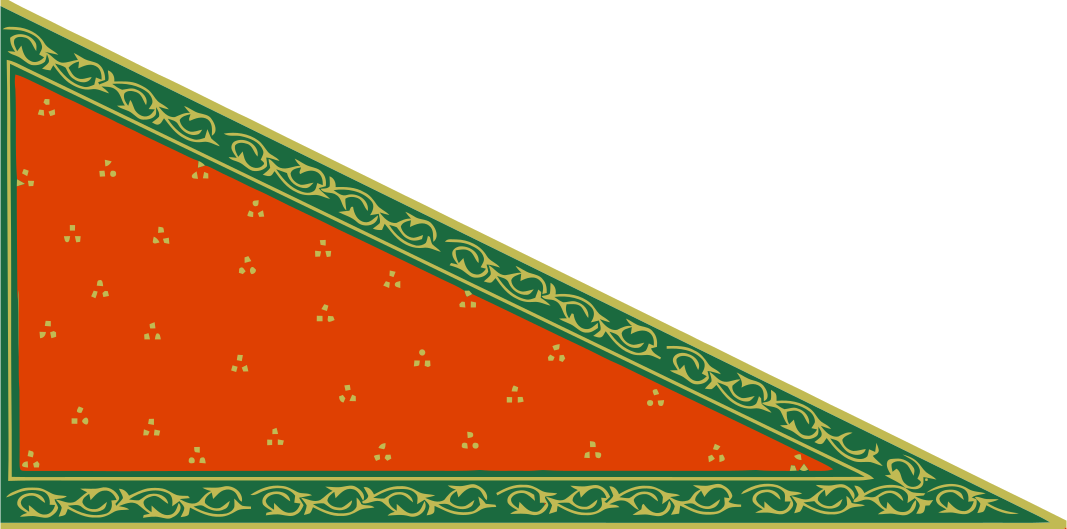




The Punjab Province, officially the Province of the Punjab, was a province of British Raj, with its capital in Lahore and summer capitals in Murree and Simla. At its greatest extent, it stretched from the Khyber Pass to Delhi; and from the Babusar Pass and the borders of Tibet to the borders of Sind. Established in 1849 following Punjab's annexation, the province was partitioned in 1947 into West and East Punjab; and incorporated into Pakistan and India, respectively.
Most of the Punjab region was annexed by the East India Company on 29 March 1849 following the company's victory against the Sikh Empire's army at the Battle of Gujrat in northern Punjab, a month prior. The Punjab was the last major region of the Indian subcontinent to fall to British imperialism.
Immediately following its annexation, the Punjab was annexed into the Bengal Presidency and administered separately by a board of administration led by the head of province.[1](p54) After 1853, the board was replaced by a chief commissioner as the Punjab was separated from the Bengal Presidency and established as a Chief Commissioner's Province.[1](p54) In 1858, the Punjab, along with the rest of British India, came under the rule of the British crown. Following the Indian Rebellion of 1857, the Punjab became a lieutenant-governor's province under the Bengal Presidency.[1](p54) After the Government of India Act 1919, Punjab was turned into a governor's province.[1](pp55) It had a land area of 358,355 square kilometers.
The province comprised four natural geographic regions – Indo-Gangetic Plain West, Himalayan, Sub-Himalayan, and the North-West Dry Area – along with five administrative divisions – Delhi, Jullundur, Lahore, Multan, and Rawalpindi – and a number of princely states.[2] In 1947, the Partition of India led to the province's division into East Punjab and West Punjab, in the newly independent dominions of the Indian Union and Pakistan respectively.
During the colonial-period, the appellation "province" was used somewhat indiscriminately but usually referred to lieutenant-governor provinces (which Punjab was after 1859) but also to chief-commissioner provinces (which Punjab was from 1853–1859).[1](pp54–55)
Etymology[edit | edit source]
The region was originally called the Sapta Sindhu Rivers,[3] the Vedic land of the seven rivers, originally: Saraswati, Indus, Sutlej, Jhelum, Chenab, Ravi, and Beas.[4] The Sanskrit name for the region, as mentioned in the Ramayana and Mahabharata, for example, was Pañcanada, which means literally "Five Waters", and was translated from Sanskrit to Farsi as Panj-Âb after the Islamic conquests.[5][6] The later name Punjab is thus a compound of two Farsi words[7][8] Panj (five) and āb (water) and was introduced to the region by the Turko-Persian conquerors[9] of India and more formally popularised during the Mughal Empire.[10][11] Punjab literally means "(The Land of) Five Waters" referring to the rivers: Jhelum, Chenab, Ravi, Sutlej, and Beas.[12] All are tributaries of the Indus River, the Chenab being the largest.
Geography[edit | edit source]
Geographically, the province was a triangular tract of country of which the Indus River and its tributary the Sutlej formed the two sides up to their confluence, the base of the triangle in the north being the Lower Himalayan Range between those two rivers. Moreover, the province as constituted under British rule also included a large tract outside these boundaries. Along the northern border, Himalayan ranges divided it from Kashmir and Tibet. On the west it was separated from the North-West Frontier Province by the Indus, until it reached the border of Dera Ghazi Khan District, which was divided from Baluchistan by the Sulaiman Range. To the south lay Sindh and Rajputana, while on the east the rivers Jumna and Tons separated it from the United Provinces.[2] In total Punjab had an area of approximately 357 000 km square about the same size as modern day Germany, being one of the largest provinces of the British Raj.
It encompassed the present day Indian states of Punjab, Haryana, Chandigarh, Delhi, and some parts of Himachal Pradesh which were merged with Punjab by the British for administrative purposes (but excluding the former princely states which were later combined into the Patiala and East Punjab States Union) and the Pakistani regions of the Punjab, Islamabad Capital Territory and Khyber Pakhtunkhwa.
In 1901 the frontier districts beyond the Indus were separated from Punjab and made into a new province: the North-West Frontier Province. Subsequently, Punjab was divided into four natural geographical divisions by colonial officials on the decadal census data:[13]:2[14]:4
- Indo-Gangetic Plain West geographical division (including Hisar district, Loharu State, Rohtak district, Dujana State, Gurgaon district, Pataudi State, Delhi, Karnal district, Jalandhar district, Kapurthala State, Ludhiana district, Malerkotla State, Firozpur district, Faridkot State, Patiala State, Jind State, Nabha State, Lahore District, Amritsar district, Gujranwala District, and Sheikhupura District);
- Himalayan geographical division (including Sirmoor State, Simla District, Simla Hill States, Bilaspur State, Kangra district, Mandi State, Suket State, and Chamba State);
- Sub-Himalayan geographical division (including Ambala district, Kalsia State, Hoshiarpur district, Gurdaspur District, Sialkot District, Gujrat District, Jhelum District, Rawalpindi District, and Attock District;
- North-West Dry Area geographical division (including Montgomery District, Shahpur District, Mianwali District, Lyallpur District, Jhang District, Multan District, Bahawalpur State, Muzaffargarh District, Dera Ghazi Khan District, and the Biloch Trans–Frontier Tract).
Administrative divisions[edit | edit source]
| Division | Districts |
|---|---|
| Cis-Sutlej Division | Ambala • Ludhiana • Firozpur • Thanesar • Shimla |
| Trans-Sutlej Division | Kangra • Hoshiarpur • Jalandhar |
| Lahore Division | Lahore • Amritsar • Sialkot • Gujranwala • Gurdaspur |
| Jhelum Division | Rawalpindi • Shahpur • Jhelum • Gujrat |
| Multan Division | Multan • Gogera • Jhang |
| Leia Division | Layyah • Khangarh • Dera Ismail Khan • Dera Ghazi Khan |
| Peshwar Division | Peshawar • Hazara • Kohat |
| Total British Territory | 81,625.24 square miles & 12,717,821 persons |
| Cis-Satluj Principlites | Patiala • Nabha • Faridkot • Jind • Malerkotla • Kalsia |
| Simla-Hill states | Hill states (south of Sutlej River) |
| Trans-Sutlej Principlites | Kapurthala • Hill states between Beas & Ravi River) |
| Bahawalpur | Bahawalpur |
| Kashmir & Jammu | Gulab singh Territories |
| Total Native States | 102,884.95 square miles & 6,750,606 persons |
| Total Punjab Province | 184,510.19 square miles & 19,468,627 persons |
| Division | Districts in British Territory / Princely States |
|---|---|
| Rawalpindi Division | |
| Lahore Division | |
| Multan Division | |
| Jullundur Division | |
| Delhi Division | |
| Total British Territory | 97,209 square miles |
| Native States | |
| Total Native States | 36,532 square miles |
| Total Punjab Province | 133,741 square miles |
Maps of administrative divisions[edit | edit source]
-
 Map of the divisions of British Punjab (with the namesake district of each division shaded darker and princely-states shaded black), 1947
 -
 Map of Punjab in 1947, with princely-state territory in purple & direct British-rule in pink.
 -
 1847–1851:- Punjab Province's Cis-Sutlej Division and Principlites
 -
 1853:- Map showing Punjab provinces and adjoining area
 -
 Districts of Punjab with Muslim (green) and non-Muslim (pink) majorities, as per 1941 census


.jpg)
.jpg)

History[edit | edit source]
Company rule[edit | edit source]


Delhi and the areas of Gurgaon, Hisar, and Karnal districts were conquered by the British in 1803.[16] On 30 December 1803, the Daulat Scindia signed the Treaty of Surji-Anjangaon with the British after the Battle of Assaye and Battle of Laswari and ceded to the British, Hisar, Panipat, Rohtak, Rewari, Gurgaon, Ganges-Jumna Doab, the Delhi-Agra region, parts of Bundelkhand, Broach, some districts of Gujarat and the fort of Ahmmadnagar.[17]:73 The area of Shimla district was obtained by the British in 1815.[16] After the conclusion of the First Anglo-Sikh War of 1845–46, the areas of the following districts were annexed by the British: Ambala, Firozpur, Hoshiyarpur, Jalandhar, Kangra, Ludhiana districts.[16][better source needed] After the Second Anglo-Sikh War of 1848–49, the areas of the following districts were annexed by the Britishers: Amritsar, Gurdaspur, Bannu, Dera Ghazi Khan, Dera Ismail Khan, Gujranwala, Gujrat, Hazara, Jhang, Jhelum, Kohat, Lahore, Montgomerty, Multan, Muzaffargarh, Peshawar, Rawalpindi, Shahpur, and Sialkot districts.[18][16]

On 21 February 1849, the East India Company decisively defeated the Sikh Empire at the Battle of Gujrat bringing to an end the Second Anglo-Sikh War. Following the victory, the East India Company announced the annexation of the conquered territory through a durbar proclamation on 30 March 1849 and annexed the Punjab on 2 April 1849[citation needed] and incorporated it within British India.[19](p556) The deposed child-monarch Duleep Singh was given a pension and forced to live outside Punjab.[19](p556)
For the task of organization of the conquered region, Henry Lawrence was the prime candidate to take up the task, yet Dalhousie did not agree with Lawrence's views fully.[19](p556) Thus, the compromise was the establishment of a three-member board of government/administration to administer the new territory.[19](p556)[1](p54) The province whilst nominally under the control of the Bengal Presidency was administratively independent.[citation needed] Lord Dalhousie constituted the Board of Administration by inducting into it the most experienced and seasoned British officers.[19](p556) The Board was led by Sir Henry Lawrence, who had previously worked as British Resident at the Lahore Durbar and also consisted of his younger brother John Lawrence and Charles Grenville Mansel.[20][19](p556) Below the Board, a group of acclaimed officers collectively known as Henry Lawrence's "Young Men" assisted in the administration of the newly acquired province.[citation needed] The Board was abolished by Lord Dalhousie in 1853;[citation needed] Sir Henry was assigned to the Rajputana Agency, and his brother John Lawrence succeeded as the first Chief Commissioner.[19](p557) Thus, Punjab became administered by a chief commissioner.[1](p54)
Recognising the cultural diversity of the Punjab, the Board maintained a strict policy of non-interference in regard to religious and cultural matters.[21] Sikh aristocrats were given patronage and pensions and groups in control of historical places of worship were allowed to remain in control.[21]
During the Indian Rebellion of 1857, the Punjab remained relatively peaceful, apart from rebellion led by Ahmad Khan Kharral.[22] In May, John Lawrence took swift action to disarm potentially mutinous sepoys and redeploy most European troops to the Delhi ridge.[23] Finally he recruited new regiments of Punjabis to replace the depleted force, and was provided with manpower and support from surrounding princely states such as Jind, Patiala, Nabha and Kapurthala and tribal chiefs on the borderlands with Afghanistan. By 1858, an estimated 70,000 extra men had been recruited for the army and militarised police from within the Punjab.[22]
British Raj[edit | edit source]
Following the Indian mutiny, Punjab became a lieutenant-governor's province, still under the Bengal Presidency.[1](p54) The governor-general of India, the highest seat of local authority, ruled the Bengal Presidency through its lieutenant-governors and chief-commissioners.[1](p54) Both the lieutenant-governors and chief-commissioners presided over commissioners of divisions, with those commissioners having authority over deputy-commissioners of districts.[1](p54)
In 1858, under the terms of the Queen's Proclamation issued by Queen Victoria, the Punjab, along with the rest of British India, came under the direct rule of the British Crown.[24] The East India Company was abolished, along with its court of directors, replacing that administrative set-up with the council of India.[1](p55) Delhi Territory was transferred from the North-Western Provinces to the Punjab in 1858, partly to punish the city for the important role the last Mughal emperor, Bahadur Shah II, and the city as a whole, played in the 1857 Rebellion.[25]
In 1859, Punjab became a lieutenant-governor's province.[1](pp54–55) Sir John Lawrence, then Chief Commissioner, was appointed the first Lieutenant-Governor on 1 January 1859. In 1866, the Judicial Commissioner was replaced by a Chief Court. The direct administrative functions of the Government were carried by the Lieutenant-Governor through the Secretariat, comprising a Chief Secretary, a Secretary and two Under-Secretaries. They were usually members of the Indian Civil Service.[26] The territory under the Lieutenant consisted of 29 Districts, grouped under 5 Divisions, and 43 Princely States. Each District was under a Deputy-Commissioner, who reported to the Commissioner of the Division. Each District was subdivided into between three and seven tehsils, each under a tahsildar, assisted by a naib (deputy) tahsildar.[27]
In 1885 the Punjab administration began an ambitious plan to transform over six million acres of barren waste land in central and western Punjab into irrigable agricultural land. The creation of canal colonies was designed to relieve demographic pressures in the central parts of the province, increase productivity and revenues, and create a loyal support amongst peasant landholders.[28] The colonisation resulted in an agricultural revolution in the province, rapid industrial growth, and the resettlement of over one million Punjabis in the new areas.[29] A number of towns were created or saw significant development in the colonies, such as Lyallpur, Sargodha and Montgomery. Colonisation led to the canal irrigated area of the Punjab increasing from three to fourteen million acres in the period from 1885 to 1947.[30]
The beginning of the twentieth century saw increasing unrest in the Punjab. Conditions in the Chenab colony, together with land reforms such as the Punjab Land Alienation Act, 1900 and the Colonisation Bill, 1906 contributed to the 1907 Punjab unrest. The unrest was unlike any previous agitation in the province as the government had for the first time aggrieved a large portion of the rural population.[31] Mass demonstrations were organised, headed by Lala Lajpat Rai, a leader of the Hindu revivalist sect Arya Samaj.[31] The unrest resulted in the repeal of the Colonisation Bill and the end of paternalist policies in the colonies.[31]
During the First World War, Punjabi manpower contributed heavily to the Indian Army. Out of a total of 683,149 combat troops, 349,688 hailed from the province.[32] In 1918, an influenza epidemic broke out in the province, resulting in the deaths of an estimated 962,937 people or 4.77 percent of the total estimated population.[33] In March 1919 the Rowlatt Act was passed extending emergency measures of detention and incarceration in response to the perceived threat of terrorism from revolutionary nationalist organisations.[34] This led to the infamous Jallianwala Bagh massacre in April 1919, where Colonel Reginald Edward Harry Dyer ordered detachments of the 9th Gorkha Rifles and the 59th Scinde Rifles under his command to fire into a group of some 10,000 unarmed protesters and Baisakhi pilgrims, killing 379.[35]
Administrative reforms[edit | edit source]
The Montagu–Chelmsford Reforms enacted through the Government of India Act 1919 expanded the Punjab Legislative Council and introduced the principle of dyarchy, whereby certain responsibilities such as agriculture, health, education, and local government, were transferred to elected ministers. The first Punjab Legislative Council under the 1919 Act was constituted in 1921, comprising 93 members, seventy per cent to be elected and rest to be nominated.[36] Some of the British Indian ministers under the dyarchy scheme were Sir Sheikh Abdul Qadir, Sir Shahab-ud-Din Virk and Lala Hari Kishen Lal.[37][38]
The Government of India Act 1935 introduced provincial autonomy to Punjab replacing the system of dyarchy. It provided for the constitution of Punjab Legislative Assembly of 175 members presided by a Speaker and an executive government responsible to the Assembly. The Unionist Party under Sir Sikandar Hayat Khan formed the government in 1937. Sir Sikandar was succeeded by Malik Khizar Hayat Tiwana in 1942 who remained the Premier till partition in 1947. Although the term of the Assembly was five years, the Assembly continued for about eight years and its last sitting was held on 19 March 1945.[39]
Partition[edit | edit source]
The struggle for Indian independence witnessed competing and conflicting interests in the Punjab. The landed elites of the Muslim, Hindu and Sikh communities had loyally collaborated with the British since annexation, supported the Unionist Party and were hostile to the Congress party led independence movement.[40] Amongst the peasantry and urban middle classes, the Hindus were the most active National Congress supporters, the Sikhs flocked to the Akali movement whilst the Muslims eventually supported the All-India Muslim League.[40]
Since the partition of the sub-continent had been decided, special meetings of the Western and Eastern Section of the Legislative Assembly were held on 23 June 1947 to decide whether or not the Province of the Punjab be partitioned. After voting on both sides, partition was decided and the existing Punjab Legislative Assembly was also divided into West Punjab Legislative Assembly and the East Punjab Legislative Assembly. This last Assembly before independence, held its last sitting on 4 July 1947.[41]
Population[edit | edit source]
| Year | Pop. | ±% |
|---|---|---|
| 1855 | 17,600,000 | — |
| 1868 | 19,700,000 | +11.9% |
| 1881 | 20,800,995 | +5.6% |
| 1891 | 22,915,894 | +10.2% |
| 1901 | 24,367,113 | +6.3% |
| 1911 | 23,791,841 | −2.4% |
| 1921 | 25,101,514 | +5.5% |
| 1931 | 28,490,869 | +13.5% |
| 1941 | 34,309,861 | +20.4% |
| Source: Census of India [14]:8[42]:6[43]:86 | ||
The first British census of the Punjab was carried out in 1855. This covered only British territory to the exclusion of local princely states, and placed the population at 17.6 million. The first regular census of British India carried out in 1881 recorded a population of 20.8 million people. The final British census in 1941 recorded 34.3 million people in the Punjab, which comprised 29 districts within British territory, 43 princely states, 52,047 villages and 283 towns.[43]
In 1881, only Amritsar and Lahore had populations over 100,000. The commercial and industrial city of Amritsar (152,000) was slightly larger than the cultural capital of Lahore (149,000). Over the following sixty years, Lahore increased in population fourfold, whilst Amritsar grew two-fold. By 1941, the province had seven cities with populations over 100,000 with emergence and growth of Rawalpindi, Multan, Sialkot, Jullundur and Ludhiana.[43]
The colonial period saw large scale migration within the Punjab due to the creation of canal colonies in western Punjab. The majority of colonists hailed from the seven most densely populated districts of Amritsar, Gurdaspur, Jullundur, Hoshiarpur, Ludhiana, Ambala and Sialkot, and consisted primarily of Khatris, Brahmins, Jats, Arains, Sainis, Kambohs and Rajputs. The movement of many highly skilled farmers from eastern and central Punjab to the new colonies, led to western Punjab becoming the most progressive and advanced agricultural region of the province.[43]
The period also saw significant numbers of Punjabis emigrate to other regions of the British Empire. The main destinations were East Africa - Kenya, Uganda and Tanzania, Southeast Asia - Malaya and Burma, Hong Kong and Canada.[43]
Religion[edit | edit source]
The Punjab was a religiously eclectic province, comprising three major groups: Muslims, Hindus and Sikhs. By 1941, the religious Muslims constituting an absolute majority at 53.2%, whilst the Hindu population was at 30.1%.[lower-alpha 4] The period between 1881 and 1941 saw a significant increase in the Sikh and Christian populations, growing from 8.2% and 0.1% to 14.9% and 1.9% respectively.[43] The decrease in the Hindu population has been attributed to the conversion of Hindus mainly to Sikhism and Islam, and also to Christianity.[43]
In 1941, the Hindus, Muslims and Sikhs made 30.1,[lower-alpha 4] 53.2 and 14.9 per cent of the total population of Punjab but made 37.9, 51.4 and 8.4 per cent of its urban population respectively.[43]
| Religious group |
1881[44][45][46][lower-alpha 5][lower-alpha 6] | 1891[47][48][49][lower-alpha 5][lower-alpha 6] | 1901[50]:34[lower-alpha 5] | 1911[51]:27[52]:27[lower-alpha 5] | 1921[53]:29 | 1931[54]:277 | 1941[14]:42 | |||||||
|---|---|---|---|---|---|---|---|---|---|---|---|---|---|---|
| Pop. | % | Pop. | % | Pop. | % | Pop. | % | Pop. | % | Pop. | % | Pop. | % | |
Islam 
|
9,872,745 | 47.58% | 10,827,628 | 47.39% | 12,183,345 | 49.22% | 12,275,477 | 50.75% | 12,813,383 | 51.05% | 14,929,896 | 52.4% | 18,259,744 | 53.22% |
Hinduism  [lower-alpha 4] [lower-alpha 4]
|
9,095,175 | 43.84% | 10,070,716 | 44.08% | 10,344,469 | 41.79% | 8,773,621 | 36.27% | 8,799,651 | 35.06% | 9,018,509 | 31.65% | 10,336,549 | 30.13% |
Sikhism 
|
1,706,165 | 8.22% | 1,849,371 | 8.09% | 2,102,896 | 8.49% | 2,883,729 | 11.92% | 3,107,296 | 12.38% | 4,071,624 | 14.29% | 5,116,185 | 14.91% |
Jainism 
|
42,572 | 0.21% | 45,575 | 0.2% | 49,983 | 0.2% | 46,775 | 0.19% | 41,321 | 0.16% | 43,140 | 0.15% | 45,475 | 0.13% |
Christianity 
|
28,054 | 0.14% | 48,472 | 0.21% | 66,591 | 0.27% | 199,751 | 0.83% | 332,939 | 1.33% | 419,353 | 1.47% | 512,466 | 1.49% |
Buddhism .svg)
|
3,251 | 0.02% | 6,236 | 0.03% | 6,940 | 0.03% | 7,690 | 0.03% | 5,912 | 0.02% | 7,753 | 0.03% | 854 | 0.002% |
Zoroastrianism 
|
413 | 0.002% | 364 | 0.002% | 477 | 0.002% | 653 | 0.003% | 526 | 0.002% | 569 | 0.002% | 4,359 | 0.01% |
Judaism 
|
N/A | N/A | 29 | 0.0001% | 24 | 0.0001% | 54 | 0.0002% | 19 | 0.0001% | 13 | 0% | 39 | 0.0001% |
| Others | 57 | 0.0003% | 28 | 0.0001% | 12 | 0% | 0 | 0% | 13 | 0.0001% | 0 | 0% | 34,190 | 0.1% |
| Total population | 20,748,432 | 100% | 22,848,419 | 100% | 24,754,737 | 100% | 24,187,750 | 100% | 25,101,060 | 100% | 28,490,857 | 100% | 34,309,861 | 100% |
| Territory comprises the contemporary subdivisions of Punjab, India, Chandigarh Union Territory, Haryana, Himachal Pradesh, National Capital Territory of Delhi (until 1911), Punjab, Pakistan, and Islamabad Capital Territory. | ||||||||||||||
| Religious group |
1881[44][45][46][55][lower-alpha 7] | 1891[47][48][49][56][lower-alpha 8] | 1901[50]:34[57]:62[lower-alpha 9] | 1911[51]:27[52]:27[lower-alpha 10] | 1921[53]:29[lower-alpha 11] | 1931[54]:277[lower-alpha 12] | 1941[14]:42[lower-alpha 13] | ||||||||
|---|---|---|---|---|---|---|---|---|---|---|---|---|---|---|---|
| Pop. | % | Pop. | % | Pop. | % | Pop. | % | Pop. | % | Pop. | % | Pop. | % | ||
| Islam
|
6,201,859 | 78.09% | 6,766,545 | 76.07% | 7,951,155 | 76.25% | 8,494,314 | 76.49% | 8,975,288 | 75.49% | 10,570,029 | 75.28% | 13,022,160 | 75.06% | |
| Hinduism [lower-alpha 4]
|
1,449,913 | 18.26% | 1,727,810 | 19.42% | 1,944,363 | 18.65% | 1,645,758 | 14.82% | 1,797,141 | 15.12% | 1,957,878 | 13.94% | 2,373,466 | 13.68% | |
| Sikhism
|
272,908 | 3.44% | 366,162 | 4.12% | 483,999 | 4.64% | 813,441 | 7.33% | 863,091 | 7.26% | 1,180,789 | 8.41% | 1,530,112 | 8.82% | |
| Christianity
|
12,992 | 0.16% | 30,168 | 0.34% | 42,371 | 0.41% | 144,514 | 1.3% | 247,030 | 2.08% | 324,730 | 2.31% | 395,311 | 2.28% | |
| Jainism
|
4,352 | 0.05% | 4,408 | 0.05% | 5,562 | 0.05% | 5,977 | 0.05% | 5,930 | 0.05% | 6,921 | 0.05% | 9,520 | 0.05% | |
| Zoroastrianism
|
354 | 0.004% | 215 | 0.002% | 300 | 0.003% | 377 | 0.003% | 309 | 0.003% | 413 | 0.003% | 312 | 0.002% | |
| Buddhism
|
0 | 0% | 0 | 0% | 6 | 0.0001% | 168 | 0.002% | 172 | 0.001% | 32 | 0.0002% | 87 | 0.001% | |
| Judaism
|
N/A | N/A | 17 | 0.0002% | 9 | 0.0001% | 36 | 0.0003% | 16 | 0.0001% | 6 | 0% | 7 | 0% | |
| Others | 21 | 0.0003% | 17 | 0.0002% | 0 | 0% | 0 | 0% | 8 | 0.0001% | 0 | 0% | 19,128 | 0.11% | |
| Total Population | 7,942,399 | 100% | 8,895,342 | 100% | 10,427,765 | 100% | 11,104,585 | 100% | 11,888,985 | 100% | 14,040,798 | 100% | 17,350,103 | 100% | |
| Territory comprises the contemporary subdivisions of Punjab, Pakistan and Islamabad Capital Territory. Note: 186 villages and 2 towns — Khemkaran and Patti — in Kasur Tehsil (Lahore District) fell on the eastern side of the Radcliffe Line, but their population numbers are still included here as detailed sub-tehsil religious data did not exist at the time. According to the 1941 census, Kasur Tehsil had a total of 322 villages and 3 towns, roughly half fell on the western side of the Radcliffe Line.[58] | |||||||||||||||
| Religious group |
1881[44][45][46][55][lower-alpha 14][lower-alpha 5] | 1891[47][48][49][56][lower-alpha 15][lower-alpha 5] | 1901[50]:34[57]:62[lower-alpha 16][lower-alpha 5] | 1911[51]:27[52]:27[lower-alpha 17][lower-alpha 5] | 1921[53]:29[lower-alpha 18] | 1931[54]:277[lower-alpha 19] | 1941[14]:42[lower-alpha 20] | ||||||||
|---|---|---|---|---|---|---|---|---|---|---|---|---|---|---|---|
| Pop. | % | Pop. | % | Pop. | % | Pop. | % | Pop. | % | Pop. | % | Pop. | % | ||
| Hinduism [lower-alpha 4]
|
7,645,262 | 59.7% | 8,342,906 | 59.79% | 8,400,106 | 58.63% | 7,127,863 | 54.48% | 7,002,510 | 53% | 7,060,631 | 48.86% | 7,963,083 | 46.95% | |
| Islam
|
3,670,886 | 28.67% | 4,061,083 | 29.11% | 4,232,190 | 29.54% | 3,781,163 | 28.9% | 3,838,095 | 29.05% | 4,359,867 | 30.17% | 5,237,584 | 30.88% | |
| Sikhism
|
1,433,257 | 11.19% | 1,483,209 | 10.63% | 1,618,897 | 11.3% | 2,070,288 | 15.82% | 2,244,205 | 16.99% | 2,890,835 | 20.01% | 3,586,073 | 21.14% | |
| Jainism
|
38,220 | 0.3% | 41,167 | 0.3% | 44,421 | 0.31% | 40,798 | 0.31% | 35,391 | 0.27% | 36,219 | 0.25% | 35,955 | 0.21% | |
| Christianity
|
15,062 | 0.12% | 18,304 | 0.13% | 24,220 | 0.17% | 55,237 | 0.42% | 85,909 | 0.65% | 94,623 | 0.65% | 117,155 | 0.69% | |
| Buddhism
|
3,251 | 0.03% | 6,236 | 0.04% | 6,934 | 0.05% | 7,522 | 0.06% | 5,740 | 0.04% | 7,721 | 0.05% | 767 | 0.005% | |
| Zoroastrianism
|
59 | 0.0005% | 149 | 0.001% | 177 | 0.001% | 276 | 0.002% | 217 | 0.002% | 156 | 0.001% | 4,047 | 0.02% | |
| Judaism
|
N/A | N/A | 12 | 0.0001% | 15 | 0.0001% | 18 | 0.0001% | 3 | 0% | 7 | 0% | 32 | 0.0002% | |
| Others | 36 | 0.0003% | 11 | 0.0001% | 12 | 0.0001% | 0 | 0% | 5 | 0% | 0 | 0% | 15,062 | 0.09% | |
| Total Population | 12,806,033 | 100% | 13,953,077 | 100% | 14,326,972 | 100% | 13,083,165 | 100% | 13,212,075 | 100% | 14,450,059 | 100% | 16,959,758 | 100% | |
| Territory comprises the contemporary subdivisions of Punjab, India, Chandigarh, Haryana, Himachal Pradesh, and National Capital Territory of Delhi (until 1911). Note: 186 villages and 2 towns — Khemkaran and Patti — in Kasur Tehsil (Lahore District) fell on the eastern side of the Radcliffe Line, but their population numbers are not included here as detailed sub-tehsil religious data did not exist at the time. According to the 1941 census, Kasur Tehsil had a total of 322 villages and 3 towns, roughly half fell on the western side of the Radcliffe Line.[58] | |||||||||||||||
Subdivisions[edit | edit source]
| District/ Princely state |
Islam
|
Hinduism [lower-alpha 4]
|
Sikhism
|
Christianity
|
Jainism
|
Others[lower-alpha 21] | Total | |||||||
|---|---|---|---|---|---|---|---|---|---|---|---|---|---|---|
| Pop. | % | Pop. | % | Pop. | % | Pop. | % | Pop. | % | Pop. | % | Pop. | % | |
| Patiala State | 436,539 | 22.55% | 597,488 | 30.86% | 896,021 | 46.28% | 1,592 | 0.08% | 3,101 | 0.16% | 1,518 | 0.08% | 1,936,259 | 100% |
| Lahore District | 1,027,772 | 60.62% | 284,689 | 16.79% | 310,646 | 18.32% | 70,147 | 4.14% | 1,951 | 0.12% | 170 | 0.01% | 1,695,375 | 100% |
| Multan District | 1,157,911 | 78.01% | 249,872 | 16.83% | 61,628 | 4.15% | 14,290 | 0.96% | 552 | 0.04% | 80 | 0.01% | 1,484,333 | 100% |
| Firozpur district | 641,448 | 45.07% | 287,733 | 20.22% | 479,486 | 33.69% | 12,607 | 0.89% | 1,674 | 0.12% | 128 | 0.01% | 1,423,076 | 100% |
| Amritsar district | 657,695 | 46.52% | 217,431 | 15.38% | 510,845 | 36.13% | 25,973 | 1.84% | 1,911 | 0.14% | 21 | 0% | 1,413,876 | 100% |
| Lyallpur District | 877,518 | 62.85% | 204,059 | 14.61% | 262,737 | 18.82% | 51,948 | 3.72% | 35 | 0% | 8 | 0% | 1,396,305 | 100% |
| Bahawalpur State | 1,098,814 | 81.93% | 174,408 | 13% | 46,945 | 3.5% | 3,048 | 0.23% | 351 | 0.03% | 17,643 | 1.32% | 1,341,209 | 100% |
| Montgomery District | 918,564 | 69.11% | 210,966 | 15.87% | 175,064 | 13.17% | 24,432 | 1.84% | 49 | 0% | 28 | 0% | 1,329,103 | 100% |
| Sialkot District | 739,218 | 62.09% | 231,319 | 19.43% | 139,409 | 11.71% | 75,831 | 6.37% | 3,250 | 0.27% | 1,470 | 0.12% | 1,190,497 | 100% |
| Hoshiarpur district | 380,759 | 32.53% | 584,080 | 49.91% | 198,194 | 16.93% | 6,165 | 0.53% | 1,125 | 0.1% | 0 | 0% | 1,170,323 | 100% |
| Jalandhar district | 509,804 | 45.23% | 311,010 | 27.59% | 298,741 | 26.5% | 6,233 | 0.55% | 1,395 | 0.12% | 7 | 0% | 1,127,190 | 100% |
| Gujrat District | 945,609 | 85.58% | 84,643 | 7.66% | 70,233 | 6.36% | 4,449 | 0.4% | 10 | 0% | 8 | 0% | 1,104,952 | 100% |
| Hill States[lower-alpha 22] | 37,214 | 3.39% | 1,053,637 | 95.92% | 6,404 | 0.58% | 407 | 0.04% | 210 | 0.02% | 603 | 0.05% | 1,098,475 | 100% |
| Hisar district | 285,208 | 28.33% | 652,842 | 64.85% | 60,731 | 6.03% | 1,292 | 0.13% | 6,126 | 0.61% | 510 | 0.05% | 1,006,709 | 100% |
| Shahpur District | 835,918 | 83.68% | 102,172 | 10.23% | 48,046 | 4.81% | 12,770 | 1.28% | 13 | 0% | 2 | 0% | 998,921 | 100% |
| Karnal district | 304,346 | 30.6% | 666,301 | 66.99% | 19,887 | 2% | 1,249 | 0.13% | 2,789 | 0.28% | 3 | 0% | 994,575 | 100% |
| Rohtak district | 166,569 | 17.42% | 780,474 | 81.61% | 1,466 | 0.15% | 1,043 | 0.11% | 6,847 | 0.72% | 0 | 0% | 956,399 | 100% |
| Gujranwala District | 642,706 | 70.45% | 108,115 | 11.85% | 99,139 | 10.87% | 60,829 | 6.67% | 1,445 | 0.16% | 0 | 0% | 912,234 | 100% |
| Kangra district | 43,249 | 4.81% | 846,531 | 94.12% | 4,809 | 0.53% | 788 | 0.09% | 101 | 0.01% | 3,899 | 0.43% | 899,377 | 100% |
| Gurdaspur district[lower-alpha 23] | 440,323 | 51.08% | 174,221 | 20.21% | 200,688 | 23.28% | 46,743 | 5.42% | 25 | 0% | 6 | 0% | 862,006 | 100% |
| Sheikhupura District | 542,344 | 63.62% | 89,182 | 10.46% | 160,706 | 18.85% | 60,054 | 7.04% | 221 | 0.03% | 1 | 0% | 852,508 | 100% |
| Gurgaon district | 285,992 | 33.59% | 560,537 | 65.83% | 637 | 0.07% | 1,673 | 0.2% | 2,613 | 0.31% | 6 | 0% | 851,458 | 100% |
| Ambala district | 268,999 | 31.73% | 412,658 | 48.68% | 156,543 | 18.47% | 6,065 | 0.72% | 3,065 | 0.36% | 415 | 0.05% | 847,745 | 100% |
| Jhang District | 678,736 | 82.61% | 129,889 | 15.81% | 12,238 | 1.49% | 763 | 0.09% | 5 | 0% | 0 | 0% | 821,631 | 100% |
| Ludhiana district | 302,482 | 36.95% | 171,715 | 20.98% | 341,175 | 41.68% | 1,913 | 0.23% | 1,279 | 0.16% | 51 | 0.01% | 818,615 | 100% |
| Rawalpindi District | 628,193 | 80% | 82,478 | 10.5% | 64,127 | 8.17% | 9,014 | 1.15% | 1,337 | 0.17% | 82 | 0.01% | 785,231 | 100% |
| Muzaffargarh District | 616,074 | 86.42% | 90,643 | 12.72% | 5,882 | 0.83% | 227 | 0.03% | 0 | 0% | 23 | 0% | 712,849 | 100% |
| Attock District | 611,128 | 90.42% | 43,209 | 6.39% | 20,120 | 2.98% | 1,392 | 0.21% | 13 | 0% | 13 | 0% | 675,875 | 100% |
| Jhelum District | 563,033 | 89.42% | 40,888 | 6.49% | 24,680 | 3.92% | 893 | 0.14% | 159 | 0.03% | 5 | 0% | 629,658 | 100% |
| Dera Ghazi Khan District | 512,678 | 88.19% | 67,407 | 11.59% | 1,072 | 0.18% | 87 | 0.01% | 106 | 0.02% | 0 | 0% | 581,350 | 100% |
| Mianwali District | 436,260 | 86.16% | 62,814 | 12.41% | 6,865 | 1.36% | 358 | 0.07% | 23 | 0% | 1 | 0% | 506,321 | 100% |
| Kapurthala State | 213,754 | 56.49% | 61,546 | 16.27% | 88,350 | 23.35% | 1,667 | 0.44% | 380 | 0.1% | 12,683 | 3.35% | 378,380 | 100% |
| Jind State | 50,972 | 14.09% | 268,355 | 74.17% | 40,981 | 11.33% | 161 | 0.04% | 1,294 | 0.36% | 49 | 0.01% | 361,812 | 100% |
| Nabha State | 70,373 | 20.45% | 146,518 | 42.59% | 122,451 | 35.59% | 221 | 0.06% | 480 | 0.14% | 1 | 0% | 344,044 | 100% |
| Shakargarh Tehsil[lower-alpha 24] | 149,600 | 51.32% | 116,553 | 39.98% | 20,573 | 7.06% | 4,779 | 1.64% | 0 | 0% | 0 | 0% | 291,505 | 100% |
| Faridkot State | 61,352 | 30.79% | 21,814 | 10.95% | 115,070 | 57.74% | 247 | 0.12% | 800 | 0.4% | 0 | 0% | 199,283 | 100% |
| Malerkotla State | 33,881 | 38.45% | 23,482 | 26.65% | 30,320 | 34.41% | 116 | 0.13% | 310 | 0.35% | 0 | 0% | 88,109 | 100% |
| Kalsia State | 25,049 | 37.17% | 29,866 | 44.32% | 12,235 | 18.15% | 55 | 0.08% | 188 | 0.28% | 0 | 0% | 67,393 | 100% |
| Biloch Trans–Frontier Tract | 40,084 | 99.6% | 160 | 0.4% | 2 | 0% | 0 | 0% | 0 | 0% | 0 | 0% | 40,246 | 100% |
| Simla District | 7,022 | 18.2% | 29,466 | 76.38% | 1,032 | 2.68% | 934 | 2.42% | 114 | 0.3% | 8 | 0.02% | 38,576 | 100% |
| Dujana State | 6,939 | 22.63% | 23,727 | 77.37% | 0 | 0% | 0 | 0% | 0 | 0% | 0 | 0% | 30,666 | 100% |
| Loharu State | 3,960 | 14.2% | 23,923 | 85.77% | 7 | 0.03% | 2 | 0.01% | 0 | 0% | 0 | 0% | 27,892 | 100% |
| Pataudi State | 3,655 | 16.98% | 17,728 | 82.38% | 0 | 0% | 9 | 0.04% | 128 | 0.59% | 0 | 0% | 21,520 | 100% |
| Total | 18,259,744 | 53.22% | 10,336,549 | 30.13% | 5,116,185 | 14.91% | 512,466 | 1.49% | 45,475 | 0.13% | 39,442 | 0.11% | 34,309,861 | 100% |
| Territory comprises the contemporary subdivisions of Punjab, India, Chandigarh Union Territory, Haryana, Himachal Pradesh, Punjab, Pakistan, and Islamabad Capital Territory. | ||||||||||||||
Language[edit | edit source]
As with religion, Punjab was a linguistically eclectically diverse province and region. In 1837, Persian had been abolished as the official language of Company administration and replaced by local Indian vernacular languages. In the Sikh Empire, Persian continued to be the official state language.[59] Shortly after annexing the Punjab in 1849, the Board of Administration canvassed local officials in each of the provinces's six divisions to decide which language was "best suited for the Courts and Public Business".[60] Officials in the western divisions recommended Persian whilst eastern officials suggested a shift to Urdu.[60] In September 1849 a two-language policy was instituted throughout the province. The language policy in the Punjab differed from other Indian provinces in that Urdu was not a widespread local vernacular. In 1849 John Lawrence noted "that Urdu is not the language of these districts and neither is Persian".[60]
In 1854, the Board of Administration abruptly ended the two-language policy and Urdu was designated as the official language of government across the province. The decision was motivated by new civil service rules requiring all officials pass a test in the official language of their local court. In fear of potentially losing their jobs, officials in Persian districts petitioned the board to replace Persian with Urdu, believing Urdu the easier language to master.[61] Urdu remained the official administrative language until 1947.
Officials, although aware that Punjabi was the colloquial language of the majority, instead favoured the use of Urdu for a number of reasons. Criticism of Punjabi included the belief that it was simply a form of patois, lacking any form of standardisation, and that "would be inflexible and barren, and incapable of expressing nice shades of meaning and exact logical ideas with the precision so essential in local proceedings."[61] Similar arguments had earlier been made about Bengali, Oriya and Hindustani; however, those languages were later adopted for local administration. Instead it is believed the advantages of Urdu served the administration greater. Urdu, and initially Persian, allowed the Company to recruit experienced administrators from elsewhere in India who did not speak Punjabi, to facilitate greater integration with other Indian territories which were administered with Urdu, and to help foster ties with local elites who spoke Persian and Urdu and could act as intermediaries with the wider populace.[61]
| Mother tongue | 1881[44][45]:168[46]:122[lower-alpha 5][lower-alpha 6] | 1931[54]:266 | ||||||||||||
|---|---|---|---|---|---|---|---|---|---|---|---|---|---|---|
| Pop. | % | Pop. | % | |||||||||||
| Punjabi | 14,895,747[lower-alpha 25] | 71.79% | 21,893,702[lower-alpha 26] | 76.84% | ||||||||||
| Hindustani | 4,193,440 | 20.21% | 3,988,023 | 14% | ||||||||||
| Pahari | 1,378,512 | 6.64% | 1,699,152 | 5.96% | ||||||||||
| Rajasthani | 116,721 | 0.56% | 618,396 | 2.17% | ||||||||||
| Kashmiri | 45,797 | 0.22% | 21,822 | 0.08% | ||||||||||
| Pashto | 32,974 | 0.16% | 92,554 | 0.32% | ||||||||||
| Tibetic | 27,474 | 0.13% | 62,703 | 0.22% | ||||||||||
| Balochi | 23,238 | 0.11% | 60,985 | 0.21% | ||||||||||
| English | 23,026 | 0.11% | 26,204 | 0.09% | ||||||||||
| Sindhi | 4,924 | 0.02% | 11,581 | 0.04% | ||||||||||
| Bengali | 2,681 | 0.01% | 2,667 | 0.01% | ||||||||||
| Persian | 2,117 | 0.01% | 4,000 | 0.01% | ||||||||||
| Gujarati & Marathi | 621 | 0% | 3,494 | 0.01% | ||||||||||
| Dravidian | 245 | 0% | 976 | 0% | ||||||||||
| Arabic & Turkish | 234 | 0% | 675 | 0% | ||||||||||
| Others | 681 | 0% | 3,923 | 0.01% | ||||||||||
| Total population | 20,748,432 | 100% | 28,490,857 | 100% | ||||||||||
| Territory comprises the contemporary subdivisions of Punjab, India, Chandigarh Union Territory, Haryana, Himachal Pradesh, National Capital Territory of Delhi (until 1911), Punjab, Pakistan, and Islamabad Capital Territory. | ||||||||||||||
1931 census[edit | edit source]
According to the 1931 Census of British Punjab Province, Punjabi was the most widely spoken language, with 50.94% of the population reporting it, and 50.49% declaring it as their mother tongue (MT). Lahnda followed with 25.90% total speakers (25.66% MT), and Hindustani accounted for 14.00% (13.75% MT). Other languages included Western Pahari (5.93%), Rajasthani (2.15%), Pashto (0.32%), Balochi (0.21%), and Kashmiri (0.08%). Additionally, 0.47% of the population spoke languages categorized as 'Others'. The table below presents the full linguistic distribution, including both total speakers and those who reported each language as their mother tongue.
| District or State | Punjabi | Lahnda | Hindustani | Western Pahadi | Rajasthani | Others[lower-alpha 27] | ||||||
|---|---|---|---|---|---|---|---|---|---|---|---|---|
| Total | MT only | Total | MT only | Total | MT only | Total | MT only | Total | MT only | Total | MT only | |
| Punjab | 50.94% | 50.49% | 25.90% | 25.66% | 14.00% | 13.75% | 5.93% | 5.90% | 2.15% | 2.10% | 1.08% | 2.10% |
| Indo-Gangetic Plain West | 66.97% | 66.16% | 2.00% | 2.00% | 25.91% | 25.50% | 0.31% | 0.30% | 4.43% | 4.35% | 0.38% | 1.69% |
| Hissar | 24.43% | 24.36% | 0.00% | 0.00% | 54.01% | 53.98% | 0.00% | 0.00% | 21.54% | 21.17% | 0.02% | 0.49% |
| Loharu State | 0.07% | 0.02% | 0.00% | 0.00% | 99.92% | 99.92% | 0.00% | 0.00% | 0.00% | 0.00% | 0.01% | 0.06% |
| Rohtak | 0.07% | 0.03% | 0.00% | 0.00% | 99.91% | 99.91% | 0.00% | 0.00% | 0.00% | 0.00% | 0.02% | 0.06% |
| Dujana State | 0.05% | 0.05% | 0.00% | 0.00% | 99.93% | 99.93% | 0.00% | 0.00% | 0.00% | 0.00% | 0.02% | 0.02% |
| Gurgaon | 0.12% | 0.03% | 0.00% | 0.00% | 78.25% | 78.25% | 0.00% | 0.00% | 21.39% | 21.58% | 0.24% | 0.14% |
| Pataudi State | 0.01% | 0.01% | 0.00% | 0.00% | 99.98% | 99.98% | 0.00% | 0.00% | 0.00% | 0.00% | 0.01% | 0.01% |
| Karnal | 1.95% | 1.79% | 0.00% | 0.00% | 98.03% | 98.01% | 0.00% | 0.00% | 0.00% | 0.00% | 0.04% | 0.20% |
| Jullundur | 99.55% | 99.45% | 0.00% | 0.00% | 0.27% | 0.18% | 0.00% | 0.00% | 0.00% | 0.00% | 0.18% | 0.37% |
| Kapurthala State | 99.84% | 99.71% | 0.00% | 0.00% | 0.14% | 0.13% | 0.00% | 0.00% | 0.00% | 0.00% | 0.02% | 0.16% |
| Ludhiana | 97.80% | 96.32% | 0.00% | 0.00% | 1.82% | 1.54% | 0.01% | 0.01% | 0.02% | 0.02% | 0.35% | 2.11% |
| Maler Kotla State | 99.67% | 99.63% | 0.00% | 0.00% | 0.32% | 0.19% | 0.00% | 0.00% | 0.00% | 0.00% | 0.01% | 0.18% |
| Ferozepore | 90.29% | 90.19% | 0.00% | 0.00% | 4.04% | 3.80% | 0.00% | 0.00% | 5.28% | 5.12% | 0.39% | 0.89% |
| Faridkot State | 94.95% | 94.68% | 0.00% | 0.00% | 2.90% | 1.33% | 0.00% | 0.00% | 0.35% | 0.14% | 1.80% | 3.85% |
| Patiala State | 85.29% | 84.57% | 0.00% | 0.00% | 2.94% | 2.61% | 2.36% | 2.33% | 9.39% | 9.19% | 0.02% | 1.30% |
| Jind State | 20.54% | 20.47% | 0.00% | 0.00% | 79.35% | 79.12% | 0.01% | 0.01% | 0.07% | 0.07% | 0.03% | 0.33% |
| Nabha State | 70.89% | 70.89% | 0.00% | 0.00% | 29.03% | 28.54% | 0.00% | 0.00% | 0.07% | 0.07% | 0.01% | 0.50% |
| Lahore | 92.02% | 86.72% | 0.03% | 0.01% | 6.13% | 3.93% | 0.05% | 0.02% | 0.06% | 0.04% | 1.71% | 9.28% |
| Amritsar | 98.07% | 97.91% | 0.00% | 0.00% | 1.01% | 0.51% | 0.03% | 0.00% | 0.08% | 0.03% | 0.81% | 1.55% |
| Gujranwala | 78.23% | 78.16% | 21.23% | 21.23% | 0.27% | 0.16% | 0.02% | 0.00% | 0.01% | 0.01% | 0.24% | 0.44% |
| Sheikhupura | 84.51% | 84.43% | 14.43% | 14.43% | 0.77% | 0.55% | 0.00% | 0.00% | 0.03% | 0.01% | 0.26% | 0.58% |
| Himalayan | 4.52% | 4.27% | 0.00% | 0.00% | 1.75% | 1.69% | 89.64% | 89.23% | 0.02% | 0.02% | 4.07% | 4.79% |
| Sirmoor State | 7.90% | 7.86% | 0.00% | 0.00% | 16.24% | 16.20% | 75.39% | 75.34% | 0.10% | 0.10% | 0.37% | 0.50% |
| Simla | 14.45% | 10.25% | 0.00% | 0.00% | 14.74% | 12.46% | 61.42% | 52.10% | 0.11% | 0.05% | 9.28%[lower-alpha 28] | 25.04%[lower-alpha 29] |
| Simla Hill states | 10.72% | 10.53% | 0.00% | 0.00% | 0.28% | 0.26% | 79.83% | 78.97% | 0.01% | 0.00% | 9.16% | 10.24% |
| Bilaspur state | 10.69% | 10.68% | 0.00% | 0.00% | 0.02% | 0.02% | 89.28% | 89.28% | 0.00% | 0.00% | 0.01% | 0.02% |
| Kangra | 1.64% | 1.51% | 0.00% | 0.00% | 0.16% | 0.15% | 94.05% | 94.00% | 0.02% | 0.02% | 4.13% | 4.32% |
| Mandi State | 1.66% | 1.53% | 0.00% | 0.00% | 0.09% | 0.08% | 96.79% | 96.75% | 0.01% | 0.01% | 1.45% | 1.63% |
| Suket State | 1.33% | 1.27% | 0.00% | 0.00% | 0.02% | 0.01% | 98.44% | 98.43% | 0.00% | 0.00% | 0.21% | 0.29% |
| Chamba State | 1.47% | 0.73% | 0.00% | 0.00% | 0.03% | 0.03% | 95.77% | 95.39% | 0.00% | 0.00% | 2.73% | 3.85% |
| Sub-Himalayan | 61.37% | 61.07% | 29.26% | 29.20% | 8.53% | 8.41% | 0.07% | 0.04% | 0.02% | 0.01% | 0.75% | 1.27% |
| Ambala | 35.61% | 35.20% | 0.00% | 0.00% | 63.45% | 63.26% | 0.17% | 0.11% | 0.15% | 0.10% | 0.62% | 1.33% |
| Kalsia State | 17.63% | 17.58% | 0.00% | 0.00% | 82.21% | 82.18% | 0.00% | 0.00% | 0.04% | 0.04% | 0.12% | 0.20% |
| Hoshiarpur | 99.79% | 99.79% | 0.00% | 0.00% | 0.16% | 0.11% | 0.01% | 0.01% | 0.01% | 0.00% | 0.03% | 0.09% |
| Gurdaspur | 98.94% | 98.91% | 0.00% | 0.00% | 0.34% | 0.20% | 0.27% | 0.11% | 0.00% | 0.00% | 0.45% | 0.78% |
| Sialkot | 99.46% | 99.45% | 0.00% | 0.00% | 0.19% | 0.15% | 0.00% | 0.00% | 0.01% | 0.01% | 0.34% | 0.39% |
| Gujrat | 68.36% | 67.72% | 30.68% | 30.68% | 0.74% | 0.46% | 0.01% | 0.00% | 0.00% | 0.00% | 0.21% | 1.14% |
| Jhelum | 10.86% | 9.63% | 88.05% | 88.05% | 0.27% | 0.17% | 0.00% | 0.00% | 0.00% | 0.00% | 0.82% | 2.15% |
| Rawalpindi | 4.36% | 4.06% | 91.87% | 91.83% | 2.26% | 2.13% | 0.07% | 0.06% | 0.00% | 0.00% | 1.44% | 1.92% |
| Attock | 2.02% | 1.81% | 93.71% | 93.17% | 0.28% | 0.23% | 0.00% | 0.00% | 0.00% | 0.00% | 3.99%[lower-alpha 30] | 4.79%[lower-alpha 31] |
| North-West Dry Area | 25.18% | 25.13% | 71.42% | 70.57% | 0.95% | 0.84% | 0.07% | 0.07% | 0.56% | 0.50% | 1.82% | 2.89% |
| Montgomery | 42.97% | 42.89% | 53.55% | 53.51% | 1.73% | 1.56% | 0.45% | 0.44% | 0.62% | 0.59% | 0.68% | 1.01% |
| Shahpur | 28.13% | 28.03% | 70.00% | 69.99% | 1.13% | 0.93% | 0.01% | 0.01% | 0.00% | 0.00% | 0.73% | 1.04% |
| Mianwali | 1.78% | 1.62% | 91.36% | 90.96% | 0.11% | 0.08% | 0.00% | 0.00% | 0.01% | 0.00% | 6.74%[lower-alpha 32] | 7.34%[lower-alpha 33] |
| Lyallpur | 80.76% | 80.73% | 17.96% | 17.95% | 0.90% | 0.69% | 0.06% | 0.00% | 0.15% | 0.09% | 0.23% | 0.54% |
| Jhang | 4.90% | 4.89% | 94.85% | 94.85% | 0.08% | 0.07% | 0.03% | 0.03% | 0.00% | 0.00% | 0.14% | 0.16% |
| Multan | 11.23% | 11.24% | 86.25% | 86.21% | 1.09% | 1.05% | 0.00% | 0.00% | 0.17% | 0.13% | 1.26% | 1.37% |
| Bahawalpur State | 7.53% | 7.46% | 86.32% | 86.12% | 1.77% | 1.62% | 0.00% | 0.00% | 3.12% | 2.79% | 1.26% | 1.86% |
| Muzaffargarh | 0.64% | 0.62% | 98.84% | 98.72% | 0.22% | 0.21% | 0.01% | 0.01% | 0.07% | 0.07% | 0.22% | 0.37% |
| Dera Ghazi Khan | 0.48% | 0.48% | 87.75% | 76.54% | 0.02% | 0.01% | 0.00% | 0.00% | 0.03% | 0.02% | 11.72%[lower-alpha 34] | 22.95%[lower-alpha 35] |
| Note: All district boundaries have seen many changes after 1947, so their boundaries are not the same as today. | ||||||||||||
Summary of the table above 1931 language census of Punjab: In pre-partition Punjab, the linguistic landscape was divided into major zones based on dominant languages and influence: Punjabi-Dominant Regions: These districts were overwhelmingly Punjabi-speaking — Hoshiarpur, Kapurthala State, Malerkotla, Jullundur, Sialkot, Gurdaspur, Amritsar, Ludhiana, Faridkot State, Ferozepore, Lahore, Patiala, and Nabha State. Punjabi with Lahnda Influence: Districts where Punjabi was dominant but there was also significant Lahnda influence included Shekhupura, Lyallpur, Gujranwala, and Gujrat.Lahnda with Punjabi Influence: Regions like Jhelum, Multan, Shahpur, and Montgomery were Lahnda-dominant but retained a strong influence of Punjabi.Lahnda-Dominant Regions: These districts were primarily Lahnda-speaking — Muzaffargarh, Jhang, Attock, Rawalpindi, Mianwali, Jhelum, Dera Ghazi Khan, Bahawalpur State, and Multan. And Mianwali, and Attock showed a small influence of Pashto while Dera Ghazi Khan had influence of Balochi, especially in their western parts.Hill Regions: The hill districts namely Kangra, Simla, and Simla Hill states & other hill States with few part of Patiala State(2.33%) specially its kandaghat tahsil were dominated by Western Pahari speakers. while some part of Simla Hill states(10.72%) also have influence of Punjabi. Hindustani and Rajasthani Zones: In Ambala Division, districts such as Delhi, Karnal, Rohtak, and Gurgaon were primarily Hindustani- and Rajasthani-speaking. However, Ambala (35.6%) and Hissar (24.4%) had significant Punjabi-speaking populations with Hindustani and Rajasthani Majority. Additionally, the majority of Jind State and parts of Patiala and Nabha State that geographically surrounded the Ambala Division were linguistic enclaves of Hindustani and Rajasthani. A very small part of Ferozepore had influence from Hindustani and Rajasthani languages.
1911 census[edit | edit source]
As per the 1911 census, speakers of the Punjabi dialects and languages, including standard Punjabi along with Lahnda[lower-alpha 36] formed just over three-quarters (75.93 per cent) of the total provincial population.
| Language | Total Punjab Province |
Indo–Gangetic Plain West[lower-alpha 37] |
Himalayan[lower-alpha 38] | Sub–Himalayan[lower-alpha 39] | North–West Dry Area[lower-alpha 40] |
|---|---|---|---|---|---|
| % | % | % | % | % | |
| Punjabi[lower-alpha 41] | 75.93%[lower-alpha 42] | 64.49%[lower-alpha 43] | 45.15% | 88.77%[lower-alpha 44] | 96.45%[lower-alpha 45] |
| Western Hindi[lower-alpha 46] | 15.82% | 29.56% | 1.39% | 8.81% | 0.56% |
| Western Pahari | 4.11% | 0.87% | 50.22% | 1.49% | 0.01% |
| Rajasthani | 3.0% | 6.26% | 0.02% | 0.01% | 0.62% |
| Balochi | 0.29% | N/A | N/A | N/A | 1.25% |
| Pashto | 0.28% | 0.07% | 0.01% | 0.5% | 0.53% |
| English | 0.15% | 0.11% | 0.2% | 0.3% | 0.05% |
| Other | 0.42% | 0.13% | 3.0% | 0.12% | 0.53% |
Literacy[edit | edit source]
Literacy Rate by Religious Community in Punjab Province 1941[63]
| Religion | % Total Literacy | % Total Male Literacy | % Total Female Literacy |
|---|---|---|---|
| Jains | 41.93% | 29.03% | 12.90% |
| Sikhs | 17.03% | 12.13% | 4.90% |
| Hindus | 16.35% | 11.89% | 4.46% |
| Christians | 7.76% | 4.69% | 3.07% |
| Muslims | 6.97% | 5.52% | 1.45% |
| Others | 7.62% | 6.85% | 0.77% |
| Total | 10.87% | 8.13% | 2.74% |
Education[edit | edit source]
In 1854, the Punjab education department was instituted with a policy to provide secular education in all government managed institutions.[64] Privately run institutions would only receive grants-in-aid in return for providing secular instruction.[64] By 1864 this had resulted in a situation whereby all grants-in-aid to higher education schools and colleges were received by institutions under European management, and no indigenous owned schools received government help.[64]
In the early 1860s, a number of educational colleges were established, including Lawrence College, Murree, King Edward Medical University, Government College, Lahore, Glancy Medical College and Forman Christian College. In 1882, Gottlieb Wilhelm Leitner published a damning report on the state of education in the Punjab. He lamented the failure to reconcile government run schools with traditional indigenous schools, and noted a steady decline in the number of schools across the province since annexation.[65] He noted in particular how Punjabi Muslim's avoided government run schools due to the lack of religious subjects taught in them, observing how at least 120,000 Punjabis attended schools unsupported by the state and describing it as 'a protest by the people against our system of education.'[66] Leitner had long advocated the benefits of oriental scholarship, and the fusion of government education with religious instruction. In January 1865 he had established the Anjuman-i-Punjab, a subscription based association aimed at using a European style of learning to promote useful knowledge, whilst also reviving traditional scholarship in Arabic, Persian and Sanskrit.[67] In 1884, a reorganisation of the Punjab education system occurred, introducing measures tending towards decentralisation of control over education and the promotion of an indigenous education agency. As a consequence several new institutions were encouraged in the province. The Arya Samaj opened a college in Lahore in 1886, the Sikhs opened the Khalsa College whilst the Anjuman-i-Himayat-i-Islam stepped in to organise Muslim education.[68] In 1886, the Punjab Chiefs' College, later renamed Aitchison College, was opened to further the education of the elite classes.
Tribes[edit | edit source]
Punjab Province was diverse, with the main castes represented alongside numerous subcastes and tribes (also known as Jāti or Barādarī), forming parts of the various ethnic groups in the province, contemporarily known as Punjabis, Saraikis, Haryanvis, Hindkowans, Dogras, Paharis, Potoharis, Himachalis, Bagri people and other non related ethnicities were Kashmiris, Balti people, Ladakhi people, Pashtuns, Baloch people, Marwaris.
| Tribe | 1881 | 1891 | 1901 | 1911 | 1921 | 1931 | ||||||
|---|---|---|---|---|---|---|---|---|---|---|---|---|
| Pop. | % | Pop. | % | Pop. | % | Pop. | % | Pop. | % | Pop. | % | |
| Jat | 4,223,885 | 20.31% | 4,500,340 | 19.64% | 4,884,285 | 20.04% | 4,891,060 | 20.56% | 5,453,747 | 21.73% | 6,070,032 | 23.74% |
| Rajput | 1,648,426 | 7.92% | 1,747,989 | 7.63% | 1,784,402 | 7.32% | 1,586,274 | 6.67% | 1,853,025 | 7.38% | 2,792,060 | 10.92% |
| Brahman | 1,040,771 | 5% | 1,069,132 | 4.67% | 1,077,252 | 4.42% | 985,901 | 4.14% | 994,529 | 3.96% | 1,058,598 | 4.14% |
| Chuhra | 1,039,039 | 5% | 1,175,504 | 5.13% | 1,175,003 | 4.82% | 912,998 | 3.84% | 750,596 | 2.99% | 681,359 | 2.66% |
| Chamar | 1,033,727 | 4.97% | 1,147,913 | 5.01% | 1,172,118 | 4.81% | 1,075,941 | 4.52% | 1,134,700 | 4.52% | 1,102,465 | 4.31% |
| Arain | 795,471 | 3.82% | 890,264 | 3.88% | 1,003,698 | 4.12% | 973,888 | 4.09% | 1,086,455 | 4.33% | 1,331,295 | 5.21% |
| Julaha | 593,199 | 2.85% | 620,401 | 2.71% | 651,800 | 2.67% | 626,960 | 2.64% | 643,403 | 2.56% | 672,243 | 2.63% |
| Tarkhan | 564,385 | 2.71% | 621,718 | 2.71% | 675,361 | 2.77% | 637,971 | 2.68% | 614,912 | 2.45% | 654,053 | 2.56% |
| Gujjar | 539,251 | 2.59% | 600,198 | 2.62% | 611,904 | 2.51% | 595,598 | 2.5% | 627,451 | 2.5% | 696,442 | 2.72% |
| Arora | 538,465 | 2.59% | 603,131 | 2.63% | 647,945 | 2.66% | 667,943 | 2.81% | 707,495 | 2.82% | 775,734 | 3.03% |
| Kumhar | 465,676 | 2.24% | 515,331 | 2.25% | 561,298 | 2.3% | 542,906 | 2.28% | 570,158 | 2.27% | 620,402 | 2.43% |
| Bania | 437,000 | 2.1% | 442,000 | 1.93% | 452,000 | 1.85% | 404,000 | 1.7% | 374,169 | 1.49% | N/A | N/A |
| Jhinwar | 418,499 | 2.01% | 458,702 | 2% | 450,362 | 1.85% | 331,951 | 1.4% | 371,418 | 1.48% | 281,512 | 1.1% |
| Khatri | 392,413 | 1.89% | 418,517 | 1.83% | 433,579 | 1.78% | 423,704 | 1.78% | 452,902 | 1.8% | 516,207 | 2.02% |
| Awan | 350,848 | 1.69% | 389,402 | 1.7% | 420,504 | 1.73% | 425,450 | 1.79% | 439,975 | 1.75% | 539,242 | 2.11% |
| Kanet | 346,000 | 1.66% | 370,000 | 1.61% | 390,000 | 1.6% | 404,000 | 1.7% | 288,159 | 1.15% | 305,814 | 1.2% |
| Mochi | 334,034 | 1.61% | 384,179 | 1.68% | 408,314 | 1.68% | 410,977 | 1.73% | 429,242 | 1.71% | 472,616 | 1.85% |
| Baloch | 331,851 | 1.6% | 383,138 | 1.67% | 466,645 | 1.92% | 530,976 | 2.23% | 531,084 | 2.12% | 624,695 | 2.44% |
| Nai | 323,703 | 1.56% | 371,144 | 1.62% | 370,019 | 1.52% | 344,845 | 1.45% | 360,653 | 1.44% | 380,657 | 1.49% |
| Sheikh | 293,606 | 1.41% | 287,778 | 1.26% | 264,656 | 1.09% | 276,687 | 1.16% | 244,800 | 0.98% | 414,623 | 1.62% |
| Lohar | 291,506 | 1.4% | 323,420 | 1.41% | 347,099 | 1.42% | 319,847 | 1.34% | 322,195 | 1.28% | 333,910 | 1.31% |
| Teli | 250,544 | 1.2% | 291,513 | 1.27% | 309,433 | 1.27% | 284,505 | 1.2% | 305,122 | 1.22% | 346,342 | 1.35% |
| Pathan | 210,613 | 1.01% | 221,262 | 0.97% | 246,790 | 1.01% | 272,547 | 1.15% | 261,729 | 1.04% | 350,008 | 1.37% |
| Sayyid | 200,728 | 0.96% | 217,034 | 0.95% | 230,802 | 0.95% | 239,160 | 1.01% | 247,087 | 0.98% | 294,223 | 1.15% |
| Mirasi | 192,107 | 0.92% | 230,700 | 1.01% | 244,506 | 1% | 223,093 | 0.94% | 232,280 | 0.93% | 244,726 | 0.96% |
| Machhi | 167,882 | 0.81% | 196,574 | 0.86% | 236,122 | 0.97% | 239,702 | 1.01% | 280,956 | 1.12% | 314,862 | 1.23% |
| Ahir | 165,878 | 0.8% | 188,838 | 0.82% | 197,805 | 0.81% | 201,299 | 0.85% | 201,539 | 0.8% | 221,933 | 0.87% |
| Kashmiri | 149,733 | 0.72% | 141,280 | 0.62% | 189,878 | 0.78% | 175,334 | 0.74% | 166,449 | 0.66% | 202,920 | 0.79% |
| Saini | 147,183 | 0.71% | 120,507 | 0.53% | 121,722 | 0.5% | 107,759 | 0.45% | 120,376 | 0.48% | 165,190 | 0.65% |
| Sunar | 145,903 | 0.7% | 164,087 | 0.72% | 174,628 | 0.72% | 155,993 | 0.66% | 127,090 | 0.51% | 159,655 | 0.62% |
| Kamboh | 129,468 | 0.62% | 150,646 | 0.66% | 173,780 | 0.71% | 171,536 | 0.72% | 180,870 | 0.72% | 239,582 | 0.94% |
| Dhobi | 123,767 | 0.6% | 139,421 | 0.61% | 142,342 | 0.58% | 151,566 | 0.64% | 163,908 | 0.65% | 175,557 | 0.69% |
| Meo | 112,566 | 0.54% | 115,916 | 0.51% | 133,300 | 0.55% | 120,752 | 0.51% | 111,564 | 0.44% | 133,089 | 0.52% |
| Faqir | 111,995 | 0.54% | 300,214 | 1.31% | 362,266 | 1.49% | 262,511 | 1.1% | 270,070 | 1.08% | 287,445 | 1.12% |
| Ghirath | 110,507 | 0.53% | 118,631 | 0.52% | 121,718 | 0.5% | 121,107 | 0.51% | 117,949 | 0.47% | 124,340 | 0.49% |
| Chhimba | 100,448 | 0.48% | 141,819 | 0.62% | 147,152 | 0.6% | 124,090 | 0.52% | 120,695 | 0.48% | 96,269 | 0.38% |
| Qassab | 92,571 | 0.45% | 109,435 | 0.48% | 114,158 | 0.47% | 117,363 | 0.49% | 120,820 | 0.48% | 127,198 | 0.5% |
| Rathi | 82,957 | 0.4% | 100,656 | 0.44% | 37,793 | 0.16% | 97,763 | 0.41% | 118,015 | 0.47% | 134,096 | 0.52% |
| Dagi & Koli | 78,559 | 0.38% | 167,772 | 0.73% | 153,990 | 0.63% | 172,269 | 0.72% | 165,159 | 0.66% | 182,235 | 0.71% |
| Mughal | 92,000 | 0.44% | 118,000 | 0.51% | 98,000 | 0.4% | 99,000 | 0.42% | 88,951 | 0.35% | N/A | N/A |
| Jogi-Rawal | 90,000 | 0.43% | 91,000 | 0.4% | 76,000 | 0.31% | 83,000 | 0.35% | 80,577 | 0.32% | N/A | N/A |
| Dumna | 66,169 | 0.32% | 64,046 | 0.28% | 53,394 | 0.22% | 72,250 | 0.3% | 36,669 | 0.15% | 37,541 | 0.15% |
| Dhanuk | 66,000 | 0.32% | 74,000 | 0.32% | 77,000 | 0.32% | 83,000 | 0.35% | 87,278 | 0.35% | N/A | N/A |
| Dogar | 63,000 | 0.01% | 70,000 | 0.01% | 75,000 | 0.01% | 68,000 | 0.29% | 74,369 | 0.3% | N/A | N/A |
| Khoja | 62,000 | 0.3% | 90,000 | 0.39% | 99,000 | 0.41% | 63,000 | 0.26% | 87,461 | 0.35% | N/A | N/A |
| Mallah | 62,000 | 0.3% | 77,000 | 0.34% | 73,000 | 0.3% | 78,000 | 0.33% | 74,233 | 0.3% | N/A | N/A |
| Mali | 58,672 | 0.28% | 95,989 | 0.42% | 105,956 | 0.43% | 96,883 | 0.41% | 92,933 | 0.37% | 85,758 | 0.34% |
| Bharai | 56,000 | 0.27% | 67,000 | 0.29% | 66,000 | 0.27% | 58,000 | 0.24% | 61,721 | 0.25% | N/A | N/A |
| Barwala | 55,000 | 0.26% | 64,000 | 0.28% | 69,000 | 0.28% | 64,000 | 0.27% | 65,907 | 0.26% | N/A | N/A |
| Mahtam | 50,313 | 0.24% | 56,982 | 0.25% | 82,719 | 0.34% | 81,805 | 0.34% | 94,325 | 0.38% | 65,262 | 0.26% |
| Labana | 47,000 | 0.23% | 55,000 | 0.24% | 56,000 | 0.23% | 58,000 | 0.24% | 56,316 | 0.22% | N/A | N/A |
| Megh | 37,373 | 0.18% | 41,068 | 0.18% | 44,315 | 0.18% | 39,549 | 0.17% | 30,465 | 0.12% | 23,207 | 0.09% |
| Khokhar | 36,000 | 0.17% | 130,000 | 0.57% | 108,000 | 0.44% | 60,000 | 0.25% | 69,169 | 0.28% | N/A | N/A |
| Darzi | 30,190 | 0.15% | 36,919 | 0.16% | 39,164 | 0.16% | 35,508 | 0.15% | 38,256 | 0.15% | 45,688 | 0.18% |
| Bawaria | 22,013 | 0.11% | 26,420 | 0.12% | 29,112 | 0.12% | 32,849 | 0.14% | 34,807 | 0.14% | 32,527 | 0.13% |
| Sansi | 19,920 | 0.1% | 22,218 | 0.1% | 26,000 | 0.11% | 24,439 | 0.1% | 17,402 | 0.07% | 165,190 | 0.65% |
| Od | 15,652 | 0.08% | 22,450 | 0.1% | 26,160 | 0.11% | 31,690 | 0.13% | 28,502 | 0.11% | 32,719 | 0.13% |
| Sarera | 10,792 | 0.05% | 11,366 | 0.05% | 9,587 | 0.04% | 10,743 | 0.05% | 9,873 | 0.04% | 11,230 | 0.04% |
| Pakhiwara | 3,741 | 0.02% | 3,674 | 0.02% | 3,595 | 0.01% | 3,711 | 0.02% | 2,801 | 0.01% | 4,540 | 0.02% |
| Ghosi | 2,221 | 0.01% | 2,652 | 0.01% | 3,012 | 0.01% | 2,419 | 0.01% | 502 | 0% | 3,853 | 0.02% |
| Harni | 1,318 | 0.01% | 4,157 | 0.02% | 3,462 | 0.01% | 3,360 | 0.01% | 2,988 | 0.01% | 3,928 | 0.02% |
| Maliar | N/A | N/A | N/A | N/A | 81,000 | 0.33% | 90,000 | 0.38% | 88,755 | 0.35% | N/A | N/A |
| Mussalli | N/A | N/A | N/A | N/A | 57,367 | 0.24% | 309,543 | 1.3% | 323,549 | 1.29% | 412,300 | 1.61% |
| Qureshi | N/A | N/A | N/A | N/A | 53,000 | 0.22% | 71,000 | 0.3% | 97,625 | 0.39% | N/A | N/A |
| Aggarwal | N/A | N/A | N/A | N/A | N/A | N/A | 339,494 | 1.43% | 349,322 | 1.39% | 379,068 | 1.48% |
| Bagaria | N/A | N/A | N/A | N/A | N/A | N/A | 1,262 | 0.01% | 1,619 | 0.01% | 2,446 | 0.01% |
| Ramdasia | N/A | N/A | N/A | N/A | N/A | N/A | N/A | N/A | N/A | N/A | 126,487 | 0.49% |
| Kahar | N/A | N/A | N/A | N/A | N/A | N/A | N/A | N/A | N/A | N/A | 88,656 | 0.35% |
| Tank Kshatrya | N/A | N/A | N/A | N/A | N/A | N/A | N/A | N/A | N/A | N/A | 37,376 | 0.15% |
| Dhiman Brahman | N/A | N/A | N/A | N/A | N/A | N/A | N/A | N/A | N/A | N/A | 13,533 | 0.05% |
| No tribe | N/A | N/A | N/A | N/A | N/A | N/A | N/A | N/A | N/A | N/A | 6,816 | 0.03% |
| Total responses | N/A | N/A | N/A | N/A | N/A | N/A | N/A | N/A | N/A | N/A | 25,569,792 | 89.75% |
| Total population | 20,800,995 | 100% | 22,915,894 | 100% | 24,367,113 | 100% | 23,791,841 | 100% | 25,101,514 | 100% | 28,490,869 | 100% |
Agriculture[edit | edit source]
Within a few years of its annexation, the Punjab was regarded as British India's model agricultural province. From the 1860s onwards, agricultural prices and land values soared in the Punjab. This stemmed from increasing political security and improvements in infrastructure and communications. New cash crops such as wheat, tobacco, sugar cane and cotton were introduced. By the 1920s the Punjab produced a tenth of India's total cotton crop and a third of its wheat crop. Per capita output of all the crops in the province increased by approximately 45 percent between 1891 and 1921, a growth contrasting to agricultural crises in Bengal, Bihar and Orissa during the period.[73]
The Punjab Agricultural College and Research Institute became the first higher educational agricultural institution in the Punjab when established in 1906. Rapid agricultural growth, combined with access to easy credit for landowners, led to a growing crisis of indebtedness.[74] When landowners were unable to pay down their loans, urban based moneylenders took advantage of the law to foreclose debts of mortgaged land.[74] This led to a situation where land increasingly passed to absentee moneylenders who had little connection to the villages were the land was located. The colonial government recognised this as a potential threat to the stability of the province, and a split emerged in the government between paternalists who favoured intervention to ensure order, and those who opposed state intervention in private property relations.[73] The paternalists emerged victorious and the Punjab Land Alienation Act, 1900 prevented urban commercial castes, who were overwhelmingly Hindu, from permanently acquiring land from statutory agriculturalist tribes, who were mainly Muslim and Sikh.[75]
Accompanied by the increasing franchise of the rural population, this interventionist approach led to a long lasting impact on the political landscape of the province. The agricultural lobby remained loyal to the government, and rejected communalism in common defence of its privileges against urban moneylenders.[73] This position was entrenched by the Unionist Party. The Congress Party's opposition to the Act led to it being marginalised in the Punjab, reducing its influence more so than in any other province, and inhibiting its ability to challenge colonial rule locally. The political dominance of the Unionist Party would remain until partition, and significantly it was only on the collapse of its power on the eve of independence from Britain, that communal violence began to spread in rural Punjab.[73]
Army[edit | edit source]
In the immediate aftermath of annexation, the Sikh Khalsa Army was disbanded, and soldiers were required to surrender their weapons and return to agricultural or other pursuits.[21] The Bengal Army, keen to utilise the highly trained ex-Khalsa army troops began to recruit from the Punjab for Bengal infantry units stationed in the province. However opposition to the recruitment of these soldiers spread and resentment emerged from sepoys of the Bengal Army towards the incursion of Punjabis into their ranks. In 1851, the Punjab Irregular Force also known as the 'Piffars' was raised. Initially they consisted of one garrison and four mule batteries, four regiments of cavalry, eleven of infantry and the Corps of Guides, totalling approximately 13,000 men.[76] The gunners and infantry were mostly Punjabi, many from the Khalsa Army, whilst the cavalry had a considerable Hindustani presence.[76]
During the Indian Rebellion of 1857, eighteen new regiments were raised from the Punjab which remained loyal to the East India Company throughout the crisis in the Punjab and United Provinces.[77] By June 1858, of the 80,000 native troops in the Bengal Army, 75,000 were Punjabi of which 23,000 were Sikh.[78] In the aftermath of the rebellion, a thorough re-organisation of the army took place. Henceforth recruitment into the British Indian Army was restricted to loyal peoples and provinces. Punjabi Sikhs emerged as a particularly favoured martial race to serve the army.[79] In the midst of The Great Game, and fearful of a Russian invasion of British India, the Punjab was regarded of significant strategic importance as a frontier province. In addition to their loyalty and a belief in their suitability to serve in harsh conditions, Punjabi recruits were favoured as they could be paid at the local service rate, whereas soldiers serving on the frontier from more distant lands had to be paid extra foreign service allowances.[80] By 1875, of the entire Indian army, a third of recruits hailed from the Punjab.[81]
In 1914, three fifths of the Indian army came from the Punjab, despite the region constituting approximately one tenth of the total population of British India.[81] During the First World War, Punjabi Sikhs alone accounted for one quarter of all armed personnel in India.[79] Military service provided access to the wider world, and personnel were deployed across the British Empire from Malaya, the Mediterranean and Africa.[79] Upon completion of their terms of service, these personnel were often amongst the first to seek their fortunes abroad.[79] At the outbreak of the Second World War, 48 percent of the Indian army came from the province.[82] In Jhelum, Rawalpindi and Attock, the percentage of the total male population who enlisted reached fifteen percent.[83] The Punjab continued to be the main supplier of troops throughout the war, contributing 36 percent of the total Indian troops who served in the conflict.[83]
The huge proportion of Punjabis in the army meant that a significant amount of military expenditure went to Punjabis and in turn resulted in an abnormally high level of resource input in the Punjab.[84] It has been suggested that by 1935 if remittances of serving officers were combined with income from military pensions, more than two thirds of Punjab's land revenue could have been paid out of military incomes.[84] Military service further helped reduce the extent of indebtedness across the Province. In Hoshiarpur, a notable source of military personnel, in 1920 thirty percent of proprietors were debt free compared to the region's average of eleven percent.[84] In addition, the benefits of military service and the perception that the government was benevolent towards soldiers, affected the latter's attitudes towards the British.[78] The loyalty of recruited peasantry and the influence of military groups in rural areas across the province limited the reach of the nationalist movement in the province.[78]
Communications and transport[edit | edit source]
In 1853, the Viceroy Lord Dalhousie issued a minute stressing the military importance of railways across India.[85] In the Punjab, however, it was initially strategic commercial interests which drove investment in railways and communications from 1860.[85]
Independent railway companies emerged, such as the Scinde, Punjab and Delhi railways to build and operate new lines. In 1862, the first section of railway in the Punjab was constructed between Lahore and Amritsar, and Lahore Junction railway station opened. Lines were opened between Lahore and Multan in 1864, and Amritsar and Delhi in 1870.[85] The Scinde, Punjab and Delhi railways merged to form the Scinde, Punjab & Delhi Railway in 1870, creating a link between Karachi and Lahore via Multan. The Punjab Northern State Railway linked Lahore and Peshawar in 1883. By 1886, the independent railways had amalgamated into North Western State Railway.[85]
The construction of railway lines and the network of railway workshops generated employment opportunities, which in turn led to increased immigration into cantonment towns.[85] As connectivity increased across the province, it facilitated the movement of goods, and increased human interaction. It has been observed that the Ferozpur, Lahore and Amritsar began to develop into one composite cultural triangle due to the ease of connectivity between them.[85] Similarly barriers of spoken dialects eroded over time, and cultural affinities were increasingly fostered.[85]
Government[edit | edit source]
Early administration[edit | edit source]
In 1849, a Board of Administration was put in place to govern the newly annexed province. The Board was led by a President and two assistants. Beneath them Commissioners acted as Superintendents of revenue and police and exercised the civil appellate and the original criminal powers of Sessions Judges, whilst Deputy Commissioners were given subordinate civil, criminal and fiscal powers.[86] In 1853, the Board of Administration was abolished, and authority was invested in a single Chief Commissioner. The Government of India Act 1858 led to further restructuring and the office of Lieutenant-Governor replaced that of Chief Commissioner. Although The Indian Councils Act, 1861 laid the foundation for the establishment of a local legislature in the Punjab, the first legislature was constituted in 1897. It consisted of a body of nominated officials and non-officials and was presided over by the Lieutenant-Governor. The first council lasted for eleven years until 1909. The Morley-Minto Reforms led to an elected members complementing the nominated officials in subsequent councils.[87]
Punjab Legislative Council and Assembly[edit | edit source]
The Government of India Act 1919 introduced the system of dyarchy across British India and led to the implementation of the first Punjab Legislative Council in 1921. At the same time the office of lieutenant governor was replaced with that of governor. The initial Council had ninety three members, seventy per cent of which were elected and the rest nominated.[87] A president was elected by the Council to preside over the meetings. Between 1921 and 1936, there were four terms of the Council.[87]
| Council | Inaugurated | Dissolved | President(s) |
|---|---|---|---|
| First Council | 8 January 1921 | 27 October 1923 | Sir Montagu Butler and Herbert Casson |
| Second Council | 2 January 1924 | 27 October 1926 | Herbert Casson, Sir Abdul Qadir and Sir Shahab-ud-Din Virk |
| Third Council | 3 January 1927 | 26 July 1930 | Sir Shahab-ud-Din Virk |
| Fourth Council | 24 October 1930 | 10 November 1936 | Sir Shahab-ud-Din Virk and Sir Chhotu Ram |
In 1935, the Government of India Act 1935 replaced dyarchy with increased provincial autonomy. It introduced direct elections, and enabled elected Indian representatives to form governments in the provincial assemblies. The Punjab Legislative Council was replaced by a Punjab Legislative Assembly, and the role of President with that of a Speaker. Membership of the Assembly was fixed at 175 members, and it was intended to sit for five years.[87]
First Assembly Election[edit | edit source]
The first election was held in 1937 and was won outright by the Unionist Party. Its leader, Sir Sikandar Hayat Khan was asked by the Governor, Sir Herbert Emerson to form a Ministry and he chose a cabinet consisting of three Muslims, two Hindus and a Sikh.[88] Sir Sikandar died in 1942 and was succeeded as Premier by Khizar Hayat Khan Tiwana.
| Position | Name |
|---|---|
| Premier | Sir Sikandar Hayat Khan |
| Revenue Minister | Sir Sundar Singh Majithia |
| Development Minister | Sir Chhotu Ram |
| Finance Minister | Manohar Lal |
| Public Works Minister | Khizar Hayat Khan Tiwana |
| Education Minister | Mian Abdul Haye |
Second Assembly Election[edit | edit source]
The next election was held in 1946. The Muslim League won the most seats, winning 73 out of a total of 175. However a coalition led by the Unionist Party and consisting of the Congress Party and Akali Party were able to secure an overall majority. A campaign of civil disobedience by the Muslim League followed, lasting six weeks, and led to the resignation of Sir Khizar Tiwana and the collapse of the coalition government on 2 March 1947.[89] The Muslim League however were unable to attract the support of other minorities to form a coalition government themselves.[90] Amid this stalemate the Governor Sir Evan Jenkins assumed control of the government and remained in charge until the independence of India and Pakistan.[90]
Coat of arms[edit | edit source]

Crescat e Fluviis meaning, Let it grow from the rivers was the Latin motto used in the coat of arms for Punjab Province. As per the book History of the Sikhs written by Khushwant Singh, it means Strength from the Rivers.
Administrative timeline[edit | edit source]
- 1849–1853: Punjab administered by a board of administration[1](pp54–55)
- 1853–1859: Punjab administered by a chief-commissioner[1](pp54–55)
- 1859–1919: Punjab administered by a lieutenant-governor[1](pp54–55)
- 1919–1947: Punjab administered by a governor[1](pp54–55)
See also[edit | edit source]
Notes[edit | edit source]
- ↑ English was used by the British administration; while Hindustani (both Hindi and Urdu) and Persian were used in local administration.
In 1849, the Board of Administration of the Punjab adopted a "two-language policy" maintaining the already-established Persian in the province, as well as establishing Hindustani for official use. However, in 1854, Persian was discontinued as an official language in the province and was replaced with Punjabi - ↑ as President of the Board of Administration
- ↑ as Governor
- ↑ 4.0 4.1 4.2 4.3 4.4 4.5 1931 & 1941 censuses: Including Ad-Dharmis
- ↑ 5.0 5.1 5.2 5.3 5.4 5.5 5.6 5.7 5.8 Including Delhi district, which was later made into a separate province in 1912, following the transfer from Calcutta to Delhi as capital of India in 1911.
- ↑ 6.0 6.1 6.2 Population figure excludes subdivisions that would ultimately form part of North-West Frontier Province following bifurcation of Punjab Province in 1901.
- ↑ 1881 figure taken from census data by combining the total population of all districts (Lahore, Sialkot, Gujranwala, Gujrat, Shahpur, Jhelum, Rawalpindi, Montgomery, Jhang, Multan, Muzaffargargh, Dera Ghazi Khan), one tehsil (Shakargarh – then part of Gurdaspur District), and one princely state (Bahawalpur) in Punjab Province, British India that ultimately fell on the western side of the Radcliffe Line. See 1881 census data here:[44][45][46]
Immediately following the partition of India in 1947, these districts and tract would ultimately make up the subdivision of West Punjab, which also later included Bahawalpur. The state that makes up this region in the contemporary era is Punjab, Pakistan. - ↑ 1891 figure taken from census data by combining the total population of all districts (Lahore, Sialkot, Gujranwala, Gujrat, Shahpur, Jhelum, Rawalpindi, Montgomery, Jhang, Multan, Muzaffargargh, Dera Ghazi Khan), one tehsil (Shakargarh – then part of Gurdaspur District), one princely state (Bahawalpur), and one tract (Biloch Trans–Frontier) in Punjab Province, British India that ultimately fell on the western side of the Radcliffe Line. See 1891 census data here:[47][48][49]
Immediately following the partition of India in 1947, these districts and tract would ultimately make up the subdivision of West Punjab, which also later included Bahawalpur. The state that makes up this region in the contemporary era is Punjab, Pakistan. - ↑ 1901 figure taken from census data by combining the total population of all districts (Lahore, Sialkot, Gujranwala, Gujrat, Shahpur, Jhelum, Rawalpindi, Mianwali, Montgomery, Lyallpur (inscribed as the Chenab Colony on the 1901 census), Jhang, Multan, Muzaffargargh, Dera Ghazi Khan), one tehsil (Shakargarh – then part of Gurdaspur District), one princely state (Bahawalpur), and one tract (Biloch Trans–Frontier) in Punjab Province, British India that ultimately fell on the western side of the Radcliffe Line. See 1901 census data here:[50]:34
Immediately following the partition of India in 1947, these districts and tract would ultimately make up the subdivision of West Punjab, which also later included Bahawalpur. The state that makes up this region in the contemporary era is Punjab, Pakistan. - ↑ 1911 figure taken from census data by combining the total population of all districts (Lahore, Sialkot, Gujranwala, Gujrat, Shahpur, Jhelum, Rawalpindi, Attock, Mianwali, Montgomery, Lyallpur, Jhang, Multan, Muzaffargargh, Dera Ghazi Khan), one tehsil (Shakargarh – then part of Gurdaspur District), one princely state (Bahawalpur), and one tract (Biloch Trans–Frontier) in Punjab Province, British India that ultimately fell on the western side of the Radcliffe Line. See 1911 census data here:[51]:27[52]:27
Immediately following the partition of India in 1947, these districts and tract would ultimately make up the subdivision of West Punjab, which also later included Bahawalpur. The state that makes up this region in the contemporary era is Punjab, Pakistan. - ↑ 1921 figure taken from census data by combining the total population of all districts (Lahore, Sialkot, Gujranwala, Sheikhupura, Gujrat, Shahpur, Jhelum, Rawalpindi, Attock, Mianwali, Montgomery, Lyallpur, Jhang, Multan, Muzaffargargh, Dera Ghazi Khan), one tehsil (Shakargarh – then part of Gurdaspur District), one princely state (Bahawalpur), and one tract (Biloch Trans–Frontier) in Punjab Province, British India that ultimately fell on the western side of the Radcliffe Line. See 1921 census data here:[53]:29
Immediately following the partition of India in 1947, these districts and tract would ultimately make up the subdivision of West Punjab, which also later included Bahawalpur. The state that makes up this region in the contemporary era is Punjab, Pakistan. - ↑ 1931 figure taken from census data by combining the total population of all districts (Lahore, Sialkot, Gujranwala, Sheikhupura, Gujrat, Shahpur, Jhelum, Rawalpindi, Attock, Mianwali, Montgomery, Lyallpur, Jhang, Multan, Muzaffargargh, Dera Ghazi Khan), one tehsil (Shakargarh – then part of Gurdaspur District), one princely state (Bahawalpur), and one tract (Biloch Trans–Frontier) in Punjab Province, British India that ultimately fell on the western side of the Radcliffe Line. See 1931 census data here:[54]:277
Immediately following the partition of India in 1947, these districts and tract would ultimately make up the subdivision of West Punjab, which also later included Bahawalpur. The state that makes up this region in the contemporary era is Punjab, Pakistan. - ↑ 1941 figure taken from census data by combining the total population of all districts (Lahore, Sialkot, Gujranwala, Sheikhupura, Gujrat, Shahpur, Jhelum, Rawalpindi, Attock, Mianwali, Montgomery, Lyallpur, Jhang, Multan, Muzaffargargh, Dera Ghazi Khan), one tehsil (Shakargarh – then part of Gurdaspur District), one princely state (Bahawalpur), and one tract (Biloch Trans–Frontier) in Punjab Province, British India that ultimately fell on the western side of the Radcliffe Line. See 1941 census data here:[14]:42
Immediately following the partition of India in 1947, these districts and tract would ultimately make up the subdivision of West Punjab, which also later included Bahawalpur. The state that makes up this region in the contemporary era is Punjab, Pakistan. - ↑ 1881 figure taken from census data by combining the total population of all districts (Hisar, Rohtak, Gurgaon, Delhi, Karnal, Sirsa, Jalandhar, Ludhiana, Firozpur, Amritsar, Simla, Kangra, Ambala, Hoshiarpur, and Gurdaspur (minus Shakargarh Tehsil)), and princely states (Loharu, Dujana, Pataudi, Kalsia, Kapurthala, Malerkotla, Faridkot, Patiala, Jind, Nabha, and Simla Hill) in Punjab Province, British India that ultimately fell on the eastern side of the Radcliffe Line. See 1881 census data here:[44][45][46]
Immediately following the partition of India in 1947, these districts and princely states would ultimately make up the subdivision of East Punjab, which also included Patiala and East Punjab States Union, Chief Commissioner's Province of Himachal Pradesh, and Bilaspur State. The states that make up this region in the contemporary era are Punjab, India, Chandigarh, Haryana, and Himachal Pradesh. - ↑ 1891 figure taken from census data by combining the total population of all districts (Hisar, Rohtak, Gurgaon, Delhi, Karnal, Jalandhar, Ludhiana, Firozpur, Amritsar, Simla, Kangra, Ambala, Hoshiarpur, and Gurdaspur (minus Shakargarh Tehsil)), and princely states (Loharu, Dujana, Pataudi, Kalsia, Kapurthala, Malerkotla, Faridkot, Patiala, Jind, Nabha, Nahan, Simla Hill, Mandi, and Chamba) in Punjab Province, British India that ultimately fell on the eastern side of the Radcliffe Line. See 1891 census data here:[47][48][49]
Immediately following the partition of India in 1947, these districts and princely states would ultimately make up the subdivision of East Punjab, which also included Patiala and East Punjab States Union, Chief Commissioner's Province of Himachal Pradesh, and Bilaspur State. The states that make up this region in the contemporary era are Punjab, India, Chandigarh, Haryana, and Himachal Pradesh. - ↑ 1901 figure taken from census data by combining the total population of all districts (Hisar, Rohtak, Gurgaon, Delhi, Karnal, Jalandhar, Ludhiana, Firozpur, Amritsar, Simla, Kangra, Ambala, Hoshiarpur, and Gurdaspur (minus Shakargarh Tehsil)), and princely states (Loharu, Dujana, Pataudi, Kalsia, Kapurthala, Malerkotla, Faridkot, Patiala, Jind, Nabha, Nahan, Simla Hill, Mandi, Suket, and Chamba) in Punjab Province, British India that ultimately fell on the eastern side of the Radcliffe Line. See 1901 census data here:[50]:34
Immediately following the partition of India in 1947, these districts and princely states would ultimately make up the subdivision of East Punjab, which also included Patiala and East Punjab States Union, Chief Commissioner's Province of Himachal Pradesh, and Bilaspur State. The states that make up this region in the contemporary era are Punjab, India, Chandigarh, Haryana, and Himachal Pradesh. - ↑ 1911 figure taken from census data by combining the total population of all districts (Hisar, Rohtak, Gurgaon, Delhi, Karnal, Jalandhar, Ludhiana, Firozpur, Amritsar, Simla, Kangra, Ambala, Hoshiarpur, and Gurdaspur (minus Shakargarh Tehsil)), and princely states (Loharu, Dujana, Pataudi, Kalsia, Kapurthala, Malerkotla, Faridkot, Patiala, Jind, Nabha, Nahan, Simla Hill, Mandi, Suket, and Chamba) in Punjab Province, British India that ultimately fell on the eastern side of the Radcliffe Line. See 1911 census data here:[51]:27[52]:27
Immediately following the partition of India in 1947, these districts and princely states would ultimately make up the subdivision of East Punjab, which also included Patiala and East Punjab States Union, Chief Commissioner's Province of Himachal Pradesh, and Bilaspur State. The states that make up this region in the contemporary era are Punjab, India, Chandigarh, Haryana, and Himachal Pradesh. - ↑ 1921 figure taken from census data by combining the total population of all districts (Hisar, Rohtak, Gurgaon, Karnal, Jalandhar, Ludhiana, Firozpur, Amritsar, Simla, Kangra, Ambala, Hoshiarpur, and Gurdaspur (minus Shakargarh Tehsil)), and princely states (Loharu, Dujana, Pataudi, Kalsia, Kapurthala, Malerkotla, Faridkot, Patiala, Jind, Nabha, Nahan, Simla Hill, Bilaspur, Mandi, Suket, and Chamba) in Punjab Province, British India that ultimately fell on the eastern side of the Radcliffe Line. See 1921 census data here:[53]:29
Immediately following the partition of India in 1947, these districts and princely states would ultimately make up the subdivision of East Punjab, which also included Patiala and East Punjab States Union, Chief Commissioner's Province of Himachal Pradesh, and Bilaspur State. The states that make up this region in the contemporary era are Punjab, India, Chandigarh, Haryana, and Himachal Pradesh. - ↑ 1931 figure taken from census data by combining the total population of all districts (Hisar, Rohtak, Gurgaon, Karnal, Jalandhar, Ludhiana, Firozpur, Amritsar, Simla, Kangra, Ambala, Hoshiarpur, and Gurdaspur (minus Shakargarh Tehsil)), and princely states (Loharu, Dujana, Pataudi, Kalsia, Kapurthala, Malerkotla, Faridkot, Patiala, Jind, Nabha, Sirmoor, Simla Hill, Bilaspur, Mandi, Suket, and Chamba) in Punjab Province, British India that ultimately fell on the eastern side of the Radcliffe Line. See 1931 census data here:[54]:277
Immediately following the partition of India in 1947, these districts and princely states would ultimately make up the subdivision of East Punjab, which also included Patiala and East Punjab States Union, Chief Commissioner's Province of Himachal Pradesh, and Bilaspur State. The states that make up this region in the contemporary era are Punjab, India, Chandigarh, Haryana, and Himachal Pradesh. - ↑ 1941 figure taken from census data by combining the total population of all districts (Hisar, Rohtak, Gurgaon, Karnal, Jalandhar, Ludhiana, Firozpur, Amritsar, Simla, Kangra, Ambala, Hoshiarpur, and Gurdaspur (minus Shakargarh Tehsil)), and princely states (Loharu, Dujana, Pataudi, Kalsia, Kapurthala, Malerkotla, Faridkot, Patiala, Jind, Nabha, Sirmoor, Simla Hill, Bilaspur, Mandi, Suket, and Chamba) in Punjab Province, British India that ultimately fell on the eastern side of the Radcliffe Line. See 1941 census data here:[14]:42
Immediately following the partition of India in 1947, these districts and princely states would ultimately make up the subdivision of East Punjab, which also included Patiala and East Punjab States Union, Chief Commissioner's Province of Himachal Pradesh, and Bilaspur State. The states that make up this region in the contemporary era are Punjab, India, Chandigarh, Haryana, and Himachal Pradesh. - ↑ Including Buddhism, Zoroastrianism, Judaism, Tribals, others, or not stated
- ↑ HillStates
- ↑ Does not include Shakargarh Tehsil, which was awarded to Pakistan as part of the Radcliffe Line.
- ↑ Part of Gurdaspur District which was awarded to Pakistan as part of the Radcliffe Line.
- ↑ Standard Punjabi: 13,266,525
Lahnda: 1,513,778
Other: 115,444 - ↑ Standard Punjabi: 14,515,090
Lahnda: 7,378,252
Other: 360 - ↑ Includes Pashto, Balochi, Kashmiri, and other languages.
- ↑ Includes 3.09% Kashmiri speakers.
- ↑ Includes 0.89% Kashmiri speakers.
- ↑ Includes 3.88% Pashto speakers.
- ↑ Includes 3.01% Pashto speakers.
- ↑ Includes 6.68% Pashto speakers.
- ↑ Includes 6.12% Pashto speakers.
- ↑ Includes 11.02% Balochi speakers.
- ↑ Includes 9.11% Balochi speakers.
- ↑ 36.0 36.1 36.2 36.3 36.4 36.5 Western Punjabi languages and dialects including Saraiki, Hindko and Pahari-Pothwari, and other related languages or dialects
- ↑ Districts: Hisar, Loharu State, Rohtak, Gurgaon, Delhi, Karnal, Jalandhar, Ludhiana, Firozpur, Lahore, Amritsar, and Gujranwala.
Princely States: Loharu, Dujana, Pataudi, Kapurthala, Malerkotla, Faridkot, Patiala, Jind, and Nabha - ↑ Districts: Simla and Kangra.
Princely States: Nahan, Mandi, Suket, Chamba, and other Simla Hill States - ↑ Districts: Ambala, Hoshiarpur, Gurdaspur, Sialkot, Gujrat, Jhelum, Rawalpindi, and Attock.
Princely States: Kalsia - ↑ Districts: Montgomery, Shahpur, Mianwali, Lyallpur, Jhang, Multan, Muzaffargarh, and Dera Ghazi Khan.
Princely States: Bahawalpur - ↑ Standard Punjabi: 58.34%
Lahnda:[lower-alpha 36] 17.59% - ↑ Standard Punjabi: 58.34%
Lahnda:[lower-alpha 36] 17.59% - ↑ Standard Punjabi: 63.49%
Lahnda:[lower-alpha 36] 1.0% - ↑ Standard Punjabi: 74.01%
Lahnda:[lower-alpha 36] 14.76% - ↑ Lahnda:[lower-alpha 36] 60.31%
Standard Punjabi: 36.14% - ↑ Including Hindustani (Hindi and Urdu), Braj Bhasha, Haryanvi, and other related languages or dialects
References[edit | edit source]
- ↑ 1.00 1.01 1.02 1.03 1.04 1.05 1.06 1.07 1.08 1.09 1.10 1.11 1.12 1.13 1.14 1.15 Michel, Aloys Arthur (1967). The Indus Rivers: A Study of the Effects of Partition. Yale University Press. ISBN 9780608140230.
- ↑ 2.0 2.1 Chisholm, Hugh, ed. (1911). . Encyclopædia Britannica (11th ed.). Cambridge University Press. p. 653.
- ↑ D. R. Bhandarkar, 1989, Some Aspects of Ancient Indian Culture: Sir William Meyers Lectures, 1938-39 Archived 7 October 2022 at the Wayback Machine, Asia Educational Services, p. 2.
- ↑ A.S. valdiya, "River Sarasvati was a Himalayan-born river" Archived 24 September 2018 at the Wayback Machine, Current Science Archived 10 July 2018 at the Wayback Machine, vol 104, no.01, ISSN 0011-3891.
- ↑ Yule, Henry (31 December 2018). "Hobson-Jobson: A glossary of Colloquial Anglo-Indian Words and Phrases, and of Kindred Terms, Etymological, Historical, Geographical and Discursive". dsalsrv02.uchicago.edu. Archived from the original on 1 December 2018. Retrieved 7 May 2018.
- ↑ Macdonell, Arthur Anthony (31 December 2018). "A Practical Sanskrit Dictionary with Transliteration, Accentuation, and Etymological Analysis Throughout". dsalsrv02.uchicago.edu. Archived from the original on 1 December 2018. Retrieved 10 July 2018.
- ↑ H K Manmohan Siṅgh. "The Punjab". The Encyclopedia of Sikhism, Editor-in-Chief Harbans Singh. Punjabi University, Patiala. Archived from the original on 5 March 2016. Retrieved 18 August 2015.
- ↑ Gandhi, Rajmohan (2013). Punjab: A History from Aurangzeb to Mountbatten. New Delhi, India, Urbana, Illinois: Aleph Book Company. p. 1 ("Introduction"). ISBN 978-93-83064-41-0.
- ↑ Canfield, Robert L. (1991). Turko-Persia in Historical Perspective. Cambridge, United Kingdom: Cambridge University Press. p. 1 ("Origins"). ISBN 978-0-521-52291-5.
- ↑ Gandhi, Rajmohan (2013). Punjab: A History from Aurangzeb to Mountbatten. New Delhi, India, Urbana, Illinois: Aleph Book Company. ISBN 978-93-83064-41-0.
- ↑ Shimmel, Annemarie (2004). The Empire of the Great Mughals: History, Art and Culture. London, United Kingdom: Reaktion Books Ltd. ISBN 1-86189-1857.
- ↑ Encyclopædia Britannica, 9th ed., vol.20, Punjab, p.107
- ↑ 13.0 13.1 13.2 "Census of India 1911. Vol. 14, Punjab. Pt. 1, Report". Archived from the original on 21 July 2022. Retrieved 21 July 2022.
- ↑ 14.0 14.1 14.2 14.3 14.4 14.5 14.6 14.7 India Census Commissioner (1941). "Census of India, 1941. Vol. 6, Punjab". JSTOR saoa.crl.28215541. Retrieved 22 July 2022.
- ↑ See the Page no.- 9,13,14, 1855 Punjab Province Census on Censusgovin & also see Page no. 4 Administration of Punab 1851-53
- ↑ 16.0 16.1 16.2 16.3 Banerjee, Abhijit; Iyer, Lakshmi (January 2003). "Appendix Table 1: Districts of British India, With Dates and Mode of Acquisition by the British". History, Institutions and Economic Performance: The Legacy of Colonial Land Tenure Systems in India (BREAD Working Paper No. 003) (PDF). Bureau for Research in Economic Analysis of Development. p. 39.
- ↑ Naravane, M.S. (2014). Battles of the Honorourable East India Company. A.P.H. Publishing Corporation. pp. 65–66. ISBN 978-81-313-0034-3.
- ↑ See point 81(c) or Pdf reader page no. - 44 - Land Administration Punjab
- ↑ 19.0 19.1 19.2 19.3 19.4 19.5 19.6 Archbold, W. A. J. (1929). "29 (XXIX): The Conquest of Sind and the Panjab". In Dodwell, Henry Herbert (ed.). The Cambridge History of India. Vol. V: British India, 1497–1858. Cambridge University Press.
- ↑ J. S. Grewal, The Sikhs of the Punjab, Volumes 2-3, Cambridge University Press, 8 October 1998, p.258
- ↑ 21.0 21.1 21.2 Arvind-Pal Singh Mandair, Sikhism: A Guide for the Perplexed, A&C Black, 8 August 2013, p.77
- ↑ 22.0 22.1 N. Arielli, B. Collins (28 November 2012). Transnational Soldiers: Foreign Military Enlistment in the Modern Era. Springer. ISBN 978-1137296634.
- ↑ Dalrymple, William (17 August 2009). The Last Mughal: The Fall of Delhi, 1857. A&C Black. ISBN 978-1408806883.
- ↑ Hibbert 2000, p. 221
- ↑ Gupta, Narayani. 1981. Delhi Between Two Empires, 1803-1931. Oxford University Press, p.26
- ↑ "Imperial Gazetteer2 of India, Volume 20, page 331 -- Imperial Gazetteer of India -- Digital South Asia Library". uchicago.edu. Archived from the original on 18 September 2020. Retrieved 20 February 2021.
- ↑ "Imperial Gazetteer2 of India, Volume 20, page 333 -- Imperial Gazetteer of India -- Digital South Asia Library". uchicago.edu. Archived from the original on 18 September 2020. Retrieved 20 February 2021.
- ↑ Imran Ali, The Punjab Canal Colonies, 1885-1940, 1979, The Australian National University, Canberra, p34
- ↑ Ian Talbot, Khizr Tiwana, the Punjab Unionist Party and the Partition of India, Routledge, 16 December 2013, p,55
- ↑ Saiyid, the Muslim Women of the British Punjab, p.4.
- ↑ 31.0 31.1 31.2 Barrier, N. Gerald. "The Punjab Disturbances of 1907: The Response of the British Government in India to Agrarian Unrest." Modern Asian Studies, vol. 1, no. 4, 1967, pp. 353–383
- ↑ Tan Tai Yong, "An Imperial Home Front: Punjab and the First World War", The Journal of Military History (2000), p.64
- ↑ "Influenza in India, 1918." Public Health Reports, vol. 34, no. 42, 1919, pp. 2300–2302
- ↑ Sarkar 1921, p. 137
- ↑ "Punjab". Encyclopædia Britannica. Archived from the original on 14 June 2013. Retrieved 4 May 2013.
- ↑ http://www.pap.gov.pk/uploads/previous_members/S-1921-1923.htm Archived 2 April 2016 at the Wayback Machine Provincial Assembly of the Punjab
- ↑ The Working Of Dyarchy In India 1919 1928. D.B.Taraporevala Sons And Company. 12 August 2023.
- ↑ http://www.pap.gov.pk/uploads/previous_members/S-1924-1926.htm Archived 7 February 2017 at the Wayback Machine Provincial Assembly of the Punjab
- ↑ http://www.pap.gov.pk/uploads/previous_members/S-1937-1945.htm Archived 2 April 2016 at the Wayback Machine Provincial Assembly of the Punjab
- ↑ 40.0 40.1 Pritam Singh, Federalism, Nationalism and Development: India and the Punjab Economy, Routledge, 19 February 2008, p.54
- ↑ http://www.pap.gov.pk/uploads/previous_members/S-1946-1947.htm Archived 7 February 2017 at the Wayback Machine Provincial Assembly of the Punjab
- ↑ "CCensus of India 1931. Vol. 17, Punjab. Pt. 2, Tables". 12 August 2023. JSTOR saoa.crl.25793242. Archived from the original on 6 June 2020. Retrieved 15 August 2021.
- ↑ 43.0 43.1 43.2 43.3 43.4 43.5 43.6 43.7 Krishan, Gopal (2004). "Demography of the Punjab (1849–1947)" (PDF). Journal of Punjab Studies. 11 (1): 77–89. Archived (PDF) from the original on 9 February 2018. Retrieved 8 February 2018.
- ↑ 44.0 44.1 44.2 44.3 44.4 44.5 "Census of India, 1881 Report on the Census of the Panjáb Taken on the 17th of February 1881, vol. I." 1881. JSTOR saoa.crl.25057656. Retrieved 7 April 2024.
- ↑ 45.0 45.1 45.2 45.3 45.4 45.5 "Census of India, 1881 Report on the Census of the Panjáb Taken on the 17th of February 1881, vol. II". 1881. p. 14. JSTOR saoa.crl.25057657. Retrieved 7 April 2024.
- ↑ 46.0 46.1 46.2 46.3 46.4 46.5 "Census of India, 1881 Report on the Census of the Panjáb Taken on the 17th of February 1881, vol. III". 1881. p. 14. JSTOR saoa.crl.25057658. Retrieved 7 April 2024.
- ↑ 47.0 47.1 47.2 47.3 47.4 "Census of India, 1891 The Punjab and its feudatories, part I--The report on the census". 1891. JSTOR saoa.crl.25318668. Retrieved 23 June 2025.
- ↑ 48.0 48.1 48.2 48.3 48.4 "Census of India, 1891 The Punjab and its feudatories, part II--Imperial Tables and Supplementary Returns for the British Territory". 1891. p. 14. JSTOR saoa.crl.25318669. Retrieved 23 June 2025.
- ↑ 49.0 49.1 49.2 49.3 49.4 "Census of India, 1891 The Punjab and its feudatories, part III--Imperial Tables and Supplementary Returns for the Native States, Together with a Caste Index". 1891. p. 8. JSTOR saoa.crl.25318670. Retrieved 23 June 2025.
- ↑ 50.0 50.1 50.2 50.3 50.4 "Census of India 1901. [Vol. 17A]. Imperial tables, I–VIII, X–XV, XVII and XVIII for the Punjab, with the native states under the political control of the Punjab Government, and for the North-west Frontier Province". 1901. JSTOR saoa.crl.25363739. Retrieved 10 March 2024.
- ↑ 51.0 51.1 51.2 51.3 51.4 "Census of India 1911. Vol. 14, Punjab. Pt. 2, Tables". 1911. JSTOR saoa.crl.25393788. Retrieved 3 March 2024.
- ↑ 52.0 52.1 52.2 52.3 52.4 Kaul, Harikishan (1911). "Census Of India 1911 Punjab Vol XIV Part II". Retrieved 3 March 2024.
- ↑ 53.0 53.1 53.2 53.3 53.4 "Census of India 1921. Vol. 15, Punjab and Delhi. Pt. 2, Tables". 1921. JSTOR saoa.crl.25430165. Retrieved 17 February 2024.
- ↑ 54.0 54.1 54.2 54.3 54.4 54.5 "Census of India 1931. Vol. 17, Punjab. Pt. 2, Tables". 1931. JSTOR saoa.crl.25793242. Retrieved 4 February 2024.
- ↑ 55.0 55.1 "Gazetteers Of Gurdaspur District, 1883-84". 1884. Retrieved 7 April 2024.
- ↑ 56.0 56.1 "Gazetteer of the Gurdaspur district, 1891-92". 1892. Retrieved 23 June 2025.
- ↑ 57.0 57.1 "Punjab District Gazetteers Gurdaspur District Vol.21 Statistical Tables". 1913. Retrieved 10 March 2024.
- ↑ 58.0 58.1 Vashishta, India. Superintendent of Census Operations, Punjab., Lakshmi Chandra. Census of India, 1951: Punjab, Pepsu, Himachal Pradesh, Bilaspur & Delhi Part I-A - Report. India, Superintendent of Census Operations, Punjab. pp. X. JSTOR saoa.crl.25797139.
{{cite book}}: CS1 maint: multiple names: authors list (link) - ↑ Goud and Mookherjee, R. Sidda and Manisha (20 April 2014). India and Iran in Contemporary Relations. Allied Publishers. p. 64. ISBN 978-8184249095.
- ↑ 60.0 60.1 60.2 Mir, Farina (2010). The Social Space of Language: Vernacular Culture in British Colonial Punjab. University of California Press. pp. 35–50. ISBN 978-0520262690.
- ↑ 61.0 61.1 61.2 Mir, Farina (2010). The Social Space of Language: Vernacular Culture in British Colonial Punjab. University of California Press. pp. 37–50. ISBN 978-0520262690.
- ↑ Source: Page 284, Census of India 1931, Volume XVII: Punjab, Part I & II - Report and Statistical Tables, Published by the Government of India, Census Commissioner's Office; Census of India 1931: Punjab - Mother Tongue Statistics, Available at JSTOR
- ↑ 1941 Punjab Province Census p.g.65 - 1941 Census of British india Punjab Province Jstor.com
- ↑ 64.0 64.1 64.2 Robert Ivermee, Secularism, Islam and Education in India, 1830–1910, Routledge, 28 July 2015, p.96
- ↑ Gottlieb William Leitner, History of indigenous education in the Punjab since annexation and in 1882, Republican Books, 1882
- ↑ Robert Ivermee, Secularism, Islam and Education in India, 1830–1910, Routledge, 28 July 2015, p.97
- ↑ Robert Ivermee, Secularism, Islam and Education in India, 1830–1910, Routledge, 28 July 2015, p.91
- ↑ Robert Ivermee, Secularism, Islam and Education in India, 1830–1910, Routledge, 28 July 2015, p.105
- ↑ "Census of India 1921. Vol. 15, Punjab and Delhi. Pt. 1, Report". 1921. JSTOR saoa.crl.25430164. Retrieved 26 March 2023.
- ↑ "Census of India 1921. Vol. 15, Punjab and Delhi. Pt. 2, Tables". 1921. JSTOR saoa.crl.25430165. Retrieved 26 March 2023.
- ↑ "Census of India 1931. Vol. 17, Punjab. Pt. 1, Report". 1931. JSTOR saoa.crl.25793222. Retrieved 21 March 2023.
- ↑ "Census of India 1931. Vol. 17, Punjab. Pt. 2, Tables". 1931. JSTOR saoa.crl.25793242. Retrieved 21 March 2023.
- ↑ 73.0 73.1 73.2 73.3 Talbot, Ian A. (2007). "Punjab Under Colonialism: Order and Transformation in British India" (PDF). Journal of Punjab Studies. 14 (1): 3–10. Archived (PDF) from the original on 9 February 2018. Retrieved 8 February 2018.
- ↑ 74.0 74.1 Islam, M. Mufakharul. "The Punjab Land Alienation Act and the Professional Moneylenders." Modern Asian Studies 29, no. 2
- ↑ Robert W. Stern, Democracy and Dictatorship in South Asia, Greenwood Publishing Group, 2001, p.53
- ↑ 76.0 76.1 Septimus Smet Thorburn, The Punjab in Peace and War, William Blackwood and Sons (1904), p.293
- ↑ Harsh V. Pant, Handbook of Indian Defence Policy: Themes, Structures and Doctrines, Routledge, 6 October 2015, p.18
- ↑ 78.0 78.1 78.2 Rajit K. Mazumder, The Indian Army and the Making of Punjab, Orient Blackswan, 2003, p.3
- ↑ 79.0 79.1 79.2 79.3 Robin Cohen, The Cambridge Survey of World Migration - "Darshan Singh Tatla - Sikh free and military migration during the colonial period", Cambridge University Press, 2 November 1995, p.69
- ↑ Ian Talbot, British Rule in the Punjab, page 207
- ↑ 81.0 81.1 Ian Talbot, Punjab and the Raj, 1988, page 41
- ↑ Kalim Siddiqui, Conflict, Crisis and War in Pakistan, Springer, 18 June 1972, p.92
- ↑ 83.0 83.1 Tan Tai Yong, The Garrison State: Military, Government and Society in Colonial Punjab, 1849-1947, SAGE Publications India, 7 April 2005, p.291
- ↑ 84.0 84.1 84.2 Rajit K. Mazumder, The Indian Army and the Making of Punjab, Orient Blackswan, 2003, p.23
- ↑ 85.0 85.1 85.2 85.3 85.4 85.5 85.6 Bhupinder Singh, Amandeep Kaur (2015). Railway Development in Colonial Punjab: Social and Cultural Assimilation, Vol. 3, Issue 1. International Journal of Social Science and Humanities Research. pp. (80–84).
- ↑ Panjab Administration Report, p.24
- ↑ 87.0 87.1 87.2 87.3 The Punjab Parliamentarians 1897-213, Provincial Assembly of the Punjab, Lahore - Pakistan, 2015
- ↑ Bakhshish Singh Nijjar, History of the United Panjab, Volume 3, Atlantic Publishers & Dist, 1 January 1996, p.159
- ↑ David P Forsythe, Encyclopedia of Human Rights, Volume 1, OUP USA, 27 August 2009, p.49
- ↑ 90.0 90.1 Lionel Knight, Britain in India, 1858–1947, Anthem Press, 1 November 2012, p.154


