








->Widr |
No edit summary Tags: Visual edit Mobile edit Mobile web edit |
||
| Line 1: | Line 1: | ||
{{Short description| | {{Short description|Union territory of India}} | ||
{{About|the | {{About|the Union Territory of the Indian Union|the [[princely state]] during the [[British Raj]]|Jammu and Kashmir (princely state)|the [[former state]] of India|Jammu and Kashmir (state)|}} | ||
{{ | {{pp-30-500|small=yes}} | ||
{{ | {{Use Indian English|date=May 2020}} | ||
{{Use dmy dates|date=September 2020}} | {{Use dmy dates|date=September 2020}} | ||
{{Infobox settlement | {{Infobox settlement | ||
| name = Jammu and Kashmir | | name = Jammu and Kashmir | ||
| settlement_type = | | settlement_type = [[States and union territories of India|UNION TERRITORY]] | ||
| image_skyline = {{Photomontage | | image_skyline = {{Photomontage | ||
| photo1a = Pahalgam Valley.jpg | | photo1a = Pahalgam Valley.jpg | ||
| Line 22: | Line 22: | ||
| image_caption = | | image_caption = | ||
| image_flag = | | image_flag = | ||
| flag_size = | |||
| flag_type = | |||
| image_blank_emblem = | | image_blank_emblem = | ||
| blank_emblem_size = | | blank_emblem_size = | ||
| blank_emblem_type = | | blank_emblem_type = | ||
| image_map = Kashmir | | image_map = [[File:Map of UT of Jammu and Kashmir and UT of Ladakh.jpg|1500px]] | ||
| map_alt = Jammu and Kashmir | | map_alt = Jammu and Kashmir | ||
| map_caption = A map of the disputed [[Kashmir]] region showing the Indian-administered union territory of Jammu and Kashmir | | map_caption = A map of Jammu and Kashmir (union Territory) bordered with yellow colour | ||
| image_map1 = [[File:Kashmir Region November 2019.jpg|250px]] | |||
| map_caption1 = A map of the disputed [[Jammu and Kashmir]] region showing the Indian-administered union territory of Jammu and Kashmir | |||
| coordinates = {{coord|33.5|75.0|region:IN-JK_type:adm1st|display=inline,title}} | | coordinates = {{coord|33.5|75.0|region:IN-JK_type:adm1st|display=inline,title}} | ||
| coor_pinpoint = | | coor_pinpoint = | ||
| coordinates_footnotes = | | coordinates_footnotes = | ||
| subdivision_type = | | subdivision_type = Country | ||
| subdivision_name = | | subdivision_name = {{Flag|India}} | ||
| established_title = [[States and union territories of India|Union territory]] | | established_title = [[States and union territories of India|Union territory]] | ||
| established_date = 31 October 2019 | | established_date = 31 October 2019 | ||
| seat_type = Capital | | seat_type = Capital | ||
| seat = [[Srinagar]] (May–October)<br /> [[Jammu]] (Nov-April)<ref name="Darbar Move">{{Cite news |url=https://www.thehindu.com/news/national/other-states/what-is-the-darbar-move-in-j-k-all-about/article18409452.ece |title=What is the Darbar Move in J&K all about? | | | seat = [[Srinagar]] (May–October)<br /> [[Jammu]] (Nov-April)<ref name="Darbar Move">{{Cite news |url=https://www.thehindu.com/news/national/other-states/what-is-the-darbar-move-in-j-k-all-about/article18409452.ece |title=What is the Darbar Move in J&K all about? |last=Desk |first=The Hindu Net |date=8 May 2017 |newspaper=The Hindu |language=en-IN |access-date=23 February 2019 |archive-url=https://web.archive.org/web/20171110135648/http://www.thehindu.com/news/national/other-states/what-is-the-darbar-move-in-j-k-all-about/article18409452.ece |archive-date=10 November 2017 |url-status=live }}</ref> | ||
| parts_type = [[List of districts in Jammu and Kashmir|Districts]] | | parts_type = [[List of districts in Jammu and Kashmir|Districts]] | ||
| parts_style = para | | parts_style = para | ||
| Line 53: | Line 55: | ||
| leader_name3 = [[Rajya Sabha]] (4) <br /> [[Lok Sabha]] (5) | | leader_name3 = [[Rajya Sabha]] (4) <br /> [[Lok Sabha]] (5) | ||
| leader_title4 = [[High Courts of India|High Court]] | | leader_title4 = [[High Courts of India|High Court]] | ||
| leader_name4 = [[ | | leader_name4 = [[Jammu and Kashmir High Court]] | ||
| unit_pref = Metric | | unit_pref = Metric | ||
| area_footnotes = {{efn|Jammu and Kashmir is a [[disputed territory]] between [[India]] and [[Pakistan]]. Jammu and Kashmir has 42,241 km<sup>2</sup> of area administered by India and 13,297 km<sup>2</sup> of area controlled by Pakistan under Azad Kashmir which is claimed by India as part of Jammu and Kashmir.}} | | area_footnotes = {{efn|Jammu and Kashmir is a [[disputed territory]] between [[India]] and [[Pakistan]]. Jammu and Kashmir has 42,241 km<sup>2</sup> of area administered by India and 13,297 km<sup>2</sup> of area controlled by Pakistan under Azad Kashmir which is claimed by India as part of Jammu and Kashmir.}} | ||
| area_total_km2 = 42,241 | | area_total_km2 = 42,241 | ||
| area_rank = | | area_rank = | ||
| elevation_max_footnotes = <ref>{{Cite | | elevation_max_footnotes = <ref>{{Cite web|url=http://publications.americanalpineclub.org/articles/12197506500/Saser-Kangri|title=Saser Kangri |journal= The American Alpine Journal (AAJ)|date=1975 |first1=Jogindar |last1=Singh |access-date=14 February 2019|archive-url=https://web.archive.org/web/20190214115923/http://publications.americanalpineclub.org/articles/12197506500/Saser-Kangri|archive-date=14 February 2019|url-status=live |pages=67–67}} [https://aac-publications.s3.amazonaws.com/documents/aaj/1975/PDF/AAJ_1975_20_1_065.pdf pdf of original pages]</ref> | ||
| elevation_max_m = 7135 | | elevation_max_m = 7135 | ||
| elevation_max_ft = | | elevation_max_ft = | ||
| Line 94: | Line 96: | ||
| footnotes = | | footnotes = | ||
| official_name = | | official_name = | ||
| module = | | module = | ||
| leader_name5 = (280 seats) | |||
| leader_title5 = [[District Development Council|DDC]] | |||
}} | }} | ||
'''Jammu and Kashmir'''{{efn|Pronounced variably as {{IPAc-en|ˈ|dʒ|æ|m|uː}} or {{IPAc-en|ˈ|dʒ|ʌ|m|uː}}, {{IPAc-en|ˈ|k|æ|ʃ|m|ɪər}} or {{IPAc-en|k|æ|ʃ|ˈ|m|ɪər}}.<ref>{{Citation |last=Jones |first=Daniel |author-link= Daniel Jones (phonetician) |title= English Pronouncing Dictionary |editor=Peter Roach |editor2=James Hartmann |editor3=Jane Setter |place=Cambridge |publisher= Cambridge University Press |orig-year=1917 |year=2003 |isbn=978-3-12-539683-8 }}</ref>}} is a region administered by India as a [[union territory]] and consists of the southern portion of the larger [[Jammu and Kashmir]] region, which has been the subject of a dispute between India and Pakistan since 1947, and between India and China since 1962.<ref name=britannica-jammu-kashmir>(a) {{citation|last1=Editors of Encyclopaedia Britannia|title=Kashmir, region Indian subcontinent|encyclopedia=Encyclopædia Britannica|url=https://www.britannica.com/place/Kashmir-region-Indian-subcontinent |access-date=15 August 2019}} (subscription required) Quote: "Kashmir, region of the northwestern Indian subcontinent ... has been the subject of dispute between India and Pakistan since the partition of the Indian subcontinent in 1947. The northern and western portions are administered by Pakistan and comprise three areas: Azad Kashmir, Gilgit, and Baltistan, the last two being part of a territory called the Northern Areas. Administered by India are the southern and southeastern portions, which constitute the state of Jammu and Kashmir but are slated to be split into two union territories. China became active in the eastern area of Kashmir in the 1950s and has controlled the northeastern part of Ladakh (the easternmost portion of the region) since 1962.";<br /> (b) {{citation|chapter=Kashmir|title=Encyclopedia Americana|publisher=Scholastic Library Publishing|chapter-url=https://books.google.com/books?id=l_cWAQAAMAAJ&pg=PA328|year=2006|isbn=978-0-7172-0139-6|page=328}} C. E Bosworth, University of Manchester Quote: "KASHMIR, kash'mer, the northernmost region of the Indian subcontinent, administered partlv by India, partly by Pakistan, and partly by China. The region has been the subject of a bitter dispute between India and Pakistan since they became independent in 1947";</ref><ref name="Osmanczyk2003">{{citation|last1=Osmańczyk|first1=Edmund Jan|title=Encyclopedia of the United Nations and International Agreements: G to M|url=https://books.google.com/books?id=fSIMXHMdfkkC&pg=PA1191|year=2003|publisher=Taylor & Francis|isbn=978-0-415-93922-5|pages=1191–}} Quote: "Jammu and Kashmir: Territory in northwestern India, subject to a dispute between India and Pakistan. It has borders with Pakistan and China."</ref> The region of Jammu and Kashmir is separated by the [[Line of Control]] from the [[Kashmir#Current status and political divisions|Pakistani-administered]] territories of [[Azad Kashmir]] and [[Gilgit-Baltistan]] in the west and north, respectively. It lies to the north of the Indian states of [[Himachal Pradesh]] and [[Punjab, India|Punjab]] and to the west of [[Ladakh]], which is also subject to the dispute as a part of Kashmir, and administered by India as a union territory. | |||
'''Jammu and Kashmir'''{{efn|Pronounced variably as {{IPAc-en|ˈ|dʒ|æ|m|uː}} or {{IPAc-en|ˈ|dʒ|ʌ|m|uː}}, {{IPAc-en|ˈ|k|æ|ʃ|m|ɪər}} or {{IPAc-en|k|æ|ʃ|ˈ|m|ɪər}}.<ref>{{Citation |last=Jones |first=Daniel |author-link= Daniel Jones (phonetician) |title= English Pronouncing Dictionary |editor=Peter Roach |editor2=James Hartmann |editor3=Jane Setter |place=Cambridge |publisher= Cambridge University Press |orig-year=1917 |year=2003 |isbn=978-3-12-539683-8 }}</ref>}} is a region administered by India as a [[union territory]] and | |||
Provisions for the formation of the union territory of Jammu and Kashmir were contained within the [[Jammu and Kashmir Reorganisation Act, 2019]], which was passed by both houses of the [[Parliament of India]] in August 2019. The act re-constituted the former [[Jammu and Kashmir (state)|state of Jammu and Kashmir]] into two union territories, Jammu and Kashmir and Ladakh, with effect from 31 October 2019.<ref name="Gazette2" /> | Provisions for the formation of the union territory of Jammu and Kashmir were contained within the [[Jammu and Kashmir Reorganisation Act, 2019]], which was passed by both houses of the [[Parliament of India]] in August 2019. The act re-constituted the former [[Jammu and Kashmir (state)|state of Jammu and Kashmir]] into two union territories, Jammu and Kashmir and Ladakh, with effect from 31 October 2019.<ref name="Gazette2" /> | ||
== Terminology == | == Terminology == | ||
Jammu and Kashmir is named after the two regions it encompasses {{ndash}} the [[Jammu region]] and the [[Kashmir Valley]]. | Jammu and Kashmir is named after the two regions it encompasses {{ndash}} the [[Jammu region]] and the [[Kashmir Valley]]. | ||
The Government of Pakistan and Pakistani sources refer to Jammu and Kashmir as a part of "Indian-occupied Kashmir" ("IOK") or "Indian-held Kashmir" (IHK).<ref>{{cite web |first= Ali | last=Zain |url= http://en.dailypakistan.com.pk/pakistan/pakistani-flag-hoisted-pro-freedom-slogans-chanted-in-indian-occupied-kashmir-567/ |title= Pakistani flag hoisted, pro-freedom slogans chanted in Indian Occupied Kashmir – Daily Pakistan Global |publisher= En.dailypakistan.com.pk |date= 13 September 2015 |access-date= 17 November 2015 |archive-url= https://web.archive.org/web/20151118114311/http://en.dailypakistan.com.pk/pakistan/pakistani-flag-hoisted-pro-freedom-slogans-chanted-in-indian-occupied-kashmir-567/ |archive-date= 18 November 2015 |url-status=live |df= dmy-all }}</ref><ref>{{cite web |url=http://dunyanews.tv/index.php/en/World/298421-Pakistani-flag-hoisted-once-again-in-Indian-Occupi |title= Pakistani flag hoisted once again in Indian Occupied Kashmir |website=Dunya News |date= 11 September 2015 |access-date=17 November 2015}}</ref> The Government of India and Indian sources in turn, call the [[Pakistan-administered Kashmir|territory under Pakistan control]] "Pakistan-occupied Kashmir" ("POK") or "Pakistan-held Kashmir" ("PHK").<ref name="Snedden 2013 p.2-3">{{cite book |first=Christopher |last=Snedden |author-link=Christopher Snedden |title=Kashmir: The Unwritten History |publisher=HarperCollins India |year=2013 |isbn=978-9350298985 |pages=2–3}}</ref><ref>{{cite news|url=http://www.thehindu.com/todays-paper/tp-opinion/the-enigma-of-terminology/article5621801.ece|title=The enigma of terminology|archive-url=https://web.archive.org/web/20151016082903/http://www.thehindu.com/todays-paper/tp-opinion/the-enigma-of-terminology/article5621801.ece|archive-date=16 October 2015|newspaper=The Hindu|date=27 January 2014}}</ref> | The Government of Pakistan and Pakistani sources refer to Jammu and Kashmir as a part of "Indian-occupied Kashmir" ("IOK") or "Indian-held Kashmir" (IHK).<ref>{{cite web |first= Ali | last=Zain |url= http://en.dailypakistan.com.pk/pakistan/pakistani-flag-hoisted-pro-freedom-slogans-chanted-in-indian-occupied-kashmir-567/ |title= Pakistani flag hoisted, pro-freedom slogans chanted in Indian Occupied Kashmir – Daily Pakistan Global |publisher= En.dailypakistan.com.pk |date= 13 September 2015 |access-date= 17 November 2015 |archive-url= https://web.archive.org/web/20151118114311/http://en.dailypakistan.com.pk/pakistan/pakistani-flag-hoisted-pro-freedom-slogans-chanted-in-indian-occupied-kashmir-567/ |archive-date= 18 November 2015 |url-status=live |df= dmy-all }}</ref><ref>{{cite web |url=http://dunyanews.tv/index.php/en/World/298421-Pakistani-flag-hoisted-once-again-in-Indian-Occupi |title= Pakistani flag hoisted once again in Indian Occupied Kashmir |website=Dunya News |date= 11 September 2015 |access-date=17 November 2015}}</ref> The Government of India and Indian sources in turn, call the [[Pakistan-administered Kashmir|territory under Pakistan control]] "Pakistan-occupied Kashmir" ("POK") or "Pakistan-held Kashmir" ("PHK").<ref name="Snedden 2013 p.2-3">{{cite book |first=Christopher |last=Snedden |author-link=Christopher Snedden |title=Kashmir: The Unwritten History |publisher=HarperCollins India |year=2013 |isbn=978-9350298985 |pages=2–3}}</ref><ref>{{cite news|url=http://www.thehindu.com/todays-paper/tp-opinion/the-enigma-of-terminology/article5621801.ece|title=The enigma of terminology|archive-url=https://web.archive.org/web/20151016082903/http://www.thehindu.com/todays-paper/tp-opinion/the-enigma-of-terminology/article5621801.ece|archive-date=16 October 2015|newspaper=The Hindu|date=27 January 2014}}</ref> | ||
"Indian-administered Kashmir" and "Indian-controlled Kashmir" are often used by neutral sources.<ref>South Asia: fourth report of session 2006–07 by Great Britain: Parliament: House of Commons: Foreign Affairs Committee page 37</ref> | "Indian-administered Kashmir" and "Indian-controlled Kashmir" are often used by neutral sources.<ref>South Asia: fourth report of session 2006–07 by By Great Britain: Parliament: House of Commons: Foreign Affairs Committee page 37</ref> | ||
== History == | == History == | ||
{{For|the 1954–2019 history|Jammu and Kashmir (state)#History}} | {{For|the 1954–2019 history|Jammu and Kashmir (state)#History}} | ||
{{For|the pre-1954 history|Kashmir#History}} | {{For|the pre-1954 history|Kashmir#History}} | ||
The state of [[Jammu and Kashmir (state)|Jammu and Kashmir]] was accorded special status by [[Article 370 of the Constitution of India]]. In contrast to other [[states of India]], Jammu and Kashmir had its own [[Constitution of Jammu and Kashmir|constitution]], [[Flag of Jammu and Kashmir|flag]] and administrative autonomy.<ref>{{citation |author=K. Venkataramanan |title=How the status of Jammu and Kashmir is being changed |newspaper=The Hindu |date=5 August 2019 |url=https://www.thehindu.com/news/national/other-states/explained-how-the-status-of-jammu-and-kashmir-is-being-changed/article28822866.ece?homepage=true}}</ref> Indian citizens from other states were not allowed to purchase land or property in Jammu and Kashmir.<ref>{{Cite news|url=https://economictimes.indiatimes.com/news/politics-and-nation/article-370-and-35a-revoked-how-it-would-change-the-face-of-kashmir/articleshow/70531959.cms|title=Article 370 and 35(A) revoked: How it would change the face of Kashmir|newspaper=The Economic Times|date=5 August 2019}}</ref> | The state of [[Jammu and Kashmir (state)|Jammu and Kashmir]] was accorded special status by [[Article 370 of the Constitution of India]]. In contrast to other [[states of India]], Jammu and Kashmir had its own [[Constitution of Jammu and Kashmir|constitution]], [[Flag of Jammu and Kashmir|flag]] and administrative autonomy.<ref>{{citation |author=K. Venkataramanan |title=How the status of Jammu and Kashmir is being changed |newspaper=The Hindu |date=5 August 2019 |url=https://www.thehindu.com/news/national/other-states/explained-how-the-status-of-jammu-and-kashmir-is-being-changed/article28822866.ece?homepage=true}}</ref> Indian citizens from other states were not allowed to purchase land or property in Jammu and Kashmir.<ref>{{Cite news|url=https://economictimes.indiatimes.com/news/politics-and-nation/article-370-and-35a-revoked-how-it-would-change-the-face-of-kashmir/articleshow/70531959.cms|title=Article 370 and 35(A) revoked: How it would change the face of Kashmir|newspaper=The Economic Times|date=5 August 2019}}</ref> | ||
| Line 119: | Line 119: | ||
A resolution to [[Revocation of the special status of Jammu and Kashmir|repeal Article 370]] was passed by both the houses of the [[Parliament of India]] in August 2019. At the same time, a [[Jammu and Kashmir Reorganisation Act, 2019|reorganisation act]] was also passed, which would reconstitute the state into two union territories, Jammu and Kashmir and Ladakh.<ref>{{Cite news|url=https://www.thehindu.com/news/national/parliament-live-govt-to-move-jammu-and-kashmir-reorganisation-bill-for-passage-in-lok-sabha/article28831274.ece|title=Parliament Live | Lok Sabha passes Jammu and Kashmir Reorganisation Bill, Ayes: 370, Noes 70|date=6 August 2019|newspaper=The Hindu|access-date=6 August 2019}}</ref> The reorganisation took effect from 31 October 2019.<ref name="Gazette2">{{citation|url=http://egazette.nic.in/WriteReadData/2019/210412.pdf|title=In exercise of the powers conferred by clause a of section 2 of the Jammu and Kashmir Reorganisation Act.|date=9 August 2019|access-date=9 August 2019|author=Ministry of Home Affairs|work=[[The Gazette of India]]}}</ref> | A resolution to [[Revocation of the special status of Jammu and Kashmir|repeal Article 370]] was passed by both the houses of the [[Parliament of India]] in August 2019. At the same time, a [[Jammu and Kashmir Reorganisation Act, 2019|reorganisation act]] was also passed, which would reconstitute the state into two union territories, Jammu and Kashmir and Ladakh.<ref>{{Cite news|url=https://www.thehindu.com/news/national/parliament-live-govt-to-move-jammu-and-kashmir-reorganisation-bill-for-passage-in-lok-sabha/article28831274.ece|title=Parliament Live | Lok Sabha passes Jammu and Kashmir Reorganisation Bill, Ayes: 370, Noes 70|date=6 August 2019|newspaper=The Hindu|access-date=6 August 2019}}</ref> The reorganisation took effect from 31 October 2019.<ref name="Gazette2">{{citation|url=http://egazette.nic.in/WriteReadData/2019/210412.pdf|title=In exercise of the powers conferred by clause a of section 2 of the Jammu and Kashmir Reorganisation Act.|date=9 August 2019|access-date=9 August 2019|author=Ministry of Home Affairs|work=[[The Gazette of India]]}}</ref> | ||
Thousands of Kashmiris, including two former Chief Ministers and hundreds of other politicians, were detained in prisons all across India,<ref name="reuters">{{cite news |title=Thousands detained in Indian Kashmir crackdown, official data reveals |url=https://www.reuters.com/article/us-india-kashmir-detentions/thousands-detained-in-indian-kashmir-crackdown-official-data-reveals-idUSKCN1VX142 |work=Reuters |date=September 12, 2019}}</ref> the state was put under a [[2019–2021 Jammu and Kashmir lockdown|lockdown]] and communication and internet services were suspended.<ref>{{cite news |title=Kashmir in lockdown after autonomy scrapped |url=https://www.bbc.com/news/world-asia-india-49246434 |access-date=6 June 2021 |work=BBC News |date=6 August 2019}}</ref> | |||
==Geography== | ==Geography== | ||
===Topography=== | ===Topography=== | ||
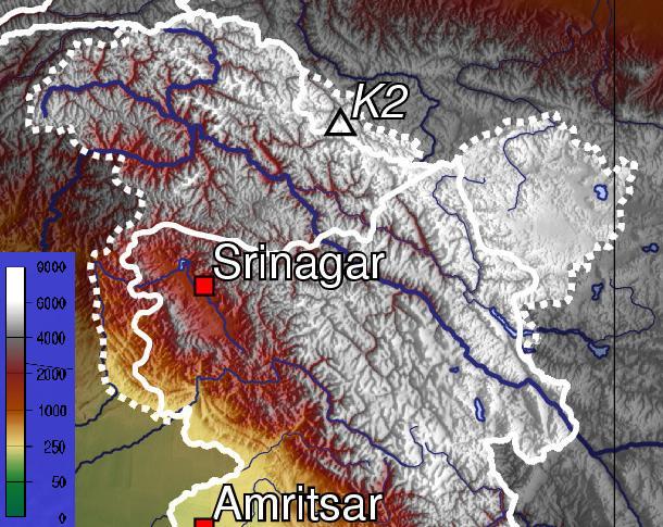
[[File:Kashmir top.jpg|thumb|[[Topographic map]] of Jammu and Kashmir, with visible altitude for the Kashmir valley and Jammu region.]] | [[File:Kashmir top.jpg|thumb|[[Topographic map]] of Jammu and Kashmir, with visible altitude for the Kashmir valley and Jammu region.]] | ||
Jammu and Kashmir is home to several valleys such as the Kashmir Valley, Tawi Valley, [[Chenab Valley]], [[Poonch (town)|Poonch]] Valley, [[Sind Valley]] and [[Lidder Valley]].<ref>{{cite web|last=Vij|first=Shivam|date=5 May 2017|title=Kashmir Is A Prison With Three Walls|url=https://www.huffingtonpost.in/2017/05/04/kashmir-is-a-prison-with-three-walls_a_22070340/|url-status=dead|archive-url=https://web.archive.org/web/20170505073150/http://www.huffingtonpost.in/2017/05/04/kashmir-is-a-prison-with-three-walls_a_22070340/|archive-date=5 May 2017|access-date=9 August 2019|work=[[HuffPost]]}} [https://shivamvij.in/2017/05/05/755/ Alt URL]</ref> The Kashmir valley is {{convert|100|km|mi|abbr=on}} wide and {{convert|15520.3|km2|sqmi|abbr=on}} in area.<ref name="AA1">{{cite web|url=https://www.asianage.com/columnists/indus-water-flow-can-t-be-stopped-721|title=Indus: The water flow can't be stopped|first=Mohan|last=Guruswamy|work=[[The Asian Age]]|date=28 September 2016|access-date=9 August 2019}}</ref> The [[Himalayas]] divide the Kashmir valley from the [[Tibetan plateau]] while the [[Pir Panjal]] range, which encloses the valley from the west and the south, separates it from the [[Punjab Plain]] of the [[Indo-Gangetic Plain]].<ref>{{cite web|url=https://www.greaterkashmir.com/news/opinion/a-tryst-of-the-heart-and-history-along-the-karakoram-highway/|title=A Tryst of the Heart and History along the Karakoram Highway|first=Asma|last=Khan|work=[[Greater Kashmir]]|date=26 April 2018|access-date=9 August 2019}}</ref> Along the northeastern flank of the Valley runs the main range of the Himalayas.<ref>{{cite web|url=https://www.zmescience.com/other/feature-post/india-pakistan-conflict-07032019/|title=Why India and Pakistan keep fighting over Kashmir – the history of the Kashmir conflict|first=Mihai|last=Andrei|work=GME Science|date=11 March 2019|access-date=9 August 2019}}</ref> This valley has an average height of {{convert|1850|m|ft}} above sea-level,<ref name="AA1"/> but the surrounding Pir Panjal range has an average elevation of {{convert|10000|ft|m}}.<ref>{{cite news|url=https://www.thehindu.com/society/history-and-culture/in-the-past-the-mountain-passes-were-entry-exit-points-for-travellers-and-invaders/article22136536.ece|title=Doorway of the gods: Himalaya crosses five countries|author1=Vrinda|author2=J. Ramanan|newspaper=[[The Hindu]]|date=21 December 2017|access-date=9 August 2019}}</ref> The [[Jhelum River]] is the major Himalayan river which flows through the Kashmir valley.<ref>{{cite encyclopedia|url=https://www.britannica.com/place/Jhelum-River|title=Jhelum River|encyclopedia=[[Encyclopædia Britannica]]|date=15 December 2015|access-date=9 August 2019}}</ref> The [[Tawi River|Tawi]], [[Ravi River|Ravi]] and [[Chenab River|Chenab]] are the other important rivers flowing through the region.<ref>{{cite web|url=https://nation.com.pk/29-Jul-2019/flooding-alert-issued-as-india-releases-water|title=Flooding alert issued as India releases water|work=[[The Nation (Pakistan)|The Nation]]|author=Agencies|date=29 July 2019|access-date=9 August 2019}}</ref> | Jammu and Kashmir is home to several valleys such as the Kashmir Valley, Tawi Valley, [[Chenab Valley]], [[Poonch (town)|Poonch]] Valley, [[Sind Valley]] and [[Lidder Valley]].<ref>{{cite web|last=Vij|first=Shivam|date=5 May 2017|title=Kashmir Is A Prison With Three Walls|url=https://www.huffingtonpost.in/2017/05/04/kashmir-is-a-prison-with-three-walls_a_22070340/|url-status=dead|archive-url=https://web.archive.org/web/20170505073150/http://www.huffingtonpost.in/2017/05/04/kashmir-is-a-prison-with-three-walls_a_22070340/|archive-date=5 May 2017|access-date=9 August 2019|work=[[HuffPost]]}} [https://shivamvij.in/2017/05/05/755/ Alt URL]</ref> The Kashmir valley is {{convert|100|km|mi|abbr=on}} wide and {{convert|15520.3|km2|sqmi|abbr=on}} in area.<ref name="AA1">{{cite web|url=https://www.asianage.com/columnists/indus-water-flow-can-t-be-stopped-721|title=Indus: The water flow can't be stopped|first=Mohan|last=Guruswamy|work=[[The Asian Age]]|date=28 September 2016|access-date=9 August 2019}}</ref> The [[Himalayas]] divide the Kashmir valley from the [[Tibetan plateau]] while the [[Pir Panjal]] range, which encloses the valley from the west and the south, separates it from the [[Punjab Plain]] of the [[Indo-Gangetic Plain]].<ref>{{cite web|url=https://www.greaterkashmir.com/news/opinion/a-tryst-of-the-heart-and-history-along-the-karakoram-highway/|title=A Tryst of the Heart and History along the Karakoram Highway|first=Asma|last=Khan|work=[[Greater Kashmir]]|date=26 April 2018|access-date=9 August 2019}}</ref> Along the northeastern flank of the Valley runs the main range of the Himalayas.<ref>{{cite web|url=https://www.zmescience.com/other/feature-post/india-pakistan-conflict-07032019/|title=Why India and Pakistan keep fighting over Kashmir – the history of the Kashmir conflict|first=Mihai|last=Andrei|work=GME Science|date=11 March 2019|access-date=9 August 2019}}</ref> This valley has an average height of {{convert|1850|m|ft}} above sea-level,<ref name="AA1"/> but the surrounding Pir Panjal range has an average elevation of {{convert|10000|ft|m}}.<ref>{{cite news|url=https://www.thehindu.com/society/history-and-culture/in-the-past-the-mountain-passes-were-entry-exit-points-for-travellers-and-invaders/article22136536.ece|title=Doorway of the gods: Himalaya crosses five countries|author1=Vrinda|author2=J. Ramanan|newspaper=[[The Hindu]]|date=21 December 2017|access-date=9 August 2019}}</ref> The [[Jhelum River]] is the major Himalayan river which flows through the Kashmir valley.<ref>{{cite encyclopedia|url=https://www.britannica.com/place/Jhelum-River|title=Jhelum River|encyclopedia=[[Encyclopædia Britannica]]|date=15 December 2015|access-date=9 August 2019}}</ref> The [[Tawi River|Tawi]], [[Ravi River|Ravi]] and [[Chenab River|Chenab]] are the other important rivers flowing through the region.<ref>{{cite web|url=https://nation.com.pk/29-Jul-2019/flooding-alert-issued-as-india-releases-water|title=Flooding alert issued as India releases water|work=[[The Nation (Pakistan)|The Nation]]|author=Agencies|date=29 July 2019|access-date=9 August 2019}}</ref> | ||
==Administrative divisions== | ==Administrative divisions== | ||
[[File:J,K and L - Indian Union Territories.jpg|thumb|'''''Jammu and Kashmir union territory''''' (J and K) is bordered in carmine colour. '''''Ladakh union territory''''' (L) is bordered in blue colour.]] | [[File:J,K and L - Indian Union Territories.jpg|thumb|'''''Jammu and Kashmir union territory''''' (J and K) is bordered in carmine colour. '''''Ladakh union territory''''' (L) is bordered in blue colour.]] | ||
{{Main|List of districts | {{Main|List of districts in Jammu and Kashmir}} | ||
The union territory of Jammu and Kashmir consists of two [[Divisions of India|divisions]]: [[Jammu Division]] and [[Kashmir Division]], and is further divided into 20 [[Districts of India|districts]].<ref name=MHA>{{cite web|url=http://mha.nic.in/uniquepage.asp?Id_Pk=306 |title=Ministry of Home Affairs:: Department of Jammu & Kashmir Affairs |access-date=28 August 2008 |url-status=dead |archive-url=https://web.archive.org/web/20081208212815/http://mha.nic.in/uniquepage.asp?Id_Pk=306 |archive-date=8 December 2008 }}</ref> | The union territory of Jammu and Kashmir consists of two [[Divisions of India|divisions]]: [[Jammu Division]] and [[Kashmir Division]], and is further divided into 20 [[Districts of India|districts]].<ref name=MHA>{{cite web|url=http://mha.nic.in/uniquepage.asp?Id_Pk=306 |title=Ministry of Home Affairs:: Department of Jammu & Kashmir Affairs |access-date=28 August 2008 |url-status=dead |archive-url=https://web.archive.org/web/20081208212815/http://mha.nic.in/uniquepage.asp?Id_Pk=306 |archive-date=8 December 2008 }}</ref> | ||
{| class="wikitable sortable" style="margin-bottom: 0;" | {| class="wikitable sortable" style="margin-bottom: 0;" | ||
|-style="vertical-align:top;" | |-style="vertical-align:top;" | ||
| Line 150: | Line 139: | ||
!| Urban Area <br />(km<sup>2</sup>) | !| Urban Area <br />(km<sup>2</sup>) | ||
!| | !| | ||
|-style="vertical-align:top;" | |-style="vertical-align:top;" | ||
|rowspan=11|[[Jammu Division|Jammu]] | |rowspan=11|[[Jammu Division|Jammu]] | ||
| Line 160: | Line 148: | ||
|| <ref>{{cite report | || <ref>{{cite report | ||
|url=https://censusindia.gov.in/2011census/dchb/DCHB_A/01/0107_PART_A_DCHB_KATHUA.pdf |page=8 |work=Census of India 2011, Part A |title=District Census Handbook Kathua |date=18 June 2014 |access-date=21 November 2020}}</ref> | |url=https://censusindia.gov.in/2011census/dchb/DCHB_A/01/0107_PART_A_DCHB_KATHUA.pdf |page=8 |work=Census of India 2011, Part A |title=District Census Handbook Kathua |date=18 June 2014 |access-date=21 November 2020}}</ref> | ||
|-style="vertical-align:top;" | |-style="vertical-align:top;" | ||
||[[Jammu district]] | ||[[Jammu district]] | ||
|| [[Jammu (city)|Jammu]] | || [[Jammu (city)|Jammu]] | ||
| {{convert|2342|km2|sqmi|disp=table|0|adj=ri0}} | | {{convert|2342|km2|sqmi|disp=table|0|adj=ri0}} | ||
|style="text-align:right;"| {{round|2089.87|2}} | |style="text-align:right;"| {{round|2089.87|2}} | ||
|style="text-align:right;"| {{round|252.13|2}} | |style="text-align:right;"| {{round|252.13|2}} | ||
||<ref>{{cite report |url=https://censusindia.gov.in/2011census/dchb/DCHB_A/01/0121_PART_A_DCHB_JAMMU.pdf |pages=13, 51, 116 |work=Census of India 2011 |title=District Census Handbook Jammu, Part A |date=18 June 2014 |access-date=21 November 2020}}<br />{{cite report |url=https://www.censusindia.gov.in/2011census/dchb/0121_PART_B_DCHB_JAMMU.pdf |pages=13, 24 |work=Census of India 2011 |title=District Census Handbook Jammu, Part B |date=16 June 2014 |access-date=21 November 2020}}</ref> | ||<ref>{{cite report |url=https://censusindia.gov.in/2011census/dchb/DCHB_A/01/0121_PART_A_DCHB_JAMMU.pdf |pages=13, 51, 116 |work=Census of India 2011 |title=District Census Handbook Jammu, Part A |date=18 June 2014 |access-date=21 November 2020}}<br />{{cite report |url=https://www.censusindia.gov.in/2011census/dchb/0121_PART_B_DCHB_JAMMU.pdf |pages=13, 24 |work=Census of India 2011 |title=District Census Handbook Jammu, Part B |date=16 June 2014 |access-date=21 November 2020}}</ref> | ||
|-style="vertical-align:top;" | |-style="vertical-align:top;" | ||
||[[Samba district]] | ||[[Samba district]] | ||
| Line 176: | Line 162: | ||
|style="text-align:right;"| {{round|38.76|2}} | |style="text-align:right;"| {{round|38.76|2}} | ||
||<ref>{{cite report |url=https://www.censusindia.gov.in/2011census/dchb/DCHB_A/01/0122_PART_A_DCHB_SAMBA.pdf |pages=9, 34, 36, 100 |work=Census of India 2011 |title=District Census Handbook Samba, Part A |date=18 June 2014 |access-date=21 November 2020}}<br />{{cite report |url=https://www.censusindia.gov.in/2011census/dchb/0122_PART_B_DCHB_SAMBA.pdf |pages=10, 12, 22 |work=Census of India 2011 |title=District Census Handbook Samba, Part B |date=16 June 2014 |access-date=21 November 2020}}</ref> | ||<ref>{{cite report |url=https://www.censusindia.gov.in/2011census/dchb/DCHB_A/01/0122_PART_A_DCHB_SAMBA.pdf |pages=9, 34, 36, 100 |work=Census of India 2011 |title=District Census Handbook Samba, Part A |date=18 June 2014 |access-date=21 November 2020}}<br />{{cite report |url=https://www.censusindia.gov.in/2011census/dchb/0122_PART_B_DCHB_SAMBA.pdf |pages=10, 12, 22 |work=Census of India 2011 |title=District Census Handbook Samba, Part B |date=16 June 2014 |access-date=21 November 2020}}</ref> | ||
|-style="vertical-align:top;" | |-style="vertical-align:top;" | ||
||[[Udhampur district]] | ||[[Udhampur district]] | ||
| Line 184: | Line 169: | ||
|style="text-align:right;"| {{round|43.72|2}} | |style="text-align:right;"| {{round|43.72|2}} | ||
||<ref>{{cite report |url=https://www.censusindia.gov.in/2011census/dchb/0119_PART_B_DCHB_UDHAMPUR.pdf |pages=12, 22 |work=Census of India 2011 |title=District Census Handbook Udhampur |date=16 June 2014 |access-date=21 November 2020}}</ref> | ||<ref>{{cite report |url=https://www.censusindia.gov.in/2011census/dchb/0119_PART_B_DCHB_UDHAMPUR.pdf |pages=12, 22 |work=Census of India 2011 |title=District Census Handbook Udhampur |date=16 June 2014 |access-date=21 November 2020}}</ref> | ||
|-style="vertical-align:top;" | |-style="vertical-align:top;" | ||
||[[Reasi district]] | ||[[Reasi district]] | ||
| Line 192: | Line 176: | ||
|style="text-align:right;"| {{round|39.01|2}} | |style="text-align:right;"| {{round|39.01|2}} | ||
||<ref>{{cite report |url=https://www.censusindia.gov.in/2011census/dchb/DCHB_A/01/0120_PART_A_DCHB_REASI.pdf |pages=9, 37, 88 |work=Census of India 2011 |title=District Census Handbook Reasi, Part A |date=18 June 2014 |access-date=21 November 2020}}<br />{{cite report |url=https://www.censusindia.gov.in/2011census/dchb/0120_PART_B_DCHB_REASI.pdf |pages=9, 13, 24 |work=Census of India 2011 |title=District Census Handbook Reasi, Part B |date=16 June 2014 |access-date=21 November 2020}}</ref> | ||<ref>{{cite report |url=https://www.censusindia.gov.in/2011census/dchb/DCHB_A/01/0120_PART_A_DCHB_REASI.pdf |pages=9, 37, 88 |work=Census of India 2011 |title=District Census Handbook Reasi, Part A |date=18 June 2014 |access-date=21 November 2020}}<br />{{cite report |url=https://www.censusindia.gov.in/2011census/dchb/0120_PART_B_DCHB_REASI.pdf |pages=9, 13, 24 |work=Census of India 2011 |title=District Census Handbook Reasi, Part B |date=16 June 2014 |access-date=21 November 2020}}</ref> | ||
|-style="vertical-align:top;" | |-style="vertical-align:top;" | ||
||[[Rajouri district]] | ||[[Rajouri district]] | ||
| Line 200: | Line 183: | ||
|style="text-align:right;"| {{round|21.89|2}} | |style="text-align:right;"| {{round|21.89|2}} | ||
||<ref>{{cite report |url=https://censusindia.gov.in/2011census/dchb/DCHB_A/01/0106_PART_A_DCHB_RAJOURI.pdf |pages=11, 107 |work=Census of India 2011 |title=District Census Handbook Rajouri, Part A |date=18 June 2014 |access-date=21 November 2020}}<br />{{cite report |url=https://www.censusindia.gov.in/2011census/dchb/0106_PART_B_DCHB_RAJOURI.pdf |pages=9, 10, 12, 22 |work=Census of India 2011 |title=District Census Handbook Rajouri, Part B |date=16 June 2014 |access-date=21 November 2020}}</ref> | ||<ref>{{cite report |url=https://censusindia.gov.in/2011census/dchb/DCHB_A/01/0106_PART_A_DCHB_RAJOURI.pdf |pages=11, 107 |work=Census of India 2011 |title=District Census Handbook Rajouri, Part A |date=18 June 2014 |access-date=21 November 2020}}<br />{{cite report |url=https://www.censusindia.gov.in/2011census/dchb/0106_PART_B_DCHB_RAJOURI.pdf |pages=9, 10, 12, 22 |work=Census of India 2011 |title=District Census Handbook Rajouri, Part B |date=16 June 2014 |access-date=21 November 2020}}</ref> | ||
|-style="vertical-align:top;" | |-style="vertical-align:top;" | ||
||[[Poonch district, Jammu and Kashmir|Poonch district]] | ||[[Poonch district, Jammu and Kashmir|Poonch district]] | ||
| Line 208: | Line 190: | ||
|style="text-align:right;"| {{round|24.08|2}} | |style="text-align:right;"| {{round|24.08|2}} | ||
||<ref>{{cite report |url=https://www.censusindia.gov.in/2011census/dchb/DCHB_A/01/0105_PART_A_DCHB_PUNCH.pdf |pages=9, 99 |work=Census of India 2011 |title=District Census Handbook Punch, Part A |date=18 June 2014 |access-date=21 November 2020}}<br />{{cite report |url=https://www.censusindia.gov.in/2011census/dchb/0105_PART_B_DCHB_PUNCH.pdf |pages=11, 13, 24 |work=Census of India 2011 |title=District Census Handbook Punch, Part B |date=16 June 2014 |access-date=21 November 2020}}</ref> | ||<ref>{{cite report |url=https://www.censusindia.gov.in/2011census/dchb/DCHB_A/01/0105_PART_A_DCHB_PUNCH.pdf |pages=9, 99 |work=Census of India 2011 |title=District Census Handbook Punch, Part A |date=18 June 2014 |access-date=21 November 2020}}<br />{{cite report |url=https://www.censusindia.gov.in/2011census/dchb/0105_PART_B_DCHB_PUNCH.pdf |pages=11, 13, 24 |work=Census of India 2011 |title=District Census Handbook Punch, Part B |date=16 June 2014 |access-date=21 November 2020}}</ref> | ||
|-style="vertical-align:top;" | |-style="vertical-align:top;" | ||
||[[Doda district]] | ||[[Doda district]] | ||
| Line 216: | Line 197: | ||
|style="text-align:right;"| {{round|19.75|2}} | |style="text-align:right;"| {{round|19.75|2}} | ||
||<ref>{{cite report |url=https://censusindia.gov.in/2011census/dchb/0116_PART_B_DCHB_DODA.pdf |pages=9, 12, 99 |work=Census of India 2011 |title=District Census Handbook Doda, Part B |date=18 June 2014 |access-date=21 November 2020}}</ref> | ||<ref>{{cite report |url=https://censusindia.gov.in/2011census/dchb/0116_PART_B_DCHB_DODA.pdf |pages=9, 12, 99 |work=Census of India 2011 |title=District Census Handbook Doda, Part B |date=18 June 2014 |access-date=21 November 2020}}</ref> | ||
|-style="vertical-align:top;" | |-style="vertical-align:top;" | ||
||[[Ramban district]] | ||[[Ramban district]] | ||
| Line 224: | Line 204: | ||
|style="text-align:right;"| {{round|15.08|2}} | |style="text-align:right;"| {{round|15.08|2}} | ||
||<ref>{{cite report |url=https://www.censusindia.gov.in/2011census/dchb/0117_PART_B_DCHB_RAMBAN.pdf |pages=10, 12 |work=Census of India 2011 |title=District Census Handbook Ramban, Part B |date=18 June 2014 |access-date=21 November 2020}}</ref> | ||<ref>{{cite report |url=https://www.censusindia.gov.in/2011census/dchb/0117_PART_B_DCHB_RAMBAN.pdf |pages=10, 12 |work=Census of India 2011 |title=District Census Handbook Ramban, Part B |date=18 June 2014 |access-date=21 November 2020}}</ref> | ||
|-style="vertical-align:top;" | |-style="vertical-align:top;" | ||
||[[Kishtwar district]] | ||[[Kishtwar district]] | ||
|| [[Kishtwar]] | || [[Kishtwar]] | ||
| {{convert|1644.00|km2|sqmi|disp=table|0|adj=ri0}} | | {{convert|1644.00|km2|sqmi|disp=table|0|adj=ri0}} | ||
|style="text-align:right;"| {{round|1643.37|2}} | |style="text-align:right;"| {{round|1643.37|2}} | ||
|style="text-align:right;"| {{round|0.63|2}} | |style="text-align:right;"| {{round|0.63|2}} | ||
||<ref>{{cite report |url=https://www.censusindia.gov.in/2011census/dchb/0118_PART_B_DCHB_KISHTWAR.pdf |pages=9, 10, 22 |work=Census of India 2011 |title=District Census Handbook Kishtwar, Part B |date=18 June 2014 |access-date=21 November 2020}}<br />Part B page 9 says the rural area is 1643.65 km<sup>2</sup>, whilst pages 10 and 22 says 1643.37 km<sup>2</sup>.</ref> | ||<ref>{{cite report |url=https://www.censusindia.gov.in/2011census/dchb/0118_PART_B_DCHB_KISHTWAR.pdf |pages=9, 10, 22 |work=Census of India 2011 |title=District Census Handbook Kishtwar, Part B |date=18 June 2014 |access-date=21 November 2020}}<br />Part B page 9 says the rural area is 1643.65 km<sup>2</sup>, whilst pages 10 and 22 says 1643.37 km<sup>2</sup>.</ref> | ||
|- style="background:lightblue; vertical-align:top;" | |- style="background:lightblue; vertical-align:top;" | ||
||Total for division | ||Total for division | ||
| Line 240: | Line 218: | ||
|style="text-align:center;"| {{round|498.05|2}} | |style="text-align:center;"| {{round|498.05|2}} | ||
|| | || | ||
|-style="vertical-align:top;" | |-style="vertical-align:top;" | ||
|rowspan=11 |[[Kashmir Division|Kashmir]] | |rowspan=11 |[[Kashmir Division|Kashmir]] | ||
| Line 249: | Line 226: | ||
|style="text-align:right;"| {{round|98.24|2}} | |style="text-align:right;"| {{round|98.24|2}} | ||
||<ref>{{cite report |url=https://censusindia.gov.in/2011census/dchb/DCHB_A/01/0114_PART_A_DCHB_ANANTNAG.pdf |page=9 |work=Census of India 2011 |title=District Census Handbook Anantnag, Part A |date=July 2016 |access-date=21 November 2020}}<br />{{cite report |url=https://censusindia.gov.in/2011census/dchb/0114_PART_B_DCHB_ANANTNAG.pdf |pages=12, 22 |work=Census of India 2011 |title=District Census Handbook Anantnag, Part B |date=July 2016 |access-date=21 November 2020}}</ref> | ||<ref>{{cite report |url=https://censusindia.gov.in/2011census/dchb/DCHB_A/01/0114_PART_A_DCHB_ANANTNAG.pdf |page=9 |work=Census of India 2011 |title=District Census Handbook Anantnag, Part A |date=July 2016 |access-date=21 November 2020}}<br />{{cite report |url=https://censusindia.gov.in/2011census/dchb/0114_PART_B_DCHB_ANANTNAG.pdf |pages=12, 22 |work=Census of India 2011 |title=District Census Handbook Anantnag, Part B |date=July 2016 |access-date=21 November 2020}}</ref> | ||
|-style="vertical-align:top;" | |-style="vertical-align:top;" | ||
||[[Kulgam district]] | ||[[Kulgam district]] | ||
| Line 256: | Line 232: | ||
|style="text-align:right;"| {{round|360.20|2}} | |style="text-align:right;"| {{round|360.20|2}} | ||
|style="text-align:right;"| {{round|49.80|2}} | |style="text-align:right;"| {{round|49.80|2}} | ||
||<ref>{{cite report |url=https://censusindia.gov.in/2011census/dchb/DCHB_A/01/0115_PART_A_DCHB_KULGAM.pdf |page=10 |work=Census of India 2011 |title=District Census Handbook Kulgam, Part A |date=July 2016 |access-date=21 November 2020}}<br />{{cite report |url=https://censusindia.gov.in/2011census/dchb/0115_PART_B_DCHB_KULGAM.pdf |pages=12, 22 |work=Census of India 2011 |title=District Census Handbook Kulgam, Part B |date=16 June 2014 |access-date=21 November 2020}}<br />Part B page 12 says the | ||<ref>{{cite report |url=https://censusindia.gov.in/2011census/dchb/DCHB_A/01/0115_PART_A_DCHB_KULGAM.pdf |page=10 |work=Census of India 2011 |title=District Census Handbook Kulgam, Part A |date=July 2016 |access-date=21 November 2020}}<br />{{cite report |url=https://censusindia.gov.in/2011census/dchb/0115_PART_B_DCHB_KULGAM.pdf |pages=12, 22 |work=Census of India 2011 |title=District Census Handbook Kulgam, Part B |date=16 June 2014 |access-date=21 November 2020}}<br />Part B page 12 says the are of the district is 404 km<sup>2</sup>, but page 22 says 410 km<sup>2</sup>.</ref> | ||
|-style="vertical-align:top;" | |-style="vertical-align:top;" | ||
||[[Pulwama district]] | ||[[Pulwama district]] | ||
| Line 265: | Line 240: | ||
|style="text-align:right;"| {{round|38.55|2}} | |style="text-align:right;"| {{round|38.55|2}} | ||
||<ref>{{cite report |url=https://www.censusindia.gov.in/2011census/dchb/0112_PART_B_DCHB_PULWAMA.pdf |pages=12, 22 |work=Census of India 2011 |title=District Census Handbook Pulwama, Part B |date=16 June 2014 |access-date=21 November 2020}}</ref> | ||<ref>{{cite report |url=https://www.censusindia.gov.in/2011census/dchb/0112_PART_B_DCHB_PULWAMA.pdf |pages=12, 22 |work=Census of India 2011 |title=District Census Handbook Pulwama, Part B |date=16 June 2014 |access-date=21 November 2020}}</ref> | ||
|-style="vertical-align:top;" | |-style="vertical-align:top;" | ||
||[[Shopian district]] | ||[[Shopian district]] | ||
| Line 273: | Line 247: | ||
|style="text-align:right;"| {{round|5.44|2}} | |style="text-align:right;"| {{round|5.44|2}} | ||
||<ref>{{cite report |url=https://www.censusindia.gov.in/2011census/dchb/DCHB_A/01/0113_PART_A_DCHB_SHUPIYAN.pdf |page=10 |work=Census of India 2011 |title=District Census Handbook Shupiyan, Part A |date=16 June 2014 |access-date=21 November 2020}}<br />{{cite report |url=https://censusindia.gov.in/2011census/dchb/0113_PART_B_DCHB_SUPHIYAN.pdf |pages=12, 22 |work=Census of India 2011 |title=District Census Handbook Shupiyan, Part B |date=16 June 2014 |access-date=21 November 2020}}<br />Part B pages 12 and 22 say the district area is 312.00 km<sup>2</sup>, but Part A page 10 says 307.42 km<sup>2</sup>.</ref> | ||<ref>{{cite report |url=https://www.censusindia.gov.in/2011census/dchb/DCHB_A/01/0113_PART_A_DCHB_SHUPIYAN.pdf |page=10 |work=Census of India 2011 |title=District Census Handbook Shupiyan, Part A |date=16 June 2014 |access-date=21 November 2020}}<br />{{cite report |url=https://censusindia.gov.in/2011census/dchb/0113_PART_B_DCHB_SUPHIYAN.pdf |pages=12, 22 |work=Census of India 2011 |title=District Census Handbook Shupiyan, Part B |date=16 June 2014 |access-date=21 November 2020}}<br />Part B pages 12 and 22 say the district area is 312.00 km<sup>2</sup>, but Part A page 10 says 307.42 km<sup>2</sup>.</ref> | ||
|-style="vertical-align:top;" | |-style="vertical-align:top;" | ||
||[[Budgam district]] | ||[[Budgam district]] | ||
| Line 281: | Line 254: | ||
|style="text-align:right;"| {{round|49.05|2}} | |style="text-align:right;"| {{round|49.05|2}} | ||
||<ref>{{cite report |url=https://censusindia.gov.in/2011census/dchb/DCHB_A/01/0102_PART_A_DCHB_BADGAM.pdf |pages=10, 46 |work=Census of India 2011 |title=District Census Handbook Badgam, Part A |date=July 2016 |access-date=21 November 2020}}<br />{{cite report |url=https://censusindia.gov.in/2011census/dchb/0102_PART_B_DCHB_BADGAM.pdf |pages=11, 12, 22 |work=Census of India 2011 |title=District Census Handbook Badgam, Part B |date=16 June 2014|access-date=21 November 2020}}<br />Part A says the district area is 1371 km<sup>2</sup>, Part B says 1371 km<sup>2</sup> (page 11) and 1361 km<sup>2</sup> (page 12s and 22).</ref> | ||<ref>{{cite report |url=https://censusindia.gov.in/2011census/dchb/DCHB_A/01/0102_PART_A_DCHB_BADGAM.pdf |pages=10, 46 |work=Census of India 2011 |title=District Census Handbook Badgam, Part A |date=July 2016 |access-date=21 November 2020}}<br />{{cite report |url=https://censusindia.gov.in/2011census/dchb/0102_PART_B_DCHB_BADGAM.pdf |pages=11, 12, 22 |work=Census of India 2011 |title=District Census Handbook Badgam, Part B |date=16 June 2014|access-date=21 November 2020}}<br />Part A says the district area is 1371 km<sup>2</sup>, Part B says 1371 km<sup>2</sup> (page 11) and 1361 km<sup>2</sup> (page 12s and 22).</ref> | ||
|-style="vertical-align:top;" | |-style="vertical-align:top;" | ||
||[[Srinagar district]] | ||[[Srinagar district]] | ||
| Line 289: | Line 261: | ||
|style="text-align:right;"| {{round|294.53|2}} | |style="text-align:right;"| {{round|294.53|2}} | ||
||<ref>{{cite report |url=https://censusindia.gov.in/2011census/dchb/DCHB_A/01/0110_PART_A_DCHB_SRINAGAR.pdf |pages=11, 48 |work=Census of India 2011 |title=District Census Handbook Srinagar, Part A |date=July 2016 |access-date=21 November 2020}}<br />Part A page 48 says the district area was 2228.0 km<sup>2</sup> in 2001 and 1978.95 km<sup>2</sup> in 2011.</ref> | ||<ref>{{cite report |url=https://censusindia.gov.in/2011census/dchb/DCHB_A/01/0110_PART_A_DCHB_SRINAGAR.pdf |pages=11, 48 |work=Census of India 2011 |title=District Census Handbook Srinagar, Part A |date=July 2016 |access-date=21 November 2020}}<br />Part A page 48 says the district area was 2228.0 km<sup>2</sup> in 2001 and 1978.95 km<sup>2</sup> in 2011.</ref> | ||
|-style="vertical-align:top;" | |-style="vertical-align:top;" | ||
||[[Ganderbal district]] | ||[[Ganderbal district]] | ||
| Line 297: | Line 268: | ||
|style="text-align:right;"| {{round|25.40|2}} | |style="text-align:right;"| {{round|25.40|2}} | ||
||<ref>{{cite report |url=https://www.censusindia.gov.in/2011census/dchb/0111_PART_B_DCHB_GANDERBAL.pdf |pages=11, 12 and 22 |work=Census of India 2011 |title=District Census Handbook Ganderbal, Part B |date=July 2016 |access-date=21 November 2020}}<br />Part B page 11 says the district area is 393.04 km<sup>2</sup>, but pages 12 and 22 say 259.00 km<sup>2</sup>.</ref> | ||<ref>{{cite report |url=https://www.censusindia.gov.in/2011census/dchb/0111_PART_B_DCHB_GANDERBAL.pdf |pages=11, 12 and 22 |work=Census of India 2011 |title=District Census Handbook Ganderbal, Part B |date=July 2016 |access-date=21 November 2020}}<br />Part B page 11 says the district area is 393.04 km<sup>2</sup>, but pages 12 and 22 say 259.00 km<sup>2</sup>.</ref> | ||
|-style="vertical-align:top;" | |-style="vertical-align:top;" | ||
||[[Bandipora district]] | ||[[Bandipora district]] | ||
| Line 305: | Line 275: | ||
|style="text-align:right;"| {{round|49.63|2}} | |style="text-align:right;"| {{round|49.63|2}} | ||
||<ref>{{cite report |url=https://www.censusindia.gov.in/2011census/dchb/DCHB_A/01/0109_PART_A_DCHB_BANDIPORE.pdf |pages=10, 47 |work=Census of India 2011 |title=District Census Handbook Bandipora, Part A |date=July 2016 |access-date=21 November 2020}}<br />{{cite report |url=https://censusindia.gov.in/2011census/dchb/0109_PART_B_DCHB_BANDIPORE.pdf |pages=11, 20 |work=Census of India 2011 |title=District Census Handbook Bandipora, Part B |date=16 June 2014 |access-date=21 November 2020}}</ref> | ||<ref>{{cite report |url=https://www.censusindia.gov.in/2011census/dchb/DCHB_A/01/0109_PART_A_DCHB_BANDIPORE.pdf |pages=10, 47 |work=Census of India 2011 |title=District Census Handbook Bandipora, Part A |date=July 2016 |access-date=21 November 2020}}<br />{{cite report |url=https://censusindia.gov.in/2011census/dchb/0109_PART_B_DCHB_BANDIPORE.pdf |pages=11, 20 |work=Census of India 2011 |title=District Census Handbook Bandipora, Part B |date=16 June 2014 |access-date=21 November 2020}}</ref> | ||
|-style="vertical-align:top;" | |-style="vertical-align:top;" | ||
||[[Baramulla district]] | ||[[Baramulla district]] | ||
| Line 313: | Line 282: | ||
|style="text-align:right;"| {{round|63.56|2}} | |style="text-align:right;"| {{round|63.56|2}} | ||
||<ref>{{cite report |url=https://censusindia.gov.in/2011census/dchb/DCHB_A/01/0108_PART_A_DCHB_BARAMULA.pdf |page=11 |work=Census of India 2011 |title=District Census Handbook Baramulla, Part A |date=July 2016 |access-date=21 November 2020}}<br />{{cite report |url=https://censusindia.gov.in/2011census/dchb/0108_PART_B_DCHB_BARAMULA.pdf|page=22 |work=Census of India 2011 |title=District Census Handbook Baramulla, Part B |date=16 June 2014 |access-date=21 November 2020}}</ref> | ||<ref>{{cite report |url=https://censusindia.gov.in/2011census/dchb/DCHB_A/01/0108_PART_A_DCHB_BARAMULA.pdf |page=11 |work=Census of India 2011 |title=District Census Handbook Baramulla, Part A |date=July 2016 |access-date=21 November 2020}}<br />{{cite report |url=https://censusindia.gov.in/2011census/dchb/0108_PART_B_DCHB_BARAMULA.pdf|page=22 |work=Census of India 2011 |title=District Census Handbook Baramulla, Part B |date=16 June 2014 |access-date=21 November 2020}}</ref> | ||
|-style="vertical-align:top;" | |-style="vertical-align:top;" | ||
||[[Kupwara district]] | ||[[Kupwara district]] | ||
| Line 321: | Line 289: | ||
|style="text-align:right;"| {{round|47.34|2}} | |style="text-align:right;"| {{round|47.34|2}} | ||
||<ref>{{cite report |url=https://censusindia.gov.in/2011census/dchb/DCHB_A/01/0101_PART_A_DCHB_KUPWARA.pdf |page=7 |work=Census of India 2011 |title=District Census Handbook Kupwara, Part A |date=July 2016 |access-date=21 November 2020}}<br />{{cite report |url=https://censusindia.gov.in/2011census/dchb/0101_PART_B_DCHB_KUPWARA.pdf|pages=11, 12 |work=Census of India 2011 |title=District Census Handbook Kupwara, Part B |date=16 June 2014 |access-date=21 November 2020}}</ref> | ||<ref>{{cite report |url=https://censusindia.gov.in/2011census/dchb/DCHB_A/01/0101_PART_A_DCHB_KUPWARA.pdf |page=7 |work=Census of India 2011 |title=District Census Handbook Kupwara, Part A |date=July 2016 |access-date=21 November 2020}}<br />{{cite report |url=https://censusindia.gov.in/2011census/dchb/0101_PART_B_DCHB_KUPWARA.pdf|pages=11, 12 |work=Census of India 2011 |title=District Census Handbook Kupwara, Part B |date=16 June 2014 |access-date=21 November 2020}}</ref> | ||
|- style="background:lightblue; vertical-align:top;" | |- style="background:lightblue; vertical-align:top;" | ||
||Total for division | ||Total for division | ||
| Line 329: | Line 296: | ||
|style="text-align:center;"| {{round|721.54|2}} | |style="text-align:center;"| {{round|721.54|2}} | ||
|| | || | ||
|} | |} | ||
==Demographics== | ==Demographics== | ||
===Religion=== | ===Religion=== | ||
{{Pie chart|label1=[[Islam]]|value1=68.8|color1=Green|label2=[[Hinduism]]|value2=28.8|color2=orange|label3=[[Sikhism]]|value3=1.9|color3=yellow|label4=[[Christianity]]|value4=0.28|color4=blue|label5=[[Buddhism]]|value5=0.03|color5=Gold|label6=[[Jainism]]|value6=0.01|color6=Maroon|label7=Others|value7=0.01|color7=Grey|label8=Not Stated|value8=0.15|color8=Black|caption=Religions in Jammu and Kashmir (2011)<ref name="2011 Census">{{cite web|title=Population by religion community – 2011|url=http://www.censusindia.gov.in/2011census/C-01/DDW00C-01%20MDDS.XLS|website=Census of India, 2011|publisher=The Registrar General & Census Commissioner, India|archive-url=https://web.archive.org/web/20150825155850/http://www.censusindia.gov.in/2011census/C-01/DDW00C-01%20MDDS.XLS|archive-date=25 August 2015}}</ref>}} | {{Pie chart|label1=[[Islam]]|value1=68.8|color1=Green|label2=[[Hinduism]]|value2=28.8|color2=orange|label3=[[Sikhism]]|value3=1.9|color3=yellow|label4=[[Christianity]]|value4=0.28|color4=blue|label5=[[Buddhism]]|value5=0.03|color5=Gold|label6=[[Jainism]]|value6=0.01|color6=Maroon|label7=Others|value7=0.01|color7=Grey|label8=Not Stated|value8=0.15|color8=Black|caption=Religions in Jammu and Kashmir (2011)<ref name="2011 Census">{{cite web|title=Population by religion community – 2011|url=http://www.censusindia.gov.in/2011census/C-01/DDW00C-01%20MDDS.XLS|website=Census of India, 2011|publisher=The Registrar General & Census Commissioner, India|archive-url=https://web.archive.org/web/20150825155850/http://www.censusindia.gov.in/2011census/C-01/DDW00C-01%20MDDS.XLS|archive-date=25 August 2015}}</ref>}} | ||
Muslims constitutes the majority of the population of Jammu and Kashmir with a significant Hindu minority.<ref name="2011 Census"/> | |||
The [[Kashmir Division]] is largely Muslim (96.41%) with a small Hindu (2.45%) and Sikh (0.81%) population. The [[Jammu Division]] is predominantly Hindu (66%) with a significant Muslim population (30%). The Muslims form a majority in the Rajouri, Poonch, Doda, Kishtwar and Ramban districts of Jammu, while the Hindus form a majority in Kathua, Samba, Jammu and Udhampur districts. Reasi district has an almost equal number of Hindus and Muslims.<ref name="2011 Census"/> | |||
The [[Kashmir Division]] is largely Muslim (96.41%) with a small Hindu (2.45%) and Sikh (0.81%) population. | |||
The [[Jammu Division]] is predominantly Hindu (66%) with a significant Muslim population (30%). The Muslims form a majority in the Rajouri, Poonch, Doda, Kishtwar and Ramban districts of Jammu, while the Hindus form a majority in Kathua, Samba, Jammu and Udhampur districts. Reasi district has an almost equal number of Hindus and Muslims.<ref name="2011 Census"/> | |||
==Government and politics== | ==Government and politics== | ||
{{main|Government of Jammu and Kashmir|Chief Minister of Jammu and Kashmir|Jammu and Kashmir Legislative Assembly}} | {{main|Government of Jammu and Kashmir|Chief Minister of Jammu and Kashmir|Jammu and Kashmir Legislative Assembly}} | ||
The union territory of Jammu and Kashmir is administered under the provisions of [[:s:Constitution of India/Part VIII#Article 239|Article 239]] of the [[Constitution of India]]. The Article 239A, originally formulated for the union territory of [[Puducherry (union territory)|Puduchery]], will also be applicable to Jammu and Kashmir.<ref name="Indian Express"> | The union territory of Jammu and Kashmir is administered under the provisions of [[:s:Constitution of India/Part VIII#Article 239|Article 239]] of the [[Constitution of India]]. The Article 239A, originally formulated for the union territory of [[Puducherry (union territory)|Puduchery]], will also be applicable to Jammu and Kashmir.<ref name="Indian Express"> | ||
[https://indianexpress.com/article/india/jammu-kashmir-bifurcation-ladakh-union-territory-key-takeaways-from-reorganisation-bill-article-370-amit-shah-5880177/ Jammu & Kashmir Reorganisation Bill passed by Rajya Sabha: Key takeaways], The Indian Express, 5 August 2019. | [https://indianexpress.com/article/india/jammu-kashmir-bifurcation-ladakh-union-territory-key-takeaways-from-reorganisation-bill-article-370-amit-shah-5880177/ Jammu & Kashmir Reorganisation Bill passed by Rajya Sabha: Key takeaways], The Indian Express, 5 August 2019. | ||
</ref> | </ref> | ||
===Executive branch=== | ===Executive branch=== | ||
The [[President of India]] appoints a [[List of Governors of Jammu and Kashmir|Lieutenant Governor]] for the union territory.<ref name="Indian Express"/> | The [[President of India]] appoints a [[List of Governors of Jammu and Kashmir|Lieutenant Governor]] for the union territory.<ref name="Indian Express"/> | ||
A Council of Ministers led by a [[Chief Minister of Jammu and Kashmir|Chief Minister]] is appointed by the Lieutenant Governor from the membership of the legislative assembly. Their role is to advise the Lieutenant Governor in the exercise of functions in matters under the jurisdiction of the legislative assembly. In other matters, the Lieutenant Governor is empowered to act in his own capacity.<ref name="Indian Express"/> | A Council of Ministers led by a [[Chief Minister of Jammu and Kashmir|Chief Minister]] is appointed by the Lieutenant Governor from the membership of the legislative assembly. Their role is to advise the Lieutenant Governor in the exercise of functions in matters under the jurisdiction of the legislative assembly. In other matters, the Lieutenant Governor is empowered to act in his own capacity.<ref name="Indian Express"/> | ||
===Legislative branch=== | ===Legislative branch=== | ||
The legislative branch is of government is a unicameral [[Legislative Assembly of Jammu and Kashmir|legislative assembly]], whose tenure is five years. The legislative assembly may make laws for any of the matters in the [[State List]] of the Constitution of India except "public order" and "police", which will remain the preserve of the central [[Government of India]]. The Lieutenant Governor also has the power to promulgate ordinances which have the same force as the acts of the legislative assembly.<ref name="Indian Express"/> | The legislative branch is of government is a unicameral [[Legislative Assembly of Jammu and Kashmir|legislative assembly]], whose tenure is five years. The legislative assembly may make laws for any of the matters in the [[State List]] of the Constitution of India except "public order" and "police", which will remain the preserve of the central [[Government of India]]. The Lieutenant Governor also has the power to promulgate ordinances which have the same force as the acts of the legislative assembly.<ref name="Indian Express"/> | ||
Elections for the Jammu and Kashmir Legislative Assembly are to be held following the implementation of new constituency boundaries which is expected to be completed in 2021.<ref>{{Cite web|url=https://zeenews.india.com/india/jammu-and-kashmir-assembly-election-in-2021-after-delimitation-ec-sources-2230726.html|title=Jammu and Kashmir assembly election in 2021 after delimitation: EC sources|date=29 August 2019|website=Zee News}}</ref> | Elections for the Jammu and Kashmir Legislative Assembly are to be held following the implementation of new constituency boundaries which is expected to be completed in 2021.<ref>{{Cite web|url=https://zeenews.india.com/india/jammu-and-kashmir-assembly-election-in-2021-after-delimitation-ec-sources-2230726.html|title=Jammu and Kashmir assembly election in 2021 after delimitation: EC sources|date=29 August 2019|website=Zee News}}</ref> | ||
===Judicial branch=== | ===Judicial branch=== | ||
[[FILE:Stamp of India - 2006 - Colnect 158978 - High Court of Jammu - Kashmir.jpeg|thumb|The [[Jammu and Kashmir High Court]] on postal stamps of India]] | [[FILE:Stamp of India - 2006 - Colnect 158978 - High Court of Jammu - Kashmir.jpeg|thumb|The [[Jammu and Kashmir High Court]] on postal stamps of India]] | ||
The union territory is under the jurisdiction of the [[Jammu and Kashmir High Court]], which also serves as high court for [[Ladakh]].<ref name="Indian Express"/> Police services are provided by the [[Jammu and Kashmir Police]].<ref name="trnscpt">{{cite web|url=https://www.livelaw.in/top-stories/salient-features-of-jammu-kashmir-reorganization-bill-146998|title=Salient Features Of Jammu & Kashmir Reorganization Bill [Read Bill]|first1=Devesh|first2=Iti|last1=Ratan|last2=Johri|date=7 August 2019|website=LiveLaw.in: All about law|access-date=7 August 2019}}</ref> | The union territory is under the jurisdiction of the [[Jammu and Kashmir High Court]], which also serves as high court for [[Ladakh]].<ref name="Indian Express"/> Police services are provided by the [[Jammu and Kashmir Police]].<ref name="trnscpt">{{cite web|url=https://www.livelaw.in/top-stories/salient-features-of-jammu-kashmir-reorganization-bill-146998|title=Salient Features Of Jammu & Kashmir Reorganization Bill [Read Bill]|first1=Devesh|first2=Iti|last1=Ratan|last2=Johri|date=7 August 2019|website=LiveLaw.in: All about law|access-date=7 August 2019}}</ref> | ||
===Parties=== | ===Parties=== | ||
The main political parties active in the region are the [[Bharatiya Janata Party]] (State President: [[Ravinder Raina]]), the [[Indian National Congress]] (State President: [[Ghulam Ahmad Mir]]), the [[Jammu & Kashmir National Conference]] (President: [[Farooq Abdullah]]) and the [[Jammu and Kashmir People's Democratic Party]] (President: [[Mehbooba Mufti]]). Other parties with a presence in the region parties include the [[Communist Party of India (Marxist)]], the [[Jammu and Kashmir National Panthers Party]], the [[Jammu and Kashmir People's Conference]], the [[Jammu and Kashmir Apni Party]] (President: [[Altaf Bukhari]]), the [[Jammu and Kashmir Workers Party]] (President: Mir Junaid) and [[Ikkjutt Jammu]] (President: Ankur Sharma). | The main political parties active in the region are the [[Bharatiya Janata Party]] (State President: [[Ravinder Raina]]), the [[Indian National Congress]] (State President: [[Ghulam Ahmad Mir]]), the [[Jammu & Kashmir National Conference]] (President: [[Farooq Abdullah]]) and the [[Jammu and Kashmir People's Democratic Party]] (President: [[Mehbooba Mufti]]). Other parties with a presence in the region parties include the [[Communist Party of India (Marxist)]], the [[Jammu and Kashmir National Panthers Party]], the [[Jammu and Kashmir People's Conference]], the [[Jammu and Kashmir Apni Party]] (President: [[Altaf Bukhari]]), the [[Jammu and Kashmir Workers Party]] (President: Mir Junaid) and [[Ikkjutt Jammu]] (President: Ankur Sharma). | ||
===Jammu and Kashmir in the Parliament of India=== | ===Jammu and Kashmir in the Parliament of India=== | ||
Jammu and Kashmir sends five members (MPs) to the lower house of the [[Indian parliament]] (the [[Lok Sabha]]) and four members to the upper house (the [[Rajya Sabha]]). | Jammu and Kashmir sends five members (MPs) to the lower house of the [[Indian parliament]] (the [[Lok Sabha]]) and four members to the upper house (the [[Rajya Sabha]]). | ||
;Lok Sabha constituencies in Jammu and Kashmir: | ;Lok Sabha constituencies in Jammu and Kashmir: | ||
{| class="wikitable sortable" | {| class="wikitable sortable" | ||
| Line 419: | Line 339: | ||
|- | |- | ||
|} | |} | ||
== Tourism == | == Tourism == | ||
{{Main|Tourism in Jammu and Kashmir}} | {{Main|Tourism in Jammu and Kashmir}} | ||
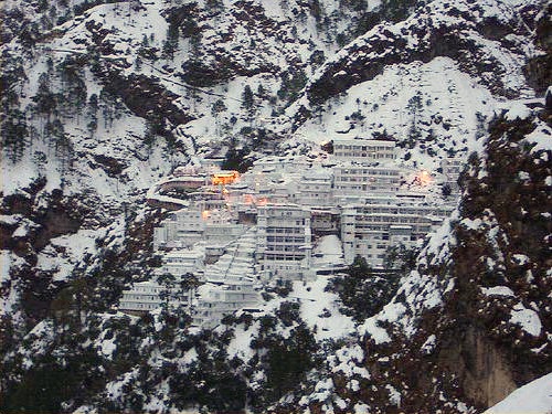
Some major tourist attractions in Jammu and Kashmir are [[Srinagar]], the [[Shalimar Bagh, Srinagar|Mughal Gardens]], [[Gulmarg]], [[Pahalgam]], [[Patnitop]] and [[Jammu]]. Every year, thousands of Hindu [[pilgrim]]s visit holy shrines of [[Vaishno Devi]] and [[Amarnath Temple|Amarnath]] which has had significant impact on the state's economy.<ref>{{cite news|url=http://www.hindu.com/thehindu/holnus/002200709130350.htm | work=Online edition of The Hindu|title=Amarnath Board to study yatra impact on Kashmir economy | access-date=6 June 2009|location=Chennai, India|date=13 September 2007}}</ref> | Jammu and Kashmir is home to several valleys such as the Kashmir Valley, [[Chenab Valley]], [[Sind Valley|Sindh Valley]] and [[Lidder Valley]]. Some major tourist attractions in Jammu and Kashmir are [[Srinagar]], the [[Shalimar Bagh, Srinagar|Mughal Gardens]], [[Gulmarg]], [[Pahalgam]], [[Patnitop]] and [[Jammu]]. Every year, thousands of Hindu [[pilgrim]]s visit holy shrines of [[Vaishno Devi]] and [[Amarnath Temple|Amarnath]] which has had significant impact on the state's economy.<ref>{{cite news|url=http://www.hindu.com/thehindu/holnus/002200709130350.htm | work=Online edition of The Hindu|title=Amarnath Board to study yatra impact on Kashmir economy | access-date=6 June 2009|location=Chennai, India|date=13 September 2007}}</ref> | ||
The Kashmir valley is one of the top tourist destinations | The Kashmir valley is one of the top tourist destinations of India.<ref>{{cite news|url=http://www.hindu.com/thehindu/holnus/004200903181221.htm|work=Online edition of The Hindu|title=Foreign tourists flock Kashmir|access-date=18 March 2009|location=Chennai, India|date=18 March 2009}}</ref> [[Gulmarg]], one of the most popular [[ski resort]] destinations in India, is also home to the world's highest green [[golf course]].<ref>{{cite web|url=https://www.wsj.com/articles/SB119332713217271534?mod=googlenews_wsj|title=Fairway to Heaven|author=Cris Prystay|date=26 October 2007|work=The Wall Street Journal}}</ref> The decrease in violence in the state has boosted the state's economy, specifically tourism.<ref>{{cite web|url=http://sify.com/news/Tourists-arrival-gives-boost-to-J-K-economy-news-jm3v4cihjai.html|archive-url=https://web.archive.org/web/20110716071016/http://www.sify.com/news/Tourists-arrival-gives-boost-to-J-K-economy-news-jm3v4cihjai.html|url-status=dead|archive-date=2011-07-16|title=Tourists arrival gives boost to J-K economy|work=Sify}}</ref> | ||
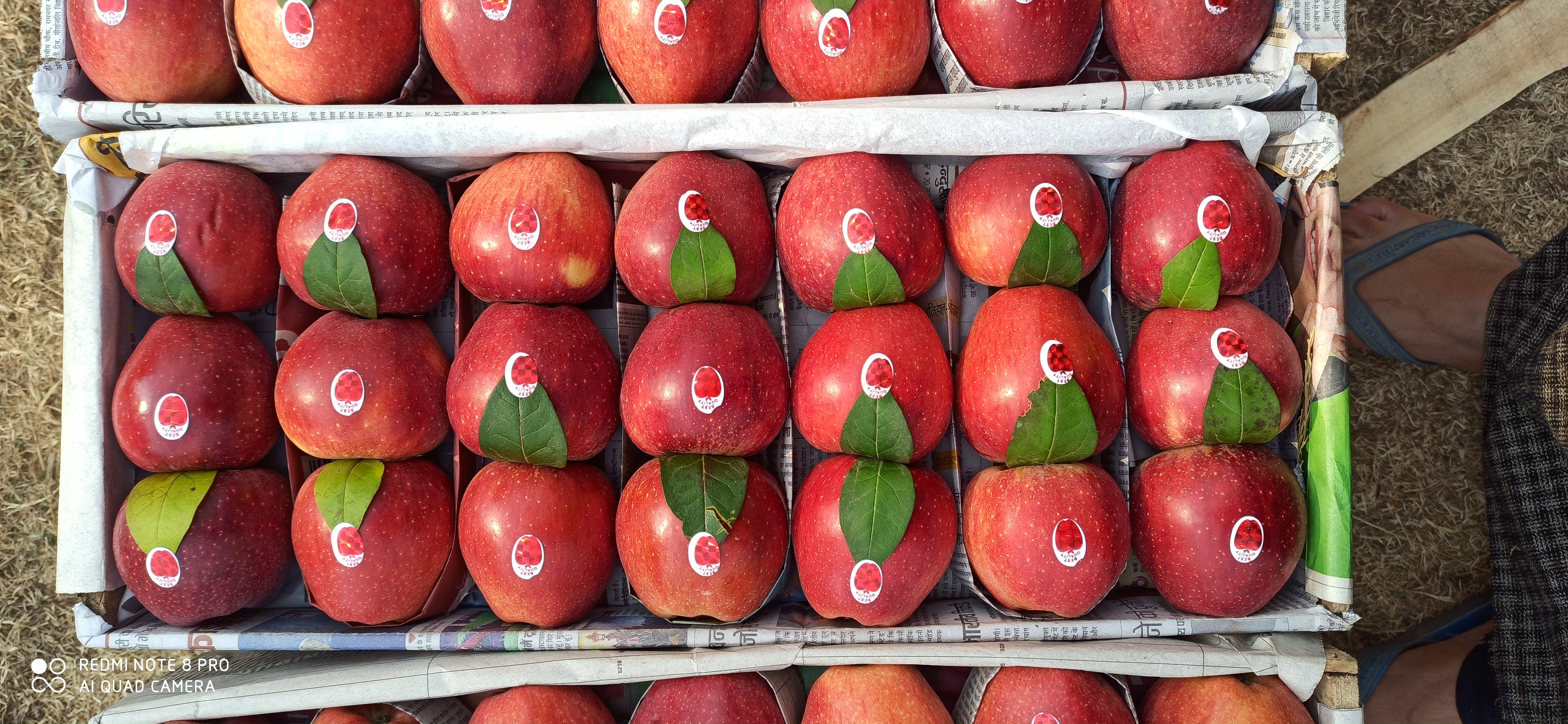
Jammu and Kashmir is also famous for its scenic beauty, flower gardens, apple farms and more. It attracts tourists for its unique handicrafts and the world-famous [[Kashmir shawl|Kashmiri Shawls]]. | Jammu and Kashmir is also famous for its scenic beauty, flower gardens, apple farms and more. It attracts tourists for its unique handicrafts and the world-famous [[Kashmir shawl|Kashmiri Shawls]]. | ||
<gallery mode="packed" heights="134"> | <gallery mode="packed" heights="134"> | ||
File: | File:River Chenab Ramban.jpg|River Chenab in [[Chenab Valley]] | ||
File:Shalimar | File:Gund village.jpg|[[Sind Valley|Sindh Valley]] | ||
File: | File:Pahalgam Valley.jpg|[[Lidder Valley]] | ||
File: | File:Shalimar Mughal Garden Srinagar 2.jpg|the [[Shalimar Bagh, Srinagar|Mughal Gardens]] | ||
File:Pahalgam views 13.JPG|[[Pahalgam]] views | |||
File:Gulmarg in 1969.jpg|[[Gulmarg]] | |||
File:Sanasar Lake.jpeg|Sanasar Lake which is around 11 km from [[Patnitop]] | |||
File:Amarnath 4.jpg|View of [[Amarnath Temple|Amarnath]] Valley. | |||
</gallery> | </gallery> | ||
== Notes == | == Notes == | ||
{{Notelist}} | {{Notelist}} | ||
== See also == | == See also == | ||
{{Portal|Geography|Asia|India}} | {{Portal|Geography|Asia|India}} | ||
| Line 492: | Line 380: | ||
* [[Jammu and Kashmir Rifles]] | * [[Jammu and Kashmir Rifles]] | ||
{{-}} | {{-}} | ||
== References == | == References == | ||
{{Reflist}} | {{Reflist}} | ||
==External links== | ==External links== | ||
{{Commons category}} | {{Commons category}} | ||
| Line 502: | Line 388: | ||
* [http://jkrajbhawan.nic.in/ Lieutenant Governor of Jammu and Kashmir] | * [http://jkrajbhawan.nic.in/ Lieutenant Governor of Jammu and Kashmir] | ||
* [https://jammukashmir.s3waas.gov.in/ Jammu and Kashmir district portal] | * [https://jammukashmir.s3waas.gov.in/ Jammu and Kashmir district portal] | ||
{{Jammu and Kashmir topics}} | {{Jammu and Kashmir topics}} | ||
{{Kashmir Valley}} | {{Kashmir Valley}} | ||
{{States and Union Territories of India}} | {{States and Union Territories of India}} | ||
{{Authority control}} | {{Authority control}} | ||
{{DEFAULTSORT:Jammu And Kashmir}} | {{DEFAULTSORT:Jammu And Kashmir}} | ||
[[Category:Jammu and Kashmir| ]] | [[Category:Jammu and Kashmir| ]] | ||
Revision as of 11:02, 7 February 2022
Jammu and Kashmir | |
|---|---|
  | |
 A map of Jammu and Kashmir (union Territory) bordered with yellow colour | |
 A map of the disputed Jammu and Kashmir region showing the Indian-administered union territory of Jammu and Kashmir | |
| Coordinates: 33°30′N 75°00′E / 33.5°N 75.0°E | |
| Country |  India India |
| Union territory | 31 October 2019 |
| Capital | Srinagar (May–October) Jammu (Nov-April)[1] |
| Districts | 20 |
| Government | |
| • Body | Government of Jammu and Kashmir |
| • Lieutenant Governor | Manoj Sinha |
| • Chief Minister | Vacant |
| • Legislature | Unicameral (114 seats)[2] |
| • Parliamentary constituency | Rajya Sabha (4) Lok Sabha (5) |
| • High Court | Jammu and Kashmir High Court |
| Area | |
| • Total | 42,241 km2 (16,309 sq mi) |
| Highest elevation | 7,135 m (23,409 ft) |
| Lowest elevation | 247 m (810 ft) |
| Population (2011)[4] | |
| • Total | 12,267,013 |
| • Density | 290/km2 (750/sq mi) |
| Languages | |
| • Official | Kashmiri, Dogri, Urdu, Hindi, English.[5][6] |
| • Spoken | Punjabi, Pahari, Gojri, Dadri[7][8] Bhadarwahi,[9] Bateri,[10] Shina,[11] Burushaski[12] and Khowar[13] |
| Time zone | UTC+05:30 (IST) |
| ISO 3166 code | IN-JK |
| Vehicle registration | JK |
| HDI (2018) |  0.688 (Medium) 0.688 (Medium) |
| Website | https://www.jk.gov.in |
Jammu and Kashmir[lower-alpha 2] is a region administered by India as a union territory and consists of the southern portion of the larger Jammu and Kashmir region, which has been the subject of a dispute between India and Pakistan since 1947, and between India and China since 1962.[15][16] The region of Jammu and Kashmir is separated by the Line of Control from the Pakistani-administered territories of Azad Kashmir and Gilgit-Baltistan in the west and north, respectively. It lies to the north of the Indian states of Himachal Pradesh and Punjab and to the west of Ladakh, which is also subject to the dispute as a part of Kashmir, and administered by India as a union territory.
Provisions for the formation of the union territory of Jammu and Kashmir were contained within the Jammu and Kashmir Reorganisation Act, 2019, which was passed by both houses of the Parliament of India in August 2019. The act re-constituted the former state of Jammu and Kashmir into two union territories, Jammu and Kashmir and Ladakh, with effect from 31 October 2019.[17]
Terminology
Jammu and Kashmir is named after the two regions it encompasses – the Jammu region and the Kashmir Valley.
The Government of Pakistan and Pakistani sources refer to Jammu and Kashmir as a part of "Indian-occupied Kashmir" ("IOK") or "Indian-held Kashmir" (IHK).[18][19] The Government of India and Indian sources in turn, call the territory under Pakistan control "Pakistan-occupied Kashmir" ("POK") or "Pakistan-held Kashmir" ("PHK").[20][21] "Indian-administered Kashmir" and "Indian-controlled Kashmir" are often used by neutral sources.[22]
History
The state of Jammu and Kashmir was accorded special status by Article 370 of the Constitution of India. In contrast to other states of India, Jammu and Kashmir had its own constitution, flag and administrative autonomy.[23] Indian citizens from other states were not allowed to purchase land or property in Jammu and Kashmir.[24]
Jammu and Kashmir had three distinct areas: Hindu-majority Jammu region, Muslim-majority Kashmir Valley and Buddhist-dominated Ladakh.[25] Unrest and violence persisted in the Kashmiri Valley and, following a disputed state election in 1987, an insurgency persisted in protest over autonomy and rights.[25][26]
The Bharatiya Janata Party (BJP) came to power in the 2014 Indian general election and five years later included in their 2019 election manifesto the revocation of Article 370 of the Constitution of India, in order to bring Jammu and Kashmir to equal status with other states.[25]
A resolution to repeal Article 370 was passed by both the houses of the Parliament of India in August 2019. At the same time, a reorganisation act was also passed, which would reconstitute the state into two union territories, Jammu and Kashmir and Ladakh.[27] The reorganisation took effect from 31 October 2019.[17]
Thousands of Kashmiris, including two former Chief Ministers and hundreds of other politicians, were detained in prisons all across India,[28] the state was put under a lockdown and communication and internet services were suspended.[29]
Geography
Topography

Jammu and Kashmir is home to several valleys such as the Kashmir Valley, Tawi Valley, Chenab Valley, Poonch Valley, Sind Valley and Lidder Valley.[30] The Kashmir valley is 100 km (62 mi) wide and 15,520.3 km2 (5,992.4 sq mi) in area.[31] The Himalayas divide the Kashmir valley from the Tibetan plateau while the Pir Panjal range, which encloses the valley from the west and the south, separates it from the Punjab Plain of the Indo-Gangetic Plain.[32] Along the northeastern flank of the Valley runs the main range of the Himalayas.[33] This valley has an average height of 1,850 metres (6,070 ft) above sea-level,[31] but the surrounding Pir Panjal range has an average elevation of 10,000 feet (3,000 m).[34] The Jhelum River is the major Himalayan river which flows through the Kashmir valley.[35] The Tawi, Ravi and Chenab are the other important rivers flowing through the region.[36]
Administrative divisions

The union territory of Jammu and Kashmir consists of two divisions: Jammu Division and Kashmir Division, and is further divided into 20 districts.[37]
| Division | Name | Headquarters | Area (km2) |
Area (sq miles) |
Rural Area (km2) |
Urban Area (km2) |
|
|---|---|---|---|---|---|---|---|
| Jammu | Kathua district | Kathua | 2,502 | 966 | 2,458.84 | 43.16 | [38] |
| Jammu district | Jammu | 2,342 | 904 | 2,089.87 | 252.13 | [39] | |
| Samba district | Samba | 904 | 349 | 865.24 | 38.76 | [40] | |
| Udhampur district | Udhampur | 2,637 | 1,018 | 2,593.28 | 43.72 | [41] | |
| Reasi district | Reasi | 1,719 | 664 | 1,679.99 | 39.01 | [42] | |
| Rajouri district | Rajouri | 2,630 | 1,015 | 2,608.11 | 21.89 | [43] | |
| Poonch district | Poonch | 1,674 | 646 | 1,649.92 | 24.08 | [44] | |
| Doda district | Doda | 8,912 | 3,441 | 8,892.25 | 19.75 | [45] | |
| Ramban district | Ramban | 1,329 | 513 | 1,313.92 | 15.08 | [46] | |
| Kishtwar district | Kishtwar | 1,644 | 635 | 1,643.37 | 0.63 | [47] | |
| Total for division | Jammu | 26,293 | 10,152 | 25,794.95 | 498.05 | ||
| Kashmir | Anantnag district | Anantnag | 3,574 | 1,380 | 3,475.76 | 98.24 | [48] |
| Kulgam district | Kulgam | 410 | 158 | 360.20 | 49.80 | [49] | |
| Pulwama district | Pulwama | 1,086 | 419 | 1,047.45 | 38.55 | [50] | |
| Shopian district | Shopian | 312 | 120 | 306.56 | 5.44 | [51] | |
| Budgam district | Budgam | 1,361 | 525 | 1,311.95 | 49.05 | [52] | |
| Srinagar district | Srinagar | 1,979 | 764 | 1,684.42 | 294.53 | [53] | |
| Ganderbal district | Ganderbal | 259 | 100 | 233.60 | 25.40 | [54] | |
| Bandipora district | Bandipora | 345 | 133 | 295.37 | 49.63 | [55] | |
| Baramulla district | Baramulla | 4,243 | 1,638 | 4,179.44 | 63.56 | [56] | |
| Kupwara district | Kupwara | 2,379 | 919 | 2,331.66 | 47.34 | [57] | |
| Total for division | Kashmir | 15,948 | 6,158 | 15,226.41 | 721.54 |
Demographics
Religion
Muslims constitutes the majority of the population of Jammu and Kashmir with a significant Hindu minority.[58]
The Kashmir Division is largely Muslim (96.41%) with a small Hindu (2.45%) and Sikh (0.81%) population. The Jammu Division is predominantly Hindu (66%) with a significant Muslim population (30%). The Muslims form a majority in the Rajouri, Poonch, Doda, Kishtwar and Ramban districts of Jammu, while the Hindus form a majority in Kathua, Samba, Jammu and Udhampur districts. Reasi district has an almost equal number of Hindus and Muslims.[58]
Government and politics
The union territory of Jammu and Kashmir is administered under the provisions of Article 239 of the Constitution of India. The Article 239A, originally formulated for the union territory of Puduchery, will also be applicable to Jammu and Kashmir.[59]
Executive branch
The President of India appoints a Lieutenant Governor for the union territory.[59]
A Council of Ministers led by a Chief Minister is appointed by the Lieutenant Governor from the membership of the legislative assembly. Their role is to advise the Lieutenant Governor in the exercise of functions in matters under the jurisdiction of the legislative assembly. In other matters, the Lieutenant Governor is empowered to act in his own capacity.[59]
Legislative branch
The legislative branch is of government is a unicameral legislative assembly, whose tenure is five years. The legislative assembly may make laws for any of the matters in the State List of the Constitution of India except "public order" and "police", which will remain the preserve of the central Government of India. The Lieutenant Governor also has the power to promulgate ordinances which have the same force as the acts of the legislative assembly.[59]
Elections for the Jammu and Kashmir Legislative Assembly are to be held following the implementation of new constituency boundaries which is expected to be completed in 2021.[60]
Judicial branch

The union territory is under the jurisdiction of the Jammu and Kashmir High Court, which also serves as high court for Ladakh.[59] Police services are provided by the Jammu and Kashmir Police.[61]
Parties
The main political parties active in the region are the Bharatiya Janata Party (State President: Ravinder Raina), the Indian National Congress (State President: Ghulam Ahmad Mir), the Jammu & Kashmir National Conference (President: Farooq Abdullah) and the Jammu and Kashmir People's Democratic Party (President: Mehbooba Mufti). Other parties with a presence in the region parties include the Communist Party of India (Marxist), the Jammu and Kashmir National Panthers Party, the Jammu and Kashmir People's Conference, the Jammu and Kashmir Apni Party (President: Altaf Bukhari), the Jammu and Kashmir Workers Party (President: Mir Junaid) and Ikkjutt Jammu (President: Ankur Sharma).
Jammu and Kashmir in the Parliament of India
Jammu and Kashmir sends five members (MPs) to the lower house of the Indian parliament (the Lok Sabha) and four members to the upper house (the Rajya Sabha).
- Lok Sabha constituencies in Jammu and Kashmir
| Constituency No. |
Constituency | Reserved for (SC/ST/None) |
|---|---|---|
| 1 | Baramulla | None |
| 2 | Srinagar | None |
| 3 | Anantnag | None |
| 4 | Udhampur | None |
| 5 | Jammu | None |
Tourism
Jammu and Kashmir is home to several valleys such as the Kashmir Valley, Chenab Valley, Sindh Valley and Lidder Valley. Some major tourist attractions in Jammu and Kashmir are Srinagar, the Mughal Gardens, Gulmarg, Pahalgam, Patnitop and Jammu. Every year, thousands of Hindu pilgrims visit holy shrines of Vaishno Devi and Amarnath which has had significant impact on the state's economy.[62]
The Kashmir valley is one of the top tourist destinations of India.[63] Gulmarg, one of the most popular ski resort destinations in India, is also home to the world's highest green golf course.[64] The decrease in violence in the state has boosted the state's economy, specifically tourism.[65]
Jammu and Kashmir is also famous for its scenic beauty, flower gardens, apple farms and more. It attracts tourists for its unique handicrafts and the world-famous Kashmiri Shawls.
-
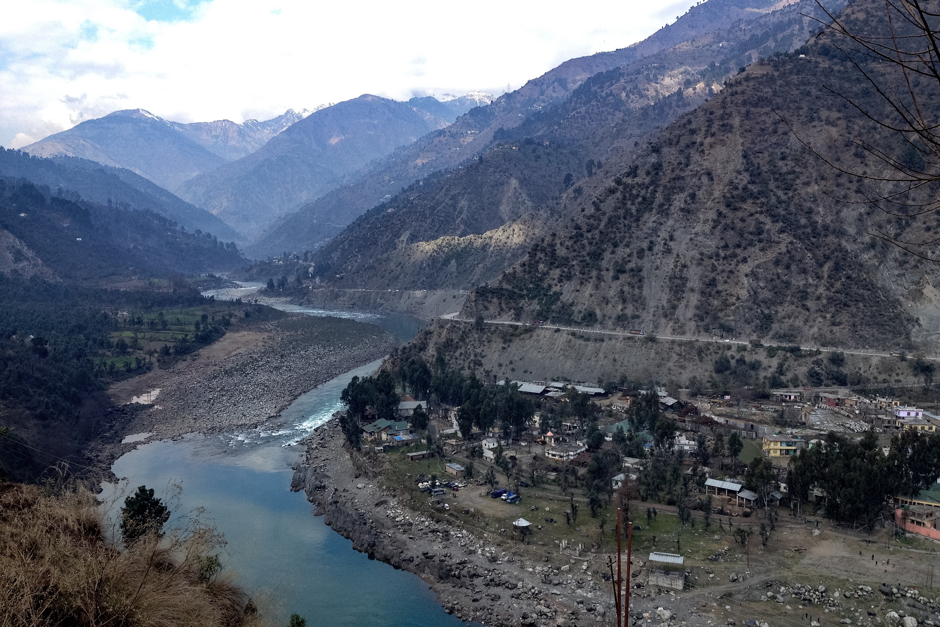 River Chenab in Chenab Valley
 -

-
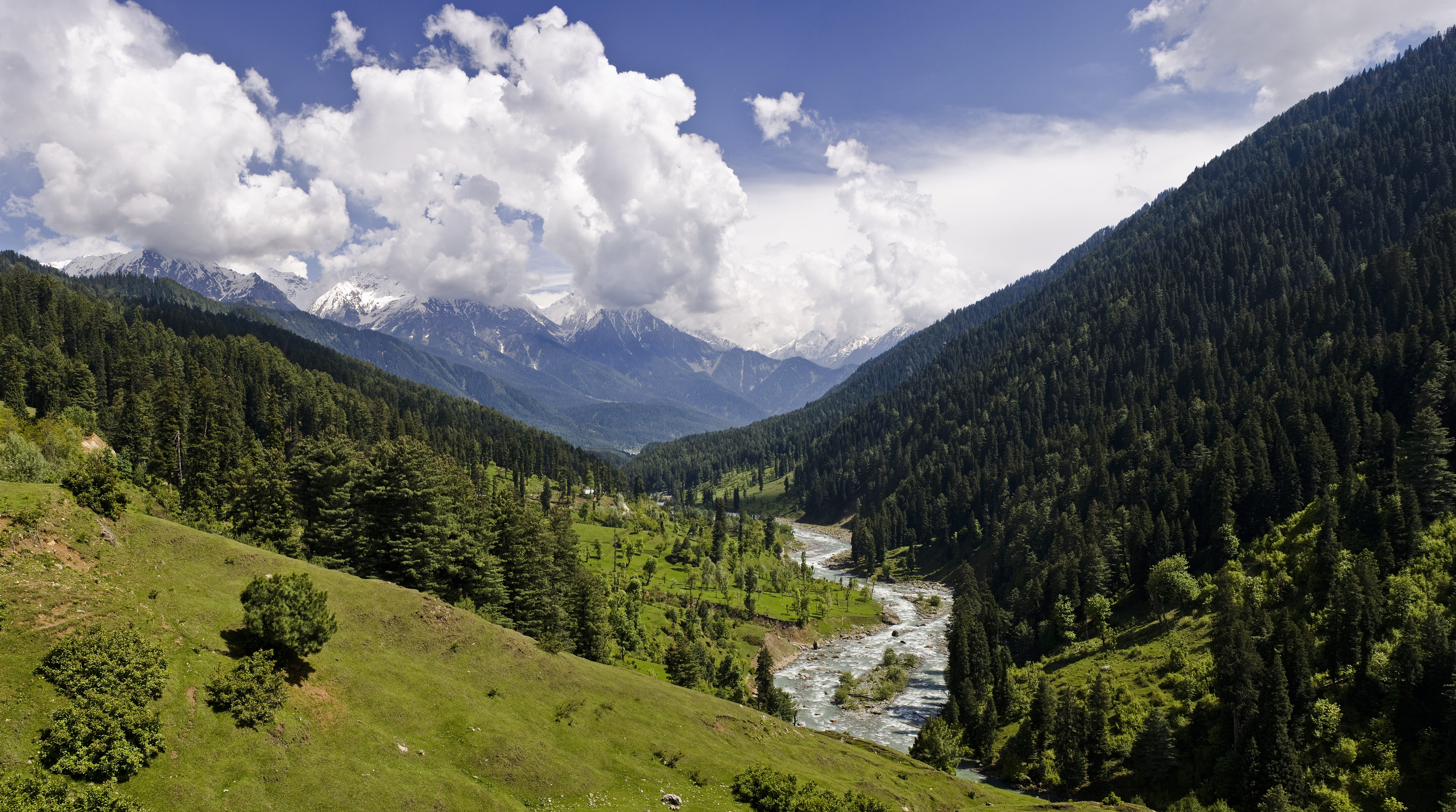
-
 the Mughal Gardens
 -
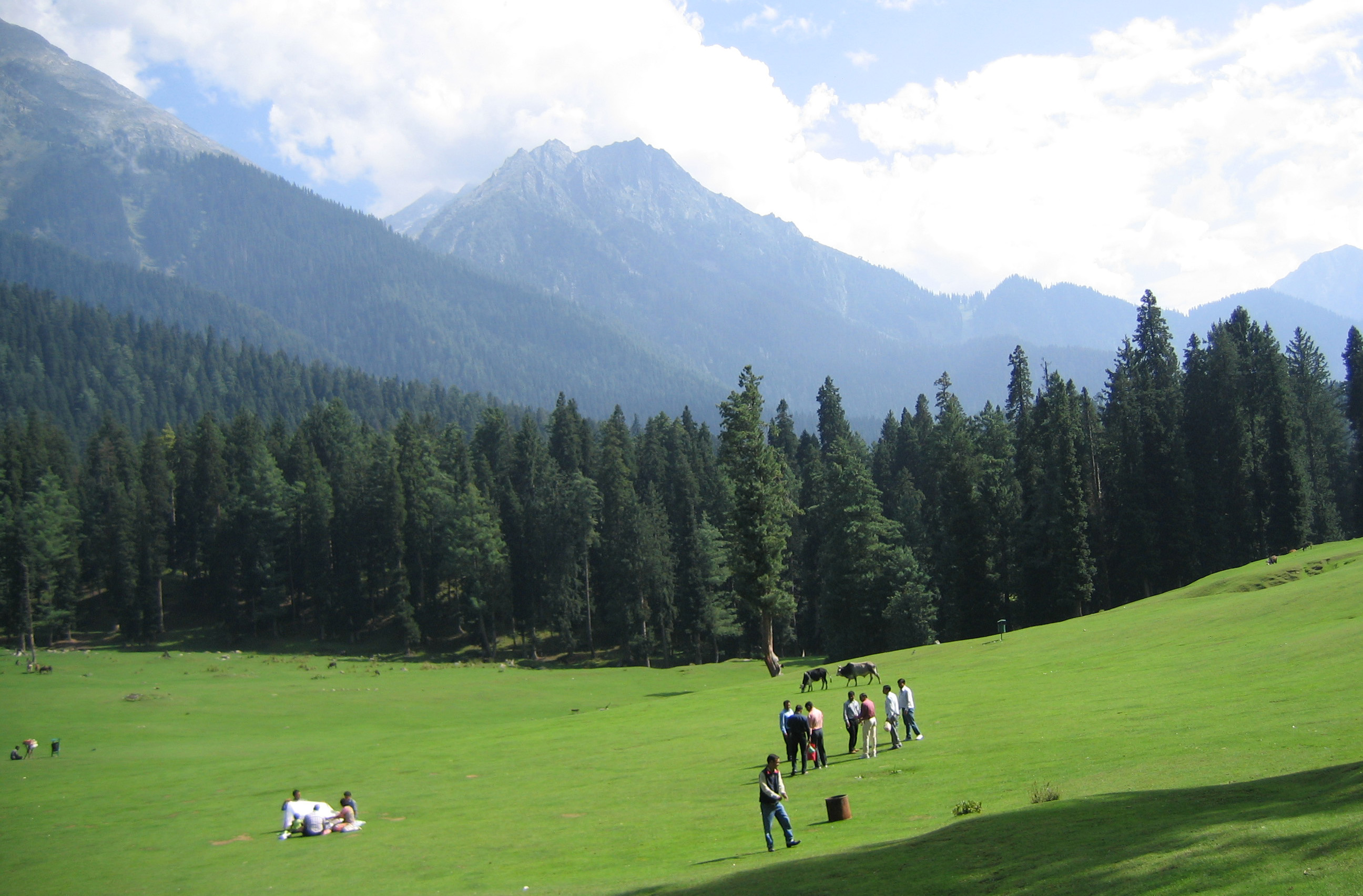 Pahalgam views
 -
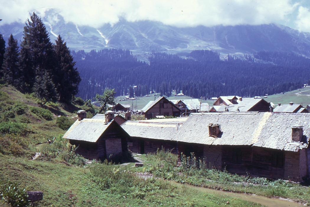
-
 Sanasar Lake which is around 11 km from Patnitop
 -
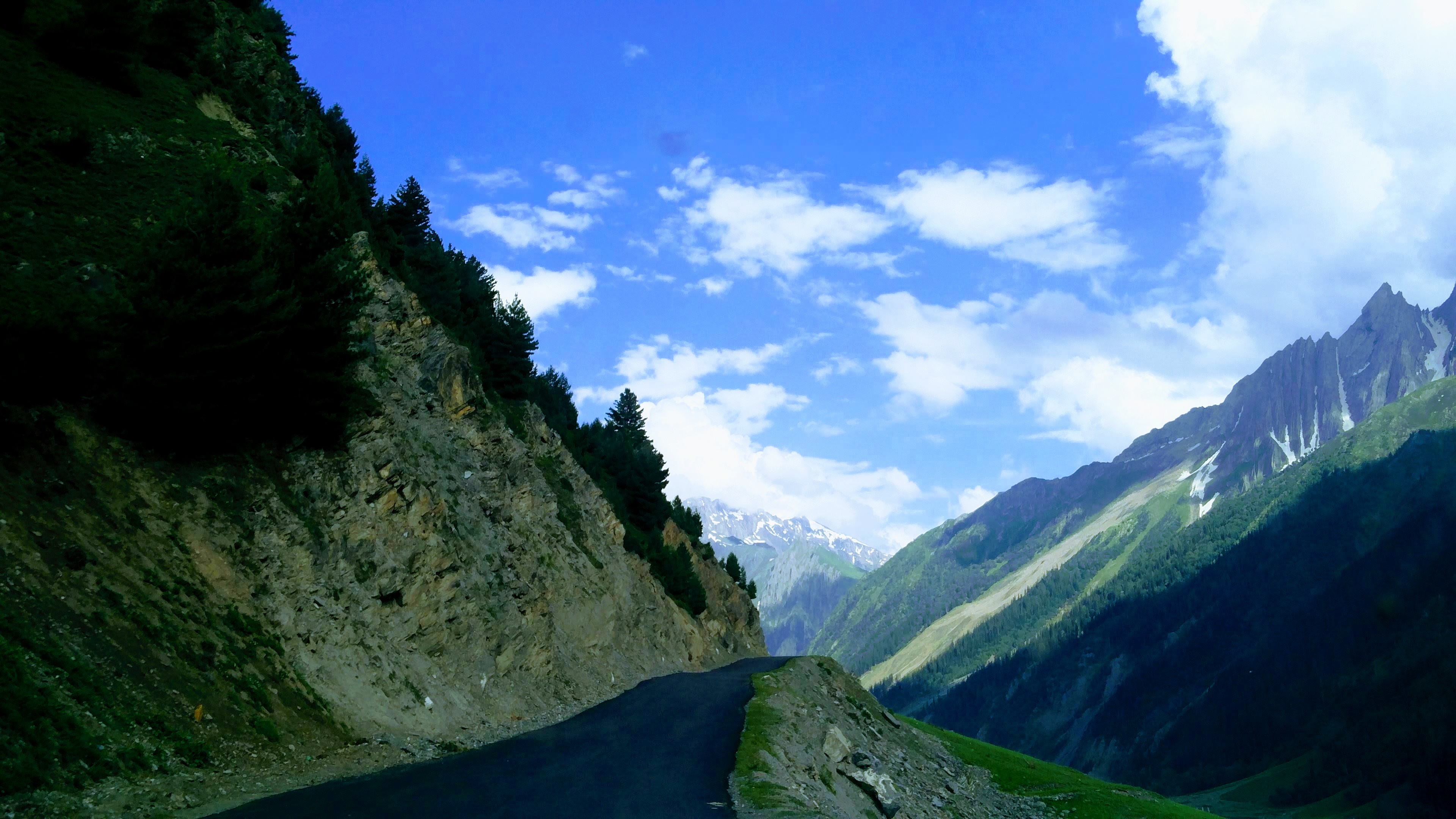 View of Amarnath Valley.


Notes
- ↑ Jammu and Kashmir is a disputed territory between India and Pakistan. Jammu and Kashmir has 42,241 km2 of area administered by India and 13,297 km2 of area controlled by Pakistan under Azad Kashmir which is claimed by India as part of Jammu and Kashmir.
- ↑ Pronounced variably as /ˈdʒæmuː/ or /ˈdʒʌmuː/, /ˈkæʃmɪər/ or /kæʃˈmɪər/.[14]
See also

- Jammu and Kashmir (princely state), for the entity that existed till 1952
- Kashmiriyat
- Tourism in Jammu and Kashmir
- Kashmiri cinema
- Literature of Kashmir
- Music of Jammu and Kashmir
- Kus Bani Koshur Karorpaet
- DD Kashir
- AIR Srinagar
- University of Kashmir
- University of Jammu
- Central University of Kashmir
- Central University of Jammu
- Jammu and Kashmir cricket team
- Real Kashmir F.C.
- Jammu and Kashmir football team
- Jammu and Kashmir Police
- Jammu and Kashmir Light Infantry
- Jammu and Kashmir Rifles
References
- ↑ Desk, The Hindu Net (8 May 2017). "What is the Darbar Move in J&K all about?". The Hindu. Archived from the original on 10 November 2017. Retrieved 23 February 2019.
{{cite news}}:|last=has generic name (help) - ↑ Shaswati Das. "Jammu and Kashmir transitions from a state into 2 federal units". livemint.com. Live Mint. Retrieved 30 June 2020.
Jammu and Kashmir will also have its own legislative assembly, under which, according to the Act, the number of seats will go up to 114 from 87 currently, following a delimitation exercise.
- ↑ Singh, Jogindar (1975). "Saser Kangri". The American Alpine Journal (AAJ). pp. 67–67. Archived from the original on 14 February 2019. Retrieved 14 February 2019. pdf of original pages
- ↑ Singh, Vijaita (29 February 2020). "Only J&K will use 2011 Census for delimitation". The Hindu. Retrieved 6 November 2020.
- ↑ "The Jammu and Kashmir Official Languages Act, 2020" (PDF). The Gazette of India. 27 September 2020. Retrieved 27 September 2020.
- ↑ "Parliament passes JK Official Languages Bill, 2020". Rising Kashmir. 23 September 2020. Retrieved 23 September 2020.
- ↑ Khan, N. (6 August 2012). The Parchment of Kashmir: History, Society, and Polity. Springer. p. 184. ISBN 9781137029584. Archived from the original on 23 February 2019. Retrieved 23 February 2019.
- ↑ Aggarwal, J. C.; Agrawal, S. P. (1995). Modern History of Jammu and Kashmir: Ancient times to Shimla Agreement. Concept Publishing Company. ISBN 9788170225577. Archived from the original on 24 February 2019. Retrieved 23 February 2019.
- ↑ Bhadrawahi. Retrieved 6 August 2019.
{{cite encyclopedia}}:|website=ignored (help) - ↑ Bateri.
- ↑ Crane, Robert I. (1956). Area Handbook on Jammu and Kashmir State. University of Chicago for the Human Relations Area Files. p. 179.
Shina is the most eastern of these languages and in some of its dialects such as the Brokpa of Dah and Hanu and the dialect of Dras, it impinges upon the area of the Sino-Tibetan language family and has been affected by Tibetan with an overlay of words and idioms.
- ↑ Pakistan's "Burushaski" Language Finds New Relatives. Retrieved 6 August 2019.
{{cite encyclopedia}}:|website=ignored (help) - ↑ Simons, Gary F.; Fennig, Charles D. (2017). Ethnologue: Languages of the World, Twentieth Edition. Dallas: SIL International.
- ↑ Jones, Daniel (2003) [1917], Peter Roach; James Hartmann; Jane Setter (eds.), English Pronouncing Dictionary, Cambridge: Cambridge University Press, ISBN 978-3-12-539683-8
- ↑ (a) Editors of Encyclopaedia Britannia, "Kashmir, region Indian subcontinent", Encyclopædia Britannica, retrieved 15 August 2019
{{citation}}:|last1=has generic name (help) (subscription required) Quote: "Kashmir, region of the northwestern Indian subcontinent ... has been the subject of dispute between India and Pakistan since the partition of the Indian subcontinent in 1947. The northern and western portions are administered by Pakistan and comprise three areas: Azad Kashmir, Gilgit, and Baltistan, the last two being part of a territory called the Northern Areas. Administered by India are the southern and southeastern portions, which constitute the state of Jammu and Kashmir but are slated to be split into two union territories. China became active in the eastern area of Kashmir in the 1950s and has controlled the northeastern part of Ladakh (the easternmost portion of the region) since 1962.";
(b) "Kashmir", Encyclopedia Americana, Scholastic Library Publishing, 2006, p. 328, ISBN 978-0-7172-0139-6 C. E Bosworth, University of Manchester Quote: "KASHMIR, kash'mer, the northernmost region of the Indian subcontinent, administered partlv by India, partly by Pakistan, and partly by China. The region has been the subject of a bitter dispute between India and Pakistan since they became independent in 1947"; - ↑ Osmańczyk, Edmund Jan (2003), Encyclopedia of the United Nations and International Agreements: G to M, Taylor & Francis, pp. 1191–, ISBN 978-0-415-93922-5 Quote: "Jammu and Kashmir: Territory in northwestern India, subject to a dispute between India and Pakistan. It has borders with Pakistan and China."
- ↑ 17.0 17.1 Ministry of Home Affairs (9 August 2019), "In exercise of the powers conferred by clause a of section 2 of the Jammu and Kashmir Reorganisation Act." (PDF), The Gazette of India, retrieved 9 August 2019
- ↑ Zain, Ali (13 September 2015). "Pakistani flag hoisted, pro-freedom slogans chanted in Indian Occupied Kashmir – Daily Pakistan Global". En.dailypakistan.com.pk. Archived from the original on 18 November 2015. Retrieved 17 November 2015.
- ↑ "Pakistani flag hoisted once again in Indian Occupied Kashmir". Dunya News. 11 September 2015. Retrieved 17 November 2015.
- ↑ Snedden, Christopher (2013). Kashmir: The Unwritten History. HarperCollins India. pp. 2–3. ISBN 978-9350298985.
- ↑ "The enigma of terminology". The Hindu. 27 January 2014. Archived from the original on 16 October 2015.
- ↑ South Asia: fourth report of session 2006–07 by By Great Britain: Parliament: House of Commons: Foreign Affairs Committee page 37
- ↑ K. Venkataramanan (5 August 2019), "How the status of Jammu and Kashmir is being changed", The Hindu
- ↑ "Article 370 and 35(A) revoked: How it would change the face of Kashmir". The Economic Times. 5 August 2019.
- ↑ 25.0 25.1 25.2 Article 370: What happened with Kashmir and why it matters. BBC (6 August 2019). Retrieved 7 August 2019.
- ↑ Jeelani, Mushtaq A. (25 June 2001). "Kashmir: A History Littered With Rigged Elections". Media Monitors Network. Archived from the original on 4 March 2016. Retrieved 24 February 2017.
- ↑ "Parliament Live | Lok Sabha passes Jammu and Kashmir Reorganisation Bill, Ayes: 370, Noes 70". The Hindu. 6 August 2019. Retrieved 6 August 2019.
- ↑ "Thousands detained in Indian Kashmir crackdown, official data reveals". Reuters. 12 September 2019.
- ↑ "Kashmir in lockdown after autonomy scrapped". BBC News. 6 August 2019. Retrieved 6 June 2021.
- ↑ Vij, Shivam (5 May 2017). "Kashmir Is A Prison With Three Walls". HuffPost. Archived from the original on 5 May 2017. Retrieved 9 August 2019. Alt URL
- ↑ 31.0 31.1 Guruswamy, Mohan (28 September 2016). "Indus: The water flow can't be stopped". The Asian Age. Retrieved 9 August 2019.
- ↑ Khan, Asma (26 April 2018). "A Tryst of the Heart and History along the Karakoram Highway". Greater Kashmir. Retrieved 9 August 2019.
- ↑ Andrei, Mihai (11 March 2019). "Why India and Pakistan keep fighting over Kashmir – the history of the Kashmir conflict". GME Science. Retrieved 9 August 2019.
- ↑ Vrinda; J. Ramanan (21 December 2017). "Doorway of the gods: Himalaya crosses five countries". The Hindu. Retrieved 9 August 2019.
- ↑ "Jhelum River". Encyclopædia Britannica. 15 December 2015. Retrieved 9 August 2019.
- ↑ Agencies (29 July 2019). "Flooding alert issued as India releases water". The Nation. Retrieved 9 August 2019.
- ↑ "Ministry of Home Affairs:: Department of Jammu & Kashmir Affairs". Archived from the original on 8 December 2008. Retrieved 28 August 2008.
- ↑ District Census Handbook Kathua (PDF). Census of India 2011, Part A (Report). 18 June 2014. p. 8. Retrieved 21 November 2020.
- ↑ District Census Handbook Jammu, Part A (PDF). Census of India 2011 (Report). 18 June 2014. pp. 13, 51, 116. Retrieved 21 November 2020.
District Census Handbook Jammu, Part B (PDF). Census of India 2011 (Report). 16 June 2014. pp. 13, 24. Retrieved 21 November 2020. - ↑ District Census Handbook Samba, Part A (PDF). Census of India 2011 (Report). 18 June 2014. pp. 9, 34, 36, 100. Retrieved 21 November 2020.
District Census Handbook Samba, Part B (PDF). Census of India 2011 (Report). 16 June 2014. pp. 10, 12, 22. Retrieved 21 November 2020. - ↑ District Census Handbook Udhampur (PDF). Census of India 2011 (Report). 16 June 2014. pp. 12, 22. Retrieved 21 November 2020.
- ↑ District Census Handbook Reasi, Part A (PDF). Census of India 2011 (Report). 18 June 2014. pp. 9, 37, 88. Retrieved 21 November 2020.
District Census Handbook Reasi, Part B (PDF). Census of India 2011 (Report). 16 June 2014. pp. 9, 13, 24. Retrieved 21 November 2020. - ↑ District Census Handbook Rajouri, Part A (PDF). Census of India 2011 (Report). 18 June 2014. pp. 11, 107. Retrieved 21 November 2020.
District Census Handbook Rajouri, Part B (PDF). Census of India 2011 (Report). 16 June 2014. pp. 9, 10, 12, 22. Retrieved 21 November 2020. - ↑ District Census Handbook Punch, Part A (PDF). Census of India 2011 (Report). 18 June 2014. pp. 9, 99. Retrieved 21 November 2020.
District Census Handbook Punch, Part B (PDF). Census of India 2011 (Report). 16 June 2014. pp. 11, 13, 24. Retrieved 21 November 2020. - ↑ District Census Handbook Doda, Part B (PDF). Census of India 2011 (Report). 18 June 2014. pp. 9, 12, 99. Retrieved 21 November 2020.
- ↑ District Census Handbook Ramban, Part B (PDF). Census of India 2011 (Report). 18 June 2014. pp. 10, 12. Retrieved 21 November 2020.
- ↑ District Census Handbook Kishtwar, Part B (PDF). Census of India 2011 (Report). 18 June 2014. pp. 9, 10, 22. Retrieved 21 November 2020.
Part B page 9 says the rural area is 1643.65 km2, whilst pages 10 and 22 says 1643.37 km2. - ↑ District Census Handbook Anantnag, Part A (PDF). Census of India 2011 (Report). July 2016. p. 9. Retrieved 21 November 2020.
District Census Handbook Anantnag, Part B (PDF). Census of India 2011 (Report). July 2016. pp. 12, 22. Retrieved 21 November 2020. - ↑ District Census Handbook Kulgam, Part A (PDF). Census of India 2011 (Report). July 2016. p. 10. Retrieved 21 November 2020.
District Census Handbook Kulgam, Part B (PDF). Census of India 2011 (Report). 16 June 2014. pp. 12, 22. Retrieved 21 November 2020.
Part B page 12 says the are of the district is 404 km2, but page 22 says 410 km2. - ↑ District Census Handbook Pulwama, Part B (PDF). Census of India 2011 (Report). 16 June 2014. pp. 12, 22. Retrieved 21 November 2020.
- ↑ District Census Handbook Shupiyan, Part A (PDF). Census of India 2011 (Report). 16 June 2014. p. 10. Retrieved 21 November 2020.
District Census Handbook Shupiyan, Part B (PDF). Census of India 2011 (Report). 16 June 2014. pp. 12, 22. Retrieved 21 November 2020.
Part B pages 12 and 22 say the district area is 312.00 km2, but Part A page 10 says 307.42 km2. - ↑ District Census Handbook Badgam, Part A (PDF). Census of India 2011 (Report). July 2016. pp. 10, 46. Retrieved 21 November 2020.
District Census Handbook Badgam, Part B (PDF). Census of India 2011 (Report). 16 June 2014. pp. 11, 12, 22. Retrieved 21 November 2020.
Part A says the district area is 1371 km2, Part B says 1371 km2 (page 11) and 1361 km2 (page 12s and 22). - ↑ District Census Handbook Srinagar, Part A (PDF). Census of India 2011 (Report). July 2016. pp. 11, 48. Retrieved 21 November 2020.
Part A page 48 says the district area was 2228.0 km2 in 2001 and 1978.95 km2 in 2011. - ↑ District Census Handbook Ganderbal, Part B (PDF). Census of India 2011 (Report). July 2016. pp. 11, 12 and 22. Retrieved 21 November 2020.
Part B page 11 says the district area is 393.04 km2, but pages 12 and 22 say 259.00 km2. - ↑ District Census Handbook Bandipora, Part A (PDF). Census of India 2011 (Report). July 2016. pp. 10, 47. Retrieved 21 November 2020.
District Census Handbook Bandipora, Part B (PDF). Census of India 2011 (Report). 16 June 2014. pp. 11, 20. Retrieved 21 November 2020. - ↑ District Census Handbook Baramulla, Part A (PDF). Census of India 2011 (Report). July 2016. p. 11. Retrieved 21 November 2020.
District Census Handbook Baramulla, Part B (PDF). Census of India 2011 (Report). 16 June 2014. p. 22. Retrieved 21 November 2020. - ↑ District Census Handbook Kupwara, Part A (PDF). Census of India 2011 (Report). July 2016. p. 7. Retrieved 21 November 2020.
District Census Handbook Kupwara, Part B (PDF). Census of India 2011 (Report). 16 June 2014. pp. 11, 12. Retrieved 21 November 2020. - ↑ 58.0 58.1 58.2 "Population by religion community – 2011". Census of India, 2011. The Registrar General & Census Commissioner, India. Archived from the original on 25 August 2015.
- ↑ 59.0 59.1 59.2 59.3 59.4 Jammu & Kashmir Reorganisation Bill passed by Rajya Sabha: Key takeaways, The Indian Express, 5 August 2019.
- ↑ "Jammu and Kashmir assembly election in 2021 after delimitation: EC sources". Zee News. 29 August 2019.
- ↑ Ratan, Devesh; Johri, Iti (7 August 2019). "Salient Features Of Jammu & Kashmir Reorganization Bill [Read Bill]". LiveLaw.in: All about law. Retrieved 7 August 2019.
- ↑ "Amarnath Board to study yatra impact on Kashmir economy". Online edition of The Hindu. Chennai, India. 13 September 2007. Retrieved 6 June 2009.
- ↑ "Foreign tourists flock Kashmir". Online edition of The Hindu. Chennai, India. 18 March 2009. Retrieved 18 March 2009.
- ↑ Cris Prystay (26 October 2007). "Fairway to Heaven". The Wall Street Journal.
- ↑ "Tourists arrival gives boost to J-K economy". Sify. Archived from the original on 16 July 2011.
External links
- Government of Jammu and Kashmir
- General Administration Department
- Lieutenant Governor of Jammu and Kashmir
- Jammu and Kashmir district portal

| Passes |  | |
|---|---|---|
| Valleys | ||
| Cities | ||
| Towns |
| |
| Rivers | ||
| Glaciers | ||
| Lakes | ||
| Mountains | ||
| Hill stations and Mughal gardens | ||
| Protected Areas | ||
| See also | ||