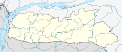
Balat, Meghalaya
Balat
Balet | |
|---|---|
town | |
| Coordinates: 25°11′46″N 91°22′37″E / 25.196088°N 91.376982°ECoordinates: 25°11′46″N 91°22′37″E / 25.196088°N 91.376982°E | |
| Country | |
| State | Meghalaya |
| District | East Khasi Hills |
| Population (2011)[1] | |
| • Total | 987 |
| Languages | |
| • Official | English |
| Time zone | UTC+5:30 (IST) |
| Vehicle registration | ML |
| Coastline | 0 kilometres (0 mi) |
| Climate | Am |
Balat is a town in the Indian state of Meghalaya.[2] It is one of the designated India-Bangladesh Border Haat.[3]
Climate[edit | edit source]
The climate here is tropical. During most months of the year, there is significant rainfall in Balat. There is only a short dry season. This climate is considered to be Am according to the Köppen-Geiger climate classification. The temperature here averages 24.7 °C. The rainfall here averages 3444 mm. The driest month is December, with 6 mm of rain. Most precipitation falls in June, with an average of 740 mm [1]
See also[edit | edit source]
- Bangladesh–India border
- Borders of India
- Border ceremonies of India's with neighbours
- Foreign trade of India
- BIMSTEC
- SAARC
References[edit | edit source]
- ↑ "Census 2011, Balat village Data".
- ↑ "Balat, Meghalaya, India".
- ↑ Meghalaya border haats, megindustry.gov.in, accessed 28 Aug 2021.
