



Ajay Kumar (talk | contribs) Created a new article Tag: New redirect |
m basic improve information for consistency additionally for consistency |
||
| Line 1: | Line 1: | ||
# | {{pp|small=yes}} | ||
{{Short description|City in Bihar, India}} | |||
{{Use Indian English|date=May 2025}} | |||
{{Use dmy dates|date=May 2025}} | |||
{{Infobox settlement | |||
| name = Gaya | |||
| other_name = | |||
| settlement_type = [[City]] | |||
| image_skyline = {{multiple image | |||
| border = infobox | |||
| total_width = 290 | |||
| image_style = border:1 | |||
| perrow = 1/1 | |||
| image1 = Vishnupad temple gaya bihar.jpg | |||
| image2 = Dungeshwari Hills.jpg | |||
| image3 = Gaya Airport GAY.jpg | |||
| image4 = Sujata Garh.JPG | |||
| image5 = Mahabodhitemple.jpg | |||
}} | |||
| image_caption = From top: [[Vishnupad Temple]], [[Gaya Airport]], [[Sujata Stupa]] and [[Mahabodhi Temple]] | |||
| image_map = | |||
| map_alt = | |||
| map_caption = Location of Gaya in Bihar | |||
| pushpin_map = India Bihar#India | |||
| pushpin_label_position = right | |||
| pushpin_map_alt = | |||
| pushpin_map_caption = | |||
| coordinates = {{coord|24.75|N|85.01|E|display=inline,title}} | |||
| subdivision_type = Country | |||
| subdivision_name = {{flag|India}} | |||
| subdivision_type1 = [[States and union territories of India|State]] | |||
| subdivision_type2 = [[Administrative divisions of India|Region]] | |||
| subdivision_type3 = [[Divisions of Bihar|Division]] | |||
| subdivision_type4 = [[List of districts in India|District]] | |||
| subdivision_name1 = {{flagicon image|Bihar Government Banner.png}} [[Bihar]] | |||
| subdivision_name2 = [[Magadha (Mahajanapada)|Magadha]] | |||
| subdivision_name3 = [[Magadh Division]] | |||
| subdivision_name4 = [[Gaya district|Gaya]] | |||
| established_title = Keekat Kshetra (R.V) | |||
| established_date = | |||
| founder = | |||
| named_for = [[Gayasura]] | |||
| government_type = [[Municipal corporation]] | |||
| governing_body = [[Gaya Municipal Corporation|Gaya Nagar Nigam]] | |||
| leader_title = [[Mayor]] | |||
| leader_name = Ganesh Paswan | |||
| unit_pref = Metric | |||
| area_footnotes = <ref>{{cite news|title=Gaya Municipal Corporation|website=[[The Times of India]]|date=31 August 2019|url=https://timesofindia.indiatimes.com/city/patna/gaya-chokes-as-master-plan-in-limbo/articleshow/70915995.cms|access-date=22 November 2020|archive-date=15 September 2020|archive-url=https://web.archive.org/web/20200915235944/https://timesofindia.indiatimes.com/city/patna/gaya-chokes-as-master-plan-in-limbo/articleshow/70915995.cms|url-status=live}}</ref><ref name=CDP-Gaya>{{cite web | url=http://urban.bih.nic.in/Docs/CDP/CDP-Gaya.pdf| page=4 | title=City Development Plan for Gaya: EXECUTIVE SUMMARY | publisher=Urban Development and Housing Department, Government of Bihar | access-date=8 October 2012 | url-status=dead | archive-url=https://web.archive.org/web/20140913030335/http://urban.bih.nic.in/Docs/CDP/CDP-Gaya.pdf | archive-date=13 September 2014}}</ref> | |||
| area_total_km2 = 308 | |||
| area_rank = 21 (India), 3rd (Bihar) | |||
| elevation_footnotes = | |||
| elevation_m = 111 | |||
| population_total = 470839<ref name="census2011"/> | |||
| population_as_of = 2011 | |||
| population_density_km2 = 9490 | |||
| population_rank = 102 (India), 2nd (Bihar) | |||
| population_demonym = Gayaite, Gayavi, Gayawaal<ref>{{cite web |url=http://huntnews.in/p/detail/458673712122865?xlang=en&uc_param_str=dnfrpfbivesscpgimibtbmntnijblauputoggdnw&pos=1462975380148&channel=education&chncat=category_english |title=Two Bihar boys in top 10 of civil services |access-date=12 July 2016 |url-status=live |archive-url=https://web.archive.org/web/20160816020056/http://huntnews.in/p/detail/458673712122865?xlang=en&uc_param_str=dnfrpfbivesscpgimibtbmntnijblauputoggdnw&pos=1462975380148&channel=education&chncat=category_english |archive-date=16 August 2016}}</ref> | |||
| demographics_type1 = Languages | |||
| demographics1_title1 = Official | |||
| timezone1 = [[Indian Standard Time|IST]] | |||
| utc_offset1 = +5:30 | |||
| postal_code_type = [[Postal Index Number|PIN]] | |||
| postal_code = 823001 - 13 | |||
| area_code = 91-631 | |||
| area_code_type = Telephone code | |||
| iso_code = [[ISO 3166-2:IN|IN-BR]] | |||
| registration_plate = BR-02 | |||
| website = {{URL|https://gaya.nic.in//}} | |||
| footnotes = | |||
| demographics1_info1 = [[Hindi]], [[English language|English]] | |||
| demographics1_title2 = Spoken | |||
| demographics1_info2 = [[Magahi]], [[Bengali language|Bengali]], [[Bhojpuri language|Bhojpuri]], [[Maithili language|Maithili]] | |||
| blank1_name = Railway Station | |||
| blank1_info = [[Gaya Junction]] | |||
| blank2_name = Airport | |||
| blank2_info = [[Gaya International Airport]] | |||
| official_name = | |||
| leader_title1 = [[Deputy Mayor]] | |||
| leader_name1 = Mohan Shrivastava | |||
}} | |||
'''Gaya''' ([[International Alphabet of Sanskrit Transliteration|IAST]]: {{lang|hi-Latn|Gayā}}) is a city, municipal corporation and the administrative headquarters of [[Gaya district|Gaya district]] and [[Magadh division]] of the [[States and union territories of India|Indian state]] of [[Bihar]]. Gaya is {{convert|116|km|mi}} south of [[Patna]] and is the state's [[List of cities in Bihar by population|second-largest]] city, with a population of 470,839. The city is surrounded on three sides by small, rocky hills ([[Mangla Gauri|Mangla-Gauri]], Shringa-Sthan, Ram-Shila, and Brahmayoni), with the [[Phalgu|Phalgu River]] on its eastern side. | |||
It is a city of historical significance and is one of the major tourist attractions. Gaya is sanctified in the [[Jain]], [[Hindu]], and [[Buddhist]] religions. Gaya district is mentioned in the great epics, the ''[[Ramayana]]'' and the ''[[Mahabharata]]''. It is the place where [[Rama]], with [[Sita]] and [[Lakshmana]], came to offer [[Pinda (riceball)|piṇḍadāna]] for their father, [[Dasharatha]], and continues to be a major Hindu pilgrimage site for the piṇḍadāna ritual. [[Bodh Gaya]], where [[Buddha]] is said to have attained [[Enlightenment in Buddhism|enlightenment]], is one of the four holy sites of [[Buddhism]]. | |||
Gaya was chosen as one of twelve heritage cities to benefit from the Government of India's four-year [[Heritage City Development and Augmentation Yojana]] (HRIDAY) scheme for urban planning, economic growth and heritage conservation projects.<ref>{{cite news |last=HRIDAY National Project Management Unit, National Institute of Urban Affairs, Ministry of Urban Development Government of India |date=21 January 2015 |title=Heritage City Development and Augmentation Yojana |website=www.hridayindia.in |url=https://hridayindia.in/wp-content/uploads/2015/01/hriday-brochure.pdf |access-date=26 September 2018 |archive-date=29 May 2016 |archive-url=https://web.archive.org/web/20160529205452/http://hridayindia.in/wp-content/uploads/2015/01/hriday-brochure.pdf |url-status=live }}</ref> | |||
==Etymology== | |||
Gaya is named after the demon ''[[Gayasura]]'' (meaning "the demon Gaya") who dwelt the area during the [[Treta Yuga]].<ref>{{Cite book |last=Mandal |first=R. B. |url=https://books.google.com/books?id=TEdpwKpTYqsC&dq=ganj+gaya+bihar&pg=PA134 |title=Systems of Rural Settlements in Developing Countries |date=1989 |publisher=Concept Publishing Company |isbn=978-81-7022-203-3 |language=en |access-date=21 June 2022 |archive-date=5 April 2023 |archive-url=https://web.archive.org/web/20230405023058/https://books.google.com/books?id=TEdpwKpTYqsC&dq=ganj+gaya+bihar&pg=PA134 |url-status=live }}</ref><ref>{{Cite book |last1=Bihar (India) |url=https://books.google.com/books?id=lTFuAAAAMAAJ&q=gaya+bihar+treta+yuga |title=Bihar District Gazetteers: Singhbhum |last2=Choudhury |first2=Pranab Chandra Roy |date=1957 |publisher=Superintendent, Secretariat Press, Bihar |language=en |access-date=21 June 2022 |archive-date=5 April 2023 |archive-url=https://web.archive.org/web/20230405023056/https://books.google.com/books?id=lTFuAAAAMAAJ&q=gaya+bihar+treta+yuga |url-status=live }}</ref> According to [[Vayu Purana]], Gaya was the name of a demon ([[Asura]]) whose body became pious after he performed strict [[Tapas (Indian religions)|penance]] and secured blessings from Lord [[Vishnu]].<ref name=MSME /> It was said that the body of [[Gayasura]] was transformed into the series of rocky hills that make up the landscape of Gaya.<ref>{{cite web |url=http://www.harekrsna.com/philosophy/associates/demons/vishnu/gayasur.htm |title=The Hare Krsnas - Battles of Vishnu Avatars - Gayasur |publisher=Harekrsna.com |access-date=7 January 2016 |url-status=live |archive-url=https://web.archive.org/web/20160304115138/http://www.harekrsna.com/philosophy/associates/demons/vishnu/gayasur.htm |archive-date=4 March 2016}}</ref> | |||
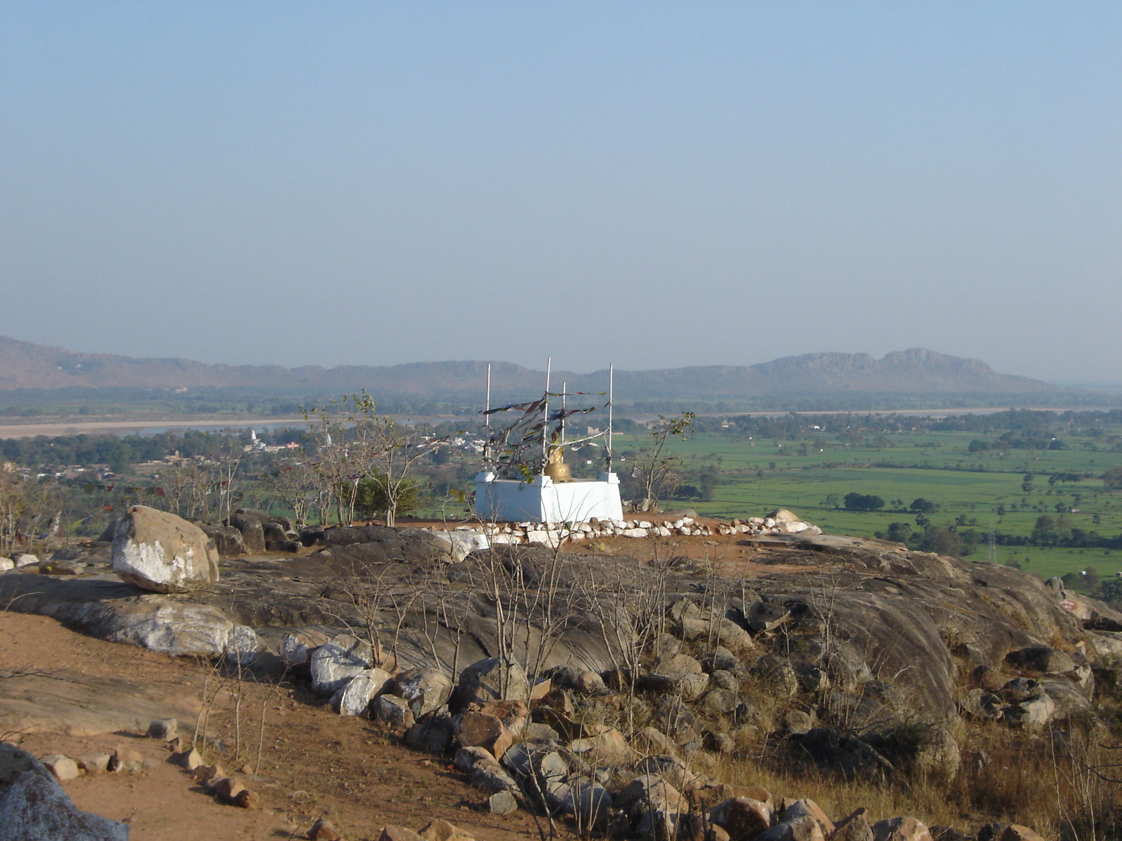
[[File:Gayasisa1.jpg|thumb|Brahmayoni Hill, where Buddha preached the ''[[Fire Sermon|Adittapariyaya Sutta]]'' (the ''Fire Sermon'')]] | |||
==History== | |||
[[File:Gaya Haffkine01.jpg|thumb|alt=A view of Gaya during British rule, photograph taken by Waldemar Haffkine|A view of Gaya during [[British Raj|British rule]], photograph taken by [[Waldemar Haffkine]]]] | |||
===Ancient history=== | |||
According to modern scholars, the [[Kikata kingdom]] from [[Rigveda|Rigvedic]] period was located at Gaya, Bihar. | |||
Gaya is an ancient city, with a Buddhist documented history dating back to the 6th century BCE when the sage [[The Buddha|Gautama Buddha]] attained enlightenment at [[Bodh Gaya]], {{convert|16|km|abbr=on}} from the modern city.<ref name="Nomination">{{cite web |url=https://whc.unesco.org/uploads/nominations/1056rev.pdf |title=World Heritage Scanned Nomination - Site Name: Mahabodhi Temple Complex at Bodh Gaya |last=World Heritage Committee |website=www.whc.unesco.org |date=29 June 2002 |access-date=27 September 2018 |archive-date=4 April 2018 |archive-url=https://web.archive.org/web/20180404051635/http://whc.unesco.org/uploads/nominations/1056rev.pdf |url-status=live }}</ref> | |||
Even before this time, Gaya was a place of pilgrimage for people from around the world. The fame of ancient Gaya derived from the account in the ''[[Ramayana]]'' of the god [[Rama]] coming here to the banks of [[Phalgu|Phalgu River]] (called the [[Niranjana]]), accompanied by his wife and younger brother, to offer [[Pinda (riceball)|pind-daan]] for their father [[Dasharatha]], for the [[moksha]] of his soul.<ref name="Rámayán">{{cite book |last=Griffith |first=Ralph T. H. |title=The Rámayán of Válmíki Translated into English Verse |publisher=London: Trübner & Co.; Benares: E. J. Lazarus and Co |date=1870–1874 |page=761 |url=https://www.gutenberg.org/files/24869/24869-pdf.pdf#page=761 |access-date=28 September 2018 |archive-date=29 July 2018 |archive-url=https://web.archive.org/web/20180729150113/http://www.gutenberg.org/files/24869/24869-pdf.pdf#page=761 |url-status=live }}</ref><ref name="pind daan">{{cite book |last=Bhalla |first=Prem D |title= Hindu Rites, Rituals, Customs and Traditions: A to Z on the Hindu Way of Life |publisher= Pustak Mahal |date=2006 |chapter-url=https://books.google.com/books?id=MOgAnbOmu08C&pg=PT307|pages=314–319 |chapter=Chapter N6-N7: What is the importance of pind daan for the deceased?; What is the purpose of the Shraddh ceremony? |isbn=978-8-122-30902-7}}</ref> In the ''[[Mahabharata]]'', Gaya is referred to as Gayapuri. | |||
Gaya flourished during the [[Maurya Empire]] (321–187 BCE), which ruled from the city of [[Pataliputra]] (adjacent to modern [[Patna]]) over an area that extended beyond the Indian subcontinent. During this period, Gaya witnessed the rise and fall of many dynasties in the [[Magadha (Mahajanapada)|Magadha]] region, where it occupied an important place in cultural history over some 2,400 years between the 6th century BCE and the 18th century CE. | |||
The city's cultural significance began with the dynasty founded by [[Sisunaga]], who exercised power over Patna and Gaya around 600 BCE. [[Bimbisara]], fifth king of the dynasty, who lived and ruled around 519 BCE, had projected Gaya to the outer world. Having attained an important place in the history of civilisation, the area experienced the influence of [[The Buddha|Gautama Buddha]] and Bhagwan Mahavir during the reign of Bimbisara. After a brief period under the [[Nanda Empire|Nanda dynasty]] (345–321 BCE), Gaya and the entire Magadha region came under Mauryan rule. Mauryan Emperor [[Ashoka]] (272–232 BCE) embraced and promoted Buddhism. He visited Gaya, and built the first temple at Bodh Gaya to commemorate the [[Buddha]]'s attainment of supreme enlightenment.<ref name="UNESCO WHC">{{cite web |url= https://whc.unesco.org/en/list/1056 |title= Mahabodhi Temple Complex at Bodh Gaya, Description |website= www.whc.unesco.org |publisher= UNESCO World Heritage Centre |access-date= 27 September 2018 |archive-date= 5 November 2020 |archive-url= https://web.archive.org/web/20201105154305/https://whc.unesco.org/en/list/1056/ |url-status= live }}</ref> | |||
The period of Hindu revivalism began with the [[Gupta Empire]] during the 4th and 5th centuries CE. [[Samudragupta]] of Magadha brought Gaya into the limelight, making it the capital of Bihar district during the Gupta empire. | |||
In 750 CE, Gaya became a part of the [[Pala Empire]], under the rule of its founder, [[Gopala]]. It is believed that the present temple of [[Bodh Gaya]] was built during the reign of Gopala's son, Dharmapala. | |||
In the 12th century CE, Gaya was invaded by [[Muhammad Bakhtiyar Khilji]] of the [[Ghaznavid Empire]]. By 1557, it had become part of the [[Mughal Empire]], and remained under its power until the [[Battle of Buxar]] and the beginning of [[British Raj|British rule]] in 1764. Gaya, along with other parts of the country, gained its independence in 1947. | |||
===Modern history=== | |||
[[File:View of Gaya from Hills of Mangla Gauri.jpg|thumb|View of Gaya from Hills of Mangla Gauri]] | |||
[[File:Bharat Sevashram Sangha temple, Gaya.jpg|thumb|Bharat Sevashram Sangha temple, Gaya]] | |||
As attested by [[Francis Buchanan-Hamilton]] in the early nineteenth century, the city was divided into two areas: a sacred area in the southern part of the city, called Gaya; and the larger secular area, which may have been known by the Muslim community as Allahabad. During the [[British Raj|British rule]], the commercial and administrative area of the secular zone was formally named Saheb Ganj by British policy reformer [[Thomas Law (1756–1834)|Thomas Law]], who was a district officer in Gaya in the late nineteenth century. Now 2023 Upgrade Gaya Junction to International Junction official news launched By @PIB_Patna on Twitter <ref name="Vidyarthi">{{cite book |last=Vidyarthi |first=Lalita Prasad |title=The Sacred Complex in Hindu Gaya |publisher=Concept Publishing Company |edition=2nd |date=1978 |chapter-url=https://books.google.com/books?id=S4FidiusPr0C&q=gaya+priests+district&pg=PA2 | |||
|pages=1–29 |chapter=Chapter 1: The Sacred Centres of Gaya |access-date=28 September 2018 }}</ref> | |||
[[Swami Sahajanand Saraswati]], founder of the [[All India Kisan Sabha]] peasant movement in 1936, established an ashram at [[Neyamatpur]], Gaya, which later became the centre of the freedom struggle in [[Bihar]]. Many prominent leaders of the [[Indian National Congress]] visited frequently to meet [[Pandit Yadunandan (Jadunandan) Sharma|Yadunandan (Jadunandan) Sharma]] when he was leader of Kisan Sabha, residing in the ashram set up by Swamiji.Yadunandan Sharma became the leader of the peasants of [[Gaya district]] and second-in-command to Swami Sahajanand Saraswati. | |||
Gaya played a significant role in the [[Indian Independence Movement]]. From 26 to 31 December 1922, the 37th session of the [[Indian National Congress]] was held in Gaya<ref>{{cite news |last=Indian National Congress |date=1923 |title=Report of the Thirty-Seventh Indian National Congress held at Gaya on the 26th, 27th, 29th, 30th and 31st December 1922 |url=https://dspace.gipe.ac.in/xmlui/handle/10973/17967https://dspace.gipe.ac.in/xmlui/bitstream/handle/10973/17967/GIPE-038654-Contents.pdf?sequence=2&isAllowed=y |access-date=26 September 2018 |archive-date=21 May 2023 |archive-url=https://web.archive.org/web/20230521160048/https://dspace.gipe.ac.in/xmlui/handle/10973/17967https://dspace.gipe.ac.in/xmlui/bitstream/handle/10973/17967/GIPE-038654-Contents.pdf?sequence=2&isAllowed=y |url-status=live }}</ref> under the presidency of [[Chittaranjan Das|Deshbandhu Chittaranjan Das]]. It was attended by prominent leaders and luminaries of the Independence Movement, including [[Mahatma Gandhi|Mohandas K. Gandhi]], [[Rajendra Prasad]], [[Anugrah Narayan Sinha]], [[Sardar Patel]], [[Maulana Azad]], [[Jawaharlal Nehru]] and [[Sri Krishna Sinha]].<ref>{{cite news |last=Roy |first=Evelyn |date=1923 |title=Politics in Gaya |url=https://dspace.gipe.ac.in/xmlui/bitstream/handle/10973/17967/GIPE-038654-Contents.pdf?sequence=2&isAllowed=y |work=The Communist International, Organ of the Executive Committee of the Communist International, English Edition |location=London, England |access-date=27 September 2018 |archive-date=27 September 2018 |archive-url=https://web.archive.org/web/20180927165005/https://dspace.gipe.ac.in/xmlui/bitstream/handle/10973/17967/GIPE-038654-Contents.pdf?sequence=2&isAllowed=y |url-status=live }}</ref> | |||
Gaya is the birthplace of eminent nationalist ''[[Honorary titles of Indian leaders|Bihar Vibhuti]]'', [[Anugrah Narayan Sinha]], Bihar's first [[Deputy Chief Minister of Bihar|deputy Chief Minister]] and Finance Minister. Former Bihar Chief Minister [[Satyendra Narayan Sinha]] also hailed from Gaya. Ishwar Chaudhary, a member of the [[5th Lok Sabha|Fifth]], [[6th Lok Sabha|Sixth]] and [[9th Lok Sabha|Ninth]] [[Lok Sabha]]s from 1971 to 1979 and from 1989 to 1991, represented the Gaya constituency of Bihar. | |||
'''Recent Developments''' | |||
The new ''Vishnupad Corridor Project'' is underway to improve pilgrim experience at Vishnupad.<ref>{{Cite news |date=2025-05-26 |title='Vishnupad Corridor project to transform pilgrims' experience' |url=https://timesofindia.indiatimes.com/city/patna/vishnupad-corridor-project-to-transform-pilgrims-experience/articleshow/121418265.cms |access-date=2025-09-28 |work=The Times of India |issn=0971-8257}}</ref> | |||
==Administration== | |||
Until 1864, Gaya was a part of the district of Bihar and [[Ramgarh district|Ramgarh]] (now in the state of [[Jharkhand]]). It became a district of [[Bihar]] in its own right on 3 October 1865.<ref>{{cite news|url=https://timesofindia.indiatimes.com/city/patna/gaya-celebrates-154th-establishment-day/articleshow/66059602.cms|title=Gaya celebrates 154th establishment day|website=[[The Times of India]]|date=4 October 2018|access-date=4 October 2018|archive-date=3 November 2018|archive-url=https://web.archive.org/web/20181103144540/https://timesofindia.indiatimes.com/city/patna/gaya-celebrates-154th-establishment-day/articleshow/66059602.cms|url-status=live}}</ref> In May 1981, the Bihar state government created the [[Magadh division]], comprising the district of [[Gaya district|Gaya]], along with [[Nawada district|Nawada]], [[Aurangabad district, Bihar|Aurangabad]] and [[Jehanabad district|Jehanabad]], all of which had originally been sub-divisions when [[Gaya district]] was created.<ref name=MSME /> [[Aurangabad]] and [[Nawada]] were partitioned from the territory of Gaya in 1973; and [[Jehanabad]] in 1988.<ref name="Statoids">{{cite web | url = http://www.statoids.com/yin.html | title = Districts of India | access-date = 11 October 2011 | last = Law | first = Gwillim | date = 25 September 2011 | work = Statoids | url-status = live | archive-url = https://web.archive.org/web/20111017155710/http://www.statoids.com/yin.html | archive-date = 17 October 2011 }}</ref> Gaya district occupies an area of 4,976 km<sup>2</sup> (1,921-mile<sup>2</sup>).<ref name=MSME /> | |||
Gaya Municipal Corporation (GMC) is the civic body that governs Gaya.<ref>{{Cite web|agency=TNN|date=10 January 2021|title=Gaya civic body takes steps to improve cleanliness score {{!}} Patna News - Times of India|url=https://timesofindia.indiatimes.com/city/patna/gaya-civic-body-takes-steps-to-improve-cleanliness-score/articleshow/80191975.cms|access-date=23 June 2021|website=The Times of India|language=en|archive-date=28 June 2021|archive-url=https://web.archive.org/web/20210628060936/https://timesofindia.indiatimes.com/city/patna/gaya-civic-body-takes-steps-to-improve-cleanliness-score/articleshow/80191975.cms|url-status=live}}</ref> GMC consists of democratically elected members, is headed by a [[mayor]], who administer the city's infrastructure, public services, and supplies.<ref>{{Cite web|agency=TNN|date=24 April 2021|title=Violation of safety norms reason for Covid spike in Gaya: Experts {{!}} Patna News - Times of India|url=https://m.timesofindia.com/city/patna/violation-of-safety-norms-reason-for-covid-spike-in-gaya-experts/articleshow/82220836.cms|access-date=23 June 2021|website=The Times of India|language=en|archive-date=24 June 2021|archive-url=https://web.archive.org/web/20210624205531/https://m.timesofindia.com/city/patna/violation-of-safety-norms-reason-for-covid-spike-in-gaya-experts/articleshow/82220836.cms|url-status=live}}</ref> | |||
==Culture== | |||
===Pilgrimage=== | |||
The city of Gaya is a holy place of [[Hinduism]], with a great number of [[Hindu deities]] represented in the engravings, paintings and carvings of its shrines. Of particular importance are the sites in the city associated with [[Vishnu]], in particular the [[Phalgu|Phalgu River]] and the shrine [[Vishnupad Mandir]], or Vishnupada, which is marked by a large footprint of Lord Vishnu engraved in a basalt block.<ref name="Vidyarthi"/> Gaya is the location at which [[Rama]], with [[Sita]] and [[Lakshmana]], offered pind-daan for his father, [[Dasharatha]]. Gaya has since remained a site of key importance for the performance of the pind-daan ritual.<ref name="Rámayán"/><ref name="pind daan"/> | |||
Gaya is considered to be one of the most ideal places to perform the [[Śrāddha]]. (A [[Śrāddha]] is the Hindu ritual that one performs to pay homage to one's ancestors, especially to one's dead parents). As per Hindu belief system, it is believed that a person goes to hell if he dies in the following circumstances - if he meets an accidental death, if he dies without his consecrations being performed, or if he is killed by a wild animal. But, if [[Śrāddha]] of that person are performed at Gaya then the soul of such a man will get rid of the tortures of the hell and will go to heaven. Performing [[Śrāddha]] here is of great importance as it helps one to get rid of ''pitra rinna'' i.e. debts towards one's ancestors (male forefathers). | |||
Nearby [[Bodh Gaya]] ("Buddha Gaya"), so named to distinguish it from the Hindu town centre of Gaya, is one of the four holiest sites of [[Buddhism]] and the site where the [[Buddha]] attained enlightenment.<ref name="UNESCO WHC"/><ref name="Vidyarthi"/> | |||
===World Heritage Site at Bodh Gaya=== | |||
The [[Mahabodhi Temple|Mahabodhi Temple Complex at Bodh Gaya]] was listed as a [[World Heritage Site]] by the [[World Heritage Committee]] of the [[UNESCO|United Nations Educational, Scientific and Cultural Organization (UNESCO)]] at its 26th session, on 26 June 2002.<ref name="UNESCO WHC"/> | |||
The {{convert|50|m|ft|adj=mid|-high}} Mahabodhi Temple central to the complex was first built by the emperor [[Ashoka]] in the 3rd century BCE. The main part of the present structure dates from the 5th–6th centuries CE. It is one of the earliest and best-preserved Buddhist temples built entirely of brick dating from the later [[Gupta Empire|Gupta]] period. The [[Bodhi Tree]] (''Ficus religiosa''), the most important of the sacred places within the complex, is reputedly a descendant of the original tree under which Siddhārtha Gautama attained [[Enlightenment in Buddhism|enlightenment]] and became the [[Buddha]].<ref name="UNESCO WHC"/> Marking this seminal moment, Bodh Gaya is one of the four holiest pilgrimage sites of Buddhism, with [[Lumbini]], [[Sarnath]] and [[Kushinagar]].<ref name="ICCROM"/> | |||
The various structures on the site have undergone a number of restorations over the centuries. Ongoing maintenance and management is required to protect the complex which, as a major pilgrimage site, is under pressure due to large numbers of visitors.<ref name="ICCROM">{{cite book |last1=Lambah |first1=Abha Narain |last2=Dorje |first2=Nangze |editor-last1=Wijesuriya |editor-first1=Gamini |editor-last2=Lee |editor-first2=Sujeong |title=ICCROM-CHA Conservation Forum Series: First ICCROM-CHA International Forum on Conservation Asian Buddhist Heritage: Conserving the Sacred |publisher=ICCROM, International Centre for the Study of the Preservation and Restoration of Cultural Property |date=2017 |pages=103–111 |chapter=Chapter 13: Challenges of managing a living Buddhist site: Mahabodhi Temple, Bodh Gaya, India |isbn=978-92-9077-240-8 |url=https://www.iccrom.org/sites/default/files/2017-11/asianbuddhist_web.pdf |access-date=27 September 2018 |archive-date=28 September 2018 |archive-url=https://web.archive.org/web/20180928044018/https://www.iccrom.org/sites/default/files/2017-11/asianbuddhist_web.pdf |url-status=live }}</ref> The site is under the responsibility of the state government of Bihar, and is managed by the Bodhgaya Temple Management Committee (BTMC) and advisory board under the Bodh Gaya Temple Act, 1949.<ref>{{cite web |url= https://www.bodhgayatemple.com/images/pdf/temple_act.pdf |title= The Bodh Gaya Temple Act, 1949 (Bihar Act of 17 of 1949), (as modified up to the 8th February, 1955) |website= www.bodhgayatemple.com |access-date= 27 September 2018 |archive-date= 10 August 2017 |archive-url= https://web.archive.org/web/20170810010027/http://www.bodhgayatemple.com/images/pdf/temple_act.pdf |url-status= live }}</ref> | |||
==Climate== | |||
As Gaya is surrounded by hills on three sides and river on the fourth side, the climate of Gaya is seasonable. Climate is characterised by relatively high temperatures and evenly distributed rainfall throughout the year. The [[Köppen Climate Classification]] sub-type for this climate is "[[Humid subtropical climate|Cwa]]" (humid subtropical).<ref>{{cite web |url=http://www.weatherbase.com/weather/weather-summary.php3?s=590718&cityname=Gaya%2C+Bihar%2C+India&units= |title=Climate Summary for Gaya, India |publisher=Weatherbase.com |access-date=7 January 2016 |url-status=live |archive-url=https://web.archive.org/web/20160323021216/http://www.weatherbase.com/weather/weather-summary.php3?s=590718&cityname=Gaya%2C+Bihar%2C+India&units= |archive-date=23 March 2016}}</ref> | |||
{{Weather box | |||
| location = Gaya (1991–2020, extremes 1901–2020) | |||
| metric first = yes | |||
| single line = yes | |||
| Jan record high C = 31.7 | |||
| Feb record high C = 36.1 | |||
| Mar record high C = 42.1 | |||
| Apr record high C = 45.0 | |||
| May record high C = 47.1 | |||
| Jun record high C = 47.9 | |||
| Jul record high C = 43.7 | |||
| Aug record high C = 42.3 | |||
| Sep record high C = 42.3 | |||
| Oct record high C = 37.2 | |||
| Nov record high C = 35.0 | |||
| Dec record high C = 31.1 | |||
| year record high C = 47.9 | |||
| Jan high C = 22.9 | |||
| Feb high C = 26.8 | |||
| Mar high C = 32.8 | |||
| Apr high C = 38.7 | |||
| May high C = 39.8 | |||
| Jun high C = 37.8 | |||
| Jul high C = 33.6 | |||
| Aug high C = 33.0 | |||
| Sep high C = 32.5 | |||
| Oct high C = 31.7 | |||
| Nov high C = 28.9 | |||
| Dec high C = 24.7 | |||
| year high C = 31.9 | |||
|Jan mean C = 15.5 | |||
|Feb mean C = 19.4 | |||
|Mar mean C = 24.9 | |||
|Apr mean C = 30.5 | |||
|May mean C = 33.2 | |||
|Jun mean C = 32.3 | |||
|Jul mean C = 29.5 | |||
|Aug mean C = 29.2 | |||
|Sep mean C = 28.8 | |||
|Oct mean C = 26.1 | |||
|Nov mean C = 21.6 | |||
|Dec mean C = 16.8 | |||
| Jan low C = 8.4 | |||
| Feb low C = 11.7 | |||
| Mar low C = 16.2 | |||
| Apr low C = 21.9 | |||
| May low C = 25.5 | |||
| Jun low C = 26.6 | |||
| Jul low C = 25.7 | |||
| Aug low C = 25.6 | |||
| Sep low C = 24.6 | |||
| Oct low C = 20.7 | |||
| Nov low C = 14.4 | |||
| Dec low C = 9.7 | |||
| year low C = 19.2 | |||
| Jan record low C = 1.5 | |||
| Feb record low C = 2.7 | |||
| Mar record low C = 7.8 | |||
| Apr record low C = 12.9 | |||
| May record low C = 17.1 | |||
| Jun record low C = 18.3 | |||
| Jul record low C = 16.7 | |||
| Aug record low C = 18.5 | |||
| Sep record low C = 17.4 | |||
| Oct record low C = 12.2 | |||
| Nov record low C = 6.1 | |||
| Dec record low C = 1.4 | |||
| year record low C = 1.4 | |||
| rain colour = green | |||
| Jan rain mm = 13.6 | |||
| Feb rain mm = 13.9 | |||
| Mar rain mm = 12.2 | |||
| Apr rain mm = 10.3 | |||
| May rain mm = 35.3 | |||
| Jun rain mm = 155.2 | |||
| Jul rain mm = 273.2 | |||
| Aug rain mm = 267.4 | |||
| Sep rain mm = 179.5 | |||
| Oct rain mm = 53.2 | |||
| Nov rain mm = 8.5 | |||
| Dec rain mm = 3.2 | |||
| year rain mm = 1025.5 | |||
| Jan rain days = 1.2 | |||
| Feb rain days = 1.3 | |||
| Mar rain days = 1.3 | |||
| Apr rain days = 0.9 | |||
| May rain days = 2.4 | |||
| Jun rain days = 6.6 | |||
| Jul rain days = 12.9 | |||
| Aug rain days = 13.5 | |||
| Sep rain days = 8.7 | |||
| Oct rain days = 2.4 | |||
| Nov rain days = 0.5 | |||
| Dec rain days = 0.3 | |||
| year rain days = 52.2 | |||
| time day = 17:30 [[Indian Standard Time|IST]] | |||
| Jan humidity = 56 | |||
| Feb humidity = 48 | |||
| Mar humidity = 32 | |||
| Apr humidity = 25 | |||
| May humidity = 36 | |||
| Jun humidity = 54 | |||
| Jul humidity = 75 | |||
| Aug humidity = 76 | |||
| Sep humidity = 76 | |||
| Oct humidity = 68 | |||
| Nov humidity = 59 | |||
| Dec humidity = 58 | |||
| year humidity = 55 | |||
| source 1 = [[India Meteorological Department]]<ref name=IMDnormals> | |||
{{cite web | |||
| archive-url = https://web.archive.org/web/20200205040301/http://imdpune.gov.in/library/public/1981-2010%20CLIM%20NORMALS%20%28STATWISE%29.pdf | |||
| archive-date = 5 February 2020 | |||
| url = https://imdpune.gov.in/library/public/1981-2010%20CLIM%20NORMALS%20%28STATWISE%29.pdf | |||
| title = Station: Gaya Climatological Table 1981–2010 | |||
| work = Climatological Normals 1981–2010 | |||
| publisher = India Meteorological Department | |||
| date = January 2015 | |||
| pages = 285–286 | |||
| access-date = 24 August 2020}}</ref><ref name=IMDextremes> | |||
{{cite web | |||
| archive-url = https://web.archive.org/web/20200205042509/http://imdpune.gov.in/library/public/EXTREMES%20OF%20TEMPERATURE%20and%20RAINFALL%20upto%202012.pdf | |||
| archive-date = 5 February 2020 | |||
| url = https://imdpune.gov.in/library/public/EXTREMES%20OF%20TEMPERATURE%20and%20RAINFALL%20upto%202012.pdf | |||
| title = Extremes of Temperature & Rainfall for Indian Stations (Up to 2012) | |||
| publisher = India Meteorological Department | |||
| date = December 2016 | |||
| page = M34 | |||
| access-date = 24 August 2020}}</ref> | |||
|source 2 = Tokyo Climate Center (mean temperatures 1991–2020)<ref name=TCC1> | |||
{{cite web | |||
| url = https://ds.data.jma.go.jp/gmd/tcc/tcc/products/climate/normal/parts/NrmMonth_e.php?stn=42591 | |||
| title = Normals Data: Gaya – India Latitude: 24.75°N Longitude: 84.95°E Height: 116 (m) | |||
| publisher = Japan Meteorological Agency | |||
| access-date = 1 December 2022}}</ref> | |||
}}Gaya has been ranked 8th best "National Clean Air City" under (Category 2 3-10L Population cities) in India.<ref>{{Cite web |date=7 September 2024 |title=Swachh Vayu Sarvekshan 2024 |url=https://prana.cpcb.gov.in/ncapServices/robust/fetchFilesFromDrive/Swachh_Vayu_Survekshan_2024_Result.pdf |website=Swachh Vayu Sarvekshan 2024}}</ref> | |||
==Economy== | |||
Gaya is the second-largest contributor to the [[economy of Bihar]], after Patna. Agriculture is the leading economic activity of the district. The main crops grown are rice, wheat, potatoes, and lentils. Livestock raised include cattle, buffaloes, goats and pigs. Gaya has a large number of household industries, producing [[Incense in India|incense sticks]] (atagarbatti), local sweets [[tilkut]] (made with sesame seed) and lai (made with poppy seed), stone-work, hand weaving, power-loom weaving, textiles and garments, small-scale manufactured goods, and plastic products. Small-scale industries also include agricultural services, metalworking, machinery and equipment production and repair services.<ref name="MSME">{{cite news |last=MSME-Development Institute, Ministry of MSME, Government of India |date=2011 |title=Brief Industrial Profile of Gaya District – Micro, Small & Medium Enterprises |url=http://dcmsme.gov.in/dips/gaya_bihar.pdf |access-date=27 September 2018 |archive-date=4 March 2016 |archive-url=https://web.archive.org/web/20160304034313/http://dcmsme.gov.in/dips/Gaya_BIHAR.pdf |url-status=dead }}</ref> The main vegetable market in the city is the Kedarnath Market. Commercial activities are located along its main roads; the city also has a large number of informal shops.<ref name="Udyog Mitra">{{cite web |url=https://www.udyogmitrabihar.in/docs/dp/gaya.pdf |title=Bihar – Economic Profile Gaya |last=Udyog Mitra, Department of Industries |publisher=Government of Bihar |date=2011 |website=www.udyogmitrabihar.in |access-date=27 September 2018 |archive-date=28 September 2018 |archive-url=https://web.archive.org/web/20180928003327/https://www.udyogmitrabihar.in/docs/dp/gaya.pdf |url-status=live }}</ref> As Gaya is an important centre of religious tourism, accommodation is widely available.<ref name="Geary">{{cite book |last=Geary | first=David |title=The Rebirth of Bodh Gaya: Buddhism and the Making of a World Heritage Site |publisher= University of Washington Press |date=2017 |page=159 |section=Buddhist Circuits and Spiritual Tourism (in Chapter 5: A Master Plan for World Heritage) |isbn=978-0-295-74238-0 | url= https://books.google.com/books?id=meA5DwAAQBAJ&pg=PA159}}</ref> Bodh Gaya's largest hotel is the Maha Bodhi Hotel, Resort & Convention Centre; the Sambodhi Retreat, a resort of Bihar, is also in the town. | |||
==Transportation== | |||
===Local transport=== | |||
There are many city buses and taxis providing services across the city and [[Bodh Gaya]]. [[Tanga (carriage)|Tangas]], [[Auto Rickshaw]]s, [[Electric rickshaw]]s, and cycle rickshaws also ply the city and [[Bodh Gaya]]. The main bus stands are Government Bus Stand, Sikaria More Bus Stand, Gaurkashni Bus Stand (Manpur), and Delha Bus Stand. Local transport is reliable, and auto rickshaws are available for various destinations in the city. | |||
A weel bus service connecting all nearby towns is operated by BSRTC ([[Bihar State Road Transport Corporation]].The Gaya–Patna railway line plays a major role in transporting people from the town to the state capital. | |||
=== Roadways === | |||
Gaya has a road network providing good connectivity with the state of Bihar and other parts of the country.<ref name=CDP>{{cite web |url= http://urban.bih.nic.in/Docs/CDP/CDP-Gaya.pdf |title= City Development Plan (2010-30) Gaya: Executive Summary |last= Egis India Consulting Engineers Private Limited |publisher= Urban Development and Housing Department Government of Biha |website= www.urban.bih.nic.in |access-date= 27 September 2018 |archive-date= 13 September 2014 |archive-url= https://web.archive.org/web/20140913030335/http://urban.bih.nic.in/Docs/CDP/CDP-Gaya.pdf |url-status= dead }}</ref> Regular direct bus services run from Gaya to [[Patna]], [[Aurangabad]], [[Bhagalpur]], [[Munger]], [[Nalanda]], [[Rajgir]], [[Varanasi]], [[Ranchi]], [[Jamshedpur]], [[Hazaribagh]], [[Bardhaman]], [[Durgapur]], [[Asansol]], [[Kolkata]], [[Lucknow]] and [[Dhanbad]]. In 2011, {{abbr|A/C|air-conditioned}} [[Mercedes-Benz]] luxury services were introduced by [[Bihar State Road Transport Corporation]] for [[Muzaffarpur]], [[Patna]], [[Munger]], [[Bhagalpur]], [[Hazaribagh]], [[Koderma]], [[Ranchi]] and Ramgarh. | |||
The [[Grand Trunk Road]] from [[Kolkata]] to [[Delhi]] passes from "[[Dobhi]] & [[Barachatti]]"some {{convert|30|km|abbr=on}} from Gaya. This road, known as [[National Highway 2 (India, old numbering)|National Highway 2]] before 2010,<ref>{{cite web|url=http://dorth.gov.in/writereaddata/sublinkimages/finaldoc6143316640.pdf|title=Rationalisation of Numbering Systems of National Highways|publisher=[[Department of Road Transport and Highways]]|access-date=27 September 2018|location=New Delhi|archive-url=https://web.archive.org/web/20160201124738/http://dorth.gov.in/writereaddata/sublinkimages/finaldoc6143316640.pdf|archive-date=1 February 2016|url-status=dead}}</ref> is now called [[National Highway 19 (India)|National Highway 19]]. It connects Gaya to [[Patna]], [[Dhanbad]], [[Ranchi]], [[Jamshedpur]], [[Bokaro Steel City|Bokaro]], [[Rourkela]], [[Durgapur, West Bengal|Durgapur]], [[Kolkata]] (495 km), [[Varanasi]] (252 km), [[Prayagraj]], [[Kanpur]], [[Delhi]], [[Amritsar]], and to the Pakistani cities of [[Lahore]] and [[Peshawar]]. Gaya is connected to Patna (105 km) by [[National Highway 22 (India)|National Highway 22]] (formerly NH 83), and to Nawada, Rajgir (78 km) and [[Bihar Sharif]] by [[National Highway 120 (India)|NH 120]]. Construction work began in 2014 on the road from Patna to Dobhi via Gaya and Gaya to Bihar Sharif to create a four-lane highway with additional road and bridge infrastructure. Completion of the project, originally due in April 2018, has been delayed. the first expressway of bihar Amas-Darbhanga Expressway is starting from a nearby village Amas, construction started from late 2020.<ref>{{cite news |last=Qadir |first=Abdul |date=25 April 2018 |title=Dobhi-Patna road project delayed |url=https://timesofindia.indiatimes.com/city/patna/dobhi-patna-road-project-delayed/articleshow/63900929.cms |work=The Times of India |location=India |access-date=28 September 2018 |archive-date=30 September 2018 |archive-url=https://web.archive.org/web/20180930092418/https://timesofindia.indiatimes.com/city/patna/dobhi-patna-road-project-delayed/articleshow/63900929.cms |url-status=live }}</ref> | |||
=== Railways === | |||
[[File:Gaya Junction platform.JPG|thumb|[[Gaya Junction]] ]] | |||
Gaya is connected to the rest of India by roads, rail and airways. The [[Grand Chord]] section of the Indian Railways passes through Gaya. [[Gaya Junction railway station]] railway station is a major junction station serving the city. Gaya Junction has been redeveloped as Model railway station recently and houses all the major facilities like waiting rooms, computerised reservation facility, food plaza, dormitory, retiring rooms, cafeteria, bookshop, etc. Gaya falls under the jurisdiction of the [[Pandit Deen Dayal Upadhyaya railway division]] of the [[East Central Railway zone]]. The [[Grand Chord]] rail line that connects [[Howrah]] and [[New Delhi]] passes through Gaya. It lies between [[Pandit Deen Dayal Upadhyaya Junction railway station|Pandit Deen Dayal Upadhyaya Junction]] on the [[Delhi]] side and [[Dhanbad Junction railway station|Dhanbad Junction]] on the [[Howrah railway station|Howrah]] side. It is located at {{Coord|24|48|13|N|84|59|57|E|}}.<ref>{{cite web |url=http://wikimapia.org/13242471/Gaya-Junction-Rail-Station-ER |title=Gaya Junction |publisher=Wikimapia |access-date=1 December 2011 |url-status=live |archive-url=https://web.archive.org/web/20130210110843/http://wikimapia.org/13242471/Gaya-Junction-Rail-Station-ER |archive-date=10 February 2013}}</ref> It has an elevation of {{Convert|117|m|ft}}.<ref name="train list">{{cite web|title=Trains at Gaya|url=http://indiarailinfo.com/arrivals/1388|publisher=India Rail Info|access-date=1 April 2012|url-status=live|archive-url=https://web.archive.org/web/20111208132627/http://indiarailinfo.com/arrivals/1388|archive-date=8 December 2011}}</ref><ref name=indiantrains>{{cite web|title=Ghanbad Junction Railway Station Details |url=http://www.indiantrains.org/station-details/?code=GAYA&name=DHANBAD+JN |publisher=indiantrains.org |access-date=1 April 2012 |url-status=dead |archive-url=https://web.archive.org/web/20140408222802/http://www.indiantrains.org/station-details/?code=GAYA&name=DHANBAD+JN |archive-date=8 April 2014}}</ref> | |||
=== Airways === | |||
{{Main|Gaya Airport}} | |||
Situated between Gaya (7 km) and [[Bodh Gaya]] (11 km), [[Gaya Airport]] is one of two operating international airports in the states of Bihar and Jharkhand. Gaya airport mainly operates weekly and seasonal flights for Buddhist pilgrims to Bodh Gaya from [[Colombo]], Sri Lanka; [[Bangkok]], [[Thailand]], [[Singapore]], [[Paro, Bhutan|Paro]] and [[Bhutan]]. There are also regular domestic flights to [[Kolkata]] and [[Delhi]]. [[IndiGo]] has started Domestic Flights to New Delhi and Kolkata. The Airports Authority of India has plans to develop Gaya Airport as a stand-by to the [[Netaji Subhash Chandra Bose International Airport]] in [[Kolkata]].<ref>{{cite web |url= https://www.aai.aero/en/node/74281 |title= Gaya Airport |website= www.aai.aero |last= Airports Authority of India |access-date= 27 September 2018 |archive-date= 17 May 2021 |archive-url= https://web.archive.org/web/20210517142138/https://www.aai.aero/en/node/74281 |url-status= live }}</ref> | |||
Gaya Airport also serves as the only place of [[Bihar]] from where Hajj pilgrims take direct flight to [[Jeddah]] and [[Madina]] in Saudi Arabia. | |||
== Pilgrimage and Spiritual Attractions == | |||
Gaya is not only significant in secular history but also revered as a major pilgrimage center in Hinduism and Buddhism. Below are key spiritual sites in and around Gaya: | |||
* [[Vishnupad Temple|Vishnupad Mandir]] – Located on the banks of the [[Phalgu River]], this temple is dedicated to Lord Vishnu. It is believed to be the spot where Vishnu subdued the demon Gayasura. A 40 cm footprint of Vishnu, known as Dharmasila, is enshrined within the temple. The current structure was rebuilt in 1787 by [[Ahilyabai Holkar|Queen Ahilyabai Holkar]].<ref>{{cite web |title=Vishnupad Temple, Gaya |url=https://tourism.bihar.gov.in/en/destinations/gaya/vishnupad-temple |access-date=4 August 2025 |publisher=Bihar Tourism}}</ref> | |||
* [[Akshayavata]] Tree – Adjacent to the Vishnupad complex, this sacred banyan tree is believed to be immortal (“Akshaya” means indestructible). Devotees believe that no Shraddha ceremony in Gaya is complete without performing rites at this tree.<ref>{{cite web |title=Places to Visit in Gaya |url=https://www.holydham.com/places-to-visit-in-gaya/ |access-date=4 August 2025}}</ref> | |||
* Sita Kund – Situated across the [[Phalgu River]] from Vishnupad, this sacred pond marks the place where [[Goddess Sita]] is said to have offered pind-daan for her father-in-law [[Dasharatha]].<ref>{{cite web |title=Discover Sita Kund, a mythological site in Gaya |url=https://www.incredibleindia.gov.in/en/bihar/gaya/sita-kund |access-date=4 August 2025 |publisher=Incredible India}}</ref> | |||
* '''Phalgu River Ghats''' – The ghats along the [[Phalgu River|Phalgu]] (Falgu) River are essential to the rituals of pind-daan. Pilgrims descend the steps to perform ancestral rites and take holy dips in the river. In September 2022, Bihar Chief Minister Nitish Kumar inaugurated India’s longest rubber dam, known as the Gayaji Dam, on the Falgu River in Gaya Ji to help maintain water levels in the river and support visitors during events such as the Pitripaksha Mela.<ref>{{cite web |title=Gayaji Dam: Bihar CM inaugurates India’s longest rubber dam on Falgu river |url=https://www.hindustantimes.com/cities/patna-news/gayaji-dam-bihar-cm-inaugurates-india-s-longest-rubber-dam-on-falgu-river-101662637910755.html |publisher=Hindustan Times |access-date=28 February 2026}}</ref> | |||
[[File:Rubber_Dam_Gaya_Ji_on_the_Phalgu_River_at_Night_–_Illuminated_Bridge.jpg|thumb|The Gayaji Dam, India’s longest rubber dam on the Falgu River in Gaya Ji, Bihar, India]] | |||
* Pretshila Hill – A hill in Gaya associated with certain mortuary rites and local legends; some pilgrims perform rituals here during [[Pitru Paksha|Pitrupaksha]].<ref>{{cite web |title=Gaya Dham Pilgrimage Places |url=https://gayapandit.com/sitakundh.php |access-date=4 August 2025}}</ref> | |||
* Ramshila – A sacred rock formation linked to the legend of [[Lord Ram|Lord Rama]] performing pinda-daan rites. Local tradition holds that Rama’s shila (stone) still bears his presence.'''<ref>{{cite web |title=Places to Visit in Gaya |url=https://www.holydham.com/places-to-visit-in-gaya/ |access-date=4 August 2025}}</ref>''' | |||
* [[Mahabodhi Temple]] (Bodh Gaya) – Though located some distance from Gaya city, this UNESCO World Heritage Buddhist complex draws pilgrims worldwide. It marks the site where [[The Buddha|Siddhartha Gautama]] attained enlightenment under the Bodhi Tree.<ref>{{cite web |title=Mahabodhi Temple, Bodh Gaya |url=https://whc.unesco.org/en/list/1056 |access-date=4 August 2025 |publisher=UNESCO}}</ref><ref>{{cite web |title=Phalgu River |url=https://en.wikipedia.org/wiki/Phalgu_River |access-date=4 August 2025}}</ref> | |||
* Bodhi Tree – At the Mahabodhi Temple complex, the sacred Bodhi Tree is believed to be a descendant of the original tree under which the Buddha attained enlightenment. Pilgrims meditate and worship here.<ref>{{cite web |title=Mahabodhi Temple |url=https://whc.unesco.org/en/list/1056 |access-date=4 August 2025 |publisher=UNESCO}}</ref> | |||
* [[Mangla Gauri Temple|Mangala Gauri Temple]] – A Shakti Peetha located on the Mangalagauri Hill in Gaya. It is believed to be the seat of the goddess (Sati) and is one of the 18 Maha Shakti Peethas.<ref>{{cite web |title=Mangla Gauri Temple |url=https://en.wikipedia.org/wiki/Mangla_Gauri_Temple |access-date=4 August 2025}}</ref> | |||
== Demographics == | |||
{{bar box | |||
|title=Religions in Gaya City (2011)<ref>{{cite web|url=http://www.census2011.co.in/census/city/181-gaya.html|title=Gaya City Census 2011 data|work=Census 2011 India|access-date=7 April 2017|url-status=live|archive-url=https://web.archive.org/web/20170507141025/http://www.census2011.co.in/census/city/181-gaya.html|archive-date=7 May 2017}}</ref> | |||
|titlebar=#Fcd116 | |||
|left1=Religion | |||
|right1=Percent | |||
|float=right | |||
|bars= | |||
{{bar percent|[[Hinduism]]|darkorange|79.43}} | |||
{{bar percent|[[Islam]]|green|19.65}} | |||
{{bar percent|[[Christianity]]|blue|0.26}} | |||
{{bar percent|[[Jainism]]|maroon|0.24}} | |||
{{bar percent|Others†|black|1.42}} | |||
|caption=Distribution of religions<br /> | |||
†<small>Includes [[Sikh]]s (0.09%), [[Buddhism|Buddhists]] (0.02%).</small> | |||
}} | |||
{{ | The city had its first census in 1872, which placed the figure at 66,843.<ref>{{Cite book |last=Singh |first=Kamaldeo Narain |url=https://books.google.com/books?id=RG3sTfBh47YC&dq=gaya+had+its+first+census+in+1872&pg=PA19 |title=Urban Development in India |date=1978 |publisher=Abhinav Publications |isbn=978-81-7017-080-8 |language=en |access-date=21 June 2022 |archive-url=https://web.archive.org/web/20220731062213/https://books.google.com/books?id=RG3sTfBh47YC&dq=gaya+had+its+first+census+in+1872&pg=PA19 |archive-date=31 July 2022 |url-status=live}}</ref> In the 2011 census, the Gaya Urban Agglomeration had a population of 470,839.<ref>{{cite web |title=Urban Agglomerations/Cities having population 1 lakh and above |url=http://www.censusindia.gov.in/2011-prov-results/paper2/data_files/India2/Table_3_PR_UA_Citiees_1Lakh_and_Above.pdf |url-status=live |archive-url=https://web.archive.org/web/20111113152754/http://www.censusindia.gov.in/2011-prov-results/paper2/data_files/India2/Table_3_PR_UA_Citiees_1Lakh_and_Above.pdf |archive-date=13 November 2011 |access-date=3 January 2021 |work=Provisional Population Totals, Census of India 2011}}</ref> The Gaya Urban Agglomeration encompasses the Gaya [[Municipal corporations in India|Municipal Corporation]], Kaler ([[Out Growth]]), and Paharpur ([[Census town#India|Census Town]]).<ref>{{cite web |title=Constituents of urban Agglomerations Having Population 1 Lakh & above |url=http://censusindia.gov.in/2011-prov-results/paper2/data_files/India2/Table_4_PR_UAs_1Lakh_and_Above_Appendix.pdf |url-status=live |archive-url=http://archive.wikiwix.com/cache/20160617063229/http://censusindia.gov.in/2011-prov-results/paper2/data_files/India2/Table_4_PR_UAs_1Lakh_and_Above_Appendix.pdf |archive-date=17 June 2016 |access-date=16 April 2012 |work=Provisional Population Totals, Census of India 2011}}</ref> the Gaya Municipal Corporation had a total population of 468,614,<ref>{{cite web |title=Gaya, District in Bihar - The population development of Gaya |url=http://www.citypopulation.de/php/india-bihar.php?adm2id=1034 |url-status=live |archive-url=https://web.archive.org/web/20160914184017/http://www.citypopulation.de/php/india-bihar.php?adm2id=1034 |archive-date=14 September 2016 |access-date=13 July 2016}}</ref> of whom 247,572 were male and 221,042 were female. The population below 5 years was 59,669. The sex ratio was 986 women to 1000 men. The literacy rate for the population aged 7 and over was 85.74%.<ref>{{cite web |title=Cities having population 1 lakh and above |url=http://www.censusindia.gov.in/2011-prov-results/paper2/data_files/India2/Table_2_PR_Cities_1Lakh_and_Above.pdf |url-status=live |archive-url=https://web.archive.org/web/20120507135928/http://www.censusindia.gov.in/2011-prov-results/paper2/data_files/India2/Table_2_PR_Cities_1Lakh_and_Above.pdf |archive-date=7 May 2012 |access-date=16 April 2012 |work=Provisional Population Totals, Census of India 2011}}</ref> | ||
{{ | |||
==Sub Towns== | |||
<!---♦♦♦ Only add a location to this list if they already have their own article on the English Wikipedia ♦♦♦---> | |||
<!---♦♦♦ Please keep the list in alphabetical order ♦♦♦---> | |||
*[[Keori]], between Gaya and Patna | |||
*[[Barachatti]] | |||
*[[Sherghati]] | |||
*[[Tekari]] | |||
*[[Bodhgaya]] | |||
*[[Gurua]] | |||
*[[Guraru]] | |||
*[[Wazirganj]] | |||
*[[Dumariya]] | |||
*[[Aatri]] | |||
== Education == | |||
[[File:Academic building of IIM BG.jpg|thumb|Academic Building of 'IIM Bodhgaya']] | |||
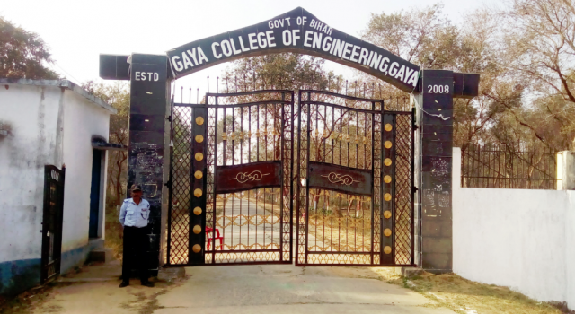
[[File:Entrance Gate Of GCE Campus.png|thumb|Entrance Gate Of GCE Campus]] | |||
Govt. Training Centres | |||
*[[Officers Training Academy|Officer's Training Academy, Gaya]] | |||
Notable Institutions of Higher Education include: | |||
*[[Central University of South Bihar]] | |||
*[[Indian Institute of Management Bodh Gaya]] | |||
*[[Anugrah Narayan Magadh Medical College and Hospital]] | |||
*[[Magadh University]] | |||
[[File:Faculty Social Sciences Magadh Universit 2010.jpg|thumb]] | |||
Notable colleges: | |||
*[[Gaya College]] | |||
*[[Gaya College of Engineering]] | |||
*[[Mirza Ghalib College]] | |||
Notable schools: | |||
*[[Nazareth Academy, Gaya]] | |||
==Notable people== | |||
*[[Gautam Buddha]] | |||
*[[Rajesh Kumar (actor)|Rajesh Kumar]] | |||
*[[Anugrah Narayan Sinha]] | |||
*[[Jitan Ram Manjhi]]<ref>{{Citation |title=Jitan Ram Manjhi |date=29 January 2025 |work=Wikipedia |url=https://en.wikipedia.org/wiki/Jitan_Ram_Manjhi |access-date=3 February 2025 |language=en}}</ref> | |||
*[[Eqbal Ahmad]] | |||
*[[Satyapal Chandra]] | |||
*[[Seyed E. Hasnain]] | |||
*[[Ashutosh Aman]] | |||
*[[Tabish Khair]] | |||
*[[Baigoman | Babu Raghunath Singh Baigoman]] | |||
*[[Prem Kumar (politician)]] | |||
*[[A. K. Narain]] | |||
*[[Lalit Mohan Sharma]] | |||
*[[Janki Ballabh Shastri]] | |||
*[[O. P. Singh]] | |||
*[[Abhay Kushwaha]] | |||
*[[Lilliput (actor)]] | |||
*[[Rajendra Prasad Yadav (Atri politician)]] | |||
*[[Surendra Prasad Yadav]] | |||
*[[Abu Bakr Ahmed Haleem]] | |||
*[[Hussain Ul Haque]] | |||
== See also == | |||
* [[Pind Daan]] | |||
* [[Pitru Paksha]] | |||
* [[Phalgu River]] | |||
* [[Akshayavat]] | |||
==References== | |||
{{Reflist|refs= | |||
<ref name="census2011">{{cite web|url=http://www.censusindia.gov.in/2011-prov-results/paper2/data_files/India2/Table_3_PR_UA_Citiees_1Lakh_and_Above.pdf|title=UA/Cities 1 lakh and above|publisher=Government of India|url-status=live|archive-url=https://web.archive.org/web/20111113152754/http://www.censusindia.gov.in/2011-prov-results/paper2/data_files/India2/Table_3_PR_UA_Citiees_1Lakh_and_Above.pdf|archive-date=13 November 2011}}</ref> | |||
}} | }} | ||
==External links== | |||
{{Commons category|Gaya, India}} | |||
*{{Wikivoyage-inline|Gaya}} | |||
{{Bihar}} | |||
{{Hindu holy cities}} | |||
{{Magadh Division}} | |||
{{Authority control}} | |||
[[Category:Gaya, India| ]] | |||
[[Category:Hindu pilgrimage sites in India]] | |||
[[Category:Buddhist pilgrimage sites in India]] | |||
[[Category:Hindu holy cities]] | |||
[[Category:Early Buddhism]] | |||
[[Category:Gautama Buddha]] | |||
[[Category:Cities and towns in Gaya district]] | |||
[[Category:Ancient Indian cities]] | |||
Latest revision as of 05:00, 6 March 2026
Gaya | |
|---|---|
  Gaya Location of Gaya in Bihar  Gaya Gaya (India) | |
| Coordinates: 24°45′N 85°01′E / 24.75°N 85.01°E | |
| Country |  India India |
| State |  Bihar Bihar |
| Region | Magadha |
| Division | Magadh Division |
| District | Gaya |
| Named for | Gayasura |
| Government | |
| • Type | Municipal corporation |
| • Body | Gaya Nagar Nigam |
| • Mayor | Ganesh Paswan |
| • Deputy Mayor | Mohan Shrivastava |
| Area | |
| • Total | 308 km2 (119 sq mi) |
| • Rank | 21 (India), 3rd (Bihar) |
| Elevation | 111 m (364 ft) |
| Population (2011) | |
| • Total | 470,839[1] |
| • Rank | 102 (India), 2nd (Bihar) |
| • Density | 9,490/km2 (24,600/sq mi) |
| Demonym(s) | Gayaite, Gayavi, Gayawaal[4] |
| Languages | |
| • Official | Hindi, English |
| • Spoken | Magahi, Bengali, Bhojpuri, Maithili |
| Time zone | UTC+5:30 (IST) |
| PIN | 823001 - 13 |
| Telephone code | 91-631 |
| ISO 3166 code | IN-BR |
| Vehicle registration | BR-02 |
| Railway Station | Gaya Junction |
| Airport | Gaya International Airport |
| Website | gaya |


Gaya (IAST: Gayā) is a city, municipal corporation and the administrative headquarters of Gaya district and Magadh division of the Indian state of Bihar. Gaya is 116 kilometres (72 mi) south of Patna and is the state's second-largest city, with a population of 470,839. The city is surrounded on three sides by small, rocky hills (Mangla-Gauri, Shringa-Sthan, Ram-Shila, and Brahmayoni), with the Phalgu River on its eastern side.
It is a city of historical significance and is one of the major tourist attractions. Gaya is sanctified in the Jain, Hindu, and Buddhist religions. Gaya district is mentioned in the great epics, the Ramayana and the Mahabharata. It is the place where Rama, with Sita and Lakshmana, came to offer piṇḍadāna for their father, Dasharatha, and continues to be a major Hindu pilgrimage site for the piṇḍadāna ritual. Bodh Gaya, where Buddha is said to have attained enlightenment, is one of the four holy sites of Buddhism.
Gaya was chosen as one of twelve heritage cities to benefit from the Government of India's four-year Heritage City Development and Augmentation Yojana (HRIDAY) scheme for urban planning, economic growth and heritage conservation projects.[5]
Etymology[edit | edit source]
Gaya is named after the demon Gayasura (meaning "the demon Gaya") who dwelt the area during the Treta Yuga.[6][7] According to Vayu Purana, Gaya was the name of a demon (Asura) whose body became pious after he performed strict penance and secured blessings from Lord Vishnu.[8] It was said that the body of Gayasura was transformed into the series of rocky hills that make up the landscape of Gaya.[9]

History[edit | edit source]

Ancient history[edit | edit source]
According to modern scholars, the Kikata kingdom from Rigvedic period was located at Gaya, Bihar.
Gaya is an ancient city, with a Buddhist documented history dating back to the 6th century BCE when the sage Gautama Buddha attained enlightenment at Bodh Gaya, 16 km (9.9 mi) from the modern city.[10]
Even before this time, Gaya was a place of pilgrimage for people from around the world. The fame of ancient Gaya derived from the account in the Ramayana of the god Rama coming here to the banks of Phalgu River (called the Niranjana), accompanied by his wife and younger brother, to offer pind-daan for their father Dasharatha, for the moksha of his soul.[11][12] In the Mahabharata, Gaya is referred to as Gayapuri.
Gaya flourished during the Maurya Empire (321–187 BCE), which ruled from the city of Pataliputra (adjacent to modern Patna) over an area that extended beyond the Indian subcontinent. During this period, Gaya witnessed the rise and fall of many dynasties in the Magadha region, where it occupied an important place in cultural history over some 2,400 years between the 6th century BCE and the 18th century CE.
The city's cultural significance began with the dynasty founded by Sisunaga, who exercised power over Patna and Gaya around 600 BCE. Bimbisara, fifth king of the dynasty, who lived and ruled around 519 BCE, had projected Gaya to the outer world. Having attained an important place in the history of civilisation, the area experienced the influence of Gautama Buddha and Bhagwan Mahavir during the reign of Bimbisara. After a brief period under the Nanda dynasty (345–321 BCE), Gaya and the entire Magadha region came under Mauryan rule. Mauryan Emperor Ashoka (272–232 BCE) embraced and promoted Buddhism. He visited Gaya, and built the first temple at Bodh Gaya to commemorate the Buddha's attainment of supreme enlightenment.[13]
The period of Hindu revivalism began with the Gupta Empire during the 4th and 5th centuries CE. Samudragupta of Magadha brought Gaya into the limelight, making it the capital of Bihar district during the Gupta empire.
In 750 CE, Gaya became a part of the Pala Empire, under the rule of its founder, Gopala. It is believed that the present temple of Bodh Gaya was built during the reign of Gopala's son, Dharmapala.
In the 12th century CE, Gaya was invaded by Muhammad Bakhtiyar Khilji of the Ghaznavid Empire. By 1557, it had become part of the Mughal Empire, and remained under its power until the Battle of Buxar and the beginning of British rule in 1764. Gaya, along with other parts of the country, gained its independence in 1947.
Modern history[edit | edit source]


As attested by Francis Buchanan-Hamilton in the early nineteenth century, the city was divided into two areas: a sacred area in the southern part of the city, called Gaya; and the larger secular area, which may have been known by the Muslim community as Allahabad. During the British rule, the commercial and administrative area of the secular zone was formally named Saheb Ganj by British policy reformer Thomas Law, who was a district officer in Gaya in the late nineteenth century. Now 2023 Upgrade Gaya Junction to International Junction official news launched By @PIB_Patna on Twitter [14]
Swami Sahajanand Saraswati, founder of the All India Kisan Sabha peasant movement in 1936, established an ashram at Neyamatpur, Gaya, which later became the centre of the freedom struggle in Bihar. Many prominent leaders of the Indian National Congress visited frequently to meet Yadunandan (Jadunandan) Sharma when he was leader of Kisan Sabha, residing in the ashram set up by Swamiji.Yadunandan Sharma became the leader of the peasants of Gaya district and second-in-command to Swami Sahajanand Saraswati.
Gaya played a significant role in the Indian Independence Movement. From 26 to 31 December 1922, the 37th session of the Indian National Congress was held in Gaya[15] under the presidency of Deshbandhu Chittaranjan Das. It was attended by prominent leaders and luminaries of the Independence Movement, including Mohandas K. Gandhi, Rajendra Prasad, Anugrah Narayan Sinha, Sardar Patel, Maulana Azad, Jawaharlal Nehru and Sri Krishna Sinha.[16]
Gaya is the birthplace of eminent nationalist Bihar Vibhuti, Anugrah Narayan Sinha, Bihar's first deputy Chief Minister and Finance Minister. Former Bihar Chief Minister Satyendra Narayan Sinha also hailed from Gaya. Ishwar Chaudhary, a member of the Fifth, Sixth and Ninth Lok Sabhas from 1971 to 1979 and from 1989 to 1991, represented the Gaya constituency of Bihar.
Recent Developments
The new Vishnupad Corridor Project is underway to improve pilgrim experience at Vishnupad.[17]
Administration[edit | edit source]
Until 1864, Gaya was a part of the district of Bihar and Ramgarh (now in the state of Jharkhand). It became a district of Bihar in its own right on 3 October 1865.[18] In May 1981, the Bihar state government created the Magadh division, comprising the district of Gaya, along with Nawada, Aurangabad and Jehanabad, all of which had originally been sub-divisions when Gaya district was created.[8] Aurangabad and Nawada were partitioned from the territory of Gaya in 1973; and Jehanabad in 1988.[19] Gaya district occupies an area of 4,976 km2 (1,921-mile2).[8]
Gaya Municipal Corporation (GMC) is the civic body that governs Gaya.[20] GMC consists of democratically elected members, is headed by a mayor, who administer the city's infrastructure, public services, and supplies.[21]
Culture[edit | edit source]
Pilgrimage[edit | edit source]
The city of Gaya is a holy place of Hinduism, with a great number of Hindu deities represented in the engravings, paintings and carvings of its shrines. Of particular importance are the sites in the city associated with Vishnu, in particular the Phalgu River and the shrine Vishnupad Mandir, or Vishnupada, which is marked by a large footprint of Lord Vishnu engraved in a basalt block.[14] Gaya is the location at which Rama, with Sita and Lakshmana, offered pind-daan for his father, Dasharatha. Gaya has since remained a site of key importance for the performance of the pind-daan ritual.[11][12]
Gaya is considered to be one of the most ideal places to perform the Śrāddha. (A Śrāddha is the Hindu ritual that one performs to pay homage to one's ancestors, especially to one's dead parents). As per Hindu belief system, it is believed that a person goes to hell if he dies in the following circumstances - if he meets an accidental death, if he dies without his consecrations being performed, or if he is killed by a wild animal. But, if Śrāddha of that person are performed at Gaya then the soul of such a man will get rid of the tortures of the hell and will go to heaven. Performing Śrāddha here is of great importance as it helps one to get rid of pitra rinna i.e. debts towards one's ancestors (male forefathers).
Nearby Bodh Gaya ("Buddha Gaya"), so named to distinguish it from the Hindu town centre of Gaya, is one of the four holiest sites of Buddhism and the site where the Buddha attained enlightenment.[13][14]
World Heritage Site at Bodh Gaya[edit | edit source]
The Mahabodhi Temple Complex at Bodh Gaya was listed as a World Heritage Site by the World Heritage Committee of the United Nations Educational, Scientific and Cultural Organization (UNESCO) at its 26th session, on 26 June 2002.[13]
The 50-metre-high (160 ft) Mahabodhi Temple central to the complex was first built by the emperor Ashoka in the 3rd century BCE. The main part of the present structure dates from the 5th–6th centuries CE. It is one of the earliest and best-preserved Buddhist temples built entirely of brick dating from the later Gupta period. The Bodhi Tree (Ficus religiosa), the most important of the sacred places within the complex, is reputedly a descendant of the original tree under which Siddhārtha Gautama attained enlightenment and became the Buddha.[13] Marking this seminal moment, Bodh Gaya is one of the four holiest pilgrimage sites of Buddhism, with Lumbini, Sarnath and Kushinagar.[22]
The various structures on the site have undergone a number of restorations over the centuries. Ongoing maintenance and management is required to protect the complex which, as a major pilgrimage site, is under pressure due to large numbers of visitors.[22] The site is under the responsibility of the state government of Bihar, and is managed by the Bodhgaya Temple Management Committee (BTMC) and advisory board under the Bodh Gaya Temple Act, 1949.[23]
Climate[edit | edit source]
As Gaya is surrounded by hills on three sides and river on the fourth side, the climate of Gaya is seasonable. Climate is characterised by relatively high temperatures and evenly distributed rainfall throughout the year. The Köppen Climate Classification sub-type for this climate is "Cwa" (humid subtropical).[24]
| Climate data for Gaya (1991–2020, extremes 1901–2020) | |||||||||||||
|---|---|---|---|---|---|---|---|---|---|---|---|---|---|
| Month | Jan | Feb | Mar | Apr | May | Jun | Jul | Aug | Sep | Oct | Nov | Dec | Year |
| Record high °C (°F) | 31.7 (89.1) |
36.1 (97.0) |
42.1 (107.8) |
45.0 (113.0) |
47.1 (116.8) |
47.9 (118.2) |
43.7 (110.7) |
42.3 (108.1) |
42.3 (108.1) |
37.2 (99.0) |
35.0 (95.0) |
31.1 (88.0) |
47.9 (118.2) |
| Average high °C (°F) | 22.9 (73.2) |
26.8 (80.2) |
32.8 (91.0) |
38.7 (101.7) |
39.8 (103.6) |
37.8 (100.0) |
33.6 (92.5) |
33.0 (91.4) |
32.5 (90.5) |
31.7 (89.1) |
28.9 (84.0) |
24.7 (76.5) |
31.9 (89.4) |
| Daily mean °C (°F) | 15.5 (59.9) |
19.4 (66.9) |
24.9 (76.8) |
30.5 (86.9) |
33.2 (91.8) |
32.3 (90.1) |
29.5 (85.1) |
29.2 (84.6) |
28.8 (83.8) |
26.1 (79.0) |
21.6 (70.9) |
16.8 (62.2) |
25.7 (78.2) |
| Average low °C (°F) | 8.4 (47.1) |
11.7 (53.1) |
16.2 (61.2) |
21.9 (71.4) |
25.5 (77.9) |
26.6 (79.9) |
25.7 (78.3) |
25.6 (78.1) |
24.6 (76.3) |
20.7 (69.3) |
14.4 (57.9) |
9.7 (49.5) |
19.2 (66.6) |
| Record low °C (°F) | 1.5 (34.7) |
2.7 (36.9) |
7.8 (46.0) |
12.9 (55.2) |
17.1 (62.8) |
18.3 (64.9) |
16.7 (62.1) |
18.5 (65.3) |
17.4 (63.3) |
12.2 (54.0) |
6.1 (43.0) |
1.4 (34.5) |
1.4 (34.5) |
| Average rainfall mm (inches) | 13.6 (0.54) |
13.9 (0.55) |
12.2 (0.48) |
10.3 (0.41) |
35.3 (1.39) |
155.2 (6.11) |
273.2 (10.76) |
267.4 (10.53) |
179.5 (7.07) |
53.2 (2.09) |
8.5 (0.33) |
3.2 (0.13) |
1,025.5 (40.37) |
| Average rainy days | 1.2 | 1.3 | 1.3 | 0.9 | 2.4 | 6.6 | 12.9 | 13.5 | 8.7 | 2.4 | 0.5 | 0.3 | 52.2 |
| Average relative humidity (%) (at 17:30 IST) | 56 | 48 | 32 | 25 | 36 | 54 | 75 | 76 | 76 | 68 | 59 | 58 | 55 |
| Source 1: India Meteorological Department[25][26] | |||||||||||||
| Source 2: Tokyo Climate Center (mean temperatures 1991–2020)[27] | |||||||||||||
Gaya has been ranked 8th best "National Clean Air City" under (Category 2 3-10L Population cities) in India.[28]
Economy[edit | edit source]
Gaya is the second-largest contributor to the economy of Bihar, after Patna. Agriculture is the leading economic activity of the district. The main crops grown are rice, wheat, potatoes, and lentils. Livestock raised include cattle, buffaloes, goats and pigs. Gaya has a large number of household industries, producing incense sticks (atagarbatti), local sweets tilkut (made with sesame seed) and lai (made with poppy seed), stone-work, hand weaving, power-loom weaving, textiles and garments, small-scale manufactured goods, and plastic products. Small-scale industries also include agricultural services, metalworking, machinery and equipment production and repair services.[8] The main vegetable market in the city is the Kedarnath Market. Commercial activities are located along its main roads; the city also has a large number of informal shops.[29] As Gaya is an important centre of religious tourism, accommodation is widely available.[30] Bodh Gaya's largest hotel is the Maha Bodhi Hotel, Resort & Convention Centre; the Sambodhi Retreat, a resort of Bihar, is also in the town.
Transportation[edit | edit source]
Local transport[edit | edit source]
There are many city buses and taxis providing services across the city and Bodh Gaya. Tangas, Auto Rickshaws, Electric rickshaws, and cycle rickshaws also ply the city and Bodh Gaya. The main bus stands are Government Bus Stand, Sikaria More Bus Stand, Gaurkashni Bus Stand (Manpur), and Delha Bus Stand. Local transport is reliable, and auto rickshaws are available for various destinations in the city. A weel bus service connecting all nearby towns is operated by BSRTC (Bihar State Road Transport Corporation.The Gaya–Patna railway line plays a major role in transporting people from the town to the state capital.
Roadways[edit | edit source]
Gaya has a road network providing good connectivity with the state of Bihar and other parts of the country.[31] Regular direct bus services run from Gaya to Patna, Aurangabad, Bhagalpur, Munger, Nalanda, Rajgir, Varanasi, Ranchi, Jamshedpur, Hazaribagh, Bardhaman, Durgapur, Asansol, Kolkata, Lucknow and Dhanbad. In 2011, A/C Mercedes-Benz luxury services were introduced by Bihar State Road Transport Corporation for Muzaffarpur, Patna, Munger, Bhagalpur, Hazaribagh, Koderma, Ranchi and Ramgarh.
The Grand Trunk Road from Kolkata to Delhi passes from "Dobhi & Barachatti"some 30 km (19 mi) from Gaya. This road, known as National Highway 2 before 2010,[32] is now called National Highway 19. It connects Gaya to Patna, Dhanbad, Ranchi, Jamshedpur, Bokaro, Rourkela, Durgapur, Kolkata (495 km), Varanasi (252 km), Prayagraj, Kanpur, Delhi, Amritsar, and to the Pakistani cities of Lahore and Peshawar. Gaya is connected to Patna (105 km) by National Highway 22 (formerly NH 83), and to Nawada, Rajgir (78 km) and Bihar Sharif by NH 120. Construction work began in 2014 on the road from Patna to Dobhi via Gaya and Gaya to Bihar Sharif to create a four-lane highway with additional road and bridge infrastructure. Completion of the project, originally due in April 2018, has been delayed. the first expressway of bihar Amas-Darbhanga Expressway is starting from a nearby village Amas, construction started from late 2020.[33]
Railways[edit | edit source]

Gaya is connected to the rest of India by roads, rail and airways. The Grand Chord section of the Indian Railways passes through Gaya. Gaya Junction railway station railway station is a major junction station serving the city. Gaya Junction has been redeveloped as Model railway station recently and houses all the major facilities like waiting rooms, computerised reservation facility, food plaza, dormitory, retiring rooms, cafeteria, bookshop, etc. Gaya falls under the jurisdiction of the Pandit Deen Dayal Upadhyaya railway division of the East Central Railway zone. The Grand Chord rail line that connects Howrah and New Delhi passes through Gaya. It lies between Pandit Deen Dayal Upadhyaya Junction on the Delhi side and Dhanbad Junction on the Howrah side. It is located at 24°48′13″N 84°59′57″E / 24.80361°N 84.99917°E.[34] It has an elevation of 117 metres (384 ft).[35][36]
Airways[edit | edit source]
Situated between Gaya (7 km) and Bodh Gaya (11 km), Gaya Airport is one of two operating international airports in the states of Bihar and Jharkhand. Gaya airport mainly operates weekly and seasonal flights for Buddhist pilgrims to Bodh Gaya from Colombo, Sri Lanka; Bangkok, Thailand, Singapore, Paro and Bhutan. There are also regular domestic flights to Kolkata and Delhi. IndiGo has started Domestic Flights to New Delhi and Kolkata. The Airports Authority of India has plans to develop Gaya Airport as a stand-by to the Netaji Subhash Chandra Bose International Airport in Kolkata.[37] Gaya Airport also serves as the only place of Bihar from where Hajj pilgrims take direct flight to Jeddah and Madina in Saudi Arabia.
Pilgrimage and Spiritual Attractions[edit | edit source]
Gaya is not only significant in secular history but also revered as a major pilgrimage center in Hinduism and Buddhism. Below are key spiritual sites in and around Gaya:
- Vishnupad Mandir – Located on the banks of the Phalgu River, this temple is dedicated to Lord Vishnu. It is believed to be the spot where Vishnu subdued the demon Gayasura. A 40 cm footprint of Vishnu, known as Dharmasila, is enshrined within the temple. The current structure was rebuilt in 1787 by Queen Ahilyabai Holkar.[38]
- Akshayavata Tree – Adjacent to the Vishnupad complex, this sacred banyan tree is believed to be immortal (“Akshaya” means indestructible). Devotees believe that no Shraddha ceremony in Gaya is complete without performing rites at this tree.[39]
- Sita Kund – Situated across the Phalgu River from Vishnupad, this sacred pond marks the place where Goddess Sita is said to have offered pind-daan for her father-in-law Dasharatha.[40]
- Phalgu River Ghats – The ghats along the Phalgu (Falgu) River are essential to the rituals of pind-daan. Pilgrims descend the steps to perform ancestral rites and take holy dips in the river. In September 2022, Bihar Chief Minister Nitish Kumar inaugurated India’s longest rubber dam, known as the Gayaji Dam, on the Falgu River in Gaya Ji to help maintain water levels in the river and support visitors during events such as the Pitripaksha Mela.[41]

- Pretshila Hill – A hill in Gaya associated with certain mortuary rites and local legends; some pilgrims perform rituals here during Pitrupaksha.[42]
- Ramshila – A sacred rock formation linked to the legend of Lord Rama performing pinda-daan rites. Local tradition holds that Rama’s shila (stone) still bears his presence.[43]
- Mahabodhi Temple (Bodh Gaya) – Though located some distance from Gaya city, this UNESCO World Heritage Buddhist complex draws pilgrims worldwide. It marks the site where Siddhartha Gautama attained enlightenment under the Bodhi Tree.[44][45]
- Bodhi Tree – At the Mahabodhi Temple complex, the sacred Bodhi Tree is believed to be a descendant of the original tree under which the Buddha attained enlightenment. Pilgrims meditate and worship here.[46]
- Mangala Gauri Temple – A Shakti Peetha located on the Mangalagauri Hill in Gaya. It is believed to be the seat of the goddess (Sati) and is one of the 18 Maha Shakti Peethas.[47]
Demographics[edit | edit source]
The city had its first census in 1872, which placed the figure at 66,843.[49] In the 2011 census, the Gaya Urban Agglomeration had a population of 470,839.[50] The Gaya Urban Agglomeration encompasses the Gaya Municipal Corporation, Kaler (Out Growth), and Paharpur (Census Town).[51] the Gaya Municipal Corporation had a total population of 468,614,[52] of whom 247,572 were male and 221,042 were female. The population below 5 years was 59,669. The sex ratio was 986 women to 1000 men. The literacy rate for the population aged 7 and over was 85.74%.[53]
Sub Towns[edit | edit source]
- Keori, between Gaya and Patna
- Barachatti
- Sherghati
- Tekari
- Bodhgaya
- Gurua
- Guraru
- Wazirganj
- Dumariya
- Aatri
Education[edit | edit source]


Govt. Training Centres
Notable Institutions of Higher Education include:
- Central University of South Bihar
- Indian Institute of Management Bodh Gaya
- Anugrah Narayan Magadh Medical College and Hospital
- Magadh University

Notable colleges:
Notable schools:
Notable people[edit | edit source]
- Gautam Buddha
- Rajesh Kumar
- Anugrah Narayan Sinha
- Jitan Ram Manjhi[54]
- Eqbal Ahmad
- Satyapal Chandra
- Seyed E. Hasnain
- Ashutosh Aman
- Tabish Khair
- Babu Raghunath Singh Baigoman
- Prem Kumar (politician)
- A. K. Narain
- Lalit Mohan Sharma
- Janki Ballabh Shastri
- O. P. Singh
- Abhay Kushwaha
- Lilliput (actor)
- Rajendra Prasad Yadav (Atri politician)
- Surendra Prasad Yadav
- Abu Bakr Ahmed Haleem
- Hussain Ul Haque
See also[edit | edit source]
References[edit | edit source]
- ↑ "UA/Cities 1 lakh and above" (PDF). Government of India. Archived (PDF) from the original on 13 November 2011.
- ↑ "Gaya Municipal Corporation". The Times of India. 31 August 2019. Archived from the original on 15 September 2020. Retrieved 22 November 2020.
- ↑ "City Development Plan for Gaya: EXECUTIVE SUMMARY" (PDF). Urban Development and Housing Department, Government of Bihar. p. 4. Archived from the original (PDF) on 13 September 2014. Retrieved 8 October 2012.
- ↑ "Two Bihar boys in top 10 of civil services". Archived from the original on 16 August 2016. Retrieved 12 July 2016.
- ↑ HRIDAY National Project Management Unit, National Institute of Urban Affairs, Ministry of Urban Development Government of India (21 January 2015). "Heritage City Development and Augmentation Yojana" (PDF). www.hridayindia.in. Archived (PDF) from the original on 29 May 2016. Retrieved 26 September 2018.
{{cite news}}: CS1 maint: multiple names: authors list (link) - ↑ Mandal, R. B. (1989). Systems of Rural Settlements in Developing Countries. Concept Publishing Company. ISBN 978-81-7022-203-3. Archived from the original on 5 April 2023. Retrieved 21 June 2022.
- ↑ Bihar (India); Choudhury, Pranab Chandra Roy (1957). Bihar District Gazetteers: Singhbhum. Superintendent, Secretariat Press, Bihar. Archived from the original on 5 April 2023. Retrieved 21 June 2022.
- ↑ 8.0 8.1 8.2 8.3 MSME-Development Institute, Ministry of MSME, Government of India (2011). "Brief Industrial Profile of Gaya District – Micro, Small & Medium Enterprises" (PDF). Archived from the original (PDF) on 4 March 2016. Retrieved 27 September 2018.
{{cite news}}: CS1 maint: multiple names: authors list (link) - ↑ "The Hare Krsnas - Battles of Vishnu Avatars - Gayasur". Harekrsna.com. Archived from the original on 4 March 2016. Retrieved 7 January 2016.
- ↑ World Heritage Committee (29 June 2002). "World Heritage Scanned Nomination - Site Name: Mahabodhi Temple Complex at Bodh Gaya" (PDF). www.whc.unesco.org. Archived (PDF) from the original on 4 April 2018. Retrieved 27 September 2018.
- ↑ 11.0 11.1 Griffith, Ralph T. H. (1870–1874). The Rámayán of Válmíki Translated into English Verse (PDF). London: Trübner & Co.; Benares: E. J. Lazarus and Co. p. 761. Archived (PDF) from the original on 29 July 2018. Retrieved 28 September 2018.
- ↑ 12.0 12.1 Bhalla, Prem D (2006). "Chapter N6-N7: What is the importance of pind daan for the deceased?; What is the purpose of the Shraddh ceremony?". Hindu Rites, Rituals, Customs and Traditions: A to Z on the Hindu Way of Life. Pustak Mahal. pp. 314–319. ISBN 978-8-122-30902-7.
- ↑ 13.0 13.1 13.2 13.3 "Mahabodhi Temple Complex at Bodh Gaya, Description". www.whc.unesco.org. UNESCO World Heritage Centre. Archived from the original on 5 November 2020. Retrieved 27 September 2018.
- ↑ 14.0 14.1 14.2 Vidyarthi, Lalita Prasad (1978). "Chapter 1: The Sacred Centres of Gaya". The Sacred Complex in Hindu Gaya (2nd ed.). Concept Publishing Company. pp. 1–29. Retrieved 28 September 2018.
- ↑ Indian National Congress (1923). "Report of the Thirty-Seventh Indian National Congress held at Gaya on the 26th, 27th, 29th, 30th and 31st December 1922" (PDF). Archived (PDF) from the original on 21 May 2023. Retrieved 26 September 2018.
- ↑ Roy, Evelyn (1923). "Politics in Gaya" (PDF). The Communist International, Organ of the Executive Committee of the Communist International, English Edition. London, England. Archived (PDF) from the original on 27 September 2018. Retrieved 27 September 2018.
- ↑ "'Vishnupad Corridor project to transform pilgrims' experience'". The Times of India. 26 May 2025. ISSN 0971-8257. Retrieved 28 September 2025.
- ↑ "Gaya celebrates 154th establishment day". The Times of India. 4 October 2018. Archived from the original on 3 November 2018. Retrieved 4 October 2018.
- ↑ Law, Gwillim (25 September 2011). "Districts of India". Statoids. Archived from the original on 17 October 2011. Retrieved 11 October 2011.
- ↑ "Gaya civic body takes steps to improve cleanliness score | Patna News - Times of India". The Times of India. TNN. 10 January 2021. Archived from the original on 28 June 2021. Retrieved 23 June 2021.
- ↑ "Violation of safety norms reason for Covid spike in Gaya: Experts | Patna News - Times of India". The Times of India. TNN. 24 April 2021. Archived from the original on 24 June 2021. Retrieved 23 June 2021.
- ↑ 22.0 22.1 Lambah, Abha Narain; Dorje, Nangze (2017). "Chapter 13: Challenges of managing a living Buddhist site: Mahabodhi Temple, Bodh Gaya, India". In Wijesuriya, Gamini; Lee, Sujeong (eds.). ICCROM-CHA Conservation Forum Series: First ICCROM-CHA International Forum on Conservation Asian Buddhist Heritage: Conserving the Sacred (PDF). ICCROM, International Centre for the Study of the Preservation and Restoration of Cultural Property. pp. 103–111. ISBN 978-92-9077-240-8. Archived (PDF) from the original on 28 September 2018. Retrieved 27 September 2018.
- ↑ "The Bodh Gaya Temple Act, 1949 (Bihar Act of 17 of 1949), (as modified up to the 8th February, 1955)" (PDF). www.bodhgayatemple.com. Archived (PDF) from the original on 10 August 2017. Retrieved 27 September 2018.
- ↑ "Climate Summary for Gaya, India". Weatherbase.com. Archived from the original on 23 March 2016. Retrieved 7 January 2016.
- ↑ "Station: Gaya Climatological Table 1981–2010" (PDF). Climatological Normals 1981–2010. India Meteorological Department. January 2015. pp. 285–286. Archived from the original (PDF) on 5 February 2020. Retrieved 24 August 2020.
- ↑ "Extremes of Temperature & Rainfall for Indian Stations (Up to 2012)" (PDF). India Meteorological Department. December 2016. p. M34. Archived from the original (PDF) on 5 February 2020. Retrieved 24 August 2020.
- ↑ "Normals Data: Gaya – India Latitude: 24.75°N Longitude: 84.95°E Height: 116 (m)". Japan Meteorological Agency. Retrieved 1 December 2022.
- ↑ "Swachh Vayu Sarvekshan 2024" (PDF). Swachh Vayu Sarvekshan 2024. 7 September 2024.
- ↑ Udyog Mitra, Department of Industries (2011). "Bihar – Economic Profile Gaya" (PDF). www.udyogmitrabihar.in. Government of Bihar. Archived (PDF) from the original on 28 September 2018. Retrieved 27 September 2018.
- ↑ Geary, David (2017). "Buddhist Circuits and Spiritual Tourism (in Chapter 5: A Master Plan for World Heritage)". The Rebirth of Bodh Gaya: Buddhism and the Making of a World Heritage Site. University of Washington Press. p. 159. ISBN 978-0-295-74238-0.
- ↑ Egis India Consulting Engineers Private Limited. "City Development Plan (2010-30) Gaya: Executive Summary" (PDF). www.urban.bih.nic.in. Urban Development and Housing Department Government of Biha. Archived from the original (PDF) on 13 September 2014. Retrieved 27 September 2018.
- ↑ "Rationalisation of Numbering Systems of National Highways" (PDF). New Delhi: Department of Road Transport and Highways. Archived from the original (PDF) on 1 February 2016. Retrieved 27 September 2018.
- ↑ Qadir, Abdul (25 April 2018). "Dobhi-Patna road project delayed". The Times of India. India. Archived from the original on 30 September 2018. Retrieved 28 September 2018.
- ↑ "Gaya Junction". Wikimapia. Archived from the original on 10 February 2013. Retrieved 1 December 2011.
- ↑ "Trains at Gaya". India Rail Info. Archived from the original on 8 December 2011. Retrieved 1 April 2012.
- ↑ "Ghanbad Junction Railway Station Details". indiantrains.org. Archived from the original on 8 April 2014. Retrieved 1 April 2012.
- ↑ Airports Authority of India. "Gaya Airport". www.aai.aero. Archived from the original on 17 May 2021. Retrieved 27 September 2018.
- ↑ "Vishnupad Temple, Gaya". Bihar Tourism. Retrieved 4 August 2025.
- ↑ "Places to Visit in Gaya". Retrieved 4 August 2025.
- ↑ "Discover Sita Kund, a mythological site in Gaya". Incredible India. Retrieved 4 August 2025.
- ↑ "Gayaji Dam: Bihar CM inaugurates India's longest rubber dam on Falgu river". Hindustan Times. Retrieved 28 February 2026.
- ↑ "Gaya Dham Pilgrimage Places". Retrieved 4 August 2025.
- ↑ "Places to Visit in Gaya". Retrieved 4 August 2025.
- ↑ "Mahabodhi Temple, Bodh Gaya". UNESCO. Retrieved 4 August 2025.
- ↑ "Phalgu River". Retrieved 4 August 2025.
- ↑ "Mahabodhi Temple". UNESCO. Retrieved 4 August 2025.
- ↑ "Mangla Gauri Temple". Retrieved 4 August 2025.
- ↑ "Gaya City Census 2011 data". Census 2011 India. Archived from the original on 7 May 2017. Retrieved 7 April 2017.
- ↑ Singh, Kamaldeo Narain (1978). Urban Development in India. Abhinav Publications. ISBN 978-81-7017-080-8. Archived from the original on 31 July 2022. Retrieved 21 June 2022.
- ↑ "Urban Agglomerations/Cities having population 1 lakh and above" (PDF). Provisional Population Totals, Census of India 2011. Archived (PDF) from the original on 13 November 2011. Retrieved 3 January 2021.
- ↑ "Constituents of urban Agglomerations Having Population 1 Lakh & above" (PDF). Provisional Population Totals, Census of India 2011. Archived (PDF) from the original on 17 June 2016. Retrieved 16 April 2012.
- ↑ "Gaya, District in Bihar - The population development of Gaya". Archived from the original on 14 September 2016. Retrieved 13 July 2016.
- ↑ "Cities having population 1 lakh and above" (PDF). Provisional Population Totals, Census of India 2011. Archived (PDF) from the original on 7 May 2012. Retrieved 16 April 2012.
- ↑ "Jitan Ram Manjhi", Wikipedia, 29 January 2025, retrieved 3 February 2025