




WikiDwarfBOT (talk | contribs) Cleanup: Source modification. |
Ilushiktka (talk | contribs) Refined content and updated sections |
||
| Line 1: | Line 1: | ||
{{About|the | {{Short description|Capital city of the Indian state of Mizoram}} | ||
{{Use Indian English|date= | {{About|the capital city of Mizoram, India|its namesake district|Aizawl district}} | ||
{{Use dmy dates|date= | {{Use Indian English|date=February 2025}} | ||
{{Use dmy dates|date=February 2025}} | |||
{{Infobox settlement | {{Infobox settlement | ||
| name | | name = Aizawl | ||
| other_name | | other_name = Aijal | ||
| settlement_type | | settlement_type = [[List of state and union territory capitals in India|Capital city of Mizoram]] | ||
| image_skyline | | image_skyline = {{multiple image | ||
| border = infobox | | border = infobox | ||
| total_width = | | total_width = 300 | ||
| image_style = | | image_style = | ||
| perrow = 1/2/2/1 | | perrow = 1/2/2/1 | ||
| image1 | | image1= Aizawl City.jpg | ||
| image2= Aizawl, | | image2= Mizoram Assembly House (wider view).jpg | ||
| | | image3= Aizawl Bench, Gauhati High Court.jpg | ||
| image4= Solomon's Temple, Aizawl, Mizoram, India.jpg | |||
| image5= | | image5 = AizawlSecretariat.jpg | ||
| image6= | | image6 = Aizawl at night.jpg | ||
}} | }} | ||
| image_alt | | image_alt = | ||
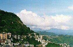
| image_caption | | image_caption = Clockwise from top: Aizawl skyline, [[Gauhati High Court|Gauhati High Court, Aizawl Bench]], Mizoram Secretariat, Aizawl cityscape at night, [[Solomon's Temple, Aizawl|Solomon's Temple]], [[Mizoram Legislative Assembly|Mizoram Assembly House]] | ||
| | | nicknames = {{lang|lus|Zofate Jerusalem}}<ref>{{cite web | url=https://indianexpress.com/article/political-pulse/mnf-hopes-to-ride-mizo-nationalism-wave-post-manipur-9002389/ | title='Zofate Jerusalem': MNF hopes to ride Mizo nationalism wave post-Manipur, to another term | date=27 October 2023 }}</ref> <br /> "The [[Jerusalem]] of the [[Zo people]]" <br /> {{lang|lus|Zawlkhawpui}}<ref>{{cite web | url=https://zalen.in/detail/zawlkhawpui-senmei-chan-ni | title=Zawlkhawpui senmei chan ni }}</ref> <br /> "The great ''zawl'' city" | ||
| map_alt | | map_alt = | ||
| map_caption | | map_caption = | ||
| pushpin_map | | pushpin_map = India Mizoram#India#Asia | ||
| pushpin_label_position | | pushpin_label_position = center | ||
| pushpin_map_alt | | pushpin_map_alt = | ||
| pushpin_map_caption | | pushpin_map_caption = Location of Aizawl in India | ||
| coordinates | | coordinates = {{coord|23|43|38|N|92|43|04|E|display=inline,title}} | ||
| subdivision_type | | subdivision_type = Country | ||
| subdivision_name | | subdivision_name = {{flag|India}} | ||
| subdivision_type1 | | subdivision_type1 = State | ||
| subdivision_name1 | | subdivision_name1 = [[Mizoram]] | ||
| subdivision_type2 | | subdivision_type2 = [[List of districts of India|District]] | ||
| subdivision_name2 | | subdivision_name2 = [[Aizawl district|Aizawl]] | ||
| established_title | | established_title = <!-- Established --> | ||
| established_date | | established_date = 1889 <small>As Fort Aijal</small> | ||
| founder | | founder = | ||
| named_for | | named_for = | ||
| governing_body | | governing_body = [[Aizawl Municipal corporation]] | ||
| leader_title1 | | leader_title1 = Mayor | ||
| leader_name1 | | leader_name1 = [[Lalrinenga Sailo|Lalrinênga Sailo]] ([[Mizo National Front|MNF]]) | ||
| unit_pref | | unit_pref = Metric | ||
| area_footnotes | | area_footnotes = <ref>{{Cite web|url=https://amcmizoram.com|title=AMC facts}}</ref> | ||
| area_rank | | area_rank = | ||
| area_total_km2 | | area_total_km2 = 129.91 | ||
| elevation_footnotes | | elevation_footnotes = | ||
| elevation_m | | elevation_m = 1132 | ||
| population_total | | population_total = 405,000<ref name="macrotrends"/> (estimate) | ||
| population_as_of | | population_as_of = 2024 | ||
| population_rank | | population_rank = 1st in [[Mizoram]] | ||
| population_density_km2 | | population_density_km2 = 2253 | ||
| population_demonym | | population_demonym = | ||
| population_footnotes | | population_footnotes = | ||
| demographics_type1 | | demographics_type1 = Languages | ||
| demographics1_title1 | | demographics1_title1 = Official | ||
| demographics1_info1 | | demographics1_info1 = [[Mizo language|Mizo]] and English<ref>{{cite web |title=Mizoram, Ministry of Development of North Eastern Region, North East India |url=https://mdoner.gov.in/about-north-east/mizoram |website=mdoner.gov.in |access-date=13 February 2025}}</ref> | ||
| | | timezone1 = [[Indian Standard Time|IST]] | ||
| | | utc_offset1 = +5:30 | ||
| timezone1 | | postal_code_type = [[Postal Index Number|PIN]] | ||
| utc_offset1 | | postal_code = 796001 | ||
| postal_code_type | | area_code_type = Telephone code | ||
| postal_code | | area_code = 0389 | ||
| area_code_type | | registration_plate = MZ-01 | ||
| area_code | | blank_name = [[Human sex ratio|Sex ratio]] | ||
| registration_plate | | blank_info = 1025 females per 1000 males [[male|♂]]/[[female|♀]]<ref name="census2011.co.in"/> | ||
| blank_name | | blank1_name = [[Köppen climate classification|Climate]] | ||
| blank_info | | blank1_info = [[Humid subtropical climate|Cwa]] | ||
| blank1_name | | blank_name_sec2 = [[Literacy in India|Literacy]] | ||
| blank1_info | | blank_info_sec2 = 98.36%<ref name="census2011.co.in"/> | ||
| blank_name_sec2 | | footnotes = | ||
| blank_info_sec2 | |||
| footnotes | |||
}} | }} | ||
'''Aizawl''' ({{IPAc-en|lang|pron|aɪ | '''Aizawl''' ({{IPAc-en|lang|pron|ˈ|aɪ|z|ɔː|l}} {{respell|EYE|zawl}}; <small>[[Mizo language|Mizo]]:</small> {{IPA|lus|ˈaɪ̯.ˈzɔːl||Aizawl.ogg}}), formerly known as '''Aijal''', is the capital city and the most populous city of [[Mizoram]], India.<ref>{{Cite web|url=https://aizawl.nic.in/about-district/#:~:text=Aizawl+is+the+largest+city,state+of+Mizoram+in+India.|title=About District | Aizawl District, Government of Mizoram | India}}</ref> It is also the third largest city in [[northeast India]].<ref>{{cite web|title=Top 10 Most Populated Cities in North-east India|date=10 November 2019 |url=http://negreens.com/article/top-10-most-populated-cities-in-north-east-india/|publisher=negreens.com}}</ref><ref>{{cite web|title=North-east India – Emerging Urbanisation|url=http://urbanecology.in/about/north-east-india-emerging-urbanisation/|publisher=urbanecology.com}}</ref> It is situated atop a series of [[ridge]]s, with an average elevation of around 1,132 metres (3,714 feet) above sea level.<ref name="Mizoram Tourism">{{Cite web|url=https://www.mizoramtourism.com/place-to-visit/1|title=Mizoram Tourism}}</ref> In 2024, the city has an estimated population of 415,000 people.<ref name="macrotrends">{{cite web|title=Aizawl, India Metro Area Population 1950–2024|url=https://www.macrotrends.net/global-metrics/cities/21154/aizawl/population#:~:text=The%20current%20metro%20area%20population,a%202.38%25%20increase%20from%202021.|publisher=macotrends.net|access-date=4 April 2024}}</ref><ref>{{cite web|title=Aizawl Population 2024|url=https://worldpopulationreview.com/world-cities/aizawl-population|publisher=worldpopulationreview.com|access-date=4 April 2024}}</ref> | ||
Having served as the capital of the [[British rule in the Lushai Hills|British Lushai Hills]] from 1898 to 1947, colonial structures are prevalent in the city centre including but not limited to the Aijal Club, [[Raj Bhavan, Aizawl|Raj Bhavan]],<ref>{{Cite web|url=https://rajbhavan.mizoram.gov.in/history-of-raj-bhavan/|title=History of Raj Bhavan}}</ref> the [[Government Aizawl College|Red School]],<ref>{{Cite web|url=https://www.mizoramtourism.com/top-destination/40|title=Top Destinations Sikul Sen}}</ref>{{efn|now part of Government Aizawl College}} and the [[District magistrate|Office of the Deputy Commissioner]].<ref>{{Cite web|url=https://www.mizoramtourism.com/top-destination/35|title=Bawrhsap Pisa Pui}}</ref> As the seat of the [[Government of Mizoram]], Aizawl is home to the [[Mizoram Legislative Assembly|Assembly House]].<ref>{{Cite web|url=https://www.mizoramassembly.in|title=Mizoram Assembly}}</ref> Additionally, Aizawl is part of the [[Smart Cities Mission]], an initiative by the [[Ministry of Housing and Urban Affairs]] aimed at [[urban development]] and infrastructure enhancement.<ref>{{Cite web|url=https://aizawlsmartcity.mizoram.gov.in|title=Aizawl Smart City}}</ref> | |||
The | ==Etymology== | ||
The word ''Aizawl'' is a combination of two [[Mizo people|Mizo]] words: "ai" meaning "[[cardamom]]" and "zawl" meaning "flatland" or "plain." Therefore, "Aizawl" could roughly translate to "the field of cardamom." This name may have historical significance or could refer to the characteristics of the area before urbanisation.<ref name="Mizoram Tourism"/> | |||
==History== | |||
===Pre-colonialism (before 1889)=== | |||
[[File:Fort Aijal 1889.jpg|thumb|left|Fort Aijal in 1889]] | |||
Before the British, Aizawl was a village founded by Chief [[Lalsavunga]] around 1810. When the British found the site it had been abandoned.<ref>{{cite book |last1=Verghese |first1=C.G.|last2=Thanzawna|first2=R.L.|title=A History of the Mizos |date=1997 |publisher=Vikas Publishing House |location=New Delhi}}</ref> During his reign at Aizawl, Lalsavunga summoned the properties of the Zadeng chiefs as a ransom for Ngurpuilala, the son of their chief Lalchungnunga. Lalsavunga freed the Zadeng [[bawi system|bawi]] and gave them better rights.<ref>{{cite book |last1=Zawla |first1=K. |title=Mizo Pi Pute leh an thlahte Chanchin |date=1964 |publisher=Gosen Press |location=Aizawl |url=https://archive.org/details/in.ernet.dli.2015.467485/mode/2up |access-date=5 March 2025}}</ref> He lived in Aizawl around 1810–1820.<ref>{{cite book |last1=Thanhlira |first1=R. |title=Aw! Zawlhawpui: History of Aizawl |date=1983 |publisher=P.M. Press |location=Aizawl |url=https://archive.org/details/dli.ministry.10012/mode/1up |access-date=10 March 2025}}</ref> Situated a mere 14 kilometres from [[Sairang]] and accessible via flat-bottomed boats, it served as a strategic location, with the Li Bial stream for the British to establish their headquarters.<ref>{{cite book|author=K. C. Kabra|title=Economic Growth of Mizoram: Role of Business & Industry|year=2008|publisher=Concept Publishing Company|url=https://books.google.com/books?id=0PcdaYllHNUC&q=lunglei+economy&pg=PA75|isbn=9788180695186}}</ref> | |||
===Colonial Aijal (1889-1948)=== | |||
{{further|Granville Henry Loch}} | |||
[[File:Northern End of Aijal 1896.png|thumb|left|The northern end of Aijal in 1896]] | |||
In 1889, Officer Dally of the [[Assam Police]], accompanied by 400 men, arrived in Aizawl village to assist Colonel Skinner's troops during a [[British rule in the Lushai Hills|British military operation]] against the Mizo natives. Aizawl was subsequently chosen as the site for a fortified post on Dally's recommendation, leading Colonel Skinner to oversee its construction. The troops erected stockades and other essential structures, establishing a significant military presence in the area. In the same year, Fort Aijal was established, a small village that became the capital of British administration in [[British rule in the Lushai Hills|North Lushai Hills]].<ref name="The Making of Aijal">{{cite web|url=http://aizawl.nic.in/makingofaijal.htm|archiveurl=https://web.archive.org/web/20131112023258/http://aizawl.nic.in/makingofaijal.htm|url-status=dead|title=The Making of Aijal|archivedate=12 November 2013}}</ref> | |||
Aijal was formally established on 25 February 1890 as '''Fort Aijal'''.<ref>{{Cite web|url=https://www.mizoramtourism.com/place-to-visit/1|title=Mizoram Tourism|accessdate=16 February 2024}}</ref> However, the communication system was not too good as there were little to no roads. The Silchar-Aizawl road was 175 km long but not an all-weather road, which was improved. In 1896, Fort Aijal became the headquarters of the Lushai Hills Military Police Battalion. [[Water scarcity]] was the primary concern for the original fort along with a lack of telegraph infrastructure.{{sfn|Chatterjee|1990|p=216}} | |||
Fort Aijal would subsequently be attacked by [[Khalkam]] and the western Lushai chiefs, which would begin the [[Lushai Rising]] on 9 September 1890. After the murder of Captain [[Herbert Richard Browne|H.R. Browne]], the western Lushai chiefs besieged Fort Aijal. Fort Aijal was commanded by surgeon H.B Melville. A relief force was brought in via the Dhaleswari river but its leader Lieutenant Swinton was fatally wounded during an ambush. He died on 26 September. Fort Aijal would be liberated on 4 October, with credit going to Melville and Lieutenant [[H.W.G. Cole]] for their defence.{{sfn|Chatterjee|1985|p=107}}{{sfn|Reid|1942|p=17}}{{sfn|McCall|1949|p=59}} | |||
The early era of Aizawl oversaw many {{lang|lus|vêngs}} ({{translation|quarters}}) with distinct populations. The [[Khasi people|Khasi]] {{lang|lus|vêng}} was full of skilled carpenters who were already Christian from missionary efforts in the Khasi hills. The Gurkha {{lang|lus|vêng}} was the quarter of soldiers and barracks. In the northern end of Aizawl lived many [[Punjabi people|Punjabi]] builders. [[Bengali people|Bengalis]] functioned as bureaucrats in early Aizawl such as administration, post offices and public works department. The [[Santali people|Santali]] were employed for coolie labour. The police force consisted of [[Assamese people|Assamese]] in the Chaprasi {{lang|lus|vêng}}. Many Mizos who visited Aizawl gave the journey the term {{lang|lus|Vai-kal}} ({{translation|going to the place of foreigners}}). Mizos were also appointed to local administratrive roles in maintaining newly built roads where they were placed in villages close to roads to weed out and keep contact with Aizawl.{{sfn|Lloyd|1991|p=40}} Aizawl also began to grow due to its reputation as the biggest market in the [[British Lushai Hills|Lushai Hills]] at the time with products such as soap, clothes, salt which were sought after.{{sfn|Lloyd|1991|p=41}} | |||
Since the roads were unusuable for wheeled transport, the system of transportation required coolies to lift supplies. In Aizawl the coolies and carriers resided in a [[Zawlbuk|{{lang|lus|Zawlbûk|cat=no}}]] on the eastern end of Aizawl. The {{lang|lus|Zawlbûk}} in Rhasi {{lang|lus|vêng}} was the most popular at the time and had been erected by the government. Khasi evangelist Rai Bhajur used the Rhasi {{lang|lus|Zawlbûk}} to engage the gospel to the Mizos. Missionary [[David Evan Jones (missionary)|David Evan Jones]] visited the {{lang|lus|Zawlbûk}} and sang hymns to the inhabitants, narrated the [[crucifixion of Christ]] and handed out stories for the literate youth.{{sfn|Lloyd|1991|p=42}} | |||
Aizawl swiftly emerged as the administrative and religious hub for the Mizos, following the establishment of the Welsh Mission Society headquarters in the city. This led to a surge in population as Aizawl Bazar evolved into the primary commercial center of the [[British rule in the Lushai Hills|Lushai Hills region]].<ref name="The Making of Aijal"/> | |||
===Contemporary Aizawl (1948–present)=== | |||
====Capital of Mizo District, Assam, India (1948–1972)==== | |||
The once modest village, situated on a level hilltop, underwent rapid expansion, transforming into a rugged and uneven settlement. The intensification of the [[Mautam|Mautam famine]] in the late 1950s prompted an influx of people seeking sustenance and opportunities, further fuelling Aizawl's growth. Nearby villages like Chaltlang and Durtlang soon became absorbed into the expanding urban landscape, marking the transition of Aizawl into a modern cityscape by the early 1960s.<ref name="themizos.com">{{cite web|url=https://www.themizos.com/2021/10/the-beautiful-hill-top-city-of-aizawl.html|title=The Beautiful Hill Top City of Aizawl|date=26 October 2021 }}</ref> | |||
====1966 Mizo National Front Uprising==== | |||
{{main|Bombing of Aizawl}} | |||
The expansion of Aizawl came to an abrupt halt in the mid-1960s due to the turmoil caused by the [[Mizo National Front uprising|Mizo Independence Movement]], spearheaded by the [[Mizo National Front]] (MNF), which engaged in open conflict with the [[Government of India]]. However, a pivotal and tragic event unfolded in Aizawl in March 1966, marking a dark chapter in its history. | |||
In an effort to suppress the MNF's advances, on 5–6 March, the Government of India launched a devastating bombardment of Aizawl and its surrounding areas, resulting in significant loss of life.<ref name="The Mizo Uprising: Assam Assembly Debates on the Mizo Movement, 1966-1971">{{cite book | |||
| title = The Mizo Uprising: Assam Assembly Debates on the Mizo Movement, 1966–1971 | |||
| author = Dr. J. V. Hluna, Rini Tochhawng | |||
| pages = xix | |||
| publisher = Cambridge Scholars Publishing | |||
| year = 2012 | |||
| isbn = 978-1-44384042-2}}</ref> By this point, Aizawl had already been largely evacuated, with many seeking refuge in the nearby jungle. This unprecedented act of the Indian government, to conduct airstrikes in its own territory in urban areas, remains the first in Indian history.<ref name="themizos.com"/><ref name="Hamlet_Bareh_Enc">{{cite book | |||
| title = Encyclopaedia of North-East India: Mizoram | | title = Encyclopaedia of North-East India: Mizoram | ||
| author = Hamlet Bareh | | author = Hamlet Bareh | ||
| Line 85: | Line 120: | ||
| publisher = Mittal Publications | | publisher = Mittal Publications | ||
| year = 2001 | | year = 2001 | ||
| isbn = 978-81-7099-787-0}}</ref> | | isbn = 978-81-7099-787-0}}</ref> | ||
== | ==== Capital of Mizoram Union Territory (1972-1987)==== | ||
Aizawl | Aizawl continued to be the capital of [[Union Territory of Mizoram|Mizoram]] after gaining the status of Union Territory. The UT status provided opportunities for economic growth and development in Aizawl. The city emerged as a key commercial and trade centre in the region, with [[Burmese people|Burmese]] ethnic [[Chin people|Chin]] immigrants seeking better job opportunities in Aizawl.<ref>{{Cite web|url=https://mizzima.com/article/chin-refugees-myanmar-receive-mixed-welcome-india|title=Chin Refugees Myanmar Receive Mixed Welcome india}}</ref> | ||
== | ==== Capital of State of Mizoram (1987–present)==== | ||
[[File:Aizawl | [[File:Aizawl.jpg|thumb|left|Aizawl in the 2000s]] | ||
Statehood provided Aizawl with enhanced access to resources, funding, and developmental schemes from the central government. This facilitated the implementation of infrastructure projects, such as [[Lengpui Airport]], educational initiatives, healthcare programs, and poverty alleviation measures aimed at fostering socio-economic growth and improving the quality of life for its citizens. | |||
On 25 May 2025, Chief Minister [[Lalduhoma]] raised the need for developing a new city in Mizoram at the [[NITI Aayog]] meeting, stressing that 80 per cent of the state's population lives in the capital Aizawl. Speaking at the meeting in New Delhi, he said Aizawl has become congested and he proposed [[Thenzawl]] in [[Serchhip district]], about 93 km from Aizawl, as the site for the new city, which will be able to accommodate 10–1.5 million residents.<ref>{{Cite news |date=25 May 202 |title=Need to develop new city, 80 pc of Mizoram population lives in capital Aizawl: CM at Niti Aayog meet |url=https://www.ptinews.com/story/national/need-to-develop-new-city-80-pc-of-mizoram-population-lives-in-capital-aizawl-cm-at-niti-aayog-meet/2587464 |url-status=live |archive-url=https://web.archive.org/web/20250527093548/https://www.ptinews.com/story/national/need-to-develop-new-city-80-pc-of-mizoram-population-lives-in-capital-aizawl-cm-at-niti-aayog-meet/2587464 |archive-date=27 May 2025 |access-date=27 May 2025 |work=Press Trust of India |language=en |publication-date=25 May 2025}}</ref> | |||
==Geography and Climate== | |||
===Geography=== | |||
Aizawl lies at approximately 23°43′N, 92°43′E and is perched on the ridge of a hill at an average elevation of 1,132 meters (3,714 feet) above sea level. The topography features steep slopes, with elevations ranging from 60 meters to 1,509 meters, making the city a mix of rugged terrains. Aizawl is surrounded by lush greenery and is part of the [[Eastern Himalayas|Eastern Himalayan foothills]].<ref name="en-in.topographic-map.com">{{Cite web|url=https://en-in.topographic-map.com/map-24ltj/Aizawl/ |title=Aizawl topographic map |access-date=15 December 2024}}</ref> | |||
==Climate== | ===Climate=== | ||
The city is located at the north of the [[Tropic of Cancer]] in the northern part of Mizoram, with the [[Tlawng]] river [[valley]] to its west and the [[Tuirial]] river valley to its east.<ref>{{Cite web |title=Aizawl – the State Capital: Mizoram |url=https://mizoram.nic.in/more/aizawl.htm |access-date=6 November 2023 |website=mizoram.nic.in}}</ref> Aizawl experiences a [[humid subtropical climate]] (Cwa) under the [[Köppen climate classification|Köppen classification]]. Summers are moderately warm with temperatures averaging between 20–30 °C (68–86 °F), while winters are cooler with temperatures ranging from 11–21 °C (52–70 °F). The city receives most of its rainfall from April to October, peaking in the months of May, July, August, and September. The remaining months are relatively dry.<ref name="en-in.topographic-map.com"/> Aizawl is ranked second best city in India for having the 'cleanest air and best [[Air quality index|AQI]]' in 2024.<ref>{{Cite web |date=21 November 2024 |title=India's top 10 cities with the best air quality in 2024: Global cities' AQI insights revealed |url=https://indianexpress.com/article/trending/top-10-listing/top-10-indian-cities-with-best-air-quality-index-aqi-2024-9680798/ |access-date= |website=The Indian Express |language=en}}</ref> | |||
{{Weather box | {{Weather box | ||
| location = Aizawl ( | | location = Aizawl, elevation {{convert|950|m|ft|abbr=on}}, (1991–2020, extremes 1973–2010) | ||
| metric first = Y | | metric first = Y | ||
| single line = Y | | single line = Y | ||
| Line 137: | Line 155: | ||
| Dec record high C = 28.5 | | Dec record high C = 28.5 | ||
|year record high C = 35.5 | |year record high C = 35.5 | ||
| Jan | | Jan record low C = 5.1 | ||
| Feb record low C = 5.0 | |||
| Mar record low C = 5.5 | |||
| Apr record low C = 6.9 | |||
| May record low C = 11.8 | |||
| Jun record low C = 9.2 | |||
| Feb record low C = | |||
| Mar record low C = | |||
| Apr record low C = | |||
| May record low C = | |||
| Jun record low C = | |||
| Jul record low C = 12.0 | | Jul record low C = 12.0 | ||
| Aug record low C = | | Aug record low C = 10.5 | ||
| Sep record low C = | | Sep record low C = 10.7 | ||
| Oct record low C = | | Oct record low C = 10.1 | ||
| Nov record low C = 10.0 | | Nov record low C = 10.0 | ||
| Dec record low C = | | Dec record low C = 4.5 | ||
|year record low C = 6.1 | |year record low C = 6.1 | ||
|Jan high C = 23.3 | |||
|Feb high C = 24.8 | |||
|Mar high C = 28.1 | |||
|Apr high C = 28.8 | |||
|May high C = 28.0 | |||
|Jun high C = 27.2 | |||
|Jul high C = 27.0 | |||
|Aug high C = 27.5 | |||
|Sep high C = 27.3 | |||
|Oct high C = 27.2 | |||
|Nov high C = 26.0 | |||
|Dec high C = 23.8 | |||
| year high C = 26.6 | |||
|Jan low C = 11.3 | |||
|Feb low C = 13.0 | |||
|Mar low C = 16.4 | |||
|Apr low C = 17.5 | |||
|May low C = 18.7 | |||
|Jun low C = 19.5 | |||
|Jul low C = 20.2 | |||
|Aug low C = 20.1 | |||
|Sep low C = 19.6 | |||
|Oct low C = 19.1 | |||
|Nov low C = 15.9 | |||
|Dec low C = 12.6 | |||
| year low C = 16.9 | |||
| rain colour = green | | rain colour = green | ||
| Jan rain mm = 9. | | Jan rain mm = 9.1 | ||
| Feb rain mm = | | Feb rain mm = 19.4 | ||
| Mar rain mm = | | Mar rain mm = 71.5 | ||
| Apr rain mm = | | Apr rain mm = 134.2 | ||
| May rain mm = | | May rain mm = 322.5 | ||
| Jun rain mm = | | Jun rain mm = 311.0 | ||
| Jul rain mm = | | Jul rain mm = 326.6 | ||
| Aug rain mm = | | Aug rain mm = 342.2 | ||
| Sep rain mm = | | Sep rain mm = 337.9 | ||
| Oct rain mm = | | Oct rain mm = 173.0 | ||
| Nov rain mm = | | Nov rain mm = 42.5 | ||
| Dec rain mm = | | Dec rain mm = 10.6 | ||
|year rain mm = | | year rain mm = 2100.5 | ||
| Jan rain days = 0. | | Jan rain days = 0.8 | ||
| Feb rain days = | | Feb rain days = 1.7 | ||
| Mar rain days = | | Mar rain days = 3.9 | ||
| Apr rain days = | | Apr rain days = 7.9 | ||
| May rain days = | | May rain days = 14.1 | ||
| Jun rain days = 17. | | Jun rain days = 17.3 | ||
| Jul rain days = 18. | | Jul rain days = 18.9 | ||
| Aug rain days = | | Aug rain days = 18.7 | ||
| Sep rain days = | | Sep rain days = 15.3 | ||
| Oct rain days = | | Oct rain days = 10.0 | ||
| Nov rain days = 2. | | Nov rain days = 2.2 | ||
| Dec rain days = 0. | | Dec rain days = 0.7 | ||
|year rain days = 111. | | year rain days = 111.5 | ||
|time day = 17:30 [[Indian Standard Time|IST]] | |||
|source 1 = [[India Meteorological Department]]<ref name=IMDnormals> | |source 1 = [[India Meteorological Department]]<ref name=IMDnormals> | ||
{{cite web | {{cite web | ||
| archive-url = https://web.archive.org/web/ | | archive-url = https://web.archive.org/web/20240408025145/https://www.imdpune.gov.in/library/public/Climatological%20Tables%201991-2020.pdf | ||
| archive-date = | | archive-date = 8 April 2024 | ||
| url = | | url = https://www.imdpune.gov.in/library/public/Climatological%20Tables%201991-2020.pdf | ||
| title = Station: Aizwal Climatological Table | | title = Station: Aizwal Climatological Table 1991–2020 | ||
| work = Climatological Normals | | work = Climatological Normals 1991–2020 | ||
| publisher = India Meteorological Department | | publisher = India Meteorological Department | ||
| access-date = 7 July 2024}}</ref><ref name=IMDcityweather> | |||
| access-date = | |||
{{cite web | {{cite web | ||
| url = http://city.imd.gov.in/citywx/extreme/FEB/aizwal2.htm | | url = http://city.imd.gov.in/citywx/extreme/FEB/aizwal2.htm | ||
| Line 242: | Line 259: | ||
}} | }} | ||
== | ==Civic Administration== | ||
{{ | [[File:Aizawl, Mizoram - panoramio.jpg|thumb|left|{{center|Aizawl city}}]] | ||
| | |||
| | Aizawl is administered by the [[Aizawl Municipal Corporation]] (AMC), established in 2010 to oversee [[urban planning]], [[sanitation]], [[waste management]], and infrastructure development within the city.<ref>{{Cite web |title=Home {{!}} Aizawl Municipal Corporation (AMC) |url=https://amcmizoram.com/ |access-date=12 February 2024 |website=amcmizoram.com}}</ref> The AMC consists of 19 elected members representing the city's wards, along with additional members appointed by the [[Governor of Mizoram]]. To promote gender representation, one-third of the total seats are reserved for women, with these reserved seats rotated every five years.<ref>{{Cite web |title=Profile {{!}} Aizawl Municipal Corporation (AMC) |url=https://amcmizoram.com/page/about-us |access-date=11 September 2024 |website=amcmizoram.com}}</ref> | ||
| | |||
| | Each ward is managed by a Ward Committee, which is headed by the elected councillor of the ward. The committee also includes two members each from the local councils within the ward. The city comprises 78 local councils, representing the city's [[Locality (settlement)|localities]]. Serving a term of five years, the councils work in close coordination with the AMC to address local governance and community issues.<ref>{{cite web|author=Dr. L.H.Chhuanawma|title=Aizawl Municipal Council|url=http://www.trcollege.net/study-material/37-political-science/79-aizawl-municipal-council|publisher=T Romana College|access-date=7 September 2012|archive-url=https://web.archive.org/web/20130528030216/http://www.trcollege.net/study-material/37-political-science/79-aizawl-municipal-council|archive-date=28 May 2013}}</ref> | ||
==Demographics== | |||
{{Historical population | |||
| source = [[Census of India]]<ref>{{Cite web|url=https://www.censusindia.gov.in/2011census/PCA/A2_Data_Table.html|title=Census of India Website: Office of the Registrar General & Census Commissioner, India|website=www.censusindia.gov.in|access-date=11 March 2021|archive-date=10 October 2021|archive-url=https://web.archive.org/web/20211010234955/https://www.censusindia.gov.in/2011census/PCA/A2_Data_Table.html|url-status=live}}</ref> | |||
| 1951 | 6,950 | |||
| 1961 | 15,329 | |||
| 1971 | 32,412 | |||
| 1981 | 75,922 | |||
| 1991 | {{formatnum:156687}} | |||
| 2001 | {{formatnum:228280}} | |||
| 2011 | {{formatnum:293416}} | |||
| percentages= | |||
}} | |||
{{bar box | |||
|title=Religion in Aizawl City (2011) | |||
|titlebar=#Fcd116 | |||
|left1=Religion | |||
|right1=Percentage | |||
|float=left | |||
|bars= | |||
{{bar percent|Christianity|blue|93.63}} | |||
{{bar percent|[[Hinduism]]|darkorange|4.14}} | |||
{{bar percent|[[Islam]]|green|1.52}} | |||
{{bar percent|[[Buddhism]]|gold|0.45}} | |||
{{bar percent|Not Stated|black|0.11}} | |||
{{bar percent|Others|grey|0.09}} | |||
{{bar percent|[[Sikhism]]|yellow|0.03}} | |||
{{bar percent|[[Jainism]]|brown|0.02}} | |||
}} | }} | ||
[[File:Old temple and military buildings in Dawrpui veng Aizawl - panoramio.jpg|thumb|Hindu temple in Dawrpui, Aizawl]] | |||
As per the [[2011 census of India]], Aizawl recorded a population of 293,416, with females constituting 50.61% and males accounting for 49.39%. The [[sex ratio]] stands at 1,025 females per 1,000 males, reflecting a favourable balance. Among children aged 0–6 years, the child sex ratio is slightly lower, with 983 girls per 1,000 boys.<ref>{{cite web|url=http://www.censusindia.net/results/town.php?stad=A&state5=999|archive-url=https://web.archive.org/web/20040616075334/http://www.censusindia.net/results/town.php?stad=A&state5=999|archive-date=16 June 2004|title= Census of India 2001: Data from the 2001 Census, including cities, villages and towns (Provisional)|access-date=1 November 2008|publisher= Census Commission of India}}</ref> | |||
== | ===Religion=== | ||
[[Christianity in Mizoram|Christianity]] is the dominant religion, with 93.63% of the population adhering to it. Among the minority religions, [[Hinduism in Mizoram|Hinduism]] accounts for 4.14%, [[Islam in Mizoram|Islam]] 1.52%, [[Buddhism in Mizoram|Buddhism]] 0.45%, [[Sikhism in India|Sikhism]] 0.03%, and [[Jainism in India|Jainism]] 0.02%. Additionally, 0.11% of the population did not specify their religious affiliation.<ref name="census2011.co.in">{{cite web|url=http://www.census2011.co.in/census/city/185-aizawl.html |title=Aizawl City Census 2011 data |work=census2011.co.in |access-date=17 May 2018}}</ref> | |||
== | As of 1910, there were 777 army personnel in Aizawl from different parts of North India as well as [[Nepal]]. The Gurkha's among the soldiers eventually settled in Aizawl.<ref>{{cite book |last1=Pachuau |first1=Joy |title=The Camera as a Witness |date=13 April 2015 |publisher=Cambridge |isbn=9781107073395 |pages=139}}</ref> | ||
=== | ===Media=== | ||
Aizawl is home to regional and national television broadcasting. Channels such as Zonet Cable TV Pvt. Ltd., and LPS Vision Production offer state and national programs in [[Mizo language|Mizo]] while [[Doordarshan]] Aizawl offers both Mizo and [[indian English|English]], reflecting the region's bilingual character. [[Miss Mizoram]], Mizo Idol, and the Ṭhazual Awards are led by Zonet.<ref>{{Cite web|url=https://hubnetwork.in/jennifer-lalrinzuali-crowned-miss-mizoram-2024/|title=Jennifer Lalrinzuali Crowned Miss Mizoram 2024|date=27 April 2024 }}</ref> | |||
Aizawl is | |||
Radio remains a popular medium in Aizawl. [[All India Radio]] (AIR) Aizawl broadcasts in Mizo, English, and occasionally in other regional languages, focusing on news, educational content, and cultural programs. FM radio stations like FM Zoawi and LPS FM are widely listened to, offering a mix of music, entertainment, and live shows.<ref>{{cite news|title=AIR buatsaih FM Zoawi chu le|url=http://www.vanglaini.org/index.php?option=com_content&view=article&id=5815:air-buatsaih-fm-zoawi-chu-le|access-date=27 August 2012|newspaper=Vanglaini|archive-date=29 May 2014|archive-url=https://web.archive.org/web/20140529085441/http://www.vanglaini.org/index.php?option=com_content&view=article&id=5815:air-buatsaih-fm-zoawi-chu-le|url-status=dead}}</ref> | |||
[[Vanglaini]], the leading daily newspaper in Mizoram, is a significant part of Aizawl's print media landscape. Published entirely in the Mizo language, it serves as the primary source of local, regional, and national news for Mizoram's residents. The paper covers a wide range of topics, including politics, social issues, culture, education, and sports, while also offering editorials and opinion pieces reflective of the state's unique perspectives.,<ref>{{cite web | |||
|url= http://vanglaini.org/ | |||
|title=Vanglaini – Mizo Daily Since 1978 | |||
|work=vanglaini.org | |||
|access-date=30 June 2010 | |||
|archive-url=https://web.archive.org/web/20140401164127/http://www.vanglaini.org/ | |||
|archive-date=1 April 2014 | |||
}}</ref> | |||
The major media in Aizawl in the Mizo and English languages are:<ref>{{cite web|title=Accredited Journalists|url=http://dipr.mizoram.gov.in/journalists|publisher=DIPR Mizoram|access-date=5 September 2012|archive-url=https://web.archive.org/web/20130619020709/http://dipr.mizoram.gov.in/journalists|archive-date=19 June 2013}}</ref> | |||
{{div col|colwidth=20em}} | {{div col|colwidth=20em}} | ||
* [[Vanglaini]],<ref>{{cite web | * [[Vanglaini]],<ref>{{cite web | ||
|url= http://vanglaini.org/ | |url= http://vanglaini.org/ | ||
|title=Vanglaini | |title=Vanglaini – Mizo Daily Since 1978 | ||
|work=vanglaini.org | |work=vanglaini.org | ||
|access-date=30 June 2010 | |access-date=30 June 2010 | ||
| Line 279: | Line 328: | ||
* The Zozam Times<ref>{{cite web|title=The Zozam Times|url=http://thezozamtimes.org/|access-date=7 September 2012|archive-url=https://web.archive.org/web/20140107115720/http://thezozamtimes.org/|archive-date=7 January 2014}}</ref> | * The Zozam Times<ref>{{cite web|title=The Zozam Times|url=http://thezozamtimes.org/|access-date=7 September 2012|archive-url=https://web.archive.org/web/20140107115720/http://thezozamtimes.org/|archive-date=7 January 2014}}</ref> | ||
* The Aizawl Post.<ref>{{cite web|title=The Aizawl Post|url=http://www.theaizawlpost.com/|access-date=7 September 2012|archive-url=https://web.archive.org/web/20140103222150/http://theaizawlpost.com/|archive-date=3 January 2014}}</ref> | * The Aizawl Post.<ref>{{cite web|title=The Aizawl Post|url=http://www.theaizawlpost.com/|access-date=7 September 2012|archive-url=https://web.archive.org/web/20140103222150/http://theaizawlpost.com/|archive-date=3 January 2014}}</ref> | ||
* India Today NE | |||
* Khawpui Aw | * Khawpui Aw | ||
* Virthli<ref>{{cite web|title=Virthli|url=http://virthli.com/|access-date=7 September 2012|archive-url=https://web.archive.org/web/20130327083314/http://www.virthli.com/|archive-date=27 March 2013}}</ref> | * Virthli<ref>{{cite web|title=Virthli|url=http://virthli.com/|access-date=7 September 2012|archive-url=https://web.archive.org/web/20130327083314/http://www.virthli.com/|archive-date=27 March 2013}}</ref> | ||
| Line 292: | Line 342: | ||
{{div col end}} | {{div col end}} | ||
''' | ===Lifestyle=== | ||
[[ | [[Chapchar Kut]], one of Mizoram's most cherished festivals, signals the arrival of spring and is celebrated with enthusiasm and grandeur. Held annually in March, it marks the completion of [[jhum cultivation|jhum (slash-and-burn) cultivation]] preparations. It is usually held on a mass scale at the Assam Rifles Parade ground (Lammual). On the roads, people would stand with a plate of [[boiled egg]]s and give it to passers-by, a pre-Christian tradition called Chhawnghnawh.<ref>{{Cite web|url=https://www.hindustantimes.com/india/egged-on-mizoram-festival-revives-pre-christian-custom/story-e6aDSthhn8K6hFP2GeblvM.html|title=Egged On Mizoram Festival Revives Pre-Christian Custom|work=Hindustan Times |date=8 March 2016 }}</ref> | ||
On Christmas, ''Kawnchei'' ([[Literal translation|lit.]] 'junction decoration') is a centerpiece of life in Aizawl, led by the [[Aizawl Municipal Corporation]]. The ''Kawnchei'' tradition results in a festive glow with illuminated streets, decorated churches, and vibrant carol-singing.<ref>{{Cite web|url=https://zalen.in/detail/kawnchei-mawi-lawmman-pe-dawn|title=Kawnchei Mawi Lawmman Pe Dawn}}</ref> The spirit of the season is deeply rooted in family gatherings, sharing meals, and attending church services. [[Mizo cuisine|Traditional Mizo dishes]], often prepared during this time, add a culinary delight to the celebrations.<ref>{{Cite web|url=https://www.mizoramtourism.com/festivals/2|title=Christmas Kawnchei}}</ref> | |||
==Transport== | |||
===Air=== | |||
[[File:Lengpui Airport Building.JPG|thumb|300px|Lengpui Airport]] | |||
Aizawl is connected by air transport through [[Lengpui Airport]] which it is situated near Aizawl.<ref>{{Cite book|url=https://archive.org/details/howilearnedgeogr0000shul|title=How I learned geography|author=Shulevitz, Uri|date=2008|publisher=Farrar Straus Giroux|isbn=9780374334994|oclc=123766698|url-access=registration}}</ref> The airport provides connectivity to [[Kolkata]], Delhi, [[Guwahati]], [[Agartala]], [[Shillong]] and [[Imphal]], operated by [[Air India]], [[Go First]] and [[IndiGo]]. A helicopter service by [[Pawan Hans]]<ref>{{cite web|title=Mizorama Helicopter Service Tur Chief Minister in Hawng|url=http://dipr.mizoram.gov.in/press-release/mizorama-helicopter-service-tur-chief-minister-in-hawng|publisher=Mizoram DIPR|access-date=14 August 2012|archive-url=https://web.archive.org/web/20131212015939/http://dipr.mizoram.gov.in/press-release/mizorama-helicopter-service-tur-chief-minister-in-hawng|archive-date=12 December 2013}}</ref> was started in 2012 and connects the city with [[Lunglei]], [[Lawngtlai]], [[Saiha]], [[Chawngte]], [[Serchhip]], [[Champhai]], [[Kolasib]], [[Khawzawl]], [[Ngopa]] and [[Hnahthial]].<ref>{{cite news|title=Nilaini atangin 'Helicopter Service|url=http://www.thezozamtimes.org/index.php?option=com_content&view=article&id=5455:nilaini-atangin-helicopter-service&catid=43:news&Itemid=63|archive-url=https://web.archive.org/web/20150923163051/http://www.thezozamtimes.org/index.php?option=com_content&view=article&id=5455:nilaini-atangin-helicopter-service&catid=43:news&Itemid=63|url-status=dead|archive-date=23 September 2015|access-date=20 August 2012|newspaper=The Zozam Times}}</ref><ref>{{cite news|title=Mizoram Chhunga Helicopter Service Scheduled Thar|url=https://dipr.mizoram.gov.in/press-release/mizoram-chhunga-helicopter-service-scheduled-thar|access-date=23 September 2015|agency=DIPR: Govt of Mizoram|archive-url=https://web.archive.org/web/20150923144248/https://dipr.mizoram.gov.in/press-release/mizoram-chhunga-helicopter-service-scheduled-thar|archive-date=23 September 2015|url-status=dead}}</ref> | |||
===Rail=== | |||
The '''Sairang Railway Station''' of Aizawl was developed as part of the [[Bairabi–Sairang line|Bairabi–Sairang railway line]], a 51.38 km broad-gauge project connecting [[Bairabi]] in Assam to [[Sairang]], approximately 15 km from Aizawl, the capital of [[Mizoram]]. Initially proposed in 1998, the project received formal approval from the [[Government of India|Indian government]] in 2008–09 and was declared a [[National Project of India|National Project]] to expedite its completion. Construction commenced in November 2014, with the foundation stone for [[Sairang|Sairang station]] laid by then-Railway Minister [[Suresh Prabhu]] on 11 November 2016. | |||
The project faced significant challenges, including difficult terrain, limited working seasons, and a tragic bridge collapse in August 2023, which resulted in the loss of 26 lives. Despite these setbacks, the line was successfully completed and received [[Commission of Railway Safety|Commissioner of Railway Safety]] (CRS) authorization in June 2025, marking a major milestone in connecting [[Mizoram]]'s capital to the national railway network. | |||
On 13 September 2025, Prime Minister [[Narendra Modi]] inaugurated the [[Sairang Railway Station]], fulfilling a long-standing aspiration of the people of [[Mizoram]]. During the inauguration, he also flagged off several key passenger trains, including the [[Sairang-Anand Vihar Terminal Rajdhani Express|Aizawl–Delhi Rajdhani Express]], [[Kolkata–Sairang Express|Aizawl–Kolkata Express]], and [[Guwahati–Sairang Express|Aizawl–Guwahati Express]], significantly enhancing regional connectivity. The station is being developed into a world-class facility, with plans to introduce additional services and improve infrastructure to meet the growing transportation needs of the region. | |||
==Education== | ==Education== | ||
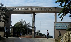
[[File:Mizoram University Entrance.JPG|thumb|300px|Mizoram University Entrance]] | [[File:Mizoram University Entrance.JPG|thumb|300px|Mizoram University Entrance]] | ||
== | The [[literacy rate]] in Aizawl city, as of the 2011 Census, is approximately 98.4%, one of the highest in India. This includes 99% literacy among males and 98% among females.<ref>{{Cite web|url=https://censusindia.gov.in/census.website/|title=Aizawl Population Aizawl Mizoram}}</ref> | ||
[[Pachhunga University College]] was among the earliest colleges founded in 1958. [[Aizawl College]], the second oldest college in Aizawl City was established in the year 1975. [[Hrangbana College]] was established in 1980, located in Chanmari, Aizawl, it has 57 teaching | |||
The education system in Aizawl includes primary, secondary, and higher education institutions. Aizawl also hosts [[Mizoram University]], established in 2001, which offers diverse undergraduate, postgraduate, and doctoral programs. The presence of specialised institutes like the [[Indian Institute of Mass Communication]] and the [[National Institute of Electronics & Information Technology|National Institute of Electronics and Information Technology]] (NIELIT) further strengthens the city's academic infrastructure. | |||
[[Pachhunga University College]] was among the earliest colleges founded in 1958. [[Aizawl College]], the second oldest college in Aizawl City was established in the year 1975. [[Hrangbana College]] was established in 1980, located in Chanmari, Aizawl, it has 57 teaching staff with 22 non-teaching staff and more than 2,000 students in the commerce and arts departments. [[Mizoram University]] established in 2001 provides affiliation to all the colleges in Mizoram. Mizoram University also provides post-graduate education as well as BTech education and other departments. [[ICFAI University, Mizoram]] located in Durtlang, [[Aizawl West College]], Government Aizawl North College, [[J.Thankima College|J. Thankima College]], [[Govt.Zirtiri Residential Science College]] also provides undergraduate courses. [[Mizoram Law College]] provides education to people who seek a profession in Law.<ref>[http://video.disc.iisc.ernet.in/vigyan/mizo_univ.htm The Mizoram University Act of 25 April 2000] {{webarchive |url=https://web.archive.org/web/20120803150529/http://video.disc.iisc.ernet.in/vigyan/mizo_univ.htm |date=3 August 2012 }}</ref> [[Indian Institute of Mass Communication]] and [[National Institute of Technology Mizoram]] has already started operations. [[Zoram Medical College]] is inaugurated on 7 August 2018 in Falkawn.<ref>{{cite web|title=Central Health Services Leh Aiims Doctor Ten Chief Minister HMU|url=http://dipr.mizoram.gov.in/press-release/central-health-services-leh-aiims-doctor-ten-chief-minister-hmu|publisher=DIPR|access-date=15 August 2012|archive-url=https://web.archive.org/web/20140201213316/http://dipr.mizoram.gov.in/press-release/central-health-services-leh-aiims-doctor-ten-chief-minister-hmu|archive-date=1 February 2014}}</ref> | |||
==Sports== | ==Sports== | ||
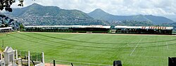
[[File:Lammual Stadium.jpg|thumb|300px|Lammual Stadium]] | [[File:Lammual Stadium.jpg|thumb|300px|Lammual Stadium]] | ||
[[Association football|Football]] is the most popular sport in Mizoram with | [[Association football|Football]] is the most popular sport in Mizoram, with several footballers playing in national leagues in different parts of India. The professional football club of the city, [[Aizawl F.C.|Aizawl F.C]], competes in the [[I-League]]. Some of the important sporting facilities in Aizawl are: | ||
# [[Rajiv Gandhi Stadium | # [[Rajiv Gandhi Stadium, Aizawl|Rajiv Gandhi Stadium]], with a seating capacity of 20,000, is located at Mualpui in Aizawl.<ref>{{cite web|last=tirhkahthawla|title=Mualpui Stadium Design|url=http://www.misual.com/2010/06/18/mualpui-stadium-design/|publisher=misual.com|access-date=14 August 2012|archive-url=https://web.archive.org/web/20130527095346/http://www.misual.com/2010/06/18/mualpui-stadium-design/|archive-date=27 May 2013}}</ref> | ||
# [[Hawla Indoor Stadium]] is the largest indoor stadium with | # [[Hawla Indoor Stadium]] is the largest indoor stadium with basketball, badminton and [[boxing]] facilities. | ||
# [[Lammual]] stadium is a single tier stadium. The stadium under construction will have a seating capacity of about 5,000 spectators.<ref>{{cite web|title=Lammual-ah Gallery sak hna tan dawn ta |url=http://thezozamtimes.org/index.php?option=com_content&view=article&id=4175:lammual-ah-gallery-sak-hna-tan-dawn-ta&catid=43:news&Itemid=63 |archive-url=https://archive.today/20130415233229/http://thezozamtimes.org/index.php?option=com_content&view=article&id=4175:lammual-ah-gallery-sak-hna-tan-dawn-ta&catid=43:news&Itemid=63 |url-status=dead |archive-date=15 April 2013 |publisher=The Zozam Times |access-date=16 August 2012 }}</ref> | # [[Lammual]] stadium is a single tier stadium. The stadium under construction will have a seating capacity of about 5,000 spectators.<ref>{{cite web|title=Lammual-ah Gallery sak hna tan dawn ta |url=http://thezozamtimes.org/index.php?option=com_content&view=article&id=4175:lammual-ah-gallery-sak-hna-tan-dawn-ta&catid=43:news&Itemid=63 |archive-url=https://archive.today/20130415233229/http://thezozamtimes.org/index.php?option=com_content&view=article&id=4175:lammual-ah-gallery-sak-hna-tan-dawn-ta&catid=43:news&Itemid=63 |url-status=dead |archive-date=15 April 2013 |publisher=The Zozam Times |access-date=16 August 2012 }}</ref> | ||
{| class="wikitable" | {| class="wikitable" | ||
| Line 318: | Line 385: | ||
| [[Association football|Football]] | | [[Association football|Football]] | ||
| [[Santosh Trophy]] | | [[Santosh Trophy]] | ||
| [[Rajiv Gandhi Stadium | | [[Rajiv Gandhi Stadium, Aizawl|Rajiv Gandhi Stadium]] | ||
|- | |- | ||
| [[Aizawl F.C.]] | | [[Aizawl F.C.]] | ||
| [[Association football|Football]] | | [[Association football|Football]] | ||
| [[I-League]] | | [[I-League]] | ||
| | | Rajiv Gandhi Stadium | ||
|- | |- | ||
| [[Chanmari F.C.]] | | [[Chanmari F.C.]] | ||
| Line 336: | Line 403: | ||
|} | |} | ||
Aizawl hosted the third edition of Xchange North East Youth NGO summit from | Aizawl hosted the third edition of Xchange North East Youth NGO summit from 3 to 5 October 2018.<ref>{{Cite web|url=https://www.telegraphindia.com/states/north-east/ne-youth-summit-at-aizawl-255781|archive-url=https://web.archive.org/web/20180904153948/https://www.telegraphindia.com/states/north-east/ne-youth-summit-at-aizawl-255781|url-status=dead|archive-date=4 September 2018|title=Aizawl will host the third edition of Xchange North East Youth NGO summit from October 3rd to 5th,2018.}}</ref> | ||
==See also== | ==See also== | ||
* [[Aizawl FC]] | |||
* [[Aizawl Monorail]] | |||
* [[Advanced Research Centre for Bamboo and Rattan|Advanced Research Centre for Bamboo and Rattan, Aizawl, Mizoram]] | |||
* [[Aizawl Theological College]] | |||
* [[Tourism in North East India]] | * [[Tourism in North East India]] | ||
==Notes== | |||
{{notelist}} | |||
== References == | == References == | ||
| Line 428: | Line 419: | ||
==External links== | ==External links== | ||
{{Commons category}} | |||
*{{Wikivoyage inline|Aizawl}} | |||
* [https://aizawl.nic.in/ Aizawl Official Website] | |||
* [https://amcmizoram.com/ Aizawl Municipal Corporation] | |||
* | ==Sources== | ||
* | *{{cite book |last=Chatterjee |first=Suhas |date=1985 |title=British rule in Mizoram |location=New Delhi |publisher=Mittal Publications}} | ||
*{{cite book |first=J. Meirion |last=Lloyd |title=History of the Church in Mizoram: Harvest in the Hills |year= 1991 |pages=17–23| url= https://books.google.com/books?id=BkgFAQAAIAAJ| publisher= Synod Publication Board}} | |||
*{{cite book|last=McCall|first=Anthony Gilchrist|title=Lushai Chrysalis|year=1949|publisher=Luzac|location=London|url=https://archive.org/details/dli.ministry.16549/mode/2up}} | |||
*{{cite book |last=Reid |first=Robert |author-link=Robert Reid (civil servant)|date=1942 |title=The Lushai Hills: culled from History of the frontier areas bordering on Assam from 1883–1941 |url=https://archive.org/details/dli.ministry.16551/page/n5/mode/2up |location=Calcutta |publisher=Firma KLM}} | |||
*{{cite book |last=Chatterjee |first=Suhas |date=1990 |title=Mizo Encyclopaedia|location=Aizawl|publisher=Jaico Publishing House}} | |||
{{Aizawl}} | {{Aizawl}} | ||
{{Urban Areas in Mizoram by Population}} | |||
{{Mizoram}} | {{Mizoram}} | ||
{{North East India}} | {{North East India}} | ||
Latest revision as of 09:46, 12 March 2026
Aizawl
Aijal | |
|---|---|
Clockwise from top: Aizawl skyline, Gauhati High Court, Aizawl Bench, Mizoram Secretariat, Aizawl cityscape at night, Solomon's Temple, Mizoram Assembly House | |
| Nicknames: | |
Location of Aizawl in India   Aizawl Aizawl (India)  Aizawl Aizawl (Asia) | |
| Coordinates: 23°43′38″N 92°43′04″E / 23.72722°N 92.71778°E | |
| Country |  India India |
| State | Mizoram |
| District | Aizawl |
| Government | |
| • Body | Aizawl Municipal corporation |
| • Mayor | Lalrinênga Sailo (MNF) |
| Area | |
| • Total | 129.91 km2 (50.16 sq mi) |
| Elevation | 1,132 m (3,714 ft) |
| Population (2024) | |
| • Total | 405,000[3] (estimate) |
| • Rank | 1st in Mizoram |
| • Density | 2,253/km2 (5,840/sq mi) |
| Languages | |
| • Official | Mizo and English[5] |
| Time zone | UTC+5:30 (IST) |
| PIN | 796001 |
| Telephone code | 0389 |
| Vehicle registration | MZ-01 |
| Sex ratio | 1025 females per 1000 males ♂/♀[6] |
| Climate | Cwa |
| Literacy | 98.36%[6] |

.jpg)


Aizawl (English: /ˈaɪzɔːl/ EYE-zawl; Mizo: [ˈaɪ̯.ˈzɔːl]  [[:Media:Aizawl.ogg|]] (help·info)), formerly known as Aijal, is the capital city and the most populous city of Mizoram, India.[7] It is also the third largest city in northeast India.[8][9] It is situated atop a series of ridges, with an average elevation of around 1,132 metres (3,714 feet) above sea level.[10] In 2024, the city has an estimated population of 415,000 people.[3][11]
Having served as the capital of the British Lushai Hills from 1898 to 1947, colonial structures are prevalent in the city centre including but not limited to the Aijal Club, Raj Bhavan,[12] the Red School,[13][lower-alpha 1] and the Office of the Deputy Commissioner.[14] As the seat of the Government of Mizoram, Aizawl is home to the Assembly House.[15] Additionally, Aizawl is part of the Smart Cities Mission, an initiative by the Ministry of Housing and Urban Affairs aimed at urban development and infrastructure enhancement.[16]
Etymology[edit | edit source]
The word Aizawl is a combination of two Mizo words: "ai" meaning "cardamom" and "zawl" meaning "flatland" or "plain." Therefore, "Aizawl" could roughly translate to "the field of cardamom." This name may have historical significance or could refer to the characteristics of the area before urbanisation.[10]
History[edit | edit source]
Pre-colonialism (before 1889)[edit | edit source]

Before the British, Aizawl was a village founded by Chief Lalsavunga around 1810. When the British found the site it had been abandoned.[17] During his reign at Aizawl, Lalsavunga summoned the properties of the Zadeng chiefs as a ransom for Ngurpuilala, the son of their chief Lalchungnunga. Lalsavunga freed the Zadeng bawi and gave them better rights.[18] He lived in Aizawl around 1810–1820.[19] Situated a mere 14 kilometres from Sairang and accessible via flat-bottomed boats, it served as a strategic location, with the Li Bial stream for the British to establish their headquarters.[20]
Colonial Aijal (1889-1948)[edit | edit source]

In 1889, Officer Dally of the Assam Police, accompanied by 400 men, arrived in Aizawl village to assist Colonel Skinner's troops during a British military operation against the Mizo natives. Aizawl was subsequently chosen as the site for a fortified post on Dally's recommendation, leading Colonel Skinner to oversee its construction. The troops erected stockades and other essential structures, establishing a significant military presence in the area. In the same year, Fort Aijal was established, a small village that became the capital of British administration in North Lushai Hills.[21]
Aijal was formally established on 25 February 1890 as Fort Aijal.[22] However, the communication system was not too good as there were little to no roads. The Silchar-Aizawl road was 175 km long but not an all-weather road, which was improved. In 1896, Fort Aijal became the headquarters of the Lushai Hills Military Police Battalion. Water scarcity was the primary concern for the original fort along with a lack of telegraph infrastructure.[23]
Fort Aijal would subsequently be attacked by Khalkam and the western Lushai chiefs, which would begin the Lushai Rising on 9 September 1890. After the murder of Captain H.R. Browne, the western Lushai chiefs besieged Fort Aijal. Fort Aijal was commanded by surgeon H.B Melville. A relief force was brought in via the Dhaleswari river but its leader Lieutenant Swinton was fatally wounded during an ambush. He died on 26 September. Fort Aijal would be liberated on 4 October, with credit going to Melville and Lieutenant H.W.G. Cole for their defence.[24][25][26]
The early era of Aizawl oversaw many vêngs (transl. quarters) with distinct populations. The Khasi vêng was full of skilled carpenters who were already Christian from missionary efforts in the Khasi hills. The Gurkha vêng was the quarter of soldiers and barracks. In the northern end of Aizawl lived many Punjabi builders. Bengalis functioned as bureaucrats in early Aizawl such as administration, post offices and public works department. The Santali were employed for coolie labour. The police force consisted of Assamese in the Chaprasi vêng. Many Mizos who visited Aizawl gave the journey the term Vai-kal (transl. going to the place of foreigners). Mizos were also appointed to local administratrive roles in maintaining newly built roads where they were placed in villages close to roads to weed out and keep contact with Aizawl.[27] Aizawl also began to grow due to its reputation as the biggest market in the Lushai Hills at the time with products such as soap, clothes, salt which were sought after.[28]
Since the roads were unusuable for wheeled transport, the system of transportation required coolies to lift supplies. In Aizawl the coolies and carriers resided in a Zawlbûk on the eastern end of Aizawl. The Zawlbûk in Rhasi vêng was the most popular at the time and had been erected by the government. Khasi evangelist Rai Bhajur used the Rhasi Zawlbûk to engage the gospel to the Mizos. Missionary David Evan Jones visited the Zawlbûk and sang hymns to the inhabitants, narrated the crucifixion of Christ and handed out stories for the literate youth.[29]
Aizawl swiftly emerged as the administrative and religious hub for the Mizos, following the establishment of the Welsh Mission Society headquarters in the city. This led to a surge in population as Aizawl Bazar evolved into the primary commercial center of the Lushai Hills region.[21]
Contemporary Aizawl (1948–present)[edit | edit source]
Capital of Mizo District, Assam, India (1948–1972)[edit | edit source]
The once modest village, situated on a level hilltop, underwent rapid expansion, transforming into a rugged and uneven settlement. The intensification of the Mautam famine in the late 1950s prompted an influx of people seeking sustenance and opportunities, further fuelling Aizawl's growth. Nearby villages like Chaltlang and Durtlang soon became absorbed into the expanding urban landscape, marking the transition of Aizawl into a modern cityscape by the early 1960s.[30]
1966 Mizo National Front Uprising[edit | edit source]
The expansion of Aizawl came to an abrupt halt in the mid-1960s due to the turmoil caused by the Mizo Independence Movement, spearheaded by the Mizo National Front (MNF), which engaged in open conflict with the Government of India. However, a pivotal and tragic event unfolded in Aizawl in March 1966, marking a dark chapter in its history.
In an effort to suppress the MNF's advances, on 5–6 March, the Government of India launched a devastating bombardment of Aizawl and its surrounding areas, resulting in significant loss of life.[31] By this point, Aizawl had already been largely evacuated, with many seeking refuge in the nearby jungle. This unprecedented act of the Indian government, to conduct airstrikes in its own territory in urban areas, remains the first in Indian history.[30][32]
Capital of Mizoram Union Territory (1972-1987)[edit | edit source]
Aizawl continued to be the capital of Mizoram after gaining the status of Union Territory. The UT status provided opportunities for economic growth and development in Aizawl. The city emerged as a key commercial and trade centre in the region, with Burmese ethnic Chin immigrants seeking better job opportunities in Aizawl.[33]
Capital of State of Mizoram (1987–present)[edit | edit source]

Statehood provided Aizawl with enhanced access to resources, funding, and developmental schemes from the central government. This facilitated the implementation of infrastructure projects, such as Lengpui Airport, educational initiatives, healthcare programs, and poverty alleviation measures aimed at fostering socio-economic growth and improving the quality of life for its citizens.
On 25 May 2025, Chief Minister Lalduhoma raised the need for developing a new city in Mizoram at the NITI Aayog meeting, stressing that 80 per cent of the state's population lives in the capital Aizawl. Speaking at the meeting in New Delhi, he said Aizawl has become congested and he proposed Thenzawl in Serchhip district, about 93 km from Aizawl, as the site for the new city, which will be able to accommodate 10–1.5 million residents.[34]
Geography and Climate[edit | edit source]
Geography[edit | edit source]
Aizawl lies at approximately 23°43′N, 92°43′E and is perched on the ridge of a hill at an average elevation of 1,132 meters (3,714 feet) above sea level. The topography features steep slopes, with elevations ranging from 60 meters to 1,509 meters, making the city a mix of rugged terrains. Aizawl is surrounded by lush greenery and is part of the Eastern Himalayan foothills.[35]
Climate[edit | edit source]
The city is located at the north of the Tropic of Cancer in the northern part of Mizoram, with the Tlawng river valley to its west and the Tuirial river valley to its east.[36] Aizawl experiences a humid subtropical climate (Cwa) under the Köppen classification. Summers are moderately warm with temperatures averaging between 20–30 °C (68–86 °F), while winters are cooler with temperatures ranging from 11–21 °C (52–70 °F). The city receives most of its rainfall from April to October, peaking in the months of May, July, August, and September. The remaining months are relatively dry.[35] Aizawl is ranked second best city in India for having the 'cleanest air and best AQI' in 2024.[37]
| Climate data for Aizawl, elevation 950 m (3,120 ft), (1991–2020, extremes 1973–2010) | |||||||||||||
|---|---|---|---|---|---|---|---|---|---|---|---|---|---|
| Month | Jan | Feb | Mar | Apr | May | Jun | Jul | Aug | Sep | Oct | Nov | Dec | Year |
| Record high °C (°F) | 29.5 (85.1) |
33.8 (92.8) |
34.6 (94.3) |
35.5 (95.9) |
34.2 (93.6) |
33.6 (92.5) |
33.2 (91.8) |
32.2 (90.0) |
32.7 (90.9) |
33.1 (91.6) |
32.8 (91.0) |
28.5 (83.3) |
35.5 (95.9) |
| Average high °C (°F) | 23.3 (73.9) |
24.8 (76.6) |
28.1 (82.6) |
28.8 (83.8) |
28.0 (82.4) |
27.2 (81.0) |
27.0 (80.6) |
27.5 (81.5) |
27.3 (81.1) |
27.2 (81.0) |
26.0 (78.8) |
23.8 (74.8) |
26.6 (79.9) |
| Average low °C (°F) | 11.3 (52.3) |
13.0 (55.4) |
16.4 (61.5) |
17.5 (63.5) |
18.7 (65.7) |
19.5 (67.1) |
20.2 (68.4) |
20.1 (68.2) |
19.6 (67.3) |
19.1 (66.4) |
15.9 (60.6) |
12.6 (54.7) |
16.9 (62.4) |
| Record low °C (°F) | 5.1 (41.2) |
5.0 (41.0) |
5.5 (41.9) |
6.9 (44.4) |
11.8 (53.2) |
9.2 (48.6) |
12.0 (53.6) |
10.5 (50.9) |
10.7 (51.3) |
10.1 (50.2) |
10.0 (50.0) |
4.5 (40.1) |
6.1 (43.0) |
| Average rainfall mm (inches) | 9.1 (0.36) |
19.4 (0.76) |
71.5 (2.81) |
134.2 (5.28) |
322.5 (12.70) |
311.0 (12.24) |
326.6 (12.86) |
342.2 (13.47) |
337.9 (13.30) |
173.0 (6.81) |
42.5 (1.67) |
10.6 (0.42) |
2,100.5 (82.70) |
| Average rainy days | 0.8 | 1.7 | 3.9 | 7.9 | 14.1 | 17.3 | 18.9 | 18.7 | 15.3 | 10.0 | 2.2 | 0.7 | 111.5 |
| Source: India Meteorological Department[38][39] | |||||||||||||
| Aizawl | ||||||||||||||||||||||||||||||||||||||||||||||||||||||||||||
|---|---|---|---|---|---|---|---|---|---|---|---|---|---|---|---|---|---|---|---|---|---|---|---|---|---|---|---|---|---|---|---|---|---|---|---|---|---|---|---|---|---|---|---|---|---|---|---|---|---|---|---|---|---|---|---|---|---|---|---|---|
| Climate chart (explanation) | ||||||||||||||||||||||||||||||||||||||||||||||||||||||||||||
| ||||||||||||||||||||||||||||||||||||||||||||||||||||||||||||
| ||||||||||||||||||||||||||||||||||||||||||||||||||||||||||||
Civic Administration[edit | edit source]

Aizawl is administered by the Aizawl Municipal Corporation (AMC), established in 2010 to oversee urban planning, sanitation, waste management, and infrastructure development within the city.[40] The AMC consists of 19 elected members representing the city's wards, along with additional members appointed by the Governor of Mizoram. To promote gender representation, one-third of the total seats are reserved for women, with these reserved seats rotated every five years.[41]
Each ward is managed by a Ward Committee, which is headed by the elected councillor of the ward. The committee also includes two members each from the local councils within the ward. The city comprises 78 local councils, representing the city's localities. Serving a term of five years, the councils work in close coordination with the AMC to address local governance and community issues.[42]
Demographics[edit | edit source]
| Year | Pop. | ±% |
|---|---|---|
| 1951 | 6,950 | — |
| 1961 | 15,329 | +120.6% |
| 1971 | 32,412 | +111.4% |
| 1981 | 75,922 | +134.2% |
| 1991 | 156,687 | +106.4% |
| 2001 | 228,280 | +45.7% |
| 2011 | 293,416 | +28.5% |
| Source: Census of India[43] | ||

As per the 2011 census of India, Aizawl recorded a population of 293,416, with females constituting 50.61% and males accounting for 49.39%. The sex ratio stands at 1,025 females per 1,000 males, reflecting a favourable balance. Among children aged 0–6 years, the child sex ratio is slightly lower, with 983 girls per 1,000 boys.[44]
Religion[edit | edit source]
Christianity is the dominant religion, with 93.63% of the population adhering to it. Among the minority religions, Hinduism accounts for 4.14%, Islam 1.52%, Buddhism 0.45%, Sikhism 0.03%, and Jainism 0.02%. Additionally, 0.11% of the population did not specify their religious affiliation.[6]
As of 1910, there were 777 army personnel in Aizawl from different parts of North India as well as Nepal. The Gurkha's among the soldiers eventually settled in Aizawl.[45]
Media[edit | edit source]
Aizawl is home to regional and national television broadcasting. Channels such as Zonet Cable TV Pvt. Ltd., and LPS Vision Production offer state and national programs in Mizo while Doordarshan Aizawl offers both Mizo and English, reflecting the region's bilingual character. Miss Mizoram, Mizo Idol, and the Ṭhazual Awards are led by Zonet.[46]
Radio remains a popular medium in Aizawl. All India Radio (AIR) Aizawl broadcasts in Mizo, English, and occasionally in other regional languages, focusing on news, educational content, and cultural programs. FM radio stations like FM Zoawi and LPS FM are widely listened to, offering a mix of music, entertainment, and live shows.[47]
Vanglaini, the leading daily newspaper in Mizoram, is a significant part of Aizawl's print media landscape. Published entirely in the Mizo language, it serves as the primary source of local, regional, and national news for Mizoram's residents. The paper covers a wide range of topics, including politics, social issues, culture, education, and sports, while also offering editorials and opinion pieces reflective of the state's unique perspectives.,[48]
The major media in Aizawl in the Mizo and English languages are:[49]
Lifestyle[edit | edit source]
Chapchar Kut, one of Mizoram's most cherished festivals, signals the arrival of spring and is celebrated with enthusiasm and grandeur. Held annually in March, it marks the completion of jhum (slash-and-burn) cultivation preparations. It is usually held on a mass scale at the Assam Rifles Parade ground (Lammual). On the roads, people would stand with a plate of boiled eggs and give it to passers-by, a pre-Christian tradition called Chhawnghnawh.[56]
On Christmas, Kawnchei (lit. 'junction decoration') is a centerpiece of life in Aizawl, led by the Aizawl Municipal Corporation. The Kawnchei tradition results in a festive glow with illuminated streets, decorated churches, and vibrant carol-singing.[57] The spirit of the season is deeply rooted in family gatherings, sharing meals, and attending church services. Traditional Mizo dishes, often prepared during this time, add a culinary delight to the celebrations.[58]
Transport[edit | edit source]
Air[edit | edit source]

Aizawl is connected by air transport through Lengpui Airport which it is situated near Aizawl.[59] The airport provides connectivity to Kolkata, Delhi, Guwahati, Agartala, Shillong and Imphal, operated by Air India, Go First and IndiGo. A helicopter service by Pawan Hans[60] was started in 2012 and connects the city with Lunglei, Lawngtlai, Saiha, Chawngte, Serchhip, Champhai, Kolasib, Khawzawl, Ngopa and Hnahthial.[61][62]
Rail[edit | edit source]
The Sairang Railway Station of Aizawl was developed as part of the Bairabi–Sairang railway line, a 51.38 km broad-gauge project connecting Bairabi in Assam to Sairang, approximately 15 km from Aizawl, the capital of Mizoram. Initially proposed in 1998, the project received formal approval from the Indian government in 2008–09 and was declared a National Project to expedite its completion. Construction commenced in November 2014, with the foundation stone for Sairang station laid by then-Railway Minister Suresh Prabhu on 11 November 2016.
The project faced significant challenges, including difficult terrain, limited working seasons, and a tragic bridge collapse in August 2023, which resulted in the loss of 26 lives. Despite these setbacks, the line was successfully completed and received Commissioner of Railway Safety (CRS) authorization in June 2025, marking a major milestone in connecting Mizoram's capital to the national railway network.
On 13 September 2025, Prime Minister Narendra Modi inaugurated the Sairang Railway Station, fulfilling a long-standing aspiration of the people of Mizoram. During the inauguration, he also flagged off several key passenger trains, including the Aizawl–Delhi Rajdhani Express, Aizawl–Kolkata Express, and Aizawl–Guwahati Express, significantly enhancing regional connectivity. The station is being developed into a world-class facility, with plans to introduce additional services and improve infrastructure to meet the growing transportation needs of the region.
Education[edit | edit source]

The literacy rate in Aizawl city, as of the 2011 Census, is approximately 98.4%, one of the highest in India. This includes 99% literacy among males and 98% among females.[63]
The education system in Aizawl includes primary, secondary, and higher education institutions. Aizawl also hosts Mizoram University, established in 2001, which offers diverse undergraduate, postgraduate, and doctoral programs. The presence of specialised institutes like the Indian Institute of Mass Communication and the National Institute of Electronics and Information Technology (NIELIT) further strengthens the city's academic infrastructure.
Pachhunga University College was among the earliest colleges founded in 1958. Aizawl College, the second oldest college in Aizawl City was established in the year 1975. Hrangbana College was established in 1980, located in Chanmari, Aizawl, it has 57 teaching staff with 22 non-teaching staff and more than 2,000 students in the commerce and arts departments. Mizoram University established in 2001 provides affiliation to all the colleges in Mizoram. Mizoram University also provides post-graduate education as well as BTech education and other departments. ICFAI University, Mizoram located in Durtlang, Aizawl West College, Government Aizawl North College, J. Thankima College, Govt.Zirtiri Residential Science College also provides undergraduate courses. Mizoram Law College provides education to people who seek a profession in Law.[64] Indian Institute of Mass Communication and National Institute of Technology Mizoram has already started operations. Zoram Medical College is inaugurated on 7 August 2018 in Falkawn.[65]
Sports[edit | edit source]

Football is the most popular sport in Mizoram, with several footballers playing in national leagues in different parts of India. The professional football club of the city, Aizawl F.C, competes in the I-League. Some of the important sporting facilities in Aizawl are:
- Rajiv Gandhi Stadium, with a seating capacity of 20,000, is located at Mualpui in Aizawl.[66]
- Hawla Indoor Stadium is the largest indoor stadium with basketball, badminton and boxing facilities.
- Lammual stadium is a single tier stadium. The stadium under construction will have a seating capacity of about 5,000 spectators.[67]
| Team | Sport | League | Venue |
|---|---|---|---|
| Mizoram football team | Football | Santosh Trophy | Rajiv Gandhi Stadium |
| Aizawl F.C. | Football | I-League | Rajiv Gandhi Stadium |
| Chanmari F.C. | Football | Mizoram Premier League | Lammual |
| Chawnpui F.C. | Football | Mizoram Premier League | Lammual/Vaivakawn field |
Aizawl hosted the third edition of Xchange North East Youth NGO summit from 3 to 5 October 2018.[68]
See also[edit | edit source]
- Aizawl FC
- Aizawl Monorail
- Advanced Research Centre for Bamboo and Rattan, Aizawl, Mizoram
- Aizawl Theological College
- Tourism in North East India
Notes[edit | edit source]
- ↑ now part of Government Aizawl College
References[edit | edit source]
- ↑ "'Zofate Jerusalem': MNF hopes to ride Mizo nationalism wave post-Manipur, to another term". 27 October 2023.
- ↑ "Zawlkhawpui senmei chan ni".
- ↑ 3.0 3.1 "Aizawl, India Metro Area Population 1950–2024". macotrends.net. Retrieved 4 April 2024.
- ↑ "AMC facts".
- ↑ "Mizoram, Ministry of Development of North Eastern Region, North East India". mdoner.gov.in. Retrieved 13 February 2025.
- ↑ 6.0 6.1 6.2 "Aizawl City Census 2011 data". census2011.co.in. Retrieved 17 May 2018.
- ↑ "About District | Aizawl District, Government of Mizoram | India".
- ↑ "Top 10 Most Populated Cities in North-east India". negreens.com. 10 November 2019.
- ↑ "North-east India – Emerging Urbanisation". urbanecology.com.
- ↑ 10.0 10.1 "Mizoram Tourism".
- ↑ "Aizawl Population 2024". worldpopulationreview.com. Retrieved 4 April 2024.
- ↑ "History of Raj Bhavan".
- ↑ "Top Destinations Sikul Sen".
- ↑ "Bawrhsap Pisa Pui".
- ↑ "Mizoram Assembly".
- ↑ "Aizawl Smart City".
- ↑ Verghese, C.G.; Thanzawna, R.L. (1997). A History of the Mizos. New Delhi: Vikas Publishing House.
- ↑ Zawla, K. (1964). Mizo Pi Pute leh an thlahte Chanchin. Aizawl: Gosen Press. Retrieved 5 March 2025.
- ↑ Thanhlira, R. (1983). Aw! Zawlhawpui: History of Aizawl. Aizawl: P.M. Press. Retrieved 10 March 2025.
- ↑ K. C. Kabra (2008). Economic Growth of Mizoram: Role of Business & Industry. Concept Publishing Company. ISBN 9788180695186.
- ↑ 21.0 21.1 "The Making of Aijal". Archived from the original on 12 November 2013.
- ↑ "Mizoram Tourism". Retrieved 16 February 2024.
- ↑ Chatterjee 1990, p. 216.
- ↑ Chatterjee 1985, p. 107.
- ↑ Reid 1942, p. 17.
- ↑ McCall 1949, p. 59.
- ↑ Lloyd 1991, p. 40.
- ↑ Lloyd 1991, p. 41.
- ↑ Lloyd 1991, p. 42.
- ↑ 30.0 30.1 "The Beautiful Hill Top City of Aizawl". 26 October 2021.
- ↑ Dr. J. V. Hluna, Rini Tochhawng (2012). The Mizo Uprising: Assam Assembly Debates on the Mizo Movement, 1966–1971. Cambridge Scholars Publishing. pp. xix. ISBN 978-1-44384042-2.
- ↑ Hamlet Bareh (2001). Encyclopaedia of North-East India: Mizoram. Mittal Publications. pp. 206–216. ISBN 978-81-7099-787-0.
- ↑ "Chin Refugees Myanmar Receive Mixed Welcome india".
- ↑ "Need to develop new city, 80 pc of Mizoram population lives in capital Aizawl: CM at Niti Aayog meet". Press Trust of India (published 25 May 2025). 25 May 202. Archived from the original on 27 May 2025. Retrieved 27 May 2025.
- ↑ 35.0 35.1 "Aizawl topographic map". Retrieved 15 December 2024.
- ↑ "Aizawl – the State Capital: Mizoram". mizoram.nic.in. Retrieved 6 November 2023.
- ↑ "India's top 10 cities with the best air quality in 2024: Global cities' AQI insights revealed". The Indian Express. 21 November 2024.
- ↑ "Station: Aizwal Climatological Table 1991–2020" (PDF). Climatological Normals 1991–2020. India Meteorological Department. Archived from the original (PDF) on 8 April 2024. Retrieved 7 July 2024.
- ↑ "Aizwal Climatological Table 1971–2000". India Meteorological Department. Retrieved 5 February 2020.
- ↑ "Home | Aizawl Municipal Corporation (AMC)". amcmizoram.com. Retrieved 12 February 2024.
- ↑ "Profile | Aizawl Municipal Corporation (AMC)". amcmizoram.com. Retrieved 11 September 2024.
- ↑ Dr. L.H.Chhuanawma. "Aizawl Municipal Council". T Romana College. Archived from the original on 28 May 2013. Retrieved 7 September 2012.
- ↑ "Census of India Website: Office of the Registrar General & Census Commissioner, India". www.censusindia.gov.in. Archived from the original on 10 October 2021. Retrieved 11 March 2021.
- ↑ "Census of India 2001: Data from the 2001 Census, including cities, villages and towns (Provisional)". Census Commission of India. Archived from the original on 16 June 2004. Retrieved 1 November 2008.
- ↑ Pachuau, Joy (13 April 2015). The Camera as a Witness. Cambridge. p. 139. ISBN 9781107073395.
- ↑ "Jennifer Lalrinzuali Crowned Miss Mizoram 2024". 27 April 2024.
- ↑ "AIR buatsaih FM Zoawi chu le". Vanglaini. Archived from the original on 29 May 2014. Retrieved 27 August 2012.
- ↑ "Vanglaini – Mizo Daily Since 1978". vanglaini.org. Archived from the original on 1 April 2014. Retrieved 30 June 2010.
- ↑ "Accredited Journalists". DIPR Mizoram. Archived from the original on 19 June 2013. Retrieved 5 September 2012.
- ↑ "Vanglaini – Mizo Daily Since 1978". vanglaini.org. Archived from the original on 1 April 2014. Retrieved 30 June 2010.
- ↑ "The Zozam Times". Archived from the original on 7 January 2014. Retrieved 7 September 2012.
- ↑ "The Aizawl Post". Archived from the original on 3 January 2014. Retrieved 7 September 2012.
- ↑ "Virthli". Archived from the original on 27 March 2013. Retrieved 7 September 2012.
- ↑ "The Mizoram Post". Archived from the original on 11 November 2013. Retrieved 7 September 2012.
- ↑ "Zozam Weekly". Archived from the original on 18 May 2014. Retrieved 7 September 2012.
- ↑ "Egged On Mizoram Festival Revives Pre-Christian Custom". Hindustan Times. 8 March 2016.
- ↑ "Kawnchei Mawi Lawmman Pe Dawn".
- ↑ "Christmas Kawnchei".
- ↑ Shulevitz, Uri (2008). How I learned geography. Farrar Straus Giroux. ISBN 9780374334994. OCLC 123766698.
- ↑ "Mizorama Helicopter Service Tur Chief Minister in Hawng". Mizoram DIPR. Archived from the original on 12 December 2013. Retrieved 14 August 2012.
- ↑ "Nilaini atangin 'Helicopter Service". The Zozam Times. Archived from the original on 23 September 2015. Retrieved 20 August 2012.
- ↑ "Mizoram Chhunga Helicopter Service Scheduled Thar". DIPR: Govt of Mizoram. Archived from the original on 23 September 2015. Retrieved 23 September 2015.
- ↑ "Aizawl Population Aizawl Mizoram".
- ↑ The Mizoram University Act of 25 April 2000 Archived 3 August 2012 at the Wayback Machine
- ↑ "Central Health Services Leh Aiims Doctor Ten Chief Minister HMU". DIPR. Archived from the original on 1 February 2014. Retrieved 15 August 2012.
- ↑ tirhkahthawla. "Mualpui Stadium Design". misual.com. Archived from the original on 27 May 2013. Retrieved 14 August 2012.
- ↑ "Lammual-ah Gallery sak hna tan dawn ta". The Zozam Times. Retrieved 16 August 2012.
{{cite web}}: CS1 maint: deprecated archival service (link) - ↑ "Aizawl will host the third edition of Xchange North East Youth NGO summit from October 3rd to 5th,2018". Archived from the original on 4 September 2018.
External links[edit | edit source]
Sources[edit | edit source]
- Chatterjee, Suhas (1985). British rule in Mizoram. New Delhi: Mittal Publications.
- Lloyd, J. Meirion (1991). History of the Church in Mizoram: Harvest in the Hills. Synod Publication Board. pp. 17–23.
- McCall, Anthony Gilchrist (1949). Lushai Chrysalis. London: Luzac.
- Reid, Robert (1942). The Lushai Hills: culled from History of the frontier areas bordering on Assam from 1883–1941. Calcutta: Firma KLM.
- Chatterjee, Suhas (1990). Mizo Encyclopaedia. Aizawl: Jaico Publishing House.
| State symbols | |
|---|---|
| Government | |
| Topics | |
| Districts | |
| Urban Areas | |
| Infrastructure | |
| Education | |
| Tourism | |
| Protected areas | |
| Mizo Culture | |

