



Kamal Guha (talk | contribs) One map in the Infobox is enough |
No edit summary |
||
| Line 2: | Line 2: | ||
{{Use dmy dates|date=August 2016}} | {{Use dmy dates|date=August 2016}} | ||
{{Infobox settlement | {{Infobox settlement | ||
| name | | name = Machilipatnam | ||
| other_name | | other_name = Masulipatnam<br>Masulipatam<br>Bandar | ||
| settlement_type | | settlement_type = [[City]] | ||
| image_skyline | | image_skyline = Robertson Square.jpg | ||
| image_alt | | image_alt = | ||
| image_caption | | image_caption = Koneru Centre | ||
| pushpin_map | | pushpin_label_position = right | ||
| pushpin_map = India Andhra Pradesh#India | |||
| pushpin_map_alt | | pushpin_map_alt = | ||
| pushpin_map_caption | | pushpin_map_caption = Location in [[Andhra Pradesh]], [[India]] | ||
| coordinates | | coordinates = {{coord|16.17|N|81.13|E|display=inline,title}} | ||
| subdivision_type | | subdivision_type = Country | ||
| subdivision_name | | subdivision_name = [[India]] | ||
| subdivision_type1 | | subdivision_type1 = [[States and territories of India|State]] | ||
| subdivision_name1 | | subdivision_name1 = [[Andhra Pradesh]] | ||
| subdivision_type2 | | subdivision_type2 = [[List of districts in Andhra Pradesh|District]] | ||
| subdivision_name2 | | subdivision_name2 = [[Krishna district]] | ||
| subdivision_type3 | | subdivision_type3 = [[List of mandals in Andhra Pradesh|Mandal]] | ||
| subdivision_name3 | | subdivision_name3 = | ||
| established_title | | established_title = Founded | ||
| established_date | | established_date = [[14th century]] | ||
| government_type | | government_type = [[Municipal Corporation]] | ||
| governing_body | | governing_body = [[Machilipatnam Municipal Corporation]], [[Machilipatnam Area Development Authority|MUDA]] | ||
| leader_party | | leader_party = [[Telugu Desam Party]] | ||
| leader_title | | leader_title = [[Member of Legislative Assembly (India)|MLA]] | ||
| leader_name | | leader_name = [[Kollu Ravindra]] | ||
| leader_title1 | | leader_title1 = [[Municipal commissioner]] | ||
| leader_name1 | | leader_name1 = Chandraiah | ||
| unit_pref | | unit_pref = [[Metric]] | ||
| area_footnotes | | area_footnotes = <ref>{{cite web|title=Machilipatnam at Glance|url=http://mmc.ind.in/|publisher=Machilipatnam Municipality|access-date=12 May 2015|archive-url=https://web.archive.org/web/20160109213331/http://mmc.ind.in/|archive-date=9 January 2016|url-status=dead}}</ref> | ||
| area_total_km2 | | area_total_km2 = 26.67 | ||
| elevation_m | | elevation_m = 14 | ||
| | | population_urban = 232,000 | ||
| population_as_of | | population_as_of = 2011 | ||
| population_density_km2 | | population_density_km2 = 6875 | ||
| population_footnotes | | population_footnotes = <ref name="population">{{cite web |title=Statistical Abstract of Andhra Pradesh, 2015 |url=https://desap.cgg.gov.in/jsp/website/gallery/Statistical%20Abstract%202015.pdf |website=Directorate of Economics & Statistics |publisher=Government of Andhra Pradesh |access-date=26 April 2019 |page=43 |archive-url=https://web.archive.org/web/20190714020914/https://desap.cgg.gov.in/jsp/website/gallery/Statistical%20Abstract%202015.pdf |archive-date=14 July 2019 |url-status=dead }}</ref> | ||
| demographics_type1 | | demographics_type1 = Languages | ||
| demographics1_title1 | | demographics1_title1 = Official | ||
| demographics1_info1 | | demographics1_info1 = [[Telugu language|Telugu]] | ||
| timezone1 | | timezone1 = [[Indian Standard Time|IST]] | ||
| utc_offset1 | | utc_offset1 = +5:30 | ||
| postal_code_type | | postal_code_type = [[Postal Index Number|PIN]] | ||
| postal_code | | postal_code = 521001,002,003,004 | ||
| area_code_type | | area_code_type = Telephone code | ||
| area_code | | area_code = 91-08672 | ||
| registration_plate | | registration_plate = AP-39, AP-40 | ||
| website | | website = {{URL|http://machilipatnam.cdma.ap.gov.in/}} | ||
| official_name | | official_name = | ||
| native_name | | native_name = <!-- No native name as per [[WP:NOINDICSCRIPTS]] --> | ||
| image_map = | |||
}} | }} | ||
'''Machilipatnam''' ({{ | '''Machilipatnam''' ({{IPA|te|mɐt͡ʃiliːpɐʈnɐm|lang|Machilipatnam.ogg}}), also known as '''Masulipatnam''', '''Masulipatam''' and '''Bandar''' ({{IPA|te|bɐn̪d̪ɐɾ|lang}}),{{Sfn|Rao|2002|p=12}} is a city in [[Krishna district]] of the Indian state of [[Andhra Pradesh]]. It is a [[municipal corporation]] and the administrative headquarters of Krishna district.<ref>{{cite web|title=Mandals in East godavari district|url=http://www.aponline.gov.in/quick%20links/apfactfile/info%20on%20districts/Krishna.html|publisher=aponline.gov.in|access-date=4 February 2016|url-status=dead|archive-url=https://web.archive.org/web/20141213093713/http://www.aponline.gov.in/quick%20links/apfactfile/info%20on%20districts/krishna.html|archive-date=13 December 2014|df=dmy-all}}</ref> It is also the [[Tehsil|mandal]] headquarters of [[Machilipatnam mandal]] in [[Machilipatnam revenue division]] of the district.<ref>{{cite web|title=Krishna District Mandals |url=http://censusindia.gov.in/2011census/maps/atlas/28part31.pdf|publisher=Census of India|access-date=18 January 2015|page=517}}</ref><ref name=census>{{cite web|title=District Census Handbook – Krishna |url=http://www.censusindia.gov.in/2011census/dchb/2816_PART_B_DCHB_KRISHNA.pdf|website=Census of India|access-date=8 January 2016|pages=15–16}}</ref> The ancient port town served as the settlement of European traders from the 16th century, and it was a major trading port for the [[Portuguese Empire|Portuguese]], [[British Empire|British]], [[Dutch colonial empire|Dutch]] and [[French colonial empire|French]] in the 17th century.{{Sfn|Reddy|2008|p=72}} | ||
== Etymology == | == Etymology == | ||
During the 17th century, it was known by the names ''Masulipatnam'' | During the 17th century, it was known by the names ''Masulipatnam'', ''Masulipatam,''<ref name=":0">{{Cite book |last=Mackenzie |first=Gordon |url=https://archive.org/details/dli.ministry.04156/page/87/mode/1up |title=A manual of the Kistna district, in the presidency of Madras |date=1883 |publisher=Lawrence Asylm Press, Madras}}</ref> ''Masula'' and ''Bandar'' (Bandar translates to 'port' in [[Persian language]]).<ref>{{cite news|last1=Guru Srikanth|first1=S|title=Machilipatnam Growth May Trigger Off Reverse Migration|url=http://www.newindianexpress.com/states/andhra_pradesh/Machilipatnam-Growth-May-Trigger-Off-Reverse-Migration/2015/04/02/article2742933.ece|access-date=10 December 2015|work=The New Indian Express|date=2 April 2015|archive-url=https://web.archive.org/web/20151128195236/http://www.newindianexpress.com/states/andhra_pradesh/Machilipatnam-Growth-May-Trigger-Off-Reverse-Migration/2015/04/02/article2742933.ece|archive-date=28 November 2015|location=Machilipatnam}}</ref>{{Sfn|George|Duggal|Bhatia|Chakrabarti|p=55}}{{Sfn|Broeze|2010}} The port town in the ancient times was also referred with the name ''Maesolia''.<ref name=":0" /><ref name="maesolia">{{cite news|title=The rise and fall of Maesolia port|url=http://www.thehindu.com/news/national/andhra-pradesh/the-rise-and-fall-of-maesolia-port/article7514192.ece|access-date=1 September 2016|work=The Hindu|date=8 August 2015|language=en-IN}}</ref> | ||
== History == | == History == | ||
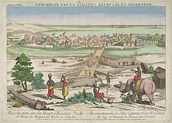
[[File:Masulipatam mg 8557.jpg|right|thumb|250px|View of Masulipatam in 1676]] | [[File:Masulipatam mg 8557.jpg|right|thumb|250px|View of Masulipatam in 1676]] | ||
The town has existed since at least the 3rd century BCE ([[Satavahana]] period) when, according to [[Ptolemy]], it was known as Maisolos. The ''[[Periplus of the Erythraean Sea]]'' calls it Masalia in the 1st-century BCE.<ref>[http://buddhism.lib.ntu.edu.tw/FULLTEXT/JR-ENG/long.htm The Great Stupa at Nagarjunakonda in Southern India], p. 187</ref> The port is on the southeastern, or [[Coromandel Coast]], of India. At the mouth of the [[River Krishna]] on the Bay of Bengal, the Masula port saw flourishing sea trade. | The town has existed since at least the 3rd century BCE ([[Satavahana]] period) when, according to [[Ptolemy]], it was known as Maisolos. The ''[[Periplus of the Erythraean Sea]]'' calls it Masalia in the 1st-century BCE.<ref>[http://buddhism.lib.ntu.edu.tw/FULLTEXT/JR-ENG/long.htm The Great Stupa at Nagarjunakonda in Southern India], p. 187</ref> The port is on the southeastern, or [[Coromandel Coast]], of India. At the mouth of the [[River Krishna]] on the Bay of Bengal, the Masula port saw flourishing sea trade.{{citation needed|date= September 2022}} | ||
Muslin was traded by ancient Greeks from the town and the word ''[[muslin]]'' originated from the name Maisolos.<ref>Periplus, Point 62; http://legacy.fordham.edu/halsall/ancient/periplus.asp {{Webarchive|url=https://web.archive.org/web/20170204143633/http://legacy.fordham.edu/Halsall/ancient/periplus.asp |date=4 February 2017 }}</ref> Muslin was an important source of income for the town, being a favourite of Roman traders for domestic consumption. Several Roman coins were found during excavations of Buddhist towns near Machilipatnam.<ref>''Buddhist Monks and Monasteries of India: Their History and Their Contribution to Indian Culture'' by Sukumar Butt, Motilal Banarsidass Publishers, 1988, p. 132</ref> | Muslin was traded by ancient Greeks from the town and the word ''[[muslin]]'' originated from the name Maisolos.<ref>Periplus, Point 62; http://legacy.fordham.edu/halsall/ancient/periplus.asp {{Webarchive|url=https://web.archive.org/web/20170204143633/http://legacy.fordham.edu/Halsall/ancient/periplus.asp |date=4 February 2017 }}</ref> Muslin was an important source of income for the town, being a favourite of Roman traders for domestic consumption. Several Roman coins were found during excavations of Buddhist towns near Machilipatnam.<ref>''Buddhist Monks and Monasteries of India: Their History and Their Contribution to Indian Culture'' by Sukumar Butt, Motilal Banarsidass Publishers, 1988, p. 132</ref> | ||
The town served as the primary sea port for the [[Kingdom of Golkonda]]. It was an outlet for textiles produced in the [[Godavari Delta]]. It was a major source of income for the kingdom, and contributed to its immense prosperity in the 1620s and 1630s.{{Sfn|Eaton|2008|p=157}} | |||
By the end of the 17th century, the port city had fallen into decline. This coincided with the Mughal conquest of Golkonda. However, mismanagement prior to the conquest may have also been a factor in the city's decline.{{Sfn|Eaton|2008|p=159}} | By the end of the 17th century, the port city had fallen into decline. This coincided with the [[Siege of Golconda|Mughal conquest of Golkonda]]. However, mismanagement prior to the conquest may have also been a factor in the city's decline.{{Sfn|Eaton|2008|p=159}} | ||
[[Salabat Jung]], the son of Nizam-ul-Mulk [[Nizam-ul-Mulk, Asaf Jah I|Asaf Jah I]], who was indebted for his elevation to the throne to the [[French Indies Company|French East India Company]], granted them in return for their services the district of [[Kondavid]] or [[Guntur]], and soon afterwards the remainder of the [[Northern Circars|Circars]]. The Circars were captured by the British from the French in 1759 and were returned to the Nizam. However Masulipatnam captured by the British during the [[Siege of Masulipatam]] was retained by the [[East India Company]].<ref name=EB1911>{{EB1911|inline=y|wstitle=Circar |volume=6 |page=380}}</ref> | |||
The town was the district headquarters of the then, Masulipatnam district and now to the [[Krishna district]], which was formed in 1859 in the composite [[Madras state]].<ref name="census" />{{Sfn|Poole|1865|p=89}} | The town was the district headquarters of the then, Masulipatnam district and now to the [[Krishna district]], which was formed in 1859 in the composite [[Madras state]].<ref name="census" />{{Sfn|Poole|1865|p=89}} | ||
== | == Geographical area == | ||
Machilipatnam city is at {{Coord|16.17|N|81.13|E|}} on the southeast coast of India and in the east coast of Andhra Pradesh.<ref>{{cite web|url=http://www.fallingrain.com/world/IN/02/Machilipatnam.html|title=redirect to /world/IN/02/Machilipatnam.html|work=fallingrain.com}}</ref> The city has an average elevation of 14 meters (45 feet).<ref>http://www.columbia.edu/itc/mealac/pritchett/00maplinks/mughal/bellinmasulipatam/overview1758.jpg</ref> | Machilipatnam city is at {{Coord|16.17|N|81.13|E|}} on the southeast coast of India and in the east coast of Andhra Pradesh.<ref>{{cite web|url=http://www.fallingrain.com/world/IN/02/Machilipatnam.html|title=redirect to /world/IN/02/Machilipatnam.html|work=fallingrain.com}}</ref> The city has an average elevation of 14 meters (45 feet).<ref>{{Cite web |title=overview1758 |url=http://www.columbia.edu/itc/mealac/pritchett/00maplinks/mughal/bellinmasulipatam/overview1758.jpg |website=[[Columbia University]]}}</ref> | ||
=== Climate === | === Climate === | ||
Machilipatnam (city) gets most of its annual rainfall due to the [[southwest monsoon]]. It has a [[tropical savanna climate]] ([[Köppen climate classification]] ''Aw'') with hot summers and moderate winters. The hottest months are between April and June. The average normal rainfall in the district is {{convert|959|mm|in}} and Machilipatnam is vulnerable to high surges of the sea due to [[cyclone]]s. The [[1977 Andhra Pradesh cyclone]] crossed the coast near [[Nizampatnam]] and took approximately 10,000 lives. As the storm approached the coast, gale winds reaching 200 km/h lashed [[Prakasam district|Prakasam]], [[Guntur]], [[Krishna]], [[East Godavari]] and [[West Godavari]] districts. A storm surge, 5 meters high, inundated the Krishna [[estuary]] and the coast south of the city (Bandar). | Machilipatnam (city) gets most of its annual rainfall due to the [[southwest monsoon]]. It has a [[tropical savanna climate]] ([[Köppen climate classification]] ''Aw'') with hot summers and moderate winters. The hottest months are between April and June. The average normal rainfall in the district is {{convert|959|mm|in}} and Machilipatnam is vulnerable to high surges of the sea due to [[cyclone]]s. The [[1864 Machilipatnam cyclone|1864 Machilipatnam Cyclone]] claimed to have killed at least 30,000 people. The [[1977 Andhra Pradesh cyclone]] crossed the coast near [[Nizampatnam]] and took approximately 10,000 lives. As the storm approached the coast, gale winds reaching 200 km/h lashed [[Prakasam district|Prakasam]], [[Guntur]], [[Krishna]], [[East Godavari]] and [[West Godavari]] districts. A storm surge, 5 meters high, inundated the Krishna [[estuary]] and the coast south of the city (Bandar). | ||
On 8 December 2004, a high capacity S-Band Doppler cyclone warning radar was installed, commissioned and made operational at the city<ref>{{cite web|title=Weather Radar Network of India Meteorological Department|url=http://www.imd.gov.in/doc/ins-radar.htm|website=India Meteorological Department|access-date=13 November 2015|url-status=dead|archive-url=https://web.archive.org/web/20150512011325/http://www.imd.gov.in/doc/ins-radar.htm|archive-date=12 May 2015|df=dmy-all}}</ref> by the German manufacturer Gematronik. With the installation of the radar, it is hoped the state will be better equipped to track cyclones. The facility will monitor the 960 km long coastline of the state.<ref>{{cite web|url=http://www.thehindu.com/2004/05/08/stories/2004050805620400.htm|work=[[The Hindu]]|date=2004-05-08|title=Andhra Pradesh News: Modern cyclone warning system for Machilipatnam}}{{dead link|date=April 2021|bot=medic}}{{cbignore|bot=medic}}</ref> | On 8 December 2004, a high capacity S-Band Doppler cyclone warning radar was installed, commissioned and made operational at the city<ref>{{cite web|title=Weather Radar Network of India Meteorological Department|url=http://www.imd.gov.in/doc/ins-radar.htm|website=India Meteorological Department|access-date=13 November 2015|url-status=dead|archive-url=https://web.archive.org/web/20150512011325/http://www.imd.gov.in/doc/ins-radar.htm|archive-date=12 May 2015|df=dmy-all}}</ref> by the German manufacturer Gematronik. With the installation of the radar, it is hoped the state will be better equipped to track cyclones. The facility will monitor the 960 km long coastline of the state.<ref>{{cite web|url=http://www.thehindu.com/2004/05/08/stories/2004050805620400.htm|work=[[The Hindu]]|date=2004-05-08|title=Andhra Pradesh News: Modern cyclone warning system for Machilipatnam}}{{dead link|date=April 2021|bot=medic}}{{cbignore|bot=medic}}</ref> | ||
{{Weather box | {{Weather box | ||
| location = Machilipatnam ( | | location = Machilipatnam (1991–2020, extremes 1901–2020) | ||
| metric first = Y | | metric first = Y | ||
| single line = Y | | single line = Y | ||
| Line 91: | Line 93: | ||
| May record high C = 47.8 | | May record high C = 47.8 | ||
| Jun record high C = 47.0 | | Jun record high C = 47.0 | ||
| Jul record high C = | | Jul record high C = 42.8 | ||
| Aug record high C = 39.8 | | Aug record high C = 39.8 | ||
| Sep record high C = 38.2 | | Sep record high C = 38.2 | ||
| Oct record high C = 37.8 | | Oct record high C = 37.8 | ||
| Nov record high C = 35. | | Nov record high C = 35.4 | ||
| Dec record high C = 34.6 | | Dec record high C = 34.6 | ||
| year record high C = 47.8 | | year record high C = 47.8 | ||
| Jan high C = 29. | | Jan high C = 29.5 | ||
| Feb high C = | | Feb high C = 31.3 | ||
| Mar high C = 33. | | Mar high C = 33.5 | ||
| Apr high C = 35. | | Apr high C = 35.4 | ||
| May high C = 37. | | May high C = 37.8 | ||
| Jun high C = 36. | | Jun high C = 36.8 | ||
| Jul high C = | | Jul high C = 34.2 | ||
| Aug high C = | | Aug high C = 33.3 | ||
| Sep high C = | | Sep high C = 33.3 | ||
| Oct high C = | | Oct high C = 32.2 | ||
| Nov high C = 30. | | Nov high C = 30.8 | ||
| Dec high C = 29. | | Dec high C = 29.6 | ||
| year high C = 32.8 | | year high C = 33.1 | ||
| Jan low C = 20. | |Jan mean C = 24.9 | ||
| Feb low C = 21. | |Feb mean C = 26.3 | ||
| Mar low C = 23. | |Mar mean C = 28.5 | ||
| Apr low C = | |Apr mean C = 30.8 | ||
| May low C = | |May mean C = 32.9 | ||
| Jun low C = 27. | |Jun mean C = 32.1 | ||
| Jul low C = 26. | |Jul mean C = 30.3 | ||
| Aug low C = 26. | |Aug mean C = 29.8 | ||
| Sep low C = | |Sep mean C = 29.7 | ||
| Oct low C = | |Oct mean C = 28.5 | ||
| Nov low C = 22. | |Nov mean C = 26.8 | ||
| Dec low C = 20. | |Dec mean C = 25.0 | ||
| year low C = 24. | | Jan low C = 20.2 | ||
| Feb low C = 21.4 | |||
| Mar low C = 23.6 | |||
| Apr low C = 26.2 | |||
| May low C = 28.2 | |||
| Jun low C = 27.7 | |||
| Jul low C = 26.4 | |||
| Aug low C = 26.1 | |||
| Sep low C = 26.1 | |||
| Oct low C = 25.0 | |||
| Nov low C = 22.8 | |||
| Dec low C = 20.5 | |||
| year low C = 24.5 | |||
| Jan record low C = 13.4 | | Jan record low C = 13.4 | ||
| Feb record low C = 14.4 | | Feb record low C = 14.4 | ||
| Mar record low C = 16. | | Mar record low C = 16.1 | ||
| Apr record low C = 18.0 | | Apr record low C = 18.0 | ||
| May record low C = 17.8 | | May record low C = 17.8 | ||
| Line 138: | Line 152: | ||
| year record low C = 13.2 | | year record low C = 13.2 | ||
| rain colour = green | | rain colour = green | ||
| Jan rain mm = | | Jan rain mm = 6.9 | ||
| Feb rain mm = 12.4 | | Feb rain mm = 12.4 | ||
| Mar rain mm = | | Mar rain mm = 0.9 | ||
| Apr rain mm = | | Apr rain mm = 9.3 | ||
| May rain mm = | | May rain mm = 43.3 | ||
| Jun rain mm = | | Jun rain mm = 124.4 | ||
| Jul rain mm = | | Jul rain mm = 182.9 | ||
| Aug rain mm = | | Aug rain mm = 173.4 | ||
| Sep rain mm = | | Sep rain mm = 183.7 | ||
| Oct rain mm = | | Oct rain mm = 208.1 | ||
| Nov rain mm = | | Nov rain mm = 114.4 | ||
| Dec rain mm = | | Dec rain mm = 15.3 | ||
| year rain mm = | | year rain mm = 1074.9 | ||
| Jan rain days = 0.6 | | Jan rain days = 0.6 | ||
| Feb rain days = 0. | | Feb rain days = 0.6 | ||
| Mar rain days = 0. | | Mar rain days = 0.2 | ||
| Apr rain days = 0. | | Apr rain days = 0.6 | ||
| May rain days = 1. | | May rain days = 1.9 | ||
| Jun rain days = 5 | | Jun rain days = 6.5 | ||
| Jul rain days = 10. | | Jul rain days = 10.5 | ||
| Aug rain days = 10.4 | | Aug rain days = 10.4 | ||
| Sep rain days = 8. | | Sep rain days = 8.7 | ||
| Oct rain days = 8. | | Oct rain days = 8.6 | ||
| Nov rain days = 3.7 | | Nov rain days = 3.7 | ||
| Dec rain days = 0. | | Dec rain days = 0.9 | ||
| year rain days = | | year rain days = 53.1 | ||
|time day = 17:30 [[Indian Standard Time|IST]] | | time day = 17:30 [[Indian Standard Time|IST]] | ||
| Jan humidity = 68 | | Jan humidity = 68 | ||
| Feb humidity = | | Feb humidity = 66 | ||
| Mar humidity = | | Mar humidity = 67 | ||
| Apr humidity = 68 | | Apr humidity = 68 | ||
| May humidity = | | May humidity = 64 | ||
| Jun humidity = | | Jun humidity = 61 | ||
| Jul humidity = 67 | | Jul humidity = 67 | ||
| Aug humidity = | | Aug humidity = 70 | ||
| Sep humidity = 73 | | Sep humidity = 73 | ||
| Oct humidity = 76 | | Oct humidity = 76 | ||
| Nov humidity = | | Nov humidity = 74 | ||
| Dec humidity = | | Dec humidity = 70 | ||
|year humidity = | | year humidity = 69 | ||
|source 1 = [[India Meteorological Department]]<ref name=IMDnormals> | | source 1 = [[India Meteorological Department]]<ref name=IMDnormals> | ||
{{cite web | {{cite web | ||
| archive-url = https://web.archive.org/web/20200205040301/http://imdpune.gov.in/library/public/1981-2010%20CLIM%20NORMALS%20%28STATWISE%29.pdf | | archive-url = https://web.archive.org/web/20200205040301/http://imdpune.gov.in/library/public/1981-2010%20CLIM%20NORMALS%20%28STATWISE%29.pdf | ||
| Line 198: | Line 212: | ||
| page = M13 | | page = M13 | ||
| access-date = 18 February 2020}}</ref> | | access-date = 18 February 2020}}</ref> | ||
}} | |source 2 = Tokyo Climate Center (mean temperatures 1991–2020)<ref name=TCC1> | ||
{{cite web | |||
{{Historical populations | | url = https://ds.data.jma.go.jp/gmd/tcc/tcc/products/climate/normal/parts/NrmMonth_e.php?stn=43185 | ||
| title = Normals Data: Machilipatnam/Franchpet – India Latitude: 16.20°N Longitude: 81.15°E Height: 3 (m) | |||
| publisher = Japan Meteorological Agency | |||
| access-date = 1 December 2022}}</ref> | |||
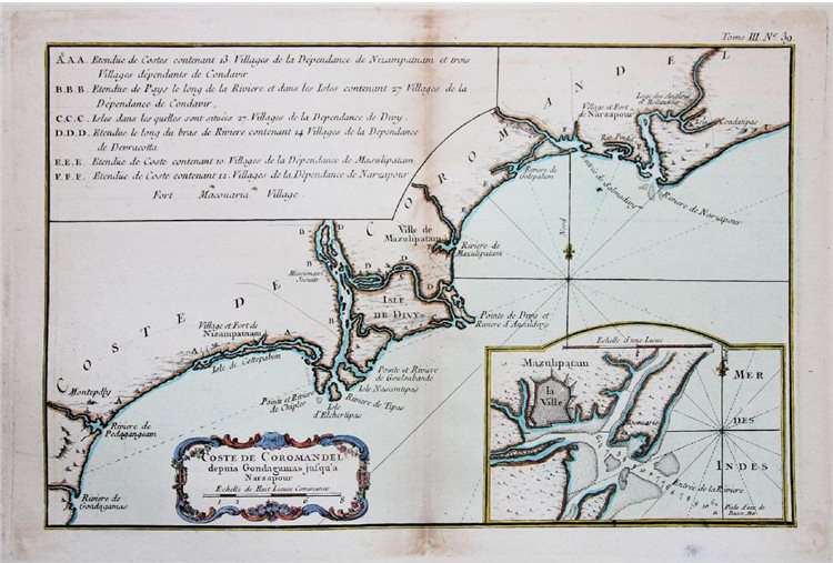
}}[[File:Musalipatam Mschilipatnam port in 1759.jpg|thumb|Masulipatam port in 1759]]{{Historical populations | |||
|1871 | 36188 | |1871 | 36188 | ||
|1881 | 35056 | |1881 | 35056 | ||
| Line 220: | Line 238: | ||
==Demographics== | ==Demographics== | ||
{{As of|2011}} [[Census of India|census]], Machilipatnam had a population of | {{As of|2011}} [[Census of India|census]], Machilipatnam had a population of 2,32,000. The total population constitutes 1,13,286 males and 1,18,714 females — a sex ratio of 1047 females per 1000 males. 13,778 children are in the age group of 0–6 years, of which 7,076 are boys and 6,702 are girls. The average literacy rate stands at 83.32% with 130,173 literates, significantly higher than the state average of 67.41%.<ref name=population /><ref>{{cite web|title=Literacy of AP (Census 2011)|url=http://www.ap.gov.in/AP%20State%20Statistical%20Abstract%20May%202014/2%20AP%20Demography.pdf|publisher=Official Portal of Andhra Pradesh Government|access-date=5 September 2014|page=43|archive-url=https://web.archive.org/web/20140714213923/http://www.ap.gov.in/AP%20State%20Statistical%20Abstract%20May%202014/2%20AP%20Demography.pdf|archive-date=14 July 2014|url-status=dead}}</ref> | ||
== Governance == | == Governance == | ||
| Line 232: | Line 250: | ||
=== Politics === | === Politics === | ||
Machilipatnam is a part of [[Machilipatnam (Assembly constituency)]] for [[Andhra Pradesh Legislative Assembly]]. | Machilipatnam is a part of [[Machilipatnam (Assembly constituency)]] for [[Andhra Pradesh Legislative Assembly]]. [[Kollu Ravindra]] is the present [[Member of Legislative Assembly (India)|MLA]] of the constituency from the [[Telugu Desam Party]].<ref>{{cite web|title=MLA|url=http://www.ap.gov.in/government/mla/|publisher=Government of AP|access-date=13 October 2014|archive-url=https://web.archive.org/web/20141008071101/http://www.ap.gov.in/government/mla/|archive-date=8 October 2014|url-status=dead}}</ref><ref>{{cite web|title=Machilipatnam Assembly 2014 Election Results |url=http://www.elections.in/andhra-pradesh/assembly-constituencies/machilipatnam.html |publisher=Elections.in|access-date=13 October 2014}}</ref> The assembly segment is also a part of [[Machilipatnam (Lok Sabha constituency)]], which was won by [[Balashowry Vallabhaneni]] of Janasena | ||
Party.<ref>{{cite web|title=MP (Lok Sabha)|url=http://www.ap.gov.in/government/mp-lok-sabha/|publisher=Government of AP|access-date=4 May 2015|archive-url=https://web.archive.org/web/20161121175516/http://www.ap.gov.in/government/mp-lok-sabha/|archive-date=21 November 2016|url-status=dead}}</ref> | |||
== Economy == | == Economy == | ||
[[File:Machilipatnam lighthouse from Manginapudi Beach.jpg|thumb|Lighthouse near Manginapudi Beach]] | |||
Machilipatnam is known for its [[handloom]] industry, which produces Kalamkari textiles exported to United States and other Asian countries.{{citation needed|date=June 2020}} | Machilipatnam is known for its [[handloom]] industry, which produces Kalamkari textiles exported to United States and other Asian countries.{{citation needed|date=June 2020}} | ||
| Line 245: | Line 265: | ||
===Art and handicrafts=== | ===Art and handicrafts=== | ||
''Machilipatnam Kalamkari'' is a [[handcrafted]] [[dyed]] block-painting of a [[Textile|fabric]].<ref>{{cite news|title=Kalamkari back in demand|url=http://www.hindu.com/2010/10/25/stories/2010102550860200.htm|date=25 October 2010|archive-url=https://web.archive.org/web/20110810013653/http://www.hindu.com/2010/10/25/stories/2010102550860200.htm|archive-date=10 August 2011|url-status=dead|work=[[The Hindu]]|location=Tirupati}}</ref> It is performed at the nearby town of [[Pedana]] and was registered with [[geographical indication]] from Andhra Pradesh.<ref>{{cite web|title=State Wise Registration Details of G.I Applications |url=http://ipindia.nic.in/girindia/treasures_protected/registered_GI_18November2015.pdf |website=Geographical Indication Registry |access-date=28 January 2016 |page=3 |url-status=dead |archive-url=https://web.archive.org/web/20160201065403/http://ipindia.nic.in/girindia/treasures_protected/registered_GI_18November2015.pdf |archive-date= 1 February 2016 }}</ref> Machilipatnam and Srikalahasti styles are the only existing Kalamkari style works present in India.<ref name=style>{{cite web|title=Kalamkari: Craft of the matter|url=http://www.mid-day.com/articles/kalamkari-craft-of-the-matter/16478155|website=mid-day|access-date=26 January 2016}}</ref> | ''Machilipatnam Kalamkari'' is a [[handcrafted]] [[dyed]] block-painting of a [[Textile|fabric]].<ref>{{cite news|title=Kalamkari back in demand|url=http://www.hindu.com/2010/10/25/stories/2010102550860200.htm|date=25 October 2010|archive-url=https://web.archive.org/web/20110810013653/http://www.hindu.com/2010/10/25/stories/2010102550860200.htm|archive-date=10 August 2011|url-status=dead|work=[[The Hindu]]|location=Tirupati}}</ref> It is performed at the nearby town of [[Pedana]] and was registered with [[geographical indication]] from Andhra Pradesh.<ref>{{cite web|title=State Wise Registration Details of G.I Applications |url=http://ipindia.nic.in/girindia/treasures_protected/registered_GI_18November2015.pdf |website=Geographical Indication Registry |access-date=28 January 2016 |page=3 |url-status=dead |archive-url=https://web.archive.org/web/20160201065403/http://ipindia.nic.in/girindia/treasures_protected/registered_GI_18November2015.pdf |archive-date= 1 February 2016 }}</ref> Machilipatnam and Srikalahasti styles are the only existing Kalamkari style works present in India.<ref name=style>{{cite web|title=Kalamkari: Craft of the matter|url=http://www.mid-day.com/articles/kalamkari-craft-of-the-matter/16478155|website=mid-day|date=24 August 2015 |access-date=26 January 2016}}</ref> | ||
===Dance=== | ===Dance=== | ||
''[[Kuchipudi]]'', a popular [[Indian Classical Dance]] form, originated at [[Kuchipudi, Krishna|Kuchipudi]], 25 | ''[[Kuchipudi]]'', a popular [[Indian Classical Dance]] form, originated at [[Kuchipudi, Krishna|Kuchipudi]], 25 kilometers from Machilipatnam.<ref>{{Cite web|last=Goyal|first=Anuradha|date=2017-03-02|title=Kuchipudi Village – Dance Village Of Andhra Pradesh|url=https://www.inditales.com/kuchipudi-village-andhra-pradesh/|access-date=2020-10-23|website=Inditales|language=en-US}}</ref> | ||
===Cuisine=== | ===Cuisine=== | ||
The city is well known for a sweet known as ''[[Laddu|Bandar Laddu]]'' and Bandar Halwa.<ref>{{cite news|last1=Varma|first1=Sujatha|title=In search of Bandar Laddu|url=http://www.thehindu.com/features/magazine/in-search-of-bandar-laddu/article4605852.ece|access-date=12 July 2015|work=The Hindu|date=13 April 2013}} Vani sweets, near to the Koneru center and RK sweets, near to the bus stand are famous in the city</ref> | The city is well known for a sweet known as ''[[Laddu|Bandar Laddu]]'' and Bandar Halwa.<ref>{{cite news|last1=Varma|first1=Sujatha|title=In search of Bandar Laddu|url=http://www.thehindu.com/features/magazine/in-search-of-bandar-laddu/article4605852.ece|access-date=12 July 2015|work=The Hindu|date=13 April 2013}} Vani sweets, near to the Koneru center and RK sweets, near to the bus stand are famous in the city</ref> Almond Milkshake is also largely famous in Machilipatanam which are Mostly centred in Koneru Centre. Bandar Biryani is delicious, which is made by Shia Muslims in Moharram rituals . | ||
===Religious worship=== | ===Religious worship=== | ||
[[File:Chilakalapudi Temple.jpg|thumb|Panduranga Swamy Temple, located in Chilakalapudi, Machilipatnam, Krishna district, Andhra Pradesh, India]] | |||
There are many religions with worship centers in and around the city, such as Panduranga Temple at Chilakalapudi, Agastheeswara Temple etc. Dattashram is a pilgrimage site on the coast and home to ancient [[Shiva]] and [[Dattatreya|Datta]] temples. Manginapudi is popularly known as "Datta Rameswaram" due to the consecration of 12 wells for bathing (recalling those at [[Rameswaram]]).<ref>{{cite web|url=http://www.dattapeetham.com/india/festivals/birthday99/history.html|title=History|work=dattapeetham.com}}</ref> | |||
===Shia Muslims=== | |||
Machilipatnam is home to the largest [[Shia Islam|Shia]] Muslim population in the entire state of [[Andhra Pradesh]]. The city hosts more than a hundred Astanas/Imambargahs (which are places for Moharram rituals). The famous chest beating ceremonies happen on Ashura in the Koneru Centre circle, attracting thousands of mourners and visitors from other religions. There are [[Imambargahs]] that are more than 600 years old, such as the Zari Astana, Baraimam Astana, Naqla Astana, and others. The Baraimam Alam is taken out for procession through the streets of Machilipatnam, a night before Ashura. and the Krishna district police offers a dhati (cloth) to the Alam. Hundreds of Shia Muslims from Hyderabad, Chennai, Bangalore, and Visakhapatnam visit the Chehlum Astana for the 17th Safar of the Islamic calendar, where Hazrat Abbas's Arabaeen attracts thousands of mourners from across South Asia. | |||
== Tourism == | == Tourism == | ||
[[Manginapudi Beach]] is on the coast of the city.<ref>{{cite web|title=Manginapudi Beach|url=https://www.aptourism.gov.in/k2-separator/k2/item/169-machilipatnam#.XA-t0mgzbIV|website=Andhra Pradesh Tourism|access-date=30 January 2016}}</ref> | [[Manginapudi Beach]] is on the coast of the city.<ref>{{cite web|title=Manginapudi Beach|url=https://www.aptourism.gov.in/k2-separator/k2/item/169-machilipatnam#.XA-t0mgzbIV|website=Andhra Pradesh Tourism|access-date=30 January 2016}}</ref> Machilipatnam also has the ruined buildings built by the Europeans who settled here.<ref>{{Cite web |title=Monuments face utter neglect in Bandar Fort |url=https://www.deccanherald.com/content/577248/monuments-face-utter-neglect-bandar.html |access-date=2025-05-19 |website=Deccan Herald |language=en}}</ref><ref>{{Cite web |date=2023-07-05 |title=Machilipatnam in Andhra Pradesh: The tenuous link between the present and the past - The Hindu |website=[[The Hindu]] |url=https://www.thehindu.com/news/national/andhra-pradesh/machilipatnam-in-andhra-pradesh-the-tenuous-link-between-the-present-and-the-past/article66999135.ece |access-date=2025-05-19 |archive-url=https://web.archive.org/web/20230705064657/https://www.thehindu.com/news/national/andhra-pradesh/machilipatnam-in-andhra-pradesh-the-tenuous-link-between-the-present-and-the-past/article66999135.ece |archive-date=5 July 2023 }}</ref> | ||
== Transport == | == Transport == | ||
The city has a total road length of {{Convert|359.09|km|mi|abbr=on}}.<ref>{{cite web|title=Details of Roads in Each ULB of Andhra Pradesh|url=http://centralapp.cdma.ap.gov.in:8080/CDMAAPTaxesInfo/RoadDetails.jsp|website=Commissioner and Directorate of Municipal Administration|publisher=Municipal Administration and Urban | The city has a total road length of {{Convert|359.09|km|mi|abbr=on}}.<ref>{{cite web|title=Details of Roads in Each ULB of Andhra Pradesh|url=http://centralapp.cdma.ap.gov.in:8080/CDMAAPTaxesInfo/RoadDetails.jsp|website=Commissioner and Directorate of Municipal Administration|publisher=Municipal Administration and Urban Development Department - Government of Andhra Pradesh|access-date=28 March 2017|url-status=dead|archive-url=https://web.archive.org/web/20160801101300/http://centralapp.cdma.ap.gov.in:8080/CDMAAPTaxesInfo/RoadDetails.jsp|archive-date=1 August 2016|df=dmy-all}}</ref> The [[National Highway 65 (India)|National Highway 65]] connects Machilipatnam to [[Pune]] via [[Hyderabad]], [[Suryapet]] and [[Vijayawada]]. [[National Highway 216 (India)|NH 216]] from [[Kattipudi]] to [[Ongole]], passes through the city. | ||
The city's bus station is owned and operated by [[Andhra Pradesh State Road Transport Corporation]].<ref>{{cite web|title=Bus Stations in Districts |url=http://www.apsrtc.gov.in/Bus%20Stations.aspx |website=Andhra Pradesh State Road Transport Corporation |access-date=15 March 2016 |url-status=dead |archive-url=https://web.archive.org/web/20160322233330/http://apsrtc.gov.in/Bus%20Stations.aspx |archive-date=22 March 2016 }}</ref><ref>{{cite news|last1=Mareedu|first1=Mouli|title=RTC takes a low blow from Laila|url=http://www.newindianexpress.com/states/andhra_pradesh/article272761.ece|access-date=15 March 2016|work=The Times of | The city's bus station is owned and operated by [[Andhra Pradesh State Road Transport Corporation]].<ref>{{cite web|title=Bus Stations in Districts |url=http://www.apsrtc.gov.in/Bus%20Stations.aspx |website=Andhra Pradesh State Road Transport Corporation |access-date=15 March 2016 |url-status=dead |archive-url=https://web.archive.org/web/20160322233330/http://apsrtc.gov.in/Bus%20Stations.aspx |archive-date=22 March 2016 }}</ref><ref>{{cite news |last1=Mareedu |first1=Mouli |date=21 May 2010 |title=RTC takes a low blow from Laila |url=http://www.newindianexpress.com/states/andhra_pradesh/article272761.ece |url-status=dead |archive-url=https://web.archive.org/web/20160315170442/http://www.newindianexpress.com/states/andhra_pradesh/article272761.ece |archive-date=15 March 2016 |access-date=15 March 2016 |work=The Times of India |location=Hyderabad}}</ref> The station is equipped with a [[Bus garage|bus depot]] for storage and maintenance of buses.<ref>{{cite web|title=Depot Name |url=http://www.apsrtc.gov.in/Depots.aspx |website=[[APSRTC]] |access-date=15 March 2016 |url-status=dead |archive-url=https://web.archive.org/web/20160309000939/http://apsrtc.gov.in/depots.aspx |archive-date=9 March 2016 }}</ref> | ||
[[Machilipatnam railway station]] is a 'B–Category' and 'Adarsh station' under the jurisdiction of [[Vijayawada railway division]].<ref>{{cite web|url= http://www.scr.indianrailways.gov.in/cris//uploads/files/1327487244480-Division%20profile-new.pdf|title = Vijayawada Division – a profile| publisher= Indian Railways|access-date=13 February 2013}}</ref> It is the terminal station of [[Vijayawada-Machilipatnam branch line]] that connects [[Howrah-Chennai main line]] at {{rws|Vijayawada}}.<ref>{{cite web|title=Machilipatnam Railway Station|url=http://indiarailinfo.com/station/map/machilipatnam-mtm/2455|website=India Rail Info|access-date=16 August 2015}}</ref> | [[Machilipatnam railway station]] is a 'B–Category' and 'Adarsh station' under the jurisdiction of [[Vijayawada railway division]].<ref>{{cite web|url= http://www.scr.indianrailways.gov.in/cris//uploads/files/1327487244480-Division%20profile-new.pdf|title = Vijayawada Division – a profile| publisher= Indian Railways|access-date=13 February 2013}}</ref> It is the terminal station of [[Vijayawada-Machilipatnam branch line]] that connects [[Howrah-Chennai main line]] at {{rws|Vijayawada}}.<ref>{{cite web|title=Machilipatnam Railway Station|url=http://indiarailinfo.com/station/map/machilipatnam-mtm/2455|website=India Rail Info|access-date=16 August 2015}}</ref> | ||
Machilipatnam port was damaged by a giant ocean wave on 1 November 1864.<ref name="Maesolia_port" /> Since then, there were many efforts to build a new port. Navayuga Engineering Company Limited is in the process of building a [[deep water port]] at Gilakaladinne of the city.<ref>{{cite web|title=G.O. on development of Machilipatnam deep water port|url=http://www.apports.in/in/port_info_content/Ports_I_GOs/2010INFRA_MS7.PDF|website=Department of Ports|publisher=Government of Andhra Pradesh|access-date=17 June 2015|url-status=dead|archive-url=https://web.archive.org/web/20150617082418/http://www.apports.in/in/port_info_content/Ports_I_GOs/2010INFRA_MS7.PDF|archive-date=17 June 2015|df=dmy-all}}</ref> | Machilipatnam port was damaged by a [[1864 Machilipatnam cyclone|giant ocean wave]] on 1 November 1864.<ref name="Maesolia_port" /> Since then, there were many efforts to build a new port. Navayuga Engineering Company Limited is in the process of building a [[deep water port]] at Gilakaladinne of the city.<ref>{{cite web|title=G.O. on development of Machilipatnam deep water port|url=http://www.apports.in/in/port_info_content/Ports_I_GOs/2010INFRA_MS7.PDF|website=Department of Ports|publisher=Government of Andhra Pradesh|access-date=17 June 2015|url-status=dead|archive-url=https://web.archive.org/web/20150617082418/http://www.apports.in/in/port_info_content/Ports_I_GOs/2010INFRA_MS7.PDF|archive-date=17 June 2015|df=dmy-all}}</ref> | ||
The nearest International airport is [[Vijayawada Airport]]. | The nearest International airport is [[Vijayawada Airport|Gannavaram, Vijayawada]] (63 kms). | ||
== Education == | == Education == | ||
| Line 279: | Line 302: | ||
==Notable natives== | ==Notable natives== | ||
* [[N. Madhava Rao]] 23rd [[Dewan of Mysore]] | |||
* [[Divi Gopalacharlu]] - Ayurvedic scholar<ref>{{Cite web|url=http://50.6.66.190/cityresources/Health_and_Medicine/personalities02.asp|title=Medical Personalities in Chennai - chennaibest.com|website=50.6.66.190|access-date=2017-10-22|archive-url=https://web.archive.org/web/20171022143114/http://50.6.66.190/cityresources/Health_and_Medicine/personalities02.asp|archive-date=22 October 2017|url-status=dead}}</ref> | * [[Divi Gopalacharlu]] - Ayurvedic scholar<ref>{{Cite web|url=http://50.6.66.190/cityresources/Health_and_Medicine/personalities02.asp|title=Medical Personalities in Chennai - chennaibest.com|website=50.6.66.190|access-date=2017-10-22|archive-url=https://web.archive.org/web/20171022143114/http://50.6.66.190/cityresources/Health_and_Medicine/personalities02.asp|archive-date=22 October 2017|url-status=dead}}</ref> | ||
* [[Timmarusu]] - Prime Minister of [[Krishnadevaraya|Raja Krishnadevaraya]], the emperor of [[Vijayanagara Empire]] | |||
* [[Pingali Venkayya]] - Independence activist; designer of the national flag | * [[Pingali Venkayya]] - Independence activist; designer of the national flag | ||
* [[Chitrapu Narayana Murthy]] - Indian director known for films like [[AVM Studios|AVM's]] [[Bhakta Prahlada (1967 film)|Bhaktha Prahlada]] (1967) | |||
* [[Mutnuri Krishna Rao]] - Independence activist and journalist | * [[Mutnuri Krishna Rao]] - Independence activist and journalist | ||
* [[U. G. Krishnamurti|U. G. Krishnamurthy]] - Philosopher | * [[U. G. Krishnamurti|U. G. Krishnamurthy]] - Philosopher | ||
* [[Bhogaraju Pattabhi Sitaramayya|Bhogaraju Pattabhisitaramayya]] - Indian independence activist and political leader | * [[Bhogaraju Pattabhi Sitaramayya|Bhogaraju Pattabhisitaramayya]] - Indian independence activist and political leader | ||
* [[Raghupathi Venkaiah Naidu]] - father of [[Telugu cinema]], Indian artiste and film maker | * [[Raghupathi Venkaiah Naidu]] - father of [[Telugu cinema]], Indian artiste and film maker | ||
* [[C. K. Nayudu]] | * [[C. K. Nayudu]] - Indian cricketer | ||
* [[Poornima (Telugu actress)|Poornima]] - Indian actress who starred in many Telugu, Tamil, Kannada and Malayalam films. | * [[Poornima (Telugu actress)|Poornima]] - Indian actress who starred in many Telugu, Tamil, Kannada and Malayalam films. | ||
* [[Jagapathi Babu]] - Telugu actor. | * [[Jagapathi Babu]] - Telugu actor. | ||
| Line 292: | Line 318: | ||
* [[C. S. R. Anjaneyulu]] - C. S. R., was an Indian film method actor, and thespian best known for his works in Telugu cinema and Telugu theater. | * [[C. S. R. Anjaneyulu]] - C. S. R., was an Indian film method actor, and thespian best known for his works in Telugu cinema and Telugu theater. | ||
* [[Nirmalamma]] - Telugu actress known for her grandmother roles in old films. | * [[Nirmalamma]] - Telugu actress known for her grandmother roles in old films. | ||
* [[Maruthi | * [[Maruthi]] - Indian director, screenwriter, producer who works primarily in Telugu cinema. | ||
* [[Mani Sharma]] - Indian composer, singer, arranger, multi-instrumentalist and music producer known for his works primarily in the Telugu and Tamil cinema along with Hindi and Kannada films. | * [[Mani Sharma]] - Indian composer, singer, arranger, multi-instrumentalist and music producer known for his works primarily in the Telugu and Tamil cinema along with Hindi and Kannada films. | ||
* [[Achyuth]] - Indian actor | * [[Achyuth]] - Indian actor | ||
* [[Srikanth Bolla]] - First [[Indian people|Indian]] blind boy to study at [[Massachusetts Institute of Technology]] and an entrepreneur and founder of [[ | * [[Srikanth Bolla]] - First [[Indian people|Indian]] blind boy to study at [[Massachusetts Institute of Technology]] and an entrepreneur and founder of Bollant Industries. | ||
* [[Turaga Desiraju]] - neurophysiologist and a professor at National Institute of Mental Health and Neurosciences | |||
== See also == | == See also == | ||
* [[List of cities in Andhra Pradesh]] | * [[List of cities in Andhra Pradesh]] | ||
* [[List of municipal corporations in Andhra Pradesh]] | * [[List of municipal corporations in Andhra Pradesh]] | ||
* [[Largest Indian cities by GDP]] | |||
== References == | == References == | ||
| Line 307: | Line 335: | ||
{{Refbegin|30em}} | {{Refbegin|30em}} | ||
* {{Cite book | last = Rao | first = E. Nageswara | title = Abburi Ramakrishna Rau | publisher = [[Sahitya Akademi]] | year = 2002 | isbn = 9788126010707 | location = Hyderabad }} | * {{Cite book | last = Rao | first = E. Nageswara | title = Abburi Ramakrishna Rau | publisher = [[Sahitya Akademi]] | year = 2002 | isbn = 9788126010707 | location = Hyderabad }} | ||
* {{Cite book | last = Reddy | first = K. V. Nandini | title = Social Science (History) 7 | * {{Cite book | last = Reddy | first = K. V. Nandini | title = Social Science (History) 7 | publisher = Ratna Sagar | isbn = 9788183322966 | url = https://books.google.com/books?id=5qkVLVpJmyoC&q=masulipatnam&pg=PP2 | language = en | year = 2008 | access-date = 8 January 2016 | edition = Revised }} | ||
* {{Cite book | last1 = George | first1 = Mary | last2 = Duggal | first2 = Gita | last3 = Bhatia | first3 = Pooja | last4 = Chakrabarti | first4 = Joyita | title = Milestones Social Science – 7 (History, Geography, Social and Political Life) | publisher = Vikas Publishing House | isbn = 9789325982673 | url = https://books.google.com/books?id=1eYwDAAAQBAJ&q=During+seventeenth+century%2C+it+was+known+with+the+name+Masulipatnam+or+Masula&pg=PA55 | language = en }} | * {{Cite book | last1 = George | first1 = Mary | last2 = Duggal | first2 = Gita | last3 = Bhatia | first3 = Pooja | last4 = Chakrabarti | first4 = Joyita | title = Milestones Social Science – 7 (History, Geography, Social and Political Life) | publisher = Vikas Publishing House | isbn = 9789325982673 | url = https://books.google.com/books?id=1eYwDAAAQBAJ&q=During+seventeenth+century%2C+it+was+known+with+the+name+Masulipatnam+or+Masula&pg=PA55 | language = en }} | ||
* {{Cite book | last = Broeze | first = Frank | title = Gateways Of Asia | year = 2010 | publisher = Routledge | isbn = 9781136169021 | url = https://books.google.com/books?id=lvfIBQAAQBAJ&q=During+seventeenth+century%2C+it+was+known+with+the+name+Masulipatnam+or+Masula&pg=PT34 | language = en }} | * {{Cite book | last = Broeze | first = Frank | title = Gateways Of Asia | year = 2010 | publisher = Routledge | isbn = 9781136169021 | url = https://books.google.com/books?id=lvfIBQAAQBAJ&q=During+seventeenth+century%2C+it+was+known+with+the+name+Masulipatnam+or+Masula&pg=PT34 | language = en }} | ||
* {{Cite book | last = Eaton | first = Richard Maxwell | title = A Social History of the Deccan, 1300-1761 : Eight Indian Lives | year = 2008 | publisher = Cambridge University Press | isbn = 978-0-521-71627-7 | oclc = | * {{Cite book | last = Eaton | first = Richard Maxwell | title = A Social History of the Deccan, 1300-1761 : Eight Indian Lives | year = 2008 | publisher = Cambridge University Press | isbn = 978-0-521-71627-7 | oclc = 226973152 }} | ||
* {{Cite book | last = Poole | first = Edward Stanley | title = The Thousand and One Nights, Commonly Called The Arabian Nights' Entertainments; Translated from the Arabic, with Copious Notes, Volume 3 | year = 1865 | publisher = Chatto & Windus | edition = Volume 3 | url=https://books.google.com/books?id=FSoMAAAAIAAJ&q=principal+port+masulipatam+golconda&pg=PA89 | access-date = 11 March 2017 }} | * {{Cite book | last = Poole | first = Edward Stanley | title = The Thousand and One Nights, Commonly Called The Arabian Nights' Entertainments; Translated from the Arabic, with Copious Notes, Volume 3 | year = 1865 | publisher = Chatto & Windus | edition = Volume 3 | url=https://books.google.com/books?id=FSoMAAAAIAAJ&q=principal+port+masulipatam+golconda&pg=PA89 | access-date = 11 March 2017 }} | ||
{{Refend}} | {{Refend}} | ||
| Line 325: | Line 353: | ||
[[Category:Cities in Andhra Pradesh]] | [[Category:Cities in Andhra Pradesh]] | ||
[[Category:Former Portuguese colonies]] | [[Category:Former Portuguese colonies]] | ||
[[Category:Port cities in India]] | [[Category:Port cities and towns in India]] | ||
[[Category:Populated coastal places in India]] | [[Category:Populated coastal places in India]] | ||
[[Category:Archaeological sites in Andhra Pradesh]] | [[Category:Archaeological sites in Andhra Pradesh]] | ||
Latest revision as of 17:34, 14 March 2026
Machilipatnam
Masulipatnam Masulipatam Bandar | |
|---|---|
 Koneru Centre | |
  Machilipatnam Location in Andhra Pradesh, India  Machilipatnam Machilipatnam (India) | |
| Coordinates: 16°10′N 81°08′E / 16.17°N 81.13°E | |
| Country | India |
| State | Andhra Pradesh |
| District | Krishna district |
| Founded | 14th century |
| Government | |
| • Type | Municipal Corporation |
| • Body | Machilipatnam Municipal Corporation, MUDA |
| • MLA | Kollu Ravindra (Telugu Desam Party) |
| • Municipal commissioner | Chandraiah |
| Area | |
| • City | 26.67 km2 (10.30 sq mi) |
| Elevation | 14 m (46 ft) |
| Population (2011)[2] | |
| • Density | 6,875/km2 (17,810/sq mi) |
| • Urban | 232,000 |
| Languages | |
| • Official | Telugu |
| Time zone | UTC+5:30 (IST) |
| PIN | 521001,002,003,004 |
| Telephone code | 91-08672 |
| Vehicle registration | AP-39, AP-40 |
| Website | machilipatnam |
Machilipatnam (Telugu: [mɐt͡ʃiliːpɐʈnɐm]  [[:Media:Machilipatnam.ogg|]] (help·info)), also known as Masulipatnam, Masulipatam and Bandar (Telugu: [bɐn̪d̪ɐɾ]),[3] is a city in Krishna district of the Indian state of Andhra Pradesh. It is a municipal corporation and the administrative headquarters of Krishna district.[4] It is also the mandal headquarters of Machilipatnam mandal in Machilipatnam revenue division of the district.[5][6] The ancient port town served as the settlement of European traders from the 16th century, and it was a major trading port for the Portuguese, British, Dutch and French in the 17th century.[7]
Etymology[edit | edit source]
During the 17th century, it was known by the names Masulipatnam, Masulipatam,[8] Masula and Bandar (Bandar translates to 'port' in Persian language).[9][10][11] The port town in the ancient times was also referred with the name Maesolia.[8][12]
History[edit | edit source]

The town has existed since at least the 3rd century BCE (Satavahana period) when, according to Ptolemy, it was known as Maisolos. The Periplus of the Erythraean Sea calls it Masalia in the 1st-century BCE.[13] The port is on the southeastern, or Coromandel Coast, of India. At the mouth of the River Krishna on the Bay of Bengal, the Masula port saw flourishing sea trade.[citation needed]
Muslin was traded by ancient Greeks from the town and the word muslin originated from the name Maisolos.[14] Muslin was an important source of income for the town, being a favourite of Roman traders for domestic consumption. Several Roman coins were found during excavations of Buddhist towns near Machilipatnam.[15]
The town served as the primary sea port for the Kingdom of Golkonda. It was an outlet for textiles produced in the Godavari Delta. It was a major source of income for the kingdom, and contributed to its immense prosperity in the 1620s and 1630s.[16]
By the end of the 17th century, the port city had fallen into decline. This coincided with the Mughal conquest of Golkonda. However, mismanagement prior to the conquest may have also been a factor in the city's decline.[17]
Salabat Jung, the son of Nizam-ul-Mulk Asaf Jah I, who was indebted for his elevation to the throne to the French East India Company, granted them in return for their services the district of Kondavid or Guntur, and soon afterwards the remainder of the Circars. The Circars were captured by the British from the French in 1759 and were returned to the Nizam. However Masulipatnam captured by the British during the Siege of Masulipatam was retained by the East India Company.[18]
The town was the district headquarters of the then, Masulipatnam district and now to the Krishna district, which was formed in 1859 in the composite Madras state.[6][19]
Geographical area[edit | edit source]
Machilipatnam city is at 16°10′N 81°08′E / 16.17°N 81.13°E on the southeast coast of India and in the east coast of Andhra Pradesh.[20] The city has an average elevation of 14 meters (45 feet).[21]
Climate[edit | edit source]
Machilipatnam (city) gets most of its annual rainfall due to the southwest monsoon. It has a tropical savanna climate (Köppen climate classification Aw) with hot summers and moderate winters. The hottest months are between April and June. The average normal rainfall in the district is 959 millimetres (37.8 in) and Machilipatnam is vulnerable to high surges of the sea due to cyclones. The 1864 Machilipatnam Cyclone claimed to have killed at least 30,000 people. The 1977 Andhra Pradesh cyclone crossed the coast near Nizampatnam and took approximately 10,000 lives. As the storm approached the coast, gale winds reaching 200 km/h lashed Prakasam, Guntur, Krishna, East Godavari and West Godavari districts. A storm surge, 5 meters high, inundated the Krishna estuary and the coast south of the city (Bandar).
On 8 December 2004, a high capacity S-Band Doppler cyclone warning radar was installed, commissioned and made operational at the city[22] by the German manufacturer Gematronik. With the installation of the radar, it is hoped the state will be better equipped to track cyclones. The facility will monitor the 960 km long coastline of the state.[23]
| Climate data for Machilipatnam (1991–2020, extremes 1901–2020) | |||||||||||||
|---|---|---|---|---|---|---|---|---|---|---|---|---|---|
| Month | Jan | Feb | Mar | Apr | May | Jun | Jul | Aug | Sep | Oct | Nov | Dec | Year |
| Record high °C (°F) | 34.5 (94.1) |
37.4 (99.3) |
42.2 (108.0) |
44.4 (111.9) |
47.8 (118.0) |
47.0 (116.6) |
42.8 (109.0) |
39.8 (103.6) |
38.2 (100.8) |
37.8 (100.0) |
35.4 (95.7) |
34.6 (94.3) |
47.8 (118.0) |
| Average high °C (°F) | 29.5 (85.1) |
31.3 (88.3) |
33.5 (92.3) |
35.4 (95.7) |
37.8 (100.0) |
36.8 (98.2) |
34.2 (93.6) |
33.3 (91.9) |
33.3 (91.9) |
32.2 (90.0) |
30.8 (87.4) |
29.6 (85.3) |
33.1 (91.6) |
| Daily mean °C (°F) | 24.9 (76.8) |
26.3 (79.3) |
28.5 (83.3) |
30.8 (87.4) |
32.9 (91.2) |
32.1 (89.8) |
30.3 (86.5) |
29.8 (85.6) |
29.7 (85.5) |
28.5 (83.3) |
26.8 (80.2) |
25.0 (77.0) |
28.8 (83.8) |
| Average low °C (°F) | 20.2 (68.4) |
21.4 (70.5) |
23.6 (74.5) |
26.2 (79.2) |
28.2 (82.8) |
27.7 (81.9) |
26.4 (79.5) |
26.1 (79.0) |
26.1 (79.0) |
25.0 (77.0) |
22.8 (73.0) |
20.5 (68.9) |
24.5 (76.1) |
| Record low °C (°F) | 13.4 (56.1) |
14.4 (57.9) |
16.1 (61.0) |
18.0 (64.4) |
17.8 (64.0) |
20.0 (68.0) |
19.0 (66.2) |
19.0 (66.2) |
18.3 (64.9) |
18.0 (64.4) |
13.9 (57.0) |
13.2 (55.8) |
13.2 (55.8) |
| Average rainfall mm (inches) | 6.9 (0.27) |
12.4 (0.49) |
0.9 (0.04) |
9.3 (0.37) |
43.3 (1.70) |
124.4 (4.90) |
182.9 (7.20) |
173.4 (6.83) |
183.7 (7.23) |
208.1 (8.19) |
114.4 (4.50) |
15.3 (0.60) |
1,074.9 (42.32) |
| Average rainy days | 0.6 | 0.6 | 0.2 | 0.6 | 1.9 | 6.5 | 10.5 | 10.4 | 8.7 | 8.6 | 3.7 | 0.9 | 53.1 |
| Average relative humidity (%) (at 17:30 IST) | 68 | 66 | 67 | 68 | 64 | 61 | 67 | 70 | 73 | 76 | 74 | 70 | 69 |
| Source 1: India Meteorological Department[24][25] | |||||||||||||
| Source 2: Tokyo Climate Center (mean temperatures 1991–2020)[26] | |||||||||||||

| Year | Pop. | ±% |
|---|---|---|
| 1871 | 36,188 | — |
| 1881 | 35,056 | −3.1% |
| 1891 | 38,809 | +10.7% |
| 1901 | 39,507 | +1.8% |
| 1911 | 42,123 | +6.6% |
| 1921 | 43,940 | +4.3% |
| 1931 | 56,928 | +29.6% |
| 1941 | 59,146 | +3.9% |
| 1951 | 77,953 | +31.8% |
| 1961 | 101,417 | +30.1% |
| 1971 | 112,612 | +11.0% |
| 1981 | 138,525 | +23.0% |
| 1991 | 159,110 | +14.9% |
| 2001 | 179,353 | +12.7% |
| 2011 | 169,892 | −5.3% |
Demographics[edit | edit source]
As of 2011[update] census, Machilipatnam had a population of 2,32,000. The total population constitutes 1,13,286 males and 1,18,714 females — a sex ratio of 1047 females per 1000 males. 13,778 children are in the age group of 0–6 years, of which 7,076 are boys and 6,702 are girls. The average literacy rate stands at 83.32% with 130,173 literates, significantly higher than the state average of 67.41%.[2][27]
Governance[edit | edit source]
Civic administration[edit | edit source]
Machilipatnam Municipal Corporation is the civic body of the city. It was constituted as a municipality in 1866 and was upgraded to corporation from special grade municipality on 9 December 2015.[28][29] It covers an area of 26.67 km2 (10.30 sq mi) under its jurisdiction. The present commissioner of the corporation is Sampath and the municipal chairperson is Motamarri Venkata Baba Prasad.[30]
Machilipatnam Urban Development Authority is the urban planning authority, headquartered at Machilipatnam.[31]
Politics[edit | edit source]
Machilipatnam is a part of Machilipatnam (Assembly constituency) for Andhra Pradesh Legislative Assembly. Kollu Ravindra is the present MLA of the constituency from the Telugu Desam Party.[32][33] The assembly segment is also a part of Machilipatnam (Lok Sabha constituency), which was won by Balashowry Vallabhaneni of Janasena Party.[34]
Economy[edit | edit source]

Machilipatnam is known for its handloom industry, which produces Kalamkari textiles exported to United States and other Asian countries.[citation needed]
Other notable local industries are boat building and fishing.[35] Machilipatnam was a trading base for the Europeans in the 17th century and known for minting copper coins, exporting diamonds, textiles etc., through the port.[36]
The AP state government is taking measures to bring back the glory of the former port city. On 7 February 2019, it has started construction of a deep seaport and associated industrial corridor under the Machilipatnam Area Development Authority.[35][37]
Culture[edit | edit source]
Art and handicrafts[edit | edit source]
Machilipatnam Kalamkari is a handcrafted dyed block-painting of a fabric.[38] It is performed at the nearby town of Pedana and was registered with geographical indication from Andhra Pradesh.[39] Machilipatnam and Srikalahasti styles are the only existing Kalamkari style works present in India.[40]
Dance[edit | edit source]
Kuchipudi, a popular Indian Classical Dance form, originated at Kuchipudi, 25 kilometers from Machilipatnam.[41]
Cuisine[edit | edit source]
The city is well known for a sweet known as Bandar Laddu and Bandar Halwa.[42] Almond Milkshake is also largely famous in Machilipatanam which are Mostly centred in Koneru Centre. Bandar Biryani is delicious, which is made by Shia Muslims in Moharram rituals .
Religious worship[edit | edit source]

There are many religions with worship centers in and around the city, such as Panduranga Temple at Chilakalapudi, Agastheeswara Temple etc. Dattashram is a pilgrimage site on the coast and home to ancient Shiva and Datta temples. Manginapudi is popularly known as "Datta Rameswaram" due to the consecration of 12 wells for bathing (recalling those at Rameswaram).[43]
Shia Muslims[edit | edit source]
Machilipatnam is home to the largest Shia Muslim population in the entire state of Andhra Pradesh. The city hosts more than a hundred Astanas/Imambargahs (which are places for Moharram rituals). The famous chest beating ceremonies happen on Ashura in the Koneru Centre circle, attracting thousands of mourners and visitors from other religions. There are Imambargahs that are more than 600 years old, such as the Zari Astana, Baraimam Astana, Naqla Astana, and others. The Baraimam Alam is taken out for procession through the streets of Machilipatnam, a night before Ashura. and the Krishna district police offers a dhati (cloth) to the Alam. Hundreds of Shia Muslims from Hyderabad, Chennai, Bangalore, and Visakhapatnam visit the Chehlum Astana for the 17th Safar of the Islamic calendar, where Hazrat Abbas's Arabaeen attracts thousands of mourners from across South Asia.
Tourism[edit | edit source]
Manginapudi Beach is on the coast of the city.[44] Machilipatnam also has the ruined buildings built by the Europeans who settled here.[45][46]
Transport[edit | edit source]
The city has a total road length of 359.09 km (223.13 mi).[47] The National Highway 65 connects Machilipatnam to Pune via Hyderabad, Suryapet and Vijayawada. NH 216 from Kattipudi to Ongole, passes through the city.
The city's bus station is owned and operated by Andhra Pradesh State Road Transport Corporation.[48][49] The station is equipped with a bus depot for storage and maintenance of buses.[50]
Machilipatnam railway station is a 'B–Category' and 'Adarsh station' under the jurisdiction of Vijayawada railway division.[51] It is the terminal station of Vijayawada-Machilipatnam branch line that connects Howrah-Chennai main line at Vijayawada.[52]
Machilipatnam port was damaged by a giant ocean wave on 1 November 1864.[36] Since then, there were many efforts to build a new port. Navayuga Engineering Company Limited is in the process of building a deep water port at Gilakaladinne of the city.[53]
The nearest International airport is Gannavaram, Vijayawada (63 kms).
Education[edit | edit source]
The primary and secondary school education is imparted by government, aided, and private schools of the School Education Department of the state.[54][55] Krishna University is located in Machilipatnam.
Notable natives[edit | edit source]
- N. Madhava Rao 23rd Dewan of Mysore
- Divi Gopalacharlu - Ayurvedic scholar[56]
- Timmarusu - Prime Minister of Raja Krishnadevaraya, the emperor of Vijayanagara Empire
- Pingali Venkayya - Independence activist; designer of the national flag
- Chitrapu Narayana Murthy - Indian director known for films like AVM's Bhaktha Prahlada (1967)
- Mutnuri Krishna Rao - Independence activist and journalist
- U. G. Krishnamurthy - Philosopher
- Bhogaraju Pattabhisitaramayya - Indian independence activist and political leader
- Raghupathi Venkaiah Naidu - father of Telugu cinema, Indian artiste and film maker
- C. K. Nayudu - Indian cricketer
- Poornima - Indian actress who starred in many Telugu, Tamil, Kannada and Malayalam films.
- Jagapathi Babu - Telugu actor.
- B. Vasantha - South Indian playback singer.
- Master Venu - Music composer of the Telugu and Tamil cinemas.
- C. S. R. Anjaneyulu - C. S. R., was an Indian film method actor, and thespian best known for his works in Telugu cinema and Telugu theater.
- Nirmalamma - Telugu actress known for her grandmother roles in old films.
- Maruthi - Indian director, screenwriter, producer who works primarily in Telugu cinema.
- Mani Sharma - Indian composer, singer, arranger, multi-instrumentalist and music producer known for his works primarily in the Telugu and Tamil cinema along with Hindi and Kannada films.
- Achyuth - Indian actor
- Srikanth Bolla - First Indian blind boy to study at Massachusetts Institute of Technology and an entrepreneur and founder of Bollant Industries.
- Turaga Desiraju - neurophysiologist and a professor at National Institute of Mental Health and Neurosciences
See also[edit | edit source]
- List of cities in Andhra Pradesh
- List of municipal corporations in Andhra Pradesh
- Largest Indian cities by GDP
References[edit | edit source]
- ↑ "Machilipatnam at Glance". Machilipatnam Municipality. Archived from the original on 9 January 2016. Retrieved 12 May 2015.
- ↑ 2.0 2.1 "Statistical Abstract of Andhra Pradesh, 2015" (PDF). Directorate of Economics & Statistics. Government of Andhra Pradesh. p. 43. Archived from the original (PDF) on 14 July 2019. Retrieved 26 April 2019.
- ↑ Rao 2002, p. 12.
- ↑ "Mandals in East godavari district". aponline.gov.in. Archived from the original on 13 December 2014. Retrieved 4 February 2016.
- ↑ "Krishna District Mandals" (PDF). Census of India. p. 517. Retrieved 18 January 2015.
- ↑ 6.0 6.1 "District Census Handbook – Krishna" (PDF). Census of India. pp. 15–16. Retrieved 8 January 2016.
- ↑ Reddy 2008, p. 72.
- ↑ 8.0 8.1 Mackenzie, Gordon (1883). A manual of the Kistna district, in the presidency of Madras. Lawrence Asylm Press, Madras.
- ↑ Guru Srikanth, S (2 April 2015). "Machilipatnam Growth May Trigger Off Reverse Migration". The New Indian Express. Machilipatnam. Archived from the original on 28 November 2015. Retrieved 10 December 2015.
- ↑ George et al., p. 55.
- ↑ Broeze 2010.
- ↑ "The rise and fall of Maesolia port". The Hindu. 8 August 2015. Retrieved 1 September 2016.
- ↑ The Great Stupa at Nagarjunakonda in Southern India, p. 187
- ↑ Periplus, Point 62; http://legacy.fordham.edu/halsall/ancient/periplus.asp Archived 4 February 2017 at the Wayback Machine
- ↑ Buddhist Monks and Monasteries of India: Their History and Their Contribution to Indian Culture by Sukumar Butt, Motilal Banarsidass Publishers, 1988, p. 132
- ↑ Eaton 2008, p. 157.
- ↑ Eaton 2008, p. 159.
- ↑
 One or more of the preceding sentences incorporates text from a publication now in the public domain: Chisholm, Hugh, ed. (1911). "Circar". Encyclopædia Britannica. Vol. 6 (11th ed.). Cambridge University Press. p. 380.
- ↑ Poole 1865, p. 89.
- ↑ "redirect to /world/IN/02/Machilipatnam.html". fallingrain.com.
- ↑ "overview1758". Columbia University.
- ↑ "Weather Radar Network of India Meteorological Department". India Meteorological Department. Archived from the original on 12 May 2015. Retrieved 13 November 2015.
- ↑ "Andhra Pradesh News: Modern cyclone warning system for Machilipatnam". The Hindu. 8 May 2004.[dead link]
- ↑ "Station: Masulipatnam (Machilipatnam) Climatological Table 1981–2010" (PDF). Climatological Normals 1981–2010. India Meteorological Department. January 2015. pp. 479–480. Archived from the original (PDF) on 5 February 2020. Retrieved 18 February 2020.
- ↑ "Extremes of Temperature & Rainfall for Indian Stations (Up to 2012)" (PDF). India Meteorological Department. December 2016. p. M13. Archived from the original (PDF) on 5 February 2020. Retrieved 18 February 2020.
- ↑ "Normals Data: Machilipatnam/Franchpet – India Latitude: 16.20°N Longitude: 81.15°E Height: 3 (m)". Japan Meteorological Agency. Retrieved 1 December 2022.
- ↑ "Literacy of AP (Census 2011)" (PDF). Official Portal of Andhra Pradesh Government. p. 43. Archived from the original (PDF) on 14 July 2014. Retrieved 5 September 2014.
- ↑ "Masula, Srikakulam, Vizianagaram upgraded into corporations". The Hindu. Vijayawada. 10 December 2015. Archived from the original on 10 December 2015. Retrieved 17 December 2016.
- ↑ "Population Glitch for Masula to Turn into Corporation". Machilipatnam. 20 February 2015. Archived from the original on 25 November 2015. Retrieved 10 December 2015.
- ↑ "Machilipatnam info". Machilipatnam Municipality. Archived from the original on 9 January 2016. Retrieved 11 December 2015.
- ↑ "State constitutes Machilipatnam Area Development Authority". Machilipatnam. 2 February 2016. Retrieved 6 February 2016.
- ↑ "MLA". Government of AP. Archived from the original on 8 October 2014. Retrieved 13 October 2014.
- ↑ "Machilipatnam Assembly 2014 Election Results". Elections.in. Retrieved 13 October 2014.
- ↑ "MP (Lok Sabha)". Government of AP. Archived from the original on 21 November 2016. Retrieved 4 May 2015.
- ↑ 35.0 35.1 Naga Sridhar, G. "A port all at sea". Retrieved 6 February 2016.
- ↑ 36.0 36.1 T. Appala Naidu (8 August 2015). "The rise and fall of Maesolia port". Machilipatnam. Retrieved 16 August 2015.
- ↑ Appala Naidu, T (6 February 2016). "MADA to expedite work on deep-sea port project". The Hindu. Machilipatnam. Retrieved 6 February 2016.
- ↑ "Kalamkari back in demand". The Hindu. Tirupati. 25 October 2010. Archived from the original on 10 August 2011.
- ↑ "State Wise Registration Details of G.I Applications" (PDF). Geographical Indication Registry. p. 3. Archived from the original (PDF) on 1 February 2016. Retrieved 28 January 2016.
- ↑ "Kalamkari: Craft of the matter". mid-day. 24 August 2015. Retrieved 26 January 2016.
- ↑ Goyal, Anuradha (2 March 2017). "Kuchipudi Village – Dance Village Of Andhra Pradesh". Inditales. Retrieved 23 October 2020.
- ↑ Varma, Sujatha (13 April 2013). "In search of Bandar Laddu". The Hindu. Retrieved 12 July 2015. Vani sweets, near to the Koneru center and RK sweets, near to the bus stand are famous in the city
- ↑ "History". dattapeetham.com.
- ↑ "Manginapudi Beach". Andhra Pradesh Tourism. Retrieved 30 January 2016.
- ↑ "Monuments face utter neglect in Bandar Fort". Deccan Herald. Retrieved 19 May 2025.
- ↑ "Machilipatnam in Andhra Pradesh: The tenuous link between the present and the past - The Hindu". The Hindu. 5 July 2023. Archived from the original on 5 July 2023. Retrieved 19 May 2025.
- ↑ "Details of Roads in Each ULB of Andhra Pradesh". Commissioner and Directorate of Municipal Administration. Municipal Administration and Urban Development Department - Government of Andhra Pradesh. Archived from the original on 1 August 2016. Retrieved 28 March 2017.
- ↑ "Bus Stations in Districts". Andhra Pradesh State Road Transport Corporation. Archived from the original on 22 March 2016. Retrieved 15 March 2016.
- ↑ Mareedu, Mouli (21 May 2010). "RTC takes a low blow from Laila". The Times of India. Hyderabad. Archived from the original on 15 March 2016. Retrieved 15 March 2016.
- ↑ "Depot Name". APSRTC. Archived from the original on 9 March 2016. Retrieved 15 March 2016.
- ↑ "Vijayawada Division – a profile" (PDF). Indian Railways. Retrieved 13 February 2013.
- ↑ "Machilipatnam Railway Station". India Rail Info. Retrieved 16 August 2015.
- ↑ "G.O. on development of Machilipatnam deep water port" (PDF). Department of Ports. Government of Andhra Pradesh. Archived from the original (PDF) on 17 June 2015. Retrieved 17 June 2015.
- ↑ "School Education Department" (PDF). School Education Department, Government of Andhra Pradesh. Archived from the original (PDF) on 19 March 2016. Retrieved 7 November 2016.
- ↑ "The Department of School Education - Official AP State Government Portal | AP State Portal". www.ap.gov.in. Archived from the original on 7 November 2016. Retrieved 7 November 2016.
- ↑ "Medical Personalities in Chennai - chennaibest.com". 50.6.66.190. Archived from the original on 22 October 2017. Retrieved 22 October 2017.
Bibliography[edit | edit source]
- Rao, E. Nageswara (2002). Abburi Ramakrishna Rau. Hyderabad: Sahitya Akademi. ISBN 9788126010707.
- Reddy, K. V. Nandini (2008). Social Science (History) 7 (Revised ed.). Ratna Sagar. ISBN 9788183322966. Retrieved 8 January 2016.
- George, Mary; Duggal, Gita; Bhatia, Pooja; Chakrabarti, Joyita. Milestones Social Science – 7 (History, Geography, Social and Political Life). Vikas Publishing House. ISBN 9789325982673.
- Broeze, Frank (2010). Gateways Of Asia. Routledge. ISBN 9781136169021.
- Eaton, Richard Maxwell (2008). A Social History of the Deccan, 1300-1761 : Eight Indian Lives. Cambridge University Press. ISBN 978-0-521-71627-7. OCLC 226973152.
- Poole, Edward Stanley (1865). The Thousand and One Nights, Commonly Called The Arabian Nights' Entertainments; Translated from the Arabic, with Copious Notes, Volume 3 (Volume 3 ed.). Chatto & Windus. Retrieved 11 March 2017.
External links[edit | edit source]
- Pages using the JsonConfig extension
- Pages with Telugu IPA
- Machilipatnam
- Cities in Andhra Pradesh
- Former Portuguese colonies
- Port cities and towns in India
- Populated coastal places in India
- Archaeological sites in Andhra Pradesh
- Mandal headquarters in Krishna district
- District headquarters of Andhra Pradesh
- 1611 establishments in the British Empire