





m robot: Update article (please report if you notice any mistake or error in this edit) |
WikiDwarfBOT (talk | contribs) Cleanup: |
||
| Line 1: | Line 1: | ||
{{Short description|Town in Ladakh, | {{Short description|Town in Indian-administered Ladakh, Kashmir region}} | ||
{{About|the municipality in Ladakh, | {{About|the municipality in Indian-administered Ladakh, Kashmir region|its namesake district|Kargil district|the film|Kargil (film)|[[Kargil War]]|Kargil War}} | ||
{{Distinguish|Cargill}} | {{Distinguish|Cargill}} | ||
{{Use dmy dates|date=May 2022}} | {{Use dmy dates|date= May 2022}} | ||
{{Infobox settlement | {{Infobox settlement | ||
| name | | name = Kargil | ||
| official_name | | official_name = | ||
| native_name | | native_name = | ||
| native_name_lang | | native_name_lang = | ||
| other_name | | other_name = | ||
| settlement_type | | settlement_type = City administered by India | ||
| image_skyline | | image_skyline = Kargil_Town_Panorama.jpg | ||
| image_caption | | image_caption = | ||
| nickname | | nickname = | ||
| | | image_map1 = Kashmir region. LOC 2003626427 - showing sub-regions administered by different countries.jpg | ||
| | | map_caption1 = Kargil is the joint capital of [[Ladakh]], the eastern part of the Indian-administered regions (shaded in [[tan (color)|tan]] ) of the disputed [[Kashmir]] region<ref name=tertiary-kashmir/> | ||
| | | image_map = {{maplink|frame=yes|plain=yes|frame-width=300|frame-height=170|frame-align=center|zoom=4|type=point|title=Kargil|marker=city|type2=shape|stroke-width2=2|stroke-color2=#808080}} | ||
| | | map_caption = Interactive map of Kargil | ||
| | | coordinates = {{coord|34.5594|76.1256 |format=dms|display=inline,title}} | ||
| | | subdivision_type = Administrating country | ||
| coordinates | | subdivision_name = India | ||
| subdivision_type | | subdivision_type1 = Region of administration | ||
| subdivision_name | | subdivision_type2 = [[List of districts of Ladakh|District]] | ||
| subdivision_type1 | | subdivision_type3 = [[List of subdistricts in India|Tehsil]] | ||
| subdivision_type2 | | subdivision_name1 = [[States and union territories of India|Union territory]] of [[Ladakh]] | ||
| subdivision_type3 | | subdivision_name2 = [[Kargil district|Kargil]] | ||
| subdivision_name1 | | subdivision_name3 = Kargil | ||
| subdivision_name2 | | established_title = <!-- Established --> | ||
| subdivision_name3 | | established_date = 1 July 1979 | ||
| established_title | | government_type = [[Ladakh Autonomous Hill Development Council, Kargil]] | ||
| established_date | | unit_pref = Metric | ||
| government_type | | area_total_km2 = 2.14 | ||
| unit_pref | | elevation_footnotes = | ||
| area_total_km2 | | elevation_m = 2676 | ||
| elevation_footnotes | | population_total = 16,338 | ||
| elevation_m | | population_as_of = 2011 | ||
| population_total | | population_footnotes = <ref name=census/> | ||
| population_as_of | | population_density_km2 = auto | ||
| population_footnotes | | demographics_type1 = Others | ||
| population_density_km2 | | demographics1_title1 = Official | ||
| demographics_type1 | | timezone1 = [[Indian Standard Time|IST]] | ||
| demographics1_title1 | | utc_offset1 = +5:30 | ||
| timezone1 | | postal_code_type = [[Postal Index Number|PIN]] | ||
| utc_offset1 | | postal_code = 194103 | ||
| postal_code_type | | registration_plate = LA 01 | ||
| postal_code | | website = {{url|https://kargil.nic.in/}} | ||
| registration_plate | | blank1_name_sec2 = {{nowrap|[[Official languages]]}} | ||
| website | | blank1_info_sec2 = [[Urdu]], [[Purgi language|Purgi]], [[Ladakhi language|Ladakhi]], [[Brokskat]], [[English language|English]]<ref name=langoff50>{{cite web|url=http://nclm.nic.in/shared/linkimages/NCLM50thReport.pdf |title=Report of the Commissioner for linguistic minorities: 50th report (July 2012 to June 2013) |publisher=Commissioner for Linguistic Minorities, Ministry of Minority Affairs, Government of India |page=49 |access-date=14 January 2015 |url-status=dead |archive-url=https://web.archive.org/web/20160708012438/http://nclm.nic.in/shared/linkimages/NCLM50thReport.pdf |archive-date= 8 July 2016 }}</ref> | ||
| blank1_name_sec2 | | blank2_name_sec2 = Other spoken | ||
| blank1_info_sec2 | | blank2_info_sec2 = [[Shina language|Shina]], [[Balti language|Balti]] | ||
| blank2_name_sec2 | | module = {{Infobox mapframe |wikidata=yes |coord={{WikidataCoord|display=i}}}} | ||
| blank2_info_sec2 | |||
| module | |||
}} | }} | ||
'''Kargil''' {{IPAc-en|ˈ|k|ɑr|ɡ|ɪ|l}} or '''Kargyil'''{{sfnp|Cunningham, Ladak|1854|p=148}}<ref>{{cite book |first=Melissa R. |last=Kerin |date=2015 |title=Art and Devotion at a Buddhist Temple in the Indian Himalaya |publisher=Indiana University Press |isbn=978-0-253-01309-5 |url=https://books.google.com/books?id=xrPdCQAAQBAJ&pg=PA206 |at=p. 206, note 53}}</ref> is a city in Indian-administered [[Ladakh]] in the [[Kashmir#Dispute|disputed]] [[Kashmir]] region.<ref name=tertiary-kashmir> The application of the term "administered" to the various regions of [[Kashmir]] and a mention of the Kashmir dispute is supported by the [[WP:TERTIARY|tertiary sources]] (a) through (e), reflecting [[WP:DUE|due weight]] in the coverage. Although "controlled" and "held" are also applied neutrally to the names of the disputants or to the regions administered by them, as evidenced in sources (h) through (i) below, "held" is also considered politicized usage, as is the term "occupied," (see (j) below). <br/> | |||
(a) {{citation|title=Kashmir, region Indian subcontinent|publisher=Encyclopaedia Britannica|url=https://www.britannica.com/place/Kashmir-region-Indian-subcontinent |accessdate=15 August 2019}} (subscription required) Quote: "Kashmir, region of the northwestern Indian subcontinent ... has been the subject of dispute between India and Pakistan since the partition of the Indian subcontinent in 1947. The northern and western portions are administered by Pakistan and comprise three areas: Azad Kashmir, Gilgit, and Baltistan, the last two being part of a territory called the Northern Areas. Administered by India are the southern and southeastern portions, which constitute the state of Jammu and Kashmir but are slated to be split into two union territories.";<br/> (b) {{citation|last1=Pletcher|first1=Kenneth|title=Aksai Chin, Plateau Region, Asia|publisher=Encyclopaedia Britannica|url=https://www.britannica.com/place/Aksai-Chin |accessdate=16 August 2019}} (subscription required) Quote: "Aksai Chin, Chinese (Pinyin) Aksayqin, portion of the Kashmir region, at the northernmost extent of the Indian subcontinent in south-central Asia. It constitutes nearly all the territory of the Chinese-administered sector of Kashmir that is claimed by India to be part of the Ladakh area of Jammu and Kashmir state."; <br/> (c) {{citation|chapter=Kashmir|title=Encyclopedia Americana|publisher=Scholastic Library Publishing|url=https://books.google.com/books?id=l_cWAQAAMAAJ&pg=PA328|year=2006|isbn=978-0-7172-0139-6|page=328}} C. E Bosworth, University of Manchester Quote: "KASHMIR, kash'mer, the northernmost region of the Indian subcontinent, administered partlv by India, partly by Pakistan, and partly by China. The region has been the subject of a bitter dispute between India and Pakistan since they became independent in 1947"; <br/> (d) {{citation|last1=Osmańczyk|first1=Edmund Jan|title=Encyclopedia of the United Nations and International Agreements: G to M|url=https://books.google.com/books?id=fSIMXHMdfkkC&pg=PA1191|year=2003|publisher=Taylor & Francis|isbn=978-0-415-93922-5|pages=1191–}} Quote: "Jammu and Kashmir: Territory in northwestern India, subject to a dispute between India and Pakistan. It has borders with Pakistan and China." <br/>(e) {{citation|last=Talbot|first=Ian|title=A History of Modern South Asia: Politics, States, Diasporas|url=https://books.google.com/books?id=eNg_CwAAQBAJ&pg=PA28|year=2016|publisher=Yale University Press|isbn=978-0-300-19694-8|pages=28–29}} Quote: "We move from a disputed international border to a dotted line on the map that represents a military border not recognized in international law. The line of control separates the Indian and Pakistani administered areas of the former Princely State of Jammu and Kashmir."; <br/> (f) {{citation|last=Skutsch|first=Carl|editor-last=Ciment|editor-first=James|title=Encyclopedia of Conflicts Since World War II|edition=2nd|year=2015|orig-year=2007|isbn=978-0-7656-8005-1|chapter=China: Border War with India, 1962|location=London and New York|publisher=Routledge|page=573|quote=The situation between the two nations was complicated by the 1957–1959 uprising by Tibetans against Chinese rule. Refugees poured across the Indian border, and the Indian public was outraged. Any compromise with China on the border issue became impossible. Similarly, China was offended that India had given political asylum to the Dalai Lama when he fled across the border in March 1959. In late 1959, there were shots fired between border patrols operating along both the ill-defined McMahon Line and in the Aksai Chin.}}<br/> (g) {{citation|last=Clary|first=Christopher|title=The Difficult Politics of Peace: Rivalry in Modern South Asia|publisher=Oxford University Press|location = Oxford and New York|isbn=9780197638408|page=109|quote=Territorial Dispute: The situation along the Sino-Indian frontier continued to worsen. In late July (1959), an Indian reconnaissance patrol was blocked, "apprehended," and eventually expelled after three weeks in custody at the hands of a larger Chinese force near Khurnak Fort in Aksai Chin. ... Circumstances worsened further in October 1959, when a major class at Kongka Pass in eastern Ladakh led to nine dead and ten captured Indian border personnel, making it by far the most serious Sino-Indian class since India's independence.}} <br/> (h) {{citation|last=Bose|first=Sumantra|title=Kashmir: Roots of Conflict, Paths to Peace|url=https://books.google.com/books?id=3ACMe9WBdNAC&pg=PA294|year=2009|publisher=Harvard University Press|isbn=978-0-674-02855-5|pages=294, 291, 293}} Quote: "J&K: Jammu and Kashmir. The former princely state that is the subject of the Kashmir dispute. Besides IJK (Indian-controlled Jammu and Kashmir. The larger and more populous part of the former princely state. It has a population of slightly over 10 million, and comprises three regions: Kashmir Valley, Jammu, and Ladakh.) and AJK ('Azad" (Free) Jammu and Kashmir. The more populous part of Pakistani-controlled J&K, with a population of approximately 2.5 million.), it includes the sparsely populated "Northern Areas" of Gilgit and Baltistan, remote mountainous regions which are directly administered, unlike AJK, by the Pakistani central authorities, and some high-altitude uninhabitable tracts under Chinese control." <br/> (i) {{citation|last=Fisher|first=Michael H.|title=An Environmental History of India: From Earliest Times to the Twenty-First Century|url=https://books.google.com/books?id=kZVuDwAAQBAJ&pg=PA166|year=2018|publisher=Cambridge University Press|isbn=978-1-107-11162-2|page=166}} Quote: "Kashmir’s identity remains hotly disputed with a UN-supervised “Line of Control” still separating Pakistani-held Azad (“Free”) Kashmir from Indian-held Kashmir."; <br/> (j) {{citation|last=Snedden|first=Christopher|title=Understanding Kashmir and Kashmiris|url=https://books.google.com/books?id=5amKCwAAQBAJ&pg=PA10|year=2015|publisher=Oxford University Press|isbn=978-1-84904-621-3|page=10}} Quote:"Some politicised terms also are used to describe parts of J&K. These terms include the words 'occupied' and 'held'." | |||
</ref> It is the joint capital of Ladakh, an Indian-administered [[union territory]]. It is also the headquarters of the [[Kargil district]]. It is the second-largest city in Ladakh after [[Leh]].<ref>Osada et al (2000), p. 298.</ref> Kargil is located {{Convert|204|km|mi}} east of [[Srinagar]] in [[Jammu and Kashmir (union territory)|Jammu and Kashmir]], and {{Convert|234|km|mi}} to the west of Leh. It is on the bank of the [[Suru River (Indus)|Suru River]] near its confluence with the Wakha Rong river, the latter providing the most accessible route to Leh.{{sfnp|Rizvi, Ladakh: Crossroads of High Asia|1996|pp=19–20}} | |||
==Etymology== | |||
The [[Ladakh Chronicles]] spell the name of Kargil as {{bo|w=dkar skyil|s=kar kyil}}.<ref>{{cite book |last=Francke |first=August Hermann |author-link=A. H. Francke |title=Antiquities of Indian Tibet, Part 2 |publisher=Superintendent Government Printing |location=Calcutta |year=1926 |url=https://archive.org/details/in.gov.ignca.24327 |via=archive.org |page=128}} | |||
</ref> The word can be interpreted as meaning a bright or wholesome expanse.<ref>[https://www.thlib.org/reference/dictionaries/tibetan-dictionary/translate.php THL Tibetan to English Translation Tool], The Tibetan & Himalayan Library. Term: "dkar skyil".</ref> | |||
Modern newspapers are said to spell the name as {{bo|w=dkar `khyil|s=kar khyil}}.<ref>{{citation |first=Dan | |||
|last=Martin |title=The Emergence of Bon and the Tibetan Polemical Tradition |publisher=Indiana University |year=1991 |url=https://books.google.com/books?id=vucKAAAAYAAJ |at=p. 280, note 128}}; See also {{citation |last=Gyeltsen |first=Jamyang |script-title=bo:དགོན་རབས་ཀུན་གསལ་ཉི་སྣང་།|title=dgon rabs kun gsal nyi snang / |publisher=Library of Tibetan Works and Archives |year=2020 |page=xx |isbn=9789390752270 |url=https://books.google.com/books?id=5NBBEAAAQBAJ&pg=PR20}}</ref> It can also be interpreted as a bright or wholesome mountainous amphitheatre.<ref>[https://www.thlib.org/reference/dictionaries/tibetan-dictionary/translate.php THL Tibetan to English Translation Tool], The Tibetan & Himalayan Library. Term: "dkar 'khyil".</ref> This phrase occurs often in Tibetan literature. | |||
The Kargil basin does give the feel of an expanse surrounded by low-pitched mountains, with the low Khurbathang plateau at the southeastern corner. This is in sharp contrast to the deep gorges that give access to the valley.{{sfnp|Rizvi, Ladakh: Crossroads of High Asia|1996|pp=19–20}}<ref>[https://www.google.com/maps/place/Kargil+194103/@34.6942477,76.0590282,6187a,35y,163.8h,64.43t/data=!3m1!1e3!4m5!3m4!1s0x38e323b1c052debb:0xa73f2023eb4fccae!8m2!3d34.5538522!4d76.1348944 View of the Kargil valley from the north], Google Maps, retrieved 17 January 2023.</ref> | |||
The people of Kargil however relate the name to ''Khar'' (fort) and ''rkil'' (centre) and interpret it as a central place among many forts.{{sfnp|Radhika Gupta, Allegiance and Alienation|2013|p=49}} | |||
Radhika Gupta has opined that it is a fitting description for a place that is equidistant from [[Srinagar]], [[Leh]] and [[Skardu]].{{sfnp|Radhika Gupta, Allegiance and Alienation|2013|p=49}} | |||
==Location== | |||
[[File:Kargil.map.gif|thumb|right|275px|Location of Kargil with respect to Kashmir, Baltistan and Leh]] | |||
Kargil is located at the confluence of multiple river valleys: the [[Suru River (Indus)|Suru River]] valley to the north and south, the Wakha Rong valley to the southeast leading to [[Leh]], and the [[Sod Valley]] to the east leading to the Indus Valley near [[Batalik]]. In addition, at a short distance to the north, the [[Dras River]] valley branches off from the Suru valley leading to the [[Zoji La]] pass and [[Kashmir Valley|Kashmir]]. Further north along the Suru valley, one reaches the Indus valley, leading to [[Skardu]]. Thus, Kargil is located at a key junction of routes between Kashmir, Ladakh and Baltistan. | |||
Scholar Janet Rizvi states that the Indus Valley between [[Marol, Baltistan|Marol]] and [[Dah, Ladakh|Dah]] is a narrow gorge and was not easily traversable in the pre-modern period. So the normal trade route between Baltistan and Leh also ran via Kargil, using the Suru valley and Wakha Rong.{{sfnp|Rizvi, Ladakh: Crossroads of High Asia|1996|pp=19–20}}<ref>{{citation |title=Lost kingdoms of the gold-digging ants (Review of ''L'or des fourmis: La découverte de l'Eldorado grec au Tibet'' by Michel Peissel) |first1=Janet |last1=Rizvi |first2=G. M. |last2=Kakpori |journal=India International Centre Quarterly |date=Summer 1988 |volume=15 |number=2 |pages=131–147 |jstor=23002056}}</ref> | |||
After the [[Partition of India]] and the [[First Kashmir War]], Baltistan came under the control of Pakistan. The [[Line of Control]] with [[Pakistan-administered Kashmir]] is roughly {{convert|11|km}} to the north of Kargil.<ref>[https://www.openstreetmap.org/directions?engine=graphhopper_foot&route=34.63460%2C76.13789%3B34.55944%2C76.12560#map=13/34.5969/76.1788&layers=C LOC Kargil to Kargil], OpenStreetMap, retrieved 26 January 2023.</ref>{{rs?|date=February 2023}} Peak 13620 overlooking Kargil town and the [[National Highway 1 (India)|Srinagar–Leh Highway]] remained in Pakistani control at the end of this conflict. During the [[Indo-Pakistan War of 1971]], Indian forces pushed the Line of Control north of the ridgeline, ensuring Kargil's security. A key village called [[Hunderman]] came under Indian control as a result of this push. | |||
==History== | ==History== | ||
Kargil | The Sod Valley had a strong fort called Sod Pasari ({{bo|w=sod pa sa ri}}, now known as '''Pasar Khar''') by the 16th or 17th century. It controlled "Lower Purig", including the Sod Valley, the lower portion of Wakha Rong and, likely the Kargil basin itself.{{sfnp|Francke, A History of Western Tibet|1907|p=103}}<ref name="Devers">{{citation |first=Quentin |last=Devers |title=Buddhism before the First Diffusion? The case of Tangol, Dras, Phikhar and Sani-Tarungtse in Purig and Zanskar (Ladakh) |journal=Études Mongoles & Sibériennes, Centrasiatiques & Tibétaines |volume=51 |year=2020 |issue=51 |doi=10.4000/emscat.4226 |s2cid=230579183 |url=https://journals.openedition.org/emscat/4226}}</ref> By the 18th or 19h century, it also had a sub-branch at '''Pashkum'''{{efn|Alternative spellings: '''Pashkyum''' and '''Paskyum'''.}} ({{bo|w=pas kyum}}) southeast of Kargil town in the Wakha Rong valley.<ref name="Devers"/> | ||
=== Dogra period === | |||
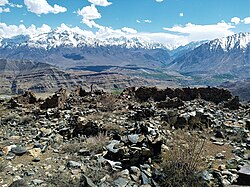
[[File:Sodh Khar (Fort) Kargil.jpg|thumb|right|280px|Ruins of the old fort at Sod]] | |||
During Zorawar Singh's invasion of Ladakh in 1834, the Dogras attacked both these forts and destroyed them.{{sfnp|Cunningham, Ladak|1854|pp=334–335}}{{sfnp|Francke, Antiquities of Indian Tibet, Part 2|1926|pp=128–129}} Afterwards, Zorawar Singh stationed a Kardar (administrator) for Kargil and Drass, and probably built a fort at Kargil for this purpose. In 1838, the people of the region revolted against the Dogras and the killed the Kardar.{{sfnp|Charak, General Zorawar Singh|1983|p=43}}{{sfnp|Handa, Buddhist Western Himalaya|2001|p=191}} | |||
In 1840, after another rebellion in Ladakh, Zorawar Singh deposed the [[Namgyal dynasty of Ladakh|Gyalpo]] and annexed Ladakh. He also decided to invade Baltistan.{{sfnp|Charak, General Zorawar Singh|1983|p=45}} On the way to Baltistan, he made a detour to Sod, routed the rebels and, according to the Dogra narrative, "annexed" the whole of Purig. He appointed kardars for Drass and Suru.{{sfnp|Charak, General Zorawar Singh|1983|p=50}}{{efn|The mention of "Suru" could be a reference to Kargil.}} | |||
After Zorawar Singh's death in Tibet, there was another rebellion in Ladakh and Purig. But Dogras sent fresh forces under Wazir Lakhpat, who beat back the Tibetans and reestablished ''status quo ante''. On returning, the Wazir garrisoned the Kargil fort and took all the Rajas of the region as prisoners.{{sfnp|Charak, General Zorawar Singh|1983|p=111}} | |||
[[ | [[Alexander Cunningham]] described the Kargil fort as a square of about sixty yards on the left bank of the Suru River immediately above its junction with Wakha Rong. It was able to defend the bridge over the Suru River and completely command the Kashmir–Ladakh road.{{sfnp|Cunningham, Ladak|1854|p=282}} | ||
In 1854, there were three ''ilaqas'' (subdistrics) in the present day Kargil distric, at Kargil, Dras and Zanskar respectively. They were headed by civil officers called ''Thanadars''.{{sfnp|Cunningham, Ladak|1854|p=274}} It would appear that the growth of Kargil as an administrative centre and a town owes to this establishment. | |||
During the reign of [[Pratap Singh of Jammu and Kashmir|Pratap Singh]], a ''wazarat'' (district) was established for all the frontier regions (including Gilgit), and Kargil was made a ''tehsil'' of the wazarat. Sometime later, Gilgit was separated, and Kargil, Skardu and Leh made up the Ladakh ''wazarat''. The district headquarters shifted between the three locations each year.{{sfn|Aggarwal, Beyond Lines of Control|2004|p=35}} | |||
In 1999 the area saw infiltration by Pakistani forces, leading to the [[Kargil War]]. Fighting occurred along a 160 km long stretch of [[ridge]]s overlooking the only road linking Srinagar and Leh.<ref name = "Globalsecurity">{{cite web| url=http://www.globalsecurity.org/military/world/war/kargil-99.htm|title=1999 Kargil Conflict|publisher=GlobalSecurity.org| access-date=2009-05-20}}</ref> The military outposts on the ridges above the highway were generally around 5,000 metres (16,000 ft) high, with a few as high as 5,485 metres (18,000 ft). After several months of fighting and diplomatic activity, the Pakistani forces were forced to withdraw to their side of the Line of Control by their Prime minister Nawaz Sharif after | === Independent India === | ||
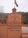
[[File:KargilWarMemorial2.JPG|thumb|right|200px|Kargil War Memorial]] | |||
The [[First Kashmir War]] (1947–48) concluded with a ceasefire line that divided the Ladakh ''wazarat'', putting roughly the Kargil and Leh ''tehsils'' on the Indian side, and the Skardu ''tehsil'' on the Pakistan side. The two Indian ''tehsils'' were soon promoted to districts and Ladakh was named a division, on a par with the [[Jammu Division|Jammu]] and [[Kashmir Division|Kashmir]] divisions in the Indian state of [[Jammu and Kashmir (state)|Jammu and Kashmir]]. Pakistan renamed the Skardu ''tehsil'' [[Baltistan]] and divided it into further districts. | |||
At the end of [[Indo-Pakistani War of 1971]], the two nations signed the [[Simla Agreement]], converting the former ceasefire line with some adjustments into a [[Line of Control]], and promising not to engage in armed conflict with respect to that boundary.<ref>{{cite book |first=Pervaiz Iqbal |last=Cheema |title=The Armed Forces of Pakistan |publisher=Allen & Unwin |year=2003 |isbn=1-86508-119-1}} Pg 4</ref> | |||
In 1999 the area saw infiltration by Pakistani forces, leading to the [[Kargil War]]. Fighting occurred along a 160 km long stretch of [[ridge]]s overlooking the only road linking Srinagar and Leh.<ref name="Globalsecurity">{{cite web| url=http://www.globalsecurity.org/military/world/war/kargil-99.htm|title=1999 Kargil Conflict|publisher=GlobalSecurity.org| access-date=2009-05-20}}</ref> The military outposts on the ridges above the highway were generally around 5,000 metres (16,000 ft) high, with a few as high as 5,485 metres (18,000 ft). After several months of fighting and diplomatic activity, the Pakistani forces were forced to withdraw to their side of the Line of Control by their Prime minister [[Nawaz Sharif]] after he visited the USA.<ref name="Summary">{{cite web|url=http://www.ccc.nps.navy.mil/research/kargil/war_in_kargil.pdf |title=War in Kargil – The CCC's summary on the war |access-date=2009-05-20 |url-status=dead |archive-url=https://web.archive.org/web/20090327120658/http://www.ccc.nps.navy.mil/research/kargil/war_in_kargil.pdf |archive-date=27 March 2009 }}</ref> | |||
==Geography== | ==Geography== | ||
[[File: | [[File:Kargil town, India panorama.jpg|thumb|right|Kargil town with the Suru river in the foreground and mountain background]] | ||
Kargil has an average elevation of 2,676 metres (8,780 feet), and is situated along the banks of the [[Suru River (Indus)]]. | Kargil has an average elevation of 2,676 metres (8,780 feet), and is situated along the banks of the [[Suru River (Indus)]]. | ||
The town of Kargil is located {{convert|205|km|mi|abbr=on}} from [[Srinagar]],<ref>[http://kargil.nic.in/profile/profile.htm Profile of Kargil District] {{Webarchive|url=https://web.archive.org/web/20090518031923/http://kargil.nic.in/profile/profile.htm |date=18 May 2009 }} Official website of Kargil District</ref> facing the [[Northern Areas]] across the [[Line of Control|LOC]]. Like other areas in the [[Himalayas]], Kargil has a temperate climate. Summers are hot with cool nights, while winters are long and chilly with temperatures often dropping below −20 °C (−4 °F).<ref>{{cite web| url=http://kargil.nic.in/profile/climate.htm| archive-url=https://web.archive.org/web/20090410042319/http://kargil.nic.in/profile/climate.htm | archive-date=10 April 2009|title=Climate & Soil conditions|work=Official website of Kargil District| access-date=2009-05-20}}</ref> | The town of Kargil is located {{convert|205|km|mi|abbr=on}} from [[Srinagar]],<ref>[http://kargil.nic.in/profile/profile.htm Profile of Kargil District] {{Webarchive|url=https://web.archive.org/web/20090518031923/http://kargil.nic.in/profile/profile.htm |date=18 May 2009 }} Official website of Kargil District</ref> facing the [[Northern Areas]] across the [[Line of Control|LOC]]. Like other areas in the [[Himalayas]], Kargil has a temperate climate. Summers are hot with cool nights, while winters are long and chilly with temperatures often dropping below −20 °C (−4 °F).<ref>{{cite web| url=http://kargil.nic.in/profile/climate.htm| archive-url=https://web.archive.org/web/20090410042319/http://kargil.nic.in/profile/climate.htm |archive-date=10 April 2009|title=Climate & Soil conditions|work=Official website of Kargil District| access-date=2009-05-20}}</ref> | ||
==Demographics== | ==Demographics== | ||
| Line 88: | Line 111: | ||
===Religion=== | ===Religion=== | ||
Islam is the largest religion in Kargil City, followed by over 77% of people. Hinduism is the second-largest religion with 19.21% adherents. Buddhism and Sikhism form 0.54% and 2.2% of the population respectively.<ref name="Kargil Population">{{cite web|url=https://www.censusindia2011.com/jammu-kashmir/kargil/kargil/kargil-mc-population.html|title=Kargil City Population|work=Census India|access-date=22 September 2020}}</ref> | Islam is the largest religion in Kargil City, followed by over 77.56% of people. Hinduism is the second-largest religion with 19.21% adherents. Buddhism and Sikhism form 0.54% and 2.2% of the population respectively.<ref name="Kargil Population">{{cite web|url=https://www.censusindia2011.com/jammu-kashmir/kargil/kargil/kargil-mc-population.html|title=Kargil City Population|work=Census India|access-date=22 September 2020}}</ref> | ||
{{Pie chart | {{Pie chart | ||
| Line 98: | Line 121: | ||
|label2 = [[Hinduism]] | |label2 = [[Hinduism]] | ||
|value2 = 19.21 | |value2 = 19.21 | ||
|color2 = | |color2 = DarkOrange | ||
|label3 = [[Sikhism]] | |label3 = [[Sikhism]] | ||
|value3 = 2.20 | |value3 = 2.20 | ||
|color3 = | |color3 = Gold | ||
|label4 = [[Christianity]] | |label4 = [[Christianity]] | ||
|value4 = 0.39 | |value4 = 0.39 | ||
| Line 107: | Line 130: | ||
|label5 = [[Buddhism]] | |label5 = [[Buddhism]] | ||
|value5 = 0.54 | |value5 = 0.54 | ||
|color5 = | |color5 = Yellow | ||
|label6 = [[Jainism]] | |label6 = [[Jainism]] | ||
|value6 = 0.01 | |value6 = 0.01 | ||
| Line 120: | Line 143: | ||
==Media and communications== | ==Media and communications== | ||
[[All India Radio]]'s channel ''AIR Kargil AM 684'' is broadcast from a radio station at Kargil | [[All India Radio]]'s channel ''AIR Kargil AM 684'' is broadcast from a radio station at Kargil.<ref>{{cite web |title=How one Ladakhi Woman Kept Kargil's AIR Station Running, Despite Enemy Shelling! |website=The Better India |date=2020-07-26 |url=https://www.thebetterindia.com/233771/ladakh-kargil-diwas-hero-all-india-radio-tsering-angmo-shunu-bravery-india-nor41/ |access-date=2020-10-07}}</ref> Greater Ladakh is the largest circulated bi-lingual newspaper in the Union Territory that publishes once in a week.{{citation needed|date=January 2023}} | ||
==Transportation== | ==Transportation== | ||
===Air=== | ===Air=== | ||
[[Kargil Airport]] is a non-operational airport located 8 kilometres from the town. The airport is included in [[UDAN]] scheme and is proposed to be operational in the near future. The nearest operational airport is the Srinagar International Airport. | [[Kargil Airport]] is a non-operational airport located 8 kilometres from the town. The airport is included in [[UDAN]] scheme and is proposed to be operational in the near future. The nearest operational airport is the [[Sheikh ul-Alam International Airport|Srinagar International Airport]]. | ||
===Rail=== | ===Rail=== | ||
| Line 133: | Line 156: | ||
==Kargil-Skardu Road== | ==Kargil-Skardu Road== | ||
The all-weather [[Skardu–Kargil Road|Kargil-Skardu road]] once linked Kargil to [[Skardu]], a city in [[Gilgit-Baltistan]]. Since the 1948 Kashmir War, the road has been closed. Whilst the Indian Government has proposed opening the road as a humanitarian gesture, the Pakistani government has refused.<ref>{{cite web|url=http://www.indianexpress.com/news/moving-on-the-kargilskardu-road/29212 |title=Moving on the Kargil-Skardu road |work=The Indian Express|date=2007-04-24 |access-date=2013-04-22}}</ref><ref>{{cite web|url=http://www.ipcs.org/article/india/the-kargil-skardu-route-implications-of-its-opening-3614.html |title=The Kargil-Skardu Route: Implications of its Opening by Zainab Akhter |publisher=Ipcs.org |access-date=2013-04-22}}</ref><ref>{{cite web|url=http://www.idsa.in/resources/parliament/PresentstatusofKargiltoSkarduRoad |title=Q. 368 Present status of Kargil to Skardu Road | Institute for Defence Studies and Analyses |publisher=Idsa.in |date=2012-03-29 |access-date=2013-04-22}}</ref> | |||
==See also== | ==See also== | ||
| Line 144: | Line 167: | ||
{{Clear}} | {{Clear}} | ||
==Notes== | |||
{{notelist}} | |||
==References== | ==References== | ||
| Line 150: | Line 176: | ||
==Bibliography== | ==Bibliography== | ||
* {{citation |last=Aggarwal |first=Ravina |title=Beyond Lines of Control: Performance and Politics on the Disputed Borders of Ladakh, India |url=https://books.google.com/books?id=2k3mgWCitj0C |year=2004 |publisher=Duke University Press |isbn=0-8223-3414-3 |ref={{sfnref|Aggarwal, Beyond Lines of Control|2004}}}} | * {{citation |last=Aggarwal |first=Ravina |title=Beyond Lines of Control: Performance and Politics on the Disputed Borders of Ladakh, India |url=https://books.google.com/books?id=2k3mgWCitj0C |year=2004 |publisher=Duke University Press |isbn=0-8223-3414-3 |ref={{sfnref|Aggarwal, Beyond Lines of Control|2004}}}} | ||
* {{citation |last=Charak |first=Sukhdev Singh |title=General Zorawar Singh |publisher=Publications Division, Government of India |year=1983 |url=https://archive.org/details/GENERALZORAWARSINGH |via=archive.org |ref={{sfnref|Charak, General Zorawar Singh|1983}}}} | |||
* {{citation |last=Cunningham |first=Alexander |title=Ladak: Physical, Statistical, Historical |publisher=Wm. H. Allen and Co |location=London |year=1854 |url=https://archive.org/details/ladakphysicalsta00cunnrich |via=archive.org |ref={{sfnref|Cunningham, Ladak|1854}}}} | |||
* {{citation |last=Francke |first=Rev. A. H. |author-link=A. H. Francke |title=A History of Western Tibet |publisher=S. W. Partridge & Co |date=1907 |url=https://archive.org/details/historyofwestern00ahfr/page/n6 |via=archive.org |ref={{sfnref|Francke, A History of Western Tibet|1907}}}} | |||
* {{cite book |first=Radhika |last=Gupta |chapter=Allegiance and Alienation: Border Dynamics in Kargil |editor=David N. Gellner |title=Borderland Lives in Northern South Asia |chapter-url=https://books.google.com/books?id=I5raAgAAQBAJ&pg=PA47 |year=2013 |publisher=Duke University Press |isbn=978-0-8223-7730-6 |pages=47–71 |ref={{sfnref|Radhika Gupta, Allegiance and Alienation|2013}}}} | * {{cite book |first=Radhika |last=Gupta |chapter=Allegiance and Alienation: Border Dynamics in Kargil |editor=David N. Gellner |title=Borderland Lives in Northern South Asia |chapter-url=https://books.google.com/books?id=I5raAgAAQBAJ&pg=PA47 |year=2013 |publisher=Duke University Press |isbn=978-0-8223-7730-6 |pages=47–71 |ref={{sfnref|Radhika Gupta, Allegiance and Alienation|2013}}}} | ||
* {{citation |last=Huttenback |first=Robert A. |title=Gulab Singh and the Creation of the Dogra State of Jammu, Kashmir, and Ladakh |journal=The Journal of Asian Studies |volume=20 |number=4 |year=1961 |pages=477–488 |doi=10.2307/2049956 |jstor=2049956 |url=https://pahar.in/mountains/Books%20and%20Articles/Indian%20Subcontinent/1961%20Gulab%20Singh%20and%20Creation%20of%20Dogra%20State%20of%20Jammu%20Kashmir%20and%20Ladakh%20by%20Huttenback%20from%20J%20Asian%20Studies%20v20%20s.pdf |ref={{sfnref|Huttenback, Gulab Singh and the Creation of the Dogra State|1961}}}} | * {{cite book |last=Francke |first=August Hermann |author-link=A. H. Francke |title=Antiquities of Indian Tibet, Part 2 |publisher=Superintendent Government Printing |location=Calcutta |year=1926 |url=https://archive.org/details/in.gov.ignca.24327 |via=archive.org |ref={{sfnref|Francke, Antiquities of Indian Tibet, Part 2|1926}}}} | ||
* {{citation |last1=Handa |first1=O. C. |title=Buddhist Western Himalaya: A politico-religious history |url=https://books.google.com/books?id=R4VuovXa5YUC&pg=PA197 |year=2001 |publisher=Indus Publishing |isbn=978-81-7387-124-5 |ref={{sfnref|Handa, Buddhist Western Himalaya|2001}}}} | |||
* {{citation |last=Huttenback |first=Robert A. |title=Gulab Singh and the Creation of the Dogra State of Jammu, Kashmir, and Ladakh |journal=The Journal of Asian Studies |volume=20 |number=4 |year=1961 |pages=477–488 |doi=10.2307/2049956 |jstor=2049956 |s2cid=162144034 |url=https://pahar.in/mountains/Books%20and%20Articles/Indian%20Subcontinent/1961%20Gulab%20Singh%20and%20Creation%20of%20Dogra%20State%20of%20Jammu%20Kashmir%20and%20Ladakh%20by%20Huttenback%20from%20J%20Asian%20Studies%20v20%20s.pdf |ref={{sfnref|Huttenback, Gulab Singh and the Creation of the Dogra State|1961}}}} | |||
* {{citation |last=Karim |first=Maj Gen Afsir |title=Kashmir The Troubled Frontiers |url=https://books.google.com/books?id=lf2jAQAAQBAJ&pg=PT30 |date=2013 |publisher=Lancer Publishers LLC |isbn=978-1-935501-76-3 |pages=30– |ref={{sfnref|Karim, Kashmir The Troubled Frontiers|2013}}}} | * {{citation |last=Karim |first=Maj Gen Afsir |title=Kashmir The Troubled Frontiers |url=https://books.google.com/books?id=lf2jAQAAQBAJ&pg=PT30 |date=2013 |publisher=Lancer Publishers LLC |isbn=978-1-935501-76-3 |pages=30– |ref={{sfnref|Karim, Kashmir The Troubled Frontiers|2013}}}} | ||
* {{citation |title=Gulab Singh |first=K. M. |last=Panikkar |author-link=K. M. Panikkar |publisher=Martin Hopkinson Ltd |year=1930 |location=London |url=https://archive.org/details/gulabsingh179218031570mbp |ref={{sfnref|Panikkar, Gulab Singh|1930}}}} | * {{citation |title=Gulab Singh |first=K. M. |last=Panikkar |author-link=K. M. Panikkar |publisher=Martin Hopkinson Ltd |year=1930 |location=London |url=https://archive.org/details/gulabsingh179218031570mbp |ref={{sfnref|Panikkar, Gulab Singh|1930}}}} | ||
* {{citation |last=Rizvi |first=Janet |title=Ladakh: Crossroads of High Asia |year=1996 |publisher=Oxford University Press |edition=Second |isbn=978-0-19-564016-8 |url=https://archive.org/details/ladakhcrossroads0000rizv |via=archive.org |url-access=registration |ref={{sfnref|Rizvi, Ladakh: Crossroads of High Asia|1996}}}} | |||
==Further reading== | ==Further reading== | ||
| Line 161: | Line 193: | ||
==External links== | ==External links== | ||
* [https://kargil.nic.in/ | * [https://kargil.nic.in/ Kargil Official Website] | ||
{{Ladakh}} | {{Ladakh}} | ||
Revision as of 06:29, 22 July 2023
Kargil | |
|---|---|
City administered by India | |
 | |
![Kargil is the joint capital of Ladakh, the eastern part of the Indian-administered regions (shaded in tan ) of the disputed Kashmir region[1]](/wiki/File:Kashmir_region._LOC_2003626427_-_showing_sub-regions_administered_by_different_countries.jpg) | |
| Coordinates: 34°33′34″N 76°07′32″E / 34.5594°N 76.1256°E | |
| Administrating country | India |
| Region of administration | Union territory of Ladakh |
| District | Kargil |
| Tehsil | Kargil |
| Government | |
| • Type | Ladakh Autonomous Hill Development Council, Kargil |
| Area | |
| • Total | 2.14 km2 (0.83 sq mi) |
| Elevation | 2,676 m (8,780 ft) |
| Population (2011)[2] | |
| • Total | 16,338 |
| • Density | 7,600/km2 (20,000/sq mi) |
| Others | |
| Time zone | UTC+5:30 (IST) |
| PIN | 194103 |
| Vehicle registration | LA 01 |
| Official languages | Urdu, Purgi, Ladakhi, Brokskat, English[3] |
| Other spoken | Shina, Balti |
| Website | kargil |
Kargil /ˈkɑːrɡɪl/ or Kargyil[4][5] is a city in Indian-administered Ladakh in the disputed Kashmir region.[1] It is the joint capital of Ladakh, an Indian-administered union territory. It is also the headquarters of the Kargil district. It is the second-largest city in Ladakh after Leh.[6] Kargil is located 204 kilometres (127 mi) east of Srinagar in Jammu and Kashmir, and 234 kilometres (145 mi) to the west of Leh. It is on the bank of the Suru River near its confluence with the Wakha Rong river, the latter providing the most accessible route to Leh.[7]
Etymology
The Ladakh Chronicles spell the name of Kargil as Wylie: dkar skyil, THL: kar kyil.[8] The word can be interpreted as meaning a bright or wholesome expanse.[9]
Modern newspapers are said to spell the name as Wylie: dkar `khyil, THL: kar khyil.[10] It can also be interpreted as a bright or wholesome mountainous amphitheatre.[11] This phrase occurs often in Tibetan literature.
The Kargil basin does give the feel of an expanse surrounded by low-pitched mountains, with the low Khurbathang plateau at the southeastern corner. This is in sharp contrast to the deep gorges that give access to the valley.[7][12]
The people of Kargil however relate the name to Khar (fort) and rkil (centre) and interpret it as a central place among many forts.[13] Radhika Gupta has opined that it is a fitting description for a place that is equidistant from Srinagar, Leh and Skardu.[13]
Location

Kargil is located at the confluence of multiple river valleys: the Suru River valley to the north and south, the Wakha Rong valley to the southeast leading to Leh, and the Sod Valley to the east leading to the Indus Valley near Batalik. In addition, at a short distance to the north, the Dras River valley branches off from the Suru valley leading to the Zoji La pass and Kashmir. Further north along the Suru valley, one reaches the Indus valley, leading to Skardu. Thus, Kargil is located at a key junction of routes between Kashmir, Ladakh and Baltistan.
Scholar Janet Rizvi states that the Indus Valley between Marol and Dah is a narrow gorge and was not easily traversable in the pre-modern period. So the normal trade route between Baltistan and Leh also ran via Kargil, using the Suru valley and Wakha Rong.[7][14]
After the Partition of India and the First Kashmir War, Baltistan came under the control of Pakistan. The Line of Control with Pakistan-administered Kashmir is roughly 11 kilometres (6.8 mi) to the north of Kargil.[15]Template:Rs? Peak 13620 overlooking Kargil town and the Srinagar–Leh Highway remained in Pakistani control at the end of this conflict. During the Indo-Pakistan War of 1971, Indian forces pushed the Line of Control north of the ridgeline, ensuring Kargil's security. A key village called Hunderman came under Indian control as a result of this push.
History
The Sod Valley had a strong fort called Sod Pasari (Wylie: sod pa sa ri, now known as Pasar Khar) by the 16th or 17th century. It controlled "Lower Purig", including the Sod Valley, the lower portion of Wakha Rong and, likely the Kargil basin itself.[16][17] By the 18th or 19h century, it also had a sub-branch at Pashkum[lower-alpha 1] (Wylie: pas kyum) southeast of Kargil town in the Wakha Rong valley.[17]
Dogra period
_Kargil.jpg)
During Zorawar Singh's invasion of Ladakh in 1834, the Dogras attacked both these forts and destroyed them.[18][19] Afterwards, Zorawar Singh stationed a Kardar (administrator) for Kargil and Drass, and probably built a fort at Kargil for this purpose. In 1838, the people of the region revolted against the Dogras and the killed the Kardar.[20][21]
In 1840, after another rebellion in Ladakh, Zorawar Singh deposed the Gyalpo and annexed Ladakh. He also decided to invade Baltistan.[22] On the way to Baltistan, he made a detour to Sod, routed the rebels and, according to the Dogra narrative, "annexed" the whole of Purig. He appointed kardars for Drass and Suru.[23][lower-alpha 2]
After Zorawar Singh's death in Tibet, there was another rebellion in Ladakh and Purig. But Dogras sent fresh forces under Wazir Lakhpat, who beat back the Tibetans and reestablished status quo ante. On returning, the Wazir garrisoned the Kargil fort and took all the Rajas of the region as prisoners.[24]
Alexander Cunningham described the Kargil fort as a square of about sixty yards on the left bank of the Suru River immediately above its junction with Wakha Rong. It was able to defend the bridge over the Suru River and completely command the Kashmir–Ladakh road.[25]
In 1854, there were three ilaqas (subdistrics) in the present day Kargil distric, at Kargil, Dras and Zanskar respectively. They were headed by civil officers called Thanadars.[26] It would appear that the growth of Kargil as an administrative centre and a town owes to this establishment.
During the reign of Pratap Singh, a wazarat (district) was established for all the frontier regions (including Gilgit), and Kargil was made a tehsil of the wazarat. Sometime later, Gilgit was separated, and Kargil, Skardu and Leh made up the Ladakh wazarat. The district headquarters shifted between the three locations each year.[27]
Independent India

The First Kashmir War (1947–48) concluded with a ceasefire line that divided the Ladakh wazarat, putting roughly the Kargil and Leh tehsils on the Indian side, and the Skardu tehsil on the Pakistan side. The two Indian tehsils were soon promoted to districts and Ladakh was named a division, on a par with the Jammu and Kashmir divisions in the Indian state of Jammu and Kashmir. Pakistan renamed the Skardu tehsil Baltistan and divided it into further districts.
At the end of Indo-Pakistani War of 1971, the two nations signed the Simla Agreement, converting the former ceasefire line with some adjustments into a Line of Control, and promising not to engage in armed conflict with respect to that boundary.[28]
In 1999 the area saw infiltration by Pakistani forces, leading to the Kargil War. Fighting occurred along a 160 km long stretch of ridges overlooking the only road linking Srinagar and Leh.[29] The military outposts on the ridges above the highway were generally around 5,000 metres (16,000 ft) high, with a few as high as 5,485 metres (18,000 ft). After several months of fighting and diplomatic activity, the Pakistani forces were forced to withdraw to their side of the Line of Control by their Prime minister Nawaz Sharif after he visited the USA.[30]
Geography

Kargil has an average elevation of 2,676 metres (8,780 feet), and is situated along the banks of the Suru River (Indus). The town of Kargil is located 205 km (127 mi) from Srinagar,[31] facing the Northern Areas across the LOC. Like other areas in the Himalayas, Kargil has a temperate climate. Summers are hot with cool nights, while winters are long and chilly with temperatures often dropping below −20 °C (−4 °F).[32]
Demographics
During the 2011 census, the population of Kargil town was recorded at 16,338. A majority of the population (11,496) is classified as Scheduled Tribes. The literacy rate is 75%.[2]
Religion
Islam is the largest religion in Kargil City, followed by over 77.56% of people. Hinduism is the second-largest religion with 19.21% adherents. Buddhism and Sikhism form 0.54% and 2.2% of the population respectively.[33]
Media and communications
All India Radio's channel AIR Kargil AM 684 is broadcast from a radio station at Kargil.[34] Greater Ladakh is the largest circulated bi-lingual newspaper in the Union Territory that publishes once in a week.[citation needed]
Transportation
Air
Kargil Airport is a non-operational airport located 8 kilometres from the town. The airport is included in UDAN scheme and is proposed to be operational in the near future. The nearest operational airport is the Srinagar International Airport.
Rail
There is no rail-connectivity to Kargil yet. The Srinagar-Kargil-Leh railway line is proposed which will connect Srinagar and Leh via Kargil. The nearest major railway station to Kargil is Jammu Tawi railway station located at a distance of 472 kilometres.
Road
An Indian national highway (NH 1) connecting Srinagar to Leh cuts through Kargil.
Kargil-Skardu Road
The all-weather Kargil-Skardu road once linked Kargil to Skardu, a city in Gilgit-Baltistan. Since the 1948 Kashmir War, the road has been closed. Whilst the Indian Government has proposed opening the road as a humanitarian gesture, the Pakistani government has refused.[35][36][37]
See also
- Kargil War
- Ladakh
- Leh
- Jammu and Kashmir (state)
- Jammu and Kashmir (union territory)
- 1988 Gilgit massacre
Notes
References
- ↑ 1.0 1.1 The application of the term "administered" to the various regions of Kashmir and a mention of the Kashmir dispute is supported by the tertiary sources (a) through (e), reflecting due weight in the coverage. Although "controlled" and "held" are also applied neutrally to the names of the disputants or to the regions administered by them, as evidenced in sources (h) through (i) below, "held" is also considered politicized usage, as is the term "occupied," (see (j) below).
(a) Kashmir, region Indian subcontinent, Encyclopaedia Britannica, retrieved 15 August 2019 (subscription required) Quote: "Kashmir, region of the northwestern Indian subcontinent ... has been the subject of dispute between India and Pakistan since the partition of the Indian subcontinent in 1947. The northern and western portions are administered by Pakistan and comprise three areas: Azad Kashmir, Gilgit, and Baltistan, the last two being part of a territory called the Northern Areas. Administered by India are the southern and southeastern portions, which constitute the state of Jammu and Kashmir but are slated to be split into two union territories.";
(b) Pletcher, Kenneth, Aksai Chin, Plateau Region, Asia, Encyclopaedia Britannica, retrieved 16 August 2019 (subscription required) Quote: "Aksai Chin, Chinese (Pinyin) Aksayqin, portion of the Kashmir region, at the northernmost extent of the Indian subcontinent in south-central Asia. It constitutes nearly all the territory of the Chinese-administered sector of Kashmir that is claimed by India to be part of the Ladakh area of Jammu and Kashmir state.";
(c) "Kashmir", Encyclopedia Americana, Scholastic Library Publishing, 2006, p. 328, ISBN 978-0-7172-0139-6 C. E Bosworth, University of Manchester Quote: "KASHMIR, kash'mer, the northernmost region of the Indian subcontinent, administered partlv by India, partly by Pakistan, and partly by China. The region has been the subject of a bitter dispute between India and Pakistan since they became independent in 1947";
(d) Osmańczyk, Edmund Jan (2003), Encyclopedia of the United Nations and International Agreements: G to M, Taylor & Francis, pp. 1191–, ISBN 978-0-415-93922-5 Quote: "Jammu and Kashmir: Territory in northwestern India, subject to a dispute between India and Pakistan. It has borders with Pakistan and China."
(e) Talbot, Ian (2016), A History of Modern South Asia: Politics, States, Diasporas, Yale University Press, pp. 28–29, ISBN 978-0-300-19694-8 Quote: "We move from a disputed international border to a dotted line on the map that represents a military border not recognized in international law. The line of control separates the Indian and Pakistani administered areas of the former Princely State of Jammu and Kashmir.";
(f) Skutsch, Carl (2015) [2007], "China: Border War with India, 1962", in Ciment, James (ed.), Encyclopedia of Conflicts Since World War II (2nd ed.), London and New York: Routledge, p. 573, ISBN 978-0-7656-8005-1,The situation between the two nations was complicated by the 1957–1959 uprising by Tibetans against Chinese rule. Refugees poured across the Indian border, and the Indian public was outraged. Any compromise with China on the border issue became impossible. Similarly, China was offended that India had given political asylum to the Dalai Lama when he fled across the border in March 1959. In late 1959, there were shots fired between border patrols operating along both the ill-defined McMahon Line and in the Aksai Chin.
(g) Clary, Christopher, The Difficult Politics of Peace: Rivalry in Modern South Asia, Oxford and New York: Oxford University Press, p. 109, ISBN 9780197638408,Territorial Dispute: The situation along the Sino-Indian frontier continued to worsen. In late July (1959), an Indian reconnaissance patrol was blocked, "apprehended," and eventually expelled after three weeks in custody at the hands of a larger Chinese force near Khurnak Fort in Aksai Chin. ... Circumstances worsened further in October 1959, when a major class at Kongka Pass in eastern Ladakh led to nine dead and ten captured Indian border personnel, making it by far the most serious Sino-Indian class since India's independence.
(h) Bose, Sumantra (2009), Kashmir: Roots of Conflict, Paths to Peace, Harvard University Press, pp. 294, 291, 293, ISBN 978-0-674-02855-5 Quote: "J&K: Jammu and Kashmir. The former princely state that is the subject of the Kashmir dispute. Besides IJK (Indian-controlled Jammu and Kashmir. The larger and more populous part of the former princely state. It has a population of slightly over 10 million, and comprises three regions: Kashmir Valley, Jammu, and Ladakh.) and AJK ('Azad" (Free) Jammu and Kashmir. The more populous part of Pakistani-controlled J&K, with a population of approximately 2.5 million.), it includes the sparsely populated "Northern Areas" of Gilgit and Baltistan, remote mountainous regions which are directly administered, unlike AJK, by the Pakistani central authorities, and some high-altitude uninhabitable tracts under Chinese control."
(i) Fisher, Michael H. (2018), An Environmental History of India: From Earliest Times to the Twenty-First Century, Cambridge University Press, p. 166, ISBN 978-1-107-11162-2 Quote: "Kashmir’s identity remains hotly disputed with a UN-supervised “Line of Control” still separating Pakistani-held Azad (“Free”) Kashmir from Indian-held Kashmir.";
(j) Snedden, Christopher (2015), Understanding Kashmir and Kashmiris, Oxford University Press, p. 10, ISBN 978-1-84904-621-3 Quote:"Some politicised terms also are used to describe parts of J&K. These terms include the words 'occupied' and 'held'." - ↑ 2.0 2.1 District Census Handbook: Kargil, Directorate of Census Operations, 2011, pp. 22–23
- ↑ "Report of the Commissioner for linguistic minorities: 50th report (July 2012 to June 2013)" (PDF). Commissioner for Linguistic Minorities, Ministry of Minority Affairs, Government of India. p. 49. Archived from the original (PDF) on 8 July 2016. Retrieved 14 January 2015.
- ↑ Cunningham, Ladak (1854), p. 148.
- ↑ Kerin, Melissa R. (2015). Art and Devotion at a Buddhist Temple in the Indian Himalaya. Indiana University Press. p. 206, note 53. ISBN 978-0-253-01309-5.
- ↑ Osada et al (2000), p. 298.
- ↑ 7.0 7.1 7.2 Rizvi, Ladakh: Crossroads of High Asia (1996), pp. 19–20.
- ↑ Francke, August Hermann (1926). Antiquities of Indian Tibet, Part 2. Calcutta: Superintendent Government Printing. p. 128 – via archive.org.
- ↑ THL Tibetan to English Translation Tool, The Tibetan & Himalayan Library. Term: "dkar skyil".
- ↑ Martin, Dan (1991), The Emergence of Bon and the Tibetan Polemical Tradition, Indiana University, p. 280, note 128; See also Gyeltsen, Jamyang (2020), dgon rabs kun gsal nyi snang / དགོན་རབས་ཀུན་གསལ་ཉི་སྣང་།, Library of Tibetan Works and Archives, p. xx, ISBN 9789390752270
- ↑ THL Tibetan to English Translation Tool, The Tibetan & Himalayan Library. Term: "dkar 'khyil".
- ↑ View of the Kargil valley from the north, Google Maps, retrieved 17 January 2023.
- ↑ 13.0 13.1 Radhika Gupta, Allegiance and Alienation (2013), p. 49.
- ↑ Rizvi, Janet; Kakpori, G. M. (Summer 1988), "Lost kingdoms of the gold-digging ants (Review of L'or des fourmis: La découverte de l'Eldorado grec au Tibet by Michel Peissel)", India International Centre Quarterly, 15 (2): 131–147, JSTOR 23002056
- ↑ LOC Kargil to Kargil, OpenStreetMap, retrieved 26 January 2023.
- ↑ Francke, A History of Western Tibet (1907), p. 103.
- ↑ 17.0 17.1 Devers, Quentin (2020), "Buddhism before the First Diffusion? The case of Tangol, Dras, Phikhar and Sani-Tarungtse in Purig and Zanskar (Ladakh)", Études Mongoles & Sibériennes, Centrasiatiques & Tibétaines, 51 (51), doi:10.4000/emscat.4226, S2CID 230579183
- ↑ Cunningham, Ladak (1854), pp. 334–335.
- ↑ Francke, Antiquities of Indian Tibet, Part 2 (1926), pp. 128–129.
- ↑ Charak, General Zorawar Singh (1983), p. 43.
- ↑ Handa, Buddhist Western Himalaya (2001), p. 191.
- ↑ Charak, General Zorawar Singh (1983), p. 45.
- ↑ Charak, General Zorawar Singh (1983), p. 50.
- ↑ Charak, General Zorawar Singh (1983), p. 111.
- ↑ Cunningham, Ladak (1854), p. 282.
- ↑ Cunningham, Ladak (1854), p. 274.
- ↑ Aggarwal, Beyond Lines of Control 2004, p. 35.
- ↑ Cheema, Pervaiz Iqbal (2003). The Armed Forces of Pakistan. Allen & Unwin. ISBN 1-86508-119-1. Pg 4
- ↑ "1999 Kargil Conflict". GlobalSecurity.org. Retrieved 20 May 2009.
- ↑ "War in Kargil – The CCC's summary on the war" (PDF). Archived from the original (PDF) on 27 March 2009. Retrieved 20 May 2009.
- ↑ Profile of Kargil District Archived 18 May 2009 at the Wayback Machine Official website of Kargil District
- ↑ "Climate & Soil conditions". Official website of Kargil District. Archived from the original on 10 April 2009. Retrieved 20 May 2009.
- ↑ 33.0 33.1 "Kargil City Population". Census India. Retrieved 22 September 2020.
- ↑ "How one Ladakhi Woman Kept Kargil's AIR Station Running, Despite Enemy Shelling!". The Better India. 26 July 2020. Retrieved 7 October 2020.
- ↑ "Moving on the Kargil-Skardu road". The Indian Express. 24 April 2007. Retrieved 22 April 2013.
- ↑ "The Kargil-Skardu Route: Implications of its Opening by Zainab Akhter". Ipcs.org. Retrieved 22 April 2013.
- ↑ "Q. 368 Present status of Kargil to Skardu Road | Institute for Defence Studies and Analyses". Idsa.in. 29 March 2012. Retrieved 22 April 2013.
Bibliography
- Aggarwal, Ravina (2004), Beyond Lines of Control: Performance and Politics on the Disputed Borders of Ladakh, India, Duke University Press, ISBN 0-8223-3414-3
- Charak, Sukhdev Singh (1983), General Zorawar Singh, Publications Division, Government of India – via archive.org
- Cunningham, Alexander (1854), Ladak: Physical, Statistical, Historical, London: Wm. H. Allen and Co – via archive.org
- Francke, Rev. A. H. (1907), A History of Western Tibet, S. W. Partridge & Co – via archive.org
- Gupta, Radhika (2013). "Allegiance and Alienation: Border Dynamics in Kargil". In David N. Gellner (ed.). Borderland Lives in Northern South Asia. Duke University Press. pp. 47–71. ISBN 978-0-8223-7730-6.
- Francke, August Hermann (1926). Antiquities of Indian Tibet, Part 2. Calcutta: Superintendent Government Printing – via archive.org.
- Handa, O. C. (2001), Buddhist Western Himalaya: A politico-religious history, Indus Publishing, ISBN 978-81-7387-124-5
- Huttenback, Robert A. (1961), "Gulab Singh and the Creation of the Dogra State of Jammu, Kashmir, and Ladakh" (PDF), The Journal of Asian Studies, 20 (4): 477–488, doi:10.2307/2049956, JSTOR 2049956, S2CID 162144034
- Karim, Maj Gen Afsir (2013), Kashmir The Troubled Frontiers, Lancer Publishers LLC, pp. 30–, ISBN 978-1-935501-76-3
- Panikkar, K. M. (1930), Gulab Singh, London: Martin Hopkinson Ltd
- Rizvi, Janet (1996), Ladakh: Crossroads of High Asia (Second ed.), Oxford University Press, ISBN 978-0-19-564016-8 – via archive.org
Further reading
- Hussain, Javed (21 October 2006). "Kargil: what might have happened". Dawn. Archived from the original on 2 December 2008. Retrieved 20 May 2009.
- Yukiyasu Osada; Gavin Allwright; Atsushi Kanamaru (2000), Mapping the Tibetan World, Tokyo: Kotan Publishing (published 2004), ISBN 0-9701716-0-9
- Paul Beersmans (13 June 1998), Jammu and Kashmir State 1998, Belgian Association for Solidarity with Jammu and Kashmir, archived from the original on 6 October 2007
External links
| History |
| ||||||||||||||||||
|---|---|---|---|---|---|---|---|---|---|---|---|---|---|---|---|---|---|---|---|
| Administration | |||||||||||||||||||
| Geography |
| ||||||||||||||||||
| Human settlements | |||||||||||||||||||
| Culture |
| ||||||||||||||||||
| Tourism and wildlife |
| ||||||||||||||||||
| Transport |
| ||||||||||||||||||
| Infrastructure |
| ||||||||||||||||||
| See also |
| ||||||||||||||||||
