National Highway 1 (India)
| National Highway 1 | ||||
|---|---|---|---|---|
| Route information | ||||
| Maintained by BRO | ||||
| Length | 534 km (332 mi) | |||
| Major junctions | ||||
| East end | ||||
| West end | Invalid type: S, Hattian Bala | |||
| Location | ||||
| States | Jammu & Kashmir, Ladakh | |||
| Primary destinations | Baramulla, Srinagar, Kargil | |||
| Highway system | ||||
| ||||
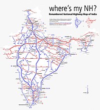
National Highway 1 (NH 1) in India runs between the union territories of Jammu & Kashmir and Ladakh. It comprises parts of old NH1A and NH1D.[1][2] The number 1 indicates, under the new numbering system,[2] that it is the northernmost East-West highway in India.
Route description[edit]
NH 1 passes from Uri to Baramulla, Srinagar, Sonamarg, Zoji La, Dras, Kargil and Leh. The route passes through high mountain passes and most of the road clings to mountainsides. The NH is the lifeline of the Ladakh region. An alternative route, the Leh-Manali Highway, exists but it climbs over even higher mountain passes. NH 1 passes near the India-Pakistan border.
Major intersections[edit]
Template:Jcttop/core Template:Jctint/core Template:Jctint/core Template:Jctint/core Template:Jctint/core Template:Jctint/core Template:Jctint/core Template:Jctint/core Template:Jctbtm
Transport[edit]
The Jammu and Kashmir State Road Transport Corporation (JKSRTC) operates regular Deluxe and Ordinary bus services between Srinagar and Leh on this route with an overnight halt at Kargil. Taxis (cars and jeeps) are also available at Srinagar for the journey.
See also[edit]
References[edit]
- ↑ "New National Highways notification - GOI" (PDF). The Gazette of India. Retrieved 10 June 2018.
- ↑ 2.0 2.1 "Rationalisation of Numbering Systems of National Highways" (PDF). New Delhi: Department of Road Transport and Highways. Archived from the original (PDF) on 1 February 2016. Retrieved 3 April 2012.
External links[edit]


