Saltoro Kangri
| Saltoro Kangri | |
|---|---|
 Saltoro Kangri, at right | |
| Highest point | |
| Elevation | 7,742 m (25,400 ft) Ranked 31st |
| Prominence | 2,160 m (7,090 ft) |
| Listing | Ultra |
| Coordinates | 35°23′57.6″N 76°50′55.2″E / 35.399333°N 76.848667°ECoordinates: 35°23′57.6″N 76°50′55.2″E / 35.399333°N 76.848667°E |
| Dimensions | |
| Length | 80 km (50 mi) |
| Geography | |
Lua error in Module:Location_map at line 526: Unable to find the specified location map definition: "Module:Location map/data/Karakoram relief" does not exist.
| |
| Parent range | Saltoro Mountains, Karakoram |
| Climbing | |
| First ascent | 24 July 1962 by Y. Takamura, A. Saito, Capt. Bashir[1] |
| Easiest route | rock/snow/ice climb |
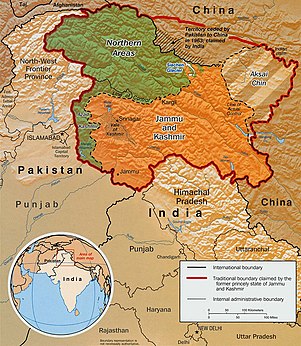
Saltoro Kangri is the highest peak of the Saltoro Mountains subrange of Karakoram range, also known as the Saltoro Range, which is a part of the Karakoram. Saltoro Kangri is a name generally used for the twin peaks, the Saltoro Kangri I to the south and the Saltoro Kangri II, connected by a saddle. While comparing the heights the generic term Saltoro Kangri is applied to the higher peak, Saltoro Kangri I, which is the 31st highest mountain in the world in remote reaches of Karokaram. It is located on the Actual Ground Position Line between Indian controlled territory in the Siachen region and Pakistani controlled territory west of the Saltoro Range.


Climbing history[edit]
The mountain was reconnoitered by the intrepid Workman couple in 1911–12. The first attempt on the peak was in 1935 by a British expedition led by J. Waller, which reached c.24500' on the SE ridge.[2][3] A British university expedition led by Eric Shipton approached this peak through the Bilafond La via Pakistan with a Pakistani climbing permit. They reached the peak but did not attempt it. This expedition was inadvertently the first move in the deadly game of Siachen oropolitics that would lead to the Siachen conflict of 1984.[4]
The first ascent of Saltoro Kangri was in July 1962, by a joint Japanese-Pakistani expedition led by T. Shidei. This piggyback expedition put A. Saito, Y. Takamura and Pakistani climber R.A. Bashir on top on July 24, following the S.E. ridge route.[1][5] This peak was climbed by an Indian Army expedition led by Colonel Narendra Kumar in 1981.[6] US maps of the area and many world atlases starting in the 1960s showed the Line of Control between Pakistani and Indian territory running from the last defined point in the 1949 Karachi Agreement, NJ9842, east-northeast to the Karakoram Pass, thus putting the whole of Saltoro Kangri and the entire Siachen Glacier in Pakistan. However, the Simla Agreement defined the Line of Control no further than point NJ9842 other than with the phrase "thence north to the glaciers." The Himalayan Index lists only one more ascent of the mountain, in 1981, and no other attempts.
See also[edit]
- Near the AGPL (Actual Ground Position Line)
- NJ9842 (peak) LoC ends and AGPL begins here
- Gharkun (peak)
- Gyong Kangri (peak)
- Gyong La (pass)
- Goma (Siachen)
- Gyari (valley)
- Chumik Kangri (peak)a
- K12 (mountain) (peak)
- Bana Top (peak)
- Bilafond La
- Saltoro Valley
- Ghent Kangri
- Sia La
- Sia Kangri
- Indira Col
- Borders
- Actual Ground Position Line (AGPL)
- India–Pakistan International Border {IB)
- Line of Control {LoC)
- Line of Actual Control (LAC)
- Sir Creek (SC)
- Borders of China
- Borders of India
- Conflicts
- Kashmir conflict
- Siachen conflict
- Sino-Indian conflict
- List of disputed territories of China
- List of disputed territories of India
- List of disputed territories of Pakistan
- Northern Areas
- Trans-Karakoram Tract
- Operations
- Operation Meghdoot, by India
- Operation Rajiv, by India
- Operation Safed Sagar, by India
- Other related topics
- Awards and decorations of the Indian Armed Forces
- Bana Singh, after whom Quaid Post was renamed to Bana Top
- Dafdar, westernmost town in Trans-Karakoram Tract
- India-China Border Roads
- Sino-Pakistan Agreement for transfer of Trans-Karakoram Tract to China
References[edit]
- ↑ 1.0 1.1
Shidei, T. (1964). "The Ascent of Saltoro Kangri" (PDF). Alpine Journal. 69: 73–80. Retrieved 2020-01-15.
{{cite journal}}: CS1 maint: url-status (link) - ↑
Hunt, John (1936). "Peak 36, Saltoro Karakoram, 1935". Himalayan Journal. 8. Retrieved 2020-01-15.
{{cite journal}}: CS1 maint: url-status (link) - ↑
Hunt, John; Waller, James (1937). "Peak 36, Saltoro Karakoram A Mountaineering Analysis". Himalayan Journal. 9. Retrieved 2020-01-15.
{{cite journal}}: CS1 maint: url-status (link) - ↑
Miller, K.J. (1958). "The Imperial College Karakoram Expedition, 1957". Himalayan Journal. 21. Retrieved 2020-01-15.
{{cite journal}}: CS1 maint: url-status (link) - ↑
Shidei, T. (1964). "The Ascent of Saltoro Kangri". Himalayan Journal. 25. Retrieved 2020-01-15.
{{cite journal}}: CS1 maint: url-status (link) - ↑
Kapadia, Harish (2005). Into the Untravelled Himalaya: Travels, Treks, and Climbs. Indus Publishing. p. 245. Retrieved 2020-01-15.
{{cite book}}: CS1 maint: url-status (link)
Further reading[edit]
- Jill Neate, High Asia: An Illustrated History of the 7000 Metre Peaks, ISBN 0-89886-238-8
- Himalayan Index
- DEM files for the Himalaya (Corrected versions of SRTM data)