


WikiDwarfBOT (talk | contribs) Cleanup: Source modification. |
typo fix |
||
| Line 1: | Line 1: | ||
{{Short description|Capital city of the Andaman and Nicobar Islands, India}} | {{Short description|Capital city of the Andaman and Nicobar Islands, India}} | ||
{{Use dmy dates|date= | {{Use dmy dates|date=December 2025}} | ||
{{Use Indian English|date= | {{Use Indian English|date=December 2025}} | ||
{{Infobox settlement | {{Infobox settlement | ||
| name | | name = Port Blair | ||
| settlement_type | | official_name = Sri Vijaya Puram | ||
| image_skyline | | settlement_type = Town | ||
| border | | image_skyline = {{multiple image | ||
| total_width | | perrow = 1/2/2/1 | ||
| | | border = infobox | ||
| | | total_width = 300 | ||
| image1 = View from South Point, (Port Blair, India).jpg | |||
| caption1 = View of [[Andaman Sea]] | |||
| image2 = Corbyns cove beach,Port Blaire,Andaman - panoramio.jpg | | image2 = Corbyns cove beach,Port Blaire,Andaman - panoramio.jpg | ||
| caption2 = Corbyn's cove beach | |||
| image3= PortBlair SeasideRoad.JPG | | image3= PortBlair SeasideRoad.JPG | ||
| | | caption3 = A seaside road | ||
| | | image4 = Science Centre Port Blair 4150297.JPG | ||
| image6= | | caption4 = Science centre | ||
| | | image5= Jaljeevshala-Aquarium at Port Blair - panoramio.jpg | ||
| caption5 = Jaljeevshala aquarium | |||
| image6 = Front_View_of_Cellular_Jail,_Port_Blair.JPG | |||
| caption6 = [[Cellular Jail]] | |||
}} | }} | ||
| | | image_blank_emblem = Seal of the Port Blair Municipal Council.svg | ||
| imagesize | | imagesize = | ||
| pushpin_map | | blank_emblem_type = Seal of the Port Blair Municipal Council | ||
| pushpin_label_position | | pushpin_map = India Andaman and Nicobar Islands#Bay of Bengal | ||
| pushpin_map_caption | | pushpin_label_position = right | ||
| subdivision_type | | pushpin_map_caption = Location in the Andaman and Nicobar Islands | ||
| subdivision_name | | subdivision_type = Country | ||
| subdivision_type1 | | subdivision_name = India | ||
| subdivision_name1 | | subdivision_type1 = [[Union Territory]] | ||
| subdivision_type2 | | subdivision_name1 = [[Andaman and Nicobar Islands]] | ||
| subdivision_name2 | | subdivision_type2 = [[Districts of India|District]] | ||
| subdivision_type3 | | subdivision_name2 = [[South Andaman district|South Andaman]] | ||
| subdivision_name3 | | subdivision_type3 = | ||
| subdivision_type4 | | subdivision_name3 = | ||
| subdivision_name4 | | subdivision_type4 = | ||
| government_type | | subdivision_name4 = | ||
| governing_body | | government_type = [[Municipal Council (India)|Municipal Council]] | ||
| leader_title | | governing_body = [[Port Blair Municipal Council]] | ||
| leader_name | | leader_party = [[Telugu Desam Party|TDP]] | ||
| established_title | | leader_title = Chairman | ||
| established_date | | leader_name = S. Shahul Hameed | ||
| area_footnotes | | established_title = | ||
| area_total_km2 | | established_date = | ||
| population_as_of | | area_footnotes = <ref name="pbmc">{{cite web|title=Port Blair City|url=https://testpbmc.andaman.gov.in/about|access-date=23 November 2020|archive-date=17 June 2021|archive-url=https://web.archive.org/web/20210617030734/http://testpbmc.andaman.gov.in/about|url-status=dead}}</ref> | ||
| population_footnotes | | area_total_km2 = 41.22 | ||
| | | population_as_of = 2011 | ||
| population_density_km2 | | population_footnotes = <ref name="pbmc"/> | ||
| timezone | | blank_info_sec2 = 1.15 ([[male|♂]]/[[female|♀]]) | ||
| utc_offset | | website = {{URL|https://pbmc.gov.in/}} | ||
| coordinates | | footnotes = As per the [[2011 Census of India|2011 census]], Port Blair had a population of 108,058.<ref name="Census">{{cite web|title=Census of India|url=https://www.census2011.co.in/data/town/804041-port-blair-andaman-and-nicobar-islands.html|work=[[2011 Census of India]]|access-date=10 May 2015}}</ref> The municipal limits were expanded from {{cvt|17.74|km2}} to {{cvt|41.22|km2}} in 2015, and the corresponding population as per the revised limits was given as 140,572 (as per the 2011 census).<ref name="pbmc"/> | ||
| elevation_footnotes | | demographics1_info1 = {{hlist|[[Hindi]]|[[Indian English|English]]}} | ||
| elevation_m | | population_total = 140572 | ||
| blank_name | | population_density_km2 = | ||
| blank_info | | demographics_type1 = [[Language]]s | ||
| | | demographics1_title1 = Official | ||
| timezone = [[Indian Standard Time|IST]] | |||
| utc_offset = +5.30 | |||
| coordinates = {{coord|11|40|06|N|92|44|16|E|display=inline,title}} | |||
| elevation_footnotes = | |||
| elevation_m = 16 | |||
| postal_code_type = [[Postal Index Number|PIN]] | |||
| postal_code = 744101 | |||
| registration_plate = AN-01 | |||
| blank_name = [[Köppen climate classification|Climate]] | |||
| blank_info = [[Tropical monsoon climate|Am]] | |||
| blank_name_sec2 = [[Human sex ratio|Sex ratio]] | |||
}} | }} | ||
'''Port Blair''' ({{Audio|Port_Blair.ogg|pronunciation}}), officially named '''Sri Vijaya Puram''' ({{IPA|hi|ˌɕɾˈɨː ˈʋɪ̯ˌd͡ʑʌjᵊ pʊˈɾ.əm}}), is the capital city of the Indian [[union territory]] of [[Andaman and Nicobar Islands]]. It is located on the [[South Andaman Island]] situated between the [[Bay of Bengal]] to the west and the [[Andaman Sea]] to the east. It is located approximately {{cvt|1,190|km}} from [[Chennai]] and {{cvt|1,255|km}} from [[Kolkata]] in [[mainland India]]. It is the headquarters of the [[South Andaman district]], and the union territory's only notified town. | |||
The town is home to the [[Veer Savarkar International Airport]], the only major airport in the islands, and [[Port Blair Port]], and serves as the major gateway for the islands. It is connected with [[mainland India]] by both air and sea, with a two to three-hour flight from mainland India and a three to four days voyage by sea from Chennai, Kolkata, or [[Visakhapatnam]]. It is home to the air base [[INS Utkrosh]] and the naval base [[INS Jarawa]] of the [[Indian Navy]], and the [[Andaman and Nicobar Command]], the only integrated tri-command of the [[Indian Armed Forces]]. It also hosts various sea and air bases of the [[Indian Coast Guard]] and the [[Andaman and Nicobar Police]]. | |||
The indigenous inhabitants of the region were the [[Andamanese peoples|Andamanese]]. In the late 18th century CE, the [[British East India Company|British]] colonised the [[Andaman Islands]], and established a [[naval base]], and a [[penal colony]], which was abandoned two years later. On 22 February 1858, the British re-established a colony at Port Blair, and a new [[Ross Island Penal Colony|penal colony]] was established on the [[Ross Island, South Andaman district|Ross Island]] near Port Blair, mainly to house the prisoners of the [[Indian rebellion of 1857]]. In 1872, the [[Andaman and Nicobar Islands]] were united under a single command and administered by a chief commissioner based out of Port Blair. The [[Cellular Jail]] was completed in 1906, and used to house [[political prisoner]]s and [[Indian Independence movement|independence activists]]. During [[Second World War]], the [[Empire of Japan|Japanese]] captured Port Blair on 23 March 1942, and it was retaken by the British on 7 October 1945. After the [[Indian Independence Act, 1947|Indian Independence]] in 1947, the Andaman and Nicobar islands became part of the [[Dominion of India]], and later a [[union territory]] with the capital at Port Blair. | |||
[[ | The city was originally named after [[Archibald Blair]], an officer of the [[Royal Indian Navy]], who colonised the region in the late 18th century CE. On 13 September 2024, the [[Government of India]] officially renamed the city to Sri Vijaya Puram. | ||
==History== | ==History== | ||
The indigenous inhabitants of the region were the [[Andamanese peoples|Andamanese]], who may have been isolated from other populations during the [[Paleolithic]] era, which ended 30,000 years ago.<ref>{{cite journal |last1=Palanichamy |first1=Malliya G. |first2=Suraksha |last2=Agrawal |first3=Yong-Gang |last3=Yao |first4=Qing-Peng |last4=Kong |first5=Chang |last5=Sun |first6=Faisal |last6=Khan |first7=Tapas Kumar |last7=Chaudhuri |first8=Ya-Ping |last8=Zhang |year=2006 |title=Comment on 'Reconstructing the Origin of Andaman Islanders' |journal=[[Science (journal)|Science]] |volume=311 |issue=5760 |pages=470 |doi=10.1126/science.1120176 |pmid=16439647 |doi-access=free}}</ref> The islands are referred to by various historians and travellers such as [[Ptolemy]] in the first century CE, [[Marco Polo]] in the 13th century CE, [[Friar Odoric]] in 14th century CE, and [[Cesare Federici]] in 16th Century CE.<ref name="SA">{{cite web |url=https://southandaman.nic.in/history/ |title=History of South Andaman |publisher=[[Government of India]] |access-date=1 December 2023}}</ref> | |||
The indigenous inhabitants | |||
[[File:Port Blair 1872 Ross Island Penal HQ.jpg|thumb|left|[[Ross Island Penal Colony|Ross Island prison]] (1872)]] | |||
[[File:Viper New Jails Construction.JPG|thumb|left|[[Viper Island]] prison under construction]] | |||
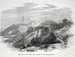
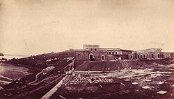
In | In 1789, [[Archibald Blair]] of the [[Royal Indian Navy]] colonised the [[Andaman Islands]], and established a [[naval base]].<ref name="SA"/> In 1794, a [[penal colony]] was established on the [[Chatham Island (Andaman Islands)|Chatham island]] and the first batch of 100 prisoners were sent to the island. The prisoners were used for labour, and worked under a civil contract. After two years, the colony was abandoned.<ref name="Vaidik">{{cite book |title=Imperial Andamans: Colonial Encounter and Island History |first=Aparna |last=Vaidik |year=2010 |page=35-37 |isbn=978-0-230-27488-4 |publisher=Palgrave Macmillan}}</ref> On 22 February 1858, the British re-established a colony at Port Blair, named after Archibald Blair.<ref name="SA"/><ref name="Vaidik"/> A new [[Ross Island Penal Colony|penal colony]] was established on the [[Ross Island, South Andaman district|Ross Island]] near Port Blair, mainly to house the prisoners of the [[Indian rebellion of 1857]], and the first set of 200 convicts arrived at the island in March 1858.<ref name="Vaidik"/><ref>{{cite journal |url=http://www.jstor.org/stable/44137988 |author=Mathur, L. P. |title=A Historical Study of Euro-Asian Interest in the Andaman and Nicobar Islands |year=1967 |journal=Proceedings of the Indian History Congress |volume=29 |page=60 |jstor=44137988 |access-date=19 May 2021 |archive-date=19 May 2021 |archive-url=https://web.archive.org/web/20210519055108/https://www.jstor.org/stable/44137988 |url-status=live}}</ref> The prisoners were used for hard labour and the clearing of forests led to frequent confrontation with the native Andamanese people. Many of the prisoners died in conflict, while some were hanged for trying to escape, apart from deaths due to disease and starvation.<ref name="SA"/> Between 1864 and 1867, a penal establishment was also built on the nearby [[Viper Island]] using prison labour.<ref>{{cite web |url=http://www.hinduonnet.com/thehindu/features/andaman/stories/2004081500270300.htm |title=Notorious once, it stands shrouded in silence now |access-date=27 December 2008 |url-status=usurped |archive-url=https://web.archive.org/web/20081227180955/http://www.hinduonnet.com/thehindu/features/andaman/stories/2004081500270300.htm |archive-date=27 December 2008 |work=[[The Hindu]]}}</ref> In 1872, the [[Andaman and Nicobar Islands]] were united under a single command and administered by a chief commissioner based out of Port Blair. The construction of the [[Cellular Jail]] started in 1896 and was completed in 1906. The jail was used to house [[political prisoner]]s and [[Indian Independence movement|independence activists]] away from the Indian mainland.<ref>{{cite journal |url=http://www.jstor.org/stable/41856271 |author=Murthy, R.V.R. |title=Cellular Jail:a Century of Sacrifices |year=2006 |journal=The Indian Journal of Political Science |volume=67 |issue=4 |pages=879–888 |jstor=41856271 |access-date=3 June 2021 |archive-date=3 June 2021 |archive-url=https://web.archive.org/web/20210603044817/https://www.jstor.org/stable/41856271 |url-status=live}}</ref><ref>{{cite news |url=https://www.independent.co.uk/news/long_reads/cellular-jail-india-integral-country-fight-freedom-independence-british-colony-andaman-and-nicobar-islands-port-blair-sushil-dasguputa-a7883691.html |archive-url=https://web.archive.org/web/20201111041305/https://www.independent.co.uk/news/long_reads/cellular-jail-india-integral-country-fight-freedom-independence-british-colony-andaman-and-nicobar-islands-port-blair-sushil-dasguputa-a7883691.html |archive-date=11 November 2020 |url-access=limited |url-status=live |title=How India's Cellular Jail was integral in the country's fight for freedom |date=14 August 2017 |work=[[The Independent]]}}</ref> | ||
During [[Second World War]], the Andaman and Nicobar islands were invaded by [[Empire of Japan|Japan]]. The Japanese captured Port Blair on 23 March 1942.<ref>{{cite web |first=Klemen |last=L |url=https://warfare.gq/dutcheastindies/andaman.html |title=The capture of Andaman Islands, March 1942 |date=1999–2000 |work=Forgotten Campaign: The Dutch East Indies Campaign 1941–1942 |access-date=31 January 2024 |archive-date=26 July 2021 |archive-url=https://web.archive.org/web/20210726181150/https://warfare.gq/dutcheastindies/andaman.html |url-status=dead}}</ref> Japan gave provisional control to the [[Azad Hind]] organisation of [[Subhash Chandra Bose]] on 29 December 1943.<ref>{{cite news |url=https://indianexpress.com/article/research/the-forgotten-story-of-the-japanese-ruling-over-a-part-of-india-8887379/ |title=The forgotten story of the Japanese ruling over (a part of) India |work=[[The Indian Express]] |access-date=1 December 2023}}</ref> Bose had limited power while the real control of the islands remained with the Japanese, with reports of widespread looting, arson, rape, and [[extrajudicial killing]]s during the Japanese occupation.<ref>{{cite book |title=Japanese in the Andaman & Nicobar Islands: Red Sun over black Water |first=Jayant |last=Dasgupta |pages=67, 87, 91–95 |isbn=978-8-170-49138-5 |year=2002 |publisher=Manas Publications}}</ref> On 7 October 1945, the territory was officially handed back to the British in a ceremony at the Gymkhana Ground in Port Blair.<ref>{{cite book |title=The Rise and Fall of Imperial Japan |first=Stephen |last=Wynn |year=2020 |isbn=978-1-473-86551-8 |publisher=Pen & Sword Books Limited |page=124}}</ref> | |||
During the [[Partition of India]], the British announced their intention to retain possession of Port Blair and use them to resettle [[Anglo-Indians]] and [[Anglo-Burmese people|Anglo-Burmese]] on these islands. The islands were claimed by the [[Indian National Congress]] by both India and Pakitan during the partition negotiations.<ref>{{cite book |title=Andaman and Nicobar Islands: A Geo-political and Strategic Perspective |first=R. V. R. |last=Murthy |year=2007 |isbn=978-8-172-11219-6 |publisher=Northern Book Centre |page=117 |quote=Muslim league pleaded with the British that Andaman and Nicobar should go to the proposed Pakistan}}</ref><ref>{{cite news |url=https://thefridaytimes.com/09-Oct-2020/mr-jinnah-s-bid-for-the-andaman-islands |title=Jinnah's bid for Andaman Islands |date=9 October 2020 |access-date=12 March 2024 |work=[[The Friday Times]] }}</ref> After the [[Indian Independence Act, 1947|Indian Independence]] in 1947, the islands became part of the [[Dominion of India]], and as per the [[Constitution of India]], the islands were to be administered by a lieutenant governor appointed by the [[Government of India]].<ref>{{cite act |title=Constitution of India |chapter=[[Parliament of India]] |year=1950 |url=https://cdnbbsr.s3waas.gov.in/s380537a945c7aaa788ccfcdf1b99b5d8f/uploads/2023/05/2023050195.pdf |publisher=[[Government of India]] |access-date=31 December 2023}}</ref> The islands became a separate [[union territory]] administered by the Government of India, following the [[States Reorganisation Act, 1956|re-organisation]] in 1956 with the capital at Port Blair.<ref>{{cite book |title=Andaman and Nicobar Islands Development Report |series=State Development Report series |publisher=[[Planning Commission of India]] |edition=illustrated |year=2008 |isbn=978-81-7188-652-4 |url=https://books.google.com/books?id=ujf2N5O4iKgC |access-date=12 March 2011 |archive-url=https://web.archive.org/web/20151209011823/https://books.google.com/books?id=ujf2N5O4iKgC |archive-date=9 December 2015 |url-status=live}}</ref> It has been developed into a key defence establishment since the 1980s due to its strategic location in the Bay of Bengal across the [[Strait of Malacca]].<ref>{{cite book |title=India's Defense Strategy and the India–ASEAN Relationship, RSIS Monograph No.28 |author=David Brewster |url=https://www.academia.edu/7716140 |access-date=24 August 2014 |archive-date=26 March 2023 |archive-url=https://web.archive.org/web/20230326031701/https://www.academia.edu/7716140 |url-status=live}}</ref><ref>{{cite news |last1=Sawhney |first1=Pravin |title=A watchtower on the high seas |url=https://www.tribuneindia.com/news/comment/a-watchtower-on-the-high-seas/720929.html |newspaper=[[The Tribune (Chandigarh)|The Tribune]] |access-date=16 April 2019 |date=30 January 2019 |archive-url=https://web.archive.org/web/20190416050217/https://www.tribuneindia.com/news/comment/a-watchtower-on-the-high-seas/720929.html |archive-date=16 April 2019 |url-status=live}}</ref> | |||
On 26 December 2004, the coasts of the islands experienced {{cvt|10|m}} high [[tsunami]] waves following [[2004 Indian Ocean earthquake and tsunami|an undersea earthquake in the Indian Ocean]].<ref>{{cite book |title=Sumatra-Andaman Islands Earthquake and Tsunami of December 6, 2004: Lifeline Performance |year=2007 |publisher=[[American Society of Civil Engineers]], Technical Council on Lifeline Earthquake Engineering |location=[[Reston, Virginia]] |isbn=9780784409510 |url=http://www.asce.org/Product.aspx?id=2147486137&productid=5511 |editor=Carl Strand and John Masek |url-status=dead |archive-url=https://web.archive.org/web/20131024115815/http://www.asce.org/Product.aspx?id=2147486137&productid=5511 |archive-date=24 October 2013}}</ref> The locals and tourists on the islands suffered the greatest casualties while the indigenous people largely survived unscathed due to movement to high grounds. | |||
Port Blair survived sufficiently to act as a base for relief efforts in the islands.<ref>{{cite news |url=http://news.bbc.co.uk/2/hi/south_asia/4181855.stm |work=[[BBC News Online]] |title=Tsunami folklore 'saved islanders' |date=20 January 2005 |access-date=23 April 2010 |archive-url=https://web.archive.org/web/20090930002820/http://news.bbc.co.uk/2/hi/south_asia/4181855.stm |archive-date=30 September 2009 |url-status=live}}</ref> In 2017, Port Blair was selected as one of the cities to be developed as a [[smart city]] under the [[Smart Cities Mission]].<ref>{{cite news|url=http://www.livemint.com/Politics/kMLIQKW3xIqOUzFJ5sZadN/Smart-cities-More-names-of-cities-to-be-announced-today.html|title=13 cities included in Phase 1 of Smart Cities Mission|last=Khanna|first=Pretika|date=24 May 2016|work=[[Live Mint]]|access-date=4 January 2017}}</ref> On 13 September 2024, the Government of India officially renamed the city to Sri Vijaya Puram.<ref>{{cite press release |title=Government has decided to rename the capital of Andaman & Nicobar Islands Port Blair as Sri Vijaya Puram |url=https://pib.gov.in/PressReleaseIframePage.aspx?PRID=2054647 |work=[[Press Information Bureau]] |access-date=13 September 2024 |date=13 September 2024}}</ref><ref>{{cite news |url=https://www.indiatoday.in/india/story/port-blair-renamed-sri-vijaya-puram-amit-shah-pm-modi-vision-free-nation-from-colonial-imprints-2599292-2024-09-13 |title=Port Blair renamed Sri Vijaya Puram 'to free nation from colonial imprints' |work=[[India Today]]|date=13 September 2024 |access-date=13 September 2024}}</ref><ref>{{cite news |url=https://www.deccanherald.com/india/port-blair-renamed-as-sri-vijaya-puram-announces-amit-shah-3189793 |title=Port Blair renamed as Sri Vijaya Puram, announces Amit Shah |work=[[Deccan Herald]] |agency=[[Press Trust of India]] |date=13 September 2024 |access-date=13 September 2024}}</ref> | |||
==Climate== | ==Climate== | ||
Port Blair has a [[tropical monsoon climate]] ([[Köppen climate classification]] ''Am'') | Port Blair has a [[tropical monsoon climate]] ([[Köppen climate classification]] ''Am''). | ||
{{Weather box | {{Weather box | ||
|collapsed = | |collapsed = | ||
|location = Port Blair ( | |location = Port Blair (1991–2020, extremes 1901–present) | ||
|metric first = Yes | |metric first = Yes | ||
|single line = Yes | |single line = Yes | ||
| Jan record high C = | | Jan record high C = 33.0 | ||
| Feb record high C = 34.6 | | Feb record high C = 34.6 | ||
| Mar record high C = | | Mar record high C = 36.0 | ||
| Apr record high C = 36. | | Apr record high C = 36.8 | ||
| May record high C = 36.4 | | May record high C = 36.4 | ||
| Jun record high C = 35.6 | | Jun record high C = 35.6 | ||
| Jul record high C = 32.8 | | Jul record high C = 32.8 | ||
| Aug record high C = 32. | | Aug record high C = 32.7 | ||
| Sep record high C = 35.4 | | Sep record high C = 35.4 | ||
| Oct record high C = 35.6 | | Oct record high C = 35.6 | ||
| Nov record high C = 34.0 | | Nov record high C = 34.0 | ||
| Dec record high C = 35.4 | | Dec record high C = 35.4 | ||
|year record high C = 36 | |year record high C = 36.8 | ||
| Jan high C = 29.9 | |||
| Feb high C = 30.6 | |||
| Mar high C = 31.7 | |||
| Apr high C = 32.5 | |||
| May high C = 31.5 | |||
| Jun high C = 30.0 | |||
| Jul high C = 29.6 | |||
| Aug high C = 29.5 | |||
| Sep high C = 29.5 | |||
| Oct high C = 30.2 | |||
| Nov high C = 30.5 | |||
| Dec high C = 30.1 | |||
| year high C = 30.5 | |||
| Jan high C = 29. | | Jan mean C = 26.5 | ||
| Feb high C = 30. | | Feb mean C = 26.9 | ||
| Mar high C = 31. | | Mar mean C = 27.6 | ||
| Apr high C = 32. | | Apr mean C = 28.7 | ||
| May high C = 31. | | May mean C = 28.2 | ||
| Jun high C = | | Jun mean C = 27.2 | ||
| Jul high C = 29. | | Jul mean C = 27.0 | ||
| Aug high C = 29. | | Aug mean C = 26.9 | ||
| Sep high C = 29. | | Sep mean C = 26.6 | ||
| Oct high C = | | Oct mean C = 27.0 | ||
| Nov high C = | | Nov mean C = 27.4 | ||
| Dec high C = | | Dec mean C = 27.0 | ||
| year high C = 30. | |||
| Jan mean C = 26. | |||
| Feb mean C = 26. | |||
| Mar mean C = 27. | |||
| Apr mean C = 28. | |||
| May mean C = | |||
| Jun mean C = | |||
| Jul mean C = | |||
| Aug mean C = 26. | |||
| Sep mean C = 26. | |||
| Oct mean C = | |||
| Nov mean C = | |||
| Dec mean C = | |||
|year mean C = | |year mean C = | ||
| Jan low C = | | Jan low C = 23.0 | ||
| Feb low C = 22. | | Feb low C = 22.7 | ||
| Mar low C = | | Mar low C = 23.4 | ||
| Apr low C = 24. | | Apr low C = 24.7 | ||
| May low C = 24. | | May low C = 24.9 | ||
| Jun low C = | | Jun low C = 24.6 | ||
| Jul low C = | | Jul low C = 24.2 | ||
| Aug low C = | | Aug low C = 24.2 | ||
| Sep low C = 23. | | Sep low C = 23.7 | ||
| Oct low C = 23. | | Oct low C = 23.8 | ||
| Nov low C = | | Nov low C = 24.3 | ||
| Dec low C = 23. | | Dec low C = 23.9 | ||
| year low C = | | year low C = 24.0 | ||
| Jan record low C = 14.8 | | Jan record low C = 14.8 | ||
| Feb record low C = 15.9 | | Feb record low C = 15.9 | ||
| Line 175: | Line 159: | ||
| Apr record low C = 17.3 | | Apr record low C = 17.3 | ||
| May record low C = 17.1 | | May record low C = 17.1 | ||
| Jun record low C = | | Jun record low C = 18.8 | ||
| Jul record low C = 18.0 | | Jul record low C = 18.0 | ||
| Aug record low C = | | Aug record low C = 19.8 | ||
| Sep record low C = 16.8 | | Sep record low C = 16.8 | ||
| Oct record low C = 17.8 | | Oct record low C = 17.8 | ||
| Line 184: | Line 168: | ||
|year record low C = 14.6 | |year record low C = 14.6 | ||
| rain colour = green | | rain colour = green | ||
| Jan rain mm = | | Jan rain mm = 48.9 | ||
| Feb rain mm = | | Feb rain mm = 14.2 | ||
| Mar rain mm = 32. | | Mar rain mm = 32.7 | ||
| Apr rain mm = | | Apr rain mm = 78.0 | ||
| May rain mm = | | May rain mm = 407.2 | ||
| Jun rain mm = | | Jun rain mm = 484.2 | ||
| Jul rain mm = | | Jul rain mm = 448.5 | ||
| Aug rain mm = | | Aug rain mm = 460.2 | ||
| Sep rain mm = | | Sep rain mm = 505.2 | ||
| Oct rain mm = | | Oct rain mm = 300.9 | ||
| Nov rain mm = | | Nov rain mm = 221.8 | ||
| Dec rain mm = | | Dec rain mm = 111.4 | ||
|year rain mm = | |year rain mm = 3113.4 | ||
| Jan rain days = | | Jan rain days = 2.2 | ||
| Feb rain days = | | Feb rain days = 0.9 | ||
| Mar rain days = 1. | | Mar rain days = 1.8 | ||
| Apr rain days = 4. | | Apr rain days = 4.2 | ||
| May rain days = 15.9 | | May rain days = 15.9 | ||
| Jun rain days = 18. | | Jun rain days = 18.7 | ||
| Jul rain days = | | Jul rain days = 19.3 | ||
| Aug rain days = 19.1 | | Aug rain days = 19.1 | ||
| Sep rain days = | | Sep rain days = 20.0 | ||
| Oct rain days = | | Oct rain days = 14.9 | ||
| Nov rain days = | | Nov rain days = 10.4 | ||
| Dec rain days = 4. | | Dec rain days = 4.9 | ||
|year rain days = | |year rain days = 132.3 | ||
|time day = 17:30 [[Indian Standard Time|IST]] | |time day = 17:30 [[Indian Standard Time|IST]] | ||
| Jan humidity = | | Jan humidity = 75 | ||
| Feb humidity = | | Feb humidity = 71 | ||
| Mar humidity = 72 | | Mar humidity = 72 | ||
| Apr humidity = 74 | | Apr humidity = 74 | ||
| May humidity = | | May humidity = 83 | ||
| Jun humidity = | | Jun humidity = 86 | ||
| Jul humidity = | | Jul humidity = 86 | ||
| Aug humidity = | | Aug humidity = 86 | ||
| Sep humidity = | | Sep humidity = 89 | ||
| Oct humidity = | | Oct humidity = 87 | ||
| Nov humidity = 82 | | Nov humidity = 82 | ||
| Dec humidity = | | Dec humidity = 77 | ||
|year humidity = | |year humidity = 81 | ||
| Jan sun = 266.6 | | Jan sun = 266.6 | ||
| Feb sun = 265.6 | | Feb sun = 265.6 | ||
| Line 250: | Line 234: | ||
| Decd sun = 7.8 | | Decd sun = 7.8 | ||
|yeard sun = 6.0 | |yeard sun = 6.0 | ||
|source 1 = [[India Meteorological Department]]<ref | |source 1 = [[India Meteorological Department]] (1971–2000)<ref> | ||
{{cite web | {{cite web | ||
| archive-url = https://web.archive.org/web/20200205040301/http://imdpune.gov.in/library/public/1981-2010%20CLIM%20NORMALS%20%28STATWISE%29.pdf | | archive-url = https://web.archive.org/web/20200205040301/http://imdpune.gov.in/library/public/1981-2010%20CLIM%20NORMALS%20%28STATWISE%29.pdf | ||
| Line 260: | Line 244: | ||
| date = January 2015 | | date = January 2015 | ||
| pages = 619–620 | | pages = 619–620 | ||
| access-date = 10 February 2020}}</ref><ref | | access-date = 10 February 2020}}</ref><ref> | ||
{{cite web | {{cite web | ||
| archive-url = https://web.archive.org/web/20200205042509/http://imdpune.gov.in/library/public/EXTREMES%20OF%20TEMPERATURE%20and%20RAINFALL%20upto%202012.pdf | | archive-url = https://web.archive.org/web/20200205042509/http://imdpune.gov.in/library/public/EXTREMES%20OF%20TEMPERATURE%20and%20RAINFALL%20upto%202012.pdf | ||
| Line 269: | Line 253: | ||
| date = December 2016 | | date = December 2016 | ||
| page = M4 | | page = M4 | ||
| access-date = 10 February 2020}}</ref><ref | | access-date = 10 February 2020}}</ref><ref> | ||
{{cite web | {{cite web | ||
| url = http://city.imd.gov.in/citywx/extreme/FEB/portblair2.htm | | url = http://city.imd.gov.in/citywx/extreme/FEB/portblair2.htm | ||
| title = Port Blair Climatological Table 1981–2010 | | title = Port Blair Climatological Table 1981–2010 | ||
| publisher = India Meteorological Department | | publisher = India Meteorological Department | ||
| access-date = 10 February 2020}}</ref><ref | | access-date = 10 February 2020}}</ref><ref> | ||
{{cite web | {{cite web | ||
| archive-url = https://web.archive.org/web/20200205042602/http://imdpune.gov.in/library/public/Daily%20Normals%20of%20Global%20&%20Diffused%20Radiations%20%201971_2000.pdf | | archive-url = https://web.archive.org/web/20200205042602/http://imdpune.gov.in/library/public/Daily%20Normals%20of%20Global%20&%20Diffused%20Radiations%20%201971_2000.pdf | ||
| Line 285: | Line 269: | ||
| page = M-3 | | page = M-3 | ||
| access-date = 10 February 2020}}</ref> | | access-date = 10 February 2020}}</ref> | ||
|source 2 = Tokyo Climate Center (mean temperatures | |source 2 = NOAA (extremes | ||
<ref>{{cite web |title=WMO Climate Normals for 1991-2020: Port Blair |url=https://www.nodc.noaa.gov/archive/arc0216/0253808/2.2/data/0-data/Region-2-WMO-Normals-9120/India/XLS/PORT_BLAIR_43333.xlsx |work=[[NOAA]] |access-date=22 March 2024 |format=CSV |quote=WMO Station Number: 43333}}</ref>), Tokyo Climate Center (mean temperatures 1991–2020)<ref name=TCC> | |||
{{cite web | {{cite web | ||
| url = https://ds.data.jma.go.jp/gmd/tcc/tcc/products/climate/normal/parts/NrmMonth_e.php?stn=43333 | | url = https://ds.data.jma.go.jp/gmd/tcc/tcc/products/climate/normal/parts/NrmMonth_e.php?stn=43333 | ||
| title = Normals Data: Port Blair - India Latitude: 11.67°N Longitude: 92.72°E Height: 79 (m) | | title = Normals Data: Port Blair - India Latitude: 11.67°N Longitude: 92.72°E Height: 79 (m) | ||
| Line 296: | Line 279: | ||
}} | }} | ||
==Demographics== | ==Demographics== | ||
{{ | {{Historical population | ||
| source = [[Government of India]]<ref>{{cite web |title=Census Tables |url=https://censusindia.gov.in/census.website/data/census-tables |work=[[Census of India]] |access-date=6 January 2024}}</ref> | |||
|1951 | 7789 | |||
|1961 | 14075 | |||
|1971 | 26218 | |||
|1981 | 49634 | |||
|1991 | 74955 | |||
|2001 | 99984 | |||
| | |2011 | 108058 | ||
| | |align = right | ||
| | |||
| | |||
| | |||
| | |||
}} | }} | ||
[[ | As per the [[2011 Census of India|2011 census]], Port Blair had a population of 108,058 of which 57,761 are males while 50,297 are females.{{efn|name=expansion|Corresponding to the old city limits prior to expansion in 2015}}<ref name="Census"/><ref>{{cite web|url=http://www.censusindia.net/results/town.php?stad=A&state5=999|archive-url=https://web.archive.org/web/20040616075334/http://www.censusindia.net/results/town.php?stad=A&state5=999|archive-date=16 June 2004|title= Census of India 2001: Data from the 2001 Census, including cities, villages and towns (Provisional)|access-date=1 November 2008|work=Census Commission of India}}</ref> There were 10,699 (9.9%) children under the age of six years. The [[sex ratio]] was 871 against the territory average of 876. The literacy rate was 90.28 %, which was higher than the territory average of 86.63 %. The male literacy was 93.16% while the female literacy rate was 86.94%.<ref name="Census"/> Post the expansion of the city limits in 2015, the population was estimated to be 140,572 as per the 2011 census.<ref name="pbmc"/> | ||
[[Tamil language|Tamil]] is the most spoken language with 40,323 native speakers, followed by [[Telugu language|Telugu]] (32,628), [[Hindi language|Hindi]] (31,520), [[Bengali language|Bengali]] (28,063), [[Malayalam language|Malayalam]] (13,670), [[Sadri language|Sadri]] (3,479), [[Kurukh language|Kurukh]] (3,459), and [[Nicobarese language|Necobarese]] (2,308). | |||
<ref>{{cite report|title=C-16 Population By Mother Tongue|url=https://censusindia.gov.in/2011census/C-16/DDW-C16-STMT-MDDS-3500.XLSX|work=Census of India|access-date=1 June 2012}}</ref> [[Hinduism]] was the majority religion with 74.37% adherents, with [[Christianity]] (12.43%) and [[Islam]] (12.43%) being the other religions.<ref name="Census"/> | |||
| | |||
| | |||
| | |||
{{ | |||
==Administration== | ==Administration== | ||
The | The [[Port Blair Municipal Council]] is the civic body administering the city of Port Blair. The council came into existence on 2 October 1957 after the Andaman & Nicobar Islands (Municipal Board's) Regulation Act was enacted on 11 March 1957.<ref name="pbmc"/> Initially covering an area of {{cvt|14.14|km2}} demarcated into nine wards, which were increased into 18 wards later. The first election to the municipal council was held in September 1995 and the council consisted of 18 elected and three nominated members.<ref name="pbmc"/> The city limits were expanded to {{cvt|41.22|km2}} in 2015.<ref>{{cite news |title=Port Blair City Limit to be Expanded |url=https://www.newindianexpress.com/nation/2011/oct/14/port-blair-city-limit-to-be-expanded-300361.html |access-date=17 March 2023 |work=[[The New Indian Express]]|date=16 May 2012 }}</ref> The council consists of 24 wards, each represented by a councilor elected through direct election.<ref>{{cite web |last=Sanjib |date=5 March 2015 |title=Port Blair city all set for expansion; PBMC to have 24 wards |url=http://www.andamansheekha.com/29724/ |access-date=17 March 2023 |work=Andaman Sheeka}}</ref> | ||
==Transportation== | |||
[[File:Veer Savarkar International Airport – New Terminal.jpg|thumb|[[Veer Savarkar International Airport]] in Port Blair is the major airport in the islands]] | |||
The Andaman and Nicobar islands are served by [[Veer Savarkar International Airport]] near Port Blair which has regular flights to major cities in India.<ref>{{cite report |url=https://www.dgca.gov.in/digigov-portal/?page=jsp/dgca/InventoryList/aerodrome/public/PUBLIC%20USE%20LICENSED%20AERODROME%20(PUBLIC%20AND%20PRIVATE)%20AND%20HELIPORT%20-converted%20(1).pdf |title=List of Aerodromes Licensed in Public Use Category |work=[[Directorate General of Civil Aviation (India)|Directorate General of Civil Aviation]] of India |access-date=11 October 2023}}</ref> The airport operates as a [[civil enclave]], sharing airside facilities with [[INS Utkrosh]] of the [[Indian Navy]].<ref>{{cite press release |title=New Terminal Building at Port Blair Airport by March 2018 |url=https://pib.nic.in/newsite/erelease.aspx?relid=98538 |work=[[Press Information Bureau]] |date=22 August 2013 |access-date=6 January 2014}}</ref> The airport has a single [[runway]] of {{cvt|3290|m|ft|sigfig=5}} in length, with the civilian terminal operated by the [[Airports Authority of India]] with air traffic operations managed by the Indian Navy.<ref>{{cite news |url=http://www.sainiksamachar.nic.in/englisharchives/2011/oct16-11/h5.htm |title=Andaman & Nicobar Command: Saga of Synergy |work=Sainik Samachar |access-date=9 January 2012}}</ref> It is home to the [[Andaman and Nicobar Command]], the only integrated tri-command of the [[Indian Armed Forces]], which operates the [[air base]] of INS Utkrosh, and the nearby naval facility of [[INS Jarawa]].<ref>{{cite press release |url=https://pib.gov.in/pressreleaseshare.aspx?prid=1560445 |title=Headquarters Andaman Nicobar Command ANC to enhance its operational capability with the upcoming commissioning of INS Kohassa |date=18 January 2019 |access-date=1 December 2023 |work=[[Government of India]]}}</ref><ref>{{cite web|title=Andaman and Nicobar command|url=http://ids.nic.in/ancommand.htm|work=National Integrated Command|access-date=1 July 2013}}</ref> The [[Port Blair Port]] is a major maritime gateway to the islands.<ref>{{cite web |url=http://andssw1.and.nic.in/pmb/history.html |title=History of Ports |publisher=Port Management Board, [[Government of India]] |access-date=1 December 2023}}</ref><ref>{{cite news |title=India plans Rs 10,000 cr transshipment port at Great Nicobar Island: PM |url=https://hr.economictimes.indiatimes.com/news/industry/india-plans-rs-10000-cr-transshipment-port-at-great-nicobar-island-pm/77466638 |access-date=10 August 2020 |newspaper=[[The Economic Times]] |archive-date=19 September 2020 |archive-url=https://web.archive.org/web/20200919070235/https://hr.economictimes.indiatimes.com/news/industry/india-plans-rs-10000-cr-transshipment-port-at-great-nicobar-island-pm/77466638 |url-status=live}}</ref> The {{cvt|230.7|km}} long [[National Highway 4 (India)|National Highway 4]] connects Port Blair and [[Diglipur]].<ref>{{cite report |url=https://morth.nic.in/sites/default/files/State_wise_Length_of_National_Highways_in_India.pdf |title=State-wise length of National Highways in India |date=30 November 2018 |publisher=[[Ministry of Road Transport and Highways]] |access-date=9 May 2019 |archive-url=https://web.archive.org/web/20200929205249/https://morth.nic.in/sites/default/files/State_wise_Length_of_National_Highways_in_India.pdf |archive-date=29 September 2020}}</ref><ref>{{cite report |url=https://morth.nic.in/sites/default/files/PragatiKiNayiGati/pdf/andaman.pdf |title=Andaman, Road development |access-date=1 December 2023 |publisher=[[Government of India]]}}</ref> | |||
{{ | |||
| | |||
| | |||
| | |||
| | |||
| | |||
| | |||
| | |||
| | |||
| | |||
|- | |||
|- | |||
| | |||
| | |||
| | |||
| | |||
|- | |||
|- | |||
| | |||
|- | |||
|[[ | |||
==Education== | ==Education== | ||
Major educational institutions include [[Andaman and Nicobar Islands Institute of Medical Sciences]], [[Andaman Law College]], [[Dr. B. R. Ambedkar Institute of Technology]], and [[Jawaharlal Nehru Government College]].<ref>{{cite web|url=https://southandaman.nic.in/public-utility-category/colleges/|title=Colleges in South Andaman|work=[[Government of Andaman and Nicobar Islands]]|access-date=1 June 2025}}</ref> | |||
=== | ==Notes== | ||
{{notelist}} | |||
==References== | ==References== | ||
| Line 738: | Line 316: | ||
==External links== | ==External links== | ||
{{Commons}} | |||
* | *{{wikivoyage inline|Port Blair}} | ||
{{South Andaman district}} | {{South Andaman district}} | ||
| Line 752: | Line 330: | ||
[[Category:Cities and towns in South Andaman district]] | [[Category:Cities and towns in South Andaman district]] | ||
[[Category:Indian union territory capitals]] | [[Category:Indian union territory capitals]] | ||
[[Category:Tourist attractions in the Andaman and Nicobar Islands]] | [[Category:Tourist attractions in the Andaman and Nicobar Islands]] | ||
[[Category:South Andaman Island]] | [[Category:South Andaman Island]] | ||
[[Category:Port cities and towns in India]] | |||
Revision as of 10:31, 2 March 2026
Port Blair | |
|---|---|
Town | |
| Sri Vijaya Puram | |
 Seal of the Port Blair Municipal Council | |
  Port Blair Location in the Andaman and Nicobar Islands  Port Blair Port Blair (Bay of Bengal) | |
| Coordinates: 11°40′06″N 92°44′16″E / 11.66833°N 92.73778°E | |
| Country | India |
| Union Territory | Andaman and Nicobar Islands |
| District | South Andaman |
| Government | |
| • Type | Municipal Council |
| • Body | Port Blair Municipal Council |
| • Chairman | S. Shahul Hameed (TDP) |
| Area | |
| • Total | 41.22 km2 (15.92 sq mi) |
| Elevation | 16 m (52 ft) |
| Population (2011)[1] | |
| • Total | 140,572 |
| Languages | |
| • Official | |
| Time zone | UTC+5.30 (IST) |
| PIN | 744101 |
| Vehicle registration | AN-01 |
| Climate | Am |
| Sex ratio | 1.15 (♂/♀) |
| Website | pbmc |
| As per the 2011 census, Port Blair had a population of 108,058.[2] The municipal limits were expanded from 17.74 km2 (6.85 sq mi) to 41.22 km2 (15.92 sq mi) in 2015, and the corresponding population as per the revised limits was given as 140,572 (as per the 2011 census).[1] | |
.jpg)


Port Blair ( pronunciation (help·info)), officially named Sri Vijaya Puram (Hindi pronunciation: [ˌɕɾˈɨː ˈʋɪ̯ˌd͡ʑʌjᵊ pʊˈɾ.əm]), is the capital city of the Indian union territory of Andaman and Nicobar Islands. It is located on the South Andaman Island situated between the Bay of Bengal to the west and the Andaman Sea to the east. It is located approximately 1,190 km (740 mi) from Chennai and 1,255 km (780 mi) from Kolkata in mainland India. It is the headquarters of the South Andaman district, and the union territory's only notified town.
The town is home to the Veer Savarkar International Airport, the only major airport in the islands, and Port Blair Port, and serves as the major gateway for the islands. It is connected with mainland India by both air and sea, with a two to three-hour flight from mainland India and a three to four days voyage by sea from Chennai, Kolkata, or Visakhapatnam. It is home to the air base INS Utkrosh and the naval base INS Jarawa of the Indian Navy, and the Andaman and Nicobar Command, the only integrated tri-command of the Indian Armed Forces. It also hosts various sea and air bases of the Indian Coast Guard and the Andaman and Nicobar Police.
The indigenous inhabitants of the region were the Andamanese. In the late 18th century CE, the British colonised the Andaman Islands, and established a naval base, and a penal colony, which was abandoned two years later. On 22 February 1858, the British re-established a colony at Port Blair, and a new penal colony was established on the Ross Island near Port Blair, mainly to house the prisoners of the Indian rebellion of 1857. In 1872, the Andaman and Nicobar Islands were united under a single command and administered by a chief commissioner based out of Port Blair. The Cellular Jail was completed in 1906, and used to house political prisoners and independence activists. During Second World War, the Japanese captured Port Blair on 23 March 1942, and it was retaken by the British on 7 October 1945. After the Indian Independence in 1947, the Andaman and Nicobar islands became part of the Dominion of India, and later a union territory with the capital at Port Blair.
The city was originally named after Archibald Blair, an officer of the Royal Indian Navy, who colonised the region in the late 18th century CE. On 13 September 2024, the Government of India officially renamed the city to Sri Vijaya Puram.
History
The indigenous inhabitants of the region were the Andamanese, who may have been isolated from other populations during the Paleolithic era, which ended 30,000 years ago.[3] The islands are referred to by various historians and travellers such as Ptolemy in the first century CE, Marco Polo in the 13th century CE, Friar Odoric in 14th century CE, and Cesare Federici in 16th Century CE.[4]


In 1789, Archibald Blair of the Royal Indian Navy colonised the Andaman Islands, and established a naval base.[4] In 1794, a penal colony was established on the Chatham island and the first batch of 100 prisoners were sent to the island. The prisoners were used for labour, and worked under a civil contract. After two years, the colony was abandoned.[5] On 22 February 1858, the British re-established a colony at Port Blair, named after Archibald Blair.[4][5] A new penal colony was established on the Ross Island near Port Blair, mainly to house the prisoners of the Indian rebellion of 1857, and the first set of 200 convicts arrived at the island in March 1858.[5][6] The prisoners were used for hard labour and the clearing of forests led to frequent confrontation with the native Andamanese people. Many of the prisoners died in conflict, while some were hanged for trying to escape, apart from deaths due to disease and starvation.[4] Between 1864 and 1867, a penal establishment was also built on the nearby Viper Island using prison labour.[7] In 1872, the Andaman and Nicobar Islands were united under a single command and administered by a chief commissioner based out of Port Blair. The construction of the Cellular Jail started in 1896 and was completed in 1906. The jail was used to house political prisoners and independence activists away from the Indian mainland.[8][9]
During Second World War, the Andaman and Nicobar islands were invaded by Japan. The Japanese captured Port Blair on 23 March 1942.[10] Japan gave provisional control to the Azad Hind organisation of Subhash Chandra Bose on 29 December 1943.[11] Bose had limited power while the real control of the islands remained with the Japanese, with reports of widespread looting, arson, rape, and extrajudicial killings during the Japanese occupation.[12] On 7 October 1945, the territory was officially handed back to the British in a ceremony at the Gymkhana Ground in Port Blair.[13]
During the Partition of India, the British announced their intention to retain possession of Port Blair and use them to resettle Anglo-Indians and Anglo-Burmese on these islands. The islands were claimed by the Indian National Congress by both India and Pakitan during the partition negotiations.[14][15] After the Indian Independence in 1947, the islands became part of the Dominion of India, and as per the Constitution of India, the islands were to be administered by a lieutenant governor appointed by the Government of India.[16] The islands became a separate union territory administered by the Government of India, following the re-organisation in 1956 with the capital at Port Blair.[17] It has been developed into a key defence establishment since the 1980s due to its strategic location in the Bay of Bengal across the Strait of Malacca.[18][19]
On 26 December 2004, the coasts of the islands experienced 10 m (33 ft) high tsunami waves following an undersea earthquake in the Indian Ocean.[20] The locals and tourists on the islands suffered the greatest casualties while the indigenous people largely survived unscathed due to movement to high grounds. Port Blair survived sufficiently to act as a base for relief efforts in the islands.[21] In 2017, Port Blair was selected as one of the cities to be developed as a smart city under the Smart Cities Mission.[22] On 13 September 2024, the Government of India officially renamed the city to Sri Vijaya Puram.[23][24][25]
Climate
Port Blair has a tropical monsoon climate (Köppen climate classification Am).
| Climate data for Port Blair (1991–2020, extremes 1901–present) | |||||||||||||
|---|---|---|---|---|---|---|---|---|---|---|---|---|---|
| Month | Jan | Feb | Mar | Apr | May | Jun | Jul | Aug | Sep | Oct | Nov | Dec | Year |
| Record high °C (°F) | 33.0 (91.4) |
34.6 (94.3) |
36.0 (96.8) |
36.8 (98.2) |
36.4 (97.5) |
35.6 (96.1) |
32.8 (91.0) |
32.7 (90.9) |
35.4 (95.7) |
35.6 (96.1) |
34.0 (93.2) |
35.4 (95.7) |
36.8 (98.2) |
| Average high °C (°F) | 29.9 (85.8) |
30.6 (87.1) |
31.7 (89.1) |
32.5 (90.5) |
31.5 (88.7) |
30.0 (86.0) |
29.6 (85.3) |
29.5 (85.1) |
29.5 (85.1) |
30.2 (86.4) |
30.5 (86.9) |
30.1 (86.2) |
30.5 (86.9) |
| Daily mean °C (°F) | 26.5 (79.7) |
26.9 (80.4) |
27.6 (81.7) |
28.7 (83.7) |
28.2 (82.8) |
27.2 (81.0) |
27.0 (80.6) |
26.9 (80.4) |
26.6 (79.9) |
27.0 (80.6) |
27.4 (81.3) |
27.0 (80.6) |
27.3 (81.1) |
| Average low °C (°F) | 23.0 (73.4) |
22.7 (72.9) |
23.4 (74.1) |
24.7 (76.5) |
24.9 (76.8) |
24.6 (76.3) |
24.2 (75.6) |
24.2 (75.6) |
23.7 (74.7) |
23.8 (74.8) |
24.3 (75.7) |
23.9 (75.0) |
24.0 (75.2) |
| Record low °C (°F) | 14.8 (58.6) |
15.9 (60.6) |
16.2 (61.2) |
17.3 (63.1) |
17.1 (62.8) |
18.8 (65.8) |
18.0 (64.4) |
19.8 (67.6) |
16.8 (62.2) |
17.8 (64.0) |
17.3 (63.1) |
16.2 (61.2) |
14.6 (58.3) |
| Average rainfall mm (inches) | 48.9 (1.93) |
14.2 (0.56) |
32.7 (1.29) |
78.0 (3.07) |
407.2 (16.03) |
484.2 (19.06) |
448.5 (17.66) |
460.2 (18.12) |
505.2 (19.89) |
300.9 (11.85) |
221.8 (8.73) |
111.4 (4.39) |
3,113.4 (122.57) |
| Average rainy days | 2.2 | 0.9 | 1.8 | 4.2 | 15.9 | 18.7 | 19.3 | 19.1 | 20.0 | 14.9 | 10.4 | 4.9 | 132.3 |
| Average relative humidity (%) (at 17:30 IST) | 75 | 71 | 72 | 74 | 83 | 86 | 86 | 86 | 89 | 87 | 82 | 77 | 81 |
| Mean monthly sunshine hours | 266.6 | 265.6 | 266.6 | 237.0 | 158.1 | 90.0 | 102.3 | 99.2 | 117.0 | 167.4 | 189.0 | 241.8 | 2,200.6 |
| Mean daily sunshine hours | 8.6 | 9.4 | 8.6 | 7.9 | 5.1 | 3.0 | 3.3 | 3.2 | 3.9 | 5.4 | 6.3 | 7.8 | 6.0 |
| Source 1: India Meteorological Department (1971–2000)[26][27][28][29] | |||||||||||||
| Source 2: NOAA (extremes
[30]), Tokyo Climate Center (mean temperatures 1991–2020)[31] | |||||||||||||
Demographics
| Year | Pop. | ±% |
|---|---|---|
| 1951 | 7,789 | — |
| 1961 | 14,075 | +80.7% |
| 1971 | 26,218 | +86.3% |
| 1981 | 49,634 | +89.3% |
| 1991 | 74,955 | +51.0% |
| 2001 | 99,984 | +33.4% |
| 2011 | 108,058 | +8.1% |
| Source: Government of India[32] | ||
As per the 2011 census, Port Blair had a population of 108,058 of which 57,761 are males while 50,297 are females.[lower-alpha 1][2][33] There were 10,699 (9.9%) children under the age of six years. The sex ratio was 871 against the territory average of 876. The literacy rate was 90.28 %, which was higher than the territory average of 86.63 %. The male literacy was 93.16% while the female literacy rate was 86.94%.[2] Post the expansion of the city limits in 2015, the population was estimated to be 140,572 as per the 2011 census.[1]
Tamil is the most spoken language with 40,323 native speakers, followed by Telugu (32,628), Hindi (31,520), Bengali (28,063), Malayalam (13,670), Sadri (3,479), Kurukh (3,459), and Necobarese (2,308). [34] Hinduism was the majority religion with 74.37% adherents, with Christianity (12.43%) and Islam (12.43%) being the other religions.[2]
Administration
The Port Blair Municipal Council is the civic body administering the city of Port Blair. The council came into existence on 2 October 1957 after the Andaman & Nicobar Islands (Municipal Board's) Regulation Act was enacted on 11 March 1957.[1] Initially covering an area of 14.14 km2 (5.46 sq mi) demarcated into nine wards, which were increased into 18 wards later. The first election to the municipal council was held in September 1995 and the council consisted of 18 elected and three nominated members.[1] The city limits were expanded to 41.22 km2 (15.92 sq mi) in 2015.[35] The council consists of 24 wards, each represented by a councilor elected through direct election.[36]
Transportation

The Andaman and Nicobar islands are served by Veer Savarkar International Airport near Port Blair which has regular flights to major cities in India.[37] The airport operates as a civil enclave, sharing airside facilities with INS Utkrosh of the Indian Navy.[38] The airport has a single runway of 3,290 m (10,794 ft) in length, with the civilian terminal operated by the Airports Authority of India with air traffic operations managed by the Indian Navy.[39] It is home to the Andaman and Nicobar Command, the only integrated tri-command of the Indian Armed Forces, which operates the air base of INS Utkrosh, and the nearby naval facility of INS Jarawa.[40][41] The Port Blair Port is a major maritime gateway to the islands.[42][43] The 230.7 km (143.4 mi) long National Highway 4 connects Port Blair and Diglipur.[44][45]
Education
Major educational institutions include Andaman and Nicobar Islands Institute of Medical Sciences, Andaman Law College, Dr. B. R. Ambedkar Institute of Technology, and Jawaharlal Nehru Government College.[46]
Notes
- ↑ Corresponding to the old city limits prior to expansion in 2015
References
- ↑ 1.0 1.1 1.2 1.3 1.4 1.5 "Port Blair City". Archived from the original on 17 June 2021. Retrieved 23 November 2020.
- ↑ 2.0 2.1 2.2 2.3 "Census of India". 2011 Census of India. Retrieved 10 May 2015.
- ↑ Palanichamy, Malliya G.; Agrawal, Suraksha; Yao, Yong-Gang; Kong, Qing-Peng; Sun, Chang; Khan, Faisal; Chaudhuri, Tapas Kumar; Zhang, Ya-Ping (2006). "Comment on 'Reconstructing the Origin of Andaman Islanders'". Science. 311 (5760): 470. doi:10.1126/science.1120176. PMID 16439647.
- ↑ 4.0 4.1 4.2 4.3 "History of South Andaman". Government of India. Retrieved 1 December 2023.
- ↑ 5.0 5.1 5.2 Vaidik, Aparna (2010). Imperial Andamans: Colonial Encounter and Island History. Palgrave Macmillan. p. 35-37. ISBN 978-0-230-27488-4.
- ↑ Mathur, L. P. (1967). "A Historical Study of Euro-Asian Interest in the Andaman and Nicobar Islands". Proceedings of the Indian History Congress. 29: 60. JSTOR 44137988. Archived from the original on 19 May 2021. Retrieved 19 May 2021.
- ↑ "Notorious once, it stands shrouded in silence now". The Hindu. Archived from the original on 27 December 2008. Retrieved 27 December 2008.
- ↑ Murthy, R.V.R. (2006). "Cellular Jail:a Century of Sacrifices". The Indian Journal of Political Science. 67 (4): 879–888. JSTOR 41856271. Archived from the original on 3 June 2021. Retrieved 3 June 2021.
- ↑ "How India's Cellular Jail was integral in the country's fight for freedom". The Independent. 14 August 2017. Archived from the original on 11 November 2020.
- ↑ L, Klemen (1999–2000). "The capture of Andaman Islands, March 1942". Forgotten Campaign: The Dutch East Indies Campaign 1941–1942. Archived from the original on 26 July 2021. Retrieved 31 January 2024.
- ↑ "The forgotten story of the Japanese ruling over (a part of) India". The Indian Express. Retrieved 1 December 2023.
- ↑ Dasgupta, Jayant (2002). Japanese in the Andaman & Nicobar Islands: Red Sun over black Water. Manas Publications. pp. 67, 87, 91–95. ISBN 978-8-170-49138-5.
- ↑ Wynn, Stephen (2020). The Rise and Fall of Imperial Japan. Pen & Sword Books Limited. p. 124. ISBN 978-1-473-86551-8.
- ↑ Murthy, R. V. R. (2007). Andaman and Nicobar Islands: A Geo-political and Strategic Perspective. Northern Book Centre. p. 117. ISBN 978-8-172-11219-6.
Muslim league pleaded with the British that Andaman and Nicobar should go to the proposed Pakistan
- ↑ "Jinnah's bid for Andaman Islands". The Friday Times. 9 October 2020. Retrieved 12 March 2024.
- ↑ "Parliament of India". Act of 1950 (PDF). Government of India. Retrieved 31 December 2023.
- ↑ Andaman and Nicobar Islands Development Report. State Development Report series (illustrated ed.). Planning Commission of India. 2008. ISBN 978-81-7188-652-4. Archived from the original on 9 December 2015. Retrieved 12 March 2011.
- ↑ David Brewster. India's Defense Strategy and the India–ASEAN Relationship, RSIS Monograph No.28. Archived from the original on 26 March 2023. Retrieved 24 August 2014.
- ↑ Sawhney, Pravin (30 January 2019). "A watchtower on the high seas". The Tribune. Archived from the original on 16 April 2019. Retrieved 16 April 2019.
- ↑ Carl Strand and John Masek, ed. (2007). Sumatra-Andaman Islands Earthquake and Tsunami of December 6, 2004: Lifeline Performance. Reston, Virginia: American Society of Civil Engineers, Technical Council on Lifeline Earthquake Engineering. ISBN 9780784409510. Archived from the original on 24 October 2013.
- ↑ "Tsunami folklore 'saved islanders'". BBC News Online. 20 January 2005. Archived from the original on 30 September 2009. Retrieved 23 April 2010.
- ↑ Khanna, Pretika (24 May 2016). "13 cities included in Phase 1 of Smart Cities Mission". Live Mint. Retrieved 4 January 2017.
- ↑ "Government has decided to rename the capital of Andaman & Nicobar Islands Port Blair as Sri Vijaya Puram". Press Information Bureau (Press release). 13 September 2024. Retrieved 13 September 2024.
- ↑ "Port Blair renamed Sri Vijaya Puram 'to free nation from colonial imprints'". India Today. 13 September 2024. Retrieved 13 September 2024.
- ↑ "Port Blair renamed as Sri Vijaya Puram, announces Amit Shah". Deccan Herald. Press Trust of India. 13 September 2024. Retrieved 13 September 2024.
- ↑ "Station: Port Blair Climatological Table 1981–2010" (PDF). Climatological Normals 1981–2010. India Meteorological Department. January 2015. pp. 619–620. Archived from the original (PDF) on 5 February 2020. Retrieved 10 February 2020.
- ↑ "Extremes of Temperature & Rainfall for Indian Stations (Up to 2012)" (PDF). India Meteorological Department. December 2016. p. M4. Archived from the original (PDF) on 5 February 2020. Retrieved 10 February 2020.
- ↑ "Port Blair Climatological Table 1981–2010". India Meteorological Department. Retrieved 10 February 2020.
- ↑ "Table 3 Monthly mean duration of Sun Shine (hours) at different locations in India" (PDF). Daily Normals of Global & Diffuse Radiation (1971–2000). India Meteorological Department. December 2016. p. M-3. Archived from the original (PDF) on 5 February 2020. Retrieved 10 February 2020.
- ↑ "WMO Climate Normals for 1991-2020: Port Blair" (CSV). NOAA. Retrieved 22 March 2024.
WMO Station Number: 43333
- ↑ "Normals Data: Port Blair - India Latitude: 11.67°N Longitude: 92.72°E Height: 79 (m)". Japan Meteorological Agency. Retrieved 1 March 2020.
- ↑ "Census Tables". Census of India. Retrieved 6 January 2024.
- ↑ "Census of India 2001: Data from the 2001 Census, including cities, villages and towns (Provisional)". Census Commission of India. Archived from the original on 16 June 2004. Retrieved 1 November 2008.
- ↑ C-16 Population By Mother Tongue. Census of India (Report). Retrieved 1 June 2012.
- ↑ "Port Blair City Limit to be Expanded". The New Indian Express. 16 May 2012. Retrieved 17 March 2023.
- ↑ Sanjib (5 March 2015). "Port Blair city all set for expansion; PBMC to have 24 wards". Andaman Sheeka. Retrieved 17 March 2023.
- ↑ List of Aerodromes Licensed in Public Use Category (PDF). Directorate General of Civil Aviation of India (Report). Retrieved 11 October 2023.
- ↑ "New Terminal Building at Port Blair Airport by March 2018". Press Information Bureau (Press release). 22 August 2013. Retrieved 6 January 2014.
- ↑ "Andaman & Nicobar Command: Saga of Synergy". Sainik Samachar. Retrieved 9 January 2012.
- ↑ "Headquarters Andaman Nicobar Command ANC to enhance its operational capability with the upcoming commissioning of INS Kohassa". Government of India (Press release). 18 January 2019. Retrieved 1 December 2023.
- ↑ "Andaman and Nicobar command". National Integrated Command. Retrieved 1 July 2013.
- ↑ "History of Ports". Port Management Board, Government of India. Retrieved 1 December 2023.
- ↑ "India plans Rs 10,000 cr transshipment port at Great Nicobar Island: PM". The Economic Times. Archived from the original on 19 September 2020. Retrieved 10 August 2020.
- ↑ State-wise length of National Highways in India (PDF) (Report). Ministry of Road Transport and Highways. 30 November 2018. Archived from the original (PDF) on 29 September 2020. Retrieved 9 May 2019.
- ↑ Andaman, Road development (PDF) (Report). Government of India. Retrieved 1 December 2023.
- ↑ "Colleges in South Andaman". Government of Andaman and Nicobar Islands. Retrieved 1 June 2025.
External links
- Pages using the JsonConfig extension
- Pages with Hindi IPA
- Port Blair
- 1789 establishments in India
- 1789 establishments in British India
- Populated places established in 1789
- Cities and towns in South Andaman district
- Indian union territory capitals
- Tourist attractions in the Andaman and Nicobar Islands
- South Andaman Island
- Port cities and towns in India