






WikiDwarfBOT (talk | contribs) Cleanup: Source modification. |
NiklasPqy606 (talk | contribs) m minor edit |
||
| Line 1: | Line 1: | ||
{{Short description|City in Indian-administered Jammu and Kashmir}} | {{Short description|City in Indian-administered Jammu and Kashmir}} | ||
{{other uses|Jammu (disambiguation)}} | {{other uses|Jammu (disambiguation)}} | ||
{{pp|small=yes}} | |||
{{Use Indian English|date= | {{Use Indian English|date=January 2025}} | ||
{{Use dmy dates|date= | {{Use dmy dates|date=January 2025}} | ||
<!-- See [[ | <!-- See [[Bharatpedia:WikiProject Indian cities]] for details -->{{Infobox settlement | ||
| name | | name = Jammu | ||
| other_name | | other_name = | ||
| settlement_type | | settlement_type = City | ||
| image_skyline | | image_skyline = {{Photomontage | ||
| photo1a = Hari_niwas.jpg | | photo1a = Hari_niwas.jpg | ||
| photo2a = Bahu Fort, Jammu.jpg | | photo2a = Bahu Fort, Jammu.jpg | ||
| Line 20: | Line 20: | ||
| foot_montage = [[Hari Niwas Palace]], [[Bahu Fort]], Tawi Bridge and [[Mubarak Mandi Palace]] | | foot_montage = [[Hari Niwas Palace]], [[Bahu Fort]], Tawi Bridge and [[Mubarak Mandi Palace]] | ||
}} | }} | ||
| image_alt | | image_alt = | ||
| image_caption | | image_caption = | ||
| nickname | | nickname = City of Temples<ref>{{Cite news |url=https://www.business-standard.com/article/pti-stories/jammu-srinagar-nh-reopens-for-one-way-traffic-119013000622_1.html |title=Jammu-Srinagar NH reopens for one-way traffic |agency=Press Trust of India |date=30 January 2019 |work=Business Standard India |access-date=28 February 2019 |quote=Jammu, the City of Temples, recorded a low of 7.7 degrees Celsius compared to the previous night's 4.1 degrees Celsius}}</ref> | ||
| image_map1 | | image_map1 = Kashmir region. LOC 2003626427 - showing Jammu division administered by India in neon blue.jpg | ||
| map_alt | | map_alt = | ||
| map_caption1 | | map_caption1 = Jammu lies in the Jammu division (neon blue) of the Indian-administered [[Jammu and Kashmir (union territory)|Jammu and Kashmir]] (shaded [[tan (color)|tan]]) in the disputed [[Kashmir]] region.{{efn|The application of the term "administered" to the various regions of [[Kashmir]] and a mention of the Kashmir dispute is supported by several [[WP:TERTIARY|tertiary sources]] reflecting [[WP:DUE|due weight]] in the coverage.<ref name= Britannica-subcontinent>{{cite encyclopedia |title=Kashmir, region Indian subcontinent| encyclopedia= [[Encyclopaedia Britannica]]|url=https://www.britannica.com/place/Kashmir-region-Indian-subcontinent |accessdate=15 August 2019| url-access= subscription | quote= Kashmir, region of the northwestern Indian subcontinent ... has been the subject of dispute between India and Pakistan since the partition of the Indian subcontinent in 1947. The northern and western portions are administered by Pakistan and comprise three areas: Azad Kashmir, Gilgit, and Baltistan, the last two being part of a territory called the Northern Areas. Administered by India are the southern and southeastern portions, which constitute the state of Jammu and Kashmir but are slated to be split into two union territories.}}</ref><ref>{{cite encyclopedia |last1=Pletcher|first1=Kenneth|title=Aksai Chin, Plateau Region, Asia| encyclopedia= Encyclopaedia Britannica |url= https://www.britannica.com/place/Aksai-Chin |accessdate=16 August 2019| url-access= subscription |quote= Aksai Chin, Chinese (Pinyin) Aksayqin, portion of the Kashmir region, at the northernmost extent of the Indian subcontinent in south-central Asia. It constitutes nearly all the territory of the Chinese-administered sector of Kashmir that is claimed by India to be part of the Ladakh area of Jammu and Kashmir state.}}</ref><ref>{{cite encyclopedia |title= Kashmir |encyclopedia = [[Encyclopedia Americana]] |publisher=Scholastic Library Publishing|url=https://books.google.com/books?id=l_cWAQAAMAAJ&pg=PA328|year=2006|isbn=978-0-7172-0139-6|page=328| first= C. E.| last= Bosworth |quote= the northernmost region of the Indian subcontinent, administered partly by India, partly by Pakistan, and partly by China. The region has been the subject of a bitter dispute between India and Pakistan since they became independent in 1947}}</ref><ref>{{cite encyclopedia |last1=Osmańczyk| first1=Edmund Jan | title= Jammu and Kashmir |encyclopedia =Encyclopedia of the United Nations and International Agreements| volume= G to M|url=https://books.google.com/books?id=fSIMXHMdfkkC&pg=PA1191|year=2003|publisher=Taylor & Francis|isbn=978-0-415-93922-5|pages=1191– |quote= Territory in northwestern India, subject to a dispute betw een India and Pakistan. It has borders with Pakistan and China.}}</ref> Although "controlled" and "held" are also applied neutrally to the names of the disputants or to the regions administered by them,<ref>{{cite book|last=Talbot|first=Ian|title=A History of Modern South Asia: Politics, States, Diasporas|url=https://books.google.com/books?id=eNg_CwAAQBAJ&pg=PA28|year=2016|publisher=Yale University Press|isbn=978-0-300-19694-8|pages=28–29| quote= We move from a disputed international border to a dotted line on the map that represents a military border not recognized in international law. The line of control separates the Indian and Pakistani administered areas of the former Princely State of Jammu and Kashmir.}}</ref><ref name= Britannica-subcontinent /><ref>{{cite book |last=Bose|first=Sumantra|title=Kashmir: Roots of Conflict, Paths to Peace |url= https://books.google.com/books?id=3ACMe9WBdNAC&pg=PA294 |year=2009|publisher=Harvard University Press|isbn=978-0-674-02855-5|pages=294, 291, 293| quote= J&K: Jammu and Kashmir. The former princely state that is the subject of the Kashmir dispute. Besides IJK (Indian-controlled Jammu and Kashmir. The larger and more populous part of the former princely state. It has a population of slightly over 10 million, and comprises three regions: Kashmir Valley, Jammu, and Ladakh.) and AJK ('Azad" (Free) Jammu and Kashmir. The more populous part of Pakistani-controlled J&K, with a population of approximately 2.5 million. AJK has six districts: Muzaffarabad, Mirpur, Bagh, Kodi, Rawalakot, and Poonch. Its capital is the town of Muzaffarabad. AJK has its own institutions, but its political life is heavily controlled by Pakistani authorities, especially the military), it includes the sparsely populated "Northern Areas" of Gilgit and Baltistan, remote mountainous regions which are directly administered, unlike AJK, by the Pakistani central authorities, and some high-altitude uninhabitable tracts under Chinese control.}}</ref><ref>{{cite book|last=Fisher|first=Michael H.|title=An Environmental History of India: From Earliest Times to the Twenty-First Century|url=https://books.google.com/books?id=kZVuDwAAQBAJ&pg=PA166|year=2018|publisher=Cambridge University Press|isbn=978-1-107-11162-2|page=166| quote= Kashmir’s identity remains hotly disputed with a UN-supervised “Line of Control” still separating Pakistani-held Azad (“Free”) Kashmir from Indian-held Kashmir.}}</ref> "held" is also considered politicised usage, as is the term "occupied".<ref>{{cite book |last=Snedden|first=Christopher|title=Understanding Kashmir and Kashmiris| url= https://books.google.com/books?id=5amKCwAAQBAJ&pg=PA10|year=2015|publisher=Oxford University Press|isbn=978-1-84904-621-3|page=10| quote= Some politicised terms also are used to describe parts of J&K. These terms include the words 'occupied' and 'held'.}}</ref>}} | ||
| | | image_map = | ||
| | | coordinates = {{coord|32.73|N|74.87|E|display=inline,title}} | ||
| coordinates | | subdivision_type1 = Administering country | ||
| subdivision_type1 | | subdivision_type2 = Region of administration | ||
| subdivision_type2 | | subdivision_type3 = [[List of districts of Jammu and Kashmir|District]] | ||
| subdivision_type3 | | subdivision_name1 = [[India]] | ||
| subdivision_name1 | | subdivision_name2 = [[Union territory]] of [[Jammu and Kashmir (union territory)|Jammu and Kashmir]] | ||
| subdivision_name2 | | subdivision_name3 = [[Jammu district|Jammu]] | ||
| subdivision_name3 | | established_title = Settled | ||
| established_title | |||
<!-- Reliable historical sources needed | <!-- Reliable historical sources needed | ||
| established_date = 2900 BC | | established_date = 2900 BC | ||
| founder = [[Jambu Lochan]] | | founder = [[Jambu Lochan]] | ||
--> | -->| named_for = | ||
| named_for | | government_type = Municipal Corporation | ||
| government_type | | governing_body = Jammu Municipal Corporation and Jammu Development Authority | ||
| governing_body | | leader_title1 = Mayor | ||
| leader_title1 | | leader_name1 = Chander Mohan Gupta, [[BJP]]<ref>{{cite news |title=Jammu gets new mayor, deputy mayor |url= https://timesofindia.indiatimes.com/india/jammu-gets-new-mayor-deputy-mayor/articleshow/66637932.cms |agency= [[Press Trust of India]] |access-date=1 April 2020 |work= [[The Times of India]] |date=15 November 2018 |language=en}}</ref> | ||
| leader_name1 | | unit_pref = Metric | ||
| unit_pref | | area_footnotes = <ref name='JMC'>{{cite web|title=Jammu City |website= jmcjammu.org |url=https://www.jmcjammu.org/jmc.html |archive-date=25 November 2023 |archive-url=https://web.archive.org/web/20231125175627/https://www.jmcjammu.org/jmc.html |url-status=dead |access-date=20 November 2020}}</ref> | ||
| area_footnotes | | area_total_km2 = 240 | ||
| area_total_km2 | | area_rank = | ||
| area_rank | | elevation_footnotes = <ref name="Elevation">{{Cite book |url=https://books.google.com/books?id=4UiY20bY7aMC&pg=PA1 |title=Regional Planning for Health Care System in Jammu and Kashmir |last=Akhtar |first=Rais |publisher=Concept Publishing Company |isbn=9788180696275 |page=1| year=2009}}</ref> | ||
| elevation_footnotes | | elevation_m = 300–400 | ||
| elevation_m | | elevation_ft = 1000-1300 | ||
| elevation_ft | | population_total = 502,197 | ||
| population_total | | population_as_of = 2011 | ||
| population_as_of | | population_footnotes = | ||
| population_footnotes | |||
| population_density_km2 = 45 | | population_density_km2 = 45 | ||
| population_metro | | population_metro = 657,314 | ||
| population_rank | | population_rank = [[List of most populous cities in India|94th]] | ||
| population_demonym | | population_demonym = Jammuwala, Jammuwale, Jammuites | ||
| demographics_type1 | | demographics_type1 = Language | ||
| demographics1_title1 | | demographics1_title1 = Official | ||
| demographics1_info1 | | demographics1_info1 = [[Hindi]],<ref name="OfficialLang">{{cite web|url=http://egazette.nic.in/WriteReadData/2020/222037.pdf | ||
|title=The Jammu and Kashmir Official Languages Act, 2020| | |title= The Jammu and Kashmir Official Languages Act, 2020| work= [[The Gazette of India]] |via= egazette.nic.in |access-date=27 September 2020}}</ref><ref>{{cite web | title=Parliament passes JK Official Languages Bill, 2020 | website=Rising Kashmir | date=23 September 2020 | url= http://risingkashmir.com/news/parliament-passes-jk-official-languages-bill-2020 | access-date=23 September 2020 | archive-date=24 September 2020 | archive-url= https://web.archive.org/web/20200924141909/http://risingkashmir.com/news/parliament-passes-jk-official-languages-bill-2020 | url-status=dead }}</ref> [[Dogri language|Dogri]],<ref>{{Cite news |last=Pathak |first=Analiza |date=2 September 2020 |title=Hindi, Kashmiri and Dogri to be official languages of Jammu and Kashmir, Cabinet Approves Bill |website= indiatvnews.com| language=en |url=https://www.indiatvnews.com/news/india/hindi-kashmiri-and-dogri-to-be-official-languages-of-jammu-and-kashmir-cabinet-approves-bill-646784 |access-date=8 September 2020}}</ref> [[Urdu]],<ref name="langoff">{{cite web| title= 52nd Report of the Commissioner for Linguistic Minorities in India| url= http://nclm.nic.in/shared/linkimages/NCLM52ndReport.pdf|website=nclm.nic.in| publisher= [[Ministry of Minority Affairs]]| access-date=23 January 2019 |url-status=dead|archive-url= https://web.archive.org/web/20170525141614/http://nclm.nic.in/shared/linkimages/NCLM52ndReport.pdf |archive-date=25 May 2017}}</ref> [[Kashmiri language|Kashmiri]], English | ||
| demographics1_title2 | | demographics1_title2 = Other | ||
| demographics1_info2 | | demographics1_info2 = [[Punjabi language|Punjabi]]<ref name="langoff"/><ref name="Census"/> | ||
| timezone1 | | timezone1 = [[Indian Standard Time|IST]] | ||
| utc_offset1 | | utc_offset1 = +5:30 | ||
| postal_code_type | | postal_code_type = [[Postal Index Number|PIN]] | ||
| postal_code | | postal_code = 180001<ref>{{cite web |title=Village/Locality based Pin mapping as on 16th March 2017 |url= https://data.gov.in/resources/villagelocality-based-pin-mapping-16th-march-2017 |website=data.gov.in |publisher= Department of Posts, Ministry of Communications, Government of India| date=16 March 2017 |access-date=4 October 2018}}</ref> | ||
| registration_plate | | registration_plate = JK-02 | ||
| blank1_name_sec1 | | blank1_name_sec1 = [[Human sex ratio|Sex ratio]] | ||
| blank1_info_sec1 | | blank1_info_sec1 = 867 [[female|♀]]/ 1000 [[male|♂]] | ||
| blank1_name_sec2 | | blank1_name_sec2 = [[Climate of India|Climate]] | ||
| blank1_info_sec2 | | blank1_info_sec2 = [[Humid subtropical climate|Cwa]] <small>([[Köppen climate classification|Köppen]])</small> | ||
| website | | website = {{URL|jammu.nic.in}} | ||
| footnotes | | footnotes = | ||
| blank2_name_sec1 | | blank2_name_sec1 = Literacy | ||
| blank2_info_sec1 | | blank2_info_sec1 = 90.14% | ||
| blank3_name_sec1 | | blank3_name_sec1 = Distance from Delhi | ||
| blank3_info_sec1 | | blank3_info_sec1 = {{cvt|575|km|mi}} NW | ||
| blank4_name_sec1 | | blank4_name_sec1 = Distance from Mumbai | ||
| blank4_info_sec1 | | blank4_info_sec1 = {{cvt|1971|km|mi}} NE ([[National highways of India|land]]) | ||
| blank2_name_sec2 | | blank2_name_sec2 = [[Precipitation (meteorology)|Precipitation]] | ||
| blank2_info_sec2 | | blank2_info_sec2 = {{cvt|710|mm|in}} | ||
| blank3_name_sec2 | | blank3_name_sec2 = Avg. summer temperature | ||
| blank3_info_sec2 | | blank3_info_sec2 = {{convert|29.6|°C|°F}} | ||
| blank4_name_sec2 | | blank4_name_sec2 = Avg. winter temperature | ||
| blank4_info_sec2 | | blank4_info_sec2 = {{convert|17.7|°C|°F}} | ||
| | | mapframe = yes | ||
| mapframe-wikidata = yes | |||
| total_type = City | |||
}} | }} | ||
'''Jammu''' ({{IPAc-en|'|dʒ|ʌ|m|uː}}) is a city in [[India]]n-administered [[Jammu and Kashmir (union territory)|Jammu and Kashmir]] in the | '''Jammu''' ({{IPAc-en|'|dʒ|ʌ|m|uː}}) is a city in [[India]]n-administered [[Jammu and Kashmir (union territory)|Jammu and Kashmir]] in the [[Jammu division|Jammu]] region. It is the [[winter capital]] of the [[union territory]] of Jammu and Kashmir. It is the headquarters and the largest city in [[Jammu district]]. Lying on the banks of the river [[Tawi River|Tawi]], the city of Jammu, with an area of {{cvt|240|sqkm}},<ref name='JMC'/> is surrounded by the [[Himalayas]] in the north and the [[Indo-Gangetic Plain|northern plains]] in the south. Jammu is the second-most populous city of the union territory. Jammu is known as "City of Temples" for its ancient temples and Hindu shrines. | ||
==Etymology== | ==Etymology== | ||
According to local tradition, Jammu is named after its founder, Raja | According to local tradition, Jammu is named after its founder, Raja Jambulochan, who is believed to have ruled the area in the 9th century.<ref name= "foundation">{{cite news | url=https://www.dailyexcelsior.com/priya-sethi-lays-foundation-stone-of-statue-of-jambu-lochan/ | title=Priya Sethi lays foundation stone of statue of Jambu Lochan | work= [[Daily Excelsior]] | date=1 August 2016 | access-date=16 April 2019 }}</ref> Local tradition holds the city to be 3,000 years old but this is not supported by historians.<ref name= Kapur80>{{cite book |last=Kapur |first=Manohar Lal |title=History of Jammu and Kashmir State: The making of the State |url=https://books.google.com/books?id=fWw8AAAAIAAJ |year=1980 |publisher=Kashmir History Publications}}</ref>{{rp|9}} | ||
==History== | ==History== | ||
According to ''[[Tarikh-i-Azmi]]'', Jammu came into existence around 900 CE. The state of ''Durgara'' (modern forms "Duggar" and "[[Dogra]])") is also attested from around this time.{{ | According to ''[[Tarikh-i-Azmi]]'', Jammu came into existence around 900 CE. The state of ''Durgara'' (modern forms "Duggar" and "[[Dogras|Dogra]])") is also attested from around this time.<ref name= Kapur80 />{{rp|9–10}} <ref name= "Charak & Billwaria">{{cite book |first1=Sukh Dev Singh |last1=Charak |first2=Anita K. |last2=Billawaria |title=Pahāṛi Styles of Indian Murals |publisher=Abhinav Publications |year=1998 |isbn=978-8-17017-356-4 |url= https://books.google.com/books?id=Kugq3wEh-W4C}}</ref>{{rp|6}} The capital of the Durgara state at that time is believed to have been Vallapura (identified with modern [[Billawar]]). Its rulers are repeatedly mentioned in Kalhana's ''[[Rajatarangini]]''.{{cite book|last=Bamzai |first=P. N. K. |author-link=P. N. K. Bamzai |title=Culture and Political History of Kashmir: Ancient Kashmir |url=https://books.google.com/books?id=1eMfzTBcXcYC |year=1994 |publisher= M.D. Publications Pvt. Ltd. |isbn=978-81-85880-31-0 |page= 184}} Babbapura (modern Babor) is another state mentioned in ''Rajatarangini'', some of whose rulers also appear by in the ''Vamshavali'' (family chronicles) of later Jammu rulers. These rulers are believed to have enjoyed almost independent status and allied themselves with the [[Delhi Sultanate|Sultans of Delhi]]. | ||
Jammu is mentioned by name in the chronicles of [[Timur]] ({{reign|1370|1406}}), who invaded Delhi in 1398 and returned to [[Samarkand]] via Jammu. In the Mughal chronicles of [[Babur]] in the early 16th century, Jammu is mentioned as a powerful state in the Punjab hills. It is said to have been ruled by [[Manhas]] Rajputs. Emperor [[Akbar]] brought the hill kingdoms of the region under Mughal suzerainty, but the kings enjoyed considerable political autonomy. In addition to Jammu, other kingdoms of the region such as [[Kishtwar]] and [[Rajauri]] were also prominently mentioned. It is evident that the Mughal empire treated these hill chiefs as allies and partners in the empire.{{ | Jammu is mentioned by name in the chronicles of [[Timur]] ({{reign|1370|1406}}), who invaded Delhi in 1398 and returned to [[Samarkand]] via Jammu. Raja Bhim Dev is prominently mentioned in the Delhi chronicles as a supporter of [[Mubarak Shah (Sayyid dynasty)|Mubarah Shah]] ({{reign|1421|1434}}) against [[Jasrat]].<ref name= "Charak & Billwaria" />{{rp|6–7}} Between 1423 and 1442, Jammu came under control of Jasrat ({{reign|1405|1442}}) who [[Jasrat#Invasion of Jammu (1423)|conquered it]] after killing his arch-enemy Bhim Dev in 1423. Later, Jasrat appointed Manik Dev (also known as Ajeo Dev) as vassal, and married his daughter.<ref>{{Cite book |last=Charak |first=Sukh Dev Singh |url=https://books.google.com/books?id=KhtIAAAAIAAJ&q=A+Short+History+of+Jammu+Raj |title=A Short History of Jammu Raj: From Earliest Times to 1846 A.D. |date=1985 |publisher=Ajaya Prakashan |language=en|pages=76–78}}</ref> In the Mughal chronicles of [[Babur]] in the early 16th century, Jammu is mentioned as a powerful state in the Punjab hills. It is said to have been ruled by [[Manhas]] Rajputs. Emperor [[Akbar]] brought the hill kingdoms of the region under Mughal suzerainty, but the kings enjoyed considerable political autonomy. In addition to Jammu, other kingdoms of the region such as [[Kishtwar]] and [[Rajauri]] were also prominently mentioned. It is evident that the Mughal empire treated these hill chiefs as allies and partners in the empire.<ref>{{cite news|last=Mohammad |first=Jigar |title=Raja Ranjit Dev's Inclusive Policies and Politico-economic developments in Jammu |newspaper=Epilogue |volume=4 |number=11 |date= November 2010 |url=https://books.google.com/books?id=TMxJzb7N_8wC&pg=PA40 |pages=40–42}}</ref> | ||
=== Modern history=== | === Modern history=== | ||
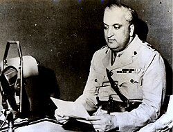
[[File:Maharaja Gulab Singh of Jammu and Kashmir.jpg|thumb|right|Maharaja [[Gulab Singh]] of Jammu and Kashmir]] | [[File:Maharaja Gulab Singh of Jammu and Kashmir.jpg|thumb|right|Maharaja [[Gulab Singh]] of Jammu and Kashmir]] | ||
[[File:Maharaja of Kashmir, Hari Singh (1895 - 1961).jpg|thumb|right|Maharaja of Kashmir, [[Hari Singh]] ( | [[File:Maharaja of Kashmir, Hari Singh (1895 - 1961).jpg|thumb|right|Maharaja of Kashmir, [[Hari Singh]] (1895–1961)]] | ||
After the decline of the Mughal power in the 18th century, the Jammu state under Raja Dhruv Dev of the ''Jamuwal'' (''[[Jamwal]]'') family asserted its supremacy among the Dugar states. Its ascent reached its peak under his successor, Raja Ranjit Dev (r. 1728–1780), who was widely respected among the hill states.{{ | After the decline of the Mughal power in the 18th century, the Jammu state under Raja Dhruv Dev of the ''Jamuwal'' (''[[Jamwal]]'') family asserted its supremacy among the Dugar states. Its ascent reached its peak under his successor, Raja Ranjit Dev (r. 1728–1780), who was widely respected among the hill states.<ref>{{cite book|last=Jeratha |first=Aśoka |title=Dogra Legends of Art & Culture |url=https://books.google.com/books?id=ToONShWeEB0C&pg=PA22 |year=1998 |publisher=Indus Publishing |isbn=978-81-7387-082-8 |page= 187}}</ref><ref name= Panikker30>{{cite book |first=K. M. |last=Panikkar |author-link=K. M. Panikkar |title=Gulab Singh |publisher=Martin Hopkinson Ltd |year=1930 |location=London |url= https://archive.org/details/gulabsingh179218031570mbp | access-date= }}</ref>{{rp|10}} Ranjit Dev promoted religious freedom and security, which attracted many craftsmen and traders to settle in Jammu, contributing to its economic prosperity.<ref>{{cite book|first=Mridu |last=Rai|title=Hindu Rulers, Muslim Subjects: Islam, Rights, and the History of Kashmir | publisher=C. Hurst & Co |year=2004 |isbn=1850656614| pages= 94–95}}</ref> | ||
Towards the end of Ranjit Dev's rule, the Sikh clans of Punjab (''[[misls]]'') gained ascendency, and Jammu began to be contested by the [[Bhangi Misl|Bhangi]], [[Kanhaiya Misl|Kanhaiya]] and [[Sukerchakia Misl|Sukerchakia]] ''misls''. Around 1770, the Bhangi ''misl'' attacked Jammu and forced Ranjit Dev to become a tributary. Brij Lal Dev, Ranjit Dev's successor, was defeated by the Sukerchakia chief Mahan Singh, who sacked Jammu and plundered it. Thus Jammu lost its supremacy over the surrounding country. | Towards the end of Ranjit Dev's rule, the Sikh clans of Punjab (''[[misls]]'') gained ascendency, and Jammu began to be contested by the [[Bhangi Misl|Bhangi]], [[Kanhaiya Misl|Kanhaiya]] and [[Sukerchakia Misl|Sukerchakia]] ''misls''. Around 1770, the Bhangi ''misl'' attacked Jammu and forced Ranjit Dev to become a tributary. Brij Lal Dev, Ranjit Dev's successor, was defeated by the Sukerchakia chief Mahan Singh, who sacked Jammu and plundered it. Thus Jammu lost its supremacy over the surrounding country. In the Battle of Rumal, the Jammu ruler was killed by Sikhs.<ref name=":0">{{cite book| url= https://archive.org/details/dli.bengal.10689.12482/page/n41/mode/2up|title=Indian Conquest of the Himalayan Territories| first= Sukhdev |last= Singh Charak |year= 1978 |pages=37|publisher=Ajaya Prakashan| place= Jammu| via= archive.org}}</ref><ref name= Panikker30 />{{rp|10–12}} | ||
In 1818 Raja Kishore Singh, father of Raja [[Gulab Singh]], was appointed and anointed the ruler of Jammu principality, and hence started the Jamwal dynasty, aka [[Dogra dynasty]], which came to rule the princely state of [[Jammu and Kashmir (princely state)|Jammu and Kashmir]] under British suzerainty. The rulers built large temples, renovated old shrines, built educational institutes and many more. A 43 | In 1808, Jammu itself was annexed to the [[Sikh Empire]] by [[Ranjit Singh]], the son of Mahan Singh.<ref name= Panikker30 />{{rp|15–16}} In 1818 Raja Kishore Singh, father of Raja [[Gulab Singh]], was appointed and anointed the ruler of Jammu principality, and hence started the Jamwal dynasty, aka [[Dogra dynasty]], which came to rule the princely state of [[Jammu and Kashmir (princely state)|Jammu and Kashmir]] under British suzerainty. The rulers built large temples, renovated old shrines, built educational institutes and many more. A {{cvt|43|km}} long [[Jammu–Sialkot line|railway line]] connecting Jammu with [[Sialkot]] was laid in 1897<ref>{{Cite encyclopedia |url=https://dsal.uchicago.edu/reference/gazetteer/pager.html?objectid=DS405.1.I34_V14_055.gif |title= Jammu Town | encyclopedia= [[Imperial Gazetteer of India]] | volume= 14| page= 49 |url-status= dead| archiveurl= https://web.archive.org/web/20090327070556/https://dsal.uchicago.edu/reference/gazetteer/pager.html?objectid=DS405.1.I34_V14_055.gif| archivedate= 2009-03-27| via= University of Chicago}}</ref> | ||
Jammu has historically been the capital of [[Jammu Division|Jammu Province]] and the winter capital of the princely state of [[Kashmir and Jammu (princely state)|Jammu and Kashmir]] (1846–1952). | Jammu has historically been the capital of [[Jammu Division|Jammu Province]] and the winter capital of the princely state of [[Kashmir and Jammu (princely state)|Jammu and Kashmir]] (1846–1952). | ||
| Line 124: | Line 115: | ||
===Battles=== | ===Battles=== | ||
# [[Battle of Jammu]] (1712) | # [[Battle of Jammu]] (1712) | ||
# [[Battle of Jammu ( | # [[Battle of Jammu (1774)]] | ||
# Battle of Rumal<ref name="Gupta">{{cite book|url=https://archive.org/details/HistoryOfTheSikhsVol.IvTheSikhCommonwealthOrRiseAndFallOfSikh/page/n349/mode/2up?q=1772|title=History Of The Sikhs Vol. IV The Sikh Commonwealth Or Rise And Fall Of Sikh Misls| first=Hari Ram |last= Gupta|date=1982|pages=339–340}}</ref> | |||
# Battle of Jammu (1808)<ref>{{citation |title=General Hari Singh Nalwa |last=Sandhu |first=Autar Singh |year=1935 |publisher=Cunningham Historical Society |location=Lahore |url=http://www.apnaorg.com/books/english/hari-singh-nalwa/book.php?fldr=book }}</ref> | |||
==Geography== | |||
[[File:Valley of Jammu.jpg|thumb|left|The Valley of Jammu]] | |||
Jammu is located at {{coord|32.73|N|74.87|E|}}.<ref>{{Cite web|url=http://www.fallingrain.com/world/IN/12/Jammu.html|title=Maps, Weather, and Airports for Jammu, India| website= fallingrain.com| publisher= | date= | access-date= }}</ref> It has an average elevation of {{cvt|300|m}}. Jammu city is situated on a series of uneven ridges of low heights in the [[Shivalik hills]]. It is surrounded by the Shivalik range to the north, east, and southeast while the Trikuta Range borders it in the northwest. It is approximately {{cvt|600|km|mi}} from the national capital, [[New Delhi]]. | |||
The city straddles the Tawi river. The old city overlooks the river from the north (right bank) while the new neighbourhoods are spread around the southern side (left bank) of the river. There are five bridges over the river. | |||
{{clear left}} | |||
==Climate== | ==Climate== | ||
Jammu, like the rest of north-western India, features a [[humid subtropical climate]] ([[Köppen climate classification|Köppen]] ''Cwa''), with extreme summer highs reaching {{convert|46|C|F}}, and temperatures in the winter months occasionally falling below {{convert|4|C|F}}. June is the hottest month with average highs of {{convert|40.6|C|F}}, while January is the coldest month with average lows reaching {{convert|7|C|F}}. Average yearly precipitation is about {{ | Jammu, like the rest of north-western India, features a [[humid subtropical climate]] ([[Köppen climate classification|Köppen]] ''Cwa''), with extreme summer highs reaching {{convert|46|C|F}}, and temperatures in the winter months occasionally falling below {{convert|4|C|F}}. June is the hottest month with average highs of {{convert|40.6|C|F}}, while January is the coldest month with average lows reaching {{convert|7|C|F}}. Average yearly precipitation is about {{cvt|1400|mm|in|abbr=on}} with the bulk of the rainfall in the months from June to September, although the winters can also be rather wet. In winter dense fog causes much inconvenience and temperature even drops to {{convert|2|C|F}}. In summer, particularly in May and June, extremely intense sunlight or hot winds can raise the temperature to {{convert|46|C|F}}. Following the hot season, the [[monsoon]] lashes the city with heavy downpours along with thunderstorms; rainfall may total up to {{cvt|669|mm|in}} in the wettest months. The city is exposed to heatwaves.{{clarify|date=April 2020}} | ||
{{Weather box|width= | Highest recorded temperature: {{Convert|47.4|C|F|abbr=on}} on 31 May 1988.<ref name="NCEI">{{cite web |title=World Meteorological Organization Climate Normals for 1991-2020: Jammu |url=https://www.nodc.noaa.gov/archive/arc0216/0253808/2.2/data/0-data/Region-2-WMO-Normals-9120/India/XLS/JAMMU_42056.xlsx |website=ncei.noaa.gov |publisher=[[National Oceanic and Atmospheric Administration]]| place= US |access-date=22 March 2024 |format=XLSX |quote=WMO number: 42056}}</ref> | ||
| collapsed = | |||
Lowest recorded temperature: {{Convert|0.5|C|F|abbr=on}} on 24 January 2016.<ref name= "NCEI"/> | |||
{{Climate chart|Jammu|7.3|18.1|67.9|10.2|21.5|74.6|14.5|26.6|64.1|19.7|32.7|41.4|24.3|37.6|22.5|26.1|38.3|109.5|25.5|34.3|416.5|24.9|33.1|403.1|23.2|32.8|144.8|18.4|31.1|23.5|13.0|26.4|12.2|8.7|21.1|21.9|float=left|clear=left}}{{Weather box | |||
|width = auto | |||
| collapsed = | |||
| metric first = yes | | metric first = yes | ||
| single line = yes | | single line = yes | ||
| location = Jammu ( | | location = Jammu (1991–2020, extremes 1925–2020) | ||
| Jan record high C = 28.0 | | Jan record high C = 28.0 | ||
| Feb record high C = 31.7 | | Feb record high C = 31.7 | ||
| Line 145: | Line 148: | ||
| Jul record high C = 45.0 | | Jul record high C = 45.0 | ||
| Aug record high C = 41.7 | | Aug record high C = 41.7 | ||
| Sep record high C = | | Sep record high C = 39.2 | ||
| Oct record high C = 37.9 | | Oct record high C = 37.9 | ||
| Nov record high C = 34.2 | | Nov record high C = 34.2 | ||
| Dec record high C = 28. | | Dec record high C = 28.5 | ||
|year record high C = 47.4 | |year record high C = 47.4 | ||
| Jan high C = 18.1 | |||
| Feb high C = 21.5 | |||
| Jan high C = 18. | |||
| Feb high C = 21. | |||
| Mar high C = 26.6 | | Mar high C = 26.6 | ||
| Apr high C = 32. | | Apr high C = 32.7 | ||
| May high C = 37. | | May high C = 37.6 | ||
| Jun high C = 38. | | Jun high C = 38.3 | ||
| Jul high C = 34. | | Jul high C = 34.3 | ||
| Aug high C = 33. | | Aug high C = 33.1 | ||
| Sep high C = | | Sep high C = 32.8 | ||
| Oct high C = 31. | | Oct high C = 31.1 | ||
| Nov high C = 26. | | Nov high C = 26.4 | ||
| Dec high C = 21. | | Dec high C = 21.1 | ||
|year high C = 29.7 | | year high C = 29.5 | ||
| Jan low C = 7. | | Jan mean C = 12.7 | ||
| Feb low C = 10. | | Feb mean C = 15.9 | ||
| Mar mean C = 20.6 | |||
| Apr mean C = 26.2 | |||
| May mean C = 31.0 | |||
| Jun mean C = 32.2 | |||
| Jul mean C = 29.9 | |||
| Aug mean C = 29.0 | |||
| Sep mean C = 28.0 | |||
| Oct mean C = 24.8 | |||
| Nov mean C = 19.7 | |||
| Dec mean C = 14.9 | |||
| year mean C = | |||
| Jan low C = 7.3 | |||
| Feb low C = 10.2 | |||
| Mar low C = 14.5 | | Mar low C = 14.5 | ||
| Apr low C = 19. | | Apr low C = 19.7 | ||
| May low C = | | May low C = 24.3 | ||
| Jun low C = | | Jun low C = 26.1 | ||
| Jul low C = 25. | | Jul low C = 25.5 | ||
| Aug low C = 24.9 | | Aug low C = 24.9 | ||
| Sep low C = 23. | | Sep low C = 23.2 | ||
| Oct low C = 18. | | Oct low C = 18.4 | ||
| Nov low C = 13.0 | | Nov low C = 13.0 | ||
| Dec low C = | | Dec low C = 8.7 | ||
|year low C = 18.0 | |||
| Jan record low C = 0.5 | |||
| | |||
| Jan record low C = 0. | |||
| Feb record low C = 1.1 | | Feb record low C = 1.1 | ||
| Mar record low C = 4.4 | | Mar record low C = 4.4 | ||
| Apr record low C = 8.5 | | Apr record low C = 8.5 | ||
| May record low C = 9.8 | | May record low C = 9.8 | ||
| Jun record low C = | | Jun record low C = 16.6 | ||
| Jul record low C = 14.0 | | Jul record low C = 14.0 | ||
| Aug record low C = 15.0 | | Aug record low C = 15.0 | ||
| Line 214: | Line 206: | ||
| Nov record low C = 6.1 | | Nov record low C = 6.1 | ||
| Dec record low C = 0.9 | | Dec record low C = 0.9 | ||
|year record low C = 0.6 | |year record low C = 0.5 | ||
| rain colour = green | |||
| Jan rain mm =67.9 | |||
| Feb rain mm =74.6 | |||
| Mar rain mm =64.1 | |||
| Apr rain mm =41.4 | |||
| May rain mm =22.5 | |||
| Jun rain mm =109.5 | |||
| Jul rain mm =416.5 | |||
| Aug rain mm =403.1 | |||
| Sep rain mm =144.8 | |||
| Oct rain mm =23.5 | |||
| Nov rain mm =12.2 | |||
| Dec rain mm =21.9 | |||
| year rain mm =1401.9 | |||
| Jan rain days =3.5 | |||
| Feb rain days =4.3 | |||
| Mar rain days =4.3 | |||
| Apr rain days =2.8 | |||
| May rain days =2.4 | |||
| Jun rain days =6.0 | |||
| Jul rain days =13.2 | |||
| Aug rain days =12.3 | |||
| Sep rain days =6.0 | |||
| Oct rain days =1.6 | |||
| Nov rain days =0.9 | |||
| Dec rain days =1.5 | |||
| year rain days =59.0 | |||
| time day = 17:30 [[Indian Standard Time|IST]] | |||
| Jan humidity =66 | |||
| Feb humidity =57 | |||
| Mar humidity =51 | |||
| Apr humidity =38 | |||
| May humidity =31 | |||
| Jun humidity =41 | |||
| Jul humidity =66 | |||
| Aug humidity =72 | |||
| Sep humidity =68 | |||
| Oct humidity =58 | |||
| Nov humidity =63 | |||
| Dec humidity =69 | |||
| year humidity =57 | |||
| source 1 = [[India Meteorological Department]]<ref>{{cite web | |||
| url = https://imdpune.gov.in/library/public/Climatological%20Tables%201991-2020.pdf | |||
| website= imdpune.gov.in | |||
| title = Climatological Tables of Observatories in India 1991-2020 | |||
| publisher = [[India Meteorological Department]] | |||
| access-date = 8 April 2024 | |||
}}</ref> | |||
}} | |||
==Transport== | ==Transport== | ||
[[File: | [[File:NE Aerial Jammu Tawi Rly Station Jul24 A7CR 01922.jpg|thumb|right|Aerial view of [[Jammu Tawi]] station]] | ||
Jammu city has a railway station called [[Jammu Tawi]] (station code JAT) that is connected with major cities of India. The old [[Jammu–Sialkot line|railway link]] to Sialkot was suspended by Pakistan in September 1947, and Jammu had no rail services until 1971, when the [[Indian Railways]] laid the [[Pathankot]]-Jammu Tawi [[Broad Gauge]] line. The new Jammu Tawi station opened in October 1972 and is an origination point for express trains. | Jammu city has a railway station called [[Jammu Tawi]] (station code JAT) that is connected with major cities of India. The old [[Jammu–Sialkot line|railway link]] to Sialkot was suspended by Pakistan in September 1947, and Jammu had no rail services until 1971, when the [[Indian Railways]] laid the [[Pathankot]]-Jammu Tawi [[Broad Gauge]] line. The new Jammu Tawi station opened in October 1972 and is an origination point for express trains. | ||
With the commencement of the [[Jammu–Baramulla line]], all trains to the [[Kashmir Valley]] will pass through Jammu Tawi. A part of the Jammu–Baramulla project has been executed and the track has been extended to [[Katra, Jammu and Kashmir|Katra]]. [[Jalandhar]] - [[Pathankot]]-Jammu Tawi section has been doubled and electrified. | With the commencement of the [[Jammu–Baramulla line]], all trains to the [[Kashmir Valley]] will pass through Jammu Tawi. A part of the Jammu–Baramulla project has been executed and the track has been extended to [[Katra, Jammu and Kashmir|Katra]]. [[Jalandhar]] - [[Pathankot]]-Jammu Tawi section has been doubled and electrified. | ||
[[ | In January 2025, the Jammu Division of [[Indian Railways]] was inaugurated. The new division will create employment opportunities, infrastructure development, promote tourism and lead to overall socio-economic development of the region.<ref>{{Cite news |title=PM Modi to inaugurate Jammu railway division, terminal station in Telangana |url=https://www.thehindu.com/news/national/pm-modi-to-inaugurate-jammu-railway-division-terminal-station-in-telangana/article69065376.ece |work=[[The Hindu]] |agency=PTI |issn=0971-751X |date=5 January 2025 |access-date=7 January 2025}}</ref> | ||
[[Jammu Airport]] is in the middle of Jammu. It has direct flights to [[Srinagar]], [[Delhi]], [[Amritsar]], [[Chandigarh]], [[Leh]], [[Mumbai]] and [[Bengaluru]]. Jammu Airport operates daily 30 arrival and departure of flights which are served by | [[NH 44|National Highway 44]] which passes through Jammu connects it to the [[Kashmir Valley]]. National Highway 1B connects Jammu with Poonch town. Jammu is {{cvt|80|km|mi}} from Kathua town, while it is {{cvt|68|km|mi}} from Udhampur city. The famous pilgrimage town of [[Katra, Jammu and Kashmir|Katra]] is {{cvt|49|km|mi}} from Jammu. | ||
[[Jammu Airport]] is in the middle of Jammu. It has direct flights to [[Srinagar]], [[Delhi]], [[Amritsar]], [[Chandigarh]], [[Leh]], [[Mumbai]] and [[Bengaluru]]. Jammu Airport operates daily 30 arrival and departure of flights which are served by [[Air India]], [[SpiceJet]], and [[IndiGo]]. | |||
The city has [[JKSRTC]] city buses and minibusses for local transport which run on some defined routes. These minibusses are called "Matadors". Besides this auto-rickshaw and cycle-rickshaw service is also available. Local taxis are also available. | The city has [[JKSRTC]] city buses and minibusses for local transport which run on some defined routes. These minibusses are called "Matadors". Besides this auto-rickshaw and cycle-rickshaw service is also available. Local taxis are also available. | ||
| Line 293: | Line 273: | ||
==Administration== | ==Administration== | ||
{{See also|Darbar Move}} | {{See also|Darbar Move}} | ||
[[ | [[File:Tawi Bridges River Jammu Aerial Jul24 A7CR 01909.jpg|thumb|Aerial view of Jammu city and Tawi river]] | ||
Jammu city serves as the winter capital of [[Jammu and Kashmir (union territory)|Jammu and Kashmir]] state from November to April when all the offices move from [[Srinagar]] to Jammu. Srinagar serves as the summer capital from May to October.<ref>{{cite web | Jammu city serves as the winter capital of [[Jammu and Kashmir (union territory)|Jammu and Kashmir]] state from November to April when all the offices move from [[Srinagar]] to Jammu. Srinagar serves as the summer capital from May to October.<ref>{{cite web | ||
|url = http://ceojammukashmir.nic.in/pdf/Moving_Emp.pdf | |url = http://ceojammukashmir.nic.in/pdf/Moving_Emp.pdf | ||
|title = Scheme for voting by postal ballot by a person holding any office under the Govt. and verified to be moving along with the headquarters of the Govt. from Kashmir Province to Jammu Province or vice-versa | |website= ceojammukashmir.nic.in | ||
|title = Scheme for voting by postal ballot by a person holding any office under the Govt. and verified to be moving along with the headquarters of the Govt. from Kashmir Province to Jammu Province or vice-versa | |||
|publisher = Office of the Chief Electoral Officer, Jammu and Kashmir | |publisher = Office of the Chief Electoral Officer, Jammu and Kashmir | ||
|access-date = 8 December 2008 | |access-date = 8 December 2008 | ||
|page=1 | |page=1 | ||
|quote=...the State Govt. functions for six months (November to April) in the winter capital Jammu after which it moves to the summer capital Srinagar...}}</ref> Jammu was a municipal committee during 2001 census of India | |quote=...the State Govt. functions for six months (November to April) in the winter capital Jammu after which it moves to the summer capital Srinagar...}}</ref> Jammu was a municipal committee during 2001 census of India, but after 5 September 2003, it upgraded its status to a municipal corporation.<ref>{{cite web |url=http://jmc.nic.in/jmc.html |title=History of Jammu Municipal Corporation |publisher= Jammu Municipal Corporation |url-status=dead |archive-url=https://web.archive.org/web/20090410050036/http://jmc.nic.in/jmc.html |archive-date=10 April 2009 |access-date=4 December 2008}}</ref> | ||
==Economy== | ==Economy== | ||
| Line 324: | Line 299: | ||
==Demographics== | ==Demographics== | ||
{{ | {{bar box | ||
| | |title=Religion in Jammu City<ref name="Jammu City Population">{{cite web|url=https://www.censusindia2011.com/jammu-kashmir/jammu/jammu/jammu-mcorp-og-population.html|title=Jammu City Population|work= censusindia2011.com| publisher= Census India|accessdate=11 July 2021|archive-date=16 April 2022|archive-url= https://web.archive.org/web/20220416214521/https://www.censusindia2011.com/jammu-kashmir/jammu/jammu/jammu-mcorp-og-population.html|url-status=dead}}</ref><ref>{{Cite web|url=http://www.census2011.co.in/census/city/3-jammu.html|title=Jammu City Population Census 2011-2019 | Jammu and Kashmir |website= census2011.co.in| publisher= | date= | access-date= }}</ref> | ||
|titlebar=#Fcd116 | |||
| | |left1=Religion | ||
| | |right1=Percent | ||
| | |float=right | ||
| | |bars= | ||
| | {{bar percent|[[Hinduism]]|darkorange|81.19}} | ||
| | {{bar percent|[[Sikhism]]|darkkhaki|8.83}} | ||
{{bar percent|[[Islam in Punjab, India|Islam]]|green|7.95}} | |||
| | {{bar percent|[[Christianity in Punjab, India|Christianity]]|dodgerblue|1.35}} | ||
| | {{bar percent|Others|lightgrey|0.28}} | ||
| | |||
| | |||
| | |||
| | |||
| | |||
| | |||
| | |||
| | |||
}} | }} | ||
As of 2011 census,<ref>{{cite web|url=http://www.censusindia.gov.in/pca/SearchDetails.aspx?Id=7318|publisher=[[Census of India]]|title=Jammu Municipal Corporation Demographics|access-date=25 April 2017}}</ref> the population of Jammu city was 502,197. Males constituted 52.7% of the population; females numbered constituted 47.3% of the population. The sex ratio was 898 females per 1,000 males against the national average of 940. Jammu had an average [[literacy]] rate of 89.66%, much higher than the national average of 74.4%: male literacy was 93.13% and female literacy was 85.82%. 8.47% of the population were under 6 years of age. The urban agglomeration of Jammu had a population of 657,314.<ref>{{cite web|url=https://www.citypopulation.de/India-JammuKashmir.html|title=Jammu & Kashmir (India): State, Major Agglomerations & Cities – Population Statistics in Maps and Charts|work= | As of 2011 census,<ref>{{cite web|url=http://www.censusindia.gov.in/pca/SearchDetails.aspx?Id=7318| website= censusindia.gov.in |publisher=[[Census of India]]| title=Jammu Municipal Corporation Demographics|access-date=25 April 2017}}</ref> the population of Jammu city was 502,197. Males constituted 52.7% of the population; females numbered constituted 47.3% of the population. The sex ratio was 898 females per 1,000 males against the national average of 940. Jammu had an average [[literacy]] rate of 89.66%, much higher than the national average of 74.4%: male literacy was 93.13% and female literacy was 85.82%. 8.47% of the population were under 6 years of age. The urban agglomeration of Jammu had a population of 657,314.<ref>{{cite web| url= https://www.citypopulation.de/India-JammuKashmir.html|title=Jammu & Kashmir (India): State, Major Agglomerations & Cities – Population Statistics in Maps and Charts|work= CityPopulation.de | publisher= |date= |access-date=25 April 2017}}</ref> Most of Jammu and Kashmir's Hindus live in the Jammu region; many speak [[Dogri language|Dogri]].<ref>{{cite encyclopedia|url=https://www.britannica.com/place/Jammu-and-Kashmir|title=Jammu and Kashmir| encyclopedia= Encyclopædia Britannica| date=21 May 2023}}</ref> | ||
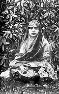
[[File:Malika Pukhraj (1912-2004) in 1920s.jpg|thumb|upright|Singer [[Malika Pukhraj]] in 1920s]] | [[File:Malika Pukhraj (1912-2004) in 1920s.jpg|thumb|upright|Singer [[Malika Pukhraj]] in 1920s]] | ||
| Line 360: | Line 320: | ||
!|Rank | !|Rank | ||
!|Language | !|Language | ||
!|1961<ref name="Census">{{cite | !|1961<ref name="Census">{{cite book |url=https://books.google.com/books?id=cb7UAAAAMAAJ|chapter= Jammu & Kashmir: Jammu| title= District Census Handbook |first1= M. H.|last1= Kamili| year=1966|via=Google Books}}</ref> | ||
|- | |- | ||
| 1 | | 1 | ||
| Line 381: | Line 341: | ||
===Muslim communities=== | ===Muslim communities=== | ||
{{main|1947 Jammu massacres}} | {{main|1947 Jammu massacres}} | ||
The city of Jammu had a significant Muslim population prior to the [[Partition of India]], 30 | The city of Jammu had a significant Muslim population prior to the [[Partition of India]], 30 per cent by the 1941 census.<ref>{{cite web |last=Wreford |first=R.G. |title=Jammu and Kashmir, Parts I and II |url=https://archive.org/details/in.ernet.dli.2015.503972/page/n115/mode/1up |work=[[1941 Census of India]] |pages=102, 103 |via=archive.org}}</ref> During the [[1947 Jammu massacres]], which preceded and continued during the [[1947 Indo-Pakistani War|Pakistan tribal invasion of Kashmir]], many Muslims were killed and many driven away to Pakistan.<ref name="Bhasin">{{Cite news| url= http://www.kashmirlife.net/jammu-1947-issue-35-vol-07-89728/|title=Jammu 1947|last=Bhasin |first= Ved |author-link=Ved Bhasin|date=17 November 2015 |newspaper= Kashmir Life|access-date=4 June 2017}}</ref><ref>{{cite thesis |type=PhD |last=Chattha |first=Ilyas Ahmad |title=Partition and Its Aftermath: Violence, Migration and the Role of Refugees in the Socio-Economic Development of Gujranwala and Sialkot Cities, 1947-1961 |date=September 2009 |url=https://eprints.soton.ac.uk/366712/ |pages= 182, 183 |publisher=Centre for Imperial and Post-Colonial Studies, School of Humanities, University of Southampton |access-date=16 February 2016}}</ref><ref>{{Cite book|url=https://books.google.com/books?id=tmA0DAAAQBAJ&pg=PA149|title=Revisiting India's Partition: New Essays on Memory, Culture, and Politics|last1=Singh|first1=Amritjit|last2=Iyer|first2=Nalini|last3=Gairola|first3=Rahul K.|date=15 June 2016|publisher=Lexington Books|isbn=9781498531054|pages=149|language=en}}</ref> | ||
After the conflict ended, many of the displaced Muslims returned and resettled back in the state.<ref>{{cite book|last=Saraf |first=Muhammad Yusuf |author-link=Muhammad Yusuf Saraf |title=Kashmiris Fight for Freedom| volume= 2 |year=2015 |orig-year=first published 1979 by Ferozsons |publisher=National Institute Kashmir Studies |location=Mirpur |page= 481| quote= Towards the middle of 1949, a movement for return started on a small scale which gained momentum by the end of 1950. A fair estimate of the returnees is about a hundred thousand. Sheikh Abdullah's Government re-settled them on their abandoned properties, advanced taqqavi loans and appointed a special staff to look after their problems.}}</ref><ref>{{cite book|title=Jammu & Kashmir, 1947–50: An Account of Activities of First Three Years of Sheikh Abdullah's Government |page=90 |year=1951 |url=https://books.google.com/books?id=jjHHO3z_1_wC |publisher= Ranbir Government Press}}</ref> Others settled in [[Sialkot District]] and other parts of Pakistani Punjab. Many prominent Punjabi residents in Pakistan, including politician [[Chaudhry Amir Hussain]], economist [[Mahbub ul Haq]], Air Marshal [[Asghar Khan]], journalist [[Khalid Hasan]] and singer [[Malika Pukhraj]] were from Jammu.<ref name= Across>{{cite book|last=Puri |first=Luv |title=Across the Line of Control: Inside Azad Kashmir |url=https://books.google.com/books?id=kYVcuqYr5FIC |date=2012 |publisher=Columbia University Press |isbn=978-0-231-80084-6}}</ref>{{rp|3, 31}} In 1961, about 17 per cent of the population in the city was Muslim.<ref>{{cite web| last= Kamili|first=H.M.|title=Jammu and Kashmir, District Census Handbook, 7, Jammu District| url= http://lsi.gov.in:8081/jspui/bitstream/123456789/5856/1/22166_1961_JAM.pdf |work=[[1961 Census of India]]|publisher=Jammu and Kashmir Government|page=42}}</ref><ref name= Across />{{rp|30}} | |||
==Education== | ==Education== | ||
| Line 389: | Line 349: | ||
In the 2014–2015 [[Union budget of India|General Budget of India]], [[Arun Jaitley]], the [[Finance Minister of India]], proposed an [[Indian Institute of Technology]] and an [[Indian Institute of Management]] for the division. List of some educational institutions is provided below. | In the 2014–2015 [[Union budget of India|General Budget of India]], [[Arun Jaitley]], the [[Finance Minister of India]], proposed an [[Indian Institute of Technology]] and an [[Indian Institute of Management]] for the division. List of some educational institutions is provided below. | ||
===Engineering Colleges in Jammu=== | |||
* [[Indian Institute of Technology Jammu]] | * [[Indian Institute of Technology Jammu]] | ||
* [[Government College of Engineering and Technology, Jammu]] | * [[Government College of Engineering and Technology, Jammu]] | ||
* [[Model Institute of Engineering and Technology, Jammu]] | * [[Model Institute of Engineering and Technology, Jammu]] | ||
* University Institute of Engineering and Technology, [[University of Jammu]] | * University Institute of Engineering and Technology, [[University of Jammu]] | ||
===Medical Institutions=== | |||
* [[Indian Institute of Integrative Medicine]], CSIR | * [[Indian Institute of Integrative Medicine]], CSIR | ||
* [[Government Medical College, Jammu]] | * [[Government Medical College, Jammu]] | ||
===Legal Institutions=== | |||
* [[Kishen Chand Law College]], Jammu | * [[Kishen Chand Law College]], Jammu | ||
* [[Dogra Law College]], Jammu | * [[Dogra Law College]], Jammu | ||
| Line 406: | Line 365: | ||
* [[R. K. Law College]], Jammu | * [[R. K. Law College]], Jammu | ||
===General Degree Courses (colleges)=== | |||
* [[Govt. Gandhi Memorial Science College]], Jammu | * [[Govt. Gandhi Memorial Science College]], Jammu | ||
* [[Govt. MAM PG College, Jammu]] | * [[Govt. MAM PG College, Jammu]] | ||
===Universities=== | |||
* [[Central University of Jammu]] | * [[Central University of Jammu]] | ||
* [[Sher-e-Kashmir University of Agricultural Sciences and Technology of Jammu]] | * [[Sher-e-Kashmir University of Agricultural Sciences and Technology of Jammu]] | ||
* [[University of Jammu]] | * [[University of Jammu]] | ||
===Schools=== | |||
* [[Kendriya Vidyalaya, Bantalab]] | * [[Kendriya Vidyalaya, Bantalab]] | ||
* [[Kendriya Vidyalaya, Sunjuwan]] | * [[Kendriya Vidyalaya, Sunjuwan]] | ||
| Line 421: | Line 380: | ||
==Cuisine== | ==Cuisine== | ||
[[File:Famous Kalaadi of Ramnagar.jpg|thumb|[[Kalari cheese]]]] | [[File:Famous Kalaadi of Ramnagar.jpg|thumb|[[Kalari cheese]]]] | ||
Jammu is known for its [[Panjiri|sund panjeeri]], [[patisa]], [[rajma]] with rice and [[Kalari cheese]]. Dogri food specialties include ambal, khatta meat, [[Macrotyloma uniflorum|kulthein di dal]], dal patt, maa da madra, [[rajma]], and {{lang|mis|italic=no|auriya}}. Pickles typical of Jammu are made of [[Fiddlehead fern|kasrod]], {{lang|mis|italic=no|girgle}}, mango with [[saunf]], [[Yam (vegetable)|jimikand]], {{lang|mis|italic=no|tyaoo}}, {{lang|mis|italic=no|seyoo}}, and potatoes. Auriya is a dish made with potatoes. Jammu cuisine features various [[chaat]]s, especially [[Panipuri|gol gappas]], kachalu, [[Chole bhature]], gulgule, [[rajma]] [[Kulcha|kulche]] and [[Dahi vada|dahi palla]], among various others.<ref>{{cite web|url=http://citypincode.in/JAMMU_AND_KASHMIR/JAMMU |title=Jammu Pincode |publisher=citypincode.in |access-date=19 May 2014}}</ref> | Jammu is known for its [[Panjiri|sund panjeeri]], [[patisa]], [[rajma]] with rice and [[Kalari cheese]]. Dogri food specialties include ambal, khatta meat, [[Macrotyloma uniflorum|kulthein di dal]], dal patt, maa da madra, [[rajma]], and {{lang|mis|italic=no|auriya}}. Pickles typical of Jammu are made of [[Fiddlehead fern|kasrod]], {{lang|mis|italic=no|girgle}}, mango with [[saunf]], [[Yam (vegetable)|jimikand]], {{lang|mis|italic=no|tyaoo}}, {{lang|mis|italic=no|seyoo}}, and potatoes. Auriya is a dish made with potatoes. Jammu cuisine features various [[chaat]]s, especially [[Panipuri|gol gappas]], kachalu, [[Chole bhature]], gulgule, [[rajma]] [[Kulcha|kulche]] and [[Dahi vada|dahi palla]], among various others.<ref>{{cite web| url= http://citypincode.in/JAMMU_AND_KASHMIR/JAMMU |title=Jammu Pincode |publisher= | work= citypincode.in |access-date=19 May 2014}}</ref> | ||
==Refugees== | ==Refugees== | ||
===Kashmiri Pandit refugees=== | ===Kashmiri Pandit refugees=== | ||
{{main|Exodus of Kashmiri Hindus}} | {{main|Exodus of Kashmiri Hindus}} | ||
Being comparatively safe from terrorism, Jammu city has become a hub of refugees. These primarily include [[Kashmiri Hindus]] who migrated from Kashmir Valley in 1989. Hindus from [[Azad Kashmir|Pakistan-administered Jammu and Kashmir]] who migrated to India have also settled in Jammu city. According to records, approximately 31,619 Hindu families had migrated from Pakistan administered Jammu and Kashmir to India. Of these 26,319 families are settled in Jammu.{{ | Being comparatively safe from terrorism, Jammu city has become a hub of refugees. These primarily include [[Kashmiri Hindus]] who migrated from Kashmir Valley in 1989. Hindus from [[Azad Kashmir|Pakistan-administered Jammu and Kashmir]] who migrated to India have also settled in Jammu city. According to records, approximately 31,619 Hindu families had migrated from Pakistan administered Jammu and Kashmir to India. Of these 26,319 families are settled in Jammu.<ref>{{cite web |title= Application for Domicile for J&K| date= 2020-09-20 |url= https://pib.gov.in/PressReleseDetailm.aspx?PRID=1656969®=3&lang=1 |website= pib.gov.in| publisher= Ministry of Home Affairs, Government of India |access-date= 2026-01-16}}</ref> | ||
===Rohingya refugees=== | ===Rohingya refugees=== | ||
{{main|2015 Rohingya refugee crisis}} | {{main|2015 Rohingya refugee crisis}} | ||
[[Rohingya people|Rohingyas]] who fled [[Rohingya conflict|Myanmar during 2016]] have also currently settled in Jammu.<ref name="Firstpost">{{Cite news |url=https://www.firstpost.com/india/as-jammu-becomes-home-for-refugees-from-four-communities-state-govt-has-to-deal-with-complex-issue-of-rights-4980561.html |title=As Jammu becomes home for refugees from four communities, govt has to deal with complex issue of rights |last=Sharma |first=Arjun |date=16 August 2018 |access-date=28 February 2019}}</ref><ref>{{Cite news |url= | [[Rohingya people|Rohingyas]] who fled [[Rohingya conflict|Myanmar during 2016]] have also currently settled in Jammu.<ref name="Firstpost">{{Cite news |url=https://www.firstpost.com/india/as-jammu-becomes-home-for-refugees-from-four-communities-state-govt-has-to-deal-with-complex-issue-of-rights-4980561.html |title=As Jammu becomes home for refugees from four communities, govt has to deal with complex issue of rights |last=Sharma |first=Arjun |website= firstpost.com| publisher= |date=16 August 2018 |access-date=28 February 2019}}</ref><ref>{{Cite news |url= https://www.bbc.co.uk/worldservice/specials/1246_land/page9.shtml |title=Paradise Lost - the Kashmiri Pandits |last=Sharma |first=Shivani |work= bbc.co.uk | publisher= [[BBC World Service]] |access-date=28 February 2019}}</ref> Some believes the settlements of Rohingya Muslims have also raised security threats in Jammu.<ref>{{Cite news |url= http://www.dailyexcelsior.com/demographic-changes-make-jammu-ticking-time-bomb/ |title=Demographic changes make Jammu a "Ticking Time Bomb" | work=Daily Excelsior |date=11 January 2017 |access-date=21 March 2019 |language=en-US}}</ref><ref>{{Cite news |url= https://www.dailypioneer.com/2018/columnists/rohingya-refugees--a-threat-to-jammu.html |title=Rohingya refugees: A threat to Jammu |last=Jain |first= Sandhya |access-date=21 March 2019 |work=The Pioneer |date=15 May 2018 |language=en}}</ref><ref>{{Cite news |url= https://www.business-standard.com/article/news-ians/demographic-changes-in-assam-bengal-j-k-kerala-aided-rise-of-fundamentalist-forces-himanta-119021901313_1.html |title= Demographic changes in Assam, Bengal, J&K, Kerala aided rise of fundamentalist forces: Himanta |publisher= [[Indo-Asian News Service]] |date=19 February 2019 |work= Business Standard India |access-date=21 March 2019}}</ref> During the [[2018 Sunjuwan attack]], intelligence agencies suspected but did not prove involvement of Rohingya Muslims in the attack.<ref>{{Cite web |url=https://www.tribuneindia.com/news/jammu-kashmir/-illegal-settlement-of-rohingya-to-be-probed-by-security-agencies/724545.html |title='Illegal settlement' of Rohingya to be probed by security agencies |last=Sharma |first=Arteev |quote=After terror attack on the Sunjuwan military station in February last year, Rohingya again came under the radar of security agencies as their alleged role in assisting militants was probed. However, their involvement has not been established as yet. |date=6 February 2019 |access-date=21 March 2019 |archive-date= 21 March 2019 |archive-url=https://web.archive.org/web/20190321184943/https://www.tribuneindia.com/news/jammu-kashmir/-illegal-settlement-of-rohingya-to-be-probed-by-security-agencies/724545.html |url-status=dead }}</ref><ref>{{Cite news |url= https://www.orfonline.org/research/examining-indias-stance-on-the-rohingya-crisis/ |title=Examining India's stance on the Rohingya crisis |last=Yhome |first=K. |access-date=21 March 2019 |language=en-US |quote=In early February 2018, a terrorist attack on an army camp in Sunjuwan of Jammu city sparked a debate on the involvement of Rohingyas as many had settled around the camp.}}</ref><ref>{{cite news |last1=Jain |first1=Bharti |last2=Dua |first2=Rohan |title=Sunjuwan Attack: After intelligence inputs, forces were told to be on alert |url=https://timesofindia.indiatimes.com/india/after-intelligence-inputs-forces-were-told-to-be-on-alert/articleshow/62868233.cms |work=The Times of India |date=11 February 2018 |language=en |access-date=14 February 2021}}</ref> | ||
==Notable people== | ==Notable people== | ||
<!---♦♦♦ Only add a person to this list if they already have their own article on the English | <!---♦♦♦ Only add a person to this list if they already have their own article on the English Bharatpedia ♦♦♦---> | ||
<!---♦♦♦ Please keep the list in alphabetical order by LAST NAME ♦♦♦---> | <!---♦♦♦ Please keep the list in alphabetical order by LAST NAME ♦♦♦---> | ||
*[[Maulana Abdur Rahman]], member of the [[2nd Lok Sabha]] | *[[Maulana Abdur Rahman]], member of the [[2nd Lok Sabha]] | ||
==Notes== | |||
{{notelist}} | |||
==References== | ==References== | ||
{{Reflist}} | {{Reflist}} | ||
==External links== | ==External links== | ||
{{commons category|Jammu (city)}} | |||
* | *{{wikivoyage inline|Jammu}} | ||
{{Jammu district}} | {{Jammu district}} | ||
| Line 465: | Line 416: | ||
[[Category:Indian capital cities]]<!--present day winter capital of Jammu and Kashmir state--> | [[Category:Indian capital cities]]<!--present day winter capital of Jammu and Kashmir state--> | ||
[[Category:Capitals of former nations]] | [[Category:Capitals of former nations]] | ||
[[Category:Former | [[Category:Former capitals in India]] | ||
[[Category:Cities in Jammu and Kashmir]] | [[Category:Cities in Jammu and Kashmir]] | ||
Revision as of 04:25, 14 March 2026
Jammu | |
|---|---|
City | |
    | |
| Nickname: City of Temples[1] | |
![Jammu lies in the Jammu division (neon blue) of the Indian-administered Jammu and Kashmir (shaded tan) in the disputed Kashmir region.[lower-alpha 1]](/wiki/File:Kashmir_region._LOC_2003626427_-_showing_Jammu_division_administered_by_India_in_neon_blue.jpg) Jammu lies in the Jammu division (neon blue) of the Indian-administered Jammu and Kashmir (shaded tan) in the disputed Kashmir region.[lower-alpha 1] | |
| Coordinates: 32°44′N 74°52′E / 32.73°N 74.87°E | |
| Administering country | India |
| Region of administration | Union territory of Jammu and Kashmir |
| District | Jammu |
| Government | |
| • Type | Municipal Corporation |
| • Body | Jammu Municipal Corporation and Jammu Development Authority |
| • Mayor | Chander Mohan Gupta, BJP[10] |
| Area | |
| • City | 240 km2 (90 sq mi) |
| Elevation | 300–400 m (1,000−1,300 ft) |
| Population (2011) | |
| • City | 502,197 |
| • Rank | 94th |
| • Density | 45/km2 (120/sq mi) |
| • Metro | 657,314 |
| Demonym(s) | Jammuwala, Jammuwale, Jammuites |
| Language | |
| • Official | Hindi,[13][14] Dogri,[15] Urdu,[16] Kashmiri, English |
| • Other | Punjabi[16][17] |
| Time zone | UTC+5:30 (IST) |
| PIN | 180001[18] |
| Vehicle registration | JK-02 |
| Sex ratio | 867 ♀/ 1000 ♂ |
| Literacy | 90.14% |
| Distance from Delhi | 575 km (357 mi) NW |
| Distance from Mumbai | 1,971 km (1,225 mi) NE (land) |
| Climate | Cwa (Köppen) |
| Precipitation | 710 mm (28 in) |
| Avg. summer temperature | 29.6 °C (85.3 °F) |
| Avg. winter temperature | 17.7 °C (63.9 °F) |
| Website | jammu |
Jammu (/ˈdʒʌmuː/) is a city in Indian-administered Jammu and Kashmir in the Jammu region. It is the winter capital of the union territory of Jammu and Kashmir. It is the headquarters and the largest city in Jammu district. Lying on the banks of the river Tawi, the city of Jammu, with an area of 240 km2 (93 sq mi),[11] is surrounded by the Himalayas in the north and the northern plains in the south. Jammu is the second-most populous city of the union territory. Jammu is known as "City of Temples" for its ancient temples and Hindu shrines.
Etymology
According to local tradition, Jammu is named after its founder, Raja Jambulochan, who is believed to have ruled the area in the 9th century.[19] Local tradition holds the city to be 3,000 years old but this is not supported by historians.[20]:9
History
According to Tarikh-i-Azmi, Jammu came into existence around 900 CE. The state of Durgara (modern forms "Duggar" and "Dogra)") is also attested from around this time.[20]:9–10 [21]:6 The capital of the Durgara state at that time is believed to have been Vallapura (identified with modern Billawar). Its rulers are repeatedly mentioned in Kalhana's Rajatarangini.Bamzai, P. N. K. (1994). Culture and Political History of Kashmir: Ancient Kashmir. M.D. Publications Pvt. Ltd. p. 184. ISBN 978-81-85880-31-0. Babbapura (modern Babor) is another state mentioned in Rajatarangini, some of whose rulers also appear by in the Vamshavali (family chronicles) of later Jammu rulers. These rulers are believed to have enjoyed almost independent status and allied themselves with the Sultans of Delhi.
Jammu is mentioned by name in the chronicles of Timur (r. 1370–1406), who invaded Delhi in 1398 and returned to Samarkand via Jammu. Raja Bhim Dev is prominently mentioned in the Delhi chronicles as a supporter of Mubarah Shah (r. 1421–1434) against Jasrat.[21]:6–7 Between 1423 and 1442, Jammu came under control of Jasrat (r. 1405–1442) who conquered it after killing his arch-enemy Bhim Dev in 1423. Later, Jasrat appointed Manik Dev (also known as Ajeo Dev) as vassal, and married his daughter.[22] In the Mughal chronicles of Babur in the early 16th century, Jammu is mentioned as a powerful state in the Punjab hills. It is said to have been ruled by Manhas Rajputs. Emperor Akbar brought the hill kingdoms of the region under Mughal suzerainty, but the kings enjoyed considerable political autonomy. In addition to Jammu, other kingdoms of the region such as Kishtwar and Rajauri were also prominently mentioned. It is evident that the Mughal empire treated these hill chiefs as allies and partners in the empire.[23]
Modern history

.jpg)
After the decline of the Mughal power in the 18th century, the Jammu state under Raja Dhruv Dev of the Jamuwal (Jamwal) family asserted its supremacy among the Dugar states. Its ascent reached its peak under his successor, Raja Ranjit Dev (r. 1728–1780), who was widely respected among the hill states.[24][25]:10 Ranjit Dev promoted religious freedom and security, which attracted many craftsmen and traders to settle in Jammu, contributing to its economic prosperity.[26]
Towards the end of Ranjit Dev's rule, the Sikh clans of Punjab (misls) gained ascendency, and Jammu began to be contested by the Bhangi, Kanhaiya and Sukerchakia misls. Around 1770, the Bhangi misl attacked Jammu and forced Ranjit Dev to become a tributary. Brij Lal Dev, Ranjit Dev's successor, was defeated by the Sukerchakia chief Mahan Singh, who sacked Jammu and plundered it. Thus Jammu lost its supremacy over the surrounding country. In the Battle of Rumal, the Jammu ruler was killed by Sikhs.[27][25]:10–12
In 1808, Jammu itself was annexed to the Sikh Empire by Ranjit Singh, the son of Mahan Singh.[25]:15–16 In 1818 Raja Kishore Singh, father of Raja Gulab Singh, was appointed and anointed the ruler of Jammu principality, and hence started the Jamwal dynasty, aka Dogra dynasty, which came to rule the princely state of Jammu and Kashmir under British suzerainty. The rulers built large temples, renovated old shrines, built educational institutes and many more. A 43 km (27 mi) long railway line connecting Jammu with Sialkot was laid in 1897[28]
Jammu has historically been the capital of Jammu Province and the winter capital of the princely state of Jammu and Kashmir (1846–1952).
After the partition of India, Jammu continues as the winter capital of the Indian state of Jammu and Kashmir.
Battles
- Battle of Jammu (1712)
- Battle of Jammu (1774)
- Battle of Rumal[29]
- Battle of Jammu (1808)[30]
Geography

Jammu is located at 32°44′N 74°52′E / 32.73°N 74.87°E.[31] It has an average elevation of 300 m (980 ft). Jammu city is situated on a series of uneven ridges of low heights in the Shivalik hills. It is surrounded by the Shivalik range to the north, east, and southeast while the Trikuta Range borders it in the northwest. It is approximately 600 km (370 mi) from the national capital, New Delhi.
The city straddles the Tawi river. The old city overlooks the river from the north (right bank) while the new neighbourhoods are spread around the southern side (left bank) of the river. There are five bridges over the river.
Climate
Jammu, like the rest of north-western India, features a humid subtropical climate (Köppen Cwa), with extreme summer highs reaching 46 °C (115 °F), and temperatures in the winter months occasionally falling below 4 °C (39 °F). June is the hottest month with average highs of 40.6 °C (105.1 °F), while January is the coldest month with average lows reaching 7 °C (45 °F). Average yearly precipitation is about 1,400 mm (55 in) with the bulk of the rainfall in the months from June to September, although the winters can also be rather wet. In winter dense fog causes much inconvenience and temperature even drops to 2 °C (36 °F). In summer, particularly in May and June, extremely intense sunlight or hot winds can raise the temperature to 46 °C (115 °F). Following the hot season, the monsoon lashes the city with heavy downpours along with thunderstorms; rainfall may total up to 669 mm (26.3 in) in the wettest months. The city is exposed to heatwaves.[clarification needed]
Highest recorded temperature: 47.4 °C (117.3 °F) on 31 May 1988.[32]
Lowest recorded temperature: 0.5 °C (32.9 °F) on 24 January 2016.[32]
| Jammu | ||||||||||||||||||||||||||||||||||||||||||||||||||||||||||||
|---|---|---|---|---|---|---|---|---|---|---|---|---|---|---|---|---|---|---|---|---|---|---|---|---|---|---|---|---|---|---|---|---|---|---|---|---|---|---|---|---|---|---|---|---|---|---|---|---|---|---|---|---|---|---|---|---|---|---|---|---|
| Climate chart (explanation) | ||||||||||||||||||||||||||||||||||||||||||||||||||||||||||||
| ||||||||||||||||||||||||||||||||||||||||||||||||||||||||||||
| ||||||||||||||||||||||||||||||||||||||||||||||||||||||||||||
| Climate data for Jammu (1991–2020, extremes 1925–2020) | |||||||||||||
|---|---|---|---|---|---|---|---|---|---|---|---|---|---|
| Month | Jan | Feb | Mar | Apr | May | Jun | Jul | Aug | Sep | Oct | Nov | Dec | Year |
| Record high °C (°F) | 28.0 (82.4) |
31.7 (89.1) |
37.3 (99.1) |
43.9 (111.0) |
47.4 (117.3) |
47.2 (117.0) |
45.0 (113.0) |
41.7 (107.1) |
39.2 (102.6) |
37.9 (100.2) |
34.2 (93.6) |
28.5 (83.3) |
47.4 (117.3) |
| Average high °C (°F) | 18.1 (64.6) |
21.5 (70.7) |
26.6 (79.9) |
32.7 (90.9) |
37.6 (99.7) |
38.3 (100.9) |
34.3 (93.7) |
33.1 (91.6) |
32.8 (91.0) |
31.1 (88.0) |
26.4 (79.5) |
21.1 (70.0) |
29.5 (85.1) |
| Daily mean °C (°F) | 12.7 (54.9) |
15.9 (60.6) |
20.6 (69.1) |
26.2 (79.2) |
31.0 (87.8) |
32.2 (90.0) |
29.9 (85.8) |
29.0 (84.2) |
28.0 (82.4) |
24.8 (76.6) |
19.7 (67.5) |
14.9 (58.8) |
23.7 (74.7) |
| Average low °C (°F) | 7.3 (45.1) |
10.2 (50.4) |
14.5 (58.1) |
19.7 (67.5) |
24.3 (75.7) |
26.1 (79.0) |
25.5 (77.9) |
24.9 (76.8) |
23.2 (73.8) |
18.4 (65.1) |
13.0 (55.4) |
8.7 (47.7) |
18.0 (64.4) |
| Record low °C (°F) | 0.5 (32.9) |
1.1 (34.0) |
4.4 (39.9) |
8.5 (47.3) |
9.8 (49.6) |
16.6 (61.9) |
14.0 (57.2) |
15.0 (59.0) |
15.0 (59.0) |
11.3 (52.3) |
6.1 (43.0) |
0.9 (33.6) |
0.5 (32.9) |
| Average rainfall mm (inches) | 67.9 (2.67) |
74.6 (2.94) |
64.1 (2.52) |
41.4 (1.63) |
22.5 (0.89) |
109.5 (4.31) |
416.5 (16.40) |
403.1 (15.87) |
144.8 (5.70) |
23.5 (0.93) |
12.2 (0.48) |
21.9 (0.86) |
1,401.9 (55.19) |
| Average rainy days | 3.5 | 4.3 | 4.3 | 2.8 | 2.4 | 6.0 | 13.2 | 12.3 | 6.0 | 1.6 | 0.9 | 1.5 | 59.0 |
| Average relative humidity (%) (at 17:30 IST) | 66 | 57 | 51 | 38 | 31 | 41 | 66 | 72 | 68 | 58 | 63 | 69 | 57 |
| Source: India Meteorological Department[33] | |||||||||||||
Transport

Jammu city has a railway station called Jammu Tawi (station code JAT) that is connected with major cities of India. The old railway link to Sialkot was suspended by Pakistan in September 1947, and Jammu had no rail services until 1971, when the Indian Railways laid the Pathankot-Jammu Tawi Broad Gauge line. The new Jammu Tawi station opened in October 1972 and is an origination point for express trains. With the commencement of the Jammu–Baramulla line, all trains to the Kashmir Valley will pass through Jammu Tawi. A part of the Jammu–Baramulla project has been executed and the track has been extended to Katra. Jalandhar - Pathankot-Jammu Tawi section has been doubled and electrified.
In January 2025, the Jammu Division of Indian Railways was inaugurated. The new division will create employment opportunities, infrastructure development, promote tourism and lead to overall socio-economic development of the region.[34]
National Highway 44 which passes through Jammu connects it to the Kashmir Valley. National Highway 1B connects Jammu with Poonch town. Jammu is 80 km (50 mi) from Kathua town, while it is 68 km (42 mi) from Udhampur city. The famous pilgrimage town of Katra is 49 km (30 mi) from Jammu.
Jammu Airport is in the middle of Jammu. It has direct flights to Srinagar, Delhi, Amritsar, Chandigarh, Leh, Mumbai and Bengaluru. Jammu Airport operates daily 30 arrival and departure of flights which are served by Air India, SpiceJet, and IndiGo.
The city has JKSRTC city buses and minibusses for local transport which run on some defined routes. These minibusses are called "Matadors". Besides this auto-rickshaw and cycle-rickshaw service is also available. Local taxis are also available.
Administration

Jammu city serves as the winter capital of Jammu and Kashmir state from November to April when all the offices move from Srinagar to Jammu. Srinagar serves as the summer capital from May to October.[35] Jammu was a municipal committee during 2001 census of India, but after 5 September 2003, it upgraded its status to a municipal corporation.[36]
Economy
Jammu city is the main cultural and economic centre of the administrative division of Jammu. A famous local basmati rice is produced in the RS Pura area near Jammu, and processed in rice mills in Jammu. The industrial estate at Bari Brahamna has a large presence of industrial units manufacturing a variety of products including carpets and electronic goods.
Tourism
Tourism is the largest industry in Jammu city. It is also a focal point for the pilgrims going to Vaishno Devi and Kashmir valley as it is second last railway terminal in North India. All the routes leading to Kashmir, Poonch, Doda and Laddakh start from Jammu city. So throughout the year, the city remains full of people from all the parts of India. Places of interest include old historic palaces like Mubarak Mandi Palace, Purani Mandi, Rani Park, Amar Mahal, Bahu Fort, Raghunath Temple, Ranbireshwar Temple, Karbala, Peer Meetha, Old city.


Demographics
As of 2011 census,[39] the population of Jammu city was 502,197. Males constituted 52.7% of the population; females numbered constituted 47.3% of the population. The sex ratio was 898 females per 1,000 males against the national average of 940. Jammu had an average literacy rate of 89.66%, much higher than the national average of 74.4%: male literacy was 93.13% and female literacy was 85.82%. 8.47% of the population were under 6 years of age. The urban agglomeration of Jammu had a population of 657,314.[40] Most of Jammu and Kashmir's Hindus live in the Jammu region; many speak Dogri.[41]
_in_1920s.jpg)
| Rank | Language | 1961[17] |
|---|---|---|
| 1 | Dogri | 55% |
| 2 | Punjabi | 22% |
| 3 | Hindi | 11.6% |
| — | Other | 11.4% |
Muslim communities
The city of Jammu had a significant Muslim population prior to the Partition of India, 30 per cent by the 1941 census.[42] During the 1947 Jammu massacres, which preceded and continued during the Pakistan tribal invasion of Kashmir, many Muslims were killed and many driven away to Pakistan.[43][44][45]
After the conflict ended, many of the displaced Muslims returned and resettled back in the state.[46][47] Others settled in Sialkot District and other parts of Pakistani Punjab. Many prominent Punjabi residents in Pakistan, including politician Chaudhry Amir Hussain, economist Mahbub ul Haq, Air Marshal Asghar Khan, journalist Khalid Hasan and singer Malika Pukhraj were from Jammu.[48]:3, 31 In 1961, about 17 per cent of the population in the city was Muslim.[49][48]:30
Education

In the 2014–2015 General Budget of India, Arun Jaitley, the Finance Minister of India, proposed an Indian Institute of Technology and an Indian Institute of Management for the division. List of some educational institutions is provided below.
Engineering Colleges in Jammu
- Indian Institute of Technology Jammu
- Government College of Engineering and Technology, Jammu
- Model Institute of Engineering and Technology, Jammu
- University Institute of Engineering and Technology, University of Jammu
Medical Institutions
Legal Institutions
- Kishen Chand Law College, Jammu
- Dogra Law College, Jammu
- Calliope School of Legal Studies, Jammu
- R. K. Law College, Jammu
General Degree Courses (colleges)
Universities
- Central University of Jammu
- Sher-e-Kashmir University of Agricultural Sciences and Technology of Jammu
- University of Jammu
Schools
Cuisine

Jammu is known for its sund panjeeri, patisa, rajma with rice and Kalari cheese. Dogri food specialties include ambal, khatta meat, kulthein di dal, dal patt, maa da madra, rajma, and auriya. Pickles typical of Jammu are made of kasrod, girgle, mango with saunf, jimikand, tyaoo, seyoo, and potatoes. Auriya is a dish made with potatoes. Jammu cuisine features various chaats, especially gol gappas, kachalu, Chole bhature, gulgule, rajma kulche and dahi palla, among various others.[50]
Refugees
Kashmiri Pandit refugees
Being comparatively safe from terrorism, Jammu city has become a hub of refugees. These primarily include Kashmiri Hindus who migrated from Kashmir Valley in 1989. Hindus from Pakistan-administered Jammu and Kashmir who migrated to India have also settled in Jammu city. According to records, approximately 31,619 Hindu families had migrated from Pakistan administered Jammu and Kashmir to India. Of these 26,319 families are settled in Jammu.[51]
Rohingya refugees
Rohingyas who fled Myanmar during 2016 have also currently settled in Jammu.[52][53] Some believes the settlements of Rohingya Muslims have also raised security threats in Jammu.[54][55][56] During the 2018 Sunjuwan attack, intelligence agencies suspected but did not prove involvement of Rohingya Muslims in the attack.[57][58][59]
Notable people
- Maulana Abdur Rahman, member of the 2nd Lok Sabha
Notes
- ↑ The application of the term "administered" to the various regions of Kashmir and a mention of the Kashmir dispute is supported by several tertiary sources reflecting due weight in the coverage.[2][3][4][5] Although "controlled" and "held" are also applied neutrally to the names of the disputants or to the regions administered by them,[6][2][7][8] "held" is also considered politicised usage, as is the term "occupied".[9]
References
- ↑ "Jammu-Srinagar NH reopens for one-way traffic". Business Standard India. Press Trust of India. 30 January 2019. Retrieved 28 February 2019.
Jammu, the City of Temples, recorded a low of 7.7 degrees Celsius compared to the previous night's 4.1 degrees Celsius
- ↑ 2.0 2.1 "Kashmir, region Indian subcontinent". Encyclopaedia Britannica. Retrieved 15 August 2019.
Kashmir, region of the northwestern Indian subcontinent ... has been the subject of dispute between India and Pakistan since the partition of the Indian subcontinent in 1947. The northern and western portions are administered by Pakistan and comprise three areas: Azad Kashmir, Gilgit, and Baltistan, the last two being part of a territory called the Northern Areas. Administered by India are the southern and southeastern portions, which constitute the state of Jammu and Kashmir but are slated to be split into two union territories.
- ↑ Pletcher, Kenneth. "Aksai Chin, Plateau Region, Asia". Encyclopaedia Britannica. Retrieved 16 August 2019.
Aksai Chin, Chinese (Pinyin) Aksayqin, portion of the Kashmir region, at the northernmost extent of the Indian subcontinent in south-central Asia. It constitutes nearly all the territory of the Chinese-administered sector of Kashmir that is claimed by India to be part of the Ladakh area of Jammu and Kashmir state.
- ↑ Bosworth, C. E. (2006). "Kashmir". Encyclopedia Americana. Scholastic Library Publishing. p. 328. ISBN 978-0-7172-0139-6.
the northernmost region of the Indian subcontinent, administered partly by India, partly by Pakistan, and partly by China. The region has been the subject of a bitter dispute between India and Pakistan since they became independent in 1947
- ↑ Osmańczyk, Edmund Jan (2003). "Jammu and Kashmir". Encyclopedia of the United Nations and International Agreements. Vol. G to M. Taylor & Francis. pp. 1191–. ISBN 978-0-415-93922-5.
Territory in northwestern India, subject to a dispute betw een India and Pakistan. It has borders with Pakistan and China.
- ↑ Talbot, Ian (2016). A History of Modern South Asia: Politics, States, Diasporas. Yale University Press. pp. 28–29. ISBN 978-0-300-19694-8.
We move from a disputed international border to a dotted line on the map that represents a military border not recognized in international law. The line of control separates the Indian and Pakistani administered areas of the former Princely State of Jammu and Kashmir.
- ↑ Bose, Sumantra (2009). Kashmir: Roots of Conflict, Paths to Peace. Harvard University Press. pp. 294, 291, 293. ISBN 978-0-674-02855-5.
J&K: Jammu and Kashmir. The former princely state that is the subject of the Kashmir dispute. Besides IJK (Indian-controlled Jammu and Kashmir. The larger and more populous part of the former princely state. It has a population of slightly over 10 million, and comprises three regions: Kashmir Valley, Jammu, and Ladakh.) and AJK ('Azad" (Free) Jammu and Kashmir. The more populous part of Pakistani-controlled J&K, with a population of approximately 2.5 million. AJK has six districts: Muzaffarabad, Mirpur, Bagh, Kodi, Rawalakot, and Poonch. Its capital is the town of Muzaffarabad. AJK has its own institutions, but its political life is heavily controlled by Pakistani authorities, especially the military), it includes the sparsely populated "Northern Areas" of Gilgit and Baltistan, remote mountainous regions which are directly administered, unlike AJK, by the Pakistani central authorities, and some high-altitude uninhabitable tracts under Chinese control.
- ↑ Fisher, Michael H. (2018). An Environmental History of India: From Earliest Times to the Twenty-First Century. Cambridge University Press. p. 166. ISBN 978-1-107-11162-2.
Kashmir's identity remains hotly disputed with a UN-supervised "Line of Control" still separating Pakistani-held Azad ("Free") Kashmir from Indian-held Kashmir.
- ↑ Snedden, Christopher (2015). Understanding Kashmir and Kashmiris. Oxford University Press. p. 10. ISBN 978-1-84904-621-3.
Some politicised terms also are used to describe parts of J&K. These terms include the words 'occupied' and 'held'.
- ↑ "Jammu gets new mayor, deputy mayor". The Times of India. Press Trust of India. 15 November 2018. Retrieved 1 April 2020.
- ↑ 11.0 11.1 "Jammu City". jmcjammu.org. Archived from the original on 25 November 2023. Retrieved 20 November 2020.
- ↑ Akhtar, Rais (2009). Regional Planning for Health Care System in Jammu and Kashmir. Concept Publishing Company. p. 1. ISBN 9788180696275.
- ↑ "The Jammu and Kashmir Official Languages Act, 2020" (PDF). The Gazette of India. Retrieved 27 September 2020 – via egazette.nic.in.
- ↑ "Parliament passes JK Official Languages Bill, 2020". Rising Kashmir. 23 September 2020. Archived from the original on 24 September 2020. Retrieved 23 September 2020.
- ↑ Pathak, Analiza (2 September 2020). "Hindi, Kashmiri and Dogri to be official languages of Jammu and Kashmir, Cabinet Approves Bill". indiatvnews.com. Retrieved 8 September 2020.
- ↑ 16.0 16.1 "52nd Report of the Commissioner for Linguistic Minorities in India" (PDF). nclm.nic.in. Ministry of Minority Affairs. Archived from the original (PDF) on 25 May 2017. Retrieved 23 January 2019.
- ↑ 17.0 17.1 Kamili, M. H. (1966). "Jammu & Kashmir: Jammu". District Census Handbook – via Google Books.
- ↑ "Village/Locality based Pin mapping as on 16th March 2017". data.gov.in. Department of Posts, Ministry of Communications, Government of India. 16 March 2017. Retrieved 4 October 2018.
- ↑ "Priya Sethi lays foundation stone of statue of Jambu Lochan". Daily Excelsior. 1 August 2016. Retrieved 16 April 2019.
- ↑ 20.0 20.1 Kapur, Manohar Lal (1980). History of Jammu and Kashmir State: The making of the State. Kashmir History Publications.
- ↑ 21.0 21.1 Charak, Sukh Dev Singh; Billawaria, Anita K. (1998). Pahāṛi Styles of Indian Murals. Abhinav Publications. ISBN 978-8-17017-356-4.
- ↑ Charak, Sukh Dev Singh (1985). A Short History of Jammu Raj: From Earliest Times to 1846 A.D. Ajaya Prakashan. pp. 76–78.
- ↑ Mohammad, Jigar (November 2010). "Raja Ranjit Dev's Inclusive Policies and Politico-economic developments in Jammu". Epilogue. Vol. 4, no. 11. pp. 40–42.
- ↑ Jeratha, Aśoka (1998). Dogra Legends of Art & Culture. Indus Publishing. p. 187. ISBN 978-81-7387-082-8.
- ↑ 25.0 25.1 25.2 Panikkar, K. M. (1930). Gulab Singh. London: Martin Hopkinson Ltd.
- ↑ Rai, Mridu (2004). Hindu Rulers, Muslim Subjects: Islam, Rights, and the History of Kashmir. C. Hurst & Co. pp. 94–95. ISBN 1850656614.
- ↑ Singh Charak, Sukhdev (1978). Indian Conquest of the Himalayan Territories. Jammu: Ajaya Prakashan. p. 37 – via archive.org.
- ↑ "Jammu Town". Imperial Gazetteer of India. Vol. 14. p. 49. Archived from the original on 27 March 2009 – via University of Chicago.
- ↑ Gupta, Hari Ram (1982). History Of The Sikhs Vol. IV The Sikh Commonwealth Or Rise And Fall Of Sikh Misls. pp. 339–340.
- ↑ Sandhu, Autar Singh (1935), General Hari Singh Nalwa, Lahore: Cunningham Historical Society
- ↑ "Maps, Weather, and Airports for Jammu, India". fallingrain.com.
- ↑ 32.0 32.1 "World Meteorological Organization Climate Normals for 1991-2020: Jammu" (XLSX). ncei.noaa.gov. US: National Oceanic and Atmospheric Administration. Retrieved 22 March 2024.
WMO number: 42056
- ↑ "Climatological Tables of Observatories in India 1991-2020" (PDF). imdpune.gov.in. India Meteorological Department. Retrieved 8 April 2024.
- ↑ "PM Modi to inaugurate Jammu railway division, terminal station in Telangana". The Hindu. PTI. 5 January 2025. ISSN 0971-751X. Retrieved 7 January 2025.
- ↑ "Scheme for voting by postal ballot by a person holding any office under the Govt. and verified to be moving along with the headquarters of the Govt. from Kashmir Province to Jammu Province or vice-versa" (PDF). ceojammukashmir.nic.in. Office of the Chief Electoral Officer, Jammu and Kashmir. p. 1. Retrieved 8 December 2008.
...the State Govt. functions for six months (November to April) in the winter capital Jammu after which it moves to the summer capital Srinagar...
- ↑ "History of Jammu Municipal Corporation". Jammu Municipal Corporation. Archived from the original on 10 April 2009. Retrieved 4 December 2008.
- ↑ "Jammu City Population". censusindia2011.com. Census India. Archived from the original on 16 April 2022. Retrieved 11 July 2021.
- ↑ "Jammu City Population Census 2011-2019 | Jammu and Kashmir". census2011.co.in.
- ↑ "Jammu Municipal Corporation Demographics". censusindia.gov.in. Census of India. Retrieved 25 April 2017.
- ↑ "Jammu & Kashmir (India): State, Major Agglomerations & Cities – Population Statistics in Maps and Charts". CityPopulation.de. Retrieved 25 April 2017.
- ↑ "Jammu and Kashmir". Encyclopædia Britannica. 21 May 2023.
- ↑ Wreford, R.G. "Jammu and Kashmir, Parts I and II". 1941 Census of India. pp. 102, 103 – via archive.org.
- ↑ Bhasin, Ved (17 November 2015). "Jammu 1947". Kashmir Life. Retrieved 4 June 2017.
- ↑ Chattha, Ilyas Ahmad (September 2009). Partition and Its Aftermath: Violence, Migration and the Role of Refugees in the Socio-Economic Development of Gujranwala and Sialkot Cities, 1947-1961 (PhD). Centre for Imperial and Post-Colonial Studies, School of Humanities, University of Southampton. pp. 182, 183. Retrieved 16 February 2016.
- ↑ Singh, Amritjit; Iyer, Nalini; Gairola, Rahul K. (15 June 2016). Revisiting India's Partition: New Essays on Memory, Culture, and Politics. Lexington Books. p. 149. ISBN 9781498531054.
- ↑ Saraf, Muhammad Yusuf (2015) [first published 1979 by Ferozsons]. Kashmiris Fight for Freedom. Vol. 2. Mirpur: National Institute Kashmir Studies. p. 481.
Towards the middle of 1949, a movement for return started on a small scale which gained momentum by the end of 1950. A fair estimate of the returnees is about a hundred thousand. Sheikh Abdullah's Government re-settled them on their abandoned properties, advanced taqqavi loans and appointed a special staff to look after their problems.
- ↑ Jammu & Kashmir, 1947–50: An Account of Activities of First Three Years of Sheikh Abdullah's Government. Ranbir Government Press. 1951. p. 90.
- ↑ 48.0 48.1 Puri, Luv (2012). Across the Line of Control: Inside Azad Kashmir. Columbia University Press. ISBN 978-0-231-80084-6.
- ↑ Kamili, H.M. "Jammu and Kashmir, District Census Handbook, 7, Jammu District" (PDF). 1961 Census of India. Jammu and Kashmir Government. p. 42.
- ↑ "Jammu Pincode". citypincode.in. Retrieved 19 May 2014.
- ↑ "Application for Domicile for J&K". pib.gov.in. Ministry of Home Affairs, Government of India. 20 September 2020. Retrieved 16 January 2026.
- ↑ Sharma, Arjun (16 August 2018). "As Jammu becomes home for refugees from four communities, govt has to deal with complex issue of rights". firstpost.com. Retrieved 28 February 2019.
- ↑ Sharma, Shivani. "Paradise Lost - the Kashmiri Pandits". bbc.co.uk. BBC World Service. Retrieved 28 February 2019.
- ↑ "Demographic changes make Jammu a "Ticking Time Bomb"". Daily Excelsior. 11 January 2017. Retrieved 21 March 2019.
- ↑ Jain, Sandhya (15 May 2018). "Rohingya refugees: A threat to Jammu". The Pioneer. Retrieved 21 March 2019.
- ↑ "Demographic changes in Assam, Bengal, J&K, Kerala aided rise of fundamentalist forces: Himanta". Business Standard India. Indo-Asian News Service. 19 February 2019. Retrieved 21 March 2019.
- ↑ Sharma, Arteev (6 February 2019). "'Illegal settlement' of Rohingya to be probed by security agencies". Archived from the original on 21 March 2019. Retrieved 21 March 2019.
After terror attack on the Sunjuwan military station in February last year, Rohingya again came under the radar of security agencies as their alleged role in assisting militants was probed. However, their involvement has not been established as yet.
- ↑ Yhome, K. "Examining India's stance on the Rohingya crisis". Retrieved 21 March 2019.
In early February 2018, a terrorist attack on an army camp in Sunjuwan of Jammu city sparked a debate on the involvement of Rohingyas as many had settled around the camp.
- ↑ Jain, Bharti; Dua, Rohan (11 February 2018). "Sunjuwan Attack: After intelligence inputs, forces were told to be on alert". The Times of India. Retrieved 14 February 2021.


