


.svg)
The Indian union territory of Jammu and Kashmir consists of two divisions: Jammu Division and Kashmir Division, and is further divided into 20 districts:[1]
History[edit | edit source]
Princely state of Jammu and Kashmir[edit | edit source]
Prior to 1947, Kashmir was a princely state under the paramountcy of the British Indian Empire. The central part of the princely state was administratively divided into the provinces Jammu and Kashmir. In addition there were frontier districts and semi-autonomous jagirs (principalities). They were subdivided as follows:[2]
- Kashmir province: Districts of Srinagar, Anantnag, Baramulla and Muzaffarabad. (Muzzafarabad later became part of Azad Kashmir.)
- Internal jagirs: Poonch (half of it later became part of Azad Kashmir), Chenani and Bhaderwah
- Jammu province: Districts of Jammu, Udhampur and Mirpur (later became part of Azad Kashmir)
- Frontier districts:
- Ladakh district with three sub-districts: Leh, Kargil and Skardu (Skardu later became part of Gilgit-Baltistan.)
- Gilgit district with two sub-districts: Gilgit and Astore. (Both later became part of Gilgit-Baltistan.)
- Frontier ilaqas comprising Punial, Ishkoman, Yasin, Kuh Ghizar, Hunza, Nagar and Chilas. (All of these regions later became part of Gilgit-Baltistan.)
The Gilgit district and the frontier ilaqas were administered by the British administration as the Gilgit Agency, which were returned to the princely state prior to the Partition of India.
Partition[edit | edit source]
After the partition of India and subsequent independence of India and Pakistan, in October 1947, following a rebellion coupled with a tribal invasion from newly independent Pakistan, the Maharaja of Jammu and Kashmir acceded to India in return for armed assistance. India and Pakistan fought the First Kashmir War that lasted through 1948, at the end of which large parts of the three western districts of Mirpur, Poonch and Muzaffarabad, the whole of the Gilgit Agency and the Skardu sub-district of Ladakh came under Pakistani control. The remainder of the princely state had been organised as a state of India under the name Jammu and Kashmir.
Inside India[edit | edit source]
A. Gilgit
B. Aksai Chin
C. Gilgit Wazarat
D. Chilas
E. Tribal territory
F. Muzaffarabad
G. Punch (western portion)
The territory under Indian control include:[3][4]
- Jammu Division: districts of Jammu, Kathua, Vijaypur, Bari Brahmana, Chak Dayala, Samba, Katra, Batote, Birpur, Doda, Batote, Lakhanpur, Udhampur, Reasi; the jagirs of Chenani and Bhaderwah; 11 per cent of the Mirpur district and 40 per cent of the Poonch jagir.[5]
- Kashmir Division: Kashmir South (Anantnag) and Kashmir North (Baramulla); 13 per cent of the Muzaffarabad district.[5]
The districts were reorganised by 1968, breaking up some of the larger districts.[6] In 2006, eight new districts were created: Kishtwar, Ramban, Reasi, Samba, Bandipora, Ganderbal, Kulgam and Shopian.[7]
In August 2019, the Jammu and Kashmir Reorganisation Act was passed by both houses of the Indian Parliament. The provisions contained in the bill reorganised the state of Jammu and Kashmir into two union territories; Jammu and Kashmir (union territory) and Ladakh with effect from 31 October 2019.
Administration[edit | edit source]
The Deputy Commissioner (DC) is the head of the district administration. They are responsible for overall administration and development activities in the district. The DC functions as District Magistrate (DM) for maintenance of law and order and as Collector for revenue administration. In the capacity of Collector, the DC oversees revenue administration, managing tasks such as revenue collection, land records maintenance, and implementation of government fiscal policies. The DC is usually an Indian Administrative Service (IAS) officer. The Deputy commissioner is assisted by Additional Deputy Commissioners, Assistant Commissioners and Sub-divisional magistrates. The districts are further divided into sub-districts and tehsils.[8]
Districts[edit | edit source]
Jammu Division[edit | edit source]
| Name | Region claimed by India | Headquarters | Before 2007[9] | After 2007 | Population 2001 Census[10] |
Population 2011 Census[10] | ||
|---|---|---|---|---|---|---|---|---|
| Area (km2) |
Area (km2) |
Area (sq miles) |
||||||
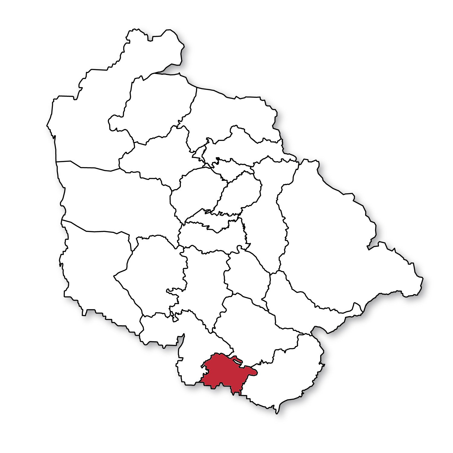
| Kathua district |  |
Kathua | 2,651 | 2,502 | 966 | [11] | 550,084 | 615,711 |
| Jammu district |  |
Jammu | 3,097 | 2,342 | 904 | [12] | 1,343,756 | 1,526,406 |
| Samba district |  |
Samba | new district | 904 | 349 | [13] | 245,016 | 318,611 |
| Udhampur district |  |
Udhampur | 4,550 | 2,367 | 914 | [14] | 475,068 | 555,357 |
| Reasi district |  |
Reasi | new district | 1,719 | 664 | [15] | 268,441 | 314,714 |
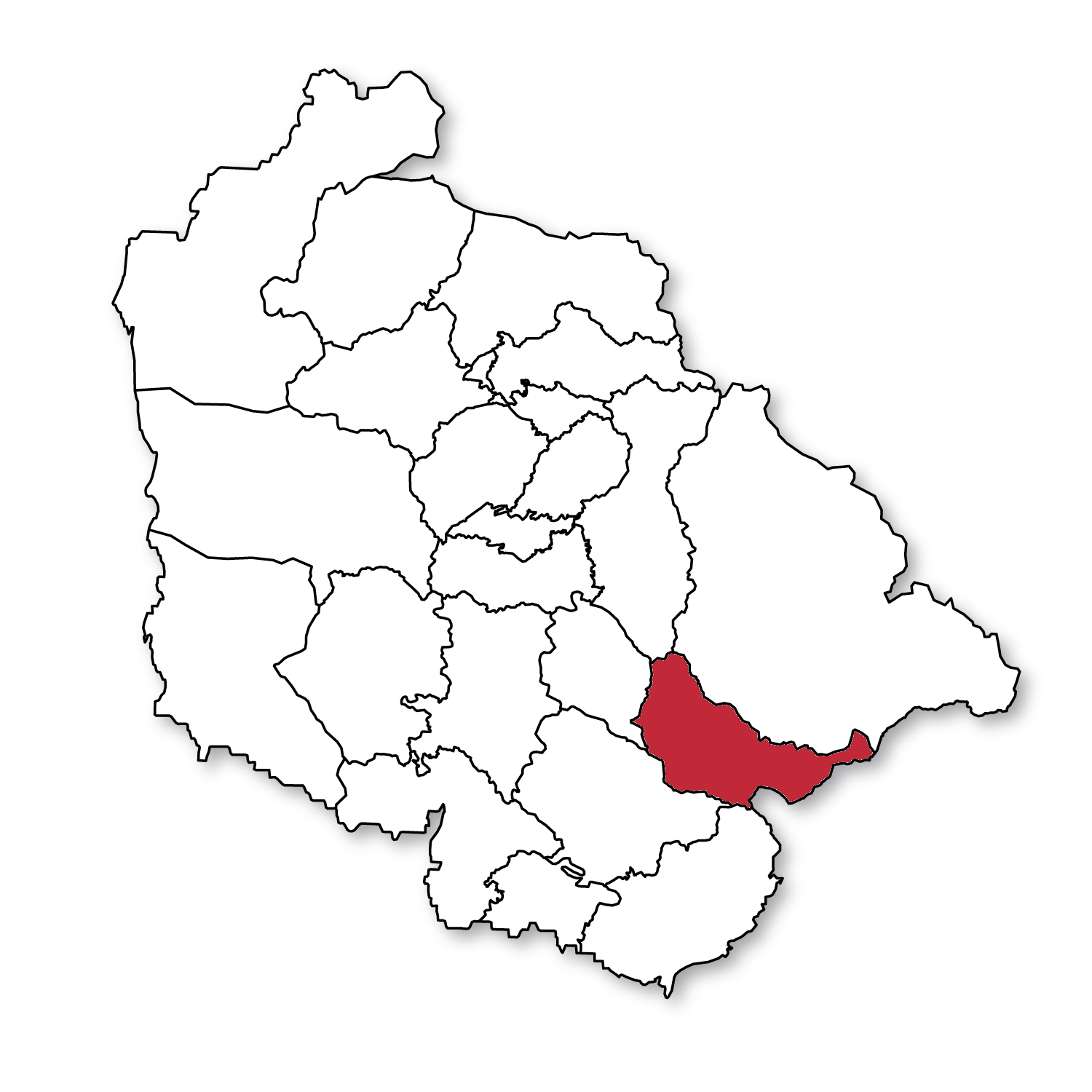
| Rajouri district |  |
Rajouri | 2,630 | 2,630 | 1,015 | [16] | 483,284 | 619,266 |
| Poonch district |  |
Poonch | 1,674 | 1,674 | 646 | [17] | 372,613 | 476,820 |
| Doda district |  |
Doda | 11,691 | 2,625 | 1,014 | [18] | 320,256 | 409,576 |
| Ramban district |  |
Ramban | new district | 1,329 | 513 | [19] | 180,830 | 283,313 |
| Kishtwar district |  |
Kishtwar | new district | 7,737 | 2,987 | [20] | 190,843 | 231,037 |
| Total for division | Jammu | 26,293 | 26,293 | 10,152 | 4,430,191 | 5,350,811 | ||
Kashmir Division[edit | edit source]
| Name | Headquarters | Before 2007[9] | After 2007 | Population 2001 Census[10] |
Population 2011 Census[10] | ||
|---|---|---|---|---|---|---|---|
| Area (km2) |
Area (km2) |
Area (sq miles) |
|||||
| Anantnag district | Anantnag | 3,984 | 3,574 | 1,380 | [21] | 778,408 | 1,070,144 |
| Kulgam district | Kulgam | new district | 410 | 158 | [22] | 394,026 | 422,786 |
| Pulwama district | Pulwama | 1,398 | 1,086 | 419 | [23] | 441,275 | 570,060 |
| Shopian district | Shopian | new district | 312 | 120 | [24] | 211,332 | 265,960 |
| Budgam district | Budgam | 1,371 | 1,361 | 525 | [25] | 607,181 | 735,753 |
| Srinagar district | Srinagar | 2,228 | 1,979 | 764 | [26] | 1,027,670 | 1,269,751 |
| Ganderbal district | Ganderbal | new district | 1,045 | 403 | [27] | 217,907 | 297,003 |
| Bandipore district | Bandipore | new district | 345 | 133 | [28] | 304,886 | 385,099 |
| Baramulla district | Baramulla | 4,588 | 4,243 | 1,638 | [29] | 843,892 | 1,015,503 |
| Kupwara district | Kupwara | 2,379 | 2,379 | 919 | [30] | 650,393 | 875,564 |
| Total for division | Srinagar | 15,948 | 15,948 | 6,158 | 5,476,970 | 6,907,623 | |
New demands[edit | edit source]
New state[edit | edit source]
New union territory[edit | edit source]
- Panun Kashmir Union Territory: meaning "our own Kashmir", is a proposed union territory of India in the Kashmir Valley, which is intended to be a homeland for Kashmiri Hindus. The demand arose after the Exodus of Kashmiri Hindus in 1990.[33][34][35][36][37]
Demand for new divisions[edit | edit source]
- Chenab Valley Division from Jammu division: encompassing the existing 3 districts of Doda, Kishtwar, and Ramban in easternmost part of Jammu DIvision. Chief Minister Omar Abdullah, in 2019, stated that if his party came to power, it would grant divisional status to both the Chenab Valley and the Pir Panjal region.[38][39][40]
- Pir Panjal Division from Jammu Division: encompassing the existing 2 districts of Poonch and Rajouri in northwestern part of Jammu Division, which are also part of the Jammu division. The advocates for this division highlight the need for a governance structure that can effectively address the specific developmental needs of the region's diverse population, which includes a significant number of Pahari and Gujjar communities with distinct terrain, culture, and economic activities. Omar Abdullah's political agenda has included granting divisional status to this region as well.[38][41]
Demand for new districts[edit | edit source]
Jammu division[edit | edit source]
In 2018, BJP repeated it's old demand of creating 4 to 5 new districts in Jammu division which has 70% more area than Kashmir Division yet presently both have same number of districts, 10 each.[42]
| New District Name | Status (As of 2025) | References |
|---|---|---|
| Bhaderwah | Pending | [43][44] |
| Thathri | Pending | [45][43][46] |
| Billawar | Pending | [47] |
| Akhnoor | Pending | [48] |
| Nowshera | Pending | [49] |
See also[edit | edit source]
References[edit | edit source]
- ↑ "Department of Jammu & Kashmir Affairs". Government of India, Ministry of Home Affairs. Archived from the original on 8 December 2008.
- ↑ Karim, Kashmir The Troubled Frontiers 2013, p. 31.
- ↑ Karim, Kashmir The Troubled Frontiers 2013, p. 29–32.
- ↑ Behera, Demystifying Kashmir 2007, p. 15.
- ↑ 5.0 5.1 Snedden, Understanding Kashmir and Kashmiris 2015, p. 167.
- ↑ Behera, Demystifying Kashmir 2007, p. 28.
- ↑ Jammu and Kashmir to have eight new districts, Indo-Asian News Service, 6 July 2006.
- ↑ "Department Of Revenue". jkrevenue.nic.in. Retrieved 6 August 2024.
- ↑ 9.0 9.1 "Divisions & Districts", Jamu & Kashmir Official Portal, 2012, retrieved 21 November 2020
- ↑ 10.0 10.1 10.2 10.3 Census of India 2011, Provisional Population Totals Paper 1 of 2011 : Jammu & Kashmir. Office of the Registrar General & Census Commissioner, India (Report).
Annexure V, Ranking of Districts by Population Size, 2001 - 2011 (Report). - ↑ District Census Handbook Kathua (PDF). Census of India 2011, Part A (Report). 18 June 2014. p. 8. Retrieved 21 November 2020.
- ↑ District Census Handbook Jammu, Part A (PDF). Census of India 2011 (Report). 18 June 2014. pp. 13, 51, 116. Retrieved 21 November 2020.
District Census Handbook Jammu, Part B (PDF). Census of India 2011 (Report). 16 June 2014. pp. 13, 24. Retrieved 21 November 2020. - ↑ District Census Handbook Samba, Part A (PDF). Census of India 2011 (Report). 18 June 2014. pp. 9, 34, 36, 100. Retrieved 21 November 2020.
District Census Handbook Samba, Part B (PDF). Census of India 2011 (Report). 16 June 2014. pp. 10, 12, 22. Retrieved 21 November 2020. - ↑ District Census Handbook Udhampur (PDF). Census of India 2011 (Report). 16 June 2014. pp. 12, 22. Retrieved 21 November 2020.
- ↑ District Census Handbook Reasi, Part A (PDF). Census of India 2011 (Report). 18 June 2014. pp. 9, 37, 88. Retrieved 21 November 2020.
District Census Handbook Reasi, Part B (PDF). Census of India 2011 (Report). 16 June 2014. pp. 9, 13, 24. Retrieved 21 November 2020. - ↑ District Census Handbook Rajouri, Part A (PDF). Census of India 2011 (Report). 18 June 2014. pp. 11, 107. Retrieved 21 November 2020.
District Census Handbook Rajouri, Part B (PDF). Census of India 2011 (Report). 16 June 2014. pp. 9, 10, 12, 22. Retrieved 21 November 2020. - ↑ District Census Handbook Punch, Part A (PDF). Census of India 2011 (Report). 18 June 2014. pp. 9, 99. Retrieved 21 November 2020.
District Census Handbook Punch, Part B (PDF). Census of India 2011 (Report). 16 June 2014. pp. 11, 13, 24. Retrieved 21 November 2020. - ↑ District Census Handbook Doda, Part B (PDF). Census of India 2011 (Report). 18 June 2014. pp. 9, 12, 99. Retrieved 21 November 2020.
- ↑ District Census Handbook Ramban, Part B (PDF). Census of India 2011 (Report). 18 June 2014. pp. 10, 12. Retrieved 21 November 2020.
- ↑ District Census Handbook Kishtwar, Part B (PDF). Census of India 2011 (Report). 18 June 2014. pp. 9, 10, 22. Retrieved 21 November 2020.
- ↑ District Census Handbook Anantnag, Part A (PDF). Census of India 2011 (Report). July 2016. p. 9. Retrieved 21 November 2020.
District Census Handbook Anantnag, Part B (PDF). Census of India 2011 (Report). July 2016. pp. 12, 22. Retrieved 21 November 2020. - ↑ District Census Handbook Kulgam, Part A (PDF). Census of India 2011 (Report). July 2016. p. 10. Retrieved 21 November 2020.
District Census Handbook Kulgam, Part B (PDF). Census of India 2011 (Report). 16 June 2014. pp. 12, 22. Retrieved 21 November 2020.
Part B page 12 says the area of the district is 404 sq km, but page 22 says 410 sq km. - ↑ District Census Handbook Pulwama, Part B (PDF). Census of India 2011 (Report). 16 June 2014. pp. 12, 22. Retrieved 21 November 2020.
- ↑ District Census Handbook Shupiyan, Part A (PDF). Census of India 2011 (Report). 16 June 2014. p. 10. Retrieved 21 November 2020.
District Census Handbook Shupiyan, Part B (PDF). Census of India 2011 (Report). 16 June 2014. pp. 12, 22. Retrieved 21 November 2020.
Part B pages 12 and 22 say the district area is 312.00 sq km, but Part A page 10 says 307.42 sq km. - ↑ District Census Handbook Badgam, Part A (PDF). Census of India 2011 (Report). July 2016. pp. 10, 46. Retrieved 21 November 2020.
District Census Handbook Badgam, Part B (PDF). Census of India 2011 (Report). 16 June 2014. pp. 11, 12, 22. Retrieved 21 November 2020.
Part A says the district area is 1371 sq km, Part B says 1371 sq km (page 11) and 1361 sq km (page 12s and 22). - ↑ District Census Handbook Srinagar, Part A (PDF). Census of India 2011 (Report). July 2016. pp. 11, 48. Retrieved 21 November 2020.
Part A page 48 says the district area was 2228.0 sq km in 2001 and 1978.95 sq km in 2011. - ↑ "Ganderbal District Development Plan" (PDF). Jammu and Kashmir Directorate of Information and Public Relations. Retrieved 23 March 2024.
- ↑ District Census Handbook Bandipora, Part A (PDF). Census of India 2011 (Report). July 2016. pp. 10, 47. Retrieved 21 November 2020.
District Census Handbook Bandipora, Part B (PDF). Census of India 2011 (Report). 16 June 2014. pp. 11, 20. Retrieved 21 November 2020. - ↑ District Census Handbook Baramulla, Part A (PDF). Census of India 2011 (Report). July 2016. p. 11. Retrieved 21 November 2020.
District Census Handbook Baramulla, Part B (PDF). Census of India 2011 (Report). 16 June 2014. p. 22. Retrieved 21 November 2020. - ↑ District Census Handbook Kupwara, Part A (PDF). Census of India 2011 (Report). July 2016. p. 7. Retrieved 21 November 2020.
District Census Handbook Kupwara, Part B (PDF). Census of India 2011 (Report). 16 June 2014. pp. 11, 12. Retrieved 21 November 2020. - ↑ "IkkJutt Jammu blows the bugle, begins Separate Jammu State Yatra". Firemedia TV. Retrieved 25 July 2024.
- ↑ Excelsior, Daily (12 February 2023). "IJ starts Yatra for separate Jammu State". Daily Excelsior. Retrieved 25 July 2024.
- ↑ Excelsior, Daily (9 January 2017). "Involve 'Panun Kashmir' in talks on return of KPs: Ambardar". Retrieved 14 March 2019.
- ↑ Wirsing, Robert (2003). Kashmir in the Shadow of War: Regional Rivalries in a Nuclear Age. M.E. Sharpe. p. 149. ISBN 9780765610898.
- ↑ PTI, (Press Trust of India) (28 July 2019). "Carve out separate state within India for Kashmiri Pandits along Jhelum river: Panun Kashmir". India Today. Retrieved 25 October 2019.
- ↑ "700 eminent Kashmiri Pandits support Centre's decision on Article 370: Panun Kashmir". Business Standard India. Press Trust of India. 22 August 2019. Retrieved 25 October 2019.
- ↑ "Post 370, Kashmiri Hindus wait to return to their homes". The Sunday Guardian Live. 19 October 2019. Archived from the original on 25 October 2019. Retrieved 25 October 2019.
- ↑ 38.0 38.1 "Separate division for Ladakh: Omar promises two more for Chenab valley, Pir Panjal if voted to power." (The Times of India, February 8, 2019).
- ↑ "The fate of Chenab Valley’s Plea for Divisional Status, Hill Council." (Kashmir Images, September 8, 2024).
- ↑ "Chenab Valley (Jammu Division)." (Bharatpedia, accessed August 8, 2025).
- ↑ "Pir Panjal Region (Jammu Division)." (Bharatpedia, accessed August 8, 2025).
- ↑ BJP wants creation of new districts, PDP says no need, The Kashmir Monitor, 2 Apr 2018.
- ↑ 43.0 43.1 "Create Bhaderwah, Thathri two districts: Rao". Daily Excelsior. 15 January 2025. Retrieved 23 January 2025.
- ↑ "J&K administration declines immediate creation of Thathri and Bhaderwah districts". Scoop News. 11 March 2025.
- ↑ Ayoob, Anzer (7 September 2020). "Why Thathri needs district status?". The Chenab Times. Retrieved 8 September 2020.
- ↑ "J&K administration declines immediate creation of Thathri and Bhaderwah districts". Scoop News. 11 March 2025.
- ↑ "Former Minister demands grant of district status to Billawar". Daily Excelsior. 21 August 2020. Retrieved 19 September 2025.
- ↑ "Youth demands district status for Akhnoor". Early Times Newspaper Jammu Kashmir. 19 September 2025. Retrieved 19 September 2025.
- ↑ Masoodi, Nazir; Chatterjee, Debjani (25 March 2018). "Demand For Separate District, Over 30 Injured In Clashes In Nowshera". www.ndtv.com. Retrieved 19 September 2025.
Bibliography[edit | edit source]
- Behera, Navnita Chadha (2007), Demystifying Kashmir, Pearson Education India, ISBN 978-8131708460
- Karim, Maj Gen Afsir (2013), Kashmir The Troubled Frontiers, Lancer Publishers LLC, pp. 30–, ISBN 978-1-935501-76-3
- Snedden, Christopher (2015), Understanding Kashmir and Kashmiris, Oxford University Press, ISBN 978-1-84904-342-7
- Larson, Gerald James. "India's Agony Over Religion", 1995, page 245
External links[edit | edit source]
- Jammu and Kashmir district portal
- "Maps of newly formed Union Territories of Jammu Kashmir and Ladakh, with the map of India", Ministry of Home Affairs, Government of India, 2 November 2019