



No edit summary Tag: missing file added |
m robot: Update article |
||
| Line 1: | Line 1: | ||
{{Short description|Union territory of India}} | {{Short description|Union territory of India}} | ||
{{Use Indian English|date= | {{pp-pc|small=yes}} | ||
{{Use dmy dates|date= | {{Use Indian English|date=August 2020}} | ||
{{Use dmy dates|date=November 2021}} | |||
{{Infobox settlement | {{Infobox settlement | ||
<!-- See Template:Infobox settlement for additional fields and descriptions --> | <!-- See Template:Infobox settlement for additional fields and descriptions --> | ||
| name | | name = Andaman and Nicobar Islands | ||
| official_name | | official_name = | ||
| type | | type = [[Union territory]]| | ||
| | | image_seal = [[File:Seal_of_Andaman_Government.png|125px]] | ||
| | | seal_type = Emblem | ||
| blank_emblem_size = | |||
| image_map = IN-AN.svg | |||
| | | image_skyline = {{multiple image | ||
| blank_emblem_size | | border = infobox | ||
| image_map | | total_width = 290 | ||
| image_skyline | | image_style = border:1; | ||
| | | perrow = 1/2/2 | ||
| | | image1 =Andaman Islands india.jpg | ||
| | | alt1 = Sea boats parked in Andaman | ||
| | | image2 = Floaters @ Andaman.jpg | ||
| | | alt2 = Scuba divers | ||
| | | image3 = Ross and Smith island, Andaman Nicobar Island.jpg | ||
| | | alt3 = Ross and Smith island | ||
| image4 = Sunset at Andaman Islands.jpg | |||
| alt4 = Sunset at Andaman Islands | |||
| image5 = Andaman.jpg | |||
| alt5 = Andaman Islands | |||
}} | }} | ||
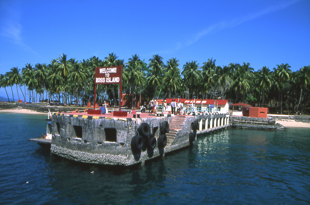
| image_caption | | image_caption = '''Clockwise from top-right''': Beach at [[Ross Island, North and Middle Andaman district|Ross]] and [[Smith Island (Andaman and Nicobar Islands)|Smith island]]; sunset at [[Andaman Islands|Andaman Island]]; diving near Andaman | ||
| map_alt | | map_alt = | ||
| map_caption | | map_caption = Location of Andaman and Nicobar Islands in India | ||
| coordinates | | coordinates = {{coord|11.68|92.77|type:adm1st_region:IN-AN|display=inline,title}} | ||
| coor_pinpoint | | coor_pinpoint = Port Blair | ||
| coordinates_footnotes | | coordinates_footnotes = | ||
| subdivision_type | | subdivision_type = [[List of sovereign states|Country]] | ||
| subdivision_name | | subdivision_name = {{flag|India}} | ||
| established_title | | established_title = Established | ||
| established_date | | established_date = 1 November 1956 | ||
| seat_type | | seat_type = Capital and largest city | ||
| seat | | seat = [[Port Blair]] | ||
| leader_title | | leader_title = [[List of Lieutenant Governors of Andaman and Nicobar Islands|Lieutenant Governor]] | ||
| leader_name | | leader_name = [[Devendra Kumar Joshi|Admiral (Retd.) Devendra Kumar Joshi]] | ||
| leader_title1 | | leader_title1 = [[Chief Secretary (India)|Chief Secretary]] | ||
| leader_name1 | | leader_name1 = Jitendra Narain, [[Indian Administrative Service|IAS]] | ||
| leader_title2 = [[Andaman and Nicobar Islands (Lok Sabha constituency)|MP (Lok Sabha)]] | |||
| | | leader_name2 = [[Kuldeep Rai Sharma]] | ||
| | | leader_title3 = [[High Courts of India|High Court]] | ||
| | | leader_name3 = [[Calcutta High Court|Calcutta High Court (Port Blair Bench)]] | ||
| | |||
<!--|unit_pref = Metric or US or UK --> | <!--|unit_pref = Metric or US or UK --> | ||
| parts_type | | parts_type = [[List of districts in India|Districts]] | ||
| parts | | parts = 3 | ||
| area_footnotes | | area_footnotes = <ref>{{cite web|url=http://www.and.nic.in/andaman/location.php |archive-url=https://web.archive.org/web/20150218234103/http://www.and.nic.in/andaman/location.php |url-status=dead |archive-date=18 February 2015 |title=Andaman and Nicobar Administration |publisher=And.nic.in |access-date=8 July 2013}}</ref> | ||
| area_total_km2 | | area_total_km2 = 8249 | ||
| area_rank | | area_rank = [[List of states and territories of India by area|28th]] | ||
| population_total | | population_total = 380,520 | ||
| population_as_of | | population_as_of = 2012 | ||
| population_footnotes | | population_footnotes = <ref>[http://www.censusindia.gov.in/ Census of India] {{Webarchive|url=https://web.archive.org/web/20070614053639/http://www.censusindia.net/cendat/language/lang_table1.PDF |date=14 June 2007}}, 2011. Census Data Online, Population.</ref> | ||
| population_density_km2 | | population_density_km2 = auto | ||
| population_note | | population_note = | ||
| demographics_type1 | | demographics_type1 = Languages<ref name="langoff">{{cite web|url=http://nclm.nic.in/shared/linkimages/NCLM50thReport.pdf |archive-url=https://web.archive.org/web/20150322000632/http://nclm.nic.in/shared/linkimages/NCLM50thReport.pdf |url-status=dead |archive-date=22 March 2015 |page=109 |title=50th Report of the Commissioner for Linguistic Minorities in India |date=16 July 2014 |access-date=6 November 2016}}</ref> | ||
| demographics1_title1 | | demographics1_title1 = Official | ||
| demographics1_info1 | | demographics1_info1 = [[Hindi]], [[English language|English]]<ref name="langoff" /> | ||
| demographics1_title2 | | demographics1_title2 = Spoken | ||
| demographics1_info2 | | demographics1_info2 = [[Bengali language|Bengali]], [[Tamil language|Tamil]], [[Telugu language|Telugu]], [[Hindi]], [[Nicobarese languages|Nicobarese]], [[Malayalam]], [[Sadri language|Sadri]], [[Kurukh language|Kurukh]], [[Munda languages|Munda]], [[Kharia language|Kharia]]<ref>{{Cite web |url=http://www.andaman.gov.in/web/guest/general-information |title=www.andaman.gov.in |access-date=27 November 2016 |archive-url=https://web.archive.org/web/20161120055809/http://www.andaman.gov.in/web/guest/general-information |archive-date=20 November 2016 |url-status=live}}</ref> | ||
| timezone1 | | timezone1 = [[Indian Standard Time|IST]] | ||
| utc_offset1 | | utc_offset1 = +05:30 | ||
| iso_code | | iso_code = [[ISO 3166-2:IN|IN-AN]] | ||
| blank_name_sec1 | | blank_name_sec1 = [[Human Development Index|HDI]] {{nobold|(2019)}} | ||
| blank_info_sec1 | | blank_info_sec1 = {{increase}}0.741 ({{colour|green|high}}) • [[List of Indian states and territories by Human Development Index|6th]] | ||
| website | | website = {{URL|https://www.andaman.gov.in/}} | ||
| module | | module = {{Infobox place symbols| embedded=Yes | ||
| region = Andaman and Nicobar Islands | | region = Andaman and Nicobar Islands | ||
| country = India | | country = India | ||
| emblem = [[Emblem of Andaman and Nicobar Islands]] | |||
| emblem = [[Emblem of Andaman and Nicobar Islands]] | | motto = [[Satyameva Jayate]]<br/>(Truth alone triumphs) | ||
| motto = [[Satyameva Jayate]]<br/>(Truth alone triumphs) | | mammal = [[Dugong]] | ||
| mammal = [[Dugong]] | | bird = [[Andaman Wood Pigeon]] | ||
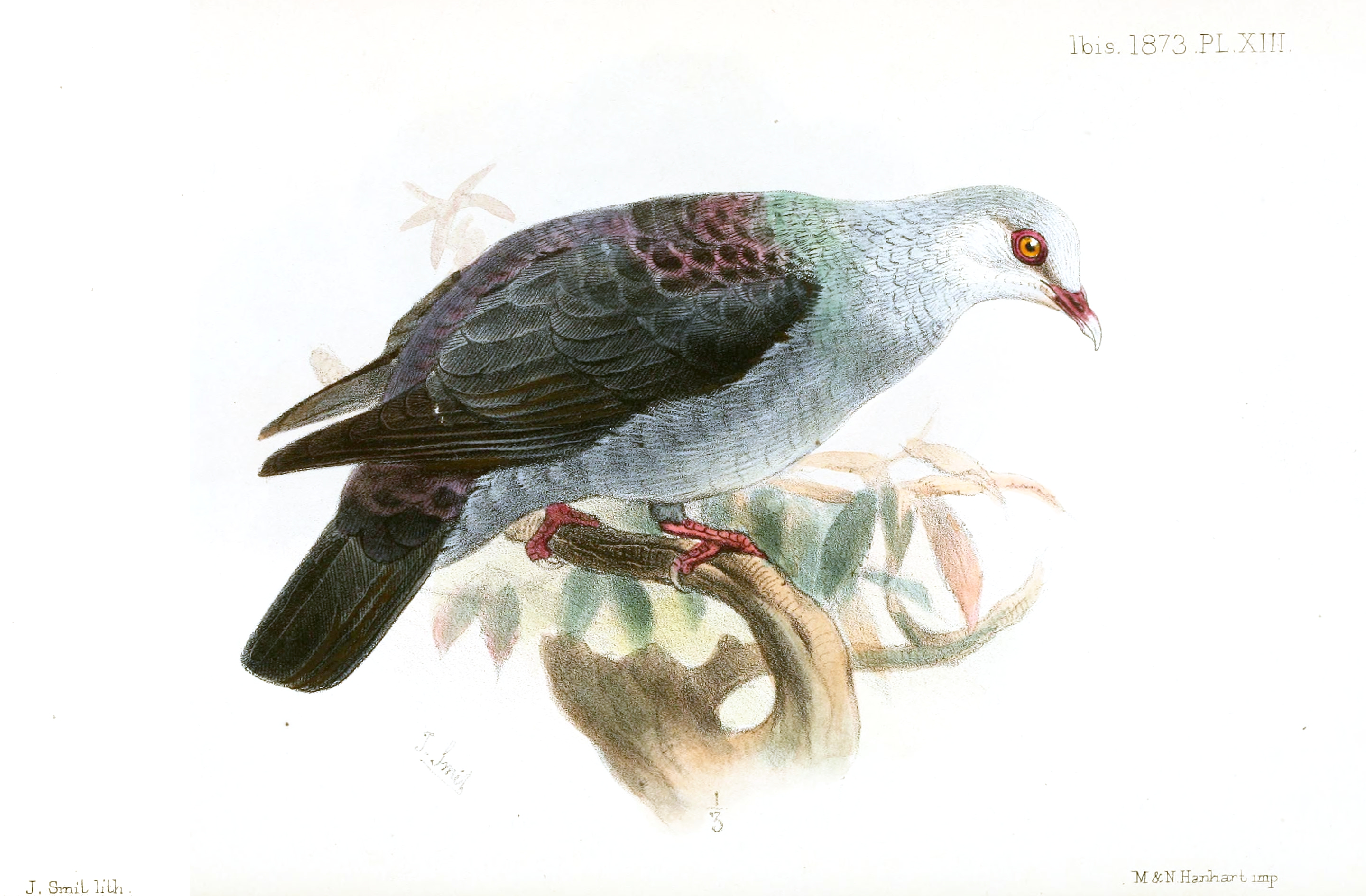
| bird = [[Andaman Wood Pigeon]] | | tree = [[File:Andaman padauk 02.JPG|50px|left]] [[Andaman Padauk]] | ||
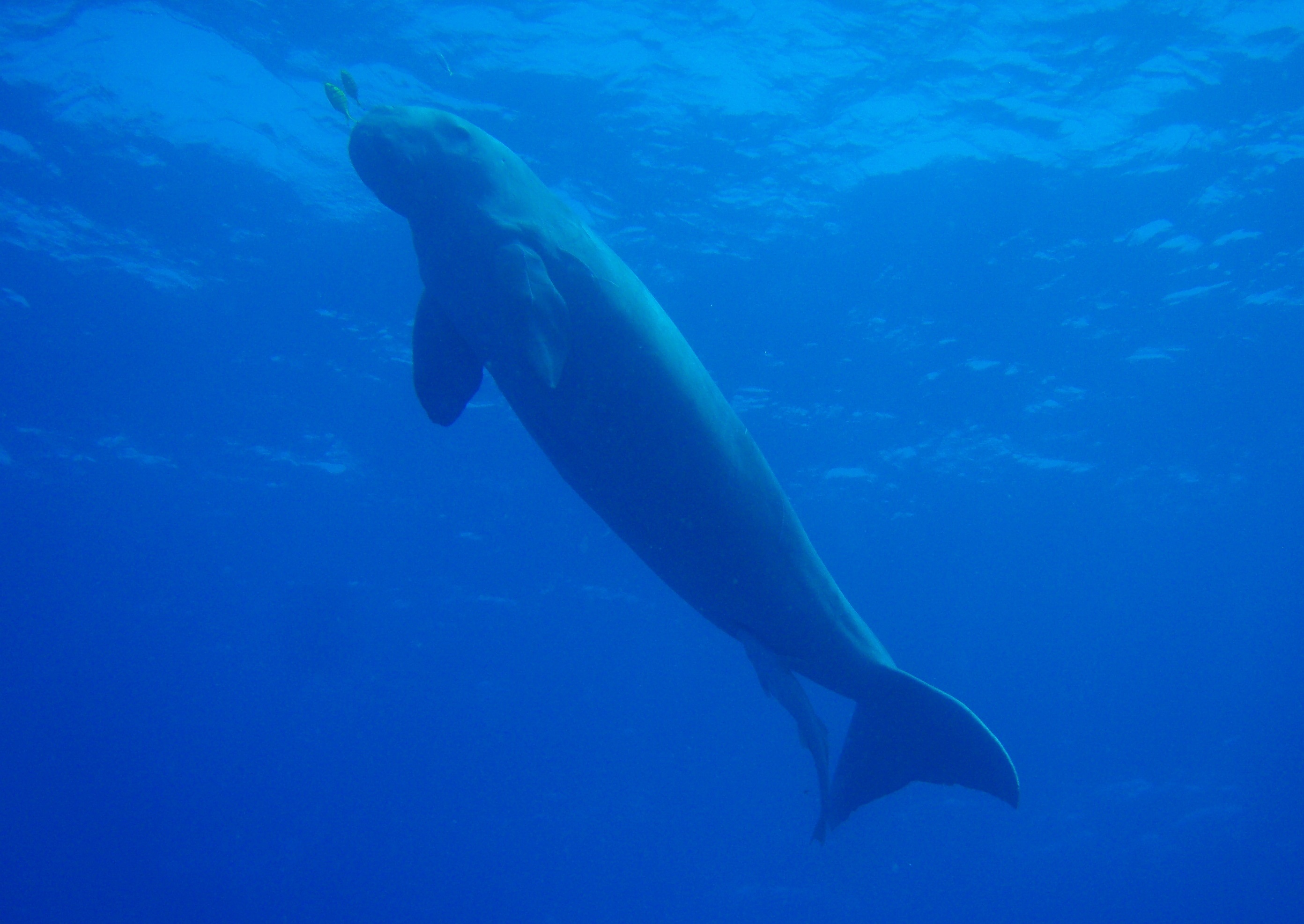
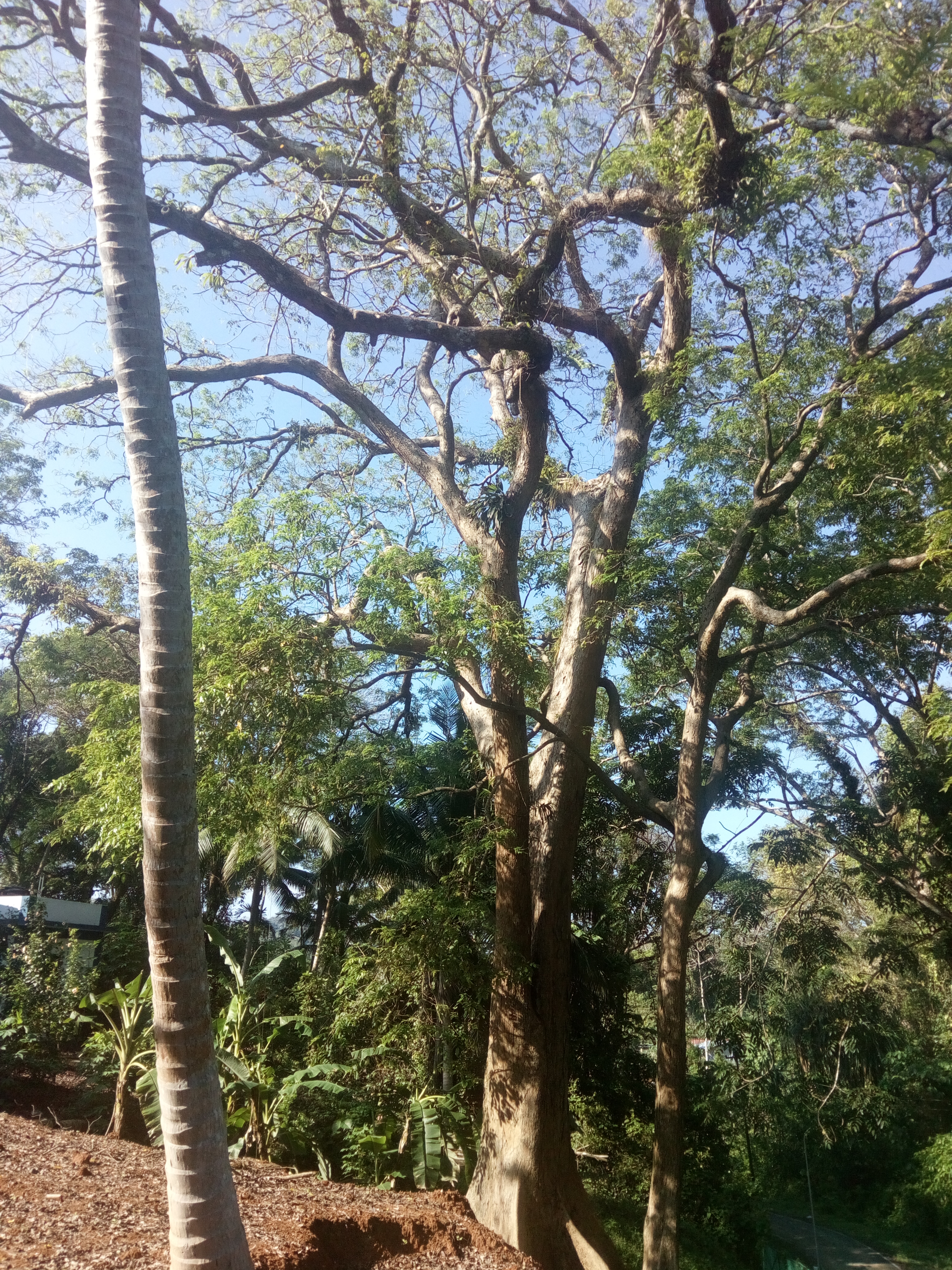
| tree = [[File:Andaman padauk 02.JPG|50px|left]] [[Andaman Padauk]] | | flower = [[Lagerstroemia speciosa]] Pyinma | ||
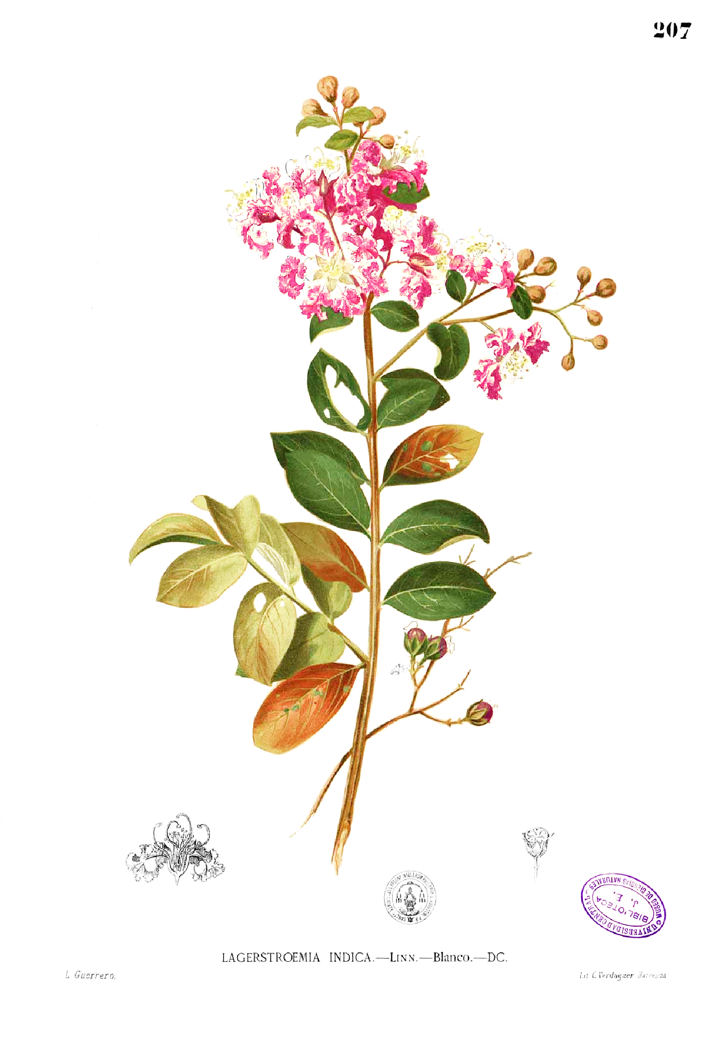
| flower = [[Lagerstroemia speciosa]] Pyinma | }} | ||
}} | }} | ||
The territory is about {{convert|150|km|abbr=on}} north of [[Aceh]] in [[Indonesia]] and separated from [[Thailand]] and [[Myanmar]] by the [[Andaman Sea]]. It comprises two island groups, the [[Andaman Islands]] (partly) and the [[Nicobar Islands]], separated by the 150 km wide [[Ten Degree Channel]] (on the [[10th parallel north|10°N parallel]]), with the Andaman islands to the north of this [[latitude]], and the Nicobar islands to the south (or by 179 km). The Andaman Sea lies to the east and the Bay of Bengal to the west. | The '''Andaman and Nicobar Islands''' is a [[union territory]] of [[India]] consisting of 572 islands, of which 37 are inhabited, at the junction of the [[Bay of Bengal]] and the [[Andaman Sea]].<ref name="tribune-watchtower">{{cite news |last1=Sawhney |first1=Pravin |title=A watchtower on the high seas |url=https://www.tribuneindia.com/news/comment/a-watchtower-on-the-high-seas/720929.html |newspaper=[[The Tribune (Chandigarh)|The Tribune]] |access-date=16 April 2019 |date=30 January 2019 |archive-url=https://web.archive.org/web/20190416050217/https://www.tribuneindia.com/news/comment/a-watchtower-on-the-high-seas/720929.html |archive-date=16 April 2019 |url-status=live}}</ref> The territory is about {{convert|150|km|abbr=on}} north of [[Aceh]] in [[Indonesia]] and separated from [[Thailand]] and [[Myanmar]] by the [[Andaman Sea]]. It comprises two island groups, the [[Andaman Islands]] (partly) and the [[Nicobar Islands]], separated by the 150 km wide [[Ten Degree Channel]] (on the [[10th parallel north|10°N parallel]]), with the Andaman islands to the north of this [[latitude]], and the Nicobar islands to the south (or by 179 km). The Andaman Sea lies to the east and the Bay of Bengal to the west. The island chains are thought to be a submerged extension of the [[Arakan Mountains]].<ref>{{Cite web|title=Andaman and Nicobar: Beyond India's landmass|url=https://www.downtoearth.org.in/coverage/andaman-and-nicobar-beyond-indias-landmass-12507|access-date=12 May 2021|website=www.downtoearth.org.in|language=en}}</ref> | ||
The territory's capital is the city of [[Port Blair]]. The total land area of the islands is approximately {{convert|8249|km2|abbr=on}}. The territory is divided into three districts: the [[Nicobar District]] with [[Car Nicobar]] as its capital, the [[South Andaman district]] with Port Blair as its capital and the [[North and Middle Andaman district]] with [[Mayabunder]] as its capital. | The territory's capital is the city of [[Port Blair]]. The total land area of the islands is approximately {{convert|8249|km2|abbr=on}}. The territory is divided into three districts: the [[Nicobar District]] with [[Car Nicobar]] as its capital, the [[South Andaman district]] with Port Blair as its capital, and the [[North and Middle Andaman district]] with [[Mayabunder]] as its capital. | ||
The islands host the [[Andaman and Nicobar Command]], the only tri-service geographical command of the [[Indian Armed Forces]].<ref>{{Cite web|title=Andaman and Nicobar Command (ANC)|url=https://www.drishtiias.com/loksabha-rajyasabha-discussions/andaman-and-nicobar-command-anc|access-date=8 December 2020|website=Drishti IAS|language=en}}</ref> | The islands host the [[Andaman and Nicobar Command]], the only tri-service geographical command of the [[Indian Armed Forces]].<ref>{{Cite web|title=Andaman and Nicobar Command (ANC)|url=https://www.drishtiias.com/loksabha-rajyasabha-discussions/andaman-and-nicobar-command-anc|access-date=8 December 2020|website=Drishti IAS|language=en}}</ref> | ||
The Andaman Islands are also home to the [[Sentinelese people]], an [[uncontacted people|uncontacted tribe]]. The Sentinelese might be the only people currently known to not have reached further than a [[Paleolithic|Paleolithic level of technology]] | The Andaman Islands are also home to the [[Sentinelese people]], an [[uncontacted people|uncontacted tribe]]. The Sentinelese might be the only people currently known to not have reached further than a [[Paleolithic|Paleolithic level of technology]];<ref name=":0">{{cite web|url=http://www.andaman.gov.in/web/guest/indigenous-tribes|title=Andaman & Nicobar Administration|archive-url=https://web.archive.org/web/20150218205553/http://www.and.nic.in/andaman/tribes.php|archive-date=18 February 2015|url-status=dead|work=and.nic.in}}</ref> however, this is disputed, as evidence of metalwork was found on their island.<ref>{{cite book |last=Pandit| first=T. N. |year=1990 |title=The Sentinelese |pages=17–20 |location=Kolkata |publisher=Seagull Books |isbn=978-81-7046-081-7 }}</ref> | ||
==History== | ==History== | ||
| Line 93: | Line 95: | ||
===First inhabitants=== | ===First inhabitants=== | ||
The earliest [[ | The earliest [[archaeological]] evidence documents some 2,200 years. However, [[Genetics|genetic]] and [[cultural]] studies suggest that the indigenous [[Andamanese]] people may have been isolated from other populations during the [[Middle Paleolithic]], which ended 30,000 years ago.<ref>{{cite journal |last1=Palanichamy |first1=Malliya G. |first2=Suraksha |last2=Agrawal |first3=Yong-Gang |last3=Yao |first4=Qing-Peng |last4=Kong |first5=Chang |last5=Sun |first6=Faisal |last6=Khan |first7=Tapas Kumar |last7=Chaudhuri |first8=Ya-Ping |last8=Zhang |year=2006 |title=Comment on 'Reconstructing the Origin of Andaman Islanders' |journal=[[Science (journal)|Science]] |volume=311 |issue=5760 |pages=470 |doi=10.1126/science.1120176 |pmid=16439647 |doi-access=free}}</ref> Since that time, the Andamanese have diversified into linguistically and culturally distinct territorial groups. | ||
The Nicobar Islands appear to have been populated by people of various backgrounds. By the time of European contact, the indigenous inhabitants had coalesced into the [[Nicobarese people]], speaking | The Nicobar Islands appear to have been populated by people of various backgrounds. By the time of European contact, the indigenous inhabitants had coalesced into the [[Nicobarese people]], speaking an [[Austroasiatic]] language, and the [[Shompen]], whose language is of uncertain affiliation. Neither language is related to Andamanese. | ||
===Chola | ===Chola imperial period=== | ||
{{See also|Andaman Tamils|Chola empire}} | {{See also|Andaman Tamils|Chola empire}} | ||
[[Rajendra Chola | [[Rajendra Chola II]] of the [[Chola Dynasty]] (modern-day South India), used the Andaman and Nicobar Islands as a strategic naval base to launch an expedition against the [[Srivijaya|Srivijaya Empire]] (modern-day Indonesia). The Cholas called the island Ma-Nakkavaram ("great open"), found in the [[Thanjavur]] inscription of 1050 CE. European traveller [[Marco Polo]] (12th–13th century) and referred to this island as 'Necuverann' a modified form of the Tamil name Nakkavaram, which then led to the modern Anglicized name 'Nicobar' during the British colonial period.<ref name="goi1908">{{Cite book|title=The Andaman and Nicobar Islands: Local Gazetteer |author=Government of India |publisher=Superintendent of Government Printing, Calcutta |year=1908 |url=https://books.google.com/books?id=rrwBAAAAYAAJ |quote=''... In the great Tanjore inscription of 1050 CE, the Andamans are mentioned under a translated name along with the Nicobars, as '''Nakkavaram''' or land of the naked people.}}</ref> | ||
===Maratha imperial period=== | |||
The islands became a temporary shipping port of the [[Maratha Empire]] and its [[Maratha Navy|navy]] in the 17th century. The Maratha admiral [[Kanhoji Angre]] established a basic naval dominance in the islands and played a role in the annexation of the islands to India.<ref>{{cite news |last1=Kukreja |first1=Air Marshal Dhiraj |title=Andaman and Nicobar Islands: A security challenge for India |url=http://www.indiandefencereview.com/news/andaman-and-nicobar-islands-a-security-challenge-for-india/ |access-date=24 November 2021 |work=Indian Defence Review |date=1 January 2013}}</ref> | |||
===Danish colonial period and British rule=== | ===Danish colonial period and British rule=== | ||
[[File:Andaman tribals fishing (c. 1870).jpg|thumb|Andaman tribals fishing (c. 1870)]] | [[File:Andaman tribals fishing (c. 1870).jpg|thumb|Andaman tribals fishing (c. 1870)]] | ||
The history of organised European [[colonisation]] on the islands began when settlers from the [[Danish East India Company]] arrived in the Nicobar Islands on 12 December 1755. On 1 January 1756, the Nicobar Islands were made a Danish colony, first named New Denmark,{{ | The history of organised European [[colonisation]] on the islands began when settlers from the [[Danish East India Company]] arrived in the Nicobar Islands on 12 December 1755. On 1 January 1756, the Nicobar Islands were made a Danish colony, first named New Denmark,<ref>{{cite book|author1=Danish National Archives|author2=C. Rise Hansen|title=Sources of the History of North Africa, Asia and Oceania in Denmark|url=https://books.google.com/books?id=EL77Dk9jyaQC&pg=PA19|date=18 October 2011|publisher=Walter de Gruyter|isbn=978-3-11-097036-4|pages=19}}</ref> and later (December 1756) Frederick's Islands (''Frederiksøerne'').<ref name="Haensel">{{cite book | ||
| title = Letters on the Nicobar islands, their natural productions, and the manners, customs, and superstitions of the natives with an account of an attempt made by the Church of the United Brethren, to convert them to Christianity. | |||
| url = https://www.gutenberg.org/ebooks/26781 | |||
| author = John Gottfried Haensel | |||
| editor =Christian Ignatius Latrobe | |||
| year = 1812}}</ref>{{rp|7}} During 1754–1756 they were administrated from [[Tranquebar]] (in continental [[Danish India]]).<ref name="Haensel"/>{{rp|8}} The islands were repeatedly abandoned due to outbreaks of [[malaria]] between 14 April 1759 and 19 August 1768, from 1787 to 1807/05, 1814 to 1831, 1830 to 1834 and gradually from 1848 for good.{{citation needed|date=August 2020}} | |||
From 1 June 1778 to 1784, [[Austria]] mistakenly assumed that Denmark had abandoned its claims to the Nicobar Islands and attempted to [[Austrian colonisation of Nicobar Islands|establish a colony]] on them,<ref name="ColVoy">{{cite web|url=http://www.colonialvoyage.com/DanishP.html |archive-url=https://web.archive.org/web/20050404001731/http://www.colonialvoyage.com/DanishP.html |url-status=dead |archive-date=4 April 2005 |title=Chronology of Danish Colonial Settlements |first=Marco |last=Ramerini |publisher=ColonialVoyage.com |access-date=16 November 2010}}</ref> renaming them ''' | From 1 June 1778 to 1784, [[Austria]] mistakenly assumed that Denmark had abandoned its claims to the Nicobar Islands and attempted to [[Austrian colonisation of Nicobar Islands|establish a colony]] on them,<ref name="ColVoy">{{cite web|url=http://www.colonialvoyage.com/DanishP.html |archive-url=https://web.archive.org/web/20050404001731/http://www.colonialvoyage.com/DanishP.html |url-status=dead |archive-date=4 April 2005 |title=Chronology of Danish Colonial Settlements |first=Marco |last=Ramerini |publisher=ColonialVoyage.com |access-date=16 November 2010}}</ref> renaming them '''Theresa Islands'''.<ref>{{cite book | ||
| url = https://www.gutenberg.org/ebooks/38462 | |||
| title = Narrative of the Circumnavigation of the Globe by the Austrian Frigate Novara | |||
| volume = II | |||
| author = Karl Ritter von Scherzer | |||
| author-link = Karl von Scherzer | |||
| page = 63 | |||
}}</ref> | |||
In 1789 the British set up a naval base and penal colony on Chatham Island next to Great Andaman, where now lies the town of [[Port Blair]]. Two years later the colony was moved to [[Port Cornwallis]] on Great Andaman, but it was abandoned in 1796 due to disease. | In 1789, the British set up a naval base and penal colony on Chatham Island next to Great Andaman, where now lies the town of [[Port Blair]]. Two years later the colony was moved to [[Port Cornwallis]] on Great Andaman, but it was abandoned in 1796 due to disease. | ||
In 1858 the British again established a colony at Port Blair, which proved to be more permanent. The primary purpose was to set up a [[penal colony]] for criminal convicts from the [[Indian subcontinent]]. The | In 1858, the British again established a colony at Port Blair, which proved to be more permanent. The primary purpose was to set up a [[penal colony]] for criminal convicts from the [[Indian subcontinent]].<ref>{{Cite journal|url=http://www.jstor.org/stable/44137988|author=MATHUR, L. P.|title=A Historical Study of Euro-Asian Interest in the Andaman and Nicobar Islands|year=1967|journal=Proceedings of the Indian History Congress|volume=29|page=60|jstor=44137988}}</ref> The [[Cellular Jail]], which was used to house [[political prisoner]]s, was constructed on the islands.<ref>{{Cite journal|url=http://www.jstor.org/stable/41856271|author=Murthy, R.V.R.|title=Cellular Jail:a Century of Sacrifices|year=2006|journal=The Indian Journal of Political Science|volume=67|issue=4|pages=879–888|jstor=41856271}}</ref><ref>{{Cite web|url=https://www.independent.co.uk/news/long_reads/cellular-jail-india-integral-country-fight-freedom-independence-british-colony-andaman-and-nicobar-islands-port-blair-sushil-dasguputa-a7883691.html |archive-url=https://web.archive.org/web/20201111041305/https://www.independent.co.uk/news/long_reads/cellular-jail-india-integral-country-fight-freedom-independence-british-colony-andaman-and-nicobar-islands-port-blair-sushil-dasguputa-a7883691.html |archive-date=2020-11-11 |url-access=limited |url-status=live|title=How India's Cellular Jail was integral in the country's fight for freedom|date=14 August 2017|website=The Independent}}</ref> | ||
[[Italy]] made an attempt at buying the Nicobar Islands from Denmark between 1864 and 1865. The Italian Minister of Agriculture and Commerce [[Luigi Torelli]] started a negotiation that looked promising, but failed due to the unexpected end of his office and the | [[Kingdom of Italy|Italy]] made an attempt at buying the Nicobar Islands from Denmark between 1864 and 1865. The Italian Minister of Agriculture and Commerce [[Luigi Torelli]] started a negotiation that looked promising, but failed due to the unexpected end of his office and the [[La Marmora II Cabinet|second La Marmora Cabinet]]. The negotiations were interrupted and never brought up again.<ref>Ministero della Guerra, Ufficio Storico, Storia Militare della Colonia Eritrea, Vol. I, Roma 1935, pp. 15-16</ref> | ||
[[Denmark]]'s presence in the territory ended formally on 16 October 1868 when it sold the rights to the Nicobar Islands to Britain,<ref name="ColVoy"/> which made them part of [[British India]] in 1869. | [[Denmark]]'s presence in the territory ended formally on 16 October 1868 when it sold the rights to the Nicobar Islands to Britain,<ref name="ColVoy"/> which made them part of [[British Raj|British India]] in 1869. | ||
In 1872 the Andaman and Nicobar islands were united under a single chief commissioner at [[Port Blair]]. | In 1872, the Andaman and Nicobar islands were united under a single chief commissioner at [[Port Blair]]. | ||
===World War II=== | ===World War II=== | ||
{{main|Japanese occupation of the Andaman Islands}} | {{main|Japanese occupation of the Andaman Islands}} | ||
[[File:The British Occupation of the Nicobar Islands, 1945 SE5438.jpg|thumb|Japanese military delegation salute Lieutenant Colonel [[Nathu Singh Rathore|Nathu Singh]], commanding officer of the [[Rajput Regiment]], following their surrender of Islands, 1945]] | |||
During [[World War II]], the islands were practically under Japanese control, only nominally under the authority of the [[Arzi Hukumate Azad Hind]] of [[Subhash Chandra Bose]]. Bose visited the islands during the war and renamed them as "Shaheed-Dweep" (Martyr Island) and "Swaraj-dweep" (Self-rule Island). | During [[World War II]], the islands were practically under Japanese control, only nominally under the authority of the [[Arzi Hukumate Azad Hind]] of [[Subhash Chandra Bose]]. Bose visited the islands during the war and renamed them as "Shaheed-Dweep" (Martyr Island) and "Swaraj-dweep" (Self-rule Island). | ||
General [[A. D. Loganathan|Loganathan]], of the [[Indian National Army]], was made the Governor of the Andaman and Nicobar Islands. On 22 February 1944 he along with four INA officers—Major Mansoor Ali Alvi, Sub. Lt. Md. Iqbal, Lt. Suba Singh, and stenographer Srinivasan—arrived at Lambaline Airport in [[Port Blair]]. On 21 March 1944, the Headquarters of the Civil Administration was established near the [[gurdwara]] at Aberdeen Bazaar. On 2 October 1944, Col. [[A. D. Loganathan|Loganathan]] handed over the charge to Maj. Alvi and left Port Blair, never to return.<ref>"Black Days in Andaman and Nicobar Islands" by | General [[A. D. Loganathan|Loganathan]], of the [[Indian National Army]], was made the Governor of the Andaman and Nicobar Islands. On 22 February 1944 he along with four INA officers—Major Mansoor Ali Alvi, Sub. Lt. Md. Iqbal, Lt. Suba Singh, and stenographer Srinivasan—arrived at Lambaline Airport in [[Port Blair]]. On 21 March 1944, the Headquarters of the Civil Administration was established near the [[gurdwara]] at Aberdeen Bazaar. On 2 October 1944, Col. [[A. D. Loganathan|Loganathan]] handed over the charge to Maj. Alvi and left Port Blair, never to return.<ref>"Black Days in Andaman and Nicobar Islands" by Rabin Roychowdhury, [Pub. Manas] Pubs. New Delhi</ref> | ||
Japanese Vice Admiral Hara Teizo and Major-General Tamenori Sato surrendered the islands to Brigadier J A Salomons, commander of [[116th Indian Infantry Brigade]], and Chief Administrator Noel K Patterson, Indian Civil Service, on 7 October 1945, in a ceremony performed on the Gymkhana Ground, Port Blair. | Japanese Vice Admiral Hara Teizo and Major-General Tamenori Sato surrendered the islands to Brigadier J A Salomons, commander of [[116th Indian Infantry Brigade]], and Chief Administrator Noel K Patterson, Indian Civil Service, on 7 October 1945, in a ceremony performed on the Gymkhana Ground, Port Blair. | ||
===After independence=== | ===After independence=== | ||
During the independence of both India (1947) and [[Burma]] (1948), the departing British announced their intention to resettle all [[Anglo-Indians]] and [[Anglo-Burmese people|Anglo-Burmese]] on these islands to form their own nation, although this never materialised. It became part of India in 1950 and was declared as a union territory of the nation in 1956.<ref name="Planning Commission Report">{{cite book|title=Andaman and Nicobar Islands Development Report|series=State Development Report series|author=Planning Commission of India|edition=illustrated|publisher=Academic Foundation|year=2008|isbn=978-81-7188-652-4|url=https://books.google.com/books?id=ujf2N5O4iKgC|access-date=12 March 2011|archive-url=https://web.archive.org/web/20151209011823/https://books.google.com/books?id=ujf2N5O4iKgC|archive-date=9 December 2015|url-status=live}}</ref> | During the independence of both India (1947) and [[Burma]] (1948), the departing British announced their intention to resettle all [[Anglo-Indians]] and [[Anglo-Burmese people|Anglo-Burmese]] on these islands to form their own nation, although this never materialised. It became part of India in 1950 and was declared as a union territory of the nation in 1956.<ref name="Planning Commission Report">{{cite book|title=Andaman and Nicobar Islands Development Report|series=State Development Report series|author=Planning Commission of India|edition=illustrated|publisher=Academic Foundation|year=2008|isbn=978-81-7188-652-4|url=https://books.google.com/books?id=ujf2N5O4iKgC|access-date=12 March 2011|archive-url=https://web.archive.org/web/20151209011823/https://books.google.com/books?id=ujf2N5O4iKgC|archive-date=9 December 2015|url-status=live}}</ref> | ||
| Line 139: | Line 156: | ||
==Geography== | ==Geography== | ||
[[File:Barren I Andamans ISS006-E-33378.jpg|thumb|left|[[Barren Island (Andaman Islands)|Barren Island]] in the Andaman Islands]] | [[File:Barren I Andamans ISS006-E-33378.jpg|thumb|left|[[Barren Island (Andaman Islands)|Barren Island]] in the Andaman Islands]] | ||
[[File:Map of Nicobar and Andaman Islands-en.svg|thumb|Map of Andaman and Nicobar Islands with an extra detailed area around Port Blair.]] | |||
<!--Geographic details such as number of islands are as per Govt of India Planning Commission Report. Do not change without discussion on talk page.-->There are 572 [[islands]]<ref>{{cite web|title=Brief Industrial Profile of Andaman and Nicobar Islands|url=http://dcmsme.gov.in/dips/a%20&%20n%20islands.pdf|publisher=Government of India Ministry of M.S.M.E|access-date=1 May 2019|archive-url=https://web.archive.org/web/20151106072349/http://dcmsme.gov.in/dips/A%20%26%20N%20Islands.pdf|archive-date=6 November 2015|url-status=live}}</ref> in the territory having an area of {{convert|8249|km2|0|abbr=on}}. Of these 38 are permanently inhabited. The islands extend from 6° to 14° North latitudes and from 92° to 94° East longitudes. The Andamans are separated from the Nicobar group by a channel (the [[Ten Degree Channel]]) some {{convert|150|km|abbr=on}} wide. The highest point is located in North Andaman Island ([[Saddle Peak (Andaman Islands)|Saddle Peak]] at {{convert|732|m|abbr=on}}). The Andaman group has 325 islands which cover an area of {{convert|6170|km2|0|abbr=on}} while the Nicobar group has only 247 islands with an area of {{convert|1765|km2|0|abbr=on}}.<ref name="Planning Commission Report"/>{{rp|33}} | <!--Geographic details such as number of islands are as per Govt of India Planning Commission Report. Do not change without discussion on talk page.-->There are 572 [[islands]]<ref>{{cite web|title=Brief Industrial Profile of Andaman and Nicobar Islands|url=http://dcmsme.gov.in/dips/a%20&%20n%20islands.pdf|publisher=Government of India Ministry of M.S.M.E|access-date=1 May 2019|archive-url=https://web.archive.org/web/20151106072349/http://dcmsme.gov.in/dips/A%20%26%20N%20Islands.pdf|archive-date=6 November 2015|url-status=live}}</ref> in the territory having an area of {{convert|8249|km2|0|abbr=on}}. Of these 38 are permanently inhabited. The islands extend from 6° to 14° North latitudes and from 92° to 94° East longitudes. The Andamans are separated from the Nicobar group by a channel (the [[Ten Degree Channel]]) some {{convert|150|km|abbr=on}} wide. The highest point is located in North Andaman Island ([[Saddle Peak (Andaman Islands)|Saddle Peak]] at {{convert|732|m|abbr=on}}). The Andaman group has 325 islands which cover an area of {{convert|6170|km2|0|abbr=on}} while the Nicobar group has only 247 islands with an area of {{convert|1765|km2|0|abbr=on}}.<ref name="Planning Commission Report"/>{{rp|33}} | ||
[[file:Beautiful sea shore at Andaman and Nicobar Islands.jpg|thumb|Sea shore at Andaman and Nicobar Islands]] | |||
The capital of the union territory, Port Blair, is located {{convert|1255|km|abbr=on}} from [[Kolkata]], {{convert|1200|km|abbr=on}} from [[Visakhapatnam]] and {{convert|1190|km|abbr=on}} from [[Chennai]].<ref name="Planning Commission Report"/>{{rp|33}} The northernmost point of the Andaman and Nicobars group is {{convert|901|km|abbr=on}} away from the mouth of the [[Hooghly River]] and {{convert|280|km|abbr=on}} from Myanmar Mainland. Indira Point at 6°45’10″N and 93°49’36″E at the southern tip of the southernmost island, Great Nicobar, is the southernmost point of India and lies only {{convert|200|km|abbr=on}} from [[Sumatra]] island in [[Indonesia]]. | The capital of the union territory, Port Blair, is located {{convert|1255|km|abbr=on}} from [[Kolkata]], {{convert|1200|km|abbr=on}} from [[Visakhapatnam]] and {{convert|1190|km|abbr=on}} from [[Chennai]].<ref name="Planning Commission Report"/>{{rp|33}} They are grouped with [[South India]].<ref>{{Cite web|title=Andaman and Nicobar - Wikitravel|url=https://wikitravel.org/en/Andaman_and_Nicobar|access-date=9 November 2021|website=wikitravel.org}}</ref> The northernmost point of the Andaman and Nicobars group is {{convert|901|km|abbr=on}} away from the mouth of the [[Hooghly River]] and {{convert|280|km|abbr=on}} from Myanmar Mainland. Indira Point at 6°45’10″N and 93°49’36″E at the southern tip of the southernmost island, Great Nicobar, is the southernmost point of India and lies only {{convert|200|km|abbr=on}} from [[Sumatra]] island in [[Indonesia]]. | ||
The only volcano in [[India]], [[Barren Island (Andaman Islands)|Barren Island]], is located in Andaman and Nicobar. It is an active volcano and had last erupted in 2017. It also has a mud volcano situated in Baratang Island. These mud volcanoes have erupted sporadically, with recent eruptions in 2005 believed to have been associated with the 2004 Indian Ocean earthquake. The previous major eruption recorded was on 18 February 2003. The locals call this mud volcano ''Jalki''. There are other volcanoes in the area. This island's beaches, mangrove creeks, limestone caves, and mud volcanoes are some of the physical features. | The only volcano in [[India]], [[Barren Island (Andaman Islands)|Barren Island]], is located in Andaman and Nicobar. It is an active volcano and had last erupted in 2017. It also has a mud volcano situated in Baratang Island. These mud volcanoes have erupted sporadically, with recent eruptions in 2005 believed to have been associated with the 2004 Indian Ocean earthquake. The previous major eruption recorded was on 18 February 2003. The locals call this mud volcano ''Jalki''. There are other volcanoes in the area. This island's beaches, mangrove creeks, limestone caves, and mud volcanoes are some of the physical features. | ||
In December 2018, Prime Minister [[Narendra Modi]], who was on a two-day visit to the Andaman and Nicobar Islands, renamed three of the islands as a tribute to [[Subhas Chandra Bose]]. Ross Island was renamed as Netaji Subhash Chandra Bose Island; Neil Island as Shaheed Island; and [[Havelock Island]] as Swaraj Island. The PM made this announcement during a speech at the Netaji Stadium, marking the 75th anniversary of the hoisting of the Indian flag by Bose there.<ref>{{Cite news|url=https://www.telegraph.co.uk/news/2019/01/01/india-strips-islands-british-colonial-names-renames-freedom/|title=Indian PM strips islands of British colonial names – and renames them after freedom fighter|last=Bedi|first=Rahul|date=1 January 2019|work=The Telegraph|access-date=2 January 2019|archive-url=https://web.archive.org/web/20190103005058/https://www.telegraph.co.uk/news/2019/01/01/india-strips-islands-british-colonial-names-renames-freedom/|archive-date=3 January 2019|url-status=live}}</ref><ref>{{Cite news |url=https://economictimes.indiatimes.com/news/politics-and-nation/pm-modi-renames-3-islands-of-andaman-and-nicobar/articleshow/67311674.cms |title=PM Modi renames 3 Andaman & Nicobar islands as tribute to Netaji |work=The Economic Times |date=31 December 2018 |access-date=2 January 2019 |archive-url=https://web.archive.org/web/20190103010545/https://economictimes.indiatimes.com/news/politics-and-nation/pm-modi-renames-3-islands-of-andaman-and-nicobar/articleshow/67311674.cms |archive-date=3 January 2019 |url-status=live}}</ref> | In December 2018, Prime Minister [[Narendra Modi]], who was on a two-day visit to the Andaman and Nicobar Islands, renamed three of the islands as a tribute to [[Subhas Chandra Bose]]. Ross Island was renamed as Netaji Subhash Chandra Bose Island; Neil Island as Shaheed Dweep Island; and [[Havelock Island]] as Swaraj Island. The PM made this announcement during a speech at the Netaji Stadium, marking the 75th anniversary of the hoisting of the Indian flag by Bose there.<ref>{{Cite news|url=https://www.telegraph.co.uk/news/2019/01/01/india-strips-islands-british-colonial-names-renames-freedom/|title=Indian PM strips islands of British colonial names – and renames them after freedom fighter|last=Bedi|first=Rahul|date=1 January 2019|work=The Telegraph|access-date=2 January 2019|archive-url=https://web.archive.org/web/20190103005058/https://www.telegraph.co.uk/news/2019/01/01/india-strips-islands-british-colonial-names-renames-freedom/|archive-date=3 January 2019|url-status=live}}</ref><ref>{{Cite news |url=https://economictimes.indiatimes.com/news/politics-and-nation/pm-modi-renames-3-islands-of-andaman-and-nicobar/articleshow/67311674.cms |title=PM Modi renames 3 Andaman & Nicobar islands as tribute to Netaji |work=The Economic Times |date=31 December 2018 |access-date=2 January 2019 |archive-url=https://web.archive.org/web/20190103010545/https://economictimes.indiatimes.com/news/politics-and-nation/pm-modi-renames-3-islands-of-andaman-and-nicobar/articleshow/67311674.cms |archive-date=3 January 2019 |url-status=live}}</ref> | ||
===The Sisters=== | ===The Sisters=== | ||
The Sisters are two small uninhabited islands, East Sister Island and West Sister Island, in the Andaman Archipelago, at the northern side of the Duncan Passage, about {{convert|6|km|nmi|abbr=on}} southeast of Passage Island and {{convert|18|km|nmi|abbr=on}} north of North Brother. The islands are about {{convert|820|feet|abbr=off}} apart, connected by a [[coral reef]]; they are covered by forests and have rocky shores except for a beach on the northwest side of East Sister Island. | |||
The Sisters are two small uninhabited islands, East Sister Island and West Sister Island, in the Andaman Archipelago, at the northern side of the Duncan Passage, about {{convert|6|km|nmi|abbr=on}} southeast of Passage Island and {{convert|18|km|nmi|abbr=on}} north of North Brother. The islands are about {{convert|820 | |||
Before the British established a colony on the Andaman, the Sisters were visited occasionally by the [[Onge people]] of Little Andaman Island for fishing. The islands may have been a waystation on the way to their temporary settlement of [[Rutland Island]] between 1890 and 1930. | Before the British established a colony on the Andaman, the Sisters were visited occasionally by the [[Onge people]] of Little Andaman Island for fishing. The islands may have been a waystation on the way to their temporary settlement of [[Rutland Island]] between 1890 and 1930. | ||
| Line 155: | Line 173: | ||
The islands have been designated as a [[wildlife refuge]] since 1987, with an area of {{convert|0.36|km2}}. | The islands have been designated as a [[wildlife refuge]] since 1987, with an area of {{convert|0.36|km2}}. | ||
==Flora== | ===Flora=== | ||
The Andaman and Nicobar Islands have a tropical rainforest canopy, made of a mixed flora with elements from Indian, Myanmar, Malaysian and endemic floral strains. So far, about 2,200 varieties of plants have been recorded, out of which 200 are endemic and 1,300 do not occur in mainland India. | The Andaman and Nicobar Islands have a tropical rainforest canopy, made of a mixed flora with elements from Indian, Myanmar, Malaysian and endemic floral strains. So far, about 2,200 varieties of plants have been recorded, out of which 200 are endemic and 1,300 do not occur in mainland India. | ||
The South Andaman forests have a profuse growth of [[epiphytic]] vegetation, mostly ferns, and orchids. The Middle Andamans harbours mostly moist [[deciduous forests]]. North Andamans is characterised by the wet evergreen type, with plenty of woody climbers. The North Nicobar Islands (including Car Nicobar and Battimalv) are marked by the complete absence of evergreen forests, while such forests form the dominant vegetation in the central and southern islands of the Nicobar group. Grasslands occur only in the Nicobars, and while [[deciduous forests]] are common in the Andamans, they are almost absent in the | The South Andaman forests have a profuse growth of [[epiphytic]] vegetation, mostly ferns, and orchids. The Middle Andamans harbours mostly moist [[deciduous forests]]. North Andamans is characterised by the wet evergreen type, with plenty of woody climbers. The North Nicobar Islands (including Car Nicobar and Battimalv) are marked by the complete absence of evergreen forests, while such forests form the dominant vegetation in the central and southern islands of the Nicobar group. Grasslands occur only in the Nicobars, and while [[deciduous forests]] are common in the Andamans, they are almost absent in the Nicobar. The present forest coverage is claimed to be 86.2% of the total land area. | ||
[[File:Nicobar Pigeon 820.jpg|thumb|upright|[[Nicobar pigeon]]]] | |||
This | This typical forest coverage is made up of twelve types, namely: | ||
# Giant [[evergreen forest]] | # Giant [[evergreen forest]] | ||
# Andamans tropical evergreen forest | # Andamans tropical evergreen forest | ||
| Line 175: | Line 193: | ||
# Submontane forest | # Submontane forest | ||
==Fauna== | ===Fauna=== | ||
[[File:Ross island - Andaman.jpg|thumb|left|upright=1.8|Ross island, Andaman]] | |||
[[File:Ross island - Andaman.jpg|thumb|left|upright=1.8| | |||
This tropical rain forest, despite its isolation from adjacent landmasses, is surprisingly rich with a diversity of animal life. | This tropical rain forest, despite its isolation from adjacent landmasses, is surprisingly rich with a diversity of animal life. | ||
About 50 varieties of forest mammals are found to occur in the Andaman and Nicobar Islands. Some are endemic, including the Andaman wild boar. Rodents are the largest group with 26 species, followed by 14 species of bat. Among the larger mammals there are two endemic{{Citation needed|date=December 2007}} varieties of wild boar, ''Sus scrofa andamanensis'' from Andaman and ''Sus scrofa nicobaricus'' from Nicobar, which are protected by the Wildlife Protection Act 1972 (Sch I). [[Saltwater crocodile]] is also found in abundance. The State Animal of Andaman is the [[dugong]], also known as the sea cow, which can be found in [[Little Andaman]]. Around 1962 there was an attempt to introduce the [[leopard]], which was unsuccessful because of unsuitable habitat. These were ill-considered moves as exotic introductions can cause havoc to island flora and fauna. Elephants also can be found in forested or mountainous areas of the islands | About 50 varieties of forest mammals are found to occur in the Andaman and Nicobar Islands. Some are endemic, including the Andaman wild boar. Rodents are the largest group with 26 species, followed by 14 species of bat. Among the larger mammals there are two endemic{{Citation needed|date=December 2007}} varieties of wild boar, ''Sus scrofa andamanensis'' from Andaman and ''Sus scrofa nicobaricus'' from Nicobar, which are protected by the Wildlife Protection Act 1972 (Sch I). [[Saltwater crocodile]] is also found in abundance. The State Animal of Andaman is the [[dugong]], also known as the sea cow, which can be found in [[Little Andaman]]. Around 1962 there was an attempt to introduce the [[leopard]], which was unsuccessful because of unsuitable habitat. These were ill-considered moves as exotic introductions can cause havoc to island flora and fauna. Elephants also can be found in forested or mountainous areas of the islands; they were brought over from the mainland to help with timber extraction in 1883.<ref>{{cite web|title=The incredible life of India's iconic swimming elephant|url=https://qz.com/india/749169/the-incredible-life-of-indias-iconic-swimming-elephant/|access-date=22 June 2020|date=4 August 2016|work=qz.com|first=Maria|last=Thomas}}</ref> | ||
[[file:Elephant at Andaman and Nicobar Islands.jpg|thumb|Elephant | [[file:Elephant at Andaman and Nicobar Islands.jpg|thumb|Elephant on the Andaman and Nicobar seashore]] | ||
About 270 species of birds are found in the | About 270 species of birds are found in the Andaman and Nicobar Islands, 14 species of which are endemic. The islands' many [[caves]] are nesting grounds for the edible-nest swiftlet, whose nests are prized in [[China]] for [[bird's nest soup]].<ref name="soup">R. Sankaran (1999), ''[http://www.traffic.org/species-reports/traffic_species_birds8.pdf The impact of nest collection on the Edible-nest Swiftlet in the Andaman and Nicobar Islands] {{Webarchive|url=https://web.archive.org/web/20100704194845/http://www.traffic.org/species-reports/traffic_species_birds8.pdf |date=4 July 2010}}''. Sálim Ali Centre for Ornithology and Natural History, Coimbatore, India.</ref> The islands also serve as a stopover site for several migratory birds such as [[Horsfield's bronze cuckoo]], [[Zappey's flycatcher]] and [[Javan pond heron]].<ref>{{Cite news|last=Singh|first=Shiv Sahay|date=21 April 2019|title=In a first, east Asian birds make Andaman stopover|language=en-IN|work=The Hindu|url=https://www.thehindu.com/news/national/other-states/in-a-first-east-asian-birds-make-andaman-stopover/article26905336.ece|access-date=7 March 2021|issn=0971-751X}}</ref> | ||
The territory is home | The territory is home for about 225 species of [[butterfly|butterflies]] and [[moth]]s. Ten species are endemic to these Islands. [[Mount Harriet National Park]] is one of the richest areas of butterfly and moth diversity on Andaman and Nicobar Islands. | ||
The islands are well known for prized [[shellfish]], especially from the genera ''[[Turbo (genus)|Turbo]]'', ''[[Trochus]]'', ''[[Murex]]'' and ''[[Nautilus]]''. Earliest recorded commercial exploitation began during 1929. Many cottage industries produce a range of decorative shell items. [[Giant clam]]s, [[green mussel]]s and [[oyster]]s support edible shellfishery. The shells of [[scallop]]s, [[clam]]s, and [[cockle (bivalve)|cockle]] are burnt in kilns to produce edible [[Lime (material)|lime]]. | The islands are well known for prized [[shellfish]], especially from the genera ''[[Turbo (genus)|Turbo]]'', ''[[Trochus]]'', ''[[Murex]]'' and ''[[Nautilus]]''. Earliest recorded commercial exploitation began during 1929. Many cottage industries produce a range of decorative shell items. [[Giant clam]]s, [[green mussel]]s and [[oyster]]s support edible shellfishery. The shells of [[scallop]]s, [[clam]]s, and [[cockle (bivalve)|cockle]] are burnt in kilns to produce edible [[Lime (material)|lime]]. | ||
There are 96 wildlife sanctuaries, nine national parks and one biosphere reserve in | There are 96 wildlife sanctuaries, nine national parks and one biosphere reserve in the Andaman and Nicobar Islands.<ref>India Year Book 2015</ref> | ||
==Demographics== | ==Demographics== | ||
| Line 203: | Line 220: | ||
|estyear= | |estyear= | ||
|estref= | |estref= | ||
|footnote=Source:Census of India<ref>{{ | |footnote=Source:Census of India<ref>{{Cite web|url=https://www.censusindia.gov.in/2011census/PCA/A2_Data_Table.html|title=Decadal Variation In Population Since 1901|website=Census of India : Office of the Registrar General & Census Commissioner, India}}</ref> | ||
|1901=24649|1911=26459|1921=27086|1931=29463|1941=33768}} | |1901=24649|1911=26459|1921=27086|1931=29463|1941=33768}} | ||
{{As of|2011}} [[Census of India]], the population of the Union Territory of Andaman and Nicobar Islands was 379,944, of which 202,330 (53.25%) were male and 177,614 (46.75%) were female. The sex ratio was 878 females per 1,000 males.<ref>{{cite web|title=Census of India|url=http://www.censusindia.gov.in/2011-prov-results/data_files/ani/ani_press_release.pdf|access-date=13 April 2012|archive-url=https://web.archive.org/web/20111113163050/http://www.censusindia.gov.in/2011-prov-results/data_files/ani/ani_press_release.pdf|archive-date=13 November 2011|url-status=live}}</ref> Only 10% of the population lived in Nicobar islands. | {{As of|2011}} [[Census of India]], the population of the Union Territory of Andaman and Nicobar Islands was 379,944, of which 202,330 (53.25%) were male and 177,614 (46.75%) were female. The sex ratio was 878 females per 1,000 males.<ref>{{cite web|title=Census of India|url=http://www.censusindia.gov.in/2011-prov-results/data_files/ani/ani_press_release.pdf|access-date=13 April 2012|archive-url=https://web.archive.org/web/20111113163050/http://www.censusindia.gov.in/2011-prov-results/data_files/ani/ani_press_release.pdf|archive-date=13 November 2011|url-status=live}}</ref> Only 10% of the population lived in Nicobar islands. | ||
Before 150 years ago, the original population of the islands – the Great Andamanese, the Onge, the Jarawa and the Sentinelese, were estimated to be around 5,000. The population of islands increased massively due to the policies of Govt of India into islands under [[Jawaharlal Nehru]] in the late 1960s, that brought settlers from other parts of the country.<ref>{{Cite web|last=Sekhsaria|first=Pankaj|title=How a statist vision of development has brought Andaman's tribals close to extinction|url=https://scroll.in/article/833293/how-a-statist-vision-of-development-has-brought-andamans-tribals-close-to-extinction|access-date=21 November 2020|website=Scroll.in|language=en-US}}</ref> | |||
The areas and populations (at the 2001 and 2011 Censuses) of the three districts<ref>source: The Office of Registrar General & Census Commissioner of India</ref> are: | The areas and populations (at the 2001 and 2011 Censuses) of the three districts<ref>source: The Office of Registrar General & Census Commissioner of India</ref> are: | ||
| Line 230: | Line 247: | ||
{{Pie chart | {{Pie chart | ||
|thumb = right | |thumb = right | ||
|caption = Languages of Andaman and Nicobar Islands 2011 | |caption = Languages of Andaman and Nicobar Islands (2011)<ref name="langs"/> | ||
|label1 = [[Bengali language|Bengali]] |value1 = 28.49 | |label1 = [[Bengali language|Bengali]] |value1 = 28.49 |color1 = red | ||
|color1 = | |label2 = [[Tamil language|Tamil]] |value2 = 15.20 |color2 = darkblue | ||
|label2 = [[ | |label3 = [[Telugu language|Telugu]]|value3 = 13.25 |color3 = deepskyblue | ||
|label3 = [[ | |label4 = [[Hindi language|Hindi]] |value4 = 12.91 |color4 = orange | ||
|label4 = [[ | |label5 = [[Nicobarese languages|Nicobarese]] |value5 = 7.65 |color5 = forestgreen | ||
|label5 = [[Nicobarese | |label6 = [[Malayalam language|Malayalam]] |value6 = 7.22 |color6 = midnightblue | ||
|label6 = [[Malayalam language|Malayalam]] |value6 = 7.22 | |label7 = [[Sadri language|Sadri]] |value7 = 5.53 |color7 = gold | ||
|color6 = | |label8 = [[Kurukh language|Kurukh]] |value8 = 3.96 |color8 = steelblue | ||
|label7 = | |label9 = [[Mundari language|Mundari]] |value9 = 1.22 |color9 = limegreen | ||
| | |label10 = [[Kharia language|Kharia]] |value10 = 1.07 |color10 = springgreen | ||
| | |label11 = Others |value11 = 3.50 |color11 = grey | ||
| | |||
}} | }} | ||
[[Hindi]] is the official language of the Andaman and Nicobar Islands, while [[English language|English]] is declared an additional official language for communication purposes.<ref name=":0" /> As of the 2011 census, [[Bengali language|Bengali]] is spoken as the first language by 28.49 per cent of the Union Territory's population followed by [[Tamil language|Tamil]] (15.20%), [[Telugu language|Telugu]] (13.24%), [[Hindi]] (12.91%), [[Nicobarese languages|Nicobarese]] (7.65%) and [[Malayalam]] (7.22%). [[Sadri language|Sadri]] (5.53%), and tribal languages [[Kurukh language|Kurukh]] (3.96%), [[Mundari language|Mundari]] (1.22%) and [[Kharia language|Kharia]] (1.07%) are also spoken by Adivasis originally from the Chota Nagpur Plateau.<ref name="langs">{{Cite web|date=2011|title=C-16 - Population by Mother Tongue - Andaman and Nicobar Islands|url=https://censusindia.gov.in/2011census/C-16/DDW-C16-STMT-MDDS-3500.XLSX|url-status=live|website=censusindia.gov.in|publisher=Office of the Registrar General & Census Commissioner, India|archive-url=https://web.archive.org/web/20180708051630/http://www.censusindia.gov.in:80/2011census/C-16/DDW-C16-STMT-MDDS-3500.XLSX |archive-date=8 July 2018 }}</ref> | |||
===Religion=== | ===Religion=== | ||
{{Pie chart | {{Pie chart | ||
| Line 270: | Line 284: | ||
|value6 = 0.5 | |value6 = 0.5 | ||
}} | }} | ||
[[File:Sri-vetrimalai-murugan-temple-port-blair-tourism-entry-fee-timings-holidays-reviews-header.jpg|thumb|Thiru. Vettrimalai Murugan temple - Port Blair]] | |||
The majority of people of the Andaman and Nicobar Islands are [[Hindu]]s (69.45%), with [[Christians]] forming a large minority of 21.7% of the population, according to the 2011 census of India. There is a significant [[Muslim]] (8.51%) minority. | The majority of people of the Andaman and Nicobar Islands are [[Hindu]]s (69.45%), with [[Christians]] forming a large minority of 21.7% of the population, according to the 2011 census of India. There is a significant [[Muslim]] (8.51%) minority. | ||
| Line 283: | Line 300: | ||
Each district is further divided into sub-divisions and [[taluk]]s: | Each district is further divided into sub-divisions and [[taluk]]s: | ||
===Sub- | ===Sub-divisions and taluks of North and Middle Andaman district=== | ||
* Diglipur Sub-Division | * Diglipur Sub-Division | ||
** [[Diglipur]] taluk | ** [[Diglipur]] taluk | ||
| Line 290: | Line 307: | ||
** [[Rangat]] taluk | ** [[Rangat]] taluk | ||
===Sub- | ===Sub-divisions and taluks of South Andaman district=== | ||
* Port Blair Sub-Division | * Port Blair Sub-Division | ||
** [[Port Blair]] taluk | ** [[Port Blair]] taluk | ||
| Line 300: | Line 317: | ||
** [[Little Andaman]] taluk ([[Hut Bay]]) | ** [[Little Andaman]] taluk ([[Hut Bay]]) | ||
===Sub- | ===Sub-divisions and taluks of Nicobar district=== | ||
* Car Nicobar Sub-Division | * Car Nicobar Sub-Division | ||
** [[Car Nicobar]] taluk | ** [[Car Nicobar]] taluk | ||
| Line 317: | Line 334: | ||
===Agriculture=== | ===Agriculture=== | ||
A total of {{convert|48675|ha}} of land is used for agriculture purposes. [[Paddy (unmilled rice)|Paddy]], the main food crop, is mostly cultivated in Andaman group of islands, whereas coconut and [[arecanut]] are the cash crops of Nicobar group of islands. Field crops, namely, [[pulses]], [[oilseeds]] and vegetables are grown, followed by [[Rice|paddy]] during [[Rabi crop|Rabi]] season. Different kinds of fruits such as [[mango]], [[sapota]], [[Orange (fruit)|orange]], [[banana]], [[papaya]], pineapple and [[root crops]] are grown on hilly land owned by farmers. Spices such as pepper, [[clove]], [[nutmeg]], and [[cinnamon]] are grown under a multi-tier cropping system. [[Rubber]], [[red oil]], [[Palm (plant)|palm]], [[noni]] and [[cashew]] are grown on a limited scale in these islands. | A total of {{convert|48675|ha}} of land is used for agriculture purposes. [[Paddy (unmilled rice)|Paddy]], the main food crop, is mostly cultivated in Andaman group of islands, whereas coconut and [[arecanut]] are the cash crops of Nicobar group of islands. Field crops, namely, [[pulses]], [[oilseeds]] and vegetables are grown, followed by [[Rice|paddy]] during [[Rabi crop|Rabi]] season. Different kinds of fruits such as [[mango]], [[Manilkara zapota|sapota]], [[Orange (fruit)|orange]], [[banana]], [[papaya]], pineapple and [[root crops]] are grown on hilly land owned by farmers. Spices such as pepper, [[clove]], [[nutmeg]], and [[cinnamon]] are grown under a multi-tier cropping system. [[Rubber]], [[red oil]], [[Palm (plant)|palm]], [[noni]] and [[cashew]] are grown on a limited scale in these islands. | ||
===Industry=== | ===Industry=== | ||
There are 1,374 registered small-scale, village and handicraft units. Two units are export-oriented in the line of fish processing activity. Apart from this, there are shells and wood-based handicraft units. There are also four medium-sized industrial units. SSI units are engaged in the production of polythene bags, PVC conduit pipes and fittings, paints and varnishes, fiberglass and mini flour mills, soft drinks, and beverages, etc. Small scale and handicraft units are also engaged in shell crafts, bakery products, rice milling, furniture making, etc. | There are 1,374 registered small-scale, village and handicraft units. Two units are export-oriented in the line of fish processing activity. Apart from this, there are shells and wood-based handicraft units. There are also four medium-sized industrial units. SSI units are engaged in the production of polythene bags, PVC conduit pipes and fittings, paints and varnishes, fiberglass and mini flour mills, soft drinks, and beverages, etc. Small scale and handicraft units are also engaged in shell crafts, bakery products, rice milling, furniture making, etc. | ||
The Andaman and Nicobar Islands Integrated Development Corporation has spread its wings in the field of tourism, fisheries, industries, and industrial financing and functions as authorised agents for [[Air India Regional|Alliance Air]]. The Islands have become a tourist destination, due to | The Andaman and Nicobar Islands Integrated Development Corporation has spread its wings in the field of tourism, fisheries, industries, and industrial financing and functions as authorised agents for [[Air India Regional|Alliance Air]]. The Islands have become a tourist destination, largely due to its beaches and waters.<ref>{{cite news|title=Andaman and Nicobar Islands – Unexplored Beauty of India |url=http://www.indianbackpacker.com/index.php/india/islands/andaman-and-nicobar-islands-andaman-and-nicobar-islands-unexplored-beauty-of-india |access-date=2 January 2013 |newspaper=The Indian Backpacker |date=December 2012 |url-status=dead |archive-url=https://web.archive.org/web/20121221184850/http://indianbackpacker.com/index.php/india/islands/andaman-and-nicobar-islands-andaman-and-nicobar-islands-unexplored-beauty-of-india |archive-date=21 December 2012}}</ref> | ||
===Tourism=== | ===Tourism=== | ||
{{main|Tourism in Andaman and Nicobar Islands}} | {{main|Tourism in Andaman and Nicobar Islands}} | ||
{{multiple image | |||
| align = left | |||
| direction = vertical | |||
| image1 = North Bay Island, Andaman & Nicobar Islands.jpeg | |||
| caption1 = Tourist enjoying scuba diving | |||
| image2 = A majestic view of the sky.jpg | |||
| caption2 = The view of the sky at sunset, from [[Neil Island]]. | |||
}} | |||
Tourism to the Andaman and Nicobar Islands is increasing due to the popularity of beaches and adventure sports like snorkelling and sea-walking.<ref name=bp1/> Plans to develop various islands under NITI (National Institute of Transforming India) Aayog is also in progress. Luxury resorts with participation from the Government are set up to plan in Avis Island, Smith Island and Long Island.<ref>{{cite web |title=Holistic Development of Islands |url=http://niti.gov.in/content/holistic-development-islands-islanders-benefits |website=Niti Aayog |publisher=Niti Aayog |access-date=4 December 2018 |archive-url=https://web.archive.org/web/20181204200629/http://niti.gov.in/content/holistic-development-islands-islanders-benefits |archive-date=4 December 2018 |url-status=live}}</ref> | Tourism to the Andaman and Nicobar Islands is increasing due to the popularity of beaches and adventure sports like snorkelling and sea-walking.<ref name=bp1/> Plans to develop various islands under NITI (National Institute of Transforming India) Aayog is also in progress. Luxury resorts with participation from the Government are set up to plan in Avis Island, Smith Island and Long Island.<ref>{{cite web |title=Holistic Development of Islands |url=http://niti.gov.in/content/holistic-development-islands-islanders-benefits |website=Niti Aayog |publisher=Niti Aayog |access-date=4 December 2018 |archive-url=https://web.archive.org/web/20181204200629/http://niti.gov.in/content/holistic-development-islands-islanders-benefits |archive-date=4 December 2018 |url-status=live}}</ref> | ||
| Line 336: | Line 360: | ||
According to official estimates, the flow of tourists tripled to nearly 430,000 in 2016-17 from 130,000 in 2008–09. The Radha Nagar beach was chosen as Asia's best beach in 2004.<ref name="bp1">{{cite web |title=How Andaman & Nicobar can fully capitalize its Tourism Potential? |url=http://news.biharprabha.com/2014/03/how-andaman-nicobar-can-fully-capitalize-its-tourist-potential/ |work=IANS |date=6 March 2014 |publisher=news.biharprabha.com |access-date=6 March 2014 |archive-url=https://web.archive.org/web/20141105002010/http://news.biharprabha.com/2014/03/how-andaman-nicobar-can-fully-capitalize-its-tourist-potential/ |archive-date=5 November 2014 |url-status=live}}</ref> | According to official estimates, the flow of tourists tripled to nearly 430,000 in 2016-17 from 130,000 in 2008–09. The Radha Nagar beach was chosen as Asia's best beach in 2004.<ref name="bp1">{{cite web |title=How Andaman & Nicobar can fully capitalize its Tourism Potential? |url=http://news.biharprabha.com/2014/03/how-andaman-nicobar-can-fully-capitalize-its-tourist-potential/ |work=IANS |date=6 March 2014 |publisher=news.biharprabha.com |access-date=6 March 2014 |archive-url=https://web.archive.org/web/20141105002010/http://news.biharprabha.com/2014/03/how-andaman-nicobar-can-fully-capitalize-its-tourist-potential/ |archive-date=5 November 2014 |url-status=live}}</ref> | ||
=== Macro-economic trend === | |||
This is a chart of trend of gross state domestic product (GSDP) of Andaman and Nicobar Islands at market prices, estimated by the [[Ministry of Statistics and Programme Implementation]], with figures in millions of Indian rupees.<ref>[http://mospi.nic.in/mospi_nad_main.htm] {{webarchive|url=https://web.archive.org/web/20111116074714/http://mospi.nic.in/mospi_nad_main.htm|date=16 November 2011}}</ref> | |||
{| class="wikitable" | |||
!Year | |||
![[Gross state domestic product|GSDP]] (millions of {{INR|link=yes}}) | |||
===Macro-economic trend=== | |||
This is a chart of trend of gross state domestic product (GSDP) of Andaman and Nicobar Islands at market prices, estimated by the [[Ministry of Statistics and Programme Implementation]], with figures in millions of Indian rupees.<ref>[http://mospi.nic.in/mospi_nad_main.htm] {{webarchive |url=https://web.archive.org/web/20111116074714/http://mospi.nic.in/mospi_nad_main.htm |date=16 November 2011}}</ref> | |||
{|class="wikitable" | |||
! Year | |||
! [[Gross state domestic product|GSDP]] (millions of {{INR|link=yes}}) | |||
|- | |- | ||
|1985 | |1985 | ||
| Line 373: | Line 384: | ||
|16,130 | |16,130 | ||
|} | |} | ||
Andaman and Nicobar Islands' gross state domestic product for 2004 was estimated at $354 million in current prices. | Andaman and Nicobar Islands' gross state domestic product for 2004 was estimated at $354 million in current prices. | ||
=== Power generation === | === Power generation === | ||
With Japanese assistance, Southern Andaman Island will now have a 15-megawatt diesel [[power plant]]. This would be the first foreign investment of any kind allowed at this strategically significant island chain. This is believed to be an [[India–Japan relations|Indo-Japanese]] strategic initiative to strengthen civilian infrastructure in the vicinity of the [[Strait of Malacca]] – a strategically important choke-point for the Chinese oil supply.<ref>{{Cite news|url=http://www.thehindu.com/todays-paper/tp-national/india-collaborates-with-japan-on-andamans-project/article8347298.ece| | With Japanese assistance, Southern Andaman Island will now have a 15-megawatt diesel [[power plant]]. This would be the first foreign investment of any kind allowed at this strategically significant island chain. This is believed to be an [[India–Japan relations|Indo-Japanese]] strategic initiative to strengthen civilian infrastructure in the vicinity of the [[Strait of Malacca]] – a strategically important choke-point for the Chinese oil supply.<ref>{{Cite news|date=13 March 2016|title=India collaborates with Japan on Andamans project|language=en-IN|newspaper=The Hindu|url=http://www.thehindu.com/todays-paper/tp-national/india-collaborates-with-japan-on-andamans-project/article8347298.ece|url-status=live|access-date=14 June 2016|archive-url=https://web.archive.org/web/20160316150103/http://www.thehindu.com/todays-paper/tp-national/india-collaborates-with-japan-on-andamans-project/article8347298.ece|archive-date=16 March 2016|issn=0971-751X}}</ref><ref>{{Cite web|title=These 8 narrow chokepoints are critical to the world's oil trade|url=http://www.businessinsider.in/These-8-narrow-chokepoints-are-critical-to-the-worlds-oil-trade/articleshow/46775193.cms|url-status=live|archive-url=https://web.archive.org/web/20160629151009/http://www.businessinsider.in/These-8-narrow-chokepoints-are-critical-to-the-worlds-oil-trade/articleshow/46775193.cms|archive-date=29 June 2016|access-date=14 June 2016|website=Business Insider}}</ref> | ||
==Education== | |||
===B.ed=== | |||
*Tagore Government College of Education | |||
===Degree=== | |||
*Andaman and Nicobar college | |||
*[[Jawaharlal Nehru Government College]] | |||
*[[Mahatma Gandhi Government College]] | |||
===Engineering=== | |||
*[[Dr. B. R. Ambedkar Institute of Technology]] | |||
*[[Pondicherry University]] (Port Blair-campus) | |||
===Law=== | |||
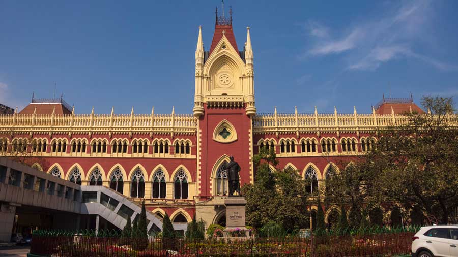
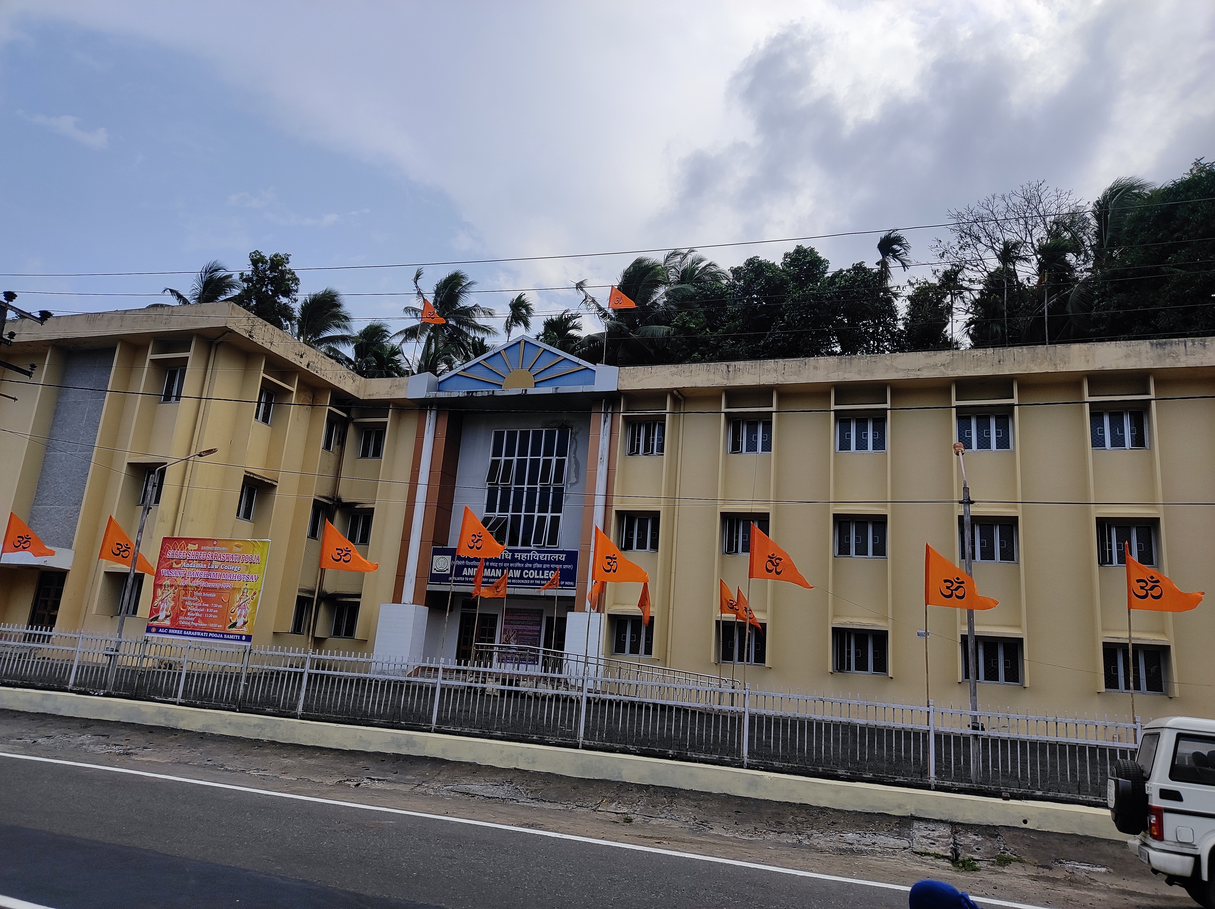
*[[Andaman Law College]] | |||
===Medicine=== | |||
*[[Andaman and Nicobar Islands Institute of Medical Sciences]] | |||
== Infrastructure == | == Infrastructure == | ||
| Line 388: | Line 417: | ||
=== Transportation === | === Transportation === | ||
The only civil airport of the Andaman and Nicobar Islands is [[Veer Savarkar International Airport]] near Port Blair. It has regular flights to [[Chennai]], [[Kolkata]], [[New Delhi]], [[Bangalore]], and [[Visakhapatnam]]. From 2016 onwards, night flights were also operated along with the day flights.{{ | [[file:Veer Savarkar International Airport IXZ.PNG|thumb|[[Veer Savarkar International Airport]]]] | ||
[[File:Cargo vessel Sindhu for Andaman and Nicobar manufactured by CSL.png|thumb|left|Cargo vessel Sindhu manufactured by [[Cochin Shipyard|CSL]] used for local transportation]] | |||
The only civil airport of the Andaman and Nicobar Islands is [[Veer Savarkar International Airport]] near Port Blair. It has regular flights to [[Chennai]], [[Kolkata]], [[New Delhi]], [[Bangalore]], and [[Visakhapatnam]]. From 2016 onwards, night flights were also operated along with the day flights.{{citation needed|date=November 2020}} | |||
Another mode of transport is ship which has routes from [[Chennai]], [[Kolkata]] and [[Visakhapatnam]]. The journey takes approximately three days and two nights.{{ | Another mode of transport is ship which has routes from [[Chennai]], [[Kolkata]] and [[Visakhapatnam]]. The journey takes approximately three days and two nights.{{citation needed|date=November 2020}} | ||
==Popular culture== | ==Popular culture== | ||
| Line 396: | Line 427: | ||
The [[National Film Awards|National Award]] winning [[Malayalam cinema|Malayalam]] film ''[[Kaalapani]]'' was set against backdrop of the [[Cellular Jail|Port Blair's Cellular Jail]]. It is one of the films that was extensively shot in the islands.<ref>{{Cite news|title=കാലാപാനി എന്ന വിസ്മയം; ഷൂട്ട് 60 ദിവസം; അന്നത്തെ മെഗാ ബജറ്റ്; കുറിപ്പ്|url=https://www.manoramaonline.com/movies/features/2020/04/09/kalapani-movie-24-years-special-article.html|access-date=21 November 2020|work=ManoramaOnline|date=9 April 2020|language=ml}}</ref> | The [[National Film Awards|National Award]] winning [[Malayalam cinema|Malayalam]] film ''[[Kaalapani]]'' was set against backdrop of the [[Cellular Jail|Port Blair's Cellular Jail]]. It is one of the films that was extensively shot in the islands.<ref>{{Cite news|title=കാലാപാനി എന്ന വിസ്മയം; ഷൂട്ട് 60 ദിവസം; അന്നത്തെ മെഗാ ബജറ്റ്; കുറിപ്പ്|url=https://www.manoramaonline.com/movies/features/2020/04/09/kalapani-movie-24-years-special-article.html|access-date=21 November 2020|work=ManoramaOnline|date=9 April 2020|language=ml}}</ref> | ||
Most parts the song ''[['96 (film) #Soundtrack|Life Of Ram]]'' got shot in this island which is featured in the 2018 [[Tamil language]] film [['96 (film)|'96]]. | |||
==Gallery== | |||
<gallery> | |||
Andaman Islands.jpg|Andaman Islands | |||
Andaman and Nicobar islands.JPG|Andaman and Nicobar islands | |||
The Coral Reef at the Andaman Islands.jpg|The coral reef at Havelock in Andaman | |||
Shaheed Island, Andamans, Mangrove beach, True wilderness.jpg|Mangrove trees on the beach, Shaheed Island | |||
Havelock Island, Canopy of tropical moist evergreen forest, Andaman Islands.jpg|Canopy of tropical rainforest | |||
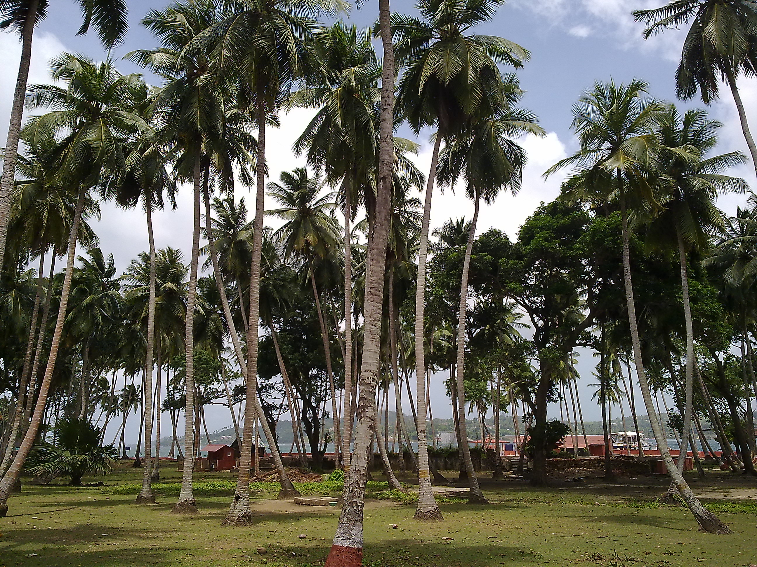
AndamansAndNicobarIslands.jpg|The Andaman coast lined with coconut palms | |||
Seascape at Chidiyatapu, Andaman islands.jpg|Seascape at Chidiyatapu, Andaman islands | |||
</gallery> | |||
==See also== | ==See also== | ||
{{ | {{Portal|Geography|Islands|Asia|India}} | ||
* [[2004 Indian Ocean earthquake and tsunami]] | * [[2004 Indian Ocean earthquake and tsunami]] | ||
* [[2014 Andaman boat disaster]] | * [[2014 Andaman boat disaster]] | ||
* [[Andamanese peoples]] | |||
* [[Coral reefs in India]] | * [[Coral reefs in India]] | ||
* [[Effect of the 2004 Indian Ocean earthquake on India]] | |||
* [[List of endemic birds of the Andaman and Nicobar Islands]] | |||
* [[List of islands of India]] | * [[List of islands of India]] | ||
==References== | ==References== | ||
{{ | {{reflist}} | ||
==External links== | ==External links== | ||
{{Commons category|Andaman and Nicobar Islands}} | {{Commons category|Andaman and Nicobar Islands}} | ||
* [http://www.censusindia.gov.in/2011-prov-results/data_files/ani/ani_press_release.pdf Census of India], Provisional Population Totals | * [http://www.censusindia.gov.in/2011-prov-results/data_files/ani/ani_press_release.pdf Census of India], Provisional Population Totals | ||
* [https://web.archive.org/web/20181213232827/http://www.and.nic.in/ Andaman and Nicobar Administration Website] | * [https://web.archive.org/web/20181213232827/http://www.and.nic.in/ Andaman and Nicobar Administration Website] | ||
* {{curlie|Regional/Asia/India/Andaman_and_Nicobar_Islands/}} | * {{curlie|Regional/Asia/India/Andaman_and_Nicobar_Islands/}} | ||
* {{Wikivoyage-inline}} | * {{Wikivoyage-inline}} | ||
* [https://tourplacesinfo.com/best-time-to-visit-andaman/ Best Time to Visit Andaman and Nicobar Islands] | |||
{{Countries and territories of Southeast Asia}} | |||
{{GeoSouthAsia}} | |||
{{States and Union Territories of India}} | |||
{{Union Territory of Andaman and Nicobar Islands}} | {{Union Territory of Andaman and Nicobar Islands}} | ||
{{Authority control}} | {{Authority control}} | ||
{{DEFAULTSORT:Andaman And Nicobar Islands}} | {{DEFAULTSORT:Andaman And Nicobar Islands}} | ||
[[Category:Andaman and Nicobar Islands| ]] | [[Category:Andaman and Nicobar Islands| ]] | ||
[[Category:Union | [[Category:Union territories of India]] | ||
[[Category:Andaman Sea]] | [[Category:Andaman Sea]] | ||
[[Category:Dependent territories in Asia]] | [[Category:Dependent territories in Asia]] | ||
| Line 441: | Line 486: | ||
[[Category:Bengali-speaking countries and territories]] | [[Category:Bengali-speaking countries and territories]] | ||
[[Category:States and union territories of India]] | [[Category:States and union territories of India]] | ||
Revision as of 02:45, 8 May 2022
Lua error in Module:Effective_protection_level at line 16: attempt to index field 'FlaggedRevs' (a nil value).




The Andaman and Nicobar Islands is a union territory of India consisting of 572 islands, of which 37 are inhabited, at the junction of the Bay of Bengal and the Andaman Sea.[5] The territory is about 150 km (93 mi) north of Aceh in Indonesia and separated from Thailand and Myanmar by the Andaman Sea. It comprises two island groups, the Andaman Islands (partly) and the Nicobar Islands, separated by the 150 km wide Ten Degree Channel (on the 10°N parallel), with the Andaman islands to the north of this latitude, and the Nicobar islands to the south (or by 179 km). The Andaman Sea lies to the east and the Bay of Bengal to the west. The island chains are thought to be a submerged extension of the Arakan Mountains.[6]
The territory's capital is the city of Port Blair. The total land area of the islands is approximately 8,249 km2 (3,185 sq mi). The territory is divided into three districts: the Nicobar District with Car Nicobar as its capital, the South Andaman district with Port Blair as its capital, and the North and Middle Andaman district with Mayabunder as its capital.
The islands host the Andaman and Nicobar Command, the only tri-service geographical command of the Indian Armed Forces.[7]
The Andaman Islands are also home to the Sentinelese people, an uncontacted tribe. The Sentinelese might be the only people currently known to not have reached further than a Paleolithic level of technology;[8] however, this is disputed, as evidence of metalwork was found on their island.[9]
History
First inhabitants
The earliest archaeological evidence documents some 2,200 years. However, genetic and cultural studies suggest that the indigenous Andamanese people may have been isolated from other populations during the Middle Paleolithic, which ended 30,000 years ago.[10] Since that time, the Andamanese have diversified into linguistically and culturally distinct territorial groups.
The Nicobar Islands appear to have been populated by people of various backgrounds. By the time of European contact, the indigenous inhabitants had coalesced into the Nicobarese people, speaking an Austroasiatic language, and the Shompen, whose language is of uncertain affiliation. Neither language is related to Andamanese.
Chola imperial period
Rajendra Chola II of the Chola Dynasty (modern-day South India), used the Andaman and Nicobar Islands as a strategic naval base to launch an expedition against the Srivijaya Empire (modern-day Indonesia). The Cholas called the island Ma-Nakkavaram ("great open"), found in the Thanjavur inscription of 1050 CE. European traveller Marco Polo (12th–13th century) and referred to this island as 'Necuverann' a modified form of the Tamil name Nakkavaram, which then led to the modern Anglicized name 'Nicobar' during the British colonial period.[11]
Maratha imperial period
The islands became a temporary shipping port of the Maratha Empire and its navy in the 17th century. The Maratha admiral Kanhoji Angre established a basic naval dominance in the islands and played a role in the annexation of the islands to India.[12]
Danish colonial period and British rule
.jpg)
The history of organised European colonisation on the islands began when settlers from the Danish East India Company arrived in the Nicobar Islands on 12 December 1755. On 1 January 1756, the Nicobar Islands were made a Danish colony, first named New Denmark,[13] and later (December 1756) Frederick's Islands (Frederiksøerne).[14]:7 During 1754–1756 they were administrated from Tranquebar (in continental Danish India).[14]:8 The islands were repeatedly abandoned due to outbreaks of malaria between 14 April 1759 and 19 August 1768, from 1787 to 1807/05, 1814 to 1831, 1830 to 1834 and gradually from 1848 for good.[citation needed]
From 1 June 1778 to 1784, Austria mistakenly assumed that Denmark had abandoned its claims to the Nicobar Islands and attempted to establish a colony on them,[15] renaming them Theresa Islands.[16]
In 1789, the British set up a naval base and penal colony on Chatham Island next to Great Andaman, where now lies the town of Port Blair. Two years later the colony was moved to Port Cornwallis on Great Andaman, but it was abandoned in 1796 due to disease.
In 1858, the British again established a colony at Port Blair, which proved to be more permanent. The primary purpose was to set up a penal colony for criminal convicts from the Indian subcontinent.[17] The Cellular Jail, which was used to house political prisoners, was constructed on the islands.[18][19]
Italy made an attempt at buying the Nicobar Islands from Denmark between 1864 and 1865. The Italian Minister of Agriculture and Commerce Luigi Torelli started a negotiation that looked promising, but failed due to the unexpected end of his office and the second La Marmora Cabinet. The negotiations were interrupted and never brought up again.[20]
Denmark's presence in the territory ended formally on 16 October 1868 when it sold the rights to the Nicobar Islands to Britain,[15] which made them part of British India in 1869.
In 1872, the Andaman and Nicobar islands were united under a single chief commissioner at Port Blair.
World War II

During World War II, the islands were practically under Japanese control, only nominally under the authority of the Arzi Hukumate Azad Hind of Subhash Chandra Bose. Bose visited the islands during the war and renamed them as "Shaheed-Dweep" (Martyr Island) and "Swaraj-dweep" (Self-rule Island).
General Loganathan, of the Indian National Army, was made the Governor of the Andaman and Nicobar Islands. On 22 February 1944 he along with four INA officers—Major Mansoor Ali Alvi, Sub. Lt. Md. Iqbal, Lt. Suba Singh, and stenographer Srinivasan—arrived at Lambaline Airport in Port Blair. On 21 March 1944, the Headquarters of the Civil Administration was established near the gurdwara at Aberdeen Bazaar. On 2 October 1944, Col. Loganathan handed over the charge to Maj. Alvi and left Port Blair, never to return.[21]
Japanese Vice Admiral Hara Teizo and Major-General Tamenori Sato surrendered the islands to Brigadier J A Salomons, commander of 116th Indian Infantry Brigade, and Chief Administrator Noel K Patterson, Indian Civil Service, on 7 October 1945, in a ceremony performed on the Gymkhana Ground, Port Blair.
After independence
During the independence of both India (1947) and Burma (1948), the departing British announced their intention to resettle all Anglo-Indians and Anglo-Burmese on these islands to form their own nation, although this never materialised. It became part of India in 1950 and was declared as a union territory of the nation in 1956.[22]
India has been developing defence facilities on the islands since the 1980s. The islands now have a key position in India's strategic role in the Bay of Bengal and the Malacca Strait.[23]
2004 tsunami
On 26 December 2004, the coasts of the Andaman and Nicobar Islands were devastated by a 10 m (33 ft) high tsunami following an undersea earthquake in the Indian Ocean. More than 2,000 people lost their lives, 4,000 children were orphaned or suffered the loss of one parent, and at least 40,000 people were rendered homeless. More than 46,000 people were injured.[24] The worst affected Nicobar islands were Katchal and Indira Point; the latter subsided 4.25 metres (13.9 feet) and was partially submerged in the ocean. The lighthouse at Indira Point was damaged but has been repaired since. A significant portion of the union territory was submerged and subsequently lost to sea. The territory which measured 8,073 km2 (3,117 sq mi) before the tsunami now stands at 7,950 km2 (3,070 sq mi).[25]
While the locals and tourists on the islands suffered the greatest casualties from the tsunami, most of the aboriginal people survived on account of oral traditions passed down over generations that warned them to evacuate from the large waves that follow earthquakes.[26]
Geography


There are 572 islands[27] in the territory having an area of 8,249 km2 (3,185 sq mi). Of these 38 are permanently inhabited. The islands extend from 6° to 14° North latitudes and from 92° to 94° East longitudes. The Andamans are separated from the Nicobar group by a channel (the Ten Degree Channel) some 150 km (93 mi) wide. The highest point is located in North Andaman Island (Saddle Peak at 732 m (2,402 ft)). The Andaman group has 325 islands which cover an area of 6,170 km2 (2,382 sq mi) while the Nicobar group has only 247 islands with an area of 1,765 km2 (681 sq mi).[22]:33

The capital of the union territory, Port Blair, is located 1,255 km (780 mi) from Kolkata, 1,200 km (750 mi) from Visakhapatnam and 1,190 km (740 mi) from Chennai.[22]:33 They are grouped with South India.[28] The northernmost point of the Andaman and Nicobars group is 901 km (560 mi) away from the mouth of the Hooghly River and 280 km (170 mi) from Myanmar Mainland. Indira Point at 6°45’10″N and 93°49’36″E at the southern tip of the southernmost island, Great Nicobar, is the southernmost point of India and lies only 200 km (120 mi) from Sumatra island in Indonesia.
The only volcano in India, Barren Island, is located in Andaman and Nicobar. It is an active volcano and had last erupted in 2017. It also has a mud volcano situated in Baratang Island. These mud volcanoes have erupted sporadically, with recent eruptions in 2005 believed to have been associated with the 2004 Indian Ocean earthquake. The previous major eruption recorded was on 18 February 2003. The locals call this mud volcano Jalki. There are other volcanoes in the area. This island's beaches, mangrove creeks, limestone caves, and mud volcanoes are some of the physical features.
In December 2018, Prime Minister Narendra Modi, who was on a two-day visit to the Andaman and Nicobar Islands, renamed three of the islands as a tribute to Subhas Chandra Bose. Ross Island was renamed as Netaji Subhash Chandra Bose Island; Neil Island as Shaheed Dweep Island; and Havelock Island as Swaraj Island. The PM made this announcement during a speech at the Netaji Stadium, marking the 75th anniversary of the hoisting of the Indian flag by Bose there.[29][30]
The Sisters
The Sisters are two small uninhabited islands, East Sister Island and West Sister Island, in the Andaman Archipelago, at the northern side of the Duncan Passage, about 6 km (3.2 nmi) southeast of Passage Island and 18 km (9.7 nmi) north of North Brother. The islands are about 820 feet (250 metres) apart, connected by a coral reef; they are covered by forests and have rocky shores except for a beach on the northwest side of East Sister Island.
Before the British established a colony on the Andaman, the Sisters were visited occasionally by the Onge people of Little Andaman Island for fishing. The islands may have been a waystation on the way to their temporary settlement of Rutland Island between 1890 and 1930.
The islands have been designated as a wildlife refuge since 1987, with an area of 0.36 square kilometres (0.14 sq mi).
Flora
The Andaman and Nicobar Islands have a tropical rainforest canopy, made of a mixed flora with elements from Indian, Myanmar, Malaysian and endemic floral strains. So far, about 2,200 varieties of plants have been recorded, out of which 200 are endemic and 1,300 do not occur in mainland India.
The South Andaman forests have a profuse growth of epiphytic vegetation, mostly ferns, and orchids. The Middle Andamans harbours mostly moist deciduous forests. North Andamans is characterised by the wet evergreen type, with plenty of woody climbers. The North Nicobar Islands (including Car Nicobar and Battimalv) are marked by the complete absence of evergreen forests, while such forests form the dominant vegetation in the central and southern islands of the Nicobar group. Grasslands occur only in the Nicobars, and while deciduous forests are common in the Andamans, they are almost absent in the Nicobar. The present forest coverage is claimed to be 86.2% of the total land area.

This typical forest coverage is made up of twelve types, namely:
- Giant evergreen forest
- Andamans tropical evergreen forest
- Southern hilltop tropical evergreen forest
- Canebrakes
- Wet bamboo brakes
- Andamans semi-evergreen forest
- Andamans moist deciduous forest
- Andamans secondary moist deciduous forest
- Littoral forest
- Mangrove forest
- Brackish water mixed forest
- Submontane forest
Fauna

This tropical rain forest, despite its isolation from adjacent landmasses, is surprisingly rich with a diversity of animal life.
About 50 varieties of forest mammals are found to occur in the Andaman and Nicobar Islands. Some are endemic, including the Andaman wild boar. Rodents are the largest group with 26 species, followed by 14 species of bat. Among the larger mammals there are two endemic[citation needed] varieties of wild boar, Sus scrofa andamanensis from Andaman and Sus scrofa nicobaricus from Nicobar, which are protected by the Wildlife Protection Act 1972 (Sch I). Saltwater crocodile is also found in abundance. The State Animal of Andaman is the dugong, also known as the sea cow, which can be found in Little Andaman. Around 1962 there was an attempt to introduce the leopard, which was unsuccessful because of unsuitable habitat. These were ill-considered moves as exotic introductions can cause havoc to island flora and fauna. Elephants also can be found in forested or mountainous areas of the islands; they were brought over from the mainland to help with timber extraction in 1883.[31]

About 270 species of birds are found in the Andaman and Nicobar Islands, 14 species of which are endemic. The islands' many caves are nesting grounds for the edible-nest swiftlet, whose nests are prized in China for bird's nest soup.[32] The islands also serve as a stopover site for several migratory birds such as Horsfield's bronze cuckoo, Zappey's flycatcher and Javan pond heron.[33]
The territory is home for about 225 species of butterflies and moths. Ten species are endemic to these Islands. Mount Harriet National Park is one of the richest areas of butterfly and moth diversity on Andaman and Nicobar Islands.
The islands are well known for prized shellfish, especially from the genera Turbo, Trochus, Murex and Nautilus. Earliest recorded commercial exploitation began during 1929. Many cottage industries produce a range of decorative shell items. Giant clams, green mussels and oysters support edible shellfishery. The shells of scallops, clams, and cockle are burnt in kilns to produce edible lime.
There are 96 wildlife sanctuaries, nine national parks and one biosphere reserve in the Andaman and Nicobar Islands.[34]
Demographics
| Population growth | |||
|---|---|---|---|
| Census | Population | %± | |
| 1901 | 24,649 | — | |
| 1911 | 26,459 | 7.3% | |
| 1921 | 27,086 | 2.4% | |
| 1931 | 29,463 | 8.8% | |
| 1941 | 33,768 | 14.6% | |
| 1951 | 30,971 | −8.3% | |
| 1961 | 63,548 | 105.2% | |
| 1971 | 115,133 | 81.2% | |
| 1981 | 188,741 | 63.9% | |
| 1991 | 280,661 | 48.7% | |
| 2001 | 356,152 | 26.9% | |
| 2011 | 380,581 | 6.9% | |
| Source:Census of India[35] | |||
As of 2011[update] Census of India, the population of the Union Territory of Andaman and Nicobar Islands was 379,944, of which 202,330 (53.25%) were male and 177,614 (46.75%) were female. The sex ratio was 878 females per 1,000 males.[36] Only 10% of the population lived in Nicobar islands.
Before 150 years ago, the original population of the islands – the Great Andamanese, the Onge, the Jarawa and the Sentinelese, were estimated to be around 5,000. The population of islands increased massively due to the policies of Govt of India into islands under Jawaharlal Nehru in the late 1960s, that brought settlers from other parts of the country.[37]
The areas and populations (at the 2001 and 2011 Censuses) of the three districts[38] are:
| Name | Area (km2) | Population Census 2001 |
Population Census 2011 |
Capital |
|---|---|---|---|---|
| Nicobar | 1,765 | 42,068 | 36,842 | Car Nicobar |
| North and Middle Andaman | 3,536 | 105,613 | 105,597 | Mayabunder |
| South Andaman | 2,640 | 208,471 | 238,142 | Port Blair |
| Totals | 7,950 | 356,152 | 380,581 |
There remain approximately 400–450 indigenous Andamanese in the Andaman islands, the Jarawa and Sentinelese in particular maintaining steadfast independence and refusing most attempts at contact. In the Nicobar Islands, the indigenous people are the Nicobarese, or Nicobari, living throughout many of the islands, and the Shompen, restricted to the hinterland of Great Nicobar. More than 2,000 people belonging to the Karen tribe live in the Mayabunder tehsil of North Andaman district, almost all of whom are Christians. Despite their tribal origins, the Karen of Andamans have Other Backward Class (OBC) status in the Andamans.
Languages
Hindi is the official language of the Andaman and Nicobar Islands, while English is declared an additional official language for communication purposes.[8] As of the 2011 census, Bengali is spoken as the first language by 28.49 per cent of the Union Territory's population followed by Tamil (15.20%), Telugu (13.24%), Hindi (12.91%), Nicobarese (7.65%) and Malayalam (7.22%). Sadri (5.53%), and tribal languages Kurukh (3.96%), Mundari (1.22%) and Kharia (1.07%) are also spoken by Adivasis originally from the Chota Nagpur Plateau.[39]
Religion

The majority of people of the Andaman and Nicobar Islands are Hindus (69.45%), with Christians forming a large minority of 21.7% of the population, according to the 2011 census of India. There is a significant Muslim (8.51%) minority.
Administration
In 1874, the British had placed the Andaman and Nicobar Islands in one administrative territory headed by a Chief Commissioner as its judicial administrator. On 1 August 1974, the Nicobar islands were hived off into another revenue district with district headquarters at Car Nicobar under a Deputy Commissioner. In 1982, the post of Lieutenant Governor was created who replaced the Chief Commissioner as the head of administration. Subsequently, a "Pradesh council" with Councillors as representatives of the people was constituted to advise the Lieutenant Governor.[22] The Islands sends one representative to Lok Sabha from its Andaman and Nicobar Islands (Lok Sabha constituency).
Administrative divisions
The Andaman and Nicobar Islands is divided into three districts:
- North and Middle Andaman (Capital: Mayabunder)
- South Andaman (Capital: Port Blair)
- Nicobar (Capital: Car Nicobar)
Each district is further divided into sub-divisions and taluks:
Sub-divisions and taluks of North and Middle Andaman district
- Diglipur Sub-Division
- Diglipur taluk
- Mayabunder Sub-Division
- Mayabunder taluk
- Rangat taluk
Sub-divisions and taluks of South Andaman district
- Port Blair Sub-Division
- Port Blair taluk
- Ferrargunj taluk
- Jirkatang taluk (native Jarawa reservation)
- Ritchie's Archipelago Sub-Division
- Ritchie's Archipelago taluk (Havelock Island)
- Little Andaman Sub-Division
- Little Andaman taluk (Hut Bay)
Sub-divisions and taluks of Nicobar district
- Car Nicobar Sub-Division
- Car Nicobar taluk
- Nancowrie Sub-Division
- Great Nicobar Sub-Division
- Little Nicobar taluk
- Great Nicobar taluk (Campbell Bay)
Economy


Agriculture
A total of 48,675 hectares (120,280 acres) of land is used for agriculture purposes. Paddy, the main food crop, is mostly cultivated in Andaman group of islands, whereas coconut and arecanut are the cash crops of Nicobar group of islands. Field crops, namely, pulses, oilseeds and vegetables are grown, followed by paddy during Rabi season. Different kinds of fruits such as mango, sapota, orange, banana, papaya, pineapple and root crops are grown on hilly land owned by farmers. Spices such as pepper, clove, nutmeg, and cinnamon are grown under a multi-tier cropping system. Rubber, red oil, palm, noni and cashew are grown on a limited scale in these islands.
Industry
There are 1,374 registered small-scale, village and handicraft units. Two units are export-oriented in the line of fish processing activity. Apart from this, there are shells and wood-based handicraft units. There are also four medium-sized industrial units. SSI units are engaged in the production of polythene bags, PVC conduit pipes and fittings, paints and varnishes, fiberglass and mini flour mills, soft drinks, and beverages, etc. Small scale and handicraft units are also engaged in shell crafts, bakery products, rice milling, furniture making, etc.
The Andaman and Nicobar Islands Integrated Development Corporation has spread its wings in the field of tourism, fisheries, industries, and industrial financing and functions as authorised agents for Alliance Air. The Islands have become a tourist destination, largely due to its beaches and waters.[41]
Tourism


Tourism to the Andaman and Nicobar Islands is increasing due to the popularity of beaches and adventure sports like snorkelling and sea-walking.[42] Plans to develop various islands under NITI (National Institute of Transforming India) Aayog is also in progress. Luxury resorts with participation from the Government are set up to plan in Avis Island, Smith Island and Long Island.[43]

In Port Blair, the main places to visit are the Cellular Jail, Mahatma Gandhi Marine National Park, Andaman Water sports complex, Chatham Saw Mill, Mini Zoo, Corbyn's cove, Chidiya Tapu, Wandoor Beach, Forest Museum, Anthropological Museum, Fisheries Museum, Naval Museum (Samudrika), Ross Island and North Bay Island. Viper Island which was earlier visited is now kept closed by the administration. Other places include Havelock island famous for Radhanagar Beach, Neil Island for Scuba diving/snorkeling/sea walking, Cinque Island, Saddle peak, Mt Harriet, and Mud Volcano. Diglipur, located at North Andaman is also getting popular in 2018 and many tourists have started visiting North Andaman as well. The southern group (Nicobar islands) is mostly inaccessible to tourists.
Indian tourists do not require a permit to visit the Andaman Islands, but if they wish to visit any tribal areas they need a special permit from the Deputy Commissioner in Port Blair. Permits are required for foreign nationals. For foreign nationals arriving by air, these are granted upon arrival at Port Blair.
According to official estimates, the flow of tourists tripled to nearly 430,000 in 2016-17 from 130,000 in 2008–09. The Radha Nagar beach was chosen as Asia's best beach in 2004.[42]
Macro-economic trend
This is a chart of trend of gross state domestic product (GSDP) of Andaman and Nicobar Islands at market prices, estimated by the Ministry of Statistics and Programme Implementation, with figures in millions of Indian rupees.[44]
| Year | GSDP (millions of ₹) |
|---|---|
| 1985 | 590 |
| 1990 | 1,100 |
| 1995 | 4,000 |
| 2000 | 7,750 |
| 2005 | 10,560 |
| 2010 | 16,130 |
Andaman and Nicobar Islands' gross state domestic product for 2004 was estimated at $354 million in current prices.
Power generation
With Japanese assistance, Southern Andaman Island will now have a 15-megawatt diesel power plant. This would be the first foreign investment of any kind allowed at this strategically significant island chain. This is believed to be an Indo-Japanese strategic initiative to strengthen civilian infrastructure in the vicinity of the Strait of Malacca – a strategically important choke-point for the Chinese oil supply.[45][46]
Education
B.ed
- Tagore Government College of Education
Degree
- Andaman and Nicobar college
- Jawaharlal Nehru Government College
- Mahatma Gandhi Government College
Engineering
- Dr. B. R. Ambedkar Institute of Technology
- Pondicherry University (Port Blair-campus)
Law
Medicine
Infrastructure
Internet
Internet access on the islands used to be limited and unreliable, since all connectivity to the outside world had to go through satellite links. Bharat Broadband Network started work on laying a fibre optic submarine cable running from the five islands to Chennai on 30 December 2018, with completion expected in December 2019.[47][48] On 10 August 2020, PM Narendra Modi formally inaugurated the Chennai–Andaman undersea Optical fibre cable which enables high-speed broadband connections in the Union Territory. The submarine cable also connects Port Blair to Swaraj Dweep, Little Andaman, Car Nicobar, Kamorta, Great Nicobar, Long Island and Rangat.[49] The initial bandwidth of the cable is 400 Gbit/s, roughly 400 times more than what the islands possessed before the fibre link.[50][51]
Ports
On 10 August 2020, PM Narendra Modi announced plans for the construction of a transshipment port in the Great Nicobar Island at a cost of ₹10,000 crore to provide shippers an alternative to similar ports in the region. The move is aimed at improving the ease of doing business of the country and enhancing maritime logistics.[52]
Transportation


The only civil airport of the Andaman and Nicobar Islands is Veer Savarkar International Airport near Port Blair. It has regular flights to Chennai, Kolkata, New Delhi, Bangalore, and Visakhapatnam. From 2016 onwards, night flights were also operated along with the day flights.[citation needed]
Another mode of transport is ship which has routes from Chennai, Kolkata and Visakhapatnam. The journey takes approximately three days and two nights.[citation needed]
Popular culture
Sir Arthur Conan Doyle refers to the Andaman Islands in his Sherlock Holmes novel The Sign of the Four.[53]
The National Award winning Malayalam film Kaalapani was set against backdrop of the Port Blair's Cellular Jail. It is one of the films that was extensively shot in the islands.[54]
Most parts the song Life Of Ram got shot in this island which is featured in the 2018 Tamil language film '96.
Gallery
-
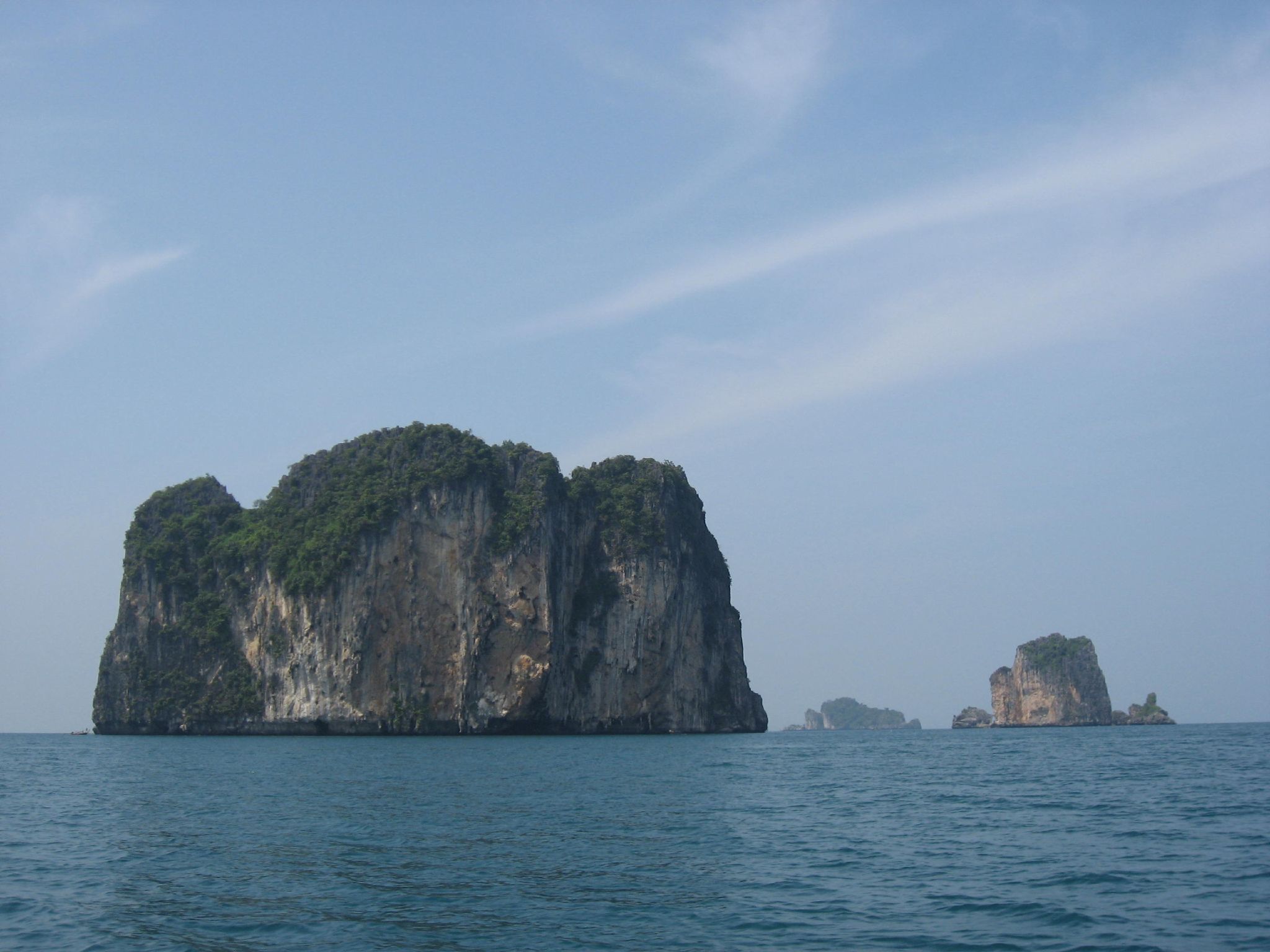 Andaman Islands
 -
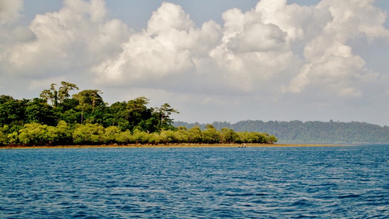 Andaman and Nicobar islands
 -
 The coral reef at Havelock in Andaman
 -
 Mangrove trees on the beach, Shaheed Island
 -
Canopy of tropical rainforest
-
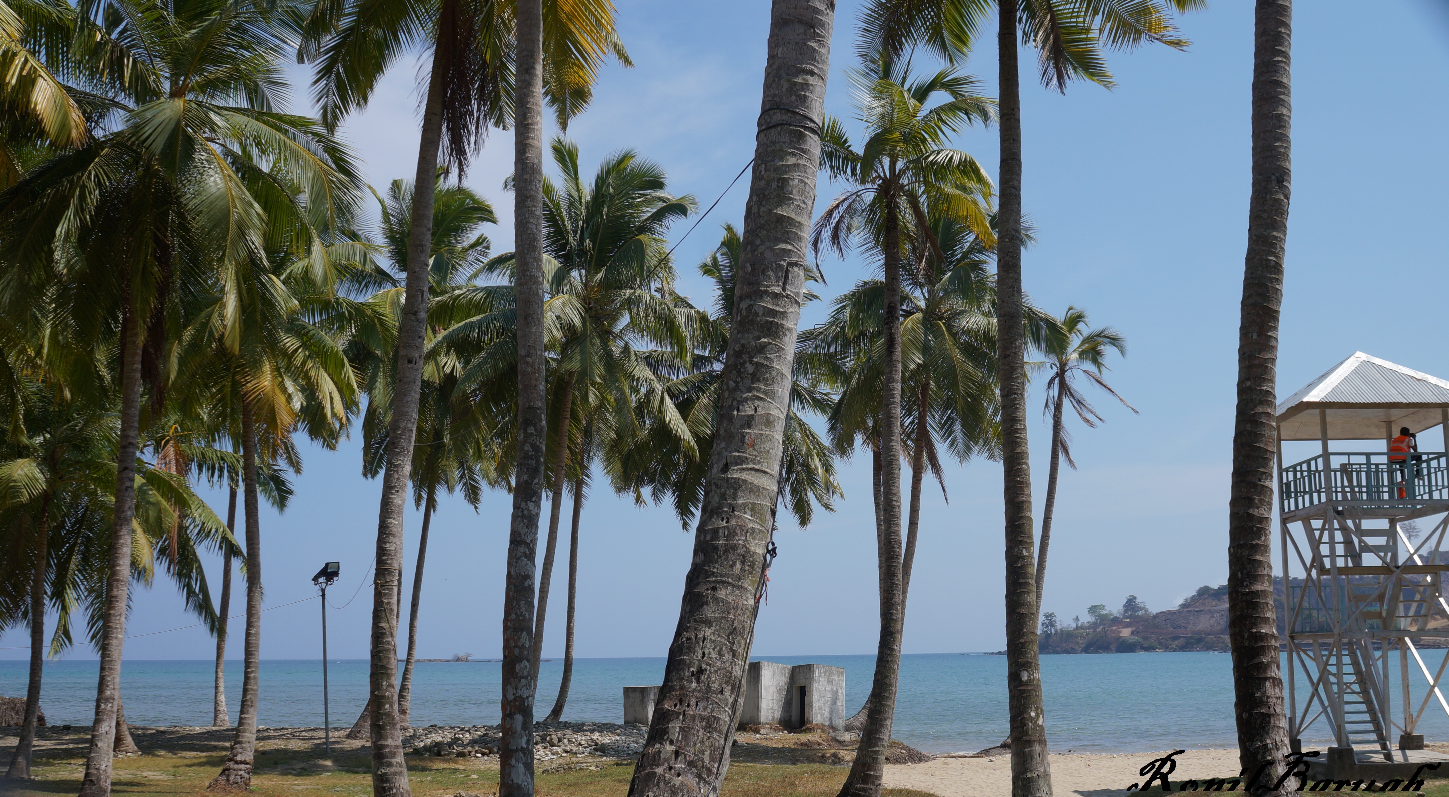 The Andaman coast lined with coconut palms
 -
 Seascape at Chidiyatapu, Andaman islands


See also


- 2004 Indian Ocean earthquake and tsunami
- 2014 Andaman boat disaster
- Andamanese peoples
- Coral reefs in India
- Effect of the 2004 Indian Ocean earthquake on India
- List of endemic birds of the Andaman and Nicobar Islands
- List of islands of India
References
- ↑ "Andaman and Nicobar Administration". And.nic.in. Archived from the original on 18 February 2015. Retrieved 8 July 2013.
- ↑ Census of India Archived 14 June 2007 at the Wayback Machine, 2011. Census Data Online, Population.
- ↑ 3.0 3.1 "50th Report of the Commissioner for Linguistic Minorities in India" (PDF). 16 July 2014. p. 109. Archived from the original (PDF) on 22 March 2015. Retrieved 6 November 2016.
- ↑ "www.andaman.gov.in". Archived from the original on 20 November 2016. Retrieved 27 November 2016.
- ↑ Sawhney, Pravin (30 January 2019). "A watchtower on the high seas". The Tribune. Archived from the original on 16 April 2019. Retrieved 16 April 2019.
- ↑ "Andaman and Nicobar: Beyond India's landmass". www.downtoearth.org.in. Retrieved 12 May 2021.
- ↑ "Andaman and Nicobar Command (ANC)". Drishti IAS. Retrieved 8 December 2020.
- ↑ 8.0 8.1 "Andaman & Nicobar Administration". and.nic.in. Archived from the original on 18 February 2015.
- ↑ Pandit, T. N. (1990). The Sentinelese. Kolkata: Seagull Books. pp. 17–20. ISBN 978-81-7046-081-7.
- ↑ Palanichamy, Malliya G.; Agrawal, Suraksha; Yao, Yong-Gang; Kong, Qing-Peng; Sun, Chang; Khan, Faisal; Chaudhuri, Tapas Kumar; Zhang, Ya-Ping (2006). "Comment on 'Reconstructing the Origin of Andaman Islanders'". Science. 311 (5760): 470. doi:10.1126/science.1120176. PMID 16439647.
- ↑ Government of India (1908). The Andaman and Nicobar Islands: Local Gazetteer. Superintendent of Government Printing, Calcutta.
... In the great Tanjore inscription of 1050 CE, the Andamans are mentioned under a translated name along with the Nicobars, as Nakkavaram or land of the naked people.
- ↑ Kukreja, Air Marshal Dhiraj (1 January 2013). "Andaman and Nicobar Islands: A security challenge for India". Indian Defence Review. Retrieved 24 November 2021.
- ↑ Danish National Archives; C. Rise Hansen (18 October 2011). Sources of the History of North Africa, Asia and Oceania in Denmark. Walter de Gruyter. p. 19. ISBN 978-3-11-097036-4.
- ↑ 14.0 14.1 John Gottfried Haensel (1812). Christian Ignatius Latrobe (ed.). Letters on the Nicobar islands, their natural productions, and the manners, customs, and superstitions of the natives with an account of an attempt made by the Church of the United Brethren, to convert them to Christianity.
- ↑ 15.0 15.1 Ramerini, Marco. "Chronology of Danish Colonial Settlements". ColonialVoyage.com. Archived from the original on 4 April 2005. Retrieved 16 November 2010.
- ↑ Karl Ritter von Scherzer. Narrative of the Circumnavigation of the Globe by the Austrian Frigate Novara. Vol. II. p. 63.
- ↑ MATHUR, L. P. (1967). "A Historical Study of Euro-Asian Interest in the Andaman and Nicobar Islands". Proceedings of the Indian History Congress. 29: 60. JSTOR 44137988.
- ↑ Murthy, R.V.R. (2006). "Cellular Jail:a Century of Sacrifices". The Indian Journal of Political Science. 67 (4): 879–888. JSTOR 41856271.
- ↑ "How India's Cellular Jail was integral in the country's fight for freedom". The Independent. 14 August 2017. Archived from the original on 11 November 2020.
- ↑ Ministero della Guerra, Ufficio Storico, Storia Militare della Colonia Eritrea, Vol. I, Roma 1935, pp. 15-16
- ↑ "Black Days in Andaman and Nicobar Islands" by Rabin Roychowdhury, [Pub. Manas] Pubs. New Delhi
- ↑ 22.0 22.1 22.2 22.3 Planning Commission of India (2008). Andaman and Nicobar Islands Development Report. State Development Report series (illustrated ed.). Academic Foundation. ISBN 978-81-7188-652-4. Archived from the original on 9 December 2015. Retrieved 12 March 2011.
- ↑ David Brewster. India's Defence Strategy and the India-ASEAN Relationship, RSIS Monograph No.28. Retrieved 24 August 2014.
- ↑ Carl Strand and John Masek, ed. (2007). Sumatra-Andaman Islands Earthquake and Tsunami of December 6, 2004: Lifeline Performance. Reston, VA: ASCE, Technical Council on Lifeline Earthquake Engineering. ISBN 9780784409510. Archived from the original on 24 October 2013.
- ↑ Effect of the 2004 Indian Ocean earthquake on India
- ↑ "Tsunami folklore 'saved islanders'". BBC News. 20 January 2005. Archived from the original on 30 September 2009. Retrieved 23 April 2010.
- ↑ "Brief Industrial Profile of Andaman and Nicobar Islands" (PDF). Government of India Ministry of M.S.M.E. Archived (PDF) from the original on 6 November 2015. Retrieved 1 May 2019.
- ↑ "Andaman and Nicobar - Wikitravel". wikitravel.org. Retrieved 9 November 2021.
- ↑ Bedi, Rahul (1 January 2019). "Indian PM strips islands of British colonial names – and renames them after freedom fighter". The Telegraph. Archived from the original on 3 January 2019. Retrieved 2 January 2019.
- ↑ "PM Modi renames 3 Andaman & Nicobar islands as tribute to Netaji". The Economic Times. 31 December 2018. Archived from the original on 3 January 2019. Retrieved 2 January 2019.
- ↑ Thomas, Maria (4 August 2016). "The incredible life of India's iconic swimming elephant". qz.com. Retrieved 22 June 2020.
- ↑ R. Sankaran (1999), The impact of nest collection on the Edible-nest Swiftlet in the Andaman and Nicobar Islands Archived 4 July 2010 at the Wayback Machine. Sálim Ali Centre for Ornithology and Natural History, Coimbatore, India.
- ↑ Singh, Shiv Sahay (21 April 2019). "In a first, east Asian birds make Andaman stopover". The Hindu. ISSN 0971-751X. Retrieved 7 March 2021.
- ↑ India Year Book 2015
- ↑ "Decadal Variation In Population Since 1901". Census of India : Office of the Registrar General & Census Commissioner, India.
- ↑ "Census of India" (PDF). Archived (PDF) from the original on 13 November 2011. Retrieved 13 April 2012.
- ↑ Sekhsaria, Pankaj. "How a statist vision of development has brought Andaman's tribals close to extinction". Scroll.in. Retrieved 21 November 2020.
- ↑ source: The Office of Registrar General & Census Commissioner of India
- ↑ 39.0 39.1 "C-16 - Population by Mother Tongue - Andaman and Nicobar Islands". censusindia.gov.in. Office of the Registrar General & Census Commissioner, India. 2011. Archived from the original on 8 July 2018.
- ↑ "Population by religion community – 2011". Census of India, 2011. The Registrar General & Census Commissioner, India. Archived from the original on 25 August 2015.
- ↑ "Andaman and Nicobar Islands – Unexplored Beauty of India". The Indian Backpacker. December 2012. Archived from the original on 21 December 2012. Retrieved 2 January 2013.
- ↑ 42.0 42.1 "How Andaman & Nicobar can fully capitalize its Tourism Potential?". IANS. news.biharprabha.com. 6 March 2014. Archived from the original on 5 November 2014. Retrieved 6 March 2014.
- ↑ "Holistic Development of Islands". Niti Aayog. Niti Aayog. Archived from the original on 4 December 2018. Retrieved 4 December 2018.
- ↑ [1] Archived 16 November 2011 at the Wayback Machine
- ↑ "India collaborates with Japan on Andamans project". The Hindu. 13 March 2016. ISSN 0971-751X. Archived from the original on 16 March 2016. Retrieved 14 June 2016.
- ↑ "These 8 narrow chokepoints are critical to the world's oil trade". Business Insider. Archived from the original on 29 June 2016. Retrieved 14 June 2016.
- ↑ "PM Modi inaugurates 2,312-kilometre undersea optical fibre cable link between Andaman-Chennai". The Indian Express. 10 August 2020. Retrieved 10 August 2020.
- ↑ Sridhar, Lalitha (17 February 2018). "It's 2018, but still tough to get online in the Andamans". The Hindu. ISSN 0971-751X. Retrieved 8 November 2018.
- ↑ "Andaman and Nicobar islands' fast-speed internet will depend on a 2,300 kilometre-long fibre optic cable". Business Insider. Retrieved 11 August 2020.
- ↑ "BSNL to enhance bandwidth 400 times in Andaman and Nicobar island in 2 years". Financial Express. 26 June 2018. Archived from the original on 8 November 2018. Retrieved 8 November 2018.
- ↑ "PM Modi inaugurates Chennai-Andaman & Nicobar submarine optical cable project - Times of India". The Times of India. 10 August 2020. Retrieved 10 August 2020.
- ↑ www.ETHRWorld.com. "India plans Rs 10,000 cr transshipment port at Great Nicobar Island: PM - ETHRWorld". ETHRWorld.com. Retrieved 10 August 2020.
- ↑ Hill, David (31 March 2012). "The 'wild' people as tourist stops". The Hindu. Archived from the original on 25 December 2013. Retrieved 12 October 2018.
- ↑ "കാലാപാനി എന്ന വിസ്മയം; ഷൂട്ട് 60 ദിവസം; അന്നത്തെ മെഗാ ബജറ്റ്; കുറിപ്പ്". ManoramaOnline (in മലയാളം). 9 April 2020. Retrieved 21 November 2020.
External links
- Census of India, Provisional Population Totals
- Andaman and Nicobar Administration Website
- Andaman and Nicobar Islands at Curlie
- Best Time to Visit Andaman and Nicobar Islands